International Research Journal of Engineering and Technology (IRJET)
e-ISSN: 2395 -0056
Volume: 04 Issue: 04 | Apr -2017
p-ISSN: 2395-0072
www.irjet.net
WATER QUALITY ANALYSIS OF EDAPPALLY CANAL USING GIS MAPPING Geeja K George1, Arundev R2, Parvathy Manoj3, Seethal P V4, Sanjith P5 1Assistant
Professor U G Students 1,2,3,4,5 Department of Civil Engineering, Mar Athanasius College of Engineering, Kerala, India. ---------------------------------------------------------------------***--------------------------------------------------------------------2,3,4,5
Abstract - Assessment of seasonal variations in surface
water quality characteristics is an essential aspect for evaluating water pollution due to both natural and anthropogenic influences on water resources. In this study, temporal variations of water quality in Edappally canal connecting Muttar puzha and Chitrapuzha were assessed and an integrated water quality map was created. Water samples from eight locations along the stretch of the canal were collected for two seasons and were analyzed for physicochemical and microbiological parameters such as pH, turbidity, COD, DO, Fe, Chloride, MPN. Variations in these properties for the two seasons were analysed and an integrated water quality map was created using ArcGIS software.
1. INTRODUCTION
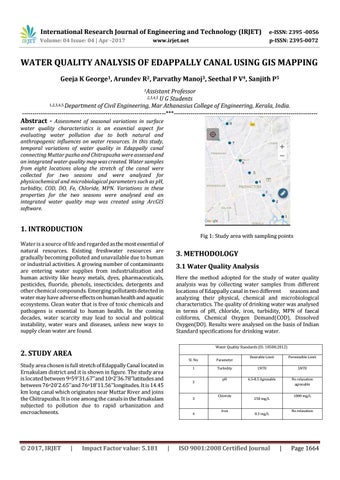
Fig 1: Study area with sampling points
Water is a source of life and regarded as the most essential of natural resources. Existing freshwater resources are gradually becoming polluted and unavailable due to human or industrial activities. A growing number of contaminants are entering water supplies from industrialization and human activity like heavy metals, dyes, pharmaceuticals, pesticides, fluoride, phenols, insecticides, detergents and other chemical compounds. Emerging pollutants detected in water may have adverse effects on human health and aquatic ecosystems. Clean water that is free of toxic chemicals and pathogens is essential to human health. In the coming decades, water scarcity may lead to social and political instability, water wars and diseases, unless new ways to supply clean water are found.
3. METHODOLOGY 3.1 Water Quality Analysis Here the method adopted for the study of water quality analysis was by collecting water samples from different locations of Edappally canal in two different seasons and analyzing their physical, chemical and microbiological characteristics. The quality of drinking water was analysed in terms of pH, chloride, iron, turbidity, MPN of faecal coliforms, Chemical Oxygen Demand(COD), Dissolved Oxygen(DO). Results were analysed on the basis of Indian Standard specifications for drinking water. Water Quality Standards (IS: 10500;2012)
2. STUDY AREA Study area chosen is full stretch of Edappally Canal located in Ernakulam district and it is shown in figure. The study area is located between 9o59’31.67’’and 10o2’36.78’’latitudes and between 76o20’2.65’’and 76o18’11.56’’longitudes. It is 14.45 km long canal which originates near Muttar River and joins the Chitrapuzha. It is one among the canals in the Ernakulam subjected to pollution due to rapid urbanization and encroachments.
© 2017, IRJET
|
Impact Factor value: 5.181
Permissible Limit
Turbidity
1NTU
5NTU
pH
6.5-8.5 Agreeable
No relaxation agreeable
Parameter
1
2
3
4
|
Desirable Limit
Sl. No.
Chloride
Iron
1000 mg/L
250 mg/L
No relaxation
0.3 mg/L
ISO 9001:2008 Certified Journal
|
Page 1664