International Research Journal of Engineering and Technology (IRJET) Volume: 04 Issue: 02 | Feb -2017
www.irjet.net
e-ISSN: 2395 -0056 p-ISSN: 2395-0072
EXPLORING GROUNDWATER LEVEL OF NAMAKKAL DISTRICT IN TAMIL NADU BY EMPLOYING GEOGRAPHIC INFORMATION SYSTEM S.Vinothkanna1, Dr.V.Emayavaramban2 and K.Senthilraja3 1Department of Geography, SEAS, Madurai Kamaraj University, Madurai – 625 021 2Department of Agronomy, Agricultural College and Research Institute, Tamil Nadu Agricultural University, Madurai, Tamil Nadu–625104, India ---------------------------------------------------------------------***---------------------------------------------------------------------
Abstract - Groundwater is one of the important resources
for living organism’s life. It will act as a life bearing layer when rainfall fails. India is an agriculture country and mostly depends on monsoon rainfall, the study on ground water is very important. This study focuses groundwater level of Namakkal district in Tamil Nadu. Nearly 34 years (1980 to 2013) of secondary data has been analyzed with simple statistical method and the result was brought out using Geographical Information System technology. The data were analysed based on seasonal and mean annual level. The overall study identified that at seasonal level the average maximum fall in groundwater level is identified in south west monsoon at Thimmanaickenpatti (22.20 m) and minimum is identified in north east monsoon season at Mohanur (1.45 m). The mean annual groundwater level within the district is identified over the period of study indicates that the lower level of 1.82 m is at Thimmanaickenpatti and highest level of 19.82 m at Pudupatti of Namagiripettai Block. Based on the availability of ground water level, the selection of agricultural crops and irrigation may be decided. Incorporating GIS in water resources study may provide better understanding on the area for the planners to prepare the action plan.
Key Words: Monsoon, Ground water Level, Rainfall, GIS and Statistics.
1.INTRODUCTION
Water level, being directly measurable, is an important parameter for the study of aquifer systems and their dynamic behavior. Water level in an unconfined aquifer is a continuous variable showing spatial variability, variations in rate of change arise due to the heterogeneity of the aquifer. Groundwater is an important water resource in India for domestic, irrigation, and industrial needs (Mamatha and Rao, 2010). India is the largest groundwater user in the world. Groundwater has played a significant role in the maintenance of India’s economy, environment and standard of living. Groundwater is, however, the main and more reliable resource of irrigation. Both over-exploitation from aquifers to address the irrigation needs, and drought events have caused severe water table level drop in many areas. Where groundwater is used for irrigation, aquifers are also being depleted at an alarming rate. Li and Revesz (2004) applied several interpolation methods to investigate the Spatio - temporal variation of regionalized variables. Tuckfield (1994) used the appropriate sampling frequency for monitoring groundwater well contamination. He used © 2017, IRJET
|
Impact Factor value: 5.181
|
temporal variogram to find the suitable sampling interval. Monitoring groundwater level fluctuation data on seasonal basis can identify early indicators of changes in the groundwater resource and help to understand how to protect it (Holmes et.al., 2001).
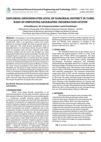
2. STUDY AREA The Namakkal District lies in the interior part of Tamil Nadu and extends between 11000’ to 11036’ north Latitudes and 77040’to 78030’ east longitudes. The total geographical area of the district is 3429.3 sq.km. Namakkal district is divided into five Taluks namely, Namakkal, Tiruchengode, Paramathi, Rasipuram and Kollimalai. Administratively Namakkal district has 15 blocks and 396 Panchayat villages. The District area covers 2.64% of the total area of Tamil Nadu state. The location of the study area is shown in (Fig.1). The district experiences subtropical climate with moderate temperature. The maximum temperature ranges from 240C to 390C and the minimum temperature from 130C to 280C. The average annual rainfall of the district is 785.4 mm. The major soil types found in this district are Black soil, Brown soil, Alluvial soil and Mixed soil. The major rivers flowing in the Namakkal district are Cauvery and Thirumanimuthar. The total population of Namakkal district as per 2011 is 1,726,601. The population density of Namakkal district for 2011 is 505 people per sq. km. Average literacy rate are 74.63 and Sex Ratio is 986 per 1000 male.
3. METHODS This study purely based on the secondary data collected from the state ground and surface water resources data centre, Chennai. The year chosen for this analysis is from 1980 to 2013. The water level data collected from the centre has been analysed by using simple statistical techniques. The water level data was categorized into seasonal and annual to check the spatial variation of water level over the district. Using GIS technique has created the database of water level. Spatial analysis tool has been used extensively in this analysis mainly interpolation technique because, it is a technique used to find out the unknown values from the known values. The results are brought out using cartographic technique as a map. Fig- 1: Location of study area – Namakkal District
ISO 9001:2008 Certified Journal
|
Page 172