Sustainable Urban Dynamics 2022


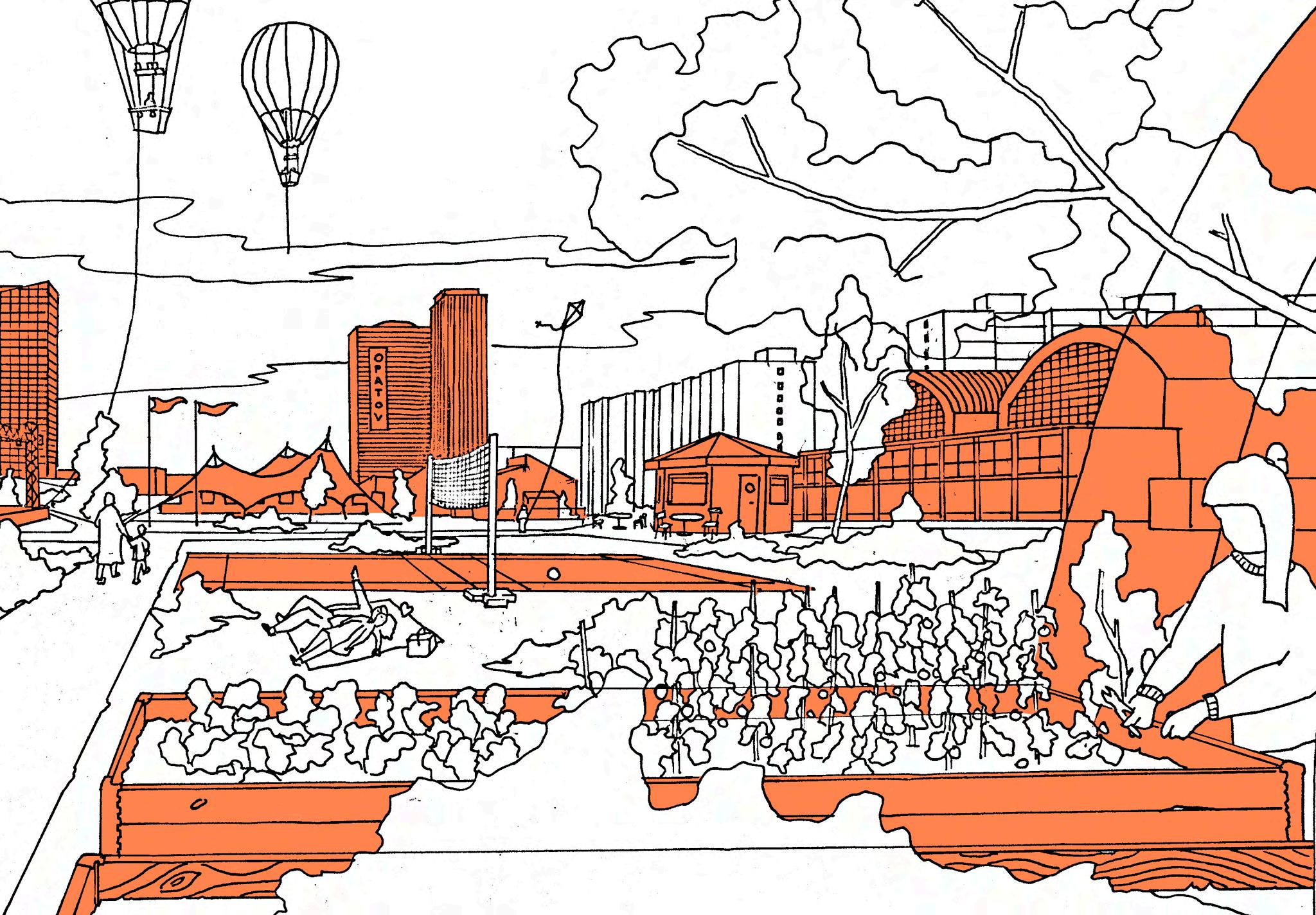


Prague 11 District
SLOW CITY IN MOTION by My Harrfors
FROM FOREST TO FOREST by Valeria Rabelo
Chodov Metro Station Area
The Coherent Pattern by Elin Bengtsson
Opatov Metro Station & Central Park Area
The Heart - Opatov by Annika Enzinger
Find your way in Praha 11 by Bruna Pessoa
11 by Eleni Tamiolaki
Re-Cycle by Floris Meeuwse
Growth within limits by Gizem Caliskan
Local Links of Jižní Město by Hugo Bennhage
PRAGUE 11: INITIATING CHANGE by Lamiaa Chnayti
LAYER 3 by Leon Ladisic
Meet the Streets of Prague 11 by Martine Mahu
Invisible cities by Maya Amei Kranner
Circular Retrofit by Ralph Frühwirth
Bridging the Gap by Salóme Rósa Þorkelsdóttir
Háje Metro Station Area
Tramformation by Christopher Nurse
BIKEprague by Elise Estunger
Praha 11 Play by Javier Ignacio Navarro Puig
Life outside by John Edmonds
Finding the Common Ground by Martyna Idasiak
Find your way to nature in Háje by Ulrica Flemström
SUDes Team:
Peter Siöström
Associate Professor,
Architect SAR / MSA
Chairman of Ax: son Johnson Institute for Sustainable Urban Design Lund University
Andreas Olsson
Architect SAR/MSA
Course Leader, SUDes School of Architecture, Lund University
Teresa Arana Aristi
Architect SAR/MSA - Urban Designer
Lecturer, SUDes
School of Architecture, Lund University
Guest Lecturers:
Dominik Landkammer, IPR Prague
Jiří Deyl, Architect/Urban Planner, IPR Prague
Jonna Ekholm, Architect /Urban Designer, Gehl
Judita Eisenberger, Urban Planner & International Relations Specialist, IPR Prague
Lucie Pára, Head of Strategy and Development Office, IPR Prague
Martin Špičák, Architect, IPR Prague
Mateusz Mastalski, Henning Larsen
Michal Lehečka, Anthropictures
Michaela Janečková, Architect / Architectural Theorist, Paneláci
Niels Björn, Urbanist Ph.D.
Peter Siöström, Associate Professor, LTH, Lund University
Pontus Wirf, RADAR arkitektur & planering
Rozalie Kašparová, Architect/Urban Designer, IPR Prague
Simon Sjökvist, Architect, COBE
Vojtěch Benedikt, Sustainable Mobility Specialist, IPR Prague
Wouter Verleure, Landscape Architect/Urban Designer, IPR Prague
Annika Enzinger, Germany
Bruna Pessoa, Brazil
Christopher Nurse, Canada
Eleni Tamiolaki, Greece
Elin Bengtsson, Sweden
Elise Estunger, Sweden
Floris Meeuwse, The Netherlands
Gizem Caliskan, Turkey
Hugo Bennhage, Sweden
Javier Ignacio Navarro Puig, Argentina
Joakim Andén, Sweden
John Edmonds, Ireland
Kritika Singh, India
Lamiaa Chnayti, Morocco
Leon Ladisic, Croatia
Martine Mahu, The Netherlands
Martyna Idasiak, Poland
Maya Amei Kranner, Austria
My Harrfors, Sweden
Ralph Frühwirth, Austria
Salóme Rósa Þorkelsdóttir, Iceland
Ulrica Flemström, Sweden
Valeria Rabelo, Mexico
Guest Critics:
Katerina Vondra, Architect/Urban Designer Mandaworks
Rozalie Kašparová, Architect /Urban Designer, IPR Prague
Peter Siöström, Associate Professor, LTH, Lund University
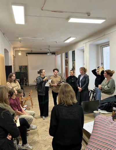
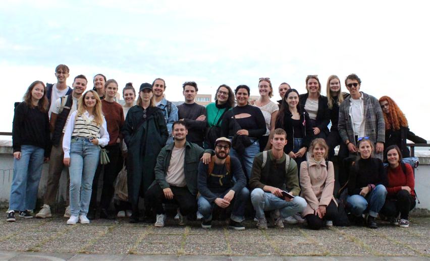
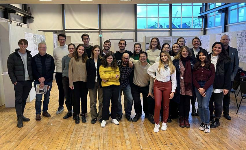
During the autumn term of 2022, students at Lund University, School of Architecture participated in the advanced course ‘Sustainable Urban Dynamics’ (ASBN31) and its complementary theory course ‘Sustainable Urban Dynamics - Theory and Tendencies (ASBN41), focusing on creating a sustainable vision for the Prague 11 District. The aim of the design course was to challenge the misconceptions about large housing estates built in the Modernist era, especially when comparing the conditions of these areas within Western Europe and Central Eastern Europe.
Students focused on questions for the development of the city’s fringe, Prague 11 district’s borders – both mental and physical- and strategies to revitalize housing estates as part of an urban transformation for the post-socialist cities, while paying attention to the site’s unique characteristics and adapting to the needs of the community. These themes were explored throughout the whole semester in various seminars, guest lectures, and project tutorials with the goal that each student explores and presents a ‘context sensitive’ urban design proposal for the transformation of the assigned district. The design process was separated into several parts - analysis, strategy, and individual design - combing both the group and individual work of the students.
A one-week study trip to visit the site was organized in combination with a four-day intensive workshop, in collaboration with Rozalie Kašparová and Vojtěch Benedikt from the Prague Institute of Planning and Development (IPR), who acted as the juries for the competition format. Upon finalizing the workshop, the students spent eight weeks developing their individual design proposals.
This course booklet presents a summary of the design site, workshop and introduces a brief presentation of 21 unique individual design proposals as a result of this semester’s design studio.
For further information on the course and the International Master’s Program please visit our website at www.stadsbyggnad.lth.se.
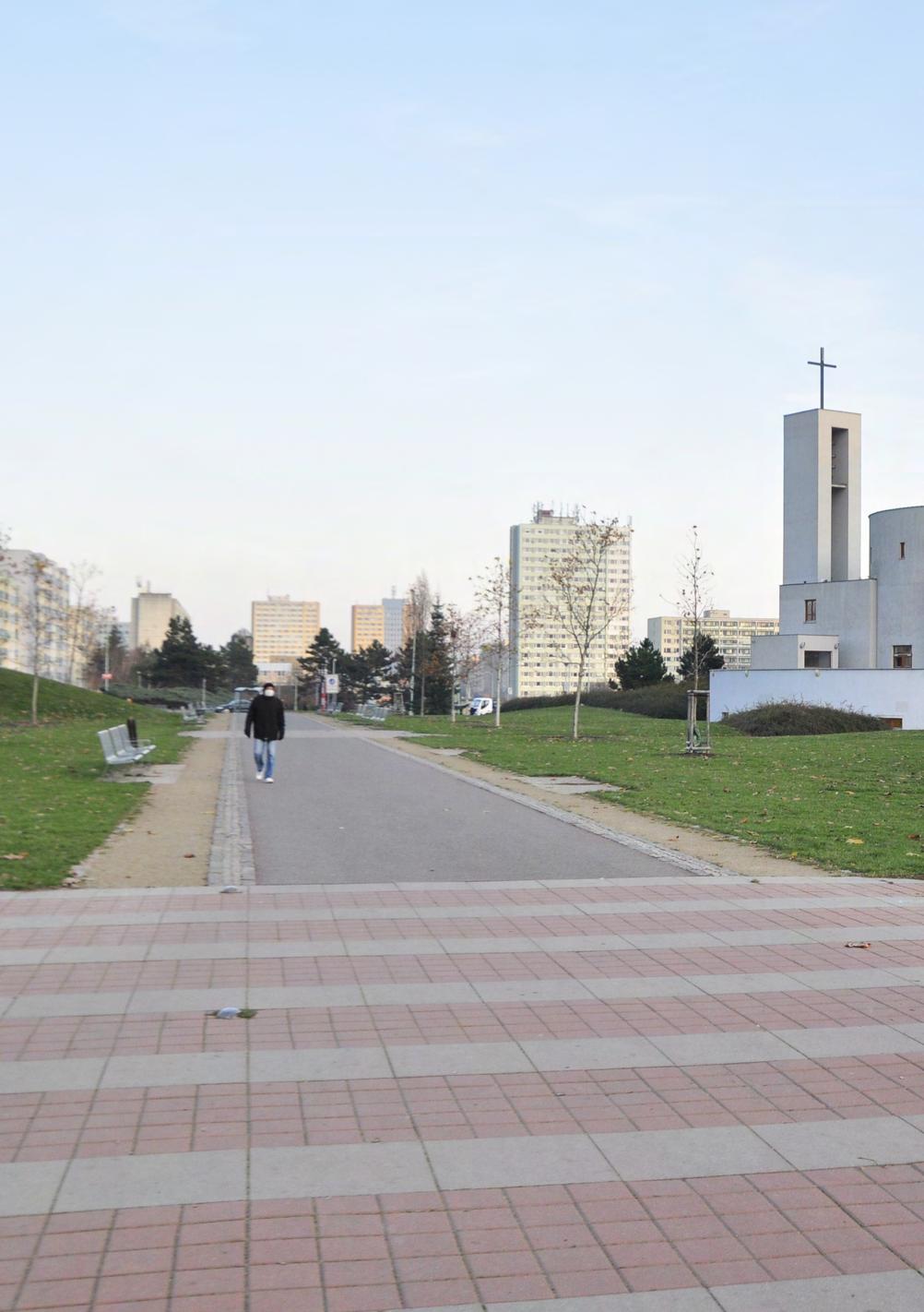
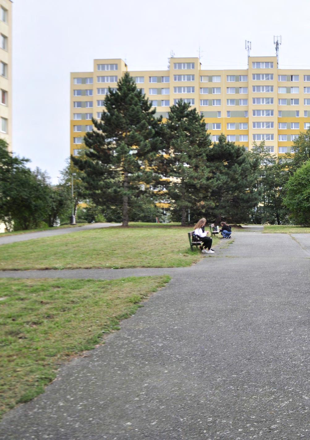
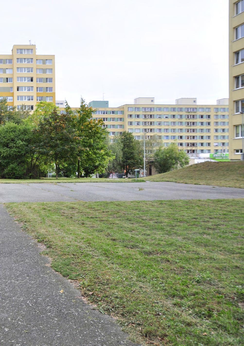
It’s the third year that the Urban Dynamics course’s focus was the city of Prague, in the Czech Republic. The students were tasked with the urban regeneration and renewal of the Jižní Město or “South City” area, Prague’s largest housing estate, in the Prague 11 District.
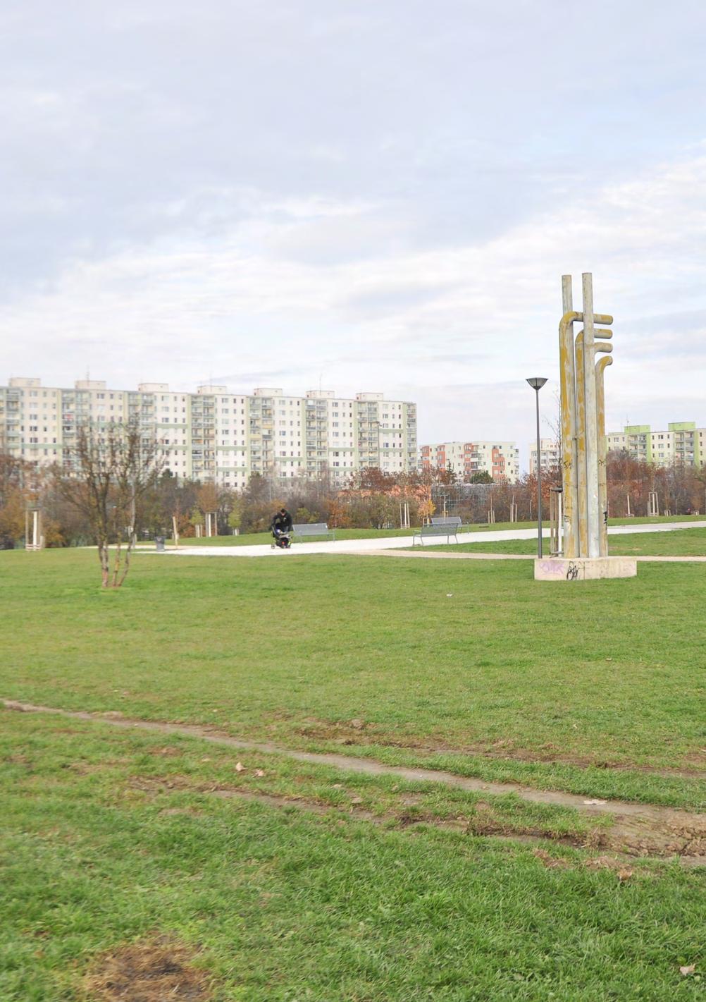
Around 80,000 people live in this area, which highlights how different the large housing estates are perceived in the Easter European countries compared to the West. Even though it is considered to be a suburb located in the city’s fringe, the district has a very strategic location, surrounded by great landscape features – forests, lakes and streams- and excellent accessibility to public transportation, which makes it a great place to live.
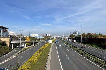
This municipal district is located eight kilometers south-east from the city center, with the D1 highway running through the area and dividing it in two, with few underpasses and tunnels for pedestrians and cyclist. The road network and infrastructure has caused the different neighborhoods to be disconnected, thus forming individual islands that encourage the use of private cars. The same can be said of the built form, with big, prefabricated panel buildings “panelák” – like the large housing estates Jižní Město 1 & 2- placed in the middle of vast under-utilized green areas which do not mix with the single-family housing areas, creating very homogenous islands. Prague 11 is served by Roztyly, Chodov, Opatov and Háje stations, the final four stops on the southern end of Line C of the Prague Metro and the areas around these stations have been identified by the Prague Institute of Planning and Development (IPR), in their Metropolitan Plan, as areas of transformation.
The Central Park located, as its name suggest, in the middle of the district, is an important asset that can become an important generator for the area. The students were encouraged to use the existing qualities of the area, to enhance and improve the quality of life for the existing and future residents.
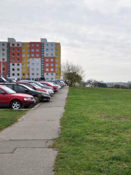
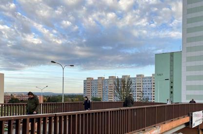
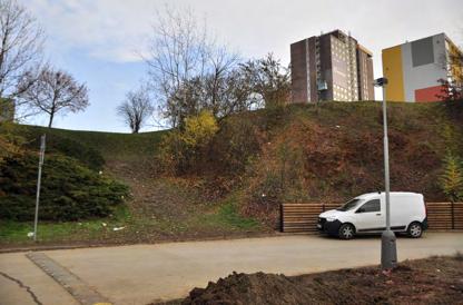
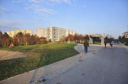
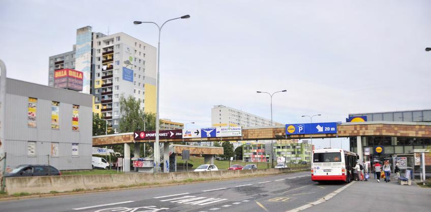
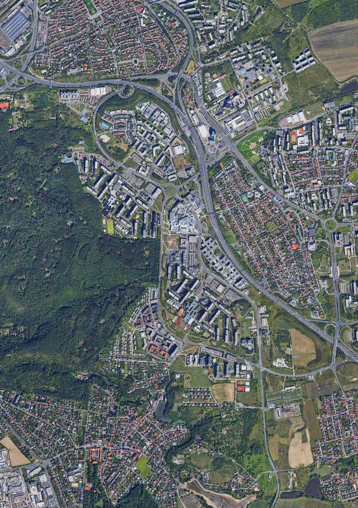
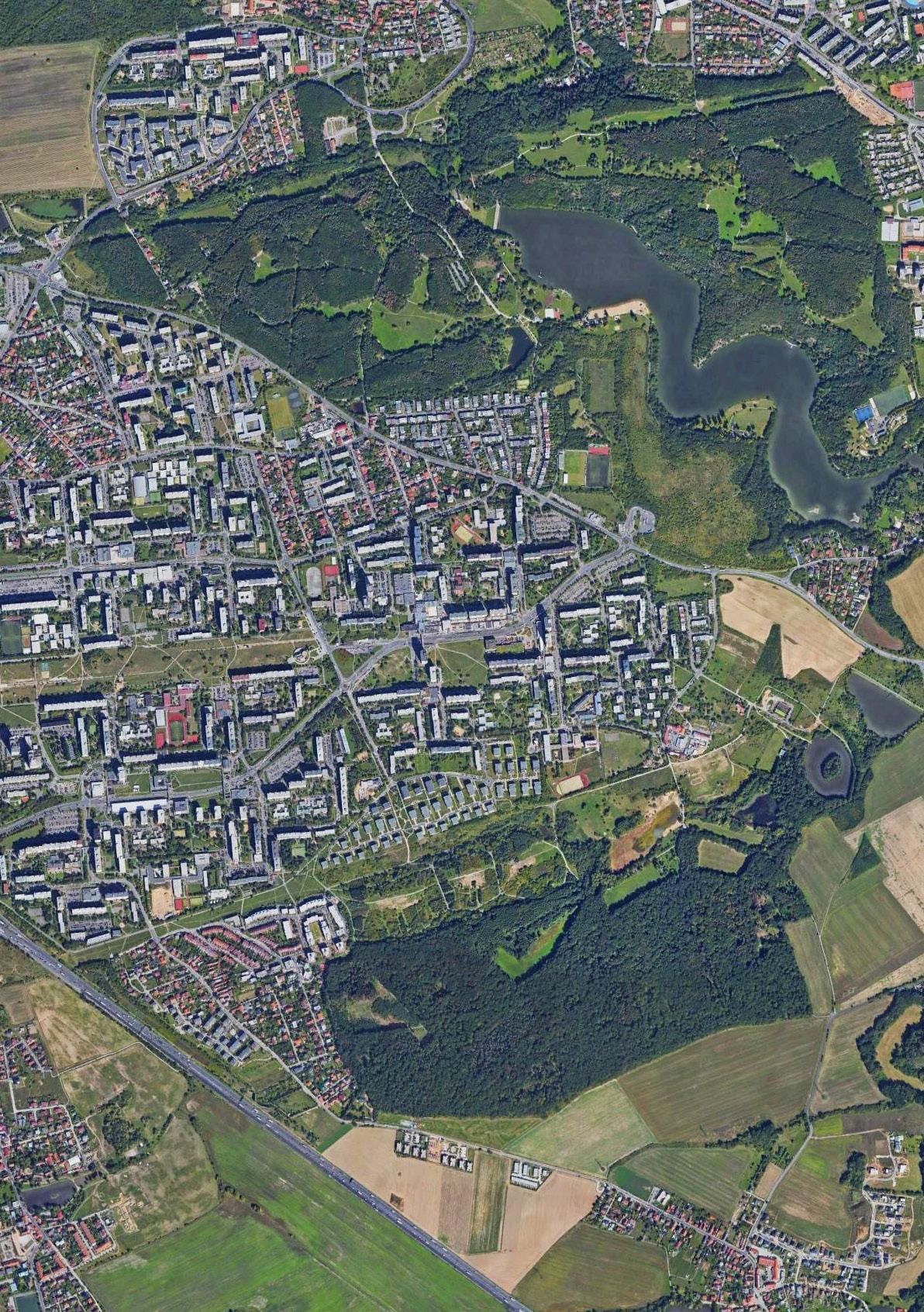
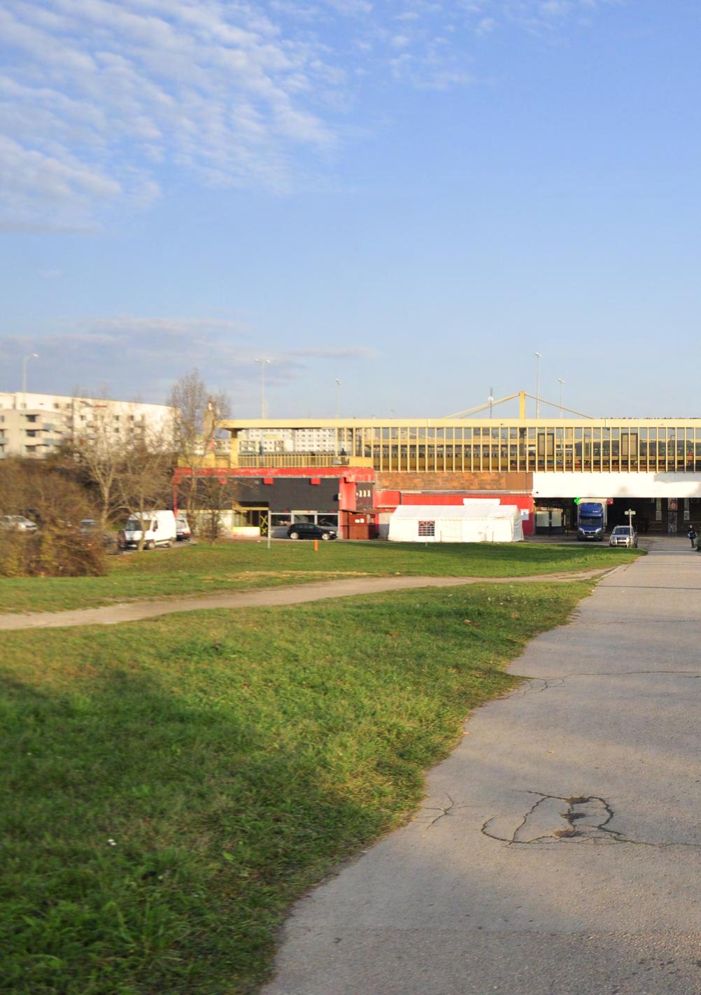
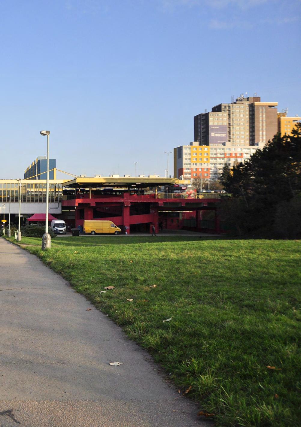
From an overall perspective to embracing Prague 11’s potentials
The aim of the four-day workshop, CONCEPT PLAN, was to give the students the opportunity to use the knowledge they acquired on Prague 11 district in the first weeks of the course, and turn it into a concept plan that answers the question: what happens when vision meets reality?
Taking into consideration the group work done in the first phases, and the possible future development areas already suggested, students worked together to develop a master plan of Prague 11 District that goes into the specifics of location, connections, wayfinding, and landscape systems.
The assignment was carried out as a competition format, with the proposals being presented to Rozalie Kašparová, and Vojtěch Benedikt as guest juries from the Prague Institute of Planning and Development (IPR), who selected a winner and a runner-up at the end of the workshop.
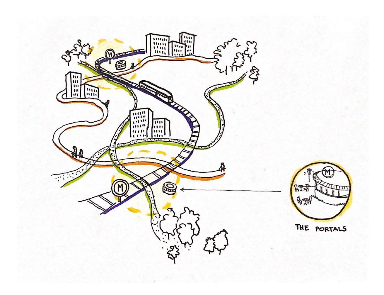
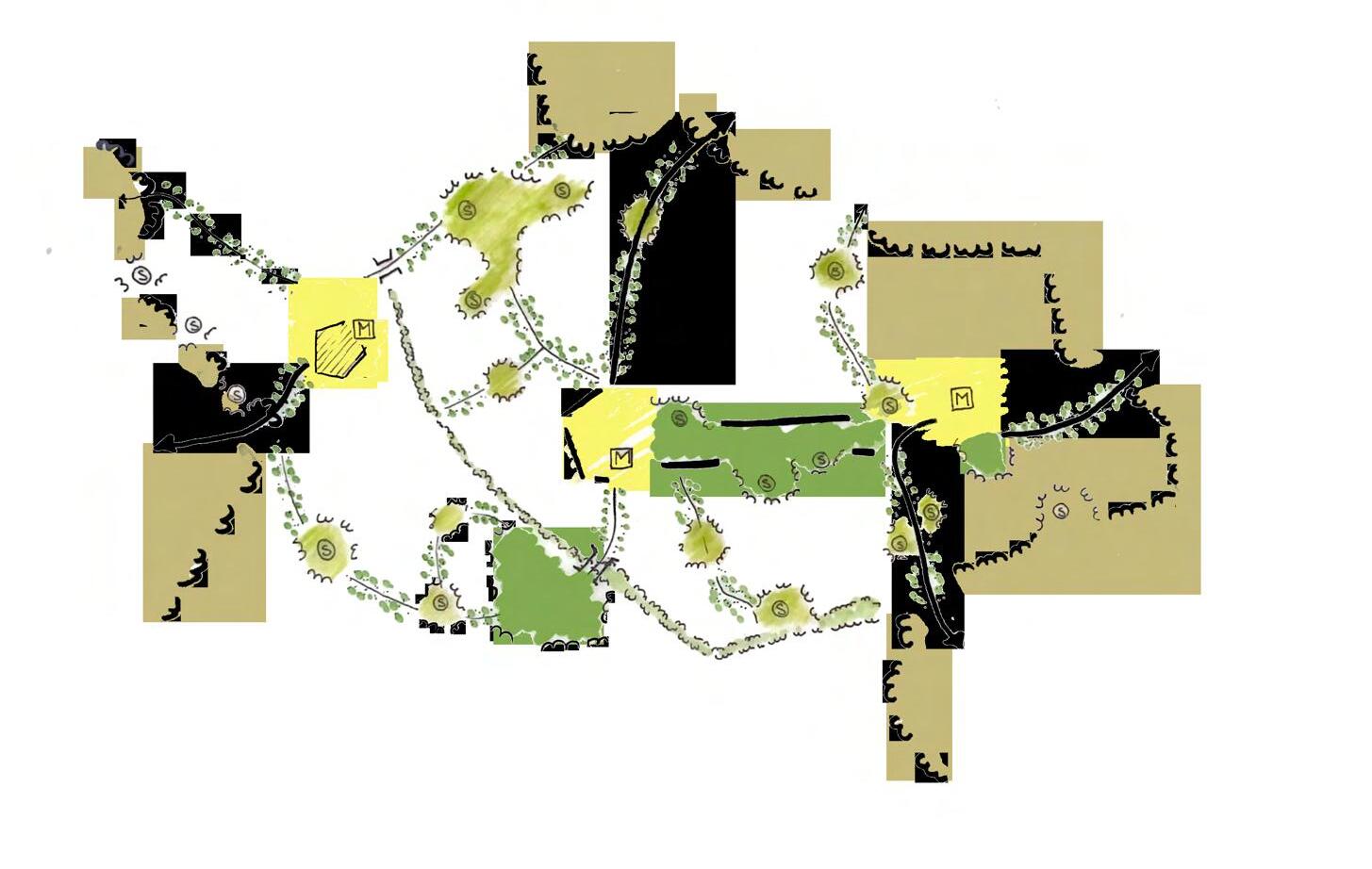
ACTIVITIES

ALLOTMENT GARDENS

COMMUNITY HUBS

COMMUNITY GARDENS

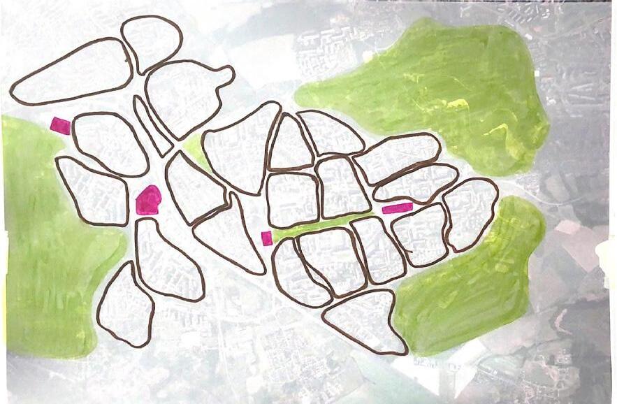
WAYFINDING

WATER ELEMENTS PARKS

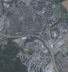

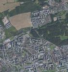
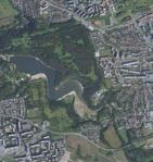
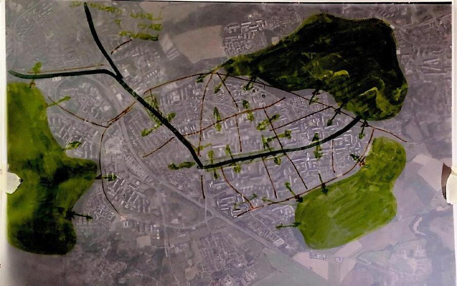
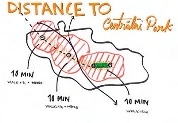
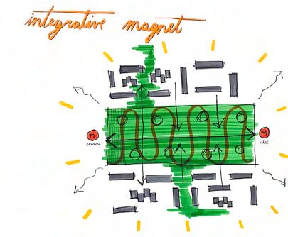
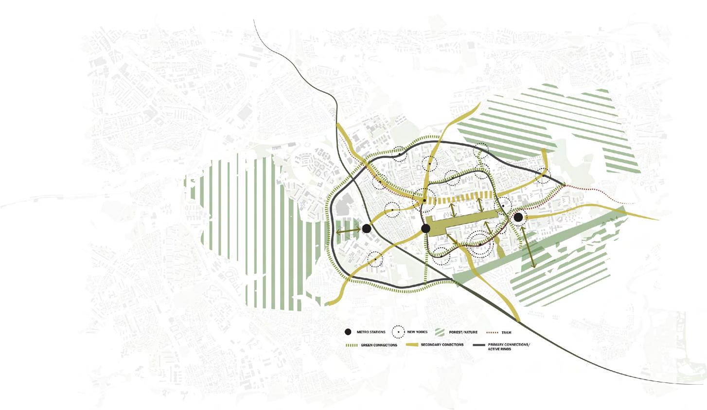


Nodes (CHODOV)
Existing: Westfield Mall
Echo to surroundings
Communication between spaces, soften edges Give direction and sense of belonging
Network
The semester schedule was broken down into 5 parts, each ending in student presentations. The 6th and final part concluded the semester and provided the students a chance to improve and reflect upon their work. This structure allowed for the students to focus on specific components of their projects and design process as well as get feedback on a consistent basis.
In general, the structure worked from the large over-arching scale of globalization towards the development of design details within the final project. Each 3-week period required the students to go one step further in the development of their projects, while at the same time bringing with them knowledge from their previous explorations. Through the guest critics comments and weekly individual tutorials, each student work grew in depth and detail in an attempt to tackle the challenges posed by the site and the course requirements.
For the first time in their studies, each student had the opportunity to choose their own design site within the Prague 11 District. After doing an in-depth research and mapping of the district and its context within the city - first in groups and after individually - they framed the key issues to be addressed and the opportunities for the future development of the area, according to their personal reflections.
As the students were one step closer to doing their thesis semester, in which they have complete freedom when it comes to deciding a design site, they were asked to draw out the area that interested them the most, based on their own conclusions after Phase 03. The end product is wide range of solutions to transform this post-socialist district into a more sustainable and livable place within three overall transformation areas, the northern Chodov area, the Opatov metro station area with the Central Park and the Háje metro station area.
Therefore, the student projects presented in this booklet have been organized in the same way, stating with the Chodov area and ending with Háje area. It is our hope that all the hard work and energy from the students can be translated in the next pages and you can be inspired by their designs.


My Harrfors, Sweden
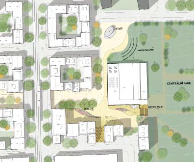
DETAIL PLAN
“A shift of priorities in the transportation system will put people over cars and the human tempo will shape the streetscapes of tomorrow!”
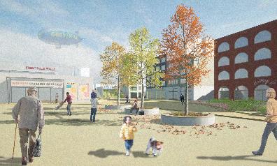
One of the major infrastructure plans in The South City is the new tram line, a tram line focused on local public transport. However, the urban structure along the streets where the tram is planned to run lacks activities and contains large voids, a large amount of spaces are given to cars and parked cars. There is nothing in the streetscape that envisions that the tram will be a well used addition to the district.
My project focuses on how the new tram line and an already satisfied neighborhood can be developed into a more sustainable and livable place by using the tram line as a generator. A shift of priorities in the transportation system will put people over cars and the human tempo will shape the streetscapes of tomorrow.
By densification of the void spaces, new frameworks can fill the streetscapes
with places where the slow values of life can happen. Slow values are values the district will benefit from and contribute to more opportunities to stay in Praha 11 during your off hours. The new developments will answer the growth of Prague with a need for new dwellings and contribute to more workplaces in the district.
A slow city is characterized in a way that supports people to live slowly. It is a walkable city with less traffic and less noise, with a variety of places for people; squares, public buildings, small businesses in active ground floors and of course closeness to nature. In motion is the movement towards the future, the creation of a healthier city for the next generation.

Valeria Rabelo Cabal, Mexico
CONNECTING DIFFERENT NEIGHBORHOODS
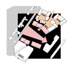
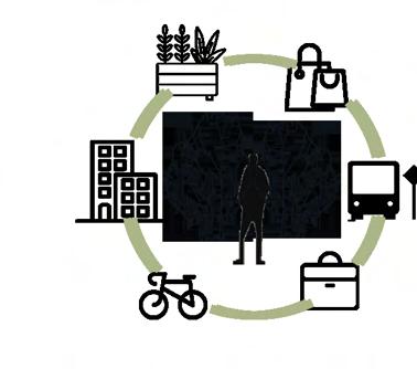
CREATE A SUSTAINABLE MIXED USED ENVIRONMENT WITHIN THE DISTRICT FROM FOREST TO FOREST
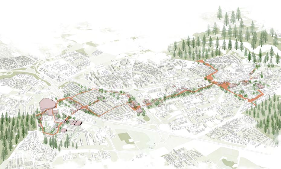
CONCEPT URBAN PLAN
“Connect the area from forest to forest by activating the thread
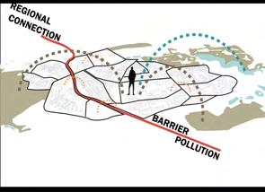
One of the most important aspects that make a city functionable, is mobility. Urban planning has created various models for “the perfect city” where mobility and connections is one of the key points to reach its effectiveness and sustainability. But what happens when a city is very well planned for mobility… by car and public transport? We’re left with a very functioning (car centered) environment. Where can people find this effectiveness? How are their lives affected with this dependency and where do we leave sustainability?
In this new concept project for Prague 11 we want to reclaim what was prioritized for cars and buildings by taking these “remaining spaces” and reducing car mobility (eventually occupancy) and adapting them to be active human scale spaces, which works in 3 different scales, block, neighborhood and district.
In a smaller scale with the use of corridors, line parks and pocket parks, with mixed used and affordances you give pedestrians an active wayfinding path that eventually will lead to another connection.
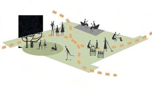
Within the neighborhood the aim is to connect (on a pedestrian level) them with mainly existing nodes, such as the 3 main stations, Roztyly, Opatov and Háje with their surroundings. Enhance the connection of these stations with mixed use buildings and active zones, with the park as a main connector and major active node
And the third scale is connecting all these nodes within, with the outdoor environment, the edges. Enhance the connection to the forests by making a direct relationship with the housing units and neighborhoods, taking remaining spaces and green areas to create main pedestrian roads or thread with meaningful spaces to everyday life, so that it can shift the flow and movement of the people on the district from car to pedestrian, through all of Prague 11.
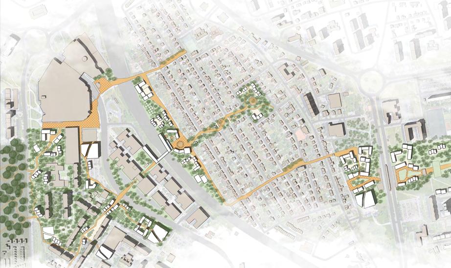
MASTER PLAN PHASE 1 1_3000
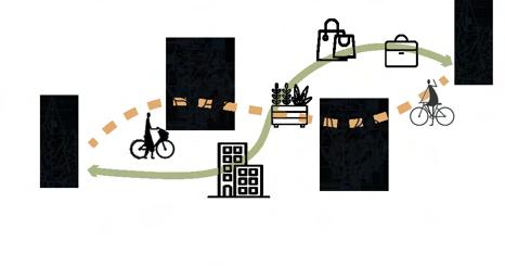
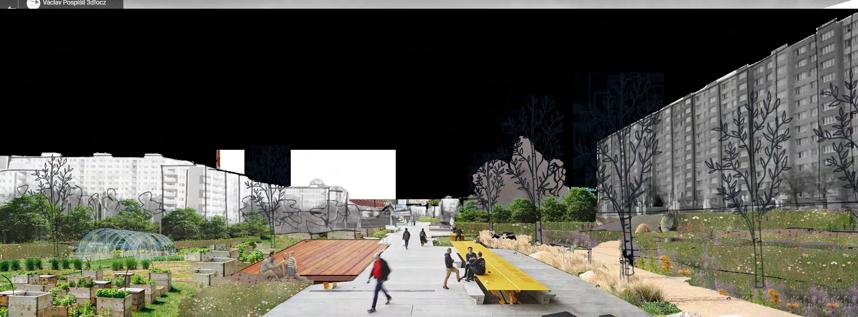
ACTIVATING THE INBETWEEN SPACES TO CREATE A FLOW WITHIN THE


Elin Bengtsson, Sweden
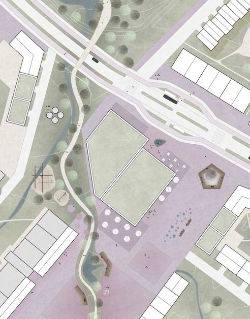
Masterplan | 1:2000
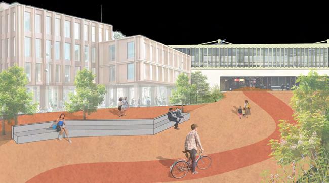
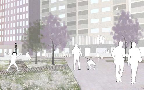
“This project aims to create a place where people don’t feel lost. Where the movement and directions are almost intuitive, and you discover new favourite places without searching.”
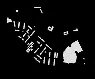
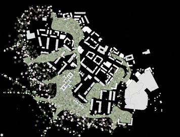
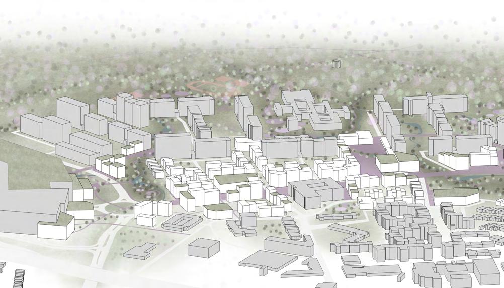
Jižní Město II is located in the northwest end of Prague 11. The two most noticeable uses of this area is the largest shopping mall of Czech Republic, and one of the largest forests of Prague 11. Between these two nodes a typical residential area of Prague 11 is located. When visiting the area, it´s easy to feel lost among the dead-end streets, the monotone architecture and the large undefined spaces.
So how can this area be developed to stitch the forest and mall together to create a coherent and readable pattern between the old and the new?
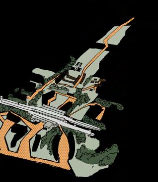
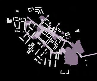
To achieve this, a green and an urban pattern was created.
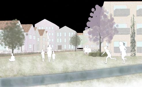
The green has a calmer character and consists of parks, farming, playgrounds, green roofs and water elements. All leading to the forest.
The urban pattern extends in a circle around the main street, the mall as well as new public functions and uses inside the residential area. The pattern connects smaller and larger public spaces such as squares, shops, cafés, urban furniture and mobility hubs to create the second pattern of this project.
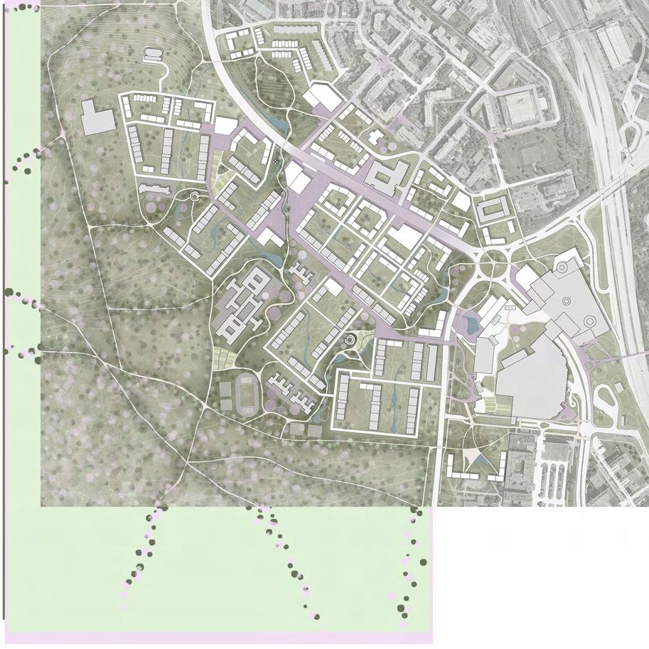
Together, these patterns create a stronger identity of the area and a stronger movement through the area which makes it easier to navigate and orientate yourself to find what you searching for, or maybe even find something better.
Opatov Metro Station Area & Central Park - Design


Annika Enzinger, Germany
Detailplan
“Connecting people by creating a heart”
Prague 11 was built in the modernist time when panel buildings and wideopen spaces were the perfect solution to solve housing problems. It was made for sleeping in your home and going somewhere else to work or for leisure activities. Cars were also a big thing back when it was built, therefore wide streets and a lot of parking lots are dominating the area.
However, people in Prague 11 are happy living there. Its wide-open spaces and the closeness to nature have positive aspects, as well as the good network of public transport.
So, what is missing in the district, where residents are happy to live?
actions and is suitable.
Starting with the Central Plaza as an opening to make the metro station more visible and to give the residents a place to do their groceries, going out in a restaurant and bar or just hanging out with friends.
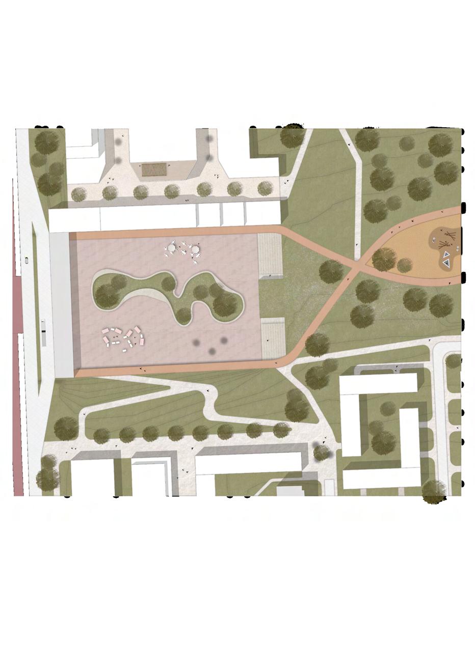


It‘s a place where they can meet, have activities and spend their leisure time. Therefore, I create a heart to connect the people in the district.
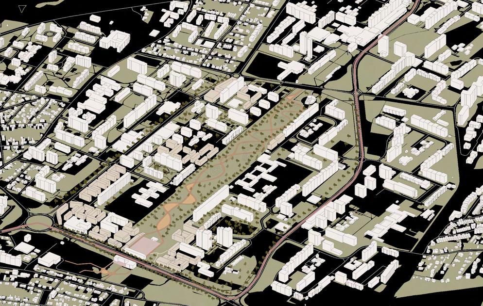
Opatov is in the middle of Prague 11. With its undefined spaces, the connection to the metro and the new tram line, wide streets, as well as the proximity to the central park, it gives enough space for
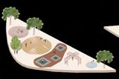
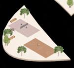
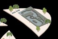
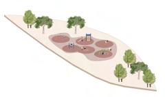
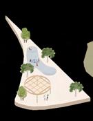
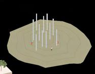
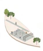
Lead on by the Central Park as a place where you can find activities no matter what stage you are in your life. Playgrounds for small children, a skatepark or outdoor gym for young people to hang out, a jogging and bike route and spaces for old people to sit down and meet up. As the station, the street and the park are on different levels and it should be accessible for everyone, it is connected through different ways as a bridge, a slope or stairs. And to be last by densifying and framing the spaces with smaller buildings to break down the scale, people get a better sense orientation in the district.
So would you like to hang out in Prague 11?

Bruna Pessôa, Brazil
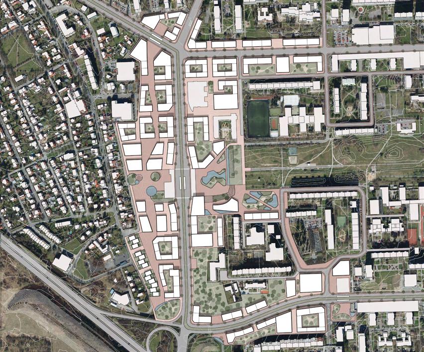
MASTERPLAN
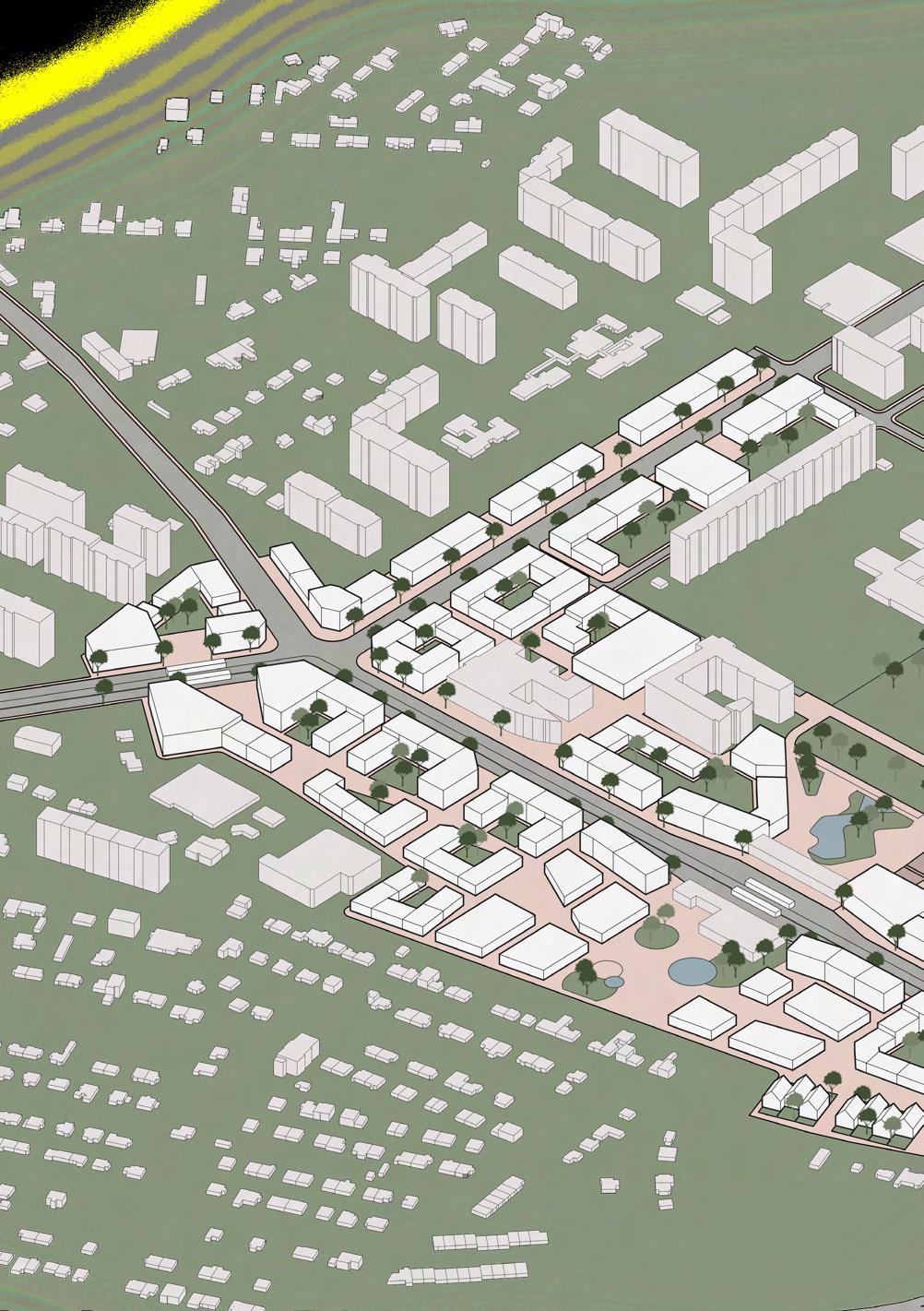
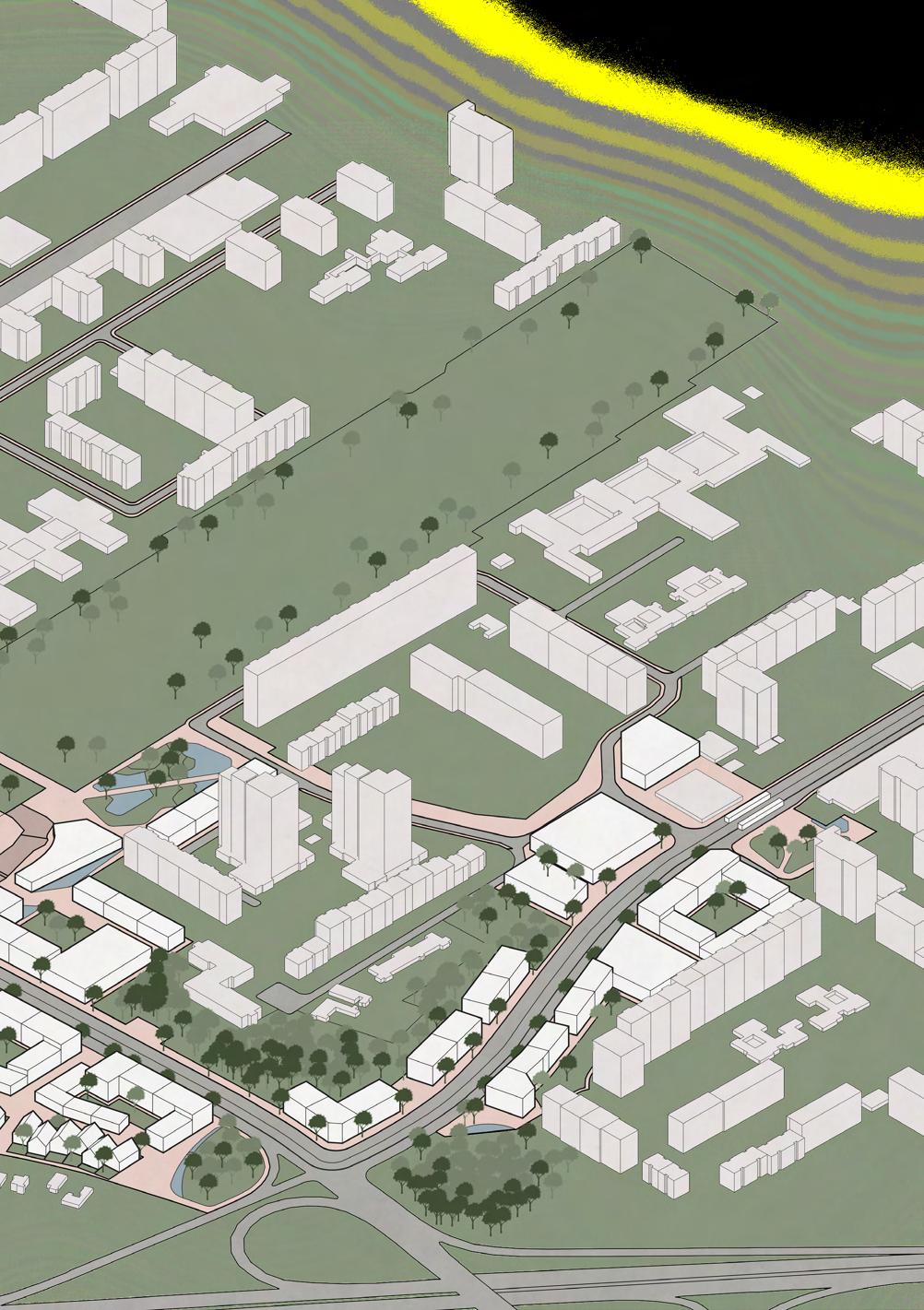
“By creating a clear public spaces network around Opatov station, the walkabitily becomes more atractive and more accessible”
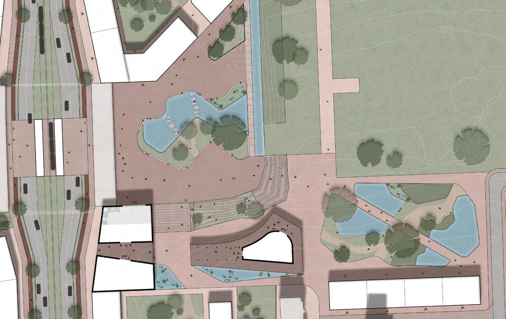
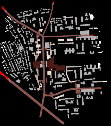
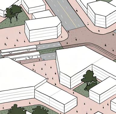
How do people locate themselves in a new environment without the navigation software help? Usually, they take landmarks, building forms, and details, like materials and vegetation composition, as reference points. The ways how the flows are disposed of are also an essential element of our natural navigation system. More straightforward connections are easier to follow than more matted ones. Therefore, by having clear reference points and easy connections, a city can help people to find themselves within it. This is not the case in the Prague 11 district, Czechia, at the moment. There, navigating yourself is not an issue just for visitors, but also for the residents. Considering this challenge, this project aims to make the spacial orientation more accessible by improving Prague 11’s urban qualities. The design driver is the development of a public space network with a coherent hierarchy framed by the new
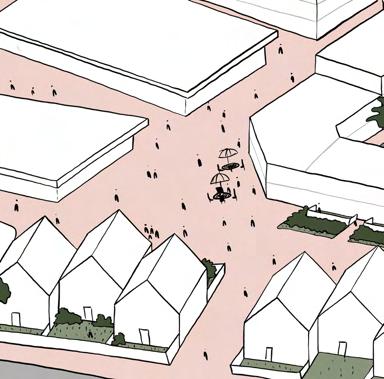
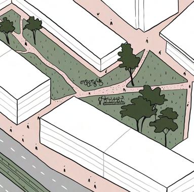
buildings and the existing context. The buildings and their in-between spaces have different characteristics depending on where they are within the neighborhood. Different types of typologies uses, landscape qualities, and materials are some of the strategies used to enhance these spaces. Prague 11 has the potential for these transformations to be realized since there are so many empty spaces between its buildings. These urban voids, most of them empty green areas and huge parking lots. They can be framed and activated by their densification and the planning of their open spaces. Since the district’s population has a strong sense of belonging and already uses its existing public spaces, Prague 11 could be even better if its public areas could be accessible, safe, and dynamic.



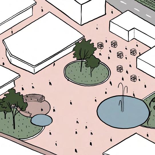
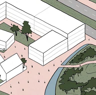
Eleni Tamiolaki, Greece
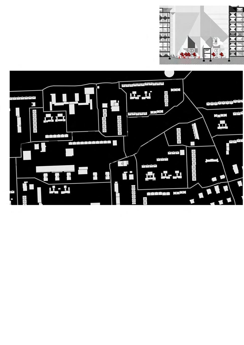
MASTERPLAN (ORIGINAL SCALE 1:2000)
“There is always something interesting in the In-Between...”
Through the exploration of District 11, a visitor can easily discover many problematics related to the urban infrastructure. Regarding the first impression, what mostly stands out is the modernistic tower blocks that derive from the communist mass production. In terms of typology and aesthetics, this concrete-hardscape is characterized by a strong egalitarian mentality which creates a monotonous atmosphere. In-between the buildings, there are huge open spaces of undefined character; a random mix of elements, such as badly placed benches, trees, grassy areas and poor lighting, create a confusion: Is it a private or a public courtyard? Is it a small public park or just a depressive passage?
My personal intention is to organize this chaotic homogenous landscape of Disctrict 11: define edges, recreate and scale down these huge open areas, starting from the inner undefined courtyards, to the larger in-between and central “void-spaces” (e.g. parking lots),
SECTION (ORIGINAL SCALE 1:200)
as well as networks and connections. The redefinition of the in-between (courtyards, playgrounds, pocket parks), in combination with some new buildings, will create smaller spots of defined use. Hence, people will have clear guidelines of how to interact with the space, while the sense of belonging will be enhanced through this scale down strategy.
My recreation of District 11 is organized in 3 phases: The first two phases are related to the transformation around Opatovská and Roztylská axis. Regarding the 3rd phase, a transformation around Hviezdoslavova axis, Michnova, Mikulova and Chilská is proposed, in order to create a strong urban “ring” connected to the main Opatovská-Roztylská recreated axis.
In my masterplan, I focus on a smaller area on Opatovská axis, including Háje metro station (mixed-uses buildings, new working places, residencies, small-scale structures for bikes/books exchange, underground parking).
Floris Meeuwse - The Netherlands
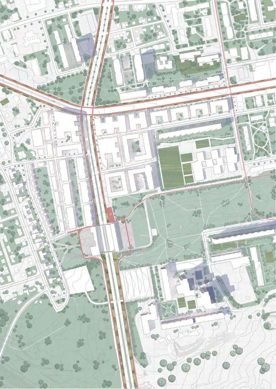
Masterplan
“Creating a bike friendly future for Prague 11”
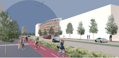
To reach my vision of creating a bike friendly area three main things need to implemented. The first one is creating sufficient bike parking. The second and most important aspect is creating a working network of bike lanes. This includes separated bike highways and separated bike lanes along major roads. The last aspect is enabling everyone to use bikes by creating a network of bikesharing options. The purpose of the cycling network will not be to get people to the city centre as this connection is served by the metro.
The overall structure of the infrastructure will consist of two rings with diagonal spokes that connect these rings. The inner ring is the one I focused on within this project. It runs around the Central Park and connects both Opatov and Hajé metro stations. The cycling infrastructure around this ring will have a more high-speed character for people to commute. Bike connections through the park will
remain or be added however they will be less for high-speed commuting and be used for leisure.
In addition to the new bike infrastructure on the site, a new tramline and a new neighbourhood will be created. The new neighbourhood will be mixed-use with a main focus on bikes rather than cars. The new neighbourhood will have two gradients. The buildings will gradually go from single-family housing to larger housing complexes from west to east. From south to north the height of the buildings will increase to fit in with the existing structure. However, the maximum number of floors will not exceed six floors. The area depicted in the masterplan can be the first phase of the redevelopment of Prague 11 with possible future phases being located along the infrastructure ring.
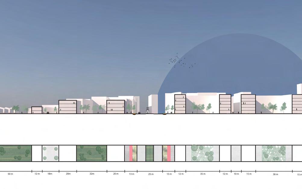

Gizem Caliskan, Turkey
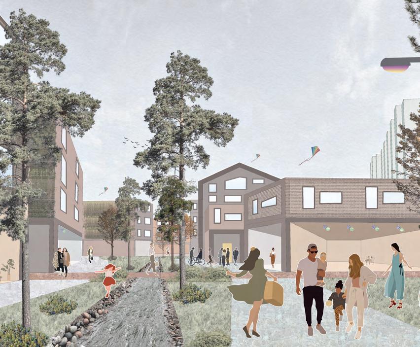
the cars
‘‘leave your car, live your life.’’
Prague district is located in the southeastern part and it is about 8 km distance from the city center giving the approximately same travel time if you take your car or take the metro from the district. For this reason, Prague 11 is a well connected to public transportation district that it holds its own strategical strength when it comes to change for better future in terms of sustainable transportation mobility.
It has its functioning underground metro infrastructure which leads all the passengers from the district to city centre about 20 minutes. Bus stations are covering almost the whole district from one’s house to the bus station. The fact that public transportation has a strong percentage in the preferred transportation options in the city makes the tram line that will pass through the district an important factor for the development of the region.
Prague 11 meets the expectations of those living there about having a strong
identity, sense of belonging, community and being happy with the area in which they live, and it has many rooms to improve itself while it called be as ‘growth within limits’. The proposal after analysis of the site consists of the dedicated areas that it takes from cars on different scales to give back it pedestrians and cyclists.
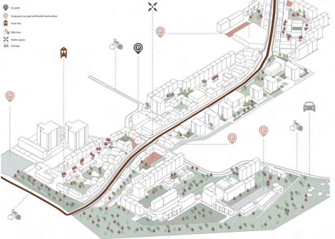
The selected project area follows the proposed tram line and its immediate surroundings. The phases of the project are primarily: the development of the tram line on a street scale, and then the developments focused on the human scale in the immediate areas.
The vision of the project is ‘’leave your car, live your life.’’ Rather than an aggressive intervention in daily life choices, the principle is to show what the space taken from cars can save back to the residents and visitors of Prague 11 and reduce the importance given to private vehicles with the development of alternative transportation options.
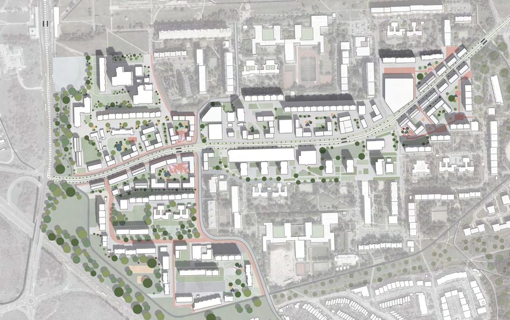
master plan

infrastructure analysis
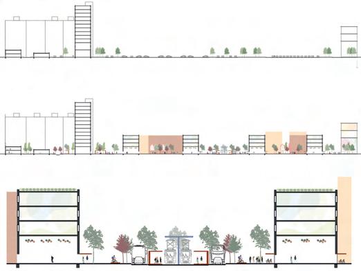
section: before
section: after
Hugo Bennhage, Sweden
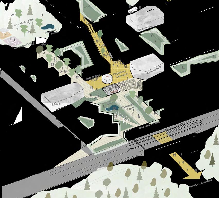
OPATOV METRO AND SURROUNDINGS
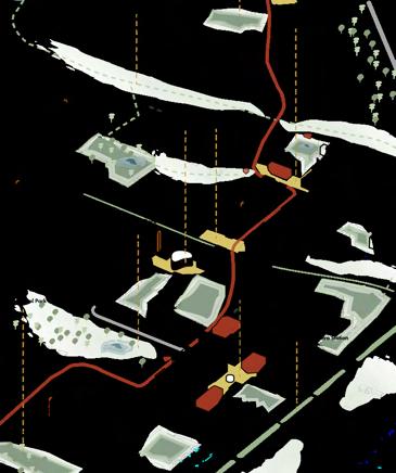
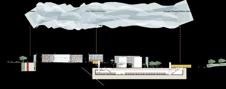
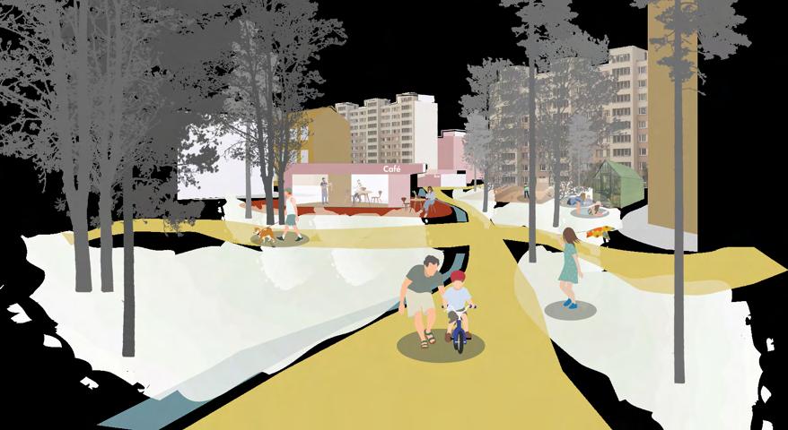
“The intention of the project is to, in small steps, enhance local links that connect local centers, metro and the suburbs with local movement of current residents.”
Jižní Město is in many ways a well functioning district in the south of Prague. With vast amounts of green space and calmness it is seen as a great place for families and pensioners. The district has the potential to add new layers without interfering with the current qualities to develop as a well functions area for other groups as well.
There is also an untapped potential in creating a local urban center for the many suburbs and countryside that is just minutes south of Jižní Město . The countryside also provides high quality green spaces as well as regional magnet points. A stronger connection within Jižní Město and its immediate surroundings could improve quality of life, shorten distances and promote sustainable alternatives.
The proposal is focusing on the area around Opatov station and neighborhoods just south of the metro. This part is also part of the local
link connection south towards the Milíčovsky recreational area, Průhonice and surrounding villages.
The project aims to create linear, easy to orient, corridors that mend the urban fabric, framing space and reducing distances. This is made to shorten the perceived distances between subcenters within the district and connecting socal spaces for social sustainability.
Through small scale interventions the project aims to define local courtyards to create hierarchy and improve the quality for a palette of age groups, residents and visitors alike.
Local centers are today introverted and fragmented. By connecting these centers, social and economical synergies can be harvested. To strengthen the local centers the project aims to add orientation, functions and quality public space inbetween.
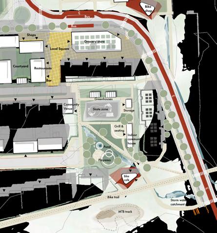
THE LOCAL COURTYARD DETAIL PLAN
Lamiaa Chnayti, Morocco
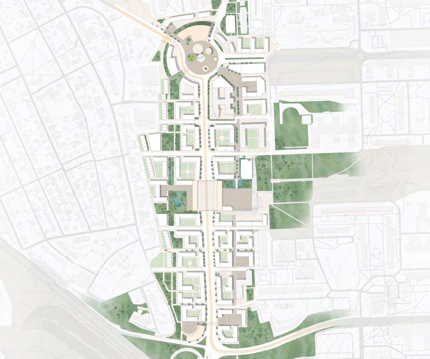
Strategic Urban Plan
“From and to Opatov, choose and make your own path”
Prague 11 is the outcome of decades of modernist planning policies , outgrown by the population increase and most of its needs, which are only fulfilled by transiting to the city center. The district is now torn between several antipodes : city vs suburb ; big scale housing vs small scale housing ; concrete vs nature, preservation vs neglect, city center connection vs district disconnection, public vs private…
The district has the potential of offering a better quality of life by enhancing its good features and creating an equilibrium and a middle layer to balance its antipodes and turning its challenges into opportunities. Opatov is a valuable and strategic site of Prague 11 because of how well it represents the complexity of the system and combines all the opposite layers that contribute in its challenges.
The concept of the design proposal is to explore how site focused interventions
can create an impact on a larger scale. Sustainability wise, the design could alter the route that Prague 11 is on and change it to the better.
The design proposal aims to prioritize social and interactive public spaces, add new features and attractions to the site by densifying and strenghting the community and its presence in Opatov, connecting the site to its key features, most importantly the metro and bus stations and finally enhance the cyclists and pedestrians connectivity throughout the whole site by creating attractive and defined paths, varying from having a green character to a more urban one.
Opatov should become an essential heart of Prague 11 and compete with the other districts thanks to its consistency, sustainability, attractiveness and representing a daily use neighborhood and destination.
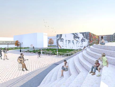
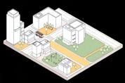
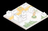
1. Creating social & interactive spaces
2. Defining and framing the in-between green space
3. Adding a middle layer to the site’s typologies
4. Branding the site and strenghtening its identity
5. Favorising semi-private courtyards in the typology
6. Prioritizing cyclists and pedestrians
7. Replacing parking lots with sustainable parking
8. Preserving the landscape and making it more sustainable
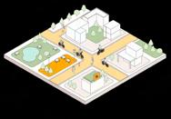


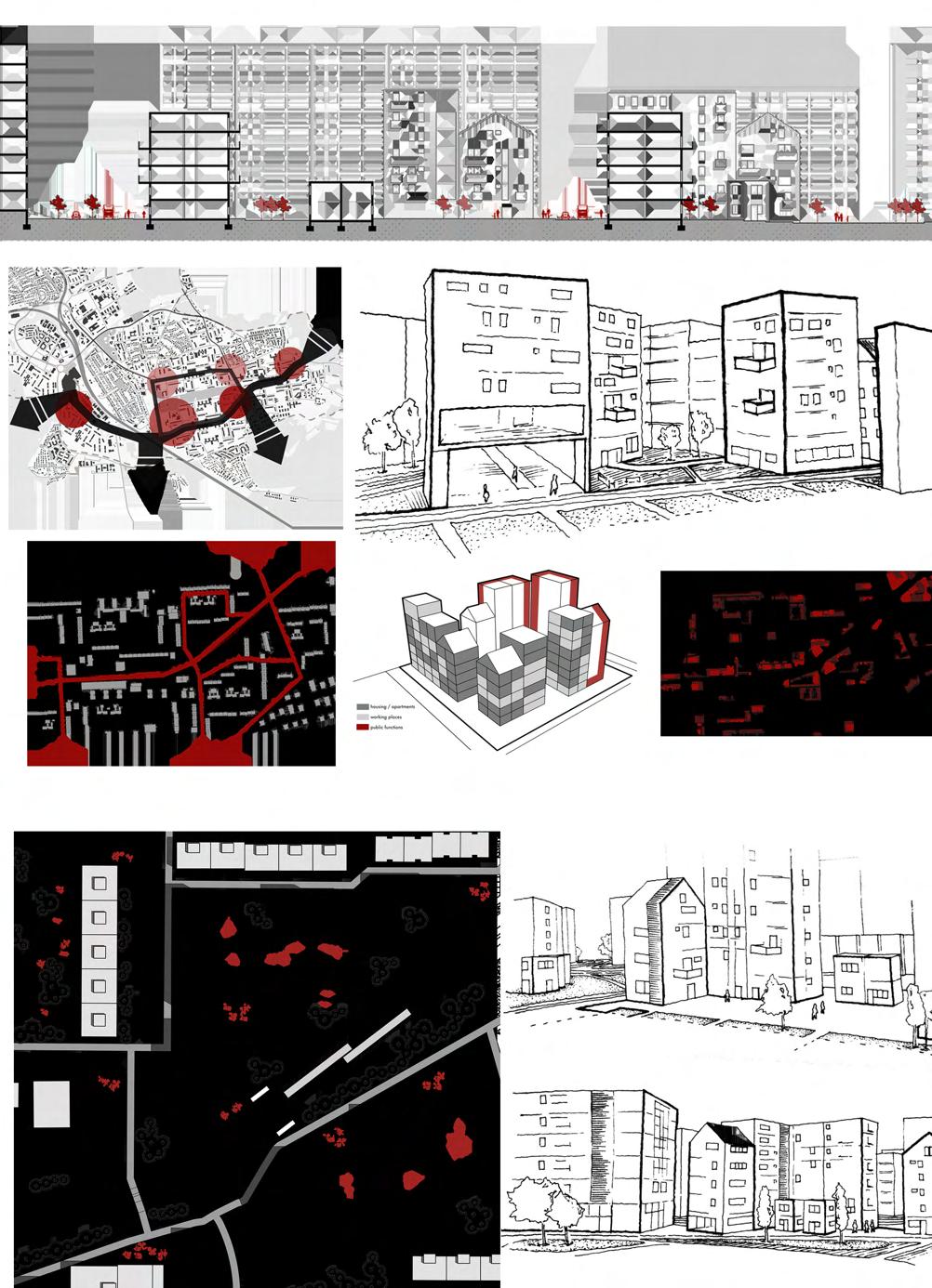
“LAYER 3 is a holistic, systematic and generic strategy for the renewal of modernist residential areas worldwide.”
Initial research indicated that Prague 11 could be used as a canvas for the development of a wide-reaching strategy for similarly planned estates around Europe. The goal was to define general tactics for modernist areas, while also seeking to respect their individual identities when implementing the newly developed principles.
South Town One was chosen as the project site because it represents the most consistent modernist intervention in Prague 11, where all the generalized shortcomings are most obvious. Furthermore, when applying the strategy to South Town One, a lot of the existing identity can be leveraged in accordance to the strategy. This especially applies to the Central Park, which is unique enough to be the area’s new city-wide identity.
The main aspects of the intervention are the strong densification and development of the two unrealized


central zones (Opatov Station and Haje Station). These are already connected by the Central Park, which can be activated with new recreational functions (permanent and temporary). This axis forms the public face of South Town One - inviting new outside users without disturbing the existing populace.
Parallel to the development new of citywide magnets, local sub-centers are densified and remodeled into desireable meeting places for the surrounding population. The residential zones, currently dominated by monotonous slab buildings, are improved with a series of smaller interventions aimed at restoring a human scale and redestributing some of the unused green public spaces.
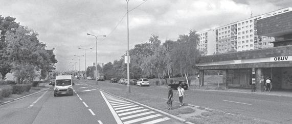
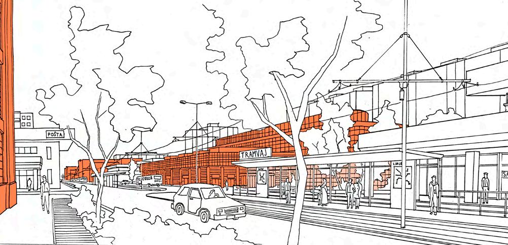
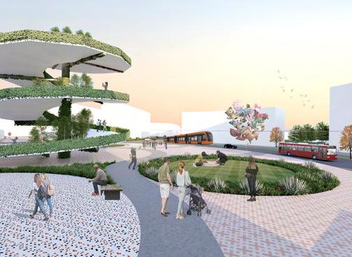
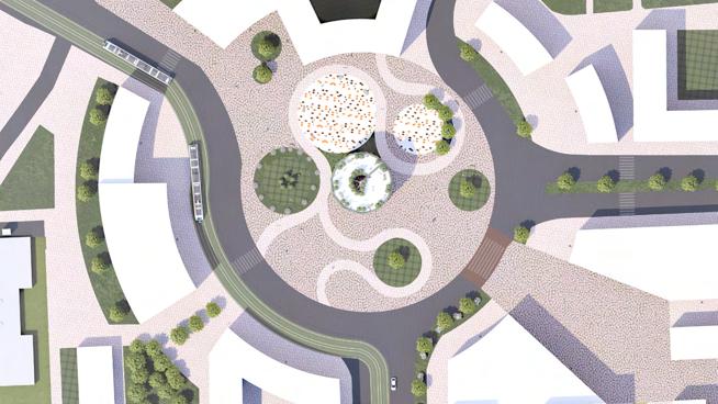
PERSPECTIVE DRAWING OF LOCAL CENTER (AND CURRENT CONDITION)
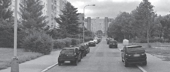
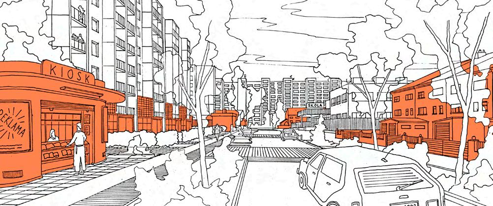
PERSPECTIVE DRAWING OF RESIDENTIAL ZONE (AND CURRENT CONDITION)
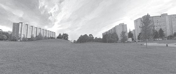
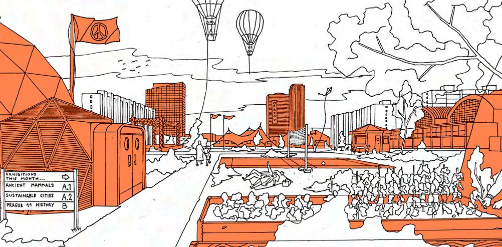
PERSPECTIVE DRAWING OF CENTRAL PARK (AND CURRENT CONDITION)
Bloc gradually collapsed, countries sought to themselves from their communist result, modernist areas are revitalization programs.


SOUTH TOWN 1 PARK a space of temporary architectural interventions, leisure, culture and sports
DETAIL PLAN EXTENTS drawn at 1:500 scale


Martine Mahu, The Netherlands
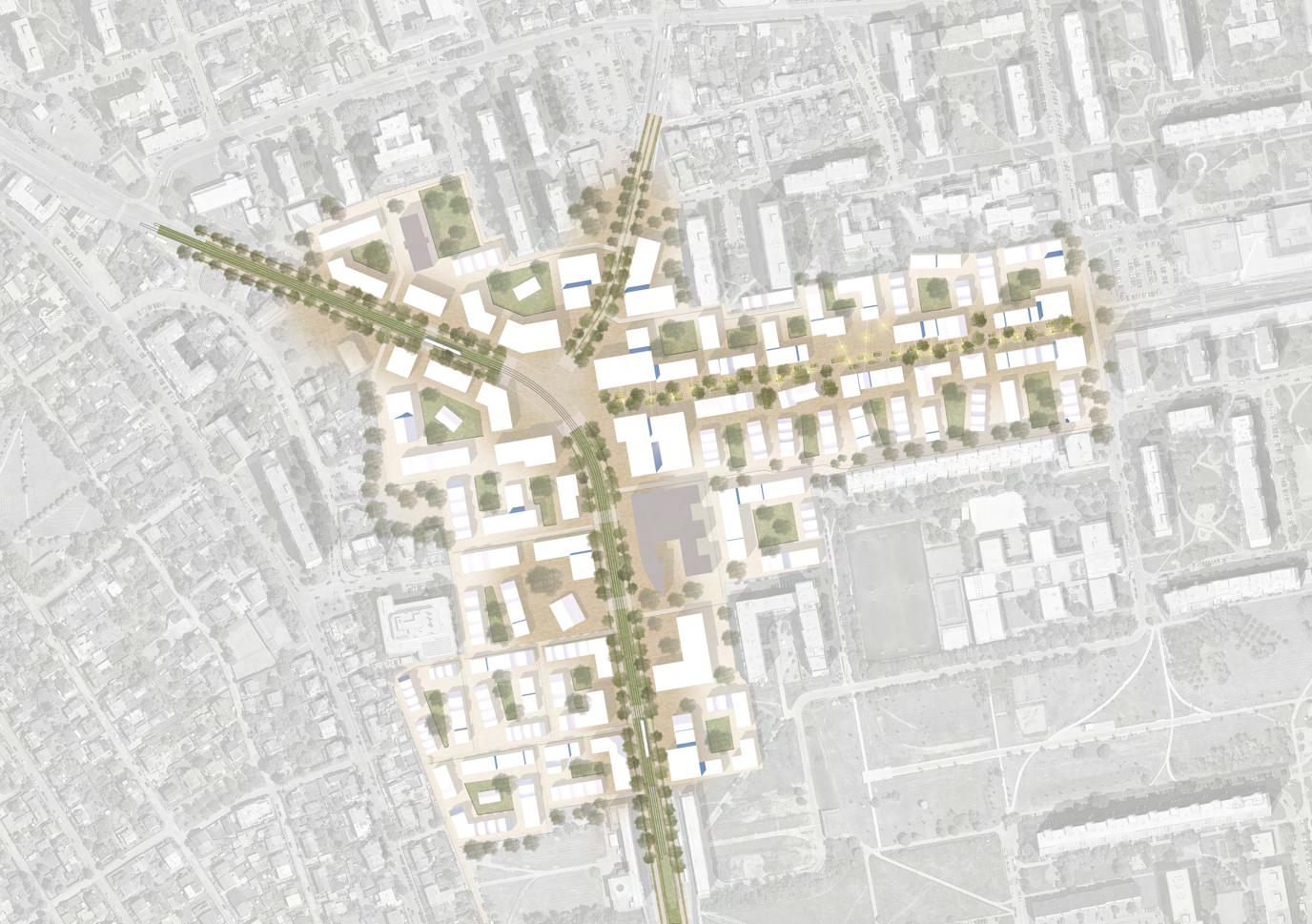
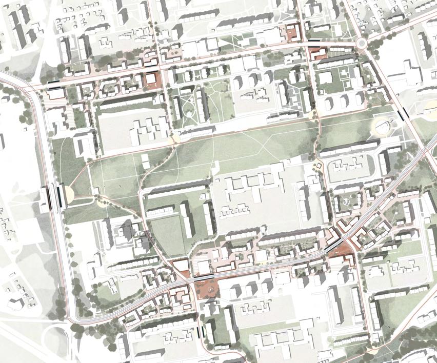
Masterplan
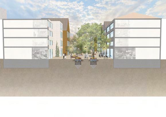
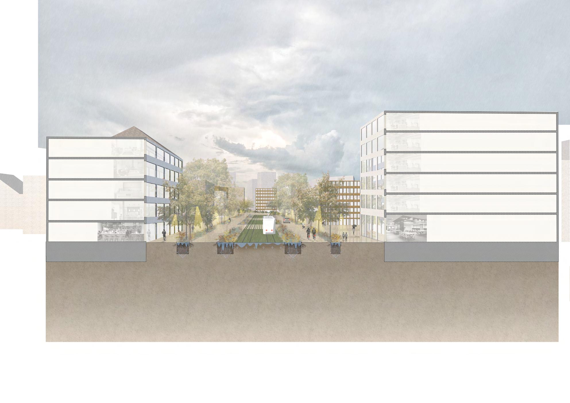
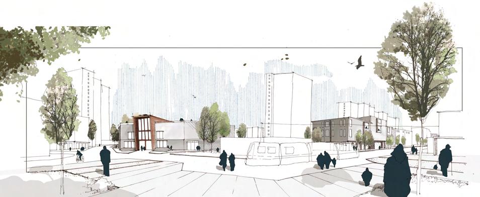
“Streets are more than just the space from curb to curb, streets are multidimensional spaces that are vital to a good working city!”
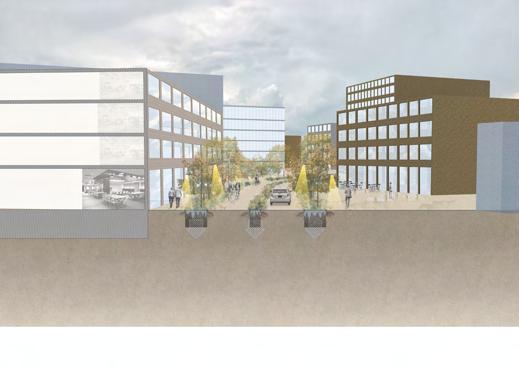
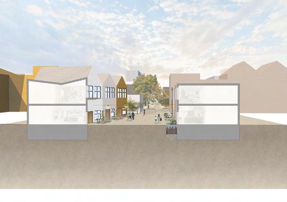
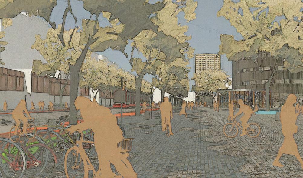
The current streets of Prague 11 are dominated by cars. In this project a masterplan is made that shifts this more towards the domination of sustainable transport, such as the tram, the bike and strolling around by foot. To encourage these ways of transport, the streets should be designed as ‘multidimensional spaces’. They should be human centred with the right dimensions and every walk or ride should be an experience, with different colours, textures and facades to look at. Next to this, streets should have spaces to gather with open and active ground floors where you can stop for a while, take a coffee or meet people.
These aspects of the new streets of Prague 11 benefit the mental and physical health as well as the environment. But next to going by foot, taking the bike or tram as a more sustainable way of travelling, a good street design can do more for the environment.
In the masterplan you can find a lot of green in the streets. Trees to cool down the surfaces to reduce the heath island effect, greenery that improves biodiversity in the street and permeable surfaces that allow water to permeate directly into the soil when it’s raining. These aspects don’t only make the new streets part of the transportation network of Prague 11, but also of the green and blue system of the district.
‘Meet (on) the streets’ shows you the future streets of Prague 11. Streets that work within the green and blue system, streets that prioritize sustainable transportation and streets that are interesting enough to work as public spaces. These streets work as arteries to bring the district to life. Streets are vital for a city and by paying a bit more attention while designing them, they can be more than just spaces for our day-to-day commute.
Maya Amei Kranner, Austria
Donlyn Lyndon masterplan
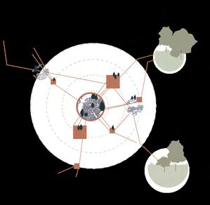
“places instill the choreographies of society”
...so shouldn’t our aim as urban designers then be to create patterns that allow for multiple choreographies to take place, rather than monofunctional volumes and lines?
The modernist way of planning has led to many issues on different scales when it comes to a human perspective usage, but one characteristic is repeating throughout the districtsits detachment on multiple scales. Therefore, designed structures lead to life being rather introverted and not open to the public.
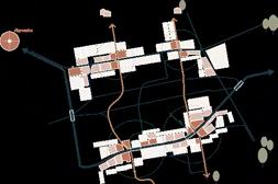
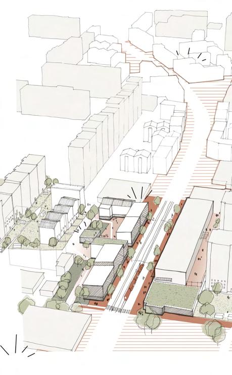
The main idea behind the design proposal is to use the spaces that have been invisible to the original planners to create frameworks on different scales that support new possibilities of life - guiding the dynamics of the district into a more sustainable, diverse and vibrant way of living.
On district level, the main goal is to develop Jižní Město into a subcentre of the city of Prague, to prepare the first steps towards a polycentric oriented city as well as using the potential of its location to merge both qualities of the city centre and the suburbs.
The designed site consists of a new inner ring, which will embrace a public core resembling city centre qualities, by providing good access to different modes of mobility, greater public spaces as well as an increased functional diversity and density.
From the inner ring to the outside, there will be a smooth transition from public and active live into a more intimate and local atmosphere. Improved corridors from north to south should allow a better movement inbetween the neighborhoods.



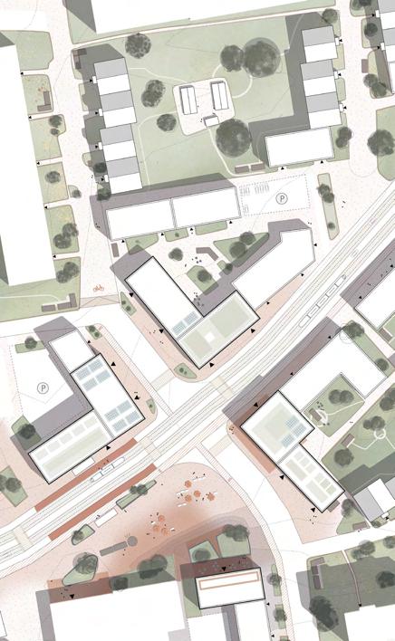
Ralph Frühwirth, Austria
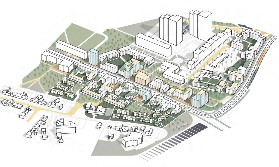
AXONOMETRIC VIEW
“Before intervening in existing Structures, we need to become circular!”
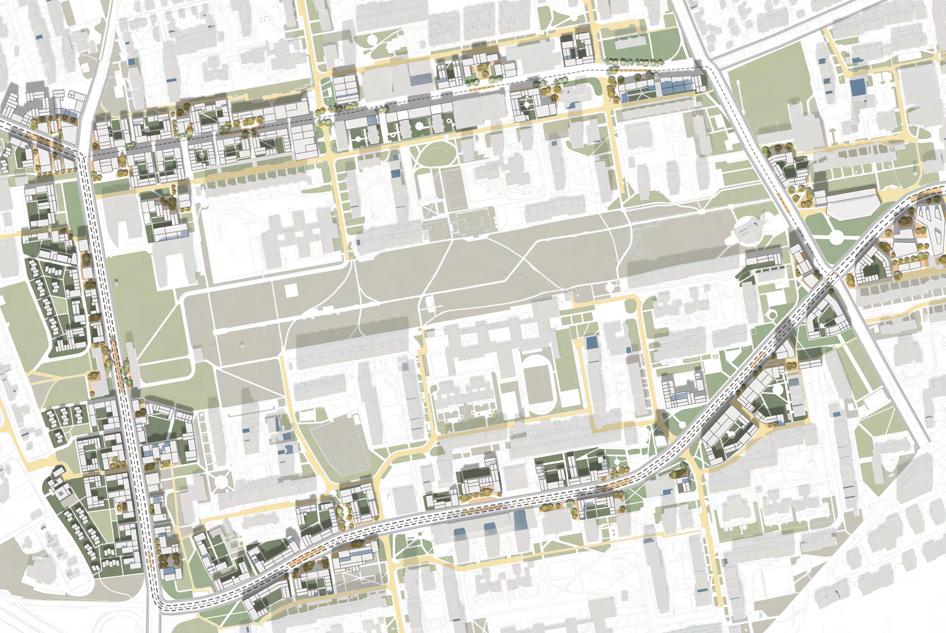
First and foremost the structure and the overall movement pattern of Prague 11 is what needs to be rethought. Due to the existing structure of the district a circular model is recommended.
Hereby two ring roads should hold the main commuting movement inside the district whereas diagonal connections linking them should also connect ’Jižní Město’ on a wider range with its surroundings. For this purpose, a BRTsystem is well suited. Additionally the new tramline connects the district on ‚Türkova‘, ‚Chilská‘ and ‚Opatovská‘ street.
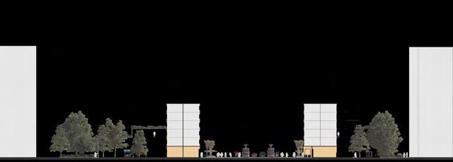
The reorganization of the main car movement allows ‚Hviezdoslavova’ street to be a commercial oriented woonerf. The redesign of the streetscape is accompanied by the creation of new green connections and the adaptation of infiltration systems.
Simultaneously to this preparation, circular retrofit on the vast empty plots next to the ring roads can take place. Hereby new development is framing the streetscape, gives orientation and creates a new network of nodes, thus making local commuting viable. It adapts to the already existing buildings and forms clear private and public relationships as well as appropriation opportunities of spaces.
The quality of public transportation, green and public space network and overall living conditions can establish a corresponding density. Although the main activity will take place on the ring roads, quieter walkways and neighborhood links will be created in the second layer of the new circular retrofit. Thus the first milestone of a sustainable development will be set.


PRINCIPLES


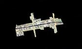


Salóme Rósa Þorkelsdóttir, Iceland
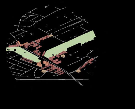
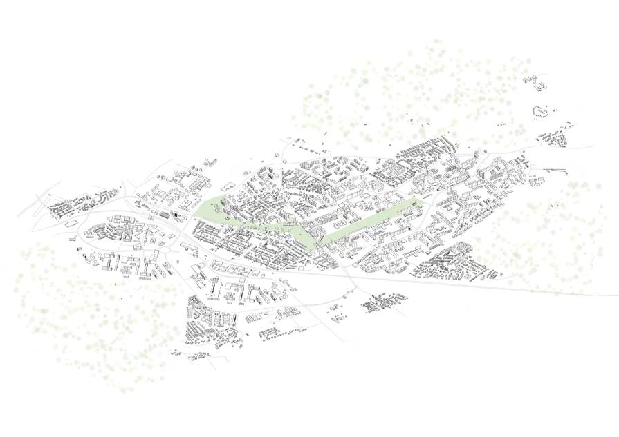
Bird´s-eye view and zoom in of site
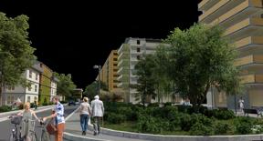
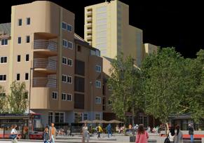
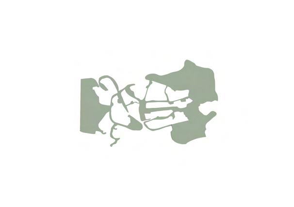
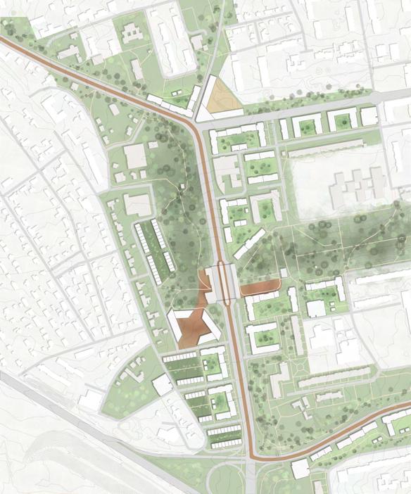
“Let’s Bridge the Gap and make Prague 11 even better than it already is!”
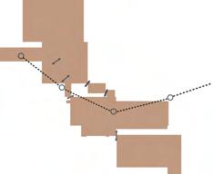
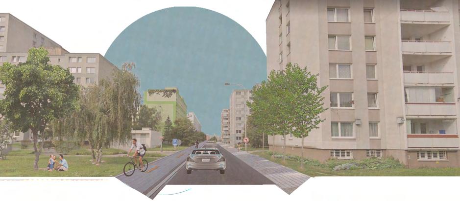
Let’s Bridge the Gap. This can be done by strengthening connections within the district and creating spaces for residents to connect with each other, as well as creating better connections to the surrounding nature. Let’s give pedestrians priority in their environment and make sustainable modes of transportation easy, safe, and enjoyable.
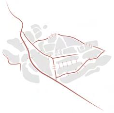
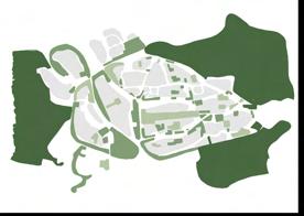
As a large-scale strategy, I’ll implement a green network throughout the district and towards the surrounding nature. These will include removing street parking and using the freed-up space for sidewalks and bicycle lanes, as well as street greenery. Street parking will be replaced with parking garages. The network will lead you through multiple green areas in the district, with differing functions, for example, urban farming, outdoor gyms, playgrounds, and parks. These new areas will be built on current undefined in-between spaces found throughout the district.
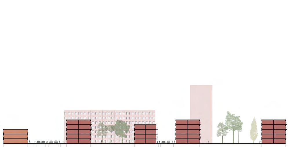
The first gap I’ll bridge will be the area surrounding the Opatov metro station. It’s located between the single-family homes and the panelak residential area, with plenty of open undefined land. This land can be used to extend the Central Park to both sides of the metro station, which as of now is barely noticeable when exiting the station despite its close vicinity. Two new neighbourhood squares will be added on either side of the station, adding frame to the park as well as space for new commercial areas.
With the addition of the new tramline, there is an opportunity of densifying around the station. These will be mixed used buildings with active ground floors, which will better frame the new park and add more functions to draw people in. The extension of the Central Park and the addition of new functions will make up for the loss of open space.
Let’s Bridge the Gap and make Prague 11 even better than it already is!



Chris Nurse, Canada
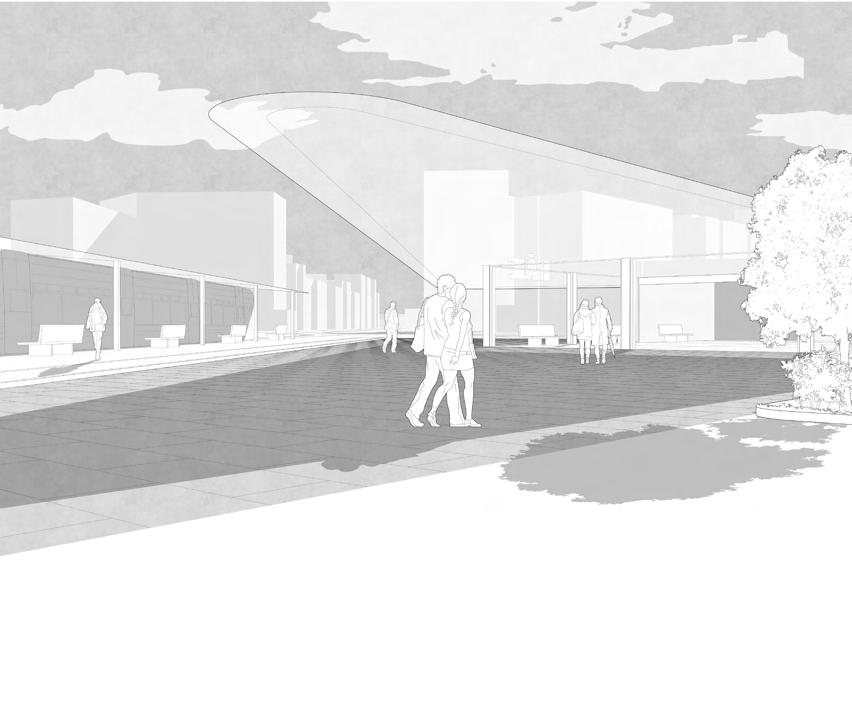
“Revitalizing Opatovská Corridor through sustainable transit-oriented development”
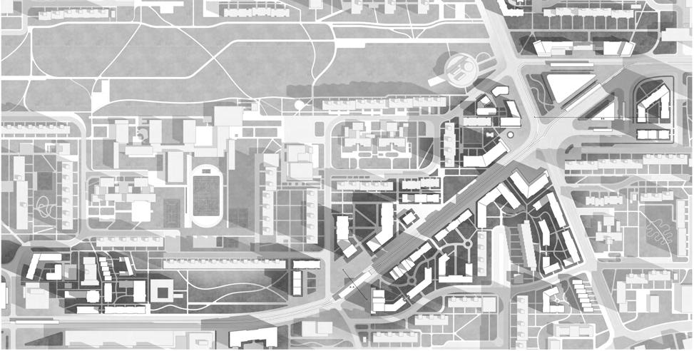
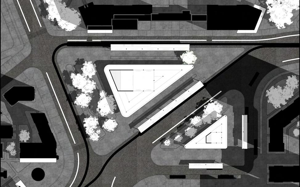
Tramformation is a revitalization of Opatovská corridor into a transit oriented urban area. Through an analysis of key concerns and opportunities identified in Prague 11, this project seeks to find the answer by focusing on what’s already set within the site conditions—including the discussion of proposed tram line, an abundance of open space, and a vibrant community that can be furthered densified. In this way, the design would be able to modify the existing site rather than impose new design principles that may not mesh well within its urban fabric. The proposed tram line becomes a critical factor of this design as a tangible opportunity for development in the surrounding Opatov neighbourhood, yet presents itself with the challenge to rectify the existing cardominant area. By designing around this route, Opatovská corridor would be regenerated into a livable, pedestrianoriented space, and a framework for sustainable transit-oriented
development would be implemented within the district.
The strategy is broken down into four stages: Phase 0: The restructuring of the street network, Phase 1: The development of the tram line, Phase 2: The development around the tram line, and Phase 3: The development in between the tram line.Within each stage, design interventions from small-large scale are implemented to transform Opatovská corridor and Prague 11’s transit network towards Háje and beyond. These design principles will provide a framework for future development in the area, as small and larger interventions can pave the way toward a sustainable city within Prague.

Elise Estunger, Sweden

“Create a bike-friendly and lively area where people feel safe to bike.”

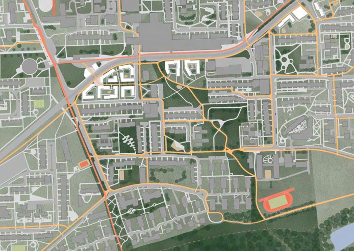
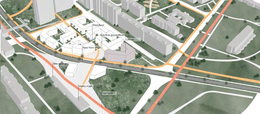
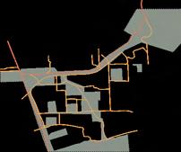
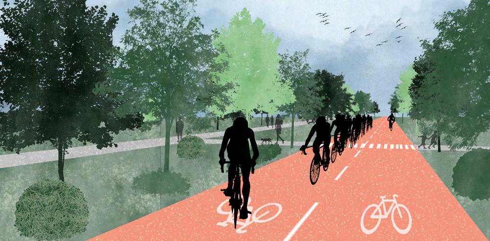
This project aims to improve the bike network and enhance the greenery and its connections to make it easier to get around Prague 11 sustainably. This is by connecting and improving the bike network and implementing bike sharing around the area. Along the bike paths, there will be different bike services such as pumps, parking, and storage.
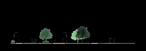
Connecting the bike network to public functions to encourage people to choose the bike to work or school, etc. Implement a fast lane for bicycles for those who want to take the bike to the city center or get to other districts more easily. Also, plan for mountain bike trails in the bigger green areas. Give the green areas new functions such as playgrounds, outdoor gyms, light art, and better seating areas to improve the usage of the space.

The suggested new development will generate new housing, stores, and jobs. The new development aims to have the bike as its primary means of transport and take the tram, bus, metro, and walking. A part of the Opatovska is planned to be car-free to give more room for pedestrians, bikes, and the new tram.





Javier Ignacio Navarro Puig, Argentina
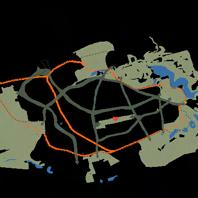
RECREATIONAL TRAIL
ACTIVE SCHOOL PLAYGROUNDS
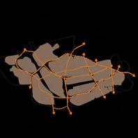
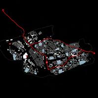
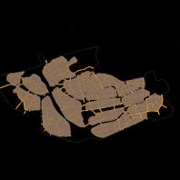
AXONOMETRIC VIEW: CONNECTION FROM NATURE TO HÁJE

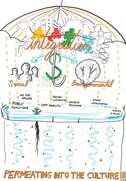
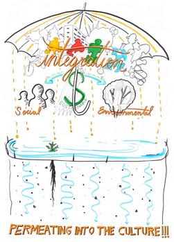
“A livable and engaging district that integrates Social and Environmental Sustainability!”
Located Southeast of Praha, the 11th district is the final stop of the Metro C line and serves as the entrance door that connects Central Bohemia with Czechia’s capital. Characterized primarily by the might of the Soviet era, brutal concrete blocks seem to be dropped as bombs from the sky in this otherwise green land well connected to forests.
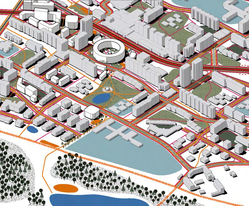
Praha 11 Play focuses on developing the sense of belonging and human interactions among all age groups while reducing Co2, improving water management and growing green connections.
In order to achieve these goals, five key strategies are established: Soft Mobility, Improved Public Transport, Better Public Spaces, New Public Functions, and Day & Night Use.
Praha 11 Play will be implemented In four phases, going from neighbourhood to district scale:
1. Laying down internal connections to move around each neighbourhood.
2. Implementing a recreational and strategical green relation to nature.
3. Joining these networks in an efficient district system.
4. Developing new public functions that nourish the existing population and result in attracting new residents.
Picture a lively and exciting district, where you can grab your bicycle and effortlessly go and enjoy the forest. Or take the tram to meet friends / family for coffee before going to the theatre. A place where education is blooming and inviting for all age groups. A place where children and adults feel safe, cycle and play!
John Edmonds, Ireland
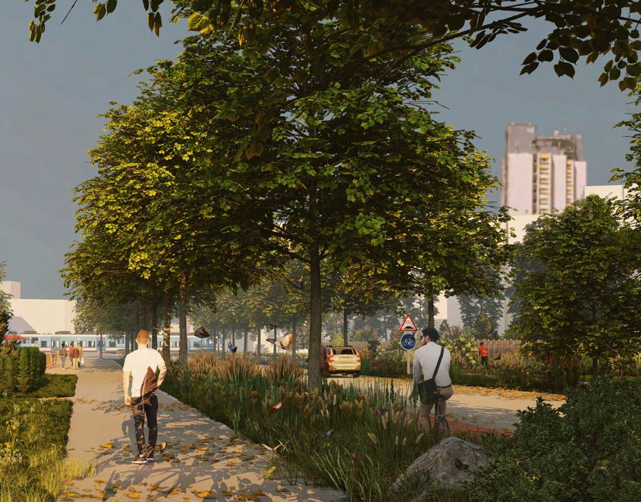
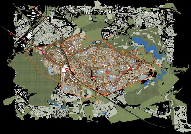
“Bringing life from inside the building to the outside”
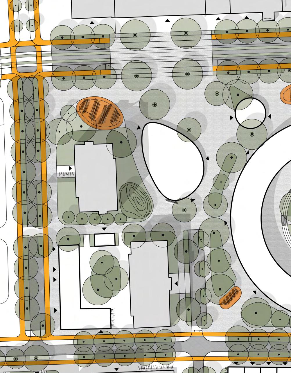
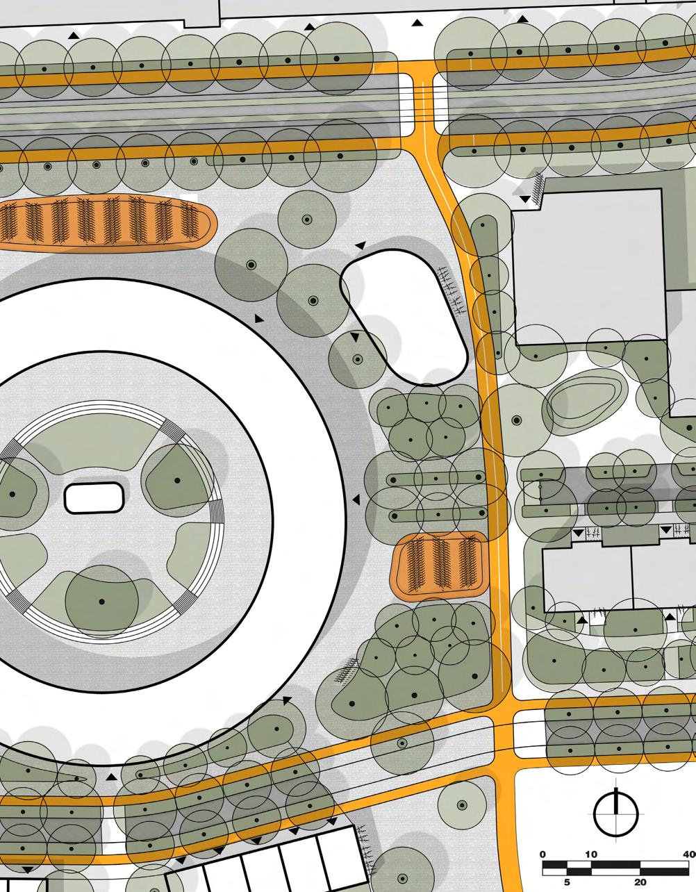
Designing the urban space with the focus of re-prioritizing the outdoor space for the users of Prague 11. The thought that was put into the outdoor and public spaces has not been taken into real consideration since the 1970s modernistic wave of the area. This has affected the issue of wayfinding, inadequate outdoor space, and poor green and blue infrastructure.
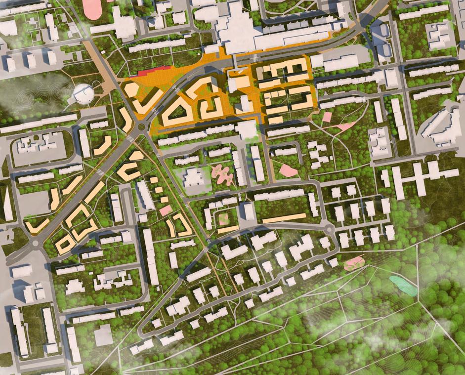
This project aims to create a new urban centre for Prague 11 using what is already existing. Taking the Háje metro station and rebranding the space into the new transport hub of Prague 11 by centralizing the bus stop and the newly proposed tram spot towards the Háje metro station.
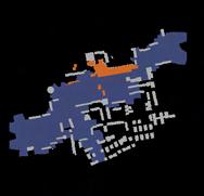
By creating this new transport hub identity of Prague 11, then we are going to densify the area. Densifying to add more functions to the area such as offices, shops, and gyms, while at the same time focusing on the tall buildings which exists around the site as the new beacon of Prague 11. This will help with wayfinding both physically and perceptually.
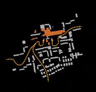
Now that the central space exists, we can push toward the last step, which is to connect the existing public spaces along with the newly proposed ones. We can do this by mapping out these spaces and connecting them by introducing street hierarchy toward the direction of these spaces. Connecting from the Háje station to the southern forest.
Let’s bring people outside!
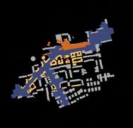
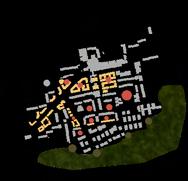
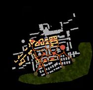


Martyna Idasiak, Poland
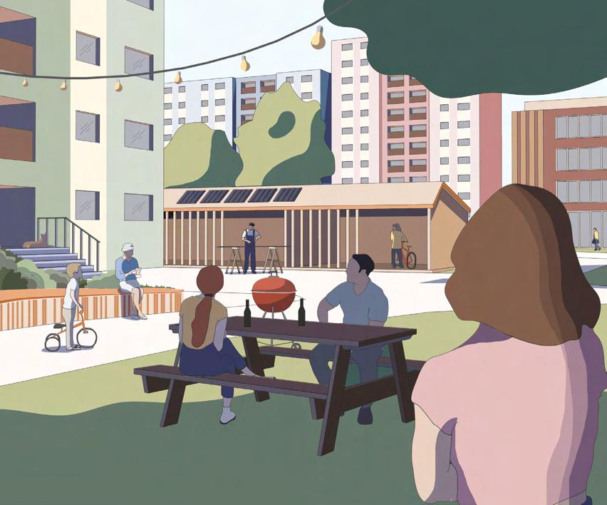
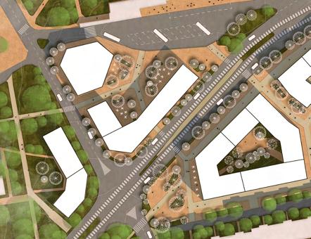
“Finding a common ground as the first milestone for a more flexible, sustainable and caring city”
Praha 11 represents many design challenges, which nevertheless can be transformed into opportunities for the more sustainable future.
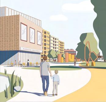
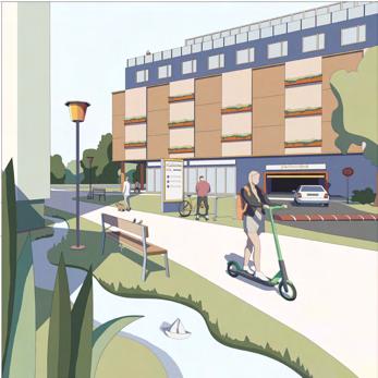
The network of “transition corridors” that consists of roads, pathways, and the outsized open space currently works as a grid of separators between homogenous zones. These vertical barriers can be flipped and opened towards the aforementioned zones, hence creating a horizontal connections in-between them that would work as a common ground for inhabitants of Praha 11.
These redesigned spaces pose an opportunity for more accessible and interconnected neighbourhood as well as provide room for design solutions that would be a tool to create sense of belonging, a hierarchy of spaces and supply the district with elements enabling more flexibility towards the future.
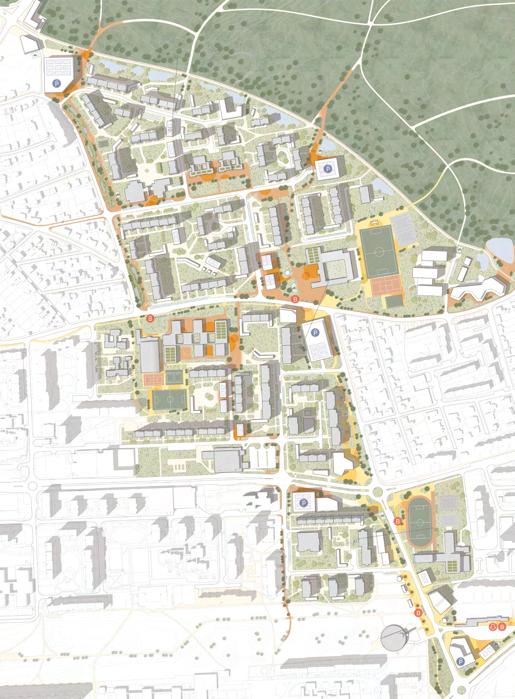
To achieve that, it would be a matter of using the existing hierarchy of roads network and breaking it up into three scales of common grounds – connecting on the district level, the neighbourhood level and the panelák level and making them meet at the so called knots that are programmed accordingly to the needs of the communities on each of the level.
Every scale of the common ground is designed to hold distinct features (which constitute threads) that enables intuitive wayfinding and introduce new functions that provide framework for more sustainable lifestyles.
Having the common grounds implemented within the district of Praha 11 would make a strong base towards possible future development of the area. Interconnected and accessible neighbourhoods are more flexible and adaptable and serve as a base for stronger community – a cornerstone of a healthy, sustainable and caring city.


Ulrica Flemström, Sweden
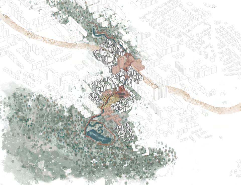
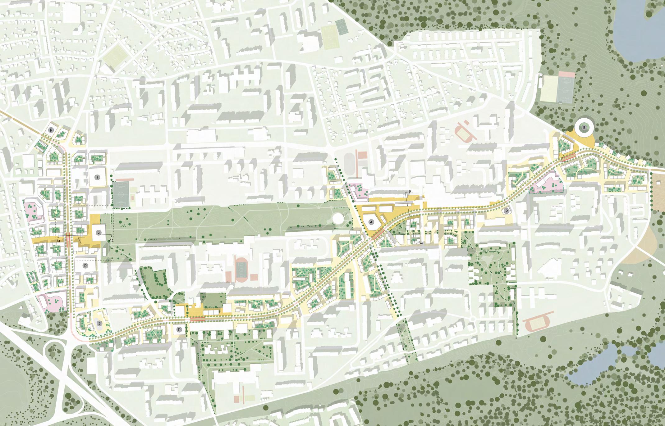
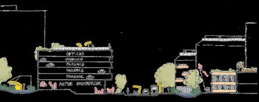
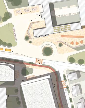
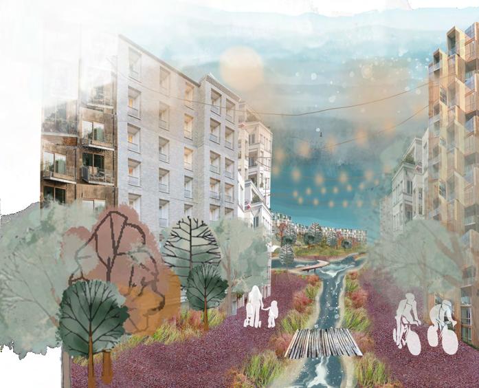
“The spine simplifies wayfinding from public transport nodes to nature by connecting scattered greenery and guiding stormwater down to the lake within the forest, which strengthens Háje’s identity!”


Háje lies on the outskirts of Prague, Czech Republic. Nature’s qualities, such as forests and lakes, embrace the site. As a new pedestrian in Háje, one of the site’s key challenges is the deficient pedestrian- and bicycle grid since it does not have a clear hierarchy that guides visitors to find their way to nature. Another challenge is that existing public spaces are not identifiable, especially those close to the metro station and future tramline. In addition, existing greenery gives an impression of being non-cohesive. Altogether, this aggravates wayfinding.

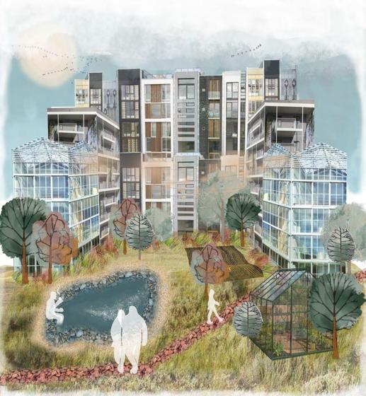
In addition, this main path will create new public spaces close to amenities along the way. It will efficiently connect Centrální park with nature in the east. At the same time, it will intertwine scattered greenery, such as an urban forest and a schoolyard, to create coherent green rooms and give clear directions.

My design proposal aims to simplify for pedestrians to find their way from the public transport facility nodes to the surrounding nature. This can be achieved by introducing a recreational corridor that will follow existing flows in the site and tie several amenities, such as schools and commercial establishments, together to populate the path.
The site’s sloping landscape has a high ridge in the east that offers a beautiful view over Háje. Potentially, it can turn into a lookout tower, contribute to more people visiting the site and strengthen Háje’s identity. Additionally, the downhill topography is an advantage due to handling heavy rains, and the path will be followed with bioswales so that the stormwater ends up in nearby lakes.


The Urban Plan in 1:2000.


Sustainable Urban Dynamics 2022


Ax:son Johnson Institute for Sustainable Urban Design Lund University
Sustainable Urban Design Master’s Program
School of Architecture
Lunds Tekniska Högskola
P.O. Box 124, 221 00
Lund, Sweden
+46 46 222 00 00 www.stadsbyggnad.lth.se
Lund University
P.O. Box 117, 221 00
Lund, Sweden
+46 46 222 00 00 www.lunduniversity.lu.se
Prague Institute of Planning and Development (IPR) http://en.iprpraha.cz/
Published January 2023