5 minute read
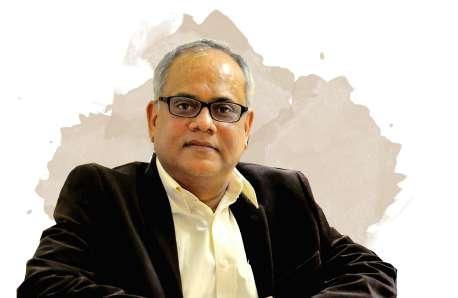
9. INTERVIEW OF ZORICA NEDOVIC-BUDIC

from F.Y.I MAGAZINE

INTERVIEW OF ZORICA NEDOVIC - BUDIC
Interviewed by: Chinmay Kamat and Kashish Singh
Advertisement
What is GIS?

GIS, geographical information system, is a technology that consists of a software that has been developed 30-40 years ago but has advanced to become much more user-friendly. It is a database for special information. It connects the data to graphical data such as each element on map including properties with roads and with hydrology. Everything on the map has a special element on the database. It is a special database which is used to store information about planning spaces, architectural plan, architectural information, value of plan, value of the building and use of building functions. Data can be selected in a targeted way and manipulated. The main point is to analyse the data and to understand what is going on in the space and imagine scenarios.
Are there any limitations on the micro scale data?
Yes, there exist databases which are under the bureaus of individual countries or with particular agencies. If they do not have it, the data has to be manually input with the help of existing potential maps and information obtained by scanning with a gps device. Can GIS help in future planning and development? How were future sites of Chicago planned?
The data, there to support databases, can be used in various aspects to understand and justify the plan. The first part of the plan is to understand what is going on in the area. Since it is in the city it becomes a bit crucial, because the economy, roads, etc. have to be considered. That is how GIS helps in understanding. The second part is developing scenarios for development. This software helps in developing the functionality of the scenarios. There are all kinds of software that are existing but this helps in developing scenarios pertaining to what will happen if the line of the road is changed, what impact would it have on the area or what impact would it have if the height of the building is altered. This is helps in visualising the consequences of certain actions. The next step is what one wishes to do but it should be in tandem with the public decisions. That is how it coordinates with the reality before the project.
How can this software be effectively used in places such as Mumbai which are densely populated and have various issues related to infrastructure?
The software would help where the density is less and in areas which hold the capacity to build a certain project. There is a relationship between density and infrastructure. The software would help in understanding the key plans of the infrastructure. For example, in a 3-dimensional project way it can be understood where the potential pathways in the landscape could be and where in the landscape important parts of infrastructure could be made. Layers can be built in the system to understand how certain areas can be interactive. This data can be used in Mumbai. This kind of software and data are available online. GIS can be used to bring any area to potential use. Technology would help in identifying the missing link and visualising things. The implementation of a plan depends on the climate, the people and all the other things. Just knowing what to do won’t define it politically and nationally. Technology cannot always be relied on. It is useful but it cannot take into account everything. All the planning and designing depends on the design, the software and its functions.
Can you tell us something about the project TUFP7 that you were working on?
I was in the university college at that time. This project was part of the site visits with the funding. FP7 is frame-work project 7. I was the principal investigator of the team. We had about 9 million euros to work with, with municipalities across Europe. Other universities also spoke and enterprises discussed the various ways and aspects to increase the urban system ability. Each place had a slightly different project and as the years went by, we were trying propose prospective solutions for sustainability across Europe. We had landscape architecture, the rules, the governor and community development. We had to look for economic cycle as well we had to travel for the economic cycle of all the materials that were being used in the development process. There were like 7 to 8 different aspects and they finally helped the project, the urban environment and one of them was special data. The technology is needed for all different aspects. It was a huge 5 years long project.
How important is it for us to start grasping the knowledge of the importance of assets and analytics about data?

We all inherit the world as it is, and we can only improve it if we do the best in our profession. In architecture and any profession that includes planning, developing, designing cities and spaces it is an important. If we do our part in the society well, we can contribute a lot. It is always good to focus and make sure we do well, when it comes to our part and fight, sometimes it’s necessary to promote your ideas and to stand behind them. I usually say to my students regarding the projects in the studio “Don’t be unrealistic because, we can dream up things that are out of the world, utopian and without any real sense.” But at the same time, you have to be bold, whether it’s Mumbai or Chicago, you have to push your ideas, push for better quality of life, aesthetic, better equipped environment, and services that need to be supplied. Sometimes planners are asked to solve the world! And it’s not easy, so I think we just have to do our part. -PHOTO