I would like to acknowledge that this project is situated on Gadigal Land. I pay respects to elders of this land past, present and emerging. I also acknowledge the many Aboriginal and Torres Strait Islander People from many Indigenous Nations and pay respect to their strong living culture and their elders past, present and emerging.
I would like to acknowledge that you cannot engage with the landscape without without engaging with aboriginal culture, people and country and you cannot engage with politics within the landscape without acknowledging our violent colonial history that has taken place on this land and the impact that ongoing systemic racism has on the lives of Aboriginal people.
Gadigal Land has long been a creative and education hub for Aboriginal people and this project intends to support the inclusion and representation of Aboriginal people on their own land.
The sovereignty of this land was never ceded and it always was, always will be, Aboriginal land.
INTRODUCTION
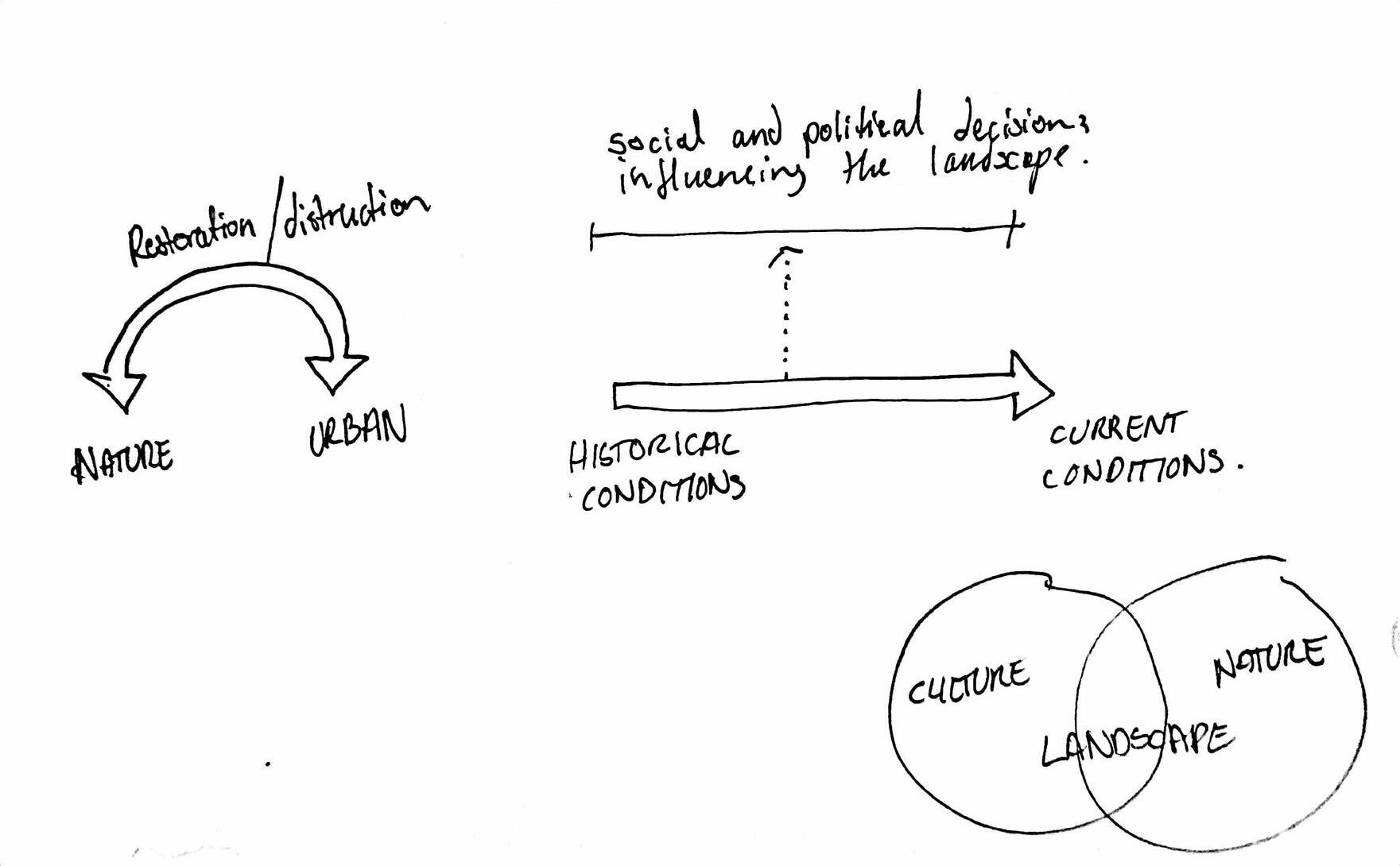
The theory of urban political ecology recognises that urban forms are created through patterns of relationships between social, economic and environmental processes. If this is the case, could a landscape lead precinct that prioritises ecological and cultural infrastructure create a more diverse and inclusive landscape so that the city remains a socially, economically, politically and ecologically viable space for all?
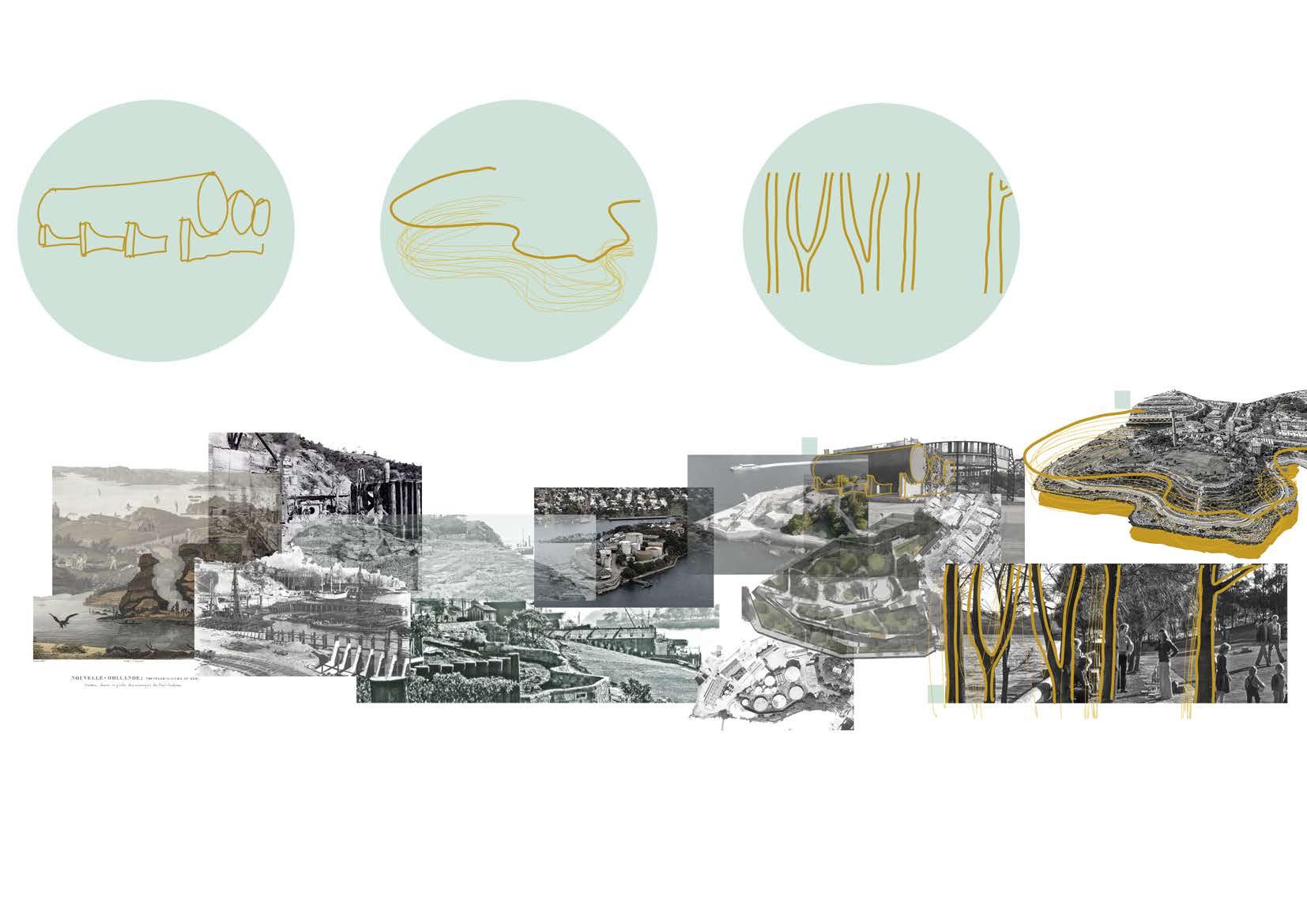
Highly valued harbour landscapes such as Barangarroo and Pyrmont that have once been important locations for wharf work and working class culture in Sydney and are excellent case studies when predicting the business as usual approach to the renewal of White Bay. These places have seen a monumental physical transition since Aboriginal land management pre-1770 to the industrial revolution in the 19th century and until today. From the beginning of European occupation of the land, the waterfront landscape of Sydney harbour and its ecology has been intensely exploited and polluted by industrial activities. The land from has been cut into or filled and reclaimed, vegetation has been cleared, creeks concreted and soil and seas pollutes by heavy metals and chemicals. The European approach to land management is far from the traditional owners strong commitment to their role as custodians of the land and belief that if you take care of the land , it will take care of you. Understanding and owning what has happened to these places and giving people the agency to be involved in what happens to their own landscape is an important process in the healing of these landscapes.
However, the waterfront of Sydney Harbour today keenly expresses Australia’s neoliberal political climate, with increasing imbalances of urban power over landscape power. The widely undesirable, noisy, dirty and polluted industrial landscapes of Sydney Harbour that were once central to the economic function of the city can barley be seen today and they are almost forgotten. These landscapes have been gentrified to become places you can visit, look at or purchase rather than live in, explore, create and activate. Landscape can be a driving factor for political and economic change as well as a limiting factor to change. By looking beyond sustainability and towards regenerative landscapes and providing people with the opportunity to be involved in the life of the city can promote transitional economies where there is a conversation between humans needs n and the ecology within the landscape.
The landscape at the bays still functions today as an industrial site. The Bays West Strategy recognises ports and working harbour operations as a living powerful economic force while there is a need to include people to enhance the area’s life and vitality. This strategy has been vital to the vision for the this project and aims to integrate “maritime and industrial stories to shape an innovative and sustainable new place for living, recreation and working.” (Draft Bays West Place Strategy 2021). There is an opportunity to create a diverse mixed use precinct that balances political, cultural, economic and ecological forces.
One of the great opportunities for the industrial site at White Bay is its “size, the way it is distinctively different from and embedded in the urban context” (Braae, Ellen 2015). Postindustrial sites often “cannot be re-inscribed in a production-bound situation again, but it is necessary to find new, positively associated uses for them. They are therefore obvious laboratories for projecting visions for the future based on a widely interpreted perspective of sustainability” (Braae, Ellen 2015). The role of post industrial sites projecting visions into the future is exceptionally relevant today with the 2021 United Nations Climate Change Conference cementing the urgent need for High emitters such as Australia to help climatevulnerable countries by taking quick and meaningful action against climate change. The post industrial landscape is first and foremost in need of healing and remediation while its urban context provides possibilities of redefining our production landscape to be sustainable and community orientated.
This project will investigate through design how a mixed use precinct can strategically enhance equity and diversity so that the needs of both human and non human stakeholders are met and the harbour city remains a socially, economically, politically and ecologically viable space for all.
SOCIO-POLITICAL LANDSCAPE DESIGN
A STUDY OF THE POLITICAL IMPORTANCE OF DESIGNED LANDSCAPES
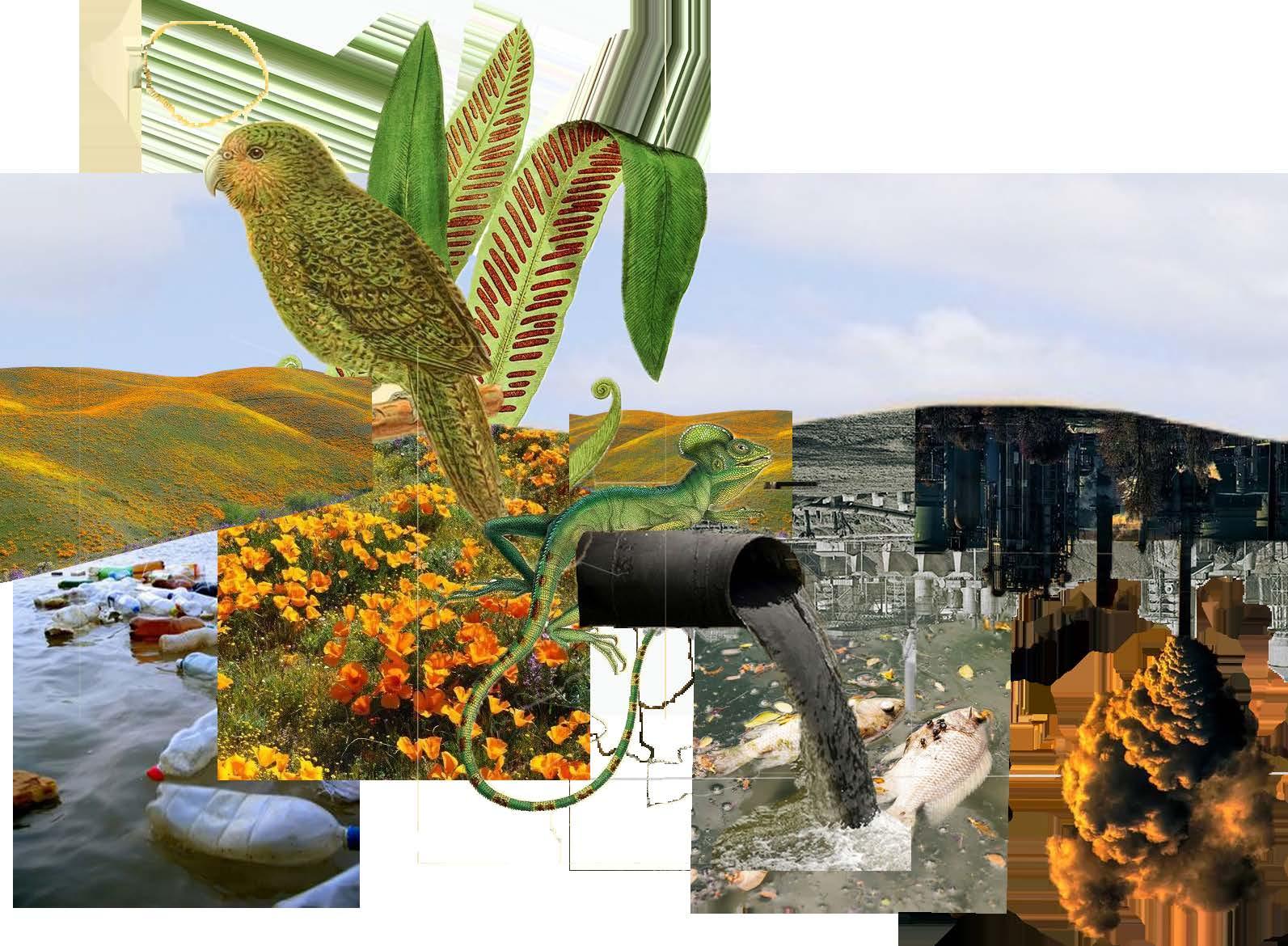
FRAMEWORK: We now find our selves well into the ecological epoch of the Anthropocentric, based on overwhelming evidence that the earths atmospheric, geologic, hydrologic, biospheric and other earth system processes are now altered by humans.(5) This is a unique point in history where our globalized economy has fabricated international challenges such as the very real threat of climate change. In response, the United nations has set 17 interlinked global sustainable development goals as a “blueprint to achieve a better and more sustainable future for all” (6). All of these goals are directly related to themes of social justice and deeply rooted in human activity.
Landscape is complex construct consisting of the inter-relationships of space, systems and people. Much research in the landscape field is coined around environmental performance with landscapes categorised into subsequent ‘isms’ which too often “neglect aesthetic, cultural, social and political dimensions of some contemporary landscape urbanism projects.” (6) The idea that humans are separate from nature too often, cuts our ties with the landscape and undermines the political and social conditions that have catalysed the current geological age that we find ourselves in.
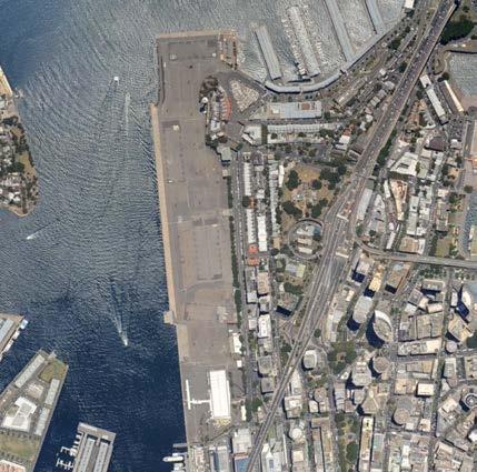
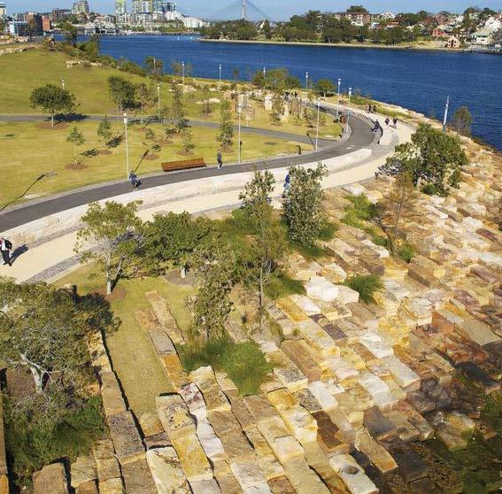
BARANGAROO HEADLAND PARK
A concrete container terminal “reborn” as a naturalistic rocky outcrop (1)
LOCATION: Sydney, Australia
AREA: 6HA (1)
DESIGNERS: Australian landscape architects Johnson Pilton Walker in association with US-based Peter Walker & Partners (2)
BUILT: 2015
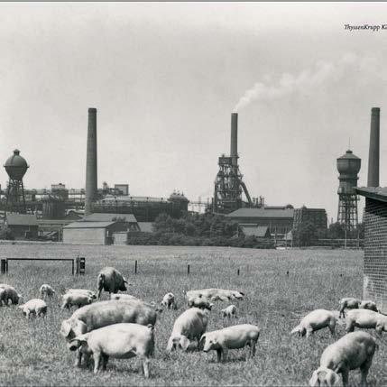
LANDSCHAFTSPARK
DUISBURG-NORD
A parkland in which industrial use was taken, developed and re – interpreted with a new syntax, existing fragments were interlaced into a new ”landscape”. (4)
LOCATION: Duisburg-Meiderich, Germany.
AREA: 180 HA (3)
DESIGNERS: Latz + Partners
BUILT: 2002
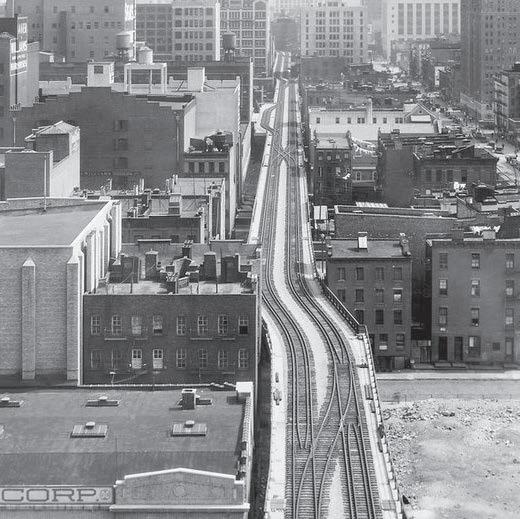
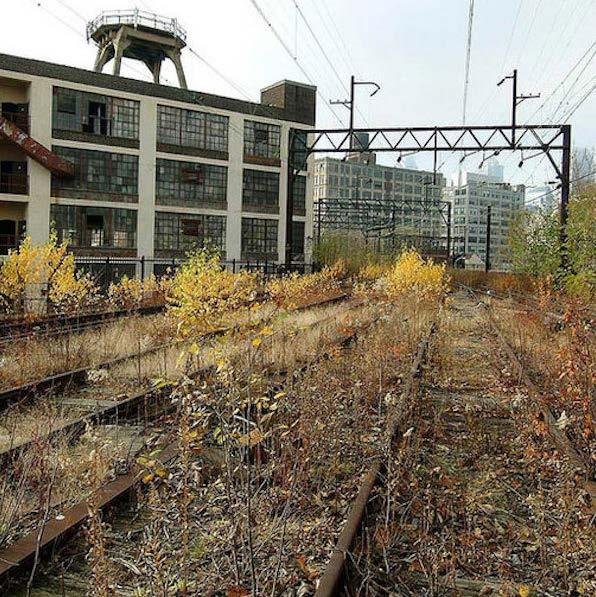
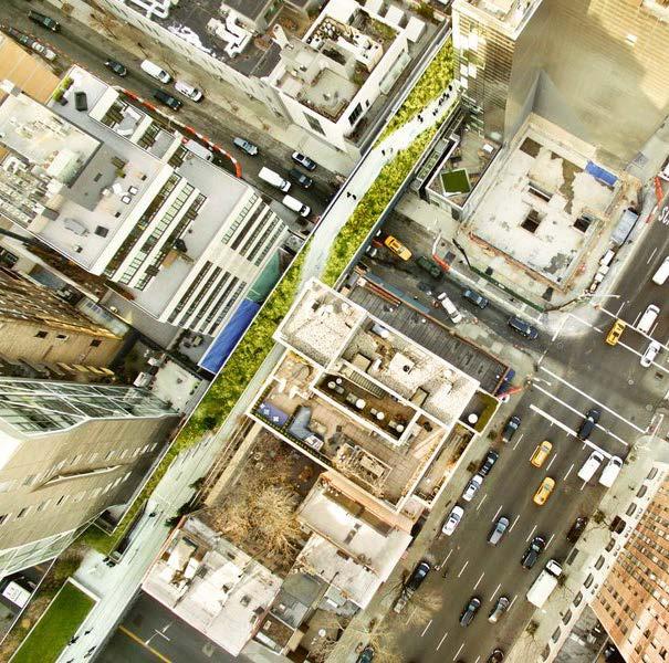
THE HIGH LINE
An elevated, linear park, greenway and rail trail created on a former New York Central Railroad.
LOCATION: New York, USA
AREA: 3.75 km²
DESIGNERS: collaboration between James Corner Field Operations (Project Lead), Diller Scofidio + Renfro, and Piet Oudolf. (4)
BUILT: 2011
Georgina Purkiss z5165112
1836 Headland (2)
SYDNEY: THE GREEN LIFESTYLE
demand for steel from the US and the German navy’s
1985: Duisburg, was abandoned by the steel industry and began decaying
Te design process for the new park began (image source: Nearmap)
The Hiline was operational, transporting millions of tons of meat, dairy, and produce (4)
greenway (4)
2004 POST INDUSTRIAL SCAR Last used as a Ship yard (image source: Nearmap) 2015 Naturalised Headland park (2)
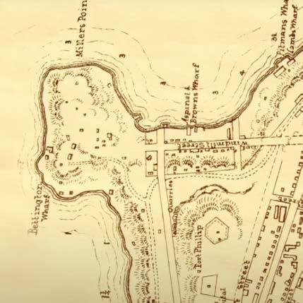
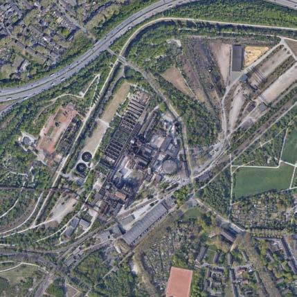
URBAN CONTEXT | A Place Within The Iconic Sydney Harbour
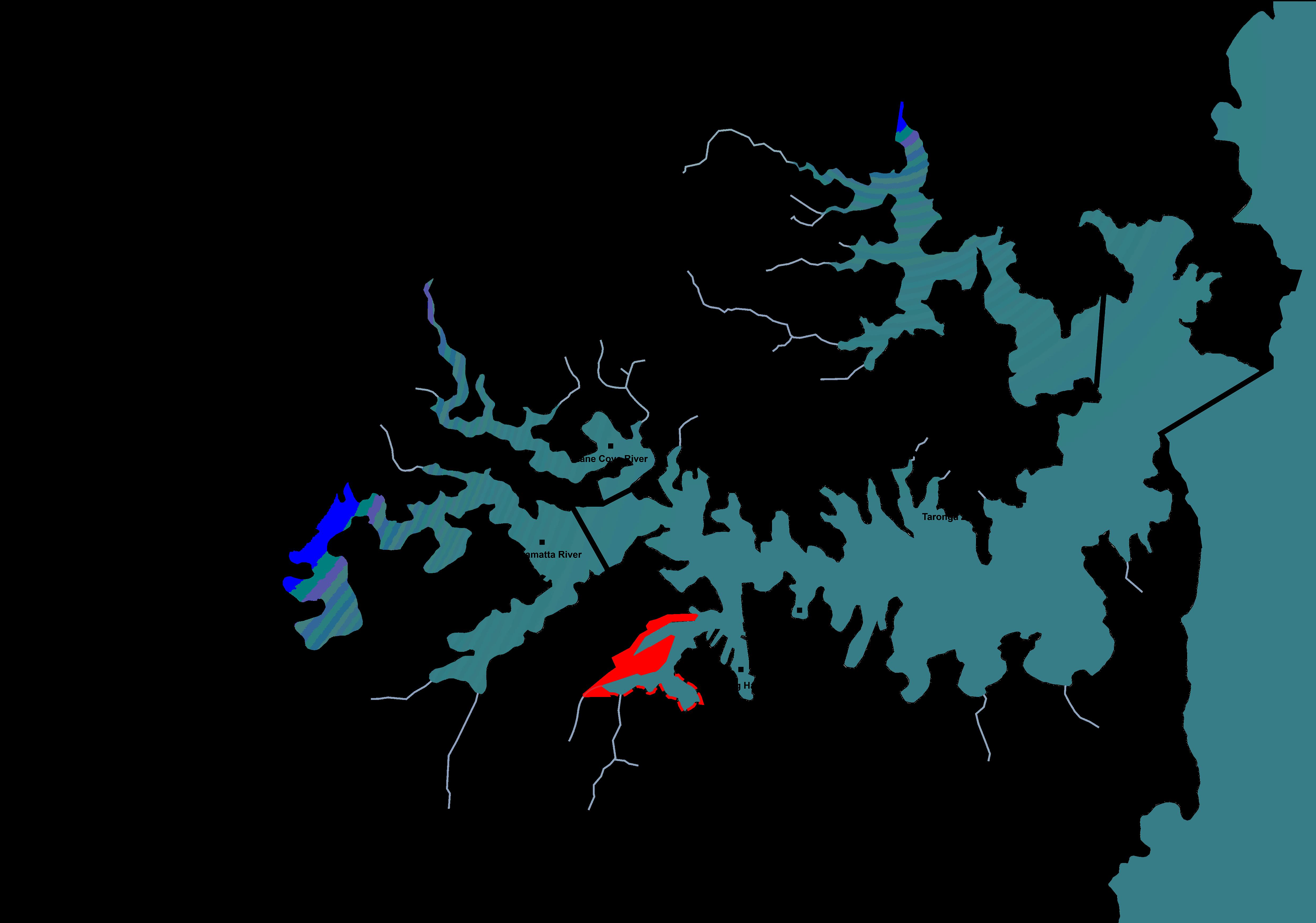
The ‘Bays Precinct’ lies within the Port Jackson sub-catchment of Sydney Harbour [1]. Today, the water of Rozelle and Blackwattle Bay is severely contaminated by heavy metals, such as copper, lead, and zinc [2]. These metals have adverse impacts to the functioning of aquatic environments, and even to humans if such metals are dissolved in groundwater and surface water [2].
PORT JACKSON
Port Jackson Catchment Boundary Tributaries
The ‘Bays Precinct’ Study Area
1:50,000 @ A3
[1] - Page 7 of the Document - Donaldson, P, Rissik, D, Vos, C, Downes, A & Gough, M 2018, Greater Sydney Harbour Estuary Coastal Management Program Scoping Study Final Report, NSW Government, Accessed 7 March 2021, <https://www. sydneycoastalcouncils.com.au/wp-content/uploads/2018/10/Greater-SydneyHarbour-Coastal-Management-Plan-Scoping-Study.pdf>.
[2] Montoya, D 2015, Pollution in Sydney Harbour: sewage, toxic chemicals and microplastics, NSW Parliamentary Research Service, Accessed 12 March 2021, <https://www.parliament.nsw.gov.au/researchpapers/Documents/pollution-insydney-harbour-sewage-toxic-chemica/Pollution%20in%20Sydney%20Harbour.pdf>.
*Analysis by Sara Curukovska as part of LAND2411 Group project: Study Area Analysis
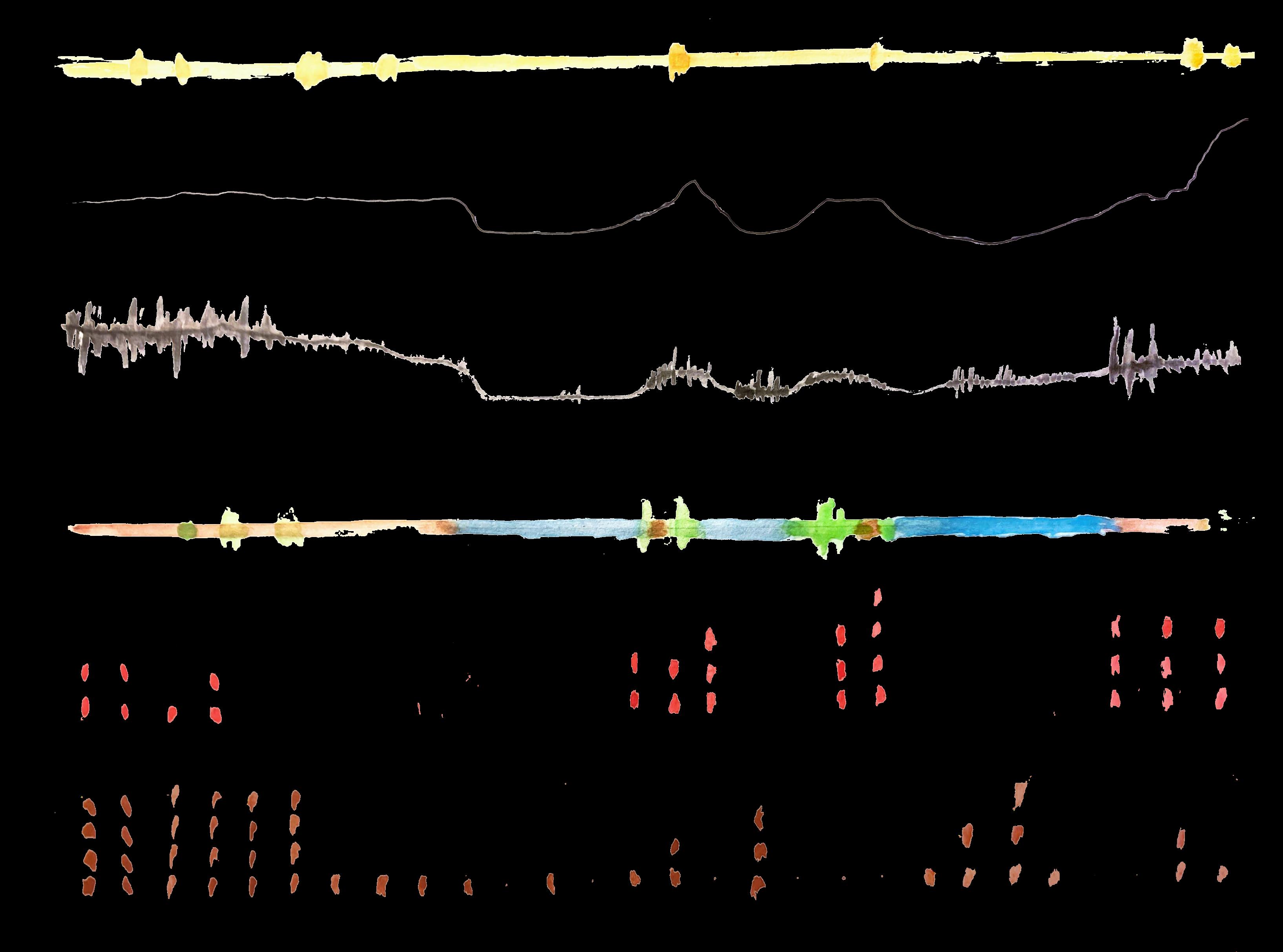
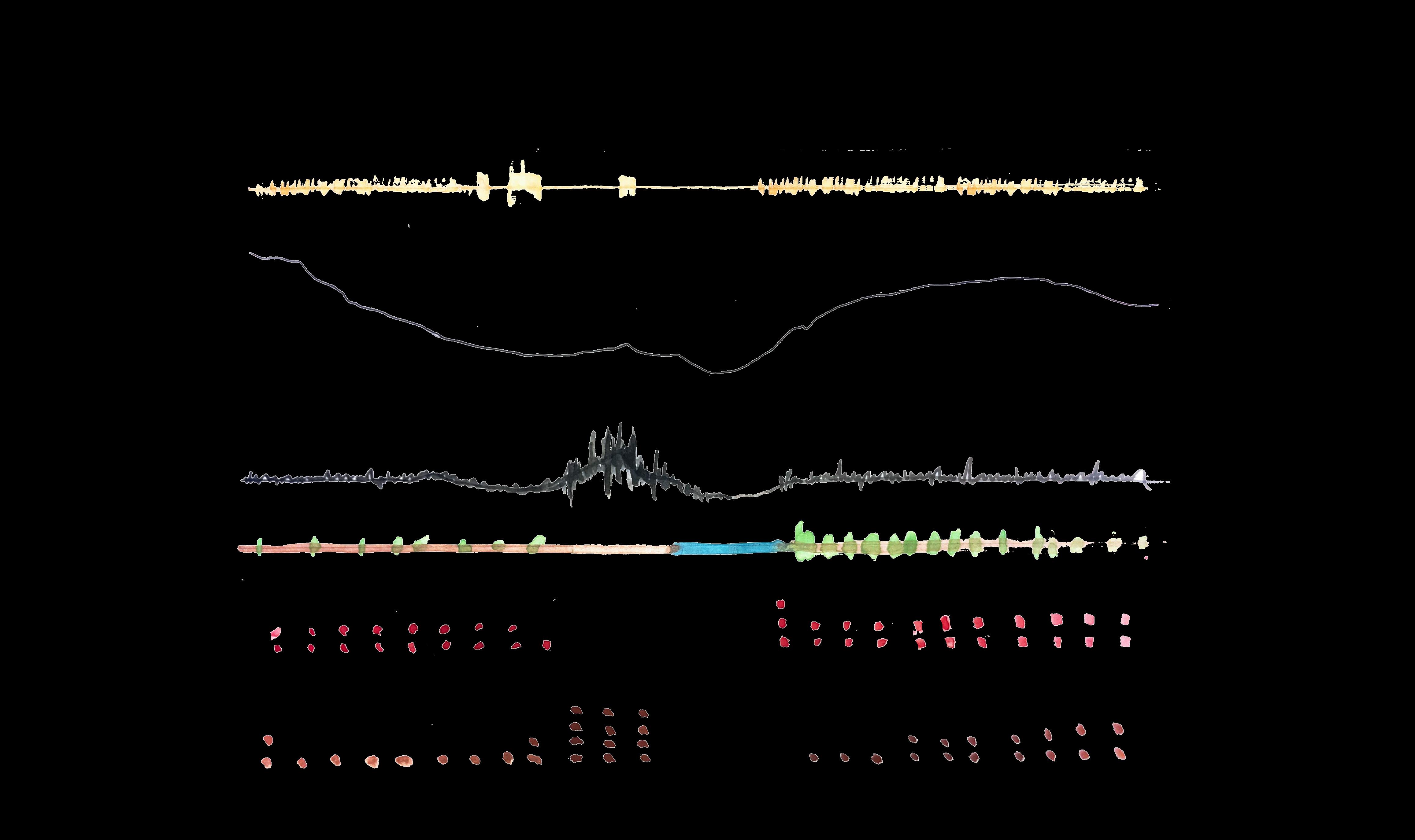
URBAN CONTEXT | Rozelle to Kirriblli Section
Topography (VE= 1/10) Built Form Rozelle Bay
Sound and Intensity
Vegetation and Canopy Cover
Pedestrian Volume
Vehicle Volume
Topography (VE= 1/10)
and Canopy Cover Sound and Intensity
Pedestrian Volume
Vegetation
Built Form
Darling St, Balmain
Rozelle Bay
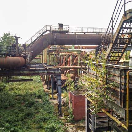
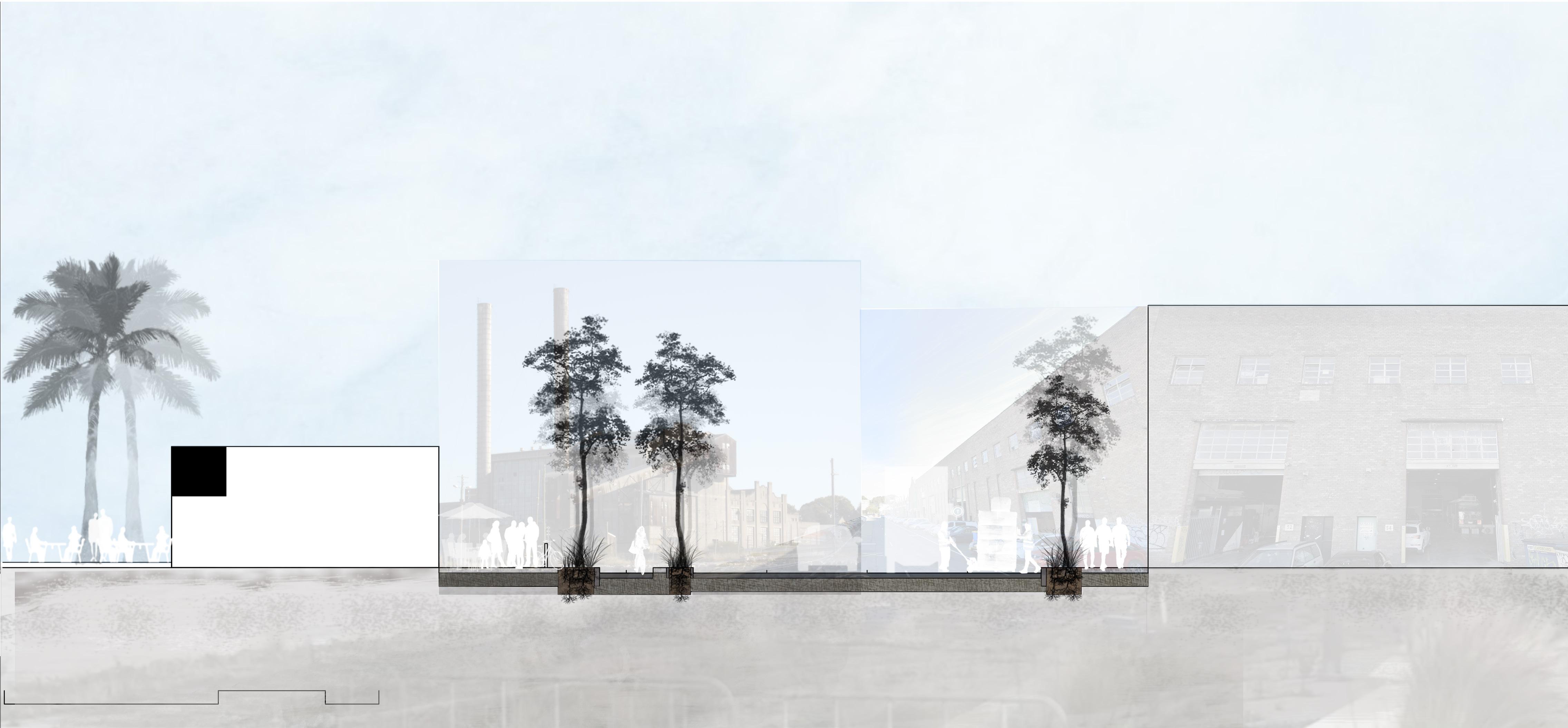
White Bay Power Station
Glebe Point Bridge Rd, Glebe
URBAN CONTEXT | TRANSIT
Transit gap: Most forms of transport found at the study area move straight past or around the site. This demonstrates the disconnect that the study area has with the larger urban system. This has been a barrier to landscape change in the past, preventing White Bay Power station to be transformed into a new google headquaters in 2015. However, the new metro line connecting Sydney’s west to the CBD is expected to open in 2024 and presents an opportunity for public transport to drive a revival of the area.
FUNDAMENTAL ASSETS | Reclaimed Land
BUILT LANDFORM
Data sourced from ‘Google Earth Pro 2021’.
HYBRID LANDFORM NATURAL LANDFORM
sourced from
from
Data
‘Google Earth Pro 2021’.
Data sourced
‘Google Earth Pro 2021’.
FUNDAMENTAL ASSETS | Heritage
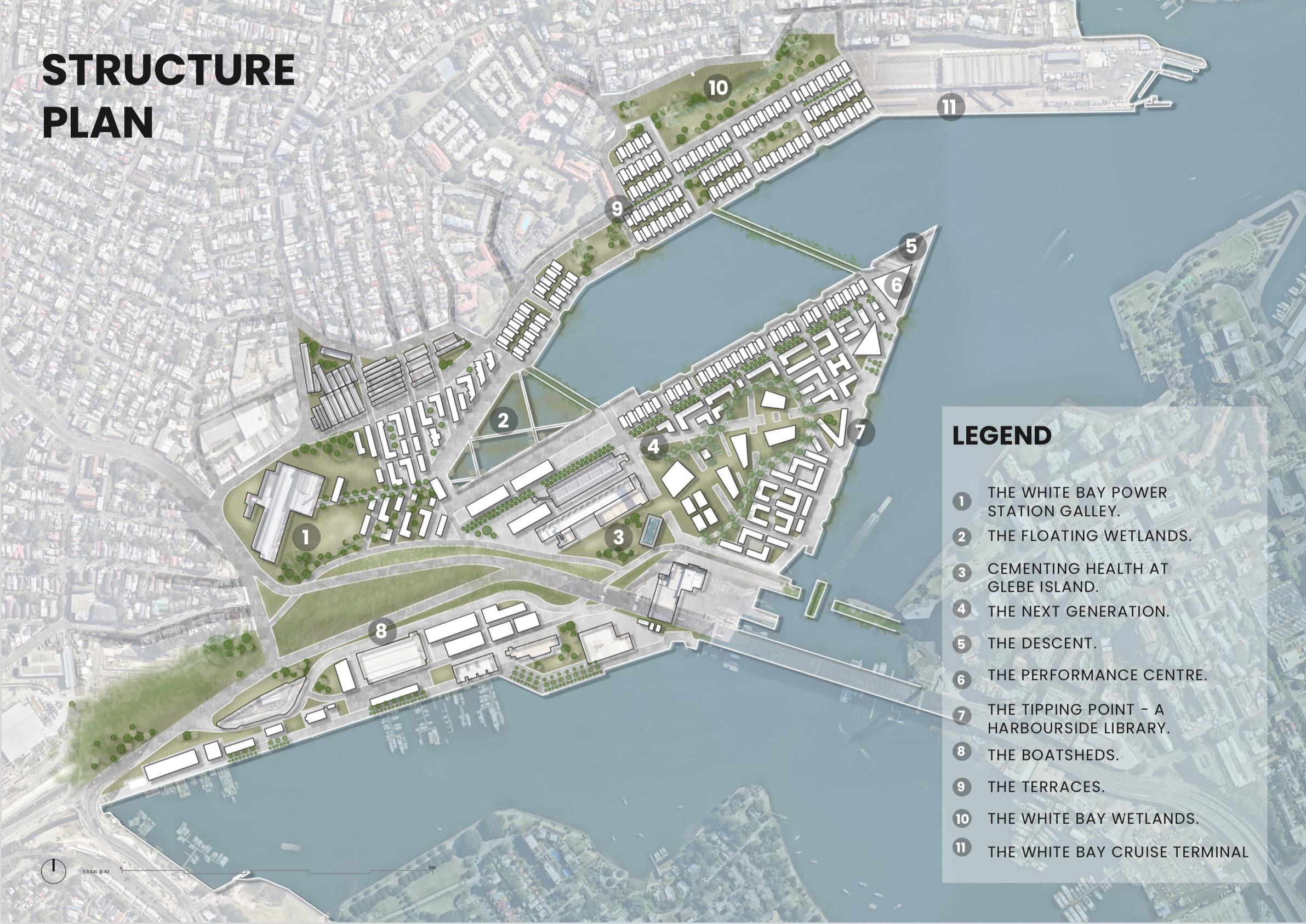
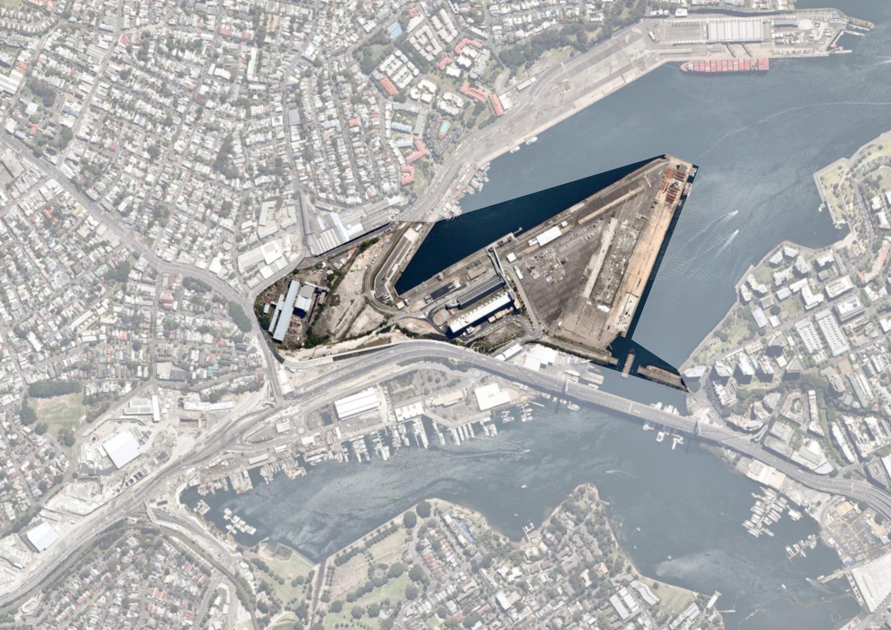
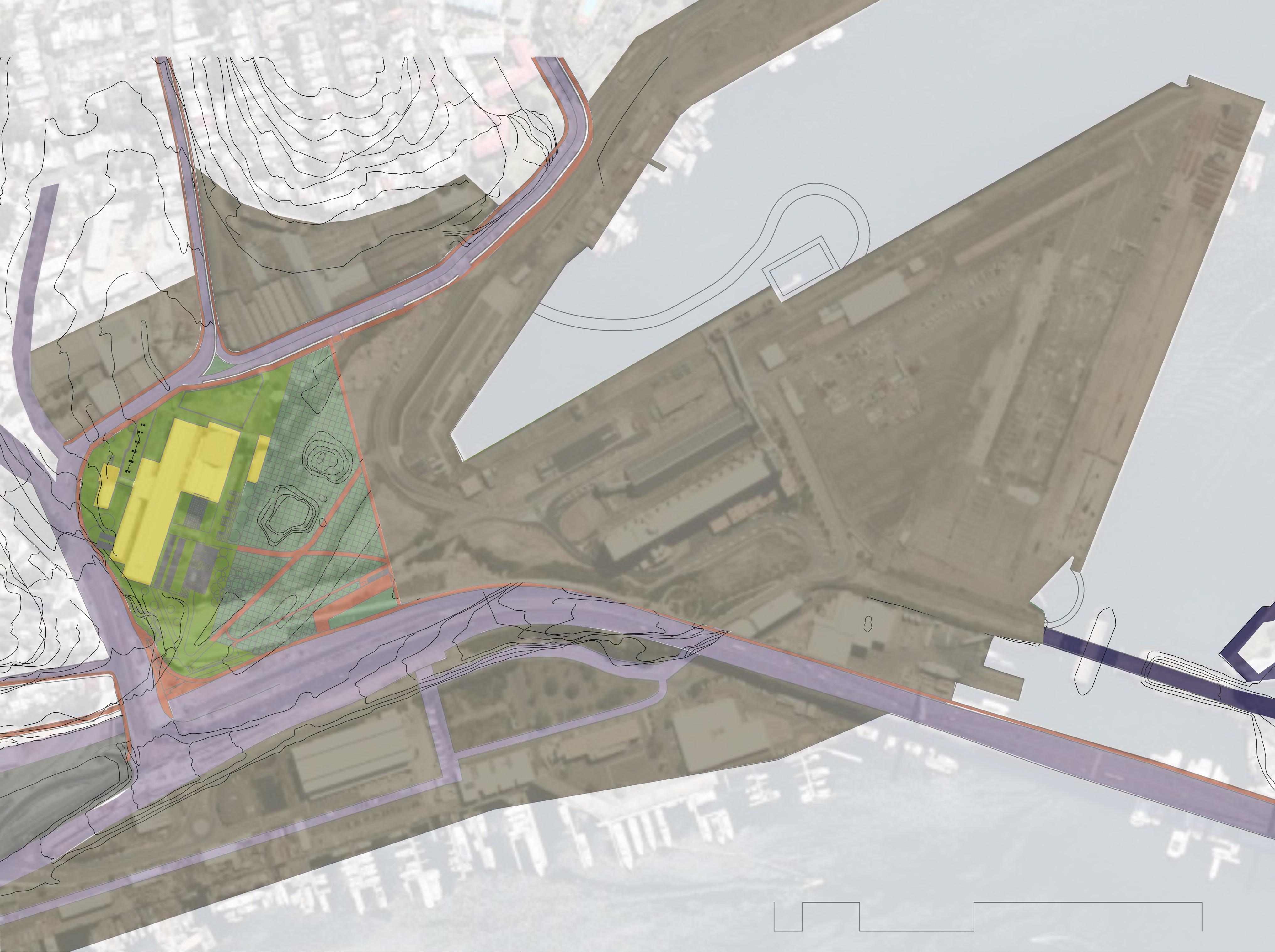
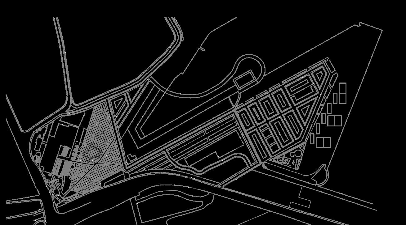
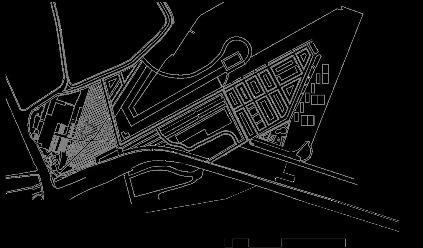
PROJECT SCOPE | Site Selection
White Bay Power Station:
A key landmark and heritage building that is a key to the history and essence of the landscape
The concrete silos as a key landmark with the opportunity for reuse
Opportunity to create diverse public space at the waterfront
New pedestrian connection from proposed Rozelle parklands to the site
The site for the proposed metro station connecting the site to CBD and Western Sydney
Opportunity for new pedestrian and cycle access from Pyrmont
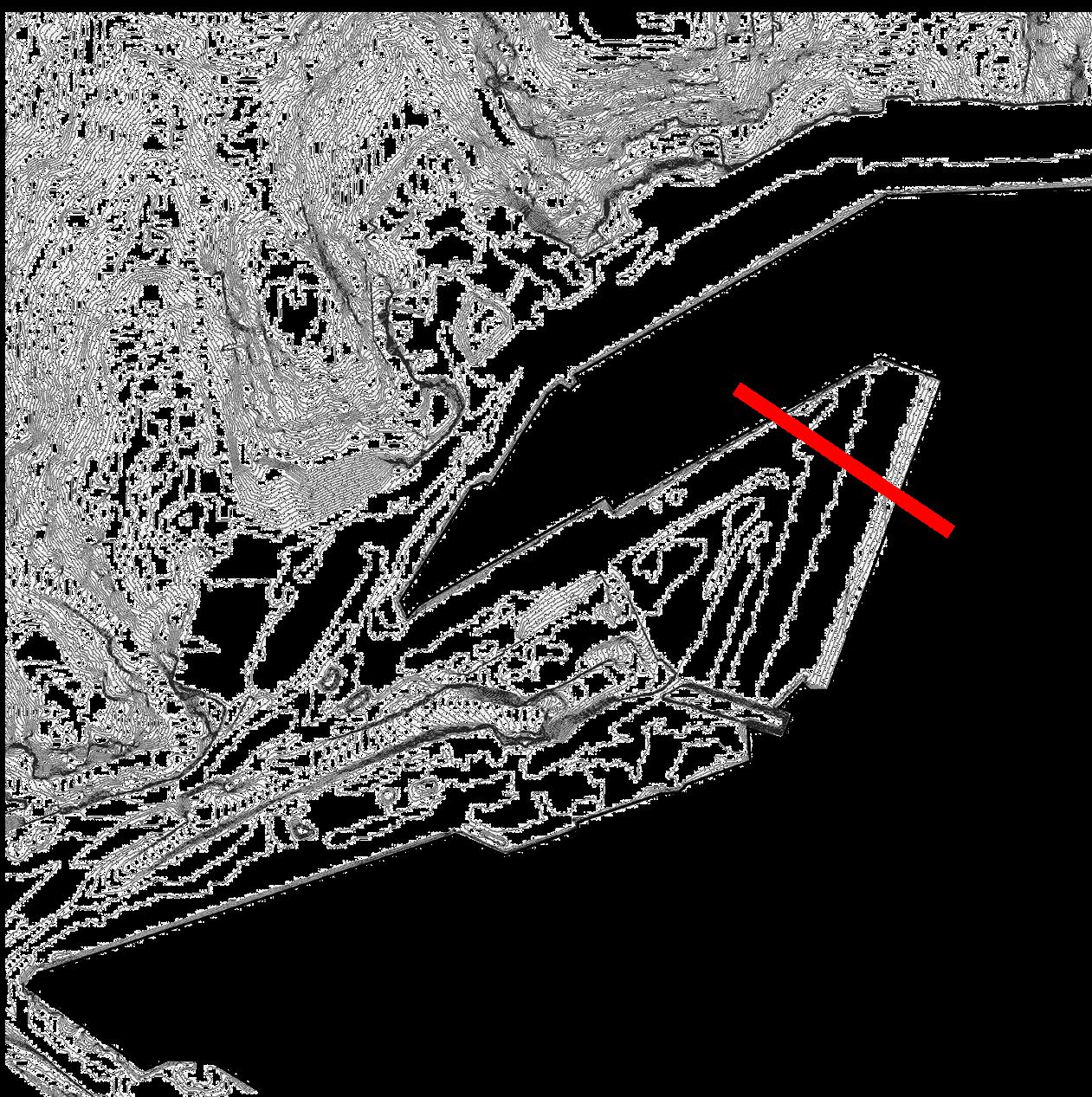
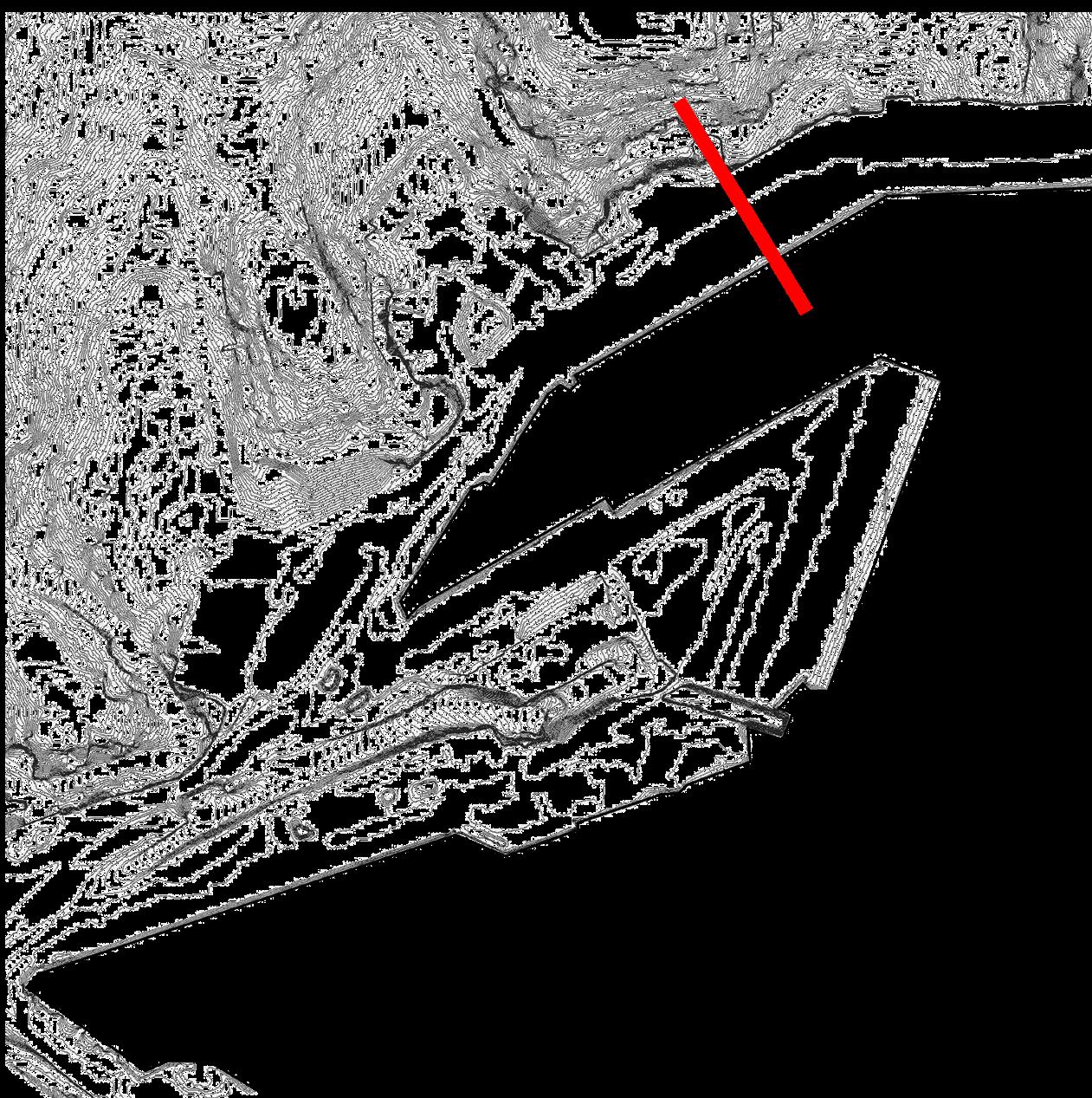
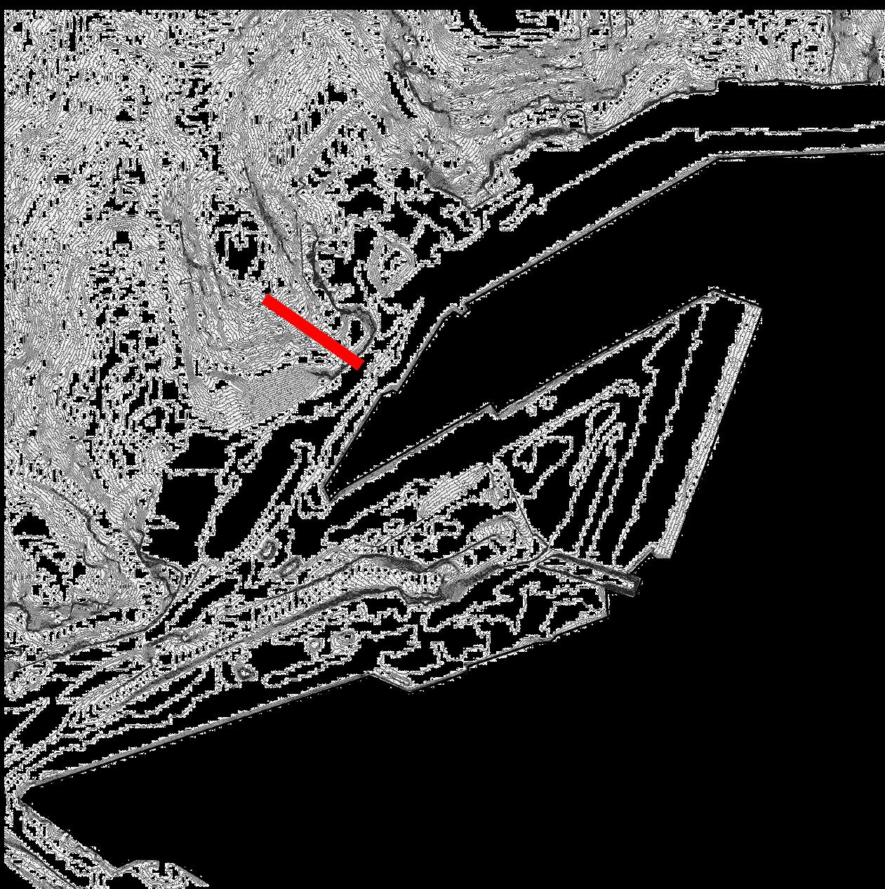
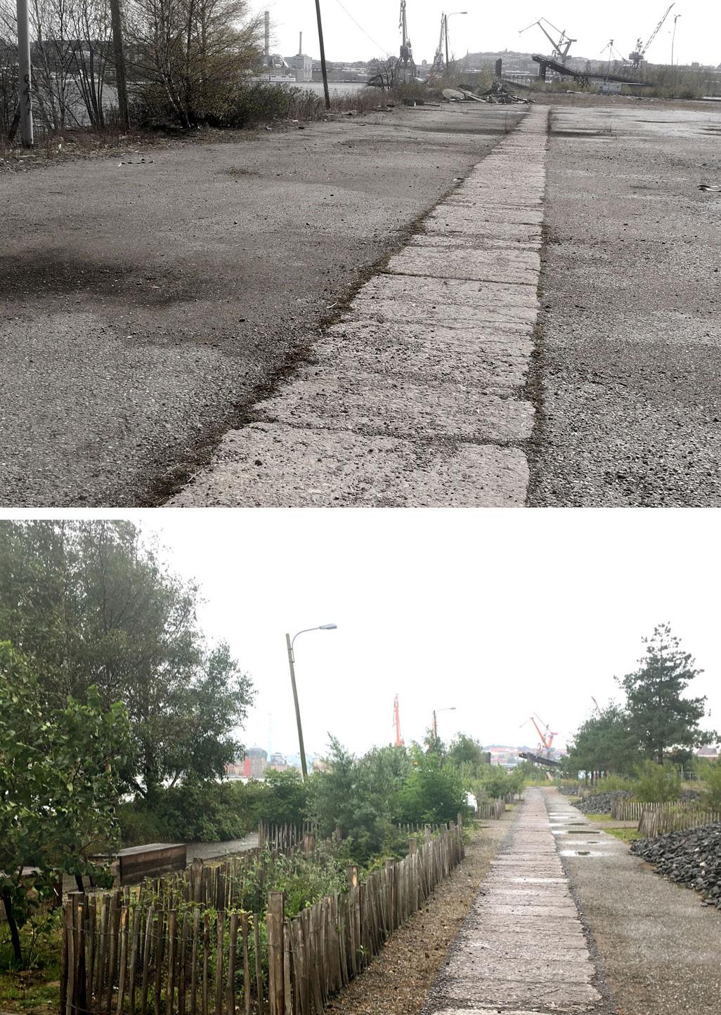
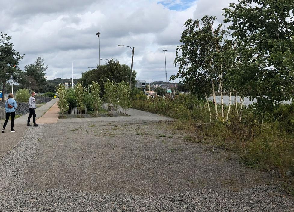
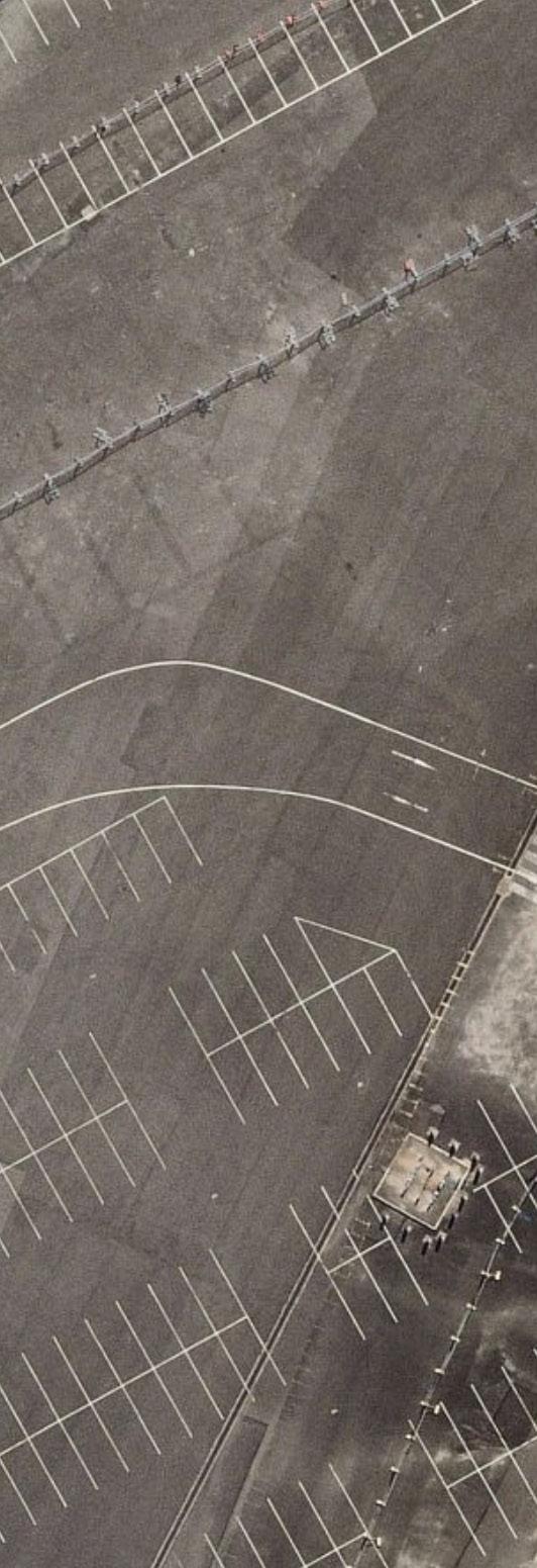
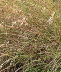
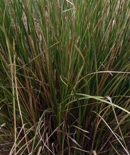
SITE ANALYSIS | Deep Cut
ABANDONED MATERIALS
RHYTHMIC PATTERNS HARD EDGES
PRECEDENT STUDIES
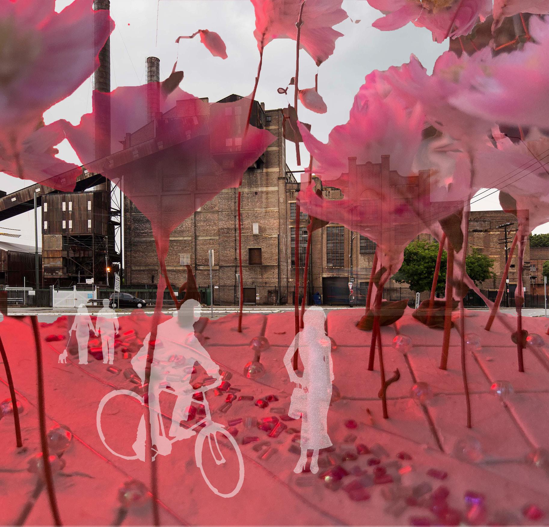
Garden of the Future
By Atelier Partero
The transformation of an abandoned space into a public space. This installation comments on optimism of nature’s regenerative ability through the renewal of a post-industrial space through the expression of art and performance.
This project shows how the industrial qualities can be maintained to create a unique aesthetic representing anthropogenigic processes.
PRECEDENT STUDIES
Shoreline Park (JUBILEE PARK)
By MARELD + atelier le balto
A contaminated, exposed and ruinous former harbor transformed into a laboratory where “ideas on aesthetics, materials, vegetation, and maintenance are tested together with the municipal staff and the public”. (Landazeine 2020).
Like white Bay, the landscape was once a functioning wet ecosystem, reclaimed for industrial activities in the 20th century.
Features of preredesigned landscape remain while parts of the concrete platform have been cut and filled with soil for gardening.
Existing planting has been delicately maintained with existing materials. The insertion of new planting beds blend into the landscape without the crisp, freshly built feeling.
MEND: REPAIRING THE LANDSCAPE
RENEW: DESIGN PROCESS
RENEW | Preliminary Timeline Thinking
RENEW | Preliminary Timeline Thinking
RENEW | Preliminary Structure
RENEW | New connections Sketch Plan
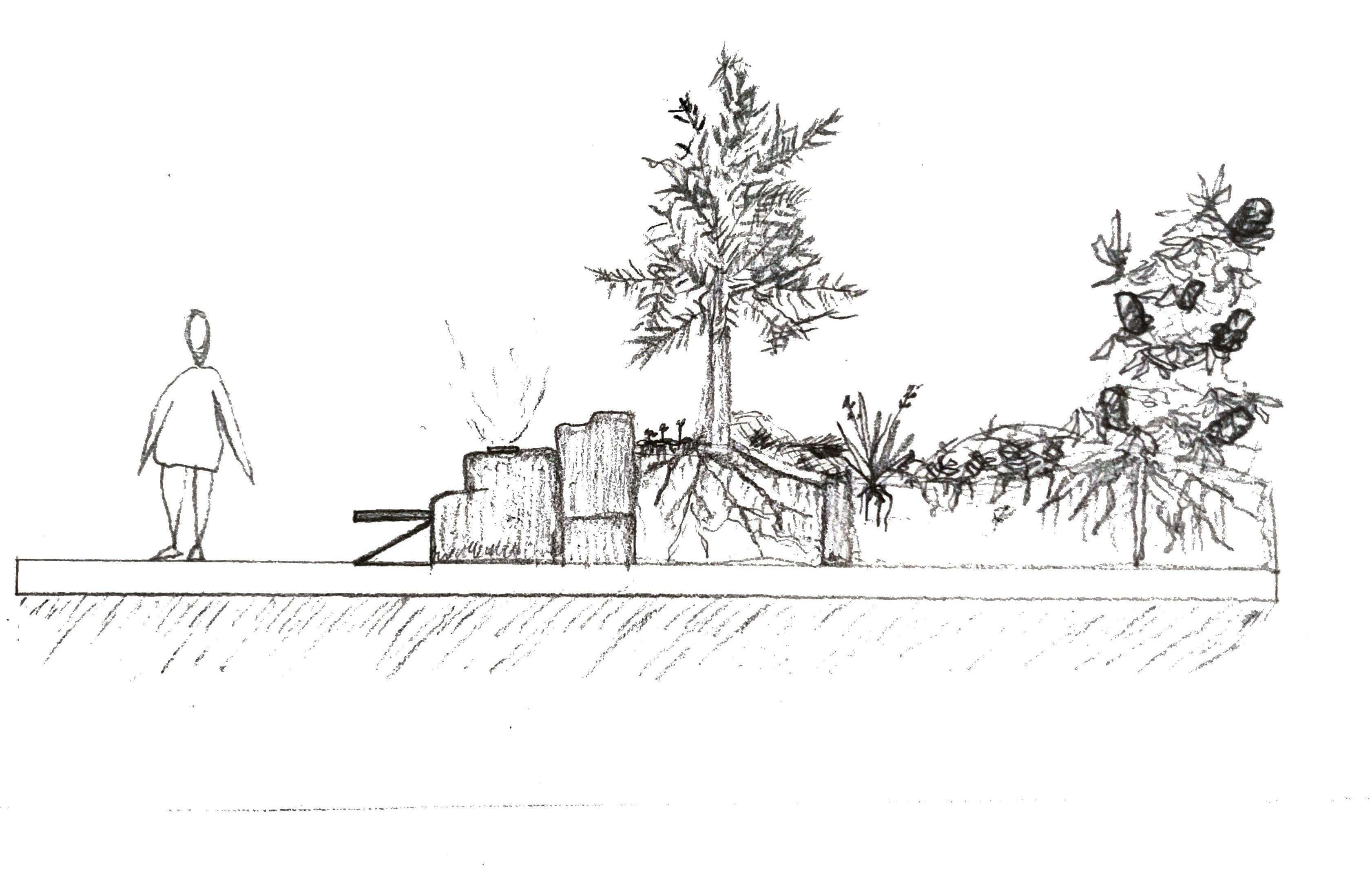
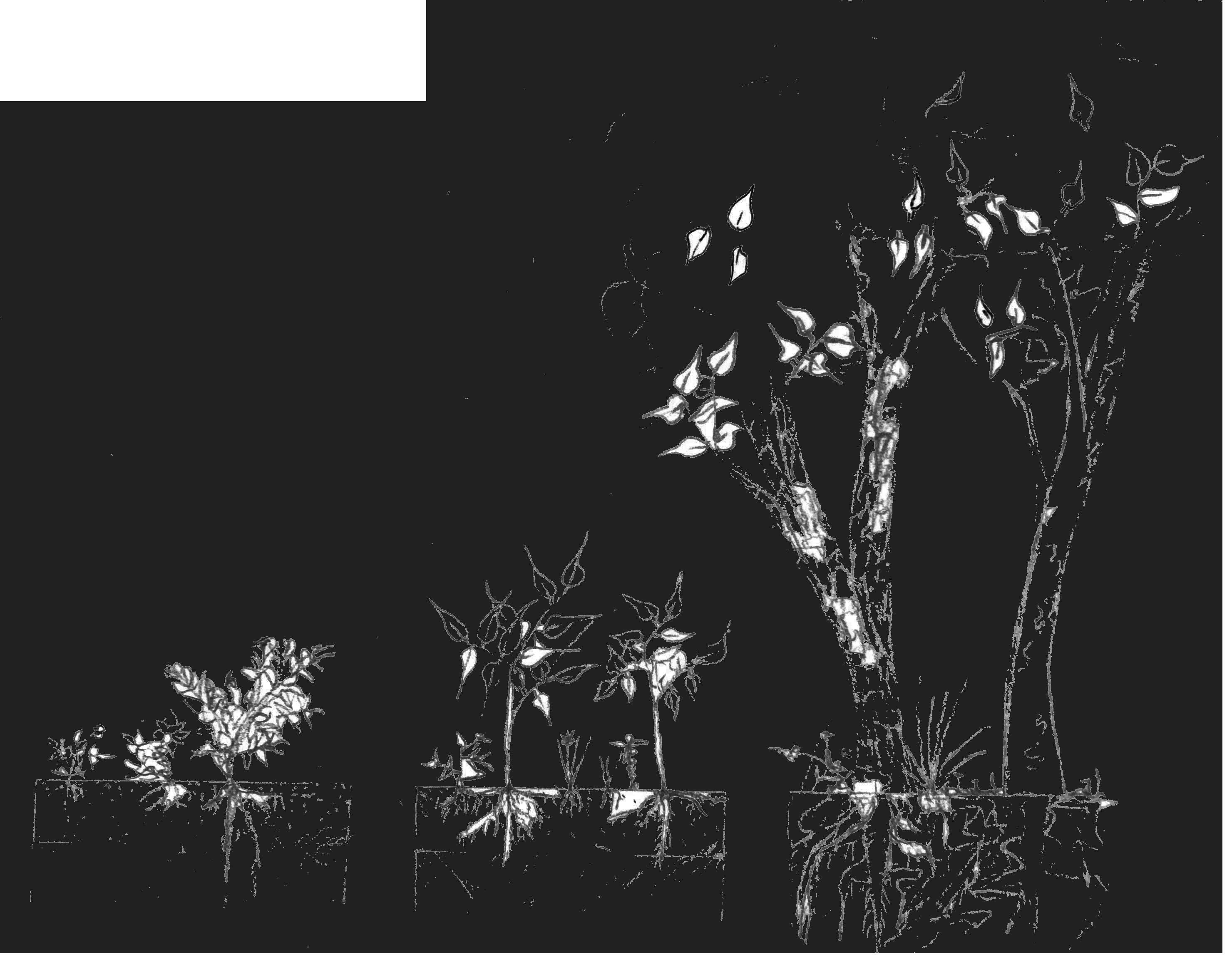
RENEW | Remediation Garden
RENEW | Remediation Garden
Phytoremediation garden concept model
RENEW | Artificial Sealife Habitat
RENEW
REGENERATE: DETAILED
DESIGN
PHASE 1: INVISIBLE BLOOM
Working waterfront land use is maintained
Glebe Island continues functioning as an Important site for Sydney’s urban infrastructure development
Robert street is maintained as a wide street serving warehouses and industry in the area. As this is the main access point to the site, this street will become the high street
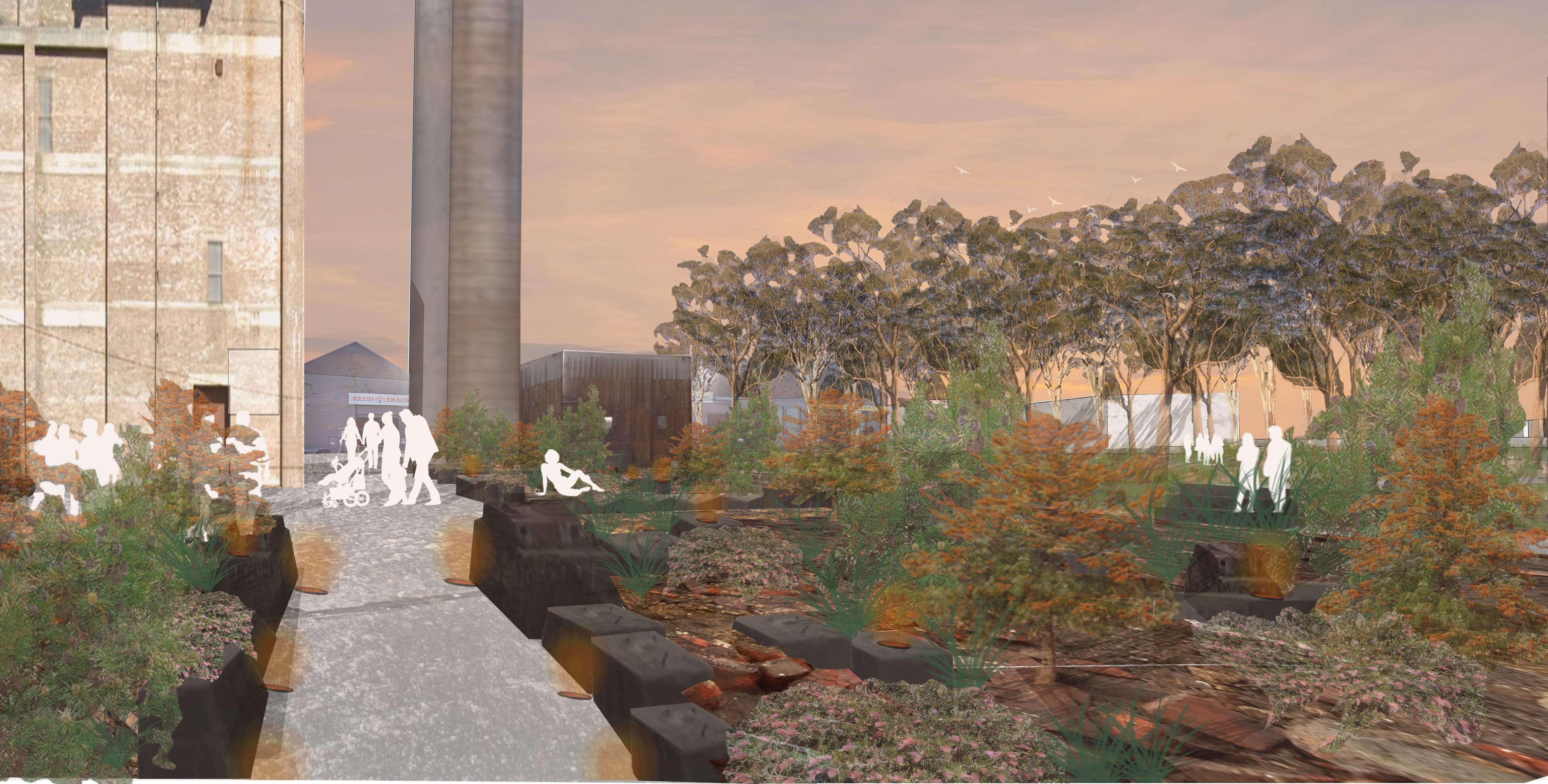
The prominence of white bay power station as a landmark with in the landscape as well as its cultural and architectural heritage justifies the building to be accessible to the Public. This building is the first catalyst for bringing people into the site
The Coal Garden complements the White Bay Power Station, providing public space that references the historic uses of the site
Stairs connect the western part of the site to the intimate landscape surrounding the power station to increase accessibility and intrigue
The Large and long process of phytoremediation begins with the import of soil from the construction of the north link tunnel excavated from parts of Glebe
Rozelle park lands opens up a new connection to the site from the west.
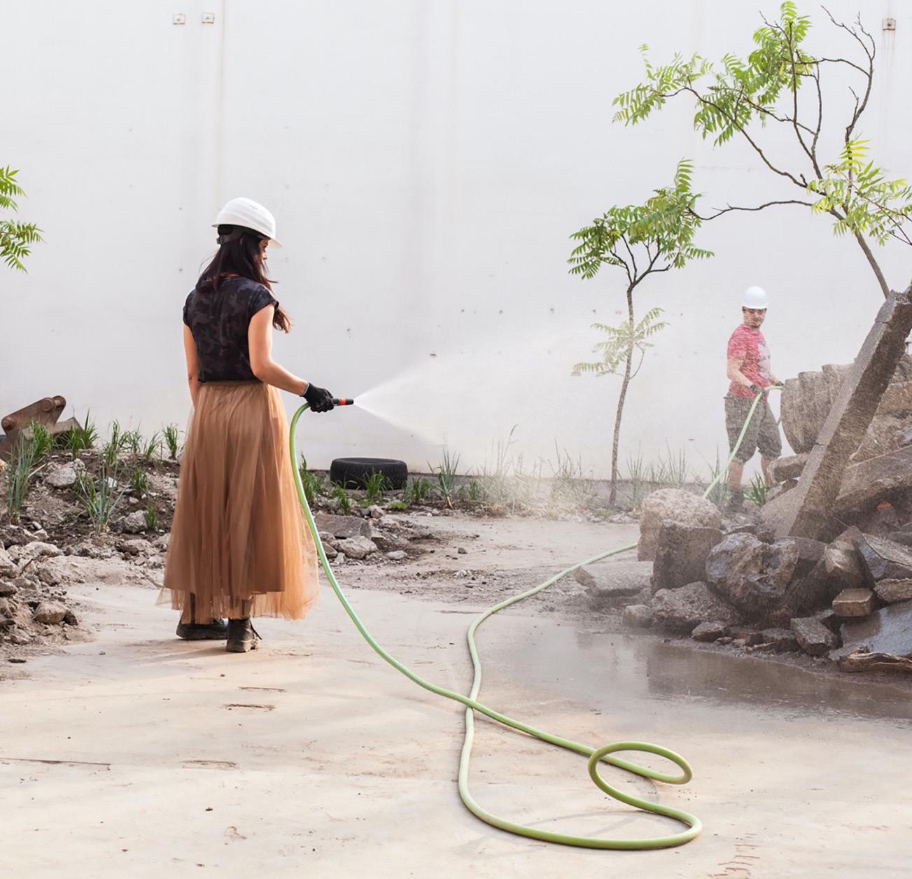
PHASE 1: INVISIBLE BLOOM | The Coal Garden
SOIL SPRINKLING FOUND MATERIAL FROM SITE PAINTED BLACK TO EMULATE COAL BURNING
SEATING
AMBIENT AMBER LIGHTING TO EMULATE COAL BURNING AND ACTIVATE THE SPACE AT NIGHT
EXISTING CONCETE FOUNDATION SEATING
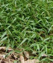
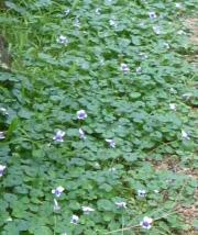
GROUND COVER
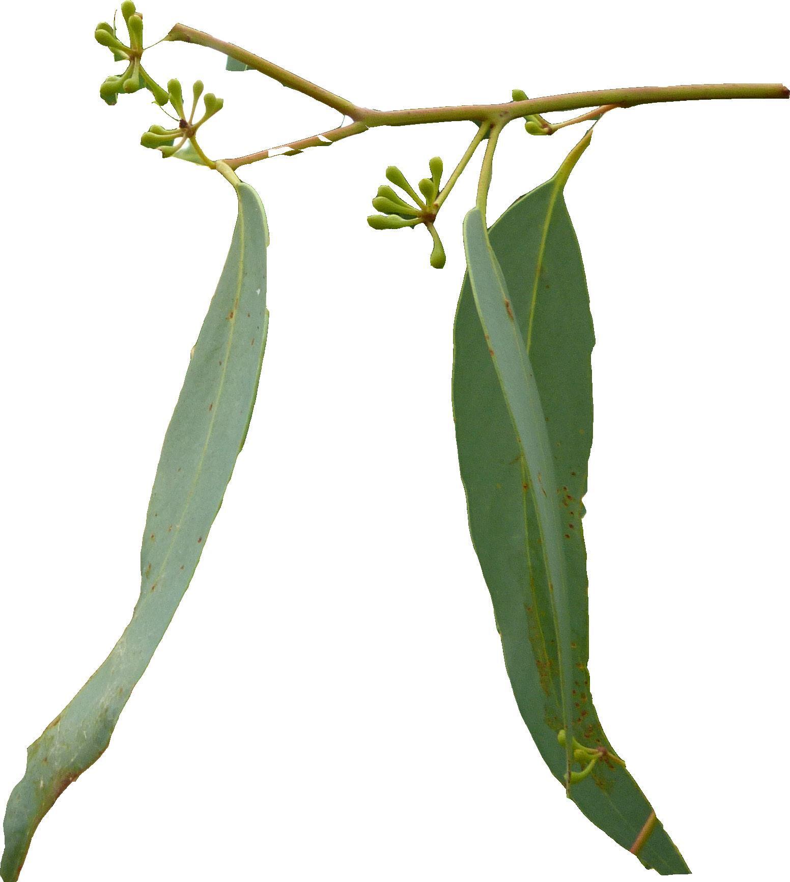
Ancistrachne maidenii
Viola banksii
Carpobrotus
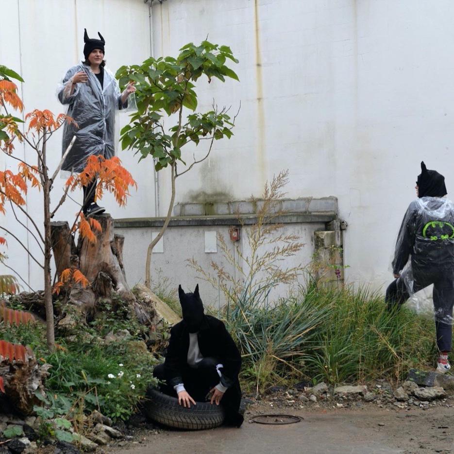
PHASE 1: INVISIBLE BLOOM | Bloom Entangle
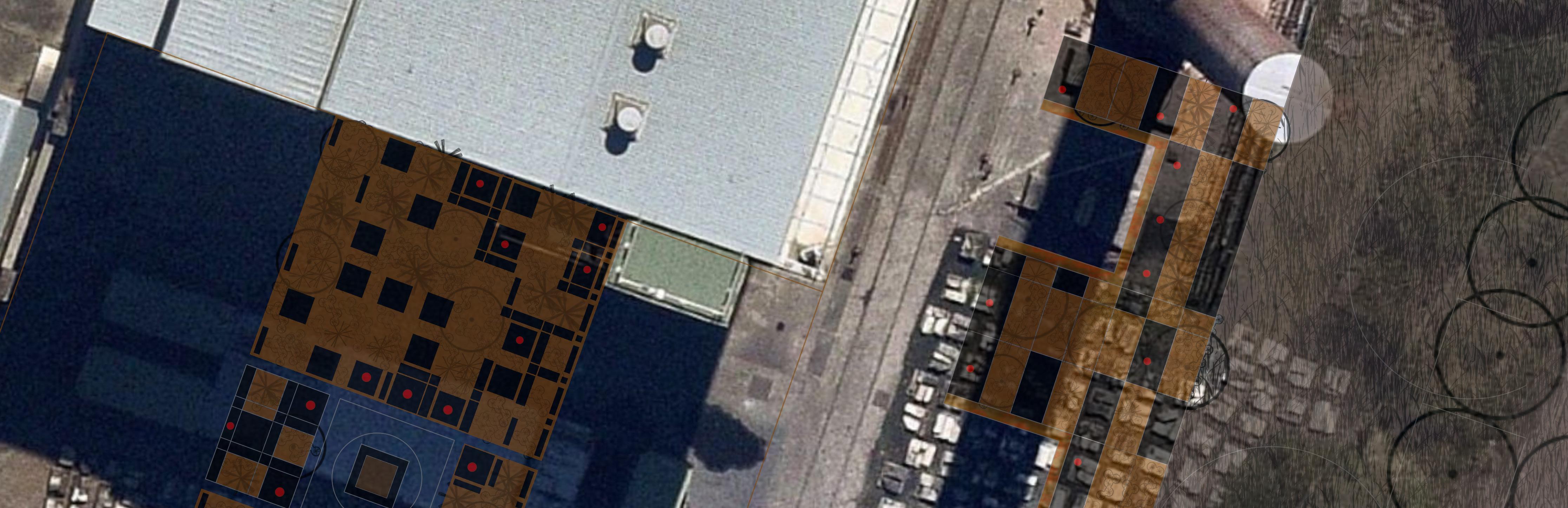
PHASE 2: CONCRETING COMMUNITY
Planting
Open Space Road Network
Pedestrian Network
Use and Hostpitality
Abiding Events:
1. The Silos are converted into residents
2. The Metro opens up, Connecting the site to Sydney CBD and Sydney West
3. The First Internal Roads are Created
4. The first mixes use buildings open
5. The Waterfront becomes accessible to the public
PHASE 2: CONCRETING COMMUNITY| A sound bath of activity
RESTARUNTS ACTIVATE THE WATERFRONT SPACE 24/7 WHILE THERE IS AN OPPORTUNITY TO SOURCE LOCAL GOODS FROM NEARBY WAREHOUSES AND LOCAL BUSINESSES
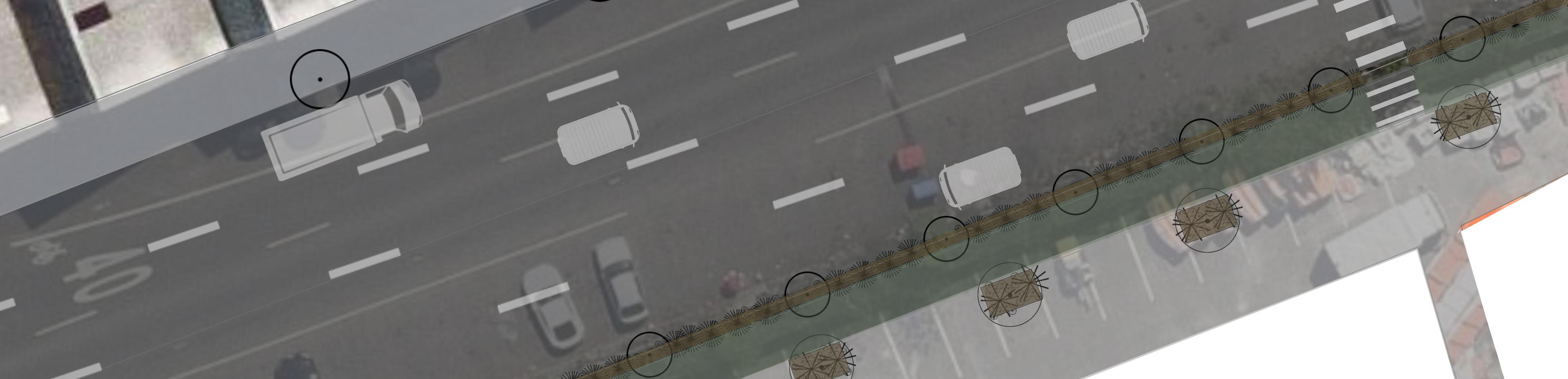
BIKE PARKING STATIONS ENCOURAGES ACTIVE MODES OF TRANSPORT A BI-LANE CYCLEWAY CONNECTS ROBERT STREET WITH THE REST OF THE SITE INCLUDING THE METRO AND GREBE BRIDGE
A GENEROUS FOOTPATH ALLOWS THE STREET TO BE ACTIVATED
THE WIDE STREET ALLOWS INDUSTRIAL ACTIVITIES OF MAKING AND PRODUCTION TO SPILL OUT INTO THE LANDSCAPE WHILE PROVINING THE NESICIARY INFRASTRUCTURE FOR TRUCKS AND UNLOADING
STREET PLANTING PROVIDES DRAINAGE FOR THE HARDSCAPE AND A HUMAN SCALE
EXISTING WAREHOUSES INCENTIVEISED FOR DIVERSIFIED BUSINESSES AND OPPORTUNITY TO PROVIDE CHEEP STUDIO SPACE FOR ARTISTS AND CREATORS
PHASE 2: A SOUND BATH: Planting
PHASE 2: CONCRETING COMMUNITY: Industry Continues
INDUSTRIAL ACTIVITIES GRATE NOISE AS WELL AS A VOID OF ACTIVITY. THERE IS AN OPPORTUNITY FOR THIS SPACE TO BE ACTIVATED BY GENERALLY UNWANTED INDUSTRIES SUCH AS MAKERS WHO MAKE A LOT OF NOISE IN THEIR PROCESSES OF LIVE MUSIC VENUES
Glebe Island continues to be used for the construction industry. The large amounts of space used for these activities reserve the landscape to be used for public open space on valuable waterfront land.
PHASE 3: INUNDATED ENERGY
LEGEND
Industry
Cultural
Planting
Building Public Open
Space
Road Network
Pedestrian Network
Residential Building
Mixed Use and Hostpitality
Active Public Space
Shared Pathway
Abiding
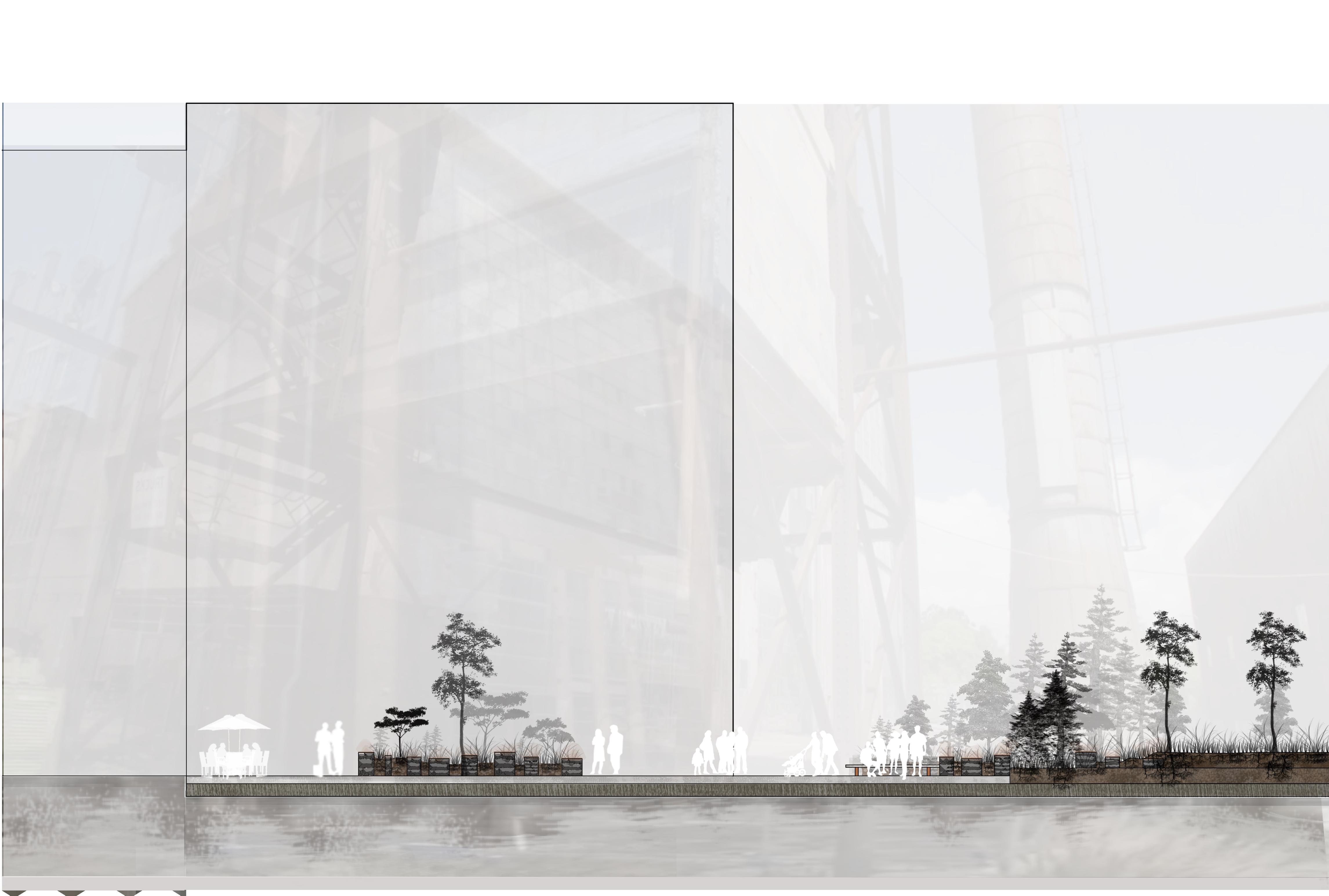
RAISED EDGE PLANTING AND SEATING
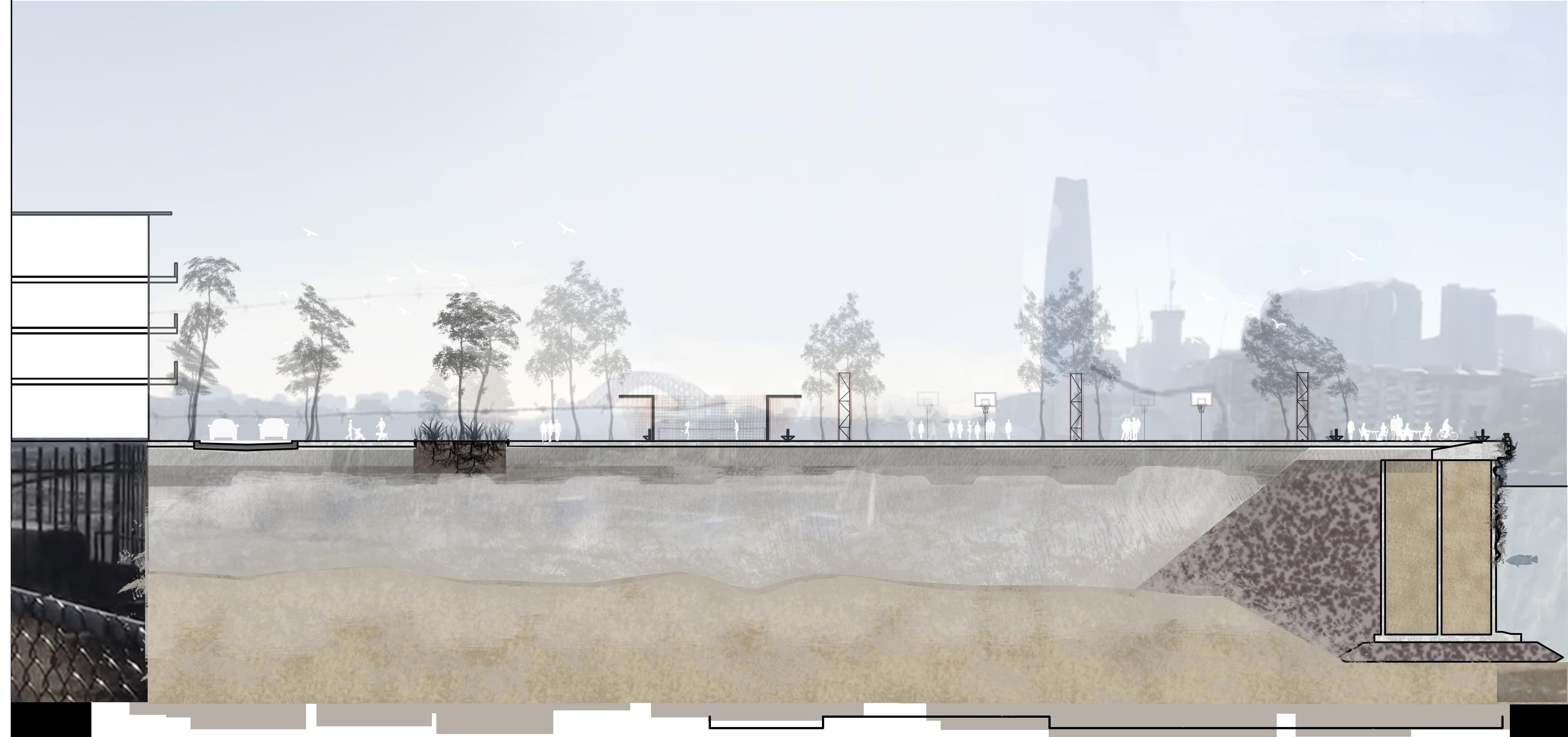
INTER-TIDAL BRIDGE
LIVING SEA WALL
EXISTING CONCRETE PLATFORM
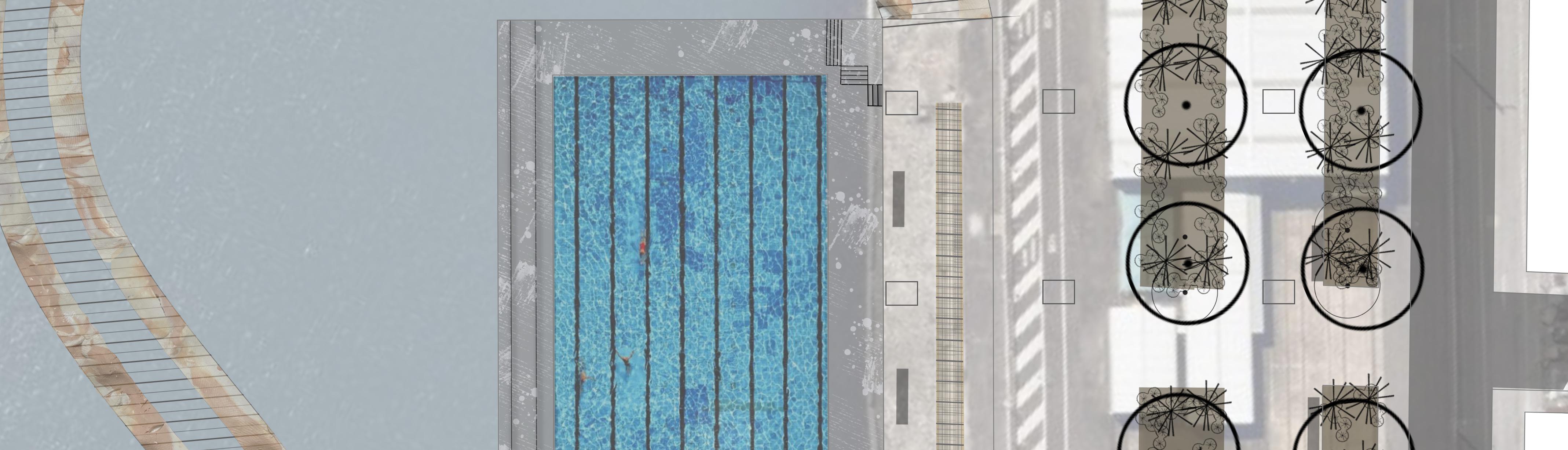
SUBMERGED POOL BUILDING
RECYCLED INDUSTRIAL STRUCTURES PROVIDING STREET LIGHTING
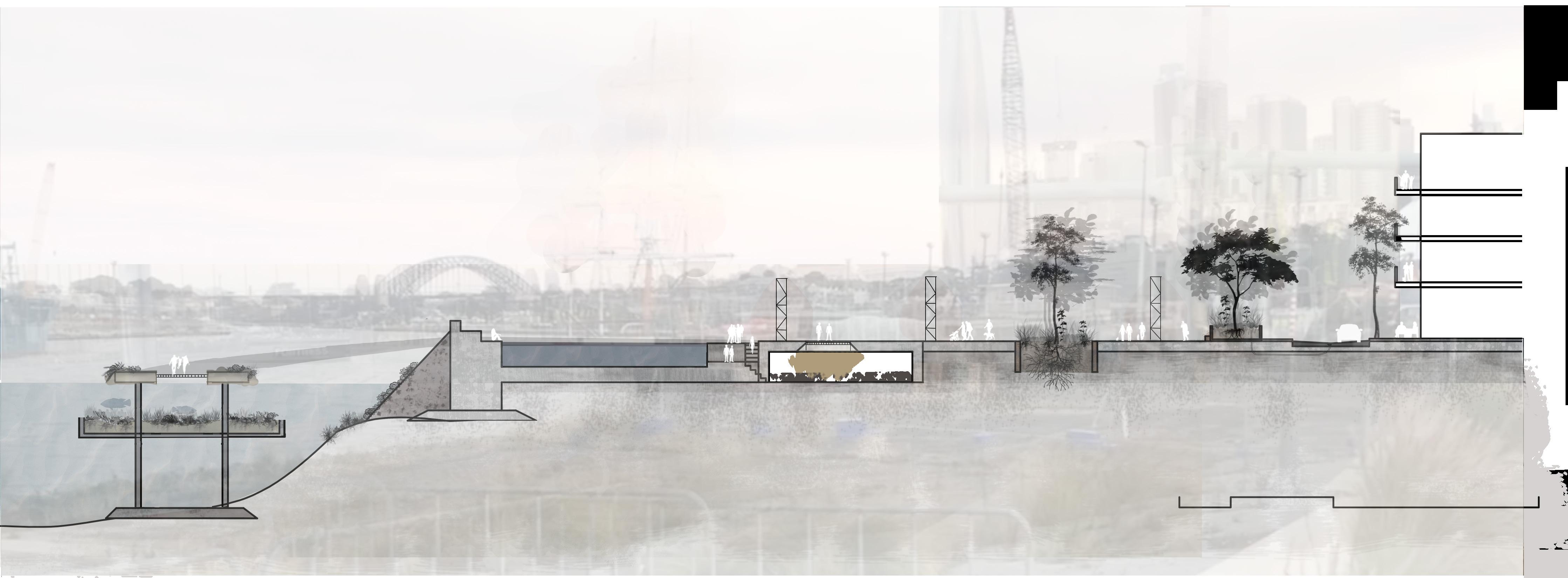
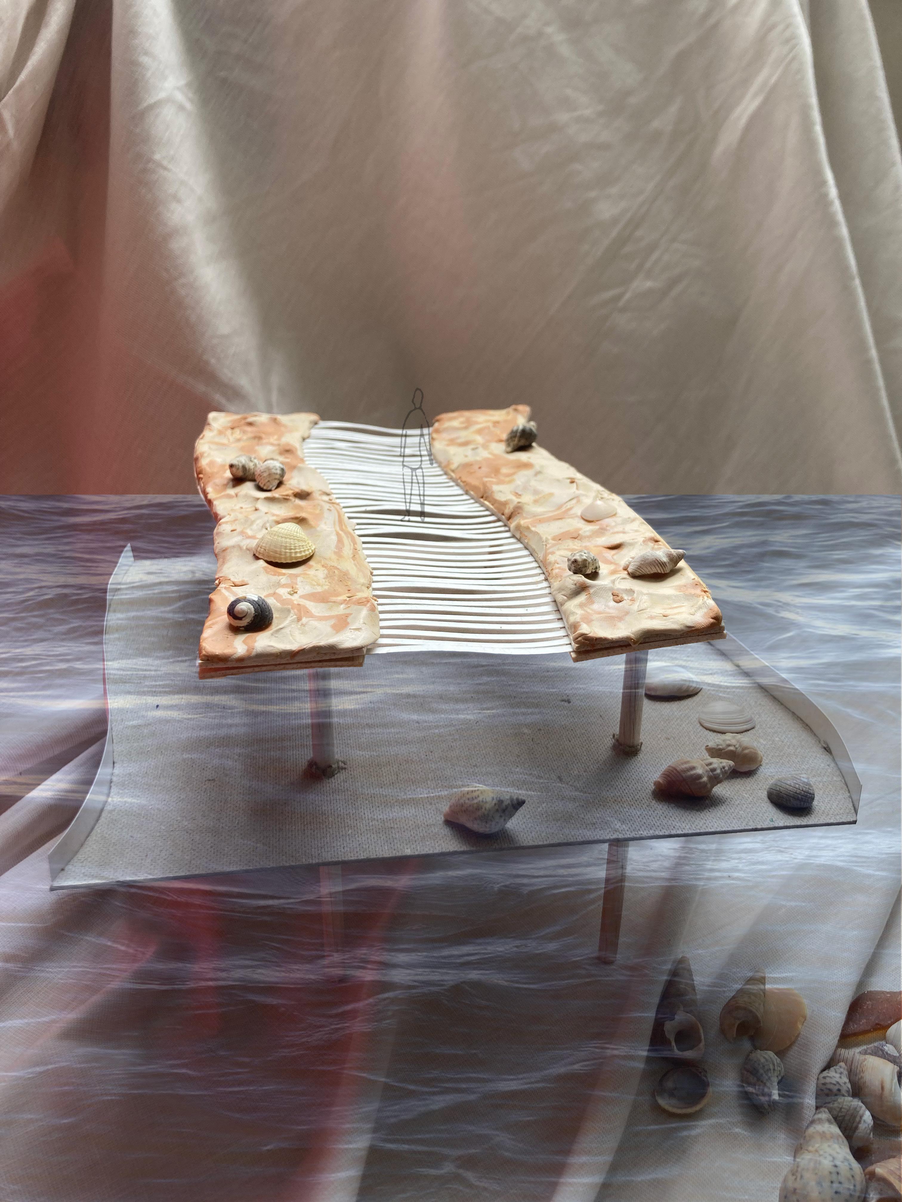
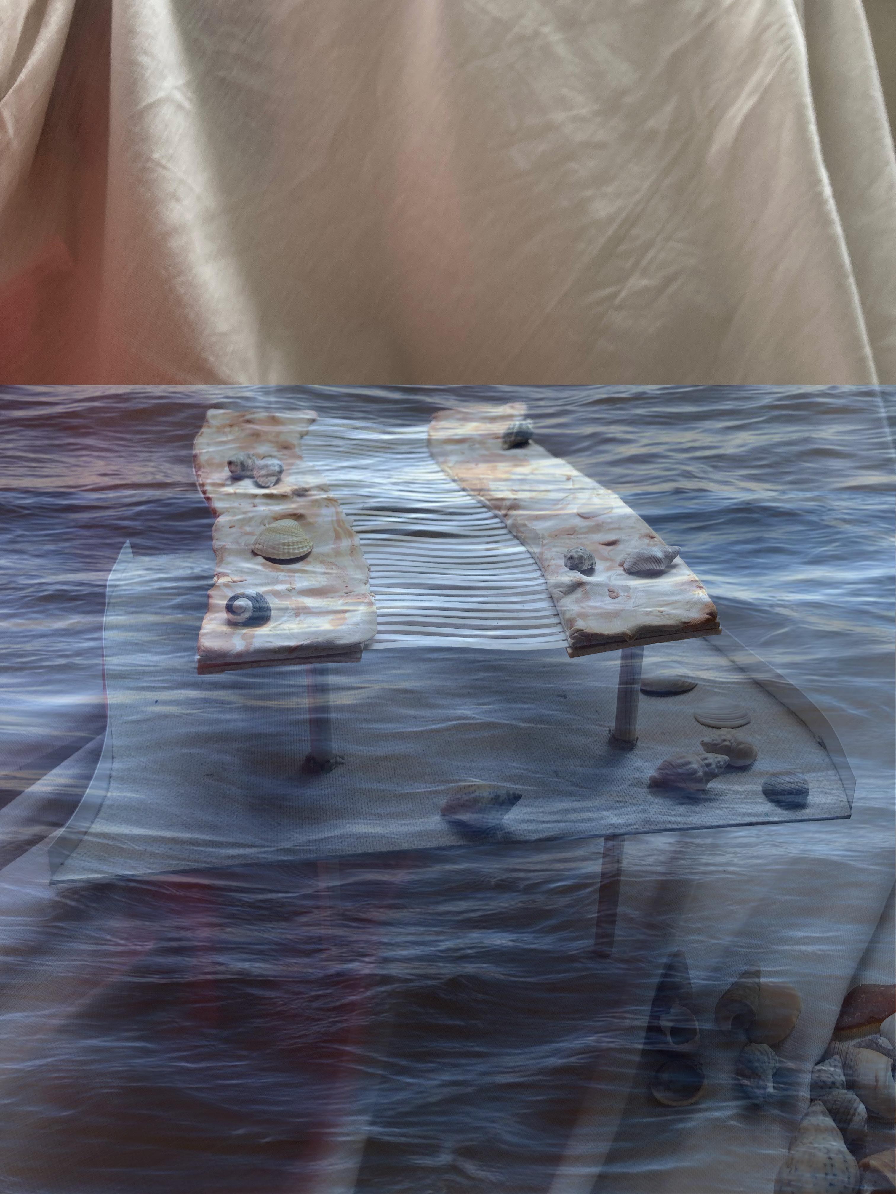
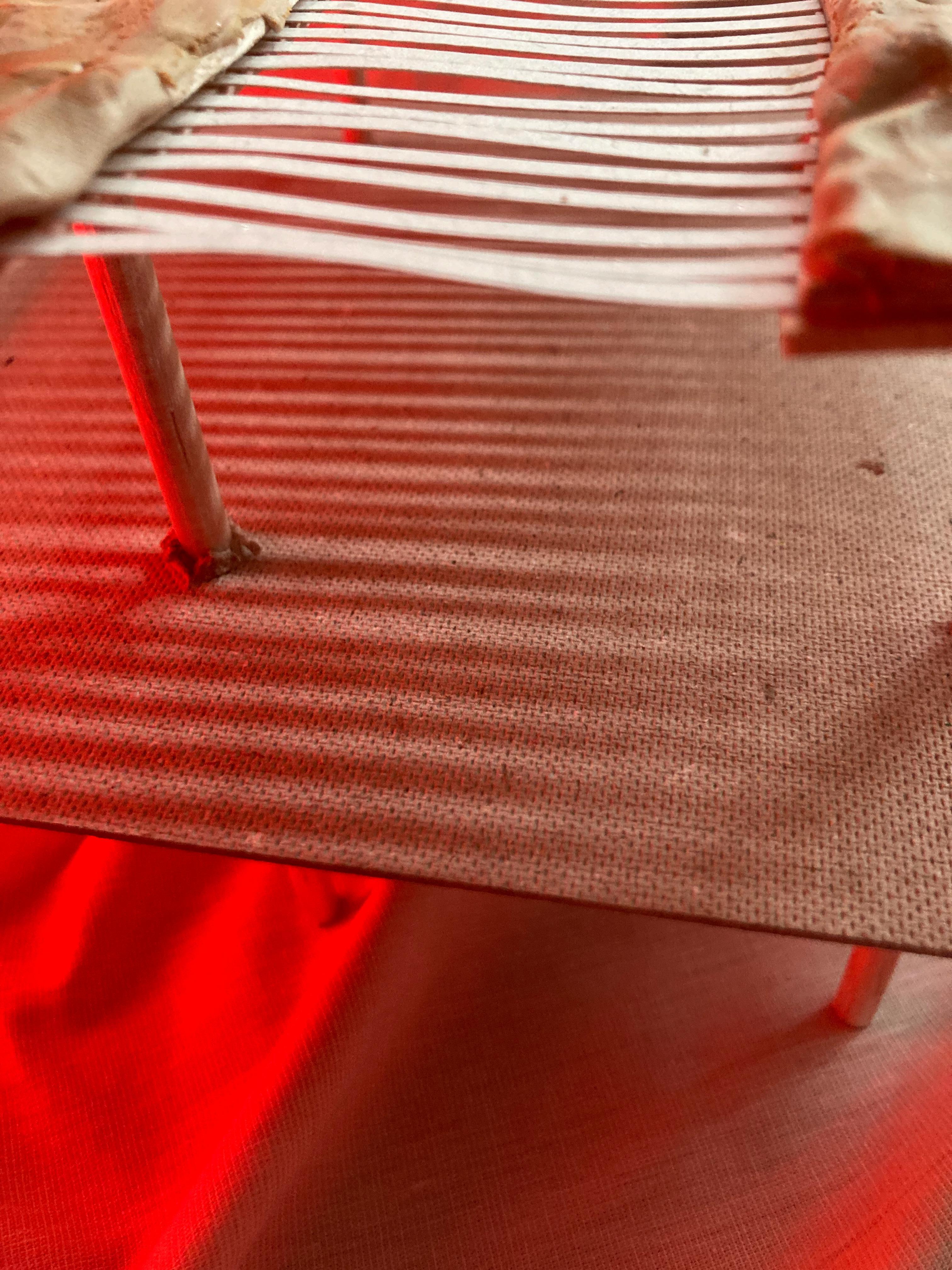
PHASE 3: INUNDATED ENERGY | Inter-tidal Bridge
INTER-TIDAL ROCK POOLS
SEAGRASS SPECIES
GRATE WALKWAY
INTER-TIDAL ROCK POOLS
SEAGRASS SPECIES
GRATE WALKWAY
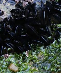
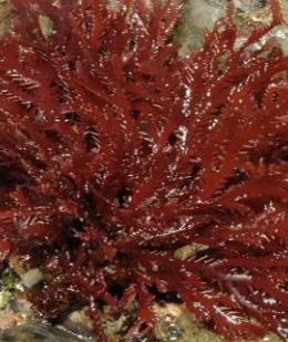
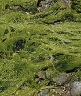
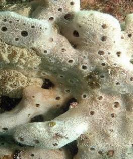
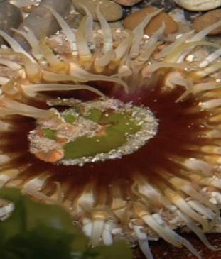
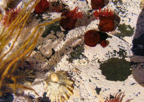
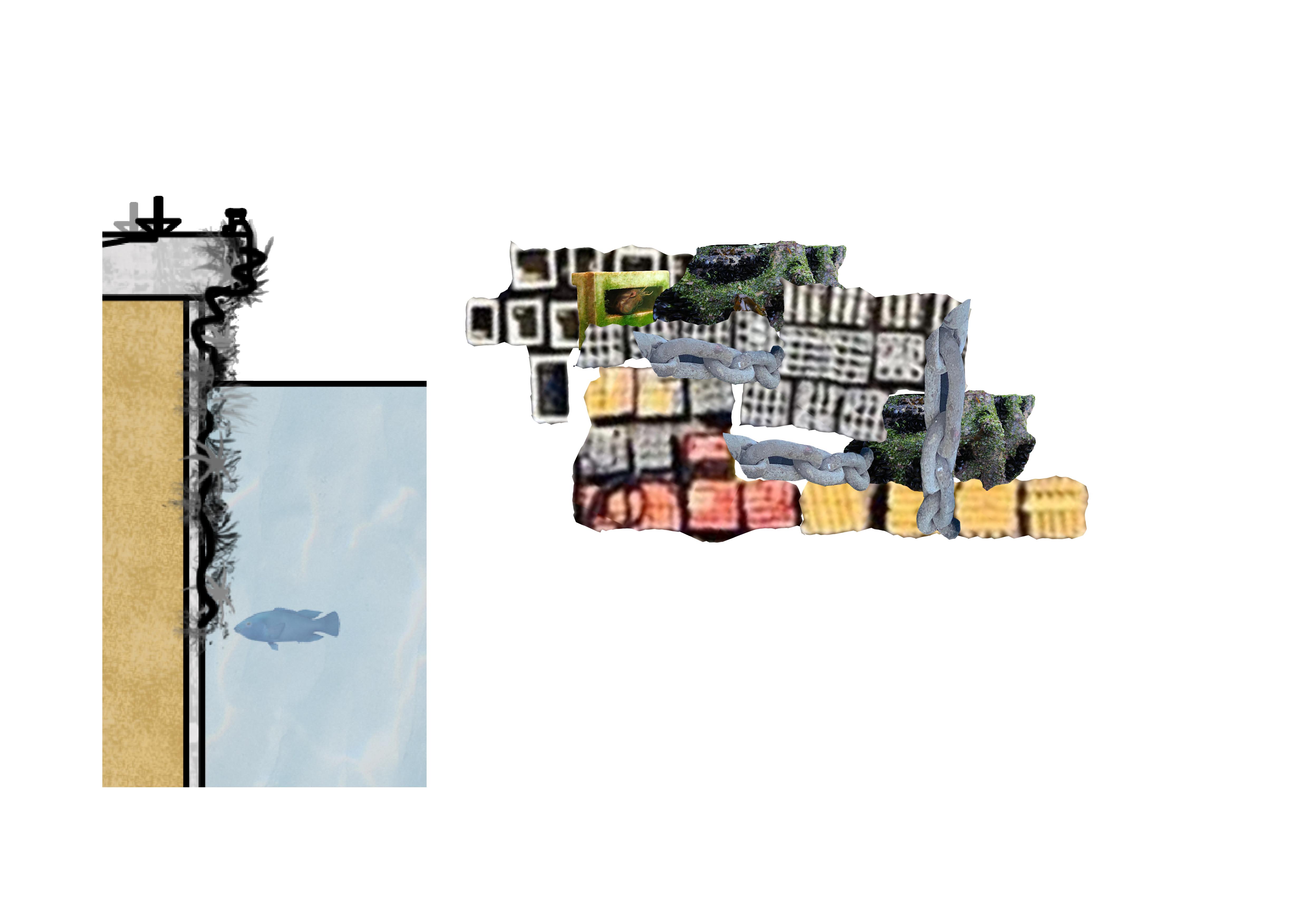
PHASE 3: Inter-tidal Bridge | Rock-pool Planting
Muscles
Colpomenia sinuosa
Plocamium sp.
Ulva compressa
White sponge
Oulactis muscosa
Tesseropora rosea
PHASE 3: Inter-tidal Bridge | Lighting
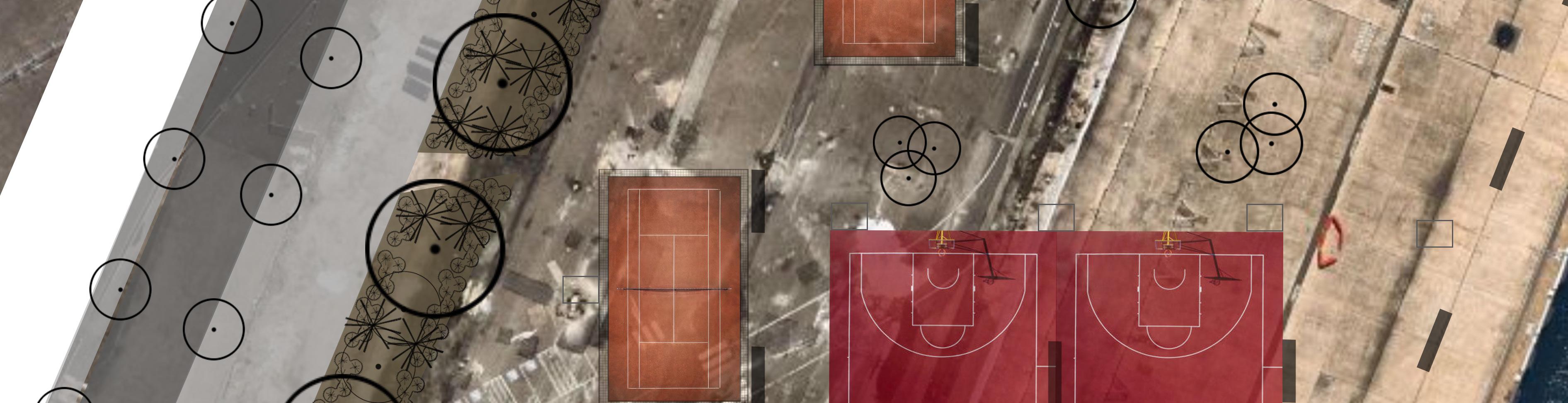
PHASE 3: INUNDATED ENERGY | Giving The Harbor Back
TENNIS COURT WITH LIGHTING SURROUNDING NETS
BASKETBALL COURT RECYCLED INDUSTRIAL STRUCTURE CREATING LIGHTING FOR COURTS TO BE USED 24/7 SEATING ALONG THE EDGE
DARLING HARBOUR PUBLIC DOMAIN EDGE
GLEBE ISLAND PUBLIC DOMAIN PYRMONT PUBLIC DOMAIN EDGE
LIVING SEA WALLS MADE FROM FOUND MATERIALS ON SITE
PHASE 3: GIVING THE HARBOUR BACK | Recycled sea walls
PHASE 3: INUNDATED ENERGY | A Shared view of Land Sea and Sky
NEW PEDESTRIAN ACCESS FROM GLEBE BRIDGE
DIVERSE AND ACTIVATED PUBLIC SPACE LIVING SEA WALLS IMPROVING WATER QUALITY
PHASE 3: INUNDATED ENERGY | Wet Forest Native Edge Planting
LARGE TREES
SMALL TREES
GROUND COVER GRASSES
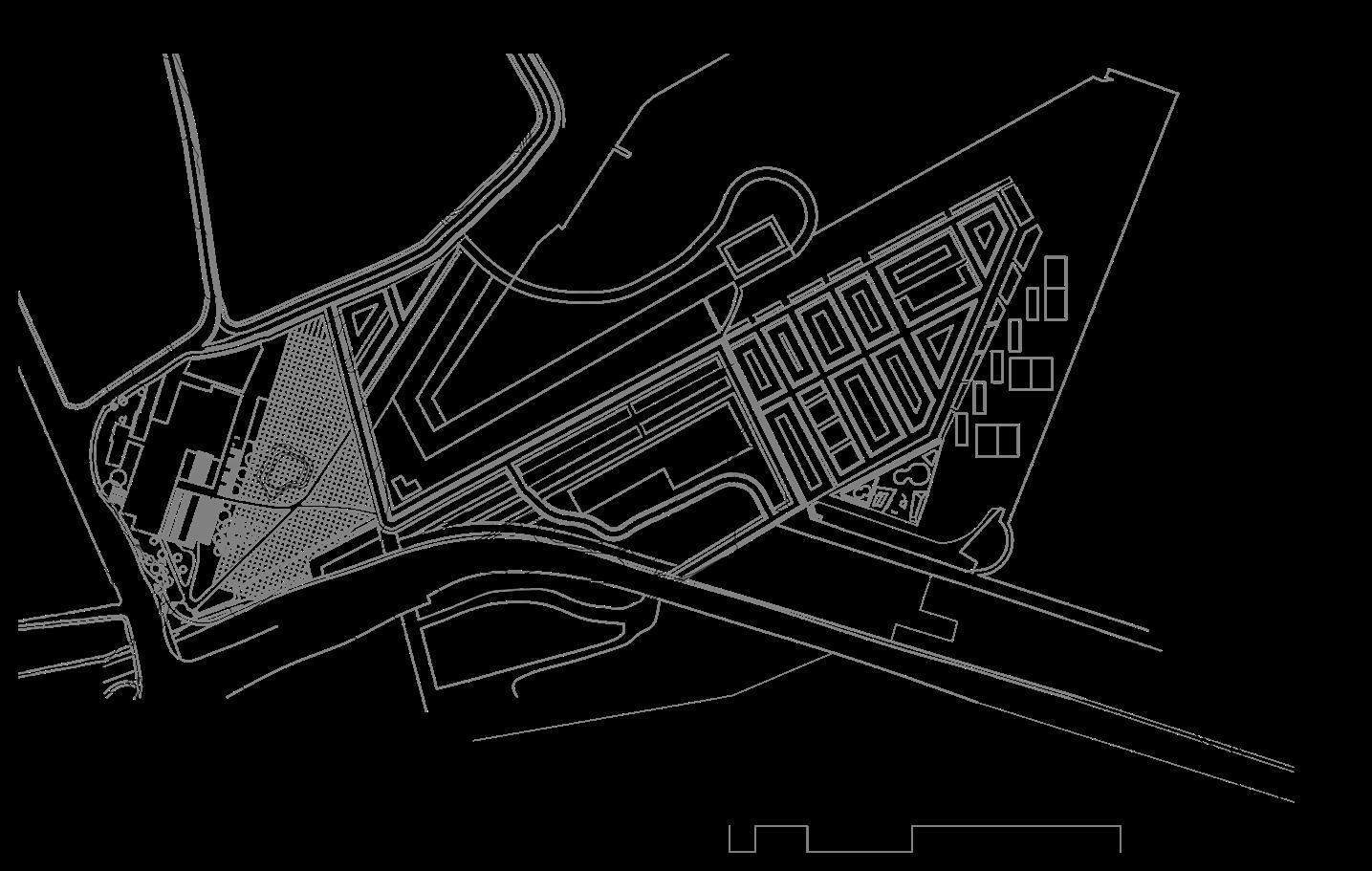
SITE STRUCTURE | Open space
PUBLIC BUILDINGS AND MIXED USE
Alan Morris (2019) ‘Super-gentrification’ triumphs: gentrification and the displacement of public housing tenants in Sydney’s inner-city, Housing Studies, 34:7, 1071-1088, DOI: 10.1080/02673037.2018.1515894
Anthropocene.info. 2021. The Anthropocene Available at: <https://www.anthropocene.info/#:~:text=The%20Anthropocene%20defines%20
Barangaroo. 2021. Barangaroo » Barangaroo Reserve. Available at: <https://www.barangaroo.com/see-and-do/things-to-do/itineraries/barangaroo-reserve/> 01/04/21
BDA - Barangaroo Waterfront Development: Headland Park - New South Wales. (2015, Mar 26). World Market In- telligence News https://login.wwwproxy1.library.unsw.edu.au/login?qurl=https%3A%2F%2Fwww.proquest.com%2F- wire-feeds%2Fbda-barangaroo-waterfront-development-headland%2Fdocview%2F1666861761%2Fse-2%3Faccoun- tid%3D12763 Accessed 10/04/21
Dr Jillian Walliss (2012) The politics of aesthetics: expanding the critique of Headland Park, Sydney, Journal of Landscape Architecture, 7:2, 6-13, DOI: 10.1080/18626033.2012.746080
Department of Planning. 2006. ‘East Darling Harbour Urban Design Competition. Stage Two, Jury Report’, March. 01/04/21
Emily Eliza Scott, & Kirsten J Swenson. (2015). Critical Landscapes : Art, Space, Politics. University of California Press. 13/04/21
Greet De Block, Vera Vicenzotti, Lisa Diedrich & Bruno Notteboom. 2019. For whom? Exploring landscape design as a political project,. Journal of Landscape Architecture, 14:3, 4-7 20/04/21
Greet De Block, Vera Vicenzotti, Lisa Diedrich & Bruno Notteboom. 2019. For whom? Exploring landscape design as a political project,. Journal of Land- scape Architecture, 14:3, 4-7
Hamil Pearsall (2012) Moving out or moving in? Resilience to environmental gentrification in New York City, Local Envi- ronment, 17:9, 1013-1026, DOI: 10.1080/13549839.2012.714762 29/04/21
United Nations Sustainable Development. 2021. Take Action for the Sustainable Development Goals. [online] Available at: <https://www.un.org/sustain- abledevelopment/sustainable-development-goals/> [Accessed 2 April 2021].
The High Line. 2021. History | The High Line. Available at: <https://www.thehighline.org/history/> 01/04/21 Earth’s%20 most,are%20now%20altered%20by%20humans.> 01/04/21