Tongling Hu
Selected Works: 2021-2025
Architectural Association
hutongling92@gmail.com
Studio Project
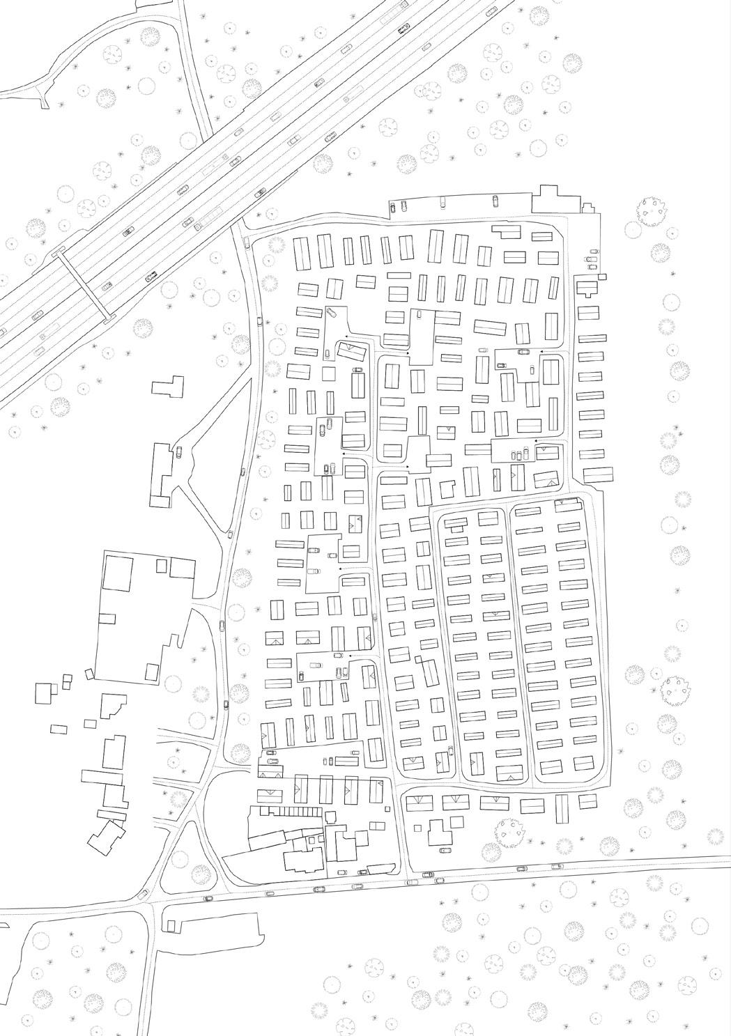
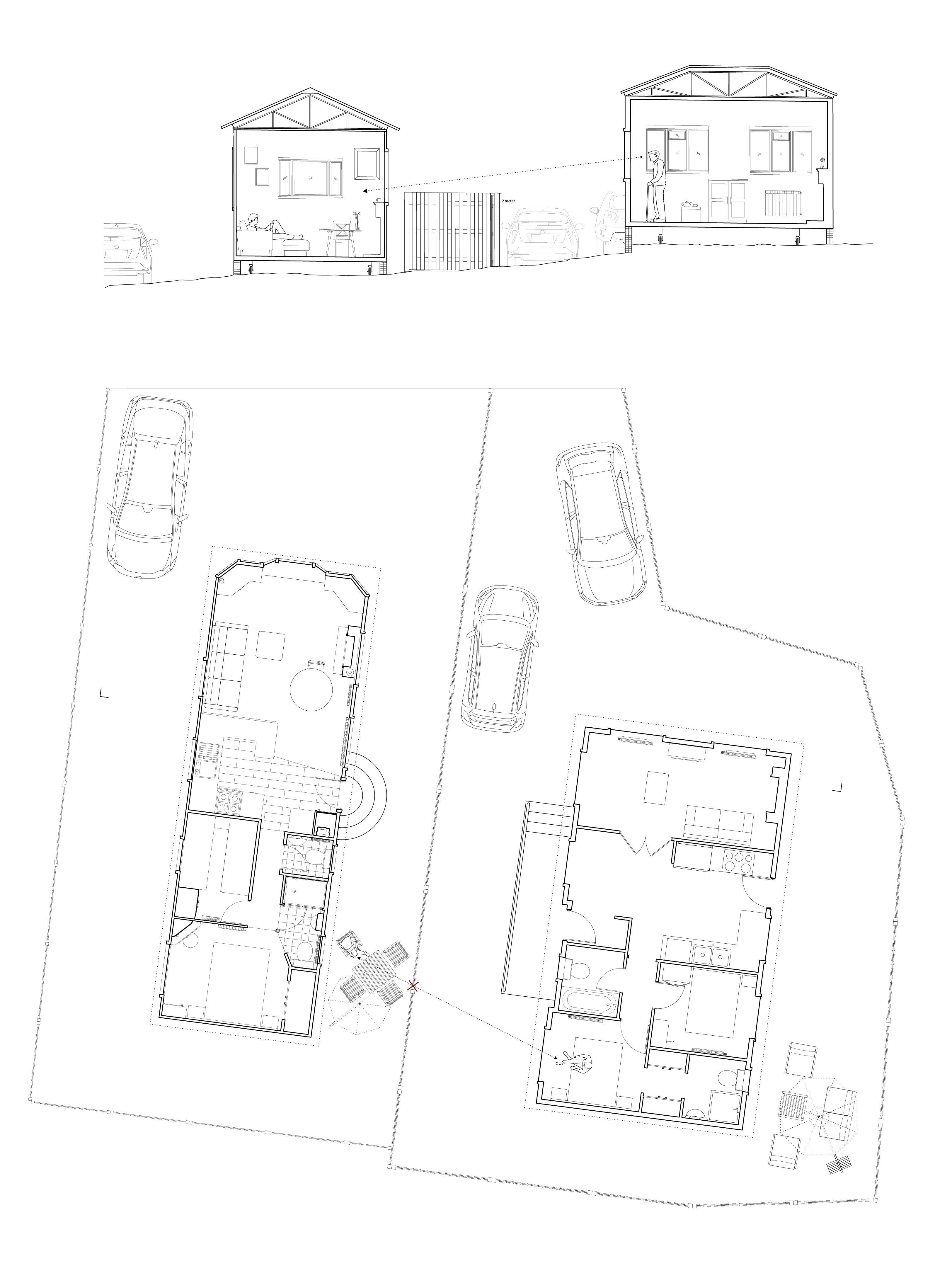
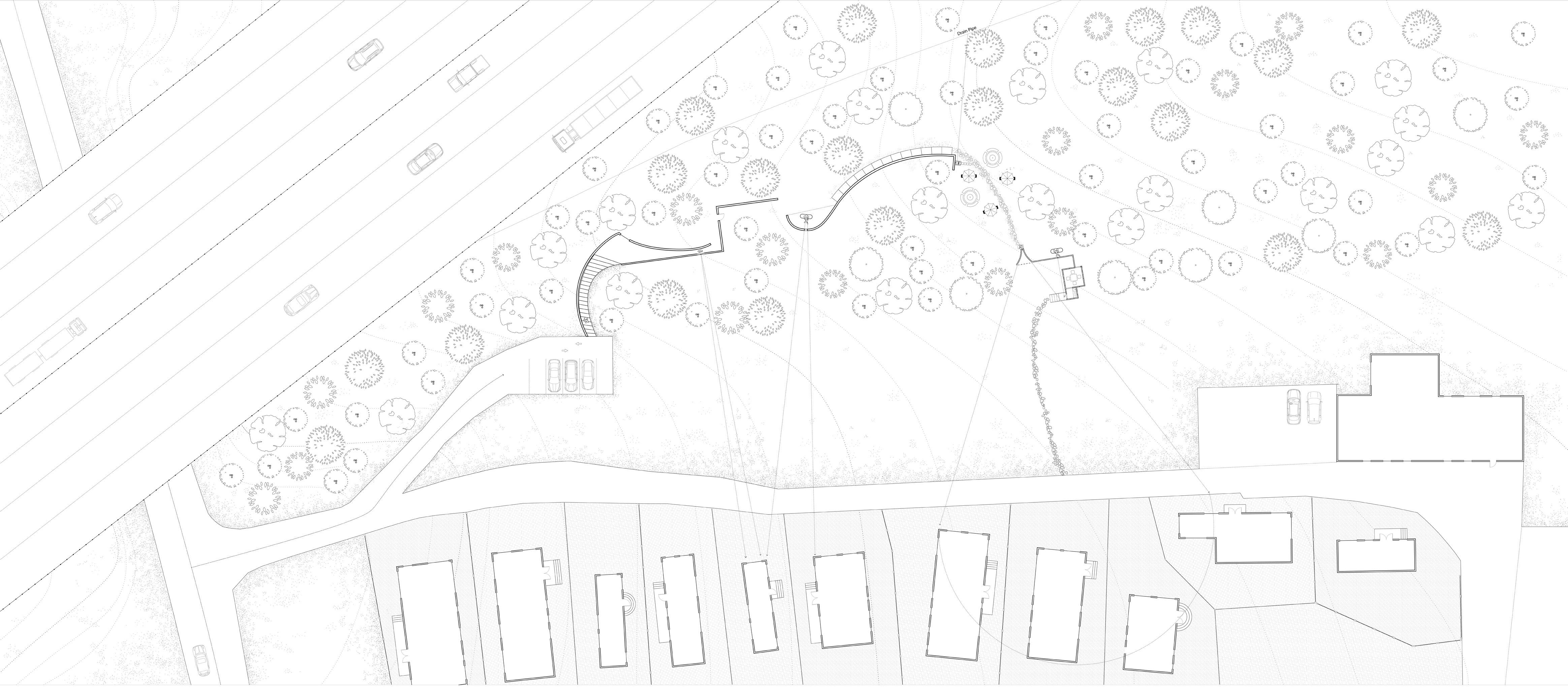
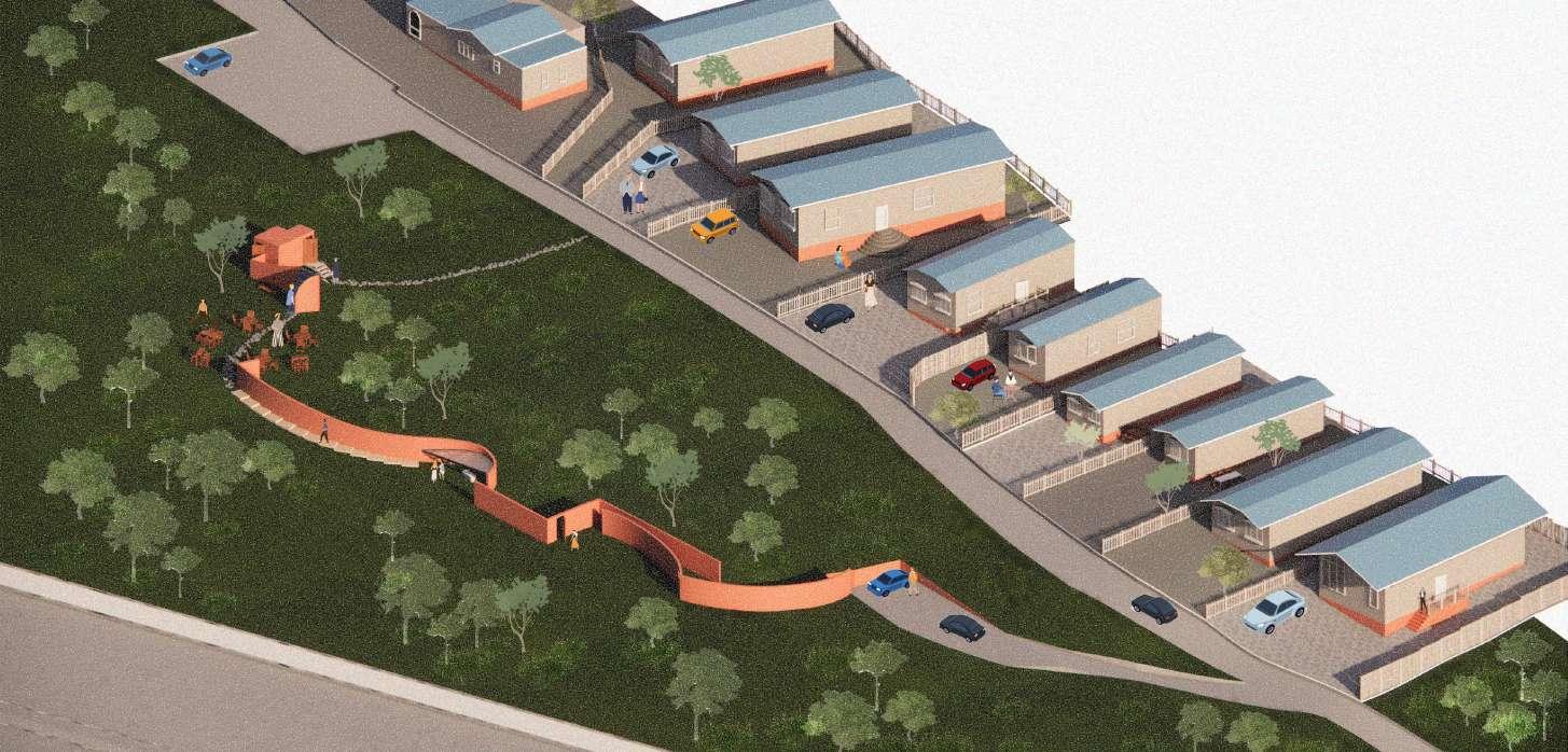
Site : Woodbine Close Park EN9 3RH
Year: 2025
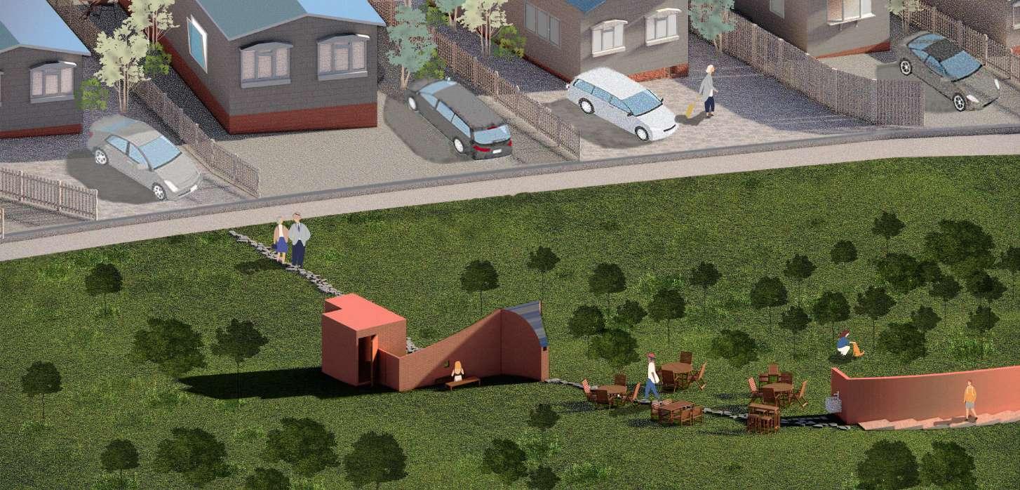
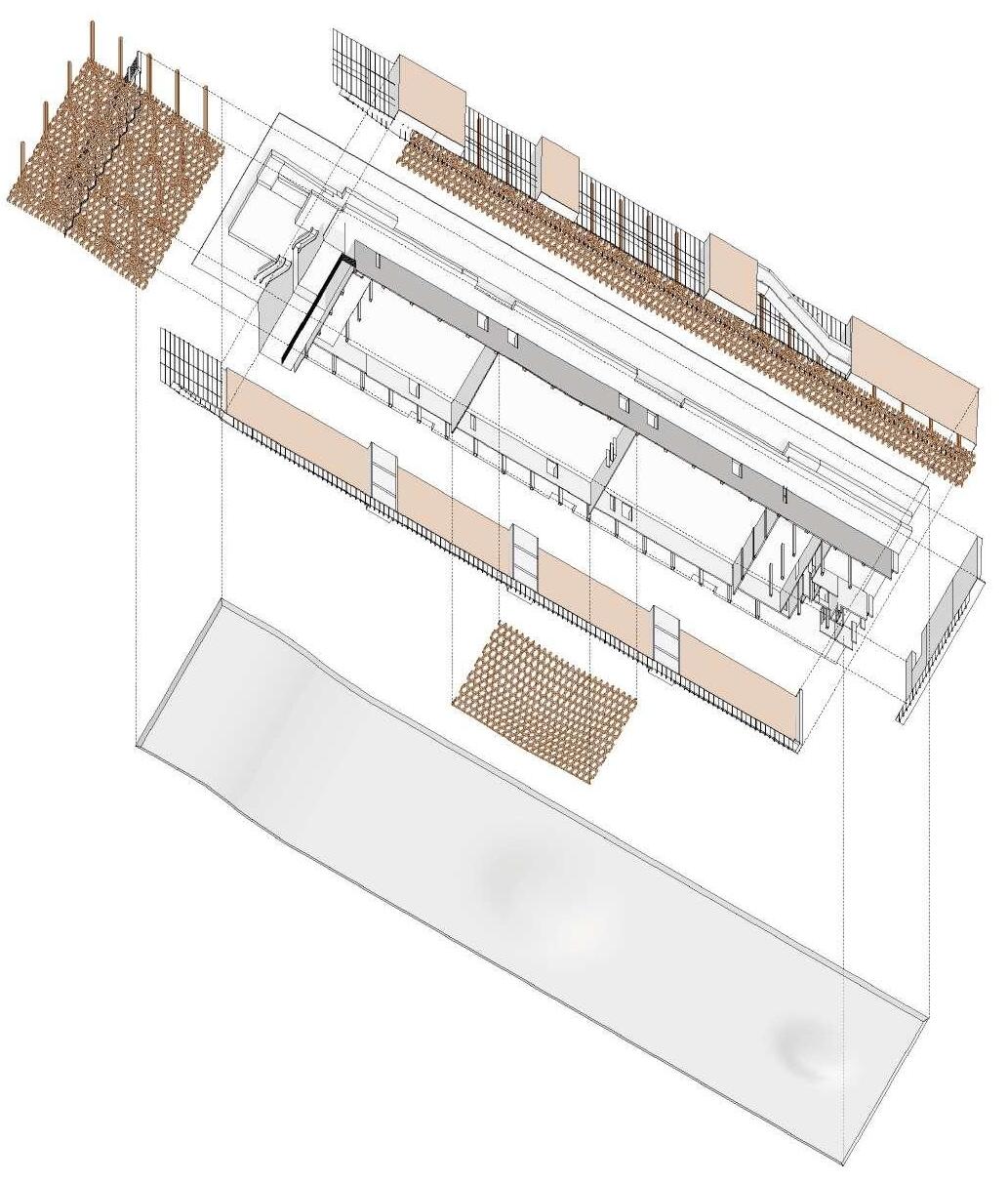
Seesaw
Woodbine Close Park
This project is a seesaw between the enclosed retired community and the relatively young generation, between being isolated and being exposed.
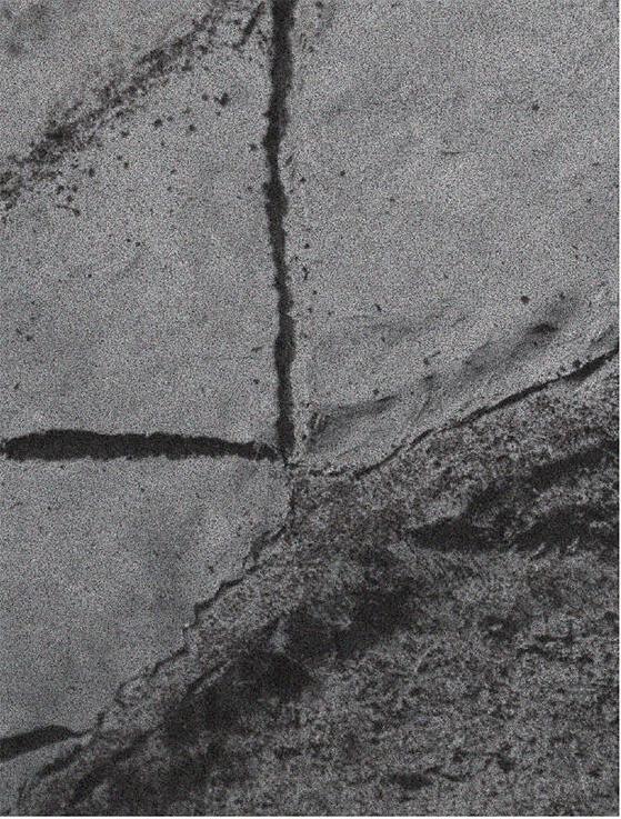
The site is an isolated park living neighborhood for retired people in the greenbelt. The existence of the park acknowledges that there is the greenbelt has the capability for hiding an isolated neighborhood.
The greenbelt is an old policy that is in the way of urban expansion. instead of using loopholes, if there is a gentle way to find the seesaw between current and past, to engage people’s attention to the ignored pieces of land surrounding them. It is a threshold to open up the community and make the greenbelt land itself be seen and explored.
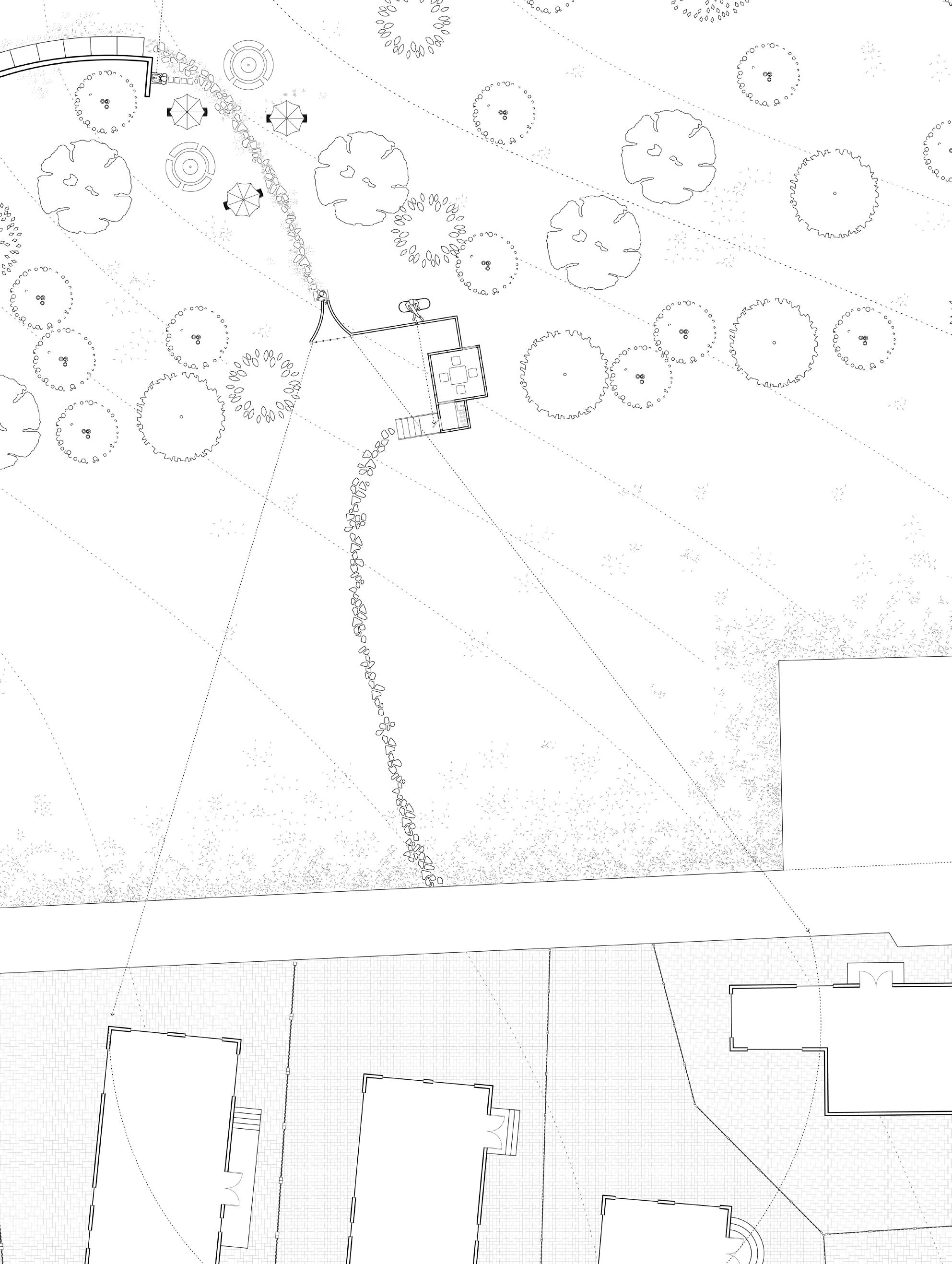
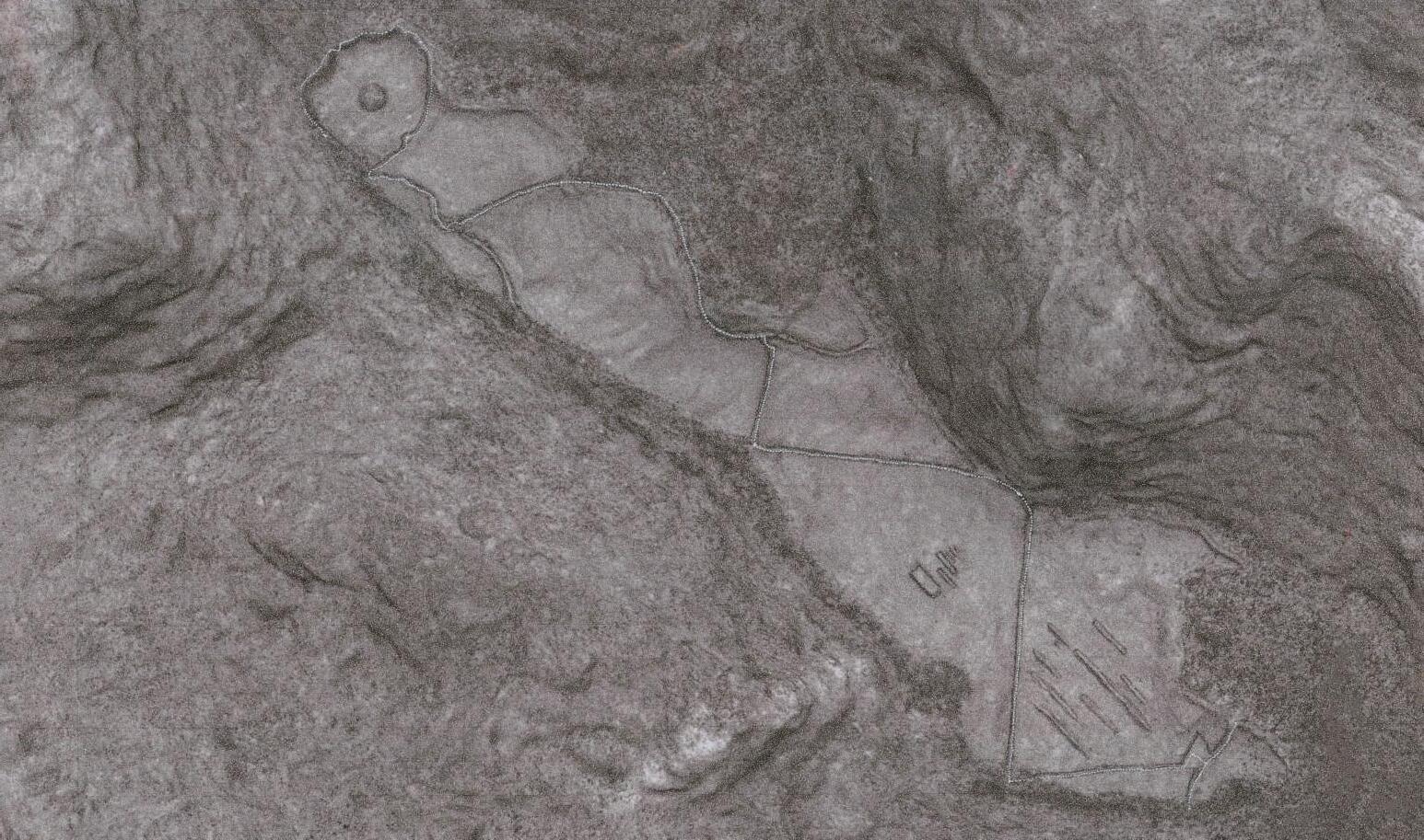
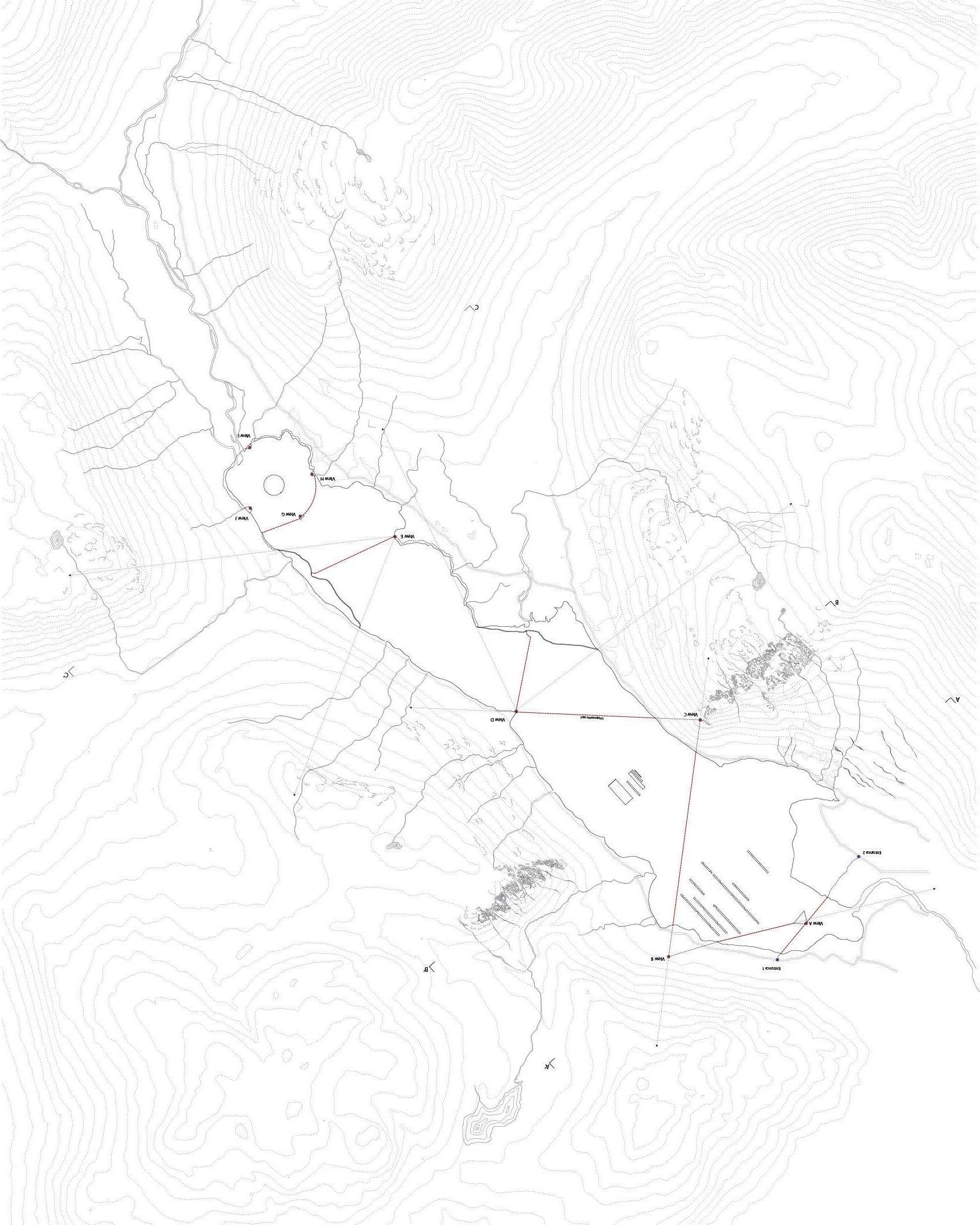
Site Plan
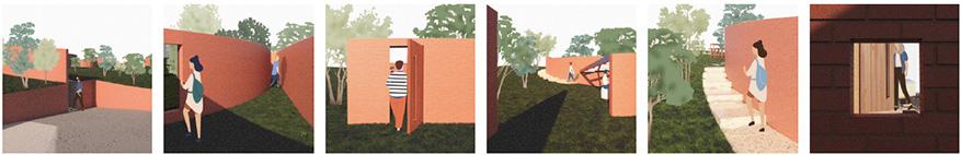
Community Threshold
I propose to create a communication threshold on the edge of the park, which attracts both the outsiders and the residents from Woodbine Close Community, and to approach the community without invading their sense of security and domesticity in this neighborhood to be defensive.
It is for people who want to take a break from this enclosed community, and for the outsiders who is curious about this unique neighborhood
Communication Mechanism
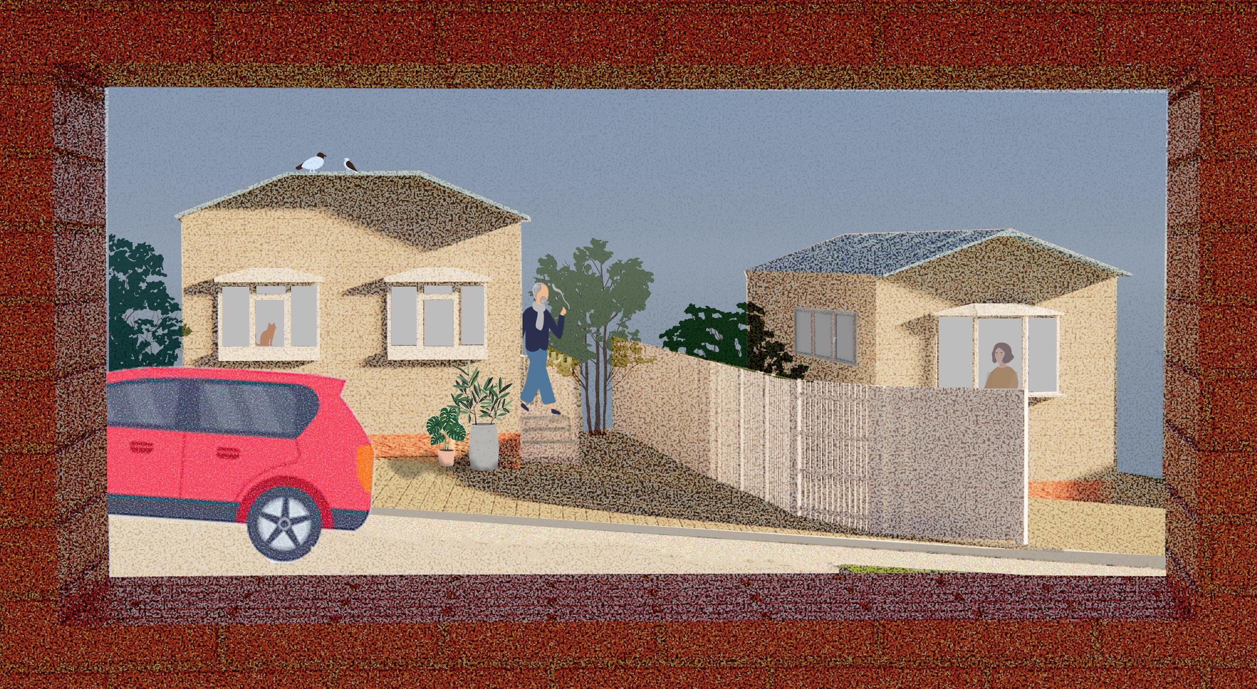
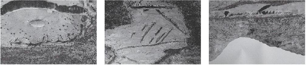
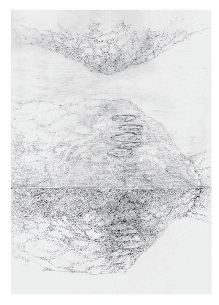
For the community and visitors, do not meet at first. I added another small car park that is limited to 5 cars for the visitors. After that, their journey of exploring the community starts. They enter the space through a narrow staircase with a view of the greenbelt.
As they walk, the wall will push them to see the 4cm hole in the brick wall, watching the life activities of the residents. The space is gradually opened to them as they emerge into it where they are guided by the door and are led to a low cabin.
In this cabin, they would sit and watch the scene of how the neighbors interact with each other. After that, they would walk to the highest point of the park and enjoy the open space.
If they are curious about the community, they can take some water from the water fountain at the end of the wall. And put it into the mist room that the residents can see from their window as a sign that the outsiders are sending their signal for conversation and small talk.
Pause
Studio Project
Site : Park West Place W2 2QJ
Year: 2024
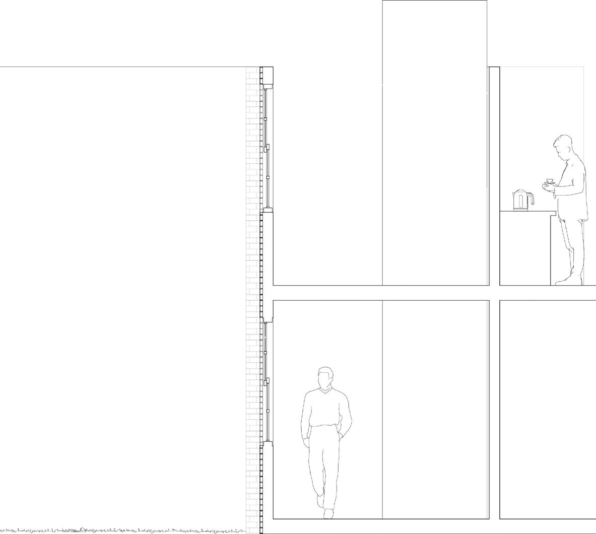
Tea Breaks
A home is a form of limitation by will, a sense of security, and stillness guards the experience of the space. The resident‘s movements seem to be random but always with a certain pattern. In modern days, the threshold between domestic space and social activities is blurring out, home is a folded space that collages privacy, connection, and work.
Do people need a break in this folded space?
A pause, a rest, an interruption, a postponement from their activity.
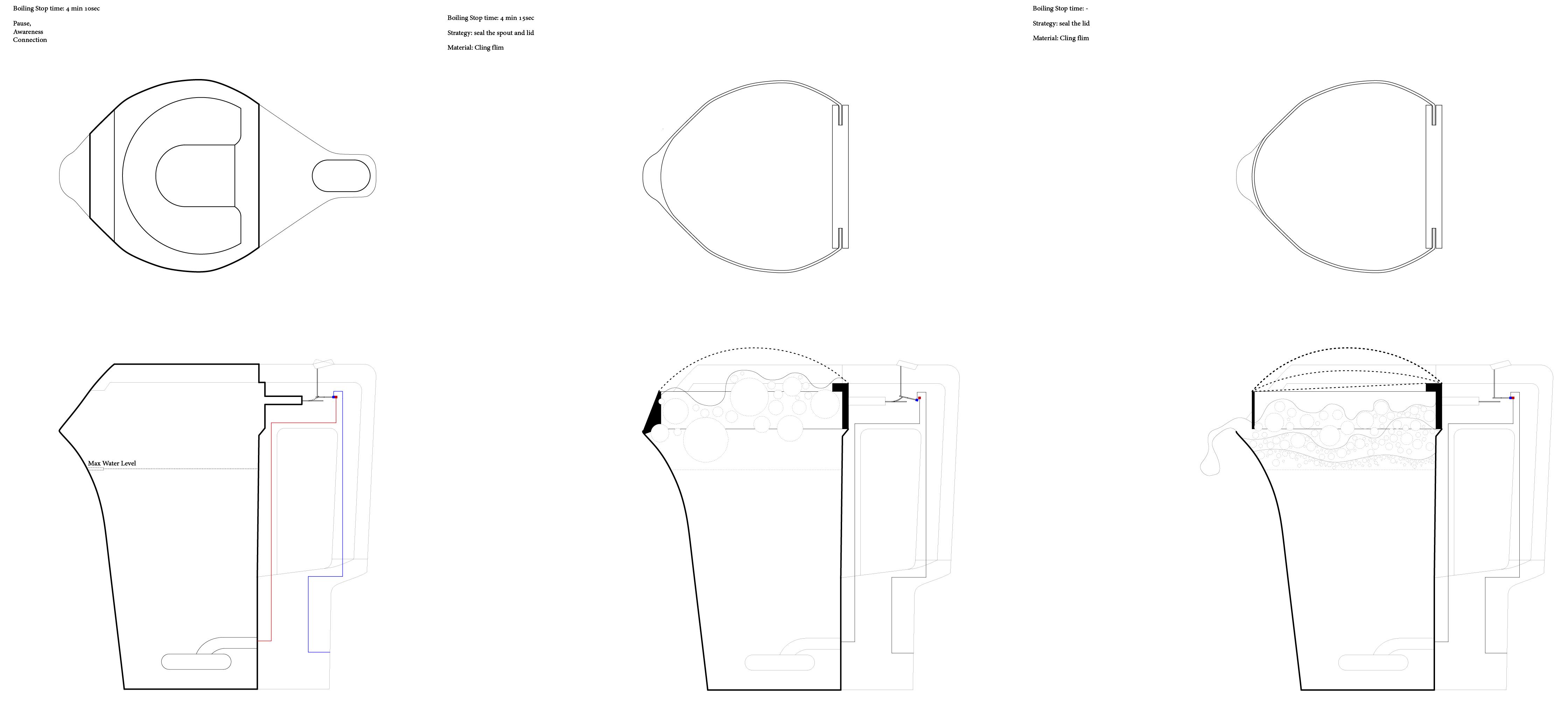
A kettle is a tool for it. It creates a “Guity Free” cut to the stillness of living through tea, a coffee and brings a 3-minute pause to the living routine.
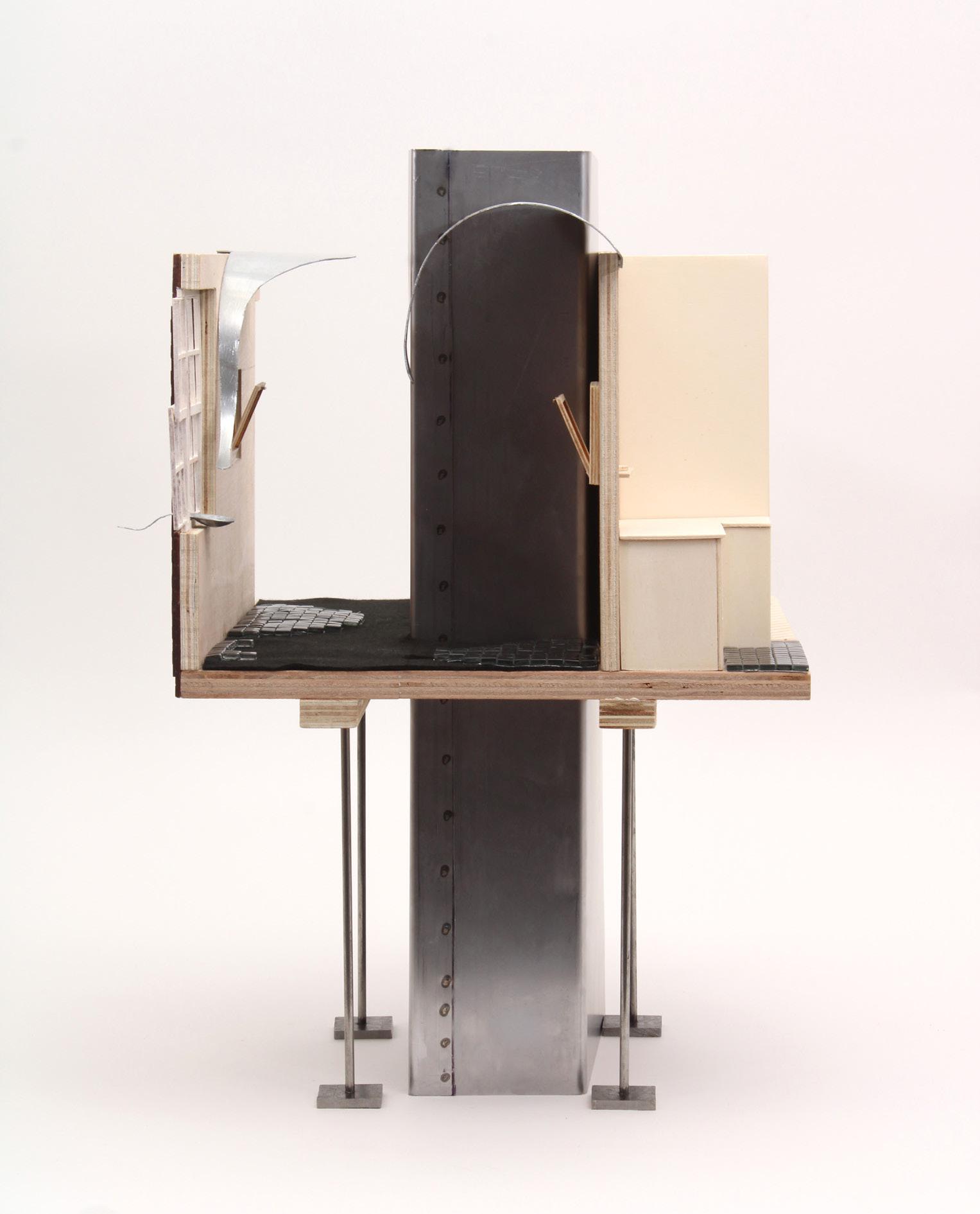
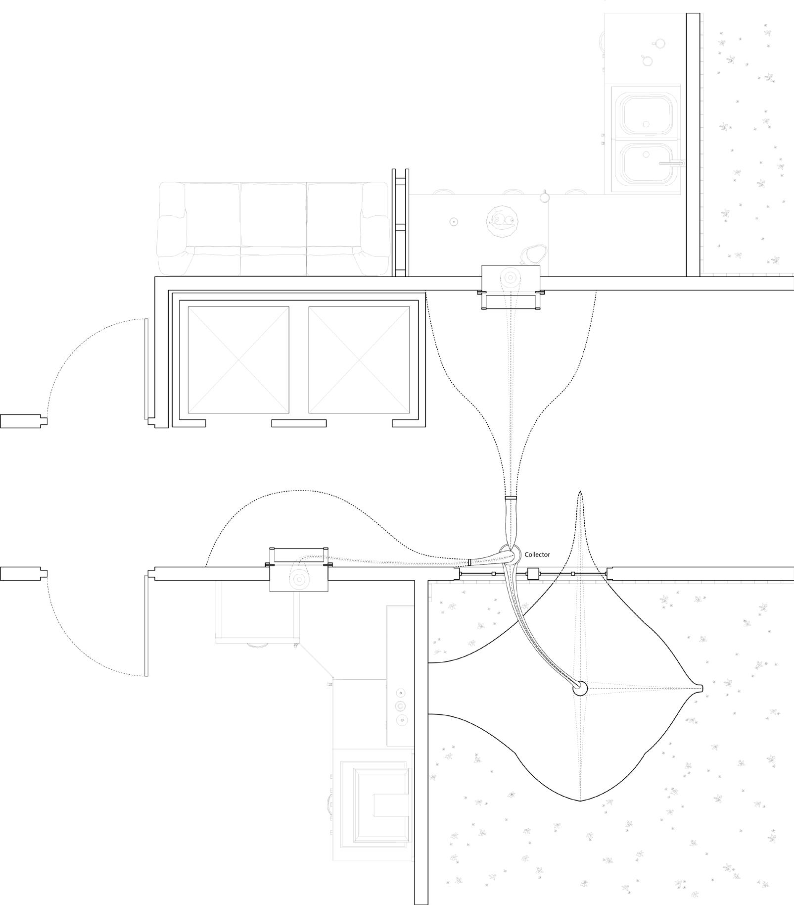
Expand and Shrink Kettle in the neighborhood
Extend the Pause
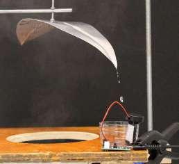
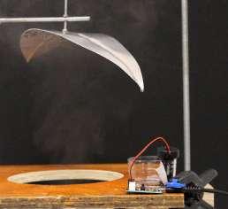
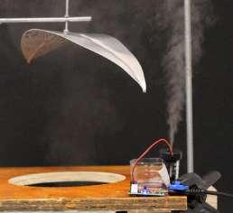
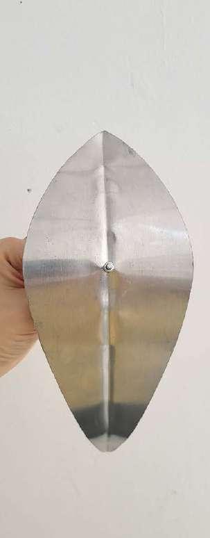
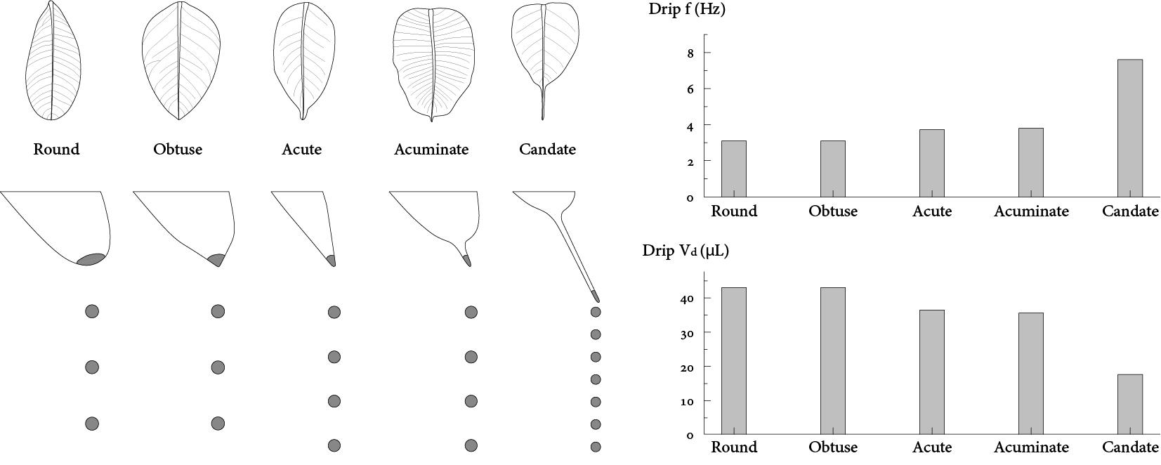
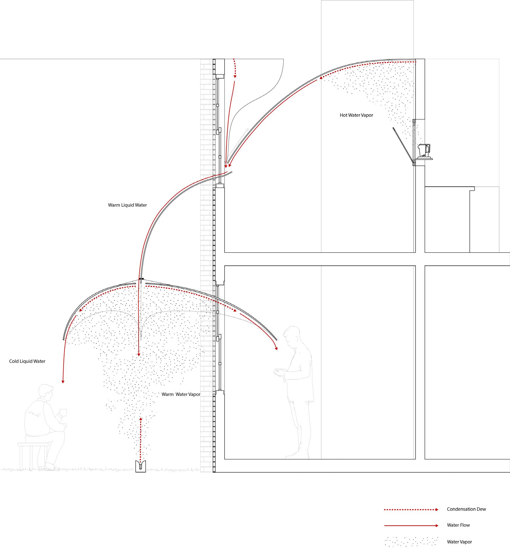
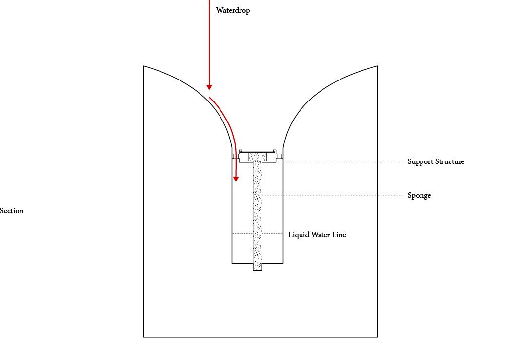
Leaf Driptip and Droplets
Leaves with narrow and thin drip tips (candate) are likely to drip more frequently than round drip tips. However, the volume of round driptip droplets is significantly bigger than narrow and sharp driptips.
Drip tips are pointed projections on the ends of leaves that help water run off. Its primary function is to help the leaf quickly and efficiently shed water from the leaf surface.
To work effectively, drip tips are accompanied by: glabrous (smooth) surface. Therefore, I choose to use aluminium for leaf material.
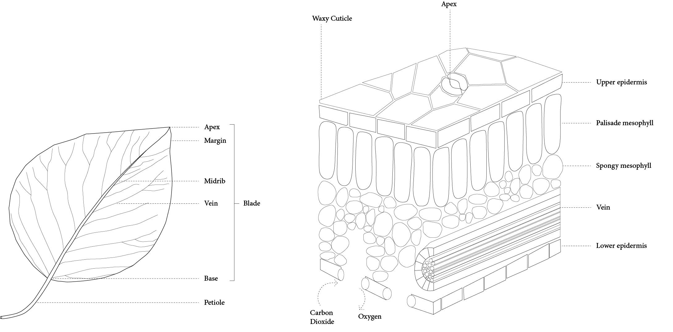
Research on leaf structure and its relation to droplet
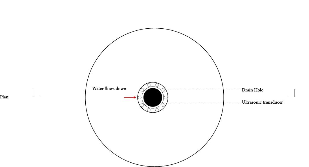
Testing: Steam - Condensation - Mist
Water Cycle and Dripping
Using multiple drip tips to provide distinct effects in the space that residents can use in a variety of ways. They can water their plants, wash their hands, and play by trying to catch the water droplets with the condensed water.
The circle:
Liquid water - boiled by the kettle - hot water vaporcondensed to warm water - drip into mist maker - warm mist for atmospheric effect - condensed to waterdrops for handwashing and playing.
Maker
Ripple as an Eye (Film Project)
Studio Project
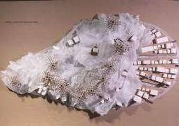
Site: Isle of Mull, Scotland
Year: 2023
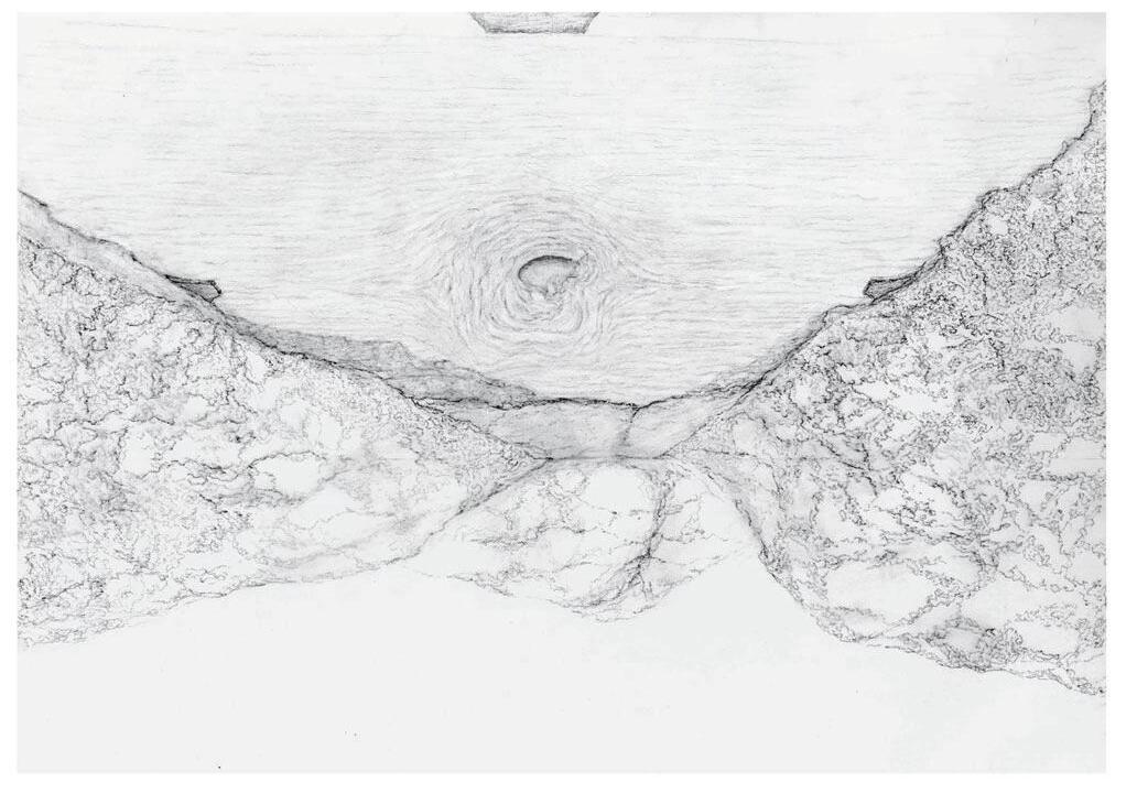
Tell story of the Land via Underwater Landscape
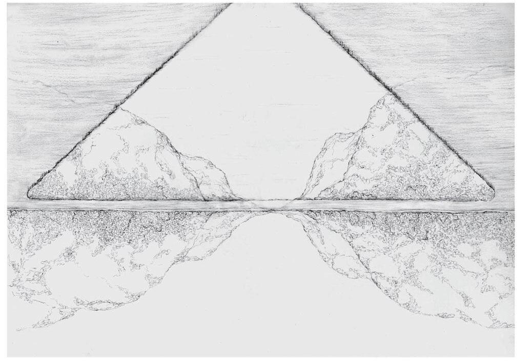
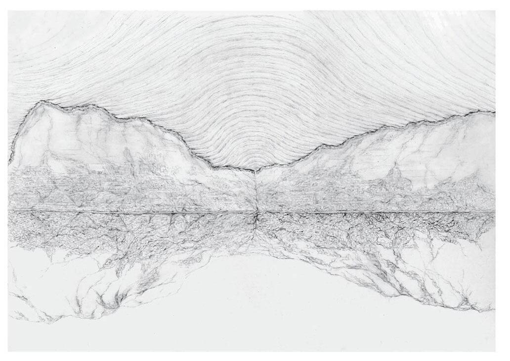
Water acts as the medium through which the landscape perfumes itself, capturing both visible and invisible elements of its surroundings from light to air. It reflects the environment through the curves of the waves, showing the essence of the landscape. I propose using water as the language of the land, performing the land’s movements through time.
By designing an underwater landscape using local rocks and marble, visitors can observe the geological history through the movements of light and ripple. The site, Loch Ba, is located within the Mull Central Complex, a region shaped by three volcanic centers. These centers are like gigantic ripples that form the land with rings of magma.
Over the past 50 million years, wind erosion has sculpted the caldera, erasing traces of the ancient volcanoes. The underwater landscape is designed to guide visitors' view, linking them to these lost geological features and revealing the touches of the wind erosion. This design aims to preserve and narrate the history of the landscape, inviting visitors to engage with the formation of Mull.
Project Film
https://youtu.be/quu8qtWmTLg?si=JXtzTQKDu_ybIi5v
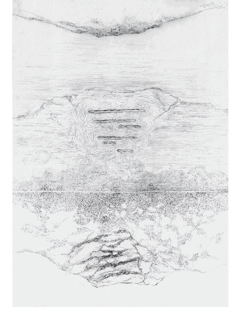
Underwater Landscape Design
Five views sculpted through the water and ripples tell the land's story as visitors pass by. A form of language appears when the wind drives the waves across Loch Ba. It becomes a subtle way to build connections between humans and land without disrupting Mull’s natural environment.
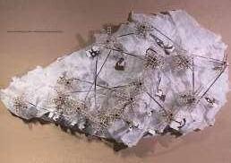
Transformation Over Time
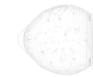
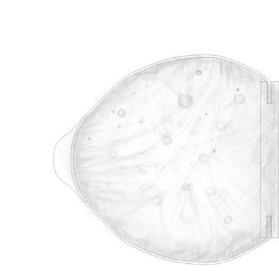
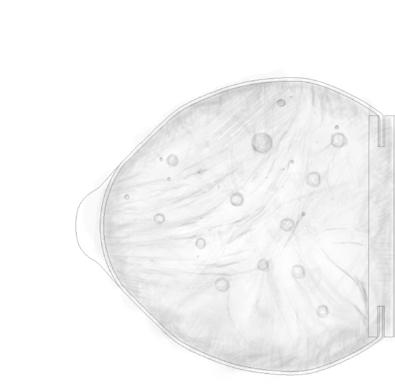
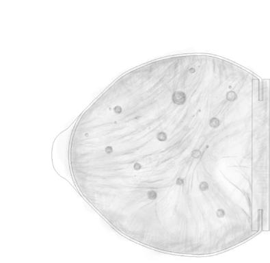
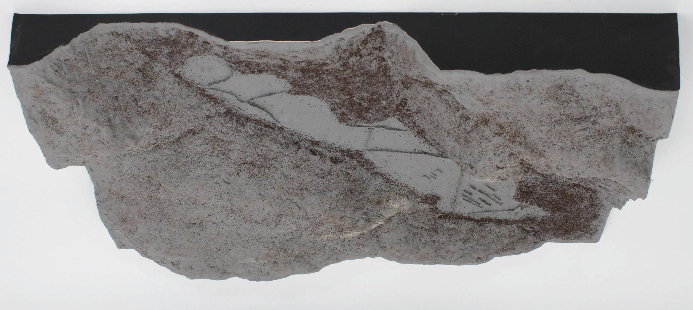
A1 size terrain and scenery model of the site. I used wood plates to construct the terrain and oil-based clay to give texture to the mountain. Then, I sprinkle dry tea leaves from English tea bags to show the Scotland mountain surface texture in winter.
In the middle is Loch Ba without water and the underwater landscape under the water's surface.
A1 Size model (Oil Clay and Tea Bags) of the site's geological features and the underwater landscape
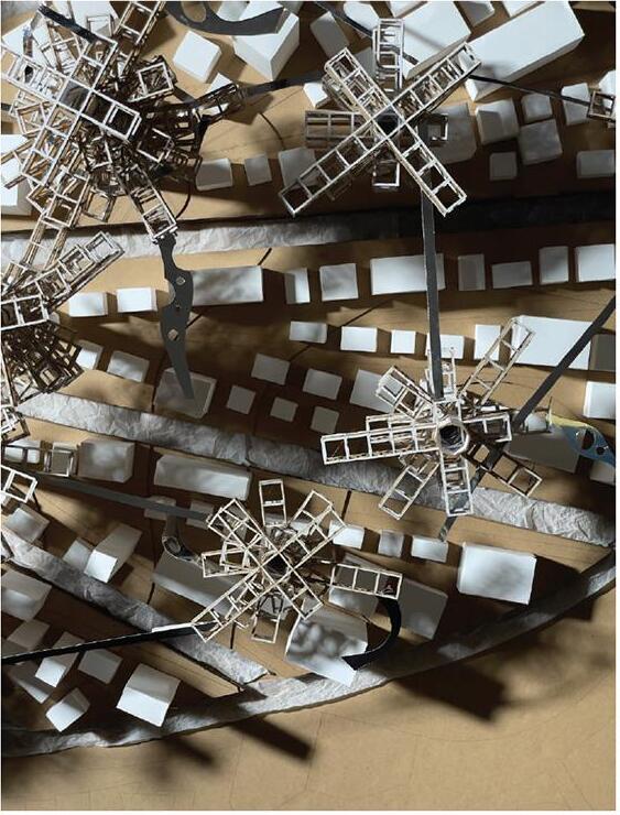
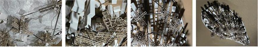
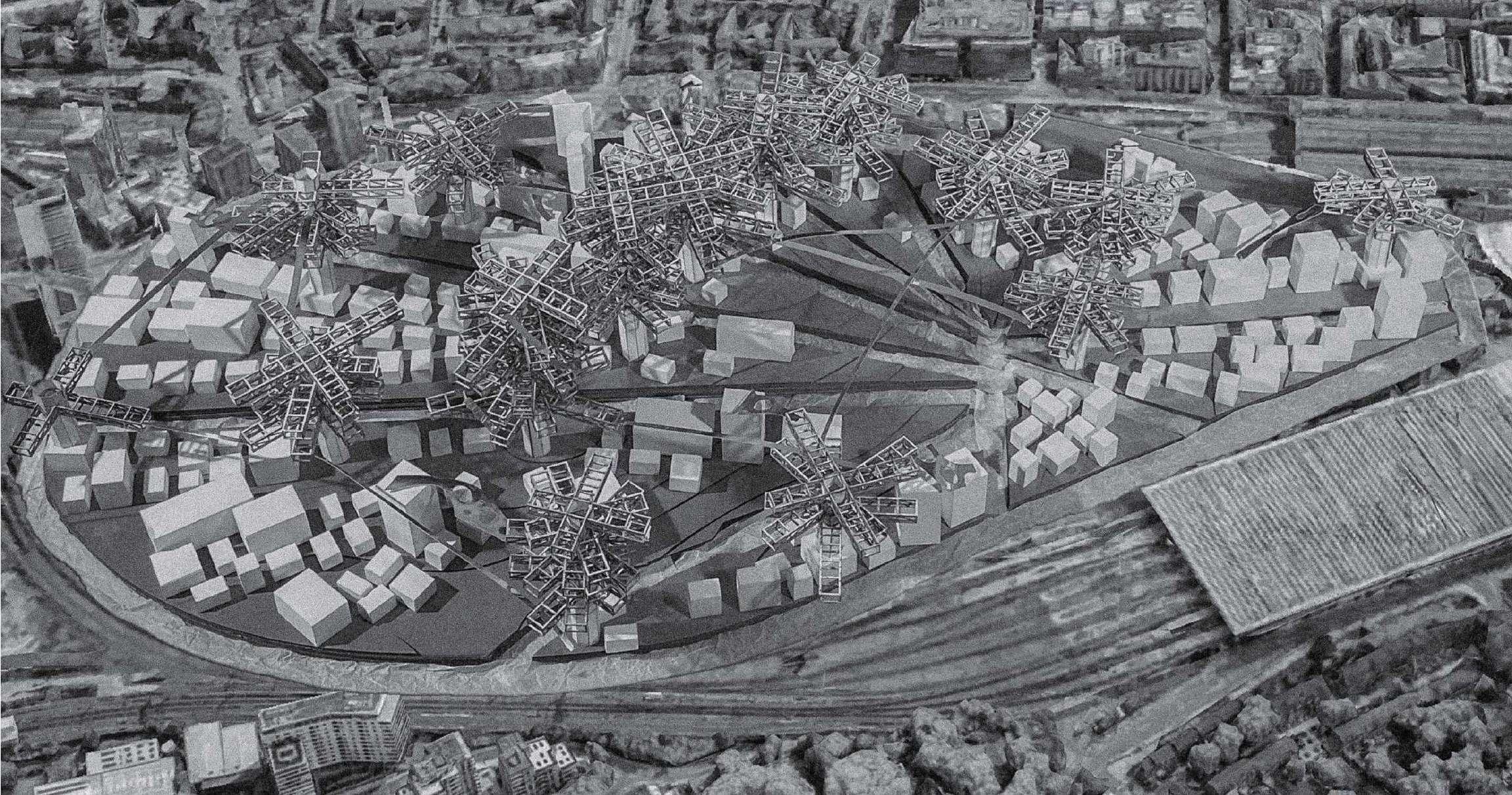
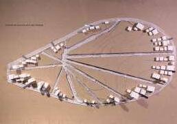
Kingscross Masterplan Design
Competition Site: Kingscross Year: 2022
The site is Kingscross area, we are proposing a masterplan for the future Kingscross area. We start our design with the background of flooding, creating a system that guides people from going into the area and gradually moving upward.
First, we isolated the whole area with canals and separated it into 10 islands, people will enter the area through bridges. As they gradually populate the area from the edge to the center, there will be cores start to be built in the highest part of each island.
Then, layers of truss structures will be added radially to the core as the density of the population on the ground level reaches its limit and the flood floods the ground level. People will gradually move to the truss tower. In order to separate the dense population in the truss tower, many more towers will be built as the flooding situation becomes more and more serious.
To divide the site into smaller compartments, 8 new canals are constructed in-between every 2 initersections of the site boundary with nearby roads.
cores are placed at the highest point of every island.
To guide inhabitants from each islands’ periphery to the core, main roads are placed radially and constructed gradually.
First
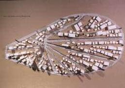
Ever-growing Structure
As the flooding situation becomes severe, the structure will start to build on the existing structure by adding truss units on the top and side of the tower as connection bridges for the Kingscross community.
Overview of the Kingscross Masterplan
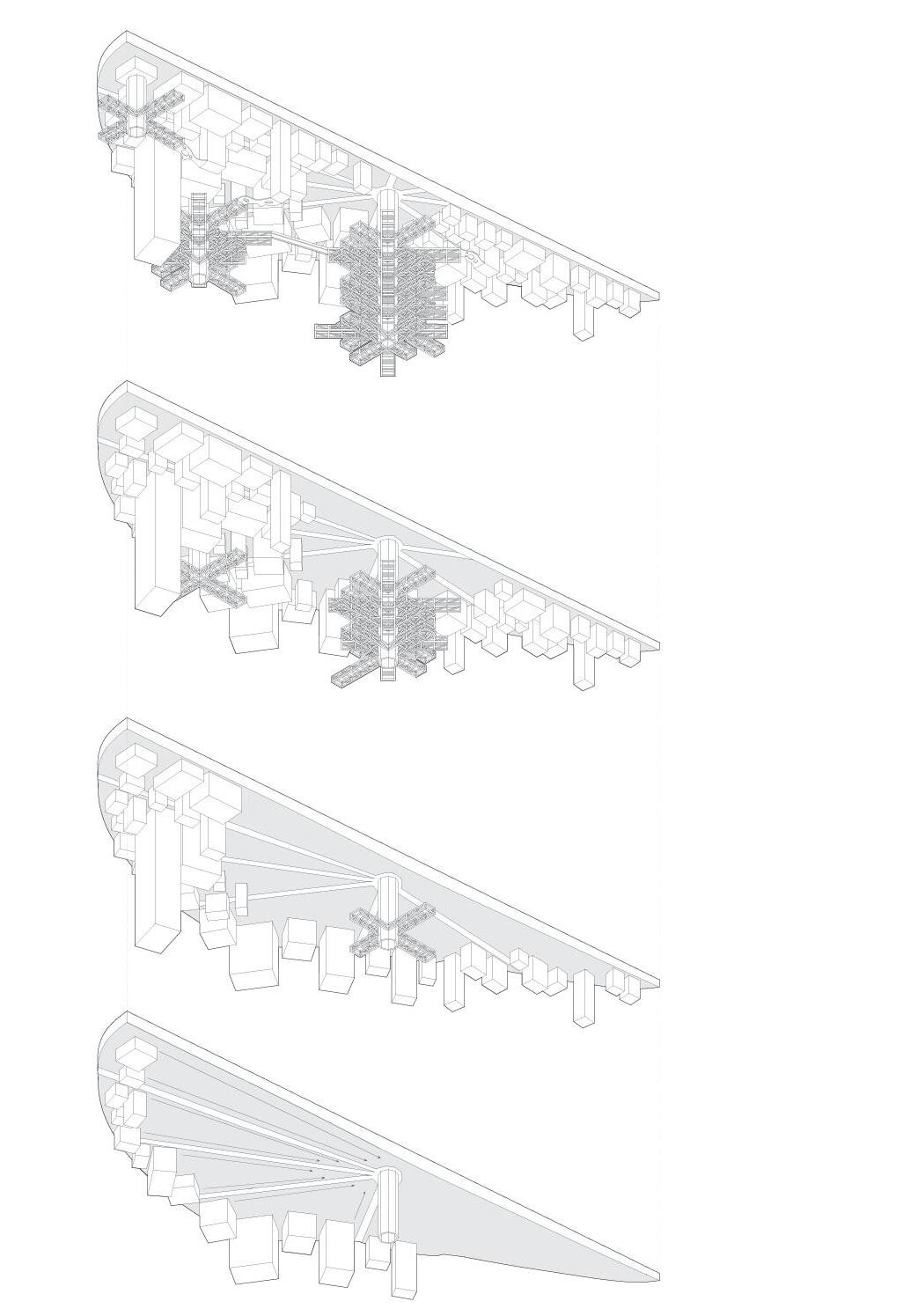
Transformation Over Time
Inhabitants are guided from periphery to the highest point of the island through gradual construction of the main roads.
Meanwhile, core the first tower is built. As the ground level gets denser and issue of flooding becomes more important, inhabitants are forced to start to move to the tower.
Addtional towers on top exisitng buildings are constructed over time.
Change in Density
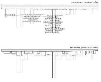
Initially, the ground level is becoming more dense as time passes by.
After the water level significantly rises, only upper parts of skyscrapers remain towering over the flood.
All other inhabitants are forced to move to the towers, forming a much more dense built environment on the top levels (while the ground is becoming less dense as water level rises).
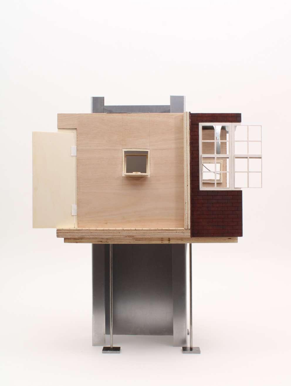
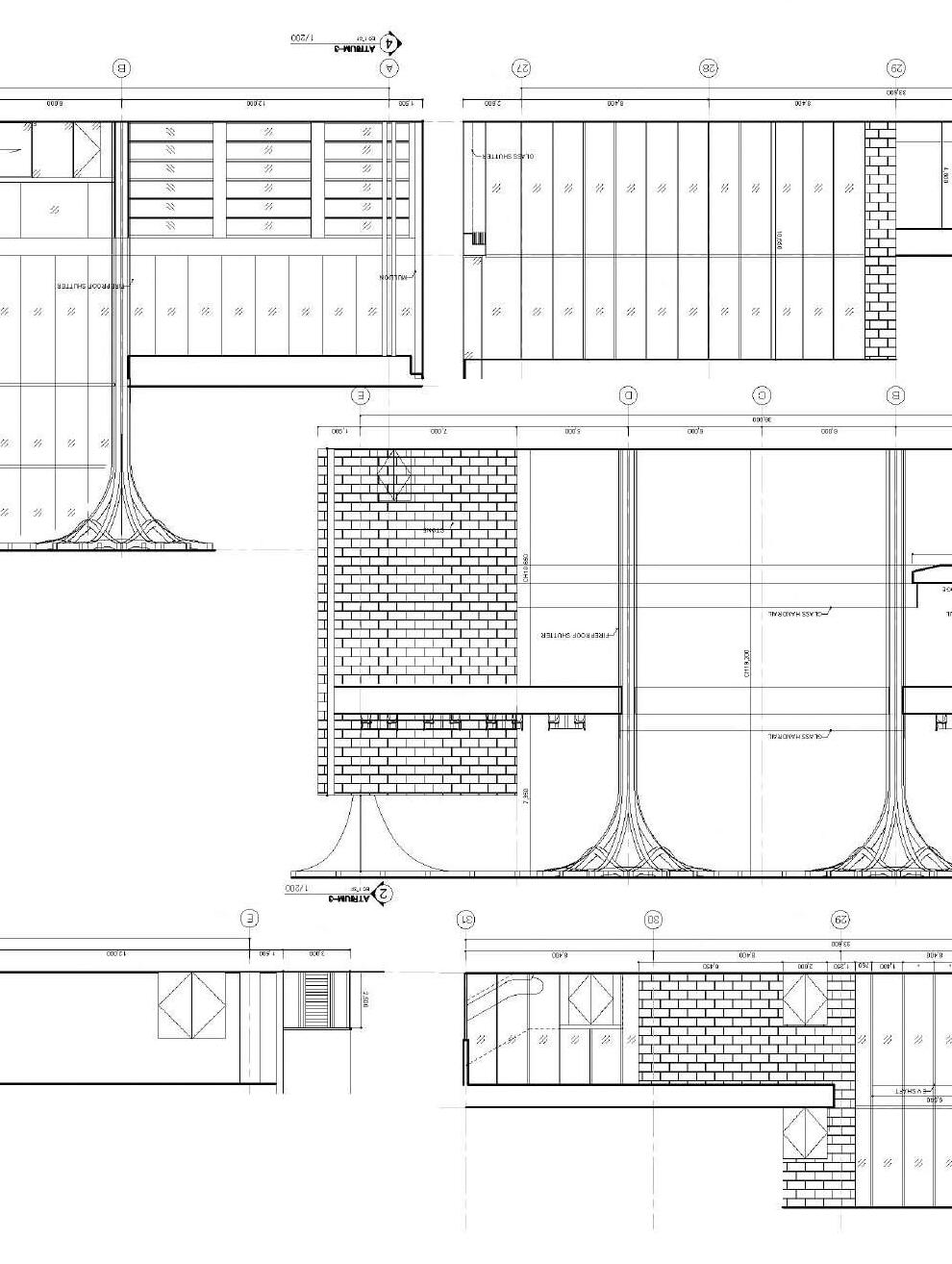
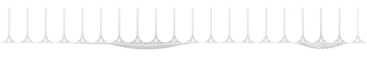
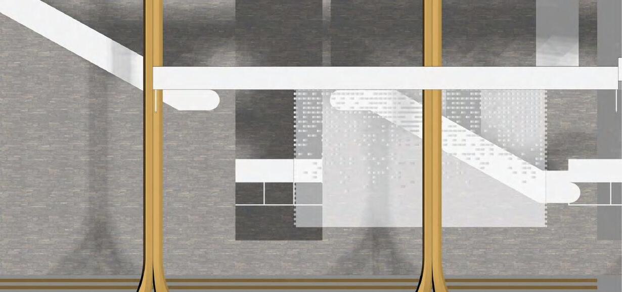
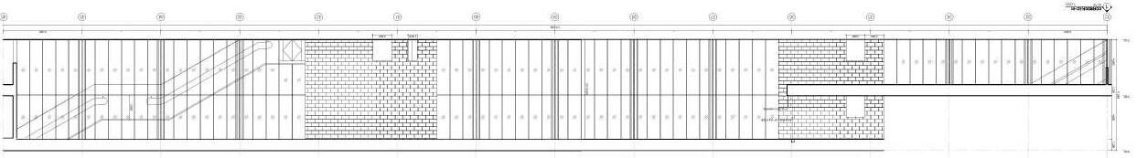
Internship Work Sample
Liangchu Museum Practice: Shigeruban-Tokyo Year: 2023
Liangchu Museum - Zhejiang
During the three-month internship, I learned how to use AutoCAD as part of a team. I also practiced and rewrote the column tree file for later application with various variables and versions. The project is a national museum design based on the local culture and heritage.
The ground floor is mainly used for special exhibitions, a cafe, and an atrium lobby. The first floor is used for collecting and donating local antiques. The third floor is for offices and facilities.