Lisboa 5 vales
Encontro de Urbanismo 2023
Lisboa, A Cidade dos Vales
Urban Planning Meeting 2023 Lisbon, The City of Valleys Lisbon 5 valleys
FICHA TÉCNICA
Promotor: Câmara Municipal de Lisboa
Editora: Have a Nice Day
Título: “Lisboa – 5 Vales”
Textos: Fátima de Sousa – Have a Nice Day e Câmara Municipal de Lisboa
Fotos: Câmara Municipal de Lisboa
Coordenação editorial:
Ana Rita Ramos – Have a Nice Day
Revisão editorial: Câmara Municipal de Lisboa
Paginação e design: Eva Vinagre e Maria Amorim – Have a Nice Day
Tradução: WordAholics
Impressão e acabamento: VRBL
Depósito legal: 541590/24
CREDITS
Promotor: Lisbon City Council
Editor: Have a Nice Day
Title: “Lisboa – 5 Vales” / Lisbon “5 Valleys”
Texts: Fátima de Sousa – Have a Nice Day and Lisbon City Council
Photography: Lisbon City Council
Editorial coordinator:
Ana Rita Ramos – Have a Nice Day
Revisor: Lisbon City Council
Pagination and design: Eva Vinagre and Maria Amorim – Have a Nice Day
Translation: WordAholics
Printing and finishing: VRBL
Legal deposit: 541590/24
índice contents
Estratégia Strategy
Uma visão estratégica para Lisboa
A strategic vision for Lisbon
Carlos Moedas
Presidente da Câmara Municipal de Lisboa
Mayor of the City of Lisbon

Pensar o futuro de uma cidade com mais de dois milénios de história tem tanto de desafiante como de motivador. Trata-se de um exercício que exige visão estratégica, reflexão técnica e audácia política. Essencialmente, exige que identifiquemos oportunidades e apresentemos soluções. Foi com base nesta abordagem que desenvolvemos o Programa 5 Vales.
Tendo como ponto de partida o ciclo de conferências “Encontro de Urbanismo” de 2023, este programa nasce de uma abordagem inovadora e integrada de requalificação urbana, assumindo-se como uma resposta estratégica aos desafios de mobilidade, sustentabilidade e coesão social em Lisboa. A ideia de “Lisboa como cidade das sete colinas” inspira o plano de intervir nos vales situados entre essas colinas. Os cinco vales selecionados — Almirante Reis, Alcântara, Ajuda, Chelas e Santo António — representam áreas com características e necessidades distintas, mas partilham o potencial de integração social e requalificação urbanística.
Cada vale é objeto de uma abordagem personalizada e em linha com a Estratégia Lisboa 2040, para projetarmos uma cidade mais inclusiva, moderna e resiliente. Propomos uma abordagem estrutural, que vá desde a requalificação do espaço público no Vale da Avenida Almirante Reis – tornando a área mais verde, mais acessível e mais segura – até à construção de 2.400 habitações no Vale de Santo António.
No contexto de uma visão integrada do território, o Programa 5 Vales representa o compromisso deste Executivo com uma urbanização inclusiva e orientada para o futuro, colocando sempre o bem-estar das pessoas no centro das suas prioridades.
Reflecting upon the future of a city with more than two millennia of history is as challenging as it is motivating. This reflection requires strategic vision, technical consideration and political boldness. Essentially, it requires us to identify opportunities and deliver solutions. It was based on this approach that we developed the 5 Valleys Programme.
Using the 2023 “Urban Planning Meeting” series of talks as a stepping stone, this programme is the result of an innovative and integrated approach to urban regeneration as a strategic response to the challenges of mobility, sustainability and social cohesion in Lisbon. The idea of “Lisbon as a city of seven hills” inspired the plan to take action in the valleys nestled between these hills. The five selected valleys – Almirante Reis, Alcântara, Ajuda, Chelas and Santo António – are areas with different characteristics and needs, but all share the potential for social integration and urban regeneration.
A personalised approach will be followed for each valley, in line with the 2040 Lisbon Strategy to design a more inclusive, modern and resilient city. We propose a structural approach, ranging from the renewal of the public space in the Avenida Almirante Reis Valley – making it greener, more accessible and safer – to the construction of 2,400 homes in the Santo António Valley.
Taking an integrated view of the territory, the 5 Valleys Programme embodies the City Council’s commitment to inclusive and forward-thinking urban planning, putting people’s well-being at the heart of its priorities.

Pensar Cidade Think City

Joana Almeida
Vereadora com o pelouro do Urbanismo
na Câmara Municipal de Lisboa
Councillor for Urban Planning at the Lisbon City Council

Lisboa é, frequentemente, associada à imagem da cidade das sete colinas. São na verdade bem mais do que sete, mesmo considerando apenas a sua área histórica central, mas o facto é que esta topografia desafiadora define a imagem única da cidade e contribui para a sua identidade muito própria. No entanto, se são as “colinas” que mais visibilidade têm, é nos vales, entre elas, que muitos dos espaços vitais da cidade se desenvolvem. Os vales da cidade albergam todos os principais corredores de mobilidade, das avenidas à rede de metropolitano, a rede de drenagem e boa parte da estrutura verde da cidade.
Alguns estão completamente consolidados, como o Vale da Avenida da Liberdade, mas outros apresentam ainda problemas de compatibilização de usos, uma rede viária incompleta, ou estão ainda por consolidar ou requalificar. É nestes espaços, que atuam frequentemente como barreiras e descontinuidades no território, que paradoxalmente estão as maiores oportunidades de consolidar, equilibrar e dar mais verde e coesão social à cidade.
Foi precisamente por reconhecermos a importância deste desafio, e oportunidade, que estabelecemos o “5 Vales” como um dos programas estratégicos do Urbanismo da Câmara Municipal de Lisboa. Este programa tem como dois principais objetivos eliminar barreiras (melhorando a conectividade entre os vales) e promover a coesão territorial e social (ligando o tecido urbano, completando a estrutura verde e criando novas ligações pedonais e cicláveis).

Lisbon is often associated with the image of the city of seven hills. There are in fact far more than seven, even when only its historic centre is considered. Indeed, this challenging topography is what shapes the city’s unique image and gives it its very own identity. All the same, while it is famous for its “hills”, many of the city’s living spaces occupy the valleys between them. Lisbon’s valleys are home to all major mobility corridors, from avenues to the metro network, the sewer system, and much of the city’s green structure.
Some are fully consolidated, such as the Avenida da Liberdade Valley, while others still face functional incompatibilities, an unfinished road system or have yet to be consolidated or overhauled. It is these areas, which often act as barriers and discontinuities in the territory, that paradoxically offer the greatest opportunities to consolidate, balance, create more green spaces and achieve social cohesion in the city.
It was precisely because we recognise the importance of this challenge, and opportunity, that we established “5 Valleys” as one of the Lisbon City Council’s strategic urban planning programmes. The two main goals of this programme are to remove barriers (by improving connectivity between valleys) and to promote territorial and social cohesion (by stitching together the urban fabric, completing the green structure and creating new foot and cycle paths).
Para estes cinco vales, que representam espaços fundamentais na estrutura funcional da cidade, o Programa 5 Vales define estratégias e implementa projetos integrados para melhorar/ /requalificar/reconstruir os vales e a sua envolvente:
Vale de Chelas
O grande vale da zona oriental da cidade caracteriza-se pela incompleta articulação entre malhas, que geram isolamento e afastamento entre bairros. Urge completar ligações através, e ao longo, do vale. Muito em breve, a área central receberá o novo Hospital de Lisboa Oriental, que será o motor de regeneração urbanística da envolvente, no que designamos de uma nova “Cidade da Saúde”. Estamos a trabalhar numa estratégia integrada, suportada por uma Operação de Reabilitação Urbana que promova a melhor articulação entre os bairros, a conclusão da estrutura verde e requalificação ambiental do bairro e permita a coordenação de intervenções de entidades da administração central, local e de privados na produção de habitação e alojamentos estudantis, reforço da oferta de equipamentos e serviços de proximidade.
The 5 Valleys Programme sets out strategies for the five valleys, which are vital spaces in the city’s functional structure, and implements integrated projects to improve/ renew/rebuild the valleys and their surroundings.
This large valley in the eastern part of the city has unfinished connections between networks, which isolate and create distance between neighbourhoods. Completion of connections through and along the valley is urgently required. The downtown area will soon see construction of the new Lisboa Oriental Hospital, the driving force behind the urban regeneration of the surrounding area, which we call a new “City of Health”. We are working on an integrated strategy, underpinned by an Urban Renewal Operation promoting improved connection between the neighbourhoods, completion of the green structure and environmental renewal of the neighbourhood, and enabling coordination of actions by central and local government entities and private companies for the production of housing and student accommodation, increasing the supply of local amenities and services.
Vale de Santo António
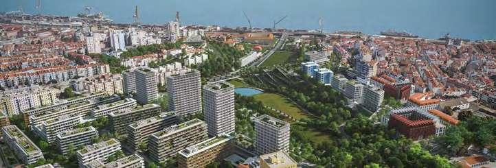
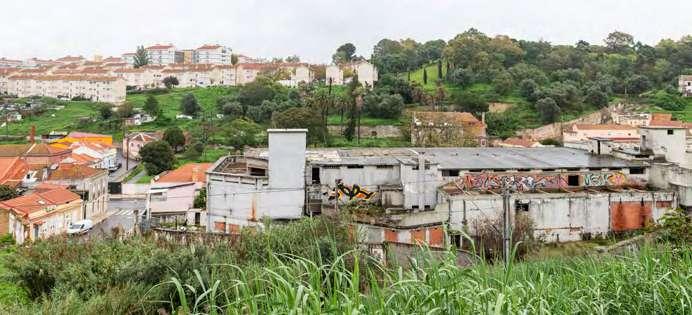
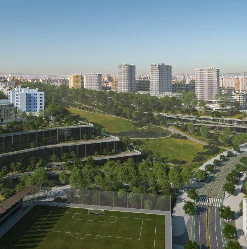
Este vale situa-se bem no centro da cidade e representa a última grande oportunidade de desenvolvimento nesta área de 48 ha, sendo o município proprietário da quase totalidade. Trata-se de um território como uma configuração desafiante, mas como uma localização excecional e vistas privilegiadas sobre o Estuário. A CML, através da alteração ao Plano de Urbanização, está a planear um bairro sustentável, inovador, e que dá resposta à carência de oferta habitacional acessível, dirigida a famílias e jovens da cidade, com oportunidade de criação de cerca de 2.400 fogos. No centro do bairro situar-se-á um novo parque urbano, com área equivalente a dois jardins da Estrela, que vem dar resposta de oferta de espaços verdes numa das áreas da cidade com maior carência a este nível. Estão previstos mais de 15 novos equipamentos públicos, distribuídos pela área, e uma rede de apoio à mobilidade suave, os quais contribuem para a criação de um bairro próximo e acessível.
This valley is located right in the heart of the city and represents the last major development opportunity in this 48-hectar area, almost all of which is owned by the City. It presents a challenging landscape but is in a prime location and has privileged views over the Estuary. The Lisbon City Council, through the amendment of the Urbanisation Plan, is planning the (re)development of a sustainable, innovative neighbourhood to address the shortage of affordable housing for families and young people in the city, opening up an opportunity to create around 2,400 homes. A new city park, spanning an area the size of two Jardim da Estrela parks, will be implemented in the centre of the neighbourhood, providing green spaces in one of the areas of the city where they are sorely needed.
More than 15 new public amenities are planned for the area, as well as a soft mobility support network, all of which will help create an accessible and coalescent neighbourhood.
Vale da Almirante Reis
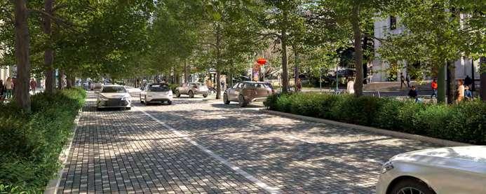
Este eixo fundamental da cidade está a ser objeto de um estudo aprofundado e integrado. O processo participativo, concluído em 2023, foi o mais participado de sempre para um espaço público da cidade, contando com mais de 2.500 contributos. Os lisboetas querem uma avenida mais amiga do peão, com mais espaço de convívio e maior segurança, mais arborizada e fresca. A proposta em desenvolvimento procura harmonizar os diferentes modos de transporte, criando mais espaço para os transportes públicos e bicicletas, sem comprometer a circulação automóvel, e revê toda a lógica de organização do perfil, prevendo um corredor arborizado contínuo, do Martim Moniz à Praça do Areeiro – o novo Passeio Verde de Lisboa.
This major artery of the city is currently the focus of an in-depth and integrated study. The participatory process, which concluded in 2023, saw the most engagement ever for a public space in the city, with over 2,500 contributions. The people of Lisbon want a more pedestrian-friendly avenue, with more space for socialising and a safer, cooler city, with more trees. The draft proposal seeks to harmonise the different modes of transport, creating more space for public transport and bicycles, without impeding motor traffic, and reworks the organisation of the area, envisaging a continuous tree-lined corridor from Martim Moniz to Praça do Areeiro squareLisbon’s new Green Promenade.
Vale de Alcântara
Estamos a desenvolver um plano integrado para este vale, focado na harmonização das intervenções sobre o espaço público, na melhoria da conectividade pedonal e na conclusão de um corredor verde contínuo. Na extremidade inferior, o vale terá uma nova estação de metro, em torno da qual se criará um dos principais interfaces de transportes da cidade que que integrará, no futuro, uma nova estação ferroviária na ligação direta entre a linha de Cascais e a linha de Cintura e a linha de transporte coletivo, em sítio próprio, que servirá a Ajuda e Belém. Toda a área será objeto de um projeto de redesenho do espaço público, que dotará de coerência e harmonia um conjunto de intervenções na zona baixa de Alcântara e permitirá unir e cerzir malhas urbanas hoje desconexas, através da criação de uma rede contínua de espaços públicos requalificados. Assim, se promoverá o reforço da acessibilidade pedonal e ciclável entre os bairros que se desenvolvem ao longo da Avenida de Ceuta e ambas as encostas do vale, bem como a consolidação do corredor verde do Vale de Alcântara.
We are developing an integrated plan for this valley, focused on harmonising works involving public space, improving pedestrian connectivity, and completing a continuous green corridor. At the lower end, the valley will have a new metro station, around which one of the city’s main transport hubs will be created. This hub will include a new railway station with a direct connection between the Cascais line and the Cintura line, and a public transport line, on a dedicated site, serving Ajuda and Belém. The entire area will be the focus of a project to redesign public space, ensuring consistency and harmony in a series of works in the lower end of Alcântara and connecting and joining urban networks that are currently disconnected by creating a continuous network of renewed public spaces. This will improve pedestrian accessibility and cycle paths between the neighbourhoods that line Avenida de Ceuta and both slopes of the valley, as well as consolidate the green corridor of the Alcântara Valley.
Vale da Ajuda
Este vale, ou melhor, vales, é repositório de um conjunto patrimonial e arqueológico único. No entanto, entre monumentos nacionais e museus de enorme qualidade e relevância, persistem vazios urbanos, fruto de sucessivas intervenções urbanísticas incompletas ou descontextualizadas. O resultado é uma malha urbana desestruturada, onde ligações entre bairros permanecem incompletas. O “remate” do Palácio Nacional da Ajuda, que apenas recentemente se concluiu, é espelho do tipo de ferida que persiste nesta área da cidade, onde bairros de diferentes épocas e tipologias nos surgem incompletos, com quarteirões por rematar, vias de ligação que terminam em impasses e uma certa ausência de espaços públicos qualificadores e unificadores. A estratégia de intervenção passa, assim, pelo estudo conjunto das malhas e intenções urbanísticas e preparação de uma rede coerente de espaços públicos e ligações viárias, com vista à qualificação urbanística e valorização patrimonial, ambiental e paisagística desta área da cidade, bem como do conjunto monumental ímpar que alberga.
This valley, or rather valleys, is home to a unique heritage and archaeological site. However, between national monuments and impressive and important museums, urban voids persist as a consequence of successive incomplete or haphazard urban works. The result is an unstructured urban environment, where connections between neighbourhoods are frayed. The “finishings” of the Ajuda National Palace, which were only recently completed, personify the still gaping wound in this area of the city, where neighbourhoods from different eras and various types appear incomplete, with unfinished city blocks, connecting roads that lead to nowhere, and a lack of quality and unifying public spaces. The intervention strategy thus involves a joint study of the urban networks and aspirations, and the preparation of a coherent network of public spaces and transport connections, with a view to the urban regeneration and enhancement of the heritage, environment and landscape of this area of the city, and that of the unique monuments and museums it houses.
Para dinamizar e dar voz a este programa, promovemos o ciclo de conferências
Encontro de Urbanismo dedicado ao tema “5 Vales”, realizado no CIUL – Centro de Informação Urbana de Lisboa, em 2023. Assistimos a um conjunto de intervenções de enorme qualidade, que nos estimularam a aprofundar ainda mais esta aposta.
Neste sentido, e dada a enorme qualidade das intervenções, a dedicação dos participantes e a relevância de divulgarmos o programa de requalificação destes vales, decidimos fazer uma edição destas conferências, perpetuando em palavras, memórias, ideias e conceitos.
É muito bom “Pensar Cidade” e poder deixar escrito o fantástico trabalho que desenvolvemos juntos.
To make this programme more dynamic and give it a voice, in 2023 we held the Urban Planning Meeting series of talks on the theme “5 Valleys”, at the Lisbon Urban Information Centre (CIUL). The quality of the talks was outstanding, encouraging us to pursue this endeavour even further. Accordingly, and given the excellent talks, the dedication of the participants and the importance of publicising the redevelopment programme for these valleys, we decided to create a publication relating to these talks, recording in words memories, ideas and concepts. It’s great to “Think City” and to be able to document the amazing work we’ve done together.
Vale de Chelas
20 de abril de 2023 20 April 2023
Moderador Moderator
José Correia
Divisão de Planeamento Territorial, CML
Spatial Planning Division, CML
Oradores Speakers
João Pedro Falcão de Campos
Falcão de Campos, Arquitecto Architect
José Veludo
Npk – Arquitectos Paisagistas Associados
Álvaro Fernandes
Divisão de Reconversão de Áreas Urbanas de Génese Ilegal, CML Division for the Conversion of Illegally Built Urban Areas, CML
Vale de Chelas e seu entorno: um valor (incomum) da cidade
Chelas Valley and its surroundings: an (exceptional) city
asset
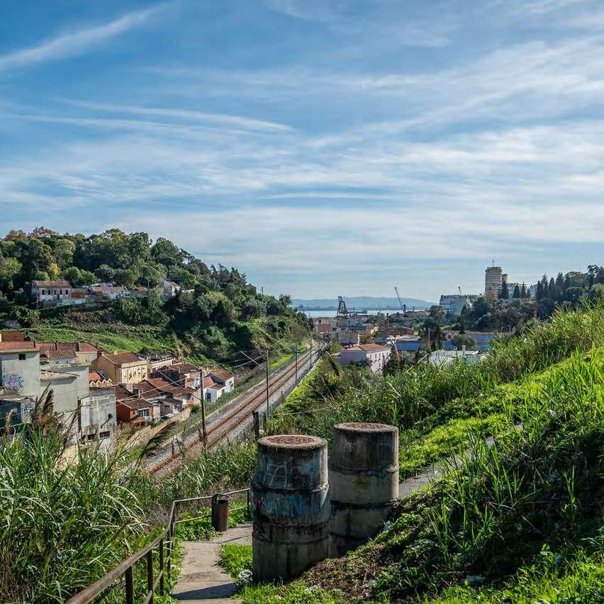
O chão da cidade define-se pelos cambiantes geográficos e geomorfológicos, que dão estrutura e marca distintiva à paisagem e imagem da cidade. O vale de Chelas e seu entorno têm a marca do seu chão: um vale com uma bacia extensa (7 km2), de natureza complexa – topográfica e ecológica/ /ambiental –, que ao longo de séculos foi sendo ocupado, apropriado, modelado, construído e habitado. Estes processos densificaram a matriz do seu chão, que as dinâmicas e constrangimentos societais cimentaram numa estratificação de estruturas e infraestruturas, no seguinte encadeamento cronológico:
• Até ao início do séc. XIX, enquanto arrabalde da cidade, fixa-se uma primeira camada que deriva da relação natural e sistémica do vale com a frente ribeirinha. Esta paisagem rústica é pontuada pelas estruturas notáveis do convento e dos mosteiros;
• Com as vagas de industrialização do séc. XIX, dá-se o incremento do eixo ribeirinho Santa Apolónia - Braço de Prata (Rua do Açúcar) e consequente valorização portuária, que vão “fechando” a relação natural e sistémica entre vale e frente ribeirinha. Implantam-se, neste eixo, complexos fabris e vilas operárias. Em paralelo, a ferrovia impõe-se e progressivamente,
The city floor is shaped by the geographic and geomorphological changes that give structure and distinctive features to the city’s landscape and image.
Chelas Valley and its surroundings are a hallmark of its floor: a valley with an extensive (7 km2) and (topographically and ecologically/environmentally) complex basin which, over the centuries, has been occupied, appropriated, shaped, built and inhabited. These processes increased the density of the soil matrix, which social dynamics and constraints cemented into a stratification of structures and infrastructures, in the following chronological sequence:
up until the beginning of the 19th century, as a city suburb, a first layer is deposited derived from the natural and systemic relationship between the valley and waterfront. This rural landscape is dotted with the remarkable structures of the convent and monasteries;
the waves of industrialisation in the 19th century ushered in the expansion of the Santa Apolónia - Braço de Prata (Rua do Açúcar) waterfront area and consequent port development, which “terminated” the natural and systemic relationship between the valley and the waterfront. Factory
até aos dias de hoje, vai rasgando o vale: primeiro transversalmente (junto ao rio) e depois prolongando-se para montante, impactando fortemente esta paisagem;
• Já no séc. XX, a partir das décadas de 50 e 60, o que foi o arrabalde, perante uma cidade em forte expansão, projeta-se agora como periferia de primeira linha: o entorno do vale absorve modelos e políticas direcionadas para a habitação; são planeados e edificados bairros e grandes ensembles de habitação, em contextos de grande pressão demográfica e política. Paralelamente, o impulso industrial perde vigor, criando bolsas, mais ou menos contínuas, de espaços vacantes em toda a frente ribeirinha, que se mantêm até aos dias de hoje.
Indelevelmente marcado que está este chão por estas sobreposições, é lugar comum olhar este extenso trecho de cidade como fragmentado, desconexo e até disruptivo.
No entanto, é imperativo (re)pensar este chão igualmente como lugar incomum: de valor na relação habitar e habitat; de valor enquanto centralidade; de valor na relação da cidade com o rio e seu estuário; de valor na relação entre a cidade compacta e a cidade “jardim”; de valor da(s) identidade(s) e pertença; de valor multicultural e plural; de valor de ecossistemas (água e solo); de valor da caminhabilidade e da mobilidade sustentável; e de valor na transição alimentar e na economia circular.
Pensar o fazer cidade desafia e convoca a (re)pensar este chão como um mosaico incomum de identidades de lugar (Tópos), impregnado de energia potencial regenerativa (Utopos) que é a energia vital de mobilização de utopias reais, para assim reconhecer o valor incomum deste território para a cidade, que “não tem só sete colinas, nem cinco vales”.
José Correia Divisão de Planeamento Territorial, CML
complexes and workers’ villages were erected along this axis. In parallel, the railway took root and progressively, and to this day, tears through the valley. First transversely (along the river) and then extending upstream, forever altering the landscape;
in the 20th century, from the 1950s and 1960s onwards, what had been a suburb is now projected as a prime area on the outskirts of a rapidly expanding city: the area surrounding the valley takes up housing models and policies; neighbourhoods and large housing estates are planned and constructed under great population and political pressure. At the same time, the industrial momentum waned, creating somewhat continuous pockets of vacant areas all along the waterfront, which remain to this day.
Despite the indelible mark left on the city floor by these overlaps, it is commonplace to see this vast stretch of city as fragmented, disconnected and even disruptive.
That said, one must (re)think this city floor as an exceptional place, one offering value in the relationship between habitation and habitat; as a centrality; in the city’s relationship with the river and its estuary; in the relationship between the compact city and the “garden” city; in identity(ies) and the sense of belonging; multicultural and plural value; ecological value (water and soil); walkability and sustainable mobility; in food transition and the circular economy.
Reflecting on building a city challenges and invites us to (re)think this floor as an exceptional mosaic of place-based identities (Topos), impregnated with potential regenerative energy (Utopos), the life force for mobilising real utopias, so as to recognise the exceptional value this territory adds to the city, which “doesn’t just have seven hills or five valleys”.
verde green
Verde é o futuro que se antecipa e se ambiciona para o Vale de Chelas.
Green is the future and what Chelas Valley aspires to.
Verde é o futuro que se antecipa e se ambiciona para o Vale de Chelas, o segundo vale mais expressivo de Lisboa na sua dimensão. É um território emoldurado pela principal linha de água de Lisboa – o rio Tejo – e por três conventos – o de Chelas, na sua centralidade interior, e os de Xabregas e da Madre de Deus, ambos na boca do vale. E que sofreu, historicamente, dois cortes abruptos: a construção do Porto de Lisboa e a edificação da linha ferroviária, com Santa Apolónia como ponto nevrálgico, os quais, nas palavras de José Correia, moderador da sessão, constituem “uma profunda barreira no contacto com a frente ribeirinha”. Também as sucessivas ações de urbanização imprimiram marcas de uma indelével descaracterização e disfuncionalidade, com a expansão da zona oriental, nos anos 90, a acentuar a incoerência territorial.
Green is the envisaged future and the one aspired to for Chelas Valley, Lisbon’s second largest valley. The area is enveloped by Lisbon’s main waterway – the Tagus River – and by three convents – Chelas, at its inner centre, and Xabregas and Madre de Deus, both at the mouth of the valley. Historically, the land saw two abrupt reductions: the construction of the Port of Lisbon and the laying down of the railway line, with Santa Apolónia as its central station, which, in the words of José Correia, moderator of the session, created “a profound barrier to contact with the riverfront”. Successive urban works also left indelible marks, stripping the area of its character and causing dysfunction, with the expansion of the eastern part of the valley in the 1990s accentuating the territorial disjointedness.
harmonia harmony
O vale carece, pois, de uma visão qualificadora, para a qual contribuíram os dois arquitetos convidados para esta sessão, ambos com pensamento e trabalho sobre este que é o segundo maior dos cinco vales que imprimem as suas marcas na topografia e na demografia de Lisboa.
O olhar de João Pedro Falcão de Campos começou por recuar no tempo, até às tentativas de urbanização do vale, nos anos 60, para se fixar nas repercussões dessas medidas sobre a atualidade. Repercussões ao nível da pobreza e, muitas vezes, da ausência de equipamentos, “introduzidos de forma avulsa e de má qualidade”, muitos ainda com muros e arame farpado à volta. A título de exemplo, mencionou o Bairro da Flamenga, com 8 mil habitantes servidos por um único café. Exemplificativa é, igualmente, a ausência de calçada à portuguesa, com o cimento a ser o revestimento de eleição. Do mesmo modo, também os espaços verdes foram alvo da ausência de planificação: “Foram-se fazendo umas intervenções”, sintetizou.
Nesses anos, em que o zonamento – delimitação de áreas de solo homogéneas, quase sempre com segregação espacial dos usos – estava na ordem do dia, o vale enfrentava um desafio anunciado: “Já se previa um novo grande hospital, que se anunciou em 2008, 2009, mas não aconteceu”. Mais tarde, novo desafio anunciado e também por concretizar: a terceira travessia do Tejo.
No entretanto, “o que ficou por construir foram os equipamentos”: “Não se construíram escolas, não se construíram zonas comerciais. Ficou a habitação, normalmente circundada por grandes vias, como que uma gola com quatro faixas, se bem que fizesse parte do esquema rodoviário uma cintura periférica e um atravessamento automóvel numa via principal. Ao não se fazerem equipamentos, tudo ficou completamente descosido”, sublinhou.
An enhanced and holistic approach is thus needed, to which the two architects invited to this session have contributed, both of whom have reflected and worked on this, the second largest of the five valleys that shape Lisbon’s topography and demography.
João Pedro Falcão de Campos began by contemplating the past, the attempts to urbanise the valley in the 1960s, focusing on the repercussions of these measures on the present. Repercussions on poverty and, often, the lack of amenities, “desultory and of poor quality”, many still surrounded by walls and barbed wire. By way of example, he mentioned the Flamenga neighbourhood, with 8,000 inhabitants served by a single café.
The absence of traditional cobblestone pavements is also illustrative, with cement being the coating of choice. Similarly, the green spaces also lacked planning. “Works were carried out here and there,” he summarised.
In the 1960s, when zoning – delimitation of homogeneous areas of land, almost always with spatial segregation of uses – was the order of the day,
the valley faced a notorious challenge. “A large new hospital was planned, announced in 2008/2009, but it didn’t happen.” Later, a new challenge was announced, which is also yet to materialise: the third Tagus River crossing.
Yet, “no public amenities were provided”. “No schools were built, no shopping centres. Only housing, usually engulfed by major thoroughfares, like a four-lane ring road, although the planned road network included a peripheral ring road and a crossing on a main road. By not including amenities, there was no cohesion at all,” he stressed.
urbanização
Municipal
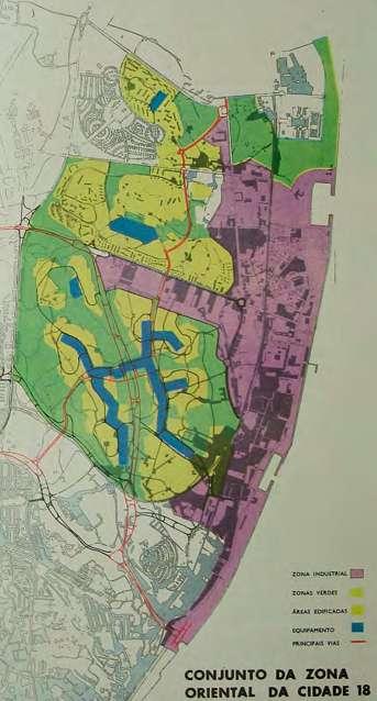
Chelas: agosto de 1965 (agosto de 1965,
–
de referência PT/AMLSB/PAE/PURB/01/0015) | Chelas urban development plan: August 1965 (August 1965, Lisbon Municipal Archive – Photographic Archive, Reference code PT/AMLSB/PAE/PURB/01/0015)

Não houve consolidação desde os anos 60, não obstante uma tentativa no final dos anos 90, recordou, com a quadra (ou quarteirão), “com um propósito bondoso, que consistia em, num só gesto, juntar quatro bairros – Flamenga, Amendoeiras, Armador e Condado – e atrás deste grande centro comercial e da habitação vinha uma rede viária, com rails e túneis”. O propósito era “bondoso”, mas a diferença de cotas faz com que, muito dificilmente, os bairros consigam aceder à quadra, “com a agravante de que a passagem de um lado para o outro se faz através do supermercado e de uma pequena ponte”. “O resto é tudo desnivelado”, notou, descrevendo este cenário como “um autêntico rodilhão do ponto de vista urbano”. Neste contexto, e convidado a (re)pensar o vale, Falcão de Campos propõe a sua transformação no segundo grande pulmão da cidade. Uma proposta que vai beber ao plano original para Chelas: “Como, defendendo o vale, podíamos ter uma densificação e uma continuidade de verde, consolidando-o com uma grande massa arbórea”. A curto-médio prazo, é “uma solução de requalificação”, uma resposta, à semelhança da experiência do vizinho bairro de Alvalade, com a sua diversidade de tipologias de habitação, e, parcialmente, do bairro do Restelo, que conseguiu criar centralidade com baixa volumetria.
There has been little or no consolidation since the 1960s of the city block, despite an attempt in the late 1990s, Falcão de Campos recalled, “with good intent to, in one swoop, unite the four neighbourhoods –Flamenga, Amendoeiras, Armador and Condado – with a road network, including rails and tunnels, running behind this large shopping centre and housing”. Their intentions were “good”, but the difference in elevation makes access to the block by the neighbourhoods very difficult, “made worse by having to cross a supermarket and small bridge to get to the other side”. “The rest is all uneven,” he noted, describing it as “complete chaos from an urban point of view”.
Bearing this in mind, and invited to (re)think the valley, Falcão de Campos proposes to transform the valley into the city’s second major lung. A proposal that builds on the original plan for Chelas.,“since, by sustaining the valley, we could increase the density and create continuity of green space, consolidating it with a large mass of trees.” In the short to medium term, it is “a regeneration solution”, a response, similar to that implemented for the neighbouring Alvalade neighbourhood, with its housing diversity, and, partially, for the Restelo neighbourhood, which created low-volume centrality.
“O Vale de Chelas carece, precisamente, de coerência, de coesão, traduzidas em ligações transversais, ligações ao rio, maior profundidade de penetração em termos ecológicos e requalificação urbana. Carece, em suma, de uma visão qualificadora.”
“Indeed, Chelas Valley lacks congruence, cohesion, translated into transversal connections, connections to the river, greater depth of eco-penetration and urban regeneration. In short, it lacks an enhanced and holistic approach.”
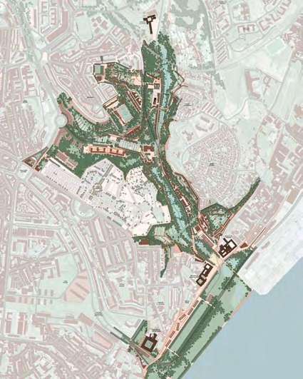
PLANTA GERAL DA PROPOSTA – ESTRATÉGIA
Planta Geral da Proposta – Estratégia (Falcão de Campos Arquitectos, LDA., NPK – Arquitectos Paisagistas Associados, LDA. e ABAP – Alçada Baptista Arquitectura Paisagista, LDA.) | General Layout included in the Proposal - Strategy (Falcão de Campos Arquitectos, LDA., NPK - Arquitectos Paisagistas Associados, LDA. and ABAP - Alçada Baptista Arquitectura Paisagista, LDA.)
São exemplos que demonstram que é “perfeitamente possível” harmonizar habitação e espaços verdes. O que implica planeamento: no caso concreto do Vale de Chelas, e antecipando que o novo Hospital de Todos os Santos será edificado na zona do Armador, impõe-se refletir sobre o impacto da circulação automóvel, com soluções de estacionamento que não minem o usufruto do bairro e com a criação de uma sequência de percursos de espaços públicos. É exatamente este o desafio subjacente à área atualmente ocupada com a designada “Feira do Relógio”, que Falcão de Campos encara como merecedora de um projeto dignificante. Afinal, são 1,5 km passíveis de disciplina, não apenas nos dias de feira, nomeadamente com o desenho de um passeio público até ao Metro e ao centro comercial.
O potencial existe, neste espaço e em todo o Vale de Chelas e nos seus bairros. O desígnio, esse, passa pela criação de novas centralidades, com equipamentos robustos – como bibliotecas ou espaços de utilização mista, para práticas sociais, culturais e desportivas – que aportem qualidade à população residente.
These examples demonstrate that it is “perfectly possible” to harmonise housing and green spaces. This, however, requires planning. Specifically in the case of Chelas Valley, and assuming that the new Todos os Santos Hospital will be built in the Armador area, the impact of motor traffic must be considered, offering parking solutions that do not frustrate enjoyment of the neighbourhood and creating a sequence of public pathways. This is exactly the challenge posed by the area currently occupied by the so-called Relógio Flea Market, which Falcão de Campos sees as deserving of a dignified project. After all, it encompasses the use of an area spanning 1.5 kilometres, not just on market days, including designing a public walkway to the Metro and the shopping centre.
This space and the entire Chelas Valley area and its neighbourhoods definitely have potential. The goal is to create new centralities with robust public amenities, such as libraries or mixed-use spaces for social, cultural and sporting activities, that improve the quality of life of the resident population.
equilíbrio balance
Estudo de Viabilidade do Corredor Oriental do Vale de Chelas (julho de 2016, NPK e Falcão de Campos Arquiteto) | Feasibility Study for the Chelas Valley Eastern Corridor (July 2016, NPK and Architect Falcão de Campos)
No cumprimento desse futuro, a coesão não está sozinha: o equilíbrio é também palavra-chave. E foi o fio condutor da intervenção de José Veludo, chamado a pensar o futuro parque hospitalar na zona oriental de Lisboa e que, neste encontro de urbanismo, se pronunciou sobre o corredor verde do Vale de Chelas. Deixou que algumas interrogações conduzissem a sua reflexão, a saber: “Com que peso e com que dimensão a construção deve estar no espaço vazio do vale? Vamos ter ou não mais construção?”. E, antes de partilhar a sua perspetiva, convidou a um primeiro olhar sobre a cidade no seu todo: “Não tenho dúvidas de que não existe equilíbrio entre o sistema natural e o sistema cultural. Não estamos numa situação em que, com pequenas correções, consigamos alcançar esse equilíbrio, no qual acredito”, comentou, defendendo “uma presença do sistema natural muito maior”.
Na sua opinião, esta maior convivência entre natural e cultural deve advir da existência de natureza de forma espontânea. “Não chega acrescentar mais um jardim, mais um parque, mais um corredor de arborização. É necessário acrescentar natureza de forma a que possa ter características suficientes para que seja espontânea, para que possa existir sem que se esteja a trabalhar sobre ela”. Monsanto é o exemplo desta premissa: “Tem uma dimensão tal que produz muito mais benefícios do que toda a energia que lá colocamos. Consegue ter dimensão para gerar uma espontaneidade natural que não depende de nós.” Alicerçou esta visão, afirmando que existem muitos sítios no parque florestal que as pessoas não conhecem, mas onde “a planta, o animal e a bactéria funcionam sem impacto da água de rega ou do corte”. “Funcionam por si só e a cidade precisa disso”, advogou.
To achieve this future, cohesion is not enough. Balance is also key. This was the leitmotiv of José Veludo’s talk, who was asked to contemplate the future hospital complex in the eastern part of Lisbon and who, at this urban planning meeting, shared his thoughts about the Chelas Valley green corridor. In his reflection, he posed several questions, in particular “How important is and how big should the building be in the empty space of the valley? Will there be more construction?”. Before sharing his views, he invited us to first look at the city as a whole. “Obviously, there is no balance between the natural and the cultural systems. We are not in a situation where, with small corrections, we can strike this balance, which I believe is needed,” he commented, championing “a much greater presence of the natural system”.
In José Veludo’s opinion, this greater coexistence between nature and culture should emerge spontaneously from the existence of nature. “It’s not enough to just add another garden, another park, another corridor of trees. We need to add enough nature so that it thrives spontaneously, so that it can exist without intervention.” Monsanto is an example of this premise. “It is so big that it produces far more benefits than all the energy we put into it. Its size enables natural spontaneity that doesn’t depend on us.” He consolidated his perspective by saying that there are many places in the forest park that people are unfamiliar with, but where “flora, fauna and bacteria survive and thrive without irrigation or mowing”. “They flourish on their own and the city needs that,” he argues.
A propósito, José Veludo alertou que se vive uma fase de emergência em que é necessário acelerar esta coexistência. De volta ao Vale de Chelas, manifestou a convicção de que se impõe assumir que “este é o último espaço com dimensão suficiente e com continuidade que pode criar características que permitam à natureza existir com espontaneidade e sem intervenção humana”. Não obstante, chamou a atenção para o risco de se distorcer a lente com que se olha para este futuro: “O vale não é um espaço que sobra, não podemos olhá-lo como um grande vazio. O natural é o elemento identitário e de coesão entre os bairros, se as margens forem bem tratadas e se as ligações estiverem acauteladas com equipamentos da vida social e urbana”. São 285 ha com potencial de valorização como corredor verde.
A questão das margens não é um pormenor. O arquiteto lembrou que, historicamente, o centro do vale foi ocupado com construções, submetido a um processo de transformação, drástico em termos ambientais, desencadeado com a introdução do tecido industrial, um tema inicialmente abordado pelo moderador da sessão, José Correia. À medida que se instalavam fábricas de maior dimensão, mais pessoas eram atraídas para trabalhar e maior a intervenção sobre a paisagem. A linha de caminho de ferro veio protagonizar novo conflito com o sistema natural, com a ligação a Santa Apolónia a “soterrar”, de certa forma, dois dos
hectares
com potencial de valorização como corredor verde
In this regard, José Veludo warned that we are in a state of emergency in which we need to speed up this coexistence. Bringing his focus back to Chelas Valley, he expressed the belief that “this is the last space of sufficient size and continuity that can create characteristics that allow nature to exist spontaneously and without human intervention”. Nevertheless, he pointed out the risk of distorting the lens through which we look at this future: “The valley is not useless space, one must not look at it as a large void. The natural environment is the identity and cohesive element between neighbourhoods, if the riverbanks are well cared for and the connections are furnished with amenities for social and urban life.” There are 285 hectares with potential for redevelopment as a green corridor.
The issue of boundaries is not a detail. The architect recalled that, historically, the centre of the valley was occupied by buildings and saw a drastic transformation from an environmental perspective, brought about by the introduction of industry, a topic initially touched upon by the moderator of the session, José Correia. As larger factories were set up, the more people flocked to work in the area and the greater the impact on the landscape. The railway line brought a new conflict with the natural system, with the connection to Santa Apolónia, in a sense, “burying” two of the convents that lined
hectares
with potential for redevelopment as a green corridor
conventos que demarcam o vale, o de Xabregas e o da Madre de Deus. A construção da ETAR implicou uma nova apropriação do território, acentuando a desconexão.
Em consequência, há “uma profundidade em relação ao Tejo que está a ser desperdiçada”. E só as encostas, onde é difícil construir, travaram a urbanização. Porém, também eles se afirmam como elementos de desconexão, na medida em que, entre os bairros a nascente e os bairros a poente, a ligação só é possível através de pontes pedonais, porquanto 100 metros de distância correspondem, na prática, a um quilómetro. Focando-se na mobilidade, defendeu que o olhar devia ter sido transferido das ligações longitudinais, entre norte e sul, através do vale, para as ligações transversais, dentro do vale.
the valley, Xabregas and Madre de Deus. The construction of the wastewater treatment plant also ate away the land, deepening the divide.
Consequently, “the depth of the Tagus is being wasted”. Only the hillsides, which are difficult to build on, halt
urban development. That said, they are also elements of disconnection, in that between the neighbourhoods to the east and the neighbourhoods to the west connection is only possible via pedestrian bridges, where a distance of 100 metres in practice corresponds to one kilometre. Turning to mobility, José Veludo argued that the focus should shift from longitudinal connections between north and south, through the valley, to transversal connections within the valley.

E, dentro do vale, retomou a questão do espaço público, para subscrever a necessidade de o parque verde funcionar como elemento de coesão, fazendo o remate dos bairros e acrescentando os equipamentos que faltam, incluindo largos de encontro entre as pessoas e zonas de atravessamento.
Nesta coesão, “a grande ambição” que, porventura, é também “a grande utopia” envolve a demolição de uma parte das construções.
“Tudo criteriosamente selecionado, no sentido de perceber quais as zonas habitacionais coesas, conservando os bairros que funcionam bem”, advogou, notando que grande parte das demolições propostas constituem edifícios camarários em ruínas. A reorganização da ETAR integra este portefólio de soluções, de modo a “não ocupar tanto o vale” e a permitir trazer de novo a ribeira à superfície.
Esta é uma questão que se prende com o sistema hídrico da cidade. O arquiteto especificou que a entrega das propostas para o corredor verde de Chelas coincidiu com a apresentação do plano de drenagem de Lisboa. “Não temos dúvida de que vai resolver alguma frequência das cheias, mas a custo de enorme investimento e de mais uma infraestrutura de que vamos ter de cuidar no futuro”, comentou, contrapondo com a criação de pequenas bacias com capacidade para, numa situação de chuva intensa, armazenar 28 mil m3, “o que é relevante, pois equivale aos depósitos que o plano de drenagem tinha preparados”. Ora, com esta solução, além de atrasar as cheias na entrada do vale, potencia-se a infiltração de água que vai ser o suporte da natureza espontânea.
“Para o sistema natural voltar a funcionar no Vale de Chelas, não há outra maneira. O urbanismo não faz milagres”: foi o comentário final que partilhou, resumindo as propostas elencadas.
And, within the valley, the architect returned his focus to the issue of public space, agreeing that the green park should serve as a cohesive element, connecting the neighbourhoods and adding the needed amenities, including meeting places for people, and crossings.
In this cohesion, “the great ambition”, which is perhaps also “the great utopia”, involves tearing down some of the buildings. “Everything has been carefully selected for an understanding of which housing areas are cohesive, preserving the neighbourhoods that work well,” he said, noting that most of the proposed demolitions are of dilapidated municipal buildings. The restructuring of the wastewater plant is included in the solutions put forward, so as to “not take up so much of the valley” and to bring the stream back to the surface.
This is an issue that relates to the city’s water system. The architect specified that the submission of the proposals for the Chelas green corridor coincided with the presentation of Lisbon’s drainage plan. “This will without a doubt reduce flood frequency, but requires significant investment and other infrastructure that will have to be maintained in the future,” he commented, suggesting the creation of small basins with the capacity to store 28,000 cubic metres during heavy rainfall, “which is relevant because it is equivalent to the collection tanks envisaged in the drainage plan.”
Besides delaying flooding at the entrance to the valley, this solution increases water infiltration to help nurture spontaneous nature.
“This is the only way for the natural system to flourish again in Chelas Valley. Urban planning can’t perform miracles”. This was the final comment he shared, summarising the proposals made.
identidade identity
As pessoas são incontornáveis na transformação, pela impressão digital que deixam no território, mas também pelo modo como a sua vivência é impactada pela própria transformação.
People are elements that cannot be ignored in this transformation, because of the digital imprint they leave on the land, and because of the way their lives are impacted by the transformation itself.
E foi sobre o modo como pessoas e território se têm moldado, ao longo do tempo, no Vale de Chelas que interveio Álvaro Fernandes. E fê-lo com base no conhecimento acumulado enquanto membro da equipa multidisciplinar da Unidade de Intervenção Territorial Oriental que, em 2015, assumiu a missão de promover um diagnóstico que fundamentasse um conjunto de eixos para intervenção em Chelas. A saber: regeneração da habitação existente, renaturalização do vale, restruturação da rede de acessibilidades e mitigação do impacto das infraestruturas.
eixos para intervenção
axes of intervention
It is precisely on how people and the land have adapted over time in Chelas Valley that Álvaro Fernandes focused his talk. And he did so using the knowledge he accumulated as a member of the multidisciplinary team of the Eastern Territory Task Force, which, in 2015, conducted an assessment that would inform a set of axes of intervention in Chelas. These include regeneration of existing housing, renaturalisation of the valley, restructuring of the accessibility network, and mitigating the impact of infrastructure.
Regeneração da habitação existente regeneration of existing housing
Renaturalização do vale renaturalisation of the valley
Restruturação da rede de acessibilidades restructuring the accessibility network
Mitigação do impacto das infraestruturas mitigating the impact of infrastructure
Um diagnóstico alavancado no espaço e no tempo, com a identificação de duas datas de referência no vale – 1885, ano da construção do caminho de ferro, e 1998, o ano da Expo98, que trouxe alterações tão profundas que se estendem à atualidade. Igualmente identificados foram dois espaços que marcam o território: a Estação de Santa Apolónia e a Fábrica de Gás da Matinha. A industrialização é, pois, um fenómeno decisivo, como já haviam assinalado os oradores anteriores, e os números atestam-no: em 1890, há registo de 156 fábricas, em 1942, ascendiam a 270. Em 1915, contavam-se cerca de 15 mil trabalhadores e em crescendo, o que impulsionou a criação de pátios e vilas – conjuntos habitacionais com uma estrutura social muito própria, que mimetizava a hierarquia das empresas. Com o êxodo rural, há um crescimento exponencial de toda a zona, alastrando pelas azinhagas e quintas a montante do vale, de que são exemplo a Curraleira, o Casal do Pinto e o Bairro Chinês.
Este movimento viria a conhecer uma face obscura, pois, entre 1980 e 2011, constata-se um esvaziamento do lugar, acompanhado da sua estigmatização. A decadência urbana acompanhou o declínio demográfico. Álvaro Fernandes sublinhou que, no estudo de 2015, foi possível identificar populações em situação limite, quase na exclusão, com atividades económicas muito desqualificadas. E isto devido a um aparente paradoxo: o vale oferecia alternativas de habitação, pelo facto de ser central, mas, como era isolado, em termos de sociologia urbana, constituiu-se como um espaço de exclusão ao centro.
As assessment conducted in space and time, pinpointing two reference dates in the valley: 1885, the year the railway was built, and 1998, the year Expo98 was held in Lisbon, both of which ushered in changes so profound that their effects are felt to this day. Two spaces that marked the territory were also identified, Santa Apolónia Station and the Matinha Gas Plant. Industrialisation was therefore a pivotal phenomenon, as previous speakers also pointed out, and the figures clearly attest to this. In 1890 a total of 156 factories were set up and in 1942 there were 270, and in 1915 there were around 15,000 workers, with the number progressively increasing, which led to the creation of courtyards and worker’s villages – housing estates with their own social structure mimicking the corporate hierarchy. With the rural exodus, the entire area saw exponential growth, spilling over into the alleyways and farms upstream of the valley, such as Curraleira, Casal do Pinto and Bairro Chinês.
This trend would bring with it a dark side. Between 1980 and 2011 the area would be abandoned and stigmatised. Urban decay accompanied population decline. Álvaro Fernandes pointed out that the 2015 study identified people living in extreme situations, in social exclusion, with highly unskilled economic activities, due to an apparent paradox: the valley offered housing alternatives because it was centrally located, but because it was isolated, in terms of urban sociology, it was a place of exclusion from the centre.
“Como é que chegamos ao estigma social e urbano daquele espaço?”,
questionou, sustentando que “há um conjunto de equipamentos que cria centralidade, mas isso não se reflete no vale. Os movimentos de entrada e saída fazem-se por portais, mas o fluxo de pessoas – estimado em 5 mil por dia, incluindo turismo – não influencia o vale. Não obstante, há oportunidades, como a localização do Ar.co [Centro de Arte & Comunicação Visual,
no antigo Mercado de Xabregas], a reabilitação das azinhagas e das antigas quintas para usos sustentáveis, bem como a divulgação da história do património material e imaterial do vale. Subsistem, contudo, algumas ameaças, em que pontua a terceira travessia do Tejo, com o risco de descaracterização e de perda de unidade e identidade.
São pontos de reflexão para o que Álvaro Fernandes preconizou como “linhas de orientação ética para uma intervenção” em Chelas. Para um território que se deseja regenerado, criativo, vibrante. E verde. Naturalmente.
“How did we arrive at this social and urban stigma?”,
he asked, arguing that “there are several public amenities that create centrality, but this is not reflected in the valley. Gateways facilitate inflows and outflows, but the flow of people (estimated to be 5,000 per day, including tourism) does not affect the valley. Nevertheless, there are opportunities to exploit, such as the location of Ar.co [Centre for Art & Visual Communication, housed in the old
Xabregas Market], the restoration of alleyways and farms for sustainable uses, as well as showcasing the history of the valley’s tangible and intangible heritage. Some threats remain, however, including construction of the third Tagus River crossing, with the risk of de-characterisation and the loss of unity and identity.
These are points of reflection on what Álvaro Fernandes recommended as “ethical guidelines for an intervention” in Chelas. For a regenerated valley, creative and vibrant. And green. Naturally.
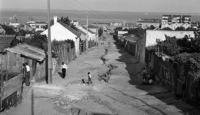
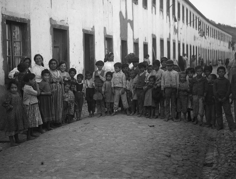
Bairro chinês junto ao campo de futebol do Oriental (c. 1950, Judah Benoliel, Arquivo Municipal de Lisboa – Arquivo Fotográfico, Código de referência PT/AMLSB/ CMLSBAH/PCSP/004/JBN/004886) | Bairro Chinês shanty town near the Oriental football field (c. 1950, Judah Benoliel, Lisbon Municipal Archive - Photographic Archive, Reference code PT/AMLSB/ CMLSBAH/PCSP/004/JBN/004886)
Vale de Santo António
6 de julho de 2023 6 July 2023
Moderador Moderator
Paulo Pardelha
Departamento de Planeamento Urbano, CML
Urban Planning Department, CML
Oradores Speakers
João Veríssimo
Lisboa Ocidental SRU – Sociedade de Reabilitação Urbana
João Sousa Morais
Faculdade de Arquitetura da Universidade de Lisboa
Faculty of Architecture, University of Lisbon
Paulo Torres
Associação Regador
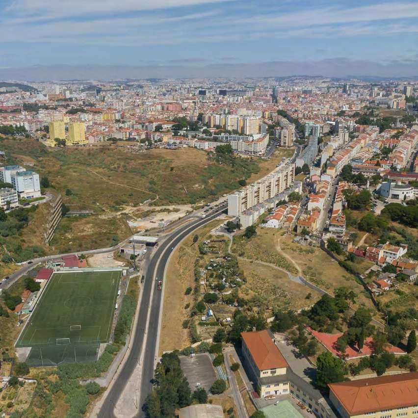
O Vale de Santo António: uma oportunidade imperdível Santo António Valley: an
extraordinary opportunity
Nesta edição do Encontro de Urbanismo, em que se debateu a Cidade dos Vales, o Vale de Santo António gerou grande expectativa e curiosidade, tendo tido grande participação.
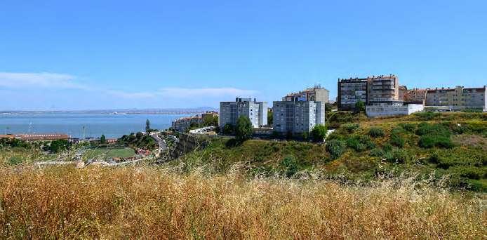
De facto, quando atravessamos o Vale de Santo António, através da Avenida Mouzinho de Albuquerque, ou quando espreitamos o vale, através do Alto da Eira ou do Alto do Varejão, somos invadidos por um sentimento de interrogação e inquietude perante a dimensão e aparente aridez que se vislumbra neste território.
Um território situado a menos de 2.000 m de distância do centro da histórica Baixa Pombalina, num percurso serpenteado onde encontramos o Castelo de São Jorge, São Vicente de Fora, o Panteão Nacional, Santa Clara e onde, logo após a Rua General Justiniano Padrel, nos deparamos com umas “ruínas modernas”, resquício do que esteve para ser o grande Arquivo Municipal de Lisboa.
Um vale que nos projeta, a norte, para o centro interior da Cidade, ligando-nos ao vale da Almirante Reis e que, a sul, encontra o rio numa relação tensa intermediada pela linha do norte e pela área portuária.
In this session of the Urban Planning Meeting, focusing on the City of Valleys, the Santo António Valley raised high expectations and aroused curiosity, with a large turnout.
Indeed, when crossing Santo António Valley via Avenida Mouzinho de Albuquerque, or when looking out over the valley from Alto da Eira or Alto do Varejão, we are overcome by a sense of puzzlement and unease at the size and seeming aridness of the area.
It is located less than 2,000 metres from Lisbon’s historic city centre, on a winding route along which one can find São Jorge Castle, São Vicente de Fora, the National Pantheon, Santa Clara and where, just after Rua General Justiniano Padrel, lie “modern ruins”, the remains of what was once the Lisbon Municipal Archive.
A valley that takes us north towards the inner centre of the city, connecting us to the Almirante Reis valley, and which, to the south, meets the river in a tense relationship mediated by the Northern Line and the port area.
Uma área expectante, mas não inoperativa, pois cumpre funções ecológicas importantes para a cidade como, por exemplo, a função de ventilação e de arrefecimento das áreas mais internas do território.
Um vale que apresenta algumas disfunções – rutura na malha urbana, efeito barreira, desencontros entre tecidos urbanos.
Um território que foi recebendo algumas intervenções com maior ou menor impacto urbanístico e social.
Uma área da cidade ainda por desenvolver, não porque não tenha havido planeamento, projetos, ações, vontades e um Plano de Urbanização em vigor.
O Vale de Santo António é… um território à procura da sua identidade, do seu futuro, à procura do seu encontro com as pessoas.
Temos pela frente, nos próximos anos e gerações, o desafio de recuperar este vale e amplificar as suas valências ecológicas. Um desafio moldado por uma proposta urbanística sensível à orografia do vale e às populações da envolvente, que acrescente e some, através do desenvolvimento de políticas públicas de habitação municipal sustentável e acessível; bem como de políticas de mobilidade e acessibilidade transformadoras do paradigma ainda atual.
Temos pela frente o desafio de poder mobilizar esforços financeiros e competência para concretizar um novo Vale de Santo António, inclusivo, resiliente, ecológico, inteligente e acessível.
Estão todos convocados, pois a oportunidade é imperdível.
Paulo Pardelha Departamento de Planeamento Urbano, CML
A locality in limbo, but functional, as it fulfils important ecological functions for the city, such as ventilation and helping cool inner-city areas.
A valley plagued by some dysfunction – a break in the urban fabric, a barrier effect, inconsistency between urban surroundings.
A place that has seen several interventions with greater or lesser urban and social impact.
An area of the city that has yet to be developed, and not due to a lack of planning, projects, actions, willingness or an urban development plan.
Santo António Valley is... a place in search of its identity, its future, in search of its encounter with people.
In the coming years and generations, we face the challenge of recovering this valley and enhancing its ecological benefits. A challenge shaped by an urban design proposal that takes account of the valley’s orography and its populations, which multiplies and grows, with the development of public policies for sustainable and affordable municipal housing, as well as mobility and accessibility policies that transform the current paradigm.
We face the challenge of mobilising financial contributions and expertise to create a new Santo António Valley that is inclusive, resilient, environmentally friendly, smart and accessible.
We call upon everyone to join in this effort, as this is an extraordinary opportunity.
luz light
Iluminar. Renaturalizar.
Requalificar. São estes os verbos que guiam a vontade de intervir no Vale de Santo António, resgatando-o a um passado que o cognominou de “vale escuro”. Um vale onde, não obstante a secundarização e o quase esquecimento a que foi votado, germinam sementes de esperança na sua mutação em “vale claro”.
Brighten. Replant.
Redevelop. These are the goals that guide the desire for intervention in Santo António Valley, rescuing it from a past which saw it nicknamed the “dark valley”. A valley where, despite being relegated to an insignificant and forgotten area, seeds of hope have been planted to transform it into a “bright valley”.
Este é um território que, como sublinhou o moderador da sessão, Paulo Pardelha, surge, quase sempre, como uma área da cidade ainda por desenvolver: não – ressalvou – por ausência de vontades, projetos, ações, existindo, inclusivamente, um plano de urbanização em vigor. “É um vale ainda expectante, embora não completamente inoperativo”, na medida em que cumpre funções essenciais para a cidade, nomeadamente de ventilação e arrefecimento. Porém, nele subsistem disfunções do ponto de vista da ligação entre territórios – permanecem barreiras, desencontros entre tecidos urbanos, que as intervenções feitas ao longo dos anos não lograram terraplanar. E, por isso,
“é um espaço ainda à procura do seu espaço”.
The moderator of the session, Paulo Pardelha, pointed out that this locality is almost always seen as an area of the city that has yet to be developed – not, he stressed, due to a lack of willingness, projects and actions; there is even an urban development plan in force. “It is a valley in limbo, but functional” insofar as it fulfils essential functions for the city, in particular ventilation and cooling. However, there are still dysfunctions in terms of the connection between territories – there are still barriers, inconsistency between urban surroundings – which the interventions carried out over the years have not addressed. And so,
“it is a space still looking for its place”.
antecedentes background
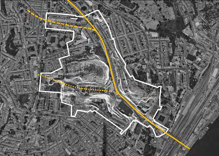
Foi precisamente sobre o espaço que se debruçou o arquiteto João Veríssimo, coautor da proposta de alteração ao plano de urbanização do vale. O processo de desenhar novos eixos de intervenção fê-lo viajar no tempo, regressando ao que definiu como antecedentes de um plano e aos sucessivos momentos deste território em transformação. E nesta viagem pela cartografia e demais espólio documental, encontrou um território sulcado praticamente de norte a sul por uma avenida –a Mouzinho de Albuquerque – enquadrada por duas elevações geradoras de uma significativa mudança de cota em todo o vale. Um vale que não é apenas um, mas três. Dois subsidiários, escavados por linhas de água que, atualmente, são apenas teóricas, porquanto foram sendo anuladas com a evolução. E é pelo vale principal – o da avenida –que se desemboca no Convento de Santos-o-Novo e no Rio Tejo, “num percurso que aparenta ser luminoso, mas que é algo lúgubre, dada a estrutura de caminhos de ferro que tapava completamente” esse final – o atual Viaduto de Santa Apolónia.
It was precisely this space that was the focus of the talk by architect João Veríssimo, co-author of the proposal to amend the valley’s urban development plan. The design of new axes of intervention saw him travel back in time, returning to what he defined as the history of a plan and the ensuing events in this area in transformation. And on his journey through cartography and other documents, he found a locality plied by an avenue – Aveinda Mouzinho de Albuquerque – practically from north to south and framed by two slopes that cause a significant change in elevation across the valley. Not just one valley, but three. Two subsidiary valleys, carved out by theoretical water lines, erased by evolution. And it is through the main valley – plied by the avenue – that one reaches the Santos-o-Novo Convent and the Tagus River, “on a route that is bright but somewhat gloomy, because of the railway structure completely overshadowing” the destination – today the Santa Apolónia Viaduct.
João Veríssimo recordou, igualmente, como este era um território relativamente ocupado – com quintas e algumas residências desordenadas, mas, ainda assim, “uma ocupação bastante relevante”, nomeadamente na que viria a ser a Avenida General Roçadas. A população era, predominantemente, constituída por trabalhadores dessas quintas, que eram quintas de produção e muitas das quais sobreviveram quase até à atualidade. Mas o vale foi-se abrindo à indústria e novos habitantes chegaram – os operários. E é com eles que ganham forma as chamadas vilas – a Vila Gadanho e a Vila Cândida são vestígios desse fenómeno na atual freguesia da Penha de França. Tal como o bairro operário dos Barbadinhos, “desenhado e aprovado em tempo de Ressano Garcia”, em 1890, pela Companhia Comercial Construtora. Embora não sendo de génese municipal, é um bairro de estilo cooperativo, com habitação modular “de um rigor extremo”, tendo resultado de um movimento popular de trabalhadores fabris que se batiam por um bairro acessível. Contudo, este movimento viria a distorcer a razão de ser do projeto: ao gerar o interesse público, os preços aumentaram, tornando-o inacessível aos seus destinatários originais. Era atrativo: afinal, na descrição do arquiteto, era composto por habitações “extremamente cuidadas”, já com um corredor, o que era raro nas vilas do século XIX, com princípios higienistas, nomeadamente ventilação transversal, e um rigor modular extensível às fachadas, “na ótica de minimizar custos”. Acresce que era um bairro equipado – com escola e mercado –, mais uma vez algo inédito na Lisboa de 1890. Razões de sobra para se ter convertido num conjunto habitacional bastante valorizado.
João Veríssimo also recalled how this was a relatively busy area, with farms and a few haphazard dwellings, but nevertheless “a fairly significant occupation”, particularly along what would become Avenida General Roçadas. The population consisted predominantly of the workers of production farms, many of which have survived to the present day. But the valley gradually opened up to industry and new inhabitants arrived – labourers. This saw emergence of the so-called worker’s villages – Vila Gadanho and Vila Cândida are the remnants of this phenomenon in what is today the parish of Penha de França. Just as the Barbadinhos working-class neighbourhood, “designed and approved in the time of Ressano Garcia”, in 1890, by Companhia Comercial Construtora. Although not erected by the City, it is a co-op neighbourhood with “very robust” modular housing, the result of a popular movement of factory workers who were fighting for an affordable neighbourhood. This movement would, however, distort the raison d’être of the project: by generating public interest, prices increased, making it unaffordable for the original beneficiaries. It was an attractive estate, after all, in the architect’s description, it comprised “carefully crafted” homes, with a corridor, which was rare in 19th-century villages, principles of hygiene, namely cross ventilation, and a robust modular structure that extended to the façades, “with a view to minimising costs”. What’s more, the neighbourhood had public amenities – a school and a market –again something unheard of in 1890 Lisbon. It is thus not surprising that it became a highly sought-after housing estate.
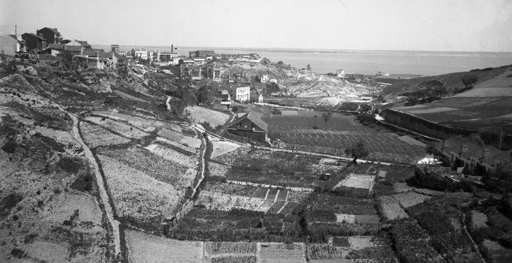
Quinta dos Peixinhos, vista do poente (abril de 1944, Eduardo Portugal, Arquivo Municipal de Lisboa – Arquivo Fotográfico, Código de referência PT/AMLSB/CMLSBAH/PCSP/004/EDP/000594) | Quinta dos Peixinhos, view from the west (April 1944, Eduardo Portugal, Lisbon Municipal Archive - Photographic Archive, Reference code PT/AMLSB/ CMLSBAH/PCSP/004/EDP/000594)
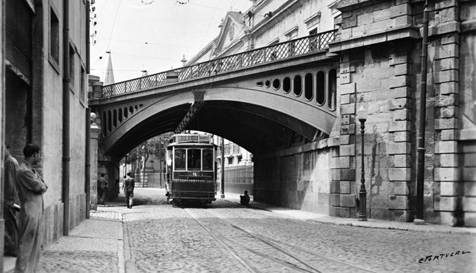
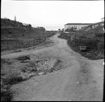
Caminho que vai dar ao convento de Santos-o-Novo, onde atualmente existe a avenida Mouzinho de Albuquerque (1961, Artur João Goulart, Arquivo Municipal de Lisboa – Arquivo Fotográfico, Código de referência PT/AMLSB/CMLSBAH/PCSP/004/AJG/000825) | Path leading to the Santos-o-Novo convent, currently Avenida Mouzinho de Albuquerque (1961, Artur João Goulart, Lisbon Municipal Archive - Photographic Archive, Reference code PT/AMLSB/CMLSBAH/PCSP/004/AJG/000825)
No decurso da elaboração da revisão do plano de urbanização para o vale, muitos foram os planos que se ofereceram ao olhar investigador da equipa. A maioria nunca executada, mas alguns planos assinados por nomes de peso. E o que mais despertou a atenção – “Estudo Base para a Urbanização do Vale Escuro”, de 1957 –tem precisamente a chancela de dois desses nomes, o arquiteto Bartolomeu Costa Cabral e o arquiteto paisagista Francisco Caldeira Cabral. Não passou, porém, de um estudo, apresentando a particularidade de abranger um limite que “extravasa em muito” o do atual vale, o que, na ótica de João Veríssimo, “faz todo o sentido”, na medida em que está associado ao da Calçada das Lajes: “Só assim se consegue cerzir as malhas urbanas e viárias que estão interrompidas atualmente”, comentou, considerando que este é um plano de um “rigor enorme”, com a mais-valia de ter conseguido colar quase todas as implantações à orografia, com exceção da Avenida Machado Santos.
Esta avenida foi sendo lançada na imagem da cidade já no século XX, como eixo de atravessamento nascente-poente – uma diretriz a que este plano não pôde obstar, mas, ainda assim, introduzindo “implantações interessantes, que tentaram, e bem, não ocupar o vale”, evitando conjuntos habitacionais mais herméticos que pudessem erguer-se como barreiras visuais e, assim, libertando o vale para a sua permeabilidade e fertilidade. “É um plano excecional” que contrasta com outros dois identificados – um de 1932, que é de um “formalismo imenso”, com recurso a praças e outros símbolos de época, com vias lançadas em “inclinações tremendas”, e um outro da década de 1970, o “Plano de Urbanização do Vale Escuro”, apenas parcialmente executado.
Estes são antecedentes “extremamente interessantes e pouco conhecidos” e que ajudam a compreender a história do vale, agora sujeito a nova vontade de intervenção.
While revising the valley’s urban development plan, the team’s sharp eye looked over a myriad plans. Most never made it out of the drawer, but some were designed by respected architects. One in particular drew the most attention, the “Baseline Study for Urban Development of the Dark Valley”, conducted in 1957 by two such respected architects, Bartolomeu Costa Cabral and the landscape architect Francisco Caldeira Cabral. It was, however, only a study, but it included the detail of a boundary that “stretches far beyond” that of the current valley, which, in João Veríssimo says “makes perfect sense”, as it is associated with that of Calçada das Lajes. “This is the only way to seamlessly join the currently disconnected urban environments and road networks,” he remarked, adding that it is a “carefully thought-out” plan, enhanced by the fact that they were able to implement nearly everything into the orography, with the exception of Avenida Machado Santos.
This avenue became the hallmark of the city as early as the 20th century, as a major eastwest crossing – a guideline that this plan could not ignore, nevertheless introducing “interesting implementations, rightly attempting not to occupy the valley”, avoiding hermetic housing developments that could be erected as visual barriers and thus opening up the valley to a plethora of new and exciting projects. “It is a magnificent plan” that contrasts with the other two identified, one from 1932, which is “extremely formal”, replicating the squares and other symbols of the time, with roads implemented on “very steep slopes”, and another from the 1970s, the “Urban Development Plan for the Dark Valley”, which was only partially implemented.
This is “extremely interesting and little-known” background information that helps to understand the history of the valley, now the subject of a renewed desire for intervention.
exemplos examples
Uma outra viagem se seguiu a esta incursão pelo passado do Vale de Santo António, uma viagem por um passado mais recente e por outras geografias impulsionada pela visão de planeamento de João Sousa Morais.
Another journey followed this foray into the past of the Santo António Valley, one that explored the more recent past and foreign lands, fuelled by João Sousa Morais’s vision of planning.
Nesta digressão por projetos que identifica como emblemáticos, Paris foi a primeira paragem, mais propriamente o “Barriére La Villette”, que nasceu da intenção de reabilitar um edifício do século XVIII na vizinhança do Canal de Saint-Martin: um “projeto lindíssimo”, assinado por Claude Nicolas Ledoux, mas que viria a quedar-se pela parte edificada, com o espelho de água e a esplanada desenhada como abraço ao edificado a desaparecerem, deixando-o isolado e sem significado do ponto de vista do território. Seria preciso esperar até à década de 80 do século XX para nova abordagem, esta protagonizada pelo ateliê Apur e pelo arquiteto Bernard Tschumi. O resultado, mais do que um projeto urbano, é um projeto de arranjos exteriores, com a arborização a tapar o viaduto ali existente –um resquício da intervenção anterior – e o canal a recuperar o seu lugar central. E o que antes era uma zona marginal da cidade metamorfoseou-se num gerador urbano, fruto desta experiência totalmente financiada pela Mairie de Paris.
In this tour of what he refers to as iconic projects, Paris was the first stop, specifically the “Barriére La Villette”, born of the intention to restore an 18th century building near the Canal de Saint-Martin neighbourhood, a “sublime project”, signed by Claude Nicolas Ledoux, but which would ultimately be limited to the building, doing away with the water mirror and the esplanade embracing the building, leaving it isolated and rendering it meaningless, from a spatial perspective. Only in the 1980s would a new approach be followed, one led by Apur studio and architect Bernard Tschumi. More than an urban project, the result is an exterior design project, with trees covering the existing viaduct – a remnant of the previous intervention – and the canal once again being the centrepiece. And what was once a marginalised area of the city metamorphosed into an urban generator; the product of an experiment funded entirely by the City of Paris.
Estugarda Stuttgart
De França para a Alemanha, é Estugarda a cidade que acolhe o projeto Avenida 21, que ganhou corpo entre 1993 e 2000 pelas mãos do estúdio gmp Architekten. E, nesta paragem, um preâmbulo se impõe: é que, como atestou o orador, a Alemanha tem uma perspetiva “muito interessante” de planeamento, assente na premissa de que ao investimento deve corresponder retorno financeiro. O cenário da intervenção é a ferrovia, mais concretamente a estação central da cidade, e o seu impacto na malha urbana: uma estrutura pesadíssima, recordou, que constituía uma barreira muito relevante do ponto de vista urbano. A resposta encontrada envolveu a sua substituição por um monocarril elétrico, emoldurado por uma estrutura verde naturalmente diluidora do embate visual. Foram intervencionados 70 ha, com o plano de financiamento cumprido a 100% e o investimento a pagar-se a si próprio. E com o adicional de ter sido o pretexto para regenerar grande parte da cidade.
From France onto Germany, Stuttgart is home to the Avenida 21 project, which took shape between 1993 and 2000 at the hands of gmp Architekten studio. At this point, a foreword is in order. As the speaker pointed out, Germany has a “very interesting” view of planning, based on the premise that financial return should match the investment. The focus of the intervention was the railway, more specifically the city’s central station, and its impact on the urban fabric. A huge structure, he recalled, forming a significant urban barrier. The solution found involved replacing it with an electric rack railway, framed by a green structure, softening its visual impact. Works encompassed a total of 70 hectares, with the financing plan executed in its entirety and the investment paying for itself, with the added bonus of having served as the pretext to regenerate a large part of the city.
Nantes
Desfecho diferente teve o terceiro exemplo desta lição: de regresso a França, para conhecer as linhas mestras do Quartier Atlanpole, projeto de 1988 do arquiteto e urbanista francês Christian de Portzamparc, a cujo traço foram entregues 400 ha para construir uma cidade tecnológica num espaço rural junto a Nantes, parcialmente atravessado por uma autoestrada. “Corresponde à minha visão de planeamento expedito. É um projeto que é desenhado e tem uma metodologia própria”, sustentou, reconhecendo-lhe, como virtudes, a relação entre as várias tipologias de construção e o modo como os quarteirões absorvem a estrutura rural pré-existente. Não veria, porém, a luz do dia nesta localização, acabando por ser transferida para norte da cidade.
Lisboa
O Vale de Santo António é o ponto de chegada deste olhar sobre o planeamento urbano, com o estudo promovido por João Sousa Morais, no âmbito do Mestrado em Arquitetura na FAUL, visando perceber qual a relação com a envolvente, “complexa e diversa”. Constata-se que o vale foi sendo ocupado de forma muito distinta ao longo do tempo, resultando numa situação complexa do ponto de vista orográfico. “Tínhamos algumas perspetivas e a primeira foi tentar salvaguardar a estrutura viária, perceber o que poderia ser reutilizado”, descreveu, adicionando a esta leitura a análise dos vários bairros, nas suas diferentes dimensões, isto é, da morfologia urbana às tipologias construídas. Foi “uma ronda muito importante para se perceberem as ligações existentes no vale, até porque uma das funções fundamentais da arquitetura urbana e da arquitetura da cidade é garantir a continuidade com o tecido urbano pré-existente”.
The third stop on the tour saw a different outcome. A return to France to visit the main features of the Quartier Atlanpole, a 1988 project by the French architect and urban planner Christian de Portzamparc, who was tasked with producing a design for a 400-hectare technology city in a rural area on the edge of Nantes, partly crossed by a motorway. “It matches my vision of expeditious planning. It is a project that is designed and follows its own methodology,” he said, pointing out as strengths the relationship between the various types of constructions and the way the blocks absorb the pre-existing rural structure. It would, however, not come to fruition in this location and was eventually transferred to the north of the city.
Lisbon
Santo António Valley is the destination of this reflection on urban planning, with the study carried out by João Sousa Morais, as part of his Master’s in Architecture at FAUL, in order to understand the valley’s relationship with its “complex and diverse” surroundings. It is clear that the valley has seen very different types of land occupation over time, resulting in a complex orography. “There were a few possibilities and the first was to try to maintain the road structure, to understand what could be reused,” he explained, further informed by an assessment of the various neighbourhoods, in their different dimensions, that is, from urban morphology to built typologies. It was “a very important exercise to understand the existing connections in the valley, not least because one of the core functions of urban architecture and city architecture is to guarantee continuity with the pre-existing urban environment.”
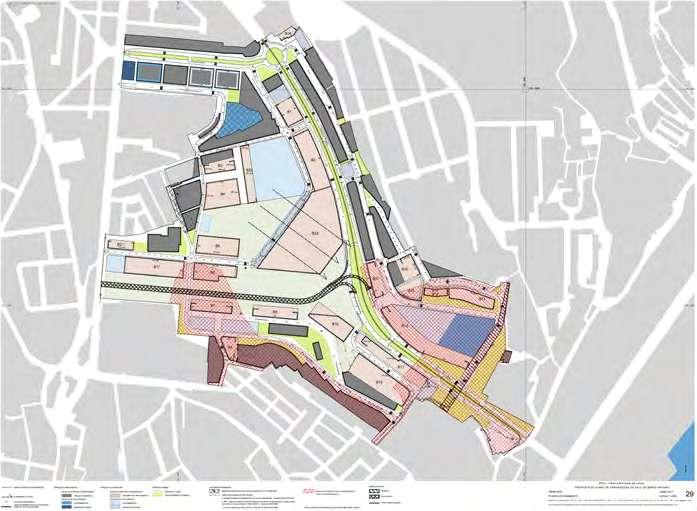


Plano de Urbanização Vale de Santo António – Proposta de Alteração, 2024 (DPT/DMU/CML) | Santo António Valley Urban Development Plan – Draft Proposal, 2024 (DPT/DMU/CML)
Estes vários caminhos de estudo conduziram ao diagnóstico de que esta importante estrutura fisiográfica, que deve estar integrada numa área central da cidade, se caracteriza, antes, pela ausência de uma lógica agregadora e ordenadora do território. Para este desiderato terão contribuído os declives acentuados e processos de urbanização relativamente dispersos, desenvolvidos na sua envolvente, que remeteram o vale para uma condição de tardoz de Lisboa. “Esta ideia de vale escuro não acontece por acaso”, comentou. Do mesmo modo, foi identificado que algumas das intervenções mais recentes, nomeadamente para construção de habitação coletiva de promoção pública, acentuaram a degradação urbana. E aumentaram a complexidade e a diversidade social.
É neste terreno que – concluiu – emergem oportunidades para explorar visões alternativas, qualificadoras e orientadas para o futuro da cidade.
E que futuro antevê? “Na prática, trata-se de requalificar o território”, articulando os diferentes tecidos urbanos em presença, renaturalizando o vale, conferindo-lhe uso e ocupação com vocação de parque urbano. “Não vamos fazer mais avenidas de Ceuta”, argumentou, advogando o desmantelamento da Avenida Mouzinho de Albuquerque, dando lugar a uma zona de passagem muito condicionada, com a criação de um anel envolvente para utilização de transporte público, e dotando-a de equipamentos multiusos.
Na perspetiva do docente da FAUL, uma visão estruturante para o vale deve assentar numa nova imagem, com continuidade morfológica com as situações pré-existentes e localização estratégica de equipamentos. Uma oportunidade para o vale pode residir – defendeu o arquiteto – na sua conversão num grande parque urbano do século XXI, abrindo as portas a que se torne uma zona interessante da cidade, com potencial de atração.
These different avenues of study revealed that this important physiographic structure, which should be integrated into a central area of the city, is the result, rather, of the absence of an approach that aggregates and organises the territory. The steep slopes and the relatively dispersed urban development around them saw the valley become the backwater of Lisbon. “This idea of a dark valley doesn’t happen by chance,” Sousa Morais commented. Similarly, we also found that some of the most recent interventions, particularly those relating to the construction of public housing, exacerbated urban decay and increased social complexity and diversity.
It is here, he concluded, that opportunities emerge to explore alternative, enhanced and forwardlooking visions for the city. And what future does he envisage? “In practice, a regeneration of the area,” stitching together the different urban fabrics, with renaturalisation of the valley, giving it the use and occupation as an urban park. “We are not going to make any more Avenida de Ceuta type thoroughfares,” he argued, calling for the decommissioning of Avenida Mouzinho de Albuquerque, limiting traffic in the area by creating a ring around it solely for public transport and furnishing it with multi-purpose facilities. From the FAUL professor’s perspective, a structuring vision for the valley should be rooted in a new image, ensuring morphological continuity with the preexisting environments and the strategic location of public amenities. An opportunity for the valley could, the architect argued, lie in converting it into a large 21st-century urban park, a first step to it becoming an interesting and potentially attractive area of the city.
experiência experience
O verde no Vale de Santo
António preconizado por João Sousa Morais pode não ser uma utopia. As sementes germinam já numa horta no Alto da Eira, promovida pela associação Regador e abraçada pela comunidade.
The green in Santo António Valley championed by João Sousa Morais may not be a utopia. The seeds are already sprouting in a vegetable garden in Alto da Eira, promoted by the Regador association and embraced by the community.
Foi da necessidade de incentivar um ritmo de vida menos acelerado, valorizando o tempo em família e em comunidade, que nasceu este projeto, que se tem alimentado de uma visão coletiva para o espaço público urbano. O projeto foi-se materializando em pequenos jardins verticais em Lisboa, até receber o convite para deixar a sua marca nesta zona de intervenção prioritária para a autarquia. A Regador acredita em soluções coletivas e sustentáveis, como partilhou o seu cofundador Paulo Torres: “Mas, para isso, precisamos de espaço, precisamos de uma cidade que, de certa forma, se case com
The project was implemented in response to the need to encourage people to live a slower pace of life, promoting family and community time, fed by a common vision for the urban public space. The project gradually took root in small vertical gardens in Lisbon, until it was invited to blossom in what is the City Council’s priority intervention area. Regador believes in collective and sustainable solutions, as stated by its co-founder Paulo Torres, “but for that we need space, we need a city that, in a sense, espouses these objectives.” The response involved a 1,000 km2 plot of land made available by the Penha
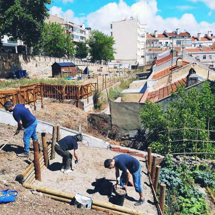
disponibilizados pela Junta de Freguesia da Penha de França made available by the Penha de França Parish Council 1.000 m2
estes objetivos”. A resposta assumiu a extensão de 1000 m2 disponibilizados pela Junta de Freguesia da Penha de França, o terreno (literalmente) fértil para uma horta, construída por todos e para todos em pleno contexto urbano, e que “veio demonstrar que o espaço verde da cidade também tem de ser alterado”. Não é, esclareceu, apenas uma horta. É um espaço onde há uma horta, mas onde a comunidade se junta e promove atividades, num exemplo de apropriação coletiva do espaço público que está ávido para ser replicado.
Houve desafios, naturalmente. Afinal, aquele era um depósito de entulho residencial – foram retiradas mais de 30 toneladas e colocada nova terra para reabilitação do solo. Ao mesmo tempo, o declive da encosta foi moldado, dando origem a vários socalcos que permitem a contenção de terras e facilitam o acesso. Subjacente esteve sempre a preocupação de não causar impacto, pelo que foram dados passos subtis – uma casa, uma estufa, um forno, um charco foram ganhando forma. A produção de alimento é, hoje, uma realidade de que beneficia toda a comunidade, num espírito de partilha que cresceu a partir das tarefas coletivas e que desemboca na utilização dos frutos da terra. “Quando existe envolvimento das pessoas no espaço, o espaço é acarinhado de outra forma, é protegido, há um sentimento de pertença”, testemunhou Paulo Torres, dando conta de que houve sempre a intenção de contagiar outros habitantes da cidade com esse sentimento de pertença, quebrando bolhas.
A horta do Alto da Eira é, pois, mais do que uma horta. É um projeto que tem acoplados objetivos que são, em si mesmos, responsabilidades: apoiar a subsistência da comunidade; aproximar as pessoas do cultivo do seu alimento, devolvendo o poder de escolha ao consumidor; destacar o papel social de uma horta comunitária; aproximar diferentes públicos, diminuindo o risco de isolamento e dinamizando as comunidades pela positiva; promover a partilha de conhecimento, tempo,
de França Parish Council, the (literally) fertile ground for a vegetable garden, planted by everyone and for everyone in the middle of the city, “proving that the city’s green space also needs to change”. It’s not just a vegetable garden, he explained. It is a place where there is a vegetable garden, but where the community comes together and does activities, exemplifying the collective appropriation of public space that invites replication.
There were challenges, of course. After all, it used to be a residential rubble dump, where over 30 tonnes were removed and new soil laid to regenerate the land. The hillside slope was reshaped, carving terraces to retain soil and facilitate access. Care was taken to not cause disruption, so subtle steps were taken – first a house, then a greenhouse, an oven, and a pond. Food production is now in full swing, benefiting the entire community, in a spirit of sharing stemming from collective tasks and blossoming into the enjoyment of the fruits of the land. “When people engage with a space, that space is appreciated differently, it is protected, there’s a sense of belonging,” said Paulo Torres, aware that there was always the intention to spread the sense of belonging to other inhabitants of the city, breaking out of bubbles.
The Alto da Eira vegetable garden is therefore more than just a vegetable garden. It is a project with purpose, with objectives that are, in themselves, responsibilities: support the subsistence of the community; bring people together to grow their own food, giving consumers back the power of choice; emphasise the social role of a community vegetable garden; bring different people together, reducing the risk of isolation and energising communities for the better; promote the sharing of knowledge, time, experiences and stories; and develop sustainable collective solutions for food and energy production.
experiências e histórias; desenvolver soluções coletivas sustentáveis para alimento e produção de energia. Enfim, transformar o bairro e, com ele, a cidade. Demonstrar que as cidades são parte da solução. E desafiar Lisboa a rever o seu conceito de cidade, começando por pensar o espaço verde como espaço público. No Vale de Santo António, o desígnio é transformá-lo num espaço claro.
In short, transform the neighbourhood and, with it, the city. Prove that cities are part of the solution. And challenge Lisbon to rethink its concept of the city, starting by seeing green space as public space. In Santo António Valley, the goal is to transform it into a bright space.
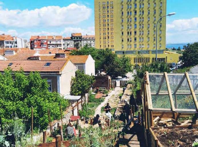
Vale da Almirante Reis
15 de junho de 2023 15 June 2023
Moderador Moderator
Rosário Salema
Departamento de Espaço Público, CML Public Space Department, CML
Oradores Speakers
Filipa Ramalhete
Centro de Estudos de Arquitetura, Cidade e Território da Universidade Autónoma de Lisboa
Centre for Architecture, City and Territory Studies, Autonomous University of Lisbon
João Appleton
Appleton e Domingos, arquitectos architects
Nádia Nogueira e Raquel Coelho
Equipa de missão do Plano Municipal para a Pessoa em Situação de Sem Abrigo Municipal Homelessness Task Force
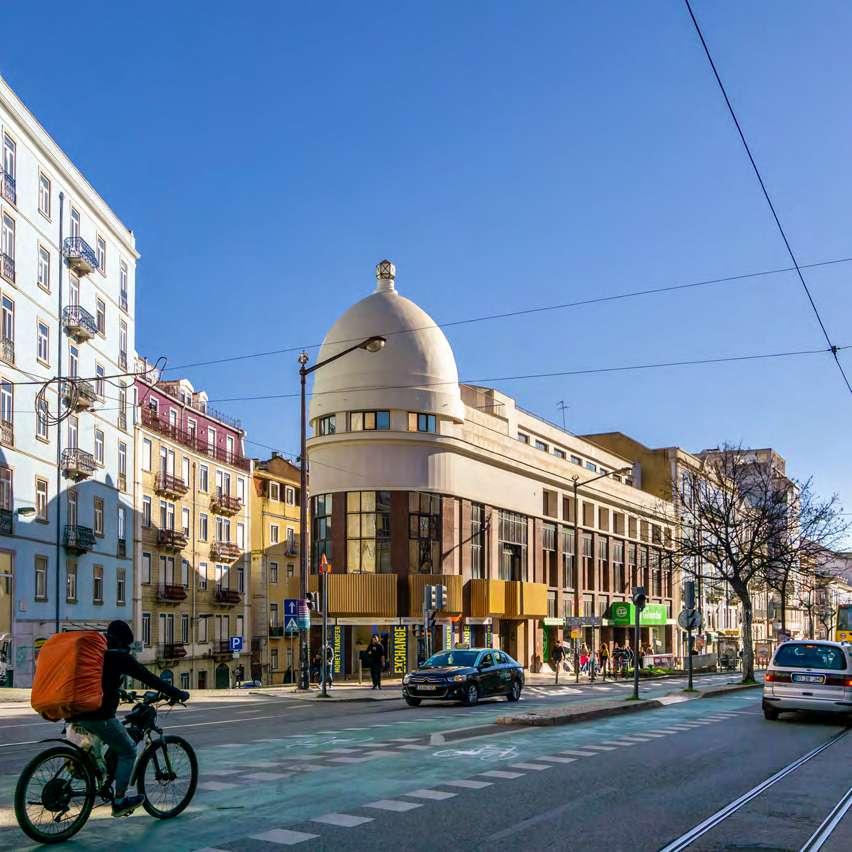
O projeto integrado para a requalificação do espaço público do eixo da Almirante Reis: ser bairro e ser cidade no segundo quartel do séc. XXI
The integrated project for renewal of the public space along the Almirante Reis axis: a neighbourhood and a city in the second quarter of the 21st century.
O Vale da Almirante Reis, antigo vale da ribeira de Arroios, constitui a unidade biofísica onde se veio implantar o eixo da Almirante Reis, composto pela Rua da Palma e pela Avenida Almirante Reis. Este vale revela, ainda hoje, através da sua toponímia, uma grande riqueza hídrica e geológica: arroios, regueirão, forno do tijolo, areeiro. Foi um vale fértil na produção de olivais, pomares e cereais e abundante na extração de areias e barro.
O vale que alberga hoje cerca de 7,7% da população do município é, desde o início do séc. XX, um lugar de acolhimento e de troca comercial. A diversidade de comunidades e de etnias que ali habitam contribui para um espaço público vibrante com uma forte identidade comercial, em particular na zona a sul da Praça do Chile.
O eixo da Almirante Reis estende-se ao longo de 2,9 km, desde a Praça do Martim Moniz à Praça Francisco de Sá Carneiro, atravessa 11 bairros, possui 6 estacões de metropolitano, vários hospitais e estabelecimentos de ensino e constitui um dos canais fundamentais do sistema de mobilidade da cidade de Lisboa.
Almirante Reis Valley, formerly the Arroios river valley, is the biophysical unit upon which the Almirante Reis axis, comprising Rua da Palma and Avenida Almirante Reis, was built. Today, this valley continues, through its toponyms, to reveal an abundant supply of water and geological wealth: arroios (streams), regueirão (furrow), forno de tijolo (brick kiln), areeiro (sandpit). It was once a fertile valley, ripe for the production of olive groves, orchards and cereal crops, and provided an abundance of sand and clay.
The valley, which today is home to around 7.7% of the municipality’s population, has welcomed residents and visitors alike and trade since the beginning of the 20th century. The diverse communities and ethnicities that call the valley home have made it a vibrant public space with a strong commercial identity, particularly in the area south of Praça do Chile.
The Almirante Reis axis stretches for 2.9 kilometres, from Praça do Martim Moniz to Praça Francisco de Sá Carneiro, crosses 11 neighbourhoods, has 6
O seu espaço público comporta, além do canal viário, a rede ciclável e os passeios pedonais. É nos passeios que se implantam o estacionamento automóvel, em recorte, as esplanadas, os abrigos da Carris, as bancas, os expositores de produtos comerciais, os canteiros, a sinalética vertical e as caixas de concessionárias. Há, ainda, a álea de tílias ao centro do canal viário. Tudo isto num espaço que possui apenas 25 m de largura.
É, tão só, a largura de uma rua, como nos diz João Appleton, num canal viário que liga a Baixa Pombalina à zona norte da cidade. Este canal viário representa um dos circuitos fundamentais de entrada e saída da cidade de Lisboa.
A intervenção no espaço público do eixo da Almirante Reis terá de responder, simultaneamente, ao seu papel fundamental no sistema de mobilidade da cidade e às necessidades da vida quotidiana dos 11 bairros que habitam em seu redor e, também, daqueles que ali trabalham, estudam e visitam.
O futuro espaço público do eixo da Almirante Reis tem como desafio uma dupla condição: ser bairro e ser cidade, no segundo quartel do séc. XXI.
No segundo quartel do séc. XXI, o espaço público urbano enfrenta, além dos desafios da mobilidade, desafios ambientais, de acessibilidade pedonal, de segurança e sociais que se colocam no encontro do coletivo no espaço urbano e que, no caso do eixo da Almirante Reis, se revestem da maior importância porque este acolhe uma população em situação de sem abrigo, cujas condições de vida merecem a maior atenção, como nos diz Paulo Silva Santos.
Tendo por base os grandes desafios que medeiam as intervenções no espaço público urbano, foi realizado um Processo de Participação Pública, entre maio e julho de 2023, e foi elaborado um extenso estudo de caracterização e diagnóstico, pelos diversos serviços da CML. Da sua articulação irá resultar o projeto integrado de requalificação do espaço público do eixo da Almirante Reis.
Rosário Salema Departamento
de Espaço Público, CML
metro stations, several hospitals and educational establishments, and is one of the major arteries of Lisbon’s mobility system.
Besides the roadway, its public space includes cycle and foot paths. Cut-out parking areas are also found along these paths, as well as outdoor eateries, Carris bus stop shelters, stalls, product displays, flowerbeds, vertical signposts, and utility access hatches. Linden lines the median strip of the road. All this within a space that is only 25 metres wide.
This is the width of a street, as João Appleton says, on a main road linking downtown Lisbon to the north of the city. This road is one of the major arteries leading into and out of the city of Lisbon.
The intervention in the public space along the Almirante Reis axis must simultaneously satisfy the key role it plays in the city’s mobility system and the daily needs of the 11 neighbourhoods that populate it, and that of those who work, study in and visit the area.
The future public space along the Almirante Reis axis faces the challenge of fulfilling two conditions: being a neighbourhood and being a city, in the second quarter of the 21st century.
In the second quarter of the 21st century, on top of the challenges of mobility, urban public space faces environmental, pedestrian accessibility, safety and social challenges that arise at the intersection of the collective in the urban space and which, in the case of the Almirante Reis axis, must urgently be addressed, as it is also home to a homeless population, whose living conditions warrant greater attention, says Paulo Silva Santos.
Bearing in mind the major challenges facing urban public space interventions, a public hearing was held between May and July 2023, and a comprehensive analysis and assessment study conducted by the various CML departments. Public comments and the study will inform an integrated project to renew the public space along the Almirante Reis axis.
pessoas people
As que vivem. As que trabalham. As que apenas passam. As que nela procuram abrigo. Estes são os fios da complexa teia humana que dá corpo ao Vale da Almirante Reis, alvo de um programa de intervenção camarário aprovado em 2022.
Those who live in the valley. Those who work in the valley. Passers-by. Those who seek shelter in the valley. These are the strands of the complex human web that is the Almirante Reis Valley, the target of an intervention plan approved by the City Council in 2022.
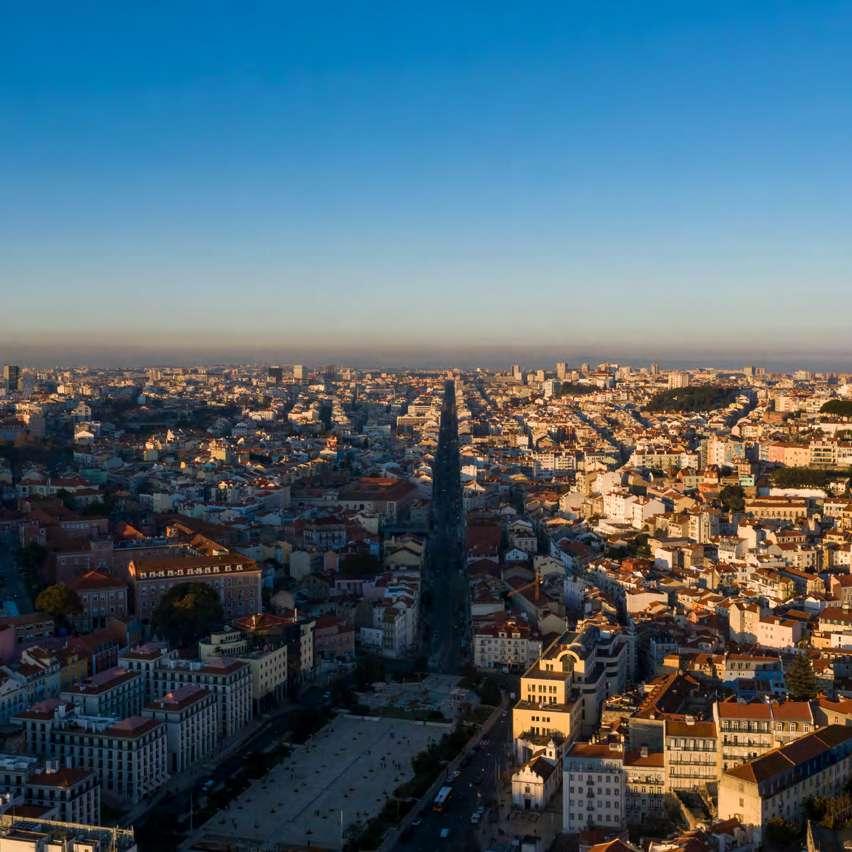
Um programa integrado que, como focou a moderadora, Rosário Salema, tem presente o passado. Afinal, foi a partir da Ribeira de Arroios que o vale se desenvolveu, com a avenida a acompanhar essa memória. E a evoluir com a necessidade de saída de Lisboa, fazendo a ligação entre o rio e o norte da cidade, num eixo “bastante extenso”, mas ferido de uma “limitação profunda”: o facto de possuir apenas 25 m de largura.
A Rua da Palma entra para a história da cidade como tendo sido o primeiro troço a ser construído, com o eixo da Almirante Reis a estender-se, ao longo dos anos, da Praça do Martim Moniz à do Areeiro. É esta avenida, bem como os espaços públicos confinantes, que formam a área de estudo do plano de intervenção, quer do ponto de vista orográfico, quer do ponto de vista das comunidades, isto é, a forma como o vale é habitado, sendo que do cruzamento entre estas duas dimensões emergiu, de imediato, um cenário: não é fácil relacionar as encostas do vale entre si, o que exige um sistema articular pedonal, que torne este eixo mais estruturado.
A acessibilidade pedonal é, assim, um dos quatro pilares deste estudo, a par da segurança, da mobilidade e do ambiente. Sempre “sem esquecer que a Almirante Reis é também um espaço de passagem, não é apenas o universo dos seus habitantes”. A qualidade de vida é um dos denominadores desta equação: promovê-la envolve ter em conta as questões de poluição e as questões de acessibilidade numa artéria com passeios demasiado estreitos e impactada pela intensa circulação viária, quer por via dos transportes públicos, quer por via do movimento de cargas e descargas inerente à sua vocação mercantil. E porque é um vale há que devolver-lhe o verde.
An integrated plan which, as the moderator, Rosário Salema, pointed out, looks to the past. After all, the valley sprung from the Ribeira de Arroios stream, with the avenue growing with it, in response to the need to provide an outbound route from Lisbon, linking the river to the north of the city, on a “fairly extensive” axis, but with a “profound limitation”: the fact that it is only 25 metres wide.
In the history books, Rua da Palma was the first stretch of road to be built in the city, with the Almirante Reis axis extending over the years from Praça do Martim Moniz to Areeiro. It is this avenue, and its adjoining public spaces, that were the focus of the study for the intervention plan, both from an orographic point of view and a community perspective, that is, the way the valley is inhabited. From the intersection between these two dimensions, a scenario immediately emerged: the difficulty in connecting the slopes of the valley to each other, which requires a foot traffic system for a more structured axis.
Pedestrian accessibility is therefore one of the four pillars of this study, along with safety, mobility and the environment, “without overlooking the fact that Almirante Reis is also a place of passage for many. It is not only used by its inhabitants”. Quality of life is one of the denominators in this equation. Ensuring or improving quality of life requires taking into account pollution and accessibility issues in an artery with overly narrow pavements and dense road traffic, caused by public transport and the inevitable loading and offloading of goods for businesses lining the avenue. And because it’s a valley, we want to bring back the green.


identidade identity
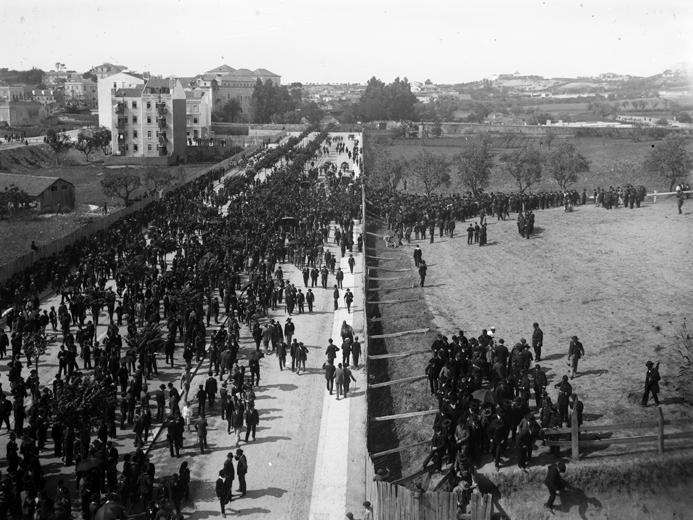
PT/AMLSB/CMLSBAH/PCSP/004/NEG/001430) | Republican rally on Avenida
Archive, Reference code PT/AMLSB/CMLSBAH/PCSP/004/NEG/001430)
Este é um eixo que a especialista em ordenamento do território Filipa Ramalhete conhece intimamente. Afinal, é uma das coordenadoras do “Atlas Almirante Reis”, obra editada em 2020 na sequência de uma investigação sobre os processos de transformação da avenida. Uma investigação que visou acrescentar novos olhares a um espaço de Lisboa que estava pouco estudado, sempre periférico:
“Não pretendeu ser exaustivo, porque a Almirante Reis não se esgota; há problemas velhos que continuam atuais e há questões novas que se vão levantando. A intenção foi acrescentar camadas de leitura sobre a avenida”.
Uma dessas camadas prende-se com a identidade: os limites são “difíceis de definir”, é uma via de entrada e saída da cidade, mas também uma via de ligação com as duas partes do vale, com nós e cruzamentos que são tão importantes como a avenida. “É uma avenida muito marcante, mas, ao mesmo tempo, há momentos em que quase temos de a adivinhar”, comentou. Ao longo das várias décadas, a Almirante Reis foi moldada por sucessivas transformações, com novos residentes, novas funções, novos edifícios, mudanças de escala e mudanças sociais, “mas sem perder o seu papel estrutural e funcional”.
This is a road that land-use planner Filipa Ramalhete knows intimately. After all, she is one of the coordinators of Atlas Almirante Reis, published in 2020 following a study on the processes of transformation of the avenue. A study aimed at bringing new perspectives to a little-studied area of Lisbon, one often included in discussions as an afterthought.
“The study didn’t cover everything, because Almirante Reis involves substantially more; there are old problems that persist to this day and there are also new issues being raised. It was conducted with the intention of including additional layers of understanding of the avenue”.
One of these layers focused on identity. The boundaries are “difficult to define”; it’s a way in and out of the city, but also a way of connecting the two parts of the valley, with interchanges and junctions that are just as important as the avenue itself. “It’s a very striking avenue, but at the same time there are moments when you almost have to guess,” she commented. Over several decades, Almirante Reis has been shaped by successive transformations, new residents, new functions, new buildings, changes in scale and social changes, “without ever losing its structural and functional role.”
A documentação espelha bem as ondas de choque do desenvolvimento da avenida. Assim, já na década de 1950 era evidente um conflito entre as zonas de circulação pedonal e a ocupação da via. Um estudo dos quarteirões, de 1959, alertava para a importância de não incrementar o comércio pelos inconvenientes que daí adviriam para o trânsito local, atendendo a que, através da avenida, se fazia, então, “um escoamento intensivo de largas zonas que, por seu intermédio, se interligam”. Nesse mesmo relatório, acentuava-se que o aproveitamento de alguns logradouros resultaria numa vantagem manifesta para as condições de salubridade, reconhecendo, embora, que, “com tal medida, se vá diferencialmente agravar o trânsito nesta artéria dorsal da cidade”. Pesando as vantagens e os inconvenientes, conclui-se que não seria possível retirar à Almirante Reis a sua vocação comercial: “E, por isso, as lojas que nelas subsistirem ressentir-se-ão do facto de não possuírem armazenamento e, por conseguinte, exigirem frequentes abastecimentos que se refletem, forçosamente, num trânsito que se pretende desafetado”.
Este relatório repleto de contradições remetia para um despacho de 1955 que regulamentava as regras de edificação, na génese do qual estarão os edifícios com piso térreo recuado, em semigaleria, dando origem às arcadas características da avenida. “Havia claramente a preocupação de aumentar a circulação pedonal, mas sem encargos para a Câmara, colocando os privados a disponibilizar espaço público”, enquadrou, recordando que este fenómeno alimentou conflitos nas décadas subsequentes, relativos à ocupação das arcadas. Acresce que, neste documento, se informa que a construção só será permitida se for salvaguardada a hipótese de aproveitamento do logradouro para estacionamento. Porém, volvidos apenas quatro anos, vingava a tese oposta, isto é, de libertação dos logradouros.
Documents depict the shock waves around development of the avenue. As early as the 1950s, there was a clear conflict between pedestrian zones and road occupation. A study of the city blocks in 1959 warned against increasing commerce because of the disruption it would cause in local traffic, given that the avenue was “an intensively used route by the many areas it connects”. The same report pointed out that the use of some leftover spaces would improve public health conditions, while admitting that “such a measure would differentially make traffic worse along this major artery of the city”. Weighing the pros and cons, we concluded that it would not be possible to strip Almirante Reis of its commercial use. “And so, the shops that remain will continue to not have storage and therefore will require the frequent delivery of supplies that will, necessarily, impact traffic flows that were intended to be free-flowing.”
This contradictory report referred to a ministerial order from 1955 that regulated the construction rules, based on which the buildings with recessed ground floors were built, in semi-galleries, resulting in the avenue’s characteristic arcades. “There was clearly a concern to increase pedestrian traffic, but at no cost to the City, with private individuals making public space available,” she explained, recalling that this trend fuelled conflicts in subsequent decades over the use of the arcades. Moreover, this document states that construction will only be permitted if the leftover space could be used for parking. However, a mere four years later, the opposite was put forward, that is, the freeing up of leftover spaces.
O tema emerge, de novo, em 1961, com um despacho em que não se recomenda o aproveitamento dos logradouros para construção, de modo “a não perturbar as pequenas zonas verdes com tratamentos menos agradáveis no tocante ao ambiente, sossego e recato que se julga de fomentar sempre que possível”. Dos arquivos sai um outro documento, datado de 1963, em que se atesta que “esta ideia de destinar a zona verde o interior dos logradouros é bastante estranha”.
O tempo não trouxe consenso. Filipa Ramalhete evocou um estudo de 2008 em que participou, com o objetivo de avaliar o potencial de utilização ecológica dos logradouros de 14 quarteirões da Almirante Reis: “Chegámos à conclusão de que não é de desprezar esse potencial ecológico, face às questões da poluição e do ruído da avenida”.
Ao mergulhar no arquivo histórico de Lisboa, sedimentou a ideia de que, muito embora seja vista como secundária, a avenida foi alvo de atenção constante da Câmara. Muitos dos projetos não chegaram, porém, a bom porto, constituindo um sinal da relação conflituosa entre habitação, comércio e circulação pedonal e motora que tem sido transversal à história da Almirante Reis.

The issue came up again in 1961, with a decision recommending against the use of leftover spaces for construction, so as to “not spoil small green areas with less pleasant uses in terms of the environment, peace and quiet that we believe should be encouraged whenever possible”. Another document from the archives, dated 1963, states that “this idea of earmarking the interior of leftover spaces for a green area is rather strange”. A consensus has yet to be reached. Filipa Ramalhete recalled a 2008 study in which she took part, aimed at assessing the potential for ecological use of the leftover space of 14 blocks along Almirante Reis. “We came to the conclusion that we should not dismiss this ecological potential, given the pollution and noise on the avenue”.
The expedition into Lisbon’s historical archives cemented the idea that, despite being seen as secondary, the avenue was an ongoing priority for the City Council. Many of the projects, however, did not come to fruition, a sign of the conflicting relationship between housing, commerce and pedestrian and motor vehicle traffic that has plagued Almirante Reis throughout the years.


Informação referente ao Processo no 19560/55 (1955, Arquivo Municipal de Lisboa, Obra 31417 - Proc 19560-DSCCPG-1955 - Folhas 27, 38 e 39) | Information regarding Process no 19560/55 (1955, Lisbon Municipal Archive, Work 31417 –Proc 19560-DSCC-PG-1955 – Pages 27, 38 and 39)
mutações mutations
Também João Appleton conhece bem este eixo e as mutações a que tem sido sujeito, as quais serviram de matéria-prima para a sua tese de doutoramento – “A Avenida Almirante Reis, uma história construída do prédio de rendimento em Lisboa”. E “um dos aspetos mais interessantes” é que,
“talvez como nenhuma outra via, reflete a história da cidade a partir da última vintena de anos do século XIX e depois ao longo do século XX”.
“Antes da avenida, existia um território – o vale –que se estendia para norte. Era um conjunto de ruas e estradas de saída da cidade, da Rua da Mouraria, Rua Direita dos Anjos, que se prolongava a partir do Largo de Santa Bárbara e bifurcava na Estrada da Charneca, na continuação da qual se localizava o Convento de Arroios”, evocou.
João Appleton is also well acquainted with this axis and the changes it has undergone, which was the focus of his doctoral thesis Avenida Almirante Reis, uma história construída do prédio de rendimento em Lisboa. “One of the most interesting aspects” is that, “perhaps
like no other road, it reflects the history of the city from the last twenty years of the 19th century and then throughout the 20th century”.
“There was a territory before the avenue – the valley – that stretched northwards. A series of streets and roads leading out of the city, from Rua da Mouraria to Rua Direita dos Anjos, which extended from Largo de Santa Bárbara and forked into Estrada da Charneca, where the Arroios Convent was located,” he said.
1
Planta parcial da cidade com o traçado completo da Avenida dos Anjos e das ruas adjacentes (1900, Arquivo Municipal de Lisboa, Código de referência PT/AMLSB/ CMLSBAH/PURB/002/01245)
Partial map of the city with the complete layout of Avenida dos Anjos and the adjacent streets (1900, Lisbon Municipal Archive, Reference code PT/AMLSB/ CMLSBAH/ PURB/002/01245)
Atlas da Carta Topográfica de Lisboa com marcação de antigas ruas e estradas sobre (1856-1858, Filipe Folque, Arquivo Municipal de Lisboa, Código de referência PT/AMLSB/CMLSBAH/ PURB/003/00028) (in A Avenida Almirante Reis, Uma História Construída do Prédio de Rendimento em Lisboa, João Guilherme Pontes Appleton Tese de Doutoramento em Arquitectura, Universidade de Lisboa – Instituto Superior Técnico, 2018)
Atlas of the Topographical Map of Lisbon with markings of old streets and roads (1856-1858, Filipe Folque, Lisbon Municipal Archive, Reference code PT/ AMLSB/ CMLSBAH/PURB/003/00028) (in A Avenida Almirante Reis, Uma História Construída do Prédio de Rendimento em Lisboa, João Guilherme Pontes Appleton PhD Thesis in Architecture, University of Lisbon - Instituto Superior Técnico, 2018)

Planta expropriações do projeto da Avenida dos Anjos (1950, Arquivo Municipal de Lisboa, Código de referência AML/UROB/PU/09/02366-fl. 1)(in A Avenida Almirante Reis, Uma História Construída do Prédio de Rendimento em Lisboa, João Guilherme Pontes Appleton Tese de Doutoramento em Arquitectura, Universidade de Lisboa –Instituto Superior Técnico, 2018)
Expropriation map for the Avenida dos Anjos project (1950, Lisbon Municipal Archive, Reference code AML/UROB/PU/09/02366-fl. 1)(in A Avenida Almirante Reis, Uma História Construída do Prédio de Rendimento em Lisboa, João Guilherme Pontes Appleton PhD Thesis in Architecture, University of Lisbon - Instituto Superior Técnico, 2018)


Levantamento da planta de Lisboa: 1904-1911 (1904-1911, Júlio António Vieira da Silva, Arquivo Municipal de Lisboa, Código de referência PT/ AMLSB/CMLSBAH/PURB/003/00056)
Survey of the map of Lisbon: 1904-1911 (1904-1911, Júlio António Vieira da Silva, Lisbon Municipal Archive, Reference code PT/ AMLSB/CMLSBAH/ PURB/003/00056)
É na década de 1870 que a avenida começa a ser planeada, com o primeiro anteprojeto no contexto dos melhoramentos da cidade idealizados por Ressano Garcia. Remontam a esse anteprojeto os seus 25 m de largura, “uma das questões que é crítica” e levantada logo na década de 1890. Em vão, porquanto nas imediações se erguiam já os primeiros bairros: a urbanização é, pois, prévia à avenida, que viria a ser inaugurada em 1903, batizada de “dos Anjos”, mais tarde renomeada para Avenida D. Amélia, até homenagear, em 1910, Carlos Cândido dos Reis, um dos arquitetos da revolta republicana. Sempre considerada estreita e sempre estrangulada por uma série de compromissos edificados, como a Igreja dos Anjos, localizada em pleno eixo da via e forçada a um trabalho de trasladação, ou como o chafariz do Largo do Intendente, igualmente deslocado.
Seria praticamente no final da década de 1920 que a Almirante Reis – então confinada entre o Mosteiro do Desterro, a sul, e o Convento de Arroios, a norte – conheceria planos para o seu prolongamento, impulsionados pela vontade de urbanizar os terrenos do Arco do Cego, viabilizando o projeto do que viria a ser o Instituto Superior Técnico. Desse projeto constam duas elipses, uma a rodear o Arco do Cego e outra o Técnico, ligadas por um sistema radial de rotundas, entre elas as praças de Londres e do Areeiro.
Em 1938, há uma mudança significativa, com o começo da intervenção de João Faria da Costa – considerado o primeiro arquiteto urbanista português com formação internacional – e de Étienne de Gröer – arquiteto polaco que se fixou em Lisboa a convite do, então, presidente da Câmara e futuro ministro das Obras Públicas, Duarte Pacheco –, os quais “começam a pensar a cidade numa escala grande”. Todavia, nesta época, pouco se constrói, “provavelmente por causa da guerra ou porque o projeto estava em revisão”. “A verdade é que começam a aparecer projetos de novos edifícios com implantações em cima do plano
Plans started being drawn for the avenue in the 1870s, with the first preliminary draft drawn up as part of the improvements to be made in the city devised by Ressano Garcia. Its 25-metre width, “one of the critical issues” raised as early as the 1890s, dates to this draft. This proved to be in vain, as the first neighbourhoods had started to spring up in the vicinity. Urban development thus preceded the avenue, which was inaugurated in 1903, christened “dos Anjos”, later renamed Avenida D. Amélia, until it paid homage, in 1910, to Carlos Cândido dos Reis, one of the leaders of the revolution. Always considered narrow and throttled by a series of built compromises, such as the Anjos Church, located in the centre of the road and then forced to move, and the fountain in Largo do Intendente square, which was also relocated.
Only towards the end of the 1920s would Almirante Reis – then confined between the Desterro Monastery to the south and the Arroios Convent to the north – see plans for its extension, driven by the desire to urbanise the lands of Arco do Cego, making the project for what would become the School of Engineering and Technology (ISTInstituto Superior Técnico) feasible. This project included two oval-shaped bends, one around Arco do Cego and the other IST, connected by a radial system of roundabouts, including Praça de Londres and Praça do Areeiro.
The year 1938 saw a significant change with the start of the works by João Faria da Costa, considered the first internationally-trained Portuguese urban planner, and by Étienne de Gröer, a Polish architect who settled in Lisbon at the invitation of the then Mayor and future Minister for Public Works, Duarte Pacheco, who “began to think about the city on a grand scale”. However, little was built at this time, “likely due to the war or because the project was yet to be finalised.”.
antigo, mas de acordo com um plano novo que não se conhecia”, realçou João Appleton. Aconteceu “sistematicamente”, nomeadamente na Praça João do Rio e no Areeiro. Quando, finalmente, foi dado a conhecer, o plano de Faria da Costa era já um “plano moderno”: “Constitui uma mudança de paradigma entre uma cidade liberal, em que há planos, mas depois cada um constrói onde quer, e uma cidade altamente controlada pelo Estado”, observou, chamando a atenção para o facto de esta evolução corresponder, igualmente a diferentes regulamentos para a cidade.
Assim, a primeira base da avenida assentava em regulamentos muito incipientes, nomeadamente o “Regulamento das vilas e cidades”, do século XIX, que só em 1903 conheceu especificidades para a construção, mas com um baixo nível de exigência. Seria preciso esperar até 1930 para o Regulamento Geral para a Construção de Lisboa, que “controla tudo” e que definia a Almirante Reis como zona 1, isto é, uma zona principal, ver a luz do dia.
“The truth is that projects for new buildings began to emerge, implemented over the old layout, but in line with a new mysterious plan,” underscored João Appleton. It happened “systematically”, particularly in Praça João do Rio and in Areeiro. When it was finally disclosed, Faria da Costa’s plan was already a “modern plan”. “It was a paradigm shift between a liberal city, where plans exist but everyone builds wherever they want, and a strict governmentcontrolled city,” he noted, pointing out that this also came with different regulations for the city.
Thus, the avenue’s first foundations were built on tentative regulations, in particular the 19thcentury “Regulation of towns and cities”, which only established the specifics for construction in 1903, but with low requirements. It would take until 1930 for the enactment of the General Construction Regulations for Lisbon, which “controlled everything” and established Almirante Reis as zone 1, that is, a primary area.
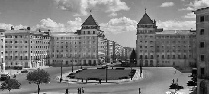

Local da antiga Igreja dos Anjos já demolida e dos edifícios em construção (c. 1910, Joshua Benoliel, Arquivo Municipal de Lisboa – Arquivo Fotográfico, Código de referência PT/AMLSB/CMLSBAH/PCSP/004/JBN/001265) | Site of the old Anjos Church, torn down, and the buildings under construction (c. 1910, Joshua Benoliel, Lisbon Municipal Archive - Photographic Archive, Reference code PT/AMLSB/CMLSBAH/PCSP/004/JBN/001265)
A avenida foi sendo urbanizada de forma “um pouco atabalhoada”, com edifícios a ganharem forma ainda antes de o perfil de rua estar estabilizado. E a paisagem edificada acabaria por ser muito semelhante à da Lisboa até aos anos 1930, pontuada por edifícios relativamente profundos, com uma estética ligeiramente francesa, mas também ligeiramente Arte Nova, para o que terá contribuído o facto de a maioria dos projetos ser assinada por construtores civis. Assim se explica, também, que as plantas sejam replicadas – todos os fogos são compridos, com um corredor, uma sala de refeições e uma cozinha ao fundo, e viradas para trás, enquanto a frente era reservada à sala e ao quarto principal. Este modelo perdurou até 1950, com escassas exceções: no primeiro troço até à Praça do Chile, apenas dois projetos são da autoria de arquitetos. Para norte, e até à Alameda, a paisagem era marcada por edifícios com cores suaves e ausência de empenas secas, em linha, aliás, com o regulamento de 1930. E voltaria a mudar, em direção ao Areeiro, com a chamada “zona dos rabos de bacalhau”, gíria de arquiteto que surge nos processos da época e que remete para a forma em “T” dos prédios.
A Almirante Reis testemunha a história dos planos de construção de Lisboa, tendo conseguido transformar a sua principal desvantagem numa vantagem, pois permite usufruir das qualidades de um grande eixo de circulação e, simultaneamente, das de rua.
Urban development of the avenue has been “somewhat haphazard”, with buildings taking shape even before the contour of the street was cemented. The built landscape would ultimately be very similar to that of Lisbon’s until the 1930s, punctuated by buildings that were relatively wide, with a slightly French aesthetic, but also Art Nouveau, likely due to the fact that most of the plans were designed by builders. This also explains why the floor plans were replicated – all units are long, with a corridor, a dining room and a kitchen at the back, and all facing the rear, while the front was reserved for the living room and the master bedroom. This model would be used until 1950, with a few exceptions. In the first section up to Praça do Chile, only two developments were designed by architects. To the north, and up to Alameda, the landscape was marked by buildings with soft colours and no dry gables, in line with the 1930 regulations. It would change again, towards Areeiro, with the so-called “cod tail area”, architect jargon that appears in the documentation of the time and refers to the “T” shape of the buildings.
Almirante Reis bears witness to the history of Lisbon’s construction plans, having managed to turn its main disadvantage into an advantage, as it allows one to enjoy the qualities of a main road and, at the same time, those of a street.
missão mission
Tem sido, pois, uma artéria de transformações. Urbanísticas, mas também sociais, revelando uma plasticidade tão significativa que a converteu numa avenida cosmopolita, multicultural e de acolhimento, mas que colocou, igualmente, a nu a face da desigualdade. E é sobre ela que se propõe intervir o Plano Municipal para a Pessoa em Situação de Sem Abrigo, a cuja equipa de missão pertencem Nádia Nogueira e Raquel Coelho, as oradoras que encerraram a sessão.
Da reunião de dados do Censos de 2021 e dos dados do NPISA – Núcleo de Planeamento e Intervenção Sem Abrigo, relativos ao último dia de 2022, foi possível aferir que, só em Lisboa, eram, à data, 3.138 as pessoas em situação de sem abrigo, sendo que 2.744 estavam em situação de “sem casa”, isto é, encontrando-se em alojamento temporário dedicado, e 394 em situação de “sem teto”, entendendo-se como vivendo no espaço público, com paradeiro em local precário ou alojada num abrigo de emergência de curta duração. É este o cenário da atuação municipal, com foco nos eixos da sinalização, emergência, transição, inserção, autonomização e prevenção.
Com este propósito, a autarquia criou equipas técnicas de rua, bem como protocolos com diversas entidades, promovendo uma atuação por territórios. E esta intervenção de rua estende-se à relação entre os espaços e a saúde pública, sendo abrangidos todos os domínios que se prendem com a ocupação e o impacto na comunidade. Assim, sempre que são sinalizados fatores de insalubridade que possam comprometer a saúde da pessoa em situação de sem abrigo, ou de outras pessoas, as equipas são convocadas a
It has, therefore, been an artery of transformation, both urban and social, revealing a plasticity so significant that it has become a cosmopolitan, multicultural and welcoming avenue, but that also exposed inequality. It is in this regard that the Municipal Plan for Homeless People proposes to intervene, with Nádia Nogueira and Raquel Coelho, the speakers who closed the session, heading up its task force.
By collating data from the 2021 Census and data from the Homeless Planning and Intervention Centre (NPISA – Núcleo de Planeamento e Intervenção Sem Abrigo), as at the last day of 2022, we were able to ascertain that, in Lisbon alone, there were 3,138 homeless people at the time, of which 2,744 were “people without a home”, that is, they were living in dedicated temporary accommodation, and 394 “didn’t have a roof over their heads”, that is, they were living in a public space, in a precarious location or in a short-term emergency shelter. This is the focal point of municipal intervention, focusing on the aspects of flagging, emergency, transition, insertion, autonomy and prevention.
To this end, the City Council has formed technical street teams and established agreements with several organisations, promoting an area-based approach. This intervention extends to the relationship between spaces and public health, encompassing all areas related to land use and the impact on the community. Accordingly, whenever unhealthy factors are identified that could compromise the health of the homeless or other people, the teams are called upon to act, preferably by referring those affected to the
atuar, desejavelmente encaminhando as pessoas em questão para a estrutura de resposta adequada. No que toca ao alojamento, são diversas as tipologias, algumas de emergência, em centros ou espaços coletivos geridos por entidades parceiras; outras de transição, nomeadamente apartamentos partilhados ou habitação municipal. Em paralelo, existem núcleos de apoio local que providenciam as necessidades mais básicas de alimentação e higiene, ao mesmo tempo que correm projetos de ocupação e inserção no mercado de trabalho. Transversal é a prevenção, quer primária, para impedir a entrada na situação de sem abrigo, quer secundária, com o intuito de evitar o retorno a essa situação.
Focando-se no eixo da Almirante Reis, a técnica Raquel Coelho especificou que é acompanhada por duas equipas de rua: uma que abrange Arroios e Areeiro, assegurada pela Comunidade Vida e Paz; e outra, centrada em Santa Maria Maior, assumida pela associação Crescer. Estas são zonas em que a intervenção ganha contornos mais críticos, porquanto estão entre as freguesias com maior número de pessoas em situação de sem abrigo.
É um cenário complexo que tem sofrido algumas flutuações: por um lado, registou-se uma diminuição do total de pessoas em situação de sem abrigo, muito por via – como descreveu Nádia Nogueira – da diminuição do número de requerentes de asilo contabilizados como pessoas em situação de sem casa; mas, por outro, assistiu-se a um aumento do número de pessoas em condição de sem teto. O perfil está, portanto, em mutação. E se, tradicionalmente, a pessoa em situação de sem abrigo era portuguesa, de meia idade e com problemáticas associadas ao consumo de álcool e outras substâncias, bem como a questões de saúde mental muito presentes, entretanto ganhou outra camada, com pessoas cada vez mais jovens e imigrantes, em situação irregular, mas também mulheres.
appropriate response structure. Accommodation wise, there are several types, some emergency shelters, in centres or collective spaces run by partner organisations, others transitional, in particular shared flats or municipal housing. At the same time, there are local support centres that meet basic food and hygiene needs, while simultaneously running projects to help people find work and for integration into the labour market. Prevention is a common thread in all efforts undertaken, whether primary, to prevent homelessness, or secondary, to help people keep their current housing or secure new housing.
Focusing on the Almirante Reis axis, technician Raquel Coelho explained that she works with two street teams, one covering Arroios and Areeiro, run by Comunidade Vida e Paz, and the other, centred on Santa Maria Maior, run by the Crescer association. These are areas where intervention is even more critical, as these are among the parishes with the highest number of homeless people.
A complex situation that has seen several fluctuations. On the one hand, there has been a decrease in the total number of homeless people, largely due, as Nádia Nogueira described, to the decrease in the number of
asylum seekers counted as being without a home, while on the other hand, there has been an increase in the number of people without a roof over their heads. The profile is therefore changing. Whereas, traditionally, the homeless were Portuguese, middleaged and with associated alcohol or substance abuse problems, and also obvious mental health issues, the profile has evolved to include increasingly younger people and migrants, illegally staying in the country, and also women.
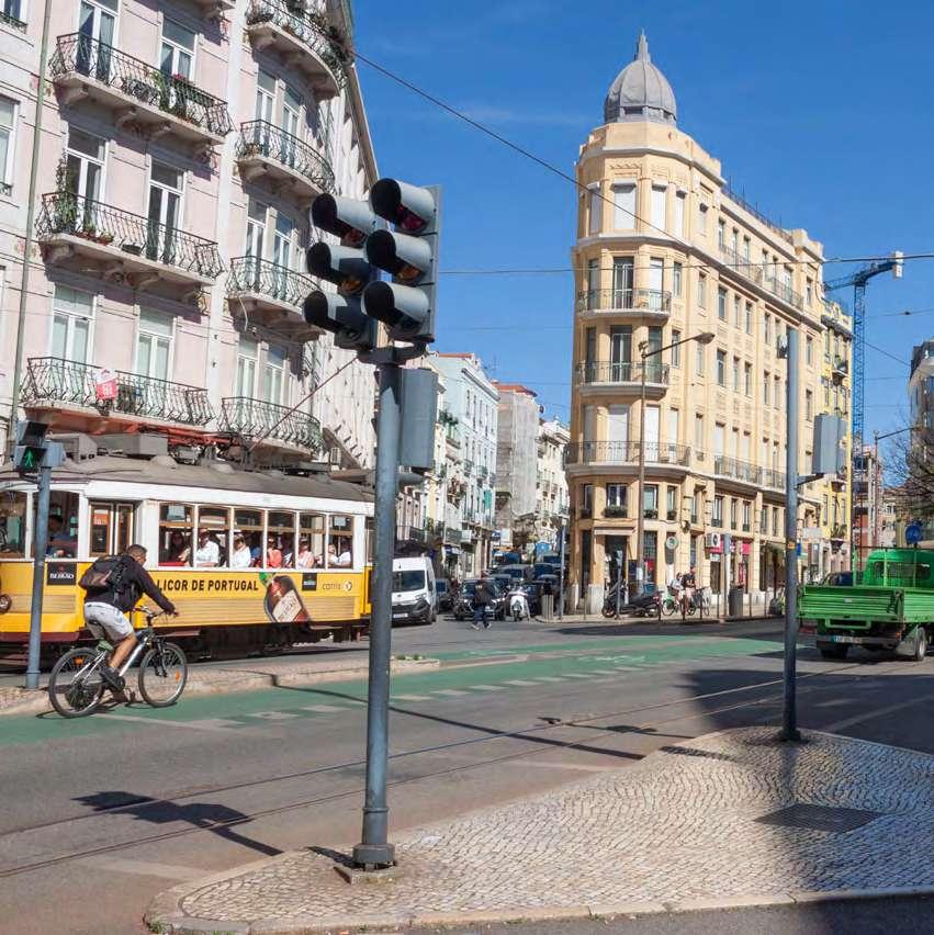
É na confluência destas distintas dimensões que emerge o projeto de requalificação do Vale da Almirante Reis. Há algumas condicionantes a gerir, entre elas, o facto de muitos dos potenciais espaços de intervenção na avenida serem privados, bem como a existência, no subsolo, das infraestruturas de saneamento e do metropolitano, mas há uma memória fundamental a preservar: a ribeira que liga Arroios ao Intendente. E a intervenção obedecerá ao desenho da água, esse elemento quase invisível que permeia toda a cidade.
It is at the confluence of these different dimensions that the Almirante Reis Valley redevelopment project emerges. There are some constraints that need to be managed, including the fact that many of the potential spaces targeted for intervention along the avenue are privately owned, and the existence of the underground sewerage and metro infrastructures. But there is one fundamental memory that must be preserved: the stream that connects Arroios to Intendente. The intervention will follow the shape of the watercourse, the nearly imperceptible element that permeates the entire city.
Vale de Alcântara
6 de julho de 2023 6 July 2023
Moderador Moderator
Catarina Freitas
Direção Municipal de Ambiente, Estrutura Verde, Clima e Energia, CML
Municipal Environment, Green Structure, Climate and Energy Department, CML
Oradores Speakers
Paula Alves e Rui Pires
Gabinete de Projeto de Estrutura Verde, CML
Green Structure Project Office, CML
Nuno Mateus
ARX Portugal Arquitetos
Catarina Raposo
BALDIOS Arquitetos Paisagistas
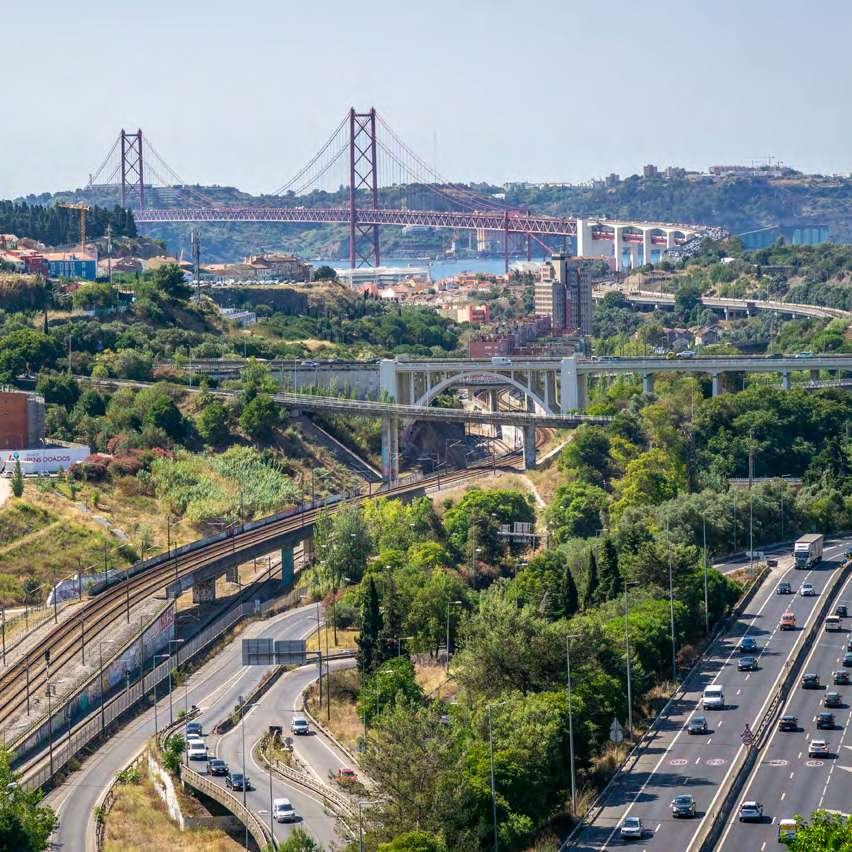
Corredor Verde do Vale de Alcântara:
a importância da Unidade de Projeto da Av. de Ceuta para a continuidade ecológica e resiliência
climática de Lisboa
Alcântara Valley Green Corridor:
the importance of the Av. de Ceuta Project Unit
for Lisbon’s ecological continuity and climate
resilience
O Corredor Verde do Vale de Alcântara, consagrado no PDM de Lisboa, é parte integrante da Estrutura Ecológica Municipal, pela sua importância para o funcionamento do sistema hídrico e para a continuidade ecológica do sistema terrestre da cidade.
O Vale de Alcântara é um dos principais vales tributários do Tejo, juntamente com os de Chelas, Valverde (Av. Liberdade), Arroios (Av. Almirante Reis), Marvila e Olivais. A manutenção da funcionalidade do Caneiro do Vale de Alcântara é, assim, fundamental para a drenagem da bacia de Alcântara e para o controlo de cheias nesta zona de Lisboa.
Mas o Vale de Alcântara constitui também um relevante eixo verde, que liga a área planáltica da cidade (Parque Florestal de Monsanto) à frente ribeirinha, atravessando quatro freguesias: Campolide, Campo de Ourique, Estrela e Alcântara.
Por essa razão, a materialização do Corredor Verde do Vale de Alcântara é tão importante para a sustentabilidade hídrica e resiliência climática de Lisboa, constando das Grandes Opções do Plano 2023/2027 e do novo Programa 5 Vales.
The Alcântara Valley Green Corridor, part of Lisbon’s Master Plan (PDM), is an integral part of the city’s ecological structure, given its importance for the functioning of the water system and the ecological continuity of the city’s land system.
The is one of the main tributary valleys of the Tagus River, together with those of Chelas, Valverde (Av. Liberdade), Arroios (Av. Almirante Reis), Marvila and Olivais. Keeping the Alcântara Valley Canal operational is therefore essential for draining the Alcântara basin and for controlling flooding in this part of Lisbon.
However, Alcântara Valley is also an important green axis that links the city’s plateau area (Monsanto Forest Park) to the riverfront, crossing four parishes: Campolide, Campo de Ourique, Estrela and Alcântara.
For this reason, creating the Alcântara Valley Green Corridor is of paramount importance to Lisbon’s water sustainability and climate resilience, and is included in the 2023-2027 Major Planning Options and in the new 5 Valleys Programme.
Atualmente, conflui para o Vale de Alcântara um complexo sistema de circulação rodoviário e ferroviário, apoiado por um conjunto de túneis e viadutos que garantem importantes ligações e acessibilidades a Lisboa. Estas infraestruturas justapõem-se parcialmente ao Caneiro do Vale de Alcântara, para onde foi encanada a ribeira, estando assim o curso natural da água artificializado e não traduzindo de forma direta a linha de vale existente.
As bacias de retenção e as soluções de base natural previstas para o Corredor Verde do Vale de Alcântara, em complementaridade com o Plano Geral de Drenagem de Lisboa, constituem uma oportunidade para reforçar a capacidade adaptativa e a resiliência climática numa bacia hidrográfica com elevada vulnerabilidade às inundações.
A intervenção no corredor
verde de Alcântara, realizada e programada, incorpora os seguintes princípios e medidas:
• Promoção da ligação aos parques localizados nas encostas, através da construção do Parque Linear do Casal Ventoso, com ligação ao Parque Urbano da Quinta da Bela Flor e extensão da ciclovia até ao rio;
• Inclusão de soluções para mitigação do risco de cheias;
• Requalificação do espaço público desta área da cidade, criando percursos pedonais contínuos e acessíveis e resolvendo a falta de segurança potenciada pelas descontinuidades urbanas;
• Integração urbana e social dos bairros habitacionais confinantes, nomeadamente a população dos bairros da Quinta do Cabrinha e do Loureiro, elevando-os ao estatuto de zeladores de um espaço público verde, acessível e requalificado;
Today, Alcântara Valley is served by a complex system of roads and railways, supported by a series of tunnels and viaducts that provide important links and access to Lisbon. Some of these infrastructures partially overlap the Alcântara Valley Canal, into which the river has been diverted, thus artificially altering the natural watercourse and not directly reflecting the existing one.
The retention basins and nature-based solutions planned for the Alcântara Valley Green Corridor, which complement the Lisbon Drainage Master Plan, provide an opportunity to increase the adaptive capacity and climate resilience of a river basin that is highly prone to flooding.
The
work carried out and planned for the Alcântara Green Corridor includes the following principles and measures:
• connecting the hillside parks, through the creation of the Casal Ventoso Linear Park, with links to the Quinta da Bela Flor Urban Park and the extension of the cycle path to the river;
• providing solutions to reduce the risk of flooding;
• regenerating the public space of this part of the city, creating continuous and accessible pedestrian routes, and eliminating the lack of safety caused by urban discontinuities;
• urban and social integration of the adjacent neighbourhoods, especially of the residents of the Quinta do Cabrinha and Loureiro neighbourhoods, making them keepers of a green, accessible and renewed public space;
• Promoção da eficiência hídrica, através da instalação de uma rede de Água para Reutilização (ApR) produzida na ETAR de Alcântara, para usos não potáveis;
• Integração de futuros projetos de requalificação arquitetónica e urbanística, nomeadamente habitação, adequados à aptidão do território e considerando as condicionantes urbanísticas desta área de vale/meia encosta.
Merece destaque o Projeto para a Requalificação e Reperfilamento da Av. de Ceuta (Unidade de Projeto da Av. de Ceuta), que, de forma inovadora e olhando para um território complexo, altamente descontinuado, desqualificado e super infraestruturado, tem uma abordagem unificadora do território, melhorando-o, integrando-o e interligando-o.
A adução de água para reutilização (água residual tratada) à área de intervenção alimentará a rede de rega de todo o Corredor do Vale de Alcântara e um elemento de água central, que terá um papel de arrefecimento relevante durante períodos de onda de calor.
Em conclusão, a concretização do Corredor Verde de Alcântara traduz um importante esforço da Câmara Municipal de Lisboa, a nível político e técnico, na articulação e coordenação das intervenções previstas neste corredor com todas as entidades presentes neste território, demonstrando uma visão inovadora na forma de fazer cidade.
No futuro, o Corredor Verde de Alcântara prosseguirá até ao rio Tejo, garantindo-se finalmente a ligação ecológica ao Corredor Ribeirinho.
Catarina Freitas
Divisão Municipal de Ambiente
Estrutura Verde, Clima e Energia, CML
• promoting water efficiency through the installation of a network of Water Reuse (WR) for non-drinking purposes, produced at the Alcântara wastewater treatment plant;
• integrating future architectural and urban development projects, in particular housing, according to the suitability of the area and taking into account the urban constraints of this valley/hill.
Of particular note is the Project for the Regeneration and Profiling of Av. de Ceuta (Av. de Ceuta Project Unit). This project adopts an innovative approach to the complex, highly discontinuous, underdeveloped and over-infrastructured area, by unifying, improving, integrating and connecting it.
The recycled water (treated wastewater) supplied to the intervention area will feed the irrigation network of the entire Alcântara Valley Corridor and is a key water element that will play an important role in cooling down the area during heat waves.
In conclusion, the implementation of the Alcântara Valley Green Corridor reflects a significant effort on the part of the Lisbon City Council, at both political and technical levels, to formulate and coordinate the works planned for this corridor, with all the entities involved in this area demonstrating an innovative vision of urban planning.
In the future, the Alcântara Green Corridor will extend as far as the Tagus River, providing an ecological link to the Riverside Corridor.
água water
A água é o fio condutor da renaturalização do Vale de Alcântara. Afinal, é o elo entre o passado e o futuro deste território de génese rural, mas que a urbanização atravessou com infraestruturas que cercearam as ligações humanas e sociais.
Estes contrastes estiveram em foco numa sessão em que esteve sempre presente a ribeira de Alcântara e em que foi debatido um território “muito desafiante e difícil”, nas palavras da moderadora, Catarina Freitas. E, mercê do conflito entre infraestruturas e tecido social, alvo de sucessivos planos de intervenção.
Water is the leitmotif of the recovery of the Alcântara Valley. It is the link between the past and the future of this rural area, where urban development has added infrastructures that have reduced human and social ties.
These contrasts were at the heart of a discussion on the Alcântara River, a “very challenging area”, as moderator Catarina Freitas put it, which has been the target of successive intervention plans because of the conflict between infrastructure and the social fabric.
ligações connections
Do mosaico de ideias que se tem gizado faz parte o projeto para o corredor verde do Vale de Alcântara, um vale que poderia ser simbolicamente pincelado a verde e azul, porque nele se procura a harmonia entre o ambiente e a memória de um território marcado pela água.
The project for the Alcântara Green Corridor is the result of the many ideas planned for this area. This valley could be symbolically painted in green and blue, seeking harmony between the environment and the memory of a territory defined by water.
Mas poderia ser, igualmente, cruzado por linhas que simbolizam as ligações que se pretendem restaurar e a continuidade que se pretende assegurar. Uma visão renaturalizadora sobre a qual se debruçou Paula Alves, recordando quão relevante é o desenho de corredores verdes: “Além da importância histórica de manterem a biodiversidade, desempenham uma função essencial na articulação de todo o património histórico e cultural da cidade”, evidenciou, acrescentando, ainda, as mais-valias da promoção da mobilidade suave e do fomento de atividades recreativas e de lazer.
Uma mão cheia de benefícios que se estende ao Vale de Alcântara, que, qual espinha dorsal, cumpre o desígnio de interligar as encostas, de Monsanto ao Tejo. Ainda que o estudo desenvolvido pelo Gabinete de Projeto de Estrutura Verde não abranja o troço final até ao rio, pois, à data, em 2014, toda aquela área era cenário de um conjunto de compromissos assumidos. “Mas, a preocupação ficou e está incluída nas Grandes Opções do Plano 2023-2027, com o programa 5 Vales e a respetiva estratégia de intervenção que incorporámos no estudo, nomeadamente promover a coesão territorial e social, criar conexão pedonal e articular todos os projetos em curso no território”, ressalvou.
Na sucessão de projeções e projetos de que o vale tem sido alvo, o Estudo de Requalificação do Vale de Alcântara (ERVA) já reflete os compromissos dos planos de urbanização, bem como as novas infraestruturas de mobilidade. A saber: o novo interface de Alcântara, a extensão da Linha Vermelha, a ligação ferroviária do Alvito A e a ligação da Linha de Cascais com a Linha de Cintura e à nova estação do Metro de Lisboa.
But it could also be crossed by lines as a symbol of the links that must be re-established and the continuity that needs to be in place. Paula Alves spoke of this vision to bring nature back to the area and reminded us of how important it is to have green corridors. “Besides their historical importance in preserving biodiversity, they play an essential role in linking all of the city’s historical and cultural heritage,” she stressed, adding that they add value in promoting soft mobility and recreational and leisure activities.
A handful of benefits that extend to the Alcântara Valley, which, as the backbone, connects the hillsides from Monsanto to the Tagus River. The study carried out by the Green Structure Project Office did not cover the final stretch to the river, as the entire area in 2014 reflected a number of commitments already made. “Nevertheless, this is still a source of concern and is included in the 2023-2027 Major Planning Options, with the 5 Valleys Programme and the related intervention strategy included in the study, namely the promotion of territorial and social cohesion, the creation of pedestrian routes, and coordination of all the projects underway in the area,” she noted.
Following a series of projections and projects for the valley, the Alcântara Valley Rehabilitation Study (ERVA) already reflects the urban planning commitments and the new mobility infrastructures. These include the new Alcântara interface, the expansion of the metro Red Line, the Alvito A rail link and the connection of Linha de Cascais with Linha de Cintura and the new Lisbon metro station.
Grande parte destas intervenções apenas foram estabilizadas após 2014, data de início do projeto do corredor verde de Alcântara. Este projeto, fruto de uma parceria entre a Câmara Municipal e a SIMTEJO, evidencia um “forte carácter ambiental”, assente em quatro alicerces: água, energia, ambiente urbano e biodiversidade. E, neste âmbito, a ribeira é resgatada ao passado: “Houve sempre a preocupação de recriar a memória da ribeira, através da utilização da água proveniente da ETAR, não só para a colocar à superfície do vale, mas também para potenciar o seu aproveitamento a montante, por exemplo, na lavagem de ruas e na rega de espaços verdes.”
Neste perspetivar do futuro, a equipa começou por olhar para o passado e conhecer a evolução histórica do vale, para concluir, desde logo, que se tratava de um espaço rural, em que a ribeira já estava contida por muros, mas sem prejuízo da sua naturalidade. É com o viaduto, primeiro, e a Avenida de Ceuta, depois, com a construção do caneiro que, em 1950, veio cobrir a ribeira, que começam a emergir os limites ao crescimento urbano. Um fenómeno que a ponte sobre o Tejo, na década seguinte, intensificou. Em paralelo, a análise fisiográfica permitiu identificar que grande parte da área de intervenção é constituída por declives superiores a 30o, correspondendo à maior bacia hidrográfica da cidade, com solos potencialmente muito permeáveis, mas vegetação pouco relevante, com exceção do alinhamento de plátanos da Avenida de Ceuta. São cerca de 20 ha, que se estendem por 4,3 km e tocam quatro freguesias – Campolide, Campo de Ourique, Estrela e Alcântara. Este panorama é, ainda, marcado pelo caneiro, coincidente com a área de intervenção na avenida, mas não com a linha do vale, bem como por um complexo sistema de circulação rodoviário e ferroviário.
It was only after 2014, when the Alcântara Green Corridor project was launched, that most of these works stabilised. This project “focuses heavily on the environment”. It has four cornerstones: water, energy, urban environment and biodiversity, and is the result of a partnership between the City Council and SIMTEJO. The river is thus brought back from the past: “Our aim was always to recreate the memory of the river, by using the water from the treatment plant not only for the surface of the valley, but also to maximise its use upstream, for example for washing roads and watering green spaces.”
The team’s first step was to look to the past in order to learn about the historical development of the valley and to envision its future. Their conclusion was that this was a rural area where the river had already been walled in, but without compromising its natural features. The limits of urban sprawl became evident with the construction of the viaduct and Avenida de Ceuta, and then with the construction of the canal that covered the river in 1950, a trend that the bridge over the Tagus River would intensify in the following decade. At the same time, the physiographic analysis showed that a large part of the intervention area consists of slopes of more than 30°, corresponding to the city’s largest watershed, with potentially highly permeable soils and little vegetation, except for the plane trees lining Avenida de Ceuta. It covers an area of around 20 hectares over a distance of 4.3 kilometres and extends across four parishes – Campolide, Campo de Ourique, Estrela and Alcântara. This landscape is also shaped by the canal, which coincides with the intervention area on the avenue but not with the valley line, and by a complex road and railway system.
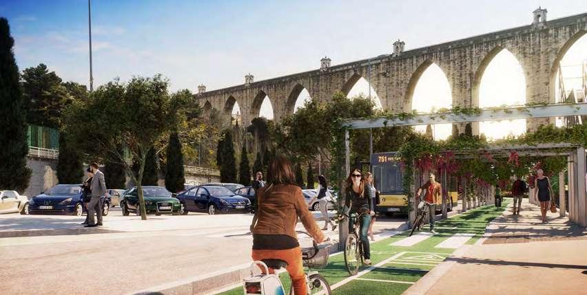
Deste cenário deriva uma diversidade significativa de interlocutores, dadas as distintas utilizações do território. Desta teia cadastral deu conta Rui Pires, do mesmo Gabinete, concretizando: “Quando pensávamos que estávamos em terreno municipal estávamos, afinal, em território da ferrovia, sendo que, por outro lado, parte da linha de comboio está implantada em terrenos municipais. E, além disso, havia hortas em territórios cartografados como sendo do domínio ferroviário”. O que se conseguiu foi, independentemente da planta de cadastro, ajustar as vedações das unidades às necessidades, de modo a garantir espaço de intervenção.
Mantém-se a propriedade do património, mas a ocupação é pública e integra a designada área verde intervencionada.
Given the different uses of the area, this scenario involves a considerable number of different stakeholders. Rui Pires, from the Green Structure Project Office, gave an account of the land registry issues encountered. “We thought we were on municipal land, when in fact we were on railway land, although part of the railway line crosses municipal land. There were also gardens in areas which were chartered as being “under the control of the railway.”. The units were fenced off according to the needs of the site, regardless of the land registry map, to allow space for the works. Ownership of the land didn’t change, but it is land for public use and forms part of the so-called “covered green area”.
Ultrapassados estes constrangimentos, o passo seguinte foi o estudo prévio para a introdução do corredor ciclo-pedonal, envolvendo, como unidades de projeto, o Bairro da Liberdade, a Estação de Campolide e a passagem superior, bem como a Quinta da Bela Flor, “um território residual” entre o bairro e a linha de comboio. A principal ligação seria uma passagem superior, concebida como um túnel a enriquecer com um edifício que comportasse um centro de interpretação do caneiro. Já na Avenida de Ceuta, a prioridade era criar um canal pedonal largo, misto, que permitisse ter água à superfície: a sua concretização implicaria eliminar uma faixa de rodagem, hipótese que acabaria por ser descartada na antevisão da introdução de uma linha de metrobus.
Once these constraints had been overcome, the next step was the preliminary study for the introduction of the pedestrian and cycle corridor, which included as project units the Liberdade neighbourhood, the Campolide station and the overpass, and Quinta da Bela Flor, “a residual area” between the neighbourhood and the railway line. The main link would be an overpass, designed as a tunnel to be complemented by a building that would house an interpretation centre dedicated to the canal. On Avenida de Ceuta, the priority was to create a wide, mixed pedestrian route that would allow surface water to flow through it, but this would have meant removing a carriageway. This option was discarded in anticipation of the introduction of a Metrobus line.
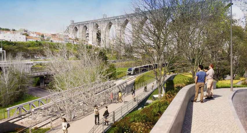
Viaduto ciclo-pedonal sobre a Av. Calouste Gulbenkian (DMAEVCE/CML, Profico e Pura Imagem) | Footbridge for cyclists and pedestrians over Av. Calouste Gulbenkian (CML/DMAEVCE, Profico e Pura Imagem)
Apesar dos constrangimentos causados pela indefinição em torno de grandes projetos de infraestruturas, já se concluíram, entretanto, algumas fases do corredor verde. A mais recente prende-se com a conclusão da passagem inferior, mas outras beneficiaram, por exemplo, o Bairro da Liberdade: na senda de um desejo da população, materializado através do orçamento participativo, conseguiu-se contemplar uma área que comportasse hortas, bem como o equipamento solicitado – um parque de skate. A propósito, Rui Pires recordou que o vale era marcado por áreas que eram depósitos de entulho e tinham ocupações ilegais, tendo sido possível uma articulação entre os espaços e os compromissos existentes. O diálogo entre as entidades envolvidas conduziu, por exemplo, ao reperfilamento da via no Bairro da Liberdade, em território da Infraestruturas de Portugal, do Eixo Norte-Sul. Já na Estação de Campolide, o ganho alcançou-se mediante a redução de um sentido, com a circulação única dentro da estrutura a permitir a conquista de espaço, objetivo para o qual concorreu também a eliminação de um acesso à Avenida Calouste Gulbenkian, bem como a estabilização da velocidade dos autocarros da Carris naquela zona.
A intervenção assumiu, ainda, a forma de um viaduto ciclo-pedonal sob o Aqueduto das Águas Livres, ultrapassando a barreira da Avenida Calouste Gulbenkian. Uma intervenção suscitada pela confirmação de que todos os arcos do aqueduto estavam ocupados com circulação rodoviária ou ferroviária, sendo inexistente qualquer acesso pedonal que garantisse proximidade.
Despite the constraints caused by the uncertainty surrounding major infrastructure projects, some phases of the Green Corridor have already been completed, such as the construction of the underpass. Other works have also been carried out in the Liberdade neighbourhood, in response to the residents’ request and funded through participatory budgeting, including an area for vegetable gardens and the requested amenity, a skate park. In this respect, Rui Pires recalled that the valley was littered with rubbish dumps and illegal occupations, and that it was possible to coordinate the spaces and existing commitments. For instance, discussions between the entities involved led to the re-profiling of the road in the Liberdade neighbourhood, situated on land owned by Infraestruturas de Portugal, on the North-South axis. The Campolide station, in turn, benefited from the introduction of uni-directional traffic, with a one-way traffic lane inside the structure allowing for more space, an objective also achieved by eliminating an access route to Avenida Calouste Gulbenkian and reducing the speed of Carris buses in the area.
A footbridge was also built for cyclists and pedestrians under the Águas Livres Aqueduct, crossing Avenida Calouste Gulbenkian. The reason for this intervention was that all the arches of the aqueduct were occupied by roads or the railway, and there was no access for pedestrians to ensure proximity.
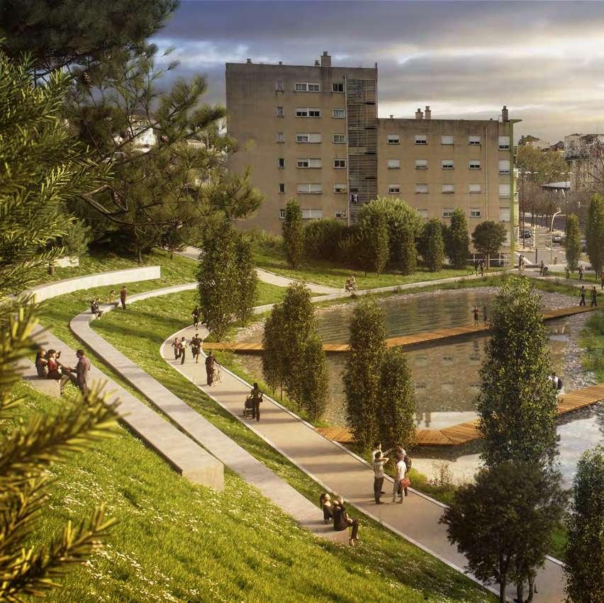
O percurso e as praças abertas de ambos os lados colmataram essa lacuna, permitindo a apropriação humana deste património. E prosseguiu na Quinta da Bela Flor: o foco, explicado por Paula Alves, foi a criação de uma rede de percursos que interligasse o corredor verde, mas também o bairro, que não possuía acesso pedonal aos interfaces de transportes públicos. A principal destas ligações é a passagem inferior, para a qual foi encontrada uma solução de engenharia aberta, particularmente interessante do ponto de vista da segurança, pelo facto de se localizar no ponto baixo, quer da Quinta da Bela Flor, quer da Avenida de Ceuta.
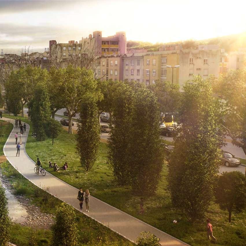
The footbridge and the open spaces on either side have filled this gap, making this heritage accessible to all. In Quinta da Bela Flor, Paula Alves explained that the focus was on creating a network of routes that would connect the green corridor, but also the neighbourhood, which had no pedestrian access to public transport interfaces. The most important of these links is the underpass, for which a particularly interesting open engineering solution was found from a safety point of view, as it is located at the lowest point of both Quinta da Bela Flor and Avenida de Ceuta.
entre a artificialidade e a naturalidade natural or artificial
O caminho que está por percorrer foi aflorado por Catarina Raposo, uma das projetistas do projeto de execução de requalificação do troço da Avenida de Ceuta. “Quando se fala de espaço público como espaço de conflito, o vale condensa essa ideia –conflito entre matriz topográfica e infraestruturas, que se sobrepõem, em associação com um conjunto de linhas imaginárias a que chamamos servidão e que implicam uma série de regras, com consequências reais e efetivas”, descreveu.
Catarina Raposo, one of the designers of the project to upgrade Avenida de Ceuta, spoke about the road ahead. “When we talk about public space as a space of conflict, the valley sums up this idea – the conflict between the topographical matrix and overlapping infrastructures, combined with a series of imaginary lines that we call easements, which imply a set of rules with real and effective consequences.”
O conflito é igualmente suscitado pela ideia de que o Vale de Alcântara constitui um elo de conexão entre a cidade e a sua envolvente, quando, à escala local, essa ideia de conexão é “quase impossível”.
E é com este conflito subjacente que se desenrola a intervenção na Avenida de Ceuta e, muito em particular, no separador central, com o desígnio de devolver a água à superfície. “Começou-se a pensar que a ribeira poderia vir ao de cima, mas ainda estamos muito longe dessa ideia mais radical”, comentou.
A solução encontrada assenta no pressuposto de que a água tratada pela estação de saneamento, em vez de ser encaminhada diretamente para o caneiro, possa ficar à superfície, ativando uma estrutura ecológica no separador central. A primeira questão foi perceber “qual a expressão desta renaturalização no contexto específico da avenida”. A resposta começou por ser procurada historicamente. O levantamento efetuado permitiu identificar que a água sempre foi manipulada no vale, com taludes, valas, tanques utilitários ou ornamentais a coexistirem numa ambiguidade entre espaço rural e espaço industrial. É uma história contada pelas infraestruturas que cruzam a ribeira, nomeadamente, muros de contenção que culminaram no caneiro. Com os seus oito metros de largura por cinco de altura, traduziu uma alteração profunda da paisagem do vale. Portanto, “a história deste vale é uma história de artificialização profunda e de manipulação da água”. A construção da avenida vem ratificar esta conclusão, na medida em que, sob ela, corre uma linha de água que corresponde ao fim da maior bacia hidrográfica da margem norte do Tejo.
The conflict also stems from the idea that Alcântara Valley is a link between the city and its surroundings, although at a local level this idea of connection is “almost impossible”.
It is against this backdrop of conflict that the intervention takes place on Avenida de Ceuta, specifically on the central reserve, with the aim of bringing the water back to the surface. “We pondered pushing the stream up to the surface, but we’re still a long way from that more radical idea,” she said.
The solution found is based on the assumption that the water treated by the treatment plant, instead of being discharged directly into the canal, could remain on the surface, providing an ecological structure along the central reserve. First, we had to understand “how this renaturalisation materialises in the specific context of the avenue.”. We began by looking to history for an answer. The study showed that water has always been controlled in the valley, with slopes, ditches, utilitarian or ornamental reservoirs co-existing in the ambiguity between the rural and the industrial space. This can be seen in the infrastructure crossing the river, particularly the retaining walls that culminate in the canal. Eight metres wide, the infrastructure represented a profound change in the landscape of the valley. For this reason, “the history of the valley is one of profound artificialisation and manipulation of water.”. The construction of the avenue is proof of this, as it has a watercourse running through it, in line with the end of the largest river basin on the north bank of the Tagus River.
Este é, pois, “um território cheio de constrangimentos”, em torno do qual gravita a intenção de uma estrutura ecológica. Mergulhando nas variações do perfil do vale, os projetistas chegaram a uma solução relativamente unitária que tentaram estender ao longo de cerca de 2 km. E, nessa solução, o alinhamento de plátanos já implantado revelou-se um dos valores a preservar, propondo-se que acompanhassem todo o percurso, criando duas estruturas lineares. Uma, a meio da encosta, a partir do caminho ciclo-pedonal existente, que será alargado. A outra no separador
It is therefore a “territory full of constraints” where the intention is to build an ecological structure. By studying the different profiles of the valley, the designers arrived at a relatively uniform solution, which they attempted to extend over approximately 2 kilometres. The alignment of the existing plane trees in this solution proved to be one of the values to be preserved, and it was proposed that they follow the entire route, creating two linear structures, one halfway up the hill, from the existing cycle-pedestrian path, which will be widened, and the other along the central reserve, at the point
Caneiro de Alcântara, obras de cobertura da ribeira de Alcântara junto da Ponte Nova (1945, Eduardo Portugal, Arquivo Municipal de Lisboa – Arquivo Fotográfico, Código de referência PT/AMLSB/CMLSBAH/PCSP/004/EDP/002321) | Alcântara canal, works to cover the Alcântara stream near Ponte Nova (1945, Eduardo Portugal, Lisbon Municipal Archive - Photographic Archive, Reference code PT/AMLSB/CMLSBAH/PCSP/004/EDP/002321)
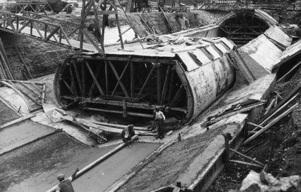
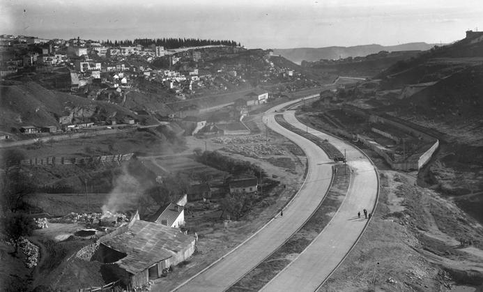
Avenida de Ceuta construída sobre o caneiro de Alcântara, com ligação à avenida da Índia. No plano superior, à esquerda, o cemitério dos Prazeres (1950, Eduardo Portugal, Arquivo Municipal de Lisboa – Arquivo Fotográfico, Código de referência PT/AMLSB/CMLSBAH/PCSP/004/EDP/000983) | Avenida de Ceuta, built over the Alcântara canal, with a link to Avenida da Índia. Top left side, Prazeres cemetery (1950, Eduardo Portugal, Lisbon Municipal Archive –Photographic archive, reference code PT/AMLSB/CMLSBAH/PCSP/004/EDP/000983)
central, a partir da referência da introdução da água oriunda da ETAR, mas levando-a mais longe, de modo a ativar uma estrutura ripícola – seria o pretexto para a plantação de espécies típicas das linhas de água, numa lógica de autossuficiência. O projeto prevê a criação de dois lagos, um que recebe a água da ETAR, conduzindo-a ao separador central, de onde corre graviticamente, até ser entregue ao caneiro e, daí, ao rio, por intermédio de um segundo lago. Este percurso longitudinal é acompanhado de uma série de açudes, cuja função é potenciar a oxigenação da água. É, pois, numa conversa entre a artificialidade e a naturalidade que se concretiza esta intervenção.
where the water from the wastewater treatment plant enters the river but continues along the river to create a riparian structure. This would be the pretext for planting species typical of watercourses, for self-sufficiency. The project envisages the creation of two lakes, one of which receives water from the treatment plant and transfers it to the central reserve, from where it flows by gravity to the canal, and from there, via a second lake, into the river. A series of weirs designed to increase the oxygen content of the water were built along the length of the river. This intervention is therefore materialised in a dialogue between artificiality and naturalness.
do progresso
from progress
Outras conversas são as que Nuno Mateus tem com os seus alunos de mestrado, a quem convida a olhar para a cidade como se ela estivesse por construir, observando o Vale de Alcântara com esse olhar virgem.
Nuno Mateus also held discussions with his Master’s students, inviting them to look at the city as if it were yet to be built, and to look at Alcântara Valley from this unadulterated view.
O seu próprio olhar tem na génese um convite para estudar o edifício da Faculdade de Arquitetura e perceber como se adaptava ao seu uso atual. Cedo compreendeu a pertinência de olhar para os edifícios no contexto de toda a encosta e vale, e é nesse processo que o vale é perspetivado como “um lugar de intervenções de arquitetura que, no conjunto e articuladamente, davam uma ideia global de paisagem”. Foi já segundo esta ótica que virou a sua atenção para o Vale de Alcântara.
Quando Nuno Mateus se propôs estudar o impacto do Hospital CUF Tejo (então, apenas programado, hoje já em funcionamento) na zona de Alcântara, uma vez mais, colocou-se a questão da relação entre a parte e o todo: olhar o lote isoladamente pecava por escasso e insuficiente, pelo que se impunha estudar a matriz em que ele se encaixava. E, neste aprofundar de conhecimento, desde logo se afirmou a certeza da sua relação histórica com a água, uma relação “muito forte” que continua a marcar todo o território.
His own view was based on an invitation to study the building of the Faculty of Architecture and see how it had been adapted to its current use. He soon realised the importance of looking at the buildings in the context of the entire hillside and valley. In this process, the valley is seen as “a site of architectural interventions which, individually and collectively, shape the landscape”. With this in mind, he turned his attention to Alcântara Valley.
When Nuno Mateus set out to study the impact of the CUF Tejo Hospital in the Alcântara area (at the time only a project, now fully operational), he once again raised the question of the relationship between the part and the whole: the problem with looking at the site in isolation is that it lacks breadth and is inadequate, so it is necessary to study the system in which it is embedded. As he deepened this knowledge, he became convinced of the historical relationship with water, a “very strong” relationship that continues to characterise the entire area.
Vista Aérea. Vale de Alcântara. Google Earth. (2018). Vale de Alcântara [Imagem de satélite]. https://www.google.com/earth/ | Aerial view. Alcântara Valley. Google Earth. (2018). Alcântara Valley [Satellite image]. https://www.google.com/earth/
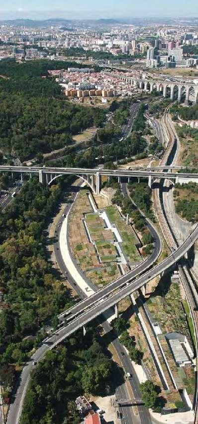
Os anos 40 trouxeram consigo uma “transformação brutal”, visível nos 35 km de via rodoviária instalada em faixa única, bem como em 120 ha de área ocupada e de área inutilizada, porque tornada inacessível – área que pode ser visualizada como 35 praças do Comércio ou sete jardins do Campo Grande. São 4 km na sua extensão, exatamente o comprimento do Central Park, em Nova Iorque: as semelhanças são meramente dimensionais, mas podem ser a semente para pensar no papel que o vale pode desempenhar em Lisboa. “Há um potencial que não está a ser observado”, comentou. E é um potencial que decorre, nomeadamente, do facto de este vale drenar 40% da água que cai na cidade – uma cidade que é também das sete ribeiras, que, paulatinamente, se foram secando, substituídas por um sistema subterrâneo.
Reverter esta situação implica, na sua ótica, um contrato intergeracional num horizonte de 60 anos, pontuado por etapas intermédias e passos progressivos. “O modelo que me parece implementável é multimodal, em que cada bairro trata o seu sistema de efluentes e recolhe a sua água pluvial e a deixa sair à superfície, depois de tratada, repondo o sistema de ribeiras original, não na totalidade, certamente, porque estamos a impermeabilizar a cidade, mas diria em 60% ou 70%, dependendo do grau de ambição e das características que se forem encontrando”, descreveu.
É com este cenário que os alunos de mestrado de Nuno Mateus trabalham, tendo subjacente uma relação entre o presente, o passado e o futuro e o desiderato de um modelo de simbiose entre a cidade e a natureza. Um modelo que, no vale, tem como fio condutor a linha de água e todo o sistema húmido: “O que estamos a propor é que o vale seja um agroparque de grande extensão, criando-se uma empresa municipal agrícola. E Lisboa responsabilizar-se-á por boa parte da produção alimentar e pela pedagogia dessa ideia de proximidade”.
The 1940s saw a “radical transformation”, visible in the 35 kilometres of single-lane roads and the 120 hectares of occupied and unused and inaccessible space – an area equivalent to 35 Praça do Comércio squares or seven Campo Grande gardens. A roughly 4 kilometre stretch of land, exactly the same length as New York’s Central Park: they’re only similar in size, but they can serve as a starting point for thinking about the role that the valley could play in Lisbon. “We are overlooking a potential aspect” he commented. This valley drains 40% of the water that falls on the city, one that also comprises seven streams that have gradually dried up and been replaced by an underground system.
In his view, a 60-year intergenerational contract, with intermediate stages and progressive steps, is needed to reverse this situation. “I believe that a multimodal model is the most feasible option, in which each neighbourhood treats its own sewage system, collects its own rainwater and releases it on the surface after treatment, restoring the original river system, not in its entirety of course, because we’re waterproofing the city, but I’d say 60% or 70%, depending on the level of ambition and the characteristics found,” he commented.
This is what Nuno Mateus’ Masters students are working on, based on a relationship between the present, the past and the future, and the desire to create symbiosis between the city and nature. A model in which the watercourse and the entire wet system are the central theme in the valley. “We propose that the valley becomes a large agropark, with the creation of a municipal agricultural company. Lisbon would be responsible for a large part of food production and for conveying this idea of proximity.”
O que está implícito é questionar o que hoje parece inevitável, isto é, um vale que gira em torno das infraestruturas nele edificadas, desmantelando ou enterrando algumas, delineando um novo sistema de percursos de rodovia que fazem a margem da zona agrícola central, cuja concretização implica a demolição dos edifícios que se encontram no leito de cheia. Outros edifícios há que devem ser preservados e reabilitados, abrindo a porta para voltar a construir os bairros, “agora num lugar altamente privilegiado”. “É uma inversão de valor brutal nesta nova centralidade de valor.”
E valor é o elo comum a todos estes olhares sobre o Vale de Alcântara. São olhares distintos, porque distinta é a natureza do que os move, mas, entre trabalhos académicos, estudos de projeto, ou projetos em execução, uma homogeneidade se destaca: afinal, une-os a proposta de uma nova territorialização, sob o signo da água.
This process involves challenging what now seems inevitable: a valley that is at the heart of its infrastructure, some of which will be demolished or buried, and a new road system along the agricultural land that will require the demolition of buildings in flood-prone areas. Other buildings should be preserved and rehabilitated, opening the door to rebuilding the neighbourhoods, which “are now in a prime location”. “It is a harsh reversal of values, where value is at the heart of the process.”
And value is the common link between all these views of Alcântara Valley. They are different perspectives, because the nature of what drives them is different. However, all the academic works, project studies and ongoing projects share one thing in common: the proposal of a new territorialisation, with water as its common element, is the glue that binds them together.
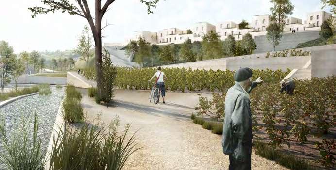
Vale da Ajuda
6 de julho de 2023 6 July 2023
Moderador Moderator
Cláudia Pinto
Programa ReSist – Resistência Sísmica, CML
ReSist Programme - Seismic Resistance, CML
Oradores Speakers
António Lamas
Lisboa Ocidental SRU – Sociedade de Reabilitação Urbana
António Marques
Centro de Arqueologia de Lisboa
Lisbon Archaeology Centre
Gonçalo Folgado
Associação Locals Approach
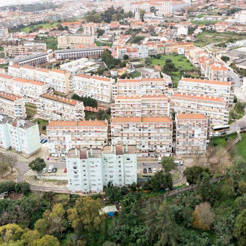
Ajuda / Rio Seco, o vale que começou por ser mar há 97 milhões de anos
Seco River/Ajuda, the valley that started out as a sea 97 million years ago
Poderá estranhar esta frase introdutória, considerando que nos dias de hoje a Ajuda se encontra numa das zonas com maior cota altimétrica no concelho de Lisboa, mas, de facto, este vale formou-se debaixo de água e esse testemunho é visível nas camadas de calcário com fósseis, datadas do Período Cretácico.
Essas rochas carbonatadas foram exploradas ao longo dos séculos… como uma rocha ornamental, vulgarmente conhecida como lioz, e como um recurso mineral natural usado na construção (alvenaria e cantarias) e na estatuária visível na cidade de Lisboa. Conhece-se também as explorações de cal, cuja atividade terá perdurado até aos anos 70, e da qual atualmente só restam os antigos fornos.
This introductory sentence may seem strange, given that Ajuda is located in one of the highest areas of the municipality of Lisbon. In fact, this valley was formed under water, as evidenced by the layers of limestone with fossils dating back to the Cretaceous period.
People have mined these carbonated rocks for centuries as an ornamental stone, commonly known as lioz (limestone), and as a natural mineral resource used in construction (masonry and stonework) and in the statues around the city of Lisbon. There were also lime factories that operated until the 1970s, of which only the old kilns remain.
A primeira referência ao Rio Seco data de 1516 e surge em documentos que mencionavam os “trabalhadores das pedreiras”. Relatos da época afirmam que esse “rio” resultava da junção de duas antigas ribeiras e que, pelo facto de ter muito pouco caudal, principalmente no verão, recebeu a designação de “Rio Seco”.
As inúmeras intervenções realizadas no Rio Seco em épocas distintas resultaram numa série de desequilíbrios no tecido urbano, bastante heterogéneo, com edifícios baixos e ruas estreitas contrastantes, com edifícios mais altos de períodos recentes… é muito evidente a fragmentação da zona pelo vale. Do enorme contraste urbano, destaca-se a coexistência do Palácio Nacional da Ajuda, bairros de habitação social acessível e o Parque Florestal do Monsanto.
Esta disparidade tipológica e o desaproveitamento do espaço público conduziram à requalificação urbana que tem vindo a ser implementada, a qual inclui a construção do Parque Urbano do Rio Seco, a implementação de uma bacia de retenção de água, medida que integra o Plano Geral de Drenagem de Lisboa, e a construção do corredor verde previsto na Estrutura Ecológica Municipal.
É este o pano de fundo e o cenário que está na base da estratégia de reconversão do Vale do Rio Seco, integrado no Programa “5 Vales”.
Ao longo desta sessão foram apresentadas várias iniciativas, as quais têm em comum o objetivo de mitigar as heterogeneidades urbanas e promover o conceito de bairro, tendo como prioridade trazer vida e serviços de proximidade para a população da zona.
Cláudia Pinto
Programa ReSist
- Resistência Sísmica, CML
The first mention of the Seco River dates to 1516 and appears in documents referring to “quarry workers”. According to reports from that time, this “river” originated from the confluence of two old streams and became known as “Rio Seco” (dry river) because of its low flow, especially in the summer.
The many interventions carried out on the Seco River over the years have disturbed the balance of the urban environment, which is very heterogeneous, with low buildings and narrow streets contrasting with taller buildings of more recent periods… the fragmentation of the area by the valley is very evident. Ajuda National Palace coexists with affordable residential neighbourhoods and the Monsanto Forest Park, creating a striking urban contrast.
The inconsistency of this type of construction and the lack of use of the public space led to the urban regeneration that was undertaken, which included the construction of the Rio Seco Urban Park, the construction of a retention basin, a measure included in the Lisbon General Drainage Plan, and the construction of the green corridor provided for in the Municipal Ecological Structure.
The Rio Seco Valley Conversion Strategy, part of the “5 Valleys” programme, is set against this background and scenario.
Several initiatives were presented during this session, all aimed at reducing urban disparities and promoting the neighbourhood concept, with the priority being to bring life and local services to the people living in the area.
património heritage
Histórico.
Edificado.
Urbano. Humano.
São distintas as faces que o património assume no Vale da Ajuda / Rio Seco; distintas, mas coexistentes no território e coexistentes nas leituras sobre o futuro e nas intervenções pensadas para lhe devolver um lugar maior na cidade.
Heritage has different aspects in the Seco River/ Ajuda Valley. Albeit distinct, they coexist in the territory, in the interpretations of the future and in the works aimed at improving its place in the city.
memórias memories
A incursão no vale começou por ser guiada pelas memórias de António Lamas, alimentadas pelas múltiplas oportunidades que teve de intervir na zona, ao abrigo das funções públicas que desempenhou ao longo dos anos.
E fê-lo recuando a 1987, ano da sua nomeação como presidente do IPPC – Instituto Português do Património Cultural. E o primeiro episódio prende-se com a construção das chamadas Torres dos Jerónimos, previstas para as traseiras do mosteiro, numa zona especial de proteção: “Tive de embargar a obra, levantar um processo de anulação do despacho do presidente da câmara, que tinha sido ilegal”, recordou. “Era uma zona muito desprotegida em termos de planeamento e de proteção de bens classificados”, contou, relembrando que, na altura, todos os monumentos de Belém e da Ajuda possuíam uma zona de proteção, mas não estavam unidas, com os vazios entre elas a darem azo a episódios como o das torres. “Promovi uma zona especial de proteção Belém-Ajuda e um plano de salvaguarda, que durou uma década, até ao fim dos anos 90, após o que foi revogado.”
The study of the valley was based on the recollections of António Lamas, fuelled by the many opportunities he had to work in the area over the years as part of his public office.
He recalls being appointed President of the IPPC – Portuguese Institute for Cultural Heritage in 1987.
The first episode has to do with the construction of the “Torres dos Jerónimos”, planned for the land behind the monastery, a special protected area. “I had to put an embargo on the construction work and initiate proceedings to overturn the mayor’s decision, which was illegal,” he recalls. “This area was very unprotected in terms of planning and protecting listed sites,” he said, recalling that at the time all the monuments in Belém and Ajuda were part of a protected area, but they were not connected, so the spaces between them led to episodes like that of the towers. “I promoted a special protection zone in Belém-Ajuda and a protection plan that lasted for ten years, until the end of the 1990s, when it was revoked.”
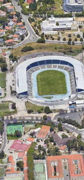
A sua presidência do IPPC é contemporânea do lançamento do projeto para o Centro Cultural de Belém (CCB). Tem ainda na imagem o parque de sucata da Junta Autónoma das Estradas que ocupava os terrenos que hoje são a base de uma verdadeira casa de cultura. Seria o anúncio da primeira presidência portuguesa da então Comunidade Económica Europeia que faria acelerar esta história: “Não havia em Lisboa uma sala para acolher orquestras sinfónicas, não havia módulos para congressos, não havia a possibilidade de responder às necessidades de albergar uma presidência europeia.” Com os fundos disponíveis, lançou-se um concurso internacional, para escolher quem assinaria a obra: em mais de 50 candidatos, sagrou-se vencedor o arquiteto italiano Vittorio Gregotti, que se associou com o português Manuel Salgado. “Uma época de decisões gloriosas”, comentou o orador, lamentando, todavia, que alguns dos módulos projetados nunca tenham saído do desenho.
The launch of the Belém Cultural Centre (CCB) project coincided with his presidency of the IPPC. He still remembers the scrap yard of the Junta Autónoma das Estradas (Portuguese Road Administration), which used to occupy the land where the cultural centre now stands. The announcement of the first Portuguese presidency of what was then the European Economic Community was the catalyst for this story. “Lisbon lacked a hall to host symphony orchestras, there were no conference halls, and there was no way to meet the needs of hosting a European Presidency.” With the funds available, an international tender was launched to select the designer for the project: the Italian architect Vittorio Gregotti, working together with the Portuguese architect Manuel Salgado, was selected from among the over 50 candidates. A time of glorious decisions,” he said. However, he regretted that some of the planned modules never left the drawing board.
Panorâmica sobre a Calçada da Ajuda, vê-se o Palácio Nacional da Ajuda (data n.e., Eduardo Portugal, Arquivo Municipal de Lisboa – Arquivo Fotográfico, Código de referência PT/AMLSB/POR/059748) | Panoramic view of Calçada da Ajuda depicting the Ajuda National Palace (date unknown, Eduardo Portugal, Lisbon Municipal Archive - Photographic Archive, Reference code PT/ AMLSB/POR/059748)
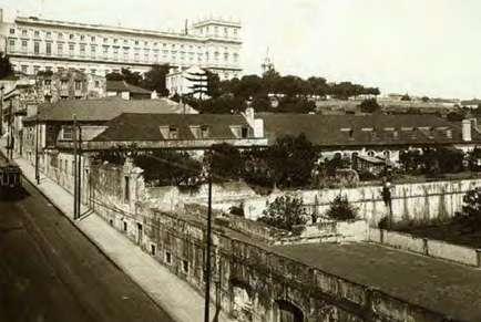
Nesta visita guiada, a paragem seguinte é o Palácio da Ajuda, cuja recuperação promoveu. Muitas foram – recordou – as tentativas para completar este palácio inacabado desde a ida de D. João VI para o Brasil. A missão de o resgatar deste abandono foi entregue a Gonçalo Byrne, o arquiteto português que havia ficado em segundo lugar no concurso para o CCB. “Fez um projeto extraordinário”, que propunha completar o palácio, repensando a fachada, mas também requalificando a zona envolvente.
E, a propósito de envolvência, entende António Lamas que se impõe a classificação do eixo da Ajuda como de interesse municipal, merecedor, nessa qualidade, de um plano de salvaguarda e de reutilização. Do antigo Museu dos Coches ao Palácio de Belém, do Teatro Luís de Camões à Travessa das Zebras, das cocheiras, onde está instalada a Escola Portuguesa de Arte Equestre, ao Quartel de Lanceiros e ao Quartel da Cavalaria da GNR, passando pelo Jardim Botânico da Ajuda, sem esquecer o palácio propriamente dito – são estas as peças de um mosaico patrimonial que justifica o interesse público.
The next stop on this tour is the Ajuda Palace, whose restoration he promoted. He recalled that since the departure of King John VI for Brazil, there had been many attempts to complete this unfinished palace. Gonçalo Byrne, the Portuguese architect who came second in the competition to design the CCB, was commissioned to save it from being abandoned. “His project was extraordinary.” It included the completion of the palace, the redesign of the façade and the redevelopment of the surrounding areas.
With regard to the surrounding environment, António Lamas believes that the Ajuda axis should be classified as a site of urban interest and, as such, deserves a protection and recovery plan. The old National Coach Museum, the Belém Palace, the Luís de Camões Theatre Hall, the Travessa das Zebras, near the stables of the Portuguese School of Equestrian Art, the Lancers’ and GNR Cavalry Barracks and the Ajuda Botanical Gardens, and of course the Palace itself, form a cultural mosaic that justifies public interest.
De dezembro de 2014 a março de 2016, António Lamas presidiu à Fundação CCB, época que lhe proporcionou a oportunidade de assumir projetos como a recuperação do Jardim Botânico Tropical, criado para acolher a ala colonial da Exposição do Mundo Português de 1940, mas há muito negligenciado. Com fundos europeus, e concretização da empresa Topiaris, foi possível devolver-lhe vida. É ainda desse tempo a encomenda ao arquiteto João Pedro Falcão de Campos de um estudo para o Largo dos Jerónimos e de uma passagem sob a linha ferroviária, para ligação ao Padrão dos Descobrimentos: “Os estudos prévios foram feitos, mas as obras não foram executadas.” Em suspenso ficou, igualmente, a ideia de uma exposição sobre a exposição de 1940, pensada como instrumental para se compreender o legado de Belém: foi planeada para o Museu de Arte Popular, foi editado o respetivo catálogo, porém, não viu a luz do dia.
Quando assumiu a presidência do CCB, trazia consigo a experiência de oito anos como responsável pela Parques de Sintra – Monte da Lua, experiência essa que viria a permear o Plano Estratégico Cultural para Belém. Estávamos em 2015 e a missão que se impunha era uma gestão integrada e valorizadora dos monumentos da zona. A coordenação da gestão, com recurso a ferramentas inspiradas no modelo da empresa municipal de Sintra – entre elas, um sistema de bilhética – permitiria salvaguardar uma constelação patrimonial mediante a geração de receitas. “A lição da Parques de Sintra demonstrou que, com uma gestão integrada, seria possível redistribuir as receitas entre monumentos com grande atração, como os Jerónimos, e monumentos quase sem visitas, como o Museu de Etnologia”, enquadrou. Em paralelo, foi pensada uma componente urbanística que implicava, nomeadamente, resolver o acesso e parqueamento de autocarros turísticos. O plano viria a ser impactado pela dinâmica eleitoral desse ano, não tendo conhecido desenvolvimentos.
From December 2014 to March 2016, António Lamas chaired the CCB Foundation. This gave him the opportunity to take on projects such as the restoration of the Tropical Botanical Garden, which was created to house the colonial wing of the 1940 Portuguese World Exhibition but had long been neglected. Thanks to European funding and the establishment of the company Topiaris, it is now back on the road to recovery. It was also at this time that the architect João Pedro Falcão de Campos was commissioned to design Largo dos Jerónimos and a tunnel under the railway line to connect it to the Monument to the Discoveries.
“The preliminary studies were carried out, but the works were not.” The idea of an exhibition on the 1940 exhibition was also shelved. The exhibition was crucial to understanding the legacy of the Belém neighbourhood: it was planned for the Museum of Popular Art and the catalogue was produced, but it never saw the light of day.
When he took over the presidency of the CCB, his experience as director of Parques de Sintra - Monte da Lua for eight years influenced the Strategic Cultural Plan for Belém. In 2015, the aim was to manage and promote local monuments in an integrated manner. Coordinated management, using tools inspired by the Sintra municipal company model – including a ticketing system – would make it possible to secure a remarkable heritage by generating revenue.
“We have learned from Parques de Sintra that, with integrated management, it is possible to redistribute revenue between the most visited monuments, such as the Jerónimos Monastery, and those with very few visitors, such as the Ethnology Museum,” he said. At the same time, an urban planning component had been developed, with solutions for access and parking for tourist coaches. No further progress was made as the plan came to a halt following the elections held that year.
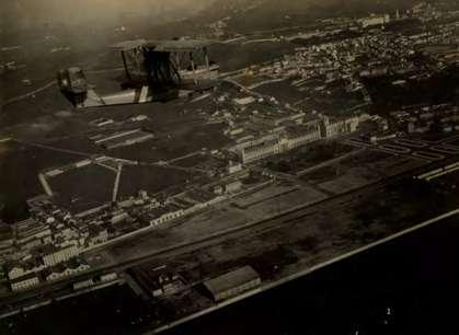
Fotografia aérea das zonas de Belém e Ajuda (entre 1930 e 1932, autor n.e., Arquivo Municipal de Lisboa –Arquivo Fotográfico, Código de referência PT/AMLSB/ MBM/000040) | Aerial photograph of the Belém and Ajuda areas (between 1930 and 1932, author unknown, Lisbon Municipal Archive - Photographic Archive, Reference code PT/AMLSB/ MBM/000040)
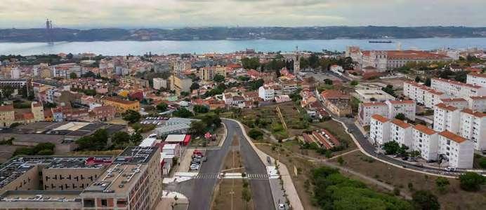
origensorigins
Distinta foi a viagem que António Marques proporcionou neste encontro. Uma viagem ao “Rio Seco e ao vale
fantástico que se encontra a descoberto” na Ajuda.
É “um pedaço de território que está mais ou menos cristalizado”, que “está praticamente em bruto e é altamente inspirador”. “O que é, desde logo, identificável é a sua geologia, pela imponência das escarpas” e essa geologia é o ponto de partida para se contar uma série de histórias sobre a importância daquele recurso para a construção da cidade e para os seus primeiros habitantes, não se podendo esquecer que Lisboa funciona ininterruptamente há 3.000 anos. Nesta história, a arqueologia desempenha, também, um papel crucial, como testemunham os fornos de cal, que foram objeto de estudo e de uma intervenção de
António Marques offered another tour at this meeting. A trip to
“Seco River and an extraordinary valley revealed” in Ajuda.
This “piece of land, seemingly frozen in time” is “practically untouched and very inspiring”. “The first thing you notice is its geology, thanks to the imposing cliffs,” the starting point for telling a number of stories about the importance of this resource for the construction of the city and its first inhabitants. Remember that Lisbon has been in continuous operation for 3,000 years. Archaeology, as evidenced by the lime kilns that have been studied and restored, also plays an important role in this story. The first remnants of the Senhora
valorização. Valiosos são, igualmente, os primeiros vestígios do povoado da Senhora das Dores, identificados, pela primeira vez, em 2019. A riqueza arqueológica reforça-se com as galerias escavadas nos maciços rochosos, postas a descoberto na sequência de uma operação de limpeza promovida pela Sociedade de Reabilitação Urbana de Lisboa Ocidental (SRU). “Todos estes aspetos são fatores-âncora essenciais para construir naquele local um novo ponto de interesse, não só para os cidadãos de Lisboa, mas para o turismo, pois são estruturas arqueológicas que podem ser rentabilizadas”, advogou.
das Dores settlement, first identified in 2019, are also of great value. The archaeological wealth is further enhanced by the galleries dug into the rock, uncovered after a cleaning operation led by the urban rehabilitation company Sociedade de Reabilitação Urbana de Lisboa Ocidental (SRU). “All these aspects are essential anchors for the creation of a new site of interest, not only for the citizens of Lisbon, but also for tourism, since these are archaeological structures that can be put to good use,” he added.
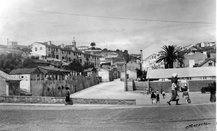
É entre a geologia e a arqueologia que se balanceia este interesse: no primeiro caso, com a relevância de, no Rio Seco, o vale acolher as duas situações geológicas mais características de Lisboa – a Formação da Bica, com calcários, e a Formação do Complexo Vulcânico, com basaltos. O que levou António Marques a comentar: “A pedra está presente na evolução do homem praticamente desde o início. Foi o caso da comunidade pré-histórica da Senhora das Dores, certamente as pedras das construções identificadas foram retiradas destas pedreiras”. Fundamental na pré-história foi também o sílex, “a tecnologia avançada para os elementos de precisão dessa época”, muito abundante na zona, constituindo mais um fator de atração para o povoamento e para a formação de aglomerados, a juntar à fertilidade dos solos e à proximidade do estuário do Tejo. “As primeiras comunidades humanas tinham aqui todas as condições de sobrevivência”, sintetizou.
E que comunidades eram essas? Este é o terreno da arqueologia, com o coordenador da estrutura camarária a regressar ao povoado pré-histórico recentemente identificado, dando conta de que os vestígios apontam para cronologias entre o Neolítico e o Calcolítico. É um facto que “a arqueologia urbana está limitada às obras, isto é, a realidade escavada é a da obra”; porém, é igualmente certo que as realidades arqueológicas se dispersam pelas áreas limítrofes do estudo. Foi o que evidenciaram as sondagens efetuadas num quarteirão próximo, outrora pertencente a um equipamento veterinário militar e onde, por volta de 2018, os primeiros trabalhos de um projeto de urbanização puseram a descoberto vestígios arqueológicos. Este é um património que “tem de ser acautelado”, pois contribui para o conhecimento de Lisboa enquanto entidade viva. Focando-se neste terreno em particular, reconheceu estar-se perante um dilema urbanístico: ou se avança com a construção, ou se opta por mantê-lo como espaço verde. Se for este último o caminho, só pontualmente será necessário proceder a mais intervenções arqueológicas, por
This site is important for its geology and archaeology. From a geological point of view, the Seco River valley is where you find the two most characteristic geological formations of Lisbon – the Bica limestone formation and the Volcanic Complex basalt formation. António Marques commented, “stone has been present in the evolution of mankind almost from the very beginning. This was the case with the prehistoric community of Senhora das Dores. The stones of the buildings that have been identified are undoubtedly from these quarries.”.
Silex, which was very abundant in the area, was also very important in prehistoric times, being “the advanced technology of the time for precision elements”. Together with the fertile soil, and the proximity of the Tagus estuary, this was another factor that attracted settlements and the formation of agglomerations. “The first human communities had all the conditions to survive here,” he sums up.
Who were these communities? That is the subject of archaeology. The City Council’s coordinator visited the recently discovered prehistoric settlement and explained that what remains of the city date back to the Neolithic and Chalcolithic periods. While it is true that “urban archaeology is limited to building sites, that is, the reality excavated is that of the building site,” it is also true that archaeological finds are scattered throughout the surrounding areas under investigation. This has been demonstrated by the surveys carried out in a nearby block, once part of a military veterinary facility, where archaeological remains were uncovered in around 2018 during the initial works of an urban development project. This heritage “must be preserved” because it is part of our knowledge of Lisbon as a living entity. Focusing on this particular piece of land, he admitted that he was faced with an urban planning dilemma: either build on it or leave it as a green space. If they choose the latter option, further archaeological work will only be required occasionally, for example,
exemplo, perante uma ação que seja mais intrusiva em relação ao subsolo. Mas, se a urbanização vingar, toda a área tem de ser escavada.
Os pontos de interrogação estendem-se às galerias subterrâneas. Porque se desconhece a respetiva estrutura e extensão. E desconhece-se a origem exata, embora não se descarte a possibilidade de datarem da pré-história. O que se sabe é que “são um elemento patrimonial importante para a história da cidade”.
if for some reason a more invasive intervention is required. But if the urbanisation goes ahead, the whole area will have to be excavated.
There are also concerns about the underground galleries, because we do not know their structure and extent. Although their prehistoric origins are not ruled out, their exact origin is unknown. What we do know is that “they are a significant element of the city’s cultural heritage.”.

Levantamento da planta de Lisboa: 1904-1911 (1904-1911, Júlio António Vieira da Silva, Arquivo Municipal de Lisboa, Código de referência PT/AMLSB/CMLSBAH/ PURB/003/00056) | Survey of the map of Lisbon: 1904-1911 (1904-1911, Júlio António Vieira da Silva, Lisbon Municipal Archive, Reference code PT/AMLSB/CMLSBAH/ PURB/003/00056)
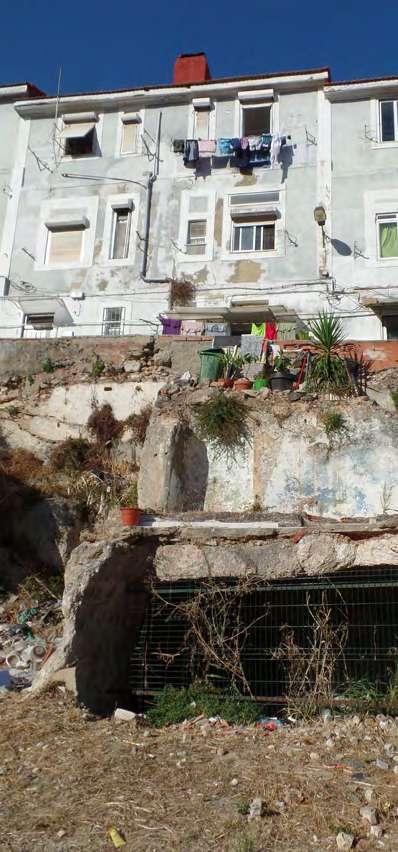
O mesmo atributo é aplicável aos fornos de cal, o elemento patrimonial construído mais visível no Rio Seco. São três, com a referência mais antiga a datar de 1791, o que se enquadra na evolução de uma cidade que, em 1755, foi abalada por um cataclismo: “A cidade inicia a seguir a sua reconstrução e um dos elementos fundamentais é a pedra e a cal necessária para as argamassas e para a construção. E esta zona estava vocacionada para este tipo de indústria. Certamente que estes maciços rochosos foram sendo talhados e utilizados para responder à necessidade urbanística da época”, interpretou.
É sobre esta tela que o Centro de Arqueologia de Lisboa se propõe intervir sob a forma de um centro interpretativo da pedra que dê visibilidade à importância deste recurso natural na construção de Lisboa.
The same applies to the lime kilns, the most visible elements of the Seco River’s built heritage. There are three kilns, the oldest of which dated to 1791, which is in line with the development of a city that was struck by a calamity: “The city began to be rebuilt, and one of the basic elements was the stone and lime needed for mortar and construction. This area was dedicated to that kind of industry. There is no doubt that carving and using these rock masses was a response to the urban needs of the time,” he said.
This is the scenario in which the Lisbon Archaeological Centre proposes to intervene, in the form of a stone interpretation centre, highlighting the importance of this natural resource in the construction of the city of Lisbon.
futuro future
As histórias contadas por Gonçalo Folgado, arquiteto urbanista fundador da Associação Locals Approach e coordenador do Foodscapes – projeto-piloto de literacia alimentar e de definição de paisagens alimentares –, têm gente dentro.
The stories told by Gonçalo Folgado, town planner and founder of the Locals Approach Association and coordinator of Foodscapes – a pilot project to promote food literacy and define food landscapes –, involve people.
A narrativa é desencadeada quando, ainda estudante da Faculdade de Arquitetura de Lisboa, identifica um desligamento com o território adjacente. Surge, assim, uma incursão ao Bairro 2 de Maio, impulsionada pela vontade de perceber como podia intervir junto da comunidade.
“Tentámos entender qual a relação da comida com o planeamento urbano, quais as condicionantes, o que é promotor ou pode ser dissuasor de uma alimentação saudável, como é que o espaço, a urbe e o ambiente social podem promover este tipo de práticas”, enquadrou. Estavam lançadas as sementes do Ajuda Foodscapes Study, que
The story begins when he was still a student at the Faculty of Architecture in Lisbon. He noticed a disconnect with the surrounding environment. Driven by a desire to understand how he could make a difference in the community, he decided to explore Bairro 2 de Maio. “We endeavoured to understand the relationship between food and urban planning, what the constraints are, what can encourage or discourage healthy eating, and how the area, the city and the social environment can encourage this kind of practice,” he said. The foundation of Ajuda Foodscapes Study were laid. The study
ambicionou retratar o acesso à alimentação saudável naquele bairro. E o que é uma foodscape? É o ambiente que rodeia o indivíduo e que define a experiência alimentar à escala do bairro e da comunidade, sendo constituído por locais de acesso à alimentação, pela vida urbana e pelos espaços públicos.
A lição inaugural desta missão é que “diagnosticar também é intervir”, pelo que o primeiro passo consistiu na recolha de informação. E pesou, de imediato, o facto de a Ajuda ser a segunda freguesia de Lisboa mais envelhecida, de ser uma das mais empobrecidas, com um rendimento médio no tercil mais baixo da cidade. Acresce que é o segundo bairro com maior percentagem de idosos, 65% dos quais vivem sozinhos ou com outros idosos. As deslocações de autocarro são duas vezes mais comuns na Ajuda, sendo que a população que a visita diariamente é o dobro da população residente.
O olhar para a comunidade devolveu a deteção de quatro perfis de consumidores e de rotinas alimentares: o vizinho idoso, que carece de ajuda para se mover e aceder a alimentos e a espaços comunitários; o cuidador comprometido, que precisa de ajuda para proporcionar alimentos saudáveis à família; os estudantes universitários, que requerem refeições saudáveis e nutritivas, assim como espaços comunitários onde possam fazer refeições com amigos e colegas; e as crianças e adolescentes, que precisam de aprender sobre alimentação saudável para desenvolver bons hábitos alimentares e disseminá-los junto da família. Apesar das diferenças, estes perfis têm um elo comum – a dificuldade em aceder a alimentos saudáveis no bairro.
aimed at portraying access to healthy food in that neighbourhood. What does foodscape mean? It is the environment that surrounds the individual and defines the food experience at the neighbourhood and community level, consisting of the places where food is available, urban life and public spaces.
The first lesson of this mission is that “intervention also involves analysis,” so the first step was to gather information. The fact that Ajuda is the second parish with the oldest population and one of the most impoverished, with the third lowest average income in the city, weighed heavily on the results. It is also the second neighbourhood with the highest percentage of elderly people, 65% of whom live alone or with other seniors. Bus travel is twice as common in Ajuda, with twice as many daily visitors as residents.
The community study identified four profiles of consumers and eating habits: the elderly neighbour who needs help getting around and accessing food and community centres; the carer who needs help providing healthy food for their family; university students who need healthy and nutritious meals and community facilities where they can cook meals with their friends and colleagues; and children and young people who need to learn about healthy eating in order to develop good eating habits that they can pass on to their families. Despite their differences, these profiles have one thing in common: difficulty in accessing healthy food in the neighbourhood.
E este foi, exatamente, um dos três principais desafios identificados, a par da qualidade do espaço público e das pressões ao nível individual. Esmiuçando cada um deles, o mentor da Locals Approach partilhou que, no primeiro caso, se verificou que apenas um em cada cinco locais de comércio vende comida saudável, o que o levou a afirmar: “Estamos perante um deserto alimentar, pode haver acesso a comida, mas não há acesso a nutrição”. As barreiras ao acesso são igualmente físicas: num raio de 15 minutos a pé, a partir do local onde se mora, estuda ou trabalha, é “muito difícil encontrar locais de comida”. Igualmente relevante é o acesso visual: na Ajuda, escasseia a comunicação sobre produtos frescos, o que, sabendo-se da importância dos estímulos sensoriais para a adoção de comportamentos alimentares, constitui uma lacuna óbvia.
This, along with the quality of public space and the pressures on individuals, was one of the three main challenges identified. The Locals Approach mentor explained that in the first case it turned out that only one in five shops sold healthy food, which prompted him to say “we are facing a food desert. There may be access to food, but there is no access to nutrition.”. There are also physical barriers to access. “It is very difficult to find places to eat within a 15-minute walk of where you live, study or work.” Visual access is also important. In Ajuda, there is very little information about fresh produce, which is an obvious gap given the importance of sensory stimulation in adopting eating behaviours.
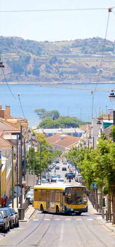
No que respeita ao segundo desafio, Gonçalo Folgado evidenciou como, na Ajuda, o acesso à alimentação é condicionado pela qualidade do espaço público. A começar pela topografia: 55% dos inquiridos apontaram a acentuada subida da encosta como uma barreira, a que se junta um perfil de rua pouco seguro, com passeios estreitos que dificultam a circulação pedonal, com a coabitação de vários modos de transportes e estruturas de interceção confusas a acentuarem a insegurança. A ausência de zonas de ensombramento é outro dos fatores dissuasores do acesso à alimentação saudável.
Este levantamento constituiu a matéria-prima sobre a qual a equipa do estudo, que remonta a 2022, trabalhou.
E três pilares emergiram:
1. Como transformar as opções de alimentação saudável em opções óbvias para a Ajuda.
2. Como promover dignidade e prazer no processo de fazer compras e desfrutar de uma refeição no espaço público.
3. Como tornar as rotinas alimentares saudáveis e parte do dia a dia do bairro.
O caminho que se abriu assumiu cinco formas:
• Melhorar a visibilidade e o acesso à alimentação saudável;
• Priorizar ruas e rotas saudáveis e seguras;
• Criar espaços públicos de qualidade;
• Apoiar o empreendedorismo e a literacia alimentar;
• Fomentar a produção alimentar local.
Regarding the second challenge, Gonçalo Folgado highlighted how access to food in Ajuda depends on the quality of public spaces. The type of terrain, for instance. Approximately 55% of respondents cited the steep gradient as a barrier, coupled with an unsafe road profile, with narrow pavements that make it difficult for pedestrians to move about, the juxtaposition of different modes of transport and confusing traffic signals adding to the sense of insecurity. Lack of shade is another barrier to accessing healthy food.
This survey provided the ingredients for the team involved in the 2022 study.
Three key ideas emerged:
1. How to make healthy food options the obvious choice for Ajuda.
2. How to promote dignity and enjoyment when shopping and eating in a public place.
3. How to make healthy eating habits part of everyday life in the neighbourhood.
Five solutions were found:
• improve visibility and access to healthy food;
• prioritise healthy and safe streets and routes;
• create high quality public spaces;
• support entrepreneurship and food literacy;
• promote local food production.
Alicerçados nestas ideias-chave, foram-se desenhando os contornos de alguns projetos-piloto que “podem iniciar uma transformação na Ajuda”. São eles:
Ajuda Super Stop – reimaginando as paragens de autocarro como locais de interação e de aprendizagem entre gerações, convertendo-as, simbolicamente, em centros de alimentação saudável;
Comida Colina Acima – criando um sistema de entregas de alimentos saudáveis onde as pessoas vivem e estudam;
Cozinha do Bairro – um espaço comunitário que possa mitigar as diferenças económicas e promover a conexão social;
Foodscape Campus – aproveitar o anfiteatro natural do polo universitário como lugar de comensalidade, fomentando vínculos com a comunidade e, deste modo, criando uma visão unificada da paisagem alimentar do bairro.
Based on these key ideas, several pilot projects have been designed to “begin a transformation in Ajuda”. They include:
Ajuda Super Stop – transforming bus stops into places of intergenerational interaction and learning, symbolically transforming them into healthy eating centres; Comida Colina Acima – creating a healthy food delivery system where people live and study;
Cozinha do Bairro – a community space that can reduce economic disparities and promote social connectedness;
Foodscape Campus – using the natural amphitheatre of the university campus as a place to eat, fostering links with the community and creating a unified vision of the neighbourhood’s foodscape.
Esta é uma missão com ambição, com vista a dar futuro a um território com raízes profundas no passado do Vale da Ajuda / Rio Seco e da cidade de Lisboa. Porque património é história, é urbanismo, são pessoas.
This is an ambitious mission that aims to secure the future of an area deeply rooted in the past of the Seco River/Ajuda Valley and the city of Lisbon. After all, heritage is history, urban design and people.
O Ciclo de Conferências Encontro de Urbanismo
– “Lisboa, a cidade dos vales” foi um ponto de partida para aprofundar a discussão sobre o ambicioso Programa 5 Vales.
O entusiasmo demonstrado pelos participantes e a relevância dos temas apresentados deixaram claro o impacto que este Programa poderá ter em Lisboa. Esta publicação constitui, assim, um testemunho dos diversos contributos para a presente reflexão e um estímulo para as etapas que ainda estão por vir. Nela, memórias, ideias e conceitos encontram-se preservados, reforçando o espírito de colaboração que marca o início deste caminho.
“Pensar a cidade” é, por essência, pensar nas gerações que virão, projetando um equilíbrio entre a qualidade de vida dos seus habitantes e a preservação dos recursos naturais. No caso do Programa 5 Vales, trata-se de um desafio singular: requalificar territórios, respeitando as suas características únicas e maximizando o seu papel estruturante na cidade. Este Programa não é apenas sobre intervenções físicas, mas sobre a construção de uma nova relação entre os lisboetas e os seus vales, de modo a transformá-los em símbolos de sustentabilidade, inclusão e bem-estar.
Que esta publicação seja mais do que um marco inicial. Que inspire ação, convoque novas ideias e motive a continuidade de um trabalho que reflete já o compromisso de muitos em criar uma Lisboa mais integrada e resiliente.
The Urban Planning Meeting series of talks – “Lisbon, the city of valleys” were the foundation for an indepth discussion about the ambitious 5 Valleys Programme.
The enthusiasm shown by participants and the relevance of the topics discussed made clear the impact this programme can have on Lisbon.
This publication puts in writing the different contributions made and lays the groundwork for the steps to be taken. It cements the memories, ideas and concepts shared, strengthening the spirit of cooperation that set us on this path.
“Thinking City” is, in essence, thinking about future generations, striking a balance between the quality of life of the city’s inhabitants and the preservation of natural resources. In the case of the 5 Valleys Programme, it poses a unique challenge: to renew and regenerate territories, while respecting their individual characteristics and maximising their structuring role. This programme is not just about physical intervention. It is about shaping a new relationship between Lisbon’s inhabitants and its valleys, transforming them into beacons of sustainability, inclusion and well-being.
The purpose of this publication is not only to lay the groundwork for (re)thinking Lisbon. It is to galvanise action, to invite fresh ideas and to encourage continuity of the work that reflects the commitment of those who strive to build a more integrated and resilient city.
