1. Flint Tools
Chopper, scrappers and worked flint found in freshly ploughed ground at Annalong, County Down. Dating to the Late Mesolithic period (5500 BC
Late Mesolithic flints
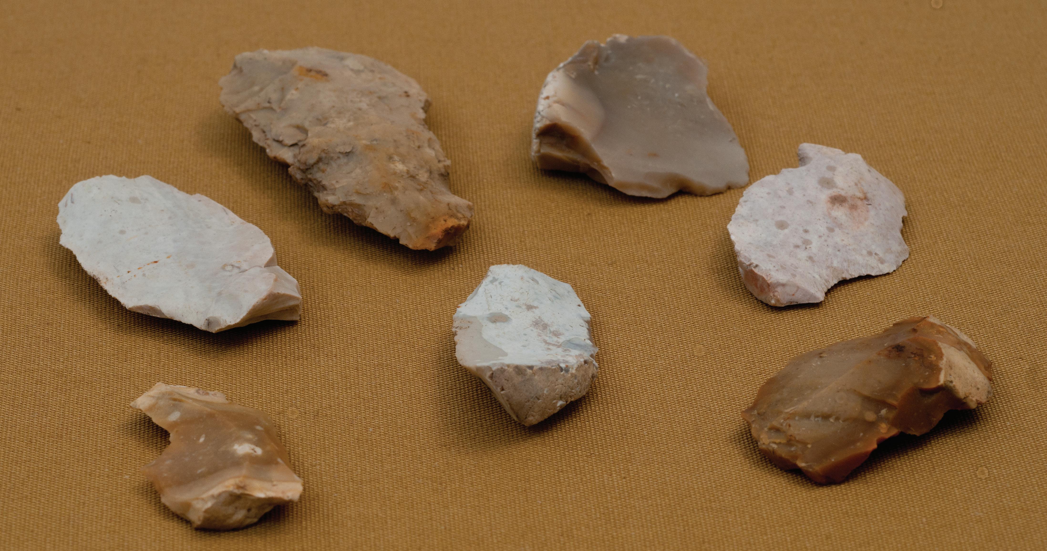
Newry and Mourne Museum Collection (photograph by William McAlpine)
Chopper, scrappers and worked flint found in freshly ploughed ground at Annalong, County Down. Dating to the Late Mesolithic period (5500 BC – 3700 BC), they were used to prepare animals and fish for food.
1. Flint Tools
Mesolithic man moved around according to the different seasons and followed herds of wild animals. They lived close to riverbanks, lakeshores and the sea to fish and gather shellfish and other types of food.
1. What type of tools would Mesolithic man use to prepare food for eating?
2. What other uses would they have?
3. Where can these stones be found?
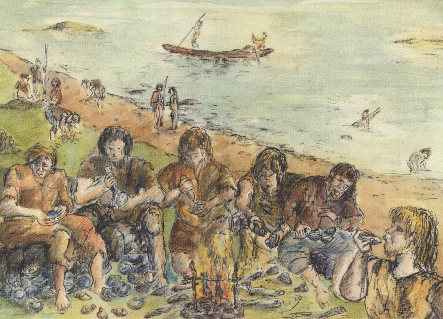
Reconstruction drawing of Mesolithic people gathering and eating oysters on the shoreline
© Northern Ireland Environment Agency
2. Food
Foods eaten during the Mesolithic
© Newry and Mourne Museum (artwork by Anna Savage)
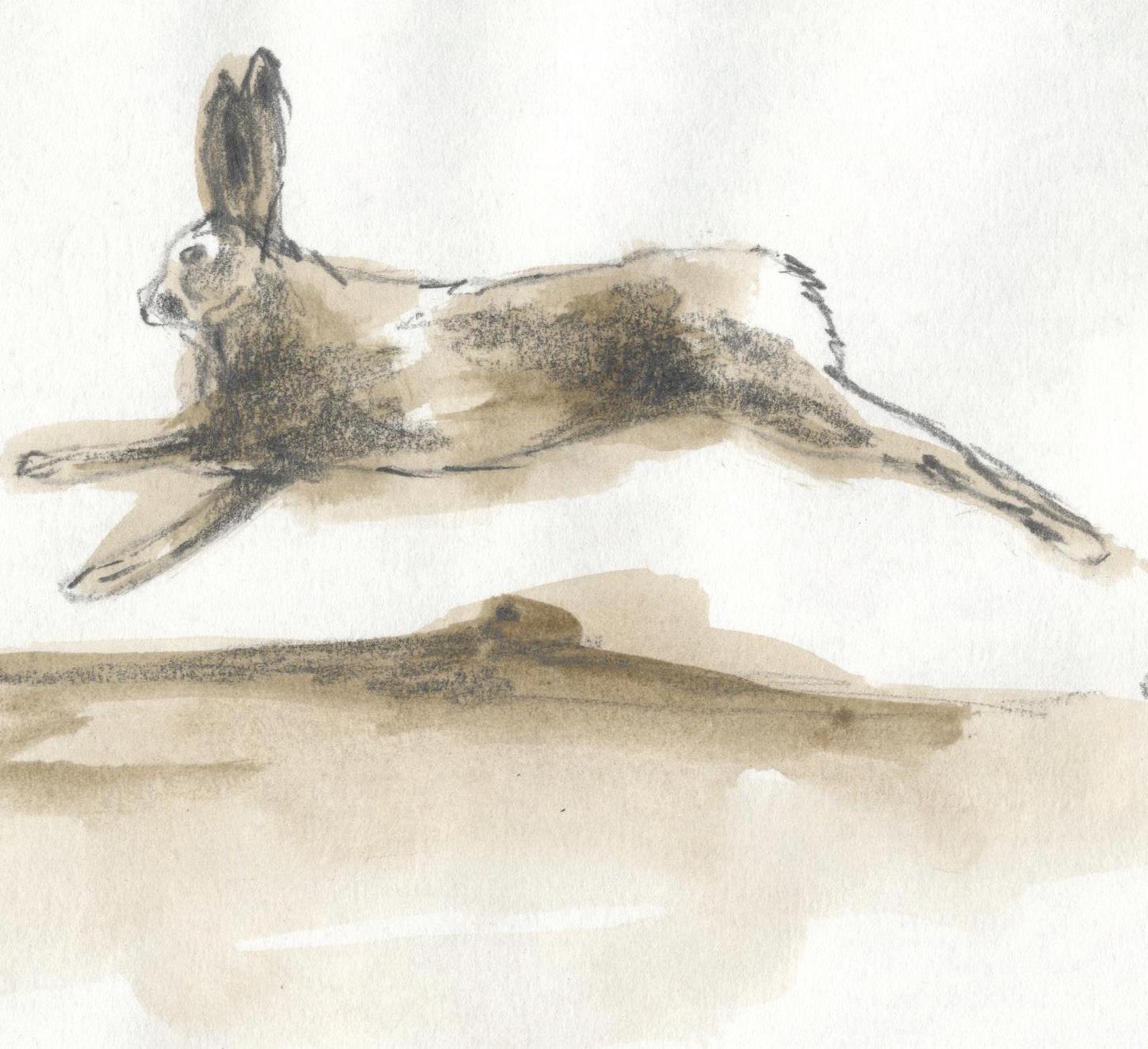
This drawing illustrates the variety of food eaten by people in Mesolithic times.
2. Food
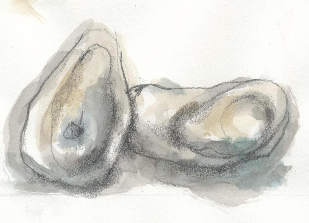
Mesolithic man would have eaten oysters and shellfish as well as nuts and berries. They would have hunted birds, deer, and wild boar using arrows, and caught fish using spears, clubs or nets.
Remains from food are found in middens. A midden is the archaeological term for a rubbish heap. They are found everywhere humans have lived. What we know of their life comes from the piles of shell and bone people left behind.
1. List some of the foods that Mesolithic man would have eaten?
2. Can you draw some of the food which these people would have eaten?
3. If archaeologists looked in your bin at home 100 years in the future, what do you think it will tell them about how you lived?
Vikings
1.
3.
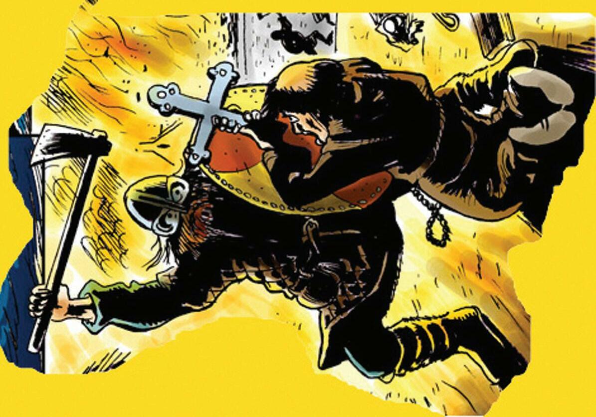
Artist’s impression of a Viking battle © Newry and Mourne Museum (artwork by John Farrelly)
3. Vikings
The Annals of Ulster – a record of important historical events – mention the defeat of the Vikings at Carlingford Lough by Muirchertach MacNeill, an Irish king, in 926. The annals record that 200 Vikings were killed in the battle.
“So Muircheartach, the son of Nial, broke the power of the Danes of Narrow-Water on that hard-fought day, when he met them by the shores of Lough Carlinn, and Heber, the chief’s brave son, will never be forgotten so long as the townland bears the name of Ringmaculroy – Rinn Mc Giolla Ruaidh – the ‘Point’ of the Red Giolla’s son.”
From “The Battle of the ’Point”, a local story about the Irish fighting the Vikings at Carlingford Lough in 926 AD and printed in Legendary Stories of the Carlingford Lough District by Michael G. Crawford. (reprinted Warrenpoint 1996).
1.
2.
How did Carlingford get its name?
Do you know of any other places in the area that were attacked by the Vikings?
3.
Imagine that you are a member of the McElroy clan involved in this battle with the Vikings, write a story on what it was like to be there.
1 August Lammas 2 August St Stephen 3 August 4 August 5 August 6 August The Transfiguration of the Lord 7 August 8 August 9 August 10 August 11 August 12 August St Merewenna 13 August 14 August 15 August The Assumption of Mary 16 August 17 August 18 August St Helena 19 August 20 August St Bernard of Clairvaux 21 August 22 August 23 August 24 August St Bartholomew 25 August 26 August 27 August 28 August St Augustine 29 August St Aidan 30 August St Ronan 31 August Calendar of Medieval Saints Days in August 4. Monks and Knights
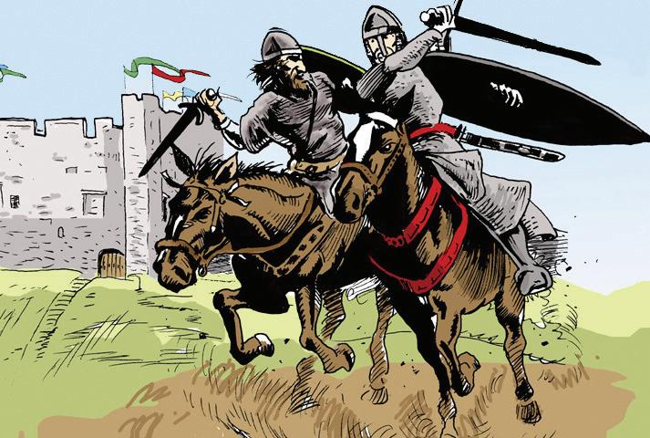
4. Monks and Knights
People who lived in the Carlingford Lough region in the medieval period used local rivers and the sea for food and travel. Fish was important in the diet for the monks and the Anglo Normans for religious reasons.
Cistercian monks were vegetarian but on certain Saints’ Days they were allowed to eat meat and fish.
1. Look at the calendar and work out the days you were allowed to eat fish.
2. If you were an Anglo Norman knight in Greencastle what would be the quickest way to visit your friend in Carlingford and why?
a. Walk b. Horse c. Boat
3. Where in this region would you find fishing fleets today?
Artist’s impression of AngloNorman knights at Greencastle Artwork by John Farelly
5. Maps and Castles
Map of “Carlingford Bay” from State of the Fortes in Ireland as they weare in the yeare
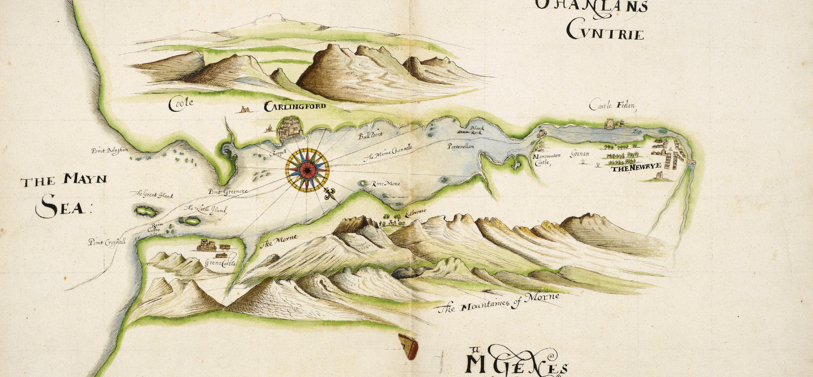
1624
by Nicholas Pynnar
B.L. Add. MS 24200 f.42 © British Library Maps were an essential tool in the expansion of English control in Ireland during the late 16th and early 17th centuries. They recorded the landscape, major towns, castles, churches and the identity of local landlords. Coastal defence was very important and this map shows the major castles and towns along Carlingford Lough.
5. Maps and Castles
Maps were an essential tool in the late 16th and early 17th centuries for the government. They recorded the landscape, major towns, castles, churches and the identity of local landlords. Maps are also very important for sailing ships and boats.
1. Look closely at the map, can you locate the castles and towns that were in the area?
2. Explore the reasons why these castles were built in these locations.
3. Use the internet to find a modern map of the Carlingford area, and compare and contrast this with the 1624 map. What are the main differences?
Detail from Nicholas Pynnar’s map of Carlingford Lough (1624) showing the town of Newry
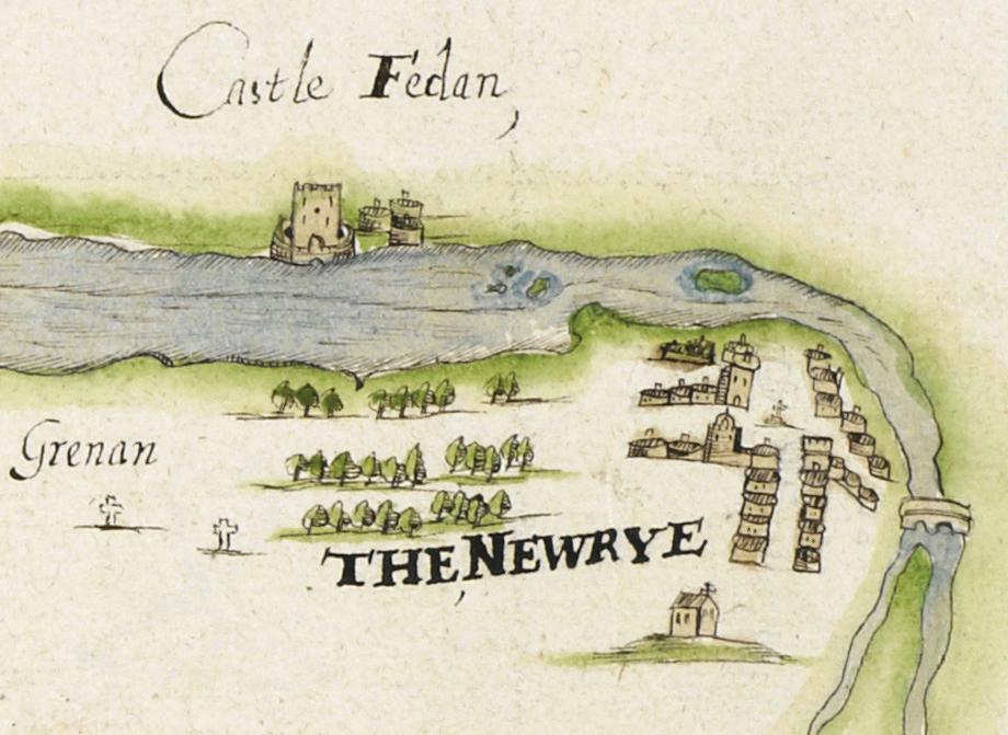
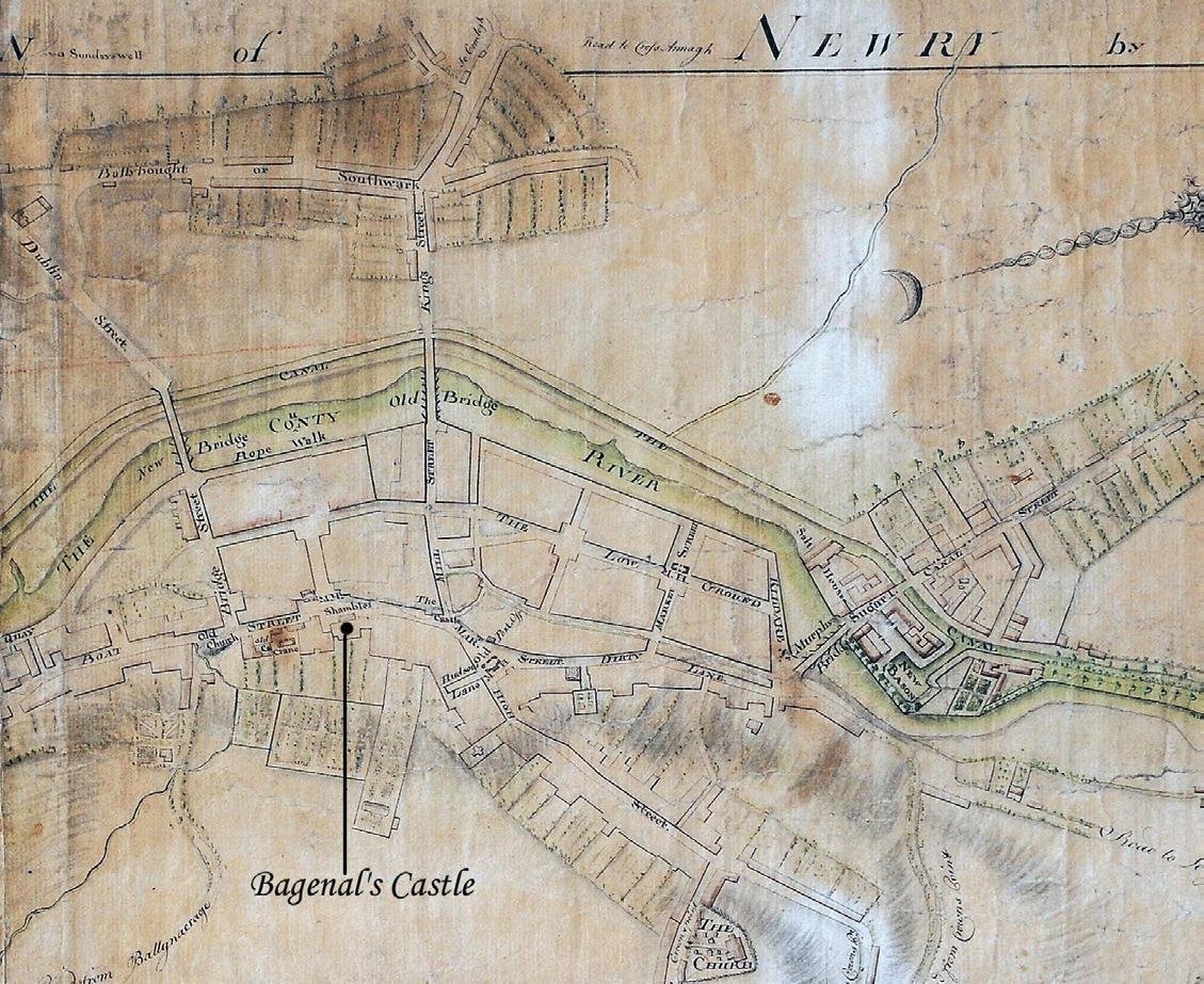
6. Maps and Streets
the Map of Newry
Detail from
by Matthew Wren, 1761 Newry and Mourne Museum Collection Drawn at a time when the modern town of Newry was taking shape, many features and streets can be recognised today including Hill Street with its squares (then known as the “Low Ground”), Murphy’s Bridge, Newry Canal and Sugar Island.
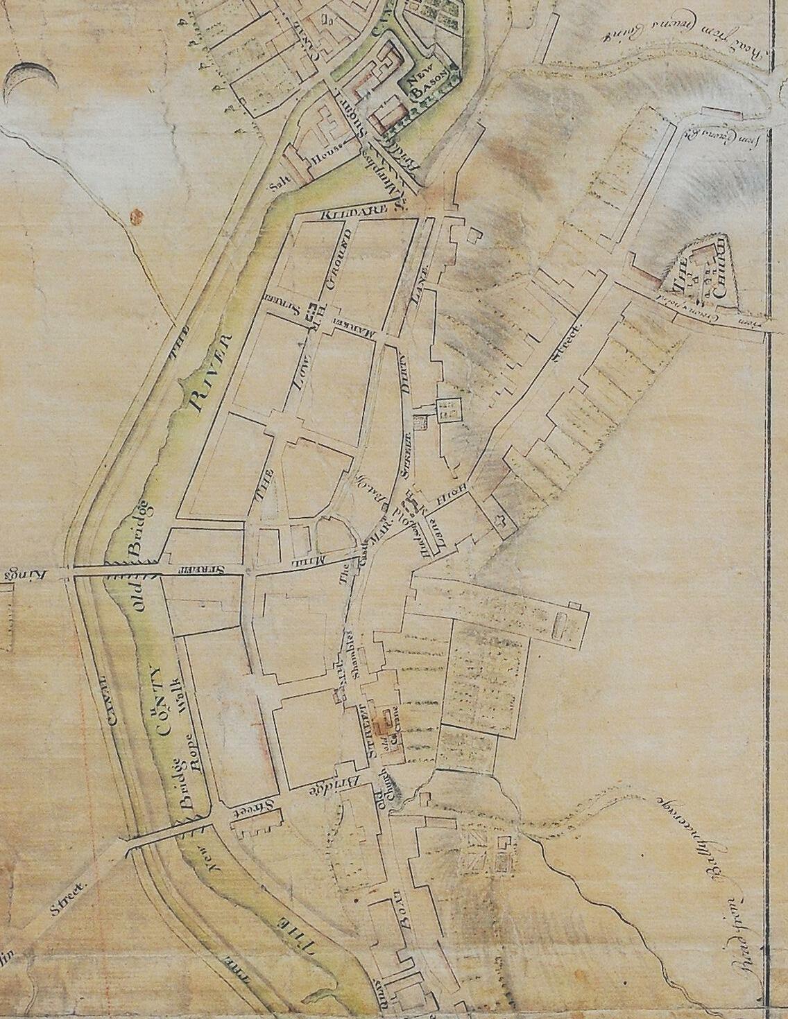
6. Maps and Streets
New landlords in the 18th century shaped the development of Newry including its expansion as a port. The building of the Newry Canal in 1742 had a profound impact on how the town looked. Look at the Wren map, which shows the shift of the town centre from Bagenal’s Castle to the reclaimed marshy ground along the Clanrye River.
1. What do you notice about the town layout from this map?
2. List the names of the streets and landmarks you recognize.
3. List the names of streets and landmarks you do not recognise.
Detail from Matthew Wren’s map of Newry with location of Bagenal’s Castle indicated
7. Merchants
Gelston
clock Newry and Mourne Museum Collection
Made by John Gelston, a Newry clockmaker, in about 1770. Longcase clocks (sometimes known as “grandfather clocks”) were popular among wealthy families in the 18 th and 19 th centuries. This clock shows the demand for luxury goods by wealthy merchant families in 18 th century Newry.
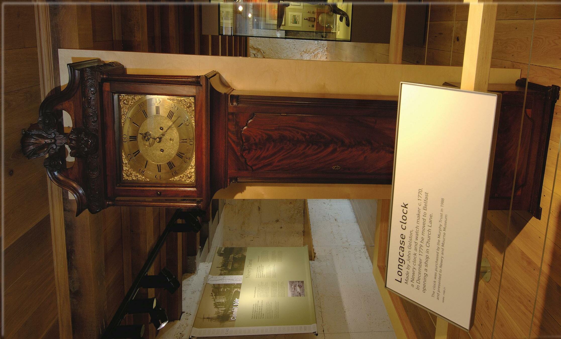
7. Merchants
Maritime trade influenced the development of Newry by the late 18th century. In this period wealthy merchants settled in the town which was expanding as a port with large warehouses appearing along the quays.
1. Look at the picture of the Gelston clock. What other expensive household items would a wealthy merchant family have in their home?
2. Why do you think Newry became a centre for business and trade?
3. Many of Newry street names and landmarks are influenced by the town’s role as a port. Can you list them?
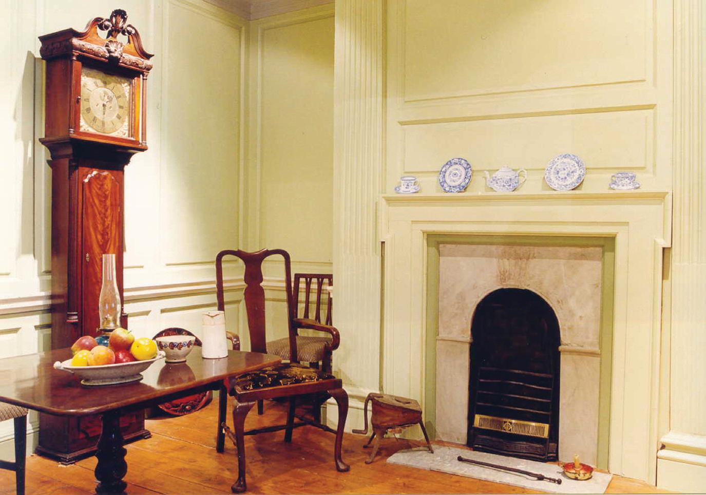
Panelled room taken from an 18th century house which originally stood in North Street, Newry
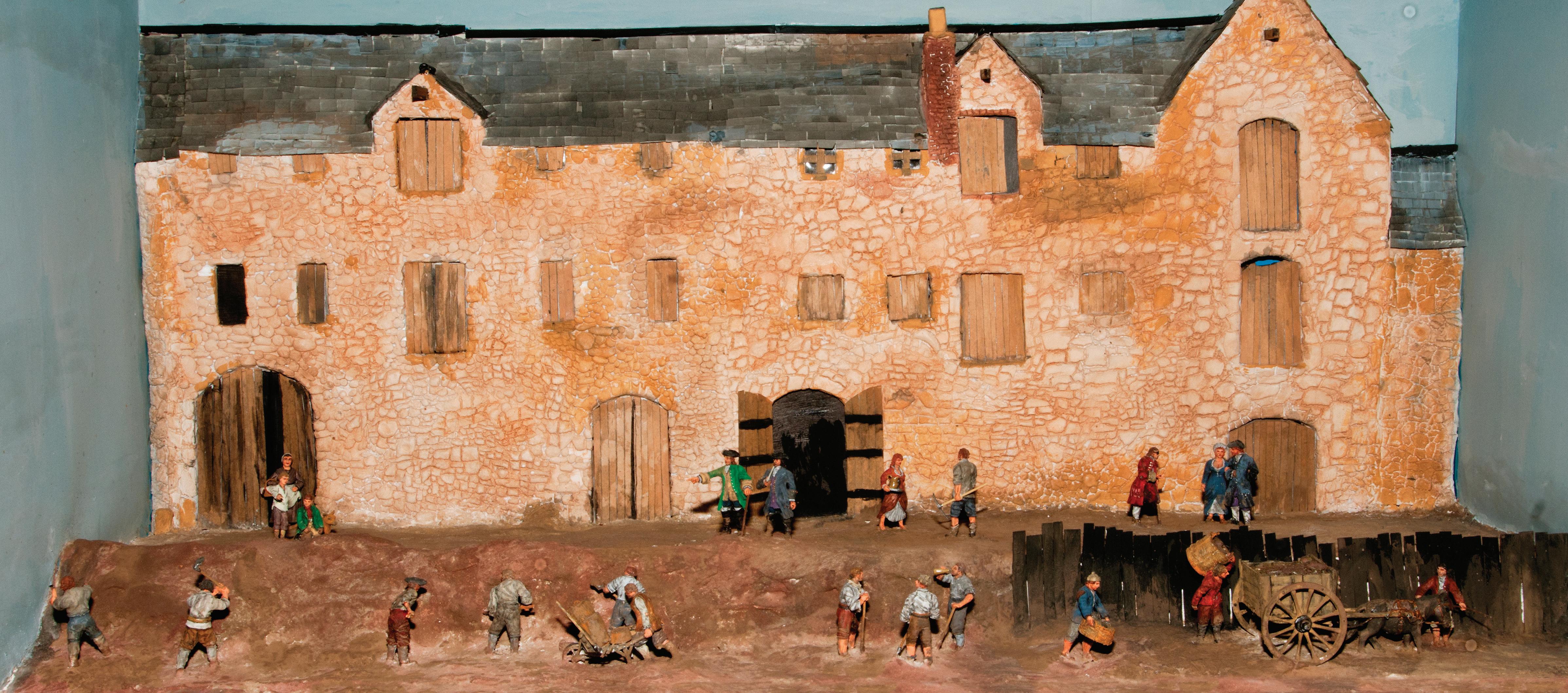
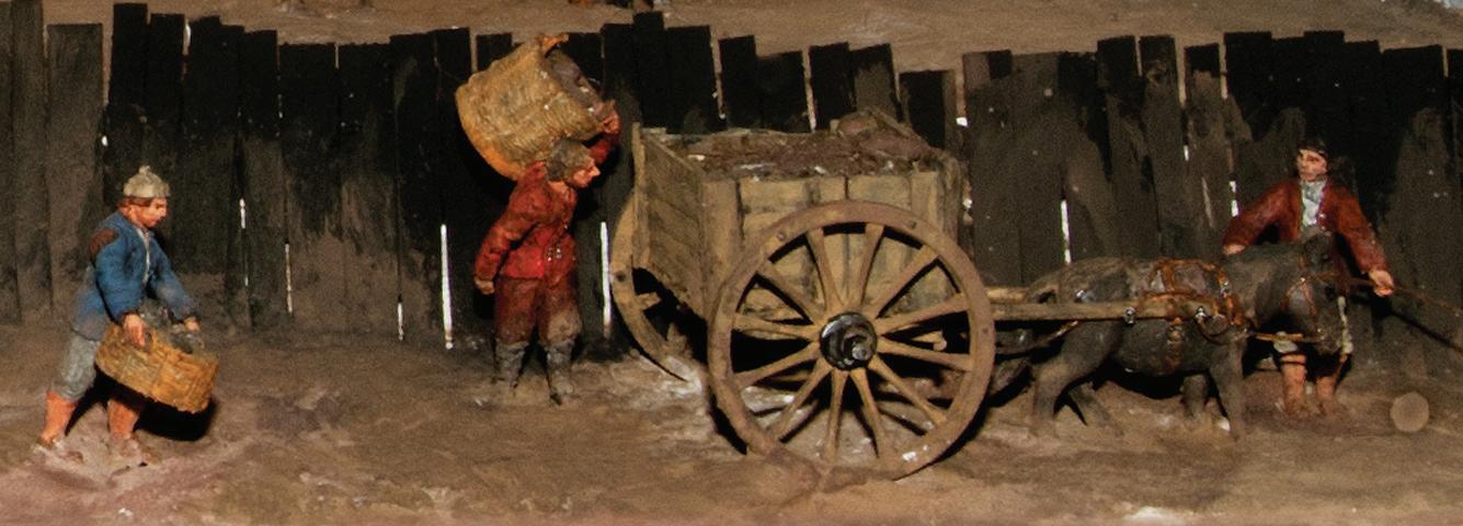
8. Constructing the Canal
Model illustrating the digging of the canal in Newry Newry and Mourne Museum Collection
The canal was dug by hand, using spades, picks and shovels and manually operated cranes. The work was hard, but well paid, 7d per day. Many of the labourers were seasonal migrants who lived away from their families for months, camping as the work progressed. They were called ‘navvies’, a term that was used for Irish labourers who dug canals and railways in North America and Britain.
8. Constructing the Canal
Look at the picture of the model
1. How much were workers paid?
2. Discuss how you would have built the canal – think of how you would have supported the sides of the trench to stop them from falling in.
3. If you were building the canal today, what machinery would you use?
Detail of model showing construction of Newry Canal
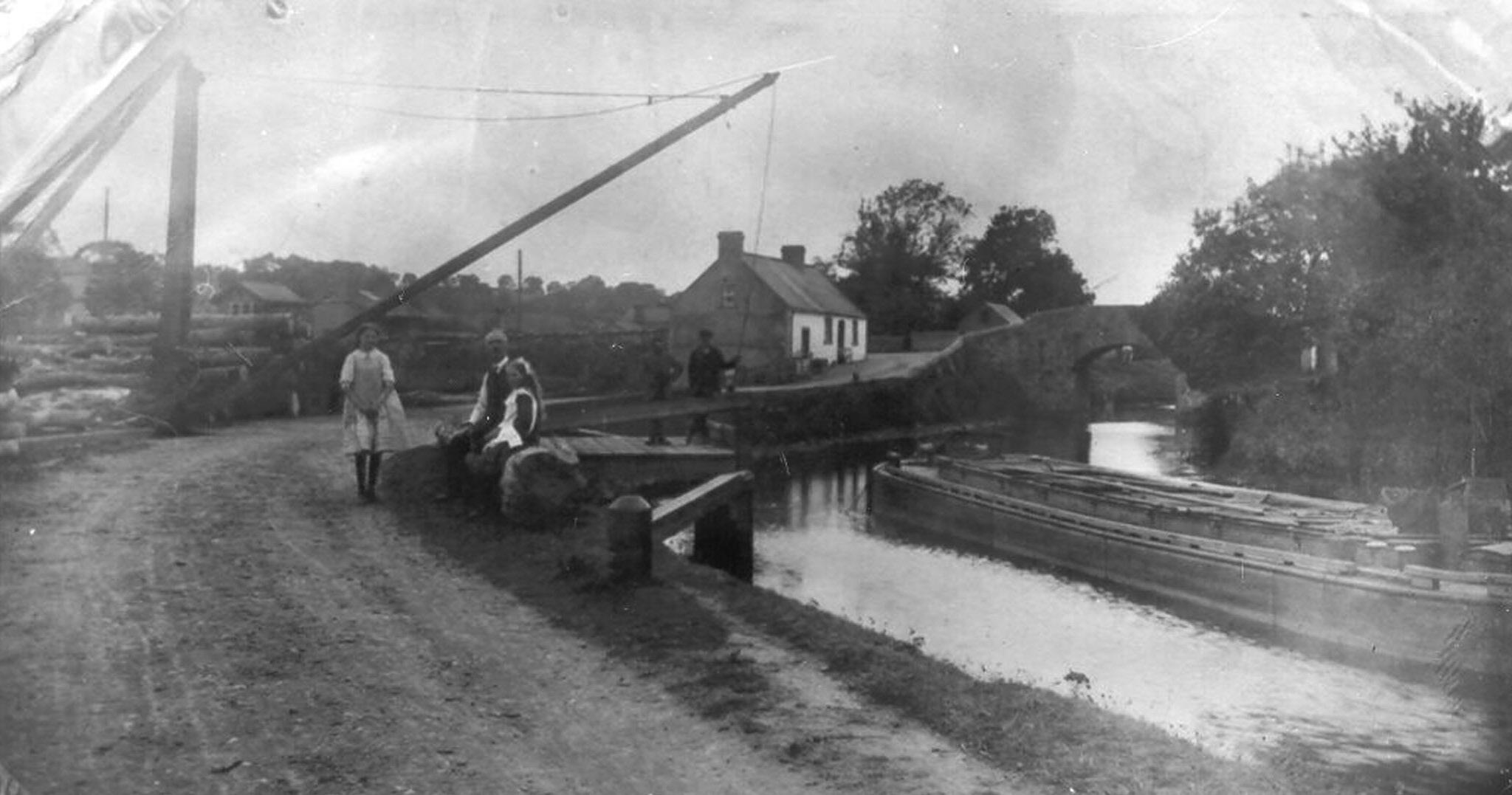
9. Trade on the Canal
The Harbour, Poyntzpass
Reproduced courtesy of Brian Cassells
The Newry Inland Canal brought trade and employment to small villages and rural areas along its route. The harbour on the canal at Poyntzpass is shown here with timber waiting to be loaded onto barges using the crane in the centre of the picture.
9. Trade on the Canal
Lock keepers lived in tied cottages and operated the locks, collecting tolls (money) from barges for using the locks along the canal.
1. What type of goods were transported on the canal?
2. How would goods have been lifted on and off the barges?
3. There were a number of locks along the canal. Find out about the life of a lock keeper. What were his duties and how did the locks operate.
Lighter or barge on Newry Canal in late 19th century Newry and Mourne Museum Collection
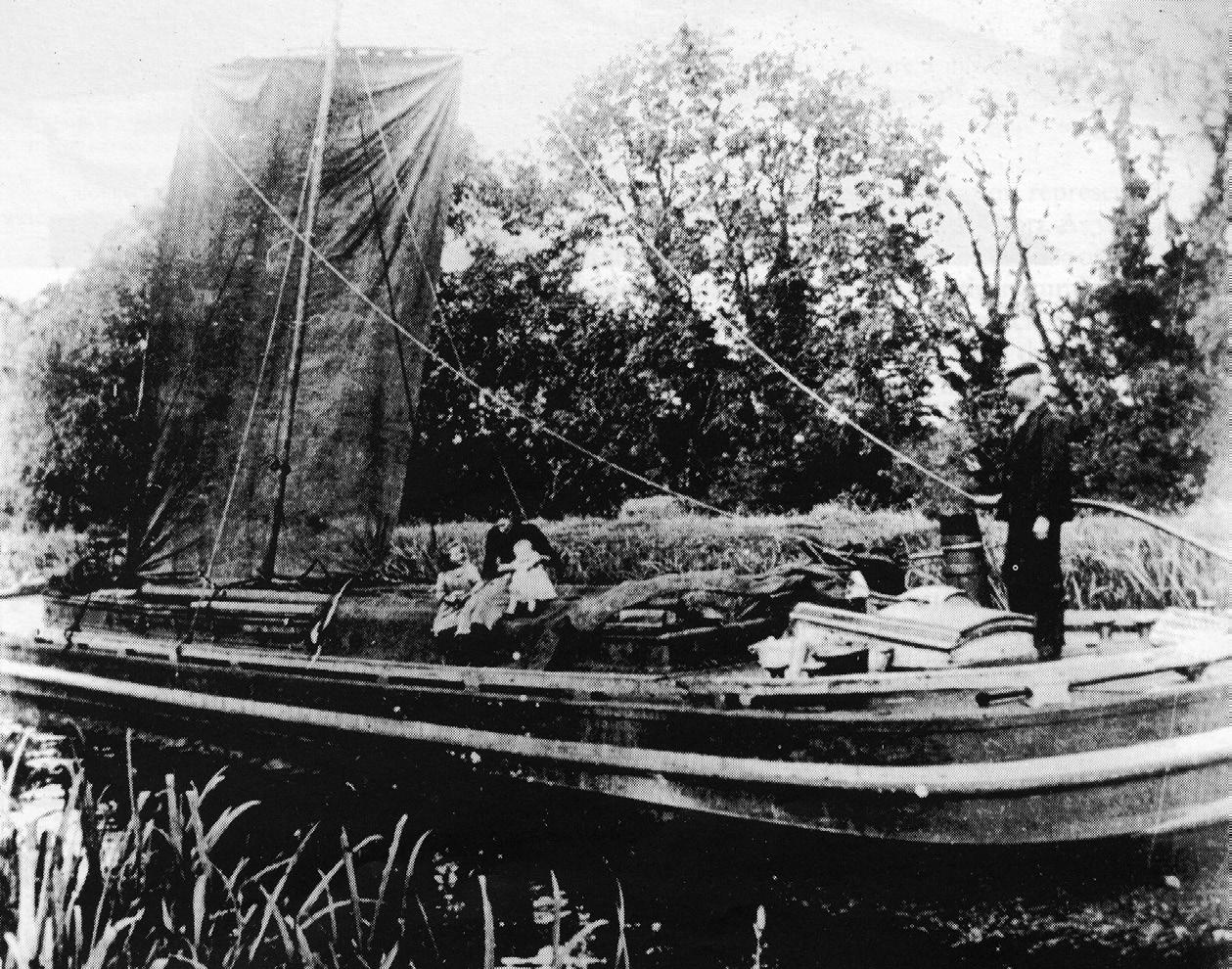
10. Emigration
Extract of letter written by Andrew
Extract from Marshall letter
Newry and Mourne Museum Collection
Written by Andrew Marshall from Watertown, New York to his father in Tullymurry, outside Newry, in October 1839.
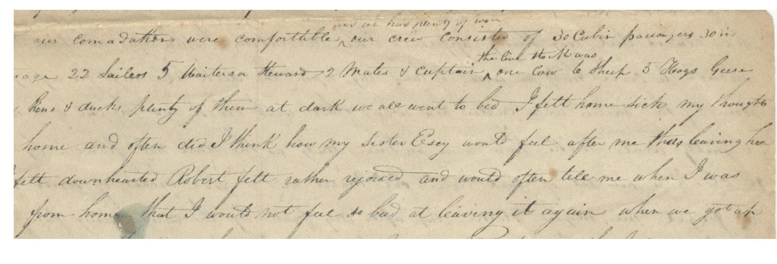
10. Emigration
People emigrating to other countries faced long and dangerous journeys by sea. Sailing ships took many weeks, sometimes months, to reach their destination. The long journeys often meant that food and drinking water were in short supply. Overcrowded conditions also caused disease and sickness to spread quickly among the passengers.
1. Why do you think the animals were on board the ship?
2. What would the conditions on the ships leaving Newry be like? Would you prefer to be in a cabin or in steerage?
Our accommodations were comfortable, our crew consisted of 30 cabin persons, 30 in steerage, 22 sailors, 5 waiters and stewards, 2 mates and captain, one cow, 6 sheep, 5 hogs, geese, turkeys, hens and ducks. I felt homesick my thoughts were on home and often did I think how my sister Essy would feel after me thus leaving her while I felt downhearted, Robert felt rather rejoiced and would often tell me when I was 4 years from home I would not feel so bad at leaving it again.
3. Imagine you are emigrating to another country. Write a letter explaining why you decided to leave home and what your hopes are for the future.
Transcript of the extract (reproduced overleaf) from the letter describing Andrew Marshall’s journey to America and mentions his homesickness
11. Trade Routes
The cargo book recorded the journeys made by a boat throughout the year and listed the type of cargo carried.
1. Look at the map and plot the journeys the Ebony made in June and July 1949.
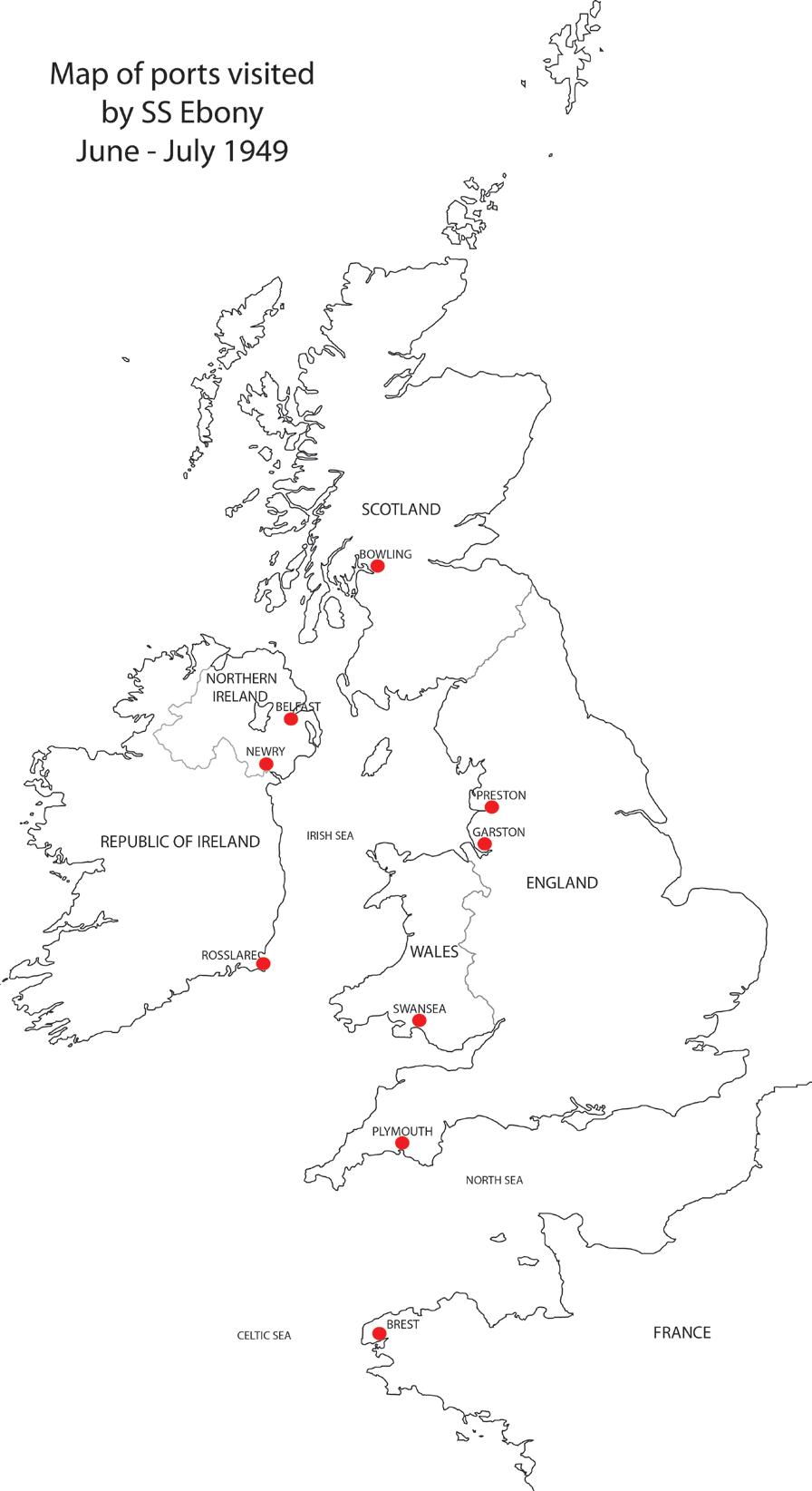
2. How many different ports were visited during this period.
3. List the cargo that the Ebony carried.
12. Life on a Coal Boat
A
Courtesy
The long history of shipping and maritime trade in Newry led many young local men to view seafaring as an exciting occupation and a way to see the world. A seaman’s wages were better then those in local mills, but living conditions on the boats were basic and journeys often dangerous.
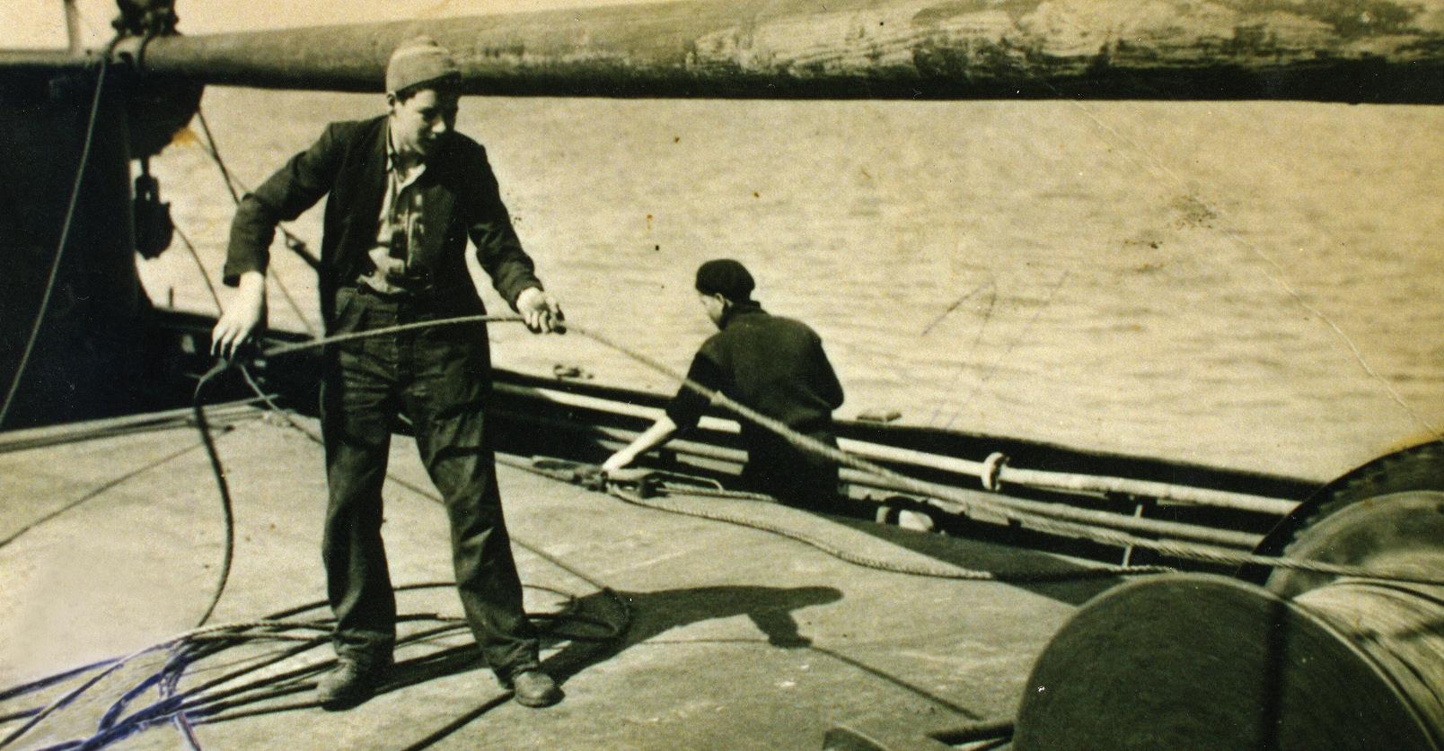 crew member working on a boat owned by Joseph Fisher & Sons Ltd, Newry
of the McKeown family
crew member working on a boat owned by Joseph Fisher & Sons Ltd, Newry
of the McKeown family
12. Life on a Coal Boat
Personal experience of a seaman who worked on a Joseph Fishers and Sons Ltd boat in the 1930s
“... I was 23 years old when I started. In those days you cooked your own grub and carried your own bed. …, cooks did not come into Fisher’s boats until ‘40s. You had a coal stove in the middle of the Foc’sle and you ate your meal there. If you wanted a bath you had to use a galvanised bucket, that was your bath. Conditions were very primitive in those days…”
“The seamen kept watch, four hours on four hours off, two men; one steering, one standby. When you got off watch you would turn in or maybe a bit of a feed first. It was a set wage, £3 a week.”
1. Using this memory, explore what life would have been like at sea.
2. Find out what it is like to work on a merchant ship today and compare this with conditions in the 1930s.
SS Ebony
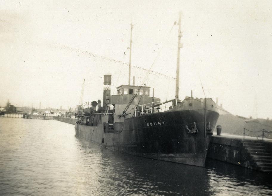
Courtesy
The SS Ebony was typical of the type of cargo steamer or collier to operate out of Newry up until the 1960s
of John McParland
