Fishers Bicycle and Pedestrian Master Plan
Fishers, Indiana July, 2014


Fishers, Indiana July, 2014


Special thanks to the following people and organizations:
Town Manager
Scott Fadness
Town Council
John Weingardt, President
Pete Peterson, Vice President
Scott Faultless, Member
Stuart F. Easley, Member
David C. George, Member
Michael Colby, Member
Renee Cox, Member
Tom Dickey , Community Development Department Director
Rachel Johnson, Assistant Director of Planning
Sue Harrison, Senior Planner
Jeff Hill, Engineering Director
Corey Pressler, Assistant Engineer
Eric Pethtel, Public Works Director
Sean O’Grady, Public Works Assistant Director
Rich Basset, Public Works
Project Advisory Committee
Len Mascaro, Bicycle Pedestrian Advocacy Committee (BPAC)
Andrea Johnson, Blue Mile
Jason Fahrlander, Community Health
Matthew Delks, Fishers Resident
David Pletzer, Fishers YMCA Advisory Board
Brenda Myers, Tourism, Inc.
Debbie Bush, IU Health
Jim Moffitt, Loke Bicycle Inc.
Jennifer Higginbotham, Metropolitan Planning Organization (MPO)
Jeremy Moore, Metropolitan Planning Organization (MPO)
Chris Richter, Motion Cycling & Fitness
Jason Wells, St. Vincent
Danesa Stolz, Parks Department
Officer Jeremy Lindauer, Police Department
Autumn Gasior, Public Relations
Jill Troha, United Way of Central Indiana
Kelly Bosier, YMCA Staff
Carol Doehrman, Fishers Chamber of Commerce
Fishers Chamber of Commerce
Carol Doehrman
Dan Canan
Special Thanks to Peter J. Fritz, Healthy Communities
Planner, Indiana Department of Health, Division of Nutrition and Physical Activity for matching funds to enable the development of the plan.
prepared by:
Rundell Ernstberger Associates, LLC
Toole Design Group


The primary purpose of the Fishers Bicycle and Pedestrian Master Plan is to continue building a comprehensive pedestrian and bicycle network. The completion of this system will provide residents with attractive alternative transportation choices and recreational opportunities. This is an important goal for Fishers because a city that offers a variety of mobility and recreational choices is a viable and desirable city to live in.
This plan is an important tool for city staff and the development community in creating a complete bicycle and pedestrian network. The ultimate goal of the plan is to create a comprehensive system of facilities making walking and cycling in Fishers more viable options for residents and visitors. This system will promote healthy living, enhance Fishers’ high quality of life while increasing opportunities for exercise and recreation by increasing connectivity to key destinations.
The Bicycle and Pedestrian Master Plan provides a programmatic description of proposed projects and priorities for implementations, possible funding sources, policy guidelines including safety and education programs, and design guidelines.
The master plan addresses facility recommendations over the next 20 years. Updates
to the plan will be necessary as Fishers evolves as a city. At a minimum the master plan shall be reviewed annually to update maps and project lists. Priorities will need to be adjusted based on opportunities such as land donations and road improvement projects. The master plan is developed to guide the city towards a system of bicycle and pedestrian facilities creating a community with a high quality of life.
The City of Fishers is located in Hamilton County just east of Indianapolis. The City is bisected by Interstate 69 from west to east and by State Road 37 from north to south. Fishers is a growing residential, governmental, medical, and commercial center. Fishers has grown by 103% in the past 10 years. With a population of 84,112 in 2013, Fishers has experienced rapid growth in the past few years. Fishers has been named the safest city to live in and is highly attractive to new families relocating to the Indianapolis area.
The study area for the master plan project includes the planning and zoning limits for the City of Fishers as depicted in Figure 1. The study area is characterized by a variety of land use types. Several neighborhoods are located in close proximity to the downtown area located off of 116th Street. This area of Fishers has an urban feel with shopping and densities more closely resembling an urban city setting. Outside of
the downtown area neighborhoods are characterized by typical suburban development with neighborhood streets and sidewalks. Many of these neighborhoods have multi-use paths surrounding their perimeter connecting with the main thoroughfares. The remaining areas of the study area are very rural in nature. Despite the close proximity to downtown Indianapolis these areas maintain larger tracts of land with narrow county roads.
The City of Fishers has made great strides in providing bicycle and pedestrian improvements for residents of the city. However, there are gaps in this system creating difficulties for those who are traveling on bike and by foot and also discouraging use from these who wish to utilize alternative modes of travel.
Although the study area includes only the areas shown in Figure 1, regional connections shall still be considered with the neighborhing towns and cities. This includes the Monon Trail, Geist Reservoir, and the trail systems in both Carmel and Noblesville as well as larger regional connections to downtown Indianapolis.


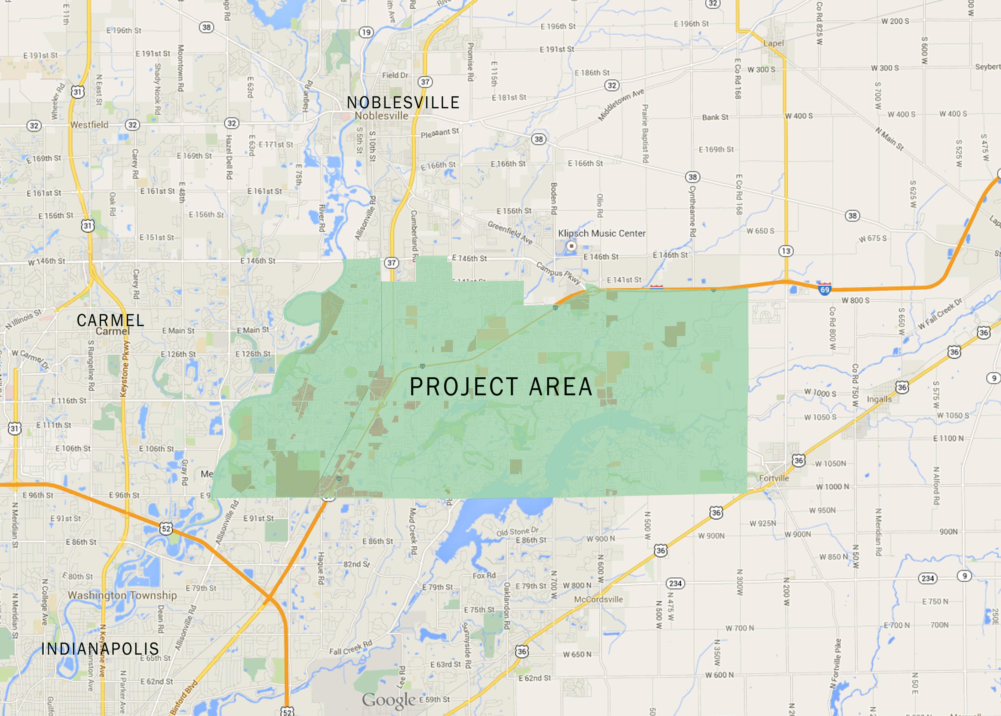
1: Study Area
This chapter provides an outline of the discovery phase of the master plan process in which the existing conditions and policies of the City were analyzed. Specific tasks within this phase included:
• Existing Conditions Inventory
• Public Input
• WikiMap Survey
Not unlike many communities which have experienced rapid growth in population in the past twenty years, Fishers has land use patterns which do not always promote bicycling and walking from neighborhood to neighborhood and to destinations. This is largely a result of typical suburban land development including cul-de-sacs and curvalinear road patterns. Although the development of subdivisions within recent years has encouraged the implementation of trails and paths surrounding the neighborhoods, and even within the neighborhoods on occasion, the nature of suburban development does not promote connections between neighborhoods. Although Fishers has actively been working on filling in the gaps created when developments do not connect, there are still many instances where existing gaps create barriers to travel by bike and foot. The rural land use patterns reaching out into the areas of the county further detract from the use of bikes and walking for reaching
destinations. However, these land use patterns offer many opportunities for walking and biking for recreation for health and fitness.
Recent changes which have added more dense land uses with mixed-use development and revised road patterns within and surrounding the downtown area are more conducive to biking and walking as a means of travel. These areas are primarily commercial with residential areas directly adjacent to the commercial areas. Both in the downtown area and where neighborhoods are located close to schools, biking and walking to reach these destinations is more likely if appropriate facilities are available.
The underlying purpose of the bicycle and pedestrian network is to connect people to destinations. There are many destinations that are desirable to travel to on a daily basis. Typically, the starting point for most trips is the home. Connections are made to run errands, get to work, school, visit parks and places of entertainment. The bicycle and pedestrian network is designed to connect neighborhoods with all of these key destinations.
There are numerous destinations within the study area. These include: major retail areas, employment centers, the government center, schools, parks and the library. In addition, there are regional destinations that must be consid-
ered for connections within the system such as the Monon Rail-Trail, existing trail systems within Noblesville and Carmel.
Major retail areas are found near the Interstate 69 interchanges and along Allisonville Road. In addition, retail areas are located along Olio Road. The retail areas are mixed in nature but all incorporate some bicycle and pedestrian facilities. Many of them lack connections back to the neighborhoods and amenities such as bike parking to encourage traveling to the centers by bike and by foot.
The various retail centers serve as key employment centers along with the industrial areas near Exit 205 and Exit 210. Launch Fishers is another key employment center. Launch Fishers is a co-working space for entrepreneurs working on start-up, high growth, and high potential enterprises. Downtown Indianapolis is also a major center


of employment for several residents in Fishers. Although limited in number now, there are some who would commute to work in Indianapolis if connections from Fishers to existing bike and pedestrian facilities were available.
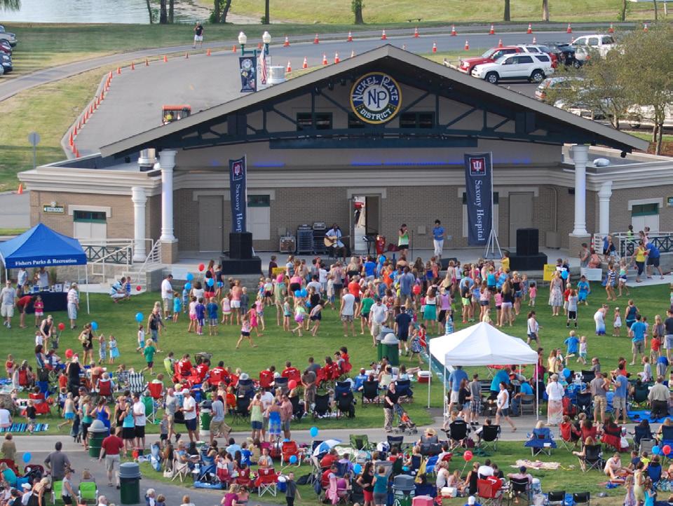
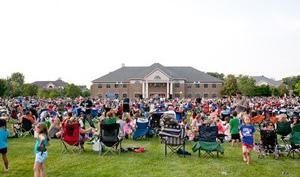
The Government Center located as the center for the downtown area is a key destination. With the library and the amphitheater located within this complex it is a key destination for the system. Facilities for a wide range of users with a wide range of comfort levels shall be provided to this center.
K-12 students within the study area are served by twelve elementary schools, three intermediate schools, three junior high schools and two high schools. Schools are shown on the Inventory Map, Figure 3 and include:
• Brooks School Elementary School
• Cumberland Road Elementary School
• Durbin Elementary School
• Fall Creek Elementary School
• Fishers Elementary School
• Geist Elementary School
• Harrison Parkway Elementary School
• Hoosier Road Elementary School
• Lantern Road Elementary School
• New Britton Elementary School
• Sand Creek Elementary School
• Thorpe Creek Elementary School
• Fall Creek Intermediate School
• Riverside Intermediate School
• Sand Creek Intermediate School
• Fishers Junior High School
• Hamilton Southeastern Junior High School
• Riverside Junior High School
• Fishers High School
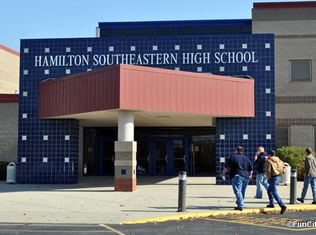
• Hamilton Southeastern High School
• Hamilton Southeastern, Freshman Center
PARKS: Parks and recreation facilities in Fishers are managed by the Fishers Parks and Recreation Department and includes over twelve parks and nature preserves. These include:
• Billericay Park
• Brooks School Park
• Cheeney Creek Natural Area
• Cumberland Park
• Cyntheanne Park North
• Flat Fork Creek Park
• Eller Fields
• Fishers Heritage Park at White River
• Hamilton Proper Park
• Harrison Thomas Park
• Hoosier Woods
• Mudsock Fields
• Olio Fields
• Ritchey Woods Nature Preserve
• Roy G. Holland Memorial Park
• Thorpe Creek Park
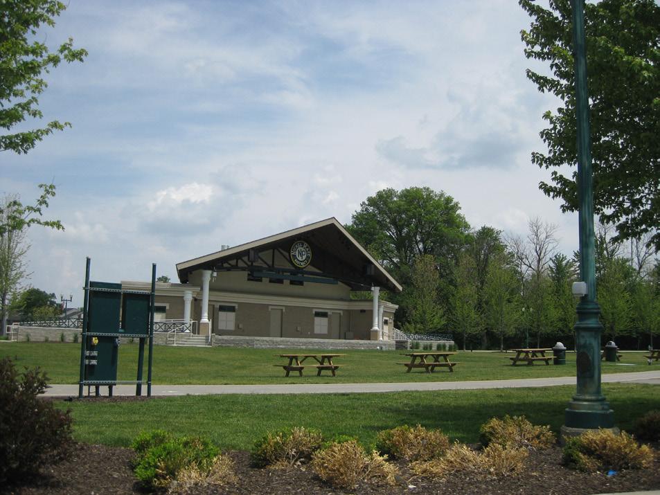
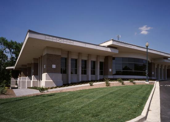
LIBRARY: The Fishers Public Library is located on Municipal Drive directly adjacent to Town Hall. The library hosts many activities for the community and children in particular. This shall be considered a key destination for both children and families.
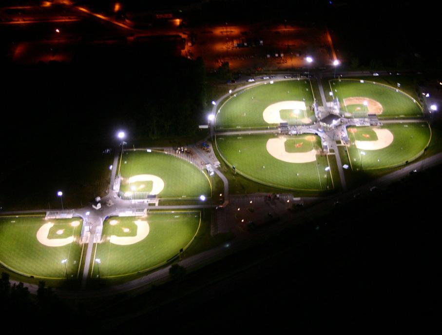
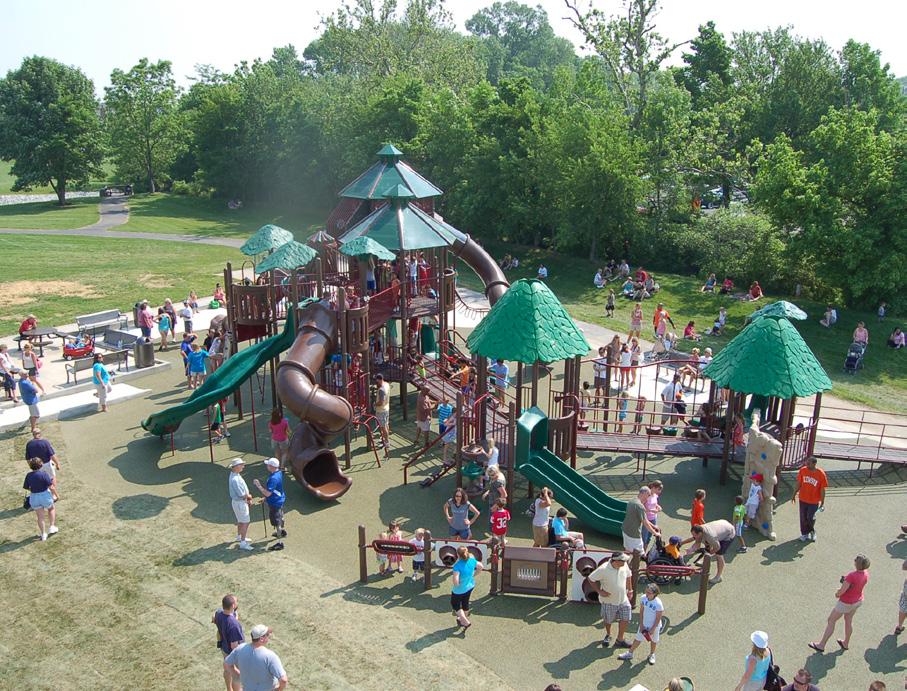
The existing network of pedestrian and bicycle facilities is shown on the Inventory Map, Figure 2. Fishers has a fairly comprehensive system of multi-use paths and trails surrounding neighborhoods and in some cases winding through the neighborhoods. These are utilized heavily by residents of the neighborhoods for recreational uses. However, the lack of connections between these trails and some key destinations limit the use of the trails for uses other than recreational trips. These trips are often are fairly short in nature and include commuting to work, running errands, and attending community events such as festivals and concerts.
The following pages illustrate a detailed look at existing facilities in Fishers. The illustrations show the community in quadrants for ease of viewing the inventory. Although local residential sidewalks were not included in the inventory, they are an important part of the overall active transportation network. Fishers will continue to fill in gaps in the local system as redevelopment occurs.


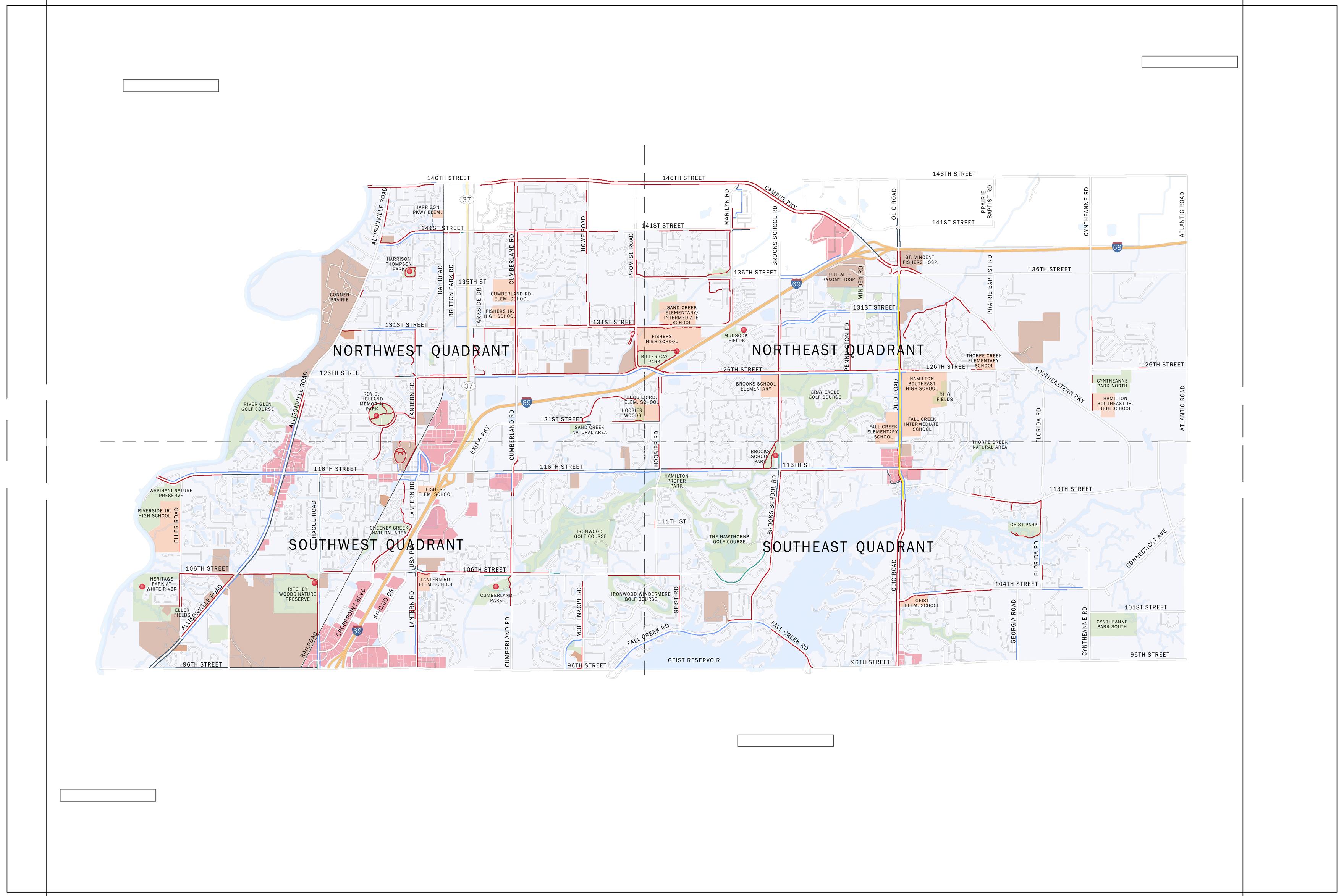
2: Inventory Map


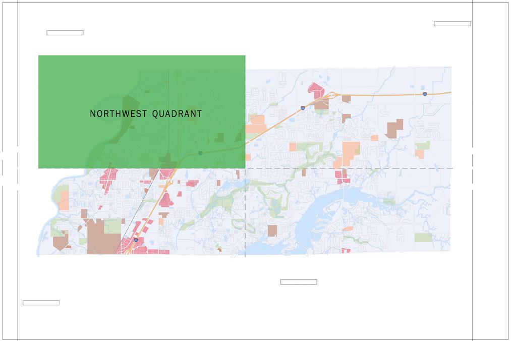
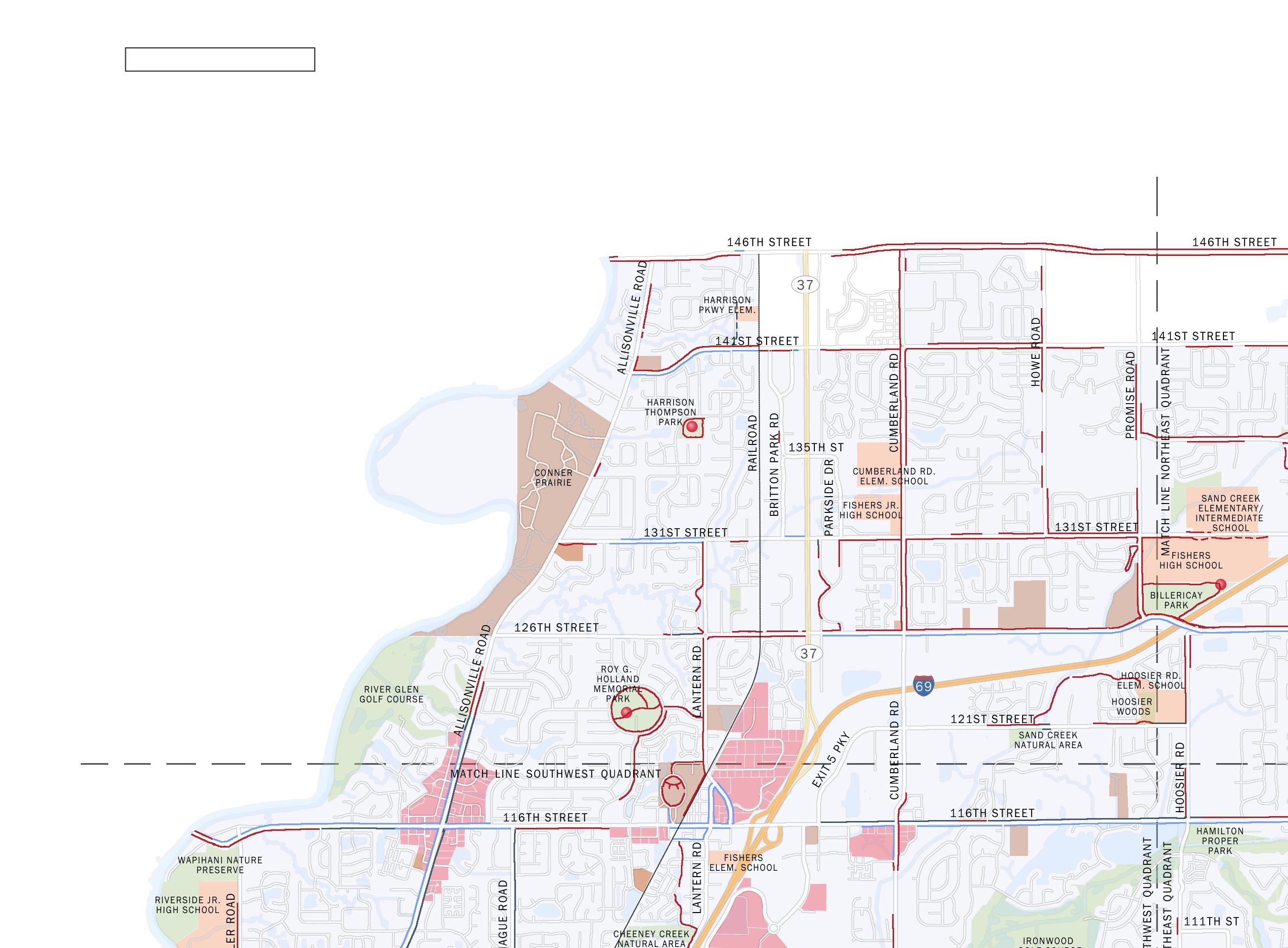
The Northwest area of the study area is characterized primarily by suburban land uses. The roadway system within the quadrant is dominated by State Road 37 and maintains a grid system. Sand Creek crosses the southeast corner of the quadrant.
Travel: Interstate 69 travels east-west across this portion of the study area and is the main route to downtown Indianapolis. State Road 37 runs north-south across the study area and is a major travel route for both residents and commuters traveling through Fishers. Major local roadways include 126th Street, 146th Street, Allisonville Road, Cumberland Road, and Lantern Road. Neighborhood roads are wide in pavement width allowing for both travel lanes and occassional parking along the curb and usually contain sidewalks on both sides of the roadway.
Bike and Pedestrian: There are many existing multi-use pathways along the local roadways within this quadrant. There are however, several gaps in the system. Major roadways which have existing facilities adjacent to them include: 146th Street, 141st Street, 131st Street and 126th Street. Cumberland Road also has an extensive system of multi-use paths.
Destinations: Specific destinations identified within this area include shopping centers along Allisonville Road and State Road 37. Conner Prairie is a local, regional and national tourist destination with tours for field trips and the concert series provided over the summer with over 350,000 visitors annually. Other key destinations within this quadrant include Roy G. Holland Memorial Park and Harrison Thompson Park as well as Cumberland Road Elementary School and Fishers Jr. High School.
Challenges: Both Interstate 69 and State Road 37 present challenges for the bike and pedestrian network connections. Interstate 69 is a major divider between the north and south portions of the community. There are however opportunities for crossing the interstate with improvements to existing overpass interchanges. State Road 37 is a high occupancy, high speed roadway intended to carry automobiles north and south through the community. The roadway and the intersection treatments are geared towards the automobile and create major barriers for pedestrians and bicyclists trying to cross the community.
The other major challenge for bicyclists and pedestrians within this quadrant are the gaps in the existing system. There are many places where trails and sidewalks end leaving bicyclists and pedestrians to enter the roadway or find off-
road routes to complete their trip. This discourages trips by bike and foot.
Opportunities: The railroad corridor running north and south through this quadrant presents an opportunity for a direct route through the community with established intersections when crossing roadways and few conflicts. The railroad is used infrequently for rail use and could become a key route for bicyclists and pedestrians. The existing facilities within this quadrant present the opportunity for quick connections to a number of communities by filling the gaps within the system and utilizing the benefit of already constructed facilities. In addition, there are a number of neighborhoods in close proximity to schools and other destinations creating the opportunity for children and families to access these destinations by bike or foot.




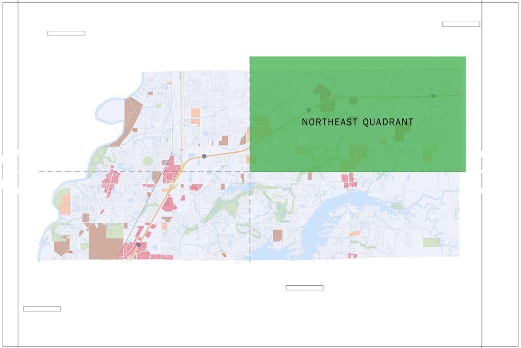
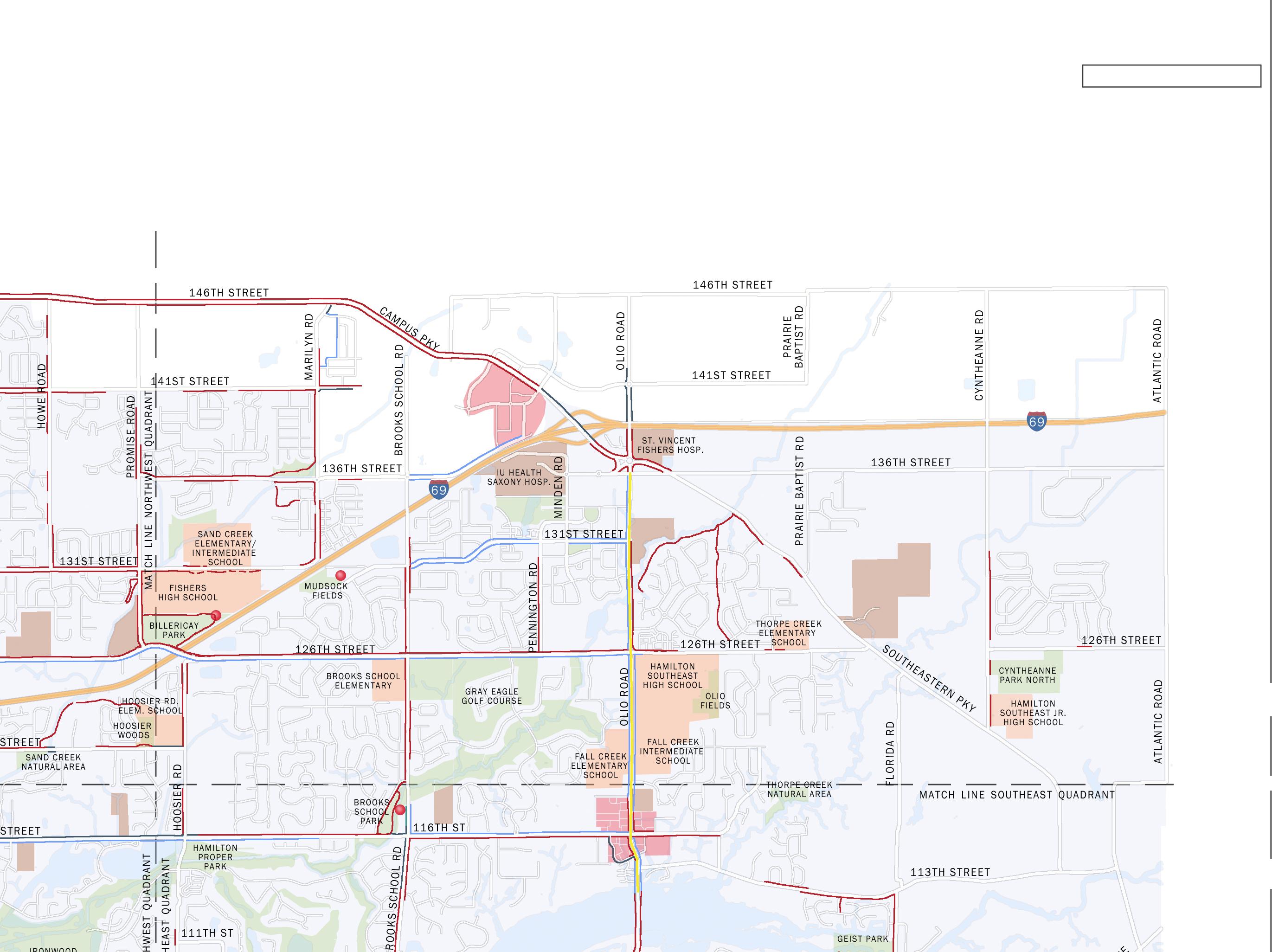
The Northeast area of the study has many types of land uses from the retail center on Campus Parkway to the hospitals located along Southeastern Parkway and the suburban developments on the west side of the quadrant to the more rural character of the eastern part of the quadrant. There are several creeks and waterways cutting across the area including Sand Creek, Fall Creek, and Thorpe Creek.
Travel: Interstate 69 creates a divide in this quadrant similar to the northwest quadrant. There is an interstate interchange at Southeastern Parkway with Southeastern Parkway crossing over the interstate. Southeastern Parkway which transitions to Campus Parkway and then to 146th Street is another major roadway within this quadrant. Olio Road is one of the major north-south roadways within the city. 126th Street connects this portion of the study area back to the downtown area and is a high capacity roadway.
Bike and Pedestrian: The majority of subdivisions within the northeast quadrant have sidewalks on both sides of the roadway. There are a number of multi use pathways running adjacent to roadways within this quadrant. However, there are a few gaps within the system of multi use paths. Bike lanes exist along Olio Road as well as many signed routes within this portion of the study area.
Destinations: There are many destinations within this quadrant including several schools, shopping centers and parks. Schools located within this quadrant include, Sand Creek Elementary School, Fishers High School, Hamilton Southeastern High School, Fall Creek Intermediate School, Fall Creek Elementary School, Hamilton Southeastern Jr. High School, and Brooks School Elementary. Cyntheanne Park North and Billerclay Park are recreational destinations located within this quadrant. The shopping center, IU Health Saxony Hospital, and St. Vincent Fishers Hospital are major employment centers and key destinations.
Challenges: This portion of the study area is fairly open with more rural development patterns. These patterns create longer trips for those communting by bike and foot to destinations located in the downtown area. The increased distances become a challenge for some bicyclists and pedestrians. Interstate 69 is a major barrier for this portion of the study area dividing the City as a whole.
Opportunities: There are several creeks and waterways located within this quadrant which present the opportunity for greenway development. Greenways can provide connections for the bike and pedestrian system while preserving natural areas. The stream corridors also provide connections between neighborhoods and the
schools within the quadrant with very few conflicts between users and automobiles.
Both of the high schools are located within this quadrant of the study area. Existing parking and activities geared towards families and children make the school campuses the ideal location for central hubs in the bicycle and pedestrian system.




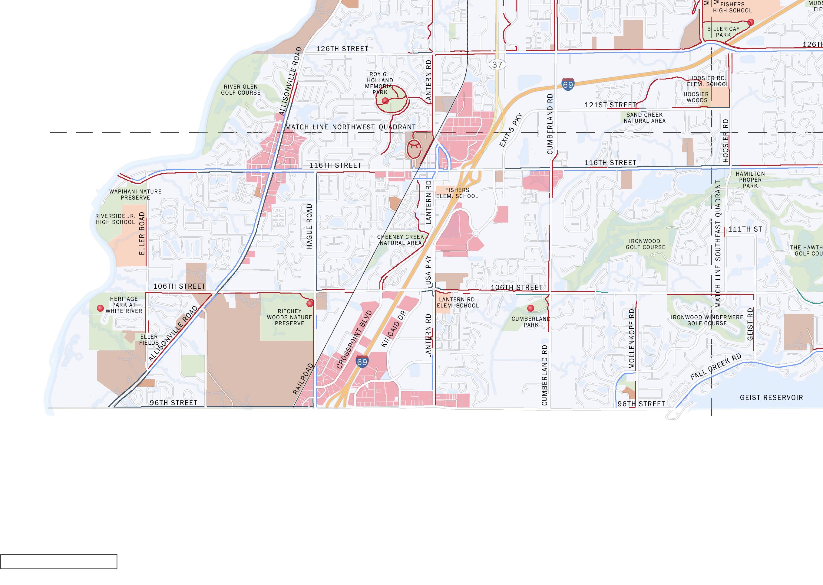
The Southwest quadrant is by far the most densely developed quadrant in the study area. This quadrant includes the downtown area of Fishers along with several shopping centers. Neighborhoods within this quadrant are typified by suburban development including many closed loops and cul-de-sacs. Often neighborhoods do not connect with each other through the roadways or sidewalks.
Travel: Interstate 69 once again bisects this quadrant creating a divide between the north and south sections. There are two interchanges off of the interstate connecting with Fishers. Other major roadways within this quadrant include Allisonville Road providing a direct connection with downtown Indianapolis and Noblesville. It also provides an alternate route to Interstate 69. Other major arteries through this quadrant include 96th Street, 106th Street and 116th Street. A new interchange from I-69 at 106th Street is being planned currently. This interchange will relieve traffic congestion along 116th Street during peak traffic times.
Bike and Pedestrian: Bike and pedestrian facilities exist adjacent to the majority of the main roadways within this quadrant. There are however several gaps within this system. In particular intersections have not been addressed for bike and pedestrian crossings
at major roadways. This creates difficulties for those wanting to cross at key intersections such as Allisonville Road and the 116th Street Interchange at Interstate 69.
Destinations: The Southwest quadrant contains many destinations for the bike and pedestrian system. Destinations include several shopping centers which are located off of the interstate interchanges and Allisonville Road.
Several parks and nature preserves are located within this quadrant including Wapihani Nature Preserve, Ritchey Woods Nature Preserve, Heritage Park at White River, Cheeney Creek Natural Area, and Cumberland Park. Creek corridors within this area include Sand Creek, Fall Creek and Cheeney Creek.
Challenges: Roadways again present the largest challenge for connecting cyclists and pedestrians. Interstate 69 bisects Fishers and the interchange overpasses are congested with traffic particularly at peak periods and do not easily accommodate bikes and pedestrians in their current configurations. 116th Street presents an additional challenge for the bike and pedestrian system with a narrow right-of-way and high traffic volumes that prohibit changes to the roadway configuration. Current sidewalks accommodate pedestrians but do not have the width to also accommodate bicycles. In addition, existing
utility infrastructure such as poles and signage create obstacles within existing sidewalks.
The busy roadway is particularly uncomfortable for bicyclists. Additional challenges include narrow bridges on local roadways such as Cumberland Road and Hague Road.
Opportunities: The density of development within this area make it ideal for encouraging bike and pedestrian travel for commuting with short travel trips and many desired destinations. The proximity of neighborhoods close to the employment centers along Crosspoint Boulevard and Kincaid Drive could attract more commuting by bicycle.
The many parks and natural creek corridors present the opportunity to create a network of “green” bicycle and pedestrian facilities connecting the parks within a natural setting. This system could become a tourist destination catering to the nature enthusiast.
Providing bike and pedestrian facilities on the interstate overpasses will connect Fishers creating a safer environment for bikes and pedestrians to travel to all areas of the City. Implementing intersection improvements along the major roadways will further connect the community creating a safe and comfortable system to connect all of Fishers.


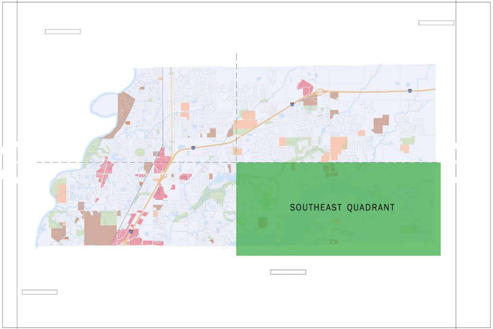
The Southeast area of the study area is characterized by suburban development dominated by natural features such as creek and woodland corridors leading to Geist Reservoir, a major outdoor recreational center for the region. Development is much less dense within this quadrant.
Travel: The pattern of roadways within the southeast quadrant varies between a typical grid system and more curvalinear roadways navigating around natural features. Interstate 69 does not bisect this quadrant reducing the number of connectivity problems found in the other quadrants. Major roadways within this area include Olio Road and 116th Street.
Bike and Pedestrian: The majority of neighborhood roads within this quadrant have sidewalks on both sides of the roadways. Some of these sidewalks are narrow and need to be upgraded to meet ADA requirements.
There are many opportunities within this area for bike and pedestrian recreation activities with existing multi-use paths along key arterials and within various parks.
Destinations: There are fewer destinations within this quadrant of the study area with Geist Reservoir being one of the key destinations. The natural characteristics of this area
make it a destination point in itself. Riding, walking and running through these areas can be a draw for nature enthusiasts. Several parks and natural areas are located within this portion of the study area including Hamilton Proper Park, Thorpe Creek Natural Area, Geist Park, Brooks School Park and the new park being constructed at Cyntheanne Park South. Shopping centers located within this quadrant provide shopping for local residents and were identified as a key destination for residents living close to the centers located on Olio Road and 96th Street. In addition, key employment nodes exist along Interstate 69 between 106th Street and 116th Street.
Challenges: Although a key asset to the area, Geist Reservoir also presents many challenges for connecting the bike and pedestrian system. There are many waterways connecting with the reservoir which create topographic challenges for the system. In addition, narrow but scenic roadways do not fully accommodate bike and pedestrian facilities. New facilities must meet required standards while respecting the natural environment that they are located within.
Opportunities: The scenic nature of this part of the study area presents many opportunities for the bike and pedestrian system especially centered around recreational use. Geist Reservoir is a regional draw for tourists. Providing bike
and pedestrian facilities from Geist Reservoir to other areas of Fishers would encourage further exploration of the City by tourists.
The creek corridors within this quadrant present opportunities to provide connections between the parks through natural corridors. Again, creating an internal loop of “green” facilities could attract additional tourists to the area looking for this type of experience.
The scenic nature of this area attracts many bicycle and pedestrian enthusiasts. Multiple bike and running routes were identified through this area of Fishers highlighting the entire quadrant as a destination for enthusiasts. Providing a more complete system of facilities provides the opportunity to further increase the attractiveness of this area for bicyclists and pedestrians of varying skill levels.




The Project Process Diagram shown in Figure 7 illustrates the process utilized to gather public input. Other tools utilized to gather input included a WikiMap Survey and a project website. The project website was updated following each phase of the process to inform the public on the progress of the master plan while also gathering additional input. Two Community Forums were conducted to gather public input. The first Community Forum was conducted in March, 2014. This forum presented existing facilities and asked the public for feedback on where they currently ride and walk, destinations that they would like to connect with, areas of conflict, and comfort level of certain routes.
The second Community Forum was held in May of 2014. Information was presented concerning suggested routes for proposed facilities. This included identification of facility types for each of the routes. Participants were asked to rate the suggested routes and comment on plan elements. Both of the Community Forums were well attended and included a diverse cross section of participants from the pedestrian and cycling community.
A full summary of the input received at the Community Forums is included in the appendix. Comments received at these meetings was documented on maps and included:
• Current routes and destinations
• Desired routes and destinations
• Areas of conflict
• Areas in need of replacement or upgrade
• Feedback on proposed routes
• Feedback on proposed facility type
• Feedback on intersection and infrastructure improvements
In addition to the Community Forums, a Project Advisory Committee (PAC) was formed to guide development of the plan and broker community support and awareness for the plan. The Project Advisory Committee was comprised of community leaders with an interest in active transportation alternatives, economic development, and healthy living including representatives from local hospitals, the YMCA, local cycling and running stores, the Chamber of Commerce, Hamilton County Tourism Inc. and City staff including the departments of Community Development, Engineering, Parks, Public Works and Police. Meetings were conducted to gather
a broad cross section of public comment and to better understand the current system and maintenance policies. Recommendations were reviewed with the PAC to help determine community priorities.
WikiMap is an online interactive public involvement platform that allows participants to identify and comment on specific challenge areas and opportunities to improve walking and biking. A WikiMap was prepared for the Fishers Bicycle and Pedestrian Master Plan and publicized on the Town’s website.
The map was open for participation from Thursday March 27th through Monday April 21st, 2014. During this time, 113 people logged into the WikiMap site and created accounts. The majority of participants (106 of 113) completed the Intro Survey, with nearly half providing input on the map itself. Map input consisted of identifying specific locations (points) that are barriers, destinations, or opportunities, as well as routes (lines) that are desirable for walking and/or biking.


When participants registered, each was asked to complete an Intro Survey describing themselves and their biking/walking habits. Questions from the intro survey included obtaining the comfort level of riders, what type of facility is desired, and basic demographic information such as gender, age and home location. The intro survey results showed that the majority of users completing the survey were experienced bicycle riders and did demonstrate a focus on bicycle facilities instead of pedestrian facilities. While representing only a portion of the population these results are still valid as these are more than likely the current users and those most interested in the imple mentation and success of the master plan.
A full review of the WikiMap and the results can be found in the appendix. A summary of the results from the web application includes:
• locations of current riding routes including those which are low-stress routes and highstress routes
• locations for desired bicycle and pedestrian routes - most of which were identified within 2 miles of downtown and include 116th Street and along the railroad
• key destinations
• areas of conflict - majority of conflicts identi fied included intersections with State Road 37, along 116th Street and Cumberland Road
The “route I’d like to bike” lines with high levels of support were mostly within 2 miles of Down
town Fishers. This includes lines along 116th Street, the railroad track, Allisonville Road north of 126th Street, 106th street, Cumberland Road, and minor streets south of Downtown.
In terms of point comments—“barrier to biking,” “place I bike to,” “place I’d like to bike to,” “barrier to walking,” “place I walk to,” “place I’d like to walk to,” and “bike parking needed”—those having the most support were nearly all located within a 1 mile corridor surrounding State Road
37 between 106th Street and 126th Street.
In summary, while there are needs and opportunities identified across Fishers, the greatest levels of participant input were focused along the State Road 37 corridor, downtown Fishers, and along the western halves of 116th and 106th Streets. These were the areas that have the greatest level of public support for improvement.
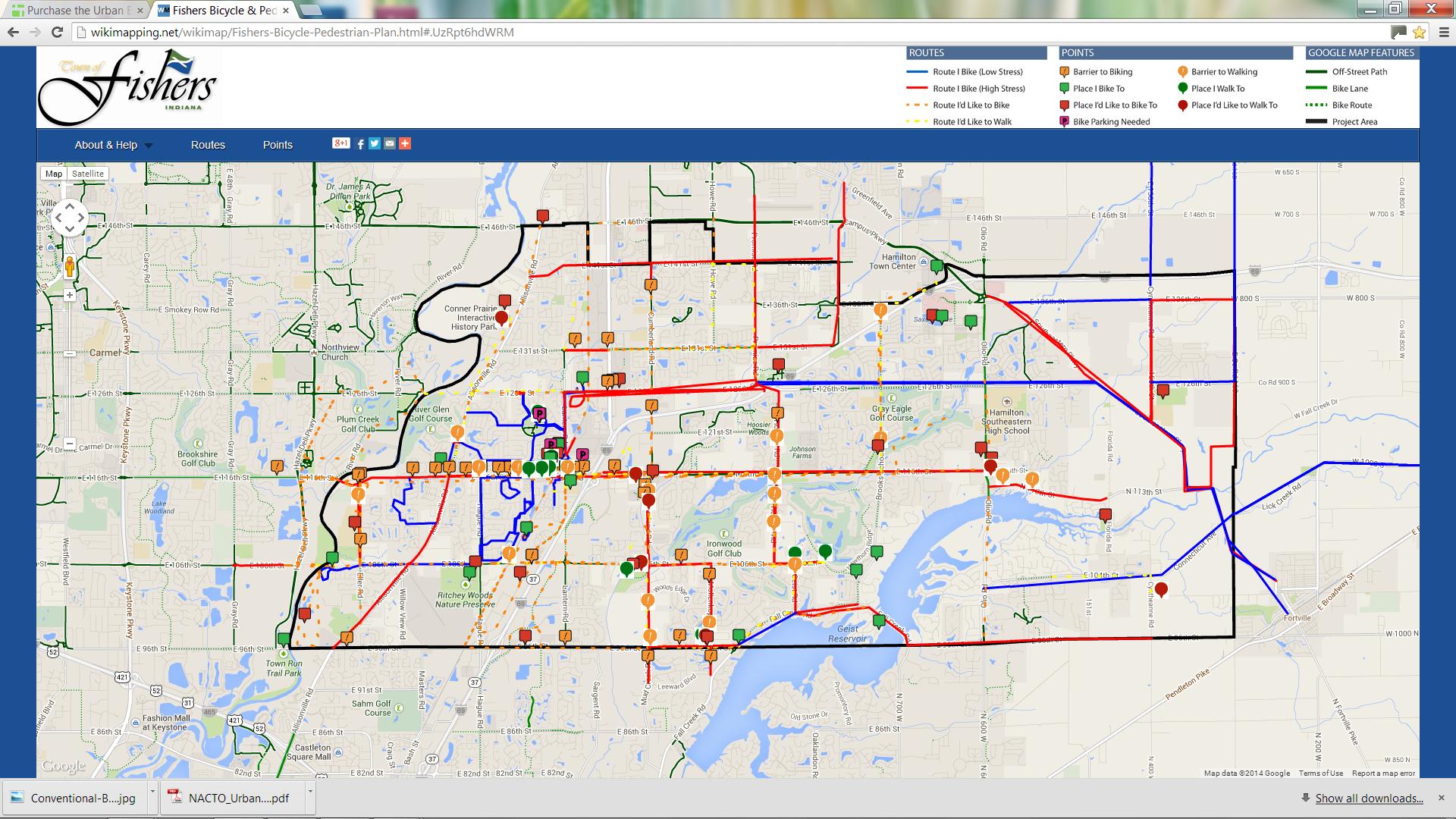
Figure 8: Image of WikiMap Input (See Appendix for Full Map)
The vision statement provides guidance for the bicycle and pedestrian master plan and for any revisions to the plan in the future. This vision statement should guide the implementation efforts of City staff going forward.
Fishers will sustain and enhance its bicycle and pedestrian network to accommodate users of all ages and abilities. The system will build upon the existing network of paths, sidewalks, and bike lanes to connect citizens to key destinations, such as schools, parks, commercial and employment centers, and regional destinations. The City will support bicycle and pedestrian infrastructure improvements that are based on national best practices, and will support education initiatives that promote safe practices for cyclists, pedestrians, and drivers alike. Fishers will also promote active transportation by partnering with community and neighborhood organizations to foster a culture that welcomes bicycling and walking for both recreation and transportation options.
The Fishers Bicycle and Pedestrian Master Plan establishes a vision for traveling by bicycle and by foot. This vision includes a complete system of facilities to connect people to neighborhoods, schools, shopping centers and parks. This network will provide people with
the opportunity to reach these destinations by foot or by bike without utilizing automobiles. The system will provide many benefits to the people of Fishers including:
• Increased health through active travel
• Increased environmental sustainability through preservation of naturalized areas and reduction in carbon dioxide from fewer vehicular trips
• Increased amenities for recreation and exercise
• Increased economic growth through increased property values near amenities
• Enhancing community pride and identity by becoming a bike and pedestrian focused community
The Bicycle and Pedestrian Master Plan contains goals and objectives for developing and implementing a pedestrian and bikeway system that will create safe, attractive and convenient options for bicycling and walking for all types of users. This will include trips for work, school, and recreation for all user types and levels. The goals are the long-range visions that guide the plan and determine the desired direction of bicycle and pedestrian planning. The objectives are more specific statements of how to accomplish the goals and identify means of measuring the success of the plan.
The goals and objectives reflect the current plan-
ning efforts of Fishers and will help the City to determine priorities for continuing to develop the bike and pedestrian system.
Objective: Design and develop bicycle and pedestrian facilities to link major activity centers including schools, parks, shopping centers, and employment centers to encourage bicycling and walking as viable, safe, and convenient alternative modes of transportation.
Objective: Provide safe and convenient bicycle and pedestrian accommodations for every type of trip and user.
Objective: Provide bicycle and pedestrian amenities on routes linking schools with the library, trails, parks, and recreational sites that encourage the mobility of school age children.
Objective: Eliminate gaps in the existing system and improve sub-standard conditions of facilities within the network.
Objective: Provide safe and convenient bicycle and pedestrian connections where natural or man-made barriers restrict access.


Objective: Create a regional network of recreational and transportation routes to connect Fishers with Municipalities and regional destinations in surrounding counties.
Objective: Provide access to bicycle and pedestrian facilities for a variety of users including walkers, runners, bicyclists, wheelchair users, strollers, and other non-motorized recreationalists and commuters.
Objective: Establish bicycle and pedestrian connections between parks to allow travel back and forth between the parks without the use of an automobile.
Objective: Provide off-road and on-road bicycle facilities to provide opportunities for different levels of recreation and commuting for various user levels.
Objective: Require bicycle parking at public buildings, retail areas, employment centers and recreational areas.
Objective: Plan, design and construct bicycle and pedestrian improvements to meet or exceed guidelines for bicycle and pedestrian safety while increasing the users level of comfort.
Objective: Monitor bicycle and pedestrian related accidents to determine areas in need of improvements.
Objective: Work with law enforcement departments to develop education and enforcement programs to increase the awareness of all road users for rules and regulations concerning bicyclists and pedestrians utilizing the roadways.
Objective: Develop and distribute information materials to all roadway users informing users of their rights and responsibilities targeting bicyclists, pedestrians, and motorists.
Objective: Design roadway crossings to maximize bicyclist and pedestrian safety.
Objective: Encourage bicycling and walking as an alternative to the automobile and as a means to reduce pollution and congestion while increasing mobility choices and the quality of life in the community.
Objective: Partner with public and private groups in the community to provide programs utilizing the network of bicycle and pedestrian facilities. This could include activities such as fun runs, festival events, and group rides to promote additional use by residents who might not otherwise utilize the system.
Objective: Promote the benefits of recreational use of the bike and pedestrian improvements for exercise.
Objective: Design and install signage and mapping to encourage bicycling and walking activities.
Fishers’ path and bikeway system will meet the basic needs of a variety of users. For pedestrians, this means providing continuous sidewalks or paths that are safe, comfortable, and easily used by people with disabilities. From a bicycling perspective, this means considering and understanding that there is wide variation in terms of skill and comfort levels amongst bicyclists in Fishers.
Ensuring that Fishers’ path and bikeway system effectively meets the needs of different users requires the adoption of comprehensive set of policies that addresses each aspect of biking and walking. This includes new policies specific to the City of Fishers as well as the adoption of state and federal policies. Rather than simply focusing on routes and infrastructure, a well-rounded and complete bicycle and pedestrian plan and program is one that is comprehensive in its recommendations and actions. A common practice is to consider the “Five E’s”—Engineering, Education, Encouragement, Enforcement, and Evaluation and Planning—when working to enhance bicycling and walking. This chapter is organized around these Five E’s, with each section containing recommendations for new policies unique to Fishers as well as excerpts from the most relevant state and federal policies.. Collectively, the policies recommended in this plan seek to sustain and enhance walking and bicycling
conditions for all users, regardless of skill level, physical ability, or whether they walk or bike for transportation or recreational purposes.
A detailed summary of other relevant federal, state, and local policies is provided in the appendix.
Engineering policies and actions are typically the most significant, in terms of cost and public agency involvement. They include changes to design standards and practices, the construction of infrastructure, and any other action that creates changes in the built environment. The following engineering policy statements were developed to address the primary engineering challenges that are faced in Fishers based on its unique context. The policies also seek to address issues observed in the older parts of the City, where infrastructure was constructed prior to the adoption of current standards. The City of Fishers will strive to meet or exceed the standards set forth in these policies, wherever practicable.
Follow the Complete Streets process to facilitate biking and walking accommodations in Fishers.
Ideally, bicycle and pedestrian facilities and infrastructure will be included with all street projects when they are initially constructed, or when
streets are reconstructed. Including bicycle and pedestrian facilities at this time is less expensive than retrofitting facilities as stand-alone projects. Two federal policies support and mandate this approach for projects utilizing federal aid unless a) bicycles are prohibited by law from using the roadway, b) the cost is excessively disproportionate to the need (exceeding 20 percent of the project cost), or c) where sparsity of population indicates an absence of need.
Following a Complete Streets process for street projects (especially those along or connecting to a planned bikeway) will help further the implementation of this plan. Such a process will ensure that all street users—motorists, bicyclists, and pedestrians—are considered during the design stage and are adequately accommodated. The process will be flexible in terms of design specifics and sensitive to the surrounding context and land uses. The process will also apply to street resurfacing, restoration, and rehabilitation (3R) projects and streets built by private developers, such as interior circulating streets in a newly-developed site when they are part of or are connected to the current and planned bicycle and pedestrian system.
Use nationally-recognized design guidelines, including AASHTO and NACTO, when designing on-street bikeways.


The Indiana Design Manual (IDM) is the statewide guidance used by INDOT and local jurisdictions during the development and design of transportation projects. Chapter 51 “Special Design Elements” provides guidance for several subject areas, including accessibility for persons with disabilities (including sidewalks), shared-use paths, and roundabouts. The IDM also contains some guidance for the design of on-street bikeways. Namely, it provides guidance on determining the appropriate type of bicycle facility (bike lane, path, etc.) based on factors such as motor vehicle traffic and speed. However, it does not contain the specific design guidance necessary to design on-street bicycle facilities.
As such, the AASHTO Guide for the Development of Bicycle Facilities, 4th Edition, 2012 (AASHTO Guide) will be used in the design of all on-street bikeways. While the AASHTO Guide serves as a set of minimum standards, the NACTO Urban Bikeway Design Guide (NACTO Guide), which is used by many communities to design innovative bicycle infrastructure that surpasses the AASHTO minimum standards, may also be consulted.
Modify the Typical Cross Sections within the Standard Construction Details to include onstreet bikeways.
The current cross sections do not show on-street bikeways. These will be modified to show bike lanes as optional for local, two-lane collector, and four-lane undivided streets. The width of the bike
Creates separation between bicyclists § and automobiles.
Increases predictability of bicyclist and § motorist positioning and interaction.
lane will be in accordance with the City’s Construction Specifications, the IDM, and the AASHTO Guide. The width will be measured from the face of curb (if the curb and gutter are poured monolithic with the pavement) or from the gutter seam, if one is present.
Increases total capacities of streets car- § rying mixed bicycle and motor vehicle traffic.
Visually reminds motorists of bicyclists’ § right to the street. daily traffic.
Modify the Construction Specifications to more clearly specify bike lane width.
Section 2.2 specifies that “bicycle lanes adjacent
Bike lanes are most helpful on streets § with a posted speed ≥ 25 mph.
On streets with high transit vehicle § volume.
to the curb shall be 4 feet in width and bicycle lanes between lanes shall be 5 feet in width.”
This will be amended to state that the width of bike lanes should be measured from the face of curb (if the curb and gutter are poured monolithic with the pavement) or from the gutter seam, if one is present.
On streets with high traffic volume, § regular truck traffic, high parking turn over, or speed limit > 35 mph, consider treatments that provide greater separa tion between bicycles and motor traffic such as:
Left-sided bike lanes
Buffered bike lanes
Utilize national and international best practices and guides for path design.
Cycle tracks
Two-way paths along roadways, which consti-
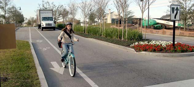
tute the most common dedicated bicycle and pedestrian facility type in Fishers, come with many challenges, including:
• Path crossings of driveways and intersections are often blocked by motor vehicles waiting to turn (motorists typically ignore stop bars
• Conflicts exist between slow-moving pedestrians (3 mph walking speed) and faster-moving bicyclists (10-15 mph is considered a moderate pace).
• The need for additional traffic control signage, especially at driveways and intersections.
• There is a lack of clarity regarding who has the right-of-way where paths cross minor streets.
• There is an increased risk of crashes due to the limited visibility of drivers (see Figure 10).
In light of these challenges, paths are most appropriate where driveways and intersections are limited. In areas with high concentrations of driveways and intersections, on-street accommodations (including bike lanes, buffered bike lanes, and cycle tracks) are preferred because they are proven to be safer.
The AASTHO Guide states that paths along roadways should be considered a supplement to, but not a replacement for, on-street bikeways. In other words, the provision of a path
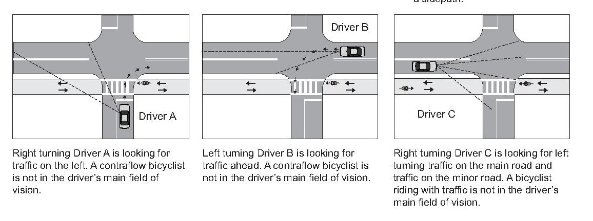
Figure 10: Visibility limitations of paths along roadways. Source: AASHTO Guide for the Development of Bicycle Facilities, 4th Edition, 2012.
does not preclude the need to provide onstreet accommodations for bicyclists that are more comfortable riding with traffic.
Since Fishers’ bicycle and pedestrian system primarily consists of paths along roadways, it is important that the City design paths according to the best design guidance available. While the Indiana Design Manual contains a significant amount of detail on path design, there are several issues and situations that it simply does not address. Therefore, the City of Fishers will regularly reference additional design guidelines and standards that address more complex issues beyond the limited scope of the IDM. These guidelines and standards include the AASHTO Guide, the NACTO Guide
section on two-way cycle tracks, the latest adopted edition of the Indiana Manual on Uniform Traffic Control Devices, Part 9 (MUTCD), and the CROW Design Manual for Bicycle Traffic (CROW Manual). The CROW Manual is the primary bicycle infrastructure design guide for the Netherlands (a country well-known for its extensive system of paths along roadways) and while it is not directly applicable to American cities, it contains many relevant concepts for path design. The CROW Manual is especially informative for designing path crossings at intersections and driveways.
Design all paths with a minimum design speed of 15 miles per hour.
The IDM states that “A bicycle minimum design


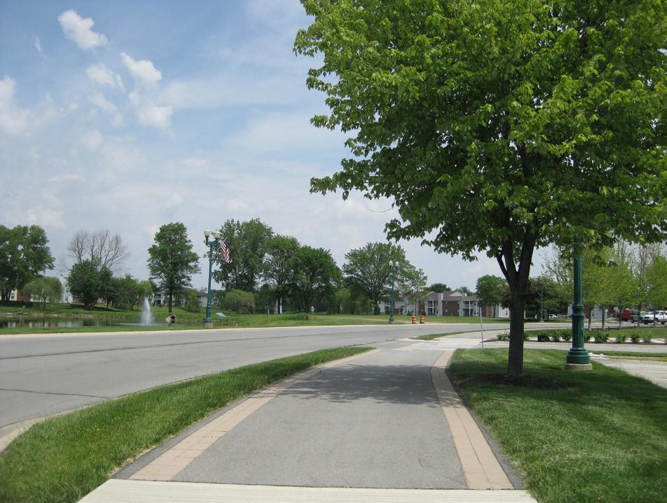
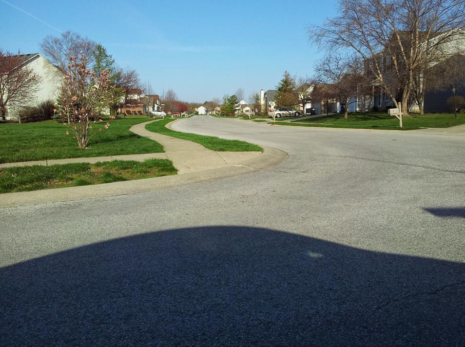
speed of 15 mph is required. A bicycle design speed of 20 mph is desirable” (IDM 51-7.05(02)). The AASHTO Guide specifies a minimum design speed of 18 mph, which may be lower “in rare circumstances.” Design speed determines sight distances and horizontal alignments. Specifically, curve radii shall be at least 60 feet in diameter if the design speed is 18 mph. In locations where physical constraints limit the ability to meet the minimum design speed, warning signage must be used, just like is required for roadway design. However, there are several locations in Fishers where paths were designed in such a way that does not adhere to minimum design speeds, as illustrated in Figure 11.
The City of Fishers shall design all new paths with a minimum design speed of 15 mph, in keeping with the IDM, and shall strive to design all paths with an 18 mph design speed.
Design all paths with a minimum width of 10 feet.
Regarding path width, the IDM states that “The desired paved width is 10 feet. The minimum paved width is 8 feet. It may be necessary or desirable to increase the width to 12 ft or 14 ft…” where higher volumes of bicycle or pedestrian traffic is expected (IDM 51-7.05(02)). According to the AASHTO Guide, two-way paths should be a minimum of 10 feet wide (the former minimum, prior to the 2012 update, was 8 feet). This is the minimum width needed for two bicyclists to
safely pass each other. In addition, other path users require wide operating spaces (up to 5 feet for inline skaters), so the 10-foot minimum is justifiable for other users as well. The AASHTO Guide states that 8-foot wide paths “may be used for a short distance due to a physical constraint such as an environmental feature, bridge abutment, utility structure, fence, and such” (AASHTO 5.2.1).
Most existing paths in Fishers are 8 feet wide, which reflects the IDM and old AASTHO Guide minimums. However, in keeping with the new AASTHO Guide standard, the City of Fishers will:
• Design all new paths to be a minimum of 10 feet wide, unless there are short segments
with physical constraints that will only allow an 8-foot wide path;
• Modify the Town Parks Plan (which is referenced in the Unified Development Ordinance) to reflect the 10-foot wide minimum;
• Modify the Typical Cross Sections detail within its Standard Construction Details to reflect the 10-foot wide minimum;
• Modify the Perimeter Path details within its Standard Construction Details to reflect the 10-foot wide minimum as well as to specify a 2-foot wide clear graded shoulder, as specified by the AASHTO Guide; and
• Modify Section 2.1(F) of its Construction Specifications to state “Right-of-Way (ROW) widths shall be per the City of Fishers Stan-

Figure 11: Paths designed with appropriate design speeds including appropriate radii and curb ramps. Crosswalk markings and detectible warnings visually notify motorists and trail users where there are intersections.
dard Construction Details. An additional 14 feet of full-width ROW…” in order to account for the wider 10-foot minimum specified by the AASHTO Guide and dual 2-foot wide clear graded shoulders.
Funding that originates from the federal government—such as the Transportation Alternatives Program—requires that AASHTO standards be met in order for projects to be eligible.
Design all paths with necessary regulatory and warning signage.
Regulatory and warning signs are crucial elements for bicyclists and pedestrians in terms of mitigating safety hazards (especially where physical constraints and age of infrastructure results in noncompliance with current IDM and AASHTO standards) and indicating who has the right-of-way at intersections. Warning and regulatory signage makes the transportation system (streets and paths) safer and more efficient.
Several parts of Fishers’ path network is lacking in regulatory and warning signage. To correct this issue, Fishers will assess all existing paths and determine signage needs based on the MUTCD standards. It will then begin a program to purchase and install the necessary signage. Signage for paths along roadways will follow the same regulatory controls as the
parallel roadway. For example, a stop sign will not be placed along the path at an intersection or driveway unless the parallel roadway also has a stop sign at the same location. Instead, the perpendicular street will include a stop bar behind the path crossing and warning signage for both the motorists and the path users. At such a location, the motorist should always yield to the path user. Warning signs for motorists turning across sidepaths may be appropriate at high traffic areas (see Figure 3).
Design all paths with a minimum cross-slope of 2 percent.
The IDM (section 51-1.05(01) and the AASHTO Guide both allow a maximum path cross-slope of 2 percent . The United States Access Board’s Public Rights-of-Way Accessibility Guidelines (PROWAG), which is the new design standard for meeting the compliancy requirements of the Americans with Disabilities Act (ADA), also mandates a 2 percent maximum cross-slope for sidewalks and paths. This maximum also applies to sidewalk and path driveway crossings, which should be relatively flat.
The majority of paths and sidewalks in Fishers were designed to not exceed a 2% cross slope. However, excessive cross-slopes of paths are present at several older driveway crossings. The City of Fishers will ensure cross-slopes do not exceed 2 percent for new path construction and reconstruction projects. Achieving flat driveway
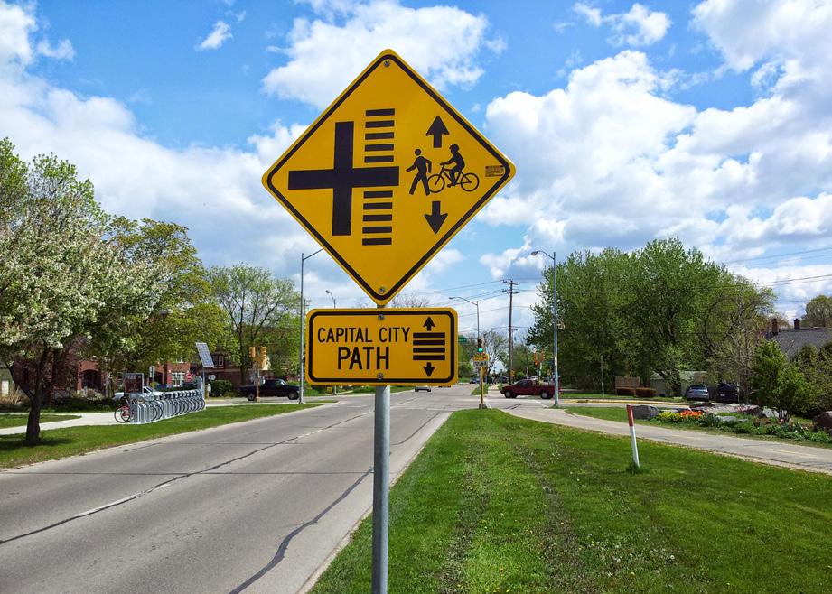
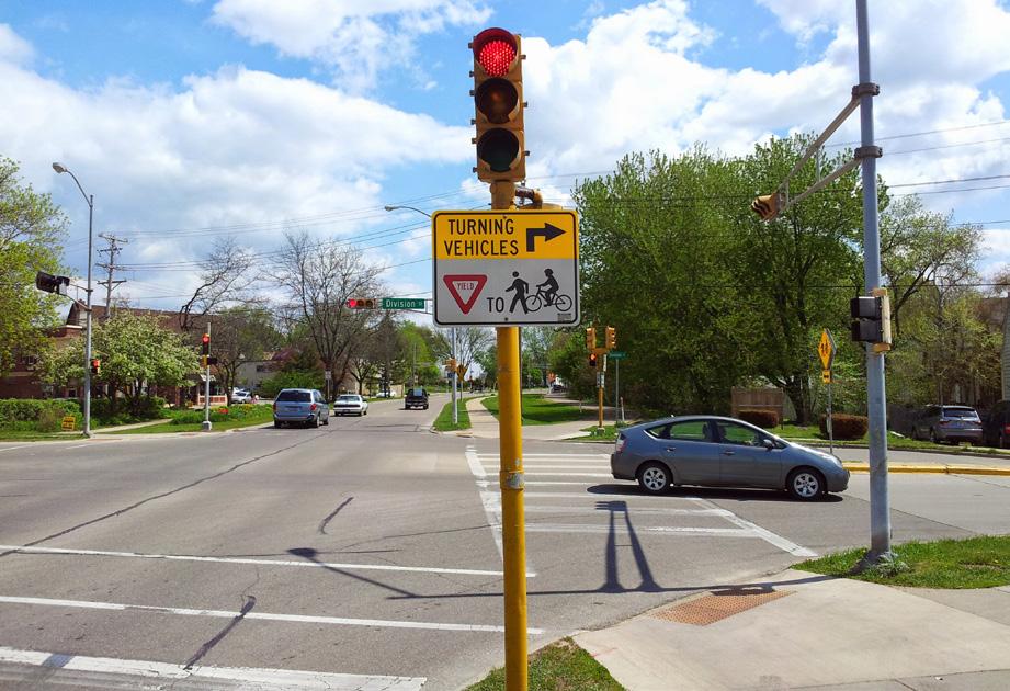
Figure 12: Example warning and regulatory signage meeting MUTCD standards.
The image on the top illustrates a warning sign for a path along a roadway. It is placed in advance of an intersection that has a moderate level of turning movements. The image on the bottom is of a sign at the same intersection, which directs motorists to yield to path users in the crosswalk.


crossings may require offsetting the path or sidewalk away from the roadway and around the driveway apron.
Design all paths with a maximum grade of 8 percent.
Grade or longitudinal slope should be as flat as practical, according to the IDM and AASHTO Guide. Furthermore, in order for a path to be ADA-compliant, its grade cannot exceed 8 percent or the grade of the adjacent roadway. The IDM and AASHTO Guide support these limits as preferable for bicyclists, though the IDM allows grades in excess of 8% under extenuating circumstances (IDM 51-1.05(02)).
While there are few locations where paths in Fishers exceed 8 percent, there are some instances where they exceed the grade of the roadway due to the topography of the right-ofway. The City of Fishers will minimize the grade of paths and ensure that new path construction/ reconstruction projects do not exceed the grade of the adjacent roadway.
Design path and sidewalk street crossings that are safe and easy to understand.
As previously mentioned, the operation of paths is especially challenging at street crossings due to limited visibility, blocked crosswalks, and confusion regarding right-of-way. Although bicyclist crashes have not been an issue in Fishers, statistics from around the country show
that bicyclists using paths along roadways are at higher risk than bicyclists riding in the street, primarily due to street crossings. With this in mind, street crossings will be designed to minimize conflicts and increase safety. Some of the greatest challenges associated with path street crossings relate to the location of the path as it approaches the intersection. A straight approach to the intersection does not require bicyclists to slow down. Paths that cross too close to the parallel street are often blocked by cars waiting to turn and place bicyclists in a location that is not highly visible for turning motorists. Best practices support taking one of two approaches:
1. Moving Closer (more appropriate for urban settings)– Moving crossings as close to the curbline of the parallel road as possible (and reducing corner radii significantly) is one approach. Desings utilizing this approach are site dependent and must consider site specific conditions. Some design considerations and recommendations include:
• The IDM recommends that path crossings be located “close to the roadway intersection so as to allow the motorist and path user to be able to recognize each other as intersecting traffic” (IDM 51-7.09(01)).
• Avoid visibility and crosswalk blockage issues.
• Refer to NACTO Guide’s section on two-way cycle tracks, for recommendations concerning very small corner radii (e.g., 5 to 10 foot
actual radius) and high-visibility pavement markings (such as solid green paint bordered by white dashed stripes).
• Design solutions should always consider the specific site and existing constraints
2. Moving Farther Away (more appropriate for suburban and rural settings) – Moving crossings farther away from the curbline so that the crossing functions as a second intersection. Moving the path crossing farther from the curbline of the parallel road has many advantages, including:
• Increasing the visibility of bicyclists and pedestrians in the crossing by motorists turning off of the parallel street, since the crossing is now directly in front of the motorist once he has turned, instead of in his peripheral view.
• Allowing space for cars turning from the parallel street onto the cross street to wait outside of the flow of traffic on the parallel street.
• Slows bicyclists as they approach the intersection, meaning they enter the crossing at slower speeds, making them more visible to motorists.
• Allows one or more cars waiting to turn onto or cross the parallel street from the cross street to queue without blocking the path crossing.
The primary disadvantage is that offset crossings require more right-of-way and additional traf-
fic control (warning signs for motorists). The IDM provides some support for moving path crossings farther from the curbline. IDM Figure 51-7R shows an alternative configuration placing the crossing at least 100 feet from the intersection and treating it as a mid-block crossing. However, this would require an excessive amount of right-of-way at intersections and places the crossing far enough from the intersection that motorists would have enough time to gain a considerable amount of speed.
Instead, the most applicable design guidance for suburban two-way paths along roadways is the Dutch CROW Manual. Its guidelines recommend 16-23 feet of setback from the curbline of the parallel road, with the path offset bend beginning at least 115 feet from the intersection with curve radii at least 39 feet (which serves to slow bicyclists). These recommendations are for intersections between arterial roads and collector/local roads. For intersections between two arterial roads, the crossings should be closer to the intersection and bicycle-specific signal heads should be used.
For locations where paths along roadways cross moderate-volume streets—especially those with moderate to high volumes of turning traffic—the City of Fishers will carefully review the NACTO Guide and CROW Manual and apply the former to urban settings (i.e.,
Downtown Fishers) and the latter to all other locations in the community. Using the NACTO Guide and CROW Manual, the City will modify its Standard Construction Details to include new details for each of these treatments (moving the path closer and moving the path farther from the parallel roadway).
Replace curb ramps as part of reconstruction and resurfacing projects in accordance with the ADA transition plan.
The US Department of Justice’s and US Department of Transportation’s Joint Technical Assistance on the Title II of the Americans with Disabilities Act Requirements to Provide Curb Ramps when Streets, Roads, or Highways are Altered through Resurfacing mandates that curb ramps be provided (or replaced if existing curb ramps are non-compliant with current ADA requirements) when a street is reconstructed or resurfaced. This ruling includes the following provisions:
• Curb ramps are required where any sidewalk or pedestrian walkway crosses a curb
• Resurfacing of a roadway is considered an alteration (thereby requiring the provision of curb ramps) when it spans from one intersection to another.
• Resurfacing includes overlays, with or without milling (new asphalt, concrete rehabilitation, open-graded surface courses, cape seals, etc.).
• Maintenance treatments do NOT trigger
the requirement to provide curb ramps (pavement markings, crack sealing, chip seals, joint repairs, friction treatment, etc.). However, multiple maintenance treatments occurring over a short span of time might constitute an alteration.
• If a crosswalk is resurfaced, curb ramps must be provided—regardless of project scope.
The City has an ADA transition plan to replace the many existing curb ramps in Fishers that were constructed prior to current standards and which do not meet current accessibility requirements. Namely, many lack detectable warnings (e.g., truncated domes) and there are several areas in the city where sidewalks simply terminate at rolled/mountable curbs, which is not sufficient for people with disabilities. These issues limit the mobility of people with disabilities and (in the case of rolled/mountable curbs) are quite dangerous for bicyclists.
The IDM includes a comprehensive set of guidelines for curb ramp design that is in keeping with the United States Access Board’s Public Rights-of-Way Accessibility Guidelines (PROWAG), which is the latest set of standards for complying with ADA requirements. The City of Fishers follows the IDM when constructing new curb ramps and has an ADA transition plan that is used to identify and replace all non-compliant curb ramps in the community. Whether constructed by the City or by developers, curb


ramps (not including flared sides) must equal the width of the sidewalk or path to which they connect. When connected to paths they must be of the perpendicular or depressed-corners types, as described in the IDM.
Design highly-visible crosswalks that are free of obstructions.
As previously mentioned, path street crossings are high-conflict locations. As such, crosswalks must be clear of obstructions and visible to pedestrians, motorists, and bicyclists. One common challenge is median nosings obstructing crossings. This forces bicyclists and people using wheelchairs to enter the traffic lane on
the parallel street. Medians should not extend into the crossings (whether or not it is a marked crosswalk). Another common issue observed is the recent use of stamped colorized concrete for crosswalks.
For every marked crosswalk, Fishers will, at a minimum, provide two solid white lines (each between 6 and 24 inches wide) in keeping with MUTCD Section 3B.18. This shall be in addition to any colorized concrete or pavers. Alternatively, the City may provide other types of marked crosswalks, including solid, continental, zebra, or ladder patterns. . The City will repaint all crosswalks in Fishers every one to two years or as fading oc-
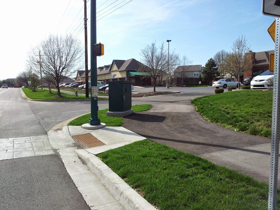
Figure 13: Compliant and non-compliant curb ramps. The curb ramp on the left is non-compliant because it does not have detectable warnings and abuts a rolled/mountable curb. The curb ramp on the right appropriately transitions from the grade of the path to the grade of the crosswalk. It also has an appropriate detectable warning (cast iron truncated domes).
curs. Alternatively, the City of Fishers may utilize more durable materials (non-slip thermoplastic, preformed tape, epoxy, etc.) to increase maintenance intervals.
Design roundabouts that are safe and easy to navigate.
Roundabouts reduce instances of crashes resulting in injuries and improve motor vehicle traffic flow. However, they can be challenging for bicyclists if certain considerations are ignored. The IDM has an extensive section on roundabouts, including several provisions for pedestrian and bicyclist accommodations (IDM 51-12.07(02)). It recommends providing bicyclist “bypasses,” which provide ramps from the roadway to paths and allow bicyclists to use crosswalks to cross the roundabout exits. The paths should be connected by ramps to the roadway 50 to 150 feet upstream of the yield point on each approach and outlet of the roundabout. The ramps should have a 25- to 35-degree angle toward the roadway and should be signed as bicycle-only to discourage pedestrians from entering the roadway. These bypasses should be used even at intersections of two roads that do not yet have paths. IDM Figures 51-12V and 51-12W (right) illustrate this concept.
The IDM provides considerable guidance on this subject, but lacks a singular detail that depicts the path bypass entrance/exit ramps and alignment of the path around the roundabout. Fishers
will develop such a detail to be included in its Standard Construction Details following the guidance provided in IDM 51-12.07(02).
Place utility access points out of the path of bicyclists.
Utility access points—manholes, water valve covers, etc.—can be dangerous objects for bicyclists if they are not perfectly flush with the road or path surface. In addition, utility access points can easily render a sidewalk or path non-compliant with accessibility requirements if they are above or below the finished surface by 1/4 inch or more. Unfortunately, it is very difficult to design, construct, and then maintain a perfectly flush utility cover.
The City of Fishers will ensure that new paths, new bike lanes, and the right half of new shared lanes (where bike lanes are not present) are free of public and franchise utility access points. Instead, utility access points will be placed in the planting strip, easement, or toward the centerline of the roadway. Where this is not feasible, utility access points will be placed in concrete sections of paths or bike lanes to minimize the post-construction movement of access points and pavement surface.
Design bikeways and paths that function equally well along existing rural cross-sections and future urban cross-sections. There are many miles of roadway in Fishers
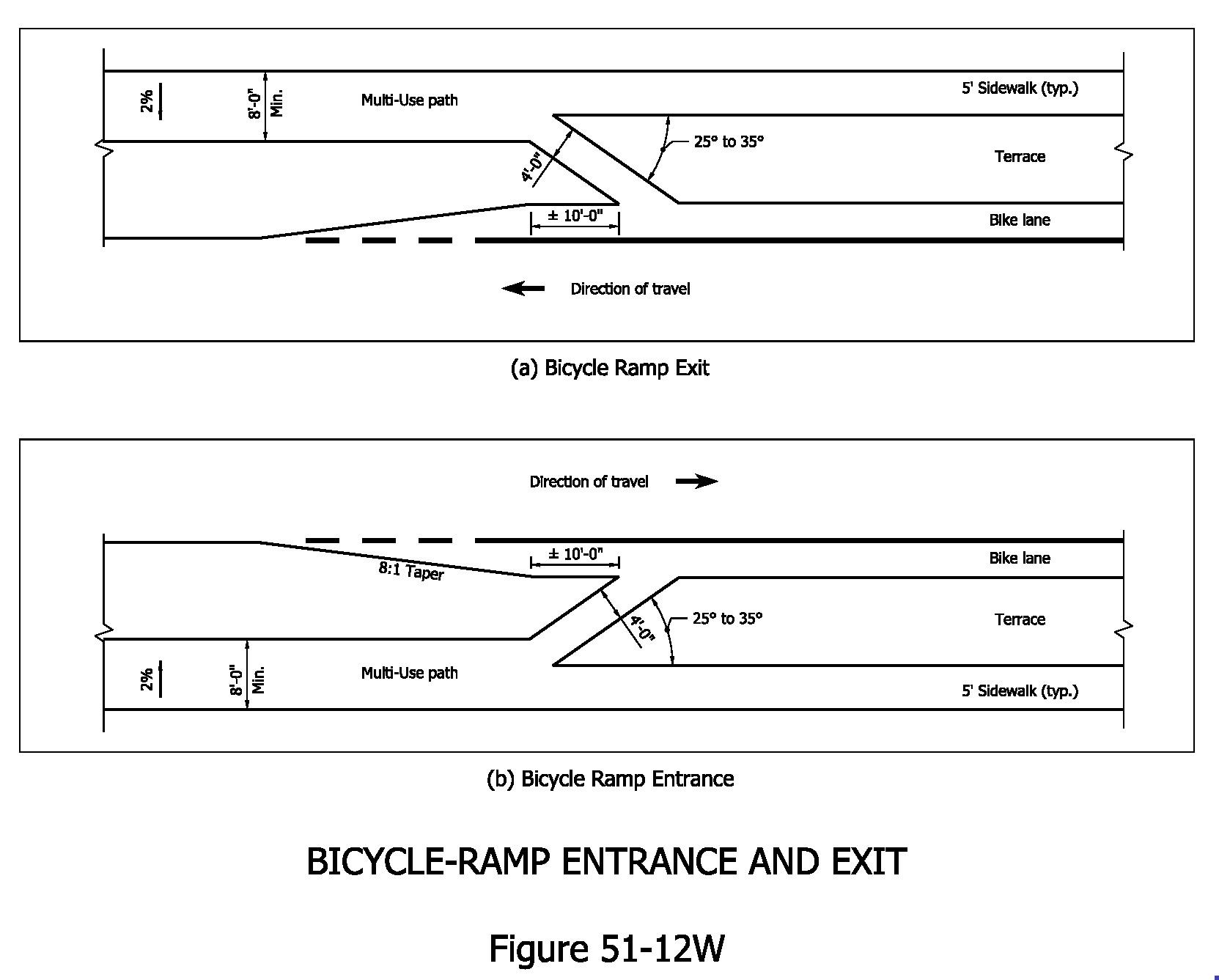
Figure 51-12W - Fishers will develop a standard design detail illustrating proper treatment of bicyclists through round-abouts including transitioning bicyclists into the roadway as depicted in the above detail.


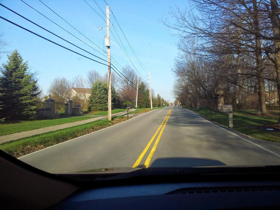
that have rural cross-sections (crowned asphalt roads with open drainage ditches). Many of these roads also have paths on one or both sides. In many cases, the paths are set at the outside of the right-of-way, 20 or more feet from the edge of the road. However, in other cases, the path is less than 10 feet from the roadway. According to the City’s Transportation Plan, most if not all of the rural cross-section roads will eventually be converted to urban cross-sections, many with additional capacity. In some cases, it is unclear whether adequate right-of-way exists to maintain the presence of paths when the road is reconstructed.
Fishers will maintain the presence of a bikeway (either path or bike lanes) whenever rural crosssection roads are converted to urban crosssections. This may require additional right-of-way or easement acquisition or the provision of on-street bikeways to supplement narrower paths or sidewalks.
A related issue in terms of paths and sidewalks close to the edge of rural cross-section roadways is that the lack of curb and gutter can result in debris deposited on the path/sidewalk. Furthermore, single vehicle run-off-road crashes are more common on roads without curbs, which is a concern when a sidewalk or path is close to the edge of the roadway. When constructing new paths along existing rural cross-section roads (roads without curbs), the City of Fishers will
provide a minimum of 10 feet of planting strip between the path or sidewalk and the roadway
Increase bicycle and pedestrian access and circulation by ensuring connectivity between neighborhoods.
Arguably the greatest challenge to increasing bicycling and walking mobility and access in Fishers is the limited connectivity between neighborhoods, which often forces bicyclists and pedestrians out to paths along arterial roadways in order to walk even short distances. Most of the neighborhoods in Fishers are connected to adjacent neighborhoods by one or maybe two streets, but these streets meander and are very
indirect. From a community-wide connectivity perspective, this makes it practically impossible to walk or bike a relatively straight route of more than 1/2 mile without using an arterial roadway path. However, this is made difficult since many neighborhoods do not have sidewalk connections to the arterial roadway paths.
Section 7.28 (PN-01, PN-02, and PN-03) of the Unified Development Ordinance include the provision of an integrated interior/exterior pedestrian network—in other words, a network of sidewalks within a subdivision that connects to perimeter paths/sidewalks. It sets width, location, and setback requirements for the internal
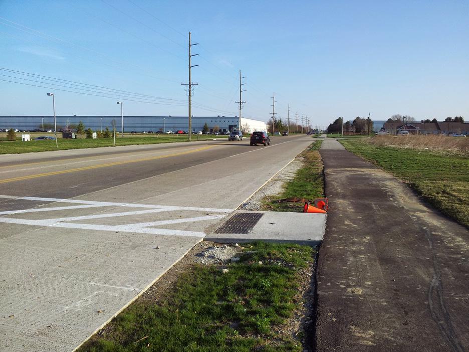
Figure 15: Paths along rural cross-section roads. The image on the left shows a path covered in debris. The image on the right shows a path along a rural cross-section road with relatively limited rightof-way, but with adequate setback. It is important to make sure a path or other comparable bicycle and pedestrian facilities are provided when the road is reconstructed.
pedestrian network and does the same for the external pedestrian network (perimeter paths). However, it does not include any sort of specific requirement regarding the connectivity between the internal and external networks. The City of Fishers will amend this section to require interior network sidewalks to connect to exterior network sidewalks or perimeter paths at every perimeter intersection and at least every 1/4 mile (which may require path connections from cul-de-sacs, easements between lots, etc.). Furthermore, the City will consider amending its Thoroughfare Plan to include a 1/2 mile grid of collector roadways, along which bikeways (bike lanes or shared lanes) and sidewalks will be provided, or 1/2 mile grid of greenway paths, for which developers must provide minimum 20-foot easements and construct minimum 10-foot wide paths. A mixed 1/2 mile collector/greenway grid would be a good alternative.
Refine the bicycle parking requirements in the Unified Development Ordinance.
The City of Fishers Unified Development Ordinance (UDO) guides land development and zoning practices for both the public and private sectors. The UDO includes several provisions for bicycle and pedestrian accommodations, including requirements for bicycle parking. Section 5.64 (PK-01) gives specifics for parking quantities and placement. Based on the intent portion of this section, it is to ap-
ply to all zoning districts in the community. However, in practice it has been primarily required for commercial districts only and is unrealistic for single-family districts. The City of Fishers will modify and clarify the applicability of these requirements to demonstrate that bicycle parking is not required for single-family development, but is required for all types of office, commercial, town center, and multi-family development. Additional modifications that will be made include:
number of
– Increasing the minimum to one (1) bicycle parking space per ten (10) vehicle parking spaces (currently one per thirty) in order to meet future demand. This would also necessitate increasing the maximum number of required spaces from 15 to 45. Note that most racks serve as two parking spaces.
Proximity to primary structure – Requiring that racks are within 120 feet (preferably within 50 feet) of the entrances they serve, as close as or closer than the nearest car parking space, and clearly visible from the building entrance and driveway or path. One outcome of these modifications is that racks will generally need to be placed near each building entrance, rather than provided in a single, concentrated location.
Work with businesses and land owners to retrofit bicycle parking into existing development.
The provisions of the UDO only apply to new development and redevelopment. However, there are many areas of existing development that are in need of bicycle parking. The City of Fishers will develop a program in partnership with business and land owners to retrofit bicycle parking into existing development.
Short of providing specific locations for bicycle parking retrofits, general locations in which parking will be prioritized include the downtown area (all Town Center zoning districts) and commercial nodes that are connected by existing paths (including but not limited to Allisonville at 116th, Olio at 116th, Hamilton Town Center, and Fall Creek Harbour Shops). Bicycle parking will be provided in these locations at a rate of 0.5 to 1 space per 1,000 square feet of retail and dining space.
In addition, WikiMap users were asked to indicate locations in need of bike parking. Only five locations were identified and all are in or around downtown:
Bike rack standards – Providing specific requirements for bike rack design, including requirements that racks support the bicycle in at least two places. While there are many types of racks that meet this requirement, inverted U type and post-and-loop type racks are the most common and most flexible in terms of placement.
• Fishers Town Commons (116th Street at


Fishers Pointe Boulevard) – bicycle parking will be provided at a rate of 0.5 to 1 space per 1,000 square feet of retail and dining space
• The Amphitheater – enough spaces for 2% of maximum expected attendance will be provided
• Fishers Public Library – bicycle parking will be provided at a rate of 1 space per 10,000 square feet
• Super Target at Fishers Corner – bicycle parking will be provided at a rate of 1 space per 5,000 square feet
• Roy G. Holland Memorial Park (at the playground) – two to four spaces (one or two racks) will be provided
In some locations, such as downtown, limited sidewalk space may make providing bike parking a challenge. If so, the City may opt to provide a bike corral, which places six to 10 bicycle parking spaces (three to five inverted U racks) in one on-street automobile parking space. Bollards or curb stops would be provided around the bike corral to delineate the space.
Anticipate the future need for long-term bicycle parking.
The UDO does not differentiate between shortterm (a few hours) and long-term (overnight or multiple days) bicycle parking. The former is usually in the form of bike racks whereas the latter typically is provided as bike lockers or indoor
parking facilities. In general, the current need in Fishers is for short-term parking. The need for City-mandated long-term bicycle parking is not currently present, but may arise once bus rapid transit (BRT) service begins in Fishers or if there is a significant increase in urban residential units without garages/storage space.
Bicyclists rely on clean and smooth surfaces to balance their two-wheel vehicles and negotiate turns and stops. If bicyclists’ attention is constantly being directed to watching for the next pothole or piece of glass, they will not be able to focus on the operation of the bicycle itself, creating a safety issue. Similarly, sidewalks and paths must be clear of debris and tripping hazards for pedestrians. In addition to being important for ADA-compliancy, clean and functional sidewalks are beneficial for all pedestrians.
Sweep all on-street bikeways and paved paths regularly.
Glass and other debris present a far more significant hazard for bicyclists and pedestrians than for motor vehicle operators. Glass can lead to flat tires while even relatively small objects such as sticks or gravel can create a fall hazard. Fishers will sweep all bikeways and paths at least twice per year (once after most snow has disappeared and once during the autumn leaf fall).
Provide prompt maintenance of potholes and other pavement damage.
Similar to debris, potholes and other pavement damage presents a more significant hazard to bicyclists and pedestrians than to motor vehicle operators. Potholes and cracks that may not be considered significant for motor vehicles can easily lead to a crash on a bicycle or a broken ankle for a pedestrian. Potholes and pavement damage should be quickly repaired on all bikeways. The City of Fishers will update its online “Request Tracker” system to include prompts for bikeway maintenance.
Repaint bikeway and crosswalk markings before they fade.
Pavement markings are critical to define rightof-way and maintain separation between bicyclists and motorists. Pavement markings are somewhat difficult to maintain because of the toll that snow plowing, salt, and sand have on marking material. To continue to reap the benefits of markings, they need to be kept fresh and visible. In locations where standard paint is used, the City will repaint markings every year or every other year. In locations where other, more durable materials (non-slip thermoplastic, preformed tape, epoxy, etc.) are used, the City will assess markings every other year and replace as needed.
Clear snow from key on-street bikeways and paths in a timely manner.
Over the past two decades, the use of the bicycle has clearly expanded to transportation. As part of that, bicyclists are extending the traditional seven to nine month season for bicycling to year-round use. Improved cycling gear and bicycle equipment (studded and knobby tires, vastly improved lighting, and suspension systems) has aided and encouraged more people to ride into and through the winter. As these changes have occurred, there has been a commensurate demand in keeping bikeways clear of snow and ice. Bicyclists using bikeways during the winter almost always have the same destinations as do motorists. The City of Fishers will update its priority plowing routes to consider key on-street bikeways and paths for commuters. All paths along roadways will be plowed within 48 hours.
Education policies and actions range from media campaigns to practical training, such as how to ride safely or properly wear a helmet. Education policies and programs are instrumental to the success of networks as they empower users to get out and use the facilities. The City of Fishers is currently working with Bicycling Indiana, the YMCA, and the Indiana State Department of Health to deliver a comprehensive education campaign for bicy -
clists, pedestrians, and drivers. The goals of the program are to outline the rights and responsibilities of all road users, familiarize all users with the rules of the road, and explain the various pavement markings and signs associated with sharing the road. The following policies provide ways to facilitate the distribution of this program and its concepts.
Bike Rodeos are a great way to direct and deliver bicycle related curricula to children. Similar events and classes can be held for adults. Topics discussed typically include the parts of a bicycle, how a bike works, how to fix a flat tire, proper helmet fitting, rules of the road, road positioning, and on-bike skills. These rodeos are often facilitated by local police department or cycling clubs and model programs are available through the League of American Bicyclists website. The City of Fishers and the Fishers Police Department will seek opportunities to continue supporting the provision of education events, in part by providing access to municipal parking lots, restrooms, and water fountains for such events. The Fishers Police Department occasionally provides safety training at elementary schools on request and will assist in delivering the new education campaign (to be developed) to drivers, bicyclists, and pedestrians.
Include at least one piece of bicycle and pedestrian education annually in Town communications to residents (Town newsletter, utility bills, tax bills, etc.).
Including bicycle related educational pieces in utility or tax bills is an easy way to reach a large group of people. Simple communications could cover a seasonal topic such as rules of the road, local bicycling ordinances, and backto-school safety information. At least once per year, the City of Fishers will distribute hard-copy educational materials explaining the rules of the road for drivers, bicyclists, and pedestrians.
Provide road safety and education materials on the Fishers webpage.
Providing bicycle and pedestrian safety and education material to residents via the City’s webpage is another excellent way to reach potential and current users. Information will include:
• Maps and other resources (a bicycle user map will be provided as part of this plan);
• Links to laws, statutes, and ordinances related to walking and biking – both local and state;
• Information about local biking and walking events;
• List of and links to local bike shops and their numbers; and
• List of and links to all walking and biking groups, including clubs, racing teams, and advocacy groups.


Fishers will update its webpage to include rules of the road educational materials for drivers, bicyclists, and pedestrians.
Investigate offering a bicycle and pedestrian education course as an alternative for bicyclists, pedestrians, and motorists who are firsttime minor offenders of bicycle and pedestrianrelated rules of the road.
Offering a bicycle and pedestrian education course as an alternative for bicyclists, pedestrians, and motorists who are first-time minor offenders of bicycle and pedestrian-related rules of the road is an efficient and cost effective way to deal with infractions. The City will explore this option for educating rather than punishing some rules of the road violators. For repeat or major offenders, such a program may also be provided, but as an additional, rather than alternative, penalty.
Provide educational information on how bicyclists, pedestrians, and motorists should use roundabouts.
This education will be provided on the City’s website and via print media. It will include information on how bicyclists should use roundabout bypasses and who yields to who at various roundabout locations. The Federal Highway Administration (FHWA) has a Roundabout Outreach and Education Toolbox that provides examples from across the country. Fishers staff will develop a simple educational pamphlet on
how to navigate a roundabout as a bicyclists and a pedestrian that will be provided on the City’s webpage and distributed in hard-copy via newsletters or utility bills.
Encouragement combines many initiatives and the strategies of the other E’s to build enthusiasm and interest in bicycling and walking. Encouragement programs include Cyclovias, National Bike Month activities, launch parties for new paths or bikeways, and employer-driven incentive strategies such as mileage reimbursements.
Bicycling to work or to other destinations is a great way to get exercise, save money, reduce pollution, and have some fun. Bike to Work weeks and Bike and Walk to School days are national activities that are part of National Bike Month (May of each year). The City of Fishers has sponsored a Bike to Work day in the past and will continue to do so each year as part of its National Bike Month celebrations. Bike/Walk to School Day is an important component of Safe Routes to School as it both encourages and educates students on how to get to school via bike or their feet. Holding such an event will be explored by the City as a partnership opportunity with local schools. Activities for these events may include:
• Morning commute stations where cyclists are treated to free coffee and breakfast, bike tune ups, and other incentives;
• Group rides with local civic leaders;
• Themed rides, such as a bike parade to school; and
• Discounts at local businesses for commuters and participants.
Sponsor and/or support local family-friendly events that promote bicycling or walking.
Family friendly events can be a great way to capture the interested but concerned portion of the cycling population, as well as a great way to introduce kids to cycling as part of everyday normal life. Often these events are community oriented and can be as simple as a group ride organized on a Sunday. Other events include Cyclovias, themed rides, and rides organized around existing neighborhood festivals, parks, or cultural destinations.
Develop and publicize a bicycle user map.
People who are not familiar with bicycling in a specific area—including visitors, new residents, and long-time residents new to bicycling—often have a difficult time determining what their route to a specific location should be. Streets that they might use to drive to a destination may not be streets on which they are comfortable bicycling. Providing maps of bicycle facilities and streets that are suitable for bicycling is a good way to encourage people to bicycle more and to raise
awareness about bicycle facilities.
The City of Fishers will develop bicycle user maps that will display bicycle facilities as well as a bicycle suitability rating for area streets. The map will be available online and in print format.
Enforcement includes policies and actions that address safety issues—such as speeding, illegal turns and movements, and general rules of the road. Programs include options for community members to work collaboratively to promote safe bicycling, walking, and driving.
According to discussions with the Fishers Police Department, bicyclists in Fishers usually obey traffic laws. Furthermore, the most common observed violations/issues related to bicycling and walking result from the actions of other types of transportation users and include:
• Golf carts using shared-use paths (on which motorized vehicles are prohibited, except for those used by persons with physical disabilities);
• Motorists speeding and disregarding stop signs; and
• Occasional road rage on the part of motorists due to bicyclists on the road.
While it is recommended that crashes be analyzed to identify the most common crash types for bicyclists and pedestrians and top crash locations, the information provided by the Police Department implies that enforcement efforts need to be directed primarily at motorists, not bicyclists and pedestrians.
Continue to enforce posted speed limits, particularly in school speed zones.
Too often speed limits are viewed as guidelines by motorists. Studies show that the probability of serious injury and death to non-motorized users when hit by a car exponentially increases with each increment of 5mph. The enforcement of posted speed limits through warnings, ticketing and yard sign campaigns can quickly make compliance the rule of the neighborhood. The Fishers Police Department will continue to enforce posted speed limits and may station additional patrol officers at low-compliance locations, such as school zones.
Utilize automated speed-tracking equipment to provide feedback to motorists when they are exceeding the speed limit.
The use of automated speed-tracking equipment is a cost effective way to alert motorists to their speed. The equipment usually utilizes flashing LED signs that change significantly in appearance when an excessive speed is detected. Often placed near schools and other places where pedestrians are known to be present, automated
speed-tracking equipment can cause motorists to consciously slow down. The Fishers Police Department will retain one or more automated speed-tracking devices to be placed at various locations throughout the year.
Expand law enforcement training as part of police academy curriculum and ongoing officer education.
Bicycle-related training for law enforcement officers in Fishers includes training from the International Police Mountain Bike Association. This training equips officers with the skills and knowledge to enforce the law on bike (including tactical maneuvers taking advantage of the bike’s speed and ability to be used as a shield). However, this training does not include any content regarding traffic interactions between motorists and bicyclists. Law enforcement officers are not always aware of the types of traffic violations that are most likely to result in crashes between bicyclists and motorists. Brief education courses for law enforcement officials can provide information about these topics and potentially count toward continuing education requirements that many officers are required to pursue. In addition, annual reviews of bicycle and pedestrian crash statistics and reports will provide the Police Department with knowledge of the specific behavioral issues and high-risk crash locations within Fishers.


Modify the City of Fishers Municipal Code to comply with Indiana Code and clarify applicability of the law
Section 73.01 of the Code states that “It is a misdemeanor for any person to do any act forbidden or fail to perform any act required in this section.” This is in conflict with Indiana Code (IC) section 9-21-11-14, which states that failure to follow rules regarding bicycling is a Class C infraction (a non-moving violation). This section of the municipal code will be modified to comply with Indiana Code. This section also states that “These regulations applicable to bicycles shall apply whenever a bicycle is operated upon any highway or upon any path set aside for the exclusive use of bicycles subject to those exceptions stated herein.” The mention of paths “set aside for the exclusive use of bicycles…” implies that these regulations do not apply to shared-use paths. To reduce confusion, “…path set aside for the exclusive use of bicycles” will be replaced with “shared-use and other paths on which bicycles are allowed.”
Section 73.04 states that “No person shall ride a bicycle upon a sidewalk within a business district when such conduct shall constitute a hazard to safety of pedestrians.” This requires judgment to determine what constitutes a hazard. This section will be revised to simply prohibit bicycling on sidewalks within downtown/the Town Center. This section also states that “The Police Chief is authorized to erect signs on any side-
walk or roadway prohibiting the riding of bicycles thereon…” Although part of a section on riding on sidewalks, this subsection appears to apply to riding on roadways, as well. It will be amended to either remove the words “or roadway” or to require approval by the City Council of each roadway prohibition proposed by the Police Chief.
Evaluation and planning policies and actions include monitoring outcomes, documenting the results of the implementation of the other E’s, and planning subsequent actions. Data collection before and after infrastructure improvements are implemented, such as user surveys and bicycle and pedestrian counts, are critical to measuring the overall effectiveness of the network.
Continue to conduct annual bicycle and walking counts throughout the City to measure the usage of facilities and growth in these modes of travel.
Annual bicycle counts provide a direct mechanism for tracking bicycling trends over time and for determining the impact of projects, policies, and programs that have been implemented. Existing counts were conducted utilizing the National Bicycle and Pedestrian Documentation Methodology.
There are three methods available for performing counts:
1. Volunteer-Based Visual Counts – The National Bicycle and Pedestrian Documentation Project provides a recommended methodology, survey and count forms, and reporting forms available for free online. Local trainers for the program are also available. Counts are conducted using volunteer labor and therefore put little financial burden on municipal budgets. It is important that counts be performed over a period of multiple days at various times in order to account for peak use. In other words, counts should be performed on weekends and weekdays and in the morning, midday, and late afternoon.
2. Electronic Counts – These methods involve using electronic equipment to automatically count the number of users. The traditional method is to use pneumatic tube counters, which are readily available and easy to use. However, they can only count bicycles—not pedestrians. Another, more effective method is to use infrared counters, which are able to count pedestrians and differentiate between pedestrians and bicyclists. With either version of this method, counters should be installed for one entire week (including weekends) in various locations, twice per year to account for seasonal variation.
3. Estimates using GPS Data – New technologies and systems allow users to record trips using GPS devices and then upload this data
to an online system. The City has some experience with basic data provided by Strava, which shows the most heavilytraveled routes. This company has recently begun selling more detailed databases to states and municipalities that will allow more accurate counts to be estimated. The limitation with this method is that it primarily records recreational bicyclists (though the company claims commuting bicycle trips can be estimated from its data). In addition, this data will provide citywide information, but only as estimates for any given street or path. This is opposed to the other methods, which provide accurate counts, but only for a few select locations.
The City of Fishers conducted its first counts in July 2014 (counting users at seven locations throughout the community) and will continue to conduct bicycle and walking counts at least annually. When GPS-based data is used, counts will be performed citywide each year. When volunteer-based manual counts or tube/eco-counter methods are used, counts will be performed at different locations each year, returning to the same locations every year in order to collect comparable data.
Apply for and receive a bronze level award for “Bicycle Friendly Community” from the League of American Bicyclists by 2016.
The League of American Bicyclists ranks applicant communities on their level of “bicycle friendliness” on a scale from “Honorable Mention” through “Platinum.” The Bicycle Friendly Community program provides a roadmap to enhance conditions for bicycling and the guidance to make Fishers a more bikeable community. The application process will help the City recognize its strengths and weaknesses regarding bicycling, and the response from the League of American Bicyclists will help guide the City in improving bicycling. Finally, a bicycle friendly ranking is something the City can be proud of. The City of Fishers is preparing to apply for Bike Friendly Community status this year.
Apply for and receive a bronze level award for “Walk Friendly Community” from the Pedestrian and Bicycle Information Center sponsored by the U.S. Department of Transportation by 2016.
The Pedestrian and Bicycle Information Center awards communities that improve and prioritize pedestrian safety, access, mobility and comfort with either a bronze, silver or gold designation. PBIC, which is a partnership between the Federal Highway Administration, the University of North Carolina, and FedEx, provides a community assessment tool to evaluate existing pedestrian conditions and programs largely based on “4 E’s:” education, encouragement, engineering, and enforcement. This walk audit can also be used in planning for future improvements and
filling in the gaps in the other E’s. Applying for a bronze designation is a very visible way for the City to show its dedication to creating a walkable community. The City of Fishers is preparing to apply this year.
and maintain a Capital Improvement Plan for
The City of Fishers currently budgets approximately $300,000 per year for path construction. There is often additional funding available and utilized for this purpose. The City does not have a multi-year plan for bikeway and path projects and the implementation of projects occurs more on an opportunity basis than on a need basis. Part of this Bicycle and Pedestrian Master Plan will include priority/phasing recommendations, but it is still recommended that the City develop and maintain a multi-year capital improvement plan for bicycle and pedestrian projects. The emphasis of this plan will be on closing gaps in the path system and constructing high-priority routes. The plan will also track the total amount of bicycle facilities that have been built in the City (including everything that exists today). Keeping track of the installed facilities within Fishers will allow staff to plan appropriately for future improvements. Having a good understanding of existing conditions will enable planners to make the best use of capital dollars when implementing new facilities.


Develop a City-wide Safe Routes to School plan to improve the safety of children walking and biking to school.
Many of the elementary and middle schools in Fishers are located on high-traffic arterial roadways. It is likely that few children walk or bike to school because of actual or perceived safety issues. A City-wide Safe Routes to School (SRTS) plan will identify specific safety issues and develop detailed recommendations for improvements. In addition, it will include education and encouragement programs to train children on how to safely walk and bike to school while making them excited to do so.
Establish a plan and program for acquiring right-of-way or easements for future paths along roadways.
A regular challenge in Fishers is acquiring rightof-way or an easement for the construction of paths along roadways. Often, several property owners will dedicate right-of-way, but one or two will refuse to do so, creating a gap in the proposed path. The City will identify and inventory all path gaps and right-of-way for planned paths. It will then systematically work to acquire easements or right-of-way for planned paths, even if the path is not slated for construction in the near future. This takes advantage of the fact that property ownership changes; it is better to acquire right-of-way from a willing property owner before he or she sells to an unwilling one.
Wayfinding is a means of providing key information about destinations, direction, and distance to help bicyclists and pedestrians determine the best routes for their trips. Many communities have installed bicycle route signs, but these provide no real guidance other than stating the obvious: you are on a bicycle route. Complete wayfinding signs provide on-the-ground information that help people find their way around a community—or between communities—significantly stretching the utility of bikeway and path networks.
Establishing a wayfinding sign system involves four steps:
1. Identify key destinations
Consider destinations for transportation and recreational users, including shopping and dining areas. The number of destinations will be limited so that wayfinding signs do not include too much text. Ideally, 2-3 citywide destinations will be identified (downtown, a major park, etc.) that will be listed on signs throughout the city, as well as 6-8 local destinations (for each half of the city) that will only be listed on nearby sign
2. Identify primary routes
Wayfinding systems are most effective when they provide turn-by-turn guidance to destinations. This is best achieved by prioritizing sign placement to the primary routes that will be used by bicyclists and pedestrians to access destina-
tions. In other words, signs are more effective along a path that parallels an arterial street than along a neighborhood street that sees relatively little use.
3. Determine sign placement
The placements and spacing of signs depends entirely on the distance to destinations and turns in the route that is being followed. In general, a wayfinding sign will be placed at the “decision point” (approximately 100 feet in advance of an intersection) so the user has adequate time to determine whether they should turn or go straight. Subsequently, confirmation signs will be placed approximately 100 feet beyond the intersection to assure users they have made the correct decision.
4. Determine sign content
In general, it is recommended that destinations that are straight ahead be placed at the top of the sign, followed by destinations that require a left turn, then destinations that require a right turn. Figure 9B-4 (on the following page) illustrates example wayfinding sign designs.
Consider creating the position of bicycle and pedestrian coordinator or assigning the duties to existing staff.
Once the plan is complete, it will need to be implemented in order for successful improvements to be made within the community. The best way to achieve this is to have a Bicycle and Pedestrian Coordinator on staff. Hiring a bicycle/ pedestrian coordinator or formally designating a
coordinator would provide a centralized point of contact for planning, programming and policies related to both on and off street facilities within Fishers. Typical job duties could include:
• Planning and managing new programs in the areas of non-motorized accommodations, safety, education, enforcement, courses, and recreation;
• Developing safety and promotional information such as quarterly newsletters and route maps;
• Arranging for special displays and events at public and technical information presentations;
• Development, review, and implementation of Bicycle and Pedestrian Master Plan projects and updates;
• Serving as principal contact with Federal, state, and local agencies on bicycles and pedestrian matters ;
• Coordinating and maintaining budget and forecast budgetary needs;
• Seeking funding for implementation of bicycle facilities and working with appropriate offices to fully integrate bicycle and pedestrian projects in programming decisions;
• Developing priorities for special studies in areas such as the location and cause of crashes; effectiveness of new facility designs; barrier removal analysis; and annual bicycle and pedestrian counts.
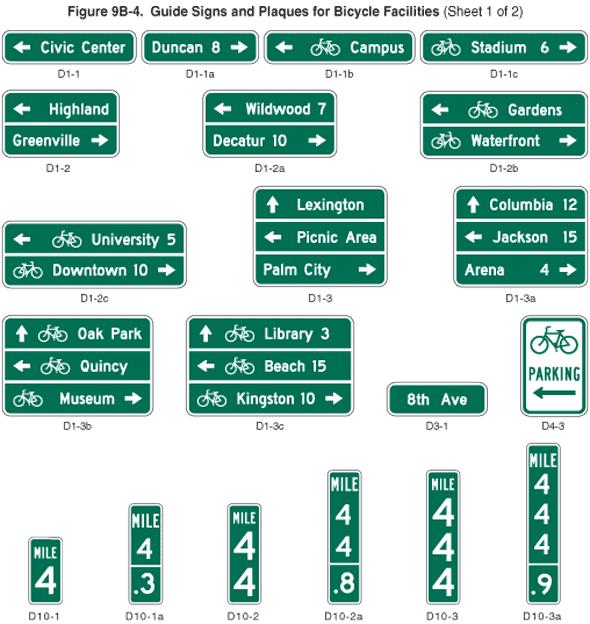


THIS PAGE LEFT BLANK
Many bicycle and pedestrian systems utilize a destination based concept to organize and prioritize future facilities for the system. This provides a system which meets a specific purpose - to get people where they want to go by bike or foot. The hub and spoke concept utilized for the Fishers Bicycle and Pedestrian Master Plan uses a destination focused design approach but with an even more detailed focus on the centers of activity for the system.
The Hub and Spoke Concept is modeled after the bicycle wheel and is used in design for various transportation systems. It is based on a strong central hub with a series of spokes connecting to the hub. A modified hub and spoke system was utilized for the City of Fishers with 3 main hubs. The hubs are located at major destination points and have amenities focused on bike and pedestrian users. The amenities might include parking, seating, maps, general information for Fishers, and water fountains. The hubs are designed to provide a centralized location for bike and pedestrian groups to gather and stage for larger outings.
Two of the City hubs for the bicycle and pedestrian system will be located at the high schools. The advantage with using the high
schools as hubs is the ability to utilize existing facilities such as automobile and bike parking. In addition, the high schools are currently centralized locations for many families related to school and extra-curricular activities providing an established comfort level for families to gather at these locations. In addition, some residual users can be gained from families visiting the schools for other activities and being exposed to the bike and pedestrian system at the same time.
The current and future development of the downtown area makes it a top destination for the system and will incorporate design elements which relate to all modes of travel including bicyclists and pedestrians. Activities at the amphitheater, Municipal Complex, and the library currently draw large groups throughout the year. Providing alternative modes of travel to this area will help to attract additional visitors and build upon the more urban character being developed for the downtown. In addition, this hub can be used to establish the “new norm” for development in Fishers which will incorporate bikes and walking as the preferred method of travel versus the automobile.
The larger red shaded rings shown around the Town Hubs depicts the areas of focus for the individual hubs. These shaded areas illustrate the connections that are needed between neigh-
borhoods and key destinations. All areas of Fishers will connect to each other but special emphasis is given to the areas located closer to the hubs as shown on the concept map.
Smaller neighborhood hubs have been identified for the system. These hubs locate destinations that relate specifically to nearby neighborhoods and identify the connections that need to be made back to this smaller internal system within the larger system. Each of the smaller hubs connects back into the larger hub system but relate on a smaller scale to neighborhoods closer to that destination. Neighborhood hubs include parks, elementary schools and nature preserves. These hubs will not contain the same density of amenities as the larger City hubs, but will contain amenities which are more focused on the local connections. At a minimum the neighborhood hubs will have bike parking, seating, and signage with mapping.
The regional spokes illustrated with orange arrows conceptually represent the importance of regional connections for the Fishers bike and pedestrian system. With expanding facilities in Fishers and surrounding areas an extensive system with many options and a wide variety of trip lengths becomes accessible for people on bike and foot.


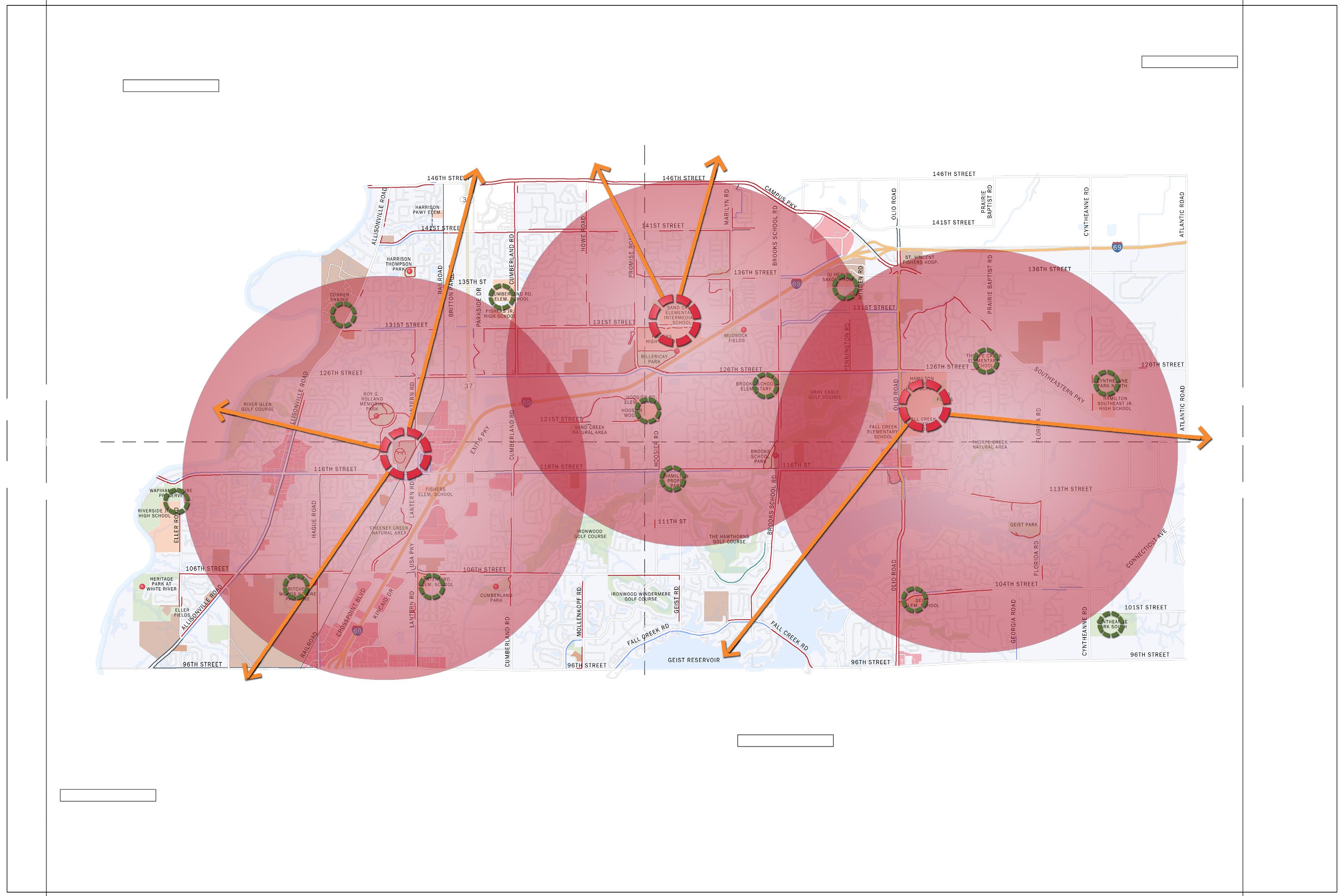

17: Hub and Spoke Concept Map
The Proposed Route Map is an ambitious network of facilities for the City of Fishers. It consists of adding over 46 miles of multi-use paths, 31 miles of bike lanes, 16 miles of greenways, 5 miles of trail adjacent to rail, and detailed improvements for intersections. These additional facilities combined with the existing facilities will provide a comprehensive system of active transporation alternatives. Proposed improvements include updating existing facilities to improve their safety and comfort levels. All of the proposed routes directly relate to the Hub and Spoke Concept providing connections between the hubs and key destination points.
The Proposed Route Map was developed in conjunction with the Project Advisory Committee, input from public meetings, survey and input from WikiMap, input received through the project website and input received directly by Fishers staff. The map represents the results of a detailed inventory and analysis process combined with public input.
This is a dynamic plan and will require some revisions as the years pass. There will be opportunities to add facilities not currently included in this master plan and changes in land use patterns may change priorities. Changes to the system will also occur as outreach efforts begin for each of the segments
within the system such as changing a specific side of the road to avoid a drainage problem or creek. Changes shall then be analyzed to determine if they add to the efficiencies of the overall system and are not revisions that reach only a few with no specific destination or use.
The major elements of the pedestrian network are sidewalks, multi-use paths and street crossings. The sidewalk is where people do most of their traveling by foot and is the space where they should be able to walk feeling safe and secure from automobiles. The goal for the pedestrian network is to provide an attractive walking environment while allowing for streetscape amenities (benches, light poles and trash cans) and utilities. Street crossings shall improve pedestrian safety and comfort through better design of intersections and pedestrian signals. Providing adequate crossing opportunities and minimizing delay at traffic signals for bicyclists and pedestrians will improve safety for all users of the roadway while providing alternative modes of travel for residents. Another key focus of the pedestrian network is filling in the gaps where sidewalks are missing to provide a complete route between people’s homes and their desired destinations.
The proposed bicycle network will better accommodate bicyclists traveling in Fishers. The majority of cyclists in Fishers are currently younger or families who prefer to ride on multiuse paths. For this reason, the largest facility provided for bicyclists in the new system is the multi-use path. However, facilities have also been provided for the more avid cyclist who is comfortable on the roadway. As there is more of a focus on active transportation options there will be more demand for these types of facilities. For this reason, the system includes a grid of bike lanes and signed routes throughout the community.
Providing regional connections is another focus of the bicycle network. Connections with neighboring attractions such as the Monon Rail-Trail provide benefits to not only the residents of Fishers but also to the residents of neighboring communities by providing a larger network of facilities with direct access to the amenities within Fishers drawing these people into Fishers.


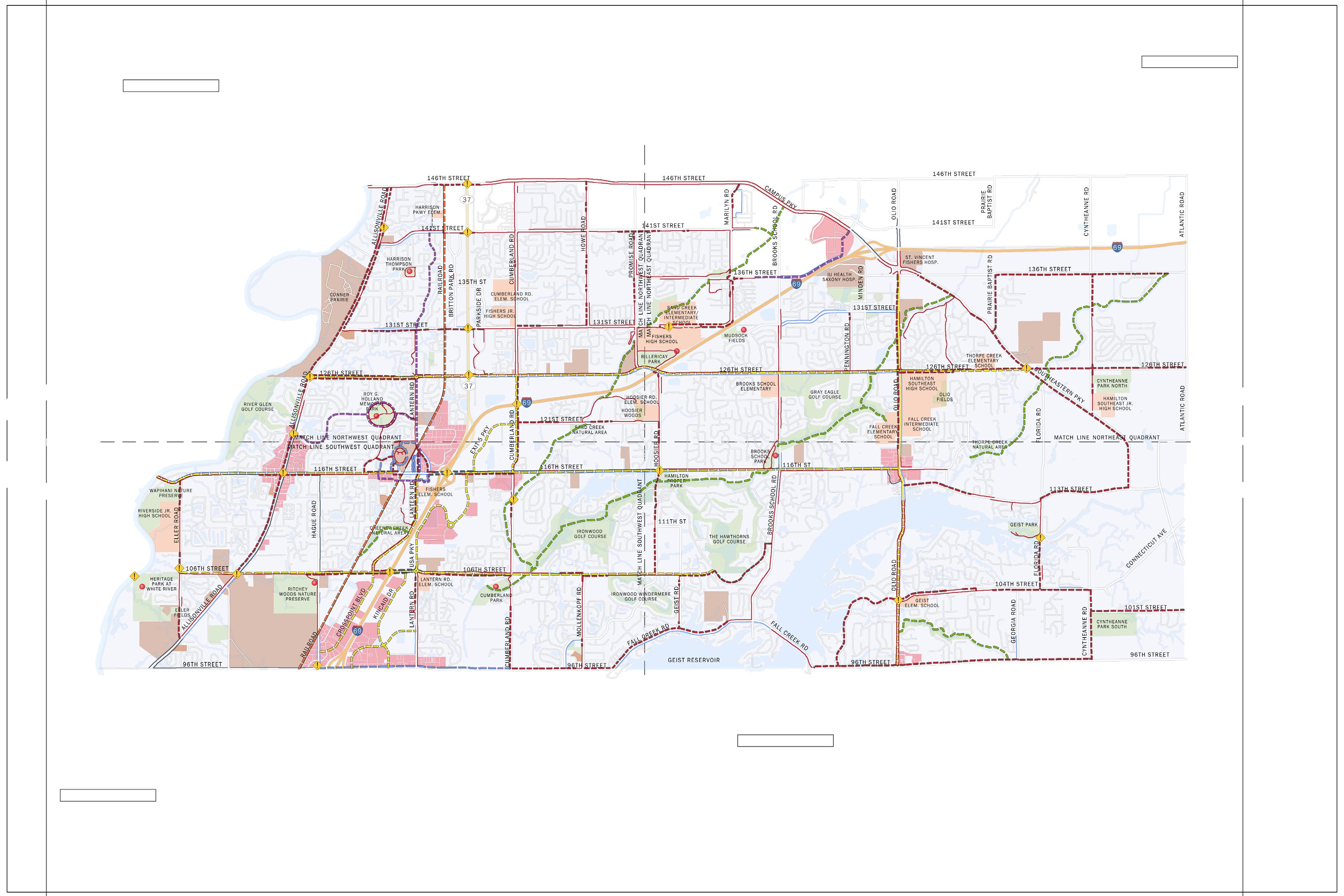
18: Proposed Route Map

Filling in gaps to the existing system of facilities while completing major loops to connect neighborhoods with key destinations such as Conner Prairie is the main focus of the proposed system within the northwest quadrant.
Multi-Use Path: There are several gaps within the current system that have been identified within this quadrant of the study area. Key roadways with gaps include: Cumberland Road, Howe Road, Promise Road, 146th Street, 141st Street, 131st Street, and 121st Street. Gaps in the existing system limit mobility of residents in this portion of the study area and shall be completed as a part of the master plan. In addition, major connections have been created with new pathways along Allisonville Road and 126th Street.
The development of a multi-use path along the frontage of Conner Prairie and Allisonville Road will provide a needed connection to downtown while providing additional recreational benefits for the historical museum. Events held on the property, including the summer concert series, attract local residents to the property creating an opportunity for connection to neighborhoods by bike or foot reducing congestion and issues with parking.
Bike Lane: Bike lanes are proposed along
126th Street. The bike lanes provide an alternative to bicycle commuters who are looking for a higher speed of travel than what is desired on the multi-use paths. This corridor provides a direct route through Fishers connecting Conner Prairie and the downtown with communities in the eastern part of the study area.
Signed Route: Signed routes within the northwest quadrant provide another alternative to travel for bicyclist. These routes are located on roadways with lower traffic volumes and speeds adding to the comfort level of bicyclists on the roadways. The signed routes provide connections between neighborhoods and the downtown where many events are located.
Greenway: Greenway development within the northwest quadrant is limited to only one phase of the Sand Creek Greenway. Completion of this greenway will provide connections between the elementary school and high schools as well as to surrounding neighborhoods. The greenway connects with the Sand Creek Natural Area in the southwest quadrant.
Intersection Improvements: State Road 37 bisects the northwest quadrant. Key connections to the remaining areas of Fishers cross State Road 37. These intersections present a major challenge to the proposed system. Detailed professional design studies for improvements to
these key intersections shall be conducted to analyze current traffic data and develop recommendations for safely and comfortably accommodating pedestrians and bicyclists across this busy roadway. These studies shall occur in the short-term as the roadway was identified as one of the biggest barriers to people biking and walking in Fishers. Improvements might include changes to signal timing to allow more time for pedestrians and bicyclists to cross; refuge islands to shorten the distance for crossing; pedestrian and bicycle signals; and specialty crosswalk applications to better identify crossings to both pedestrian and bicyclist along with motorists. Similar treatments might be applied to intersections along Allisonville Road. Although, more narrow in width, traffic volumes still create challenges for pedestrians and bicyclists to cross the roadway.


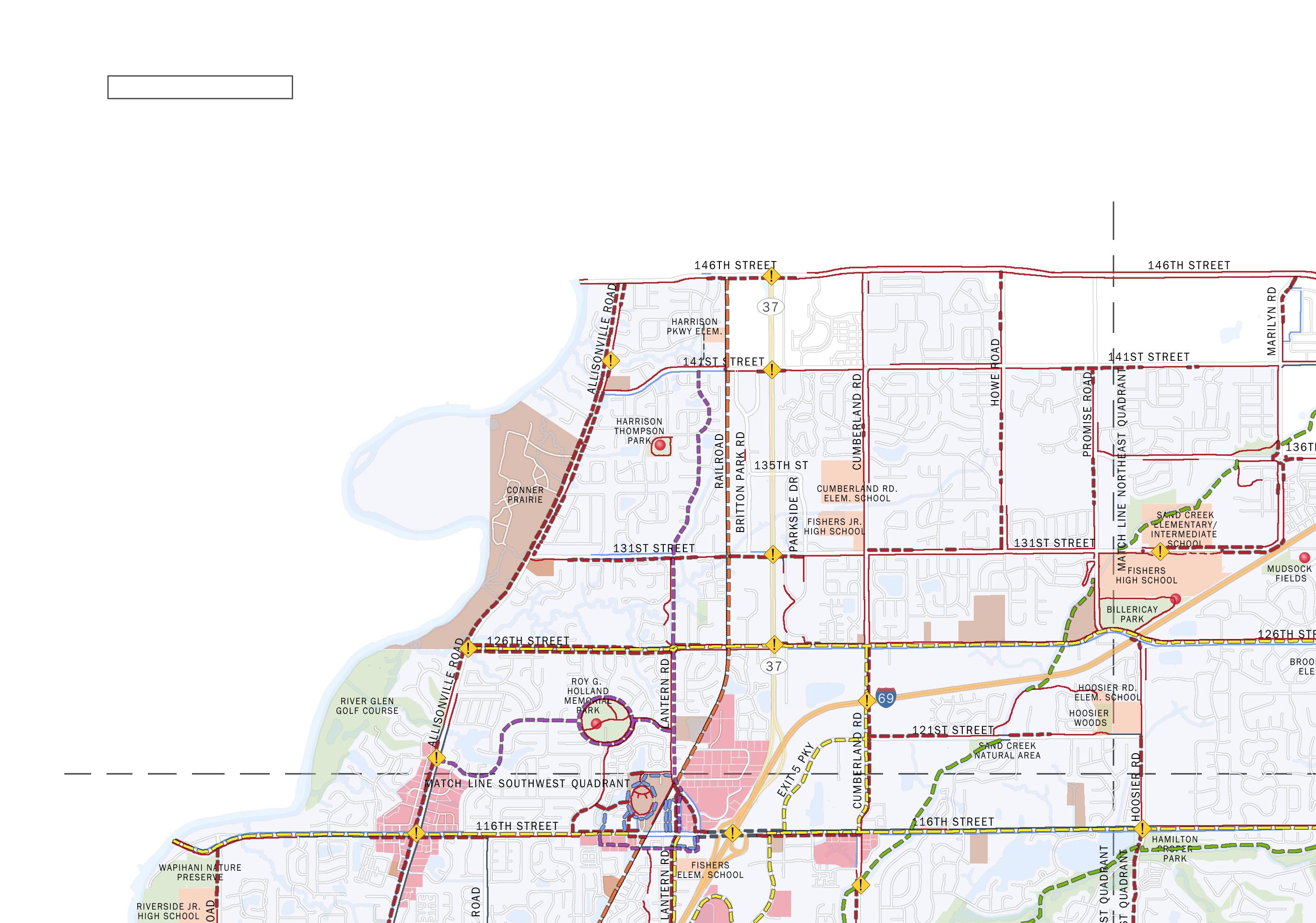


Filling in the gaps to the existing system is one of the areas of focus for the northeast quadrant. Other areas of focus include completing systems which provide recreational loops while accommodating commuting between work and home on bike or foot. Two of the main hubs are located within this quadrant at each of the high schools. This creates a focus of the system to this area with many programs and events designed to start and end at each of the hub locations.
Multi-Use Path: The existing multi-use path along 146th Street and Campus Parkway is utilized by many residents for exercise and recreational use. Residents noted in both of the public forums that they would utilize this pathway more if the gaps in the system were completed. The extension of the pathway along Southeastern Parkway is another key component to the plan. This will provide an important recreational loop for bicyclists and pedestrians looking for more mileage in a closed system. With the completion of the pathway along 126th Street a connection will be made between the schools and the parks to the east of Southeastern Parkway.
Renovation of the existing sidewalk along Olio Road between 116th Street and Southeastern Parkway will better accommodate families
traveling by bike. By replacing the sidewalk on one side of the roadway with a multi-use path, accommodations can be made for bicyclist while reducing the conflicts between pedestrians and bikes along this corridor.
Bike Lane: Bike lanes are proposed along 126th Street to connect with existing bike lanes along Olio Road. A large portion of 126th Street currently has pavement width to accommodate bike lanes. This bike lane provides a very important link for residents in this portion of the study area to the downtown area of Fishers.
Signed Route: The signed route within the northeast quadrant provides an additional on-road facility for bicyclist commuting to the shopping center along Campus Parkway and the hospitals located within this area.
Greenway: Greenways within the northeast quadrant are one of the key elements to providing cross-town connections for the bicycle and pedestrian system. These corridors connect schools with parks and neighborhoods creating opportunities to incorporate environmental education as a part of the greenway development. Greenways are by their nature more secluded providing opportunities to connect with the environment with fewer conflicts between the built environment of the automobile. The greenways also provide recreational experiences for resi-
dents looking for a different type of exercising experience.
Intersection Improvements: Intersection improvements within this quadrant are focused more on treatments at schools. Enhancements to the bike and pedestrian system will increase usership for the system especially for children and families. This will also require improvements to crossings and intersections surrounding the school campuses to provide safe crossing environments for children.
The addition of bike lanes to 126th Street along with the addition of multi-use paths along both 126th Street and Southeastern Parkway will create the need for intersection improvements at the intersection of these roadways. In addition, this will be a key crossing for students traveling from the schools to the parks located east of Southeastern Parkway.
Although Fishers does not have jurisdiction over Campus Parkway and 146th Street within this area the City should coordinate with neighboring Jurisdictions to provide facilities which connect the Fishers bike and pedestrian system with each of the neighboring networks.


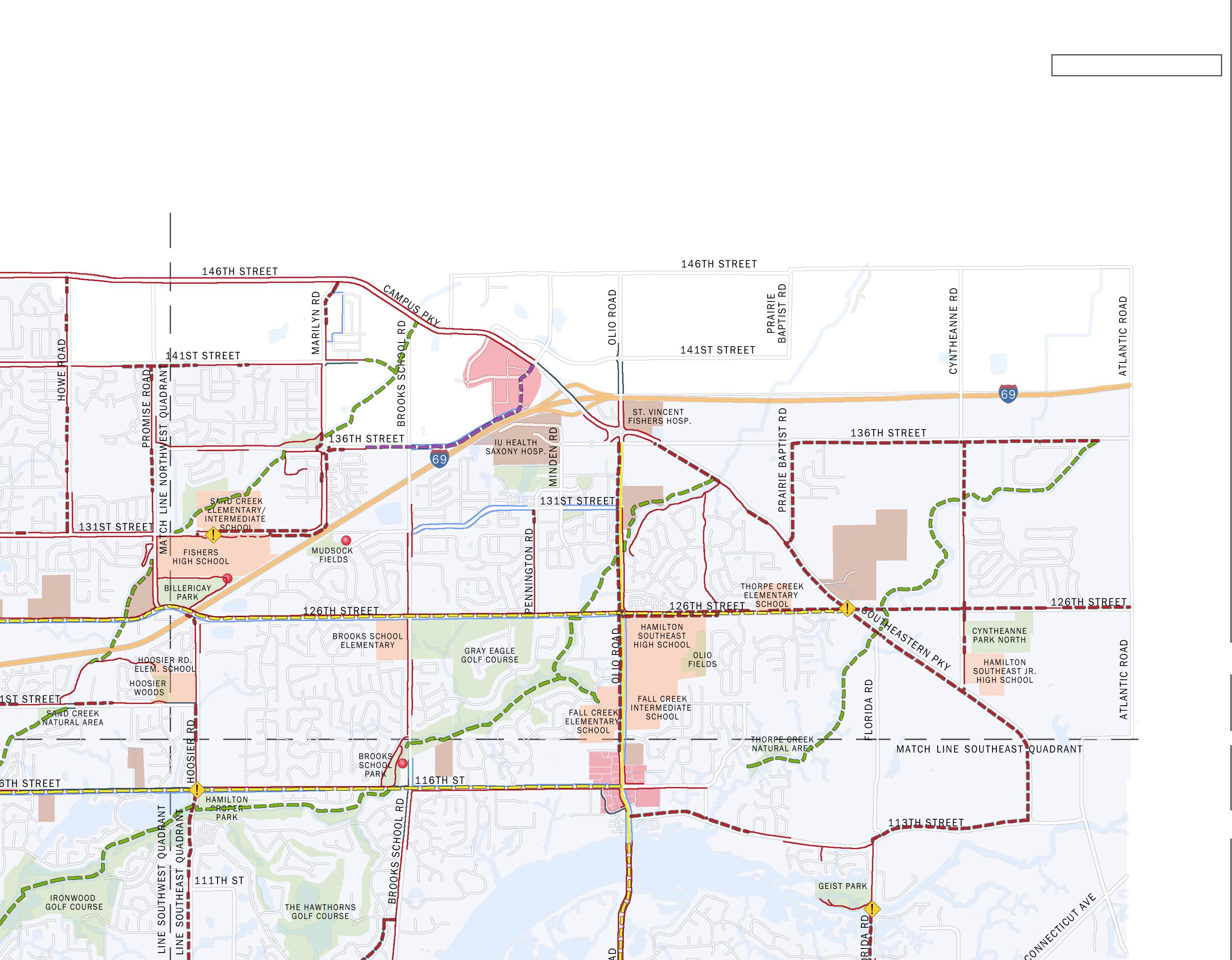
The southwest quadrant has more development than the other quadrants of the study area. This includes destinations, residential areas, and retail areas creating an increased need for a complete system serving this area. Neighborhood streets are generally comfortable for bicyclists to ride on and the majority of these neighborhood streets have existing sidewalks for pedestrians. Many of the connector streets such as 106th Street and 116th Street have some existing facilities.
Multi-Use Path: Like many areas throughout Fishers, the focus for improvements within the southwest quadrant is to fill in gaps within the current system. This includes identifying areas with more difficult design solutions such as narrow bridges where there is not enough room to accommodate bikes and pedestrians. Many of the multi-use path projects proposed within this area are fairly short in length but are usually more complicated in design solution and include higher construction costs.
The existing sidewalk along Allisonville Road between 106th Street and 116th Street is recommended to be removed and reconstructed as a multi-use path. Adding the multi-use path within existing right-of-way provides an alternative to bicyclists and pedestrians who are not as comfortable utilizing the existing sidepath
on the east side of the roadway.
Sidepath: The sidepath is currently utilized in a few locations of Fishers. This application of a multi-use path directly adjacent to the roadway shall only be utilized where right-of-way widths limit the use of a traditional multi-use path with a grass verge in between the roadway. This occurs at the intersection of I-69 and both 116th Street and 106th Street. Both of these locations need improvements to accommodate the sidepath but pavement width does exist on the bridges. Improvements being designed for the new interchange at 106th Street shall incorporate more appropriate facilities if possible.
Bike Lane: Bike lanes are proposed on 116th Street and 106th Street. In addition, bike lanes are proposed on Crosspoint Boulevard, Kincaid Drive, N by NW Boulevard and USA Parkway. The bike lanes are provided to accommodate bicyclists who are commuting to and from work as well as those who prefer to ride on-road. Providing bike lanes within these areas also encourages the use of alternative modes of transportation for smaller trips such as running errands during lunch breaks.
Greenway: Greenway development within this area includes completion of the Sand Creek Greenway, Fall Creek Greenway, and the Cheeney Creek Greenway. These greenways provide
connections from park to park and between neighborhoods and parks.
Intersection Improvements: One of the most important improvements for the proposed system is the intersection of I-69 and 116th Street. The interchange is currently dominated by automobiles with no facilities provided for bike and pedestrians while existing facilities occur on both sides of the interchange. Providing bicycle and pedestrian facilities through this intersection will connect many areas of Fishers which are currently cut off from the downtown area. A detailed design study shall occur for this intersection to provide appropriate and safe facilities for pedestrians and bicyclists.
Another key intersection for the completion of the system occurs at 106th Street and Interstate 69. Efforts are underway currently to design a new interchange for I-69 at this location. This interchange is intended to relieve some of the traffic on 116th Street. Lower traffic volumes would make 116th Street a more attractive corridor for bicyclist and pedestrians. Proposed improvements at this interchange would include facilities to accommodate bikes and pedestrians as a part of the new interchange.


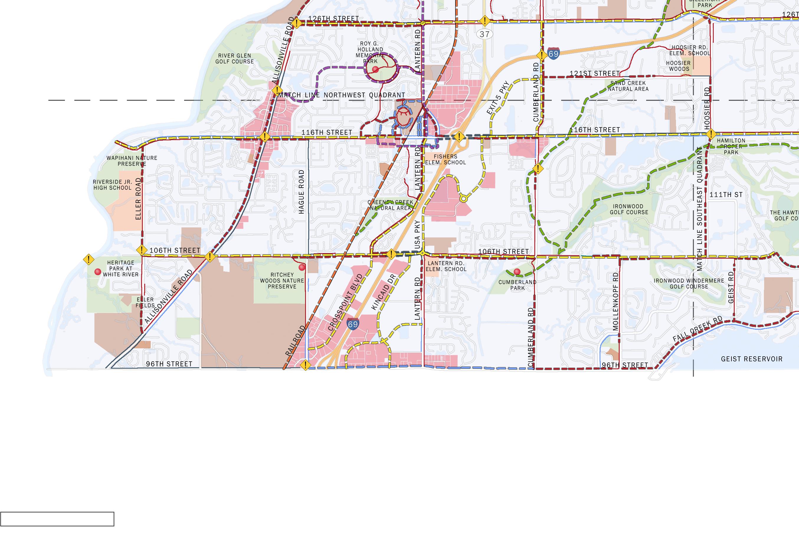
The downtown area serves as the primary hub of the proposed system. Many events are currently held within the downtown at the library and the amphitheater. This area was identified as a high priority destination for all levels of bicycle users and pedestrians. Many residents of Fishers would like to be able to travel to this area without using their automobiles. In addition, the available parking and other facilities make this the ideal location for future programs highlighting bicycling and walking in Fishers for those that can not access the downtown by bike or foot because of distance or other restraints. The downtown hub will incorporate a higher density of facilities catering to the bicyclist and pedestrian including bike parking (for commuters and larger events), seating, wayfinding, and repair stations.
The downtown area does present some challenges for people riding their bikes and walking. 116th Street carries a high volume of traffic. This street is also constricted in width by existing buildings in the downtown area. Existing sidewalks accommodate walkers but bicyclists can only travel in the roadway. The comfort level for bicyclists riding on 116th Street is intolerable for most riders.
The strategy for accommodating both pedestrians and bicyclist within and through the downtown area involves separate facilities for
each. Pedestrians will continue to have direct and straight access through the downtown on sidewalks along 116th Street while bicyclists will be given options for traveling through the downtown on routes parallel to 116th Street. Bicyclist can continue to travel along 116th Street but would be required to either join traffic or dismount and walk their bikes along the sidewalks.
Pedestrian Recommendations: The pedestrian infrastructure improvements involve the addition of multi-use pathways and sidewalks. The proposed facilities connect gaps in the current system while providing accommodations for pedestrians throughout the downtown. As development occurs within the downtown area sidewalks and the pathway system shall be further developed as new roadways are established within this area (see recommendations in the Nickel Plate District Code Ordinance #111813A). Sidewalk widths shall be adequate to accommodate pedestrians and amenities such as seating and lighting.
The narrow pavement width and available right-of-way for 116th Street restricts the addition of bicycle facilities along or adjacent to the street. The pavement width is too narrow to accommodate bike lanes and the distance between the curb and building face is too narrow to provide an off-road facility. The recommendations for bicyclist includes the
safest solution for the majority keeping in mind that most riders are not comfortable riding in traffic along this portion of 116th Street. Although these connections are not direct routes along 116th Street, they do provide direct routes from the different areas of Fishers to key destinations including the library, the amphitheater, and the edge of the shopping district downtown.
Proposed multi-use paths along Commercial Drive and Lantern Road connect with existing paths along Municipal Drive. Bicyclist can utilize the existing pathways around the Municipal Complex and continue back to 116th Street along another proposed pathway adjacent to the drive leading to the Post Office. The rightof-way for 116th Street widens at this location allowing for the addition of a multi-use path to continue the route along 116th Street. In addition, bicyclists can utilize proposed facilities running parallel with 116th Street to the south including a trail along the railroad and a shared lane route along South Street.


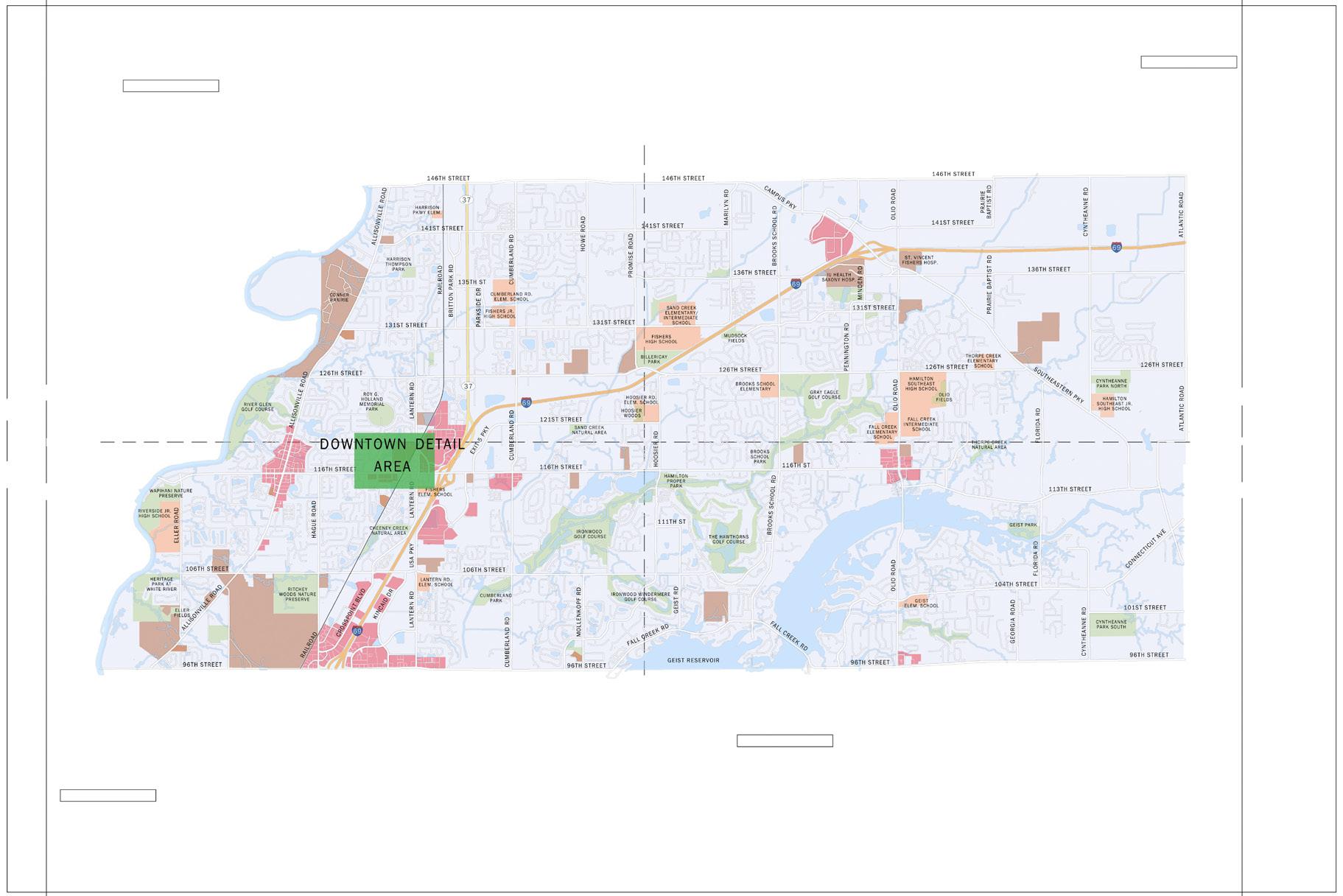
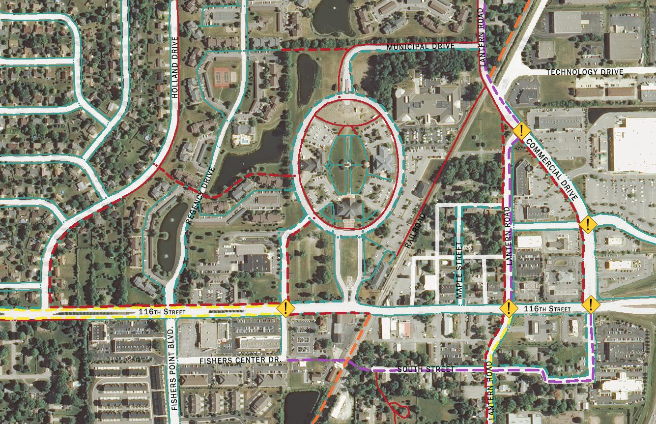


The focus of the southeast quadrant is to provide facilities which not only offer alternative modes of travel for residents but also to provide a unique recreational experience catering towards the bike and pedestrian community. This design focus seeks to capitalize on the natural features of this portion of the study area.
Multi-Use Path: Proposed multi-use paths within this quadrant are designed to provide larger regional connections to amenities such as Geist Reservoir while providing smaller loops for recreational use. This creates a system attractive to many types of users looking for a variety of path lengths for exercise and recreation. A resident looking for a 3 mile run can find a loop which connects back to their neighborhood while the same resident looking to make a trip by bike to one of the parks can also find facilities to serve this need.
The hub at Hamilton Southeastern High School will serve this portion of Fishers. Events such as fun runs and bike rides can be programmed to utilize the facilities located within this quadrant. The multiple loops create opportunities for a variety of events to occur within the area with fewer disruptions to area residents.
Proposed multi-use paths within this area of Fishers accommodate the current needs of residents while anticipating the needs of future residents as the area develops. This includes providing multi-use paths along main roadways to connect the area with downtown Fishers and other amenities located on the western sides of Fishers.
Bike Lane: The bike lane along Olio Road is proposed to be extended south to 96th Street. This provides a regional connection to points south and north along Olio Road. The extension of the bike lane adds to the grid of bike lanes serving the different areas of Fishers providing connections back to the hubs for the system.
Greenway: Greenway development within this quadrant supports the focus of recreational use in the area. The natural corridors will provide connections between neighborhoods and parks as well as from park to park. Greenways included within this area include Bee Camp Creek Trail, Thorpe Creek Greenway, and Sand Creek Greenway. Creating these greenway corridors can also act to preserve the natural areas as development occurs on the surrounding lands.
Creating a system of facilities with a focus on the natural environment while promoting alternative modes of travel will encourage use of the greenway system. This will promote Fishers as a
community for outdoor tourism attracting visitors from the nearby Geist Reservoir.
Intersection Improvements: Intersection improvements will be needed throughout this area with few crosswalks currently provided. Key intersections with further study needed include the intersection of Olio Road at 104th Street near Geist Elementary School; Florida Road at Geist Park; and Hoosier Road at 116th Street.


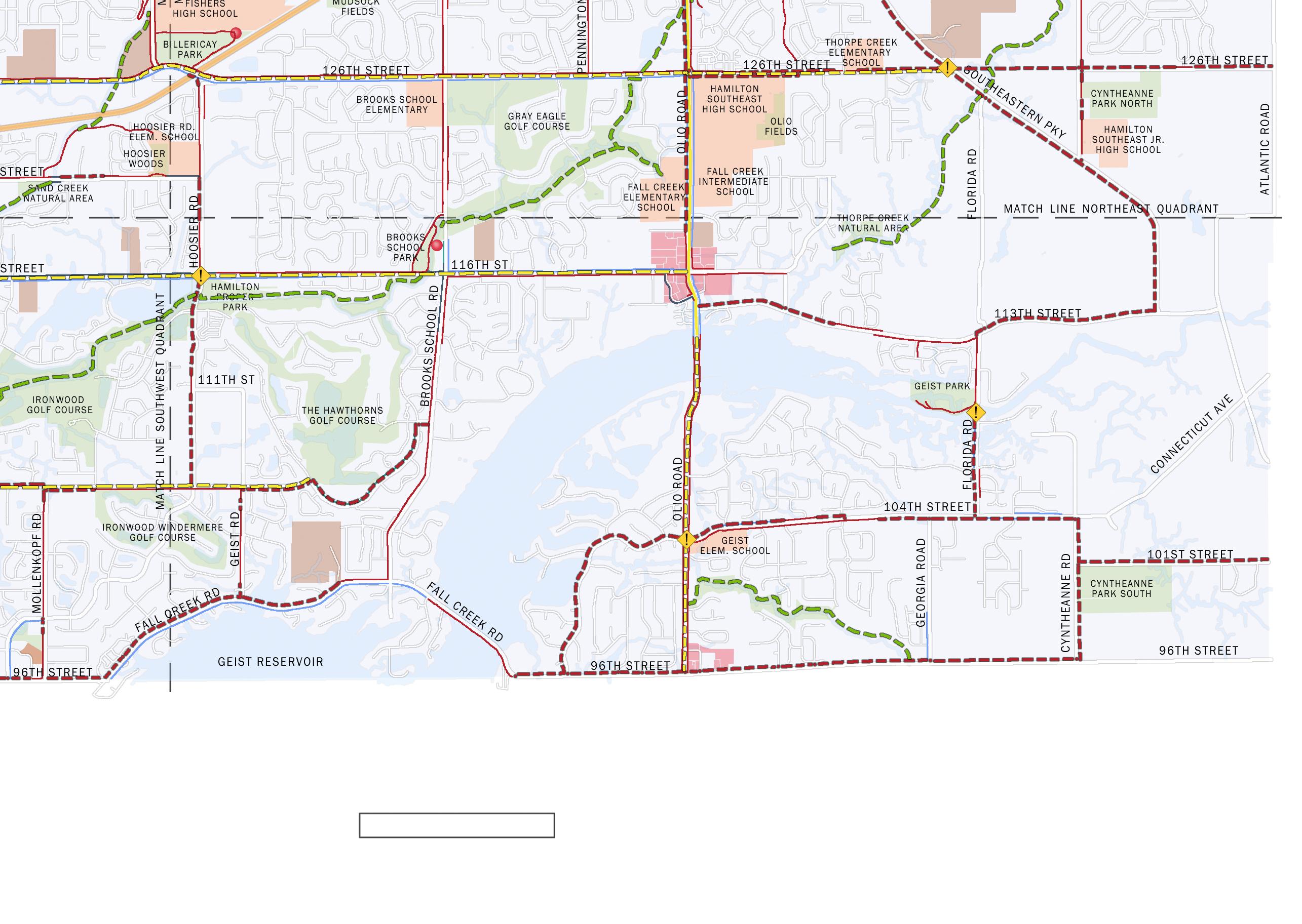
The proposed bicycle and pedestrian network for Fishers must be implemented over time as resources become available. There are many factors that may weigh into decisions concerning sequencing of implementation including availability of funds, the funding source, user needs, land ownership and political will to name just a few. This plan recognizes that the implementation of each of these projects will require involvement of area property owners, detailed engineering studies, public participation, and the overall feasibility of that specific project. The intent of this plan is to identify the most feasible facility type to provide the most comprehensive system of facilities based on the information currently available and shall be used as a guide for future design of particular projects. Project priorities were developed based on the goals and objectives developed at the beginning of the master planning process.
Some general priorities have been developed to guide implementation of the facilities. These general priorities are recommended for consideration of projects which might vary from the priorities listed here and include:
• Proposed facilities on publicly owned land: Access to the land where the facilities are planned, either through fee simple ownership or through easement rights is obvi-
ously critical to implementation. Facilities that are proposed on publicly owned land such as parks or in conjunction with public Rights-of-Way shall be given high priority.
• Proposed facilities associated with other public or private improvements: Planned improvements to land or along corridors where facilities are planned often times provide opportunities for implementation. As plans are developed by Fishers, Hamilton County, or the Indiana Department of Transportation for road improvements coordination shall occur early in the process between Fishers and the entity making the improvements to incorporate the proposed facilities into the improvements. Opportunities might also exist when private development occurs through coordination with the developers and the development review process.
• Proposed facilities which fill a gap in the current system: Proposed trail segments which complete existing links between neighborhoods and key destinations shall be given high priority. Fishers has an impressive system of trails and facilities but is lacking in a few key areas. Filling in these gaps will maximize investments and create a more comprehensive network for residents.
• Projects with greatest impact: Proposed projects which provide facilities to a greater number of residents providing connections to key destinations shall be given priority over projects reaching fewer households.
• Regional connections: Projects which provide key regional connections to existing pedestrian and cycling networks in adjacent communities shall be given high priority.
• Add pavement markings: where roadways can accommodate new bike lane stripes, bike lane markings or shared lane marking without any other changes to the infrastructure these improvements shall be made in the short-term. While there may be a limited number of locations where this is possible, this is a relatively low-cost treatment that can often be done quickly to increase opportunities for users of the system.
These general priorities shall be considered as guidelines, with opportunity playing a major role in determining actual implementation. Opportunity can come in many forms including the funding source (i.e. grant, dedication of land, endowment, etc.) and the timing of related projects (both public and private). These opportunities may open the door for implementation of a specific facility that might have been lower on


the priority list. It is understood that the development of a truly connected system will not happen quickly. Careful and methodic planning will ensure that the system is completed as quickly as possible utilizing available funds and opportunities. The following implementation charts outline the strategy to be utilized in completing the system. Projects have been divided into short-term, mid-term, and long-term projects.
Projects listed in the short-term capital projects chart shall be considered high priorities in implementation of the system. Short-term projects help to create early success that helps to build momentum for other improvements recommended within this plan. These routes provide connections to destination with high demand with a focus on reaching the majority of residents within Fishers. Most of these projects are fairly easy to implement but some of the more difficult projects are listed within the short-term projects list where they will provide critical connections to gaps within the system. Short-term projects are expected to be implemented within the next 5 years.
Mid-term capital projects are expected to be constructed within the next 10 years. These projects tend to include more complex facility improvements such as improvements to existing bridge
facilities and new bike and pedestrian bridges beside existing automobile bridges. In addition, as development spreads throughout Fishers, new densities will be created outside of the existing neighborhoods. The mid-term projects provide connections to areas of expected growth as well as providing additional connections to destinations identified within this plan
Long-term capital projects are expected to be constructed over the next 20 years. These projects require additional time for planning, design and budget planning. These projects also seek to incorporate improvements with long-term transportation projects such as road widening projects and bridge improvements.
This plan establishes the vision and roadmap needed to provide a more complete system of bicycle and pedestrian improvements for Fishers. It will be important in the future to measure progress, reassess priorities, and strive to further increase the use and safety of the facilities within the system as Fishers moves ahead with implementation of the plan.
As implementation progresses Fishers shall consider the following as ways to measure the success:
• Increase the number of neighborhood road-
ways designated as bicycle boulevards by installing traffic calming and share the road improvements
• Make intersection improvements through Fishers to allow bicyclists and pedestrians on non-arterial streets to safely cross arterial streets.
• Focus on bridges so that over time all bridges provide safe convenient access for bicyclists and pedestrians.
• Encouraging business owners to front on multi-use trails.
• Provide high capacity bicycle parking in more parks, schools, public buildings, retail areas, libraries and community centers.
• Encourage new commercial and office buildings to be equipped with lockers and showers for bicyclists and runners/walkers.
• Creating staffed bicycle facilities offering high-capacity parking, repairs and rentals during festivals and events.
• Installing new types of bicycle facilities at intersections (bicycle boxes, bicycle turn pockets, traffic signals for bicycles only and special signal phasing for bicyclists).
• Conduct an online public survey to gauge the perception of success of the new facility improvements.
• Analyze crash data for new facilities to identify areas of additional improvements.
Short Term Capital Projects Recommendations (1‐5 years)


Mid‐Term Capital Projects Recommendations (6‐10 years)


Long Term Capital Projects Recommendations (11‐20 years)
Long Term Project Implementation Chart
The matrix in the following pages summarizes various attributes of the primary bicycle and pedestrian facility types recommended for the City of Fishers. Additional detail for each facility type can be found in the Technical Sheets following the summary matrix.
The walking person and bicycle symbols in the top right corner of each page indicates whether the content of the page is applicable for pedestrians, bicyclists, or both.
Description
Typical Application
Bicycle
Lower volume, lower speed residential streets designed to prioritize bicycle through travel while discouraging motor vehicle traffic and maintaining relatively low motor vehicle speeds.
For lower volumes and speed roadways, to create a lower stress bicycle prioritized route often parallel to a major roadway not suitable for bicycle travel. Also for use on residential roadways.
Motor
Vehicle Speeds
Traffic Volumes
Other Considerations
Motorist/bicyclist speed differential of 15 mph or less. Posted limits of 25 mph or less.
Shared lane markings (or “sharrows”) are pavement markings that denote shared bicycle and motor vehicle travel lanes. The markings indicate where the bicyclist shall be anticipated to operate.
Space-constrained roads with narrow travel lanes, or road segments upon which bike lanes are not selected due to space constraints or other limitations.
Posted limits of 35 mph or less.
Fewer than 3,000 vehicles per day. Varies.
Local roads with low volumes and speeds, offering an alternative to, but running parallel to, major roads. Still shall offer convenient access to land use destinations.
Additional Guidance
• AASHTO Guide for the Development of Bicycle Facilities (2012)
• NACTO Urban Bikeway Design Guide (2012)
• Manual on Uniform Traffic Control Devices (2009)
• Fundamentals of Bicycle Boulevard Planning & Design (2009)
May be used in conjunction with wide outside lanes. Explore opportunities to provide parallel facilities for less confident bicyclists. Where motor vehicles allowed to park along shared lanes, place markings to reduce potential conflicts with opening car doors.
• AASHTO Guide for the Development of Bicycle Facilities (2012)
• NACTO Urban Bikeway Design Guide (2012)
• Manual on Uniform Traffic Control Devices (2009)


Typical Application
On-road facilities designated for exclusive use by bicyclists through pavement markings and signs (optional). Typically applied to arterial and collector streets where volumes and/or speeds would otherwise discourage bicycling.
Major roads that provide direct, convenient, quick access to major land uses. Also can be used on collector roads and busy urban streets with slower speeds.
Additional pavement width outside of the travel lanes that reduce crashes, aid maintenance, and provide space for bicyclists and pedestrians (although paved shoulders typically do not meet accessibility requirements for pedestrians).
Rural highways that connect town centers and other major attractors.
A system of signs and pavement markings that guide bicyclists along preferred routes (which may or may not be numbered) to destinations across the city and region. Signs may state distance to destinations or include route numbers.
Bike routing is used to establish preferred routes where bikeway infrastructure is not needed or is not feasible.
Wayfinding shall be implemented along major bikeways across the city or region and along all bikeways in close proximity to major destinations.
Motor
Vehicle Speeds
Traffic Volumes
Other Considerations
Posted limits of greater than 25 mph. Typically 40–55 mph.
Additional Guidance
Where motor vehicles are allowed to park adjacent to bike lane, provide a bike lane of sufficient width to reduce probability of conflicts due to opening vehicle doors and objects in the road. Analyze intersections to reduce bicyclist/motor vehicle conflicts.
• Indiana Design Manual (2013)
• AASHTO Guide for the Development of Bicycle Facilities (2012)
• NACTO Urban Bikeway Design Guide (2012)
• Manual on Uniform Traffic Control Devices (2009)
Provides more shoulders width for roadway stability. Shoulder width shall be dependent on characteristics of the adjacent motor vehicle traffic, i.e. wider shoulder on higherspeed and/or higher-volume roads.
• Indiana Design Manual (2013)
• AASHTO Guide for the Development of Bicycle Facilities (2012)
• AASHTO Policy on Geometric Design of Highways and Streets (2013)
• Manual on Uniform Traffic Control Devices (2009)
Bike routes can provide an alternative to busier highways or streets, but may be circuitous, inconvenient, or discontinuous. Explore opportunities to provide shared lane markings, paved shoulders, or bike lanes for less confident bicyclists.
• Indiana Design Manual (2013)
• NACTO Urban Bikeway Design Guide (2012)
• Manual on Uniform Traffic Control Devices (2009)
Description
Typical Application
Motor Vehicle Speeds
Traffic Volumes
Other Considerations
Intersections can be optimized to accommodate bicyclists by including pavement markings that increase visibility and reduce conflicts and designing signals to serve the unique operating characteristics of bicyclists.
At intersections of major streets, especially those with right-turn lanes and/or high volumes of motor vehicle traffic.
Not applicable.
A shared-use path is a two-way facility physically separated from motor vehicle traffic and used by bicyclists, pedestrians, and other non-motorized users.
High bicycle and pedestrian demand corridors including former railroads, utility easements, shorelines, and rivers. Shared-use paths along streets are often referred to as “sidepaths.”
Not applicable.
A pedestrian walkway located within public right-of-way, typically adjacent to property lines. Sidewalks provide vertical and/or horizontal separation between vehicles and pedestrians and are the most common pedestrian facility type.
Both sides of all urban streets. In low-demand areas, such as cul-de-sacs and very low density neighborhoods, sidewalks may alternatively be placed on only one side of the street.
Not applicable.
Additional Guidance
Not applicable.
Not applicable.
Not applicable. Pavement marking treatments and signal design will vary depending on the context and character of each intersection and shall be chosen based on engineering judgment.
Analyze intersections to anticipate and mitigate conflicts between path and roadway users. Design path with all users in mind, wide enough to accommodate expected usage. Onroad alternatives may be desired for advanced riders who desire a more direct facility that accommodates a higher speed and minimizes conflicts with driveway traffic and pedestrians.
Sidewalks shall be provided as the default pedestrian accommodation within communities. When retrofitting sidewalks in a community, it is best to first concentrate on busier streets and around places where walking is more common: schools, transit stops, commercial areas, etc.
• Indiana Design Manual (2013)
• AASHTO Guide for the Development of Bicycle Facilities (2012)
• Manual on Uniform Traffic Control Devices (2009)
• OTREC Operational Guidance for BicycleSpecific Traffic Signals (2013)
• Jensen, SU. Safety effects of blue cycle crossings: A before-after study. Accident Analysis & Prevention, 40(2), 742-750. (2008)
• Thompson, SR. Bicycle-Specific Traffic Signals: Results from a State-of-the-Practice Review (2012)
• Indiana Design Manual (2013)
• AASHTO Guide for the Development of Bicycle Facilities (2012)
• FHWA Shared-Use Path Level of Service Calculator (2006)
• Manual on Uniform Traffic Control Devices (2009)
• Indiana Design Manual (2013)
• NACTO Urban Street Design Guide (2013)
• Proposed Guidelines for Pedestrian Facilities in the Public Right-of-Way (PROWAG; 2011)


Description Curb Ramps
Curb ramps provide transition between sidewalks and crosswalks and must be installed at all intersection and midblock pedestrian crossings, as mandated by federal legislation (1973 Rehabilitation Act and ADA 1990).
Typical Application
Motor
Vehicle Speeds
Traffic Volumes
Other Considerations
All newly constructed and altered roadway projects must include curb ramps. Agencies with more than 50 employees are required to have a transition plan in place to address the staging of the curb ramp upgrades.
Not applicable.
Not applicable.
A variety of facility types intended to increase the safety of pedestrians crossing streets and roads. In addition to pavement markings, crosswalks may include signals/beacons, warning signs, and raised platforms.
Place on all legs of signalized intersections, in school zones, and across streets with more than minor levels of traffic.
Additional Guidance
Separate curb ramps shall be provided for each crosswalk at an intersection rather than a single ramp at a corner for both crosswalks. The separate curb ramps improve orientation for visually impaired pedestrians by directing them toward the correct crosswalk.
• Indiana Design Manual (2013)
• Proposed Guidelines for Pedestrian Facilities in the Public Right-of-Way (PROWAG; 2011)
Varies. Additional traffic controls, such as signals, shall be provided when speeds exceed 40 mph.
Varies. Additional traffic controls, such as signals, shall be provided when ADT exceeds 12,000 on 4-lane roads.
The implications of marking a crosswalk at non-signalized and midblock locations shall be carefully considered.
• Indiana Design Manual (2013)
• NACTO Urban Street Design Guide (2013)
• Safety Effects of Marked Versus Unmarked Crosswalks at Uncontrolled Locations: Final Report and Recommended Guidelines (2005)
• Proposed Guidelines for Pedestrian Facilities in the Public Right-of-Way (PROWAG; 2011)
• ADA Accessibility Guidelines (2004)
• Manual on Uniform Traffic Control Devices (2009)
Description
Typical Application
Raised islands located along the centerline of a street, as roundabout splitter islands, or as “pork chop” islands where right-turn slip lanes are present. They provide refuge for pedestrians and allow multi-stage crossings of wide streets.
Wide, multi-lane streets that are too wide for one-stage crossings, midblock and offset crosswalks so pedestrians only have to negotiate one direction of traffic at a time, and locations where traffic calming is needed.
Motor Vehicle Speeds
Traffic Volumes
Varies. Additional traffic controls, such as signals, shall be provided when speeds exceed 40 mph.
Varies. Additional traffic controls, such as signals, shall be provided when ADT exceeds 12,000 on 4-lane roads.
Other Considerations
Additional Guidance
Crossing islands are one of many traffic calming devices and can be used in conjunction with curb extensions to reduce crossing distances while slowing traffic. Vegetation, lighting, and other aesthetic treatments and amenities may be placed in crossing islands. However, it is critical that visibility not be obscured.
• NACTO Urban Street Design Guide (2013)
• Manual on Uniform Traffic Control Devices (2009)
Pedestrian signals control the flow of foot traffic through intersections and across roads. They include traditional WALK/DON’T WALK signals, rapid-flash beacons, hybrid or HAWK signals, and other illuminated traffic control devices.
At all signalized intersections where sidewalks or shared-use paths are present and at most midblock crossings.
Varies. At minimum, shall be placed at all signalized intersections and any marked crosswalk where speeds exceed 40 mph.
Varies. At minimum, shall be placed at all signalized intersections and any marked crosswalk where ADT exceeds 12,000 on 4-lane roads.
Pedestrian signal phases must be timed based on the length of the crossing. If pedestrians are forced to wait longer than 40 seconds, non-compliance is more likely. Pedestrian lead signals, countdown signals, and fixed (as opposed to actuated/push-button) signals increase compliance.
• Indiana Design Manual (2013)
• Manual on Uniform Traffic Control Devices (2009)
• NACTO Urban Street Design Guide (2013)


Facility Technical Sheet
Description
On-road facilities designated for exclusive use by bicyclists through pavement markings and signs (optional). Typically applied to arterial and collector streets where volumes and/or speeds would otherwise discourage bicycling.
Benefits
• Dedicated space for bicyclists (except near intersections where motorists may enter bike lanes to make right turns).
• Can act as wayfinding aids.
• Established facility type that is understood by most road users.
• May encourage more bicycle travel.
• Can lower motor vehicle speeds in some settings.
Challenges
• May not be appropriate for all types of bicyclists.
• Potential risk of “dooring” when placed adjacent to parking.
• May be placed on the left side of one-way roadways to avoid adjacency with on-street parking on the right side.
• May optionally be placed on only one side of a roadway in the uphill direction as a climbing lane if space is limited.
• Two-way bicycle travel may be achieved on some one-way streets by providing a contra-flow bike lane.
• Depending on the design of the roadway, bicyclists may have to operate in mixed traffic (such as to make turns).
• Typical width: 5’ (minimum 4’ to gutter seam or curb)
• Minimum width next to parked cars: 5’
• May be wider adjacent to narrow parking lanes and in areas with high on-street parking turnover.
• Include pavement markings to indicate one-way travel.
• Indiana Design Manual (2013)
• AASHTO Guide for the Development of Bicycle Facilities (2012)
• For high-speed or high-volume roads, alternative routes suitable for users of all abilities shall be considered.
• Consider whether passing between two bicyclists is desirable and adjust lane widths accordingly.
• May include buffers (minimum 18”) between bike lane and travel lane and/or between bike lane and parking lane to provide additional separation.
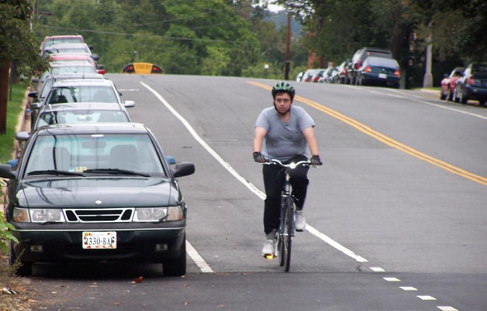
• Potential for vehicles driving/parking in the bicycle lane. Bike lanes provide dedicated space for bicyclists, but may present risks (such as “dooring”) depending on their design.
• NACTO Urban Bikeway Design Guide (2012)
• Manual on Uniform Traffic Control Devices (2009)
Facility Technical Sheet
Description
Shared lane markings (or “sharrows”) are pavement markings that denote shared bicycle and motor vehicle travel lanes. The markings indicate where the bicyclist shall be anticipated to operate.
Benefits
• May increase motorist awareness of the potential presence of bicyclists.
• Can act as wayfinding aids.
• The shared space is more likely to be swept and plowed than separated facility types.
• Low cost of implementation
Challenges
• May not be suitable for all users as they do not provide separate space for bicyclists.
• Typically used on local, collector, or minor arterial streets with low traffic volumes.
• Typically feasible within existing right-ofway and pavement width even in constrained situations that preclude dedicated facilities.
• May be used to fill gaps between bike lanes or other dedicated facilities for short segments where there are space constraints.
• Commonly used on bicycle boulevards to reinforce the priority for bicyclists.
• May be used for downhill travel in conjunction with climbing lanes intended for uphill travel.
• Typically supplemented by signs, especially Bikes May Use Full Lane (R4-11).
• When applied on higher speed/volume roads, consider alternative routes suitable for users of all abilities.
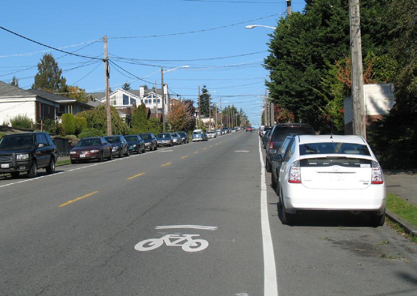
• May have higher maintenance needs than other facility types due to the wear and tear presented by motor vehicles driving over the pavement markings. The placement of Shared Lane Markings varies based on lane width and the presence of on-street parking.
Design Criteria
• Posted speed limits of 35 mph or less.
• The marking’s centerline must be minimum 4’ from curb where parking is prohibited.
• The marking’s centerline must be minimum 11’ from curb where parking is permitted.
References & Resources
• AASHTO Guide for the Development of Bicycle Facilities (2012)
• NACTO Urban Bikeway Design Guide (2012)
• Manual on Uniform Traffic Control Devices (2009)
• For narrow lanes, it may be desirable to center shared lane markings along the centerline of the outside travel lane.


Facility Technical Sheet
Description
Additional pavement width outside of the travel lanes that reduce crashes, aid maintenance, and provide space for bicyclists and pedestrians (although paved shoulders typically do not meet accessibility requirements for pedestrians).
Benefits
• Provide separated space for bicyclists and can be used by pedestrians.
• Reduce run-off-road motor vehicle crashes.
• Reduce pavement edge deterioration and accommodate maintenance vehicles.
• Provide emergency refuge for public safety vehicles and disabled vehicles.
Challenges
• Typically placed along high-speed roads.
• May not facilitate through-intersection bicycle movement unless Specifically designed to do so.
• For pedestrians, paved shoulders are not able to meet accessibility requirements and intersections typically lack crosswalks and pedestrian signals.
• There are several situations in which additional shoulder width shall be provided including motor vehicle speeds exceeding 50 mph, moderate to heavy volumes of traffic, and above-average bicycle or pedestrian use.
• The placement of milled rumble strips may significantly degrade the functionality of paved shoulders for bicyclists. Rumble strips shall be placed as close to the edge line as practicable. Alternatively, rumble stripes may be used.
• Where rumble strips are present, gaps of at least 12’ shall be provided every 40-60’.
• Indiana DOT has a paved shoulder policy and a guide which can help determine when paved shoulders are needed.
• Intersections with unpaved roads and driveways often result in gravel and debris deposited on paved shoulders. Paving the aprons of these intersections can mitigate the negative effect.
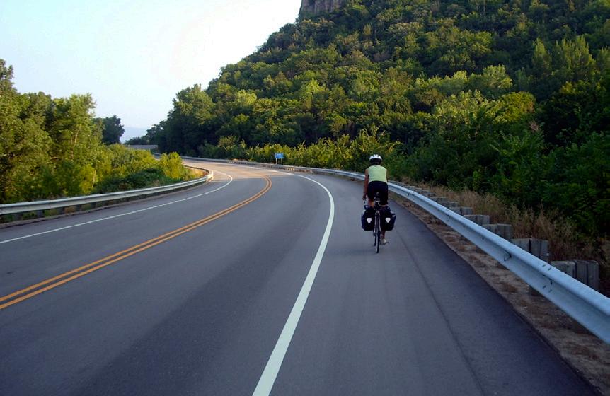
Wide paved shoulders reduce run-off-road crashes, improve roadway maintenance, and can provide space for bicyclists.
• Minimum width without milled rumble strips: 4’ from edgeline to edge of pavement (5’ if adjacent to curb or guardrail).
• Minimum width with milled rumble strips: 4’ from rumble strip to edge of pavement (5’ if adjacent to curb or guardrail).
• Indiana Design Manual (2013)
• AASHTO Guide for the Development of Bicycle Facilities (2012)
• AASHTO Policy on Geometric Design of Highways and Streets (2013)
• Manual on Uniform Traffic Control Devices (2009)
Facility Technical Sheet
Description
Intersections can be optimized to accommodate bicyclists by including pavement markings that increase visibility and reduce conflicts and designing signals to serve the unique operating characteristics of bicyclists.
Benefits
• Enhanced pavement markings warn users of potential conflict locations, help define expected behaviors, and encourage turning motorists to yield to bicyclists.
• Improved signal designs provide adequate time for bicyclists to clear signalized intersections, minimize bicyclist delay, and reduce the likelihood that bicyclists will disobey the signal.
Challenges
• Excessive pavement markings may result in confusion or clutter.
• Bicycle-oriented signals may result in a slight loss of capacity at the intersection and may increase red-light running.
• Pavement marking treatments used at intersections can include dashed white lines, symbols including chevrons and bicycle symbols, and green pavement
• Pavement marking treatments will vary depending on the context and character of each intersection and shall be chosen based on engineering judgment.
• Corridor-wide intersection treatment can maintain consistency; however, spot treatments can be used to highlight conflict locations.
• Detection shall be provided for bicyclists at signalized intersection approaches requiring
• A variety of pavement markings can enhance intersections, guide bicyclists, and warn of potential conflicts.
actuation. It shall not be expected that onroad bicyclists will be required to leave the roadway to actuate a signal. Video detection, microwave and infrared detection can be an alternate to loop detectors.

Bike boxes and green pavement (combined in this example) are two tools for improving intersections for bicyclists.
• Bicyclists shall be accommodated by lengthening the green and red phases of traffic signals and ensuring loop detectors sense bicycles. Bicycle-specific signals may be used and have received interim approval from FHWA.
• Refer to the references and resources listed below for specific design criteria.
References & Resources
• Indiana Design Manual (2013)
• AASHTO Guide for the Development of Bicycle Facilities (2012)
• Manual on Uniform Traffic Control Devices (2009)
• OTREC Operational Guidance for Bicycle-Specific Traffic Signals (2013)
• Jensen, SU. Safety effects of blue cycle crossings: A before-after study. Accident Analysis & Prevention, 40(2), 742-750. (2008)
• Thompson, SR. Bicycle-Specific Traffic Signals: Results from a State-of-the-Practice Review (2012)


Description
A system of signs and pavement markings that guide bicyclists along preferred routes (which may or may not be numbered) to destinations across the city and region. Signs may state distance to destinations or include route numbers.
Benefits
• Improves the usefulness of the bicycle network, especially when routes are diverted away from well-known streets.
• May encourage the use of lower-stress bikeways.
Challenges
• Can cause unnecessary confusion if the selection of destinations and placement of signs is not optimized.
• Can contribute to sign clutter.
• Bicycle route signs shall provide bicyclists with direction, destination, and distance information to commercial centers, rail stations, shared use paths, and other popular destinations.
• The location of signs and represented destinations shall be planned in a comprehensive manner, considering the likely routes of bicyclists and probable destinations.
• To assist the bicyclist, the system shall provide three general forms of guidance:
» Directional signs: placed at decision points where routes intersect and where routes turn from one street to another.
» Regional route signs: Placed along designated routes.
• Include destination, direction, and distance.
• Place the nearest destination in the sign’s top position.
• Place directional signs on the near side of intersections.
• Place confirmation signs on the far side of intersections.
References & Resources
• Indiana Design Manual (2013)
• NACTO Urban Bikeway Design Guide (2012)
• Manual on Uniform Traffic Control Devices (2009)
» Confirmation signs (also called designation signs): used to confirm route choice.
• Sign design can be customized, but the clarity and accuracy of the information must be the top priority.
• Coordinate with existing/programmed bikeways and bicycle route maps.
Facility Technical Sheet
Description
A pedestrian walkway located within public right-of-way, typically adjacent to property lines. Sidewalks provide vertical and/or horizontal separation between vehicles and pedestrians and are the most common pedestrian facility type.
Benefits
• Dedicated space for pedestrians. The presence of a sidewalk or pathway on both sides of the street corresponds to approximately an 88% reduction in “walking along road” pedestrian crashes.
• Improve mobility for pedestrians and provide access for all types of pedestrian travel.
• Sidewalks can encourage walking and promote fitness, exercise, and the general health of a community.
Challenges
• Often difficult to retrofit sidewalks in existing neighborhoods.
• Need to be well maintained and often that responsibility is passed on to adjacent property owners.
• When retrofitting sidewalks in a community, it is best to first concentrate on busier streets and around places where walking is more common: schools, transit stops, commercial areas, etc.
• Furnishing zones or terraces (the space between the curb and sidewalk) provide space for curb ramps, streetlight poles, fire hydrants, bike racks, traffic signs, etc. This space shall be clear at intersections in order to maintain maximum sight lines for both motorists and pedestrians.
• The typical terrace width is four to six feet.
• Even though roadway shoulders are not legal pedestrian facilities in Indiana and cannot
legally be designated as pedestrian access routes, the occasional pedestrian that uses a shoulder as a walkway benefits from a wide paved shoulder.
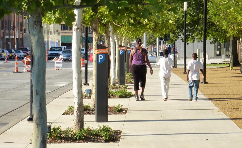
This furnishing zone (terrace) between the curb and sidewalk contains street trees, benches, and lighting.
Design Criteria
• Standard width: 5’ (4’ permitted to avoid obstructions).
• Wider sidewalks shall be installed near schools, at transit stops, in downtown areas, or anywhere high concentrations of pedestrian traffic exists.
References & Resources
• Indiana Design Manual (2013)
• NACTO Urban Street Design Guide (2013)
• Proposed Guidelines for Pedestrian Facilities in the Public Right-of-Way (PROWAG; 2011)
• Maximum cross-slope: 2%. Recommended cross-slope is 1% to 2% with tight tolerances
• Running grade: generally permissible to match the grade of the adjacent roadway


Facility Technical Sheet
Description
A shared-use path is a two-way facility physically separated from motor vehicle traffic and used by bicyclists, pedestrians, and other non-motorized users.
Benefits
• Separated from motor vehicle traffic.
• May be more appropriate for children, seniors, and persons with disabilities.
• Provides recreational opportunities in addition to transportation.
Challenges
• Costly and complicated right-of-way acquisition.
• Topography and drainage can greatly impact design.
• High construction costs.
• Can present safety concerns when placed adjacent to a roadway with frequent driveway or intersection crossings.
• A shared-use path shall be designed to suit the characteristics of bicyclists. This includes establishing a design speed (typically 18 mph) and designing curb radii appropriately.
• To accommodate high volumes and reduce conflicts between different user types, a path wider than the minimum can be provided or modes can be separated by constructing parallel paths for bicyclists and pedestrians.
• On a path that is shared by both transportation and recreational bicyclists, additional path width is desirable to allow users to pass.
• On wider paths, signage to remind users to keep right except to pass shall be provided.
• Along paths that provide attractive recreational opportunities, consider adding amenities such as benches, rest areas, and scenic overlooks.

Shared-use paths may parallel streets, utility easements, railroads, and natural features such as rivers.
• Minimum width: 10’. Widths as narrow as 8’ are acceptable for short distances under physical constraint. Warning signs shall be considered at these locations.
• In locations with heavy volumes or a high proportion of pedestrians, widths exceeding 10’ are recommended. A minimum of 11’ is required for users to pass with a user traveling in the other direction.
References & Resources
• Indiana Design Manual (2013)
• AASHTO Guide for the Development of Bicycle Facilities (2012)
• FHWA Shared-Use Path Level of Service Calculator (2006)
• Manual on Uniform Traffic Control Devices (2009)
Facility Technical Sheet
Description
A variety of facility types intended to increase the safety of pedestrians crossing streets and roads. In addition to pavement markings, crosswalks may include signals/beacons, warning signs, and raised platforms.
Benefits
• Increases the visibility of pedestrians crossing at intersections and controlled mid-block crossings.
• Can have traffic-calming effects if raised or if curb extensions are provided.
Challenges
• Road grades and crowns pose challenges for constructing crosswalks that meet accessibility requirements.
• Multi-lane streets and rural intersections require longer crosswalks and are less comfortable for pedestrians.
• Enforcing stop-bar compliance is important so that drivers do not stop in crosswalks.
• There are many different styles of crosswalk striping and some are more effective than others. Ladder, zebra, and continental striping patterns are understood to be more visible to drivers.
• Signal phasing is very important. Pedestrian signal phases must be timed based on the length of the crossing. If pedestrians are forced to wait longer than 40 seconds, noncompliance is more likely.
• Raised crossings calm traffic and increase the visibility of pedestrians.
• Curb extensions, also known as bulb-outs and bump-outs, reduce the distance pedestrians
have to cross and calm traffic.

• Place on all legs of signalized intersections, in school zones, and across streets with more than minor levels of traffic.
• Add rapid-flash beacons, signals, crossing islands, curb extensions, and/or other traffic-calming measures when ADT exceeds 12,000 on 4-lane roads or speeds exceed 40 mph on any road.
• There are locations where crosswalks shall not be marked without additional design features noted above. Refer to the references and resources listed below for specific design criteria.
References & Resources
• Indiana Design Manual (2013)
• NACTO Urban Street Design Guide (2013)
• Safety Effects of Marked Versus Unmarked Crosswalks at Uncontrolled Locations: Final Report and Recommended Guidelines (2005)
• Proposed Guidelines for Pedestrian Facilities in the Public Rightof-Way (PROWAG; 2011)
• ADA Accessibility Guidelines (2004)
• Manual on Uniform Traffic Control Devices (2009)


Facility Technical Sheet
Description
Curb ramps provide transition between sidewalks and crosswalks and must be installed at all intersection and midblock pedestrian crossings, as mandated by federal legislation (1973 Rehabilitation Act and ADA 1990).
Benefits
• Universally, widespread benefits apply to people using wheelchairs, strollers, walkers, crutches, handcarts, bicycles, or who have mobility restrictions that make it difficult to step up and down high curbs.
Challenges
• Curb ramp designs can be challenging especially at intersections with large radii or on streets within narrow rightof-ways.
• Need to be well maintained, especially during winter months when snow and ice are encountered
• Curb ramps can be a problem for pedestrians with visual impairments because they minimize the tactility of the transition point between the sidewalk and the roadway.
• Furnishing zones or terraces (the space between the curb and sidewalk) of 7’ of width provide just enough space at intersections for curb ramps to gain sufficient elevation to a sidewalk.
• Separate curb ramps shall be provided for each crosswalk at an intersection rather than a single ramp at a corner for both crosswalks. The separate curb ramps improve orientation for visually impaired pedestrians by directing them toward the correct crosswalk.
• Curb ramps are required to have landings. Landings provide a level area with a cross slope of 2% or less in any direction for wheelchair users to wait, maneuver into or out of a ramp, or bypass the ramp altogether. Landings shall be 5’ by 5’ and shall, at a minimum, be 4’ by 4’.
• All newly constructed and altered roadway projects must include curb ramps. Agencies with more than
50 employees are required to have a transition plan in place to address the staging of the curb ramp upgrades.
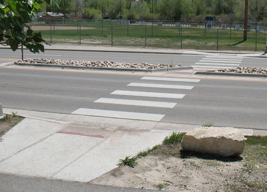
Design Criteria
• Maximum slope: 1:12 (8.33%).
• Maximum slope of side flares: 1:10 (10%).
• Maximum cross-slope: 2% (1–2% with tight tolerances recommended).
References & Resources
• Indiana Design Manual (2013)
• Proposed Guidelines for Pedestrian Facilities in the Public Right-ofWay (PROWAG; 2011)
• Indiana Design Manual (2013)
• Truncated domes (the only permitted detectable warning device) must be installed on all new curb ramps to alert pedestrians to the sidewalk and street edge.
Facility Technical Sheet
Description
Pedestrian signals control the flow of foot traffic through intersections and across roads. They include traditional WALK/ DON’T WALK signals, rapid-flash beacons, hybrid or HAWK signals, and other illuminated traffic control devices.
Benefits
• Facilitate safe crossings of major streets and roads by providing right-of-way for pedestrians.
• Reduce pedestrian crashes, especially when leading pedestrian intervals and/or countdown signals are incorporated.
Challenges
• May add length and complexity to signal phases, potentially encouraging non-compliance.
• WALK signals may encourage pedestrians to enter the intersection without looking for turning vehicles. Right-turnon-red allowance compounds this challenge.
• Drivers—especially those that pass the same crossing on a regular basis—often become desensitized to continuallyflashing beacons.
• Signal phasing is very important. Pedestrian signal phases must be timed based on the length of the crossing. If pedestrians are forced to wait longer than 40 seconds, non-compliance is more likely.
• Include count-down timers to encourage compliance.
• It is recommended that intersections with large volumes of turning traffic have 3–7 second leading pedestrian intervals so that pedestrians can enter crosswalks prior to turning vehicles proceeding.
• Fixed signals (as opposed to actuated/ push-button signals) that always provide a WALK phase are preferred in urban areas.
• Coordinated signal timing with constant interval lengths benefits pedestrians, bicyclists, and drivers alike.
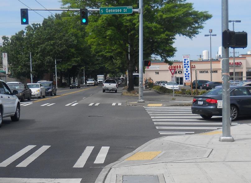
Countdown pedestrian signals encourage compliance, especially where fixed signal intervals are implemented.
Design Criteria
• Minimum walk time: 7 seconds. Timing shall allow pedestrians to cross the entire street in one cycle.
• The use of continually-flashing beacons shall be avoided. Rapid-flash or HAWK signals are preferred.
References & Resources
• Indiana Design Manual (2013)
• Manual on Uniform Traffic Control Devices (2009)
• NACTO Urban Street Design Guide (2013)
• 2-stage crossings may be implemented in situations where noncompliance would otherwise result (such as crossing wide, multi-lane roads).


Facility Technical Sheet
Description
Raised islands located along the centerline of a street, as roundabout splitter islands, or as “pork chop” islands where right-turn slip lanes are present. They provide refuge for pedestrians and allow multi-stage crossings of wide streets.
Benefits
• Provide safe refuge when crossing wide, multi-lane streets.
• Allow shorter signal phases since crossings can be broken down into two or more stages.
• Improve crossings at unsignalized locations, as pedestrians are only required to negotiate one direction of traffic at a time.
• Have traffic calming effects.
Challenges
• Noncompliance with pedestrian signals may decrease with multi-stage crossings due to impatience or feelings of vulnerability.
• While preferable, cut-through medians may accumulate debris and snow more than ramped islands.
• There are two primary types of crossing islands. The first cuts through the island, keeping pedestrians at street-grade. The second ramps pedestrians up above street grade and may present challenges to constructing accessible curb ramps unless they are more than 17’ wide.
• Cut-through widths shall equal the width of the crosswalk. Cut-throughs may be wider in order to allow the clearing of debris and snow, but shall not encourage motor vehicles to use the space for u-turns.
• Crossing islands can be coupled with other trafficcalming features, such as partial diverters.
• Crossing islands may be used to connect two or more off-set crosswalks. This treatment can be used to mitigate challenges associated with off-set
intersections and do improve compliance with twostage crossings.
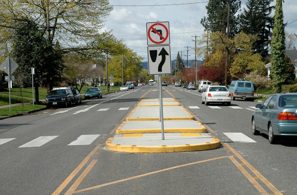
This crossing island doubles as a partial diverter. Curb ramps are “cut through,” allowing pedestrians to remain at-grade.
Design Criteria
• Minimum width: 6’ (8’ recommended to accommodate higher pedestrian volumes, bicyclists, and wheelchair users).
• Curb ramps with truncated dome detectable warnings and 5’ by 5’ landing areas are required.
• A nose that extends past the crosswalk is not required, but is recommended.
• Vegetation and other aesthetic treatments may be incorporated, but must not obscure visibility.
• NACTO Urban Street Design Guide (2013)
• Manual on Uniform Traffic Control Devices (2009)