not a portfolio


to whom it may concern

not a portfolio


to whom it may concern
this is not a portfolio.
This is not a portfolio in its departure from conventional design exercises which begin with a supposedly complete reading of a context (which can never fully be read), identification of issues (that can never be enitrely perceived) and end with the proposal of a design (that attempts an absolute fix for issues larger than a project, a semester, or sometimes a lifetime).
Instead, it chronicles a lateral reading of urbanity through a diverse set of manifestations- from the almost rural to the synthetic suburb.
Committed to problem posing more than problem solving, it attempts the reading of landscapes, only to speculate new languages for reading. It identifies issues in order to spotlight them, well aware that such identification is partial and temporal. It also puts forth design; almost always as an act of co-productionundertaken as an initiator of continued discourse ..
and not conclusive solutions.

Ehsan Ann Arbor, 2025
fluid aspirations natore, bangladesh teaching dhaka, bangladesh
detroit reparations michigan, united states research texas, united states negotiating thresholds dhaka, bangladesh engagement são paulo brazil cartography misc. locations impressions misc. locations 01 05 03 07 02 06 04 08


What aspirations inform the development of secondary urban centers of the developing worldat the intersection of geography, governance, power and polity?
The Secondary City
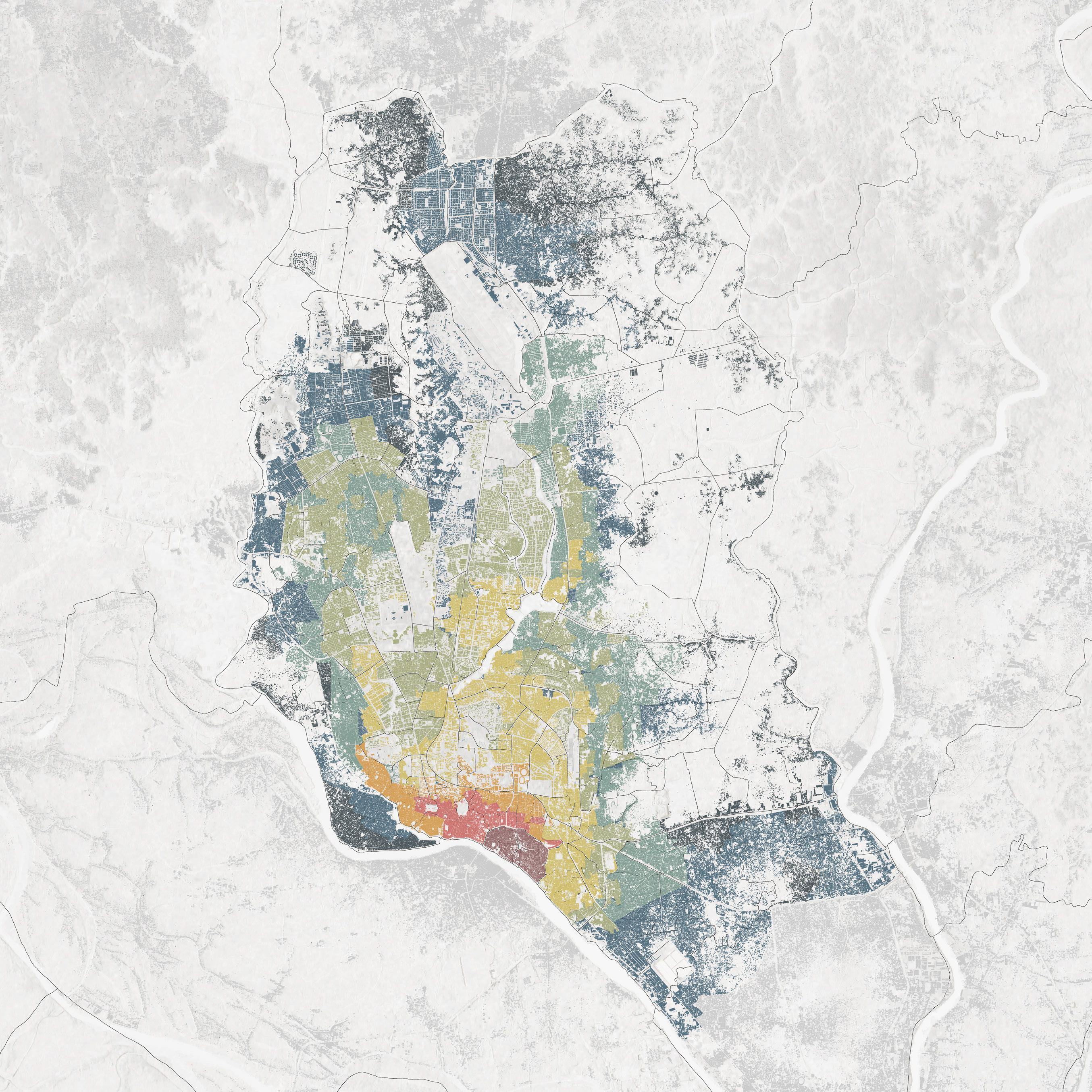
Much like other economically developing nations, Bangladesh has also been racing to drive urbanism away from its major cities- prompting a series of decentralization intiatives. These moves often invite the overlap between urbanity and unique geographic territories- threatening the latter.
One such condition is found in the largest marshy depression of the country where a municipality is fast developing, in spite of its population beginning to plateau.
Singra Municipality is not only contending with the consequences of its concretizing model of urbanism- best encountered in the erratic behavior of its many receding water bodies. Furthermore, it must now determine what models and mechanisms of development it will adopt for its future- in the face of a population soon to decline, and a climate that is fast deteriorating.
Municipality Ordinance (1977)
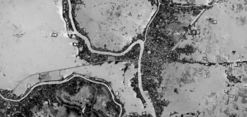
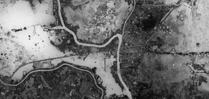
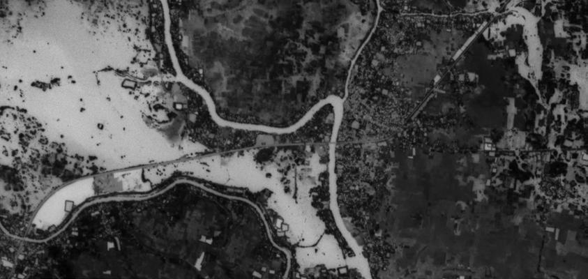
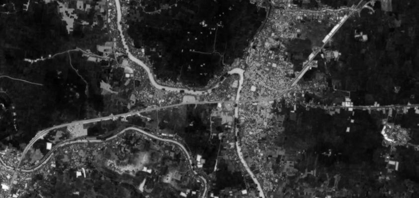
Fluidity (and water) manifests in various ways in Bangladesh- from coastal surges and seven hundred rivers forming the backbone of the land, to the vast expanses of marshy depressions that inform sensitive cycles of submersion and subsidence.
This is a study of the largest wetland of Bangladesh



water as everyday water as ritual


water as synthetic

a semi-permanent coexistence with the land, informed by cyclic transformations in materiality, occupation and ways of life.
absorbing contextual abundance of water into culture and faith. Using water as a purifying medium as well as a metaphysical contained for renewal.
an imposition of permanence in a fluid landscape of impermanenceinviting negligence, othering and ultimately, killing the water.




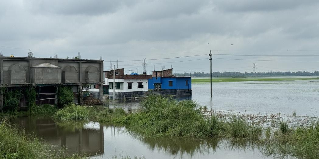

fisherman
We say the Beel (Marsh) is our pride, and we market our fish claiming it is from these aquatic landscapes.
In reality, fishery has radically shifted to cultures within ponds in the city and the once famous fish from the Cholon Beel and the Atrai River is all but gone!
You want reform? Start there.


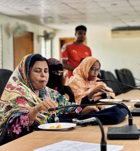
councilor
The children in my ward are faced with daily challenges to cross the river (and canal) to reach school. This is further worsened with seasonal waterlogging which spreads pollutants, deterring school going children.
I have been advocating for a bridge to improve connectivity for our children but..
To no avail.


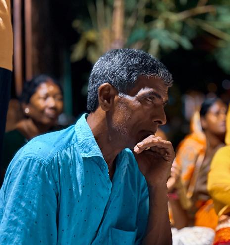
trader
The Hindu Community of Singra has a long standing tradition of engaging with craftsparticularly terracotta tiles.
These are now cheaper to import from factories than to buy from local artisans.
The craft is all but dead.
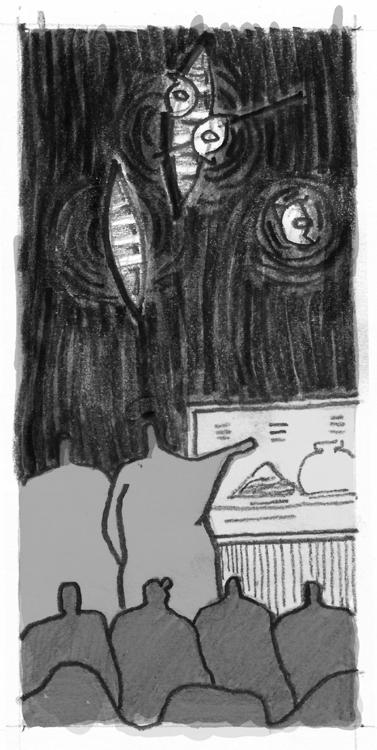
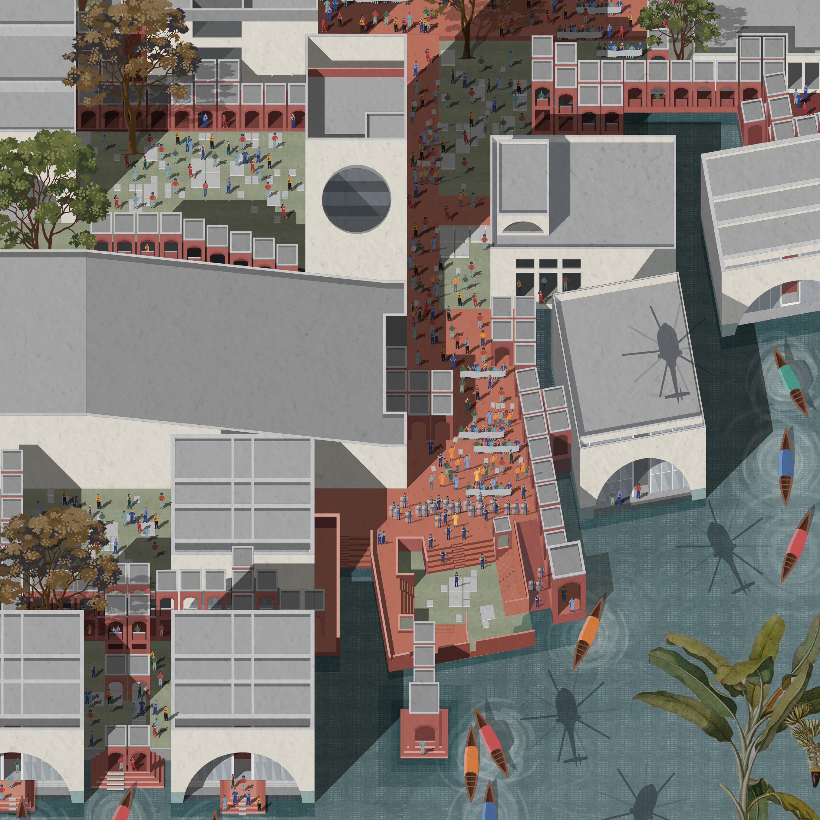
Once sustained by crafting terracotta tiles from post-monsoon soil, Singra’s earthen traditions are fading. The Earthen Commons revives this landbased craft through a community cooperative and center, reconnecting people with the marshy terrain they shaped.
Full-scale terracotta production reduces significantly. The craft center becomes a training center for the artform of terracotta. The cooperative shares its findings and recommendations on soil quality, pollution and encroachment.
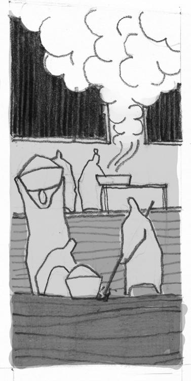
As the water recedes quickly from the marsh, craftspersons and fishermen begin collecting nutrient-rich topsoil from the freshly drained land. Another group documents the quality of soil.
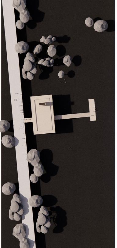
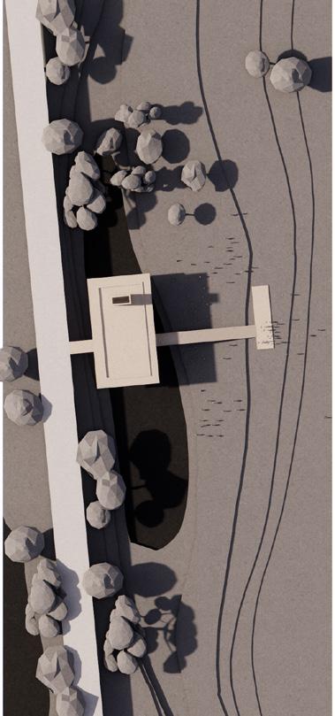
The Earthen Commons hosts an annual festival where various terracotta crafts are sold in temporary stalls situated in the receding banks of the river. These stalls are an invitation to celebrate this ancient craft, prompting awareness of the threats posed to it. As water returns, the stalls recede, celebrating temporality.


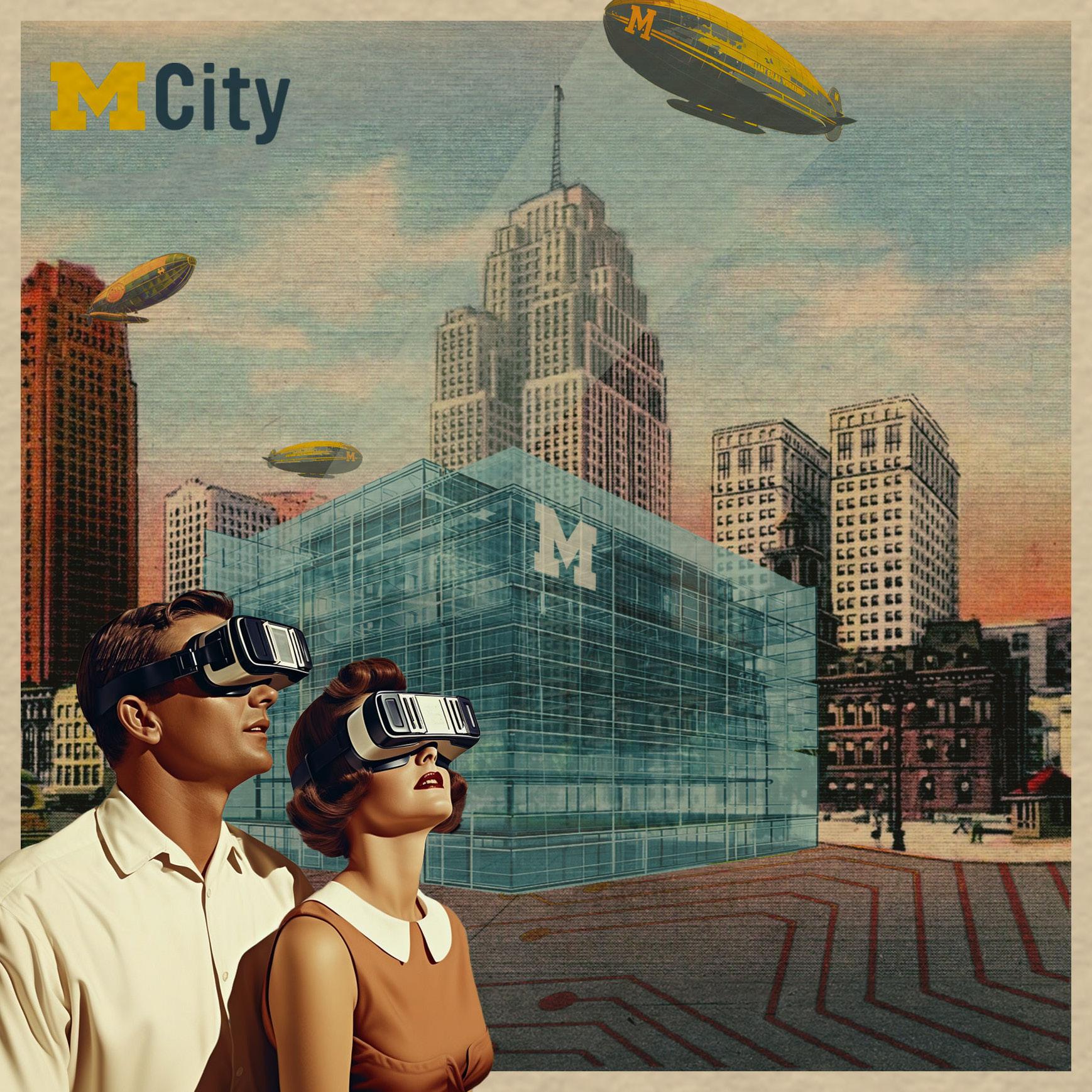
In the same manner as highways that once ripped through neighborhoods, innovation without repair is likely to repeat historic socio-spatial harms
Dispersing the UMCI Campus
Neighborhood Functions
In acknowledging the inevitability of the UMCI campus, this project addresses its program instead and proposes additional functions and amenities that disperse the campus from one concentrated building to a series of spaces that disperse throughout downtown Detroit and finally, into surrounding neighborhoods.
Excerpts from the project illustrated here outline the neighborhood spaces introduced as a satellite to the UMCI. This includes urban gardens that double as cafes for neighborhoods to convene.
In revisiting the notion of the cyber cafeneighborhood kiosks for reading- powered by the University of Michigan Library resources- create more effective interfaces with the university and its mandate for innovation.
Through neighborhood + technology connectivity models, these spaces prototypical and minimal spaces are meant to disperse innovation into neighborhoods most affected by socio-spatial inequalities.


Dispersing the UMCI Begins with server spaces extending beyond the currently proposed campusgrowing into ancillary structures and neighborhood cafes.
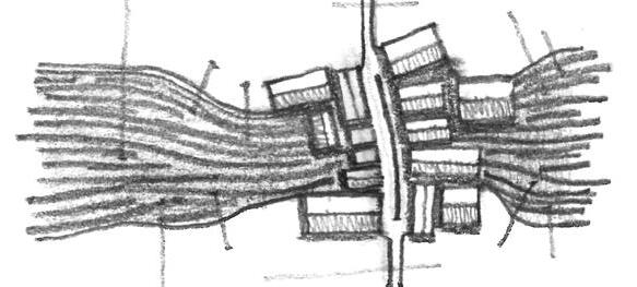
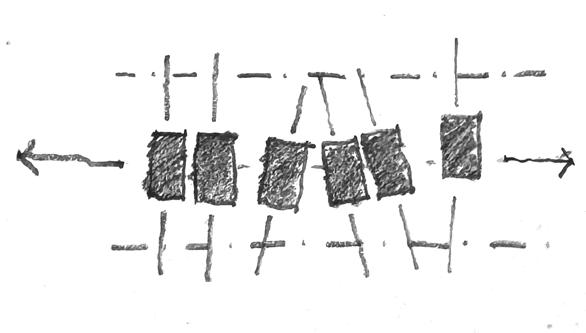
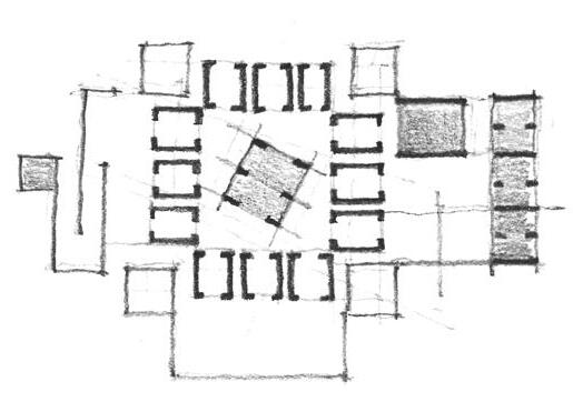
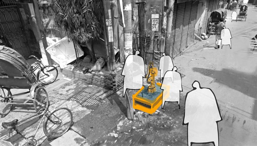
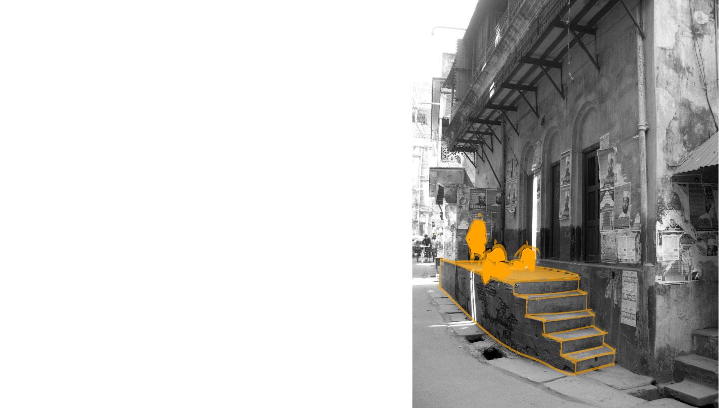
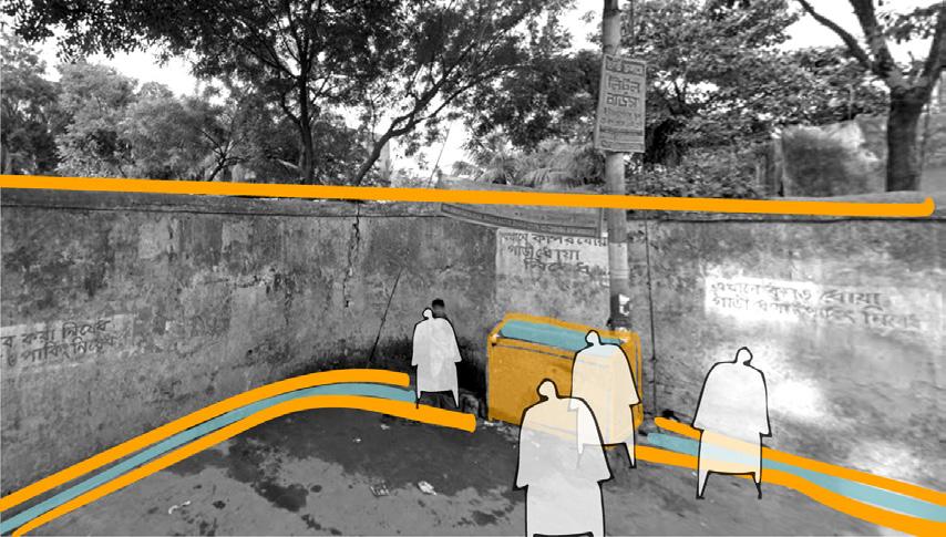
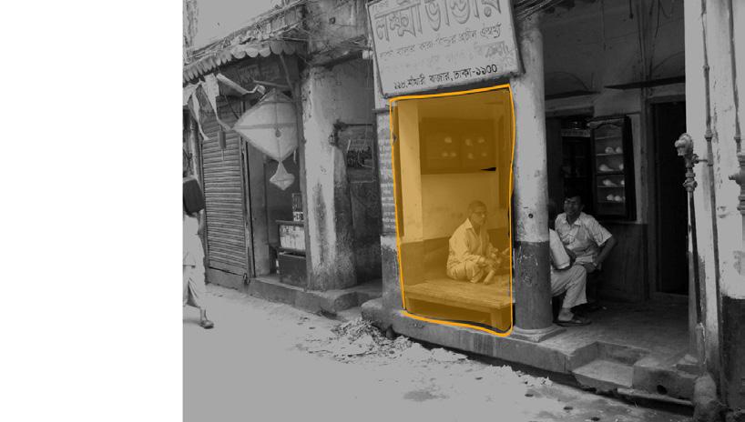
Thresholds in Dhaka’s built fabric separate binaries such as private-public and formal-informal actors. This thesis explores thresholds and the life that evolves around them. By examining these boundaries at three scales, notional interventions are suggested to provoke discourse on urban spatial thresholds.
Suggestive, undefined points in a space can create divisions by setting criteria between two seemingly homogeneous areas. In public spaces, this is achieved through urban furniture, fixtures, or natural elements like vegetation.
Linear thresholds, often walls, define clear lines of separation but can also appear as doorways or curbs.
Planar thresholds add a third, liminal space, creating a more gradual transition between two areas compared to linear thresholds.
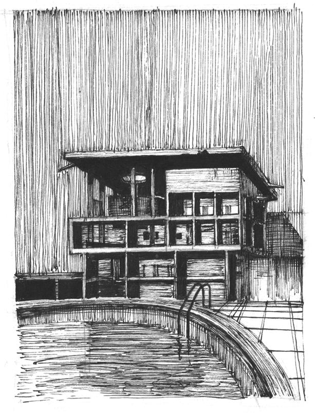
Volumetric thresholds, commonly found between indoor-outdoor or private-public spaces, add a further layer of transition by introducing intermediate volumes.



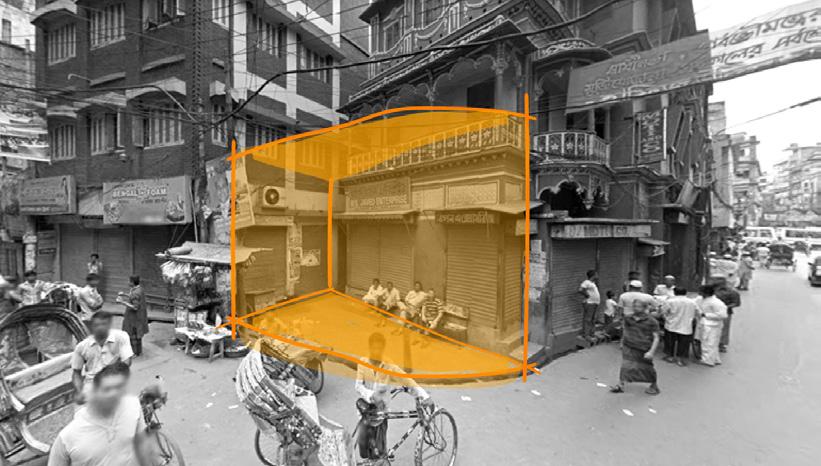
Along Thresholds
Permanent Vendors
Lot Boundary
Sidewalk
Empty Lot Semi Permanent Vendors
Lot Boundary
Sidewalk Curb

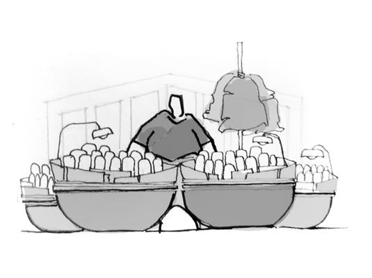


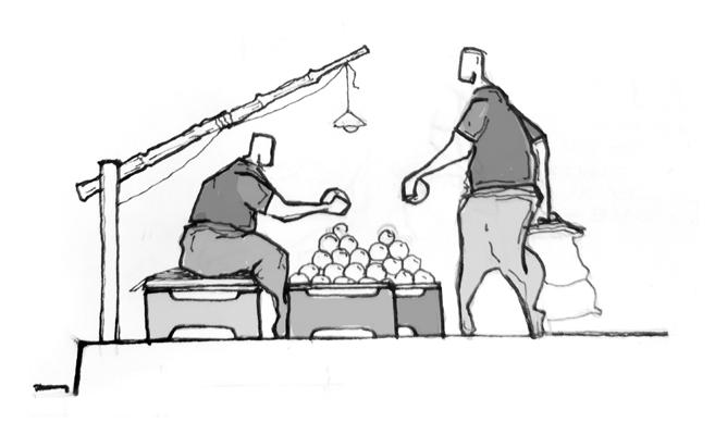

Semi-Mobile Vendors
Sidewalk Public Place Node Road

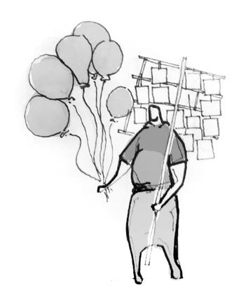

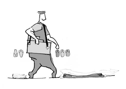
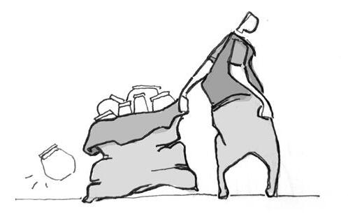
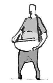
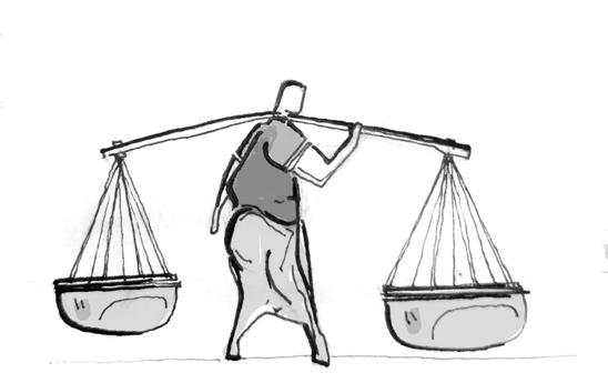
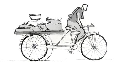
Mobile Vendors
Sidewalk Road Location + Structure stationary at single site + permanent structure temporary at single site + removable structure moving between sites + light mobile structure constant motion + light mobile structure



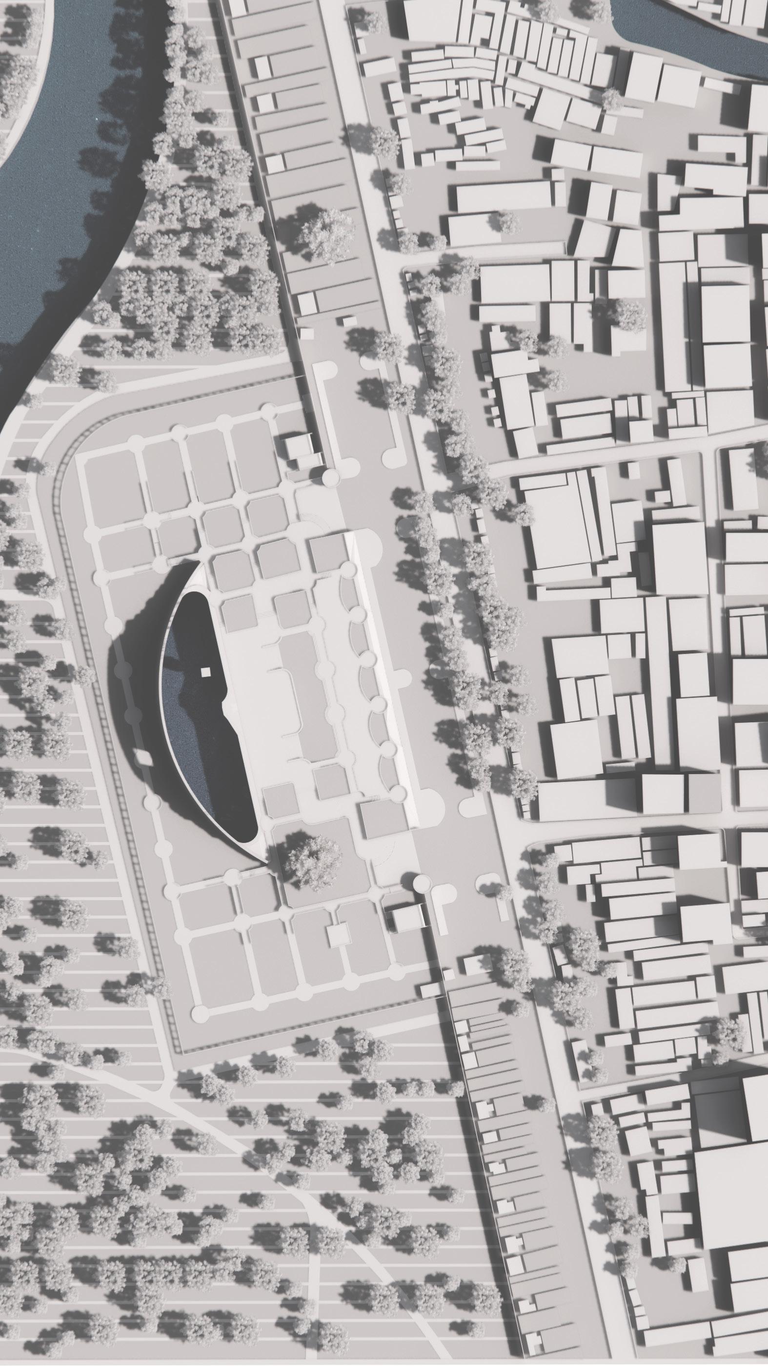
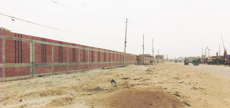
a walled off cemetery
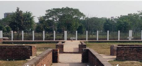
gateway to a monument separated by a fence breached to create plurality of space

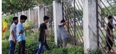
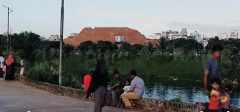
a park in a cemetery
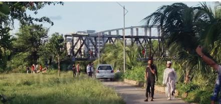
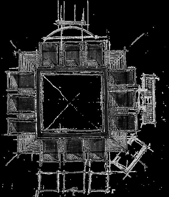
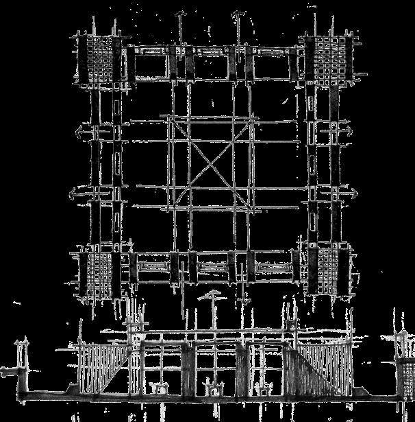


Volume as Threshold
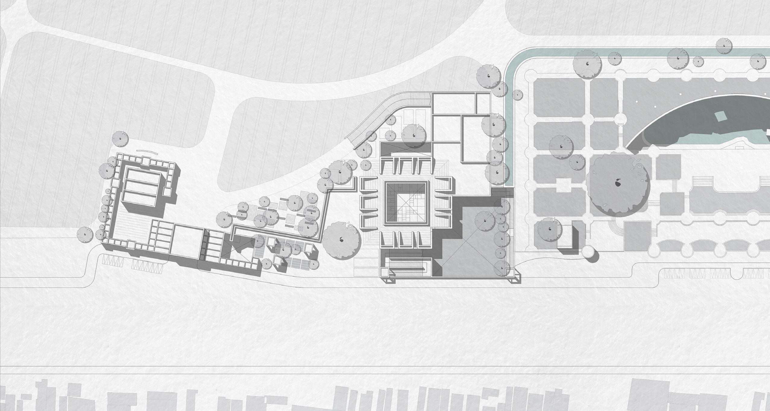
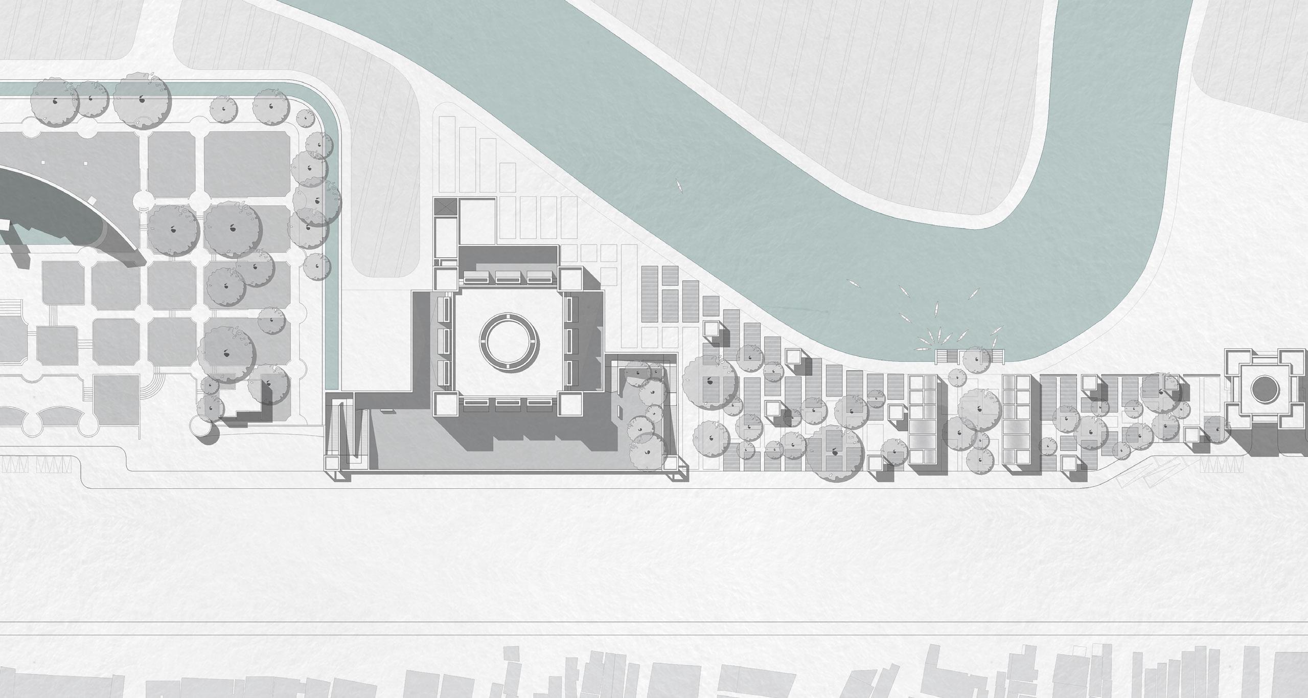
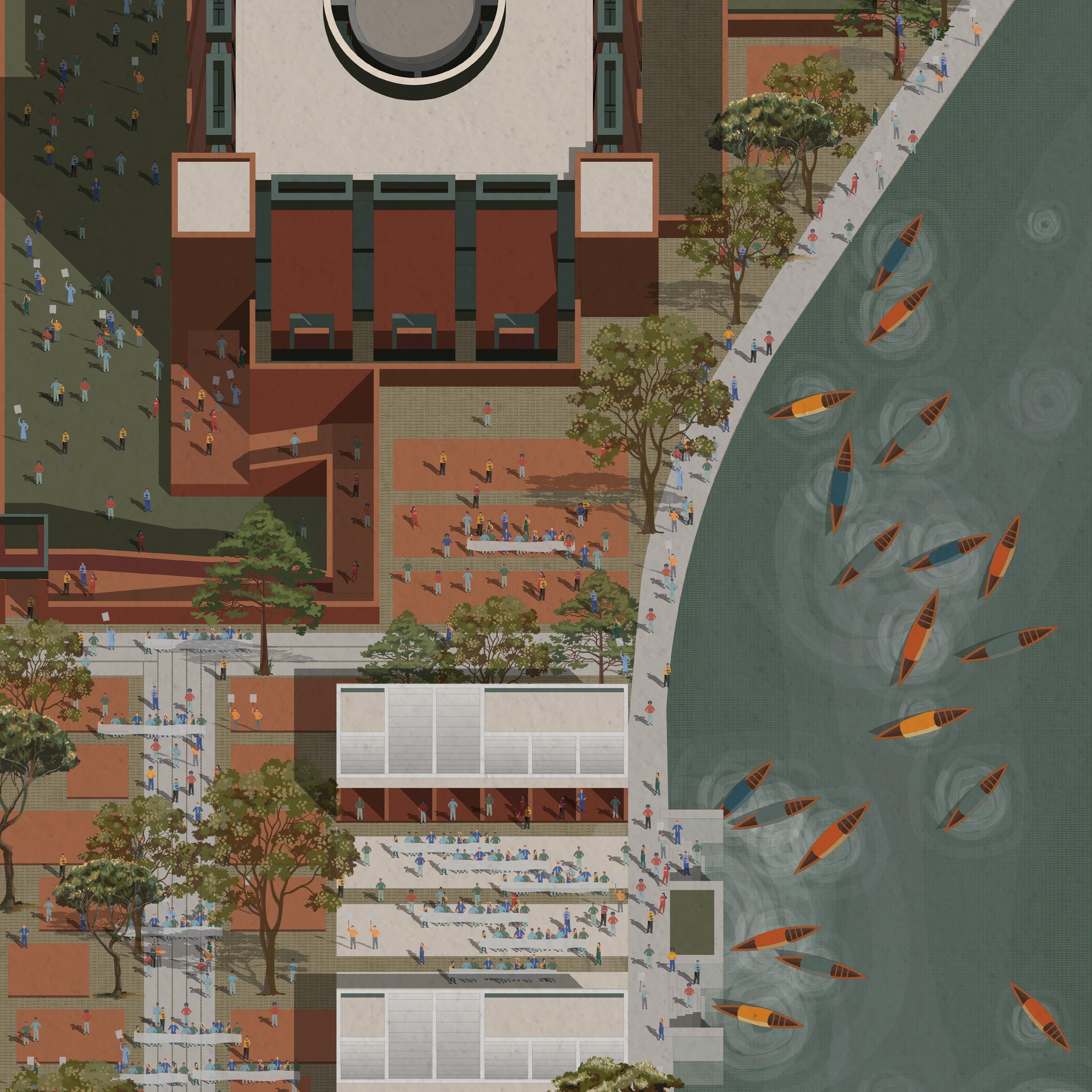
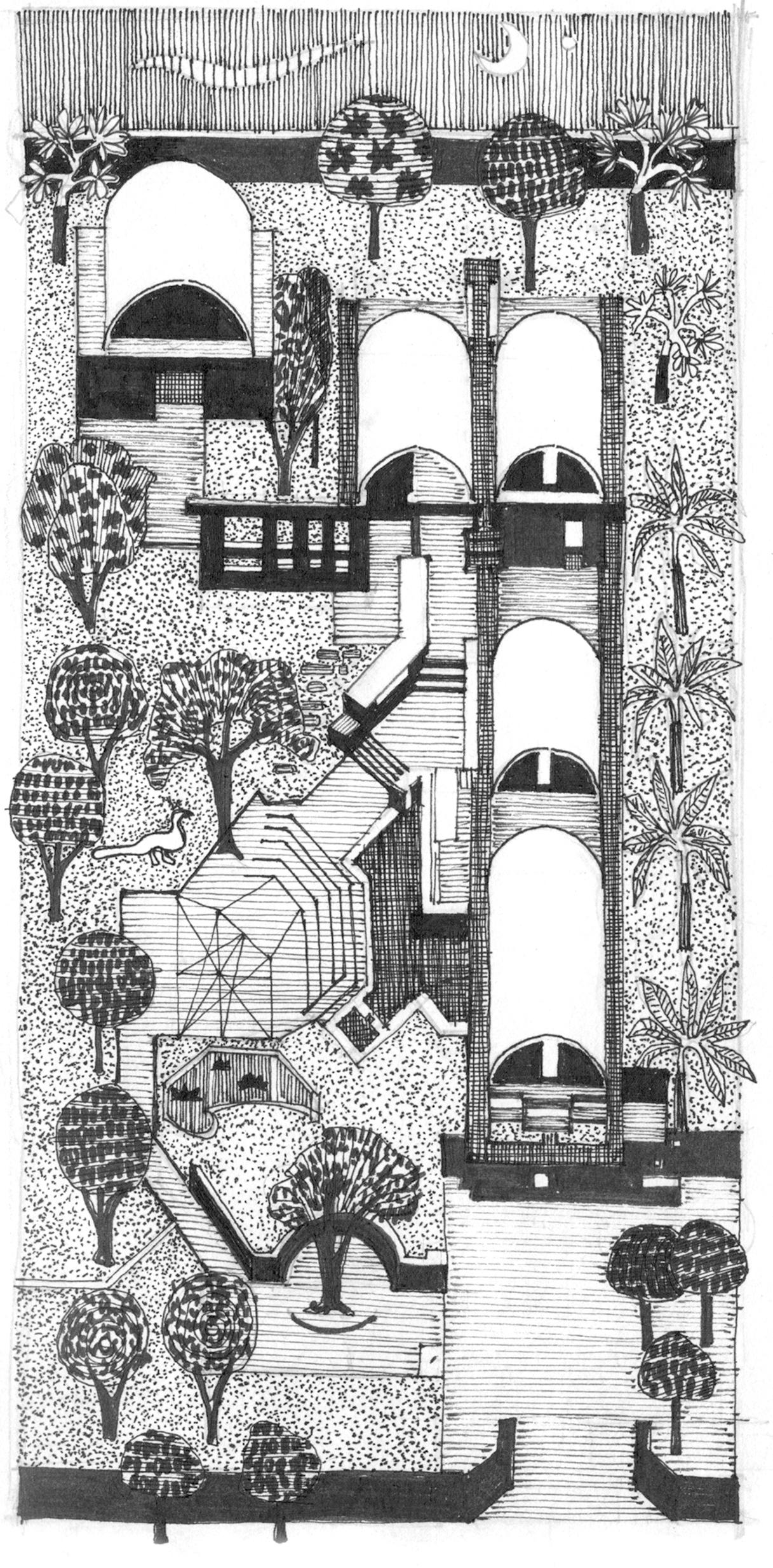
The vision of the city authorities to complement the spirit of the monument and retain the sanctity of the cemetery with a museum and library, are in direct conflict with people’s need for recreational spaces. These considerations informed a design intervention that caters to both the intended and actual uses of this space.
Site Plan Legend
01. Graveyard (existing)
02. Mosque (existing + expansion)
03. Museum (existing + expansion)
04. Martyred Intellectuals’ Monument (existing)
05. Library (proposed)
06. Nursery (redesigned)
07. Promenade (proposed)
site plan
section aa’ 400’ 800’

Library as Remembrance admin
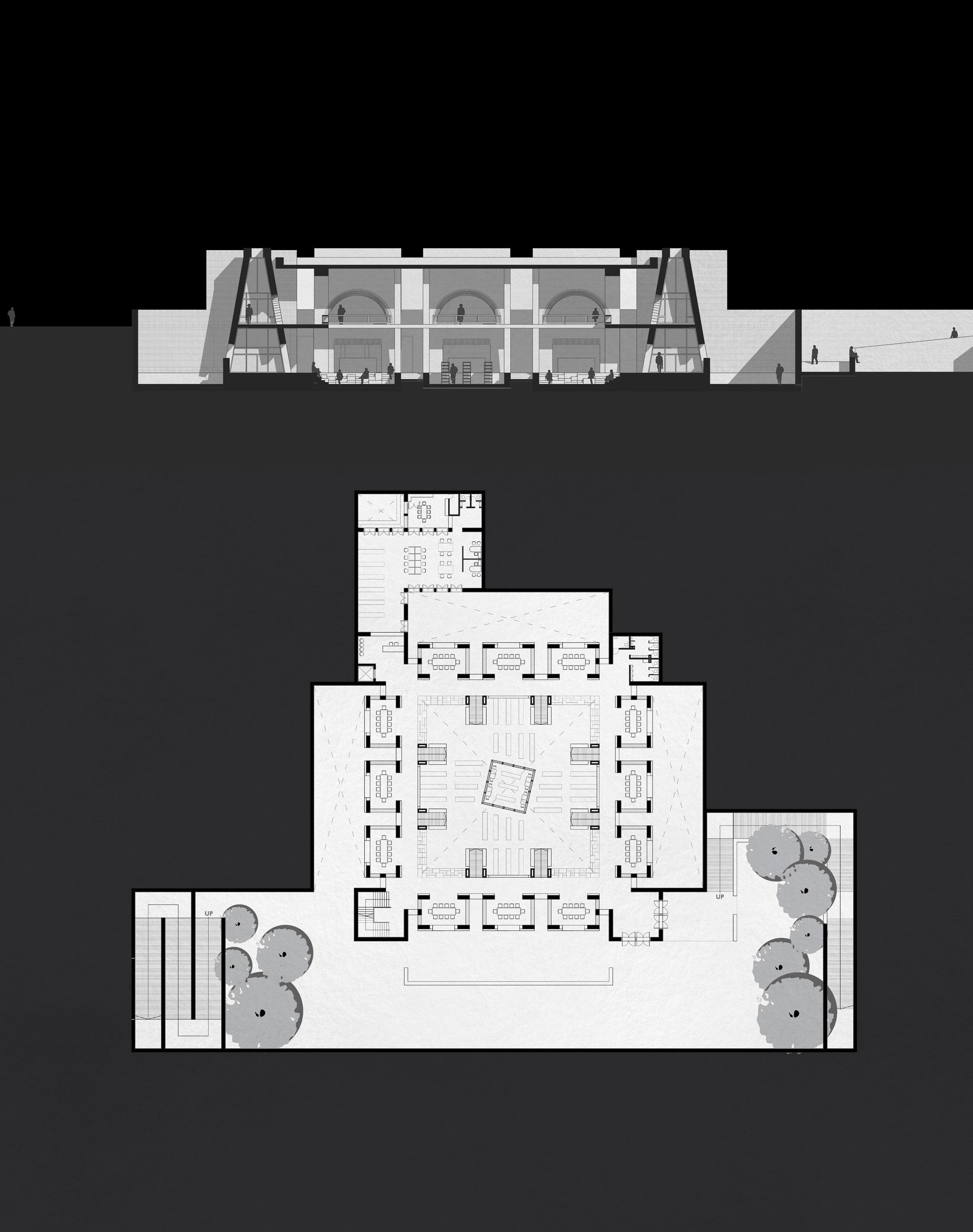
the library of remembrance is an invitation to resume intellectual practices as the backbone of nation building - practices that were deliberately vanquished at this very site at the dawn of the nation’s birth.
44° 20’ 48” N 85° 24’ 37” W
NAD 1983 StatePlane Michigan Central FIPS 2112
Maps Are Never Neutral
Trade-Offs In Projection
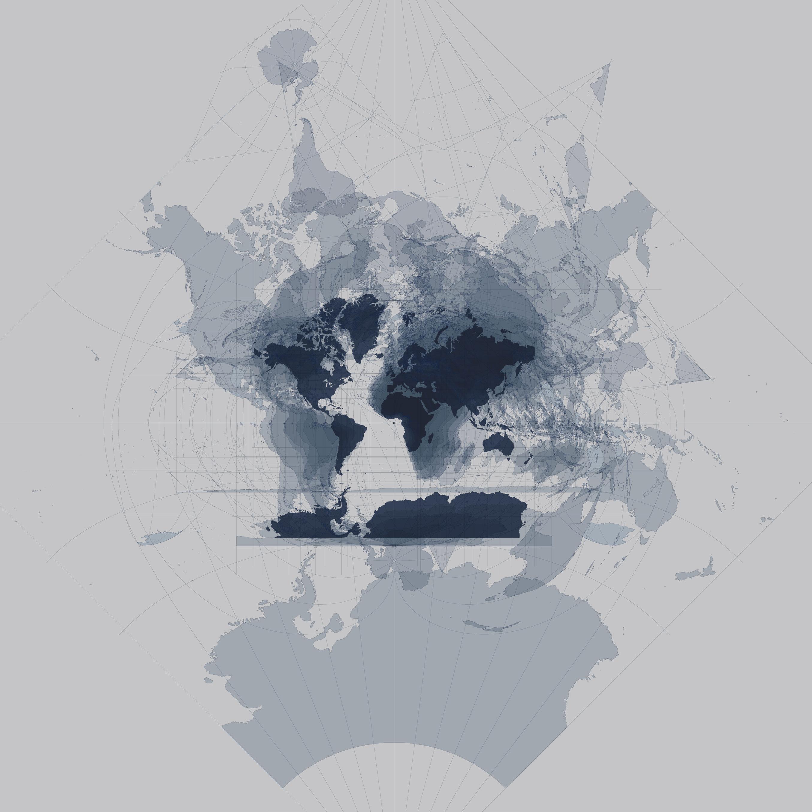
Maps have never been neutral tools. The Mercator projection famously inflated northern and southern landmasses while compressing the equatorial belt, rendering colonized countries visually smaller and politically diminished. Greenland appeared the size of Africa, despite being fourteen times smaller; visual distortion reinforced geopolitical hierarchies.
Every projection is a compromise. The Gall–Peters preserves relative land area but elongates continents; the Mollweide balances area with a pleasing oval form yet distorts shapes; Buckminster Fuller’s Dymaxion interrupts continuity to minimize distortion but sacrifices intuitive geography. Each is a negotiation among land area, proportion, and the perceived distances between places.
A Granular Consequence
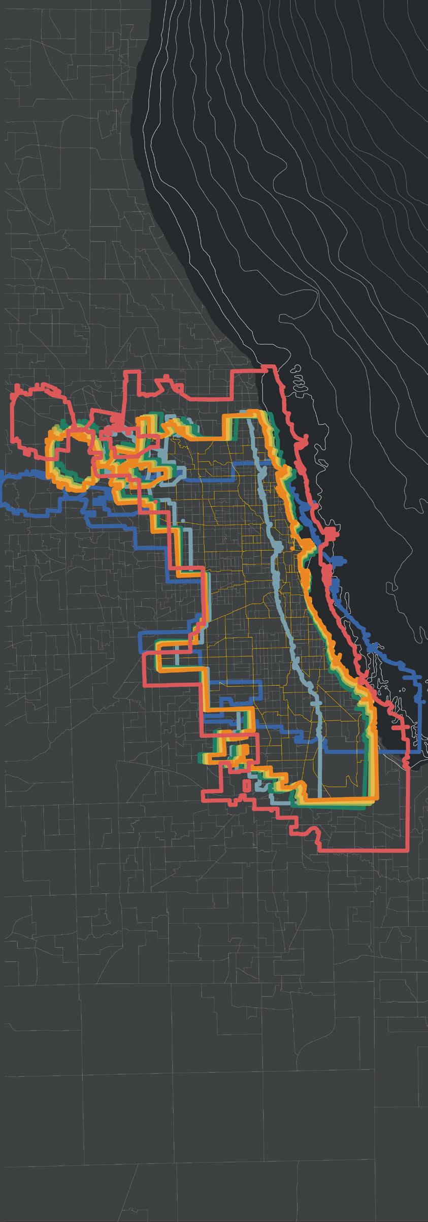
At the city scale, projection choice becomes even more consequential. Chicago aligns best with Illinois State Plane East; switching to Illinois West, Michigan South, or Indiana West introduces small but measurable shifts. Apply global projections like Mercator or Cylindrical Equidistant, and distortions become significant, undermining precision mapping.
projection as politics
42° 38’ 46” N
83° 17’ 33” W
NAD 1983 StatePlane Michigan South FIPS 2113
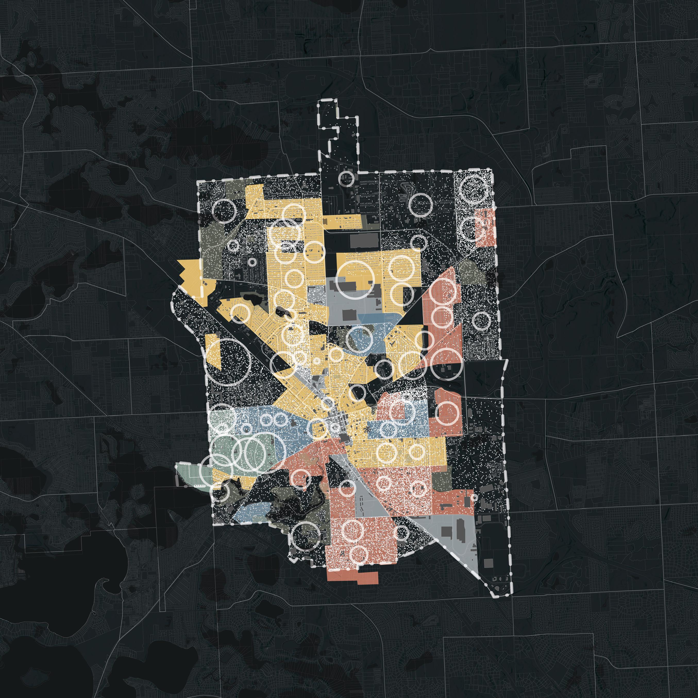
In the mid-20th century, Pontiac, Michigan, was subject to redlining; a discriminatory housing policy where banks and federal agencies marked predominantly Black neighborhoods as highrisk for investment. These redlined zones were systematically denied mortgages and insurance, inhibiting homeownership, neighborhood stability, and generational wealth among residents of color.
Though redlining was outlawed in 1968, its spatial scars remain visible. Pontiac’s formerly redlined areas still suffer from underinvestment, lower property values, and aging infrastructure. These zones often overlap with today’s census tracts that exhibit higher poverty rates and lower median household incomes, underscoring the enduring legacy of racialized disinvestment.
Pontiac’s current median household income is significantly below the state average, and its demographic is majority Black and Latino. This correlation between past exclusionary policies and present socioeconomic conditions illustrates how structural racism continues to shape urban outcomes across generations.
23° 45’ 52” N
90° 23’ 20” E
Gulshan 303 Bangladesh Transverse Mercator
Riverine
Trajectories
Dhaka is shaped by centuries of geographic and political shifts. Its history precedes Mughal riverine outposts with shophouses and bazaars. British rule exapnded the city with rail lines and maidans, then embraced Modernist planning as East Pakistan’s capital. After 1971, as Bangladesh’s capital, rapid urbanization followed, with private housing markets filling floodplains and transforming Dhaka into a dense, concrete expanse.
This history created diverse urban fabrics: Mughal shophouses and Islamic public gardens, colonial-era regimental housing blocks, and post-independence model towns racing to facilitate an exponential population boom. Informal districts emerged as a parallel, revealing persistent inequalities. Today’s urban form is, however, increasingly static; trading communal intimacy for regularized isolation.
Despite this, sites like the Parliament complex stand as pauses amid relentless growth. As Dhaka’s population surges and history is paved over, the future demands preservation, reform, and creative reuse to ensure the city remains livable and historically legible. 1750’
Project Brief
Learning Outcomes
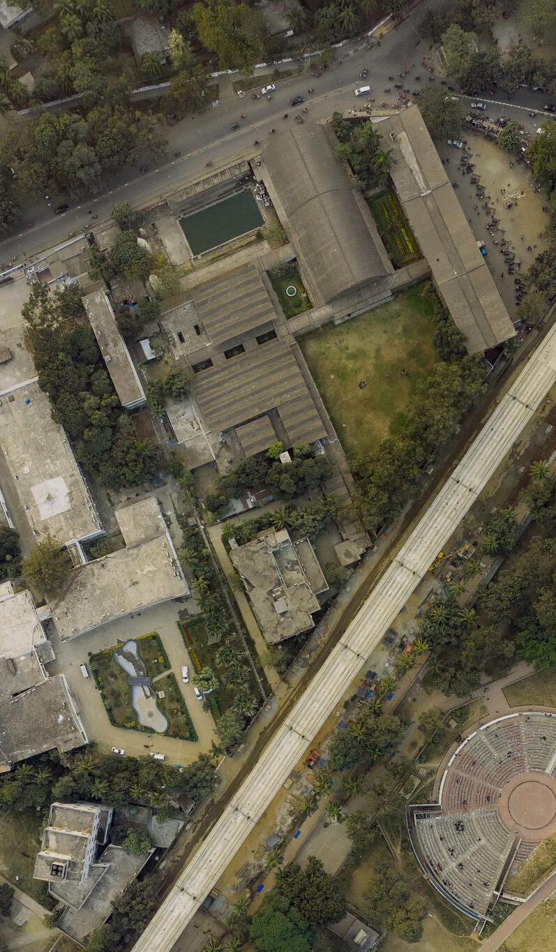
The Teacher-Student Center (TSC) of Since its design by Greek architect Doxiadis in 1960, this landmark has outgrown its capacity and is in need of expansion to offer expanded and upgraded facilities. Students are required to design an expansion to the TSC, addressing a complex set of programs. Special emphasis is desired on a strong conceptual approach and professional-level design quality
Study and Analyze existing precedents in order to formulate strategies for expansion
Conceptualize and express design ideas
Identify and articulate different design considerations: formal, functional and structural
Formulate design solutions based on both technical and socio-cultural contexts
Generate architectural and technical drawings equivalent to construction working drawings.
Existing complex with potential expansion site >
Source: Nakib Shah Alam
Ashfak Ullah Chowdhury >> Campus Aerial Perspective
Project Brief
Learning Outcomes
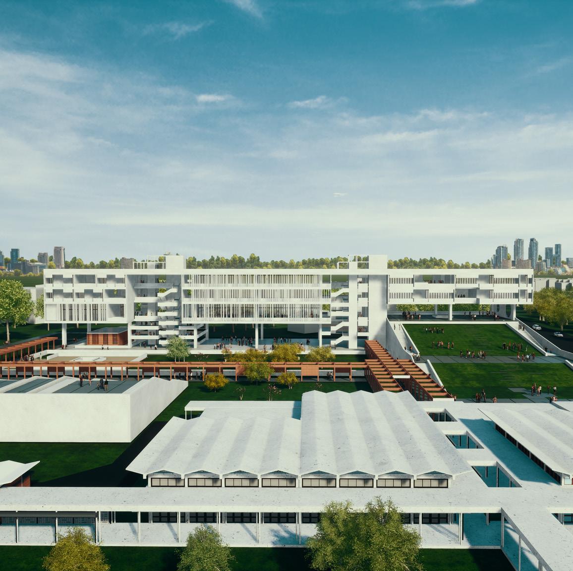
The Design of an Architecture School is premised around hands-on training and requires a proposal that facilitates architectural pedagogy at the intersection of science and the arts. Through the careful organization of modular learning spaces and supporting functions, students are required to envision a campus that stages an atmosphere of learning and reflection in various modalities.
Special attention is desired towards spaces of informal encounters, congregation, conversation and ultimately, reflection in an educational complex that fosters a deeper appreciation for the built environment.
Learn about organizing multiple modular functions of a school into a unified whole.
Demonstrate understanding of relationship between space requirements, circulation, basic structural system and site surroundings and develop formal expression of functions.
Develop understanding on how the essence of a program guides to develop uniqueness in design. Respond to site forces and address the challenges of site constraints through design.
Site Student Work
Axonometric Site View site plan 300’
Nestled in a compact urban setting, the site challenges students to create a sanctuary of learning at the heart of urban congestion and chaos.
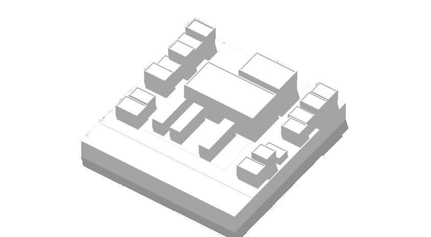
Kafil Uddin > Massing + Form Generation


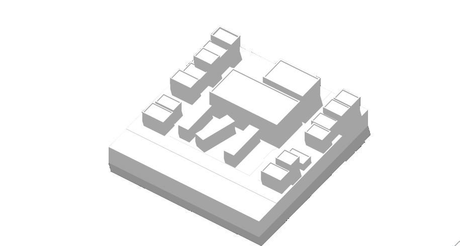


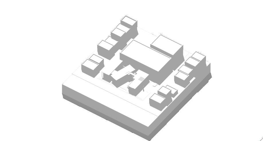


Property Ecologies traces the evolution of property practices in Houston Texas. The research, illustrated through models and drawings, was exhibited in ‘Big, Hot, Sticky’ hosted by the Architecture Center Houston in June 2024.
The Karankawa People of Galveston Bay moved seasonally to gather food. They practiced resource-sharing without property boundaries. Despite initial cooperation with settlers, conflict over land led to their near extinction by the 1820s, marking the beginning of static property practices in the region.
From 1823, land grants facilitated the settlement of Texas, with ranchers and farmers receiving expansive plots for agriculture. Stephen F. Austin led 300 families. Mexican restrictions on emigration fueled Texas’ eventual annexation in 1845.
As plantations expanded in Texas, slavery grew. Settler estates quickly expanded into vast plantations to form new property fabrics predominantly cultivating sugar and cotton. Earlier laws had granted mineral rights to landowners, later refined to enable leasing and sales of mineralrich estates.
The Law of Relinquishment allowed Texan landowners to separate surface and mineral rights, in response to the rush for mining oil. Earlier laws had granted mineral rights to landowners, later refined to enable leasing and sales of mineral-rich estates.
As the single family home gained mass popularity, subdivisions further introduced new property conventions in Texas. An almost synthetic landscape comprising extensive levees imposed homogeneous housing schemes onto a variety of contexts.
Texas’ 1999 Renewable Portfolio Standard sparked its wind energy industry, making it the U.S. leader by 2006. Recent debates on wind estate severance, akin to mineral rights, culminated in a 2023 court ruling permitting wind rights separation.
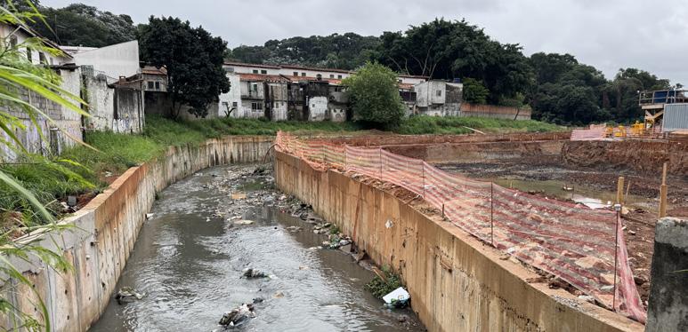
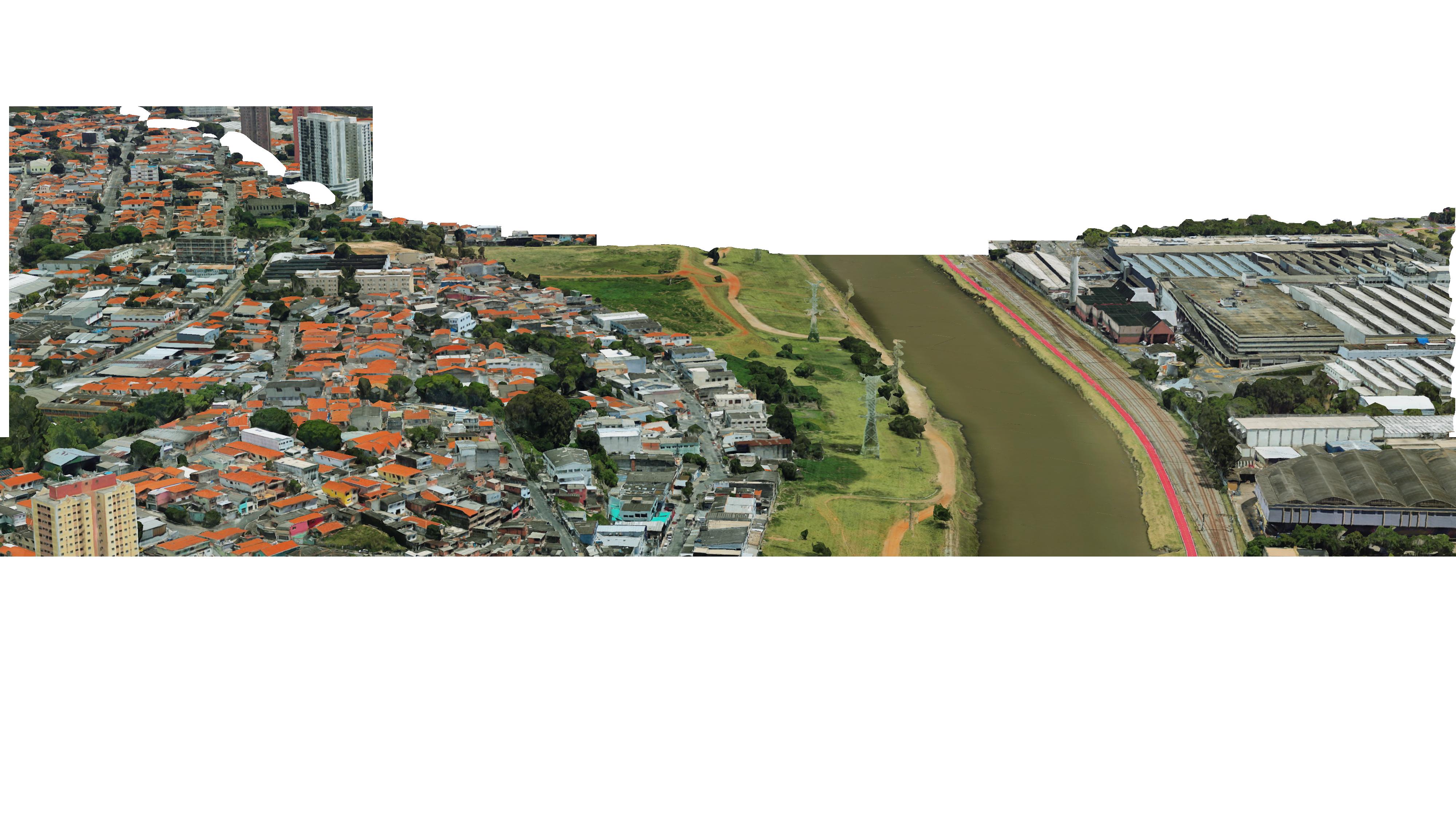
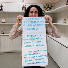
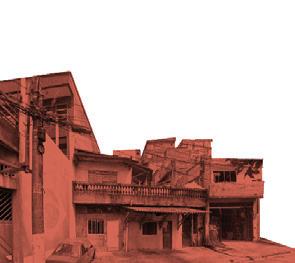
An urban renewal project in the South of São Paulo threatens entire communities facing imminent displacement. As part of the University of Michigan’s Public Design Corps, students collaborated with ongoing efforts of local community partners to complement their struggles and resistances in the face of this forthcoming disruption in the fabric of the city.
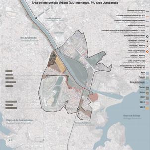
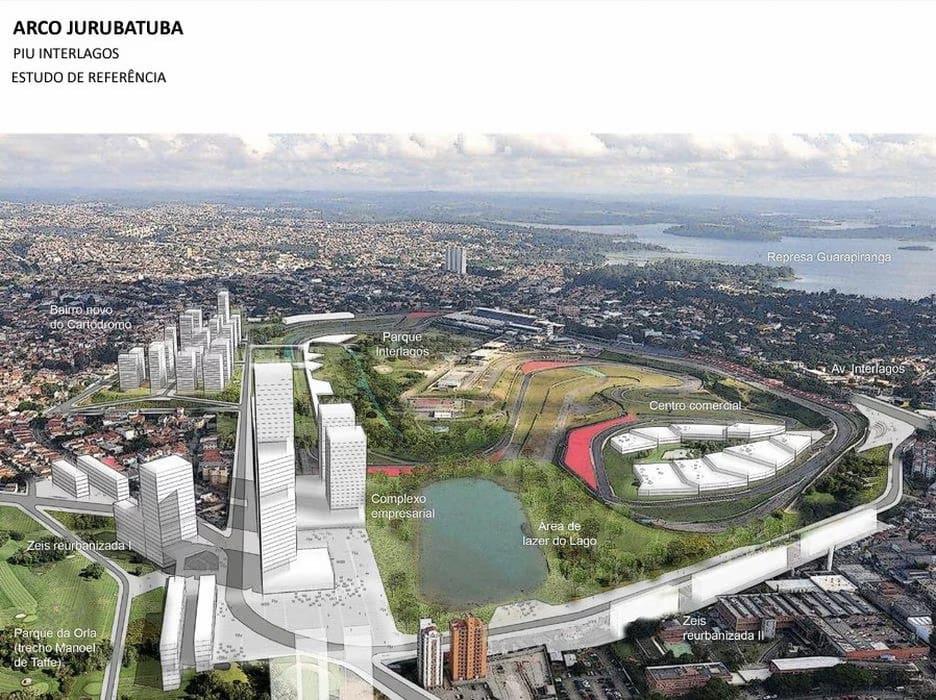
Students begin by collecting and unpacking official documents, maps, proposals and laws that help better understand but also illustrate for local stakeholders, the consequences of the PIU Arco Jurubatuba, a 2014 urban renewal proposal in the South of the city.
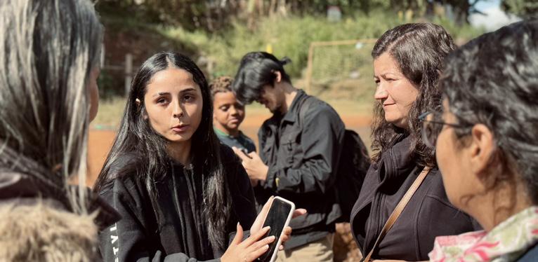
Once in São Paulo, students verify government data with ground realities to provide local communities with updated maps and statistical data. Scoping, field observation and community consultation further illustrate present conditions as a parallel to the project proposal
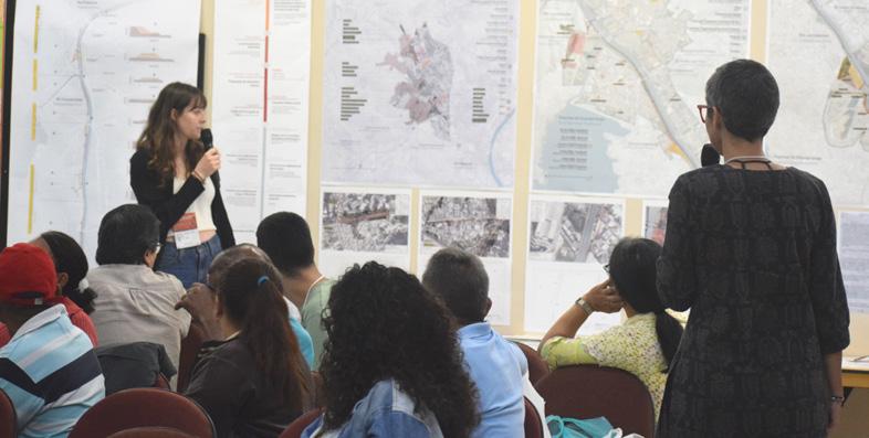
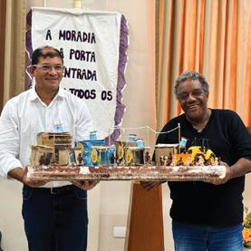
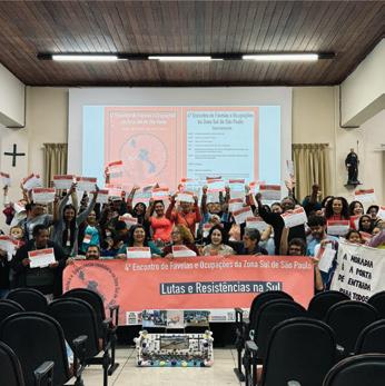
Students help local partners organize a community gathering event. Multiple communities come together to share mutual struggles and technical persons and stakeholders provide updates on various actions of resistance. The gathering ends with a co-produced manifesto and students return from São Paulo to create open source platforms for disseminating updated maps and data for all.





lutas_resistencias_no_sul



lutas_resistencias_no_sul
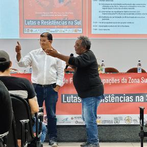
The 4th Meeting of Favelas and Occupations in the Southern Periphery of São Paulo ended with the
2w


^ Volume
Ahmedabad, India (2019)
Aspirations 2024 graduate Reparation 2024 graduate Threshold 2020 undergraduate
Master of Urban Design, University of Michigan
Graduate Thesis. Duration: 16 Weeks
In Singra, Bangladesh.
Advisors: María Arquero de Alarcón, Jessica Fayne
Fieldwork Collaborators: Huraera Jabeen, PhD, Singra Municipality, Binayak Chakraborty, Srikanta
Acharya
Master of Urban Design, University of Michigan
Urban Design Studio. Duration: 16 Weeks
In Detroit, Michigan, United States
Instructors: Cyrus Penarroyo
Collaborators: Cameron Blakely, Akshita Mandhyan
Bachelor of Architecture, BRAC University
Year Four Level One. Duration: 12 Weeks
In Dhaka, Bangladesh.
Instructors: Prof. Fuad Hassan Mallick, Iftekhar
Ahmed, PhD, Khondaker Hasibul Kabir, Abul Fazal
Mahmudun Nabi, Mohammad Zillur Rahman
Gratitude: Huraera Jabeen, PhD, Rahul Mehrotra
Expansion of TSC 2021 teaching
Department of Architecture, BRAC University
Year Five Level One, Duration: 12 Weeks
Co-Instructors: Prof. Fuad Hassan Mallick, PhD, Ehsan Khan, Mohammad Faruk, Naim Ahmed Kibria, Mohammad Habib Reza
Contributions as Teaching Assistant: Instruction, Review and Project Documentation
School of Architecture 2022 teaching
Peripheral Centralities 2024 engagement
Department of Architecture, BRAC University
Year Two Level Two. Duration: 5 Weeks
Co-Instructors: Atiqur Rahman, S M Kaikobad, Gourab Kundu
Contributions as Lecturer: Design Theory Lecture, Demonstration and Review
Master of Urban Design, University of Michigan Public Design Corps. Duration: 6 Weeks
In São Paulo, Brazil
Instructor: Maria Arquero de Alarcón
Local Partners: UNIÃO, Centro Gaspar Garcia de Direitos Humanos, Defensoria Pública do Estado de São Paulo, Peabiru Trabalhos Comunitários e Ambientais, Articulação Vila Andrade, Comunidade Pantanal
Peers: Tabita Aitonean, Jasmine Paulk, Natalia Boldt, Mariam Reyes, Yi-Chien Kuo, Jess Chen, Stephanie Dutan, Yesha Malaviya, Akshita Mandhyan, Angie Perez, Chun Wang, Aaron Johnson
Contribution: Public Consultation, Research, Graphic Production, Photography, Documentation, Website Design.
Property Ecologies
2024
research
bibliography
Taubman College, University of Michigan
Exhibition: Big, Hot, Sticky by Maggie Tsang / Rice
Architecture
Organizer: Architecture Center Houston
Research Team: Gabriel Cuéllar, Athar Mufreh, Saylor Allen
Contributions: Literature Review, Exhibition Text, Illustration, Model Making
Alexander, Alan. “The Texas Wind Estate: Wind as a Natural Resource and a Severable Property Interest.” University of Michigan Journal of Law Reform, no. 44.2, University of Michigan Law Library, 2011, pp. 429-, doi:10.36646/mjlr.44.2.texas.
Cantrell, Gregg. Stephen F. Austin, Empresario of Texas. Yale University Press, 1999.
Ricklis, Robert A. The Karankawa Indians of Texas an Ecological Study of Cultural Tradition and Change. 1st ed., University of Texas Press, 1996.
Wilkinson, Alfred Ernest and Richardson, Julian Andrew. Law of Oil and Natural Gas; a Hand Book of the Statutes of Texas and the Decisions of Its Courts Relating to Oil and Natural Gas, the Organization and Operation of Oil and Gas Companies, and the Ownership and Transfer of Mineral Rights. E. L. Steck, 1915
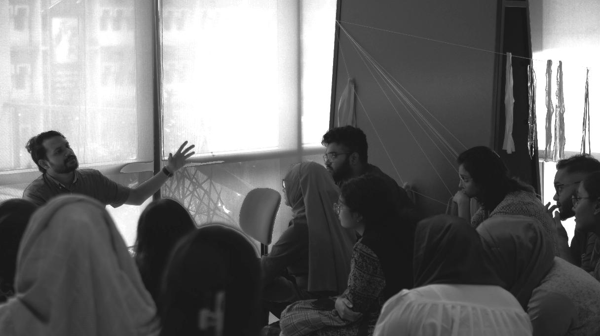
Discourse 2023 kafil uddin
And finally, a note of gratitude to my studentswho remain my greatest source of both learning and inspiration..