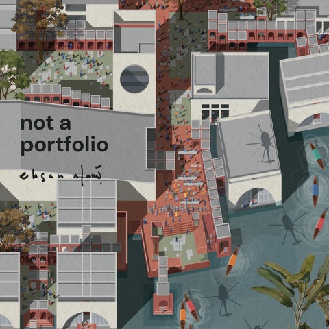
not a portfolio
this is not a portfolio to whom it may concern this is not a portfolio.
This is not a portfolio in its departure from
conventional design exercises which begin with a
supposedly complete reading of a context (which can never fully be read), identification of ‘issues’ (that can
never be enitrely perceived) and end with the proposal of a design (that attempts an absolute fix for issues larger than a project, a semester, or sometimes a lifetime).
Instead, it chronicles a lateral reading of the built-
unbuilt through a diverse set of circumstances—from the almost rural to the synthetic suburb.
Committed to problem posing more than problem
solving, it attempts the reading of (land)scapes, only to arrive at new languages of reading. It identifies
challenges in order to spotlight them; well aware that
such identification is partial and temporal. It also puts forth design- almost always as an act of
co-production, undertaken as an initiator of continued discourse ..
and not conclusive solutions.
Ehsan
Ann Arbor, 2025
\0 chronology content and
01
fluid aspirations natore, bangladesh
02
detroit reparations michigan, united states
06
07
confluence
03
natore, bangladesh
08
oneness
04
05
dinajpur, bangladesh
jhenaidah, bangladesh
research + engagement misc. locations
cartography misc. locations
teaching
09
thresholds dhaka, bangladesh
alleviation
10
dhaka, bangladesh
miscellaneous misc. locations
01 aspirations graduate thesis
What aspirations inform the development of secondary urban centers of the developing world- at the intersection of geography, governance, power and polity?
The
Much like other economically developing
Secondary
nations, Bangladesh has also been racing to
City
drive urbanism away from its major citiesprompting a series of decentralization intiatives. These moves often invite the overlap between urbanity and unique geographic territoriesthreatening the latter. One such condition is found in the largest marshy depression of the country where a municipality is fast developing, in spite of its population beginning to plateau. Singra Municipality is not only contending with the consequences of its concretizing model of urbanism- best encountered in the erratic behavior of its many receding water bodies. Furthermore, it must now determine what models and mechanisms of development it will adopt for its future- in the face of a population soon to decline, and a climate that is fast deteriorating.
Water Index
A Fluid Landscape
Fluidity (and water) manifests in various ways in Bangladesh- from coastal surges and
summer
seven hundred rivers forming the backbone of the land, to the vast expanses of marshy depressions that inform sensitive cycles of submersion and subsidence. This is a study of the largest wetland of Bangladesh
monsoon
autumn
River Network of Bangladesh
late autumn
winter
NDWI Map of Western Bangladesh showing Singra.
spring
water as everyday
water as ritual
water as synthetic
a semi-permanent coexistence
absorbing contextual abundance of
an imposition of permanence in a
with the land, informed by cyclic
water into culture and faith. Using
fluid landscape of impermanence-
transformations in materiality,
water as a purifying medium as well
inviting negligence, othering and
occupation and ways of life.
as a metaphysical contained for
ultimately, killing the water.
renewal.
মাছ মা াছ িব িবে বে তা তা fisherman We say the Beel (Marsh) is our pride, and we market our fish claiming it is from these aquatic landscapes. In reality, fishery has radically shifted to cultures within ponds in the city and the once famous fish from the Cholon Beel and the Atrai River is all but gone! You want reform? Start there.
কাউ কা াউি উি লর লর councilor The children in my ward are faced with daily challenges to cross the river (and canal) to reach school. This is further worsened with seasonal waterlogging which spreads pollutants, deterring school going children. I have been advocating for a bridge to improve connectivity for our children but.. To no avail.
শ্রীকা শ্রীক কান্ত ান্ত trader The Hindu Community of Singra has a long standing tradition of engaging with craftsparticularly terracotta tiles. These are now cheaper to import from factories than to buy from local artisans. The craft is all but dead.
A School of Life
A councilor’s plea for a bridge revealed broader issues of access to education in flood-prone areas. A new cooperative responds with floating, modular classrooms offering daycare to vocational training within the city’s aquatic landscape.
Monsoon
A Floating Elementary School runs year round with sessions beginning in Monsoon. Children gain awareness on hydrology while learning on classrooms on the river. This is complemented by water cleanup activtiies, stewardship roles and awareness campaigns
Late Autumn
As early as October, receding water nudges floating modules deeper into the river. New modules arrive from canals already running dry. Additional after school programs tutor adolescent learners preparing for National Board Examinations.
Spring
On the newly emerged banks, additional modules host a seasonal vocational school. Programs are intended for married women interested in acquiring new skills and workshops for unemployed youth. Daycare and elementary school continues.
The Earthen Commons
Once sustained by crafting terracotta tiles from post-monsoon soil, Singra’s earthen traditions are fading. The Earthen Commons revives this land-based craft through a community cooperative and center, reconnecting people with the marshy terrain they shaped.
Monsoon
Full-scale terracotta production reduces significantly. The craft center becomes a training center for the artform of terracotta. The co-operative shares its findings and recommendations on soil quality, pollution and encroachment.
Late Autumn
As the water recedes quickly from the marsh, craftspersons and fishermen begin collecting nutrient-rich topsoil from the freshly drained land. Another group documents the quality of soil.
Spring
The Earthen Commons hosts an annual festival where various terracotta crafts are sold in temporary stalls situated in the receding banks of the river. These stalls are an invitation to celebrate this ancient craft, prompting awareness of the threats posed to it. As water returns, the stalls recede, celebrating temporality.
02 reparation graduate
The University of Michigan’s Center for Innovation (UMCI) is a proposal in the heart of downtown Detroit that envisions the University’s mandate to drive innovation in technology. However, in the absence of acknowledging legacies of socio-spatial inequalities that have been prevalent in the city, it is prone to perpetrating the same harms as past endeavors in the city such as freeways ripping through African-American neighborhoods.
Counter
This project posits the UMCI as an act of
Premise
dispersion- of functions, that also allow opportunities and resources to percolate beyond the downtown district and into neighborhoods that have little to no access to them. This is done through distributing proposed training, experimental and educational functions throughout downtown and adding mixed-use, housing-oriented spaces into the scope of the project. In the third tier, the UMCI morphs into a campus more than a concept- one that can be interacted with through a series of prototypical neighborhood spaces that allow the UMCI to become an instrument of repair embedded into communities that still contend with historic traces of disinvestment.
context map 2.5 mi
income education redlining districts
Innovation without Repair In the same manner as highways that once ripped through neighborhoods, innovation without repair is likely to repeat historic socio-spatial harms
Dispersing the
In acknowledging the inevitability of the UMCI
UMCI Campus
campus, this project addresses its program instead and proposes additional functions and amenities that disperse the campus from one concentrated building to a series of spaces that disperse throughout downtown Detroit and finally, into surrounding neighborhoods.
Neighborhood Functions
Excerpts from the project illustrated here outline the neighborhood spaces introduced as a satellite to the UMCI. This includes urban gardens that double as cafes for neighborhoods to convene. In revisiting the notion of the cyber cafeneighborhood kiosks for reading- powered by the University of Michigan Library resourcescreate more effective interfaces with the university and its mandate for innovation. Through neighborhood + technology connectivity models, these spaces prototypical
Urban Gardens +
and minimal spaces are meant to disperse
Neighborhood
innovation into neighborhoods most affected
Cafes, Detroit
by socio-spatial inequalities.
Dispersing the UMCI Begins with server spaces extending beyond the currently proposed campusgrowing into ancillary structures and neighborhood cafes.
03 confluence professional
The largest delta in the world, Bangladesh is a landscape written in water; defined by a rich spectrum of wetness. In its largest wetland, a silent crisis is slowly altering a palette of streams, rivers, and marshes. Urban aspirations have inspired infrastructural projects rooted in permanence; often at odds with the landscape.
Premise
The municipality of Singra lies in Cholon Beel, the largest wetland of Bangladesh. In 2016, the city initiated a ‘Canal Development Project’- a waterfront public space that revived the central canal of the city.
From
However, an unrealistic design scheme, coupled
Development
with budget exceedance soon ran the project
to Re-
to ground. Soon after, the site was abandoned,
Development
rendering it into central dumpyard of the city. In 2021, Urban Core was invited to resume the project, working with the concrete structures that had already been cast on site and introducing porosity, vegetation and publicfacing spatial interfaces in the spaces that were yet to be concretized.
Co-Creation
The project foregrounded life in the deltathrough selection of trees, wall murals, material porosity, and level changes- all determined through extensive public consultation, coproduction of space and repeated verification with all concerned stakeholders.
Initial Site Conditions
Improvised Street Life
People Know
The site presented a ruin; with
Informal vendors had taken up the
The entire design process was
incomplete concrete walls from the
interface between the street and the
repeatedly informed by engagement
original design framing a dumpyard.
abandoned canal- we decided it was
with the citizens of Singra.
imperative to retain them.
Delta Promenade The project envisioned the completion of the abandoned waterfront promenade and in doing so, enable the revival of the city’s connection to its central canal and therefore, to water.
The Site As Encountered
The Site As Designed
We encountered a site that had an abandoned, concrete-
At the end of the project, the central canal had been cleaned
heavy project that had been paused; making way for waste
up, new trees were planets, porous surfaces were introduced
dumping, pollution and crime.
and the city had co-produced its central promenade.
A Place for All The completion of the project led to the production of a public space that was open to all. Through porous surfaces, shaded niches, informal nodes of engagement and vegetated pockets, the project has activated the central spine of the city.
04 oneness professional
Bending herringbone paths trace the entry to a remote village nestled in thick canopy-
surrounding fabric
situated in the middle of nowhere. It is here that the Santal community has built a century-old home for themselves and now aspire to erect a permanent chapel to facilitate worship as well as congregation. neighboring verancular precedent
Context
The Santals of Northern Bangladesh are an indigenous community prevalent in the larger region. A century ago, British Colonial rule relocated them to their current habitat; as railway construction labors. Despite growing
first phase design idea
into village majorities, labels of social inferiority from neighboring communities as well as institutions remain till today. The need for a community chapel building became an opportunity to support their ongoing struggle for identity and co-existence with their non-indigenous neighbors. At
second phase design idea
the same time, it presented an invitation to generate circumstances of gathering within the community through the generation of semiopen spaces with plural connotations of use. Program
Congregation Hall Preparation Space Public Toilet Study Room Open Community Plinth
third phase design idea
context
materiality
adjacencies
site plan 200’
site
community consultation
co-designing on site
Oneness An Earthen Community Chapel
community balcony prayer hall a
site plan
a’ 15’
priest’s study earthen wall
spire angled roof section aa’ depressed hall
15’
hall \ congregation
plinth \ community
landmark \ village
05 thresholds
undergraduate thesis
Point Landscape Furniture Fixture
Thresholds in Dhaka’s built fabric separate binaries such as private-public and formalinformal actors. This thesis explores thresholds and the life that evolves around them. By examining these boundaries at three scales, notional interventions are suggested to provoke discourse on urban spatial thresholds.
Line Terrain Elevation Surface
Point
Suggestive, undefined points in a space can create divisions by setting criteria between two seemingly homogeneous areas. In public spaces, this is achieved through urban furniture,
Line Wall Door Curb
fixtures, or natural elements like vegetation. Line
Linear thresholds, often walls, define clear lines of separation but can also appear as doorways or curbs.
Plane
Planar thresholds add a third, liminal space, creating a more gradual transition between two areas compared to linear thresholds.
Volume
Volumetric thresholds, commonly found between indoor-outdoor or private-public spaces, add a further layer of transition by introducing intermediate volumes.
Plane Path Volume Scale Balcony
water node
staggered street
raised plinth
gateway
water station
boundary wall
shop front
corner recess
Informality Along
Location +
Thresholds
Structure
Permanent
stationary
Vendors
at single site
Lot Boundary
+
Sidewalk
permanent
Empty Lot
structure
Semi Permanent
temporary
Vendors
at single site
Lot Boundary
+
Sidewalk
removable
Curb
structure
Semi-Mobile
moving
Vendors
between sites
Sidewalk
+
Public Place Node
light mobile structure
Road
constant Mobile
motion
Vendors
+
Sidewalk
light mobile
Road
structure
Thresholds in a Public Place
a walled off cemetery
gateway to a monument
separated by a fence
breached to create
plurality of space
site plan
a park in a
625’
cemetery
Negotiating Thresholds
01
02
03
04
Intervention
Volume as
The vision of the city authorities to
Threshold
complement the spirit of the monument and
Site Plan Legend
01. Graveyard (existing) 02. Mosque (existing + expansion)
retain the sanctity of the cemetery with a
03. Museum (existing + expansion)
museum and library, are in direct conflict with
04. Martyred Intellectuals’ Monument (existing)
people’s need for recreational spaces. These
05. Library (proposed)
considerations informed a design intervention
06. Nursery (redesigned)
that caters to both the intended and actual
07. Promenade (proposed)
uses of this space.
site plan 400’ 05
06
07
section aa’ 800’
Library as Remembrance
section aa’ 50’
admin the library of courtyard
remembrance is an invitation to resume intellectual practices as the backbone of nation
stack area
building practices
reading rooms
that were deliberately vanquished at this very site at
ramp to
the dawn of the
monument
nation’s birth.
public courtyard
library @ - 15’0” 70’
06 alleviation undergraduate
Alleviation inquires how larger socio-cultural statistics often misrepresent disadvantaged groups and how introduction of new spaces can empower the under-represented. One Inauguration
“our families are not sure what happens here.”
Two Admission
Jhenaidah Municipality in Bangladesh has a
Three
Misleading
literacy rate higher than the national average,
Daycare
Statistics
though female literacy, especially among adult
Education
“attending training will lead to neglecting the
“a daycare would help look after the children.”
women, remains low due to early marriage and education discontinuation. Vocation
Public consultations reveal that most married
Instead of
women with incomplete degrees seek
Schooling
empowerment through vocational skills. By
Four
attending hands-on training, they hope to
Recreation
“can their father also engage with this space?”
gain skills in crafts and other practical areas, contributing to family income and amplifying their household voice. A Space That Empowers
To support this, a new space was needed to facilitate vocational training. This training would engage all household members, fostering sustained acceptance and support.
Five Civic Space
“if only this was a space for the whole family”
Adult cannot attend training with household chores and young children at
Adolescent vocational training is required alongside school for empowerment
Infant it takes over 30 minutes to walk to school and the route is not suitable for site plan 300’
Intervention The intervention, one of three for infants, adolescent, and adult women, is planned along the city’s receding central riverbank, celebrating women, empowerment, and water as a connecting element for these learning centers.
Training Center for Married Women section aa’ public space
20’ recreation
classroom
spaces at street level above welcome the entire family into the complex
site plan healthcare workshop
40’ workshop
classroom daycare amphitheater
spaces blend into the river allowing outdoor activities while ensuring privacy when required
07 green over grey research
Regional Transect
Natural Land
As aging grey infrastructure begin to fail at unprecedented rates in the face of frequent extreme wet weather events, Southeast
Rural Land
Michigan experiences an unequally distributed landscape of stormwater-borne hardships. Open Space
Low Intensity Residential
Nature
In light of this crisis, nature-based solutions
Based
offer an alternative to aging infrastructure. They
Solutions
Mid Intensity Residential
are more cost-effective than infrastructural upgradation, and premised around a larger spectrum of co-benefits than other green infrastructure approaches (green stormwater
High Intensity Residential
infrastructure and low impact development in the United States). Methods
This regional planning study, undertaken by a
Light Industry
multi-discplinary team foregrounds fish and wildlife considerations and adopts a method that simultaneously considers ecologies, communities, land-use, financing, and
Downtown
stormwater modelling. Planning
The output from this study comprises of a
Tools
regional transect, fish and wildlife planning
Infrastructure
cards, nature-based solutions cards and a regional actor network among others. These are tailored to support NBS design endeavors in the region.
Waterfront
Phasing Study: Implementing Nature Based Solutions
Phase I Initial Condition
Nature Takes Time
Nature-based Solutions are often depicted as finished products; pristine end results that obscure the processes and stakeholders involved in the implementation of green infrastructure. Through a series of phasing studies, this project spotlights the key phases during NbS implementation, including processes
Phase II Land Assembly + Excavation
that often take years. This includes land assembly, de-paving, excavations, planting (and waiting for vegetation to mature), initial maintenance activities and routine operation and maintenance schemes. These processes are not only timeintensive. They are also components of NbS implementation that require a spectrum of stakeholder engagement, community stewardship models, and continued
Phase III
engagement with the localities of NbS
Planting + Daylighting
implementation.
+ De-Paving
Legend 1. Depressed playing field serves as temporary stormwater detention basin 2. New neighborhood park with vegetation and trails. 3. Daylighted buried stream 4. Bioswale at industrial park for runoff filtration 5. Neighborhood de-paving of abandoned alleyways 6. Missing-middle housing in vacant lots 7. Urban farming in vacant lots.
1
2
3
4
5
6
7
Fish + Wildlife Planning Cards A set of fish and wildlife planning cards spotlight priority species in the Southeast Michigan region.
These cards are intended to depict each species as members of larger ecosystems through trophic relationships, ideal and adapted habitats, nesting and breeding areas, and conservations status. The cards also outline ideal habitat conditions for each species and design considerations to foster habitats as part of any nature-based solutions.
Nature Based Solutions Cards
NBS Type
NBS Benefits
Prototypical Isometric Illustration
Potential Locations Suitable for NBS Type
Storage / Conveyance
Storage / Conveyance
Typologies Design Considerations
Maintenance
Other NBS Cards
Built Examples Environmental Socio-Cultural Economic Benefits
07 property ecologies research
Brief
Property Ecologies traces the evolution of property practices in Houston Texas. The research, illustrated through models and drawings, was exhibited in ‘Big, Hot, Sticky’ hosted by the Architecture Center Houston in June 2024.
Karankawa 500 CE
The Karankawa People of Galveston Bay moved seasonally to gather food. They practiced
Severance 1919 CE
The Law of Relinquishment allowed Texan landowners to separate surface and mineral
resource-sharing without property boundaries.
rights, in response to the rush for mining oil.
Despite initial cooperation with settlers, conflict
Earlier laws had granted mineral rights to
over land led to their near extinction by the
landowners, later refined to enable leasing and
1820s, marking the beginning of static property
sales of mineral-rich estates.
practices in the region. Subdivision Land Grants 1823 CE
From 1823, land grants facilitated the
1920 CE
As the single family home gained mass popularity, subdivisions further introduced
settlement of Texas, with ranchers and farmers
new property conventions in Texas. An almost
receiving expansive plots for agriculture.
synthetic landscape comprising extensive
Stephen F. Austin led 300 families. Mexican
levees imposed homogeneous housing
restrictions on emigration fueled Texas’
schemes onto a variety of contexts.
eventual annexation in 1845. Wind Energy
Texas’ 1999 Renewable Portfolio Standard
1999 CE
sparked its wind energy industry, making it
Plantation
As plantations expanded in Texas, slavery
1830 CE
grew. Settler estates quickly expanded into
the U.S. leader by 2006. Recent debates on
vast plantations to form new property fabrics
wind estate severance, akin to mineral rights,
predominantly cultivating sugar and cotton.
culminated in a 2023 court ruling permitting
Earlier laws had granted mineral rights to
wind rights separation.
landowners, later refined to enable leasing and sales of mineral-rich estates.
Indigenous
Land Grants
Plantation
Severance
Subdivision
Energy
07 public design corps engagement
Premise
An urban renewal project in the South of São Paulo threatens entire communities facing imminent displacement. As part of the University of Michigan’s Public Design Corps, students collaborated with ongoing efforts of local community partners to complement their struggles and resistances in the face of this forthcoming disruption in the fabric of the city.
One
Students begin by collecting and unpacking
Unpacking
official documents, maps, proposals and laws that help better understand but also illustrate for local stakeholders, the consequences of the PIU Arco Jurubatuba, a 2014 urban renewal proposal in the South of the city.
Two Fieldwork
Once in São Paulo, students verify government data with ground realities to provide local communities with updated maps and statistical data. Scoping, field observation and community consultation further illustrate present conditions as a parallel to the project proposal
Three
Students help local partners organize
Sharing
a community gathering event. Multiple communities come together to share mutual struggles and technical persons and stakeholders provide updates on various actions of resistance. The gathering ends with a co-produced manifesto and students return from São Paulo to create open source platforms for disseminating updated maps and data for all.
field visits -
01. urban renewal
engaging the community
02. countermapping
03. grounding realities
setting up a gathering
04. dissemination
08 projection as politics cartography
44° 20’ 48” N 85° 24’ 37” W NAD 1983 StatePlane Michigan Central FIPS 2112
Maps Are Never Neutral
Maps have never been neutral tools. The Mercator projection famously inflated northern and southern landmasses while compressing the equatorial belt, rendering colonized countries visually smaller and politically diminished. Greenland appeared the size of Africa, despite being fourteen times smaller; visual distortion reinforced geopolitical hierarchies.
Trade-Offs In Projection
Every projection is a compromise. The Gall–Peters preserves relative land area but elongates continents; the Mollweide balances area with a pleasing oval form yet distorts shapes; Buckminster Fuller’s Dymaxion interrupts continuity to minimize distortion but sacrifices intuitive geography. Each is a negotiation among land area, proportion, and the perceived distances between places.
A Granular
At the city scale, projection choice becomes
Consequence
even more consequential. Chicago aligns best
WGS 1984 Web Mercator
with Illinois State Plane East; switching to
NAD 1927 Illinois West FIPS 1202
Illinois West, Michigan South, or Indiana West
NAD 1927 Illinois East FIPS 1201 NAD 1927 Indiana West FIPS 1302
introduces small but measurable shifts. Apply global projections like Mercator or Cylindrical
chicago, il
Equidistant, and distortions become significant, undermining precision mapping.
NAD 1983 Michigan South FIPS 2113 Equidistant Cylindrical Cylindrical Equal Area
10 mi
Mercator Gall Peters Cylindrical Equal Area Mollweide Sinusoidal
projection as politics 5,000 mi
Goode Homolosine Winkel Tripel Polyconic Berghaus Star AAG Adams Square II Fuller
08 red remnants cartography
42° 38’ 46” N 83° 17’ 33” W NAD 1983 StatePlane Michigan South FIPS 2113
redlining Redlining
In the mid-20th century, Pontiac, Michigan, was subject to redlining; a discriminatory housing policy where banks and federal agencies
& african american population
marked predominantly Black neighborhoods as high-risk for investment. These redlined zones were systematically denied mortgages
2 mi
and insurance, inhibiting homeownership, neighborhood stability, and generational wealth among residents of color. Enduring Scars
Though redlining was outlawed in 1968, its spatial scars remain visible. Pontiac’s formerly redlined areas still suffer from underinvestment, lower property values, and aging infrastructure. These zones often overlap with today’s census tracts that exhibit higher poverty rates and lower median household incomes, underscoring the enduring legacy of racialized disinvestment.
Pontiac
Pontiac’s current median household income
Today
is significantly below the state average, and
& african
its demographic is majority Black and Latino.
american
This correlation between past exclusionary
population
income
policies and present socioeconomic conditions illustrates how structural racism continues to shape urban outcomes across generations.
2 mi
red remnants 1 mi a b c d o redlining districts
75K 12K median income = 2 persons african american
08 dhaka in anatomy cartography
23° 45’ 52” N
ancient fort
90° 23’ 20” E Gulshan 303 Bangladesh Transverse Mercator
enclave
Riverine Inceptions
Dhaka is shaped by centuries of geographic and political shifts. Its history precedes Mughal riverine outposts with shophouses and bazaars. British rule exapnded the city with rail
regimental 1750’
lines and maidans, then embraced Modernist planning as East Pakistan’s capital. After 1971, as Bangladesh’s capital, rapid urbanization followed, with private housing markets filling floodplains and transforming Dhaka into a dense, concrete expanse. Urban
This history created diverse urban fabrics:
Form
Mughal shophouses and Islamic public
riverfront
gardens, colonial-era regimental housing blocks, and post-independence model towns racing to facilitate an exponential population
campus
boom. Informal districts emerged as a parallel, revealing persistent inequalities. Today’s urban form is, however, increasingly static; trading communal intimacy for regularized isolation. Future Trajectories
Despite this, sites like the Parliament complex
institution
stand as pauses amid relentless growth. As Dhaka’s population surges and history is paved over, the future demands preservation, reform, and creative reuse to ensure the city remains livable and historically legible.
threshold 1750’
the evolution of dhaka 1600
1750
1850
1960
1980 8 mi
1990
2002
2017
08 after the line cartography
23° 10’ 15” N 89° 12’ 0” E WGS 1984 Web Mercator (Auxiliary Sphere)
Colonial Conclusions
Partition marked the violent culmination of British colonial rule in the Indian subcontinent in 1947. After nearly two centuries of extraction and control, the British exit strategy sought to create two sovereign nations, India and Pakistan, divided largely along religious lines. In Bengal, a province with a deeply entangled Hindu-Muslim population, this division proved especially catastrophic
Radcliffe
Drawn in just five weeks by Sir Cyril Radcliffe,
Line
a British lawyer unfamiliar with the region, the boundary line split Bengal into East Pakistan and West Bengal. The process disregarded cultural, economic, and ecological continuities, using outdated maps and hasty census data. The line cut through homes, communities, rivers, and forests with surgical indifference.
Violence,
In Bengal, Partition displaced millions. Violence
Exchange,
erupted in both rural villages and urban centers
Aftermath
like Calcutta and Dhaka. Families abandoned land overnight, sometimes exchanging properties informally across borders. Entire communities vanished, and many who stayed became minorities overnight—marked, mistrusted, and often persecuted.
09 design one
Lines from Nature
teaching
Anika Tabassum Biva
Project
Introduction to Design is a student’s first
Brief
exposure to Architecture through a series of design exercises. Students explore compositions with basic elements, such as lines, planes and volumes. The studio starts with a 2D exercise with lines and concludes with a 3D dimensional Abstraction of a Film. In the process, students explore a series of
Rafiya Nusrat Moushe
media from graphite to sculpting with found materials. In addition, they are also introduced to precedents in Architecture and asked to analyze and formulate abstractions of them using the fundamental elements of design previously learned. Learning Outcomes
Express different concepts and design ideas in graphical format Identify the different characteristics of basic
Fatema Nusrat Raisa
design elements such as lines, primary shapes and forms Apply the aesthetic principles of basic design to create various compositions Improve analytical and innovative thinking ability Develop the skills of using different media (digital and others, whenever possible) to show both two and three-dimensional expressions of basic design compositions.
Abir Hossain
Composition
Low Relief
with Shapes
Fatema Nusrat Raisa
Shafiqa Anjum Autoshi
Faiza Jabin
Yashfia Sadaf
Jannatul Ferdouse Sinthya
Israt Rahman Sinthee
09 school of architecture teaching
Project Brief
The Design of an Architecture School is premised around hands-on training and requires a proposal that facilitates architectural pedagogy at the intersection of science and the arts. Through the careful organization of modular learning spaces and supporting functions, students are required to envision a campus that stages an atmosphere of learning and reflection in various modalities. Special attention is desired towards spaces of informal encounters, congregation, conversation and ultimately, reflection in an educational complex that fosters a deeper appreciation for the built environment.
Learning Outcomes
Learn about organizing multiple modular functions of a school into a unified whole.
site plan 300’
Site
challenges students to create a sanctuary of
Demonstrate understanding of relationship
learning at the heart of urban congestion and
between space requirements, circulation, basic
chaos.
structural system and site surroundings and develop formal expression of functions. Develop understanding on how the essence of a program guides to develop uniqueness in design. Respond to site forces and address the challenges of site constraints through design.
Nestled in a compact urban setting, the site
Student Work
Kafil Uddin > Massing + Form Generation Axonometric Site View
Massing
Zoning
Tilt
Access
Roof
Complex
09 expansion of teacher student center teaching
Project
The Teacher-Student Center (TSC) of Since
Brief
its design by Greek architect Doxiadis in 1960, this landmark has outgrown its capacity and is in need of expansion to offer expanded and upgraded facilities. Students are required to design an expansion to the TSC, addressing a complex set of programs. Special emphasis is desired on a strong conceptual approach and professional-level design quality
Learning Outcomes
Study and Analyze existing precedents in order to formulate strategies for expansion Conceptualize and express design ideas Identify and articulate different design considerations: formal, functional and structural Formulate design solutions based on both technical and socio-cultural contexts Generate architectural and technical drawings equivalent to construction working drawings.
Site Image
Existing complex with potential expansion site > Source: Nakib Shah Alam
Student Work
Ashfak Ullah Chowdhury >> Campus Aerial Perspective
10 receding commons miscellaneous
Thresholds Original Design 1960 Parliament >
Original Design Instruments of Democracy
Guest Lecture Taubman College of Architecture
1960 Walkway >
and Urban Planning, University of Michigan Course: Politics of Balance, Fall 2024 Instructor: Ana Morcillo Pallares October 22, 2024 A Alfred Taubman Commons, University of Michigan Modification
Brief
The lecture examines the National Parliament
2002
Building of Bangladesh, designed by Architect
South Plaza >
Louis Kahn. Tracing the historic development of the complex as a parallel to the birth of the nation is followed by an examination of spatial exclusion as a mechanism to hinder democratic practices. Finally, the uprising of Monsoon 2024 and the resultant events that unfolded in the premises of the Jatiyo Shangshad Bhaban also illustrate the futility of such exclusionary practices. The lecture was followed by an
Modification
engaging discussion further unpacking the
2014
intersection of politics and design.
South Plaza >
10 impressions miscellaneous
^ Volume Ahmedabad, India (2019) Staging > Dhaka, Bangladesh (2019)
1 1 acknowledgment project
Fluid Aspirations 2024 graduate
Master of Urban Design, University of Michigan Graduate Thesis. Duration: 16 Weeks In Singra, Bangladesh.
Oneness 2023 professional
Associate Consultant, Urban CoRe In Dinajpur, Bangladesh. Duration: 9 Weeks Design Team: Huraera Jabeen (Principal
Advisors: María Arquero de Alarcón,
Architect)
Jessica Fayne, PhD
Commission: St. Francis of Assisi + Fr. Michel
Gratitude: Huraera Jabeen, PhD, Singra
Tigga
Municipality, Binayak Chakraborty, Srikanta
Contribution: Scoping and User Consultation,
Acharya
Material Research, Program + Design Development
Repair
Master of Urban Design, University of Michigan
2024
Urban Design Studio. Duration: 16 Weeks
graduate
In Detroit, Michigan, United States Instructors: Cyrus Penarroyo Collaborators: Cameron Blakely, Akshita
Status: Awaiting Construction Threshold 2020 undergraduate
Bachelor of Architecture, BRAC University Year Four Level One. Duration: 12 Weeks In Dhaka, Bangladesh.
Mandhyan
Instructors: Prof. Fuad Hassan Mallick, Iftekhar
Generative AI Acknowledgement: Spatial
Ahmed, PhD, Khondaker Hasibul Kabir, Abul Fazal
visualization collages produced AI-generated
Mahmudun Nabi, Mohammad Zillur Rahman
assets using Midjourney AI through written
Gratitude: Huraera Jabeen, PhD, Rahul Mehrotra
prompts and reference images. Alleviation Confluence
Associate Consultant, Urban CoRe
2018
Year Four Level One. Duration: 12 Weeks
2021
In Natore, Bangladesh. Duration: 8 Weeks
professional
Design Team: Huraera Jabeen (Principal
Instructors: Huraera Jabeen, PhD, Khondaker
Architect)
Hasibul Kabir, Tasfin Aziz, Mohammad Zillur
Commission: Singra Municipality
Rahman
Contribution: Scoping and User Consultation,
Study Collaborators: Tanvir Islam, Sabrina Ritu
Material Research, Program + Design Development, Hands-On Construction Status: Completed
undergraduate
Bachelor of Architecture, BRAC University In Jhenaidah, Bangladesh.
Green Over
rvtr, University of Michigan
Property
Taubman College, University of Michigan
Grey
Duration: 10 Months
Ecologies
Exhibition: Big, Hot, Sticky by Maggie Tsang /
2025
Supervisors: Kathy Velikov (Co-PI), Maria Arquero
research
de Alarcón
2024 research
Rice Architecture Organizer: Architecture Center Houston
Funding Agency: National Fish and Wildlife
Research Team: Gabriel Cuéllar, Athar Mufreh,
Foundation (NFWF)
Saylor Allen
Project Team: University of Michigan (Glen
Contributions: Literature Review, Exhibition Text,
Daigger, Curt Wolf), Peter Adriaens, Nabilla
Illustration, Model Making
Maharani, Gustav Rohde), Michigan State University (Dana Infante, Justin Miller), Wayne State University (Carol Miller, Lara Treemore Spears)
Design One 2023 pedagogy
Department of Architecture, BRAC University Year One Level One. Co-Instructors: Zainab Faruqui Ali, Saima Sharmin, Doito Bonotulshi, Emmat Khanam
Peripheral Centralities 2024 graduate
Master of Urban Design, University of Michigan
Contributions as Lecturer: Theory Lecture,
Public Design Corps. Duration: 6 Weeks
Model Making Tutorial and Design Review
In São Paulo, Brazil Instructor: Maria Arquero de Alarcón Local Partners: UNIÃO, Centro Gaspar Garcia de Direitos Humanos, Defensoria Pública do Estado de São Paulo, Peabiru Trabalhos Comunitários
School of Architecture 2022 pedagogy
Department of Architecture, BRAC University Year Two Level Two. Duration: 5 Weeks Co-Instructors: Atiqur Rahman, S M Kaikobad, Gourab Kundu
e Ambientais, Articulação Vila Andrade,
Contributions as Lecturer: Design Theory
Comunidade Pantanal
Lecture, Demonstration and Review
Peers: Tabita Aitonean, Jasmine Paulk, Natalia Boldt, Mariam Reyes, Yi-Chien Kuo, Jess Chen,
Expansion
Stephanie Dutan, Yesha Malaviya, Akshita
2021
Mandhyan, Angie Perez, Chun Wang, Aaron
pedagogy
Department of Architecture, BRAC University Year Five Level One, Duration: 12 Weeks Co-Instructors: Prof. Fuad Hassan Mallick, PhD,
Johnson
Ehsan Khan, Mohammad Faruk, Naim Ahmed
Contribution: Public Consultation,
Kibria, Mohammad Habib Reza
Research, Graphic Production, Photography,
Contributions as Teaching Assistant: Instruction,
Documentation, Website Design.
Review and Project Documentation