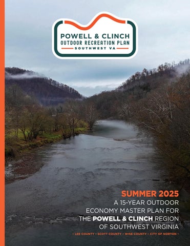


PRODUCED FOR PRODUCED BY

PRODUCED FOR PRODUCED BY
POWELL AND CLINCH OUTDOOR RECREATION PLAN PROJECT COMMITTEE
Jimmy Adkins – Director of Planning, LENOWISCO Planning District Commission
Natalie Chapman – Economic Development & Grants Supervisor, Wise County
Kim Davis – Executive Director, Friends of Southwest Virginia
Bill Dingus – Assistant County Administrator, Scott County
Katie Dunn – Community Engagement & Tourism Director, City of Norton
Thomas Lawson – Regional Planner, LENOWISCO Planning District Commission
Leslie Litton – Economic Development & Tourism, Lee County
Jen Otey – Outdoor Recreation Development Manager, Friends of Southwest Virginia
Robby Wright – County Administrator, Lee County
VIDEO INTERVIEWS
Kim Davis – Executive Director, Friends of Southwest Virginia
Bill Dingus – Assistant County Administrator, Scott County
Katie Dunn – Community Engagement & Tourism Director, City of Norton
Maddie Gordon – CEO, Clinch River Outfitters
Thomas Lawson – Regional Planner, LENOWISCO Planning District Commission
Map 01: Regional Context...............................15
Map 02: Outdoor Recreation Assets.......... 35
Map 03: Natural Resources Assets...............41
Map 04: Historical and Cultural Assets.....43
Map 05: Powell and Clinch Region Outdoor Recreation Hubs............. 75
Map 06: North Fork of the Pound Outdoor Recreation Hub...............77
Map 07: Guest River Gorge Outdoor Recreation Hub .............. 79
Map 08: Bark Camp Outdoor Recreation Hub.................................83
Map 09: High Knob Outdoor Recreation Hub.................................89
Exhibit 01: Powell and Clinch Region Economic Impact Analysis.......21
Exhibit 02: Unthanks Cave Natural Area Preserve................................36
Exhibit 03: The Cedars Natural Area Preserve.........................................36
Exhibit 04: Powell Valley Overlook............. 37
Exhibit 05: Thomas Walker Civic Park.......38
Exhibit 06: High Knob Recreation Area....39
Exhibit 07: Artisan and Music Trails...........44
Exhibit 08: Swinging Bridges.......................45
Exhibit 09: Clinch River Valley Initiative...46
Exhibit 10: High Knob Regional Initiative Vehicular Wayfinding System...................... 71
Exhibit 11: High Knob Regional Initiative Trail Marker System...................... 73
Map 10: Maple Gap Outdoor Recreation Hub.................................. 93
Map 11: Stone Mountain Outdoor Recreation Hub....................................95
Map 12: Pennington Gap Outdoor Recreation Hub................................... 97
Map 13: Cumberland Gap Outdoor Recreation Hub.................................99
Map 14: Trail Towns.......................................... 103
Map 15: City of Norton....................................117
Map 16: Blueways.............................................125
Map 17: Regional Trails and State Parks......................................... 137
Map 18: Beaches to Bluegrass Trail............ 139
Exhibit 12: Spearhead Trails...........................84
Exhibit 13: Scott County Horse ParkIllustrative Master Plan..............86
Exhibit 14: Trail Town Guides.......................105
Exhibit 15: Powell River Trail Downtown Appalachia Route.......................106
Exhibit 16: VMS Criteria and Tier Breakdown....................................109
Exhibit 17: St. Paul Market Square..............112
Exhibit 18: Park Avenue Streetscape Enhancements.............................120
Exhibit 19: Powell River Access AreasRoute 666.....................................128
Exhibit 20: Destination Fishing Experiences.................................134
Exhibit 21: Sugar Hill Unit..............................143
ThePowell and Clinch
Outdoor Recreation Plan provides strategic direction to Lee, Scott, and Wise Counties and the independent City of Norton as they invest in outdoor recreation infrastructure and their downtowns. This chapter summarizes the foundation and intent of this important work and o ers insight into the plan's purpose, goals, process, and overall organization.
THIS CHAPTER:
Project Background
Project Goals 1.3 Planning Process 1.4 Plan Organization
Nestled in Southwest Virginia, the Powell and Clinch Region is the gateway to Virginia from the neighboring states of Kentucky and Tennessee. Encompassing the LENOWISCO Planning District Commission (PDC) of Lee, Scott, and Wise Counties as well as the independent City of Norton, the region is a premier destination for outdoor enthusiasts. With access to the Clinch, Powell, and Holston Rivers, Cumberland Gap National Historical Park, High Knob Recreation Area, George Washington and Je erson National Forest, and a variety of state parks, it serves as the perfect basecamp for adventurers of all ages and abilities seeking to explore the great outdoors.
Led by Friends of Southwest Virginia and funded by grants from the Appalachian Regional Commission and the Virginia Tobacco Region Revitalization Commission, this plan builds on previous outdoor recreation planning e orts within the region. In particular, the recent High Knob Regional Initiative Master Plan (2019) provides a unified vision and guiding principles to drive sustainable growth in the High Knob Region. While planning e orts at the city, state, and regional levels may vary in both number and relevancy across the region, the Powell and Clinch Outdoor Recreation Plan seeks to extend regional outdoor recreation opportunities by fostering partnerships and strategically expanding recreational assets and regional connectivity.
In addition to expanding outdoor recreation, city o cials and leaders are committed to revitalizing historic downtowns while preserving their charm, cultural heritage, and distinctive character. In the Powell and Clinch Region, five downtowns either participate in or are pursuing the Virginia Main Street Program: Big Stone Gap, Gate City, Norton, St. Paul, and Wise. Other small communities in the region have potential to serve as “trail towns” connecting community members and visitors to outdoor recreation assets and services.
The Powell and Clinch Outdoor Recreation Plan, developed over ten months through intensive collaboration, reflects the shared vision of local leaders and community stakeholders. This 15-year roadmap is designed to enhance outdoor recreation, connectivity, and sustainability across the Powell and Clinch Region, improving quality of life for residents and strengthening local resources to support lasting growth.
Inventory and assess the existing outdoor recreation assets in the study area, evaluating their current condition and capacity to o er a high-quality outdoor experience for all users.
Collaborate with government entities, community leaders, and the public to identify ongoing and planned projects aimed at enhancing the quality of life for both residents and visitors.
Identify new, compelling tourism infrastructure projects to promote the outdoor economy, enhance the quality of life, and drive private investment.
Identify projects that also help achieve broader community goals, such as young adult and workforce retention, small business growth, environmental quality, and active living.
Develop a 15-year action plan that captures community interest and inspires a shared vision by incorporating compelling renderings, site master plans, 3D illustrations, and other visual elements to clearly convey recommendations and ideas.
Provide the steering committee and their partners with clear strategies and a prioritization schedule for implementing the plan recommendations.
The Powell and Clinch Outdoor Recreation Plan represents the culmination of several months of analysis, planning, graphic development, and numerous meetings and site visits. The planning process involved five major phases.
September - November 2024
Created a unique plan identity and promotional video for the Powell and Clinch Outdoor Recreation Plan that built excitement with government leaders, community partners, and the public. Hosted a project website that informed about project goals, opportunities for engagement, and progress. Facilitated a Direction Setting meeting with the Project Committee.
September - November 2024
Conducted site visits, field analysis, and demographic research to develop an inventory of existing assets and understand key opportunities and constraints. Reviewed previous planning e orts that may have implications for the Powell and Clinch Outdoor Recreation Plan.
October 2024January 2025
Conducted a series of interviews and focus groups with government o cials, business leaders, and community members to discuss the following themes: cultural arts, economic development, outdoor recreation, and opportunities for children and families. Gathered input from citizens about desired priorities via an online survey.
December 2024May 2025
Created the plan framework that featured preliminary recommendations for improving and expanding outdoor recreation assets. Hosted a public meeting to share recommendations with community members for input.
April - June 2025
Developed an action plan that included the recommendations determined during the planning process, a phasing schedule, and an outline for grant funding sources.
The Powell and Clinch Outdoor Recreation Plan is organized into five (5) major chapters as outlined below.
The current chapter, which summarizes the foundation and intent of this important work, and outlines the plan’s purpose, goals, process, and organization.
A snapshot of the regional setting and outdoor recreation economy, demographic trends, previous planning e orts, and an analysis of tourism market potential are presented here. The chapter also includes an inventory and analysis of the current assets within the Powell and Clinch Region.
This chapter discusses tools used for public engagement, highlights stakeholders and organizations involved in the planning process, and presents key results from an online survey designed to obtain ideas from the community regarding their outdoor economy and future development priorities for the region. The chapter culminates with Emerging Themes that guide plan recommendations.
This chapter is organized according to six (6) Focus Areas as identified during the planning process: 1) Wayfinding, 2) Outdoor Recreation Hubs, 3) Main Streets and Trail Towns, 4) City of Norton, 5) Blueways, and 6) Regional Trails and State Parks. Each of the Focus Areas, in turn, contains specific project areas. This chapter is supported by extensive custom illustrations and design schematics.
This chapter provides a comprehensive matrix of all infrastructure recommendations, prioritization, implementation strategies, and an outline of grant funding sources.
This chapter examines the regional context of the Powell and Clinch Region, focusing on its role in the economy, demographic trends, and relevant past planning e orts. It also includes an analysis of tourism market potential and provides a high-level overview of the region’s recreational, natural, cultural, and outdoor economic assets.
IN THIS CHAPTER:
2.1 Regional Context
2.2 Outdoor Recreation Economy
2.3 Regional Demographics
2.4 Previous Planning Efforts
2.5 Key Assets and Programs
2.6 Tourism Market Potential
This section examines the Region’s local geography, primary transportation corridors, natural resources, and managed lands.
The Powell and Clinch Region, located in Southwest Virginia, includes Lee, Scott, and Wise Counties along with the independent City of Norton. The region is bordered by Kentucky and Cumberland Gap National Historical Park to the west, Tennessee to the south, Dickenson County to the north, and Russell and Washington Counties to the east. It lies just west of Abingdon, VA, and northwest of Kingsport and Johnson City, TN. Visitors from Asheville, NC, Knoxville, TN, and Roanoke, VA can reach the region within a three-hour drive, allowing for an accessible and convenient outdoor destination.
Covering a combined area of 1,381 square miles, Lee, Scott, and Wise Counties feature elevations ranging
from 1,200 feet to the 4,226-foot summit of High Knob. The City of Norton, the smallest independent city in Virginia, spans approximately 7.5 square miles. The region is home to two of Virginia’s five physical geographies: the Valley and Ridge and Appalachian Plateau.
Highway 58 cuts through the region, running southwest to east, serving as a major east-west transportation corridor. It intersects with Highways 421 and 23, creating vital north-south connections. These routes extend north into Kentucky and south to I-26 in Tennessee, linking the region to broader transportation networks and facilitating regional accessibility.
The Powell and Clinch Region is defined by its rich natural resources and vast landscapes. Encompassing parts of the George Washington and Je erson National Forest, the area includes numerous state parks and recreational facilities that o er diverse outdoor activities for both residents and visitors. Hiking trails, overlooks, and driving routes, such as those along the Cumberland Gap National Historical Park and the Heart of Appalachia Route, showcase the region's natural beauty and vibrant outdoor appeal.
The Powell, Clinch, and Holston Rivers are integral features of the Powell and Clinch Region, o ering both scenic quality and abundant recreational opportunities. This trio of rivers not only enriches the region’s ecology, but also supports outdoor activities that attract visitors and locals alike, highlighting the area's natural charm.
The Powell River is renowned as one of Virginia’s finest remote float streams, winding through sparsely populated areas ideal for fishing, bird watching, and wildlife viewing. Anglers enjoy catching smallmouth bass and rock bass while paddlers navigate its serene waters surrounded by scenic landscapes.
The Clinch River, flowing through a long, narrow valley between Powell Mountain and Copper Ridge, supports a variety of wildlife species, making it an ecological treasure. Its waters o er fishing for species such as smallmouth bass, crappie, walleye, and rock bass. With over 50 miles of river suitable for floating, its Class I and II waters can be accessed by beginner and novice paddlers, accommodating multi-day canoeing or boating trips.
Extending through parts of Southwest Virginia and Tennessee, the Holston River comprises the North, Middle, and South Forks. These waterways provide diverse recreational options, including fishing, kayaking, and hiking. Known for its biodiversity, the Holston River serves as a habitat for species like smallmouth bass, sunfish, and walleye, enhancing its appeal to anglers and nature enthusiasts.
Federal, state, and local managed lands provide an abundance of outdoor recreation and scenic activities for residents and visitors to the Powell and Clinch Region. The Region boasts more than 82,000 acres of US Forest Service (USFS) land, which includes the George Washington and Je erson National Forest. Four state parks, Southwest Virginia Museum Historical State Park, Clinch River State Park, Wilderness Road State Park, and Natural Tunnel State Park, are found within the region, as well as Cumberland Gap National Historical Park.
The independent City of Norton is home to five managed parks, including the thousand-acre Flag Rock Recreation Area. Adjacent to Norton is the High Knob Tower, where on a clear day views can be enjoyed of Pine Mountain (KY), Mount Rogers (VA), Whitetop Mountain (VA), Clinch Mountain (VA), Roan Mountain (TN), and Great Smoky Mountains National Park (NC/TN). Bear Creek Reservoir managed by the Town of Wise and Big Cherry Reservoir managed by the Town of Big Stone Gap are open for fishing, kayaking, and hiking.
As the economic focus of the Powell and Clinch region shifts away from resource extraction, community leaders seek to foster growth through new economic opportunities. Building on positive national and state trends in outdoor economy growth and spending, the Powell and Clinch Outdoor Recreation Plan aims to enhance the region’s natural assets and strengthen its outdoor recreation infrastructure to foster a vibrant outdoor economy. By establishing the region as a premier outdoor destination, the plan seeks to drive economic growth by attracting more visitors from a broader geographic area, extending their stays when they visit, and increasing spending at businesses in the region.
As reported by the Bureau of Economic Analysis, the outdoor recreation economy accounted for 2.2 percent ($563.7 billion) of current dollar gross domestic product (GDP) for the nation in 2022.
According to the Outdoor Foundation’s 2022 Outdoor Participation Trend
Report, 164.2 million, or 54%, of Americans ages 6 and over participated in outdoor recreation at least once. Since March 2020, the number of new and returning outdoor participants has increased by 26%.
The most popular outdoor activities are running, hiking, fishing, biking, and camping.
As reported by the Bureau of Economic Analysis, the outdoor recreation economy accounted for 1.9 percent ($13.4 billion) of current dollar gross domestic product (GDP) for Virginia in 2023. Per the
Outdoor Foundation’s 2022 Outdoor Participation Trend Report, Virginia is located in the South Atlantic region of the United States, which has the highest percentage of outdoor recreation participants in the nation.
Located in southwest Virginia and bordering Kentucky and Tennessee, the Powell and Clinch Region serves as a gateway to Virginia from these neighboring states. Its strategic position makes it well-suited to attract visitors traveling by vehicle throughout the three-state region and beyond.
With over 82,000 acres of U.S. Forest Service land across the region and the eastern entrance of Cumberland Gap National Historical Park, the towns in the Powell and Clinch Region are well-positioned to serve as gateway communities to vast public lands and diverse outdoor recreation opportunities. Visitors can enjoy activities such as hiking, rock climbing, mountain biking, hunting, birdwatching, and camping. Additionally,
the region’s three scenic rivers, the Powell, Clinch, and Holston, o er prime opportunities for kayaking, canoeing, tubing, and fishing. To estimate the potential economic impact of the outdoor economy in the Powell and Clinch Region, an economic impact analysis was conducted using data from the 2020 Decennial Census, the American Community Survey, trail use studies, and a conservative projected market capture rate. The analysis assessed visitor impact within a 60-, 120-, and 180-minute driving radius and calculated potential visitor spending.
(See Exhibit 01: Powell and Clinch Region Economic Impact Analysis, p. 21.)
Visitors within a 60-minute drive of the Powell and Clinch Region include those from Kingsport, Tennessee. The 120-minute driving radius extends to Abingdon and Bristol, Virginia, Pikeville and Middlesboro, Kentucky, Newport, Bristol, and Johnson City, Tennessee, and Asheville, North Carolina. Within 180 minutes, the region attracts visitors from Brevard and Morganton, North Carolina, Galax and Blacksburg, Virginia, London, Kentucky, and Knoxville, Tennessee.
THE MARKET
There is an approximate POPULATION of… 265,047 within a 60 minute driving radius 1,355,896 within a 120 minute driving radius
4,165,476 within a 180 minute driving radius …of the Powell and Clinch Region.
25% of that population could be considered POTENTIAL VISITORS to the region* 66,261 - 1,041,369
*According to various trail use surveys and studies, 25% of adults used a trail in the past 12 months.
SPENDING IMPACT
As a conservative estimate, the Powell and Clinch Region could expect to capture 3% - 5% of this market and assume each visitor will spend $70* during their visit.
VISITOR
*According to Blue Ridge National Heritage Area Study (2013) and multiplied by 1.35 to adjust for inflation.
PROJECTED MARKET CAPTURE: 3% X 66,261 = 1,987 PEOPLE 5% X 66,261 = 3,313 PEOPLE 3% X 1,041,369 = 31,241 PEOPLE 5% X 1,041,369 = 52,068 PEOPLE 1,987 - 3,313 visitors x $70 = $139,090 - $231,910 ANNUAL IMPACT 31,241 - 52,068 visitors x $70 = $2,186,870 - $3,644,760 ANNUAL IMPACT
As a conservative estimate, we assume each visitor will spend $70.
This section explores population, income, and employment data for residents of Lee, Scott, and Wise Counties and the independent City of Norton as reported by the U.S. Census Bureau and the Bureau of Labor Statistics.
According to 2021 American Community Survey (ACS) data from the U.S. Census Bureau, Virginia is home to 8,823,498 residents, with 81,227 residents from the Powell and Clinch Region. The total number of households in the region is 33,625, and the average household size is 2.26 people per household. Of those households, approximately 19.5% have one or more household members with a disability. Within the region, 22% of households are below the poverty line, more than double the state percentage of 10%.
The median age for the Powell and Clinch Region is 45.1, compared to the median age of Virginia of 39.2 and the United States of 39. Within the region, 18.2% of the total population are under 18, 58.9% are between the ages of 1864, and 23% are over 65.
Of the total population in the region, 92.4% are White, 3.6% are Black, 3.1% are two or more races, and less than 1% are American Indian, Asian, or other/non-specified race. Within the region, 1.5% of the population is Hispanic or Latino.
The per capita income for the Powell and Clinch Region is $25,230 – 49% percent lower than the state average of $50,240 and 37% lower than the national average of $40,363. The median annual household income is $43,534 – 51% lower than the state average of $89,834 and 37% lower than the national average of $69,021.
Within the region, 73.7% of households own their own home, while 26.3% rent. The median home value within the region is $127,697.
Fifty-nine percent of the Powell and Clinch Region population is considered working age, or between the ages of 18-64. There are 2,413 total businesses in the region and 30,611 total employees. The unemployment rate for the region is 4%, slightly higher than the state unemployment rate of 3.2%.
Within the Powell and Clinch Region, 15.5% hold a bachelor’s, graduate, or professional degree, 30.5% have some college or an associate’s degree, 31.2% hold a high school diploma, and 16.3% do not have a high school diploma.
Based on various economic criteria, the Appalachian Regional Commission (ARC) currently classifies Lee and Wise Counties, which includes the independent City of Norton, as ‘distressed counties’ and Scott County as an ‘at-risk county’. The ARC assigns the ‘distressed area’ designation to census tracts in at-risk and transitional counties that have a median family income no greater than 67% of the U.S. average and a poverty rate 150% of the U.S. average or greater. The ‘atrisk’ designation is assigned to census tracts at risk of becoming economically distressed, ranking between the worst 10 percent and 25 percent of the nation’s counties.
Total Population College Degree
Total Households Households with Disability
Median Household Income
Median Age Population 65+ Households Below the Poverty Level
Working Age Population (18-64)
Total Businesses
This section provides a brief summary of relevant previous planning e orts that have implications on the Powell and Clinch Region. Studies are organized according to their date of completion, ranging from 2003 to 2025.
The Integrated Resource Plan (IRP) is a comprehensive study that evaluates how Tennessee Valley Authority (TVA) could meet the future energy needs of the Valley region by considering resource needs and options, physical and operational constraints, risks, and proposed resource choices. The IRP aims to continue to provide a ordable, reliable, resilient, and increasingly cleaner power to the Tennessee Valley region.
This plan serves as a community guide for responsible growth and development. It outlines goals, priorities, and future land use to support informed decisions by local government leaders and key stakeholders. The plan is grounded in an analysis of current conditions and reflects the long-term vision and priorities of Scott County residents.
Spearhead Trails, operated by the Southwest Regional Recreation Authority (SRRA), is a system of over 400 miles of motorized and non-motorized trails that serves as an outdoor recreation and tourism asset in Southwest Virginia. This strategic plan aims to revitalize SRRA into a professional, high-functioning entity in order to enhance capacity in serving the people and economy of Southwest Virginia. Core strategic growth areas identified include trail enhancement and expansion, sustainability, marketing/promotion, revenue diversification, community engagement, collaboration and partnerships, and data management.
The purpose of this plan is to create a framework document for the development and operation of the Clinch River State Park as well as a framework for the acquisition and development of future sites along the Clinch River. Primary recreation goals of this plan focus on providing a range of accessible overnight and day use opportunities and facilities for visitors to the park, such as overnight river support sites and day-use river support sites for paddlers. Specific sites for camping and amenity enhancement include the Sugar Hill Unit.
This plan provides a basis to assess the current economic state of the region, the opportunity to identify strategies to guide regional economic development, forge partnerships, and improve economic outcomes and quality of life. The LENOWISCO PDC aims to maintain and promote the region’s natural beauty and cultural amenities while seeking sustainable growth opportunities. Specific trail development, enhancements, and connectivity include the Spearhead Trail System, Big Cherry Reservoir, Flag Rock Recreation Area, Devil’s Bathtub, Powell River Trail North, Norton Multi-Use Connector Trail, and a Southwest Virginia Trail Network.
This plan presents key development opportunities that bolster the economic impact of key outdoor assets of the Pound River, Pine Mountain, and the Clinch Ranger District of the George Washington and Je erson National Forest. Goals of the plan focus on maintaining and improving parks and recreational facilities within Pound to provide leisure time and active recreation for citizens. Recommendations include physical improvements, such as accessibility, water recreation access, and new and existing park upgrades, as well as improvements in programming, organizational, and long-term maintenance.
This project, created by Virginia Tech, was funded by the Environmental Protection Agency (EPA) as a Brownfield Assessment to determine level of contamination and potential for redevelopment through conceptual design in Pound, VA. Connectivity between the downtown area and nearby community landmarks is recommended as well as development of a small downtown community plaza. However, before any future community gathering space can be constructed, a two tier retaining wall is suggested following the removal of the former bank building.
Produced by the Virginia Tourism Corporation (VTC), this statewide plan aims to help Virginia communities sustainably strengthen tourism potential through industry development and impactful promotion. As a result of the research conducted, the outdoor recreation industry contributes nearly $22 billion annually to the Virginia economy. Across the Commonwealth, outdoor recreation was listed as the top priority area of product development, and trail development received the most mentions. The plan recommends the addition of resources to the outdoor recreation industry and connecting outdoor recreation experiences across localities, regions, and the state.
This plan provides a framework for and serves as a flexible guide to be used by local government, the private sector, and individual citizens toward attaining health, safety, convenience, prosperity, and general welfare. The plan aims to increase tourism and outdoor recreation through land reclamation and development. Recreational goals include expansion of Lee County’s recreational activities and facilities and improving the general appearance and promotion of the county’s natural resources and tourism sites.
This plan serves as a policy guide for current and future land use and resource management in Wise county. The plan identifies vital issues as regional in nature, contributing them to growth impacts that cross municipal or county boundaries and impact the region as a whole. Outdoor recreation priorities include improving access and cleanliness, development of ecotourism and agritourism that protect natural resources, development and protection of parks, trails, and outdoor recreational areas, and development of “multiple use” land on USDA Forest Service property.
This plan aims to promote and enhance the rich natural resources of the High Knob region and connect its diverse and vibrant communities to increase tourism based on outdoor recreation while growing local economies. Goals of the HKRI include trail expansion, cultural enhancements, diversification of services and recreation activities, improving accessibility, and implementation of outdoor business incubators. Focus areas include Flag Rock, High Knob Beach, Keokee Lake, Guest River Gorge, Bark Camp Lake, Big Cherry Campground Resort, and Devil’s Bathtub.
This plan serves as Virginia’s plan for outdoor recreation and land conservation with a vision to connect people with outdoor recreation opportunities and natural and scenic resources. Analysis and recommendations are categorized by the 23 Regions. For the LENOWISCO PDC, which encompasses Lee, Scott, and Wise Counties, the independent City of Norton, and the town of Pennington Gap, projects focus on trail expansion and connection, river access, and facility upgrades.
This project, driven by the Powell River Tourism Committee, aims to provide su cient recreational access and facilities along the Powell River for day-trips and multi-day camping journeys. Several existing and potential access points have been identified, and recommendations suggest signage, informational kiosks, and parking expansion.
This plan, prepared by Alta, shares the vision of a statewide shared-use path and multi-use trail that connects communities between the Virginia Beach Oceanfront and Cumberland Gap, providing residents and visitors in southern Virginia with increased opportunities for walking, bicycling, and horseback riding. The plan recommends an ideal o -road alignment, considered a long-term goal, as well as an interim on-road route that is intended for both transportation and recreation by non-motorized users.
This plan, updated from 2000, intends to establish a clear vision for the future condition of Natural Tunnel State Park, with emphasis on connecting Natural Tunnel State Park to other resources in the community, such as the Clinch River, the Crooked Road Heritage Music Trail, the Virginia Coal Heritage Trail, the proposed Beaches to Bluegrass Trail, and the Daniel Boone Wilderness Trail. Additional facility goals include development of satellite canoe put-in/take-out sites, parking expansion, greater accessibility for trails, and the addition of an amphitheater and comfort station.
This Economic Impact Assessment (EIA) estimates the total potential economic impact to be generated from the development of new and expanded trail systems in Southwest Virginia as part of the Spearhead Trails initiative. It is recommended that this plan should be considered in conjunction with the Trails Development Plan and Business Plan, and capture rates should be re-adjusted following the opening of trails.
This executive summary update represents the most recent five-year review from the original document in 1998. The 2014 update places value on connecting Wilderness Road State Park to other resources in the community, such as the Cumberland Gap National Historical Park, Pine Mountain State Scenic Trail, and the proposed Beaches to Bluegrass Trail. Plan recommendations are designed to increase visitation and improve visitor experience while minimizing impact to the park. Additional land acquisition is recommended to enhance connectivity of natural and recreational resources, enhance park o erings, bu er the park from inappropriate development and/or protect valued viewsheds.
The Lee County Trail Study inventories the existing and potential routes for trails in the Pennington Gap-Stone Mountain Trail System. Recommendations include engaging landowners adjacent to the existing OHV trails around Pennington Gap as well as establishing and expanding trails in the following areas: Stone Mountain, Wilderness Road Trail, Daniel Boone Wilderness Trail, water trails, Unthanks Cave Natural Area Preserve, Lake Keokee, and local greenway systems.
This plan, prepared under the direction and guidance of the Norton Planning Commission, serves as a long-term guide that reflects the community’s vision, goals, and priorities. It highlights the expansion of outdoor recreation opportunities—such as hiking, biking, and climbing—in and around Norton. *The City is currently in the process of updating the comprehensive plan.
This section provides an overview of tourism and outdoor recreation assets found throughout the Powell and Clinch Region and organizes them into three (3) major asset types including: 1) Outdoor Recreation and Managed Areas; 2) Natural Resources; and 3) Historic and Cultural Resources. Each asset is located on an inventory map, and a summary list of specific assets is provided for each major asset type. Exhibits highlight key signature tourism and outdoor recreation assets within the region.
Powell and Clinch Region by the Numbers:
Total land area: 889,645 Acres
Conserved Land: 137,002 Acres
George Washington and Jefferson National Forest: 82,118 Acres
Elevation Range: 1,200 - 4,226 Feet above sea level
Powell River: 90 Miles
Clinch River: 45 Miles
Holston River: 31 Miles
Conserved lands o er managed areas that provide parks, trails, greenways, and river access points. These outdoor recreation facilities provide direct access to the natural resource assets found throughout the region.
Outdoor Recreation and Managed Areas Assets:
•Bark Camp Lake and Recreation Area
•Bear Creek Reservoir
•Big Cherry Reservoir
•Cave Springs Recreation Area
•Clinch River State Park
•Cumberland Gap National Historical Park
•Devil's Bathtub and Devil’s Fork Trail
•Flag Rock Recreation Area and Trails
•Gap Cave
•Gateway Park
•George Washington and Je erson
National Forest Trail System
•Greenbelt Trail
•Guest River Gorge
•Hanging Rock Day Use Area
•Hensley's Settlement
•High Knob Recreation Area
•Lake Keokee
•Little Stone Mountain
•Little Stony Falls
•Little Stony National Recreation Trail
•Natural Tunnel State Park
•Norton City Park
Park + Trail
•Pendleton Island
Creek Day Use Area
Trail
•Red Fox Trail
•Roaring Fork
•Rock Bottom Horse Camp
•Scott County Horse Park
•Stony Creek Park (Devil's Bathtub Parking)
•Spearhead Trails
•St. Paul Bluebell Park
•Stone Mountain Trail
•Straight Fork Ridge Trail
•Thomas Walker Civic Park
•Unthanks Cave Natural Area Preserve
•White Rocks
Unthanks Cave, noted for the diversity of the life that it supports, is one of the most biologically significant caves in the southern Appalachians. Protected by the Department of Conservation and Recreation (DCR), the streams in Unthanks Cave provide subterranean drainage for a large area south of the Powell River.
Located in Lee County, the Cedars Natural Area Preserve covers up to 40 square miles of karst landscape, where thin soils develop over easily-dissolved limestone bedrock, creating terrain that tends to be rolling, rocky, rugged, and full of sinkholes, caves, and sinking streams. This preserve, not publicly accessible, is a haven for rare plant species adapted to the thin, nutrient-poor soils of the area.
Accessible from the northbound lanes of US Route 23, this scenic overlook boasts views of the picturesque Powell Valley. The valley, beginning between Powell Mountain and Little Stone Mountain, is part of the High Knob Landform and follows the Powell River west towards the Tennessee border. With a striking visual change in elevation, the Powell Valley is a true geological wonder.
Thomas Walker Civic Park in Ewing, Virginia serves as the trailhead access to the Sand Cave. A nearly 8 mile round-trip hike or ride will bring hikers and horseback riders to discover eroded rock forms with ceilings of gold, red, and green.
The highest campground in the Clinch Ranger district of the George Washington and Je erson National Forest, High Knob Recreation Area sits at 3,800 feet elevation. High Knob Lake, with its 300 ft sand swimming beach, is stocked and fishing is permitted with a Virginia license and a US Forest Service Stamp. Other recreational amenities include a small amphitheater, numerous trails, and a campground with 13 tent and recreational vehicle sites.
The Powell and Clinch Region is home to an abundant number of natural resources. Through sustainable planning, infrastructure development, and public access management, these resources provide an opportunity to expand outdoor recreation for both residents and visitors.
Natural Resources Assets
•Bark Camp Lake
•Bear Creek Reservoir
•Big Cherry Reservoir
•Big Stony Creek
•Clear Creek
•Clinch River
•George Washington and Je erson National Forest
•Hardy Creek
•Holston River - North Fork
•Little Moccasin Creek
•Little Stony Creek
•Martins Creek
•Norton Reservoir
•Pound River
•Powell River
The Powell and Clinch region was shaped by the mountains, rivers, pioneers, and coal mining. From Daniel Boone’s trailblazing to Civil War battles and Appalachian traditions, its layered past is preserved in local museums, landmarks, and cultural festivals.
Historic and Cultural Assets
•Carter Family Fold
•Chadwell Gap Trail
•Daniel Boone Wilderness Trail Interpretive Center
•Historic Downtown Big Stone Gap
•Historic Downtown Gate City
•Historic Downtown Norton
•Historic Downtown St. Paul
•Historic Downtown Wise
•Swinging Bridges
•The Crooked Road
•The Lonesome Pine and Wilderness Road Artisan Trails
•University of Virginia’s College at Wise Oxbow Center
Southwest Virginia's Artisan and Music Trails celebrate the region's rich heritage and scenic beauty. The Crooked Road Trail traces the area’s musical roots through the Appalachian Mountains, connecting historic bluegrass and old-time music venues. The Lonesome Pine Trail o ers stunning views of rugged landscapes and historic mountain communities. Meanwhile, the Wilderness Road Artisan Trail showcases local creativity with artisan studios, galleries, and cultural sites. Together, these trails provide a unique journey through Southwest Virginia's vibrant music, art, and natural wonders.
Historically, the swinging bridges of Southwest Virginia served as vital pedestrian crossings over the area’s rivers and creeks. Today, these suspension bridges are maintained by the Virginia Department of Transportation (VDOT), preserving a cherished piece of local heritage. With over three dozen bridges scattered throughout Scott and Lee Counties, they o er visitors a nostalgic glimpse into the past while providing picturesque vantage points to admire the scenic beauty of the Clinch and Powell Rivers.
The Clinch River Valley Initiative (CRVI) is a project aimed at strengthening local economies in Southwest Virginia's coalfield regions by focusing on the Clinch River, which is considered one of the most biologically diverse river systems in North America. Collaborating with various local partners and working on a watershed-wide scale, this community-driven initiative has gained considerable momentum and o ers insights for communities across Appalachia and beyond.
A tourism market potential analysis for outdoor recreation was performed to analyze demographic, psychographic, and visitor data as part of the Business Activation Plan Framework. Data were collected within the Powell and Clinch Region – within 60 minutes driving radius of the Region, within 120 minutes driving radius of the Region, and within 180 driving radius of the Region. Recorded results were measured through a Market Potential Index (MPI) metric, which compares the demand for a specific product or service in a defined geography with the national demand for that same product or service. The MPI value at the national level is 100. The following outdoor recreation activities received an MPI value greater than 100.
Residents within the Powell & Clinch Region are more likely than the average American to participate in the following outdoor recreation activities:
1.Fresh Water Fishing
2.Salt Water Fishing
3.Power Boating
4.Canoeing or Kayaking
5.Birdwatching
Residents within a 60 minute driving radius of the Powell & Clinch Region are more likely than the average American to participate in the following outdoor recreation activities:
1.Fresh Water Fishing
2.Canoeing or Kayaking
3.Birdwatching
4.Motorcycling
5.Power Boating
6.Overnight Camping Trip
Residents within a 120 minute driving radius of the Powell & Clinch Region are more likely than the average American to participate in the following outdoor recreation activities:
1.Fresh Water Fishing
2.Canoe or Kayaking
3.Birdwatching
4.Motorcycling
5.Power Boating
6.Horseback Riding
7. Overnight Camping Trip
Residents within a 180 min radius of the Powell & Clinch Region are more likely than the average American to participate in the following outdoor recreation activities:
1.Fresh Water Fishing
2.Canoeing or Kayaking
3.Motorcycling
4.Birdwatching
5.Power Boating
6.Horseback Riding
7. Overnight Camping Trip
8.Swimming
Residents and visitors can enhance their outdoor recreation experience through horseback riding tours, tube, canoe, and kayak rentals, guided fishing trips, all-terrain vehicle (ATV) excursions, mountain bike rentals, and various shuttle services. A variety of outdoor recreation related businesses currently serve the Powell and Clinch Region.
The tourism market potential analysis o ers important insights into the region’s outdoor recreation economy. By examining recreation activity participation among residents within a three-hour drive, the analysis can help inform business development—highlighting opportunities for destination-quality outfitters, guide services, and other visitor-oriented amenities. The Powell and Clinch Region can use the tourism market potential index to identify service gaps, attract new businesses, and enhance its appeal as a regional outdoor recreation destination.
This chapter explores the tools used for public engagement, highlights the stakeholders and organizations involved in the planning process, and presents key findings from an online survey that gathered community input on the outdoor recreation economy and future development priorities for the Powell and Clinch Region. It concludes with emerging themes that serve as the foundation for the plan's recommendations.
IN THIS CHAPTER:
3.1 Tools of Engagement
3.2 Community Partners
3.3 Community Survey
3.4 Emerging Themes
The Powell and Clinch Outdoor Recreation Plan was launched with a two-minute promotional video featuring key community leaders. This video showcased the planning process and objectives while encouraging citizens to visit the project website and participate in the online community survey. Additionally, a project Fact Sheet was developed to summarize essential project information.
The Powell and Clinch Outdoor Recreation Plan planning process engaged a diverse range of stakeholders, including local government, quasi-governmental organizations, nonprofits, and private businesses. The consultant team conducted interviews, focus group meetings, and site visits with stakeholders identified at the kick-o meeting. Key insights and takeaways from these discussions are reflected in the plan's recommendations.
Government & Quasi-Government Agencies
•Big Stone Gap Tourism
•City of Norton Tourism
•Clinch River State Park
•Lee County Soil and Water
•LENOWISCO Planning District Commission
•Natural Tunnel State Park
•Pound Tourism
•Scott County EDA
•The University of Virginia's College at Wise
•Town of Appalachia
•Town of Big Stone Gap
•Town of Nickelsville
•Town of Wise Planning District
•US Forest Service
- Clinch Ranger District
•Virginia Tourism
•Wise County Tourism
•Axe Handle Distillery
•Clinch River Life, LLC
•Clinch River Youth Summit
•Healthier Communities Coalition
•Heart of Appalachia Tourism Authority
•Rock Bottom Horse Camp
•Scott County Horse Association
•Spearhead Trails
•The Nature Conservancy
•Upper Tennessee River Roundtable
Focus group meetings were conducted to set goals, gather input, and propose recommendations for future investments in outdoor recreation investment in the Powell and Clinch Region.
Scott County Focus GroupsNovember 7, 2024
Two separate focus group meetings were conducted with stakeholders from Scott County. The focus groups included community leaders and representatives from outdoor recreation, tourism, and economic development.
Wise County & City of Norton Focus Groups - November 7, 2024
Three separate focus group meetings were conducted with stakeholders from Wise County and the independent City of Norton. The focus groups included community leaders and representatives from outdoor recreation, tourism, environmental stewardship, and economic development.
Lee County Focus GroupNovember 8, 2024
One focus group meeting was conducted with stakeholders from Lee County. The focus group included community leaders and representatives from tourism and economic development as well as prominent river stakeholders.
Carol Doss – Executive Director, Upper Tennessee Round Table
Keith Harless – Town Manager, Pennington Gap
Tim Hobbs – River Stakeholder
Heather Hogan – Business Owner
Molly Lamb – Spearhead Trails
John Miehle – Rock Bottom Horse Camp
Sean Morris – River Stakeholder
Steve Pike – Government Relations Director, Spearhead Trails
Robby Wright – Lee County Administrator
Je Arrington – Business Owner
Bobby Bloomer – Clinch River Life, LLC
Robert Chapman – Natural Tunnel State Park
Bill Dingus – Assistant County Administrator, Scott County
John Kilgore – EDA Director, Scott County
Nora Murphy – Healthier Communities Coalition
Jennifer Pike – Board Member, Heart of Appalachia Tourism Authority
Eddie Skeen – Supervisor, Scott County
Jennifer White – Business Owner, Devils Fork Campground
Scott Bowen – Manager, Clinch River State Park
Elizabeth Cooperstein – Medical Director
Natalie Chapman – Economic Development and Tourism, Wise County
Carol Doss – Executive Director, Upper Tennessee Round Table
Kara Dotten – Appalachian Voices Clinch Coalition
Katie Dunn – Community Engagement & Tourism Director, City of Norton
Mitch Elliot – Transit, Big Stone Gap
Shayne Fields – Trail Coordinator, City of Norton
Debbi Hale – Tourism, City of Pound
Je Hess – Executive Director, Heart of Appalachia Tourism Authority
Steve Lawson – Town Manager, Big Stone Gap
Fred Luntsford – Town Manager, Appalachia
Ked Meade – Tourism and Economic Development, Big Stone Gap
Tim Short – Tourism O ce Specialist, Heart of Appalachia Tourism Authority
Abby Starland – Intern, Town of Wise
Beth Walker – Community Member
Reagan Walsh – Town Planner/Zoning Administrator, Town of Wise
Gina Wohlford – Superintendent, Wise County Schools
Held on May 21, 2025, at the High Knob Destination Center in Norton, Virginia, the public meeting provided an opportunity for members of the community to see the plan recommendations and designs, ask questions, and provide feedback. Nearly 20 community members attended the public meeting.
The consultant team reached out to the community stakeholders and the public to discuss priorities, underutilized assets, and desired public improvements for outdoor recreation in the Powell and Clinch Region. These answers provided insights and input on goals and recommendations.
Reopen some of the closed recreation areas, especially those in Wise and Lee Counties. Examples - Cane Patch, Phillips Creek, and Cave Springs.
Please put Pound in the list of places to give some attention to.
More family friendly events held in assorted parks and destinations. High Knob Music Festival is a great example. Introduce people to the area and keep giving them reasons to come back.
More guided hikes, or guide services.
Improving the High Knob Recreation Area to be more accessible, directional signage.
Support for existing recreation business providers.
Horse trails connecting to campgrounds for horse and riders. River launches. National Forest Campgrounds with hosts.
Outdoor education installations/ community information. Cultural installations and outdoor art installations/murals/community art spaces.
We need to help existing outfitters businesses.
Explore potential rail to trail routes and development. Additional hiking and greenbelt development that are accessible throughout the region. The Pound recreation areas are or could be a wonderful continuation of the Pine Mountain. Cane Patch, Bee Bottom and Lake access from North Fork and the Beach area have always been a huge part of the community.
If the Lee County area had some bait/tackle shops. Canoe rentals, kayak rentals, some sort of outdoor recreation business, rent bikes for the greenways. Sell all the name brand stu plus also sell local made tackle, like lures and flies, etc.
The Powell and Clinch Outdoor Recreation Plan – Community Survey was conducted to gather input on which outdoor recreation and tourism assets residents and visitors feel are most important and how future regional projects should be prioritized.
The survey received a total of 320 responses between November 2024 and January 2025. The online survey was promoted by local stakeholders in the Powell and Clinch Region and Friends of Southwest Virginia via the project website, email, and social media platforms. This section presents key survey findings.
1
2
3
Hiking Trails
River Accesses
Campgrounds
4
Multi-use Trails/ Greenways
5
1st2nd3rd4th
Building on extensive research, community engagement, and listening, the Powell and Clinch Emerging Themes establish the region's aspirations and vision for the outdoor economy. The emerging themes are foundational to the recommendations highlighted in Chapter 4. Collectively, this strategic roadmap will serve local leaders and decision-makers as they plan and execute thoughtful investments in the community.
The five (5) emerging themes include: 1) Connectivity; 2) Natural Resources; 3) Community Development; 4) Outdoor Recreation; and 5) Partnerships.
Invest in outdoor recreation infrastructure that increases access and connectivity among natural resources, commercial areas, and historic assets.
Conserve and sustain natural resources through well-conceived trail corridors, river accesses, and managed lands.
Foster community development that empowers residents, strengthens local resources, and cultivates sustainable growth to improve quality of life.
Expand outdoor recreation opportunities to distribute demand across the Powell and Clinch Region and establish the region as a premier outdoor recreation destination.
Establish and maintain partnerships between federal, state, and local government agencies, non profit organizations, and community groups to plan, implement, and manage outdoor recreation infrastructure projects.
This chapter serves as the heart of the Powell and Clinch Outdoor Recreation Plan and is organized according to six (6) primary Focus Areas as identified through the planning process: 1) Wayfinding, 2) Outdoor Recreation Hubs, 3) Main Streets and Trail Towns, 4) City of Norton, 5) Blueways, and 6) Regional Trails and State Parks. Each focus area includes specific projects and action steps.
IN THIS CHAPTER:
Focus Area 1: Wayfinding
Focus Area 2: Outdoor Recreation Hubs
Focus Area 3: Main Streets and Trail Towns
Focus Area 4: City of Norton
Focus Area 5: Blueways
Focus Area 6: Regional Trails and State Parks
E ective wayfinding and gateway signage are critical for helping travelers navigate across the region, while also increasing awareness, enhancing visibility, and improving accessibility to outdoor recreation assets and downtown areas. Well-designed signs with a regional brand not only direct people to key destinations, but also contribute to the overall character and appeal of the region, ensuring that both residents and tourists can easily navigate and appreciate the community's unique natural assets.
During the community planning process, stakeholders identified the need for improved vehicular signage across the Powell and Clinch Region. As part of the High Knob Regional Initiative Master Plan (2019), a wayfinding system was developed through a comprehensive branding initiative (See Exhibit 10: High Knob Regional Initiative Wayfinding System, page right; and Exhibit 11: High Knob Regional Initiative Trail Marker System on page 73).
Building on this foundation and expanding the system in collaboration with community and destination partners will help unify Lee, Scott, and Wise Counties as the Powell and Clinch Region. A cohesive, regionwide wayfinding network will not only enhance navigation for residents and visitors—it will also strengthen the region’s identity, promote connectivity,
and create a more welcoming and unified experience across the Powell and Clinch Region.
Specific Powell and Clinch Outdoor Recreation Plan action items in support of the regional vehicular wayfinding are as follows:
1.1.1 Regional Wayfinding System
Expansion. Expand the planned High Knob wayfinding system to encompass the three county region of Lee, Scott, and Wise Counties.
1.1.2 High Knob Wayfinding
Implementation. Support government and non-profit partners with implementation of the High Knob wayfinding system. See Exhibit 10: High Knob Regional Initiative Vehicular Wayfinding System, page right.
The High Knob Regional Initiative planning process produced a coordinated vehicular wayfinding brand system for the High Knob Region. Branding elements include a color palette, typography, directional arrows, and an illustrative sign typology for high speed and low speed vehicular trailblazers and gateway signs.
A variety of signage and brand identities are utilized for existing natural and recreational assets throughout the Powell and Clinch Region. A unified signage package will allow residents and tourists to visually and mentally connect the natural and recreational assets found within the region and encourage visitors to seek out additional opportunities when they travel in the region.
Specific Powell and Clinch Outdoor Recreation Plan action items in support of trails, greenways, and blueways signage are as follows:
1.2.1 Signage Package Development. Design and implement a unified signage package for trail systems, recreation areas, and other outdoor recreation assets within the region. See Exhibit 11: High Knob Regional Initiative Trail Marker System, page right.
As part of the High Knob Regional Initiative (HKRI), a trail marker sign typology was created for use on trails outside the U.S. Forest Service system, where specific standards apply. This consistent, HKRI-branded signage for trails, greenways, and blueways will improve wayfinding, enhance the user experience, and visually connect outdoor assets across the region - reinforcing a unified identity throughout the Powell and Clinch Region.
Signs:
Publicly managed lands throughout the region were identified as the most feasible locations for the development of additional outdoor recreation opportunities and enhancement of existing infrastructure. In addition, business development centered on the outdoor recreation economy was identified as an important means for increasing economic impact within the rural cultural and downtown areas of the region.
Eight locations were identified as outdoor recreation hubs throughout the region that can serve as core activity centers to disperse use and provide a variety of outdoor recreational experiences for people of all ages and abilities.
The eight outdoor recreation hubs are: 1) North Fork of the Pound, 2) Guest River Gorge, 3) Bark Camp, 4) High Knob, 5) Maple Gap, 6) Stone Mountain, 7) Pennington Gap, and 8) Cumberland Gap (See Map 05: Powell and Clinch Region Outdoor Recreation Hubs, page right).
The North Fork of the Pound outdoor recreation hub is located in northern Wise County with close proximity to the George Washington and Je erson National Forest. The North Fork of the Pound reservoir is managed by the United States Army Corps of Engineers (USACE) and the United States Forest Service (USFS) and o ers outdoor recreation on adjacent National Forest lands. This site was identified as an outdoor recreation hub due to its accessibility to numerous outdoor recreation assets, such as the North Fork of Pound River Reservoir and Boat Launch, Phillips Creek Day Use Area, Wise Boat Launch, picnic areas, and hiking trails. Developing a purpose-built mountain bike trail system would o er a new recreation experience and re-opening Cane Patch Campground would support existing and proposed outdoor recreation opportunities.
This outdoor recreation hub is bounded by public land boundaries on the north by the Virginia - Kentucky state line, the west by Rumley Branch, the south by the North Fork of the Pound River and Reservoir, and the east by US Hwy 23 (See Map 06: North Fork of the Pound Outdoor Hub, page right).
The Town of Pound is within close proximity of this hub and would serve paddlers, fishermen, and mountain bikers.
Specific Powell and Clinch action items in support of North Fork of the Pound Outdoor Recreation Hub are as follows:
2.1.1 Existing Facilities. Maintain Phillips Creek Day Use Area and reopen Cane
Branch Campground (USFS). Support USACE plans for maintenance and enhancement of lake facilities and amenities.
2.1.2 Trail Development. Develop a purpose-built mountain bike trail system on USFS and USACE managed lands (50 miles).
2.1.3 Fishing Opportunities. Support current delayed harvest trout stocking e orts on the North Fork of the Pound River.
2.1.4 Business Development. Seek entrepreneurs to explore outdoor recreation retail opportunities centered on paddling, mountain biking, and fishing in the Town of Pound.
The Guest River Gorge outdoor recreation hub is located within the George Washington and Je erson National Forest in southeast Wise County and northwest Scott County between the Towns of Coeburn and Dungannon. The area is managed by the USFS and includes the Guest River Gorge Trail and rock climbing.
This outdoor recreation hub includes public lands bounded on the west by VA 72, the east by the Guest River corridor, and the south by the Clinch River (See Map 07: Guest River Gorge Outdoor Hub, page right).
With its proximity to the Guest River Gorge trailhead, Coeburn shows potential as a trail town to serve family bikers and rock climbers.
Specific Powell and Clinch action items in support of Guest River Gorge Outdoor Recreation Hub are as follows:
2.2.1 Existing Facilities. Support USFS e orts to manage and promote the Guest River Gorge Trail as a familyfriendly rail trail experience. Support USFS e orts to manage and promote climbing and bouldering in the Guest River Gorge.
2.2.2 Business Development. Seek entrepreneurs to explore outdoor recreation retail opportunities focused on rock climbing and biking in the Town of Coeburn.
The North Fork of the Pound outdoor recreation hub includes the Town of Pound and amenities managed by the United States Forest Service and United States Army Corps of Engineers.
The Guest River Gorge outdoor recreation hub is located south of the Town of Coeburn and includes the Guest River Gorge Trail, a family-friendly rail trail.
The Bark Camp outdoor recreation hub is located in southeast Wise County and northeast Scott County within the George Washington and Je erson National Forest. The USFS manages numerous outdoor recreation amenities in the area, including Hanging Rock Day Use Area, Little Stony National Recreation Trail, Chief Benge Scout Trail, and Bark Camp Recreation Area. Bark Camp Lake and Little Stony Creek o er trout fishing within this hub. The Thunderstruck Trail — a non-motorized trail managed by Spearhead Trails that supports hiking, biking, and equestrian use—is also included in this hub. Developing a purpose-built equestrian trail system would expand equestrian recreation anchored by the current Scott County Horse Park.
This outdoor recreation hub includes public lands bounded on the south by Hunters Valley East Road, the west by State Route 619 (SR 619), Mountain Fork Road (FS 704), and Edith Gap, Robinson Knob, and Stone Mtn. Roads, the north by Montgomery and Pine Camp Roads, and USFS boundaries, and on the east by VA 72 (See Map 08: Bark Camp Outdoor Recreation Hub, page right).
Local plans to expand the Scott County Horse Park and recent access development on the Clinch River, support the Town of Dungannon’s potential to be developed as a trail town with promotion of equestrian, paddling, and fishing assets.
Specific Powell and Clinch action items in support of Bark Camp Outdoor Recreation Hub are as follows:
2.3.1 Existing Facilities. Support USFS e orts to manage and promote Hanging Rock Day Use Area, Little Stony National Recreation Trail, Chief Benge Scout Trail, High Knob Trail, and Bark Camp Recreation Area. Support current equestrian trail e orts managed and maintained by Spearhead Trails.
2.3.2 Trail Development. Develop a purpose-built equestrian trail system on USFS lands (30 miles) that can complement the existing Thunderstruck and High Knob Trails.
2.3.3. Scott County Horse Park. Support government and non-profit partners in maintaining, enhancing, managing, and promoting existing facilities, as well as in implementing the master plan (See Exhibit 13: Scott County Horse ParkIllustrative Master Plan, pgs. 86 and 87.)
2.3.4 Fishing Opportunities. Support current put and take trout stocking e orts at Bark Camp Lake and put and take and special regulation trout stream designation on Little Stony Creek.
2.3.5 Business Development. Seek entrepreneurs to explore outdoor recreation retail opportunities focused on equestrian, hiking, and paddling in the Town of Dungannon.
In 2008, the Virginia General Assembly passed legislation to create the Southwest Regional Recreation Authority (SRRA). The SRRA's mission is to create and manage multi-use trails and boost economic development through Spearhead Trails. Legislation mandated that a board govern the authority with representation from each of the associated counties and municipalities. The SRRA has expanded all-terrain vehicle (ATV) and non-motorized trails, adding 400+ miles of outdoor opportunity for hikers, bikers, and thrill seekers.
The Bark Camp outdoor recreation hub includes the Town of Dungannon, Scott County Horse Park, the Thunderstruck equestrian trail managed by Spearhead Trails, and a variety of United State Forest Service facilities and trails.
The Scott County Horse Park master plan includes a new facilities building with adjacent parking, an expanded outdoor arena, a proposed barn located beside the new main covered ring, and designated RV and trailer parking areas to accommodate event vendors, show competitors, park users, and spectators.
The High Knob outdoor recreation hub, encompassed by George Washington and Je erson National Forest, is located south of the City of Norton and east of Big Stone Gap in southern Wise County and northern Scott County. This site was identified as an outdoor recreation hub due to its proximity to existing outdoor amenities, such as High Knob Tower, High Knob Recreation Area, Devils Fork Trail, Chief Benge Trail, Norton Reservoirs, Scott County Stony Creek Park, and USFS system trails. The USFS, Scott County, City of Norton, and Town of Big Stone Gap own and manage lands in the High Knob outdoor recreation hub. The Norton Reservoir, Clear Creek, and Big Stony Creek o er trout fishing within this hub. Partners should support ongoing e orts for maintenance, improvement, and promotion of these existing outdoor recreation assets and encourage development of destination quality facilities within the High Knob recreation hub.
This outdoor recreation hub is bounded by public land boundaries on the east by State Route 619 (SR 619), Mountain Fork Road (FS 704), and Edith Gap, Robinson Knob, and Stone Mtn. Roads, on the north by public land boundaries south of US 58 and 23, on the west by Powell Valley, Egan, and Cracker Neck Roads, Good Spur Ridge, and Cove Creek Mine Lane, and on the south by Hunters Valley West Road (See Map 09: High Knob Outdoor Recreation Hub, page right).
Recent trail development to complete connectivity between public lands managed by multiple government entities within this hub supports development and promotion of Big Stone Gap and the City of Norton as trail
towns to serve hikers and fishermen (See Map 05: High Knob Outdoor Recreation Hub, page right).
Specific Powell and Clinch action items in support of High Knob Outdoor Recreation Hub are as follows:
2.4.1 Existing Facilities. Support USFS e orts to manage and promote High Knob Tower, High Knob Recreation Area, Chief Benge Scout Trail, Devils Fork (Bathtub) Trail, and other USFS system trails. Improve USFS gravel road system to promote access from the north and south. Support local plans and e orts to develop, manage, and promote destination quality facilities at Big Cherry Reservoir, Norton Parks & Reservoirs, and Scott County Stony Creek Park.
2.4.2 Fishing Opportunities. Support current put and take trout stocking e orts at Norton Reservoir, Clear Creek, and Big Stony Creek and special regulation trout stocking e orts on the Mountain Fork of Big Stony Creek. Implement put and take trout stocking e orts at Big Cherry Reservoir.
2.4.3 Business Development. Seek entrepreneurs to explore outdoor recreation retail opportunities centered on hiking and fishing in the City of Norton and Town of Big Stone Gap.
The High Knob outdoor recreation hub features the High Knob Tower and Devils Fork (Bathtub) Trail managed by the US Forest Service, Flag Rock Recreation Area managed by the City of Norton, and Big Cherry Reservoir managed by the Town of Big Stone Gap.
The Maple Gap outdoor recreation hub, which is located at the intersection of Wise, Scott, and Lee Counties and within the George Washington and Je erson National Forest, lies between the Town of Big Stone Gap and Du eld. The Wallen Ridge Trail, a seven mile moderately di cult multi-use trail open to hikers and horseback riders, o ers scenic vistas of the surrounding mountains and valleys. Two gravel USFS roads, Wallen Ridge (FS 641) and Jasper Cli (FS 294) also o er scenic drives in this hub. The South Fork of the Powell River o ers trout fishing within this hub. Developing a purpose-built mountain bike trail system would expand and diversify the outdoor recreation o erings in this area.
This outdoor recreation hub includes public lands bounded on the north by Big Stone Gap and US 58, on the southwest by public land boundaries between Dryden and Du eld, on the southeast by Natural Tunnel Parkway and Mabe Stanleytown Road, and on the east by Cracker Neck Road, Good Spur Ridge, and Cove Creek Mine Lane (See Map 10: Maple Gap Outdoor Recreation Hub, page right).
Big Stone Gap is within close proximity of this hub and would serve mountain bikers, hikers, and fishermen.
Specific Powell and Clinch action items in support of Maple Gap Outdoor Recreation Hub are as follows:
2.5.1 Existing Facilities. Support USFS e orts to manage and maintain Wallen Ridge Trail and USFS gravel roads
2.5.2 Trail Development. Develop a purpose-built mountain bike trail system on USFS lands (30 miles), and support local government and nonprofit partners in the development and maintenance of a trail connection between Devils Fork (Bathtub) Trail and Big Stone Gap.
2.5.3 Fishing Opportunities. Support current put and take trout stream designation on the South Fork of the Powell River.
2.5.4 Business Development. Seek entrepreneurs to explore outdoor recreation retail opportunities focused on mountain biking, hiking, and fishing in the Town of Big Stone Gap.
Encompassing portions of the George Washington and Je erson National Forest, the Stone Mountain outdoor recreation hub is situated in southwest Wise and northeast Lee Counties, incorporating the Towns of Appalachia and nearby Big Stone Gap. The area is managed by the USFS and includes numerous outdoor recreation assets, such as the Dark Hollow Trail, Olinger Gap Trail, Stone Mountain Trail, Lake Keokee Day Use Area, and USFS system trails. Lake Keokee o ers fishing for largemouth bass, bluegill, redear sunfish, and channel catfish, and the Powell River o ers trout fishing within this hub.
This outdoor recreation hub is bounded on the north by US Business 23 and the USFS boundary south of Exeter Road and SR 606, on the west by the boundary of the Stone Mountain Wilderness, on the south by Cave Springs, Wampler Hollow, and Strawberry Patch Roads, and Big Stone Gap, and on the east by West Norton and Powell Valley Roads (See Map 11: Stone Mountain Outdoor Recreation Hub, page right).
Big Stone Gap and Appalachia would serve as trail towns for this outdoor recreation hub.
Specific Powell and Clinch action items in support of Stone Mountain Outdoor Recreation Hub are as follows:
2.6.1 Existing Facilities. Support USFS e orts to manage and maintain Dark Hollow Trail, Stone Mountain Trail, Lake Keokee Day Use Area, and USFS System Trails. Support local plans and e orts to develop, manage, and promote the Greenbelt Trail, Powell River Trail, and other local trails and outdoor recreation assets.
2.6.2 Fishing Opportunities. Support current put and take and delayed harvest trout stream designations on the Powell River.
2.6.3 Business Development. Seek entrepreneurs to explore outdoor recreation retail opportunities focused on biking, hiking, and fishing in the Towns of Appalachia and Big Stone Gap.
The Pennington Gap outdoor recreation hub includes approximately 500 acres of private lands northeast of the Town of Pennington Gap and the Stone Mountain Wilderness Area within the George Washington and Je erson National Forest in northeastern Lee County. The site was identified as an outdoor recreation hub due to its proximity to the existing Stone Mountain ATV Trail managed by Spearhead Trails and Cave Springs Campground, Stone Mountain Trail, Payne Branch Trail, and the Stone Mountain Wilderness Area managed by the USFS. The North Fork of the Powell River o ers trout fishing opportunities within this hub. Expanding the current ATV trail network to make it more accessible to a variety of ages and abilities and re-opening Cave Springs Campground would support and strengthen the outdoor recreation opportunities in the area.
This outdoor recreation hub is bounded on the north by the North Fork of the Powell River, on the west by the Town of Pennington Gap and US 421, on the south by Old Woodway Road and the Powell River to the community of Olinger, and on the east by the easternmost boundary of the Stone Mountain Wilderness (See Map 12: Pennington Gap Outdoor Recreation Hub, page right).
The Town of Pennington Gap could be established as a trail town that serves o -highway vehicles, hikers, and fishermen.
07Specific Powell and Clinch action items in support of Pennington Gap Outdoor Recreation Hub are as follows:
2.7.1 Existing Facilities. Conduct a planning process to reimagine the Cave
Springs Campground to address trail connectivity to and within the Stone Mountain Wilderness and additional campsites to serve larger campers and vans. Support USFS e orts to manage and maintain Stone Mtn. and Payne Branch Trails. Support and promote maintenance and operation of the Stone Mountain ATV Trail.
2.7.2 Trail Development. Explore OHV/ ATV trail system expansion to serve a variety of ages and abilities in an environmentally conscious manner.
2.7.3 Fishing Opportunities. Support current trout stocking e orts on the North Fork of the Powell River.
2.7.4 Business Development. Seek entrepreneurs to explore outdoor recreation retail opportunities focused on OHVs, hiking, and fishing in the Town of Pennington Gap.
Cumberland Gap outdoor recreation hub encompasses outdoor recreation assets located in southwestern Lee County. Cumberland Gap National Historic Park, managed by the National Park Service (NPS), is considered the first great gateway to the west and boasts scenic views, historic settlements, and inspiring landforms. The park and surrounding area provide for many outdoor recreation and cultural amenities, such as White Rocks, Sand Cave, Hensley Settlement, Pinnacle Overlook, Wilderness Road Campground and picnic area, and NPS system trails. Wilderness Road State Park and Wilderness Trail are also found in this hub and managed by the Department of Conservation and Recreation - Virginia State Parks. The Cedars and Unthanks Cave Natural Area Preserves are managed by the Virginia Department of Conservation and Recreation - Natural Heritage and allow limited access. The Powell River, Hardy Creek, and Martins Creek o er fishing opportunities in the area. The enhancement of the Thomas Walker Civic Park Sand Cave trailhead, development of the Powell River Blueway, and support of NPS park development and management plans will support and promote the outdoor recreation economy in far southwestern Virginia.
This outdoor recreation hub is bounded on the north and west by the VirginiaKentucky state line, on the south by the Virginia - Tennessee border, and on the east by Wallens Creek Road, US 58, and US 421 (See Map 13: Cumberland Gap Outdoor Recreation Hub, page right).
Jonesville, Ewing, and Rose Hill are located within this hub and would serve hikers, equestrians, paddlers, and fishermen.
Specific Powell and Clinch action items in support of the Cumberland Gap Outdoor Recreation Hub are as follows:
2.8.1 Existing Facilities. Support NPS plans to develop, manage, and maintain Cumberland Gap National Historic Park. Assist the Park with e orts to establish a “Friends” group and Volunteers-in-Parks (VIP) Adopt-a-Trail program to complete trail assessments and trail maintenance in cooperation with park sta with a focus on accessibility. Support government and non-profit partners with maintenance and enhancement of the existing Thomas Walker Civic Park.
2.8.2 Fishing Opportunities. Support current delayed harvest trout stream designation on Hardy Creek and put and take trout stocking e orts on Martins Creek.
2.8.3 Business Development. Seek entrepreneurs to explore outdoor recreation retail opportunities focused on equestrian and hiking in the Town of Jonesville and Communities of Ewing and Rose Hill. Promote business development opportunities for tourism support services like lodging and dining.
The Cumberland Gap outdoor recreation hub includes Cumberland Gap National Historic Park which features the Sand Cave, White Rocks and other National Park Service system trails.
The small communities located in the Powell and Clinch Region are essential to the future success of the area and can leverage the region’s natural assets to support outdoor recreation. Developing these communities as “trail towns” will connect outdoor recreation users to regional natural assets and outdoor economy services. Creating a trail town identity, providing trail connectivity, promoting Main Streets, celebrating history and culture, and developing public space and art will enhance quality of life for residents, attract business investment, and stimulate economic growth through tourism.
Sixteen locations were identified as trail towns, selected based on their existing and potential downtown structure and proximity to outdoor recreation hubs. The sixteen trail towns include: Appalachia, Big Stone Gap, Coeburn, Du eld, Dungannon, Ewing, Gate City, Jonesville, Nickelsville, Norton, Pennington Gap, Pound, Rose Hill, St. Paul, Weber City, and Wise (See Map 14: Trail Towns, page right). Cities and towns that are either participating in or currently pursuing the Virginia Main Street Program are circled.
A trail town is one that embraces its access to trails and outdoor recreation to attract outdoor enthusiasts and boost local economy through providing outdoor recreation services and amenities to support visitors exploring nearby attractions. Visitor or Destination Centers developed within each town will provide important information to visitors about outdoor recreation opportunities and support services in the area. Successful trail towns have an established identity and branding, are committed to further development of local trails and greenways, support local entrepreneurs, and promote connectivity between towns and natural resources.
Specific Powell and Clinch action items in support of Trail Town Development are as follows:
3.1.1 Identity and Marketing. Develop a trail town identity, including unique branding, based on proximity to outdoor recreation hubs and targeted recreational activities.
3.1.2 Local Trails and Greenways. Further develop existing local trails and identify opportunities for new trail/ greenway development.
3.1.3 Connectivity. Promote connectivity between towns and natural resources via regional trail systems.
3.1.4 Support Local Entrepreneurs. Seek out and provide support to community members with a desire to start small businesses that support the outdoor economy.
A comprehensive trail town guide can assist tourists that are looking for outdoor recreation opportunities, outfitters, lodging, and restaurants. One example is the O cial North Carolina Trail Town Guide created by Visit NC with 15 destination partners in the Outdoor NC Alliance. The Guide grew out of a shared commitment to accessibility, openness, and stewardship across the state. In each of the 15 areas featured, trail names, activities, and level of accessibility provide outdoor recreation enthusiasts with the destination trip and responsible travel tips they need to have a successful and enjoyable visit.
The planned Powell River Trail through Downtown Appalachia will provide a local trail for community members that extends between the Town of Big Stone Gap and City of Norton and promotes connectivity between many outdoor recreation assets in the region.
The Virginia Main Street (VMS) Program is a preservation-based economic and community development program that follows the National Main Street approach. The VMS provides technical assistance, consulting services, training, and grant funding for participating communities. The VMS utilizes local and regional assets, community vision, and market understanding to create outcomes through targeted design, economic organization, and promotional strategies and activities. Layering grant opportunities and technical assistance with economic development, entrepreneurship, urban design, and fundraising, VMS strives to provide each community with individualized support.
Specific Powell and Clinch action items in support of Virginia Main Street (VMS) Designation are as follows:
3.2.1 Exploring Main Street. For communities that are not currently a Virginia Main Street Community, consider applying for Tier 1: Exploring Main Street.
3.2.2 Mobilizing Main Street. For communities that are currently Tier 1 Virginia Main Street Communities, apply for Tier 2: Mobilizing Main Street.
Requirements: EMS communities must keep their community contact information updated with VMS and are expected to attend VMS trainings or request VMS technical assistance at least once a year, as well as give an annual update each January of the program's progress. Part icipants are also encouraged to join Main Street America (MSA) as a Community Member at the Affiliate level. To join, visit mainstreet.org.
Grants: EMS communities are eligible to apply for VMS grants such as Community Vitality Grants (CVG) and Financial Feasibility Grants (FFG), which can provide additional funding for projects such as: organizational development consulting services, entrepreneur su pport programs, place-making projects, façade programs, and environmental design consulting services. Please consult the VMS Grant Manual for additional information.
Virginia Main Street utilizes local and regional assets, community vision, and market understanding to create outcomes through targeted design, economic, organization, and promotional strategies and activities. Layering grant opportunities and technical assistance with economic development, entrepreneurship, urban design, and fundraising, VMS strives to provide each community with individualized support.
Services: VMS provides EMS communities with technical assistance as resources permit. VMS can assist with organizational issues including roles and responsibilities of staff and Board/Committee and work plan development (either on-site or virtual).
the two-year program;
• Representation at all other VMS trainings;
• Apply for and maintain MSA community membership at the Affiliate level, and;
• Document their program’s progress each year by submitting monthly economic development data reports to VMS and an annual self-assessment to MSA.
Follow the Main Street Approach
Grants: MMS communities are eligible for Community Vitality Grants (CVG) and Financial Feasibility Grants (FFG) through VMS. For more information, please refer to the VMS Grant Manual. They are also encouraged to apply for other DHCD grants to leverage additional resources in the community. VMS staff can assist with more information on these opportunities.
Active Participation
Progress Reporting
Main Street America Membership at Affiliate level
The Main Street Approach is the foundation of long-term, sustainable revitalization.
Each year, EMS staff or volunteers must attend a minimum of one VMS-sponsored training from the calendar at virginiamainstreet.com or reach out to their VMS program administrator at least once per year.
EMS communities must maintain updated contact information with VMS and must give an annual report of their program’s progress each January.
EMS communities are encouraged to join MSA as a Community Member at the Affiliate level. This membership provides access to additional resources, contacts, and examples.
Services: VMS provides MMS communities with ample technical assistance and resources throughout the two-year MMS program. VMS will assist with organizational development issues such as staff and Board roles and responsibilities, annual work plan development, fund development, volunteer engagement and management plans, non-profit organizational management, and/or urban planning to direct the design work of the organization.
Work in a pedestrian-oriented commercial district
Organizational Visit
Grants
Grants
VMS assists with organizational issues including roles and responsibilities of staff and Board/Committee. Work planning assistance is also provided (on-site or virtual)
EMS programs should generally have a pedestrian-oriented commercial area with a focus on economic development through locally owned businesses and fostering entrepreneurship.
VMS assists with organizational issues including roles and responsibilities of staff and Board/Committee. Work planning assistance is also provided (on-site or virtual)
EMS communities are eligible for VMS grants such as CVG and FFG, which can provide funding for projects such as: organizational development consulting services, entrepreneur support programs, place-making projects, façade programs, and environmental design consulting services.
Grace Period: The goal of the Mobilizing curriculum is to get communities ready for AVMS designation. If a community applies for and does not receive AVMS designation at the immediate end of its Mobilizing curriculum year, it will have an additional two years to re-apply without re-enrolling in the Mobilizing program. During this grace period, the local Main Street organization will 1) be designated as a Mobilizing Main Street Community, 2) be able to attend Mobilizing trainings as needed and 3) receive targeted technical assistance from VMS staff as the organization continues to progress. Targeted technical assistance will be identified and provided as part of an annual service plan during this time, as resources allow.
Mobilizing Main Street (MMS) is a two-year program that provides targeted organizational development support to build a community’s revitalization program using the Main Street Approach. Through grassroots leadership and a commitment to holistic preservation-based economic development, downtown champions can create lasting impact for the local economy and community as a whole.
Requirements
Alongside fellow MMS cohort members, participants work to better position their community for economic opportunity. The program’s curriculum focuses on building the capacity of the local Main Street initiative to further their local mission. VMS works closely with MMS communities to build a solid organizational foundation and enhance their implementation of the Main Street Approach, which will ultimately prepare participants for the responsibilities of Advancing Virginia Main Street (AVMS) designation and Main Street America Community Accreditation.
Progress Reporting
Main Street America Membership at Affiliate level
Work in a pedestrian-oriented commercial district
MMS communities must have a dedicated committee to attend monthly meetings and sessions as a part of the MMS curriculum. Regular attendance, participation, and completion of the session work is required. MMS community staff and/or volunteers are expected to attend all VMS sponsored trainings (listed on virginiamainstreet.com).
MMS programs must complete monthly homework assignments and economic development data reports.
Alongside fellow MMS cohort members, participants work to better position their community for economic opportunity. The program’s curriculum focuses on building the capacity of the local Main Street initiative to further their local mission. VMS works closely with MMS communities to build a solid organizational foundation and enhance their implementation of the Main Street Approach, which will ultimately prepare participants for the responsibilities of Advancing Virginia Main Street (AVMS) designation and Main Street America Community Accreditation.
MMS programs must join MSA at the Affiliate level. This membership provides access to additional resources and examples of how to implement the Main Street Approach.
MMS communities should have pedestrian-oriented commercial areas with a focus on locally owned businesses and fostering entrepreneurship, unless otherwise approved by VMS.
At the end of the MMS two-year program, communities are eligible to apply for AVMS designation. Completion of the MMS curriculum is a requirement for communities that intend to pursue application for AVMS designation.
Services and Grants
Reconnaissance Visit
MMS communities are eligible for all the services and grants of EMS communities.
At the end of the MMS two-year program, communities are eligible to apply for AVMS designation. Completion of the MMS curriculum is a requirement for communities that intend to pursue application for AVMS designation.
VMS and/or outside specialists perform a preliminary needs assessment of the physical and economic environment of the community and downtown (on-site or virtual).
Eligibility: Active EMS communities that are looking to further their Main Street work and aspiring to pursue AVMS designation should consider MMS. Eligible communities should:
• Meet the description of a Main Street District;
Organizational Services
Eligibility: Active EMS communities that are looking to further their Main Street work and aspiring to pursue AVMS designation should consider MMS. Eligible communities should:
VMS and/or MSA staff assists with organizational issues including roles and responsibilities of staff and Board. Assistance includes annual work plan development, fund development, volunteer management plans, and non-profit organizational management. Additional topics such as urban planning and design may be available.
• Meet the description of a Main Street District;
• Have an existing 501(c)(3) nonprofit with a mission for commercial district revitalization OR an existing Main Street steering committee consisting of a chairman and minimum of five (5) stakeholder members, and;
• Have an existing 501(c)(3) nonprofit with a mission for commercial district revitalization OR an existing Main Street steering committee consisting of a chairman and minimum of five (5)
• Have local government support and commitment to Main Street as an economic development strategy, which could be a recent EMS or MMS resolution, financial contribution to Main
stakeholder members, and;
The Powell and Clinch Region is rich in history and culture, with resources such as the Carter Family Fold, the Chadwell Gap Trail, Daniel Boone Wilderness Trail Interpretive Center, Lincoln Memorial University College of Veterinary Medicine, and the University of Virginia’s College at Wise Oxbow Center. Restoring, maintaining, and celebrating historic and cultural heritage allows for showcasing, storytelling, and upholding the integrity of the roots of the region.
Specific Powell and Clinch action items in support of History and Culture are as follows:
3.3.1 Historic Buildings. Identify, restore, and maintain historic buildings to showcase architectural heritage.
3.3.2 Cultural Events. Host festivals, art walks, and live performances that highlight local traditions, music, and arts.
3.3.3 Storytelling Spaces. Develop and install public art, such as plaques, murals, or interactive exhibits, that share stories of the area's history and notable figures.
Built in the 1950s, the historic Lyric Theater in St. Paul underwent a decadelong restoration and continues to bring the community together with performances and events.
In considering the growth of the outdoor economy, community members also voiced a strong desire for green spaces and parks where residents and visitors can relax, gather, and extend their time downtown. In addition, streetscape improvements, such as street trees and landscaping, lighting and furnishing, and curb and sidewalk modifications, provide a more accessible, inviting, and safe atmosphere. Public space and park enhancement creates a dynamic downtown atmosphere that fosters social interaction and celebrates local festivals and events year-round.
Specific Powell and Clinch action items in support of Public Spaces and Parks are as follows:
3.4.1 Green Space and Pocket Parks. Develop small downtown parks to enhance the visual appeal and serve as community gathering spaces.
3.4.2 Streetscape Improvements. Design and implement ADA-accessible streetscape improvements to include wide sidewalks, lighting, furnishings, street trees, landscaping, and curb extensions to reduce the length of crosswalks.
Alleys can be easily converted with furnishings and artwork into public space that encourages community gathering.
St. Paul's Market Square concept elevates this shared public space to a significant downtown asset that will attract community members and visitors to events. A formal gateway and permeable paver alleyway lead to the Clinch River Farmers Market pavilion establishing a pedestrian corridor while preserving parking for non-public property access. Pedestrian space is additionally defined by a low-profile vertical wall separating parking from pavers surrounding the pavilion. Trees, overhead string lights, artificial turf, picnic tables, and public art further enhance the space and support an inviting, flexible space for gatherings, relaxation, and community connection. Collaboration with willing property owners will be required to make this vision a reality.
Public art and murals enrich communities by fostering a sense of identity, unity, and cultural expression, as evident by the LOVEworks statewide branding initiative designed to promote life experiences in Virginia. Through an established public art committee, ordinary spaces can be transformed into vibrant environments that revitalize neglected spaces, attract tourism, and support local artists and culture.
Specific Powell and Clinch action items in support of Public Art and Murals are as follows:
3.5.1 Public Art. Develop a public art committee for the town. Identify locations and install public art and murals that celebrate the town's history and culture.
3.5.2 Local Artisans and Crafts. Promote local artists and craftspeople by featuring their art in storefronts, galleries, or markets.
Public art can encompass a wide variety of media, forms, and locations.
The City of Norton, the smallest incorporated city in the Commonwealth of Virginia, sits in the shadow of High Knob, the highest point in the Cumberland Mountains. It o ers an abundance of natural, cultural, and historic landmarks for residents and visitors to the region. High Knob Destination Center, Legion Park, and Flag Rock Recreation Area o er city managed facilities to the public. Enhancing already existing local trails, greenway systems, and connections will provide even more outdoor recreation opportunities and elevate Norton as an outdoor recreation destination.
Trail and greenway systems reflect an emphasis on sustainability, health, and community connectivity by providing safe, accessible areas for walking, biking, and other activities that promote physical and mental well-being. Currently, the City of Norton has approximately 12 miles of natural surface trail. Developing a comprehensive greenway plan and trails that connect key assets both within the City and nearby will support the local outdoor recreation economy by fostering recreation-based businesses and provide recreation opportunities for the community and visitors alike.
Specific Powell and Clinch action items in support of the Norton Trails and Greenway System are as follows:
4.1.1 Planning. Develop a comprehensive trail and greenway plan that connects key community assets, such as parks and schools, within the City, while also making linkages to nearby regional assets including the Powell River Trail and the Towns of Appalachia, Wise, and Coeburn.
4.1.2 Powell River Trail. Support local plans and e orts to develop, manage, and promote this regional linear trail that connects Big Stone Gap, Appalachia, and Norton.
4.1.3 Norton/USFS Trail Connector. Implement the planned trail connector between the City of Norton Destination Center and Flag Rock Area Trail System to High Knob and the Clinch Ranger District trail system at High Knob.
Community members, stakeholders, and the City of Norton recognize the value that streetscape enhancements would bring to Park Avenue in Downtown Norton and a direct connection to the High Knob Destination Center. The City has completed design and preliminary engineering e orts and continues to seek funding for implementation. Present conditions of Park Avenue from 11th Street SW to Coeburn Avenue SW include: four lanes of travel, onstreet parking, sharrows, and sidewalks of varying widths. Streetscape improvements would allow for ADA accessibility, heightened safety, and a multi-use path, transforming Park Avenue into a key recreation asset.
Specific Powell and Clinch action items in support of the Park Avenue and 11th Street Improvements are as follows:
4.2.1 Park Avenue Multi-use Path and Streetscape Enhancement. Implement the proposed road diet which includes high visibility crossings, shared use path, and landscape strip on the south side of US Highway Business 23/Park Avenue SW from 11th St. SW to Coburn Ave. SW (See Exhibit 18: Park Avenue Streetscape Enhancements, pages 120121).
4.2.2 11th Street Multi-use Path. Implement the proposed shared use path along 11th St. to connect the Park Avenue multi-use path to the City of Norton Multi-use Connector Trail - High Knob Access Enhancements project.
4.2.3 City of Norton Multi-use Connector Trail - High Knob Access Enhancements. Implement the proposed 10-foot wide multi-use connector trail along Kentucky Ave. and 12th St. SW from 11th St. to Laurel Ave. SW to connect the City of Norton with the High Knob Destination Center.
The proposed Downtown Norton streetscape enhancements, following the Virginia Department of Transportation's (VDOT) engineered plan, include a pedestrian-only sidewalk and a shared multi-use path, separated by a paver strip with streetlights and branded banners. A landscape bu er with large street trees will line Park Avenue, and high-visibility pedestrian crosswalks, pedestrian signals, and tra c-calming bumpouts will improve safety and flow.
The City of Norton attracts hundreds of outdoor recreationists per year, with a 56% increase in travel expenditures in the last decade (HKRI, 2019). Developing a multipurpose facility that encourages local culture and business development as well as outdoor recreation retail and outfitters would harness this visitor demographic and provide additional opportunities for promoting recreation in the region.
Specific Powell and Clinch action items in support of The Norton Great Outdoor Incubator are as follows:
4.3.1 Facility Development. Develop a multi-purpose facility that provides opportunities for flexible work
spaces, business amenities, retail, outfitters, and local art and business development as outlined in the High Knob Regional Initiative Master Plan.
The Norton Great Outdoor Incubator was envisioned within the High Knob Regional Initiative Master Plan (2019).
The Powell and Clinch Region contains three major waterways ideal for paddle and fishing access: the Clinch River, Powell River, and North Fork of the Holston River (See Map 16: Blueways, page right). Safe, legal, and accessible areas are critical for development of these natural and recreational assets. Paddle trails, or blueways, should be designed and developed according to the desired user experience, level of accessibility, environmental impact, water body, and types of watercraft. These rivers also provide fishing opportunities for smallmouth bass and other game fish. By supporting government and non-profit partners with the protection, development, management, and promotion of blueways, these major waterways will be seen as significant regional outdoor recreation assets.
The Clinch River, flowing approximately 135 miles southwestward from its origin near the Town of Tazewell, is known as “the crown of the mountain empire.” Rich in biodiversity, the Clinch is home to about 50 species of mussels, more than any other river in the world, and over 100 species of non-game fish. Twelve access points currently exist on the Clinch. Prioritizing additional access points with float time consideration along with enhancement for local and commercial use would allow for increased accessibility and outdoor economic development.
Specific Powell and Clinch action items in support of the Clinch River Blueway are as follows:
5.1.1 access area Maintenance and enhancement. Support government and non-profit partners with maintenance and enhancement of existing access areas to promote local and commercial use (See Exhibit 19: Powell River Access Areas - Route 666, pages 128 - 129).
5.1.2 signage & Wayfinding. Create a comprehensive branding, wayfinding, and information signage package.
5.1.3 access area development. Continue development of access areas as outlined in the Clinch River State Park Master Plan.
5.1.4 Fishing opportunities. Support the Virginia Department of Wildlife Resources (DWR) management of native and stocked gamefish in the river and its tributaries.
With headwaters located in Wise County, the Powell River flows approximately 80 miles through Virginia before entering the State of Tennessee. Public access is limited on the Powell River, with currently only three public access areas. As part of the Coal County Outdoor Access Master Plan (2022), Mattern & Craig Engineers and Surveyors presented eleven preliminary conceptual designs and locations (See Appendix A.2) for river access development. Focused efforts on maintenance and enhancement of existing access areas for local and commercial use and development of a comprehensive master plan for the blueway will improve accessibility to this natural asset.
Specific Powell and Clinch action items in support of the Powell River Blueway are as follows:
5.2.1 access area Maintenance and enhancement. Support government and non-profit partners with maintenance and enhancement of existing access areas to promote local and commercial use.
5.2.2 Fishing opportunities. Support the Virginia Department of Wildlife Resources (DWR) management of native and stocked gamefish in the river and its tributaries.
5.2.3 regional Blueway development. Produce a comprehensive regional blueway master plan that addresses branding, access area locations, access area design, and blueway management.
The main attraction at the Powell River Access along Route 666 is the swinging bridge. To enhance this access as a primary access location, a paved parking lot loop is proposed, featuring 6 angled parking spaces, trailer parking, informational kiosk, retaining wall to address site topography constraints, and a concrete access ramp leading to the Powell River.
4 5 1
V ehicular P arkin g (5 )
Trailer P arkin g (1 )
Inform a tional K ios k
PROGRAM E LE MEN TS 2 3 4 5 1 R etaining W al l
Existing S win g ing B r idg e
Access R am p to P owell R ive r 6
Known for its exceptional smallmouth bass fishery, the North Fork of the Holston River runs 30 miles in Scott County. Currently three access areas exist for paddle and fishing access. Focused efforts on maintenance and enhancement of existing accesses and development of a comprehensive master plan for the proposed blueway will improve accessibility and promote economic development.
Specific Powell and Clinch action items in support of the North Fork Holston River Blueway are as follows:
5.3.1 access area Maintenance and enhancement. Support government and non-profit partners with maintenance and enhancement of existing access areas to promote local and commercial use.
5.3.2 Fishing opportunities. Support the Virginia Department of Wildlife Resources (DWR) management of native and stocked gamefish in the river and its tributaries including current delayed harvest trout stream designation on Moccasin Creek, a tributary of the North Fork of the Holston River.
5.3.3 regional Blueway development. Produce a comprehensive regional blueway master plan that addresses branding, access area locations, access area design, and blueway management.
Existing river accesses on the North Fork of the Holston River should be maintained and enhanced to promote both local and commercial use.
Anglers may seek out specific locations for fishing depending on a number of factors that can influence the destination choice to include fishery type, support services, setting, existing access infrastructure, and additional amenities and activities (See Exhibit 20: Destination Fishing Experiences pages 134 - 135). Regional blueways provide a significant natural and outdoor recreation resource that can provide economic development opportunities for existing businesses and new commercial ventures that serve fishermen.
Specific Powell and Clinch action items in support of Destination Fishing Experiences are as follows:
5.4.1 Business development. Inventory existing services (lodging, shuttles, boat rental, and guides) across the region. Identify gaps in service, engage potential investors and entrepreneurs, and promote business development opportunities that directly support and enhance fishing.
5.4.2 curated itineraries and Public relations. Explore the creation of curated itineraries for visitors, and initiate a public relations campaign with a specific focus on traditional and digital media that serves the target audience.
5.4.3 unique Facility development. Explore development of a unique facility (fishing lodge) that takes advantage of regional fishing opportunities and provides guides, accommodations, educational opportunities, personalized customer experiences, and access to area rivers.
O er tourists and visitors an outdoor recreation experience in a specific location for fishing. Depending on a visitor’s desired user experience, the following factors can influence the destination choice.
Regional trail systems connect communities and offer access to scenic landscapes. Local amenities such as campgrounds, hotels, restaurants, grocery stores, and outdoor recreation based businesses support regional trail systems and encourage tourists to remain in the area, pushing money into the local economy. While they may initially exist as disconnected segments, the intent of these trail systems is to connect regional assets and provide a destination quality outdoor recreation experience. The numerous existing state parks and trail segments within the Powell and Clinch Region provide an ideal terrain blueprint for the development and management of an interconnected regional trail system linking natural assets (See Map 17: Regional Trails and State Parks, page right).
The developing Beaches to Bluegrass Trail aims to connect communities between the Virginia Beach oceanfront and Cumberland Gap, increasing opportunities for residents and visitors to walk, bike, and ride horseback. While this trail is largely in the conceptual phase, major trails, state parks, recreation areas, national parks, wildlife refuges, and scenic landscapes exist along the proposed route. It currently incorporates existing segments of the Chief Benge Scout Trail, Stone Mountain Trail, and Wilderness Road Trail.
Coordinated trail planning through the development of detailed corridor plans in several sections in addition to branding efforts to enhance and promote existing trail segments of the Beaches to Bluegrass Trail are key opportunities to enhance visibility and increase awareness of the trail in the region.
Specific Powell and Clinch action items in support of the Beaches to Bluegrass Regional Trail are as follows:
6.1.1 Trail Planning. Develop a detailed corridor study for a portion of segment 33 (Scott/Washington/Russell County LineDungannon), segment 35 (High Knob to Big Stone Gap), and segment 37 (Stone Mountain Trail - Wilderness Road Trail).
6.1.2 existing Trail designation. Identify, brand, and promote existing trail segments in the George Washington and Jefferson National Forest, along the Wilderness Road Trail, and in Cumberland Gap National Historical Park as the Beaches to Bluegrass Trail.
maps, and a google map of the trunk line: http://www.dcr.virginia.gov/r ecreational_planning/trailb2b.shtml
Located in northern Wise County and managed by the U.S. Forest Service, the Pine Mountain State Scenic Trail is considered a highly challenging route that offers scenic overlooks and views of interesting rock features. An approximately 44 mile segment of this trail follows the Pine Mountain Ridge along the border of Virginia and Kentucky. A 9 mile section near the Town of Pound is popular among outdoor recreationists for birding, camping, and hiking. Developing and enhancing the existing US 23 Pound Gap Trailhead would increase awareness and promote use of this segment of the Pine Mountain State Scenic Trail.
Specific Powell and Clinch action items in support of the Pine Mountain State Scenic Trail/Great Eastern Trail are as follows:
6.2.1 existing efforts. Support Pine Mountain Trail Association efforts to manage, maintain, and promote the trail.
6.2.2 Trailhead development. Develop and enhance the existing Pound Gap Trailhead on US 23.
The existing Pine Mountain State Scenic Trail - Pound Gap Trailhead on US-23.
Currently under development, the Clinch River State Park aims to highlight the Clinch River’s natural, historical, and recreational resources, becoming the first blueway state park in Virginia. The Clinch River State Park Comprehensive Master Plan (2023) outlined the management and future development vision for the park. Primary recreation goals of this plan focus on providing a range of accessible overnight and day use opportunities and facilities for visitors to the park, such as overnight river support sites and day-use river support sites for paddlers. Specific sites for camping and amenity enhancement include Atrip Bent Unit and Sugar Hill Unit.
6.3.1 existing Facilities. Support Virginia Department of Conservation and Recreation (DCR) efforts to manage and promote the Sugar Hill Unit and existing boat launches.
6.3.2 clinch river comprehensive Master Plan. Support Virginia Department of Conservation and Recreation (DCR) plans for the development and operation of Clinch River State Park.
As part of the Clinch River State Park Comprehensive Plan, the Sugar Hill Unit Master Plan proposes the property to be the key regional hub for this section of the Clinch River State Park. The unit’s development is organized into three (3) themed uses: overnight camping accommodations, operations and maintenance, and primary visitor services.
Source: VA State Park Clinch River Master Plan (2022)
Wilderness Road State Park celebrates the historical route carved by Daniel Boone, renowned for opening America’s first western frontier. The park, located in western Lee County, encompasses nearly 330 acres with several cultural and recreational amenities, such as a visitor center, picnic shelters, a playground, a sand volleyball court, horseshoe pits, an amphitheater, Wilderness Road Trail, and reconstructed Martin’s Station. Through the Wilderness Road State Park Master Plan (2014), Virginia State Parks is committed to a 20-year vision
of maintenance and improvements to existing and proposed facilities within the park.
Specific Powell and Clinch action items in support of Wilderness Road State Park are as follows:
6.4.1 existing efforts. Support Virginia Department of Conservation and Recreation efforts to manage and promote Wilderness Road State Park.
6.4.2 Fishing opportunities. Support current delayed harvest trout stocking efforts on Indian Creek.
Natural Tunnel, more than 850 feet long and 10 stories high, was naturally carved through a limestone ridge over thousands of years ago. The park, located in Scott County, encompasses 900 acres with several cultural and recreational amenities, including a visitor center, picnic area, an amphitheater, campgrounds, a chairlift to the tunnel floor, cave tours, paddle trips on the Clinch River, a museum and library, and Cove Ridge Center. Through the Natural Tunnel State Park Master Plan (2014), Virginia State Parks is committed to a 20-year vision of increasing both visitation and the visitor experience while having a positive impact on the region’s economic vitality.
Specific Powell and Clinch action items in support of Natural Tunnel State Park and Daniel Boone Wilderness Trail Interpretive Center are as follows:
6.5.1 existing Facilities. Support Virginia Department of Conservation and Recreation (DCR) efforts to manage and promote Natural Tunnel State Park and the Daniel Boone Wilderness Trail Interpretive Center.
6.5.2 Fishing opportunities. Support current put and take trout stocking efforts on Stock Creek.
This chapter presents additional general recommendations for implementing the Powell and Clinch Outdoor Recreation Plan, highlights a summary matrix of all action items presented throughout the plan, and provides key grant funding organizations.
IN THIS CHAPTER:
5.1 General Recommendations
5.2 Implementation Matrix
5.3 Key Grant Funding Opportunities
The Powell and Clinch Outdoor Recreation Plan provides a community-led vision and 15-year roadmap to create and enhance outdoor infrastructure development that benefits both residents and visitors and establishes the region as an outdoor recreation destination. The pursuit of any action or project must be underpinned by one or more of the five emerging themes discovered during the planning process, including: 1) Connectivity; 2) Natural Resources; 3) Community Development; 4) Outdoor Recreation; 5) Partnerships.
Friends of Southwest Virginia and its partners should consider five (5) general recommendations as they work to implement the Powell and Clinch Outdoor Recreation Plan, which include the following:
Establish a dedicated Outdoor Recreation Infrastructure Development and Stewardship Committee consisting of approximately 6-10 members and composed of representatives from local governments, non-profit organizations, public land agencies, and other key stakeholders. The committee will guide a coordinated public and non-profit organization framework for the planning, funding, and development of outdoor recreation facilities and infrastructure.
2.Federal Land Manager Partnership Agreements and Stewardship
Coordinate specifically with the United States Forest Service (USFS) and National Park Service (NPS) to develop partnership agreements with local governments, non-governmental organizations, and non-profits to lead and assist with maintenance and stewardship of existing outdoor recreation facilities and explore re-opening facilities that are currently closed.
3.Regional Trail Planning, Training, and Maintenance Partnerships
Establish a coalition of trail-oriented volunteers that coordinates with land managers and organized non-profit trail groups to facilitate regional trail planning and development. Partner with local educational institutions like the University of Virginia’s College at Wise and Mountain Empire Community College to create and o er trail training programs to educate volunteers and allow them to assist with maintenance of existing trails across the region.
4.Virginia Department of Transportation (VDOT)
Coordinate with VDOT to ensure that proposed street enhancements, including wayfinding signage, road diets, and alternative transportation infrastructure, align with state policies, design standards, and safety guidelines. Emphasis will be placed on enhancing multimodal safety and accessibility for pedestrians, cyclists, and motorists while supporting overall transportation e ciency and community connectivity.
5.Destination Center Expansion and Development
Encourage visitor or destination center development throughout the Powell and Clinch Region within outdoor recreation hubs or trail towns to provide key information to visitors about outdoor recreation opportunities and support services in each area. Develop and promote a free, self-paced initiative, similar to the Virginia State Park Trail Quest Program or National Park Passport Program, that encourages residents and visitors to visit each of the destination centers, track their adventures, record progress, and share outdoor recreation experiences.
1.1 Vehicular Wayfinding System
1.2 Trails, Greenways, and Blueways Signage
• 1.1.1 Regional Wayfinding System Expansion. Expand the planned High Knob wayfinding system to encompass the three county region of Lee, Scott, and Wise Counties.
• 1.1.2 High Knob Wayfinding Implementation. Support government and non-profit partners with implementation of the High Knob wayfinding system.
• 1.2.1 Signage Package Development. Design and implement a unified signage package for trail systems, recreation areas, and other outdoor recreation assets within the region.
• 2.1.1 Existing Facilities. Maintain Phillips Creek Day Use Area and reopen Cane Branch Campground (USFS). Support USACE plans for maintenance and enhancement of lake facilities and amenities.
2.1 North Fork of the Pound
• 2.1.2 Trail Development. Develop a purpose-built mountain bike trail system on USFS and USACE managed lands (50 miles).
• 2.1.3 Fishing Opportunities. Support current delayed harvest trout stocking e orts on the North Fork of the Pound River.
• 2.1.4 Business Development. Seek entrepreneurs to explore outdoor recreation retail opportunities centered on paddling and mountain biking in the Town of Pound.
•Existing Facilities. Support USFS e orts to manage and promote the Guest River Gorge Trail, climbing, and bouldering in the Guest River Gorge.
• Business Development. Seek entrepreneurs to explore outdoor recreation retail opportunities focused on rock climbing and biking in the Town of Coeburn.
• 2.3.1 Existing Facilities. Support USFS e orts to manage and promote Hanging Rock Day Use Area, Little Stony National Recreation Trail, Chief Benge Scout Trail, and Bark Camp Recreation Area. Support current equestrian trail e orts managed and maintained by Spearhead Trails.
• 2.3.2 Trail Development. Develop a purpose-built equestrian trail system on USFS lands (30 miles) that can complement the existing Thunderstruck and High Knob Trails.
• 2.3.3 Scott County Horse Center. Support government and non-profit partners in maintaining, enhancing, managing, and promoting existing facilities, and in implementing the master plan.
• 2.3.4 Fishing Opportunities. Support current put and take trout stocking e orts at Bark Camp Lake and put and take and special regulation trout stream designation on Little Stony Creek.
• 2.3.5 Business Development. Seek entrepreneurs to explore outdoor recreation retail opportunities focused on equestrian, hiking, and paddling in the Town of Dungannon.
• 2.4.1 Existing Facilities. Support USFS e orts to manage and promote High Knob Tower, High Knob Recreation Area, Chief Benge Scout Trail, Devils Fork (Bathtub) Trail, and other USFS system trails. Improve USFS gravel road system to promote access from the north and south. Support local plans and e orts to develop, manage, and promote destination quality facilities at Big Cherry Reservoir, Norton Parks & Reservoirs, and Scott County Stony Creek Park.
• 2.4.2 Fishing Opportunities. Support current put and take trout stocking e orts at Norton Reservoir, Clear Creek, and Big Stony Creek and special regulation trout stocking e orts on the Mountain Fork of Big Stony Creek. Implement put and take trout stocking e orts at Big Cherry Reservoir.
Scott County, Wise County
Scott County, Wise County, City of Norton
• 2.4.3 Business Development. Seek entrepreneurs to explore outdoor recreation retail opportunities centered on hiking and fishing in the City of Norton and Town of Big Stone Gap. LOCATION
• 2.5.1 Existing Facilities. Support USFS e orts to manage and maintain Wallen Ridge Trail and USFS gravel roads.
• 2.5.2 Trail Development. Develop a purposebuilt mountain bike trail system on USFS lands (30 miles), and support local government and non-profit partners in the development and maintenance of a trail connection between Devils Fork (Bathtub) Trail and Big Stone Gap.
• 2.5.3 Fishing Opportunities. Support current put and take trout stream designation on the South Fork of the Powell River.
• 2.5.4 Business Development. Seek entrepreneurs to explore outdoor recreation retail opportunities focused on mountain biking, hiking, and fishing in the Town of Big Stone Gap.
• 2.6.1 Existing Facilities. Support USFS e orts to manage and maintain Dark Hollow Trail, Stone Mountain Trail, Lake Keokee Day Use Area, and USFS System Trails. Support local government plans and e orts to develop, manage, and promote the Greenbelt Trail, Powell River Trail, and other local trails and outdoor recreation assets.
• 2.6.2 Fishing Opportunities. Support current put and take and delayed harvest trout stream designations on the Powell River.
• 2.6.3 Business Development. Seek entrepreneurs to explore outdoor recreation retail opportunities focused on biking, hiking, and fishing in the Towns of Appalachia and Big Stone Gap.
• 2.7.1 Existing Facilities. Conduct a planning process to reimagine the Cave Springs Campground to address trail connectivity to and within the Stone Mountain Wilderness and additional campsites to serve larger campers and vans. Support USFS e orts to manage and maintain Stone Mountain and Payne Branch Trails. Support and promote maintenance and operation of the Stone Mountain ATV Trail.
• 2.7.2 Trail Development. Explore OHV/ATV trail system expansion to serve a variety of ages and abilities in an environmentally conscious manner.
• 2.7.3 Fishing Opportunities. Support current trout stocking e orts on the North Fork of the Powell River.
• 2.7.4 Business Development. Seek entrepreneurs to explore outdoor recreation retail opportunities focused on OHVs, hiking, and fishing in the Town of Pennington Gap.
Scott County, Wise County, Lee County
Wise County, Lee County
• 2.8.1 Existing Facilities. Support NPS plans to develop, manage, and maintain Cumberland Gap Historic Park. Assist the Park with e orts to establish a “Friends” group and Volunteers-in-Parks (VIP) Adopt-a-Trail program. Support government and non-profit partners with maintenance and enhancement of the existing Thomas Walker Civic Park.
2.8 Cumberland Gap
National Historical Park
• 2.8.2 Fishing Opportunities. Support current delayed harvest trout stream designation on Hardy Creek and put and take trout stocking e orts on Martins Creek.
• 2.8.3 Business Development. Seek entrepreneurs to explore outdoor recreation retail opportunities focused on equestrian and hiking in the Town of Jonesville and Communities of Ewing and Rose Hill. Promote business development opportunities for tourism support services like lodging and dining.
• 3.1.1 Identity and Marketing. Develop a trail town identity, including unique branding, based on proximity to outdoor recreation hubs and targeted recreational activities.
3.1 Trail Town Development
3.2 Virginia Main Street (VMS) Designation
• 3.1.2 Local Trails and Greenways. Further develop existing local trails and identify opportunities for new trail/greenway development.
• 3.1.3 Connectivity. Promote connectivity between towns and natural resources via regional trail systems.
• 3.1.4 Support Local Entrepreneurs. Seek out and provide support to community members with a desire to start small businesses that support the outdoor recreation economy.
• 3.2.1 Exploring Main Street. For communities that are not currently a Virginia Main Street Community, consider applying for Tier 1: Exploring Main Street.
• 3.2.2 Mobilizing Main Street. For communities that are currently Tier 1 Virginia Main Street Communities, apply for Tier 2: Mobilizing Main Street.
• 3.3.1 Historic Buildings. Identify, restore, and maintain historic buildings to showcase architectural heritage.
3.3 History and Culture
• 3.3.2 Cultural Events. Host festivals, art walks, and live performances that highlight local traditions, music, and arts.
• 3.3.3 Storytelling Spaces. Develop and install public art, such as plaques, murals, or interactive exhibits, that share stories of the area’s history and notable figures.
• 3.4.1 Green Space and Pocket Parks. Develop small downtown parks to enhance visual appeal and serve as community gathering spaces.
3.4 Public Space & Parks
3.5 Public Art & Murals
• 3.4.2 Streetscape Improvements. Design and implement ADA-accessible streetscape improvements to include wide sidewalks, lighting, furnishings, street trees, landscaping, and curb extensions to reduce the length of crosswalks.
• 3.5.1 Public Art. Develop a public art committee for the town to identify locations and installations for public art and murals that celebrate the town’s history and culture.
• 3.5.2 Local Artisans and Crafts. Promote local artists and craftspeople by featuring their art in storefronts, galleries, or markets.
• 4.1.1 Planning. Develop a comprehensive trail and greenway plan that connects key community assets, such as parks and schools, within the City, while also making linkages to nearby regional assets including the Powell River Trail and the Towns of Wise and Coeburn.
of Norton
4.1 Norton Trails and Greenway System
• 4.1.2 Powell River Trail. Support local plans and e orts to develop, manage, and promote this regional linear trail that connects Big Stone Gap, Appalachia, and Norton.
• 4.1.3 Norton/USFS Trail Connector. Implement the planned trail connector between the City of Norton Destination Center and Flag Rock Area Trail System to High Knob and the Clinch Ranger District Trail System at High Knob.
of Norton
• 4.2.1 Park Avenue Multi-use Path and Streetscape Enhancement. Implement the proposed road diet, which includes high visibility crossings, shared use path, and landscape strip on the south side of US Highway Business 23/ Park Avenue SW from 11th St. SW to Coburn Ave. SW.
4.2 Park Avenue and 11th Street Improvements
4.3 Norton Great Outdoors Incubator
• 4.2.2 11th Street Multi-use Path. Implement the proposed shared use path along 11th St. to connect the Park Avenue multi-use path to the City of Norton Multi-use Connector Trail - High Knob Access Enhancements project.
• 4.2.3 City of Norton Multi-use Connector TrailHigh Knob Access Enhancements. Implement the proposed 10-foot wide multi-use connector trail along Kentucky Ave. and 12th St. SW from 11th St. to Laurel Ave. SW to connect the City of Norton with the High Knob Destination Center.
• 4.3.1 Facility Development. Develop a multipurpose facility that provides opportunities for flexible work spaces, business amenities, retail, outfitters, and local art and business development as outlined in the High Knob Regional Initiative Master Plan.
• 5.1.1 Access Area Maintenance and Enhancement. Support government and non-profit partners with maintenance and enhancement of existing access areas to promote local and commercial use.
• 5.1.2 Signage & Wayfinding. Create a comprehensive branding, wayfinding, and information signage package.
5.1 Clinch River
• 5.1.3 Access Area Development. Continue development of access areas as outlined in the Clinch River State Park Master Plan.
• 5.1.4 Fishing Opportunities. Support the Virginia Department of Wildlife Resources management of native and stocked gamefish in the river and its tributaries.
• 5.2.1 Access Area Maintenance and Enhancement. Support government and non-profit partners with maintenance and enhancement of existing access areas to promote local and commercial use.
• 5.2.2 Fishing Opportunities. Support the Virginia Department of Wildlife Resources (DWR) management of native and stocked gamefish in the river and its tributaries.
• 5.2.3 Regional Blueway Development. Produce a comprehensive regional blueway master plan that addresses branding, access area locations, access area design, and blueway management.
• 5.3.1 Access Area Maintenance and Enhancement. Support government and non-profit partners with maintenance and enhancement of existing access areas to promote local and commercial use.
5.3 North Fork Holston River
5.4 Destination Fishing Experiences
• 5.3.2 Fishing Opportunities. Support the Virginia Department of Wildlife Resources (DWR) management of native and stocked gamefish in the river and its tributaries.
• 5.3.3 Regional Blueway Development. Produce a comprehensive regional blueway master plan that addresses branding, access area locations, access area design, and blueway management.
• 5.4.1 Business Development. Inventory existing services (lodging, shuttles, boat rental, and guides) across the region. Identify gaps in service, engage potential investors and entrepreneurs, and promote business development opportunities that directly support and enhance fishing.
• 5.4.2 Curated Itineraries and Public Relations. Explore the creation of curated itineraries for visitors, and initiate a public relations campaign with a specific focus on traditional and digital media that serves the target audience.
• 5.4.3 Unique Facility Development. Explore development of a unique facility (fishing lodge) that takes advantage of regional fishing opportunities and provides guides, accommodations, educational opportunities, personalized customer experiences, and access to area rivers.
6.1 Beaches to Bluegrass
• 6.1.1 Trail Planning. Develop a detailed corridor study for a portion of segment 33 (Scott/Washington/ Russell County Line - Dungannon), segment 35 (High Knob to Big Stone Gap), and segment 37 (Stone Mountain Trail - Wilderness Road Trail).
• 6.1.2 Trail Designation. Identify, brand, and promote existing trail segments in the George Washington and Je erson National Forests, along the Wilderness Road Trail, and in Cumberland Gap National Historical Park as the Beaches to Bluegrass Trail.
6.2 Pine Mountain Trail
6.3 Clinch River State Park
• 6.2.1 Existing Facilities. Support Pine Mountain Trail Association e orts to manage, maintain, and promote the trail.
• 6.2.2 Trailhead Development. Develop and enhance the existing Pound Gap Trailhead on US 23.
• 6.3.1 Existing Facilities. Support Virginia Department of Conservation and Recreation (DCR) e orts to manage and promote the Sugar Hill Unit and existing boat launches.
• 6.3.2 Clinch River Comprehensive Master Plan. Support Virginia Department of Conservation and Recreation (DCR) plans for the development and operation of Clinch River State Park.
6.4 Wilderness Road State Park
6.5 Natural Tunnel State Park & Daniel Boone Wilderness Trail Interpretive Center
• 6.4.1 Existing Facilities. Support Virginia Department of Conservation and Recreation e orts to manage and promote Wilderness Road State Park.
• 6.4.2 Fishing Opportunities. Support current delayed harvest trout stocking e orts on Indian Creek.
• 6.5.1 Existing Facilities. Support Virginia Department of Conservation and Recreation e orts to manage and promote Natural Tunnel State Park and the Daniel Boone Wilderness Trail Interpretive Center.
• 6.5.2 Fishing Opportunities. Support current put and take trout stocking e orts on Stock Creek.
PARTNERSHIP FUNDING AGENCY
Appalachian Regional Commission (ARC) - Area Development Program
Appalachian Regional Commission (ARC) – Appalachian Regional Initiative For Stronger Economies (ARISE)
Appalachian Regional Commission (ARC) - Partnerships for Opportunity and Workforce Economic Revitalization (POWER) Initiative
Virginia Department of Community Housing and Development - Community Development Block Grants (CDBG)
Virginia Department of Community Housing and Development - Industrial Revitalization Fund (IRF)
Virginia Main Street - Downtown Investment Grants (DIG)
Appalachian economic development, focusing on infrastructure, tourism, and business growth
Virginia Main Street - Community Vitality Grants (CVG)
$300,000 - Nonconstruction
$1.5 millionConstruction Based on Local Criteria Annually
Multi-state collaborative projects that address ARC’s five focus areas $10 million Based on Local Criteria Varies
Coal industry losses, including tourism investments $1.5 million Based on Local Criteria N/A
Community improvement projects, including economic development, housing, and infrastructure $3 million N/A Annually
Funds redevelop vacant commercial and industrial properties for market-driven uses
Revitalizes historic districts with one-time creative, sustainable development projects for AVMS communities
Enhances historic districts through design, planning, economic vitality, and nonprofit development for EMS and MMS communities
*Current as of June 2025. Subject to change.
Virginia Main Street - Financial Feasibility Grants (FFG)
Virginia Tourism Corporation (VTC) - Virginia Special Events and Festivals Program
Revitalization of non-productive upper floor space for vacant and/ or deteriorated properties
Event infrastructure after participating in DRIVE Tourism programs
Virginia Tourism CorporationDRIVE
and Grant Program
Virginia Department of Conservation and Recreation (DCR) - Land and Water Conservation Fund (LWCF) Public outdoor recreation area acquisition, development, and connectivity projects
Virginia Department of Conservation and Recreation (DCR) - Recreational Trails Program (RTP)
Virginia Department of Conservation and Recreation (DCR) - Trail Access Grant Program
Virginia Tobacco Region Revitalization Commission (VTRRC)
Construction, rehabilitation, and acquisition of trails and related facilities, improving accessibility and use
Shovel-ready projects that enhance trail access for people with disabilities
Revitalization projects in Virginia’s tobacco region, focusing on agribusiness, economic development, and tourism
projects that can help communities become more livable
Virginia Department of Transportation (VDOT)Transportation Alternatives Program
Enhance non-motorized travel options and improve transportation infrastructure
Virginia Office of Intermodal Planning and Investment (OIPI) - Multimodal Planning Technical Assistance Program Promotes healthy communities and business advancement As
Virginia Department of Transportation (VDOT) Recreational Access Program
USDA Rural Development
- Rural Business Development Grant
and road access to public recreational sites
economic development and job creation
APPALACHIAN REGIONAL COMMISSION (ARC) – AREA DEVELOPMENT (AD) PROGRAM
The ARC Area Development Program makes investments in two general areas: critical infrastructure and business and workforce development, which includes natural and cultural heritage and downtown revitalization projects. The revitalization projects can include a broad range of projects, including planning, streetscapes, signage, or the renovation of historic buildings. The projects should support the businesses, residents, and visitors in the target downtown area and should emphasize economic development in its benefits, rationale, and performance measures.
APPALACHIAN REGIONAL COMMISSION (ARC) – APPALACHIAN REGIONAL INITIATIVE FOR STRONGER ECONOMIES (ARISE)
The ARC ARISE Initiative encourages multi-state collaborative projects that strengthen business and industry, and grow and support the development of new opportunities across multiple economic sectors. Project proposals must address at least one of ARC’s five focus areas: 1.) businesses, 2.) workforce ecosystems, 3.) infrastructure, 4.) regional culture and tourism, or 5.) eaders and community capacity.
APPALACHIAN REGIONAL COMMISSION (ARC) – PARTNERSHIPS FOR OPPORTUNITY AND WORKFORCE ECONOMIC REVITALIZATION (POWER) INITIATIVE
The ARC POWER Initiative helps communities and regions that have been a ected by job losses in coal mining, coal power plant operations, and coal-related supply chain industries. Funding can be leveraged for tourismrelated capital investments, including construction and acquisition.
VIRGINIA DEPARTMENT OF COMMUNITY HOUSING AND DEVELOPMENT – COMMUNITY DEVELOPMENT BLOCK GRANTS (CDBG)
CDBGs provide funds for community improvement and planning grants to implement projects that will most directly impact the greatest needs of the community and clearly articulate strategies for addressing these community development needs. Funds can be used for economic development, comprehensive community development, community service facilities, targeted neighborhood housing rehabilitation, and public infrastructure.
The IRF Program funds the redevelopment of vacant and deteriorated industrial and commercial properties for any market-driven purpose, including mixed-use. Eligible former property uses include manufacturing, warehousing, mining, transportation, power production, department stores, theaters, hotels, shopping centers, and school buildings.
The Virginia Main Street Program is a preservation-based economic and community development program that o ers a range of services and assistance to communities interested in revitalizing their historic commercial districts. DIGs allow Main Street organizations to take on unique, one-time projects that measurably, creatively, and sustainably advance the organization's goals and strategies. Grants are available only to designated Advancing Virginia Main Street (AVMS) organizations
The Virginia Main Street Program is a preservation-based economic and community development program that o ers a range of services and assistance to communities interested in revitalizing their historic commercial districts.CVG projects create lasting positive impact on the historic downtown or neighborhood commercial districts, including, but not limited to, design projects, wayfinding system development, strategic planning, website development, economic vitality projects, and nonprofit organizational development. CVG grants are available to all of Virginia’s active Exploring Main Street (EMS) and Mobilizing Main Street (MMS) communities and organizations.
The Virginia Main Street Program is a preservation-based economic and community development program that o ers a range of services and assistance to communities interested in revitalizing their historic commercial districts. FFGs can be used for buildings or structures with non-productive upper floor space that may be vacant and/or deteriorated and whose poor condition creates a notion of physical and economic blight in the surrounding area. The grant also allows for small-scale development to new or beginning developers within the district. Grant funds are available to all VMS communities on a first-come, firstserve basis
This program provides funding for special events and/or festivals that show positive and significant impact on tourism and requires a marketing plan designed to drive visitation to Virginia. Requests used for expanding festival capacity, adding a stage, enhancing visitor experience, adding artisan markets, concessions, food trucks, or other revenue generating activities are desired.
Grants are available to Virginia DMOs who have been established for at least 6-months and have participated in DRIVE Tourism, DRIVE 2.0, and/ or DRIVE Outdoor. Funding can be utilized for event infrastructure such as non-permanent staging and tables, chairs, umbrellas, lighting, and portable generators.
RECREATION –LAND AND WATER CONSERVATION
The LWCF supports the acquisition and/or development of public outdoor recreation areas. Funds may be used for acquisition (lands, wetlands, and waters) for public outdoor recreation as well as physical connections among them (trails, waterways, wildlife habitat corridors), development, or a combination of acquisition and development projects that serve a wide variety of public outdoor recreation activities.
VIRGINIA DEPARTMENT OF CONSERVATION AND RECREATION – RECREATIONAL TRAILS PROGRAM (RTP)
The RTP funds the building and rehabilitating of trails and trail facilities as well as land acquisition for trail projects. Funds may be used for construction, maintenance, restoration, and development of trails, trail linkages, and trailhead facilities/ amenities, increasing accessibility and use for persons with disabilities, acquisition of easements, and assessments of trail conditions.
VIRGINIA DEPARTMENT OF CONSERVATION AND RECREATION –TRAIL ACCESS GRANTS PROGRAM
This grant funds shovel-ready projects that increase access to trail opportunities for people with disabilities. Funds may be used for tactile or interpretive signage, waysides with audio description, accessible watercraft launches, accessibility improvements to restrooms, parking, and picnic areas, or removing tread obstacles and creating firm and stable tread surfaces.
REVITALIZATION COMMISSION (VTRRC)
The Commission operates several programs that provide grant or loan funds to accomplish specific revitalization objectives in the tobacco region of Virginia. Projects may include e orts that expand the local and regional economy in agribusiness, economic development, business development, industrial sites and infrastructure, or tourism.
The Lowe’s Hometown Grants Program supports community projects that involve making physical improvements or enhancements. Projects must be sponsored by a nonprofit or government entity and must fall into at least one of the following categories: community resources/space; safe a ordable housing; cultural preservation; area revitalization; and/or skilled trades education initiatives.
Community Grant that supports bicycle infrastructure projects and targeted initiatives that make it easier and safer for people of all ages and abilities to bike.
Small grant to fund quick-action projects that can help communities become more livable for people of all ages.
T-Mobile has partnered with Smart Growth America and Main Street America, to help build stronger and more prosperous small towns and rural communities. The T-Mobile Hometown Grants program will help fund projects that build or renovate public spaces.
The VDOT Transportation Alternatives Program is intended to help fund community-based projects that expand non-motorized travel choices and enhance the transportation experience, focusing on providing pedestrian and bicycle facilities and community improvements. Community improvements may include enhancing the cultural, historical, and environmental aspects of the transportation infrastructure.
This program provides funding to develop implementable plans that
advance community visions aligned with the vision, goals, and objectives established by the Commonwealth Transportation Board (CTB), which promotes healthy communities and business advancement. Intergovernmental cooperation, regional planning, public-private partnerships, and coalitions are encouraged.
State-funded program to assist with construction, reconstruction, maintenance, and improvements of bikeways or roads that serve publicly developed recreational or historic sites operated by state or local government entities.
The purpose of the RBDG program is to promote economic development and job creation projects that benefit rural areas or towns outside the urbanized periphery of any city with a population of 50,000 or more. Grants are organized in two separate categories: business opportunity grants and business enterprise grants. Funds may be used for training, land acquisition or development, pollution control, rural transportation, community economic development, feasibility studies, and long-term business strategic planning.
IN THIS CHAPTER:
A.1 Powell & Clinch
Outdoor Recreation
Plan Fact Sheet
A.2 Mattern & Craig
Preliminary
Conceptual Designs
A.3 Photo Locations
Inventory and assess the existing outdoor recreation assets in the study area, evaluating their current condition and capacity to o er a high-quality outdoor experience for all users.
PARTNERS
Collaborate with government entities, community leaders, and the public to identify ongoing and planned projects aimed at enhancing the quality of life for both residents and visitors.
GAPS
Identify new, compelling tourism infrastructure projects to promote the outdoor economy, enhance the quality of life, and drive private investment.
UNITY
Identify projects that also help achieve broader community goals, such as young adult and workforce retention, small business growth, environmental quality, and active living.
VISUAL
Develop a 15-year action plan that captures community interest and inspires a shared vision by incorporating compelling renderings, site master plans, 3D illustrations, and other visual elements to clearly convey recommendations and ideas.
STRATEGY
Provide the steering committee and their partners with clear strategies and a prioritization schedule for implementing the plan recommendations.
Jen Otey
Outdoor Recreation Development Manager
Friends of Southwest Virginia (276) 492-2400 jotey@myswva.org
ThePowellandClinchOutdoorRecreationPlanisacommunitydriveninitiativedesignedtocreatea15-yearroadmapfor enhancingoutdoorrecreation,connectivity,andsustainability acrosstheregion.CoveringLee,Scott,andWiseCountiesand theCityofNorton,thisplanaimstoextendregionalrecreation opportunitieswhilepromotingresponsiblegrowth.
LedbyFriendsofSouthwestVirginiaandfundedbygrants fromtheAppalachianRegionalCommissionandtheTobacco RegionRevitalizationCommission,theplanseekstostrengthen ecotourismandtheoutdooreconomy.Thegoalistofoster partnershipsandstrategicallyexpandrecreationalassetsand regionalconnectivity.
Theplanenvisionsincreasingtheeconomicimpactofoutdoor recreation,improvingqualityoflifeforresidents,andelevating currentassetstoensurelong-termsustainabilityandeconomic growth.
The consultant team will hold a direction-setting meeting with a steering committee to discuss key opportunities and challenges, compile a comprehensive database of existing tourism assets, and assess current resources and infrastructure.
Interviews and focus groups with community leaders, partner organizations, and government o cials will provide insights into the region and its assets. A promotional video leveraged by social media will encourage public participation in an online survey. A dedicated project website will serve as an information hub throughout the planning process.
Guided by the steering committee, stakeholders, and community input, the consultant team will develop a framework outlining preliminary recommendations for enhancing and expanding outdoor recreation assets. Following this, the team will initiate a second round of public engagement to gather further feedback.
The final 15-year action plan will encompass all recommendations, a phasing schedule, and an outline of potential grant funding sources. The plan will be made publicly accessible on the project website.
Tim Johnson
Director of Outdoor Recreation Planning Destination by Design Planning (828) 413-0546
tim@DbDplanning.com
1Poteet Ferry Bridge
2Cooney Hollow Swinging Bridge
3Cheek Spring
4 Sewell Bridge
5 Oxford Ford
6Flannary Bridge
7Mouth of Wallen Creek
8Route 666 Swinging Bridge
9Snodgrass Ford
10 Beech Grove
11Fletchers Ford
● Gravel access drive & parking (5)
● Info kiosk
● Concrete boat launch
● Timber curb stop
● Gravel access drive & parking (5)
● Info kiosk
● Timber Curb Stop
● Gravel access drive & parking (5)
● Info kiosk
● Timber curb stop
● Concrete steps
● Concrete boat launch
● Gravel access drive & parking (5)
● Info kiosk
● Timber curb stop
● Concrete boat launch
● Gravel access drive & parking (5)
● Info kiosk
● Timber curb stop
● Concrete Boat Launch
● Roadway to be improved leading down to site
● Gravel access drive & parking (5)
● Info kiosk
● Timber curb stop
● Concrete boat launch with launch ramp
● Gravel access drive & parking (5)
● Info kiosk
● Timber curb stop
● Concrete boat launch
● Gravel access drive & parking (5)
● Info kiosk
● Timber curb stop
● Concrete boat launch
● Gravel access drive & parking (5)
● Info kiosk
● Timber curb stop
● Concrete boat launch
● Gravel access drive & parking (5)
● Info kiosk
● Timber curb stop
● Concrete boat launch
● Gravel access drive & parking (5)
● Info kiosk
● Timber curb stop
● Concrete boat launch
Cover - Bark Camp Lake
Table of Contents -
P. 2 - Route 666 Swinging Bridge - Powell River
P. 5 - The Carter Family Fold; Powell River Trail - Appalachia; Clinch River Farmer’s Market - St. Paul
P. 8 - Bark Camp Lake; Lee County
P. 10 - Bark Camp Lake
P. 11 - City of Norton; Scott County Horse Park
P. 12 - Powell River Trail Trailhead - Appalachia
P. 17 - CSX - Copper Creek Viaduct
P. 23 - Town of Wise
P. 25 - Town of Appalachia
P. 31 - Powell River - Appalachia
P. 32 - Clinch River - Scott County
P. 33 - Lee County
P. 40 - Phillips Creek Day Use Area
P. 49 - Route 666 Swinging Bridge - Powell River
Pgs. 58-59 - Bark Camp Lake
Pgs. 64-65 - US Hwy 23 Overlook near Pound Gap
P. 66 - Rexanna Fishing and Boating Access - Clinch River
P. 69 - City of Norton
P. 71 - Big Stone Gap - Greenbelt Trail; Powell River Trail Trailhead - Appalachia; Blue Bell Island Trail - St. Paul
P. 73 - Cumberland Gap National Historical Park - Fort McCook Trail; Pine Mountain
Scenic Trail - Pound Gap Trailhead; Clinchport River Access Area - Clinch River; Pine Mountain Scenic Trail - Pound Gap
P. 80 - Phillips Creek Day Use Area; Town of Pound; Wise County - Pound Gap
P. 81 - Guest River Gorge; Guest River Gorge Trailhead
P. 85 - Bark Camp Lake; Bark Camp Recreation Area; Hanging Rock Day Use Area; Little Stony National Rec Trail; Scott County Horse Park
P. 90 - Big Cherry Reservoir
P. 91 - High Knob Observation Tower; State Route 619 - Norton; Chief Benges Scout Trail; Devil’s Fork Loop Trail; Flag Rock Recreation Area
P. 100 - Cumberland Gap National Historical Park - White Rocks overlook
P. 101 - Cumberland Gap National Historical Park - Sand Cave
P. 111 - St. Paul
P. 114 - A.R. Matthews Memorial Park - St. Paul
P. 115 - Flag Rock Recreation Area
P. 131 - Weber City Access - North Fork of the Holston
P. 133 - Route 666 Swinging Bridge - Powell River
P. 135 - Rexanna Fishing and Boating Access - Clinch River
P. 165 - US Hwy 23 Overlook near Pound Gap