Technical: AutoCAD, Land F/X, Rhino + Grasshopper, SketchUp, V-Ray, Lumion, ArcGIS Pro, QGIS, Adobe Creative Suite high fluency in physical model-making, ecological analysis, GIS mapping, and visual storytelling
Languages: English (native), Norwegian A1 – B1 (Speak Norsk School)
Hrimnir Ramen - Oslo, Norway July 2024 – Present Waiter
• Delivered high-volume service in a fast-paced restaurant while completing master classes in sake and champagne, building expert-level product knowledge to enhance guest experience, ultimately personally breaking the record for tips at the restaurant, which is shared between all working staff
Cultural Visibility of Sami and Kven - Oslo, Norway January 2025 – April 2025 Independent Research Applicant
• Proposed a research-based PhD on Sámi and Kven identity in Arctic urban planning; one of 5 applicants (out of 60) invited to interview at AHO
• Developed a methodological framework combining critical cartography, visibility theory, and spatial justice.
• Hand-crafted a wood architectural model and carved a willow tree to represent site-specific vegetation and its cultural significance in Nikolai Astrup’s paintings
• Cross-referenced landscape and architectural plans to guide model composition, placement, and spatial logic for the team’s finalist proposal (link)
AHO Diploma - Oslo, Norway
Diploma Candidate – Landscape Architecture
January 2024 – June 2024
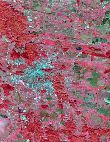
• Investigated the Nova Kakhovka Dam breach as a case study to test the proposed legal definition of ecocide by the Stop Ecocide Foundation (intended for future ICC prosecution); analyzed spatial, ecological, and legal evidence to assess its applicability to this case and inform broader enforcement efforts
• Reframed crisis evaluation by integrating resilience theory into severity scoring; developed a quantitative framework to analyze ecological damage across wartime events, later reflecting on the ethical challenge of using numeric systems to evaluate crimes of environmental destruction
• Mapped 100+ environmental damage incidents across Ukraine using ArcGIS; transformed raw data from Ecoaction, news media, and citizen reports into a geolocated dataset, translating observations into visual spatial evidence and demonstrating how landscape architecture can contribute to environmental accountability during conflict (link)
The Coastal Resilience Design Studio - Newark, Delaware, USA
Research and Design Student
June 2019 – August 2022
• “Carbon into the Tidewater” (team proposal) — contributed to this ASLA Award of Excellence and CERF 1st Place-winning project (link) by leading a community interview, translating insights from additional resident conversations (including street-level outreach), and co-developing a resilience narrative linking oyster reef restoration, dredge reuse, and blue carbon credits to long-term ecological and economic viability
• Visualized resilience systems — including oyster reefs, flood zones, and carbon cycles — using ArcGIS, ecological diagrams, and hand-drawn illustrations
• Translated scientific, policy, and community insights into accessible public presentations and narrative mapping across disciplines, producing multi-scale plans and visuals (renders, plans, sections) for projects in Frederica, Little Creek, Bowers, and Hampton, building trust in render-resistant communities
The University of Delaware - Newark, Delaware, USA
Teaching Assistant
June 2019 – August 2019
LARC 233: Foundations of Landscape Architecture (Fall 2020), LARC 250: Design Process (Spring 2021)
• Led a more dynamic and supportive studio culture—credited by faculty with transforming remote and in-person learning through high-engagement TA hours, community-building, and ultimately increasing studio engagement and attendance
• Guided first-year students through concept development, site analysis, and representation skills; provided targeted feedback, design support, and grading across two core landscape architecture courses
North Creek Nurseries - Landenberg, PA, USA
Plant and Trials Gardener
June 2019 – August 2019
• Took responsibility for newly planted display garden sections, overseeing plant health, seasonal care, and layout adjustments; developed hands-on understanding of maintenance as a form of ongoing design
• Worked directly with native and trial species, applying pruning and replanting strategies, gaining field experience often overlooked in screen-based landscape practice
Education
International Master of Landscape Architecture
The Oslo School of Architecture and Design (AHO) – Oslo, Norway
Diploma project: A Method to Determine Ecocide from a Landscape Perspective
Bachelor of Landscape Architecture
The University of Delaware - Newark, Delaware, USA
Teaching Assistant, Student ASLA President (2020–2022), and UD World Scholar
August 2022 - May 2024
August 2018 – May 2022
Relevant Coursework: ArcGIS, Advanced Digital Design, Urban Design, Ecological Planting Design, Stormwater Management, Plant Ecology, Soils & Sustainability, Marine Science, Site Engineering, Construction Materials & Methods
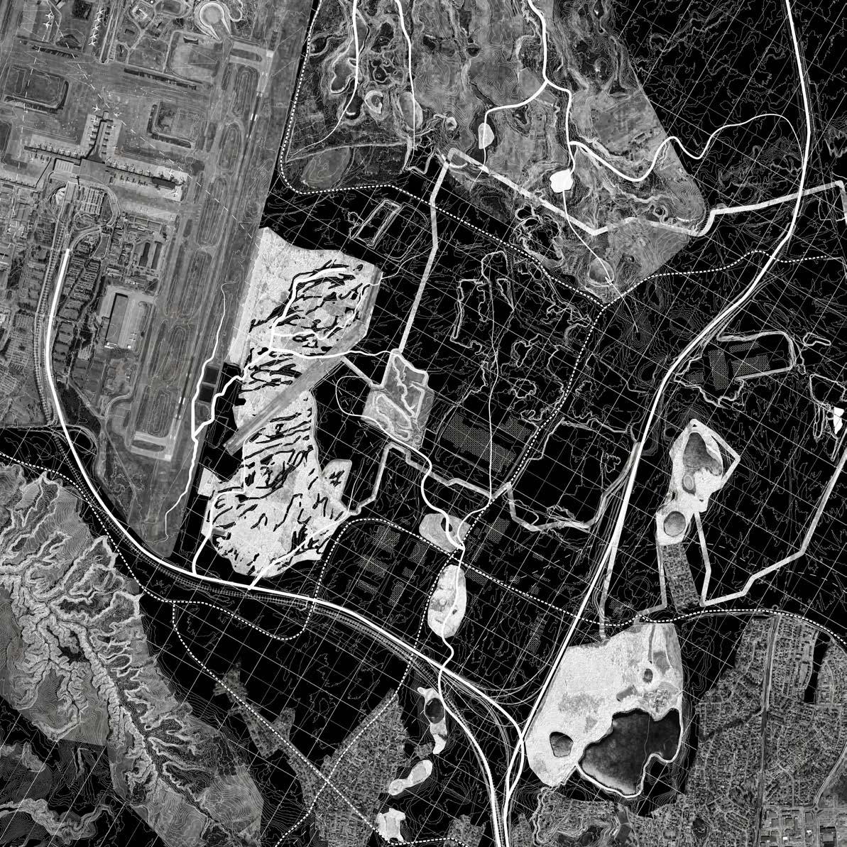
trucks, t-rex, and techno oslo gardermoen airport, oslo, norway
pg. 14 pg. 6
reviving marka's history through the life and death of spruce tonsenhagen, oslo, norway
kotzebue: the gateway into the arctic kotzebue, alaska pg. 22
04
pg. 30
coastal resilience design studio selected works hampton, virginia and little creek, delaware
05
pg. 38
production as resilience lviv, ukraine
06
pg. 46
a method to determine ecocide from a landscape perspective: the nova kakhovka dam case in the russia-ukraine war kherson oblast, ukraine
Trucks, T-Rex, and Techno
Our project aimed to create a framework for the community of Jessheim and the wider Oslo region. The site itself, Gardermoen, is sandwiched between Jessheim and Oslo Airport. Gardermoen holds one of the richest gravel deposits in Norway. The area homes Norway’s largest groundwater reservoir, but Oslo does not utilize the water because of existing extraction activities and pollution. The municipality plans to use this area for big box development. This plan
Period: January 2023 - May 2023
School: The Oslo School of Architecture and Design
Studio: All You Can Store
Partner: Taylor Steel
establishes a framework for future urbanization that respects the site’s key geological features, organized around a tabula rasa approach. While the details are left for future decisions, the design allows for the planting of new vegetation and gentle interventions. It encourages users to make the space their own, whether through unconventional uses like dinosaur sculptures, festivals, or outdoor recreation. It’s a plan designed for the unplanned.
Location: Gardermoen, Oslo, Norway
Supervisors: Sabine Muller and Miguel Hernandez Quintanilla
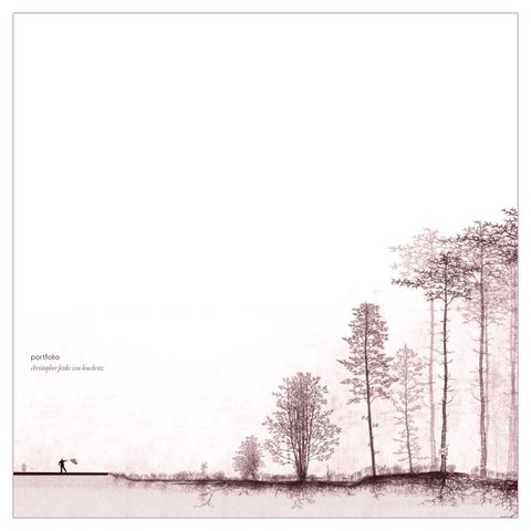
Completed by: Taylor Steel and Christopher Fettke von Koeckritz
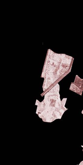
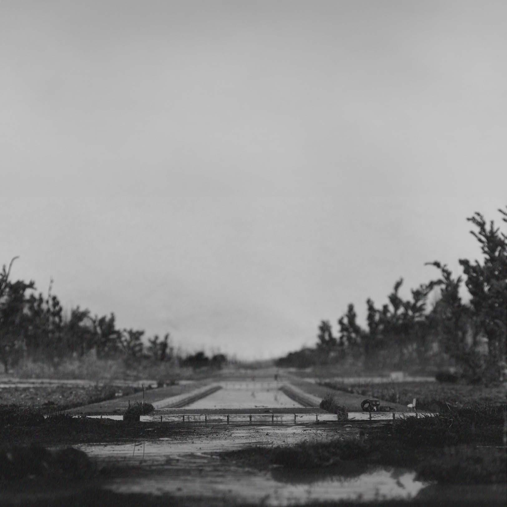
This image showcases typical architectural a theatrical stage. 35 mm camera This is a stage.
showcases a model that differs from architectural representations, resembling stage. Designed and viewed through a lens, the concept explores a reused stage.
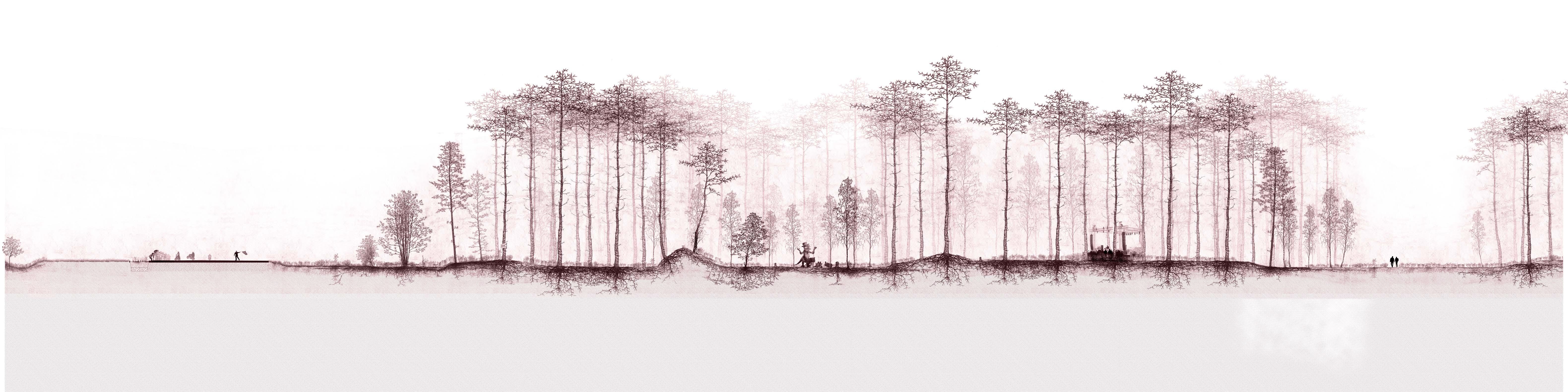
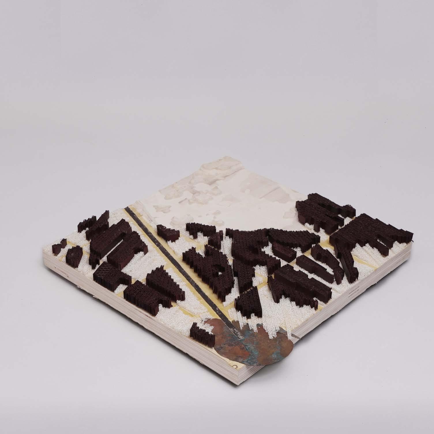
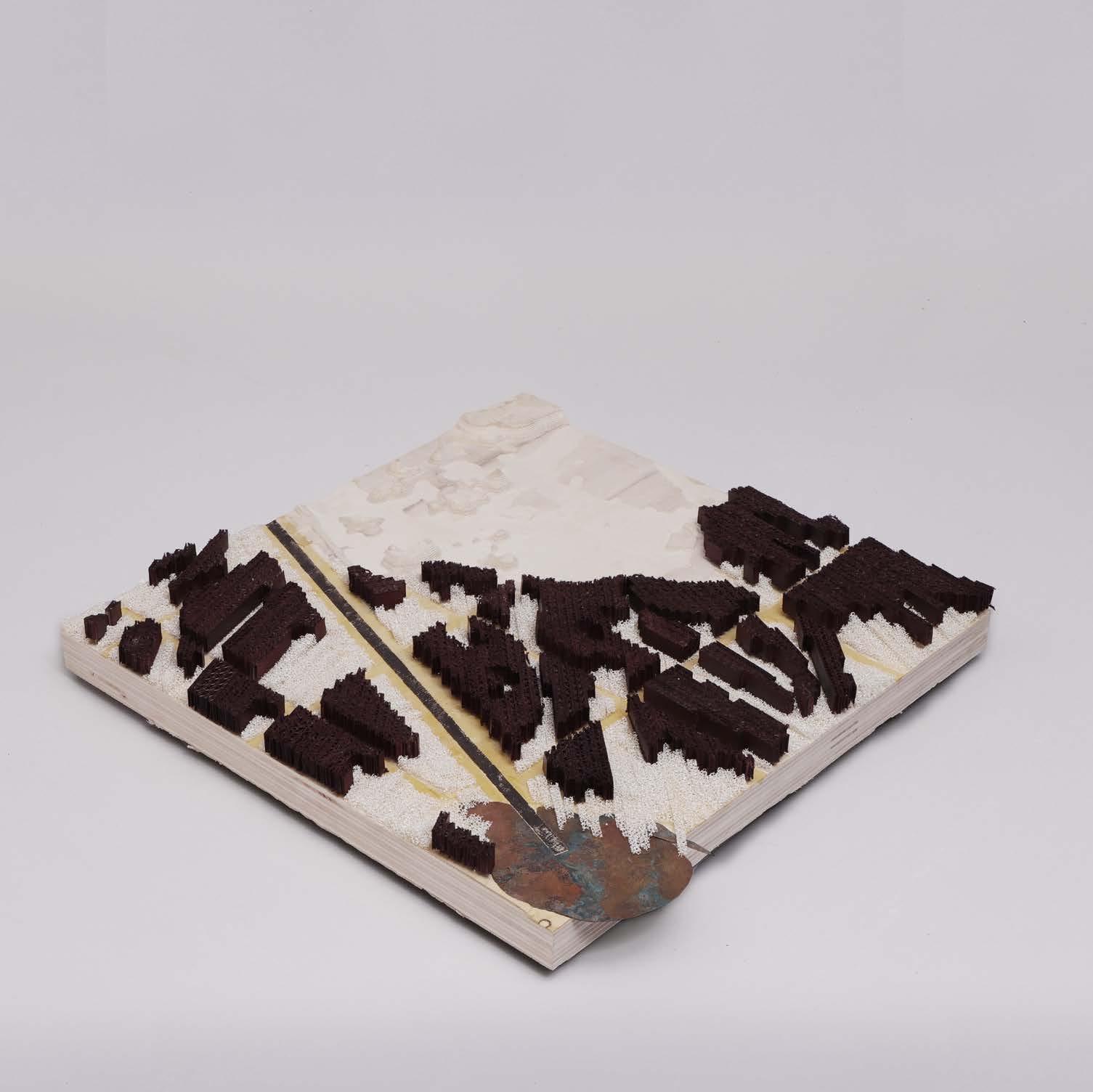
racetrack, challenging the tabula rasa approach with elements of spruce and new forest. This image showcases a model that differs from typical architectural representations, the concept explores a reused racetrack, challenging the tabula rasa approach with elements of spruce and new forest.
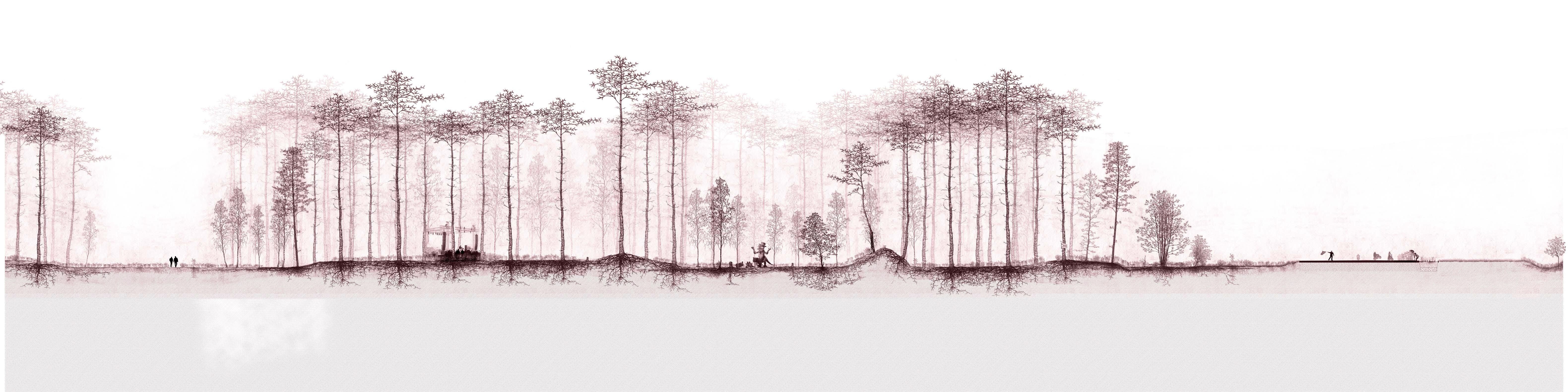
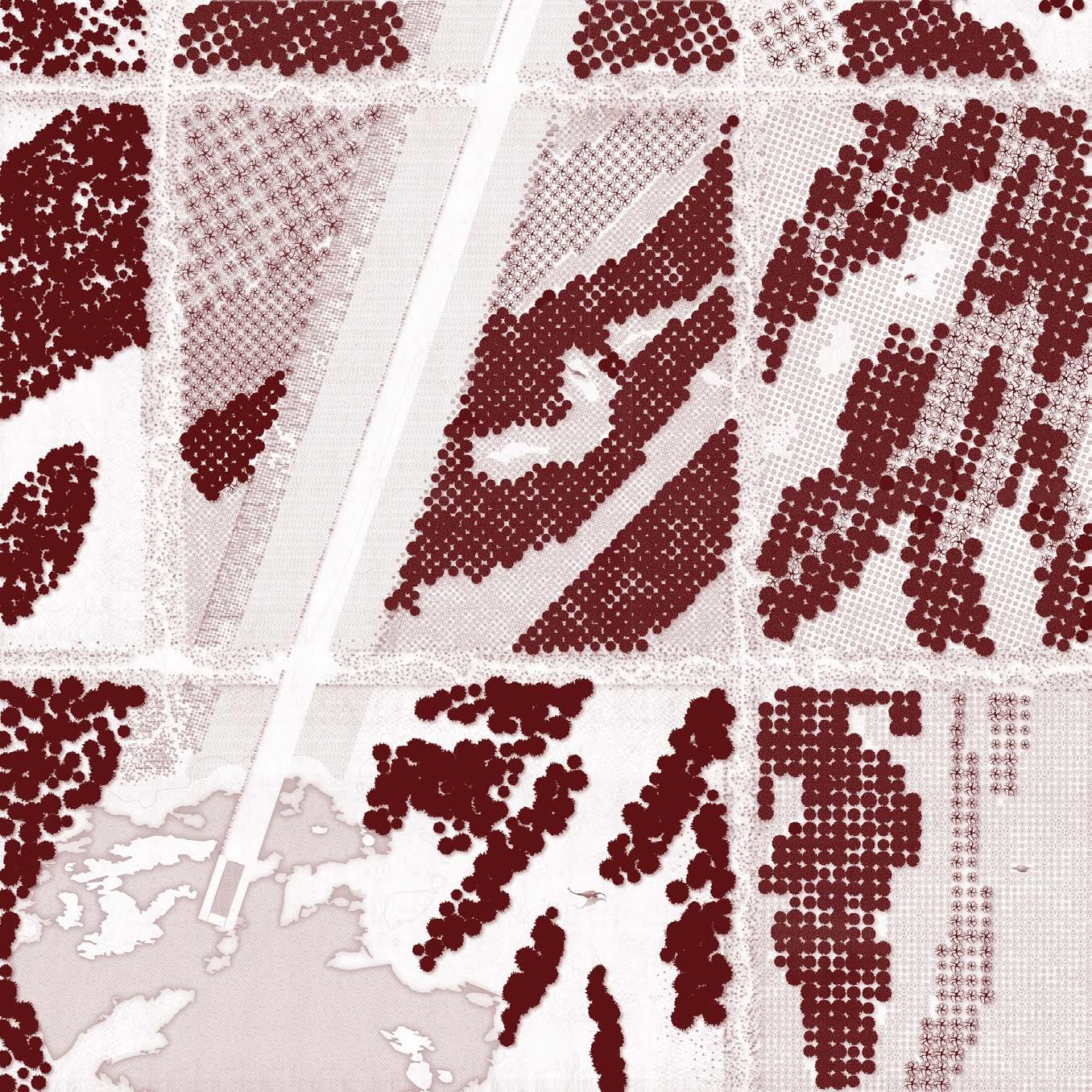
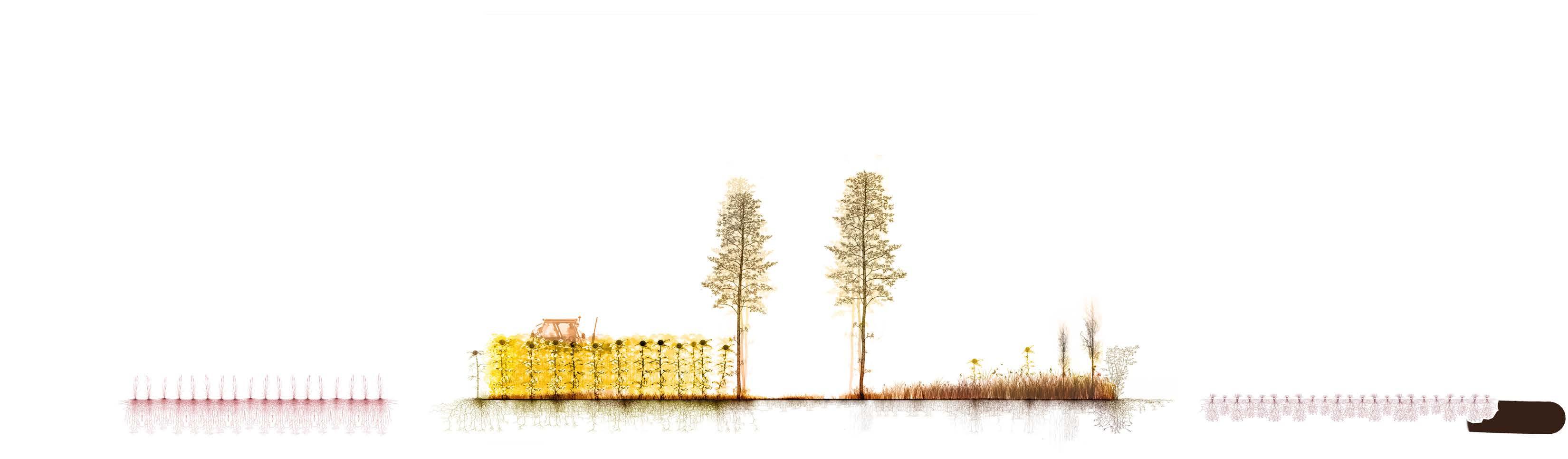
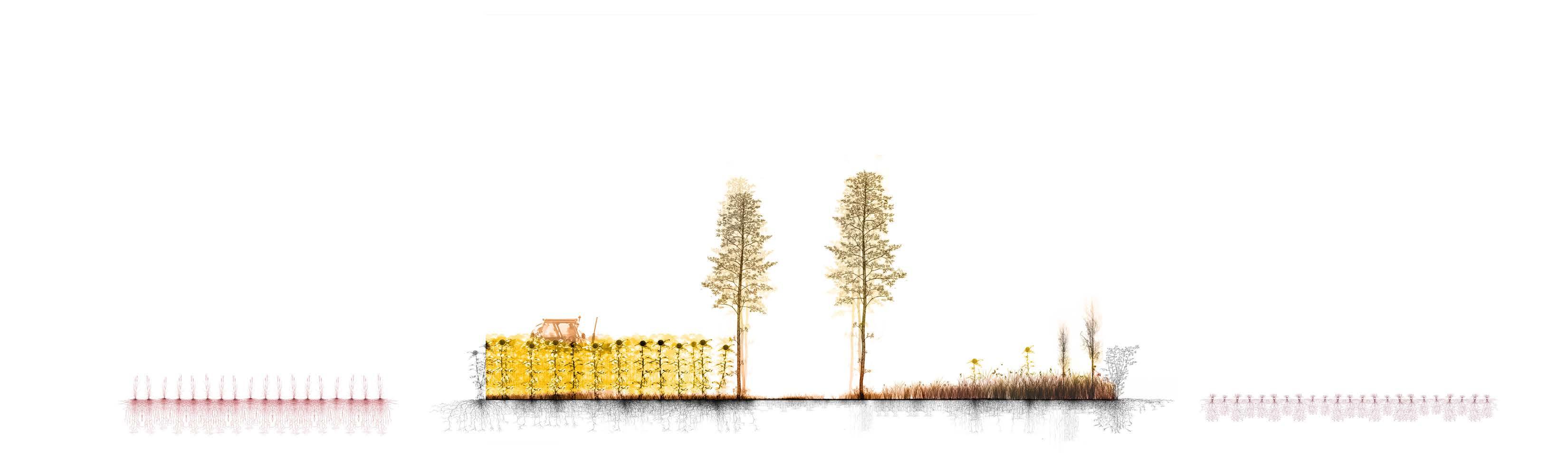
This conceptual design model explores the manipulation of vegetation based on topography shaped by ancient glacial movements. Spruce is removed from 10,000-year-old water channels, with different vegetation (such as spruce)introduced for timber use, following the
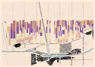
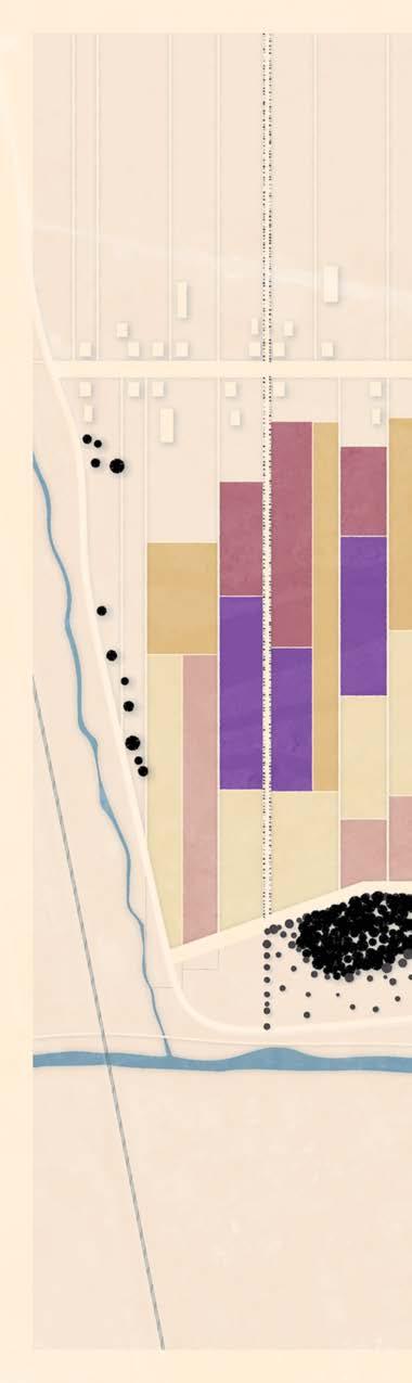
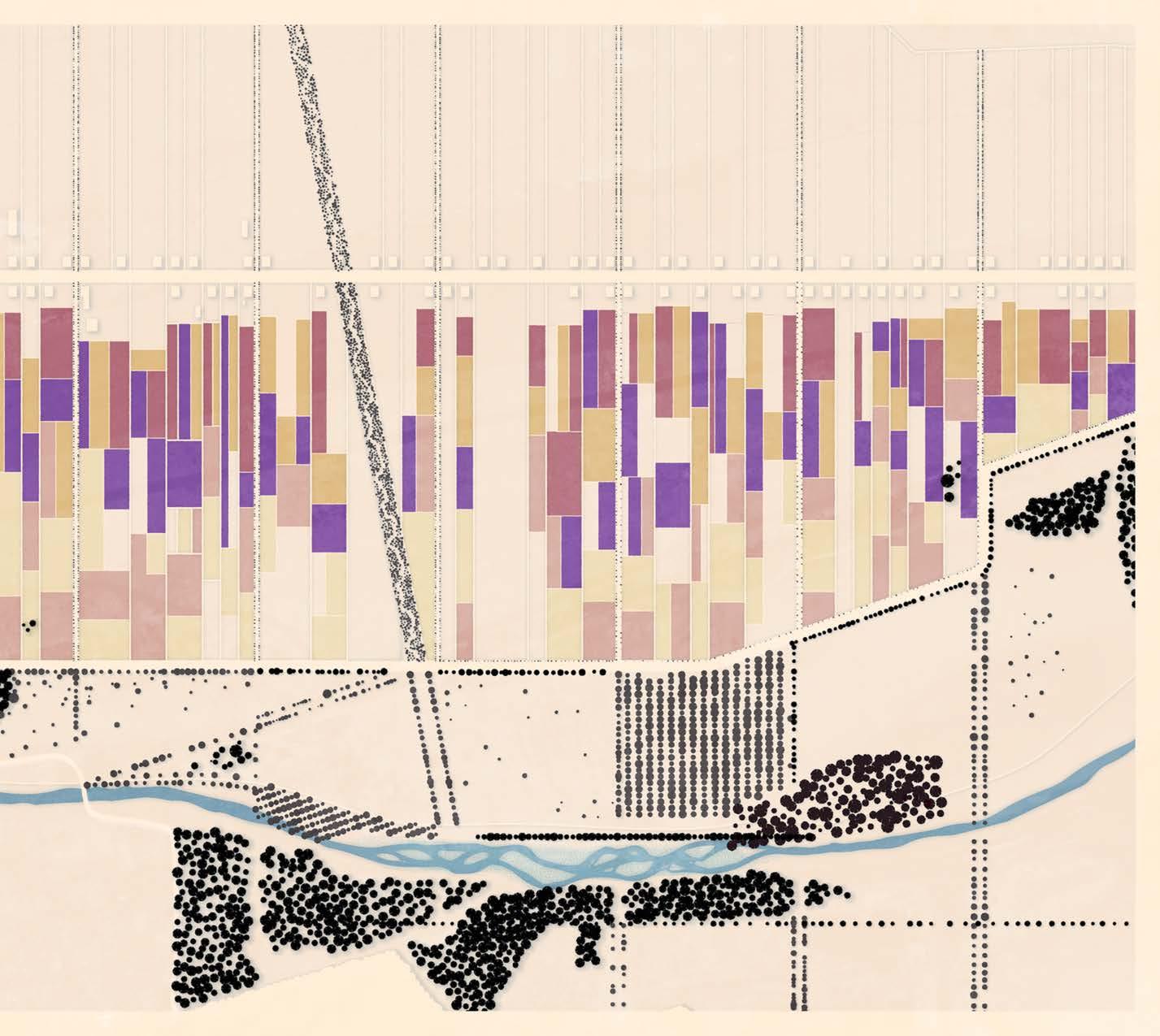
The masterplan (right) depicts a zoom-in of the tabula rasa scheme. Non-native Norwegian spruce is removed as needed — whether harvested for timber or lost to warming and disease — and gradually replaced with birch and other native species. Urbanization and gravel use shape the ground plane, while planting patterns follow existing channels. “Objects” are introduced to spark curiosity, and open spaces accommodate events ranging from exhibitions to performances and
photo credit: Miguel Hernandez Quintanilla and Mattias Fredrik Josefsson
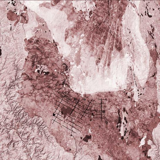
Tabular Rasa Transplant Plan
Scale: 1:50,000
Programs/Illustrated: ArcGIS Pro and Adobe Illustrator
Completed by: Christopher Fettke von Koeckritz
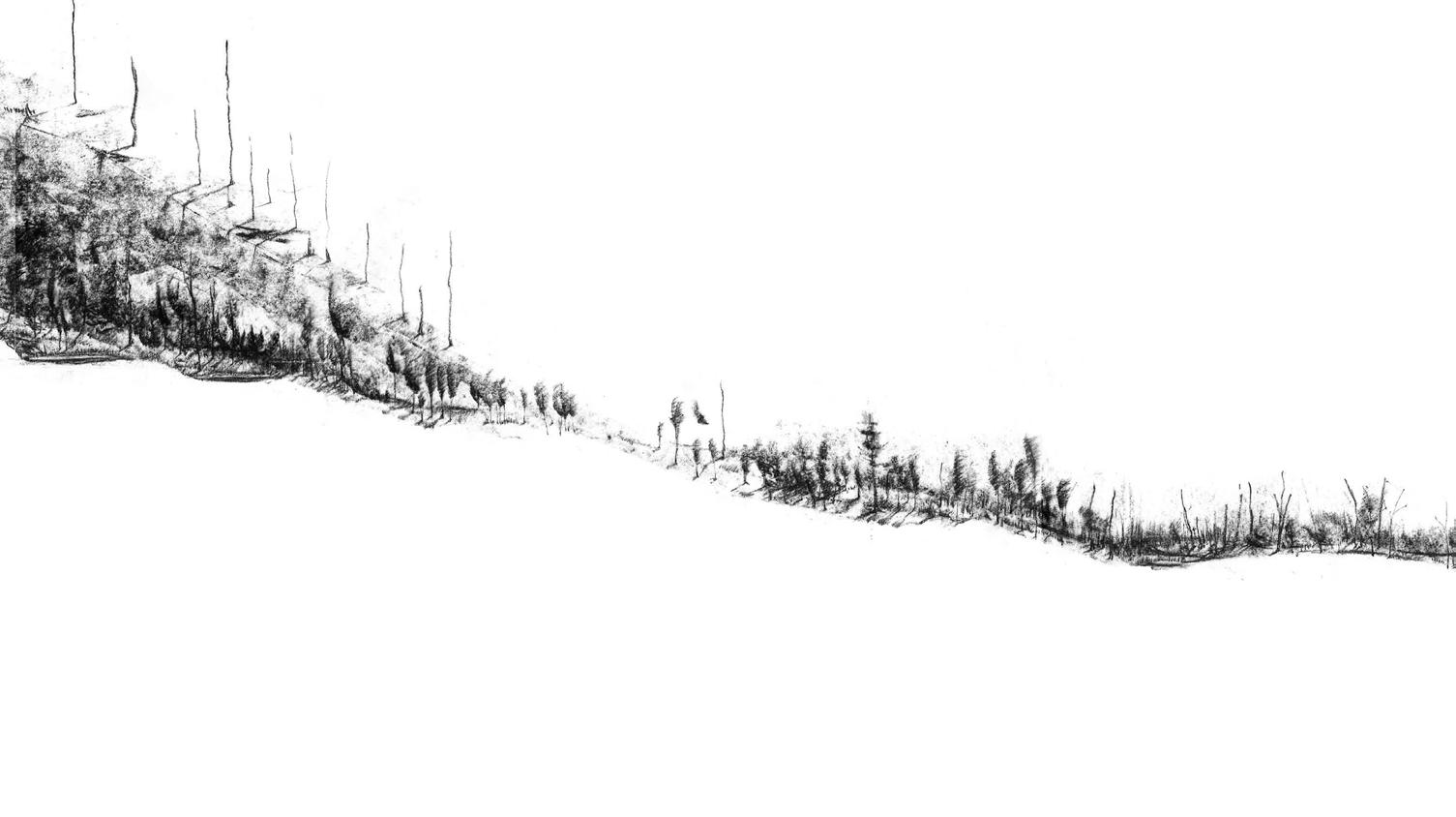
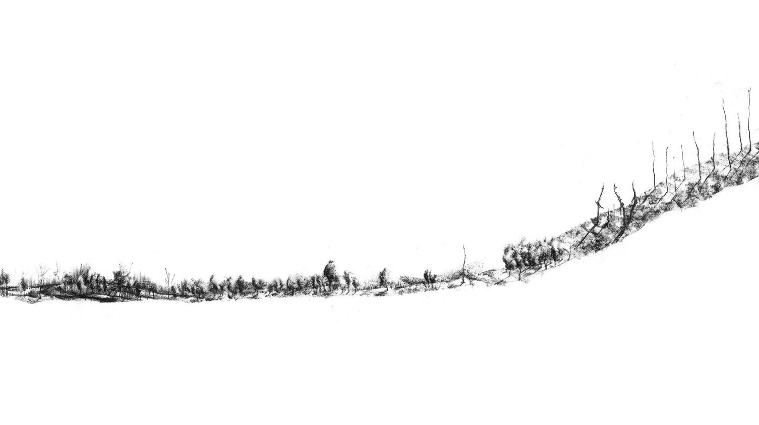
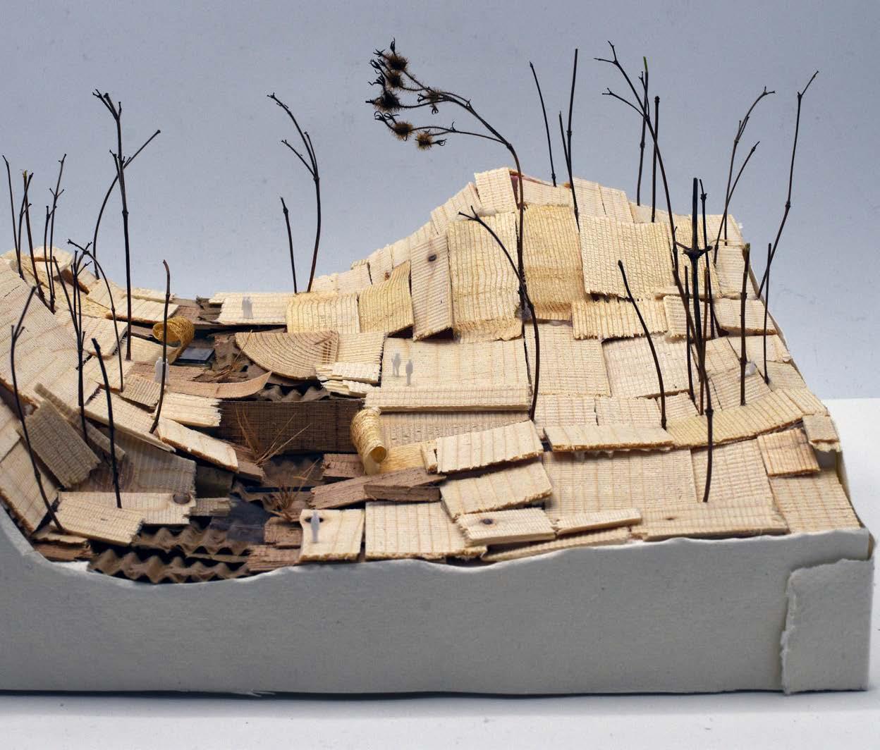
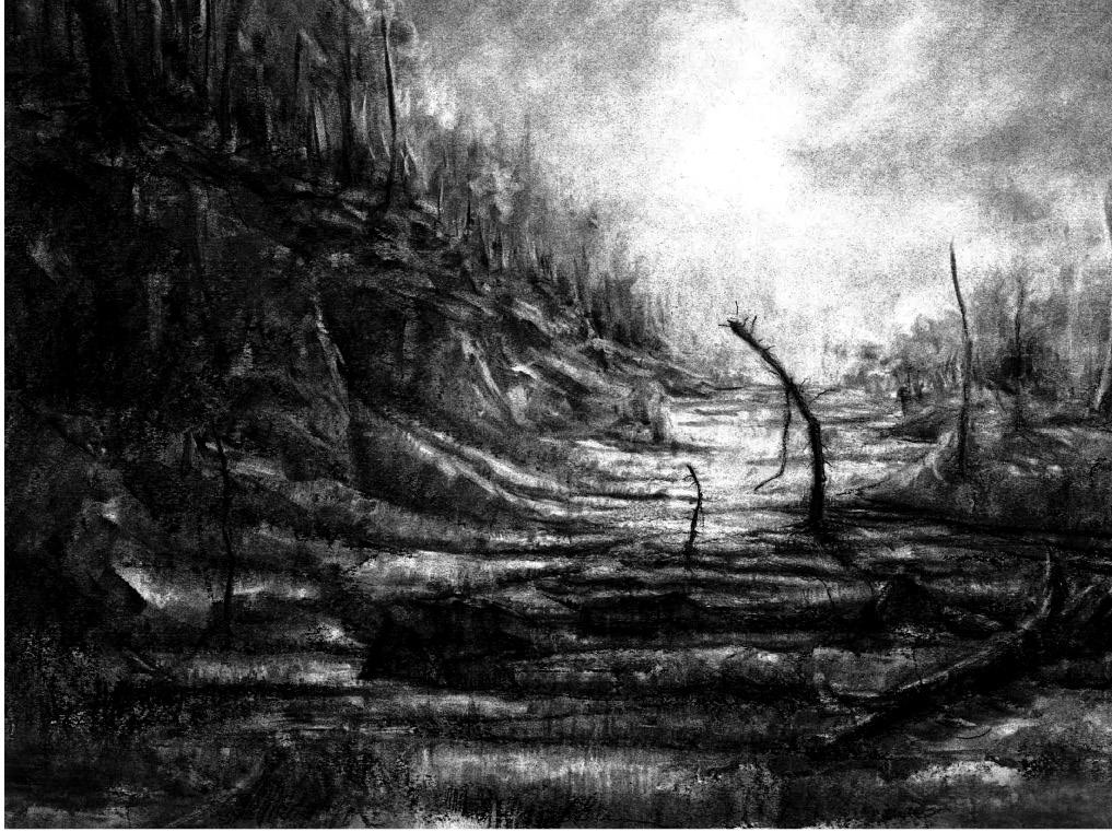
Reviving Marka’s History Through the Life and Death of Spruce
This project explores the design of a transitional edge in the landscape at the Markas border in Tonsenhagen, Oslo, using typography as a design tool. It examines both temporal and environmental conditions, aiming to create a transition between the suburban landscape
and the Marka. By incorporating historical geological features, particularly the bog, the project seeks to honor and integrate the area’s natural history while designing a boundary that harmonizes the forest with the suburban surroundings.
Period: September 2022 - December 2022
School: The Oslo School of Architecture and Design
Studio: Edge Landscape
Location: Tonsenhagn, Oslo, Norway
Supervisors: Karin Helms and Miguel Hernandez Quintanilla
pavement
A Calcareous Foundation
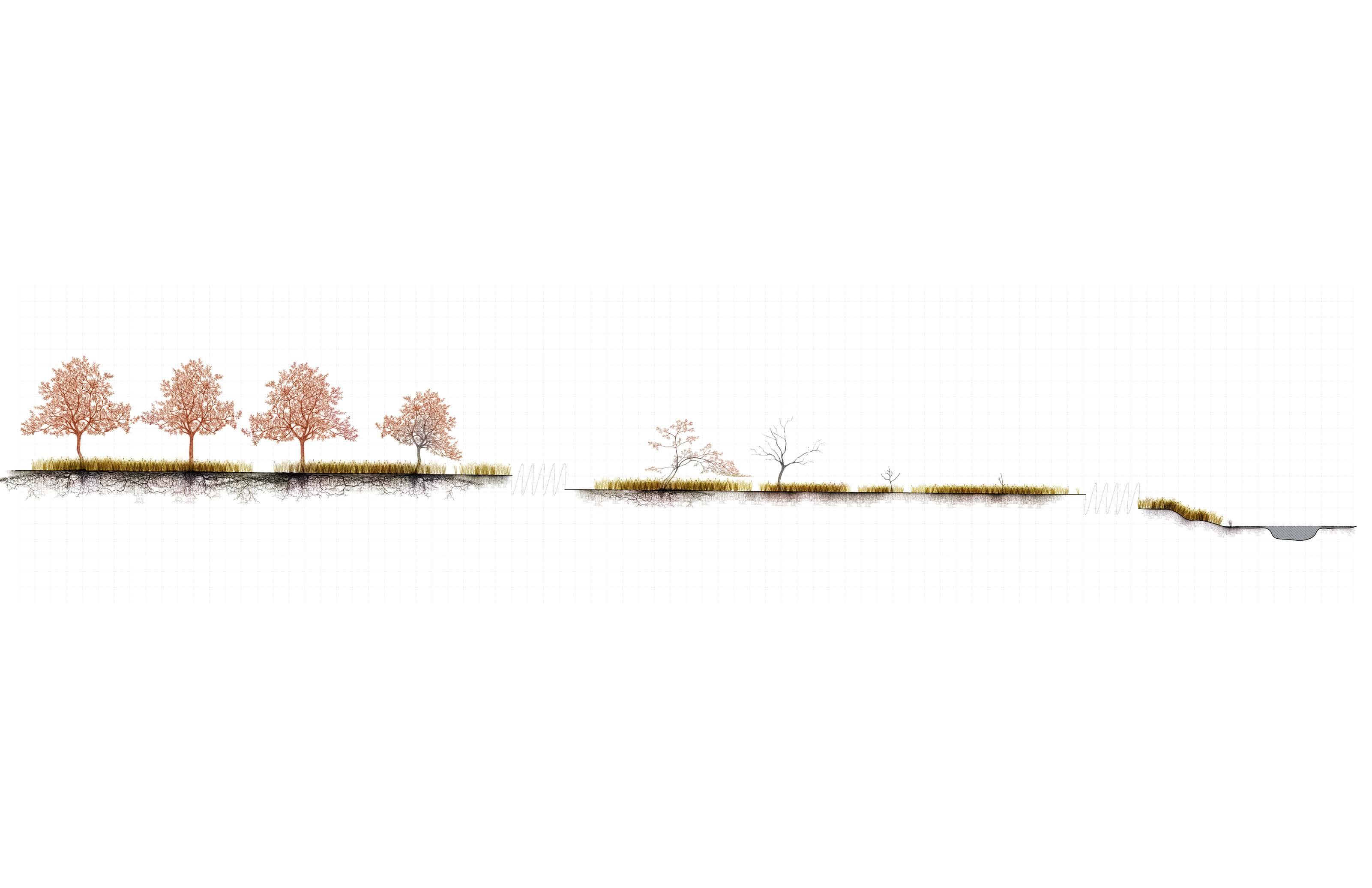
The design positions Tonsenhagen as a landmark and point of departure for reviving the river in northern Oslo — at the threshold where the city meets the marka forest. Topographical interventions are the primary tools, reshaping the valley to reconnect its fragmented stream (still faintly visible) and establish new ecological and social connectors.
The calcareous base supports sphagnum growth, while the existing slope provides ideal conditions for gentle damming to encourage bog formation. The project explores how manipulated landforms can foster resilience and habitat, transforming a school parking lot into a gradually evolving, living park.
aggregate
soil/ deposits
[depth and contents assumed]
bedrock
[clay shale]
sphagnum medium
calcareous base supports sphagnum growth
peat formation
reduced oxygen = reduced decomposition
[accumulation: 1 mm per year]
wetland plants
[erosion attenuation and allow “nature” to fill space] reduce flow velocity
dams
raised bog
waterlog outcome is variable steelconsider other materials
Picea Abies From a Cultural Landscape Perspective Medium: Charcoal
The spruce, once an invasive species creating Oslo Marka's iconic forest, is now despised despite being beloved by locals. As global warming threatens its survival, this project uses bogs to capture and preserve the spruce's legacy, recording its history in layers of organic matter, cherished by people but scorned by ecologists.
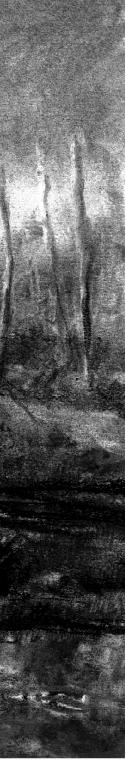
Kotzebue: The Gateway Into The
Arctic
This project will assess erosion mitigation and adaption methods in Kotzebue as the community’s vulnerability increases from the degrading natural systems. Developing a conceptual plan may promote the opportunities that prioritize short-to mid-term erosion mitigation and improve other subsistent relationships between culture and the landscape. This proposal requires
a thorough understanding of the dynamic Arctic landscape and systems of the Kotzebue Sound, the community’s subsistence with the landscape, and deeply rooted cultural traditions. Understanding these factors will promote a design that achieves the goal and visually communicates ideas for the community.
Period: January 2022 - May 2022
School: The University of Delaware
Studio: Capstone
Location: Kotzebue, Alaska, USA
Supervisors: Jules Bruck
For over 10,000 years, Qikiqtagruk (now Kotzebue) was a hub within a seminomadic subsistence network. Families moved seasonally across rivers and sea ice to hunt, fish, gather berries, and store food in permafrost cellars — mobility itself was a resilience strategy.
After the U.S. purchase of Alaska in 1867, missionaries and American settlement policies encouraged fixed residence in Kotzebue. Schools, churches, and trade infrastructure anchored families to one location, reducing adaptive mobility.
Historically, sea-ice in Kotzebue events typically occurring shoreline during the spring Sea ice
Submerged vs. Unsubmerdged
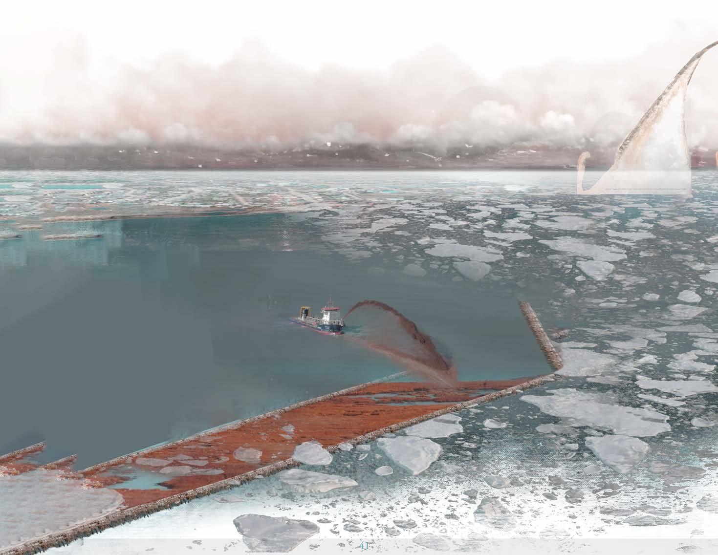
Initial studies tested submerged breakwaters to avoid interference with boats and prevent ice jams. Harsh Arctic conditions led to the adoption of unsubmerged breakwaters as the more resilient option. Natural accretion at the southern edge of Kotzebue suggested a mirrored form to the north could similarly trap sediment and extend land..
0-1.641.64-3.33.3-4.94.9-8.2
Masterplan Breakwater
Design repurposes dredged material into barriers, protecting the town from coastal and ice erosion.
Breakwaters mitigate stabilizing ice conditions.
erosion while supporting seasonal seal hunting and conditions.
Project Team
DJ Bromley, Landscape Architecture, Marine Science
Christopher Fettke von Koeckritz, Landscape Architecture, Art
Kevin Ganjon, Env Studies & Political Science, Data Science
Ryan McCune, Civil & Environmental Engineering
Leigh Muldrow, Landscape Architecture
Delaney Pilotte, Landscape Architecture
2022 ASLA Student Awards award of excellence cerf 1st place award of excellence
The Coastal Resilience Design
Studio Selected Works
The following section devotes a glimpse into the range of a collaborative research studio addressing climate adaptation, ecological resilience, and community needs in vulnerable coastal regions. Selected works explore blue carbon systems, adaptive planting strategies, and resilient market design.
Carbon in the Tidewater
The place has a history of firsts, from early settlers to the first African slave ships in 1619 and the first Union Army camp freeing enslaved African Americans in 1861. It has endured war, fires, hurricanes, and floods. As climate change
Little Creek, DE
Conceptual Resilience Plan, 2020
Frederica, DE
Market Catalyst Project, 2020
Fenwick Island State Park, DE
Dune Strategy Project , 2020
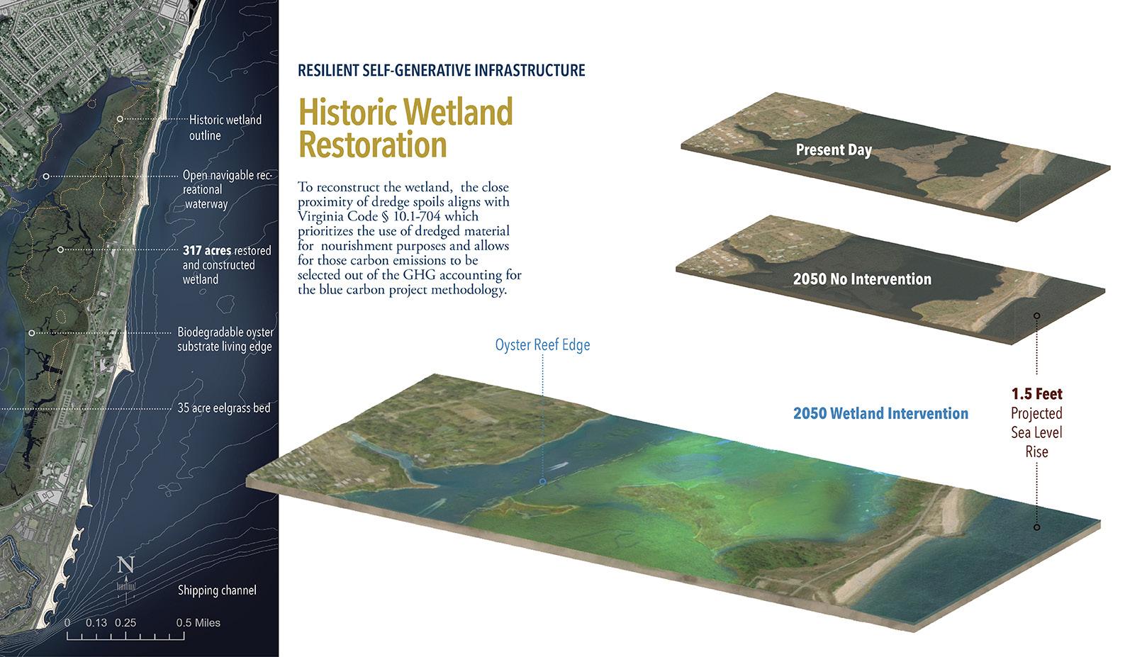
worsens, Hampton, Virginia, faces risks from low elevation and land subsidence. This project aims to protect Hampton with a nature-based resilience plan, focusing on adaptive ecosystems certified through the Blue Carbon and Resilience Credit Market Economy. It calls for a shift in infrastructure investment, prioritizing human-ecological approaches. “Carbon in the Tidewater” will use Resilient Self-Generative Infrastructure to create a living coastal edge that is adaptive, ecologically productive, and economically protective.
Little Creek, DE
Waterman’s Village Project [Continued], 2020
Hampton, VA
Carbon in the Tidewater, 2021
Bowers Beach, DE Stormwater, 2022
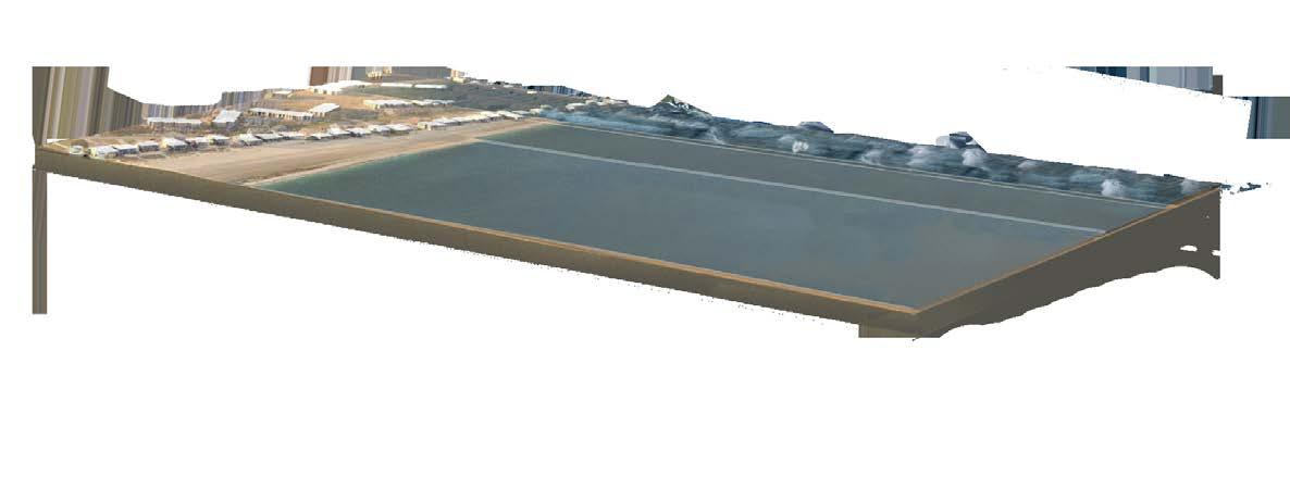
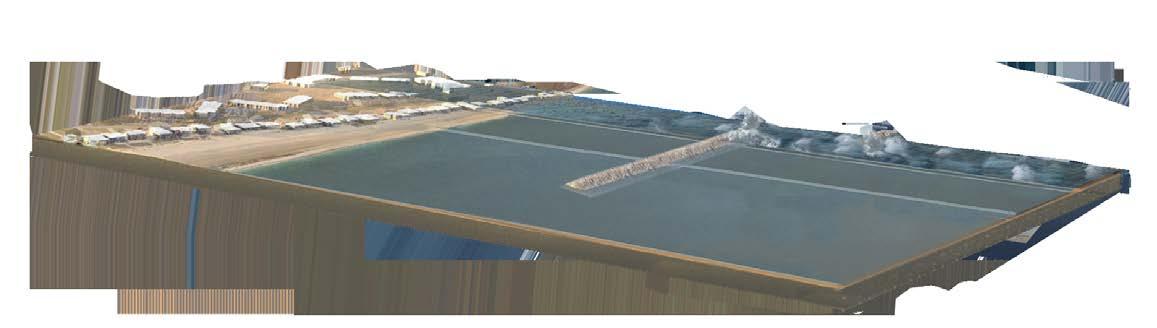
Buckroe Breakwater
Risk Mitigation
Staggered 720-foot oyster-covered breakwaters reduce wave energy to protect Buckroe Beach. They account for 4.5 feet of sea level rise, 5 feet of storm surge, and 9.5-foot waves. These breakwaters also support eelgrass growth, aiding carbon sequestration and recreational fishing. Combined with a dredge material beach replenishment program, this system safeguards the community and its investments from rising waters and storm surges.
Present Day Sea Level
No Intervention
Damage from wave energy is significantly reduced in the worst case storm scenarios
Breakwater Intervention
CARBON
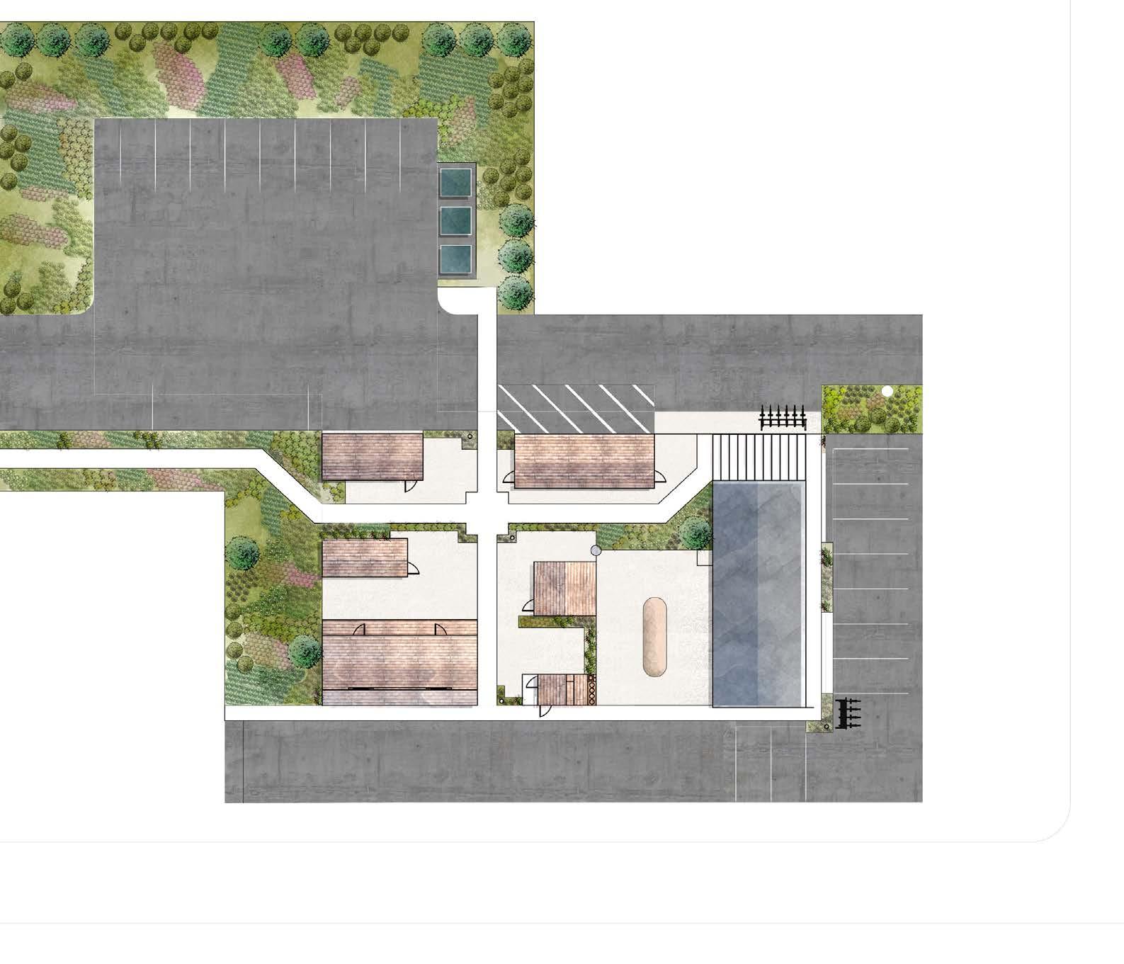
Little Creek Grill & Patio
Full service deli with a 12’x 24’ patio with pergola & rear side privacy fence
Lucky’s Bait & Tackle
14’x 36’ Year-Round Retail
Located at the rear for ease of boat/trailer parking & frequent commercial deliveries
Lil’ Creek Kayak
12’ x 36’ Seasonal Retail
Located at rear for easy tractor access to haul boats to the waterfront
Open Retail
14’x16’ Retail Space
Open Retail
10’x22’ Retail Space
Horseshoe Market
14’x40’ Three season market supplying summer produce, fall pumpkins & Christmas trees
Located for street-front vibrancy and maximum outdoor space
Big Scoop Ice Cream
8’x15’ Seasonal Retail
Includes large outdoor eating & seating space
Pedestrian Path
Connects to the future development project on the Cavalier’s site
Natural Planted Buffer
Native species chosen for flood tolerance, mild salinity, and biodiversity
Christopher Fettke von Koeckritz
Little Creek, DE Waterman’s Village Project [Continued], 2020
This micro-retail pattern book reimagined Little Creek’s waterfront identity by proposing a resilient, small-scale retail village rooted in local culture and materials. Inspired by coastal vernacular and designed for flood tolerance, the plan emphasized native planting, flexible modular structures, and community-scaled businesses. My contribution included producing a semihand-drawn master plan, which allowed me to think through spatial decisions and convey how the village might feel in everyday use. This hybrid drawing process helped balance technical accuracy with cultural character in a way that pure digital renders could not.
AT JOHNNY CAKE LANDING
TIDAL MARKET
AT JOHNNY CAKE LANDING
COASTAL RESILIENCE DESIGN STUDIO | UNIVERSITY OF DELAWARE
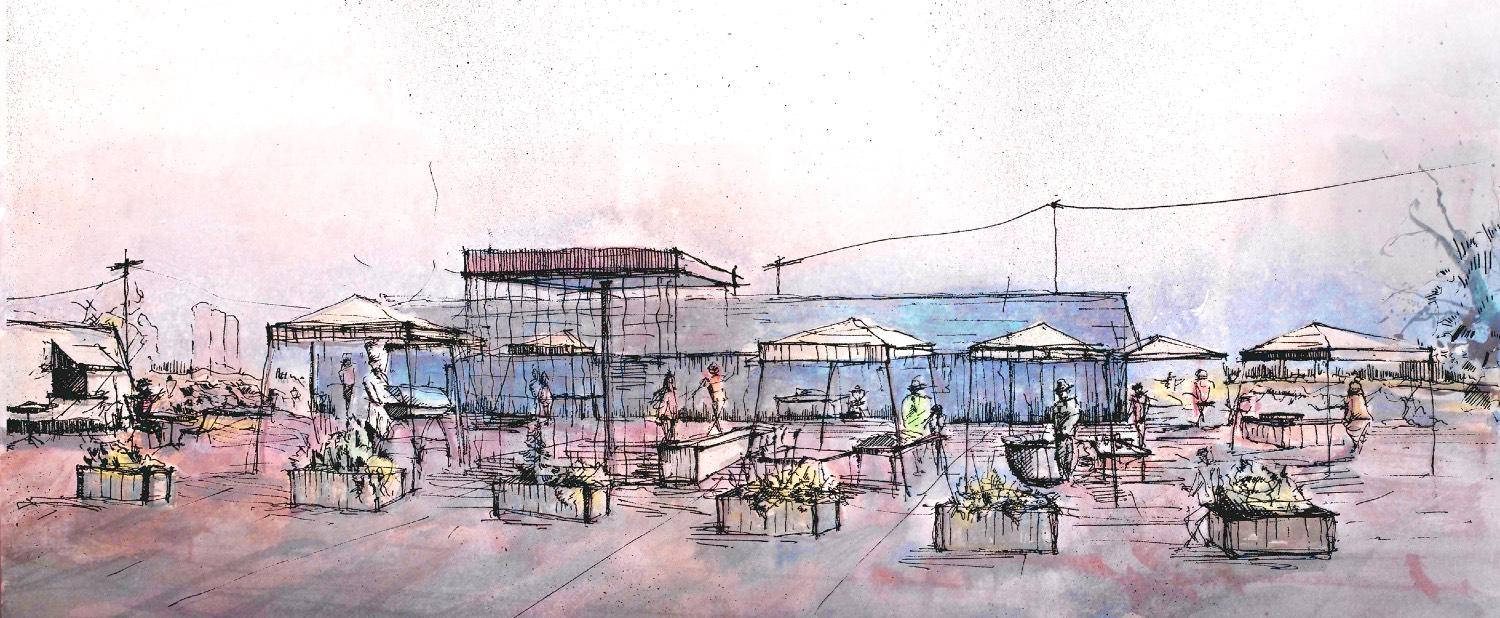
Frederica, DE
Market Catalyst Project, 2020
This proposal envisioned a farmer’s and micro-retail market as a catalyst for Frederica’s food access and economic resilience. The project reactivated a vacant site, addressed the town’s food desert, and created opportunities for local entrepreneurs. My role focused on visualizing what the market could feel like for residents, using accessible graphics instead of polished “high-end” renderings. These illustrations helped community members picture the market as a welcoming, functional place — reinforcing its identity as both a local food hub and a driver of small-town vitality.
Production as Resilience: Lviv, Ukraine
The duration and outcome of the war, the status of the territory, and demographic changes in Lviv remain uncertain. Meanwhile, escalating climate and environmental crises pose increasing challenges, including extreme weather, threats to ecosystems, food security, and cultural heritage.
Envision a future where urban development is shaped by productive landscapes and water systems that not only secure food and integrate cultural heritage but also mitigate climate and environmental crises, driven by local communities.
Period: September 2023 - December
2023
School: The Oslo School of Architecture and Design
Studio: Global Urbanism
The common thread linking current and historical wars, future climate challenges, and Ukrainian heritage is production. By 2073, productive landscapes in Ukraine will transform, offering resilience against aggression and environmental crises while fostering community and democracy.
Partners: Kaveh Kawousi and Lucien Bretill
Location: Lviv, Ukraine
Supervisors: Håvard Breivik-Khan, Ida Højlund Rasmussen, and
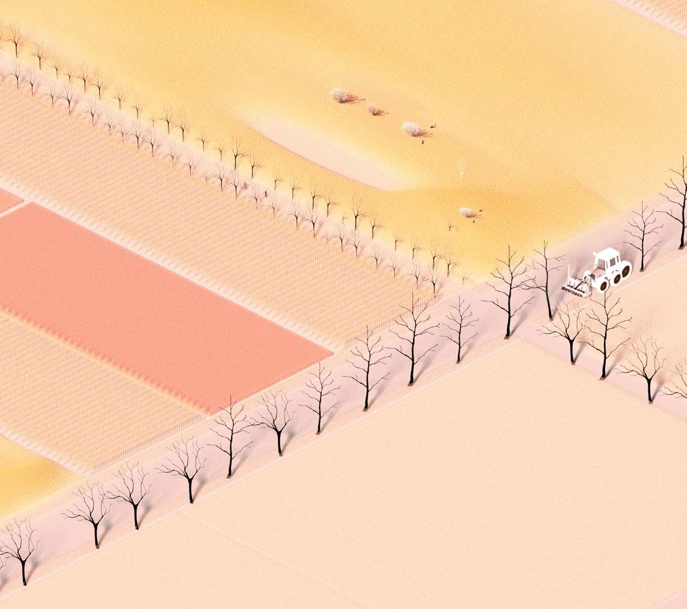
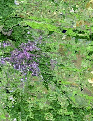
Adjacent to the Lviv municipality border, we propose a semi-permeable boundary to control urban expansion, promoting the possible growth of agricultural practices adaptable to wartime scenarios and potential internal migration if food
production requirements rise. This plan prioritizes land for agricultural expansion while protecting areas adjacent to the Poltva River from urban expansion.
Scale: 1:2,000 Programs/Illustrated: ArcGIS
Ukraine’s enduring spirit of resilience and adaptability through continuous testing and learning.
A Method to Determine Ecocide From a Landscape Perspective
The Nova Kakhovka Dam Case in The Russia-Ukraine War
Focusing on the ongoing war in Ukraine as a case study, this project intends to create a method capable of determining whether ecocide events occur - a potential crime prosecutable by the International Criminal Court (ICC). The project considers data collection and its gaps, expressing and scaling ecocide through mapping, and quantification of severity informed by ecological and crises theory. The testing of the
method also calls for adjustments in the legal ecocide proposals to make the case to adopt ecocide to the Rome Statute stronger and more relevant to the scope of ecocide. While centered on Ukraine, the methodology is designed for global applicability in various conFlict situations
Click Here
Period: January 2024 - May 2024
School: The Oslo School of Architecture and Design Studio: Diploma
Location: Kherson Oblast, Ukraine
Supervisors: Anders Ese
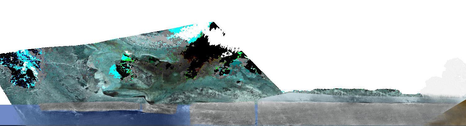
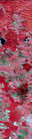
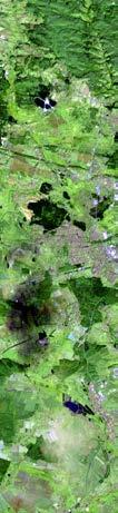
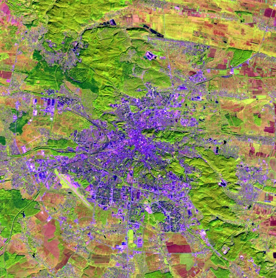
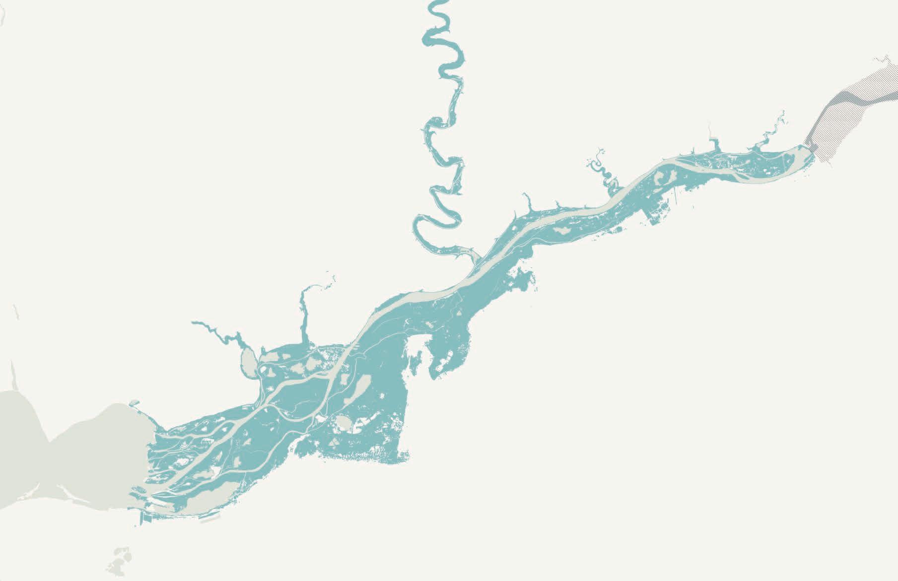
Map of environmental destruction open-source Telegram red highlight the two case
destruction caused by Russian forces. Data compiled from the Stop Ecocide Foundation, channels, and news reports, transcribed into Excel and geolocated in GIS. The areas in case studies examined in this diploma.
Case 2: Kakhovka Dam Explosion
[The following provides a summary of the reference paper: introducing ecocide as a potential category of international law, framing the Russia–Ukraine war within this context, and outlining a method for quantifying environmental crises. The full paper is available at the first link.]
REFERENCE PAPER: ECOCIDE, RUSSIAN-UKRAINE CASE, AND CRISES
Introduction
Today, we face two overarching challenges: the environmental and climate crises manifest in interlinked climate and biodiversity crises. Our ecosystems are complex networks dependent on global and local systems dynamics, revealing a domino-like effect in vulnerability. Habitats include flora, fauna, and human populations that depend on biodiverse habitats across all landscapes: terrestrial, aquatic, and marine ecosystems.
The 2022 Global Living Planet Index by the World Wildlife Fund states that from 1970-2018, the monitored wildlife populations have declined by 69%, primarily due to extraction, monoculture, and human urbanization. This grim statistic rises with the intensifying climate crisis. If warming cannot be kept under 1.5 degrees Celsius, there will be a danger that, shortly, biodiversity loss will be taken over by climate change as its driver.
These environmental problems are greatly multiplied by armed conflicts. As big a crisis as an armed conflict may be, it must be emphasized that an environmental crisis is the foundation of our existence, not just an additional problem. The notion of ecocide is very much a concern in peacetime as it is during wartime, and the issue of environmental destruction is the central problem that must be solved.
PAPER ABSTRACT
This paper investigates the historical development and legal implications of the term ‘ecocide,’ focusing on specific ecological damage in Ukraine. By examining the actions of a Ukrainian NGO utilizing open-source data, particularly in highlighting Russia’s environmental aggression, the paper explores the potential for environmental war crimes. Additionally, it acknowledges the importance of third-party verification alongside governmental initiatives, recognizing the limitations and necessity of independent confirmation. Through comparative
PROPOSAL – THE STOP ECOCIDE FOUNDATION
1) For the purpose of this Statute, “ecocide” committed with knowledge that there is a substantial either widespread or long-term damage to acts.
2) For the purpose of paragraph 1:
a) “Wanton” means with reckless disregard clearly excessive in relation to the social
b) “Severe” means damage which involves disruption or harm to any element impacts on human life or natural, cultural
c) “Widespread” means damage which area, crosses state boundaries, or species or a large number of human
d) “Long-term” means damage which redressed through natural recovery
e) “Environment” means the earth, hydrosphere and atmosphere, as well
The European Law Institute (ELI) has actively panel’s efforts. The ELI aims to “define the aspects conditions for prosecution in the European framework” the Rome Statute. 10
PROPOSAL – THE EUROPEAN LAW INSTITUTE
Article 3(2) states “ecocide means any conduct committed with intent, which may cause, or severe and longterm damage or severe and an ecosystem or ecosystems in the natural (3) “For the purposes of paragraph 2, a person (a) in relation to conduct, that person means
10 European Law Institute, Ecocide, 2021
FOUNDATION
means unlawful or wanton acts substantial likelihood of severe and the environment being caused by those disregard for damage which would be social and economic benefits anticipated;
involves very serious adverse changes, element of the environment, including grave cultural or economic resources;
which extends beyond a limited geographic or is suffered by an entire ecosystem or human beings;
which is irreversible or which cannot be recovery within a reasonable period of time;
its biosphere, cryosphere, lithosphere, well as outer space.
actively participated in the discussion, paralleling the aspects characterizing the crime of ecocide and the framework” and collect support for its inclusion in
conduct as defined in paragraph 4 or 5, or substantially contribute to causing, and irreparable or irreversible damage to environment.”
person has intent where:
means to engage in that conduct; and
response is in connecting gaps that have already been established with potential solutions that crowdsourcing may provide. In conclusion, even with the challenges at hand, the potential of crisis crowdsourcing in mapping is an innovative tool for conducting modern emergency response, giving power to the people through collective action and digital connectivity in the challenge of complex global problems. Crowdsourcing has made itself evident as one of the critical methodologies in ensuring that the environmental assessment of a crisis is democratic, accurate, timely, and one that can fill gaps in data like the Ukraine ecocide case.
UNDERSTANDING THE SEVERITY OF CRISES
This second section addresses crisis elements to provide a more fixed understanding of severity. The legal definition provided by the SEF addresses specific requirements but remains vague, allowing for interpretation. For example, ‘‘’Severe’ means… very serious adverse changes, disruption, or harm to any element of the environment...” This vagueness establishes ambiguity in determining what constitutes severity, specifically concerning ecocide cases from an ecological perspective. The case study of the dam destruction illustrates this ambiguity and highlights the relevance of considering additional crisis elements when quantifying severity.
Ecological Concerns and Catastrophic Failures
Global discussions about the destruction of the Nova Kakhovka Dam highlighted significant ecological concerns. Ecologists’ views emphasized that the dam had disrupted the hydrology and ecosystem functions of the Dnipro River, arguing that the landscape is better off without the dam.
Resilience in Ecological Systems
Furthermore, Ecological criticisms point out that dams pose severe risks of catastrophic failure beyond disrupting ecosystems. These structures are perhaps ticking time bombs, possibly causing environmental and humanitarian crises upon failure. There is a difference between controlled decommissioning and unexpected collapses, regardless of the cause. Gunderson states, “The speed, severity, and complexity of natural disasters continually challenge the ability of society to generate appropriate responses”; these responses can be perceived as a form of resilience.
Characteristics in Resilience
As in ecology, the ecosystem reacts to environmental changes, adapting to ensure stability. The concept of resilience in ecology addresses the ecosystem’s ability to withstand and recover from change. As defined by Holling (1973), resilience encompasses two different aspects of change in an ecosystem over time.
The first feature that characterizes resilience is the persistence of relationships in a system and the “ability of systems to absorb changes of state variables, driving variables, and parameters, and persist” (Holling 1973). As mentioned above, the traditional definition of resilience indicates the ability to return to a previous state once an event has passed. The second feature that characterizes resilience is “the size of a stability domain or the amount of disturbance
TESTING THE SYSTEM - CASE 1
2022 ANDRIIVKA SHELLING
JUNE 9,
The system was tested using two cases: the fire in Andriivka and the Destruction of the Nova Kakhovka Dam.
The fire in Andriivka scored 8, while the dam scored 200, a notably higher score than the fire case. The difference between the two cases lies in the number
of cascading events and the complexity of the dam case, which challenges the system’s ability to categorize events and quantify them. However, the results suggest that the fire is probably not an instance of an ecocide.
It should also be noted that only one sub-event was tested using the methods.
Shelling of Andriivka
SIZE OF FIRE: 2.5 HECTACRES
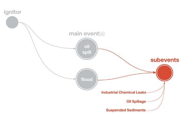
THE KAKHOVKA DAM - CASE 2
ASSUMED AND PROBABLE
SUBEVENT DISCHARGE OF HAZARDOUS CHEMICALS
*MAIN EVENT* AND SUB-EVENT RELEASE OF OIL STORED IN THE HPP
a
SUB-EVENT SUSPENDED SEDIMENTS
SUB-EVENT INDUSTRIAL FACILITY CHEMICAL LEAKAGE
RUSSIAN OCCUPATION
KAKHOVKA DAM DESTRUCTION
As for the Kakhovka Dam case, the following diagram was an early adaptation illustrating all the main events, sub-events, and results under our methodology, highlighting the need to run all sub-events through this process to identify possible ecocide cases. Furthermore, these are just two cases within Ukraine. Addressing ecocide through the International Criminal Court (ICC) aims to secure reparations for all experiencing ecocide and in this case Ukraine. Importantly, acts of ecocide have legal consequences beyond fundamental moral implications, and this is both in times of peace and war.
Reflection
This project, like many landscape projects, is ongoing. After reflection, I regret using a numerical scale to quantify the severity of ecocide. While numbers may offer precision in larger samples, the individuality of each case makes this approach inadequate, and perhaps inappropriate. Much like in genocide, where the concept defines the crime, not necessarily; the number of deaths. ecocide’s impact cannot be reduced to a simple figure.
Moving forward I wish to share this work; therefore, I must revise my methodology, shifting to a narrative and context-based framework for categorizing severity. This approach will provide a more refined, meaningful, and sensitive evaluation of environmental destruction, which I plan to incorporate into future work.