
Contents
Studio Work
Archiving Inuit Memoryscape
OysterBar
StoopScapes
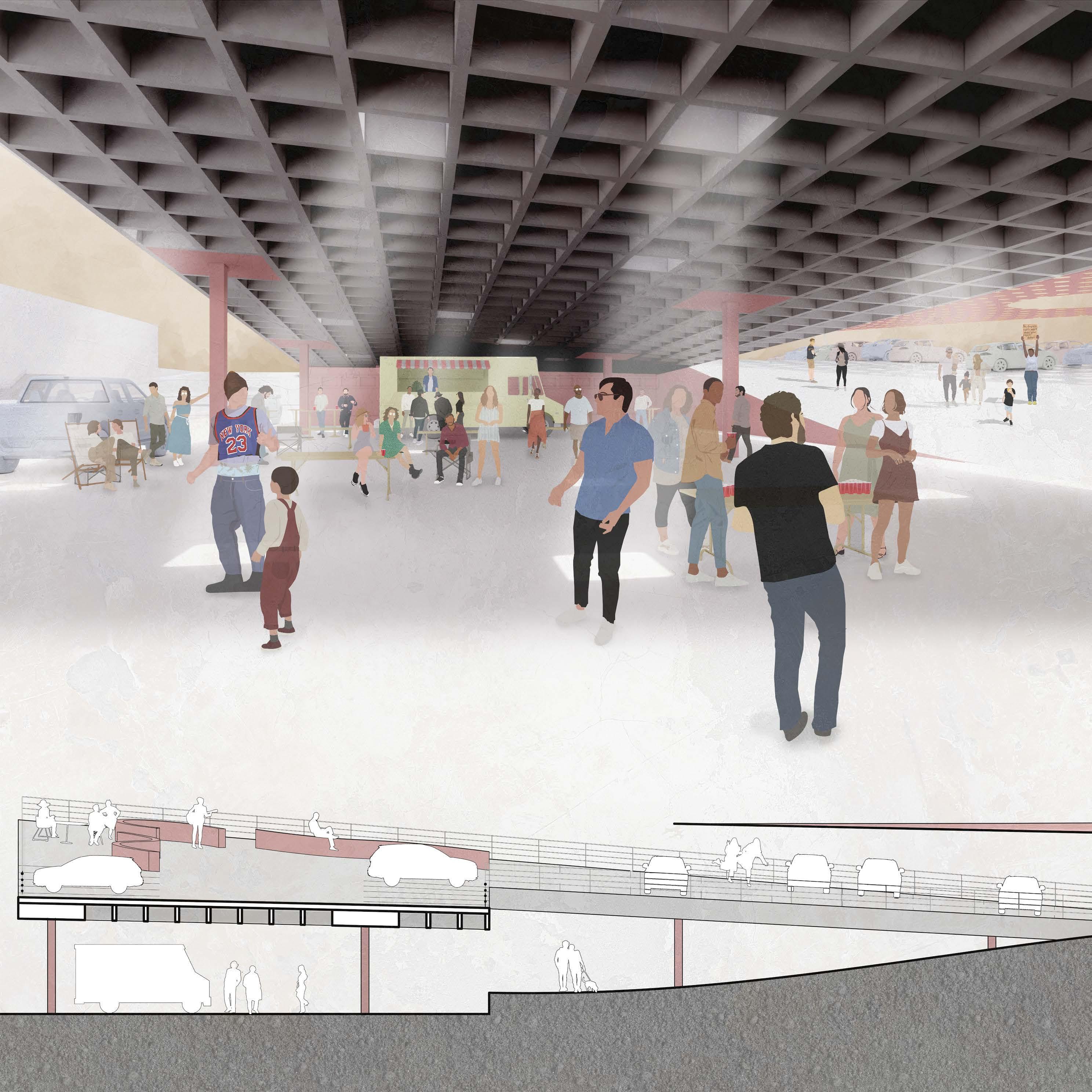
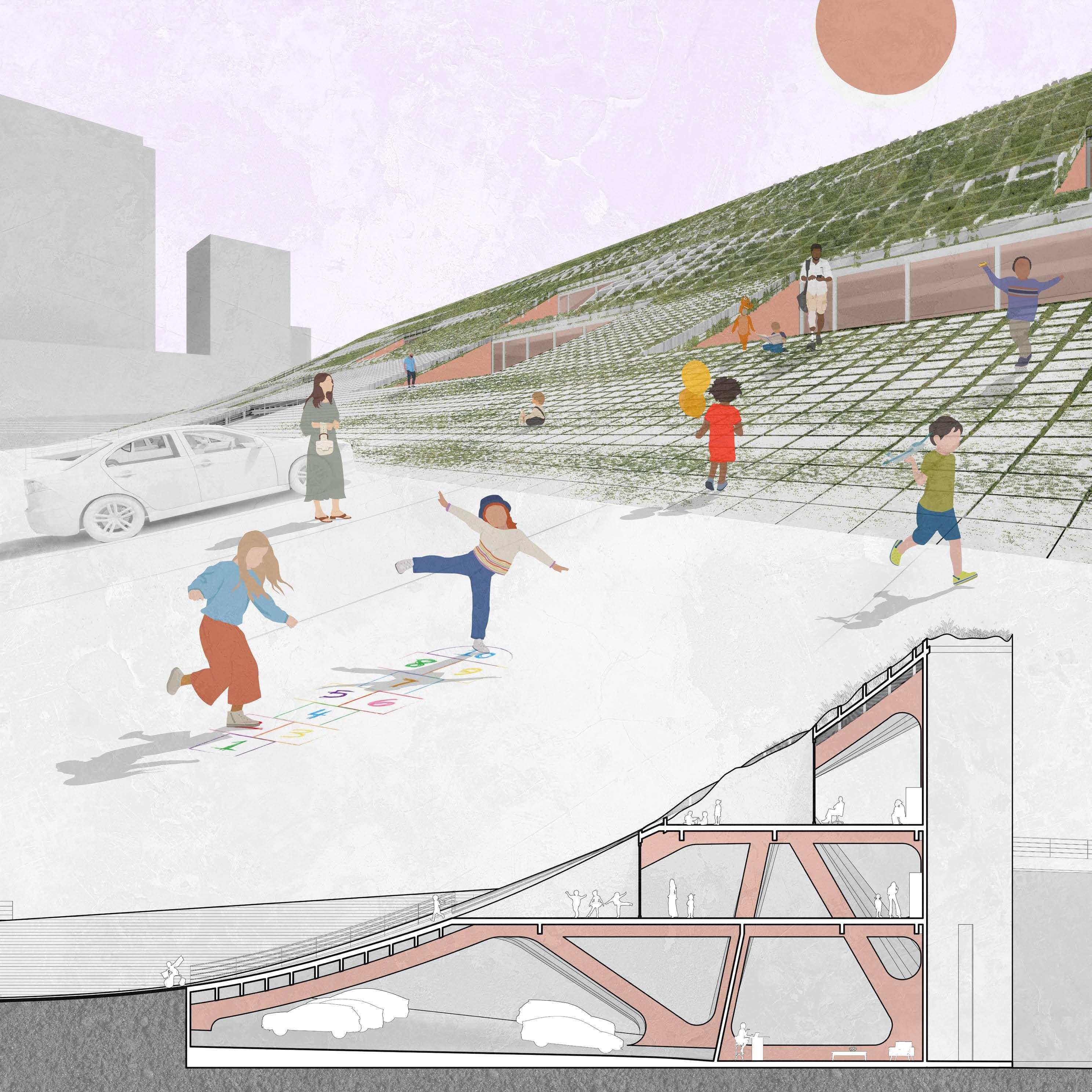
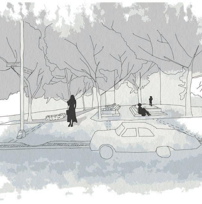
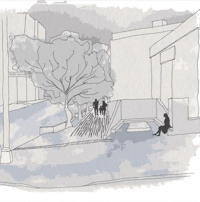
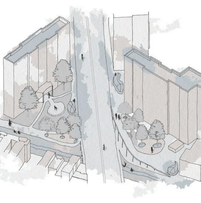
Community Park(ing)
Waterscape
Connective Island
Professional Work
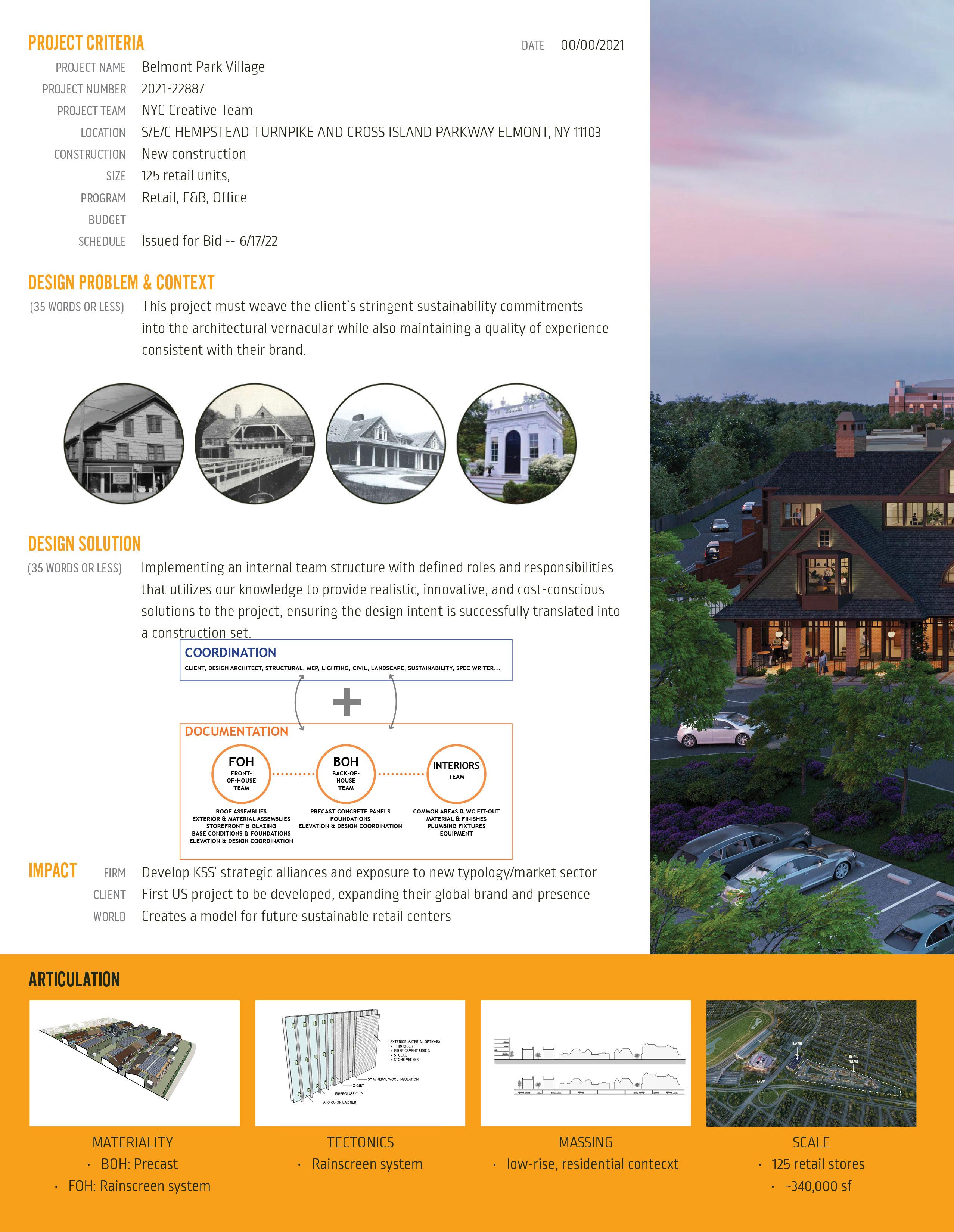
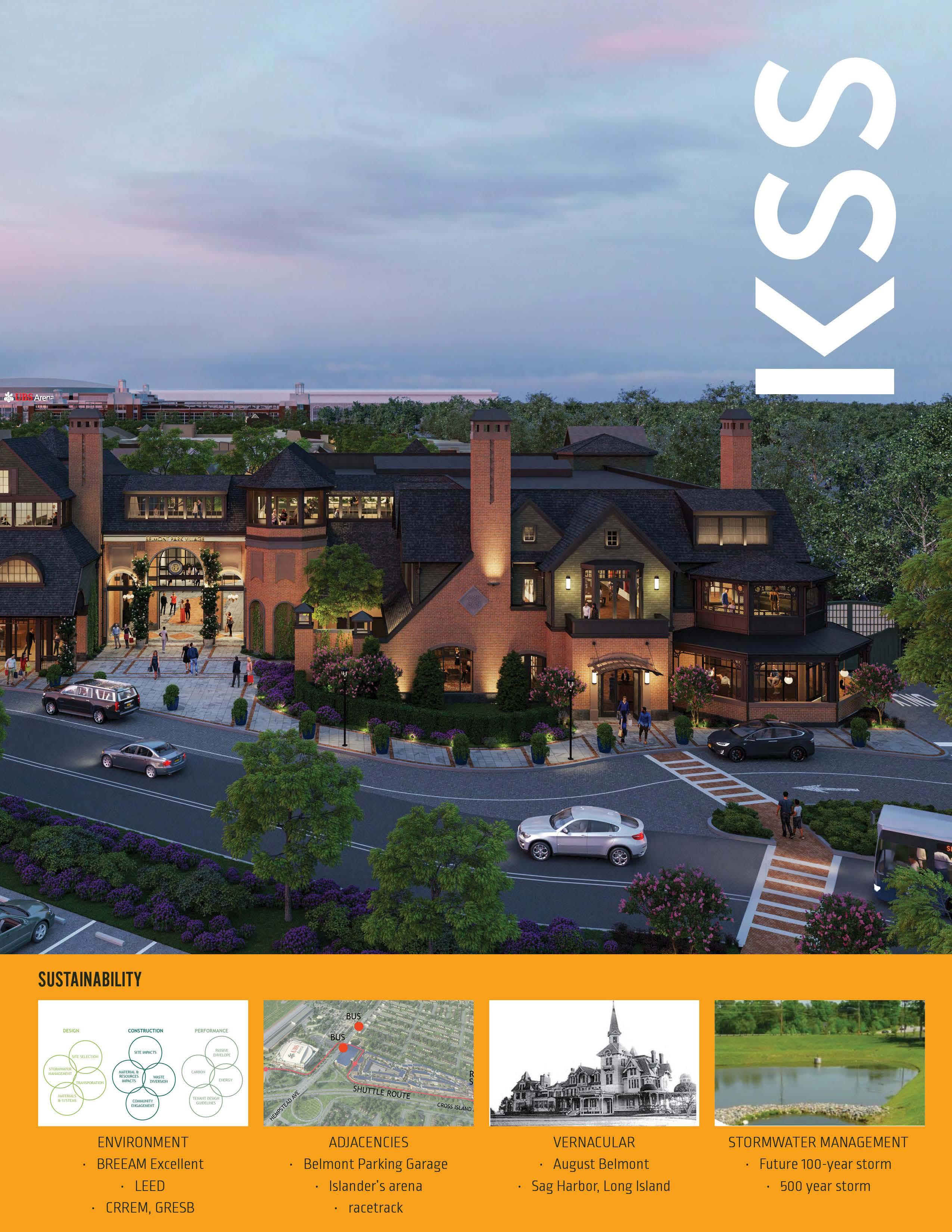
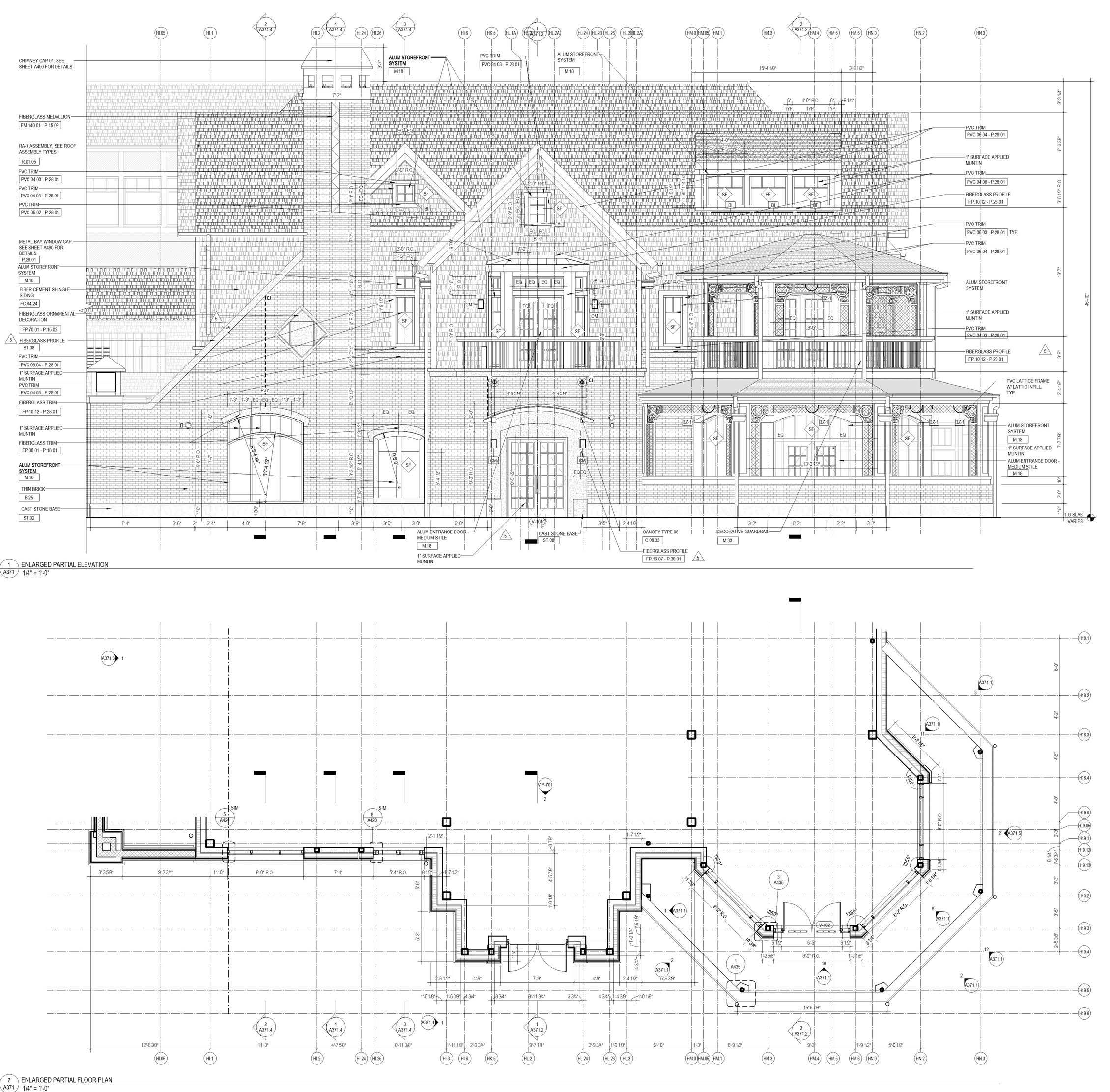
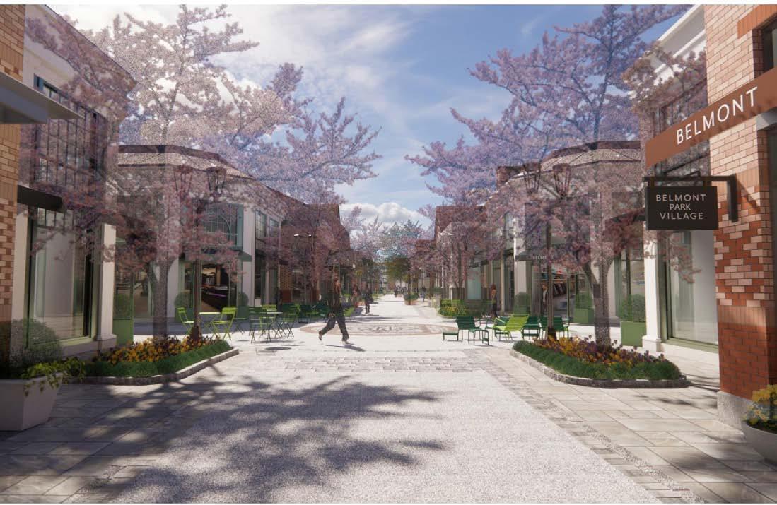
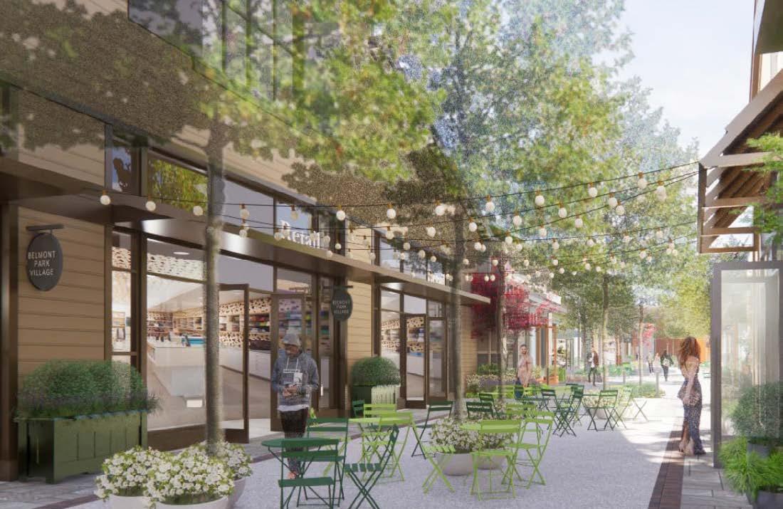
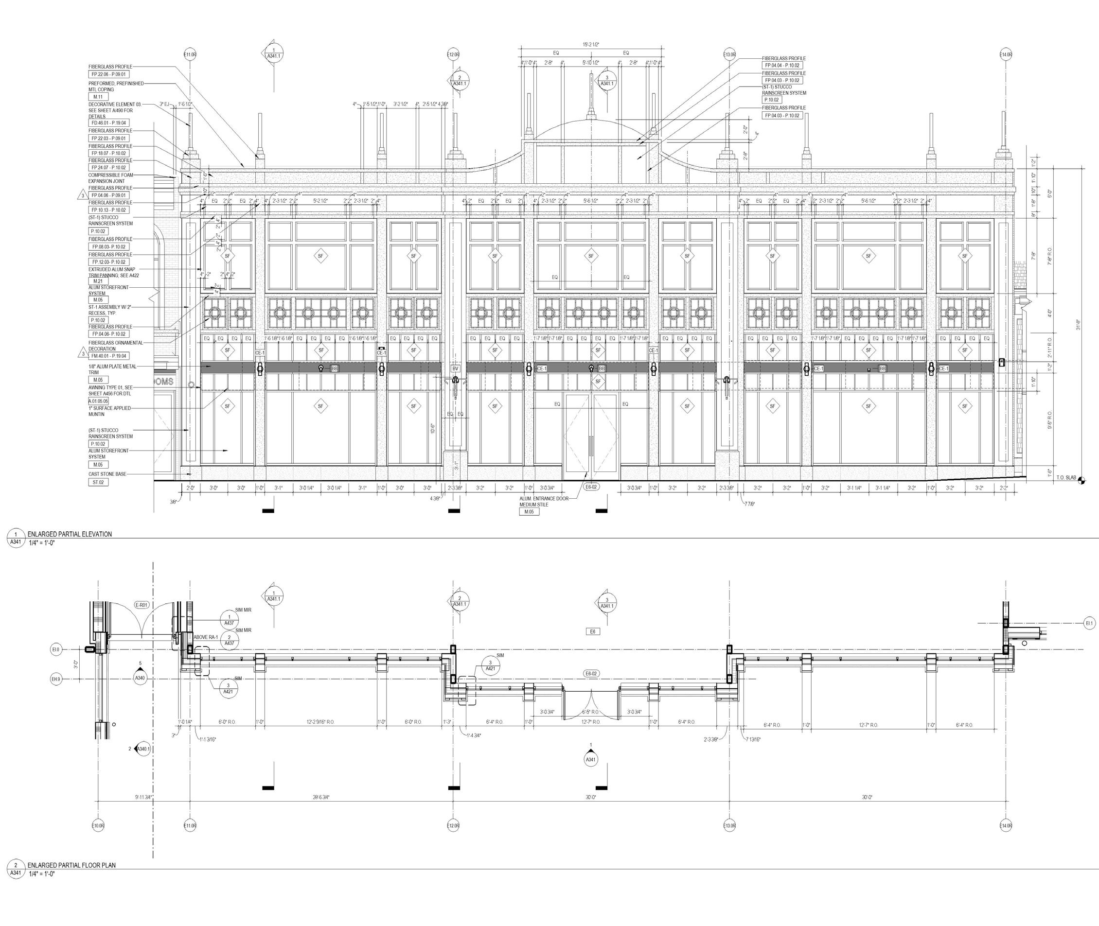
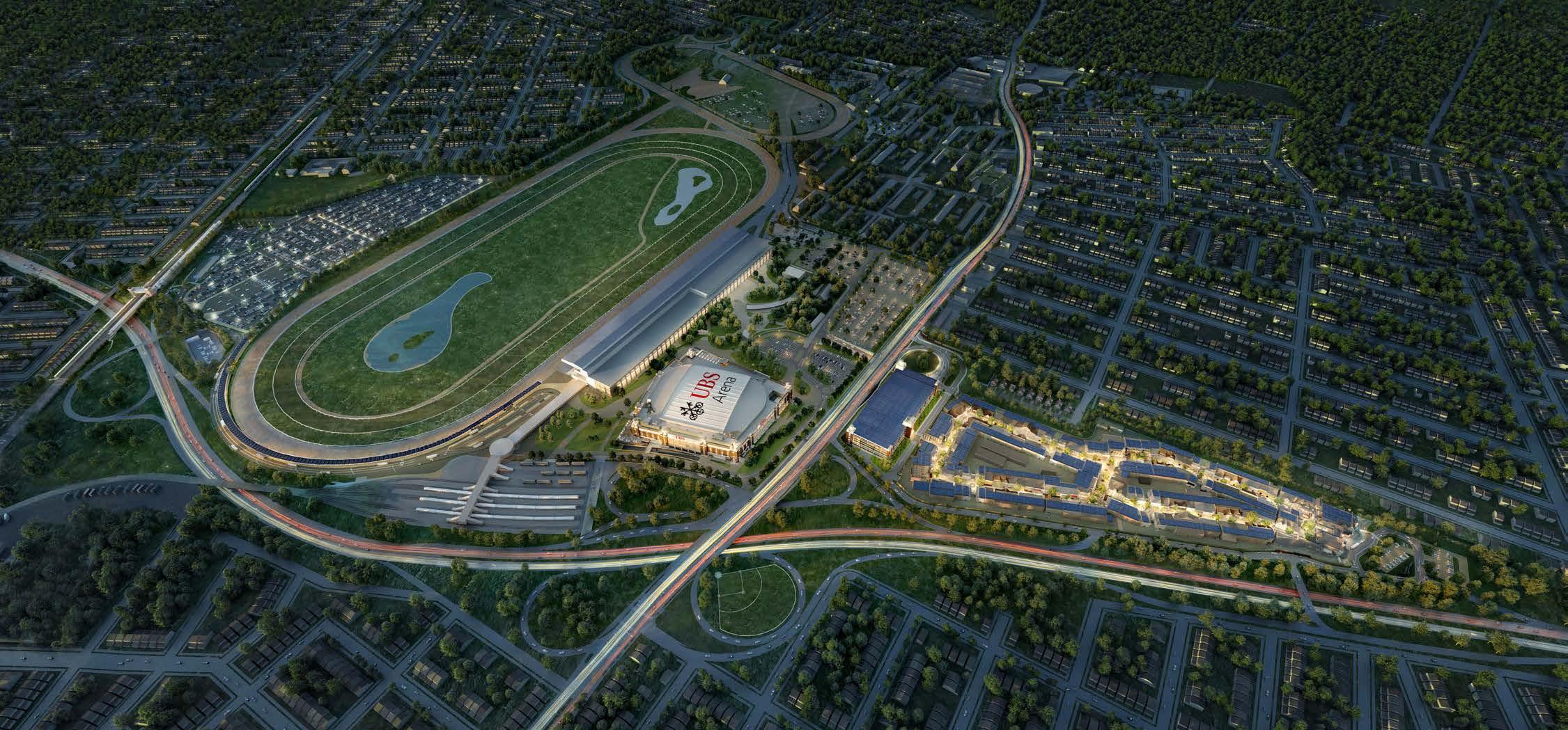
Belmont Park Retail
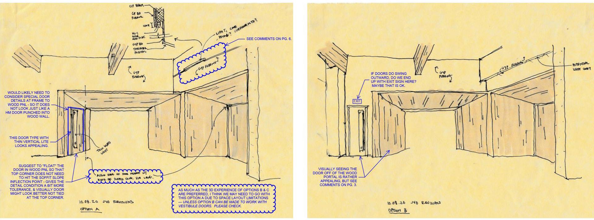
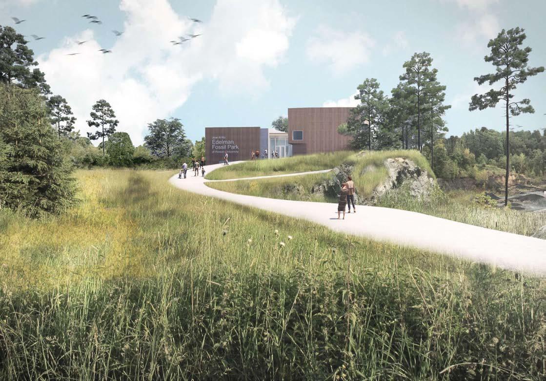
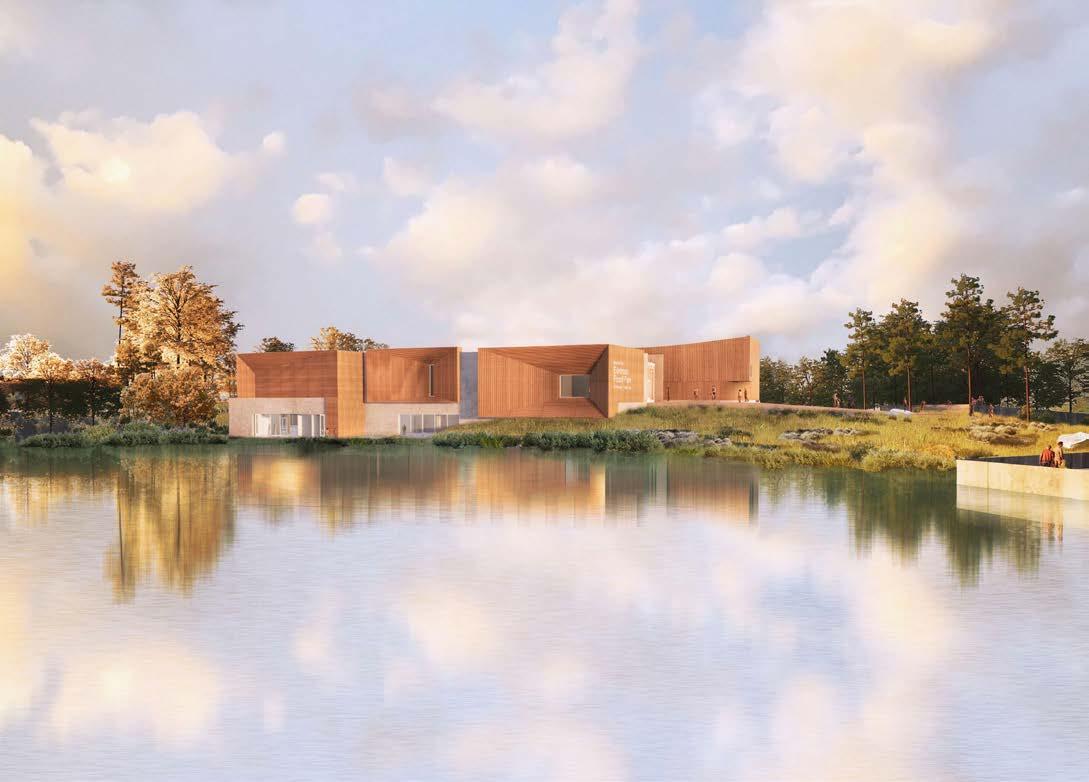
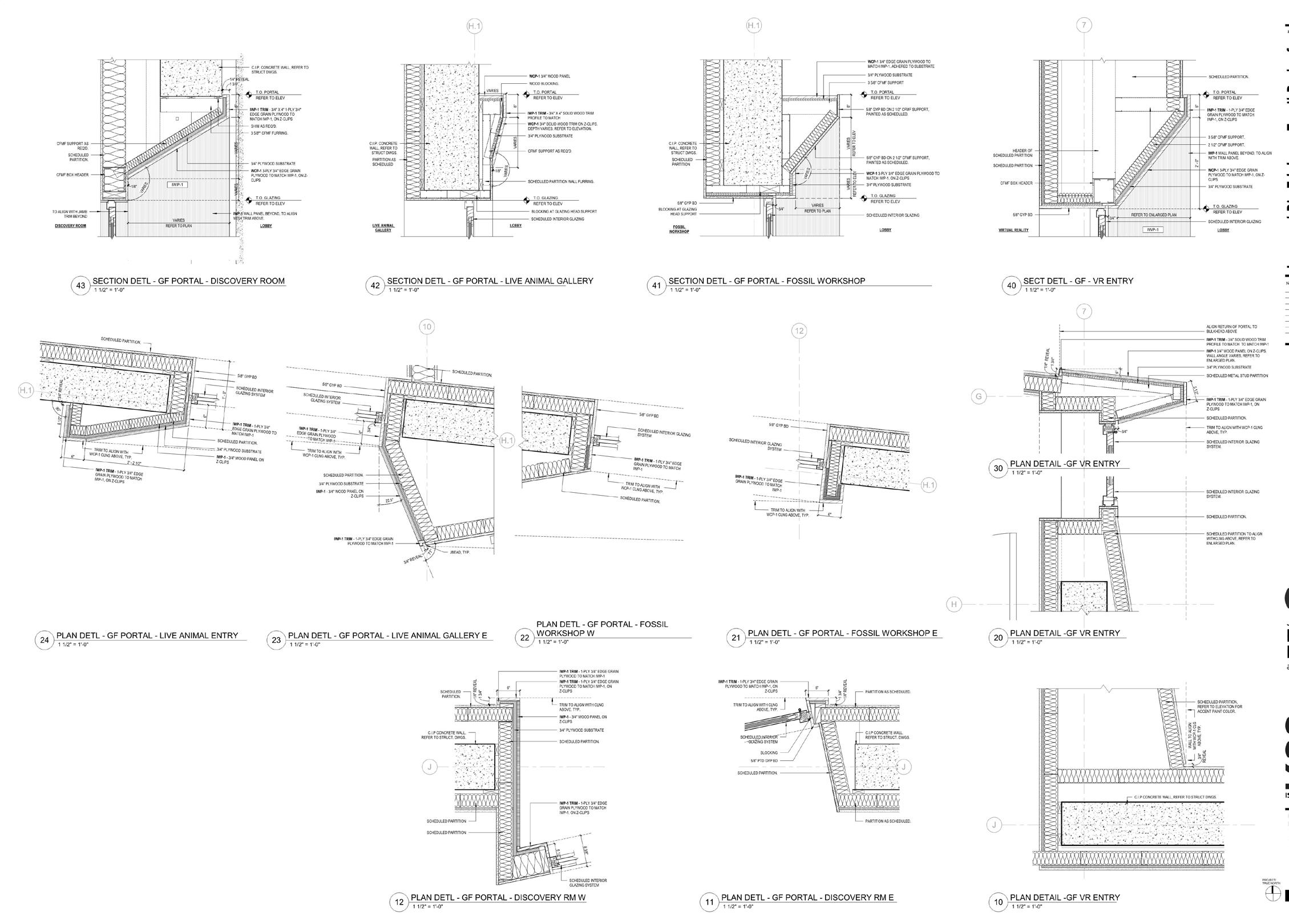
Fossil Park
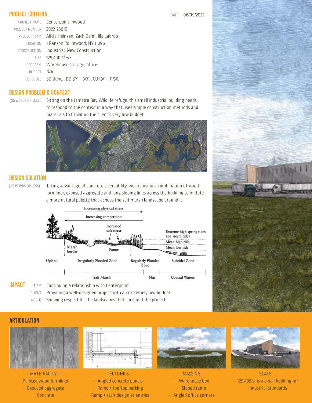
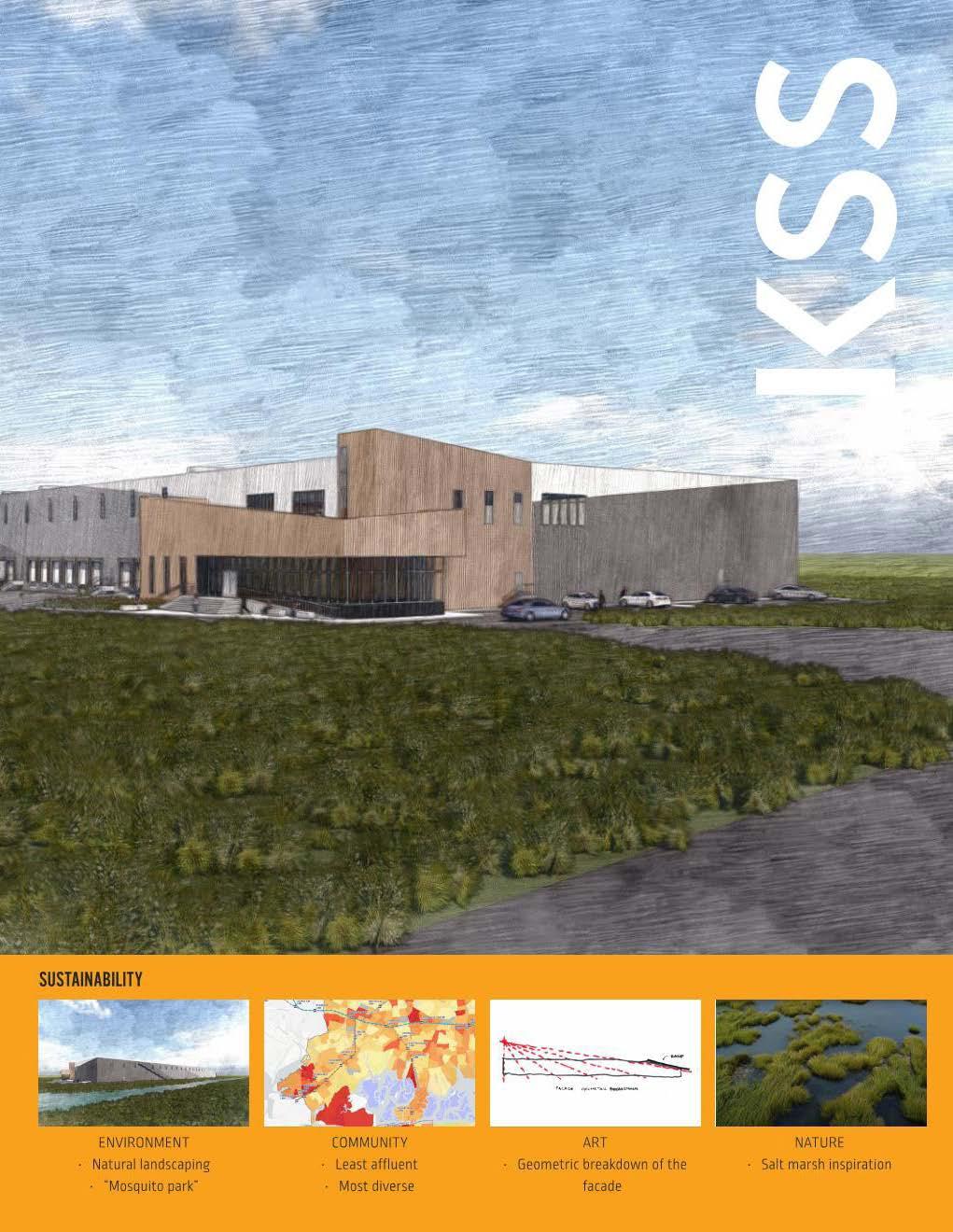
Rason Road
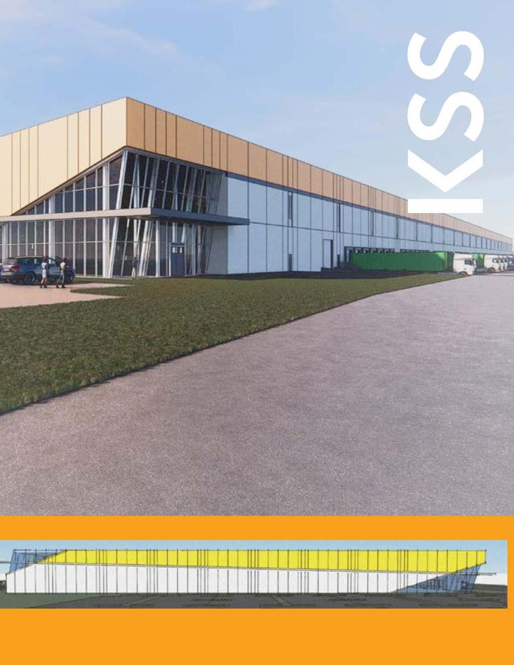
Stoltz Churchman
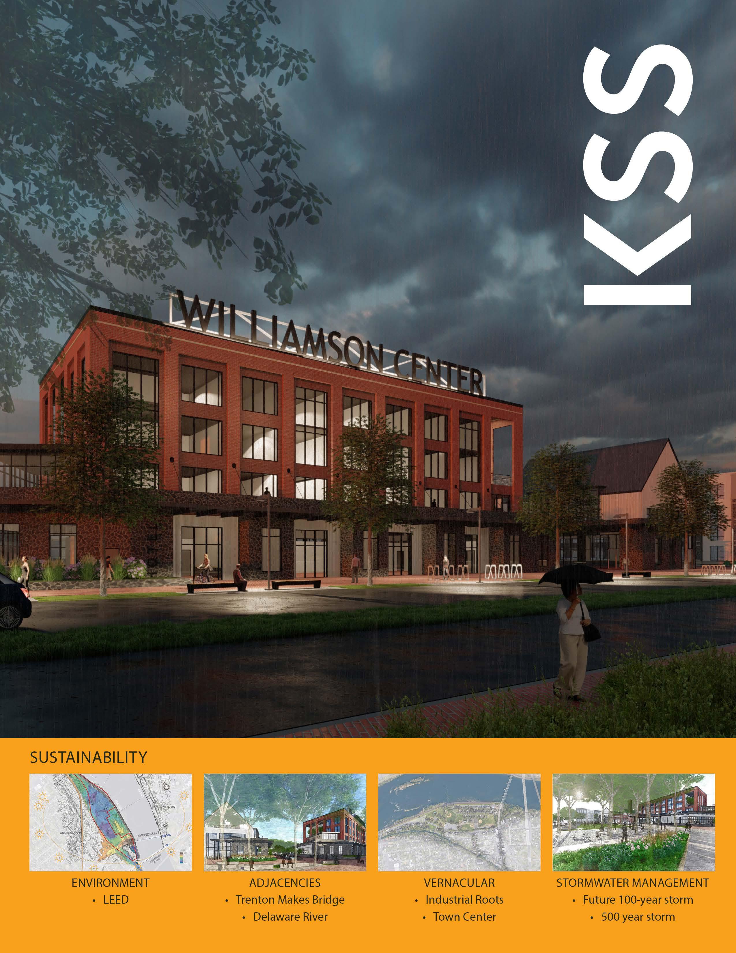
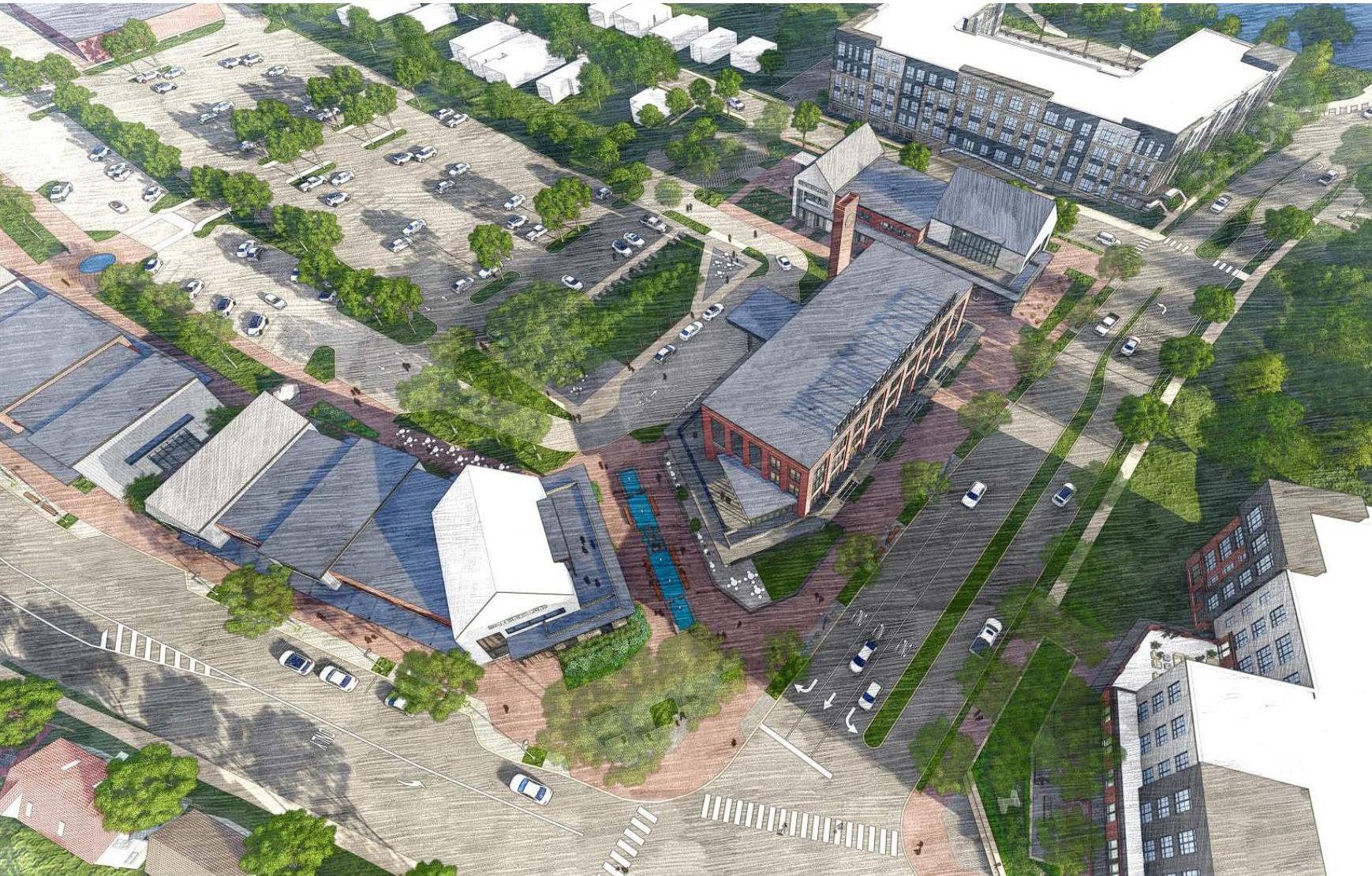
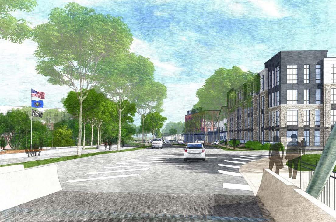
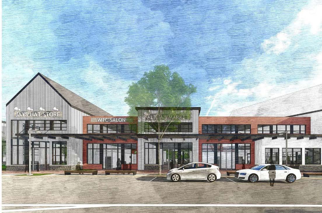
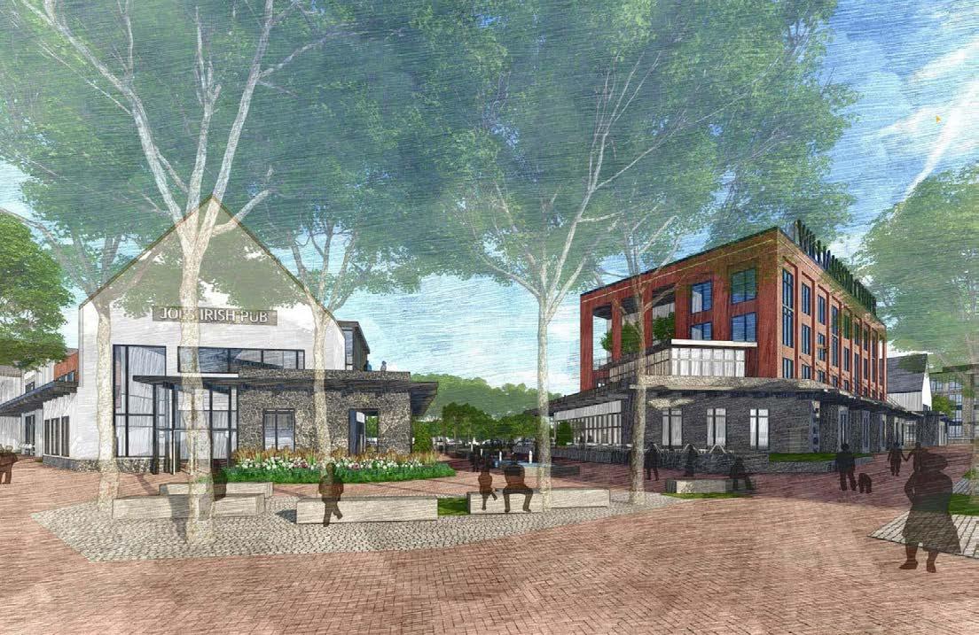
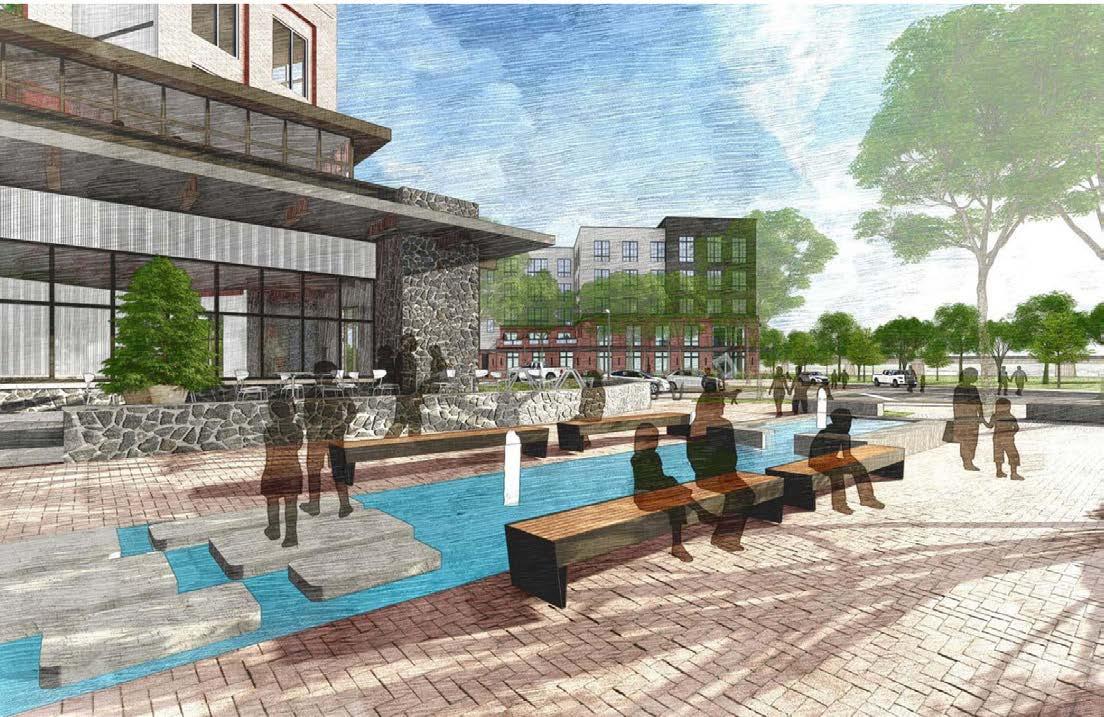
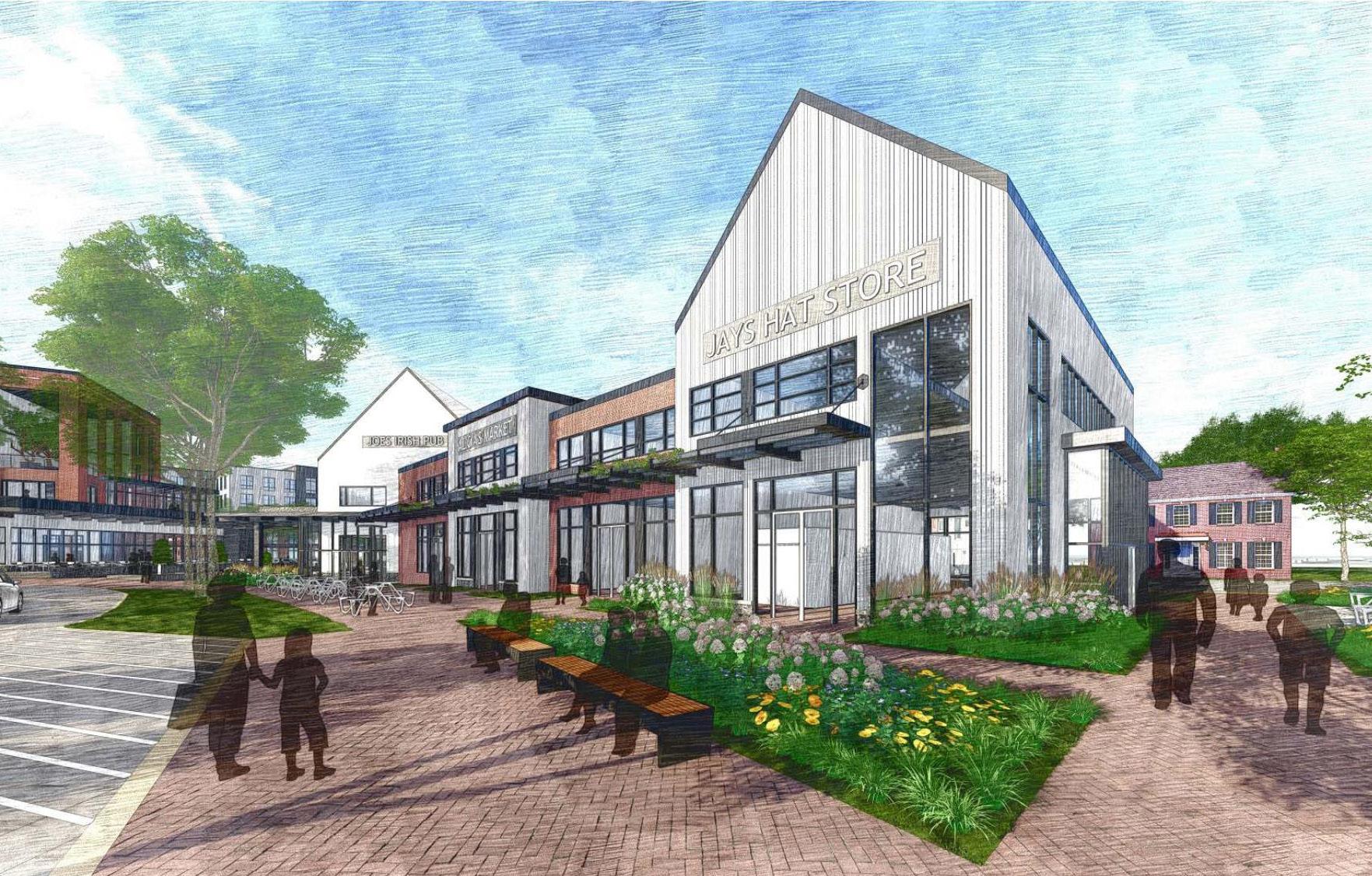
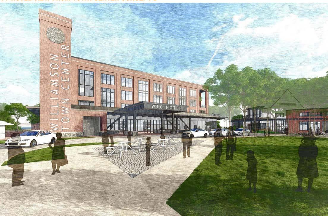
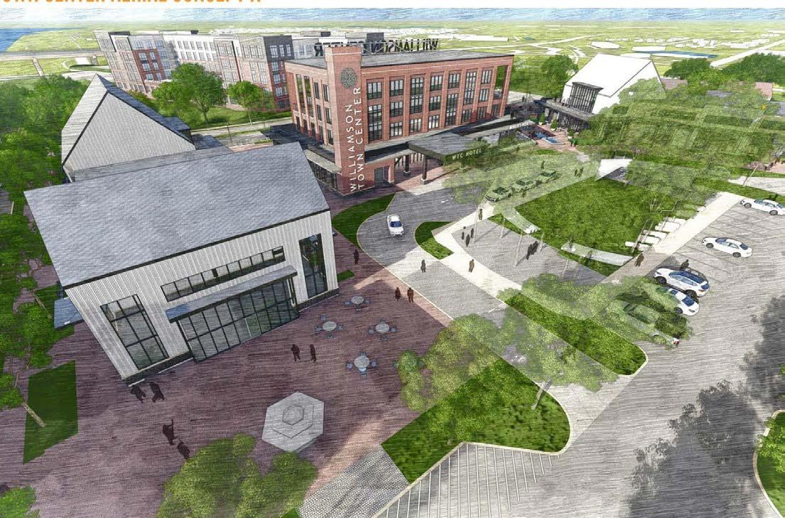
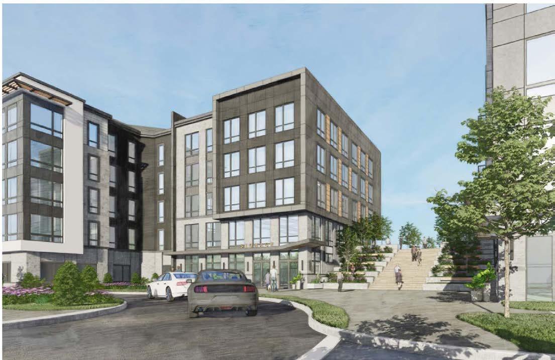
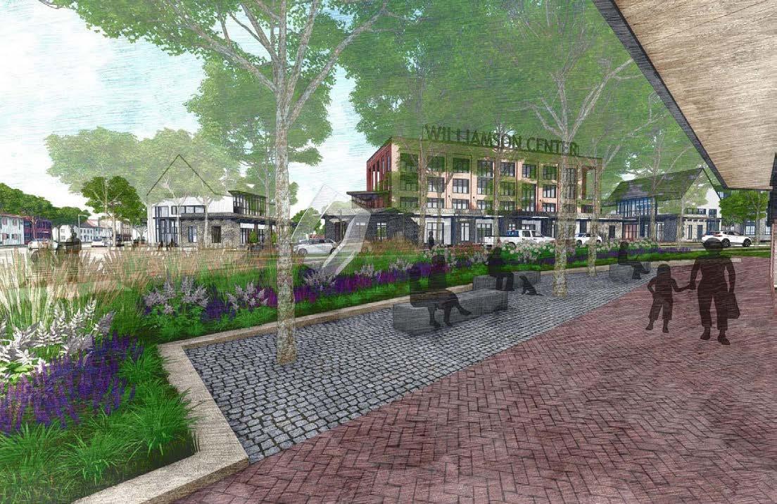
Williamson Town Center
Explorations
Color as Poetic Interpretation
Density Mapping
Tiny House
Vicenza


Studio Work
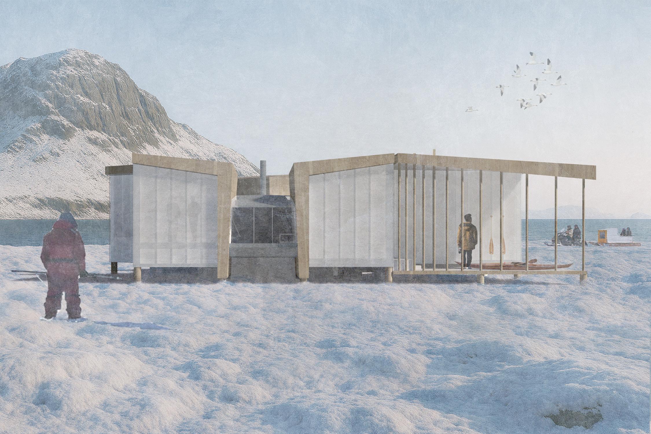
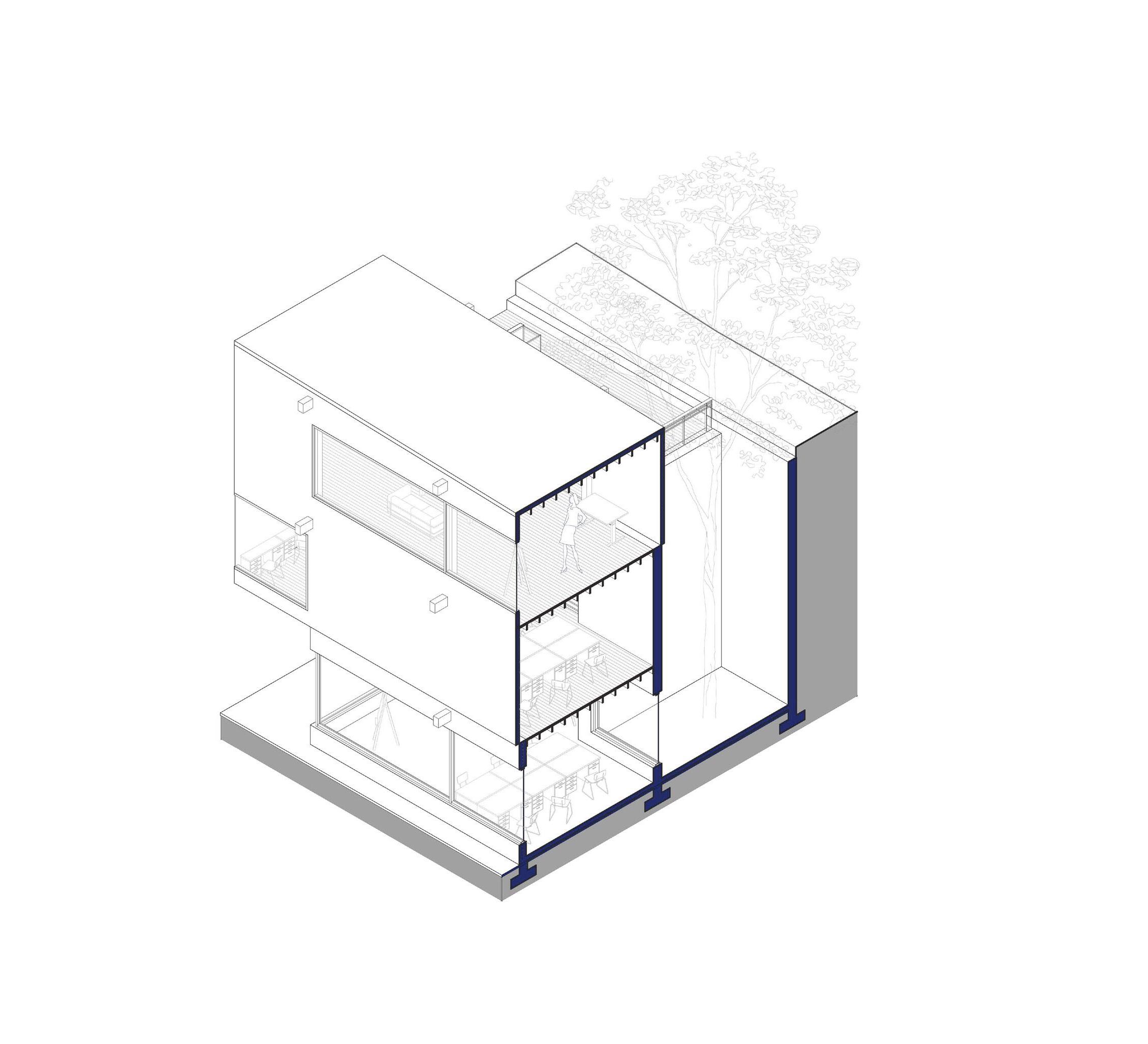
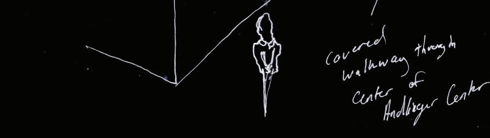
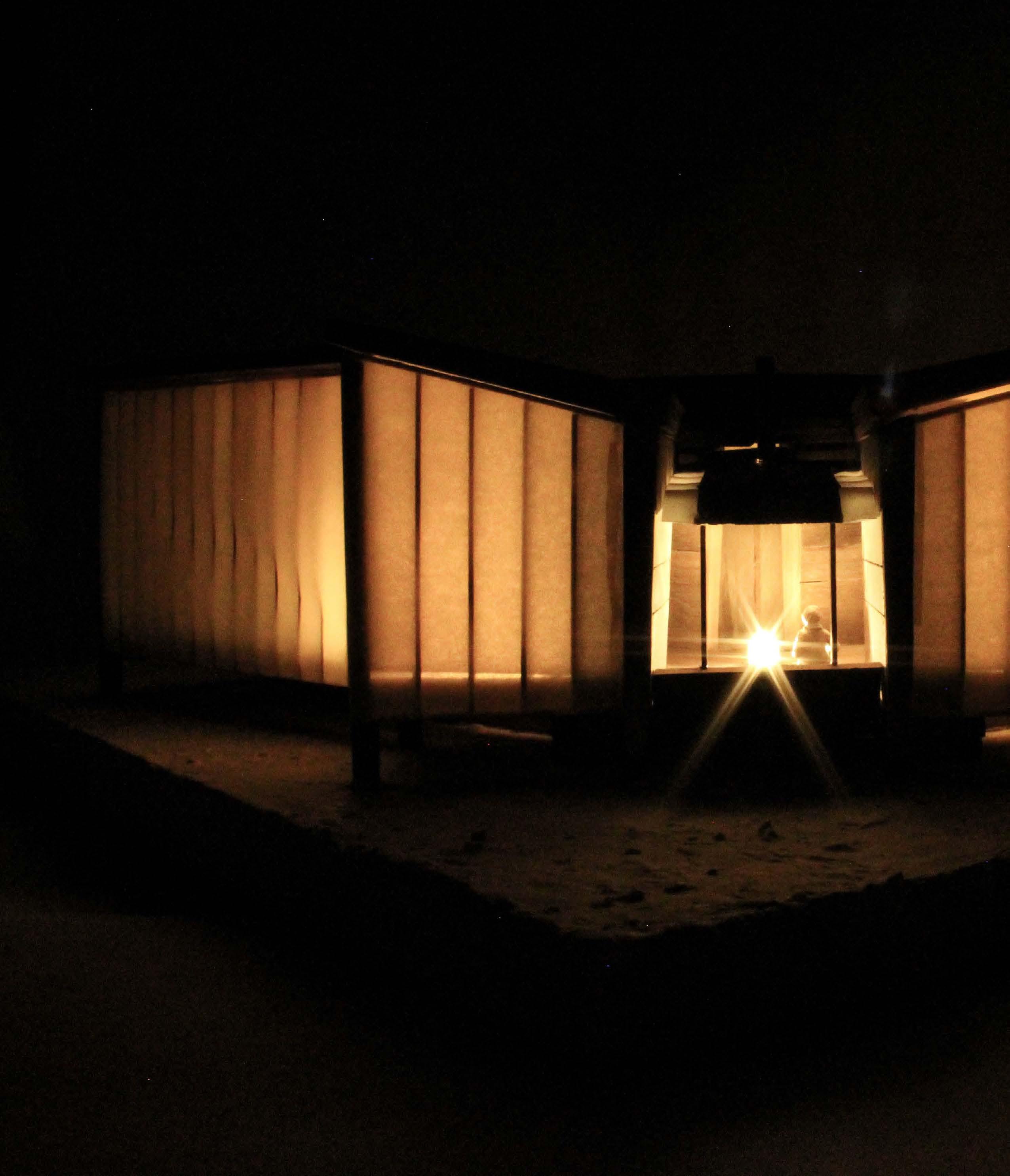
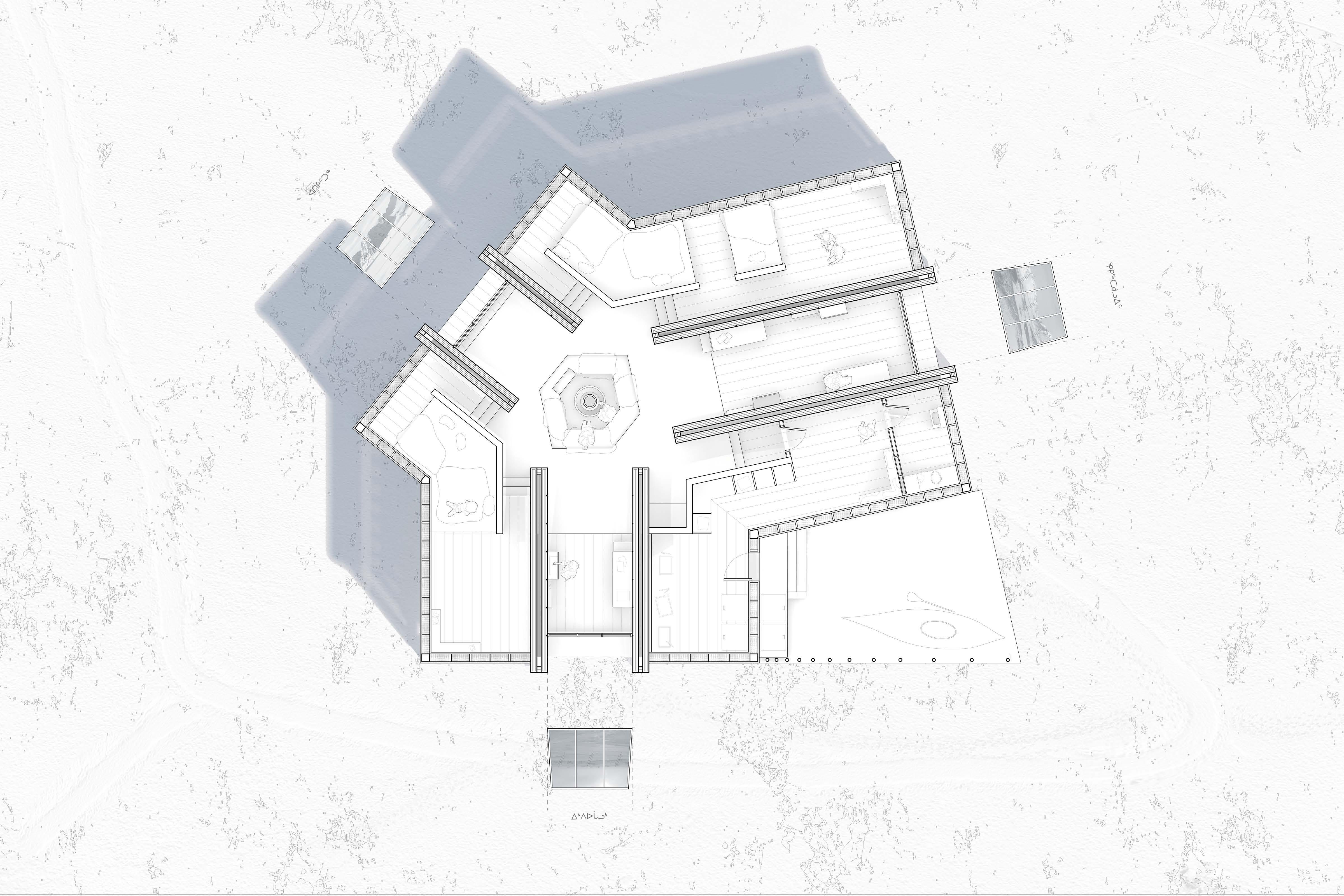
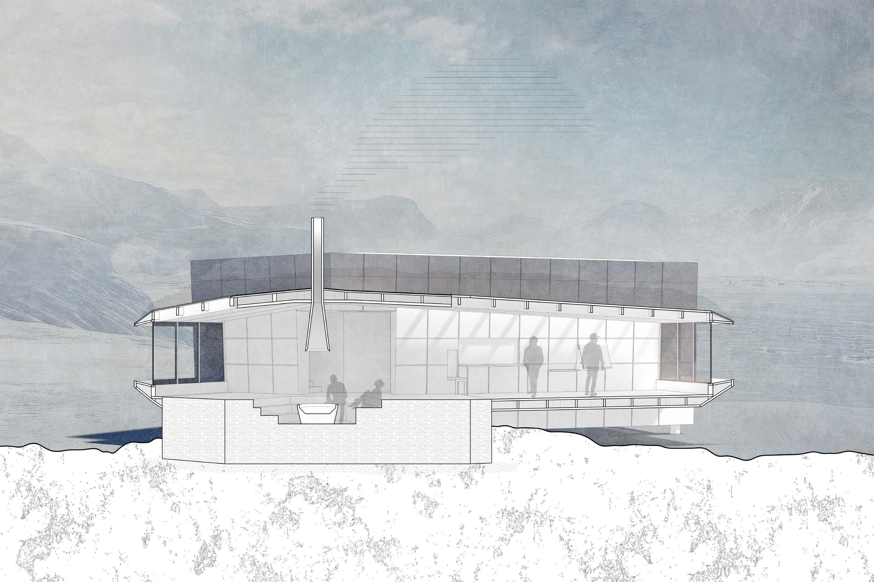
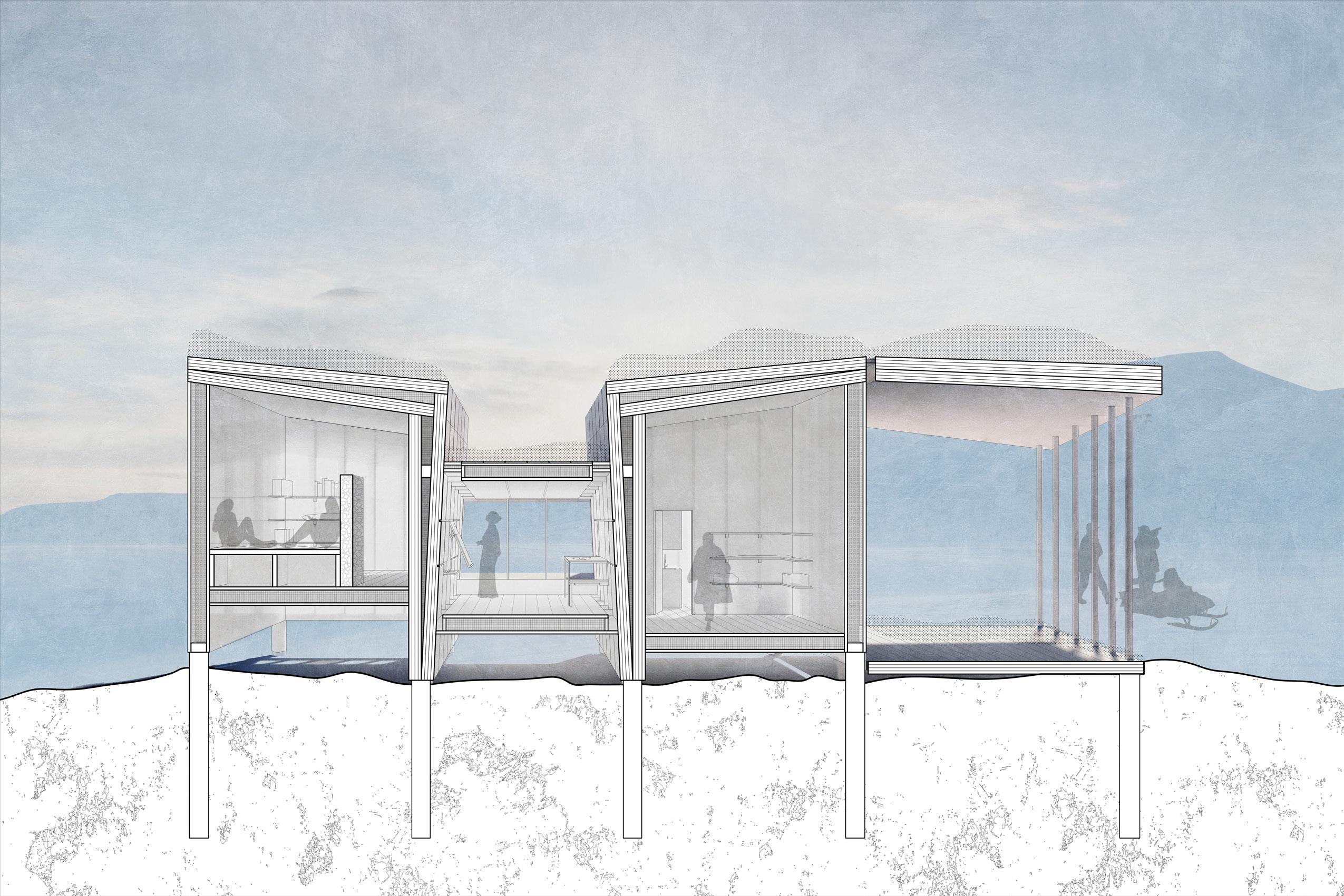
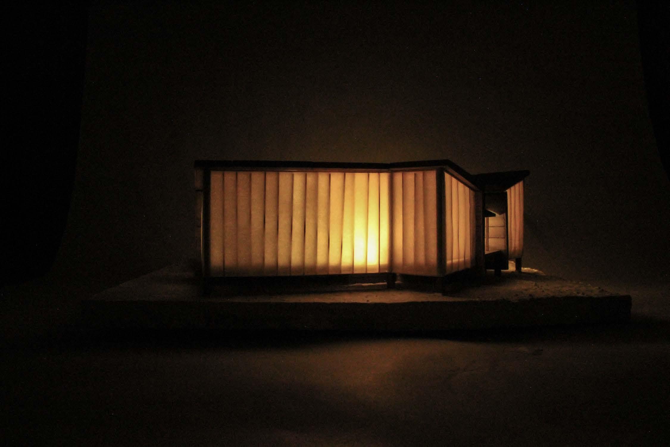
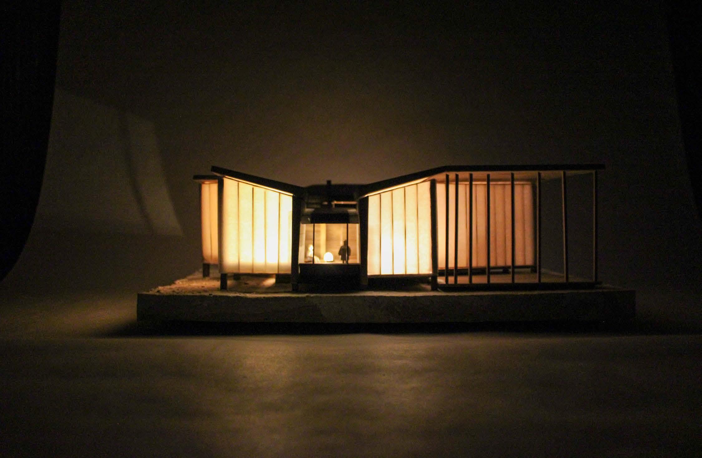
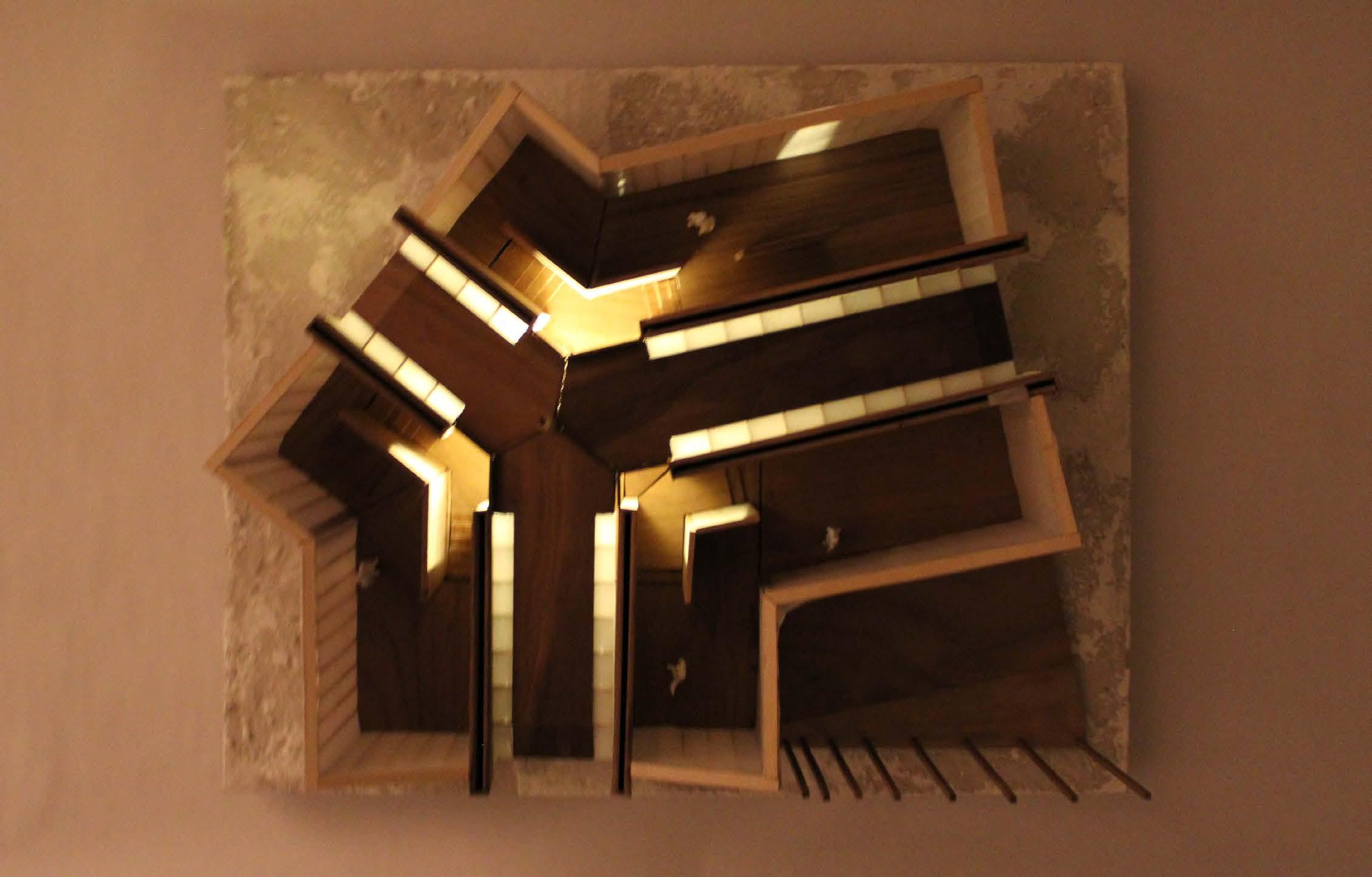
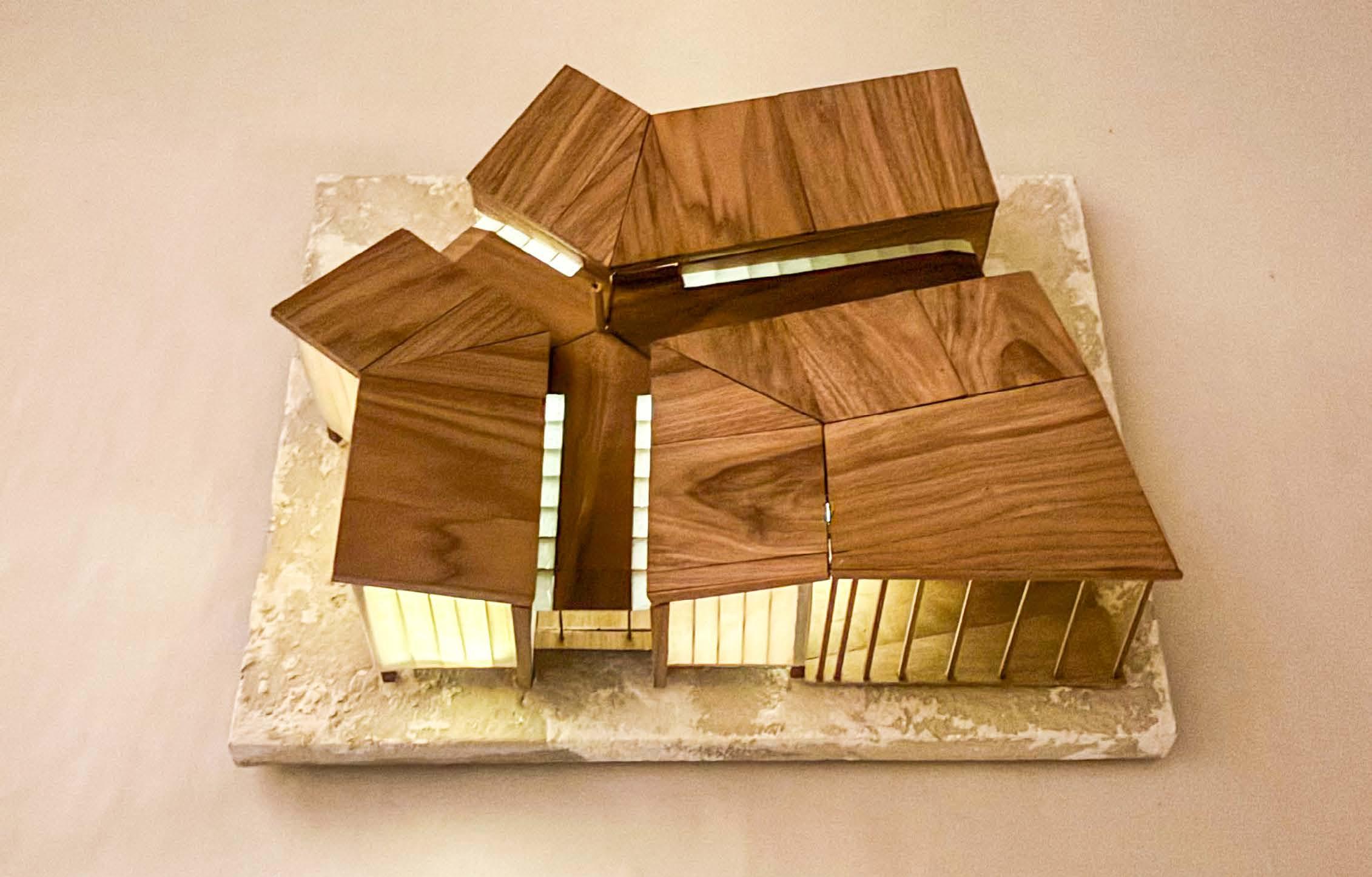
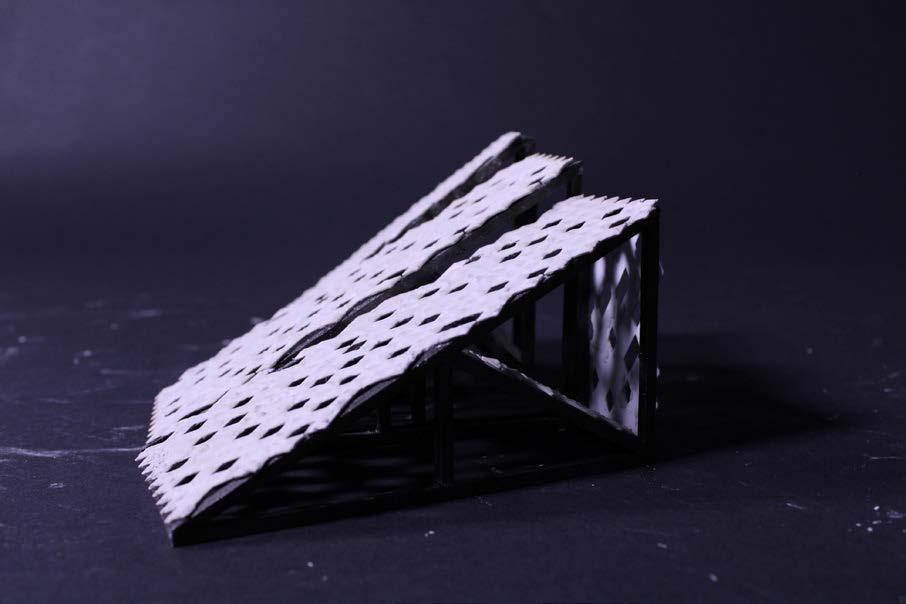
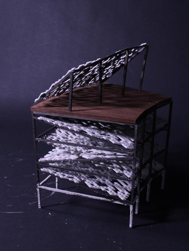
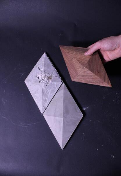
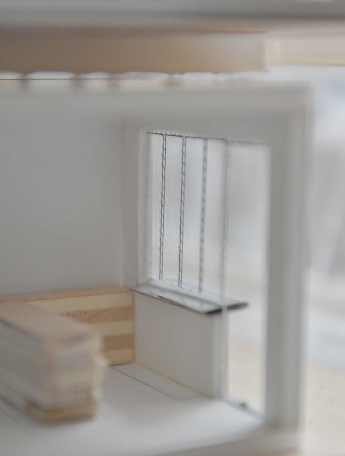
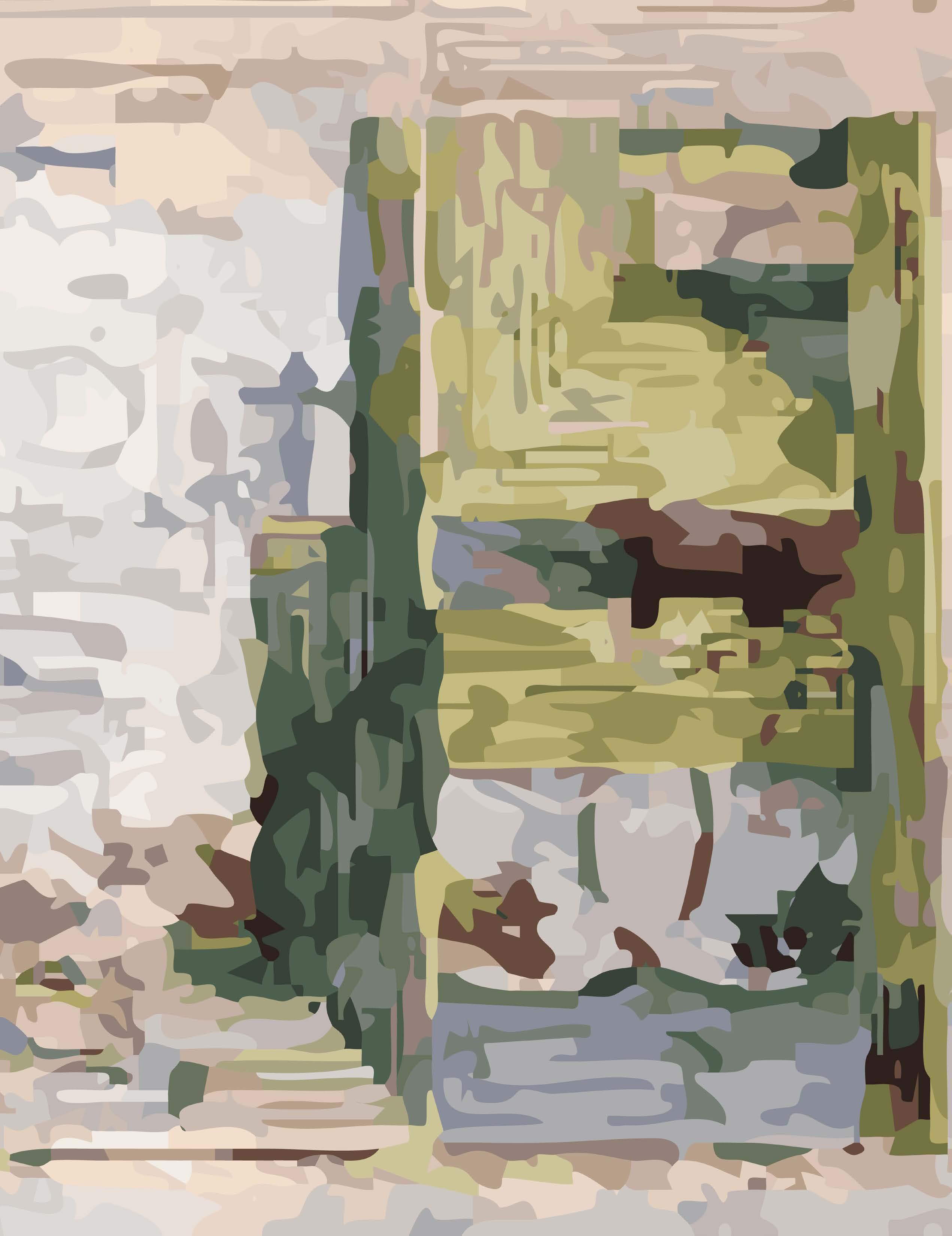
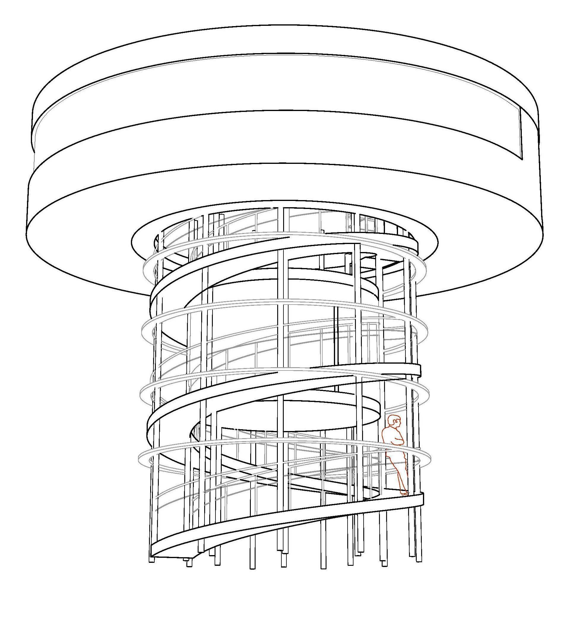
A series of hunting cabins, a typology in dr amatically increasing demand over the past two decades, is conceived not as buildings but as decentralized archival devices. The cabins are situated in remote areas along known hunting routes in the Fox Basin area near Igloolik. Each cabin frames key landforms associated with Inuit place names, enabling users to re-enter the memoryscape through embodied sightlines, environmental cues, and perspectival relationships. Rather than translating Inuit knowledge into Western archival forms, the project creates architectural situations that restore the horizon as a memory interface, reembed place names in lived spatial experience, and situate the archive back into the land it emerges from.
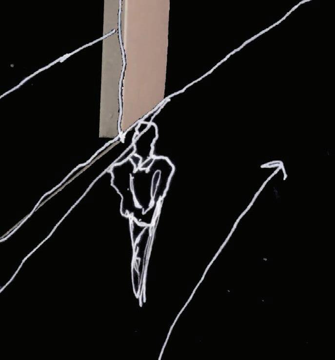
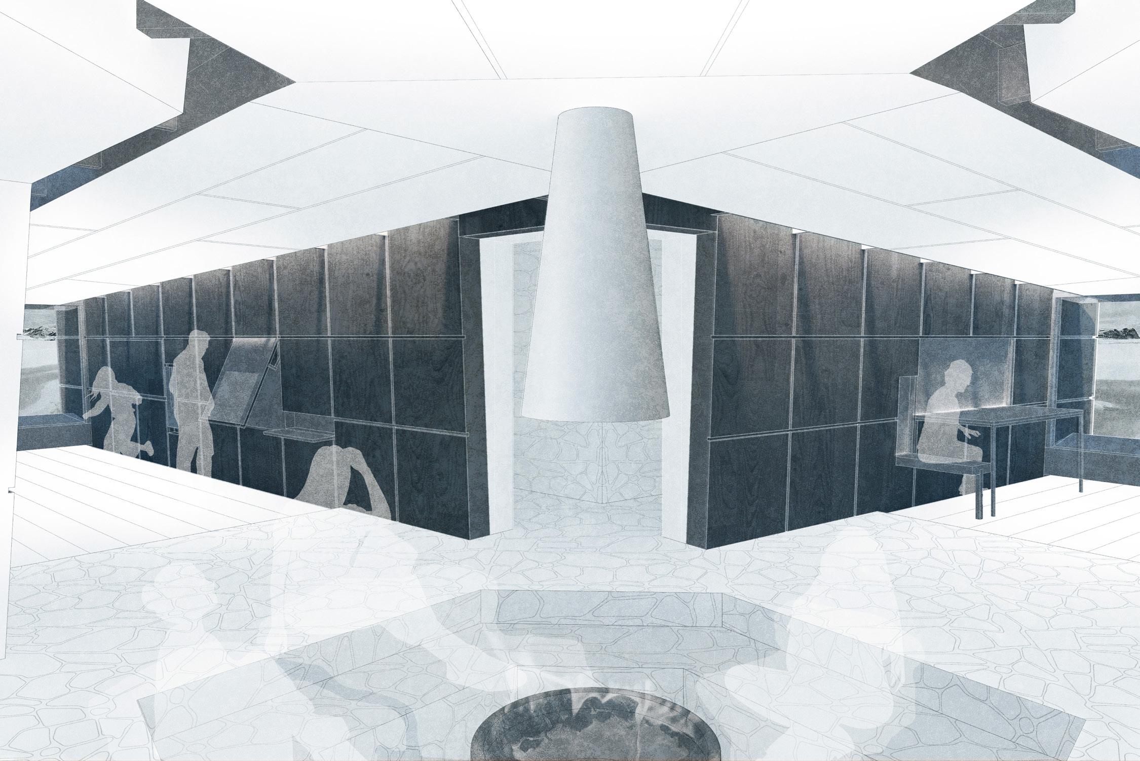
The hunting cabin is derived from the organization of traditional Inuit shelters where the user progresses from a covered entry through a form of airlock, into a communal area, and then finally to a raised, shared sleeping platform at the rear of the building. This traditional layout is reimagined utilizing the directions of the nearest place names to the site. CLT panel walls not only frame the horizon in key directions, but act as the central structure for the three rooms that surround and create space for the hearth.
This is an intentional subversion of tr aditional wayfinding in the sense that wayfinding typically occurs outdoors. The archive reinforces the concept of Anijaarniq (Ah-nee-yaaq-niq) and orienting as a form of dwelling through direct visual connection to the landscape from the center of the building. The central space is intentionally vertically compressed and significantly more isolated from daylight than the bedrooms, forcing attention outwards towards the source of daylight. The horizon in each of the only three windows in the cabin becomes the sole source of orientation in an otherwise disorienting and artificially lengthened space.


Bridgeport, Connecticut
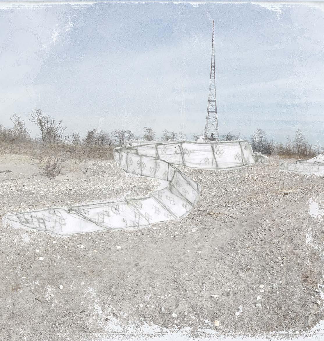
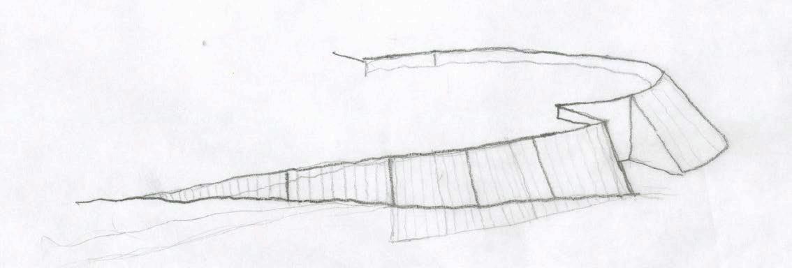
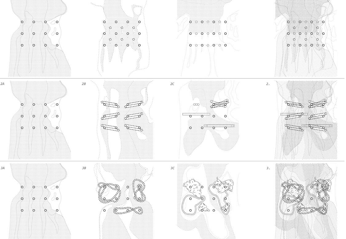
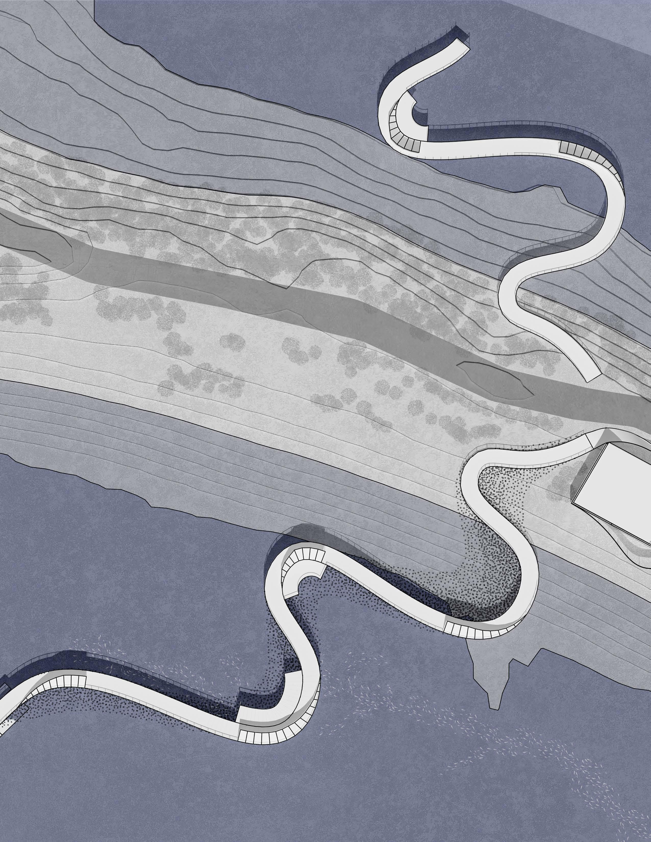
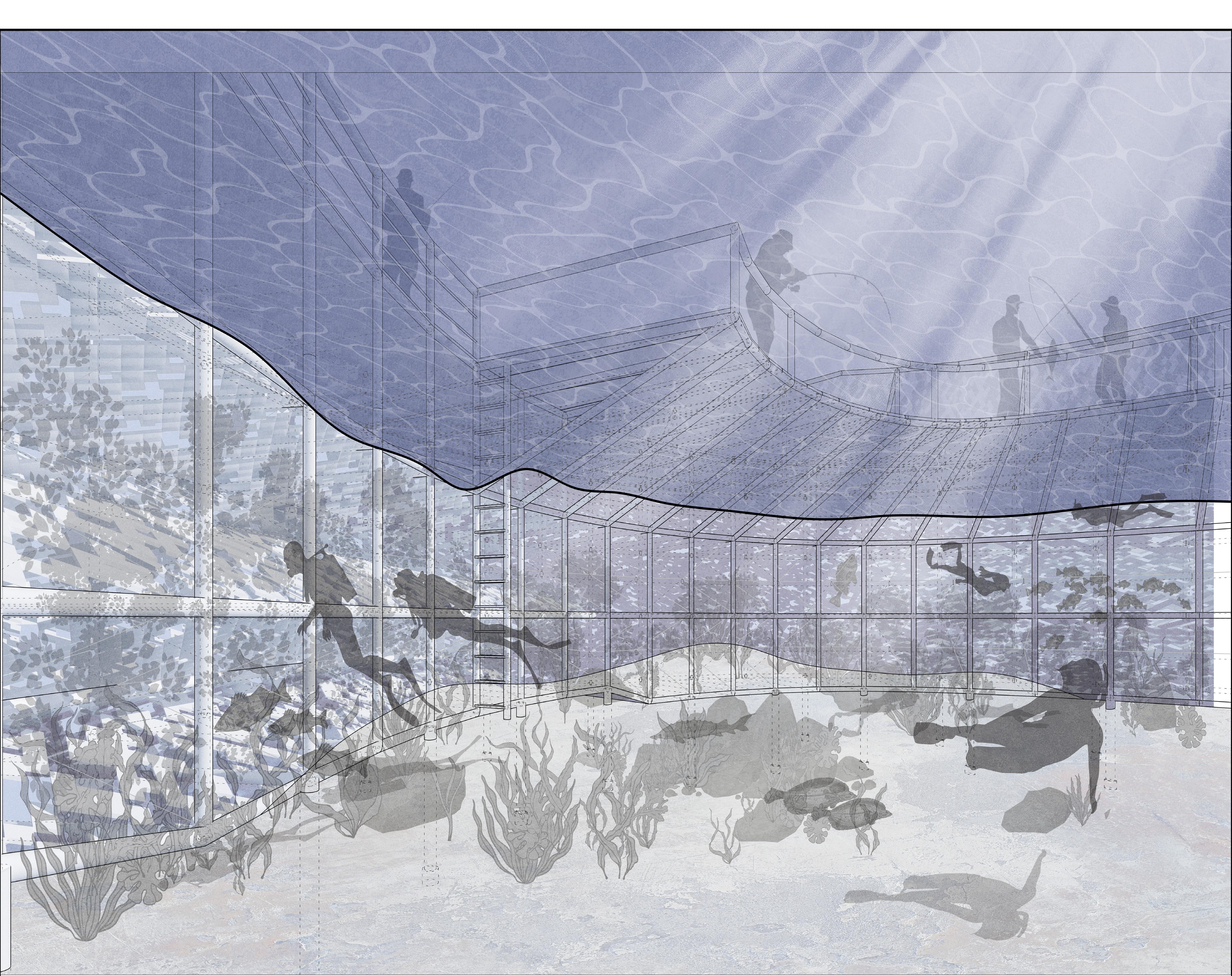
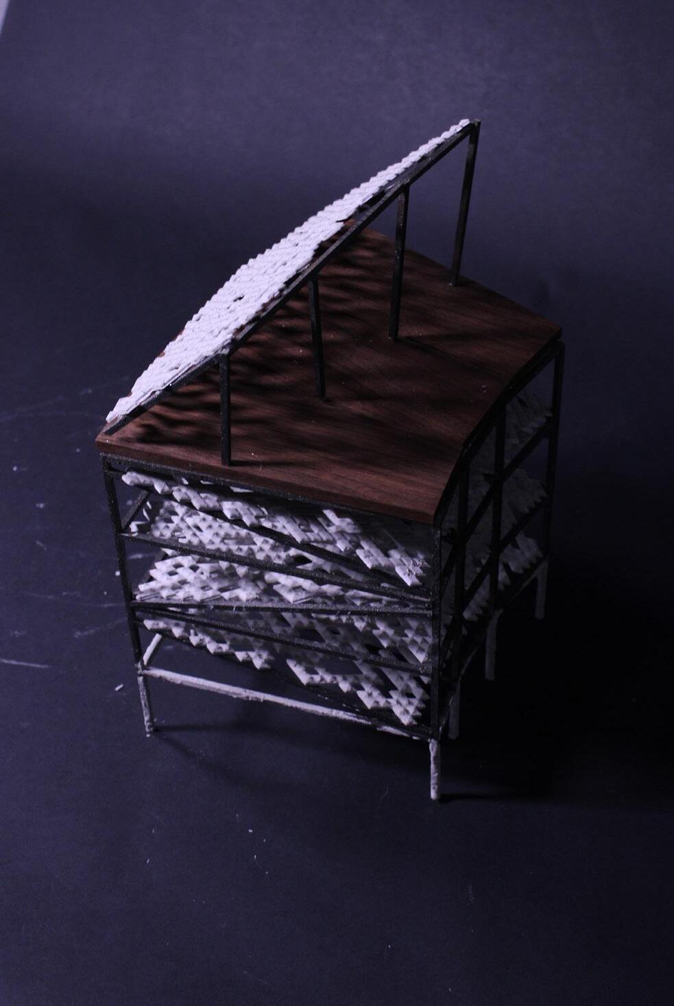
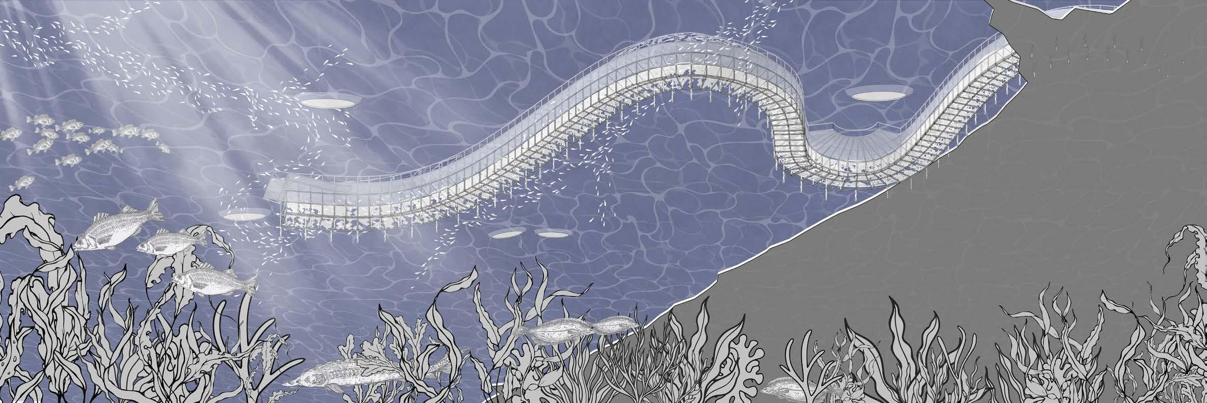
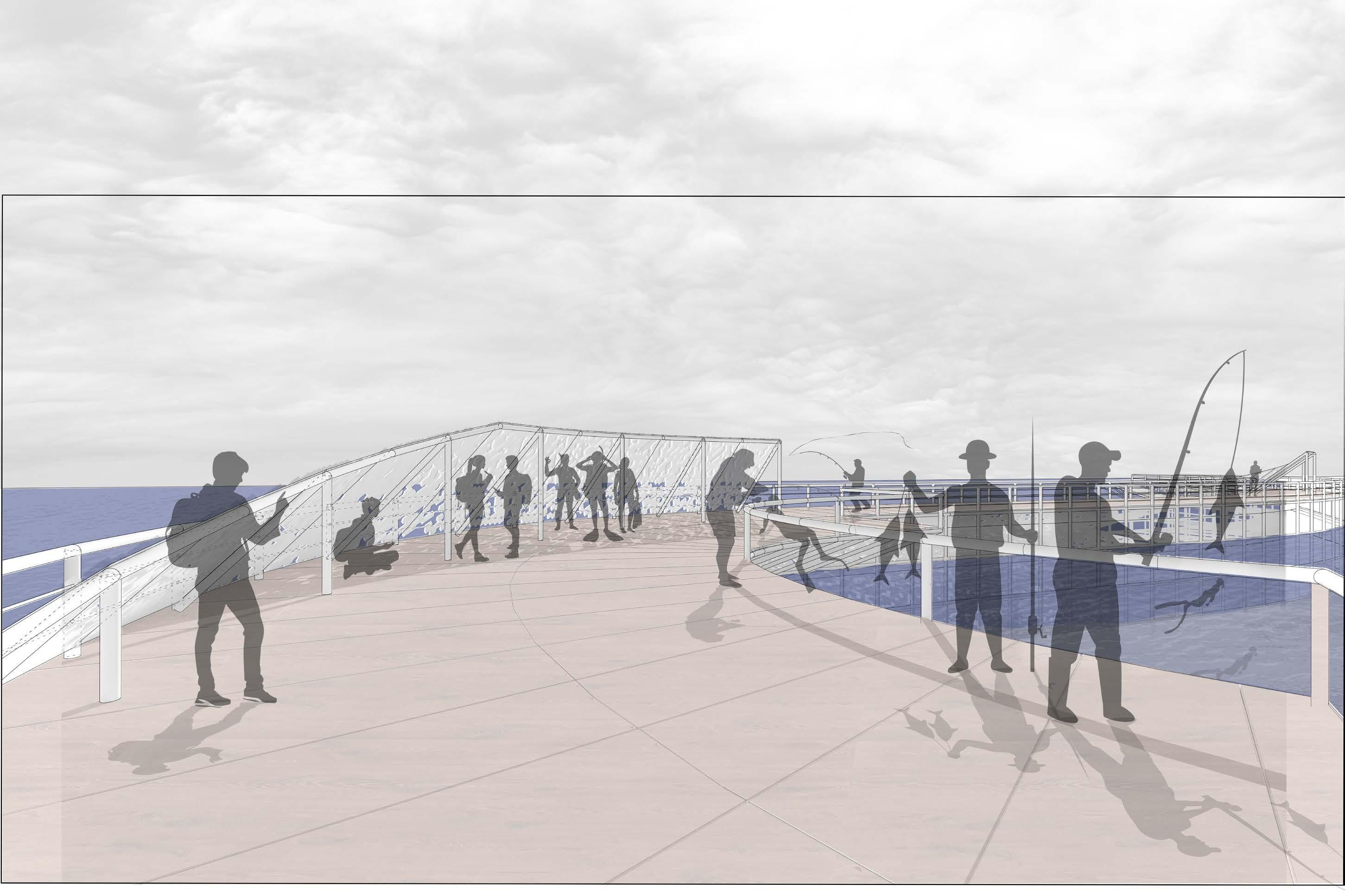
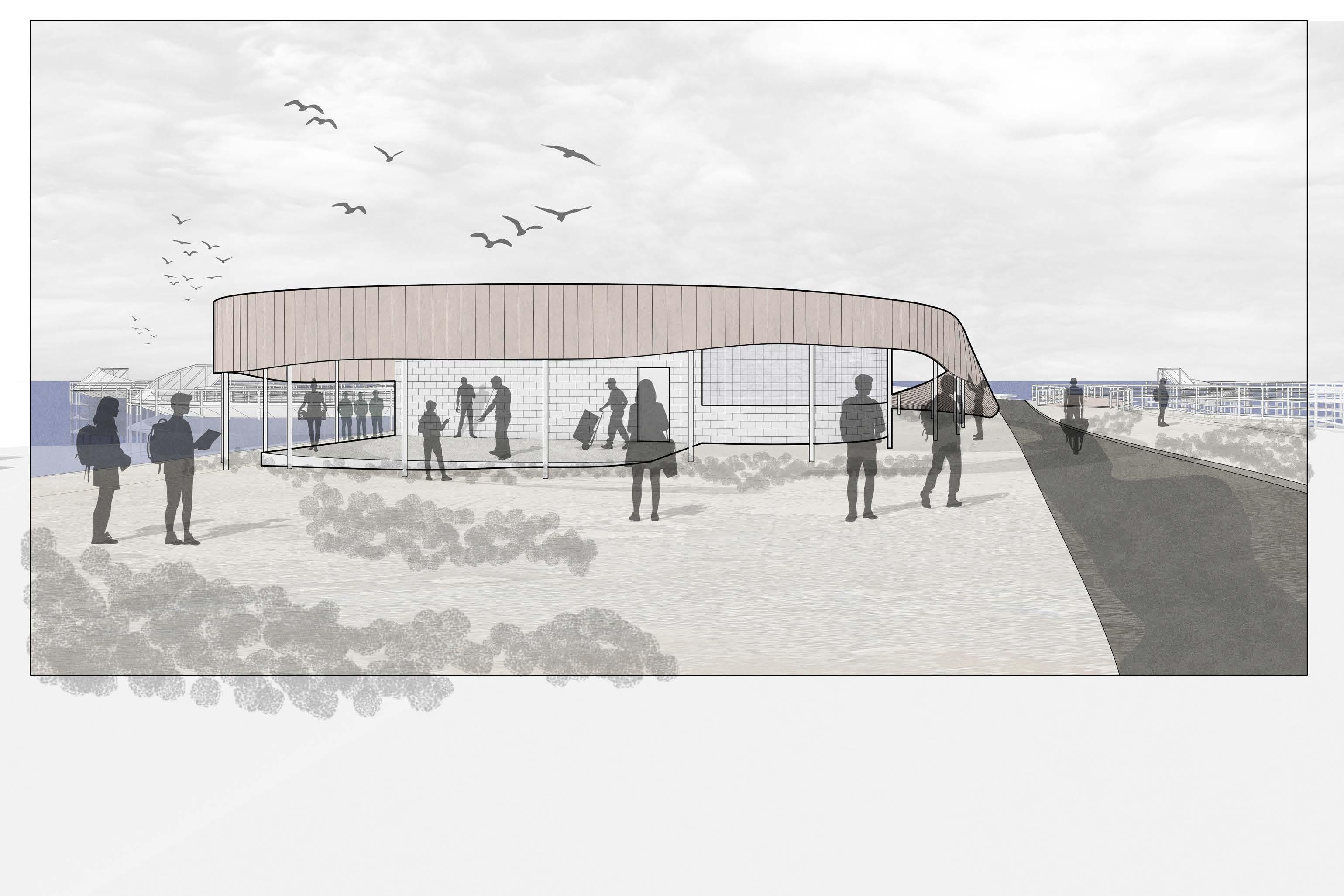
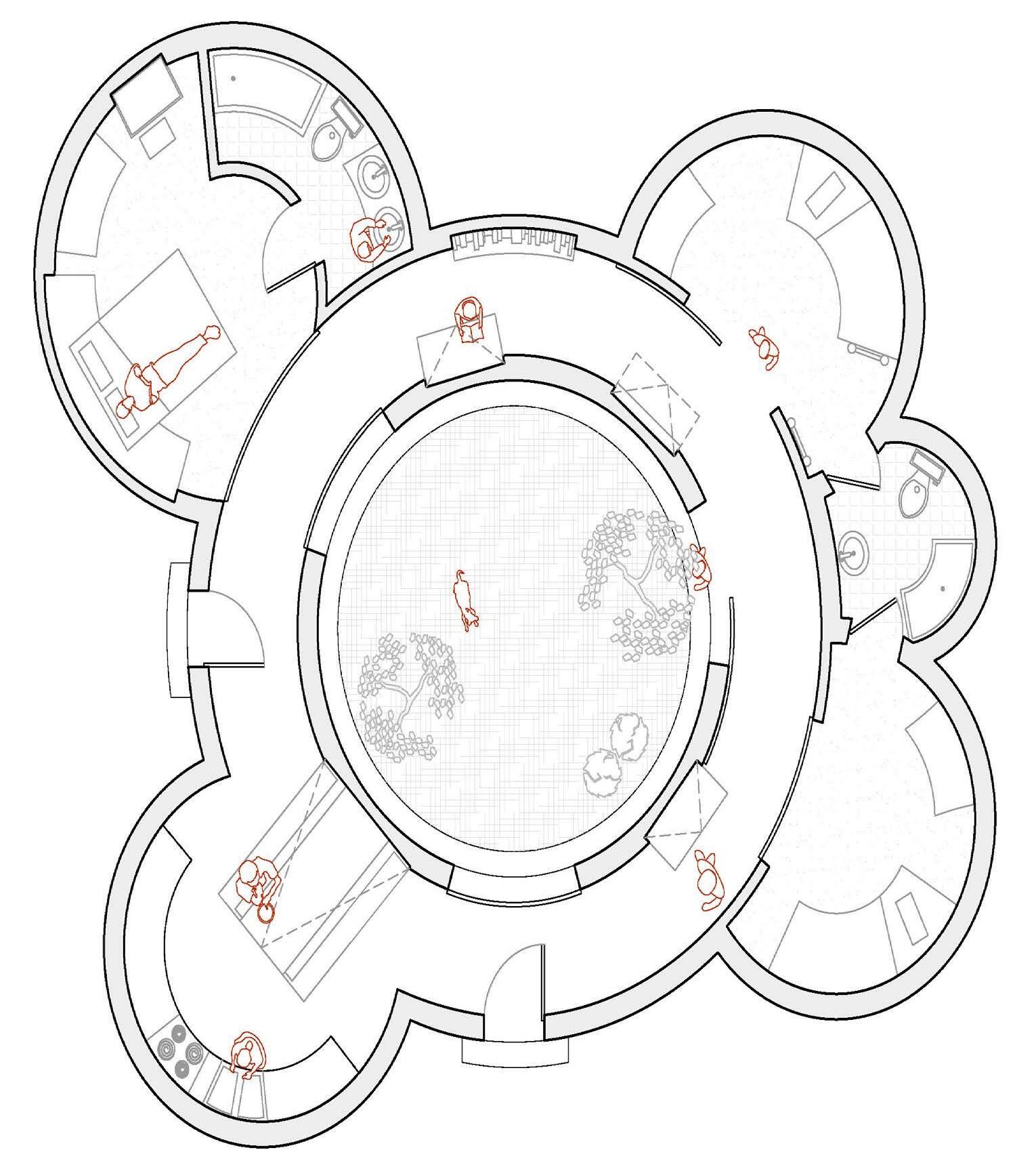
What does multi-temporal and multi-species architecture look like? We’re not talking about a zoo typology or a green roof with local plant species; we’re attempting to develop a form, building material, and program in which the human isn’t the primary user. We present an architecture which builds upon a rigid framework of steel and adapted concrete to extend into the sea, stabilize the shifting sands of the beach below, and provide a habitat for human and marine life that endures beyond typical coastal lifecycles. We seek to preserve these natural lifecycles through careful shaping of a meandering structure that runs largely parallel to the beach, which will help absorb storm energy and retain sand, passively reinforcing the beach and providing a habitat for humans and wildlife alike.
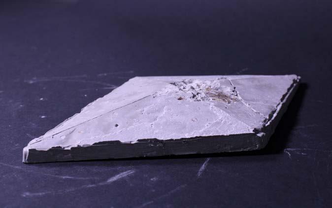
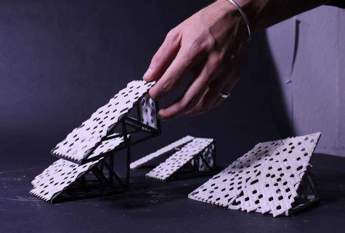
Our adaptable form uses prefabricated panels, made on site from local materials and using local labor, which can be applied both to this site and new sites in the future. Over time this will create new habitat, reinforce the peninsula, and offer recreation and education to visitors. As the panels stack, they form a fishing and observation pier that climbs the beach with the rising tides, diffusing wave energy and helping retain sand and slowing beach erosion. We incorporate facilities onsite to aid in oyster cultivation and building new framework elements; the facility is then capable of sustaining and propagating itself along the beach. Through research and testing, we’ve developed a concept for a panel that is clad in a porous matrix of Oystercrete diamonds and will serve as an artificial oyster reef bed designed to mimic natural oyster beds. This is not a single complete solution, but a first test case – a tool box that can aid current and future efforts alike to address local, remote, and future needs.


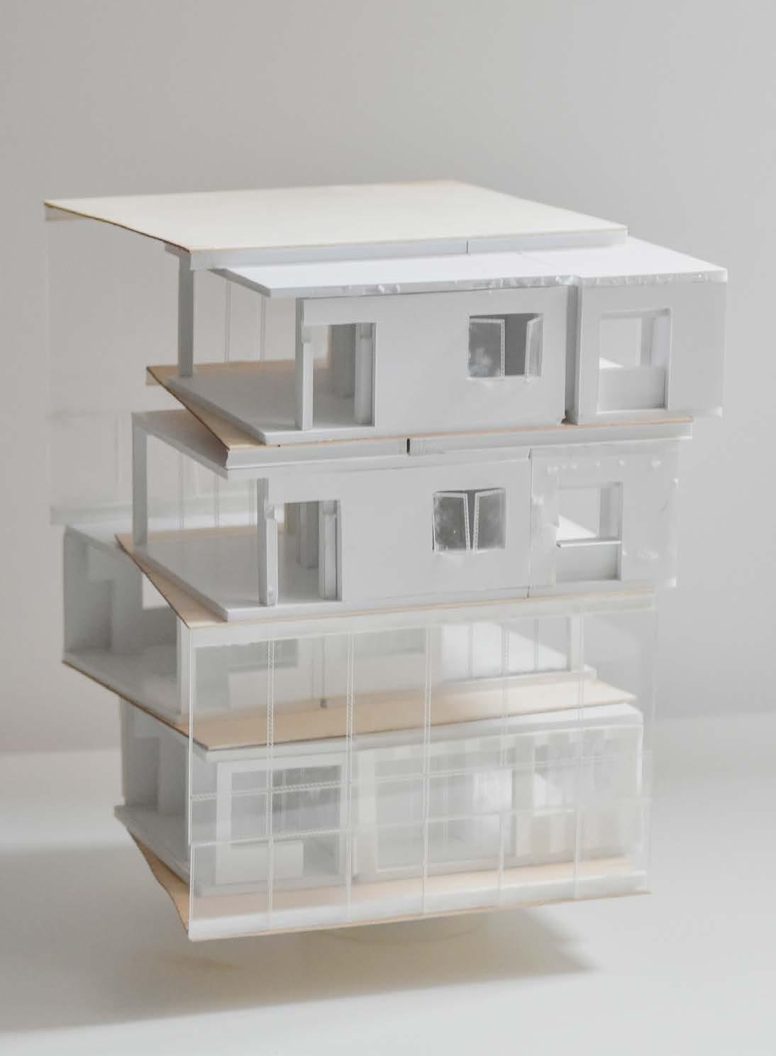
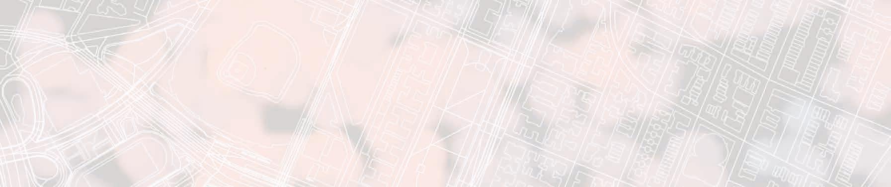
Harlem, New York City

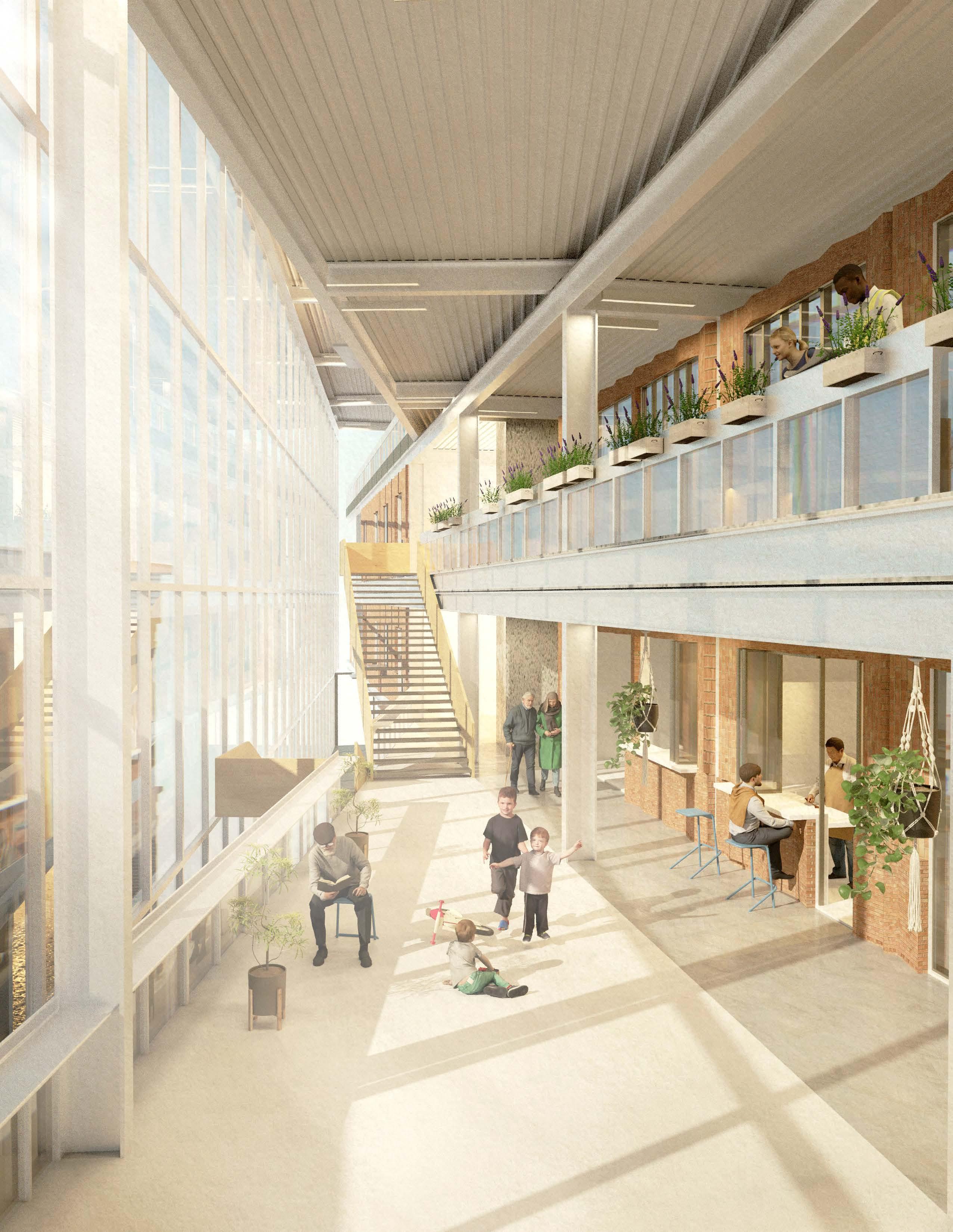
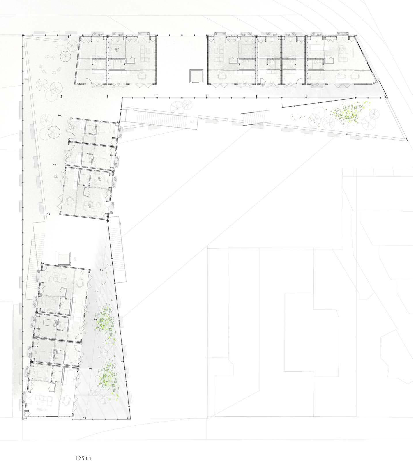
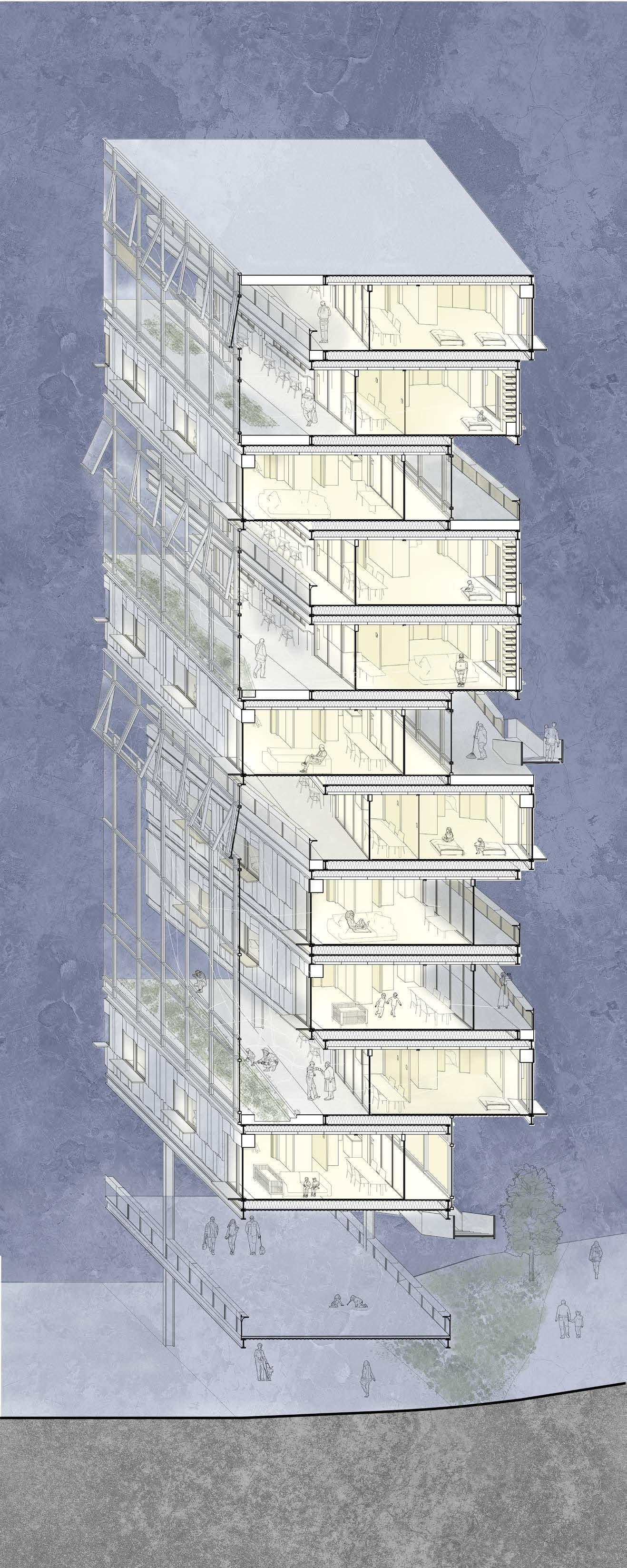
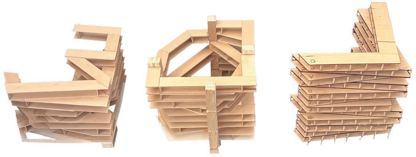
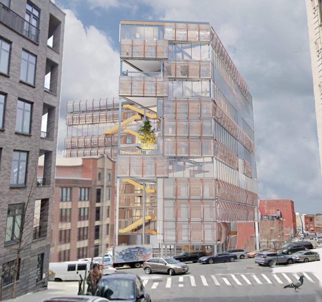
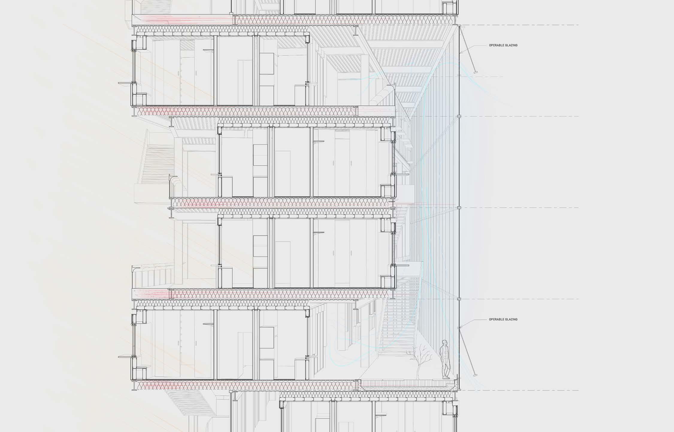
Can we design an apartment complex in a way that feels expansive, open, and connected? Can we bring a sense of spaciousness and community to residents, through architecture?
Through the staggering of vierendel trusses containing a single wide corridor of apartment units, summer and winter gardens are created on the north and south sides of the building. These gardens are communal, semi-private “stoops” that connect each unit through a space defined by the community it serves.
The unit plan is designed to “invite” or create a space that entertains the possibility of an informal gathering through the design of a gradient from public to private space, utilizing the “utility” spaces as a buffer zone between the truly private bedroom.
Acknowledging the ebbs and flows of social energy in people, the design of the “porch” allows for user to control the public visibility of the front. Giving the user agency to control their privacy. The idea of exposing the slab within the inside of the unit demarcates where your “home” starts relative to the unit itself because of the contrast. However, relative to the entire building, the slab becomes a similar language with circulation space or “public space”. This design of bringing the perceived public space into the unit is also a subtle gesture towards the resident that the entire building is apart of the home experience by pulling the resident to the semi-outdoor “stoop”.

Harlem, New York City, New York
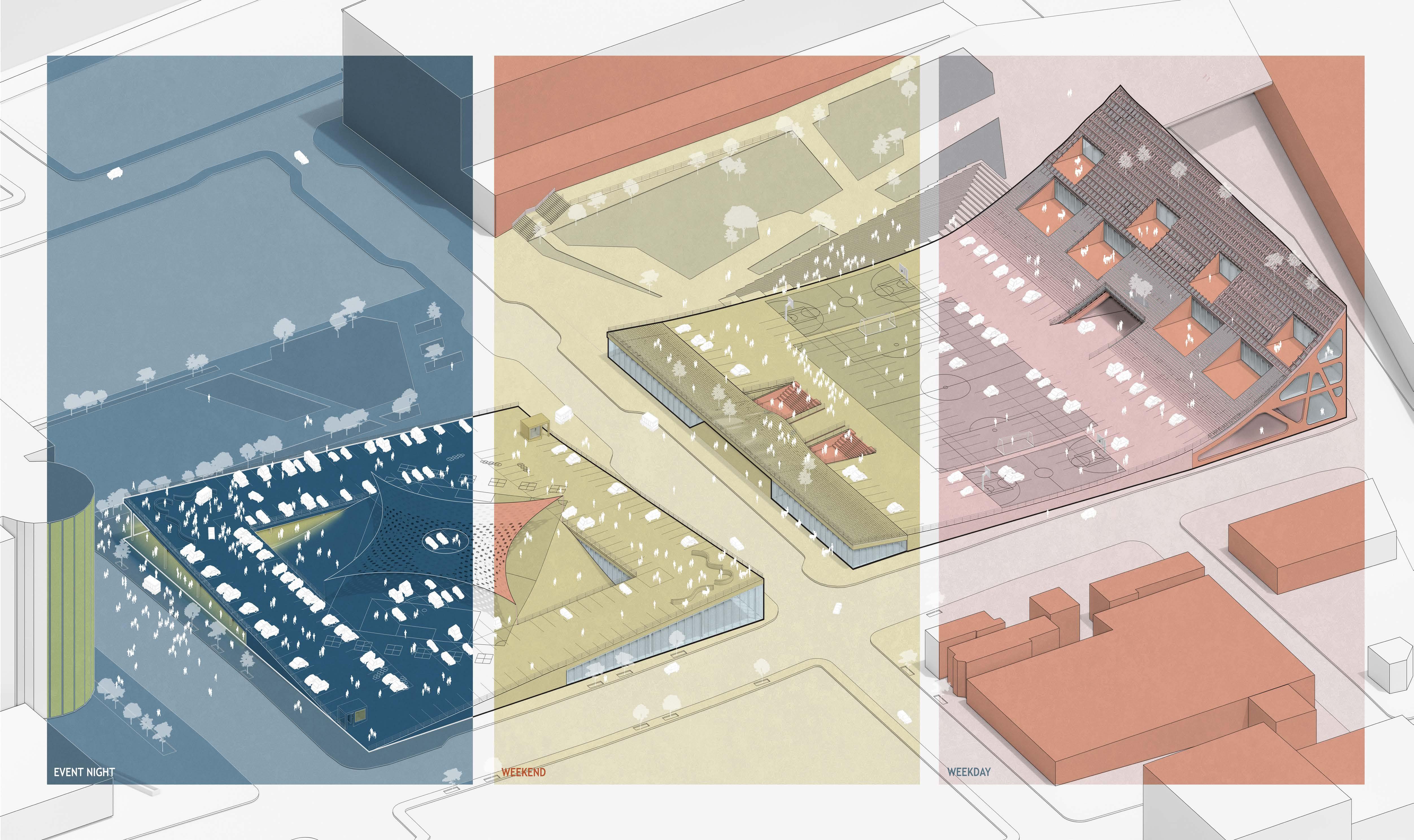
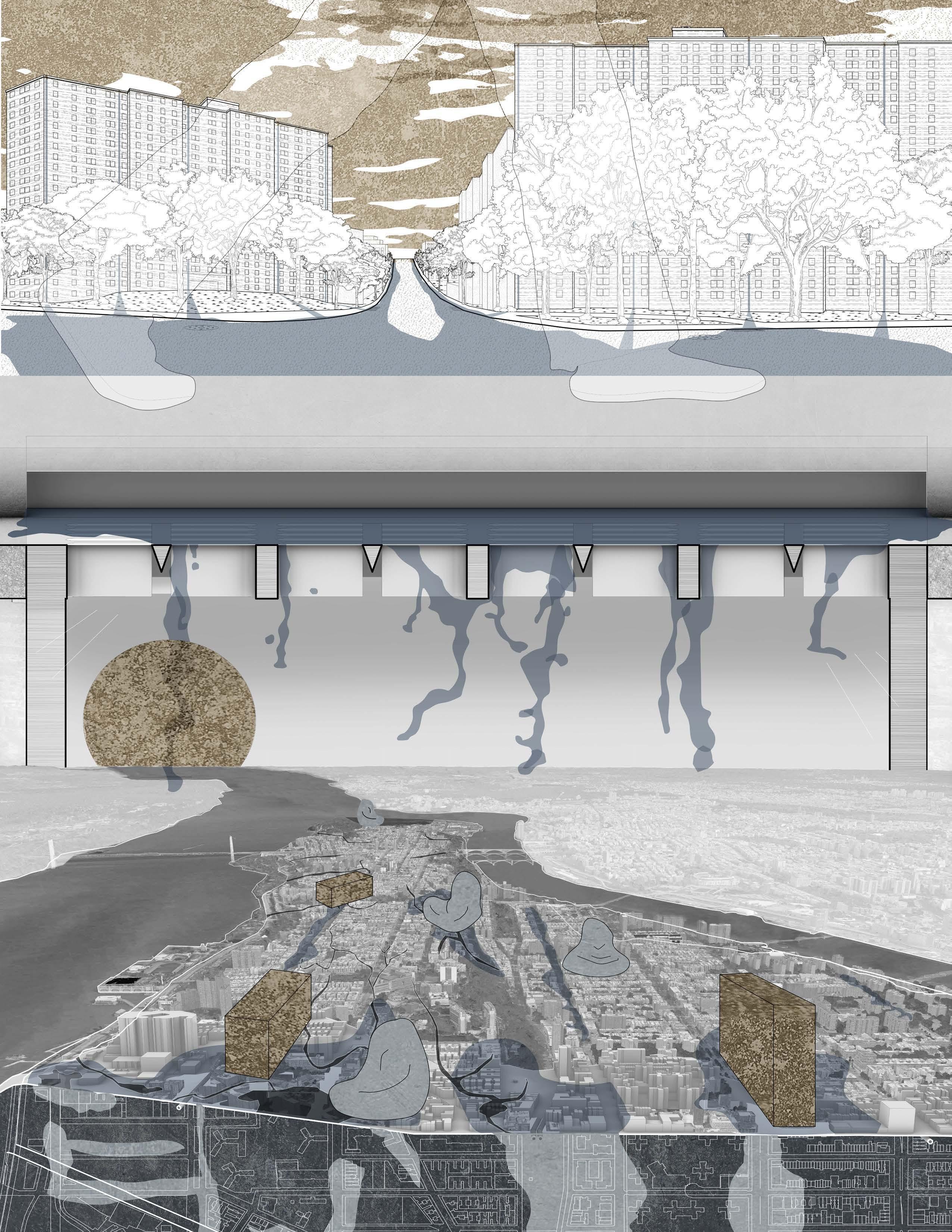
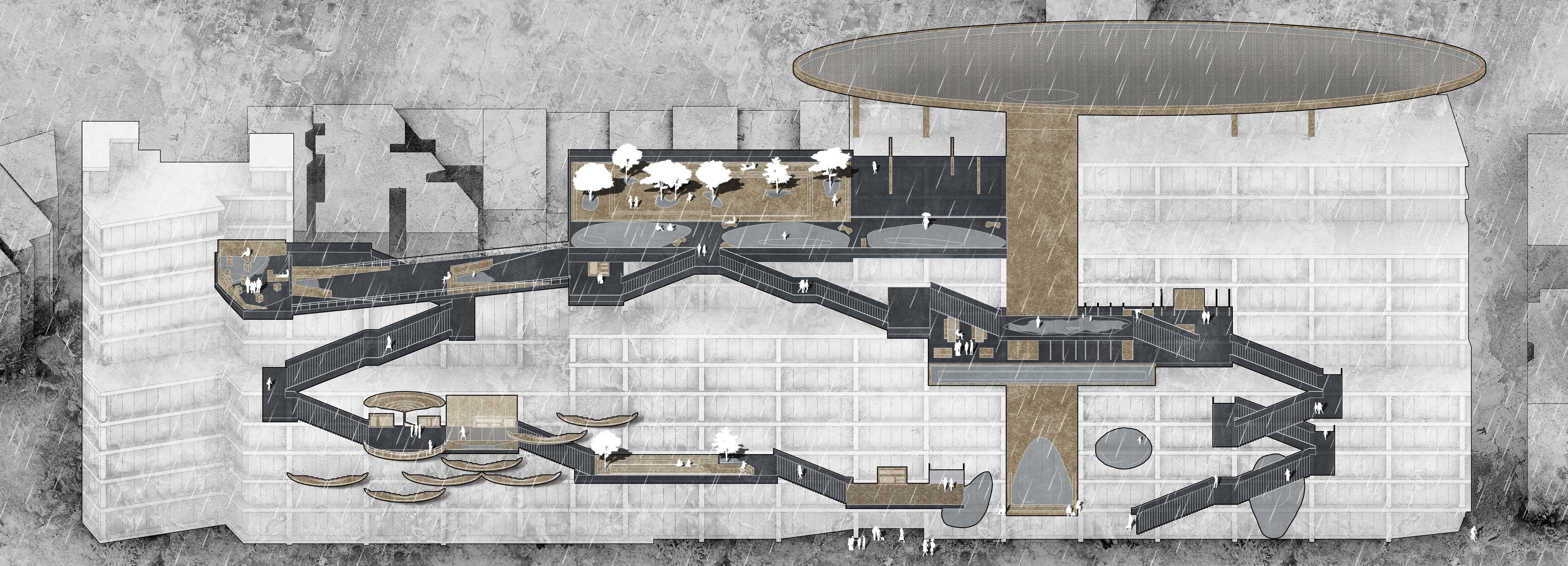
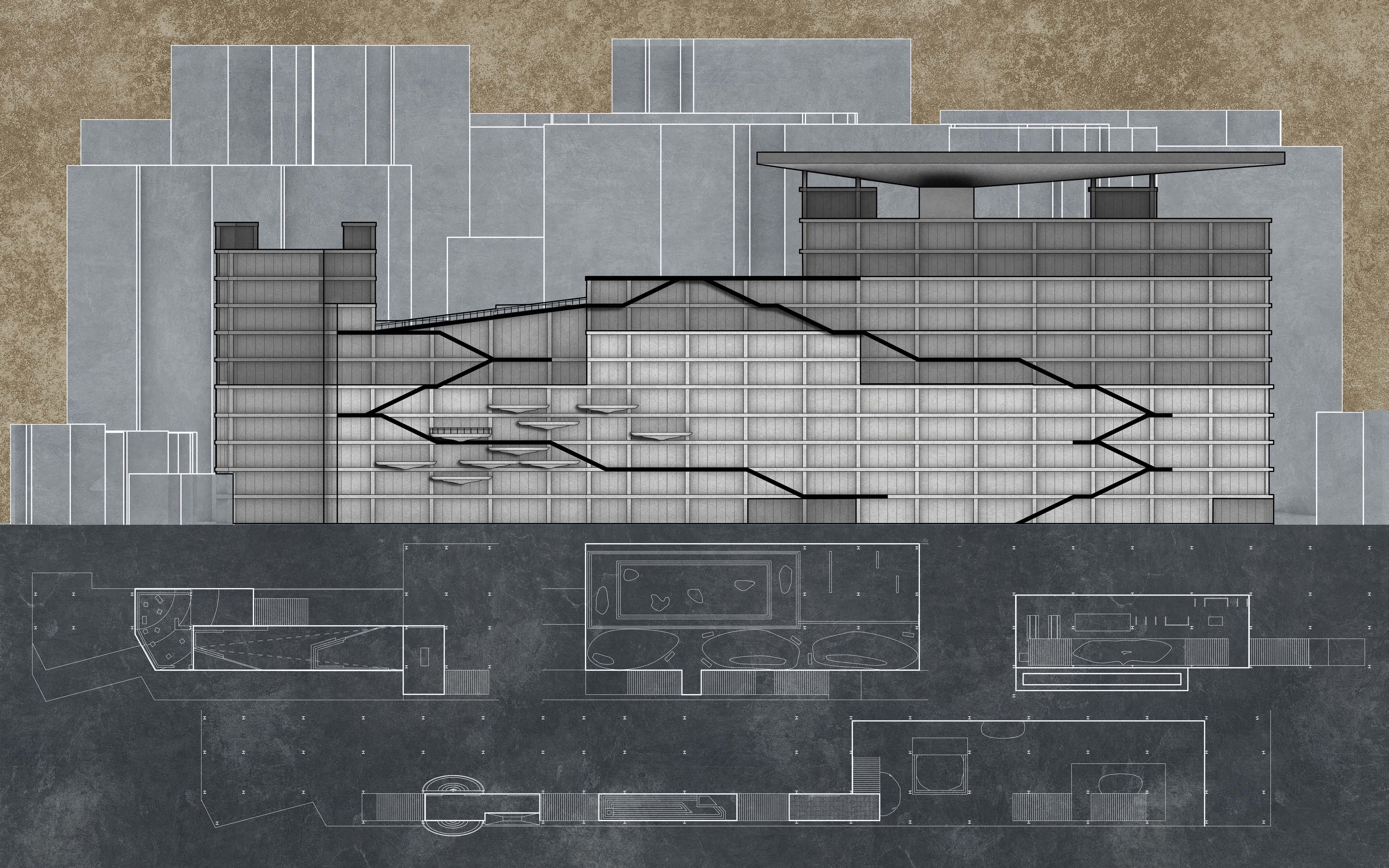
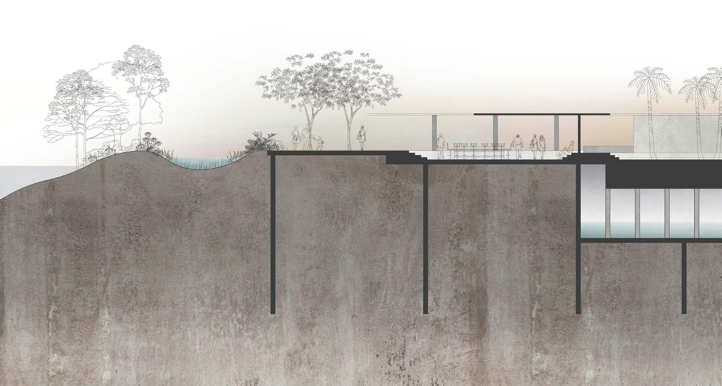
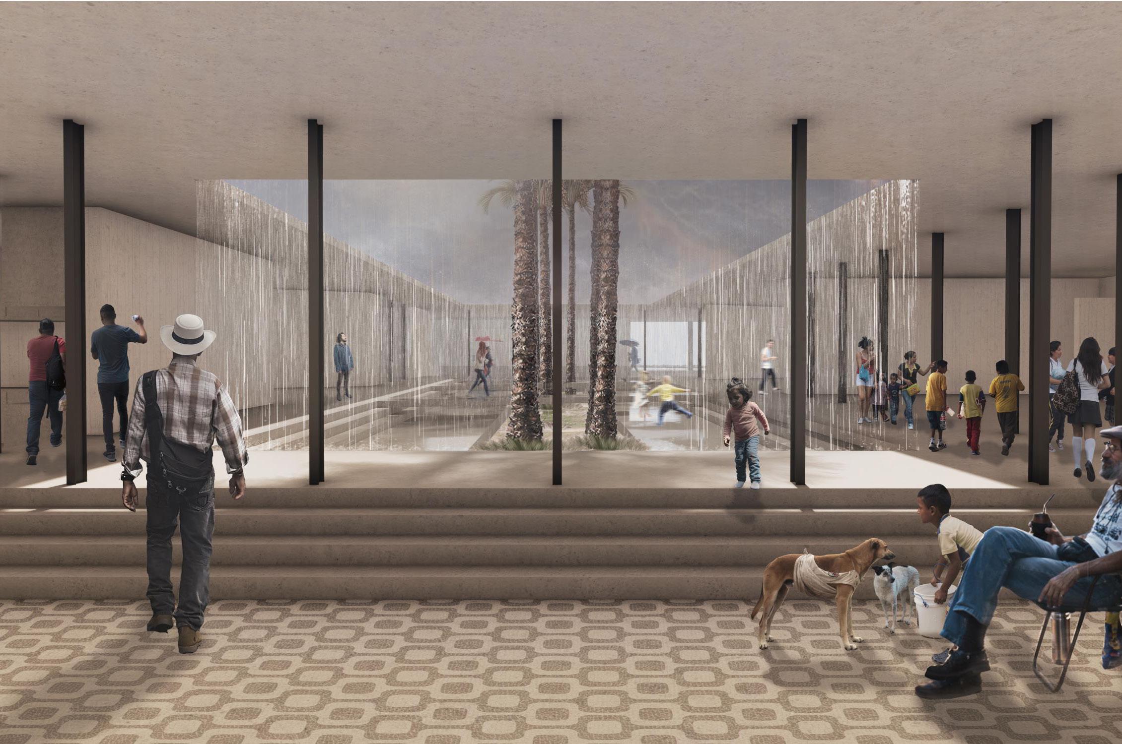
Nicknamed the Concrete Jungle, New York City is a sprawling network of nonporous surfaces that requires an even more complex network of drainage systems to account for the surface runoff produced.
While rising sea levels have drawn the attention of the public in recent years, the impact of climate change on other infrastructure has been largely ignored. As the climate continues to warm, New York City is receiving 10-20% more annual precipitation than 100 years ago, and severe storm precipitation has increased by 70%. The city’s century old infrastructure cannot accommodate the increase in runoff - CSOs dump raw sewage into the nearest river during every storm while many parts of the city experience flood damage multiple times a year.
Waterscape is centered around the concept of the water square - public architecture designed to flood during storms and slow the release of runoff into water management systems. The project utilizes the existing Taystee lab, a new construction struggling to find tenants, as a platform for education regarding New York City’s runoff problems. The front bay of the structure has been reworked into a pathway that showcases various systems of temporary water retention in a trade show format. The design of the path allows for each of the installations to function as they would in actual application while viewers interact with them, thus demonstrating how these strategies could be used to benefit both current and future projects.
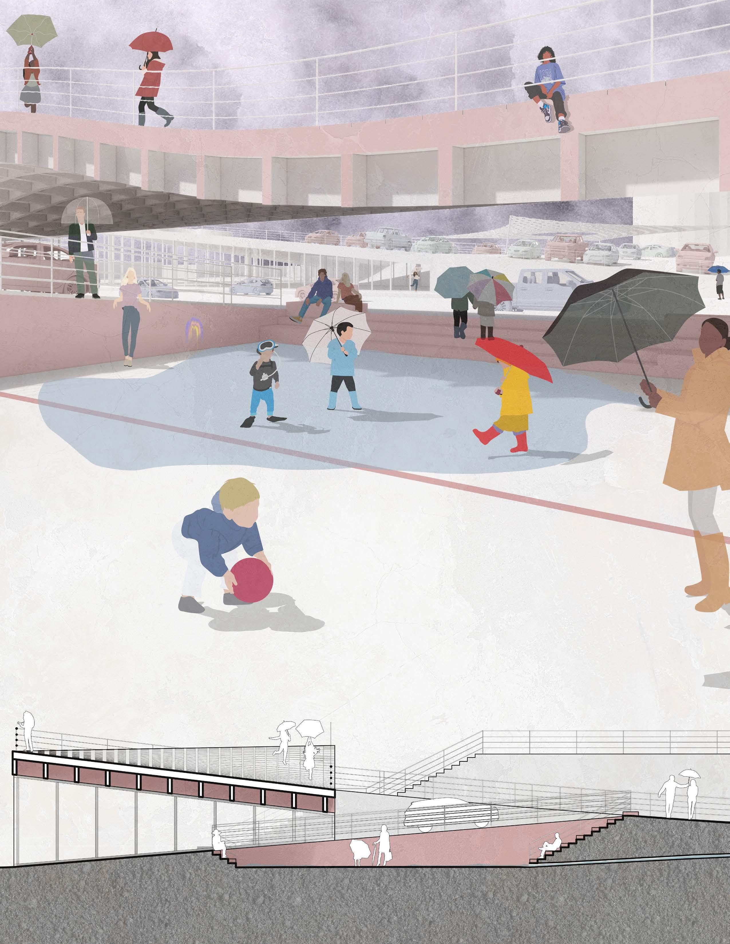
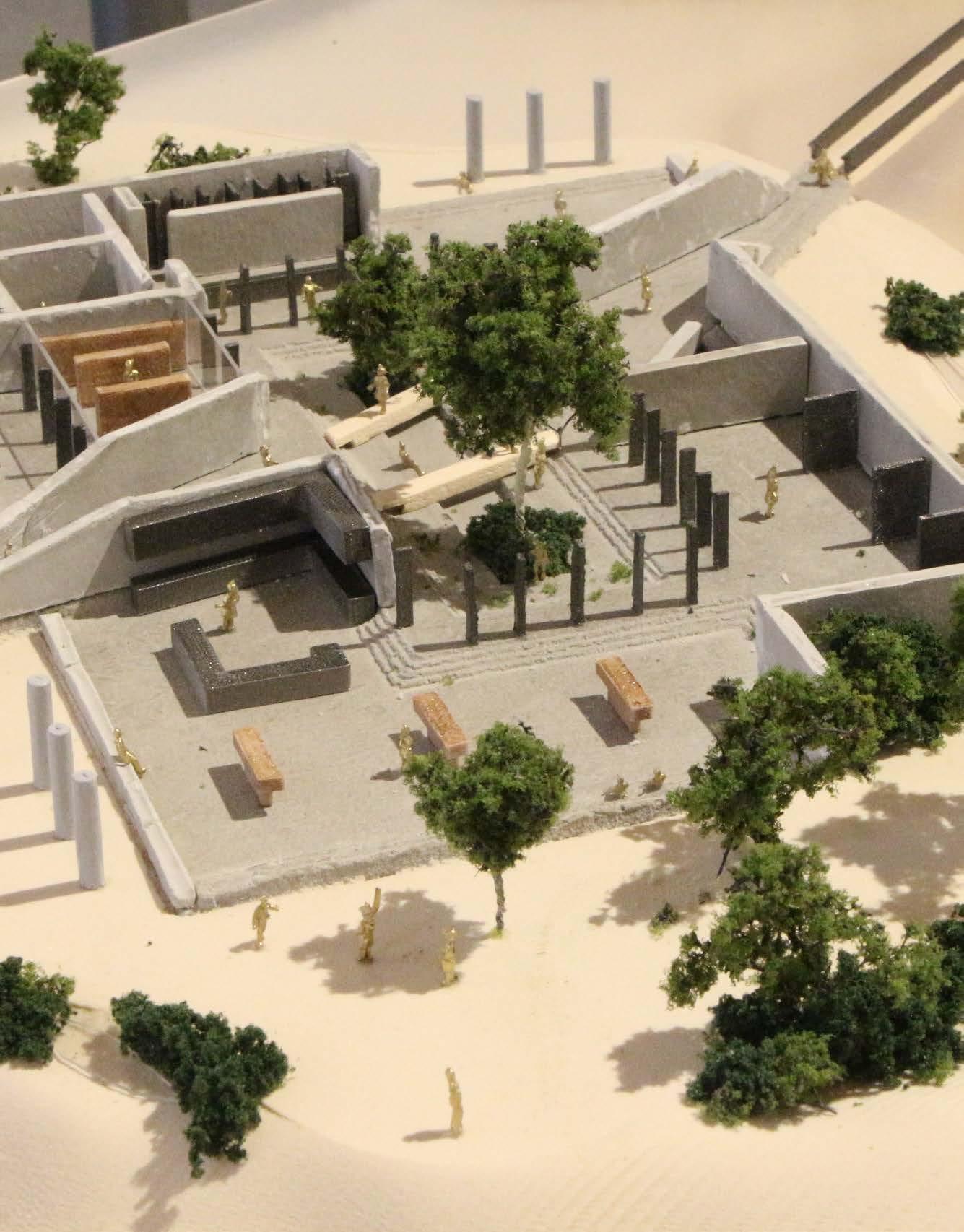
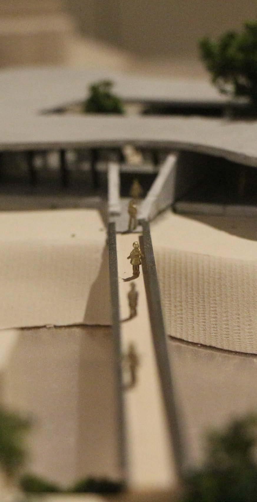
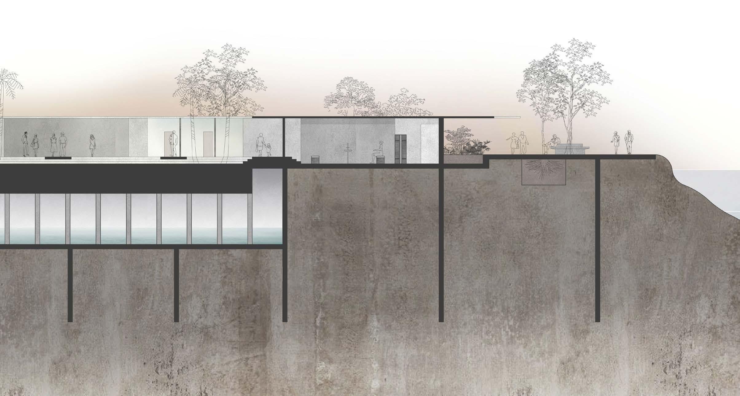
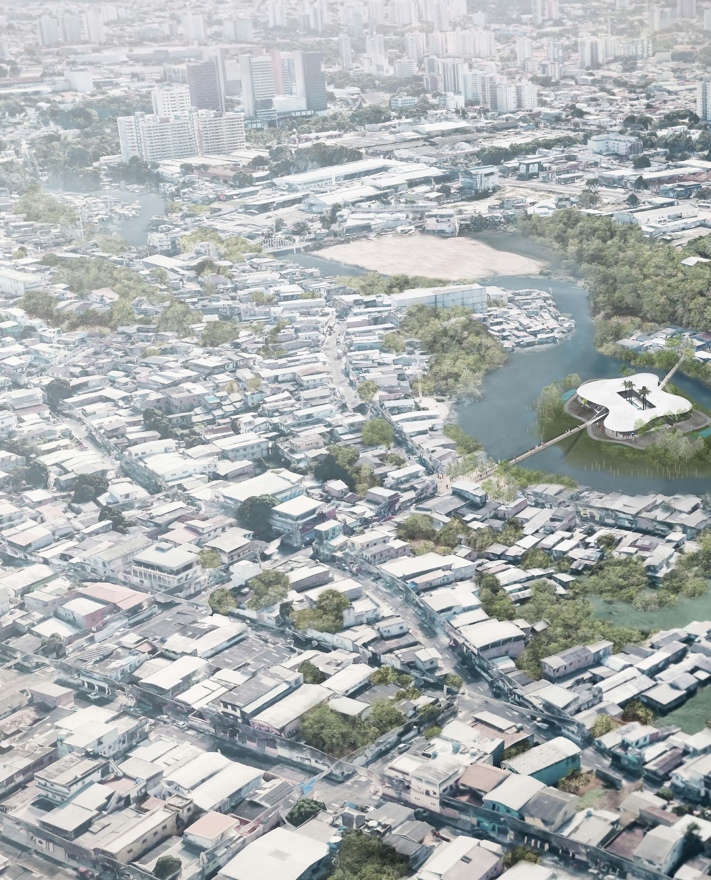
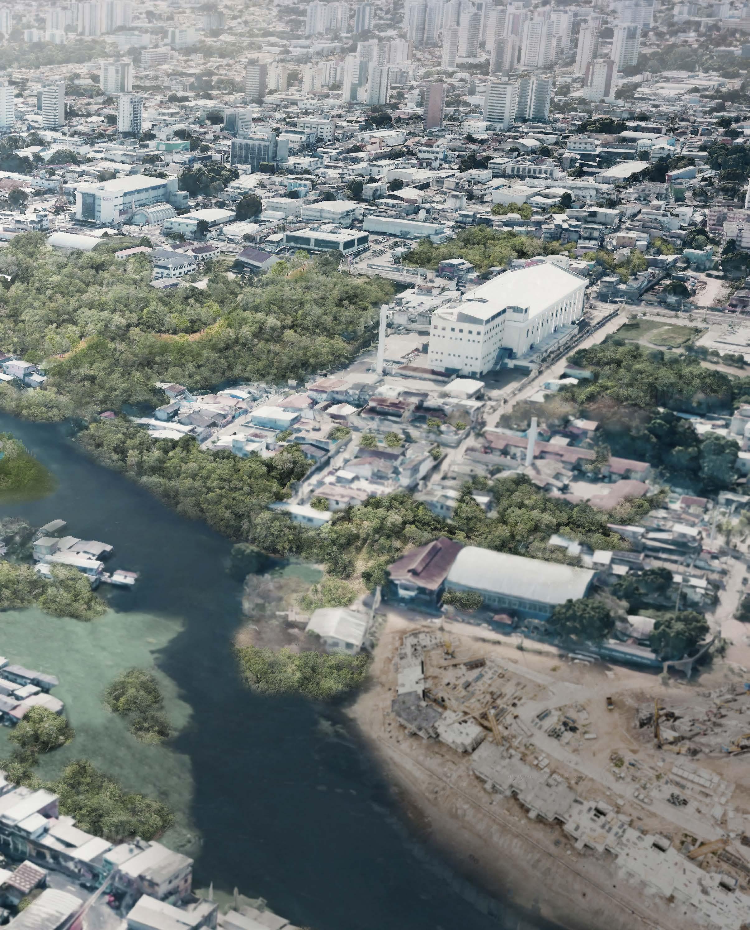
Mindu River, Manaus, Brazil
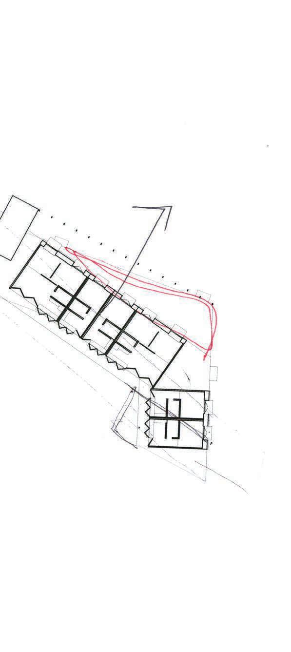
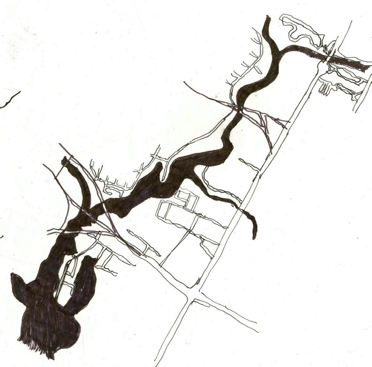
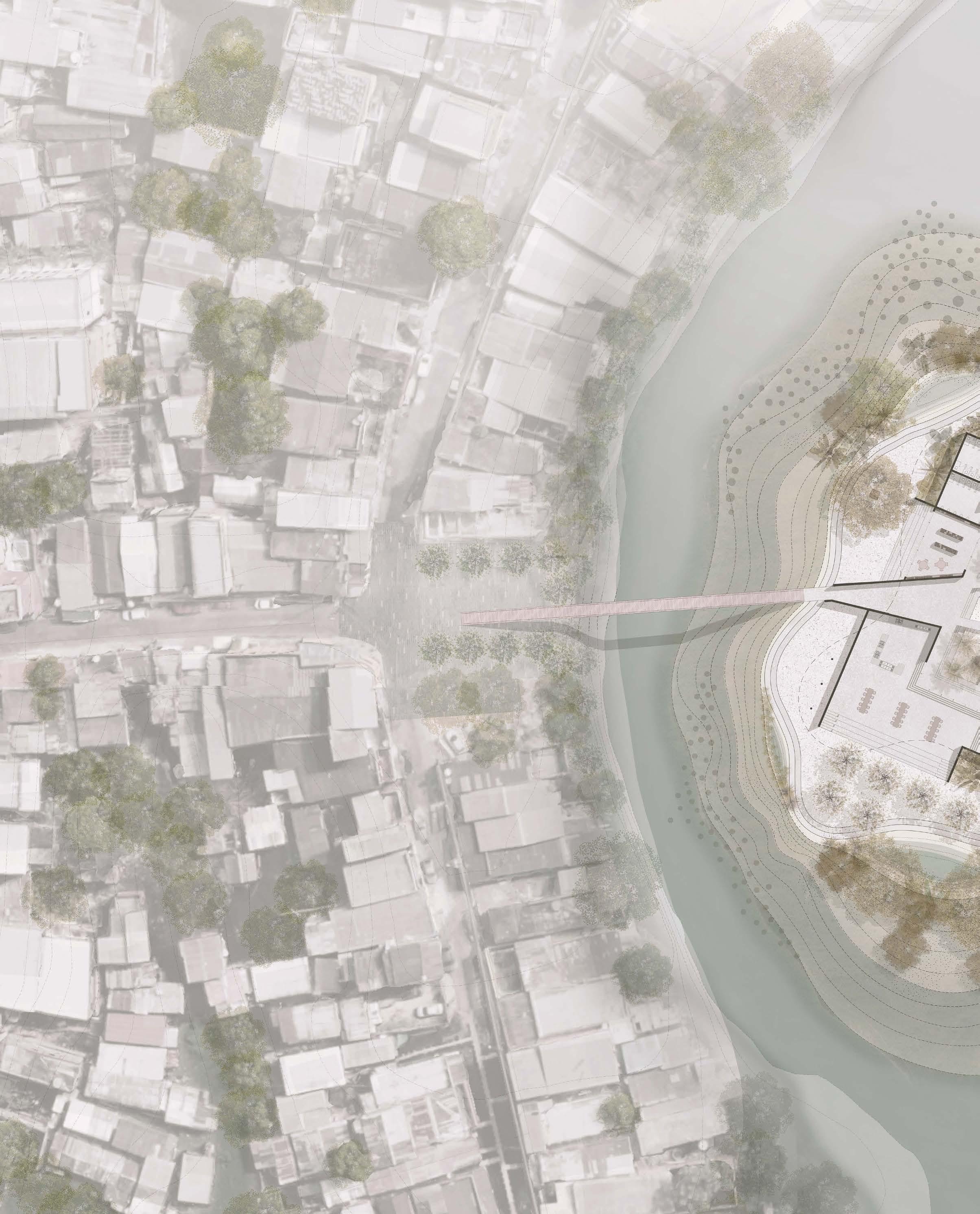
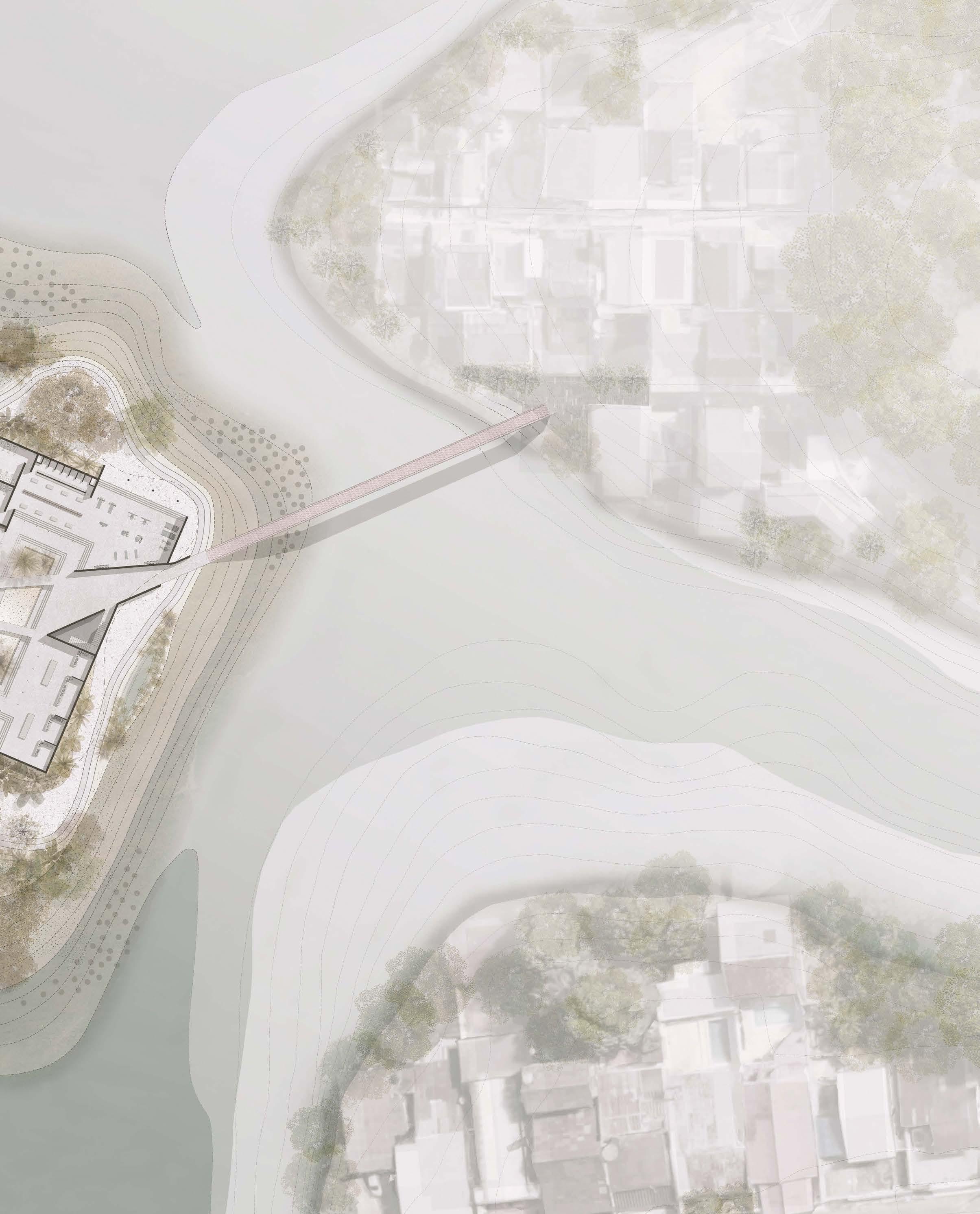
By the construction of an artificial island that serves as new community center, the project links the western edge of the stream to the main bus terminal in the city. In doing so, the project creates a “new commons” on new ground.
The artificial island is created through strategic placing of the building’s foundations and the leftover dredging materials from the city. The shape of the island will change over time, as the water erodes and deposits soil around the building’s foundation.
Instead of being a linear connection, the connective island itself is the combination of architecture and landscape. The roof of the architecture, the courtyard system, and the landscape of the island work together to collect and filter surface runoff that is collected in a cistern for later use by the building. The building houses basic amenities such as a kitchen, bathrooms, a gym, and gathering spaces for casual meetings or an informal market.
Connective Island
Manaus: Re-inscribing the River in the City
Felipe Correa and Alex Yuen

Partner: Yu Chen - landscape Architect University of Virginia - Fall 2019

Professional work
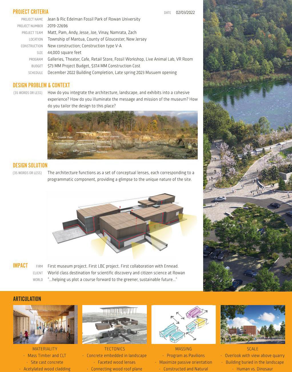
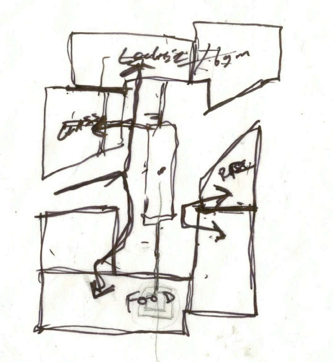
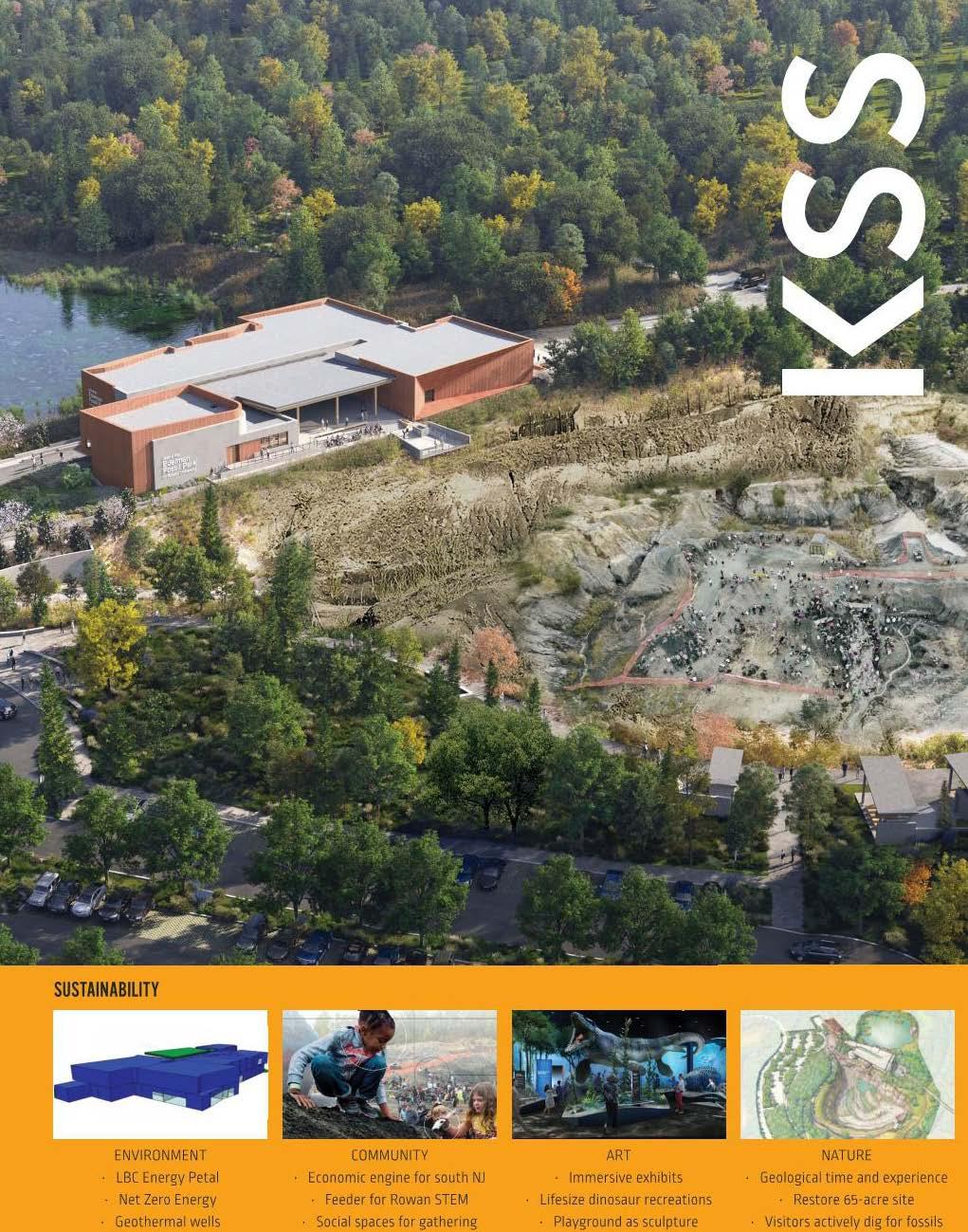
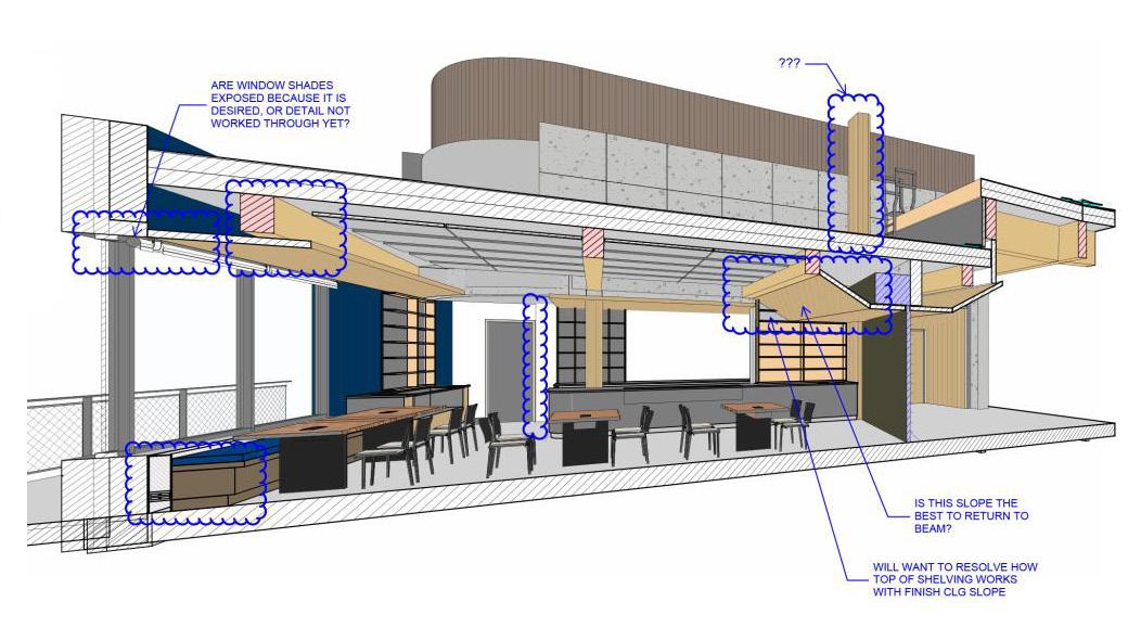
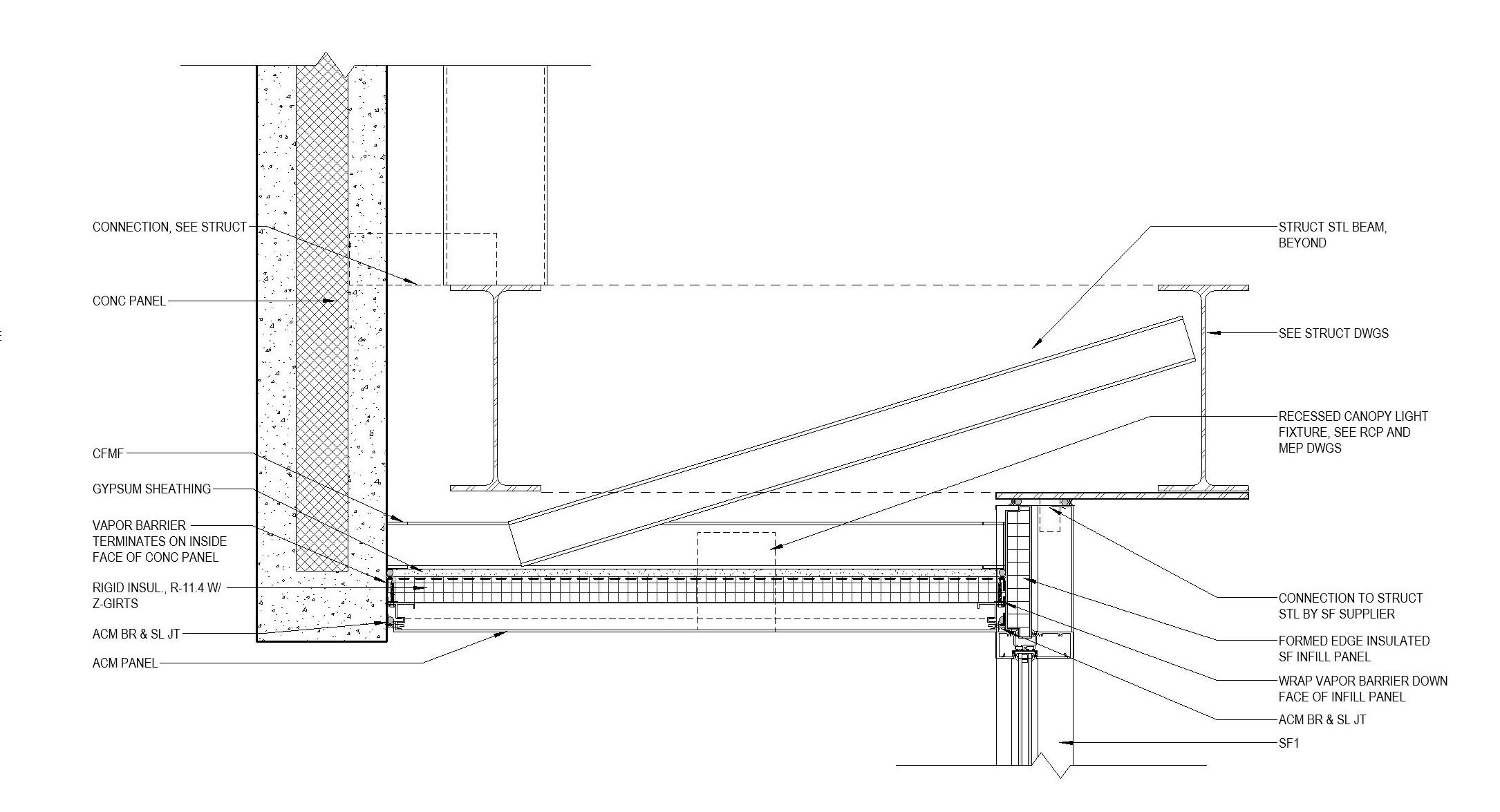
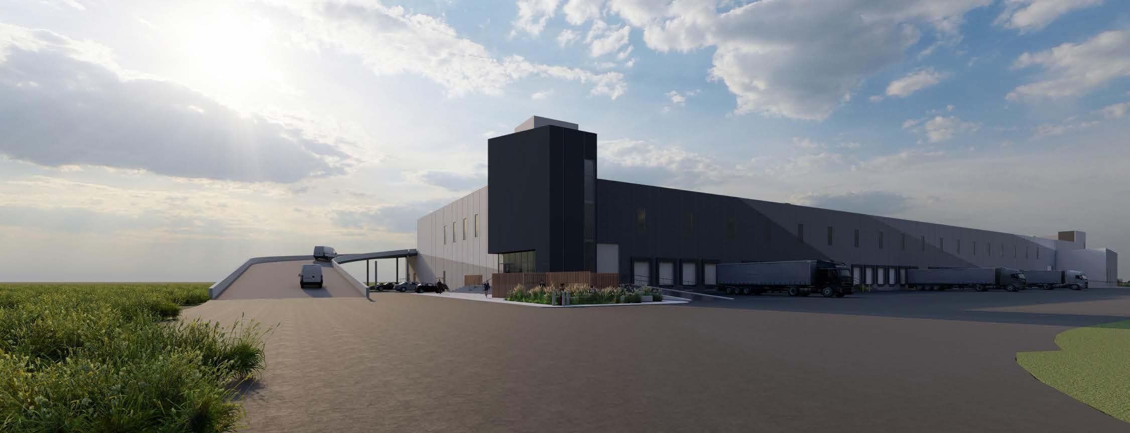
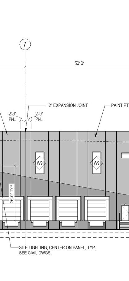
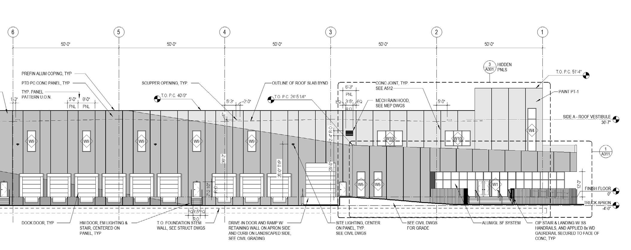
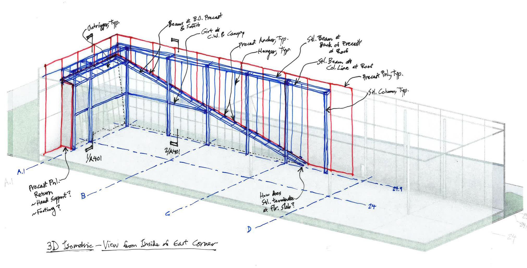
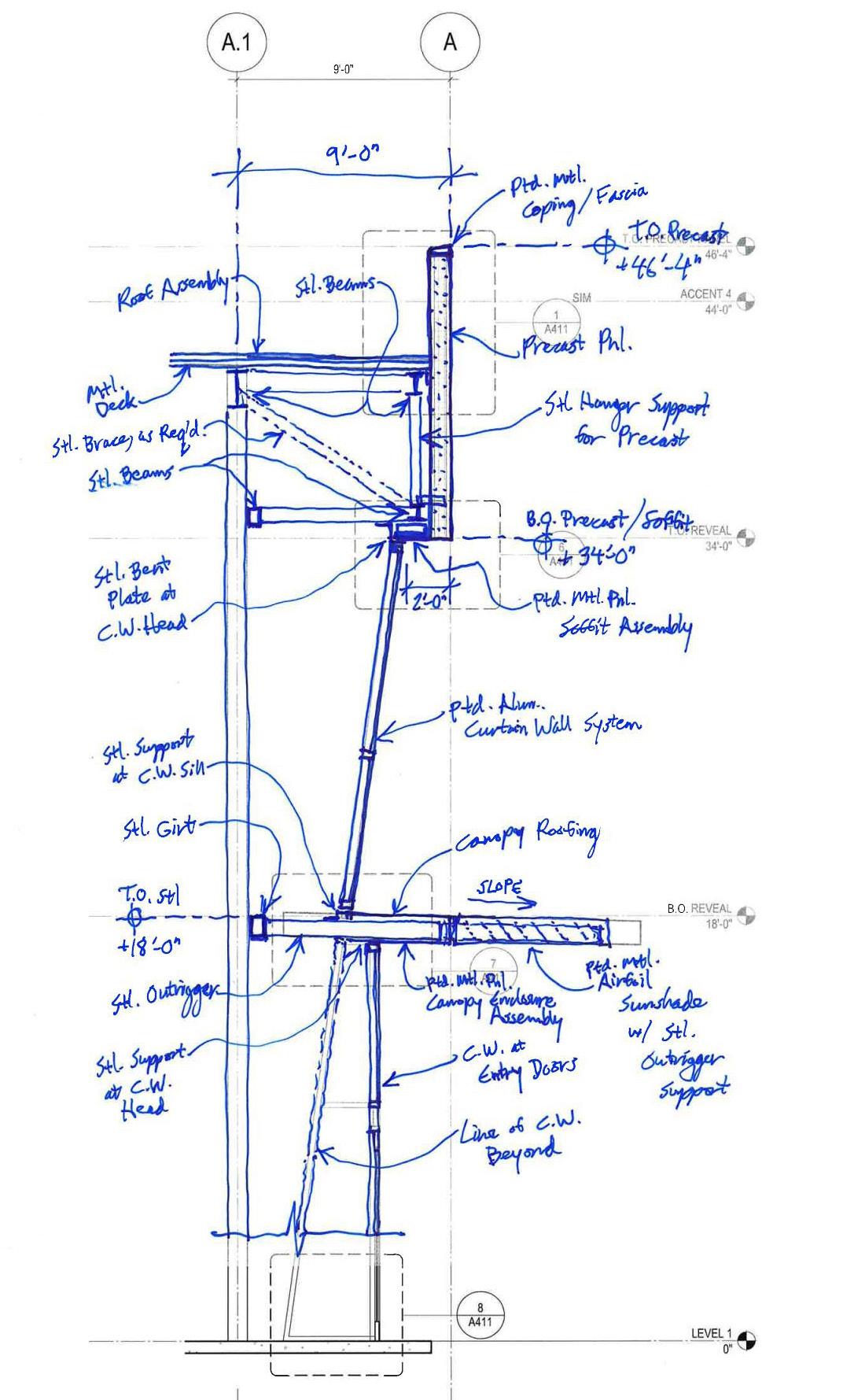
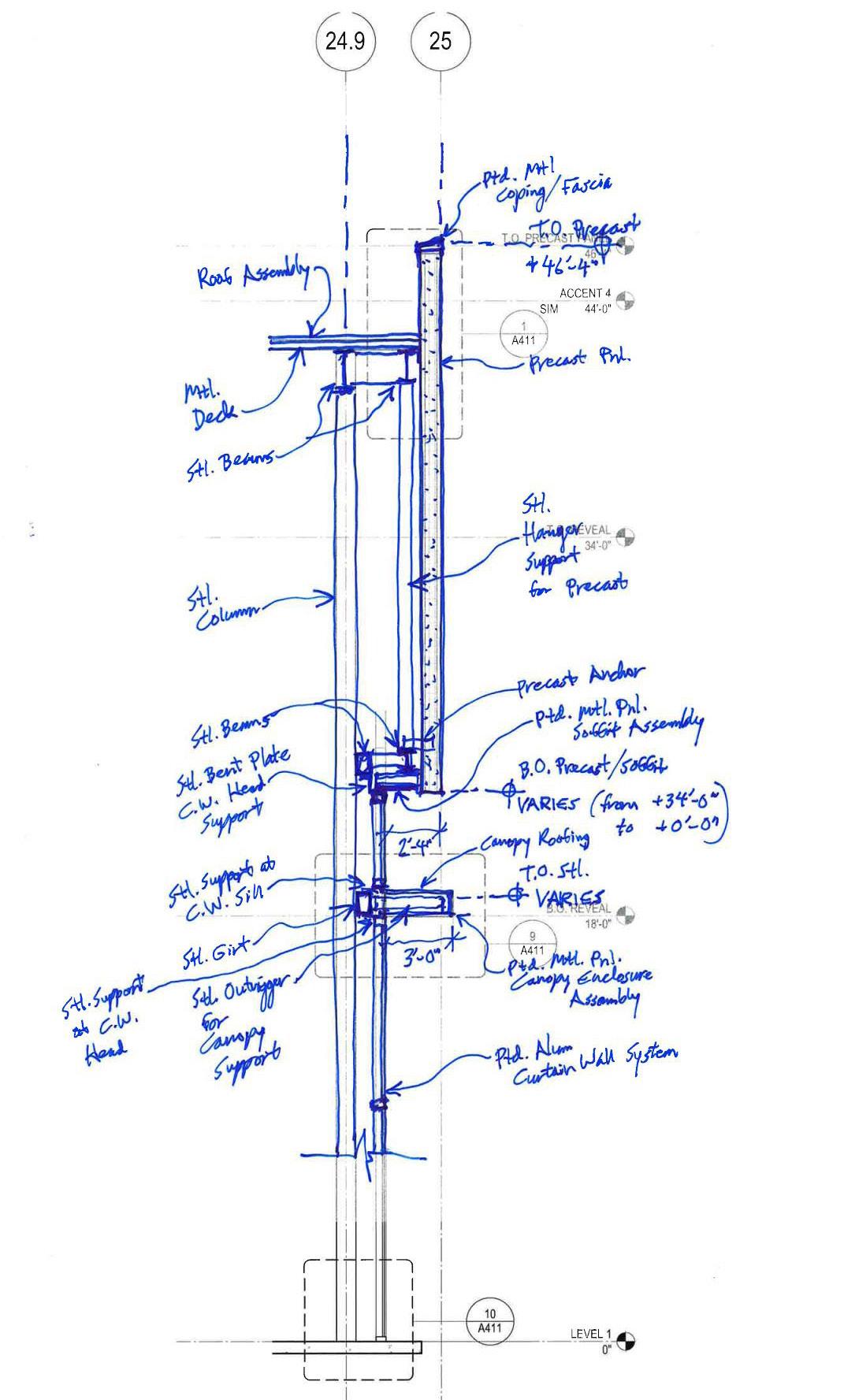
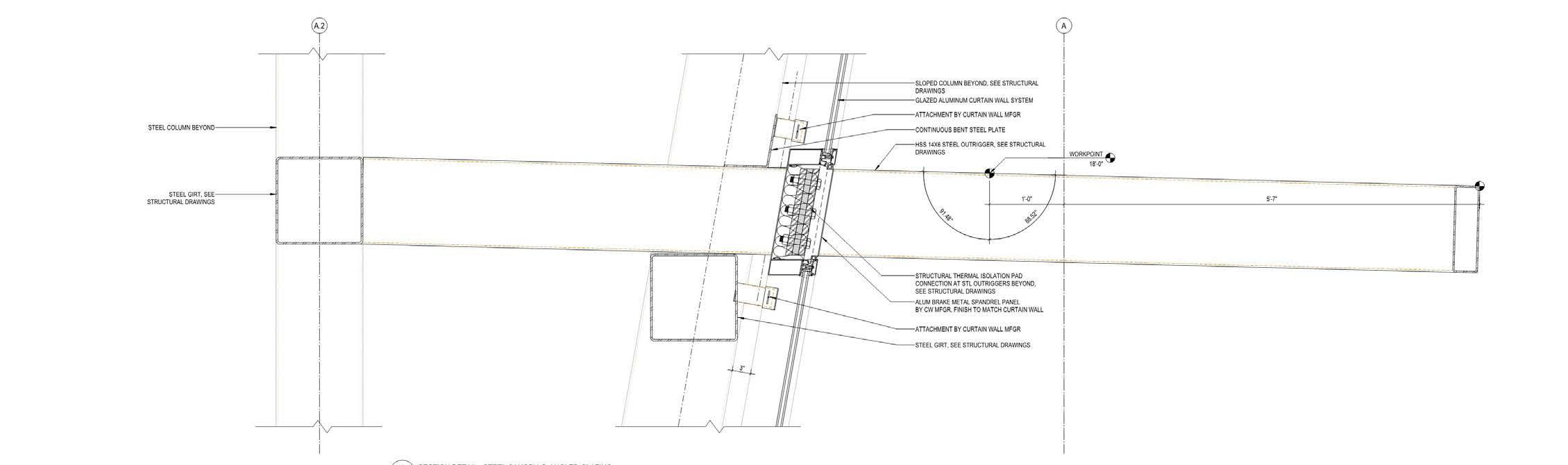
Mantua Township, NJ KSS Architects Aug 2020 - June 2023, june 2024 - Aug 2024
Phases: DD, CD, CA

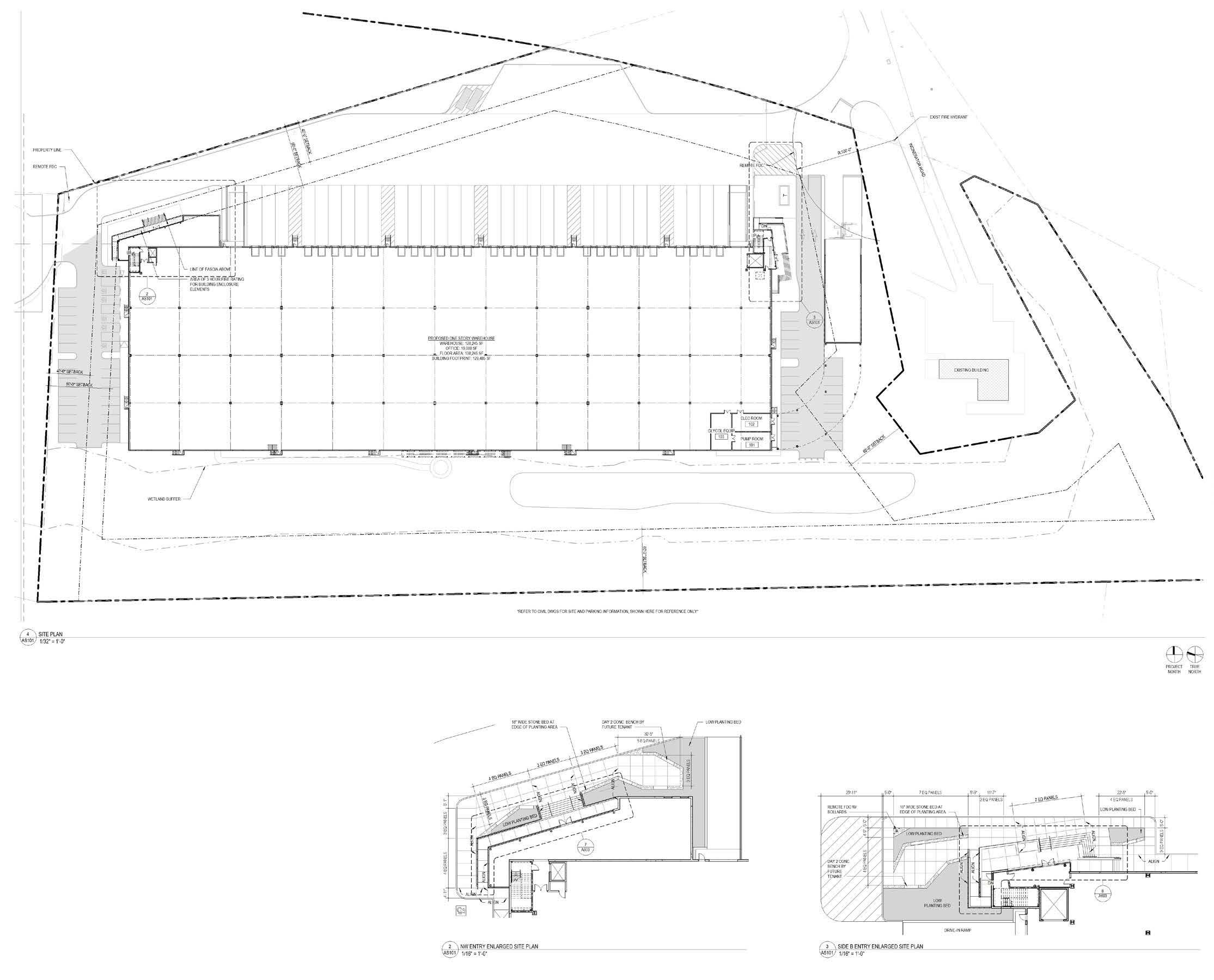
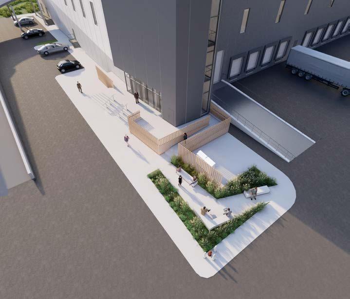
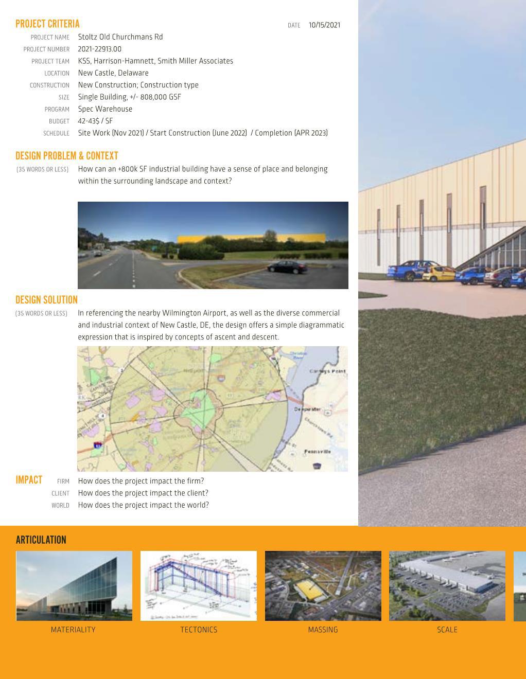
Stoltz Churchman
New Castle, DE
KSS Architects August 2021 - March 2022
Role: Architectural Designer
Phases: SD, DD, CD

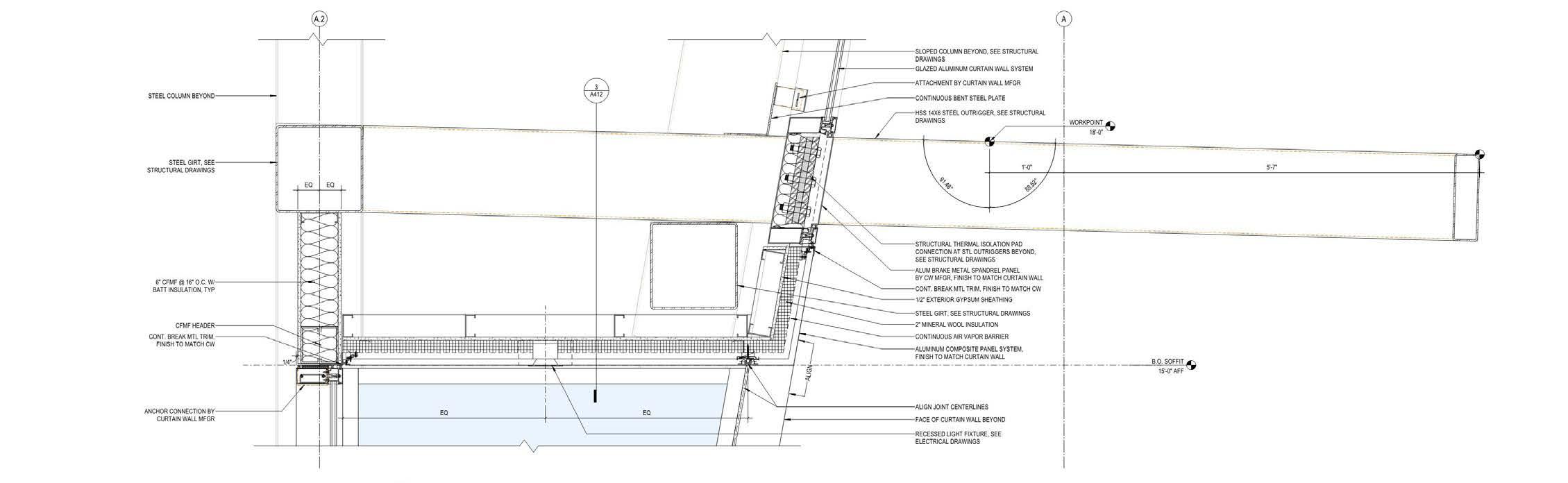
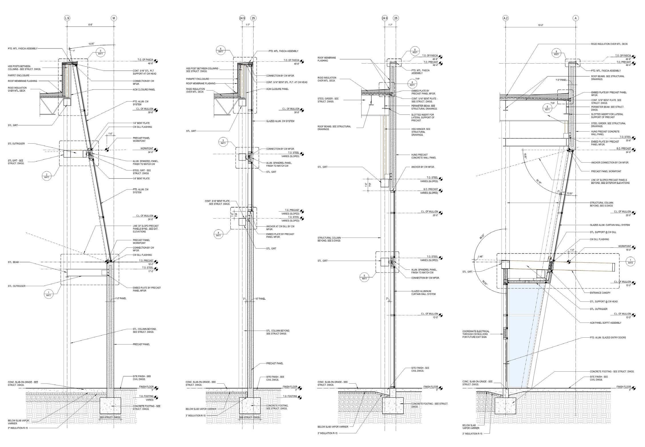
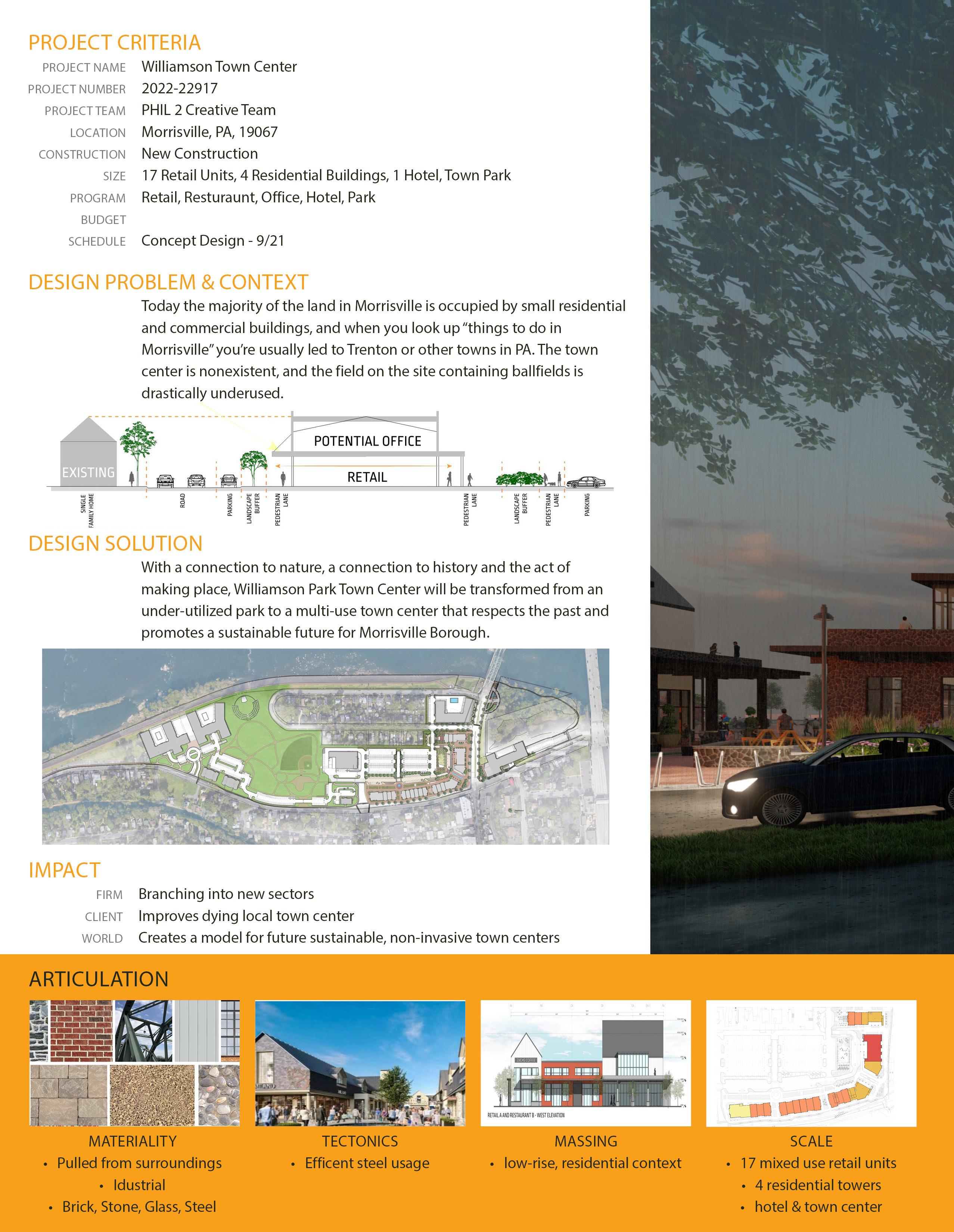
Morrisville, PA
KSS Architects
April 2021 - Sept 2021
Role: Architectural Designer
Phases: Concept, SD


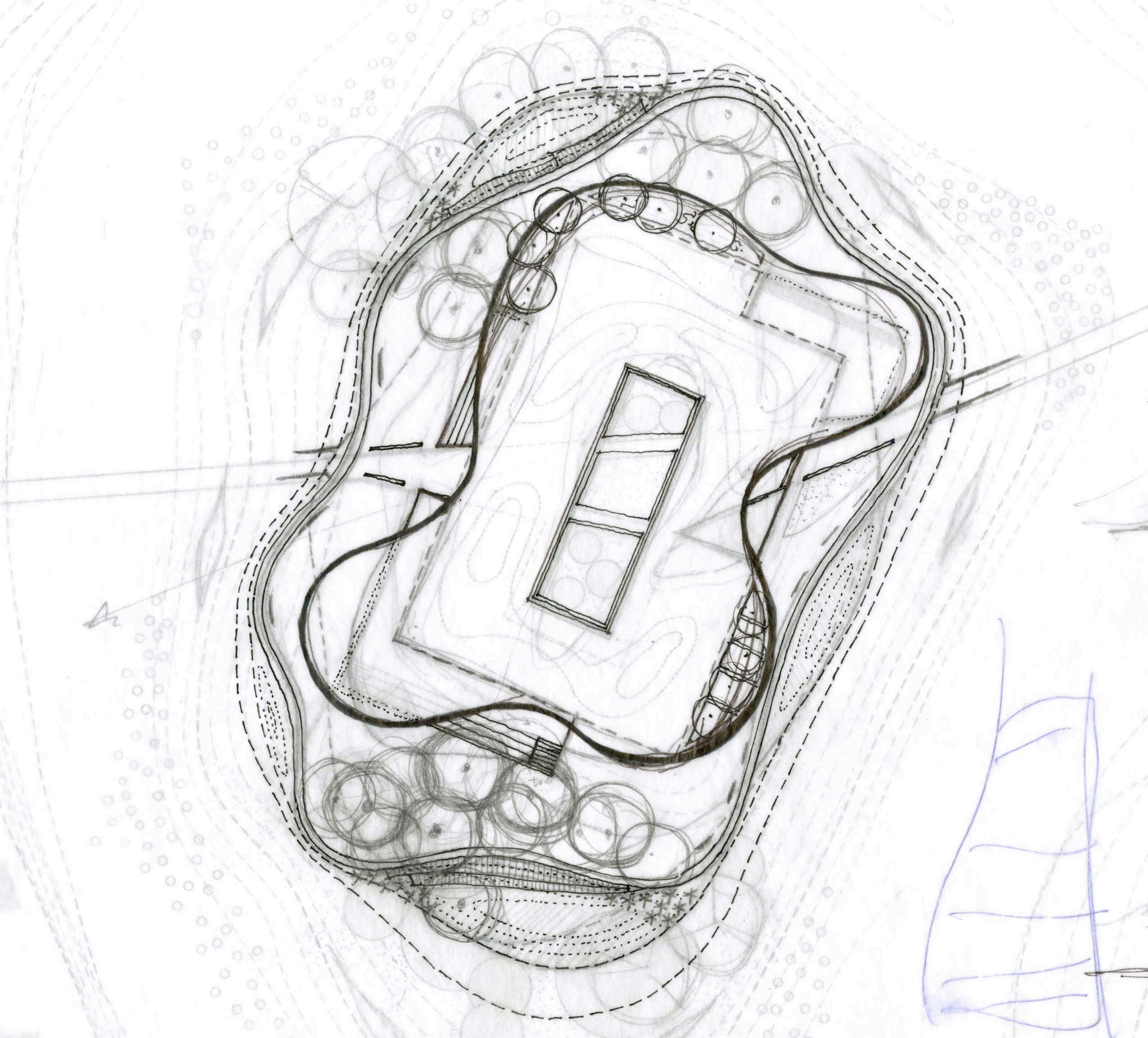
explorations
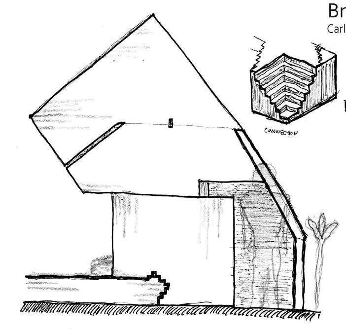
Tomba Brion, Treviso, Italy
Carlo Scarpa’s architectural legacy is often summarized through his meticulous attention to detail in precisely calibrated joints, stepped reveals, and the dialogue of carefully chosen materials. However, focusing exclusively on detail risks overlooking the deeper conceptual engine of his work: drawing as a phenomenological and atmospheric practice. Scarpa’s drawings are not neutral, technical intermediaries; they are active, exploratory acts of perception in which color becomes a primary medium for sensing space, long before it takes architectural form.
This project builds upon Scarpa’s atmospheric drawing practice through a series of digital paintings derived from his original compositions. Rather than reproducing his linework or color palette, the method isolates the chromatic fields embedded within Scarpa’s drawings and transforms them into colorblocked compositions. This process intentionally removes line, geometry, and representational anchors in order to reveal the atmospheric logics that his drawings encode but do not always explicitly describe. It is an interpretation of Scarpa’s drawings in an effort to make plain the intent behind the drawings that is often overlooked.
Color as Poetic Interpretation:
Reading Atmosphere in Carlo Scarpa’s Drawings
Architecture Apropos Art
Steven Holl Columbia University - Fall 2025

Location Unspecified
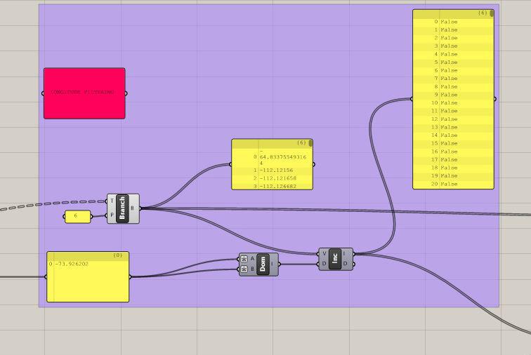
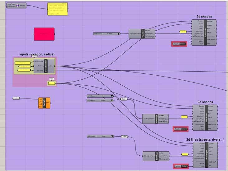
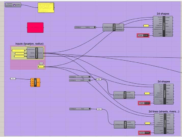
Utilizing parametric design, both analogue and digital, students were tasked with developing a drawing machine.
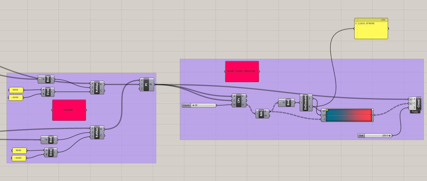
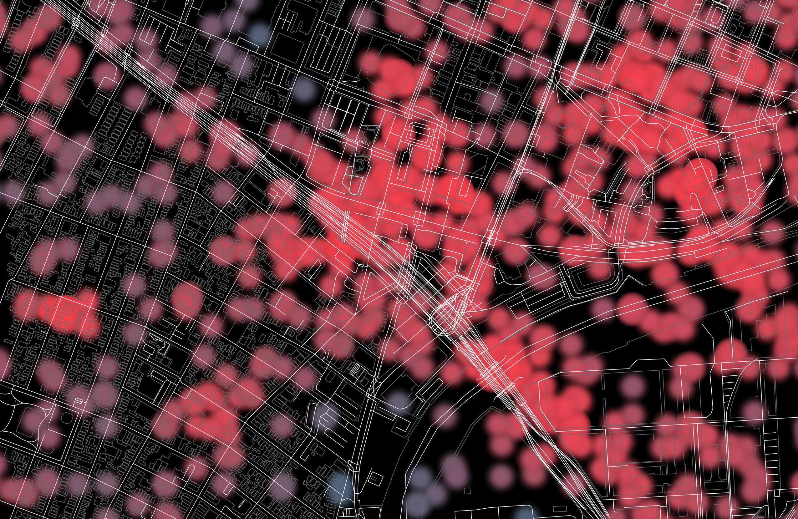
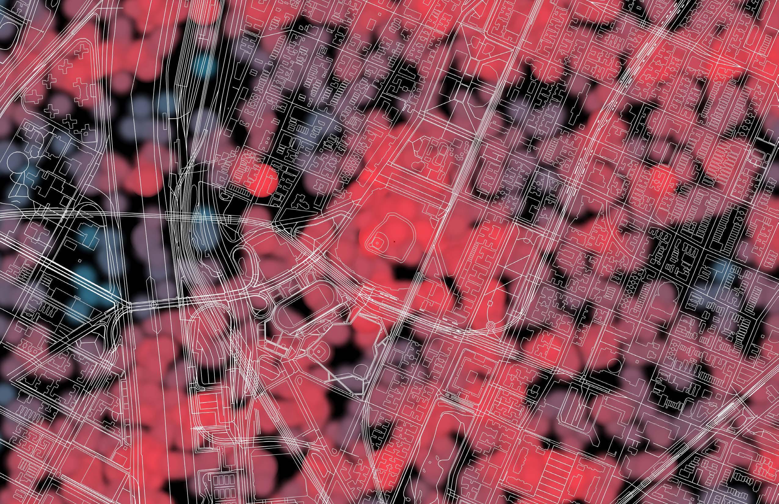
This movement density mapping machine was created utilizing Grasshopper. The user inputs the coordinates of the desired site, and the script pulls mapping base layer information from open source GIS data within a 1.5 mile radius. The heat map data points are pulled from cellphone records available to the public and plotted on the map utilizing the established coordinate system. The user can also choose to filter the heat map by time of day if desired and adjust colors as necessary. Given the prominence of cellphones, this provides an accurate picture of population dispersement within a given space at a level of detail that typical population maps utilizing census data are lacking.
Location Unspecified
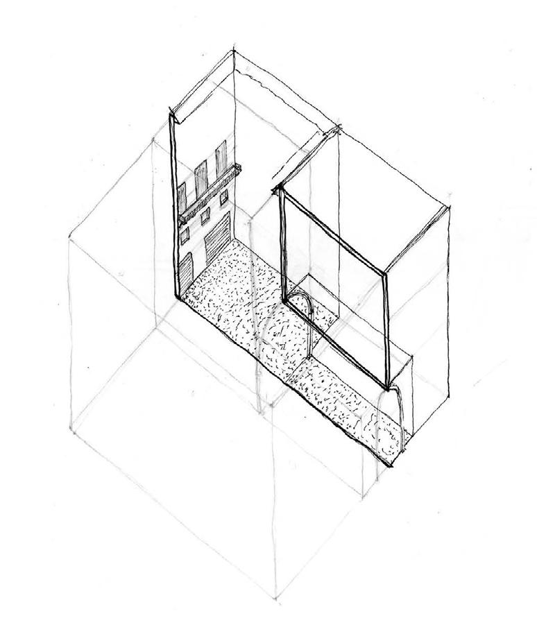
Utilizing specific guidelines, the studio was asked to create a series of housing/ dwelling spaces - one horizontal, one vertical, one removed from the ground, and one set of stairs.
These experiments lasted a week each, and were used to inform the housing project in D.C. later in the semester. They explored aggregation and density in multiple dimensions and unique shapes.
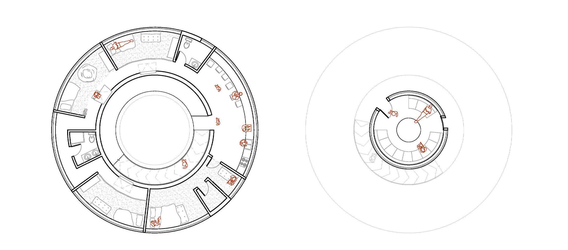
Tiny Housing Studies
Modular Housing
Anthony Averbeck
University of Virginia - Spring 2018

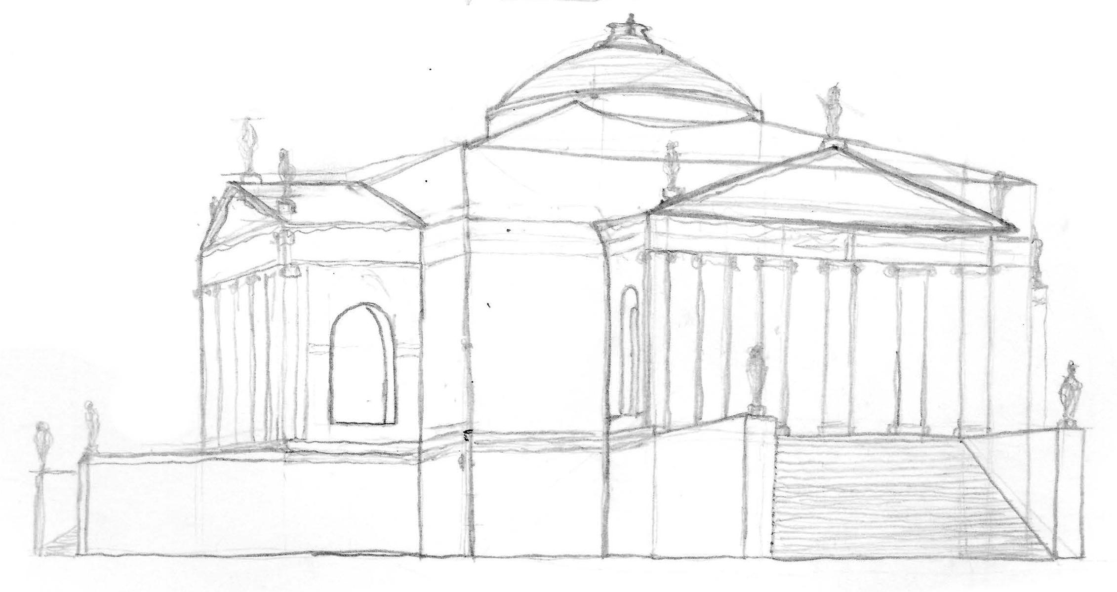
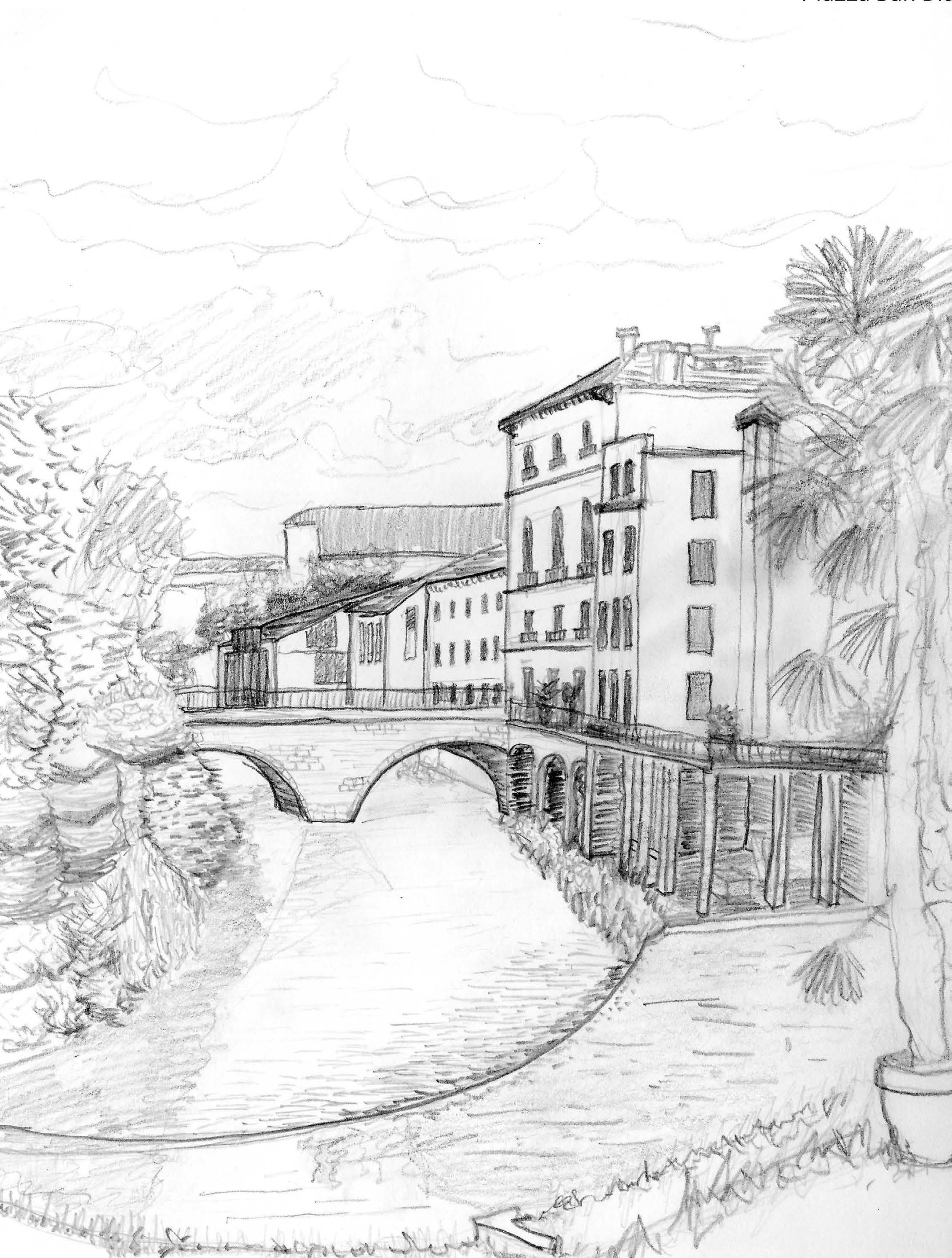
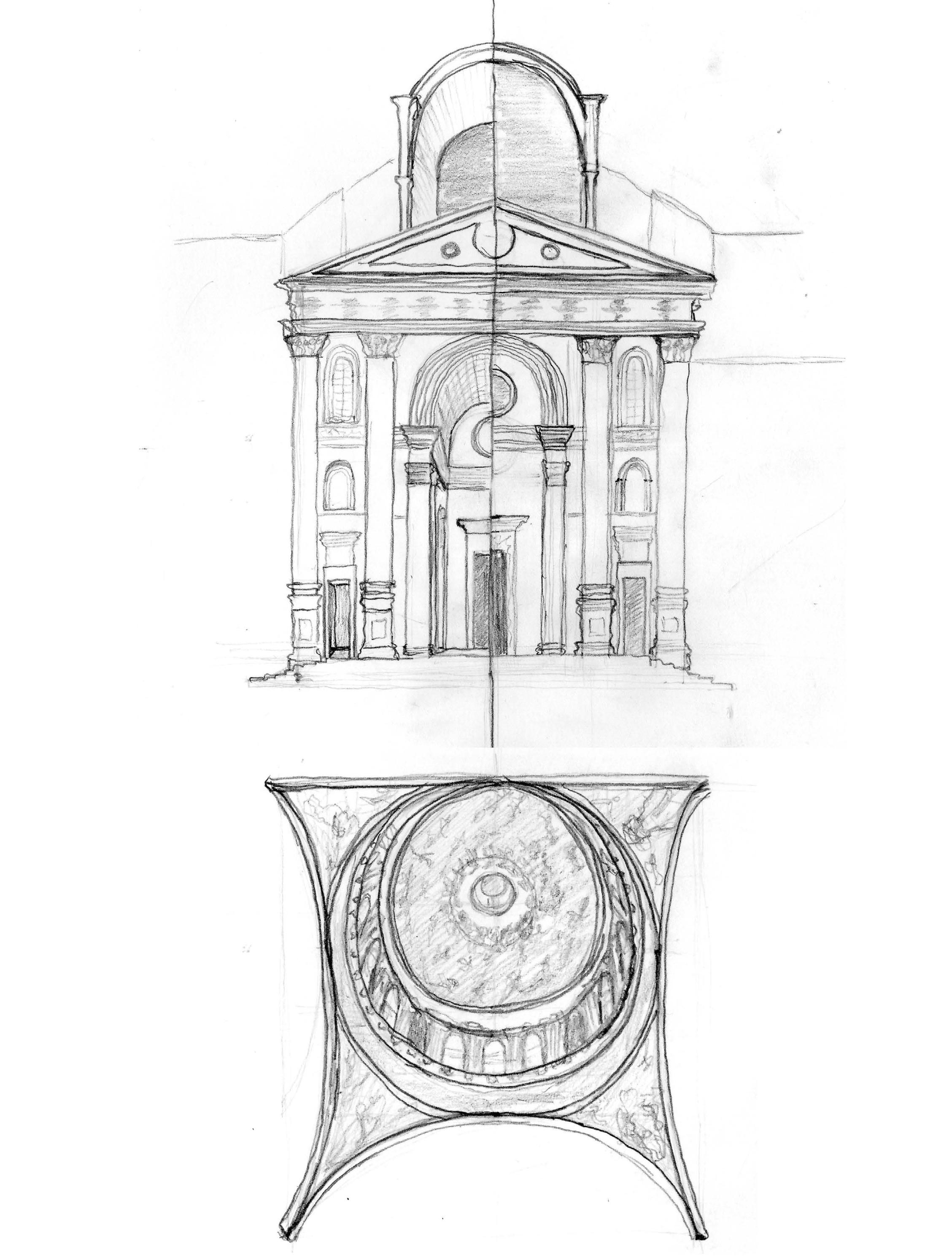
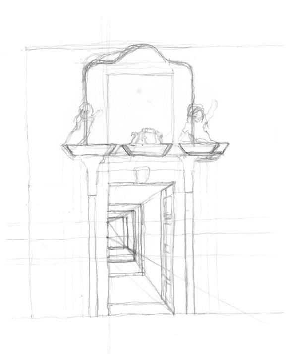
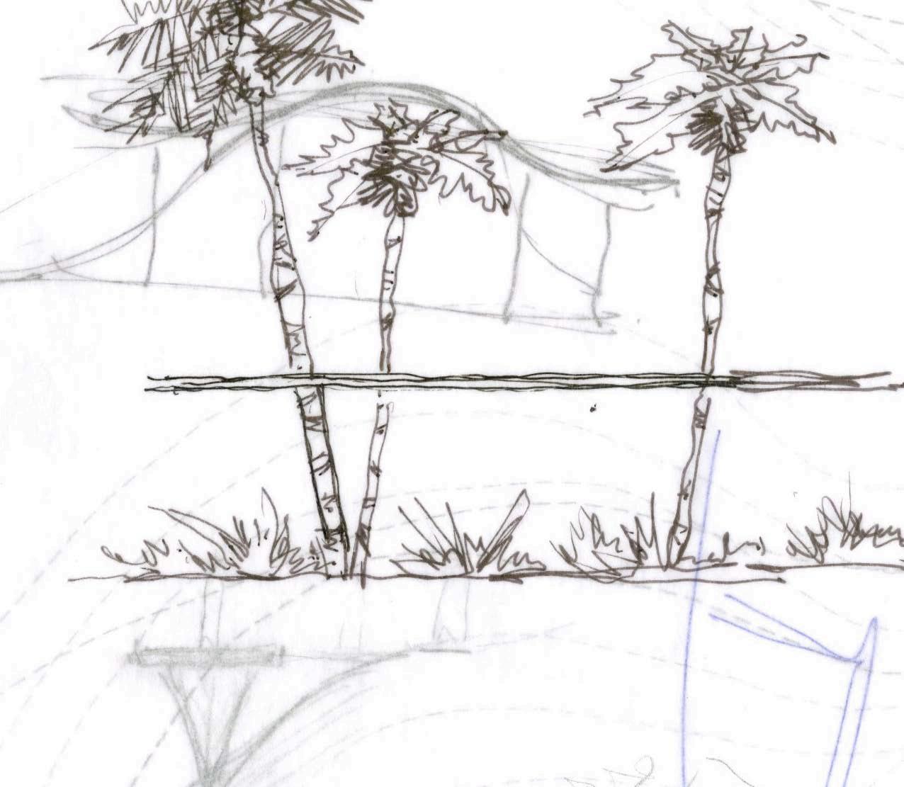
and the Veneto
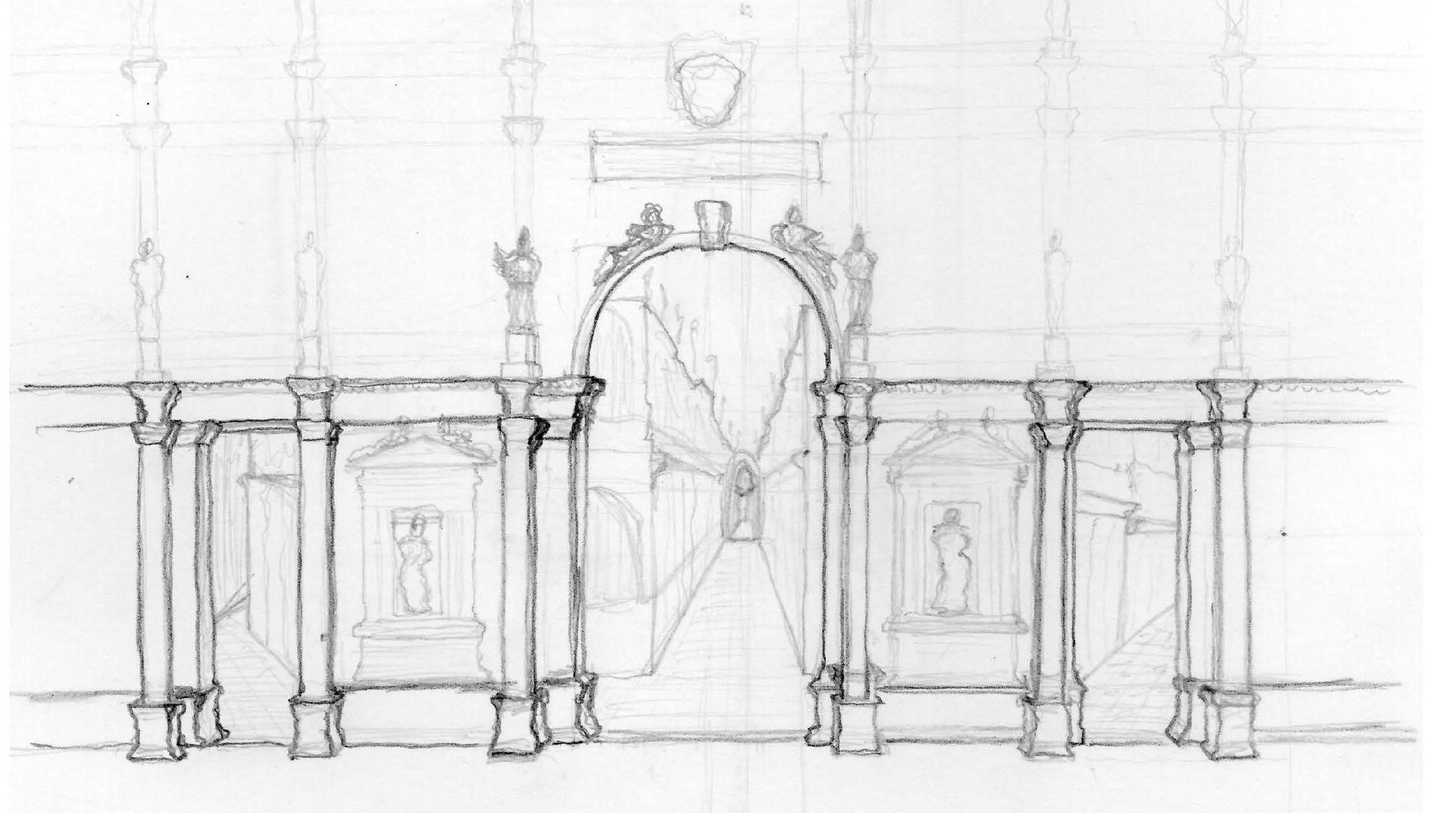
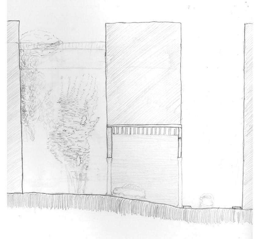
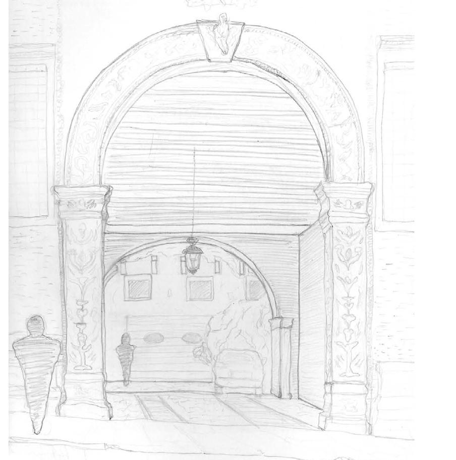
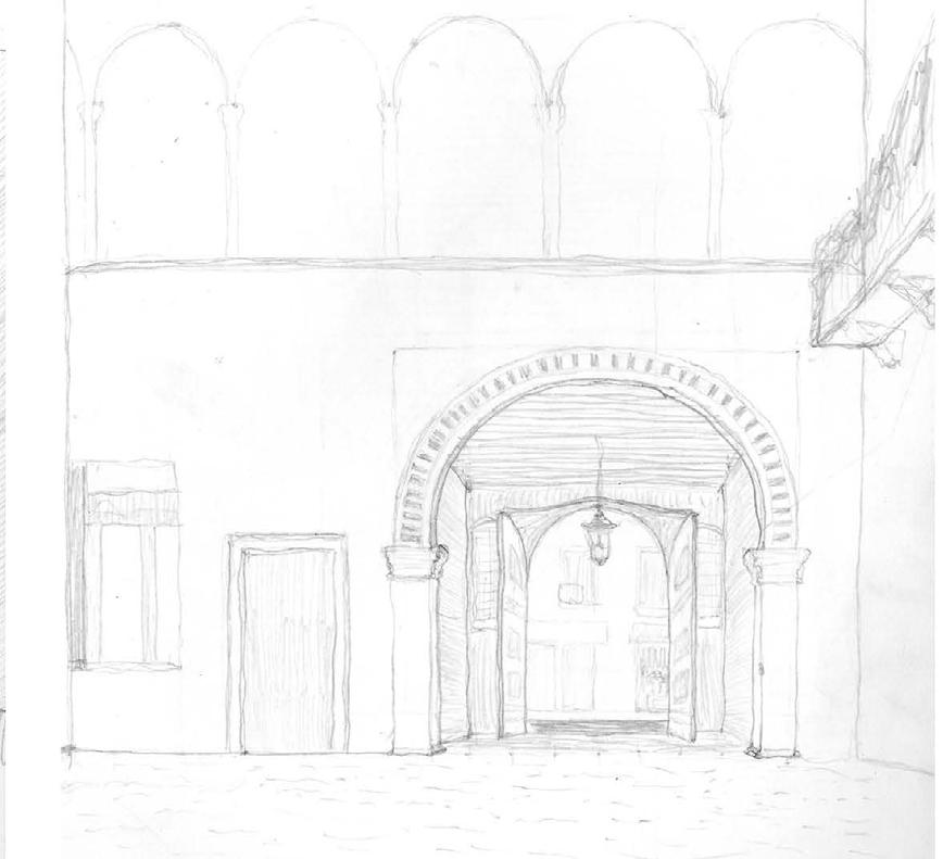
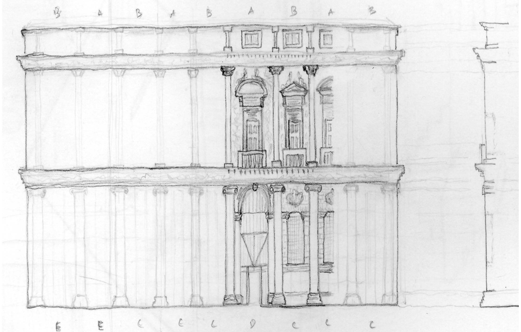
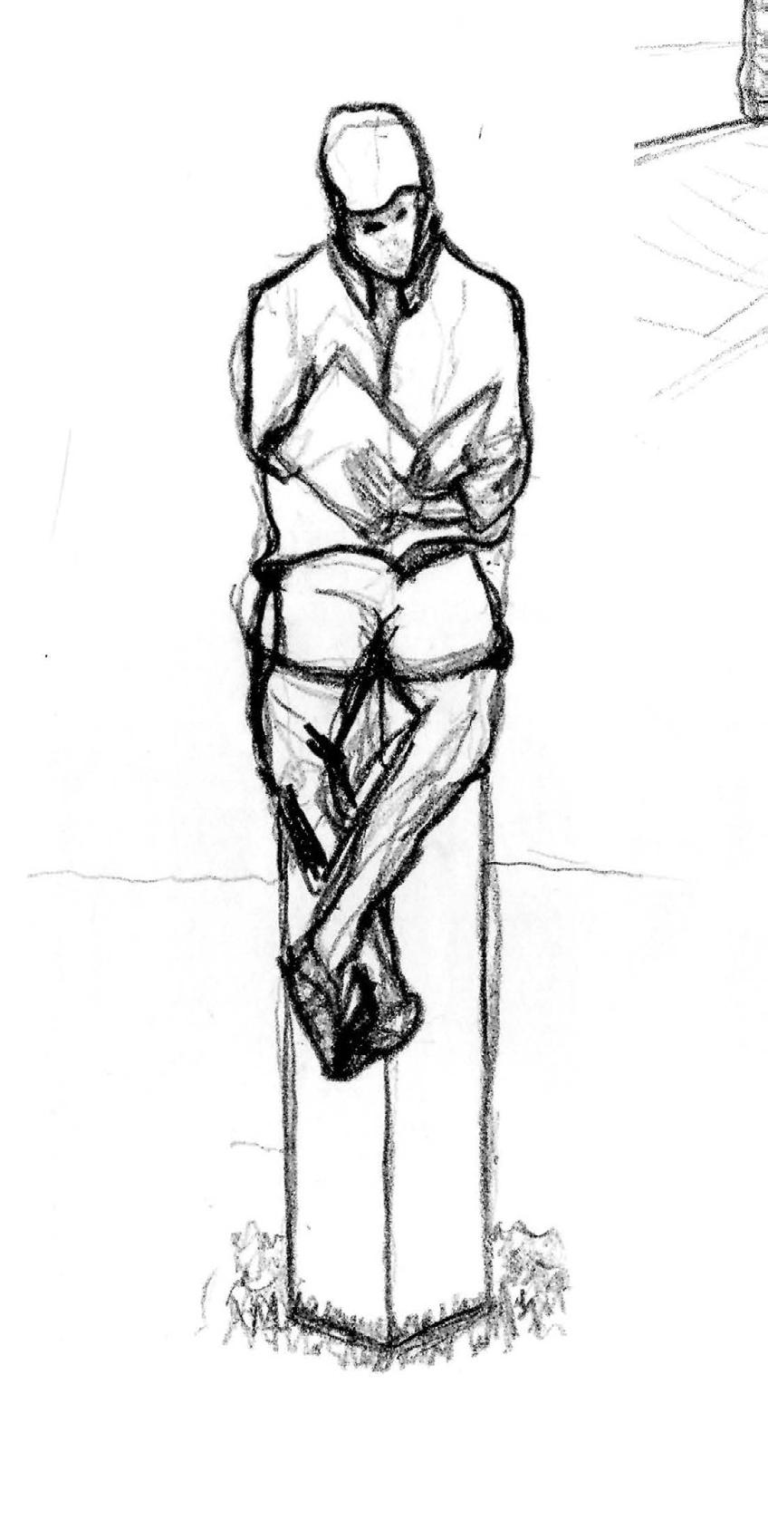
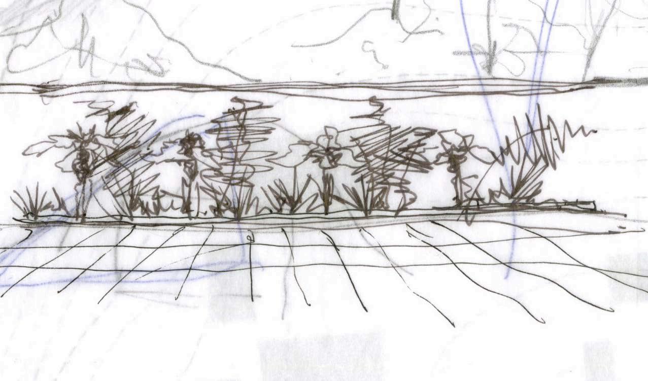
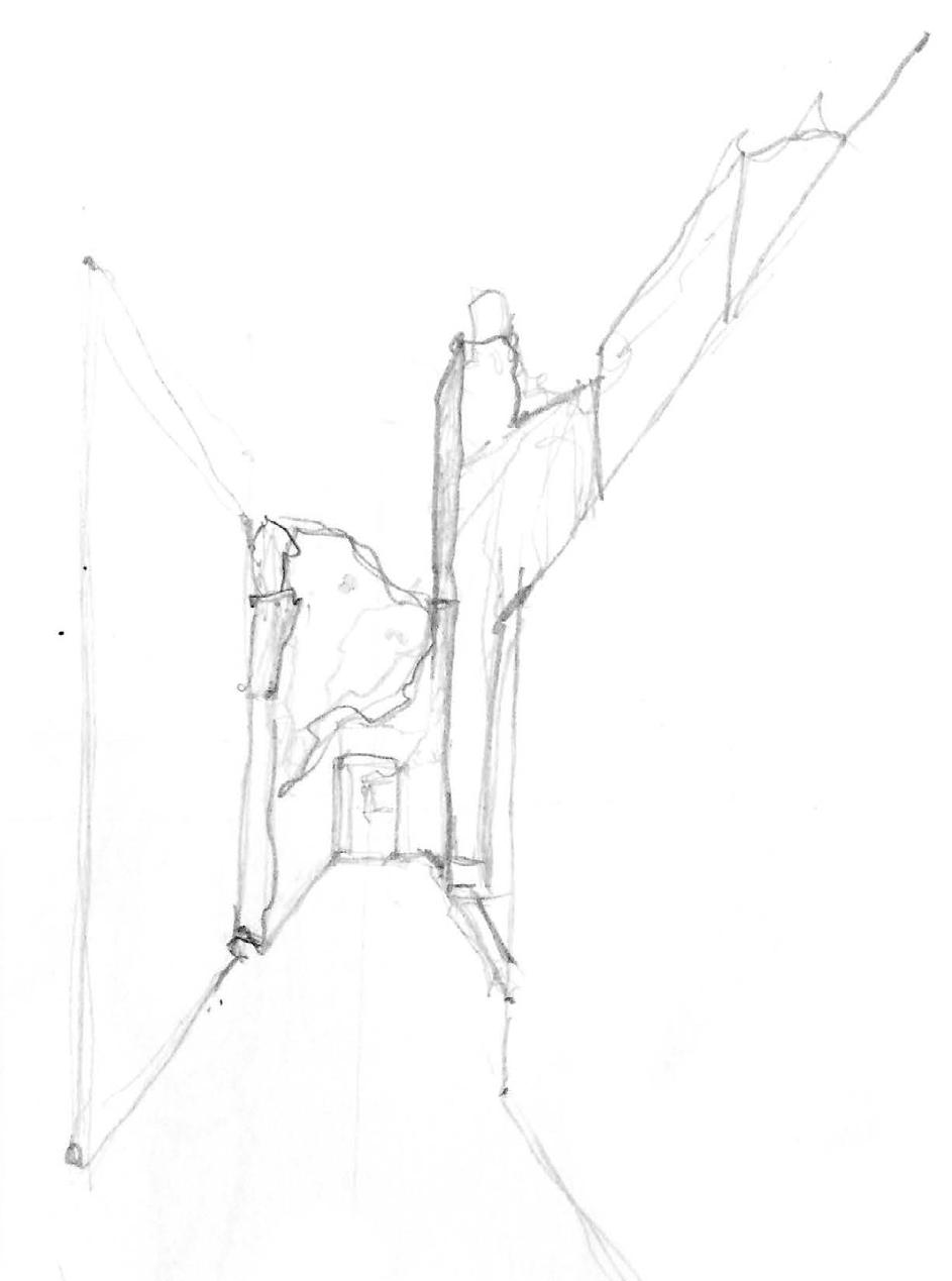
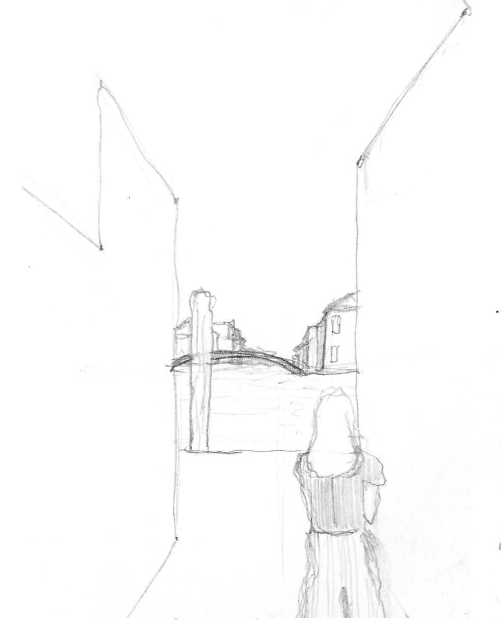
The following drawings and sketches were completed in Vicenza or surrounding Venetian cities. Each drawing was completed in an hour or less, and is intended to show more of an architectural analysis than a hyper-accurate representation.
These images are a selection from a 6 week period during the summer of 2018 competed in pencil, pen, or wax crayon. To view the entire body of finished works with locations and dates, please visit zacharyjbeim.myportfolio.com