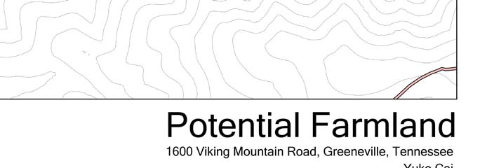
Yuke Cai
Landscape Architecture Portfolio
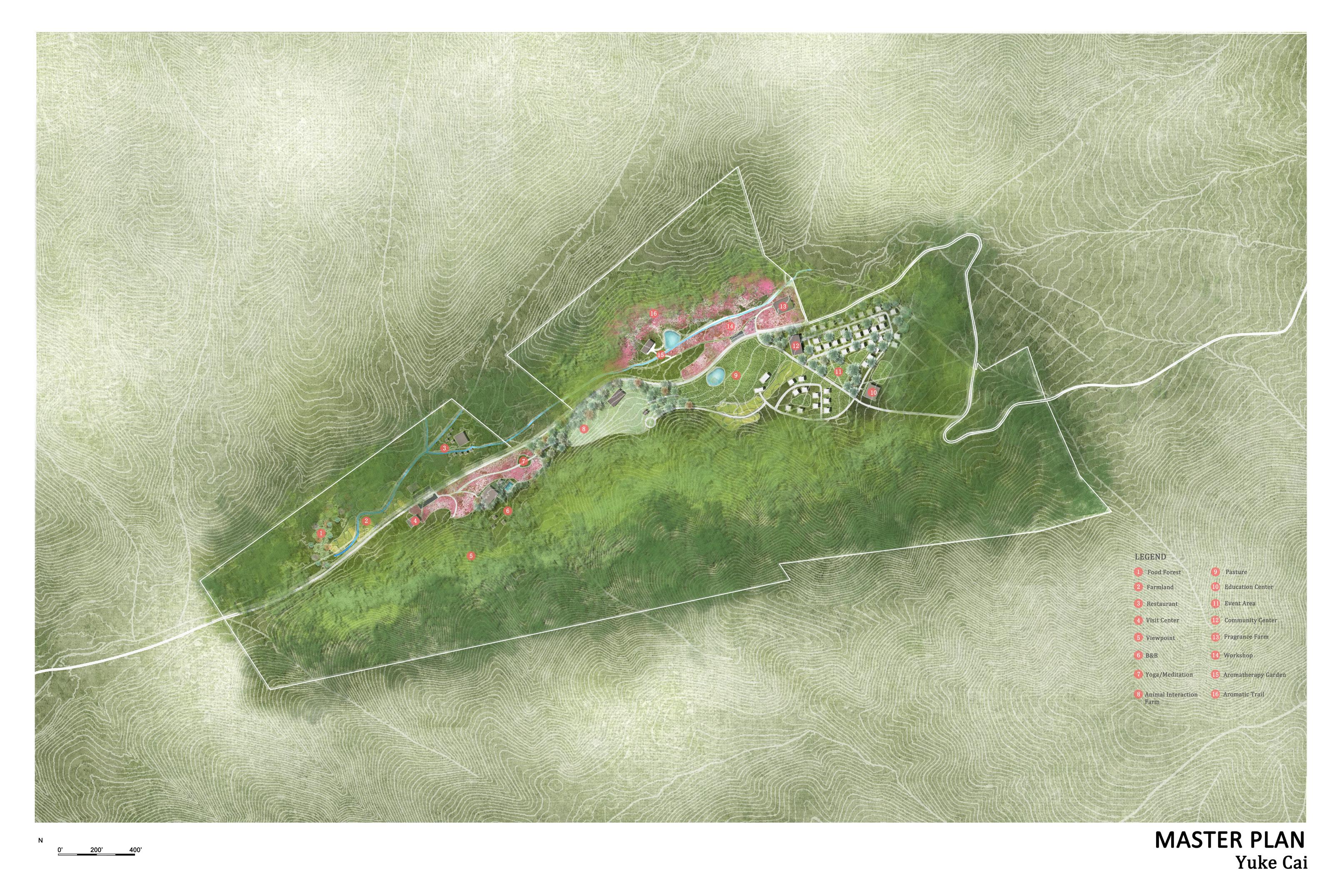
REVEALING WIND
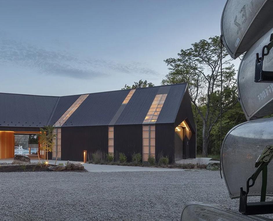
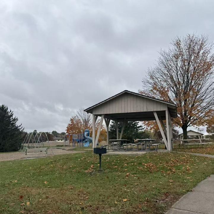
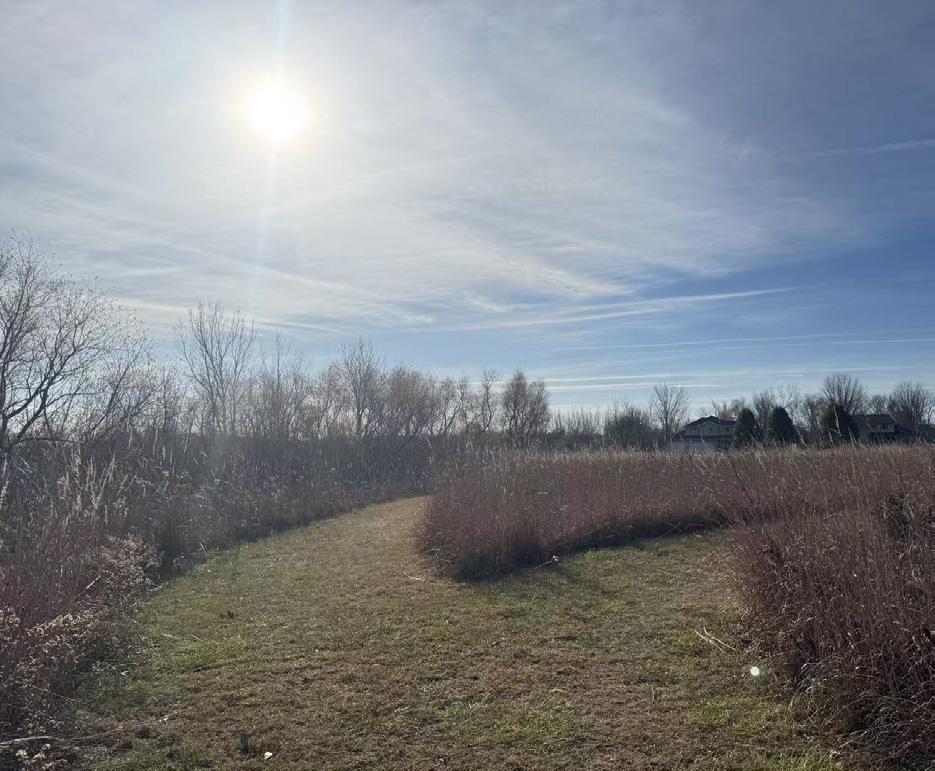
Boone, IA, United State
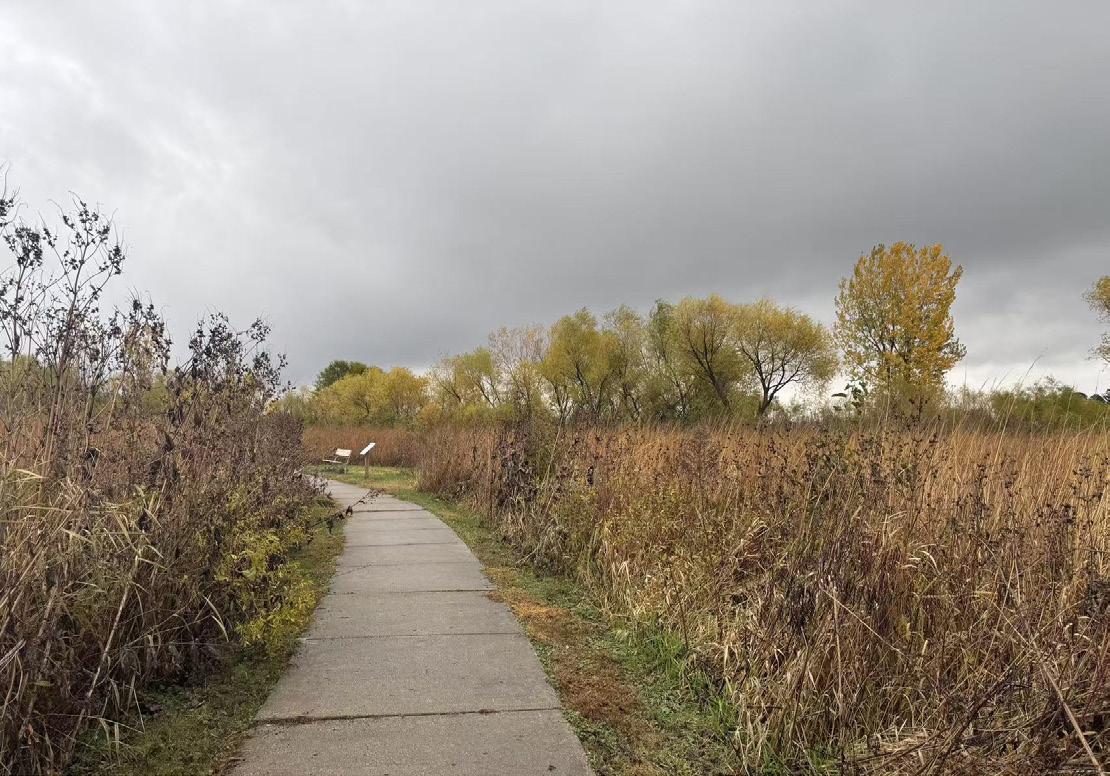
This project originated from a direct site experience. During a visit to Cap Erbe Park on the outskirts of Boone, Iowa, a strong winter wind was felt through cold air, shifting sounds, and subtle ground movement—unseen, yet clearly present. This moment became the conceptual starting point of the project, raising the question of how wind, an invisible environmental force, can be transformed into a legible and experiential element in landscape design.
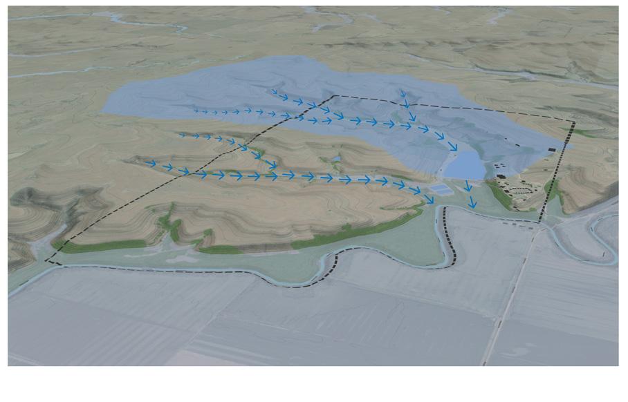
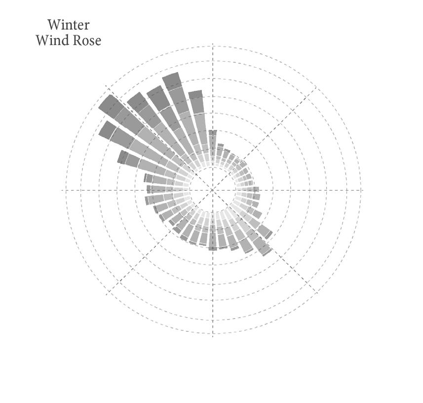
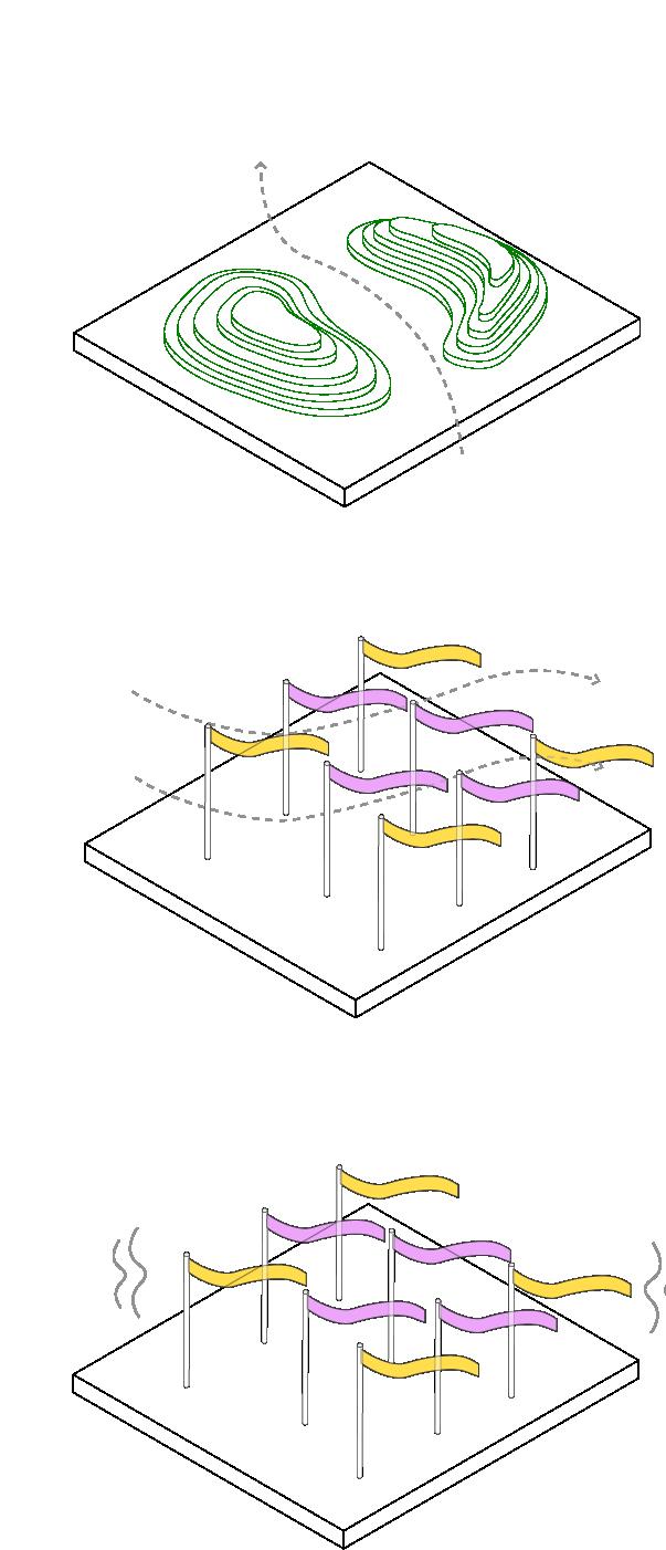
The project treats wind as an organizer of space and seasonality. Site analysis identified distinct prevailing wind patterns—northwest winds in winter and southeast winds in summer—which informed the formation of a wind corridor system aligning circulation, landform, planting, and program with site airflow.
Through landform modification, planting strategies, and lightweight wind-responsive elements, wind is translated into sensory experience. Grading guides and modulates air movement, while vegetation is organized by its dynamic response, from fine grass motion to broader canopy movement. As seasons shift, wind transitions from direct and intense in winter to filtered and softened in summer, reframing it from a background condition into a shared environmental experience.
Professor: Adina Cox, Tom Neppl Iowa State University Fall 2025
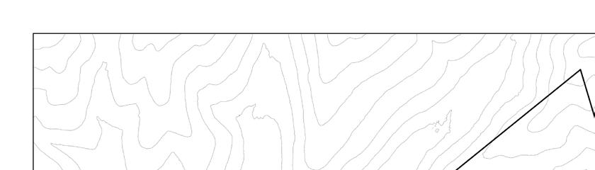
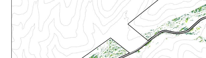
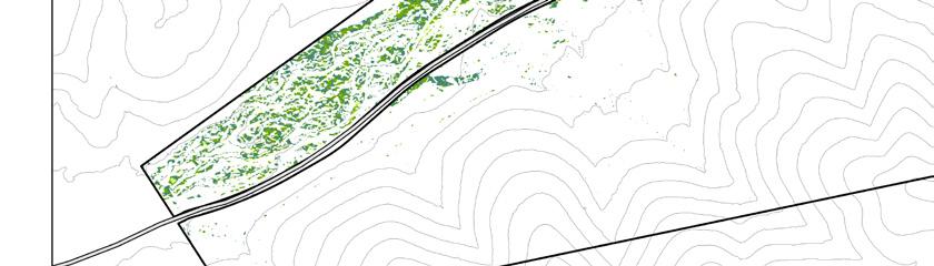
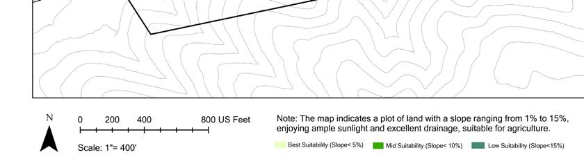
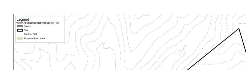
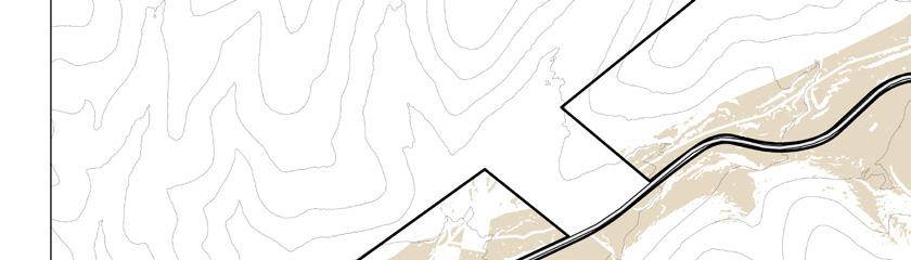
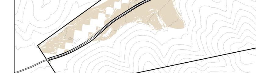
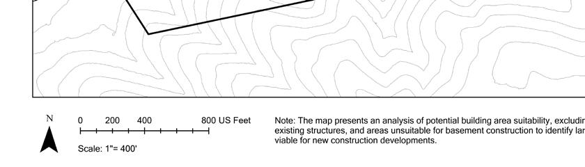
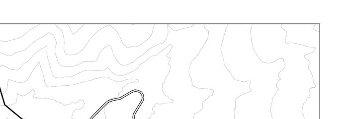
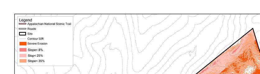
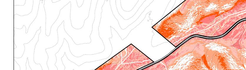
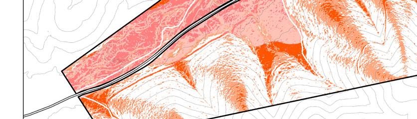
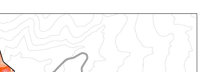
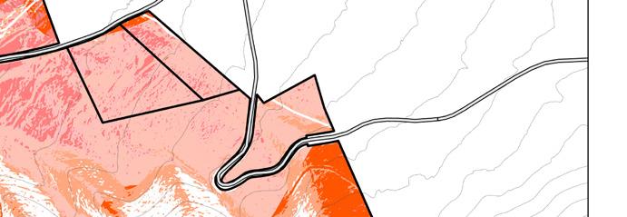
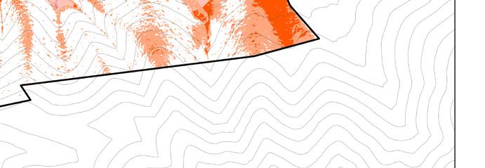
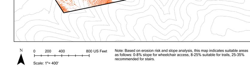
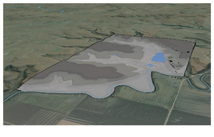
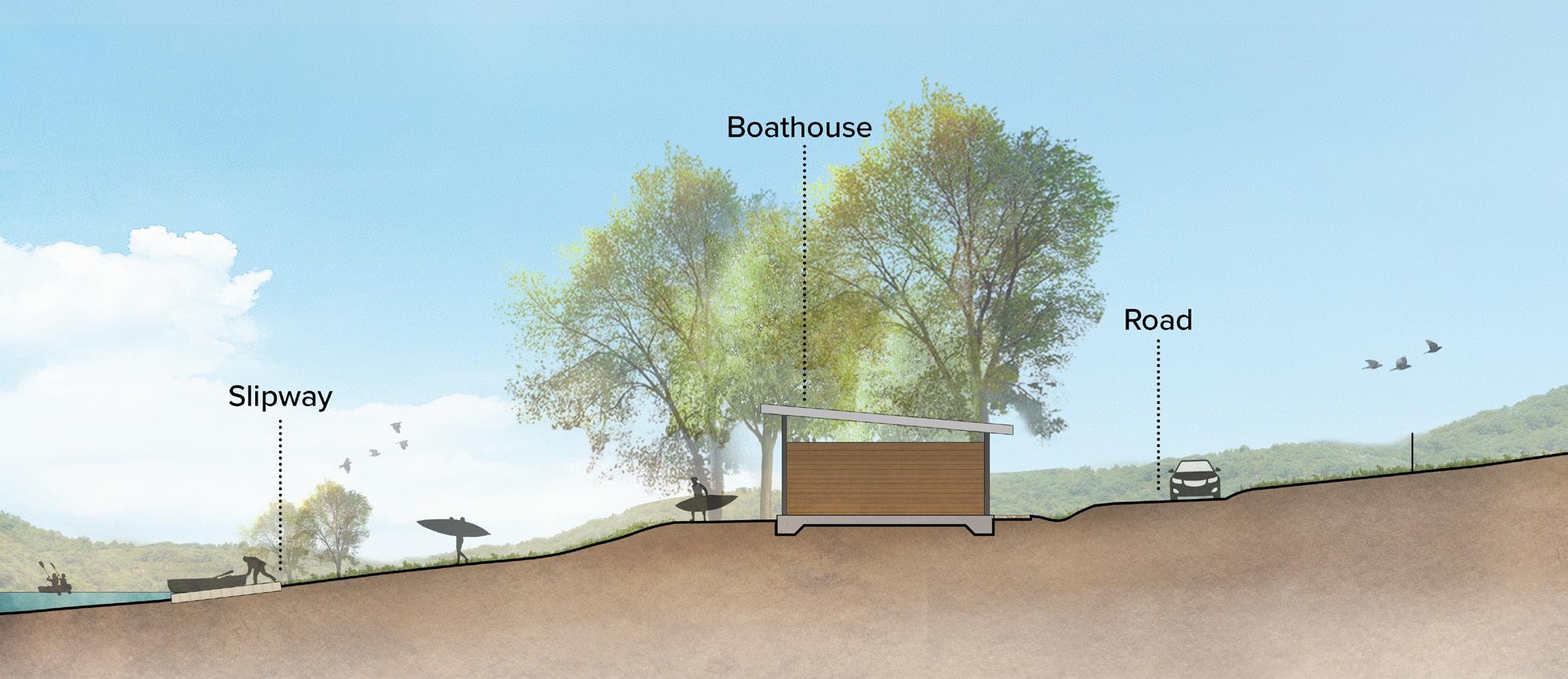
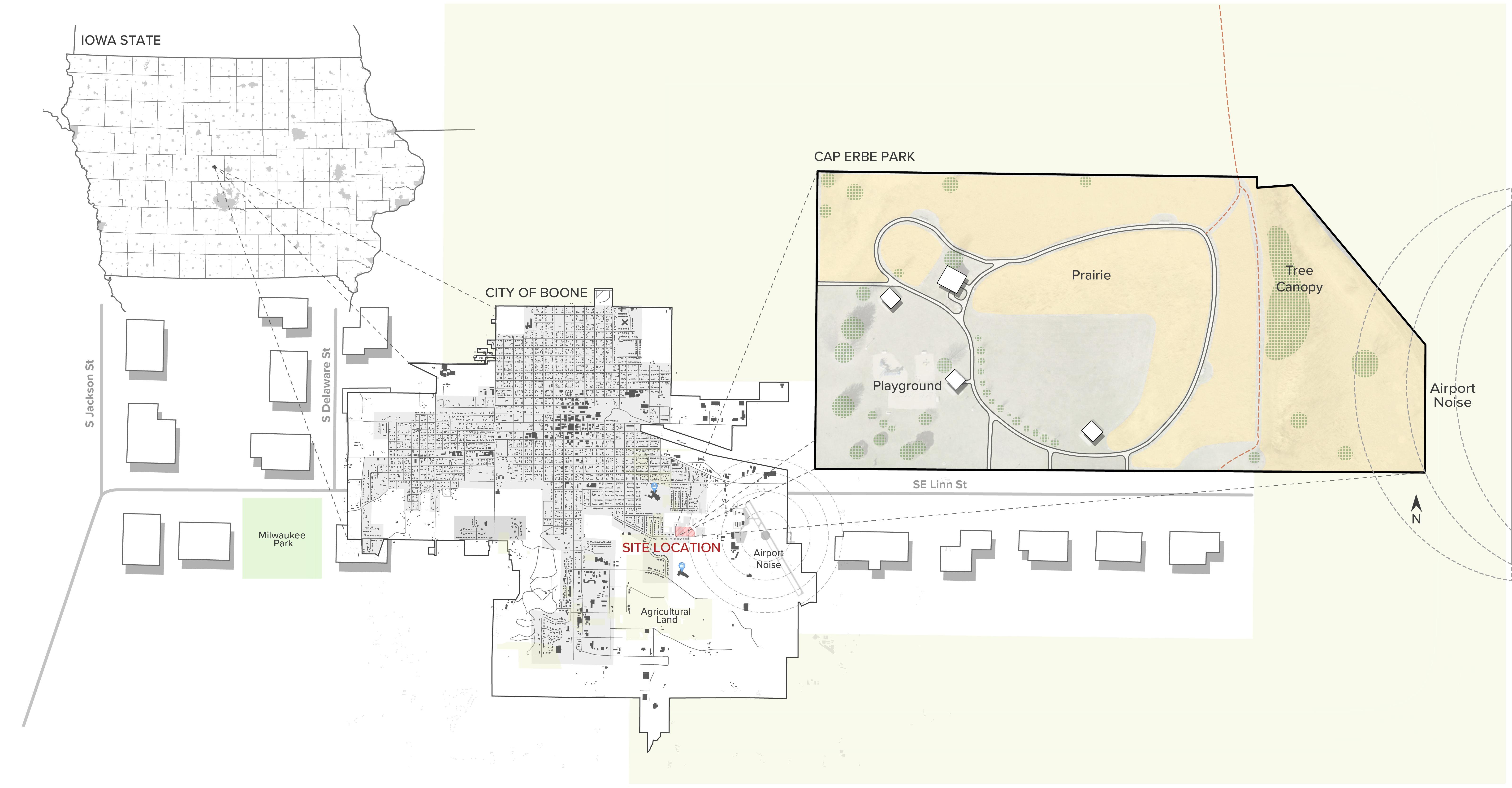
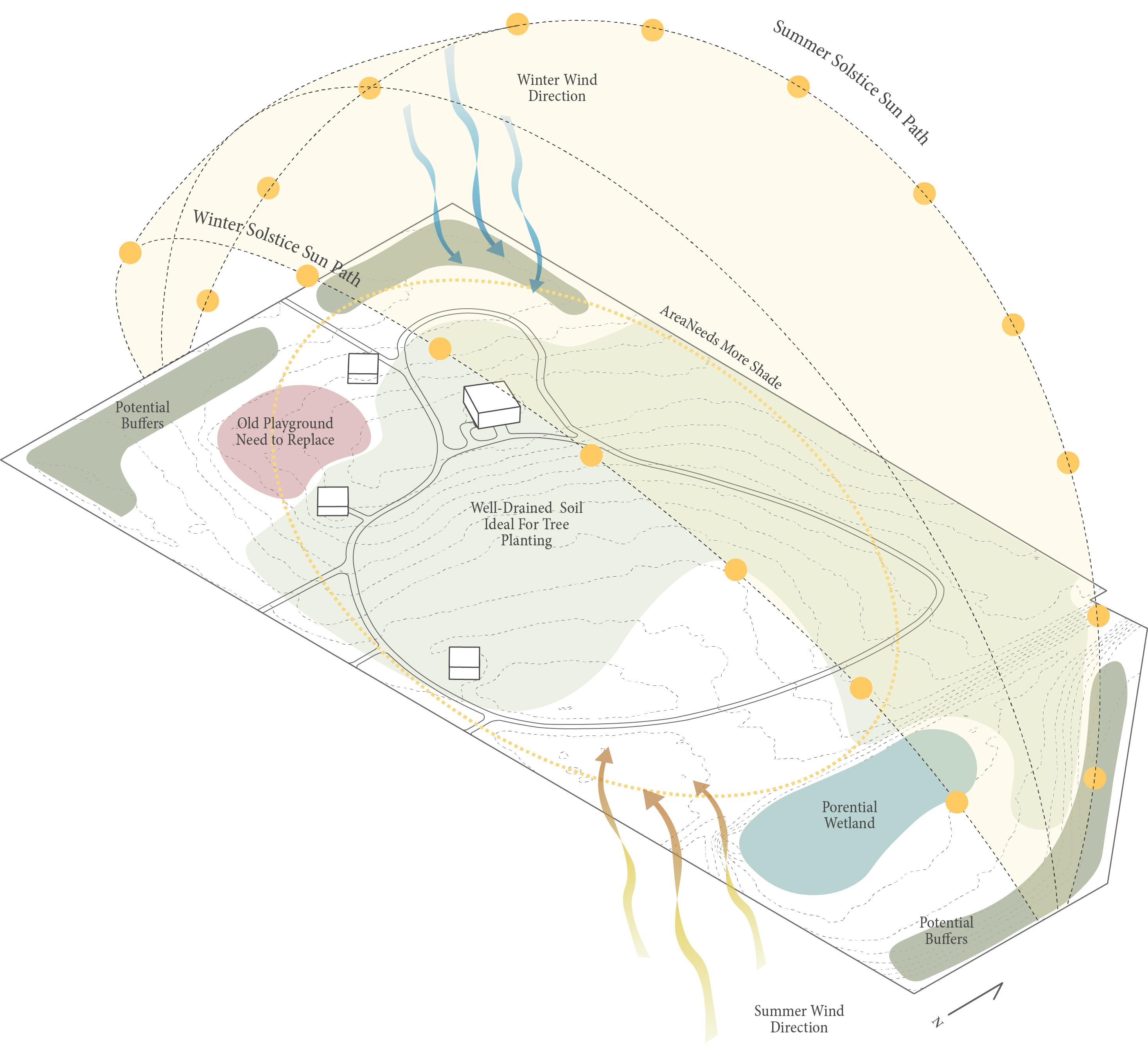
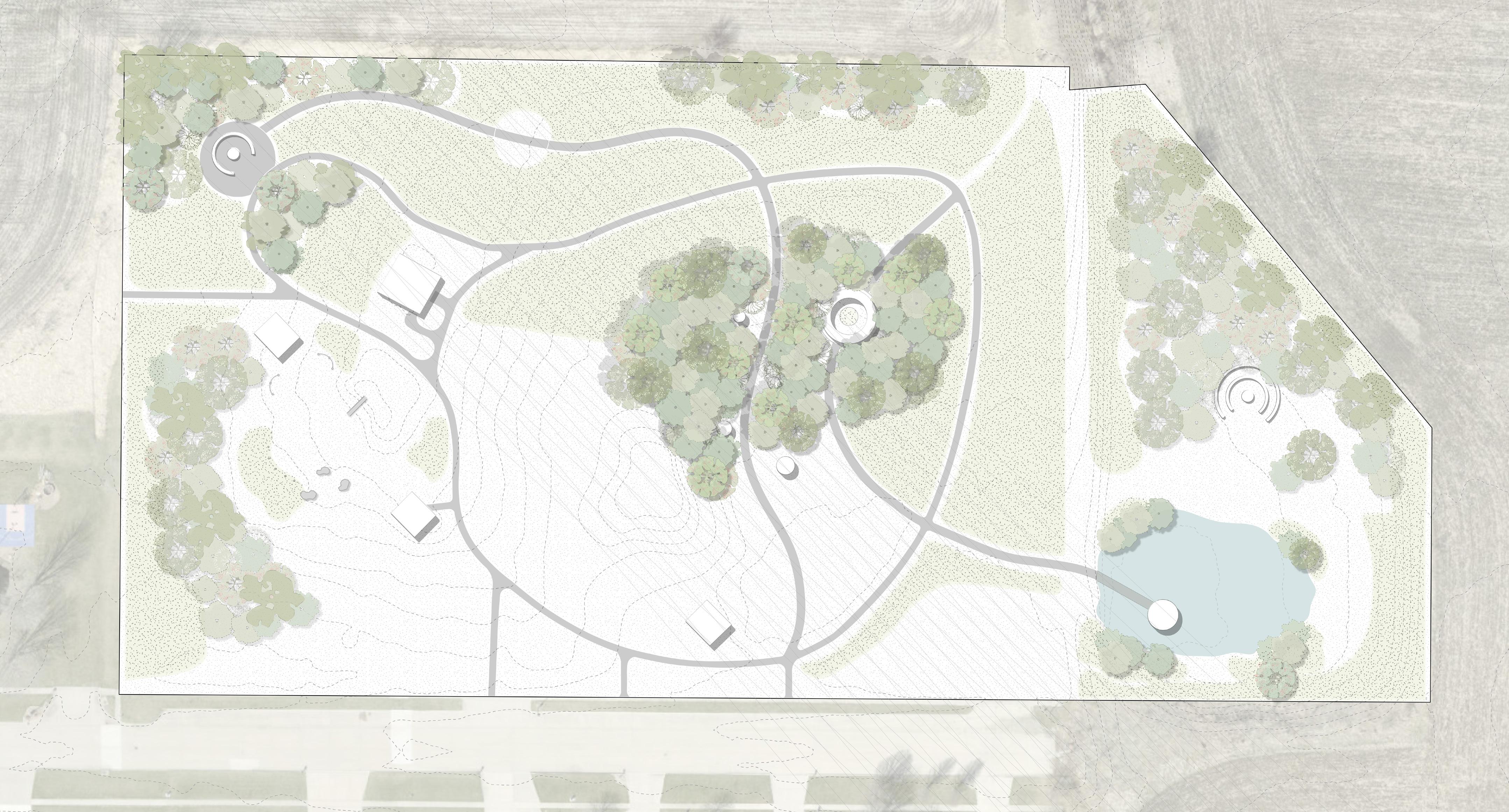
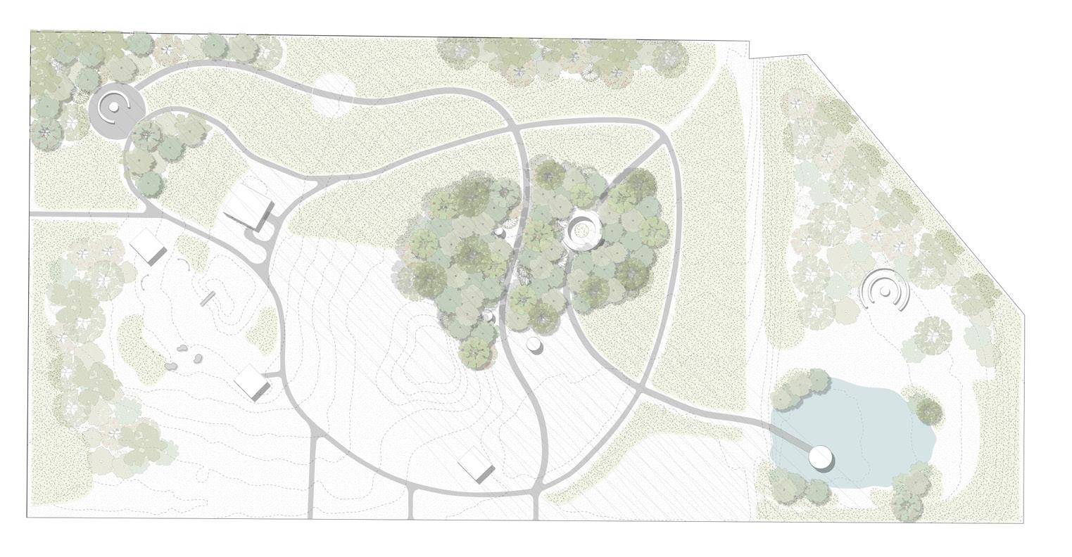
This page presents the project location and existing site conditions, highlighting the location of Cap Erbe Park and its surrounding context.
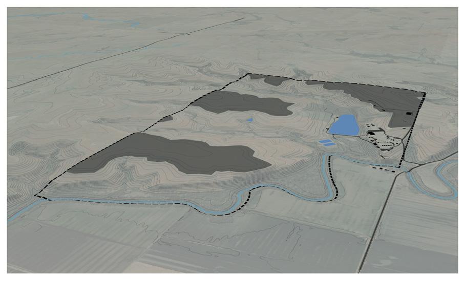
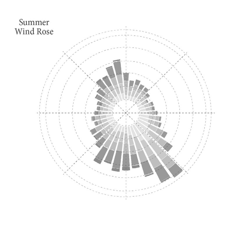
By combining wind roses with sun paths, topography, vegetation, and existing uses, I began to understand how wind moves through the site. This analysis informed how the design could shape landform and planting to work with wind and support different seasonal experiences. Seasonal Wind, Sun, and Site Interaction
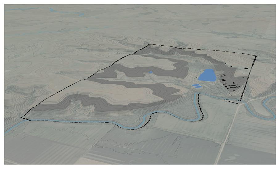
This exploded axonometric diagram layers topography, slope, vegetation, and circulation to reveal their spatial relationships in three dimensions, allowing multiple site systems to be understood simultaneously.
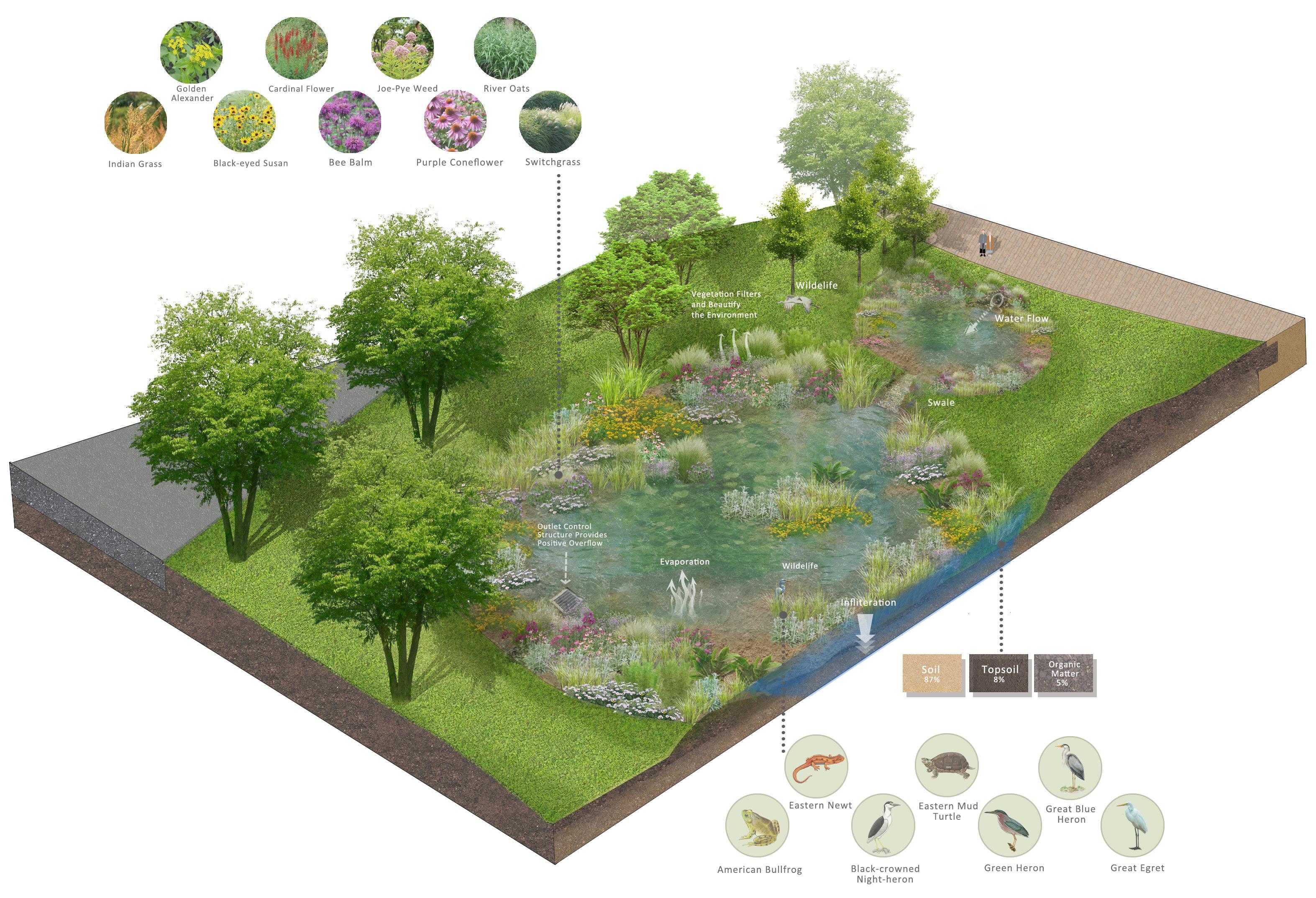
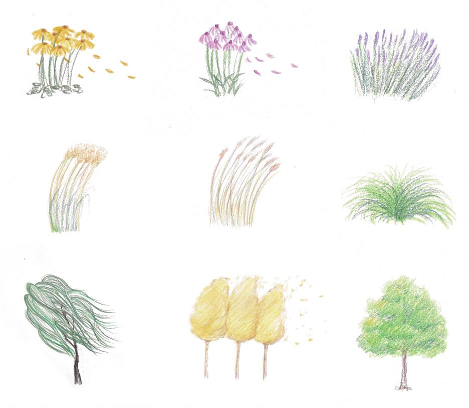
This diagram presents the wind corridor strategy through three sensory dimensions: shaping, seeing, and hearing wind. Wind is guided by vegetation and micro-topography, made visible through the movement of trees, grasses, and lightweight materials, and made audible through layered soundscapes. Together, these elements transform wind into a legible spatial experience that can be perceived visually, acoustically, and physically.
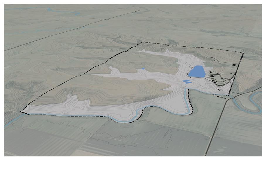
Wind Direction & Flow Shaping
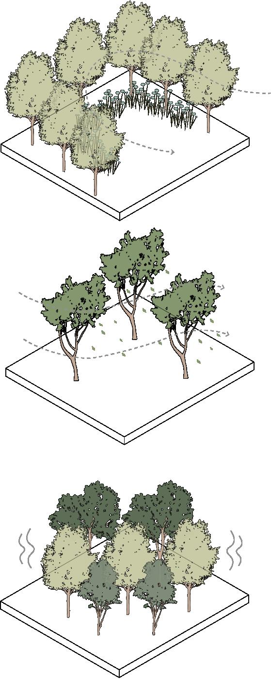
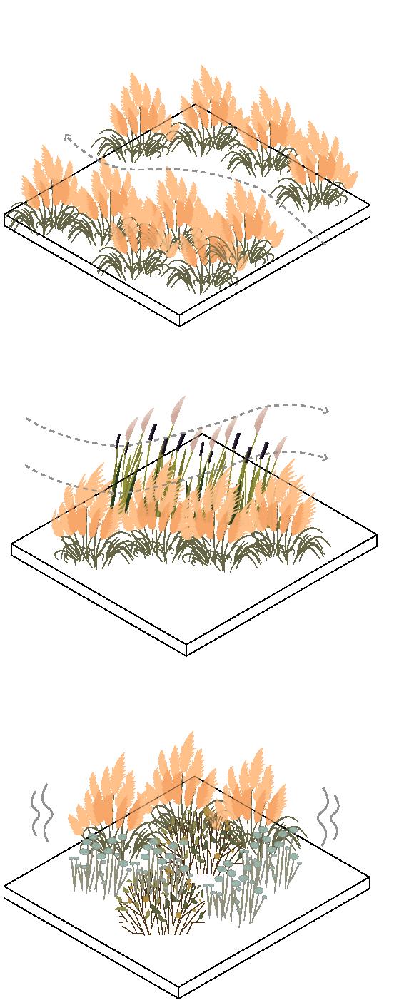
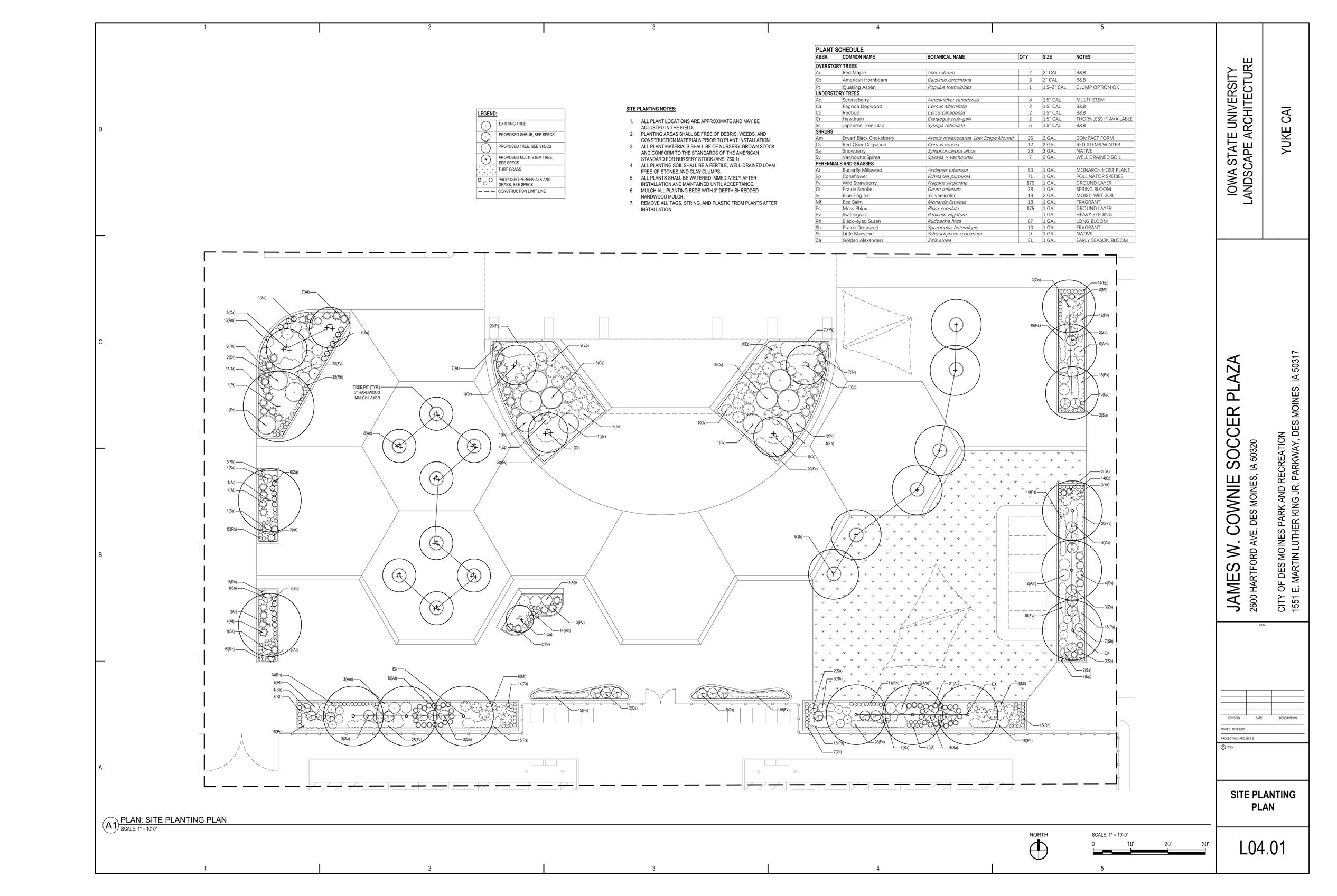
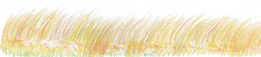
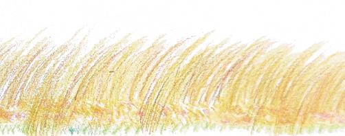
Plant selection is driven by how vegetation responds to wind rather than by ornamental or taxonomic criteria. Vegetation translates airflow into visible movement and sound across multiple scales.
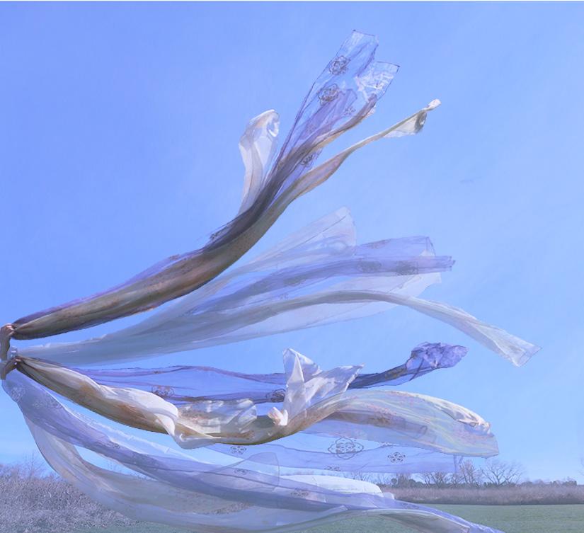
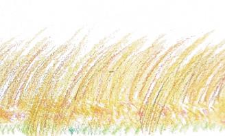
The soft, blurred strokes create a sense of atmospheric motion, capturing the gentle, shifting beauty of plants as they dissolve into the flow of wind.
Perspectives
These perspectives illustrate key experiential moments within the site, showing how play, rest, and gathering spaces are shaped by wind-responsive landforms, vegetation, and structures to create a multisensory landscape of movement, sound, and calm.
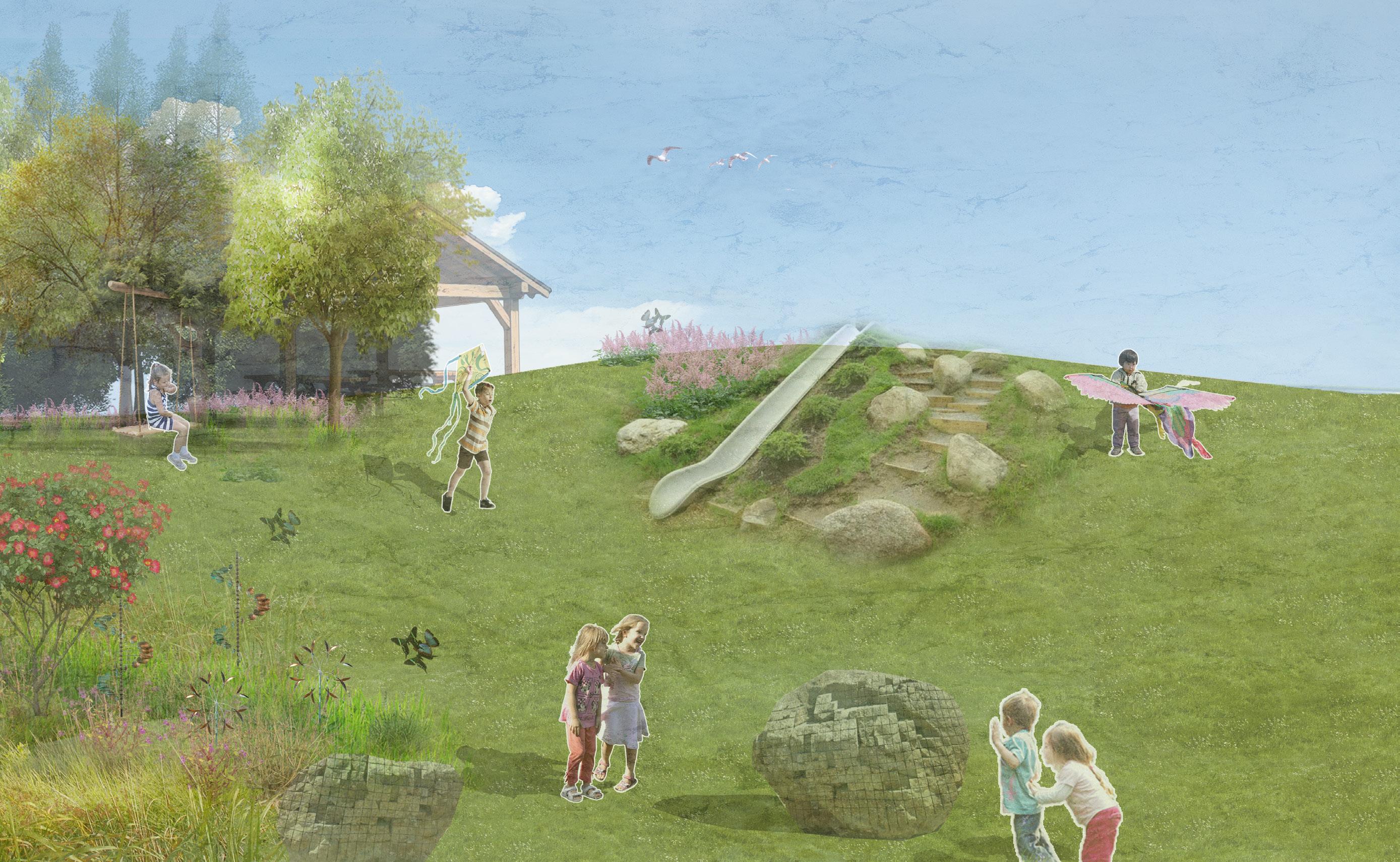
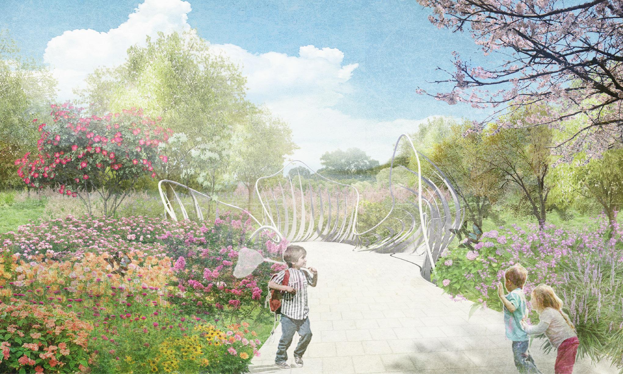
Perspective 1
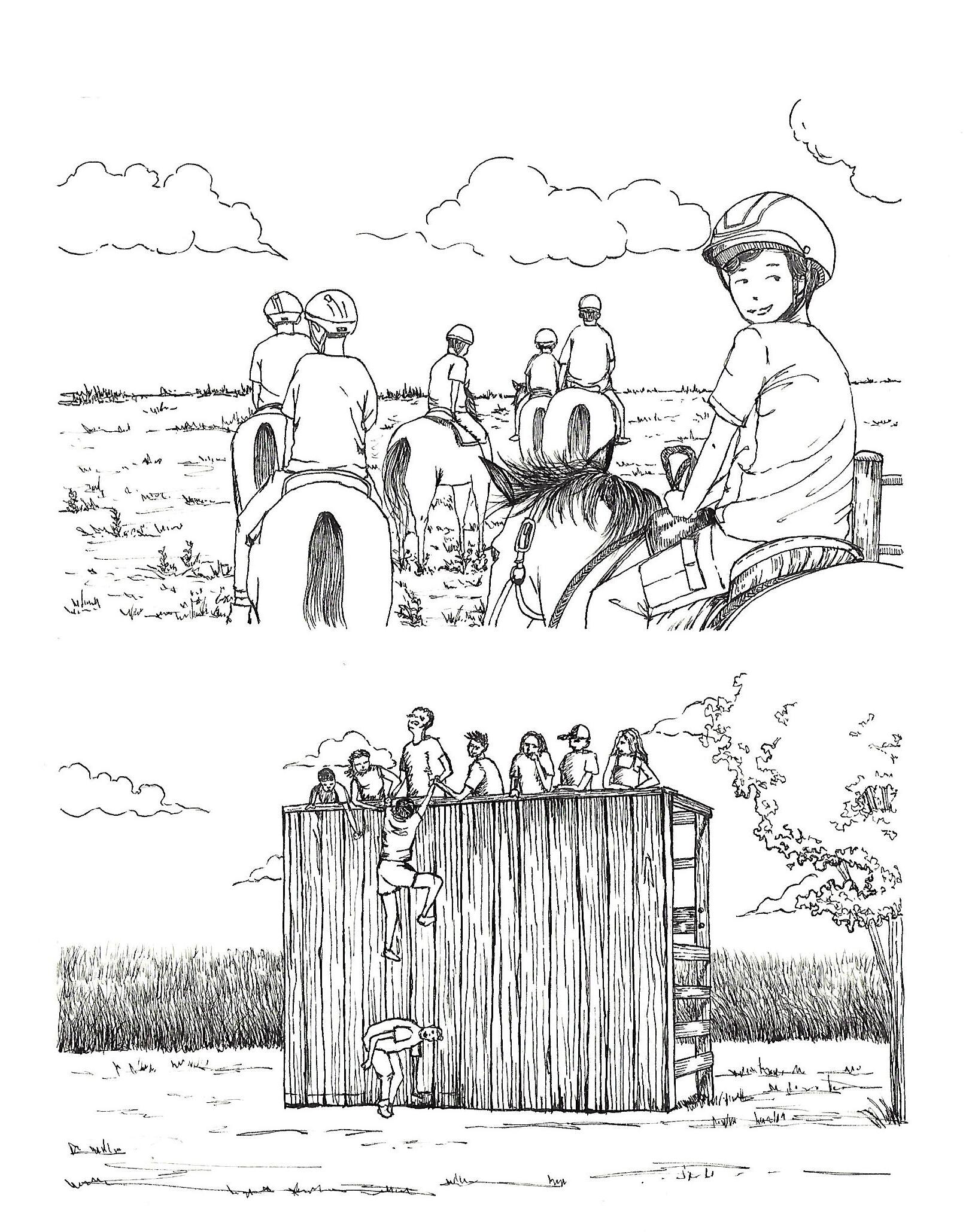
Within the nature play area, children run, fly kites, and explore wind-responsive elements. Through movement, sound, and play, the presence of wind becomes something they can sense, follow, and enjoy.
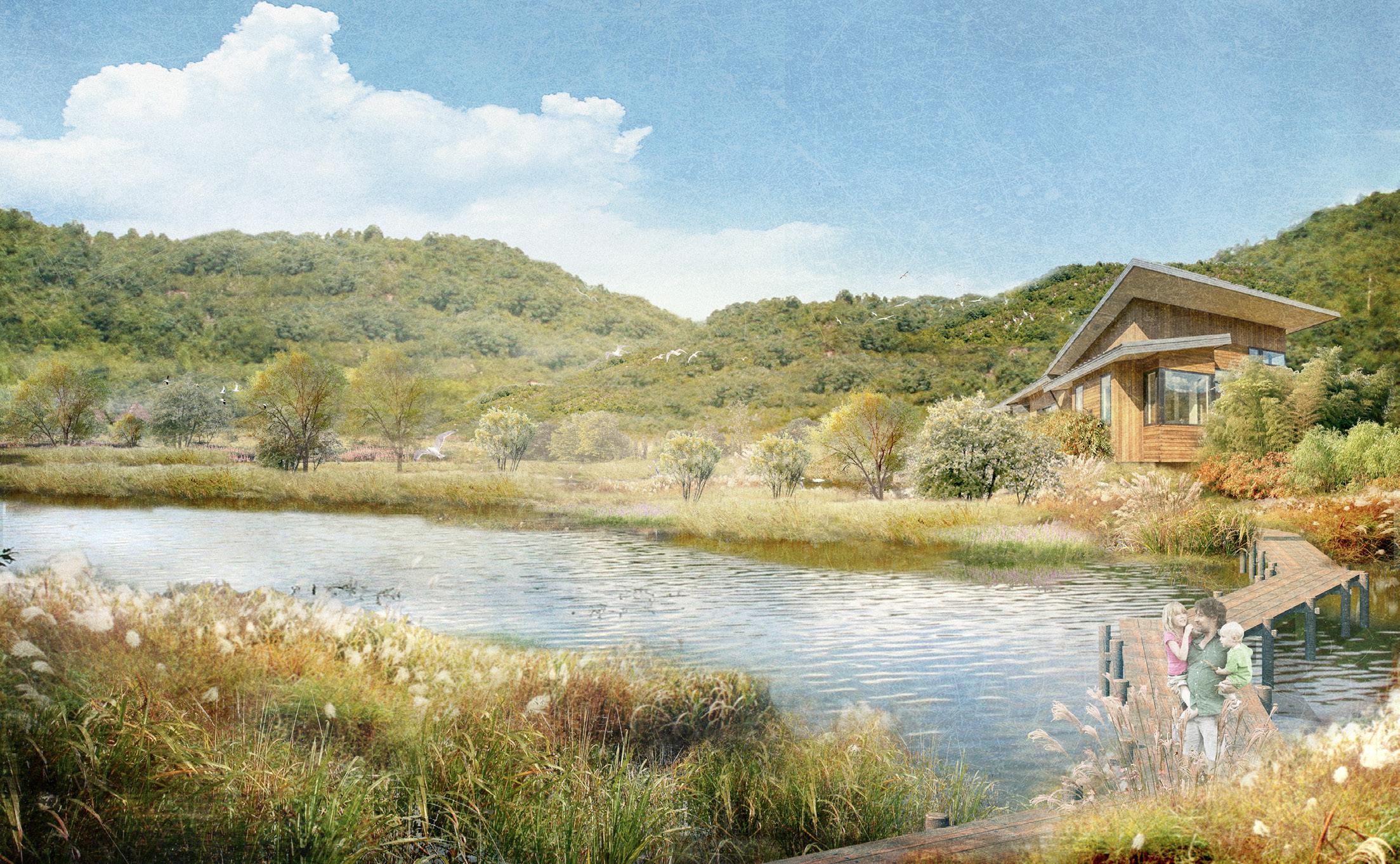
2
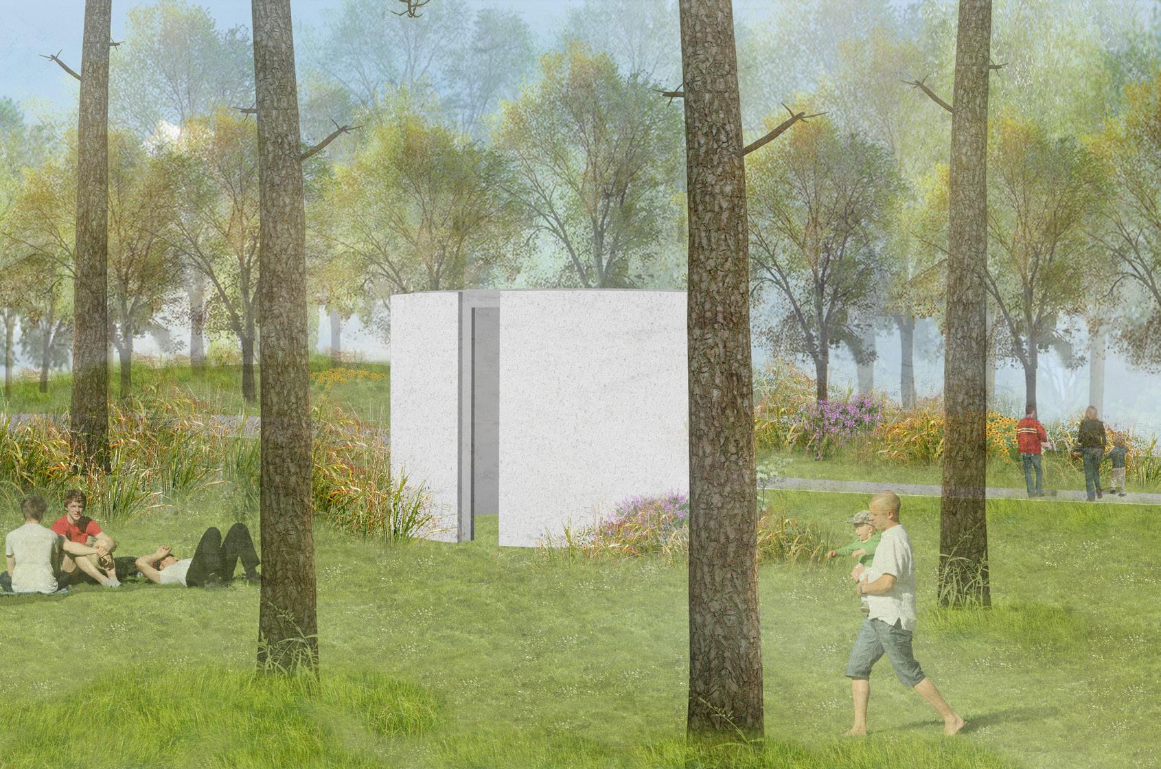
A quiet moment within the wind corridor, where people relax among trees and grasses. In the background, a wind-sound structure translates airflow into sound, reinforcing wind as an experiential element of the landscape.
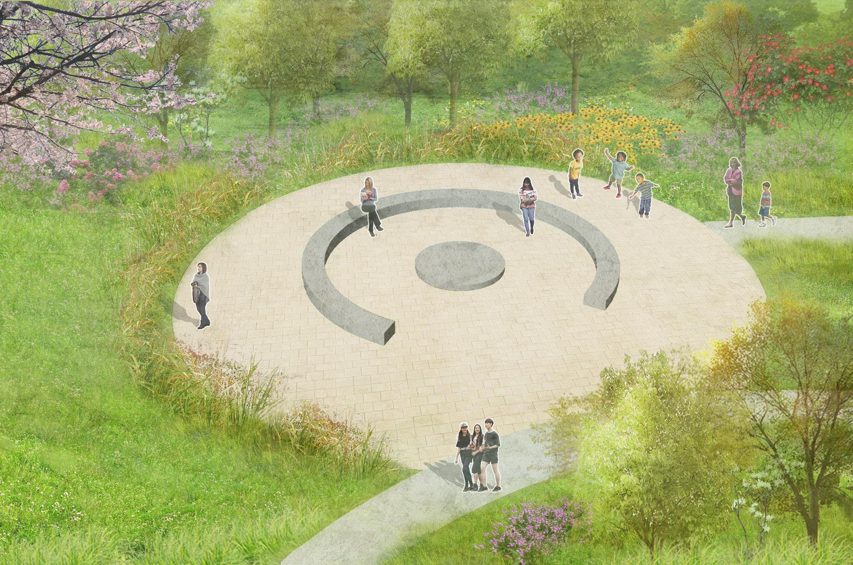
3
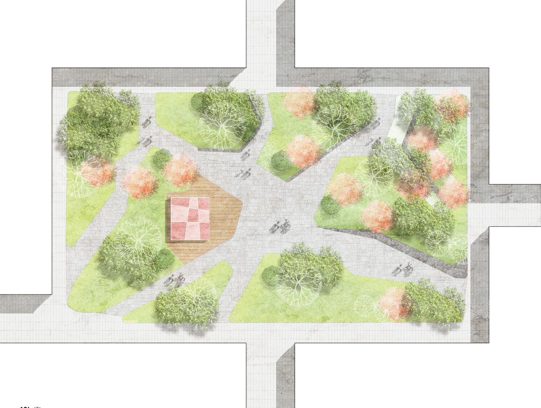
The wind calm retreat creates a quiet clearing for gathering and conversation. Sheltered from stronger winds, it becomes a place for outdoor learning and shared moments.
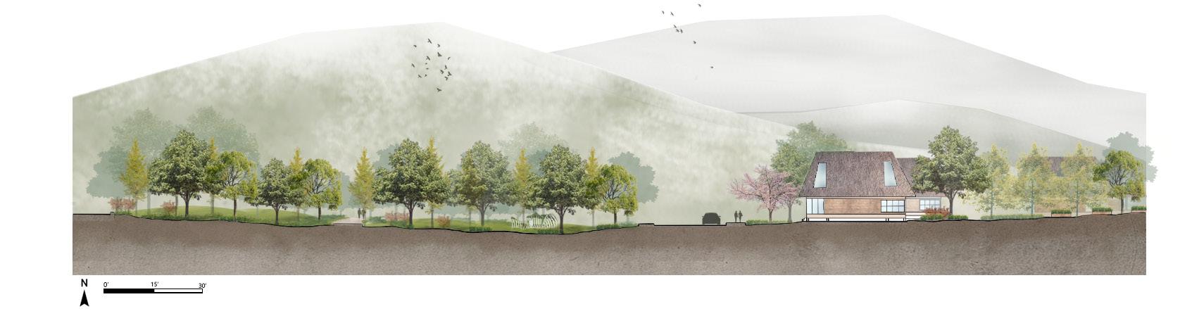
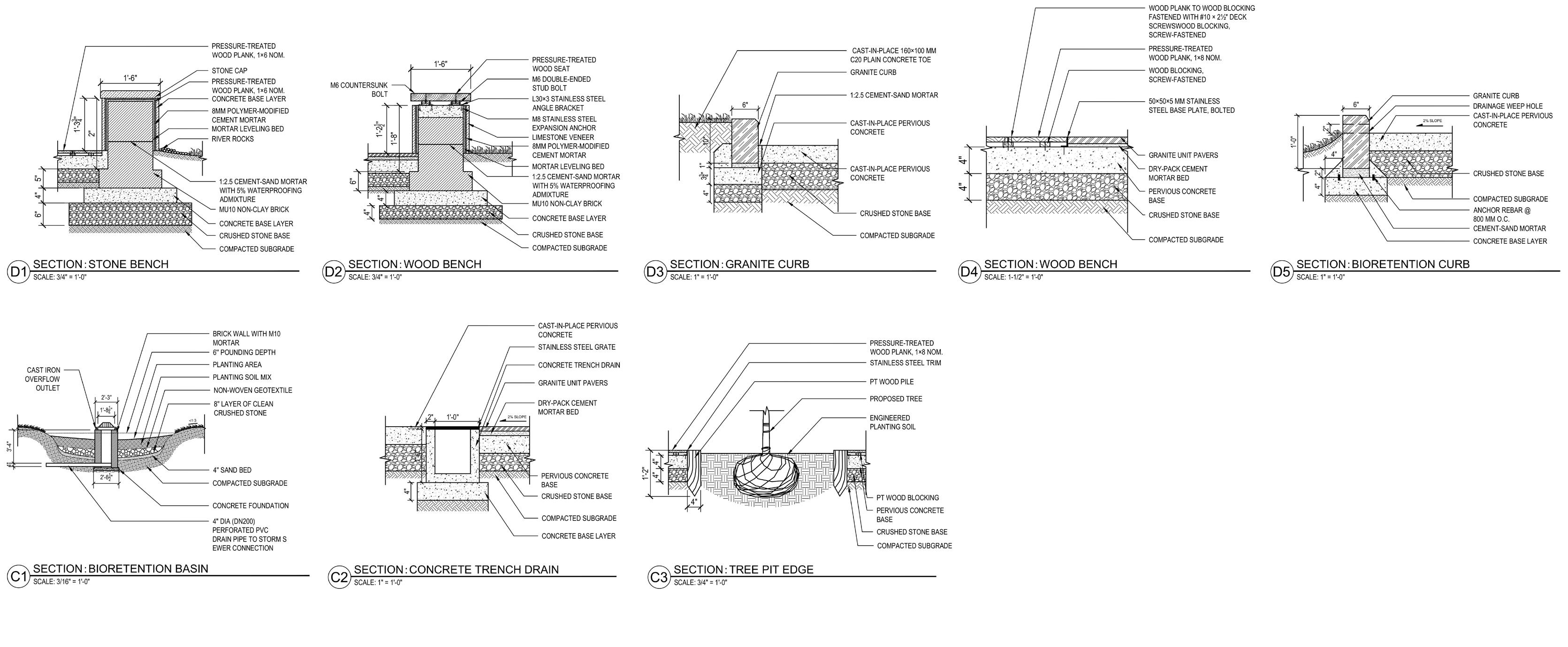
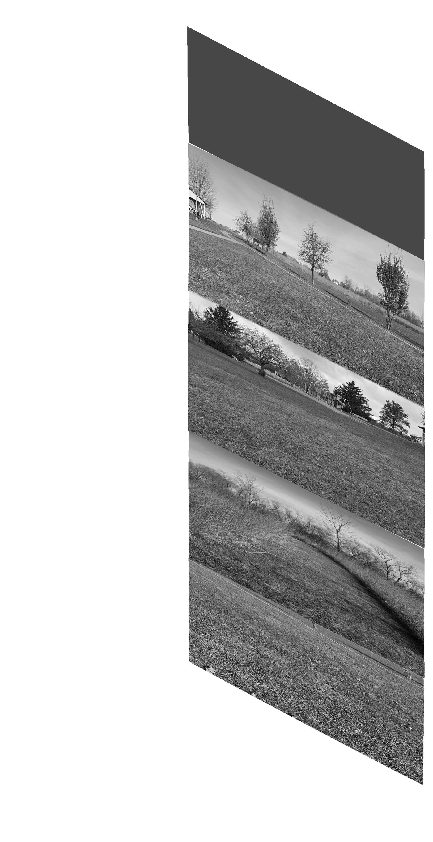
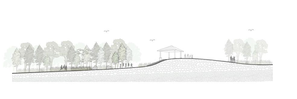
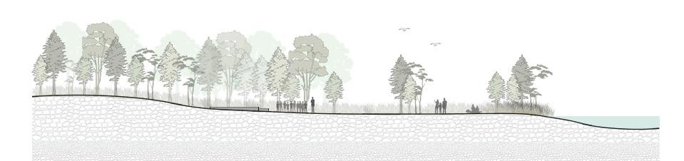
Sections
These sections illustrate how prevailing winds interact with site elements to shape vegetation structure and spatial form, and how the relationship between wind and topography creates distinct seasonal experiences, while also revealing the spatial organization of the nature play and outdoor classroom areas.
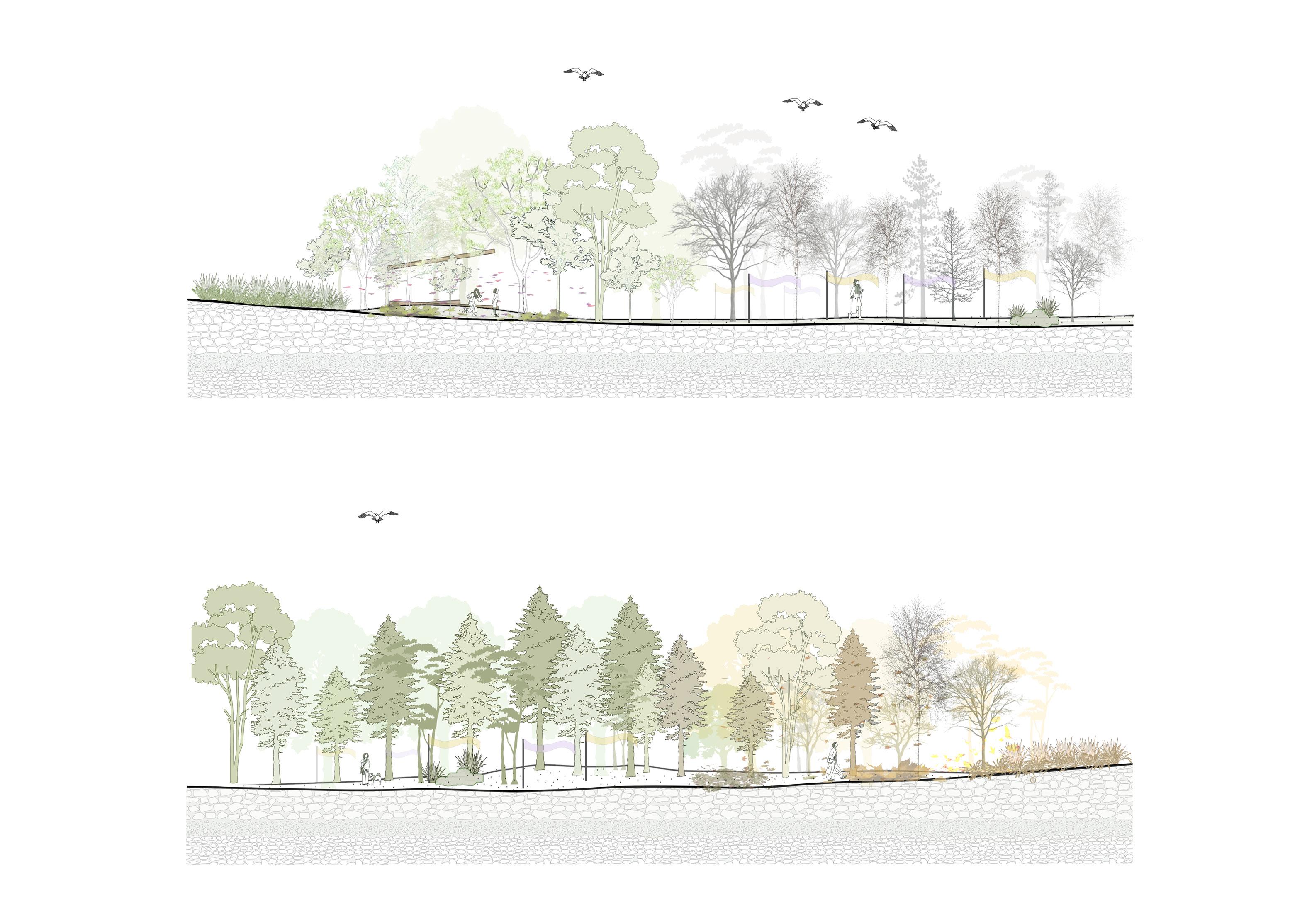

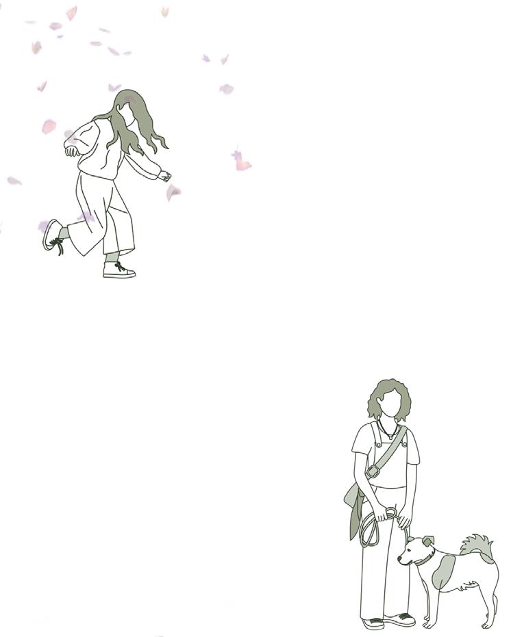
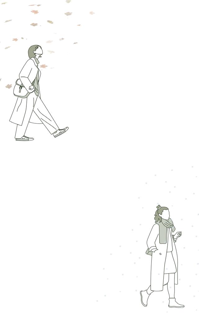
Experience In Different Seasons
“A light breeze moves through the shade—cool, calm, and perfect for a relaxed walk with my dog.”
“The petals are dancing with the wind! I want to chase them— everything feels light and full of movement.”
“The landscape feels gray and quiet, and the ribbons clearly reveal the shape of the wind, becoming a vivid presence.”
“Every step comes with rustling leaves. The wind feels sharper, and the sounds from the trees and grasses are clearer now.”
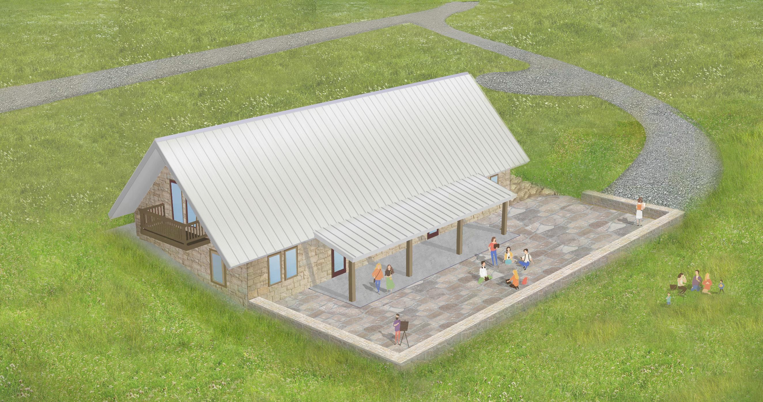
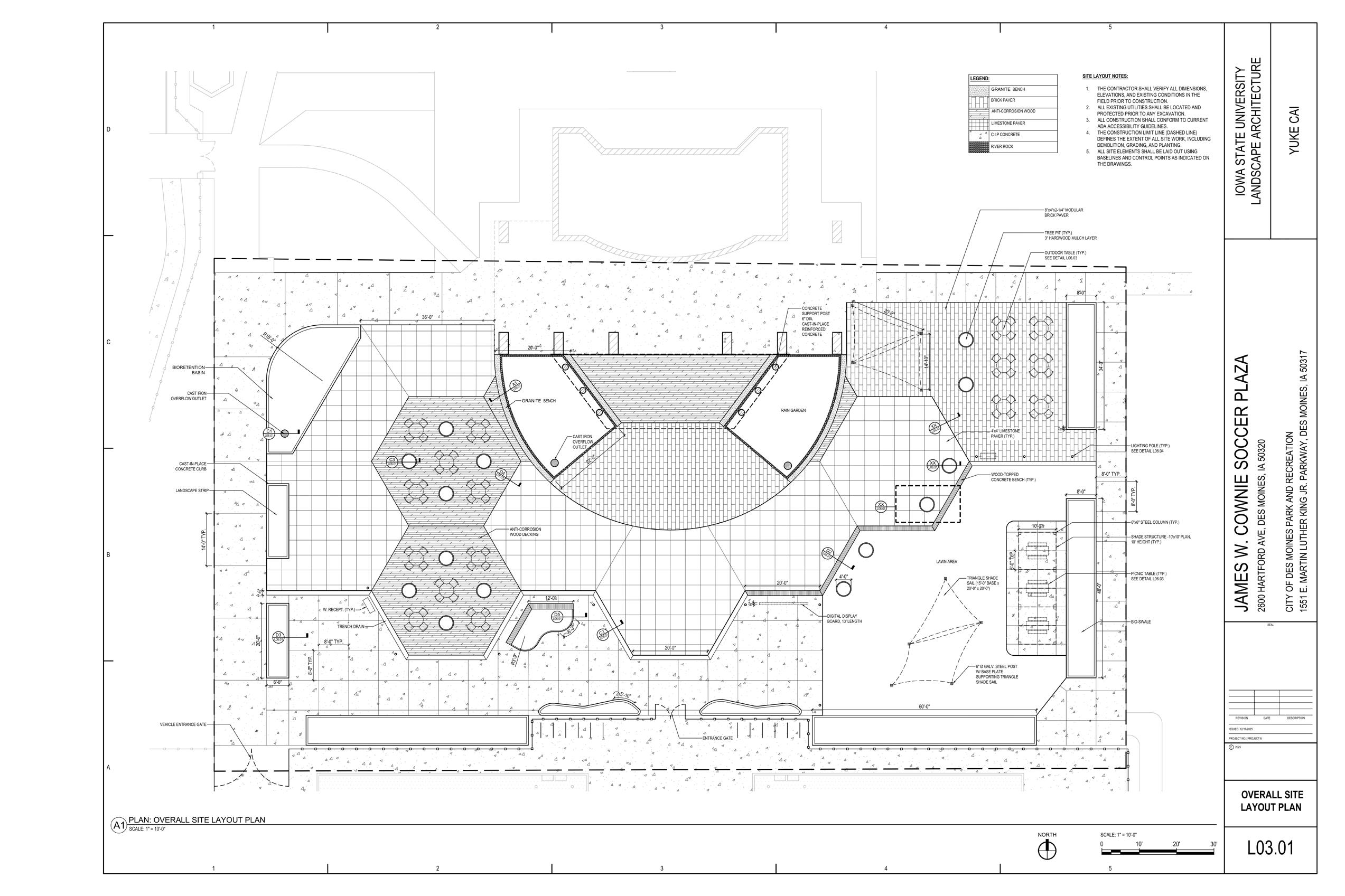
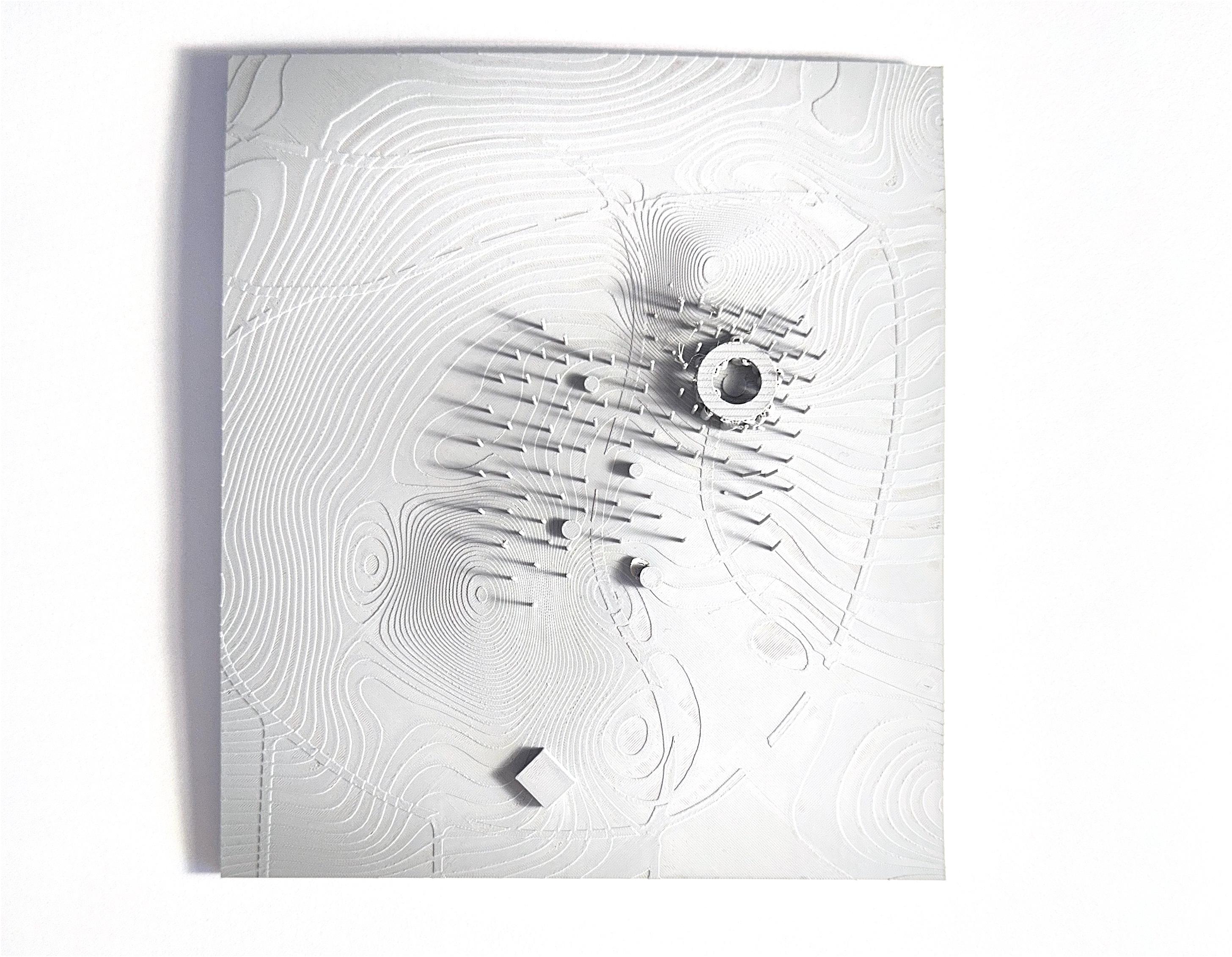
This physical model translates topography, wind-responsive elements, and key program nodes into three dimensions


BROOKLYN PARK
Brooklyn Park, MN, United State
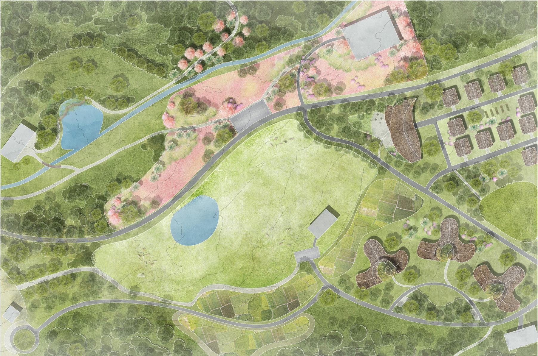
This project originates from an analysis of a fragmented transit landscape in Brooklyn Park, Minnesota, where a proposed light rail extension runs through expansive parking lots, disconnected developments, and an underutilized park corridor. Although transit infrastructure is present, the area lacks spatial continuity, ecological performance, and equitable access to public space. These conditions prompted an exploration of how transit-oriented development can become a driver of ecological regeneration and spatial justice.
Building on precedents of successful TOD projects and informed by GIS analysis of local topography, hydrology, land use, and accessibility, the design seeks to reconnect isolated neighborhoods, restore wetland systems, and restructure development intensity around the transit hub. A continuous green corridor links the station, mixed-use districts, and surrounding communities, transforming residual land and stormwater infrastructure into productive public landscapes.
By integrating transit accessibility with green infrastructure and mixed-use development, the project redefines TOD as a regenerative urban framework. Wetlands, park systems, and walkable public spaces are interwoven with housing and services, creating an environment in which ecological processes and everyday social life reinforce one another.
Professor: Austin Dunn, Heidi Hohmann Iowa State University Fall 2024
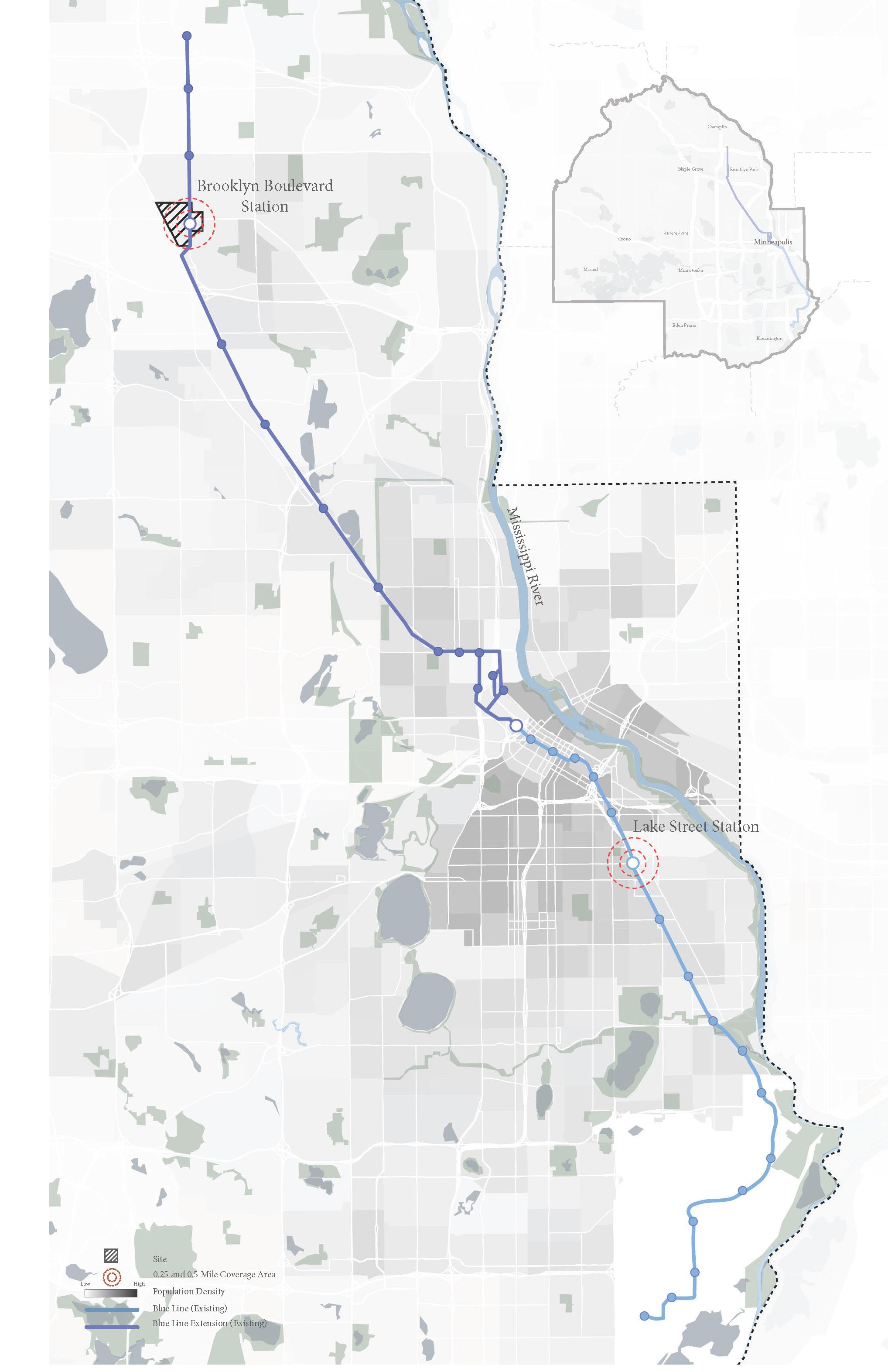
The Blue Line in Minneapolis demonstrates the potential of transit-oriented development (TOD). While Lake Street Station supports a compact, walkable, and green urban center, the Brooklyn Boulevard Station along the extension remains dominated by parking, fragmented development, and poor pedestrian conditions. This contrast reveals the opportunity to transform underutilized land into a connected, resilient, and green TOD node.

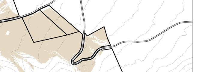
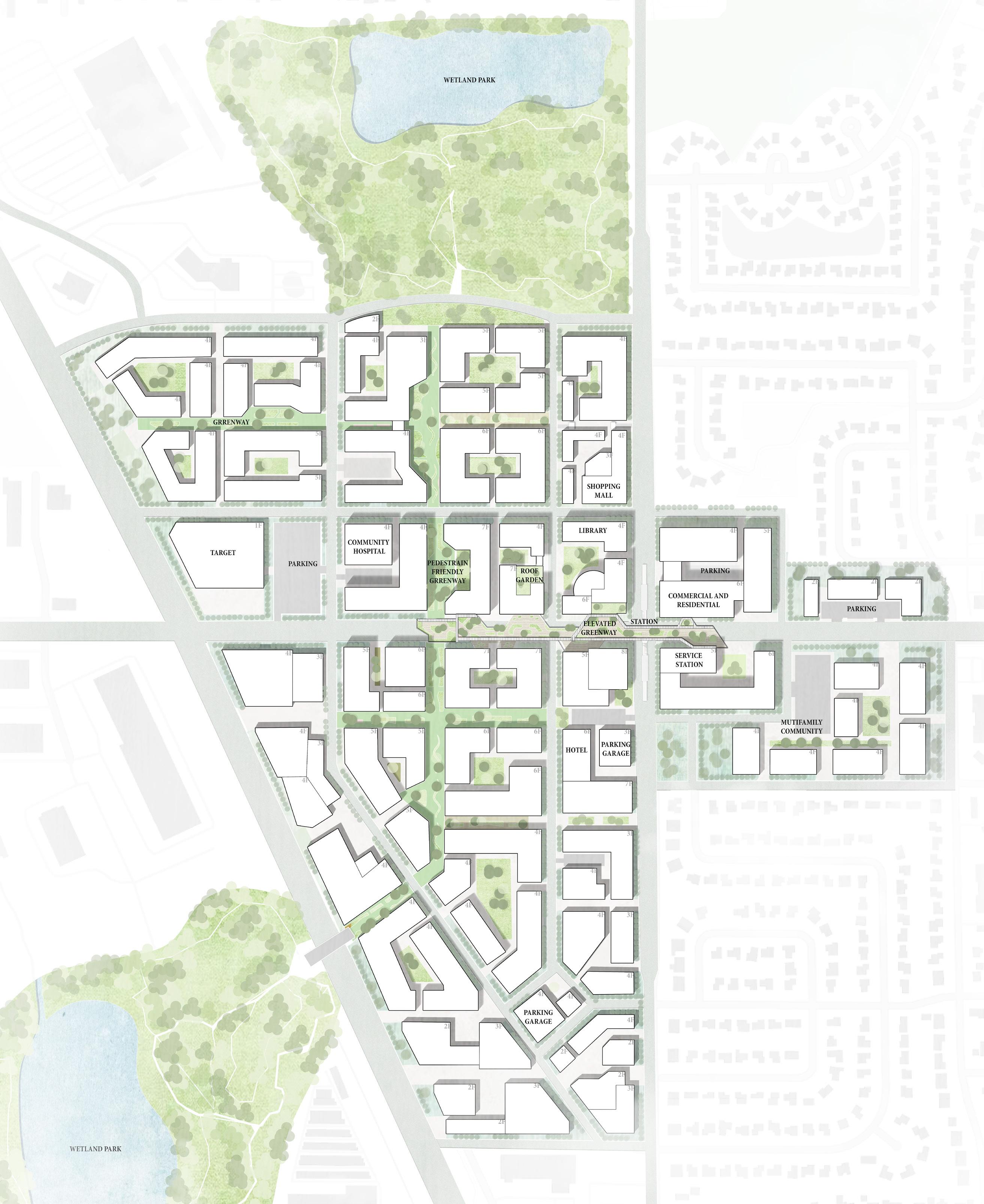
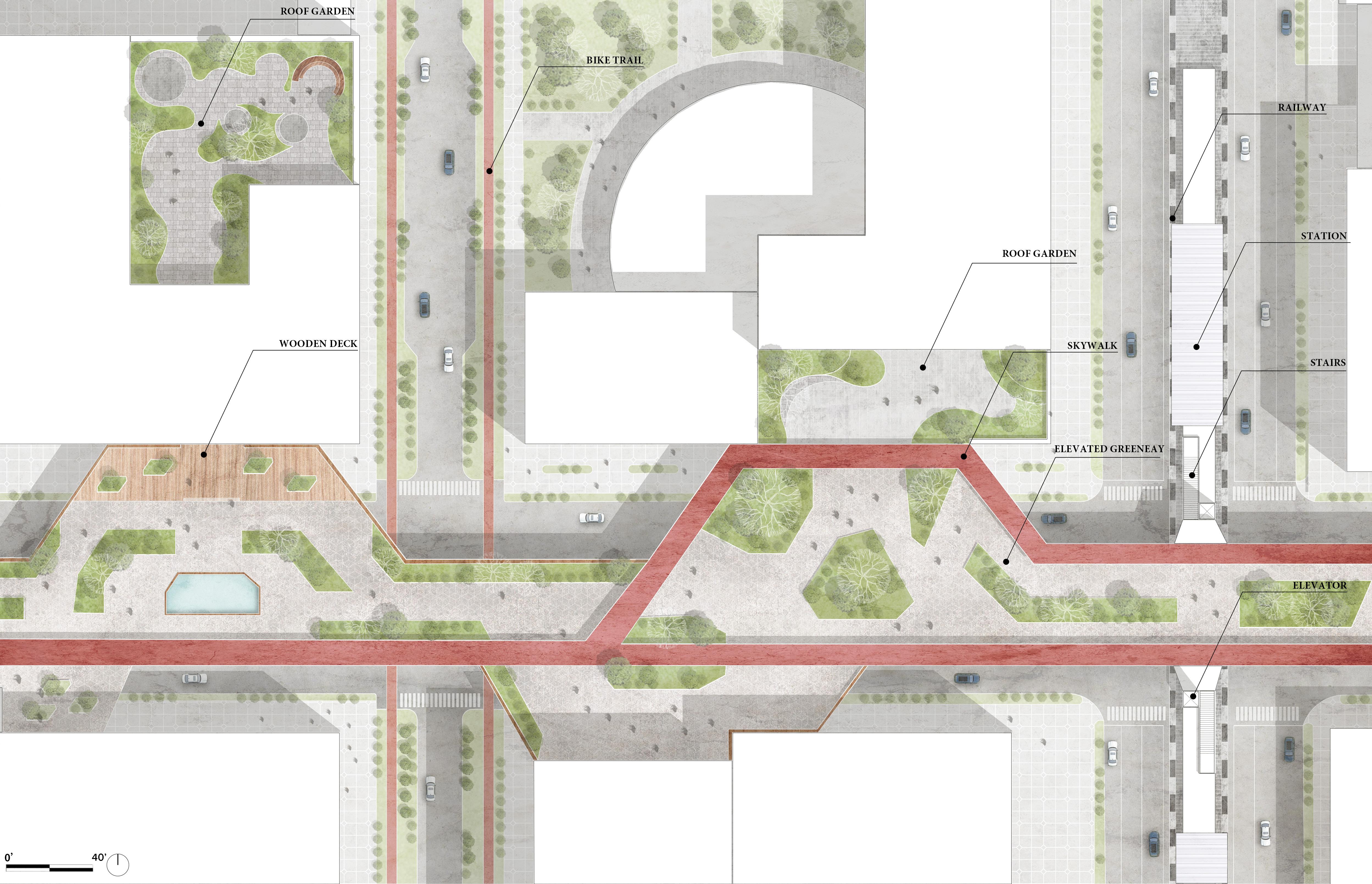
Based on site analysis, the project transforms underutilized floodplain areas into wetlands and connects them through a pedestrian greenway, forming a continuous corridor that links the transit station with surrounding neighborhoods. By replacing surface parking with compact mixed-use and residential development, the design integrates green infrastructure with urban density to create a connected, walkable, and resilient TOD framework.
Based on the previous site analysis, the area lacks coherent planning and su cient green space. Two undeveloped oodplain areas are transformed into wetland parks that manage stormwater while introducing much-needed green space to the urban fabric. e design begins by connecting these wetlands through a pedestrian-friendly parkway, forming a continuous green corridor. An elevated greenway links the system to the transit station and the existing neighborhood park, creating a safe and walkable network that encourages active mobility.
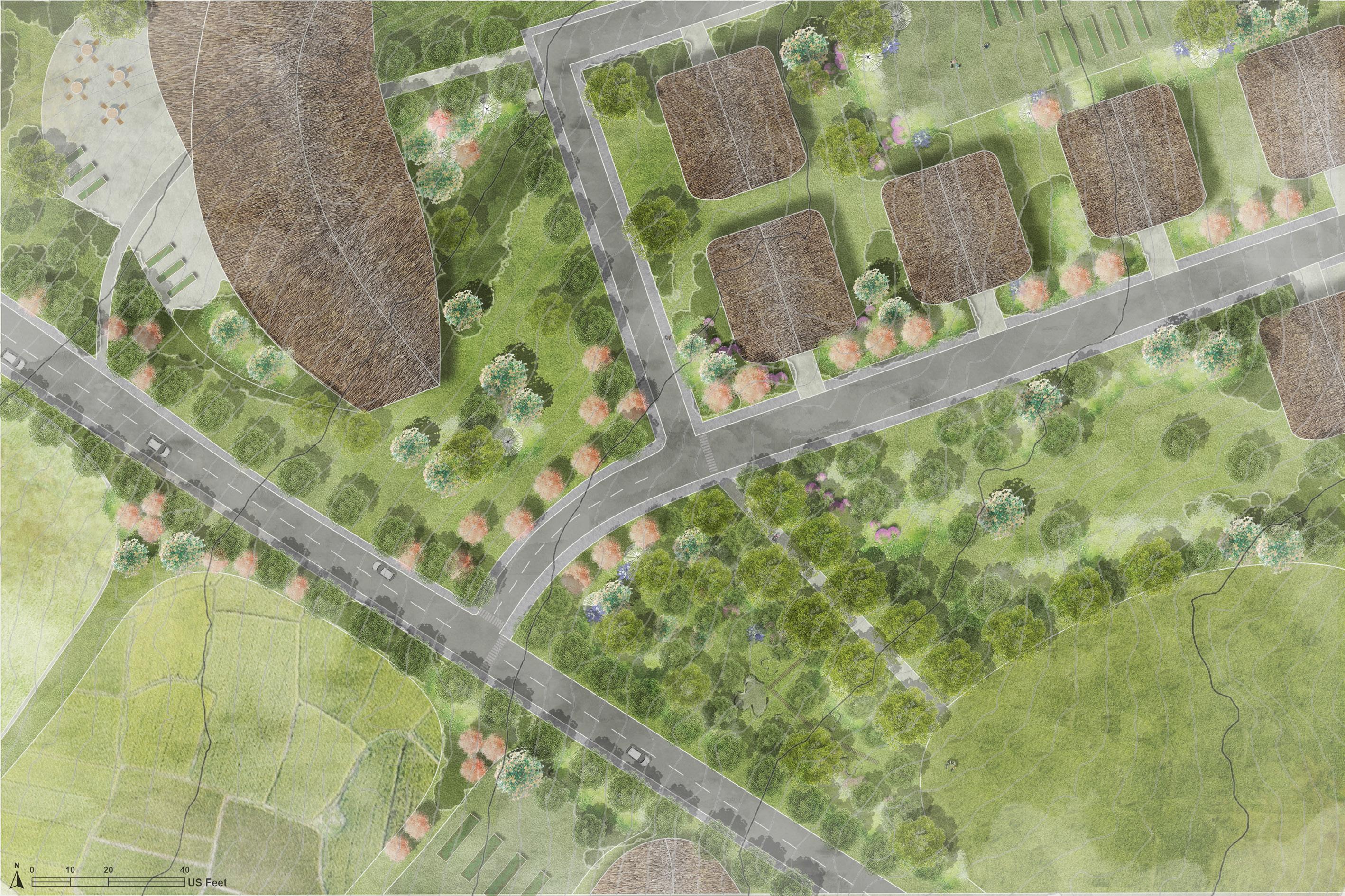
At the urban scale, the redesign reorganizes land use by replacing large surface parking lots with compact mixed-use and residential blocks. is new structure integrates ecological infrastructure with urban density, establishing a connected and resilient TOD community.


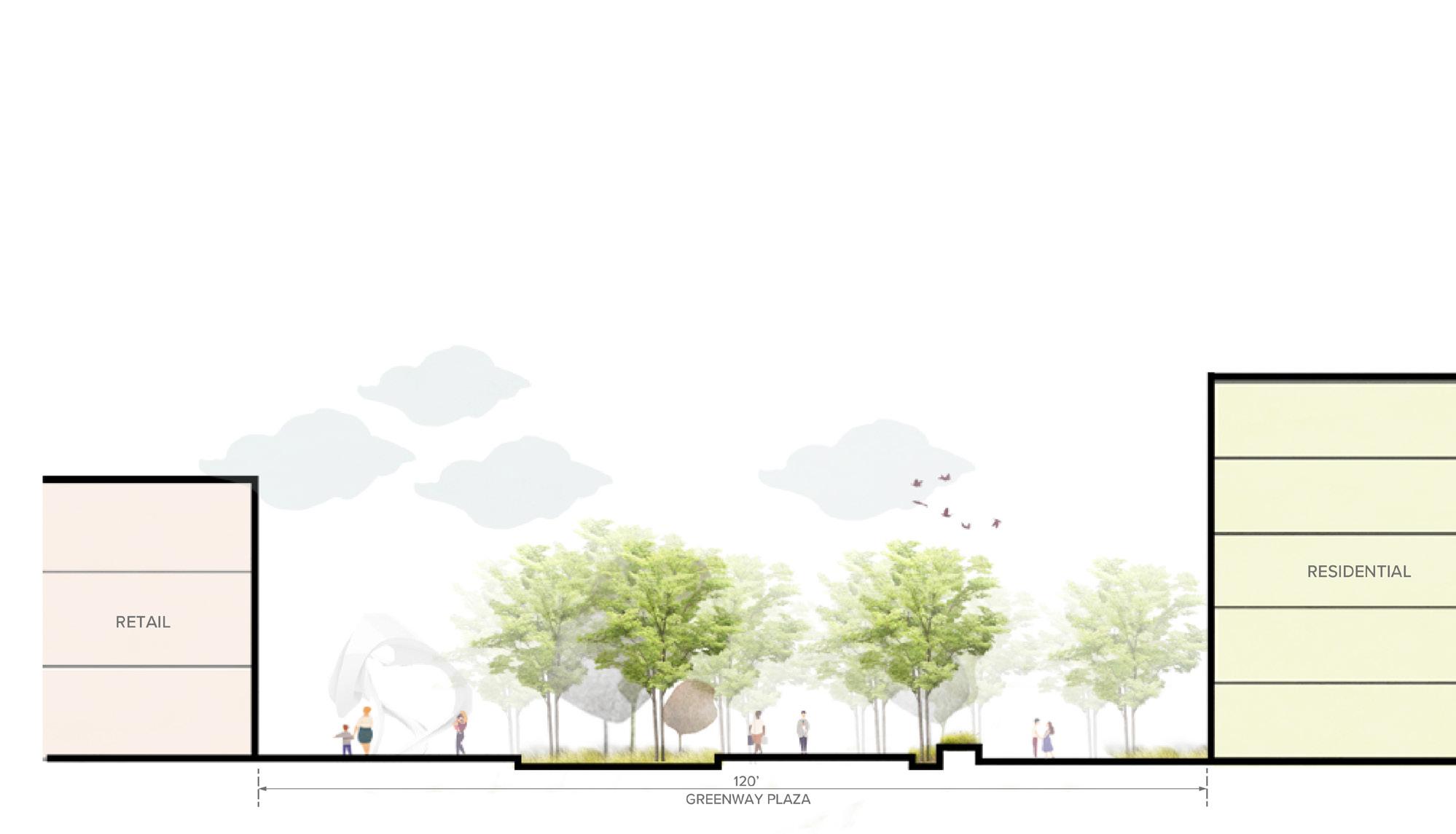
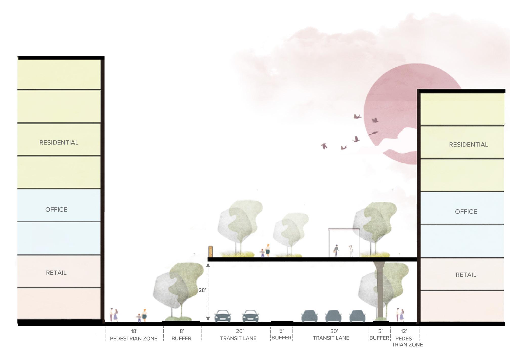
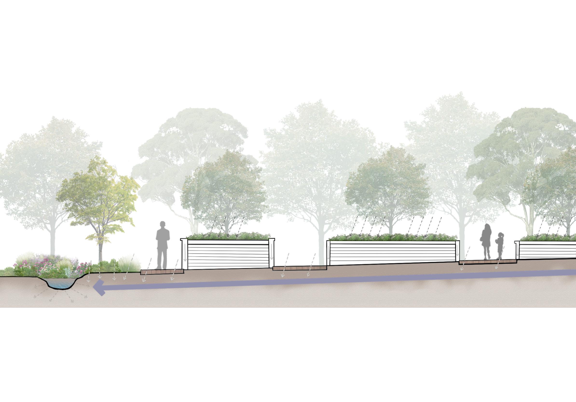
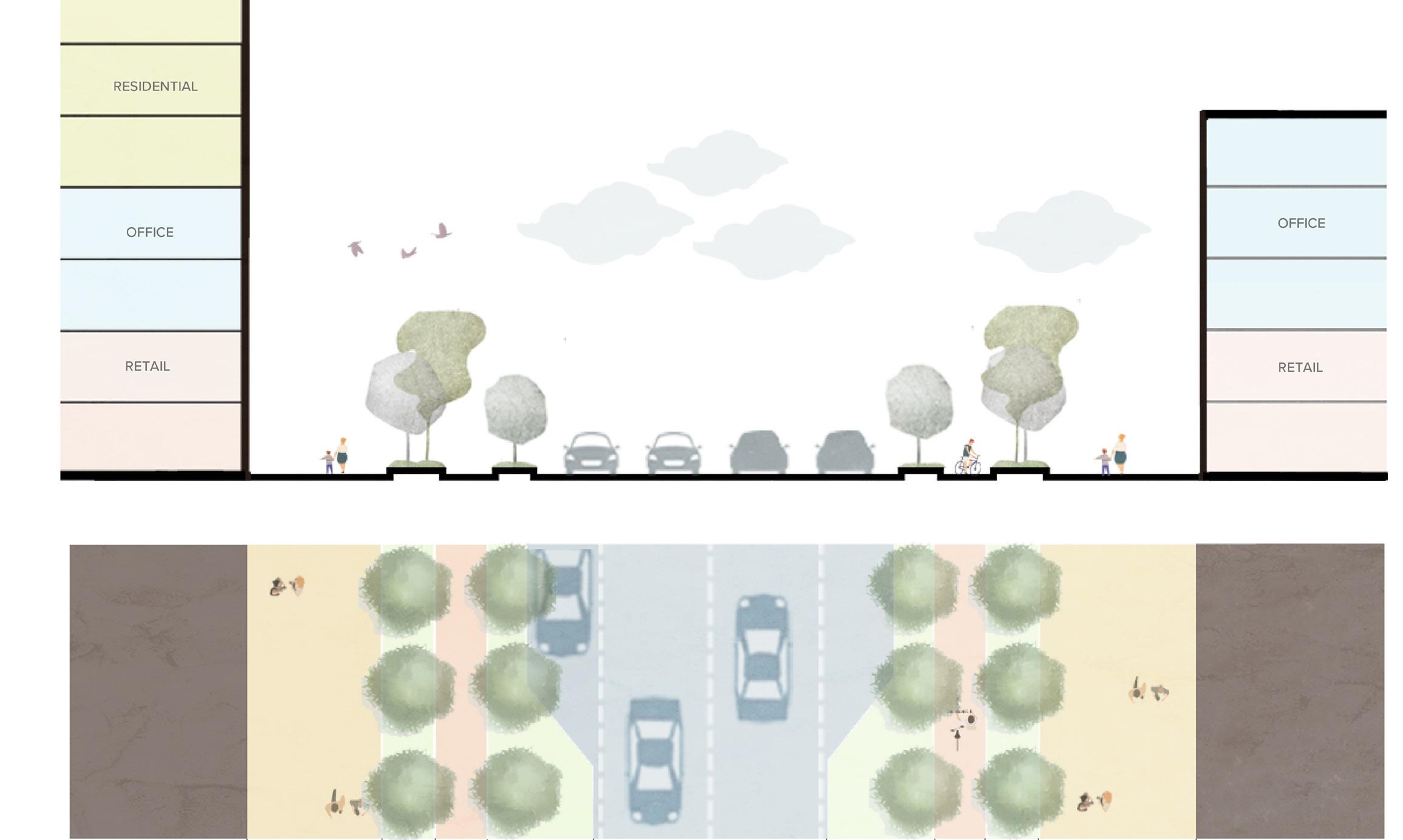
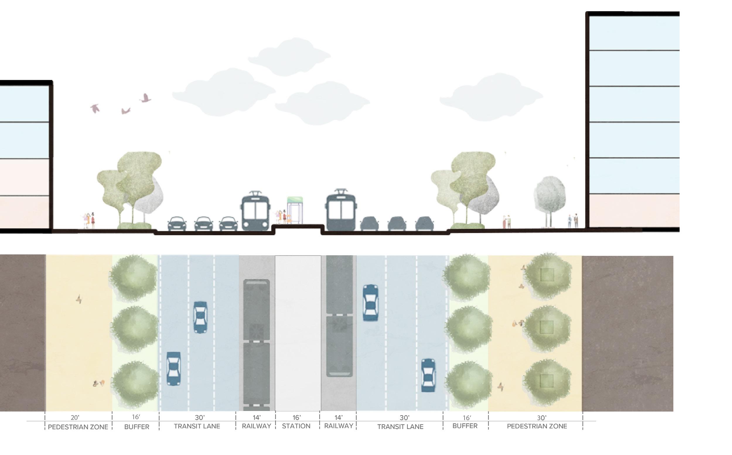
Transit-Oriented Street Section
These sections illustrate the spatial relationship between mixed-use buildings, pedestrian zones, and transit infrastructure, showing how street width, tree buffers, and program distribution create a walkable, transit-focused corridor that balances movement, safety, and public space within the TOD framework.
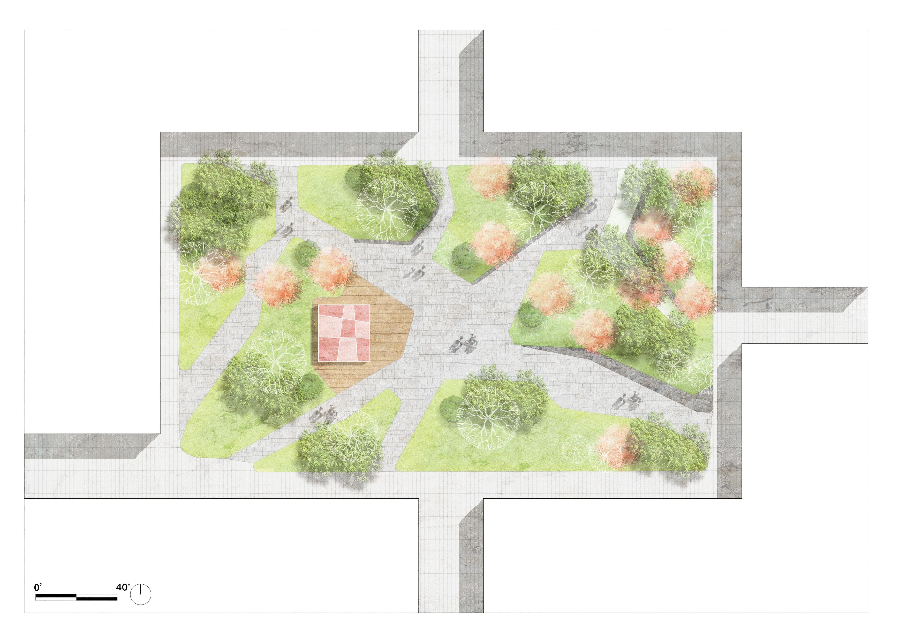
This courtyard functions as a semi-private green heart within the mixed-use block, organizing circulation and providing a sheltered outdoor space for daily activities.
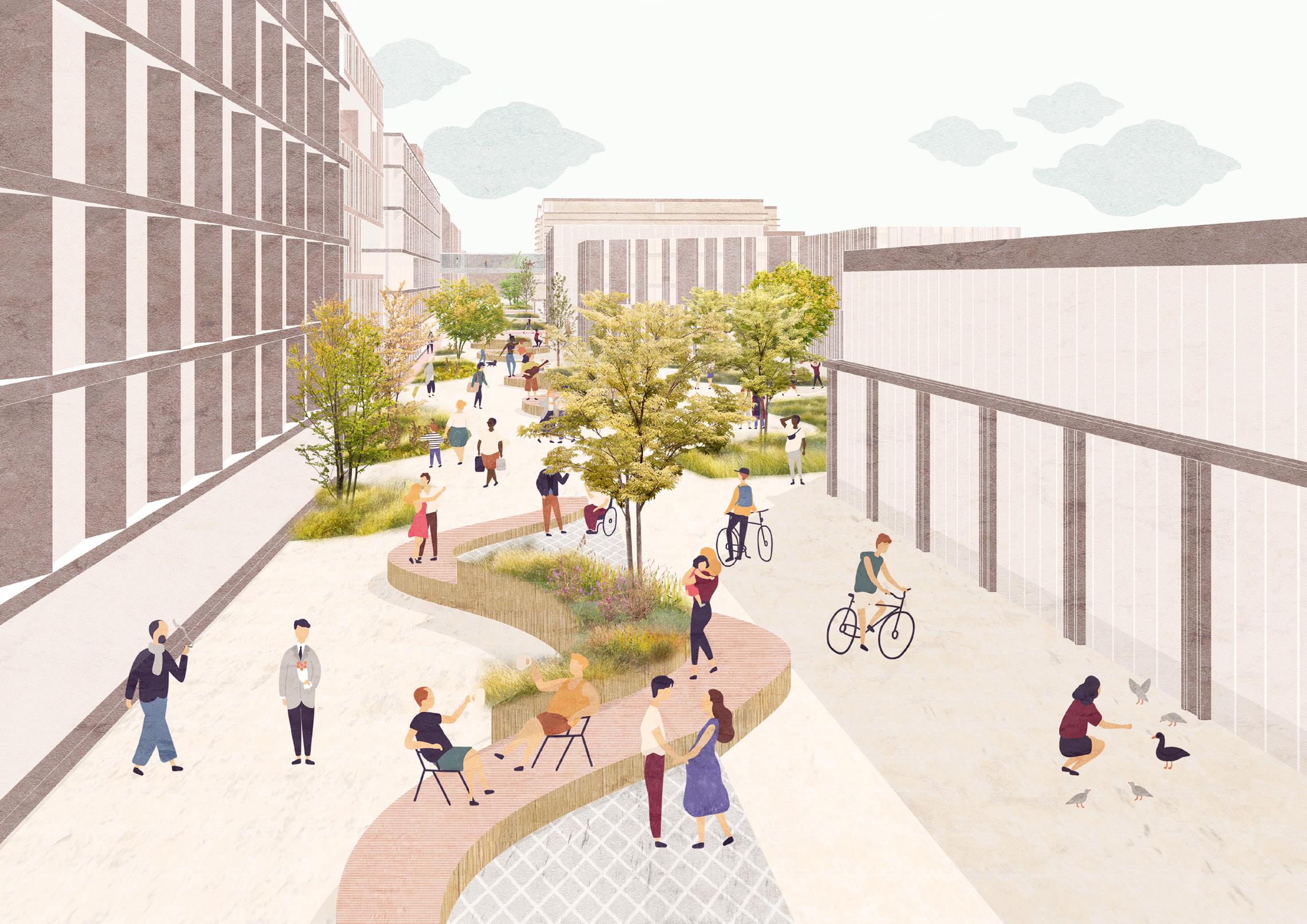
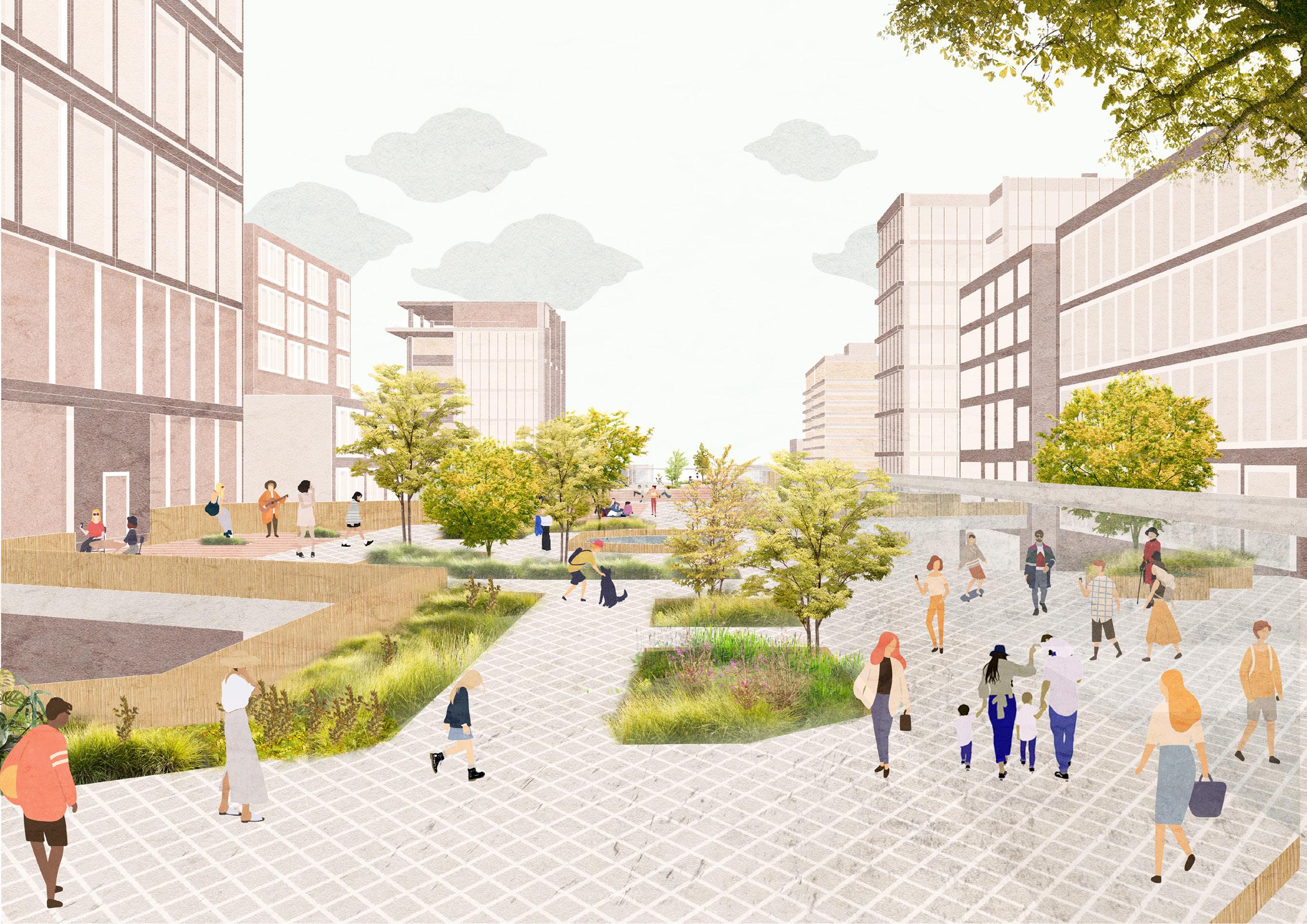
These perspectives illustrate everyday life within the TOD, highlighting the elevated greenway and pedestrianoriented streets as connected public spaces that support walking, cycling, and social activity within a green, mixed-use urban environment.
Perspective 1
This perspective shows a pedestrianfriendly street with shaded walkways, seating, and active public space.
Perspective 2
This perspective shows the elevated greenway as a central pedestrian corridor linking mixed-use buildings with layered planting and public space.