
Sydney
2 0 2 5

Sydney Design-Research Studio 2025
This Page is Intentionally blank
1. SYDNEY STUDIO
2. SITE OVERVIEW
Site 1: MELROSE PARK
01. SITE ANALYSIS AND VISION
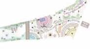
02. MASTERPLAN AND FRAMEWORK
03. HOUSING GUIDELINES
04. ROAD GUIDELINES
05. OPEN SPACE GUIDELINES
06. FOCUS AREA
Site 2: CONCORD WEST STATION
01. BACKGROUND
02. VISION AND PRINCIPLES
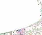
03. MASTERPLAN AND FRAMEWORK
04. DESIGN GUIDELINES
05. DETAIL DESIGN
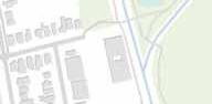
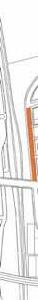
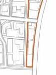
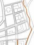
Site 3: CARTER STREET
01. VISION
02. SITE ANALYSIS
03. CASE STUDY
04. MASTERPLAN FRAMEWORK
05. GUIDELINES
06. FOCUS AREA DESIGN GUIDELINES

1 SYDNEY STUDIO
1. About Sydney Studio
2. 2025 Studio Theme
2 SITE OVERVIEW
1. Studio Site Overview
3 DESIGN SITES
1. Overview
4 SITE VISIT
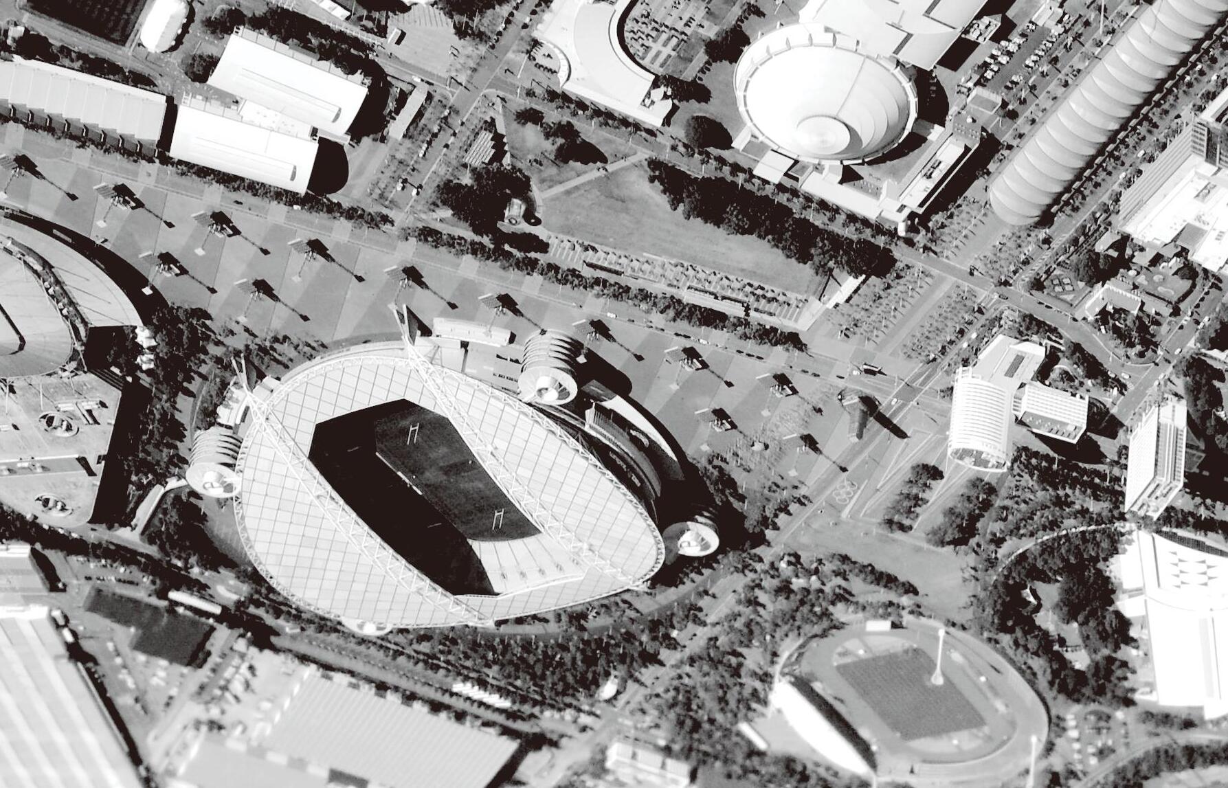
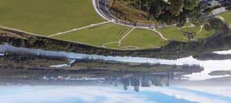
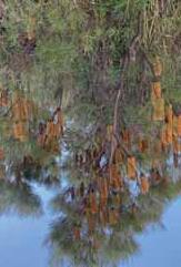
1. Sydney Olympic Park

This studio aims to equip students with practical and theoretical skills in urban design through a research-informed, project-based learning process. They were expected to reflect in their design process at three different scales:
• Large (metropolitan) urban scale (XL)
• Intermediate (precinct) urban scale (L)
• Building (development) scale (M&S)
The workshop built upon the research-led design vision which informed students of the planning and design process. It encouraged students to identify vision and strategies at the local and global scale. Students will then turn these aspirations to detailed design solutions, accompanied by an intelligent approach to design development, ensuring the site and its projects are able to contribute to and integrate with the city. The workshop began with the site analysis and SWOT Analysis, which were integrated with the review and analysis of Case Studies. The activity then concentrated on the development of a general masterplan and the conceptual architecture design.
By the end of the course, students will produce a comprehensive Urban Design Project Booklet that includes:
• A vision statement
• Precedent and case studies
• Urban design frameworks and proposals
• Design guidelines and architectural focus studies
Class Schedule (Tuesday Evenings @ 7:30 PM)
May 6: Site Analysis (Regional + Urban + Site scale), SWOT
May 1: Vision Development / Precedent Study / Scale Comparison Draft 1
May 27: Vision Refinement / Scale Comparison Draft 2
June 3: Vision & Site Analysis Presentation
June 10: Framework Concepts (Minimum 3 alternatives)
June 24: Framework Development + Massing Concepts
July 1: Mid-Term Framework Presentation
July 8: Focus Area Architecture Design
July 15: Architectural Design Presentation
July 22: Final Review: Presentation Panels & Booklets
Sydney Field Trip Schedule (July 30 – August 5 @Research Field)
July 30 (Wed): Visit UNSW / Sydney Walking Tour
July 31 (Thu) AM: Olympic Park Site Visit
July 31 (Thu) PM: Case Study Visit + Interview #1
Aug 1 (Fri) AM: Case Study Visit + Interview #2
Aug 1 (Fri) PM: Case Study Visit + Interview #3
Aug 2–3 (Sat–Sun): Independent Research + Proposal Development
Aug 4 (Mon): Final Presentation at UNSW
Aug 5 (Tue): Free Time
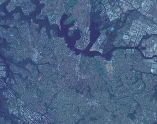
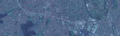
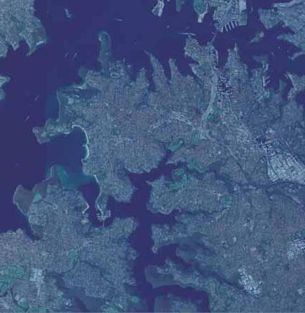
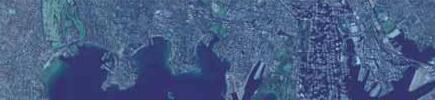
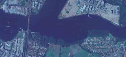
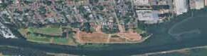
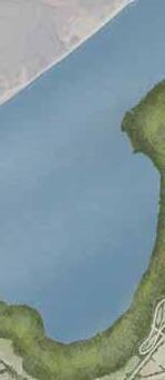
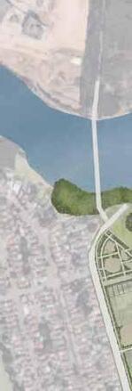
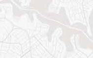
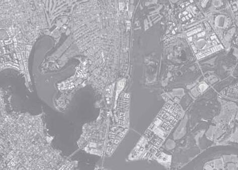
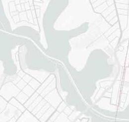
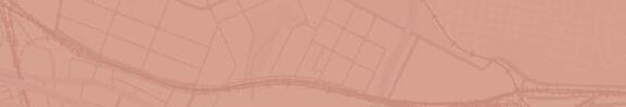
The Parramatta River is a vital waterway connecting central and western Sydney. Urbanistically, it serves as a key east-west link for Sydney and forms the core of the “Central River City” concept. It also acts as the foundation for waterfront developments, enhancing the city’s appeal.
Functionally, it supports public transport as a major ferry route between central Sydney and Parramatta, and is utilized for recreation and tourism. Furthermore, it’s a natural environment supporting the surrounding ecosystem and contributes to the area’s historical and cultural landscape.


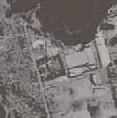
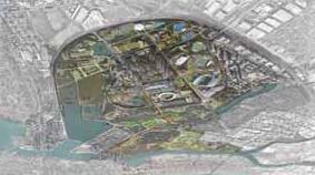
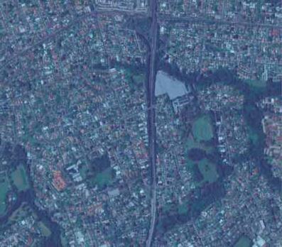
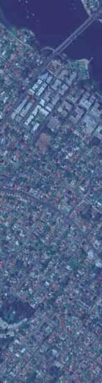
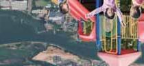
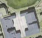
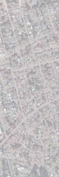
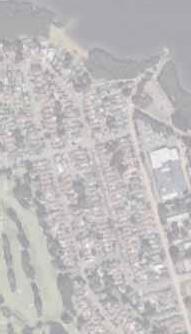
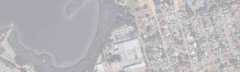
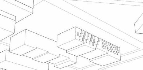
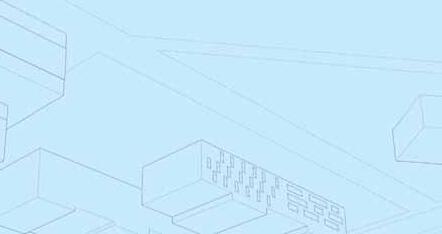
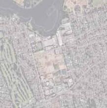
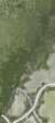
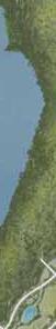
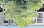
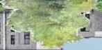
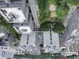
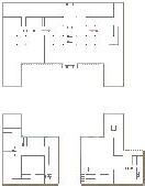
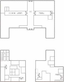
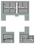
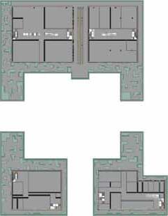
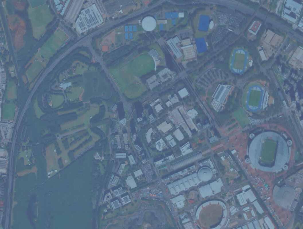
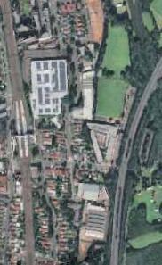
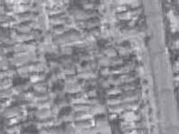
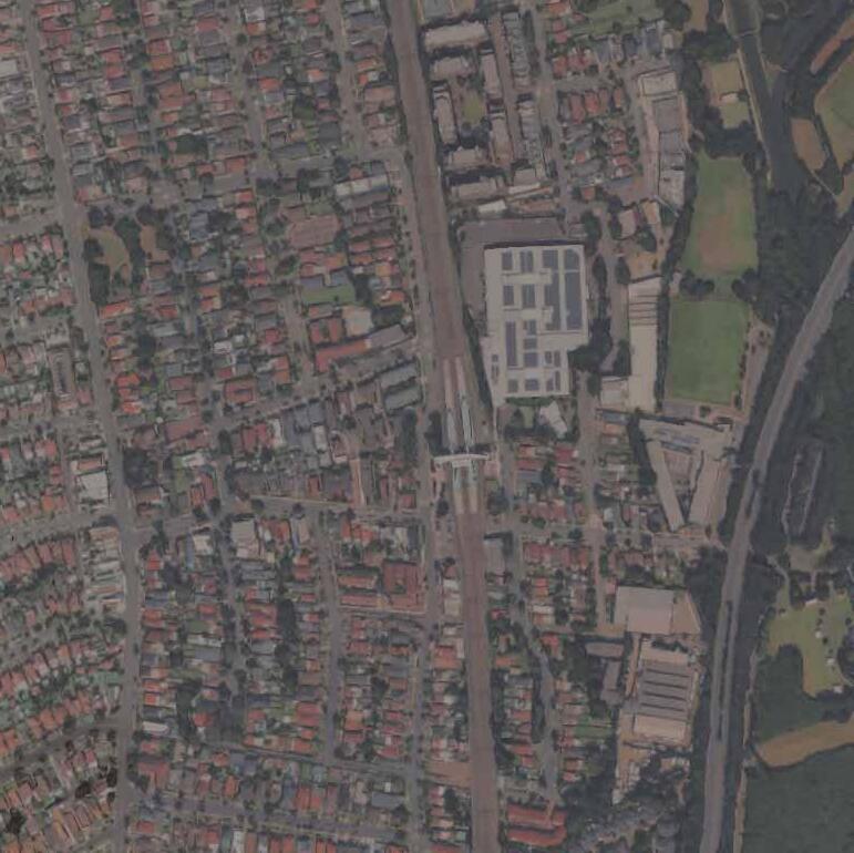
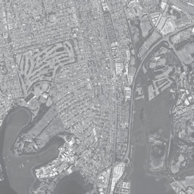
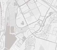
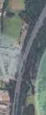
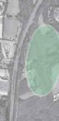
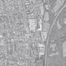
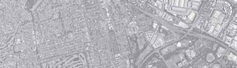
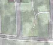
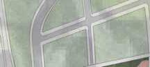
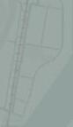
1. Sydney Olympic Park
Location of Sydney Olympic ParkField Survey by each group
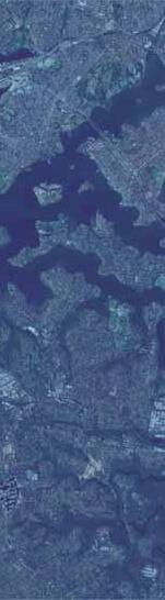
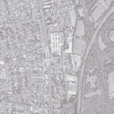
Sydney Olympic Park is located approximately 14 km west of the Sydney city center, along the Parramatta River. It is a site that underwent large-scale regeneration from a former industrial waste treatment plant and was developed as the main venue for the 2000 Sydney Olympic and Paralympic Games.
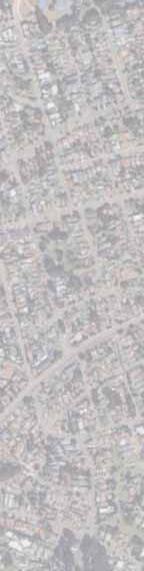
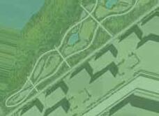
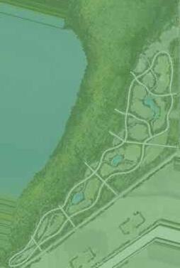
River Network
Sydney Olympic Park is located approximately 14 km west of the Sydney city center, along the Parramatta River. It is a site that underwent large-scale regeneration from a former industrial waste treatment plant and was developed as the main venue for the 2000 Sydney Olympic and Paralympic Games.

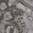
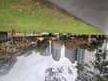
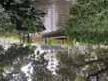
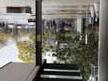
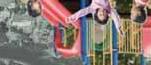
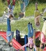
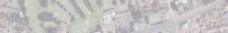
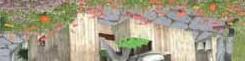
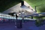
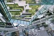
During the site visit to Sydney Olympic Park, each group conducted a site visit based on the points to observe in accordance with the content and concepts proposed for their own sites. It was a weekday afternoon and it was raining, so there were few people around.
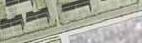
• Melrose Park Group
Pic 1-1) A large street facing the stadium and various public facilities. The sidewalks seem too wide.
Pic 1-2) The park is spacious and easily accessible from the surrounding area.
Pic 1-3) A garden with rich vegetation and a calm space located in a residential area
• Concord West Group
Pic 2-1) There are many businesspeople around the station, mainly in the arcade area.
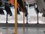
Pic 2-2) The training equipment in the park is shared and can be used by anyone.
Pic 2-3) Lots of chairs and tables in an open space.
• Carter Street Group
Pic 3-1) The public swimming pool is used by many people.
Pic 3-2) Even on rainy days, the stadium was used for events and other purposes.
Pic 3-3) The road leading from the front of the main stadium to the redevelopment area.

This Page is Intentionally blank


01-1. Site Visit
01-2. Site Analysis
01-3. Vision
01-4. Principle
01-5. SWOT Analysis
02-1. Master Plan
02-2. Framework
03-1. Zoning Strategy for Housing
03-2. Building Guidelines
04-1. Road Guidelines
05-1. Open Space Guidelines
05-2. Garden Guidelines
05-3. Landscape Palette
06-1. Focus Area Concept
06-2. Focus Area Design
06-3. Perspective Images
This Page is Intentionally blank

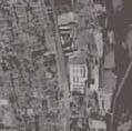
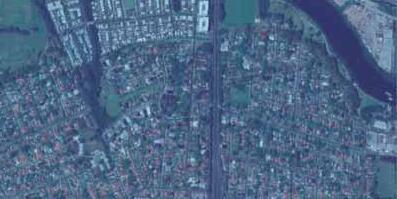
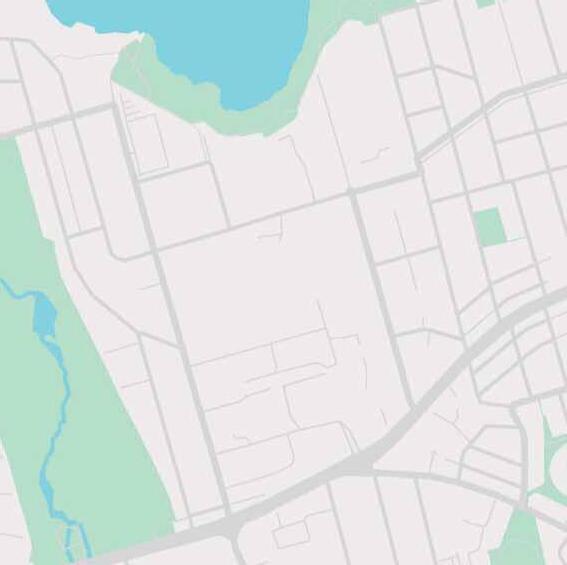
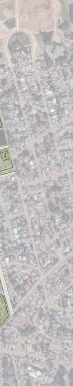
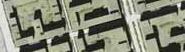
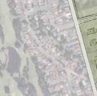
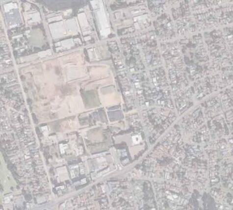
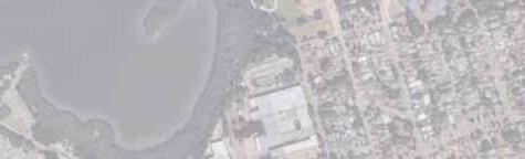
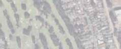
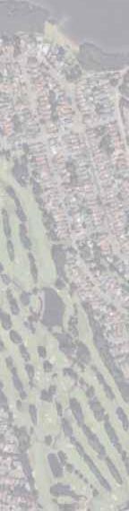
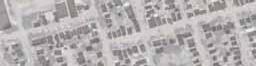
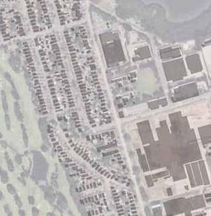
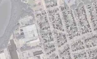
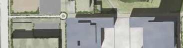
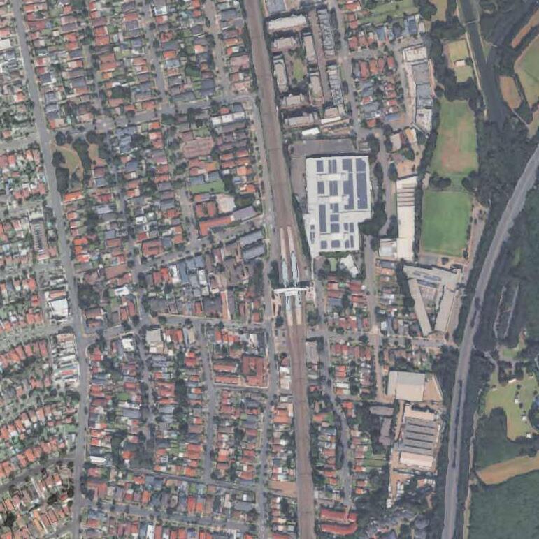
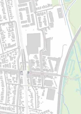
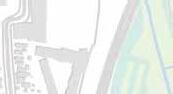
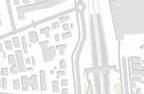
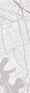
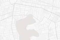
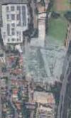
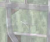
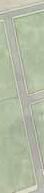
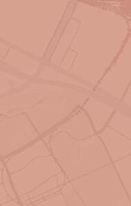
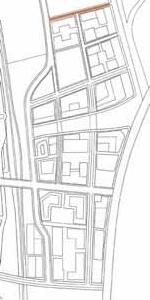
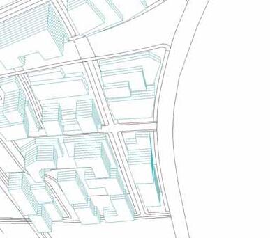
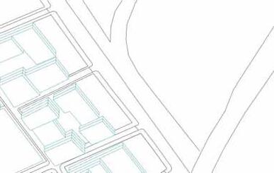
Melrose Park is located about 12km north-west of Sydney CBD and 7km east of Parramatta. The area was formerly an industrial zone with large warehouse and pharmaceutical facilities. It is included in the route of Parramatta Light Rail Stage 2, which will connect Parramatta to Sydney Olympic Park via Melrose Park. Construction is expected to begin in 2025, with operations starting around 2032.
Site Route
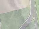
1:SEKISUIHOUSE DEVELOPMENT
2:Melrose Park Public School
3:ERMINGTON BOAT RAMP
4:ARCHER PARKConsiderations
Considerations
The area around Melrose Park is dominated by lowrise residential areas and lacks diversity in urban functions. In future LRT development, it is essential to introduce not only residential facilities but also civic and commercial facilities. Additionally, the connection to mangrove forests and rivers is not readily apparent, and despite being adjacent to natural environments, the area does not fully utilize their appeal. In future development, it is important to preserve existing natural environments while creating spaces where people can feel a connection to nature and greenery in their daily lives, thereby enhancing the overall value of the area.
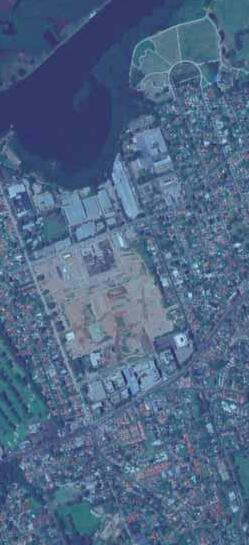
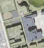
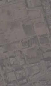
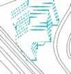
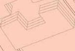
The 30-hectare redevelopment project will transform the former industrial area into a high-density, green mixed-use town, with plans to build 5,500 to 6,000 residential units. At present, only the northern section has been completed, and no residents have moved in yet. The central development area showed overall terrain variations.
The site has parking, basic facilities, and river access. It will connect to Parramatta Light Rail Phase 2, improving transport to the opposite bank. From April 2025, weekday use will be restricted for about three years due to construction, but weekends remain open. On my visit, rainy weather kept users away, and it felt a bit far from the planned site.
Melrose Park Public School, founded in 1945, is a small community school that values literacy, numeracy, and diversity. Due to large-scale development and rising student numbers, it is being redeveloped to expand capacity from 170 to over 700 students, with a new high school set to open nearby in 2027.
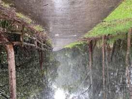
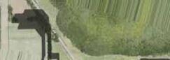
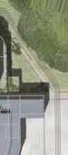
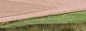
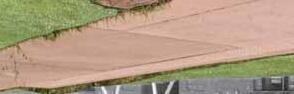
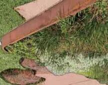
Archer Park is a riverside park with a walking trail that winds through a mangrove forest. It offers opportunities to enjoy nature, and in the future, the Parramatta Light Rail Stage 2 will run alongside the park. When I visited on a rainy day, there were no people around, and the river water was murky, which made me question its appeal as a relaxing spot. Although a walking trail exists, it did not feel like a particularly comfortable space to walk in.
Public Transport Access
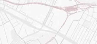
The area is served by an extensive bus network that provides access to a variety of destinations. However, a drawback is the limited service frequency. Accessing rail or ferry transport currently requires a 30-minute walk. A light rail line is planned within the precinct, which will enhance connectivity to Sydney Olympic Park, Parramatta CBD, and the Sydney CBD.
513 : Carlingford to West Ryde via Dundas Valley(2/h) 520&M52 : (8/h)
544 : Macquarie Centre to Auburn via Eastwood 2/h 524 :Ryde & West Ryde to Parramatta via Melrose Park 2/h
Traffic Conditions and Car Dependency
Melrose fronts Victoria Road, and the surrounding arterial roads carry high traffic volumes. Another characteristic of the area, as well as of the wider NSW region, is a high rate of car dependency.
On the other hand, in areas such as West Ryde and Melrose Park, where railway stations are relatively nearby, it can be seen that although commuting and schooling by car still account for a large share, there is also a certain proportion of people who use the train.

Arterial Road
Sub Arterial Road
Collector Road
2000~3000cars/h
1000~2000cars/h
500~1000cars/h
Surrounding Environment of Melrose Park
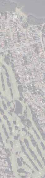
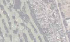
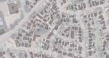
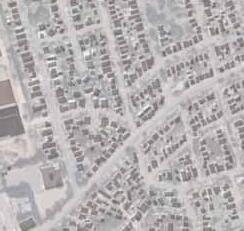
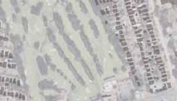
In the Melrose Park area, there are a few small retail outlets, but large-scale shopping facilities are reliant on centres in Parramatta and Ryde. The surrounding land use is predominantly detached housing and low-rise apartment buildings. A mix of natural environments—such as the Parramatta River and nearby national parks—and urban amenities supports an active lifestyle for families and other residents. With golf courses and parks close by, outdoor activities are easily accessible.
Surrounding Environment of Melrose Park
The statistical data clearly indicate that the surrounding areas, including Melrose Park, West Ryde, and Ermington, have a relatively high proportion of family households with children. Compared to the broader NSW average, these neighborhoods show a stronger presence of young families, which suggests that the community is shaped by a family-oriented lifestyle and services that support children and parents alike. This demographic characteristic contributes to a vibrant residential environment with a focus on family needs and child-friendly amenities.
The surrounding area includes George Kendall Riverside Park, which offers a wide range of facilities such as playgrounds, sports fields, walking and cycling paths, barbecue areas, and a dog park. In addition, mangrove forests and nature reserves contribute to an environment rich in open space and natural landscapes.
A Flexible and Lively neighborhood for those who want a new place of settlement that has full Accessibility, Child-rearing friendly environment, and opportunities to experience rich nature


In addition to green slow-mobility options such as bicycles and e-boards, the introduction of autonomous vehicle routes will enhance internal accessibility, while walkable connections will create an environment that allows seamless movement throughout the area.
The network of through-traffic routes overlaps with the network of gardens, creating numerous intersections and nodes within the area. By designing these points safely and with unique character, an intuitive connection between gardens and streets can be achieved.
A variety of housing types will be provided to enable people to live in and remain part of the community. Residential development will be arranged at higher densities to improve cost efficiency.
Integrating and Dispersion of Servises
Essential urban functions are consolidated at key transport hubs to ensure ease of access for a wide range of people, while leisure and ancillary urban functions are dispersed throughout the area to encourage circulation and movement within the community.
Complex Streetscapes
Through building setbacks and the installation of distinctive street furniture, a varied and memorable streetscape is created, fostering a strong sense of place for residents.
varying planting features for each area and movement corridor, the network of gardens is clarified while responding to adjacent needs and enhancing overall environmental performance.
Strength
The diversity of public transport modes
The area is served by an extensive bus network, and with nearby railway and ferry services, it offers a wide range of public transport options.
A rich natural environment
The waterfront along the Parramatta River features valuable mangrove forests and designated conservation areas.
Weakness
Underutilization of Public Transport Resources
Despite the variety of available public transport options, actual usage remains low due to factors such as limited bus service frequency and the considerable distance to surrounding public transport nodes.
Single Land Use
Although there is a high proportion of family households, land use has become overly single-purpose, resulting in a shortage of nearby childcare facilities, hospitals, and commercial services.
Oppportunity
Public Transport Growth
Momentum is building for LRT and river transport, creating chances to improve connectivity.
Support for Affordable Childcare
Government support is increasing while waiting lists grow, opening space for new childcare serv
River Environment and Citizen Action
River improvements and active protected-area groups offer opportunities for eco-projects and community ties.
Threat
High Car Dependence
Strong reliance on private vehicles remains, posing challenges for shifting toward sustainable transport options.
LRT Congestion and Hub Overload
Future LRT use may lead to overcrowding and excessive concentration around key stations, requiring careful planning and management.
This Page is Intentionally blank
Melrose Park is located along the river between Sydney CBD and Parramatta CBD, and is seizing the opportunity to undergo redevelopment in conjunction with the regeneration of the adjacent Olympic Park. The redevelopment of this vast former industrial site is set to become a pioneering model for Sydney’s next-generation urban development. The area around Olympic Park is currently in a transitional phase and is expected to undergo significant transformation within Sydney. Melrose Park is taking advantage of this opportunity to provide an affordable and comfortable living environment where people seeking a new place to settle can continue to live sustainably throughout their lives.


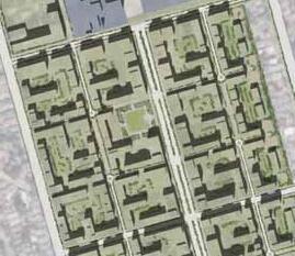


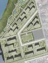


On the waterfront side, the land use will incorporate civic and commercial functions, making the most of the natural environment as a regional asset. In addition, part of the waterfront will be allocated to high-end residential areas to ensure economic sustainability.
On the northern side, the land use will be primarily residential, including affordable housing, to provide homes that are accessible for younger generations. Furthermore, commercial functions will be introduced along the main street running through the center of the district to create vibrancy and activity in the area.
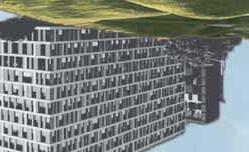
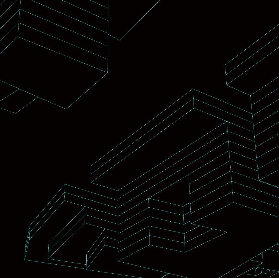
The plan adopts a massing strategy that gradually increases building volume from the surrounding lowrise residential areas toward the central district. Specifically, lower- to mid-rise buildings are arranged along the outer edges of the district, transitioning to mid- to high-rise buildings toward the core blocks. This approach promotes development density while maintaining harmony with the surrounding environment. Furthermore, along the waterfront, the largest-scale buildings are positioned to create a symbolic and vibrant new regional hub.
Through this phased massing strategy, the plan aims to achieve a seamless connection with the existing urban fabric while shaping a sustainable and diverse urban environment for the future.
Maximum height 15m


This plan combines development focused on residential, commercial, and mixed-use areas with non-development uses such as civic facilities, open spaces, and roads to achieve a well-balanced urban structure. The residential areas consist of high-, mid-, and low-rise buildings, with a total gross floor area of approximately 550,000 m2, accommodating around 7,892 households and an estimated population of about 19,675. The inclusion of commercial and mixed-use zones ensures daily convenience and a variety of functions. Furthermore, ample provision of civic facilities, public spaces, and roads is planned to deliver a comfortable urban infrastructure and a high-quality living environment.
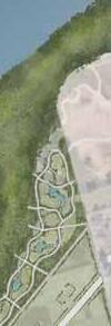
This plan aims to create a “Garden-Oriented City,” forming a green and livable urban environment by integrating a variety of open spaces within the development and connecting them into a cohesive network so that nature can be enjoyed close to home.
Large, medium, and small parks are strategically arranged to ensure access within the following approximate walking distances:
Large parks: within about 400m
Medium parks: within about 100m
Small parks: within about 50m These parks are interconnected through a tree-like network of greenways. Each medium park is linked by a greenway to the nearest large park, and each small park is linked to the nearest medium park.
Through this layered and connected green space network, the plan brings nature into daily life and promotes the creation of a sustainable and attractive urban environment.


In Melrose Park, automobile traffic will be restricted in many areas of the district to create an urban environment that prioritizes pedestrians. Within each block, dedicated pedestrian pathways will be strategically arranged to prevent buildings from creating closed-off street fronts. In addition, multiple entrance points will be provided as major access nodes.
Through these measures, the plan aims to realize an urban environment where everyone can walk comfortably and move about safely.
Pedestrian Route
Pedestrian-Priority Shared Street
Alleys
Entrances
A circulatory mobility system will be planned within the district, utilizing autonomous vehicles to create a cutting-edge mobility environment.
In addition, the existing LRT plan will be reviewed to strengthen connectivity between local transport within the district and regional transport networks beyond it.
Furthermore, a new ferry terminal will be established, adding greater diversity to the city’s transportation options and contributing to the formation of an urban environment with high accessibility and ease of movement.
Existing Light Rail Route
Proposed Light Rail Route
Existing Ferry Route
Proposed Ferry Route
Existing Bus Route
Proposed Bus Stop
This plan limits general vehicular traffic in principle while ensuring a circulation system that allows residents to use cars for their daily needs. Three primary north–south roads will be provided for vehicles, and additional east–west roads will be developed to maintain essential accessibility, achieving a pedestrian-oriented urban environment while supporting necessary vehicular movement.
This plan provides the necessary and sufficient number of parking spaces to accommodate the large residential population. At the same time, it aims to create a living environment that does not rely on private cars, setting the basic parking supply at one space per two residential units.
In addition, angled parking is introduced along streets to improve compatibility with pedestrian movement. This approach enables more efficient use of roadside parking spaces, helps secure wider sidewalks, and contributes to the creation of an attractive streetscape.
This Page is Intentionally blank
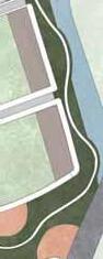
Main Street Block
A vibrant zone along the main street. Buildings with greater depth are encouraged, while a 12m height defines the skyline to create an active streetscape.
A quiet residential zone along a sub-street. Building depth is controlled to reduce the sense of enclosure and maintain a calm living environment.
A sub-street zone designed with respect for existing detached houses. Building heights are strictly limited to avoid creating pressure on the surrounding homes.
Waterfront
A premium zone that takes full advantage of Parramatta River views. Larger units and generous street setbacks create a spacious, low-density character


Main Street Districts
East Side Districts
West Side Districts
Waterfront Districts


Base and maximum building heights are set for each district, and setbacks are used to create a sense of depth, while ensuring that the same height does not continue for more than 20 meters to avoid monotony. Streetwalls are formed along more than 50% of the street length with a height variation of ±3 m to introduce rhythm, and façade designs are changed every 30 m to provide both continuity and diversity. At intersections, a continuous 30 m streetwall is maintained with corner entrances to emphasize key nodes, and buildings at the four corners of a block are at least 3 m higher than the surrounding buildings to create landmarks. Districts with lower height limits provide a calmer streetscape, while districts with greater height allowances create a more urban and dynamic impression, resulting in a streetscape that is varied, memorable, and attractive for pedestrians.
*Only allowed on the sub-street
SerbackOn the main street side, the setback shall be 4m for areas with a height of 12m or more, and on the Main Street and Hope Street sides, the ground floor shall be set back 4m.
Streetwalls form more than 50% of the street length, with a height variation allowance of ± about 3 m
Change the architectural facade every 30 meters.
At intersections on the main street, a continuous street wall shall be maintained for a length of 30 meters. A corner entrance is required.
Buildings located at the four corners of the block shall be at least 3 meters higher than the surrounding building heights. The same height shall not continue for more than 20 meters.
back 10m from the surrounding streets of the block.
The same height shall not continue for more than 20 meters.
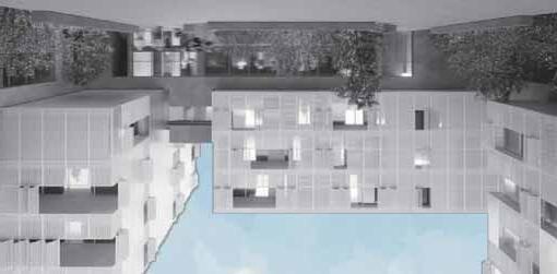
The image of residential buildings in the northern part of the development area (Main Street District, East Side District, and West Side District) is as follows.
The image of residential buildings in the southern part of the development area, the Waterfront District, is as follows.


Buildings are arranged along the outer edges of each block, often in L-shaped configurations, to create clear and usable courtyard spaces. Minimum distances between buildings—12 m in Main Street Districts and 10 m in the Waterfront District—secure light, ventilation, and openness. Each block provides at least two pedestrian-only public passages, including at least one outdoor route, ensuring easy access to these spaces. Courtyard layouts are limited to a diagonal of 80 m to maintain a human scale, and façades vary every 30 m to add diversity and character. In the Waterfront District, longer façades face the water, linking buildings, gardens, and pedestrian routes into a rich and inviting network of open spaces.
Building DepthFacing a road over 24m : 20 ~ 25m
Building layout conditions in District
walkways in
Facing a road less than 24m : 10 ~ 15m
Buildings shall be placed along the block edges, and not less than 80% of the combined length of two adjoining outer edges (forming an L-shape) shall be lined with buildings.
For the West Side district, this percentage shall be 70%.
Provide a minimum of two pedestrian-only public passages along each side of the block, and such passages shall remain open to the public. Public access to these passages shall be ensured during daytime hours.
At least one of the required pedestrian-only public passages shall be configured as an outdoor space.
Change the architectural facade every 30 meters.
Arrange buildings so that the diagonal of the outer perimeter of the block’s courtyard-type configuration is kept within 80 meters, preventing the courtyard from becoming too large.
Buildings shall be arranged so that their longer façades face the waterfront edge of the block.
Provide pedestrian-only public passages within the block, and ensure that they remain publicly accessible at all times, both day and night.


Guidelines for Achieving a Lifetime Neighborhood through the Provision of Diverse
These guidelines promote a lifetime neighborhood by ensuring a diverse housing mix and supportive facilities. Unit sizes range from under 40 m2 to over 100 m2, allowing people at different life stages to live and remain in the area. The mix varies by district, with medium-sized units concentrated in the Main Street Districts and smaller units emphasized in the East Side District. Between 30% and 40% of the housing supply is designated as affordable, supporting residents with different economic backgrounds. Buildings on roads wider than 24 m include retail on the ground floor to enhance convenience, while at least 40% of rooftop areas are dedicated to recreation and community uses. Together, these measures create an inclusive and adaptable neighborhood where residents can live, grow, and stay connected over time.
Rooftop facilities, inclusive of all ancillary equipment, shall not exceed a height of 4 meters, and their use shall be restricted to recreational purposes. Rooftop recreation and community facilities shall constitute no less than 40% of the total rooftop area.
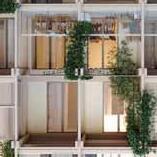
Façade Greening Guideline
At least 20% of the façade must be greened with elements like vertical gardens, climbing plants, or green walls.
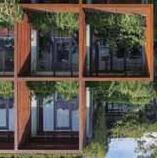
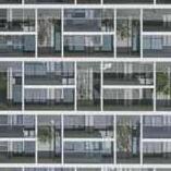
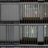
Open Type
An open type façade exposes balconies and openings directly on the exterior, creating a lively and approachable look. It reflects residents’ daily lives and emphasizes natural light and ventilation through elements like continuous balconies and railings.
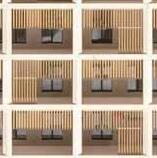
Rhythmic Type
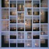
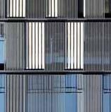
Closed Type
A closed type façade uses continuous walls or screens to shield the interior, giving priority to privacy. This style creates a calm, unified appearance that blends smoothly with its surroundings, often using louvers or perforated panels.

The rhythmic type expresses the building’s structural grid or modular layout on the exterior. Columns, beams, and balconies appear in an orderly pattern, giving the façade clarity, balance, and architectural rhythm.
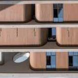
Landmark Type
A landmark type façade focuses on strong visual identity rather than exposed structure. Bold materials, colors, or sculptural forms create a striking presence, allowing the building to stand out as an icon in the cityscape.
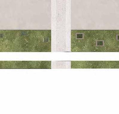
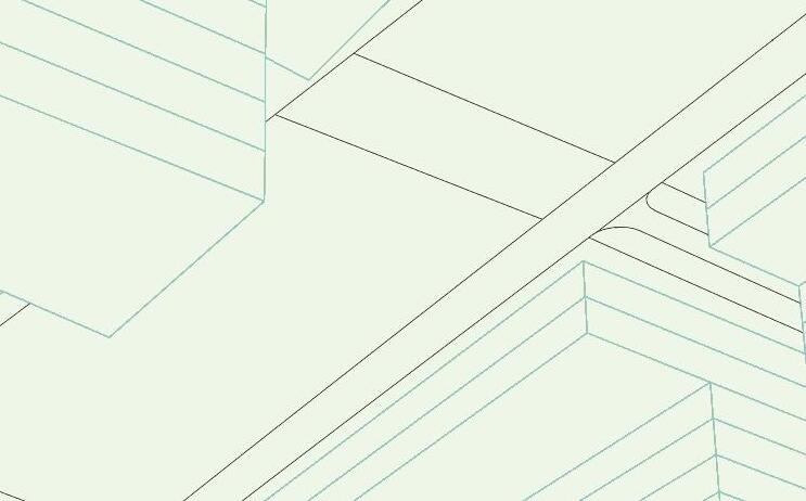
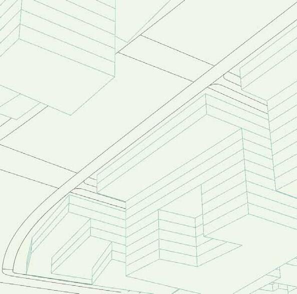
Hope Street is a major automobile traffic artery that runs east-west through Melrose Park and serves as a trunk road supporting the entire region’s transportation network.
Sidewalk:
3~4m Sidewalk provides a comfortable and safe walking environment.
Local Bus Lane:
3m Local Bus lane is connected to the sidewalk to create a smooth flow of people and a convenient route for getting on and off vehicles.
Bike Lane:
2m Bike lane is provided. The bike lane shares space with parking and bicycle parking areas, enabling flexible use.
Vehicle Lane:
3m Vehicle lane is provided, with vehicle speeds limited to 20–30 km/h. This design balances safety and the function of the street as a living environment.
Street Trees and Planting Strip:
1m planting strip is established, with broad-canopied street trees continuously arranged along the sides of the vehicle lane and sidewalks.
LRT Dedicated Lane:
10m LRT lane is secured in the center. Green belts of 1.5 m on each side are established.
Side street is a road section mainly for pedestrians and local traffic. General vehicles are restricted from entering.
Sidewalk:
3m Sidewalk is provided to ensure a comfortable and safe walking environment.
Vehicle Lane:
5m is maintained. Shared by local traffic and passenger vehicles.
Street trees and planting strips:
1m planting strip is provided, with wide-canopied street trees continuously arranged along the side street.
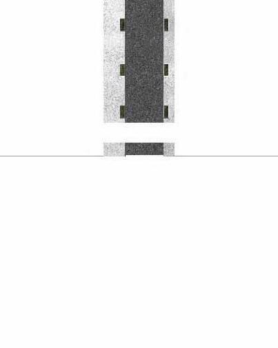
Lateral Street serves as a primary dual-lane vehicular corridor facilitating lateral movement across the urban area.
Sidewalk:
3m sidewalk is provided to ensure a comfortable and safe walking environment.
Vehicle Lane:
3m Vehicle lane is provided. This design balances safety and the function of the street as a living environment.
Parking spaces:
3m are secured. Parking is available for residents.
Street trees and planting strips:
1m planting strip is established, with widecanopied street trees continuously arranged along the side street.
Warf Street and Hughes Street are major roads that support north–south traffic flow within the city.
Sidewalk:
3m sidewalk provides a comfortable and safe walking environment.
Vehicle Lane:
3m vehicle lane is provided to balance safety and traffic efficiency.
Parking Space:
3m parking space is provided. Parking is available for residents.
Street Trees and Planting Strip:
2m planting strip is provided, with wide-canopied street trees continuously arranged along the side of the road.
Riverside Road is a residential street in a serene, upscale neighborhood.
Designed primarily for local residents, it features comfortable sidewalks, landscaped planting strips, and dedicated parking spaces for residents.
Sidewalk:
3m sidewalk provides a comfortable and safe walking environment.
Vehicle Lane:
3m vehicle lane is provided to balance safety and traffic efficiency.
Parking Space:
3m parking space is provided. Parking is available for residents.
Street Trees and Planting Strip:
2m planting strip is provided, with wide-canopied street trees continuously arranged along the side of the road.
This Page is Intentionally blank
1. Waterfront Open Space Guidelines


Nature Zone


Purpose
Prioritize the conservation and regeneration of mangrove forests and local ecosystems, while offering spaces for quiet walks, nature observation, and environmental education.
Ecological Conservation
Preserve existing mangrove and riparian vegetation to the greatest extent possible. Limit public access to protect sensitive habitats.
Educational Features
Install interpretive signage explaining mangrove ecology and local biodiversity to promote environmental awareness and learning.
Observation Trails
Provide low-impact walking paths through or near mangrove areas for nature exploration and birdwatching.
Low-Impact Lighting
Use minimal, warm-tone lighting at night to avoid disturbing wildlife and maintain the natural atmosphere.
Plaza Zone
Purpose
Create an active public space seamlessly connected to the LRT station plaza, serving as a hub for events, social gatherings, and everyday relaxation, in collaboration with surrounding commercial amenities.
Integrated Layout
Ensure a barrier-free transition between the station plaza and waterfront plaza, allowing smooth pedestrian flow without level changes.
Commercial Interface
Encourage activation of the plaza edge by orienting cafés, restaurants, and retail with open terraces directly facing the public space.
Event Capacity
Provide space for temporary stages and flexible event setups. Include shaded or semi-enclosed rest areas to support comfort during gatherings.
Sports Zone
Provide versatile facilities that support a wide range of sports activities for various age groups and skill levels.
Indoor Facilities
Include flexible-use indoor spaces suitable for sports such as basketball, futsal, and group fitness programs.
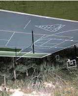
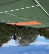
Outdoor Courts
Install multi-purpose courts for tennis, basketball, and soccer, with durable surfaces and appropriate lighting.
Accessibility & Safety
Ensure barrier-free access, clear circulation paths, and buffer zones between different activity areas to maintain safety for all users.
Play Zone
Provide a safe and stimulating environment for children to play creatively, with playground equipment and water play features.
Play Diversity
Incorporate a variety of play opportunities that engage children’s curiosity, imagination, and physical activity.
Ensure clear sightlines for guardians, with ample shaded seating and rest areas near play zones.
Planting Strategy
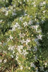
Use fruit trees, flowering shrubs, and other sensoryfriendly plants to encourage interaction with nature and support informal environmental learning.
1. Large Gardens
Large Garden2. Main Street Commons
Common Function
Urban gathering and event spaces where local residents and external visitors can come together.
Approximate Area
4,000–5,000 m2
Basic Composition
Paved event space: 30–40%
Multipurpose lawn area: 40–50%
Planting, walking paths, and seating areas: 20–30%
Large Garden1. Gateway Garden Program
Gateway Garden is a welcoming public space where local residents and visitors can gather and interact. As the symbolic entry point to Melrose Park, it showcases the area’s vibrancy and community spirit.
Design Guidelines
Paved event plaza (30%) for markets and activities
Multipurpose lawn (50%) for daily use and relaxation
Greenery, paths, and seating (20%) for comfort and walkability


Large Garden2. Main Street CommonsLarge Garden3. Serenity Garden
Program
A lively public space integrated with commercial activity, designed for gathering and social interaction.
Design Guidelines
Market paving (40%)
Dining lawn (40%): Over 30% of the area shaded
Greenery and paths (20%): Shrubs planted approximately every 2m2
Program
A calming, nature-focused space offering a sense of privacy, designed for relaxation and quiet reflection.
Design Guidelines
Walkways and planting (60%): A mix of evergreen and deciduous trees (6–10m in height)
Activities (30%): One 50m2 yoga deck and five outdoor reading benches
Paved entrance (10%)


Common Function
Theme-based spaces for social interaction and community activities, primarily serving residents within each block.
Approximate Area
2,000–3,000 m2
Basic Composition
Activities / equipment for play and work: 40–60%
Lawns, planting, and environmental greening: 20–40%
Paths, benches, and rest areas: 20–30%
Medium Garden1. Adventure Garden Program
A nature-based play space designed to foster creativity and physical development in children.
Design Guidelines
Play area (60%): Play equipment (H 2.0m), surfaces of grass or wood chips
Mound (20%): Gently sloped hill, H 1.5m, slope 20°
Greenery, rest, and paths (20%): Benches provided, with open sightlines for safety


Medium Garden2. Together GardenMedium Garden3. Outdoor Work Garden Program
A supportive space for interaction among families with children, offering opportunities for connection and childcare assistance.
Design Guidelines
Lawn area (50%): At least 50% of the space should be shaded Paths and access (20%): Paved, step-free walkways at least 1.8m wide for stroller access
Childcare facility (30%): Two roofed childcare rooms, each over 15m2
Program
An outdoor space designed to support creativity, relaxation, and informal work for younger generations.
Design Guidelines
Work zone (40%): At least three wooden desks (1200×600mm)
Shade equipment (30%): Shade structures with a height of 2.1m or more
Green & rest (30%): Eye-level planting and benches in shaded areas


Common Function
Everyday spaces for rest, casual encounters, and relaxation.
Approximate Area
500–1,000 m2
Basic Composition
Activities, interaction, and light work: 30–50%
Lawns and planting: 30–40%
Paths, benches, and decorative elements: 20–30%
Small Gardens1. Edible Garden Program
A community garden for shared vegetable growing and casual interaction.
Design Guidelines
Cultivation (50%): Raised beds, max 1.5m2, H 600–800mm
Paths (20%): Min. 1.2m wide, wood chip or gravel surface
Community zone (30%): Compost, table, benches


Small Gardens2. Relaxation GardenSmall Gardens3. Play Garden
Program
A quiet space for rest, reading, and gentle sensory healing.
Design Guidelines
Seating zone (40%): Individually placed benches, spaced over 2m apart, with shade
Greenery & scent (30%): 20+ varieties of aromatic herbs and plants
Decorative elements (30%): Pergolas, benches, and other calming features
Program
A safe, nearby play space for young children.
Design Guidelines
Play zone (60%): Small equipment (H 1.2m) with rubber chip surface
Rest & supervision (20%): Benches for caregivers within 5m of play area
Greenery (20%): Soft boundaries using open, child-friendly planting


Provide shade, attract birds, and help regulate microclimate temperature.
Add seasonal interest through flowers, fragrance, and changing colors.

Support walkability, guide visual flow, and ensure ease of maintenance.
Add seasonal interest through flowers, fragrance, and changing colors.
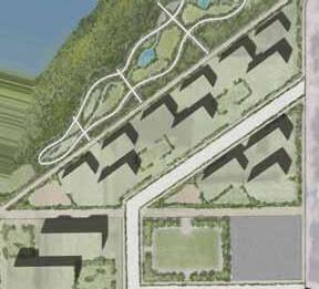
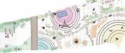
06-1. Focus Area Concept
06-2. Focus Area Design
06-3. Perspective Images
1, Accumulation of common space and collective activities in the town
Provide opportunities for Melrose Park residents to share and take part in a variety of activities, for both individual as well as group activities. Support opportunities for community-building group activities, thereby promoting long-term commitment to living in the town.
2, Concentration of functions necessary for life-long living
Concentrate the facilities and functions that are essential to the lives for both children and adults. All essential town services will be compactly integrated to create a town where people can live without a car.
3, Promotion of child care and services for young people
As children and youth grow, provide the services required at each stage of growth. This will promote residency of the child-rearing generation and attract new residents.
4, Support for transportation services
The site is a nodal point between the tram station and intra-regional transportation. The project will assist in providing these transportation services in a problem-free and comfortable manner.
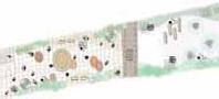
1, Aim to exposure of activities and creation of new activities through interaction
A variety of architectural spaces and facilities will be provided to accommodate various activities. These activities will be exposed to the outside so as to stimulate each other and generate innovation.
2, Provide services and entertainment for children and youth generation
Offer a full range of services and entertainment for young people, such as learning, exercise, and recreation. Provide a built environment where young people can pursue their interests and hobbies.
3, Designing space by taking advantage of the landscape with LRT
The LRT crossing the plaza is one of the main features of the project, and the LRT will be not only as a means of transportation but also as an important component of the landscape, creating a beautiful and comfortable landscape of the plaza.
4, Switching spatiality by intermediating between the residential area and the riverfront area
The plaza will serve as a buffer between the residential area to the north and the riverfront area to the south. The plaza will be a cohesive space that seems to be surrounded by buildings, forming an intermediate area. This switches the spaces with different characteristics between the north and south.
5, Provide green infrastructure as a garden city.
As a garden city, Melrose Park will provide an urban space where living and gardens are closely intertwined. This characteristic will be incorporated in the Focus Area to provide green infrastructure that allows people to easily access greenery.
Building 1 - Leaning Centre:
Service for young generation, Service for Child care
Provide architectural services for a wide variety of activities, with a special focus on children and youth
Buillding 2 - Public Centre :
Public Service & Transportation Service
Provide public services to residents and operational services for transit users.
Building 3 - Shopping Centre:
Retail, Shopping, Entertainment, Living Services
Provide commercial services, recreational facilities, and food services necessary for daily life.
Building 1 Leaning Centre
Serviceforyounggeneration, ServiceforChildcare
Building 2 Public Centre
PublicService TransportationService
Building 3 Shopping Centre
Retail,Shopping,Entertainment, LivingServices
Building 1 - Leaning Centre:
Education Centre
- Studying & Academic Activity
Student Support Centre
- Sport & Cultural Club Activity
Nursery School
Collaboration Lounge
Buillding 2 - Public Centre :
Library
Town Office
Transport Survice Office
Building 3 - Shopping Centre:
Shopping Mall
Bank Office
Transportation Service Office
Medical clinic and Drag store
Movie Theater
Supermarket
Restaurants and Lounges
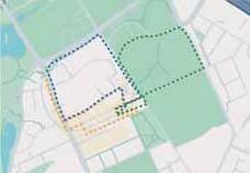
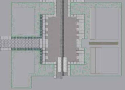
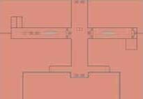
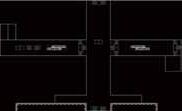
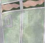
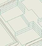
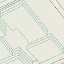
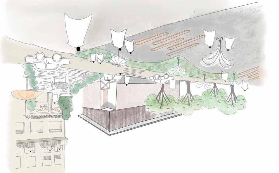
The Focus Area will consist of two blocks, east and west, with a plaza between them. The following design guidelines (fig, 1)will be established for development in each of the east and west blocks.
Skyline
Frontage(SquareSide)
HigherStoreySetback
GroundLevelSetback
70%Setback(Exceptbothedge)
minimum6m(Note:NoVolumeontheSquareSideFrontVolume)
Squareside&Roadside:6m(Altenative:Set6mwideArcadeorSunvisors)
ClossLandscapeSlitNoHigherstoreyvolumeinfrontofSchoolentranceNovolumeinfrontofSchoolentrance
GroundLevelPlan


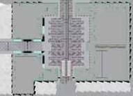
SkylineRooftopGarden
Window(1-3Storey)
Window(4~Storey)
Roadside:SmallSizeRetailswithanentrance towardtheroad
Squareside:SmallSizeRet ailswithanentrance towardtheroad
Roadside:Placeanentrancetowardtheroad
Squareside:LargeOpenActivitySpace (minimum550m^2)
PlaceGardenSpaceFullcoverRooftop:PlaceGreenspaceson30%ofRooftoparea (ExceptthespaceforArchitecturalTechnicalFacilities)
Squaresidecorner:FullGlassFacadethattheactivitiesinsidecanbeseenfromoutside (ExceptBackroom)
Squareside:50%GlassFacadethattheactivitiesinsidecanbeseenfromoutside (ExceptBackroom)

Plaza zone
Design to emphasize the LRT rails: vary the design of the pavement in areas where the LRT passes through and in areas where the LRT does not.
Ensure safety against LRT: Street poles are placed at 2m intervals so that the LRT passage is clearly distinguished.
Corresponding to the flow of people: The design of the pavement will be different in the central area and along the buildings.


Leaning Centre


01 BACKGROUND
01-1 Context
01-2 Site analysis
01-3 SWOT analysis
02 VISION AND PRINCIPLES
02-1. Concept
02-2. Vision
02-3 Principles.
03 MASTERPLAN AND FRAMEWORK
03-1. Masterplan
03-2. Land uses
03-3. Parking strategy
03-4. Circulation strategy
03-5. Public facilities strategy
03-6. Phasing strategy
04
04-1. Road design guidelines
04-2. Building form & placement guidelines
04-3. Openspace guidelines
05 DETAIL DESIGN
05-1. Design concept
05-2. Architectural plan
This page is intentionally left blank.

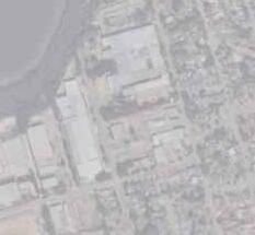
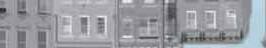
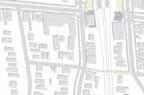
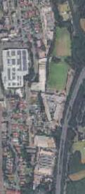
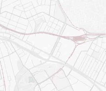
Concord West is situated at the intersection of several rapidly developing urban centers, including Sydney Olympic Park, Rhodes, Homebush, Liberty Grove, and North Strathfield. These adjacent areas are characterized by large-scale redevelopment projects that support a wide range of urban functions such as healthcare, retail, events, and high-density residential living.
Within this context of intensifying urbanization and functional diversification, Concord West is uniquely positioned to serve as a complementary and transitional neighborhood. Rather than replicating the large-scale, mono-functional developments of its surroundings, Concord West is expected to accommodate diverse daily life needs through a more fine-grained, community-oriented urban fabric. This includes supporting multi-generational living, local identity, and everyday accessibility, bridging the gaps between high-intensity nodes and the surrounding residential landscape.
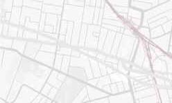
The area surrounding Concord West Station is a quiet residential neighborhood, primarily composed of lowto medium-density housing, and located adjacent to Sydney Olympic Park. The station is served by the T9 Northern Line, providing convenient access to both central Sydney and suburban areas, offering a balance between urban accessibility and suburban tranquility. However, the area faces several physical barriers that negatively impact its accessibility—namely Homebush Drive, the railway line, and Powells Creek—all of which contribute to limiting smooth movement within and beyond the district.
The site information may be summarized as follows; 2.
Address
West, NSW2138


The area is bounded by wide, car-oriented roads, notably Concord road and Homebush Bay Drive, which carries heavy traffic and divides the site. Pedestrian and cycling paths are mostly east–west, with limited crosswalks and poorly maintained streets, drive ways, and tunnels, reducing walkability and spatial continuity.


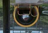
Driveway underpass to the Olympic Park
A low-clearance underpass beneath the driveway connecting Concord West and Sydney Olympic Park, limiting comfort for pedestrians and cyclists.
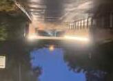
Poor Railway underpass
A railway underpass linking the east and west city, illustrating poor connection quality. The tunnel is narrow, and cyclists are required to dismount, reducing convenience and comfort.


Concord west area offers key community facilities and local shops, supporting daily life and walkability.
There are many facilities that support the lives of young children, such as primary schools and childcare centers.


A cluster of small retail shops and local stores creates a walkable environment.


Numerous community hubs such as churches and community centers provide gathering places for residents.


Diverse openspaces
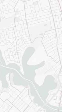
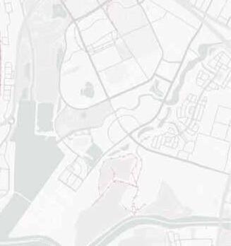
In addition to public parks like Concord West Playground, the station area is dotted with street trees and green spaces, offering daily opportunities for contact with nature. Sydney Olympic Park, in particular, retains ecologically rich green areas that can serve as valuable urban–nature interfaces.
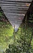
Located within walking distance from the site, Sydney Olympic Park spans approximately 430 hectares. It features extensive running and cycling tracks, major sporting venues, and ecologically rich green spaces. The park offers both active recreation and nature experiences, making it a popular destination for residents and visitors alike.


Concord West is currently served by a combination of train and bus networks. Access to broader destinations typically requires a transfer at Strathfield Station, a major interchange hub connecting intercity and suburban rail services.The upcoming LRT extension is expected to significantly improve regional connectivity by linking Concord and surrounding areas more efficiently via public transport. This new infrastructure will enhance mobility and reduce dependence on private vehicles. While neighboring districts such as Rhodes, Homebush, and Burwood benefit from multiple bus routes, public transportation within the Concord West area remains limited. At present, only a single bus line runs along Concord Road, providing limited coverage and weak connections to Concord West Station and local amenities. This internal lack of accessibility presents a key challenge for equitable and convenient transport access within the neighborhood.
Topography
The site slopes gently from north to south, descending toward Powells Creek and Sydney Olympic Park. In contrast, the nearby highways and railway lines are constructed at higher elevations than the surrounding ground, creating both visual and physical barriers that further divide the area.
Flood Hazard analysis
A portion of Concord West is identified as a flood hazard area. This risk is concentrated in the western part of the suburb, originating from the low-lying land that slopes towards the creek.
Boundary
Contour Lines: 2m Interval
Contour Lines: 10m Interval
The area features a mix of zoning types, with mediumdensity residential (R3) in the center and low-density and environmental zones along the western and southern edges.
FAR range from 0.5 to 2.8 with higher values in the southeast indicating potential for future high-density development.


The maximum building height permitted on the site is 8.5 metres. This low height control reflects the existing low-rise suburban character of the area.


Within the growing Greater Sydney region, this area is projected to experience particularly rapid population growth.
People 12,842
Median age 37
Families 3,399
Average number of children per family for families with children 1.7 for all households (a) 0.8
All private dwellings 4,917
Average number of people per household 2.8
Average number of motor vehicles per dwelling 1.6


Educational infrastructure within the district is under significant strain. Concord High School is operating at 140% capacity, and only 25% of local students attend public schools, far below the NSW average of 65%, largely due to inadequate facilities.Although a new school is planned at Wentworth Point, it is not expected to meet the projected demand driven by increasing residential density. Within the Concord High catchment, an estimated 2,000 additional students are anticipated over the next 15 years.
To respond to this pressure, the Canada Bay LGA urgently requires a new public high school by 2030, with total demand projected to exceed 1,700 students by 2040.


Diverse Residential Profiles and Living Patterns
Concord West exhibits a diverse residential landscape, with varying demographic profiles and lifestyles across different areas.
When compared against the SA2 (Statistical Area Level 2) average for Concord West – North Strathfield, distinct patterns emerge: areas around the station tend to attract a younger population with fewer children, indicating a predominance of high-density, urban-style living within the Concord area.
In contrast, the eastern residential zones show a higher median age, reflecting a more established, family-oriented environment characterized by longterm residency and a quieter lifestyle.
01. Rich Natural Environment and Open Spaces
The area features abundant greenery, creekfronts, and playgrounds both within and around the site, providing a comfortable living and social environment surrounded by nature.
02. Station and Neighbourhood Character
Located close to the station, with facilities such as churches, elementary schools, and community centers nearby, the area has the potential for a walkable lifestyle serving multiple generations.
01. Infrastructure-Induced Barriers
Driveways, railway tracks, and the creek divide the neighborhood, disrupting spatial cohesion.
02. Poor Walkability
A lack of pedestrian crossings and car-oriented road design significantly restrict pedestrian circulation and ease of movement.


01. Connectivity with Regional Transport Networks
Connections to major hubs like Sydney Olympic Park and Burwood via train and future light rail transit (LRT) could increase the area’s centrality amid redevelopment trends.
02. Population Growth and Local Revitalization
Development and population influx in the surrounding area are expected to stimulate expansion of educational, commercial, and medical facilities, fostering greater vibrancy.

01. Infrastructure Strain
Insufficient high schools and medical facilities, along with chronic traffic congestion, especially on George St, may lead to infrastructure lagging behind population growth.
02. Car Dependence and Aging Population
Ongoing reliance on automobiles risks diminishing quality of life for nondriving residents, including a growing elderly population.
This page is intentionally left blank.
1. Lifetime neighbourhood
This plan focuses on “Age-Friendly” “Accessible” “Lifelong Learning”. The aim is to create a place where people of all generations can learn, connect, and live healthy lives throughout their lifetime.
To enhance walkability and local circulation, the pedestrian environment will be improved through the addition of benches, shaded resting areas, and barrier-free path ways. This will create a safe and pleasant walking experience for people of all ages and physical abilities.
Learning
By integrating quality natural environments into everyday life, people will have opportunities to learn, support each other, and maintain their well-being through shared experiences in nature. Community gardens, parks, and learning hubs will promote intergenerational exchange and holistic wellness.
Accessibility
Improved public transportation networks—including access by train, bus, bicycle, and on foot—will enable residents to easily connect with surrounding urban centers. This ensures that people can continue to live in this nature-rich neighborhood while remaining well connected to the wider city.


Rooted in the site’s potential and current challenges, this vision imagines a community where people of all ages can live, learn, and grow together. The city responds to an increasingly diverse population, bridging social and physical divides through inclusive design and active public spaces.
By supporting multigenerational interaction, accessible infrastructure, and opportunities for continuous learning, the neighborhood becomes more than a place to live It becomes a platform for lifelong contribution and shared belonging.

1. Four principles
Connecting generations through a central public square
A lively civic heart centered on a main plaza links people of all ages. Daily activities, events, and casual encounters converge here, shaping the social identity of the neighborhood.
The design will remove physical and visual barriers to create a highly walkable and inclusive public realm. A seamless pedestrian network will prioritize safe and direct connections to public transport and vibrant outdoor activity zones, ensuring movement is easy and intuitive for everyone.


To integrate the core activities of life—playing, learning, and caring—within a cohesive public realm. By arranging diverse functions around this shared space, their activities are encouraged to overlap and enrich one another, fostering a community where life is experienced as a whole.
Bringing water and nature into daily life.
The creek edge is shaped as a soft, flood-adaptive landscape. Green terraces and walkways invite people to gather, rest, and play along the water. Nature becomes part of the everyday experience of the station area.


This page is intentionally left blank.
This plan aims to create a sustainable town centered around Concord West Station, where multiple generations can interact, based on the following four basic principles.
Development of a pedestrian axis
Establish a space where movement between north and south is easy, centered on the station and a large plaza continuous with the station, where people can gather and interact daily. This naturally spreads pedestrian flow from the town center to the surrounding areas.
Strengthening connections with the neighborhood
Develop new pathways and bus routes to the east, west, north, and south of the station to connect with nearby schools, parks, and residential areas. This eliminates existing barriers and improves overall continuity within the neighborhood.
Shared facilities and multigenerational use
Locate public facilities such as schools, halls, and community centers adjacent to the plaza, enabling cross-functional use of educational, welfare, and interaction functions. It aims for multiple generations to use these spaces together depending on the time of day.
Coexistence with natural assets
Redevelop the area along the creek by creating green spaces and promenades while responding to flooding. Integrate the natural environment into daily life, creating an environment where people can safely spend time by the waterside.


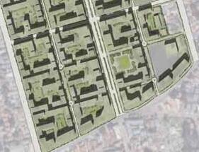
Zoning
Mixed-use and civic buildings cluster around the central plaza, forming an active urban core. Educational facilities are near Victoria Avenue for safe school access. Residential zones (luxury, mid-rise, low-rise) spread outward, reflecting local character.
Height and FAR, BCR
Building heights range from 2 to 10 storeys, arranged progressively to support diverse lifestyles. Taller buildings (6–10 storeys) are placed near the railway and central plaza to reduce noise, with heights decreasing westward toward natural and low-rise residential areas. Buildings near parks maximize views and sunlight, while open parking reduces flood risk. The height layout frames key views and movement paths.
This strategy creates a sustainable, connected, and inclusive community balancing convenience, nature, and diversity.
To create a safer and more comfortable environment, the strategy encourages slower traffic and spatial separation between people and vehicles. Streets are designed to naturally reduce vehicle speed, while cars are guided through rear access roads instead of main pedestrian areas.
Concentrate car movement into key parking zones to minimize disruption and promote walkability.
Encourage park and ride
Provide parking near the station to support transit use and reduce local car dependency.
Multi-functional Flood Zone Parking
Transform flood-prone areas under the viaduct into parking and open space, functioning as water retention zones during emergencies.
1. Bus network
Additional East-West bus network
Only one north-south bus route ran along Concord Road, providing limited connectivity. To address the east-west barrier, we propose adding new east-west bus routes and increasing the frequency of existing trunk lines.
The new bus connecting Concord West and Sydney Olympic Park not only improves east-west accessibility, but also supports daily mobility needs between key community functions. In addition, the proposed Concord West bus line functions as a smallscale mobility service, such as school buses and transportation for the elderly linking residential areas with schools, markets, and healthcare facilities.
Bus stops are placed approximately every 300–400 meters, especially around key daily destinations such as schools, parks, and markets. This fine-grained stop spacing ensures that all generations, including the elderly and children, can access the service within a 5-minute walk, supporting a more inclusive and walkable community.

Existing Bus Line
Sydney Olympic Park – Concord West
Concord West Bus Line
City Centre – Sydney Olympic Park
Sydney Olympic Park Bus Line 1
Sydney Olympic Park Bus Line 2
Sydney Olympic Park Bus Line 3


Human-focused network
A cycling route is planned to run through Concord West, connecting Rhodes and Homebush, to improve bike circulation within the area. The station is within a 5-minute ride from the cycling road, and bike parking is provided at the station. This encourages people to switch from private cars to public transport by integrating train and bicycle use.


The existing community core, previously concentrated in the northern part of Concord West, will be dispersed around the central plaza, creating a network of shared public facilities that encourage multigenerational interaction.
By introducing an online reservation system, facilities can be shared among diverse user groups across different time slots. This ensures both safety and accessibility, positioning public and educational facilities as common urban assets available to all.
Key facilities such as public buildings and elderly homes are located directly along the plaza to encourage a plaza-centered lifestyle. Meanwhile, schools are placed behind the community core to ensure children’s safety while still enabling inclusive and active learning experiences around the plaza.
The plaza seamlessly connects with the Sydney Olympic Park, allowing age-friendly programs to expand into its rich natural environment.


This development plan is structured into four stages, implemented step by step over time. 1
Stage 0:
First, George Street and Victoria Avenue, which are connected to the area, will be widened and a collective reconstruction will accompany the widening.
Stages 1-2
In this stage, development will begin with currently vacant lots and public open spaces. These areas will be transformed into new places for community interaction, enhancing livability and accessibility for local residents. These early stages also serve as a preparatory phase, fostering familiarity and social acceptance of future redevelopment efforts.
Stages 3–4
In this stage, areas that include existing residential zones will be addressed. Redevelopment will proceed gradually, based on a process of consensus building with current residents. This phase prioritizes continuity of daily life and the preservation and regeneration of community ties, while improving overall housing conditions.
This page is intentionally left blank.
04-1. Road design guidelines
04-2. Building form & placement guidelines
04-3. Openspace guidelines
The car-centered transportation environment in Concord West creates barriers for many residents, especially the elderly, children, and wheelchair users. To address this issue, sidewalks and bicycle lanes will be developed along major roads to ensure safe and comfortable movement for all generations. In addition, the area around the station will be improved to enhance connectivity with public transportation, promoting a pedestrian-friendly environment and encouraging TOD.
New Victoria St. (24m ROW)
George St. (21m ROW)
Station St. (21m ROW)
Neighbourhood St. 1 (20m ROW)
Neighbourhood St. 2 (15m ROW)
Local St. 3 (6m ROW)
Green spine (6m ROW)
Neighbourhood St. 3 (6m ROW)
Site
Extending the local shopping street toward SOP
This street extends the existing retail corridor toward Sydney Olympic Park, encouraging smooth traffic flow while enhancing walkability and greenery. Wide sidewalks and planting areas support an active street life with safe pedestrian movement.
These paths are made up of the following elements:
Sidewalks: 3.0 m
Parking lanes: 2.1 m
Driveways: 3.5 m × 4 lanes
Median (Greenway): 2.0 m
Planting strips: 1.5 m


A direct and inclusive route from Rhodes to the station
George Street provides a clear, congestion-free connection between Rhodes and Concord West Station. Designed to support smooth traffic flow while enhancing pedestrian safety, it encourages everyday movement not only for residents but also for commuters. The street integrates tree-lined sidewalks, a central median, and retail frontage to create a welcoming approach for all.
These paths are made up of the following elements:
Sidewalks: 4.0 m (each side)
Drive lanes: 6.0 m × 2
Median: 1.0 m


An active transit street linking mobility and retail
This wide boulevard connects the plaza and nearby parking structure, supporting both private vehicles and transit access. With commercial spaces at ground level and a multi-story park-and-ride facility adjacent, the street plays a key role in facilitating movement to and from the station area. A central median and wide sidewalks ensure safe and organized circulation for all users.
These paths are made up of the following elements:
Sidewalk (left): 3.0 m
Buffer zone: 1.0 m
Drive lane (x2): 6.0 m each
Median: 1.0 m
Buffer zone: 1.0 m
Sidewalk (right): 4.0 m


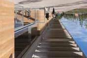
A lively cycling corridor along the river
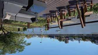
This river-adjacent street supports both daily mobility and recreation. Separated bike lanes on both sides ensure safe and comfortable cycling. The path connects to vibrant public amenities under the elevated structure, including a basketball court and a live event space, making it an active spine for sports, culture, and mobility.
These paths are made up of the following elements:
Sidewalk (left/right): 3.0 m / 3.0 m
Green buffer: 1.0 m
Bike lanes: 2.0 m × 2
Planting strip: 2.0 m × 2
Driveway (2-way): 8.0 m


Connecting residents to the waterfront and SOP while easing traffic
This residential street enhances daily access from existing housing areas to the riverside and Sydney Olympic Park. Designed to alleviate main-road congestion, it offers an alternative, comfortable route with wide sidewalks and greenery. The layout ensures that local residents can enjoy calm circulation and improved connectivity to key destinations.
These paths are made up of the following elements:
Sidewalk (left): 3.0 m
Driveway: 8.0 m (two-way)
Sidewalk (right): 4.0 m


A central green corridor for all generations
This narrow but vibrant spine opens up in front of the station, leading into a lively plaza with fountains, basketball space, and views toward Sydney Olympic Park. Designed for multigenerational use, it offers a safe, walkable, and engaging green space at the heart of the community.
These paths are made up of the following elements:
Pedestrian walkway: 5.0 m
Planting buffer: 1.0 m


A pedestrian-first corridor connecting key public spaces
This 6-meter-wide path runs through the plaza, offering a safe and pleasant walking route to nearby public facilities and the station. While primarily designed for pedestrians, it also accommodates light service traffic for deliveries and maintenance. As a quiet spine within the civic core, it enhances daily walkability and flexible plaza use.
These paths are made up of the following elements: Sidewalks: 1.5 m × 2
Service lane (shared with pedestrians): 3.0 m


Linking the plaza, elderly home, and riverside
This quiet local street connects the central plaza with nearby elderly housing and the riverside. It ensures safe access for pedestrians and vehicles within a residential environment, while wide sidewalks and greenery enhance the comfort of daily movement.
These paths are made up of the following elements:
Sidewalks: 2.0 m (left) / 3.5 m (right)
Buffer: 1.0 m × 2
Driveway: 6.5 m (2-way shared)


The vegetation serves to reduce noise from traffic, provide visual separation, and create a more pleasant riding environment.A strip of layered planting, using low-maintenance shrubs and small trees, is proposed along the edge of the cycle path. This buffer not only improves acoustic comfort but also enhances safety by increasing the psychological distance between cyclists and vehicles.A minimum planting width of 1.5 to 2 meters is recommended, using native species that are durable and suitable for the local environment.
These paths are made up of the following elements:


Setbacks and Building Separation
All buildings shall maintain a minimum setback of 3 meters from the front property line. A minimum offset of 5 meters shall be provided between principal building structures.
Corner Plazas
Buildings on the corner of major roads lots must dedicate a 5m x 5m area at the corner as a public plaza, enhanced with landscaping and seating.
Landscaped Slope
Slopes facing Green plazas should be designed to create visually pleasing and rich interfaces by planting vegetation and creating steps and perches.
Active Frontage
A minimum of 50% of the ground-floor facade along Green plazas shall feature transparent glazing. Permitted ground-floor uses are limited to active uses :retail, food and beverage establishments, and public cultural facilities.
GREEN Frontage
To create a lush and continuous green edge along the street, enhancing the pedestrian experience and softening the interface between buildings and the public realm.
To foster diverse and high-quality living environments, the area is divided into three distinct zones. Each zone is assigned a unique building typology and is governed by a specific set of regulations tailored to its intended character.
The residential development will consist of a total of 1,900 units, distributed across four housing types to ensure a balanced and inclusive community.
Mid-Range Housing will provide approximately 720 units, accounting for 38% of the total.
Luxury Housing will include around 440 units, representing 23%.
Affordable Housing will make up 31% of the total, with approximately 590 units.
Elderly Homes will comprise 150 units, or 8% of the overall plan.
By offering a mix of housing types, the project aims to support diverse household structures and lifestyles, contributing to the creation of a sustainable and inclusive living environment.


Goal
Medium density housing for young adults and small families. Promote the inclusion and interaction of a diverse range of residents.
Mid-Block Greenway
Where a street block length exceeds 90 meters without an intersecting public street or laneway, new development is required to provide a publicly accessible mid-block greenway and courtyard. This connection should be oriented perpendicular to the street to provide a rich walkable route through the block. This greenway must be landscaped, welllit, and universally accessible to ensure a safe and pleasant pedestrian environment.
Height Limit
Maximum of 8 stories along the main street, and 6 stories in other areas. Height will be reduced in stages at the boundary of the city block.
Dwelling layout and lighting:
Facing south and east, maximum depth of dwelling unit is 18 m. Building spacing is 8 m or more. The building spacing shall be at least 8m.
Common use and facilities
Atrium lobby on the 1st floor, open corridors for each 3-4 units. Stores, cafes, etc. can be located on the first floor for active use. Garbage disposal is concentrated at the rear of the building or in the basement.


Goal
Located at the station front, this area provides highdensity residential building, especially more luxury housing above active commercial spaces, balancing urban vibrancy with quiet, high-quality living.
Podium Design
Maximum height is 10 stories. The height of the area facing the plaza will be reduced in stages. Residential floors are offset more than 5 meters from each side to create a podium for Sky Exposure and Human Scale.
Facade and Entrance
The exterior of the house has a neutral color + vertical lattice for a calm impression. Following the frontage guideline, entrances are made more visible with glass and lighting, and are connected to the town with benches and plantings. The commercial and residential traffic lines are clearly separated.
Residential Environment
Facing huge openspace, natural light and ventilation are secured. The depth of the residential units should be 18m or less, with openings on both sides. A common terrace on the rooftop will provide a place for residents to interact and refresh themselves.


Goal
Located near the riverside and open sky, this area offers a peaceful, nature-connected lifestyle. Its proximity to Sydney Olympic Park supports continuity with the wider community and encourages a welcoming, multigenerational living environment.
Courtyard
A central courtyard that covers at least 15% of the site, includes greenery and seating, and ensures equal access from all units.
Height Limit
Maximum of 8 stories along the main street, and 6 stories in other areas. Height will be reduced in stages at the boundary of the city block.
Dwelling layout and lighting
Facing south and east, maximum depth of dwelling unit is 18 m. Building spacing is 6 m or more. The building spacing shall be at least 6m.
Barrier-free and safety
All elderly units feature barrier-free access with ramps, wide openings, and anti-slip finishes throughout.


Four Park haracteristics
We plan four distinctive public plazas stretching from the station front to the creek. These continuous open spaces aim to support the diverse lives of local residents, improve the quality of daily movement and stay, and create a sense of unity throughout the area.


Area A: Welcome Gateway
Low grass cover for clear views and soft color at the station entrance.
Plants: Lomandra longifolia, Themeda australis, Viola hederacea.


Flowering / Feature Trees


Shaded, lively plaza with seasonal flowering trees and seating.
Plants: Casuarina glauca, Melaleuca quinquenervia, Jacaranda mimosifolia, Banksia integrifolia.
Area B: Community Garden Area C: Active
Trees for shade, flowering accents, and soft groundcover around sports facilities.
Plants: Eucalyptus robusta, Syncarpia glomulifera, Callistemon citrinus, Themeda australis, Microlaena stipoides.
Area D: Waterside Promenade
Wetland-tolerant trees and native grasses for a restorative natural edge.
Plants: Casuarina glauca, Melaleuca styphelioides, Banksia integrifolia, Themeda australis, Microlaena stipoides.

Evergreen / Structure Trees Evergreen canopy forms a calming green framework year-round.


& Understorey


Traffic Flow and Connections:
Directly connect to station stairs and entrances, forming the first symbolic plaza upon exiting the station.
Provide multiple access routes linking the station, surrounding roads, and adjacent building entrances to support smooth pedestrian circulation.
Paving and Configuration:
Pave the area in front of buildings with tiles; paving width = 2× store entrance width to ensure openness.
Target 60–70% paving ratio, with 1–7 m green belts on the north and south sides.
Central paved zone to remain flat and multipurpose, suitable for events and meeting points.
Planting Plan:
Introduce native Concord West trees as symbolic elements:
10–12 m main trees with 4–6 m secondary trees for layered greenery.
Prioritize evergreen species to maintain year-round cleanliness and shade.
Furniture and Rest Areas:
Install benches and tables for short-term station users.
During events, move or cluster furniture along buildings or green belts to keep the center open and flexible.


Trees with sufficient rooting volume can thrive, providing shade and beauty
Trees with sufficient rooting volume can thrive, providing shade and beauty
mall
Flat paving supports multifunctional use including daily movement and events

A flexible edge zone designed for temporary food trucks and events, supported by retractable furniture and adjacent benches for casual seating
Primary access from the station, designed as a symbolic threshold with widened paving and clear sightlines to guide pedestrians into the plaza

Open space entrance
Gateway area linking to surrounding streets and neighborhoods. Designed with layered planting and seating for smooth integration and visibility
Adjacent to retail and cafe zones, this area features layered greenery and outdoor seating to encourage longer stays and passive interaction
Central multi-use space with flexible paving and movable furniture, creating a seamless transition between circulation and gathering functions
Traffic Flow and Connections:
Ensure accessibility with at least one entrance from the roadway.
Set back central paved areas to blend with lawn spaces; integrate a water zone connecting to Civic Square with a 10×18 m fountain as a focal point.
Paving and Configuration:
North and south green belts: 1–15 m width, achieving 40–50% paving and 50–60% greenery. Incorporate 5+ educational farms (10×10 m each) in buffer zones for elementary school use.
Planting Plan:
Combine 15 m tall trees and 4 m shrubs to create height variation and seasonal visual rhythm. Select species safe for children and compatible with recreational use.
Furniture and Rest Areas:
Provide benches and tables usable by all ages, positioned under tree shade and near resting points. Increase resting spots and allow flexible layout changes for daily use and events.


Civic
Stone-paved plaza with gentle slopes connects directly to roads, underpass, and civic buildings. Supports events and daily use
10–15 m tall trees and mid-height species provide seasonal shade, safety for kids, and green layering
Water area
A fountain anchors the space, smoothly integrated with lawn and paving for play and relaxation
Residential
Homes overlook the plaza, offering visual connection, safety, and daily engagement with public space

Retail
Shops open directly to the plaza with no barriers, creating seamless transitions and lively street edges

Stone-paved plaza with gentle slopes connects directly to roads, underpass, and civic buildings. Supports events and daily use
Traffic Flow and Connections:
Provide entrances on all surrounding roads, ensuring circulation through sports cores, stone-paved pathways, underpass activities, Square D. Establish continuous pedestrian flow linking to surrounding facilities, including SOP.
Paving and Configuration:
ay out 2–3 light sports cores (table tennis, simple play equipment) within the plaza.
Connect these areas with 2–3 m wide stone-paved pathways, incorporating gentle curves and ±0.5 m level changes for varied walking experiences.
Underpass Activities:
Utilize the underpass space for basketball courts with movable goals, a skateboard park, and live event areas.
Ensure a direct pedestrian connection to SOP for wider regional access.
Planting Plan:
Target 55% greenery and 45% paving across the plaza.
Use lawn as the primary surface outside the sports cores, with 10–12 m tall trees on the perimeter and 4–6 m mid-height trees in the center to create layered greenery.


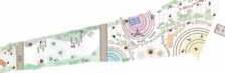


Tall and mid-height trees create layered greenery, offering shade and a sense of enclosure
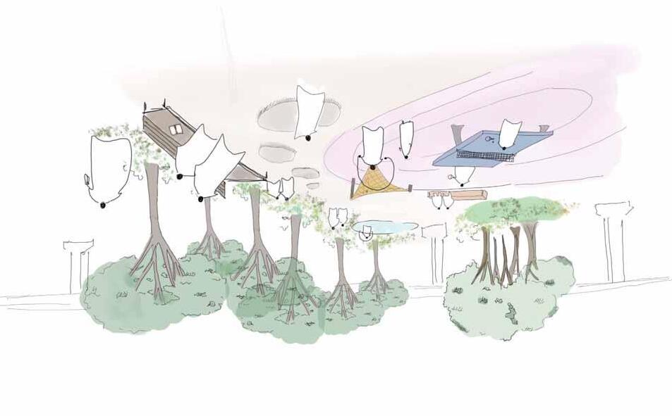
Open space connects to the underpass and hall. Supports events, sports, and daily circulation from all directions

Facility
Equipped with sports facilities like table tennis, this area supports casual play, school activities, and office use during breaks
Paved open area allows flexible sports use and small-scale events without interrupting flow
furniture
Moveable benches and tables are placed along green edges for rest, watching games, or casual gatherings

wide stone paths with soft curves and slight slopes connect sports areas and improve walking experiences
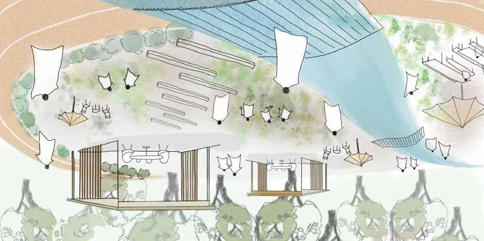
The improved connectivity between Concord West and Sydney Olympic Park allows for a more integrated use of the green spaces adj acent to educational facilities. Instead of being closed-off school grounds, these areas are reimagined as a time-shared landscape that responds to the rhythms of the day and the needs of different generations. During school hours, the space functions as an open extension of the classroom—supporting outdoor learning and active play. In the late afternoon and evening, the same landscape transitions into a gentle walking path and a communal green for local residents, particularly seniors and families.
By designing this flexible use of space, the project encourages intergenerational interaction and blurs the boundaries between institutional and public space. It promotes openness, shared responsibility, and the idea that educational environments can be assets for the whole community—not just for students.
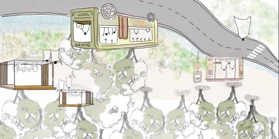
With the introduction of new bus routes linking Sydney Olympic Park and Concord West, the area around the station is transformed into a dynamic transit hub that does more than simply move people. The station plaza and the newly activated underpass are designed to accommodate not only flows of mobility but also flows of daily life. As people gather, wait, pass through, or linger, the space becomes a visible platform for ordinary, spontaneous activity.
Children might be seen skating, commuters sipping coffee, and older residents resting or chatting—all within the same shared environment. These layers of activity are not coincidental; they are strategically designed to encourage passive engagement and informal interaction across generations. In this way, transportation infrastructure becomes more than a technical system—it becomes a civic stage where everyday life unfolds in full view.
7. Area D: Waterside Promnade
Traffic Flow and Connections:
Extend the stone-paved pathway (2.5–3 m wide, 40–50 m long) from Square C into Square D and connect it to the entrance of the elderly home.
Maintain a barrier-free layout, with no level differences exceeding 0.5 m, to ensure accessibility for all users.
Paving and Configuration:
Design the river edge with a curved layout, creating a 1–20 m green belt along the roadway.
Set the paving ratio at 70% and greenery ratio at 30%, using lawn as the primary ground cover.
Integrate the riverside greenery with the existing slope vegetation to achieve a 30% canopy cover.
Planting Plan:
Plant 8–10 m tall trees and 4–6 m mid-height trees to create a layered riverside landscape.
Use 1–2 m low shrubs around platforms to frame views without blocking the river scenery.
Furniture and Rest Areas:
Install 10–15 benches and 2 decks (3 m × 10 m each) facing the river to create comfortable resting points.
Position furniture for use by local café visitors and nearby residents.


Furniture
Flat paving supports multifunctional use including daily movement and events
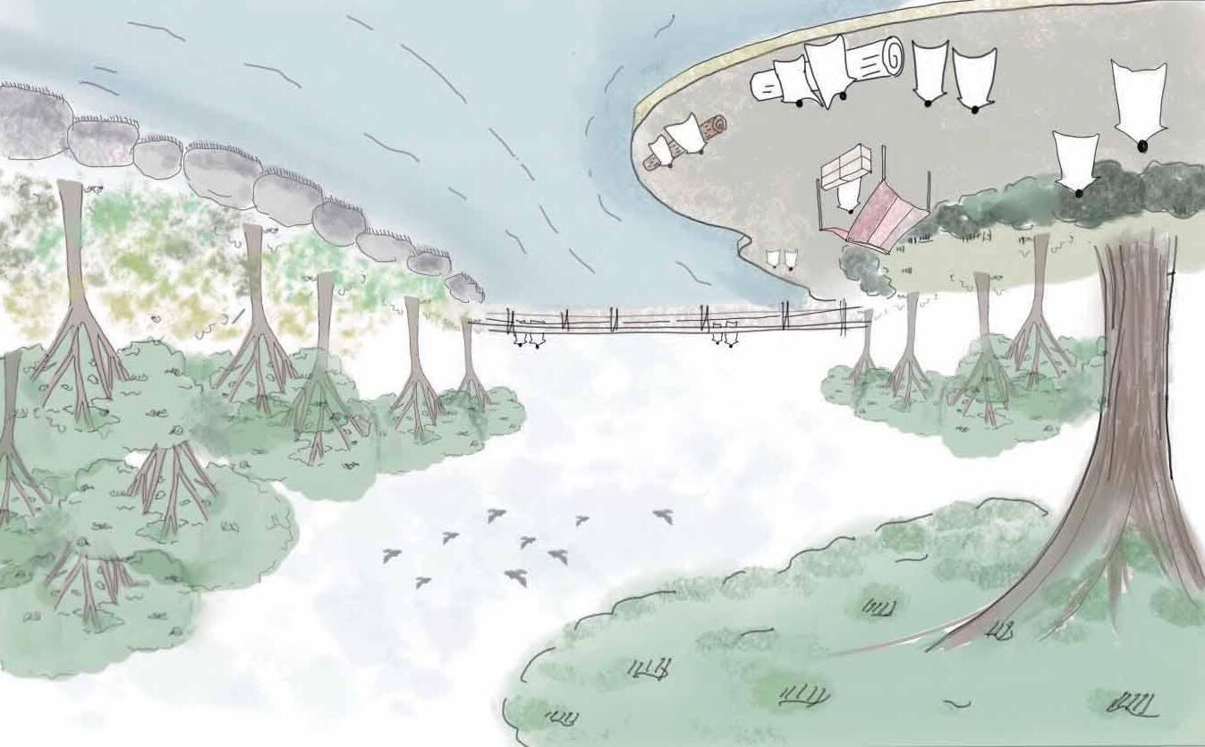
Furniture
Flat paving supports multifunctional use including daily movement and events
Provide shade, comfort, and visual appeal while enhancing the microclimate. These trees support biodiversity and create a welcoming environment for daily movement and occasional events
continuous paving ensures safe and accessible movement for all users. It supports daily circulation to the creek


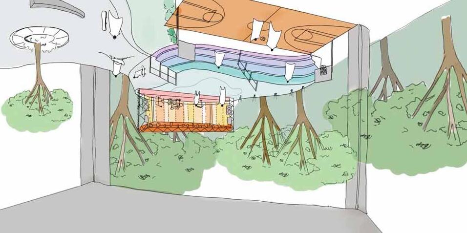
Transforming the underpass from a barrier into a multifunctional social infrastructure.
This design aims to activate the underpass as a flexible public space that serves both everyday use and emergency response.
During normal times, it offers skateboarding ramps, recreational space, and informal gathering zones.
In times of heavy rain or disaster, the same space functions as a retention basin to support urban resilience.
This dual-purpose infrastructure enhances inclusivity, encourages youth activity, and provides a new layer of public utility in the heart of the city.


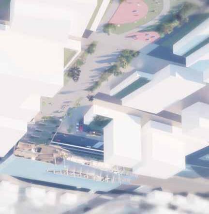


Connecting the community to major centers including the Sydney CBD, Parramatta, and Homebush, Concord West Station is a key transport hub for this neighbourhood.


The current station consists of four platforms, and the existing buildings are constructed across the tracks.
This station is designed to be a multi-functional community center, extending beyond its core transit role. It will be seamlessly integrated with the main public plaza, serving as a central gathering space for the entire neighborhood. The architectural design overcomes the physical barrier of the railway, creating an intuitive and accessible connection that unites the area’s east and west sides. Furthermore, an upper-level with retail and observation areas will provide a key public destination for all generations to gather and stay.

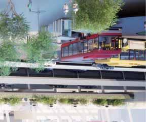
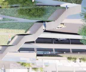
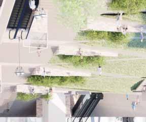
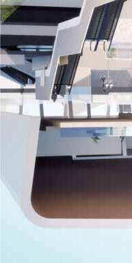
Dynamic Intersection of Diverse Journeys
Seamlessly linking east and west with a new open space, this station becomes a vibrant node where three distinct flows converge, representing a rich diversity of people and purposes.
A continuous ramp leads people seamlessly from the green to the concourse. The ramp has various surfaces, including a stage, furniture and lawn, and acts as an extension of the square and a place for people to stay.


Public Transit Access Flow


West-East Pedestrian Through Flow
Retail & Amenity Loop Flow


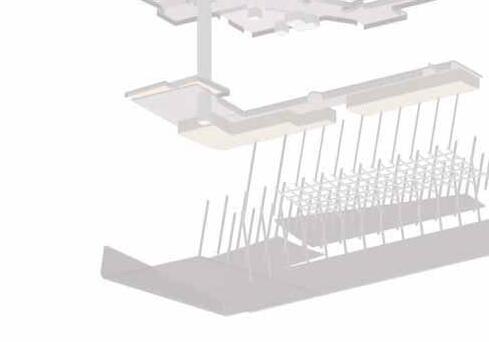


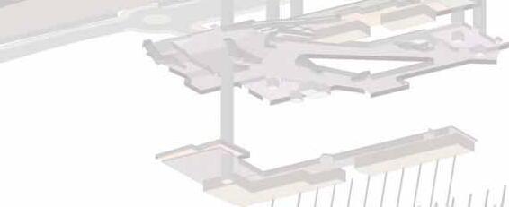


The level difference between the east and west sides of the station shall be connected by a series of landscaped terraces and grand stairs. This terraced design will create a seamless, intuitive, and universally accessible pedestrian flow, breaking down the physical barrier of the topography.
The under-croft spaces created by the level changes shall be utilized as parking and bicycle storage facilities. This strategy promotes a “Park & Ride” lifestyle, reducing reliance on private vehicle transport within the district and encouraging the use of public transit. The design must ensure these areas are welllit, secure, and have clear wayfinding.
The station will have an elevated concourse and observation deck on the upper levels, strategically positioned to overlook the central green space and the Sydney Olympic Park in the distance. This will make these open spaces important civic landmarks in the area.


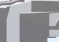


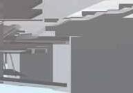


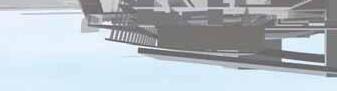


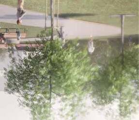

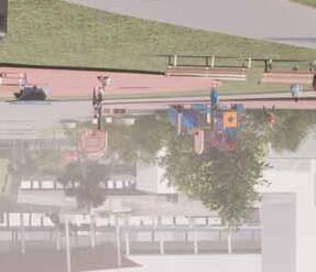

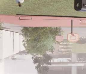


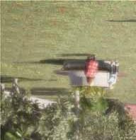
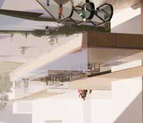

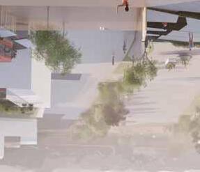

This page is intentionally left blank
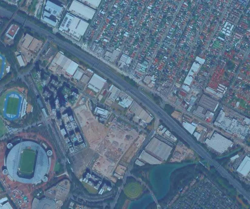
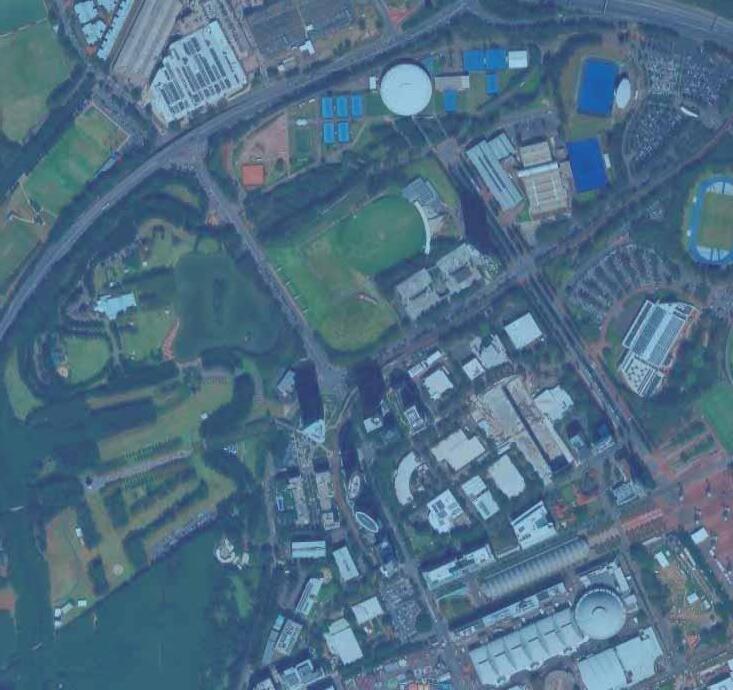


01-1. Overview
01-2. Concept
02-1. District
02-2. Neighbourhood
02-3. SWOT analysis
03-1. Gateway Neighbourhood
03-2. Lifetime Neighbourhood
04-1. Illustrative plan
04-2. Masterplan
04-3. Land Use
04-4. FAR & BCR
04-5. Setback
04-6. View Corridor
04-7. Circulation
04-8. Green Space
05-1. Residential Design Guidelines
05-2. Road Design Guidelines
05-3. Open Space Guidelines
06-1. Design Concept
06-2. Transit Mall Design Guidelines
06-3. Mixed-Use Building Design Guidelines
06-4. Perspectives

This page is intentionally left blank

The aim of our masterplan is to develop four playgrounds that are accessible and convenient for people both inside and outside the neighbourhood, so that more people can benefit from Sydney Olympic Park.
As part of this, Carter Street will serve as a vital link to Lidcombe, which is currently isolated by motor ways and main roads.
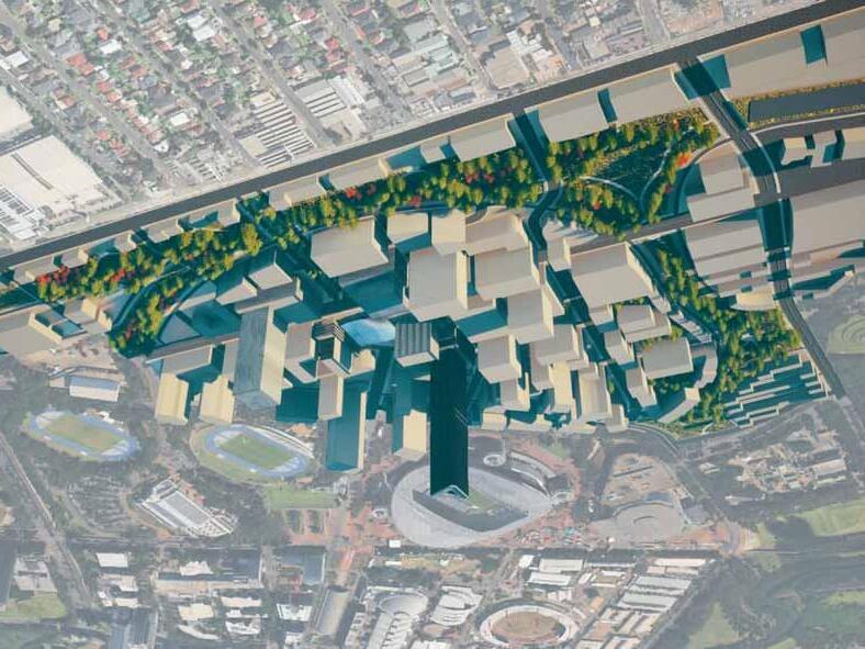
Serving as the central Gateway, Carter Street will be a landmark destination that attracts a significant number of visitors. We are creating ‘Lifetime Neighbourhood’—a self-sufficient and thriving community equipped with all the essential services, retail, and public spaces to support residents from all walks of life.
Enhanced connectivity is at the heart of our vision. The new LRT line makes Carter Street an accessible destination for all. More than just a station, it will be a vibrant ‘Transit Mall’—an integrated hub where various modes of transport converge, ensuring smooth, convenient, and sustainable travel for residents and visitors.
We are creating a significant ‘Green Corridor’ that bridges communities as we transform the motorway into a tunnel. This vital connection will provide residents with safe and direct walking and cycling access to the services of Carter Street. It also strengthens the physical and social connection to Sydney Olympic Park (SOP), integrating its recreational opportunities into the daily life of the neighbourhood.
This page is intentionally left blank
Although current Carter Street is undeveloped, the surrounding neighbourhood area offers unique amenities around Sydney Olympic Park.
Sydney Olympic Park on the north side of Carter Street features an entertainment area that hosts major events and a civic area for citizens to exercise in their daily lives.
On the south side, low-rise commercial and residential facilities line up along the main road called Parramatta Road. There is also a continuous block extending to the Lidcombe district.
Olympic Park Station is a transit hub close to Carter Street. Olympic Park Station provides access to the broader areas such as Parramatta CBD and Sydney Central. However, access from the neighbourhood to the Olympic Park Station is difficult due to the lack of railway services as it stands.
Carter Street is accessible by bus to other major areas such as Lidcombe, Concord, and Parramatta. However, the Olympic Park station is a bit far away, and three available buses to Parramatta and Concord serve bus stops on the outer edge of Carter Street.
401:
Lidcombe is connected to a bus stop in Carter Street, and there are four bus stops on Carter Street.
525:
This route runs from Parramatta to Olympic Park, passing along the edges of the neighbourhood.
526:
From Concord to Homebush, the railway stations are connected through Olympic Park Station.
There are green spaces around Carter Street including Sydney Olympic Park, but most of the green space is spread out in areas away from its core.
Haslam’s Marker, the closest green space, is a decent spot nearby; however, it is small and not easily accessible to many people.

The neighbourhood is surrounded by collector roads, ensuring good access to main roads and motorways.
However, the limited number of traffic lights at junctions poses potential safety concerns..
Carter Street
There is extensive on-street parking along Carter Street.
Hill Road
Hill Road has heavy traffic due to the large number of cars coming from Western motorway, Lidcombe and Parramatta Road.
This page is intentionally left blank
Strengths
Access via Transportation
The area is well-served by various transportation options.
Place for Shopping
Major retail presence with a large “COSTCO”.
Sports & Fitness Hub
Several opportunities for a variety of exercises.
Weaknesses
Walkability
A significant amount of street parking creates an environment that is unfriendly to pedestrians.
Vibrancy
Without events, the area is quiet and not very lively.
Lack of Services
There are few amenities for residents to enjoy daily life.
Accessibility Issues
A steep incline on the road leading to Sydney Olympic Park presents a barrier for pedestrians and cyclists.
Opportunities
Commercial and Community Engagement
The constant flow of people is commuting through Carter Street.
Potential Economic Benefits
The capacity to host major events is a huge economic and cultural asset.
Threats
Poorly Maintained Road
During events, the main roads become exceptionally crowded and difficult to use.
Possible Traffic Congestion
This influx of vehicles from the highway leads to traffic congestion on surrounding roads.
Living Environment
Noise from the events might lead to a nuisance for local residents , and there is also a lack of parking.
This page is intentionally left blank
Overview
The main street runs in front of the station to welcome those visiting by transportation. Commercial and mixed use buildings are located along that street, while hotels and high-rise residential buildings are located around the stadium.
There will be approximately 90,000 people in total on an event day within this precinct. There’s clear separation on its zoning for low-rise residential areas off the stadium precinct.
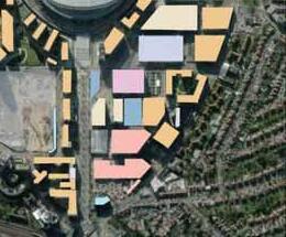

: High-residential : Public : Low-residential : Others
: Commercial GreenSpace : Hotel : Parking
Scale Comparison

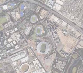
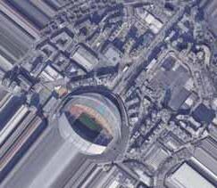
Appearance Land Use
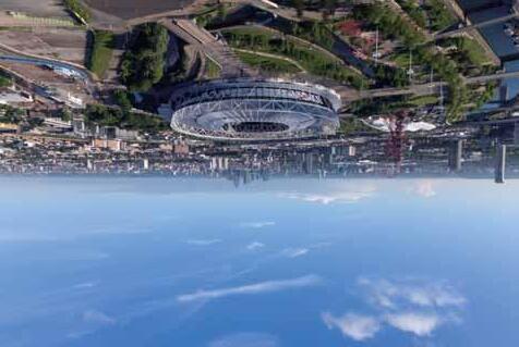
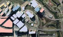
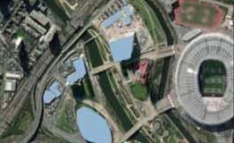


Similar to SOP, this is an example of a concentrated Olympic legacy that forms a gateway to the Olympic Park.
Multiple Neighbourhoods spread out in the park, and a greenway appears in the path from the station to the stadium. Commercial and mixed use also concentrated in front of the station, while hotels and high-rise residences are included in these land use. Scale Comparison
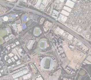

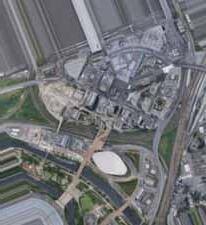
Highway capping and removal
The strategy reclaimed land from divisive highways into green urban boulevard reconnecting neighbourhoods.
The highway was moved underground, and the surface was transformed into the Rose Kennedy Greenway. The linear park not only alleviated heavy traffic congestion but also reconnected neighbourhoods.
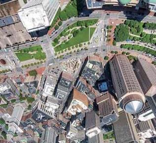
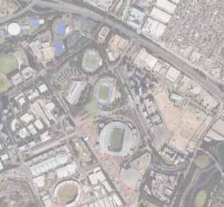
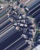
The community, which had been divided for 50 years was reconnected through major redevelopments.
After placing the highway underground and creating the park on top, the project serves as a green bridge, reconnecting the community along with the improvements on intersections and wider shoulders on the road.
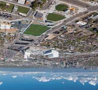
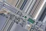
Integration of accesible infrastructure
Below are the infrastructures designed to encourage circulation not only improve accessibility between locations, but offers additional amenities in between.
This elevated highway was demolished and replaced with a ground-level, multi-modal urban boulevard, integrating green space and reconnecting the city to the cultural center which has played an important role for residents and visitors.
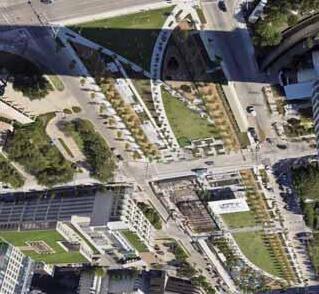

The upgrades to the station will further strengthen its role as gateway. The integration to the other transportation would enlarge not just whole developments inside station square but the connection for people coming from outside.

Buffer design
Aiming for a design in public open spaces slightly opened to public, that urges social connection and recreational activities.
West Harbour, Malmö, Sweden
There are wide green space in between buildings designed as a buffer area incorporating recreation. The green coverage area is spreading as shown between residential and other land uses.
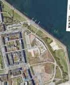
Park, Boston, US
Here are the low-rise buildings adjacent to the stadium. There seems to be a vibrant atmosphere on and off the event days while retail and mixed-use development are dominant in the land use.
The proposed sites have been left undeveloped on the west side and the southern city block next to the highway.
The masterplan outlines both of the zone as key proposal area with distinct urban fabric crossing in front of the transit hub.


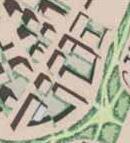


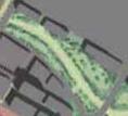


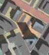


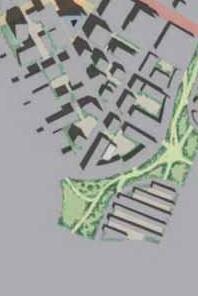


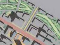


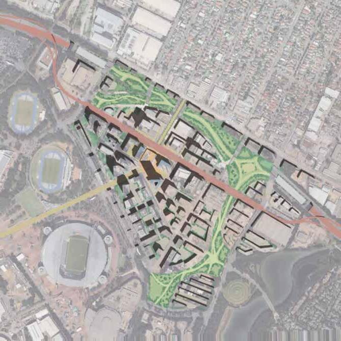

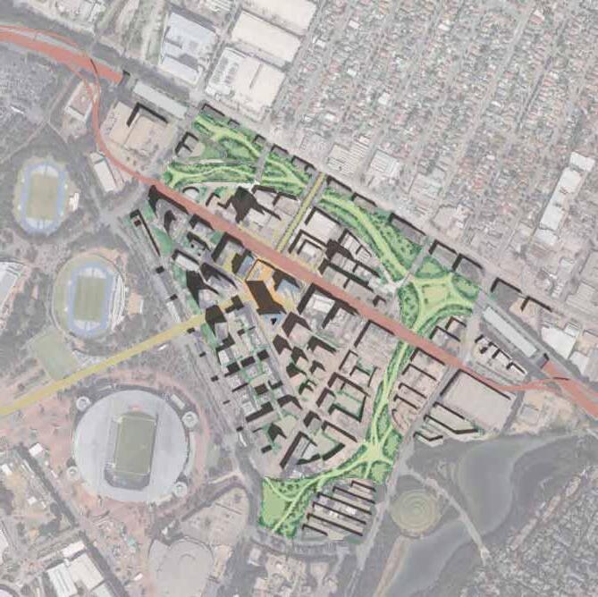

At the district scale, this masterplan strategically positions Carter Street within its broader regional context, fostering robust connections with its surroundings. Central to this vision is the establishment of a grand Green Corridor, which seamlessly weaves the expansive parklands of Sydney Olympic Park into the green heart of the Carter Street precinct.
More than just a connection, this corridor acts as a vital artery, designed to welcome and channel movements. It captures pedestrian flows from the adjacent Lidcombe and Newington Districts, while also accommodating visitors arriving via ferry and car, guiding them smoothly into Carter Street.
Ultimately, the plan envisions Carter Street thriving as a dynamic and integrated hub that flourishes through its symbiotic relationship with surrounding facilities and communities.


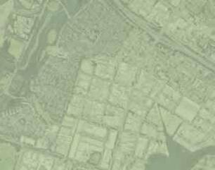

NEWINGTON DISTRICT


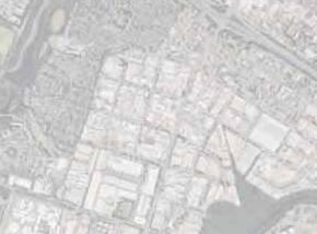


LIDCOMBE DISTRICT


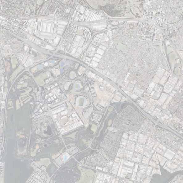


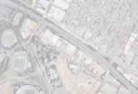


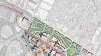


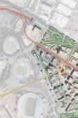
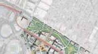


Neighbourhood Scale
This master plan envisions the transformation of Carter Street into a premier destination, defined by two key features: a central “Transit Mall” and a unifying “Green Corridor.”
At the heart of the precinct lies the vibrant transit mall, conceived as the primary hub of community life and connectivity. This dynamic space will serve as the district’s main gateway, integrating seamlessly with the future Sydney Metro West station and other public transport links. Originating from this central point, a commercial axis will branch out to form a lively avenue, while a transit axis ensures effortless movement throughout the area.
Complementing the bustling energy of the mall is the expansive Green Corridor, which acts as the precinct’s green spine. This corridor is designed to be a welcoming and iconic feature, weaving through the community to connect key destinations. It provides a natural, inviting path to amenities such as the entertainment facilities and the civic playground, making them focal points for both residents and visitors.
Both the transit mall and the Green Corridor will play a pivotal role in fostering a cohesive and integrated environment where community, commerce, and nature coexist, establishing a unique and desirable identity for the Carter Street precinct.


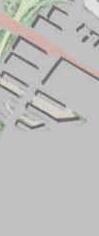


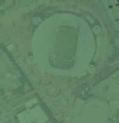
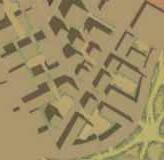


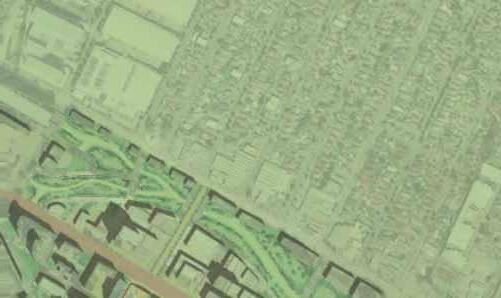


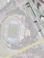
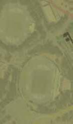


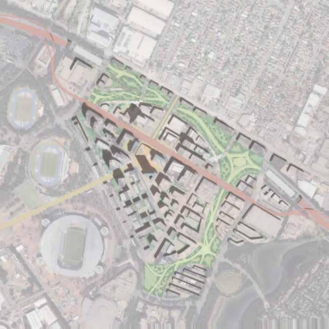
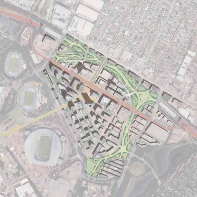

Future Land Use outlines a development framework that will support the growth of this neighbourhood based on precedents equivalent to site area and also defined by the urban fabric with a large traffic intersection and its widespread amenities.
Building footprints are determined by the required number of areas.

LANDUSESITEAREA(㎡)COVEREDAREA(㎡)GROSSFLOORAREA(㎡)
HIGH-RISERESIDENTIAL RETAIL
125,00075,000700,000
60,00035,000240,000
20,0006,00090,000
35,00030,000220,000
N/A115,000N/A

PARKING
N/A35,000540,000
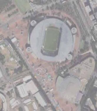
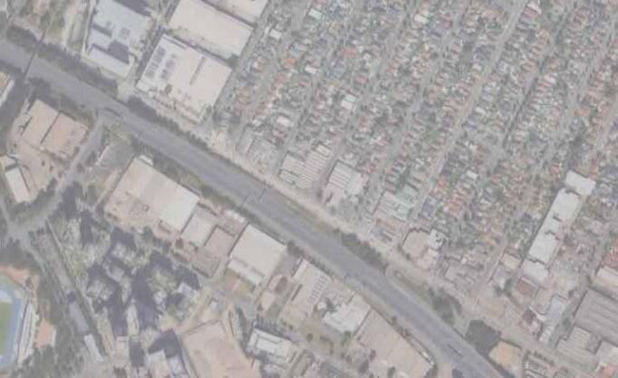

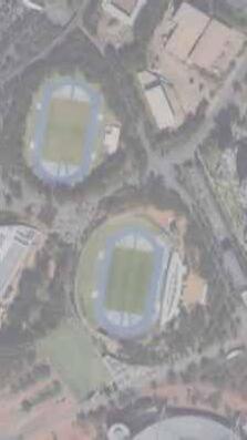
FAR:
Floor area ratio have been defined from each of the GFA calculated and the appropriate footprint. The number at the certain area has been set higher and suitable for major developments.
BCR:
These numbers intend to outline covered area of each land with buildings. The area with high ratio is projected to become high-dense development zone while all the estimated development lands to cover half of the sites.
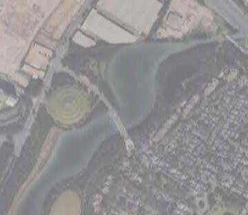

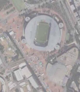

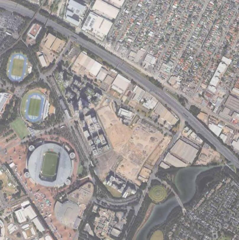
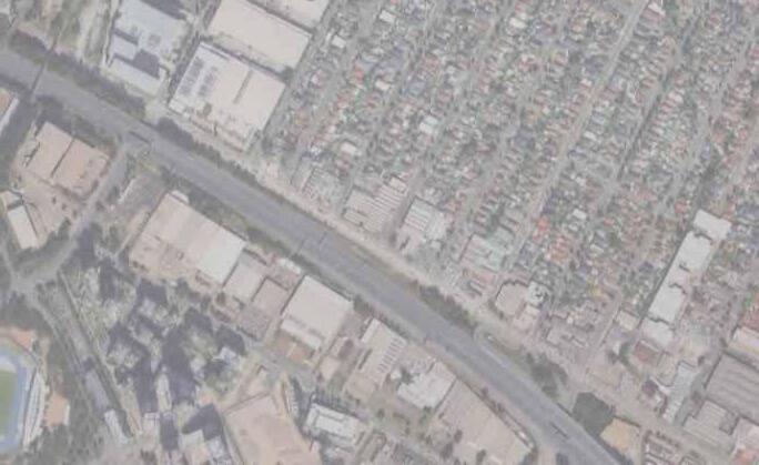
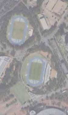
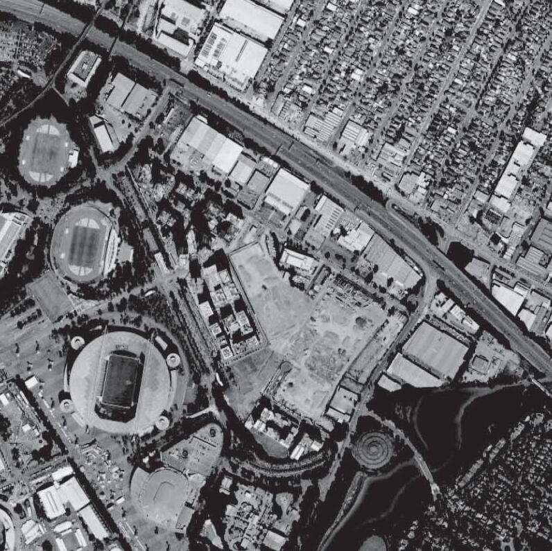
Setback regulations determine the outer boundaries of the building footprints.
Especially the roads adjacent to greenways shall have no setback. On the other hand, along Carter Street, where there is a concentration of high-rise buildings, further building setbacks are required on wide streets to avoid a sense of enclosure.

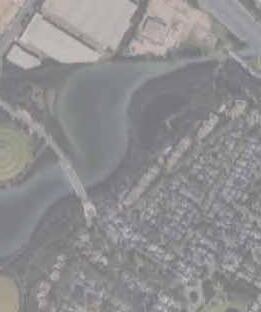
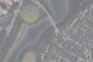


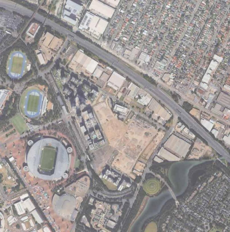
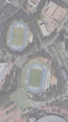
Restricting building height from two perspectives;
a) To capitalize gradual skyline
No higher buildings allowed in eyesight from gates of the neighbourhood, shown in orange, to the 150m of the landmark building.
b) To make the landmark building stand out
No higher buildings allowed in eyesight from entrances of Carter Street, the main road shown in blue, to the 100m of the landmark building.
Railway
The station should be located at the intersection with Carter Street as close as SOP, similar to the current LRT extension plan. This aims to avoid the congestion of cars, buses and LRT at Carter Street.
Bus
The station will be routed so that cars and buses would not intersect the LRT, but going through Carter Street to alleviate traffic congestion instead.
Additional clear integrated bus routes are required to minimise the intersections of motorway. One penetrated road to Lidcombe has covered the commuter transportation through both neighbourhoods.
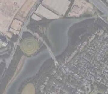

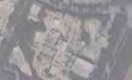
: LRT : Newington Route : Lidcombe Route : Expressway Bus

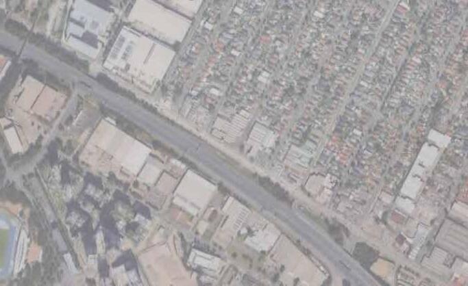

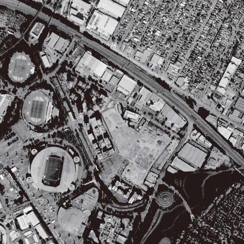


The road plan aims to increase accessibility to amenities from the wider area to make the four playgrounds currently car-dependent parts of the neighbourhood.
Pedestrian network
The sidewalk plan defines access to each playground from wide pedestrian spaces, including Carter Street and a greenway.
The living streets in the western undeveloped areas will be added to the residential areas due to the lack of the streets. In addition, the space between the LRT station and the Sydney Olympic Park will have pedestrian roads.
Vehicular network
The road plan defines the roadway so that ingress and egress from the undergrounded highway will be possible via Carter Street, the main roadway of the neighbourhood.
This open space framework creates a well-connected and vibrant public realm. Its strategy uses “Nodes” as gateways to welcome diverse people from residential areas like Newington , Lidcombe , and Wentworth Point , as well as from hubs like the transit mall and Accor Stadium.
From these points, a network of “Paths” directs “Pedestrian Flow” to various amenities, including the Athletic Centre. This network highlights a “Main Park”, envisioned as a unique landmark destination with a distinctive character. The entire system within the “Site Boundary” is designed to be accessible and engaging for all.
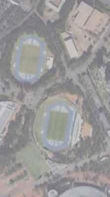
This page is intentionally left blank
05-1. Residential Design Guidelines
05-2. Road Design Guidelines
05-3. Green Space Design Guidelines
Overview
Carter Street is currently in the beginning stages of residential development. Also, population growth is expected with the regeneration of Olympic Park and the upcoming extension of the LRT.
In accordance with the proposed land use strategy, 7,500 residential units will be provided for 15,000 people for a diverse range of people regardless of income level targeting to distribute affordable housing over 20% of population.
Housing distribution is different in three areas in order to enhance liveability. Thus, there shall be rows of high-rise residential buildings within 45m square block in areas close to existing high-density developments. Around the edge of these areas, there shall be relatively low buildings, including a couple of storeys with other functions installed especially on the ground floor.
And mid-rise residential buildings shall be constructed on the outer edge for the purpose of securing pedestrian space along greenways.
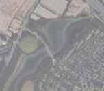


This type of apartment is set to be built in the central area of this neighbourhood so not to hide behind high-rise buildings. Also installing retail or shops as amenities on the lower floor.
Typical typology for apartments as this type of footprints are adaptable to the high-rise building and well-lit following the positions of windows. Ground floor must be activated with other uses to create a vibrant street as shown on the left.
This typology is located separately from the highrise development area in the middle, making it a primarily residential thoroughfare defined by its quiet and private character. Lacking ground-floor retail, the streetscape is composed of uniform residential frontages, lobbies, and private access points, serving as a tranquil buffer from the more active parts of the city.
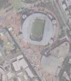


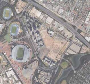


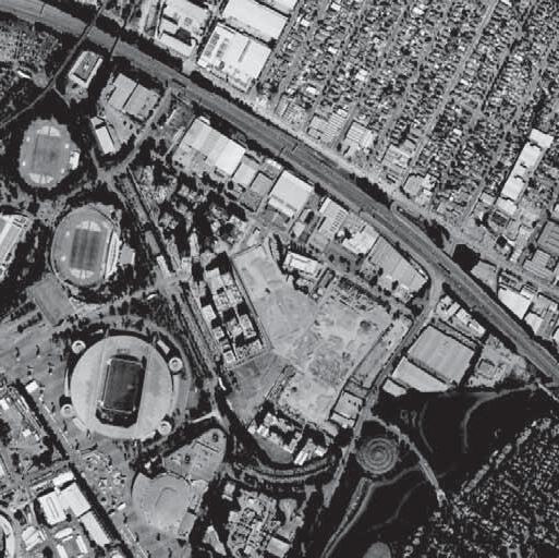
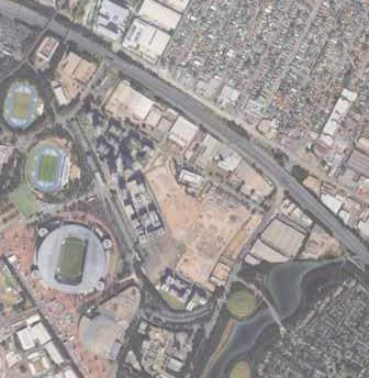


Here are nine types of roads in this neighbouhood from 16m to the range of 44m.
The movement network of the precinct has been developed to balance the needs of pedestrian, cycle and vehicular traffic. The street network compliments the character of Sydney Olympic Park, while connecting the precinct to the surrounding areas.
: Site Boundary
: 34m Carter Street
: 28m Uhrig Road
: 26m Edwin Flack Avenue
: 25m Collector Road
: 22m Local Open Street
: 18m Local Street
: 18m Local Spine
: 16m Connection Road
: 44m Gateway Street
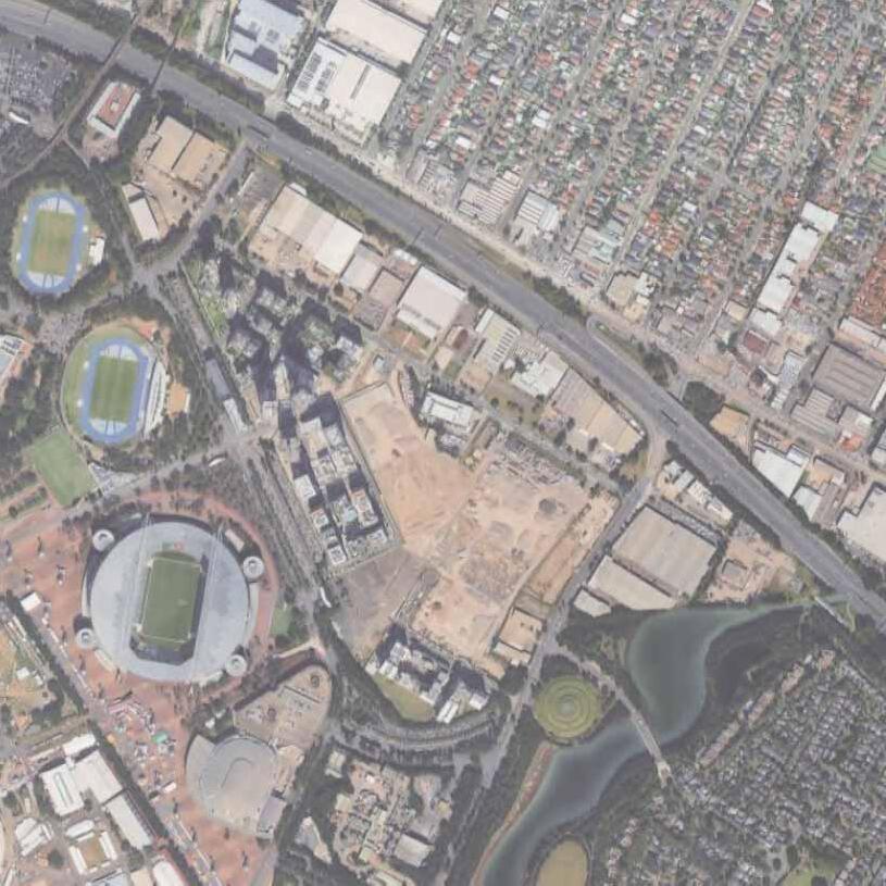
The road is defined as the main road of the neighbourhood with the merging points of highway are shared. So, the bus lanes have been installed directly accessible to the transit station next to the lane.
10-20% BONUS IN THE FAR
A10%to20% bonusinthe permittedFloor AreaRatio(FAR) canbegranted
byprovidingopenspace equivalentto5%ofthetotallot areaonthesidefrontingCarter Street.
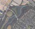


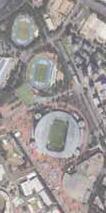
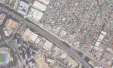


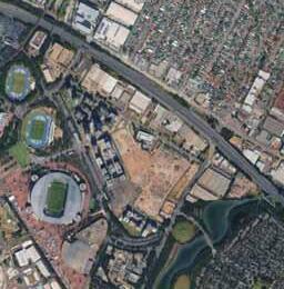


This road is a major artery designed specifically to serve the adjacent stadium precinct. It manages the intense surges of cars and pedestrians during major events with its multiple lanes and wide, separated pavements for crowd safety. It is a high-capacity road that balances the demands of a large public venue with the daily needs of the community.


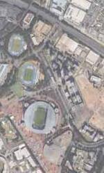


This road type was adopted for the traffic flow outside the residential area. This road, connecting to local roads, is also a bus route, and three lanes were provided on one side with the aim of improving access to the station.


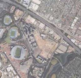


This street acts as a central boulevard and community spine for the neighbourhood. With its generous width, landscaped median, and wide pavements, it is designed to be more than just a road for cars. Its “open” design makes it a key public space, suitable for community gatherings, markets, or simply acting as a beautiful primary street for residents going to transit hub.


This is a standard local street designed for simple and safe access to homes. It features two travel lanes separated to control traffic, along with wide pedestrian zone. Its well-organised design prioritises a safe and secured environment for residents living along the streets.


Local spine is defined to become a road encouraging pedestrians with a safe and secured vehicular environment. That “shared road” incorporate safety and security making it difficult to drive insecure in a narrow street.


This road incorporates residents and visitors safely reaching the proposed green corridor lying alongside its road. It’s also the inner road inside of the collector road that encourages walkable experiences.


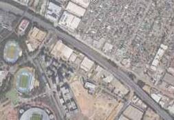


This way is a leading path to the gateway of this neighbourhood, as the central pedestrian footpath is serving spacious open spaces.
Also, the newly integrated bus routes are running this road through to Lidcombe neighbourhood.


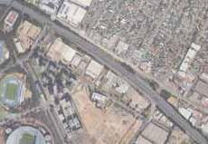
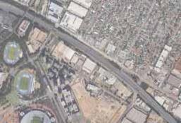


Park entrances must be considered to ensure continuity with adjacent city blocks, designing the park to function as an integrated part of the city. Providing multi-access points is essential to achieve this, as it incorporates daily use while enhancing safety through the interaction to the community.
These multiple entrances should be organised with a clear hierarchy. A ‘Main Entrance’ should face a primary street, acting as the formal face of the park and equipped with key amenities such as information signage. In contrast, ‘Secondary Entrances’ are designed as simpler gateways that provide convenient, daily access for local residents.
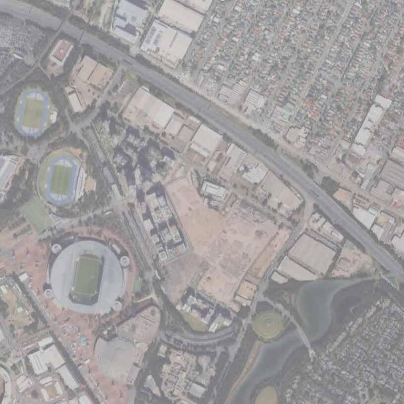


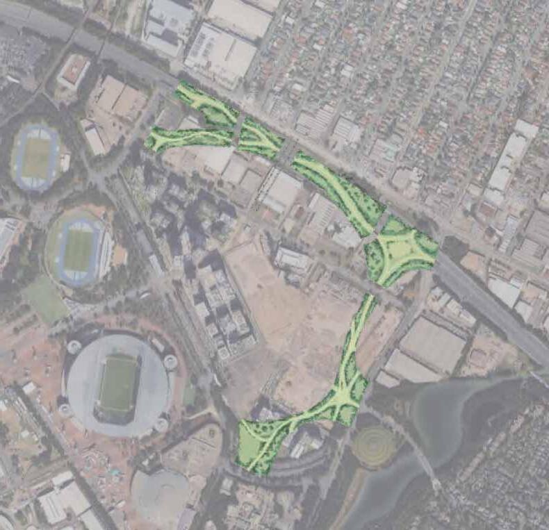


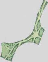


Palettes
In accordance with the green coverage ratio, specific plants must be selected for the categories of tall trees, medium-sized trees, and shrubs/ground cover. Thus, the plants shown below are proposed as a standard selection, based on their suitability for the climatic conditions of Sydney, Australia.
When designing green spaces, the “green coverage ratio” must be considered. This means that a designated percentage of the park’s total site area must be planted with vegetation.
The method for calculating the plant area is as follows:
Tall trees (over 3m) are credited as 10m2 per tree.
Medium-sized trees (1-3m) are credited as 4m2 per tree.
Shrubs and ground cover are credited based on their actual planted areas.
By assigning an appropriate green coverage ratio for each park, this methodology aims to create high-quality green spaces.
These trees form the landscape's backbone, providing significant shade, cooling benefits,
encouraging the planting of large, impactful species.


Perfect for gardens and streets, these human-scale trees provide landscape value.

This category covers the ground plane, preventing soil erosion, suppressing weeds, and adding color and texture. The actual planted area is counted directly, reflecting their primary function of providing surface coverage.


Overview
Strategically located with connections to the adjacent Sydney Olympic Park, residential areas, and Carter Street. This park is designed to be a welcoming space for a diverse range of visitors. The primary purpose of the park is to offer a place for rest and relaxation with benches and small shelters.
Specification
Total area : 41,200m2
Primary Function : Relaxation and Recreation
Pathway Width : 3m
Green Coverage Ratio : 20% (8,240m2)
Flora :
Tall Trees : 400
Medium-Sized Trees : 200 Shrubs : 2,240m2
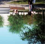

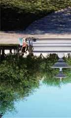
Overview
Designed as a central gathering place for visitors from surrounding commercial facilities, the park’s core is a spacious tiled plaza. This versatile space is designed to foster community engagement and social interaction, with a strategic tree layout that maintains clear, open sightlines.
Specification
Total area : 23,400m2
Primary Function : Improving the Community Pathway Width : 4m
Green Coverage Ratio : 10% (2,340m2)
Flora : Tall Trees : 4100
Medium-Sized Trees : 50 Shrubs : 840m2
Overview
This park, located off Central Road next to office and commercial area, is designed to feel open with clear views following the reduction in number of tall trees per area. Tall trees are lined up at even intervals along the paths together with lights. It has aimed to create beautiful tree-lined walkways for everyone to enjoy.
Specification
Total area : 17,100m2
Primary Function : Connection between main roads
Pathway Width : 4m
Green Coverage Ratio : 15% (2,940m2)
Flora :
Tall Trees : 150
Medium-Sized Trees : 300 Shrubs : 240m2
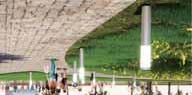
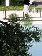
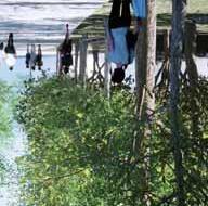

Overview
This park connects Central Road to an area with schools and offices. Its main purpose is to create a gradual change from a busy atmosphere to a relaxation space. Tall trees along the walkways will incorporate produce an overall calm and quiet feeling in entire of the park.
Specification
Total area : 17,100m2
Primary Function : Relaxation and Recreation
Pathway Width : 4m
Green Coverage Ratio : 15% (2,565m2)
Flora :
Tall Trees : 150
Medium-Sized Trees : 200
Shrubs : 265m2
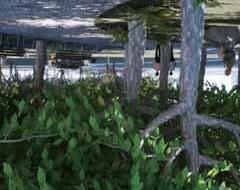

Overview
This park, located next to an elementary school, is set up for children to play. The objective here is to make it feel like an extension of the schoolyard, but with a much more wild atmosphere. Kids can be in touch with nature thanks to a high percentage of green space. Benches around the park does help make sure it’s a useful space for everyone in the community, not just for kids.
Specification
Total area : 21,800m2
Primary Function : Extention of the school playground
Pathway Width : 2m
Green Coverage Ratio : 25% (5,450m2)
Flora :
Tall Trees : 350
Medium-Sized Trees : 200
Shrubs : 1,150m2
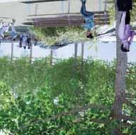

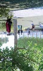
Overview
This park is located in a quieter part of Carter Street, away from the busy center. It’s designed mainly for relaxation. With an intention to establish authentic Sydney vibes, so traditional plants with bright, rich colors are preferred. There will also be street furniture like benches where needed, so people can have a place to have a rest.
Specification
Total area : 20,600m2
Primary Function : Relaxation and Recreation
Pathway Width : 4m
Green Coverage Ratio : 25% (5,150m2)
Flora :
Tall Trees : 350
Medium-Sized Trees : 300
Shrubs : 450m2
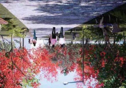
This page is intentionally left blank
06-1. Design Concept
06-2. Transit Mall Design Guidelines
06-3. Mixed-use Building Design Guidelines
06-4. Perspectives
The focus area comprises five buildings and is broadly divided into two main zones: the station building area, which includes the station, and the station-front building area located to its south.
The masterplan’s primary objective is to establish a reconnection over north to south, as a gateway to the district. A landmark tower at its centre will anchor the development, reinforcing its identity as a Central Business District. An integrated station and mixed-use complex, serve as a major transportation hub for bus and LRT services, will draw people from surrounding areas. By creating this central space for activity, significant pedestrian flow and lively neighbourhood will be created, enhancing multiple functions of the entire city.
The station focuses on people being able to use and walk comfortably, and aims to be an open transition terminal with natural light to enhance safety and security. 1. Function
Attracting people from surrounding areas by providing a station and complex with a nodal function for bus and LRT public transportation. By creating a central activity space for the city, it will generate a flow of people and liveliness, enhancing the attractiveness and functionality of the city overall.


The LRT is routed to enter the station from the north, while buses are planned to have a one-way access route from the north and south to ensure smooth and safe operation.
The entire site plan is driven by pedestrian flow. The entrances to all retail buildings are strategically oriented towards the central transit mall, demonstrating a clear design intent to channel commuter traffic directly into the commercial areas. This creates a highly integrated and synergistic environment where the transport infrastructure and retail destinations are mutually reinforcing.


From the ground level to five storeys are projected to be filled with retail shops. The floor plan is strategically designed to support a high-density mix of retail stores located from the ground level to five storeys. A primary circulation loop ensures constant customer flow along a continuous frontage of tenant spaces, maximizing exposure for each retailer. This layout, often centered on a multi-story atrium for open sightlines and vertical connectivity, allows for flexible partitioning to accommodate a diverse range of store sizes, from small boutiques to larger-format shops.
1. Function
The aim is to develop a complex in the area around the station that welcomes a diverse range of people, attracting local residents and visitors from the station, fostering a bustling atmosphere and becoming a symbol of the city’s individuality.
Entertainment and commercial facilities function as amenities for those visiting this neighbourhood. Retail and office spaces are located on the lower floors of each building to serve residents of the neighbourhood as well.
This page is intentionally left blank
Waseda university
Tetsuya Yaguchi
University of New South Wales
Raffaele Pernice
Waseda University (Yaguchi Lab)
Site 1: Merlose Park
Sosuke Ando
Rin Kajikawa
Masato Sasaki
Site 2: Concord West
Soichi Kaiwa
Mayu Suzuki
Shidaku Chin
Site 3: Carter Street
Shu Kawamata
Kentaro Tachi
Shoji Momosaki
First Published byFirst Published by Yaguchi Lab.at Department of Architecture, School of Creative Science and Engineering, Waseda University.
Supervised byTetsuya Yaguchi
Edited byKentaro Tachi
Masato Sasaki
Mayu Suzuki
Rin Kajikawa
Shidaku Chin
Shoji Momosaki
Shu Kawamata
Soichi Kaiwa
Sosuke Ando
Published Date2025/07/25