
Trenton Transit-Oriented Development Redevelopment Area Plans

Page 1


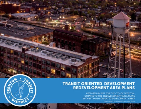
TRANSIT ORIENTED DEVELOPMENT

REDEVELOPMENT AREA PLANS

PREPARED BY WRT FOR THE CITY OF TRENTON: UPDATES TO THE REDEVELOPMENT AREA PLANS WITHIN TRANSIT ORIENTED DEVELOPMENT AREAS FINAL DRAFT FOR ADOPTION - MAY 2024

PART B: REDEVELOPMENT AREA PLANS

I.

EWING-CARROLL-SOUTHARD REDEVELOPMENT AREA

CENTRAL EAST REDEVELOPMENT AREA

TRENTON STATION REDEVELOPMENT AREA

IV.

ROEBLING COMPLEX REDEVELOPMENT AREA

ROEBLING GATEWAY REDEVELOPMENT AREA

LAMBERTON REDEVELOPMENT AREA

CASS STREET REDEVELOPMENT AREA

PART C: IMPLEMENTATION IMPLEMENTATION

PART A TRENTON TRANSIT DISTRICT OVERVIEW

ACKNOWLEDGEMENTS

City Council

Joseph Harrison

Jasi Mikae Edwards

Crystal Feliciano

Jenna Figueroa Kettenburg

Teska Frisby

Yazminelly Gonzalez

Jennifer Williams

Planning Board Members

Anthony Santora

Caty Dominguez

Charles Romanow - Chair

Diana Walker

Jeff Halpern

Jonathan “Lank” Conner

Joseph Harrison

Markus Green

Patricia Ni’ma Mohammed

Randy Baum – Vice-Chair

Wanda Swiggett

Department of Housing and Economic Development

Stephani Register

Willard Stanback

Michael Kolber

J.R. Capasso

Tom McGough

Eric Maywar

Jeffrey Wilkerson Consultants

WRT, LLC

Brownfield Redevelopment Solutions (BRS)

Kittelson & Associates

Urbane Development

Wilentz, Goldman, and Spitzer

INTRODUCTION & CONTEXT 01

IN THIS CHAPTER

INTRODUCTION & LOCATION

REDEVELOPMENT PLAN PURPOSE & STATUTORY REQUIREMENTS

HOW TO USE THIS PLANNING DOCUMENT

PLANNING PROCESS & COMMUNITY ENGAGEMENT

INTRODUCTION & LOCATION

CONTEXT

Trenton’s transportation infrastructure has grown and evolved over the city’s long history, leaving the Trenton of today with a robust transportation system that can accommodate the City’s growth well into the future.

As the only city in New Jersey to serve three major railway systems (Amtrak, NJ Transit, and SEPTA), with service to New York and Philadelphia, Trenton has untapped potential to support dense, walkable, mixed-use development near the City’s transit stations.

As transit ridership continues to rise back to pre-pandemic levels, now is the time to plan for improved pedestrian connections, amenities, housing, and mixed-use development – all within walking distance of Trenton’s transit stations.

What is Transit Oriented Development?

New Jersey Future defines transitoriented development, or TOD, as simply mixed-use residential and commercial development designed to take advantage of access to public transportation. TOD is an important component of “smart growth” because it allows communities to live, work, shop, and play without having to rely on a car. TOD is designed to take advantage of existing infrastructure like roads and rail lines for denser development in centralized areas with available alternative transportation, thus reducing development pressure on open space and farmland. Generally, transit accessibility and TOD areas include those that are within a 10-minute walk or ½ mile from transit stations. The three transit stations that are part of this planning process are Trenton Transit Center, Hamilton Avenue Station, and Cass Street Station. The Trenton Transit Center serves Amtrak, NJ Transit, SEPTA, the River Line, and buses and the Hamilton Avenue and Cass Street Stations are exclusively the River Line light rail and SEPTA.

What is a Redevelopment Plan?

A Redevelopment Area Plan (RDA) is a Plan that guides the “rebuilding or restoration of an area in measurable state of decline, disinvestment, or abandonment.” As a whole, the City of Trenton has over 40 Redevelopment Area Plans (RDAs) of which seven existing redevelopment areas are located within the Trenton Transit District and are in need of an update. This planning process includes an update of each of those seven Redevelopment Area Plans and includes the identification of catalyst sites and early action projects.

Redevelopment Area Plans in need of an update:

f Ewing-Carroll-Southard, last revised in 2007.

f Central East, last revised in 2023.

f Trenton Station, last revised in 2009.

f Roebling Gateway, last revised in 2013.

f Roebling Complex, last revised in 1997.

f Lamberton, last revised in 2014.

f Cass Street, last revised in 2007.

TRANSIT ORIENTED DEVELOPMENT STRATEGIC PLAN

Trenton’s Transit Oriented Development Strategic Plan (TOD Plan) was adopted in 2019 and was prepared to supplement the Trenton250 Plan (2017). The Plan defines major gaps and barriers to the redevelopment and revitalization of the transit station areas, including safety and security, sense of place, vacant and abandoned properties, transportation connections, and property redevelopment. It also provides frameworks to create opportunities around the Trenton Transit Center (1/2-mile radius) and provides recommendations for coordination between City Departments, property development, intersection improvements and connections between interest areas, infrastructure investments, and economic drivers.

The purpose of the Trenton Transit Oriented Redevelopment Area Plan is to build upon the work developed through the TOD Plan, update the RDAs to reflect the current objectives and environment, and to facilitate funding and support for development near transit. The updates will benefit the community and it will be an opportunity to:

f Implement the Transit Oriented Development Strategic Plan to coordinate investment within the study areas, encourage compact mixed-use development, multimodal linkages, and equitable access in and around the transit stations within the Redevelopment Plans.

f Design new concepts for infill and mixed-use development to determine the appropriate program and level of development for the study areas that are sensitive to the City of Trenton’s predominant land uses, building heights, and community character, as well as the vision to achieve.

f Pursue Transit Village Designation to advance development and transit connections, as well as economic attractors with a network of walkable and bikeable streets, public plazas, and open streets.

f Bring Plans up to date with Trenton250 and the new Land Development Ordinance (LDO) to set the ground to develop a distinct place that preserves and enhances the character of the existing neighborhoods.

f Identify streetscape and public space improvements, to create an authentic live/work/play environment that attracts residents and visitors to experience the Trenton Transit District.

f Improve multi-modal connections, community character, and sense of place through safe and inviting connections for pedestrians, bicyclists, vehicles, and public transit users.

f Explore innovative approaches to economic development.

f Build capacity for existing residents, businesses, and property owners to support implementation efforts that support the long-term strength of the Redevelopment Areas.

f Define opportunities for publicprivate partnerships that will encourage the investment within Redevelopment Areas to realize the vision of the Redevelopment Plans and increase the potential for funding and implementation dollars

f Facilitate development projects with landowners including county and state public agencies.

The updates of these Redevelopment Plans brings an opportunity to involve the community in conversations about the future use of properties that have been neglected, and which are the strategies to implement these areas as community-friendly, housing appropriate, and economic drivers of the community; bring plans up to date with Trenton250 and the new Land Development Ordinance (LDO); understand the market potential and constraints near Trenton’s transit stations; identify catalyst sites and early action projects to keep the momentum going; better position the areas for funding opportunities and partnerships; and build capacity for residents and existing business owners.

TRENTON250 VISION & GUIDING PRINCIPLES

Trenton First: A Premier Economic and Cultural Center Built on Arts, Industry and Education

f Foster Social Opportunity and a Vibrant Economy through Education.

f Establish a Preeminent Arts and Culture Destination.

f Build a Safe City.

f Advance Good Governance.

f Promote Civic Unity and Pride.

f Cultivate a Healthy City.

f Reinforce High-Quality Neighborhoods and a 24/7 Downtown Trenton.

f Capitalize on Location and Urban Form to Support a Multi-Modal Transportation Network.

REDEVELOPMENT PLAN PURPOSE & STATUTORY REQUIREMENTS

The purpose of the Trenton Transit Oriented Redevelopment Area Plans is to build upon the work developed through the TOD Plan, update the Redevelopment Areas (RDAs) to reflect the current objectives and environment, and to facilitate funding and support for development near transit. The updates will benefit Trentonians and it will be an opportunity to:

f Implement the Transit Oriented Development Strategic Plan through coordination of investment within the study areas, encourage compact mixed-use development, multimodal linkages, and equitable access in and around the transit stations within the Redevelopment Plans.

f Design new concepts for infill and mixed-use development to determine the appropriate program and level of development for the study areas that are sensitive to the City of Trenton’s predominant land uses, building heights, and community character, as well as the Trenton250 vision.

f Pursue Transit Village Designation funding to advance development and transit connections, as well as economic attractors with a network of walkable and bikeable streets, public plazas, and open streets.

f Bring the Redevelopment Area Plans up to date with Trenton250 and the new Land Development Ordinance (LDO) to set the ground to develop a distinct place that preserves and enhances the character of existing neighborhoods.

f Identify streetscape and public space improvements, to create an authentic live/work/play environment that attracts residents and visitors to experience the Trenton Transit District.

f Improve multi-modal connections, community character, and sense of place through safe and inviting connections for pedestrians, bicyclists, vehicles, and public transit users.

f Explore innovative approaches to economic development.

f Build capacity for existing residents, businesses, and property owners to support implementation efforts that support the long-term strength of the Redevelopment Areas.

f Define opportunities for publicprivate partnerships that will encourage the investment within the Redevelopment Areas to realize the vision of the Redevelopment Plans and increase the potential for funding and implementation dollars

f Facilitate development projects with landowners including county and state public agencies.

The updates of these Redevelopment Plans brings an opportunity to involve the Trenton community in conversations about the future use of properties that have been neglected, and which are the strategies to implement these areas as communityfriendly, housing appropriate, and economic drivers for the larger

Trenton area; bring plans up to date with Trenton250 and the new Land Development Ordinance (LDO); understand the market potential and constraints near Trenton transit stations; identify catalyst sites and early action projects to keep the momentum going; better position the areas for funding opportunities and partnerships; and build economic and infrastructure capacity for residents and existing business owners.

WHAT IS THE LAND DEVELOPMENT ORDINANCE?

“The new Land Development Ordinance (LDO) will help to preserve, strengthen, and protect the historic physical patterns of development that define the character of the City, direct reinvestment to targeted areas, and create new opportunities for economic development, helping to make Trenton a more sustainable, livable, and business-friendly community.”

“The Trenton 250 Master Plan established a long-term vision for the future of the City, and called for a number of new programs and policies to move the City toward that vision. Many of the new programs and policies require the support of an updated, modern Land Development Ordinance. As such, the development of Trenton’s new Land Development Ordinance is a major step in implementing the Trenton 250 Master Plan.”

f The LDO addresses inconsistent and insufficient standards for developable land.

f It relates regulations and the current built environment of Trenton.

f Allows for certain forms of development that the community desires.

BENEFITS OF TRANSIT ORIENTED DEVELOPMENT

f Promotes pedestrian mobility, and fosters environments that improve mental and physical health.

f Reinforces the sense of place by creating dense, walkable, mixed-use development near transit and adds to vibrant, connected communities.

f Enhances safety by creating a walkable streetscape environment and integrates walking and cycling networks with public transit.

f Reduces carbon footprint and vehicle miles traveled.

f Helps address socio-spatial inequity to better access opportunities.

f Stimulates local economy by activating the area and helps community revitalization efforts.

UPDATES TO EXISTING PLANS

Trenton250 Plan gives a recommendation to review and update accordingly all its Redevelopment Area Plans to ensure compliance with Local Redevelopment and Housing Law, land use, and community use.

The City of Trenton has 42 adopted Redevelopment Area Plans with adoption dates between the 1960s and 2023. Redevelopment Areas make up a significant portion of the City, with approximately 30 percent of the land within the City’s boundary falling within a designated Redevelopment Area.

As a preliminary first step, a review of Redevelopment Areas as part of the LDO update (developed in 2020) gives an extensive overview of the Redevelopment Plans, progress towards implementation, and their alignment with Trenton250.

Process to Update Redevelopment Area Plans

The Local Redevelopment and Housing Law (LRHL) provides municipalities with the authority to designate “Areas In Need of Redevelopment” (AINR) to formulate and adopt redevelopment plans for these areas. Once an area is designated for redevelopment, the municipality must follow the statutory requirements set forth in the LRHL.

The LRHL does not set a provision for the expiration of the area in need of redevelopment or the redevelopment plan, but it permits municipalities to amend a redevelopment plan or adopt a new one to reflect changing conditions: incorporation of changes in local development objectives and land use policies, emerging development trends, etc. The process for amending a redevelopment plan is the same as the process undertaken for its initial adoption.

The Redevelopment Plan must include:

f The goals and objectives for the area, and it must relate and explain how these will support the land use goals of the municipality as described in the municipal master plan for Trenton: the Trenton250 Plan adopted in 2017.

f Proposed land uses and building requirements of the study area, which can vary on the level of specificity regarding these requirements.

f Adequate provision for temporary or permanent relocation of the residents in the study area.

f Identification of parcels that may be acquired, if required.

f Relationship to other municipal plans.

f Relationship to local zoning.

HOW TO USE THIS DOCUMENT

Part A. Trenton Transit District Overview

Executive Summary

PART A

01. Introduction and Context

Introduction & Location

• Context

• What is Transit Oriented Development?

• What is a Redevelopment Plan?

TOD Strategic Plan and Trenton250

Redevelopment Plan Purpose and Statutory Requirements

• Area in need of redevelopment designationsupdates to existing plans

• Redevelopment Plans progress

How to Use this Planning Document

02. Trenton Transit District

Existing Plans and Projects

• Mobility

• Economic development

• Open space

• Preservation Issues & Opportunities to Be Addressed in the Transit District

• Challenges & weaknesses

• Opportunities & strengths

Pursuing the Transit Village Designation

• Steps to application, benefits, and reasons to pursue

03. Redevelopment Plan Framework

Planning Process and Community Engagement

• Project planning team

• Project timeline

• Stakeholder interviews

• Community meetings summary

• Planning board meeting summary

Real Estate and Demographic Trends

• Demographic trends

TOD District Redevelopment

• Framework and Opportunities

• TOD principles and goals

Part B. Redevelopment Area Plans

I. Ewing-Carroll-Southard

II. Central East

III. Trenton Station

IV. Roebling Complex

V. Roebling Gateway

VI. Lamberton

VII. Cass Street

Part C. Implementation

04. Implementation

Relationship to Local Objectives

Economic Incentives

• Opportunity Zones

• New Market TAX Credit

• Low Income Housing Tax Credits

• State of New Jersey

Brief Intro and Existing Conditions

• Underutilized land: ownership and vacancy

• Services and assets

• Environmental conditions, resilience, and vulnerability

• Transit and mobility

• Character of the area

Development Framework

• Sub-districts and opportunity catalyst sites identification

• Future land use

• Urban design, placemaking, public realm

• Sustainability and green infrastructure strategies

• Zoning map updates and bulk guidelines

Role of the City

• Tools/auction of sites

• Request for Proposals

Additional Studies and Considerations

Approval Process

Amendments

GUIDE TO THIS DOCUMENT

If you are a community member

For community members that want to learn about this Plan and development around Trenton Transit District, “Part A. Intro to the Trenton Transit District” chapters are essential to understand how and why the Redevelopment Area Plans are developed, and what the Plans are trying to achieve for the Trenton Transit District.

“Part B: Redevelopment Area Plans” is comprised of seven standalone Redevelopment Plans that describe in more detail how the area would look and feel, from public realm and infrastructure improvements to different scenarios of development and the size and shape of the buildings and recommended land uses.

If you are a property owner or a developer

Trenton Transit District property owners who are interested in developing should become familiar with the overall framework of the Redevelopment Area Plans, as described in Chapter 2 of each of them. Development applications and project designs will need to be consistent with the City of Trenton Land Development Ordinance and this Plan’s direction for dedicating and improving streets and public spaces; attracting catalyst site uses and designing for successful ground floor experience; and establishing height and massing envelopes for future buildings.

“Part C: Implementation” is a summary of implementation measures, including the approval process, additional considerations, and economic incentives.

If you work for the City

The City will use these Redevelopment Plans to evaluate applications and guide public improvements to ensure the new development is consistent with the overall recommended development, policies, and the City of Trenton Land Development Ordinance. Future public infrastructure, mobility, and public realm investments should be consistent with the Redevelopment Plans. The City should regularly monitor progress being made on public projects in the planning area. The City, as the owner of some of the properties depicted on the catalyst sites, will also play a critical role in enabling project development. All parts of the Redevelopment Plans are important for City Staff to understand, with an emphasis on the implementation measures described in Chapter 3 of every Redevelopment Plan and “Part C: Implementation.”

PLANNING PROCESS & COMMUNITY ENGAGEMENT

PROJECT PLANNING TEAM

The City of Trenton selected the WRTled team to develop a framework for updating seven Redevelopment Area (RDA) Plans located near transit. WRT is leading the process, building on recent plans and leveraging catalytic development projects to update the Plans toward best practices in urban planning and placemaking, strategic economic opportunities, and multimodal and TOD planning, while building on community engagement. The team includes subconsultants:

f BRS (Brownfield Redevelopment Solutions): BRS brings their expertise and understanding of barriers to environmental justice and brownfield redevelopment to the planning process.

f Kittelson & Associates: Kittelson is the transportation lead and supports the Plan with ideas and best practices for TOD bicycle, pedestrian, complete streets, and land use planning –as well as understanding the NJ Transit Village process and DVRPC Connections Plan.

f Urbane Development: Urbane Development is the economic and small business development lead. Their team specializes in helping entrepreneurs and anchor institutions in under-resourced communities to create equitable change. Urbane takes an innovative approach to facilitating the market trends analysis to identify development opportunities that are consistent with Trenton’s growth objectives and to leverage proposed transit investments and stakeholder vision.

f Wilentz, Goldman, and Spitzer: Wilentz, Goldman, and Spitzer supports the team and the City of Trenton with the regulatory process and best practices for reviewing and updating Trenton’s Redevelopment Area Plans.

PROJECT TIMELINE

The project timeline responds to the need to update the Redevelopment Area Plans in such a way that builds on community preferences and is grounded on location and market conditions. The project kicked off in summer 2021 and included a number of consensus efforts between the community, business owners, and stakeholders, and it was truth grounded by consultant site visits, stakeholder interviews, and rounds community engagement.

TRENTON TRANSIT DISTRICT 02

IN THIS CHAPTER

EXISTING PLANS AND PROJECTS

PURSUING THE TRANSIT VILLAGE DESIGNATION

EXISTING PLANS AND STUDIES

As part of the initial assessment, the team has reviewed over 15 planning documents with relevant recommendations for the Trenton Transit District area.

Trenton Transit Center Circulation

Improvements Local Concept Development Study

The Trenton Transit Center Circulation Improvements Local Concept Development Study is underway, and it seeks to improve mobility within and around Trenton Transit Center for ease of access. Key features of the study include a road diet on Market Street to provide protected bike lanes; removal of Route 1 jug handle and relocation of the US-1 northbound on-ramp; westbound connection of Barlow Street and Market Street; converting Clinton Avenue between Barlow Street and Market Street into a transit-, pedestrian-, bicycle-only street.

Trenton Complete Street Design Handbook

The Complete Street Design Handbook was developed in 2020 to bring safe mobility and appropriate infrastructure to all transportation users including pedestrians, bicyclists, transit users, and motorists. The Plan aligns with the Trenton250 resolution for Complete Streets for a “comprehensive, integrated, connected street network” and defines specific and general recommendations for streets in Trenton.

Downtown Trenton Bicycle and Pedestrian Plan & Citywide Updates

The Downtown Trenton Bicycle and Pedestrian Plan was developed in 2016 to detail bicycle and pedestrian recommendations that enhance local safety and mobility while connecting to regional infrastructure. It recommends actions to increase safety and mobility and it is incorporated in the Trenton250 Plan as a part of the Transportation and Circulation element of the Plan. DVRPC is currently developing a citywide Vision Zero, Trails, and Bike Plan and network with extensive community input that will be included in the Trenton Transit District recommendations.

Transit Oriented Development Strategic Plan

Recommendations focus on the Trenton Center Priority Area and the Hamilton Avenue and Cass Street Priority Area. Closely tied to Trenton250, the plan includes action cards and development concepts that are intended to coordinate public and private sector development. The TOD Strategic Plan is a guiding document for the redevelopment area plan updates.

ECONOMIC DEVELOPMENT

Trenton Transit Center Strategic Action Blueprint

The Trenton Transit Center Strategic Action Blueprint was developed in 2018 to create a framework for long-term value around the Trenton Transit Center while defining the priorities that are catalysts for immediate actions. The Plan points out specific infrastructure projects and development sites as well as land use updates that can guide public and private investments.

Reconnecting Communities - Route 29

Many in Trenton have long advocated and planned for a rebuild of a section of Route 29 in downtown. Funding for the Route 29 Boulevard Project would provide an opportunity to recapture developable land, re-establish a neighborhood, a riverfront park, and reconnect to the Delaware River. While outside of the Transit District, planning and design for major infrastructure improvements will be linked to connections back to the Transit District.

OPEN SPACE

Trenton Assunpink Creek Greenway

Trenton Station Link – The Trenton Assunpink Greenway Plan was developed in 2010 to guide the development of open space (linear park) between Monmouth Street and the Trenton Transit Center to link a larger greenway and recreational hub, currently under development, to transit, increase the amount of recreational space and natural environments available in the City of Trenton and increase the marketability of residential and commercial development in the area near transit.

Mercer Cemetery Master Plan

The Mercer Cemetery Master Plan is underway and strives to develop Mercer Cemetery into a beautiful, restored, safe, and welcoming place in which the people are honored and those who visit can experience it as a quiet respite in the City of Trenton. Mercer Cemetery is located adjacent to the Trenton Transit Center.

ARTS, CULTURE, PRESERVATION

Trenton Arts in Focus - Creek to Canal

A shared vision to restore linkages and connect from “Creek to Canal” - through creation of Trenton’s first creative district - adjacent to the Trenton Transit District. The plan proposes State Street and Broad Street as key cultural / creative corridors with a restored Assunpink Creek and connection to the D&R Canal.

Historic Preservation Plan

The Historic Preservation Plan was developed in 2001 and gives an extensive overview of historic resources, designated historic districts, and individually designated landmarks. The Plan establishes a criteria for these assets as well as making recommendations for additional landmarks and historic districts. The EwingCarroll Historic District and Mercer Cemetery are both included in the plan.

PURSUING NJ TRANSIT VILLAGE DESIGNATION

STEPS TO APPLICATION & REASONS TO PURSUE

The Transit Village Designation encourages development in the compact “Transit Village” districts, which provides economic benefits and opportunities to:

f Improve bus and transit connections.

f Improve bicycle and pedestrian facilities such crosswalks, sidewalks, and bicycle parking while increasing opportunities for utilizing nonvehicular travel modes to and from the anchor station.

f Improve the public realm through placemaking activities with various elements of design and management.

This designation provides the municipality with the following benefits:

f The State of New Jersey’s commitment to the vision for the redevelopment.

f Coordination of state agencies through a Transit Village Task Force.

f Eligibility for grants and technical assistance from NJDOT, including the Transit Village Grant Program, administered by the Division of Local Aid and Economic Development.

f Priority points for Low Income Housing Tax Credit applications.

f Rehabilitation loans.

f Financing for residential development.

One key outcome of this process will be for Trenton to pursue Transit Village Designation with the State of New Jersey. The Redevelopment Area Plans will serve as the basis for that application and designation process.

TRANSIT VILLAGE APPLICATION REQUIREMENTS

01

Pre-application meeting

Before applying, municipality must have had a preapplication with NJDOT Transit Village Coordinator no more than six months prior to the submittal of application.

05

Identify sites where TOD real estate projects are anticipated

Show any anticipated/envisioned TOD real estate projects within the Transit Village District and as well as any other affordable housing efforts (existing and proposed).

02

Identify existing transit

What modes of transit serve the community and the Transit Village District?

What steps has the municipality taken so these modes of transit are integrated and it is easy to transfer between them?

06

Identify bicycle and pedestrian improvements

Municipal documents that have been adopted that support the improvement of bicycle and pedestrian infrastructure and friendliness of the Transit Village District.

03

Demonstrate willingness to grow around a transit facility

For designation, municipality must demonstrate commitment to grow in jobs, housing, and population in the Transit Village District.

Adopt a TOD Redevelopment Plan and/or TOD Zoning Ordinance

Understanding of relevant TOD Redevelopment Plans and /or TOD Zoning ordinances that have been adopted and whether they support compact, mixed-use, pedestrianfriendly, and transit-supportive development, with a residential component appropriate for the area in terms of density and scale. 04

07

Identify placemaking efforts

Existing and/or planned public amenities are available at the transit facility initiated by the municipality.

Management organizations or organized stewardship that exist in the municipality and whether it is within the Transit Village District.

Regularly scheduled community events near the transit facility.

Steps that have been taken to maintain and enhance the historic character of the Transit Village District.

Any existing and/or planned cultural amenities, programmable open spaces or cultural arts districts within the boundaries of the Transit Village District.

Retail within the transit facilities that provide “eyes on the street” past 5 pm.

REDEVELOPMENT FRAMEWORK 03

IN THIS CHAPTER

STAKEHOLDER INTERVIEW THEMES

COMMUNITY MEETINGS SUMMARY

REAL ESTATE AND DEMOGRAPHIC TRENDS

TOD DISTRICT REDEVELOPMENT OPPORTUNITIES

STAKEHOLDER INTERVIEW THEMES

Early in the planning process, WRT team-member Urbane Development conducted interviews with 12 Trenton stakeholders between August and October 2021. Interviewees represented City Government, Development, Community & Economic Development, and Business. Specifically, the planning team interviewed stakeholders from the following entities and represent a snapshot in time, to be taken into consideration with broader community input:

f City of Trenton Economic Development Division

f City of Trenton Planning Division

f AJAX

f Greater Trenton

f Isles

f NJ Future

f New Jersey Economic Development Authority

f Downtown Trenton

f Terracycle

f Princeton Hydro

f JAG Resources

Several themes, summarized below, emerged from these interviews. Key themes included political, strategic, and economic challenges, as well as physical, demographic, and political assets and opportunities.

CHALLENGES & WEAKNESSES

Regional and State Collaboration is Needed

Interviewees raised several considerations regarding redevelopment challenges at the local, county, and state level. While there is significant support for revitalization and opportunities for redevelopment near Trenton’s transit hubs, past gridlock in local politics, lack of collaboration among local players, limited City staff capacity, and tax rates that are some of the highest in the U.S. were all cited as hindrances to development in Trenton at the local level. A large percentage of vacant land is publicly owned, and there is the need to create better synergies between City and State visions for Trenton’s future.

Show Action & Progress

Some interviewees questioned the benefits of conducting another planning process, citing that there are too many plans that have not yet been implemented. Rather than make new plans, stakeholder feedback suggests the City should identify a few key strategies to move forward with - focusing on catalyst sites that can spur investment and show progress. The redevelopment area plan updates intentionally include several catalyst sites that can be started as early action projects, and opportunities to show progress and investment needed to spur redevelopment.

Many needs related to local economic development

Stakeholders cited the need to attract and support workers and businesses as key local economic development challenges.

Workers

A foundational gap that seems to lie at the heart of these challenges is scarce workforce development opportunities in Trenton. One interviewee identified a need to prepare residents for jobs in Trenton beyond entry-level opportunities. They cited this as a reason why many higher-level jobs in the city are filled by people from outside of Trenton.

Other interviewees also alluded to the notion that many Trenton workers do not live in Trenton. In addition, one stakeholder expressed that many Latinx residents work in construction jobs, often outside of the city. This, they stated, contributes to a dynamic in which those who live in Trenton do not work there, and those who work in Trenton do not live there.

Given this dynamic, interviewees stated that with COVID-19 and the rise of remote work, fewer workers are coming into the city. One stakeholder emphasized the need to attract residents to Trenton.

Business

Stakeholders also identified the need to attract and retain businesses as a high priority. Suggestions on how Trenton can achieve this varied — interviewees cited incentives to offset high taxes, a startup incubator and bilingual services for a growing community of Latinx residents and entrepreneurs, a makerspace, and storefront/streetscape improvements at key intersections like S. Broad/S. Clinton and S. Clinton/ Hamilton as potential tools.

One stakeholder identified safety and security as an issue for attracting and retaining both new businesses and new residents.

OPPORTUNITIES & STRENGTHS

Opportunities for physical improvement and development exist

Interviewees shared many specific areas and sites where they believe strong development opportunities exist. Many of these are summarized and included in the draft Redevelopment Area plan updates.

Underutilized land

One interviewee emphasized that Trenton has many assets — such as the waterfront, arena, State Capitol, and vacant buildings that have retained their character. However, they stated that these assets are underutilized, and alluded again to workers living outside of the city as a contributing factor. Other stakeholders also made reference to underutilized physical space by citing parking lots as opportunities for redevelopment. One stakeholder stated that there are far too many parking lots, but recognized that it is a challenge to redevelop them.

Diversity of scales

While some stakeholders cited large-scale potential development sites — such as Roebling Block 2 and the current Salvation Army building, others felt the City should focus

more on smaller-scale, incremental improvements. One interviewee of the latter perspective expressed a desire to start with a few small wins, rather than a huge project to tackle. They emphasized opportunities to invest in lower cost changes that support the community and have visible improvements — such as physical improvements in cleanliness, safety, public art, and a business ecosystem — as a way to build momentum. Some stakeholders who were more focused on the large Roebling 2 area also recognized its development as a challenge because of its size. Another interviewee similarly focused more on the need to make physical improvements in what already exists, citing investment in infrastructure and, specifically, intersections as a need.

Socio-economic trends are changing

Interviewees also cited several changes in demographics, and economic and real estate activity as potential opportunities for Trenton.

Growing Community of Entrepreneurs

Several stakeholders cited Trenton’s growing Latinx population as a major

area of opportunity. One interviewee stated that these newcomers include many Central American immigrants taking advantage of Trenton’s Sanctuary City status. Multiple interviewees characterized these communities as entrepreneurial, describing how residents are opening businesses — including new “multi-service” establishments that offer an array of services ranging from check cashing and remittance to tax help and travel booking, revitalizing storefronts, and informally selling food. One interviewee said the growing enclave near Hamilton Avenue in South Trenton, in particular, has great potential for commercial opportunity. Others also alluded to the potential for these new entrepreneurs to anchor business corridors or incubators.

Attracting New Investment

In regards to economic and real estate activity, interviewees mentioned that, recently, there has been some interest in Trenton from out-of-state developers, and that much of the new economic activity in the city is occurring outside of redevelopment areas. These trends could be related to a comment made by another stakeholder, who believes that new incentives favor Trenton as a

place for development, as they require less equity investment from developers. Lastly, one stakeholder positioned the fact that a lot of land in the redevelopment area is owned by the city and county as an opportunity.

Local pride and commitment prevail

In contrast to earlier comments about a lack of coordination and effectiveness at the local level, some interviewees emphasized that there is a strong network of organizations and dedicated leaders that are committed to Trenton’s redevelopment. One stakeholder expressed that these long-standing leaders span economic development, nonprofit, public, and business sectors. Another stated that while there is a strong community of organizations supporting local development, they are under-resourced, limiting their transformative potential. Pride in Trenton’s assets was also expressed by a stakeholder who described a vision of making Trenton a “mecca for art and food” by generating opportunities for new restaurants and urban agriculture, building upon the City’s informal service industry, and highlighting its unique cultural assets through programming.

COMMUNITY MEETING SUMMARY

COMMUNITY MEETINGS SUMMARY

As part of the planning process, WRT conducted two rounds of community engagement to inform the Redevelopment Plans updates in a way that responds to the needs of the residents. The team and the City of Trenton conducted outreach via different communication channels: flyers, emails, newspapers, etc. to be able to reach out to as many residents as possible.

In February 2023, the planning team facilitated two Open Houses that brought residents, city agencies, and other area stakeholders together to discuss and shape the emerging catalyst sites that represent opportunities for economic and social development in the study area.

Community Open HouseCity Hall

On February 7, 2023, the planning team facilitated an Open House that brought residents, city agencies, and other area stakeholders together to discuss and shape the emerging catalyst sites that represent opportunities for economic and social development in the study area. On the first day of this twopart community meeting, the team shared the redevelopment areas in the northern portion of the Trenton Transit District, showing findings, opportunities, and potential development scenarios and patterns in redevelopment areas.

WHAT IMPROVEMENTS ARE NEEDED IN CENTRAL EAST? COMMUNITY

Small businesses/ services #1

Vacant lot clean-up #2

Playground for children #3

The feedback section of the Open House allowed all stakeholders to incorporate their thoughts and needs in categories such as allowed land use, scale of development, mobility, and connection and streetscape improvements. Some of the common themes the team found were:

f Ewing-Carroll-Southard: there is an interest in single-family units with space for home businesses and transitional/affordable housing across from the Rescue Mission. Participants were interested in beautification projects that bring safety and greenery to the area, and better lighting throughout.

f Central East: there is an interest in triplexes, single-family with space for home businesses and townhomes to keep the character of the area but also build density as Walnut Avenue approaches the Trenton Transit Center. Some of the most needed cited improvements were spaces for small businesses and services for area residents, vacant lot cleanup, and spaces for children, as well as renovation of existing housing, beautification of the streets and safer sidewalks with greenery.

Community Open House, Trenton Social

In day 2 of this two-part community meeting, the team shared some of the redevelopment areas in the central and southern portion, showing findings, opportunities, and potential development in interest areas. This second Open House replicated the format from day 1, allowing all stakeholders to incorporate their feedback. Some of the common themes the team found were:

f Lamberton: there is a widespread interest in activating vacant lots, that are sparse throughout the area, as well as their cleanup. Attendees cited safety as the major barrier to access transit in the area, citing intersections and speed control as the key elements to be improved. Participants also cited elements that will make the area feel safer and more community-centered, like development that creates a façade to the street, existing housing improvements, more green spaces and greenery, and affordable rentto-own housing.

Other community ideas and needs in the transit-oriented development areas:

f Street improvements: improved street signage and markings, street trees, and improved intersections and crossings.

f Mobility: better connections to transit, better pedestrian and bike infrastructure, and creation of complete streets with safe access for walkers, bikers, and drivers.

f Safety: more multi-family buildings that would provide eyes-on-thestreet, pedestrian-friendly streets, and cultural events in public areas.

Other considerations for the transitoriented development area:

f Transit: creation of a pedestrian network, better lighting at transit, and bike-share stations.

f Placemaking: café and restaurants, public art, and cultural events.

f Mobility: sidewalk improvements, pedestrian-only zones, and safe crossings.

f Safety: lighting, improved bike lanes, and traffic-calming measures.

PLANNING BOARD VIRTUAL MEETINGS & BRIEFINGS

The planning team introduced the planning process and presented progress at several Planning Board meetings. Starting with the October 14, 2021 meeting, the Planning Board members and public shared feedback and questions for discussion. The planning team used the February 22, 2023 Planning Board meeting as an opportunity to provide a virtual workshop option and a continuation of the in-person February workshops. The team presented the preliminary study, the catalytic areas, and the community engagement summary to the planning board and set the ground for discussion for the Trenton Station, Roebling Complex, and Cass Street Redevelopment Areas.

COMMUNITY

Improved intersections/ crossings #3 WHAT OTHER STREET IMPROVEMENTS ARE NEEDED?

Improved

Park signage Street lighting

REAL ESTATE AND DEMOGRAPHIC TRENDS

Consultant team member, Urbane Development conducted a demographic and market trend analysis in 2022. A variety of indicators were studied during this initial assessment and organized into four categories:

1. Demographics.

2. Income and housing.

3. Business and employers.

4. Workforce.

Data was collected from the U.S. Census Bureau, the Bureau of Labor Statistics (BLS), the Census LEHD OnTheMap tool, and Data Axel. In all cases data was pulled separately for the seven Redevelopment Areas and was then aggregated to the study area. Population and demographic projections were estimated utilizing ESRI Business Analyst Online software and analyzed by Urbane. The following presents the key results of the analysis.

Demographics key takeaways

f Net population has remained stable over the past decade.

f Ethnic cohort shifts indicate a shrinking Black and White populations and a growing Hispanic and Asian American and Pacific Islander populations.

Income and housing key takeaways

f Economic mobility is challenging with demand for basic social services.

f The study area housing stock is mostly pre-WWII, and renter occupied.

Business and employers key takeaways

f Jobs in the study area are dominated by large public administration employers.

f Small businesses account for the majority of establishments (92%) with an average of nine employees per establishment.

Workforce key takeaways:

f Educational levels in conjunction with median household incomes described in the demographic section point to residents occupying low- to moderate-income jobs.

f A small number of residents are accessing the study area’s available public administration jobs although it is the number one employer in the City of Trenton. Residents are instead working in service-producing and good-producing industries.

KEY FINDINGS

POPULATION

KEY FINDINGS

White Alone

Black Alone

American Indian Alone

Asian Alone

Some Other Race Alone

Two or More Races

Hispanic Origin (Any Race)

5,020 residents in 2021 INCOME AND HOUSING

1,579 total households

KEY FINDINGS

EMPLOYMENT

Public Administration #1 Health Care and Social Assistance #2

Jobs in the study area were heavily dominated by the public administration sector in 2019, accounting for over 50% of all jobs #3 Educational Services

1,905 total housing units #

Adopted in 1985 and last amended in 2007, the Ewing-Carroll-Southard Redevelopment Plan strives to rehab existing residential and loft buildings for more quality housing options, retrofit existing industrial buildings for commercial or public use, and build infill residential. The Plan is consistent with Trenton250 and is recommended to amend the Plan to reflect the mixed-use designation in Trenton250.

ROEBLING GATEWAY

within flood zone

Adopted in 1997 and last amended in 2013, the Roebling Gateway Redevelopment Plan proposes new and rehabbed housing, neighborhood-scale commercial uses, cultural facilities, and establishing a connection to downtown business district, Trenton Transit Station, and Route 1. The Plan is consistent with Trenton250; the recommendation is that the Plan should strengthen the urban character of the area and reinforce vehicular, bicycle, and pedestrian linkages to Trenton Transit Center through public realm improvements.

LAMBERTON

Adopted in 2006 and last amended in 2014, the Lamberton Street Redevelopment Plan promotes to rehab the housing stock, infill housing, and the adaptive reuse of historic buildings. The Plan is consistent with Trenton250; the recommendation is to amend the Plan to reflect current conditions and community vision.

NORTHERN

Adopted in 1984 and last amended in 2023, the Central East Redevelopment Plan strives to rehab buildings and land for residential use. The Plan is consistent with Trenton250, recommending to acquire pockets of vacant land to encourage reinvestment.

TRENTON STATION

Adopted in 1984 and last amended in 2009, the Trenton Station Redevelopment Plan promotes smart growth and transit-oriented development through high-density mixed-use developments that integrates into the surrounding community and maintains strong pedestrian connections. It is consistent with Trenton250; the recommendation is to amend the Plan to reflect current conditions and plans (Trenton Transit Center Strategic Action Blueprint and Transit Oriented Development Plan.)

CENTRAL

ROEBLING COMPLEX

Adopted in 1991 and last amended in 1997, the plan strives to create a mixed-use district of residential, commercial, cultural, and light industrial while preserving the historical significance of the area. The Plan is consistent with Trenton250; the recommendation is that the Plan is to create two separate sections of the RDA, which will make it easier to understand and allow for more context and sensitive regulations.

CASS STREET

Adopted in 1992 and last amended in 2007, the Cass Street Redevelopment Plan advocates for a full service YMCA and transit village design principles. The Cass Street Redevelopment Plan is not consistent with Trenton250; the recommendation is to update the Plan to reflect current goals for the area and consider it a transit oriented development area with complete streets and pedestrian and bike-friendly amenities.

TOD DISTRICT REDEVELOPMENT OPPORTUNITIES

The transit-oriented development framework provides big picture ideas for how to advance opportunities for mobility and pedestrian and bicycle access across the Trenton Transit Districts.

For ease of organization, this section is broken down into northern redevelopment areas (Ewing-CarrollSouthard, Central East, Trenton Station); central redevelopment areas (Roebling Complex, Roebling Gateway); and southern redevelopment areas (Lamberton, Cass Street).

The framework primarily carries forward previous studies and plans, and current community needs and opportunities identified throughout this planning process. The Trenton Transit Oriented Development Strategic Plan (2019) designated land use subzones that dictate uses, densities, and development requirements in the Redevelopment Areas.

Northern Redevelopment Areas:

Ewing-Carroll-Southard; Central East; Trenton Station

The area immediately surrounding Trenton Transit Center is designated as an Immediate Transit Center Zone – allowing high density, mixed-use development with 8 to 22 stories and reduced onsite parking standards. North of E. State Street and east of Route 129, the Redevelopment Area transitions to Neighboring Transit Center Zone, reducing building heights to 5 to 12 stories and allowing shared parking, and a Residential Fringe Zone north of Wall Street and in Trenton Transit Center’s southeastern tip. This zone allows neighborhood residential development with a maximum of 5 stories and onstreet parking. While Ewing-CarrollSouthard and Central East are not assigned land use subzones, EwingCarroll-Southard borders Neighboring Transit Center and Residential Fringe Zones and Central East is primarily adjacent to the Residential Fringe Zone.

Despite the focus of Trenton’s existing plans on Trenton Station

Redevelopment Area, stakeholder interviews revealed an interest in mixed-use development in the adjacent northern Redevelopment Areas, as well as a desire for enhanced pedestrian connectivity in Ewing-Carroll-Southard.

Specific stakeholder observations for the northern portion of the Transit District include:

f Adjacent Mercer Cemetery could provide pedestrian access and connectivity with maintenance and safety in mind.

f Improvements are needed on Perry Street: east-west connection to Great Connector Greenway Trail proposed on the Transit Oriented Development Strategic Plan.

f Development opportunities exist on surface lots.

f Opportunity for mixed-use development along Walnut Street at Chestnut Street and Monmouth Street intersections.

The importance of a thoughtful redevelopment framework for EwingCarroll-Southard and Central East is alluded to in the Trenton Transit Center

Strategic Action Blueprint, which states that “adjacent neighborhoods can be assets or liabilities, depending on how they redevelop, how accessible they are to the train stations, and what qualityof-life attributes they contribute.”

Within Trenton Station, the Trenton Transit Center Strategic Action Blueprint identifies several key development challenges and opportunities in the area immediately surrounding the Trenton Transit Center.

Challenges:

f Lack of identity and place-based amenities.

f Quality-of-life character not conductive to attracting new investment or increased transit station use.

f Underutilized public and open spaces.

On a macro-scale, Trenton Transit Center Strategic Action Blueprint also highlights the feasibility challenges of achieving the size and scale of development appropriate for the area given Trenton’s real estate market.

Priority Intersection

Key Placemaking Opportunity

Proposed Complete Streets

Prioritized Complete Streets where main barriers exist

Pedestrian improvements

Proposed Multi-use Trail

Central Redevelopment Areas:

Roebling Complex; Roebling Gateway

The Trenton Transit Oriented Strategic Plan as well as this Plan’s stakeholder engagement revealed significant opportunities for transit oriented redevelopment in the Roebling Complex and Roebling Gateway Redevelopment Areas. While proposed and suggested improvements in Roebling Complex focus on adaptive reuse of the area’s strong stock of formerly industrial buildings and infill of large parking lots, Roebling Gateway is perceived as a residential area whose traditional character should be preserved while diversifying uses and creating more neighborhood-scale commercial, cultural, and institutional assets.

A key aspect of the City’s strategy for the Roebling Complex study area include splitting the redevelopment area in two, as outlined in the Trenton250 Plan, given the diversity of uses and characters east and west of Route 129.

The Roebling Center Redevelopment Plan Zone (RPZ-2), covering the area from Route 129 to Roebling Complex’s current eastern boundary, will center largely on redeveloping the area’s historic industrial buildings creating a sense of place, and fostering connection with the adjacent neighborhoods, and

it is designated by the Trenton Transit Oriented Strategic Plan as a Neighboring Transit Center Zone.

The Arena Redevelopment Plan Zone (RPZ-3) would cover the area to the west of Route 129, extending just beyond Roebling Center’s western boundary to include parcels across on the western side of S. Broad Street, and it is designated by the Trenton Transit Oriented Strategic Plan as a Neighboring Transit Center Zone.

Within this geography, stakeholders’ desires were well aligned with the priorities outlined in the Trenton Transit Oriented Strategic Plan.

Proposals are centered around goals for establishing this area as a hub for cultural, recreational, and entertainment activities. Strategies to achieve this in both the short- and long-term include:

f Infill surface parking lots to create mixed-use development.

f Address the CURE Insurance Arena parking needs by creating structured parking.

f Create a sense of place around CURE Insurance Arena and along S Broad Street through the South Broad Arena District placemaking initiative.

f Develop new uses in alignment with the CURE Insurance Arena unique character.

f Strengthen connectivity between the CURE Insurance Arena area, western neighborhood adjacencies, Hamilton Street Station, and Roebling Center.

Additional stakeholder insights in Roebling Complex Redevelopment Area include:

f Approach housing development in the area by starting at the periphery of the radius around Hamilton Street Station rather than targeting the area immediately around the station.

f View S Clinton Avenue as a key link between the Hamilton Avenue Station and Hamilton Avenue.

f Develop a more robust plan for Roebling Block 2, including light manufacturing, housing, and mixeduse development located near Hamilton Avenue Station.

f Important to demystify the manufacturing industry within Trenton and educate young people about the field.

f Ensure Roebling Complex retains its supermarket as tax credits reach the end of their life.

Given the more residential nature of Roebling Gateway, the priorities laid out for the area in Trenton250 are primarily centered around enhancing linkages to Trenton Transit Center, creating residential and mixeduse infill development, and façade improvements. Preservation of historic buildings, minimizing new light industrial uses (permitted only as conditional uses), and limiting parking structures along main streets are the City’s key land use goals for Roebling Gateway. Stakeholder visions for this Redevelopment Area went further, envisioning blocks between S Clinton Avenue and Hudson Street as prime mixed-use development opportunities. Specifically, S Clinton Avenue and Hamilton Avenue were viewed as key potential commercial corridors. The light industrial zoning of the west of Canal Street was flagged as an opportunity for Roebling Gateway.

Proposed

Prioritized

Proposed

Southern: Lamberton; Cass Street

The Lamberton Street Redevelopment Area has been identified by the City and stakeholders as an area with strong redevelopment potential given its proximity to key transportation routes and existing investment and development activities. Given the Trenton Transit Oriented Strategic Plan’s proposals to establish this study area’s eastern edge and adjacency as an entertainment destination through the new Arena Redevelopment Area and the South Broad District, and the associated interest the area is expected attract, it will be critical to plan intentionally for the residential neighborhoods that make up the majority of the Lamberton Street Redevelopment Area. The area’s existing Redevelopment Plan advocates for sensitivity of the southern redevelopment area’s community.

The current Cass Street Redevelopment Plan focuses on a location for a new full-service YMCA fronting S Broad Street with an aquatic center, fieldhouse, programs, wellness, and fitness facilities with access from a redesigned Madison Street. Since the development of the indoor recreation facility did not materialize, further discussions are needed with the community to determine potential future uses, although there is a consensus that there is a need for outdoor recreation. Given its proximity to the Cass Street Station, there is potential for transit oriented and mixeduse development fronting Cass Street and along the S Broad Street corridor.

Priority Intersection

Key Placemaking Opportunity

Proposed Complete Streets

Prioritized Complete Streets where main barriers exist

Pedestrian improvements

Proposed Multi-use Trail

[PAGE

INTENTIONALLY LEFT BLANK]

EWING-CARROLL-SOUTHARD REDEVELOPMENT AREA PLAN

PREPARED BY WRT FOR THE CITY OF TRENTON: UPDATES TO THE REDEVELOPMENT AREA PLANS WITHIN TRANSIT ORIENTED DEVELOPMENT AREAS

FINAL DRAFT FOR ADOPTION - MAY 2024

REDEVELOPMENT AREA PLANS PART B

ACKNOWLEDGEMENTS

City Council

Joseph Harrison

Jasi Mikae Edwards

Crystal Feliciano

Jenna Figueroa Kettenburg

Teska Frisby

Yazminelly Gonzalez

Jennifer Williams

Planning Board Members

Anthony Santora

Caty Dominguez

Charles Romanow - Chair

Diana Walker

Jeff Halpern

Jonathan “Lank” Conner

Joseph Harrison

Markus Green

Patricia Ni’ma Mohammed

Randy Baum – Vice-Chair

Wanda Swiggett

Department of Housing and Economic Development

Stephani Register

Willard Stanback

Michael Kolber

J.R. Capasso

Tom McGough

Eric Maywar

Jeffrey Wilkerson Consultants

WRT, LLC

Brownfield Redevelopment Solutions (BRS)

Kittelson & Associates

Urbane Development

Wilentz, Goldman, and Spitzer

TABLE OF CONTENTS

UNDERUTILIZED LAND SERVICES AND ASSETS

ENVIRONMENTAL CONDITIONS, RESILIENCE & VULNERABILITY TRANSIT & MOBILITY

FRAMEWORK

SUB-DISTRICTS AND LAND USE

URBAN DESIGN, PLACEMAKING, PUBLIC REALM

SUSTAINABILITY & GREEN INFRASTRUCTURE STRATEGIES

ZONING UPDATES AND BULK GUIDELINES

GUIDE TO THIS DOCUMENT

If

you are a community member

For community members who want to learn about this Plan and development around Trenton Transit District, “Part A. Intro to the Trenton Transit District” chapters are essential to understand how and why the Redevelopment Area Plans are developed, and what the Plans are trying to achieve for Trenton Transit District.

“Ewing-Carroll-Southard Redevelopment

Plan” is a standalone Plan that describes in more detail how the area would look and feel, from public realm and infrastructure improvements to different scenarios of development and the size and shape of the buildings and recommended land uses.

If you are a property owner or a developer

Trenton Transit District property owners who are interested in developing should become familiar with the overall framework of the Plan, as described in Chapter 2 of this document. Development applications and project designs will need to be consistent with the City of Trenton Land Development Ordinance and this Plan’s direction for dedicating and improving streets and public spaces; attracting catalyst site uses and designing for successful ground floor experience; and establishing height and massing envelopes for future buildings (Chapter 2).

“Part C: Implementation” is a summary of implementation measures, including the approval process, additional considerations, and economic incentives.

If you work for the City

The City will use this Plan to evaluate applications and guide public improvements to ensure the new development is consistent with the overall recommended development, policies, and the City of Trenton Land Development Ordinance. Future public infrastructure, mobility, and public realm investments should be consistent with the Ewing-Carroll-Southard Redevelopment Plan. The City should regularly monitor progress being made on public projects in the planning area. The City, as the owner of some of the properties depicted on the catalyst sites, will also play a critical role in enabling project development. All parts of the Plan are important for City Staff to understand, with an emphasis on the implementation measures described in Chapter 3 of this Plan and “Part C: Implementation.”

WHAT IS A REDEVELOPMENT AREA PLAN?

A Redevelopment Area Plan (RDA) is a Plan that guides the “rebuilding or restoration of an area in measurable state of decline, disinvestment, or abandonment.”

The City of Trenton has over 40 Redevelopment Area Plans (RDAs) of which seven existing redevelopment areas are located within the Trenton Transit District and are in need of an update. This planning process includes an update of each of those seven Redevelopment Area Plans and includes the identification of catalyst sites and early action projects.

INTRODUCTION & EXISTING CONDITIONS 01

IN THIS CHAPTER

UNDERUTILIZED LAND

SERVICES AND ASSETS

ENVIRONMENTAL CONDITIONS, RESILIENCE, & VULNERABILITY

TRANSIT & MOBILITY

INTRODUCTION

Located within the larger Coalport/ North Clinton neighborhood, the Ewing–Carroll-Southard district falls within one of the city’s historic districts. The Redevelopment Area is generally bounded by Perry Street, Southard Street, Monmouth Street to Cottage Alley, Cottage Alley, Elizabeth Street to Ewing Street, Ewing Street, Dill Alley and the rear property lines of properties on the West Side of Carroll Street up to and including 91 Carroll Street.

The northernmost Redevelopment Area in the Trenton Transit District has experienced some progress on Plan implementation including public streetscape, transportation, and open space improvements.

The character is mainly residential with one- or two-story units in the southern portion of the study area and services in the northern part. However, there are still a few mixed-use areas within the area today. There is a large inflow of unhoused population coming into the area to utilize services at the Rescue Mission. The last amendment of the Plan strives to:

f Rehab existing residential and loft buildings for housing.

f Rehab the industrial building in Ogden Street for commercial or public use.

f Infill residential on vacant lots.

f Rehab the former PAL building for office use.

Underutilized Land

About 15% of the parcels in EwingCarroll-Southard are vacant lots. Nearly 80% of these lots, primarily clustered around Perry Street and Ogden Street, are owned by the City of Trenton providing high potential for redevelopment.

Nearly half of the total land cover is comprised of high-density impervious surface (80-100% cover.)

Service and Assets

Part of the study area is designated as the Ewing-Carroll-Southard Historic District. Historic districts serve to identify historically and architecturally significant areas, as well as foster preservation and restoration efforts and a sense of neighborhood pride. This historic district features primarily residential structures from the 1800s. Consisting mainly of three-story twins and rowhouses sharing similar architectural styles, the district has a distinctive uniformity in its character. The historic structures will help determine what other uses can be developed as well as funding available for rehab and redevelopment.

Ewing-Carroll-Southard and its adjacencies contain several significant social and community services, including the Rescue Mission –operating in a historic industrial building and providing shelter, behavioral health, and job training – and Mt. Carmel Guild, a food pantry.

PRIVATE AND PUBLIC VACANCY

Figure 2.

Environmental Constraints, Resilience and Vulnerability

There are no environmental constraints observed in the Ewing-Carroll-Southard Redevelopment Area.

Transit and Mobility

The Ewing-Carroll-Southard Redevelopment Area is characterized by mainly one-way streets. With Perry Street as a major east-west collector, the rest of the streets lead to the Trenton Transit Center area. Almost all the study area falls under a ½-mile walking distance from Trenton Transit Center, a valuable resource for residents, but there are some sidewalk disconnections and repairs needed.

The proposed improvements in previous plans suggested a future bike lane along Perry Street that would connect to the Transit Oriented Development’s proposed Great Connector Greenway Trail, Assunpink Creek, the northern part of the Central East and Trenton Station Redevelopment Areas, and Greenwood Avenue.

Redevelopment Area

Priority Intersection

Proposed Complete Streets

Prioritized Complete Streets where main barriers exist

SOUTHARD STREET LOOKING NORTH

DEVELOPMENT FRAMEWORK 02

IN THIS CHAPTER

FRAMEWORK

SUB-DISTRICTS AND LAND USE

URBAN DESIGN, PLACEMAKING, PUBLIC REALM

SUSTAINABILITY & GREEN INFRASTRUCTURE STRATEGIES

ZONING UPDATES AND BULK GUIDELINES

FRAMEWORK

The Redevelopment Plan provides a framework and requirements within the Ewing-Carroll-Southard Redevelopment Area. This framework and requirements are derived from the following:

f Contextual development, including existing development in the area.

f Community feedback received during the planning process.

f Economic feasibility and the ability of the Redevelopment Plan Area to support civic and community facilities.

f The need to create an interconnected Trenton Transit District where multi-modal transportation is equitable, safe, and easy to access.

The framework is presented in four parts - 1) recommended land use, 2) urban design and public realm, 3) multi-modal circulation, and 4) sustainability and green infrastructure recommendations and requirements.

Land Use, Urban Design, and Public Realm

The Ewing-Carroll-Southard Redevelopment Plan Land Use recommendations are based on a catalyst site approach, one that develops a few key ideas for the district to become a mixed-use environment with places to live, work, and enjoy community life based on input from the community and Transit Oriented planning and land use principles.

Through these catalyst sites, land use and development recommendations will be paired with urban design and public realm best practices to achieve a successful density for this district.

The catalyst sites will also identify ground floor spaces where retail is likely to be successful through the pairing of street activation and multi-modal circulation strategies; cultural catalysts and open space areas will also be identified so they can be encouraged.

Multi-modal Circulation

The Ewing-Carroll-Southard Redevelopment Plan Multi-modal Circulation requirements envision different types of streets that accommodate several types of mobility for an interconnected Trenton Transit District. Drawing from different plans studied and summarized in “Part A: Intro to the Trenton Transit District”, the Plan provides an overall mobility framework that will enhance and encourage quality pedestrian, bicycling, and transit experiences, while maintaining vehicular infrastructure.

The ultimate goal is to leverage access to local and regional transit and create an interconnected network of streets and paths to provide safe and direct routes. Each targeted street will complement adjacent land uses and desired activities.

Sustainability and Green Infrastructure

The Ewing-Carroll-Southard Redevelopment Plan Sustainability and Green Infrastructure requirements and recommendations will provide guidelines to address urban heat islands and flooding risks within the area.

STREET TYPES ON THE TRENTON TRANSIT DISTRICT

To distinguish the multi-modal transportation character of the streetscapes of Redevelopment Plans within the Trenton Transit Center District, the Plan identifies four types of main streets that include the following elements:

f Complete Streets - prioritizes pedestrian, bicycle, and transit mobility. Elements include, but are not limited to, protected bike lanes and wide sidewalks with street activation.

f Priority Connection - prioritizes pedestrian and transit connections. These are the main thoroughfares to transit assets and their added elements might vary due to street conditions.

f Cycling Priority - prioritizes pedestrian and bicycle transit. It is identified as an alternate route for cyclists due to lower traffic and better accommodation of safety measures.

f Street and Green Improvements - prioritizes pedestrian experience and streetscape improvements that include landscaping and connections in a local level.

4. OPPORTUNITIES IN EWING-CARROLLSOUTHARD RDA

Redevelopment Area

Intersection Improvements

Proposed Complete Streets

Public Space Improvements

On-street Bike Lane

Potential Infill Development

Stable residential Area

Educational Facility

Community Resource

Place of Worship

Figure
PerrySt
Carroll St
EwingSt
OgdenSt
Monmouth St
Cross St
Southard St

SUB-DISTRICTS AND LAND USE

SUB-DISTRICTS AND CATALYST SITES

Based on analysis of the EwingCarroll-Southard Redevelopment Area that considered several factors (e.g., property ownership, existing and future land uses, circulation, opportunities in the area related to transit and resident and stakeholder priorities), the Redevelopment Plan identifies two sub-districts:

f Ogden Street Sub-district: this subdistrict is bounded by Perry Street, Ogden Street, Ewing Street, and Southard Street and encompasses the Henry J. Austin Health Center at Ewing Street and the currently vacant site that previously housed the Habitat for Humanity’s ReStore.

The vision for this sub-district includes the opportunity for new rowhouse-style development with permitted ground floor uses and re-purposing of the current ReStore building for flex space with uses that are compatible with the surroundings and add to the services found in the area. Perry Street will accommodate a protected bike lane that connects to the proposed N Clinton Avenue Complete Street as a corridor to access Trenton Transit Center by biking or walking.

f Ewing Street Sub-district: this subdistrict is bounded by Ogden Street, Ewing Street, Perry Street, and Southard Street and encompasses Southard Park.

The vision for this district includes the opportunity to establish Ewing Street as a gateway to Trenton Transit Center, as a primary connecting street for the northern Redevelopment Area to transit (with ground floor uses and open spaces that support pedestrian connectivity) and a streetscape that allows room for planting and greenery as well as street furnishing and fixtures. The new development adds to the street façade and public pedestrian facilities and provides opportunities for pocket open spaces and rehab of Southard Park, while providing opportunities for outdoor recreation linked to stabilized housing on Ewing Street. Perry Street will accommodate an on-street bike lane that will serve as a connector to Roberto Clemente Park - the Fire HQ which hosts a fire museum - Downtown and E State Street Complete Streets improvements.

LAND USE

The uses recommended by the Redevelopment Plan are consistent with the Plan’s purpose, intent, and design principles, and Trenton’s Land Development Ordinance. These land uses are compatible with existing development within the Ewing-CarrollSouthard Redevelopment Plan and the surrounding area. The following categories are recommended uses to create a district that aligns with the catalyst sites vision. For a full list of uses, refer to the Land Development Ordinance.

f Recommended uses:

f Residential Uses and Live-Work Units.

f Parks and Plazas.

f Adaptive Reuse of existing buildings.

f Recommended ground floor uses:

f Retail or Commercial Uses.

f Spaces for Cultural Activities and Civic Uses.

f Artists Galleries, Studios, and Workshops.

f Food Courts and Market Halls, limited to Adaptive Reuse structures.

f Educational Facilities, limited to Adaptive Reuse structures.

f Indoor Sports and Gym/ Fitness Uses, limited to Adaptive Reuse.

f Additional recommended use regulations:

f Uses within the first-floor spaces in Ewing-CarrollSouthard Redevelopment Area, except for entryways and lobbies, should be limited to the uses listed in the previous section.

f On-street parking is not permitted on Ogden Street.

f On-street parking is not permitted east-bound on Perry Street.

f Accessory recommended uses:

f Off-Street Parking Facilities.

f Off-Street Loading Facilities, limited to Adaptive Reuse.

Live-work units
Adaptive reuse
Planting strip
Streetscape activation
Pedestrian activation
Transit wayfinding

URBAN DESIGN, PLACEMAKING, PUBLIC REALM

General provisions for good urban design practices, placemaking, and the public realm are described below. This Redevelopment Plan does not provide detailed architectural design guidelines. Materials, massing, and articulation will be determined through review with the Planning Board of the City of Trenton. Zoning and bulk guidelines are provided in the Land Development Ordinance (LDO). The provision for public spaces should comply with any cited requirements in this Plan, subject to approval by the City of Trenton in a Redevelopment Agreement.

f The design of the buildings should create a consistent street-wall that relates to the pedestrian realm while expressing a cohesive district identity and should promote a human-scale experience on the ground floor.

f Future development along Perry Street and Ewing Street should consider appropriate façade and design material selection that reinforce the character of existing uses.

f All buildings must be oriented toward a public street.

f All public entrances must include direct pedestrian connections to adjacent sidewalks on the main façade. Public entrances must be visually recognized from the main façade.

f Public realm should allow for at least a 3’ planting strip along Ewing Street separating traffic and pedestrians and might include stormwater infrastructure elements.

f Bike lanes and protected bike lanes must comply with the City of Trenton Complete Streets Design Handbook standards and Citywide Updates.

f Complete Street design must comply with the City of Trenton Complete Streets Design Handbook.

f Parks and open spaces should be accessible at street level with public amenities including, but not limited to, furnishings, landscape, and public art.

f Surface parking lots as a primary use is not permitted on Ewing-CarrollSouthard Redevelopment Area.

f Parking requirements are provided in the City of Trenton Land Development Ordinance.

f If surface parking is developed under one of the Land Development Ordinance’s conditions in the Redevelopment Area, this should be designed with planting islands that infiltrate and manage stormwater on-site.

Priority Connection

Street and Green Improvements

Open Space Improvement

Open Space

Educational Facility

Community Resource

Place of Worship

Figure 6.

OGDEN STREET SUB-DISTRICT RECOMMENDATIONS

This sub-district includes vacant lots Block 1011 Lot 12-15 and Lot 7-10 south of Perry Street and Block 1002 Lot 1 where the vacant building of Habitat for Humanity ReStore is currently located.

Development

In the event of redeveloping the parcels above, this Plan, in accordance with Trenton250 and the Redevelopment Plan purposes, recommends new development that brings additional services and housing stock to the area.

The development of live-work units facing Perry Street with small storefronts on the ground floor will provide local retail and opportunities for entrepreneurs while adding housing units to the Redevelopment Area.

The adaptive reuse of the former Habitat for Humanity ReStore building brings an opportunity to add to the services and uses found in this Redevelopment Area. In case of rehabbing this building, it should act as a keystone piece for the Ewing Street gateway to Trenton Transit Center and the Transit Oriented Development Areas, being a central piece of this district.

Circulation

Previous plans revealed the need and willingness to act on street infrastructure improvements and alternate modes of transportation.

Perry Street is recommended as a Priority Connection Street, which will host a protected bike lane that will connect to the proposed Priority Connection and Complete Street on N Clinton Avenue, easing the bicycle connections to Trenton Transit Center.

Gateway Plazas and Open Spaces

The former Habitat for Humanity ReStore building could accommodate a gateway plaza that serves the new uses of the building, ties together the Perry Street streetscape, and serves as passive recreation for the surrounding stable housing areas.

Pocket open space

EWING STREET SUB-DISTRICT RECOMMENDATIONS

This sub-district includes vacant lots Block 1101 Lots 25-32 on the intersection of Ogden Street and Perry Street.

Development

In the event of the redevelopment of the parcels above, this Plan, in accordance with Trenton250 and the Redevelopment Plan purposes, recommends a new development with ground floor, human-scale commercial frontage on the corner of Ogden Street and Perry Street. This new development will reinforce the sense of a continuous street façade along Perry Street and will provide street activation.

Circulation

Previous plans revealed the need and willingness to act on street infrastructure improvements and alternate modes of transportation, as well as a dire need for connection to Trenton Transit Center.

This sub-district proposes Ewing Street as the main pedestrian thoroughfare to reach Trenton Transit Center and the

multi-modal transportation network in the area. Ewing Street is envisioned as a walkable, green street, with connected sidewalks and adequate crossings to public services and area development.

In addition, small buffers of planting and greenery from the street might include stormwater strategies. Adequate traffic signals, crossing signals, and transportation wayfinding signs are part of the streetscape.

Gateway Plazas and Open Spaces

In addition to the gateway plaza on the north side of the intersection of Ogden Street and Perry Street, Southard Park acts as a gathering place for residents and visitors alike. The restoration of this community open space will allow the creation of a streetscape that incorporates greenery and landscaping as well as development and will enhance the pedestrian connection experience to Trenton Transit Center.

PREFERRED DEVELOPMENT AT EWING-CARROLL-SOUTHARD COMMUNITY

Figure 7.

MULTI-MODAL CIRCULATION REQUIREMENTS

The multi-modal circulation requirements of the Redevelopment Plan provided are intended to reduce the need for parking and limit the generation of additional vehicular traffic, particularly single-occupancy vehicle traffic. Creating a vibrant and interconnected pedestrian and bicycle environment that links the area to the Trenton Transit District and other parts of Trenton is a major goal of this Redevelopment Plan.

Vision Zero

To enhance the safety of pedestrians, the developers within this Redevelopment Area must include Vision Zero strategies to reduce or eliminate vehicle-pedestrian conflicts including, but not limited to, trafficcalming measures and adequate vehicular and pedestrian signals.

This Redevelopment Plan recommends a Vision Zero study for the Trenton Transit District that addresses practices and policies to align them with mobility safety for all. The study should:

f Analyze the Redevelopment Areas and develop measurable strategies and timeline for actions.

f Implement infrastructure changes to prioritize safety over speed: reducing travel lanes, implementing traffic-calming measures, extending the curb at intersections to reduce pedestrian crossing distances, etc.

f Change policies to align with context and safety goals, i.e. setting appropriate speed limits where vehicle traffic mixes with pedestrian and bicycle traffic.

Pedestrian and bicycle circulation

This Redevelopment Plan and its proposed development and streetscape improvements through the catalyst sites increases pedestrian walkability and bicycle access in the Ewing-CarrollSouthard Redevelopment Area.

The Plan recommends provision of integrated bicycle lanes along Perry Street and supporting facilities such as bicycle storage, and bikeshare stations. These improvements shall be consistent and should be developed as noted in the City of Trenton Complete Streets Design Handbook standards and Citywide Updates, and addressed in the

Redevelopment Agreement document.

Bike lanes should be located and designed in such a way as to minimize conflicts with other modes of transportation.

Ewing Street, proposed as the major thoroughfare to Trenton Transit Center, should provide connected sidewalks and adequate crossings at intersections, as well as traffic and pedestrian signals. The Land Development Ordinance sets the requirements for setbacks and any development should comply to allow for large sidewalks in the Redevelopment Area.

Open space in street intersections and vision zero + greening strategies

SUSTAINABILITY & GREEN INFRASTRUCTURE STRATEGIES

The Ewing-Carroll-Southard Redevelopment Area falls within a moderate to high (3-5F above city average) urban heat island.

This Redevelopment Plan and its proposed streetscape improvements through the catalyst sites, proposes:

f Street tree planting projects and maintenance on Ewing Street and Perry Street to increase the greening of the area while providing shadowed pedestrian areas. The canopy of the street trees should be distinctive and appropriately scaled to be compatible with the Redevelopment Area design and character.

f All new green/planted areas should consider a diverse selection of native plantings to increase biodiversity, resiliency, and a high plant survival rate.

f Streets may include green buffers (minimum 3’) between pedestrian and vehicular infrastructure when widths allow. This buffer may include green infrastructure to retain stormwater runoff and filter pollutants that run off roadways and other impermeable areas in the public realms. These green buffers may include, or may be additional to vegetated swales, rain gardens, and permeable pavers.

f Include planting islands that manage stormwater on-site on any surface parking developed in the Redevelopment Area to increase permeable surfaces and vegetation that can absorb and retain rainwater.

f Green Building Guidelines to be applicable within the Ewing-CarrollSouthard Redevelopment Area. For more information go to the Implementation chapter.

Urban heat islands and green infrastructure strategiestree planting, rain gardens, permeable pavers

ZONING UPDATES AND BULK GUIDELINES

The Land Development Ordinance, aligned with Trenton250 and adopted in 2023, regulates and limits the use of land and the locations of buildings and structures.

The uses recommended in this Redevelopment Area Plan are consistent with Trenton250 and the Land Development Ordinance. All properties shall conform to the Trenton District Standards and all requirements cited in the Land Development Ordinance.

The Ewing-Carroll-Southard Redevelopment Area comprises the following zoning districts, according to the Land Development Ordinance:

f Mixed-use Flex District (C-MX): heterogeneous mixture of mediumintensity commercial and higher density residential uses for a mixeduse environment. The development must be compatible with the existing historic fabric of the Redevelopment Area and promote the reuse of existing buildings for flexible spaces when practicable.

f Medium Density Residential District (RM-2): moderately dense single-family, single-family attached, two-family, and rowhouse dwellings, as well as small-scale commercial uses that serve the neighborhood are permitted. Compatible institutional uses are also permitted in this district.

Figure
SOUTHARD STREET LOOKING SOUTH

IMPLEMENTATION & EARLY ACTIONS 03

IN THIS CHAPTER

IMPLEMENTATION MEASURES

IMPLEMENTATION MEASURES - DRAFT

The following table represents a list of all the implementation measures identified in the Ewing-Carroll-Southard Redevelopment Plan. For each measure, the table indicates potential roles and the estimated timeline to start each implementation measure.

Near = 0-3 years

Mid = 3-6 years

Long = 6+ years

* Note: Many will be ongoing (following start)

ELSE SHOULD BE INVOLVED?

DEVELOPMENT AND THE GROUND FLOOR

Mid-density development (refer to LDO for list of uses).

Live-work units that prompt activity along streets are encouraged. Adaptive reuse is encouraged. Supporting streetscape elements (i.e., street furniture, tree planting, etc.)

Owners/ Developers X X Long-term. Support of pedestrian activity through active ground floors. X X Long-term, to be implemented with development.

CIRCULATION

Connected pedestrian infrastructure on Ewing Street.

Improvement and addition of traffic signals and crossings in Ewing Street.

Provision of an integrated bicycle lane along Perry Street.

City of Trenton X

City of Trenton X

Refer to City of Trenton

Complete Streets Design Handbook standards and Citywide Updates.

City of Trenton X X

Near-term.

Near-term.

Mid-term. Feasibility study should be conducted.

CIRCULATION

Supporting facilities and infrastructure for streets with bike lanes. Include bikeshare stations, bicycle storage, wayfinding signs, traffic signals when designing bike lanes.

STREETS AND PUBLIC SPACES

New open space in the corner of Ogden Street and Ewing Street with passive recreation.

Develop a new open space as part of new development or adaptive reuse of the block. Include street furniture, trees and plantings.

Restoration of Southard Park. Clean-up and enhancement of the existing public space.

City of Trenton X

WHO ELSE SHOULD BE INVOLVED?

GROUPS

Mid-term, to be implemented with development of bike lanes.

City of Trenton X X

Long-term, to be implemented with development.

Other agencies and organizations X X Near-term.

ACTIONS

HOW TO ACHIEVE IT

SUSTAINABILITY AND GREEN INFRASTRUCTURE

Tree planting on Ewing Street and Perry Street.

LEAD AGENCY

WHO ELSE SHOULD BE INVOLVED?

TIMELINE CITY OWNERS/ DEVELOPERS OTHER AGENCIES AND ORGANIZATIONS COMMUNITY MEMBERS AND GROUPS

City of Trenton X

All new green/planted areas should consider a diverse selection of native plantings to increase biodiversity, resiliency, and a high plant survival rate.

City of Trenton; other agencies and organizations X X

Green buffers with green infrastructure along pedestrian routes.

City of Trenton X

Stormwater planting islands on new developed surface parking. Owners/ Developers X

ADDITIONAL STUDIES

Vision Zero Study.

Conduct a study that addresses best practices and policies for mobility safety for all.

City of Trenton X X

Near-term through Street Tree Planting and Maintenance Program.

Near-term.

Mid-term, as enhancement/ conversion of streets are being developed.

Long-term, to be implemented with development.

Near-term, study being conducted.

[PAGE

INTENTIONALLY LEFT BLANK]

[PAGE

INTENTIONALLY LEFT BLANK]

AP. A

PARCELS IN EWING-CARROLL-SOUTHARD REDEVELOPMENT AREA

[PAGE

INTENTIONALLY LEFT BLANK]

CENTRAL EAST REDEVELOPMENT AREA PLAN

PREPARED BY WRT FOR THE CITY OF TRENTON: UPDATES TO THE REDEVELOPMENT AREA PLANS WITHIN TRANSIT ORIENTED DEVELOPMENT AREAS

FINAL DRAFT FOR ADOPTION - MAY 2024

REDEVELOPMENT AREA PLANS PART B

ACKNOWLEDGMENTS

City Council

Joseph Harrison

Jasi Mikae Edwards

Crystal Feliciano

Jenna Figueroa Kettenburg

Teska Frisby

Yazminelly Gonzalez

Jennifer Williams

Planning Board Members

Anthony Santora

Caty Dominguez

Charles Romanow - Chair

Diana Walker

Jeff Halpern

Jonathan “Lank” Conner

Joseph Harrison

Markus Green

Patricia Ni’ma Mohammed

Randy Baum – Vice-Chair

Wanda Swiggett

Department of Housing and Economic Development

Stephani Register

Willard Stanback

Michael Kolber

J.R. Capasso

Tom McGough

Eric Maywar

Jeffrey Wilkerson

Consultants

WRT, LLC

Brownfield Redevelopment Solutions (BRS)

Kittelson & Associates

Urbane Development

Wilentz, Goldman, and Spitzer

UNDERUTILIZED LAND SERVICES AND ASSETS

ENVIRONMENTAL CONDITIONS, RESILIENCE & VULNERABILITY TRANSIT & MOBILITY

SUB-DISTRICTS

URBAN DESIGN, PLACEMAKING, PUBLIC REALM

SUSTAINABILITY

GUIDE TO THIS DOCUMENT

If

you are a community

member

For community members who want to learn about this Plan and development around Trenton Transit District, “Part A. Intro to the Trenton Transit District” chapters are essential to understand how and why the Redevelopment Area Plans are developed, and what the Plans are trying to achieve for Trenton Transit District.

“Central East Redevelopment Plan” is a standalone Plan that describes in more detail how the area would look and feel, from public realm and infrastructure improvements to different scenarios of development and the size and shape of the buildings and recommended land uses.

If you are a property owner or a developer

Trenton Transit District property owners who are interested in developing should become familiar with the overall framework of the Plan, as described in Chapter 2 of this document. Development applications and project designs will need to be consistent with the City of Trenton Land Development Ordinance and this Plan’s direction for dedicating and improving streets and public spaces; attracting catalyst site uses and designing for successful ground floor experience; and establishing height and massing envelopes for future buildings (Chapter 2).

“Part C: Implementation” is a summary of implementation measures, including the approval process, additional considerations, and economic incentives.

If you work for the City

The City will use this Plan to evaluate applications and guide public improvements to ensure the new development is consistent with the overall recommended development, policies, and the City of Trenton Land Development Ordinance. Future public infrastructure, mobility, and public realm investments should be consistent with the Central East Redevelopment Plan. The City should regularly monitor progress being made on public projects in the planning area. The City, as the owner of some of the properties depicted on the catalyst sites, will also play a critical role in enabling project development. All parts of the Plan are important for City Staff to understand, with an emphasis on the implementation measures described in Chapter 3 of this Plan and “Part C: Implementation.”

WHAT IS A REDEVELOPMENT AREA PLAN?

A Redevelopment Area Plan (RDA) is a Plan that guides the “rebuilding or restoration of an area in measurable state of decline, disinvestment, or abandonment.”

The City of Trenton has over 40 Redevelopment Area Plans (RDAs) of which seven existing redevelopment areas are located within the Trenton Transit District and are in need of an update. This planning process includes an update of each of those seven Redevelopment Area Plans and includes the identification of catalyst sites and early action projects.

INTRODUCTION & EXISTING CONDITIONS 01

IN THIS CHAPTER

UNDERUTILIZED LAND

SERVICES AND ASSETS

ENVIRONMENTAL CONDITIONS, RESILIENCE, & VULNERABILITY

TRANSIT & MOBILITY

INTRODUCTION

The Central East Redevelopment Area is bounded by Chestnut Avenue, Thompson Street, northerly lot line of Block 104, Lot 8, Monmouth Street, Freeman Lane, the rear (westerly) lot lines of 23-115 Chambers Street, Morton Alley, southerly lot of Block 107, Lot 52, the rear (southerly) property lines of 11-43 Walnut Avenue including Lots 114-U and 26, and the southerly lot line of Block 107, Lot 34.

The Redevelopment Area main character is residential, with rowhouses and single-family two-story development creating attractive front porch-like facades to the street., however, there is a need for rehab and streetscape improvements in the area. The primary focus of the Redevelopment Plan is to rehab buildings and land for residential use but there has been little progress on implementation. While some buildings appear to have been recently rehabbed, significant pockets of vacant land and vacant or distressed residences remain. Recent redevelopment proposals for mixeduse and residential have been drafted for consideration by the City Council.

Figure 1.

Underutilized Land

Central East Redevelopment Area is characterized by the high number of vacancies, consisting of 33% vacant lots and 27% vacant buildings. The City of Trenton owns nearly 40% of all parcels in this Redevelopment Area, including 71% of the vacant lots and 42% of the vacant building parcels. Only 5% of Central East Redevelopment Area consists of medium- to high-density (60-100%) impervious surface.

There is great potential for redevelopment within this small Redevelopment Area, due to the high vacancy rate and the close proximity to Trenton Transit Center.

Service and Assets

Central East Redevelopment Area is mainly residential and presents a lack of services and assets but two corner stores that provide service to residents in the area and very close proximity to a community garden. Nonetheless, its proximity to Trenton Transit Center and areas of proposed high-density mixed-use development, present an opportunity to connect to services through walkable streetscapes.

Figure 2.

Environmental Constraints, Resilience and Vulnerability

There are no environmental conditions or constraints observed in the Central East Redevelopment Area.

Transit and Mobility

The Central East Redevelopment Area is characterized by mainly one-way streets. With Walnut Avenue directly connecting to Trenton Transit Center through pedestrian and vehicular connections, all of the area falls within the 1/2-mile connection to transit. There are currently some sidewalk disconnections and repairs needed. Previous plans suggested a proposed bike lane on Chambers Avenue that connects to Greenwood Avenue

to the east and Lincoln Avenue and Perry Street to the west, passing through Monmouth field and north of Rush Crossing Apartments, where it directly links to Assunpink Greenway. Chestnut Avenue is proposed as a Complete Street that will expand south and west and will connect with N Clinton Avenue, also a proposed Complete Street. These improvements will enhance bicycle and pedestrian connections once the whole Complete Streets network is developed, making it easier for residents to connect to other parts of Trenton through pedestrian- or bicycle-enhanced environments.

Redevelopment Area

Priority Intersection

Proposed Complete Streets

Prioritized Complete Streets where main barriers exist

Cycling Improvements

Pedestrian Improvements

Proposed Multi-use Trail Development Opportunity Area

WALNUT AVE AND MONMOUTH STREET

DEVELOPMENT FRAMEWORK 02

IN THIS CHAPTER

FRAMEWORK

CATALYST SITES AND LAND USE

URBAN DESIGN, PLACEMAKING, PUBLIC REALM

SUSTAINABILITY & GREEN INFRASTRUCTURE STRATEGIES

ZONING UPDATES AND BULK GUIDELINES

FRAMEWORK

The Redevelopment Plan provides a framework and requirements within the Central East Redevelopment Area. This framework and requirements are derived from the following:

f Contextual development, including existing development in the area.

f Community feedback received during the planning process.

f Economic feasibility and the ability of the Redevelopment Plan Area to support civic and community facilities.

f The need to create an interconnected Trenton Transit District where multi-modal transportation is equitable, safe, and easy to access.

The framework is presented in four parts - 1) recommended land use, 2) urban design and public realm, 3) multi-modal circulation, and 4) sustainability and green infrastructure recommendations and requirements.

Land Use, Urban Design, and Public Realm

The Central East Redevelopment Plan

Land Use recommendations are based on a catalyst site approach, one that develops a few key ideas for the district to become a mixed-use environment with places to live, work, and enjoy community life based on input from the community and Transit Oriented planning and land use principles.

Through these catalyst sites, land use and development recommendations will be paired with urban design and public realm best practices to achieve a successful density for this district.

The catalyst sites will also identify ground floor spaces where retail is likely to be successful through the pairing of street activation and multi-modal circulation strategies; cultural catalysts and open space areas will also be identified so they can be encouraged.

Multi-modal Circulation

The Central East Redevelopment Plan

Multi-modal Circulation requirements envision different types of streets that accommodate several types of mobility for an interconnected Trenton Transit District. Drawing from different plans studied and summarized in “Part A: Intro to the Trenton Transit District”, the Plan provides an overall mobility framework that will enhance and encourage quality pedestrian, bicycling, and transit experiences, while maintaining vehicular infrastructure.

The ultimate goal is to leverage access to local and regional transit and create an interconnected network of streets and paths to provide safe and direct routes. Each targeted street will complement adjacent land uses and desired activities.

Sustainability and Green Infrastructure

The Central East Redevelopment Plan

Sustainability and Green Infrastructure requirements and recommendations will provide guidelines to address urban heat islands and flooding risks within the area.

STREET TYPES ON THE TRENTON TRANSIT DISTRICT

To distinguish the multi-modal transportation character of the streetscapes of Redevelopment Plans within the Trenton Transit Center District, the Plan identifies four types of main streets that include the following elements:

f Complete Streets - prioritizes pedestrian, bicycle, and transit mobility. Elements include, but are not limited to, protected bike lanes and wide sidewalks with street activation.

f Priority Connection - prioritizes pedestrian and transit connections. These are the main thoroughfares to transit assets and their added elements might vary due to street conditions.

f Cycling Priority - prioritizes pedestrian and bicycle transit. It is identified as an alternate route for cyclists due to lower traffic and better accommodation of safety measures.

f Street and Green Improvements - prioritizes pedestrian experience and streetscape improvements that include landscaping and connections in a local level.

4. OPPORTUNITIES IN CENTRAL EAST RDA

Redevelopment Area

Intersection Improvements

Proposed Complete Streets

Public Space Improvements

On-street Bike Lane

Potential Infill Development

Stable residential Area

Educational Facility

Community Resource

Place of Worship

RaoulWallenbergAve

Figure
WalnutAve
MonmouthSt
ChambersSt
EStateSt
LocustSt
GreenwoodAve
ChestnutAve

CATALYST SITES AND LAND USE

CATALYST SITES

Based on analysis of the Central East Redevelopment Area that considered several factors including property ownership, existing and future land uses, circulation and parking, opportunities in the area related to transit and resident and stakeholder priorities, the Redevelopment Plan proposes a few key ideas for a lively, family-friendly district along Walnut Avenue with access to transit.

The vision for this Redevelopment Area includes medium density infill development that addresses the gaps and vacant lots found on Walnut Avenue. The development density intensifies as it approaches Trenton Transit Center. These new density will help create a cohesive environment for a family-friendly community.

Along with this development, streetscape improvements will help in creating a better pedestrian connection to Trenton Transit Center and the multimodal transportation that the area offers, contributing to the wellbeing and accessibility of the community.

Near Walnut Avenue and Chestnut Street, ground floor commercial uses are allowed to create services and amenities that will serve the community in this area.

Neighborhood street with greenery and walkable environment

LAND USE

The uses recommended by the Redevelopment Plan are consistent with the Plan’s purpose, intent, and design principles, and the Land Development Ordinance. These land uses are compatible with existing development within the Central East Redevelopment Plan and the surrounding area. The following categories are recommended uses to create a district that aligns with the catalyst sites vision. For a full list of uses, refer to the Land Development Ordinance.

f Recommended uses:

f Residential Uses and Live-Work Units.

f Parks and Plazas.

f Adaptive Reuse of existing buildings.

f Recommended ground floor uses:

f Retail or Commercial Uses.

f Spaces for Cultural Activities and Civic Uses.

f Performing Arts and Entertainment Spaces.

f Additional recommended use regulations:

f Uses within the firstfloor spaces in Central Redevelopment Area, except for entryways and lobbies, should be limited to the uses listed in the previous section.

f Accessory recommended uses:

f Accessory Apartment.

f Off-Street Parking Facilities.

Flex open space activation - seasonal cultural and social activities
Children-friendly furnishings

URBAN DESIGN, PLACEMAKING, PUBLIC REALM

General provisions for good urban design practices, placemaking, and the public realm are described below. This Redevelopment Plan does not provide detailed architectural design guidelines. Materials, massing, and articulation will be determined through review with the Planning Board of the City of Trenton. Zoning and bulk guidelines are provided in the Land Development Ordinance (LDO). The provision for public spaces should comply with any cited requirements in this Plan, subject to approval by the City of Trenton in a Redevelopment Agreement.

f The design of the buildings should create a consistent street-wall that relates to the pedestrian realm while expressing a cohesive district identity and should promote a human-scale experience on the ground floor.

f Future development along Walnut Avenue should consider appropriate façade and design material selection that reinforces the character of Trenton’s residential districts and public amenities nearby.

f All buildings must be oriented toward a public street.

f All public entrances must include direct pedestrian connections to adjacent sidewalks on the main façade. Public entrances must be visually recognized from the main façade.

f Bike lanes and protected bike lanes must comply with the City of Trenton Complete Streets Design Handbook standards and Citywide Updates.

f Complete Street design must comply with the City of Trenton Complete Streets Design Handbook.

f Parks and open spaces should be accessible at street level with public amenities including, but not limited to, furnishings, landscape, and public art.

f Surface parking lots as a primary use is not permitted on Trenton Station Redevelopment Area.

f All other parking requirements are provided in the City of Trenton Land Development Ordinance.

f If surface parking is developed under one of the Land Development Ordinance’s conditions in the Redevelopment Area, this should be designed with planting islands that infiltrate and manage stormwater on-site.

PREFERRED DEVELOPMENT AT CENTRAL EAST

Triplex (three units)

Single-family with space for home business

COMMUNITY

Playground for children #3 WHAT IMPROVEMENTS ARE NEEDED IN CENTRAL EAST?

Small businesses/ services #1

Vacant lot clean-up #2

Townhomes

5. CATALYST

DEVELOPMENT IN CENTRAL EAST RDA

LEGEND

Complete Street

Priority Connection

Street and Green Improvements

Rail

Open Space Improvement

Park

Pedestrian-Only Bridge Zone

Open Space

Outdoor Fitness

Community Resource

Place of Worship

Pedestrian Bridge

Figure

CENTRAL EAST RECOMMENDATIONS

This sub-district includes vacant lots Block 12804 Lot 1-7; Block 12806 Lot 1-4; Block 12902 Lot 8-10; Block 12903 Lot 11-22; Block 13101 Lot 51-62 and 67-69; and Block 26403 Lot 1-8.

Development

In the event of redeveloping the parcels above, this Plan, in accordance with Trenton250 and the Redevelopment Plan purposes, recommends medium density development along Walnut Avenue that is consistent in height and materials with the residential character of the neighborhood.

The infill development in this area is recommended to be residential with the possibility of hosting ground floor commercial amenities on the areas of proximity to Trenton Transit Center. These new developments on vacant lots will allow a visual connection through this residential corridor toward Trenton Transit Center, also improving the safety and walkability of the area.

Circulation

Previous plans revealed the need and willingness to act on street infrastructure improvements, alternate modes of transportation, and accessibility to transit.

This Plan proposes Walnut Avenue as a connected sidewalks along the east and west sides of Walnut Avenue with the addition of trees that provide shade to pedestrians.

An integrated bike lane on Walnut Avenue as a improvement street, which will allow an easier access to Trenton Transit Center from the northern neighborhoods as well as connecting with major streets like S Clinton Avenue, Greenwood Street, all of which provide access to downtown and other service and amenity areas.

Chestnut Avenue is envisioned as a Complete Street, facilitating access to E State Street and Trenton’s northern and southern neighborhoods through safe, multi-modal transit.

In addition, the Chestnut Avenue bridge is planned to be converted to pedestrian- and bike-only from E State Street to Walnut Avenue to facilitate accessibility between districts and the Trenton Transit Center and the surrounding mobility assets.

Gateway Plazas and Open Spaces

With programming and design improvements, there are opportunities for Central East to benefit from the proximity of pocket parks including Chambers/Locust Garden, Jefferson Vincent Park, and Chestnut Community Garden. These spaces could benefit from promotion through cohesive branding and the creation of a seasonal social neighborhood activities agenda that is family-friendly and benefits the community. The maintenance of these open spaces and inclusion of children-friendly furnishings such as

Figure 6.

playgrounds on Jefferson Vincent Park will also help with the activation of these spaces and the safety of the overall area through neighborhood activation. This Plan strongly recommends including bikeshare stations and bicycle parking in or nearby these open spaces to encourage alternate modes of transportation to active and passive recreation. Adequate signage, crossings, and traffic-calming measures should be put in place, especially near these areas.

Character and Identity

These Plan proposes open space branding strategies (e.g., directional signage) for enhancing and promoting active and passive recreation in this residential neighborhood as well as clear signage that will direct residents towards transit hubs like Trenton Transit Center.

COMMUNITY

WHAT STREETSCAPE IMPROVEMENTS ARE NEEDED IN CENTRAL EAST?

Renovation of existing housing

Murals & plants

Beautification

Maintain safer sidewalks Bike lanes Need more street trees Also needs to be andmaintained cut

Figure

MULTI-MODAL CIRCULATION REQUIREMENTS

The multi-modal circulation requirements of the Redevelopment Plan provided are intended to reduce the need for parking and limit the generation of additional vehicular traffic, particularly single-occupancy vehicle traffic. Creating a vibrant and interconnected pedestrian and bicycle environment that links the area to the Trenton Transit District and other parts of Trenton is a major goal of this Redevelopment Plan.

Vision Zero

To enhance the safety of pedestrians, the developers within this Redevelopment Area must include Vision Zero strategies to reduce or eliminate vehicle-pedestrian conflicts including, but not limited to, trafficcalming measures and adequate vehicular and pedestrian signals.

This Redevelopment Plan recommends a Vision Zero study for the Trenton Transit District that addresses practices and policies to align them with mobility safety for all. The study should:

f Analyze the Redevelopment Areas and develop measurable strategies and timeline for actions.

f Implement infrastructure changes to prioritize safety over speed: reducing travel lanes, implement traffic-calming measures, extend the curb at intersections to reduce pedestrian crossing distances, etc.

f Change policies to align with context and safety goals, i.e. setting appropriate speed limits where vehicle traffic mixes with pedestrian and bicycle traffic.

Pedestrian and Bicycle Circulation

This Redevelopment Plan and its proposed development and streetscape improvements proposes an increased accessibility to Trenton Transit Center through pedestrian walkability and bicycle access in the Central East Redevelopment Area.

This Plan recommends Walnut Avenue as the major thoroughfare to Trenton Transit Center, and connected sidewalks and adequate crossings at intersections should be provided, as well as traffic and pedestrian signals.

Walnut Avenue is recommended for the provision of integrated bicycle lanes and supporting facilities such as bikeshare stations. These improvements shall be consistent with and developed as noted in the City of Trenton Complete Streets Design Handbook standards and Citywide Updates, and addressed in the Redevelopment Agreement document. Bike lanes should be designed in such a way as to minimize conflicts with other modes of transportation.

Walkable neighborhood street + open space activation

Complete Streets

As indicated in the Trenton Complete Streets Design Handbook, Chestnut Avenue is identified as a “Downtown Connector Corridor”. The Downtown Connector Corridor Complete Streets aims to provide safe, efficient movement of all road users through Downtown Trenton. These corridors are characterized for running along medium to high density thoroughfares with increased street activity. The required elements for this type of Complete Street includes: 6’-12’ pedestrian zone; lighting; bus stop amenities with seating and shelter; narrowed lanes to reduce traffic speed; ADA ramps on crosswalks; and pedestrian signals and warning signs. A full list of required and recommended elements can be found in the Plan.

The development of these Complete Streets should comply with said Plan and Citywide Updates, and addressed in the Redevelopment Agreement.

SUSTAINABILITY & GREEN INFRASTRUCTURE STRATEGIES

The Central East Redevelopment Area falls within a mild to moderate (1-2F above city average) urban heat island. This Redevelopment Plan and its proposed streetscape improvements recommends:

f Street tree planting projects and maintenance on Walnut Avenue and Jefferson Vincent Park to increase the greening of the area while providing shadowed pedestrian and recreation areas. The canopy of the street trees should be distinctive and appropriately scaled to be compatible with the Redevelopment Area design and character.

f All new green/planted areas should consider a diverse selection of native plantings to increase biodiversity, resiliency, and a high plant survival rate.

f Any new paved areas in plazas and open spaces should include increased permeable surfaces and vegetation that can absorb and retain rainwater to mitigate flooding and enhance green space.

f Include planting islands that manage stormwater on-site on any surface parking developed in the Redevelopment Area to increase permeable surfaces and vegetation that can absorb and retain rainwater.

f Green Building Guidelines to be applicable within the Central East Redevelopment Area. For more information go to the Implementation chapter.

Green infrastructure strategies - permeable pavement, and parking planting island

ZONING UPDATES AND BULK GUIDELINES

The Land Development Ordinance, aligned with Trenton250 and adopted in 2023, regulates and limits the use of land and the locations of buildings and structures. The uses recommended in this Redevelopment Area Plan are consistent with Trenton250 and the Land Development Ordinance. All properties shall conform to the Trenton District Standards and all requirements cited in the Land Development Ordinance.

The Central East Redevelopment Area comprises the following zoning districts, according to the Land Development Ordinance:

f Medium Density Residential District (RM-1): this district accommodates moderately dense single-family, single-family attached, two-family, and rowhouse dwellings.

Select compatible non-residential uses are also permitted within the district.

f Medium Density Residential District (RM-2): this district accommodates moderately dense single-family, single-family attached, two-family, and rowhouse dwellings. Select compatible institutional uses are also permitted within the district.

f High Density Residential District (RH-2): accommodates a development pattern composed of a mixture of housing types at the highest densities within Trenton for the residential districts. It is designed

to reflect the development pattern existing in many of Trenton’s oldest neighborhoods, and to encourage well-designed high-density residential development where appropriate within the City that includes small-scale commercial uses that serve the neighborhoods. Select compatible institutional uses are also permitted within the district.

f Open Space and Recreation District (OS-R): accommodates the creation, preservation, and enhancement of public open space and recreational amenities within Trenton. Accommodates active and passive recreational uses and acknowledges multiple roles that these spaces often play within the City. Compatible ancillary uses such as outdoor entertainment venues, cafes, and similar uses are also permitted within the district.

LAND DEVELOPMENT ORDINANCE

Figure 8.

IMPLEMENTATION & EARLY ACTIONS 03

IN THIS CHAPTER

IMPLEMENTATION MEASURES

IMPLEMENTATION MEASURES - DRAFT

The following table represents a list of all the implementation measures identified in the Ewing-Carroll-Southard Redevelopment Plan. For each measure, the table indicates potential roles and the estimated timeline to start each implementation measure.

Near = 0-3 years

Mid = 3-6 years

Long = 6+ years

* Note: Many will be ongoing (following start)

DEVELOPMENT AND THE GROUND FLOOR

Residential infill development (refer to LDO for list of uses).

Support of pedestrian activity and walkability.

CIRCULATION

Connected pedestrian infrastructure on Walnut Avenue.

Provision of adequate signage, crossings, and traffic calming measures, with special regard near open spaces.

Live-work units that prompt activity along streets are encouraged. Supporting streetscape elements (i.e., street furniture, tree planting, etc.) should be incorporated to promote walkability. Owners/ Developers

City of Trenton

City of Trenton

Long-term.

Long-term, to be implemented with development.

Near-term.

Near-term.

CIRCULATION

Provision of an integrated bicycle lane along Walnut Avenue.

Supporting facilities and infrastructure for streets with bike lanes.

Refer to City of Trenton Complete Streets Design Handbook standards and Citywide Updates.

Include bikeshare stations, bicycle storage, wayfinding signs, traffic signals when designing bike lanes.

STREETS AND PUBLIC SPACES

Conversion of Chestnut Avenue to Complete Street “Downtown Connector Corridor”.

City of Trenton X

City of Trenton

Identity and branding of the area’s open spaces.

See Trenton Complete Streets Design Handbook for typology elements.

Establish a recognizable brand and implement signage that guides users through the neighborhood assets and Trenton’s transit assets.

City of Trenton X

Mid-term. Fesibility study should be conducted.

Mid-term, to be implemented with development of bike lanes.

Mid-term.

City of Trenton; other agencies and organizations X X X X Near-term.

ACTIONS

STREETS AND PUBLIC SPACES

HOW TO ACHIEVE IT

LEAD AGENCY

CITY

WHO ELSE SHOULD BE INVOLVED?

DEVELOPERS OTHER AGENCIES AND ORGANIZATIONS

COMMUNITY MEMBERS AND GROUPS TIMELINE

Activation of open spaces. Creation of seasonal social neighborhood activities and agenda. Other agencies and organizations X X Mid-term.

SUSTAINABILITY AND GREEN INFRASTRUCTURE

Tree planting on Walnut Avenue and Jefferson Vincent Park.

All new green/planted areas should consider a diverse selection of native plantings to increase biodiversity, resiliency, and a high plant survival rate.

Increased permeable surfaces on new public spaces.

Design new public spaces with permeable surfaces that allow for runoff and stormwater filtration.

City of Trenton X X X

Near-term through Street Tree Planting and Maintenance Program.

City of Trenton; other agencies and organizations X X X X Near-term.

City of Trenton X X X

Stormwater planting islands on new developed surface parking. Owners/ Developers X

ADDITIONAL STUDIES

Vision Zero Study.

Conduct a study that addresses best practices and policies for mobility safety for all.

City of Trenton X X

Mid-term, as enhancement/ conversion of streets are being developed.

Long-term, to be implemented with development.

Near-term, study being conducted.

[PAGE

INTENTIONALLY LEFT BLANK]

[PAGE

INTENTIONALLY LEFT BLANK]

AP. A

PARCELS IN CENTRAL EAST REDEVELOPMENT AREA

[PAGE

INTENTIONALLY LEFT BLANK]

TRENTON STATION REDEVELOPMENT AREA PLAN

PREPARED BY WRT FOR THE CITY OF TRENTON: UPDATES TO THE REDEVELOPMENT AREA PLANS WITHIN TRANSIT ORIENTED DEVELOPMENT AREAS

FINAL DRAFT FOR ADOPTION - MAY 2024

REDEVELOPMENT AREA PLANS PART B

ACKNOWLEDGMENTS

City Council

Joseph Harrison

Jasi Mikae Edwards

Crystal Feliciano

Jenna Figueroa Kettenburg

Teska Frisby

Yazminelly Gonzalez

Jennifer Williams

Planning Board Members

Anthony Santora

Caty Dominguez

Charles Romanow - Chair

Diana Walker

Jeff Halpern

Jonathan “Lank” Conner

Joseph Harrison

Markus Green

Patricia Ni’ma Mohammed

Randy Baum – Vice-Chair

Wanda Swiggett

Department of Housing and Economic Development

Stephani Register

Willard Stanback

Michael Kolber

J.R. Capasso

Tom McGough

Eric Maywar

Jeffrey Wilkerson

Consultants

WRT, LLC

Brownfield Redevelopment Solutions (BRS)

Kittelson & Associates

Urbane Development

Wilentz, Goldman, and Spitzer

URBAN

GUIDE TO THIS DOCUMENT

If you are a community member

For community members who want to learn about this Plan and development around Trenton Transit District, “Part A. Intro to the Trenton Transit District” chapters are essential to understand how and why the Redevelopment Area Plans are developed, and what the Plans are trying to achieve for Trenton Transit District.

“Trenton Station Redevelopment Plan” is a standalone Plan that describes in more detail how the area would look and feel, from public realm and infrastructure improvements to different scenarios of development and the size and shape of the buildings and recommended land uses.

If you are a property owner or a developer

Trenton Transit District property owners who are interested in developing should become familiar with the overall framework of the Plan, as described in Chapter 2 of this document. Development applications and project designs will need to be consistent with the City of Trenton Land Development Ordinance and this Plan’s direction for dedicating and improving streets and public spaces; attracting catalyst site uses and designing for successful ground floor experience; and establishing height and massing envelopes for future buildings (Chapter 2).

“Part C: Implementation” is a summary of implementation measures, including the approval process, additional considerations, and economic incentives.

If you work for the City

The City will use this Plan to evaluate applications and guide public improvements to ensure the new development is consistent with the overall recommended development, policies, and the City of Trenton Land Development Ordinance. Future public infrastructure, mobility, and public realm investments should be consistent with the Trenton Station Redevelopment Plan. The City should regularly monitor progress being made on public projects in the planning area.

The City, as the owner of some of the properties depicted on the catalyst sites, will also play a critical role in enabling project development. All parts of the Plan are important for City Staff to understand, with an emphasis on the implementation measures described in Chapter 3 of this Plan and “Part C: Implementation.”

WHAT IS A REDEVELOPMENT AREA PLAN?

A Redevelopment Area Plan (RDA) is a Plan that guides the “rebuilding or restoration of an area in measurable state of decline, disinvestment, or abandonment.”

The City of Trenton has over 40 Redevelopment Area Plans (RDAs) of which seven existing redevelopment areas are located within the Trenton Transit District and are in need of an update. This planning process includes an update of each of those seven Redevelopment Area Plans and includes the identification of catalyst sites and early action projects.

TRENTON TRANSIT CENTER FRONT PLAZA

INTRODUCTION & EXISTING CONDITIONS 01

IN THIS CHAPTER

UNDERUTILIZED LAND

SERVICES AND ASSETS

ENVIRONMENTAL CONDITIONS, RESILIENCE, & VULNERABILITY

TRANSIT & MOBILITY

INTRODUCTION

The Trenton Station Redevelopment Area is generally bounded by Lincoln Avenue between N Clinton Street and E State Street to the north, Carroll Street, S. Clinton Avenue, Raoul Wallenberg Avenue and Market Street to the west, 311-317 Monmouth Street, Thompson Street, and the rear parcel boundary of Hollywood Avenue to the east, and Greenwood Avenue to the south.

This Redevelopment Area is the largest of the ones within the transit-oriented development boundaries and over six times larger than its neighboring Redevelopment Areas.

There has been some progress in implementing the Plan so far, particularly the development of Rush Crossing and investment in Trenton Transit Center. The Plan has been amended twelve times since adoption, most recently in 2009. This last amendment strives to:

f Promote smart growth around Trenton Transit Center.

f High-density, mixed-use development that integrates into the surrounding community.

f Maintain strong pedestrian connections.

Underutilized Land

Within Trenton Station’s sizable geography, roughly six acres of land are vacant lots, with 30% of them owned by the City. Most of the proportion of the underutilized land in this Redevelopment Area comes from surface parking lots, comprising nearly 20% of all parcels. 35% of the land in the study area is high-density impervious surface hindering stormwater management and pedestrian experience.

Service and Assets

The Trenton Station Redevelopment Area formerly held the Yard Avenue Historic District, active from 1980 to 1985 and now home to Station Plaza. Nowadays it is home to several state and municipal government assets, which include the City of Trenton’s Board of Education, the U.S. District Court of New Jersey, and the state’s Department of Environmental Protection. In addition to these major assets in the area, there is also the Salvation Army Worship and Community Center at the corner of E. State Street and Raoul Wallenberg Avenue. The center’s recent closing presents new redevelopment opportunities given its proximity to Trenton Transit Center.

Figure 2.

Environmental Constraints, Resilience and Vulnerability

The Trenton Station Redevelopment Area faces flooding and brownfieldrelated environmental constraints. While most of the flood risk in the area consists of regulatory floodway, 6% of its land cover is within the 100year floodplain. Flood risk in this RDA primarily affects the three rail lines that pass through the Trenton Transit Center, as well as the station itself. The affected rails operate both local and regional routes, including AMTRAK’s Northeast Corridor, SEPTA, and the NJ Transit RiverLINE.

Trenton Station Redevelopment Area also contains one brownfield according to available data – the former site of the Crossley Machine Company, which closed in 1999. Soil samples from the time of the closing indicated contamination from multiple chemicals.

The City of Trenton, the current owner of the 0.8-acre site via tax foreclosure in 2020, assessed a penalty to the company in 2014 for their failure to remediate the site. After litigation in 2017, the New Jersey Department of Environmental Protection determined that the penalty must be paid. The City of Trenton will begin new investigations on this site.

Transit and Mobility

The Trenton Station Redevelopment Area is home to the Trenton Transit Center, the major transit facility in the city and home to AMTRAK, SEPTA, and the River Line.

There have been several transit and mobility improvements proposed in previous plans for this area, and it has been formalized as an “Immediate Transit Center Zone” by the Transit Oriented Development Strategic Plan, with several of its strategies guiding towards creating an area characterized by compact, mixed-use development, multi-modal linkages, and equitable transit access.

The proposed improvements are particularly important given the commuting patterns identified in previous Plans:

f Enhance pedestrian and bicycle safety and delineate preferred routes for bicyclists – the proposed bike lane on E. State Street and N. Clinton Avenue will allow safe connections between downtown and the Trenton Transit Center, in addition to connecting to the southern areas of the Trenton Transit Center.

Figure 3.

f Facilitate access to transit – multimodal transit options are critical in these Redevelopment Areas as 18% of workers in Trenton live in households with no vehicle and 32% have access to only one vehicle per household. Through proposed Complete Streets and intersection improvements, the pedestrian connections to Trenton Transit Center will be improved, making it easier for all residents living within a ½ mile walkshed to access multimodal transit.

Nonetheless, stakeholder engagement and first-hand examinations revealed the following mobility-related barriers to catalyze redevelopment in this geography:

f There are poor bicycle and pedestrian connections to and from the Trenton Transit Center.

f The study area’s existing road network cannot support a significant increase in vehicular traffic.

FLOOD RISK AND BROWNFIELD SITES LEGEND

1% Annual Chance Flood Hazard

2% Annual Chance Flood Hazard

Reduced Flood Hazard

Brownfield Within the RDA

Other Brownfield

Figure 4.
RAOUL WALLENBERG AVENUE FROM TRENTON TRANSIT CENTER FRONT PLAZA

DEVELOPMENT FRAMEWORK 02

IN THIS CHAPTER

FRAMEWORK

SUB-DISTRICTS AND LAND USE

URBAN DESIGN, PLACEMAKING, PUBLIC REALM

SUSTAINABILITY & GREEN INFRASTRUCTURE STRATEGIES

ZONING UPDATES AND BULK GUIDELINES

FRAMEWORK

The Redevelopment Plan provides a framework and requirements within the Central East Redevelopment Area. This framework and requirements are derived from the following:

f Contextual development, including existing development in the area.

f Community feedback received during the planning process.

f Economic feasibility and the ability of the Redevelopment Plan Area to support civic and community facilities.

f The need to create an interconnected Trenton Transit District where multi-modal transportation is equitable, safe, and easy to access.

The framework is presented in four parts - 1) recommended land use, 2) urban design and public realm, 3) multi-modal circulation, and 4) sustainability and green infrastructure recommendations and requirements.

Land Use, Urban Design, and Public Realm

The Trenton Station Redevelopment Plan Land Use recommendations are based on a catalyst site approach, one that develops a few key ideas for the district to become a mixed-use environment with places to live, work, and enjoy community life based on input from the community and Transit Oriented planning and land use principles.

Through these catalyst sites, land use and development recommendations will be paired with urban design and public realm best practices to achieve a successful density for this district.

The catalyst sites will also identify ground floor spaces where retail is likely to be successful through the pairing of street activation and multi-modal circulation strategies; cultural catalysts and open space areas will also be identified so they can be encouraged.

Multi-modal Circulation

The Trenton Station Redevelopment Plan Multi-modal Circulation requirements envision different types of streets that accommodate several types of mobility for an interconnected Trenton Transit District. Drawing from different plans studied and summarized in “Part A: Intro to the Trenton Transit District”, the Plan provides an overall mobility framework that will enhance and encourage quality pedestrian, bicycling, and transit experiences, while maintaining vehicular infrastructure.

The ultimate goal is to leverage access to local and regional transit and create an interconnected network of streets and paths to provide safe and direct routes. Each targeted street will complement adjacent land uses and desired activities.

Sustainability and Green Infrastructure

The Trenton Station Redevelopment

Plan Sustainability and Green Infrastructure requirements and recommendations will provide guidelines to address urban heat islands and flooding risks within the area.

STREET TYPES ON THE TRENTON TRANSIT DISTRICT

To distinguish the multi-modal transportation character of the streetscapes of Redevelopment Plans within the Trenton Transit Center District, the Plan identifies four types of main streets that include the following elements:

f Complete Streets - prioritizes pedestrian, bicycle, and transit mobility. Elements include, but are not limited to, protected bike lanes and wide sidewalks with street activation.

f Priority Connection - prioritizes pedestrian and transit connections. These are the main thoroughfares to transit assets and their added elements might vary due to street conditions.

f Cycling Priority - prioritizes pedestrian and bicycle transit. It is identified as an alternate route for cyclists due to lower traffic and better accommodation of safety measures.

f Street and Green Improvements - prioritizes pedestrian experience and streetscape improvements that include landscaping and connections in a local level.

Figure 5. OPPORTUNITIES IN TRENTON

STATION RDA

LEGEND

Redevelopment Area

Intersection Improvements

Proposed Complete Streets

Public Space Improvements

On-street Bike Lane

Potential Infill Development

Stable residential Area

Educational Facility

Community Resource

Place of Worship

Transit Station

SUB-DISTRICTS AND LAND USE

SUB-DISTRICTS AND CATALYST SITES

Based on analysis of the Trenton Station Redevelopment Area that considered several factors including property ownership, existing and future land uses, circulation and parking, opportunities in the area related to transit and resident and stakeholder priorities, the Redevelopment Plan proposes two sub-districts:

f E State Street Sub-district: this sub-district is bounded by the rear property line of the parcels north of E State Street, N Clinton Avenue, and the rear property line of the parcels south of E State Street and includes the former Broadwing Communications building. The vision for this sub-district includes a dense, mixed-use community with pedestrian and multi-modal transportation access, close to open spaces and transit, with a marked identity as a gateway to Trenton Transit Center and downtown Trenton.

Development along E State Street, lined up with ground floor uses with high transparency and accessible, is designed in such way that supports pedestrian activity and contributes to the vitality of the overall area. These spaces might include a range of commercial and flex uses that can house retail as well as amenities.

f Raoul Wallenberg Sub-district:

This sub-district is bounded by the rail lines, N Clinton Avenue, and the rear property line of the parcels north of Raoul Wallenberg Avenue and includes several state services. This sub-district is envisioned as a destination for placemaking and connection to the Trenton Transit Center. Visitors will enjoy the area through a visible identity that will extend into E State Street. Flex open spaces will serve as small-scale retail and cultural amenities, and will spill into well-connected modes of transportation, enlivening the Trenton Transit Center streetscape and environment.

LAND USE

The uses recommended by the Redevelopment Plan are consistent with the Plan’s purpose, intent, and design principles, and the Land Development Ordinance. These land uses are compatible with existing development within the Trenton Station Redevelopment Plan and the surrounding area. The following categories are recommended uses to create a district that aligns with the catalyst sites vision. For a full list of uses, refer to the Land Development Ordinance.

f Recommended uses:

f Residential Uses and LiveWork Units.

f Parks and Plazas.

f Adaptive Reuse of existing buildings.

f Office and Co-working Spaces.

f Educational Facilities.

f Institutional Uses.

f Recommended ground floor uses:

f Retail or Commercial Uses.

f Spaces for Cultural Activities and Civic Uses.

f Artists Galleries, Studios, and Workshops.

f Indoor Sports and Gym/ Fitness Uses.

f Office Space.

f Restaurants and Bars.

f Performing Arts and Entertainment Spaces.

f Additional recommended use regulations:

f Uses within the first-floor spaces in Trenton Station Redevelopment Area, except for entryways and lobbies, should be limited to the uses listed in the previous section.

f On-street parking is not permitted on N Clinton Ave between E State Street and Wall Street.

f Accessory recommended uses:

f Off-Street Parking Facilities.

f Off-Street Loading Facilities.

Flex open space activation - cultural and social activities + commercial pop-up activity
Street furniture and green areas
Mixed-use development
Streetscape activation
Transit+pedestrian wayfinding and branding

URBAN DESIGN, PLACEMAKING, PUBLIC REALM

General provisions for good urban design practices, placemaking, and the public realm are described below. This Redevelopment Plan does not provide detailed architectural design guidelines. Materials, massing, and articulation will be determined through review with the Planning Board of the City of Trenton. Zoning and bulk guidelines are provided in the Land Development Ordinance (LDO). The provision for public spaces should comply with any cited requirements in this Plan, subject to approval by the City of Trenton in a Redevelopment Agreement.

f The design of the buildings should create a consistent street-wall that relates to the pedestrian realm while expressing a cohesive district identity and should promote a human-scale experience on the ground floor.

f Future development along Raoul Wallenberg Avenue should consider appropriate façade and design material selection that reinforce the multi-modal character of Trenton Transit Center and relates to it and the public amenities nearby.

f All buildings must be oriented toward a public street.

f All public entrances must include direct pedestrian connections to adjacent sidewalks on the main façade. Public entrances must be visually recognized from the main façade.

f Public realm should allow for at least a 3’ planting strip along E State Street separating traffic and pedestrians and might include stormwater management elements.

f Bike lanes and protected bike lanes must comply with the City of Trenton Complete Streets Design Handbook standards and Citywide Updates.

f Complete Street design must comply with the City of Trenton Complete Streets Design Handbook.

f Parks and open spaces should be accessible at street level with public amenities including, but not limited to, furnishings, landscape, and public art.

f Surface parking lots as a primary use are not permitted on Trenton Station Redevelopment Area.

f All other parking requirements are provided in the City of Trenton Land Development Ordinance.

f If surface parking is developed under one of the Land Development Ordinance’s conditions in the Redevelopment Area, this should be designed with planting islands that infiltrate and manage stormwater on-site.

Figure 7. CATALYST DEVELOPMENT IN TRENTON STATION RDA

LEGEND

Complete Street

Priority Connection

Cycling Priority

Rail

Placemaking

Park

Pedestrian-Only Bridge Zone

Open Space

Outdoor Fitness

Community Resource

Place of Worship

Pedestrian Bridge

Trenton Transit Center

Green Strategies

RAOUL WALLENBERG SUB-DISTRICT RECOMMENDATIONS

This sub-district includes lots Block 801 Lot 3-6 north of Raoul Wallenberg Avenue, several state agencies, and Trenton Transit Center.

Development

In the event of redeveloping the parcels above, this Plan, in accordance with Trenton250 and the Redevelopment Plan purposes, recommends new development that considers generous setbacks and developments that match the height and scale of surrounding buildings as well as their character while creating new open spaces and greenspace amenities facing Trenton Transit Center for placemaking activities.

The development in this sub-district is recommended to be residential, to add to the housing stock of the city while providing easy transportation access due to its proximity to Trenton Transit Center and other mobility assets, as well as downtown. These developments should provide ground floor commercial amenities and should create a consistent streetwall and encourage a lively street and support pedestrian activity during business hours and beyond.

Circulation

Previous plans revealed the need and willingness to act on street infrastructure improvements and alternate modes of transportation, improve intersections and improve access to Assunpink Creek.

This sub-district proposes the realignment of Raoul Wallenberg Avenue to ease the five-point intersection on E State Street and Chestnut Avenue. This realignment will not only help traffic and intersection safety concerns, but it will also allow for a pedestrian reconnection to Assunpink Creek and Assunpink Greenway from Trenton Transit Center.

Raoul Wallenberg Avenue is envisioned as a Complete Street, with large sidewalks and green buffers for a better pedestrian experience.

This Complete Street will host a dedicated drop-off/pick-up area for the Trenton Transit Center, a dedicated bus lane, and a protected bike lane that will connect Trenton Transit Center with E State Street and downtown Trenton, and the northern and southern Trenton Transit District areas. A new trail will connect directly from Trenton Transit Center to Assunpink Creek. This new Complete Street on Raoul Wallenberg Avenue will be surrounded by placemaking open spaces which will be activated by transit traffic and the ground floor commercial areas of the new development.

In addition, the S Clinton Avenue bridge is planned to be converted to pedestrian-, bike-, and transit-only to facilitate accessibility between districts and the Trenton Transit Center and surrounding mobility assets.

Complete Streets with dedicated bike lane and safe intersection crossings

COMMUNITY

WHAT TRANSIT IMPROVEMENTS YOU’D LIKE TO SEE ON THE TOD DISTRICT?

Pedestrian network #1

Better lighting at transit #2

Bikeshare stations #3

WHAT PLACEMAKING ACTIVITIES YOU’D LIKE TO SEE? COMMUNITY

Cafe/restaurants #1

Public art #2

Cultural events #3

RAOUL WALLENBERG AVENUE: PROPOSED CROSS-SECTION

Figure 8.

Gateway Plazas and Open Spaces

With programming and design improvements, there are opportunities to bring open space activity to life in the Trenton Transit Center area through placemaking activities on both sides of Raoul Wallenberg Avenue. These open space improvements will anchor new catalyst nodes and will make intersections safer and easier to cross for pedestrians, bikers, transit riders, and drivers.

This sub-district proposes flex open spaces that serve as small-scale retail and cultural amenities (seasonal performance space, multi-function event space, food court) on both sides of Raoul Wallenberg Avenue. The Trenton Transit Center will feature a transit plaza designed to use as a multifunction public space and platform for a robust multi-modal strategy with room for drop-off/pick-up, bicycle parking, bikeshare, and shuttles to reduce the traffic impact.

The new development across Trenton Transit Center will feature active streetscapes that will be tied to transit functions and commercial opportunities to create a lively plaza for transients and residents and will connect pedestrians to E State Street through the pedestrian court between the state agencies buildings.

These people- and place-based strategies will also address safety concerns through Vision Zero strategies (i.e. curb extensions to reduce pedestrian crossing distance) and make Trenton Transit Center area a welcoming and pedestrian-friendly space for neighborhood residents.

Character and Identity

This sub-district proposes extensive identity and branding of the Trenton Transit Center and other multi-modal transportation found in the area to establish a recognizable brand and strong visual connection of the transit assets the area has to offer. Clear signage, uniform and strategically located at transit stations and bus stops, and pedestrian and bicycle routes and their supporting infrastructure, should be provided to ensure easy wayfinding of alternate routes of transportation for non-vehicular users.

Figure 9.
PLACEMAKING AROUND TRENTON TRANSIT CENTER

E STATE STREET SUB-DISTRICT RECOMMENDATIONS

STAKEHOLDERS

WHAT IMPROVEMENTS ARE NEEDED AROUND TRANSIT CENTER?

Connect Lincoln Avenue to Monmouth Street and Assunpink Greenway through a trail

This sub-district includes vacant lot Block 1302 Lot 1.01 south of E State Street, the Salvation Army site, the surface parking lot on 541 E State Street, and vacant lots Block 1301 Lot 8.02-11 and Lots 15-19 north of E State Street.

Development

In the event of redeveloping the parcels above, this Plan, in accordance with Trenton250 and the Redevelopment Plan purposes, recommends new development along E State Street with large setbacks along E State Street.

Circulation

Previous Plans revealed the need and willingness to act on street infrastructure improvements and alternate modes of transportation, improve intersections and provide easy and safe access to Trenton Transit Center.

In addition, the Chestnut Street Avenue bridge is planned to be converted to pedestrian- and bike-only access and will connect to the new Assunpink Greenway trail to provide a direct connection to nature and the Trenton Transit Center.

Connect Trenton Transit Center to Assunpink Greenway

STAKEHOLDERS

WHAT IMPROVEMENTS ARE NEEDED AROUND TRANSIT CENTER?

Signage and identity

Enhance transit stops

The development in this sub-district is recommended to be residential, while other uses such as institutional and educational are also encouraged. The proximity to Trenton Transit Center and other mobility assets, as well as downtown, creates a perfect environment for residential and job development in this catalyst site. Large setbacks following the Land Development Ordinance are required to allow for ground floor commercial amenities and services that would serve the surrounding community and activates street life while supporting pedestrian activities. The development should create a consistent and lively streetwall that matches their surroundings in terms of materiality and architectural articulation while creating a welcoming environment to encourage activation through economic activities.

This sub-district proposes E State Street and N Clinton Avenue as a Complete Streets, with wide, accessible sidewalks with greenery and stormwater infrastructure strategies. E State Street pedestrian assets will be activated by the commercial activity on the ground floor of the new developments. The new Complete Streets will also host a protected bike lane that will connect to downtown and the Trenton Transit Center through the new alignment of Raoul Wallenberg Avenue. A new pedestrian alignment on the north side of E State Street will allow for convenient access from the northern neighborhoods and the Rush Crossing Apartments area.

Additionally, the improvement of high vehicular traffic intersections with special attention to non-vehicular safety and protected bike lanes within the proposed Complete Streets is necessary.

Gateway Plazas and Open Spaces

With programming and design improvements, E State Street will acquire a main street character that is populated with services and amenities and will serve the adjacent neighborhoods. The wide streetscape design will contain green features and small gathering spaces (benches, shaded areas) that will provide passive recreation throughout the street. The design of the buildings, with special care to defensible space design, is key for the safety of the users and creating a lively character.

Placemaking opportunities in rehabbed, pedestrian-only bridges and protected bike lanes

MULTI-MODAL CIRCULATION REQUIREMENTS

The multi-modal circulation requirements of the Redevelopment Plan provided are intended to reduce the need for parking and limit the generation of additional vehicular traffic, particularly single-occupancy vehicle traffic. Creating a vibrant and interconnected pedestrian and bicycle environment that links the area to the Trenton Transit District and other parts of Trenton is a major goal of this Redevelopment Plan.

Vision Zero

To enhance the safety of pedestrians, the developers within this Redevelopment Area must include Vision Zero strategies to reduce or eliminate vehicle-pedestrian conflicts including, but not limited to, trafficcalming measures and adequate vehicular and pedestrian signals.

This Redevelopment Plan recommends a Vision Zero study for the Trenton Transit District that addresses practices and policies to align them with mobility safety for all. The study should:

f Analyze the Redevelopment Areas and develop measurable strategies and timeline for actions.

f Implement infrastructure changes to prioritize safety over speed: reducing travel lanes, implement traffic-calming measures, extend the curb at intersections to reduce pedestrian crossing distances, etc.

f Change policies to align with context and safety goals, i.e. setting appropriate speed limits where vehicle traffic mixes with pedestrian and bicycle traffic.

Pedestrian and Bicycle Circulation

This Redevelopment Plan and its proposed development and streetscape improvements through the catalyst sites proposes an increased accessibility to Trenton Transit Center and connection to downtown through pedestrian walkability and bicycle access in the Trenton Station Redevelopment Area.

This Plan recommends the provision of protected bicycle lanes along E State Street in addition to the in-progress N Clinton Avenue. Supporting facilities such as bicycle storage, and bikeshare stations should be added. These improvements shall be consistent and should be developed as noted in the City of Trenton Complete Streets Design Handbook standards and Citywide Updates, and addressed in the

Redevelopment Agreement document. Bike lanes should be located and designed in such a way as to minimize conflicts with other modes of transportation. Adequate infrastructure, infrastructure enhancement, traffic signals, and indications should be in place to enhance the safety of pedestrians and cyclists alike.

This Redevelopment Plan, in alignment with the Transit Oriented Development Strategic Plan, also proposes the realignment of Raoul Wallenberg Avenue and the conversion to Complete Street. This change will provide an opportunity to relief the five-point intersection at E State Street and Chestnut Avenue, while achieving a safer, more connected area to open spaces and trail assets for the benefit of the Trenton community. Additionally, by realigning Raoul Wallenberg Avenue, there is an opportunity for a pedestrianonly trail connection from the Trenton Transit District to the proposed Assunpink Creek Greenway that extends north of the area.

Complete Streets

As indicated in the Trenton Complete Streets Design Handbook, E State Street and a portion of N Clinton Avenue are identified as a “Downtown Connector Corridor”. The Downtown Connector Corridor Complete Streets aims to provide safe, efficient movement of all road users through Downtown Trenton. These corridors are characterized for running along medium to high density thoroughfares with increased street activity. The required elements for this type of Complete Street includes: 6’-12’ pedestrian zone; lighting; bus stop amenities with seating and shelter; narrowed lanes to reduce traffic speed; ADA ramps on crosswalks; and pedestrian signals and warning signs. A full list of required and recommended elements can be found in the Plan.

The development of these Complete Streets should comply with said Plan and Citywide Updates, and addressed in the Redevelopment Agreement.

Intersection Improvements

As depicted in the Trenton Transit Center Circulation Improvements Local Concept Development Study, the intersections on N Clinton Avenue and E State Street, E State Street and Chestnut Avenue, E State Street and the new alignment on Raoul Wallenberg Avenue, and S Clinton Avenue and Greenwood Avenue are under study to improve the safety of pedestrians and bicycle users, connect sidewalks, implement bike lanes, and overall ease the access to downtown and Trenton Transit Center. These intersections have completed the Concept Development phase.

Light Rail Transportation

This Redevelopment Plan recommends a preliminary study on ridership and feasibility for the River Line extension in alignment with the Mercer County Long Range Transportation Vision to serve the Trenton metro area in efforts to provide mass transit to the vehicle-oriented central New Jersey region.

Complete Street with protected bike lane elements and ground floor activation

SUSTAINABILITY & GREEN INFRASTRUCTURE STRATEGIES

The Trenton Station Redevelopment Area is within the flood zone vulnerability area; the FEMA risk map depicts that the flood risks are somewhat frequent. In addition, the area falls within a mild to moderate (1-3F above city average) urban heat island. This Redevelopment Plan and its proposed streetscape improvements through the catalyst sites, recommends:

f Street tree planting projects and maintenance on E State Street, Raoul Wallenberg Avenue, and N Clinton Street to increase the greening of the area while providing shadowed pedestrian areas. The canopy of the street trees should be distinctive and appropriately scaled to be compatible with the Redevelopment Area design and character.

f All new green/planted areas should consider a diverse selection of native plantings to increase biodiversity, resiliency, and a high plant survival rate.

f Any new paved areas in plazas and open spaces should include increased permeable surfaces and vegetation that can absorb and retain rainwater to mitigate flooding and enhance green space.

f Raoul Wallenberg Avenue and E State Street should include a green infrastructure installations between pedestrian and vehicular infrastructure (minimum width 3’).

This buffer should retain stormwater runoff and filter pollutants that washoff roadways and other impermeable areas in the public realms. These green buffers may include, or may be additional to rain gardens and permeable pavers.

f Include planting islands that manage stormwater on-site on any surface parking developed in the Redevelopment Area to increase permeable surfaces and vegetation that can absorb and retain rainwater.

f Assunpink Creek should be remediated and invasive species should be removed to enhance the green space and mitigate flooding.

Any new plantings by Assunpink Creek’s new trail that connects Trenton Station with the greenway should consider native plantings to enhance the natural environment and provide pollinator habitats.

f Green Building Guidelines to be applicable within the Trenton Station Redevelopment Area. For more information go to the Implementation chapter.

Green infrastructure strategies - tree planting, and rain gardens on sidewalks extensions

ZONING UPDATES AND BULK GUIDELINES

The Land Development Ordinance, aligned with Trenton250 and adopted in 2023, regulates and limits the use of land and the locations of buildings and structures. The uses recommended in this Redevelopment Area Plan are consistent with Trenton250 and the Land Development Ordinance. All properties shall conform to the Trenton District Standards and all requirements cited in the Land Development Ordinance.

The Trenton Station Redevelopment Area comprises the following zoning districts, according to the Land Development Ordinance:

f Transit-Oriented Development District (TOD): intense mixture of commercial and residential uses in a predominantly vertically mixed-use environment focused on Trenton Transit District, including Trenton Transit Center and Hamilton Avenue and Cass Street light rail stations. This district facilitates walkable, mixed-use development between transit assets and nearby destinations. Due to the extent of the area and the different characteristics, two sub-districts are established: TOD-1 and TOD-2, which difference relies on the height of the buildings and the intensity of the density.

f High Density Residential District (RH-1): heterogeneous mixture of housing types at high density. A mix of all housing types is permitted within the district, as well as smallscale commercial uses that serve the neighborhoods. Compatible institutional uses are also permitted.

Figure 10. LAND DEVELOPMENT ORDINANCE

IMPLEMENTATION & EARLY ACTIONS 03

IN THIS CHAPTER

IMPLEMENTATION MEASURES

IMPLEMENTATION MEASURES - DRAFT

The following table represents a list of all the implementation measures identified in the Trenton Station Redevelopment Plan. For each measure, the table indicates potential roles and the estimated timeline to start each implementation measure.

Near = 0-3 years

Mid = 3-6 years

Long = 6+ years

* Note: Many will be ongoing (following start)

CAN BE INVOLVED?

DEVELOPMENT AND THE GROUND FLOOR

High-density development around Trenton Transit Station (refer to LDO for list of uses).

Support of pedestrian activity through active ground floors.

CIRCULATION

Realignment of Raoul Wallenberg Avenue.

Mixed-use development with ground floor uses that prompt activity along streets. Supporting streetscape elements (i.e., street furniture, tree planting, etc.)

Owners/ Developers

See Transit Oriented Development Strategic Plan. City of Trenton

Dedicated bus lane along Raoul Wallenberg Avenue.

Protected bike lane along Raoul Wallenberg Avenue.

Transit Oriented Development Strategic Plan. City of Trenton

Transit Oriented Development Strategic Plan. City of Trenton

Long-term.

Long-term, to be implemented with development.

Near-term. Feasibility study already conducted.

Near-term. Feasibility study already conducted.

Near-term. Feasibility study already conducted.

WHO CAN BE INVOLVED?

CIRCULATION

New pedestrian alignment on E State Street to Wall Street.

Improvement of high-vehicular traffic intersections (see Intersection Improvements on page 25 for a full list of intersections).

Supporting facilities and infrastructure for streets with bike lanes. Include bikeshare stations, bicycle storage, wayfinding signs, traffic signals when designing bike lanes.

Conversion of S Clinton Avenue bridge to pedestrian-, bike-, transitonly access.

MEMBERS AND GROUPS

City of Trenton X

See Transit Oriented Development Strategic Plan.

City of Trenton X

City of Trenton X

City of Trenton X

Long-term.

Mid-term. Feasibility study already conducted.

Mid-term, to be implemented with development of bike lanes.

Mid-term. Prelim,. concepts have moved into pre, engineering

ACTIONS

CIRCULATION

Conversion of Chestnut Avenue Bridge to pedestrian- and bike-only access.

HOW TO ACHIEVE IT

Transit wayfinding signage.

See Transit Oriented Development Strategic Plan.

Establish a recognizable brand and implement signage that guides users through the different transit assets Trenton offers.

STREETS AND PUBLIC SPACES

Conversion of E State Street to Complete Street “Downtown Connector Corridor”.

Conversion of N Clinton Avenue to Complete Street “Downtown Connector Corridor”.

See Trenton Complete Streets Design Handbook for typology elements.

City of Trenton X

WHO CAN BE INVOLVED?

AGENCIES AND ORGANIZATIONS COMMUNITY MEMBERS AND GROUPS

Mid-term. Feasibility study already conducted.

Other agencies and organizations X

City of Trenton X

See Trenton Complete Streets Design Handbook for typology elements.

New pedestrian connection to Assunpink Creek. Pedestrian path from Trenton Transit Station to Assunpink Creek.

See Transit Oriented Development Strategic Plan.

City of Trenton X

Other agencies and organizations X

Long-term

Mid-term.

Mid-term.

Mid-term, to be implemented with realignment of Raoul Wallenberg Avenue.

WHO CAN BE INVOLVED?

ACTIONS

STREETS AND PUBLIC SPACES

Drop-off/pick-up area at Trenton Transit Station.

HOW TO ACHIEVE IT

LEAD AGENCY

See Transit Oriented Development Strategic Plan.

Placemaking activities on public spaces around Trenton Transit Station. Activate public space through flex open spaces that serve as smallscale retail and cultural amenities (see page 22).

Identity and branding of Trenton Transit Station

Redevelopment Area and transit assets.

Establish a recognizable brand and implement signage that guides users through the different transit assets Trenton offers.

Street furniture and green features on public spaces and Complete Streets.

Include street furniture, trees and plantings on streets and public spaces. See Trenton Complete Streets Design Handbook for typology elements on designated Complete Streets.

City of Trenton; other agencies and organizations

TIMELINE CITY OWNERS/ DEVELOPERS OTHER AGENCIES AND ORGANIZATIONS

City of Trenton X

City of Trenton X X

COMMUNITY MEMBERS AND GROUPS

Near-term. Feasibility study already conducted.

Near-term.

City of Trenton X

Near-term.

Mid-term, as enhancement/ conversion of streets are being developed.

ACTIONS

HOW TO ACHIEVE IT

SUSTAINABILITY AND GREEN INFRASTRUCTURE

Tree planting on E State Street, Raoul Wallenberg Avenue, and N Clinton Avenue.

All new green/planted areas should consider a diverse selection of native plantings to increase biodiversity, resiliency, and a high plant survival rate.

LEAD AGENCY

WHO CAN BE INVOLVED?

TIMELINE CITY OWNERS/ DEVELOPERS OTHER AGENCIES AND ORGANIZATIONS COMMUNITY MEMBERS AND GROUPS

City of Trenton

Near-term through Street Tree Planting and Maintenance Program.

City of Trenton; other agencies and organizations

Green buffers with green infrastructure along pedestrian routes.

Increased permeable surfaces on new public spaces.

Stormwater planting islands on new developed surface parking.

Design new public spaces with permeable surfaces that allow for runoff and stormwater filtration.

City of Trenton

City of Trenton

Owners/ Developers X

Near-term.

Mid-term, as enhancement/ conversion of streets are being developed.

Mid-term, as enhancement/ conversion of streets are being developed.

Long-term, to be implemented with development.

WHO CAN BE INVOLVED?

ACTIONS

HOW TO ACHIEVE IT LEAD AGENCY

SUSTAINABILITY AND GREEN INFRASTRUCTURE

Assunpink Creek clean-up and beautification.

Other agencies and organizations X

Assunpink Creek natural environment enhancement.

ADDITIONAL STUDIES

Vision Zero Study.

Enhance Assunpink Creek greenery with native plantings to increase biodiversity.

City of Trenton; other agencies and organizations X

Feasibility study for RIVERLine Extension.

Conduct a study that addresses best practices and policies for mobility safety for all.

Study should be in alignment with the Mercer County Long Range Transportation Vision.

City of Trenton X

Other agencies and organizations X

AND GROUPS

Mid-term, to be implemented with realignment of Raoul Wallenberg Avenue.

Mid-term, to be implemented with realignment of Raoul Wallenberg Avenue.

Near-term, study being conducted.

Mid-term.

[PAGE

INTENTIONALLY LEFT BLANK]

AP. A

PARCELS IN TRENTON STATION REDEVELOPMENT AREA

PARCELS IN TRENTON STATION REDEVELOPMENT AREA (CONTINUED)

[PAGE

INTENTIONALLY LEFT BLANK]

[PAGE

INTENTIONALLY LEFT BLANK]

ROEBLING GATEWAY REDEVELOPMENT AREA PLAN

PREPARED BY WRT FOR THE CITY OF TRENTON: UPDATES TO THE REDEVELOPMENT AREA PLANS WITHIN TRANSIT ORIENTED DEVELOPMENT AREAS

FINAL DRAFT FOR ADOPTION - MAY 2024

REDEVELOPMENT AREA PLANS PART B

ACKNOWLEDGEMENTS

City Council

Joseph Harrison

Jasi Mikae Edwards

Crystal Feliciano

Jenna Figueroa Kettenburg

Teska Frisby

Yazminelly Gonzalez

Jennifer Williams

Planning Board Members

Anthony Santora

Caty Dominguez

Charles Romanow - Chair

Diana Walker

Jeff Halpern

Jonathan “Lank” Conner

Joseph Harrison

Markus Green

Patricia Ni’ma Mohammed

Randy Baum – Vice-Chair

Wanda Swiggett

Department of Housing and Economic Development

Stephani Register

Willard Stanback

Michael Kolber

J.R. Capasso

Tom McGough

Eric Maywar

Jeffrey Wilkerson Consultants

WRT, LLC

Brownfield Redevelopment Solutions (BRS)

Kittelson & Associates

Urbane Development

Wilentz, Goldman, and Spitzer

ROEBLING GATEWAY REDEVELOPMENT AREA PLAN

UNDERUTILIZED LAND SERVICES AND ASSETS

ENVIRONMENTAL CONDITIONS, RESILIENCE & VULNERABILITY

TRANSIT & MOBILITY

FRAMEWORK

SUB-DISTRICTS AND LAND

URBAN DESIGN, PLACEMAKING, PUBLIC REALM

SUSTAINABILITY

ZONING UPDATES AND BULK GUIDELINES

GUIDE TO THIS DOCUMENT

If you are a community member

For community members who want to learn about this Plan and development around Trenton Transit District, “Part A. Intro to the Trenton Transit District” chapters are essential to understand how and why the Redevelopment Area Plans are developed, and what the Plans are trying to achieve for Trenton Transit District.

“Roebling Gateway Redevelopment Plan” is a standalone Plan that describes in more detail how the area would look and feel, from public realm and infrastructure improvements to different scenarios of development and the size and shape of the buildings and recommended land uses.

If

you are a property owner or a developer

Trenton Transit District property owners who are interested in developing should become familiar with the overall framework of the Plan, as described in Chapter 2 of this document. Development applications and project designs will need to be consistent with the City of Trenton Land Development Ordinance and this Plan’s direction for dedicating and improving streets and public spaces; attracting catalyst site uses and designing for successful ground floor experience; and establishing height and massing envelopes for future buildings (Chapter 2).

“Part C: Implementation” is a summary of implementation measures, including the approval process, additional considerations, and economic incentives.

If you work for the City

The City will use this Plan to evaluate applications and guide public improvements to ensure the new development is consistent with the overall recommended development, policies, and the City of Trenton Land Development Ordinance. Future public infrastructure, mobility, and public realm investments should be consistent with the Roebling Gateway Redevelopment Plan. The City should regularly monitor progress being made on public projects in the planning area.

The City, as the owner of some of the properties depicted on the catalyst sites, will also play a critical role in enabling project development. All parts of the Plan are important for City Staff to understand, with an emphasis on the implementation measures described in Chapter 3 of this Plan and “Part C: Implementation.”

WHAT IS A REDEVELOPMENT AREA PLAN?

A Redevelopment Area Plan (RDA) is a Plan that guides the “rebuilding or restoration of an area in measurable state of decline, disinvestment, or abandonment.”

The City of Trenton has over 40 Redevelopment Area Plans (RDAs) of which seven existing redevelopment areas are located within the Trenton Transit District and are in need of an update. This planning process includes an update of each of those seven Redevelopment Area Plans and includes the identification of catalyst sites and early action projects.

INTRODUCTION & EXISTING CONDITIONS 01

IN THIS CHAPTER

UNDERUTILIZED LAND

SERVICES AND ASSETS

ENVIRONMENTAL CONDITIONS, RESILIENCE, & VULNERABILITY

TRANSIT & MOBILITY

INTRODUCTION

The Roebling Gateway Redevelopment Area is generally bounded by Greenwood Avenue to the north, S. Broad Street, Hamilton Avenue, Clark Street, Elmer Street, and S. Clinton Avenue to the west, Mott Street to the south, and the rear property lines on the west side of S. Clinton Avenue, the rear property lines in the south side of Hamilton Avenue, Hamilton Avenue, Benton Street, Pearl Street, Tyler Street, and the rear if the property lines north of Tyler Street to the east.

This Redevelopment Area is characterized by its mainly residential urban fabric and its two primary streets cutting through: Hamilton Avenue connecting east-west and S Clinton Avenue connecting north-south.

Although this Redevelopment Area is not formally included in the Transit Oriented Development Strategic Plan, it is recognized as an area adjacent to Trenton Transit Center.

There has been some progress made to the Plan’s goals, including:

f Develop new and rehabbed housing, neighborhood-scale commercial uses, cultural facilities, and supportive institutional uses.

f Establish connectivity between Roebling Center and the downtown business district, Trenton Transit Center, US-1, and NJ-129.

Underutilized Land

Roebling Gateway Redevelopment Area primarily features small vacant parcels scattered across the study area. 7% of the parcels are vacant lots and 11% are vacant buildings. While the majority of these vacant parcels are privately owned, 23% of the study area vacant lots are city owned. Nearly 50% of Roebling Gateway RDA total land cover is comprised of medium to high-density impervious surface.

Service and Assets

Part of the study area is designated as the Greenwood-Hamilton Historic District. These districts serve to identify historically and architecturally significant areas, as well as foster preservation and restoration efforts and a sense of neighborhood pride. While there are no historic landmarks in this area, the majority of the buildings within this Historic District are considered historic, featuring styles of the City’s urbanization between the mid-19th century and the early 20th century. Stylistic elements include bracketed cornices, small attic windows, and “gingerbread” details. Commercial corridors, characterized by small businesses, have emerged along Hamilton and S Clinton Avenue as rowhouses have been transformed to include commercial uses, building upon several historic structures that features first floor commercial facades.

PRIVATE AND PUBLIC VACANCY

Figure 2.

Environmental Constraints, Resilience and Vulnerability

While the Roebling Gateway Redevelopment Area does not face any notable flood hazard risk, it features brownfield sites. The brownfield sites in this study area are geographically small due to the previous uses of the land. While one is occupied as an autobody shop, a small industrial brick building adjacent to the north end of Roebling Center remains vacant. This last site has high development potential, depending on remediation actions and costs, due to its location.

Transit and Mobility

The Roebling Gateway Redevelopment Area has two primary roads cutting through and easing the mobility northsouth and east-west. Hamilton Avenue is one of the highest traffic roads in Trenton and despite these high levels of traffic, approximately 18-40% of households within the study area and Roebling Complex Redevelopment

Area walk to work and 25-45% are zero-vehicle households (American Community Survey data 2007-2011). There is a significant proportion of households in this Redevelopment Area relying on multi-modal transit necessitates new approaches to enhance safety and comfort for people traveling on foot. This is compounded by the high rate of bicycle and pedestrian crashes noted in several precedent plans along Hamilton Avenue and by the intersection of Greenwood Avenue and S Clinton Avenue. While the Transit Oriented Development Strategic Plan proposes a Complete Street along S Clinton Avenue, it does not provide consideration to enhance the eastwest mobility beyond a bike lane on Hamilton Avenue. However, this Plan does prioritize improvements to the Hamilton Avenue and S Clinton Avenue intersection and Greenwood Avenue and S. Clinton Avenue intersection to enhance the safety of multi-modal transit as this key juncture along the proposed on-street bicycle network.

Redevelopment Area

Priority Intersection

Proposed Complete Streets

Prioritized Complete Streets where main barriers exist Cycling Improvements Pedestrian Improvements

Proposed Multi-use Trail Development Opportunity Area

DEVELOPMENT FRAMEWORK 02

IN THIS CHAPTER

FRAMEWORK

CATALYST SITES AND LAND USE

URBAN DESIGN, PLACEMAKING, PUBLIC REALM

SUSTAINABILITY & GREEN INFRASTRUCTURE STRATEGIES

ZONING UPDATES AND BULK GUIDELINES

FRAMEWORK

The Redevelopment Plan provides a framework and requirements within the Roebling Gateway Redevelopment Area. This framework and requirements are derived from the following:

f Contextual development, including existing development in the area.

f Community feedback received during the planning process.

f Economic feasibility and the ability of the Redevelopment Plan Area to support civic and community facilities.

f The need to create an interconnected Trenton Transit District where multi-modal transportation is equitable, safe, and easy to access.

The framework is presented in four parts - 1) recommended land use, 2) urban design and public realm, 3) multi-modal circulation, and 4) sustainability and green infrastructure recommendations and requirements.

Land Use, Urban Design and Public Realm

The Roebling Gateway Redevelopment Plan Land Use recommendations are based on a catalyst site approach, one that develops a few key ideas for the district to become a mixeduse environment with places to live, work, and enjoy community life based on input from the community and Transit Oriented planning and land use principles.

Through these catalyst sites, land use and development recommendations will be paired with urban design and public realm best practices to achieve a successful density for this district.

The catalyst sites will also identify ground floor spaces where retail is likely to be successful through the pairing of street activation and multi-modal circulation strategies; cultural catalysts and open space areas will also be identified so they can be encouraged.

Multi-modal Circulation

The Roebling Gateway Redevelopment

Plan Multi-modal Circulation requirements envision different types of streets that accommodate several types of mobility for an interconnected Trenton Transit District. Drawing from different plans studied and summarized in “Part A: Intro to the Trenton Transit District”, the Plan provides an overall mobility framework that will enhance and encourage quality pedestrian, bicycling, and transit experiences, while maintaining vehicular infrastructure.

The ultimate goal is to leverage access to local and regional transit and create an interconnected network of streets and paths to provide safe and direct routes. Each targeted street will complement adjacent land uses and desired activities.

Sustainability and Green Infrastructure

The Roebling Gateway Redevelopment Plan Sustainability and Green Infrastructure requirements and recommendations will provide guidelines to address urban heat islands and flooding risks within the area.

STREET TYPES ON THE TRENTON TRANSIT DISTRICT

To distinguish the multi-modal transportation character of the streetscapes of Redevelopment Plans within the Trenton Transit Center District, the Plan identifies four types of main streets that include the following elements:

f Complete Streets - prioritizes pedestrian, bicycle, and transit mobility. Elements include, but are not limited to, protected bike lanes and wide sidewalks with street activation.

f Priority Connection - prioritizes pedestrian and transit connections. These are the main thoroughfares to transit assets and their added elements might vary due to street conditions.

f Cycling Priority - prioritizes pedestrian and bicycle transit. It is identified as an alternate route for cyclists due to lower traffic and better accommodation of safety measures.

f Street and Green Improvements - prioritizes pedestrian experience and streetscape improvements that include landscaping and connections in a local level.

Figure 4. OPPORTUNITIES IN ROEBLING GATEWAY RDA

Redevelopment Area

Intersection Improvements

Proposed Complete Streets

Public Space Improvements

On-street Bike Lane

Potential Infill Development

Stable residential Area

Educational Facility

Community Resource

Place of Worship

CATALYST SITES AND LAND USE

CATALYST SITES

Based on analysis of the Roebling Gateway Redevelopment Area that considered several factors including property ownership, existing and future land uses, circulation and parking, opportunities in the area related to transit and resident and stakeholder priorities, the Redevelopment Plan proposes a few key ideas for a lively district that facilitates access to transit.

The vision for this Redevelopment Area includes high-density mixeduse residential infill development with ground floor retail uses. The density should intensify as it approaches the Greenwood Avenue and the Trenton Transit Center area, acting as a threshold between both districts. This infill development will help create a more cohesive and safer environment by filling the gaps between the fabric of the neighborhood.

Along with this, streetscape improvements will help create a better pedestrian and bicycle connection to Trenton Transit Center and encourage multi-modal transportation for this residential neighborhood, contributing to the wellbeing and accessibility of the community.

Multi-modal mobility infrastructure: bus stops and bikeshare station

LAND USE

The uses recommended by the Redevelopment Plan are consistent with the Plan’s purpose, intent, and design principles, and the Land Development Ordinance. These land uses are compatible with existing development within the Roebling Gateway Redevelopment Plan and the surrounding area. The following categories are recommended uses to create a district that aligns with the catalyst sites vision. For a full list of uses, refer to the Land Development Ordinance.

f Recommended uses:

f Residential Uses and Live-Work Units.

f Parks and Plazas.

f Adaptive Reuse of existing buildings.

f Office and Co-working Spaces.

f Educational Facilities.

f Light Industrial Uses –including fabrication, warehousing, and assemblytype manufacturing in areas designated as such by the Land Development Ordinance.

f Research Development Facilities.

f Recommended ground floor uses:

f Retail or Commercial Uses.

f Artists Galleries, Studios, and Workshops.

f Restaurants and Bars.

f Additional recommended use regulations:

f Uses within the first-floor spaces in Roebling Gateway Redevelopment Area, except for entryways and lobbies, should be limited to the uses listed in the previous section.

f Accessory recommended uses:

f Off-Street Parking Facilities.

f Off-Street Loading Facilities.

Vacant lot temporary activation
Vision Zero strategies + greening and stormwater strategies + passive recreation and branding
Transit+pedestrian wayfinding and branding
Walkable neighborhood street

URBAN DESIGN, PLACEMAKING, PUBLIC REALM

General provisions for good urban design practices, placemaking, and the public realm are described below. This Redevelopment Plan does not provide detailed architectural design guidelines. Materials, massing, and articulation will be determined through review with the Planning Board of the City of Trenton. Zoning and bulk guidelines are provided in the Land Development Ordinance (LDO). The provision for public spaces should comply with any cited requirements in this Plan, subject to approval by the City of Trenton in a Redevelopment Agreement.

f The design of the buildings should create a consistent street-wall that relates to the pedestrian realm while expressing a cohesive district identity and should promote a human-scale experience on the ground floor.

f Future development along S Clinton Avenue and Hudson Street should consider appropriate façade and design material selection that reinforce the character of Trenton Transit Center and relates to it and the public amenities nearby.

f All buildings must be oriented toward a public street.

f All public entrances must include direct pedestrian connections to adjacent sidewalks on the main façade. Public entrances must be visually recognized from the main façade.

f Public realm should allow for at least a 3’ planting strip along S Clinton Avenue separating traffic and pedestrians and might include stormwater management elements.

f Bike lanes and protected bike lanes must comply with the City of Trenton Complete Streets Design Handbook standards and Citywide Updates.

f Complete Street design must comply with the City of Trenton Complete Streets Design Handbook.

f Parks and open spaces should be accessible at street level with public amenities including, but not limited to, furnishings, landscape, and public art.

f Surface parking lots as a primary use are not permitted on Trenton Station Redevelopment Area.

f All other parking requirements are provided in the City of Trenton Land Development Ordinance.

f If surface parking is developed under one of the Land Development Ordinance’s conditions in the Redevelopment Area, this should be designed with planting islands that infiltrate and manage stormwater on-site.

CATALYST AREAS AND MULTI-MODAL TRANSPORTATION IN ROEBLING GATEWAY RDA

ROEBLING GATEWAY RECOMMENDATIONS

These recommendations include all of the Roebling Gateway Redevelopment Area and vacant lots Block 13501 Lot 26-30, Block 13503 Lot 26-27, and Block 15801 Lot 2 west of S Clinton Avenue; Block 13703 Lot 18-22, Block 15607 Lot 7, 11, and Block 15609 Lot 4,6,7 east of S Clinton Avenue; Block 13504 Lot 12-15, Block 13703 Lot 14-15 north of Hamilton Avenue; Block 15601 Lot 18-19, Block 15801 Lot 45-46 south of Hamilton Avenue; Block 13503 Lot 3, Block 13701 Lot 8, 10 north of Pearl Street; Block 13601 Lot 1, 2, 23, and Block 13801 Lot 1 north of Tyler Street; and Block 13501 Lot 20-25 south of Greenwood Avenue.

Development

In the event of redeveloping the parcels above or in the Redevelopment Area, this Plan, in accordance with Trenton250 and the Redevelopment Plan purposes, recommends infill development along S Clinton Avenue, Hudson Street, and Hamilton Avenue that intensifies as it approaches Greenwood Avenue and the Trenton Transit Center area. Any new developments should be consistent in height and materials with those readily found in the Hamilton Greenwood Historic District and complementary to the residential character of the neighborhood.

The infill development in this area is recommended to be residential with the possibility of hosting ground floor

amenities on these main thoroughfares. Live-work units are encouraged on single, narrow vacant lots as a way to allow for affordable spaces for local businesses in the Redevelopment Area. Some infill development is already underway for vacant lots in this Redevelopment Area, including the 30-unit mixed-use development in the S Clinton Avenue with Hamilton Avenue.

These new developments with ground floor commercial activities on vacant lots will add to the services already provided in the area while supporting pedestrian activity during business hours. Furthermore, creating a cohesive street-wall will allow to have a visual connection through these major streets while also improving the safety and walkability of the area.

Historic District

A portion of the Redevelopment Area is within the Greenwood Hamilton Historic District and any new development and rehab of existing structures shall recognize and preserve the architectural and historical character of the area.

The preservation of existing historic buildings in the Greenwood Hamilton Historic District portion of the Redevelopment Area is required.

Proposed plans for rehabilitation of buildings or new construction within the Historic District is subject to the review and approval of the Trenton Landmarks Commission.

Proposed new development should, where appropriate and feasible, incorporate the character of the existing historic facades into the overall project

Historic building restoration and new development that responds to Historic District standards

design and architectural elements. As part of the site plan review for any redevelopment taking place in the Roebling Gateway Redevelopment Area, the developer should demonstrate that their building and accompanying site work is in conformance with Historic District standards.

If the new development requires demolition of any existing structures within the Greenwood Hamilton Historic District, the developer will be required to seek approval by the Landmarks Commission prior to the demolition and must work with the City to identify potential organizations for removing any salvageable historic architectural elements.

Circulation

Previous plans revealed the need and willingness to act on street infrastructure improvements, alternate modes of transportation, and accessibility to Trenton’s transits assets.

This Redevelopment Plan proposes street improvements on S Clinton Avenue between Greenwood Street and Hamilton Avenue.

These infrastructure improvements should aim for connected sidewalks on the east and west sides of the street, with addition of trees that provide shade to pedestrians. Adequate pedestrian crossings and intersection signals will allow for safer connections not only to the Trenton Transit Center but also to Hamilton Avenue Station and surrounding areas.

Hamilton Avenue, from NJ-129 to Hudson Street, and S Clinton Avenue from Hamilton Avenue extending south, are envisioned as a Priority Connection, including pedestrian and bicycle infrastructure where feasible. Hudson Street and Hamilton Avenue from Hudson Street extending east,

are proposed to host a protected bicycle lane as a more accessible, safer alternate route. These non-vehicular mobility strategies should be paired with the addition of bikeshare stations for added accessibility for area residents. These improvements to these streets will allow for safer, direct connections not only to Trenton Transit Center but also to Hamilton Avenue Station and surrounding areas.

Greenwood Avenue, is envisioned as a Complete Street, that will incorporate greenscape and furnishing zones and wide pedestrian sidewalks to enhance mobility between the Redevelopment Area while providing adequate and accessible, safer, direct connections to Trenton Transit Center and downtown Trenton.

Gateway Plazas and Open Spaces

With programming and design improvements, there are opportunities for Roebling Gateway to clean and enhance vacant lots as part of beautification strategies or incorporate flexible, temporary spaces while development is being pursued in the Redevelopment Area.

These flex, temporary spaces can be populated with green features and small gathering spaces (benches, shaded areas) that will provide passive recreation throughout the street. These vacant lot rehab strategies will proportionate a welcoming and pedestrian-friendly space for neighborhood residents and will serve as public spaces within the fabric of the neighborhood and the already existing commercial spaces.

Character and Identity

This study area, and all new development happening within, should match the neighborhood residential character observed throughout to continue promoting its strong visual identity.

This Redevelopment Plan proposes clear branding of the Greenwood Hamilton Historic District through signage, historic markers, and wayfinding. In addition, clear signage that will direct residents and visitors alike to neighborhood assets and transit hubs like Trenton Transit Center and Hamilton Avenue Station are strongly recommended.

MULTI-MODAL CIRCULATION REQUIREMENTS

The multi-modal circulation requirements of the Redevelopment Plan provided are intended to reduce the need for parking and limit the generation of additional vehicular traffic, particularly single-occupancy vehicle traffic. Creating a vibrant and interconnected pedestrian and bicycle environment that links the area to the Trenton Transit District and other parts of Trenton is a major goal of this Redevelopment Plan.

Vision Zero

To enhance the safety of pedestrians, the developers within this Redevelopment Area must include Vision Zero strategies to reduce or eliminate vehicle-pedestrian conflicts including, but not limited to, trafficcalming measures and adequate vehicular and pedestrian signals.

This Redevelopment Plan recommends a Vision Zero study for the Trenton Transit District that addresses practices and policies to align them with mobility safety for all. The study should:

f Analyze the Redevelopment Areas and develop measurable strategies and timeline for actions.

f Implement infrastructure changes to prioritize safety over speed: reducing travel lanes, implementing traffic-calming measures, extending the curb at intersections to reduce pedestrian crossing distances, etc.

f Change policies to align with context and safety goals, i.e. setting appropriate speed limits where vehicle traffic mixes with pedestrian and bicycle traffic.

Pedestrian and Bicycle Circulation

This Redevelopment Plan and its proposed development and streetscape improvements proposes an increased accessibility to Trenton Transit Center and the overall Trenton Transit District through pedestrian walkability and bicycle access in the Roebling Gateway Redevelopment Area.

This Plan recommends Hamilton Avenue, from NJ-129 to Hudson Street, Hudson Street, and S Clinton Avenue from Hamilton Avenue extending south as a Priority Connection. These streets should support multi-modal transportation to accommodate bus routes and on-street bicycle lanes where feasible, as well as connected sidewalks with greenery. Hudson Street and Hamilton Avenue from Hudson

Protected bicycle lane and intersection improvements, bicycle infrastructure wayfinding and traffic signage
Branding strategies: transit and city branding for the City of Porto

Street extending east, are proposed to host protected bicycle lanes.

Supporting facilities such as bicycle storage, and bikeshare stations shall be added. These improvements shall be consistent and should be developed as noted in the City of Trenton Complete Streets Design Handbook standards and Citywide Updates, and addressed in the Redevelopment Agreement document. Bike lanes should be located and designed in such a way as to minimize conflicts with other modes of transportation. Adequate infrastructure, infrastructure enhancement, traffic signals, and indications should be in place to enhance the safety of pedestrians and cyclists alike.

For achieving greater pedestrian connections to Trenton Transit Center and Hamilton Avenue, the Roebling Gateway Redevelopment Plan proposes streetscape improvements on S Clinton Avenue between Greenwood Avenue and Hamilton Avenue.

Streetscape improvements should include, but not be limited to, connected sidewalks and adequate crossings at intersections as well as traffic and pedestrian signals, and greenery that provides shading.

Complete Streets

As indicated in the Trenton Complete Streets Design Handbook, Greenwood Avenue is identified as a “Downtown Connector Corridor”. The Downtown Connector Corridor Complete Streets aims to provide safe, efficient movement of all road users through Downtown Trenton. These corridors are characterized for running along medium to high density thoroughfares with increased street activity. The required elements for this type of Complete Street includes: 6’-12’ pedestrian zone; lighting; bus stop amenities with seating and shelter; narrowed lanes to reduce traffic speed; ADA ramps on crosswalks; and pedestrian signals and warning signs.

A full list of required and recommended elements can be found in the Complete Streets Design Handbook.

The development of these Complete Streets should comply with said Plan and Citywide Updates, and addressed in the Redevelopment Agreement.

Intersection Improvements

The Roebling Gateway Redevelopment Area Plan proposes an intersection study on Greenwood Avenue with S Clinton Avenue, Greenwood Avenue with Hudson Street, Hamilton Avenue with S Clinton Avenue, and NJ-129 with Hamilton Avenue.

A design study is key to implementing any of the multi-modal circulation recommendations presented in this Redevelopment Plan. Successfully implementing recommendations made by an intersection improvement study will enhance the safety of pedestrians and bicycle users, and will overall ease the access to Trenton Transit Center and Hamilton Avenue Stations.

SUSTAINABILITY & GREEN INFRASTRUCTURE STRATEGIES

The Roebling Gateway Redevelopment Area falls within a mild to moderate (1-3F above city average) urban heat island on the eastern part and moderate to high (3F-5F above city average) heat island on the western part. This Redevelopment Plan and its proposed streetscape improvements recommends:

f Street tree planting projects and maintenance on Greenwood Avenue, Hamilton Avenue, S Clinton Avenue, and Hudson Avenue to increase the greening of the area while providing shadowed pedestrian areas. The canopy of the street trees should be distinctive and appropriately scaled to be compatible with the Redevelopment Area design and character.

f All new green/planted areas should consider a diverse selection of native plantings to increase biodiversity, resiliency, and a high plant survival rate.

f Any new paved areas in plazas and open spaces should include increased permeable surfaces and vegetation that can absorb and retain rainwater to mitigate flooding and enhance green space.

f Greenwood Avenue and Hamilton Avenue should include green infrastructure installations between pedestrian and vehicular infrastructure (minimum width 3’). This buffer should retain stormwater runoff and filter pollutants that washoff roadways and other impermeable areas in the public realms. These green buffers may include, or may be additional to rain gardens and permeable pavers.

f Include planting islands that manage stormwater on-site on any surface parking developed in the Redevelopment Area to increase permeable surfaces and vegetation that can absorb and retain rainwater.

f Green Building Guidelines to be applicable within the Roebling Gateay Redevelopment Area. For more information go to the Implementation chapter.

Green infrastructure strategies - tree planting + rain gardens, and green buffer for multi-modal transportation separation

ZONING UPDATES AND BULK GUIDELINES

The Land Development Ordinance, aligned with Trenton250 and adopted in 2023, regulates and limits the use of land and the locations of buildings and structures. The uses recommended in this Redevelopment Area Plan are consistent with Trenton250 and the Land Development Ordinance. All properties shall conform to the Trenton District Standards and all requirements cited in the Land Development Ordinance.

The Roebling Gateway Redevelopment Area comprises the following zoning districts, according to the Land Development Ordinance:

f High Density Residential District

(RH-1): heterogeneous mixture of housing types at high density. A mix of all housing types is permitted within the district, as well as smallscale commercial uses that serve the neighborhoods. Compatible institutional uses are also permitted.

f High Density Residential District

(RH-2): accommodates a development pattern composed of a mixture of housing types at the highest densities within Trenton for the residential districts. It includes small-scale commercial uses that serve the neighborhoods. Compatible institutional uses are also permitted.

f Industrial Mixed-Use District

(I-MU): accommodates a mixture of light industrial uses including fabrication, warehousing, and assembly-type manufacturing, as well as office and research and development facilities that may produce moderate external impact. General industrial uses may also contain outdoor storage and related outdoor activities.

ORDINANCE

Figure 6. LAND DEVELOPMENT
HUDSON STREET LOOKING SOUTH

IMPLEMENTATION & EARLY ACTIONS 03

IN THIS CHAPTER

IMPLEMENTATION MEASURES

IMPLEMENTATION MEASURES - DRAFT

The following table represents a list of all the implementation measures identified in the Roebling Gateway Redevelopment Plan. For each measure, the table indicates potential roles and the estimated timeline to start each implementation measure.

Near = 0-3 years

Mid = 3-6 years

Long = 6+ years

* Note: Many will be ongoing (following start)

ELSE SHOULD BE INVOLVED?

DEVELOPMENT AND THE GROUND FLOOR

Residential infill development (refer to LDO for list of uses).

Long-term. Support of pedestrian activity and walkability, Active ground floors on main corridors.

Live-work units that prompt activity along streets are encouraged. Supporting streetscape elements (i.e., street furniture, tree planting, etc.) should be incorporated to promote walkability.

Owners/ Developers

Preservation of historic buildings in the Greenwood-Hamilton Historic District. Refer to “Historic District Regulations”, LDO for regulations and standards.

City of Trenton

Long-term, to be implemented with development.

Review and approval by Trenton Landmarks Commission before Redevelopment Agreement.

TO ACHIEVE IT

DEVELOPMENT AND THE GROUND FLOOR

Development and accompanying site work should conform with Historic District Standards. Refer to “Historic District Regulations”, LDO for regulations and standards. Owners/ Developers X X

WHO ELSE SHOULD BE INVOLVED?

Review and approval by Trenton Landmarks Commission before Redevelopment Agreement.

CIRCULATION

Improvement of high-vehicular traffic intersections (see Intersection Improvements on page 23 for a full list of intersections).

Mid-term. Feasibility study should be conducted. Street improvements on S Clinton Avenue between Greenwood Street and Hamilton Avenue. Prioritize pedestrian experiences through streetscape improvements.

City of Trenton X X

City of Trenton X X Near-term.

WHO ELSE SHOULD BE INVOLVED?

ACTIONS

CIRCULATION

Conversion of Hamilton Avenue, from NJ-129 to Hudson Street to a Priority Connection to access transit assets.

Conversion of S Clinton Avenue from Hamilton Avenue extending south to a Priority Connection to access transit assets.

HOW TO ACHIEVE IT

Connected pedestrian infrastructure, provision of protected bike lanes to support multi-modal transportation.

Connected pedestrian infrastructure, provision of protected bike lanes to support multi-modal transportation.

Protected bike lane along Hudson Street. Refer to City of Trenton Complete Streets Design Handbook standards and Citywide Updates.

Protected bike lane along Hamilton Avenue from Hudson Street extending south.

Supporting facilities and infrastructure for streets with bike lanes. Include bikeshare stations, bicycle storage, wayfinding signs, traffic signals when designing bike lanes.

City of Trenton X

City of Trenton X

City of Trenton X

City of Trenton X

City of Trenton X

Long-term. Feasibility study should be conducted.

Long-term. Feasibility study should be conducted.

Mid-term. Feasibility study should be conducted.

Mid-term. Feasibility study should be conducted.

Mid- to longterm, to be implemented with development of bike lanes.

ACTIONS HOW TO ACHIEVE IT

CIRCULATION

Provision of adequate signage, crossings, and traffic calming measures on main corridors leading to transit assets.

Transit wayfinding signage.

Establish a recognizable brand and implement signage that guides users through the different transit assets Trenton offers.

STREETS AND PUBLIC SPACES

Conversion of Greenwood Avenue to Complete Street “Downtown Connector Corridor”.

Beautification of vacant lots.

See Trenton Complete Streets Design Handbook for typology elements.

AGENCY WHO ELSE SHOULD BE INVOLVED?

City of Trenton

City of Trenton

Near-term.

Identity and branding of Greenwood Hamilton Historic District.

Creation of flexible, temporary spaces with green features and gathering spaces.

City of Trenton X

City of Trenton; community members and groups

Establish a recognizable brand and implement historic signage, markers, and wayfinding that guide users through the different district assets.

City of Trenton X

Mid-term.

Near-term, while lots are being developed.

Mid-term.

ACTIONS

STREETS AND PUBLIC SPACES

Identity and branding of transit assets.

HOW TO ACHIEVE IT

LEAD AGENCY

Establish a recognizable brand and implement signage that guides users through the different transit assets Trenton offers.

SUSTAINABILITY AND GREEN INFRASTRUCTURE

Tree planting on Greenwood Avenue, Hamilton Avenue, and Hudson Street.

All new green/planted areas should consider a diverse selection of native plantings to increase biodiversity, resiliency, and a high plant survival rate.

Green buffers with green infrastructure along Greenwood Avenue and Hamilton Avenue pedestrian routes.

City of Trenton

WHO ELSE SHOULD BE INVOLVED?

TIMELINE CITY OWNERS/ DEVELOPERS OTHER AGENCIES AND ORGANIZATIONS COMMUNITY MEMBERS AND GROUPS

City of Trenton X

City of Trenton; other agencies and organizations X

City of Trenton X

Near-term.

Near-term through Street Tree Planting and Maintenance Program.

Near-term.

Mid-term, as enhancement/ conversion of streets are being developed.

WHO ELSE SHOULD BE INVOLVED?

ACTIONS

HOW TO ACHIEVE IT

SUSTAINABILITY AND GREEN INFRASTRUCTURE

Increased permeable surfaces on new public spaces.

Stormwater planting islands on new developed surface parking.

ADDITIONAL STUDIES

Vision Zero Study.

Design new public spaces with permeable surfaces that allow for runoff and stormwater filtration.

LEAD AGENCY

Intersection Improvement Study.

Conduct a study that addresses best practices and policies for mobility safety for all.

Conduct a study that addresses the safety and accessibility of high vehicular traffic intersections with special attention to multi-modal circulation to enhance the safety of pedestrians and bicycle users.

City of Trenton

Owners/ Developers

City of Trenton X

OTHER AGENCIES AND ORGANIZATIONS

COMMUNITY MEMBERS AND GROUPS

TIMELINE CITY OWNERS/ DEVELOPERS

Mid-term, as enhancement/ conversion of streets are being developed.

Long-term, to be implemented with development.

Near-term, study being conducted.

City of Trenton X

Mid-term.

[PAGE

INTENTIONALLY LEFT BLANK]

AP. A

PARCELS IN ROEBLING GATEWAY REDEVELOPMENT AREA

PARCELS IN ROEBLING GATEWAY REDEVELOPMENT AREA (CONTINUED)

PARCELS

IN ROEBLING GATEWAY REDEVELOPMENT AREA (CONTINUED)

[PAGE

INTENTIONALLY LEFT BLANK]

[PAGE

INTENTIONALLY LEFT BLANK]

ROEBLING COMPLEX REDEVELOPMENT AREA PLAN

PREPARED BY WRT FOR THE CITY OF TRENTON: UPDATES TO THE REDEVELOPMENT AREA PLANS WITHIN TRANSIT ORIENTED DEVELOPMENT AREAS

FINAL DRAFT FOR ADOPTION - MAY 2024

REDEVELOPMENT AREA PLANS PART B

ACKNOWLEDGMENTS

City Council

Joseph Harrison

Jasi Mikae Edwards

Crystal Feliciano

Jenna Figueroa Kettenburg

Teska Frisby

Yazminelly Gonzalez

Jennifer Williams

Planning Board Members

Anthony Santora

Caty Dominguez

Charles Romanow - Chair

Diana Walker

Jeff Halpern

Jonathan “Lank” Conner

Joseph Harrison

Markus Green

Patricia Ni’ma Mohammed

Randy Baum – Vice-Chair

Wanda Swiggett

Department of Housing and Economic Development

Stephani Register

Willard Stanback

Michael Kolber

J.R. Capasso

Tom McGough

Eric Maywar

Jeffrey Wilkerson

Consultants

WRT, LLC

Brownfield Redevelopment Solutions (BRS)

Kittelson & Associates

Urbane Development

Wilentz, Goldman, and Spitzer

ROEBLING COMPLEX REDEVELOPMENT AREA PLAN

UNDERUTILIZED LAND SERVICES AND ASSETS

ENVIRONMENTAL CONDITIONS, RESILIENCE & VULNERABILITY

TRANSIT & MOBILITY

SUB-DISTRICTS

URBAN DESIGN, PLACEMAKING, PUBLIC REALM

SUSTAINABILITY

GUIDE TO THIS DOCUMENT

If you are a community member

For community members who want to learn about this Plan and development around Trenton Transit District, “Part A. Intro to the Trenton Transit District” chapters are essential to understand how and why the Redevelopment Area Plans are developed, and what the Plans are trying to achieve for Trenton Transit District.

“Roebling Complex Redevelopment Plan” is a standalone Plan that describes in more detail how the area would look and feel, from public realm and infrastructure improvements to different scenarios of development and the size and shape of the buildings and recommended land uses.

If

you are a property owner or a developer

Trenton Transit District property owners who are interested in developing should become familiar with the overall framework of the Plan, as described in Chapter 2 of this document. Development applications and project designs will need to be consistent with the City of Trenton Land Development Ordinance and this Plan’s direction for dedicating and improving streets and public spaces; attracting catalyst site uses and designing for successful ground floor experience; and establishing height and massing envelopes for future buildings (Chapter 2).

“Part C: Implementation” is a summary of implementation measures, including the approval process, additional considerations, and economic incentives.

If you work for the City

The City will use this Plan to evaluate applications and guide public improvements to ensure the new development is consistent with the overall recommended development, policies, and the City of Trenton Land Development Ordinance. Future public infrastructure, mobility, and public realm investments should be consistent with the Roebling Complex Redevelopment Plan. The City should regularly monitor progress being made on public projects in the planning area.

The City, as the owner of some of the properties depicted on the catalyst sites, will also play a critical role in enabling project development. All parts of the Plan are important for City Staff to understand, with an emphasis on the implementation measures described in Chapter 3 of this Plan and “Part C: Implementation.”

WHAT IS A REDEVELOPMENT AREA PLAN?

A Redevelopment Area Plan (RDA) is a Plan that guides the “rebuilding or restoration of an area in measurable state of decline, disinvestment, or abandonment.”

The City of Trenton has over 40 Redevelopment Area Plans (RDAs) of which seven existing redevelopment areas are located within the Trenton Transit District and are in need of an update. This planning process includes an update of each of those seven Redevelopment Area Plans and includes the identification of catalyst sites and early action projects.

INTRODUCTION & EXISTING CONDITIONS 01

IN THIS CHAPTER

UNDERUTILIZED LAND

SERVICES AND ASSETS

ENVIRONMENTAL CONDITIONS, RESILIENCE, & VULNERABILITY

TRANSIT & MOBILITY

INTRODUCTION

The Roebling Complex Redevelopment Area is generally bounded by US-1 to the north, S Broad Street and the rear property line of Joyce McDade Administration building and Mercer County Office of Aging to the west, Dye Street and Hudson Street to the south, and Mott Street and Clark Street to the east.

This Redevelopment Area is one of the largest within the Trenton Transit District. It houses the Hamilton Avenue Station along NJ-129, which separates the Redevelopment Area in two well-defined portions. The character of the area is mainly light industrial, with services and assets within its boundaries.

The Redevelopment Plan primarily seeks to:

f Create mixed-use development that incorporates residential, commercial, cultural and light industrial.

f Preserve the architectural and historic significance of the area. Significant progress has been made implementing this Plan, particularly given the ongoing redevelopment of Roebling Block 3 as the Roebling Center, an area with residential, commercial assets and services for the community developed in 2015. Roebling Lofts, the mixeduse residential first phase of this development was completed in 2017. These improvements will continue to spur interest and development potential in the area.

Underutilized Land

Roebling Gateway Redevelopment Area primarily features large vacant areas scattered across the study area. 7% of the parcels are vacant lots and 11% are vacant buildings. While the majority of these vacant parcels are privately owned, 23% of the study area vacant land is city owned. Nearly 50% of Roebling Gateway Redevelopment Area total land cover is comprised of medium to high-density impervious surface.

Service and Assets

Part of the Redevelopment Area is home to a significant geography of Trenton’s industrial legacy, and it contains several historic buildings, including buildings of John A Roebling Sons Company and American Steel and Wire Company. Within these notable structures, there are those on Roebling Block 3 site as well as the Roebling Wire Works building situated in Mill Yard Park. The Roebling Wire Works structure has been transformed into an indoor skate park and events space, hosting several events and festivals throughout the year.

This Redevelopment Area also includes assets that serve present day needs and uses in its community. The CURE Insurance Arena is a larger scale asset that can leverage its proximity to Hamilton Avenue Station and Roebling Complex. It also contains government assets like the Mercer County Improvement Authority, the Social Security Administration, and New Jersey Realtors.

PRIVATE AND PUBLIC VACANCY

Figure 2.
LEGEND

Environmental Conditions, Resilience and Vulnerability

While the Roebling Complex Redevelopment Area does not face any notable flood hazard risk, it features several large brownfield sites. Roebling Block 2 and the juror parking for Mercer County north of CURE Insurance Arena, are two sites whose notable redevelopment potential may be hindered by the presence of brownfields.

In the recent Roebling Block 2 Request for Proposals, the City outlined the potentially required remedial actions and estimated costs so that proposals could be tailored to these specifications. The 8-acre juror parking, owned by the Mercer County Improvement Authority, and the private 1-acre lot adjacent to it, have an active Response Action Plan for their brownfields.

The City of Trenton played a leading role in the remediation of Roebling Block 3. The County continues to conduct compliance activities at remaining areas of concern.

Transit and Mobility

The Roebling Complex Redevelopment Area is critical to mobility within the Trenton Station District and beyond.

The Hamilton Avenue and NJ-129 corridors are some of the highest traffic roads in Trenton, and both corridors see an annual average of 10,000 to 20,000 vehicles per day. Despite these high levels of traffic, approximately 18-40% of households within the Roebling Complex and Roebling Gateway Redevelopment Area walk to work.

The combination of these high-traffic roads moving people through the area and the significant proportion of households in this Redevelopment Area relying in multi-modal transit necessitates new approaches to enhance safety and comfort for people traveling on foot. This is compounded by the high rate of bicycle and pedestrian crashes noted in several precedent plans along Hamilton Avenue and near the intersection of Hamilton Avenue and NJ-129.

While the Transit Oriented Development Strategic Plan proposes Complete Streets along S Broad Street and S Clinton Avenue, it does not provide consideration to enhance the eastwest mobility beyond a bike lane on Hamilton Avenue. However, this Redevelopment Plan does prioritize improvements to the Hamilton Avenue and NJ-129 intersection to enhance the safety of multi-modal transit as this key juncture along the proposed on-street bicycle network.

During this Redevelopment Area Plan update process, the desire to enhance mobility across NJ-129 was pointed out, suggesting an elevated connection from S Broad Street to Hamilton Avenue.

FLOOD RISK AND BROWNFIELD SITES

Figure 4.

DEVELOPMENT FRAMEWORK 02

IN THIS CHAPTER

FRAMEWORK

SUB-DISTRICTS AND LAND USE

URBAN DESIGN, PLACEMAKING, PUBLIC REALM

SUSTAINABILITY & GREEN INFRASTRUCTURE STRATEGIES

ZONING UPDATES AND BULK GUIDELINES

FRAMEWORK

The Redevelopment Plan provides a framework and requirements within the Roebling Complex Redevelopment Area. This framework and requirements are derived from the following:

f Contextual development, including existing development in the area.

f Community feedback received during the planning process.

f Economic feasibility and the ability of the Redevelopment Plan Area to support civic and community facilities.

f The need to create an interconnected Trenton Transit District where access to multi-modal transportation is equitable, safe, and easy to access.

The framework is presented in four parts - 1) recommended land use, 2) urban design and public realm, 3) multi-modal circulation, and 4) sustainability and green infrastructure recommendations and requirements.

Land Use/Urban Design and Public Realm

The Roebling Complex Redevelopment Plan Land Use recommendations are based on a catalyst site approach, one that develops a few key ideas for the district to become a mixeduse environment with places to live, work, and enjoy community life based on input from the community and Transit Oriented planning and land use principles.

Through these catalyst sites, land use and development recommendations will be paired with urban design and public realm best practices to achieve a successful density for this district.

The catalyst sites will also identify ground floor spaces where retail is likely to be successful through the pairing of street activation and multi-modal circulation strategies; cultural catalysts and open space areas will also be identified so they can be encouraged.

Multi-modal Circulation

The Roebling Complex Redevelopment

Plan Multi-modal Circulation requirements envision different types of streets that accommodate several types of mobility for an interconnected Trenton Transit District. Drawing from different plans studied and summarized in “Part A: Intro to the Trenton Transit District”, the Plan provides an overall mobility framework that will enhance and encourage quality pedestrian, bicycling, and transit experiences, while maintaining vehicular infrastructure.

The ultimate goal is to leverage access to local and regional transit and create an interconnected network of streets and paths to provide safe and direct routes. Each targeted street will complement adjacent land uses and desired activities.

Sustainability and Green Infrastructure

The Roebling Complex Redevelopment

Plan Sustainability and Green Infrastructure requirements and recommendations will provide guidelines to address urban heat islands and flooding risks within the area.

STREET TYPES ON THE TRENTON TRANSIT DISTRICT

To distinguish the multi-modal transportation character of the streetscapes of Redevelopment Plans within the Trenton Transit Center District, the Plan identifies four types of main streets that include the following elements:

f Complete Streets - prioritizes pedestrian, bicycle, and transit mobility. Elements include, but are not limited to, protected bike lanes and wide sidewalks with street activation.

f Priority Connection - prioritizes pedestrian and transit connections. These are the main thoroughfares to transit assets and their added elements might vary due to street conditions.

f Cycling Priority - prioritizes pedestrian and bicycle transit. It is identified as an alternate route for cyclists due to lower traffic and better accommodation of safety measures.

f Street and Green Improvements - prioritizes pedestrian experience and streetscape improvements that include landscaping and connections in a local level.

Figure 5. OPPORTUNITIES IN ROEBLING COMPLEX RDA

Redevelopment Area

Intersection Improvements

Proposed Complete Streets

Public Space Improvements

On-street Bike Lane

Potential Infill Development

Stable residential Area

Educational Facility

Community Resource

Place of Worship

FurmanSt
ElmerSt

ROEBLING BLOCK 2 SUB-DISTRICT CURE ARENA SUB-DISTRICT

SUB-DISTRICTS AND LAND USE

SUB-DISTRICTS AND CATALYST SITES

Based on analysis of the Roebling Complex Redevelopment Area that considered several factors including property ownership, existing and future land uses, circulation and parking, opportunities in the area related to transit and resident and stakeholder priorities, the Redevelopment Plan proposes three sub-districts:

f Roebling Block 2: this sub-district is bounded by Hamilton Avenue to the north, NJ-129 to the west, Broad Street and Dye Street to the south and S Clinton Avenue and Clark Street to the east.

The vision for this sub-district is to envision development that is in line with the newly redeveloped Roebling Complex. It shall include a mix of uses to support the overall goal of Roebling Complex, with services and amenities that serve the residents of the surrounding neighborhoods. The vision includes strategies that act as catalyst for new streetscape and transit improvements across NJ-129, in a way that provides safe access for residents as well as transients.

f Roebling Block 3: this sub-district is bounded by Hudson Street to the east and south, Mott Street to the south, and S Clinton Avenue to the west.

The vision for this sub-district includes the adaptive reuse of the former John A. Roebling Sons Company and American Steel and Wire Company buildings to maintain the character of the area and provide a glimpse to the former industrial character of the neighborhood. The Plan recommends flexible spaces to allow placemaking activities to happen in this area of the Trenton Transit District, in a way that allows space for planting, sidewalks, street furnishing and creates a cohesive district identity.

f CURE Insurance Arena sub-district:

this sub-district is bounded by NJ129 to the east, US-1 to the north, and Broad Street to the west. This sub-district envisions a new recreational identity for the area, which will include the current CURE Insurance Arena. A new structure, hosting events and parking, separates event-related activities from traffic and creates a shared plaza and green space amenities that will make the pedestrian user experience more accessible, safe, and enjoyable. Across the street, new development that is next to this new recreational district and just across from downtown will bring in the year-round activity desired in the area.

The vision includes mobility strategies that will ease the connection across NJ-129 for the comfort of the residents and that aim to the access services and open spaces across neighborhoods, as well as access to the RIVERLine transit lines.

LAND USE

The uses recommended by the Redevelopment Plan are consistent with the Plan’s purpose, intent, and design principles, and the Land Development Ordinance. These land uses are compatible with existing development within the Trenton Station Redevelopment Plan and the surrounding area.

The following categories are recommended uses for Roebling Block 1 and 2 sub-districts to create an environment that aligns with the catalyst sites vision. For a full list of uses, refer to the Land Development Ordinance.

f Recommended uses:

f Residential Uses and LiveWork Units.

f Parks and Plazas.

f Adaptive Reuse of existing buildings.

f Office and Co-working Spaces.

f Educational Facilities.

f Institutional Uses.

f Recommended ground floor uses:

f Retail or Commercial Uses.

f Educational Facilities.

f Spaces for Cultural Activities and Civic Uses.

f Artists Galleries, Studios, and Workshops.

f Restaurants and Bars.

f Performing Arts and Entertainment Spaces.

f Additional recommended use regulations:

f Uses within the first-floor spaces in Roebling Complex Redevelopment Area, except for entryways and lobbies, should be limited to the uses listed in the previous section.

f Accessory recommended uses:

f Off-Street Parking Facilities.

f Off-Street Loading Facilities.

The following categories are recommended uses for CURE Arena sub-districts to create an environment that aligns with the catalyst sites vision. For a full list of uses, refer to the Land Development Ordinance.

f Recommended uses:

f Parks and Plazas.

f Spaces for Cultural Activities and Civic Uses.

f Performing Arts and Entertainment Spaces.

f Restaurants and Bars.

f Recommended ground floor uses:

f Retail or Commercial Uses.

f Spaces for Cultural Activities and Civic Uses.

f Performing Arts and Entertainment Spaces.

f Restaurants and Bars.

f Additional recommended use regulations:

f Uses within the first-floor spaces in CURE Insurance Arena sub-district, except for entryways and lobbies, are limited to the uses listed in the previous section.

f Accessory recommended uses:

f Structured parking, attached to an additional use.

f Off-Street Loading Facilities.

URBAN DESIGN, PLACEMAKING, PUBLIC REALM

General provisions for good urban design practices, placemaking, and the public realm are described below. This Redevelopment Plan does not provide detailed architectural design guidelines. Materials, massing, and articulation will be determined through review with the Planning Board of the City of Trenton. Zoning and bulk guidelines are provided in the Land Development Ordinance (LDO). The provision for public spaces should comply with any cited requirements in this Plan, subject to approval by the City of Trenton in a Redevelopment Agreement.

f The design of the buildings should create a consistent street-wall that relates to the pedestrian realm while expressing a cohesive district identity and should promote a human-scale experience on the ground floor.

f Future development along S Clinton Avenue should consider appropriate façade and design material selection that reinforce the character of the area and relate to it and the public amenities nearby.

f All buildings must be oriented toward a public street.

f All public entrances must include direct pedestrian connections to adjacent sidewalks on the main façade. Public entrances must be visually recognized from the main façade.

f Public realm should allow for at least a 3’ planting strip along Hamilton Avenue and S Broad Street separating traffic and pedestrians and might include stormwater management elements.

f Bike lanes and protected bike lanes must comply with the City of Trenton Complete Streets Design Handbook standards and Citywide Updates.

f Complete Streets must comply with the City of Trenton Complete Streets Design Handbook.

f Parks and open spaces should be accessible at street level with public amenities including, but not limited to, furnishings, landscape, and public art.

f Surface parking lots as a primary use are not permitted on Roebling Complex Redevelopment Area.

f All other parking requirements are provided in the City of Trenton Land Development Ordinance.

f If surface parking is developed under one of the Land Development Ordinance’s conditions in the Redevelopment Area, this should be designed with planting islands that infiltrate and manage stormwater on-site.

CATALYST AREAS AND MULTI-MODAL TRANSPORTATION IN ROEBLING GATEWAY RDA

LEGEND

Complete Street

Priority Connection

Cycling Priority

Street and Green Improvements

Road Diet

Rail

Park

Open Space Improvement

Priority Vacancies to Address

Open Space

Outdoor Fitness

Community Resource

Place of Worship

Trenton Transit Center

Recreation

Stadium

Food Court

Pop-up Market

Figure 7.

ROEBLING BLOCK 2 SUB-DISTRICT RECOMMENDATIONS

This sub-district includes lots Block 15901 Lot 1-3 on Hamilton Avenue and Clark Avenue.

Development

In the event of redeveloping the parcels above, this Plan, in accordance with Trenton250 and the Redevelopment Plan purposes, recommends the preservation and rehab of existing structures. Any new developments in the area shall recognize and preserve the architectural and historical character of the area.

The preservation of the existing industrial historic buildings in the Roebling 2 sub-district area is required. Proposed new development should, where appropriate and feasible, incorporate the character of the existing historic facades into the overall project design and architectural elements.

New development in this sub-district is recommended to amplify the services provided in the redeveloped Roebling Market, to add to the assets found in the area while providing easy access through Hamilton Avenue and other transit modes. Light-industrial uses as provided in the Land Development Ordinance are permitted.

Residential development is recommended to add to the housing stock of the Roebling Complex

Redevelopment Area and should create new open spaces and greenspace amenities that complement the development.

Circulation

Previous plans revealed the need and willingness to act on street infrastructure improvements, alternate modes of transportation, and accessibility to Trenton’s transits assets.

This sub-district proposes Hamilton Avenue, from NJ-129 to Hudson Street, as a Priority Connection, including pedestrian and bicycle infrastructure where feasible. In addition, as a safe, alternate route, bicycle lanes are recommended along Elmer Street and Canal Street to facilitate access to this new district and the rest of Trenton Transit District. The addition of bikeshare stations in the Roebling Block 2 area is highly encouraged to bring access to alternate modes of transportation. These improvements to the streets in the area will allow

for safer, direct connections not only to Trenton Transit District but also to Hamilton Avenue Station and Cass Street Station.

This sub-district is well-served by the Hamilton Avenue Station and thus, the redevelopment of the area should leverage this opportunity when designing the new development and the streetscape in a way that provides easy access for pedestrians and cyclists to this Trenton asset.

Even with these improvements, the major challenge that Roebling Complex Redevelopment Area faces is accessibility and safety across NJ129. As the Trenton SR 129 Study recommends, NJ-129 should be redesigned – reducing lanes, adding a protected bike lane, improving intersections, realigning and enhancing sidewalks, and enhancing the traffic and pedestrian signals between others, will allow a higher accessibility to Hamilton Avenue Station and Cass Street Station for all residents on both sides of NJ-129, in addition to improving the connectivity between districts and access to services for non-vehicular users.

Gateway Plazas and Open Spaces

With programming and design improvements, there are opportunities for Roebling 2 sub-district to become a gateway for all the Roebling Complex areas.

This Plan recommends the treatment of NJ-129 and Hamilton Avenue as a gateway to increase awareness of the entrance to an area of neighborhood character. In addition, a gateway will point residents and visitors to the landmark comprised by all the catalyst sites projects that have already been developed and the future areas of Roebling Complex that will be an asset not only for this study area but for all Trenton.

All the streetscape and open space areas within this sub-district should incorporate green features and small gathering spaces (benches, shaded areas) that will provide passive recreation within the district’s services and recreational areas.

Character and Identity

This Redevelopment Plan proposes clear, cohesive treatment and branding of the different open spaces and services found within Roebling Blocks 1, 2, and 3 to guide the residents and visitors through the different spaces and assets in the area. Signage, historic markers, and wayfinding are some of the elements recommended.

In addition, signage that will direct residents and visitors alike to transit hubs like Trenton Transit Center and Hamilton Avenue Station are strongly recommended.

Gateway elements treatment Transportation wayfinding
Street redesign with Vision Zero strategies
Historic building restoration that responds to Historic District standards

ROEBLING BLOCK 3 SUB-DISTRICT RECOMMENDATIONS

This sub-district includes lots Block 15704 Lot 1, 1.03, 1.08 on Mott Street and S Clinton Avenue.

Development

In the event of redeveloping the parcels above, this Plan, in accordance with Trenton250 and the Redevelopment Plan purposes, recommends the adaptive reuse of the former John A Roebling Sons Company buildings to provide an authentic experience that speaks to the former buildings while adapting them to new uses that will serve the community.

The preservation of the existing industrial historic buildings in the Roebling 3 sub-district area is required. Any new developments in the land shall recognize and preserve the architectural and historical character of the area, incorporating it in the overall project design and architectural elements of the new development. Residential development is recommended within this sub-district. The new services, assets, and amenities recommended in this Plan will allow future residents to live in a mixed-use environment with accessible services and transportation.

Any new developments should create open spaces and plazas that complement the development and are able to host placemaking activities, so the sub-district can become a recreational point for area families and residents.

Circulation

Previous plans revealed the need and willingness to act on street infrastructure improvements, alternate modes of transportation, and accessibility to Trenton’s transits assets.

S Clinton Avenue from Hamilton Avenue extending south is envisioned as a Priority Connection, including pedestrian and bicycle infrastructure where feasible. Hudson Street is proposed to host a protected bicycle lane as a more accessible, safer alternate route. These non-vehicular mobility strategies should be paired with the addition of bikeshare stations for added accessibility for area residents. These improvements to these streets will allow for safer, direct connections not only to Trenton Transit Center but

also to Hamilton Avenue Station and surrounding areas for non-vehicular users.

Gateway Plazas and Open Spaces

With programming and design improvements, there are opportunities for Roebling 3 sub-district to become a catalyst for open space activities and point place in Trenton for events and community gathering.

By developing open space along with new density and adaptive reuse opportunities, the recreational areas will become a node and multi-function public space, a platform for seasonal events (performances, art showings, food fairs, multi-function event space) in Trenton. Large open spaces shall be subdivided with landscaping strategies and shall incorporate furnishing and shading strategies, converting the areas into passive recreation for all users.

Character and Identity

This Redevelopment Plan proposes clear, cohesive treatment and branding of the of the different open spaces and services found within Roebling Blocks 1, 2, and 3 to guide the residents and visitors through the different spaces and assets in the area. Signage, historic markers, and wayfinding are some of the elements recommended.

In addition, signage that will direct residents and visitors alike to transit hubs like Trenton Transit Center and Hamilton Avenue Station are strongly recommended.

CURE ARENA SUB-DISTRICT RECOMMENDATIONS

This sub-district includes lots Block 10101.01 Lot 6 on Hamilton Avenue, NJ-129, and S Broad Street.

Development

In the event of redeveloping the parcels above, this Plan, in accordance with Trenton250 and the Redevelopment Plan purposes, recommends advancing this sub-district towards a new vibrant entertainment district that will not only serve Trenton but its region.

The location of the CURE Insurance Arena in Trenton makes it adequate to use it as a catalyst to activate other areas of the city like downtown Trenton. This Plan recommends a CURE Insurance Arena Strategic Plan study to create a plan to host various regional events (including sports, concerts, performances) and create a year-round calendar that activates the now currently underutilized space. As part of the activation strategy, the Plan recommends retrofitting the northern area of the structure facing Hamilton Avenue to host commercial spaces that will activate the street.

In addition, a multi-purpose facility with structured parking on the south edge of the block, is envisioned not only to support the reactivation of the CURE Insurance Arena but also to create an edge with NJ-129 and frame an open space between both structures that will serve as outdoor recreation area with seasonal placemaking activities – a flex space that can be converted into a gathering point for various events that will activate the area.

Circulation

Previous plans revealed the need and willingness to act on street infrastructure improvements, alternate modes of transportation, and accessibility to Trenton’s transits assets.

The CURE Insurance Arena area is currently isolated for non-vehicular users. This Plan recommends Hamilton Avenue as a Priority Connection, including pedestrian and bicycle infrastructure where feasible. The addition of bikeshare stations in the CURE Insurance Arena area is highly encouraged to bring access to alternate modes of transportation.

S Broad Street is envisioned as a Complete Street, that will incorporate greenscape and furnishing zones and wide pedestrian sidewalks to enhance mobility between the Redevelopment Area while providing adequate and accessible, safer, direct connections to Hamilton Avenue Station, Cass Street Station, and downtown Trenton.

In alignment with the SR 129 Study NJ129 should be redesigned – reducing lanes, adding a protected bike lane, improving intersections, realigning and enhancing sidewalks, and enhancing the traffic and pedestrian signals between others, will allow a higher accessibility to Hamilton Avenue Station and Cass Street Station for all residents on both sides of NJ-129, in addition to improving the connectivity between districts and access to services for nonvehicular users.

Gateway Plazas and Open Spaces

With programming and design improvements, there are opportunities to bring back to life CURE Insurance Arena sub-district through programming and open space activation.

The development of a new entertainment area across from the CURE Insurance Arena will allow the creation of an open space that will be a platform for a gathering area for events and an outdoor venue for small pop-up performances that will activate the sub-district. This open space area should be accessible from NJ-129 and S Broad Street and be lined up by a high-transparency ground floor to enliven the space. Landscaping strategies should subdivide the space and provide a natural barrier to the east and west major road thoroughfares, creating a lively plaza with peoplebased placemaking strategies that will also address safety concerns and make the CURE Insurance Arena sub-district a welcoming and pedestrian-friendly space for all Trentonians.

HAMILTON SUB-DISTRICT

This sub-district includes lots Block 10001 Lot 14-22 on Hamilton Avenue, and S Broad Street.

Development

In the event of redeveloping the parcels above, this Plan, in accordance with Trenton250 and the Redevelopment Plan purposes, recommends midto high-density development with generous setbacks that creates a family-friendly, pedestrian-oriented environment due to its proximity to downtown Trenton and Hamilton Avenue Station.

The development of this sub-district is recommended to be residential, to add to the housing stock of the city and the activation of the Hamilton Avenue/S Broad Street area. The developments fronting Hamilton Avenue should provide ground floor commercial amenities and a consistent streetwall to encourage a lively street and support pedestrian activity in the area. The vision for the CURE Arena sub-district will also help support this activity.

Circulation

Previous plans revealed the need and willingness to act on street infrastructure improvements, alternate modes of transportation, and accessibility to Trenton’s transits assets.

This sub-district should promote walkability and access to transit through pedestrian-friendly streets with generous setbacks. New streets should be lined up with greenery including, but not limited to, trees and greenery that also provides stormwater management. The proximity to downtown Trenton and Hamilton Avenue Station make this location prime for a mixed-use district. Adequate signage, crossings, and traffic-calming measures should be put in place to ensure the safety of the residents and visitors.

This Plan recommends Hamilton Avenue as a Priority Connection, including pedestrian and bicycle infrastructure where feasible. The addition of bikeshare stations in this new development area is highly encouraged to bring access to alternate modes of transportation.

S Broad Street is envisioned as a Complete Street, that will incorporate greenscape and furnishing zones and wide pedestrian sidewalks to enhance mobility between the Redevelopment Area while providing adequate and accessible, safer, direct connections to Hamilton Avenue Station, Cass Street Station, and downtown Trenton.

Gateway Plazas and Open Spaces

With programming and design improvements, there are opportunities for Hamilton sub-district to be a prime location for a family-friendly, pedestrian community.

This Plan recommends development that allows the creation of open spaces for passive and active recreation, providing residents with gathering areas and entertainment spaces. The addition of children-friendly furnishings such as playgrounds, and other open space furniture such as benched and lighting, is highly encouraged in these areas; these will help with the activation of spaces which will help ensure safety of the overall area.

Street and plaza activation through pop-up events
Passive recreation spaces
Vision Zero strategies + greening and stormwater strategies + passive recreation and branding
District branding
Walkable neighborhood street

MULTI-MODAL CIRCULATION REQUIREMENTS

The multi-modal circulation requirements of the Redevelopment Plan provided are intended to reduce the need for parking and limit the generation of additional vehicular traffic, particularly single-occupancy vehicle traffic. Creating a vibrant and interconnected pedestrian and bicycle environment that links the area to the Trenton Transit District and other parts of Trenton is a major goal of this Redevelopment Plan.

Vision Zero

To enhance the safety of pedestrians, the developers within this Redevelopment Area must include Vision Zero strategies to reduce or eliminate vehicle-pedestrian conflicts including, but not limited to, trafficcalming measures and adequate vehicular and pedestrian signals.

This Redevelopment Plan recommends a Vision Zero study for the Trenton Transit District that addresses practices and policies to align them with mobility safety for all. The study should:

f Analyze the Redevelopment Areas and develop measurable strategies and timeline for actions.

f Implement infrastructure changes to prioritize safety over speed: reducing travel lanes, traffic-calming measures, extend the curb at intersections to reduce pedestrian crossing distances, etc.

f Change policies to align with context and safety goals, i.e. setting appropriate speed limits where vehicle traffic mixes with pedestrian and bicycle traffic.

Pedestrian and bicycle circulation

This Redevelopment Plan and its proposed development and streetscape improvements proposes an increased accessibility to Trenton Transit Center and the overall Trenton Transit District through pedestrian walkability and bicycle access in the Roebling Complex Redevelopment Area.

This Plan recommends S Clinton Avenue from Hamilton Avenue extending south and Hudson Street as a Priority Connection. These streets should support multi-modal transportation to accommodate bus routes and on-street bicycle lanes where feasible, as well as connected sidewalks with greenery. Elmer Street and Canal Street are proposed to host a protected bicycle lane as an

alternate, safe route to Trenton Transit Center, Hamliton Avenue Station and Cass Street Station. Supporting facilities such as bicycle storage, and bikeshare stations shall be added. These improvements shall be consistent and should be developed as noted in the City of Trenton Complete Streets Design Handbook standards and Citywide Updates, and addressed in the Redevelopment Agreement document. Bike lanes should be located and designed in such a way as to minimize conflicts with other modes of transportation. Adequate infrastructure, infrastructure enhancement, traffic signals, and indications should be in place to enhance the safety of pedestrians and cyclists alike.

Complete Streets

As indicated in the Trenton Complete Streets Design Handbook, S Broad Street is identified as a “Connector Corridor”. The Connector Corridor Complete Streets are characterized for running along streets that have a lower density of commercial retail and aim to provide efficient travel across the city, regardless of how people choose to get around. The required elements for this type of Complete Street includes: 5’-8’ pedestrian zone; lighting; ADA ramps on crosswalks; and pedestrian signals and warning signs. A full list of required and recommended elements can be found in the Complete Streets Design Handbook.

The development of these Complete Streets should comply with the Trenton Complete Streets Design Handbook and Citywide Updates, and addressed in the Redevelopment Agreement.

Intersection improvements

The Roebling Complex Redevelopment Area Plan proposes an intersection study on NJ-129 with Hamilton Avenue and S Broad Street with Hamilton Avenue.

A study with recommendations is key to implement successfully any of the multi-modal circulation recommendations presented in this Redevelopment Plan. Successfully implementing recommendations made by an intersection improvement study will enhance the safety of pedestrians and bicycle users, and will overall ease access to Trenton Transit Center and Hamilton Avenue Stations.

Trenton SR 129 Study

Following the Trenton SR129 Study, and as outlined in the Trenton250 Plan, this Redevelopment Area Plan recommends NJ-129 to be redesigned. The Trenton SR129 Study conducted a background analysis and assessment of existing conditions of the corridor; findings and recommendations were based on onsite observations and data collection.

This Plan, in alignment with the recommendations made and in alignment with the catalyst site areas vision, proposes full street improvements on NJ-129 to improve pedestrian and transit connections between the Trenton Transit District and ensure the safety of the road users, whether vehicular on non-vehicular. Improvements should include, but not be limited to: reducing width of lanes to reduce active speed on the road; adding protected bike lanes and realigning/adding/repair sidewalks to enhance non-vehicular transportation; conduct intersection studies and take appropriate measures to ensure safe crossings and mobility east-west of the corridor; enhance traffic and pedestrian signals to improve safety; add medians throughout the corridor and curb extensions, both including stormwater management, to reduce the crossing distance between both sides of the corridor. These measures will improve connectivity between districts and access to services, and enhance safety for all road users.

Bikeshare stations
Protected bicycle lane and intersection improvements

SUSTAINABILITY & GREEN INFRASTRUCTURE STRATEGIES

The Roebling Complex Redevelopment Area falls within a moderate to high (3F5F above city average) heat island. This Redevelopment Plan and its proposed streetscape improvements recommends:

f Street tree planting projects and maintenance on Hamilton Avenue, S Broad Street, S Clinton Avenue, and Hudson Avenue to increase the greening of the area while providing shadowed pedestrian areas. The canopy of the street trees should be distinctive and appropriately scaled to be compatible with the Redevelopment Area design and character.

f All new green/planted areas should consider a diverse selection of native plantings to increase biodiversity, resiliency, and a high plant survival rate.

f Any new paved areas in plazas and open spaces should include increased permeable surfaces and vegetation that can absorb and retain rainwater to mitigate flooding and enhance green space.

f Hamilton Avenue, S Broad Street, and the improved NJ-129 corridor should include green infrastructure installations between pedestrian and vehicular infrastructure (minimum width 3’). This buffer should retain stormwater runoff and filter pollutants that run off roadways and other impermeable areas in the public realms. These green buffers may include, or may be additional to rain gardens and permeable pavers.

f Include planting islands that infiltrate manage stormwater on-site on any surface parking developed in the Redevelopment Area to increase permeable surfaces and vegetation that can absorb and retain rainwater.

f Green Building Guidelines to be applicable within the Roebling Complex Redevelopment Area. For more information go to the Implementation chapter.

Green infrastructure strategies - tree planting, and rain gardens on sidewalks extensions

ZONING UPDATES AND BULK GUIDELINES

The Land Development Ordinance, aligned with Trenton250 and adopted in 2023, regulates and limits the use of land and the locations of buildings and structures. The uses recommended in this Redevelopment Area Plan are consistent with Trenton250 and the Land Development Ordinance. All properties shall conform to the Trenton District Standards and all requirements cited in the Land Development Ordinance.

The Roebling Complex Redevelopment Area comprises the following zoning districts, according to the Land Development Ordinance:

f Transit-Oriented Development District (TOD-1): intense mixture of commercial and residential uses in a predominantly vertically mixed-use environment focused on Trenton Transit District, including Trenton Transit Center and Hamilton Avenue and Cass Street light rail stations. This district facilitates walkable, mixed-use development between transit assets and nearby destinations.

Due to the extent of the area and the different characteristics, two subdistricts are established: TOD-1 and TOD-2, differences are based on the height of the buildings and the intensity of the density.

Figure 9.

IMPLEMENTATION & EARLY ACTIONS 03

IN THIS CHAPTER

IMPLEMENTATION MEASURES

IMPLEMENTATION MEASURES - DRAFT

The following table represents a list of all the implementation measures identified in the Roebling Complex Redevelopment Plan. For each measure, the table indicates potential roles and the estimated timeline to start each implementation measure.

Near = 0-3 years

Mid = 3-6 years

Long = 6+ years

* Note: Many will be ongoing (following start)

CAN BE INVOLVED?

DEVELOPMENT AND THE GROUND FLOOR

Mixed-use development and additional uses that amplify services provided by Roebling Market in the Roebling Complex area (refer to LDO for list of uses).

High-density residential development on Hamilton sub-district (refer to LDO for list of uses).

Support of pedestrian activity and walkability, Active ground floors on main corridors.

Preservation of historic buildings in the Roebling Complex area.

Mixed-use development with ground floor uses that prompt activity along streets. Supporting streetscape elements (i.e., street furniture, tree planting, etc.)

Owners/ Developers

Long-term.

Long-term.

Long-term, to be implemented with development.

City of Trenton

DEVELOPMENT AND THE GROUND FLOOR

Adaptive reuse of historic buildings in Roebling Complex.

Retrofit of CURE Insurance Arena by Hamilton Avenue.

Multi-purpose facility development on CURE Insurance Arena parking.

CIRCULATION

Improvement of high-vehicular traffic intersections (see Intersection Improvements on page 27 for a full list of intersections).

Owners/ Developers

City of Trenton X

Owners/ Developers

City of Trenton X

Long-term.

Long-term.

Mid-term. Feasibility study should be conducted.

ACTIONS

CIRCULATION

Conversion of Hamilton Avenue extending up to Hudson Street to a Priority Connection to access transit assets.

Conversion of S Clinton Avenue from Hamilton

Avenue extending south to a Priority Connection to access transit assets.

HOW TO ACHIEVE IT

Connected pedestrian infrastructure, provision of protected bike lanes to support multi-modal transportation.

Connected pedestrian infrastructure, provision of protected bike lanes to support multi-modal transportation.

Protected bike lane along Hudson Street.

Protected bike lane along Elmer Street.

Protected bike lane along Canal Street.

Refer to City of Trenton Complete Streets Design Handbook standards and Citywide Updates. City of Trenton

WHO CAN BE INVOLVED? TIMELINE

MEMBERS AND GROUPS

Long-term. Feasibility study should be conducted.

Long-term. Feasibility study should be conducted.

Mid-term. Feasibility study should be conducted.

Mid-term. Feasibility study should be conducted.

Mid-term. Feasibility study should be conducted.

ACTIONS

CIRCULATION

Supporting facilities and infrastructure for streets with bike lanes.

TO ACHIEVE IT

Redesign of NJ-129 to promote accessibility for pedestrians and bicycles.

Include bikeshare stations, bicycle storage, wayfinding signs, traffic signals when designing bike lanes.

Reduce lanes, add protected bike lanes, improve intersections, realign and enhance sidewalks, enhance traffic signals, etc. (refer to Trenton SR129 Study)

City of Trenton X

WHO CAN BE INVOLVED?

AND ORGANIZATIONS

MEMBERS AND GROUPS

Transit wayfinding signage.

Establish a recognizable brand and implement signage that guides users through the different transit assets Trenton offers.

STREETS AND PUBLIC SPACES

Conversion of S Broad Street to Complete Street “Connector Corridor”.

See Trenton Complete Streets Design Handbook for typology elements.

City of Trenton X

Mid- to longterm, to be implemented with development of bike lanes.

Long-term. Feasibility study already conducted.

City of Trenton X

City of Trenton X

Near-term.

ACTIONS

STREETS AND PUBLIC SPACES

Create gateways by Hamilton Avenue and NJ-129.

HOW TO ACHIEVE IT

Include markers and signage for historic buildings in the area and community assets.

Design public spaces within Roebling 2 sub-district development.

Incorporate green features and small gathering spaces.

Design multi-functional recreational areas within Roebling 3 sub-district development.

Create a new public space in the CURE Insurance Arena parking area.

Incorporate landscaping and shaded areas that can host a range of events.

City of Trenton X

DEVELOPERS

WHO CAN BE INVOLVED?

AGENCIES AND ORGANIZATIONS COMMUNITY MEMBERS AND GROUPS

Identity and branding of Roebling Complex.

Create a public space for outdoor seasonal recreation, gathering and entertainment to support placemaking activities and CURE Insurance Arena programming.

Establish a recognizable brand and implement historic signage, markers, and wayfinding that guide users through the different historic buildings and assets.

City of Trenton; Owners/ Developers

City of Trenton; Owners/ Developers X

City of Trenton; Owners/ Developers X

Long-term, to be implemented with development.

Long-term, to be implemented with development.

Long-term, to be implemented with development.

City of Trenton X

ACTIONS HOW TO ACHIEVE IT LEAD AGENCY

SUSTAINABILITY AND GREEN INFRASTRUCTURE

Tree planting on Hamilton Avenue, S Broad Street, Clinton Avenue, and Hudson Avenue.

All new green/planted areas should consider a diverse selection of native plantings to increase biodiversity, resiliency, and a high plant survival rate.

Green buffers with green infrastructure along Hamilton Avenue and NJ129 redesigned pedestrian routes.

City of Trenton X

DEVELOPERS

WHO

CAN BE INVOLVED?

AGENCIES AND ORGANIZATIONS COMMUNITY MEMBERS AND GROUPS

TIMELINE

Near-term through Street Tree Planting and Maintenance Program.

City of Trenton; other agencies and organizations

Increased permeable surfaces on new public spaces.

Design new public spaces with permeable surfaces that allow for runoff and stormwater filtration.

City of Trenton

City of Trenton

Near-term.

Mid-to long term, as enhancement/ conversion of streets are being developed.

Mid- to longterm, as enhancement/ conversion of streets are being developed, or to be implemented with development.

ACTIONS

HOW TO ACHIEVE IT

SUSTAINABILITY AND GREEN INFRASTRUCTURE

LEAD AGENCY

Stormwater planting islands on new developed surface parking. Owners/ Developers

ADDITIONAL STUDIES

Vision Zero Study.

Intersection Improvement Study.

Conduct a study that addresses best practices and policies for mobility safety for all.

Conduct a study that addresses the safety and accessibility of high vehicular traffic intersections with special attention to multi-modal circulation to enhance the safety of pedestrians and bicycle users.

Conduct a study that addresses programming and explores partnerships.

City of Trenton X

WHO CAN BE INVOLVED?

OWNERS/ DEVELOPERS OTHER AGENCIES AND ORGANIZATIONS COMMUNITY MEMBERS AND GROUPS

TIMELINE

Long-term, to be implemented with development.

Near-term, study being conducted.

CURE Insurance Arena

Strategic Plan Study.

Create a year-round calendar of regional and local events for activation of the area.

City of Trenton X

Mid-term.

City of Trenton X X

Mid- to longterm.

[PAGE

INTENTIONALLY LEFT BLANK]

[PAGE

INTENTIONALLY LEFT BLANK]

AP. A

PARCELS IN ROEBLING COMPLEX REDEVELOPMENT AREA

[PAGE

INTENTIONALLY LEFT BLANK]

[PAGE

INTENTIONALLY LEFT BLANK]

LAMBERTON REDEVELOPMENT AREA PLAN

PREPARED BY WRT FOR THE CITY OF TRENTON: UPDATES TO THE REDEVELOPMENT AREA PLANS WITHIN TRANSIT ORIENTED DEVELOPMENT AREAS

FINAL DRAFT FOR ADOPTION - MAY 2024

REDEVELOPMENT AREA PLANS PART B

ACKNOWLEDGMENTS

City Council

Joseph Harrison

Jasi Mikae Edwards

Crystal Feliciano

Jenna Figueroa Kettenburg

Teska Frisby

Yazminelly Gonzalez

Jennifer Williams

Planning Board Members

Anthony Santora

Caty Dominguez

Charles Romanow - Chair

Diana Walker

Jeff Halpern

Jonathan “Lank” Conner

Joseph Harrison

Markus Green

Patricia Ni’ma Mohammed

Randy Baum – Vice-Chair

Wanda Swiggett

Department of Housing and Economic Development

Stephani Register

Willard Stanback

Michael Kolber

J.R. Capasso

Tom McGough

Eric Maywar

Jeffrey Wilkerson

Consultants

WRT, LLC

Brownfield Redevelopment Solutions (BRS)

Kittelson & Associates

Urbane Development

Wilentz, Goldman, and Spitzer

UNDERUTILIZED

ENVIRONMENTAL CONDITIONS, RESILIENCE & VULNERABILITY TRANSIT & MOBILITY

SUB-DISTRICTS

URBAN

SUSTAINABILITY

GUIDE TO THIS DOCUMENT

If

you are a community

member

For community members who want to learn about this Plan and development around Trenton Transit District, “Part A. Intro to the Trenton Transit District” chapters are essential to understand how and why the Redevelopment Area Plans are developed, and what the Plans are trying to achieve for Trenton Transit District.

“Lamberton Redevelopment Plan” is a standalone Plan that describes in more detail how the area would look and feel, from public realm and infrastructure improvements to different scenarios of development and the size and shape of the buildings and recommended land uses.

If you are a property owner or a developer

Trenton Transit District property owners who are interested in developing should become familiar with the overall framework of the Plan, as described in Chapter 2 of this document. Development applications and project designs will need to be consistent with the City of Trenton Land Development Ordinance and this Plan’s direction for dedicating and improving streets and public spaces; attracting catalyst site uses and designing for successful ground floor experience; and establishing height and massing envelopes for future buildings (Chapter 2).

“Part C: Implementation” is a summary of implementation measures, including the approval process, additional considerations, and economic incentives.

If you work for the City

The City will use this Plan to evaluate applications and guide public improvements to ensure the new development is consistent with the overall recommended development, policies, and the City of Trenton Land Development Ordinance. Future public infrastructure, mobility, and public realm investments should be consistent with the Lamberton Redevelopment Plan. The City should regularly monitor progress being made on public projects in the planning area.

The City, as the owner of some of the properties depicted on the catalyst sites, will also play a critical role in enabling project development. All parts of the Plan are important for City Staff to understand, with an emphasis on the implementation measures described in Chapter 3 of this Plan and “Part C: Implementation.”

WHAT IS A REDEVELOPMENT AREA PLAN?

A Redevelopment Area Plan (RDA) is a Plan that guides the “rebuilding or restoration of an area in measurable state of decline, disinvestment, or abandonment.”

The City of Trenton has over 40 Redevelopment Area Plans (RDAs) of which seven existing redevelopment areas are located within the Trenton Transit District and are in need of an update. This planning process includes an update of each of those seven Redevelopment Area Plans and includes the identification of catalyst sites and early action projects.

INTRODUCTION & EXISTING CONDITIONS 01

IN THIS CHAPTER

UNDERUTILIZED LAND

SERVICES AND ASSETS

ENVIRONMENTAL CONDITIONS, RESILIENCE, & VULNERABILITY

TRANSIT & MOBILITY

INTRODUCTION

The Lamberton Redevelopment Area is generally bounded by the Northeast Corridor to the north, NJ-29 to the west, Federal Street to the south, and S. Broad Street to the east.

This Redevelopment Area is the westernmost geography in the Trenton Transit District. Although not formally identified in the Trenton Transit Oriented Strategic Action Plan, the northeastern area of this RDA is part of the Hamilton Avenue/Cass Street priority area while the rest is designated as an adjacent area.

The character of this Redevelopment Area is mainly residential, with some open space areas in the south and center areas and some commercial uses on the eastern part of the study area.

The Plan has been partially completed, with some additions like the new residential townhome development Cooper Crossing, and its last amendment seeks to:

f Rehabilitate the area’s housing stock.

f Develop new housing through infill strategies.

f Conduct adaptive reuse of historic buildings.

Underutilized Land

The Lamberton Redevelopment Area is dotted with many relatively small vacant lots. There is great redevelopment potential for Lamberton Redevelopment Area: 19% of the parcels in the study area are vacant lots and 11% are vacant buildings, with nearly 70% of these being city owned and mostly located on the western part of the study area near the newly redeveloped Cooper Crossing. Lamberton Redevelopment Area has roughly 30% of the land cover comprised of medium- to high-density impervious surfaces.

Service and Assets

Lamberton Street Redevelopment Area is comprised of rowhouses, duplexes, neighborhood-scale commercial buildings, schools, and churches primarily from the 19th and early 20th centuries.

The study area, associated with Trenton’s greatest period of urban and industrial expansion, has a unified character featuring a cohesive scale, massing, form, and building materials with few modern infill developments. With few exceptions, most of the buildings in the Redevelopment Area are historic, including the legacy Cracker Factory building that was converted to a mixed-income housing development in 2008. The Redevelopment Area provides connectivity to Trenton’s historic municipal wharf and waterfront, though its access is impeded by NJ-29.

Stakeholders flagged several assets as significant anchors of social and cultural life in this study area which include Trenton Social and Cooper Field. Cooper Field could become a regional anchor for sports and open space activities

Figure 2.

PRIVATE AND PUBLIC VACANCY

Environmental Conditions, Resilience and Vulnerability

A significant portion of the Lamberton Redevelopment Area faces severe risk of flooding.

Nearly 40% of the study area falls within the 2% annual chance flood hazard zone and 2% is in the 100-year floodplain. This primarily residential geography includes Parker Elementary School, and Trenton’s Board of Education.

This Redevelopment Area also includes one brownfield site, owned by the city. This site has active uses, including parking for the Boys & Girls Club and a small residential parking structure.

Transit and Mobility

The Lamberton Redevelopment Area has close access to the Hamilton Avenue Station and it is partially within the 1/2-mile radius of the Cass Street Station, nonetheless connections across NJ-129 shall be improved to make these mobility assets completely accessible to residents.

Complete Streets improvements have been recommended along major northsouth and east-west connectors in the study area: Lamberton Street, Centre Street, Ferry Street, and S Broad Street. Additionally, a proposed multi-use trail connector is planned to link Cooper Field with S Broad Street as part of the larger regional Circuit Trails initiative.

The Lamberton Redevelopment Area benefits from its walkable streets and scale, access to several open spaces, small markets and restaurants, Parker Elementary School, and the Hamilton Avenue Station.

Redevelopment Area

Priority Intersection

Proposed Complete Streets

Prioritized Complete Streets where main barriers exist Cycling Improvements

Pedestrian Improvements

Proposed Multi-use Trail Development Opportunity Area

Figure 4. FLOOD RISK AND BROWNFIELD SITES
LAMBERTON STREET

DEVELOPMENT FRAMEWORK 02

IN THIS CHAPTER

FRAMEWORK

SUB-DISTRICTS AND LAND USE

URBAN DESIGN, PLACEMAKING, PUBLIC REALM

SUSTAINABILITY & GREEN INFRASTRUCTURE STRATEGIES

ZONING UPDATES AND BULK GUIDELINES

FRAMEWORK

The Redevelopment Plan provides a framework and requirements within the Lamberton Redevelopment Area. This framework and requirements are derived from the following:

f Contextual development, including existing development in the area.

f Community feedback received during the planning process.

f Economic feasibility and the ability of the Redevelopment Plan Area to support civic and community facilities.

f The need to create an interconnected Trenton Transit District where access to multi-modal transportation is equitable, safe, and easy to access.

The framework is presented in four parts - 1) recommended land use, 2) urban design and public realm, 3) multi-modal circulation, and 4) sustainability and green infrastructure recommendations and requirements.

Land Use, Urban Design, and Public Realm

The Lamberton Redevelopment Plan

Land Use recommendations are based on a catalyst site approach, one that develops a few key ideas for the district to become a mixed-use environment with places to live, work, and enjoy community life based on input from the community and Transit Oriented planning and land use principles.

Through these catalyst sites, land use and development recommendations will be paired with urban design and public realm best practices to achieve a successful density for this district.

The catalyst sites will also identify ground floor spaces where retail is likely to be successful through the pairing of street activation and multi-modal circulation strategies; cultural catalysts and open space areas will also be identified so they can be encouraged.

Multi-modal Circulation

The Lamberton Redevelopment Plan

Multi-modal Circulation requirements envision different types of streets that accommodate several types of mobility for an interconnected Trenton Transit District. Drawing from different plans studied and summarized in “Part A: Intro to the Trenton Transit District”, the Plan provides an overall mobility framework that will enhance and encourage quality pedestrian, bicycling, and transit experiences, while maintaining vehicular infrastructure.

The ultimate goal is to leverage access to local and regional transit and create an interconnected network of streets and paths to provide safe and direct routes. Each targeted street will complement adjacent land uses and desired activities.

Sustainability and Green Infrastructure

The Lamberton Redevelopment Plan

Sustainability and Green Infrastructure requirements and recommendations will provide guidelines to address urban heat islands and flooding risks within the area.

STREET TYPES ON THE TRENTON TRANSIT DISTRICT

To distinguish the multi-modal transportation character of the streetscapes of Redevelopment Plans within the Trenton Transit Center District, the Plan identifies four types of main streets that include the following elements:

f Complete Streets - prioritizes pedestrian, bicycle, and transit mobility. Elements include, but are not limited to, protected bike lanes and wide sidewalks with street activation.

f Priority Connection - prioritizes pedestrian and transit connections. These are the main thoroughfares to transit assets and their added elements might vary due to street conditions.

f Cycling Priority - prioritizes pedestrian and bicycle transit. It is identified as an alternate route for cyclists due to lower traffic and better accommodation of safety measures.

f Street and Green Improvements - prioritizes pedestrian experience and streetscape improvements that include landscaping and connections in a local level.

Figure 5. OPPORTUNITIES IN TRENTON STATION RDA

Redevelopment Area

Intersection Improvements

Proposed Complete Streets

Public Space Improvements

On-street Bike Lane

Potential Infill Development

Stable residential Area

Educational Facility

Community Resource

Place of Worship

BRIDGE STREET SUB-DISTRICT

FERRY STREET SUB-DISTRICT COOPER FIELD SUB-DISTRICT

SUB-DISTRICTS AND LAND USE

SUB-DISTRICTS AND CATALYST SITES

Based on analysis of the Lamberton Redevelopment Area that considered several factors including property ownership, existing and future land uses, circulation and parking, opportunities in the area related to transit and resident and stakeholder priorities, the Redevelopment Plan proposes three sub-districts:

f Bridge Street Sub-district: this subdistrict is bounded by S Broad Street to the east, the rail line to the north, Lamberton Street to the west, and Federal Street to the south.

f Cooper Field Sub-district: This subdistrict is bounded by Lamberton Street to the east, US-1 to the north, NJ-29 to the south, and Federal Street to the south.

The vision for this sub-district includes infill development for a thriving family-oriented neighborhood as well as active neighborhood recreation in the Cooper Field area and a better access to the riverwalk for residents and downtown neighborhoods.

Redevelopment Area

Sub-district Boundary

This Plan envisions the Bridge Street sub-district as a thriving neighborhood core, where infill development also offers ground floor services and amenities around S Broad Street that will serve the residents (local stores, bars, restaurants, corner stores). The main east-west streets, Bridge Street and Federal Street, connect to the riverwalk and function as main connectors to the Hamilton Avenue Station on NJ-129.

f Ferry Street Sub-district: This subdistrict is bound by the rail lines to the north, S Warren Street to the west, Ferry Street to the south, and S Broad Street to the east.

This Plan envisions the Ferry Street sub-district as a key corridor for stormwater management and runoff retention through open space strategies that will also provide open space recreation to the Lamberton area.

LAND USE

The uses recommended by the Redevelopment Plan are consistent with the Plan’s purpose, intent, and design principles, and the Land Development Ordinance. These land uses are compatible with existing development within the Trenton Station Redevelopment Plan and the surrounding area. The following categories are recommended uses to create a district that aligns with the catalyst sites vision. For a full list of uses, refer to the Land Development Ordinance.

f Recommended uses:

f Residential Uses.

f Parks and Plazas.

f Educational Facilities.

f Institutional Uses.

f Recommended ground floor uses:

f Retail or Commercial Uses.

f Spaces for Cultural Activities and Civic Uses.

f Indoor Sports and Gym/ Fitness Uses.

f Restaurants and Bars.

f Performing Arts and Entertainment Spaces.

f Additional recommended use regulations:

f Uses within the first-floor spaces in Lamberton Redevelopment Area, except for entryways and lobbies, should be limited to the uses listed in the previous section.

f Accessory recommended uses:

f Off-Street Parking Facilities.

f Off-Street Loading Facilities.

Vacant lot temporary activation
Walkable neighborhood street Street furniture and green areas
Street redesign with dedicated bike lane and safe intersection crossings

URBAN DESIGN, PLACEMAKING, PUBLIC REALM

General provisions for good urban design practices, placemaking, and the public realm are described below. This Redevelopment Plan does not provide detailed architectural design guidelines. Materials, massing, and articulation will be determined through review with the Planning Board of the City of Trenton. Zoning and bulk guidelines are provided in the Land Development Ordinance (LDO). The provision for public spaces should comply with any cited requirements in this Plan, subject to approval by the City of Trenton in a Redevelopment Agreement.

f The design of the buildings should create a consistent street-wall that relates to the pedestrian realm while expressing a cohesive district identity and should promote a human-scale experience on the ground floor.

f Future development in the Lamberton Redevelopment Area should consider appropriate façade and design material selection that reinforce the residential character of the area.

f All buildings must be oriented toward a public street.

f All public entrances must include direct pedestrian connections to adjacent sidewalks on the main façade. Public entrances must be visually recognized from the main façade.

f Public realm should allow for at least a 3’ planting strip along S Broad Street separating traffic and pedestrians and might include stormwater management elements.

f Bike lanes and protected bike lanes must comply with the City of Trenton Complete Streets Design Handbook standards and Citywide Updates.

f Complete Streets must comply with the City of Trenton Complete Streets Design Handbook.

f Parks and open spaces should be accessible at street level with public amenities including, but not limited to, furnishings, landscape, and public art.

f Surface parking lots as a primary use are not permitted on Lamberton Redevelopment Area.

f All other parking requirements are provided in the City of Trenton Land Development Ordinance.

f If surface parking is developed under one of the Land Development Ordinance’s conditions in the Redevelopment Area, this should be designed with planting islands that infiltrate and manage stormwater on-site.

WHAT IMPROVEMENTS ARE NEEDED? COMMUNITY

Activation of vacant lots #1 Vacant lot clean-up #2

Playground/activities for children #3

CATALYST AREAS AND MULTI-MODAL TRANSPORTATION IN LAMBERTON RDA

BRIDGE STREET SUB-DISTRICT RECOMMENDATIONS

This sub-district is bounded by S Broad Street to the east, the Northeast Corridor to the north, Lamberton Street to the west, and Federal Street to the south.

Development

In the event of redeveloping the parcels in this sub-district, this Plan, in accordance with Trenton250 and the Redevelopment Plan purposes, recommends the stabilization of vacant parcels through local coordination and the infill development where feasible and appropriate, with special attention to the residential character of the area.

In addition, coordinated efforts for historic preservation in the neighborhood will help strengthen the housing market in the area.

The preservation of existing historic buildings in the Lamberton Redevelopment Area is required. Any new developments in vacant shall recognize and preserve the architectural and historical character of the area.

Circulation

Previous plans revealed the need and willingness to act on street infrastructure improvements, alternate modes of transportation, and accessibility to Trenton’s transits assets.

This Redevelopment Plan proposes street improvements on Ferry Street, Union Street, and Steel Street. These infrastructure improvements should aim for connected sidewalks on the east and west sides of the street, with addition of trees that provide shade to pedestrians. Adequate pedestrian crossings and intersection signals will allow for safer connections not only to the riverwalk but will also improve mobility in the Redevelopment Area and surroundings.

S Broad Street and Federal Street are envisioned as a Complete Street, that will incorporate greenscape and furnishing zones and wide pedestrian sidewalks to enhance mobility between the Redevelopment Area while providing adequate and accessible, safer, direct connections to Hamilton Avenue Station and Cass Street Station.

Gateway Plazas and Open Spaces

With programming and design improvements, there are opportunities to stabilize some of the vacancies within the sub-district with programming and landscaping strategies.

This Plan recommends the enhancement of vacant lots through cleaning programs and beautification strategies that incorporate flexible, temporary spaces such as pop-up gardens, community gardens, or playgrounds while development is being pursued in the Redevelopment Area.

These flex, temporary spaces can be populated with green features and small gathering spaces (benches, shaded areas) that will provide passive recreation throughout the street. These vacant lot rehab strategies will result in a welcoming and pedestrian-friendly space for neighborhood residents and will serve as public spaces within the fabric of the neighborhood.

Character and Identity

Any new development within this sub-district shall comply with historic preservation standards and shall pay homage to the historic residential character of the neighborhood to continue promoting the strong visual identity this area has.

COMMUNITY

WHAT STREETSCAPE IMPROVEMENTS ARE NEEDED IN THE LAMBERTON AREA?

Development that creates facade to the street Historic lighting and fixtures

Street clean-up Trees and greenery throughout Lamberton

CENTRE STREET: PROPOSED CROSS-SECTION

Figure 8.

COOPER FIELD SUB-DISTRICT RECOMMENDATIONS

This sub-district is bounded by Lamberton Street to the east, the rail line to the north, S Warren Street and NJ-29 to the west, and Federal Street to the south.

Development

In the event of redeveloping the parcels in this sub-district, this Plan, in accordance with Trenton250 and the Redevelopment Plan purposes, recommends the stabilization of vacant parcels through local coordination and the infill development where feasible and appropriate, with special attention to the residential character of the area.

In addition, coordinated efforts for historic preservation in the neighborhood will help strengthen the housing market in the area.

The preservation of existing historic buildings in the Lamberton Redevelopment Area is required. Any new developments shall recognize and preserve the architectural and historical character of the area.

Circulation

Previous plans revealed the need and willingness to act on street infrastructure improvements, alternate modes of transportation, and accessibility to Trenton’s transits assets.

This Redevelopment Plan proposes street improvements on Ferry Street, Union Street, and Steel Street. These infrastructure improvements should aim for connected sidewalks on the east and west sides of the street, with addition of trees that provide shade to pedestrians. Adequate pedestrian crossings and intersection signals will allow for safer connections not only to the riverwalk but will also improve mobility in the Redevelopment Area and surroundings. Federal Street is envisioned as a Complete Street, that will incorporate greenscape and furnishing zones and wide pedestrian sidewalks to enhance mobility between the Redevelopment Area while providing adequate and accessible, safer, direct connections to Hamilton Avenue Station and Cass Street Station.

Additionally, in alignment with the Route 29 Boulevard Feasibility Assessment Report, this Plan recommends the redesign of NJ-29 to allow for accessibility to Trenton’s waterfront and connection to Cooper Field. Reducing lanes, improving intersections, realigning/creating sidewalks, and enhancing the traffic and pedestrian signals between others, will allow a higher accessibility and will improve connectivity

Gateway Plazas and Open Spaces

With programming and design improvements, Cooper Field can become a major recreational anchor for south Trenton, not only for its position within the neighborhood but also for its proximity to the riverwalk, other sports complexes and the Boys and Girls Club.

The Redevelopment Area Plan recommends a study on the Cooper Field recreational area that includes rehab to the existing installations, activities and events programming, and the improvement of its connections to the riverwalk area and sport complexes.

Additionally, the enhancement of vacant lots is recommended through cleaning programs and beautification strategies that incorporate flexible, temporary spaces such as pop-up gardens, community gardens, or playgrounds while development is being pursued in the Redevelopment Area.

These flex, temporary spaces can be populated with green features and small gathering spaces (benches, shaded areas) that will provide passive recreation throughout the street. These vacant lot rehab strategies will bring a welcoming and pedestrian-friendly space for neighborhood residents and will serve as public spaces within the fabric of the neighborhood.

Character and Identity

Any new development within this sub-district shall comply with historic preservation standards and shall pay homage to the historic residential character of the neighborhood to continue promoting the strong visual identity this area has.

FERRY STREET SUB-DISTRICT RECOMMENDATIONS

This sub-district is bounded by the Northeast Corridor to the north, S Warren Street to the west, Ferry Street to the south, and S Broad Street to the east.

Development

In the event of redeveloping the parcels above, this Plan, in accordance with Trenton250 and the Redevelopment Plan purposes, recommends no development in the area and dedicates the parcels to stormwater and runoff strategies that will enhance and beautify the neighborhood while managing the flooding in the area.

Circulation

This Redevelopment Plan proposes street improvements on Ferry Street. These infrastructure improvements should aim for connected sidewalks on the east and west sides of the street, with addition of trees that provide shade to pedestrians. Adequate pedestrian crossings and intersection signals will allow for safer connections not only to the riverwalk but will also improve mobility in the Redevelopment Area and surroundings.

Bridge Street and Union Street, by the intersection under US-1, is recommended to be redesigned to accommodate better traffic flows.

For instance, regulating traffic flows and timing at the traffic lights and designating Bridge Street as a oneway westbound and Union Street as a one-way eastbound is recommended.

Gateway Plazas and Open Spaces

With programming and design improvements, there are opportunities for Ferry Street sub-district to be a key corridor for stormwater and runoff management.

Vacant parcels in the sub-district should accommodate individual propertylevel strategies. These strategies should incorporate infiltration swales and bio-retention areas, increase pervious surfaces, and include neighborhoodscale rainwater management.

To implement strategies, this Plan recommends offering local and state incentives programs and promotes financial strategies to decrease the initial cost for owners of private parcels in the area.

In addition, public outreach plays an important role on opportunities for financing and fundraising, and inform the community about opportunities.

Other strategies such as curb extensions can also be accommodated throughout the Redevelopment Area to support Ferry Street sub-district efforts.

COMMUNITY

WHAT OTHER IDEAS DO YOU HAVE FOR LAMBERTON?

“Improvement on accessibility to waterfront”

“Green and play spaces”

“Existing housing improvements”

“Community events!”

“Activity by CURE Arena”

“Heat relief islands”

Flex, temporary activation of vacant lots + new development following Historic Preservation standards

MULTI-MODAL CIRCULATION REQUIREMENTS

The multi-modal circulation requirements of the Redevelopment Plan provided are intended to reduce the need for parking and limit the generation of additional vehicular traffic, particularly single-occupancy vehicle traffic. Creating a vibrant and interconnected pedestrian and bicycle environment that links the area to the Trenton Transit District and other parts of Trenton is a major goal of this Redevelopment Plan.

Vision Zero

To enhance the safety of pedestrians, the developers within this Redevelopment Area must include Vision Zero strategies to reduce or eliminate vehicle-pedestrian conflicts including, but not limited to, trafficcalming measures and adequate vehicular and pedestrian signals.

This Redevelopment Plan recommends a Vision Zero study for the Trenton Transit District that addresses practices and policies to align them with mobility safety for all. The study should:

f Analyze the Redevelopment Areas and develop measurable strategies and timeline for actions.

f Implement infrastructure changes to prioritize safety over speed: reducing travel lanes, traffic-calming measures, extend the curb at intersections to reduce pedestrian crossing distances, etc.

f Change policies to align with context and safety goals, i.e. setting appropriate speed limits where vehicle traffic mixes with pedestrian and bicycle traffic.

Pedestrian and bicycle circulation

This Redevelopment Plan and its proposed development and streetscape improvements proposes an increased accessibility to the overall Trenton Transit District through pedestrian walkability and bicycle access in the Lamberton Redevelopment Area.

This Plan recommends Centre Street as a Priority Connection. These streets should support multi-modal transportation to accommodate bus routes and on-street bicycle lanes where feasible, as well as connected sidewalks with greenery. Bridge Street is proposed to host a protected bicycle lane as an alternate, safe route to Hamliton Avenue Station and Cass Street Station. Supporting facilities such as bicycle storage, and

bikeshare stations shall be added. These improvements shall be consistent and should be developed as noted in the City of Trenton Complete Streets Design Handbook standards and Citywide Updates, and addressed in the Redevelopment Agreement document. Bike lanes should be located and designed in such a way as to minimize conflicts with other modes of transportation. Adequate infrastructure, infrastructure enhancement, traffic signals, and indications should be in place to enhance the safety of pedestrians and cyclists alike. Streetscape improvements are recommended for Ferry Street, Union Street, and Steel Street. Streetscape improvements should include, but should not be limited to, connected sidewalks and adequate crossings at intersections as well as traffic and pedestrian signals, and greenery that provides shading.

Complete Streets

As indicated in the Trenton Complete Streets Design Handbook, Federal Street and S Broad Street are identified as a “Connector Corridor”. The Connector Corridor Complete Streets are characterized for running along streets that have a lower density of commercial retail and aim to provide efficient travel across the city, regardless of how people choose to get around. The required elements for this type of Complete Street includes: 5’-8’ pedestrian zone; lighting; ADA ramps on crosswalks; and pedestrian signals and warning signs. A full list of required and recommended elements can be found in the Complete Streets Design Handbook.

The development of these Complete Streets should comply with the Trenton Complete Streets Design Handbook and Citywide Updates, and be addressed in the Redevelopment Agreement.

Multi-modal transportation signals and wayfinding

Bikeshare stations
Street redesign with Vision Zero strategies

SUSTAINABILITY & GREEN INFRASTRUCTURE STRATEGIES

The Lamberton Redevelopment Area is within the flood zone vulnerability area; the FEMA risk map depicts that the flood risks are somewhat frequent. Additionally, the area falls within a moderate to high (3F-5F above city average) heat island on the eastern part and mild to moderate (1-3F above city average) urban heat island on the western part. This Redevelopment Plan and its proposed streetscape improvements recommends:

f Street tree planting projects and maintenance on Ferry Street, Bridge Street, Federal Street, Centre Street, and Lamberton Street to increase the greening of the area while providing shadowed pedestrian areas. The canopy of the street trees should be distinctive and appropriately scaled to be compatible with the Redevelopment Area design and character.

f All new green/planted areas in the Redevelopment Area should consider a diverse selection of native plantings to increase biodiversity, resiliency, and a high plant survival rate.

f Any new paved areas in plazas and open spaces should include increased permeable surfaces and vegetation that can absorb and retain rainwater to mitigate flooding and enhance green space.

f Ferry Street, Centre Street, and Federal Street should include green infrastructure installations

between pedestrian and vehicular infrastructure (minimum width 3’). This buffer should retain stormwater runoff and filter pollutants that wash off roadways and other impermeable areas in the public realms. These green buffers may include, or may be additional to rain gardens and permeable pavers.

f The Ferry Street sub-district should be dedicated to local stormwater management through diverse strategies including, but not limited to swales, bio-retention, and rain gardens.

f Include planting islands that infiltrate manage stormwater on-site on any surface parking developed in the Redevelopment Area to increase permeable surfaces and vegetation that can absorb and retain rainwater.

f Green Building Guidelines to be applicable within the Lamberton Redevelopment Area. For more information go to the Implementation chapter.

ZONING UPDATES AND BULK GUIDELINES

The Land Development Ordinance, aligned with Trenton250 and adopted in 2023, regulates and limits the use of land and the locations of buildings and structures. The uses recommended in this Redevelopment Area Plan are consistent with Trenton250 and the Land Development Ordinance. All properties shall conform to the Trenton District Standards and all requirements cited in the Land Development Ordinance.

The Lamberton Redevelopment Area comprises the following zoning districts, according to the Land Development Ordinance:

f High Density Residential District (RH-1): heterogeneous mixture of housing types at high density. A mix of all housing types is permitted within the district, as well as smallscale commercial uses that serve the neighborhoods. Compatible institutional uses are also permitted.

f Main Street Corridor Commercial District (C-MS): accommodates a broad range of commercial and residential uses in a vertically and horizontally mixed-use environment along Trenton’s most prominent, historic, walkable, commercial corridors. Dwellings are allowed above ground floor as well as rowhouse structures.

f Mixed-Use Transition District (MUT): accommodates a moderately intense mix of commercial and residential uses, supporting and serving as transitional area between neighborhood residential or commercial areas and more intensely developed commercial or mixed -use areas.

f Institutional (INST): accommodates a range of federal, state, county, and municipal governmental operations, as well as campus-like institutional uses such as healthcare and educational facilities. The district standards are designed to accommodate the needs of large institutions in a manner that protects the surrounding neighborhoods and business districts. Additional uses may be permitted, such as residential and professional office or business uses that might be compatible with the character of the district.

LAND DEVELOPMENT ORDINANCE

Figure 9.
LEGEND

IMPLEMENTATION & EARLY ACTIONS 03

IN THIS CHAPTER

IMPLEMENTATION MEASURES

IMPLEMENTATION MEASURES - DRAFT

The following table represents a list of all the implementation measures identified in the Lamberton Redevelopment Plan. For each measure, the table indicates potential roles and the estimated timeline to start each implementation measure.

Near = 0-3 years

Mid = 3-6 years

Long = 6+ years

* Note: Many will be ongoing (following start)

DEVELOPMENT AND THE GROUND FLOOR

Residential infill development (refer to LDO for list of uses).

Stabilization of vacant lots.

Supporting streetscape elements (i.e., street furniture, tree planting, etc.) should be incorporated to promote walkability.

Stabilization of vacancies should include cleanups, plantings, and maintenance.

Preservation of historic buildings in the Lamberton area.

CIRCULATION

Street improvements on Ferry Street, Union Street, and Steel Street.

Prioritize pedestrian experiences through streetscape improvements.

Owners/ Developers

Owners/ Developers

City of Trenton

Near-term.

Long-term.

City of Trenton

CAN BE INVOLVED?

CIRCULATION

Conversion of Centre Street to a Priority Connection to access transit assets.

Provision of a protected bike lane along Bridge Street.

Connected pedestrian infrastructure, provision of protected bike lanes to support multi-modal transportation.

Refer to City of Trenton

Complete Streets Design Handbook standards and Citywide Updates.

Supporting facilities and infrastructure for streets with bike lanes. Include bikeshare stations, bicycle storage, wayfinding signs, traffic signals when designing bike lanes.

City of Trenton X

City of Trenton X

City of Trenton X

Long-term. Feasibility study should be conducted.

Mid-term. Feasibility study should be conducted.

Mid- to longterm, to be implemented with development of bike lanes.

ACTIONS

CIRCULATION

Redesign of NJ-29 to promote accessibility for pedestrians and bicycles.

HOW TO ACHIEVE IT

Reduce lanes, add protected bike lanes, improve intersections, realign and enhance sidewalks, enhance traffic signals, etc. (refer to Route 29 Boulevard Feasibility Assessment)

Redesign of Bridge Street and Union Street intersection under US-1.

STREETS AND PUBLIC SPACES

Conversion of S Broad Street and Federal Street to Complete Street “Connector Corridor”. See Trenton Complete Streets Design Handbook for typology elements.

City of Trenton

DEVELOPERS

WHO CAN BE INVOLVED?

AGENCIES AND ORGANIZATIONS COMMUNITY MEMBERS AND GROUPS

TIMELINE

Enhancement of vacant lots and beautification strategies.

Conduct clean-ups and beautification strategies such as pop up or community gardens, or flex temporary spaces with green features.

City of Trenton X

City of Trenton X

City of Trenton; Owners/ Developers X

Long-term. Feasibility study already conducted.

Mid-term. Feasibility study should be conducted.

Mid-term.

Near-term, while lots are being developed.

ACTIONS HOW TO ACHIEVE IT

STREETS AND PUBLIC SPACES

Situate Cooper Field as a major recreational anchor. Conduct a study on assessment of installations and activities, event programming, and connections to riverwalk and other sport complexes.

SUSTAINABILITY AND GREEN INFRASTRUCTURE

Dedicate Ferry Street subdistrict to stormwater and run-off strategies. Manage flood with individual propertylevel strategies such as infiltration swales and bioretention areas.

All new green/planted areas should consider a diverse selection of native plantings to increase biodiversity, resiliency, and a high plant survival rate.

Tree planting on Ferry Street, Bridge Street, Federal Street, Centre Street, and Lamberton Street.

AGENCY WHO CAN BE INVOLVED?

DEVELOPERS

AGENCIES AND ORGANIZATIONS COMMUNITY MEMBERS AND GROUPS

TIMELINE

Mid-term.

Near-term.

Developers

City of Trenton; other agencies and organizations

City of Trenton X

Near-term.

Near-term through Street Tree Planting and Maintenance Program.

ACTIONS

HOW TO ACHIEVE IT

SUSTAINABILITY AND GREEN INFRASTRUCTURE

Green buffers with green infrastructure along Federal Street, Centre Street, and Ferry Street pedestrian routes.

Increased permeable surfaces on new public spaces.

Stormwater planting islands on new developed surface parking.

ADDITIONAL STUDIES

Vision Zero Study.

Design new public spaces with permeable surfaces that allow for runoff and stormwater filtration.

City of Trenton X

WHO CAN BE INVOLVED?

OWNERS/ DEVELOPERS OTHER AGENCIES AND ORGANIZATIONS COMMUNITY MEMBERS AND GROUPS

City of Trenton X X

Owners/ Developers X

Cooper Field Study.

Conduct a study that addresses best practices and policies for mobility safety for all.

Conduct a study on assessment of installations and activities, event programming, and connections to riverwalk and other sport complexes.

City of Trenton X

City of Trenton X

TIMELINE

Mid-term, as enhancement/ conversion of streets are being developed.

Mid-term, as enhancement/ conversion of streets are being developed.

Long-term, to be implemented with development.

Near-term, study being conducted.

Mid-term.

[PAGE

INTENTIONALLY LEFT BLANK]

[PAGE

INTENTIONALLY LEFT BLANK]

AP. A

PARCELS IN ROEBLING GATEWAY REDEVELOPMENT AREA

PARCELS IN LAMBERTON REDEVELOPMENT AREA (CONTINUED)

PARCELS IN LAMBERTON REDEVELOPMENT AREA (CONTINUED)

PARCELS IN LAMBERTON REDEVELOPMENT AREA (CONTINUED)

[PAGE

INTENTIONALLY LEFT BLANK]

CASS STREET REDEVELOPMENT AREA PLAN

PREPARED BY WRT FOR THE CITY OF TRENTON: UPDATES TO THE REDEVELOPMENT AREA PLANS WITHIN TRANSIT ORIENTED DEVELOPMENT AREAS

FINAL DRAFT FOR ADOPTION - MAY 2024

REDEVELOPMENT AREA PLANS PART B

ACKNOWLEDGMENTS

City Council

Joseph Harrison

Jasi Mikae Edwards

Crystal Feliciano

Jenna Figueroa Kettenburg

Teska Frisby

Yazminelly Gonzalez

Jennifer Williams

Planning Board Members

Anthony Santora

Caty Dominguez

Charles Romanow - Chair

Diana Walker

Jeff Halpern

Jonathan “Lank” Conner

Joseph Harrison

Markus Green

Patricia Ni’ma Mohammed

Randy Baum – Vice-Chair

Wanda Swiggett

Department of Housing and Economic Development

Stephani Register

Willard Stanback

Michael Kolber

J.R. Capasso

Tom McGough

Eric Maywar

Jeffrey Wilkerson

Consultants

WRT, LLC

Brownfield Redevelopment Solutions (BRS)

Kittelson & Associates

Urbane Development

Wilentz, Goldman, and Spitzer

CASS STREET REDEVELOPMENT AREA PLAN TABLE OF CONTENTS

UNDERUTILIZED LAND SERVICES AND ASSETS

ENVIRONMENTAL CONDITIONS, RESILIENCE & VULNERABILITY TRANSIT & MOBILITY

SUB-DISTRICTS AND LAND

URBAN DESIGN, PLACEMAKING, PUBLIC REALM

SUSTAINABILITY

GUIDE TO THIS DOCUMENT

If

you are a community

member

For community members who want to learn about this Plan and development around Trenton Transit District, “Part A. Intro to the Trenton Transit District” chapters are essential to understand how and why the Redevelopment Area Plans are developed, and what the Plans are trying to achieve for Trenton Transit District.

“Cass Street Redevelopment Plan” is a standalone Plan that describes in more detail how the area would look and feel, from public realm and infrastructure improvements to different scenarios of development and the size and shape of the buildings and recommended land uses.

If you are a property owner or a developer

Trenton Transit District property owners who are interested in developing should become familiar with the overall framework of the Plan, as described in Chapter 2 of this document. Development applications and project designs will need to be consistent with the City of Trenton Land Development Ordinance and this Plan’s direction for dedicating and improving streets and public spaces; attracting catalyst site uses and designing for successful ground floor experience; and establishing height and massing envelopes for future buildings (Chapter 2).

“Part C: Implementation” is a summary of implementation measures, including the approval process, additional considerations, and economic incentives.

If you work for the City

The City will use this Plan to evaluate applications and guide public improvements to ensure the new development is consistent with the overall recommended development, policies, and the City of Trenton Land Development Ordinance. Future public infrastructure, mobility, and public realm investments should be consistent with the Cass Street Redevelopment Plan. The City should regularly monitor progress being made on public projects in the planning area.

The City, as the owner of some of the properties depicted on the catalyst sites, will also play a critical role in enabling project development. All parts of the Plan are important for City Staff to understand, with an emphasis on the implementation measures described in Chapter 3 of this Plan and “Part C: Implementation.”

WHAT IS A REDEVELOPMENT AREA PLAN?

A Redevelopment Area Plan (RDA) is a Plan that guides the “rebuilding or restoration of an area in measurable state of decline, disinvestment, or abandonment.”

The City of Trenton has over 40 Redevelopment Area Plans (RDAs) of which seven existing redevelopment areas are located within the Trenton Transit District and are in need of an update. This planning process includes an update of each of those seven Redevelopment Area Plans and includes the identification of catalyst sites and early action projects.

HAMILTON STREET STATION

INTRODUCTION & EXISTING CONDITIONS 01

IN THIS CHAPTER

UNDERUTILIZED LAND

SERVICES AND ASSETS

ENVIRONMENTAL CONDITIONS, RESILIENCE, & VULNERABILITY

TRANSIT & MOBILITY

INTRODUCTION

The Cass Street Redevelopment Area is generally bounded by NJ-129 to the west, the rear property line of the parcels south of Cass Street, the east property line of Block 19601 Lot 1 and Block 17001 Lot 1, and S Broad Street to the east.

The southernmost Redevelopment Area in the Trenton Transit District is bisected by the railroad that connects Hamilton Avenue Station and Cass Street Station. This Redevelopment Area does not include Cass Street Station within its boundaries; however, it is right outside the geography.

Cass Street Redevelopment Area is mainly formed by parking lots and some services, and a small cluster of housing on the southeast end.

The current Redevelopment Plan prioritizes the creation of a full-service YMCA and integrating New Jersey’s Transit Village design principles, although there has been no progress on implementation and the Plan is inconsistent with Trenton250.

Cass Street Redevelopment Area was identified as a priority for update in a previous review of the Redevelopment Area Plans as part of the Land Development Ordinance update.

Underutilized Land

This Redevelopment Area is predominantly comprised of underutilized land as 84% of the parcels are surface parking lots.

The development potential of Cass Street Redevelopment Area’s large lots is not clear as they are privately owned and managed by Mercer County Improvement Authority (MCIA), but there is potential to create mixed-use development due to the total acreage, surface parking use, and the proximity to transit stations and Roebling Complex. Nearly 75% of Cass Street total land cover is classified as high-density impervious surface.

Service and Assets

The Cass Street Redevelopment Area, primarily comprised of parking and vacant lots and buildings and dotted with few residential buildings, is bordered on the west by the New Jersey State Prison across of NJ-129 and by the Foundation Academies on the east. The Foundation Academies is a charter school focused on preparing students for secondary education opportunities, a potential anchor for future development in this study area.

Figure 2.
AND PUBLIC VACANCY

Environmental Constraints, Resilience and Vulnerability

There are no constraints observed in the Cass Street Redevelopment Area, although the abundance of impervious surfaces, minimal tree cover, and stormwater runoff is an issue of environmental concern.

Transit and Mobility

Currently, the majority of the land in the Cass Street Redevelopment Area is privately owned parking located across from the New Jersey State Prison on the west and along S Broad Street on the east, and it is adjacent to several restaurants, Joyce McDade Administration Buildings, and the Mercer County Office of Aging.

The large parking lot is currently used as overflow parking for CURE Insurance Arena and is also daily/monthly rented. This parking area is also utilized by nearby offices as parking, including parking for Mercer County buildings and staff.

The Transit Oriented Development Strategic Plan planned for a Complete Street on Cass Street that would facilitate east-west connections to S Broad Street, and to open a new Complete Street north-south cutting through the parking lot that would subdivide the block into two smaller blocks and will provide a more direct connection between Cass Street and S Broad Street by the Roebling Complex.

Redevelopment Area

Priority Intersection

Proposed Complete Streets

Prioritized Complete Streets where main barriers exist

Cycling Improvements

Pedestrian Improvements

Proposed Multi-use Trail Development Opportunity Area

DEVELOPMENT FRAMEWORK 02

IN THIS CHAPTER

FRAMEWORK

CATALYST SITES AND LAND USE

URBAN DESIGN, PLACEMAKING, PUBLIC REALM

SUSTAINABILITY & GREEN INFRASTRUCTURE STRATEGIES

ZONING UPDATES AND BULK GUIDELINES

FRAMEWORK

The Redevelopment Plan provides a framework and requirements within the Cass Street Redevelopment Area. This framework and requirements are derived from the following:

f Contextual development, including existing development in the area.

f Community feedback received during the planning process.

f Economic feasibility and the ability of the Redevelopment Plan Area to support civic and community facilities.

f The need to create an interconnected Trenton Transit District where access to multi-modal transportation is equitable, safe, and easy to access.

The framework is presented in four parts - 1) recommended land use, 2) urban design and public realm, 3) multi-modal circulation, and 4) sustainability and green infrastructure recommendations and requirements.

Land Use, Urban Design, and Public Realm

The Cass Street Redevelopment Plan

Land Use recommendations are based on a catalyst site approach, one that develops a few key ideas for the district to become a mixed-use environment with places to live, work, and enjoy community life based on input from the community and Transit Oriented planning and land use principles.

Through these catalyst sites, land use and development recommendations will be paired with urban design and public realm best practices to achieve a successful density for this district.

The catalyst sites will also identify ground floor spaces where retail is likely to be successful through the pairing of street activation and multi-modal circulation strategies; cultural catalysts and open space areas will also be identified so they can be encouraged.

Multi-modal Circulation

The Cass Street Redevelopment Plan

Multi-modal Circulation requirements envision different types of streets that accommodate several types of mobility for an interconnected Trenton Transit District. Drawing from different plans studied and summarized in “Part A: Intro to the Trenton Transit District”, the Plan provides an overall mobility framework that will enhance and encourage quality pedestrian, bicycling, and transit experiences, while maintaining vehicular infrastructure.

The ultimate goal is to leverage access to local and regional transit and create an interconnected network of streets and paths to provide safe and direct routes. Each targeted street will complement adjacent land uses and desired activities.

Sustainability and Green Infrastructure

The Cass Street Redevelopment Plan

Sustainability and Green Infrastructure requirements and recommendations will provide guidelines to address urban heat islands and flooding risks within the area.

STREET TYPES ON THE TRENTON TRANSIT DISTRICT

To distinguish the multi-modal transportation character of the streetscapes of Redevelopment Plans within the Trenton Transit Center District, the Plan identifies four types of main streets that include the following elements:

f Complete Streets - prioritizes pedestrian, bicycle, and transit mobility. Elements include, but are not limited to, protected bike lanes and wide sidewalks with street activation.

f Priority Connection - prioritizes pedestrian and transit connections. These are the main thoroughfares to transit assets and their added elements might vary due to street conditions.

f Cycling Priority - prioritizes pedestrian and bicycle transit. It is identified as an alternate route for cyclists due to lower traffic and better accommodation of safety measures.

f Street and Green Improvements - prioritizes pedestrian experience and streetscape improvements that include landscaping and connections in a local level.

4. OPPORTUNITIES IN CASS STREET RDA

Redevelopment Area

Intersection Improvements

Proposed Complete Streets

Public Space Improvements

On-street Bike Lane

Potential Infill Development

Stable residential Area

Educational Facility

Community Resource

Place of Worship

Figure
WoolvertonSt

CATALYST SITES AND LAND USE

CATALYST SITES

Based on analysis of the Cass Street Redevelopment Area that considered several factors including property ownership, existing and future land uses, circulation and parking, opportunities in the area related to transit and resident and stakeholder priorities, the Redevelopment Plan proposes a full redesign of the Redevelopment Area to host a familyfriendly, service-oriented district.

The vision for this Redevelopment Area includes a dense, mixed-use community with pedestrian and multi-modal transportation access, open spaces and amenity access.

Development along a new street that crosses the study area will be lined with ground floor uses with high transparency and accessibility, and it is designed in such way that supports pedestrian activity and a new area full of vitality and activity.

The current parking lot will be developed to provide this new community with easy access to Roebling Complex, Hamilton Street Station and Cass Street Station, and can be a catalyst for other transit-oriented redevelopment projects across Trenton.

New development sensitive of context and street environment

LAND USE

The uses recommended by the Redevelopment Plan are consistent with the Plan’s purpose, intent, and design principles, and the Land Development Ordinance. These land uses are compatible with existing development within the surroundings of Cass Street Redevelopment Plan.

The following categories are recommended uses to create a district that aligns with the catalyst sites vision. For a full list of uses, refer to the Land Development Ordinance.

Recommended uses:

f Residential Uses and LiveWork Units.

f Parks and Plazas.

f Office and Co-working Spaces.

f Educational Facilities.

f Institutional Uses.

f Recommended ground floor uses:

f Retail or Commercial Uses.

f Spaces for Cultural Activities and Civic Uses.

f Indoor Sports and Gym/ Fitness Uses.

f Restaurants and Bars.

f Additional recommended use regulations:

f Uses within the first-floor spaces in Cass Street Redevelopment Area, except for entryways and lobbies, are limited to the uses listed in the previous section.

f On-street parking is not permitted on the new street alignment.

f Accessory recommended uses:

f Structured Parking attached to an additional use.

f Off-Street Parking Facilities.

f Off-Street Loading Facilities.

Open space activation - commercial activity + street furniture
Open space activation - human-scale environments, shade, and street furniture
Human-scale mixed-use development

URBAN DESIGN, PLACEMAKING, PUBLIC REALM

General provisions for good urban design practices, placemaking, and the public realm are described below. This Redevelopment Plan does not provide detailed architectural design guidelines. Materials, massing, and articulation will be determined through review with the Planning Board of the City of Trenton. Zoning and bulk guidelines are provided in the Land Development Ordinance (LDO). The provision for public spaces should comply with any cited requirements in this Plan, subject to approval by the City of Trenton in a Redevelopment Agreement.

f The design of the buildings should create a consistent street-wall that relates to the pedestrian realm while expressing a cohesive district identity and should promote a human-scale experience on the ground floor.

f Future development in the Cass Street Redevelopment Area should consider appropriate façade and design material selection that reinforces the character of a pedestrian-oriented district.

f All buildings must be oriented toward a public street.

f All public entrances must include direct pedestrian connections to adjacent sidewalks on the main façade. Public entrances must be visually recognized from the main façade.

f Public realm should allow for at least a 3’ planting strip along the new street that crosses the district north-south, separating traffic and pedestrians and might include stormwater management elements.

f Bike lanes and protected bike lanes must comply with the City of Trenton Complete Streets Design Handbook standards and Citywide Updates.

f Complete Streets must comply with the City of Trenton Complete Streets Design Handbook.

f Parks and open spaces should be accessible at street level with public amenities including, but not limited to, furnishings, landscape, and public art.

f Surface parking lots as a primary use are not permitted on Cass Street Redevelopment Area.

f All other parking requirements are provided in the City of Trenton Land Development Ordinance.

f If surface parking is developed under one of the Land Development Ordinance’s conditions in the Redevelopment Area, this should be designed with planting islands that infiltrate and manage stormwater on-site.

CASS STREET RECOMMENDATIONS

This sub-district includes vacant lots Block 16901 Lot 1, 2, 3, 4.01 5, 7, and Block 17001 Lot 1-3

Development

In the event of redeveloping the parcels in this sub-district, this Plan, in accordance with the Redevelopment Plan purposes, recommends the creation of a new, mixed-use district

The development of this study area can comprise, but is not limited to, residential mixed-use buildings, office space, entertainment venues, and institutional uses. The proximity to Hamilton Avenue Station, Cass Street Station, and other mobility assets, creates a perfect environment for residential and job development in this catalyst site.

In figure 5, the northern part of the study area would host multi-family housing with ground floor commercial spaces and amenities that will complement those found on S Broad Street and Roebling Complex.

The development would face an open plaza that is easily accessible from Roebling Market and S Broad Street, as well as Hamilton Avenue Station and Cass Street Station.

The southern part of the study area will host a mix of residential and entertainment uses, as well as institutional, with ground floor commercial uses and structured parking. Large setbacks following the Land Development Ordinance are required to allow for ground floor commercial amenities and services that would serve the surrounding community and activates street life while supporting pedestrian activities. The development should create a consistent and lively street wall that opens up to the street, with a high-transparency component. New development should be designed in a way that is inviting of pedestrian traffic and a lively street.

Circulation

Previous plans revealed the need and willingness to act on street infrastructure improvements, alternate modes of transportation, and accessibility to Trenton’s transits assets.

This Redevelopment Plan proposes a new connection north-south, from S Broad Street to Cass Street, to enhance the mobility and accessibility of these areas and the transit assets located nearby. This street is recommended to host a protected bicycle lane and wide sidewalks. A green buffer with stormwater strategies and trees to create a natural barrier between pedestrians and vehicular traffic. Furnishings and other streetscape infrastructure that speaks to a main street and pedestrian character is encouraged.

Bikeshare stations and bicycle infrastructure is encouraged to reinforce the multi-modal mobility character of this district and add accessibility to the area.

S Broad Street is envisioned as a Complete Street, that will incorporate greenscape zones and wide

pedestrian sidewalks to enhance mobility between the Redevelopment Area while providing adequate and accessible, safer, direct connections to Trenton Transit District areas.

Adequate pedestrian crossings and intersection signals should be in place to ensure the safety of all road users, whether vehicular or non-vehicular.

Additionally, in alignment with the SR 129 Study, NJ-129 should be redesigned – reducing lanes, adding a protected bike lane, improving intersections, realigning and enhancing sidewalks, and enhancing the traffic and pedestrian signals between others, will allow a higher accessibility to Hamilton Avenue Station and Cass Street Station for all residents on both sides of NJ-129, in addition to improving the connectivity between districts and access to services for non-vehicular users.

These robust strategies together make the Cass Street Redevelopment Area will make an ideal place to create a mixed-use district that can be accessed through multi-modal transit, and is walkable to and from other parts of Trenton, like Roebling Market.

Gateway Plazas and Open Spaces

With programming and design improvements, there are opportunities to bring open space activity to life in the Cass Street Redevelopment Area..

A new plaza in the intersection of S Broad Street and Adeline Street will open up this new district to the public, being a gateway for a welcoming, mixed-use neighborhood. On the intersection of the new street and Adeline Street, a small-scale neighborhood park will provide a recreation area for all new and surrounding residents alike.

All the open spaces and plazas should be designed following pedestrian-oriented urban design and landscaping principles and allow for furnishings and planting that will provide shade and passive recreational spaces throughout the district.

Character and Identity

Any new development within this subdistrict should focus on pedestrian- and transit-oriented scales and be permeable to encourage people to participate of the neighborhood live and use alternate modes of transportation as their mobility choice throughout Trenton.

MULTI-MODAL CIRCULATION REQUIREMENTS

The multi-modal circulation requirements of the Redevelopment Plan provided are intended to reduce the need for parking and limit the generation of additional vehicular traffic, particularly single-occupancy vehicle traffic. Creating a vibrant and interconnected pedestrian and bicycle environment that links the area to the Trenton Transit District and other parts of Trenton is a major goal of this Redevelopment Plan.

Vision Zero

To enhance the safety of pedestrians, the developers within this Redevelopment Area must include Vision Zero strategies to reduce or eliminate vehicle-pedestrian conflicts including, but not limited to, trafficcalming measures and adequate vehicular and pedestrian signals.

This Redevelopment Plan recommends a Vision Zero study for the Trenton Transit District that addresses practices and policies to align them with mobility safety for all. The study should:

f Analyze the Redevelopment Areas and develop measurable strategies and timeline for actions.

f Implement infrastructure changes to prioritize safety over speed: reducing travel lanes, implementing traffic-calming measures, extending the curb at intersections to reduce pedestrian crossing distances, etc.

f Change policies to align with context and safety goals, i.e. setting appropriate speed limits where vehicle traffic mixes with pedestrian and bicycle traffic.

Pedestrian and bicycle circulation

This Redevelopment Plan and its proposed development and streetscape improvements proposes an increased accessibility to the overall Trenton Transit District through pedestrian walkability and bicycle access in the Cass Street Redevelopment Area and its surroundings.

This Plan recommends Cass Street as a Priority connection. These streets should support multi-modal transportation to accommodate bus routes and on-street bicycle lanes where feasible, as well as connected sidewalks with greenery.

The new street that crosses the district north-south is proposed to host a protected bicycle lane as an alternate, safe route to Trenton Transit Center, Hamilton Avenue Station and Cass Street Station. Supporting facilities such as bicycle storage, and bikeshare stations shall be added. These improvements shall be consistent and should be developed as noted in the City of Trenton Complete Streets Design Handbook standards and Citywide Updates, and addressed in the Redevelopment Agreement document. Bike lanes should be located and designed in such a way as to minimize conflicts with other modes of transportation. Adequate infrastructure, infrastructure enhancement, traffic signals, and indications should be in place to enhance the safety of pedestrians and cyclists alike.

Complete Streets

As indicated in the Trenton Complete Streets Design Handbook, S Broad Street is identified as a “Connector Corridor”. The Connector Corridor Complete Streets are characterized for running along streets that have a lower density of commercial retail and aim to provide efficient travel across the city, regardless of how people choose to get around. The required elements for this type of Complete Street includes: 5’-8’ pedestrian zone; lighting; ADA ramps on crosswalks; and pedestrian signals and warning signs. A full list of required and recommended elements can be found in the Complete Streets Design Handbook.

The development of these Complete Streets should comply with the Trenton Complete Streets Design Handbook and Citywide Updates, and addressed in the Redevelopment Agreement.

Intersection improvements

The Cass Street Redevelopment Area Plan proposes an intersection study for NJ-129 with S Broad Street, and NJ-129 with Cass Street.

A study with recommendations is key to successfully implement any of the multi-modal circulation recommendations presented in this Redevelopment Plan. Successfully implementing recommendations made by an intersection improvement study will enhance the safety of pedestrians and bicycle users, and will overall ease access to Hamilton Avenue Station and Cass Street Station.

Trenton SR 129 Study

Following the Trenton SR129 Study, and as outlined in the Trenton250 Plan, this Redevelopment Area Plan recommends that NJ-129 is redesigned. The Trenton SR129 Study conducted a background analysis and assessment of existing conditions of the corridor; findings and recommendations were based on onsite observations and data collection.

This Plan, in alignment with the recommendations made and in alignment with the catalyst site areas vision, proposes full street improvements on NJ-129 to improve pedestrian and transit connections between the Trenton Transit District and ensure the safety of the road users, whether vehicular on non-vehicular. Improvements should include, but not be limited to: reducing width of lanes to reduce active speed on the road; adding protected bike lanes and realigning/adding/repair sidewalks to enhance non-vehicular transportation; conduct intersection studies and take appropriate measures to ensure safe crossings and mobility east-west of the corridor; enhance traffic and pedestrian signals to improve safety; add medians throughout the corridor and curb extensions, both including stormwater management, to reduce the crossing distance between both sides of the corridor. All these measures will improve connectivity between districts and access to services, and enhance safety for all road users.

Street design with Vision Zero strategies
Active pedestrian environment

SUSTAINABILITY & GREEN INFRASTRUCTURE STRATEGIES

The Cass Street Redevelopment Area falls within a severe (5F-8F above city average) heat island This Redevelopment Plan and its proposed streetscape improvements recommend:

f Street tree planting projects and maintenance on S Broad Street, Cass Street, and the new street that crosses the district north-south to increase the greening of the area while providing shadowed pedestrian areas. The canopy of the street trees should be distinctive and appropriately scaled to be compatible with the Redevelopment Area design and character.

f All new green/planted areas in the Redevelopment Area should consider a diverse selection of native plantings to increase biodiversity, resiliency, and a high plant survival rate.

f Any new paved areas in plazas and open spaces should include increased permeable surfaces and vegetation that can absorb and retain rainwater to mitigate flooding and enhance green space.

f The new street crossing the Redevelopment Area north-south should include green infrastructure installations between pedestrian and vehicular infrastructure (minimum width 3’). This buffer should retain stormwater runoff and filter pollutants that washoff roadways and other impermeable areas in the public realms. These green buffers may include, or may be additional to rain gardens and permeable pavers.

f Include planting islands that manage stormwater on-site on any surface parking developed in the Redevelopment Area to increase permeable surfaces and vegetation that can absorb and retain rainwater.

f Green Building Guidelines to be applicable within the Cass Street Redevelopment Area. For more information go to the Implementation chapter.

Green infrastructure strategies - rain garden + parking with stormwater infrastructure: planting islands

ZONING UPDATES AND BULK GUIDELINES

The Land Development Ordinance, aligned with Trenton250 and adopted in 2023, regulates and limits the use of land and the locations of buildings and structures. The uses recommended in this Redevelopment Area Plan are consistent with Trenton250 and the Land Development Ordinance. All properties shall conform to the Trenton District Standards and all requirements cited in the Land Development Ordinance.

The Cass Street Redevelopment Area comprises the following zoning districts, according to the Land Development Ordinance:

f High Density Residential District (RH-1): heterogeneous mixture of housing types at high density. A mix of all housing types is permitted within the district, as well as smallscale commercial uses that serve the neighborhoods. Compatible institutional uses are also permitted.

f Transit-Oriented Development District (TOD-1): intense mixture of commercial and residential uses in a predominantly vertically mixed-use environment focused on Trenton Transit District, including Trenton Transit Center and Hamilton Avenue and Cass Street light rail stations. This district facilitates walkable, mixed-use development between transit assets and nearby destinations. Due to the extent of the area and the different characteristics, two subdistricts are established: TOD-1 and TOD-2, which difference relies on the height of the buildings and the intensity of the density.

Figure 7. LAND DEVELOPMENT ORDINANCE LEGEND
ADELINE STREET LOOKING NORTH

IMPLEMENTATION & EARLY ACTIONS 03

IN THIS CHAPTER

IMPLEMENTATION MEASURES

IMPLEMENTATION MEASURES - DRAFT

The following table represents a list of all the implementation measures identified in the Cass Street Redevelopment Plan. For each measure, the table indicates potential roles and the estimated timeline to start each implementation measure.

Near = 0-3 years

Mid = 3-6 years

Long = 6+ years

* Note: Many will be ongoing (following start)

DEVELOPMENT AND THE GROUND FLOOR

Mixed-use development and additional uses that amplify services provided in nearby Redevelopment Areas (refer to LDO for list of uses).

Support of pedestrian activity through active ground floors.

CIRCULATION

Mixed-use development with ground floor uses that prompt activity along streets. Supporting streetscape elements (i.e., street furniture, tree planting, etc.)

Owners/ Developers

Long-term.

Long-term, to be implemented with development.

New north-south connection from S Broad Street to Cass Street. Provide protected bike lane, wide sidewalks with green buffers and stormwater strategies, and streetscape furnishings.

Supporting facilities and infrastructure for streets with bike lanes. Include bikeshare stations, bicycle storage, wayfinding signs, traffic signals when designing bike lanes.

City of Trenton X

Long-term.

City of Trenton

Long-term.

WHO CAN BE INVOLVED?

CIRCULATION

Conversion of Cass Street to a Priority Connection to access transit assets. Connected pedestrian infrastructure, provision of protected bike lanes to support multi-modal transportation.

Provision of adequate signage, crossings, and traffic calming measures on main corridors leading to transit assets.

Improvement of high-vehicular traffic intersections (see Intersection Improvements on page 23 for a full list of intersections).

MEMBERS AND GROUPS

City of Trenton X

City of Trenton X

City of Trenton X

Long-term. Feasibility study should be conducted.

Near-term.

Mid-term. Feasibility study should be conducted.

WHO CAN BE INVOLVED?

ACTIONS

CIRCULATION

HOW TO ACHIEVE IT

Redesign of NJ-129 to promote accessibility for pedestrians and bicycles. Reduce lanes, add protected bike lanes, improve intersections, realign and enhance sidewalks, enhance traffic signals, etc. (refer to Trenton SR129 Study)

STREETS AND PUBLIC SPACES

Conversion of S Broad Street to Complete Street “Connector Corridor”.

Creation of new public space at the intersection of S Broad Street and Adeline Street.

Creation of a new neighborhood park by Adeline Street.

See Trenton Complete Streets Design Handbook for typology elements.

City of Trenton

Long-term. Feasibility study already conducted.

City of Trenton

City of Trenton

City of Trenton

SUSTAINABILITY AND GREEN INFRASTRUCTURE

All new green/planted areas should consider a diverse selection of native plantings to increase biodiversity, resiliency, and a high plant survival rate.

City of Trenton; other agencies and organizations

Mid-term.

Long-term, to be implemented with development.

Long-term, to be implemented with development.

Near-term.

ACTIONS

HOW TO ACHIEVE IT

SUSTAINABILITY AND GREEN INFRASTRUCTURE

Tree planting on S Broad Street, Cass Street, and the new street that crosses the district north-south.

LEAD AGENCY

WHO CAN BE INVOLVED?

TIMELINE CITY OWNERS/ DEVELOPERS OTHER AGENCIES AND ORGANIZATIONS COMMUNITY MEMBERS AND GROUPS

City of Trenton X

Green buffers with green infrastructure along he new street that crosses the district north-south.

Increased permeable surfaces on new public spaces.

Design new public spaces with permeable surfaces that allow for runoff and stormwater filtration.

City of Trenton X X

City of Trenton X X

Stormwater planting islands on new developed surface parking.

ADDITIONAL STUDIES

Vision Zero Study.

Conduct a study that addresses best practices and policies for mobility safety for all.

Owners/ Developers X

City of Trenton X X

Near-term through Street Tree Planting and Maintenance Program.

Long-term, as enhancement/ conversion of streets are being developed.

Long-term, as enhancement/ conversion of streets are being developed.

Long-term, to be implemented with development.

Near-term, study being conducted.

[PAGE

INTENTIONALLY LEFT BLANK]

AP. A

PARCELS IN CASS STREET REDEVELOPMENT AREA

[PAGE

INTENTIONALLY LEFT BLANK]

[PAGE

INTENTIONALLY LEFT BLANK]

IMPLEMENTATION OF REDEVELOPMENT AREA PLANS

PREPARED FOR THE CITY OF TRENTON: UPDATES TO THE REDEVELOPMENT AREA PLANS WITHIN TRANSIT ORIENTED DEVELOPMENT AREAS

REVISED - FEBRUARY 2024

IMPLEMENTATION PART C

ACKNOWLEDGEMENTS

City Council

Joseph Harrison

Jasi Mikae Edwards

Crystal Feliciano

Jenna Figueroa Kettenburg

Teska Frisby

Yazminelly Gonzalez

Jennifer Williams

Planning Board Members

Anthony Santora

Caty Dominguez

Charles Romanow - Chair

Diana Walker

Jeff Halpern

Jonathan “Lank” Conner

Joseph Harrison

Markus Green

Patricia Ni’ma Mohammed

Randy Baum – Vice-Chair

Wanda Swiggett

Department of Housing and Economic Development

Stephani Register

Willard Stanback

Michael Kolber

J.R. Capasso

Tom McGough

Eric Maywar

Jeffrey Wilkerson Consultants

WRT, LLC

Brownfield Redevelopment Solutions (BRS)

Kittelson & Associates

Urbane Development

Wilentz, Goldman, and Spitzer

COMMUNITY-DRIVEN VISION

RELATIONSHIP TO LOCAL OBJECTIVES

TRENTON250 MASTER PLAN AND CITYWIDE PLANS

The seven RDAs comprising the TOD district are part of the City’s broader efforts to make Trenton a “more sustainable, livable, and businessfriendly community” as stated in Trenton250, the long-range master plan. The recommendations for land use, public space and transportation are incorporated into each of the redevelopment plan updates and are reflected in interim documents and engagement materials throughout the planning process.

Additionally, Trenton 250 highlights the need for future improvements to the Trenton Transit District with the ability to act as a catalyst for other development and priorities in Trenton. The Redevelopment Area Plan updates are consistent with the Trenton250 Priority Investment Framework and Trenton’s Land Development Ordinance (LDO).

The Redevelopment Area Plans also build on the TOD Strategic Action Plan, adopted by City of Trenton in December 2019. While the implications of the COVID-19 pandemic on the office market and transit use led to adjustments to land use and density, the overall intent and recommendations of the updated Redevelopment Area Plans are consistent with the TOD Strategic Action Plan.

Future updates to Trenton250 and the LDO should reflect the revised Redevelopment Area Plans, identification of catalyst sites and public space improvements, and recommended design, density, land use, and transportation improvements. Other key plans for consistency include the DRAFT recommendations from the City of Trenton’s Bike, Trails, and Vision Zero planning projects that have been incorporated into the redevelopment updates. Adopted February, 2017

RECOMMENDED GREEN BUILDING GUIDELINES

High density development

The following Green Building Guidelines for high density development based on the International Code Council’s 2012 International Green Construction Code (https://codes.iccsafe.org/content/ IGCC2021P2), serve as regulatory measures governing new construction, additions, and alternations within the Trenton TOD Redevelopment Areas. Any updates to the International Green Construction Code should be considered in future project design, These guidelines can be instrumental in enhancing the environment and health performance of buildings and structures, and can be applied during the design and construction phases. These Green Building Guidelines are critical to realizing our vision of a vibrant, eco-friendly, and healthconscious urban environment.

Water Use Efficiency

In accordance with the Green Building Guidelines, specific measures are in place to reduce water consumption in various aspects of the building including plumbing fixtures and fittings, appliances, HVAC systems and

equipment, roofs, and commercial food service operations.

In terms of water consumption management, the guidelines mandate the installation of remote communication-enabled measurement devices to collect data on domestic water supply consumption for the building. Both potable and reclaimed water entering the building must undergo monitoring or submetering. Additionally, for individually leased, rented, or sublet spaces within buildings exceeding 50,000 square feet, separate submeters are required.

Energy Efficiency

The Green Building Guidelines specify energy efficiency requirements for buildings and appliances, on-site renewable energy systems, and energy measuring.

f For renewable energy systems, building projects are required to include on-site photovoltaic systems with a rated capacity of at least 2 watts per square foot, multiplied by the horizontal projection of the gross roof area over conditioned and semi-heated spaces.

f Regarding energy consumption management, the installation of measurement devices with remote communication capabilities is mandatory. These devices will collect energy consumption data for each energy supply source to the building, including gas, electricity, and district energy, surpassing the thresholds specified below:

f Electrical service: >200 KVA;

f On-site renewable electric power: all systems > 1kVA (peak);

f Gas and district services: >1,000,000 Btu/h (300 kW);

f Geothermal energy: >1,000,000 Btu/h (300 kW) heating; and

f On-site renewable thermal energy: >100,000 Btu/h (30 kW).

Indoor Environment Quality (IEQ)

For Indoor Environmental Quality (IEQ), the following aspects must be monitored and complied with as per mandatory provisions: indoor air quality, control of environmental tobacco smoke, monitoring of outdoor air delivery, ensuring thermal comfort, managing building entrances,

controlling acoustics, maintaining lighting quality, optimizing daylighting, and utilizing low-emitting materials.

Materials and Resources

The guidelines also address the environmental and human health impacts of building materials. This includes resource conservation, minimizing life cycle impacts of building materials, reducing atmospheric impacts, ensuring product transparency, and implementing effective waste management practices.

APPLICABLE SITES

Trenton Station

f Mixed-Use, Institutional Cass Street

f Mixed-Use, Residential, Office, Entertainment, Institutional

Roebling Complex

f Mixed-Use, Residential, Recreation

Lower density development

The Green Building Guidelines for lower density development based on the U.S. Green Building Council’s Leadership in Energy and Environmental Design (LEED), serve as a rating and certification system intended to increase the environmental and health performance of new construction, additions, and existing buildings within the Trenton TOD Redevelopment Areas. These Green Building Guidelines can be applied during the design, construction, and operations phases, which are critical to realizing our vision of a vibrant, eco-friendly, and healthconscious urban environment.

Water Use Efficiency

To conserve low-cost portable water resources and promote effective water management while supporting highperformance building operations, the guidelines provide water policies for managing project water consumption.

f Water Use Reduction: monitoring water consumption and identifying water efficiency improvements of building systems and planning for system retrofits.

f Water Metering: permanently install water meters that measure the total potable water use for the buildings on a monthly basis for twelve consecutive months.

f Water Performance: demonstrating reductions in total potable water consumption over the last 12 consecutive months. Points are awarded based on total potable water consumption using the metric of gallons/square foot/year.

Energy Efficiency

The Green Building Guidelines specify requirements for energy efficiency for buildings and appliances, on-site renewable energy systems, and energy measuring. Each of these requirements offers a range of options, each assigned varying point values.

f Energy Performance: to promote resilience and reduce the environmental and economic harms associated with excessive energy use that disproportionately impact frontline communities, the guidelines suggest establishing a minimum level of operating energy performance as a prerequisite to then achieve increasing levels of energy performance. Specifically,

the guidelines suggest to have permanently installed energy meters or submeters that measure total building energy consumption for each energy source.

f Decarbonization and Efficiency Plans: guidelines supporting long-term planning for deep reductions in greenhouse gas emissions from building energy and refrigerants through 2050, including buildings subject to building performance standards.

f Renewable Energy Production: guidelines supporting the reduction of the environmental and economic harms associated with fossil fuel energy by increasing self-supply of renewable energy. Specifically, use renewable energy systems to offset building energy costs. The use of solar gardens or community renewable energy systems is also allowed if the project owns the system, and the system is located with the same utility service area as the facility claiming the use.

Indoor Environment Quality (IEQ)

For Indoor Environmental Quality (IEQ), the following features should be monitored and complied with as per mandatory provisions: indoor air quality, control of environmental tobacco smoke, monitoring of outdoor air delivery, ensuring thermal comfort, managing building entrances, controlling acoustics, maintaining lighting quality, optimizing daylighting, and utilizing low-emitting materials.

f Indoor Air Quality Performance: the guidelines suggest the evaluation of the ventilation systems, exhaust mechanisms, and filtration processes to ensure compliance with indoor air quality (IAQ) standards. The primary goals are to minimize exposure to environmental tobacco smoke, safeguard building occupants and surfaces, and promote IAQ awareness through indoor air monitoring, ventilation, filtration, and other improvement strategies.

f Green Cleaning: the guidelines target fostering a healthy building interior and site, and reducing the potential negative impact of cleaning, disinfecting and maintenance products and processes on the cleaning personnel, building occupants, and the environment.

f Low-Emitting Materials: guidelines supporting the reduction of concentrations of chemical contaminants that can damage air quality, human health, productivity, and the environment.

f Thermal Comfort: for thermal comfort design, the guidelines suggest design heating, ventilating, and air-conditioning (HVAC) systems and the building envelope to meet the requirements of ASHRAE Standard 55-2010 or ISO and CEN Standards. For thermal comfort control, the building should provide individual thermal comfort controls for at least 50% of individual occupant spaces. Also, provide group thermal comfort controls for all shared multi-occupant spaces.

f Lighting and Acoustic Performance: the guidelines target he connection of building occupants with the outdoors, reinforce circadian rhythms, and reduce the use of electrical lighting by introducing daylight into the space. Requirements for acoustic performance include addressing HVAC background noise, sound isolation, reverberation time, and implementing sound reinforcement and masking where applicable, for all occupied spaces.

Materials and Resources

The Green Building Guidelines also address the environmental and human health impacts of building materials. This includes resource conservation, minimizing life cycle impacts of building materials, reducing atmospheric impacts, ensuring product transparency, and implementing effective waste management practices.

f Waste Performance: the guidelines suggest the prevention of waste and the reduction of the amount of materials from building operations and maintenance that is disposed of in landfills or incinerators.

f Embodied Carbon of Interior Materials during Renovations: during demolition, renovation, or remodeling projects with recoverable materials, prioritize the reuse of high-embodied carbon products, promoting closed-loop product cycles.

f Building Product Disclosure and Optimization: the guidelines suggest encouraging the use of products and materials for which life-cycle information is available and that have environmentally, economically, and socially preferable life-cycle impacts. Specifically, focus on environmental product declarations, sourcing of raw materials, and material ingredients.

APPLICABLE SITES

Ewing-Carroll-Southard

f Residential, Adaptive Reuse, Live-Work Units

Central East

f Mixed-Use, Residential (below three floors)

Roebling Gateway

f Mixed-Use residential infill development with commercial uses

Lamberton

f Residential infill development with commercial uses

PLANNING FOR RESILIENCE

RESILIENT TRENTON

The Resilient Trenton project is a vital initiative aimed at preparing the City of Trenton for the various impacts of climate change. This includes addressing challenges such as extreme weather events, increased flooding, air quality issues, water resource changes, and economic consequences that affect residents, businesses, and vulnerable communities. In partnership with the NJDEP Resilient NJ: Municipal Assistance Program, the project focuses on developing a Resiliency Action Plan. This planning process includes an evaluation of existing city plans, identification of necessary actions and amendments to enhance climate resilience, and the planned protection of critical infrastructure and communities.

New Jersey’s projected climate challenges, such as increased annual precipitation, intensified precipitation events, larger and more frequent floods, intensified tropical storms, and heightened drought risks by 2050, highlight the growing climate threats

In this context, the urgency of this initiative is paramount. The Resiliency Action Plan states that Trenton has a 68% risk of experiencing at least one flood over 6 feet by 2050. In addition, more than 10% of Trenton's urban acres are within the 500-year floodplain. Nearly 11% of Trentonians who are currently living below the poverty line also reside in the 500-year floodplain leaving them at a substantial climaterelated risk. Vulnerable populations more likely to experience increased risk and outcomes from climate change include elderly, children and people with disabilities, as well as low-income individuals and households, owners and renters of older homes and the housing insecure. These statistics underscore the pressing need for proactive measures to address climate-related challenges in Trenton.

DELAWARE RIVER BY LAMBERTON REDEVELOPMENT AREA
Resilient Trenton

WHERE DOES THIS APPLY?

The Assunpink Creek flows through the Trenton Transit District RDA. The 100 and 500-year floodplain follows the flow of the creek. Per the Redevelopment Area Plan, green infrastructure, green buffers, and native tree plantings are recommended in the area of Assunpink Creek and Raoul Wallenberg Avenue.

In addition, any new development must comply with Inland Flood Protection Rules of an increase of 2 feet.

NEW JERSEY’S UPDATED INLAND FLOODING REGULATIONS

On July 17, 2023, NJDEP adopted new Inland Flood Protection rule (https:// dep.nj.gov/inland-flood-protectionrule/), which are used to ensure the new investments, developments, and reconstructions at significant risk can be better defined, managed, and protected by using the best available climate-informed precipitation data. Under the Inland Flood Protection rule, the N.J.A.C. 7:13 Flood Hazard Area

Control Act (FHACA) Rules (https://dep. nj.gov/wp-content/uploads/rules/rules/ njac7_13.pdf) provide guidelines and standards of the rules for development in flood hazard areas and adjacent to surface waters to mitigate the impacts from current and future intense and frequent flooding events.

Flood Elevation Requirements

Per the flood elevation requirements for Trenton, NJ, the following aspects must be considered. Please refer to the current version of N.J.A.C. 7:13 - 2.3, 3.3 and areas mentioned in Appendix 2.

Generic Section for N.J.A.C. 7:133.3 Method 1

f N.J.A.C. 7:13 - 2.3 Regulated areas: development in a flood hazard area, where exits along every regulated water that has a drainage area of 50 acres or greater. If less than 50 acres, it will not be applied.

f N.J.A.C. 7:13 - 3.3 Determining the flood hazard area and floodway based on a Department delineation on or after January 24, 2013 (Method 1): The flood hazard area design flood elevation shall be equal to two feet above FEMA's 100-year flood elevation (base flood elevation)

f N.J.A.C. Appendix 2 List of Department Delineated Waters: The delineation of the flood hazard areas in Trenton - Entire reach of the Assunpink Creek (studied water)

Flood Vulnerability Planning Areas represent flood prone areas determined by one of the following methods: 1. Flood Hazard Area Design Flood Elevation (FHADFE) plus 2 feet; or 2. FEMA 1% base flood elevation plus 3 feet.

FEMA Risk MAP areas shown reflect the results from the discovery process of the FEMA Risk Mapping, Assessment and Planning (Risk MAP) Project for Trenton, NJ. These areas were determined by FEMA, state and local leaders to be areas at risk of flooding based on review of current and historic flood-related data. Due to the Trenton-specific nature of the discovery process, results allow for a more comprehensive understanding of local flood risks beyond the scope of FEMA National Flood Hazard data.

Vulnerability Planning Area

Flood Hazard

FEMA Risk MAP Result (Type of Flooding: Frequency)

Fluvial (river/stream) or Pluvial (stormwater): Extremely frequently

Fluvial (river/stream): Somewhat frequently

Fluvial (river/stream): High rainfall events only

FLOOD HAZARDS IN TRENTON

Prepared for Resilient NJ Vulnerability Assessment by BRS Inc.

Figure 1.

ECONOMIC INCENTIVES

There are numerous economic incentive programs available in the form of tax credits, grants, loans, technical, and financial assistance.

Additional information can be found on the City of Trenton’s website, New Jersey DCA and the NJ Community Asset Map, and New Jersey Economic Development Authority (EDA).

Highlighted below are programs that are most likely to be appropriate in the Trenton Transit District.

Neighborhood

Preservation Program

The Neighborhood Preservation Program (NPP) provides direct financial and technical assistance to municipalities based on strategic revitalization’s plans within those municipalities. Trenton’s adjacent Downtown District is an approved NPP district (2021) and is managed by Isles. Portions of Lamberton, Trenton Station, EwingCarroll-Southard, Central East, and Roebling Gateway are eligible for the program. NPP is intended to serve as a platform for other state investments and applications are encouraged to support other programs like Transit Village.

Funds can be used for code enforcement, acquisition, public services, and financial assistance for privately owned properties.

Neighborhood Revitalization Tax Credit (NRTC)

Authorized in 2002, the Neighborhood Revitalization Tax Credit (NRTC) program has become a successful public/ private program furthering community development and neighborhood change. The NRTC program offers businesses who invest in the revitalization of eligible neighborhoods (including the Trenton Transit District) an 80 percent tax credit against various state taxes. Programwide, a total of $15 million per year is available in tax credits, with a maximum of $1 million available per neighborhood.

NJ DOT Transit Village Initiative

Discussed throughout the plan, a next step for the Trenton Transit District will be to seek NJ DOT Transit Village designation. With this designation, the district and City will be eligible for priority funding, technical assistance, and other NJDOT grant opportunities.

New Jersey Urban Enterprise Zone (UEZ) Program

The UEZ program was established in 1983 and the City of Trenton joined in 1986. Trenton has used Zone Assistance Funds, which provide a source of flexible revenue, to support economic development and gap funding, including street improvements for Roebling Market revitalization. Funding for Zone Assistance Funds was restored in FY22 and should be considered for priority improvements within the Trenton Transit District.

Aspire

New Jersey EDA’s Aspire program is a gap financing tool to support commercial, mixed use, and residential real estate development projects; it was created in 2021 under the Economic Recovery Act. In Trenton, for example, Aspire funding will be used for a new energy-efficient 130-unit residential building with retail, restaurant, and plaza space within one mile of the Transit Center at the edge of Trenton’s Mill Hill neighborhood. The gap financing represents 45% of eligible project costs, significant funding to make this redevelopment project possible.

Emerge

The Emerge program, also created under the Economic Recovery Act of 2020 encourages economic development through per-job tax refunds to projects that invest private capital in targeted industries or in small business growth. Tax credits can be combined with the Aspire program to increase its impact.

New Market Tax Credit (NMTC) Eligible Census Tracts

The City of Trenton is eligible for New Market Tax Credits, a program created by the federal government in 2000 with a goal of attracting private investment to economically distressed areas. The program allows eligible community development entities (CDEs) to seek opportunities in eligible areas. Projects are competitive and must have a budget of at least $5 million and provide an economic benefit and job creation – private businesses, developers, healthcare centers, and non-profits are common recipients of the NMTC program.

Low Income Housing Tax Credits

A successful federal tax credit program, the credits are able to reduce federal tax liability and act as a catalyst to attract private development to the affordable housing market.

Brownfields Redevelopment Incentive Program

There are several likely or confirmed brownfield sites within the Trenton Transit District. The Brownfields Redevelopment Incentive Program is one potential funding / incentive program that provides tax credits to compensate developers of redevelopment projects located on brownfield sites for remediation costs. Tax credits under this program are capped at $50 million annually for six years.

Van Sciver building - Aspire program

CITY OF TRENTON ROLE & RESPONSIBILITIES

The City of Trenton has numerous redevelopment tools it can employ to implement the city’s redevelopment area plans. As a redevelopment entity, the City can undertake redevelopment projects, and for this purpose issues bonds; acquire property; exercise eminent domain within a Condemnation Redevelopment Area; prepare sites for use in accordance with the redevelopment plan; contract for professional services; contract with public agencies or developers for any project or redevelopment work; negotiate and collect revenue from a redeveloper; contract for services; lease or convey property; conduct investigations or make surveys and tests; contract with a public agency for relocation; repair, demolish, or remove buildings and improvements; recommend the redevelopment of other areas; and publish and disseminate information. Tools and approaches used by the City of Trenton include:

Redeveloper’s Agreement

Redevelopment within the project area can be implemented through a redevelopment agreement between the City of Trenton and a designated redeveloper. In this case, the city may use an RFP process to select a redeveloper. Any such agreement will limit use of the property to the uses permitted in the plan, require work to be done within a certain time period deemed reasonable, and will include requirements for leases, covenants, and ownership of improvements. All agreements should be prepared with the best interest of the city at the forefront and include a competitive process and thorough review. Often public engagement session(s) may be part of developing an RFQ and redevelopment selection and agreement.

A selected developer will then be designated for the project and commence the negotiation with the City of a disposition agreement setting forth the terms and conditions of acquisition and development of the property.

Sale by Ordinance

The City of Trenton can authorize sale of city-owned property (within the redevelopment area), with or without public bidding for redevelopment or rehabilitation. Factors such as development experience and financial viability will be considered. All property located within the City must be developed and used in accordance with any applicable Redevelopment Plans and all other applicable laws and regulations, including zoning regulations, redevelopment laws, the City Code and the State Uniform Construction Code. Properties within the Trenton Transit District RDAs are subject to additional requirements as described in the redevelopment area plans.

Coordination with Other Public Agencies

.The City of Trenton will continue to coordinate with other public agencies, as stakeholders and property owners within the Trenton Transit District. These include Mercer County, Mercer County Improvement Authority, the State of New Jersey, and NJ Transit. Regular coordination and long-range planning is needed to implement the Redevelopment Area Plans.

Public Auction of Sites

The City periodically holds public auctions, in which members of the public may bid to purchase City-owned properties. The purpose of the auctions is to make certain City-owned properties available for purchase by qualified parties interested in rehabilitating them and returning them to the City’s tax rolls. Auctions typically include both residential and commercial properties, as well as vacant lots. City real estate auctions are advertised on the City’s website, and provide a link for required pre-registration. Properties do not need to be within a redevelopment area to be included in the public auction and are typically more appropriate for small sites, vacant lots, individual residential buildings. All auctions should be held within the City’s best interest.

Adapt-A-Lot Program

The City of Trenton currently owns and maintains more than 1,500 vacant properties that need care and maintenance, and shares a vested interest in the upkeep and beautification of those lots. This program allows residents and community groups to legally care for such lots and benefit the overall community through an application and Licensee Agreement process. For those properties that are part of a redevelopment area plan, an AdoptA-Lot agreement may be appropriate as an interim measure but shall remain consistent with the redevelopment plan.

ADDITIONAL STUDIES

APPROVALS PROCESS

Upon adoption of the Redevelopment Area Plans, additional studies should be conducted to ensure that unique circumstances do not pose special problems for the Redevelopment Areas and surrounding areas and corresponds to the visions put forth in this document.

Recommended additional studies:

f Concept Development Study for Perry Street in the Ewing-CarrollSouthard Redevelopment Area, which includes the Perry Street corridor and the intersection with US Route 1.

f Feasibility Study and alignment of the "Trenton Transit Center

Circulation Improvements Local Concept Development Study preferred alternative" for the seven intersections surrounding Trenton Transit Center in the Trenton Station Redevelopment Area Plan.

f Comprehensive Study of intersection and traffic-calming measures where traffic may increase through residential neighborhoods, particularly at the US Route 1 offramp near Parker Elementary School in Lamberton Redevelopment Area.

Trenton250 Plan recommends review and update accordingly all its Redevelopment Area Plans to ensure compliance with Local Redevelopment and Housing Law, land use, and community use.

A review of Redevelopment Areas as part of the LDO update (developed in 2020) gives an extensive overview of the Redevelopment Plans, progress towards implementation, and their alignment with Trenton250.

Process to Update Redevelopment Area Plans

The Local Redevelopment and Housing Law (LRHL) provides municipalities with the authority to designate “Areas In Need of Redevelopment” (AINR) to formulate and adopt redevelopment plans for these areas. Once an area is designated for redevelopment, the municipality must follow the statutory requirements set forth in the LRHL.

The LRHL does not set a provision for the expiration of the area in need of redevelopment or the redevelopment plan, but it permits municipalities to amend a redevelopment plan or

adopt a new one to reflect changing conditions: incorporation of changes in local development objectives and land use policies, emerging development trends, etc.

The process for amending a redevelopment plan is the same as the process undertaken for its initial adoption.

The Redevelopment Plan must include:

f The goals and objectives for the area, and it must relate and explain how these will support the land use goals of the municipality as described in the municipal master plan for Trenton: the Trenton250 Plan adopted in 2017.

f Proposed land uses and building requirements of the study area, which can vary on the level of specificity regarding these requirements.

f Adequate provision for temporary or permanent relocation of the residents in the study area.

f Identification of parcels that may be acquired, if required.

f Relationship to other municipal plans.

f Relationship to local zoning.

Governing body directs the Planning Board for a preliminary investigation of an area for redevelopment and conducts a public hearing

Planning board shows boundaries of proposed RDA with parcels included and sets the basis for the investigation

AMENDMENTS & UPDATES

Planning board sets public hearing and gives public notice describing the RDA boundaries and parcels included

Notice is published periodically and is sent to owners of all parcels within the area

Governing body adopts binding resolution designating all/part of a proposed area as a RDA

3 8 4 6

Planning board makes recommendation to governing body for the designation of all/ part of the redevelopment after public hearing

Governing body authorizes preparation of a Redevelopment Plan, which might be delegated to the planning board

Upon compliance with the requirements of applicable law, the City Council may amend, revise or modify the Redevelopment Plans, as circumstances may make such changes appropriate.

To amend the Redevelopment Plans once it has been adopted by City Council, a new public hearing must first be held by the Planning Board.

The Planning Board recommendation and the City Council decision on any amendment of the Redevelopment Plans must be evaluated for consistency with the city Master Plan and other pertaining Plans in the area. 1 5 7 2

Planning board has 45 days to review the RDA Plan and submits to governing body for action

Governing body adopts, by ordinance, the Redevelopment Plan after introduction of the ordinance and public hearing

TRANSIT ORIENTED DEVELOPMENT REDEVELOPMENT AREA PLANS

Turn static files into dynamic content formats.

Create a flipbook