CONSERVE WINTER 2025
The Evolving Nature of Our Work
Message from the President
What’s Inside
In this issue of Conserve, we’re sharing stories of our work and how it has evolved in recent years.
3
Our land conservation and stewardship work is increasingly planned and implemented with various aspects of climate change in mind, including emphases on forest protection and reforestation. GIS mapping allows us to monitor the progress of the protection of the most important species and the increasing connectivity of protected lands.
5 6
Our watershed work includes a wide range of stream protection and enhancement work but in recent years includes a high priority on riparian reforestation, and on removing artificial barriers that impede aquatic species movement from one stream segment to another, both related to the changing climate. Our community greening program is planting large numbers of native trees, especially those more tolerant of heat and drought. And recently, our community greening staff and partners are using tools including AI to manage maintenance, tree inventory and tree health. At Fallingwater, technology is giving us the ability to provide a wide range of virtual learning, and digital technology is giving us a clear view of the details of the building, collections and components. This issue also describes recent collaborations and research underway to recognize those who first cared for and cultivated Pennsylvania’s landscapes. Thank you for your generous support, which allows our work to evolve and advance. We could not do our work to protect land, conserve our rivers and streams, protect native species, plant trees and green spaces, and preserve Fallingwater in such evolving ways without your very generous involvement and support.
Thomas D. Saunders P R E S ID E N T AN D C EO
In Memoriam: We are saddened by the October 11, 2025, passing of Franklin Blackstone, Jr., who served as a member of the WPC board for 50 years. Franklin was an exceptional person who was passionate about and dedicated to advancing WPC’s mission and work. We are grateful for his time, generosity and leadership, and continue to extend our deepest condolences to his family and friends.
Managing Forests for a Changing Climate Digitizing a Work of Art Giving Fish a Pass
8
Virtual Learning Continues to Engage Students
9
A Bird’s-Eye View
12
No Joke: Plants Face Uncertain Future
14
Telling Untold Stories
16
Planting Trees for a Future Climate
18
The Way Nature Intended
The Western Pennsylvania Conservancy protects and restores exceptional places to provide our region with clean waters and healthy forests, wildlife and natural areas for the benefit of present and future generations. To date, the Conservancy has permanently protected more than 290,000 acres of natural lands. The Conservancy also creates green spaces and gardens, contributing to the vitality of our cities and towns, and preserves Fallingwater, a symbol of people living in harmony with nature.
BOARD OF DIRECTORS PRESIDENT AND CEO Thomas D. Saunders
Alfred Barbour David Barensfeld Barbara H. Bott E. Michael Boyle Cynthia Carrow Marie Cosgrove-Davies Beverlynn Elliott Donna J. Fisher Susan Fitzsimmons Paula A. Foradora
OFFICERS Debra H. Dermody Geoffrey P. Dunn Thomas Kavanaugh Bala Kumar Dan B. Frankel Dennis Fredericks Felix G. Fukui Caryle R. Glosser Carolyn Hendricks Thomas F. Hoffman Gregory M. Hyziewicz Sanjeeb Manandhar Justin McCann Robert T. McDowell
Chair Vice Chair Treasurer Secretary Daniel S. Nydick Stephen G. Robinson Samuel H. Smith Alexander C. Speyer III K. William Stout Megan Turnbull Joshua C. Whetzel III Gina Winstead
For information on WPC & Fallingwater memberships: 412-288-2777 | Toll Free: 1-866-564-6972 info@paconserve.org WaterLandLife.org | Fallingwater.org
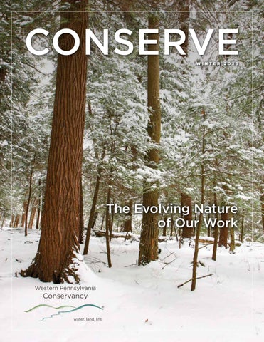
COVER PHOTO: Snow covers the Hemlock Trail in Laurel Hill State Park in Cambria County, one of the 11 Pennsylvania state parks the Conservancy helped establish.
Managing Forests For A
CHANGING CLIMATE B e ready to take notes or hit record on your digital device when Matt Marusiak, director of land protection at the Western Pennsylvania Conservancy, starts explaining the importance of forest management practices. “I can talk about this stuff for days,” says a smiling Matt. He helps the Conservancy protect land across the region and stewards many Conservancy-owned preserves, including the 1,500-acre Bennett Branch Forest located within the Pennsylvania Wilds region. Forest management is a strategic, planned approach that considers the long-term stewardship and care of a forest’s natural resources. Matt explains that forest management involves many considerations specific to the forest type and uses, such as protecting a forest’s wetlands, rare plants and streams, or harvesting trees for wood production. “When we care for the health and productivity of Pennsylvania’s woodlands, and under the right conditions, our forests show resiliency,” he adds. In sustainable forestry, forest landowners primarily focus on practices that foster the natural establishment of tree regeneration (sometimes supplemented with planting trees) and timber harvesting that is less than the growth rate to nurture a healthy, ecologically diverse forest.
“At Bennett Branch, about 1,200 acres are managed as a working forest (the remaining 300 acres are forest reserve areas that won’t be harvested) and we employ sustainable forestry practices while ensuring that those forested acres will continue to provide ecological, social and economic benefits to the region for years to come,” he adds. “Bennett Branch is the only Conservancy-owned property where we are actively cutting and harvesting trees.” When assessing a harvest, he explains, landowners consider tree health, age class and species diversity, and allow less-desirable trees to be removed first for timbering. Good quality trees are retained to ensure natural forest regeneration and help sustain the forests for future generations. Climate change is altering how forest landowners manage their forests. In addition to a focus on forest regeneration, managers are also evolving to consider forest resiliency in the face of rapid increases in biodiversity loss, diseases, invasive species and extreme weather events. Forests cover approximately 60 percent of Pennsylvania, and as the “Earth’s lungs,” they provide essential services such as filtering air, storing carbon, collecting and purifying stormwater, and providing wildlife habitat and shelter. They also provide great scenic beauty and a wide range of recreational Continues on Page 4
As visitors walk the trail at the Conservancy’s Bennett Branch Forest in Elk and Clearfield counties, they can observe sustainable forest management practices, which balance tree harvesting with the long-term health of the forest. 3
Within stands of nonnative trees at our Bear Run Nature Reserve in Fayette County, the Conservancy is girdling, or thinning, the trunks of trees, which will eventually cause the trees to fall to the forest floor.
climate change, enhance soil health and improve the overall health of the land. Also, past forestry practices have favored monocultures, which are single-species tree stands planted for efficient timber harvesting. These types of forests are vulnerable because they lack the genetic and ecological diversity, or biodiversity, needed to withstand the effects of climate change. Continued from Page 3
opportunities, such as hiking, exploring, wildlife and foliage viewing and hunting. The Conservancy owns and manages more than 15,000 acres, most of which are open to the public as forested preserves. Climate change threatens all that forests provide by increasing the likelihood of wildfires, pest outbreaks and droughts, which can stress or kill trees and create rapid changes in forest ecology. A forest’s resilience is measured by how quickly it can recover or adapt to these types of disturbances. “This means that landowners need to continue proven solutions, such as reforestation, to make forests healthier, which will result in improved wildlife habitat, carbon storage and timber quality,” explains Matt. “For years, on Bennett Branch Forest and other properties, we have been reforesting areas that didn’t have trees due to past impacts such as mining.” A recent example of this is a project that launched in the fall of 2024 at our Lake Pleasant Conservation Area in Erie County on more than 100 acres previously impacted by gravel mining. More than 70,000 new trees, in the form of tree stems, were planted earlier this year, and a new soil amendment called biochar was added to enhance the soil. According to Bosland Growth, the partner that oversaw the site preparation and planting of trees for the project, using biochar can mitigate the effects of 4
CONSERVE
Today, landowners know that a healthy forest is a diverse forest, and they embrace mixed-species plantings and actively restore the restoration of degraded areas to encourage native habitat to rebound.
long run for the native forest-dwelling wildlife, insects and plants at Bear Run,” says Andrew Zadnik, senior director of land stewardship at the Conservancy. By also protecting old-growth stands and creating wildlife corridors, we are helping forests stay connected and resilient, says Mary Ann Furedi, the Conservancy’s ecological assessment manager with the Pennsylvania Natural Heritage Program, who is leading an old-growth forest study with a grant from the PA Department of Conservation and Natural Resources’ Bureau of Forestry. Old-growth forests, or old-growth stands within a forest, have attained great age by not experiencing significant industrial or human
“For years, on Bennett Branch Forest and other properties, we have been reforesting areas that didn’t have trees due to past impacts such as mining.” - Matt Marusiak, Conservancy Director of Land Protection
For example, at our 5,100-acre Bear Run Nature Reserve, there is a management project underway to convert dense stands of non-native Norway spruce and red pine, planted in the late 1950s, to a native mixed deciduous forest. This is being accomplished by girdling, or ring-barking, a selection of the conifer trees, which will cause those trees to lose nutrients, die naturally and decay on the reserve over many years. As a result of this girdling, trees will eventually fall, creating small canopy opening through which sunlight will reach the forest floor. This will encourage the growth of native deciduous trees such as red maple, tulip tree, American beech and various oaks. “Letting some of those conifers fall and allowing the forest to naturally recover with oaks and maples is better in the
disturbance. Old-growth forests host a variety of wildlife species and miles of pristine streams, and hold more carbon dioxide than any other natural habitat on land. We’re in the final year of a three-year study aimed at better understanding where these types of forests exist and discovering the universal characteristics of these special habitats. By combining land protection, sound management, stewardship and continued research, Pennsylvania’s forests can rise to meet the challenges of the 21st century and beyond, ensuring that future generations inherit thriving and resilient forest ecosystems.
a work of art
F
rom the natural aesthetic of the stone and wood to the woodlands and waterfall of its natural setting, Frank Lloyd Wright’s Fallingwater is one of the most recognized works of American architecture. So, when the company involved in the recent reconstruction of Notre-Dame Cathedral of Paris, which had been severely damaged by fire in 2019, reached out, Fallingwater Director Justin Gunther quickly responded. “We previously digitally scanned Fallingwater in 2017, but with new technologies and upgrades to scanning equipment and software, and with the need to document the preservation work currently underway, it made sense to revisit this work with Autodesk and its partner, Case Technologies,” shares Justin. Through technologies, including advanced building information modeling and scanning tools, Autodesk and Case Technologies can digitally scan and capture every detail of Fallingwater with pinpoint accuracy. This process creates an exact 3D digital record of the building’s dimensions, materials, furniture, collections and current conditions for use in preservation and documentation. This summer, on a pro bono basis, Autodesk and Case Technologies used their technology and a drone to scan and document the conditions of Fallingwater and the major preservation work currently underway and scheduled to be completed next spring.
Technology experts from Autodesk and Case Technologies have been visiting Fallingwater to conduct digital scanning, creating a 3D digital model for preservation and documentation purposes.
“This documentation effort is a prime example of how digital preservation supports the current preservation work and builds resilience, enhancing our long-term management and safeguarding of the site,” Justin notes. “If Fallingwater is damaged by fire or human activity, or further impacted by weather, its exact form can be studied and reconstructed from this data,” he adds. “This digital record is a powerful archival tool that can be referenced for generations to come.” One reason preservation efforts advanced quickly at Notre-Dame, reopening to the public within five years, was the extensive laser scanning and detailed records. Such examples underscore how digital documentation can mean the difference between total loss and faithful restoration, explains Justin.
Beyond preservation, Justin says, the technology also has other important and practical uses for education and accessibility. The 3D models can be turned into virtual tours or interactive exhibition displays, opening access to schools and the public locally and worldwide. “We’re currently considering how this technology can be used for these purposes in the future,” Justin says. “So, we can’t thank Autodesk and Case Technologies enough for their expertise and generosity.” Tristan Randall, an executive with Autodesk, says the company’s mission is not just a statement, rather it’s a commitment to innovation with purpose. “By applying our technology to the preservation of Fallingwater and Notre-Dame,” adds Tristan, “we’re showing that designing and making a better world means protecting the best of what we already have.” 5
U
nlike bears that can lumber over hills, or birds that can fly from forest to field, aquatic animals such as fish can’t escape stream channels. “They’re completely reliant on where the streams flow,” says Jenifer Christman, WPC’s vice president of watershed conservation, “but humans can help fix the disconnections for them.” Human-made infrastructure, including dams and culverts, leads to fragmented watersheds, which means fish can’t move upstream to spawn. They’re forced to compete for resources in overcrowded areas, leading to stress and disease. Other aquatic organisms, such as freshwater mussels, which rely on fish for reproducing and dispersal, can also be at the mercy of streamflow.
6
CONSERVE
In 2012, on the East Branch Tionesta Creek, the Conservancy’s watershed conservation team completed its first aquatic organism passage project, in which barriers that prevent aquatic animals from moving freely are removed. “There were five narrow pipes with a road overtop,” which fish clearly could not pass through, Jenifer recalls. “With our partners in the Allegheny National Forest, we replaced those at multiple crossings with single, larger arch culverts.”
In 2014, the team became involved in the North Atlantic Aquatic Connectivity Collaborative, a network of agencies and organizations focused on improving aquatic connectivity across 13 North Atlantic states from Maine to West Virginia. The NAACC provides protocols to assess culvert conditions and score their severity of barrier and ability to pass fish and wildlife through roadstream crossings (culverts and bridges). This and other data is available at streamcontinuity.org.
The Conservancy did fish surveys before and after the replacements. “The data showed we made huge improvements in fish passage,” she says. “It was exciting because it was the first time we had science backing up our AOP work.”
After Hurricane Sandy ripped through mid-Atlantic states in 2012, “NAACC created standardized survey forms to rate culverts,” Jenifer says. “Through NACC training, we certified our entire watershed staff to score culverts.”
Streambed simulation involves placing streambed material such as rocks, boulders and dirt in a new culvert to simulate a natural stream channel through the culvert. This work prevents erosion and reduces fine sediment, while also allowing for fish passage and connectivity. Pictured here is a culvert installed in 2020 on Bank Run at Forest Road in the Allegheny National Forest using streambed simulation.
One successful project funded by NFWF and other grants was on Pennsylvania State Game Lands 25 in the Middle Fork watershed. In 2016, WPC partnered with Trout Unlimited and the PGC on a watershed management plan and assessment that identified 19 projects to improve habitat and reconnect 12.6 stream miles. From 2020 to 2024, the Conservancy team worked with multiple partners to replace five culverts, allowing fish and wildlife to move unimpeded under roads and along the stream, stabilize streambanks to prevent erosion and flooding, and place naturally fallen logs to provide multiple in-stream benefits for fish and wildlife.
The WPC’s entire watershed conservation team was trained in the NAACC protocol in 2016. Then in early 2017 they partnered with the Pennsylvania Fish and Boat Commission, Trout Unlimited and American Rivers to establish the Pennsylvania Aquatic Connectivity Team, a group that identifies and implements AOP projects. Now, more fish move freely in streams and more watersheds are reconnected, Jenifer explains. “Around 2023 we received a large National Fish and Wildlife Foundation grant that allowed us to work on multiple passages in the north central and central regions of the Pennsylvania Game Commission’s regions. After that, the work has just exploded!”
Kylie Maland, WPC watershed manager for the Lake Erie & Ohio River basin who led the Middle Fork project, says working with partners in one watershed over a long period can drastically improve water quality, habitat connectivity and other ecosystem services. “Headwater tributaries, such as the Middle Fork, are important coldwater refuge for trout, especially in the summer months,” she says. “Access to smaller, colder headwater systems is essential for trout reproduction and survival.”
environment to traverse and natural habitat materials for food, shelter and nesting. Plus, building the stream bed and bank materials inside metal culverts helps protect the pipes from corrosion and abrasion.” From 2014 to 2024, WPC participated in 29 dam removals and 52 culvert removals and connected 198 miles of stream. “By the end of 2025, we plan to have removed another 25 to 30 culverts and connected another 45 miles of stream,” Jenifer says. Although it’s impossible to know how many fish, mussels, turtles, salamanders and other animals the work affects, “The most important things we can do for them,” says Jenifer, “is to reconnect their existing habitats and restore the ones they have.”
Replacing culverts and removing dams seems straightforward, but there’s always room for improvement. Around 2014, “Staff attended the U.S. Forest Service’s week-long training course on using streambed simulation,” says Kylie. The technique involves placing streambed material such as rocks, boulders and dirt in the new culverts to create a stream channel through the replaced passage. Maintaining streambanks, including as the stream passes through a pipeculvert or under a bridge, provides habitat connectivity for semi-aquatic animals such as amphibians and reptiles, and other wildlife, Kylie says. “Aquatic animals have a more natural
WPC Watershed Projects Manager Alysha Trexler photographs a culvert pipe before it is replaced.
7
Students at Connellsville Area Middle School in Fayette County participate in a virtual field trip to learn more about Frank Lloyd Wright’s Fallingwater.
Continues to Engage Students
W
hen Fallingwater temporarily closed for public tours in March 2020 due to the COVID-19 pandemic, Amy Humbert, Fallingwater’s manager of school programs and outreach, recalled feeling the weight of that historic moment. “I knew when we reopened, it was going to be a monumental shift from how we did things before the pandemic. Everyone at Fallingwater embraced the many challenges head-on,” she recalled. Amy leads K-12 educational programming about Fallingwater through in-person and virtual experiences, including school and family field trips with guided architectural tours designed to enhance student learning. Before COVID, online, or virtual, instruction was often confined to higher education or specialized training programs. Many K-12 teachers had never used platforms like Zoom or Google Classroom. But as classrooms closed, educators at every level adapted, including Amy and other educators at Fallingwater. “Virtual learning has opened more classroom doors, and we can now use
Pictured on the screen, Amy Humbert, Fallingwater’s manager of school programs and outreach, virtually shares Fallingwater’s history, stories and information with students. 8
CONSERVE
hybrid instruction to reach more people locally and across the world,” she shares. A lesson from the pandemic, she adds, is that virtual learning enriches traditional classrooms and hybrid education— blending in-person and virtual instruction—in ways few imagined possible five years ago. Thanks to the generosity of local lodging facilities, foundations and other donors, our Wright In Our Backyard program provides free onsite or virtual tours for local schools in Fayette, Washington, Westmoreland and Greene counties. Virtual field trips are a great option for schools that are unable to visit on-site due to distance or other reasons. “School students in small towns or large cities, locally, nationally or internationally, can all learn more about Fallingwater online. Until they can visit in person one day, that’s a wonderful outcome for us,” she adds. In 2024, Fallingwater engaged nearly 1,100 K-12 students in virtual field trips. Both
in-person and virtual experiences also expose young learners to possible careers in design, architecture, preservation, education and museum management. Another benefit of virtual programming is how it advances knowledge and access for students with diverse learning styles, such as visual or multimedia learners, or for those with mobility challenges. Interactive modules and the ability to revisit content at a later date are also available and popular options for virtual programming. Expanded virtual educational opportunities still have their challenges, including digital inequity, lack of access to technology and unreliable internet access in rural communities. However, as Fallingwater’s in-person and virtual experiences evolve, young learners will have additional opportunities to explore a versatile educational landscape that offers various ways to learn more about Fallingwater, the Kaufmann family and Frank Lloyd Wright.
A BIRD’S-EYE VIEW
Inset: Brad Georgic, a Federal Aviation Administration Part 107 Certified Remote Pilot, pilots the drone at a state forest to identify potential green salamander habitat. The drone can be used to collect a unique perspective of a project and its connection to the landscape. For example, this drone image of a riparian tree planting showcases how trees will enhance stream protection.
P
rior to 2018, if Conservancy scientists wanted to determine which plant species grew on a cliffside, someone scaled the cliff. When ecologists wanted to know how much cattail grew in an area, they slogged through miles of wetlands to measure. If Fallingwater’s maintenance crew suspected a water line leak? Out came the picks and shovels to locate the line. GIS (Geographic Information Systems) and drone technology have dramatically changed the mapping landscape and altered the way nearly every Conservancy department works. Today, garden staff know at a glance how much mulch is needed to cover 130 gardens. At Fallingwater, sewage, water, power and communications infrastructure have been mapped, so staff can use a tablet and GPS to accurately locate and understand what is buried beneath their feet. Using a tablet and GPS, staff can go into the field and accurately locate and understand what is buried beneath their feet. Scientists can analyze spatial relationships between species, habitat and other natural or manmade threats. “A drone can provide in a few hours what used to take several days,” says Conservancy GIS Manager Brad Georgic. “It has
streamlined our work.” GIS allows staff to spatially visualize and analyze all aspects WPC work. “The drone provides a bird’s-eye view to give more context to our projects than photos from the ground can give. We can now quickly get imagery for a basemap, which is a layer of geographic information (such as roads, buildings and terrain) that provides context for other data on a map,” Brad says. “Both technologies have simplified and streamlined the data collection process.” The Conservancy uses drones in two ways: to collect unique visual pictures of projects and to collect downward-facing images to be merged into a basemap. To create a basemap, the drone collects hundreds of images across a user-defined area. The software flies the drone within the area, autonomously capturing the images, although the pilot always has manual control, too. During flight, the drone software displays everything the pilot needs to fly safely, including battery life, altitude, excessive wind and remote-control signal strength. Because the drone records the GPS coordinates of the image, GIS software can stitch the hundreds of images into one high-resolution geo-referenced Continues on Page 10
9
Continued from Page 9
basemap. Because this merged image knows where it is at in the world, other GIS data can be overlaid and analyzed.
Pennsylvania endangered least bittern and state imperiled pied-billed grebe, “wetland species that can benefit from specific habitat management.”
WPC began using a drone in 2018, but the importance of aerial basemaps has been there since the Wright brothers soared above the dunes at Kitty Hawk. Users can rapidly see changing landscapes, identify features or just see what’s around them. To track change over time, WPC staff often uses PennPilot’s archive of statewide imagery dating back to the 1930s. “We were at the mercy of the free imagery provided by state or national mapping efforts,” Brad says, “but the drone allows us to make our own basemaps when we need them. All make a difference for analysis.”
Drone imagery added a considerable amount of clarity to an often-difficult process, David says. “We segmented out different wetland types such as emergent cattail, waterwillow shrub and spatterdock-waterlily emergent wetlands.”
Combining the drone basemap with other GIS data provides the best information available for seeing and explaining relationships. Staff can compare new information against the base layer and visualize spatial relationships among natural elements: “Why does this
“You couldn’t walk 400 acres and note all the vegetation in one day. But drone imagery can be taken in hours,” says Brad. “An ecologist can easily see patterns of different vegetation types and can spot check it when necessary.” On the Youghiogheny River, the globally rare and Pennsylvania endangered Barbara’s buttons (Marshallia grandiflora) grows in areas of river scour, where fastmoving water or ice removes sediment from the bed or banks of a river. “We didn’t have a good map of all the
“ Drones, GIS and technology have allowed for better decisions regarding conservation and allocating funding for conservation projects. It has literally taken our work to new heights!” - Brad Georgic, Conservancy GIS Manager
plant only grow here? Why are all the birds over there? How large is the trash pile on that property?” In 2021, Brad collected drone imagery covering more than 2,800 acres of wetland habitat at Pennsylvania State Game Lands 213 and 214 as part of the Pennsylvania Natural Heritage Program’s Crawford County secretive marsh bird population and habitat conservation project. “A main objective was to determine what types of wetland habitat were most important to populations of secretive marsh birds,” says David Yeany, WPC avian ecologist with the Pennsylvania Natural Heritage Program. This included breeding birds such as the
rocks and the scour regions,” Brad says. “We used drone imagery to map each rock and see where the flower grew between them.” WPC ecologists created a base map to refer to annually to see if the plant was still there. Natural heritage staff also spend countless hours in the field studying species and identifying rare and endangered species and habitats. “GIS allows them to access and collect data on their smartphones,” Brad says. Throughout WPC, “Drones, GIS and technology have allowed for better decisions regarding conservation and allocating funding for conservation projects,” Brad says. “It has literally taken our work to new heights!”
Drone images captured during the secretive marsh bird population and habitat conservation project at PA State Game Lands 213 and 214 in Crawford County helped provide accurate distinctions critical to analysis of marsh bird presence and numbers. This allowed scientists to make wetland habitat management recommendations to the PA Game Commission that could help these high-priority conservation bird species.
10
CONSERVE
11
No Joke
Plants Face Uncertain Future
A
day in the life of a botanist might include hours ambling through forest, field and fen, eyes peeled for a particular plant. Such isolation could lead to reduced communication skills, but botanists need to be great collaborators and communicators. Knowing when to “plant” a great joke helps, too. Steve Grund, who recently retired as a senior botanist after 30 years with the natural heritage program at the Western Pennsylvania Conservancy, always had a or joke ready to pad his lengthy discussions about rare or endangered plants. Although 12
CONSERVE
his puns got chuckles in the field, his work was nothing less than serious. Steve chose botany as a major at the University of Michigan after taking a course in plant systematics. “The professor, Herb Wagner, used humor to make us think the subject was the greatest thing in the world,” Steve recalls. Consequently, as a teaching assistant lecturing pre-med students on botany and biology, Steve “hammed it up.” Seeing his students’
Steve Grund observes Barbara’s buttons (Marshallia grandiflora). “I take pride that I pushed for focusing our work on the rarest of rare, the plants that could go extinct,” he says. “We need the best information we can get on globally rare plants in Pennsylvania, and we’ve moved in that direction.” Below: In 2017, Steve and an intern came across rare running buffalo clover (Trifolium stoloniferum).
grades rocket upward at the rate that bamboo grows “was the most thrilling moment of my career,” he says. Steve’s keen eye for plants led to the discovery of three globally rare species not previously known to be living in the state. In 1995, he happened across a tiny orchid that turned out to be Bayard’s malaxis (Malaxis bayardii), which, although documented at 21 sites in Pennsylvania, hadn’t been seen in the state since 1949 and has not been seen since. In 2017, he and an intern also accidentally came across rare running buffalo clover (Trifolium stoloniferum), which was suspected to be in Pennsylvania but hadn’t yet been found. And he is waiting for a ragwort (Packera), which he found in 2018 near Ohiopyle, to be published as a new species. For more than a century, changes in approaches to botany progressed at the creeping pace of a Creosote bush growing in the desert. That is to say, very slowly. But recently, “Technology has made the job easier,” Steve notes. For example, “We used to carry topographic maps into the field to figure out where we were. Now we have GPS, which will continue to improve to the point where it will take you to within a few meters of a specimen.” (See page 9 for an article about WPC’s use of drone and GIS technology.) The Internet has increased efficiency exponentially. “You no longer have to go to a museum to see plant specimens. Now they’re scanned and put online,” says Steve, whose specialty is plant conservation and floristics (the study of the distribution and relative abundance of plants). “Before, you had, at best, a list of counties from which a plant was documented, only because some professor went to the trouble to record that information.” Additionally, community (citizen) science apps such as iNaturalist have coaxed non-scientists outdoors to document the natural world. Scientists vet and confirm the information, which then populates online databases, providing previously undreamed-of amounts of data for scientists and researchers to mine.
threat to plant diversity was land use and conversion of natural areas. That’s still huge,” he says. “Now, invasive species and climate change are serious threats. They’re pushing plants to the edge of extinction.” Drastic drops in bird and insect populations are bellwethers that our ecosystems are in trouble, he warns. “When plant species go extinct, the ecosystems will eventually cease to function. Humans are in trouble along with everything else.” Another concern is that “There aren’t many species-level biology programs at big universities anymore,” he says. “Grad students often have no expert to consult with. Despite this, there are still very good botanists rising the ranks.” Indeed, working with interns and young seasonal botanists was his favorite part of the job. “All of the new hires since I started at the Conservancy, without exception, are just phenomenal.” Still, to get more young people interested in the natural world, Steve emphasizes, “We need to get them outside to look at nature and ask questions.” In the old days, he says, students made herbariums by pressing found plants in books. An engaging, modern way is to make records on iNaturalist. However, “You can’t lose sight of field studies!” Steve emphasizes. “When you see plants in the field you find differences you don’t see on dead, flat plants on herbarium sheets.” The trick to retirement is still doing the job you like, minus paperwork, Steve muses. When he’s not playing classical piano, he volunteers with the Conservancy, remains a research associate at the Carnegie Museum of Natural History, continues to serve on the Vascular Plant Technical Committee, and is treasurer of Pennsylvania Botany. It’s imperative for everyone to stay engaged with nature, Steve insists. He raises his voice and channels his beloved professor, Herb Wagner: “People, you’ve got to get out in the field! And know. These. Plants!”
Despite those advances, Steve has serious concerns about the future of plant conservation. “When I started out, the biggest 13
“Telling
Untold
Stories...”
T
he Western Pennsylvania Conservancy is helping to advance a cultural history project called Untold Stories of Pennsylvania’s State Parks & Forests. This work is being done in collaboration with the Pennsylvania Department of Conservation and Natural Resources, Pennsylvania Historical and Museum Commission, Heinz History Center and other partners to undertake cultural and historical research and provide a more complete historical context for public lands in Pennsylvania.
The partners have been working to research and highlight the stories of Native Americans and African Americans. The research has focused on people’s ways of life, including family history, land use and stewardship, economic activity and hardship, and relations with the broader community in two significant locations in our region: the African American Laurel Hill Settlement in Laurel Ridge State Park in Cambria County and the Native American use of forest resources in the Slippery Rock Creek watershed in Butler County. The first phase of this project, which took place in 2023 and 2024, focused on the history and archeological research of these areas. This work was largely done by students and faculty from Indiana University of Pennsylvania, who worked at the Laurel Hill Settlement, or Brown Farm, an integrated settlement community of mostly Black pioneers located in what is now Laurel Ridge State Park in Cambria County near Johnstown.
14
CONSERVE
For IUP History Professor Dr. Erin Conlin, it was important to connect with and speak to local historians, community elders and descendants to get oral histories. Under Dr. Conlin and other faculty, other students searched for copies of land deeds, deed books or county maps to identify owners and paired that information with census data and church records to find names of landowners and their connection to the land. “Most of the research was already done, thanks to the Johnstown historical society and other local historians. This effort had a lot of community support, because the local residents made it a point to keep these stories alive,” she says. “But we wanted to learn who else in the community might know more about this important place or the families who lived there.” Erin trained students to ask questions of and record interviews as part of an oral-history project. Whether through family documents, photographs or recipes, she noted, “We wanted to know how they would like their stories to be told and preserved.” “While our goal was to talk to descendants, most have been reluctant to participate, but we hope the more we highlight the history of the site the more willing they may be in the future to share their stories and memories.” Dr. Ben Ford and anthropology graduate student Abdul Jones, both also with IUP, have had the opportunity to collect interviews with other community members. “Unearthing these stories isn’t just storytelling, but they change how we understand local economies, place names and who belongs to these places today,” Erin explains. Since 2018, Slippery Rock University has been conducting a Native American archaeological dig in the Slippery Rock Creek watershed. Before European settlers arrived, Indigenous peoples had used controlled burns to clear fields, cultivated orchards and other vegetation along river valleys, and built
Untold Stories project team members, including those from DCNR, IUP and ROZ Group, particpated in a fall 2025 site visit to the Brown Farm in Laurel Ridge State Park in Cambria County.
seasonal camps along the river banks for trade. Many of Butler County’s oldest field boundaries trace routes used for centuries by the Lenape and other Indigenous peoples, and their mark on the Western Pennsylvania landscape is evident in research and observations. All of the research from both locations can be found on the Conservancy’s website at WaterLandLife.org/UntoldStories. Phase two of the Untold Stories project, which began in summer 2025, is to explore ways to better interrupt, educate and share these rich and varied stories with visitors to these public lands. For this work, the ROZ Group was hired as a consultant and educational resource partner. The group’s president and CEO, Rosalyn J. McPherson, says her firm has extensive experience working on similar projects across Pennsylvania and nearby states, and believes telling these stories is not just about correcting history, it’s about connecting to history.
“I get excited about telling these stories of layered and intertwined histories that show that land and water were more than property—they were memories, livelihoods and identities for so many. These stories reveal a more profound truth about Pennsylvania’s landscapes: long before industrial expansion, these lands were sustained and shaped by the hands of Indigenous and Black peoples, too. This project will remind people of their important, and sometimes unknown, contributions to our landscape today,” Rosalyn shares.”
Scan this QR code to read more of these stories and watch videos on the Conservancy’s website at WaterLandLife.org/ UntoldStories.
Left: PA DCNR staff stand near the resting place of some members of an 18th-century integrated community of mostly Black and Indigenous people, known locally as the Brown Farm, located in Laurel Ridge State Park in Cambria County. Right: Slippery Rock University researchers say there is strong evidence and patterns of connection between people and the forest by the Indigenous peoples of the Susquehannok, Erie, Delaware (Lenni Lenape) and later the Six Nations of the Haudenosaunee (Mohawk, Oneida, Onondaga, Cayuga, Seneca and Tuscarora—referred to as “Iroquois” by settler populations) who lived on and managed the lands in the Slippery Rock Creek watershed in the early part of the 18th century.
15
PLANTING TREES
For A Future Climate
Because their root systems hold soil in place to prevent erosion, riparian trees are vital for maintaining water quality, stabilizing streambanks, providing wildlife habitat and removing pollutants. Since 2013, the Conservancy has planted more than 100,000 riparian trees along rivers and streams. 16
CONSERVE
P
lanning and forecasting are essential for conservation work. That’s why the Western Pennsylvania Conservancy’s staff regularly partners with other organizations on various planning efforts to help advance a variety of conservation initiatives across the region.
is expected to conclude by the end of 2025, will also include a 10-year street tree management plan, a tree benefits analysis, and a data management and sharing platform, called TreeKeeper, that will be accessible to project partners and the public in spring 2026.
One such initiative the Conservancy is managing is the City of Pittsburgh’s 2025 “Smart” Street Tree Inventory. Currently concluding as an update to the tree inventory done 10 years ago, it will update data, provide critical information about the city’s urban forest and offer detailed recommendations for effectively and proactively managing and growing the city’s tree canopy. The Conservancy is working in conjunction with the Pittsburgh Shade Tree Commission, the City of Pittsburgh Department of Public Works Forestry Division, Pennsylvania Department of Conservation and Natural Resources and the Davey Resource Group.
“We have moved the needle in a positive direction in every category–from species diversity, to routine maintenance, to health conditions. With this new technology, we can continue to make progress together in an even more efficient and strategic way,” Jeff says.
Ten years ago, foresters, certified arborists and professional staff scanned Pittsburgh’s street trees through visual assessments to determine the canopy health, tree conditions and planting needs, as well as marking the location of each tree using GIS technology. Today, while the need for that information remains, the way the inventory is conducted has changed. Pittsburgh is the first city in the U.S. to have two LIDAR, or light detection and ranging, scans, with the first undertaken in 2023. The “Smart” Street Tree Inventory, which began in fall 2024, is the first effort in the country to utilize ground-based LIDAR and AI technology for a comparative back-to-back scanning process to inventory street trees. During late spring and summer 2025, scanning took place on 50,196 street trees in an effort to enhance the City of Pittsburgh’s ability to support tree plantings, tree care and monitoring, and to promote canopy equity across city neighborhoods. This inventory shows the significant improvements that have been made to Pittsburgh’s street tree population over the last 10 years. Since the last inventory report in 2015, there are more than 15,000 additional street trees in Pittsburgh. Jeff Bergman, associate vice president of urban forestry and community greening at the Conservancy, says the inventory, which
He added that due to climate change, future inventories may need to consider street tree species that are more tolerant to heat, drought and pollution, and ones that are more pest and disease-resistant. For example, some southern-native species and cultivars (varieties that have been produced in cultivation by selective breeding) may be recommended because they can tolerate hotter summers while still supporting native ecosystems. The Conservancy’s botany program manager with the Pennsylvania Natural Heritage Program, Scott Schuette, says climate change in Pennsylvania is contributing to changes in ecosystem structure, shifts in species ranges and changes to the timing of plant growth and flowering. These changes, he says, will disrupt how and when organisms, including trees, interact within an ecosystem and can lead to inefficient pollination, fruit production and altered seed dispersals. According to the 2021 Pennsylvania Climate Impacts Assessment, temperatures are expected to reach 90 degrees Fahrenheit or more an average of 37 days per year, a significant increase from the five days per year during climate data collected from 1971 to 2000. Also, during this timeframe, Pennsylvania has seen an eight percent increase in average annual precipitation. This is due in large part to increased frequency, magnitude and intensity of heavy rainfall events. In addition to the Conservancy’s urban and community forestry work, the Conservancy’s watershed program plants various tree species in rural areas to help stabilize land near rivers and streams. Since
Volunteers help the Conservancy and its partners plant street trees in many Pittsburgh neighborhoods to help shade streets and homes, offer natural beauty, provide wildlife habitat and purify the air we breathe.
2013, the Conservancy has planted more than 100,000 riparian trees. Conservancy Watershed Project Manager Alysha Trexler says that the Conservancy has traditionally planted a diversified mix of native trees within riparian areas. Flood-tolerant natives, such as black willow, river birch, swamp white oak and American sycamore, are prioritized for their adaptability to environmental changes as well as their ability to stabilize banks while shading waterways. “As Western Pennsylvania’s average temperature range changes and weather becomes more variable, the riparian trees we plant today are chosen for their versatility between drought and flood tolerance,” Alysha shares. She adds that trees are a major investment in improving water quality for both our urban and rural communities, as well as for the environment. “Being aware of what grows and thrives in riparian areas, which can range from extremely wet to quite dry, means that we must be flexible in species selection and include a wide variety of natives that are adapted to environmental fluctuations now and into the future.” 17
The Way
H
ave you ever stood outside during a downpour and marveled at the amount of brown water rushing into the street? Sewage drains, clogged with debris, can rapidly overflow. In worst case scenarios, towns in low-lying areas—in Western Pennsylvania there are many—suffer flooding and destruction. Traditionally, municipalities have used “gray infrastructure,” including curbs, gutters, drains and underground pipes to remove stormwater as quickly as possible. However, “Gray infrastructure can cause pollutant runoff and increased flooding downstream. Not allowing stormwater time to soak into the ground can lead to lower groundwater levels,” says Art Demeo, WPC’s senior director of community greening projects. “Meanwhile, excessive concrete and asphalt, combined with lack of plants, can create a ‘heat island’ effect, or higher temperatures.”
Intended Unfortunately, as humans develop more land and build more paved roads, rooftops, parking lots and other impervious surfaces, the rate of stormwater runoff has increased. Communities are often required to address these water quality and stormwater management issues, but sometimes older or economically challenged communities possess fewer resources to implement green infrastruture. Tree plantings, bioswales and rain gardens can provide environmentally friendly alternatives to installing new gutters and pipes. At WPC, we consider rainwater a resource, not a nuisance! Since 2013, we’ve worked with local communities to install “green infrastructure”— bioswales, rain gardens and green parking lots—that offset the effects of rainfall. These natural stormwater management systems use strategically selected and installed native plants and trees to absorb, filter and slow
stormwater runoff. This method helps stormwater to be absorbed and filtered naturally—the way nature intended. “Natural stormwater management solutions help reduce strain on storm sewer systems and enhance local groundwater recharge,” Art says, adding that incorporating trees and native perennials in these projects also supports pollinator populations and provides habitat for small wildlife species. Not to mention, the colorful flowers and lush greenery beautify communities! With the help of partners and volunteers and the support of donors, the Conservancy installs “green infrastructure” to help absorb and slow stormwater runoff in communities around the region. Here are just a few examples of several natural stormwater solution projects we’ve implemented.
Rain Gardens
Water-tolerant native plants in rain gardens absorb and filter rainwater. Our rain gardens provide beautiful, practical stormwater management solutions in areas such as Pittsburgh’s Larimer neighborhood, Marienville, Harrison Township and at the Carnegie Science Center on Pittsburgh’s North Shore. A rain garden at Bennetts Valley Senior Center in Weedville, Elk County has helped mitigate flooding issues next to the parking lot. Prior to 2023, there was no drainage in the lightly sloping lawn. As a result, rainfall events caused huge pools of water to form. In 2023 we worked with the senior center, Elk County Conservation District and the Penn State Extension Master Gardener program to construct the garden, which manages the runoff naturally. “The garden has beautiful flowers and plants and is attractive in all seasons,” says Deb Quickel, BVSC treasurer. “The Senior Center is pleased with the improved drainage.” Native perennials and shrubs, including cardinal flower, blue flag iris, swamp milkweed, common rush, liatris and buttonbush, help to absorb rainwater in the rain garden at Bennetts Valley Senior Center in Weedville, Elk County.
18
CONSERVE
A small bridge we built over the garden improves access to Kersey Run, a tributary to the Bennett Branch Sinnemahoning Creek, a popular fishing stream. Generous funding from the Stackpole-Hall Foundation made the project possible.
Bioswales
Typically professionally designed and engineered and connected to existing sewer infrastructure, bioswales use natural elements such as plants and rocks to help slow and manage stormwater runoff. Subsurface tanks can be used to retain runoff and slowly release the stormwater. Our bioswales help to convey stormwater runoff and filter pollutants in Millvale, Clairton, Point State Park and other areas. In 2018, we partnered with Pittsburgh Water, ALCOSAN and the City of Pittsburgh to install a 535-foot bioswale—the longest in Pennsylvania— at our community garden in Pittsburgh’s Hill District neighborhood. It intercepts 882,800 gallons of stormwater from entering the combined sewer overflow. More than 250 community volunteers helped to plant 13,000 perennial plants and 25 trees. The bioswale received the 2018 Sustainability Award from the American Society of Civil Engineers.
A bioswale at our community garden at Centre and Herron avenues in Pittsburgh’s Hill District neighborhood intercepts 882,800 gallons of stormwater annually.
Green Parking Lots
Heavy rain running off asphalt parking lots can spell disaster, contributing to flooding in communities by overwhelming storm drains and creeks. The Borough of Carnegie in Allegheny County is prone to flooding, due in part to its location within the lower Chartiers Creek watershed. In 2016, we partnered with the borough to design, create and plant two “green” parking lots in the heart of the central business district. Community volunteers helped install trees, bioswales and native perennial shrubs and flowers. Along with permeable pavement, these green features, totaling about 10,400 square feet of porous surfaces, capture stormwater and slowly release it into storm drains.
Two green parking lots in Carnegie, Allegheny County feature trees, bioswales and native perennial shrubs and flowers. The plants work in conjunction with permeable pavers to allow water to seep through into the ground below.
Scan this QR code to learn how our rain garden in Pittsburgh’s Larimer neighborhood works.
19
800 Waterfront Drive Pittsburgh, PA 15222 412-288-2777 info@paconserve.org WaterLandLife.org Fallingwater.org
Giving back to nature is truly an investment in the future of our shared home. From restoring native wetlands and protecting vital forest habitats to conducting scientific research that guides our region’s future, our work isn’t theoretical or far away—it’s happening right here. Every acre we protect, every stream we restore and every community garden we plant ensures that our future generations will inherit a healthier, more resilient Western Pennsylvania. The passion and generosity of supporters like you empower the Western Pennsylvania Conservancy’s on-the-ground work. We can’t do it without you. Together, we are building a future where both nature and communities can thrive. Please consider renewing your membership or making a special year-end gift today. Your support makes a real difference.
DONATE TODAY!
Scan the QR code or go to WaterLandLife.org/Donate