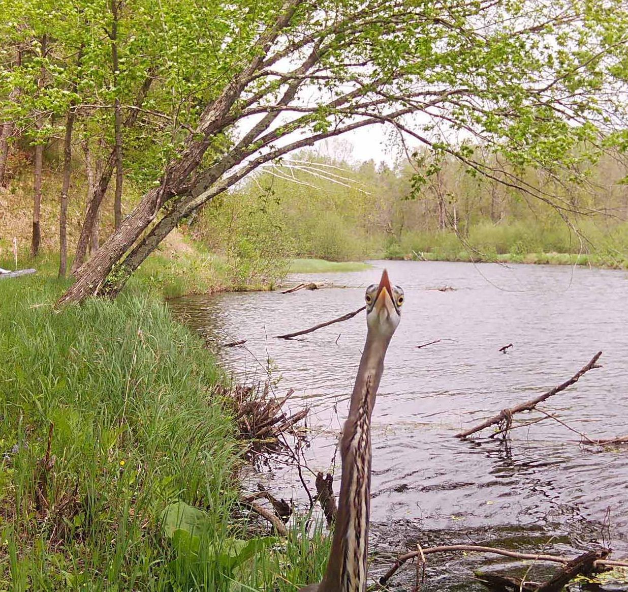
We’re really sticking our neck out with this one — or, rather, it’s the great blue heron doing the neck-sticking in another Snapshot Wisconsin photo sure to bring a smile.
Great blue herons (Ardea herodias) are migratory birds that return to our state each spring to nest around swampy areas, particularly in places with lots of dead trees. Breeding grounds are known as rookeries, and there are several notable ones in Wisconsin, including at Devil’s Lake State Park.
These birds often can be seen hunting for small fish, frogs, snakes and other prey in ponds or marshes, remaining quite still until they make a move to spear their next meal.
They’re big! A great blue heron can stand more than 4 feet tall, with long and spindly legs, the S-shaped neck that seems to go forever when outstretched and a wingspan over 6 feet.
We’re looking for your clever captions for this great blue heron photo. Please send short suggestions via email to dnrmagazine@wisconsin.gov. Or jot them down and mail by May 1 to:
DNR magazine PO Box 7921 Madison, WI 53707
We’ll pick some of the best suggested captions to share in the next issue. For replies from the winter issue fox images, see the inside back cover.
Communications Director Andi Sedlacek
Publications Supervisor Molly Meister
Managing Editor Andrea Zani
Art Direction Douglas Griffin and Sunny Frantz
Printing Schumann Printers
Like us on Facebook facebook.com/WIDNR PUBL-OC-026 ISSN-0736-2277 Watch us on YouTube YouTube.com/user/WIDNRTV

us on Instagram @wi_dnr
Governor Tony Evers
Natural Resources Board
Robin Schmidt, La Crosse, Chair
Rachel Bouressa, New London
Douglas Cox, Keshena
Deb Dassow, Cedarburg
Jeff Hastings, Westby
Patty Schachtner, Somerset
Bill Smith, Shell Lake
Printed in Wisconsin on recycled paper using soy-based inks in the interest of our readers and our philosophy to foster stronger recycling markets in Wisconsin.
Wisconsin Department of Natural Resources
Karen Hyun, Secretary
Steven Little, Deputy Secretary
Mark Aquino, Assistant Deputy Secretary

Karen Hyun
Greetings, and a belated Happy New Year!
I hope your 2026 is off to a positive start and that you’ve been able to find time to enjoy the last vestiges of winter and all its opportunities for outdoor adventure.
Although it felt like a faroff dream at some points during late January’s deep freeze, winter has loosened its grip, as it always does, making way for the changing of the seasons.
Spring is in the air. So, too, are the many outdoor activities — from fishing and spring turkey season to hiking and camping — that come with it.
Spring is a time of renewal, regrowth and possibility, and I’ve always felt that those things carry over beyond our environment and ecosystems into our lives. The greenery of the season has always filled me with hope and optimism for the year ahead, and 2026 is no different.
There’s a lot to be excited about this year at the DNR. For starters, we’re picking up where last year’s 125th anniversary of the Wisconsin State Park System left off, as 2026 marks 75 years of Wisconsin’s incredible State Natural Areas Program.
To celebrate, this issue goes in-depth into the history of the program and the extraordinary landscapes it helps to protect.
Our content breaks down the numbers to show the scope and scale of Wisconsin’s state natural areas, highlights several properties you won’t want to miss and explores the critical role SNAs play in safeguarding some of our state’s most vulnerable species.
That’s not the only milestone we’re celebrating this year. It’s also the 50th year of publication for Wisconsin Natural Resources magazine, and I know you’ll enjoy the vast array of stories we have planned throughout the year.
In this issue, you’ll find stories covering fishing basics for anyone looking to wet a line, read about wildlife such as wood turtles and greater prairie-chickens, and check in on the Knowles-Nelson Stewardship Program, a key component in helping to fund important aspects of what we do here at the DNR.
Readers also will find information about wildlife crossings, the history of Wisconsin’s public shooting ranges and ongoing efforts to support the mighty Mississippi River, plus a fun article about slime mold (which is even stranger than it sounds).
Finally, I want to thank every one of our readers for your continued support. Whether you’re a conservation patron, magazine subscriber, license holder or just someone interested in Wisconsin’s natural resources, all of us at the DNR do what we do for and because of you.
Thank you, and I hope to see you somewhere outside this spring!
issue of
This issue of Wisconsin Natural Resources is special for a big reason: It marks the start of the magazine’s 50th year of publication! Volume 1, Issue 1 of Wisconsin Natural Resources was printed in January 1977, making this year Volume 50.
The magazine, now quarterly, has carried on the tradition of informative publications from the DNR (and its precursor, the Wisconsin Conservation Department) starting way back in 1919 with the Wisconsin Conservationist. In 1936, that was renamed the Wisconsin Conservation Bulletin, which continued until the change to the current magazine format in 1977.
Wisconsin Natural Resources reaches readers in every season with both print and digital editions, encouraging them to enjoy, appreciate and support the outdoors. It features news of the DNR and the vital work of the agency on behalf of the state’s beautiful natural resources.
Join our magazine family or share it as a gift to others! You can find digital issues, subscribe to the print edition and check out the story archives for all the great content from the past five decades. For details, go to wnrmag.com.
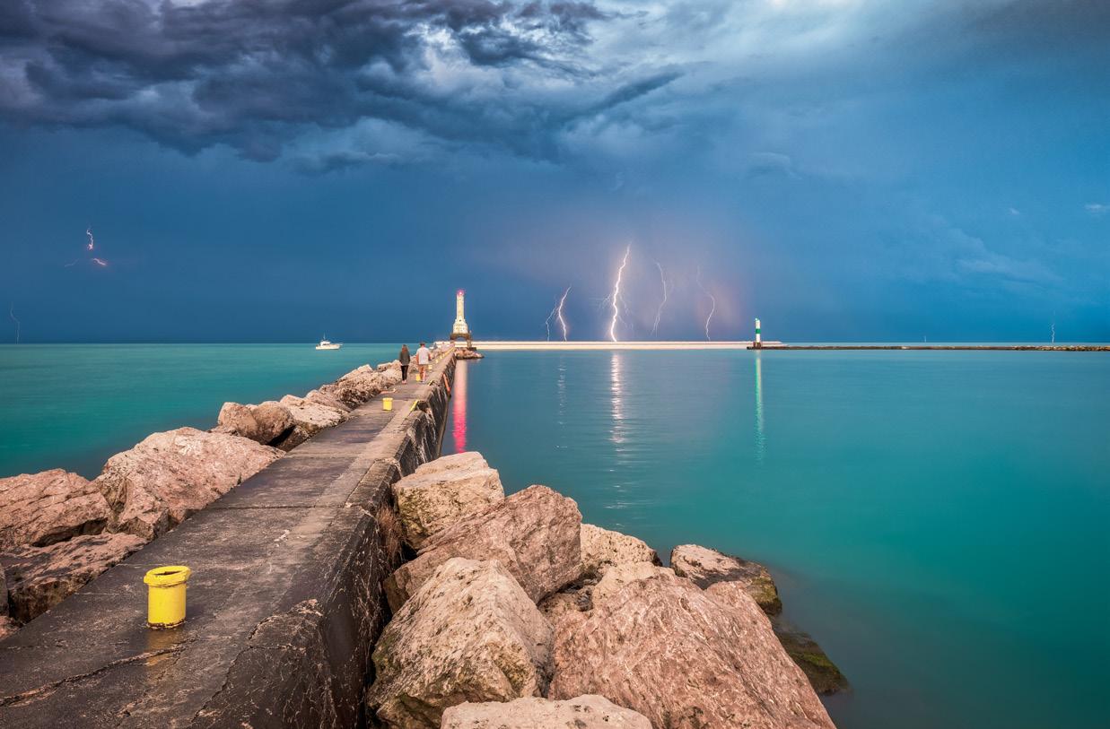
“Striking Sky" captures Lake Michigan at Port Washington and was a first-place winner in the 2020 Great Waters Photo Contest (natural features category).
The 2026 Great Waters Photo Contest and Writing Project highlights the beauty and importance of Wisconsin’s Great Waters — lakes Michigan and Superior and the Mississippi River — and your work can be featured! Submission deadline is April 1, with the best photos and writings used in the next Wisconsin Great Waters Calendar and other DNR media.
Find all you need to enter the contest and help celebrate our Great Waters at dnr.wi.gov/tiny/3296.
It’s tax season and you might be filing soon. The Wisconsin state income tax form makes it easy to donate to the Endangered Resources Fund to support state conservation efforts. Plus, the gift is taxdeductible and matched by the state dollar for dollar!
Contributions have helped support hundreds of plant and animal species in the state. Just find the “donations” area on your Wisconsin tax form and click to make a donation. For details, go to dnr.wi.gov/tiny/971.
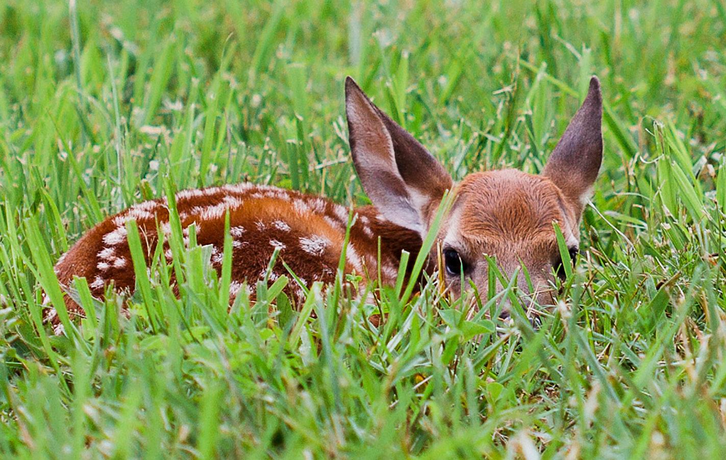
It’s not unusual to see young wild animals in spring as the landscape comes back to life after winter. When that happens, the DNR reminds everyone to help keep wildlife wild by maintaining a safe distance.
Young wild animals might seem helpless or alone, but they are adapted to survive without human intervention. And with most species, it’s natural for mothers to leave their young alone for long periods, when these animals will remain still to blend in with their surroundings and avoid attracting predators.
Keeping wildlife wild helps animals avoid unnecessary stress, properly meet their dietary and habitat needs and learn normal social behaviors. Also note that it’s illegal to possess most wild animals, which are protected under state and federal laws.
For more on how you can help keep wildlife wild, check dnr.wi.gov/tiny/966.
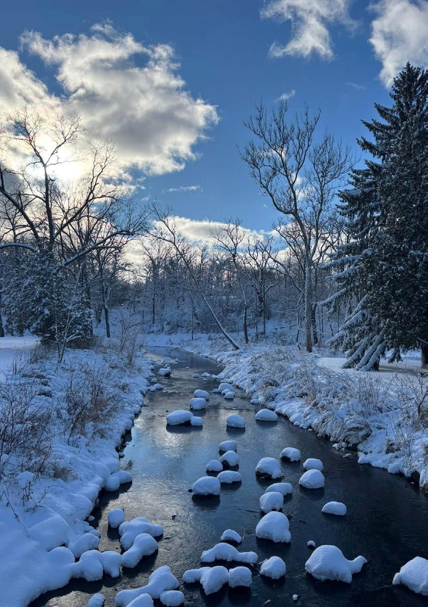
I wanted to share a photo of beautiful Petrifying Springs Park, the flagship park for Kenosha County Parks. This was taken after our first major snowfall. Stay warm.
Craig Sadur Kenosha
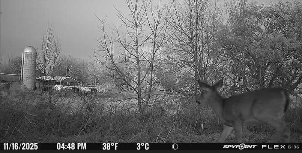
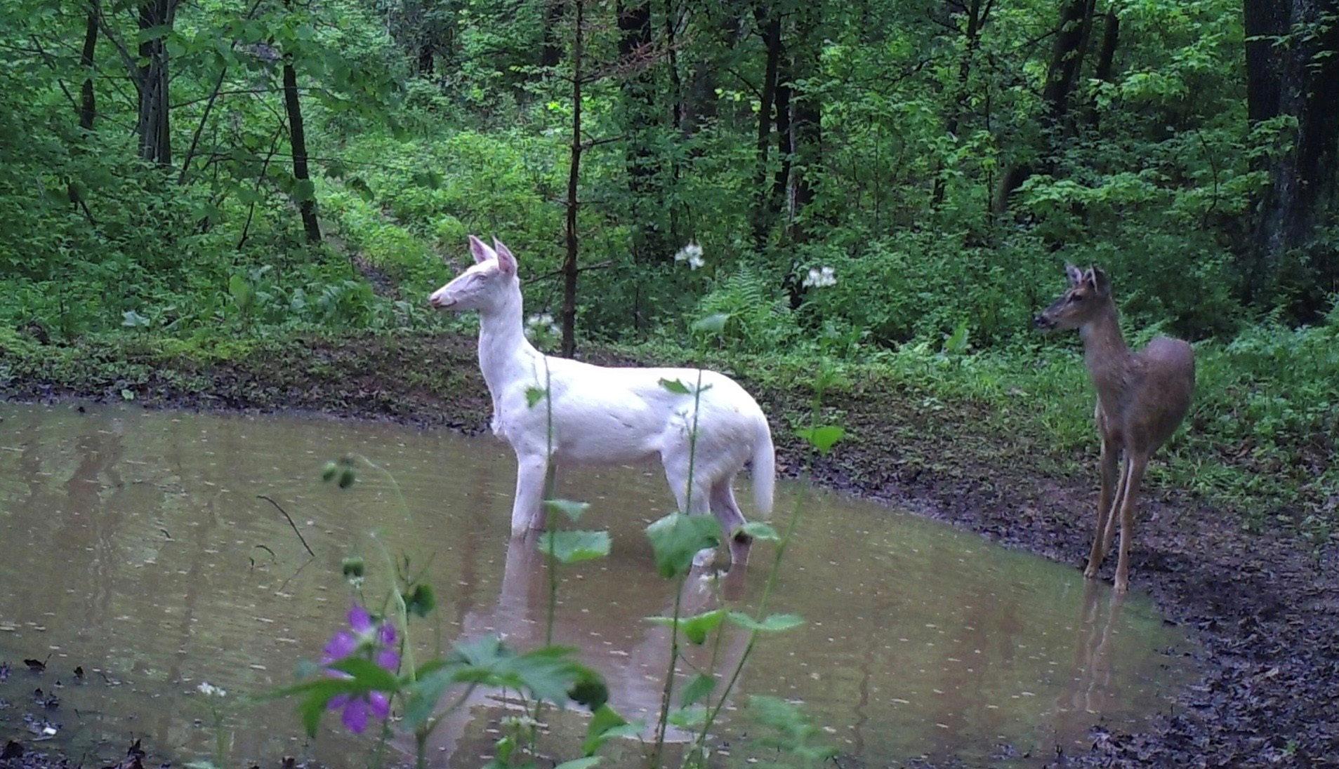
I wanted to send in a picture pulled from one of my trail cams. A few people have told me it looks fake, but it’s not. It’s a small doe with the farm in the background on the land I’m lucky enough to hunt here in Wisconsin. The picture was taken outside of Fox Lake.
I get asked now and then why I hunt whitetail. For me, hunting is about seeing a side of the world most people never slow down enough to notice. It’s watching how everything moves, grows and comes to life out there.
What you can’t see in that picture is me sitting in my tree stand about 25 yards away, just watching that young doe wander past on her way toward the corn field. Moments like that are why I do it. They remind me to slow down and enjoy what Mother Nature puts in front of us.
Paul Ramirez Waupun
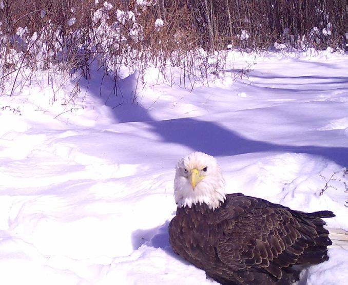
I read in this new (winter) edition the article on bald eagles. That brought to mind a photo taken on my Snapshot Wisconsin camera in Waupaca County, near Iola. This magnificent bird was just sitting in the snow. However, if you look closely, you will notice it is missing an eye. A following photo showed it flying away, seemingly unhampered by this injury.
Kevin Ball Wauwatosa
You forgot a Wisconsin conifer in the list of state conifer species (“Cool conifers,” winter). Taxus canadensis, the Canada yew, is native to Wisconsin, though becoming rare because of deer browsing. Even though it does not have the typical cone of conifers, it still belongs within the group. Glenn Herold Cedarburg
Thanks for the email, Glenn. You are correct, Canada yew is a native conifer in Wisconsin, where it is mostly found in the far north, associated with the state’s small area of boreal forest, with scattered occurrences in other locations. While the list in the magazine story was not meant to be all-inclusive, Taxus canadensis certainly fits the bill of cool conifers!
Write in by emailing dnrmagazine@wisconsin.gov or send letters to:
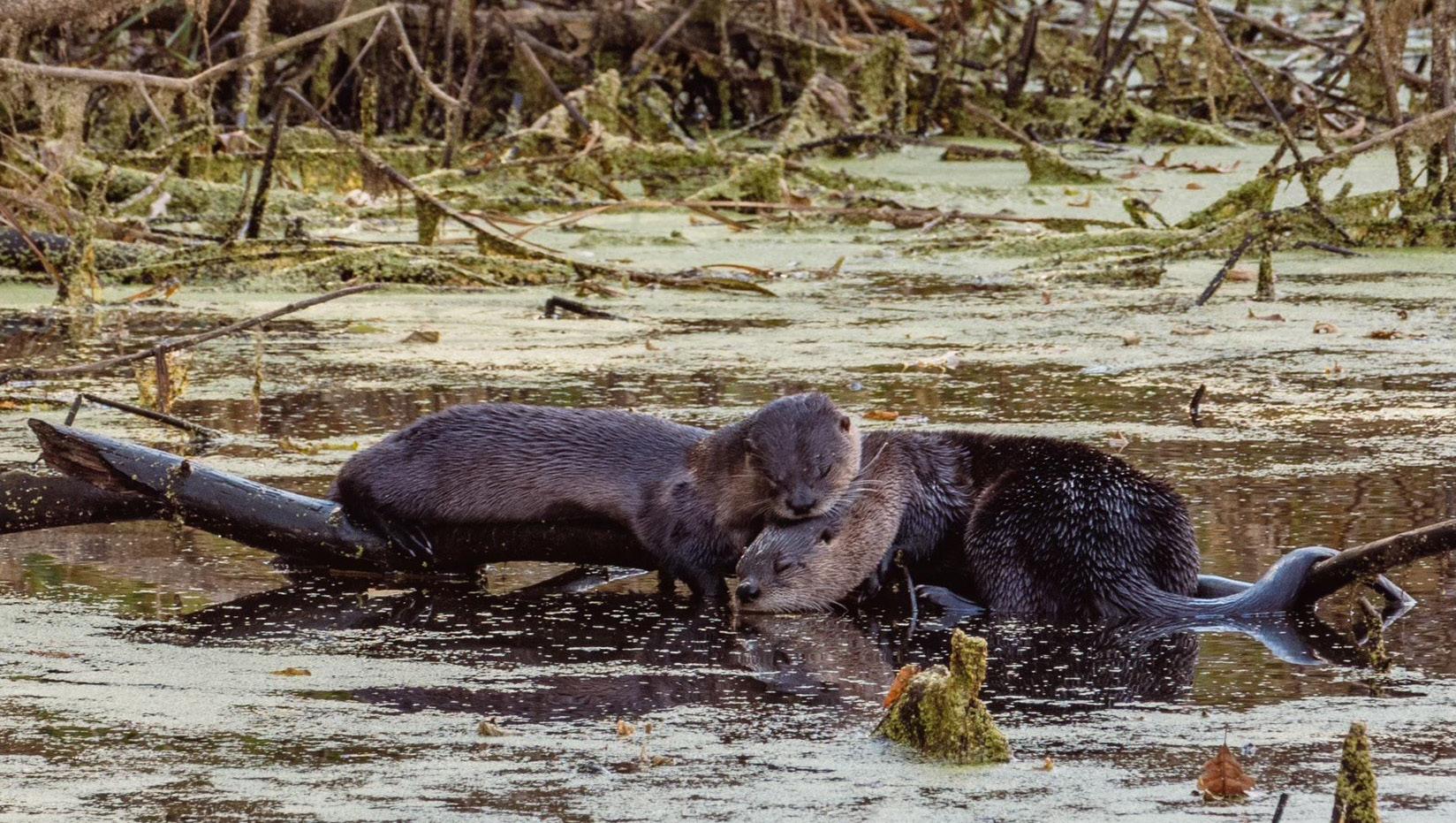
Saw these otters in a pond near Emerald. Enjoyable to watch.
Heidi Eliason Emerald

What a magnificent article did your staff compose on the ill-fated iron ore carrier, the Edmund Fitzgerald — the story, the photographs, the history.
When we received the fall issue in the mail and saw the “Fitz” article, it brought memories from 50 years past, when I witnessed the mighty ship being loaded at the dock with taconite pellets. Several days later, when I was having breakfast at a restaurant in Rice Lake, I read the morning paper and saw the ship’s fate as noted in your incredible story.
I have seen grain ships loaded in Superior, too. We live in Florida now. However, the DNR magazine brings us home. I have traveled all 72 counties in Wisconsin. Your staff is without peer.
Denis Mark Hanson
The Villages, Florida
Hello, I have been receiving Wisconsin Natural Resources magazine for several years and always enjoy the content. I felt compelled this time to write about the fall 2025 issue.
In the “It's trophy time” article, I was surprised to note that the word “weeds” was used several times instead of “aquatic vegetation.” We are so often brought up to think of weeds as plants that are
undesirable, which leads people to think we should remove them.
Especially in water situations, “weeds” are removed because they appear to be in the way of our opportunity to enjoy the waterways. In reality, the right aquatic vegetation is critical to the health of our waterways and the wildlife that relies on it.
Granted, there are many invasive plants that should be removed when done correctly to improve a specific site, but we need to recognize that native vegetation has its place in our environment.
Thank you for allowing me to pass along my “2 cents.”
Dana Hartel Winneconne
Thank you for your feedback, Dana. The word “weeds” does often carry negative connotations and in some cases can be referring to destructive invasive species. But that might not always be the case when it comes to aquatic vegetation.
Hello, just wanted to share this image that my trail cam caught on our land in Pepin County. Thanks.
Dave Hoban
Eau Claire
PRIMED FOR STATE PARK FUN AND ADVENTURES? CHECK AND CHECK PRIMED FOR STATE PARK FUN AND ADVENTURES? CHECK AND CHECK
WARMER WEATHER will be here before we know it, and now’s the time to prep for your spring and summer adventures in the Wisconsin State Park System.
From gathering your gear to planning your next outing, follow this checklist to help you get ready for outdoor fun.
Emma Macek is a public information officer in the DNR’s Office of Communications.
If you’re planning to visit a state park, forest or recreation area or use a state trail, you’ll probably need a vehicle admission or state trail pass. You can purchase both in advance online at dnr.wi.gov/topic/parks.
You can also check to see if your local library participates in the Check Out Wisconsin State Parks at Your Library program. Through this program, cardholders can check out daily admission passes to state parks, forests and recreation areas. You can find participating libraries at dnr.wi.gov/tiny/4071.
The Wisconsin State Park System has lots of beautiful campsites, but they fill up quickly, especially on weekends. Be sure to plan ahead and make your reservations early.
Ready to plan your adventures at Wisconsin State Park System properties? Scan the QR code or visit dnr.wi.gov/topic/parks.
When it’s time to head out, remember a few quick tips:
y Bring basic items like water, snacks, sunscreen and insect spray.
y Dress for the weather; bring layers and wear appropriate footwear.
y If recreating alone, let someone know where you’re going and when you plan to return.
Looking for a new state property to explore? The DNR’s Find a Park webpage — dnr.wi.gov/tiny/801 — has you covered. You can even filter and search properties by activities such as hiking, biking or horseback riding, or find certain amenities, including accessible features.
Each state park, forest, recreation area or trail property also has links to more information, maps and driving directions. Click on the icons on the map or the tiles below to view more details about each property.
Wisconsin state parks, forests and trails have a few rules to protect the safety of visitors and the environment. A full list of rules is available at dnr.wi.gov/topic/parks/rules.

You can make a camping reservation online at dnr.wi.gov/tiny/1551 or by calling 1-888-947-2757. The reservation site’s “notify me” feature can alert you when a site that meets your selected criteria becomes available.
Once you have your reservations booked, it’s time to make sure your gear is ready to go. Your tent and other supplies can wear out with use, and it’s not fun to camp with failing equipment. Pull out your gear early for a quick inspection before heading out.
Get directions, download maps and gather other helpful information such as parking details so you have a plan before you head out.
Responsible pet owners and their pets are welcome at Wisconsin State Park System properties, but please keep your pets under control and on a leash no longer than 8 feet, dispose of waste properly and stay away from pet-free areas.
Relaxing in a hammock is a great way to enjoy Wisconsin’s state properties. Make sure to place them only in public areas — such as campsites, picnic areas and other day-use areas — that are clear of obstructions, and do not leave them unattended.
You can forage for personal consumption on most state-owned properties in Wisconsin without a permit if it’s only for edible fruits and nuts, mushrooms, wild asparagus and watercress, or for garlic mustard and other invasive species listed in Ch. NR 40, Wis. Adm. Code. Gathering seeds, leaves, stems, roots or other plant parts is not allowed, including medicinal herbs and wild leeks or ramps.
If you’re unsure if foraging is allowed at a specific property, call the property or stop by the office.
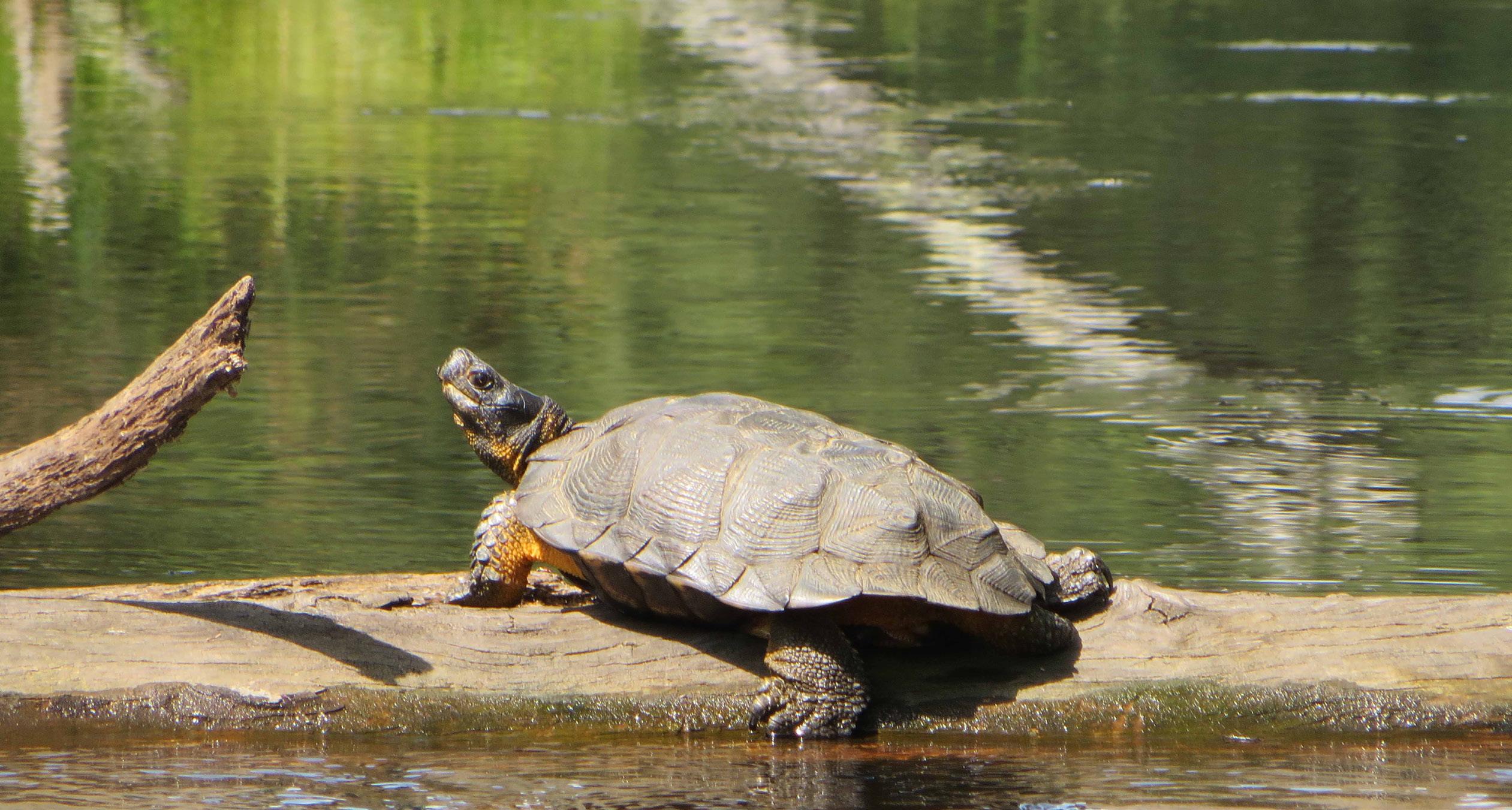
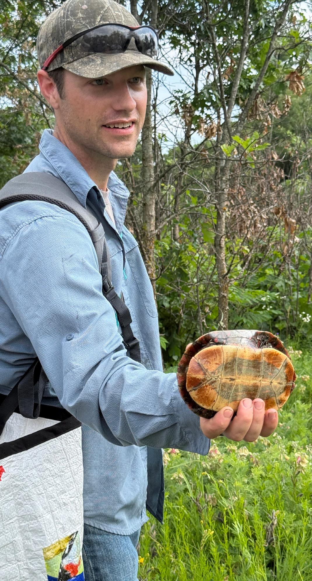
HIDDEN IN STREAMS and beneath dense forest canopies, a population of turtles has been dwindling over the years.
Rare and notoriously tricky to spot, wood turtles blend in perfectly with leaf litter or go undetected in the water. Due to their secretive nature, they’ve largely been a mystery to scientists — until now.
For the past four years, researchers have trekked along uneven riverbanks, scrambled through dense shrubs overrun with ticks and hiked in mosquitoinfested forests in search of these hard-to-find turtles. It’s part of a collaborative project to study wood turtle populations and, for the first time, their habitat preferences in the Upper Midwest.
The data collected — down to the level of river currents and forest canopy coverage — provides the information we need to protect and restore habitats, hopefully boosting population numbers in the coming years.
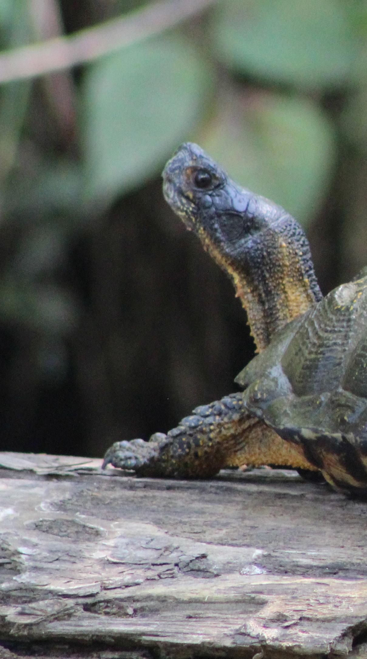
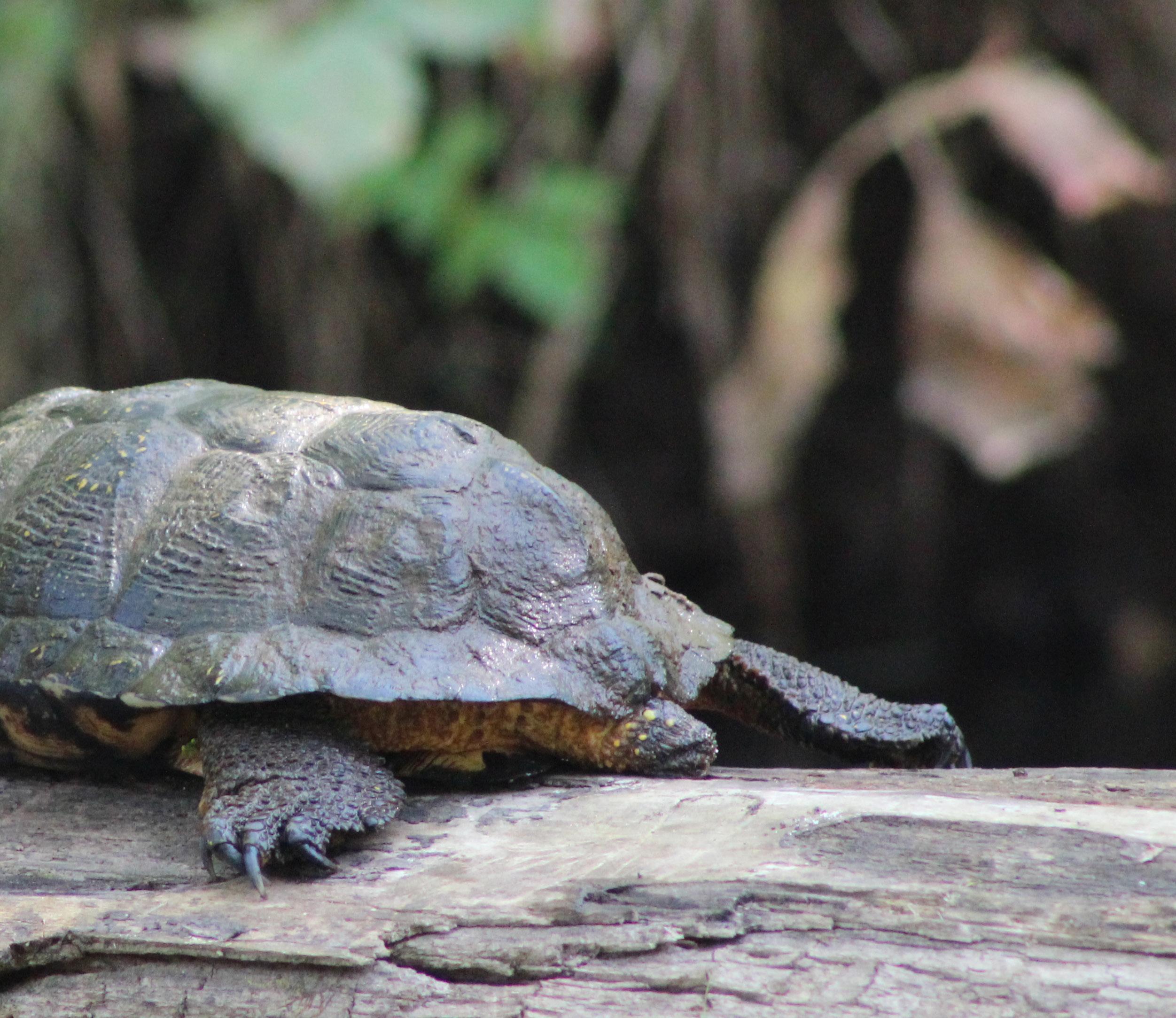
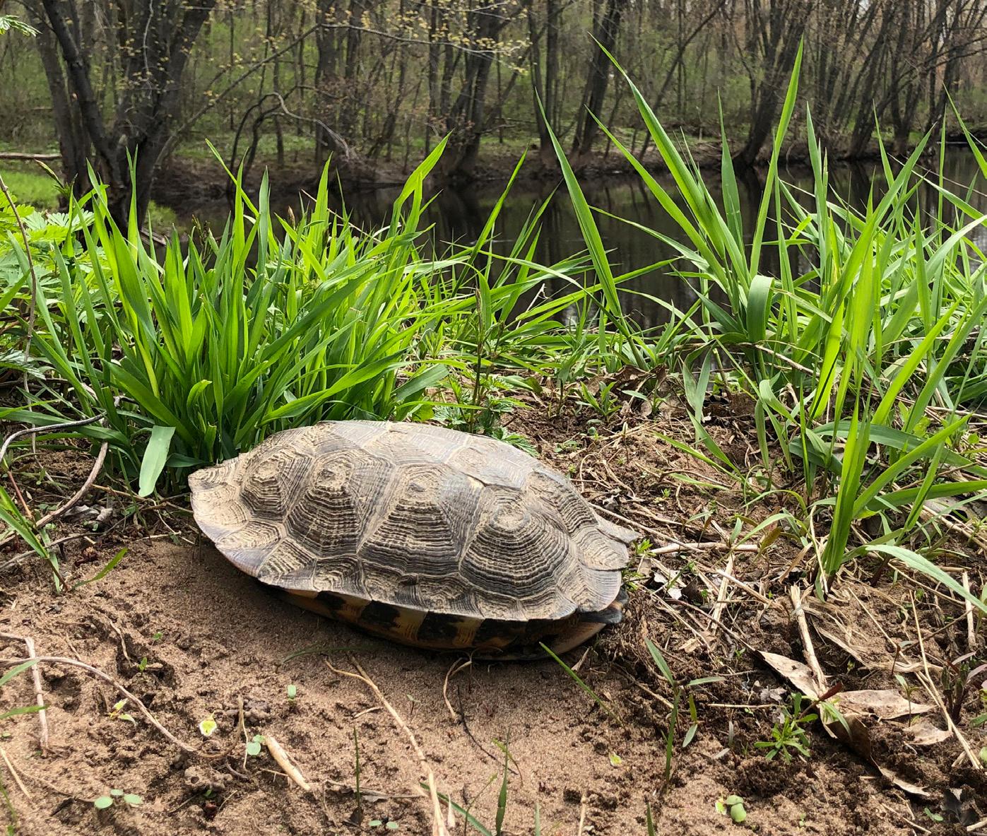
Wood turtles (Glyptemys insculpta), which are semi-aquatic, get their name from the rings on their shells that resemble tree growth rings. Their name is also fitting because they live primarily in forested areas with adjacent rivers and streams, including Wisconsin’s Northwoods.
Our state is a key part of their range, which stretches from the western edge of Minnesota, northern Wisconsin and Michigan all the way to the northeastern United States.
A semi-aquatic species, wood turtles live mostly in forested areas near rivers and streams.
“We have a significant part of the Northwoods in the upper Midwest in Wisconsin, and as a result, we have a regionally significant number of wood turtles here — and, therefore, a larger responsibility to conserve the species,” said Andrew Badje, a biologist in the DNR’s Natural Heritage Conservation program.
Wood turtles are listed as threatened in Wisconsin and as a species of greatest conservation need across their range in the United States. Threats include predation, road mortality, habitat fragmentation, illegal pet trade and climate change, as they prefer cooler temperature regimes.
The research project was funded by the U.S. Fish and Wildlife Service through a Great Lakes Fish and Wildlife Restoration Act grant. Efforts represent a collaboration among the Wisconsin DNR, West Virginia University, U.S. Forest Service, Bad River Band of Lake Superior Chippewa Indians and other state agencies and universities in Iowa, Michigan and Minnesota. The first part of the project was collecting baseline population and demographic data throughout the wood turtle's range in Wisconsin. Over the four years, the team completed nearly 250 surveys at 50 different sites.
In addition to being difficult to find, wood turtles also have a short survey window. They can really only be spotted during a couple of periods: in spring as they emerge from the river or stream where they overwinter and during the nesting season, generally late May through June.
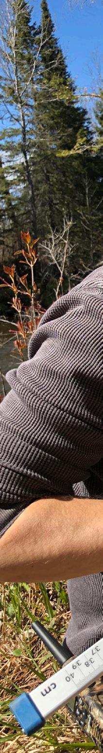
When researchers did find turtles during surveys, they took size and weight measurements and carefully added PIT tags, passive integrated transponders, implanted for tracking. They collected environmental data, like water temperature, currents and clarity where turtles were found.
The team also made a small, permanent notch at the edge of each turtle’s outer shell covering, or scute, to help identify them in the future and deter illegal trade.
The team plans to do these same surveys again in 10 years to assess how the species is doing and identify which conservation actions have been effective, such as nest protection and reducing road mortality.
The second part of the project involves combining the collected habitat data with the wood turtle abundance data to determine which habitat characteristics are most important to wood turtles.
Lastly, the team has created a habitat suitability model using existing population and presence data from Wisconsin, Iowa, Michigan and Minnesota. This model will help predict where wood turtles are likely to be found and assist biologists in documenting new populations with suitable habitat.
In addition, the habitat suitability model will provide property managers with information on where resources can best be used to manage and restore highquality wood turtle habitat. The information also is helpful for finding the species in future surveys.
“Since we have a short one-month window to survey for them, having this model is helpful to say, ‘All right, this is where they could be, now let’s see if we can find them there,’” Badje said. “In these areas of higher suitability, we can take proactive steps to better manage habitat for healthy wood turtle populations and other species that use riverine corridors.”
With the fieldwork and data analysis done for now, biologists are busy creating and implementing management strategies and conservation tactics.
Perhaps most importantly for Wisconsin, the habitat suitability model has shown an abundance of potential habitat in our state. That’s good news for Wisconsinites and the species.
The project has been years in the making and has plenty of distance yet to cover, but slow and steady can help win the race to protect a vulnerable species.
Here are some ways to help turtles.
y Protect nests: Build a nest cage that keeps out predators and allows hatchlings to exit the nest on their own.
y Drive cautiously: Slow down, be alert and reduce distractions, especially on roads near wet areas, lakes and rivers during the spring and summer months.
y Share your sightings: Report turtle observations, road crossings and nest sites using the DNR’s reporting form — dnr.wi.gov/tiny/4076 — to help us manage and protect turtles more effectively. You can also report suspicious illegal activity associated with turtles to the DNR’s Violation Hotline online, dnr.wi.gov/ contact/hotline.html, or by calling or sending a text to 1-800-847-9367.
y Keep wildlife wild: Help protect Wisconsin’s native turtles by keeping wild turtles in the wild (do not take them as pets) and not releasing pet turtles outdoors.
y Donate: DNR conservation efforts for endangered and threatened species wouldn’t be possible without support from the Endangered Resources Fund. Find out more and donate now at dnr.wi.gov/tiny/1261
LEARN MORE
For details on the Wisconsin Turtle Conservation program and ways you can help the wood turtle and other species, including links to report sightings and a video to build a nest cage, scan the QR code or go to dnr.wi.gov/tiny/4081.

Wood turtles get their name from shell rings that resemble the growth rings of a tree.
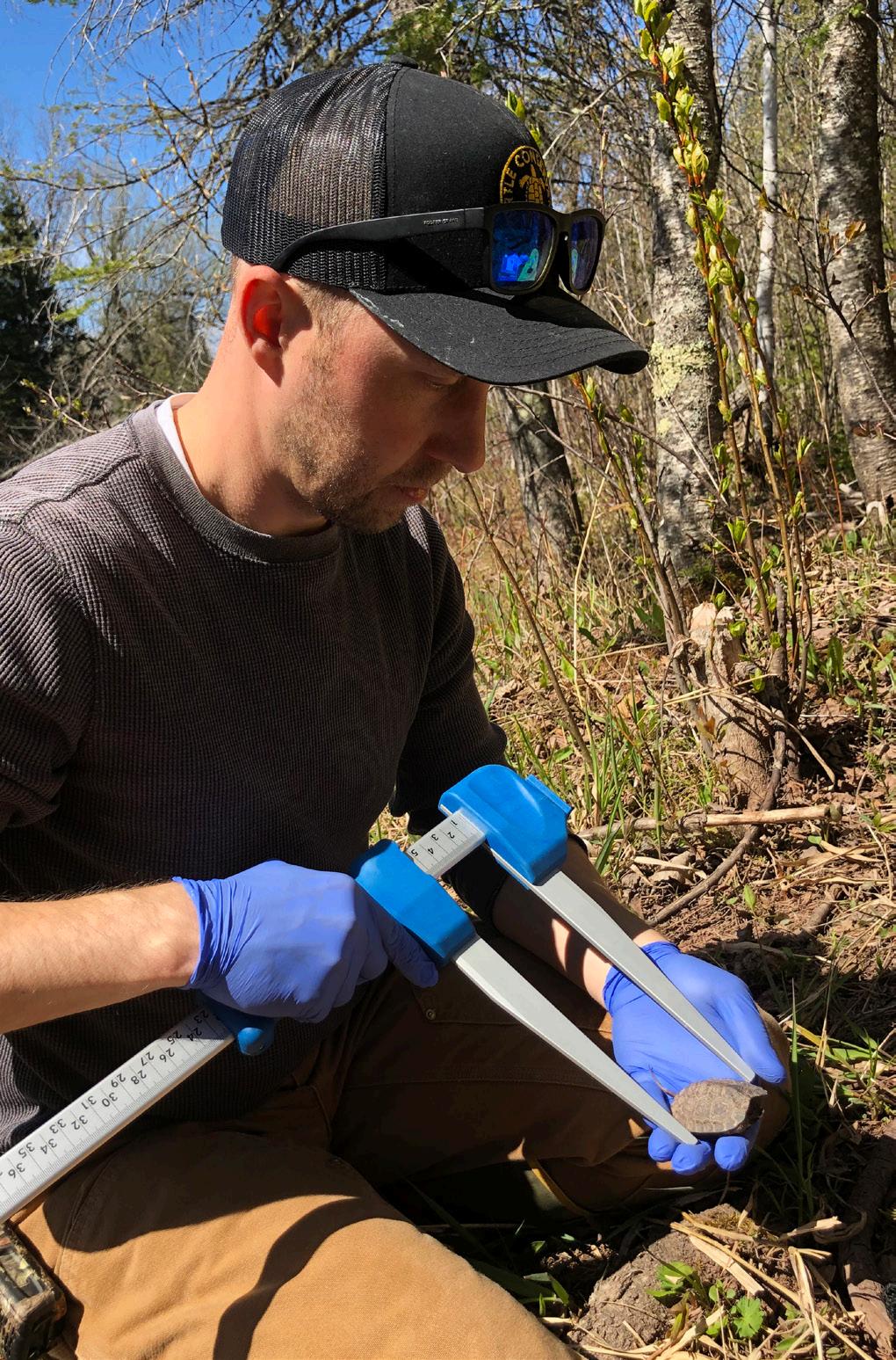
DNR conservation biologist Andrew Badje records wood turtle measurements as part of survey efforts for this statethreatened species.
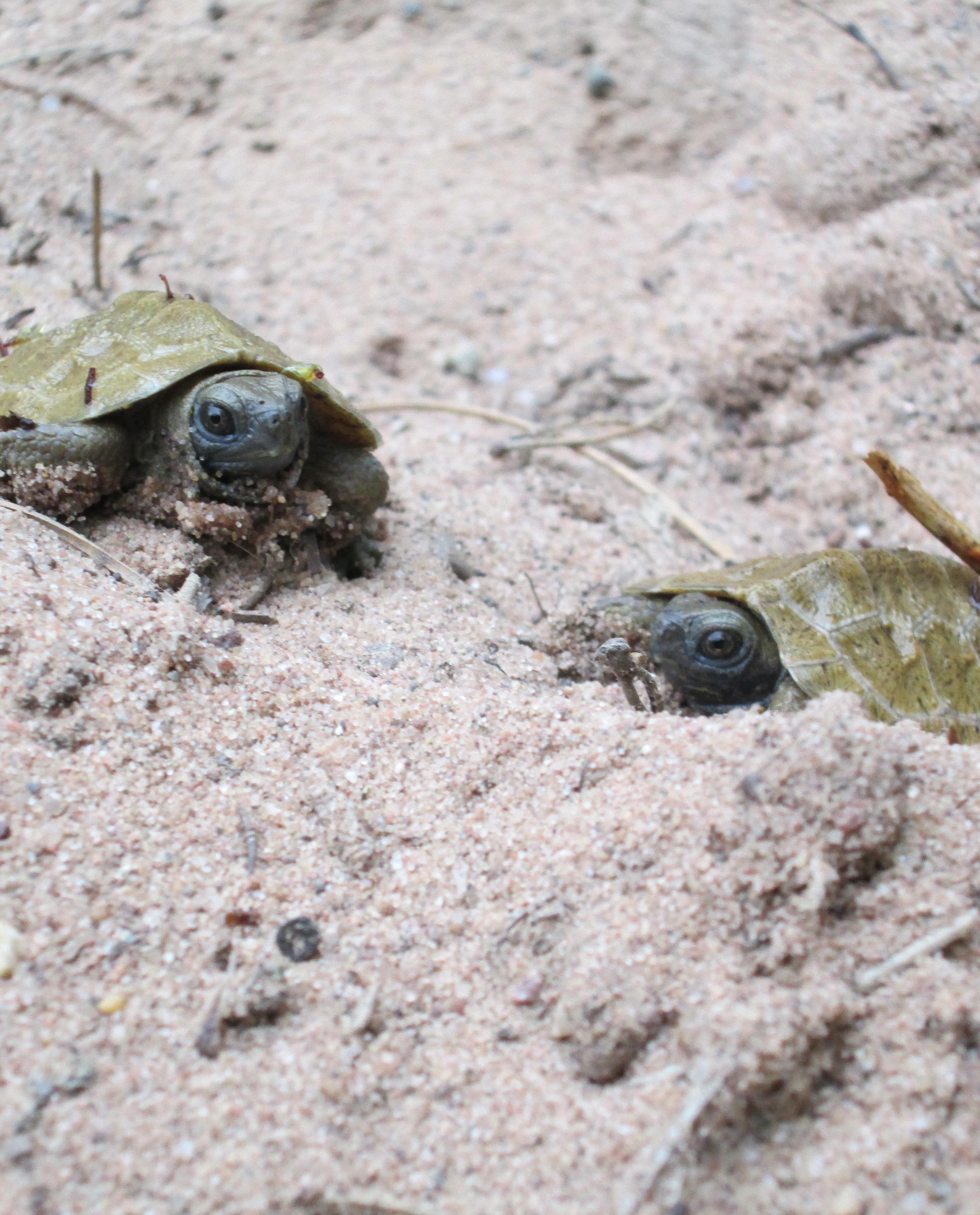
After female wood turtles nest from late May to early July, hatchlings typically emerge in September.
Get Kids Outside emphasizes joys of the outdoors
Get Kids Outside emphasizes joys of the outdoors
KRYSTAL PENCE

GET KIDS OUTSIDE is at
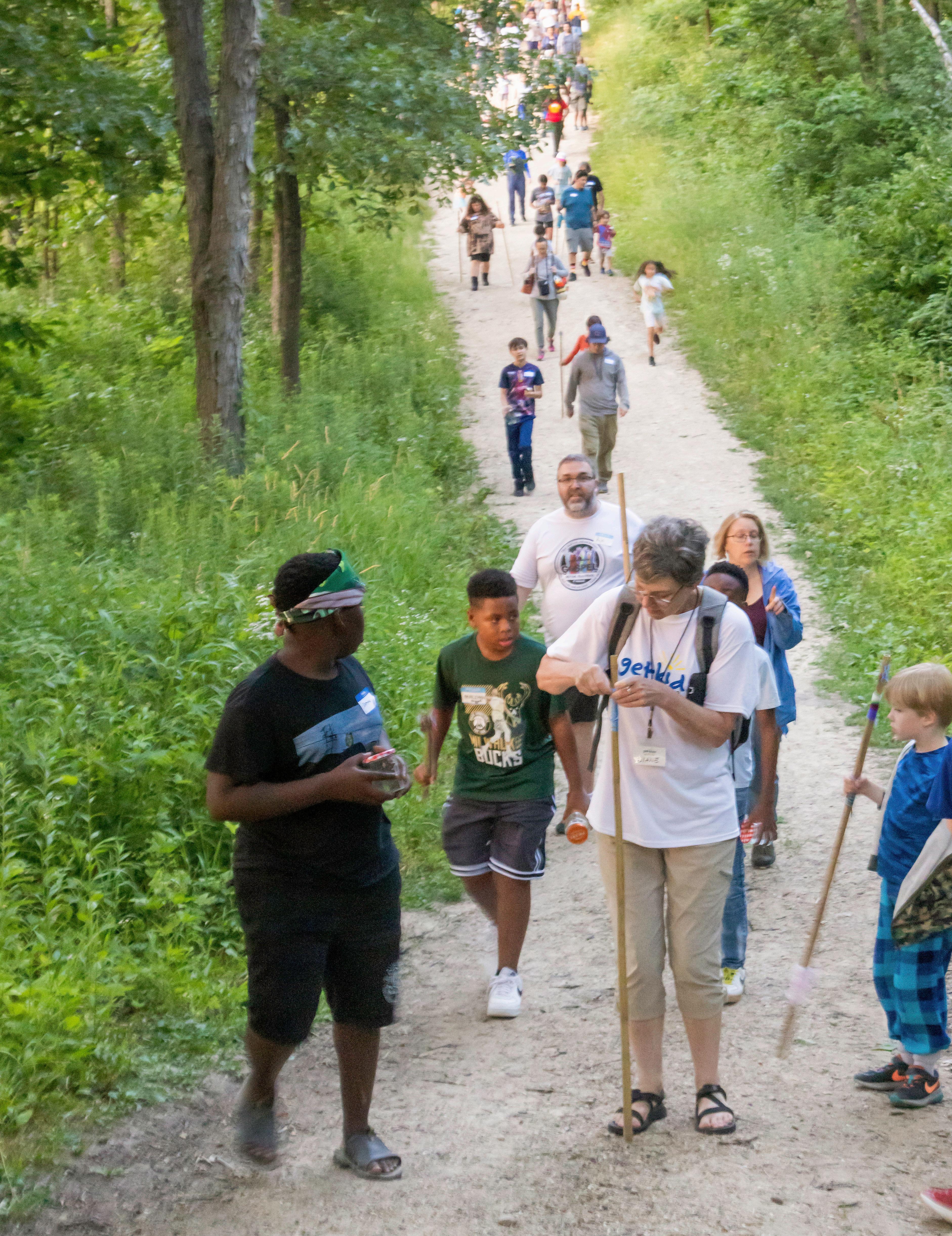
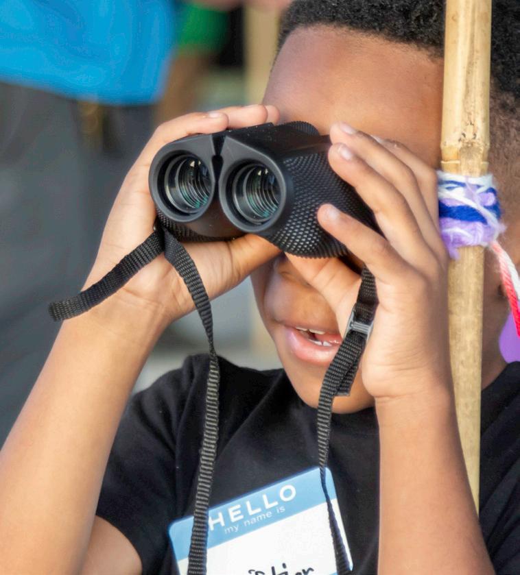
the forefront of the push to do exactly what their name suggests. The resounding message behind the group is to promote learning and well-being through outdoor opportunities for children and their families.
LEARN MORE
For details on Get Kids Outside, check getkidsoutsidewi.com.
“Kids are calmer and less stressed after getting outside in nature,” said Diane Schwartz, who founded the Madison-based organization in 2010. “Our vision is to ensure that all kids get to experience nature on their own terms and relate that experience to their own lives.”
Shortly after receiving her elementary teaching degree in 2008, Schwartz began leading hiking excursions for kids on the weekends and spearheading a biking program. She also became involved with Madison’s Christ the Solid Rock Baptist Church, promoting nature experiences.
Attending services and ultimately joining the church opened her eyes to social justice issues, which strengthened her resolve to provide outdoor experiences in particular for youth of color.
“The biggest lesson I’ve learned is that nature is for everyone and spending time in nature can have a positive impact on children,” said Schwartz, whose long resumé of outdoor-related experience includes a stint at the DNR.
The World Health Organization recommends children ages 1-4 spend at least three hours a day being physically active, while ages 5-17 get at least 60 minutes a day of moderate to vigorous activity. Since playing outdoors tends to involve more physical activity than indoor play, getting children outside helps bridge the gap between nature and exercise.
What’s more, there is a multitude of evidence supporting the notion that time in nature and green spaces provides mental health benefits. And it’s difficult to ignore the evidence linking time outdoors to increased energy, improved mood and elevated creativity.
Despite the long list of positive reasons to lace up our shoes and step outdoors, challenges often remain when trying to get families outside. That’s where organizations like Get Kids Outside come in.
“(The) mission is simple — get kids outside!” said program participant Pat Wongkit. “Once they are outside, they will immediately fall in love and want to explore.”
Working with volunteers, parents and caregivers, Get Kids Outside helps bring moments of whimsy
and outdoor play back to children in the modern age. Supported by donations, the help of partner groups and fiscal backing from Madison’s Center for Community Stewardship, Get Kids Outside offers its activities for no charge or very low cost.
“The program showed me that nature isn’t something distant or intimidating; it’s accessible, it’s free and meaningful when shared with others,” Wongkit said.
“Sometimes people get so busy with life that they forget the simplest thing that’s good for them is being outside in nature.”
To vary kids’ experiences, Get Kids Outside events are hosted at a variety of southern Wisconsin locations and different times throughout the year.
One popular event is the annual Firefly Hike, which began in 2016. The hike is held every summer at Dane County’s Indian Lake County Park, with families from the community encouraged to attend. It’s one of Schwartz’s favorite events.
“It is a joy to watch the kids catch — and, of course, release — the fireflies and enjoy nature at night,” she said. “Kids don’t get outside at night very much anymore, and this is an opportunity for them to do so in a safe environment.”
At the end of the day, there are many ways to experience and enjoy the outdoors. No matter what kind of play gets families and kids outside, it’s worth remembering the many benefits outdoor activities can offer for both youth and adults.
“Through hands-on activities and time spent outside, our young kids get to slow down and experience the outdoors with intention — the changing seasons, local wildlife and how being outdoors positively affects their mood and focus,” Wongkit said.
“Being outdoors on a regular basis is exactly what our children need.”
Krystal Pence is a contracts specialist in the DNR’s Division of Environmental Management and a freelance writer and photographer.
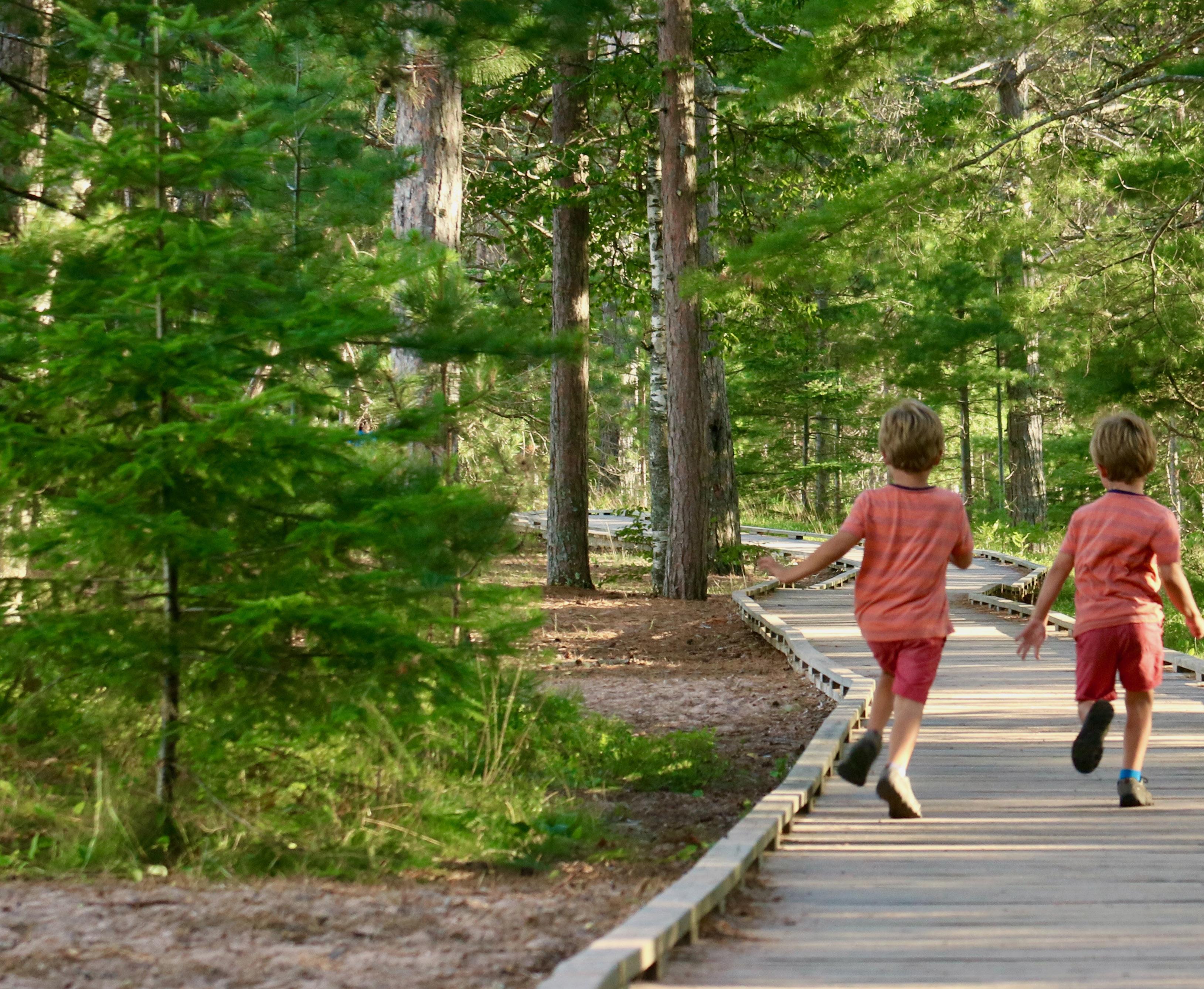
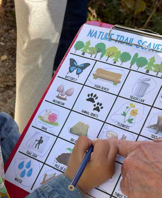
Nature scavenger hunts are a fun way to engage kids in the outdoors.
STORY AND PHOTOS BY THOMAS MEYER
ISUSPECT THE PROFESSOR WOULD BE PLEASED. Aldo Leopold, that is. First, a short quiz. Where in Wisconsin can you do the following?
1. Tread on a quaking, floating mat of sphagnum moss in search of carnivorous plants and tiny bog orchids.
2. Explore a Wisconsin desert, complete with sand dunes, native cacti and lizards.
3. Snap a photo of a federally endangered Karner blue butterfly.
4. Get lost in a primeval forest among soaring white pines and hemlocks that block the sun.
5. Experience sights and sounds of the native landscape much like it was when Wisconsin became a state in 1848.
If you answered “a state natural area” to any of these, congratulations! (To be exact: 1. Grandma Lake Wetlands; 2. Blue River Sand Barrens; 3. Karner Blue Meadow; 4. Van Vliet Hemlocks; and 5. Almost any SNA.)
This year, the DNR marks 75 years of one of its most innovative and successful efforts, the Wisconsin State Natural Areas Program. It’s a diamond jubilee worth celebrating in a big way.
For details on the DNR’s State Natural Areas Program, including visitor guidelines, volunteer opportunities and information on each of Wisconsin’s 694 SNAs, scan the QR code or go to dnr.wi.gov/tiny/2746.

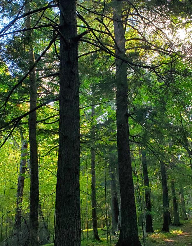
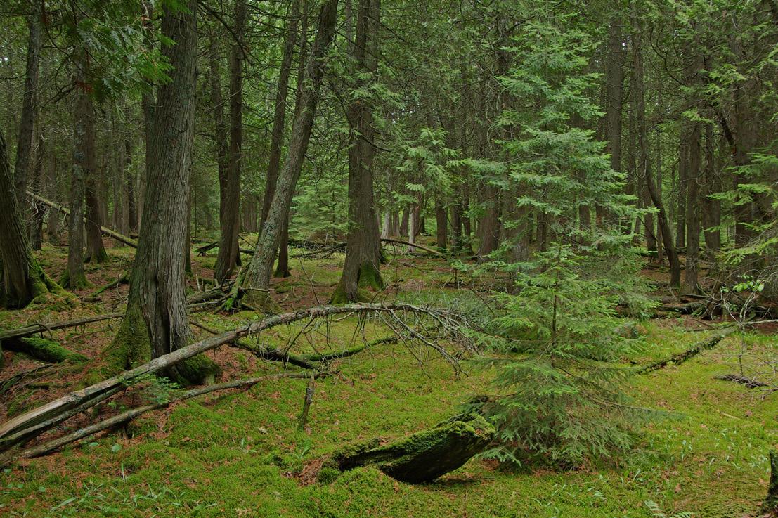
Van Vliet Hemlocks State Natural Area protects one of the state’s best old-growth forests in the Northern Highland-American Legion State Forest.
The year 1951 is recognized as the official birth of this gem of a program, but its legacy reaches back even earlier and is tied to Leopold, a Wisconsin conservation icon. What Professor Leopold and others could not have foreseen was how the concept they championed would someday become an unrivaled success and serve as a model for other nature preserve systems nationwide.
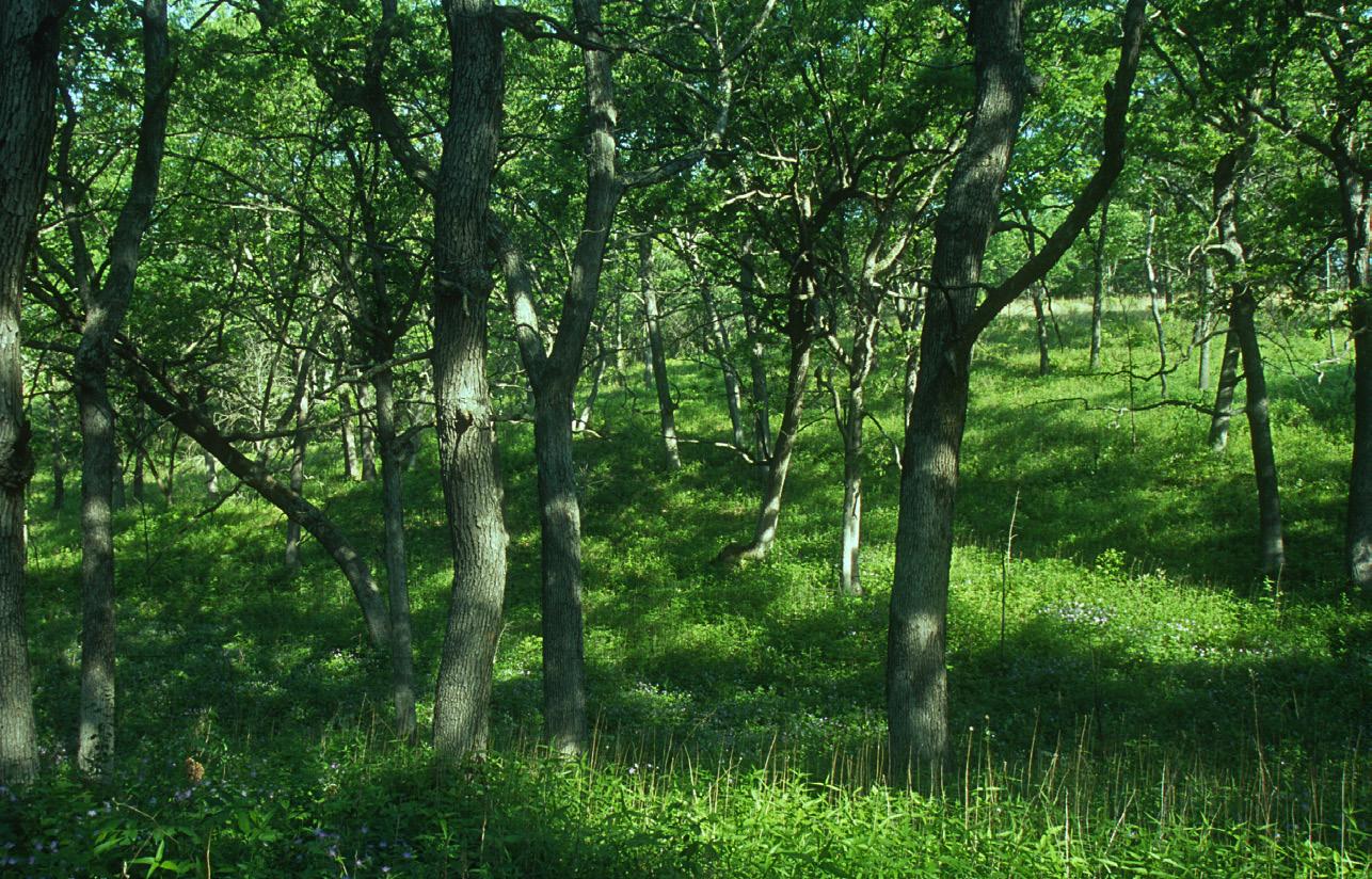
Today, the Wisconsin State Natural Areas Program is the largest of its kind in the U.S., protecting the very best examples of the state’s old-growth forests, unplowed prairies, diverse wetlands and unusual geological features.
Wisconsin harbors a dizzying array of flora and fauna compared to most other Midwestern states. That’s largely because it sits at the confluence of three major North American biomes, or major ecological zones: the eastern deciduous forest, northern conifer forest and western prairie.
The state’s diverse geology — from the rugged Driftless Area to the shorelines of the Great Lakes — along with the influences of the region’s climate and long-standing Native American land practices such as intentionally set fire created the rich variety of natural communities that greeted Wisconsin’s first European settlers in the 1800s.
These natural communities are groups of different plants and animals living together in a specific area at a particular time and in a specific habitat. High-quality examples of these varied communities are the building blocks of the SNA Program.
The DNR recognizes 99 natural community types, including 73 terrestrial and 26 aquatic types. Their names include phrases such as “dry prairie,” “floodplain forest” and “open bog,” derived from their dominant vegetation type combined with an environmental feature.
The mission of the SNA Program sounds a bit daunting, but it has remained consistent through the program’s long history:
“Locate, establish and conserve a system of state natural areas that as nearly as possible represents the wealth and variety of Wisconsin’s native landscape for education and research and, most importantly, to help secure the long-term protection of Wisconsin’s biological diversity for future generations.”
Although other DNR programs such as state parks, forests and wildlife areas contribute to protecting Wisconsin’s biodiversity, only the SNA Program is uniquely charged with the preservation and management of our state’s rare species and natural communities. It’s also responsible for protecting significant geological and archaeological features.
Unlike other DNR properties geared toward public recreation, you typically won’t find designated trails, campgrounds or picnic tables at SNAs, but nearly all are open for hiking, hunting, fishing and nature appreciation.
In the 1940s, Leopold was a professor of wildlife management at UW-Madison and an appointee to the Wisconsin Conservation Commission, the forerunner to today’s Natural Resources Board. The commission provided guidance to the Wisconsin Conservation Department, now known as the DNR.
Leopold and his colleagues — notably botanists
Norman Fassett, also of UW-Madison, and Albert Fuller of the Milwaukee Public Museum — were alarmed by the loss of Wisconsin’s natural communities due to development, agriculture and timber production. The places they took their students to learn about native plants and animals were winking out, and at an accelerating rate.
They decided to take action. In 1945, Leopold, using his influence as a member of the Conservation Commission, pushed for the creation of an ad hoc Natural Areas Committee in the Conservation Department, to be charged with identifying and protecting important
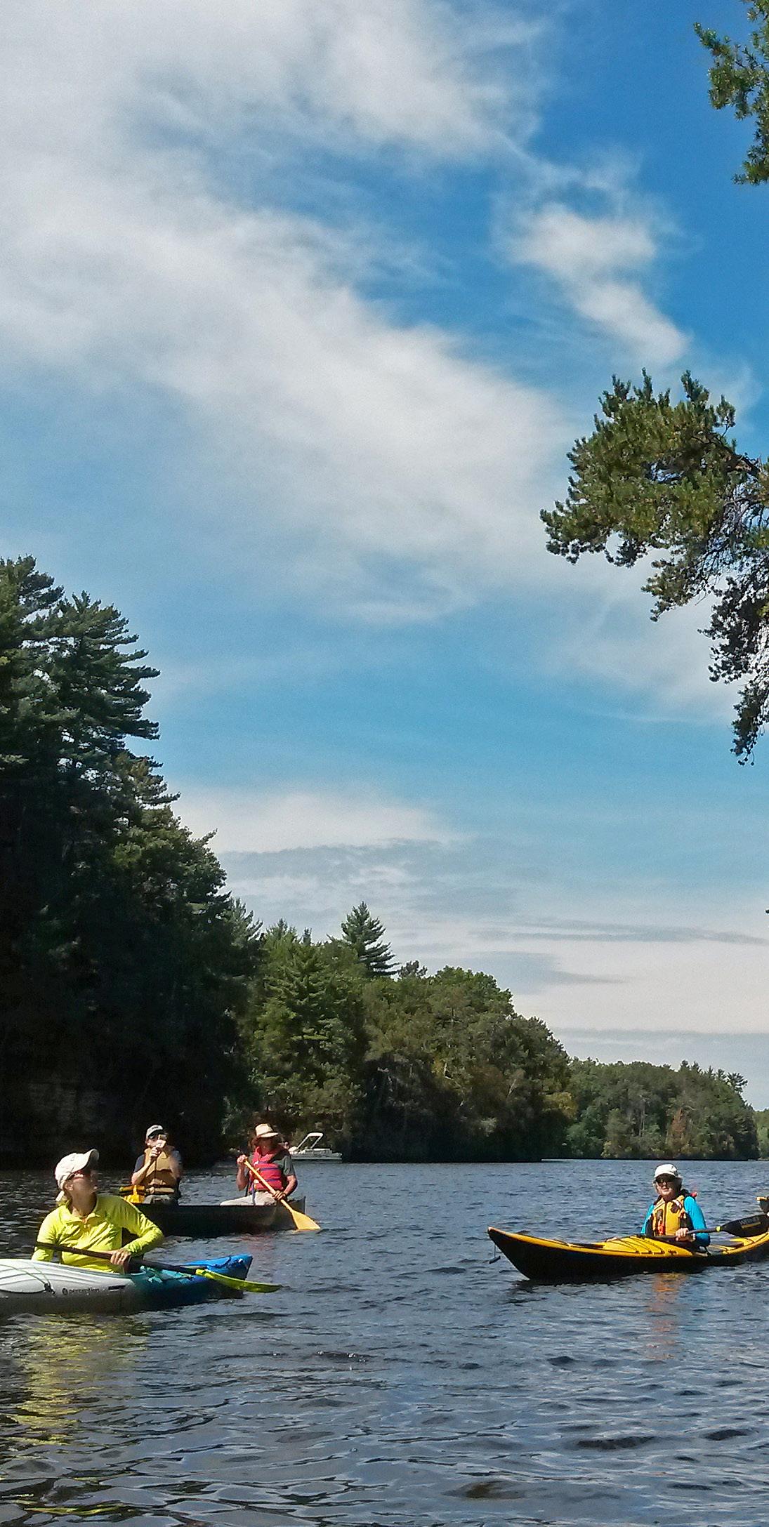

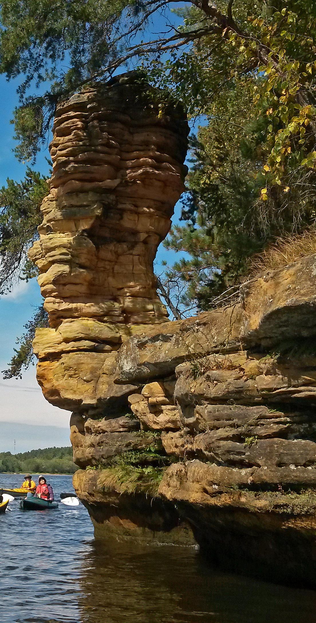
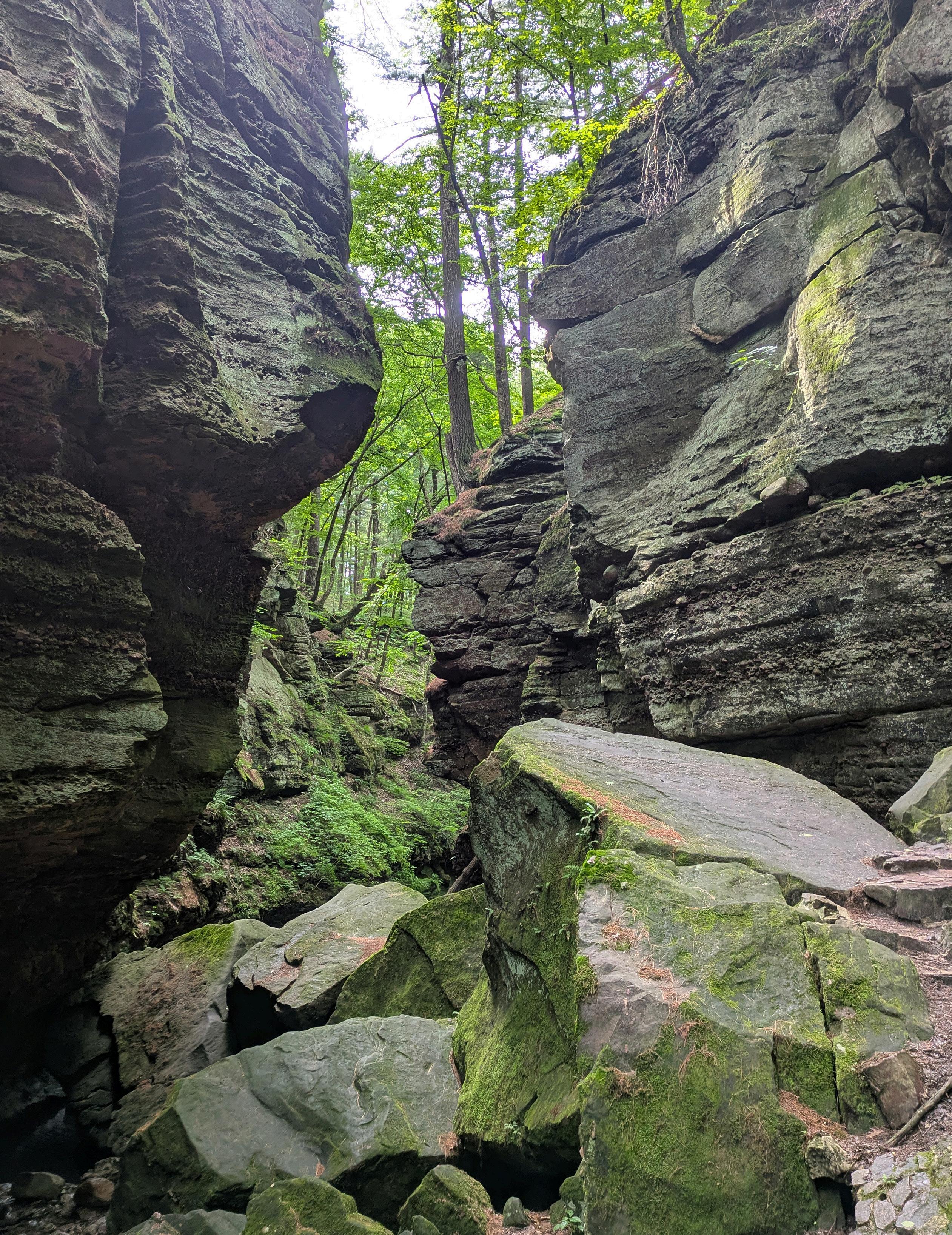
Left: Kayakers glide past Chimney Rock at Dells of the Wisconsin River State Natural Area.
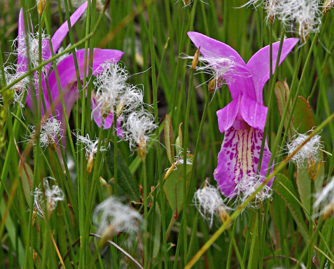
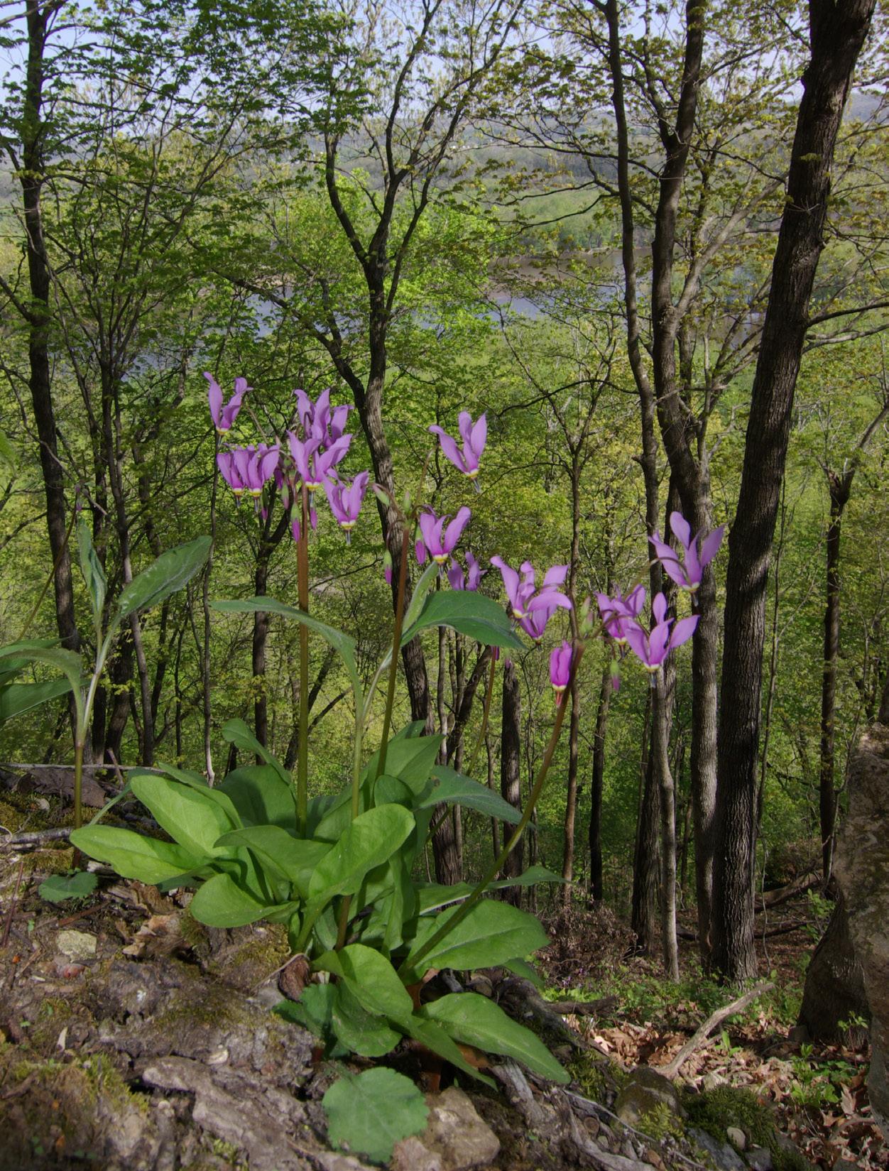
Bottom left: Dragon’s mouth orchids at Grandma Lake Wetlands in the Chequamegon-Nicolet National Forest.
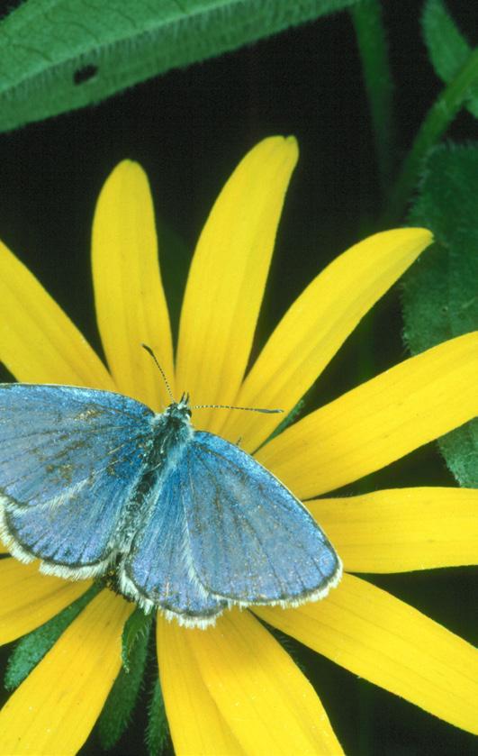
Bottom middle: A Karner blue at Karner Blue: the federally endangered butterfly at Karner Blue Meadow SNA.
Bottom right: The name of Germain Hemlocks SNA in Oneida County honors ecologist Clifford Germain, who was instrumental in the creation and growth of what eventually became the State Natural Areas Program.
areas of natural and botanical interest. A committee of three was established — Fassett, Fuller and Conservation Department forester Frederick Wilson — and set to work.
At that time, there had yet to be a comprehensive survey of natural lands in the state, so selecting sites and setting priorities for protection was a challenge for the new group. They relied heavily on recommendations from their colleagues in academia and the Conservation Department.
By the late 1940s, the department had purchased three natural areas to be set aside for scientific study: Parfrey’s Glen in the Baraboo Hills; Cedar Grove, a migratory bird-banding station along Lake Michigan; and Cedarburg Bog, a diverse wetland complex in Ozaukee County.
These areas were assigned to the department’s Parks and Forests Division. But the division’s superintendent, C.L. Harrington, was at a loss for how best to manage the sites, which he referred to as “scientific areas.”
Harrington suggested that a more formal committee of scientists be established by law to better guide the Conservation Department on the protection of these areas. In 1951, the Wisconsin Legislature created a new six-member State Board for the Preservation of Scientific Areas, with prominent UW-Madison plant ecologist John Curtis as the group’s first chairperson.
Thus was born the very first statewide and statesanctioned natural areas protection program in the nation.
Within a year, the board had designated 16 state scientific areas, and by the early 1960s, 32 sites were in the portfolio. Nearly all scientific areas were designated on lands already in public ownership, typically a small area embedded within a larger state park, forest or wildlife area.
Although this model of building a network of natural areas was effective early on, it eventually became clear that the Conservation Department needed to provide more dedicated support, including a budget
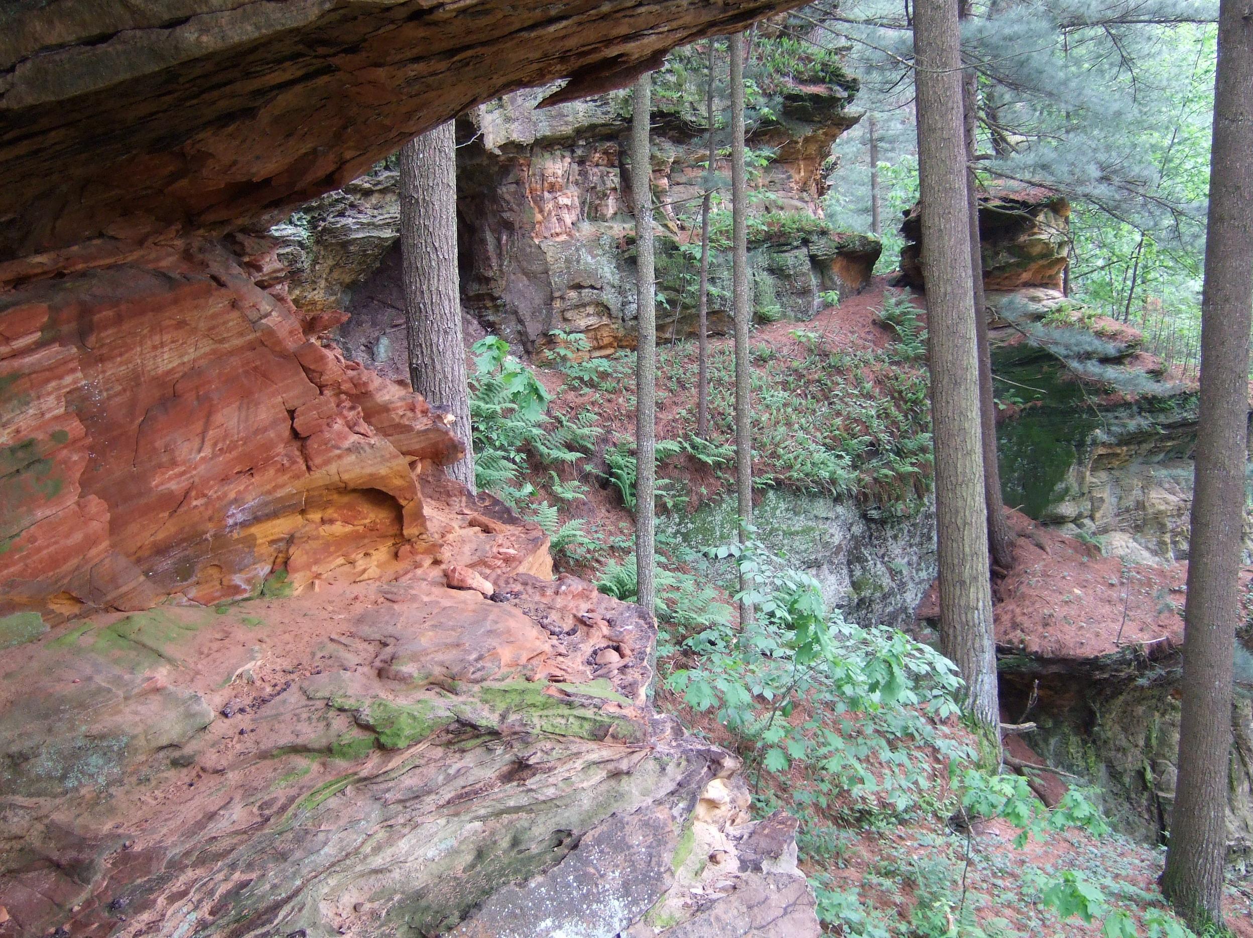
Above: Count the Ridgeway Pine Relict SNA in Wisconsin’s Driftless Area among the outstanding state natural areas with acreage purchased using funds from the KnowlesNelson Stewardship Program.
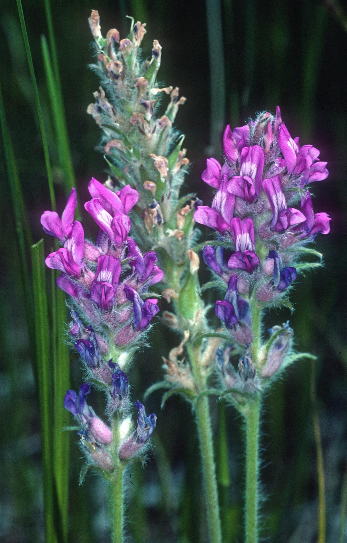
Center: Fassett’s locoweed, named for botanist and early natural areas visionary Norman Fassett, is endemic to Wisconsin, meaning you’ll find it nowhere else but here — including at state natural areas.
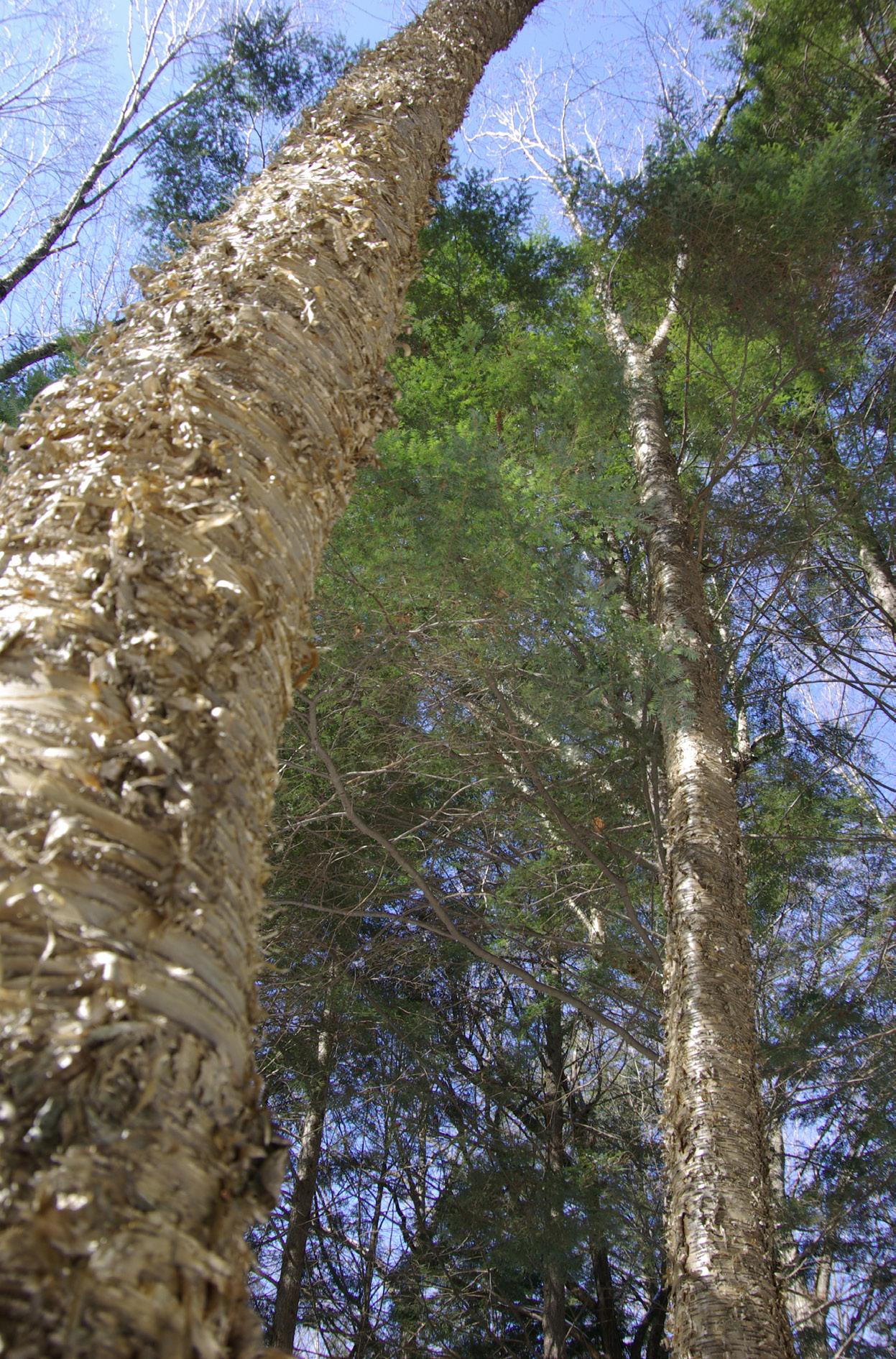
Right: It’s named Little Bear Hemlocks SNA, but these yellow birch know how to make their towering presence felt.
for administration and land acquisition, plus a staff.
The trajectory of the scientific areas program changed significantly in 1966, when the department hired ecologist Clifford Germain as the program’s first staff person and provided a budget for the advisory group to administer.
Germain was a young Conservation Department wildlife manager and graduate of UW-Madison, where he had taken courses taught by Leopold and Fassett. With Germain on board, the program grew quickly.
He forged new partnerships to establish scientific areas on lands owned by other local, state and federal agencies and organizations, including the National Park Service, county forest departments, the University of Wisconsin, and a newly emerging group of private land trusts such as The Nature Conservancy. By the early 1980s, the program had grown to 200 sites.
Germain also initiated a county-by-county inventory of natural lands that would provide a broader understanding of how many remained and which of those might qualify for protection as scientific areas. A
limited pot of money from state and federal sources provided the department funds to directly acquire land, though the majority of scientific areas were still being designated on existing public properties.
The program matured and hummed along for more than three decades at a predictable and consistent pace, but a major boost was on the way.
In 1985, the Wisconsin Legislature passed the Natural Heritage Act, legislation that made several changes to the program. The term “scientific area” was dropped in favor of “state natural area,” and the program’s advisory board was renamed the Natural Areas Preservation Council.
More importantly, the act gave the DNR power to legally dedicate natural area lands in perpetuity, provided some funds to manage state natural areas and created a Natural Heritage Inventory. This nationally standardized data collection of rare species and natural community locations provides a science-based source of information to help prioritize potential SNA
Explore Wisconsin’s state natural areas this year with a Natural Resources Foundation of Wisconsin field trip! The foundation is a nonprofit and DNR partner that protects our state’s lands, waters and wildlife and connects all people with nature, including supporting projects at state natural areas.
Each year, over 270 trips take place from April to early November, many at SNAs. Experts, including DNR staff, lead adventures that offer a behind-thescenes look at Wisconsin’s natural treasures.
Registration is available online starting soon and is open to Natural Resources Foundation members. Join now to participate in field trips, and sign up as soon as possible after registration opens, as trips can fill quickly.
Learn more about Natural Resources Foundation field trips at wisconservation.org/field-trips.
establishment.
Four years later, another action by the Legislature would transform Wisconsin’s landscape of protected natural areas in an even more monumental way.
The Stewardship Program, later renamed the Knowles-Nelson Stewardship Program, was created in 1989 to provide money to the DNR to preserve natural areas, protect wildlife and fish habitat, and expand opportunities for outdoor recreation. (See story on Page 36.)
Equally important, the Stewardship Program has provided dozens of matching grants to land trusts to purchase their own natural areas, all of which are open to the public for nature appreciation. Since its inception, the Stewardship Program has provided many millions of dollars for state natural area land acquisition.
The current SNA network spans the entire state, with 694 state natural areas encompassing more than 400,000 acres of land and water. Although that might seem huge, it accounts for only about 1% of Wisconsin’s land area.
Remarkably, 90% of Wisconsin’s rare plant species and 75% of rare wildlife species are protected on SNAs. Concentrations of state natural areas are found in
biodiversity hot spots, including the Baraboo Hills, the Door Peninsula, the valley of the Lower Wisconsin and Mississippi rivers, and a pair of state forests — Kettle Moraine and Northern Highland-American Legion.
The DNR owns and manages 431 SNA sites, with the remainder owned by more than 60 program partners. State natural areas range in size from the tiny Koro Railroad Prairie at 3 acres to the massive Bibon Swamp at more than 15 square miles.
Seventy-five years in the making — more, if you count its conceptual beginnings — the State Natural Areas Program is thriving. And its future looks bright, though not without challenges. As the program moves into a new age, it looks to its recently completed strategic plan for guidance.
Today’s core goals are not unlike those of the past: protect biodiversity and rare species, provide stewardship for SNAs using principles of conservation biology, accommodate scientific research and provide places for environmental education and compatible public use.
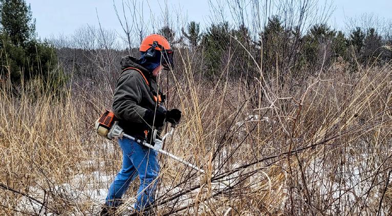
Anchoring the program and addressing its challenges falls to a group of dedicated field ecologists in the DNR’s Bureau of Natural Heritage Conservation, supported by a team of natural area technicians.
Operating out of nine regions across the state,
Far left: Nearly all SNAs dating to Wisconsin’s original scientific areas program are on lands that had already been publicly owned, such as Wyalusing Hardwood Forest (SNA No. 5) in Wyalusing State Park.
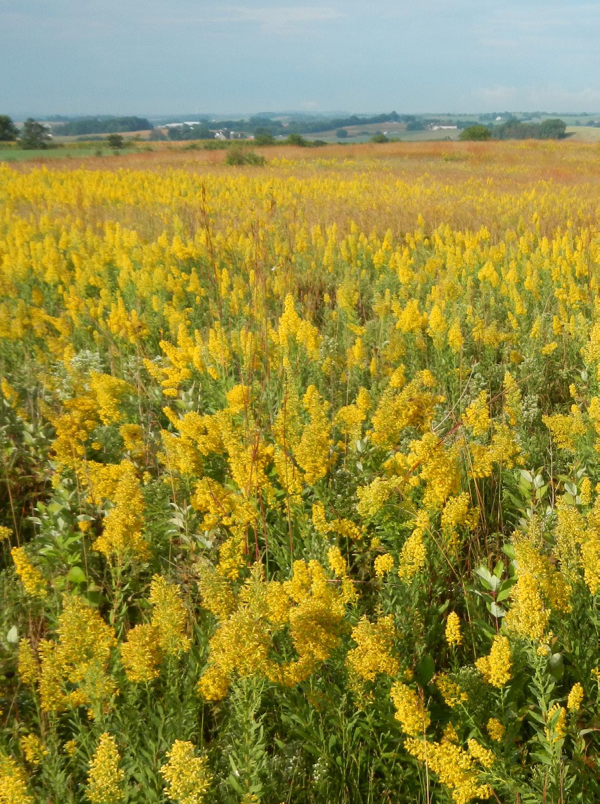
Center: Empire Prairies SNA practically glows with goldenrod and other showy plant species.
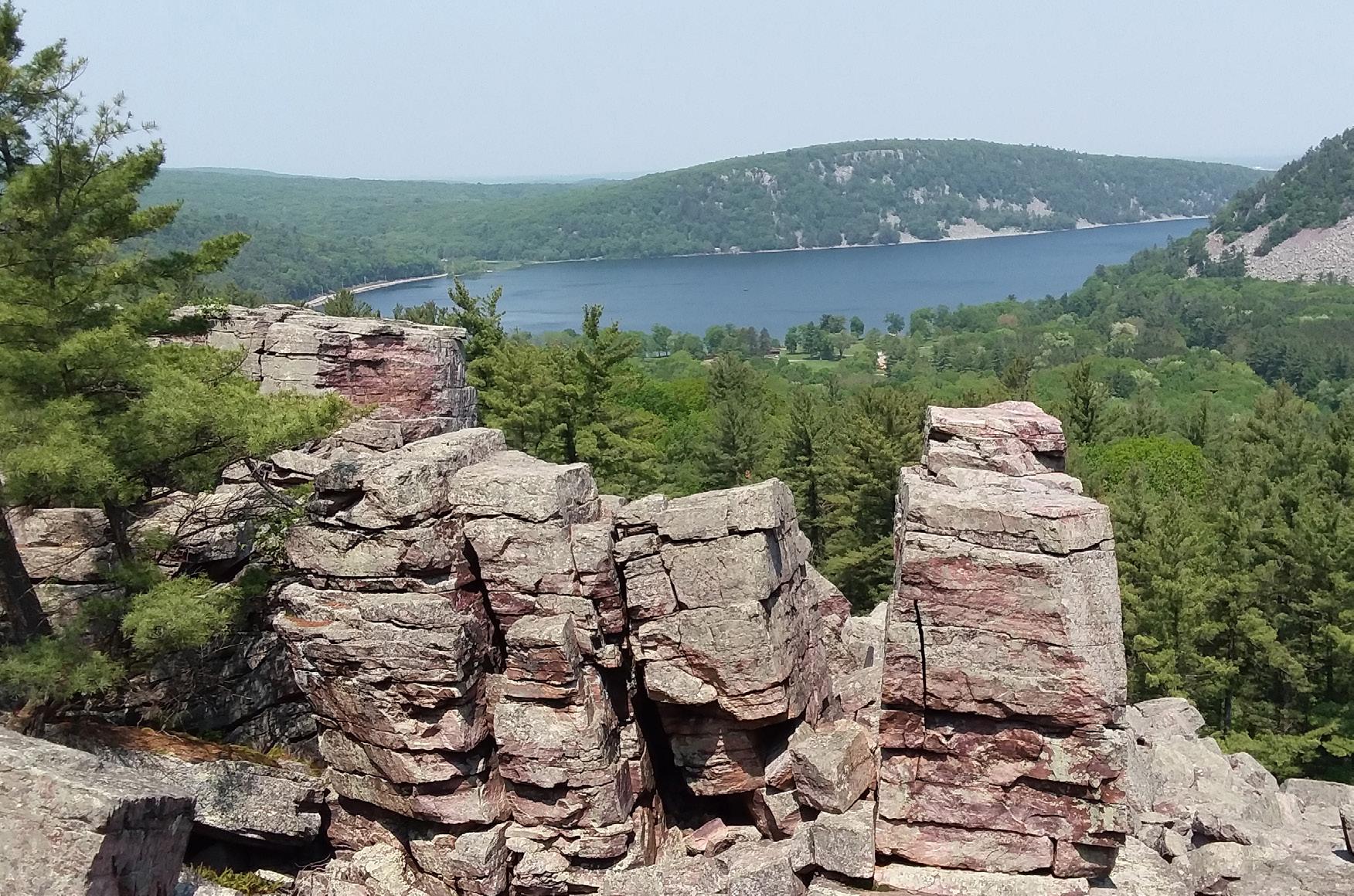
Above: Four state natural areas can be found within Devil’s Lake State Park, including South Bluff/Devil’s Nose.
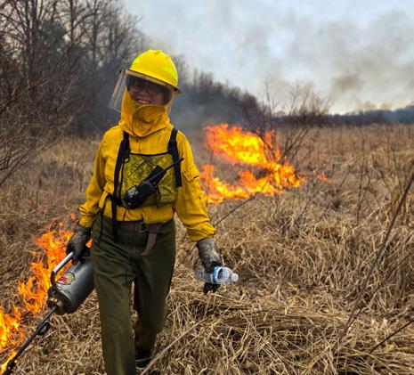
they battle the ever-growing list of invasive plants and animals that threaten the diversity of natural areas, coordinate prescribed burns on fire-dependent landscapes, monitor rare species populations and grapple with how to make natural areas more resilient to a changing climate.
These seem like overwhelming tasks, but you can help. The SNA Volunteer Program welcomes people of all abilities to help restore and manage SNAs through hands-on workdays throughout the year. (See story on Page 31.)
Additionally, the SNA Program benefits directly from donations made to the Endangered Resources Fund and from the sale of Endangered Resources specialty license plates.
But perhaps the best thing you can do is to get outside, visit a state natural area and share the wonder of Wisconsin’s natural heritage with others. The professor would be pleased.
Thomas Meyer is a retired DNR conservation biologist who worked with the State Natural Areas Program for more than 20 years. In 2022, he received the George B. Fell Lifetime Achievement Award from the Natural Areas Association, a national group supporting those working in natural areas programs.
Work at Wisconsin state natural areas is supported through the DNR’s Endangered Resources Fund. Each donation is matched dollar for dollar by the state, and there are three ways to give:

Tax check-off: When filing your Wisconsin state income taxes, look for “Endangered Resources” in the “Donations” section of the tax form.
Endangered resources license plates: Give a $25 annual donation through your vehicle registration and choose a wolf or eagle license plate.
Donate online: Use VISA, Master Card, American Express, Discover or eCheck.
Learn more about the Endangered Resources Fund and the critical work it supports at dnr.wi.gov/tiny/1261.
WITH NEARLY 700
covering more than 400,000 acres, Wisconsin’s State Natural Areas Program is nothing short of amazing. SNAs protect the state’s vulnerable native landscapes and provide habitat for rare plants and animals while also serving as valuable areas for research and educational use.
Note that while the DNR owns many state natural areas, unique partnerships such as with land trusts, county and local governments are critical to the success of the program. The agency recognizes the many supporters of Wisconsin’s state natural areas.
The locations highlighted here represent only a small fraction of what the SNA Program has to offer. For all you need to know about state natural areas, including finding an SNA near you, scan the QR code or go to dnr.wi.gov/tiny/2746.

Katharine Caywood is a communications and marketing specialist for the DNR’s Bureau of Natural Heritage Conservation.
Location: Sauk County
Designated: 1952
Ownership: DNR
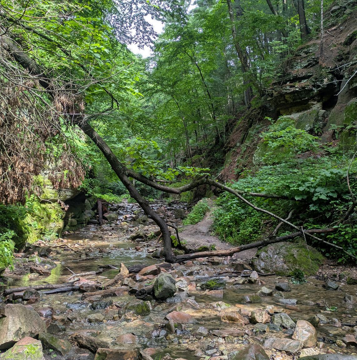
Wisconsin’s first state natural area, this site within Devil’s Lake State Park is truly a gem of the Baraboo Hills. The steep walls of the sandstone gorge, the meandering creek and surrounding forest make this SNA home to a variety of highquality natural communities that are critical for rare plants and animals.
Parfrey’s Glen was designated in 1952 during the first full year of the State Natural Areas Program. While stewardship in the program’s early years was less intensive, DNR staff and partners now work to manage invasive species and conduct prescribed burns to help maintain this beautiful place.
Location: Polk County
Designated: 2000
Ownership: DNR
The ancient lava-formed bedrock here was left streaked with striations following Wisconsin’s last glacial period more than 10,000 years ago. The thin, acidic soil and sun-warmed rock create a perfect habitat for specially adapted plants. Cactus, moss and lichen grow over the rock and in crevices.
This glade located within Wisconsin’s Interstate Park is one of three state natural areas that cover 228 acres in the park, along with the Dalles of the St. Croix River and Interstate Lowland Forest.
Location: Pepin County
Designated: 2004
Ownership: DNR
It’s hard to say which is more spectacular — the view of the 400-foot-high bluff or the view of Lake Pepin from the top. Maiden Rock Bluff is one of the most noteworthy rock faces along the Mississippi River.
The designation of this site as a state natural area not only protects the rare species that live here but also ensures this natural wonder is kept free from development.
Location: Marquette County
Designated: 1968
Ownership: DNR
Located within Lawrence Creek Wildlife Area, this SNA benefits from collaboration between the DNR’s bureaus of Natural Heritage Conservation, Wildlife Management and Fisheries to care for the diverse mix of habitats found here.
The primary feature is the trout stream, which is fed by freshwater seeps and springs before leading into Lawrence Lake. Dry prairie and oak barrens, found in few places worldwide, also make up the site and benefit from prescribed fire.

Location: Crawford County
Designated: 2002
Ownership: DNR
The rolling hills of Wisconsin’s Driftless Area are a mix of forests, fields and meandering rivers. When you round a corner in the Kickapoo River Valley and approach Hogback Prairie, you can’t help but notice how different it is than the neighboring ridges. At 300 feet tall, it’s exposed to sunlight and the elements from all directions, allowing for an unusual mix of native plants to grow here. In recent years, with help from local producers, volunteers have helped plant native violets in nearby converted agricultural fields, which helps support rare species in this SNA.
Location: Door County
Designated: 1995
Ownership: Private and DNR
Located along 1.5 miles of Lake Michigan shoreline, this site is an important stopover for migratory shorebirds and waterfowl. It supports a boreal forest that is far south of the normal range and one of only two areas in the state where boreal forests persist.
In addition to the forest, the bedrock beach, exposed during fluctuating water levels, creates a unique environment for rare plants only found in Door County. A donation of 362 acres of land from The Nature Conservancy in 2020 helped connect pieces of globally important habitat.
Location: Oneida County
Designated: 1991
Ownership: DNR
Old-growth forests are uncommon in Wisconsin, but Squirrel River Pines SNA is home to a red and white pine forest featuring some trees as large as 30 inches in diameter. Located on a remote, sandy peninsula of the Squirrel River, the forest is surrounded by wetlands.
This area provides nesting habitat for bald eagles and trumpeter swans — two formerly endangered and now recovered Wisconsin species.
Location: Iowa County
Designated: 1968
Ownership: DNR
This 2,208-acre SNA contains the largest remnant tallgrass prairie east of the Mississippi River. It also includes oak barrens, sedge meadow and floodplain forest. Across these distinct habitats there are over 200 species of plants that have naturally occurred here for thousands of years.
As a part of the Lower Wisconsin Scenic Riverway, this SNA provides a stunning natural backdrop for paddlers and boaters.
Location: Ozaukee County
Designated: 1952
Ownership: DNR and UW-Milwaukee
This state natural area, also among the first established, is the most intact bog in southern Wisconsin and supports the largest lake in Ozaukee County. The bog boasts an exceptional variety of wetland species, and the SNA is home to 12 different wetland plant communities ranging from emergent marsh to hardwood swamp and sedge meadow.
Cedarburg Bog is one of 86 designated “Important Bird Areas” in Wisconsin. Nearly 300 species of birds have been recorded as breeding or migrating through the bog. Research at UW-Milwaukee’s Saukville Field Station, supported through opportunities at Cedarburg Bog SNA, has contributed to 415 scientific publications and 152 dissertations and theses since 1970.
Volunteers from the Friends of the Cedarburg Bog provide educational events and habitat restoration work and have constructed boardwalks on the property.
State natural areas shelter some of our most vulnerable species
IN THE DAYS PRECEDING intensive European settlement, Wisconsin's landscape was a tapestry of unique natural communities, ranging from prairies and oak openings in the south to towering pine forests and boggy wetlands in the north. Together, these ecosystems harbored the full complement of our state's rich diversity of plant and animal species.
Over the ensuing centuries, these natural communities would be significantly reduced or would disappear altogether due to agricultural and logging practices, industrialization, the spread of nonnative invasive plant species, and climate change — taking many plants and animals with them along the way.
Not all is lost, however.
Some lands have escaped extensive alteration or recovered from disturbance throughout Wisconsin. Today, many are now protected as part of the State Natural Areas Program.
These special places are dedicated to preserving our native landscapes, as well as many of our most unique and often endangered or at-risk plants and wildlife. Here are just a few of those VIP species, plus a look at a particularly vital habitat type found at state natural areas.

Perhaps the prettiest animal on this list, the ornate box turtle (Terrapene ornata) gets its name from the striking yellow lines that adorn its carapace, or shell, forming a pattern unique to each turtle and giving them a hand-painted look. They are the only species of box turtle native to Wisconsin and are endangered in the state. These unique turtles live strictly on land and are limited to the south-central and southwestern part of the state, where they inhabit mesic prairies, dry-mesic prairies, sand prairies, oak savannas and open to semi-open woodlands. These habitat types, often found within state natural areas, provide ample food for the turtles, offer shelter from the summer heat and allow them to burrow deep enough to avoid freezing in winter.
The eastern massasauga (Sistrurus catenatus), a state-endangered and federally threatened species, is one of only two venomous snake species found in Wisconsin, along with the timber rattlesnake. The eastern massasauga is on the smaller side, typically maxing out at 2-3 feet in length.
These snakes utilize several of the unique floodplain habitats protected by state natural areas in western and south-central Wisconsin, such as open canopy wetlands, sedge meadows, fresh wet meadows, shrub-carrs and adjacent upland prairies, floodplain forests and old fields.
Massasaugas do not hibernate in a group like other snake species. Instead, as temperatures drop, they will overwinter in terrestrial crayfish burrows or rotted-out root channels.

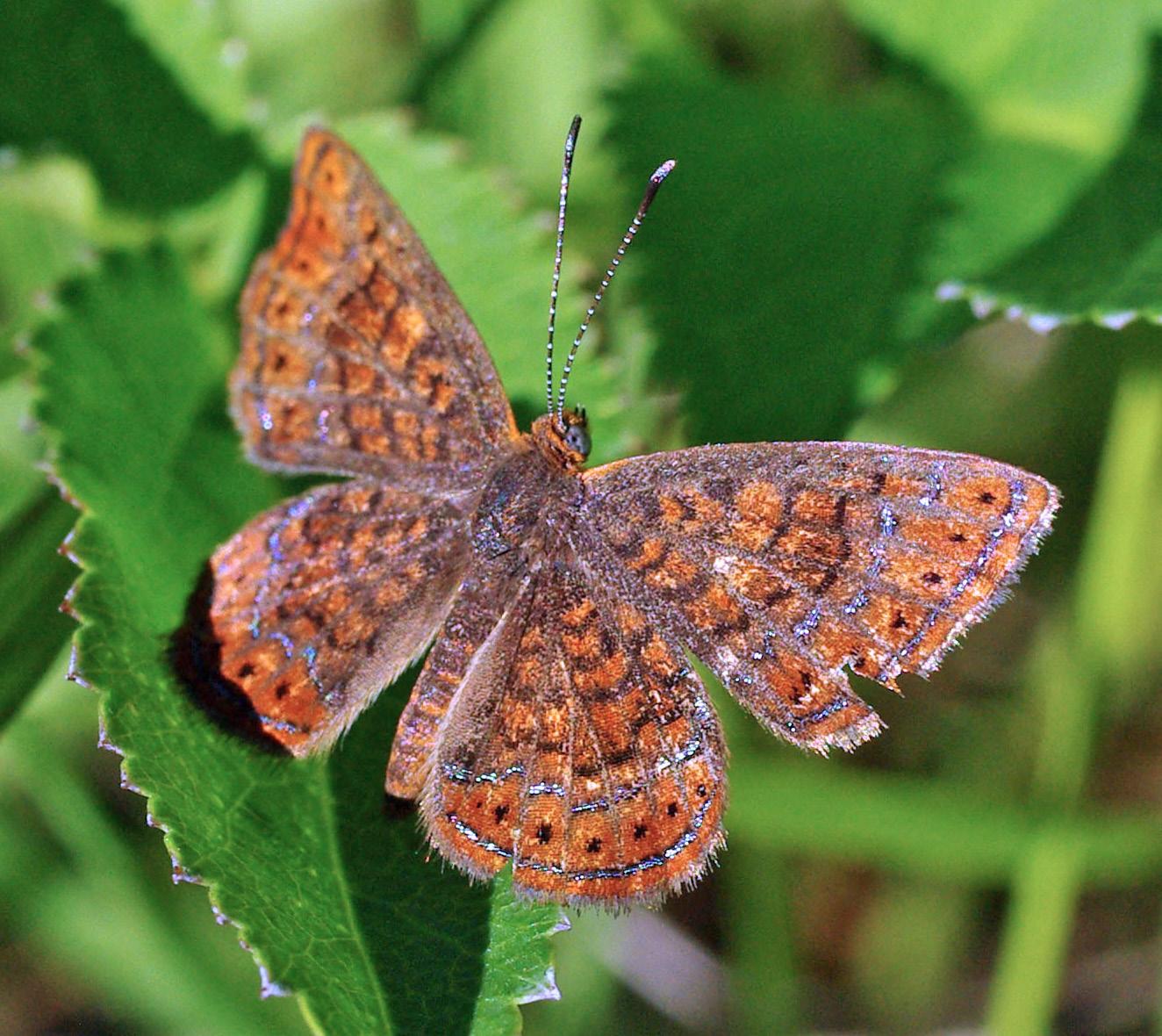
The swamp metalmark (Calephelis muticum) is a small, orangish-brown butterfly (and a cool potential band name) with distinctive metallic spots along its wings. Despite their name, these state-endangered butterflies are not found in places technically considered swamps, but prefer mineral-rich wetlands fed by calcium-laden groundwater with low vegetation and sedges.
The places where these conditions exist are known as calcareous fens. They are rare in Wisconsin, with many of the highest-quality remaining calcareous fens protected at state natural areas.
Swamp metalmarks are exclusive to these communities because they are an ideal habitat for swamp thistle (Cirsium muticum), the host plant upon which these butterflies lay their eggs.

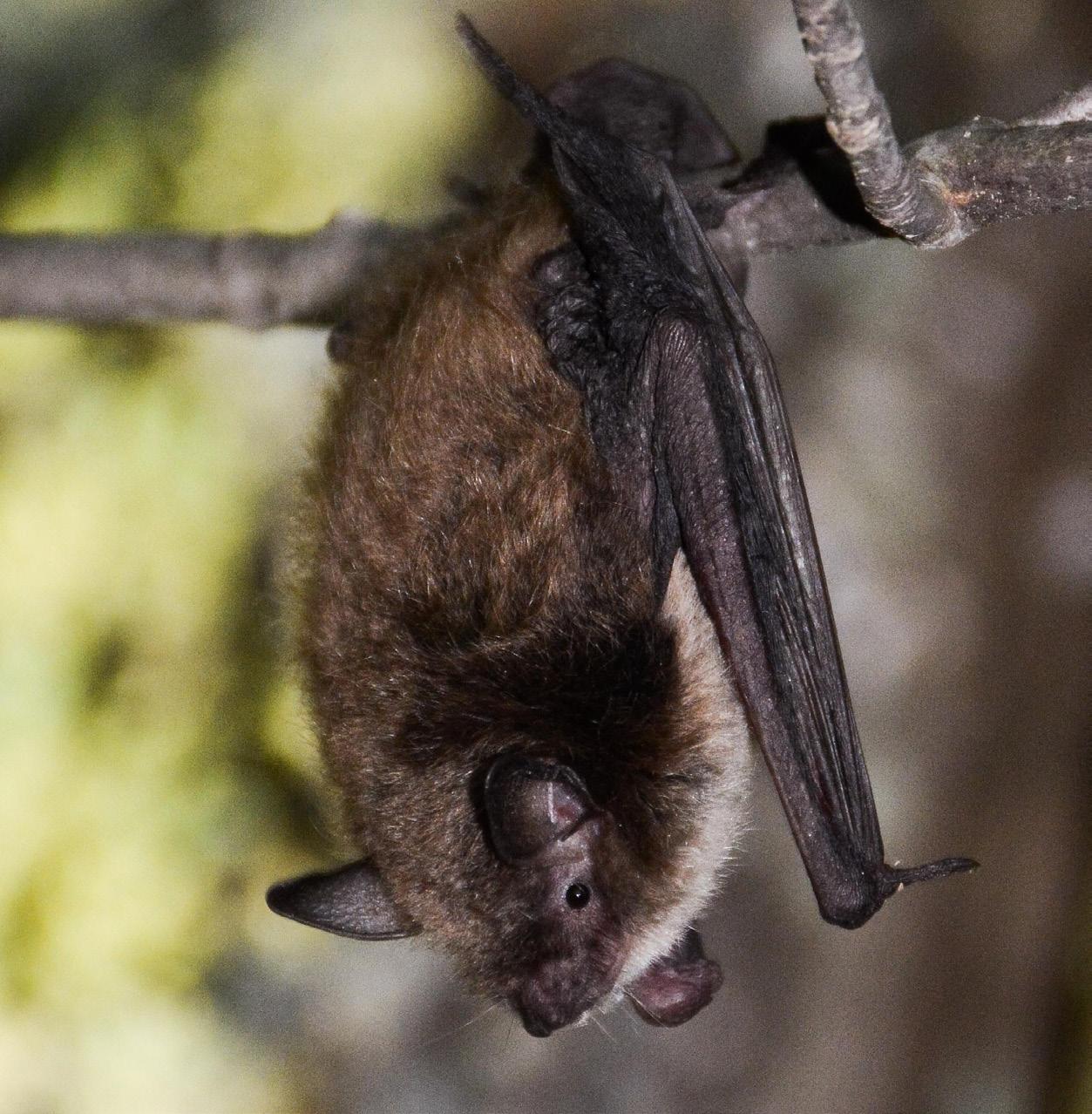
Of the eight bat species found in Wisconsin, four are state-threatened. One of these, the little brown bat (Myotis lucifugus), is showing rebounding numbers, thanks in part to the habitats found in state natural areas.
In summer, little brown bats may roost in tree snags, bat houses and buildings across Wisconsin. But come fall, many of them head to a few SNAs, where they can find very specific habitat to use from October through April.
Unlike the other examples on this list, however, the bat habitat at SNAs isn't a holdover of Wisconsin's native landscapes. It's a byproduct of industrialization — abandoned mines, to be specific.
Two large mines in particular, both within state natural areas, provide the vast majority of shelter for little brown bats overwintering in the state. Despite being relics of industry, these sites offer ideal conditions critical to a significant proportion of the nation's little brown bats.
Rocky Run Oak Savanna State Natural Area in Columbia County offers an excellent example of the fire-dependent oak opening habitat type.
Also known as oak savannas, oak openings are open savanna communities that combine prairie elements with a robust oak cover, usually of the white, bur or chinquapin variety. Black oaks and shagbark hickory may be present, too.
Throughout history, these oak openings experienced frequent surface fires, which cleared the subcanopy and burned most taller shrubs, literally blazing a pathway for native wildflowers, along with grasses and sedges, to dominate the landscape between the established oaks.
This confluence of circumstances creates ideal conditions for a wide array of plants, animals, insects and birds, several of which require these specific conditions to survive or thrive.
As the state developed, many oak openings were turned into farm fields and small settlements. Furthermore, fire suppression became standard practice, extinguishing the very fires required to sustain these communities.
Today, oak openings are among the rarest plant communities in the Upper Midwest, with very few high-quality sites remaining. Of those that do remain, a vast majority are within (67%) or immediately adjacent to (77%) state natural areas.
Although they are not plants or animals, oak openings deserve a spot on this list, as their presence within SNAs allows for the combination of prescribed fires and careful management by DNR staff and volunteers that keeps these critical communities strong.
Want more? Here are a few of the many additional plants and animals — sometimes rare, always interesting — found in the important protected landscapes of Wisconsin’s state natural areas.
Plants
y Dwarf lake iris, topping out at a mere 3 inches tall
y Dune thistle, native to Wisconsin
y Ultra-rare calypso orchid
y Eastern prairie fringed orchid
y Lapland azalea, a small evergreen shrub found at only two places in Wisconsin, both at SNAs
y Round-leaved orchid
y Snow trillium
y White lady’s slipper
y Green violet, thought lost from Wisconsin for more than 65 years but recently rediscovered at an SNA Wildlife
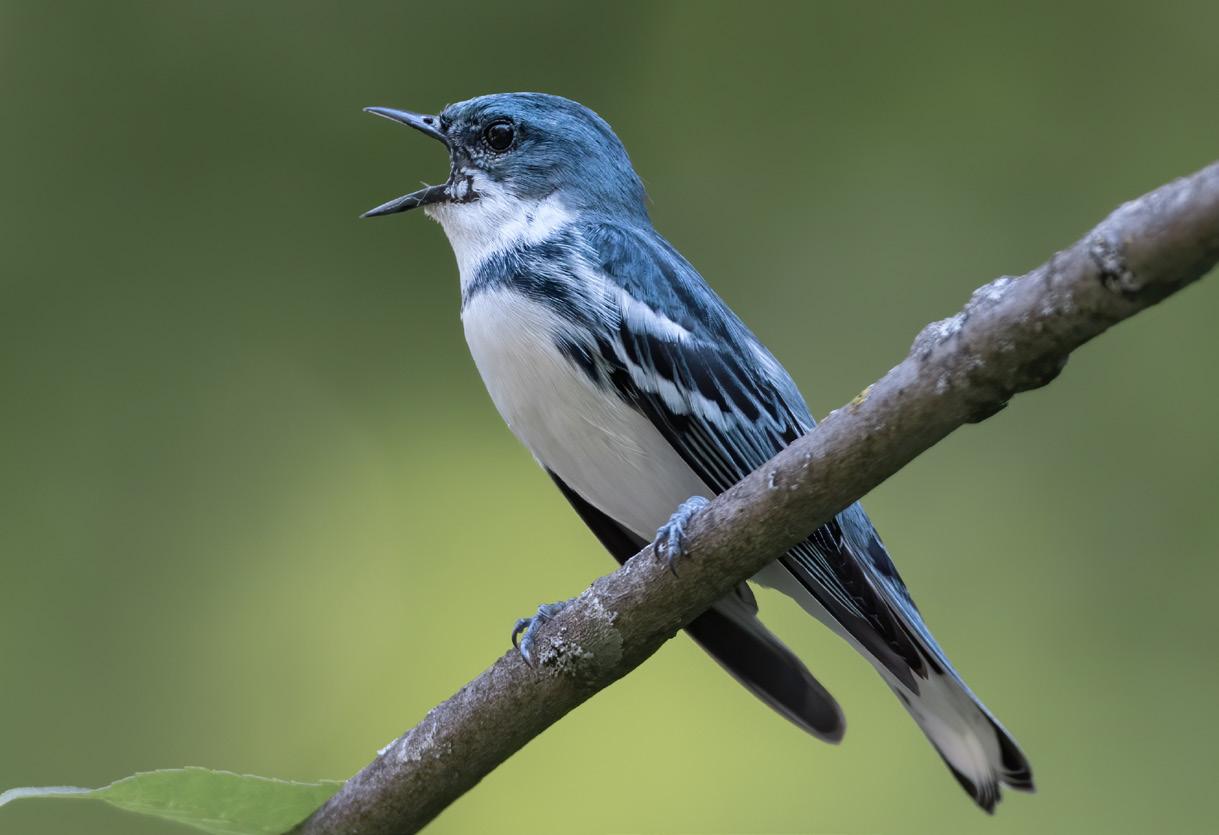
y Cerulean warbler
y Acadian flycatcher
y Starhead topminnow, a rare inhabitant of clean, slow streams and quiet backwaters
y Slender glass lizard
y Hine’s emerald dragonfly
y Cherrystone drop, a tiny woodland snail
y Upland sandpiper, a long-distance migrant from South America and a signature species of the open prairie
— THOMAS MEYER
KATHARINE CAYWOOD
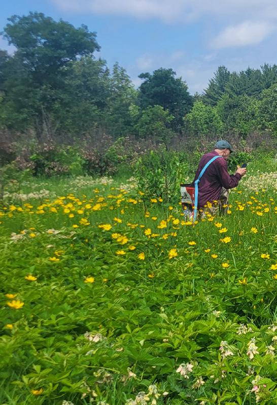
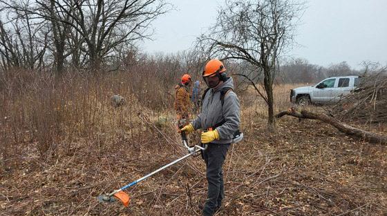
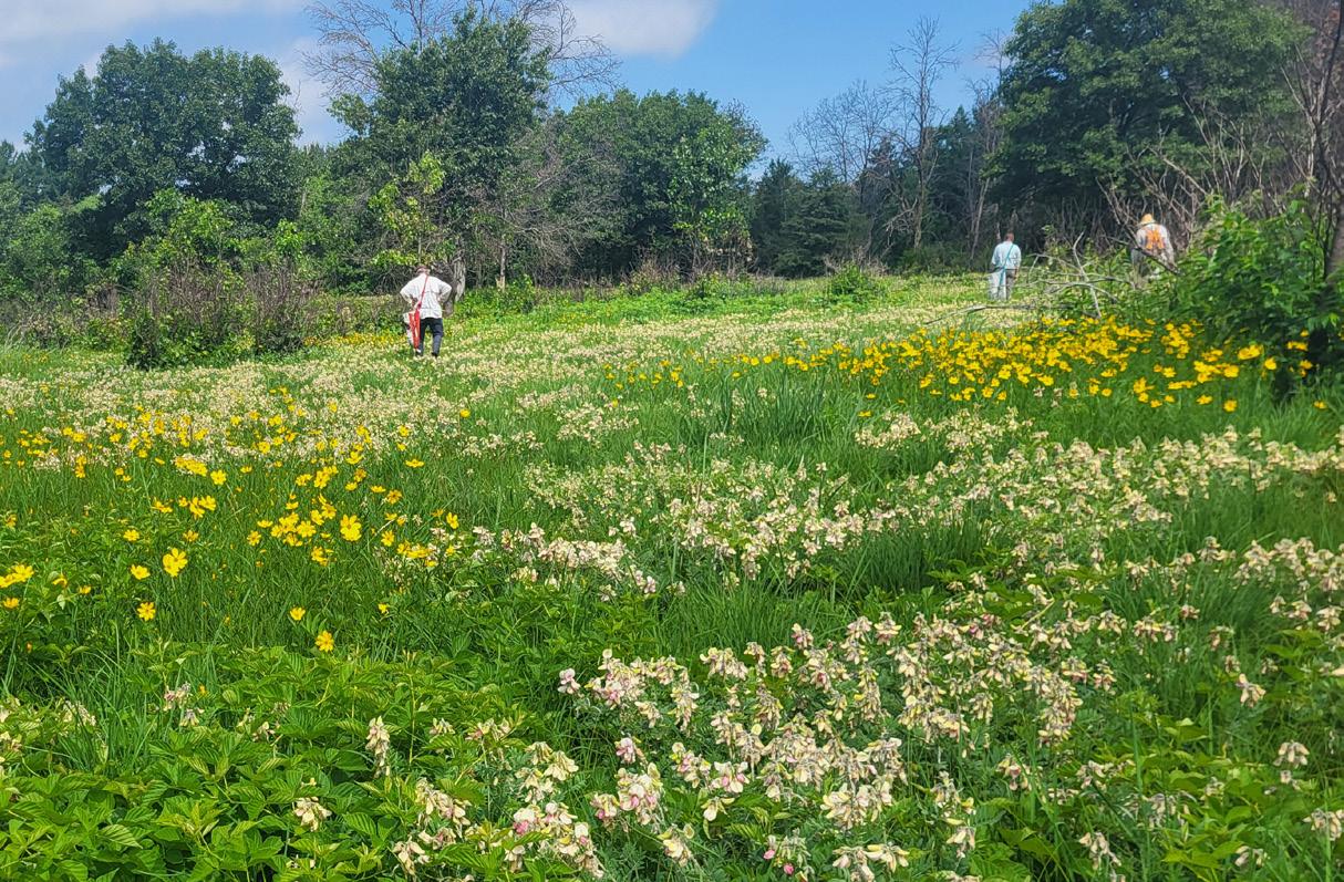
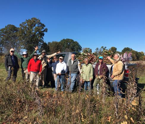
LOOK! A PAINTED TURTLE,” one of the volunteers shouted from a short distance away where she was hidden among shrubs and small oak trees at a state natural area near the Wisconsin River. The rest of us paused our seed collecting and gathered around, eager for the opportunity to see one of the local residents.
An hour earlier, our group of a dozen or so had gathered in the parking area clad in rubber boots, sun hats and long-sleeved, light layers — appropriate gear for the day with its 90-degree forecast. We were there in response to an email sent by Jared Urban, the DNR’s state natural areas volunteer coordinator, inviting volunteers to help collect seeds.
Urban, who started as a member of the DNR’s SNA field crew in 2008, launched the State Natural Areas Volunteer Program in 2014, drawing on successful examples from states like Michigan and Illinois, along with local land trusts and nonprofits.
This volunteer work, made possible with money from the DNR’s Endangered Resources Fund, has proven quite valuable — and popular. The most recent annual report for the program noted there were nearly 9,000 volunteer hours registered on 7,755 SNA acres.
Volunteers help care for state natural areas by taking on a variety of tasks throughout the year: clearing and burning brush, hand pulling invasive species like garlic mustard, planting seeds and even supporting prescribed fire efforts. Seed collection is often a favorite volunteer job, and it was our task on this day.
With a pair of scissors and a birdseed bag upcycled to add a shoulder strap, volunteers headed into the field. Along with contributing to seed collection, we had an amazing opportunity to observe a unique ecosystem — including unexpected sightings of local wildlife — while also learning a bit about plant identification.
Because this area had been managed with prescribed fire, we found that many plants produced an
exceptionally high number of seeds. We were asked to look for two different types of seeds with guidance to collect only a third of the seeds from each plant.
Wild lupine was one of the seeds we collected. It is a host plant for a federally endangered butterfly, the Karner blue, and is an important nectar plant for a variety of other pollinators.
The other species we looked for was needle grass, a native plant with a spear-shaped seed attached to a long stem-like structure called an awn. Upon encountering moisture in the sandy environments where it grows, the awn twists in a spiral, effectively drilling the seed downward where it has a better chance of germination.
We walked from the parking area down a sandy access road, where Urban pointed out a newly managed portion of the property that had been burned a few months earlier. Prescribed fire is a central restoration practice for many of Wisconsin’s critical habitats, and in 2024, specially trained volunteers spent 802 hours helping with prescribed burns at 36 state natural areas.
At this particular site, prescribed fire was used to reduce woody debris after the area was cleared in preparation for reestablishing native barrens plants.
Beyond that area, we came to an opening where we were greeted by the pointed, orange petals of a wood lily. This uncommon flower, like many others we were able to see in bloom, is an excellent indicator of the health of a site.
“It’s unique to have such a high-quality plant community,” Urban said. “These places can change so
quickly for the worse, and it takes a lot of time and effort for them to recover.
“Wisconsin is a diverse place, and even within SNAs in the same county, you may have dramatically different plant communities.”
As we continued through the site to collect seeds, we saw the purple tendrils of lead plant flowers, the yellow and pink blossoms of goat’s rue, and cup-shaped prickly pear cactus blooms. Since most SNAs intentionally do not have established trails, visiting with Urban and the volunteer group provided an expert-guided tour of an incredibly special place.
SNA volunteers — including members of the public as well as staff from across the DNR, federal agencies, nonprofits, county and municipal governments,
Volunteers are a key component of state natural areas management. Here are just a few of the hundreds who help at these special places.
universities and tribal partners — are connected through a shared mission. The goal is to protect the remaining segments of what Wisconsin naturally looked like as far back as 10,000 years ago, when the last glaciers receded.
The challenges facing state natural areas have increased dramatically in the 75 years since the system was established by state statute in 1951. Invasive species, changing climate, encroaching development, increased recreational uses and other modern challenges can limit the survival of both native plants and wildlife. But positive outcomes are possible.
“We can make changes for the better,” Urban said. “Volunteering is a way to learn new things and be outside with other people who also believe in the value of SNAs.”
State natural area volunteers include thousands of people from around Wisconsin. Thank you to everyone who has offered their time to aid these special places over the years! Volunteers are needed at SNAs throughout the state. To learn more and find volunteer events near you, scan the QR code or check dnr.wi.gov/tiny/2556.

At the end of our volunteering day, a short walk led us back to the parking area. Collected seeds were combined so they could be processed by drying, milling and mixing with more than 40 other species of seeds gathered at this site.
In a few hours, our group had collected about 10 pounds of unprocessed seeds that would be replanted to help expand the footprint of the existing native plant community.
Katharine Caywood is a communications and marketing specialist for the DNR’s Bureau of Natural Heritage Conservation.
Volunteers have been part of this group for more than 40 years. From 2021 to 2024, volunteers completed 12,013 hours of stewardship at
for
than 20 years
90% of WI’s rare plant species can be found on SNAs
75% of WI’s rare wildlife can be found on SNAs
SNAs make up just over 1% of all land in the state
About a third of SNAs are owned by non-DNR entities (including federal agencies, county governments and nonprofit conservation organizations)
292 SNAs embedded in other DNR properties
The mission of the DNR’s State Natural Areas Program is to locate, establish and conserve a system of state natural areas that as nearly as possible represents the wealth and variety of Wisconsin’s native landscape. These areas serve for education and research purposes and, most importantly, to help secure the long-term protection of Wisconsin’s biological diversity for future generations.
7,307 acres of prescribed burns
6,842 acres of invasive plant control
694 locations covering 408,468 acres
Located in 70 of Wisconsin’s 72 counties
Protecting 99 distinct natural communities
Volunteers
One Year — 2024 at a Glance
584 individual volunteers
40 volunteer organizations
8,799 hours volunteered 7,755 acres enhanced
FOR MORE THAN 35 YEARS, THE KNOWLES-NELSON STEWARDSHIP PROGRAM HAS HELPED PROTECT WISCONSIN’S OUTDOORS
JONNA MAYBERRY
STEWARDSHIP SETS ASIDE
LAND for future generations by preserving it or helping to develop it into resources the community can utilize, while also ensuring the current generation can recreate on it. Stewardship is defined as “the careful and responsible management of something entrusted to one's care.”
Wisconsin’s commitment to environmental stewardship and
outdoor recreation dates back long before the start of the state-funded Knowles-Nelson Stewardship Program over three decades ago.
When the DNR was created in 1967 — a merger of two departments, Conservation and Resource Development — it was founded on the principle that Wisconsin’s air, land and water are public trust resources that must be managed
carefully for the benefit of both current and future generations.
This philosophy, shaped by leaders such as former Wisconsin governors Gaylord Nelson and Warren Knowles, established the state as a national leader in conservation, public land access and science-based natural resources management.
“THE ULTIMATE TEST OF MAN'S CONSCIENCE MAY BE HIS WILLINGNESS TO SACRIFICE SOMETHING TODAY FOR FUTURE GENERATIONS WHOSE WORDS OF THANKS WILL NOT BE HEARD.”
— GAYLORD NELSON
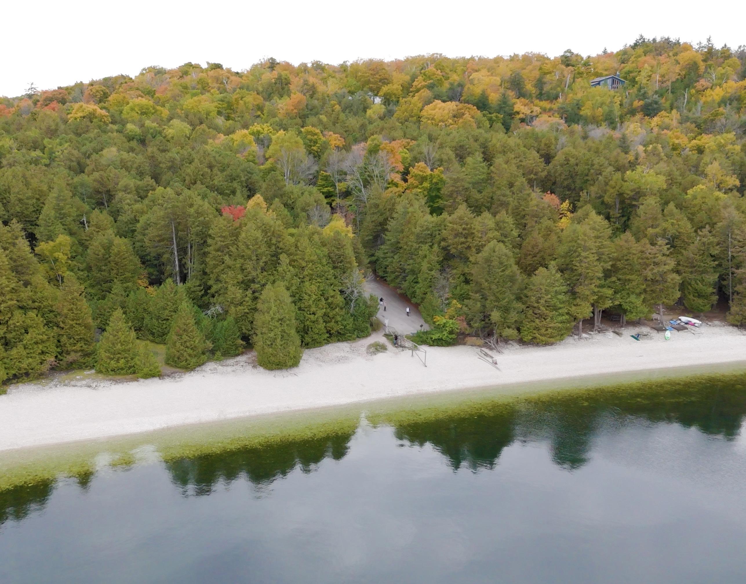
Village of Sister Bay Pebble Beach Acquisition, Door County. Sister Bay joined forces with the Door County Land Trust to acquire a 16.3-acre parcel that includes 600 feet of Green Bay shoreline. Funded by the Stewardship Program, the acquisition shielded sensitive habitats and boosted recreational activities such as hiking, swimming and paddle sports.
The Stewardship Program, created in 1989 by the Wisconsin Legislature and then-Gov. Tommy Thompson, builds on this legacy. It provides a comprehensive, longterm framework to protect land, expand recreational opportunities and support partnerships with local governments and nonprofits across the state.
The Stewardship Program gives the DNR spending authority to purchase land additions and access easements to existing state properties. Stewardship dollars also support recreational infrastructure on state properties, including campsite, restroom and trail improvements.
Most annual Stewardship Program spending takes the form of grants to local governments and nonprofit nature conservation organizations. Stewardship grants fund local park infrastructure, boat ramp facilities, recreational trails and land purchases for parks and preserves statewide.
H.J. DeBaker Eagles Nest Boat Launch, Brown County. In addition to property acquisitions and upgrades, the Knowles-Nelson Stewardship Program can boost recreational boating opportunities by helping to fund boat launches, channel dredging, navigation aids and other boating infrastructure.
Village of Howard Duck Creek Conservation Corridor Acquisition, Brown and Outagamie counties. Valuable wildlife habitat in a globally significant conservation area and birding hot spot was protected using Stewardship Program funds to acquire 112.9 acres of Duck Creek Marsh, on the southwest shore of Green Bay. The project also provided an additional access point for waterfowl hunters and nonmotorized boats on the popular bay.
Initiated in the 1960s, ORAP was put forward to assist local communities in developing and enhancing outdoor recreation facilities, recognizing that access to parks, trails and waterways is crucial to quality of life and local economies.
When the Stewardship Program began — eventually named for the two former governors who inspired it through their commitment to ORAP — it incorporated and expanded upon ORAP’s principles.
Today, these elements of ORAP remain key components of the Stewardship Program, supporting locally driven projects while benefiting from the broader, more comprehensive funding structure provided by the Knowles-Nelson Stewardship Program.
Funding from the KnowlesNelson Stewardship Program supports recreational development and conservation land purchases across the state through several DNR-administered grant programs.
Opposite page:
South Shore Lake Superior Fishery Area, Bayfield County. The KnowlesNelson Stewardship Program can assist projects that help make properties more accessible.
From its inception, the Stewardship Program has funded not only DNR land acquisition and recreational development, but also several grant subprograms. Through these grants, local communities and nonprofits have matched the state's investment dollar for dollar to expand parks and public nature preserves.
Stewardship dollars have been invested in every one of Wisconsin’s 72 counties.
Before the Knowles-Nelson Stewardship Program, the Outdoor Recreation Action Program, or ORAP, laid important groundwork for Wisconsin’s modern approach to outdoor recreation funding.
Grants are available to aid local governments, nonprofit groups, county forests and Friends Groups. Activities such as recreational boating and motorized recreation also are supported by Stewardship Program funds.
When local governments or partners apply for grants, DNR regional project managers help guide them through the process and inform them of grants available for proposed projects, explained Terry Bay, DNR facilities and lands bureau director.
For example, Bay said: “If a local government wants to buy some land for the development of a playground or hold it in conservation, they will work with their regional project manager to identify appropriate grant opportunities to assist with funding the project.”
The benefits of the Stewardship Program are far-reaching and include:
y Conservation of land for environmental impact, public access for outdoor recreation, forest industry and conservation easements (when a landowner legally grants rights to a government agency or other organization to access and manage land).
y Support for new and existing infrastructure such as trails, roads and structures.
y Support for projects from partners, including nonprofit conservation organizations.
“We do have occasions where land is acquired for things like water quality improvement, watershed rights and improving the stream quality of the adjacent land,” Bay noted.
The economic benefits of stewardship are not necessarily the first
thing we think of, but they are immense. Take the forestry industry, for example.
“We are protecting the industry by protecting our forests,” Bay said. “Forestry and timber is the second-largest industry in the entire state. Making sure we have a sustainable, renewable forest supports that industry.”
As for the recreation component of the program, access to recreational areas is essential and becoming ever more so.
“Demand for outdoor recreation is only growing,” Bay said. “This program supports outdoor recreation in a sustainable way, supporting local economies.
“We have a growing population and growing demand. How do we support these needs without land?”
The Knowles-Nelson Stewardship Program is approaching a
critical juncture, with its current funding scheduled to end with the state fiscal year on June 30. It will be up to the Wisconsin Legislature to reauthorize the program.
After more than three decades of protecting land, expanding public access and supporting partnerships in every county, the importance of the Stewardship Program to Wisconsin’s conservation and outdoor recreation legacy is especially clear.
A potential loss of the Stewardship Program would mark a significant shift in how Wisconsin invests in conservation, recreation and community-led outdoor projects. Focus on the program underscores the vital role it has played as a long-term, stable framework for safeguarding the state’s natural resources for future generations.
Jonna Mayberry is a public information officer in the DNR’s Office of Communications.
For background and grant information about the Knowles-Nelson Stewardship Program, check dnr.wi.gov/topic/stewardship.
To be eligible for a Stewardship Program grant, land must be publicly accessible. You can find public access lands to explore at dnr.wi.gov/tiny/3026.
The nonprofit Gathering
Waters: Wisconsin’s Alliance for Land Trusts maintains a website regarding the statewide success of the Stewardship Program. For a variety of information, including overall program data, latest news and a searchable “impact” map of all investments with project details, check knowlesnelson.org.
ANDREA ZANI
AS SPRING DRAWS NEAR, the Wisconsin fishing scene begins to transform with the landscape.
Ice fishing shanties disappear, along with the ice upon which they sit. Lakes and waterways slowly warm. And fish such as steelhead, northern pike, yellow perch and walleye welcome the season by getting busy with feeding and spawning activity.
Come the first Saturday of May, it’s game on for anglers as Wisconsin’s general inland fishing season opens statewide (May 2 this year). Spawning picks up among more species, like bass and panfish, as water temperatures continue to rise. Soon, the full flavor of summertime fishing in the state will be upon us.
Kids age 15 and under (and anyone born before 1927) can fish for free; otherwise, fishing in the state requires a license. For state residents, it’s just $20 for an annual license, and it’s even cheaper for first-time buyers ($5), youth 16-17 ($7) and adults 65 and up ($7). Nonresidents will pay a bit more, but there are specially priced shortterm and family license options to help accommodate visitors.
Fishing regulations help ensure a bright future for fishing in Wisconsin. Online resources, including the current Guide to Wisconsin Hook and Line Fishing Regulations, provide all you need to know for fishing right.
Getting ready for another fishing season — or getting started, if you don’t consider yourself an angler already — is easy. Plus, the DNR is here to help, with all you need to get out and go fish.
Let’s jump in with a few notes and helpful resources related to the wonderful world of fishing in Wisconsin. You can find complete information on these topics and more on the DNR’s main fishing webpage. Scan the QR code or go to dnr.wi.gov/topic/fishing


From easy-access urban spots to scenic locales in the middle of nowhere, there are so many great places to wet a line in Wisconsin. The DNR offers all sorts of information to find somewhere that works for you. Fishing with kids, targeting certain waterways, staying close to home, locating accessible opportunities — you’ll find details on it all at the main webpage.
The DNR’s new Fishing Finder tool is another terrific resource, serving as a onestop shop for all things fishing, including stocking data, boat launch access points, public lands to fish and more. Users can zoom in on the area they want to fish, click on the exact waterbody they’re interested in, and — voila! — all the relevant fishing information is displayed at their fingertips. Check it out at dnr.wi.gov/tiny/3391.
Fresh fish can be delicious, and it feels great knowing what’s on the plate is your own catch. Keep in mind that fish may take in pollutants from their environment and food in their diet, so it’s important to follow Wisconsin’s fish consumption guidelines. Find them at dnr.wi.gov/tiny/3401
Here’s a pro tip for those new to fishing: The DNR has angling equipment you can borrow, for free! Several DNR offices, state parks and other locations participate in the tackle loaner program, offering basics like bobbers, fishing line and rods and reels. Learn more at dnr.wi.gov/tiny/2211.
Did you know Wisconsin has more than 160 fish species? You can find some of the most common fish highlighted on the DNR website. Or learn to identify them all with the comprehensive Fish ID tool developed by the DNR, Wisconsin Sea Grant and UW-Madison’s Center for Limnology. Check it out at seagrant.wisc.edu/fish-id
If you’re not sure you’re ready to commit to fishing just yet, Free Fishing Weekend gives you the chance to try it, no strings (or fishing line) attached. Nearly all state waters are open to fishing by everyone with no license required, and special events are planned around the state. Mark your calendars for June 6-7 this year to give fishing a try. You just might be hooked!
There’s so much more to fishing, and anglers of all experience levels will find helpful information on the DNR’s fishing webpage. Detail-oriented? Get down in the weeds with Fisheries publications and surveys. Like to know how fish are stocked? Read about state fish hatcheries. Have specific questions? Find an answer in our FAQs. Even “Fish in Business” topics like fish farming and fishing tournaments are covered here.

Fans of fishing can use the DNR events calendar to search for fishing clinics in their area, dnr.wi.gov/events. Or consider attending clinics hosted by local fishing clubs, which work wonders around the state to bring fishing fun to the public.
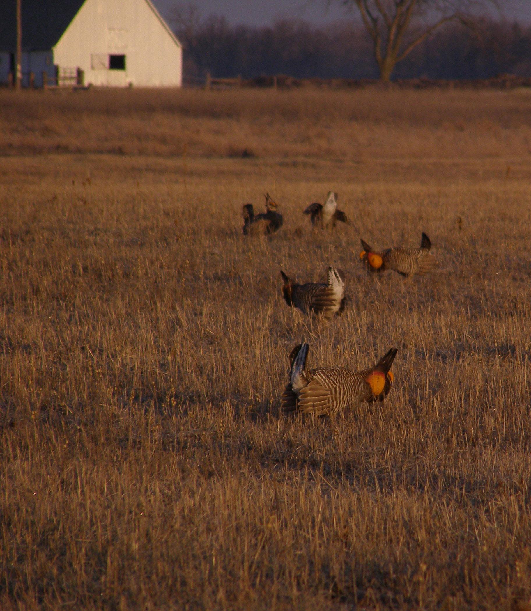
Open grasslands like those at Paul J. Olson State Wildlife Area provide critical habitat for the greater prairie-chicken.
LEARN MORE
For details on greater prairie-chicken management in Wisconsin, including how you can help and a link to a video of booming activity last year at Buena Vista Wildlife Area, scan the QR code or go to dnr.wi.gov/tiny/4086. To learn about the annual Wisconsin Greater Prairie-Chicken Festival in mid-April, go to wisprairiechickens.org

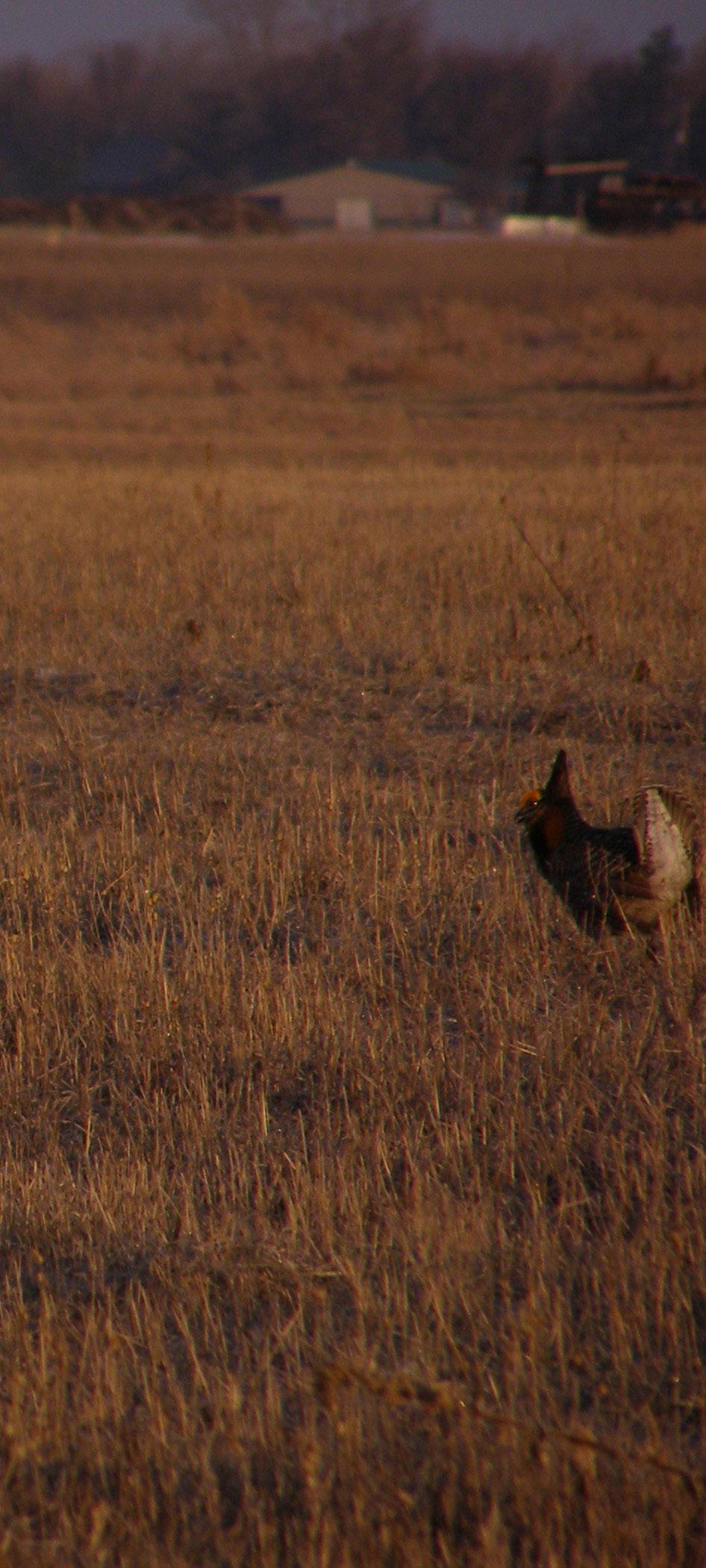
BUSINESS WILL SOON BE BOOMING for Wisconsin’s greater prairie-chickens at their local lek. So what the heck is a lek?
Think of it as a competition arena or a dating site, in the physical sense, but for prairie-chickens. Every spring, mostly from late March to early May, the birds gather at communal display grounds in the grassland areas where they live.
Males engage in elaborate courtship rituals in an attempt to assert dominance and draw the attention of nearby females. These wannabe Casanovas strut, hop, stamp their feet, flap their wings, raise their pinnae (long neck feathers) and puff out bright orange air sacs aside their necks. They spar with each other, though their actions rarely result in serious injuries.
Females, for their part, watch and wait, sometimes chasing each other around the lek. When a female is attracted by a particular male bird, she signals her interest by crouching down and extending her wings.
After mating, the female heads off. To help ensure species diversity, she might visit multiple nearby leks before finding taller grass in which to make a nest and lay her dozen or so eggs.
This annual behavior is known as booming, which is also the best way to describe one of the most noticeable noises males make during these displays, a low booming that sounds a bit like air blowing over the top of an empty bottle. They also make other sounds like cackles, clucks and whoops.
It’s a dating dance for early birds — it all happens at dawn — and these breeding grounds are a thing of real tradition for greater prairie-chickens.
Typically, lek locations remain in the same area over time, with some ancestral leks going back more than a century. But sometimes booming sites can relocate when birds respond to habitat changes or human disturbance. For instance, leks have been known to move to a recently burned grassland or shift after conversion of grassland habitat to a different land use.
Greater prairie-chickens (Tympanuchus cupido pinnatus) are members of the grouse family and unique to North America’s grasslands. Once common in Wisconsin, they have seen their range narrowed to the central part of the state, mostly because of loss and fragmentation of grassland habitat due to development, intensive agriculture and forest encroachment or woody succession.
Today, Buena Vista Wildlife Area in Portage County supports the majority of Wisconsin’s greater prairie-chickens (slightly larger and darker colored
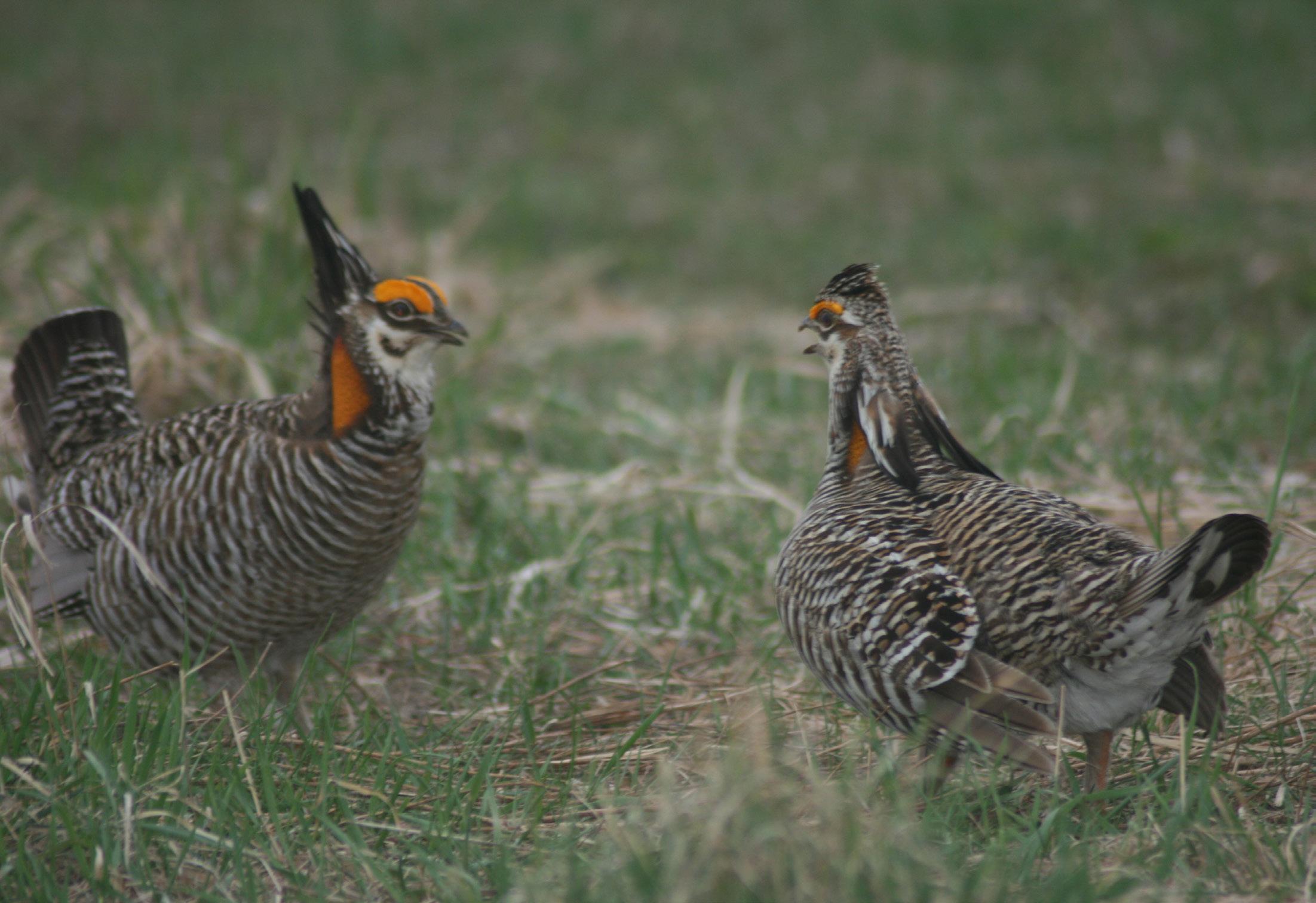
Male greater prairie-chickens square off during mating rituals, with dominant birds claiming the best territories at the center of the lek.
than the lesser prairie-chicken). The state population is carefully managed under the Wisconsin Greater Prairie-Chicken Management Plan 2022-2032, a 10-year guide developed by the DNR and the Greater Prairie-Chicken Advisory Committee.
Many partners, from government agencies to dedicated conservation groups, are key players along with the DNR. Goals of the plan include bolstering genetic diversity, improving and expanding habitat, growing conservation partnerships and raising public awareness of the greater prairie-chicken.
All to help ensure a strong future for life at the lek.
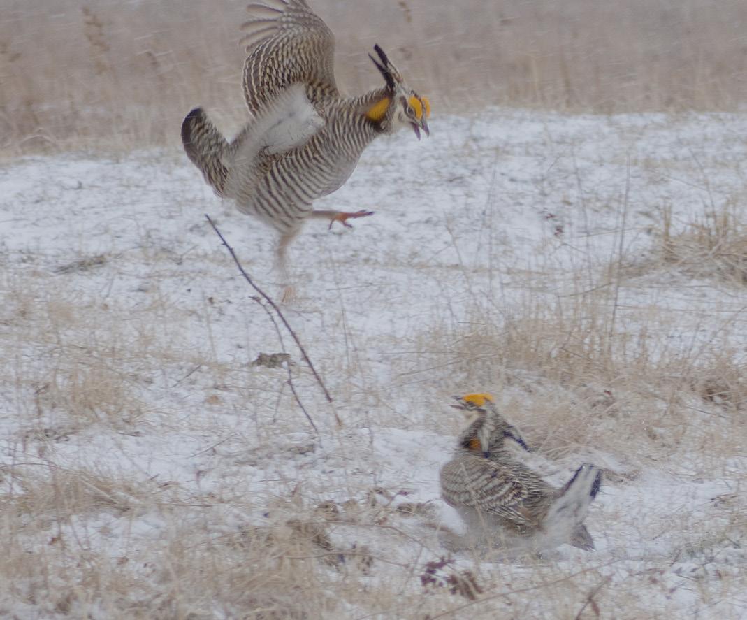

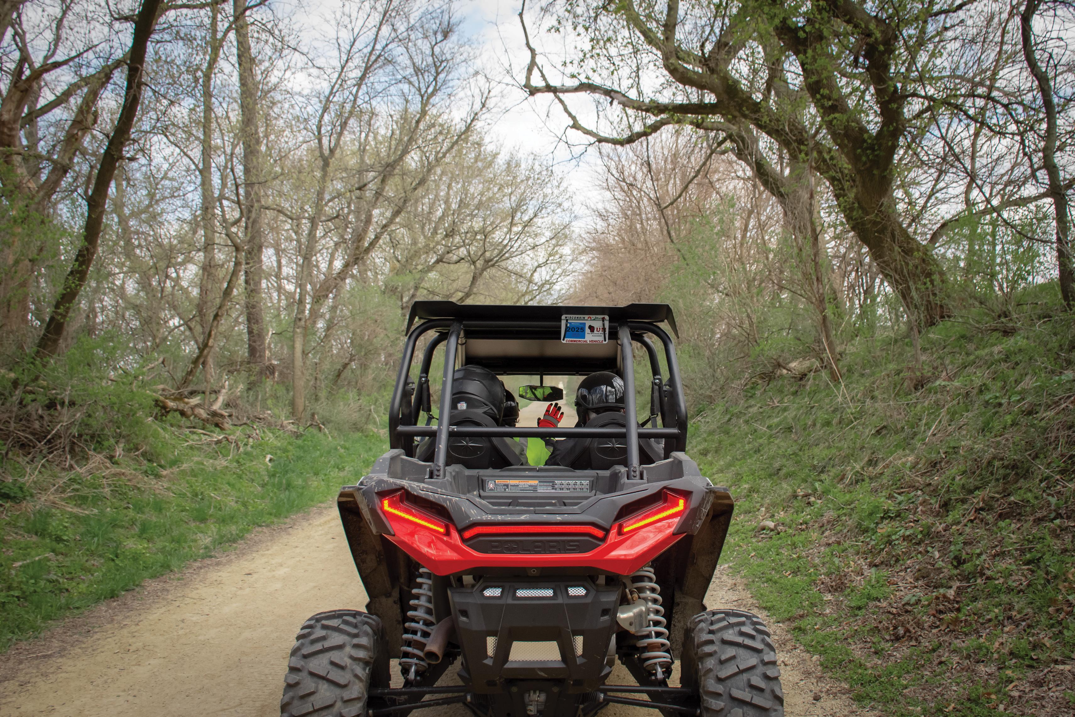
dnr.wisconsin.gov/topic/atv

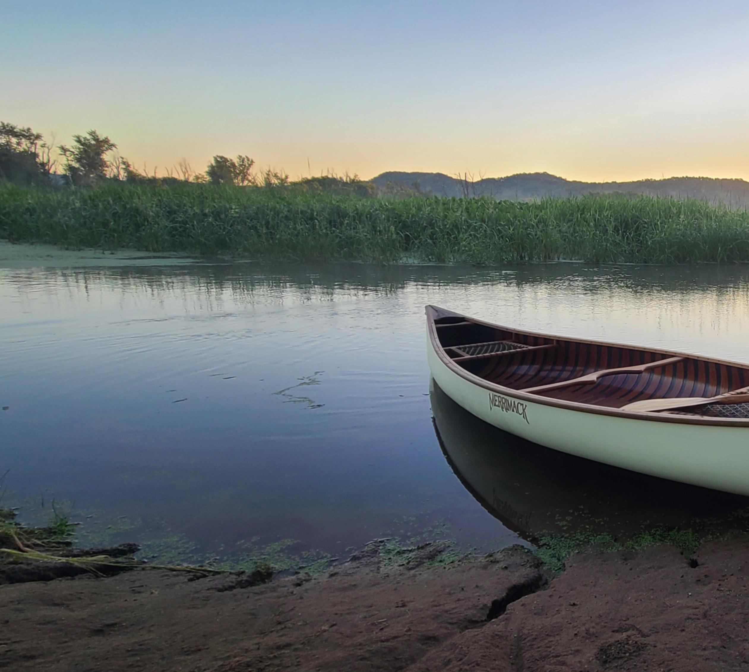
THE UPPER MISSISSIPPI RIVER winds its way along 230 miles of Wisconsin’s western border. It’s a special place with sweeping bluff-top vistas, bottomland forests, wetlands, wide pools and islands.
From the headwaters at Lake Itasca in Minnesota, the Upper Mississippi extends downstream to the mouth of the Ohio River at Cairo, Illinois. From there, the Lower Mississippi River flows all the way to New Orleans.
Bordering the states of Minnesota, Wisconsin, Iowa, Illinois and Missouri, the upper section includes more than 1,250 miles of river, a little more than half of the Mississippi River basin.
The word “Mississippi” is derived from an Ojibwe word meaning “great river” or “gathering of waters.” It’s an apt name because the entire Mississippi River basin, or watershed, drains over 40% of the continental U.S. as it winds through the heart of our nation.
Flowing some 2,350 miles from its humble beginnings in Minnesota to its immense delta in the Gulf of Mexico, it’s the world’s third-longest river system.
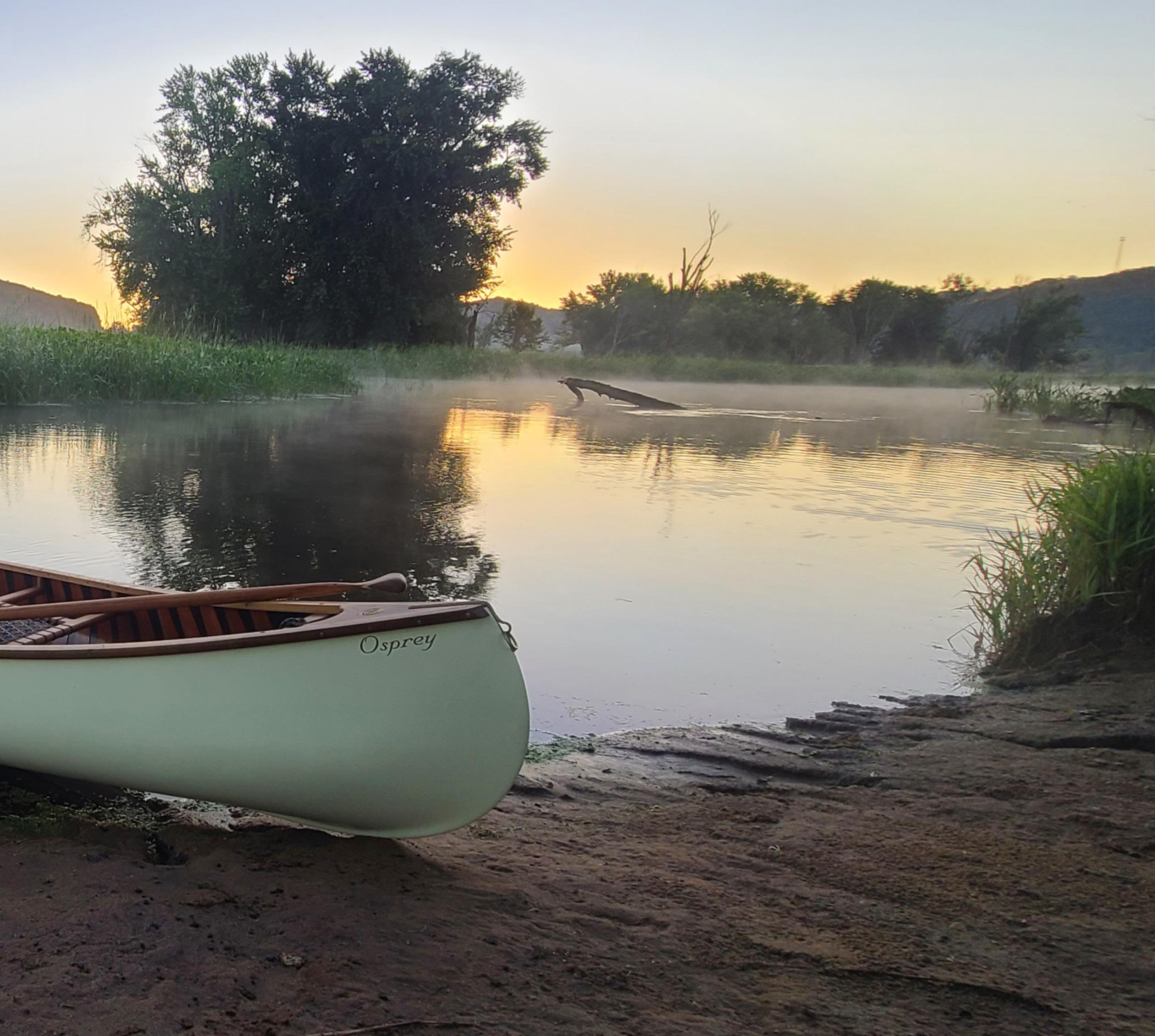
The Mississippi River is vital to our nation’s health. It’s the centerpiece of a $500-billion-a-year natural resource and recreation-based economy, employing more than 1.5 million Americans, and is an important shipping corridor.
More than 20 million people rely on the Mississippi for drinking water. It serves as a migration corridor for 60% of North American birds, and hundreds of other species of fish and wildlife rely on it.
But the Mississippi is also a river at risk on many fronts, facing severe ecological decline.
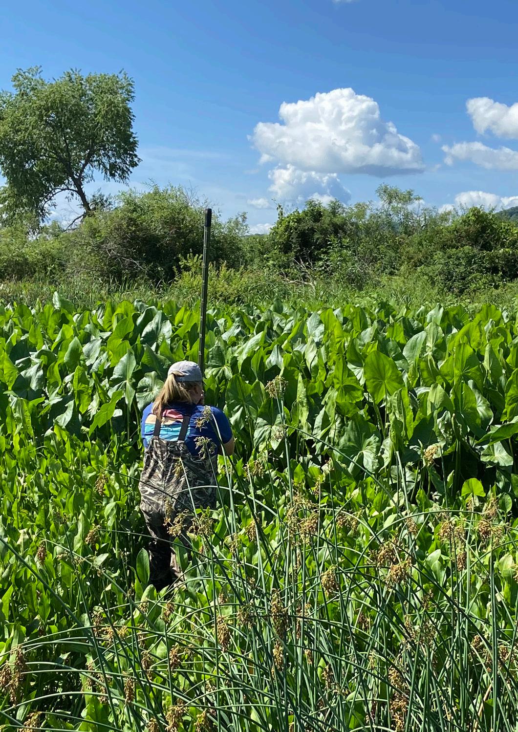
Monitoring aquatic plants in areas of the Upper Mississippi helps scientists better understand the
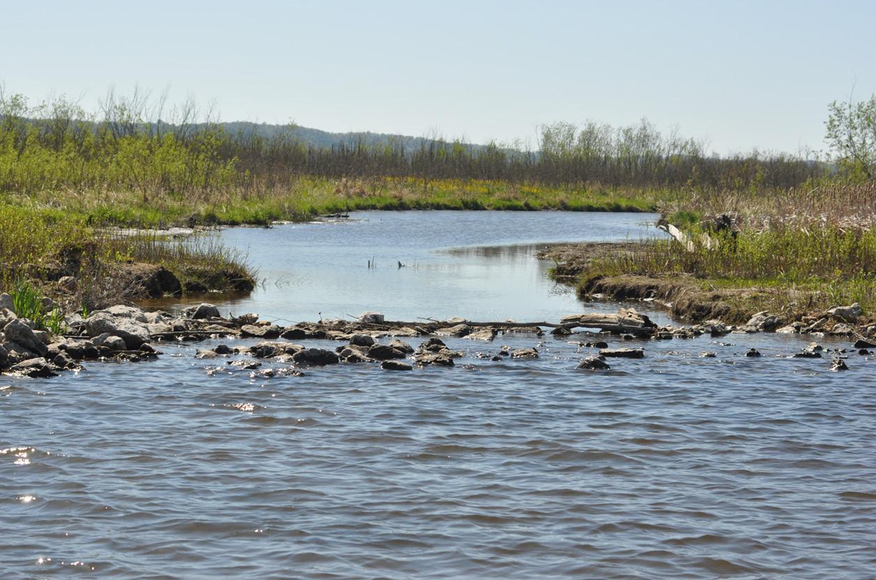
Since the 1930s, the Upper Mississippi River has been heavily modified and its flows regulated by a series of locks, dams and pools to maintain a consistent water depth of 9 feet for commercial navigation. This has dramatically altered the natural river processes and habitats.
Before river modifications began, the Upper Mississippi River was an ever-shifting mosaic of braided channels, islands, sandbars and floodplains, making navigation in larger boats difficult.
Water levels were also unpredictable. The river frequently built new land in some places, eroded it elsewhere, or even changed its path in response to floods and droughts.
Forty years ago, in 1986, Congress established the Upper Mississippi River Restoration Program as a way to balance competing uses of the river for navigation, commerce, fish and wildlife habitats and recreation.
Wisconsin is one of five states that work with federal agencies, nongovernmental organizations and others to monitor the river’s health and use the data to implement projects aiming to maintain this important balance.
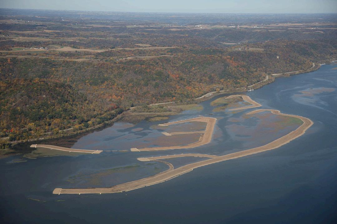
The U.S. Army Corps of Engineers is responsible for both project and budget management of the UMRR Program, working in cooperation with federal and state partners to implement habitat rehabilitation projects, science and monitoring in the river.
The Wisconsin DNR’s Long-Term Resource Monitoring Field Station in La Crosse is a key member of the data collection network operated by the five Upper Mississippi River states and the U.S. Geological Survey under the UMRR Program.
“The long-term data collected across the network helps us assess overall river system health by highlighting both system-wide changes and changes occurring in only parts of the system,” said Patrick Kelly, the DNR’s LTRM Field Station supervisor.
“The data collected by Wisconsin DNR staff in Pool 8 at La Crosse and by Minnesota DNR in Pool 4 at Lake City, Minnesota, helps us better understand the health of the fisheries, water quality and aquatic vegetation along Wisconsin’s border.”
Long-term datasets are crucial to understanding both slow-moving and fast-moving changes in the river, Kelly explained.
“This data helps us understand how and where this complex system is changing over time,” Kelly said. “It identifies where we’re making progress, where we need more work and how the river is responding to new stressors, such as more frequent and longer duration high-water events.
“It informs our strategies and priorities for future collaborative work.”
Data collection helps create a better understanding of fisheries health and other aspects of the Upper Mississippi.
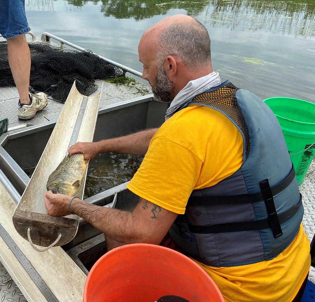
Clockwise from top:
Canvasback ducks take to the sky near Prairie du Chien, where the river provides vital habitat for migratory birds.
Wood duck in autumn on the river near La Crosse.
Improved water clarity on the Upper Mississippi has resulted in more abundant aquatic plants, such as wild rice.
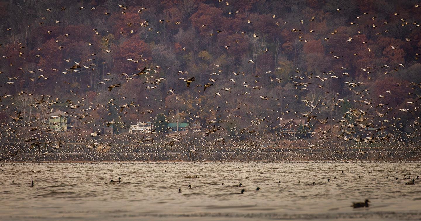
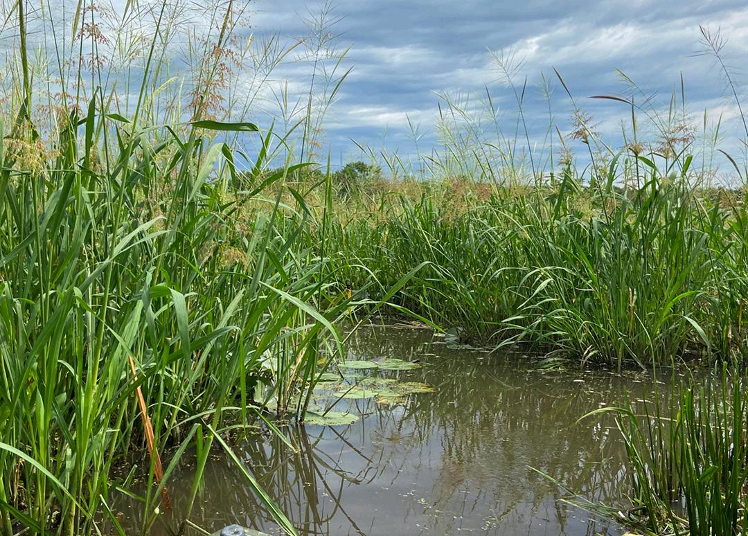
Monitoring in the upper reaches of the river shows that water clarity has improved over the past few decades and aquatic plants have become more abundant and diverse. Wild rice is one of the species that’s dramatically increased in density over the past several years in these areas.
“Some plants act as ecosystem engineers and create habitat in areas that may otherwise be unsuitable for other species,” said Alicia Carhart, LTRM aquatic vegetation specialist for the DNR.
“Rooted plants, like wild rice, slow water down and reduce waves. This limits sediment movement and allows more sediment to deposit on the riverbed, making the water clearer. Clear water allows sunlight to penetrate further, helping aquatic plants to grow in deeper water.”
More sediment also decreases water depth, Carhart added, which contributes to a further increase in plants.
All that is good news for fish and wildlife. Aquatic plants are important food and habitat for fish, waterfowl and other aquatic life.
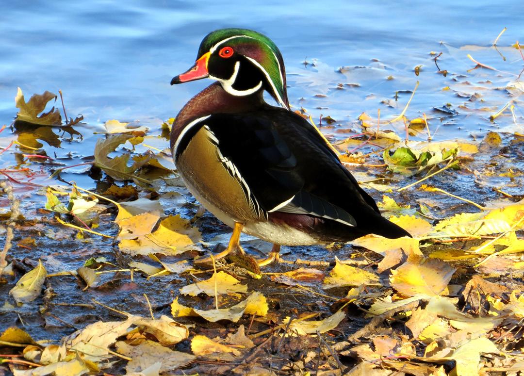
The Upper Mississippi River provides important resting and feeding areas for millions of birds during their migrations. At least 25 different types of aquatic plants found here provide vital energy for waterfowl such as canvasback ducks.
Aquatic plants also provide cover for fish as well as the creatures they eat. Many fish have an easier time foraging and spawning in clear water.
“Long-term monitoring has helped inform our understanding of the shift from high turbidity and scarce vegetation to clear water and abundant vegetation in the upper reaches of the river,” Carhart said.
Along with the long-term increase in water clarity, there has been a systemic decline in common carp and an extended period of low water levels. Plus, several local management and restoration actions have taken place to improve conditions for aquatic vegetation.
“All of these factors likely work together to maintain favorable conditions for abundant aquatic vegetation in much of the Upper Mississippi River,” Carhart said.
Habitat rehabilitation and enhancement projects are another aspect of the UMRR Program. Projects use a wide range of construction methods and approaches to mimic natural river processes that will help the many species of fish, birds and other wildlife that rely on the river, even though the river is heavily modified.
Methods include island creation, water level management, dredging, shoreline protection and floodplain restoration.
“For example, we’ve restored and constructed several islands in Pool 8, which have benefited a variety of fish and wildlife,” Carhart said. “We also conducted temporary water level drawdowns to create better conditions for aquatic plants to grow.”
These projects were done in places on the Mississippi that don’t interfere with the navigational channel. In fact, rebuilding islands in the river provides a useful place to put the copious volumes of sand and sediments that continually need to be dredged from the river to maintain the 9-foot navigational channel for boat and barge traffic.
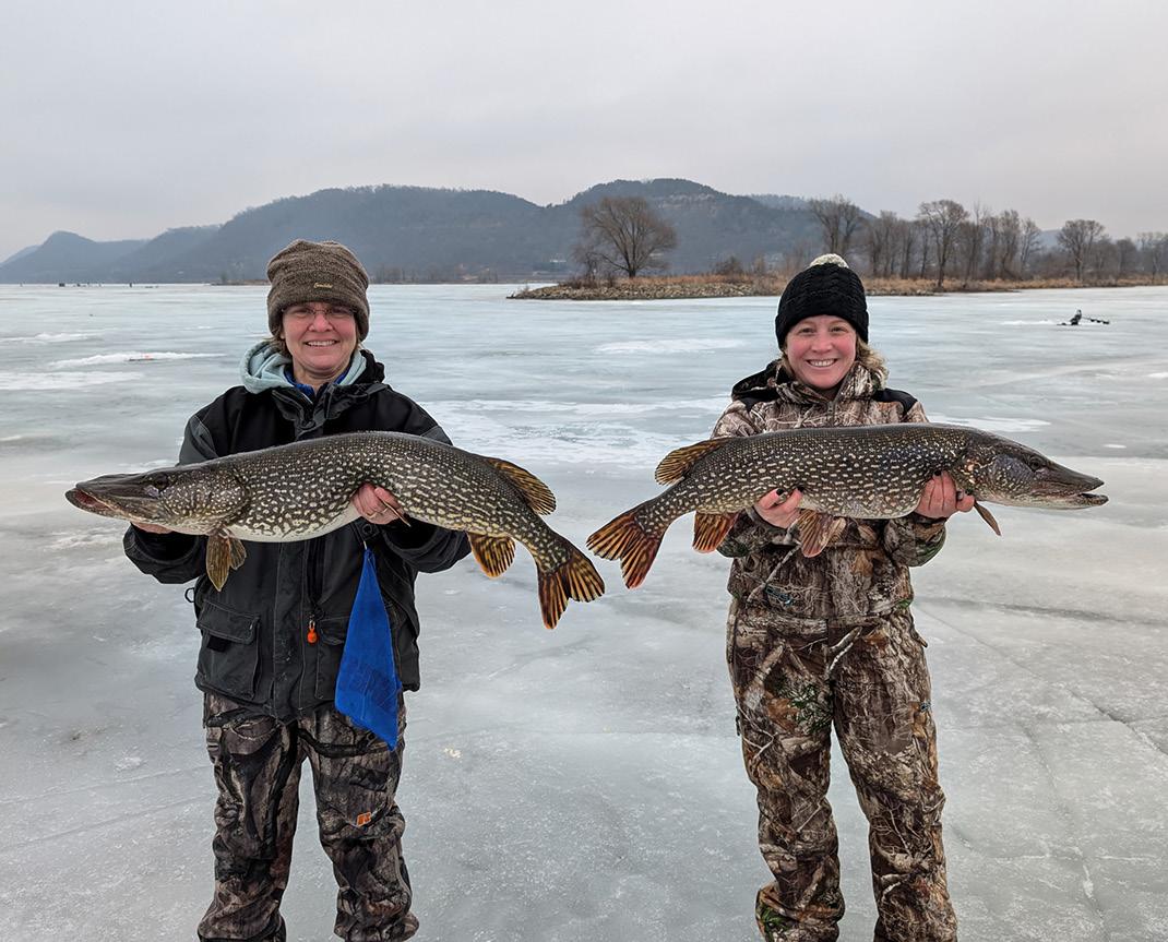
40
63
years for the Upper Mississippi River Restoration Program, established in 1986. habitat projects completed to date.
121,400 6
acres restored and connected along the Upper Mississippi River. active projects along the Wisconsin border.
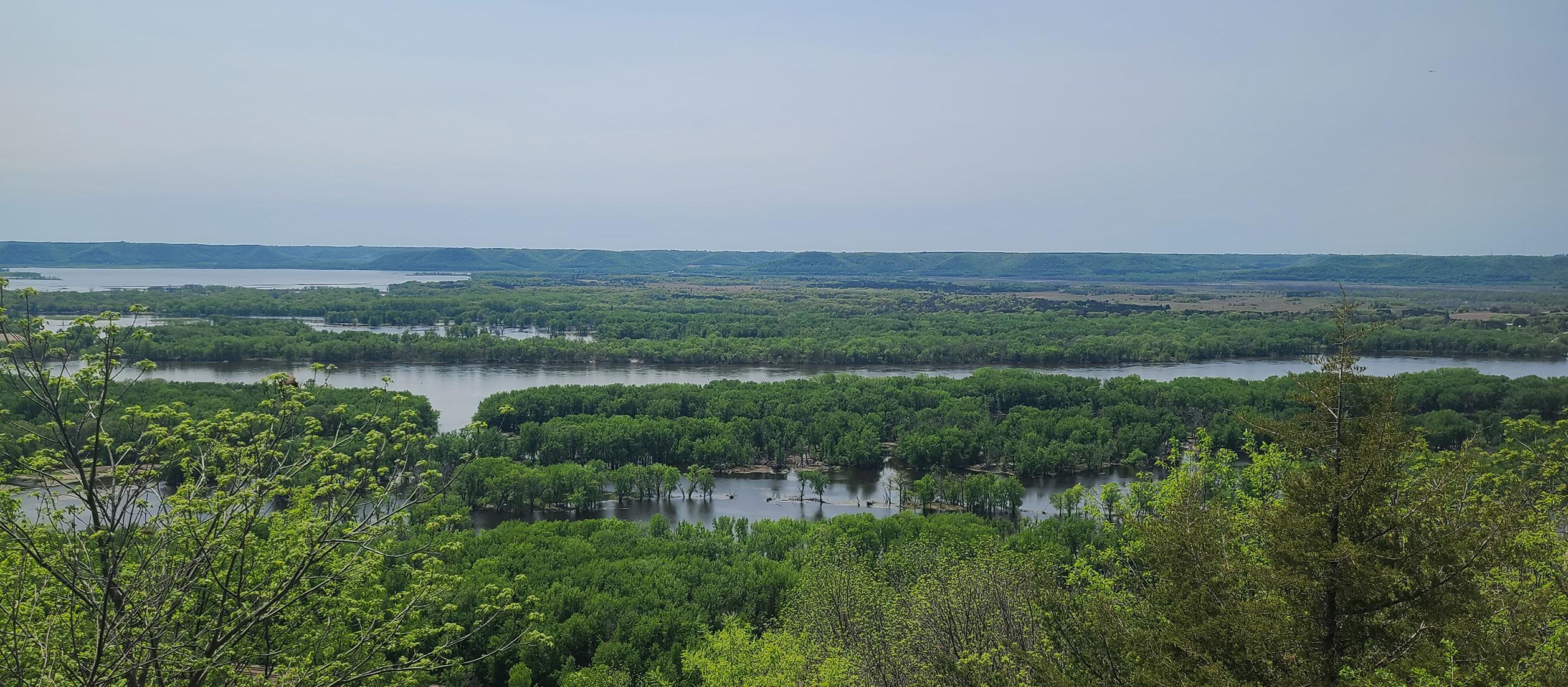
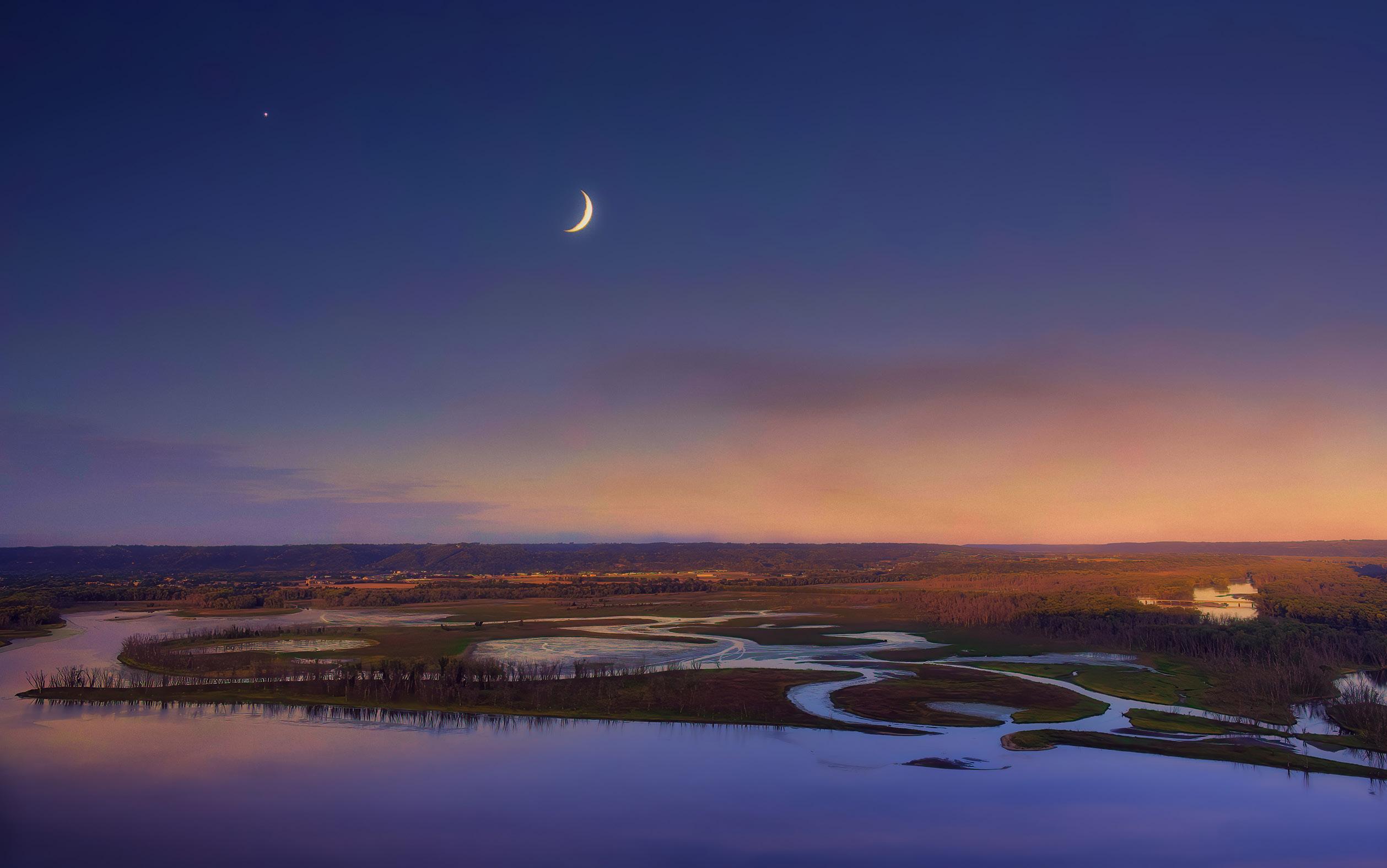
Rebuilding islands on the Mississippi is a win-win for navigation interests as well as fish and wildlife.
Islands reduce wind-driven waves in the wide-open pools of the river, which prevents sediment from being stirred up and making the water turbid. Gradual shorelines along the islands’ edges provide a range of water depths for different kinds of plants to grow. They also create a range of habitats to shelter young fish and other aquatic life.
Once these islands are established, they are magnets for all kinds of waterbirds, fish and other animals that rely on the river.
Consistent federal funding through the UMRR Program has allowed for both habitat restoration projects as well as monitoring.
“Long-term monitoring also allows us to better understand how the river responds to restoration projects,” Carhart said, “so we can adapt our management where needed.”
The Upper Mississippi River Restoration Program was authorized by the federal Water Resources Development Act of 1986, becoming the first environmental restoration and monitoring program on a large U.S. river system. For details, scan the QR code or go to dnr.wi.gov/tiny/4046

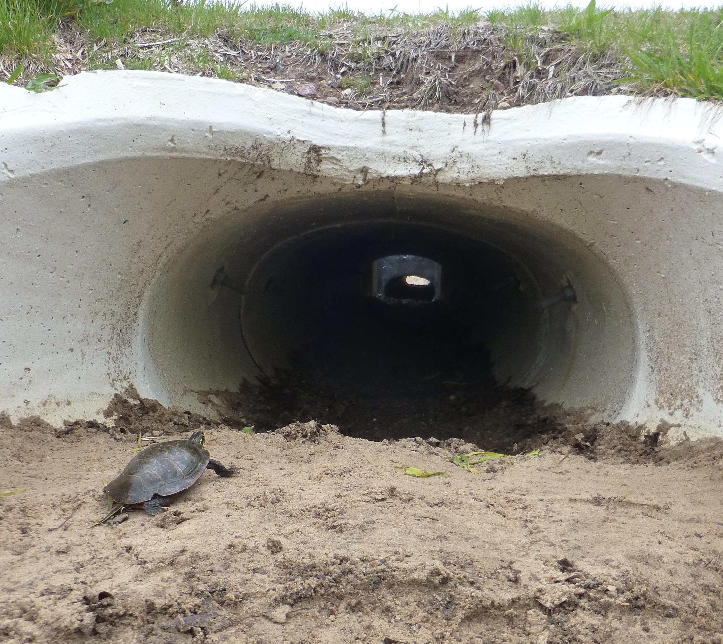
WISCONSIN DEPARTMENT OF TRANSPORTATION
ISCONSIN IS HOME TO HUNDREDS of native wildlife, but highways can fragment their habitat and disrupt natural movement patterns. As deer, turtles and other animals attempt to cross Wisconsin roads in search of food and shelter or to access breeding grounds, the risk of vehicle crashes with wildlife increases.
Over the years, the Wisconsin Department of Transportation has implemented solutions to avoid or minimize impacts to wildlife and their habitat as part of infrastructure projects, often in concert with the DNR. For instance, wildlife crossings — structures that allow animals to move safely across or beneath highways — can help make travel safer for motorists and wildlife alike.
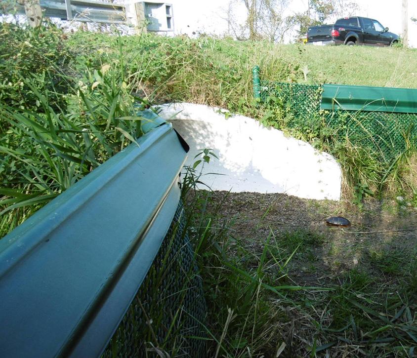
Turtles and other small animals can use a concrete culvert to find safe passage under Highway 66 near Stevens Point, with fencing to keep them off the busy road.
“Our agency is committed to strengthening Wisconsin’s transportation system for the efficient movement of people and goods, but we’re also looking at solutions to better connect Wisconsin’s wildlife to their habitat,” WisDOT Secretary Kristina Boardman said.
“We’re proud of our work and the collaboration with the Wisconsin DNR to reconcile mobility with ecology to ensure wildlife of all sizes can safely traverse our roads and bridges.”
In Wisconsin, wildlife crossings come in several forms, including eco-passages (culverts) with fencing, wildlife shelves under bridges, infilling riprap around structures with smaller stones, and adding fencing to funnel large and small animals through crossing areas.
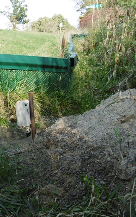
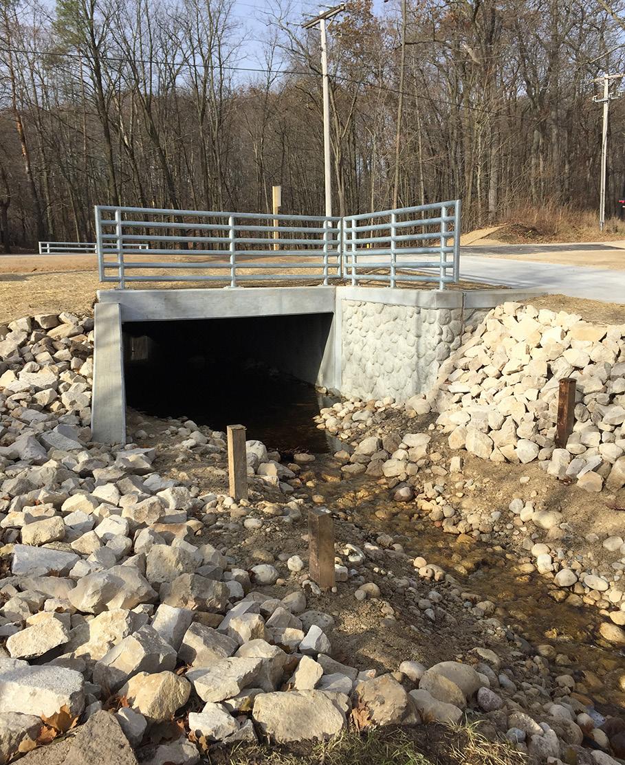
Some examples of WisDOT infrastructure projects involving wildlife crossings on state highways include:
y Elliptical eco-passage and fencing along Highway 15 near Hortonville in Outagamie County to provide a safe crossing for turtles.
y Box culvert placed beneath Highway 67 near Osceola in Fond du Lac County with stream restoration and walleye spawning habitat.
y Small tunnel under Highway 66 near Stevens Point in Portage County. Part of a 2016 highway resurfacing project, the 68foot underpass helps connect habitat areas at Jordan Pond and the Plover River, where turtles in particular were regularly hit by vehicles on the busy highway.
Successful mitigation projects rely on close coordination between WisDOT and partner agencies, including the DNR. The latter has a staff of about 20 transportation liaisons around the state who work with WisDOT and municipalities to advance transportation projects while protecting the environment.
For WisDOT, these cooperative efforts help balance realistic habitat connectivity solutions within broader goals of delivering on-time, on-budget road projects that enhance traveler mobility and safety.
Scan the QR code to access a PDF of the complete Wildlife Crossing Hotspot Analyses report from the Wisconsin Department of Transportation.

In summer 2025, WisDOT received results from a one-year research project, Wildlife Crossing Hotspot Analyses, led by Marcel Huijser and Matthew Bell of the Western Transportation Institute at Montana State University. The report identifies locations to consider for future Wisconsin wildlife crossings.
The researchers modeled areas with high crash frequency involving large wild animals (i.e., deer and bear) across the state highway network in Wisconsin. The hotspot road segments were screened against cost-benefit thresholds to help identify areas where implementing mitigation was expected to be less expensive in the long run than taking no action.
The researchers also gathered available GIS information from the DNR on more than 30 species of conservation concern across the state, including amphibians, rep -
tiles and mammals. The data and hotspot mapping will help WisDOT recommend wildlife crossing strategies where infrastructure investment will yield the greatest reduction in collisions while improving habitat connectivity.
WisDOT will continue to evaluate opportunities to integrate wildlife-friendly infrastructure solutions and aquatic passages into future highway projects where data shows clear safety and ecological benefits.
In addition to the infrastructure work, WisDOT and the DNR publish regular public awareness campaigns via news releases and social media to inform and educate motorists about being safe and alert for wildlife while driving.
Motorists are advised to be alert and drive with caution on Wisconsin roads, especially during peak times in spring and fall as well as dawn and dusk, when animals are most active.
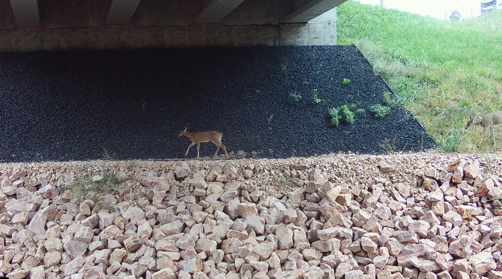
A deer makes its way via a wildlife underpass in Washburn County, where U.S. Highway 53 crosses Potato Creek, in this image from a trail camera set up by DNR transportation liaisons Amy Cronk and Shawn Haseleu.

PLASTIC IS EVERYWHERE . It’s useful, convenient and part of everyday life. However, the plastic we use today, if not properly recycled, could be around forever — at least 100 years or more.
If recycled properly, though, a plastic item you’re done using can live on to become something new and helpful to someone else.
But before we head to the recycle bin, let’s first talk about how we can reduce our plastic usage from the start.
Recycling plastic is a great step toward reducing plastic pollution, but it can be hard to avoid using plastic in the first place. Small actions done by many people to reduce plastic usage can have a big impact. Here are a few ways to start.
y Swap your single-use plastic sandwich and snack bags for reusable, washable storage containers.
y Go the same route with water and coffee — use a reusable, refillable water bottle and travel coffee mug to cut down on one-time-use containers.
y Reuse plastics such as beverage bottles, plastic bags and packaging when possible.
y Share appreciation for events and locations that provide recycling opportunities for customers and participants.
y Subscribe to Recycling Updates, the DNR's free emailed newsletter dedicated to recycling; sign up at dnr.wi.gov/tiny/4066.
If a plastic item has that little triangle symbol with a number on it, you can recycle it anywhere, right? Unfortunately, this is not the case.
Each municipality in Wisconsin has distinct recycling rules regarding what it accepts, including plastics. Variations occur because the facilities municipalities rely on to sort and process recyclables have different equipment, locations and markets.
It’s important to know the rules for your community to ensure you’re doing the right thing.
Plastics are made from chemical resins, and various resins have different physical properties. In general, different resins cannot be mixed together to make new products.
To help keep resins separate, the plastics industry developed a standardized numerical resin code system. These codes, numbered 1 through 7 and usually imprinted with a triangular arrangement of arrows on the bottom of plastic containers, help consumers identify the plastic.
All recyclers in Wisconsin accept plastic with resin codes #1 and #2. These plastics comprise about 97% of all plastic bottles, according to the Association of Plastics Recyclers. Since there are strong and stable markets for these plastics, they are banned from landfill disposal in Wisconsin.
Plastics with resin codes #3 through #7 are generally harder to recycle into new products. Some municipal-
ities may direct residents to keep some or all of these out of the recycling bin or cart. Some of these plastics, such as bags marked with resin codes #2 or #4, may have other recycling options.
This is why it’s important to know your municipality’s rules around plastics recycling.
So what about plastic bags and plastic wrap? You can recycle clean and dry plastic wrap and bags at many grocery stores and other retailers, usually in a bin near the entrance. Check with local stores to find out what they take before heading there.
It can take between 100 and 1,000 years or more for plastic to decompose, depending on environmental conditions. When plastic does end up in the environment rather than getting recycled, it can break down into smaller pieces of plastic, becoming microplastics and infiltrating our ecosystems.
Plastic pollution can harm animals too, especially marine animals. Plastic bags, plastic bottles and even fishing line easily find their way into rivers, lakes and streams where animals may ingest them or get tangled in them.
Plastic pollution isn’t good for anyone, but it can be prevented.

For details on recycling in Wisconsin, including links on what to recycle and information about plastic bags, scan the QR code or visit dnr.wi.gov/tiny/2436.

McMiller Sports Center in Waukesha County is the state’s largest public outdoor shooting range.
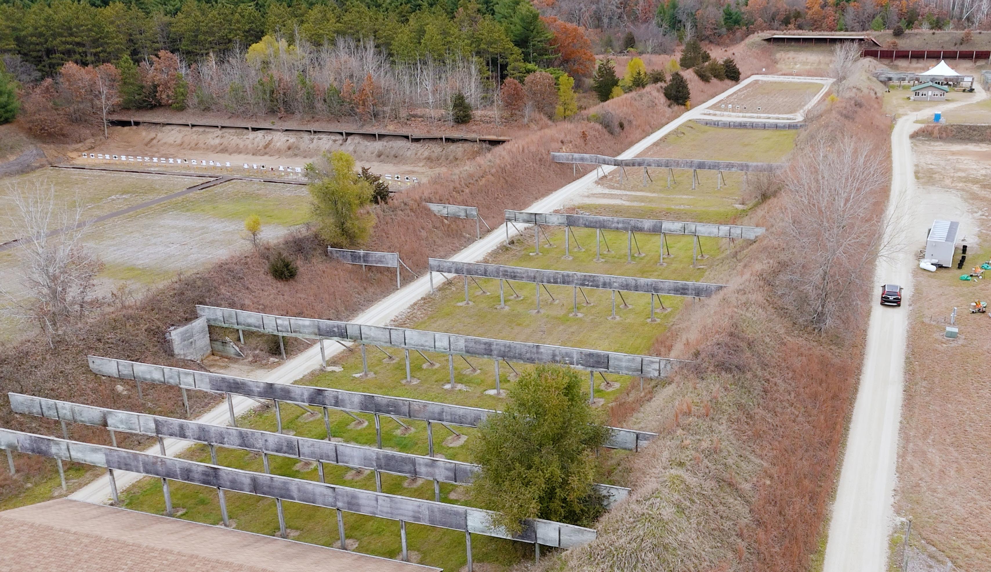
RECREATIONAL SHOOTERS HELP KEEP CONSERVATION FUNDING ON TARGET
THE I DEA OF TYING HUNTING and angling to conservation might be nothing new to people who hunt and fish. And supporting fish and wildlife management with money from excise taxes on firearms, ammunition, archery and fishing equipment has been happening for decades via historic PittmanRobertson and Dingell-Johnson legislation.
So where do recreational shooters fit in the picture? Turns out, they’re actually front and center, important cogs in keeping conservation efforts and wildlife management moving forward and properly funded.
“Hunters are a big part of the equation, but it’s recreational shooters who are purchasing firearms and a good amount of the ammunition,” said Brett Johanen, the DNR’s statewide public shooting range manager.
“They’re buying in bulk. Hunters don’t need more

than maybe one firearm and a little ammunition, but recreational shooters are purchasing a lot of ammunition.”
That’s a big reason why the DNR has 11 shooting ranges around the state, falling under the Division of Public Safety and Resource Protection. The ranges offer safe and structured locations for firearm users to practice, learn and enjoy shooting activities — and contribute to conservation.
“If we didn’t have that relationship and that support and understanding from those rec shooters, that cycle of funding would fall apart,” Johanen said.
All 50 states and five U.S. territories receive money from the U.S. Fish and Wildlife Service through the Pittman-Robertson Wildlife Restoration Act, which dates to 1937. Annual amounts are based on a formula that considers several factors, including sales of

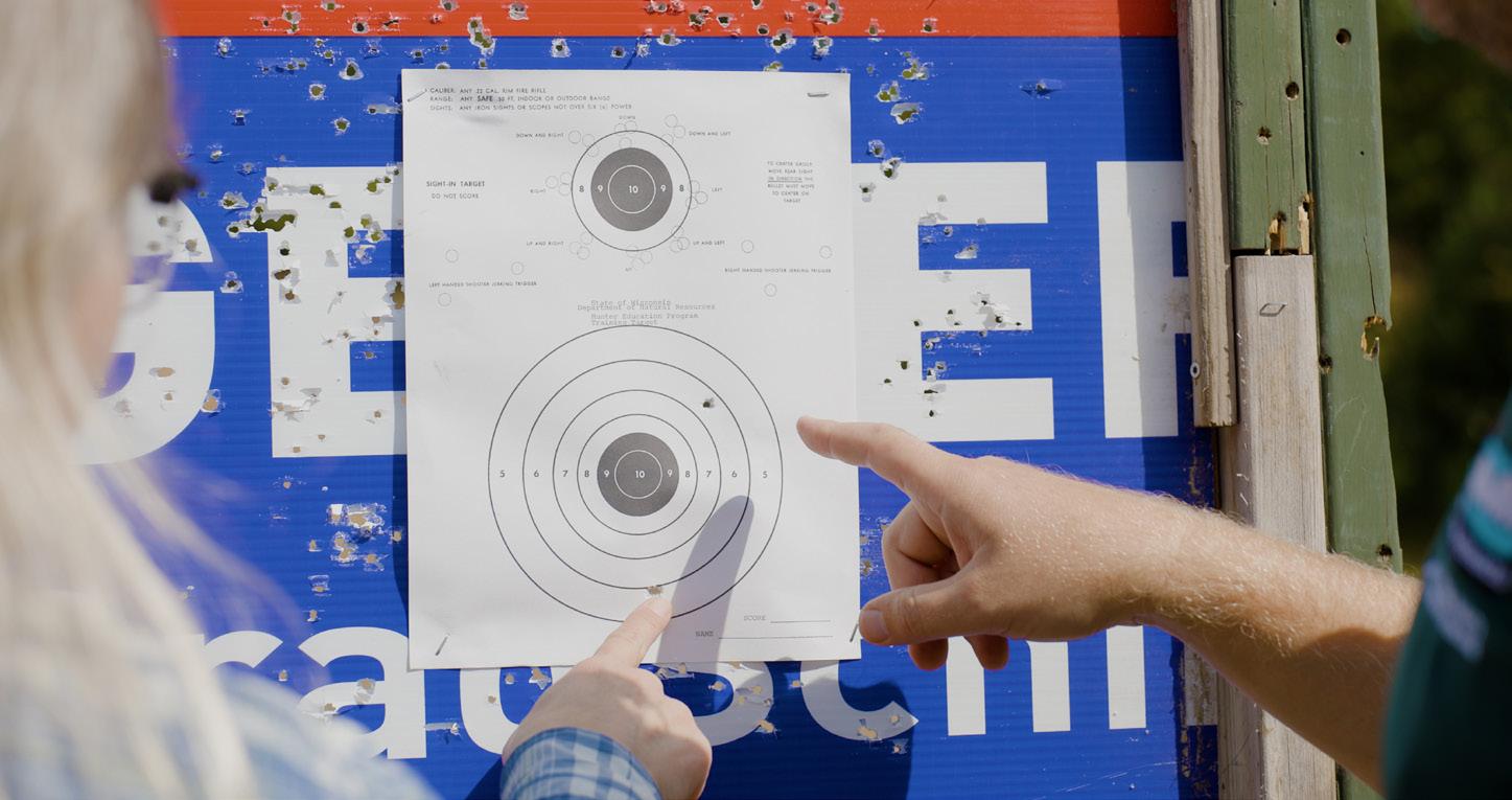
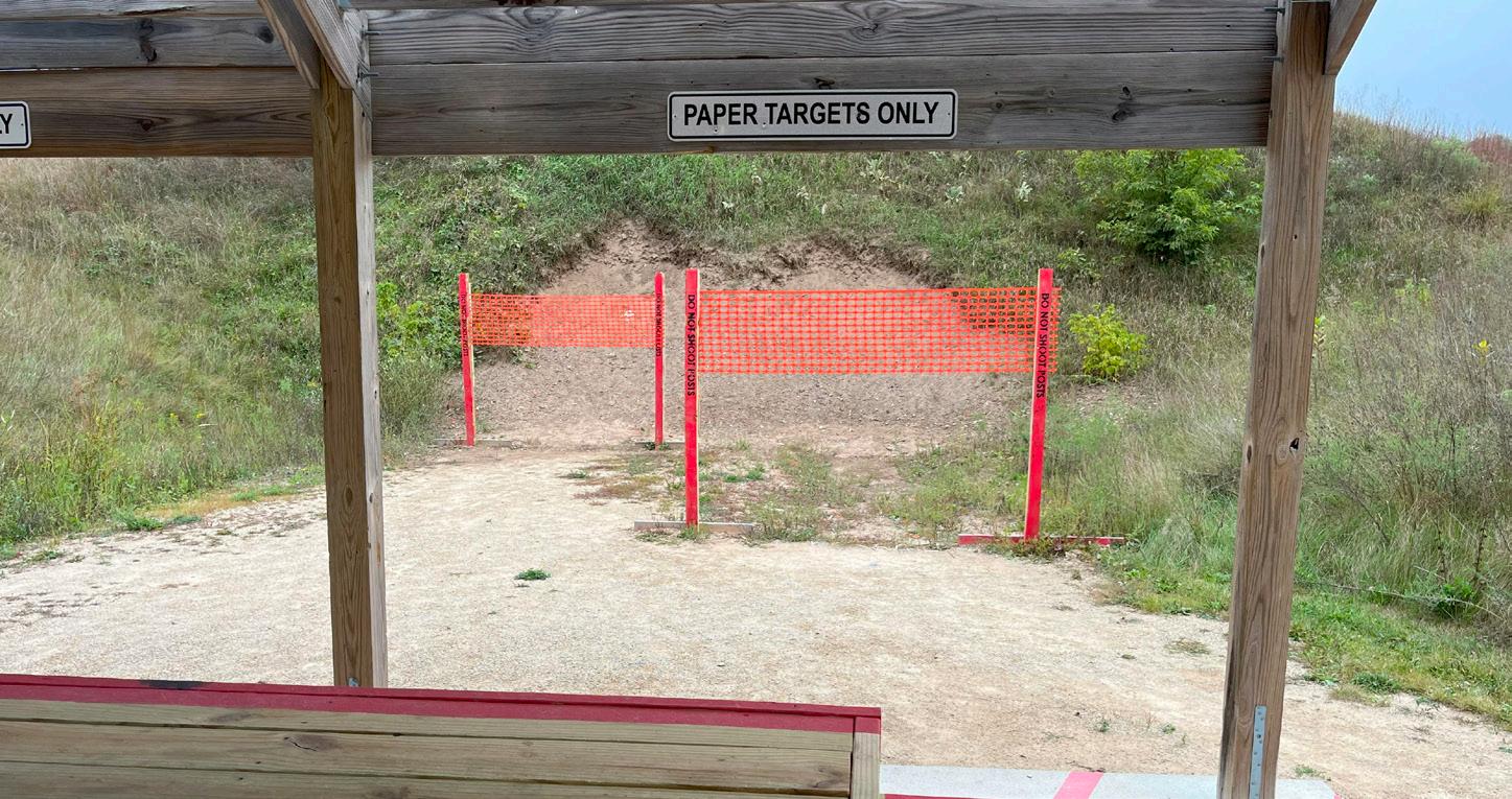
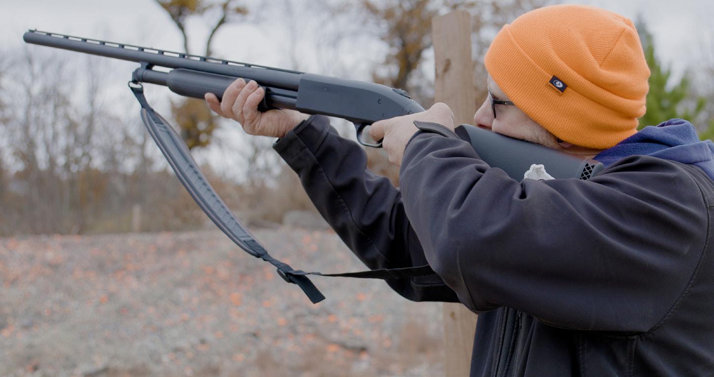
The North American Model of Wildlife Conservation, a philosophy that guides policies and laws regarding natural resources management, has drawn support from many, including recreational shooters. The NAMWC has seven basic tenets.
y Wildlife as public trust resources. Natural resources and wildlife on public lands are managed by government agencies to ensure that current and future generations always have wildlife and wild places to enjoy.
y Prohibition on commerce of dead wildlife. Commercial hunting and the sale of wildlife is prohibited to ensure the sustainability of wildlife populations.
y Rule of law. Laws and regulations developed by the people and enforced by state and federal agencies will guide the proper use of wildlife resources.
y Opportunity for all. Every citizen has an opportunity by law to hunt and fish in the U.S. and Canada.
y Wildlife should only be killed for a legitimate purpose. Individuals may legally kill certain wild animals under strict guidelines for food and fur, selfdefense and property protection. Laws prohibit the casual killing of wildlife.
y Wildlife as an international resource. Because wildlife and fish freely migrate across boundaries between states, provinces and countries, they are considered an international resource.
y Scientific management of wildlife. The best science available will be used as a base for informed decision-making in wildlife management.
Source: U.S. Fish and Wildlife Service
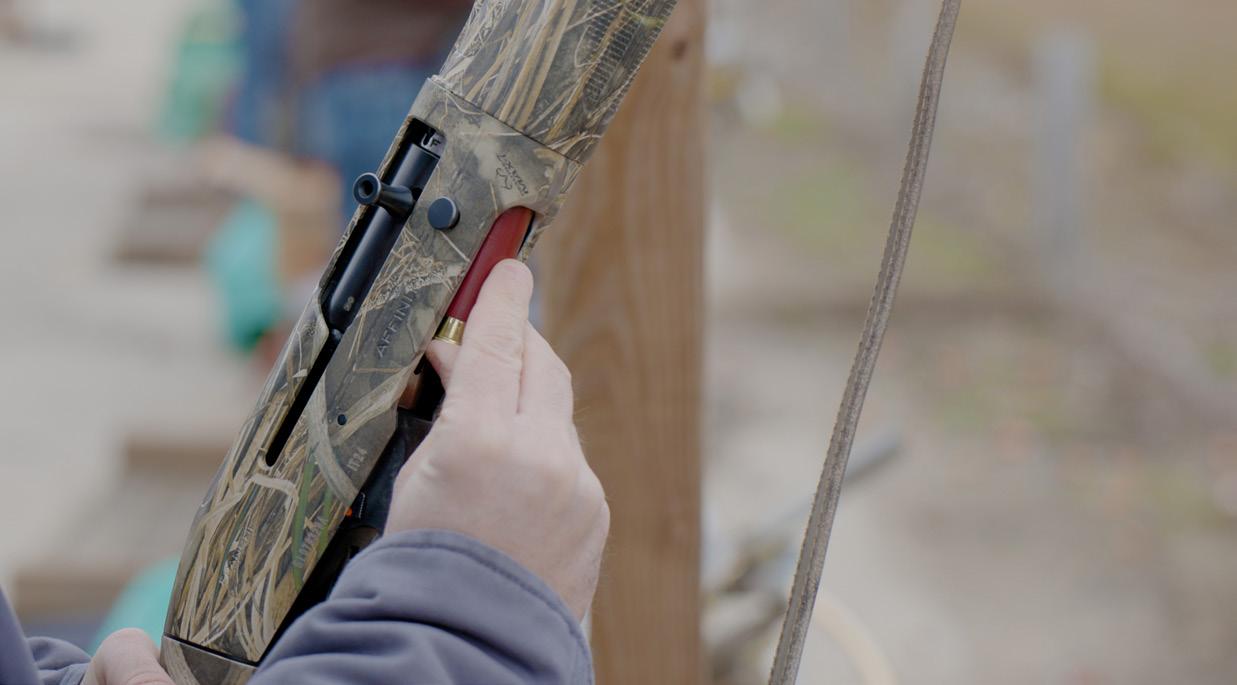
Recreational shooters generally buy ammunition in larger quantities than hunters, supporting conservation funding through the excise taxes of the Pittman-Robertson Act.
firearms, ammunition and hunting licenses.
(The Dingell-Johnson Act of 1950 serves a similar purpose for fishing.)
Recent data has shown much growth in nonhunting firearm and ammunition purchases, which means a corresponding increase in conservation funding from those sales.
Without money generated by the PittmanRobertson Act, Johanen said, “We wouldn’t be able to manage the wildlife habitats in Wisconsin alone, not to mention the entire country.”
Shooting ranges are far from a new development in the state. A majority of shooting ranges began cropping up back in the 1940s, Johanen noted, as servicemen returned from World War II. Often called “sportsmen’s clubs,” they were seen as a social gathering place where people could connect with their peers.
The DNR’s involvement with shooting ranges likely began in 1975 with the Boulder Junction Shooting Range, located on state-owned land near the agency’s Trout Lake Forestry Headquarters. In the 1990s, development of shooting ranges on state lands accelerated, especially at places like McMiller Sports Center in Waukesha County, now the state’s largest public outdoor shooting range.
All of this is predicated on legal ownership and safe use of firearms, Johanen said. “That’s what we’re trying to promote at all times, whether at a range or in the field. Safety is our top priority.”
Responsibility for day-to-day operations at DNR shooting ranges depends on the location. McMiller, for example, is operated by a contracted concessionaire; others are run by local sporting groups. Partners play a crucial role in keeping DNR shooting ranges operational.
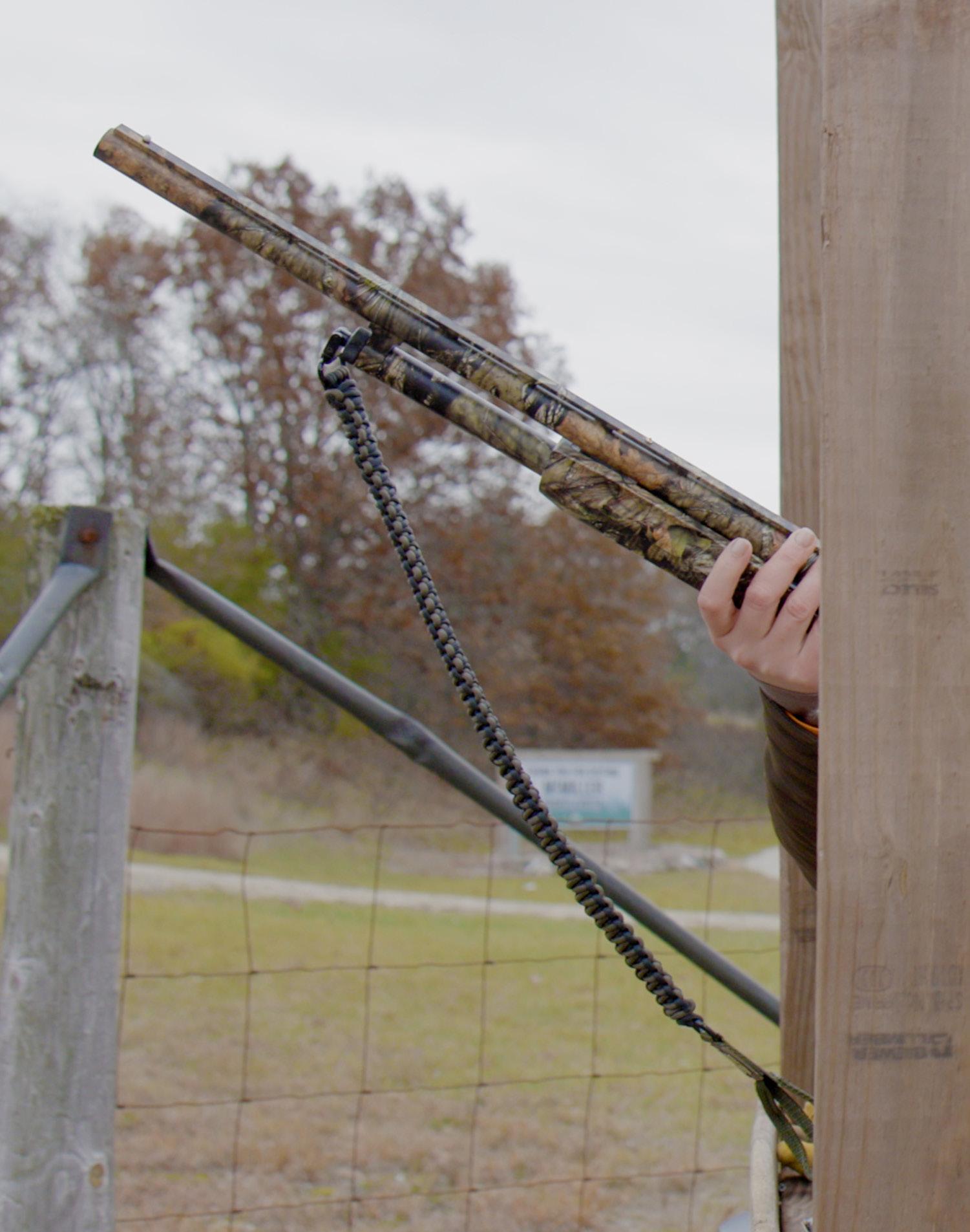
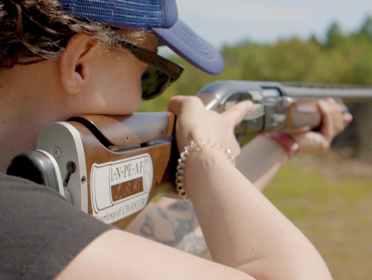

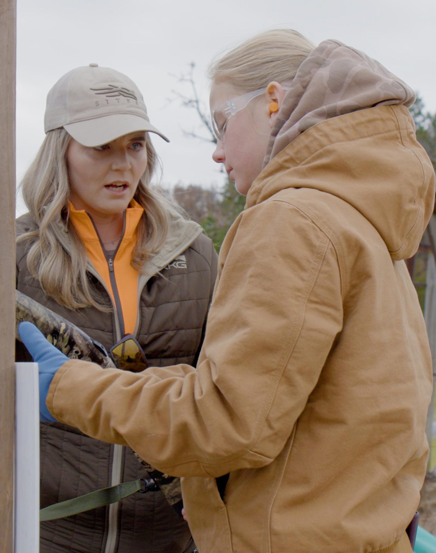

Facilities can vary from basic offerings to more amenities and programs, but generally speaking, shooting range users supply their own gear. Hours and fees also vary depending on the range. All skill levels are welcome, and memberships are offered in some cases to help offset costs of facility maintenance.
For consistency and safety, as of 2024, the DNR’s Division of Public Safety and Resource Protection has one point person, now Johanen, responsible for oversight of all the state-owned ranges.
“In the past, individual ranges were managed by a team, including local property managers and other DNR staff,” he said. “That posed a lot of challenges” as all team members had many other responsibilities.
“Having a central person can help make ranges more efficient and effective operations,” he said. Plus, it allows the DNR to be more responsive to customer needs.
To find a public shooting range near you and learn the rules at DNRowned ranges, scan the QR code or go to dnr.wi.gov/tiny/102
DNR shooting ranges are open throughout the year. For those who use ranges to prep for fall hunting seasons, Johanen pointed to spring and summer as good times to get out in front of the busy season.
“Fall can get busy as people are prepping for gundeer season,” he said. “Don’t wait until the last minute to get set for the fall gun-deer season — avoid the crowds and be proactive.”
Overall, there are more than 400 shooting ranges in Wisconsin, beyond the DNR’s 11 public ranges. Some are privately owned and others are operated by local government units.
To support these places, the DNR offers a Shooting Range Grant Program, with local governmental agencies, educational institutions and private groups able to apply for reimbursements of range construction costs, including safety features like backstops and protective fencing as well as noise mitigation materials that help shooting ranges be good neighbors in their communities.
Offering financial support for local shooting ranges can help make opportunities more accessible and closer to home for people, Johanen said, especially at busy times of the year. “We can kind of spread people out that way,” he added.
Recreational shooters in Wisconsin have indicated support for their role in the conservation funding equation, Johanen said, noting it fits well with the North American Model of Wildlife Conservation.
The NAMWC features a set of seven guiding principles that help shape policies and laws regarding fish and wildlife.
“Once these recreational shooters are made aware of their impacts, they are on board, which is huge,” Johanen said.
The idea is to use sound science and active management to safeguard our natural resources, with public support a crucial component. All who appreciate nature can benefit from the wildlife and habitat management that results from Pittman-Robertson Act funding.
“When we’ve spoken to recreational shooters about Pittman-Robertson and NAMWC, they’re very supportive,” Johanen added. “It makes me happy to hear people say, ‘We’re contributing to a greater cause.’ That’s very powerful.”

Andrea Zani is managing editor of Wisconsin Natural Resources magazine.
SOME OF THE MOST BELOVED characters of Wisconsin lore originated in the mid- to late 20th century, including Bucky Badger from UW-Madison and Bango, the Milwaukee Bucks mascot. The nationally recognized fire prevention icon Smokey Bear also came about in the same era.
There’s another mischievous persona dating to that time with whom you might not be so familiar: Torchy Timberloss.
Torchy was first conceived as a menacing-looking flame derived from the imagination of Wisconsin Conservation Department firefighters around 1950. Exactly whose idea he was is unknown, but graphics of his image were originally created by Harry C. Allman when he worked as a draftsman with the engineering division at the then Forest Protection Headquarters in Tomahawk (now the LeMay Forestry Center).

The Wisconsin Conservation Department, precursor to the DNR, used illustrations by Harry C. Allman that incorporated features of Torchy — as “Malice in Wonderland” in this example.

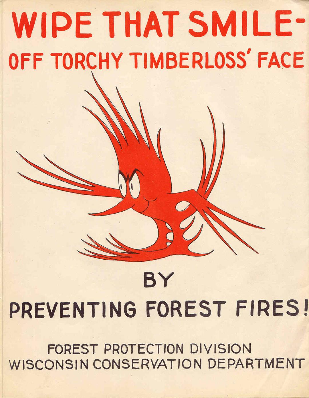
Initially, Torchy made many appearances in fire prevention publications and posters. But by 1958, the concept had seemed to run its course, and Torchy disappeared from printed materials.
Torchy made a comeback in the late 1970s, thanks to a DNR staff member named Earl Meyer, who was then a forest fire prevention and forestry law enforcement specialist.
Torchy’s likeness was reintegrated into flags, hard-hat decals and patches to provide identification for Wisconsin personnel on out-of-state fire assignments. It’s common for many firefighters across the country to exchange patches or pins from their home agency.
Meyer changed Torchy from a devilish character to a more friendly fire and added a shovel in his hand to represent firefighting tools. A black outline around Torchy represents the use of soil to fight flames, and blue surrounding his full logo represents water.
Legend also has it that the full Torchy logo was in the shape of a triangle as a possible nod to the elements that make up the fire triangle: heat, fuel and oxygen.
Later versions of Torchy, credited to DNR staff member Earl Meyer, added a shovel to represent firefighting tools and appeared on hard hats and other apparel.
These days, Torchy’s name and image will focus less on “Timberloss” and more on good and safe fire as he continues his evolution. DNR staff are working to deploy Torchy as an ambassador to prevent human-caused accidental fires and also explain the benefits of safe prescribed burning.
Wisconsin has a rich history of periodic fire, historically through cultural burning by tribal citizens throughout the state. These smaller, low-intensity burns were conducted for wildlife and land management purposes such as attracting game, reducing fuels or encouraging the growth of medicinal native plants and food sources.
Many plant communities in Wisconsin — including prairie, wetland, oak and pine barrens, savannas and forests — adapted over thousands of years to periodic fire. These fire-dependent communities are in significant decline and would now cease to exist in their ideal state without fire to reset the natural cycle.
DNR fire crews and other trained practitioners conduct prescribed burns for the health of these ecosystems to mimic the natural benefits that these low-intensity, cooler fires historically provided. These benefits include removing invading brush, decreasing dead grass (thatch) and leaf litter, and promoting the growth of native, fire-dependent vegetation.
Wildlife using these areas benefit from improved nesting habitat, an increase in forage quality and abundance, and higher rates of success in rearing young. To avoid negative impacts for rare species, DNR biologists and ecologists closely monitor their presence and emergence after winter and avoid burning in those areas once these species are detected.
Not all fire is bad, and Torchy’s evolution is a testament to that. Watch for Torchy’s important “good and safe fire” messaging on the DNR’s email and social media channels throughout the spring.
Molly Meister is a publications supervisor in the DNR’s Office of Communications. Catherine Koele is a wildfire prevention specialist and Michele Witecha is the prescribed fire specialist, both in the DNR’s Division of Forestry.
The DNR recently revived Torchy, tweaking his image and focusing more on good fire, or prescribed burning, rather than the “Timberloss” part of his name.
Don’t
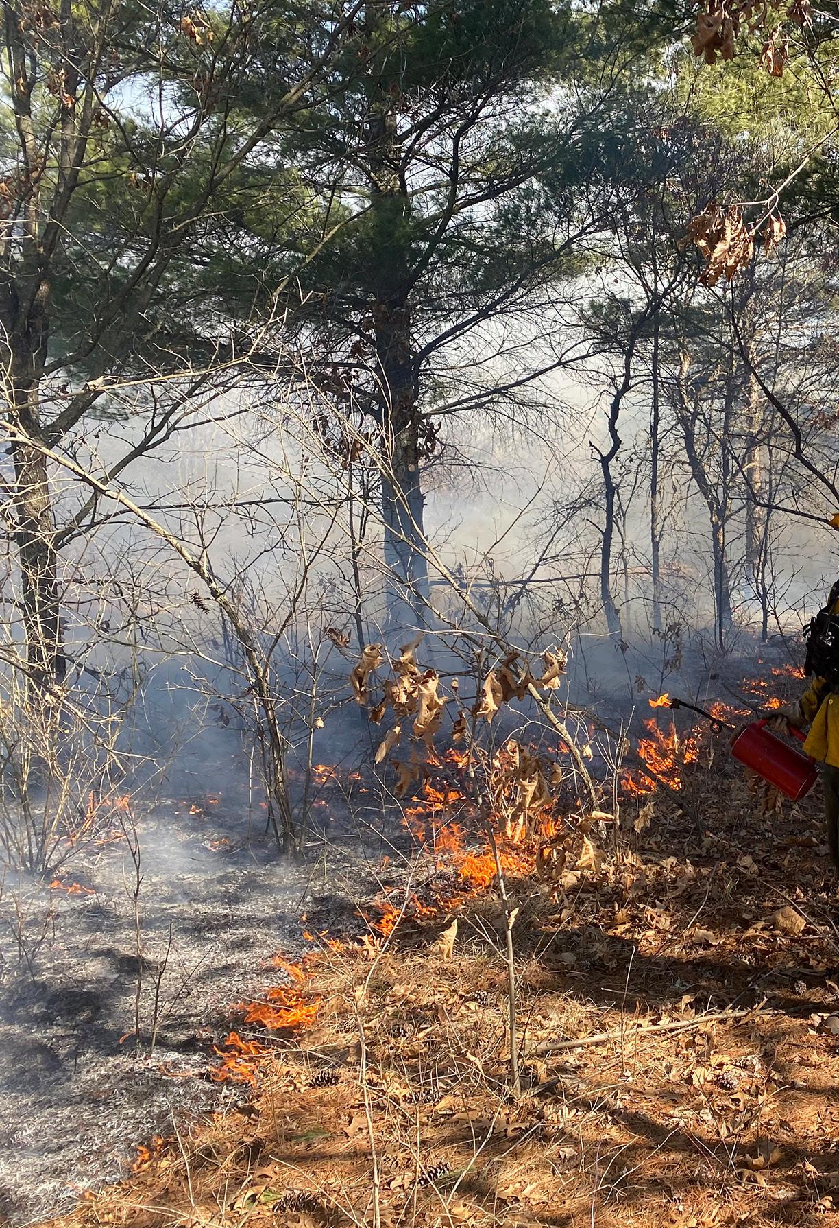


Spring is wildfire season in Wisconsin. Each year, there are an average of 1,000 wildfires in our state that burn nearly 3,000 acres. 98% of those fires are human-caused, and most can be prevented.
The No. 1 cause of wildfires in Wisconsin, especially in spring, is burning debris such as brush and leaf piles. A burning permit is required in DNR protection areas for burning in a barrel, a debris pile and grass or wooded areas as outlined by the permit, unless the ground is completely snow-covered.
Permits are free and can be obtained online at apps.dnr.wi.gov/burnpermits or by phone, 1-888-947-2876. Note that some areas of the state are not regulated by the DNR, so it’s important to check with local municipal or fire officials for any ordinances or other burning restrictions in your area.
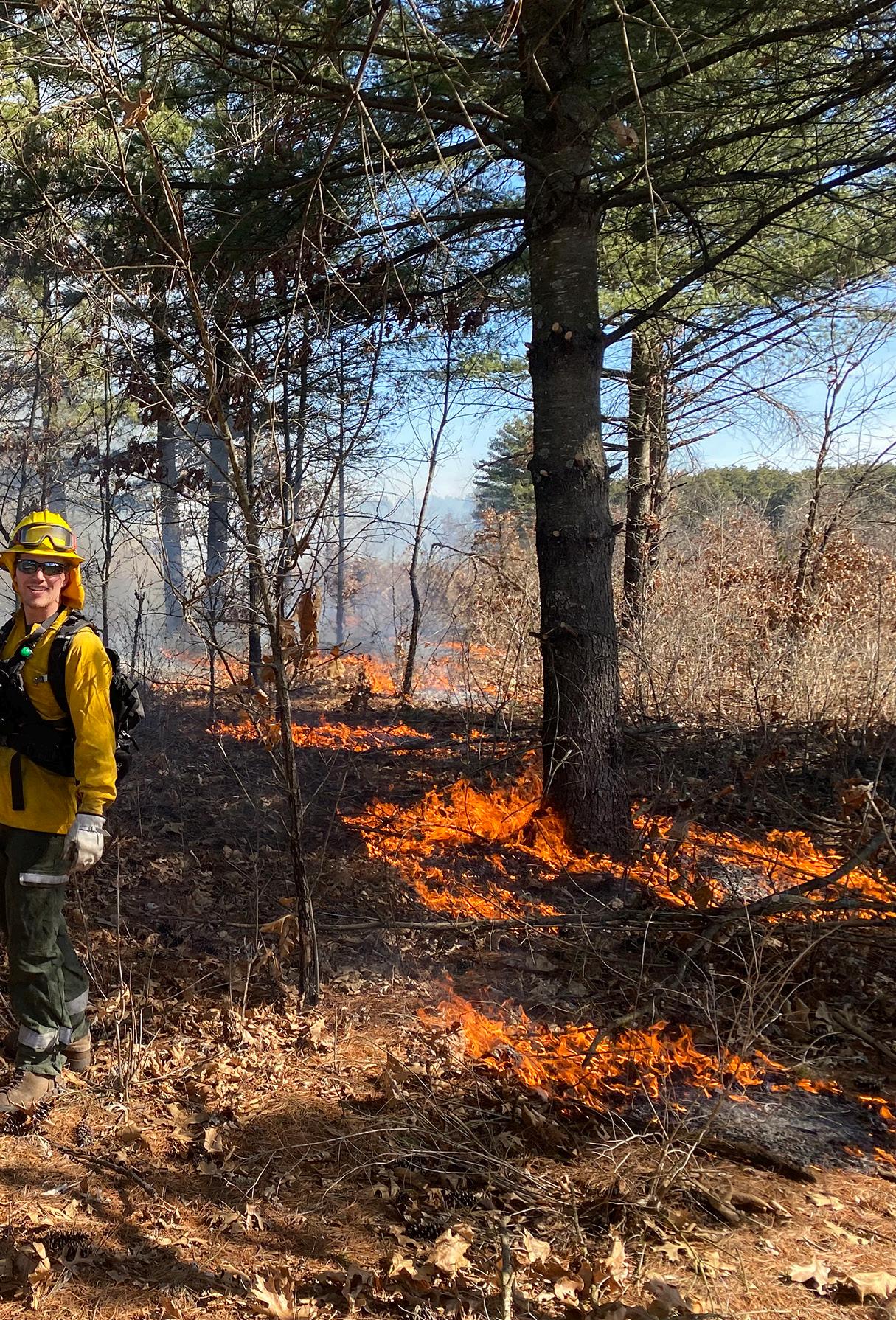
Regarding prescribed burns, if you choose to hold one of these on your property, remember these tips.
Make a plan of how you’ll light the area and hold the fire within the perimeter. Select a wind direction that will not transfer smoke to any sensitive populations.
Obtain proper burning permits from local jurisdictions and follow all the rules on the permit.
Notify your neighbors and the local fire department/dispatch to prevent false calls.
Choose the right weather. Stay away from dry, high wind days or days when the cloud cover is very low. Be sure to check the forecast as well as the fire danger levels the morning of the burn to ensure conditions are ideal.
Protect yourself. Tall leather boots and gloves, eye protection and 100% cotton or fire-resistant clothing are best.
Keep your fire in the perimeter and establish solid fire breaks around your burn area. Watch your burn at all times. Have a reliable and portable water source available and carry hand tools (rakes, shovels, etc).
Be prepared for the unexpected. Unplanned events can happen, so it’s important to think through every scenario, including an escaped fire, a communication or equipment breakdown or an injury.
Know your limits; prescribed burning can be physically demanding work. If you don’t feel comfortable conducting a burn, you can find a professional burn contractor along with plenty of other resources with help from the Wisconsin Prescribed Fire Council, prescribedfire.org.
— DNR STAFF
LEARN MORE
Scan the QR code or visit dnr.wi.gov/topic/forestfire for information on burning permits, restrictions, fire danger, protecting your property from wildfires, prescribed burns and more.

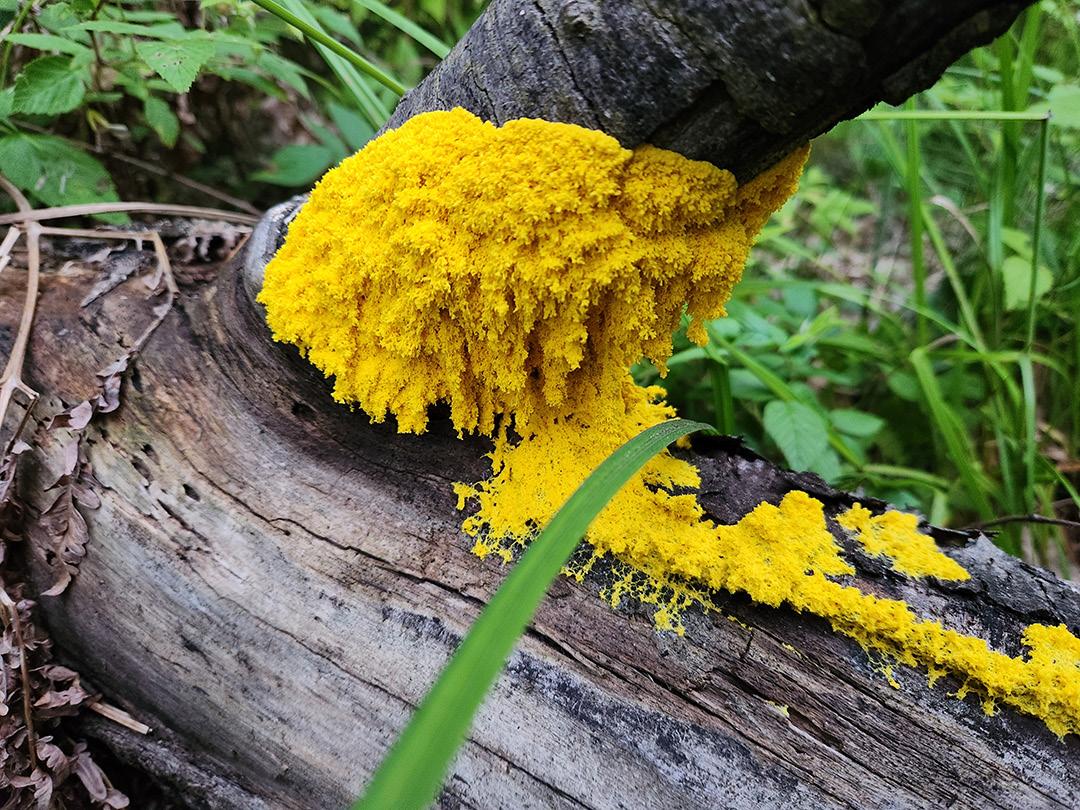
Slime molds like dog vomit can appear suddenly on decaying logs and other organic material, helping things decompose to provide nutrients for soil.
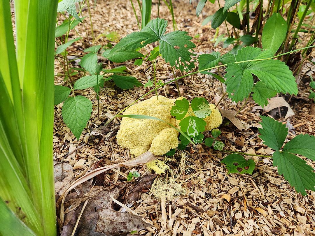
YOUSTEP OUTSIDE AFTER A WARM, WET stretch in Wisconsin and, surprise, there’s a colorful blob on your mulch or old stump. Yesterday, nothing. Today, blob.
Meet the slime mold!
Slime molds can appear overnight, creep to a new spot and then seem to vanish. It’s a sudden “now you see me, now you don’t” forest magic.
Despite the name, slime mold isn’t really mold. Once lumped in with fungi, slime mold is now classified in the Protist kingdom and described as “amoeba-like.”
This means it lacks a rigid cell wall, which helps it engulf food using a process called phagocytosis. In other words, it wraps itself around its snack and “swallows it.”
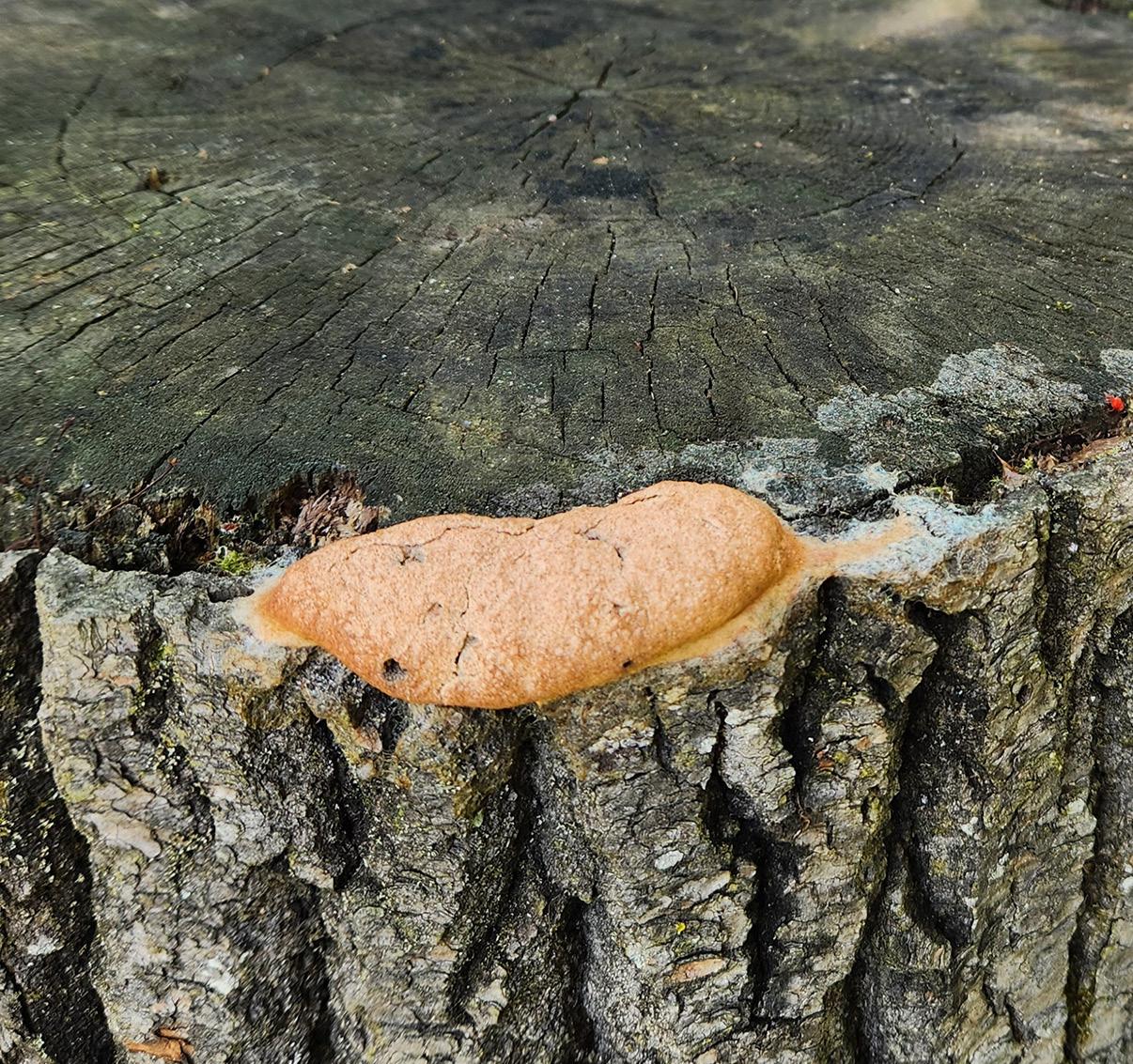
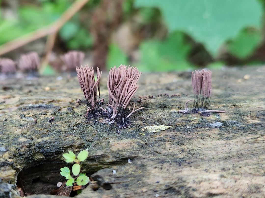
The most dramatic stage for slime mold is called the plasmodium, the feeding and moving stage. It builds an interconnected network of tubes that look like veins, allowing it to stream around and pulse itself towards food.
And it really does move, up to an inch per hour. No brain, no eyes, yet slime molds can “remember” where they’ve been and make problem-solving choices as they search for decaying matter.
So, what’s it eating? Mostly bacteria found in and on wood, though some also feed on tiny organisms like fungi and yeast.
Slime molds are basically a small cleanup crew for the forest floor, aiding in the decay of organic matter to recycle it back into the food web.
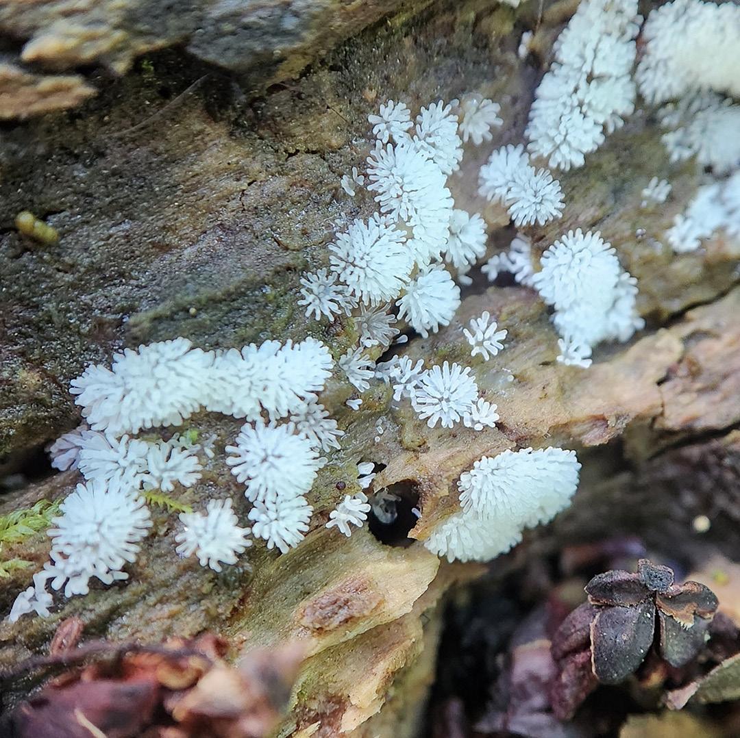
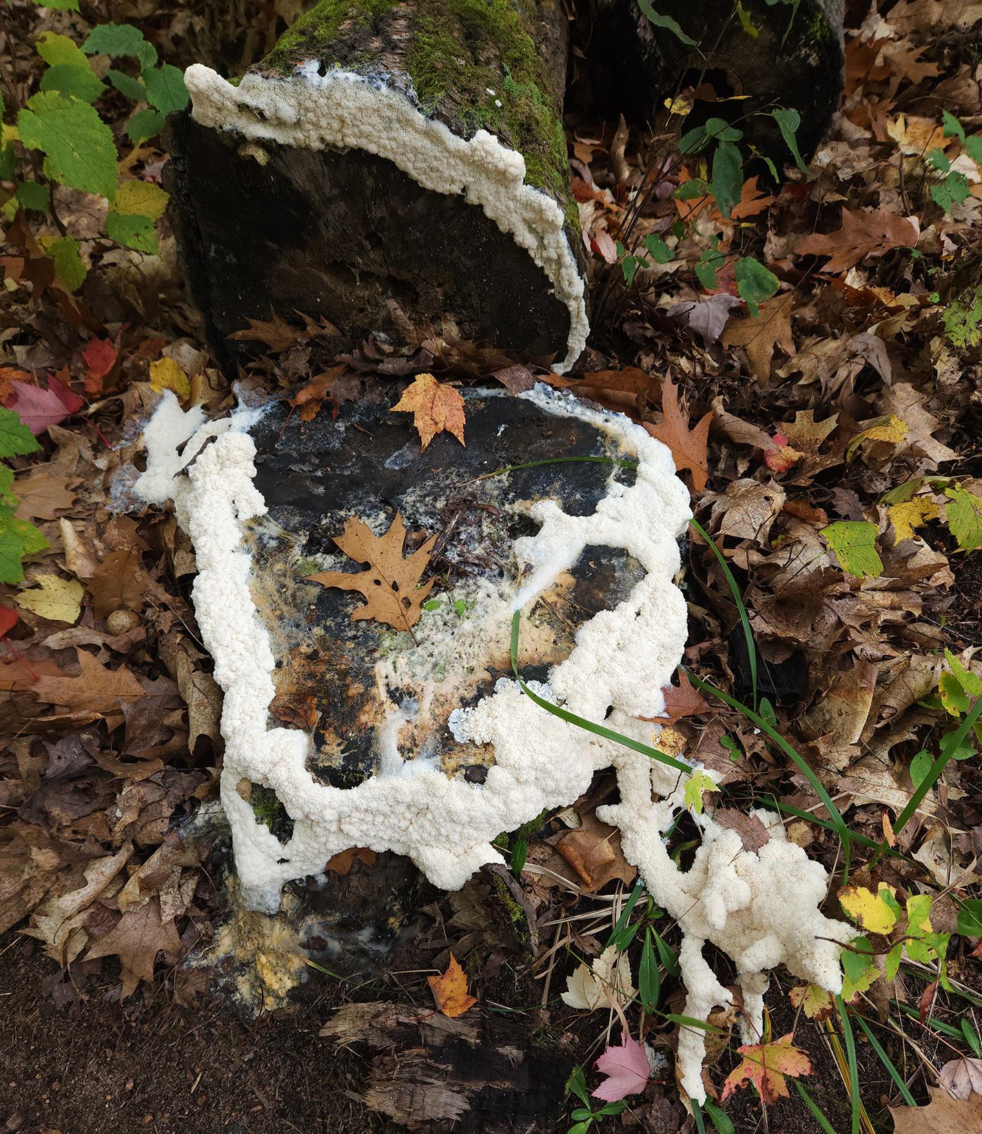
In Wisconsin, slime molds are often spotted in late spring and summer on decaying logs, stumps, dead leaves and other organic litter, generally in shady areas. They come in different shapes, sizes and colors, so you might not realize you’re looking at one.
An unforgettable slime mold in Wisconsin is known as “dog vomit” (Fuligo septica). The name describes its appearance: bright yellow and resembling scrambled eggs. This slime mold can sometimes even be found in areas of full sun after growing in the dark of night.
The sudden appearance of any slime mold may be alarming. But they’re here to help, decomposing organic material into nutrients for soil.
If you don’t want it around, you can rake, scrape or shovel it away. If left alone, it will often dry out and vanish on its own in a day or two.
Next time Wisconsin gets warm, rainy weather, try a little “slime safari.” Inspect mulch, stumps and damp logs for slime mold.
If you find a blob today, come back tomorrow to see how it progresses. You might catch it mid-adventure, quietly recycling a dead stump, one pulsating move at a time.
Jada Thur is a communications specialist in the DNR’s Office of Communications. Linda Williams, a DNR plant pest and disease specialist for the DNR’s Forest Health Team, contributed to this story.

‘SliME
INTER IS COMING TO AN END in Wisconsin and slime molds are back — creeping, oozing and doing their weird little thing.
This fun project, a mash-up of several recipe sources, lets you make your own edible treat inspired by dog vomit slime mold. It’s quick, easy and perfectly safe to eat.
If you’re someone who likes to play with your food, you can do that here. Stretch it, squish it and, when you’re feeling ready to brave the slime mold, take a bite!
y 1 cup mini marshmallows
y 2 tablespoons cooking oil
y 2 tablespoons powdered sugar
y 2 tablespoons cornstarch
y Yellow food coloring (optional, about 4-5 drops)
INSTRUCTIONS
1. Place marshmallows and oil in a microwave-safe bowl.
2. Microwave in short bursts. Start by cooking on high for 10 seconds, stir, then repeat in 10-second intervals until the marshmallows are fully melted and smooth (it will be very sticky). The marshmallows will form a stretchy, gooey base, while the oil helps prevent sticking to the bowl and keeps the slime flexible.
3. Color it (optional). Stir in 4-5 drops of yellow food coloring until evenly mixed.
4. Make your “anti-sticky” powder. On a plate, mix powdered sugar and cornstarch together. It will absorb stickiness, making the slime easier to handle.
5. Pour the melted marshmallow mixture onto the plate. Use a spoon at first, then your hands once it cools. Knead it into the powder mixture until it’s smooth, stretchy and not sticky.
Pro tip: You might not need all the powder, or you might need a little more. If your marshmallow mixture is still sticky, add more powdered sugar and cornstarch a little at a time until you get the desired consistency. Now it’s play time! You can stretch it, blob it and let it “creep” across the plate like a real slime mold. Or eat it right up — just like slime molds gobble up their own food along the way!
Jada
Thur is a communications specialist in the DNR’s Office of Communications.


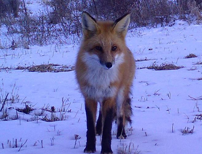
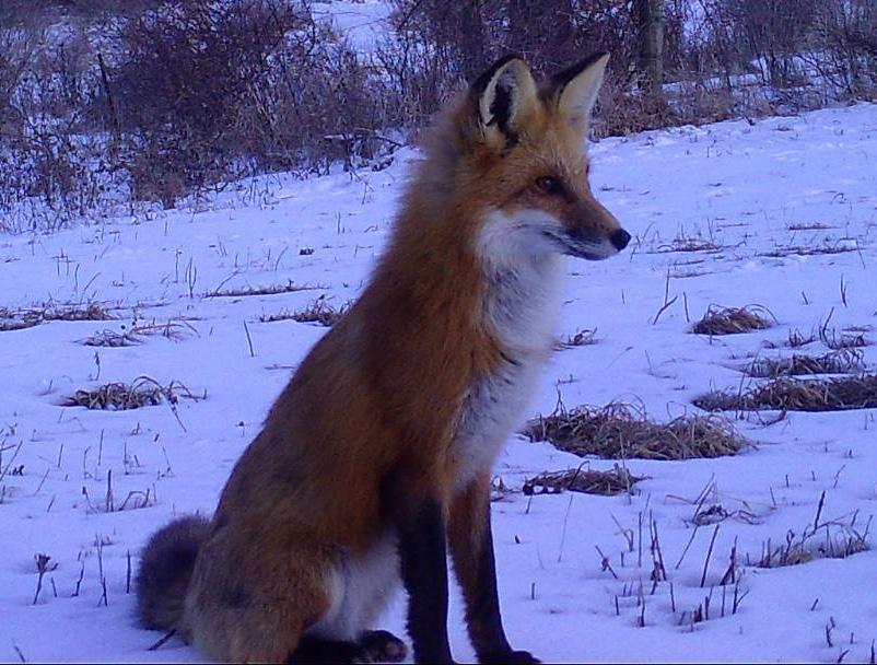
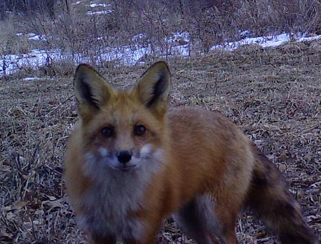
Reader Yvette Stilen let us know she’s a big fox fan when sending in her fox caption idea. “We love seeing foxes! My dad has had a few litters over the years at the end of his driveway located in Bruce. They are so cute and fun to watch! We also have a few that live near the dog park that we like to watch located in New London.”
“Oh, hey, you, this is my good side. Just checking to make sure you got that!”
Here are a few of the best reader replies for last issue’s CAPTION THIS fox photos.
A couple of young readers got in touch with caption ideas for the series of fox photos. First, Addy, age 12, from Arena.
1. “What is this?”
2. “Waiting for you to leave.”
3. “You’re still here?”
And 13-year-old Rebecca from Osceola wrote us a nice letter to send in her captions, along with some kind words about the magazine. “Thank you for the amazing articles and the pages of exciting
“Wow! I did have a great coat last winter!” — W.L. Hammann, Cameron
“I can’t go anywhere without the paparazzi following me around.”
— Jane Redenius, Janesville
“Oh, where, oh, where have the rabbits all gone? Oh, where, oh, where can they be?”
— Daryl Krug, Fond du Lac
“I hope I get my picture in the DNR magazine. I’m pretty foxy looking.”
— Paul Kieler, Dickeyville
“I’m handsome and sly. I’ll pose for your camera … so long as a mouse isn’t nearby.”
— Jake Carr, West Allis
“Veni, vidi, vici.”
— Jim Paprocki, Green Bay
“I came. I saw. I conquered. Eventually.” — Barbara Gauger
These three fox photos remind me of a dog training session, with three commands.
1. “Stay! Who’s a good fox?”
2. “Sit! You’re such a good fox.”
3. “Come! And what a good listener!”
— Harry Green, Nekoosa
“I’m ready to eat. What’s for supper?”
— K. Wasson, Arkdale
information. … I don’t really like to read, but I LOVE to read these! My favorite articles are about the animals and how they need help, how to help them and what you guys (DNR) are doing to help them.”
1. “Wait, hold up, was that there before? Well, no, I don’t think so. Or maybe, ah!”
2. “No, Linda, I just don’t see how this could work.”
3. “Are you still here? Get off my lawn!”
1. “Yes, I heard the dinner bell. I’m coming!”
2. “Look at me, what a good boy I am, waiting so patiently.”
3. “Never mind, I’ll come get it myself!”
— Mary and Mike Smaglick, Pewaukee
“See no evil. Hear no evil. Oops! Busted!” (P.S.: Really enjoy your magazine and the wide variety and informational articles. Longtime subscriber, first time commenting.) — Phil Mersberger, Sheboygan
“Strike a pose. Vogue, vogue, vogue.“
— Ann S., Hales Corners
“You’re wasting your time; my vixen is camera-shy during this month.”
— Jerry Davis, Barneveld
“Is this my sly side?”
— Jim Wilson, Beloit
“My cousin said there’s a cute fox contest.”
— Amy A. Healey Evanston, Illinois
“I’m ready for my closeup.”
— Craig Berkoben
“Smile, I’m on ‘Candid Camera’!”
— Doug Hartman, Green Bay
“Hello, gorgeous!”
— Karen Derdzinski, Elm Grove

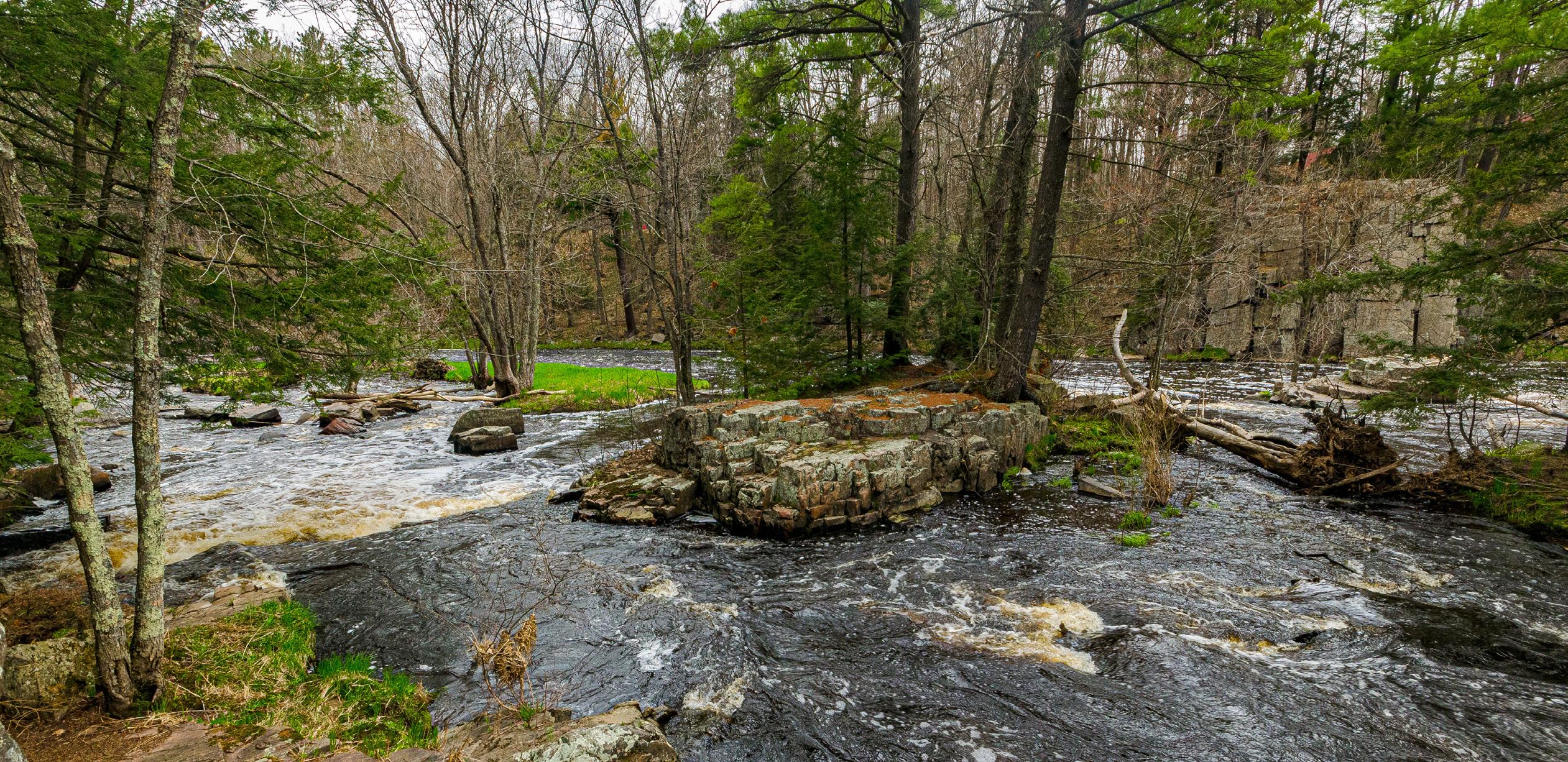
RECOGNIZED AS A STATE NATURAL AREA
for more than 50 years, the Dells of the Eau Claire River protects a particularly scenic portion of the river where geologic processes have resulted in an unusual tilting of bedrock. This picturesque area in Marathon County includes a narrow, rocky gorge and waterfalls that can be especially pretty in spring when snowmelt sends the river cascading through this stretch.
Here, the water flows over outcrops of Precambrianage rhyolite schist, a very hard volcanic rock formed through metamorphosis and later tilted to a nearvertical position, allowing the rock to split readily along its cleavage planes.
Later, powerful glacial meltwaters bulldozed through the area, creating the gorge and leaving behind a series of potholes formed by the grinding action of swirling sand and gravel. This is an excellent area to observe fracture-controlled stream flow and the development of multiple stream terraces.
A northern mesic forest of hemlock, sugar maple, yellow birch and mountain maple lines the rocky gorge, along with abundant patches of Canada yew and a rich spring flora. There also are large white pine and red oak.
South of the river is a narrow ridge dominated by hemlock that survived the state’s cutover era, with some trees up to 250 years old. Older trees of other species like white pine and red oak are present, and forested seeps — shaded groundwater areas formed by active springs — line both sides of the ridge.
This beautiful location, found within Dells of the Eau Claire River County Park, is owned by Marathon County, one of 60-plus partners who own state natural areas. It was designated a state natural area in 1973.
Driving directions: From the intersection of Highway 52 and County Y in Hogarty, go west on Highway 52 about 1.5 miles, then south on County Y just under 2 miles to a parking area south of the Eau Claire River and west of the road. Hiking trails lead through the natural area.