
weiw020762gmail.com www.linkedin.com/in/wei-wang-a0131a228 +44 07422517171 / +86 13396450479
25/06/2003
London / Shanghai
I am an Urban Design graduate from University College London with a keen interest in how cities can promote community well-being, creativity and inclusive living. With a background in urban planning and design, my work focuses on transforming urban spatial structures into unique environments that focus on human, emotional and cultural creativity.
During my studies, I have led various design projects, from large-scale master plans to local public spaces, and often served as the main concept developer. My recent project focuses on how to create more pleasant and emotionally connected urban spaces under the demand for sustainable urban development.
I have gained practical experience through internships in urban planning and landscape design, during which I have been involved in spatial strategy, visual representation and coordination of multiple thinking strategies. I am proficient in design and analysis tools such as Rhino, AutoCAD, QGIS and Adobe Suite.
I firmly believe that thoughtful, collaborative design can connect people and space - and I have been committed to shaping the future of cities with more meaning, creativity and spiritual wellbeing.
2024-2025 MSc Urban Design and City Planning, University College London
- Focus on masterplanning, place making, urban design academic research, and spatial plan.
- Developed strong teamwork and leadership skills.
- Organised a community exhibition as part of public engagement practice.
2021-2024 BSc Urban Planning, Design and Management, University College London - 2:1
- Key modules: Urban Design, Economics of Cities and Their Regions, Spatial Analysis, Management for Built Environment, Urban and Environmental Politics, Transport Policy and Planning, Planning and Property Law, Real Estate Development.
- Developed design proficiency through planning tasks and studio-based design projects.
- Led group projects as main concept designer
- Achieved 2:1 degree in Bachelor.
- Participated in UCL BSP Society workshops and events
June- Sep 2023 Town Planner Assistant Intern, Yantai Blue Sky Investment Development Co.Ltd, China
- Contributed to town/community planning proposals, masterplanning.
- Focused on spatial design and project reporting.
- Assisted in meetings and coordination with clients.
June-Sep 2022 Landscape Designer Intern, PALM Design, Hangzhou, China
- Supported public space and landscape design.
- Created client visuals and presentation materials.
- Participated in client discussions.
- RTPI Student Member: Participated in academic events and workshops related to urban planning.
- UCL Live Club, 2023-2024: Events & Design Coordinator: Organised student-led events and managed design tasks such as posters, branding, and visuals.
Architecture
- Sketchup
- Rhino
- 3D
- AutoCAD
- QGIS
Graphics
- Photoshop - Illustrator
- Indesign
Others
- Adobe Premiere Pro
- MS Office
Statement of Authorship
Chinese (Native) English
The design concepts, spatial strategies, drawings, and visual content throughout this portfolio are my own work unless otherwise stated. A small number of visuals were rendered by a groupmate based on my design direction and conceptual framework.
1

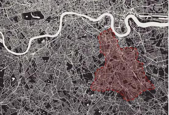
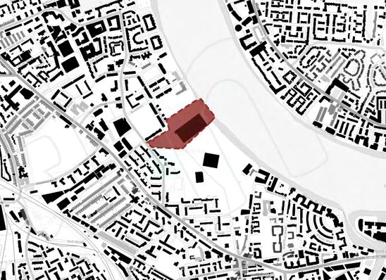
Urban Design Proposal for Billingsgate Fish Market & South Poplar
2
Urban Design code creative and characterized development of west silvertown
4
Public Square Design: Redesign of sloane square
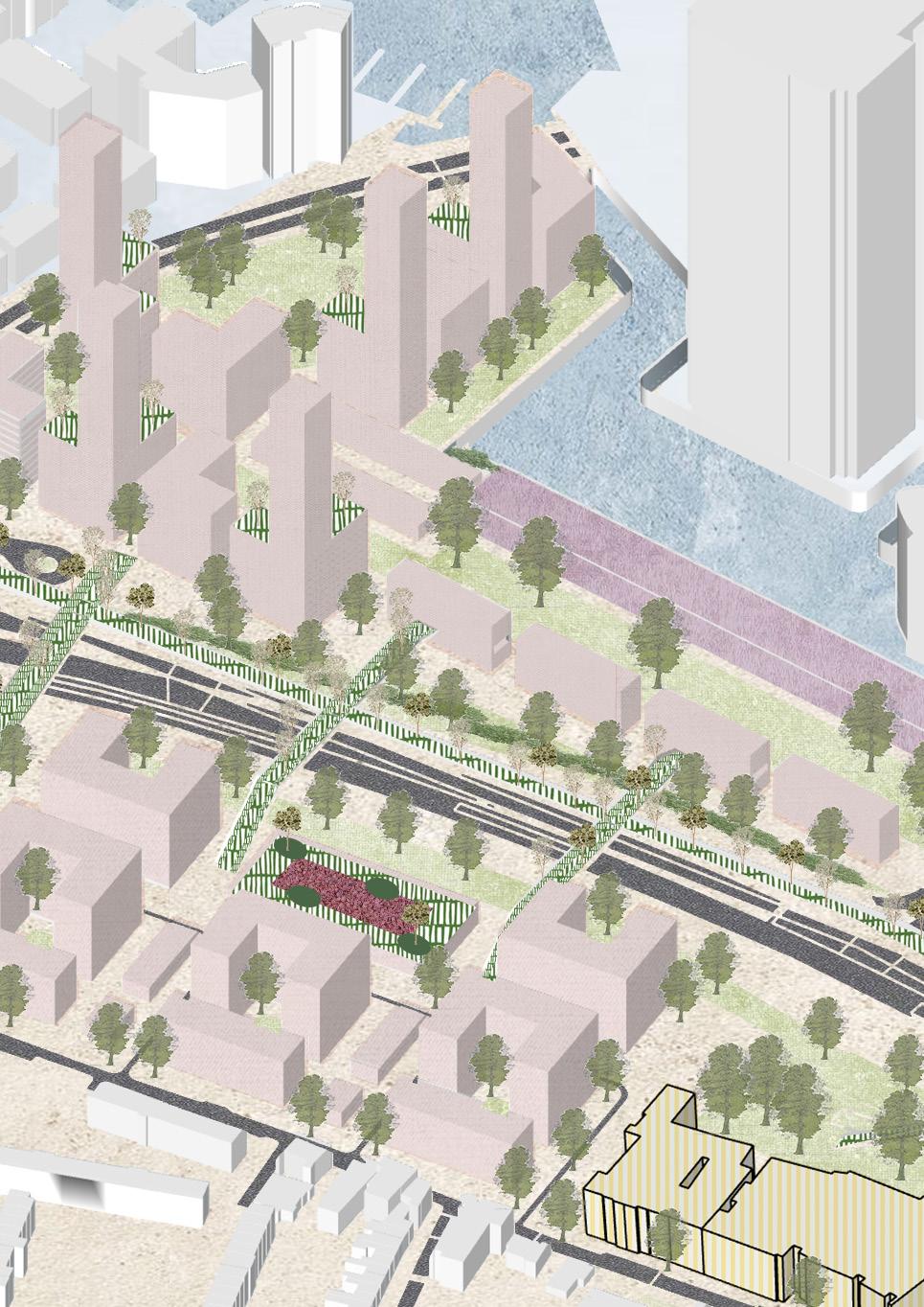
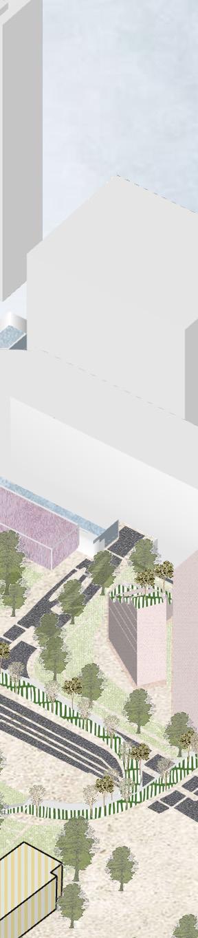
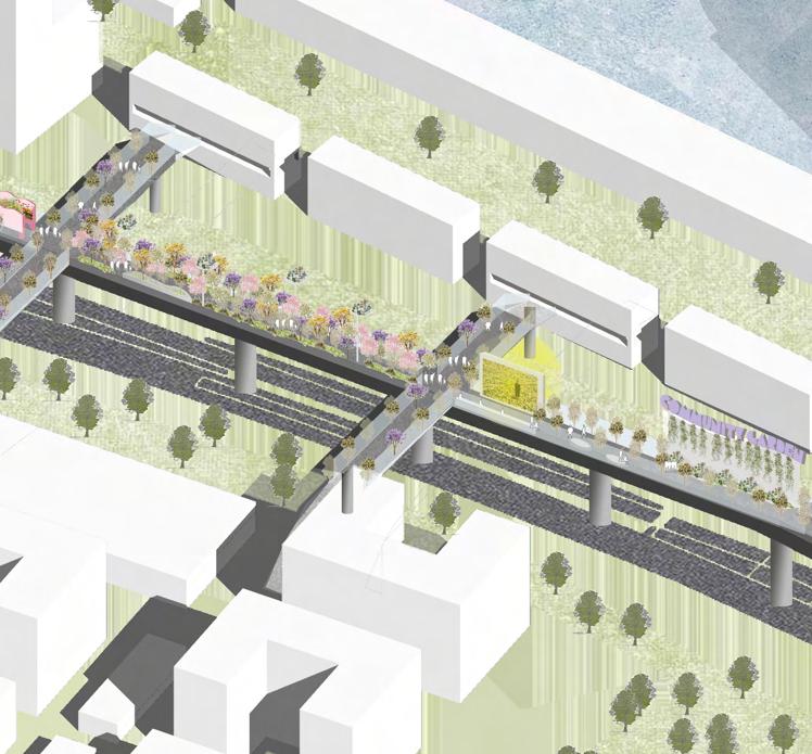
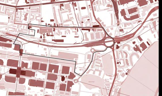
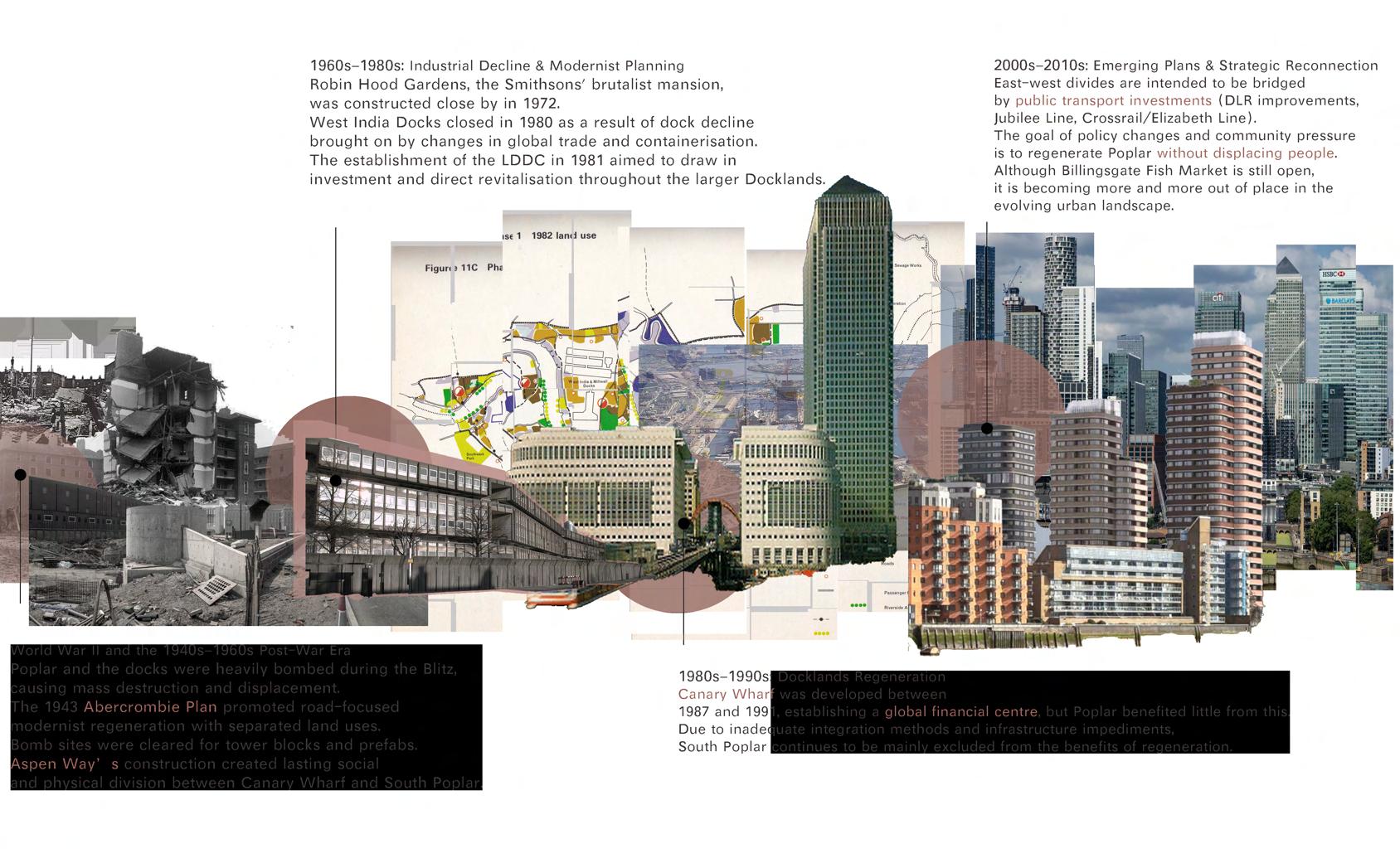
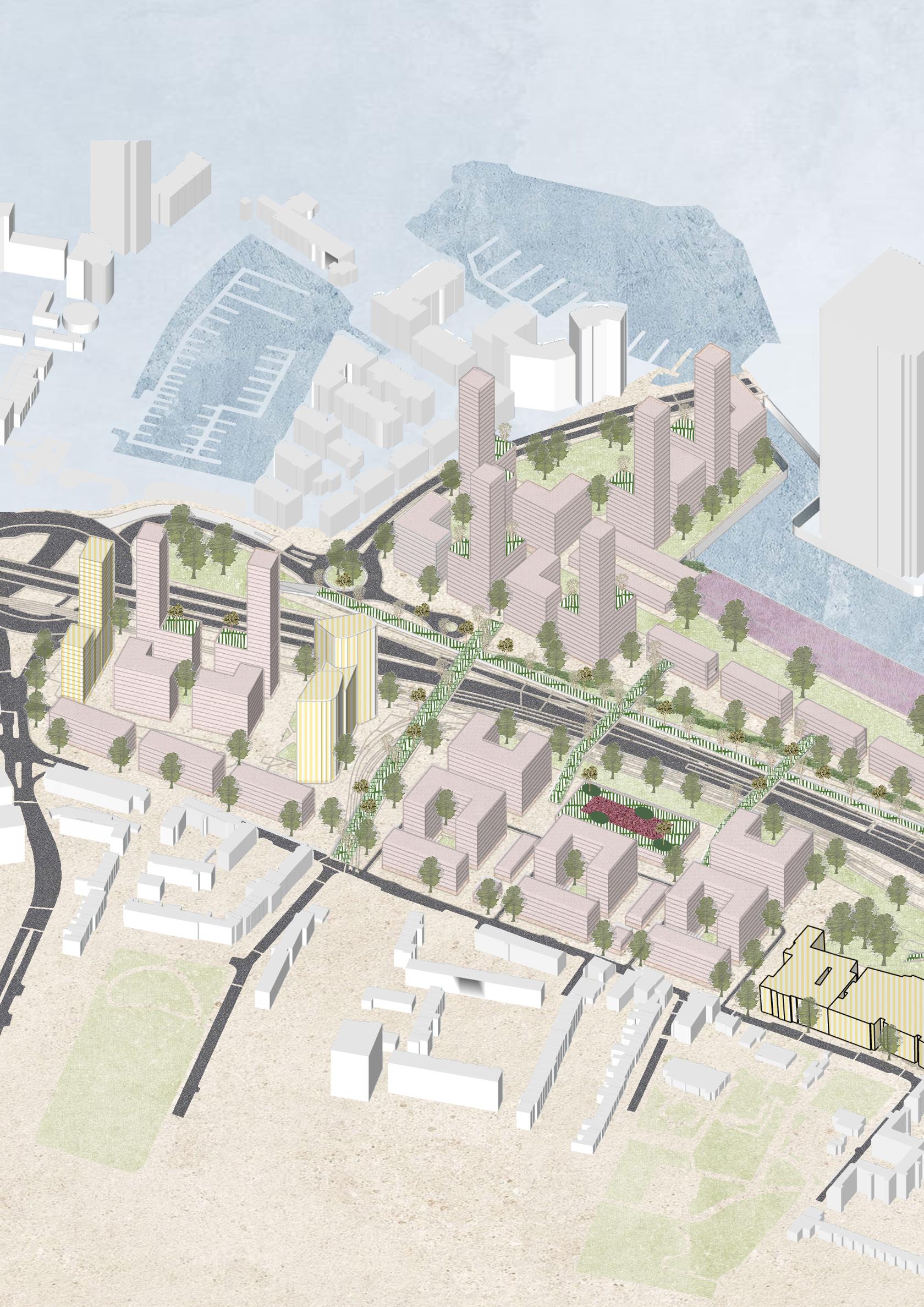
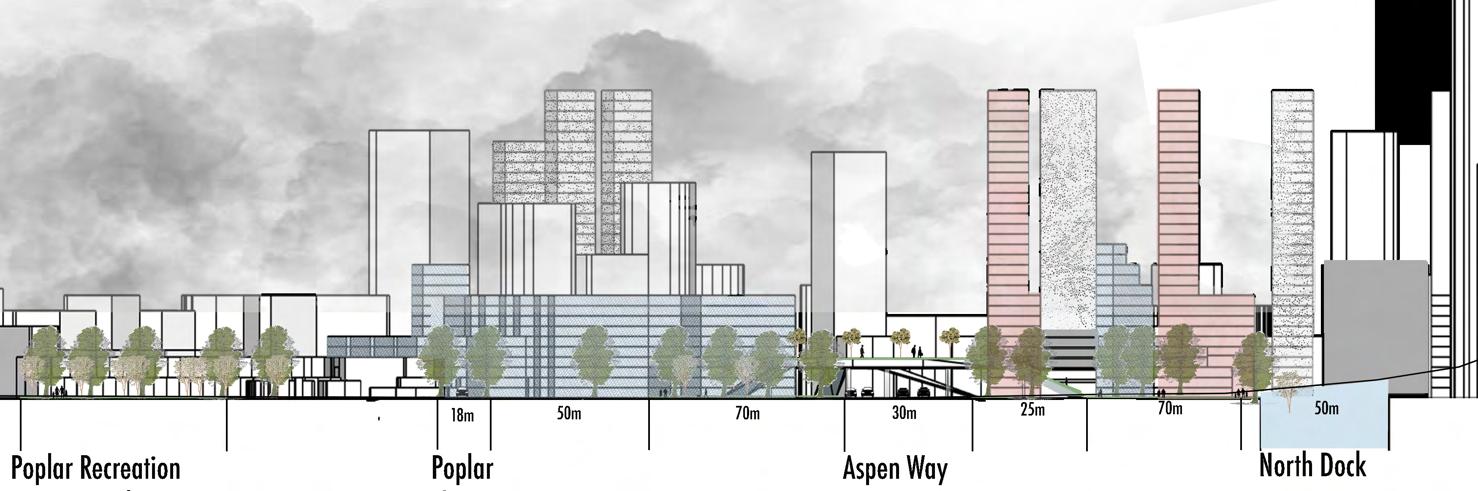
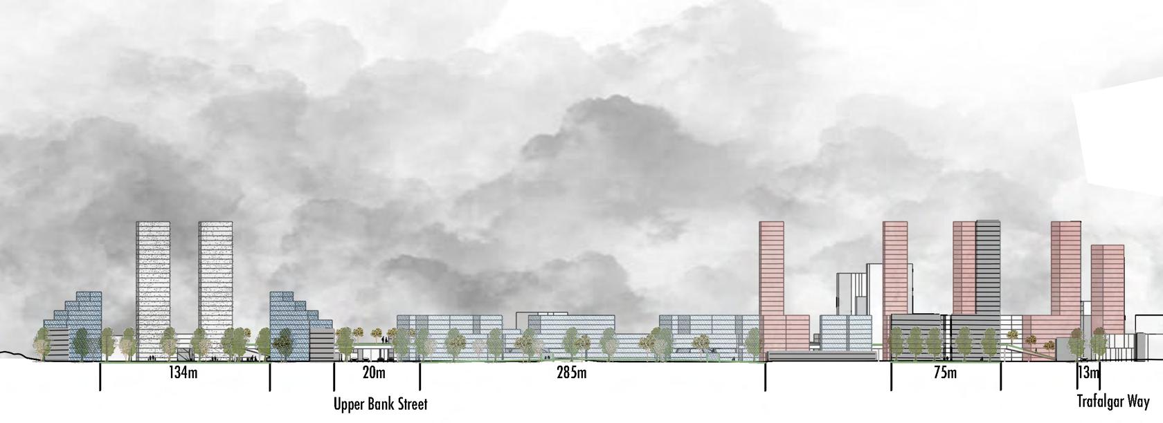
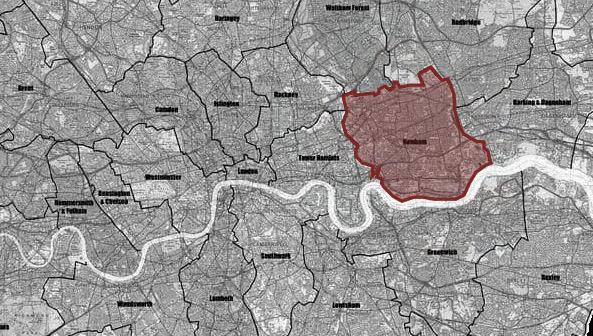
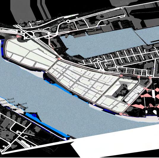
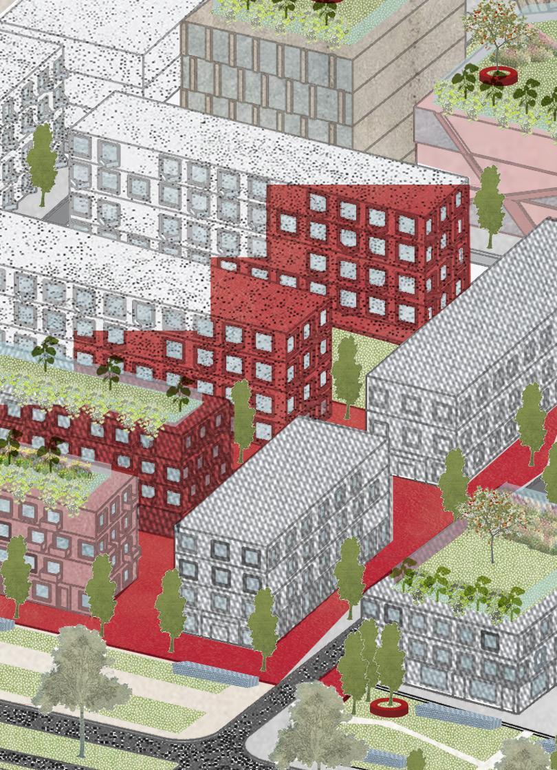
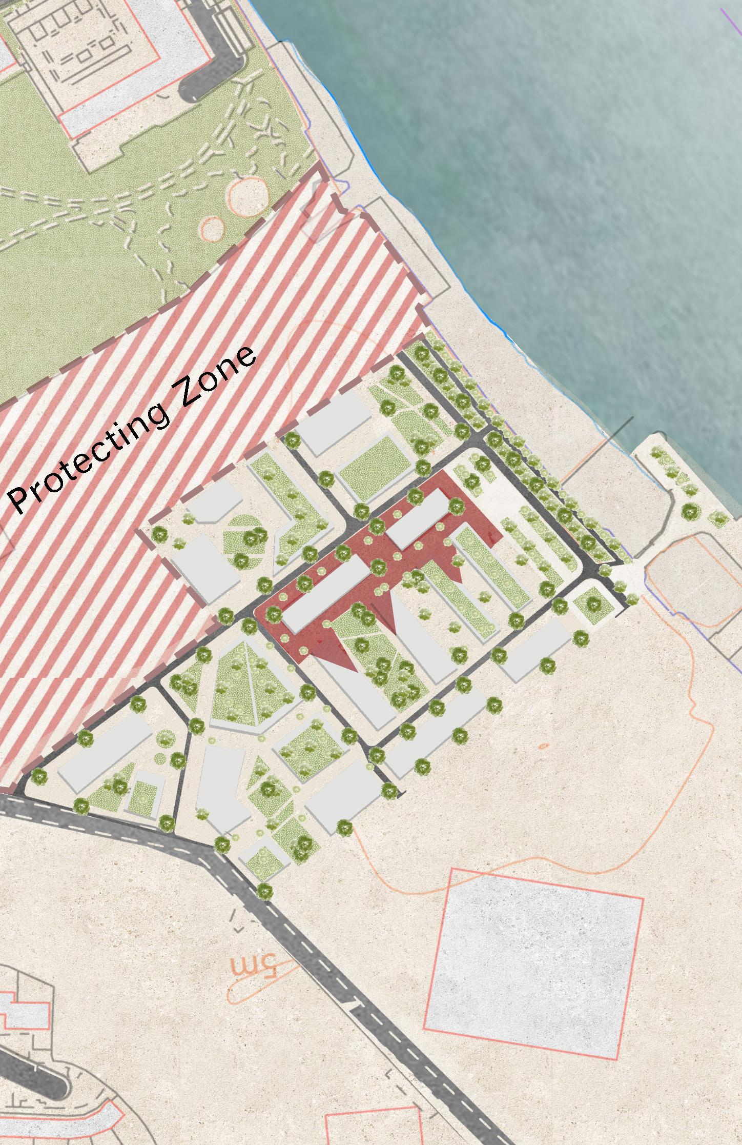
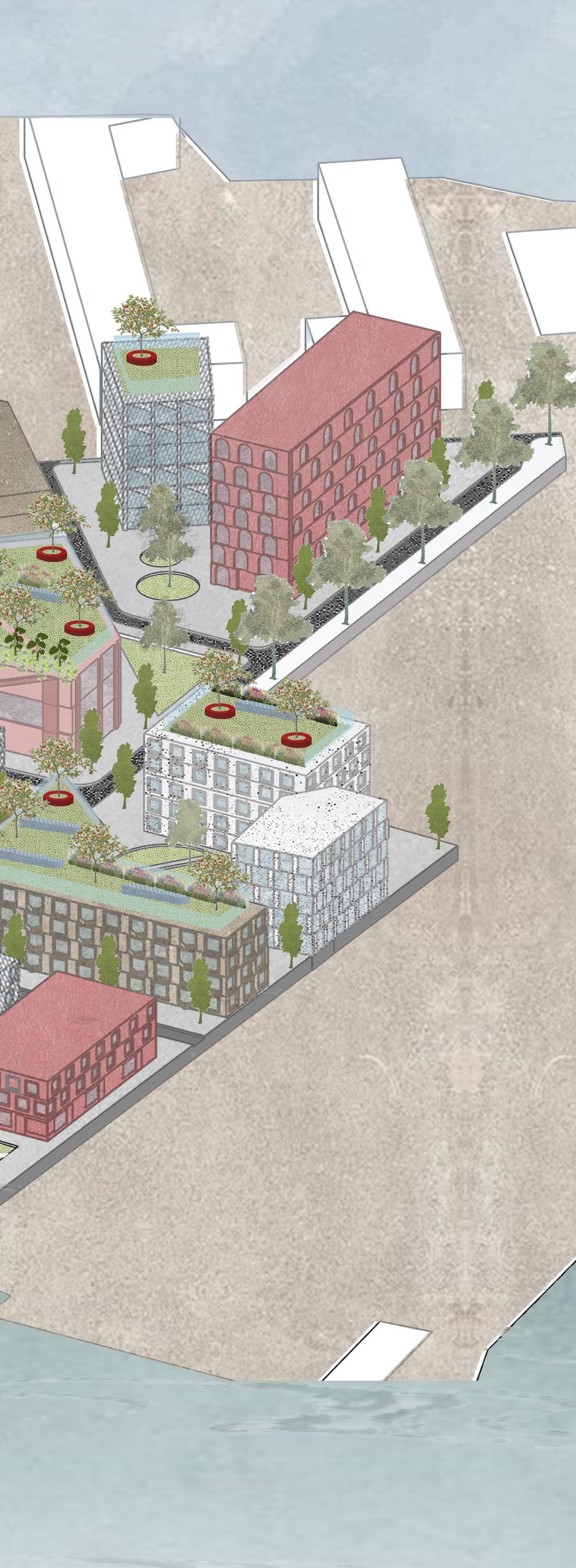
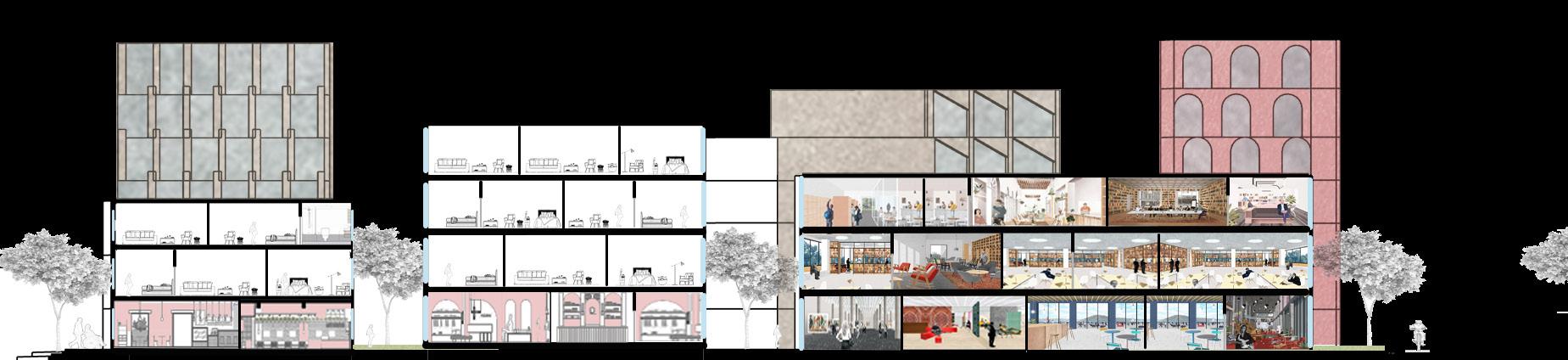
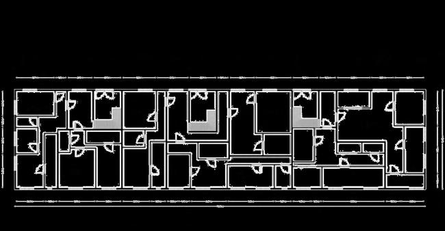
The Billingsgate & South Poplar concept, which is situated on the border between Poplar and Canary Wharf, turns a disjointed industrial landscape into a resilient, people-centered neighbourhood. By incorporating natural corridors, a dynamic cultural bridge, and a variety of housing types, the concept reimagines high-density living through sustainable urban solutions. The design promotes a healthier, more connected lifestyle by striking a balance between ecological networks and inclusive public areas, guaranteeing that social wellbeing and environmental performance are integrated at every scale.
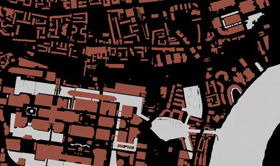
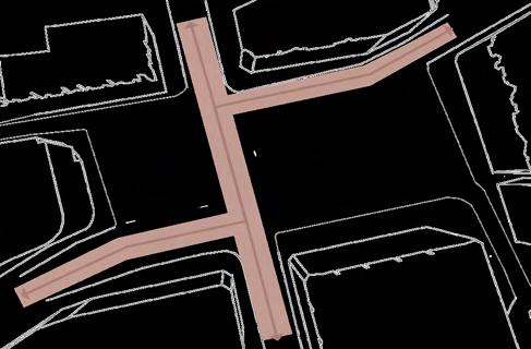
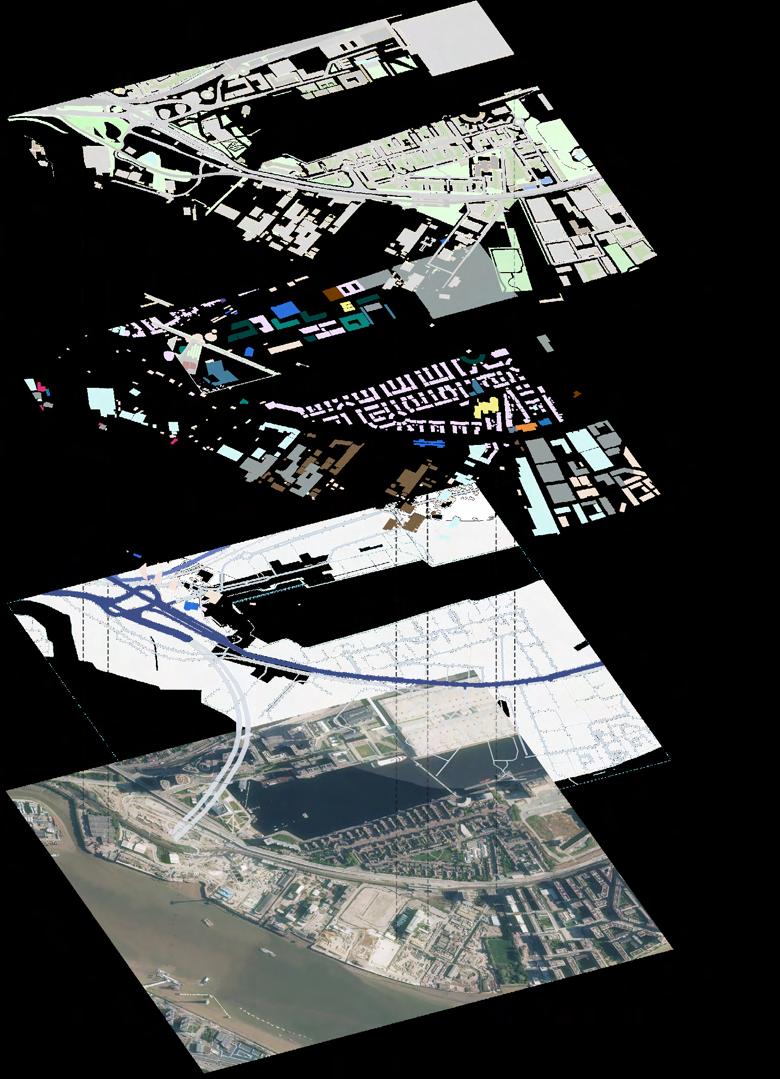
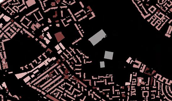
The figure-ground study depicts a disjointed architectural environment where big industrial blocks predominate and there are significant spaces between them. The site's limited spatial definition and poor walkability are caused by the absence of human-scale urban grain.
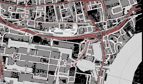

Movement is severely hampered by major road infrastructure, such as Aspen Way and the DLR tracks. The lack of consistent and limited pedestrian access further exacerbates the gap between Canary Wharf, Poplar, and the shoreline.

Large commercial and transportation zones are located south of Aspen Way, indicating a fragmented land use pattern on the property. While the southern portion lacks functional diversity and neighbourhood cohesion, the northern edge is dotted with residential, educational, and retail uses.
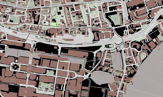


Green space is sporadic and dispersed. The area's environmental performance and public amenity value are limited by the lack of cohesive green infrastructure, despite the presence of pockets of greenery surrounding Poplar and to the north of the site.

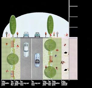
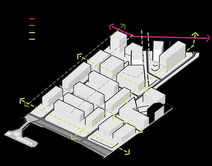
Pedestrian and Visual Connectivity
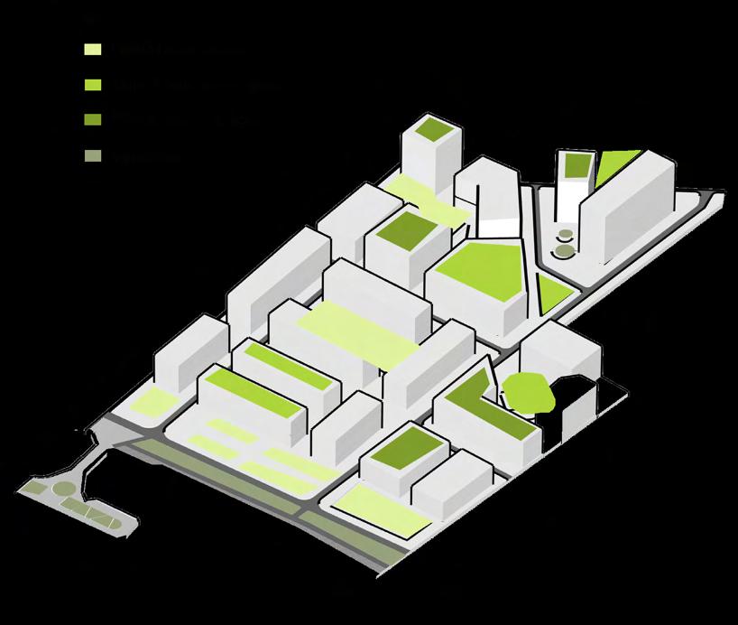
Integrated Green Infrastructure
Primary and Secondary Circulation Routes
Urban Block and Street Layout Typology
Height Gradient and Visual Hierarchy
Building Typologies
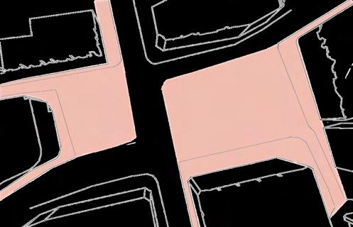
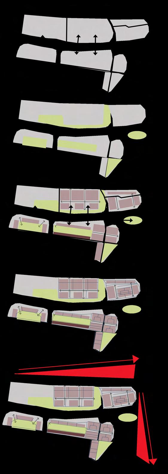
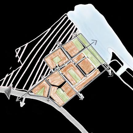
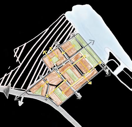
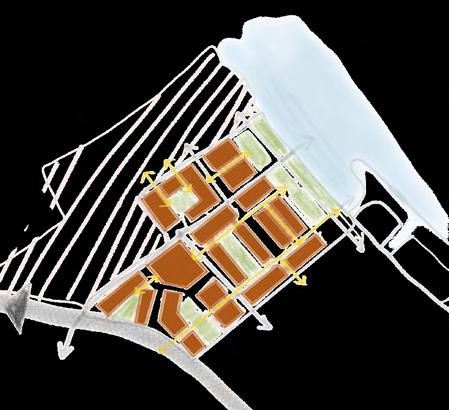
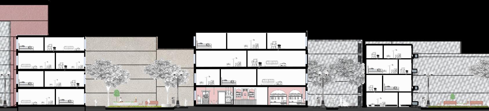
Five fundamental spatial concepts form the masterplan. Strong connections and easy navigation throughout the site are ensured by pedestrian and visual connectedness. Green infrastructure that is integrated has both ecological and social advantages.
Primary and secondary circulation that is unobstructed A readable street hierarchy is defined by routes. A logical yet diverse spatial organisation is produced by the Urban Block and Street Layout Typology. Lastly, height gradient and visual hierarchy improve massing and establish clear focus points.
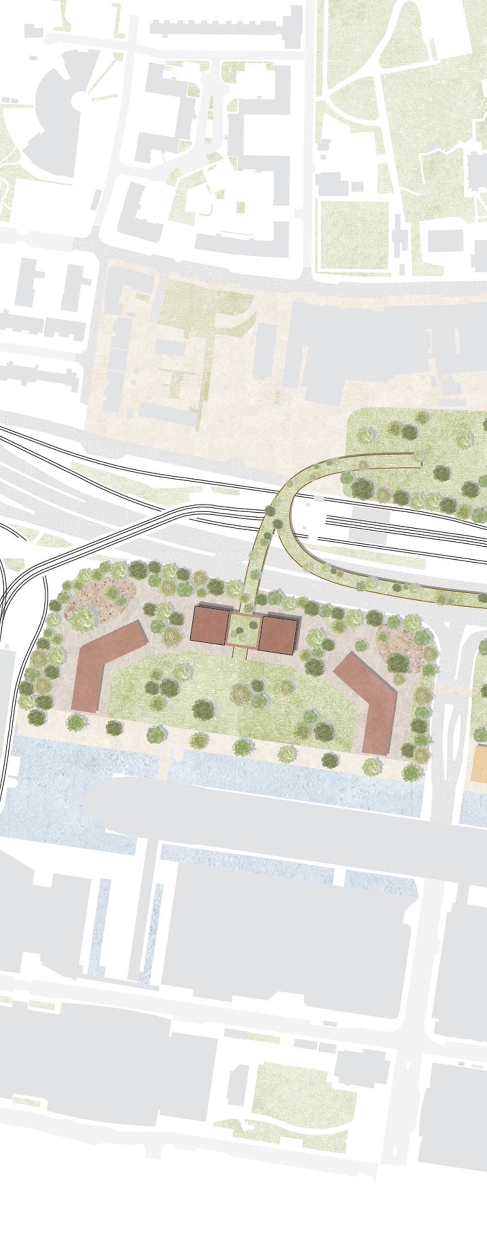


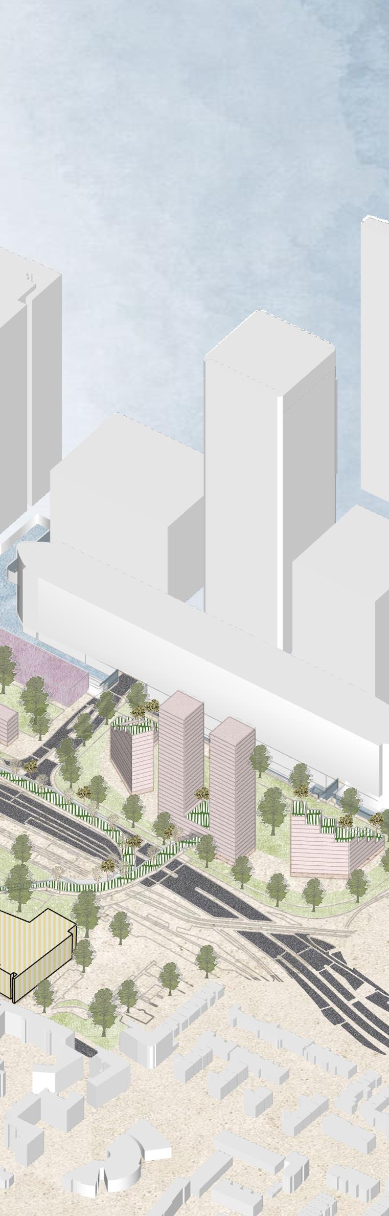

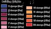
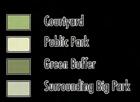


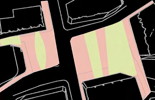
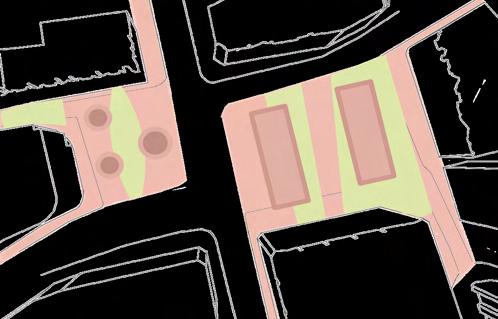
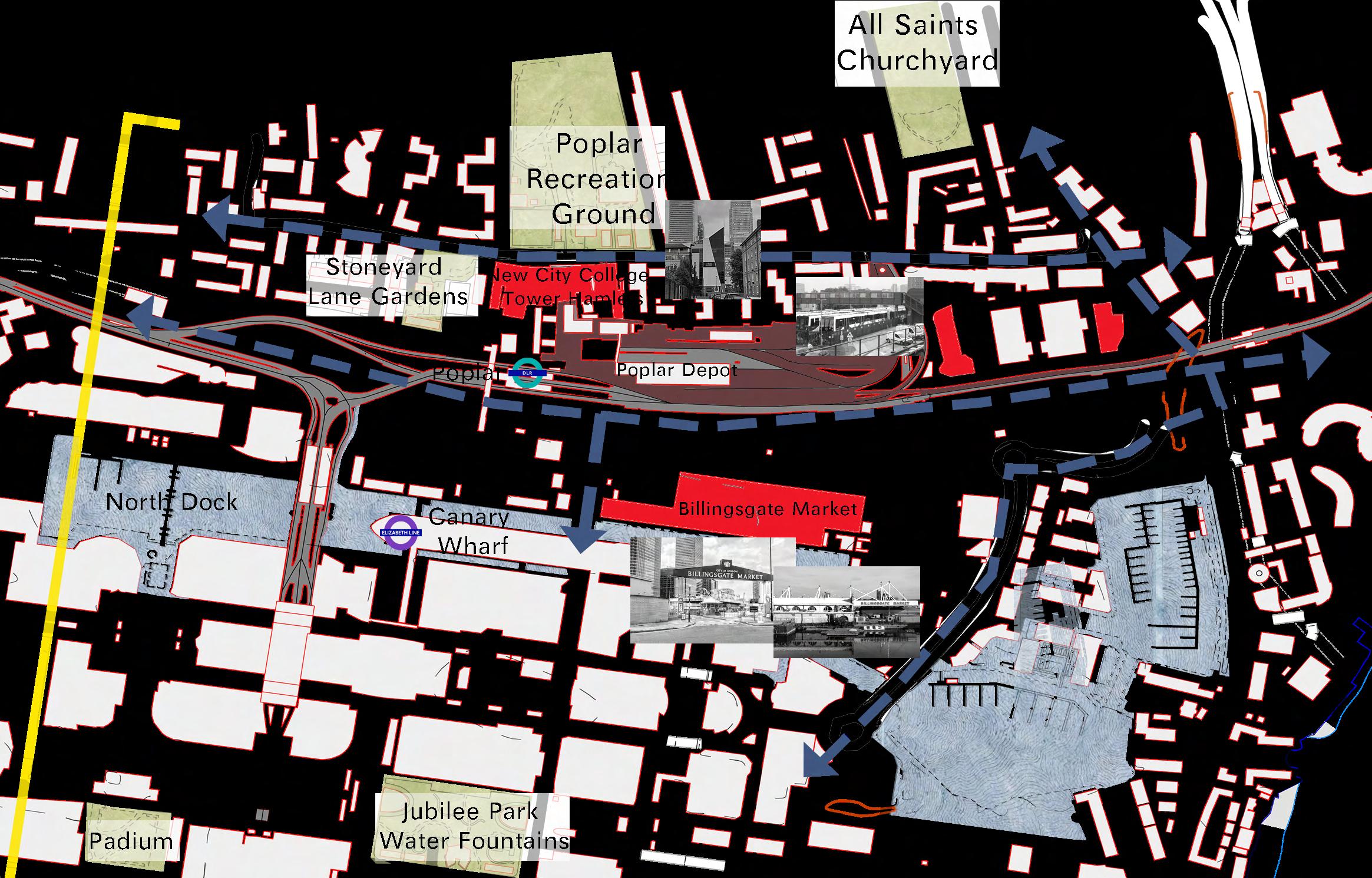
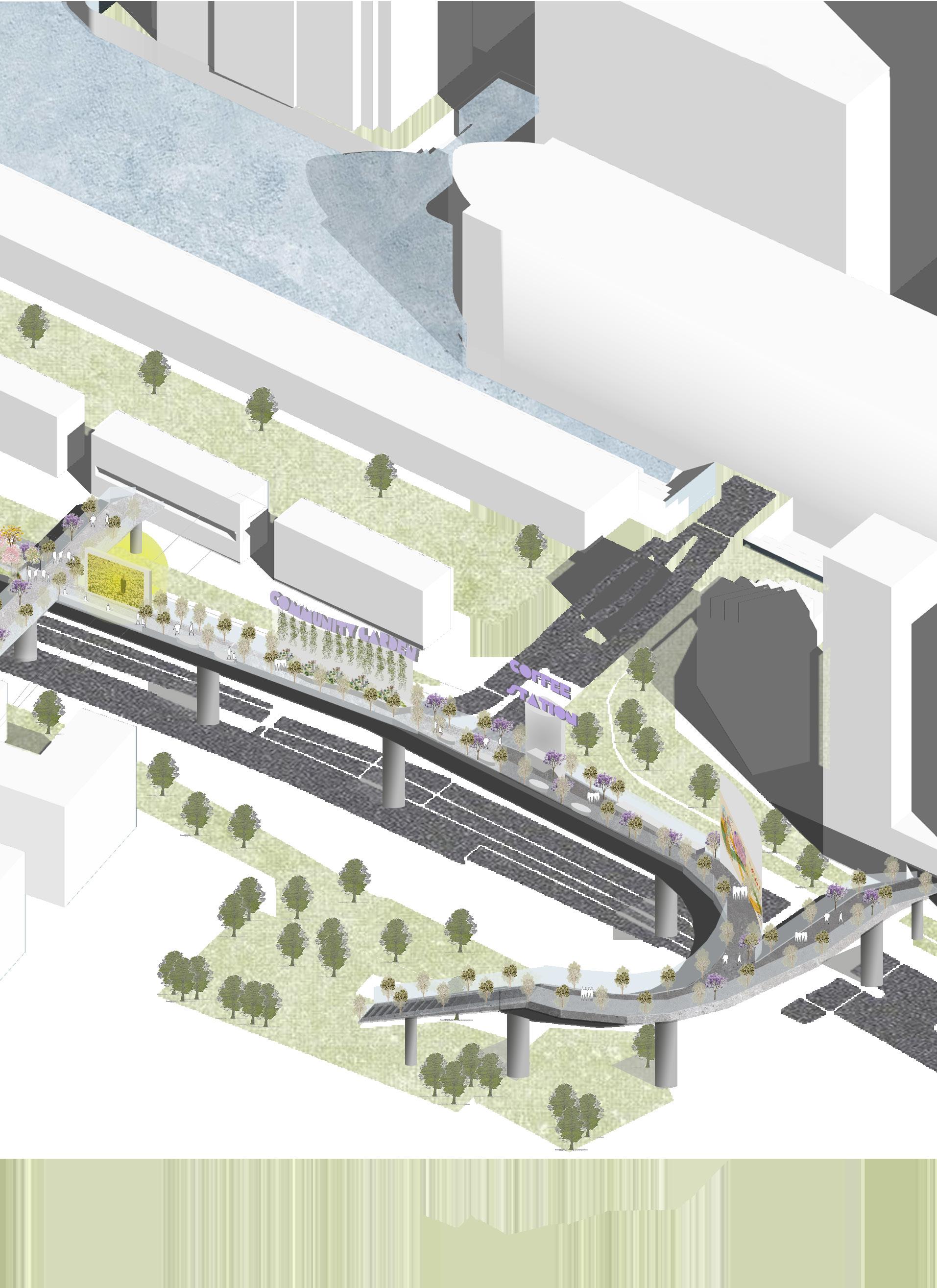
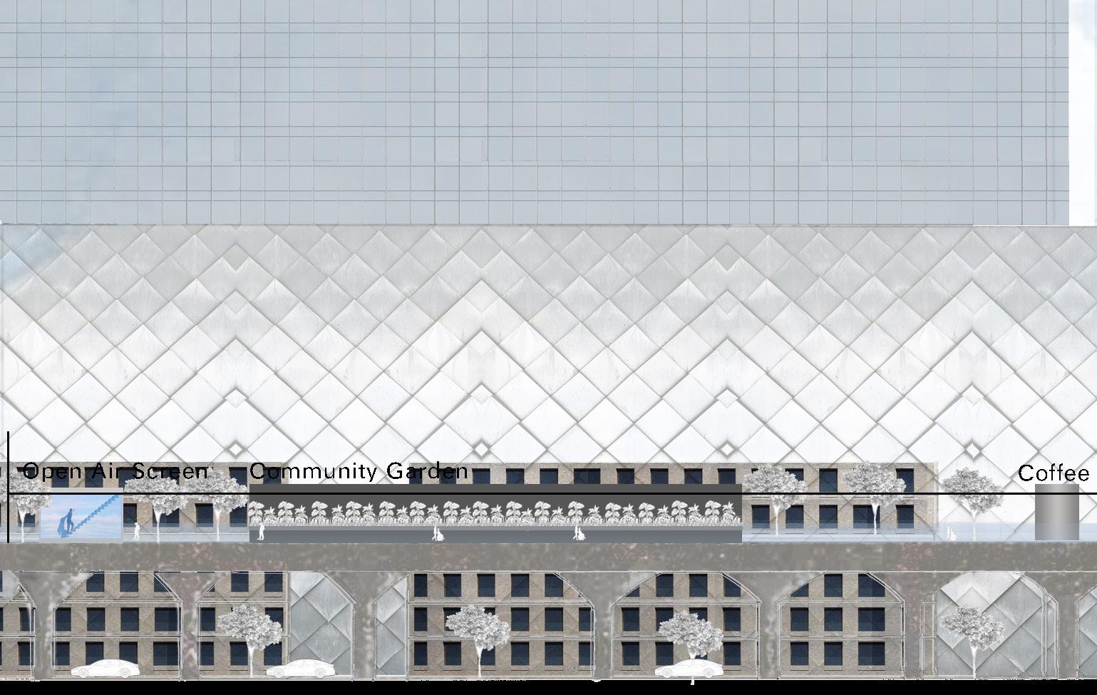
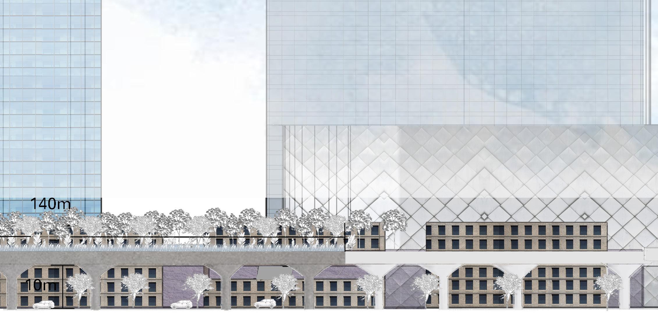
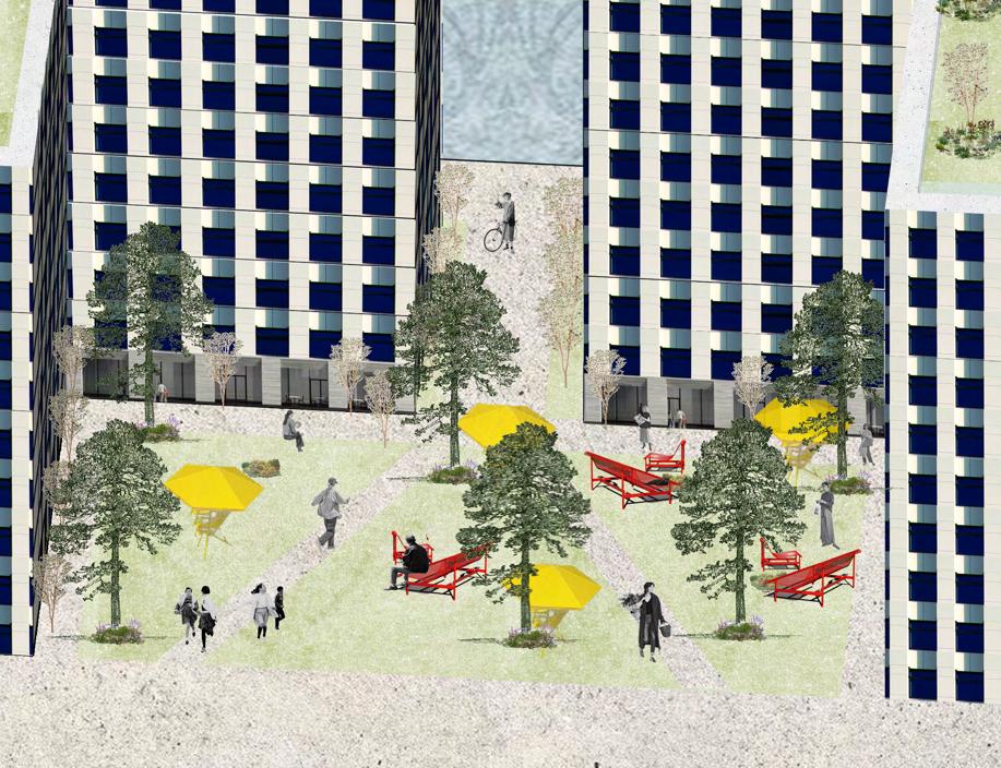
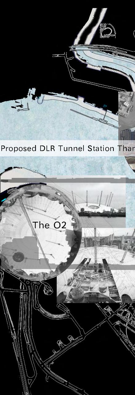
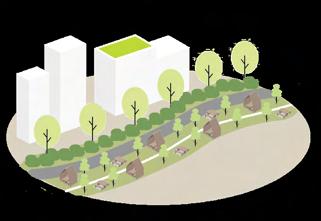
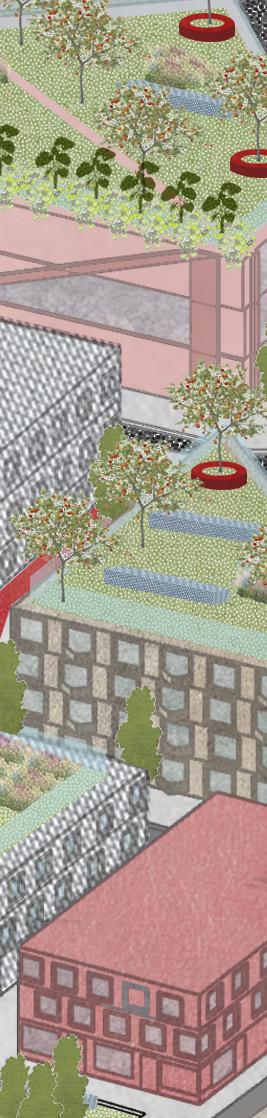
The green spine's primary ecological zone, CA2, connects the bluegreen network. Bridges CA2 (a) and (b) link to parks in the north and the waterfront in the south. The green spine, which was intended to resemble a park, has a variety of seasonal gardens that draw inspiration from British landscapes. CA2 supports regional ecological value and biodiversity as a member of the UK's Rewilding Network.
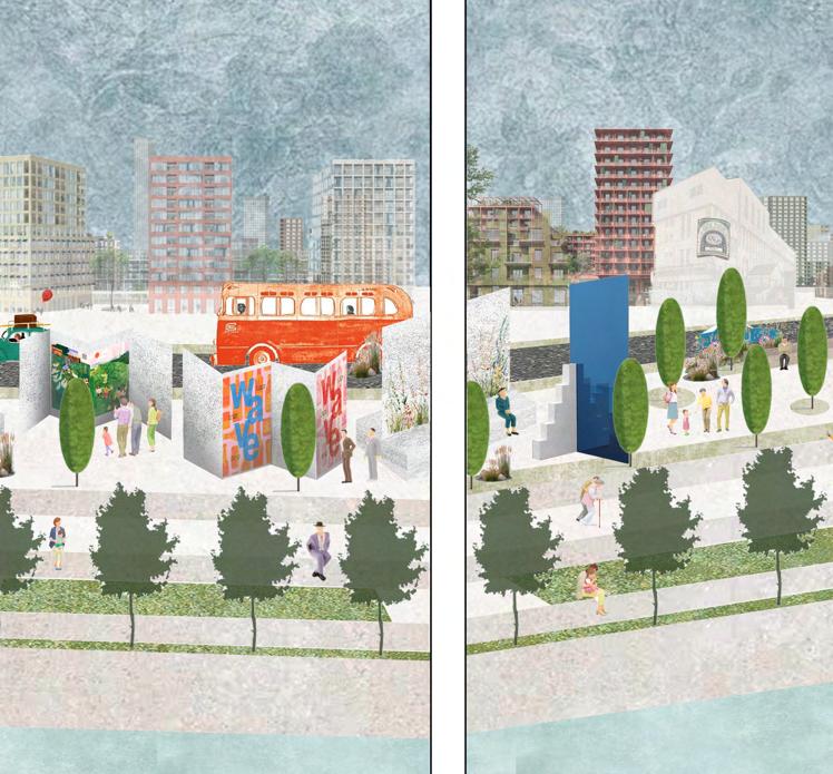
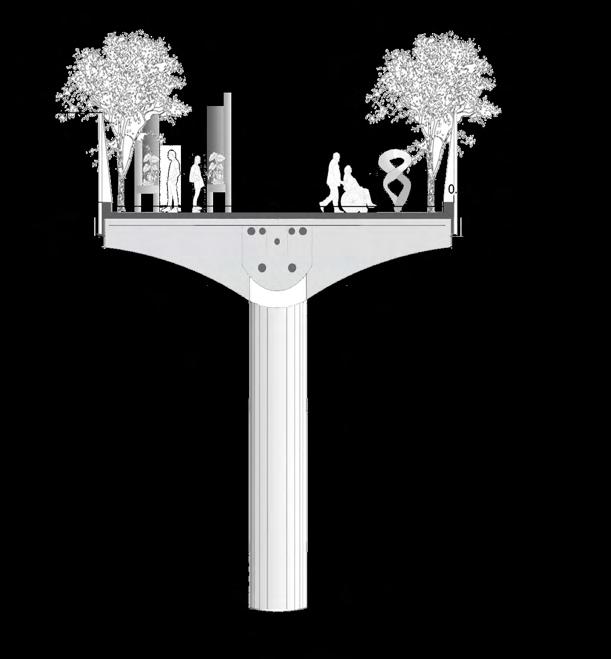
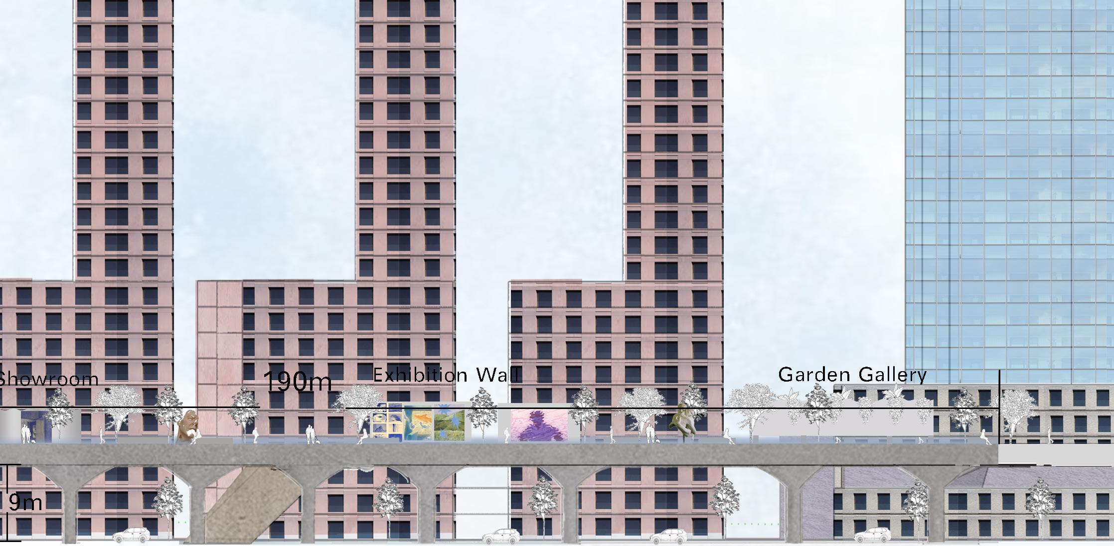
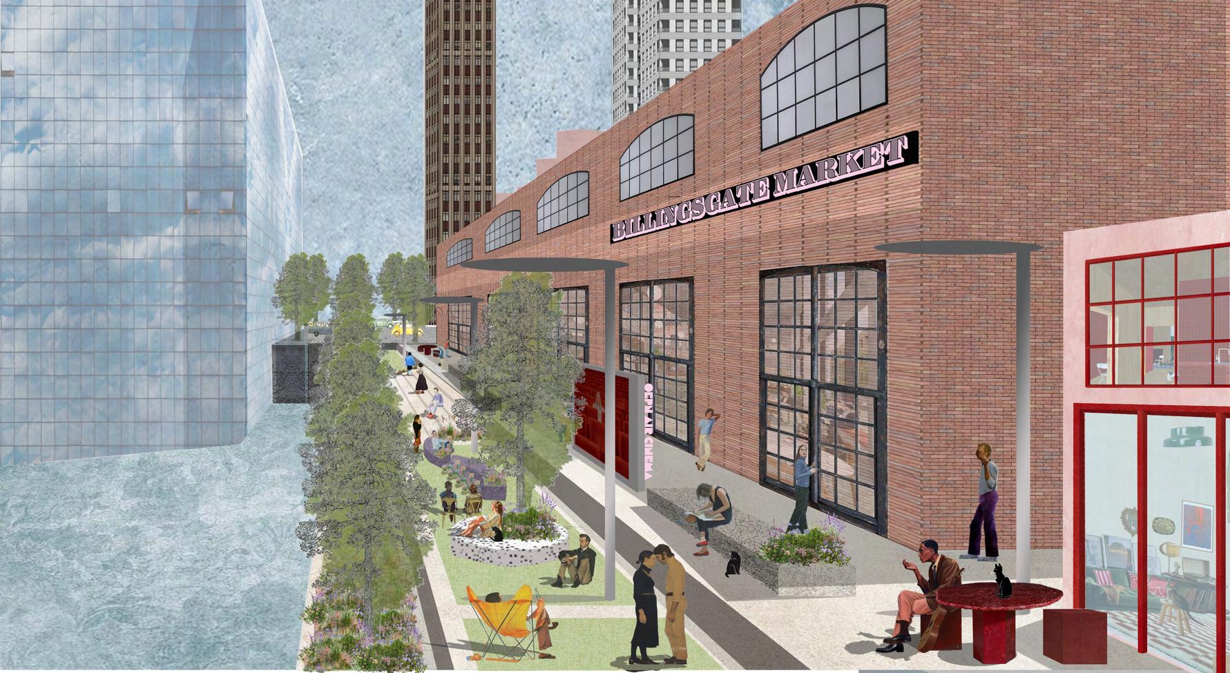
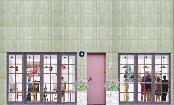
CA3 is the arts, culture, and commerce zone of the Green Spine/bridge. It will include dedicated market spaces and small commercial units for rent, seating, street furniture, and space for users to dwell. CA3 can also host a variety of public artworks, mixing permanent installations with temporary exhibitions. These activities will help establish the bridge as a destination, notsimply a place to move through.

In collaboration with schools, gyms, and outreach organisations, CA1 is a communal zone that offers urban farming, gardens, cafés, and outdoor movie and advertisement screens. It provides inclusive, entertaining activities for local youth and families and is situated between Tower Hamlets College and courtyard housing.
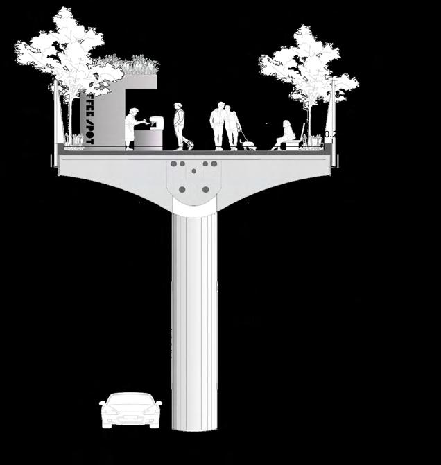
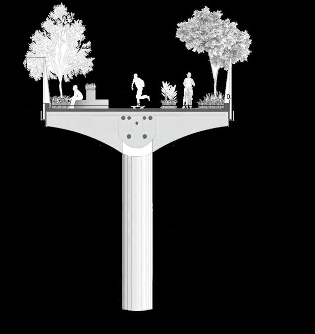
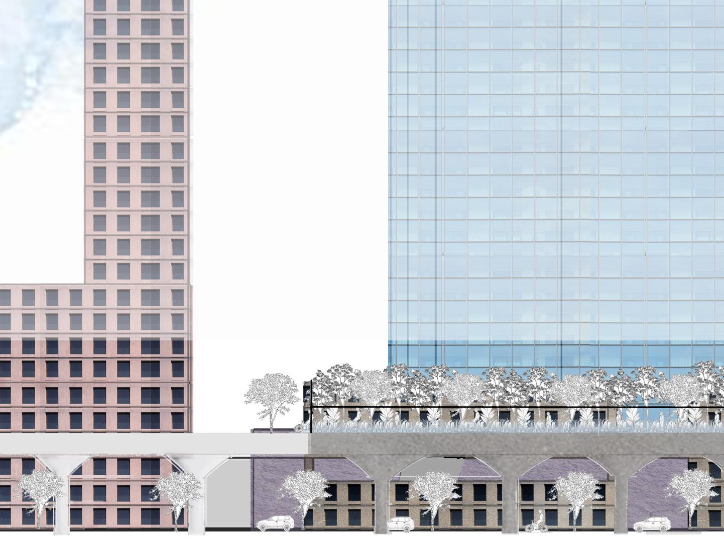
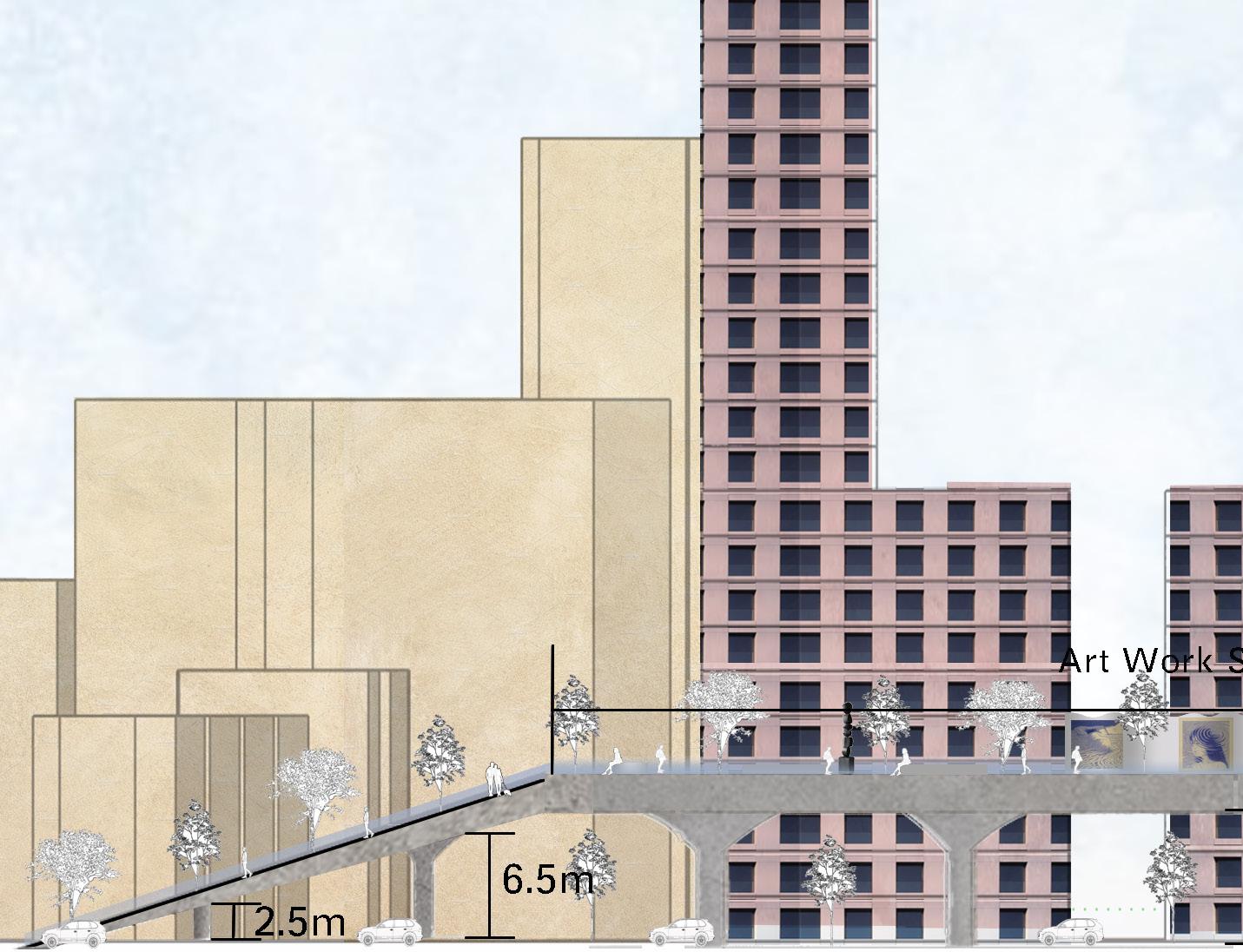
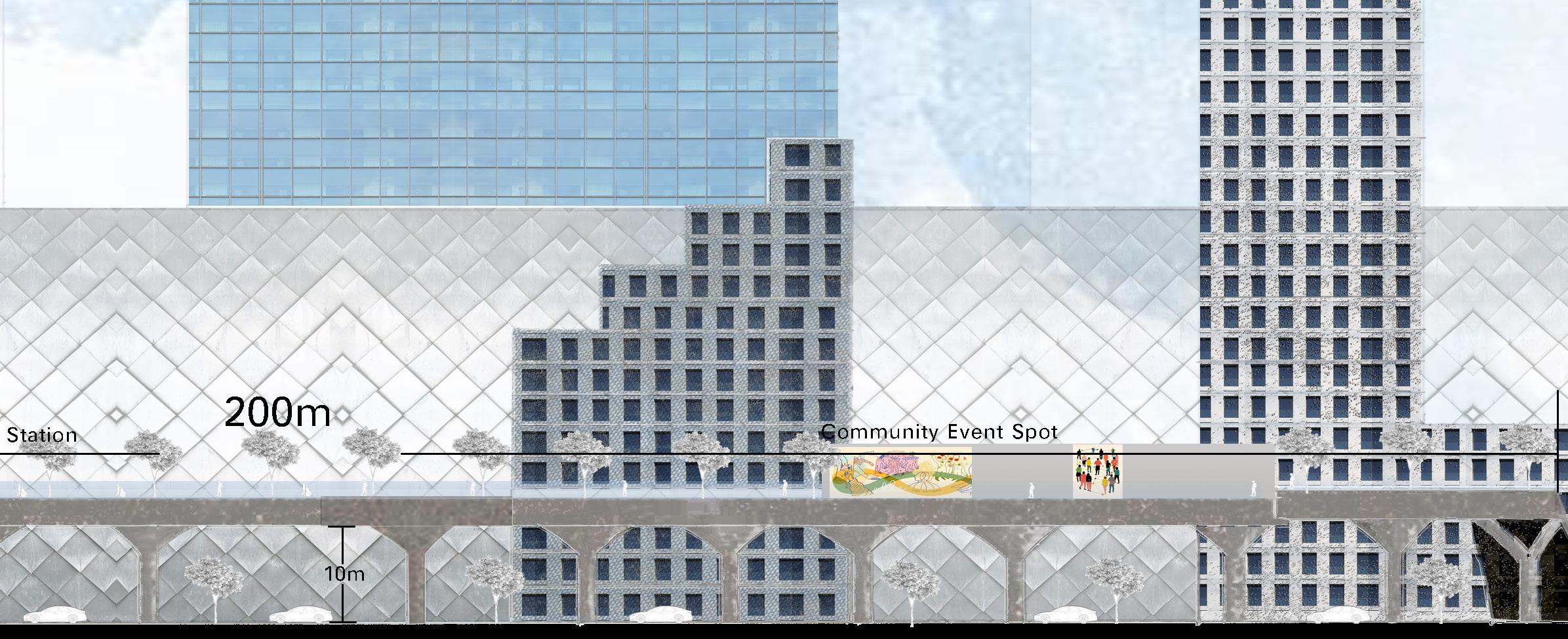
The bridge is a bike- and pedestrian-only public spine that offers a safe, active, and social way to cross Aspen Way. Designed as a vibrant public space, it features three distinct zones that support recreation, culture, and sustainability. Blending green infrastructure with community-focused design, the bridge not only connects areas but also strengthens neighbourhood identity.


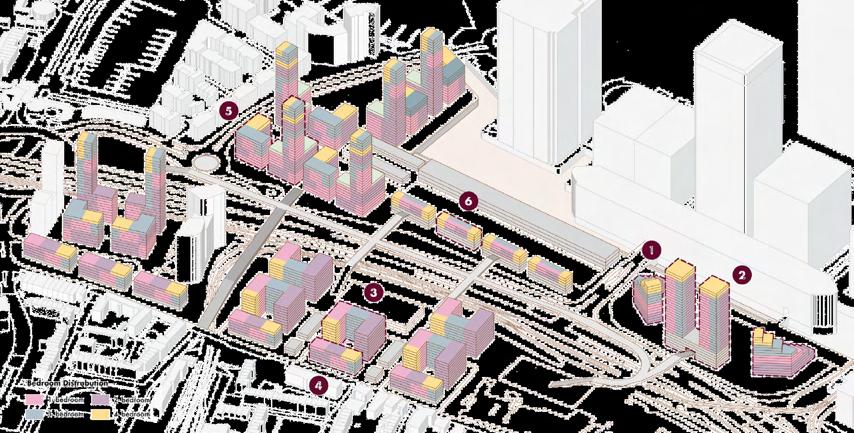
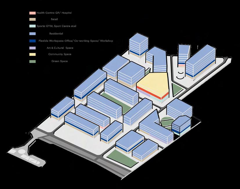
With a balanced tenure mix of 45% market, 30% affordable/social, and 25% shared ownership, the approach guarantees long-term affordability and social equity.
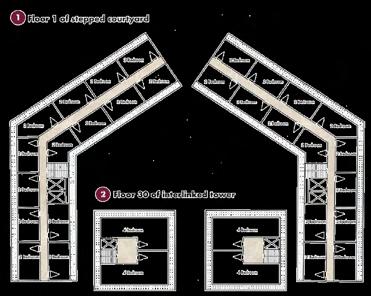
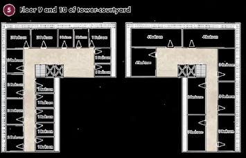
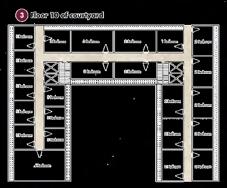
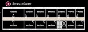
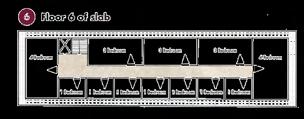
For an estimated 11,350 people, it provides about 4,400 dwellings (about 37,833 persons per acre). In order to accommodate a variety of households, unit sizes range from one to four bedrooms, with 70% having one or two bedrooms and 30% having three bedrooms or more.
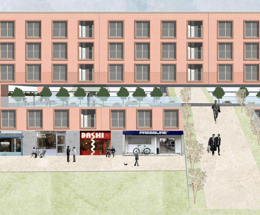
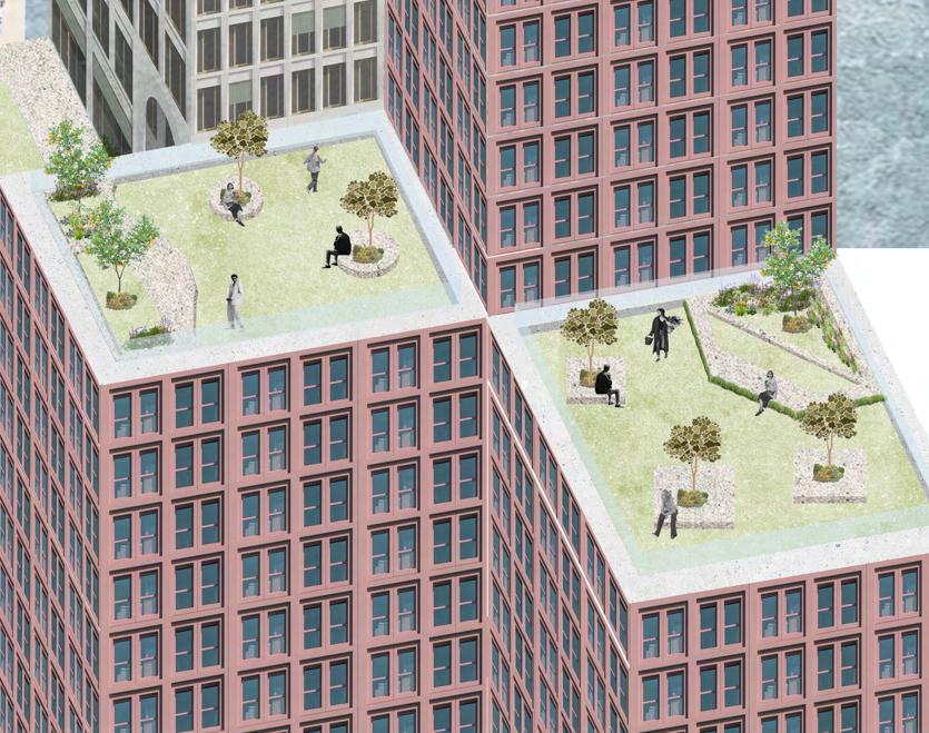
Every home satisfies the quality, daylighting, and space requirements of the London Plan (GLA, 2021). In a congested urban environment, green roofs, courtyards, and active ground floors provide welcoming, lively areas.
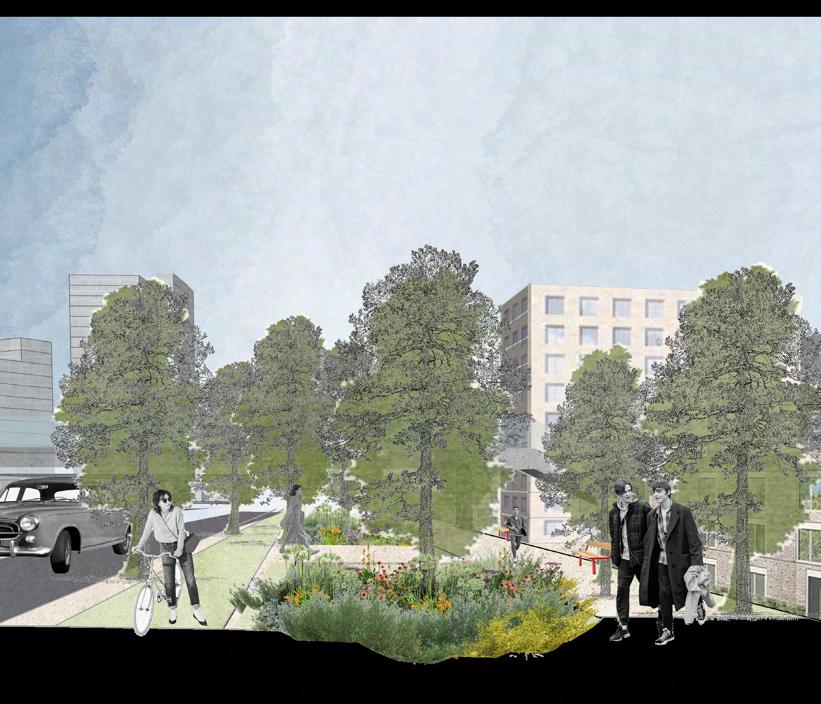
This high-density, human-centered neighbourhood turns the industrial riverbed into a bustling, walkable waterfront by combining dwellings with dynamic public areas.
It provides spaces for recreation, festivals, and community life and is connected to the old fish market. Retail, courtyards, rooftop gardens, and active frontages all promote everyday contact, wellbeing, and climate resilience.
An inclusive, interconnected urban lifestyle is produced via mixed-use architecture and green infrastructure.


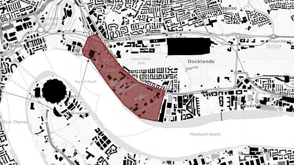
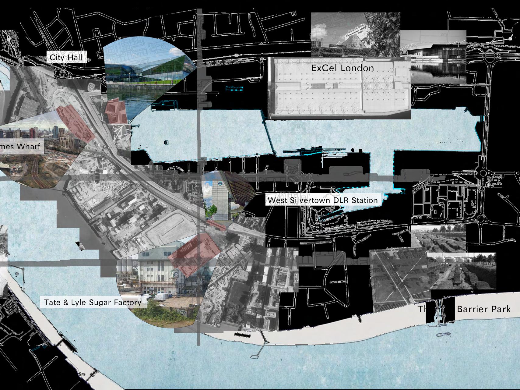
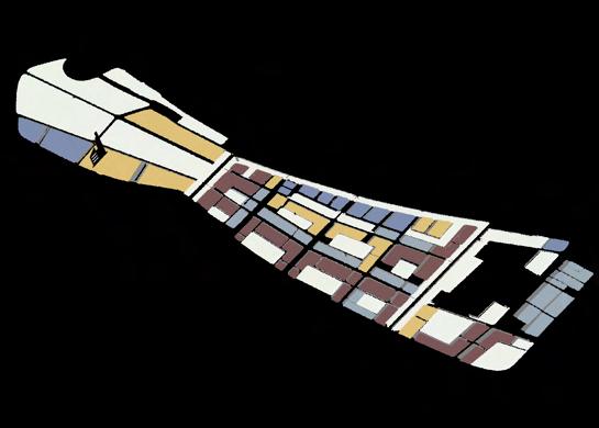
With an emphasis on revitalising the neighbourhood around the Tate & Lyle sugar factory and the new construction sites near the proposed Thames Wharf DLR station, this design code lays out a legal framework for directing future development in West Silvertown. By creating a thriving creative, cultural, and artistic district, the goal is to encourage the adaptive reuse of underutilised spaces. The code aims to create a strong sense of place based on artistic expression and cultural identity by combining affordable residential and commercial development. Zoning, land use, building typologies, street hierarchy, and methods for fusing industrial legacy with upcoming cultural development are all covered in the guidelines. These components work together to create a complete urban design toolset that will help West Silvertown develop into a unique, welcoming, and character-rich community in the future.

Strength
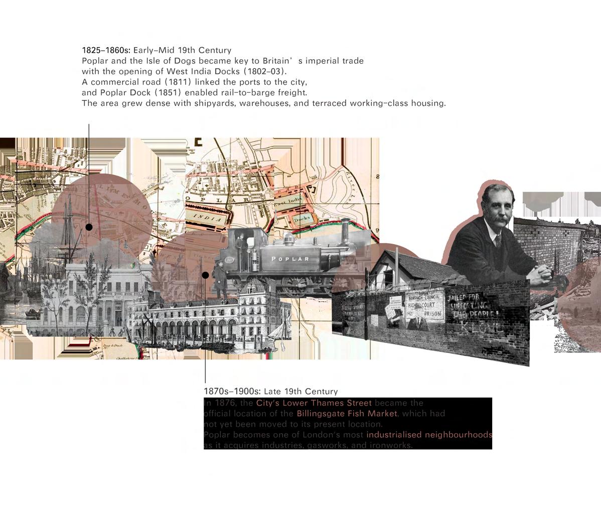
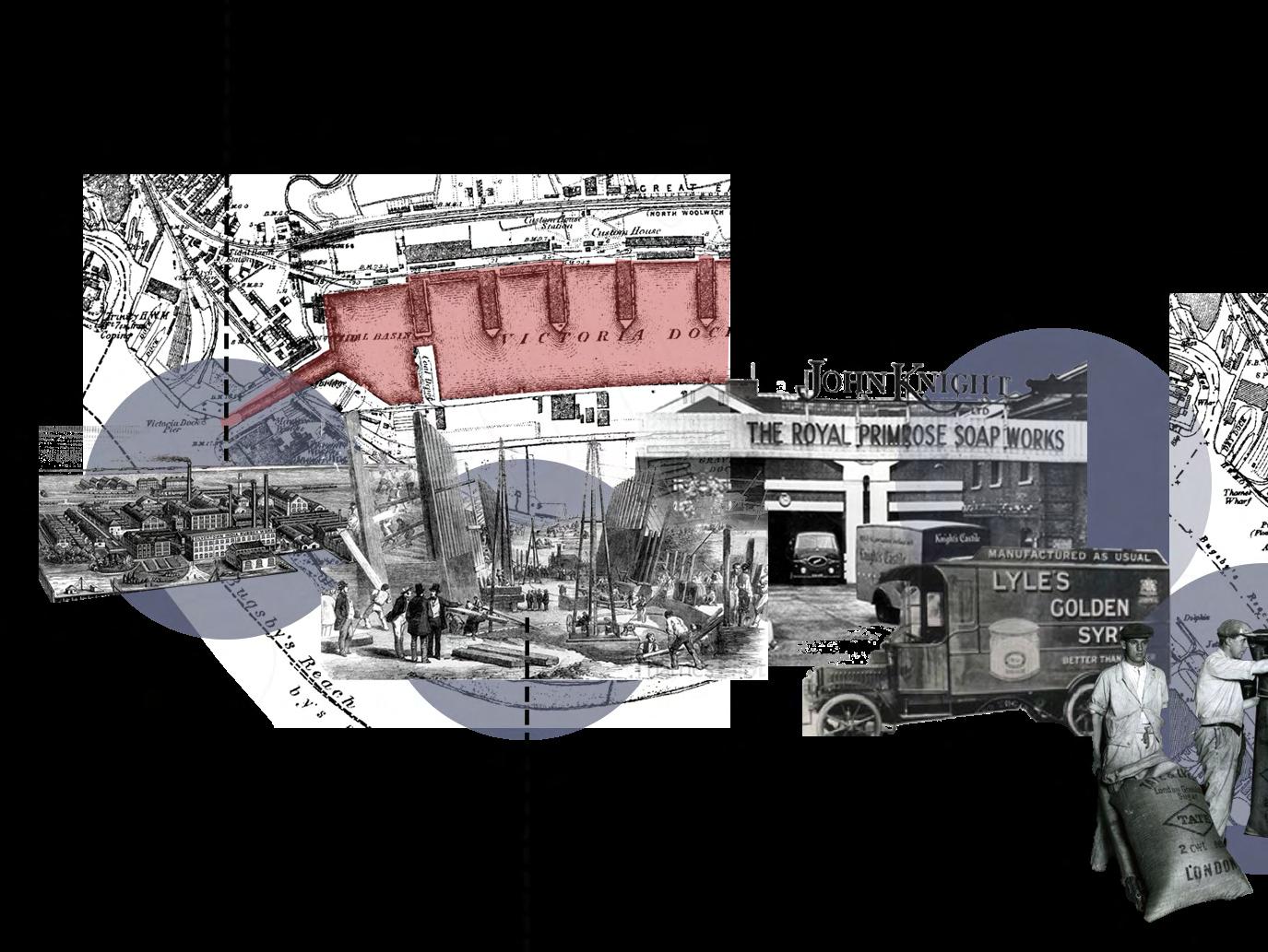
Mid-19th Century: Establishments of Industry Late 19th to Mid 20th Centuries:
1852: Samuel Winkworth Silver's India-rubber and Telegraph Works is established, marking the beginning of Silvertown's industrial identity and the urbanisation of the area.
Impact on Space: Natural wetlands and rural uses are replaced by infrastructure and factories, which take over the land.
Royal Victoria Dock opens in 1855, bringing with it more heavy industries and international trade.
Urban Structure: Development of warehouses, worker housing, and rail infrastructure; emergence of linear waterfront industrial zones, separated from residential districts.
Weakness
The site's prime location near the Royal Docks and River Thames offers strong placemaking potential, excellent connectivity, and a rich industrial heritage.
Weaknesses include poor permeability, disconnected streets, mono-functional industrial land, limited public realm, weak green links, and underused low-density plots.
Opportunities include transforming the area into a creative district, leveraging DLR expansion for transit-oriented development, enabling affordable live-work spaces, and applying sustainable design like walkable grids and green corridors.
Threats include gentrification risks, slow development due to industrial ownership, environmental concerns like contamination and flooding, and dependence on major infrastructure investment.
Walkable streets that connect the riverfront, surrounding plots, and Thames Wharf DLR will let you reconnect to the grid.
Encourage mixed-use neighbourhoods with residences, places for creativity, and light industry to create a lively, round-theclock community.
Utilise anchor spaces, a variety of forms, and adaptive reuse to celebrate identity.

Encourage affordability by providing inclusive housing and creative community workspaces.
Connected open areas and natural corridors will green the public sphere.
Use design codes for building kinds, heights, frontages, and materials to guarantee excellence.

1990s-2000s: Early Regeneration Moves 2005-Present: Transit-Oriented Development & Masterplanning
Safety-driven land-use planning and zoning are necessary because of the 1917 Silvertown explosion, which emphasises the risks of locating high-risk industry next to residential areas.
1950s-1980s: Economic slowdown, extensive brownfields, and urban voids from manufacturing closures are caused by the fall of docks as a result of containerisation.
1994: Britannia Village marks early renewal, shifting from industrial to walkable, low-rise residential with river views.
2000: Thames Barrier Park introduces post-industrial ecology and reconnects the area to the river.
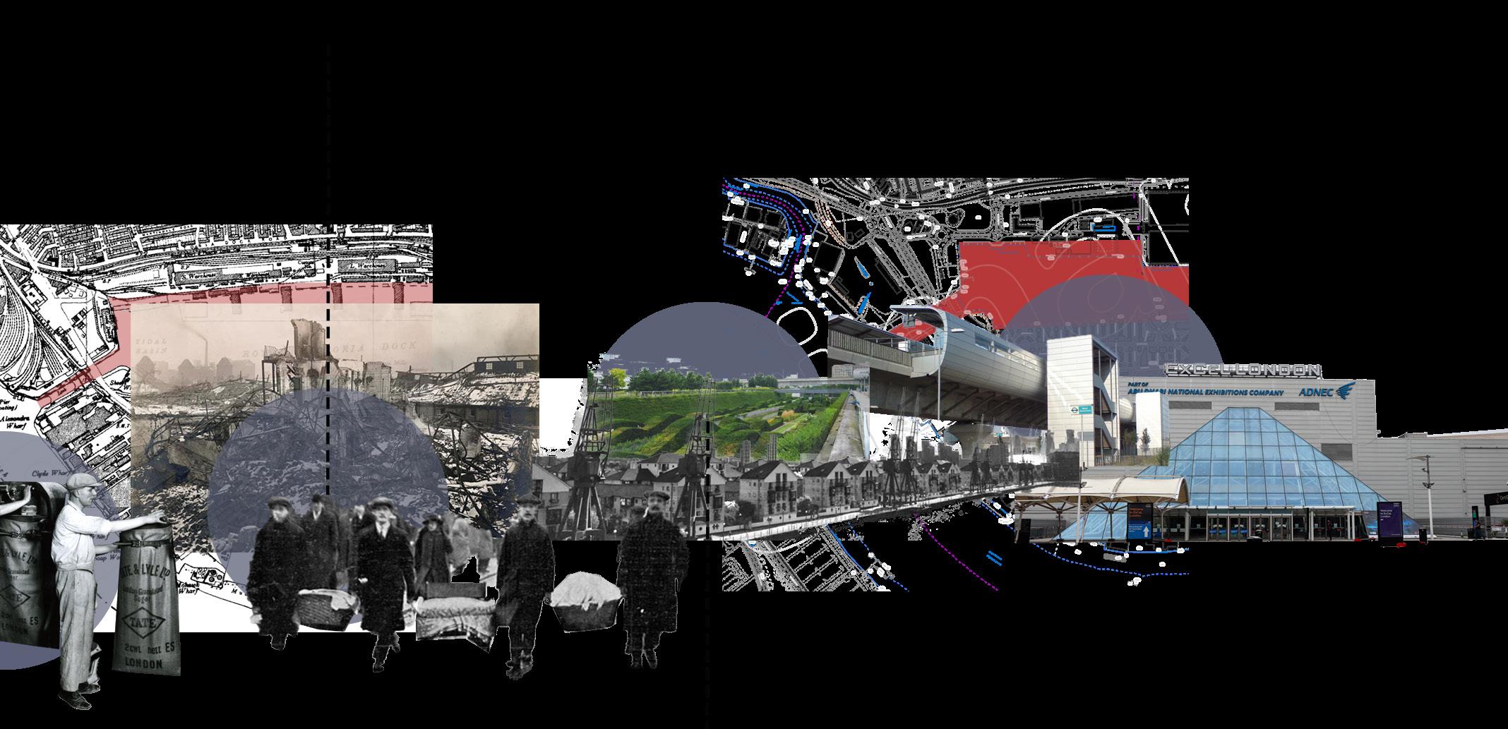
2005: West Silvertown DLR opens, enabling transit-oriented growth and pushing for mixeduse development.
Since 2015: Plans like Thames Wharf and Silvertown Quays propose 6,500+ homes and creative hubs.

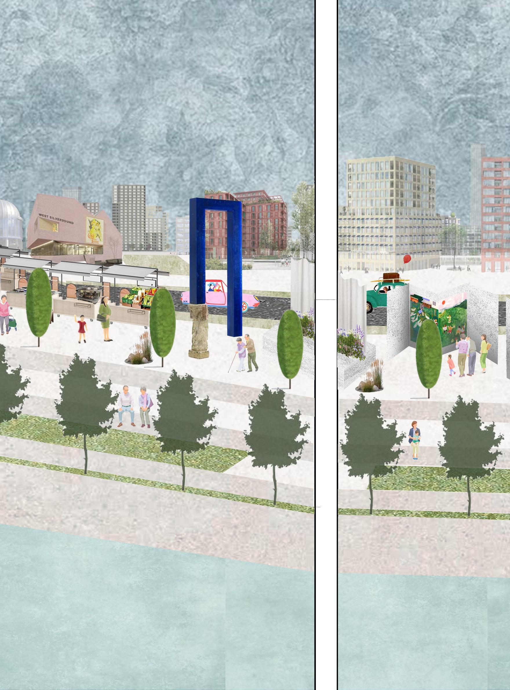
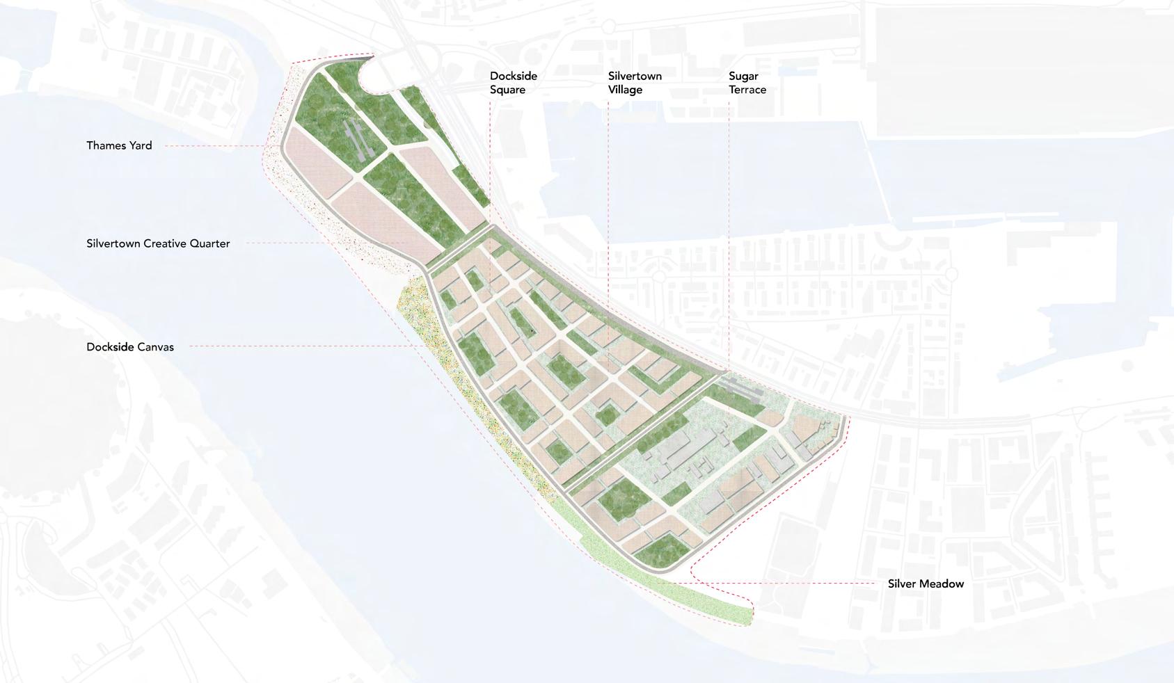
An emerging creative and culturally rich district of East London with 3120 new homes for families and creative entrepreneurs of all ages.
Channelling creative industries into the economic core of West Silvertown with supporting commercial spaces in mixed-use and mixedtypology neighbourhoods where home, work and play are immediately accessible.
Celebrating arts and cultural activities through permanent and seasonal, built and open spaces for festivals, exhibitions and performances overlooking the river, with an array of public green spaces for intimate, daily recreational uses.
An exciting riverfront experience with closer than-ever recreational and leisure spaces on the water.
A reimagination of Silvertown's industrial heritage as the heart of creative pursuits of the future.
A strategic genius loci of Silvertown strengthening social connections across neighbouring communities.
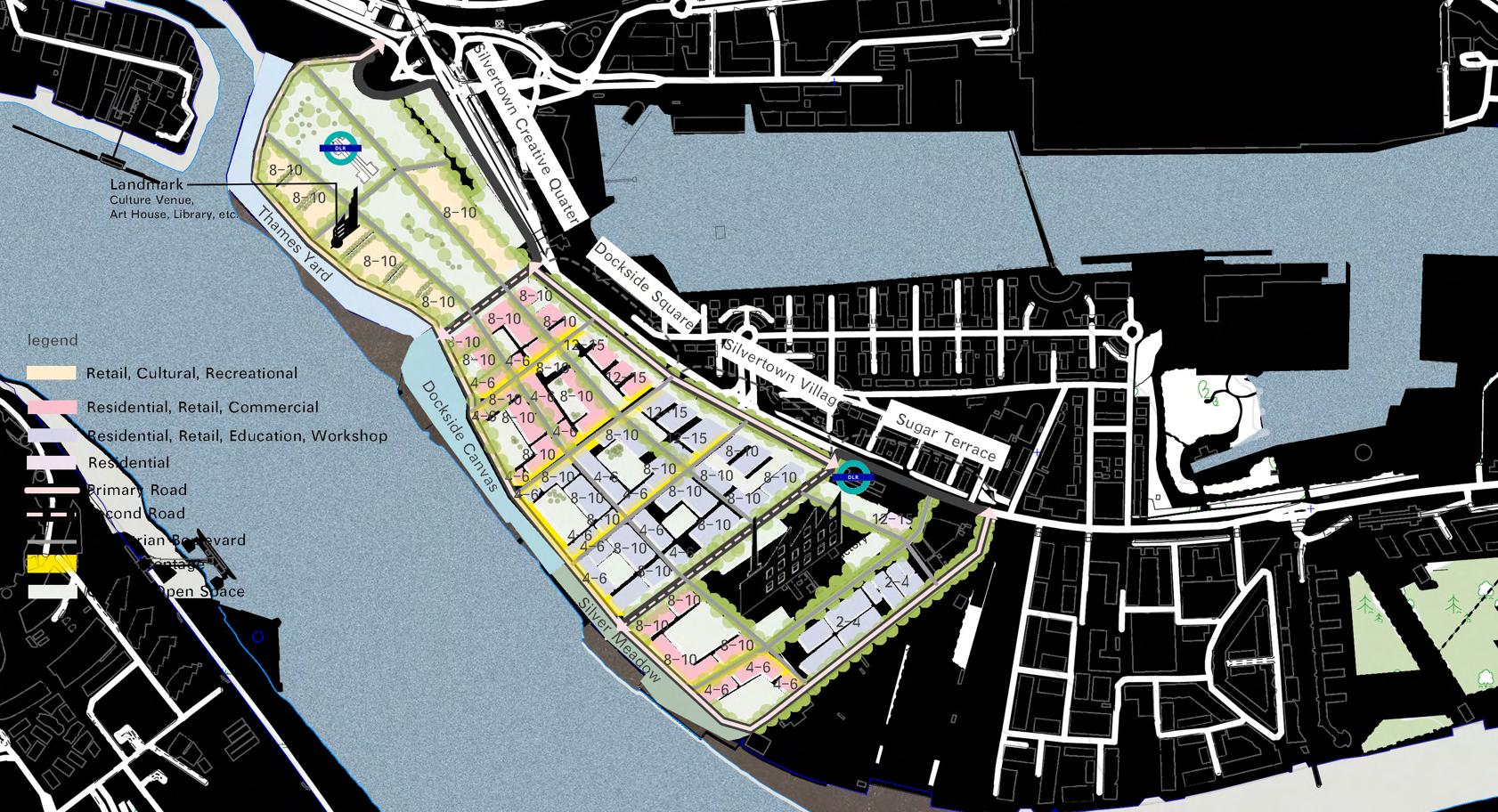
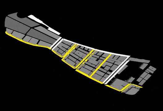
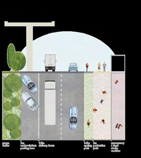
Block Structure Street Network
Developments must follow block guidelines, but the Silvertown Creative Quarter allows design flexibility to enhance clarity, access, and public space quality.
To provide safe, inclusive, and transparent connections both within the site and to the surrounding areas, proposals should adhere to the street hierarchy.
Building Plot Public Space
Construction plots must meet design rules on height, materials, scale, and use to ensure visual harmony and context-sensitive development across zones.
In order to facilitate social, cultural, and recreational activities and to foster a sense of place identity and wellbeing, green and public areas should be accessible, inclusive, and multipurpose.
Active Frontage & landmark
Active frontages and landmarks should be incorporated into designs to improve wayfinding, enliven public areas, and encourage social and commercial activities.
Active Frontage for Art Studios, Retail Stores, and Commercials
Greenery Infrastructure
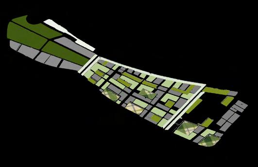
Architecture Typology
Park/Public Space (Wharf Park)

Street Hierarchy


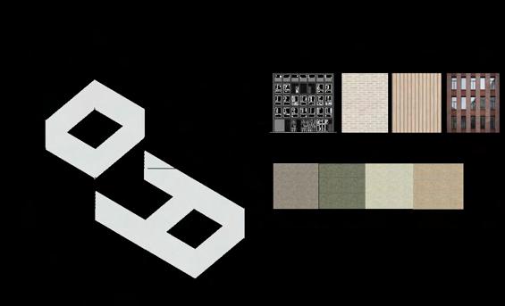

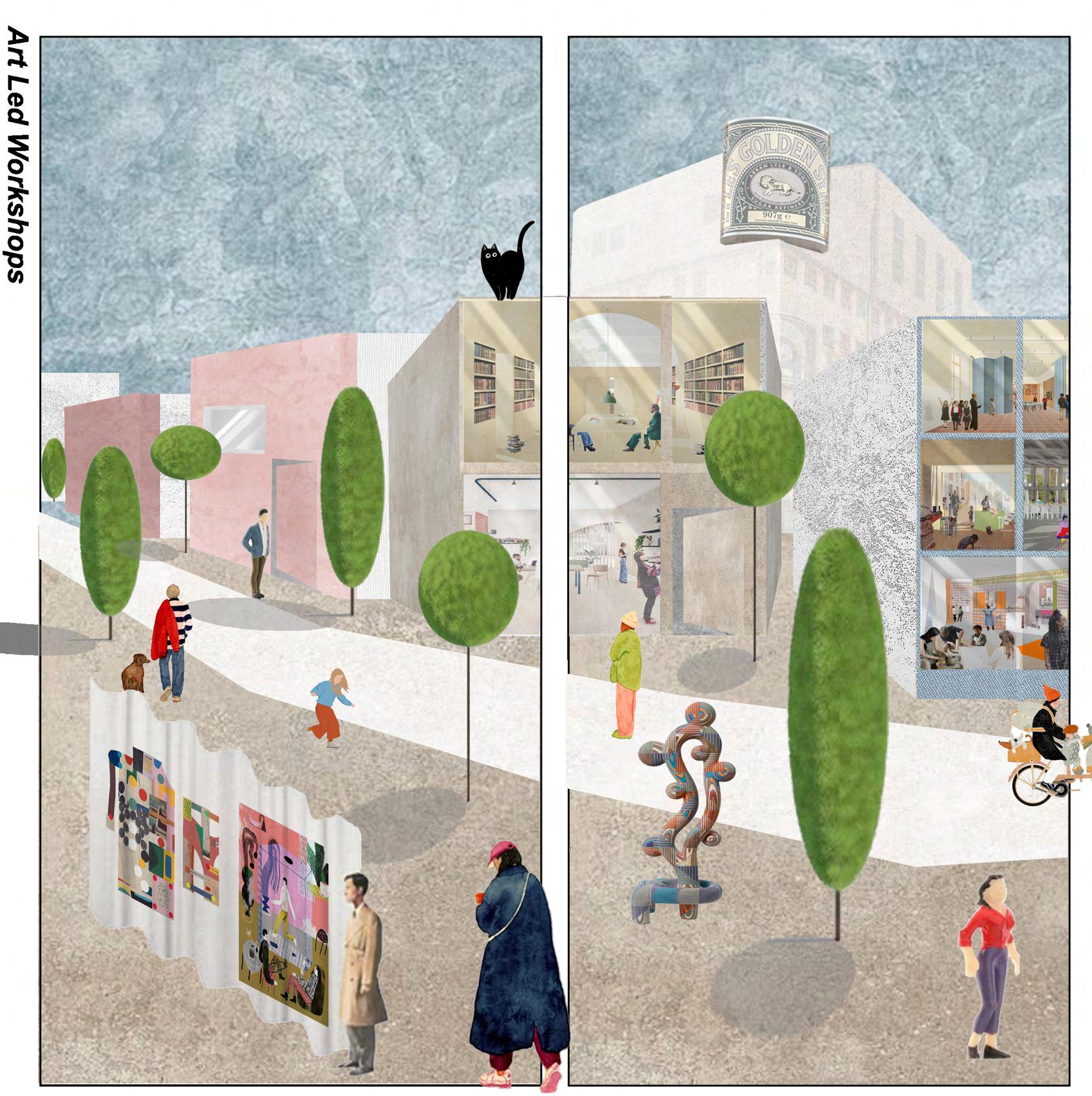
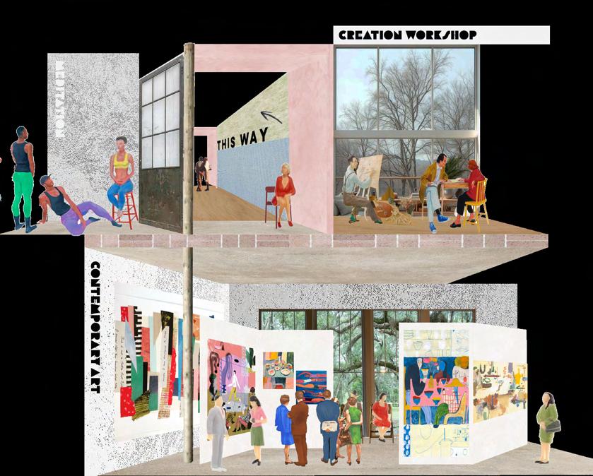
This design code must direct the conversion of the southern part of West Silvertown into a creative cluster by converting industrial areas into venues for community usage, art-led businesses, and cultural events. Through innovative workshops, renovated manufacturing facilities, and adaptable event spaces that change over time to accommodate shifting requirements, it should foster a thriving ecology of regional artists, designers, and makers.
In order to promote creativity and engagement, buildings should include adaptable floor plans, open interiors, natural lighting, and convenient access to outdoor areas for exhibitions and meetings.
The local event venue, which hosts pop-ups, community festivals, art fairs, and performances, must act as a crucial anchor. New construction or the adaptive reuse of old industrial buildings can accomplish this.
To promote place identity and represent the neighborhood's industrial heritage, public areas should have sculptures, murals, and furniture created by artists. This will make the area a more creative and friendly neighbourhood.
The modification encourages a move towards light and clean creative sectors, such as:
- Artist studios and shared maker spaces
- Print, pottery, and fashion workshops
- Media, photography, film, and digital arts studios
- AR/VR, animation, game design, and graphic production creative labs
0 Pop-up stores and incubators for design
Long-term success can be facilitated by forming alliances with:
- GLA (Greater London Authority) and local councils
- Hubs for creative enterprises (such as Bow Arts, The Trampery, and Somerset House Studios)
- Universities (such as UAL, RCA, and Goldsmiths) for student showcases and artist residencies
- Workplace Group and Second Home are examples of private developers and workplace suppliers.
- Cultural donors such as Creative UK or Arts Council England
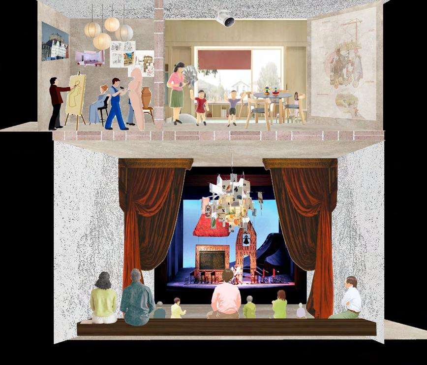
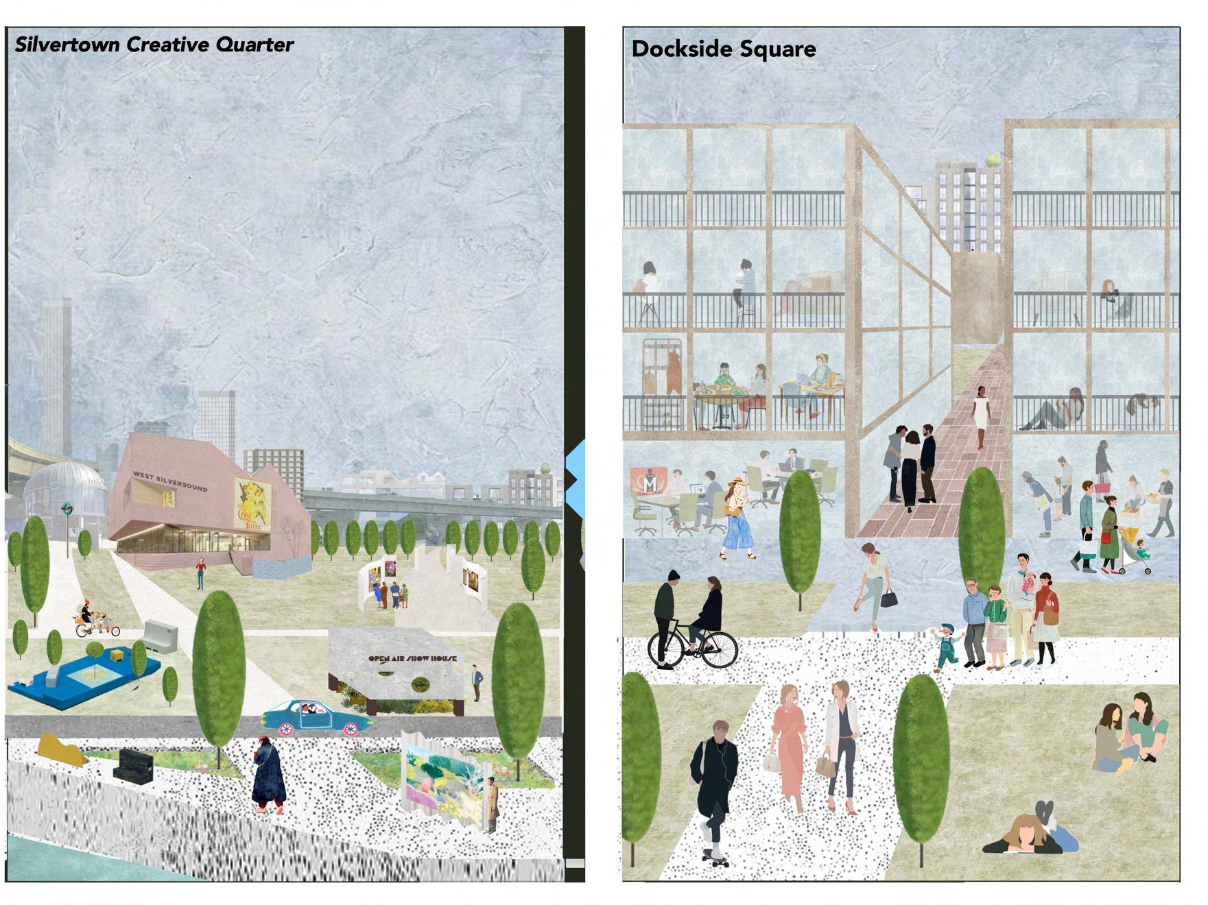
Silvertown Creative Quarter
A thriving cultural centre that features outdoor art, galleries, and venues, this centre encourages local creativity and stimulates the economy by drawing both locals and tourists. The planned DLR stations will improve connectivity and cross-cultural interchange even further.
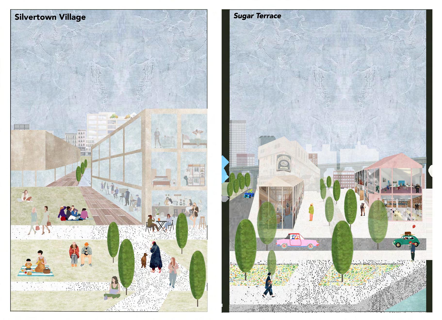
Silvertown Village
With residences, cafes, studios, a school, a hospital, a pharmacy, and a general practitioner, Silvertown Village combines basic amenities with artistic venues. It creates a lively, approachable, and family-friendly community that prioritises wellbeing.
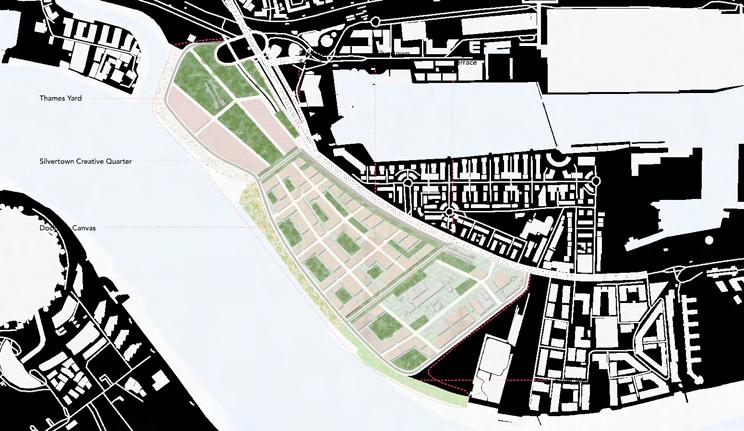

Dockside Square
A mixed-use neighbourhood along the river that encourages creativity and connection by having residences above and stores, cafés, and cultural activities below.
Sugar Terrace
Sugar Terrace, a creative centre with adaptable offices that maintain local culture, was once the Tate & Lyle sugar plant. The change promotes community identity and inclusive growth without accelerating gentrification.
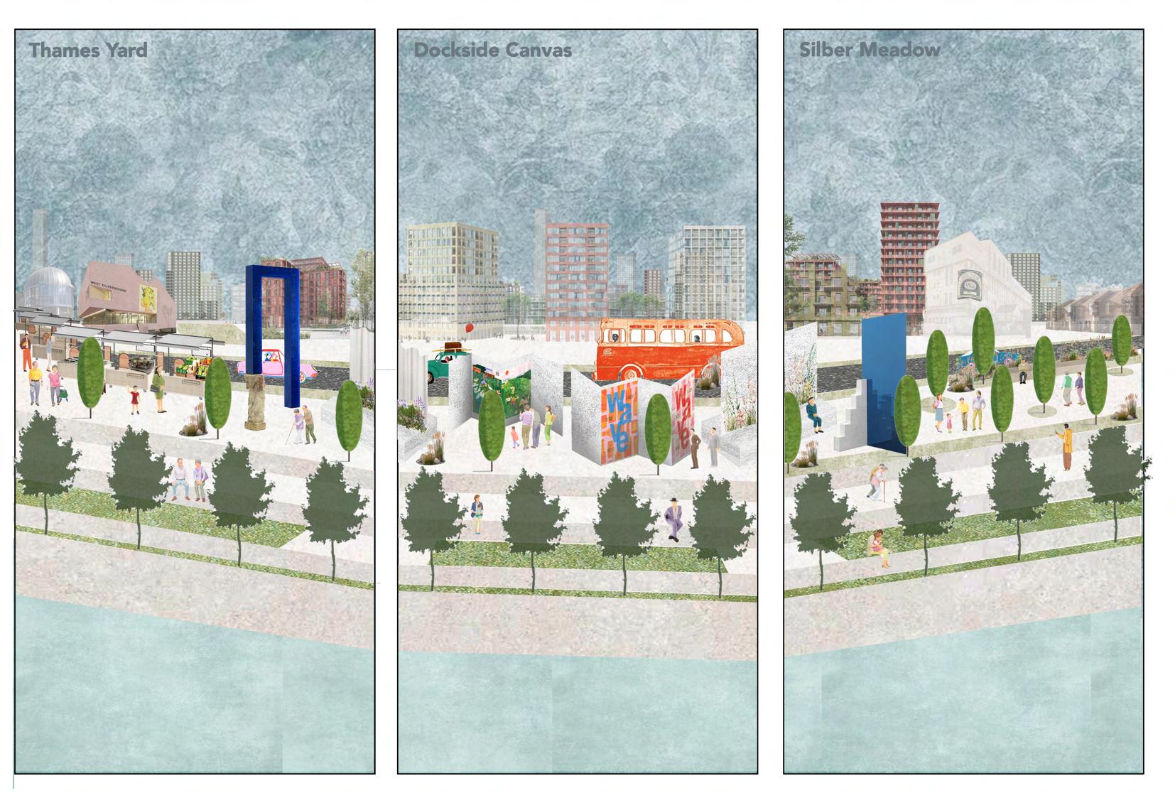
Thames Yard
Silvertown's relationship to the river is strengthened and the area is revitalised by a bustling waterfront with festivals, markets, and local stores.
Dockside Canvas
A plaza beside the river that supports up-and-coming artists and promotes cultural identity through pop-ups, murals, and exhibitions.
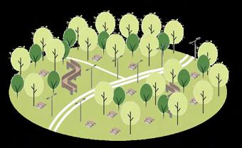
Silver Meadow
A tranquil green area featuring family areas, pathways, and lawns that provides a respite from the surrounding business districts.
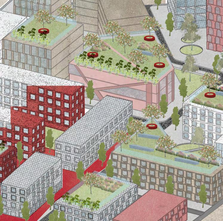
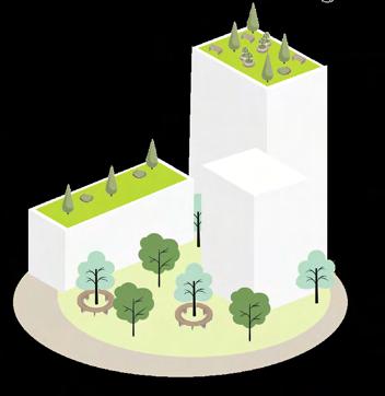
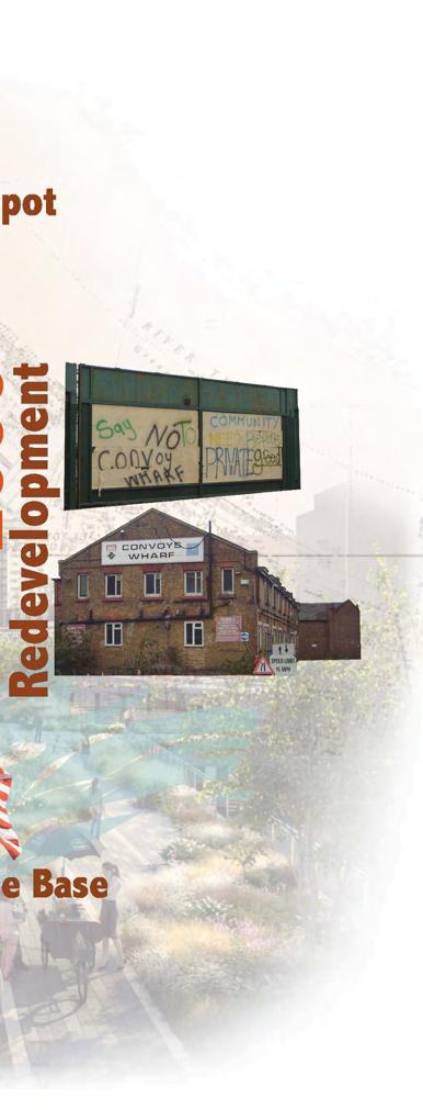
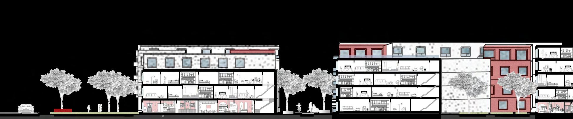
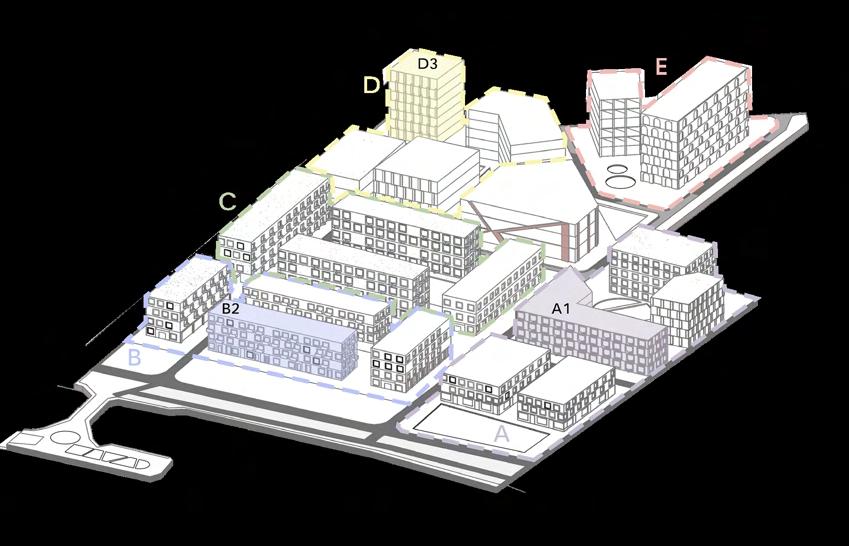
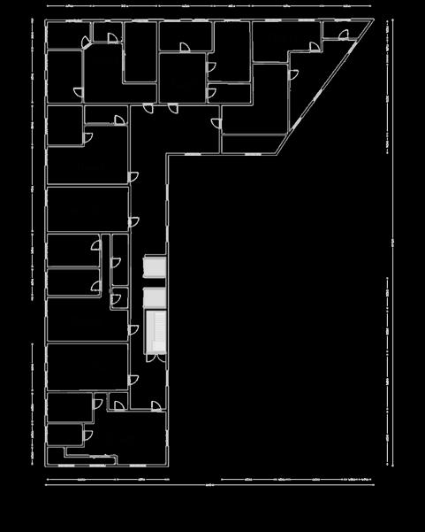
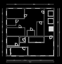
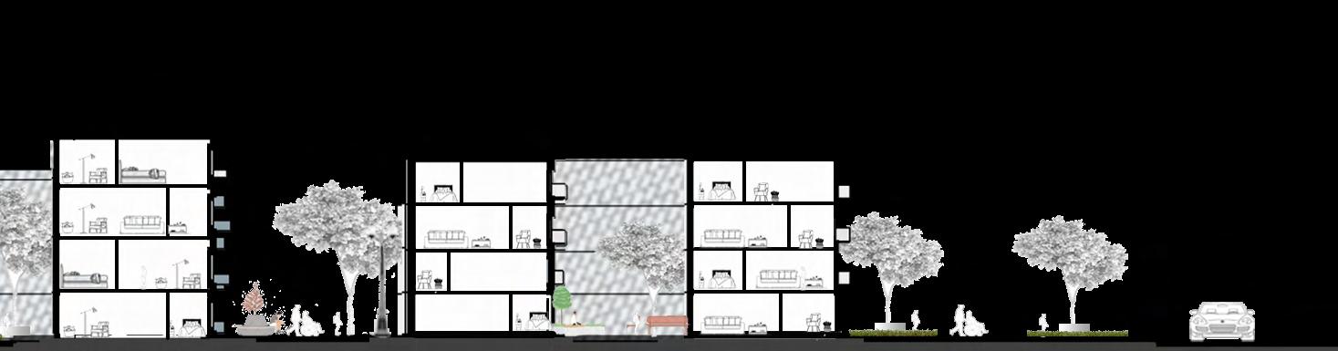
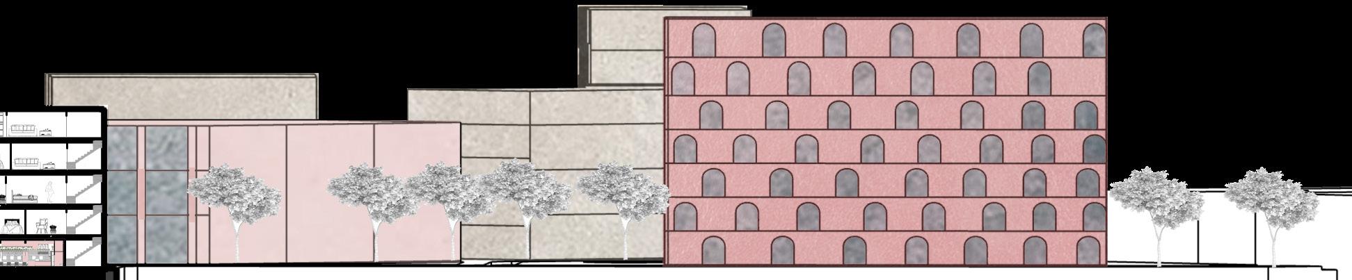
In order to turn a former industrial riverbank edge into a welcoming, energetic, and human-scaled area, this proposal investigates a midscale layout within Convoys Wharf. In order to promote daily social life, the design incorporates a network of activated public areas, layered residential typologies, and ample green infrastructure. Through tiered housing forms, communal courtyards, and a permeable street hierarchy, the concept redefines urban density with a focus on walkability, affordability, and liveability. The approach embeds flexibility and well-being at the core of the community by striking a balance between architectural diversity and spatial coherence.
Although the location is primarily residential, there is potential for mixed-use development due to the neighbouring business and retail sectors.

Due to its location at a B-road intersection, the site has good connectivity; however, fragmented local roads indicate that walkability and transitions need to be enhanced.

The location is close to parks and green areas, providing opportunity for ecological and recreational connections as well as robust green infrastructure.
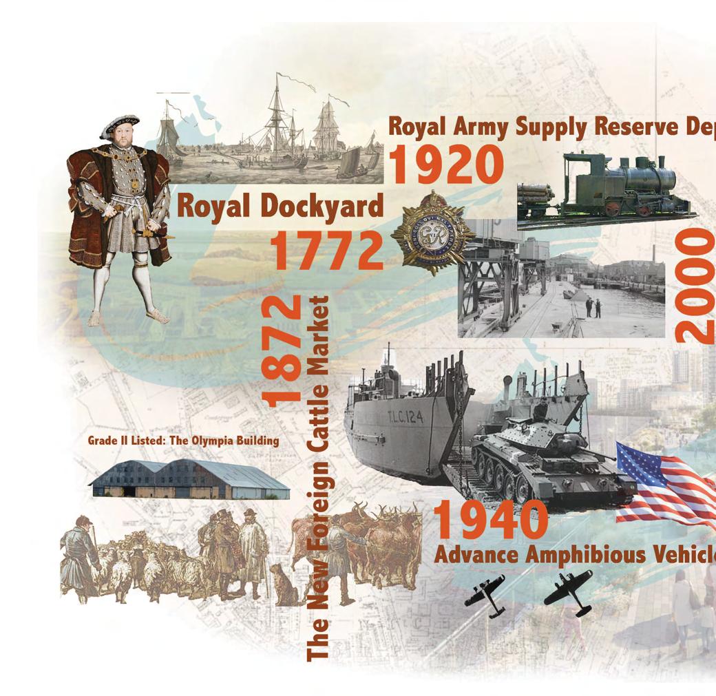
1,800 housing units with 50% affordable housing (majority social rent) for the whole Convoys Wharf.
Deliver a walkable and accessible site with connected open spaces. Include school, health, and community facilities. Safeguard Convoys Wharf for waterborne transport.
Respect for the history and heritage of Deptford: Inherited from predecessors knowledge, skills ingenuity;passed on over generations; heritage led regeneration. Respect for every person regardless of background, ethnicity, age or sexuality: All people be given equal respect. Young and old live together. Provide opportunities for all. Respect for the environment: The Earth is our home. Manage resources inharmony with
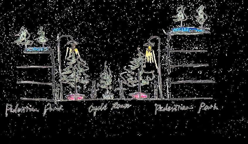

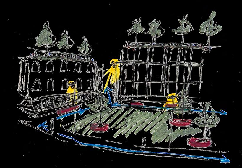
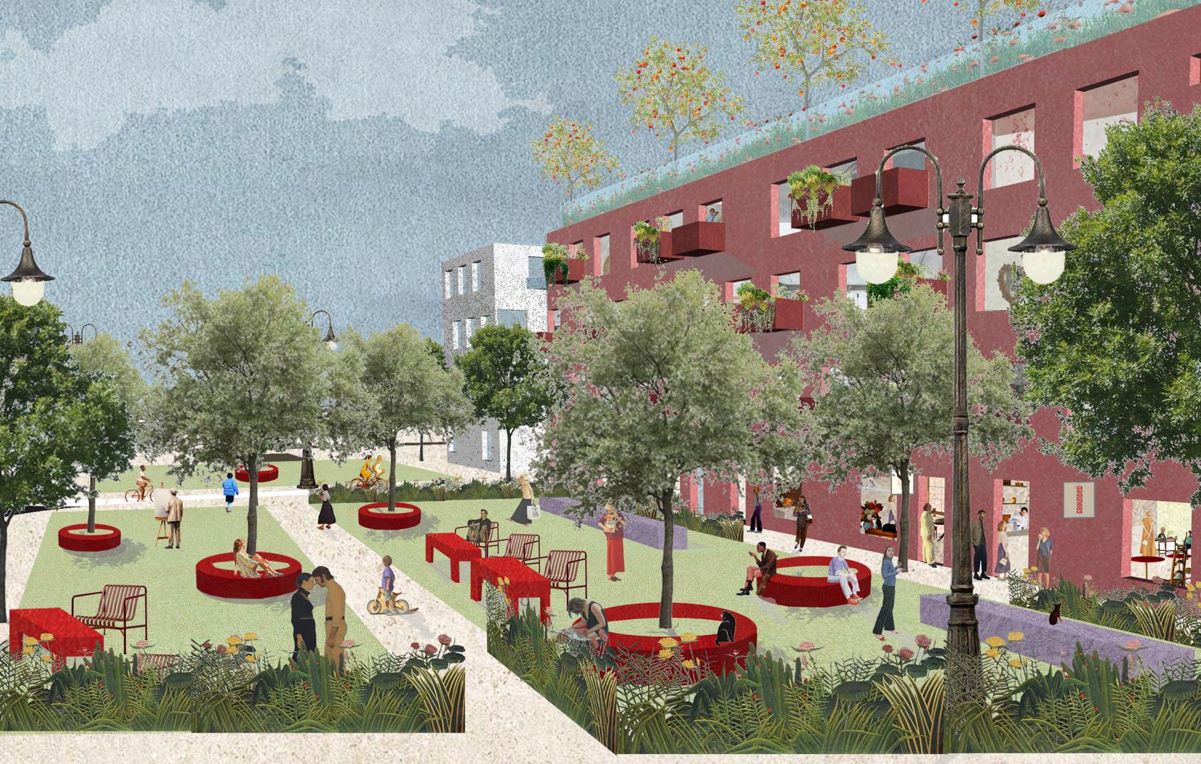
The courtyard typologies that promote social interaction while remaining open and in tune with their environment are at the heart of the design. These common areas serve as friendly gathering places for the community. With the help of well-considered amenities, safety precautions, and inclusive design, the area also places a high priority on bike and pedestrian-friendly infrastructure.
The design improves access and connection in response to the site's closeness to a protected area and the River Thames. In order to promote community, it separates the neighbourhood into discrete but connected areas, with green spaces dispersed equally to guarantee that every resident has equitable access to nature.


This master plan combines mixed-use development with significant community integration to create an inclusive, sustainable neighbourhood along the Thames. Even though homes make up 81% of the land, social infrastructure, shopping, and open areas improve accessibility and inclusivity. Fifty percent of the 370 units are affordable (138 at London Affordable Rent and 47 at London Living Rent).
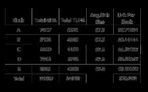
90% of the mix is made up of flats and 10% is made up of two-story residences and apartments with one to four bedrooms. The five major blocks (A-E) have an average of 67.5 square metres per unit and range from 5,640 to 7,907 sqaure metres. Through accessible public areas, shared amenities, and a variety of housing options, the concept fosters affordability and unity.
With a diverse housing stock, layered green infrastructure, and a fine-grained street network, this Convoys Wharf area provides a warm and robust living space. The master plan strikes a balance between accessible social amenities, lively public areas, and residential living.
While green spaces and biodiverse landscapes integrate nature into the urban fabric, affordable, integrated housing promotes diversity and unity. Fair distribution of utilities is provided, and Commons Wharf acts as a focal point for creative and community interaction.
Altogether, this new project gives Convoys Wharf vitality and liveability, making it a lively, community-focused area to call home.
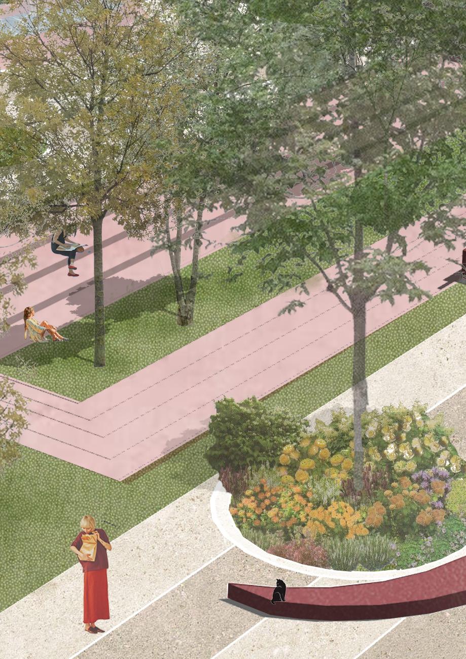
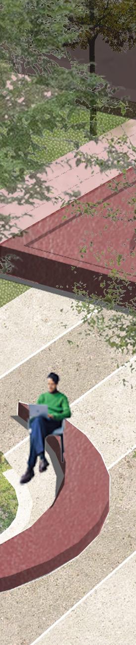
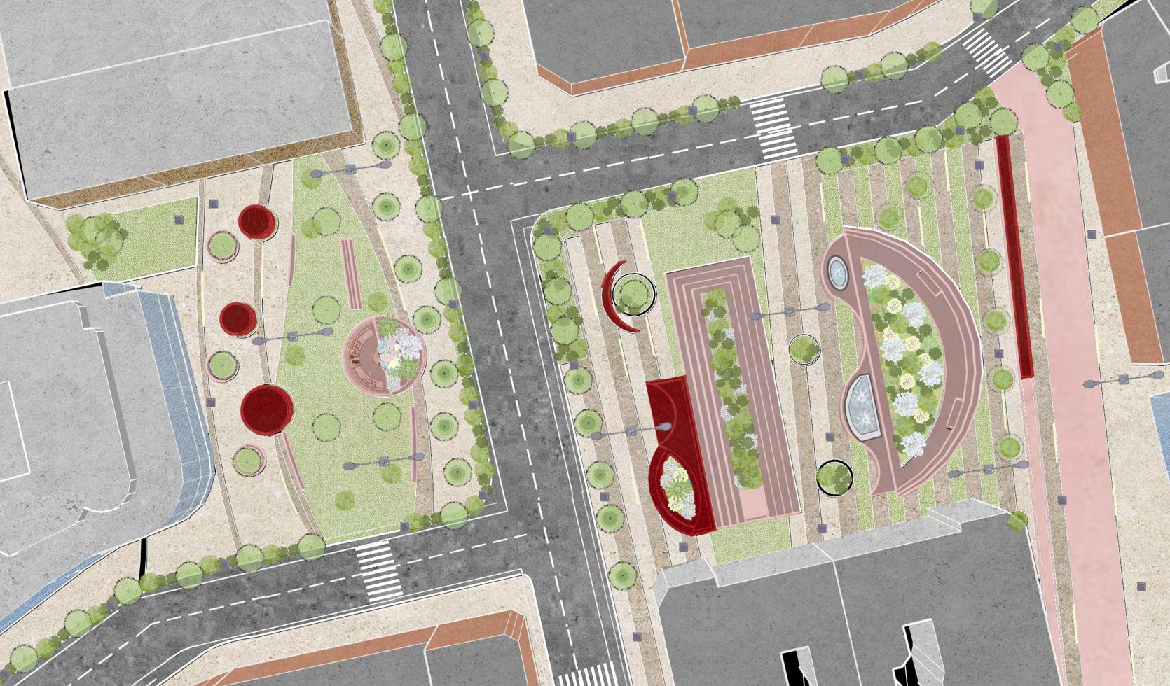
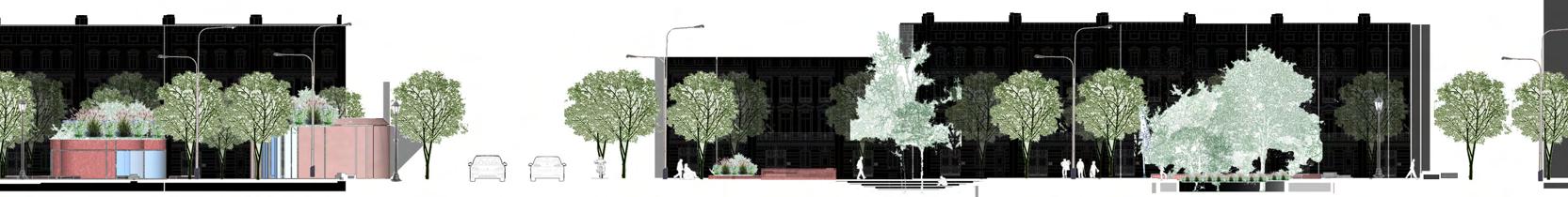
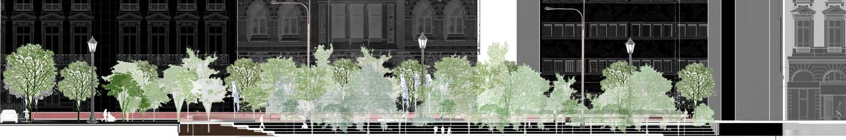
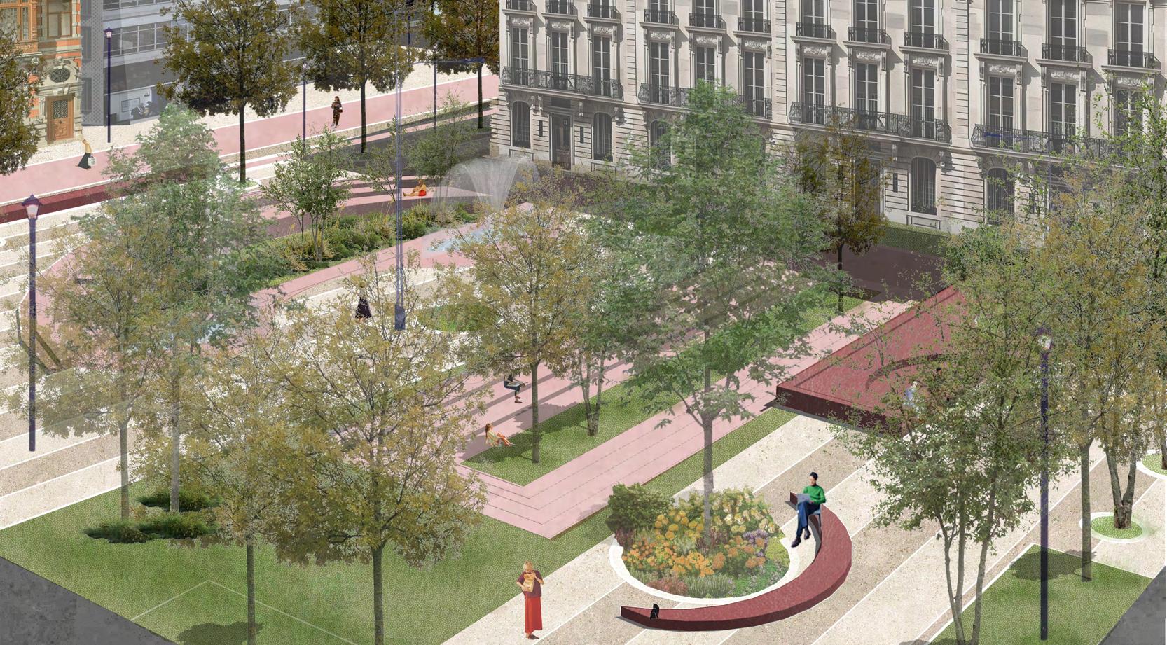
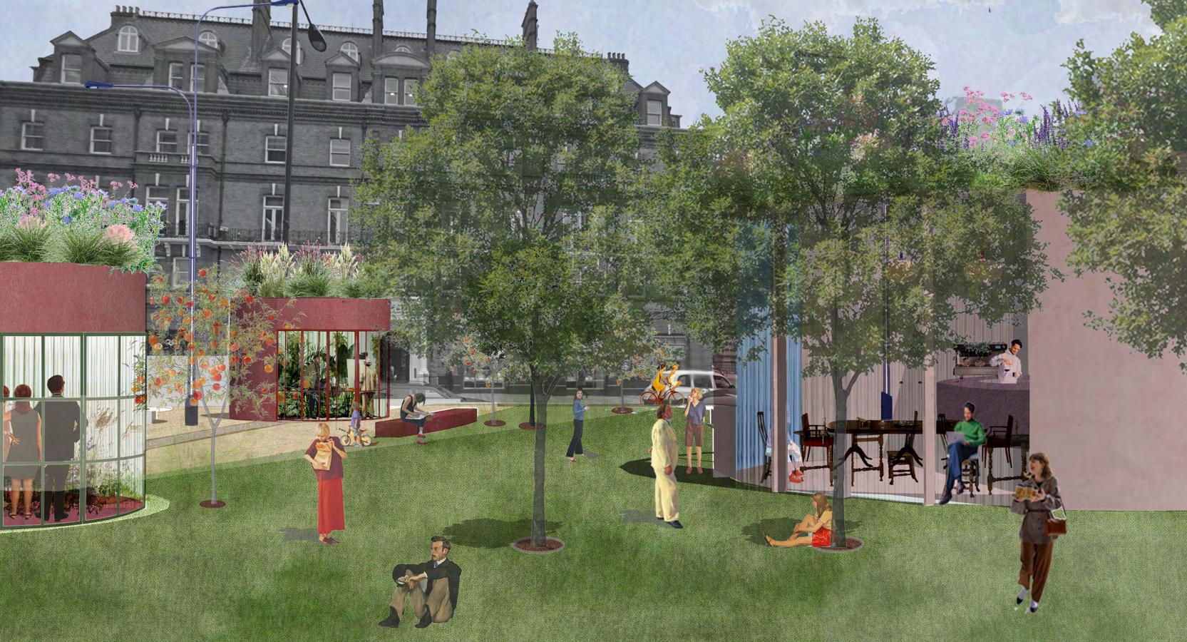
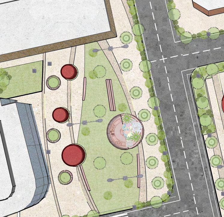
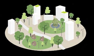
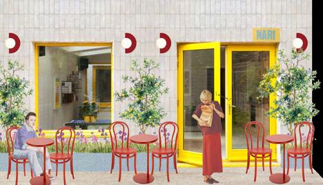
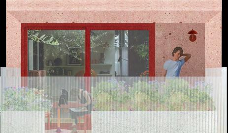
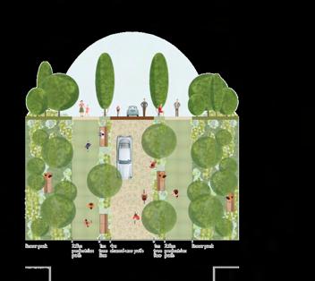
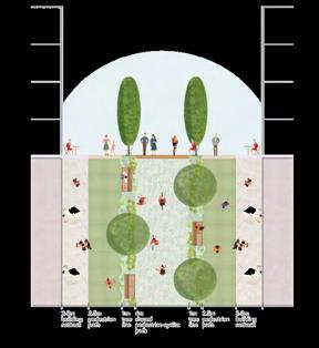
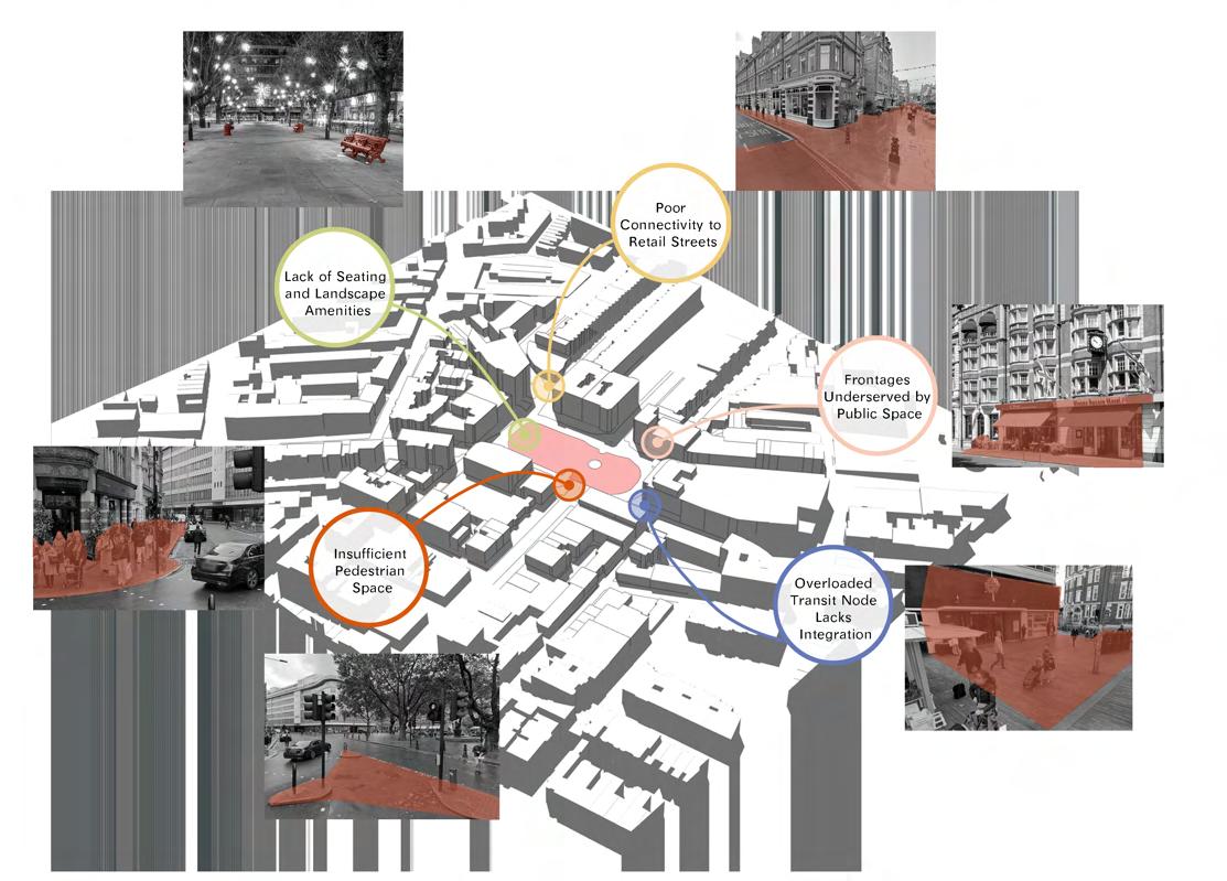
Sloane Square's original traffic-dominated area has been transformed into a lively, people-focused public square thanks to this makeover. To improve walkability and social interaction, the plan includes curved walkways, layered green areas, and interactive areas. Shaded seating sections, water features, terraces with plants, and tiny pavilions that facilitate community events are some of the main attractions. The design enhances connectivity and visual coherence throughout the square while creating a warm, inclusive ambiance by softening sharp edges and incorporating lush landscaping.
Zoned Greenery: Open lawns and borders bordered by trees create hospitable spaces for rest, casual get-togethers, and seasonal activities.
Sculptural Planters & Sitting: Integrated planting and curved sitting walls provide visual appeal and several uses, promoting informal use and a tactile connection to the natural world.
Active Edges: Ground plane activation from open plazas and café terraces promotes adaptable public use and commercial spillover.
Focal Water Features: With music, movement, and reflective surfaces that encourage pause, little pools and fountains improve the microclimate.
Layered Paths: Textures and patterns of paving establish spatial hierarchy, direct movement, and visually unite the environment.
Lighting & Accessibility: The area is readable and useable day and night thanks to strategic lighting that guarantees safety and inclusive access.