Comprehensive Plan Update
ADOPTION DATE
December 5, 2024

ADOPTION DATE
December 5, 2024

Mayor
Russell Wiita
City Council
Conner Morgan, Position 1
Stephanie Aldrich, Position 2
Cory Dearborn, Position 3
Joseph Hund, Position 4
Heidi Dawson, Position 5
Christina Sivewright, Position 6
Jeffrey Beeler, Position 7
City Staff
City Administrator
Tyler Christian
Planning Board
Kenneth Morrell, Position 1
Whitney Quillin, Position 2
Judie Cyr, Co-Chair, Position 3
Emily Keyes, Position 4
Michael Weidman, Chair, Position 5
Janet Peterson, Former Chair
Hal Hart, Community Development Director
Nate Morgan, Public Works Director
Cyd Donk, Associate Planner/Permit Technician
Mark Bond, Assistant Planner/Code Enforcement
Sky Valley Chamber of Commerce
Debbie Copple, Director
Melody Dazey, Economic Development
Consultant Team
Framework
Transportation Solutions, Inc.
Sieger Consulting
142 Introduction & Vision Connection
142 Planning Themes
143 Background & Engagement
144 Relationship to Other Elements
145 Transportation Today
147 Goals, Policies, & Programs
156
158 Introduction + Vision Connection
160 Planning Themes
160 Background + Engagement
161 Relationship to Other Elements
161 Capital Facilities + Utilities Today
162 Level of Service Standards
165 Goals, Policies, and Programs
AADT
Annual Average Daily Traffic
ADA Americans with Disabilities Act
ADT Average Daily Traffic
ADU Accessory Dwelling Unit
AMI Area Median Income
AWDT Average Weekday Traffic
BAS Best Available Science
BLTS Bicycle Level of Traffic Stress
BMP Best Management Practice
CARA Critical Aquifer Recharge Area
CFP Capital Facility Plan
CIP Capital Improvement Plan
CDBG Community Development Block Grant
CPP Countywide Planning Policies
CPTED Crime Prevention through Environmental Design
CTR Commute Trip Reduction
DADU Detached Accessory Dwelling Unit
DOE [Washington State] Department of Ecology
DU/AC Dwelling unit per Acre
EMS Emergency Services
ESA Endangered Species Act
FEMA Federal Emergency Management Act
FHWA Federal Highway Administration
GIS Geographic Information System
GMA Growth Management Act
HUD [U.S. Department of] Housing & Urban Development
LEED Leadership in Energy & Environmental Design
LID Low Impact Development
LOS Level of Service
LTS Level of Traffic Stress
NPDES National Pollution Discharge Elimination System
OFM [Washington State] Office of Financial Management
PAA Planned Annexation Area
PHS Priority Habitat & Species Program
PROS Plan Parks, Recreation, & Open Space Plan
PSE Puget Sound Energy, Inc.
PSH Permanent Supportive Housing
PSRC Puget Sound Regional Council
RCW Revised Code of Washington
RDI Racially Disparate Impacts
SEPA [Washington] State Environmental Policy Act
SMA Shoreline Management Act
SMP Shoreline Master Plan
TAZ Transportation Analysis Zones
TDM Transportation Demand Management
TDR Transfer of Development Rights
TIP Transportation Improvement Program
TOD Transit Oriented Development
UGA Urban Growth Area
WSDOT Washington State Department of Transportation
WUTC Washington Utilities & Transportation Commission
Annual Average Daily Traffic (AADT): Average daily traffic volume on a roadway for all days of the week during a period of one year, expressed in vehicles per day (vpd).
Active Transportation: Refers to any form of human-powered transportation—walking, cycling, using a wheelchair, in-line skating or skateboarding.
Accessory Dwelling: “Accessory unit” means a second dwelling unit either in or added to an existing single-family detached dwelling, or in a separate accessory structure on the same lot as the main dwelling, for use as a complete, independent living facility with provision within the accessory apartment for cooking, eating, sanitation, and sleeping. Such a dwelling is an accessory use to the main dwelling. Accessory units are also commonly known as “mother-in-law” units or “carriage houses.”
Americans with Disabilities Act (ADA): A wide-ranging civil rights law that prohibits, under certain circumstances, discrimination based on disability. Title II of the Act prohibits discrimination by all public entities at the local (i.e. school district, municipal, city, county) and state level, including access to programs and services offered by the entity, as well as physical access described in the ADA Standards for Accessible Design.
Average Daily Traffic (ADT): Average daily traffic volume on a roadway, measured during a period of less than one year.
Best Management Practices: These are defined by the Washington State Department of Ecology as physical, structural, and/or managerial practices that, when used singly, or in combination, prevent or reduce pollution of water. The types of BMPs include source control, runoff treatment, and stream -bank erosion control.
Bicycle Facility: An improvement designed to facilitate mobility by bicycle, including bicycle trails, bicycles lanes, and storage facilities.
Bicycle Level of Traffic Stress (BLTS): A measure of bicyclist experience on an element of transportation infrastructure, including roadways, bike lanes, trails, and shared-use paths. BLTS indicates the user’s perception of personal comfort or safety.
Calibration: In transportation modeling, the adjustment of model parameters to allow a model to generate more accurate outputs.
Capacity (transportation): As a travel demand modeling input, capacity represents the practical limit of vehicles which can be served by a particular network element in a given unit of time. In general, as demand increases relative to capacity on a given network element, delay increases and speed decreases. In the Sultan travel demand model, capacity is expressed in units of vehicles per hour.
City: When capitalized, City pertains to the City of Sultan as a municipal government and jurisdiction. Lowercase city is used generically when not referring to a proper noun.
Climate Resilience: The capacity of a community, business, or natural environment to prevent, withstand, respond to, and recover from climate impacts and disruptions.
Climate Mitigation: Involves strategies to reduce greenhouse gas emissions and enhance natural absorbers of these gases to limit global warming. It includes transitioning to renewable energy, improving energy efficiency, and protecting forests. Unlike climate change adaptation, mitigation addresses the causes rather than the impacts of climate change.
Clustering: A development design technique that concentrates buildings or lots in specific areas on a site to allow remaining land to be used for recreation, common open space, or the preservation of historically or environmentally sensitive areas and features.
Comprehensive Plan: The City’s future-looking vision, goals, and policies document that holistically covers land use, development, and infrastructure. The Washington State Growth Management Act establishes comprehensive plans as the centerpiece of local long-range planning to guide day-to-day decisions by elected officials and local government staff. Each Washington city and county must periodically review and, if needed, revise its comprehensive plan and development regulations every 10 years.
Concurrency: A land use planning and implementation tool, introduced in the Washington State Growth Management Act (GMA), which is designed to ensure that necessary public facilities and services to support new development are available and adequate (based on adopted Level of Service standards) at the time of development.
Congestion: Results when traffic demand approaches or exceeds the available capacity of the system. While this is a simple concept, it is not constant. Traffic demands vary significantly depending on the season of the year, the day of the week, and even time of day. Also, the capacity, often mistaken as constant, can change because of weather, work zones, traffic incidents, or other non- recurring events.
Connectivity: The state or extent of being connected or interconnected for all modes of transportation.
Context-sensitive Infill: Infill development designed to be compatible with the existing community character. Compatible implies a response to basic neighborhood patterns—such as green street edges of front yards and street trees or frontage patterns, forms, and orientation of buildings—whose continuation allows change to be accommodated while preserving cherished aspects of neighborhood character. The continuation of these patterns can accommodate a diversity of architectural styles, while providing an underlying sense of cohesion and “place” that helps define the character of neighborhoods.
Cottage Housing: Detached bungalow scale houses clustered around a common open space and/or private spaces aggregated together in a commons arrangement.
Critical Areas: Include the following areas and ecosystems: (a) Wetlands; (b) areas with a critical recharging effect on aquifers used for potable water; (c) fish and wildlife habitat conservation areas; (d) frequently flooded areas; and (e) geologically hazardous areas (RCW 36.70A.030(5)).
Density Averaging: Also known as lot size averaging, allows the size of individual lots within a development to vary from the zoned maximum density, provided that the average density in the development as a whole meets that maximum.
Erosion Hazard Areas: Areas in the city underlain by soils that are subject to severe erosion when disturbed. Such soils include, but are not limited to, those classified as having a severe or very severe erosion hazard according to the USDA Soil Conservation Service.
Fair Housing: The ability for all people to choose where they live without discrimination based on race, color, national origin, sex, family status, or disability—these are the “protected classes” under state and federal law. (Some places also protect age, sexual orientation, or having a Section 8 voucher). Cities may not make zoning or land use decisions or implement policies that exclude or otherwise discriminate against protected persons, including individuals with disabilities.
Floodplain: Total area subject to inundation by the base flood, i.e., a flood having a one percent chance of being equaled or exceeded in any given year, often referred to as the 100-year flood.
Functional Plans: Detailed plans for facilities and services and action plans for other governmental activities such as parks, surface water, streets, etc. Functional plans should be consistent with the Comprehensive Plan.
Geologically Hazardous Areas: Areas that because of their susceptibility to erosion, sliding, earthquake, or other geological events, are not suited to the siting of commercial, residential, or industrial development consistent with public health or safety concerns (RCW 36.70A.030(9)).
Goal: A general statement expressing a desired result consistent with the vision and towards which policies and objectives aim.
Habitat Area: Natural vegetated areas on which animals depend for one or more life cycle requirements, such as food, shelter, migration, and reproduction. The greater the size and complexity of a habitat area, the more plant and animal species it can support.
Human Scale: Human scale means that the size of the building relates to the approximate dimensions of the human body.
Infill: Urban infill is defined as new development that is sited on vacant or undeveloped land within an existing community, and that is enclosed by other types of development. The term “urban infill” itself implies that existing land is mostly built-out already, and what is being built is in effect “filling in” the gaps. The term most commonly refers to building single-family homes in existing neighborhoods but may also be used to describe new development in commercial, office, or mixed-use areas.
Intersection Transportation Level of Service (LOS): Measures average peak hour delay for vehicles at key intersections. LOS is expressed qualitatively using letters A through F, with A representing very good operations and F representing undesirable operations.
Landslide Hazard Areas: Landslide hazard areas means those areas potentially subject to risk of mass movement due to a combination of geologic, topographic, and hydrologic factors. These areas are typically susceptible to landslides because of a combination of factors including: bedrock, soil, slope gradient, slope aspect, geologic structure, groundwater, or other factors.
Location-Efficient Housing: Location-efficient housing refers to homes that have easy or inexpensive access to workplaces, schools, shopping, and other necessary destinations. Housing locations are efficient to the most people when routes to these destinations are easily walkable, don’t require the resident to own an automobile, and can be reached in 20 minutes or less.
Low Impact Development (LID): Design concepts including a variety of strategies and techniques to address the negative impacts associated with stormwater runoff. Strategies include, but not limited to:
• Reduce the street width and road network within a development.
• Replace impervious roadways, driveways and sidewalks with more pervious materials where feasible.
• Reduce lot size and setbacks/frontage requirements through cluster designs.
• Increase retention of forested open space and better protect critical areas.
• Direct stormwater runoff to vegetated bioretention areas where shallow storage is used to promote infiltration and evaporation.
• Eliminate conventional pipe and catch basins to increase time of concentration by promoting sheet and shallow concentrated flow.
• Enhance soil conditions on site by preservation of existing topsoil structure, soil amendments and protection from compaction during construction.
• Reuse runoff for non-potable application onsite.
Major approach (Transportation): At an intersection, the major approaches are generally those that have a higher functional classification and serve higher traffic volumes. At minor-road-only stop control intersections, traffic on major approaches is not required to stop.
Manufactured Home: A type of prefabricated housing that is largely assembled in factories and then transported to sites of use. Manufactured homes are built as dwelling units of at least 320 square feet in size with a permanent chassis to assure the initial and continued transportability of the home. The requirement to have a wheeled chassis permanently attached differentiates “manufactured housing” from other types of prefabricated homes, such as modular homes.
May: When “may” is used in a policy, such language indicates the City has the option to take steps to accomplish the purpose of the policy.
Minor approach: At an intersection, the minor approaches are generally those that have a lower functional classification and serve lower traffic volumes. At minor-road-only stop control intersections, traffic on minor approaches is required to stop.
Multi-Family Dwelling/Dwelling, Attached: A one-family dwelling attached to one or more one-family dwellings by common roofs, walls, or floors. Common types of attached multi-family dwellings include:
• Flat: A residential building containing two (2) or more dwelling units which are attached at one or more common roofs, walls, or floors. Typically, the unit’s habitable area is provided on a single level. Unit entrances may or may not be provided from a common corridor.
• Townhouse: A one-family, ground-related dwelling attached to one or more such units in which each unit has its own exterior, groundlevel access to the outside, no unit is located over another unit, and each unit is separated from any other unit by one or more vertical common walls. Typically the units are multi-story.
Natural Area: Natural areas are characterized as undeveloped landscapes containing vegetation, slopes, streams, lakes, pollinator habitat, and other features that have developed through natural growth and evolution rather than planned development or construction.
Passive Recreation: Outdoor recreational activities, such as nature observation, hiking and canoeing or kayaking, that require a minimum of facilities or development and that have minimal environmental impact on the recreational site.
Permanent Supportive Housing: Housing that combines low-barrier affordable housing, health care, and supportive services to help individuals and families lead more stable lives.
PM peak hour (Transportation): The highest four consecutive fifteenminute volume intervals during the PM peak period of travel. PM peak hour represents the continuous one-hour period when traffic volumes on local roadways are typically at their peak, and generally corresponds to the period of rush hour traffic when commuters return home from work.
Policy: A statement giving guidance to decision makers for the purpose of achieving a goal’s desired result.
Priority Species: Those species considered to be priorities for conservation and management and identified in the Washington Department of Fish and Wildlife Priority Habitat and Species (PHS) List.
Salmonid: A fish of the salmon family.
Shall: When “shall” is used in a policy, such language requires that the City take steps to accomplish the purpose of the policy.
Should: When “should” is used in a policy, such language indicates the City has the option to take steps to accomplish the purpose of the policy.
Single-Family Dwelling: A building containing one dwelling unit which is not attached to any other dwelling by any means except fences, has a permanent foundation, and is surrounded by open space or yards.
Special Needs Housing: Special needs housing in this plan includes homes suitable for and occupied by people with one or more self-help limitations, such as physical or mental disability, long-term illness, or alcohol or drug issues. The housing may or may not incorporate supportive services, and may be permanent or transitional. Examples include adult family homes, assisted living facilities, and group homes for people with developmental disabilities.
Stormwater: Water from rainfall and snow that runs off surfaces such as rooftops, paved streets, highways, and parking lots and flows into surface water including drainage facilities, rivers, streams, lakes, or Puget Sound. Stormwater can also come from hard grassy surfaces like lawns, play fields, and from graveled roads.
Surface Water: Water found above the land, including oceans, estuaries, lakes, rivers, streams, and ponds.
Sustainability: Generally refers to addressing the current population’s
needs without compromising future generations’ quality of life. Environmental sustainability involves promoting actions that minimize pollution, waste, and harm to our natural ecosystems. The aim is to ensure a healthy environment that provides resources for future generations.
Traffic assignment: The final step of the travel forecasting process. Traffic assignment concerns the selection of routes between origins and destinations in transportation networks. In general, traffic assignment assumes an equilibrium condition – in other words, travelers will strive to find the shortest (or least resistance) path from origin to destination, with network equilibrium occurring when no vehicle can decrease travel effort by shifting to a new path.
Transfer of Development Rights: Transfer of Development Rights (TDR) means the transfer of the right to develop or build from sending sites to receiving sites. The sending site is the parcel of land from which development rights will be transferred. After transferring the development rights from the sending parcel, future development is limited. Receiving sites are sites to which development rights are transferred. Typically, these are parcels of land in urban areas where the existing services and infrastructure can accommodate additional growth. Development rights that are “sent” off of a sending site are placed on a receiving site.
Transit Oriented Development: Transit-oriented development (TOD) describes a mix of housing, office, retail, and amenities integrated into a walkable neighborhood and anchored by high quality public transit.
Transportation Analysis Zone (TAZ): The unit of geography used in most transportation planning models. TAZs include the socioeconomic data, including household and employment data, which is used as inputs to the trip generation procedure.
Travel demand model: A tool used by transportation engineers and planners to forecast future travel patterns and conditions.
Trip generation: The first step in the travel forecasting process. Trip generation predicts the number of trips originating in or destined for a transportation analysis zone.
Trip distribution: The second step of the travel forecasting process. Trip distribution matches trip origins and destinations to develop a “trip table” or origin-destination matrix that displays the number of trips going from each origin to each destination.
Total Maximum Daily Load (TMDL): A regulatory term in the U.S. Clean
Water Act, describing a value of the maximum amount of a pollutant that a body of water can receive while still meeting water quality standards.
Universal Design: Universal Design refers to a broad spectrum of ideas meant to produce products, buildings, or other built environments that are usable to the greatest extent possible by everyone, regardless of their age, ability, or status in life. Wheelchair ramps, essential for people in wheelchairs but also used by all, are a common example. There are also cabinets with pull-out shelves, kitchen counters at several heights to accommodate different tasks and postures, and low-floor buses that “kneel” (bring their front end to ground level, rather than on-board lifts).
Validation (Transportation): The application of the calibrated model and comparison of the results against observed data.
Vehicle trip: A trip made by a motorized vehicle from an origin to a destination, usually assumed to be without stops. It may be associated with a more-than-one-person trip (for example, in a carpool). Vehicle trips are the units of travel in the Sultan travel demand model.
Vision: A forward-looking statement of the community’s desired form, function, and aesthetic. It serves as the keystone upon which goals, policies, and programs are based.
VISION 2050: VISION 2050 is the region’s plan to provide an exceptional quality of life, opportunity for all, connected communities, a spectacular natural environment, and an innovative, thriving economy. Developed by the Puget Sound Regional Council, VISION 2050’s multicounty planning policies, actions, and regional growth strategy guide how and where the Puget Sound Region grows through 2050. The plan informs updates to the Regional Transportation Plan and Regional Economic Strategy. VISION 2050 also sets the stage for updates to countywide planning policies, and informs the local comprehensive plans of cities and counties.
Volume to Capacity (V/C): The rate of comparison of roadway demand (vehicle volumes) with roadway supply (carrying capacity).
Wetland: Area that is inundated or saturated by surface water or ground water at a frequency and duration sufficient to support, and that under normal circumstances do support, a prevalence of vegetation typically adapted for life in saturated soil conditions. Wetlands generally include swamps, marshes, bogs and similar areas. Wetlands do not include those artificial wetlands intentionally created from nonwetland sites, such as irrigation and drainage ditches or grass-lined swales. Wetlands may include those artificial wetlands intentionally created from nonwetland areas created to mitigate conversion of wetlands (RCW 36.70A.030(20)).

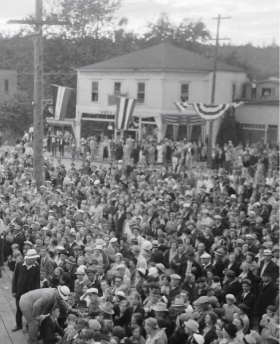
Bucking contest July 4th 1936 at Sultan University of Washington Libraries, Special Collections
Sultan 2044—the 2024 Comprehensive Plan Periodic Update for the City of Sultan—arises from extensive collaboration between City staff, Planning Board members, City Council members, and the community at large. This plan charts an implementable path of goals, policies, and programs to satisfy a shared community vision for 2044.
This plan advances the City’s 2011 Comprehensive Plan by responding to emerging community needs and desires while fulfilling Washington State Growth Management Act mandates for periodic updates. It also satisfies requirements established in Snohomish County’s Countywide Planning Policies and Multicounty Planning Policies from the Puget Sound Regional Council.
The following Plan is split into two volumes.
Volume I includes the community vision, policy framework, Future Land Use Map, and goals, policies, and programs for all plan elements including Land Use, Housing, Community Design, Natural Environment, Economic Development, Parks & Recreation, Transportation, and Capital Facilities & Utilities.
Volume II includes supporting research and documentation that justifies the goals, policies, and programs of each plan element laid out in Volume I. In many cases, recent planning efforts are reflected or referenced in this material such as the Housing Action Plan and the Parks, Recreation, and Open Space (PROS) Plan.
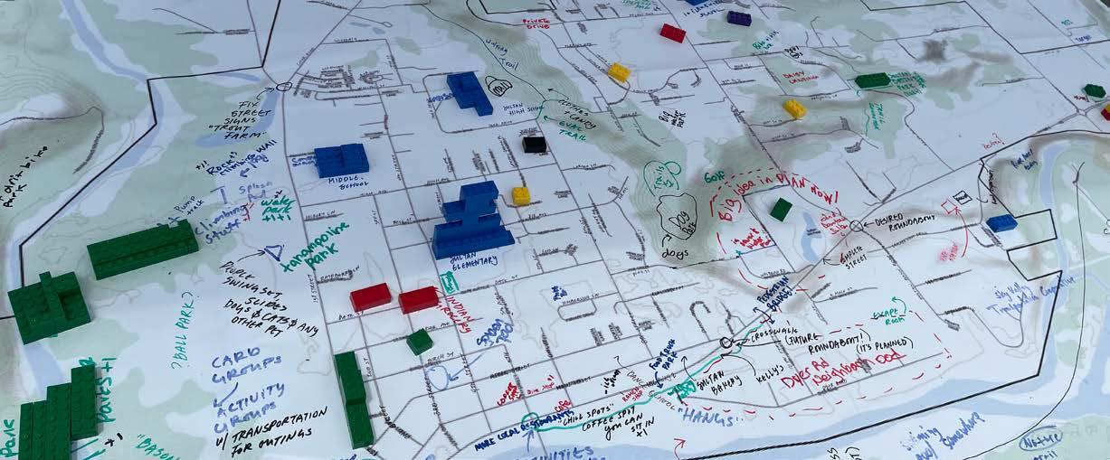
Hands on activities, like this LEGO PlaceIt map, were key to engaging community members of all ages and abilities.
Sultan 2044 reflects community input gained during an extensive engagement effort led by the City’s Community Development Department. This involved school outreach, a three-day Planning Summit Series, tabling at community events, community surveys, and collaboration with the Planning Board and City Council. The City frequently provided project updates in its newsletter, conducted outreach at the Sultan Farmer’s Market and everyday listening posts at City Hall and Red Apple Market, attended luncheons at the Volunteers of America, went doorto-door in Sultan’s neighborhoods, shared information during weekly Coffee with the City gatherings, and maintained a consistently updated multi-lingual project website. A selection of these outreach efforts are summarized below.
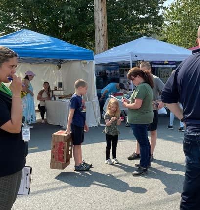
Over the summer of 2023, the project team hosted a table at the Sultan Farmers Market on 11 occasions, which resulted in hundreds of community interactions. City staff and consultants provided project information, listened to community feedback, and provided interest forms and volunteer sign-up sheets for those who wanted to engage more with the Plan. A variety of interactive mapping and photo preference activities were used to gather specific feedback and to generate focused conversations.
The City’s Farmers Market booth was also critical for disseminating a community survey covering demographic information and comprehensive planning priorities. The survey—made available online and in hardcopy— received 761 responses that provided valuable information about beloved aspects of Sultan and desires for the future.
The annual Sultan Shindig event in Downtown, hosted by the Sky Valley Chamber of Commerce, featured a Sultan 2044 booth to share information, record community feedback, and issue the community survey. The project team also designed a PlaceIt activity where people— especially kids—were encouraged to place LEGOs on a citywide basemap where they desire future commercial activities, parks, housing, and transportation linkages across the city.
City staff made themselves available several days a week in strategic everyday locations over the Summer and Fall of 2023 for a total of 16 days. A table outside Red Apple and inside the City Hall atrium provided community members with general project information, interactive mapping exercises, photo preference activities, and survey-taking opportunities.
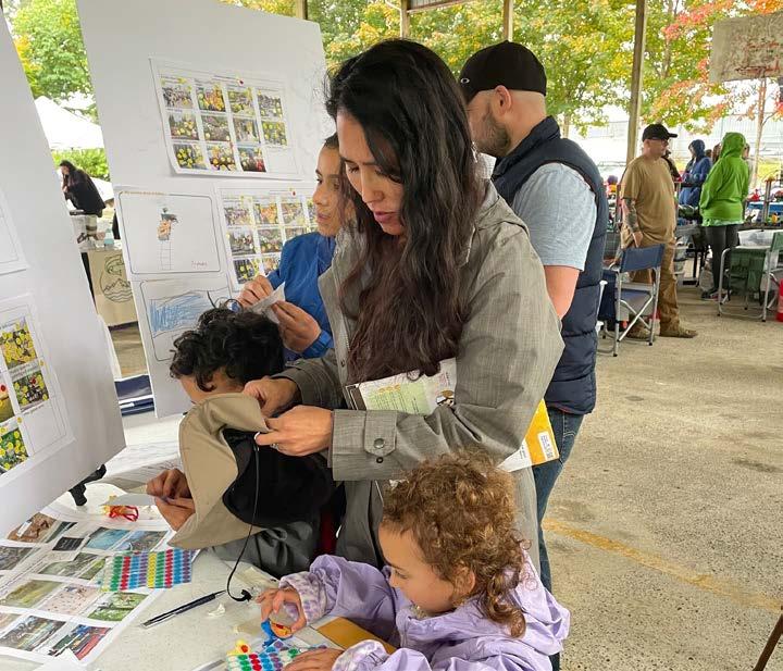
The annual Return of the Salmon celebration at Osprey River Park included a booth focused on desired improvements for Sultan’s parks and downtown. Dozens of community members learned about comprehensive planning and responded to visual preference prompts to help understand Plan priorities for public space and park amenities.
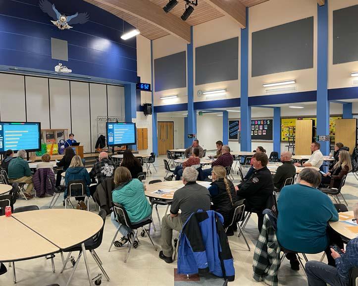
Offered online and in-person at Sultan Middle School, the threeday Planning Summit covered comprehensive planning education, community visioning exercises, and area-focused engagement activities with 73 community members. Small groups mapped community assets, challenges, and desired connections during the kick-off event and the following nights used a variety of polling and mapping prompts to understand participants’ aspirations for Downtown, the US-2 corridor, and Sultan’s neighborhoods.
City staff attended High School lunchtimes and several school-based events like the Health Fair and Educational Jamboree at the Sultan Middle School to conduct focused outreach with local kids. Visual preference surveys and discussions helped the project team understand students’ (and their families’) desires for kid-friendly destinations and downtown amenities.
The project team brought a variety of presentations, discussion questions, and interactive workshops to the Planning Board and City Council throughout the Update process. Beyond sharing periodic status reports, staff and consultants attended 9 meetings for direction on the 2044 vision, growth strategies, and future land use map.
Night one of the Planning Summit was held at Sultan Middle School.
The Sultan 2044 Community Vision builds on community needs and desires, carrying forward the foundations of community building economic activity, connectivity and access, infrastructure sufficiency, and environmental stewardship that have been emphasized in past planning efforts. Sultan 2044 adapts and refines these values to the evolving context of a rapidly growing and diversifying community.
The 2044 Planning Vision is organized into nine vision strategies. The vision strategies are a synthesis of multiple outreach efforts which include pop-up activities, information sharing, and surveys at recurring community events like the Sultan Farmers Market, a three-night Planning Summit Series, and additional workshops with the City Council and Planning Board. The 2044 Vision also reflects aspirations expressed in previous visioning efforts for the 1995 Comprehensive Plan, 2005 APA Workshop, 2011 Comprehensive Plan, and 2021 Strategic Plan for Downtown Sultan.
Plan for more grocery offerings, retail shops, restaurants, cafes, and other daily needs within the city. The City will work to enhance and expand walkable mixed-use districts Downtown, along US-2, and in Sultan’s neighborhoods for more retail, services, and amenities.
Provide year-round destinations for kids of all ages that not only bring joy, but instill life skills and meaningful opportunities. The City will support businesses, entertainment, recreational opportunities, learning centers, and more to provide a rich social and educational experience for youth.
Emphasize art, culture, history, and recreation to strengthen community identity and belonging. The City will promote art and culture year-round and celebrate its indigenous significance and local heritage as a logging town while fostering a strong sense of community for Sultan’s increasingly diversifying population.
Plan for a safe, connected multi-modal transportation network that allows residents and visitors to reach everyday connections comfortably and efficiently. The City will tie together new and existing neighborhoods with additional connections, such as multi-use trails and multi-modal streets, for increased safety and accessibility.
Improve the condition of US-2 to maximize reliability, safety, and the visual image of Sultan. The City will focus on a variety of land use, beautification, environmental, and transportation efforts to capitalize on the visual and functional aspects of US-2.
Ensure new growth provides community benefits and sufficient infrastructure. The City will ensure that the new infrastructure aligns with the rate of population growth, addressing housing, employment, and community needs accordingly.
Provide more diverse housing types and ownership opportunities to support a growing and diversifying community. The City will support and encourage diverse and creative housing opportunities across all neighborhoods.
Expand and enhance parks, recreation, and trails as distinguished community assets. The City will pursue recreation-based tourism strategies, grow its trail network, and focus on a variety of active and passive park programming.
Plan for climate resilience and mitigate natural hazards like floods and wildfire. The City will guide investment away from natural hazards and encourage sustainable low-carbon lifestyles and development patterns.
Each element within the Comprehensive Plan Update is related to Sultan’s Big Ideas for 2044. This matrix illustrates the connection strength between the Big Ideas and the impact individual elements have on them.
Plan for more grocery offerings, retail shops, restaurants, cafes, and other daily needs within the city Economic Development & Community Enrichment
Provide year-round destinations for kids of all ages that not only bring joy, but instill life skills and meaningful opportunities
Emphasize art, culture, history, and recreation to strengthen community identity and belonging
Plan for a safe, connected, multi-modal transportation network that allows residents and visitors to reach everyday connections comfortably and efficiently
Strong Connection
Moderate Connection
Improve the condition of US-2 to maximize reliability, safety, and the visual image of Sultan
Ensure new growth provides community benefits and sufficient infrastructure
Provide more diverse housing types and ownership opportunities to support a growing and diversifying community
Expand and enhance parks, recreation, and trails as distinguished community assets Parks & Environment
Weak Connection
Plan for climate resilience and mitigate natural hazards like floods and wildfire
Comprehensive planning is a fundamental method for calibrating state, regional, county, and municipal goals and objectives and linking them to strategic policies and actions to guide the City over a twenty year planning period. Comprehensive plans must plan for a minimum of twenty years, with periodic updates every ten years to ensure that the city is growing and changing in alignment with the Plan. Periodic updates are also an opportunity to address changing conditions and needs in the city and region. Each planning effort includes significant community engagement, as well as coordination and participation between city agencies, boards and commissions, and elected officials. Comprehensive planning serves as an important opportunity for collaboration across departments and the community, resulting in positive and coordinated growth that respects and enhances a city’s unique sense of place.
The purpose of the Comprehensive Plan, as articulated by state legislation, is to create a policy framework that aligns planning efforts across and within agencies. The Plan guides the adoption and implementation of development regulations by the City and partner organizations, and establishes both long- and short-term City priorities. It is intended to be a central resource linking goals, policies, and strategies at a municipal level, and aligning them to local standards and actions to be implemented. Importantly, legislation includes a requirement that zoning, capital expenditures, and development regulations conform to the Goals, Policies, and Programs articulated in the Comprehensive Plan. Beyond state and regional mandates, the Comprehensive Plan is a guiding document that drives the day-to-day work of the City.
Sultan is guided by Washington State planning requirements that are contained in state legal codes and the 1990 Growth Management Act (GMA), which is codified in RCW Chapter 36.70A and in other related and amended sections of the Revised Code of Washington (RCW). As the name indicates, the GMA was adopted to ensure strategic growth in the state, preserve resource lands, and coordinate density in jobs and housing within existing regional centers. This approach reduces infrastructure costs and resource consumption while preserving Washington’s environmental assets.
In advance of planning efforts, the Office of Financial Management (OFM) provides a range of population projections for Washington counties so that the counties can plan appropriately to accommodate anticipated growth. For large metropolitan regions such as Puget Sound, a regional body acts as an intermediary for these growth allocations. In Puget Sound, members of the Puget Sound Regional Council (PSRC) including Snohomish, Kitsap, King, and Pierce Counties as well as the region’s tribes, cities, transit agencies, and port districts work together to set a regional growth target and then allocate growth to the respective counties. This ensures that large transit projects and other regional infrastructure investments are coordinated with growth in employment and housing. Finally, counties work with their constituent cities following the regional growth construct set by PSRC to allocate jobs and housing across different geographic areas. These growth targets are formalized in the Snohomish County Countywide Planning Policies (CPPs). Each city must then plan for its assigned growth within its urban growth area and municipal boundary. A complete description of the Snohomish Countyled process for establishing development capacity, growth targets, and affordable housing needs is provided in Volume II.
Office of Financial Management (OFM) produces county growth projections
Counties and other members within the Puget Sound Regional Council collectively decide on the regional growth target within OFM projections
Snohomish County works with local governments to allocate job and housing growth across constituent cities
Figure IN-1. Growth Allocation Methodology
Sultan allocates jobs and housing based on existing land capacity and updates the Comprehensive Plan and zoning code to direct growth
The GMA triggers comprehensive plans at the regional, county, and city level. Countywide Planning Policies must be consistent with the regional comprehensive plan (PSRC’s VISION 2050), and city comprehensive plans must be consistent with both regional and county plans. For Sultan, this means that this Comprehensive Plan must conform to state requirements, PSRC’s VISION 2050, and Snohomish County’s Countywide Planning Policies. In recent years, major amendments to the Growth Management Act, VISION 2050, and Countywide Planning Policies include provisions to address deficits in affordable housing, climate change adaptation and mitigation, and racially disparate impacts.
The topics addressed in this comprehensive plan are also the subject of many other City efforts and plans. The comprehensive plan is aligned as accurately as possible with the latest topic-focused plans for housing, capital facilities, parks, and more without introducing redundancies in City policymaking. For example, the Housing Element includes goals, policies, and programs that support the 2023 Housing Action Plan (HAP) without directly repeating the strategies and actions in the HAP. As such, prior to the introduction of each element’s goals, policies, and strategies, this document will identify other relevant City plans.
The Sultan Comprehensive Plan follows the framework of the Community Vision, which is implemented through the Plan’s Future Land Use Map and the Plan elements. Each Plan element includes a series of goals, policies, and programs, which together make up the framework the City must follow when directing operations over the 20-year planning period. All goals, policies, and programs are written to achieve compliance with the Growth Management Act (RCW 36.70A.070(1)), PSRC VISION 2050, and the Snohomish County’s Countywide Planning Policies, and further the vision articulated by community members. For the purposes of this document, the terms “Goal,” “Policy,” and “Program” are defined as follows:
Goal – Broad statements indicating a general aim or purpose to be achieved. A goal is a direction setter, an ideal future end, condition, or state related to the public health, safety, or general welfare toward which planning and implementation measures are directed.
Policy – Topic-specific statements designed to address a specific goal or objective. Policies provide guidelines for current and future decisionmaking, identifying a clear commitment by the local legislative body. A policy is an extension of a plan’s goals, reflecting topical nuance as well as an assessment of conditions, and drives progress towards achieving that goal.
Program - Plans for getting from the current state to the conditions outlined in a goal or policy. A program provides a general plan or directive required to further a goal or policy. In some cases, a program can help the City articulate a specific set of actions.
The City of Sultan first adopted a Comprehensive Plan in 1994, which underwent a full update in 2011 and was subsequently amended in 2015 and 2019. The 2024 periodic update to the existing comprehensive plan must align with state, regional, and county-level requirements which stem from the State’s Growth Management Act, Puget Sound Regional Council’s VISION 2050 and its Planning Policies, and Snohomish County’s Countywide Planning Policies respectively.
Furthermore, new bills adopted in the 2021 and 2022 state legislative sessions significantly augment the ways in which comprehensive plans support growth and introduce new conditions that also must be met during plan updates. These bills are summarized below:
HB 1220: Requires jurisdictions to plan for and accommodate, rather than encourage the availability of, emergency and affordable housing
HB 1241: Changes the Comprehensive Planning Periodic Update and Shoreline Master Program cycles from 8 to 10 years. Requires a 5-year implementation progress report and an annual work program for select jurisdictions
HB 1717: Adds new requirements for cities and counties to include local and regional tribes in planning processes and decisions
HB 2001: Expands the ability to build tiny houses
SB 5042: Changes the initial effective date of certain actions under the GMA
SB 5118: Designates juvenile rehabilitation community facilities as essential public facilities
SB 5235: Increases housing unit inventory by removing arbitrary limits on housing
SB 5275: Enhances opportunity in limited areas of more intensive rural development (LAMIRDs)
SB 5818 : Promotes housing construction in cities through amendments to, and limiting appeals under, SEPA and GMA
The 2024 Comprehensive Plan Update builds on the 2011 iteration of the Plan (and its more recent amendments), updating existing goals, policies, and programs from the previous plan. Staff from a variety of City departments collaborated with the consultant team on the following policy review and development processes:
• An external consistency check was conducted by comparing existing goals and policies against state, regional, and county requirements.
• Existing goals and policies were consolidated, reorganized, and revised to maintain or establish compliance.
• New and existing programs are also included to provide more hierarchy and ease of implementation.
• In some cases, existing policies were rewritten and recategorized as programs.
• New goals, policies, and programs were drafted to comply with state, regional, and county requirements and, ultimately, evaluated against the community vision for 2044.
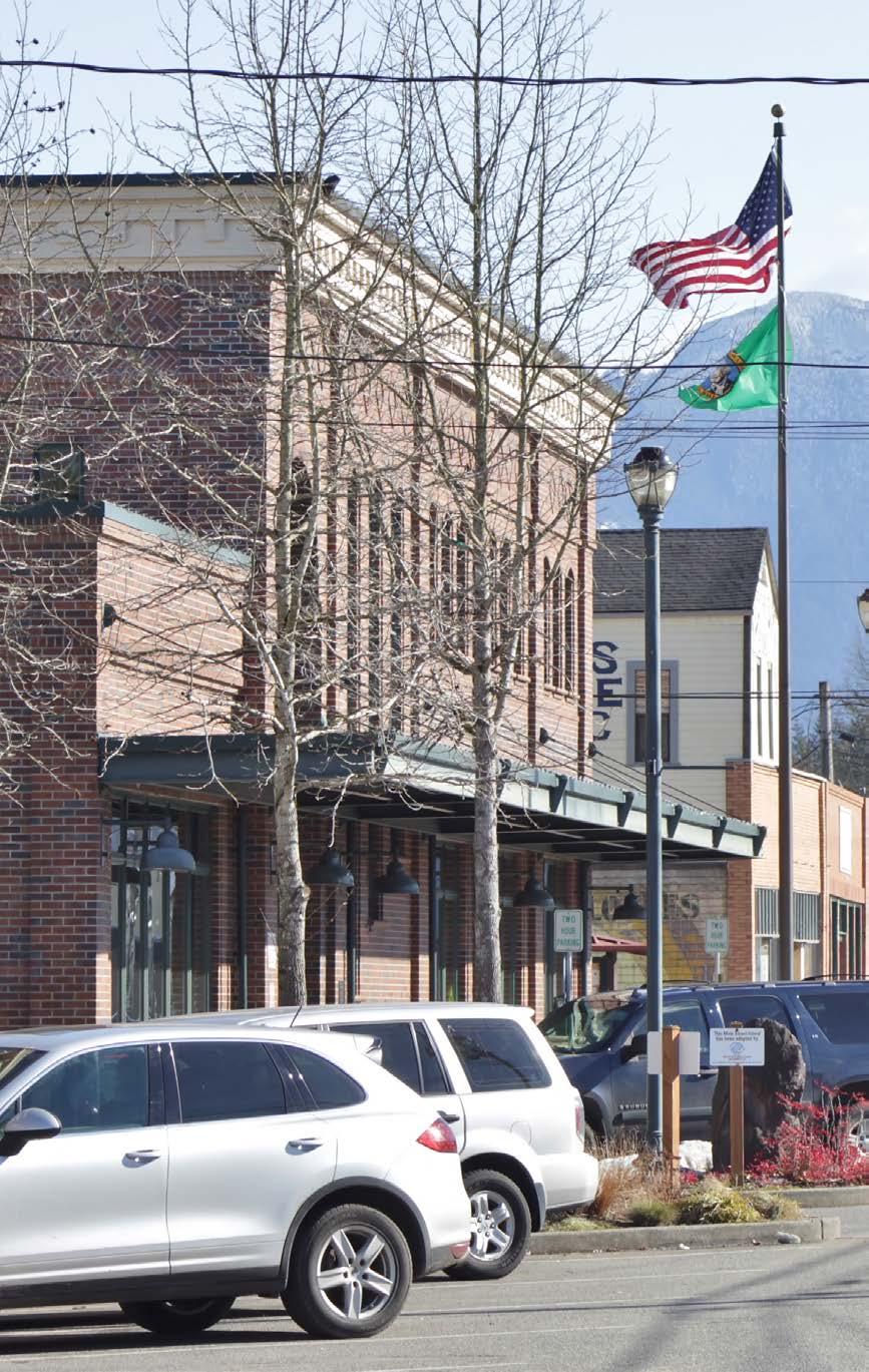
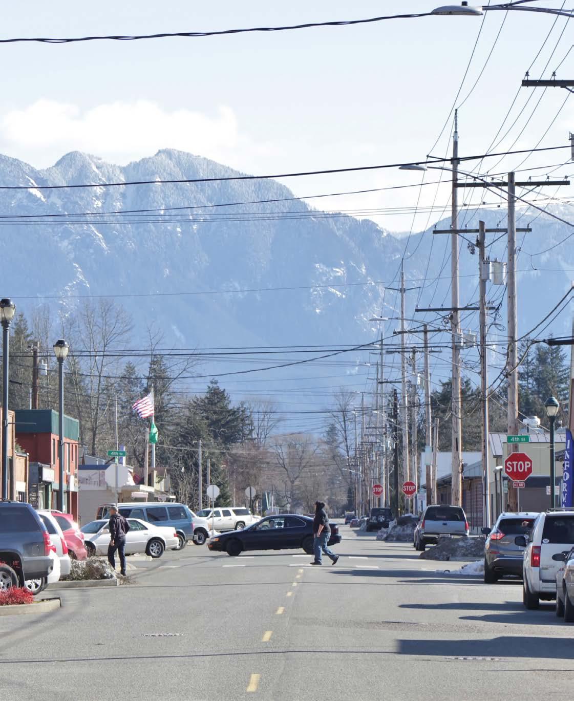
Sultan’s Community Design Element guides the urban design, aesthetic, and community identity qualities of the community vision for 2044. Celebrating mill town heritage, elevating arts and culture, nurturing a distinct small town feel, carefully blending the design of new development, and enhancing the image of Sultan’s US-2 corridor are all components of the vision that touch the Community Design Element. This element will continue to emphasize the City’s image as a suburban community embedded in a pristine natural setting with dramatic mountain views while guiding tasteful and functional neighborhood design and fostering vibrant public spaces that welcome a variety of people and experiences.
Each element is related to Sultan’s Community Vision for 2044. This graphic illustrates the strength of the connection between the Vision and the Community Design Element. For more on the Nine Big Ideas that make up the Vision, see the Community Vision Section of this document.
In past comprehensive plans, the Community Design Element has served to paint a detailed history and vision for the future of Sultan. This element has evolved into a critical component of the Plan with goals and policies to strengthen the City’s community identity, historic resources, and urban design qualities of its streetscapes, public spaces, and buildings.
This is Volume I of the Community Design Element. Volume II includes an analysis of Sultan’s existing community design.
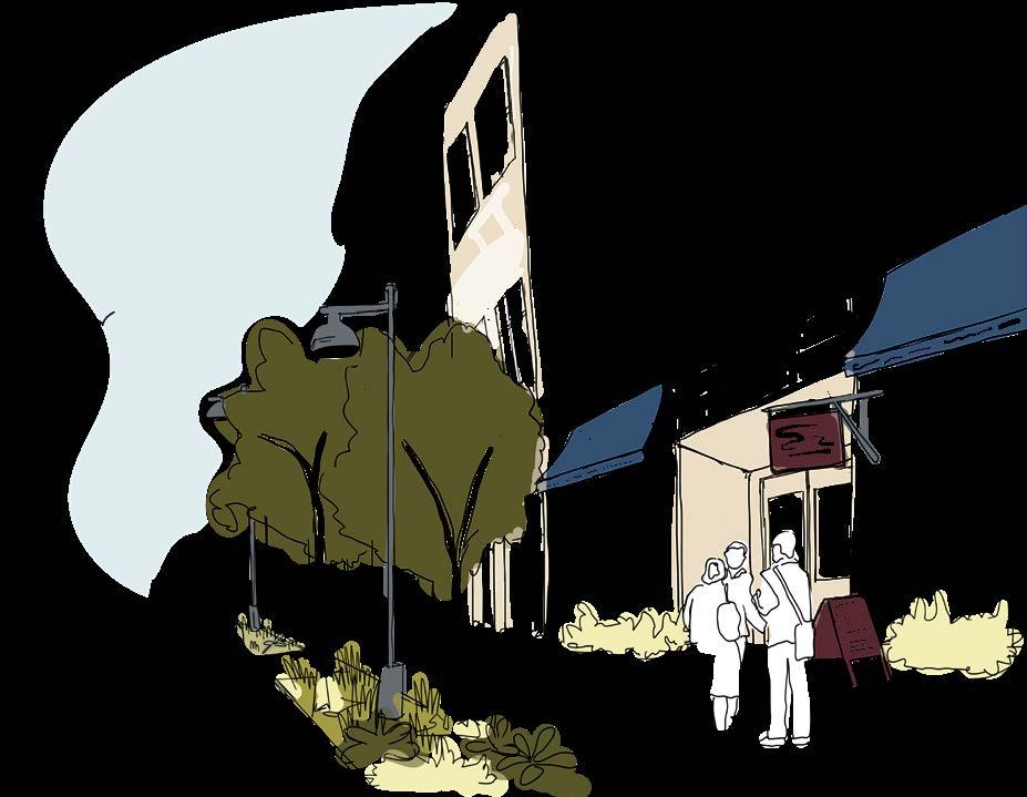
Community Design Element goals are linked to key themes identified by the greater Sultan community. The influence of these themes permeate other elements of the Comprehensive Plan.
• Integrate traditional development patterns, quality design, and public parks and connections in new neighborhoods (influenced elements: Land Use, Housing, Natural Environment, Economic Development, Parks & Recreation).
• Enliven public spaces with distinct community events, public art, and educational signage (Land Use, Economic Development).
• Enhance the placemaking qualities of streetscapes, parks, and other public spaces to maximize comfort and sense of identity for all (Land Use, Economic Development, Parks & Recreation, Transportation).
• Celebrate Sultan’s heritage and indigenous significance (Land Use, Natural Environment, Economic Development, Parks & Recreation).
Downtown Sultan is envisioned with flood-proof 3-story buildings, active retail frontages, pedestrian amenities, and street trees
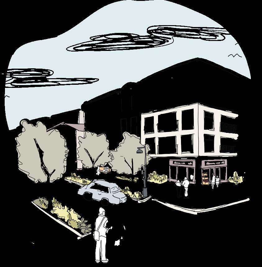
Desired conditions along the eastern extent of US-2 include 4-story mixed-use buildings and pedestrian amenities
Community Input
Community design was emphasized in many public discussions and outreach activities that informed this Plan update. From the onset of early engagement events in Summer 2023, community members vouched for a higher quality public realm and more opportunities for art and culture. Values for Sultan’s community design came through during various outreach efforts:
• Farmers Market and Other Community Events - Residents indicated that accessible parks, recreation, and natural areas were among the defining characteristics of Sultan’s identity. More community events, improved storefronts, distinct wayfinding, and street trees are desired features to enhance Downtown.
• Sultan Shindig - Not everyone feels welcome in Sultan and many community members are dissatisfied with the scale, design, and connectivity of new subdivisions. Street trees and park space must be a condition for new development, especially as it adds to Sultan’s natural sense of place.
• Planning Summit - Gathering places and community events are necessary for a strong sense of community in Sultan’s future. According to many residents, the visual appeal of the City—especially from US-2—is sub-optimal. New growth in neighborhoods and along US-2 needs to enhance the natural environment and include unique design features that make Sultan distinctive.
The Community Design Element is relevant to many other elements in the Plan. Goals and policies in this element guide the distinct placemaking and design features that set Sultan apart from other communities while fostering a feeling of belonging for all. Consequently, many goals and policies introduced here implicate other elements in the Plan. The Housing and Natural Environment Elements, for example, are directly influenced by community design directives for improved neighborhood design and the integration of native and climate-resilient plantings. Goals and policies for an interconnected system of parks and trails— critical features for Sultan’s identity—impact the Parks and Recreation Element.
Sultan’s unique charm derives from its beautiful natural setting and its physical and social characteristics. Smaller building scales, historic main street buildings, lively community events, vast natural areas, and locally-owned businesses are among the attributes that begin to define the City’s sense of community. Sultan’s neighborhoods, streetscapes, public spaces, and community institutions do not exist in isolation. The interaction of these elements is what contributes to its “small town character,” beloved by many in the community, and what sets Sultan apart from other cities.
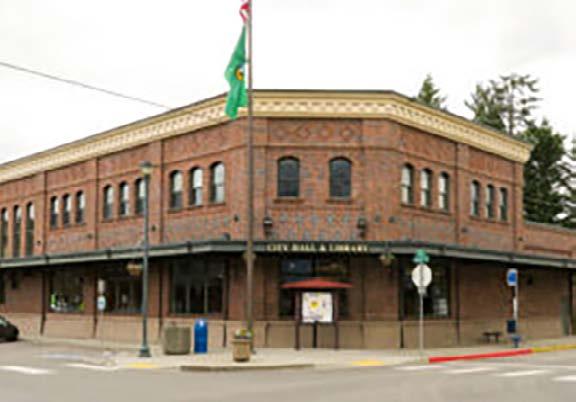
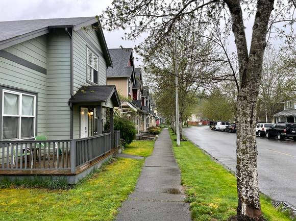
• Scale and Proportion: Sultan features smaller, more intimate building scales, and today most buildings reach only two stories tall in most of the city. The downtown area especially maintains a focus on humanscale architecture, creating a cozy and inviting atmosphere. In the neighborhoods adjacent to Downtown, the homes are smaller and more traditional in style, making them feel familiar yet distinct from one another.
• Architecture and History: Sultan’s historic core also contains elements of the architectural styles that defined the city’s history
The Community Design Element is closely connected to elements for Land Use, Housing, Natural Environment, Economic Development, and Capital Facilities & Utilities.
Desired conditions along US-2 include a multimodal pathway and a gateway feature integrated with new roundabouts
and cultural heritage. These vernacular designs give the downtown a timeless quality and include styles such as the Visitor’s Center and Kiss the Sky Books with their original brick, and the false front architecture exhibited by the Cascade Health Clinic. Museums and cultural markers downtown further celebrate Sultan’s history and heritage.
• Pedestrian-Friendly Streets: Downtown Sultan and adjacent neighborhoods emphasize walkability with sidewalks, crosswalks, and pedestrian-scale streetscapes, due in part to Sultan’s history that predates the dominance of the automobile. City blocks range between 250’ and 300’ in length, making them attractive for mixed and diverse uses while providing an interesting visual and textural landscape for those on foot. Ultimately, this walkability encourages residents and visitors to stroll, shop, and interact more than they would in disconnected and unfriendly streets.

• Public Spaces: Sultan’s 159 acres of parks and open space, plus the city’s 10 miles of trails, provide places for community gatherings and recreation, and River Park’s proximity to downtown makes it an ideal location for many of these events. These are places for everyone, which helps to create a friendly and welcoming atmosphere.
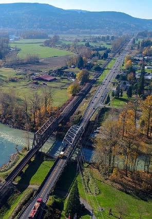
• Natural and Scenic Beauty: Natural features, such as the scenic views of the mountains, confluence of the rivers, and surrounding forests define much of Sultan.
• Sense of Community: The sense of community is a fundamental aspect of Sultan’s character. Community involvement and engagement in planning and decision-making processes is critical, and residents have a say in shaping their town’s future. Residents have strong social connections and a shared sense of identity.
Taken together, these traits combine to create Sultan’s “small town

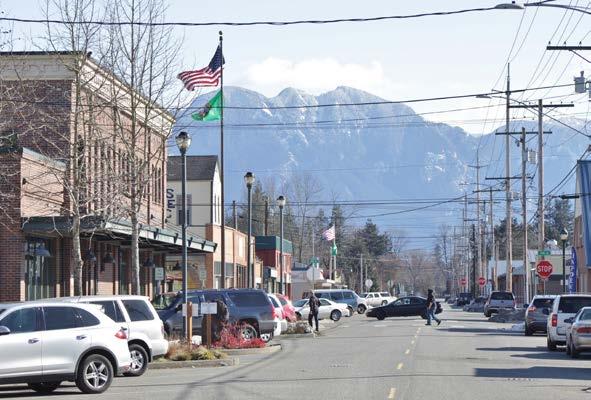

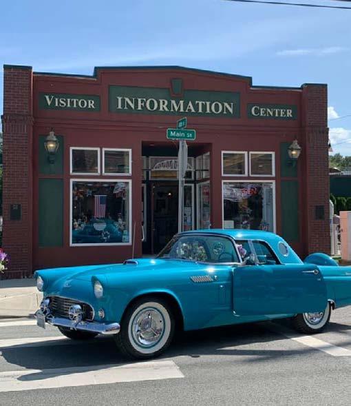

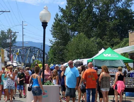
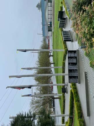
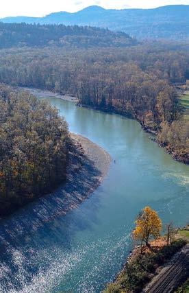
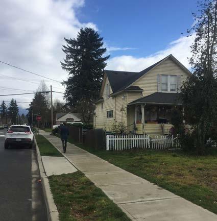

Intimate Neighborhood Building Scales

CD 1. Define a pattern of urban development that is recognizable, provides an identity, and reflects Sultan’s character, values, and opportunities.
CD 1.1. Create a recognizable development pattern that distinguishes between urban and rural.
CD 1.2. Promote contextual infill development in existing neighborhoods.
CD 1.3. Encourage and enhance an integrated network of trails, parks, habitat corridor linkages, and open spaces as a key characteristic of Sultan’s identity.
CD 1.3.1. Promote the implementation of multiuse trails wherever culs-de-sac terminate the road network, creating better connectivity and reducing obstaces for nonmotorized travel including bicycles and pedestrians.
CD 1.4. Promote the integration of local arts, culture, history, and other identity-building characteristics in mixed-use hubs.
CD 1.5. Provide a variety of public spaces and informal gathering places throughout the community that are welcoming to all ages.
CD 1.6. Design public spaces with seating, lighting, landscaping, street trees, distinct signage, and other pedestrian amenities.
CD 2. Create local visual identities and interests, retain natural landscape features, and develop a quality urban environment.
CD 2.1. Promote and support beautification efforts that produce a coherent and appealing Downtown aesthetic.
CD 2.1.1. Work with property owners to establish standards to create visual images that organize the disparate elements of Sultan’s business district into a cohesive, pleasing identity.
CD 2.1.2. Develop a downtown streetscape – creating onstreet parking areas, consolidating off-street parking lots, installing street trees, lights, benches, paving areas, and other design amenities.
CD 2.1.3. Promote a welcoming environment in the downtown Main Street. Businesses should be facing and welcoming to Main Street.
CD 2.2. Develop an optional architectural design review consultation process for interested building owners and business operators.
CD 2.2.1. Develop architectural design standards for the downtown that provide illustrations of preferred concepts, solutions, materials, styles, and other particulars affecting quality architectural solutions within the downtown.
CD 2.3. Retain and enhance the natural landscape in all land development projects to maximize ecosystem service benefits, support climate resilience, and support salmon recovery goals. This includes:
CD 2.3.1. Preserving existing trees, native vegetation, and site contoures to maintain natural stormwater management, reduce heat islands, and provide carbon sequestation.
CD 2.3.2. Protecting and integrating natural drainage features, such as streams, wetlands, and riparian areas to enhance water filtration, flood control, and habitat for wildlife, particularly salmon.
CD 2.3.3. Encouraging the use of LID techniques such as bioswales, permeable surfaces, and rain gardens to manage stormwater onsite, reduce runoff and protect water quality.
CD 2.3.4. Recognizing the climate related benefits of maintaining the natural landscape, such as improving resilience to flooding, reducing erosion, and contributing to cooling effects while also supporting biodiversity and enhancing the quality of life for residents.
CD 2.4. Encourage retention of existing buildings or sites that provide unique or special landmarks, horizon references, or other interesting visual values.
CD 3.1. Encourage protection of lands, natural features or related activities that provide unique landmarks in the natural landscape. Encourage protection of lands or sites that have unique views or vistas of natural landforms and landmarks, particularly of the Wallace, Sultan, and Skykomish Rivers, and Cascade Mountains.
CD 3.2. Preserve pleasing visual corridors along major roads to reflect natural beauty and a semi-rural atmosphere.
CD 3.2.1. Require landscape screens, earth berms, and other natural material or design buffers, particularly about wholesale urban commercial or industrial uses that front or are visible from adjacent residential areas or roads or U.S. 2.
CD 3.3. Enhance the visual image along the US-2 corridor with an emphasis on gateways and intersections.
CD 3.3.1. Develop major gateways on U.S. 2 at Rice Road and Sultan Startup Road – to indicate the edge of the developed Sultan urban area and establish a city identity.
CD 3.3.2. Develop minor gateways into the downtown from 2nd, 4th, 5th, 8th, and Main Streets – to indicate entry into the historic city center and establish a downtown identity.
CD 3.3.3. Install landscaping along U.S. 2 through the developed downtown and commercial areas – to control parking and access, and improve visual appearances.
CD 3.3.4. Incorporate more lighting Downtown.
CD 4. Preserve historic and cultural resources
CD 4.1. Protect lands, buildings, or other site features that are unique archaeological sites, historic areas, or publicly designated landmark districts or buildings.
CD 4.1.1. Identify lands within Sultan and its urban growth area that are suitable for urban uses and pose the fewest impacts to archaeological, historic, cultural, or special character areas.
CD 4.1.2. Work with land trust and other preservation groups to acquire and protect development rights on sensitive lands, environments, viewpoints, habitats, and other important resources.
CD 4.1.3. Work with Snohomish County and the Washington State Historic Preservation Office to develop a methodology for determining the design and historic impact of proposed development projects on sensitive heritage sites within the Sultan Urban Growth Area.
CD 4.2. Encourage architecturally pleasing, older buildings to be relocated to other, more compatible sites when the structures need to be relocated from present locations.
CD 4.3. Incorporate indigenous art and history into trails, parks, and other public spaces
CD 4.4. Encourage preservation, restoration, and reuse of historic properties through code flexibility, fee reductions, and other regulatory and financial incentives.
CD 4.4.1. Identify design and/or financial incentives that can be used to help with building or site modification costs – particularly within the downtown and flood plain.
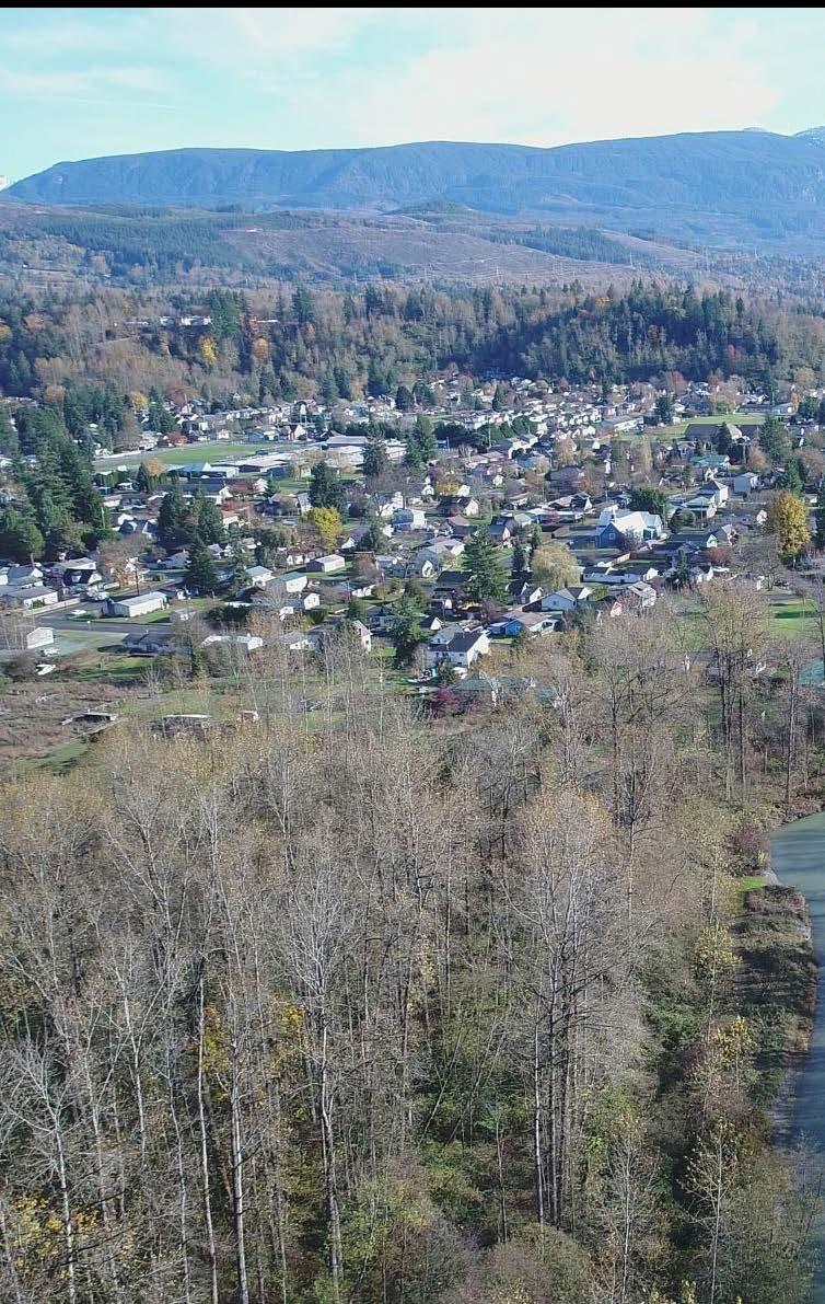
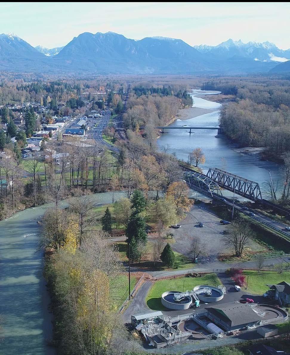
Sultan’s Land Use Element is foundational to meeting the shared community vision for 2044. Providing access to daily goods and services within the city’s mixed-use districts and neighborhoods, creating lively destinations for residents and visitors, and expanding job and housing opportunities are among the many planning objectives catalyzed by the Land Use Element. This element will continue to emphasize residential land uses and natural rural characteristics of Sultan while expanding the types of housing that can be built in neighborhoods. Opportunities for affordable housing, mixed-use development, and desired commercial uses are also made possible through updated land use policies and zoning regulations.
New land use designations for key locations along US-2 and Sultan Basin Road are introduced in this element to unlock more opportunities for a mix of uses that satisfy the everyday needs of Sultan’s growing population. This element also emphasizes the complexities and possibilities presented by overlapping community assets, risks, and opportunities.
Updates to the Land Use Element include:
• New Future Land Use Map categories to provide greater flexibility as a planning tool
• Addition of mapped community assets and opportunities
• Addition of Wildland-Urban Interface designation
• Addition of strategic areas suitable for subarea planning
• Identification of parcels for affordable housing opportunities
This is Volume I of the Land Use Element. Volume II includes supporting documentation and background information like state mandates, existing land use patterns, and the capacity estimates and development assumptions establishing the 2044 Growth Strategy.
The Land Use Element affects every other element within the Comprehensive Plan. This makes it highly relevant to most aspects of the 2044 Vision, especially in creating more opportunities for economic development, community enrichment, and improved infrastructure.
Each element is related to Sultan’s Community Vision for 2044. This graphic illustrates the strength of the connection between the Vision and the Land Use Element. For more on the Nine Big Ideas that make up the Vision, see the Community Vision Section of this document.
Land Use Element goals are derived from key themes that reflect state and regional planning requirements, along with input from the greater Sultan community. The influence of these themes can be seen throughout the Comprehensive Plan.
• Ensure that people of all income levels have access to choice and opportunities including housing, employment, transportation, services, and amenities (influenced elements: Housing, Parks and Recreation, Economic Development, Transportation, Capital Facilities and Utilities).
• Prioritize approaches that increase physical activity, social interaction, and community health and wellbeing (Housing, Parks and Recreation, Transportation, Capital Facilities and Utilities).
• Balance the preservation of environmental assets with the creation of new housing and employment opportunities while reducing exposure to environmental hazards (Community Design, Housing, Natural Environment, Parks and Recreation, Economic Development).
• Maintain the provision of high-quality public services, infrastructure, and parks and open space while facilitating inclusive population and employment growth (Community Design, Housing, Parks and Recreation, Transportation, Capital Facilities and Utilities).
• Address racially disparate impacts and racial exclusion through land use planning (Housing, Parks and Recreation, Transportation, Capital Facilities and Utilities).
Figure LU-1. Land Use Element - Vision connection
The Land Use Element is connected to all of the other elements due to its wide-reaching impacts on housing, transportation, parks, utilities, and more.
Land use was at the core of many community engagement events, discussions, and pop-up activities that informed this comprehensive plan update. Beginning with early outreach at community events in Summer 2023, Sultan residents emphasized the importance of balancing growth and affordability with sufficient infrastructure and stewardship of the natural environment. Priorities for how Sultan uses its land emerged during various engagement efforts:
• Farmers Market and Other Community Events - Residents underscored the need for goods, services, and amenities to satisfy daily needs in Sultan without driving to neighboring cities like Monroe. Access to parks, recreation, and natural areas was identified by community members as a top asset to maintain and expand to more neighborhoods in the city.
• Sultan Shindig and Youth Outreach - Downtown destinations for kids, neighborhood-serving retail offerings, and varied housing opportunities are necessary for Sultan’s future. Improvements and expansion of parks, mobility networks, and other infrastructure must be commensurate with continued growth.
• Planning Summit - A grocery store, trail system, and park are essential to have within 15 minutes of home. US-2 and Downtown are key locations to expand job opportunities and missing services like grocery, hardware stores, and entertainment. Small corner stores and cafes have a place in Sultan’s neighborhoods.
• Planning Board and City Council Meetings - Elected leaders and Planning Board members helped determine an appropriate and realistic distribution of housing and job growth in the land use alternatives for the Plan. Meeting feedback emphasized the City’s commitment to HB 1220 compliance by embracing a range of housing types in residential and mixed-use land use types at viable intensities for affordable housing development.
The Land Use Element influences all elements within the Comprehensive Plan. Land use goals, policies, and programs determine the distribution of different land use types within the city and coordinate the other elements in the Plan. Accordingly, most goals, policies, and programs described here concern multiple elements simultaneously. For example, land use goals and policies work to establish a development pattern that colocates higher-density housing, mixed-use development, and amenities in areas with sufficient transportation and utility infrastructure. This impacts the Housing, Transportation, and Capital Facilities & Utilities
Elements. Similarly, the Future Land Use Map and land use goals establish a lower-density development pattern close to environmentally critical areas. This impacts the Housing Element as well as the Natural Environment Element.
The current land use pattern in Sultan includes suburban and rural residential neighborhoods. Residential subdivisions with single-family detached homes dominate the Sultan Basin plateau, and more traditional gridded neighborhoods exist in the lower-lying areas north of Downtown. New neighborhoods are often disconnected from one another on Sultan Basin Road, and all rely on US-2 as their sole connection to Downtown.
Low density warehousing and manufacturing uses line US-2 for much of Sultan’s east-west extent, and limited mixed-use or commercial uses exist Downtown. Civic land uses like schools, government, and administrative buildings coexist within and north of Downtown. Figure LU-2 breaks down the city’s existing land uses based on Snohomish County parcel data from 2024.
A complex of natural features including streams, wetlands, bogs, and steep forested areas are found throughout the city. These environmental assets in combination with parks and open spaces like Osprey River Park, Reese Park, and the planned Mountain View Park comprise a rich natural landscape that coexists with a low-density built environment.
Figure LU-2. Existing Land Use in Sultan (Snohomish County, 2024)
The Future Land Use Map (FLUM) is an extension of the community vision and brings together all the other elements of the Plan. It is designed to stimulate more commercial offerings, new job and housing opportunities, and community destinations while balancing the infrastructure sufficiency and environmental stewardship desired by the community. The FLUM will help Sultan unite its decoupled development pattern with safe, connected neighborhoods linked to distinct walkable centers with active businesses, gathering places, and diverse housing choices. The protection of forested hillsides, wetlands, and natural habitat is also in the purview of the FLUM as it directs development away from fragile ecosystems and, in doing so, restores the natural environment’s ability to mitigate climate impacts. It also initiates viable economic development across the city by aligning new housing with everyday needs and amenities in expanded mixed-use districts in neighborhoods, along US-2, and in Sultan’s historic downtown—all of which is necessary to support the local economy, foster entrepreneurship, and enliven cultural attractions.
At its core, the FLUM is a planning tool that guides where the City focuses growth in jobs and housing as well as the capital facilities, open space, utilities, and other infrastructure needed to support that growth. To that end, the FLUM flows from the goals and policies articulated in this Plan— particularly those set forth in the Land Use Element—while addressing the employment and housing targets issued by Snohomish County. The FLUM was developed in collaboration with the City’s Planning Board, City Council, and staff from the Community Development and Public Works Departments.
The FLUM is divided into generalized land use designations: residential, mixed-use, manufacturing, public/institutional, and open space types. The FLUM should not be read as a zoning map—different types of zoning can occur within each of the listed land use designations so long as they fit under the umbrella of the designation. For instance, there may be multiple types of residential zoning within Neighborhood Residential, but scale and intensity requirements and use allowances within Neighborhood Residential will be less than in Compact Residential and reflective of geographic constraints and opportunities. Similarly, the designation and subsequent zoning regulations for Urban Center and Mixed-Use Corridor—the city’s most urban classifications—will vary greatly from Neighborhood Hubs, which are intended to provide limited, lower-intensity mixed uses supportive of the surrounding neighborhood. The FLUM is meant to create some flexibility in zoning decisions made by the City and will be the basis for future zoning updates. Its design ensures sufficient employment and housing capacity to meet the future need of the city and across different income brackets allocated by Snohomish
Figure LU-3. Future Land Use Map

Neighborhood Residential Religious-Owned Parcels

Compact Residential Potential Subarea City Limit Sultan UGA Unincorporated
Neighborhood Hub 3 Story Overlay
Urban Center 4 Story Overlay
Mixed-Use Corridor Manufacturing
Figure LU-4. (Opposite) Supplemental Thumbnail Maps: Community assets, risks, and desired connections
County. The FLUM is also structured to help efficiently plan for future infrastructure by adding an emphasis to limited geographic areas of growth
Beyond the general distribution of land uses, the FLUM contains forward-looking designations that respond to community desires and growth pressures as Sultan evolves. The map identifies locations for Neighborhood Hub and Mixed-Use Corridor expansion, which are envisioned to develop into walkable, amenity-rich destinations. Also identified are areas for potential subarea planning—a holistic planning and design process that could turn strategic locations into vibrant mixeduse districts with well-connected streets, integrated trail networks, new parks, and cohesive development that supports a variety of businesses and housing types.
Supplemental to the FLUM are three layers that are critical to guiding the preservation, growth, and sustainability of Sultan’s built and natural environment. Among these are community assets, which include key community hubs and infrastructure like schools and community risks, which include areas with natural hazard risks, infrastructure gaps, and fragile environmental features that compose Sultan’s natural beauty. A final layer includes desired connections envisioned to provide safe, multimodal improvements on existing streets and new east-west linkages bringing together Sultan’s neighborhoods, Downtown, and parks.
• The FLUM combines higher-intensity uses like multi-family housing, mixed-use development, and commercial buildings to create an attractive, walkable, and functional Mixed-Use Corridor along US-2.
• To fulfill the city’s affordable housing need (part of the Snohomish County CPP Growth Targets), Sultan must allow taller multi-family and mixed-use buildings in viable locations. The FLUM accommodates this housing around key intersections along US-2 and in select religious-owned parcels because these areas have the greatest access to infrastructure, transit, schools, services, and amenities.
• The FLUM identifies areas for expanded Neighborhood Hubs to bring locally-serving commercial uses and gathering spaces into residential areas.
• The FLUM shows current and proposed open space including parks, forested areas, and wildlife corridors to enhance wildlife habitat and provide equitable access to the city’s pristine natural environment for all residents.
• The FLUM shows sensitive natural areas and hazards where development is discouraged.
Ultimately, the FLUM is crucial to carrying out the community vision. The diagrams in the following pages show how clustering certain land uses can help orchestrate that vision.
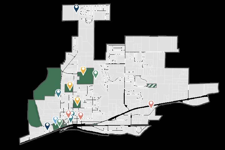
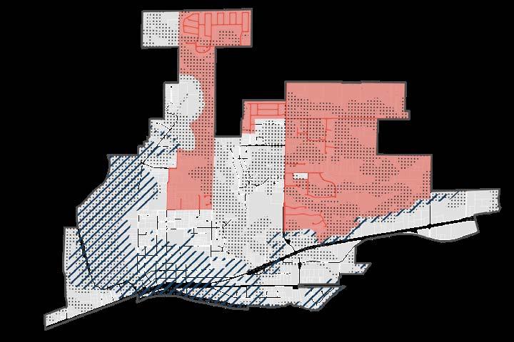
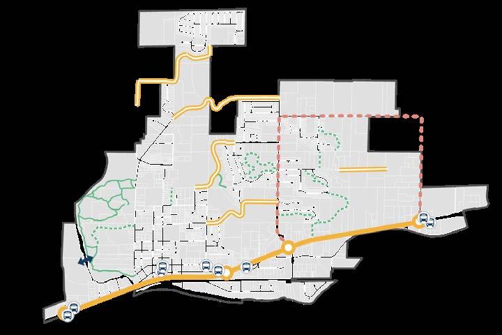


Figure LU-5. Initial and adjusted 2044 housing and employment growth targets, per Snohomish County Countywide Planning Policies mandated under the GMA
The City of Sultan has been issued a 2044 growth target of 1,425 housing units and 1,330 jobs according to its “Cities and Towns” designation (Figure LU-5). These numbers were generated through a regional planning process with the Puget Sound Regional Council, Snohomish County, and cities; finalized targets are issued in the Snohomish County Countywide Planning Policies (see Policy Framework for more details).
The FLUM establishes sufficient development capacity for the City to fulfill not only its growth target, but the housing types necessary to support the affordable housing need. For example, housing affordable to households earning less than 50% of the area median income—which makes up most of Sultan’s affordable housing need—is most feasibly provided in low-rise apartment and condominium buildings. As such, much of the planned housing growth is distributed among the MixedUse Corridor and religious-owned parcels. More information on the role of religious-owned parcels, the 2044 Growth Strategy, capacity estimates, and development assumptions can be found in Volume II and the Housing Element.
Figure LU-6 shows the planned distribution of the City’s 1,330-job and 830-unit target according to housing types that will realistically support its affordable housing need. Figure LU-7 projects population growth based on the Snohomish County Populations; Sultan is expected to grow to 8,672 people by 2044.

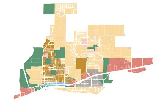
Figure LU-6. Geographic distribution of the adjusted 2044 housing and employment growth targets used for traffic modeling purposes. Circled areas indicate the corresponding land use designation, not the precise location of the unit distribution.
(Projection Based on Snohomish County Growth Target)
Figure LU-7. Sultan population projection for 2044
Mixed-Use Corridor
Urban Center
Neighborhood Hub
Compact Residential
Neighborhood Residential
Manufacturing
Public / Institutional
Religious-Owned
Wetlands / Lakes / Rivers
Critical Areas / Shoreline
Public / Institutional
Proposed Density: 0 du/ ac | 10-20 jobs/ac
Typical Building Typology: Low-rise administrative buildings, storage facilities, and civic structures
Proposed Density: 24-30 du/ac | 18-25 jobs/ac
Typical Building Typology: Low-rise mixed-use buildings, traditional retail storefronts, live-work buildings, and mixed residential buildings
Compact Residential
Proposed Density: 18-24 du/ac
Typical Building Typology: Low-rise multifamily, middle housing
Neighborhood Residential

The land use designations above are broader than zoning definitions to allow the city more flexibility in establishing its land use code. However, intended density windows are indicated below to ensure that the city provides enough capacity for its housing and job allocations. As the diagram shows, the Mixed-Use Corridor (US-2) is slated for the most dense development while Compact Neighborhood and Neighborhood Residential have lower land use intensity.
Proposed Density: 18 du/ac | 5-10 jobs/ac
Typical Building Typology: Ground Floor commercial uses,
Wetlands / Lakes / Rivers
Proposed Density: 24-36 du/ac | 20-30 jobs/ac
Typical Building Typology: Low- and midrise apartment, condo, commercial, and mixed-use buildings up to 4 stories
Proposed Density: 0 du/ ac | 10-15 jobs/ac
Typical Building Typology: Large-footprint industrial and warehouse structures

The land use designations above are broader than zoning definitions to allow the city more flexibility in establishing its land use code. However, intended density windows are indicated below to ensure that the city provides enough capacity for its housing and job allocations. As the diagram shows, the Mixed-Use Corridor (US-2) is slated for the most dense development while Compact Neighborhood and Neighborhood Residential have lower land use intensity.
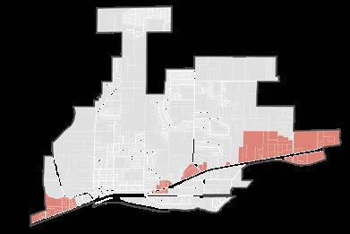
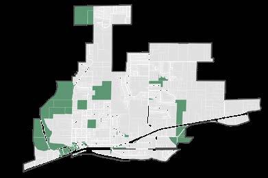
The following section illustrates the seven major land use types identified in the FLUM. Thumbnail maps below show the location and extent of the Neighborhood Residential, Compact Residential, Neighborhood Hub, Urban Center, Mixed-Use Corridor, Manufacturing, and Public/ Institutional designations. Example photos of the various types of uses and building forms allowed under each are found on the following pages.
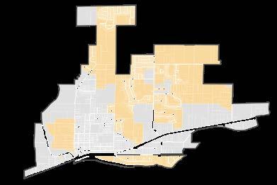
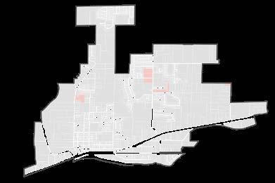
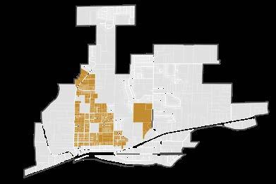
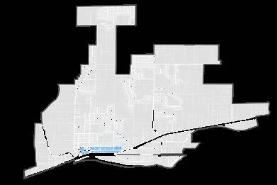
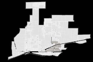
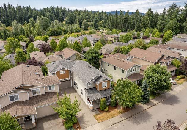
Sultan’s predominant land use designation covers much of the gradient of suburban-torural residential areas across the city. A series of new growth strategies for middle housing, infill housing, and improved subdivision standards will enable a wider variety of housing choices in Neighborhood Residential. While zoning will ultimately dictate exact densities and land uses allowed, Neighborhood Residential is intended to support detached and attached single-family homes, accessory dwelling units, and a range of middle housing types, including duplexes, triplexes, fourplexes, townhomes, and cottages.
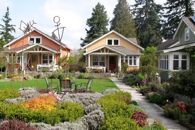
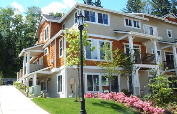
The FLUM establishes Compact Residential as the next increment of residential development intensity above Neighborhood Residential. Generally, this land use designation supports single-family and multi-family development— multiplex buildings, stacked flats, courtyard apartments, and other forms of large middle housing—between Neighborhood Residential and higher-intensity areas like Urban Center and the Mixed-Use Corridor.

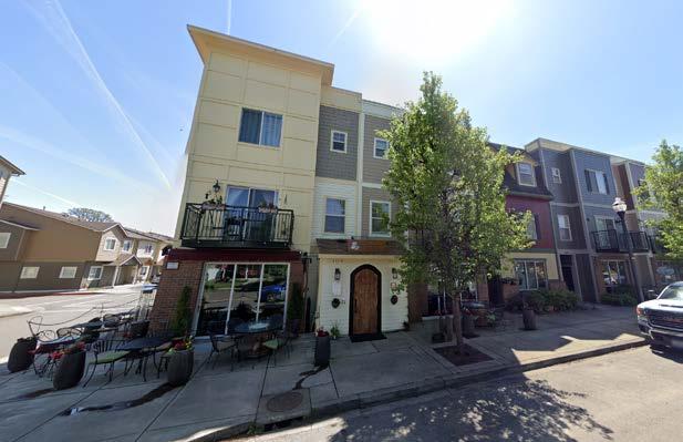
Many of the city’s existing residential neighborhoods are isolated from everyday destinations like shopping, healthcare facilities, schools, institutions, and social gathering spaces. The FLUM expands existing Neighborhood Hubs on 1st Street, Sultan Basin Road, and Rice Road. These areas are envisioned to support locally-serving convenience stores or grocers, cafes, restaurants, community gathering or recreational areas, and diverse housing options that are connected to surrounding neighborhoods with safe pedestrian and bicycle networks.

Downtown Sultan is designated as an Urban Center on the FLUM. This area is intended to support a mix of retail, administrative, civic, residential, and entertainment uses necessary to activate it as a vibrant destination in the future. Live-work units and taller mixed-use buildings will interlink with a wider variety of housing types and commercial uses, including hardware stores, grocers, healthcare facilities, restaurants, cafes, and daycare centers.
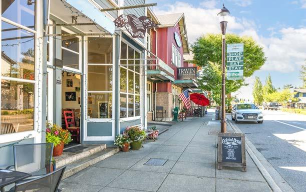
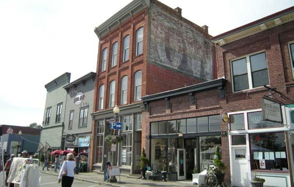
The FLUM identifies many areas along US-2 with the Mixed-Use Corridor designation. These locations are intended to absorb much of the employment and housing growth anticipated in the coming years. A range of commercial, residential, civic, and entertainment land uses are intended to be supported and the combination of increased building heights and potential subarea planning can create future opportunities for coordinated and connected development.
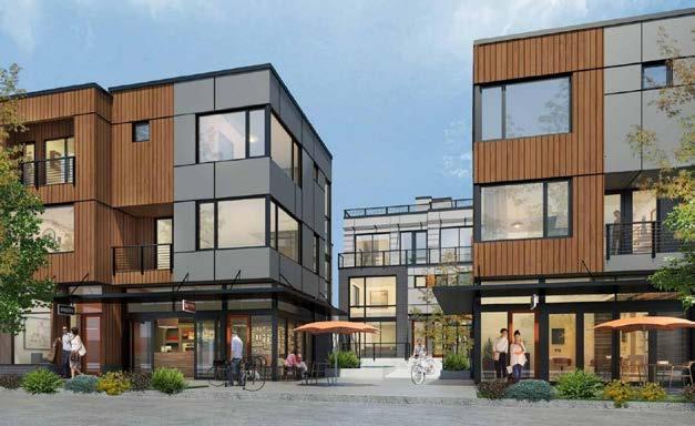
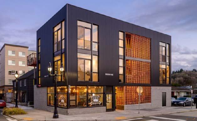
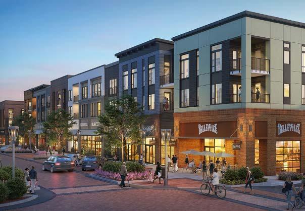
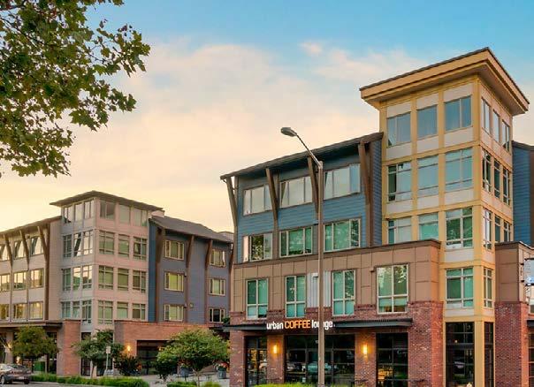
Areas at the base of Sultan Basin Road and south of US-2 are designated as Manufacturing on the FLUM. This land use designation is concentrated here to support large-scale industrial, warehousing, and manufacturing operations in a way that limits disturbances to surrounding residential areas.
Schools, administrative buildings, parks, Cityowned parcels, and other institutional hubs exist across Sultan. The FLUM designates these areas as Public/Institutional to indicate continued investment in parks, recreation, education, and civic spaces needed to meet the needs of the community, support youth development, and expand opportunities for inclusive, healthy, socially-active living.
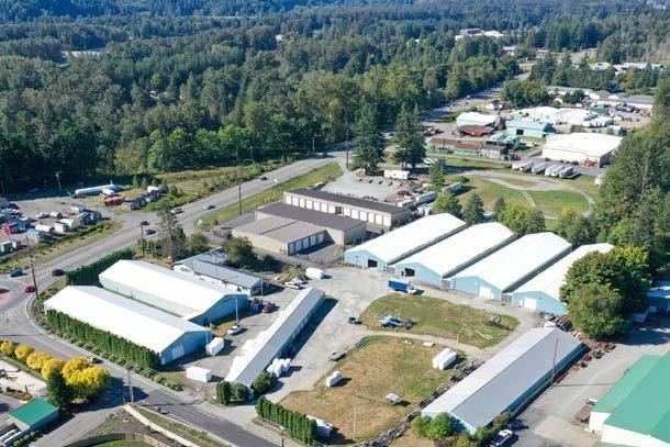
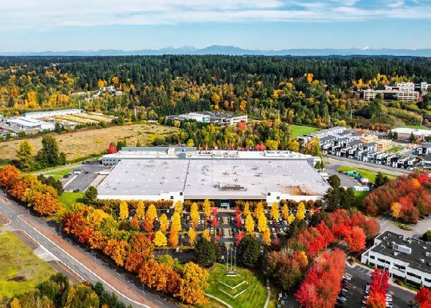

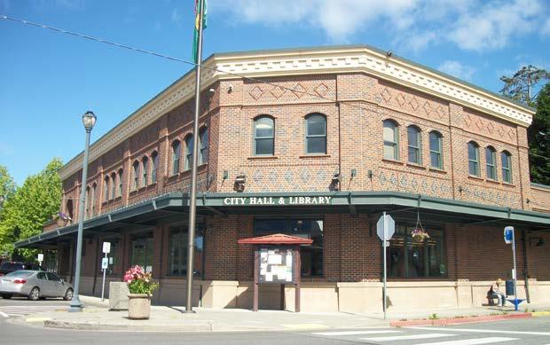
LU 1. Guide the city’s population growth in a manner that endeavors to maintain or improve Sultan’s quality of life and unique cultural heritage.
LU 1.1. Ensure that land use regulations endeavor to accommodate the region’s 20-year growth forecast for Sultan.
LU 1.1.1. Adopt a Comprehensive Plan and development regulations that recognize Sultan’s needs and effectively coordinate development efforts.
LU 1.1.2. Delineate different land uses using natural features and road or other physical improvements.
LU 1.1.3. Identify and resolve critical transition areas or points of conflict with adjacent properties or incompatible land uses.
LU 1.1.4. Designate an adequate supply of land zoned for housing to support 20-year population allocations as required by Snohomish County Planning Policies.
LU 1.1.5. Designate an adequate supply of land zoned for employment to support 20-year employment allocations as required by the Snohomish County Planning Policies.
LU 1.1.6. Guide Sultan’s population growth by directing development away from ecologically sensitive area to preserve the natural landscapes that contribute to the city’s quality of life and cultural heritage. Development proposals should ensure that growth enhances environmental heal and maintains the community resilience to climate change.
LU 1.2. Encourage future development in areas where growth will be supported with adequate facilities and services consistent with the capital facilities plan.
LU 1.2.1. Periodically update the comprehensive plan to reflect changes, opportunities, and desires.
LU 1.3. Streamline development standards and regulations for residential and commercial development, especially in hub areas, to accommodate a broader range of project types consistent with regional vision.
LU 1.4. Promote avoidance measures in future development that address environmental impacts including the use of Low Impact Development (LID) techniques, habitat preservation and restoration, and stormwater management systems, ensuring no net loss of ecological function and alignment with climate resilience goals.
LU 1.5. Periodically review land use regulations and development standards to
(a) Monitor effectiveness in achieving GMA and Plan goals;
(b) Review regulatory impact on economic feasibility and barriers to development; and
(c) Assess potential racially disparate impacts, including displacement, displacement risk, and exclusion.
LU 1.5.1. Define density based on the land’s carrying capacity.
LU 1.5.2. Construct zoning regulations to provide incentives that are used appropriately to further the goals and policies of the Comprehensive Plan.
LU 1.5.3. Define proposed designations of land use. Coordinate all implementing ordinances, programs, proposals, and projects in conformance with the intentions of the Comprehensive Plan.
LU 1.6. Balance community objectives with the perspectives of private property owners by ensuring appropriate protection of property rights.
LU 2. Plan for and encourage development patterns, transportation strategies, and street design that promote the health and well-being of all Sultan residents.
LU 2.1. Promote livable and diverse neighborhood design through zoning, subdivision standards, and other mechanisms that:
(a) Use clustering to create common open space and conserve critical areas;
(b) Incorporate new landscaping, street trees, and parks
(c) Encourage housing type diversity; and
(d) Require public connections.
LU 2.2. Promote a compatible mix of residential and commercial land uses to make it possible to conveniently walk or bike to work and shopping, lessening reliance on automobiles and reducing green house gas emissions.
LU 2.2.1. Review land uses to limit conflicts between residential and commercial uses such as height, mass, traffic, noise, and other characteristics for residential neighborhood compatibility.
LU 2.3. Encourage the expansion of paths and trails from residential areas to neighborhood hubs and commercial centers.
LU 2.3.1. Prioritize the development of convenient walking routes along streams, rivers, and waterfronts.
LU 2.3.2. Work with the Sultan School District to plan for safe walks to school.
LU 2.4. Allocate urban development onto lands that are capable of supporting urban uses. Limit development on lands or soils encumbered with severe environmental hazards – such as the Sultan and Skykomish Rivers floodways.
LU 2.4.1. Identify lands within Sultan and its urban growth area that are capable of supporting urban uses and pose the fewest environmental risks.
LU 2.5. Support the safety, health, and well-being of the community by adopting standards that encourage the development of neighborhoods that promote physical activity, increase transportation mode choice, reduce and avoid wildlife conflict by planning for habitat connectivity, and reduce existing disparities between populations.
LU 2.5.1. Pursue joint-use agreements to share facilities with schools to provide neighborhoods with convenient and attractive places for recreation.
LU 2.5.2. Identify opportunities to increase acreage of total recreation areas, especially areas that can accommodate youth and adult sports fields.
LU 2.5.3. Require site plans to show how new open spaces connect with existing adjacent open spaces. Additionally, efforts must be made to maintain connectivity between blocks of critical habitat areas when unavoidable impacts occur.
LU 2.6. Require health impact assessments for all new developments to protect the interests and health of the wider community.
LU 2.7. Promote planning and development practices that ensure equitable living conditions and minimize environmental health disparities, including exposure to air, light, noise pollution, and climate related hazards.
LU 2.8. Pursue noise reduction tactics throughout the development lifecycle, mitigating the impact of construction and related noise on the surrounding ecosystem (through both physical and strategic means).
LU 3. Prioritize centers and priority areas along US-2 as locations for more compact, mixed-use development.
LU 3.1. Develop high quality, compact Neighborhood Hubs and Urban Center (Downtown) that impart a sense of place, incorporate mixed uses and choices in housing types, provide affordable housing options, and encourage walking, bicycling, and transit use.
LU 3.1.1. Partner with transit providers to incorporate transit amenities into the design of commercial and residential development.
LU 3.1.2. Adopt mixed-use, residential, and commercial zoning where appropriate to support transit use and encourage walkability.
LU 3.1.3. Adopt sufficient density standards (15 du/ac minimum) for residential, commercial, and retail development to ensure development that supports transit and walkable environments.
LU 3.2. Support a mix of commercial, office, and residential land uses to locate in centers.
LU 3.2.1. Promote fiscal sustainability by designating adequate land zoned for uses that generate tax revenue for the City.
LU 3.3. Encourage the development of and improvements to the pedestrian network that enhance walkability and bikability while reducing the likelihood of wildlife conflict.
LU 3.3.1. Identify bike and pedestrian paths throughout centers to promote pedestrian activity and ease of access to and from housing and retail areas. In tandem, prioritize multi-benefit outcomes, such as the creation of habitat corridors that can simultaneously be used for recreational opportunities.
LU 3.4. Plan for the creation of plazas, parks, civic spaces, trails, and other public spaces especially in or adjacent to Neighborhood Hubs.
LU 3.4.1. Identify and create opportunities to develop parks, civic places, and public spaces, especially in or adjacent to centers.
LU 3.5. Incentivize the integration of affordable housing in new mixeduse development.
LU 3.6. Encourage commercial and entertainment uses that create opportunities for community, not just commerce, for all ages and abilities.
LU 3.7. Support efficient review and approval of innovative land use developments such as industrial or business parks, mixeddensity residential developments, special business district projects, or other proposals that may be submitted and considered.
LU 4. Provide active and diverse commercial and industrial centers that promote economic growth, provide family wage jobs, and meet the 20-year employment growth targets set by Snohomish County Planning Policies.
LU 4.1. Encourage the development of Sultan as the focal point of ruralbased industries and commerce.
LU 4.2. Limit non-industrial use of industrial lands to uses which are complementary to industrial activities.
LU 4.3. Protect industrial lands from encroachment by other land uses, which would reduce the present and future economic vitality of industrial lands.
LU 4.3.1. Zone industrial lands so as to minimize impacts on surrounding land uses, especially residential land uses.
LU 4.3.2. Zone new or additional industrial development where utilities are available or planned for and have convenient access to existing or planned highways or major streets.
LU 4.4. Support reinvestment and expansion efforts of existing manufacturing and industrial businesses.
LU 5. Ensure that public facilities support and strengthen community health, social equity, and environmental stewardship.
LU 5.1. Ensure that new development is located in areas with minimal barriers to providing urban utilities and services, maintaining a realistic balance between the land’s capability and Sultan’s growing population.
LU 5.2. Site essential public facilities consistent with the Growth Management Act, Snohomish County Comprehensive Plan and the Countywide Planning Policies.
LU 5.2.1. Cooperate with Snohomish County neighboring cities and special purpose districts to share essential public facilities and increase efficiencies of operation.
LU 5.3. Siting proposed new or expansions to existing essential public facilities must consist of the following:
(a) An inventory of similar existing essential public facilities, including their locations and capacities;
(b) A forecast of the future needs for the essential public facility;
(c) An analysis of the potential and economic impacts and benefits to jurisdictions receiving or surrounding the facilities;
(d) An analysis of the proposal’s consistency with County and City policies;
(e) An analysis of alternatives to the facility, including decentralization, conservation, demand management and other strategies;
(f) An analysis of alternative sites based on siting criteria developed through an inter-jurisdictional process;
(g) An analysis of environmental impacts and mitigation;
(h) Consideration of future climate conditions, including changes to temperature, rainfall, and sea level, to help ensure facilities function as intended over their planned life cycle;
(i) An equity impact assessment addressing potential displacement risks; and
(j) Extensive public involvement.
LU 5.4. Collect impact fees to help pay for public facilities needed to serve new growth and development in Sultan. Impact fees may be used for :
(a) Public streets, roads, and bicycle and pedestrian facilities;
(b) parks, open space, and recreation facilities;
(c) school facilities; and
(d) fire protection facilities.
LU 5.5. Collaborate with the Sultan School District and other institutions to plan for and site new schools within the urban growth area to address urban capacity needs and to support safe, walkable access for students.
LU 5.5.1. For public facilities and institutions such as schools located outside of the urban growth area, coordinate with Snohomish County to ensure safe and equitable means of community access from within city limits.
LU 6. Encourage sustainable and resilient development practices that reduce greenhouse gas emissions, promote hazard mitigation, and foster environmental stewardship.
LU 6.1. Decrease auto reliance through sustainable land use planning that encourages dense, mixed-use development patterns and non-motorized forms of travel.
LU 6.2. Encourage new building construction to incorporate green building techniques and materials.
LU 6.2.1. Develop incentives for new and refurbished buildings to incorporate green techniques and materials into their construction.
LU 6.3. Support and provide incentives to increase the percentage of new development and redevelopment – both public and private – to be built at higher performing energy and environmental standards.
LU 6.4. Encourage low-density development in the floodplain to retain and protect existing low-density areas and reduce the risk of exposure on flood-prone lands. Require flood mitigation in building practices, including flood pedestals and other floodsmart mechanisms for development that occurs within the floodplain.
LU 6.5. Promote sustainable water management activities and low impact development (LID) measures that preserve natural discharge patterns, promote groundwater recharge, minimize impacts caused by impervious surfaces, and maximize retention of existing vegetation.
LU 6.6. Protect lands and sites that are designated for parks, recreation, or other open space uses, whether now or one day held in trust or common.
LU 6.7. Preserve where possible the open or natural space features within new development, particularly along shorelines, bluffs, and wetlands. Development applications must demonstrate an effort to protect and enhance habitat corridor connection by utilizing connected open spaces, clustered development, or other similar tactics.
LU 6.8. Account for floodplain elevation when siting and constructing public facilities and services, requiring flood mitigation techniques wherever possible.
LU 6.9. Prioritize wildfire mitigation and adaptation in new and existing development.
LU 6.9.1. Adopt building, fire, and development codes that reduce wildfire risk across Sultan’s neighborhoods such as the wildland urban interface code developed by the International Code Council or building and maintenance standards created by Firewise USA.
LU 6.9.2. Support educational campaigns on wildfire mitigation, preparedness, and adaptation.
LU 7. Promote development that prioritizes equity, ensuring that growth benefits all residents and minimizes the risk of displacement to vulnerable communities.
LU 7.1. Foster inclusive engagement practices, welcoming diverse perspectives to ensure a comprehensive and representative approach to land use decisions.
LU 7.2. Identify and support residents and businesses that are vulnerable to displacement.
LU 7.3. Promote the availability of affordable commercial spaces to prevent displacement of local small businesses.
LU 7.4. Integrate equity impact assessments into land use decisionmaking processes to systematically identify and address potential displacement risks associated with development projects.
LU 8. Coordinate and cooperate with regional jurisdictions and agencies on essential public facilities, rural transition areas, and annexations.
LU 8.1. Collaborate with Snohomish County to coordinate the proposed boundaries of the Sultan urban growth area, and suitable zoning protection of the lands within the proposed urban/rural transition area.
LU 8.1.1. Jointly create a Rural/Urban Transition Area (RUTA) with Snohomish County to preserve the existing, undeveloped character of the lands outside of the urban growth area.
LU 8.1.2. Coordinate with adjacent jurisdictions to ensure compatible land uses in areas along contiguous boundaries.
LU 8.1.3. Support annexation proposals that meet the following criteria:
(a) The annexation achieves the growth, and economic needs and goals for the city as set forth in the comprehensive plan;
(b) The area can be supported with adequate facilities and urban services consistent with capital facilities plans for public facilities and utilities; and
(c) There is an adopted land use plan for the annexation area.
LU 8.2. Continue to participate in the activities of regional entities as deemed appropriate, such as the US 2 Safety Coalition, Snohomish County Tomorrow, and Snohomish County Cities.
LU 8.3. Coordinate the land and financial resources that are available to realize a more effective, balanced local system of historical and cultural heritage resources.


Figure H-1. Housing Element - Vision connection.
Sultan’s Housing Element is built on the foundation set by the 2044 Vision and Big Ideas. Diverse and affordable housing options, safe and connected neighborhoods, and community enrichment are at the core of many of this element’s goals, policies, and programs, which aim to enhance both existing and new neighborhoods with the natural setting and architectural traditions of Sultan. Collaboration with diverse partners, the use of religious-owned land, new funding mechanisms, and regulatory innovations are just a few of the many new opportunities for Sultan to expand housing access to households with limited financial means.
Each element is related to Sultan’s Community Vision for 2044. This graphic illustrates the strength of the connection between the Vision and the Housing Element. For more on the Nine Big Ideas that make up the Vision, see the Community Vision Section of this document.
Updates to the Housing Element include:
• Implementation of feasible housing types to equitably house all economic and demographic segments of the community.
• Clarification and enhancement of the physical and social characteristics that make Sultan’s neighborhoods unique.
• Adequate provisions for permanently supportive housing and emergency housing.
• Measures to address racially disparate impact, displacement, and exclusion in local housing.
• New policies and programs to provide residential areas with access to jobs, services, and amenities.
This is Volume I of the Housing Element. Volume II includes supporting documentation and background information for this element, including the 2023 Housing Action Plan and land capacity analysis for HB 1220.
The Housing goals, policies, and programs in this element are intended to support expanded access to housing across all economic segments and housing needs in Sultan. The City’s recent explosion of growth has seen the expansion of primarily single-family housing stock, which cannot accommodate the full range of housing needed across various age and income levels, household types, and ownership opportunities to support equitable growth across the region. The goals and policies in this element seek to address these needs and access while retaining what makes the community a beautiful and neighborly place to live. Key themes in the Housing Element emerge from state mandates, community desires, and Sultan’s vision for 2044.
• Ensure that people of all income levels have access to housing close to opportunities including employment, transportation, services, and amenities. (Influenced elements: Land Use, Capital Facilities and Utilities, Parks and Recreation, Transportation, Economic Development).
• Support Missing Middle Housing that contributes to the physical and natural characteristics of existing neighborhoods. (Land Use, Capital Facilities and Utilities, Climate Change).
• Ensure new development supports community resilience and sustainability goals. (Land Use, Parks and Recreation, Climate Change).
• Address racially disparate impact, displacement risk, and racial exclusion. (Land Use, Parks and Recreation, Capital Facilities and Utilities, Climate Change).
The purpose of the Housing Element is to create policies that support the development of housing in accordance with local needs and anticipated growth. Of course, merely providing enough housing does not ensure affordability, accessibility, or attractiveness—all of which are essential components of a successful community. The Washington State Growth Management Act (GMA) recognizes this, as reflected in the following housing goal that was updated in 2021 after the passage of HB 1220:
“Plan for and accommodate housing affordable to all economic segments of the population of this state, promote a variety of residential densities and housing types, and encourage preservation of existing housing stock.”
Washington State and the Puget Sound Region face a catastrophic housing shortage. Sultan’s balance of proximity to both natural amenities and major employment centers creates significant demand for housing, particularly in light of the recent shift towards hybrid and remote work. To ensure that Sultan’s existing and future residents can comfortably live in the community, the City must reduce barriers to denser housing. Not only is this a directive in this Plan, but a mandate from Washington State.
New legislation passed in 2021—HB 1220—requires cities to provide enough zoned capacity to accommodate housing affordable to all economic segments, including permanent supportive housing, emergency housing, and emergency shelters. Cities must also identify and rectify policy with racially disparate impacts, map areas with displacement risk, and adopt anti-displacement policies.
Rapid growth, housing affordability, and local desires for diverse housing types and ownership opportunities were at the forefront of many engagement activities and discussions that influence the Housing Element. Priorities for local housing were clarified during many outreach events, including:
• Farmers Market, Sultan Shindig, and Other Community EventsProviding diverse housing opportunities, and more of them, was the primary feedback received during these events. Intertwining housing with access to parks, recreation, and natural areas, while simultaneously making sure that infrastructure kept up with the city’s rapid growth, were identified by community members as top concerns.
• Planning Summit - Middle housing types, such as cottage clusters, townhomes, and ADUs, were seen as desirable and feasible means to create more housing in both new and existing neighborhoods. Overwhelmingly, attendees expressed a desire to see more small retail options, such as corner stores and cafes, integrated into Sultan’s residential fabric.
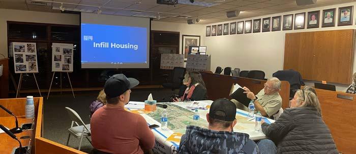
• Planning Board and City Council Meetings - Meeting feedback emphasized the City’s commitment to HB 1220 compliance by embracing a range of housing types in residential and mixed-use land use types at viable intensities for affordable housing development.
Considering Sultan’s continued growth and increasing affordability challenges, similar themes were discussed at nearly all engagement touchpoints. Across the community, people expressed an increasing desire for workforce housing. Many residents communicated the need for alternative paths to homeownership and a wider variety of housing options including condos and multi-family homes.
At the same time, community members are concerned about the impact of new housing development, and many emphasized the need to maintain a balance between growth and over-densifying. Finally, some residents expressed innovative ideas for infill housing on larger, underutilized lots in Sultan, including cottage housing, multiplex buildings, and tiny home villages.
Housing goals, policies, and programs guide the composition of residential neighborhoods and consider affordability broadly in the sense of living and transportation costs, meaning the Housing Element is strongly and necessarily tied to the other elements in the Comprehensive Plan. For example, support for many of the concepts presented in this element can be paralleled in the Land Use Element, which discusses allocating land for mixed-use development and affordable housing, connecting neighborhoods, and integrating more community-serving retail into residential areas. This element impacts Land Use, Transportation, Parks & Recreation, Economic Development, and Capital Facilities & Utilities.
A Planning Summit session dedicated to housing included a hybrid virtual session with optional in-person attendance at City Hall.
The Housing Element is directly impacted by the Land Use Element, and is closely related to the Transportation, Parks & Recreation, Economic Development, Neighborhood Design, and Capital Facilities & Utilities Elements
Figure H-2 shows Sultan’s existing housing stock compared to its Snohomish County Countywide Planning Policies (CPPs) 2044 growth target and housing need. As per guidance issued by the Washington State Department of Commerce, certain housing types are more feasible for different levels of affordability. For instance, low- and mid-rise apartment or condominium buildings are the most viable form of housing for households earning between 0-50% Area Median Income (AMI). Areas on the map in Figure H-3 are color coded according to where the City intends to accommodate different types of housing:
• Neighborhood Residential and Compact Residential: Single-family homes, ADUs, and middle housing will accommodate income levels above 80% AMI
• Neighborhood Hub: Middle housing in combination with low-rise mixed-use buildings (ground floor retail and housing above) could accommodate households earning at least 50% AMI.
• Urban Center and the Mixed-Use Corridor: Larger apartments and condos, mass timber buildings, point-access blocks, and other forms of mid-rise housing that can accommodate households earning 0-120% AMI. Deep affordability is possible with subsidies and incentives.
• Surplus land on three religious-owned parcels are capable of supporting a variety of low-rise and middle housing that can accommodate households earning 0-50% AMI, especially if paired with subsidies, incentives, and non-profit housing developers.
Sultan must also accommodate 88 units/beds of emergency housing, which is excluded from the 2044 growth target (see Volume II).
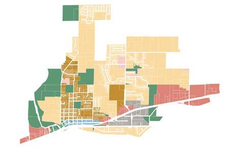
The current housing stock in Sultan is largely composed of three and four-bedroom single-family detached homes in suburban residential neighborhoods and subdivisions. Limited multi-family housing exists north of Downtown in the form of duplexes, single-family conversions, fourplexes, and one-to-two story apartment buildings. Despite the fast pace of construction occurring along Sultan Basin Road, housing costs have risen rapidly, but prices tend to be slightly lower than western portions of Snohomish County and the greater Puget Sound.
Figure H-3. General spatial distribution of Sultan’s housing need for 2044 by future land use designation
H-4. Housing Prices in Sultan, 2018 - 2023
Redfin, March 2024
Figure H-5. Household Size vs Housing Unit Size
US Census Bureau ACS 5-year 2018-2022
Rental opportunities are far less common, and current construction is oftentimes not in alignment with local need regarding household size. Figure H-5 shows the mismatch between household size (number of people) and unit size (number of bedrooms), just one example of how Sultan’s housing stock is not keeping up with its diversifying community.
There is an unalignment between local need and available units
Figure H-6. Housing Unit Surplus/Deficit
US Census Bureau ACS 5-year 2018-2022
Figure H-6 uses a single number to shows the difference between the number of households and the number of housing units from above. For example, the number of households with one or two people in Sultan exceeds the number of studio or one bedroom units available by 887. These 887 households must therefore look for homes with more bedrooms than what they want or need, often resulting in paying more for a larger home than they would prefer.
The majority of Sultan is zoned for single-family residential, yet new state legislation (HB 1220) requires cities to provide enough zoned capacity
to accommodate affordable housing growth. The Snohomish County CPP growth target is divided into five income brackets determined by Area Median Income (AMI) to ensure that affordable housing is equitably distributed throughout the county.
Due to high costs of land and housing construction, state guidance indicates that housing for extremely low and very low-income households is most feasibly provided in larger apartment buildings. To accomplish this, Sultan needs increased density in some areas to support low- and mid-rise construction. PSRC and the GMA also indicate the importance of co-locating affordable housing with amenities, transit, and other services. To this end, the future land use map focuses growth in the Urban Center (Downtown) and the Mixed-Use Corridor (along US-2). Appropriately located surplus land owned by religious institutions can also accommodate feasible building types for extremely low and very low-income housing when a specific zoning overlay is applied.
For low and moderate income households, middle housing may provide some opportunities for housing affordable to this cohort. Housing types include modest multi-family homes like duplexes, triplexes, sixplexes, and courtyard apartments, and in some rare cases, cottage clusters and townhomes. More likely, market-rate and subsidized units in low-rise apartment buildings will accommodate this level of affordability. The future land use map establishes these opportunities in the Urban Center, Mixed-Use Corridor, and Compact Residential areas. Surplus religiousowned land can also support this housing with a specific zoning overlay.
State guidance indicates that generally, residents with incomes over 100% AMI can afford single-family housing. However, even those households with more income flexibility and purchasing power make use of a wide range of housing types across different stages of life. The future land use map seeks to align housing options more closely with the needs of current and future residents.
State mandates updated with HB 1220 require that cities and counties provide adequate zoned capacity for emergency housing. This may take the shape of traditional shelter arrangements, hotel rooms, tiny home villages, or short-term apartments, all of which provide access to showers, bathrooms, and services. Sultan must allow these uses in enough places to accommodate the emergency housing allocation of 76 beds or units. Documentation of the City’s capacity for emergency housing can be found in Volume II.
H 1. Promote housing development that reduces costs, achieves higher densities, and expands housing choice to meet the needs of all people in Sultan.
H 1.1. Encourage the construction of middle housing in both new and existing single-family neighborhoods.
H 1.1.1. Update zoning to ensure duplexes and other multiplexes, low- and mid-rise apartment buildings, courtyard and garden apartments, cottage clusters, and townhomes are accommodated across the city.
H 1.1.2. Create objective and flexible design standards to ensure middle housing is context-sensitive. Administrative review only.
H 1.1.3. Revise subdivision standards to support middle housing and ADUs in new neighborhoods.
H 1.1.4. Right-size development regulations to make middle housing viable on more lots.
H 1.2. Support smaller lot sizes, cluster housing, infill housing, and other strategies to promote efficient use of land zoned for residential development.
H 1.2.1. Develop standards that incentivize the use of alleys, rear garages, and street parking in new housing development.
H 1.2.2. Address utility requirements and connection fees that might be cost prohibitive for infill housing.
H 1.2.3. Develop pre-approved ADU plans to be used for fast-tracked permitting in all neighborhoods.
H 1.3. Support diverse housing types that are affordable to Sultan's workforce.
H 1.3.1. Allow higher-density affordable housing on religious-owned land.
H 1.4. Minimize cost barriers to housing production by simplifying development regulations and streamlining the permitting process.
H 1.4.1. Develop incentives and partnership opportunities with organizations like Housing Hope and Habitat for Humanity to facilitate higher-density affordable housing.
H 1.4.2. Consider the use of right-sized impact fees, local improvement districts, general obligation bonds, and existing revenue sources to provide needed infrastructure funding.
H 1.4.3. Remove barriers which prevent religious institutions and community organizations from hosting emergency shelters or emergency housing facilities.
H 1.4.4. Address the need for flexibility within development regulations to address environmental protection standards by updating regulations to include: (a) Flexible subdivision design such as cluster development or conservation subdivisions; and (b) Flexibility in lot size and configuration, including on site density transfers to accommodate habitat patches and corridors.
H 1.5. Require, to the greatest extent feasible, the development of efficient and environmentally sensitive housing practices to minimize the impacts of infrastructure on natural resources and to address state energy efficiency, carbon reduction, and salmon recovery goals.
H 1.6. Ensure there is sufficient zoned land capacity for housing across all income segments, consistent with the Regional Growth Strategy and Snohomish County Growth Targets.
H 1.6.1. Adjust Sultan's growth target and housing need according to development trends in housing and employment.
H 1.7. Periodically refine zoning and development standards according to the City's progress toward its growth target and housing need.
H 1.7.1. Establish a public facing dashboard to monitor local progress on housing outcomes.
H 1.7.2. Audit the Sultan Municipal Code every three years for usability, effectiveness, and efficiency. Include discussions with community advisory groups and the development/design community to determine regulatory issues and opportunities
H 2. Increase development of mixed-use neighborhoods with equitable access to transit and jobs.
H 2.1. Support mixed-use projects that provide housing over ground floor commercial or office activities, increasing choice and achieving higher densities within a pedestrian-oriented environment.
H 2.1.1. Revise development standards to allow 3-story mixed-use buildings Downtown.
H 2.1.2. Revise development standards to allow 4-story residential and mixed-use buildings along US-2 east of Sultan Basin Road.
H 2.2. Encourage residential development that minimizes vehicle miles traveled, maximizes transportation choices, optimizes the use of existing/planned transportation systems and capital facilities, and improves the jobs-housing balance.
H 2.2.1. Enable high density mixed-use and residential development around centers and transit stops.
H 2.3. Increase capacity for affordable housing options close to employment, education, shopping, public services, and public transit.
H 2.3.1. Create use permissions and development standards for live-work units.
H 2.3.2. Reduce parking requirements in areas where transit, biking, or biking are viable.
H 3. Support regional efforts to accommodate affordable housing for all demographic groups and income levels.
H 3.1. Participate in cooperative, multi-jurisdictional programs that contribute to an adequate supply of diverse, affordable, and/ or special need housing.
H 3.1.1. Incentivize long-term affordable housing through regulatory relief, property tax incentives, connection fee waivers, and parking requirement reductions.
H 3.2. Encourage preservation and maintenance of existing affordable housing.
H 3.2.1. Dedicate funds for acquisition of at-risk affordable housing.
H 3.2.2. Support state efforts to protect Sultan's manufactured home parks as a source of lowincome housing.
H 3.3. Support emergency transitional housing, public and private housing, and services for people who are homeless.
H 3.3.1. Allow indoor emergency shelters and emergency housing in any zone where hotels are allowed.
H 3.3.2. Enable permanent supportive housing and other income-restricted development where residential development is allowed.
H 3.4. Protect low-income renters and renters with disabilities.
H 3.4.1. Require or incentivize the creation of accessible units.
H 4. Address and mitigate against racially disparate impacts, displacement, and exclusion in local housing.
H 4.1. Actively monitor vulnerable communities and enact antidisplacement mechanisms like property tax exemptions or deferrals, relocation assistance, tenant opportunity to purchase policy, and right to return policy.
H 4.2. Promote equitable development by intentionally distributing growth and resources in a way that mitigates and repairs existing disparities in household wealth, housing quality, access to homeownership finance, access to daily needs, and/ or proximity to pollutants and environmental hazards.
H 4.3. Support the expansion of homeownership in Sultan, providing increased opportunities to build intergenerational wealth.
H 4.3.1. Partner with external agencies to enable alternative homeownership models like community land trusts, down payment assistance, and limited or sharedequity cooperatives.
H 4.4. Collaborate with Sultan's most disproportionately impacted communities when developing, implementing, and monitoring strategies that address racial exclusion and displacement risk.
H 4.4.1. Partner with the Tulalip and Skykomish Tribes on indigenous-led development projects.
H 4.4.2. Renegotiate expiring affordable housing covenants.
H 4.4.3. Establish a rental inspection and registry program.
H 4.4.4. Work with non-profit organizations and community groups to purchase at-risk affordable housing.
H 4.4.5. Develop processes to monitor and enforce fair housing laws.
H 4.5. Partner with Snohomish County advocacy groups to provide public resources and events focused on housing equity.
This page intentionally left blank

Sultan’s natural environment, shaped by the Sultan and Skykomish Rivers, has influenced the city since its inception, providing key transportation routes for timber and pristine natural beauty for its residents and visitors to enjoy. The Natural Environment Element addresses critical areas like wetlands, critical aquifer recharge areas, fish and wildlife conservation areas, geologically hazardous areas, and frequently flooded areas. Within Sultan's 2,246-acre Urban Growth Area, prominent features include three major rivers (Skykomish, Sultan, and Wallace), two creeks (Wagley Creek and Winters Creek), and numerous minor streams. These water bodies, along with other critical areas, are essential components of Sultan's landscape that are protected and enhanced under the guidance of this element.
The 2024 Comprehensive Plan Update aligns with the vision to create a safe and friendly city for all, reflecting Sultan’s commitment to environmental stewardship and economic sustainability. Essential components of the 2044 Vision—climate resilience, mitigation of natural hazards like floods and wildfires, and the protection of Sultan’s sensitive environmental features—are addressed in the Natural Environment Element. Ultimately, this element balances the mandate of protecting critical areas with the need for growth and development. Updates to the Natural Environment Element include:
• New and enhanced policies focused on environmental stewardship, climate change mitigation and adaptation, and the protection of water bodies, wildlife habitats, and other natural features.
• Promotion of innovative, environmentally sensitive development practices and integrated, interdisciplinary approaches for environmental planning and assessment.
• Reorganization and consolidation of goals, policies, and programs.
• Layout improvements for functionality and usability.
Each element is related to Sultan’s Community Vision for 2044. This graphic illustrates the strength of the connection between the Vision and the Natural Environment Element. For more on the Nine Big Ideas that make up the Vision, see the Community Vision Section of this document.
The Natural Environment Element goals and policies are derived from planning themes and big ideas that reflect community desires as well as state, regional, and county requirements. The influence of these planning themes are evident throughout the Plan.
• Expand and enhance parks, recreation, and trails as distinguished community assets (influenced elements: Community Design, Parks and Recreation, Land Use, Natural Environment).
• Plan for climate resilience and mitigate natural hazards like floods and wildfire (Community Design, Parks and Recreation, Land Use, Natural Environment).
• Balance the preservation of environmental assets with the creation of new housing and employment opportunities while reducing exposure to environmental hazards (Community Design, Land Use, Housing, Economic Development, Transportation).
• Enhance ecological functioning in planning efforts (Land Use, Housing, Parks & Recreation).
The Washington State Growth Management Act (GMA) outlines specific environmental planning requirements related to land use and comprehensive plans. These requirements encompass the designation and protection of natural resource lands and critical areas by using Best Available Science (BAS) in decision-making processes.
Washington State's HB 1181, enacted in 2023, amends the Growth Management Act (GMA) by requiring local comprehensive plans to include a climate element with resilience and greenhouse gas emissions mitigation sub-elements. The resilience sub-element mandates goals and policies for climate preparedness, response, and recovery for all GMA planning counties and cities, while the greenhouse gas emissions sub-element focuses on reducing emissions and vehicle miles traveled, emphasizing economic, environmental, and social cobenefits, and prioritizing environmental justice. The legislation provides a framework, guidance, and funding for incorporating these elements into comprehensive plans. The Natural Environment Element update in 2024 initiates alignment with HB1181; however, Sultan must formally adopt a greenhouse gas reduction sub-element and resilience subelement by 2029 to achieve full compliance.
The protection and enhancement of Sultan's natural environment were common themes in various public engagement efforts that informed this comprehensive plan update. Residents view habitat protection and natural hazard mitigation as critical components of Sultan's natural environment. Priorities for Sultan’s natural environment were clarified during many outreach events, including:
Sultan Farmers Market, Red Apple, & City Hall Listening Posts - In the community survey, respondents expressed an overwhelming love for Sultan’s parks and natural beauty—particularly as they contribute to residents’ sense of community. Balancing environmental protection with continued growth was also indicated as a priority for the future.
Planning Summit - Participants identified Sultan’s parks, rivers, and mountain views as popular assets during the community mapping exercise, while noting that flooding and wildfire risk are recurring challenges.
Sultan Shindig - Preserving open spaces and ecological functioning comes up frequently during discussions about the importance of parks and green spaces to the community. The protection of habitat for salmon, deer, and other wildlife is important to residents. Many residents are passionate about mitigating the impacts of climate change and are
concerned about the risks of floods and wildfires. The community is increasingly interested in actions to reduce local emissions and vehicle miles traveled.
The Natural Environment Element is influenced by various Plan Elements, including land use, housing, parks & recreation, and transportation, which guide the distribution of land uses, development types, transportation networks, and parks systems. This element negotiates circumstances when activities occur along or near critical areas or the WildlandUrban Interface, playing a crucial role in mitigating and addressing the impacts of climate change on natural areas. It informs future land use considerations and new development locations, directing development away from critical areas and guiding transportation routes away from open water. Additionally, the Natural Environment Element informs economic opportunities and tourism development by shaping community identity, attracting visitors, and fulfilling the community's desire for access to natural resources and trails. Finally, all other elements of the plan acknowledge the sensitivities of critical areas protected by the Natural Environment Element.
Multiple water bodies, including the Skykomish River, Sultan River, Wallace River, Winters Creek, Wagley Creek, and unnamed streams, drain and shape the geography of the Sultan Urban Growth Area. The Sultan UGA is drained by three principal basins: the Lower Sultan River Basin, Lower Mainstem Skykomish Basin, and May Creek Basin.
Sultan's unique location encompasses critical areas such as wetlands, geologically hazardous zones, aquifer recharge areas, and wildlife habitats, presenting both natural assets and development challenges. Steep slopes along the Sultan Basin Plateau and river banks are classified as erosion and landslide hazards and many seismogenic folds and faults crossing the city are identified seismic hazards. Over 30% of the city’s parcels lie within the 100-year floodplain, making them increasingly vulnerable to flooding from the Skykomish and Sultan Rivers. This flooding has notably impacted downtown twice in the past decade, necessitating special design considerations for new buildings in flood-prone areas. Additionally, Sultan has a high vulnerability to the aquifer recharge areas, which contribute to development challenges throughout the city. The city also faces a wildfire risk, as much of Sultan lies within the WildlandUrban Interface. This area—a vulnerable mix of built structures and forests—has seen an increase in wildfires in Western Washington and the Skykomish River Valley in recent years. These environmental factors collectively shape the planning and development strategies in Sultan.
The Natural Environment Element is closely connected to elements for Community Design, Land Use, Housing, Economic Development, Parks & Recreation, and Transportation.
Figure NE-2. Flood risks, wildfire risks, and state protected critical areas across Sultan
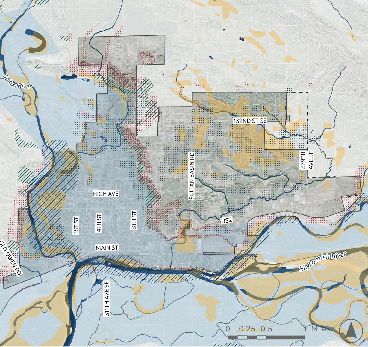


Wetlands
Frequently Flooded Areas Unknown
Priority Wildlife Habitat
Erosion Hazard Areas
Landslide Hazard Areas
Seismic Hazard Areas
NE 1. Act as stewards of Sultan's natural areas and ecosystems, reducing pollution while protecting wildlife, habitats, and natural features that are representative of Sultan’s ecological heritage.
NE 1.1. Protect and restore Sultan's native and climate-resilient vegetation, enhance tree canopy coverage, and ensure tree and vegetation health in order to mitigate climate challenges.
NE 1.2. Prioritize the preservation of natural ecological features when siting new development.
NE 1.2.1. Protect fragile ecosystems such as fish spawning beds and open space areas that contain prime wildlife habitat characteristics.
NE 1.2.2. Keep critical area maps up to date, including a critical area overlay on zoning maps.
NE 1.3. Require the mitigation of environmental damages for all development projects.
NE 1.3.1. Establish a review process that includes minimum performance criteria that developers must satisfy in order to obtain project approvals, and hold the developer liable and accountable for the successful accomplishment of proposed performance requirements.
NE 1.3.2. Utilize natural materials and designs where improvements are considered to blend new construction with the natural setting.
NE 1.4. Support programs and techniques that manage and reduce the spread of invasive species that are harmful to natural ecological function and habitat.
NE 1.5. Encourage the reduction of toxic pesticides, chemical fertilizers, and other products that present a risk to the health of the environment and humans.
NE 1.6. Support designated species of local or state significance, particularly salmonids, and protect areas that are critical for survival of endangered or threatened species.
NE 1.7. Collaborate with other jurisdictions in the county and region to protect and enhance critical habitats, water quality, and natural ecosystems, employing interdisciplinary approaches and Best Available Science (BAS), advancing interdisciplinary approaches for environmental planning and assessments.
NE 2. Strengthen the community's capacity to withstand and adapt to the effects of climate change through the use of sustainable infrastructure, reduction of greenhouse gas emissions, and other strategies to enhance climate resilience.
NE 2.1. Protect and enhance Sultan's natural features that mitigate possible damage from environmental hazards and contribute to climate resiliency, including wetlands, bogs, soils, tree canopy, and other forms of natural green infrastructure.
NE 2.2. Avoid potential impacts to community safety during climaterelated disasters by appropriately mitigating land disturbance and development in landslide hazard areas, along steep slopes, and within sensitive portions of the Wildland Urban Interface (WUI).
NE 2.3. Protect lands containing shallow depths to bedrock or bedrock escarpments, particularly where combined with slopes that are susceptible to landslide hazards.
NE 2.4. Protect or mitigate damage to soils with extremely poor permeability, high water tables, or very poor compressive strengths during the land use development process.
NE 2.5. Protect lands and soils with severe limitations, particularly wetlands, drainage corridors and lands with seasonal high water tables, land over aquifers, and aquifer recharge areas.
NE 2.6. Employ strategies such the use of alternative and renewable energy sources, energy management technologies, and other conservation tactics to reduce energy use per capita.
NE 2.7. Commit to reducing greenhouse gas emissions in line with state and regional targets through sustainable land use practices, conservation practices, comprehensive waste reduction, and promoting community-wide green initiatives.
NE 2.7.1. Incentivize new development to standards created by Leadership in Energy and Environmental Design.
NE 2.7.2. Develop a fully compliant Climate Change & Resiliency Element by 2029, including subelements for Greenhouse Gas Reduction and Resiliency.
NE 3. Ensure equitable access to a healthy environment for all, regardless of race, ethnicity, socioeconomic status, age, gender, or ability.
NE 3.1. Create and maintain new public parks and green spaces, prioritizing community access in places with limited greenery and barriers to pedestrian connectivity.
NE 3.2. Increase public access to publicly-owned shoreline.
NE 3.3. Expand and enhance Sultan's trail network, providing ecofriendly connectivity throughout the city that offers wildlife habitat corridor linkage benefits while simultaneously providing recreational opportunities accessible to all ages and abilities.
NE 3.4. Establish a community advisory board encouraging participation and feedback from people of diverse cultural and socioeconomic backgrounds to prioritize environmental justice and equitable access to greenery, open space, parks, and trails.
NE 3.4.1. Designate socially valuable natural landmarks and sites on future land use map overlays and zoning maps.
NE 3.5. Participate in the creation of regional plans and strategies for open spaces, wildlife corridors, and recreation opportunities, ensuring equitable access to the outdoors across the community.
NE 4. Honor the unique, interdependent relationship between Sultan's water, land, and cultural heritage, protecting Sultan's natural waterway setting to the maximum extent feasible.
NE 4.1. Maintain the ecological integrity of shorelines, waterways, floodplains, and other natural water features, regulating human activities that may impact natural currents, flows, and floodways.
NE 4.1.1. Define and regulate activities that may occur within or affect the function of natural aquatic systems, including dredging, construction, and navigation activities.
NE 4.1.2. Establish and maintain legally defensible aquatic buffer zones that preserve the natural biological functions of streams and other aquatic systems, and that facilitate growth of native vegetation and other materials contributing to or draining into Sultan's surrounding water resources and wetlands.
NE 4.1.3. Pursue acquisition of repetitive flood loss properties within the floodway zone to reduce risk and damage from flooding, and protect wetland and wildlife habitat.
NE 4.1.4. Establish development standards for development in dam failure impact zones.
NE 4.1.5. Implement dam failure plans to maintain readiness.
NE 4.1.6. Establish performance criteria and standards governing the preservation of wetlands and drainage corridors.
NE 4.2. Promote the use of retention ponds, natural drainage methods, and other site improvements that conserve natural drainage features and wetland habitats.
NE 4.2.1. Establish design guidelines and performance standards for the use of site retention ponds, natural drainage methods, and other site improvements.
NE 4.3. Use BAS to improve and enhance perennial streams, ponds, springs, marshes, swamps, wet spots, bogs, and other surface tributary collection areas.
NE 4.4. Cooperate with Snohomish County and other public agencies to create and implement plans that will prevent groundwater contamination risks from future developments in high-risk areas.
This page intentionally left blank
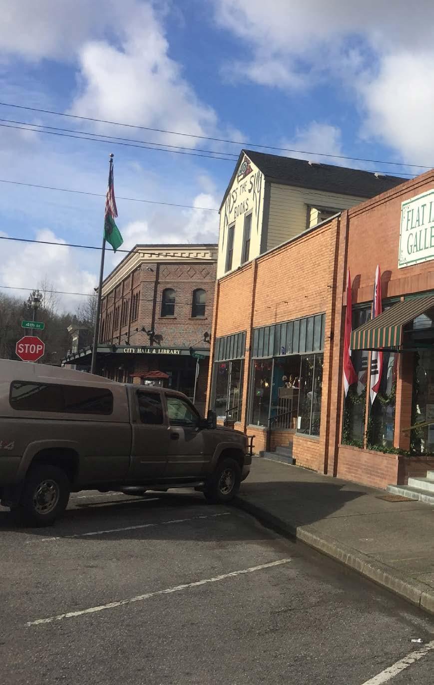
The next twenty years will present Sultan with many opportunities to provide goods and services for its growing population while keeping tax dollars local and reducing vehicle trips to nearby cities for shopping and employment. Sultan’s Economic Development Element charts a path to capitalize on these possibilities and satisfy the community vision for 2044. New and expanded retail opportunities, the creation of entertainment and social destinations, access to medical facilities, abundant jobs, and overall community enrichment are among the many aspirations in the community vision that this element is designed to address.
This element continues to emphasize general objectives for a diversified business community, family-wage paying jobs, and access to goods and services that have been at the fore of past comprehensive plans. As this Plan looks toward 2044 and considers changing employment dynamics and desires of new residents, the Economic Development Element has been updated to reflect priorities for youth employment and enrichment, placemaking and active mixed-use areas, and support for Sultan’s remote and hybrid workers.
Updates to the Economic Development Element include:
• Refined goals, policies, and programs that are connected to the community vision
• Additional emphasis on the connection between placemaking, social connections, and economic development success
• Economic development profile
This is Volume I of the Economic Development Element. Volume II provides background detail through an economic development profile, which reviews population, household, employment, and fiscal and economic indicators that support this element's conclusions and direction.
Each element is related to Sultan’s Community Vision for 2044. This graphic illustrates the strength of the connection between the Vision and the Economic Development Element. For more on the Nine Big Ideas that make up the Vision, see the Community Vision Section of this document.
The goals, policies, and programs in this element guide the City toward a more economically active and fiscally sustainable future. The goals and policies address key themes derived from both community desires and the City's planning and fiscal objectives. Each takeaway below relates to multiple plan elements.
• Expanding job opportunities a nd destinations for youth. From after-school programs, workforce development, and employment to destinations for socializing and entertainment, enrichment for Sultan’s youth is a high priority of the Plan. (Influenced elements: Community Design, Land Use, Parks & Recreation).
• Provision of local goods and services. New and expanded offerings for retail, medical facilities, and other services are crucial for meeting the everyday needs of Sultan’s growing population without relying on long vehicle trips and losing taxable sales to nearby cities (Land Use, Natural Environment, Transportation, Capital Facilities & Utilities).
• Business development, support, and retention. Recruitment and support for new and existing businesses is crucial to a healthy economy (Housing, Transportation, Capital Facilities & Utilities).
• Fiscal sustainability. Capturing more local spending, expanding economic opportunities through commercial development, and attracting regional spending through recreation and tourism can strengthen the City’s bottom line (Community Design, Land Use, Parks & Recreation, Capital Facilities & Utilities).
Figure ED-1. Economic Development ElementVision connection
and activities.
• New job opportunities and workforce housing so people can live and work in Sultan. Supporting employment growth and encouraging housing that’s affordable to low-to-moderate income households can eliminate the long commutes many Sultan residents face and, at the same time, provide jobs for all residents (Land Use, Housing, Natural Environment, Transportation, Capital Facilities & Utilities).
• Catalyze mixed-use development. Strategic areas on the US-2 corridor will provide opportunities for commercial development, cultural uses, amenities, and local services adjacent to affordable and market-rate housing (Land Use, Housing, Transportation, Capital Facilities & Utilities).
Outreach to community members and local business owners was highly informative to the themes addressed in the Economic Development Element. This element not only benefited from engagement efforts for the Comprehensive Plan Update but it was also able to rely on community feedback facilitated by the Sky Valley Chamber of Commerce during ongoing conversations with established and aspiring business entrepreneurs. Local access to everyday needs, expanded job opportunities, and community destinations headlined residents’ list of priorities since this Plan Update's first day of outreach. Priorities for local economic development were clarified in several outreach events, including:
• Farmers Market and Other Community Events - Residents emphasized the desire for retail offerings like a full-sized grocery store and hardware store, everyday community meet-up places like cafes, more restaurant options, and critical services like medical clinics and daycare centers.
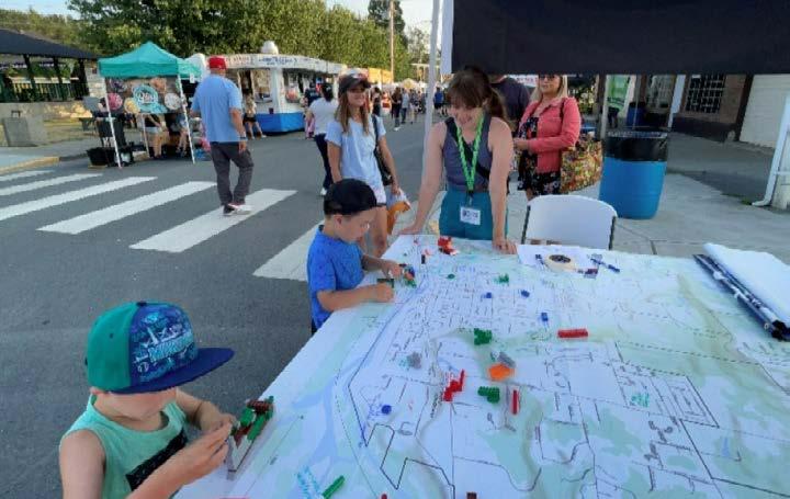
• Sultan Shindig and Youth Outreach - Downtown destinations and programming for kids, including educational and social outlets, are crucial for the well-being of Sultan’s youth. Kids and their families have ambitions for a regional learning center and safe entertainment establishments like an arcade and bowling alley.
• Planning Summit - Attendees not only reiterated the need for everyday shopping, kid-friendly destinations, and new job opportunities but also the desire to beautify storefronts, streetscapes, signage, and decorations to attract businesses and visitors.
• Planning Board and City Council Meetings - Elected leaders and Planning Board members helped determine expanded areas for commercial development along US-2 and in Neighborhood Hubs. Clear consensus was also established for well-rounded approaches to satisfying residents' daily needs, improving the City’s fiscal sustainability, and enhancing the placemaking features and economic functioning of Downtown.
Successful economic development requires a holistic approach beyond simply creating and sustaining jobs. Ensuring abundant and affordable housing for the local workforce, maintaining high-quality infrastructure for business development, planning for sufficient land for economic activity, and supporting access to community amenities such as parks, schools, and natural areas all play a role in supporting the economic vitality of a city. The Economic Development Element is highly intertwined with all other elements in the plan and is most successfully accomplished through integrated development efforts with the Community Design, Land Use, Housing, Transportation, and Capital Facilities & Utilities Elements.
Despite a productive history with natural resource-based industries, Sultan’s economic development landscape has experienced periods of decline and stagnation in recent years. Today, various industries are represented, with most employment occurring in education, public administration, and food and accommodation (Figure ED-1). Manufacturing, construction, and warehousing contribute significantly to employment relative to the job densities of these industries due to few large employers like ROMAC. Few jobs are represented in retail and personal services, especially in comparison to Sultan’s population, and therefore contribute little to the City’s tax revenue (Figure ED-2). In sum, Sultan supports approximately 1,200 jobs, resulting in a lopsided ratio of about one job for every six people.
The Economic Development Element is closely connected to elements for Community Design, Land Use, Housing, Transportation, and Capital Facilities & Utilities.
Washington State Department of Commerce,
Also complicating Sultan’s economic development status are the daily in and out-flows of residents and local employees (Figure ED-3). Due to relatively few job opportunities within Sultan, the vast majority of employed residents leave the city each day to work in other cities throughout the Puget Sound. At the same time, a considerable number of employees who work in Sultan commute into the city each day from different parts of the region. These dynamics produce many long distance single-occupancy vehicle trips and exacerbate retail sales leakage since residents are likely to spend their earnings on purchases outside Sultan, where they work and/or where daily shopping needs can be met.
2,091
Figure ED-3. Sources of Sultan’s governmentwide revenue without proprietary funds, 2022
Washington State Auditor's Office, Financial Intelligence Tool, 2022 Filings, 2023
Figure ED-4. Sultan employment inflow/ outflow
US Census Bureau, Longitudinal EmployerHousehold Dynamics, 2020
ED 1. Support economic development that provides family-wage jobs, diversifies the city’s business community, and creates a sound tax base for Sultan.
ED 1.1. Facilitate local business development efforts, property investment projects, and programs enhancing Sultan's economic opportunities. Prioritize these efforts on Main Street.
ED 1.1.1. Support the creation of special improvement districts, including parking and business improvement authorities, local improvement districts, or other programs when such ventures provide public benefits and are appropriate to Sultan's long range goals.
ED 1.1.2. Discourage undesirable commercial development with low job density, like self storage facilities.
ED 1.2. Foster a supportive environment for all businesses in Sultan to help create employment opportunities within the Sultan economy.
ED 1.2.1. Leverage Sultan’s unique physical location as a recreation destination by supporting tourist related activities.
ED 1.2.2. Participate with the Sky Valley Chamber of Commerce, other public agencies, and private interests in marketing development projects, labor force training programs, and other efforts to attract new businesses to the Sultan area.
ED 1.3. Encourage local business development opportunities for small or start-up businesses that may be owned by or employ Sultan residents, especially those from underrepresented groups.
ED 1.3.1. Promote the local use of small business financing and management assistance programs through direction or referral to available programs.
ED 1.3.2. Work with the Sky Valley Chamber of Commerce on business recruitment, retention, and expansion efforts.
ED 1.4. Work with other public agencies and private interests to identify and promote sites that can be suitably developed for a variety of local employment projects consistent with desired regional and local economic growth.
ED 1.4.1. Implement effective zoning in areas designated as Urban Center, Mixed-Use Corridor, and Neighborhood Hub for mixed-use office, commercial, and residential uses to maximize local services and promote pedestrian-oriented centers.
ED 1.4.2. Work with interested property owners to determine employment center possibilities. Determine the costs of providing sewer, fire and police protection, multimodal access, recreational areas, and other services and amenities for Sultan residents. When feasible, calculate the public benefits that may be realized through the creation of local jobs and increased tax revenue.
ED 1.4.3. Implement effective zoning in areas identified as Manufacturing for industrial, fabrication, warehousing, and other uses to support major employers.
ED 1.5. Provide zoning for a suitable supply of commercial, retail, business, office, and industrial lands to encourage a closer balance between jobs and housing consistent with the regional growth strategy.
ED 1.5.1. Annually review and monitor Sultan’s Buildable Lands Report to ensure an adequate amount of land for employment uses is available.
ED 1.5.2. Zone for an adequate supply of commercial and mixed-use development to encourage local employment, shopping, and other urban service activities.
ED 1.6. Promote the development of industries and services that promote sustainability and address climate change and community resiliency.
ED 1.7. Capitalize on the mutual benefits and connections between rural economies as food suppliers and the Sultan community as processors and consumers.
ED 1.8. Identify and protect against the potential for physical, economic, and cultural displacement of existing locally owned, small businesses as a result of development or redevelopment and market pressure. Consider a range of mitigation strategies to mitigate the impacts of displacement.
ED 2. Grow and invest in Sultan's workforce
ED 2.1. Support youth and young adult employment opportunities
ED 2.1.1. Work with the Sky Valley Chamber of Commerce, School District, and other private and public partners to match students and local employers.
ED 2.1.2. Identify job and apprenticeship opportunities within City operations for local youth.
ED 2.2. Foster partnerships with the School District, agencies, and other educators to offer high-quality and accessible training programs that equip young people with the skills needed to meet regional and global economic demands.
ED 2.3. Advocate for the creation of a regional learning center, business development center, or vocational school.
ED 3. Foster vibrant mixed-use hubs as engines of Sultan's economic growth and attractive destinations for residents and visitors
ED 3.1. Lead planning, collaboration, and development efforts to reuse older buildings, redevelop vacant properties, and revitalize Downtown.
ED 3.1.1. Identify facilities and buildings that may be used for small business start-ups, including older structures that may be suitably reused for business purposes.
ED 3.1.2. Implement a vacancy tax or similar mechanism to promote economically productive uses in Downtown buildings.
ED 3.1.3. Support local marketing efforts, parking and building improvements, and other actions that may revitalize properties.
ED 3.1.4. Establish a dedicated entity for Downtown revitalization, like a Main Street Association
ED 3.1.5. Develop a detailed strategy for marketing, promoting, and attracting the development of Sultan's commercial and industrial land opportunities.
ED 3.2. Focus amenities and mixed-use and commercial development in Downtown and along US-2 with smaller nodes of activity in Neighborhood Hubs.
ED 3.2.1. Build and maintain a safe shared-use path for comfortable walking and rolling along US-2.
ED 3.3. Promote and maintain a variety of cultural uses, activities, and events in Downtown and other mixed-use hubs.
ED 3.3.1. Develop a Downtown Plan, Corridor Plan, and/or focused subarea plans at key locations along US-2.
ED 3.3.2. Create and preserve dedicated public space serving a variety of community functions within Downtown.
ED 3.3.3. Partner with and support community organizations dedicated to arts and culture uses, events, activities, and experiences.
ED 3.4. Provide infrastructure and amenities in Sultan's mixed-use hubs through planning, design, and funding.
ED 3.5. Invest in public spaces, public art, cultural hubs, and recreational amenities to enrich community life.
ED 4. Establish a supportive system and built environment for hybrid and work-from-home employees residing in Sultan.
ED 4.1. Work with service providers to expand and enhance internet and communications infrastructure.
ED 4.2. Create meeting, business, and co-working spaces Downtown or in Sultan's mixed-use hubs.
ED 4.3. Support neighborhood-serving restaurant and retail opportunities.
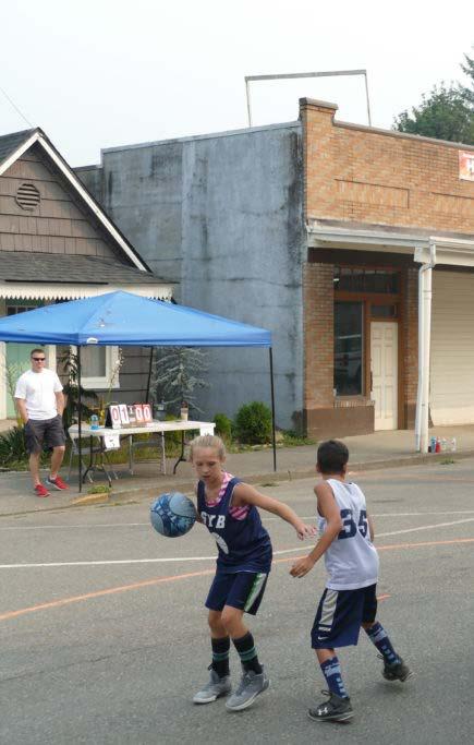
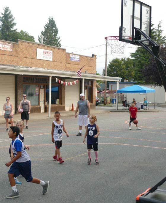
The Parks & Recreation Element guides how public spaces in Sultan can act as assets for community, ecological, and economic health, helping to accomplish several aspects of the 2044 Vision. As the city grows, parks will serve as vital lands set aside for community benefit, connecting residents and visitors with art, history, and culture. Parks will also be part of climate resilience, with river-adjacent parks playing a role in flood mitigation and tree canopy working to alleviate urban heat island effect. This element plans for parks that continue to embed Sultan’s rich and unique landscape into the city, while expanding local opportunities for recreation, play, and cultural enrichment.
Updates to the Parks & Recreation Element include:
• Emphasis on assets and amenities that contribute to community health. This includes new play and/or fitness equipment, trails, lighting, benches, and safety features in parks.
• A new approach to Parks Level of Service (LOS) that takes a holistic approach to quantity, quality, and access to Sultan’s parks.
This is Volume I of the Parks Element. Volume II includes further detail on park improvement strategies and provides an external reference to the 2020 Parks, Recreation, and Open Space (PROS) Plan.
Goals and policies in the Parks & Recreation Element are derived from planning themes and big ideas for the next 20 years as well as state, regional, and county requirements. The influence of these planning themes ripple throughout this element.
• Improve existing parks to amplify the impact of existing park land. Sultan is not lacking park acres, but residents desire more amenities for recreation, gathering, and respite. (Influenced elements: Community Design, Land Use, Economic Development, Natural Environment).
• Invest in park planning for Regional Tourism. Sultan has the opportunity to attract US-2 travelers into its parks for hiking, water sports, fishing, and other local recreation offerings. Zooming out and planning for impactful parks rather than making piecemeal improvements will help to harness parks for regional tourism (Community Design, Economic Development).
Each element is related to Sultan’s Community Vision for 2044. This graphic illustrates the strength of the connection between the Vision and the Parks & Recreation Element. For more on the Nine Big Ideas that make up the Vision, see the Community Vision Section of this document.
• Serve families with accessible parks and amenities. Sultan’s families desire to be near parks where they can walk with strollers, play on playgrounds, and otherwise recreate. Mountain View Park will fill a gap in the eastern portion of Sultan, and will also be Sultan’s first Neighborhood Park. As growth brings more families to the area, additional Neighborhood Parks and better access to existing parks will help ensure that people are able to visit local parks regularly (Community Design, Land Use, Capital Facilities & Utilities).
• Expand Trail Networks in Conjunction with Transportation. Sultan residents desire more safe routes for walking and bicycling, which can be accommodated within parks and via multi-modal transportation networks (Community Design, Transportation).
• Infuse ecological and environmental design into parks: Sultan’s parks can be part of a strategy to retain water and mitigate damage during flooding events, while also providing education about the area’s waterways, habitats, and mineral resources (Natural Environment).
Public engagement was conducted during 2019-2020 as part of the Parks, Recreation, and Open Space (PROS) Plan and again as part of this planning process. Throughout the planning efforts, residents expressed an appreciation for Sultan’s parks, trails, and recreational offerings, and a desire for additional park maintenance and amenities to allow for more regular park use. Priorities for Sultan’s parks and recreation were voiced during many outreach events, conducted as part of these two projects:
Figure PR-1. Parks & Recreation ElementVision connection
The Parks & Recreation Element is closely connected to elements for Community Design, Land Use, Natural Environment, Economic Development, and Capital Facilities & Utilities.
• 2024 Comprehensive Plan Engagement was conducted at Sultan Shindig, National Night Out, and other community events. People at these events expressed that parks are important to Sultan’s families who want to live near parks with amenities such as trails, playgrounds, and sports facilities. People want amenities that they are currently traveling to other cities to access—a pool and splash pad being commonly requested items. Additionally, people desire more connections to Sultan’s rivers and the preservation and enhancement of green spaces. People also identified the lack of art and community gathering places in Sultan.
• 2020 PROS Plan Engagement included four public forums, stakeholder meetings, and a public input survey. Respondents identified new and updated play equipment and increased safety as high priorities, as well as improved park maintenance, and new recreational programs for youth. Survey respondents also reported that clear maps, additional lighting, and benches would increase their usage of parks. The equestrian community also mobilized during this engagement effort and formed a stakeholder group to evaluate trails in Osprey Park.
The public spaces and programs guided by the Parks Element can often be venues for carrying out goals and policies put forth in other Comprehensive Planning Elements. For example, trails in parks can function as multi-modal transportation networks, events and attractions in parks can act as generators of economic development, and the preservation of open space through the parks system functions to protect local natural systems.
Under RCW 36.70A.070, park and recreation facilities shall be included in the Capital Facilities Element, ensuring that spending for these facilities is planned and accounted for.
Residents of Sultan have access to 107.7 acres of municipal park land and 10 miles of trails, which offer access to the city’s wooded areas and rivers, as well as opportunities for recreation, respite, and gathering. These core municipal parks serve as the basis for the evaluation of the parks system’s Level of Service (LOS), which is a tool for understanding how the parks system is meeting residents’ needs, and how it needs to expand in order to keep up with the growing population. In addition to municipal parks, Sultan residents have access to fields and courts on school grounds, several state parks, and forests managed by the Washington Department of Natural Resources. These facilities are discussed in greater detail in Volume II.
Sultan’s parks are concentrated around the historic town center and adjacent to the Sultan River, and most of the western half of the city falls within a half-mile walk of a green space. In the eastern portion of the city, residents have access to several trails, but lack a nearby park. The development of Mountain View Park will alter this dynamic, adding 4.5 acres of active and passive amenities to residents in this area. This will also be Sultan’s first Neighborhood Park, a typology that serves nearby residents by offering amenities that can be enjoyed by people of all ages and abilities.
Much of Sultan’s existing park acreage is forested, with some portions accessible by trail and others acting as undeveloped open space. In Osprey Park, Sultan’s Regional, 76.2 acre park, trails offer views and access to the Sultan River, link areas with recreation amenities, extend out of the park through wooded areas, and connect back into the street grid and to River Parks via a pedestrian bridge. On the west side of the Sultan River, Rudolph Reese Park (18.8 acres) offers a similar spread of wooded areas and recreation amenities, but without a formal trail network. These forested, undeveloped parks surrounding the river are an asset to the City, helping with flood mitigation and providing day to day access to the nature that surrounds Sultan. There are also opportunities to amplify their local impact and regional draw by adding highly desired facilities, improving park access, and adding trail amenities such as wayfinding signage, benches, and lighting.
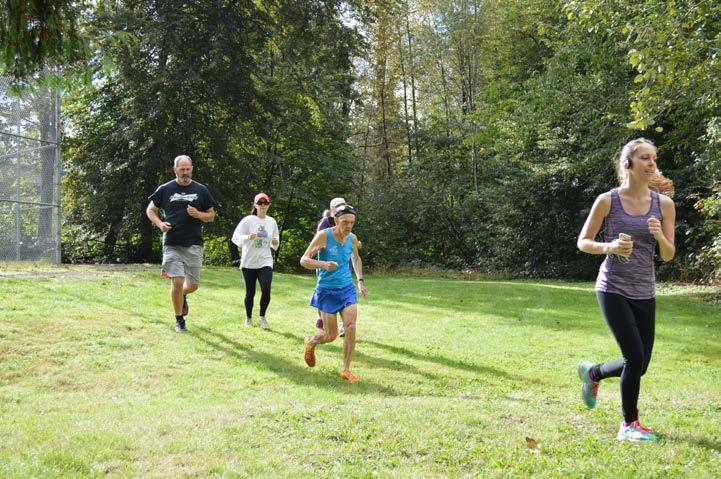
A series of several parcels, River Park serves as the location for numerous community events, including Sultan Shindig, National Night Out, and the Farmers Market. A small pavilion acts as a venue for performers, and a fenced-in area across Main Street contains skateboarding ramps and rails. During the Comprehensive Plan engagement process, people expressed the desire for public art, a central plaza, and more community gathering spaces in general. River Park’s centrally located and relatively flat parcels offer a possible location for these improvements, presenting an opportunity for the City to cultivate its local culture and share it with visitors.
As past economic drivers such as logging have declined over the past few decades, recreation-based tourism has emerged as a potential driver of economic growth. One of the City’s goals is to develop a park system that will attract visitors to the area through modes such as regional sports tournaments, school events, and recreation destinations. Increased interest from the Seattle Metro area in visiting the Leavenworth/ Wenatchee region means that more people are passing through Sultan via U.S. Highway 2. Parks can be part of a strategy to capitalize on this traffic by offering unique destinations for activities such as fishing, kayaking, hiking, or visits to local parks that can be incorporated into people’s travels.
Compared to some small cities, Sultan has an abundance of park land, but residents desire more amenities to allow them to use them. New trail routes, playgrounds, seating, and lighting would reportedly add to everyday park use for Sultan residents. Residents also desire amenities like a splash pad, which is not currently available in Sultan or neighboring areas. The addition of a unique-to-the-area facility like this could be part of the strategy of drawing visitors to Sultan, while providing a space for gathering, recreation, and heat relief for Sultan’s residents.

City-Owned Open Space
HOA Park (Private)
Public Trails

Private Trails Snohomish County Park Forest Reserve City Limit
Sultan’s parks and recreation system consists of parks, trails, and facilities that are owned and operated by the City. These facilities are broken into categories for the purposes of planning and calculating a Level of Service metric that aims to ensure that the system is meeting the needs of residents and the goals of the City. For this plan, parks are categorized as Regional Parks, Community Parks, Neighborhood Parks, Indoor Facilities, and School Parks, with the following characteristics:
• Regional Parks are the largest type of park, and are often built by counties or entities with regional scope. They are typically large expanses of land that offer access to scenic areas as well as passive and active amenities, generally more than 50 acres in size. These parks have the potential to draw visitors from outside the city itself, and thus should be designed to accommodate out-of-town guests. Osprey Park is Sultan’s Regional Park.
• Community Parks draw visitors from several neighborhoods by providing an array of passive and active amenities, offering a highly desired amenity with community draw, and/or because they are centrally located. These parks can accommodate organized sports and community events, though they also function for day to day use and informal recreation, much like a Neighborhood Park. The City of Sultan’s Community Parks are Rudolph Reese Park and River Parks.
• Neighborhood Parks are meant to serve the surrounding neighborhood by offering a mix of passive and active amenities which allow people of all ages and abilities to use the park for recreation, relaxation, and socializing. These parks may include facilities such as a playground, a sports facility, open lawn, shade trees or a structure, plantings, and benches and/or picnic tables. The development of Mountain View Park will be Sultan’s first Neighborhood Park.
• Mini-Parks (or Pocket Parks) are the smallest typology within the city park system. They are intended to serve the immediate surrounding area, and may be built to serve a specific need, such as providing access to a beach or lookout point, or where the development of a larger neighborhood park is not possible. While Pocket Parks alone typically cannot meet a city’s park and recreation needs, they can be valuable and well-utilized spaces. Travelers Park is Sultan’s Mini-Park.
• A Special Use Park offers a specific amenity or is used for a specific purpose, such as an annual event While they inherently do not serve the entire City, or serve the City only during specific time windows, they may be a regional draw or a beloved local resource. Sportsman Park, which is oriented towards boat and fishing access on the Sultan River, is Sultan’s Special Use Park.
• Indoor Facilities are buildings that are owned and/or operated by the City, and offer public resources such as classes and community gathering space. Indoor facilities are discussed further in Volume II.
The Demands and Needs analysis in this plan consists of the following:
• Public engagement conducted during the PROS Plan and Comprehensive Plan processes
• Facilities inventory
• Input from City staff and consultants
• Analysis of park quantity, quality, and access
The table below quantifies amenities available in Sultan’s parks:
The Level of Service (LOS) metric quantifies the status of an entire park and recreation system to inform future needs for park improvement and expansion. Cities adopt a LOS Standard for how their park system serves residents; the goal is that as the city grows, the park system also grows to meet the changing demand.
An acreage-based LOS calculation has historically been used in parks planning. As far back as 1914, landscape architect Charles Downing Lay recommended that cities supply 15 acres of various types of parkland per 1000 residents. In 1983, the National Recreation and Parks Association (NRPA) published its own set of standards and guidelines, which recommended 6.25 to 10.5 acres of park land per 1,000 residents. Under this and any acreage-based standard, a city must acquire new land to continue to meet its adopted standard as its population increases in size.
Since releasing this publication, which was widely used and adopted as best practice, the NRPA has changed course – a 2019 report notes:
“There is not a single set of standards for parks and recreation that could possibly encompass the uniqueness found in every community across the country. Communities vary greatly by size, needs, and desires; so too should their park and recreation agencies’ offerings. To think an agency in Alaska, one in Kansas, and one in south Florida should hold themselves to the same standards is unrealistic, impractical, and potentially detrimental.”
Even within a single city, needs change over time in response to recreation trends, age of the population, and economic factors, among others. While an ideal LOS standard can be used throughout multiple planning cycles and act as a consistent goal post for serving a community’s park needs, these standards may need to be updated in order to continue to reflect changing needs for parks, trails, and indoor facilities.
The Washington Recreation and Conservation Office (RCO) recommends a Level of Service standard that encompasses the following:
• Quantity criteria: Number of facilities, acres of park land, etc.
• Quality criteria: Public satisfaction, facility function, etc.
• Distribution and Access Criteria: Percent of population within ½ mile of a Neighborhood Park, percentage of parks and recreation facilities that may be accessed safely via non-motorized transportation, etc.
Because the park LOS metric is meant to reflect how the current parks,
trails, and facilities are meeting the city’s needs, public engagement should play a key role in shaping this metric. What are people missing from their park system? What would allow them to access their parks more regularly? Where are there needs for maintenance and upgrades to keep facilities in fine working order? The feedback received during the PROS Planning and Comprehensive Planning processes provide much of this information.
Much of what Sultan residents desire pertains more to park improvements, maintenance, and programming rather than the acquisition of land: New and updated playgrounds, access to water, amenities such as lighting, benches, and signage… A traditional acreage-based LOS does not encompass these park features. While it is important for Sultan to set aside land for parks and open space as it grows and develops, truly meeting resident needs for recreation, respite, and gathering will require improvements to existing parks in addition to the acquisition of land.
In an effort to directly address feedback gathered from the public, this plan uses a unique “eligible acres” calculation to evaluate the quantity and quality of parks in Sultan.
The quantity and quality of Sultan’s parks are expressed as Eligible Acres, which uses a scoring system to determine what percentage of each park’s acres are eligible for the LOS . A scoring matrix assigns points to each park based on their facilities, features, and needs for maintenance using scoring categories that reflect local recreation needs expressed during public engagement as well as economic, ecological, and equity factors.
Based on this system, each park is given a score which is the ratio of
Park Points
Possible Points
points earned to possible points. The amount of possible points differs based on park typologies. For example, regional parks are expected to provide a greater number of amenities than a community park.
NOTE: Though Sportsman Park is categorized as a Special Use Park and Travelers Park as a Mini-Park, their scores are calculated using the points possible for a Community Park. Community Parks are meant to serve multiple neighborhoods, and may have unique amenities not available elsewhere in the city. The goal is that Sportsman Park can function in this way, offering water access as well as amenities that allow people to picnic and gather. Travelers Park, while small, is in a prime location and the City should strive to optimize the use of that land.
Figure PR-6. Factors considered in the scoring matrix for Eligible Acres
Quantity and condition of sports fields
Recreation needs
Quality and condition of playgrounds
Trail miles and amenities
Access to water
Desired amenities
Community gathering space
Dog park amenities
Permeability of park surfaces
Ecological function
Access and Equity
Figure PR-5. 2024 Parks Eligible Acres
Tourism
Quantity of trees and continuous canopy
Accessibility of park via walking or biking
ADA pathways
Regionally unique features
Public art and interpretive signage
The tables below show an adopted LOS standard of 10 acres per 1,000 residents, which draws on the traditional ratio used for several decades. Under this metric, Sultan needs 67.30 acres of park land for its current population size. Sultan parks currently total 107.65 acres, significantly more than required under this standard. Using the Eligible Acres
*This does not include Mountain View Park, currently under construction
calculation, we see that only 52.5 of these acres are currently eligible to be included in the LOS, reflecting the need for additional programming, maintenance, and improvements.
Given Sultan’s anticipated growth, the City will need to add 31.76 Eligible Acres of park land by 2044, with 21.46 of these acres reflecting an increased need due to growth. These acres can be added through the acquisition and development of land, or by park improvements that increase the score and therefore increase the Eligible Acres of an existing park. The opportunities to increase Sultan’s park scores are outlined further in the Capital Projects List.
Sultan’s trail network is a beloved aspect of the parks system, and an aspect that residents would like to see improved. Trails in Sultan afford views of the Sultan River, access to Osprey Park’s dense tree cover, as well as hiking opportunities in the eastern portion of Sultan.
The addition of trail miles as well as trail amenities such as lighting, signage, and benches were requested during public engagement efforts. There are opportunities to improve multi-modal connectivity as well as trails that allow for exploration through Sultan’s wooded parks. In particular, the addition of trails in Rudolph Reese Park could be part of the effort to connect it to Osprey Park, resulting in a connected network of trails that would afford visitors access to Sultan’s beautiful natural areas.
Below is a metric for measuring Sultan’s Level of Service for trails, which outlines a goal of adding 6 miles of public trails by 2044.
Figure PR-9. Trails map
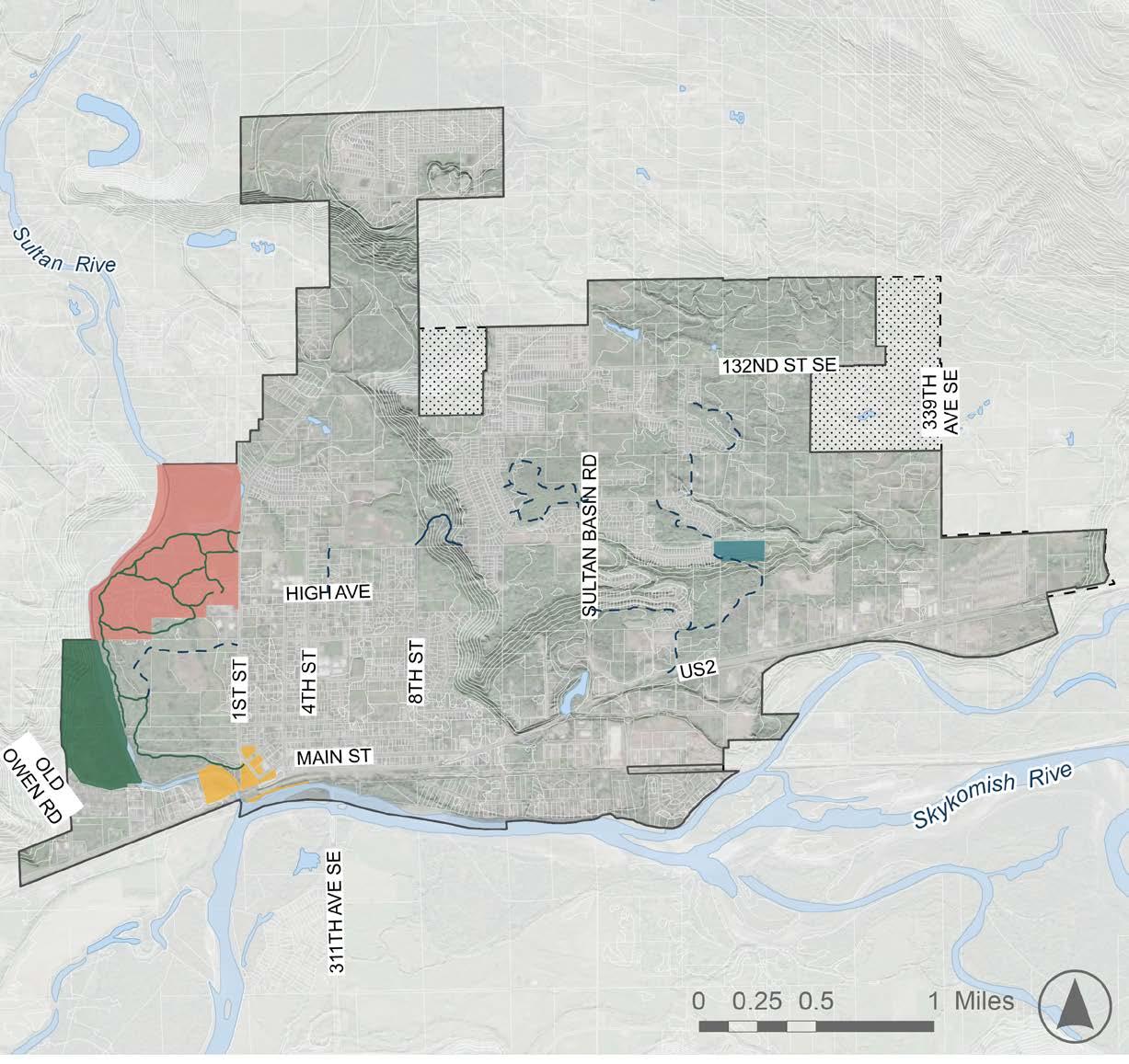
Community Park
Neighborhood Park
Regional Park
Special Use Park
Mini-Park
Public Trails
Private Trails
Evacuation Trails

Unincorporated
City Limit Sultan UGA
Distribution and Access Criteria: Percent of residents within ½ mile from a park
The RCO suggests a standard of a Community Park within 5 miles of every resident, and a Neighborhood Park within .5 miles of every resident. These standards do not always make sense for small communities – in Sultan, the expanse of the city itself is less than 5 miles, and there are currently no designated Neighborhood Parks.
What this metric aims to express is how easy it is for residents to walk, bike, or roll to parks that provide facilities that allow them to relax and recreate. In Sultan, Osprey Park and Rudolph Reese Park currently come closest to serving this function, as they both contain a playground, sports fields, benches, and walking paths. These parks are both concentrated in the west portion of the city, as are River Parks and Sportsman Park.
Currently, approximately 32.7% of households are within ½ mile of Osprey Park and/or Rudolph Reese Park, a grade of “D” according to the RCO. This metric is measured is “as the crow flies,” and does not account for the street network and pathways through which people access the park. This is particularly pertinent for Rudolph Reese Park, whose park entrance requires driving on Highway 2 and entering on Old Owen Road.
The completion of Mountain View Park will introduce the Neighborhood Park typology to Sultan, while also filling some of the gap in service for the eastern portion of the City. With this addition, 50.1% of existing Sultan residents will be within ½ mile of a qualifying park. This will bring Sultan’s access rating up to a “C” rating.
Adding facilities that allow Sportsman Park and River Parks to be more widely used, such as a playground, picnic areas, and a sports court, could increase walkability to qualifying parks to 57%. This would bring Sultan’s park access rating up to a “B.” % of residents within .5 miles of a park
Figure PR-11. Park Access Map
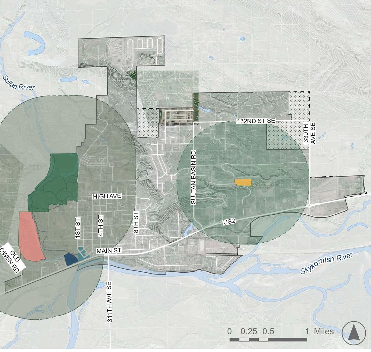
Park Access Buffers
Osprey Park 1/2 mile buffer
Proposed Mt. View Park
River Parks
Rudolph Reese Park
Sportsman Park

City Limit Sultan UGA Unincorporated
Achieving full city coverage will require the addition of new parks, but the RCO’s guidelines are just that: guidelines. Sultan residents may not want to spend City resources pursuing 100% park access or an “A” rating from the RCO. However, residents have expressed the desire for better walkability to parks, and increasing neighborhood park access would help ensure that families can regularly access playgrounds, ballfields, and other desired amenities. As Sultan grows, and the need for additional park acreage increases, the City should prioritize new parks in areas of the city with less coverage. Further, the City should consider a study that looks more specifically at pathways to parks to understand how the City can help residents access their parks more easily.
PR 1. Develop a high-quality and diversified recreation system that provides opportunities for all age and interest groups, with a focus on addressing the needs of historically marginalized communities, transforming the city into a 'recreation gateway' and boosting the local economy.
PR 1.1. Strive to develop a comprehensive, high quality system of multipurpose recreation trails and corridors for recreational hikers and walkers, joggers, casual strollers, bicyclists, neighborhood residents, and equestrians that access significant environmental features, public facilities and developed urban neighborhoods.
PR 1.1.1. Extend trails through natural area corridors to provide a high quality, diverse sampling of Sultan's environmental resources – particularly along the Wallace, Sultan, and Skykomish Rivers, and the shorelines of Winters and Wagley’s Creeks.
PR 1.2. Recognize trail corridors as an important recreational opportunity, resource conservation mechanism, habitat corridor linkage, and alternative transportation network.
PR 1.3. Emphasis should be given to connecting people to destinations such as neighborhoods, parks, water resources, schools, and work.
PR 1.4. Incorporate a variety of features and amenities that support passive activities in parks, like comfortable seating, shade structures, picnic tables, etc, allowing them to be useful yearround and in diverse weather conditions.
PR 1.5. Support the development of athletic recreational facilities for all age groups and recreational interests.
PR 1.5.1. Where appropriate, initiate joint planning and operating programs with other public and private organizations to determine and provide for special activities on an area or regional wide basis, such as off-road vehicle trails, camping and fishing facilities, boating, rock climbing, and gun range facilities.
PR 1.6. Integrate a range of activities and structures that support active uses across Sultan's parks, including ball courts, playgrounds, climbing walls, splashpads, and other kid-friendly features.
PR 1.7. Cooperate with public and private agencies to acquire and preserve additional waterfront access for recreational activities and pursuits.
PR 1.7.1. Seek opportunities to develop a mixture of watercraft access opportunities including for canoe, kayak, rowboat, raft, and power boating.
PR 1.7.2. Work with property and facility owners to increase public access and utilization of special features –including the shorelines, wetlands, and bluffs that meander through and between developed areas.
PR 2. Recognize parks, trails, and open spaces as vital community assets that must be conserved and ensure facility planning incorporates community input and support to promote equitable access for all residents.
PR 2.1. Provide a park and recreation system that is integrated into the built and natural environment in a way that enhances existing neighborhoods and preserves environmental features.
PR 2.2. Cooperate with the Snohomish County Department of Parks & Recreation, Washington State Department of Fish & Wildlife, other public and private agencies, and with private landowners to preserve the most suitable sites and resources with the ability to provide high quality, convenient park and recreational facilities.
PR 2.3. Strive to create a comprehensive, balanced park and recreational system that integrates Sultan with Snohomish County, Sultan School District, Washington State Department of Wildlife, and other public and private park and recreational lands to provide a greater variety of recreation facilities to the Sultan community.
PR 2.3.1. When appropriate, initiate discussions with the Sultan School District about the possibility of entering into joint ventures for the development of combined school, playground, and athletic facilities.
PR 2.4. Ensure every resident has access to a Community or Neighborhood Park within 1/2 mile of their home.
PR 2.4.1. Update the inventory, surplus, and/or deficiency of City park lands based on the official population estimates from the Washington State Office of Financial Management.
PR 2.5. Emphasize community participation and user inputs from historically marginalized groups. Support community efforts in the planning, design, development, maintenance, and protection of parks, trail corridors, and other open spaces.
PR 2.6. Support the development of a community plaza or similar community spaces to provide a venue for social and cultural events.
PR 2.6.1. Support private, public, and non-profit organizations in developing special meeting facilities, assembly facilities, health, and other community facilities to support community needs.
PR 2.6.2. Develop, if appropriate, a select number of centers that are oriented to the most significant indoor activities for multi-agency use.
PR 3. Support and incorporate arts and culture within the parks and recreation system to showcase the heritage of the City and its people.
PR 3.1. Incorporate historical and cultural lands, sites, artifacts, and facilities into the park system to preserve these interests and provide a balanced social experience.
PR 3.1.1. Work with historical and cultural groups to hold community activities in parks and recreational facilities – including downtown promotional events.
PR 3.2. Encourage parks and other open spaces to provide a platform for local artists to showcase their artwork.
PR 4. Design and develop park facilities to prioritize safety and accessibility for all while ensuring feasibility to ensure implementation.
PR 4.1. Seek opportunities to implement design and development standards to improve park facility safety and security.
PR 4.1.1. Where appropriate, develop adopt-a-park programs, neighborhood park watches, park police patrols, and other innovative programs that increase maintenance, safety and security awareness, and visibility.
PR 4.1.2. Develop trail improvements to a design and development standard which is easy to maintain and accessible by maintenance, security and other appropriate personnel, equipment, and vehicles.
PR 4.2. Design park and recreational trails and facilities to be accessible to individuals and organized groups of all physical capabilities, skill levels, age, income, and activity interest.
PR 4.2.1. Implement safety standards, procedures, and programs that provide proper training and awareness for City staff charged with maintaining City park and recreation facilities.
PR 4.3. Improve visibility of existing park facilities and amenities through maps, signage, and digital information.
PR 4.4. Work to design and develop facilities that are of low maintenance and high capacity design to reduce overall facility maintenance and operation requirements and costs.
PR 4.5. Define existing and proposed land and facility levels of service that differentiate requirements due to population growth versus improved facility standards, neighborhood versus community nexus of benefit, and other regional efforts in order to effectively plan and program park and recreation needs within existing city boundaries.
PR 5. Promote the conservation of natural environments by considering environmental impacts, mitigating the effects of climate change, building climate resilience, and protecting natural biodiversity.
PR 5.1. Preserve and protect significant environmental features for park and open space use including unique wetlands, open spaces, woodlands, shorelines, waterfronts, and other characteristics that reflect Sultan's natural heritage.
PR 5.1.1. Formulate and adopt standards for new development that encourage the preservation of unique site features or areas.
PR 5.1.2. Encourage the preservation of unique site features and provide public use and access in new land developments – particularly by linking the extensive wetlands on the plateau.
PR 5.2. Implement efforts and steps to improve and conserve ecological habitats and natural ecosystems within the park system, ensuring the protection and sustainability of local biodiversity and natural resources.
PR 5.3. Integrate parks into the city's flood mitigation strategy, utilizing green spaces to manage stormwater, reduce flooding risks, and enhance resilience against climate impacts.
PR 5.4. Preserve and grow public and private recreational opportunities and facilities along shorelines.
PR 6. Ensure efficient and judicious use of funding, retain financial flexibility, match user benefits and interests, and increase facility services.
PR 6.1. Strive to create effective and efficient methods of acquiring, developing, operating, and maintaining park and recreational facilities in ways that equitably distribute costs and benefits to public and private users, including the application of adopted growth impact fees where new developments impact existing levels of service standards.
PR 6.1.1. Consider joint ventures with the Snohomish County Department of Parks & Recreation, Sultan School District, Washington State Department of Wildlife, and other public and private agencies to fund facility development and maintenance where feasible and desirable.
PR 6.1.2. Use a methodology for determining impact fees that takes into account the impact of growth on social equity, as well as environmental sustainability, in order to best assess and allocate impact fees to address deficiencies.
PR 6.2. Support innovative methods of financing facility development, maintenance, and operating needs.
PR 6.2.1. Investigate new, innovative methods of financing facility development, maintenance, and operating needs to reduce costs, retain financial flexibility, match user benefits and interests, and increase facility services.
PR 6.2.2. Work with the community to establish and fund the minimum level of service for park facilities and maintenance.
PR 6.3. Enhance existing park sites and recreation facilities when financially feasible.
This page intentionally left blank


Transportation is a topic with far greater implications than most people realize. Far from being simply about getting from point A to point B, considerations such as the mode and speed of travel, as well as the distribution, orientation, and the design of streets and the quality of the trip are among those things that often have the largest physical, social, and economic impacts on a community. Transportation also has a direct relationship with the quality of the natural environment—protecting and enhancing Sultan’s environment, promoting energy conservation, and improving quality of life.
This element describes Sultan’s existing transportation environment, the transportation issues the community faces, and likely impacts through 2044. It proposes a series of transportation improvements, goals, and policies to help Sultan address current and future needs while maintaining a safe and effective multimodal transportation system. When implemented, these transportation system improvements will support Sultan’s business community, provide for increased safety, and retain the community character residents cherish.
This is Volume I of the Transportation Element. Volume II includes further detail on background for the element and its supporting documentation.
Goals and policies in the Transportation Element are derived from planning themes and big ideas for the next 20 years as well as state, regional, and county requirements. The following major themes and observations help establish the context for understanding Sultan’s existing transportation environment:
• US-2 is a vital link for Sultan, for both local and regional circulation. Traffic growth on US-2 is likely to occur not only because of new development in Sultan but also because of additional development in eastern Snohomish County and an increase in recreational and tourism-based travel demand.
Each element is related to Sultan’s Community Vision for 2044. This graphic illustrates the strength of the connection between the Vision and the Transportation Element. For more on the Nine Big Ideas that make up the Vision, see the Community Vision Section of this document.
• Complete street improvements are necessary to address existing design deficiencies on local access roads and improve multimodal connectivity, including non-motorized travel opportunities
• Congestion and heavy use of the BNSF Everett-Spokane corridor through Sultan may have residual traffic and noise impacts on the City.
State Mandates
Washington State’s Growth Management Act (GMA) mandates inclusion of specific information within the Transportation Element. In addition to requiring that this element be consistent with and implement the land use element of this Comprehensive Plan, GMA requires that the element satisfies requirements for each of seven transportation-related subtopics (RCW 36.70A.070):
• Land Use Assumptions Used in Estimating Travel
• Estimated Multimodal Level of Service to State-Owned Facilities
• Service and Facility Needs
• Financing and Investment
• Intergovernmental Coordination
• Demand Management
• Land Uses Adjacent to Airports
The Washington Administrative Code (WAC 365-195-325) also provides procedural guidance on two important requirements of the GMA:
1. Consistency between the elements of the County’s GMA Comprehensive Plan and comprehensive plans of cities within its borders; and
2. Consistency between the land uses established in the land use plan and the transportation improvements identified in the transportation element needed to serve the land uses.
This Transportation Element has been prepared in compliance with GMA requirements and has been developed to be consistent with Puget Sound Regional Council’s (PRSC’s) VISION 2050, the Snohomish County Comprehensive Plan, and the City of Sultan’s Concurrency Management System (see chapter 16.70 of the Sultan Municipal Code). As conditions and community, countywide, and regional objectives change, data in this element will provide a benchmark for future updates.
Transportation was at the fore of many interactions with community members during the engagement events that informed this Plan Update. From the onset, the public was adamant that US-2 congestion be resolved, and that multimodal mobility become a priority. Detailed priorities for how Sultan plans for transportation are summarized below.
• Farmers Market and Other Community Events - Residents emphasized the need for safe and reliable transportation options in and around Sultan. Daily commute times and improved access to everyday needs must be addressed in transportation infrastructure improvements.
• Sultan Shindig and Youth Outreach - Connections between neighborhoods for a variety of non-motorized transportation modes were a key desired by Sultan’s youth. The US-2 delays and safety concerns are ongoing challenges.
• Planning Summit - Improved connectivity and safer routes for walking and biking were key priorities identified during the Planning Summit. US-2 provides a huge opportunity to restore reliable mobility and enhance the city’s image from passersby.
The technical analysis and findings, including travel demand and intersection operations forecasts, described in this Transportation Element are based on the housing and employment targets described in the Land Use Element.
Transportation in Sultan is dominated by US-2, a WSDOT-designated Highway of Statewide Significance (HSS) which serves as a major freight and recreational corridor as well as the only route for City of Sultan residents to access local and regional destinations on either side of the Sultan River. US-2 operates with significant congestion during periods of high travel demand, particularly during the summer recreational season. High delay and travel time variability during weekday afternoon and Sunday midday periods limit residents’ abilities to travel between Sultan Basin, historic Downtown Sultan, and commercial and residential development to the west of the Sultan River.
The city’s existing transportation network reflects a focus on motorized personal vehicle travel, with relatively few modern pedestrian and bicycle transportation facilities and limited transit service. While the recently-completed Sultan River pedestrian bridge has increased active transportation opportunities, the relative lack of safe and accessible pedestrian and bicycle facilities constrain residents’ ability to travel to, from, and within Sultan during periods of high demand on US-2.
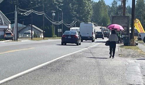
Existing walking conditions along US-2
Figure T-3. 2024 NonMotorized Facilities
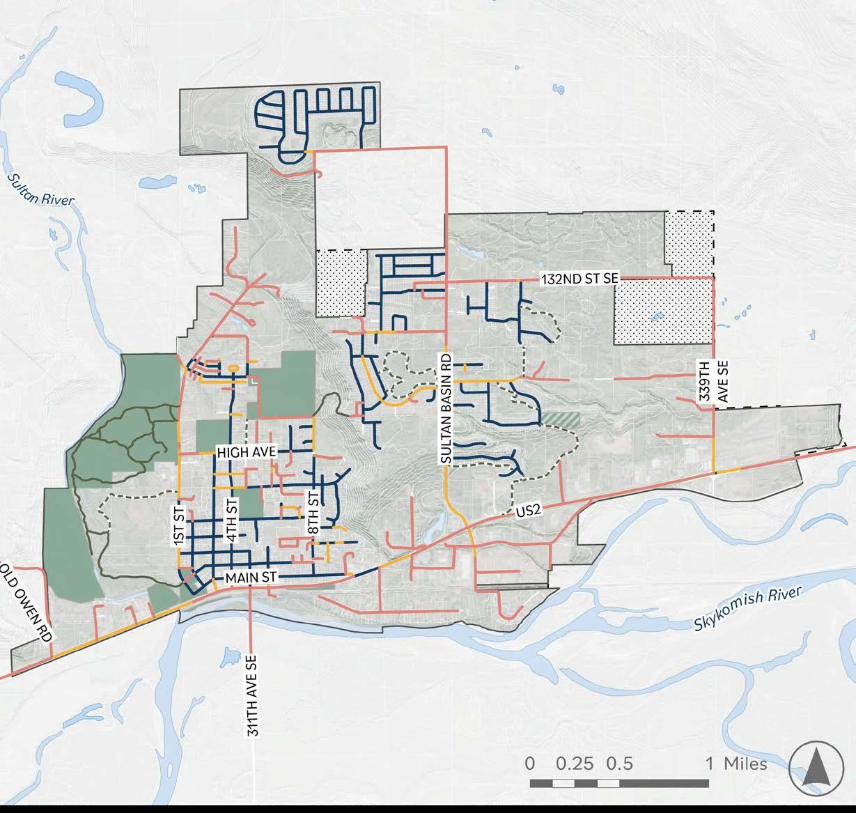
Existing Nonmotorized Facilities
Both Sidewalks
One Sidewalk No Sidewalk


The transportation goals and policies described below establish the vision for this Transportation Element and support the overall vision of the Comprehensive Plan. These goals and policies are organized under the categories: local and regional transportation planning, supporting the economy, protecting the environment, and facilitating innovation. These policies are consistent with the Countywide Planning Policies for Snohomish County as amended July 2023, as well as the Puget Sound Regional Council (PSRC) VISION 2050 Multicounty Planning Policies.
The City of Sultan will work proactively with transportation planning agencies and service providers to plan, finance, and implement an efficient, affordable, equitable, inclusive, and safe multi-modal transportation system that supports state-level planning, the Regional Growth Strategy, and local comprehensive plans and promotes economic vitality, environment sustainability, and human health.
TR 1. The City will pursue interlocal agreements and procedures for jointly mitigating traffic impacts, including provisions for development and design review and sharing of developer impact mitigation.
TR 1.1. Interlocal agreements will be used to define procedures and standards for mitigating traffic impacts, sharing improvement and debt costs for transportation facilities, and addressing maintenance and funding for future transportation facilities and services. These interlocal agreements may also include Community Transit or the Washington State Department of Transportation where mitigation includes transportation demand management strategies or transit related improvements, such as park and ride facilities, bus rapid transit stations, or high-occupancy lanes.
TR 1.2. When a project's impacts extend across jurisdictional boundaries, shared development mitigation will be pursued.
TR 1.3. The City will encourage private sector investment in transportation services and facilities.
TR 2. The City will establish procedures for setting priorities, programming, and financing for transportation facilities and services consistent with VISION 2050, the Growth Management Act, and federal transportation legislation.
TR 2.1. The City will maintain consistent methodologies to determine transportation needs and their estimated costs in terms of capital, operations, preservation, and maintenance.
TR 2.2. Transportation needs will be prioritized based on the extent to which they fulfill the objectives of the adopted Regional Growth Strategy (RGS), Comprehensive Plan, long range transit agency plans, and transportation policies.
TR 2.3. Transportation facility and service investments will be prioritized that support compact, pedestrian- and transitoriented development.
TR 2.4. Transportation investments will be prioritized to support the achievement of regional greenhouse gas emission reduction goals.
TR 2.5. The City will maintain an ongoing six-year program that specifies the financing of immediate transportation improvements consistent with the RGS, The Regional Transportation Plan, and WSDOT’s Washington Transportation Plan.
TR 2.6. The financing of transportation systems and improvements will reflect the true costs of providing service, reflecting the costs and benefits attributable to those who use the system as well as those who benefit from it. Impacts of transportation system choices and funding decisions on climate change should be considered as part of this process.
TR 3. The City will provide transportation facilities and services necessary to support and implement the RGS and the land use element of the Comprehensive Plan, including roadway configurations, active transportation options, and public transportation services appropriate to the designated land use types and intensities by:
TR 3.1. Maintaining and improving existing arterials, neighborhood streets, and associated pedestrian, bicycle, and transit infrastructure in order to promote safe and efficient use for all modes;
TR 3.2. Providing a network of multimodal arterials based on the adopted functional classification system and design standards that will improve connectivity, circulation, and reduce vehicle miles of travel;
TR 3.3. Using land use projections based on the Regional Growth Strategy and the land use element to identify and plan for adequate roadway, pedestrian, bicycle, and transit services to meet travel needs;
TR 3.4. Reviewing land use designations where levels of service cannot adequately serve or expect to achieve concurrency for development allowed under the designation;
TR 3.5. Providing adequate access to and circulation for public service and priority for public transportation vehicles as appropriate;
TR 3.6. Consulting with Community Transit, as appropriate, when planning future land use in designated transit emphasis corridors for consistency with long-range transit plans and to ensure that the land use and transit services are mutually supported;
TR 3.7. Preparing for changes in technology and travel patterns for moving people and goods; and
TR 3.8. Improving street connectivity to encourage walking, bicycling, transit use, and physical activity.
TR 4. The City will maintain transportation design standards that address public transportation, roadways, walkways, bikeways, and access for people with disabilities, low-income and special needs populations, and that recognize differences among communities by:
TR 4.1. Identifying major travel routes needing additional public transportation, pedestrian, or bicycle-related improvements to increase people-carrying capacity;
TR 4.2. Coordinating with WSDOT and Snohomish County to develop or complete a system of interjurisdictional walkways and bikeways;
TR 4.3. Establishing multimodal transportation facility design, level of service standards and site plan design standards that will address the movement of goods and services to enhance the wellbeing of the economy and public health; and
TR 4.4. Implementing context-sensitive solutions that recognize the variety of functions of transportation facilities and that promote compatibility with the natural environment, adjoining land uses, and activities and that create high-quality public spaces.
TR 5. The County and cities should prepare consistent rules and procedures among affected jurisdictions and transit agencies for locating, designing, and constructing transportation facilities and services to minimize and mitigate their adverse impacts on the natural environment, resource lands, or human health. Depending on the jurisdiction, these may include:
TR 5.1. Design standards and consistent methods to reduce stormwater pollution, improve fish passages, and minimize other adverse impacts on shorelines, water resources, drainage patterns, and soils;
TR 5.2. Location criteria that minimize the disruption to natural habitat, flood plains, wetlands, geologically and other environmentally sensitive areas;
TR 5.3. Cooperation with the Puget Sound Clean Air Agency, PSRC, and local jurisdictions to ensure consistency with the transportation control measure requirements of the 1990 Clean Air Act Amendments; and
TR 5.4. Development of a transportation system that minimizes negative impacts to and promotes human health.
TR 6. The City will employ professionally-accepted methodologies for determining transportation levels of service. The County and cities should use – in coordination with transit agencies – a consistent technique in calculating transportation level of service on a systems basis that:
TR 6.1. Incorporates different levels of service depending on development form, mix of uses and intensity/density of land use, availability and adequacy of transit service, and the availability and adequacy of bicycle and pedestrian facilities in accordance with local comprehensive plans and long-range transit agency plans;
TR 6.2. Employs consistent data collection and processing in determining travel demand and system operations along with the Puget Sound Regional Council (PSRC), adjacent local jurisdictions and transit agencies; and
TR 6.3. Monitors level of service and concurrency on a routine basis on those critical transportation facilities and services that serve as indicators of system operation.
TR 7. The City will maintain concurrency requirements for land development by considering transportation levels of service and available financial resources to make needed transportation improvements.
TR 7.1. The goals, policies, and objectives of the Transportation Element shall be the basis for making interpretations of development concurrency with transportation.
TR 7.2. The impact of alternate modes of travel, as well as singleoccupant vehicles, will be considered in the transportation concurrency management system.
TR 7.3. The City recognizes that there are transportation services and facilities that are at their ultimate capacity.
TR 7.4. The City will reconsider land use designations where it is evident transportation facilities and services cannot be financed or provided in sufficient time to maintain concurrency with land development.
TR 8. The City will establish common policies and technical procedures for transportation system management and transportation demand management programs that reduce trip making, total miles traveled, and the climate change and air quality impacts associated with development, which improve the efficiency of the transportation system.
TR 8.1. The City will establish consistent commute trip reduction, vehicle-miles-of-travel and single-occupant vehicles goals and consistent methods of measuring progress to ensure consistency and equity.
TR 8.2. The City will coordinate with Community Transit and Snohomish County for the implementation of employer and residential trip reduction programs.
TR 9. The City, in cooperation with Community Transit, will participate in education programs that encourage use of public transportation and ridesharing.
TR 10. The City will, in cooperation with Community Transit, provide for transit-supportive infrastructure and programs, including:
TR 10.1. Safe, pleasant, and convenient access for pedestrians, bicyclists, and other non-motorized wheeled modes of travel;
TR 10.2. Safe and convenient access to and transfer between all forms of transit and other modes of travel; and
TR 10.3. Pricing or regulatory mechanisms to encourage transit use and reduce reliance on the automobile.
TR 11. The City will maintain, preserve, and operate the existing transportation systems in a safe and usable state. The City will undertake maintenance, management, predictable funding, and safety practices that:
TR 11.1. Maintain and operate transportation systems to provide safe, efficient, and reliable movement of people, goods, and services;
TR 11.2. Protect the investment in the existing system and lower overall life-cycle costs through effective maintenance and preservation programs;
TR 11.3. Reduce the need for some capital improvements through investments in operations; demand management strategies, and system management activities that improve the efficiency of the current system;
TR 11.4. Improve the safety of the transportation system and, in the long term, pursue the goal of zero deaths and serious injuries;
TR 11.5. Advance the resilience of the transportation system by incorporating redundancies, preparing for disasters and other impacts, and coordinated planning for system recovery; and
TR 11.6. Assess and plan for adaptive transportation responses to potential threats and hazards arising from climate change, including the possibility of managed retreat where necessary. Prioritize relocating infrastructure at risk from flooding and other climate-related hazards to more resilient areas, ensuring long-term safety and functionality.
TR 12. The City, in cooperation with Community Transit and the Washington State Department of Transportation, should plan strategically to integrate measures to reduce emissions that contribute to climate change by:
TR 12.1. Developing and coordinating transportation plans that support land use and other plan elements and contribute to a flexible, holistic, and long-term approach to promote sustainability and mitigate impacts contributing to climate change;
TR 12.2. Maximizing efficiency of existing transportation investments and pursuing measures to reduce vehicle miles of travel and greenhouse gas emissions from transportation;
TR 12.3. Supporting the transition to a cleaner transportation system by planning for and encouraging investment in clean energy options such as zero emission vehicles, low carbon fuels, and the necessary infrastructure to support clean energy options;
TR 12.4. Developing and implementing transportation modes, fuels, and technologies that are energy-efficient and reduce negative impacts on the environment; and
TR 12.5. Increasing the proportion of trips made by transportation modes that are alternatives to driving alone by ensuring availability of reliable and competitive mobility options.
TR 12.6. The City is committed to integrating Low Impact Development (LID) practices when practical into all transportation infrastructure projects to minimize stormwater runoff, reduce pollution, protect water quality, and help address salmon recovery goals. In alignment with this commitment, the City shall prioritize the identification and replacement of fish barriers within the transportation network to restore natural fish passage and improve aquatic habitats.
TR 13. The City will collaborate with the Washington State Department of Transportation (WSDOT) and Community Transit to designate transit emphasis corridors that allow effective and integrated planning of land use and transportation.
TR 14. The County and cities, in cooperation with the Washington State Department of Transportation and port authorities, should plan and implement projects and programs that support trade and the needs of state, regional, and local distribution of goods and services and attract and retain industries and skilled workers through:
TR 14.1. Coordinated design and construction of regional and local transportation facilities that support manufacturing and trade;
TR 14.2. Traffic operations measures and capital improvements that minimize the impacts of freight movement on other modes of travel;
TR 14.3. Maintenance, preservation, and expansion of freight rail capacity;
TR 14.4. Establishment of programs aimed at preserving rail rights-ofway; and
TR 14.5. Special efforts to ensure any ongoing conflicts and other needs are planned for and resolved to the greatest extent possible.
TR 15. The City will prepare compatible rules and procedures to implement transportation programs and projects that provide access to opportunities while preventing and mitigating potential adverse impacts to people with low incomes and people with special transportation needs.
TR 16. The City will coordinate with the Washington State Department of Transportation and Snohomish County (as appropriate) in planning, designing, programming, and constructing nonmotorized transportation facilities. The City recognizes a need for:
TR 16.1. Compatibility in interjurisdictional bikeway and walkway standards;
TR 16.2. Joint planning for a safe system of bicycle and pedestrian facilities that link residential areas, schools, recreational areas, business districts, and transit centers and facilities; and
TR 16.3. New development to accommodate nonmotorized transportation facilities in its site planning.
TR 17. The City, in cooperation with the Washington State Department of Transportation, will preserve existing freight and passenger railroad rights-ofway for continued rail transportation use.
TR 18. Consistent with the RGS, arterial capacity improvements that encourage rural growth should be avoided. Where increased arterial capacity is warranted to provide safe and efficient travel between UGAs:
TR 18.1. Road standards shall be consistent with appropriate development patterns and densities; and
TR 18.2. Appropriate rural land development and access management regulations should be in place prior to authorizing improvements.

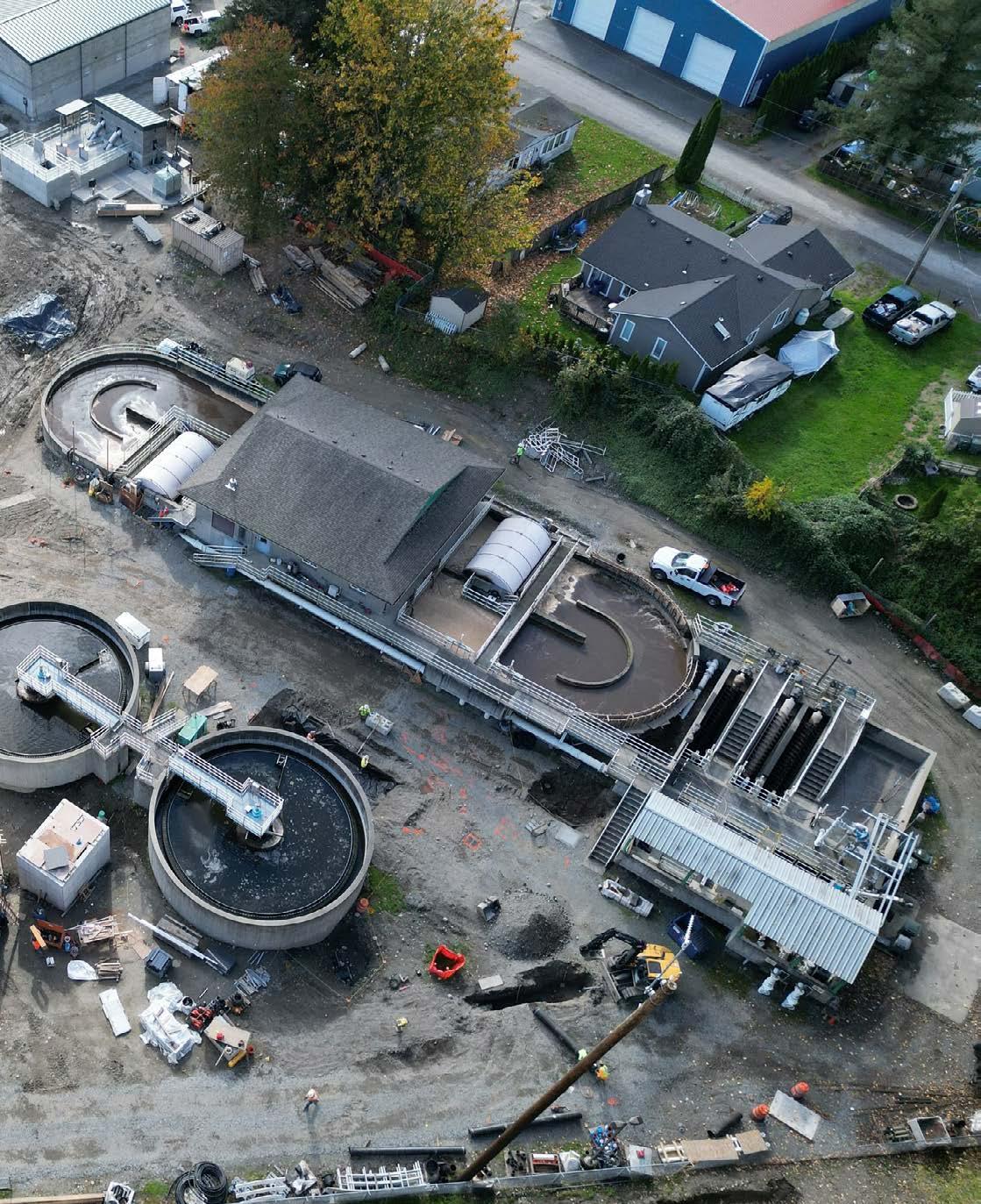
Capital facilities and utilities together encompass the essential public services that support Sultan. Capital Facilities refers to a broad spectrum of public infrastructure and amenities, including streets, parks, schools, libraries, public safety, and government services. Utilities covers electricity and energy usage, water and sewer service, stormwater, telecommunications, and waste services.
The process of developing a capital facilities plan (CFP) includes identifying the roads, parks, sewer, water, and other services needed to support the land use plan and projected population. As a first step, the needs analysis in this plan identifies a project list that is not constrained by the availability of financial resources. The second step in the CFP planning process is to assess whether sufficient revenues will be available to finance needed facilities and services. The third step, unless sufficient revenues already exist, requires reassessing the Land Use Element to ensure consistency between capital facilities plan element and the financing plan within the Capital Facilities Element.
It’s important to note that the CFP outlines a financial strategy. The CFP does not prescribe specific courses of action, nor does it authorize individual projects. Such authorization occurs when a project is included in the city’s six year Capital Improvement Program (CIP) and through the city’s annual budget process. The strategy is flexible and seeks to identify how all of the project needs that are “on the table” can be funded in an orderly, long-term fashion.
This plan addresses Sultan’s need to provide timely and adequate public services and facilities. Each individual capital facility is discussed in detail providing projected needs, costs, and potential funding. The plan also includes a six-year financial plan to fund improvements to water, sewer, stormwater, general government, parks, and transportation facilities. Finally, the plan identifies other public facilities such as police, fire, administrative facilities like City Hall and libraries, and schools.
Collectively, this combined Capital Facilities & Utilities Element helps the City to ensure that the right services are in the right places to best support the development planned for across the other elements of the Plan.
Each element is related to Sultan’s Community Vision for 2044. This graphic illustrates the strength of the connection between the Vision and the Capital Facilities + Utilities Element. For more on the Nine Big Ideas that make up the Vision, see the Community Vision Section of this document.
Consistent with this direction, the goals, policies, and programs in this element guide the City to have facilities that adequately support new development, address past deficiencies, and maintain their stated Level of Service (LOS).
Level of Service (LOS) is a measure of the quality and effectiveness of a municipal service or facility, gauging how well it meets the needs of the population. LOS can be tailored to specific contexts and can vary in its criteria and measurement methods, but the core idea remains the same: assessing and ensuring the quality of service delivered to Sultan residents.
The Capital Facilities & Utilities Element details the various LOS standards established by the City, which are supported through the City’s planning goals, policies, and programs. These goals and policies prioritize community resiliency and environmental sustainability, and address the rapid growth experienced by the city in recent years.
This is Volume I of the Capital Facilities and Utilities Element. Background information for this Element can be found in Volume II, which contains the data and analyses that provide the foundation for the goals, policies, and programs detailed below. Volume II also includes 6- and 20-year project lists and a facility funding analysis and strategy.
The Capital Facilities & Utilities Element is closely connected to elements for Community Design, Land Use, Housing, Parks & Recreation, and Transportation.
The goals and policies of the Capital Facilities & Utilities Element are aligned with state and regional planning requirements, as well as the experiences and feedback received from the broader Sultan community. These themes are integrated throughout the Comprehensive Plan.
Ensure that people of all income levels have equitable access to quality infrastructure and community amenities (influenced Elements: Land Use, Housing, Parks and Recreation, Economic Development, Transportation).
Prioritize public facilities that increase physical activity, social interaction, and community health and wellbeing (Land Use, Housing, Parks and Recreation, Transportation).
Ensure that the new infrastructure required to support growth is balanced against the needs of the existing natural environment (Community Design, Housing, Natural Environment, Parks and Recreation, Economic Development).
Maintain the provision of high-quality public services, infrastructure, and parks and open space while facilitating inclusive population and employment growth (Land Use, Community Design, Housing, Parks and Recreation, Transportation).
Address racially disparate impacts and racial exclusion through land use planning and facilities siting (Land Use, Housing, Parks and Recreation, Transportation).
Sultan’s rapid growth was a central topic during the community engagement activities and discussions informing this Plan update. Across nearly every event, including the Farmers Market, Sultan Shindig, and Planning Summit, community members expressed concerns about rapid growth, citing potential negative impacts on schools, infrastructure, transportation, and residential neighborhoods. Residents and visitors alike cited aspirations for Sultan’s parks and infrastructure to expand to accommodate the needs of the community while simultaneously respecting the natural landscape and creating additional connections from neighborhood to neighborhood. Similar sentiments were expressed by the Planning Board and City Council, who also emphasized the need for hazard mitigation measures to protect Sultan’s existing and future infrastructure investments.
The goals, policies, and programs in the Capital Facilities & Utilities Element intersect with every other component of the Plan, as this element influences the distribution of essential services across the city. For example, Capital Facilities & Utilities goals help to ensure that infrastructure capacity will support population growth and land use patterns, directly impacting the Land Use, Housing, and Transportation Elements. The provision of parks, open spaces, and recreational facilities is directly tied to the Parks Element, while the integration and design of these facilities into the built and natural environment influences the Community Design Element.
Population growth and public service needs may initiate expansions of Sultan’s capital facilities. In addition to the ongoing construction of a new wastewater treatment facility and replacement of the water treatment plant, other facilities and municipal buildings may require capacity improvements as the City plans for impending housing and job growth, including upgrades and expansions of existing public utilities (water, sewer, and stormwater).
Many of Sultan’s existing facilities are in good condition, but are also increasingly vulnerable to natural hazards. City Hall, the police department, Public Works, and other administrative buildings are all located within the 100-year floodplain. Local schools managed by the Sultan School District face capacity constraints, causing them to defer maintenance and relying on portables for increased classroom space.
Trends toward electrification and renewable energy production are critical to keep in mind as the City plans for 2044, while the rise in remote work has showcased the need for expanding the availability and capacity of internet service.
Transportation
Maintain a LOS D for City arterials.
Provide 10 acres of regional parks per 1,000 residents.
Provide 5 acres of community parks per 1,000 residents.
Parks
Sewage Collection and Treatment
Provide 1.5 acres of neighborhood parks per 1,000 residents.
Every resident within 0.5 miles of a neighborhood park/trail.
• Waste Water Treatment Plant is permitted for a maximum average month capacity of .72 million gallons per day.
• New gravity sewer systems shall be designed on the basis of an average daily per capita flow of sewage of not less than 70 gallons per capita per day.
• Sewer system shall be designed to contain all sewage and extraneous flow that enters during a 10-year, 24 hour storm event.
• Sewer capacity calculated with the pipe flowing full at the design pipe slope under projected peak hour conditions.
• Minimum pipe slope shall be sufficient to maintain a velocity of 2 feet per second under flowing full conditions.
• All sewers will be laid on a grade to produce a mean velocity of at least 2 feet per second when flowing full.
• The life expectancy for new sanitary sewers, using current design practices, should exceed 50 years.
Water Supply and Storage
• The city will plan for at least a 20-year projected use of its supply sources so that future water supply resource limitations can be effectively handled.
• The city will provide a minimum fire flow of 1,000 gallons per minute (GPM) for 2 hours duration for all land uses.
• For new water main installations, the city will plan to provide the following minimum fire flows:
* Single family/low density residential – 1,000 GPM/2 hrs
* Commercial/manufacturing – 2,500 GPM/2 hrs
* Schools – 2,500 GPM/2hrs
* Government/Institutional – 2,500 GPM/2 hrs
* All other land uses – 1,500 GPM/2 hrs
• New installed water mains will meet the future minimum fire flows throughout the water service area by 2044
• The City will maintain a minimum pressure of 30 psi at customer meters during all demand conditions, excluding a fire or emergency, and a maximum of 125 psi in water mains.
• During fire conditions, the minimum pressure at customer meters and throughout the remainder of the system will be 20 psi.
• During failure of the system, the maximum pressure will not exceed 150 psi.
• The City will provide sufficient standby storage for an emergency condition in which a major supply source is out of service.
• The volume of standby emergency storage will be sufficient to maintain uninterrupted supply to the system for 2 days.
• Gravity standby storage must be located above the elevation that yields a 20 psi service pressure to all services in the water service zone under peak hour demand conditions.
• The City will endeavor to maintain a minimum standby storage volume of 200 gallons per ERU.
• Design standards are the current version of the Stormwater Management Manual for Western Washington.
• Maintain Department of Ecology Standards for stormwater infiltration, retention/ detention and water quality treatment, using Best Management Practices (BMPs).
• New stormwater conveyance system built to accommodate 25-year storm event.
Works Facility
• Existing conveyance system built to accommodate a 10-year storm event standard.
• The overall goal is to have the removal of 80% of the total suspended solids (TSS) from stormwater, using BMPs put forth in the Dept. of Ecology Standards.
• Volume of runoff predicted from a 24-hour storm with a 6-month return frequency and continuous simulation modeling, as standards allow.
Level of Service Guideline for planning capital facilities – Not used in determining concurrency for development approval:
• 1,000 square feet of maintenance shop space per 1,000 residents
Firefighters
School Students
Library
Solid Waste
Level of Service Guideline for planning capital facilities – Not used in determining concurrency for development approval:
• 1,000 square feet of city office space per 1,000 residents
District separate from City; service level determined by provider. See referenced plans in Volume II.
District separate from City; service level determined by provider. See referenced plans in Volume II.
District separate from City; service level determined by provider. See referenced plans in Volume II.
Pending information from provider. Determined based on need.
CFU 1. Ensure that facilities and services projects are financially feasible, and that public funding for infrastructure development is accounted for in annual city budgets.
CFU 1.1. Use general revenues to fund projects that provide a benefit to the entire community.
CFU 1.1.1. Allow property owners and developers to work together to finance necessary improvements using approved capital improvement financing tools such as Local Improvement Districts, and latecomers agreements to jointly finance entire systems of improvements.
CFU 1.2. Ensure the burden for financing capital facilities should be primarily borne by the direct beneficiaries of the facility, unless potential sharing of benefits is related to the purpose of the facility.
CFU 1.3. Equitably distribute costs associated with collection, distribution, or retention to the private properties that contribute to runoff.
CFU 1.3.1. Maintain a coordinated capital facilities program and fiscal strategy that support the implementation of the comprehensive plan elements including land use, transportation, public services, and other infrastructure services.
CFU 1.4. Re-examine the infrastructure development sequence envisioned by the comprehensive plan in the event City revenues and fiscal strategies are not able to fund the plan’s growth requirements.
CFU 2. Ensure that facility and service plans adequately address existing deficiencies and meet future needs.
CFU 2.1. Address facility and service needs that are consistent with the comprehensive plan and city growth targets, updating existing facility plans if necessary. Facilities considered necessary to support new development include streets, water, sewer, stormwater, schools, and parks.
CFU 2.2. Coordinate all projects intended to enhance current levels of service with projects that are necessary for new development.
CFU 2.3. Consult with neighboring jurisdictions and the Snohomish County Public Utility District No. 1 to update and implement local plan and development regulations.
CFU 2.4. Operate and maintain existing facilities in a manner consistent with future growth anticipated in the city.
CFU 2.4.1. Encourage joint siting and shared use of facilities for schools, community centers, health facilities, cultural and entertainment facilities, public safety/ public works, libraries, swimming pools, and other social and recreational facilities.
CFU 2.4.2. On an annual basis, identify deficiencies in existing municipal facilities and systems, ensuring they are addressed in updates to the City Capital Improvement Plan.
CFU 2.5. Ensure that new development is connected to the city sewer system. Support a long-term strategy to convert existing development from septic systems to sanitary sewer.
CFU 3. Facilitate citywide utility services that are reliable, competitive, equitable, and financially sustainable.
CFU 3.1. Coordinate with utility providers to ensure that quality and reliable services are provided at affordable rates citywide.
CFU 3.1.1. On an annual basis, provide public and private utility companies copies of the Sultan Capital Facilities Program (CFP), including the schedule of proposed road and public utility construction projects, so that companies may coordinate construction, maintenance, and other needs in an efficient manner.
CFU 3.2. Coordinate with telecommunication companies to maintain and enhance Sultan's telecommunications systems to meet the city's growing demands.
CFU 3.2.1. Explore development of more comprehensive and reliable internet service through coordination with telecommunications providers.
CFU 3.3. Provide water and fire protection services to properties within the city limits and all future annexation areas.
CFU 3.4. Prioritize construction of public and private utility service supply lines and facilities within a common or adjacent utility corridor using street or road rights-of-way.
CFU 3.5. Where safe, practical, and consistent with utility uses, use regional and local utility corridors for the development of recreational trails, open spaces, and other land uses that may provide multiple benefits to the public.
CFU 4. Encourage water conservation and protect water quality.
CFU 4.1. Support and implement water conservation and reuse measures to reduce water use.
CFU 4.1.1. Reduce wastewater generation and ensure water availability by promoting the increased use of reclaimed water
CFU 4.1.2. Work with customers to reduce demand and conserve limited resources before developing new facilities.
CFU 4.2. Consider incentives for water conservation, surcharge for service outside the city limits, acquisition of groundwater rights, and other water programs with cost implications.
CFU 4.3. Ensure all new development within the water service boundary is served by the municipal water system.
CFU 4.3.1. Continue to require that property owners wishing to connect developed parcels currently served by a private well and within the Urban Growth Area (UGA) will transfer their water rights to the City.
CFU 4.4. Protect the chemical, physical, and biological quality of ground and surface waters. Encourage the protection of natural systems and the habitats of fish and wildlife, and prevent the loss of soil and plant materials due to erosion.
CFU 4.4.1. Use natural vegetation, low-impact development techniques, erosion control measures, and other means to protect water quality and treat runoff.
CFU 4.5. Monitor the city’s water supply to ensure that potential service gaps or quality issues are addressed in a timely manner.
CFU 4.6. Participate in regional water quality and flood hazard reduction efforts within all drainage basins that affect the city.
CFU 4.7. In surrounding rural areas, design services for limited access when they are needed to solve isolated health and sanitation problems, so as not to increase the development potential.
CFU 4.7.1. Work with Snohomish Health District, Washington State Department of Ecology, and other public agencies to correct failed septic system problems within the rural areas surrounding the Sultan urban service area to reduce possible contamination of the groundwater reserve and aquifer.
CFU 4.7.2. To the greatest extent feasible, allow sewer systems only in areas outside of frequently flooded zones.
CFU 4.8. Where feasible, utilize existing ecological function to accomplish capital facility function.
CFU 5. Seek to maximize reliability and resiliency of community facilities services.
CFU 5.1. Incorporate hazard mitigation measures into existing facilities maintenance and upgrade plans.
CFU 5.2. Coordinate with Snohomish County Fire District 5 to plan for adequate fire flow in all areas of the city, placing reserve facilities at strategic locations to maintain line pressure.
CFU 5.3. Revise and implement development standards to locate existing or proposed power distribution lines underground to reduce possible storm damage and aesthetic clutter.