Zealand Walk: Pouakai Circuit - a loop track on Mt Taranaki
Weather: Weather prediction for June
Zealand Walk: Pokemokemoke Reserve boasts over 300 native plants
New Zealand Walks:The Benefits of Walking Part 2
Book: Where to go when Hiking
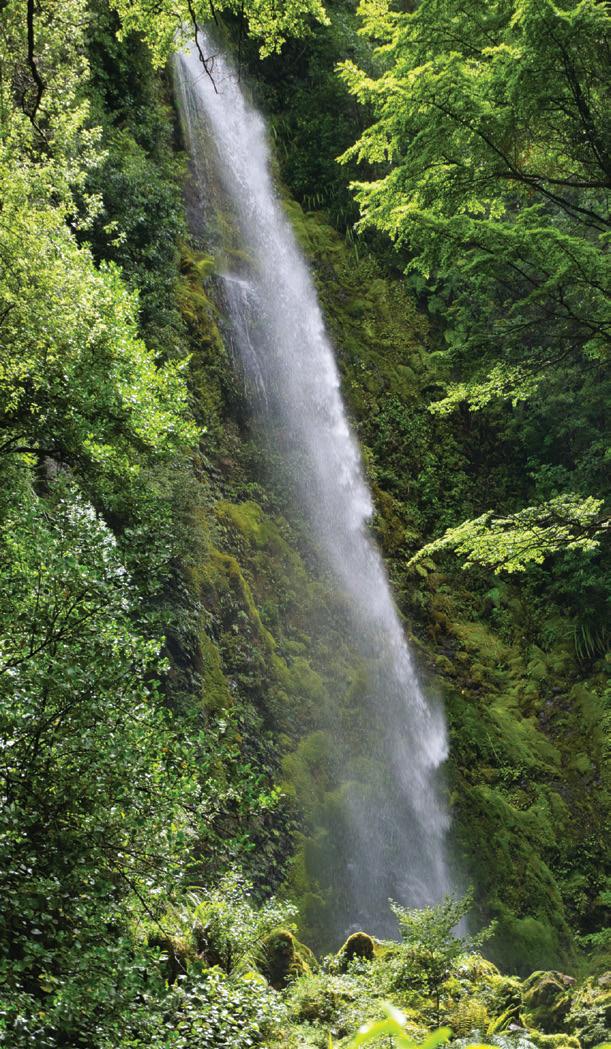
Zealand Walk: Whiskey Falls Walk - a waterfall named after an illicit still
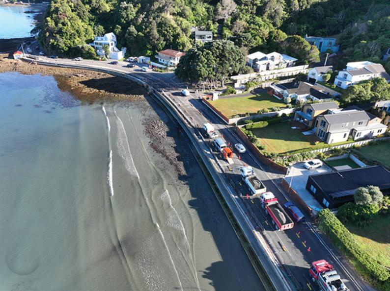
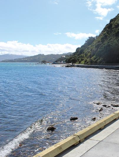
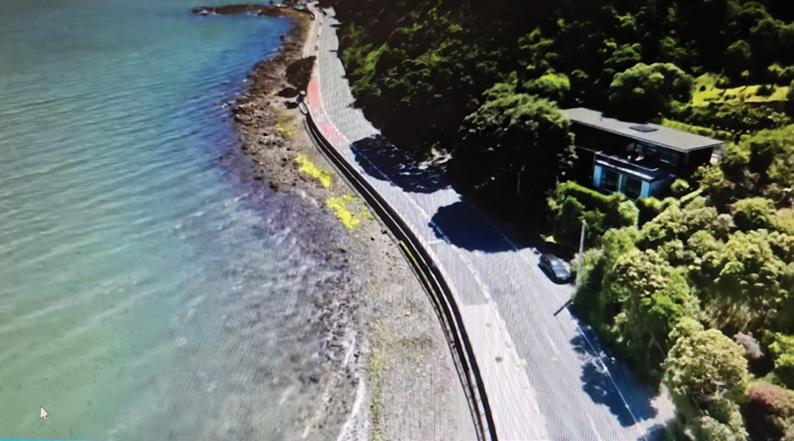
Walk: Eastern Bays Pathway officially
England’s Coast to Coast a classic reborn as a National Trail 30 New Zealand Walk: New walking experience opened in North Canterbury
New Zealand Walk: Plenty of variety on Branch Walk way 34 Walking Festival: Waiheke Island Walking Festival shows off its history, tracks and birdsong
39 New Zealand Walk: Lake Wombat Walk an enchanting forest trail
Zealand Shop 52 Pak A Roo Walking Jackets
Issue 339 JUNE 2026 26 20 18
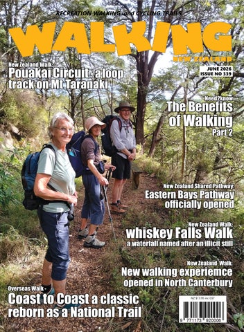
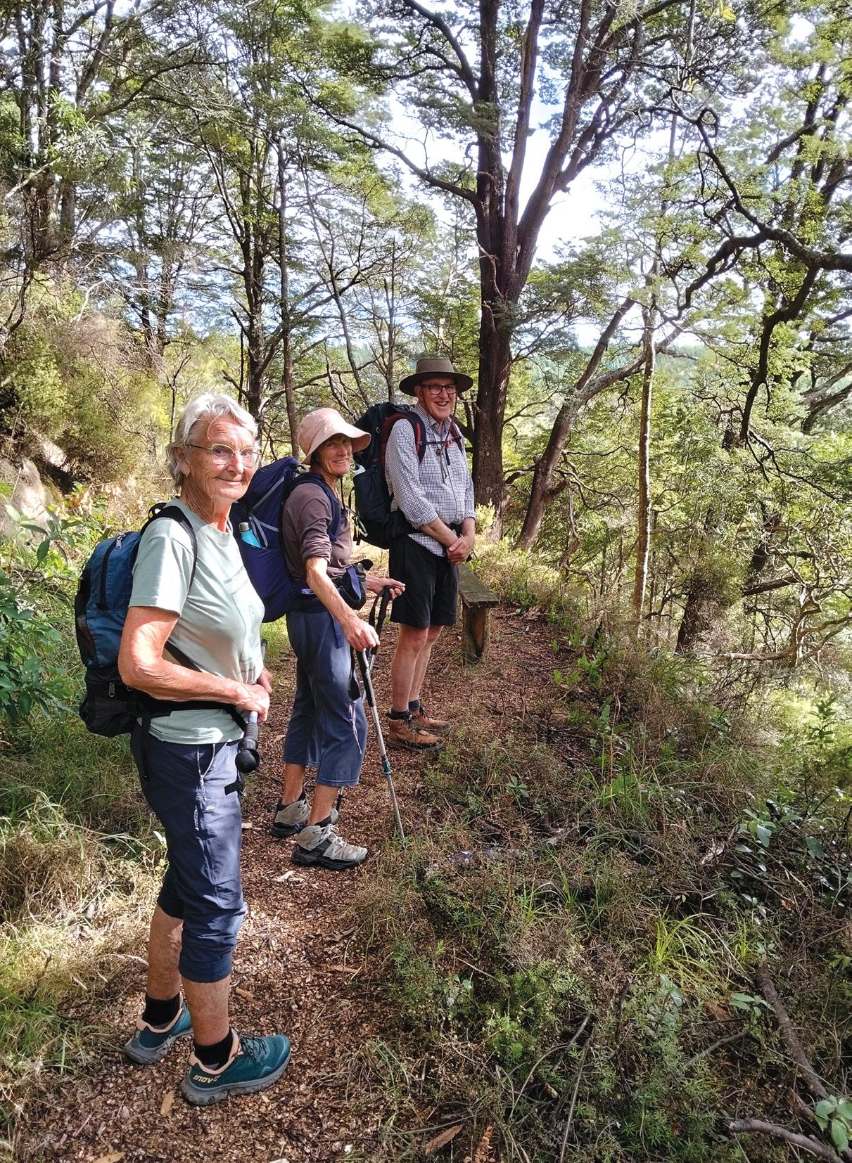
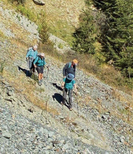
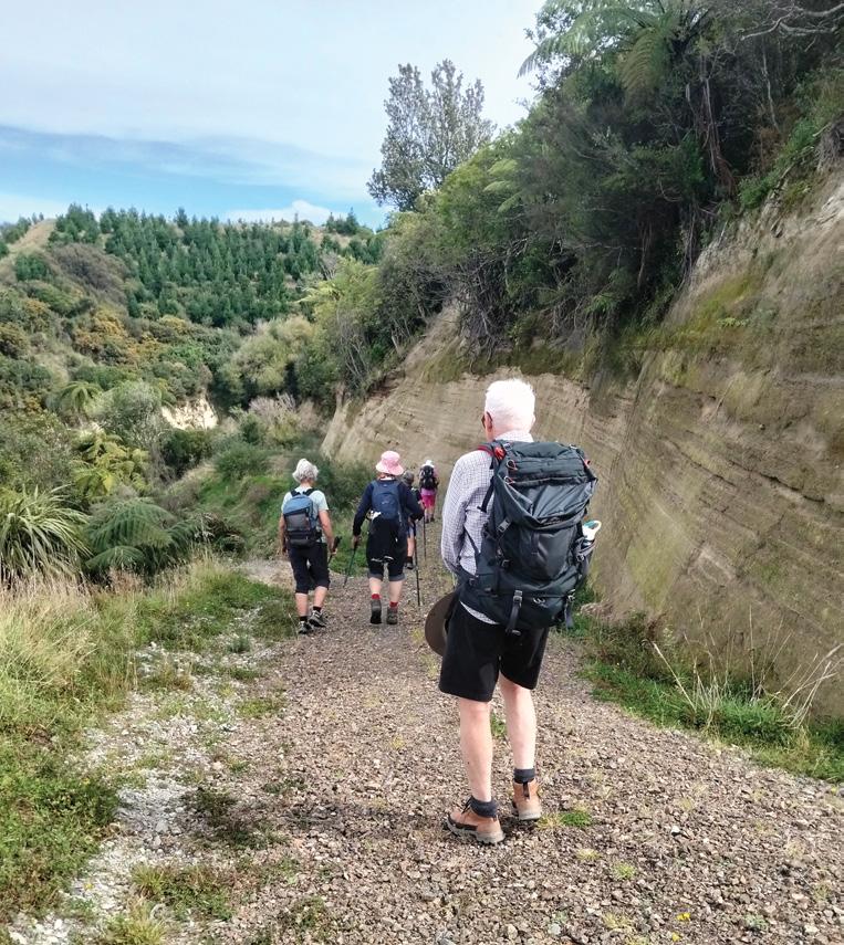
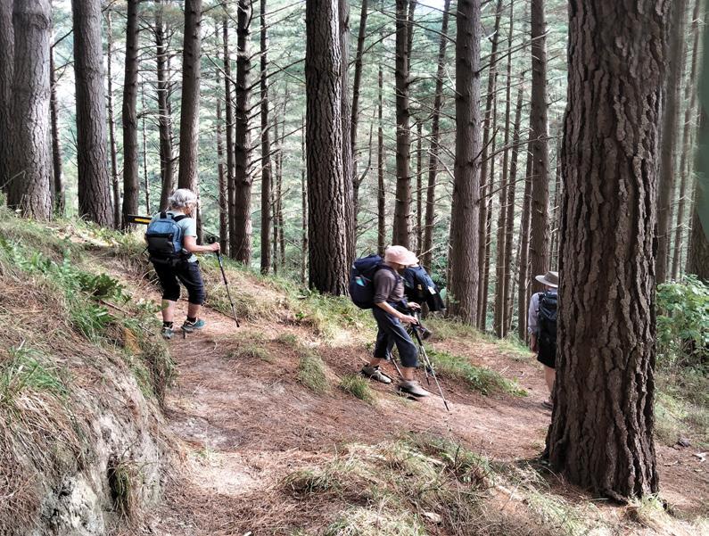
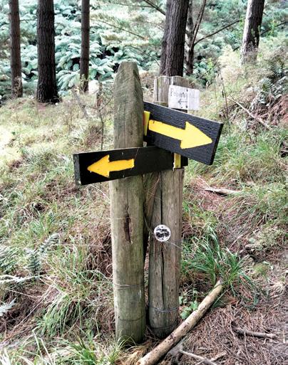
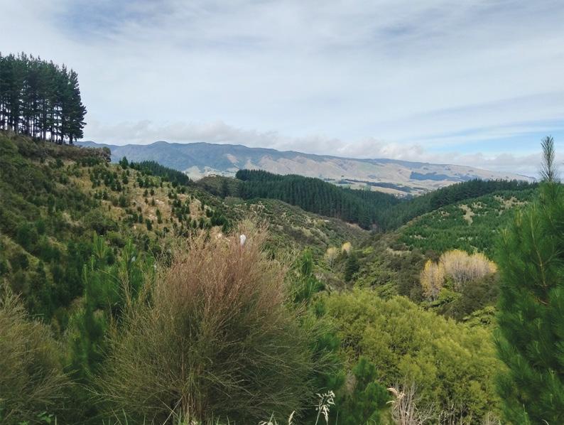
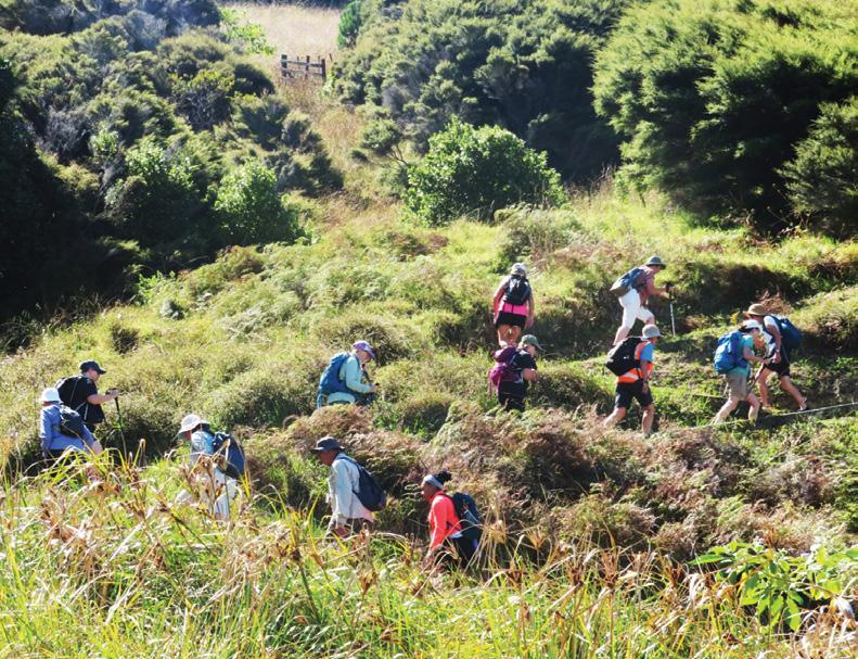
Cover image: A group walking through a bush section ofnthe Branch Walkway in the Pohangina Valley, in the Manawatu. Photo by David Scoullar
PUBLISHER/EDITOR: Frank Goldingham MNZM: Phone, 027-274-0726
CONTRIBUTORS: Barbz Lowther, Ken Ring, Phillip O’Donnell, David Scoullar, Catherine tooher,ADVERTISING MANAGER: Frank Goldingham - 0800 walking (925-546) 027-274-0726
Email: walkingnz@xtra.co.nz
COMING EVENTS ADVERTISING: Frank Goldingham 0800-walking (925-546) Email: walkingnz@xtra.co.nz
SUBSCRIPTIONS: Phone 0800-925-546
SUBSCRIPTION
DISTRIBUTION: Are Direct NZ Limited WALKING NEW ZEALAND LTD, 47 Lincoln Terrace, Hokowhitu Palmerston North, 4410 Telephones 06-358-6863 - 027-274-0726
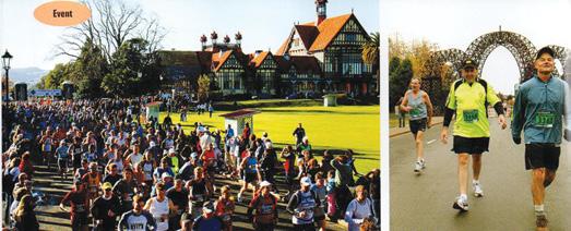
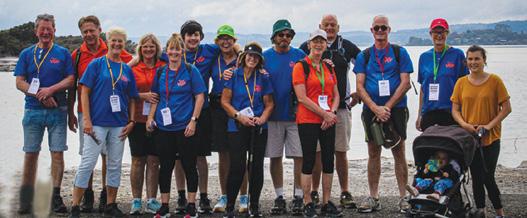
Rotorua Walking Festival celebrates outstanding success
The Organisers of the Rotorua Walking Festival are delighted to acknowledge the outstanding success of the 2026 event, held across 20, 21 and 22 March. This year’s festival once again showcased the very best of Rotorua’s natural beauty, community spirit, and international appeal.
Now in its 33rd year, the Rotorua Walking Festival has grown into a cherished annual recreational event. Inspired by renowned European walking events such as the Nijmegen Walk, which attracts over 40,000 participants annually, the event recognised both the significant health benefits of walking for people of all ages and abilities, the opportunity to bring people together to create greater understanding and the chance to create an international event that would support Rotorua during the shoulder tourism season.
Since its establishment in 1994 the festival has remained a non-competitive, recreational event welcoming participants of all ages and abilities. Walkers can choose to take part in one or both days, selecting from a range of distances that highlight the region’s unique landscapes.
Day one traditionally takes participants through the majestic Whakarewarewa Forest, while day two offers an exploration of Rotorua’s urban parks and geothermal environment. Highlights include passing by Whakarewarewa and Te Puia and a variety of scenic stream, lake, forest and bush tracks.
A much-loved feature of the festival is the Friday evening guided nocturnal forest walk. This one a a half hour torchlight experience allows participants to connect with nature after dark, often spotting glowworms and listening to native wildlife, with proceeds supporting the Rotorua Botanical Society.
On a similar basis the Plunket walk on Saturday showcases the great work that Plunket does in the Rotorua community and on Sunday the SPCA “Dog walk” profiles the excellent work of SPCA in Rotorua.
This year was the first year of the Barnardos 10 km walks on Saturday and Sunday with some of the proceeds going to their “Whats Up” programme supporting young people in the community
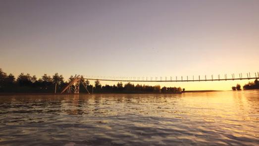
Construction began this month on the Whangaehu River Bridge
Construction of a 120-metre suspension bridge across the Whangaehu River began in April , after more than ten years in the making
The bridge part of the Te Araroa Trail will cross the Whangaehu River near its mouth at the Tasman Sea, allowing walkers to follow the coast from Whanganui rather than traversing 32km of road that is a stretch that currently takes hikers along Portal Street, No 2 Line, Warrengate Road, SH3 and Whangaehu Beach Road before the trail heads off-road again. Once complete, walkers will instead move through a coastal dune system that is one of the last of its kind in New Zealand - a genuinely special stretch of trail that has been waiting for this bridge for a long time.
Totara tree roots
I was horrified to see (issue 338) a 2000 year old totara tree on the Montgomery Peak Track Akaroa being treated with total disrespect by having it roots trampled on. A great way to kill an old tree. Please advocate for some protection for the tree before it’s ruined, Canterbury has so few native trees. Cheers Ken
What is the world’s most sought after trekking destination
Japan has bee?n named the world’s most sought-after trekking destination, according to new global research from World Expeditions, with its ancient pilgrimage routes capturing the imagination of travellers.
The inaugural World’s Best TreksSurvey, conducted by World Expeditions, collected 13,453 destination preferences from 11,952 participants across Australia, New Zealand, the United Kingdom and North America. Japan ranked number overall with 2,107 votes, ahead of Nepal (1,949) and Patagonia (1,858).
‘Japan has quietly become one of the great trekking destinations of our time,’ said Sue Badyari, CEO of World Expeditions. ‘Routes such as the Kumano Kodo, the Nakasendo Way and the Shikoku Pilgrimage offer a rare combination of deep cultural and spiritual heritage, accessible yet rewarding walking routes and well-developed trail networks.
Reader’s View
Walk talk
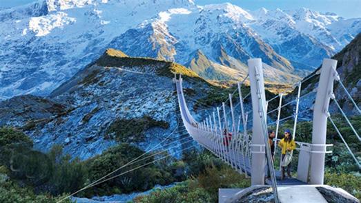
Spectacular Hooker Valley bridge to open this year
The massive new suspension bridge being built up the Hooker Valley at Aoraki/Mount Cook will open in late July/early August this year.
The bridge which will span 189 metres across the Hooker River on the upper section of the popular Hooker Valley track will replace an existing swing bridge which had to be closed in April 2025 due to riverbank erosion near the bridge supports.
Construction of the new bridge began in August 2025 and since then mother nature has thrown everything at the team working on site.
Aoraki/Mount Cook Operations Manager Sally Jones says extreme weather and adverse sub-alpine conditions have been very challenging for the construction crew who have battled 130 kph winds and un-seasonal snowfalls.
“Despite this, the team is making good progress with the completion of the large backstay anchors. The massive steel cables which will span the river, have arrived from Italy and will be hung in the next few months. The bridge is really starting to take shape which is exciting. It will be a spectacular destination for visitors to experience,” she says.
The lower section of the Hooker Valley track from the first suspension bridge to a viewing platform with a lookout over Mueller Lake is still open. The upper part of the track will remain closed until the completion of the project.
Visitors to the park are enjoying other walking and hiking tracks including to Governors Bush, Kea Point, and up to the Tasman Lakes and for a more challenging hike, the climb up to the newly refurbished Mueller Hut.
Due to rising costs Walking New Zealand magazine will go up in price from 1st July 2026. The single copy will be $16.95, 6 months $99.00, 12 months $169, 24 months $325, Digital 12 months $5.95 and 12 months $59.00. The new price for existing subscribers renewing will not go up until August 1 2026. From July 31 the printed magazine will only be available from our website: www.walkingnewzealand.co.nz. at $16.95, posted..
Finland the World’s happiest country for the ninth Year
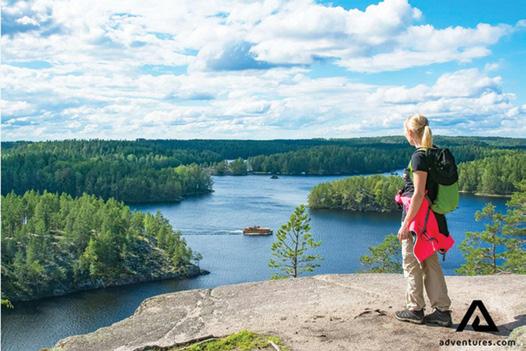
Finland has once again been ranked the happiest country in the world in the United Nations’ World Happiness Report 2026, marking the ninth consecutive year the Nordic nation has topped the global ranking. This year, the message from Finland is simple: happiness starts with switching off, preferably somewhere by a lake and far away from notifications
The 2026 report explores the impact of social media and constant connectivity on wellbeing, highlighting growing evidence that increased time spent online can negatively affect wellbeing. In Finland, often cited for its close connection to nature and balanced way of life, the secret to happiness lies in doing the opposite: stepping away from screens, slowing down and spending time in nature.
The Finnish response to the win reflects this ethos, with happiness often rooted in simple, everyday moments: a swim in a clear lake, heating the sauna, walking in the forest, or sharing good food with friends at a summer cottage. To celebrate the milestone, Visit Finland is inviting people around the world to experience the Finnish antidote to digital overload through the Chill Like a Finn challenge, giving participants the chance to win a free seven-day summer stay in Finnish Lakeland, one of Europe’s largest lake regions.
Visit Finland offers a free 7-day trip to Finland for those looking for a digital detox
New Tasmania Great Walk
Tasmanian Walking Company has officially launched the Uluru-Kata Tjuta Signature Walk, marking the 15th addition to the Great Walks of Australia collection.
The five-day, 54km experience connects Kata Tjuṯa to Uluru across a 500-million-year-old landscape and introduces a new cultural offering to the premium walking category.
Tasmanian Walking Company co-owner, Brett Godfrey says ‘This is the first new long-distance, overnight walk inside a national park brought to market since the Three Capes Track opened over a decade ago.’ enquiries@taswalkingco.com.au
Pouakai Circuit - a loop track on
By Barbz Lowther
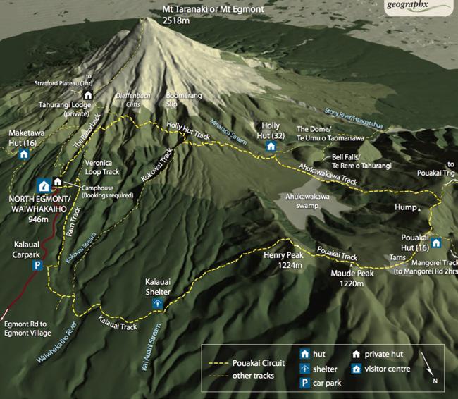
Between the storms in February, we were lucky to strike two calm, dry days to complete the Pouakai Circuit in Egmont (Te PapaKura-a-Taranaki) National Park, the second oldest national park in new Zealand.
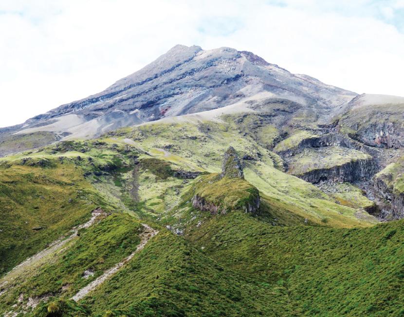
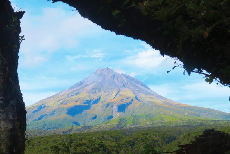
Mt Taranaki (2,518meters) the focal point of the park, has a wealth of walks, up to the summit, around, and amongst the foothills. We chose the Pouakai Circuit, a 26
km loop from North Egmont Visitor Centre.
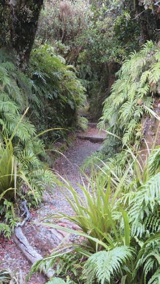
It is a varied trail through bush, alpine tussock fields, rocky mountain trails and swamp, all very well marked and maintained. Setting off on the Veronica Loop Track, we climbed steadily through pretty lowland bush and sub alpine scrub. There were lots of coprosmas and horopito and ferns and moss bordered the trail. In just over half an hour we reached a
junction. Holly Hut Track continued on up and Veronica Loop turned left. Continuing up we passed a clearing with lovely views out to Mt Ruapehu.
At the top of the bush line we
Above left: Humphreys Rock on the foothills of Mt Taranaki.
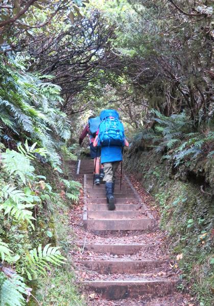
Above right: Heading up Veronica Track.
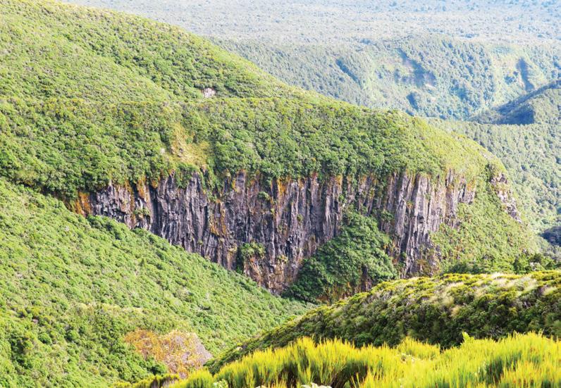
Below left: Dieffenburg Cliffs showing the lava columns.
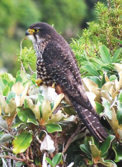
Below left: A New Zealand falcon.
Mt Taranaki
stopped to enjoy the 360 view. We could see the summit of Mt Taranaki, Humphreys Rock, Maude Peak, Mt Henry, Dieffenbach Cliffs, Ruapehu and native bush extending over the foothills; quite stunning and worth the climb.
Above middle: Map of the walks.
Above right: Heading up Veronica Track.
Below right: The trail skirting around the foothills
New Zealand Walks
Pouakai Circuit
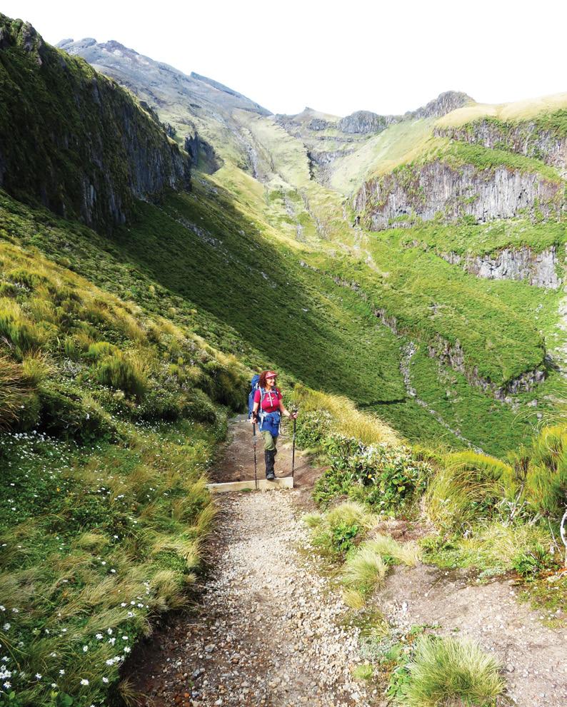
As we were leaving, a New Zealand falcon flew onto a rock close by and sat a while. We hadn’t seen one that close before. After crossing a creek below ‘Humphrey’ the trail veered right and sidled around the mountain. This section was open, barren, rocky but with awesome views. We passed Dieffenbach Cliffs that are towering lava columns, and
Above left: Walking down towards Holly Hut.
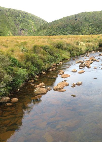
Above right: A bend in the blue waters of the Pouakai River.
- a loop track on Mt Taranaki
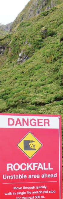
clambered over four boulder fields created by rock falls from way up the mountain.
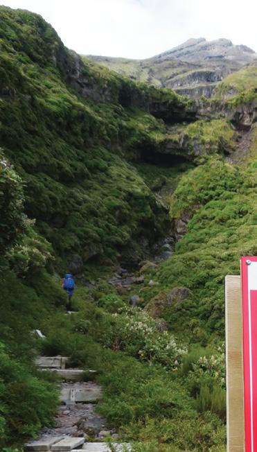
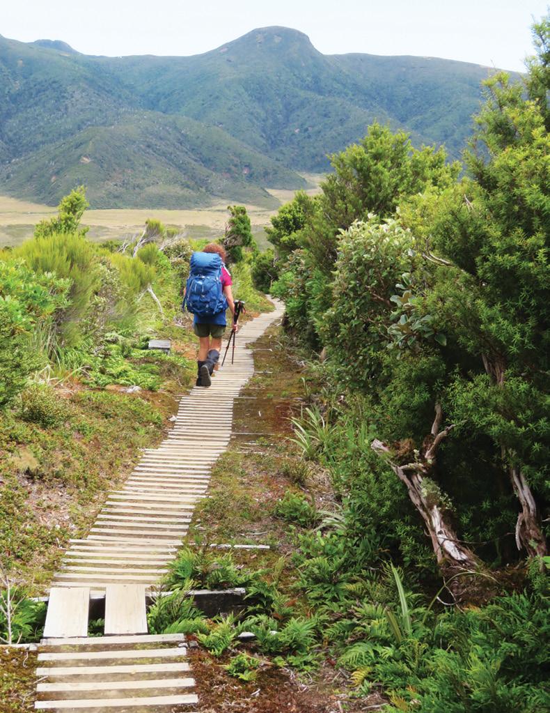
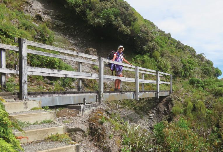
The trail was bordered with mountain tutu, alpine daisies, leatherwood scrub, hebes, koromiko, and ferns. It was very well maintained, with bridges over streams, and a series of steps and boardwalks in wetter areas.
In just over two hours we descended on boardwalk and gravel track, to Korowai stream – noteworthy because of its red water, caused by manganese oxide oozing from the earth.
Although there had been heavy rain the day before, the track was remarkably dry. Holly Hut was about 10 minutes from the stream – a perfect place for lunch. Bells Falls that is 30 meters high, is another half an hour and is worth visiting.
Many circuit walkers choose to take three days, staying at both Holly
and Pouakai Huts, and allowing time to explore side tracks and spend time at the falls.
Unfortunately we only had a small window before more rain was forecast, so we had to move on. We continued on to Ahukawakawa Swamp. This now has boardwalk all the way across to protect the fragile environment. This swamp, formed 3,500 years ago, is home to many plant species found no-where else in the world. Sedges, sphagnum moss, herbs, and red tussock are common here
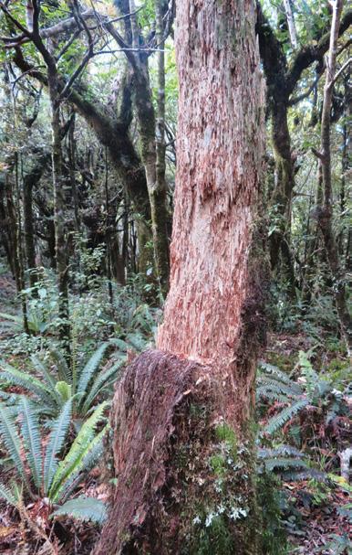
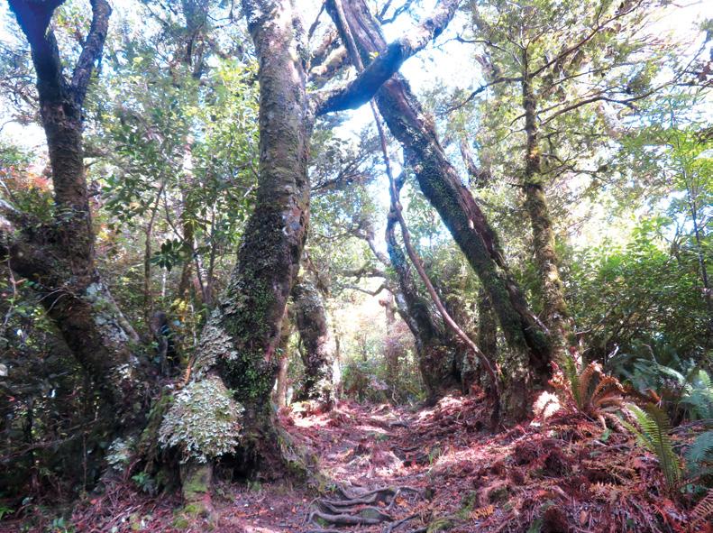
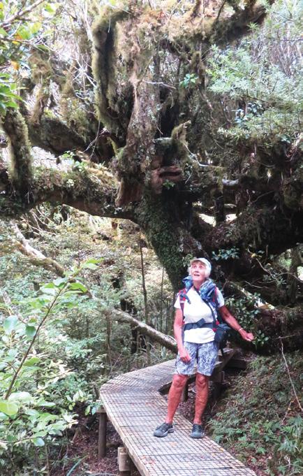
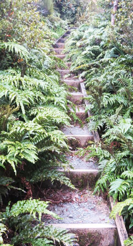
Once over the swamp the trail was unrelentingly up wooden steps for over an hour. We were very grateful for the cloud cover. The only respite, was an area of level boardwalk through ‘Goblin Forest’ – huge old Totaras dripping with Moss and
Above middle: Mountain Fuschia shedding its bark.
Above right: Heading up Veronica Track.
Ouch! Sore feet while walking?
Hikers Wool is 100% New Zealand wool. Cushion your feet to prevent pain, rubbing and blisters.
Buy online or at selected stockists For more info visit www.hikerswool.co.nz
Pouakai Circuit - a loop track on Mt Taranaki
Lichen.
Reaching the top of the stairs, a downhill boardwalk stretched out in front - but our joy was short lived. In three minutes, after the junction with the Pouakai Summit Track, we had yet more steps. This section gave awesome views of mountain peaks, and Mt Taranaki peeping above the clouds. We looked over a vast area of forest of rimu, totara, rata and kamahi.
Dead mountain cedar, stripped by the possums, stood out stark against the green.
We soon reached the plateau, and the turn-off to Pouakai Hut. Pouakai is five minutes down Mangorei Track, which is a good escape route, if the weather deteriorates. The road is only two hours from here.
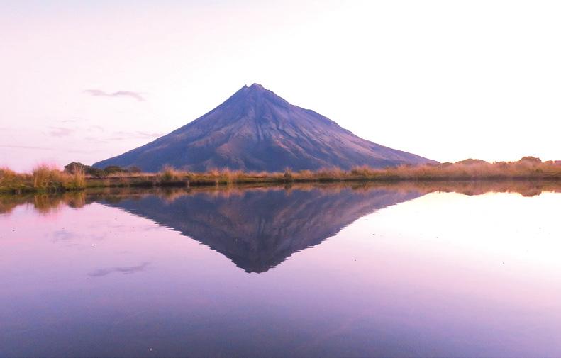
Reaching the hut mid-afternoon, we dropped our packs, returned to the plateau, and walked over tussock land, down to the alpine tarn, to watch the ever changing reflections of Mt Taranaki. It was fascinating watching the changes from
Above left: Forest on the Kaiauai track. Middle left: A view of Mt Taranaki thru’ the trees on the Kaiauai track
Below left: A reflection of Mt Taranaki in Pouakai tarn
New Zealand Walks
total cloud cover, to glimpses of the mountain, to the full reflection with a pink backdrop of twilight.
After a night in the clean cozy hut, we set off past the tarn again, to check for early morning reflections. From there we headed up yet more steps and a couple of long ladders to reach the summit of Mt Henry (1,224 meters), named after a Scottish nurseryman.
We sat a while to enjoy the scenery, before continuing on downhill. What a luxury!
It felt so good to be going down as others were trudging up. No matter which direction you walk the circuit, there are many many steps. We soon reached the forest floor and a leafy track.
Following the Kaiauai Track through lowland forest of kamahi,
tawa, kohekohe, hinau and mahoe predominantly, we negotiated roots and rocks, and crossed several creeks. Streams were well marked, with larger ones bridged.
We crossed swing bridges over Kai Auahi Stream and Waiwhakaihe River. Long ladders, and staircases helped in the steeper sections. Although bait traps were stationed at regular intervals throughout the whole circuit, birds were scarce. We saw the falcon, a robin, a tomtit and four wood pigeons in the entire walk.
By late afternoon we had a choice of finishing via the Ram Track on a rugged forest trail, or a shorter option up Egmont Road. We chose the shorter option and on reaching the carpark, were offered a lift to the Camphouse. So Kind!
We spent the night at the camphouse, New Zealands oldest building within a National Park. It was cozy and very well equipped with very good hot showers, microwave, oven, instant hot water. The Works! A lovely end to a challenging couple of days.
We had planned to walk into Maketawa Hut the following day, but when we woke to rain, plans were changed.
This was a really interesting varied and challenging walk, well worth doing, but do check the weather. Because there are long exposed sections, it would have been much more difficult with rain or hot sun, changing a delightful walk to a hard slog. We were grateful to have neither.
Above right: Goblin Forest. Huge old trees dripping with lichen and moss – the only bit of level boardwalk in this section .
Below right: And the many steps up from Ahukawakawa.
New Zealand Walks
JUNE Weather prediction
(Weather is an inexact science, like medicine. Dates given are to be regarded as focus points. Please allow 3-4 days leeway for all forecasts)
1st-6th An unsettled period with low pressure and cold fronts bringing storms.
3rd-4th Chance of first significant snowfalls in the South Island alpine regions and central Otago, incl. Coronet Peak, The Remarkables, Cardrona, and Treble Cone.
6th-11th High-pressure systems cross the country bringing mostly clear, cold, and dry conditions to most parts of the country.
6th Light breezes and overnight fog likely in Canterbury, including Christchurch.
8th Chance of fog in Wellington.
9th Mostly calm air on the West Coast with possible patches of fog overnight.
10th Fog likely in Auckland and into the Waikato.
Over the next four weeks the weather patterns may be quite dynamic with an anticipated four high pressure systems taking center stage for a time interspersed with up to seven intense storm fronts either sweeping up from the Southern Ocean or pushing down onto the country from the northern Tasman Sea.
In general, the high-pressure systems may swiftly pass across the country in stronger westerly flows. Some of the more vigorous cold fronts may bring a mix of thunderstorms, hail, lightning strikes, high winds and even snow, particularly in the last week of this outlook period. Rainfall amounts may be around 50% lower than normal in NelsonMarlborough and Otago regions over the next four weeks, while up to 160-200% more than average in North Canterbury, inland parts of the Manawatu, Waikato, Auckland, and on the Central Plateau, including in Waiouru. Closer to average elsewhere.
Aside from rain, there may also be up to three significant snowfall events, with the chance of snow in the east of the South Island in the second week, in Southland in the third week, and in the North Island
Central Plateau near the end of this outlook period. Despite the frequent passage of storms during this outlook period, most parts of the country can enjoy above average sunshine by at least 10% more than is typical for this time of year and with parts of the Hawkes Bay, Wairarapa, eastern Marlborough, the Tekapo district, Central Otago and Southland all up to 25% more sunshine hours. The next four weeks may also continue the trend of being slightly warmer than what is normal for this time of year, by around half a degree more for the country as a whole. Inland South Canterbury and Otago regions see maximum temperatures up to 1.5-2°C warmer than normal.
larly in the Milford Sounds area. 18th Chance of very high winds for a time in the Central Otago region, possibly causing some damage to infrastructure and property, as well as disruptions to the Queenstown airport. Snow likely from Kaikoura to Southland and flurries likely in Dunedin and Christchurch. Possible hail showers in Wellington.
18th-19th Heavy rain on the West Coast.
19th Very cold with severe frosts likely in the north Canterbury region, particularly in the Hanmer Forest area.
19th-22nd A large high crosses the country during this spell easing winds to a light south westerly flow to mostly calm air throughout. Chance of fog and light snow in Christchurch.
20th-22nd Period of widespread heavy rain over the North Island. 23rd-25th Weakening high pressure prevails with conditions becoming unsettled.
The west and north of the North Island may also warmer by between 0.5-1°C, while conversely, the Hawkes Bay region may be cooler by a similar variant. Minimum temperatures may also be more than 2°C higher than average in Northland to Auckland regions, while below normal by as much as 1°C in the Hawkes Bay and the Tararua districts. 11th-13th Low pressure prevails with the chance of widespread rain and snow in higher reaches.
11th-12th Fog likely in Auckland and into the Waikato.
14th-16th Cold fronts brush the southern parts of the country with showers to the western half of the South Island and scattered over the North Island.
14th-17th Chance of fog in Canterbury, including Christchurch.
15th-16th Chance of hail showers in Christchurch or brief snow flurries.
17th-20th Very unsettled and blustery storm fronts cross the country over the next couple of days.
17th Very heavy rain likely in the south of the South Island, particu-
26th-28th A weak trough crosses the country ahead of a high that remains almost stalled over Tasmania but extending its ridge over much of New Zealand. Unusually warm spell in north Canterbury districts, with maximum temperatures into the mid-20’s in some areas. Chance of fog continues in Christchurch.
28th-30th A large anticyclonic system crosses the country bringing mostly dry and very cold conditions almost everywhere. Fog still possible in the Christchurch area. Frosts in many districts.
29th Very strong winds likely along the eastern coasts of the North Island from the Coromandel to the Bay of Plenty.
Pukemokemoke Reserve boasts over 300 native plants
The Pukemokemoke Bush Loop Track is a great Waikato walking trail, boasting over 300 native plants including matai, totara, kauri, kanuka and kahikatea, great picnic spots and stunning views of the wider region.
The 40ha Pukemokemoke Reserve, just 20 minutes north of Hamilton includes nine sites of interest, which are marked along the track; these include a log hauler site, the kauri grove and the lookout.
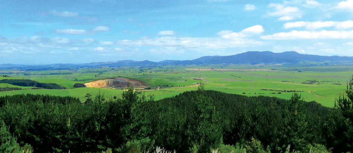
The lookout at the summit of the track provides stunning 360 degree views of the region, with the Hakarimata Ranges, Mt Te Aroha and more all visible on a clear day. From the summit the track loops back down the mountain to the log hauler site, a large clearing perfect for a family picnic in the sunshine and further exploration of the other tracks and rejuvenation efforts happening in the reserve.
Pukemokemoke Reserve consists of 40 hectares of original and modified forest cover, which, when donated by David Johnstone in 1994, had been grazed by cattle, was overrun with weeds and was home to all manner of predators. Despite this it was recognised as one of the most species-rich forest remnants of the Waikato and has been designated a Key Ecological Site (KES) by Environment Waikato.
The bush contains fine specimens of forest trees including kauri, rimu and pukatea, plus 80 species of native ferns. A variety of birds have been sighted at Pukemokemoke.
The forest rises from 20m above sea level at the stream to a lookout at 166m which gives a panoramic view of the whole Waikato basin.
The reserve is visited by a wide range of users including school groups, hikers, naturalists, fundraisers and picnickers. It is accessed by a 400m long drive off Tauhei Road and the entrance is over a bridge across the Mangatea Stream.
The track is open all year round and is a 30 minutes drive from Hamilton on Tauhei Road, Gordonton Time Allow one hour 30 minutes to do the circuit.
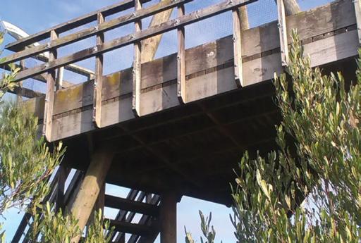
Above: The view from the top. Above right: The viewing platform. Below right: A board walk through bush.
Phillip Donnell explores why exploring the natural world on foot is good for us.
Have you ever noticed how good you feel after spending time outdoors? That uplifted feeling isn’t just in your head — it’s your natural connection to the living world at work! This relationship between humans and nature has a name: biophilia. And it might just be the key to creating a world where people and nature thrive together.
Last month I explained how the scientific community and the general public have increasingly embraced “nature therapy” (otherwise known as “ecotherapy” or “green care”) as a vital pillar of holistic health.
As urbanisation and digital immersion continue to rise, the deliberate practice of reconnecting with the natural world has transitioned from a niche wellness trend to an evidence-based clinical solution.
Walking is an ideal and inexpensive way to achieve this reconnection and start to enjoy the many physical, mental and emotional advantages that accrue from it.
For example, in 2025 trials comparing ecotherapy to standard cognitive-behavioural therapy (CBT) found it equally effective for reducing depressive symptoms.
Nature therapy is not a mono -
The benefits of Wal
lithic practice; it encompasses a diverse range of modalities which can be tailored to individual needs. Harnessing the therapeutic benefits of nature has given rise to several highly personalised approaches. ranging from structured clinical sessions to self-guided rituals.
One of the most prominent is Forest Bathing, or Shinrin-yoku, a practice popularised in Japan that focuses on engaging all five senses (sight, sound, taste, smell, touch) rather than physical exertion.
It is not a hike, but a slow-motion immersion where one consciously listens to the wind and smells the damp earth. Any quiet, tree-filled area, such as native bush walks in Auckland, the Redwoods in Rotorua, or local botanic gardens, are suitable locations.
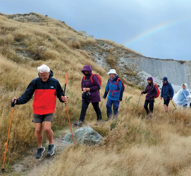
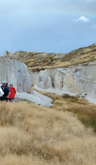
Above right: Walking the Blue Lake at St Bathans.
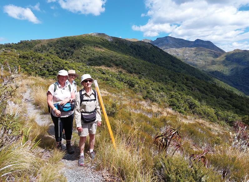
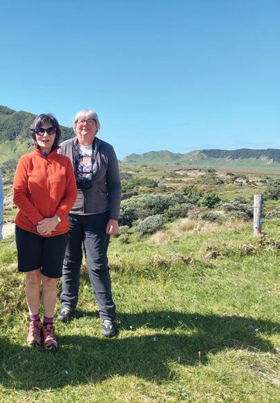
Below left: A group on Mt Arthur. Below rigt: On the walk to the Eastcape Lighthouse.
Part two of two
Leave devices behind, walk slowly, and spend time simply sitting or standing, al- lowing nature to “enter” your body. These immersive, multisensory experiences have been found to lower blood pressure, decrease heart rate, increase energy, improve mood and boost immune function. This practice is popular for fostering “soft fascination”—a relaxed, uplifting, and contemplative state.
Another vital modality is Horticultural Therapy, which involves
using gardening activities to promote human healing and rehabilitation. The act of gardening — tending to a living thing and participating in the cycle of growth — helps participants build mobility, resilience, selfesteem, and a sense of accomplishment.
By Phillip Donnell
It also reduces anxiety and stress. It is much more than simply planting and weeding. Involvement in community gardens and environmental restoration projects would certainly come into this category. Horticultural Therapy is an approach widely used in retirement villages, healthcare facilities, schools and prisons.
“Blue Mind” therapy, which involves activities near or in water, has gained significant traction in recent years. It is an evidence-based practice exploring the mental health benefits of being in, on, or near water. Coined by Dr. Wallace J. Nichols, this approach reduces stress (cortisol), lowers anxiety, and fosters a calm, meditative state
The rhythmic sound of waves and the visual expanse of the ocean have been found to be particularly effective for individuals suffering from burnout and PTSD, providing a soothing sensory experience that few urban environments can replicate.
Activities like surfing or lakeside
walks provide profound emotional relief, particularly for those dealing with highrisk stress or trauma.
Wilderness and Adventure Therapy is often used for atrisk youth or tormented veterans. The former often uses a “nomadic” model, utilising nature, backpacking, and primitive skills to foster healing through outdoor challenges.
The latter typically involves a base camp with high-adventure, structured activities (e.g. rock climbing, canoeing) and specific, oftenfacilitated, therapeutic goals.
Both of these methods leverage nature, group dynamics, and physical challenges to improve self-esteem, confidence, emotional regulation and behavioural health alongside building self-efficacy, resilience, and social bonds.
By removing technology and distractions, participants can connect with the environment, peers, and themselves. It is a growing field, including in New Zealand.
Green Exercise involves performing physical activities, such as cycling, walking or running, specifically in green spaces, to enhance the physiological and psychological benefits of movement.
The positive benefits are greater
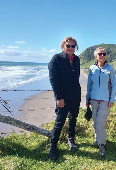
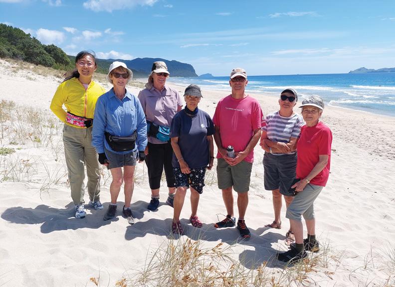
Below right: The golden sands at Opoutere Beach, Coromandel.
New Zealand Walks
The benefits of Walking Part two
than doing the activities indoors. The combination of physical activity and nature exposure provides a synergistic effect. The natural environment requires mental focus on changing terrain and weather, which acts as a distraction from daily stressors.
Additionally, it provides essential vitamin D from sunlight. Outdoor settings often feel less demanding, leading to higher enjoyment, better health outcomes and improved adherence. Even short, five -minute sessions can significantly enhance self-esteem and energy levels.
There is currently a global movement to integrate nature therapy into mainstream healthcare through social prescribing. The challenge is often accessibility.
Not everyone has a mountain range or a pristine forest in their backyard. However, the beauty of nature therapy in is its scalability.
Experts now advocate for the “Nature Pill”— a minimum of 120 minutes of nature exposure per week to see detectable health benefits. This can be achieved in small doses: a twenty-minute walk through a city park, a morning spent in a community garden, or even looking at the sky.
If outdoor access is limited, 2026 wellness trends suggest “bio-harmonizing” your spaces. The integration
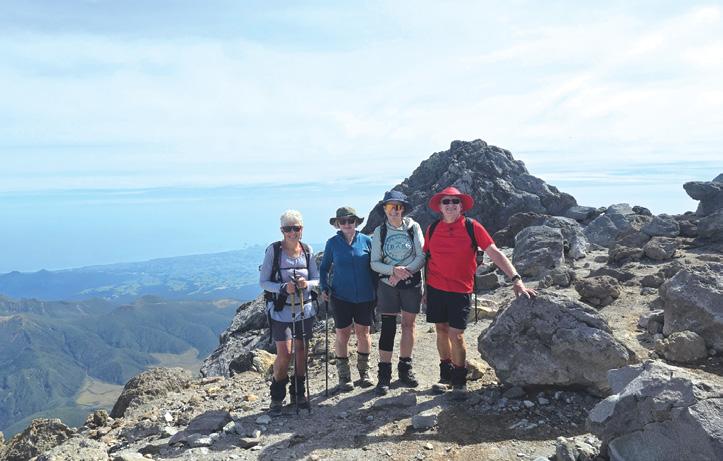
Above: A group poses on the summit of Mt Taranaki.
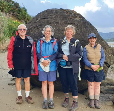
Above right: In front of a big rock at Kototu Boulder Beach, Hokianga,
of houseplants, natural textures, and high-resolution nature imagery into living and working spaces has been shown to reduce ambient stress levels, proving that even a symbolic connection to the earth is better than none at all.
For those with limited mobility or living in dense urban areas, virtual nature therapy (using VR or nature recordings) is emerging as a viable, though less potent, alternative for mood enhancement and stress reduction.
Walking, of course, ticks many of the above boxes. Walking clubs in New Zealand offer, social, and fitness-focused walking opportunities, ranging from city strolls to mountain trekking.
These clubs often cater to all skill levels with weekly, structured, or casual, social walks. My own Footsteps Walking Club provides a national community for walkers. Searching for “[City Name] walking group” or hiking clubs on Facebook is effective. Check the community noticeboards at local libraries, supermarkets, or cafes.
Walk Buddy is an app that helps match walkers in NZ based on preferences. To maximize the therapeutic effect of your walking adventures, experts recommend “unplugging.” Leaving devices behind allows for a full sensory reset and prevents the cognitive drain of constant notifications.
In conclusion, “nature therapy” represents a necessary and salutary
development in our understanding of health and wellness. It acknowledges that we are biological creatures who require more than just nutrients and shelter to thrive; we require a sense of belonging within the natural world.
Nature therapy teaches us that the cure for the stresses of the modern world is not more technology, but a return to the environments that shaped us.
By stepping outside, we are not just escaping our problems; we are engaging in a sophisticated, ancient, and deeply effective biological reset that preserves our humanity in an increasingly digital world. Exploring the natural world on foot is indeed good for us!
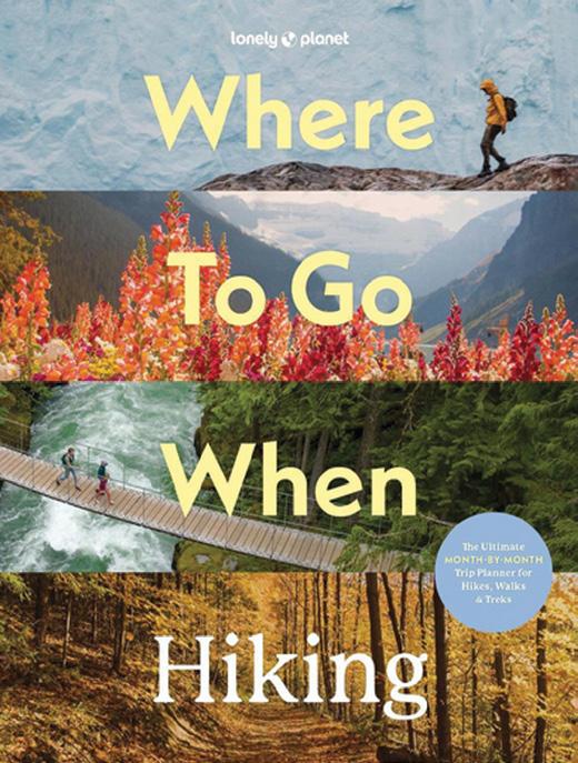
Where To Go When Hiking a coffee-table delight
There’s a certain moment familiar to every walker: boots by the door, maps spread across the table, and a single lingering question, where next? It is precisely this sense of possibility that Where to Go When: Hiking, published by Lonely Planet, captures so effectively. This is not simply a guidebook; it is a beautifully curated invitation to explore the world on foot.
At its core, the book is a global hiking planner, presenting 96 trails from around the world, carefully organised across the calendar year.
Rather than overwhelming the reader with endless lists, the structure is refreshingly simple: each month features eight standout hikes, chosen for optimal conditions at that time of year.
This makes the book as practical as it is inspiring, whether you are planning a future expedition or simply dreaming of one.
What makes this book particularly appealing is its month by month format. January might lead you to sun drenched coastal paths, while July transports you to alpine trails at their seasonal best. The effect is almost like travelling the globe without leaving your armchair. It encourages readers to think seasonally, aligning their adventures with the best weather, scenery, and conditions.
The range of hikes included is impressive. The book spans everything from short “micro adventures” to multi day treks and iconic long distance routes.
This diversity ensures the book appeals to hikers of all abilities, from beginners testing their limits to seasoned trampers seeking their next big challenge.
While the photography is undeniably a highlight showing lush forests, rugged coastlines, and snowcapped peaks, the book does not sacrifice substance for style. Each featured hike includes essential planning information: distance, duration, difficulty level, start and end points, and practical considerations such as permits, transport, and accommodation.
This blend of inspiration and logistics is where the book excels. It strikes a balance between a coffee-table travel book and a usable guide. The inclusion of route maps and concise summaries makes it possible to move from dreaming to planning with minimal effort. For many readers, this will be its greatest strength as it doesn’t just show you where to go; it helps you figure out how to get there.
One of the joys of Where to Go When HIking: Hiking is its truly international scope. The book moves seamlessly between continents, introducing readers to landscapes they may never have considered. From remote coastal tracks in Africa to high altitude treks in the Americas and historic pilgrimage routes in Europe, it celebrates the sheer variety of walking experiences available worldwide.
For New Zealand readers in particular, this global perspective is compelling. While New Zealand offers some of the finest walking tracks on earth, this book broadens the horizon, reminding us that the culture of walking is a shared, worldwide passion.
The success of this book lies in its ability to inspire without intimidating. Many hiking guides are dense and technical, aimed at experienced adventurers. In contrast, this title feels accessible. It invites readers in with stunning imagery and clear, engaging descriptions, then gently provides the practical details needed to turn ideas into reality.
If there is a limitation, it is inherent in the book’s format. With only a handful of pages devoted to each hike, it cannot provide the depth of a dedicated trail guide. However, this is not a flaw so much as a reflection of its purpose, as it is a starting point, not the final word.
Where to Go When Hiking: Hiking is a superb addition to the bookshelf of any walking enthusiast. It combines the visual appeal of a coffee-table book with the practical utility of a travel planner, making it both inspiring and genuinely useful.
For hikers dreaming of new horizons, it offers something invaluable: direction. Not in the sense of telling you exactly what to do, but in opening doors to possibilities you may never have considered. Whether you are planning your next overseas adventure or simply indulging in a bit of armchair travel, this book is a reminder of the simple joy of putting one foot in front of the other, somewhere new, somewhere beautiful, somewhere waiting to be explored.
Whiskey Falls Walk - a waterfall named
Words and photos by Michael Henricks
The small village of St Arnaud lies at the entrance to the Nelson Lakes National Park, some 90 minutes south of Nelson.
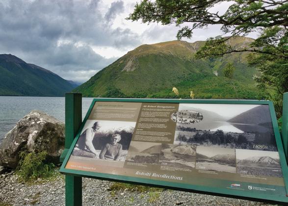
From the village, it is a short walk to the lake and the DOC information centre. The information centre is an essential place to visit prior to undertaking any walks. It provides an overview of the park’s history and its unique geology along the Alpine Fault line, which cuts through the surrounding area. The information centre will have the latest up-to-date weather, and it is important to recheck the forecast before your walk, as conditions can change quickly.
The Nelson Lakes National Park has had an interesting history, as prior to the national park coming into existence, John Kerr had established Lake Station in the 1850s. It was a large high-country pastoral lease that included the St Arnaud Basin and surrounding hills, grazing sheep along the open lower slopes of Mount Robert.
As you look at Mount Robert towards its northern face from the jetty, the treeline slope of Mount Robert is unusually low because of erosion following the loss of the original beech, because of a forest fire in 1887 and then subsequent grazing.
When John Kerr died in 1898, Lake Station was returned to the Crown. In the following years, Lake Rotoiti was initially reserved for public use between 1907 and 1928 as public domains, only becoming a national park in 1956.
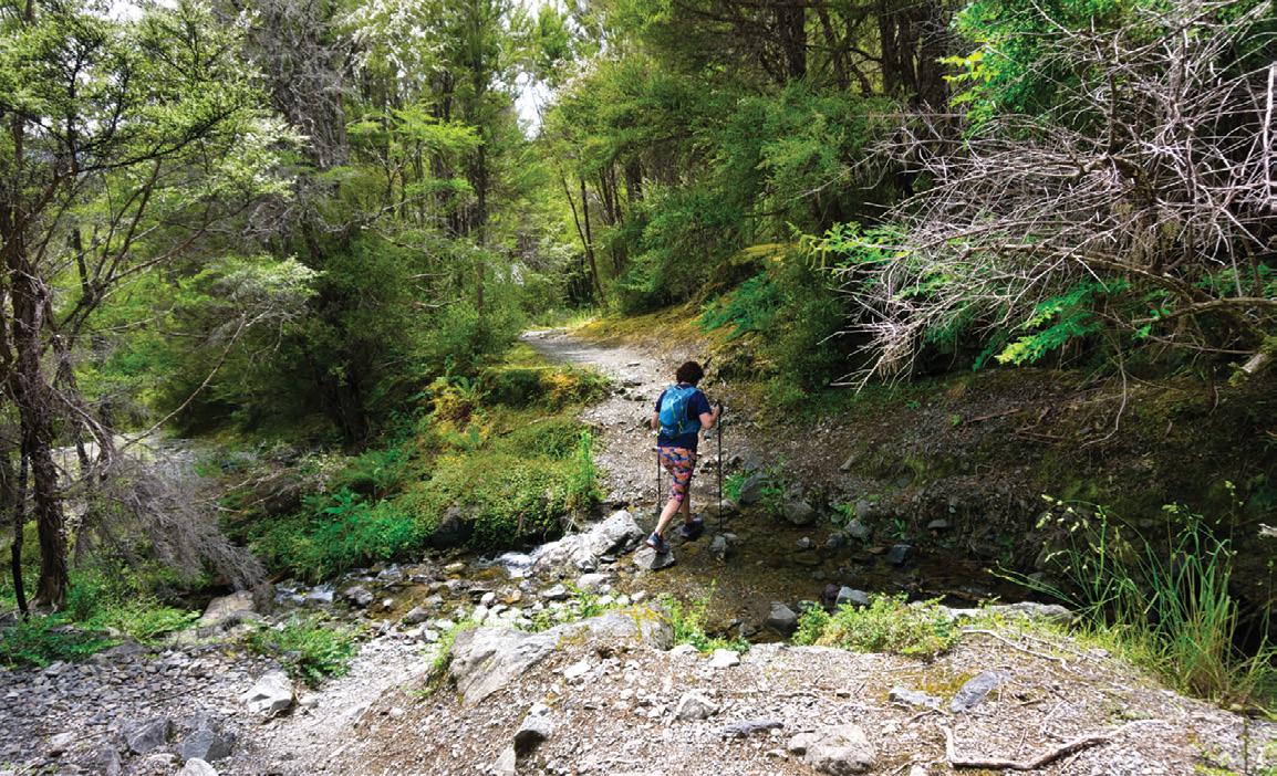
For our long weekend at Lake Rotoiti, we have planned several walks in the park, and they are going to take us from a waterfall on the bush-fringed Lake Rotoiti, to the tussock and alpine herb fields of Mount Robert over the next few days.
With the overnight thunderstorms slowly clearing, we headed out on a cool and crisp autumn morning to Whiskey Falls at the southern end of the lake.
From the jetty, the walk heads out and around the peninsu-
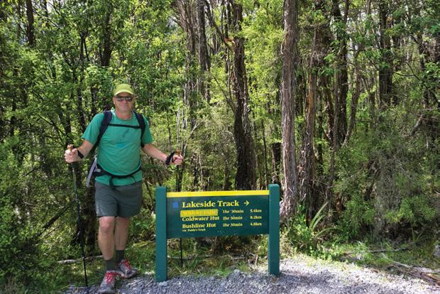
Above left: Author Michael at the start of the Lakeside Track. Below: Stream crossing on Lake side Track.
after an illicit still
lar through the beech forest as part of the peninsular walk to West Bay. The walk crosses the lake’s outlet bridge and then continues a short distance on a dusty Mount Robert road to the start of the Lakeside Track.
The Lakeside Track enters the lower native bush clad slopes of Mount Robert, with the track crossing several small streams before exiting onto the shores of the lake. This made it an ideal place to stop and have our morning tea, as we enjoyed the view looking back towards Kerr Bay.
The track continues to weave its way in and out of bush along the lake for some time. As we neared the falls, it was now a slow and steady climb up from the lake, as we carefully crossed several small streams.
From the junction, it is a short but steep walk up through the dense bush to the 40-metre-high waterfall.
Legend has it that Whiskey Falls is named after a holidaymaker discovered a dismantled still in the 1890s and reported it to the Nelson authorities. When the authorities returned to the camp, the still had vanished along with the three miners who had operated it.
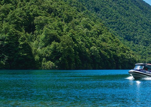
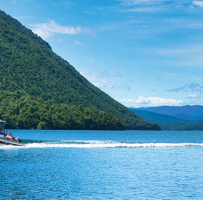
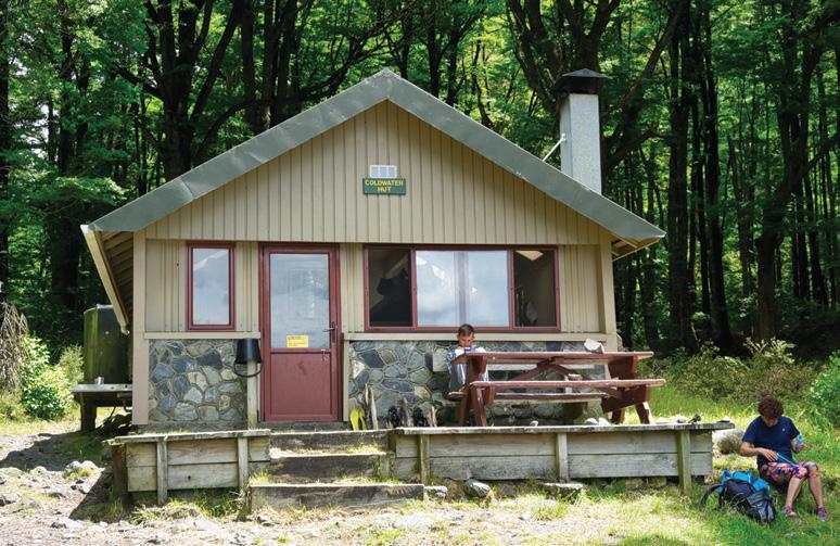
From the waterfall junction, the track now slowly descends through the bush to Cold Water Bay hut and our lunch stop. It was mid-afternoon when our water taxi arrived for the 20-minute trip back to Kerr Bay and a wonderful way to finish our walk.
Fact File
Estimated distance: 14km from Kerr Bay to Cold Water Hut. Grade::Easy with some steep muddy sections Estimated Time Four Hours. Water Taxi: www.rotoitiwatertaxi. co.nz. Weather:Check the weather before the walk and prepare accordingly.
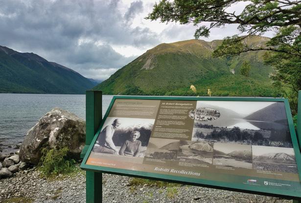
Above left: Lake Rotoiti Water Taxi Above right: Lunch at Cold Stream Hut. Below right: The Whiskey Falls. Below left: Information panel peninsular walk,Kerr
Bay.
By Catherine Tooher
Eastern Bays Pathway officially opened
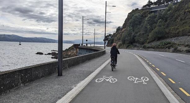
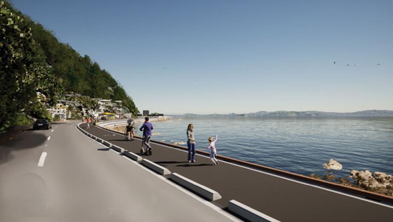
On a calm, sunlit autumn morning just days after its official opening on April 18, 2026 by the Minister of Transport Chris Bishop, I set out to experience one of the Wellington region’s newest coastal journeys, the shared pathway known as Tupua Horo Nuku.
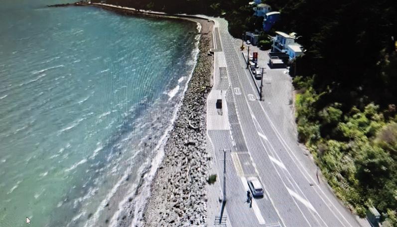
Hugging the edge of Wellington Harbour between Point Howard and Eastbourne, this striking new route offers a fresh way to explore the Eastern Bays, blending engineering ingenuity with natural beauty and cultural storytelling.
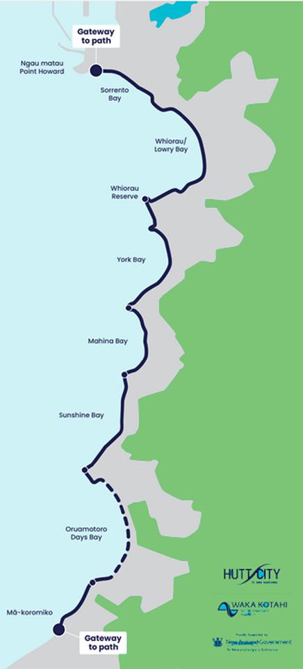
Tupua Horo Nuku is a 4.4-kilometre shared walking and cycling pathway, running along Marine Drive between Ngāu Matau (Point Howard) and Eastbourne.
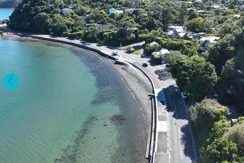
Built atop a newly constructed seawall, the path not only provides a safer and more accessible route for walkers and cyclists, but also protects the vulnerable coastal road from storms and erosion.
This dual purpose design is immediately apparent as you ride it. On one side lies the open harbour, sparkling under the sun; on the other, steep bush-clad hills rise sharply, creating a dramatic corridor between land and sea.
While the Māori name Tupua Horo Nuku carries deep cultural
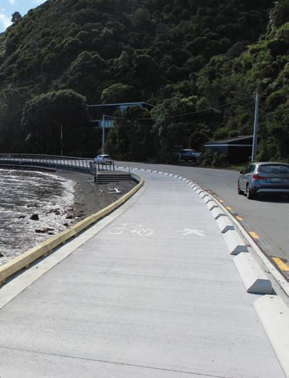
Above left: Construction equipment working on a section last year. Middle left; A completed section. Below left: The section is smooth and flat to walk or ride on.
meaning referencing Ngake, one of the legendary beings said to have shaped Wellington Harbour there is no official English name for the route.
It is often simply referred to as the Eastern Bays Shared Path, though the Māori name is increasingly embraced and used.
Starting from Point Howard, the path immediately feels inviting. Wide, smooth, and sealed, it is clearly designed with shared use in mind for cyclists, walkers, runners, and families all have space to move comfortably.
The surface is excellent for riding. Whether on a road bike, e-bike, or even a casual cruiser, the gentle gradients and even pavement make for an effortless journey. For walkers, the terrain is equally forgiving as it is essentially flat, with only minor undulations.
Within minutes, the rhythm of the ride settles in. The sound of tyres on smooth asphalt mixes with the soft lap of waves against the seawall.
As the path winds southward, it threads through a series of picturesque bays: Lowry Bay, York Bay, Māhina Bay and Sunshine Bay, each with its own character.
Lowry Bay offers a peaceful opening stretch, with boats moored offshore and tidy homes lining the hillside. Further along, York Bay brings a slightly more vibrant feel, often dotted with locals enjoying the beach or launching kayaks.
Māhina Bay is perhaps the most scenic section. Here, the harbour seems to open up, and on a clear day the views stretch right across to Wellington city. It’s the kind of place that invites a pause and I found myself stopping more than once simply to take it in.
Sunshine Bay, true to its name, was glowing in the morning light. Native plantings and carefully designed edges soften the engineering of the seawall, helping the pathway blend into its surroundings.
One of the most enjoyable aspects of the ride was the people. Just days after opening, the path was already alive with activity.
There were families walking with young children, older couples strolling at a relaxed pace, and plenty of cyclists, from serious riders in lycra to casual weekend cruisers. A few runners passed by, taking advantage of the flat, uninterrupted stretch. Everyone seemed to share a quiet sense of appreciation. Smiles and nods were common, as if acknowledging that this was something special, a new space for the community to enjoy.
What makes Tupua Horo Nuku particularly impressive is how it balances infrastructure with environment.
The seawall beneath the path is a substantial piece of engineering, designed to withstand coastal forces and future-proof Marine Drive.
Above left: The smooth surface of the new pathway.
Above right: Looking down on the completed pathway.
Yet it doesn’t feel intrusive. Care.
Eastern Bays Pathway officially opened
ful landscaping, planting, and design elements soften its presence, allowing the natural beauty of the harbour to remain the star.
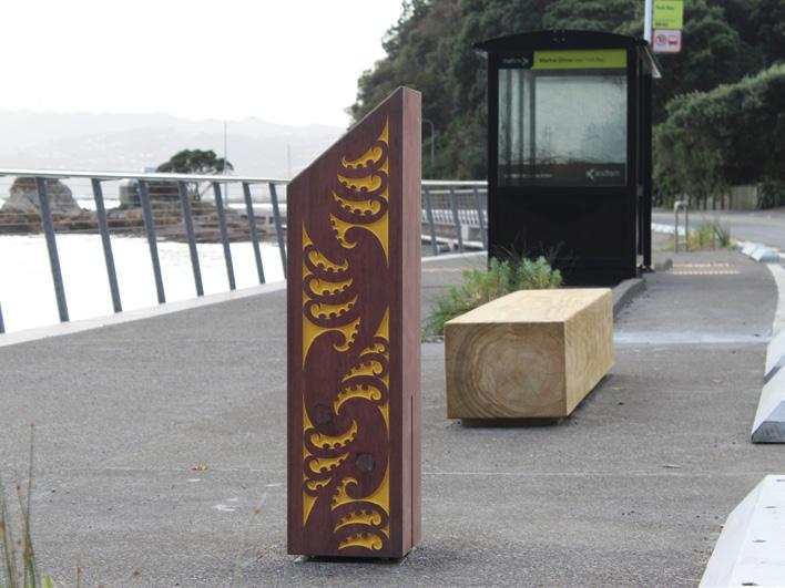
Interpretive elements along the route also hint at the cultural narrative behind the name, connecting the physical journey with the deeper story of the land and sea.
At 4.4 kilometres one way, the pathway is ideal for a short outing or a relaxed half-day adventure.
Cycling time: At an easy pace with stops, it took me around 30 to45 minutes one way. Walking time: Most walkers can expect around one to one and a half hours one way, depending
on pace and how often they stop to enjoy the views.
Because the route is relatively short and flat, it’s accessible to a wide range of users, including families and those looking for a gentle coastal stroll.
Arriving in Eastbourne, the path transitions seamlessly into a lively seaside village atmosphere. Cafés, beaches, and grassy reserves provide the perfect reward at the end of the journey.
It’s easy to turn the outing into a longer experience from grabing a coffee, wander along the waterfront, or simply sit and watch the harbour activity.
As a point-to-point route, Tupua Horo Nuku offers several return
options: Ride or walk back the same way as the most straightforward choice. There is public transport as Eastbourne is well served by buses connecting back toward Lower Hutt and Wellington. Then there is ferry connections from Days Bay offering a scenic return across the harbour to Wellington city.
This flexibility makes it easy to tailor the trip to your energy levels and time.
Tupua Horo Nuku is not a standalone project. It forms part of a wider regional push to improve walking and cycling connections, including the broader Te Ara Tupua network linking Wellington and Lower Hutt that is planned to be opened this year.
Together, these projects are reshaping how people move around the region, encouraging active transport while creating new recreational opportunities.
Cycling Tupua Horo Nuku in perfect weather so soon after its opening felt like a privilege. The combination of smooth riding, stunning coastal scenery, and a welcoming atmosphere made for an unforgettable experience.
It’s a pathway that succeeds on multiple levels. It’s practical, providing a safer alternative to a narrow and exposed road. It’s resilient, strengthening the coastline against future storms. And most importantly, it’s enjoyable. It’s a place where people can slow down, connect with the environment, and simply enjoy being outdoors.
For walkers, it offers an easy, scenic outing. For cyclists, a relaxed coastal cruise. For the community, a shared space that brings people together.
And while it may not have an English name, Tupua Horo Nuku hardly needs one. Its identity is already clear it’s a pathway shaped by history, landscape, and the simple pleasure of movement along the water’s edge.
Above left: An aerial view of a completed section.
Below left: A bus shelter, seat and sculpture on the wide track.
PHOTO CONTEST
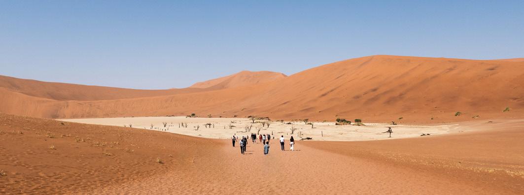
Above top: It is only about a 15-minute walk from the carpark over the crest of a hill, to get your first glimpse of Deadvlei in the Namib Desert, Namibia. Deadvlei is a large bleached white clay pan, with 700-year-old dead black camel thorn trees sticking out, and is surrounded by orange dunes. Photo by Claire Woodhall,, Napier.
Above left: Dawson Fall, Taranaki National Park, Photo by William, Fuller, Russel.
Above right: Despite having a total of 249 years, it didn’t deter us from enjoying 5 days on Glenorchy based tracks. Here we are under the watchful eye of our guide crossing a shingle slide on the Lake Rere Loop track. Never say die! Photo from Vicky Ross, Red Beach
We are looking for the best digital photos each month depicting walking
Now the time to get your digital camera out or look through your digital images and enter the
Walking New Zealand Digital Photo Contest
Two Rangitikei tracks offer rewarding experiences .
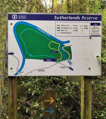
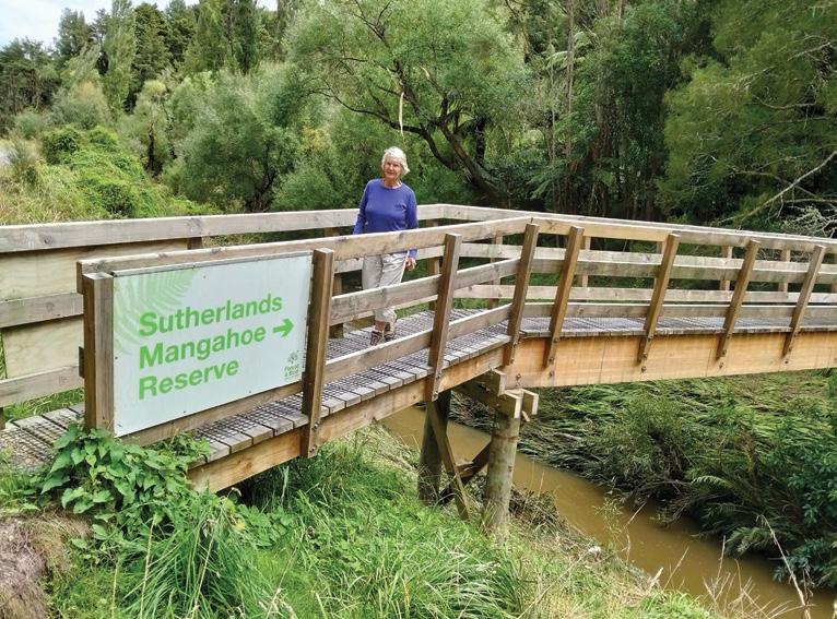
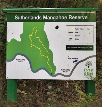
Above left: Sutherland Puriri tracks sign board.
Above right: A footbridge leads into Sutherlands Mangahoe.
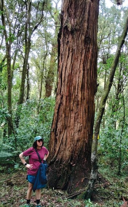
Below left: One of the impressive totara.
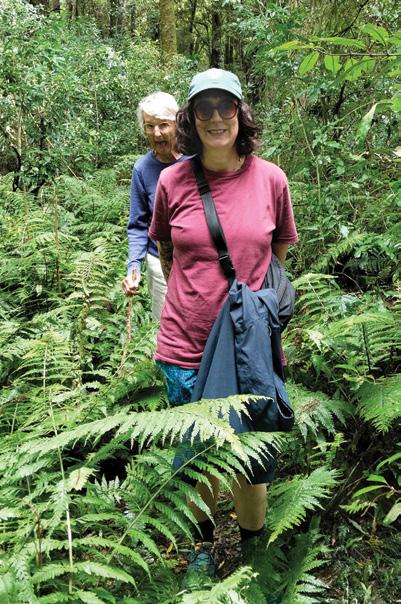
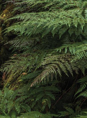
Below right: A fern-fringed track in Sutherlands Mangahoe.
TBy Dave Scoullar
he Turakina Valley near Hunterville has a number of Forest and Bird reserves and two of them, located in close proximity, share similar names.
They are the Sutherland Puriri and Sutherland Mangahoe and both offer interesting and rewarding bush walking experiences.
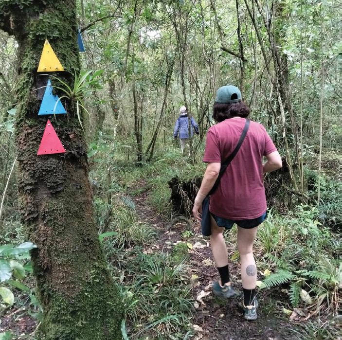
Sutherlands Puriri has 60ha of kahikatea, tawa, kanuka and mapou forest. There are three colour-coded circular tracks ranging from 20 minutes to an hour and 15 minutes. A point of interest is several ancient Maori food storage pits. It is believed that Maori used food from the pits when supplies ran short in the winter.
Bird life includes shining cuckoo, kingfisher and pigeon and populations have been boosted in recent
years through intensive pest control. The harsh screech from the tree-tops of resident sulphur-crested cockatoos may also be heard.
The reserve is located at the junction of Mangahoe and Turakina Valley roads, 20km west of Hunterville. Access is over a stile at the southern-most point of the reserve off Turakina Valley Road.
Sutherlands Mangahoe is 5km
away along Mangahoe Road towards Hunterville. At 12ha it is smaller and has one track that takes around 50 minutes to complete.
The reserve is made up mainly of kahikatea podocarp forest which also includes rimu, rewarewa, matai, miro over an understory of tawa. The many impressive totara are a particular attraction.
Common native bird species include bellbird, tui, grey warbler, fantail, silver eye and pigeon. As with Sutherlands Puriri, pest control has helped bring this forested area back to its former glory. A newlybuilt footbridge over the Mangahoe Stream leads into the reserve.
While well-marked, the tracks in these reserves can be rough and boggy in places and sturdy footwear is recommended. But generally they provide an easy to moderate walking experience. Roadside parking in available but neither reserve has toilet facilities.
Above: Three tracks are colourcoded.
Below left: Sutherland’s Mangahoe sign board.
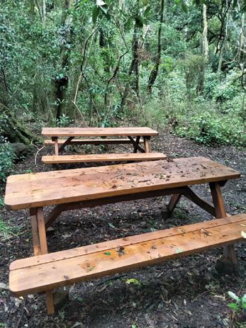
Below right: New seating in Sutherlands Puriri.
* 100% Mini ripstop polyester
* Waterproof, seamsealed, breathable
* Moisture-wicking mesh and taffeta lining
* Elastic waist with adjustable drawstring
* Large leg openings with snap adjustments
* Packs into the rear pocket becoming an 20cm x 20cm pouch
* Machine wash
* Sizes XS-XXXL
* Colour Black
PAK-A-ROO OVERPANTS $69.95 plus $7.00 P&P
England’s Coast to Coast: A Classic reborn as a National Trail
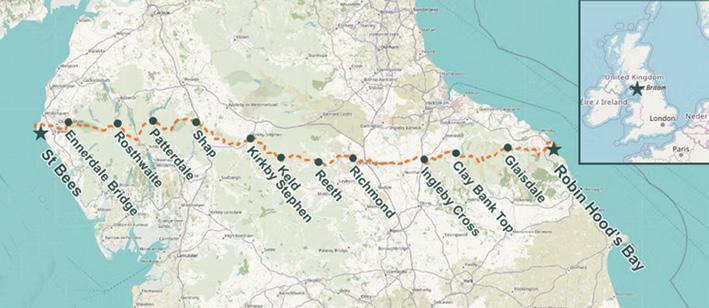
On March 25, 2026, one of Britain’s most cherished longdistance walks stepped into a new era. Alfred Wainwright’s legendary Coast to Coast path stretching 305.7 km from the Irish Sea to the North Sea was officially designated as England’s newest National Trail.
Following a £5.5 million upgrade led by Natural England, the route now combines its much-loved rugged charm with improved access, signage, and conservation measures.
For decades, the Coast to Coast has held near-mythical status among walkers. Unlike many formal trails, it began as a personal vision crafted by the meticulous and passionate Alfred Wainwright in the 1970s. His hand drawn maps and evocative descriptions inspired generations to lace up their boots and traverse northern England from west to east.
Now, with official recognition, the trail is poised to welcome even more adventurers while preserving its unique character.
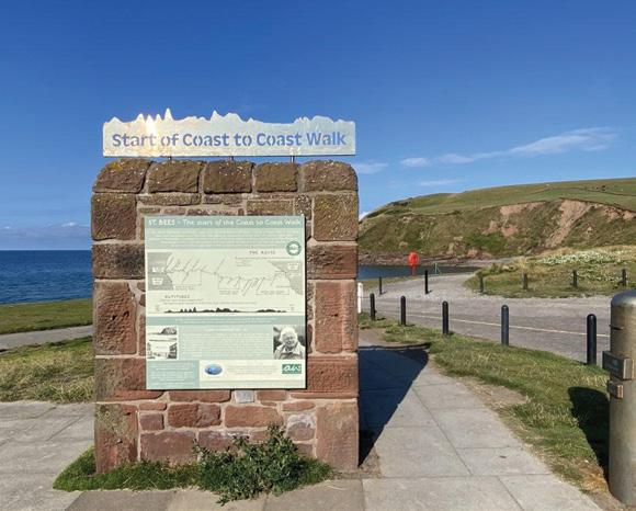
The walk begins at St Bees, where the red sandstone cliffs meet the Irish Sea. Tradition dictates that walkers dip their boots, or at least a pebble into the water before setting off. From here, the trail heads inland, quickly rising into the dramatic fells of the Lake District.
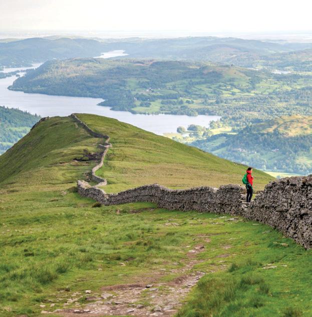
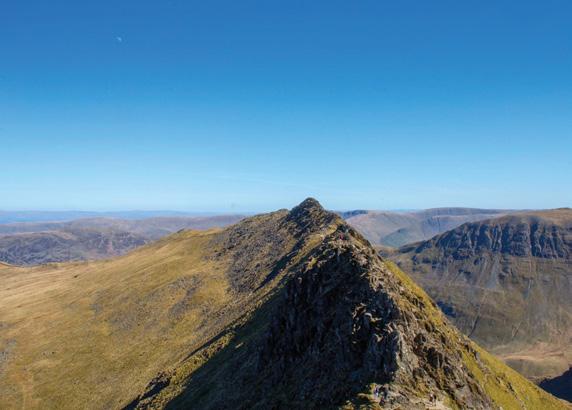
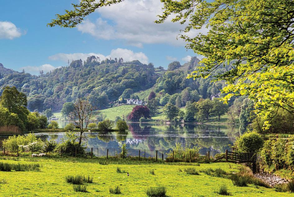
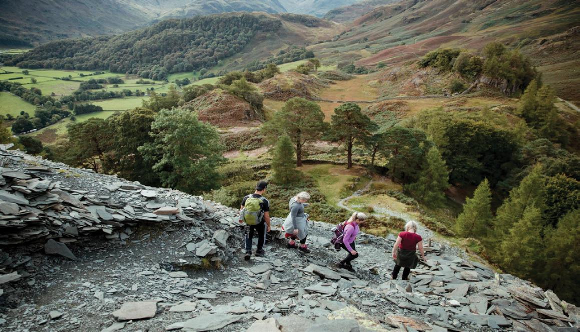
This first section is arguably the most physically demanding and the most visually spectacular. Jagged ridgelines, mirror-like lakes, and sweeping valleys define the landscape. Walkers may choose high-level routes over peaks like Helvellyn or opt for gentler valley paths, depending on weather and experience. Days here are filled with climbs and descents, but also
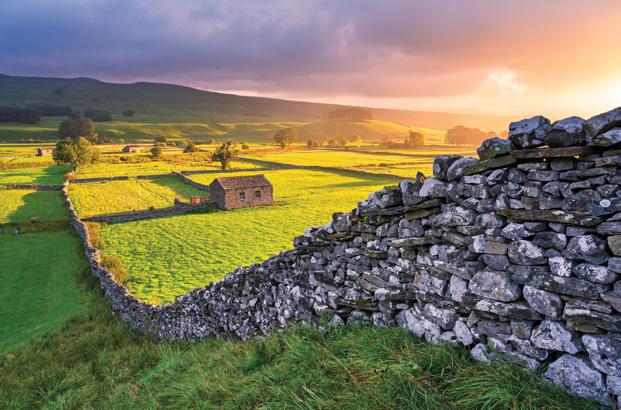
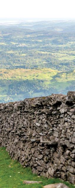
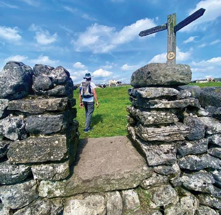
moments of stillness: a lone tarn reflecting the sky, or the distant call of a curlew echoing across the hills. Emerging from the Lakes, the trail softens as it enters the Yorkshire Dales. The terrain here is a patchwork of green fields bordered by dry stone walls, interspersed with limestone outcrops and charming villages.
This is classic pastoral England
Above left: Start of the walk Saint Bees Head.
Above right: The wall of stone in the Lakes District.
Below left: The dry stoned wall with a traditional barn in Dales National Park
Below right:The hill at Helvellyn . Opposite page above right: Beautiful Lake Grassmere in English Lakes District. Below right: Barrowdale from Castle Gragg.
gentle on the legs compared to the Lakes, but rich in atmosphere. Villages such as Keld and Reeth offer welcoming pubs, cosy accommodations, and a chance to connect with fellow walkers. It’s here that the social fabric of the Coast to Coast becomes evident: shared stories over a pint, muddy boots lined up by the door, and a camaraderie forged through shared effort.
The final stretch takes walkers across the expansive North York
England’s Coast to Coast:
A Classic reborn as a National Trail
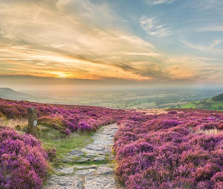
Moors. Wide, open heather moorland dominates this section, with big skies and long horizons creating a sense of solitude and reflection.
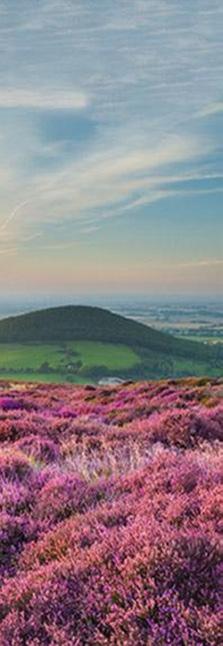
The walking here is less technically challenging but can feel relentless, especially in poor weather. Yet there is a quiet beauty to the moors with the shifting colours of heather, the whisper of wind through grasses, and the occasional sighting of red grouse darting across the path.
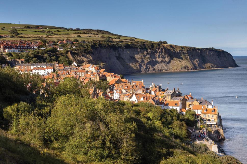
At last, the trail descends to Robin Hood’s Bay. The sight of the North
Sea is both exhilarating and emotional. Tradition again calls for a symbolic gesture like dipping boots into the sea to complete the journey. For many, it’s a moment of triumph, relief, and deep satisfaction.
The new National Trail status brings several enhancements. Waymarking has been standardised, making navigation easier, especially in remote areas. Path surfaces have been improved in erosion-prone sections, and accessibility has been considered more carefully, opening
parts of the trail to a broader range of users.
Importantly, these upgrades have been designed to respect Wainwright’s original vision. The Coast to Coast remains an “unofficially of-
Above top left: An opening in the stoned wall at Dales Way.
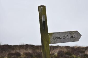
Above left: The Coast to Coast sign. Above right: The colourful flowers on the Cleverland Way
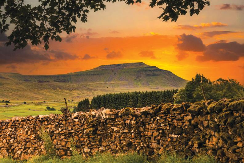
Below left: Sunset with Ingleborough Hill in Yorksire Dales National Park.
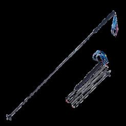
Foldable Hiking Sticks
* 51cm-110cm
* Folds into 4 sections
* Comes with handy bag
* Made from Aviation Aluminium
ficial” route in spirit, flexible, varied, and deeply personal. Walkers can still choose alternative paths, tailor their itineraries, and experience the journey in their own way.
The full route spans 305.7 km, typically completed in 12 to 16 days. Daily distances vary depending on chosen routes and fitness levels, generally ranging from 15 to 25 km per day.
Accommodation options are plentiful, from traditional inns and B&Bs to campsites and bunkhouses. Luggage transfer services are also widely available, allowing walkers to carry only a day pack, an increasingly popular choice.
The track itself varies enormously. In the Lake District, expect rocky, uneven paths and steep ascents. The Yorkshire Dales offer grassy trails and farm tracks, while the North York Moors feature well-defined but exposed routes. Good footwear, weather preparedness, and navigation skills remain essential.
What sets the Coast to Coast apart is not just its landscapes, but its narrative. Each day brings a new chapter of coastal cliffs, mountain passes, pastoral valleys, and windswept
moors. It’s a journey through England’s natural and cultural heritage, stitched together by a path that feels both historic and timeless.
You’ll encounter fellow walkers from around the world, each with their own story and motivation. Some walk to challenge themselves physically, others for reflection or escape. Many return home changed in subtle but lasting ways.
The designation of the Coast to Coast as a National Trail ensures its protection and sustainability for generations to come. With increasing popularity comes responsibility, both for those who manage the trail
and those who walk it.
By maintaining the delicate balance between access and preservation, the Coast to Coast can continue to inspire without losing its soul.
For those who have long dreamed of crossing England on foot, there has never been a better time. And for those who have already walked it, the call to return may be stronger than ever.
From the crashing waves at St Bees to the cobbled streets of Robin Hood’s Bay, this is more than a walk, it’s a pilgrimage across landscapes, history, and the enduring spirit of adventure.
Above right: Robin Hoods Bay the end of the walk.
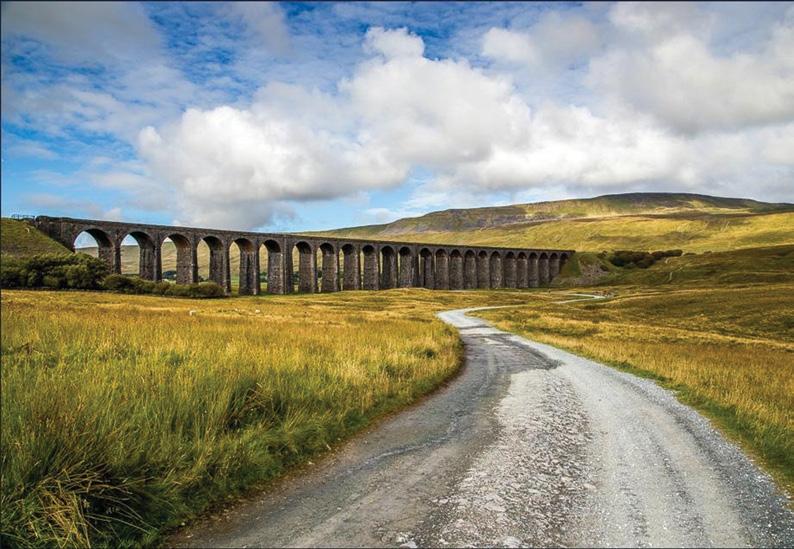
Below right: The Ribble Viaduct stretches across a valley.
New walking experience opened in North Canterbury
High above the braided riverbeds and farmland of North Canterbury, a brand new walking experience was opened in April, up a spectacular slice of hill country that, until recently, few people ever saw.
The Ashley Gorge Skyline Track, perched above the upper reaches of the Ashley Gorge, is a remarkable example of what community passion and persistence can achieve.
After more than a decade of volunteer effort, this elevated route now offers trampers a fresh perspective on a much-loved recreation area.
From the moment you leave the valley floor, the Skyline Track makes its intentions clear: this is a climb with rewards. The route steadily ascends through rugged hill country, eventually reaching heights of nearly 800 metres above sea level.
The full track takes around four
to five hours return, making it an achievable half-day tramp for reasonably fit walkers.
While not technical, the track is a step up from the family friendly loops below in the gorge. Expect a sustained climb, exposed ridgelines, and sections of uneven ground that demand good footwear and a moderate level of fitness.
What sets this walk apart is the sense of space. As you gain height,
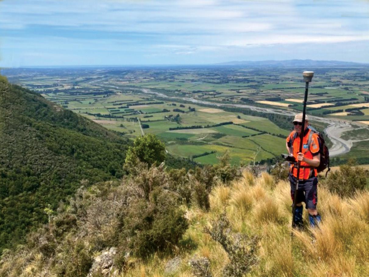
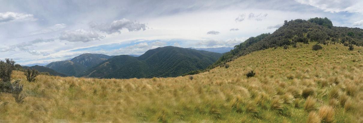
the dense bush gives way to open ridges, and suddenly the Canterbury Plains stretch out in a vast patchwork far below. On a clear day, the views are expansive and deeply satisfying with rolling farmland to the east, foothills rising to the west, and the winding course of the Ashley River / Rakahuri cutting through it all.
The Skyline Track offers a constantly changing landscape. Lower sections pass through regenerating native bush and pockets of forest alive with birdsong. As the climb continues, vegetation becomes more open, revealing tussock-covered slopes and rocky outcrops.
The real highlight, however, is the panoramic ridgeline walking. From here, the sensation of being “on top of the world” is unmistakable. The Canterbury Plains seem to go on forever, while the surrounding hill country rolls away in waves. Early
morning or late afternoon light adds a golden hue to the landscape, making this an especially rewarding time to walk.
Keep an eye out for native birdlife along the way, and pause often as the views are worth it.
One of the most compelling aspects of the Skyline Track is its story. This is not a heavily engineered Great Walk, but a labour of love built largely by local volunteers. Over the past decade, thousands of hours have gone into cutting, marking, and maintaining the route.
Materials were flown in by helicopter and then hauled into position by hand, with volunteers installing markers and shaping the trail across challenging terrain. In total, more than 15,000 hours of community effort have gone into developing the wider Ashley Gorge track network.
The result is a track that feels authentic and grounded in its landscape that is a route created by people who know and love this place.
While Canterbury is known for iconic walks in the high country and national parks, the Ashley Gorge Skyline Track offers something different. It is a readily accessible hillcountry adventure with big views and a strong local story.
It bridges the gap between short scenic strolls and full alpine tramps, delivering a satisfying climb without
requiring technical skills or overnight gear. For many walkers, it will become a go-to option for a rewarding halfday outing.
Most importantly, it stands as a testament to what communitydriven conservation and recreation can achieve. What was once a vision has become a tangible, walkable reality and one that invites visitors to quite literally rise above the landscape and see Canterbury from a whole new angle.
For those willing to put in the climb, the reward is simple: space, solitude, and a skyline that feels entirely your own.
Getting there
The Skyline Track is located about one hour’s drive from Christchurch, making it an easy day trip.
To reach the start:
Head north from Christchurch to Rangiora
Continue inland towards Oxford
Follow signs to Ashley Gorge
Parking is available near the popular recreation area at the gorge, close to picnic grounds and existing walking tracks. From there, signage directs walkers to the Skyline Track access point.
The lower Ashley Gorge area is already well established, with facilities such as toilets, picnic areas, and short walking tracks, making it a good base before or after tackling the skyline route.
Above left:The view of North Canterbury from the Ashley Gorge Skyline Trail. Photo by Ashley Gorge Tracks Group.
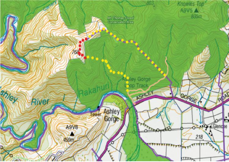
Above right: Map of the trails. Red dots: Walking easement over prrivate land where the trail reaches the open skyline. Yellow dots Trail within scenic bush on DOC land and along uniformed legal road connecting to existing trails. Photo by Ashley Gorge Tracks Group.
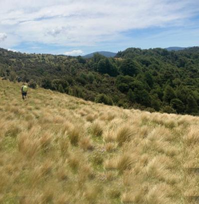
Below left: Looking up the Ashley Gorge Skyline Trail. Photo by Ashley Gorge Tracks Group.
Plenty of variety on Branch Road Walkway
TBy Dave Scoullar
he 6km Branch Road Walkway in the Pohangina Valley, 16km from Ashhurst, has charm and history and is considered to be a relatively easy walk. It follows the route of an abandoned road linking Pohangina Village with Ridge Road. When Branch Road was closed in
the 1960s the locals stepped in to maintain it as a beautiful walkway From Ridge Road, the entry point favoured by many walkers as the track goes downhill, the first 3km is through open farmland offering extensive views of the valley below
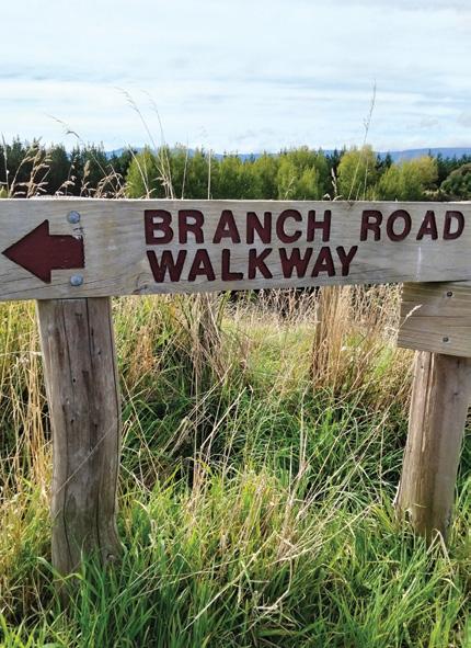
Above left: Sign at Ridge Road. Above right: Starting the downward path.
Below left: Descending through pines.
Below right: The walkway is wellmarked.
and out to the Ruahine Ranges. The track then crosses into a mud-prone native bush section with tree ferns, black beech and many regenerating shrubs before winding through pine plantations and exiting into Kuku Road in the Pohangina village.
Adding to its scenic qualities, Branch Road has an interesting history as the missionary/explorer William Colenso with two guides followed this old Maori route on a trek from Hawke’s Bay to Lake Taupo in 1848.
The well-padded track with clear signage goes through some private land but no permission is needed. Mostly wide, there are some narrow places with drop-offs, so care needs to be taken. There are information boards at each end of the walkway and a number of seats and stiles along the way.
Walking at a leisurely pace most people should be able to complete the downhill section in about 90 minutes. Coming up from Pohangina Village there are few short steep sections and an elevation gain of
about 285m and this may take about two hours. It is recommended that transport be arranged to drop you at Ridge Road, if you do not want to walk both ways. There is a small parking area at Ridge Road and at the bottom you can park in the Pohangina Recreation Reserve. Toilets
are available in the village.
No dogs are allowed on the track which is closed in September and October for lambing.
Above right: Valley and Ruahine views
Above left: Taking a rest on one of the seats
Below right: Crossing one of the stiles.
Waiheke Island shows off its history,
WBy Barbz Lowther
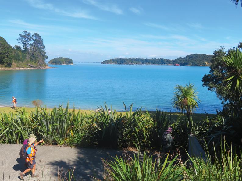
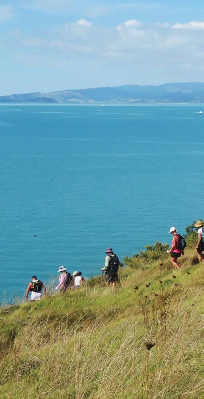
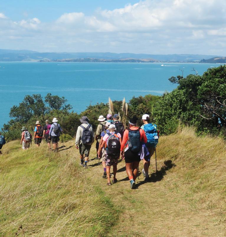
aiheke has done it again. Although we were only there for three days of the Waiheke Island Walking Festival, we discovered new tracks and bays we hadn’t seen before, learnt lots about the history of Waiheke and saw some amazing sculptures.
Waiheke continues to impress. Every time we visit, there seem to be more tracks, linking roads to stands of bush, with lovely bird song, and on to secluded little bays. It is well marked and easy to explore.
Our first walk this year was a historical Discovery of Te Whau, led by Ian Burrows. It was fascinating with a mix of early Maori from the 1300’s and European from the 1840’s.
Above left: Island Bay.
Middle left: Crossing the stream at the end of Okoka Bay.
Below left: A little bit of road walking with lovely views
Island Walking Festival history, tracks and birdsong
Apart from the history, the Te Whau coast itself is rugged and beautiful, with walking tracks all through. Whakanewha Forest, which is the largest area of native bush on Waiheke, that covers much of it.
Here you can find the biggest bird population, due to an extensive trapping programme. We were shown different types of bait traps. Fences have been built especially to entice stoats into a trap. They seem to be working, because it is estimated that only six stoat families remain on Waihehe.
In the 1300’s Te Whau was covered in native bush. In the 1840’s land was bought from the Maori and cut into smaller blocks. The only way in to this area was by boat, horseback or walking, until 1956, when the road was built. The first baches built are now 100 years old.
Our walk today was an inter -
Above left: Awesome views as we walked down to the coastal track.
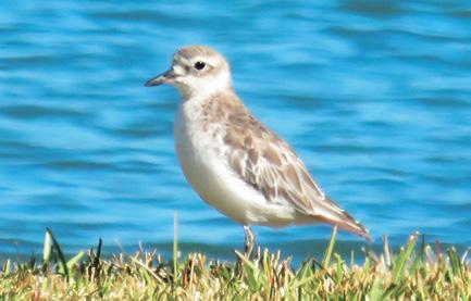
Above right: A Dotterel
Below right: Houses nestled into the landscape.
esting mix of road, beach, and bush tracks seamlessly integrated. Meeting at Rocky Bay (Omiha) Hall, we walked to Kuakarau Bay, where godwits fly in from Alaska during September and October each year, returning to the Arctic to breed in March.
Continuing along the trail into
Whakanewha Forest, we walked through a nikau grove. These lovely trees can be easily dated by counting their rings three to four a year).
These trees were 15 to 20 years old. There were lots of karaka, horopito, kawakawa, rangiora and ferns, with puriri and pohutukawa towering above. Widow-makers (kahakaha) perched on their branches and rata twined around the tall trees.
We heard several kereru. Continuing on a section of road, we had views, over Putiki Bay, to a community who have made houseboats their homes for over 40 years.
We looked over to Maori Hill (Te Potiki o Kohu) the second largest pa site on Waiheke. Fifty pa sites were built between 1500 and 1700, but in 1821 Honeheke attacked the island forcing Ngati Poua to abandon the island for about a decade.
Walking up Margaret Reeves Drive, with stunning views all the way, we soon reached Dead Dog Bay (Okoka) where the boat
Waiheke Island Walking Festival shows off its history, tracks and birdsong
by David McCracken stands. We watched dotterels and oyster catchers and looked for banded rail in the wetlands nearby. !n 1844 Charles de Witt, the Belgium Consul bought land here, planning to relocate belgiums during the 1845 famine.
He was unsuccessful, but there are still several belgium street names on Waiheke. His house, built in 1844 and enlarged in 1860, is one of the oldest remaining. It is unique in having kauri walls 30cms thick, stuffed with shells. While gazing at the house, we met the current owner who has lived there for 10 years.
At the end of the Bay we crossed a stream, and took a steep path to vintage lane to avoid wet feet around the headland. Ian had gained permission for us to walk through private property to access Wharetane Bay. Middens found on this beach confir m that people were eating shellfish here between1381 and 1584. Following green and yellow poles,
sculpture
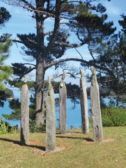
Above left: Walking past Hinemoa Bay (Te Akai o Hine) named after Hinemoa Elder. Above right A kereru Below left: The boat sculpture by David McCracken. Below right: Rocky Bay (Omiha) Hall, first built in 1918 and about to be restored.
we walked from the Bay to Rothschild Terrace, and another interesting snippet of history, that the Rothschild family built a house here as a” Bolt Hole” during the cold war.
When the place sold there were plans for town houses, helipads and the like, which luckily never happened. In 1990 zoning was given for low density residential plots.
Our last section was along another coastal trail, past Hinemoa Bay (Te Akai O Hinemoa) named after Hinemoa Elder. We returned to Kuakarau Bay in just under four hours, and the local bus arrived 10 minutes later to take us back to Oneroa.
It was a really interesting and informative walk, with stunning views, beautiful bush, lovely bird song, pretty bays, good company and perfect weather. Thanks Ian.
The next day we explored the north west section of the Te Ara Hura Trail, from Matiatia. Again, it was a mix of bush tracks, road walking and beach wanders, all beautifully joined together to create a loop as long as you chose, from 30 mins to several hours.
At regular intervals, signs led on different tracks, back to Oneroa, and several runners passed us, on their daily circuit.
After walking over the reserve at
Matiatia, we crossed the footbridge and climbed well graded wooden steps towards Church Bay. In a short time we had expansive views of the Gulf of Auckland city, Rangitoto Motutapu, Motuihi, Rakino, The Noises and Great Barrier. It was stunning. Continuing along the tops, we passed several amazing houses, and impressive sculptures, all of which seemed to fit into the environment. The trail was a mix of open path and pockets of bush, both beautiful.
In about two hours we reached Church Bay that is a long expanse of golden sand.
A football field and a shearing shed showed that we were near a road, but we felt miles from civilisation. It was so quiet and tranquil with only the sound of waves, moving sand and birds.
After wandering along the bay we climbed a steep slope to meet the track to Cable Bay. Signs led us up beside grape vines to a bush track, to Te Rere Pt at the north end of Cable Bay. Our next section was road walking on Cable Bay Lane and Walter Frank Drive to a little bush track down to Te Wharua Bay. This was a new discovery for us, so we stopped for a swim.
Moving along the beach, yet another bush track took us up to Church Bay Road, which led to a beautiful
Above left: and middle:Sculptures near Oneroa.
Above right: Sculptures on the headland.
Below right: Walking a section of the Te Ara Hura Trail in the north west of Waiheke .
Waiheke Island Walking Festival
stand of broadleaf forest with wide leaf strewn paths, the dappled light high-lighting the ferns underneath. We soon reached a trig with remarkable views over grape vines, Oneroa and the gulf beyond. We took the trail down through grasslands to Cable Bay Winery, walked the last 15 minutes back to Oneroa on the road, and ended our day with a swim.
It was such an interesting mix of lush, beach, and easy road walking, and could easily be shortened or lengthened at any time. There are so many trails.
On our last day we joined a sculp-
ture walk led by Fiona Blanchard, Director of Waiheke Art Gallery and Sculpture on the gulf. We met in Alison Park in Oneroa, and Fiona took us on a section of the Te Ara Hura trail in the north east of the island. We saw awesome sculptures and magnificent scenery, and found another bay we hadn’t seen before called Island Bay. This walk ended at the art gallery, another impressive display. It was a lovely ending to three days on Waiheke.
Waiheke is like an enormous outdoor art gallery with so many magnificent sculptures displayed in the most unlikely places such as parks, reserves, bush clearings, bays and beaches, headlands and private gardens. They turn the trails into a treasure hunt for both natural and man-made beauty.
If you haven’t been to the Waiheke Walking Festival, it’s one to put on your bucket list. it is so easy to reach, and with an excellent bus service to get around. If you don’t want to drive to Auckland, take the train from Hamilton.
Above left: Following a zig zag path up through grassland.
Above right: Pulling out Milkweed which can be quite invasive..
Below right: Steps leading down to Island Bay, near Oneroa.
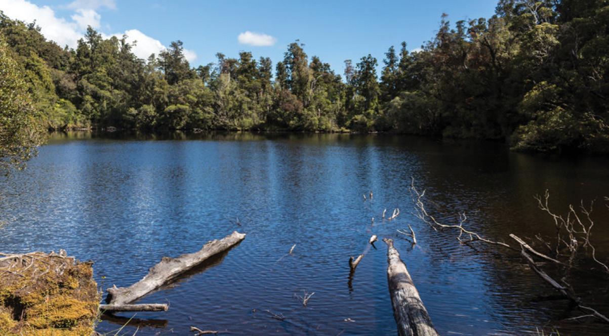
Lake Wombat Walk an enchanting forest trail
The tranquil beauty of the Lake Wombat Walk, is an enchanting forest trail nestled near Franz Josef Glacier in our stunning Westland region.
This easy, approximately one hour and 30 minute, loop track offers a refreshing escape into an ancient rainforest.
Here you can discover the serene waters of Lake Wombat, often described as a ‘tarn’, which uniquely formed 9,000 years ago by the powerful Franz Josef Glacier. It sits dramatically below the impressive 1300-metre peak of Alex Knob, offering glimpses of its grandeur.
Lake Wombat Walk is celebrated for its incredible native birdlife and lush flora. Listen for the melodic calls of the bellbird and tui filling the air, watch the friendly fantails
flit around, and spot the subtle grey warbler. What truly sets this track apart, as highlighted by Franz Josef DOC staff, is its often-overlooked abundance of native plant life.
There are the seasonal wonders like the vibrant Easter Orchids, which are not only visually stunning but also emit a delightful vanilla-like fragrance when in bloom, adding an unexpected aromatic layer to your forest adventure. Perfect for nature enthusiasts, birdwatchers, and families seeking an accessible yet profoundly immersive New Zealand rainforest experience.
The Lake Wombat Walk offers a peaceful escape and a deeper connection to the wild heart of the West Coast, making it a must-do among Franz Josef walks.
The lake is named after Jack Irwin,
alias Wombat Jack, who sluiced for gold in the area in the 1800s. Fact file
Duration: one hour 30 min Distance 3.8 km return via same track Intensity Easy: Walking track: Type Family Friendly, Half Day (up to four hours
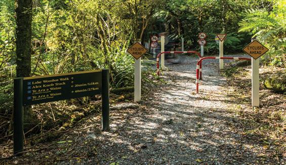
Getting there: Drive or walk south from the Franz Josef Waiau township across the Waiho River bridge and turn left onto the Glacier Access Road or Te Ara a Waiau.
Drive or walk for approximately 2 km to where the Lake Wombat Walk begins, signposted on the right side of the road.
Above Lake Wombat in the West Coast.
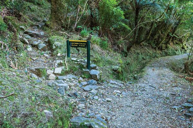
Below left and right: Signs on the Lake Wombat walk. .
Walking Clubs Groups
NORTH ISLAND
NORTHLAND
BAY OF ISLANDS
BAY OF ISLANDS WALKERS: Saturday (AM), Jacqui Watson 022-6019741, Roz Whittaker 021-063-1455
DARGAVILLE
DARGAVILLE TRAMPING GROUP: Last Sunday of month (AM), Lynley Thompson 021-102-3974, colvilleestate1@gmail.com
WHANGAREI
CARDIAC CARE WALKING GROUP: Wednesday (AM or PM), Jo or Hugh Knight 09-438-7976
BARRIER TRAMPING& BEER LOVERS CLUB: Sunday, John Brock 09-429-0211
AUCKLAND
AUCKLAND GLOBAL TREKKERS: Sundays (BIA), Auckland walks and one overseas walk, auckland.global.trekkers@gmail.com, https:// heylo.group/aucklandglobaltrekkers
BLUE TOP WALKERS: Henderson, Tuesday, Thursday (AM), Terry Wilson 09-814-9523 or 021-266-1071, terryandsheena@gmail.com, www. bluetopwalkers.weebly.com
FIA OLA WOMEN’S DEVELOPMEMT WALK GROUP: Monday to Saturday, Anne, 09-813-0021
FIT4LIFE: Glenfield, Monday (PM), Friday (AM), Sarah 021 534 649
TE ATAU PENINSULA WALKERS: Monday, Friday (AM), Wednesday (PM), Mary Jones 09-834-6989
TE ATATU SOUTH ACTIVE 35+ WALKING GROUP: Te Atatu South, Wednesday, Edna, 09-834-1401
THE HAPPY WANDERERS WALKING GROUP: Wednesday (AM), Joy Williams 09-817-2464 or 027-353-3434
TITIRANGI TWILIGHT WALKERS: Tuesdays, Thursday, (PM) Titirangi Library, Wednesday (PM) Glovers Real Estate Green Bay, Louise 021437-547, louisenicholson@xtra.co.nz
TITIRANGI WALKERS: Sundays (AM), John Harris 09-627-0099, jeanah@ihug.co.nz
EAST COAST BAYS WALKERS: Browns Bay, Tuesday, Friday (AM), Pam Mattson 09-302-4882 or 021-268-4154, pam_4882@yahoo.co.nz
GREENHITHE WALKING GROUP: Greenhithe, Tuesday (AM), Marjorie Andrew 09-413-9065
HIGHBURY COMMUNITY HOUSE: Highbury, Thursday, Friday (AM), Judy Mayn 09-480-5279
MAIRANGI WALKING NETWORK: Mairangi Bay, Everyday (AM), Paula Cole 09-444-6435
MILFORD MALL WALKERS: Greenhithe, Tuesday, Thursday, (AM), Carol Mosedale 09-443-2054
MILFORD MENS PROBUS: Ian Hall 09-479-4259
NORTH SHORE DIABETES SUPPORT GROUP: Every second Sunday (AM), Dave or Panny 09-476-7447
NORTH SHORE SOCIAL WALKING GROUP: Every second Wednesday, Rosamonde Johnson 022-308-8975, rsmndj@gmail.com
NORTH SHORE TRAMPING CLUB: president@nstc.org.nz, www. nstc.org.nz
NORTHCOTE WALKING GROUP: Northcote, alternative Tuesdays,
LEGEND
Fitness levels: “B” beginner, ”I” intermediate, “A” advanced. (AM) denotes morning walk, (PM) denotes an afternoon or evening walk. Group co-ordinators are asked to please advise us of any updates by fax 06-358-6864 or email walkingnz@xtra.co.nz.
KELVIN GROVE WALKERS: Tuesday (PM), (I), Marjory Edmonds,
Notice to clubs and walking groups
If you notice there that the times, names or contact numbers etc on the list of Walking Grroups in the Directory on these pages needs updating please email us at walkingnz@xtra.co.nz. These are are free listing.
LEGEND
Fitness levels: “B” beginner, ”I” intermediate, “A” advanced. (AM) denotes morning walk, (PM) denotes an afternoon or evening walk. Group co-ordinators are asked to please advise us of any updates by fax 06-358-6864 or email walkingnz@xtra.co.nz.
LAMBDA DAY TRAMPERS: every second Sunday, (BI), social group for gays and lesbians of all ages, https://lambdatrampers.org/ LINWOOD AVENUE WALKING GROUP: Wednesday, Thursday (AM) (B), 03-389-5303
PIONEER TRAMPERS:Thursday (AM) (IA),4-5 hour tramps in Banks Peninsula and the hills and lower mountains from Mt Hutt to Mt Grey, pioneertrampers@gmail.com
ALEXANDRA HARRIER & WALKERS CLUB: Saturday (PM), April tOctober, John Thompson 03-448-7244, www.alexharriers.co.nz
MOSGIEL
Notice to clubs and walking groups
If you notice there that the times, names or contact numbers etc on the list of Walking Grroups in the Directory on these pages needs updating please email us at walkingnz@xtra.co.nz. These are are free listing.
9 Tough Gal Team Challenge: Auckland, Kumeu, Auckland
16 Run Auckland: Farm Cove, Pak-
The H215 Professional 4 Function Pedometer
The H-215, 4-function pedometer is a superb, reasonably priced pedometer that counts steps, calculates distance, calories burned and has a 12/24 hour clock.
This is the model that has sold over a quarter of a million worldwide. It has the largest display of any pedometer we tested and is very accurate.
Dimensions: (L) 5.6 * (W) 3.7 * (t) 2.7 cm
Price only $36.95 plus $7.00 P&P
Phone 0800-925-546 for bulk prices
Available now from:
Walking New Zealand Shop
47 Lincoln Tce, Palmerston North - Phone 0800-925-546 Fax 06-358-6864 or email walkingnz@xtra.co.nz. www.walkingnewzealand.co.nz
uranga, Auckland
22 Sprig & Fern 10K: Brightwater
23 Forest Run Fest, Bottle Lake Forest, Christchurch
26-29 Great Naseby Water Race, Nasby Foorest Park, Nasby
29 Kaitaia Trail Run/Walk, Te Hiku Forest, West Coast Road, Kaitaia
29 Mount Maunganui Half Marathon, Mt Maunganui
30 Auckland Trail Run & Walk: Waitawa, Waitawa Regional Park, Auckland
30 The Lake Dunstan Trail Marathon, Clyde to Cromwell
SEPTEMBER 2026
5 Canterbury Adventure Race, Canterbury
5 Dovedale Hill Race, Dovedale
5 Kinloch Off Road Challenge, Kinloch, Taupo
5 Laps at the Lakes, Pauanui, Coromandel Peninsula
5 Scenic Circles Backyard Ultra, Timaru
6 North Shore Marathon, Milford, Auckland
Great walks and rides
Waiotahe Trail
Pakihi Track
12 Motueka to Māpua Relay, Motueka, Tasman District
12 Peak to Pub, Mt Hutt Ski Area, Canterbury
12 Tongariro River Trail, Turangi
12 Wainuiomata Hill Run, Wainuiomata, Lower Hutt
13 Emerson’s Dunedin Marathon, Dunedin
13 Run Auckland: Millwater Estuary, Milford, Auckland
12 Stanley Bay Mud Run, Stanley Bay, Auckland
13 Whangarei Run/Walk Festival, Whangarei
19 Merrell Race Tekapo, Cnaterbury
19 Queen Charlotte Relay, Picton to Havelock, Marlborough
19 Te Āpiti Traverse, Woodville
20 Brighton Backyard Ultra, Brighton, Dunedin
20 Hutt Marathon, Petone. Hutt Valley
20 Terry Fox Run: Auckland, Flat Bush, Auckland
20 Terry Fox Run: Christchurch, Hagley Park, Christchurch
25 Spring Challenge Adventure Race, Hanmer Springs
30 New Zealand Walks: Heaphy Track and Oparara Arches
33 New Zealand Walk: Lou’s Lookout Walk
34 New Zealand Walks: Wandering along the Waika to River Trail from the dam to Jones Landing
38 New Zealand Walk: A’Deanes Bush Walk through an original existing forest
42 Coming Events: New Zealand
46 Coming Events: Australia
48 New Zealand Country Breaks
52 Pak A Roo Walking Jackets
SEPTEMBER 330 2025
3 Contents 4 Walk Talk
6 New Zealand Walk; Short walks at Lake Brunner
8 New Zealand Walking Festival: Wairarapa Walking Festival has over 25 walks
10 New Zealand Walk: Makotuku Track has wide appeal
13 Need2know: 7000 steps a day now achievable for most people
14 New Zealand Walk: A wander along the Karangahake Gorge
18 Weather: Weather prediction for September
19 New Zealand Walk: Track repair confirmed for Waimata Gemstone Bay
20 New Zealand Walk: Cape Saddle Walk: A valley to valley walk in Craigieburn Forest Park
24 Walking New Zealand Monthly Photo Contest
26 High Achiever: Raukumara Hikoi to view work done on the ranges
29 Australian Walks: Forest Sky Pier, Orara East State Forest offers great coastal views
30 Te Araroa Trail: How walkers donation have helped the Te Araroa Trail
32 News: 100 years of history with the Auckland Natural History Walking Group
34 New Zealand Walks: Walks in Winsome Wairarapa
36 New Zealand Walk: Walking fron the Woodville end to Ashhurst to first lookout
40 Directory of New Zealand Walking Groups
42 Coming Events: New Zealand
46 Coming Events: Australia
47 Coming Events: Rest of World
48 New Zealand Country Breaks
52 Pak A Roo Walking Jackets
AUGUST 329 2025
3 Contents
4 Walk Talk
6 New Zealand Shared Pathway: Te Ahu a Turanga Manawatu to Tararua a journey from Ashhurst to Woodville
10 New Zealand Shared Pathway: Build the Path
11 New Zealand Walk: St Leonard’s Beach dog friendly
14 New Zealand Walk: Kurow Hill Walk an unique experience
18 Weather: Weather predictiofor August
19 Viewpoint: Reinstate the competitive walking section: Why Auckland Marathon must listen to walkers
20 New Zealand Walking Festival: Bay of Islands Walking Weekend
23 Living Streets Aotearoa: Do you do this?
6 New Zealand Walk: Switch off at Port Jackson
26 New Zealand Walk: Walk to Blyth Hutt - popular Tongariro National Park walk
30 New Zealand Walk: Okere Falls
15 New Zealand Walk: The Great Dripping Loop walk
18 Weather: Weather prediction
24 Walking New Zealand Monthly Photo Contest
29 High Achiever: Northland engineer wins Outdoor Access Champions Award
30 New Zealand Walk: Hinehopu Bluffs for lots of native trees and birdlife
33 New Zealand Walk: The Terrace Walk at Franz Josef
34 New Zealand Walk: Karituwhenua Stream Walk a short family walk
36 New Zealand Walk: Omarama’s Clay Cliffs has an unique landscape
39 Auckland Walk: A walk or bike ride through Logan Park Reserve:
40 Directory of New Zealand Walking Groups
42 Coming Events: New Zealand
48 New Zealand Country Breaks
52 Taupo Marathon JULY 328 2025
3 Contents
4 Walk Talk
6 New Zealand Walk: Tawa Loop Walk - a blend of natural beauty
10 New Zealand Trail: Access easements are the foundation of Kawatiri Coastal Trail
12 New Zealand Walks: Nine DOC huts for the first timer
14 Walking Tours: What is Footsteps
17 High Achiever: Dunedin track builder wins national award
18 New Zealand Walks: Wairakau Stream Walk included a climb up the Duke’s Nose Peak
22 New Zealand Trails: Sign of the Vimes: new Marlborough Vineyard Trail:
24 Walking New Zealand Monthly Photo Contest
26 Overseas Walks: The wild West Coast Trail on Vancouver Island
29 Subscription page
30 New Zealand Walk: Inglewood Walkway a popular community asset
32 New Zealand Walk: McClaren Falls Park has lots of easy walks
36 Australian Walks: Ten best walks and hikes in Tasmania
42 Coming Events: New Zealand
46 Coming Events: Australia
47 Coming Events: Rest of World
48 New Zealand Country Breaksp
52 Pak A Roo Jackets JUNE 327 2025
3 Contents
4 Walk Talk
6 New Zealand Walk: Walking on Waiheke enjoying bird song
11 New Zealand Walks: Unveiling the beauty and history of the Nydia Track, Marlborough Sounds
14 New Zealand Walks: Wandering through wonder a walk in the Hamilton Gardens
17 Australian Walks: Outstanding odyssey in Oz with some great walks in South Australia
20 New Zealand Walk: Scotts Beach & Nikau Walk, Karamea
23 Te Araroa Trail: A day walk on the Te Araroa Trail
24 Walking New Zealand Monthly Photo Contest
26 Shared Pathway: Cycling the Kapiti Coast: an Autumn adventure
30 New Zealand Walk: Taieri River Scenic Reserve an interesting walk
32 New Zealand Walk: Te Henui Walkway Extension a little known walk
34 New Zealand Event: Run Tekapo walks with breath-taking views
36 New Zealand Walks: From forest to skyline Walking the Wilds of Puhi Peaks
40 Directory of New Zealand Walking Groups
42 Coming Events: New Zealand
45 Coming Events: Rest of World
48 New Zealand Country Breaks
51 Walking New Zealand Shop
52 Pak A Roo Jackets MAY 326 2025
3 Contents 4 Walk Talk
26 Walking Tours: What’s in the mix for 2026
Falls Walk - Canterbury’s secret canyon walk
19 New
6 New Zealand Walk: Lake Rotorangi Hydro Walkway a little gem
9 New Zealand Walk: Six top Kapiti walks - coastal, scenic and bush worth exploring
12 Waitomo Cycle Trails: Waitomo - a bike walk adventure 14 New Zealand Trail: Ruakuri Scenic Reserve
New Zealand Walk: Washpen
The ULTIMATE is Zerofit’s flagship product and perfect for hiking, golf, sailing or any outdoor activities when it’s cold. But if you are more active it is complemented by the Heatrub MOVE.
Twice as warm as a standard base layer, the material regulates tempertures as you move, so you won’t suffer from cold sweat, if your are running or cycling.
Please visit the Walking New Zealand Shop: https://walkingnewzealand.co.nz/productcategory/apparel/ for more details and to order.