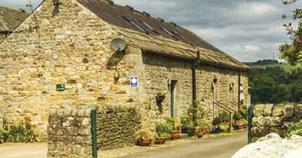
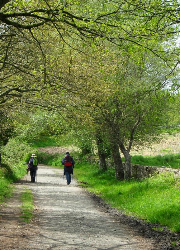
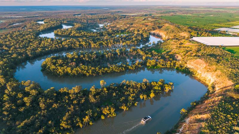
New Zealand Walk: Te Otamanui Walkway, Te Kowhai, has four trail entrances
Book: High Country Huts and Homesteads
New Zealand Walk: Walk the wild west on the spectacular west Auckland track
18 New Zealand Walk: Ohangaturuturu Track showcases park 21 New Zealand Walk: Te Whau Pathway section opened
Walking New Zealand Monthly Photo Contest 24 New Zealand Walks: Seals a feature of walks in the Cape Foulwind area
26 Australian Walks: Eleven great hikes for all ages in New South Wales
30 New Zealand Walk: Giant totara feature of Montgomery Peak Track
32 New Zealand Walk: Lake Okareka - a bird lover’s paradise
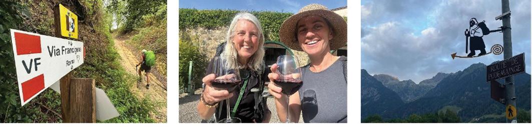
35 Book: The only way is up on foot to Rome
36 New Zealand Walk: A visit to Auckland’s first regional park 60 years on
38 Need2know: Discover your wild backyard - Why use iNaturalist?
39 Need2know: Waipoua Forest embarks on bold expansion
40 Directory of New Zealand Walking Groups 42 Coming Events: New Zealand
Coming Events: Australia
Coming Events: Rest of World
48 New Zealand Country Breaks
50 Index of previous 15 issues
51 Walking New Zealand Shop
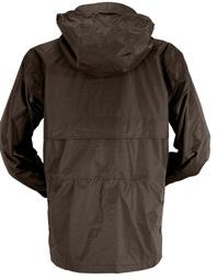
52 Pak A Roo Walking Jackets
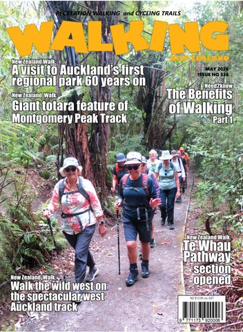
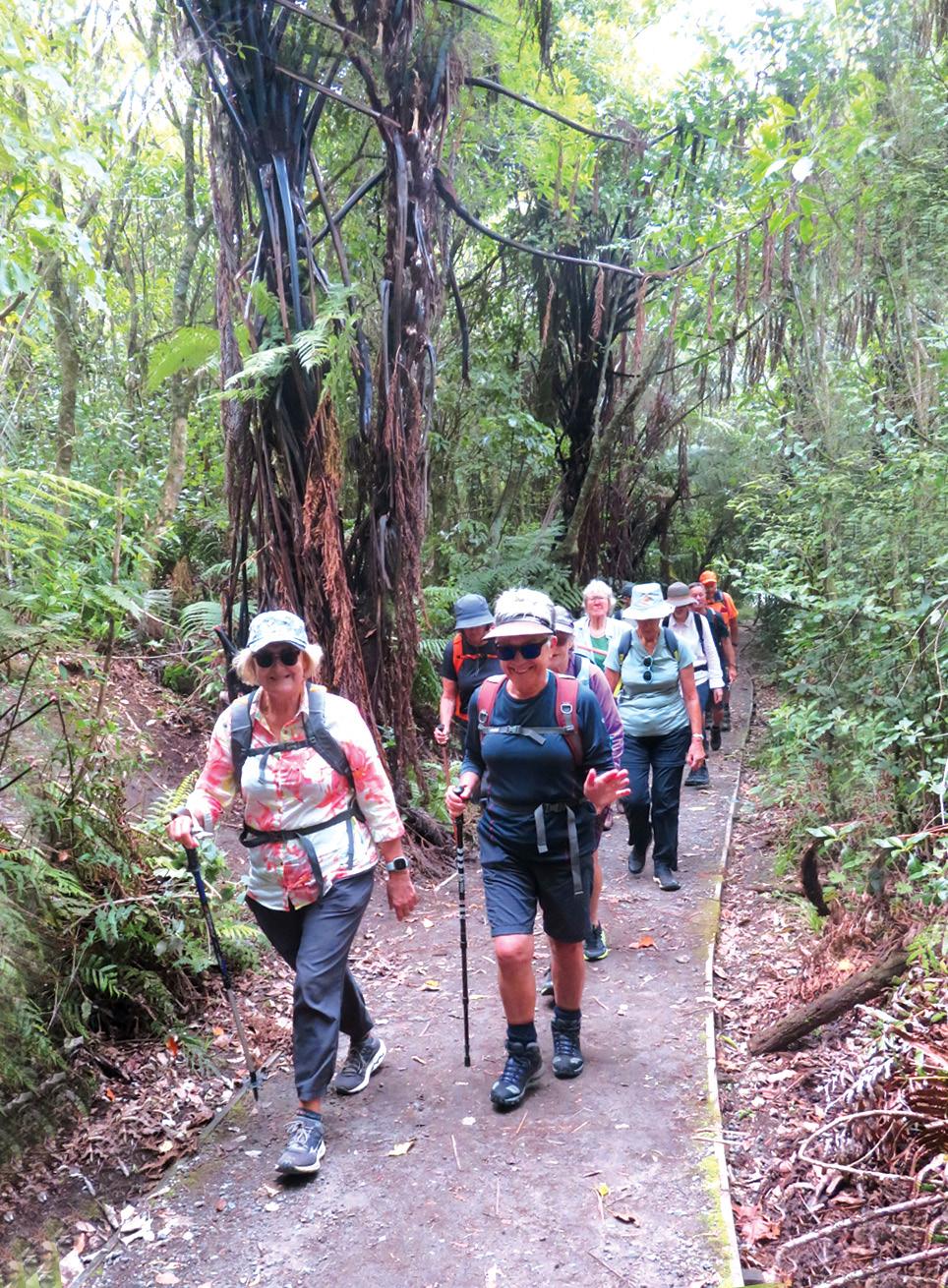
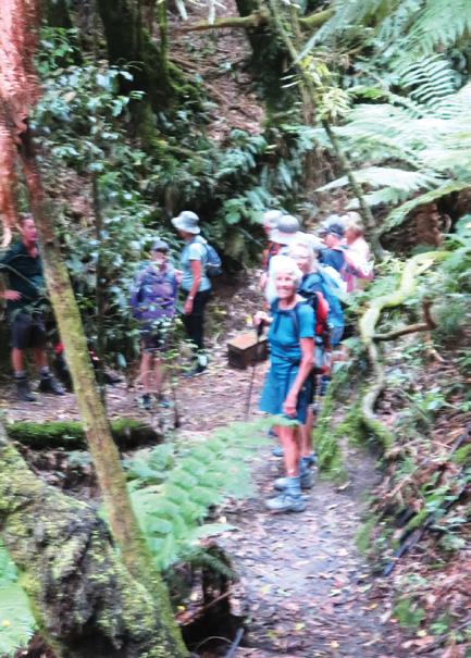
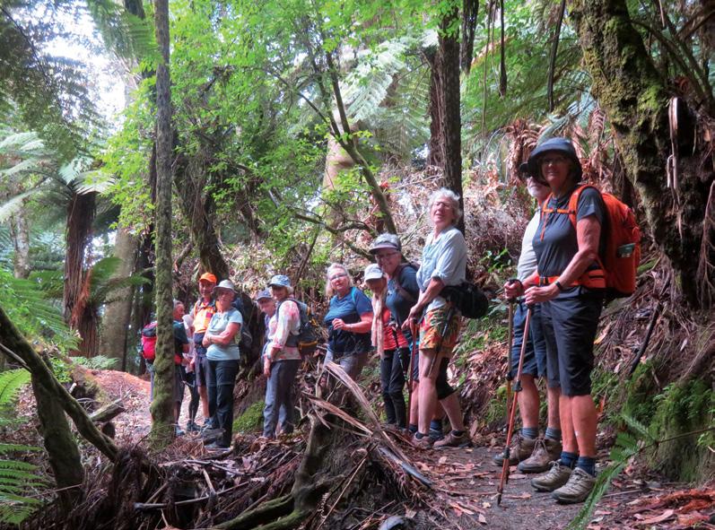
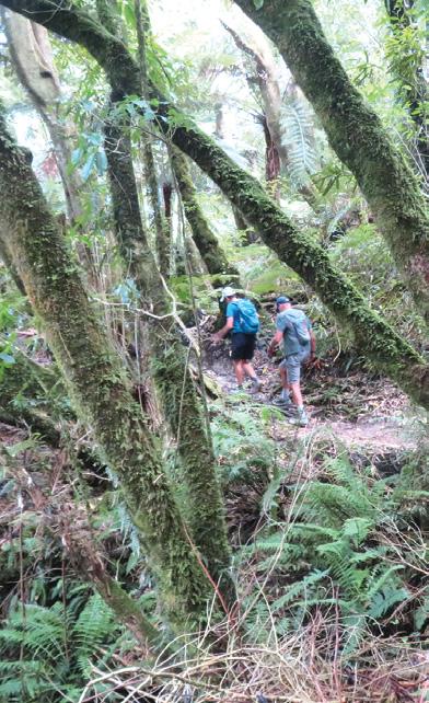
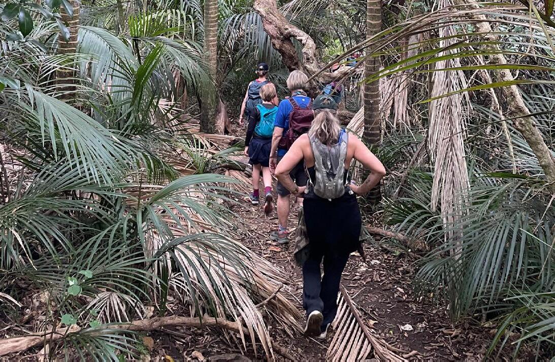
Cover image: Members of the Shoestring Tramping Group walking on a bush track to Boyes Beach on the Lake Orareka Walk. Photo by Barbz Lowther
PUBLISHER/EDITOR: Frank Goldingham MNZM: Phone, 027-274-0726
CONTRIBUTORS: Barbz Lowther, Ken Ring, Phillip O’Donnell, David Scoullar, Ralph Lyon, Ceila Wade Brown, Yvonne van Eerden, Marlene Lynam, and Patrick Quinn
ADVERTISING MANAGER: Frank Goldingham - 0800 walking (925-546) 027-274-0726
Email: walkingnz@xtra.co.nz
COMING EVENTS ADVERTISING: Frank Goldingham 0800-walking (925-546)
Email: walkingnz@xtra.co.nz
SUBSCRIPTIONS: Phone 0800-925-546
SUBSCRIPTION RATES:
WALKING NEW ZEALAND LTD, 47 Lincoln Terrace, Hokowhitu Palmerston North, 4410 Telephones 06-358-6863 - 027-274-0726
Kawatiri Coastal Trail wins Outdoor Access Champion Award
A new trail across one of Aotearoa’s most historic, fascinating and naturally abundant coastlines has won a prestigious national award for championing public outdoor access.
The Kawatiri Coastal Trail in the Buller District has been named a 2026 Outdoor Access Champion by the Outdoor Access Commission.
This award recognises the Charleston-to-Westport Coastal Trail Trust’s decade-long commitment to developing the 40-kilometre Kawatiri Coastal Trail and securing enduring, inclusive public access across one of Aotearoa’s most culturally and ecologically rich coastlines.
Completed in March 2025, the Grade 2 walking and cycling trail stretches from Westport to Charleston, connecting communities, landscapes, stories, and generations.
Wydon Farm Bed and Breakfast
Enjoy a relaxing farm stay at Wydon Farm B&B, a National Trust working farm close to Hadrian’s Wall and the market town of Haltwhistle, known as the Centre of Britain. Wake up to a delicious Northumbrian breakfast made with fresh local ingredients before heading out to explore the surrounding countryside, walking trails and historic sites. Book your stay and see why guests return again and again.
Walking New Zealand digital edition
Walking New Zealand magazine has gone digital on our own website. Viewers can read through the lastest issue for only $3.95 an issue, paid by credit card before viewing.
Go to www. walkingnewzealand.co.nz and mouse over Shop and Subscribe and then click on Latest Issue - Digital. Enjoy!
- 2026
Riverside cultural experiences
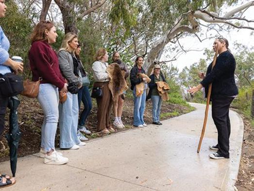
Bibbulmun Yorga is a new operator offering women-led cultural wellness tours at Dyoondalup, Point Walter along Perth’s picturesque Swan River / Derbarl Yerrigan in West Australia.
Led by Founder and proud Bibbulmun woman Delvene, the ‘Walk in Her Footsteps’ tour invites guests to “walk in the footsteps of our ancestors”, in an immersive and healing experience.
Participants will enjoy a gentle walk along the river’s edge while discovering more about Country, local Aboriginal wisdom and culture and the connection between yorgas (women) and the land.
Mother and daughter ticket options are available, making for an enriching multi-generational wellness and bonding opportunity.
Walking tours in Australia guaranteed Australian Walking Holidays has a series of guaranteed departures on several of its most popular adventures,giving travellers certainty when planning Australian winter travel.
It has also introduced a $0 deposit offer on selected trips and departures, allowing travellers to secure their place and confirm plans later.
Guaranteed departures include the Larapinta End to End, Classic Larapinta Trek in Comfort, Best of the Larapinta Trail and the Snowies Alpine Walk, along with Tasmanian favourites including the Flinders Island Walking Adventure – In Comfort and The Overland.
Your favourite walk or bike ride could win you a free subscription
We are looking for readers’ favourite New Zealand walks or bike rides. Many of us go out regularly walking or biking on a route which we class as our favourite, for a number of reasons. Perhaps because for it’s scenery, it’s safe, it’s challenging, it’s flat, it’s hilly, it’s varied, or for whatever reason.
We would like you to tell us in your own words what is you favourite walk or bike ride and why. Email us a story from say 250 up to 1200 words including a photo or photos.
We will now give you a FREE subscription (six months or more, depending on the article), or extension to Walking New Zealand magazine for walks published.
You can also post an article to Walking New Zealand, Freepost 78863, P O Box 1922, Palmerston North, or fax 06-358-6864.
If sending a photo by email please make sure photos are in high resolution.
Our email address is: walkingnz@xtra.co.nz.
Please put “My Favourite Walk” in the subject line and include your name and postal address.
Walk talk
Harwoods Hole Track not legally closed
Federated Mountain Clubs of New Zealand (FMC) has confirmed that, despite Department of Conservation (DOC) signage and its website listing the track to Harwood’s Hole as closed, DOC has since acknowledged the track is not legally closed and the public can still access the area.
DOC has confirmed in correspondence with FMC that it has been decided to cease maintenance of the track to Harwoods Hole, not to formally close it.
Eastern Bays pathway to open in April
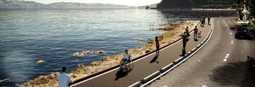
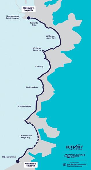
The Eastern Bays Shared Path (Tupua Horo Nuku) project is scheduled to open to the public on Saturday, 18 April 2026.
This 4.4km walking, cycling, and scooter path along Lower Hutt’s Eastern Bays connects Point Howard and Eastbourne.
After a blessing and community celebration of the completed 4.4km shared path on April 18 the entire route along Marine Drive is expected to be available for public use.
Work on the next stage of the City to Sea pathway is underway
Construction was started in March on City to Sea East, which runs between Porritt Park and SH74 in Avondale.
The shared walking and cycling path is part of the Ōtākaro Avon River Corridor Regeneration Plan and is being built in three stages. Stage one, the western portion, was finished last year and the next stage is expected to take approximately nine months to build.
“We have engaged Citycare to carry out this project and are excited to see work happening. There has been great use of the western section, and this eastern extension will allow the community to explore even more of the red zone,” says Red Zone Manager Dave Little.
“As part of the project we are installing several breakout spaces and nature play areas. There will also be plantings, to help with ecological restoration, and lighting so that the space can still be used safely as the days get shorter and winter approaches.”
The second stage includes one road crossing at Avondale Road. There will be traffic management in place, with detours around active work areas for pedestrians and cyclists. Traffic will be one-way during the construction of the Avondale Road crossing. Mr Little says there has also been progress at Avon Park.
“There is now pedestrian access through the park, instead of people coming off Snell Bridge and having to detour around it.”
Detailed design work is currently being completed on the third and final section, with construction work expected to begin before the end of the year. Once finished, the City to Sea pathway will be around 11km long following the course of the Ōtākaro Avon River from the city to New Brighton.
You can now view and enjoy the latest issue of
Walking New Zealand magazine online for $3.95 at http://www.walkingewzealand.co.nz
The benefits of Walking
Phillip Donnell explores why exploring the natural world on foot is good for us.
For several years now I have operated a national walking club called Footsteps. It offers walking excursions throughout New Zealand and also overseas. The rationale
is that perambulating in natural settings is beneficial for humans. This idea was first put forward by E.O. Wilson in 1984. His “biophilia hypothesis” proposed that humans have an innate, genetically-based need to connect with nature and other forms of life, stemming from the fact that our species spent more
Part one of two
than 99% of its history in direct contact with the natural world. He suggested that this deep-seated affinity is crucial for human mental, physical, and emotional health.
Modern “nature therapy” — also known as ecotherapy or green care, is the intentional practice of returning to these roots to trigger a multisystem biological reset. In times past, the medical model focused almost exclusively on pharmaceutical and technological interventions to address the rising tide of chronic stress, anxiety, and physical illness.
However, recent decades have brought a profound realisation: as humans become increasingly
By Phillip Donnell
insulated by concrete, glass, and digital screens, we are suffering from what researchers call “nature deficit.”
In response, nature therapy has emerged not as a fringe lifestyle choice, but as a scientificallyvalidated pillar of clinical healthcare and general well-being.
The foundations and efficacy of Nature Therapy lie in three theoretical frameworks. Whether it is a casual walk in the park, or a formal process facilitated by a trained professional, mindful sensory engagement with our surroundings is the key:
• Attention Restoration Theory (ART): Natural environments allow the brain to recover from the “directed attention fatigue” caused by modern urban life and screens.
You can now view back issues of Walking New Zealand magazine two issues back from the latest, FREE at http://issuu.com/walkingnewzealand
• Stress Reduction Theory (SRT): Exposure to nature activates the parasympathetic nervous system, leading to physiological relaxation.
• Calm and Connection Theory: Suggests that safe natural areas activate archaic neurological systems that release oxytocin, a hormone that promotes bonding and reduces stress.
The science of why and how nature heals is now well-established. Nature therapy has proven health benefits. Research published in recent years highlights the significant impact of nature on various health markers.
The physiological impact of nature therapy is perhaps its most compelling argument. When we immerse ourselves in natural environments, our bodies undergo measurable physiological shifts.
The medical community recognises that regular nature exposure is one of the most effective ways to regulate the autonomic nervous system. When a person enters a forest or a park, their body almost immediately
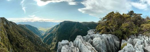
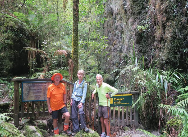
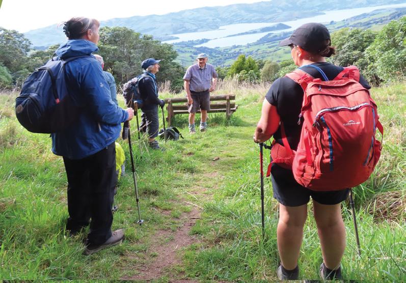
Above: left: Coastal beach walking on the coast at Cape Turn Again. Above right: A group at the entrance to Cave Creek, Paparoa.
‘Carry
Ouch! Sore feet while walking?
Hikers Wool is 100% New Zealand wool. Cushion your feet to prevent pain, rubbing and blisters.
Buy online or at selected stockists For more info visit www.hikerswool.co.nz
The benefits of Walking Part
transitions from a “fight or flight” sympathetic state to a “rest and digest” parasympathetic state.
After just 20 minutes in a natural setting, this shift is measurable through a significant drop in salivary cortisol — the body’s primary stress hormone —and a decrease in heart rate and blood pressure.
The chemical dialogue between humans and plants is an interesting facet. Our immune system can be enhanced. Trees and various plants emit organic compounds
one
called phytoncides, which they use to protect themselves from pests and diseases. When humans breathe these in, it triggers a surge in “Natural Killer” (NK) cells — white blood cells that specialise in fighting viruses and tumour-infected cells.
Recent data suggests that a three-day immersion in a natural environment can elevate immune function for up to thirty days.
Beyond the physical benefits, the cognitive and emotional transformations offered by nature
therapy are essential for navigating the complexities of 2026. This is not only so in relation to treating illness, but also to building “emotional fitness”.
Modern life is characterised by “directed attention” — the intense, focused mental energy required to process emails, navigate traffic, and manage complex tasks. This form of attention is finite and easily exhausted, leading to mental fatigue and irritability.
Nature provides cognitive restoration through what psychologists call “soft fascination” — stimuli like light filtering through foliage, the movement of clouds, rustling leaves or flowing water, capture attention effortlessly, allowing the brain’s cognitive resources to rest, replenish and recharge.
Studies have shown that nature therapy improves cognitive function. After spending time in nature (one hour or more), individuals perform up to 20% better on tasks requiring memory, prolonged attention span, focus, and creative problem-solving.
Children and adults with ADHD often see significant improvements in focus and impulse control after visiting green spaces, as nature provides a break from the sensory
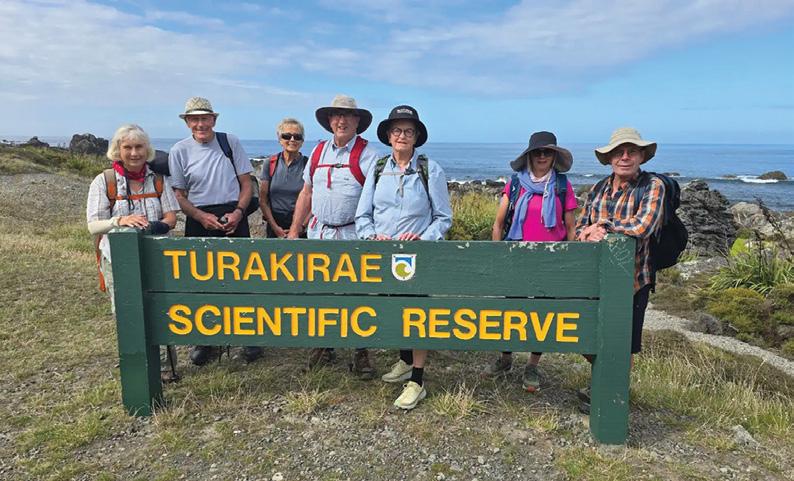
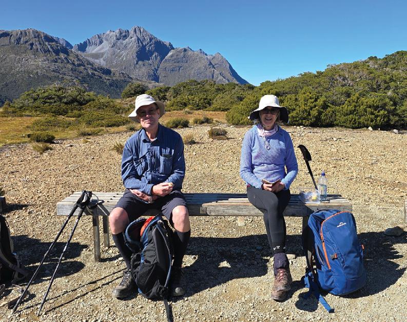
Above left: The Turakirae Scenic Reserve is popular with walkers. Below left: Resting after a long hike.
overload of urban environments.
Nature-based activities have been shown to reduce rumination that is the repetitive negative thinking associated with anxiety and depression.
Of considerable significance is the concept of “awe.”
In the vastness of a mountain range or the presence of an ancient tree, a person’s perspective shifts.
Psychological research has increasingly focused on how this sense of awe diminishes the “small self”, reducing the tendency to ruminate on personal problems and fostering a greater sense of connection to the world as well as increased empathy, and generosity.
This reduction in rumination is a primary reason why ecotherapy is now frequently prescribed alongside traditional talk therapy.
As we navigate 2026, nature therapy stands as a vital bridge between ancient wisdom and modern science. It reminds us that we are not separate from the environment
but a part of it. By intentionally stepping outside, we don’t just “get a breath of fresh air” — we engage in a sophisticated, multi-system biological reset that preserves our health in a rapidly changing world. Walking is an ideal means to this end. So why not put your shoes on and get going!?
(In Part 2 next month I will explore different approaches available to walkers who want to enjoy the therapeutic benefits of nature)
A
Ouch! Sore feet while walking?
Hikers Wool is 100% New Zealand wool. Cushion your feet to prevent pain, rubbing and blisters.
Buy online or at selected stockists For more info visit www.hikerswool.co.nz
Above top
group after walking in the Waihi Falls in the Wairarapa.
MAY Weather prediction
(Weather is an inexact science, like medicine. Dates given are to be regarded as focus points. Please allow 3-4 days leeway for all forecasts)
1st Very cold overnight in Otago and the Central Plateau, severe frosts possible.
1st-10th Fog likely in the Canterbury region, particularly in the Christchurch area.
2nd Very strong southwesterlies, strong gusts around South West Cape, Stewart Is.
3rd-4th A cold front crosses the country, bringing a very cold southwest flow.
5th Possible fog patches in the lower North Island, including in Wellington.
5th-6th High pressure slowly crosses the country in a very gentle southwest flow.
6th-12th A depression east of Australia slowly moves across the Tasman Sea and over New Zealand during the coming week, bringing rain activity for several days.
8th Chance of heavy rain in the Waiouru to Mt Ruapehu area.
8th-10th Chance of fog in Auckland, the Waikato, Canterbury and Christchurch.
10th Heavy rain in Westland, storms/ hail in Christchurch, fog in Wellington.
10th-11th A trough crosses the North Island bringing heavy rain from Northland to Wellington, and Taranaki to the Kapiti coast. Very heavy downpours Taranaki to Paraparaumu may result in property damage due to overflowing rivers.
Over the next four weeks, anticyclones dominate more than usual for this time of year, esp. to the south and southeast of the South Island. The usual passage of low pressure may be blocked by the high-pressure.
Only 5 major depressions may be expected, mostly the northeast of the North Island, causing more easterly flows than normal over the North Island and lighter breezes over the South. Rainfall likely to be extremely below average in Nelson-Marlborough, the Tekapo basin, and the northern and alpine areas of the South Island, as well as in the Manawatu and Kapiti regions. Above average in the eastern North Island.
Some parts of Timaru, Tekapo, Nelson-Marlborough and Kapiti may only receive around a tenth of their normal rainfall for this time of year, while other western and alpine areas of the South Island and Manawatu may receive half their usual rainfall. Most other parts of the western North Island and the remainder of the South Island can also expect below
average rainfall but within 25% of their norm. In contrast, the east of the North Island may receive up to twice as much rainfall than what is typical for this time of year.
Accompanying the below average rainfall, sunshine hours are expected to be around 10% more in the west of both islands and inland regions of the South Island, while the east of the North Island may be duller than average by around 25% less; a reflection of the increased rainfall expected.
Island, including in the West Coast, Canterbury and Otago.
15th Very cold in Central Otago, with severe frosts and mostly clear skies. Dull and gloomy with very strong northeasterly winds over the northern North Island. Chance of very heavy rain in Auckland, possibly causing flooding. Heavy rain also likely in the West Coast, with chance of brief flooding in the Greymouth district.
by Ken Ring
Temperatures during this period may be generally colder with the average for the country as a whole around 1°C below average. The next four weeks may be colder than average in inland parts of the South Island, Kaikoura, Banks Peninsula, Central Otago, and central North Island, with a general trend of around 1.5-2°C below the norm. Average temps in Auckland, southern North Island and many parts of the South Island may see temps averaging below 1°C less than average.
Only the western South Island can anticipate average temps. Minimum temps may be particularly low in the west of the North Island and in inland parts of the South Island over the next four weeks with a number of districts from Taranaki to Wellington, Nelson, Marlborough, Central Otago and the McKenzie Basin all around 2°C below normal.
Accompanying this swift cooler change during this next four weeks may be the arrival of the first significant snowfalls for the year. First, there is the chance of snow falling for a brief time on the Napier-Taupo highway around the first week ahead, in mid-May.
Then more generous snowfall events are likely in the first week of June in the South Island alpine regions; much to the delight of the ski fields. Good snowfalls can be expected in central Otago, and including Coronet Peak, the Remarkables, Cardrona and Treble Cone fields.
11th Chance of funnel formation winds developing and causing some damage in the Napier region. Rain may be heavy for a time in the Wellington region.
11th-13th A depression lingers over the country bringing scattered storm activity.
12th-14th Chance of thunderstorms with occasional hail showers in the South
16th Chance of the first snow in the Central Plateau and Napier-Taupo highway.
16th-18th A weak high pressure ridge brings light breezes and calm conditions. Possible fog in Christchurch and Wellington and misty patches in the west.
18th Chance of snow flurries in Christchurch.
19th Unusually warm day in Canterbury, possible patches of fog in Christchurch.
19th-21st A depression crosses the country. Rain in the SI and showers in the North.
20th Chance of fog in Auckland to the Waikato.
21st-22nd Light breezes and overnight fog patches likely in the Christchurch area.
22nd Very strong and gusty easterly winds over the north of the North Island, particularly in the Hauraki Gulf.
22nd-29th A very large anticyclonic system slowly crosses the country bringing a spell of gentle breezes and patches of fog overnight in numerous areas.
27th Chance of thick fog for a time in Auckland and down through the Waikato, as well as in central Otago. Fog may cause disruptions for a time for travellers.
29th-30th Chance of frost in the Waikato, Bay of Plenty and the eastern South Island.
31st A wet front ahead of a couple of depressions to the west and north of the country brings heavy rain at times in western districts from Taranaki to Fiordland and including in the northern parts of the South Island.
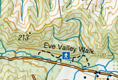
Eves Valley Walk for the family
Eves Valley Scenic Reserve is a regenerating beech-podocarp forest covering 28 hectares.
The reserve has many picnic areas and a scenic bush walk, approximately 27 km from Nelson near Brightwater.
The Eves Valley walk is 1.3 km loop or a 2.1 km out-and-back trail, typically taking 30 to 60 minutes to complete.
The path is relatively flat with an elevation gain of only about 52 metres.
It passes through a rare area of regenerating lowland beech-podocarp forest and is a popular spot for families due to its gentle terrain and scenic picnic areas.
There are unbridged streams on the walk. In normal flows these are easily crossed, however in floods or high flows they can become impassable and you will need to wait until floodwaters recede. Assess streams carefully before crossing and if in doubt, stay out.
Fact File
Eves Valley Walk is 27km from Nelson
Trail is a 1.3 km loop or a 2.1 km out-and-back trail taking 30 to 60 minutes.
Dogs are permitted, provided they are kept on a leash at all times.
There is a long-drop toilet and a picnic table located at the start of the walk.
The walk is highly rated for families and small children due to the gentle distance and interesting features like streams and bridges.
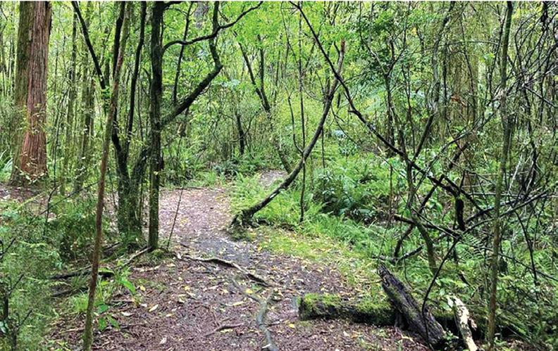
Above right: The flat gravel path through Eves Valley Walk.
Below right: A board walk makes crossing the stream easier.
Ouch! Sore feet while walking?
Hikers Wool is 100% New Zealand wool. Cushion your feet to prevent pain, rubbing and blisters.
Buy online or at selected stockists For more info visit www.hikerswool.co.nz
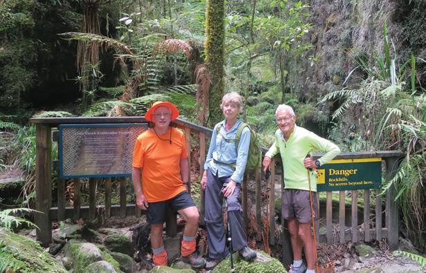
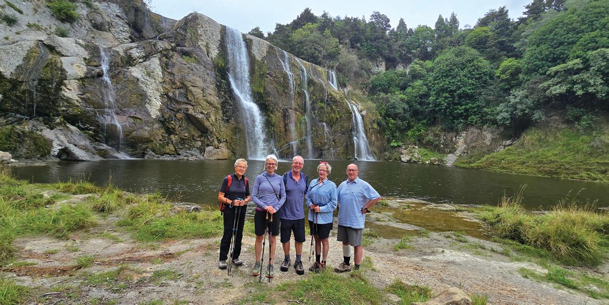
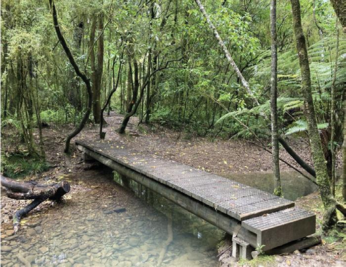
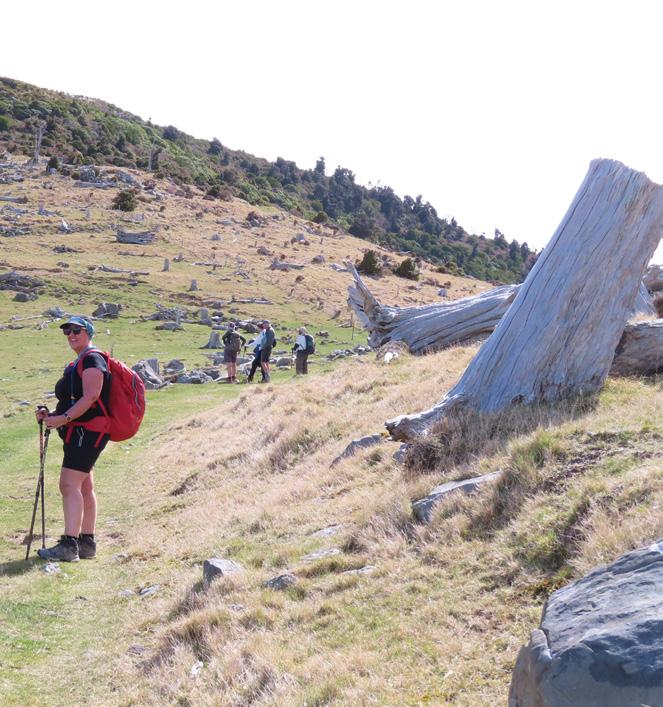
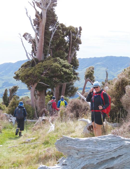
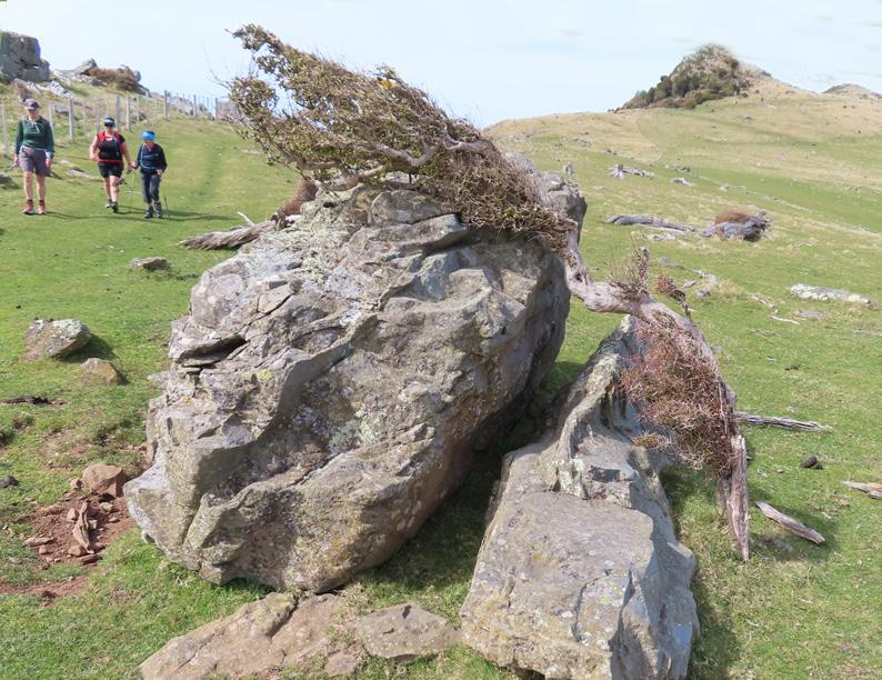
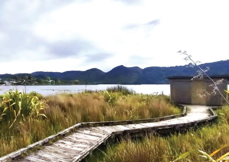
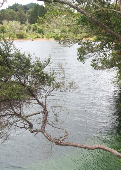
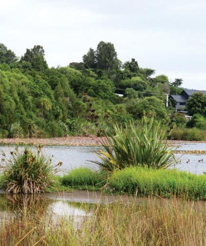
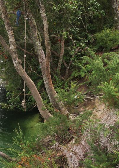
Te Otamanui Walkway, Te Kowhai, has four trail entrances
By Marlene Lynam
My favourite walk in the Waikato region is the Te Otamanui Walkway in the village of Te Kowhai, 15 kms north west of Hamilton.
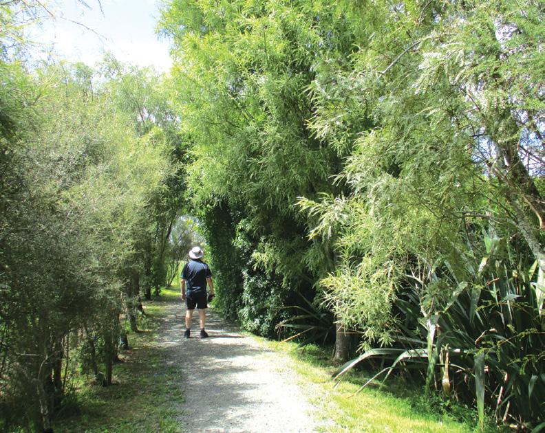
This is a delightful all season , all weather, gravel pathway,
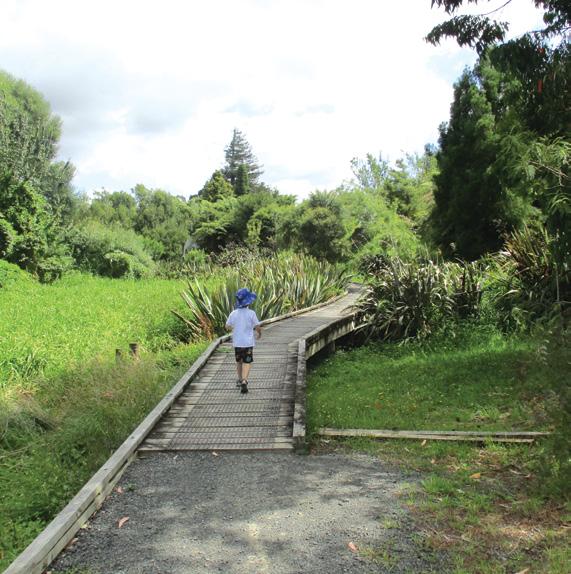
well formed and flat, and very family friendly. There are some boardwalk sections over swampy areas and parts of the walkway are lined with avenues of kowhai trees, best seen in Spring when they are flowering.
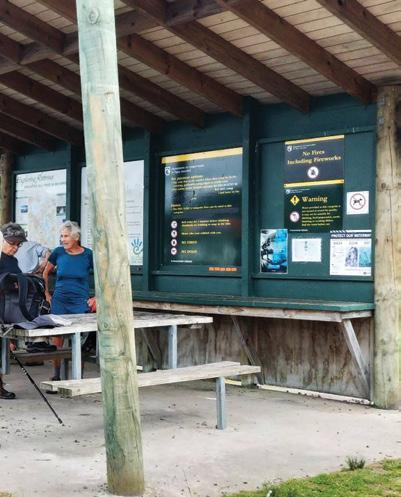
The information panels give
lots of interesting information about the history of Te Kowhai, the lagoon and the kowhai trees, and these are interspersed along
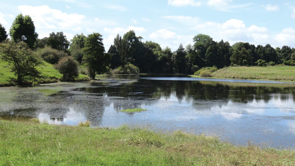
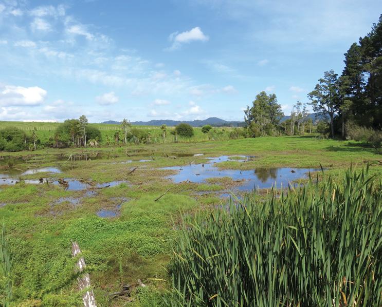
Above: The clear waters of the lagoon.
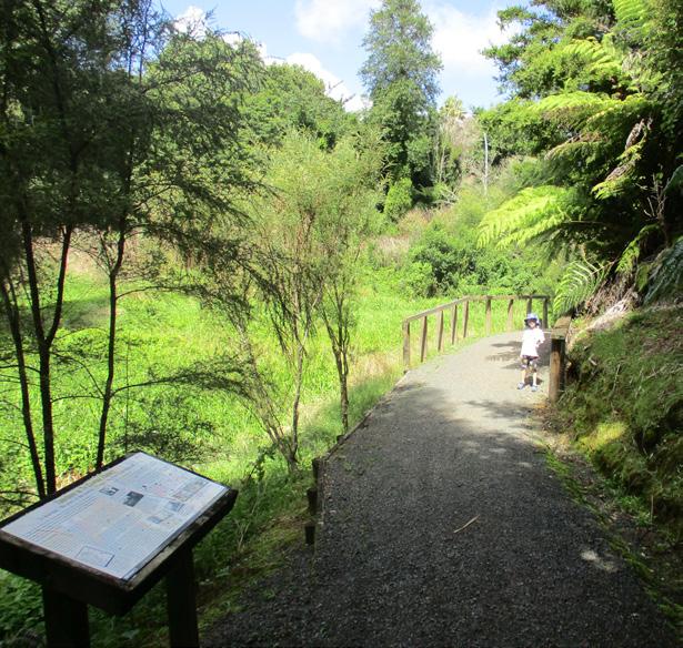
Below left: Near the start of the main entrance, overgrown stream on the left of the track.
Below right: Walking on the boardwalk.
the trail as are seats for you to rest awhile to take in the ambience of this special place.
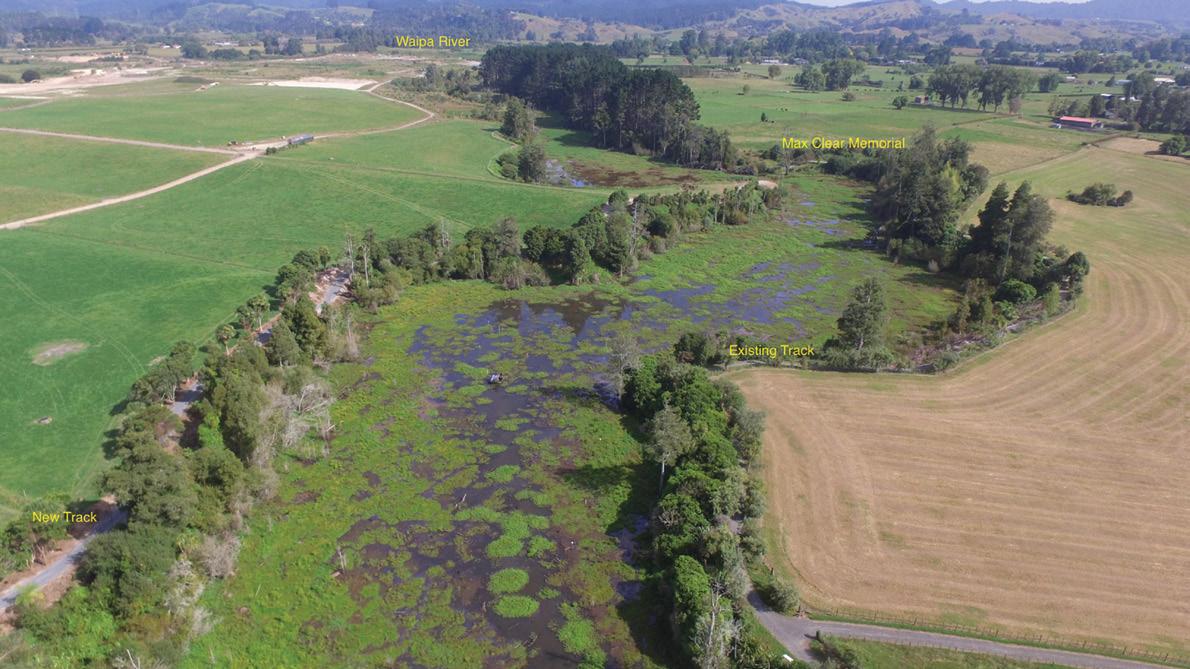
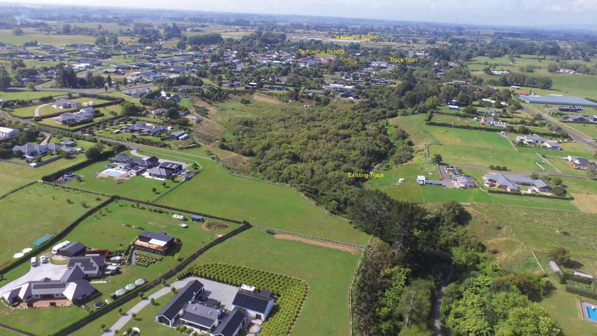
There are four trail entrances, the main one starting in the centre of the village on Horatiu Road, just below the hall and opposite the school carpark. There is plenty of parking at the hall. Another two entrances are in Penbeagle Road and Coombes Road, but these will give a shorter walk. The fourth entrance is by a sharp left hand corner on Bedford Road, about 1 km from the village centre. The main trail follows the Te Otamanui Stream and the Te Otamanui Lagoon stretching towards the Waipa River.
The Te Otamanui Lagoon is a flooded valley marking an ancient course of the Waipa River. The lagoon itself is a 24 hectare (60 acre) body of water, about 3 km long and is located in a long narrow gully. It is fed by the Te Otamanui Stream.
The lagoon was an important food source for early local Maori.
Early European settlement saw the lagoon used as a recreational facility with sailing, swimming and canoeing being regular activities. Today the lagoon has poor water quality and algal growth after decades of neglect. It is almost completely overgrown. Hopefully one day this can be turned around.
Starting from the main entrance, it is a gentle and peaceful
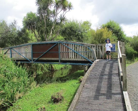
stroll with the stream alongside to keep you company. Keen eyes spotted a family of ducks navigating their way downstream. The trail meanders for a while until you reach a blue footbridge over the stream. This path leads up to the Bedford Road entrance.
While the original trail continues straight ahead on the eastern side, a new trail has been formed over the footbridge and continues
Above right: Near the start of the main entrance, overgrown stream on the left of the track.
Te Otamanui Walkway, Te Kowhai has
trail entrances
on the western side of the stream and lagoon for approximately 1.7 kms to its end. This trail borders farmland with views to distant bush clad ranges. Thanks must go to the two local landowners adjoining the walkway for contributing to the new extension.
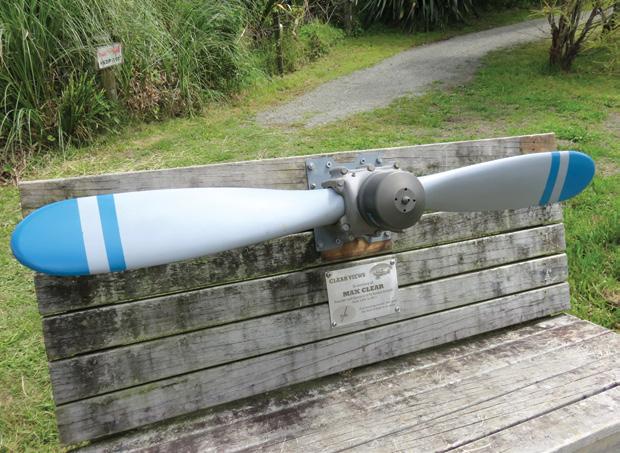
The original trail ends in a grassy clearing where there is a seat with an aeroplane propellor and a plaque in memory of Max Clear, founder and operator of
the nearby Te Kowhai airfield. The plaque reads: “Clear Views. A pioneering aviator who gave the thrill of flight to so many”. This is a nice place to have a picnic as there is a barbecue table nearby. A plaque on another seat along the trail reads: “Sometimes I sit and think and sometimes I just sit! Joan Valois”.
At the time of writing, another footbridge is currently being built about halfway along the walkway, connecting the two sides, and at a later date, a bridge will be
built from the end of the new trail across to the propellor seat end of the trail, thus forming a loop. It is hoped that one day the trail can be extended right through to the Waipa River.
Further downstream from the end of this section, the Te Otamanui Lagoon becomes a beautiful waterway, best viewed from driving further around Bedford Road.
Above: An aerial view of the walkway. Below left: A earoplane propellor in memory of Max Clear.
Below right: The blue bridge crossing the stream to the Bedford Road entrance and the new trail.
This part of the lagoon flows out to the Waipa River via a small stream outlet.
The lagoon is also home to lots of native birds so it’s a great place for bird spotting.
On today’s visit, I saw several pukeko, a kingfisher, a fantail and a lonely heron. In Spring, tuis will arrive in force when the kowhai trees and flax are flowering. Pest control is evident in places along the trail.
Thanks must be given to the local community volunteers who are actively involved in the upkeep of the trail, with support from the Waikato District Council
through funding and development.
Allow an hour or two for this picturesque walk. Even though it is close to suburbia, the walk gives a feeling of remoteness.
After the walk, enjoy a coffee or cold drink at the nearby Te Kowhai Village Cafe by the Te Kowhai Gardens Vegetable Shop.. I can highly recommend their Iced coffee.
Above: The end of the walkway looking downstream to a view of distant ranges.
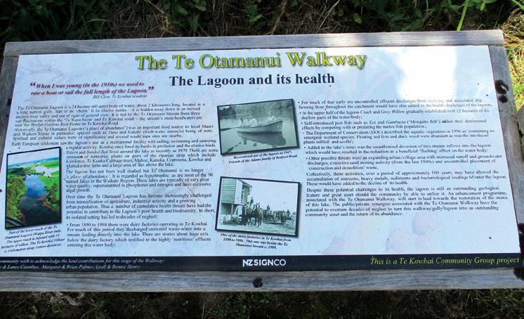
Below Details all about the Te Otamanui Walkway.
High Country Huts and Homesteads
By Lewis Craig and Savage, Cathy
From the authors of Australias favourite bush camping and 4WD guides comes a striking review of the High Country’s most aesthetic and historic huts.
Lavishly illustrated with beautiful full-colour photographs, High Country Huts is a nostalgic collection of abandoned mountain homesteads, shearers huts, travellers shelters and many other lonely structures.
The text portrays a short history of each hut along with many fascinating accompanying stories!
Walk the wild west on the spectacular
By Patrick Quinn
West Auckland Track
Words like iconic, breathtaking and spectacular can be overused, but when it comes to Ōmanawanui Track in West Auckland they are by far the best way to describe one of the most impressive walks in Auckland.
With Mataraki about to begin, a visit to Ōmanawanui Track is a fitting winter adventure to herald the start of this distinctly Aotearoa season of celebration.
Part of the Te Ara Tūhura / Hillary Trail, the track caters for everyone, from families looking for a daytrip to serious trampers on multi-day hikes connecting with other parts of the Hillary Trail.
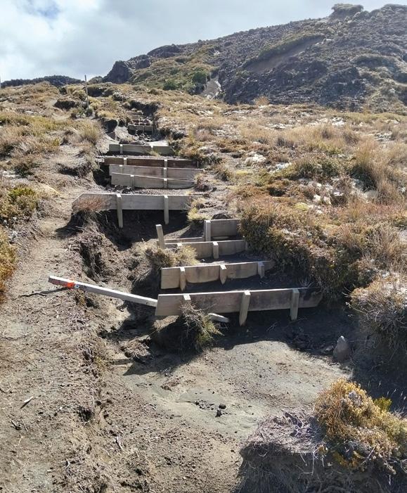
Closed in 2018 as part of the kauri dieback rāhui in the Waitākere Ranges Regional Park, Ōmanawanui Track reopened in 2021 after a major upgrade which has made it more accessible. Work included installing 2.5km of box steps. There are approximately 2420 individual steps on Ōmanawanui Track, as well as boardwalks at the trig station and a unique floating one around a historic pā site. It means narrow ridges and steep terrain which characterised the track are now easier to negotiate.
Starting at Whatipū Beach at the
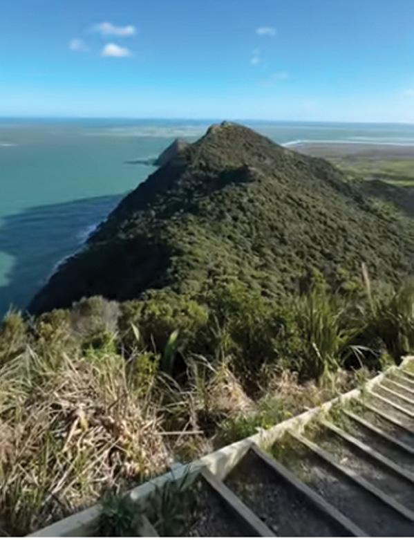
Above left: Looking out into the Tasman Sea. Below left: The Manukau Harbour from the track.
Ouch! Sore feet while walking?
Hikers Wool is 100% New Zealand wool. Cushion your feet to prevent pain, rubbing and blisters.
Buy online or at selected stockists For more info visit www.hikerswool.co.nz
mouth of the Manukau Harbour, Ōmanawanui Track is nearly 3km long and climbs approximately 373m, running ribbon-like between the harbour and the native forestclad Waitākere Ranges. The track itself winds through regenerating native bush, low scrubland and past exposed rock faces to a ridge offering stunning views of the harbour and surrounding area.
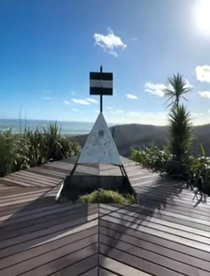
From here, hikers head down the ridgeline, past a former pā site, before once again climbing to the recently upgraded trig station lookout at the highest point
Here there are 360-degree views of the wind-swept West Coast and the best view of the Manukau bar, which was the site of New Zealand’s worst maritime disaster.
Hike Ōmanawanui Track on a clear day and you may even be rewarded with vistas all the way down the coastline to Mt Taranaki.
Walking the Ōmanawanui Track
can take up to three hours depending on your fitness level and how long you linger over those views. Your attention may also be captured by the many seabirds who make their home in the area, regarded as being a remote wilderness area of high biodiversity value.
These seabirds such as mātātā (fernbird), taranui (Caspian tern), tara (white-fronted tern), tūturiwhatu (New Zealand dotterel), pohowera (banded dotterel), tōrea pango (variable oystercatcher) and poaka (pied stilt).
What to know before you go
Always check the weather before you go. Search specifically for the area you’re going to. Forecasts can vary from coast to coast and the city forecast isn’t always accurate for regional areas.
Before you head off, tell someone your plans. Mobile phone coverage isn’t always available on Auckland’s trails, so it’s important someone knows where you are.
Above left: A boardwalk. Above right: Steps and more steps but what a view! Below right: The trig station.
Mangaturuturu Track showcases park
By Dave Scoullar
With the bustling hiking activity around Whakapapa Village in the north of Tongariro National Park, walking opportunities in the south based on Ohakune are sometimes under-rated and overlooked.
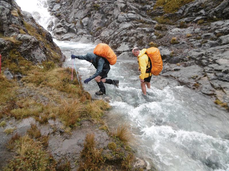
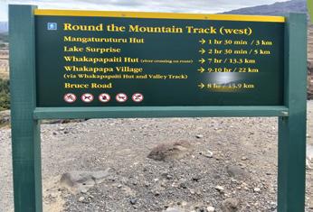
One track which offers challenges but also rewards is from the Ohakune Mountain Road to Mangaturuturu Hut. This well-marked track, which is part of the Round the Mountain Track, has beautiful mountain views and grand open country vistas. The Conservation Department estimates the 3km hike to the hut will take one and a half hours but it may be longer as the track is rocky, sometimes steep and is degraded in places. There are also four stream crossings, usually only ankle deep.
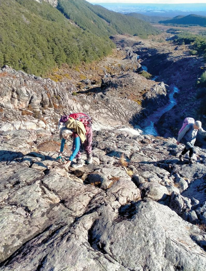
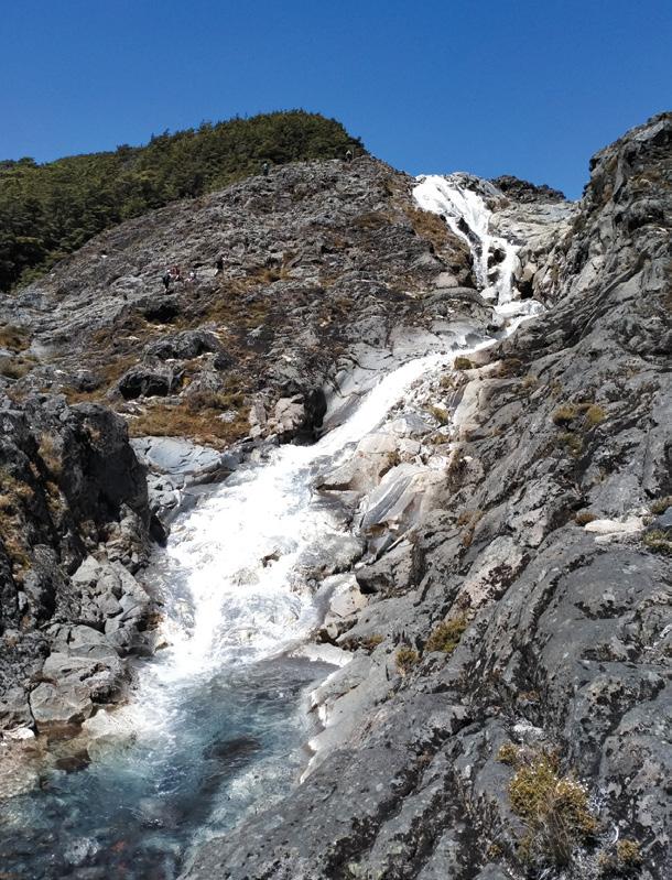
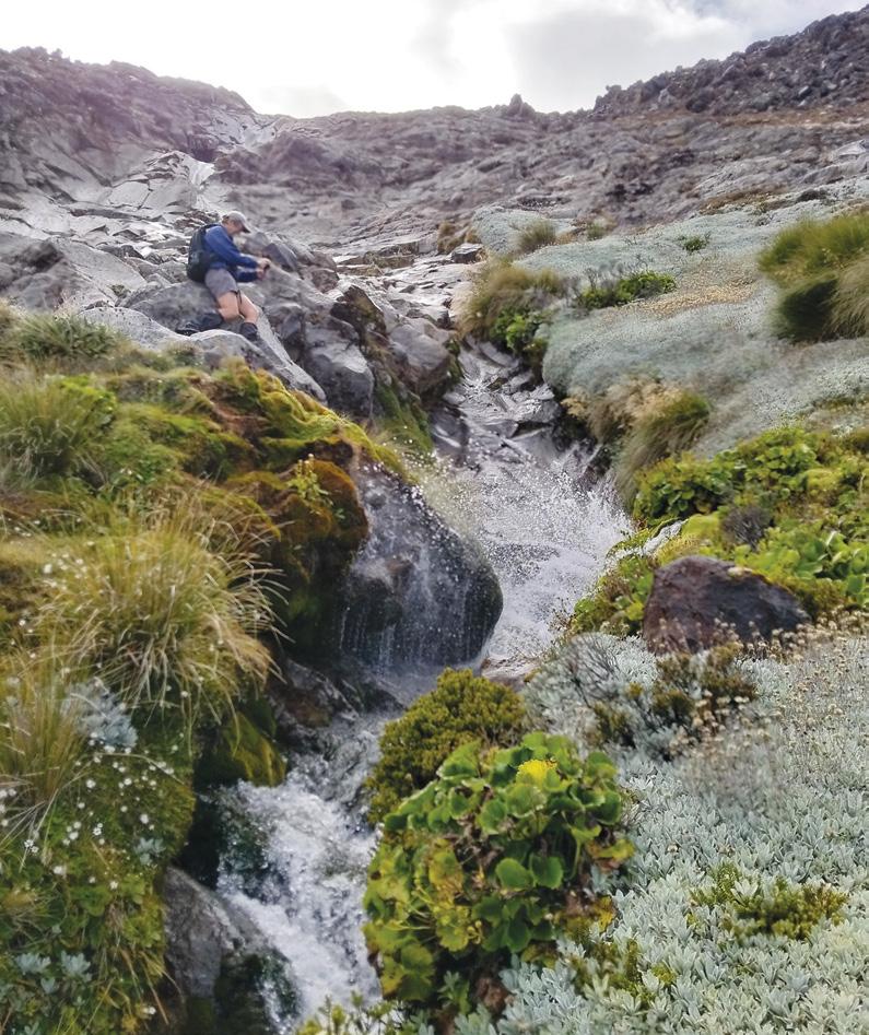
The main challenge on the route is the Cascades which involves descending a narrow, rocky ridge above a stream and then down a 60m open rock face beside a spectacular cascade of water, hence the name. This rock face can be a bit of a scramble. If taken slowly it’s not too daunting but care is needed when wet and slippery.
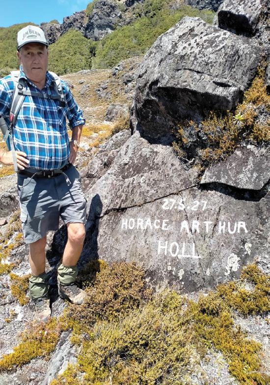
The track continues in a westerly direction, reaching a narrow stream bed. Nearby but off-track and easily missed is a marked rock known as the Holl Memorial. It is for Harold Holl who drowned in this stream in 1927. Soon after a section of board walk is reached leading to the hut which is situated in beech trees beside the Mangaturuturu Stream.
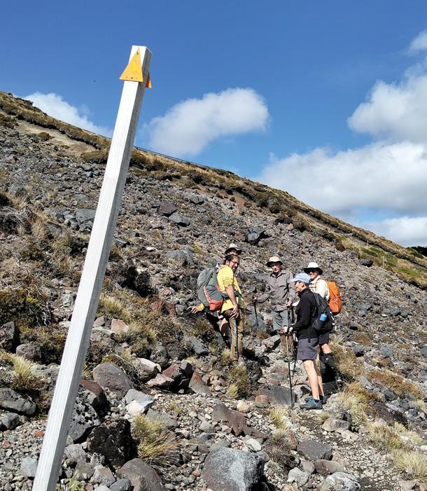
Above left: The open rock face requires care. Below left: . Cascades stream crossing.
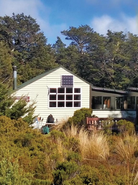
Above left: The Mangaturuturu Hut.
Above right: The Cascades are spectacular..
Below left: The Holl memorial.
The new VeryFitPro ID205L is an intelligent smart looking Sports Watch and activity tracker that ticks all the boxes.
* Strong and durable 3cm clear glass touch screen display
* Skin friendly soft and comfortable wristband strap
* Nine exercise modes walking, running, hiking, cycling, treadmill, fitness, mountain climbing, spinning bike and yoga
* Many functions: step monitoring function, heart rate monitoring, sleep monitoring, calorie monitoring, call reminder, message reminder, sedentary reminder, alarm reminder, stopwatch, timer, music control, looking at mobile phone, breathing training, time and date display, multi-sport mode (step, calories, speed, distance, active time), daily goal
* Raise your hand and the screen will light up.
* Customize the face of your Smart Watch to fit your needs.
* IP68 Deep Waterproof
* Magnetic charging with USB charging cable takes about 2.5 hours for around 10 days usage.
* Uses VeryFitPro app Compatible with smart phones that use IOS 8.0/Android OS 4.4 or later, and Bluetooth 4.0 or later
* Colours available: Black
Mangaturuturu Track showcases park
Above left: Signs at the start. Above right: The track is degraded in places.
Below left: The Cascades are spectacular.
The Mangaturuturu Hut has 10 bunks and belongs to the Whanganui Tramping Club, It opened in 1958. Club members built it, carrying materials in from Horopito. (This was before the mountain road was built). Fees must be paid to stay overnight in the hut or camp there and bookings are required with DOC.
Those wanting more of a challenge can go on to Lake Surprise, a further 2km on the RMT, which will take about another hour. But first there is the Mangaturuturu Stream to cross, wider and swifter than earlier streams on this route.
Should walkers turn back at the the Cascades, they can take comfort in the knowledge that they have had the opportunity to take in the national park’s magnificent volcanic landscape, dotted with waterfalls.
Sun protection, a hat and a windbreaker jacket may be helpful since the track is exposed and has no shade. A small carpark is located at the trailhead which is about 15km up the mountain road, close to the Turoa ski field.
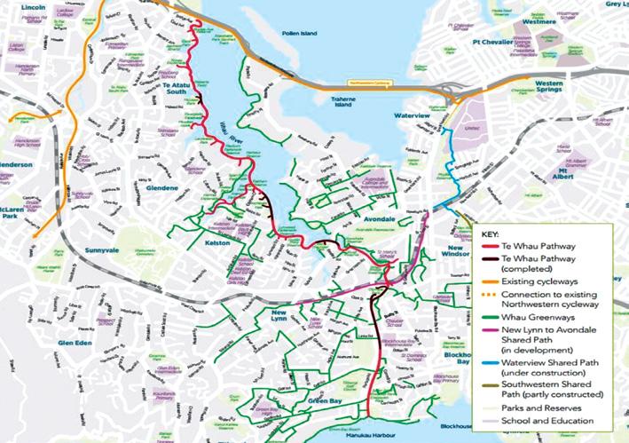
Te Whau Pathway section opened
The long-anticipated opening of the Te Whau Pathway has marked a significant milestone in Auckland’s urban development, bringing to life a vision years in the making.
On 20 March the first purpose-built boardwalk section of the pathway officially opened in Te Atatū South, offering both a practical transport link and a striking recreational experience along the Whau River.
This newly opened section, known as the Horowai Connection is relatively short but symbolically important.
While precise total length figures for the opening stage are modest compared to the full project, it forms part of a wider network of boardwalks and links, with nearby construction references indicating sections in the hundreds of metres range.
More importantly, this stretch represents the first dedicated offroad boardwalk component of the pathway, setting the design standard for future stages.
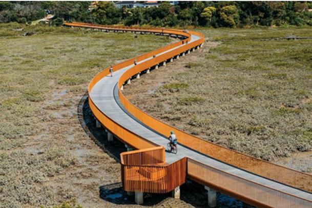
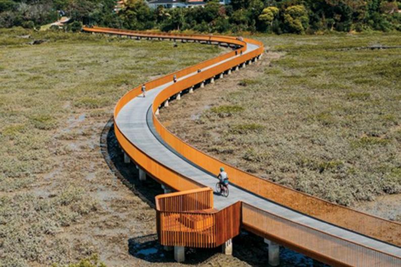
What distinguishes this section is its design. The Horowai Connection is a four-metre-wide shared pathway that weaves along the edge of the Whau River.
Elevated above sensitive mangrove environments, the boardwalk creates a “blue-green” corridor, blending ecological preservation with public access. Built for both cyclists and pedestrians, it connects the Northwestern Cycleway with local parks such as Roberts Field, enabling safer, more scenic travel away from busy roads.
The pathway also incorporates cultural design elements developed in partnership with mana whenua, reflecting the environmental and historical significance of the river.
The opening ceremony was led by stakeholders behind the project, including the Te Whau Pathway Environment Trust alongside Auckland Council and its partners. The project
.itself is a collaborative effort involving local boards, central government funding, and iwi such as Ngāti Whātua Ōrākei and Te Kawerau ā Maki.
This partnership approach has been central to ensuring the pathway reflects both community needs and cultural values.
Importantly, this opening is just the beginning. The Te Whau Pathway is a much larger, multi-stage infrastructure project that will eventually span from Te Atatū Peninsula on the Waitematā Harbour to Green Bay on the Manukau Harbour.
When complete, it will be Auckland’s only continuous off-road route connecting the two harbours, following a historic Māori portage route. The full pathway has been
divided into five sections, many of which are still under development or in planning.
Current priorities include additional boardwalk connections and new links between parks and neighbourhoods, with further construction expected to continue over the coming years.
In this context, the March opening is less about distance and more about direction. It offers a tangible glimpse of the future, a connected, accessible, and environmentally sensitive corridor through West Auckland.
As more sections are completed, the Te Whau Pathway is set to become not just a transport route, but a defining public space that reconnects communities with the natural landscape of the Whau River.
We are looking for the best digital photos each month depicting walking
Now the time to get your digital camera out or look through your digital images and enter the
Walking New Zealand
Digital Photo Contest
Above right: A good place to be! At top of Latter’s Spur Track, Victoria Park, looking towards Sugarloaf Scenic Reserve. It’s an easy uphill walk with a loop back down via Harry Ell Track. After many days of bad weather, the tracks were busy with people walking.and enjoying this very accessible area.
Photo by Marie-Therese McRae, Papanui, Christchurch.
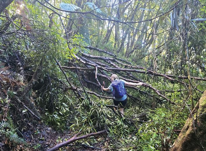
Below: The damage that some of our beautiful walks have suffered, but also to the dedication we have to carry on.... We need our wilderness to enrich our souls, it’s important to keep on going... This was just one tree down in Wairongomai! Photo by Gail Francis, Ohauiti, Tauranga.
PHOTO CONTEST
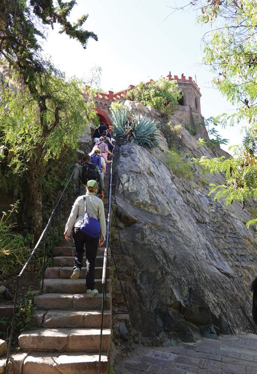
Opposite page above left: Climbing the steep steps on Santa Lucia Hill in Santiago for panoramic views of the city and the Andes. Photo by Claire Woodhall, Napier.
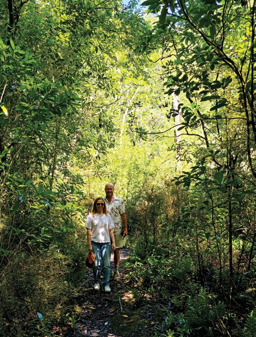
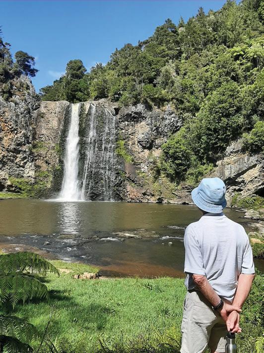
Above right: Raewyn and Mark wanted to do a short hike at Ashley Gorge in North Canterbury. Lovely picnic area, good facilities, river to swim in and numerous walking tracks. Photo taken by Heather Winter, Oxford. Below right: My husband Bruce admiring the beauty and enjoying the melodic sound of Hunua Falls. Photo by Jo Alexander of Epsom Auckland
Email your entries to: walkingnz@xtra.co.nz with subject line “Walking New Zealand Photo Contest” Only EMAILED entries will be accepted.
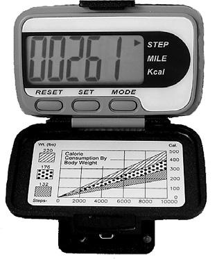
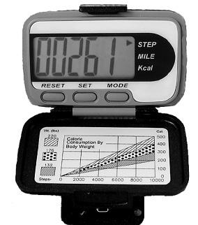
The H215 Professional 4 Function Pedometer
The H-215, 4-function pedometer is a superb, reasonably priced pedometer that counts steps, calculates distance, calories burned and has a 12/24 hour clock.
This is the model that has sold over a quarter of a million worldwide. It has the largest display of any pedometer we tested and is very accurate.
Dimensions: (L) 5.6 * (W) 3.7 * (t) 2.7 cm
Price only $36.95 plus $7.00 P&P
- Phone 027-274-0726 or email walkingnz@xtra.co.nz. www.walkingnewzealand.co.nz
Seals a feature of walks in the Cape Foulwind area
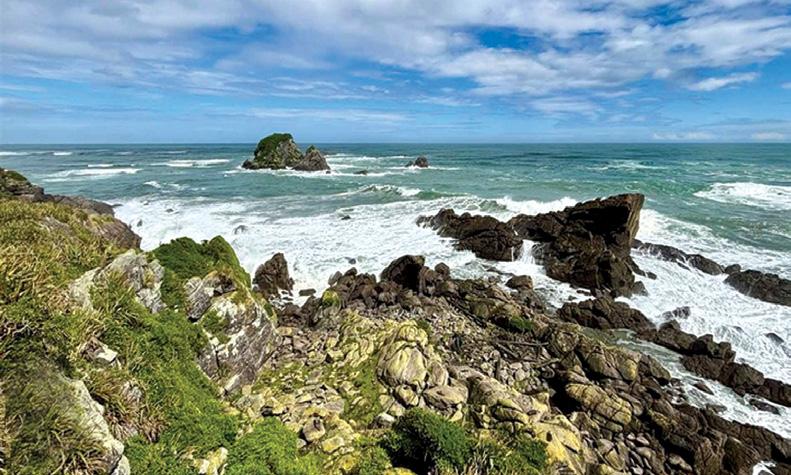
On the rugged West Coast of the South Island, just a short drive from Westport, the Cape Foulwind Walkway offers one of New Zealand’s most rewarding short coastal walks, especially for families keen to encounter wildlife up close.
With sweeping ocean views, dramatic cliffs, and a thriving seal colony, it’s a walk that delivers plenty of variety without demanding too much effort.
The walkway stretches along a wild and beautiful section of coastline, shaped by the relentless force of the Tasman Sea. The name “Cape Foulwind” was given by Captain James Cook, who encountered fierce winds here during his 18th-century voyage, and visitors today will often understand why.
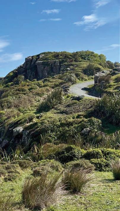
Despite its dramatic name, the track itself is very manageable. The path is well-formed, wide, and mostly gravel, making it suitable for families with children, and even for sturdy pushchairs in good weather.
The terrain is gently undulating rather than steep, allowing walkers to focus on the ever-changing views rather than the effort underfoot.
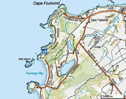
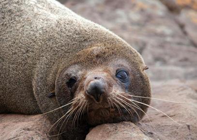
The highlight for most families is the seal colony near Tauranga Bay. From the main car park at Tauranga Bay, it’s an easy 10–15 minute walk along the track to a viewing platform overlooking the rocks below, where New Zealand fur seals (kek-
eno) gather in impressive numbers.
Depending on the time of year, you may see pups playing in rock pools, adults basking lazily in the sun, or the occasional splash as seals slip into the sea. The viewing platform keeps visitors at a safe and respectful distance, but still close enough to observe their behaviour in detail, something that never fails to delight younger walkers.
.There are several options depending on how far you want to walk:
Tauranga Bay to Seal Colony (Return):
This is the most popular family option. The return walk takes around 20–30 minutes at a relaxed pace, making it perfect for younger children or those short on time.
Tauranga Bay to Cape Foulwind Lighthouse (One Way):
Above right Cape Foulwind on the wild West Coast.
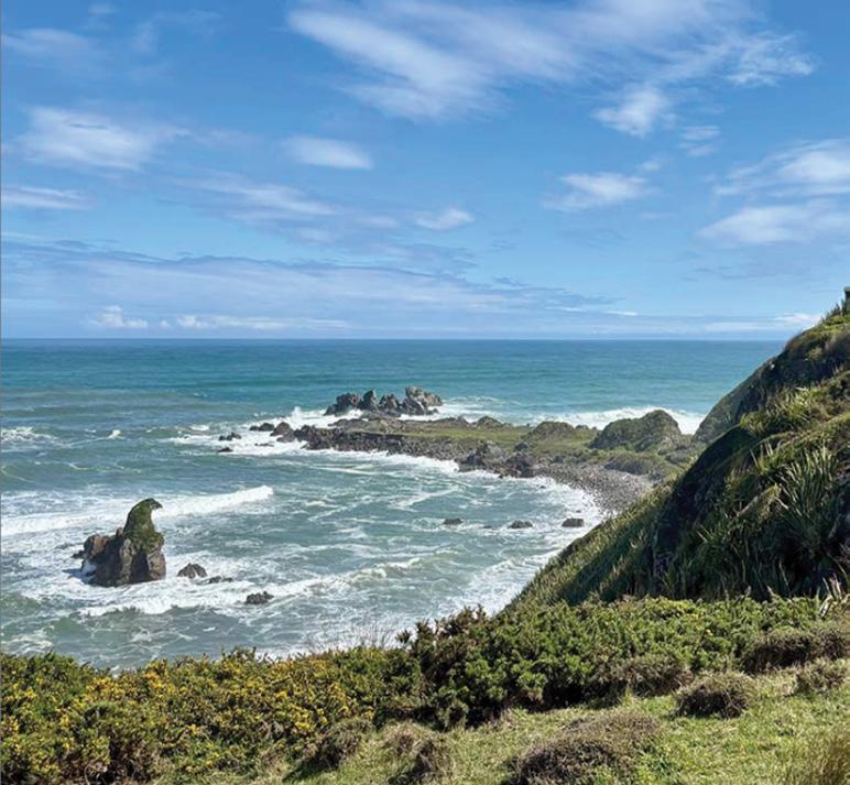
Above far right: Looking out into the wild Tasman Sea from Cape Foulwind.
Below right: A seal resting on the rocks.
For those wanting a longer outing, the full walkway from Tauranga Bay to the lighthouse takes about 1.5 hours one way (roughly 3–4 hours return). The track continues along the cliffs, offering expansive sea views and a sense of remoteness.
Cape Foulwind Lighthouse to Seal Colony (Return):
Starting from the lighthouse end provides another perspective and takes about 2–3 hours return.
The track is not a loop, so you can either retrace your steps or arrange transport between the two ends.
What Else to See and Do
Beyond the seals, the walkway is rich in natural and historical interest. Keep an eye out for seabirds riding the coastal winds, and in the right season, you may even spot dolphins offshore. Informative panels along the track share stories of early Māori settlement and European history in the area.
At the lighthouse end, the Cape Foulwind Lighthouse stands as a sentinel above the sea, a great spot for photos and a chance to imagine life for keepers in such an exposed
location.
Back at Tauranga Bay, there’s a sandy beach ideal for a picnic or a paddle on a calm day. The bay is also a popular spot for surfers, adding a lively atmosphere to your visit.
What makes the Cape Foulwind Walkway specially is its flexibility. Whether you have just half an hour or a full afternoon, you can tailor the experience to suit your group’s energy levels. The well-maintained track, frequent viewpoints, and guaranteed wildlife encounter combine to create a walk that is both accessible and memorable.
For visitors to the West Coast, it’s a must-do outing, one where children can see wildlife in its natural habitat, and adults can soak up some of the region’s most striking coastal scenery.
Eleven great hikes for all ages in New South Wales
New South Wales is home to some of the best hiking and walking routes in Australia, from easy strolls suitable for all ages to rugged, multi-day treks that can challenge even the most seasoned outdoors people – those looking to cover some ground won’t be short of options.
Murramarang South Coast Walk
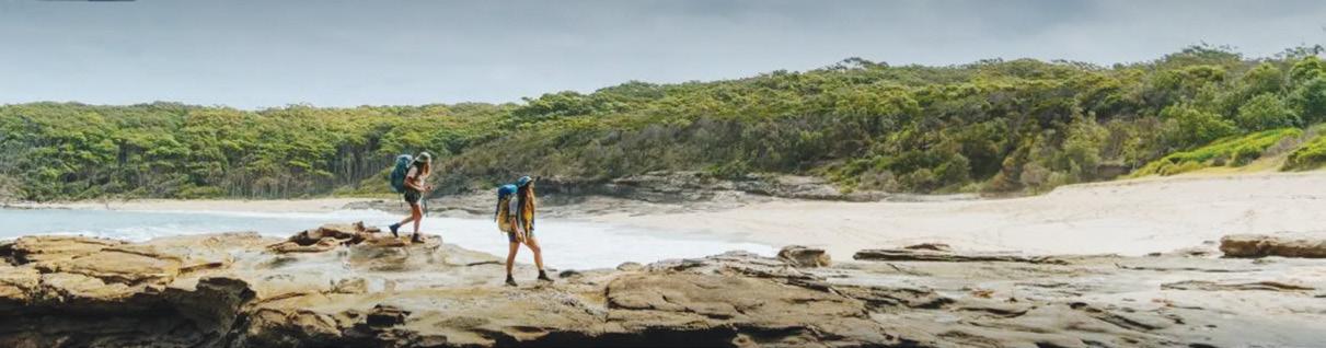
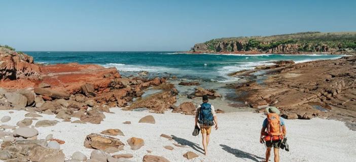
The Murramarang South Coast Walk traverses the Murramarang National Park and passes through coastal villages, secluded beaches and gum forests, starting at Pretty Beach south of Ulladulla and ending at Maloneys Beach north of Batemans Bay. You can choose to stay overnight in campsites or in cabins along the way, with several multi-day experience packages available through the NSW National Parks and Wildlife Service, including options for transfers and tours. Region X (which is eco-certified) and Women Want Adventure also offer guided experiences.
Keep an eye out for wildlife like lyrebirds, wonga pigeons, eastern grey kangaroos and more. From May to October is the best time to undertake this walk, and you may also spot whales as they migrate up and down the coast.
Murramarang National Park is also an area of rich Aboriginal cultural heritage. Just north of the start of the walk is Murramarang Aboriginal Area, which is one of the largest and most important Aboriginal sites on the NSW coast.
•In a nutshell: A spectacular multi-day walk taking in the dramatic South Coast of NSW.
• Parking: Parking is available at Pretty Beach, Pebbly Beach, Depot Beach, South Durras and Maloneys Beach.
• Distance: 34km one way • Difficulty: Grade 4
Bynguano Range walking track
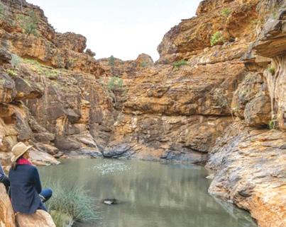
Out near Broken Hill sits Mutawintji National Park, and its arid, rocky landscape is primed for exploration. One excellent way to do so is on the Bynguano Range Walking Track, an offshoot of the Homestead Gorge walking track.
Experience the captivating natural terrain and unique environment of far western NSW and take in Aboriginal rock art, as well as kangaroos and emus among some of the rocky outcroppings that make up this incredible national park.
This Grade 5 walk is for serious hikers. Park at the Homestead Creek campground car park and start your journey there. On your way into the park, stop by the (unstaffed) visitor centre to get some key information and use the facilities before getting underway.
• In a nutshell: Head off the beaten track and out of your comfort zone with this challenging day trek in northwest NSW.
Above: Mutawintji Gorge Walk, Mutawintji National Park
Bondi to Coogee Coastal Walk
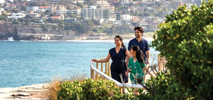
Drawing hundreds of thousands of walkers a year, from local fitness gurus to out-of-towners eager to see what all the fuss is about, the Bondi to Coogee Coastal Walk is an institution in Sydney’s Eastern Suburbs.
Hugging the coast, you’ll pass some of the city’s most storied spots: pause for a game of bowls with a stunning seaside backdrop at Clovelly Bowls Club; pay your respects at Waverley Cemetery, one of the most scenic resting places in the world; and finish up at Coogee with a well-earned drink or bite to eat at the Coogee Bay Hotel.
Extra points if you can plan your visit during the annual Sculpture by the Sea event, which sees artwork displayed around the section of the walk between Bondi and Tamarama.
• In a nutshell: An iconic route that belongs on every Sydney bucket list.
• Parking: Yes, though most car parks and street parking near beaches in the Eastern Suburbs are timed and paid, so consider taking public transport.
• Distance: 6km one way
Light to Light Walk
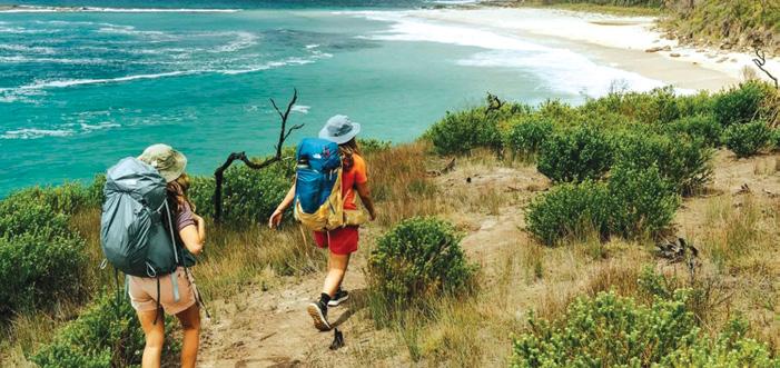
Located in the Sapphire Coast’s Beowa National Park, the Light to Light Walk is a hidden gem, primed for wilderness adventure. Starting at historic Boyds Tower and finishing at the iconic Green Cape Lighthouse, walkers weave through an ever-changing landscape of red clifftops, sheltered coves, eucalypt forest and coastal heathland, spotting wildlife along the way, including seals, seabirds and seasonal migrating whales.
Experienced walkers can tackle the track carrying their own packs and supplies, and by booking a two-night self-guided camping experience. Transfer services are available to assist with transport to and from the track, as well as guided experiences by Navigate Expeditions, Sapphire Coast Guiding Co and Life’s an Adventure (all eco-certified); and Park Trek Walking Holidays.
• In a nutshell: Take a trip along the Sapphire Coast and enjoy empty beaches and wide-open spaces.
• Parking: Available at the start and end of the walk. Transfers or car shuffles recommended. • Distance: 32km one way • Difficulty: Grade 4
The Bathers Way Walk
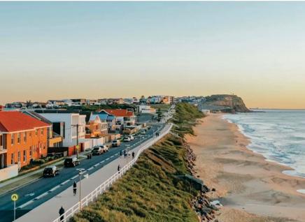
Newcastle’s beaches are some of the most glorious in the country and, lucky for Novocastrians, many of the beaches are connected on the Bathers Way Walk. In addition to stunning swimming spots along the way, you’ll also be treated to wonderful views of the city and its most famous landmarks. In winter, when it might be a bit too chilly for a dip, keep your eyes peeled for whales playing at sea. There are many spots to join the Bathers Way Walk, or you can start at either end. In the south, start at Merewether Ocean Baths, passing Merewether Beach, Dixon Park Beach, Bar Beach, Newcastle Memorial Walk, the Bogey Hole, Newcastle Beach, Newcastle Ocean Baths and Nobbys Beach before ending at the famous Nobbys Lighthouse. If you’ve still got some juice in your legs, continue out to the end of Nobbys Breakwall for an uninterrupted, 360-degree view of the sea
• In a nutshell: Hop from beach to beach on the sunny shores of Newcastle.
• Parking: Parking is available all along the walk.
• Distance: 6km • Difficulty: Grade 2
Above: The Bathers Way, New-
Above: Bondi to Coogee Coastal Walk, Sydney
Above: Light To Light Walk, Hegartys Bay - Credit: Remy Brand | DC-
Grand Cliff Top Walk
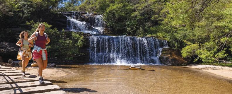
Starting at Wentworth Falls and ending at Katoomba, the Grand Cliff Top Walk is an ideal way to see many of the highlights in the Blue Mountains National Park. Discover Aboriginal culture, spectacular lookouts, the Three Sisters, numerous waterfalls and quaint villages. Stay overnight in Leura to sample the excellent restaurants, pubs and boutiques.
Listen out for the yellow-tailed black cockatoo – named Wumbarrung in the Gundungurra language – the wayfinding symbol for this walk and a significant bird to the traditional custodians of Gundungurra Country.
Blue Mountains Adventure Company offers an eco-certified guided experience, if preferred. Blue Mountains Tracks and Retreats and Emu Trekkers also offer guided experiences.
• In a nutshell: See the best of the Blue Mountains.
• Parking: Available at Wentworth Falls, Leura and Katoomba.
• Distance: 19km • Difficulty: Grade 3
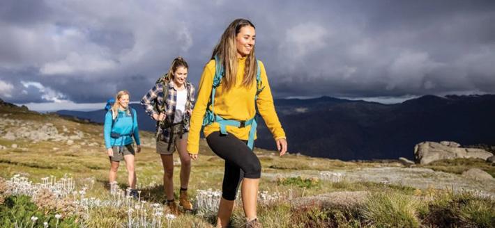
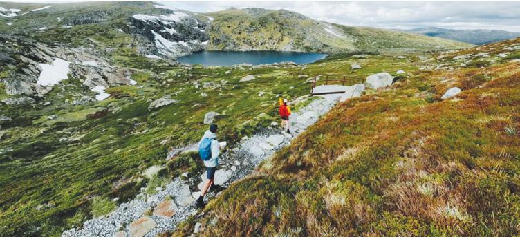
Mount Kosciuszko Summit Walk
Hard work is rewarded on the Mount Kosciuszko Summit Walk. You’ll be treated to views of some of the country’s tallest peaks, fields of wildflowers in spring and glacial lakes. While much of the hike is shared between walkers and bikers, cycling isn’t allowed on the final 1,400 metres to the summit of Mount Kosciuszko.
The walk is snowbound in winter, generally from June to October. While the route is open, it’s best tackled on cross-country skis or snowshoes, and there are no snow poles marking the route.
The walk starts at Charlotte Pass inside Kosciuszko National Park. Guided experiences are available via Thredbo Guided Hikes and The Adventure Gene Pty Ltd
• In a nutshell: A high-altitude action adventure, unlike any other in Australia.
• Parking: Yes, near the trackhead on Kosciuszko Road, though it may be limited. • Distance: 18.6km return • Difficulty: Grade 3
Walgun Cape Byron walking track
Popular with surfers, wellness enthusiasts and creative minds, thousands flock to Byron Bay for a taste of a slower-paced, bohemian life. The Walgun Cape Byron walking track offers the perfect snapshot of the area’s natural beauty, winding its way through the Walgun Cape Byron State Conservation Area.
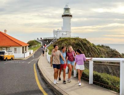
You’ll be treated to majestic coastal views (and potentially wallaby, whale, dolphin and stingray sightings) while dipping in and out of rainforest over this 3.7km loop. The path takes you right up to the Cape Byron Lighthouse, which has stood on watch at the most easterly point of Australia since 1901. The trail isn’t too difficult or long, but does feature some moderately steep sections. Wander Byron offers guided sunrise walk experiences.
• In a nutshell: An amazing way to explore the natural beauty and signature landmarks of one of the most beloved spots in NSW.
• Parking: There is paid parking on the streets near the start of the walk, and there are car parks at The Pass, Captain Cook lookout, Wategos Beach and Cape Byron Lighthouse. You can also walk from Main Beach to the start of the trail – it’s less than 30 minutes.
• Distance: 3.7km loop
• Difficulty: Grade 3
Cape Byron Lighthouse, Byron Bay
Above: Mount Kosciuszko Summit Walk, Kosciuszko National Park - Credit: Thredbo Resort
Above: Grand Cliff Top Walk, Wentworth Falls.
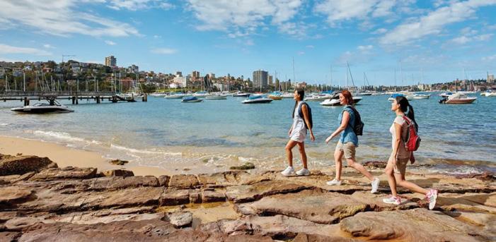
Spit Bridge to Manly Walk
The Northern Beaches’ Spit Bridge to Manly Walk puts your feet on largely unfinished (but well-maintained) trails. You’ll encounter gorgeous coastal views of Middle Harbour, coupled with a mix of bush and brushland, and Aboriginal rock engravings. The route is light on cafes and rest stops, so it’s a good idea to bring water and snacks, but make sure to save room for lunch in Manly. Head to Felons Brewing Co Manly for Mediterranean-leaning pub grub, craft beer and an ideal perch to watch the ferries come in.
• In a nutshell: This walk will have you dipping in and out of bushland on the way to one of the most happening spots in Sydney.
• Parking: There are free, untimed spots on the streets around the northern end of the Spit Bridge, near where the walk starts. Much of Manly’s parking is timed and paid, so consider taking public transport to your chosen starting point. • Distance: 10km one way • Difficulty: Grade 3
Snowies Alpine Walk
• In a nutshell: Spend four days walking the iconic Snowy Mountains.
• Parking: Available at Guthega, Perisher Valley and Bullocks Flat. Limited parking at Charlotte Pass.
• Distance: 56km • Difficulty: Grade 4
Journey across Australia’s alpine roof with the Snowies Alpine Walk in Kosciuszko National Park. The 56km, four-day hike will take you through unique alpine landscapes and up to the summit of Australia’s highest peak: Mount Kosciuszko. While you’re there, wander through wildflower meadows, snow gum forests and glacier-carved landscapes.
If you’d prefer a guided experience, there are many operators who facilitate group and private experiences: The Adventure Gene, Australian Walking Holidays, Thredbo Guided Hikes (sustainable certified), Life’s An Adventure (eco-certified) and Women Embrace Adventure.
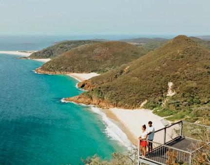
Tomaree Coastal Walk
Beginning at Tomaree Head and weaving through pretty angophora forest, small coastal communities and past secluded beaches to the culturally significant Worimi Conservation Lands, the Tomaree Coastal Walk is a lesson in NSW beach beauty, and an ideal city getaway. The journey is best experienced as an overnight walk staying at nearby off-park accommodation such as Port Stephens Koala Sanctuary or Shoal Bay Holiday Park, however, it can also be completed in three days for a more leisurely pace.
Keen on a shorter, but equally beautiful experience? The Tomaree Head Summit Walk is 2.2km-return, Grade 5 hike overlooking the Jurassic Park-like Shoal, Port Stephens and Fingal bays, beginning at the end of Shoal Bay Road.
• In a nutshell: A multi-day experience past secluded beaches, rock platforms and coastal villages.
• Parking: At both ends of the walk.
• Distance: 27km one way
• Difficulty: Grade 4
Above: Snowies Alpine Walk, Kosciuszko National Park - Credit: D Parsons | DCCEEW
Giant totara feature of Montgomery
by Yvonne van Eerden
We drove to the start of the Totara Walk approximately one hour from Christchurch on the Akaroa Highway then turned left just before the Hilltop onto the Summit Road for approx 200 metres.
There is a small car park for a couple of cars on the left hand side of the road and this is where you start the giant Tōtara Walk of (15 minutes).
The track climbs straight away and heads towards the totara tree. They say that the totora tree is most likely over 2000 years old. It is stunning.
Even if you do not venture past the tree it certainly is worthwhile doing the walk to see the giant totora and
also the regenerating bush.
After many photos we moved on and continued up the track which opened up to a lookout (20 minutes) over towards Akaroa Harbour.
As we continued the track changed and we had to climb over the boulders towards the bluffs. The rocks and boulders were a little slippery and
Above left: The lookout towards Akaroa Harbour. Above right: Taling in the views. Below left: The giant totara tree.. Below right: Huge Boulders.
Peak Track
mossy in places as there had been some rain the previous week and parts of the track were in the shade all day, but we tried to be careful at finding our footing!
■The track seemed to go up, up and up but we all took our time and certainly enjoyed the challenge of the boulders which were so huge in places and in such different shapes and sizes. You needed to take some time to stop and look around to catch a glimpse of the views and the stunning trees around you.
Some of the trees or remaining parts of the trees were most unusual with one having a chainsaw cut at the button but still standing and the old fuchsia trees with the huge branches and hollow trees which were also amongst the bush. If you did not take the time to look around you would just walk on by.
The bluffs also protruded above the
forest canopy. We had a great morning tea break with a view and then headed on to meet Pettigrew's Track. At the top of the Montgomery Peak we hit gale force winds but continued walking down and the wind just seemed to disappear.
We continued heading towards Mt Sinclair. The old totara trees were certainly an amazing graveyard of magnificent sculptures with an incredible
background with the blue sky, hills and tussock.
We sat for lunch with scenic views. It was time to head back the way we had come and everyone was happy at what we had achieved.
This walk can be as long or short as you want with so many other tracks adjoining. We had a very lucky day with the weather and the condition of the track but eventually you have to make the decision to return.
Above right: Reaching the top. Below right: Huge boulders.
Lake Okareka - a bird lover’s paradise
Lake Okareka near Rotorua, is a nature lovers paradise. With well marked access points off Tarawera Road, there is now an interesting and varied walk right around it.
Because it has a mix of shade and open spaces, it can be walked any time of the year, but is especially nice in summer providing lots of shade in the bush sections and lovely swimming spots in the lake.
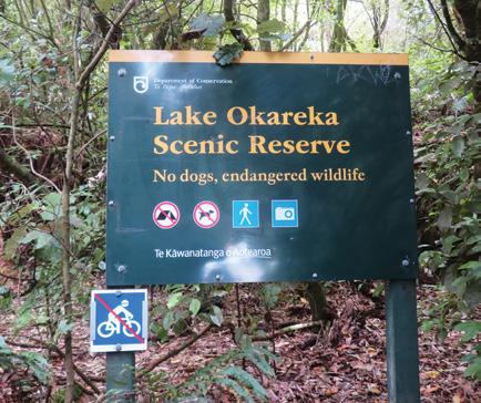
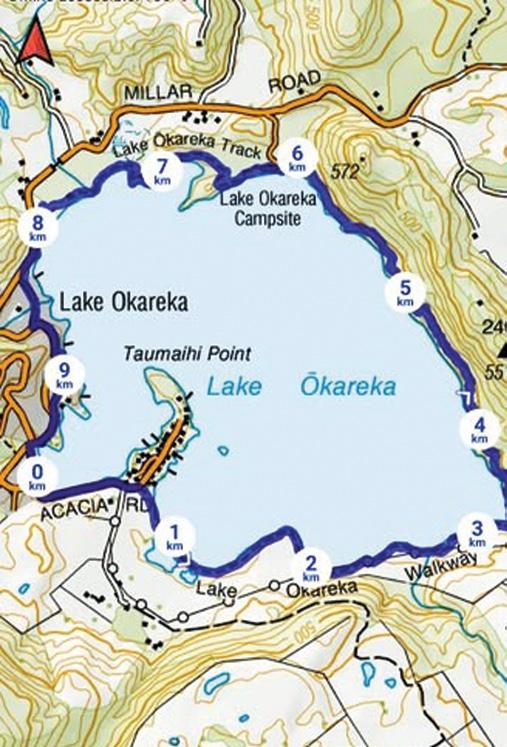
We started from Acacia Bay Reserve car park. From here is a three minute walk up the road to reach Okareka Walkway. Information boards displayed the birds living here, and a ‘Hide’ nearby provided an interesting place to sit and watch a while.
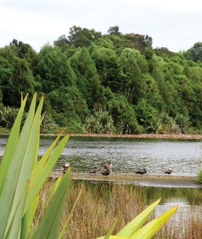
This is a haven for bird watchers, offering a huge variety. You can find paradise ducks, mallards, Canadian geese. cormorants, pukekos, gulls, black swans, pied stilts, crakes and
Above left; The Hide near the beginning of the walk – and lots of info’ boards. Below left: Lots of pungas here.
lapwings to name a few. There were so many birds, each with their own call. It was quite a chorus!
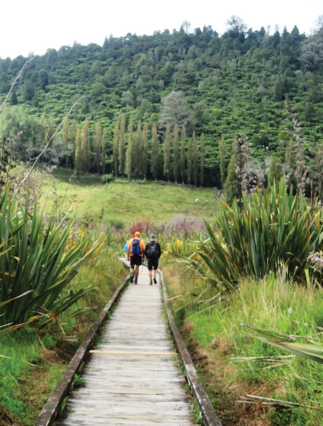
We followed gravel track and boardwalk over the wetlands for about 40 minutes stopping to read signs, watch birds and take photos. Crossing a little bridge, the trail turned right and began a gradual climb to a lovely leaf covered track above the lake.
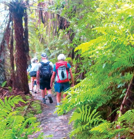
We walked through ferns and under pungas, with a top canopy of rewarewa. Some sections were cool and shady, while in other sections the sun streamed in, lighting the ferns to a vivid green.
The trail skirted the lake, giving glimpses of clear water below. We stopped half way for a break and to watch a little robin hopping around close by. Continuing on, we reached Lake Okareka Scenic Reserve - an open area by the lake shore, with a good swimming spot, toilets, a shelter and a D0C campsite. 110 bait traps have been set in this area to try to
Above left: A view from the boardwalk. Middle left: A sheltered lunch spot. Below left: A rope swing along the way.
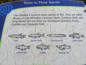
Top Right: Member of the Shoestring Tramping Group on the track.. Above right: Sign showing Fish in Lake Okareka.
Below right: Filtered sunlight brightening the ferns to a brilliant green.
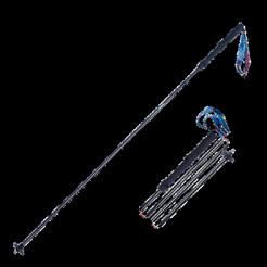
Foldable Hiking Poles
* Made from Aviation Aluminium
* Adjustable from 65cm -135cm
* Folds into 3 sections
* Straight rubber handle
* Comes with handy bag
* Colours Blue or Red
Lake Okareka
- a bird lover’s paradise
control pests and the long term goal is to create a pest free sanctuary. After stopping here for lunch, we took the bush path to Boyes Beach. On the way, we found a swing tied to a tree over the lake. We stopped to admire it but didn’t have a go.
Further along, we took a side track to a viewing platform overlooking wetlands. It was warm and sunny after the cool bush walk, and we sat a while watching dragonflies flitting around
Boyes Beach was two minutes down the track, with a lovely open space with good toilets, a well planned playground and a place to swim. From there the trail led along the road for about 15 minutes back to our cars. It was a delightful walk with many options, easy access and plenty of parking. If you’re interested in birds, go to Lake Okareka.
Above left: Walkers on the boardwalk.
Above top right: Map of the walk. Above right: The bush track following above the lake.
The only way is up on foot to Rome
The Only Way is Up: On Foot to Rome is a memoir of longdistance walking, but it is also a meditation on how we move forward when life asks us to begin again.
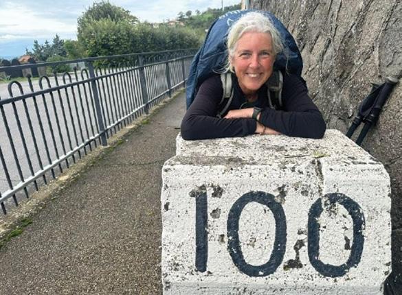
Setting out from Canterbury and walking some 2400 km to Rome along the Via Francigena, Jennifer Andrewes undertakes a modern pilgrimage across England, France, Switzerland and Italy.
What begins as a physical journey soon becomes something deeper: an exploration of momentum, mindset, and the quiet power of putting one foot in front of the other when the way ahead is uncertain.
Structured as a series of daily stages, the book follows the rhythms of pilgrimage life – early starts, long days on the road, chance encounters, moments of solitude, and the simple rituals that sustain a walker: coffee stops, conversations, rest, reflection.
Along the way, Jennifer meets fellow pilgrims from around the world,
navigates doubt and discomfort, and learns to trust the unfolding path rather than trying to control the outcome.
While written through the lens of walking to Rome, The Only Way is Up speaks to anyone standing at a crossroads.
It offers pilgrimage not as an escape from real life, but as a practical framework for living well: shedding excess weight – physical and metaphorical – building resilience, cultivating presence, and finding meaning through steady forward movement. The journey reveals how momentum can transform thinking, restore confidence, and open new possibilities.
The author’s experience living with Parkinson’s is part of the landscape, but it does not dominate the narrative. Instead, it quietly sharpens the book’s central insight: that while we cannot always change our circumstances, we can change how we meet them. Pilgrimage becomes a way of training response – choosing movement over
stagnation, curiosity over fear.
For readers considering a camino or long walk, the book offers an honest, grounded portrait of life on the trail.
For others, it provides something broader: reassurance that clarity often comes through motion, that the path reveals itself step by step, and that sometimes the only way forward – in walking and in life – is onwards and upwards.
“A generous, reflective and uplifting account of pilgrimage as a framework for navigating change.” Helen Clark, former Prime Minister of New Zealand.
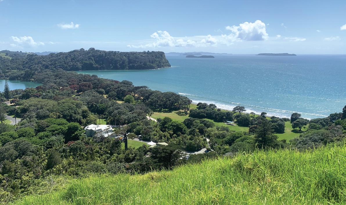
A visit to Auckland’s first regional park 60 years on
Wenderholm (Winter Garden) opened to the public on the 18th of December 1965. It remains in fine condition and one of the most popular regional parks in the Auckland area. It offers a variety of experiences
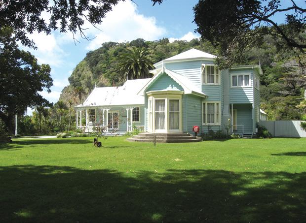
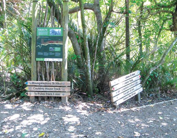
Above; Looking down on Wenderholm Regional Park. Below left: Couldrey House. Below right: Information signs at the start.
and attractions such as bush walks, a fine beach, farm paddocks, outstanding views, an historic homestead, many sheltered areas with picnic tables and room for games, native birds and river outlooks.
There is a large well set up campground and a farmhouse (Schischka House) accommodation that can be rented as well as a glamping unit.
With the areas varied natural resources it is not hard to
By Ralph Lyon
see why this general area was a favoured locality for settlement by Māori for close to 1000 years. At 148 hectares the park has a selection of tracks so there are opportunities to find a walk to suit your preferences for a day’s outing from a relaxed stroll to a more extended and energetic circuit. Perhaps as preparation for a walking trip in some other part of the country or world.
Pick up a park brochure from the information booth and choose your route. A good introduction to the attractions of the park is to walk the Maungatauhoro Te Hikoi Loop as described on the brochure. This loop
offers some great views and an introduction to the forest and its bird life.
It is worth making a short side diversion along the Puhoi Track as you go past the junction as it takes you out to an open grassy area with superb views to the north and a seat for a rest before returning to the Couldrey House Track and continuing your return circuit.
The tracks on this loop are well formed and lightly gravelled. Other tracks can be rougher particularly the southeastern section of the Perimeter Track.
With the increasing uncertainty around fuel supplies it may become of increasing interest that Wenderholm Regional Park can be accessed using the bus service to Waiwera and
Boots Packs Rainwear
All your tramping essentials
One shop ~ Since 1988
a five minute walk from the nearest bus stop to the park track system
Auckland’s regional parks provide us with exceptional chances to enjoy some natural outdoor environments. Friends of Regional Parks (FOR Parks) is a volunteer organisation committed to working with Auckland Council to improve and expand Auckland’s regional parks. Please consider becoming a member or joining the FOR Parks committee to help support the future of the parks.
For more information on FOR Parks you can visit the website forparks.org.nz or contact bronwen. turner@forparks.org.nz
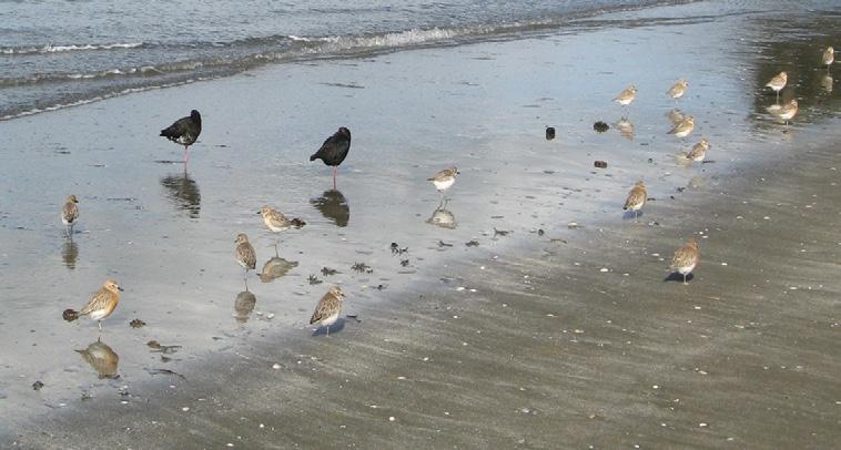
Above Birds resting on the beach at low tide.
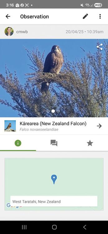
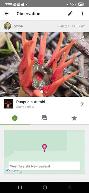
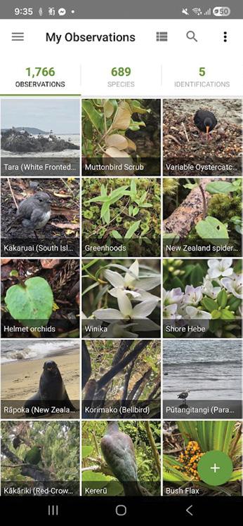
Discover your wild backyard: Why use iNaturalist?
You don’t need to be a scientist to do science. All you need is a smartphone, a sense of curiosity, and the remarkable natural world that surrounds us here in Aotearoa New Zealand.
iNaturalist is a free app that lets you photograph plants, animals, and fungi, then uses a combination of artificial intelligence and a global community of human naturalists to identify what you’ve found.
Getting outside is good for you
We all know we should spend more time outdoors. Research consistently links time in nature with lower stress, better mood, and improved mental wellbeing.
Every observation you make is available for researchers and conservation agencies around the world. It’s simple, it’s free, and it’s genuinely changing how we understand our natural environment.
By Celia WadeBrown
But iNaturalist adds a layer of purpose to a walk in the Tararua Ranges or a stroll around Lake Wairarapa. Suddenly you’re not just getting fresh air — you’re on a mission.
That bright blue mushroom by the track, the unfamiliar bird call, the scented orchid— they all become small mysteries worth solving. People who use the app often say it completely changes how they move through the landscape, slowing them down and sharpening their attention in the best possible way.
You are making a difference
Every photo you upload contributes to real science. iNaturalist feeds data into the Global Biodiversity Information Facility, which is used by researchers, conservation managers, and government agencies to understand where species live and how populations are changing over time.
In a region like ours, with its remarkable diversity of habitats — from coastal wetlands to hill country forests — local observations fill genuine gaps in scientific knowledge.
Our country is home to some extraordinary species, ancient lineages like the tuatara, new moths that have blown over in storms from Australia, and the pesky yellow-legged hornet.
Even what seems ordinary to us can be valuable data. A kererū feeding in your garden in July, a particular orchid flowering two weeks earlier than usual, or a lizard spotted somewhere it hasn’t been recorded before — these details matter.
Your garden counts too iNaturalist isn’t just for trampers and birdwatchers. You can record
plants in your own backyard — whether it’s a native you’ve planted, a heritage rose, or a vegetable you grew from seed. Importantly, the app is also a powerful tool for tracking invasive weeds. Species like old man’s beard, barberry, and tradescantia are spreading, and community observations help track their distribution so we can respond.
Watching the seasons shift
Climate change is altering the rhythms of nature in ways that are easy to miss year to year but striking over time. When did the kōwhai flower this season? When did the first cicadas emerge? Citizen science records from apps like iNaturalist are becoming essential tools for tracking these phenological shifts — the seasonal timing of natural events — giving us a living record of how our environment is responding to a warming climate.
How to get started
Download iNaturalist free from the App Store or Google Play. Create an account, head outside, and
take a photo of anything that catches your eye. The app will suggest an identification if you have data or internet, and the community will often confirm or make another suggestion within hours. If you are out of coverage, just add it to iNaturalist and upload when you get home. You can also explore what others have recorded nearby, which is a wonderful way to discover what’s living in your local reserve.
The only downside of using iNaturalist is that it might slow you down. I’ve adapted a proverb that sums this up: If you want to go fast, go alone. If you want to go far, go in a group. If you want to go slowly, go with a botanist. If you want to go even more slowly, go with an entomologist!
You can now view back issues of Walking New Zealand magazine, two issues back from the latest, FREE at : http://issuu.com/walkingnewzealand.
Waipoua Forest embarks on bold expansion
The Kauri Walks tracks in Waipoua Forest are closed for naturing from March until the end of October while contractors build new infrastructure to expand and enhance the visitor experience and protect the chiefly trees (Rākau Rangatira) from kauri dieback disease.
DOC Northern North Island Regional Director Sue Reed-Thomas says the renovation at Kauri Walks will allow improved access to the Four Sisters and open previously inaccessible parts of Waipoua, including unique kauri gumland wetlands.
Forest health is our top priority, and we are focused on delivering a memorable experience so visitors who come naturing here walk away and want to be part of protecting this incredible taonga for future generations,”
Sue says. “Partnership is the key element of the Rākau Rangatira kaupapa. We work alongside Te Roroa to share this significant milestone of getting work underway.”
Piripi Moore, Te Roroa representative, says the renovation works mark an important step forward within the wider Rākau Rangatira kaupapa, which began in earnest with the completion of the new Tāne Mahuta infrastructure and enhanced visitor experience in 2024.
“This phase is also about more than new infrastructure,” Piripi says. “When people come to understand the cultural and ecological significance of Waipoua, they become part of its protection. Our hope is that every manuhiri leaves not only inspired by the majesty of these rākau rangatira, but with a deeper awareness of their responsibility to uphold the mauri of the ngahere.
“For Te Roroa, this is an expression of kaitiakitanga responsibilities in action. We are proud that our kaimahi will be actively involved throughout construction, visibly upholding our role as mana whenua and our intergenerational commitment to safeguard this taonga for
ngā uri whakatipu, while helping shape a world-class visitor experience grounded in respect, conservation and kotahitanga.”
Sue says main contractor Keir Projects specialises in this type of construction, with many of the team being multi-disciplined tradespeople who are highly qualified to work in remote areas and sensitive areas.
The new boardwalk will be 1.5 km long. All work will be carried out under robust biosecurity controls approved and monitored by Kauri Ora, DOC, and Tiakina Kauri.
Kauri Walks (Te Matua Ngahere) and the Four Sisters are expected to re-open for visitors in October 2026.
The Four Sisters has been closed since 2019 due to the biosecurity threat posed by the plant pathogen that causes kauri dieback disease.
Tane Mahuta will remain open for naturing during the upgrade of Kauri Walks.
Te Matua Ngahere is the oldest out of the two largest living kauri trees and is estimated to exceed 2,000 years. He was discovered by Nicholas Yakas in 1928 when he and other men were working to build the road that is now known as SH12.
Tane Mahuta measurements: trunk girth: 16.41 m, trunk height: 10.21 m , total height: 29.9 m, trunk volume: 208.1 m³.
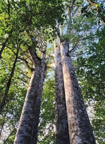
Above right: Some of the kauri trees in Waipoua Forest . Photo Marina Van den Berg
NORTH ISLAND
NORTHLAND
BAY OF ISLANDS
BAY OF ISLANDS WALKERS: Saturday (AM), Jacqui Watson 022-6019741, Roz Whittaker 021-063-1455
DARGAVILLE
DARGAVILLE TRAMPING GROUP: Last Sunday of month (AM), Lynley Thompson 021-102-3974, colvilleestate1@gmail.com
WHANGAREI
CARDIAC CARE WALKING GROUP: Wednesday (AM or PM), Jo or Hugh Knight 09-438-7976
BARRIER TRAMPING& BEER LOVERS CLUB: Sunday, John Brock 09-429-0211
AUCKLAND
AUCKLAND GLOBAL TREKKERS: Sundays (BIA), Auckland walks and one overseas walk, auckland.global.trekkers@gmail.com, https:// heylo.group/aucklandglobaltrekkers
BLUE TOP WALKERS: Henderson, Tuesday, Thursday (AM), Terry Wilson 09-814-9523 or 021-266-1071, terryandsheena@gmail.com, www. bluetopwalkers.weebly.com
FIA OLA WOMEN’S DEVELOPMEMT WALK GROUP: Monday to Saturday, Anne, 09-813-0021
FIT4LIFE: Glenfield, Monday (PM), Friday (AM), Sarah 021 534 649
TE ATAU PENINSULA WALKERS: Monday, Friday (AM), Wednesday (PM), Mary Jones 09-834-6989
TE ATATU SOUTH ACTIVE 35+ WALKING GROUP: Te Atatu South, Wednesday, Edna, 09-834-1401
THE HAPPY WANDERERS WALKING GROUP: Wednesday (AM), Joy Williams 09-817-2464 or 027-353-3434
TITIRANGI TWILIGHT WALKERS: Tuesdays, Thursday, (PM) Titirangi Library, Wednesday (PM) Glovers Real Estate Green Bay, Louise 021437-547, louisenicholson@xtra.co.nz
TITIRANGI WALKERS: Sundays (AM), John Harris 09-627-0099, jeanah@ihug.co.nz
EAST COAST BAYS WALKERS: Browns Bay, Tuesday, Friday (AM), Pam Mattson 09-302-4882 or 021-268-4154, pam_4882@yahoo.co.nz
GREENHITHE WALKING GROUP: Greenhithe, Tuesday (AM), Marjorie Andrew 09-413-9065
HIGHBURY COMMUNITY HOUSE: Highbury, Thursday, Friday (AM), Judy Mayn 09-480-5279
MAIRANGI WALKING NETWORK: Mairangi Bay, Everyday (AM), Paula Cole 09-444-6435
MILFORD MALL WALKERS: Greenhithe, Tuesday, Thursday, (AM), Carol Mosedale 09-443-2054
MILFORD MENS PROBUS: Ian Hall 09-479-4259
NORTH SHORE DIABETES SUPPORT GROUP: Every second Sunday (AM), Dave or Panny 09-476-7447
NORTH SHORE SOCIAL WALKING GROUP: Every second Wednesday, Rosamonde Johnson 022-308-8975, rsmndj@gmail.com
NORTH SHORE TRAMPING CLUB: president@nstc.org.nz, www. nstc.org.nz
NORTHCOTE WALKING GROUP: Northcote, alternative Tuesdays,
LEGEND
Fitness levels: “B” beginner, ”I” intermediate, “A” advanced. (AM) denotes morning walk, (PM) denotes an afternoon or evening walk. Group co-ordinators are asked to please advise us of any updates by fax 06-358-6864 or email walkingnz@xtra.co.nz.
If you notice there that the times, names or contact numbers etc on the list of Walking Grroups in the Directory on these pages needs updating please email us at walkingnz@xtra.co.nz. These are are free listing.
LEGEND
Fitness levels: “B” beginner, ”I” intermediate, “A” advanced. (AM) denotes morning walk, (PM) denotes an afternoon or evening walk. Group co-ordinators are asked to please advise us of any updates by fax 06-358-6864 or email walkingnz@xtra.co.nz.
LAMBDA DAY TRAMPERS: every second Sunday, (BI), social group for gays and lesbians of all ages, https://lambdatrampers.org/ LINWOOD AVENUE WALKING GROUP: Wednesday, Thursday (AM) (B), 03-389-5303
PIONEER TRAMPERS:Thursday (AM) (IA),4-5 hour tramps in Banks Peninsula and the hills and lower mountains from Mt Hutt to Mt Grey, pioneertrampers@gmail.com
Notice to clubs and walking groups If you notice there that the times, names or contact numbers etc on the list of Walking Grroups in the Directory on these pages needs updating please email us at walkingnz@xtra.co.nz. These are are free listing.
9 Tough Gal Team Challenge: Auckland, Kumeu, Auckland
16 Run Auckland: Farm Cove, Pakuranga, Auckland
22 Sprig & Fern 10K: Brightwater
23 Forest Run Fest, Bottle Lake Forest, Christchurch
26-29 Great Naseby Water Race, Nasby Foorest Park, Nasby
29 Kaitaia Trail Run/Walk, Te Hiku Forest, West Coast Road, Kaitaia
29 Mount Maunganui Half Marathon, Mt Maunganui
30 Auckland Trail Run & Walk: Waitawa, Waitawa Regional Park, Auckland
30 The Lake Dunstan Trail Marathon, Clyde to Cromwell
SEPTEMBER 2025
5 Canterbury Adventure Race, Canterbury
5 Dovedale Hill Race, Dovedale
5 Kinloch Off Road Challenge, Kinloch, Taupo
5 Laps at the Lakes, Pauanui, Coromandel Peninsula
5 Scenic Circles Backyard Ultra, Ti-
The H215 Professional 4 Function Pedometer
The H-215, 4-function pedometer is a superb, reasonably priced pedometer that counts steps, calculates distance, calories burned and has a 12/24 hour clock.
This is the model that has sold over a quarter of a million worldwide. It has the largest display of any pedometer we tested and is very accurate.
Dimensions: (L) 5.6 * (W) 3.7 * (t) 2.7 cm
Price only $36.95 plus $7.00 P&P
Phone 0800-925-546 for bulk prices
Available now from: Walking New Zealand Shop 47 Lincoln Tce, Palmerston North - Phone 0800-925-546 Fax 06-358-6864 or email walkingnz@xtra.co.nz. www.walkingnewzealand.co.nz
You can now view and enjoy the latest issue of Walking New Zealand magazine online for $3.95 at http://www.walkingnewzealand.co.nz
maru
6 North Shore Marathon, Milford, Auckland
12 Motueka to Māpua Relay, Motueka, Tasman District
12 Peak to Pub, Mt Hutt Ski Area, Canterbury
12 Tongariro River Trail, Turangi
12 Wainuiomata Hill Run, Wainuiomata, Lower Hutt
13 Emerson’s Dunedin Marathon, Dunedin
13 Run Auckland: Millwater Estuary, Milford, Auckland
12 Stanley Bay Mud Run, Stanley Bay, Auckland
13 Whangarei Run/Walk Festival, Whangarei
19 Merrell Race Tekapo, Cnaterbury
19 Queen Charlotte Relay, Picton to Havelock, Marlborough
19 Te Āpiti Traverse, Woodville
20 Brighton Backyard Ultra, Brighton, Dunedin
20 Hutt Marathon, Petone. Hutt Valley
20 Terry Fox Run: Auckland, Flat Bush, Auckland
CAMINO MAGIC MAY 2026
Fully Escorted
Join YOU Travel Whitianga’s experienced escort on a soul-stirring 16-night adventure through Spain and beyond. Walk 115km of the legendary Camino from Sarria to Santiago, uncovering ancient villages, scenic trails, and rich cultural treasures. Space is limited so register your interest today!
Contact us to get more information today! 75 Albert Street, Whitianga 07 866 4397 diana@traveloptions.co.nz
Hagley Park, Christchurch
25 Spring Challenge Adventure Race, Hanmer Springs
30 New Zealand Walks: Heaphy Track and Oparara Arches
33 New Zealand Walk: Lou’s Lookout Walk
34 New Zealand Walks: Wandering along the Waika to River Trail from the dam to Jones Landing
38 New Zealand Walk: A’Deanes Bush Walk through an original existing forest
42 Coming Events: New Zealand
46 Coming Events: Australia
47 Coming Events: Rest of World
48 New Zealand Country Breaks
52 Pak A Roo Walking Jackets SEPTEMBER 330 2025
3 Contents
4 Walk Talk
6 New Zealand Walk; Short walks at Lake Brunner
8 New Zealand Walking Festival: Wairarapa Walking Festival has over 25 walks
along the Karangahake Gorge
18 Weather: Weather prediction for September
19 New Zealand Walk: Track repair confirmed for Waimata Gemstone Bay
20 New Zealand Walk: Cape Saddle Walk: A valley to valley walk in Craigieburn Forest Park
24 Walking New Zealand Monthly Photo Contest
26 High Achiever: Raukumara Hikoi to view work done on the ranges
29 Australian Walks: Forest Sky Pier, Orara East State Forest offers great coastal views
30 Te Araroa Trail: How walkers donation have helped the Te Araroa Trail
32 News: 100 years of history with the Auckland Natural History Walking Group
34 New Zealand Walks: Walks in Winsome Wairarapa
36 New Zealand Walk: Walking fron the Woodville end to Ashhurst to first lookout
40 Directory of New Zealand Walking Groups
42 Coming Events: New Zealand
46 Coming Events: Australia
47 Coming Events: Rest of World
48 New Zealand Country Breaks
52 Pak A Roo Walking Jackets AUGUST 329 2025
3 Contents
4 Walk Talk
6 New Zealand Shared Pathway: Te Ahu a Turanga Manawatu to Tararua a journey from Ashhurst to Woodville
10 New Zealand Shared Pathway: Build the Path
11 New Zealand Walk: St Leonard’s Beach dog friendly
14 New Zealand Walk: Kurow Hill Walk an unique experience
18 Weather: Weather predictiofor August
19 Viewpoint: Reinstate the competitive walking section: Why Auckland Marathon must listen to walkers
20 New Zealand Walking Festival: Bay of Islands Walking Weekend
23 Living Streets Aotearoa: Do you do this?
24 Walking New Zealand Monthly Photo Contest
26 Walking Tours: What’s in the mix for 2026
29 High Achiever: Northland engineer wins Outdoor Access Champions Award
30 New Zealand Walk: Hinehopu Bluffs for lots of native trees and birdlife
33 New Zealand Walk: The Terrace Walk at Franz Josef
34 New Zealand Walk: Karituwhenua Stream Walk a short family walk
36 New Zealand Walk: Omarama’s Clay Cliffs has an unique landscape
39 Auckland Walk: A walk or bike ride through Logan Park Reserve:
40 Directory of New Zealand Walking Groups
42 Coming Events: New Zealand
48 New Zealand Country Breaks
52 Taupo Marathon JULY 328 2025
3 Contents
4 Walk Talk
6 New Zealand Walk: Tawa Loop Walk - a blend of natural beauty
10 New Zealand Trail: Access easements are the foundation of Kawatiri Coastal Trail
12 New Zealand Walks: Nine DOC huts for the first timer
14 Walking Tours: What is Footsteps
17 High Achiever: Dunedin track builder wins national award
18 New Zealand Walks: Wairakau Stream Walk included a climb up the Duke’s Nose Peak
22 New Zealand Trails: Sign of the Vimes: new Marlborough Vineyard Trail:
24 Walking New Zealand Monthly Photo Contest
26 Overseas Walks: The wild West Coast Trail on Vancouver Island 29 Subscription page
Falls Park has lots of easy walks
36 Australian Walks: Ten best walks and hikes in Tasmania
42 Coming Events: New Zealand
46 Coming Events: Australia
47 Coming Events: Rest of World
48 New Zealand Country Breaksp
52 Pak A Roo Jackets JUNE 327 2025
3 Contents 4 Walk Talk
6 New Zealand Walk: Walking on Waiheke enjoying bird song
11 New Zealand Walks: Unveiling the beauty and history of the Nydia Track, Marlborough Sounds
14 New Zealand Walks: Wandering through wonder a walk in the Hamilton Gardens
17 Australian Walks: Outstanding odyssey in Oz with some great walks in South Australia
20 New Zealand Walk: Scotts Beach & Nikau Walk, Karamea
23 Te Araroa Trail: A day walk on the Te Araroa Trail
24 Walking New Zealand Monthly Photo Contest
26 Shared Pathway: Cycling the Kapiti Coast: an Autumn adventure
30 New Zealand Walk: Taieri River Scenic Reserve an interesting walk
32 New Zealand Walk: Te Henui Walkway Extension a little known walk
34 New Zealand Event: Run Tekapo walks with breath-taking views
36 New Zealand Walks: From forest to skyline Walking the Wilds of Puhi Peaks
40 Directory of New Zealand Walking Groups
42 Coming Events: New Zealand
45 Coming Events: Rest of World
48 New Zealand Country Breaks
51 Walking New Zealand Shop
52 Pak A Roo Jackets MAY 326 2025
3 Contents
4 Walk Talk
6 New Zealand Walk: Lake Rotorangi Hydro Walkway a little gem
9 New Zealand Walk: Six top Kapiti walks - coastal, scenic and bush worth exploring
12 Waitomo Cycle Trails: Waitomo - a bike walk adventure
14 New Zealand Trail: Ruakuri Scenic Reserve
16 New Zealand Walk: Washpen Falls Walk - Canterbury’s secret canyon walk
19 New Zealand Walk: Walk through a canyon in an ancient volcano
19 New Zealand Walk: Whangarei forestry walkway re-opened
20 Shared Pathway: Hauraki Rail Trail - Thames to Matatoki
23 Book: Hiking the Hexa - a journey on France’s newest through hike
24 Walking New Zealand Monthly Photo Contest
26 Overseas Walks: Trekking to Machu Picchu by the Salkantay Trek
30 Auckland Walks: Great Auckland spots for walking your dog
34 Overseas Walks: Colorado for thousands of hiking trails
39 New Zealand Walk: New footpath bridge opened in Wellsford
40 Directory of New Zealand Walking Groups
42 Coming Events: New Zealand
45 Coming Events: Australia
48 New Zealand Country Breaks
52 Pak A Roo Jackets APRIL 325 2025
3 Contents 4 Walk Talk
6 New Zealand Walk: Lake Rotorangi Hydro Walkway a little gem
9 New Zealand Walk: Six top Kapiti walks - coastal, scenic and bush worth exploring
12 Waitomo Cycle Trails: Waitomo - a bike walk adventure
14 New Zealand Trail: Ruakuri Scenic Reserve
16 New Zealand Walk: Washpen Falls Walk - Canterbury’s secret canyon walk
19 New Zealand Walk: Walk through a canyon in an ancient volcano
24 Walking New Zealand Monthly Photo Contest
26 Overseas Walks: Trekking to Machu Picchu by the Salkantay Trek
30 Auckland Walks: Great Auckland spots for walking your dog
34 Overseas Walks: Colorado for thousands of hiking trails
39 New Zealand Walk: New footpath bridge opened in Wellsford 40 Directory of New Zealand Walking Groups 42 Coming Events: New Zealand 45 Coming Events: Australia
Coming Events:
10 New Zealand Walk: Makotuku Track has wide appeal
13 Need2know: 7000 steps a day now achievable for most people
14 New Zealand Walk: A wander
New Zealand Walk: Inglewood Walkway a popular community asset 32 New Zealand Walk: McClaren
19 New Zealand Walk: Whangarei forestry walkway re-opened
20 Shared Pathway: Hauraki Rail Trail - Thames to Matatoki
23 Book: Hiking the Hexa - a journey on France’s newest through hike
10 Walking Festival: Walking the
The ULTIMATE is Zerofit’s flagship product and perfect for hiking, golf, sailing or any outdoor activities when it’s cold. But if you are more active it is complemented by the Heatrub MOVE.
Twice as warm as a standard base layer, the material regulates tempertures as you move, so you won’t suffer from cold sweat, if your are running or cycling.
Please visit the Walking New Zealand Shop: https://walkingnewzealand.co.nz/productcategory/apparel/ for more details and to order.