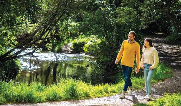
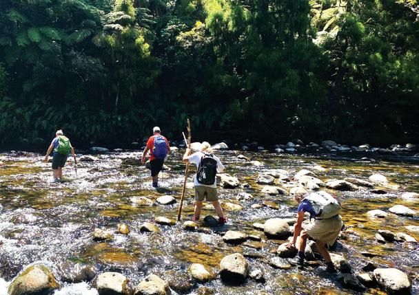
Australian Walks: Explore the Murray River with the experts
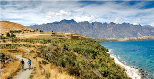
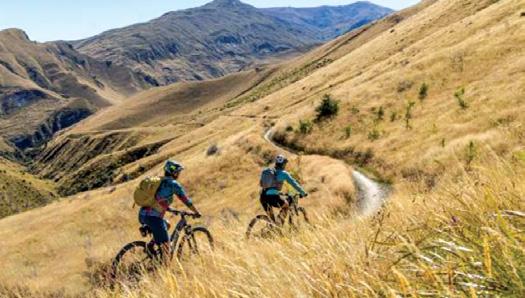
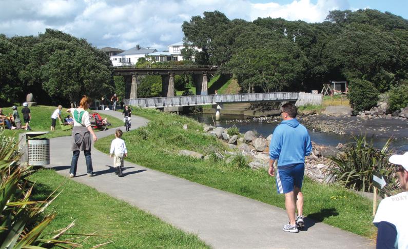
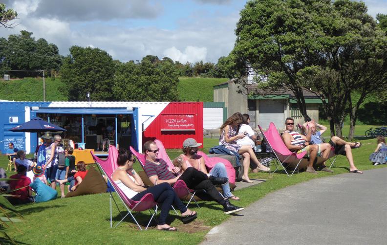
New Zealand Cycle Tour Ride, Sip and Enjoy Hawkes Bay Uncorked
Event: Stanfield Hut an ideal place for lunch
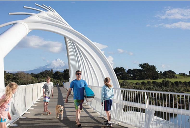
New Zealand Walk: Bridal Veil Falls Walk a short walk with impact
New Zealand Walkin g Groups: A day on foot along Aucklands Waterfront from Downtown to St Heliers
Overseas Walks: Lochs, Munros, Bens and Braes
Issue 337 APRIL 2026
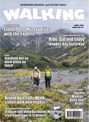
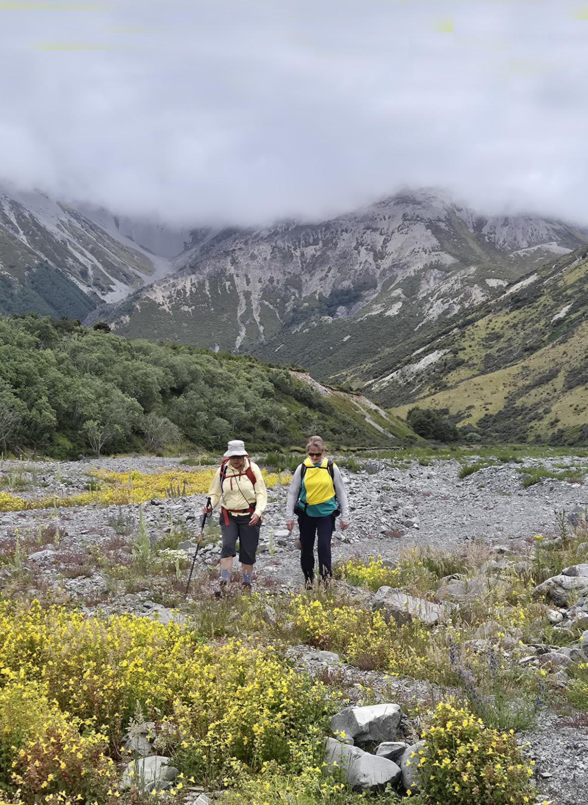
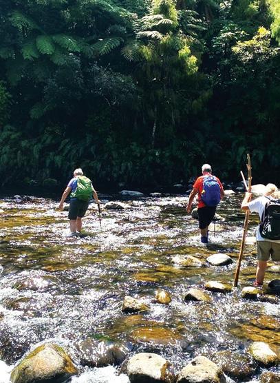
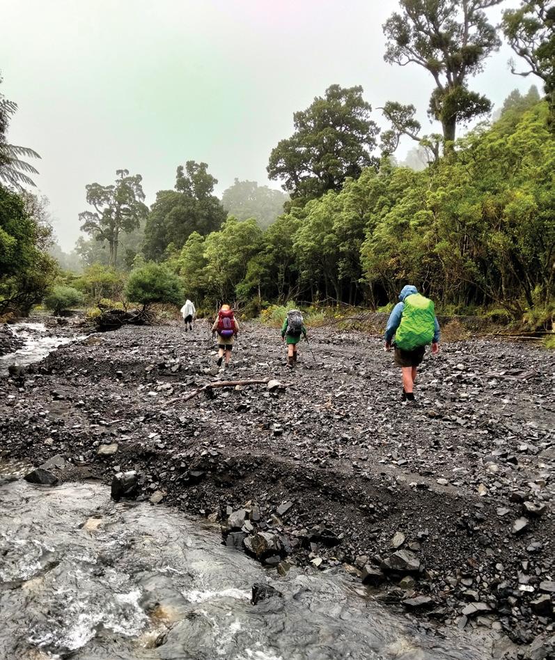
Cover image: Below left: Members of Bishopdale Tramping Club enjoying a jaunt along the Kowai River following a visit to John Hayward Memorial Hut. located on Brooksdale Station which runs from the foot of the Torlesse Range up to Porters Pass. Photo by Marie-Therese McRae, Papanui, Christchurch.
PUBLISHER/EDITOR: Frank Goldingham MNZM: Phone, 027-274-0726
CONTRIBUTORS: Gwen Bowler, Barbz Lowther, Ken Ring, Phillip O”Donnell, David Scoullar,, Gwen Bowler, Patrick Tooher, and Catherine Quinn
ADVERTISING MANAGER: Frank Goldingham - 0800 walking (925-546) 027-274-0726
Email: walkingnz@xtra.co.nz
COMING EVENTS ADVERTISING: Frank Goldingham 0800-walking (925-546) Email: walkingnz@xtra.co.nz
SUBSCRIPTIONS:
0800-925-546
Are Direct NZ Limited
WALKING NEW ZEALAND LTD, 47 Lincoln Terrace, Hokowhitu Palmerston North, 4410 Telephones 06-358-6863 - 027-274-0726
Queenstown Trails Trust has been granted consent for its Jack’s Point to Frankton Trail. The trust is hopeful that construction work can begin this year.It will cost around $850k, with $400k of funds still to be raised. As well as the Jack’s Point to Frankton Trail, QTT are also exploring a new suspension bridge crossing the Kimi-ākau/Shotover River at Arthurs Point, an active transport crossing of SH6 at Jim’s Way, and the Sunshine Bay to Seven Mile Track.
New mountain bike trails
Coronet Peak opened for summer at the start of December, with three new mountain bike trails to open in the coming weeks. ‘Wakatipu View’ ‘Velvet Rolls’ and ‘World Cup’. The former being a 2.7km easy trail providing an accessible more family friendly biking option.
Nearby, another three new mountain bike trails, near Arrowtown, are also being constructed in the former Coronet Forest. Part of Project Tohu, one of the largest revegetation projects in New Zealand which involves Queenstown Lakes District council, Te Tapu o Tāne and Tāhuna Ride and Conservation.
Walking New Zealand digital edition
Walking
Construction started on next section of South Express Cycleway
Construction on the next section of Christchurch’s Puari ki Niho-toto South Express Cycleway, extending the cycleway west down Waterloo Road from Barters Road to Jones Road, started last month.
Two-thirds of the South Express cycleway are already open, from the city to Kyle Park, creating an uninterrupted 10km route from the central city through Riccarton and out to Hornby.
The cycleway passes nine schools along its route, providing safe cycle facilities for the students, as well as connecting into the Nor’west Arc and Northern Line. “Once the full cycleway is completed, it will join up with the Selwyn District Council’s cycleway on Jones Road to provide a safe link through to Rolleston,” says Manager Planning and Delivery Transport Jacob Bradbury. The Council is coordinating the cycleway construction with several other infrastructure projects in the area, including: line marking and wayfinding signage within the Waterloo Business Park line marking and wayfinding signage within Templeton replacing a water supply pipe on Railway Terrace replacing the current deep-dish channel on Railway Terrace resurfacing the Railway Terrace carriageway and northwest footpath.
The total package of work is expected to take five months to complete.
“Christchurch is a great city to get around by bike, and our growing network of cycleways helps make it easier and safer. It also helps to ease the pressure on our roads,” Mr Bradbury says. South Express is one of nine major cycleways that lead into the city centre. The cycleways are mainly separated from the road, unlike cycle lanes. They are designed to provide a safer, pleasant, comfortable and efficient way for people to get around the city by bike. The final section of the cycleway will pass through the Gilberthorpes Road/Waterloo Road/Parker Street/ Moffett Street intersection and include a stretch of Waterloo Road from the western end of Kyle Park to Finsbury Street. This work is dependent on collaboration with KiwiRail. The Council and KiwiRail are in discussions around the scope and phasing of this work.
Walk talk
New Kawarau 32km bike trail
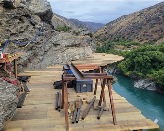
The much-anticipated Kawarau Gorge Trail is on the home stretch. The work has included building bridges across a major river without easy access, lifting diggers into locations by helicopter, building bluff bridges capable of carrying machinery, and building a trail around ‘‘one of the gnarliest highway bluffs in the region’’.
The 32km bike trail, built by the Southern Lakes Trails is due to open towards the end of summer and will unlock a 530km continuous network across Queenstown and Central Otago that’ll extend to Waihola, near Dunedin.
Off - the- beaten track adventure
Shepherd’s Lookout is a new boat-in/boat-out halfday hiking experience in Wānaka with Wānaka Water Taxis.
With private access to Mt Burke Station’s remote peninsula, this guided or self-guided trip is perfect for off-the-beaten-track adventurers.
Your favourite walk could win you a free subscription
We are looking for readers’ favourite New Zealand walks. Many of us go out regularly walking on a route which we class as our favourite, for a number of reasons. Perhaps because for it’s scenery, it’s safe, it’s challenging, it’s flat, it’s hilly, it’s varied, or for whatever reason.
We would like you to tell us in your own words what is you favourite walk and why. Email us a story from say 250 up to 1200 words including a photo or photos.
We will now give you a FREE subscription (six months or more, depending on the article), or extension to Walking New Zealand magazine for walks published.
You can also post an article to Walking New Zealand, Freepost 78863, P O Box 1922, Palmerston North, or fax 06-358-6864.
If sending a photo by email please make sure photos are in high resolution. Our email address is: walkingnz@xtra.co.nz.
Please put “My Favourite Walk” in the subject line and include your name and postal address.
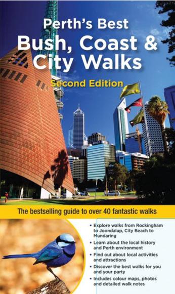
Perth’s Best bush, Coast & City Walks
Perth and its environs boast a huge range of beautiful environments, making the region perfect for exploring on foot.
This second edition of Perths Best Bush, Coast & City Walks introduces the best walks for visitors and residents alike, ranging from leisurely beach-side strolls to the more rugged tracks deep in the bush.
Detailed descriptions and maps help the reader explore the regions parks, bushland, lakes, coasts and most interesting urban areas. As with previous titles in the series, the book is richly illustrated with over 150 full-colour photographs and dozens of detailed maps.
$7.00 P&P
A summary table of walks indicating distances, facilities and highlights is included to help the reader find exactly the right walk for the occasion. Walking chapters: Perth Metropolitan, Coastal Walks, Swan and Canning Rivers, Wetlands, Darling Ranges. Available now from: Walking New
North Phone 027-274-0726 Order online: www.walkingnewzealand.co.nz A fingertip Pulse/Oximeter can be used to measure oxygen saturation and heart pulse rate through the finger. Monitor respiratory conditions, pre and post exercise, and pre and post operative conditions.
Shop
A day on foot along Auckland’s Waterfront: from Downtown to St Heliers Bay
BY Catherine Tooher
There’s a certain charm about exploring a city at walking pace with the slower rhythm, the chance to notice small details, and the satisfaction of tracing the shoreline with your own two feet.
On a bright, breezy morning, I decided to do just that and set out to walk the Auckland Waterfront from the central city all the way to St Heliers Bay. The route promised sea views, lively beachside suburbs,
and a string of inviting cafés along the way. It did not disappoint.
I began my walk at the downtown Ferry Building, that golden - hued Edwardian landmark that seems to watch over the harbour. Early commuters were spilling out of ferries from Devonport and Waiheke, and the air was thick with the smell of coffee and salt. I grabbed a takeaway flat white from a café near Queen’s Wharf and took a moment to watch the ferries glide in and out before setting off eastward along Quay Street.
This first stretch past the Viaduct Harbour and the newer Wynyard Quarter showed Auckland’s modern
face: gleaming glass offices, luxury yachts, and sculptures dotting the waterfront path. The Wynyard Promenade was already busy with joggers, cyclists, and families. It’s easy to see why: every angle offers postcard views of the Harbour Bridge and Waitematā Harbour.
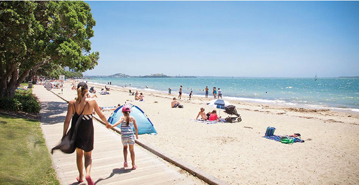
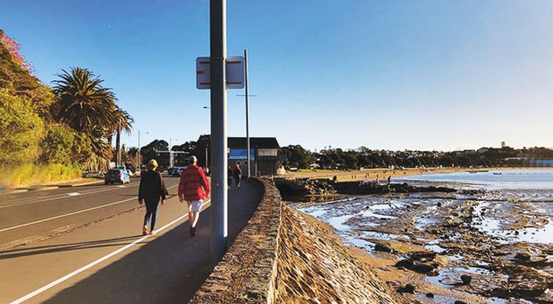
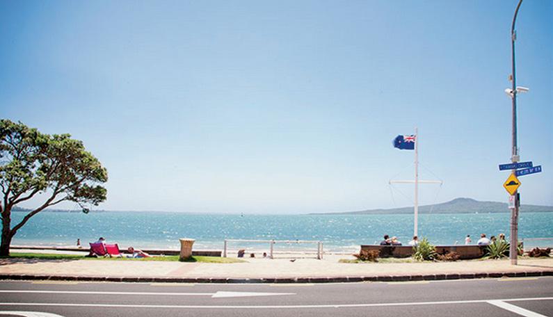
Leaving the bustle of the city centre behind, I followed the pedestrian path that merges with Tamaki Drive, the famous coastal route that threads through Auckland’s eastern bays. This is where the walk finds its rhythm. The harbour spread out to the left, dotted with sailboats, while Rangitoto Island loomed in the distance like a sleeping giant. The sight is classic Auckland, volcanic, marine, and unmistakably beautiful.
The walkway is wide and well-maintained, perfect for walkers, runners, cyclists, and roller-bladers sharing the space. The scent of the sea mingled with occasional wafts of sunscreen and fish‑and‑chips from nearby kiosks. Past the Ports of Auckland and under the Parnell cliffs, I passed Okahu Bay, a sheltered curve of beach popular with paddleboarders and families launching small boats. Nearby sits Kelly Tarlton’s Sea
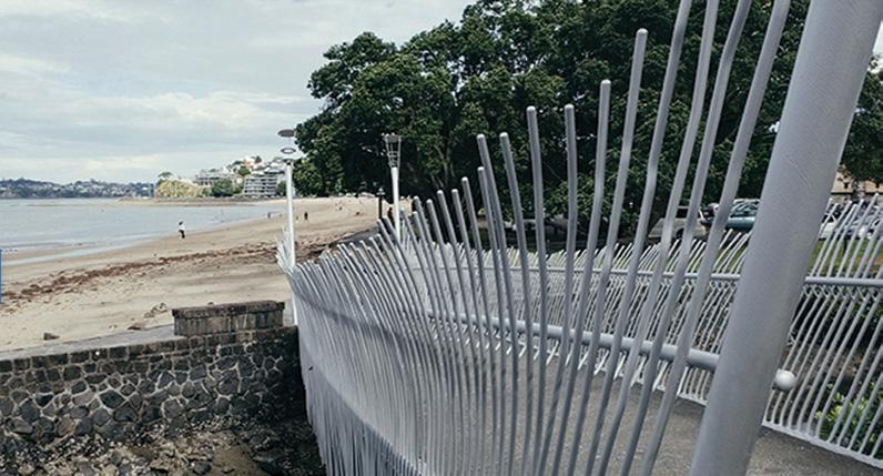
Above: left: The pathway beside the beach,
Below left: The shared pathway on Customs Street.
Life Aquarium, its distinctive dome visible from the road. Even from outside, you can’t miss its playful marine themed design.
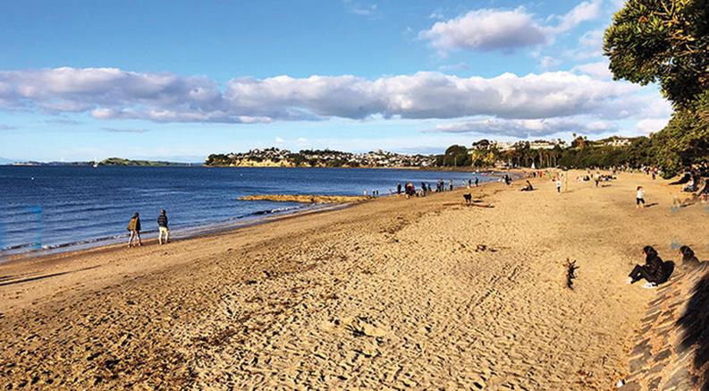
After roughly an hour of walking at a moderate pace (about six kilometres from the city centre), I reached Mission Bay, one of Auckland’s best-known beachfront suburbs. The atmosphere here shifted instantly: the hum of city traffic gave way to the chatter of beachgoers, the rhythmic splash of waves, and the sizzle of grills from nearby eateries.
Mission Bay is a natural place to pause. I found a seat on the grass by the fountain that is the iconic Trevor Moss Davis Memorial Fountain, with its bronze sea creatures gleaming in the sun. The beach stretched wide before me, perfect for a swim or a barefoot stroll along the sand. Just across the road, a line of restaurants and cafés beckoned. I settled on a shaded table at a café offering Mediterranean fare and treated myself to a light lunch of a grilled halloumi salad and another coffee, this time enjoyed leisurely as I watched life unfold around me.
For those with more of a sweet tooth, Mission Bay is also famous for its ice-cream parlours, and judging by the long queues, they are worth the wait. The energy in this suburb is infectious with people picnicking, playing volleyball, walking dogs, or simply watching the world go by.
Feeling recharged, I resumed the walk toward St Heliers Bay. The next stretch was quieter but equally scenic. Tamaki Drive gently curves along Kohimarama Beach, a favourite with locals for its calm waters and relaxed vibe. The view of Rangitoto grew sharper here, the volcanic cone framed perfectly across the blue water. I passed clusters of swimmers, kayakers, and families enjoying the sand. The path is dotted with benches, each offering a place to rest and take in the panorama.
Above right: Looking back toward the city.
Middle right: Looking out towards the island of Rangitoto from the pathway at low tide.
Below right: The popular sandy beach at Mission Bay.
From Kohimarama, it’s another two kilometres or so to St Heliers Bay, the final destination of my journey, making the full walk about nine kilometres one way. The gradient is gentle, so even though it’s a long stretch, it feels more like a relaxed amble than a physical challenge. The sea breeze and almost continuous shade from the pohutukawa trees help keep things comfortable.
Coming into St Heliers felt like arriving at a coastal village. The beach here is beautifully wide, framed by grassy picnic spots and classic seaside architecture. Cafés and boutiques line the main street, projecting an easygoing yet polished atmosphere. I treated myself to a well‑earned iced coffee and pastry from one of the beachfront cafés and found a spot under a tree to watch
Downtown to St Heliers Bay
paddleboarders glide across the bay. The sense of calm and accomplishment settled in as I realised I had walked the entire waterfront from the heart of downtown Auckland to
one of its most scenic suburbs. Including my stop in Mission Bay, the entire trip took me about two and a half hours. Without breaks, the walk could be done in under two hours, but it’s best savoured slowly. Every bay feels like a mini destination.
After relaxing for a while at St Heliers, I faced the inevitable question: how to get back. Fortunately, Auckland’s public transport makes it simple. Bus routes run frequently along Tamaki Drive, and stops are conveniently located near the beach. Within a few minutes, I caught a bus heading back toward Britomart, letting the same views roll past my window that I had admired earlier on foot. The ride took about 25 minutes making it a pleasant opportunity to sit back and reflect on the journey.
Some walkers choose to make the round trip on foot, but for me, one direction was enough. The contrast between the quiet rhythm of walking there and the smooth, quick return by bus felt like closing a satisfying loop.
This walk, more than just a scenic stroll, reminded me how well Auckland balances urban energy with natural beauty. Few cities let you start among office buildings and end up at a relaxed beach café within a few hours, never losing sight of the sea along the way. The route is constantly lively yet never crowded enough to feel rushed.
What stood out most was the variety along a single road with historic wharves, art installations, family beaches, high-end restaurants, and humble fish‑and‑chip shops all sharing the same stretch of coast. It’s an easy walk for locals looking to rediscover their city, or visitors wanting to experience Auckland at its most authentic: outdoors, friendly, and drenched in sea air.
If you plan to do it yourself, go early to make the most of the calmer morning hours, bring a hat and sunscreen, and allow time to linger at each bay. The whole experience feels less like a hike and more like a leisurely seaside day unfolding step by step.
By the time I returned downtown that afternoon, a faint crust of salt had formed on my skin, and my mobile phone reported nearly 20,000 steps, a small price for such a rewarding journey. From the bustling harbour front to the laid-back charm of St Heliers, the Auckland Waterfront Walk offers a microcosm of what the city does best: simple pleasures framed by spectacular scenery.
Above: left: Looking down towards the beach. Below right: Rangitoto in the background.
Bledisloe Park to Old West Road walk
Ijoined the native birds as the path through Bledisloe Park journeys through one of Palmerston North’s native bush remnants.
My walk begins at the Tennent Drive entrance to Bledisloe Park, on a calm morning with low cloud hanging gently over the hills. This section of the park feels tucked away from the surrounding suburban streets, and as soon as I stepped onto the track, the noise of traffic faded into birdsong and the soft crunch of gravel underfoot.
The walk from Tennent Drive to Old West Road is best described as an easy to moderate recreational bush walk. It’s suitable for families, casual walkers, and anyone looking for a peaceful nature break without committing to a long or strenuous hike. The gradient is generally gentle, though there are a few gradual inclines that raise the heart rate slightly without becoming
demanding. The well-formed path makes it accessible for most fitness levels.
At the beginning, the track is wide and clearly defined, with compacted gravel and dirt underfoot. The surface was in good condition, firm, mostly dry, and free of major obstacles. As I progressed deeper into the park, native bush began to close in on either side of the path. Tall trees arched overhead, filtering the light and creating a soft, green canopy. Ferns lined the edges of the track, their fronds stretching toward the filtered sunlight. I noticed the soundscape changing as well; tui and fantails flitted through the trees, their calls echoing gently in the still air. Occasionally, I could hear the distant hum of the surrounding suburb.
Midway along the route, the track opened briefly into grassy clearings.
These spaces provided a contrast to the enclosed bush sections and offered glimpses of the surrounding hills. I passed a few people enjoying the morning with some walking dogs, others jogging at a steady pace. The atmosphere was relaxed and friendly, with the unspoken camaraderie that often exists between people sharing a quiet outdoor space.
Further along, the path narrowed slightly as it gently descended toward Old West Road. Here, tree roots were more visible across parts of the track.
As I approached the Old West Road exit, the bush began to thin, and suburban houses became visible through the trees. The transition back to the built environment felt gradual rather than abrupt. Stepping off the track and onto the roadside footpath, I felt refreshed and grounded.
Overall, the walk from Tennent Drive to Old West Road through Bledisloe Park was a gentle, scenic bush walk with well-maintained tracks and varied surroundings that offered a peaceful immersion in nature, light exercise, and a pleasant connection between two parts of the community.
Fact File
Distance Bledisloe Park to Old West Road: 3.2km one way
Track: Moderate
Contour: Flat to moderate hills with some steep climbs
Surface: Gravel, steps
Parking at Tennent Drive
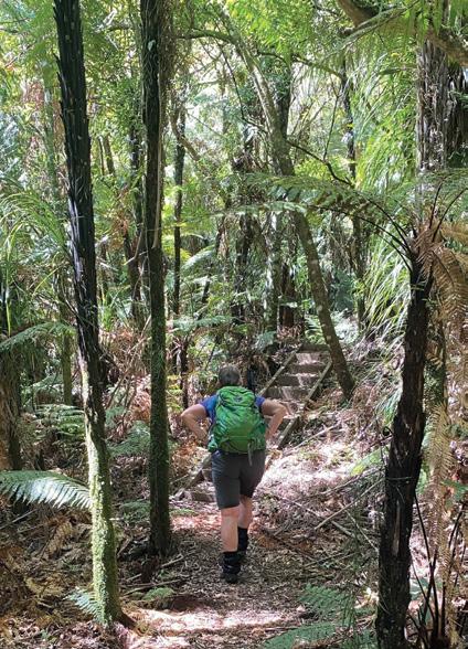
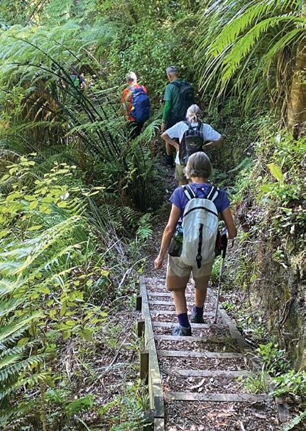
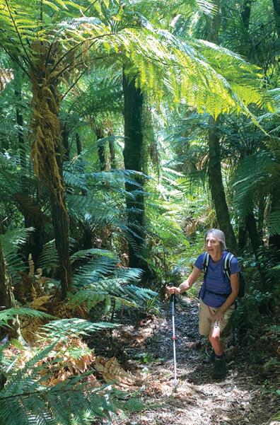
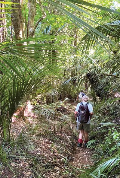
Above left: the track through a forest. Above right: The track beside the Turitea Stream.
Below left: A couple going down steps.
APRIL Weather prediction
(Weather is an inexact science, like medicine. Dates given are to be regarded as focus points. Please allow 3-4 days leeway for all forecasts)
29th Mar-1st April Unusually high maximum temperatures in the east and inland parts of the South Island, including throughout Canterbury, and north and central Otago, with many areas peaking maximum temperatures in excess of 30°C.
1st-3rd Chance of fog in Christchurch.
2nd-6th Prolonged spell of high pressure bringing mostly dry conditions throughout.
2nd Unusually hot in Palmerston North, maximum likely to reach into the low 30’s.
5th Possible thunderstorms in Canterbury.
6th-8th Possible overnight fog patches in Christchurch.
7th-12th A period of unstable conditions with outbreaks of occasional showers and rain in many parts of the country as low pressure troughs cross the country.
9th Significant soil moisture deficits may still persist throughout much of the west of the North Island including from the Waikato and Taranaki, also in the Wairarapa and extending in to the east of the South Island. In contrast, some rainfall in the Manawatu and Taranaki regions may see some relief to soil moisture levels.
10th Chance of drought breaking heavy rain in Taranaki, particularly Stratford.
Over the next four weeks there may be up to four very large high-pressure systems slowly crossing the country, centered more to the south and east of the South Island. Also, during this period, there should be up to seven or eight major cold fronts, with the depressions in the Tasman Sea coming more from the northwest of the North Island than is normal. As such, there should be moist northeast winds should be more frequent over the North Island, but drier easterlies over the South Island.
Overall, Northland, the Hauraki Plains, Cape Reinga, the Bay of Islands, Wellington, Nelson and Marlborough regions may see up twice as much rainfall than normal for this time of year, while the Central Plateau, North Taranaki, the remainder of Northland, the Kapiti Coast and Wairarapa may see up to 150% more rain. In contrast, the
southern half of the South Island may only see around half the usual amount of rain for this outlook period, including in the Christchurch and Alpine areas, and in the southwest of the South Island.
Generally, significant soil moisture deficits may still remain in inland Otago and eastern Canterbury, while the other regions that up to this time had soil deficits, may have received significant relief and drought conditions over by the end of this outlook period. Generally, sunshine hours may be at least 10% more than normal in Wellington and in the east and north of the South Island and up to 20% sunnier in the west and south of the South Island.
mouth region, possibly causing some flash flooding.
16th Chance of showers in Northland while mostly dry elsewhere.
17th Chance of heavy rain in the East Coast, particularly in the Gisborne area.
18th Overnight thunderstorms may cross the lower North Island, incl. Wellington.
by Ken Ring
In contrast, Auckland and the Waikato regions may be over 10% cloudier than average, with the remainder of the country closer to their norms. Generally, temperatures may be milder than normal, with the west of the North Island warmer, and inland Canterbury and Otago cooler than average. Overall, the next four weeks may see daily maximum temperatures between half and one degree above average in Coromandel, the Waikato, Central Plateau, Taranaki to the Manawatu, Nelson, Fiordland and the Tekapo areas, while parts of inland Canterbury and Otago may be cooler by around half a degree below their averages. Minimum temperatures may be between 1-1.5°C above the norm in the northern half of the North Island including in the Central Plateau and Taranaki, the Bay of Plenty, Waikato, Auckland and Northland, while cooler by a similar variant in Fiordland, Nelson, and inland Otago.
11th Chance of brief fog in Christchurch
12th Chance of tornados in the West Coast, particularly Westport, which may receive some wind damage. Possible thunderstorms across Canterbury.
13th-14th Anticyclonic. Gentle breezes and overnight fog patches in Canterbury like, particularly in the Christchurch area.
15th A cold front crosses the country. Chance of very heavy rain in the Grey-
19th-22nd A large anticyclonic system moves across the country. Dry at first but with rain developing as it decays.
20th-24th Light air over the Canterbury region, with regular patches of fog likely.
25th Very heavy rain likely in the Takaka area.
25th-27th An active trough embedded with thunderstorms crosses the North Island and the northern half of the South Island producing heavy rain and bringing the potential for localised flooding in many parts of the North Island to Nelson.
Thunderstorm activity may be particularly severe in Northland causing some power outages in the region, while heavy rain in the Rotorua to Taupo and Central Plateau regions may result in flooding, particularly along local river systems, and disruptions to transport and roads.
26th Very warm day in Canterbury with max temps likely to reach the upper 20’s. A band of thunderstorms cross the northern half of the North Island.
28th Unsettled and changeable with a weak high over the South Island and a weak low over the North Island and trough between the two centres bringing scattered rain throughout the South Island and into the lower North Island.
29th-30th A depression deep in the Southern Ocean extends a cold front up over the country ahead of a high pressure ridge. Chance of light snow and fog patches in Christchurch.
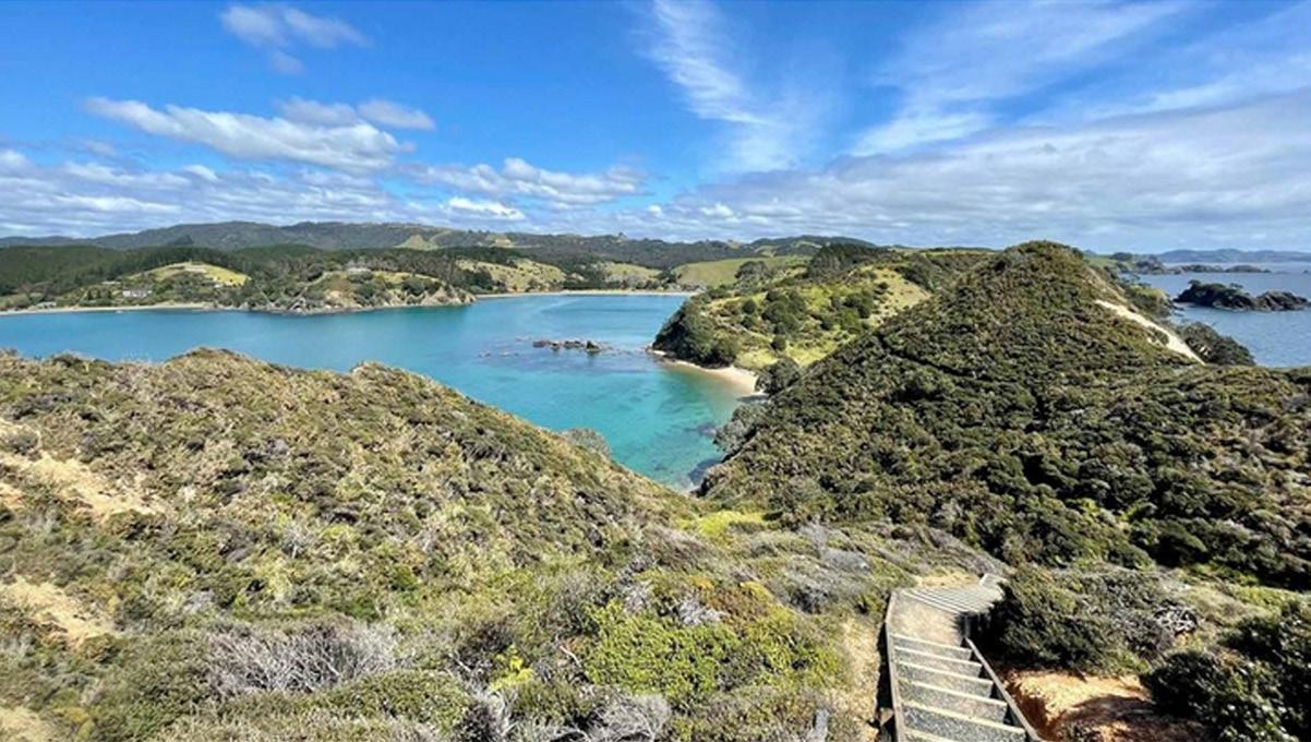
Mahinepua Peninsula Walk quietly re-arranges the soul
There are walks that stretch the legs, and then there are walks that quietly rearrange the soul. The Mahinepua Peninsula Track in Northland does both.
Tucked along the far north-east coast of Aotearoa, near the small settlement of Totara North in the Far North District, the Mahinepua Peninsula feels like a secret you’ve stumbled upon rather than a destination you’ve arrived at.
The track itself is modest in length, approximately five kilometres return and typically takes between two to three hours, depending on how often you stop. And you will stop.
The walk begins near Mahinepua Bay, a sweep of golden sand framed by pōhutukawa and rolling farmland. Almost immediately, the track rises gently, opening up to wide views across the Pacific. To the east lies the Cavalli Islands, scattered like green jewels on blue silk.
To the west, sheltered coves curve into the land, their waters calm and impossibly clear. The beauty of this walk is in its variety. One moment you are climbing grassy ridgelines with the wind at your back with the
next, you’re descending into quiet bays where waves fold softly onto untouched beaches. Opito Bay is a particular highlight thta is a long, pale arc of sand perfect for a barefoot pause or a picnic.
Unlike many of Northland’s more rugged tramps, the Mahinepua Peninsula Track is accessible to most reasonably fit walkers. The path is well-marked but uneven in places, with some steep sections that reward effort with expansive, uninterrupted views.
There is little shade along the ridges, so sun protection and water are essential, especially in summer.
Getting there is part of the charm. From Kerikeri, allow around 45 minutes by car. Follow State Highway 10 north toward Kaeo, then turn right onto Matauri Bay Road, following signs toward Mahinepua Bay. The final stretch narrows into rural roads edged by pasture and glimpses of sea, building anticipation with every bend.
What makes the Ma -
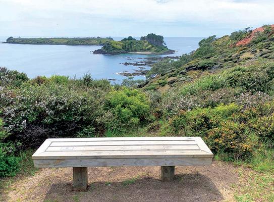
hinepua Peninsula special is not just its scenery, though that alone would suffice. It’s the sense of space—of standing on a narrow spine of land between sky and sea, with nothing but wind, salt air, and the rhythmic hush of waves for company.
In a region famed for its coastline, this small peninsula offers a perfectly proportioned taste of Northland’s wild grace. It is a walk to savour slowly, to breathe deeply upon, and to remember long after the boots are off.
Above: The steps down to the bay. Below right: A seat to sit on and enjoy the views.
LOCHS, MUNROS, GLENS, BENS AND BRAES!
Phillip Donnell invites you to explore the best walks in bonnie Scotland…
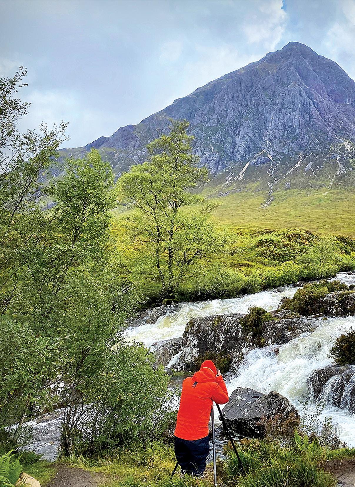
A photographer takes an image at the waterfall at Ative Mor.
By Phillip Donnell
LOCHS, MUNROS, GLENS, BENS AND
Scotland’s landscape is a masterclass in geographical diversity, offering a compressed beauty that allows a hiker to transition from ancient volcanic peaks to Caribbeanstyle white sands within a single afternoon.
While the country is famous for the gruelling 150km West Highland Way, its true soul is often found in its shorter trails—routes that can be completed in under three hours but leave an impression that lasts a lifetime.
These walks are not merely exercises in physical activity; they are
immersive journeys through deep time, folklore, and some of the most dramatic geology in the Northern Hemisphere. Here I highlight just a few.
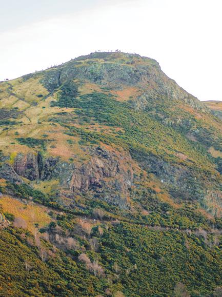
In the capital city of Edinburgh, the urban and the wild collide at Arthur’s Seat, a dormant volcano which rises 251m from the heart of the city like a sleeping dragon. On the ascent through Holyrood Park, the scent of yellow gorse flowers mingles with the salty air from the nearby Firth of Forth.
The summit panorama encom -
passes the medieval spires of the Old Town, the geometric precision of the New Town, and the distant blue silhouettes of the Highlands.
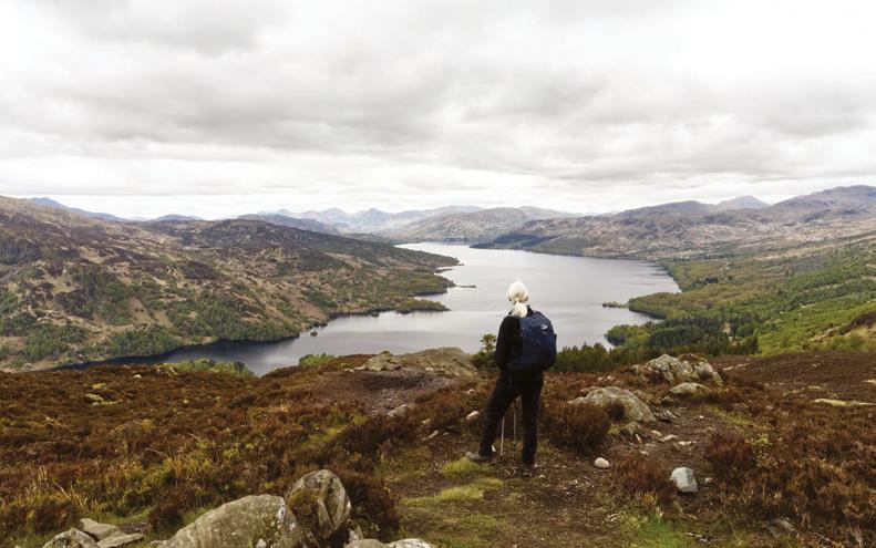
Moving north into the Trossachs, the trail up Ben A’an (barely 3km) offers what many locals call the “mountain in miniature.” Its steep, rocky staircase provides a cardiovascular challenge that culminates in a view rivalling any of the great Munros. Loch Katrine stretches out below, framed by the peaks of Ben Venue and the Arrochar Alps. This quintessential walk captures the romanticism of the 19th-century poets who first popularised the region.
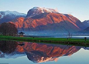
The highest peak in Scotland, and the entire UK, is Ben Nevis, standing at 1,345m, located in the Grampian Mountains near Fort William. Known for its dramatic summit plateau and challenging climbs, it’s a popular destination for hikers, offering snow year-round and stunning views, but requires careful preparation due to unpredictable weather.
The Mountain Track (Pony Track) is the most common route, taking six to eight hours return, but it’s demanding.
The sensory experience changes entirely when one enters the ancient woodlands of Perthshire. At the
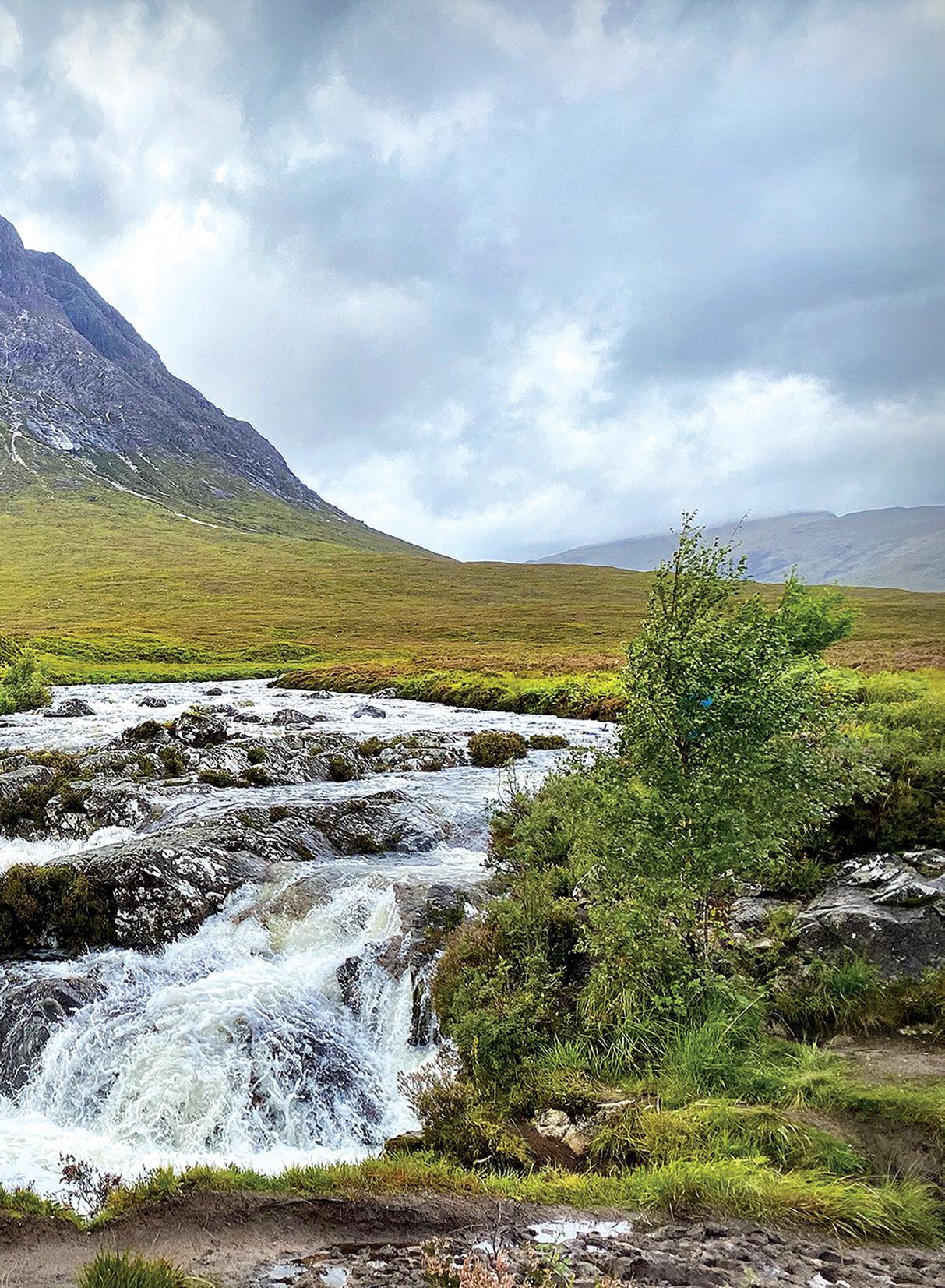
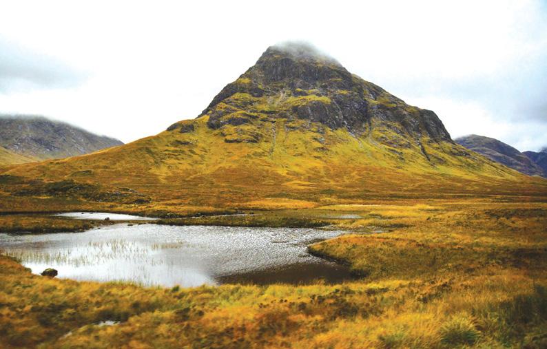
Above left: Buachaille Etive Mor, Glencoe.
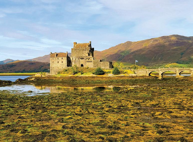
Above right: Eillan Donan Castle
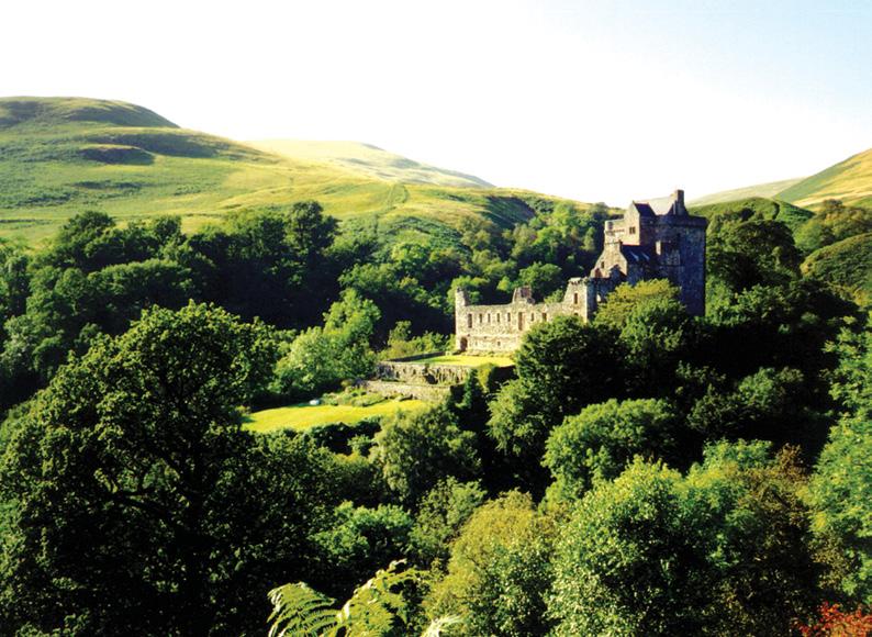
Below left: Castle Campbell.
BRAES!
Hermitage near Dunkeld the scale of nature feels almost cathedral-like. Tall Douglas firs tower over the River Braan.
The walk leads to Ossian’s Hall, an 18th-century folly built into the rock face. As walkers enter the small stone building and open the back shutters, they are met with the thunderous roar and spray of the Black Linn Falls.
The 2012 James Bond film Skyfall featured the dramatic landscapes of Glen Coe and Glen Etive in the Scottish Highlands. The iconic driving scene with the Aston Martin
DB5 was filmed on the A82 road near the mountain Buachaille Etive Mòr, while the surrounding, moody scenery represents the backdrop for Bond’s ancestral home.
The north of Scotland—encompassing the rugged North-West Highlands and the ethereal Caithness coast—remains the ultimate frontier for walkers seeking solitude and drama. Unlike the manicured paths of the south, short walks here offer a visceral connection to a landscape shaped by ancient ice and sea.
A standout is the trek to Stac Pollaidh in Assynt. While reaching the true technical summit requires a scramble, the short, steep circuit
around its base provides what is arguably the best “view-per-km” in the UK. From this vantage point, the landscape looks like a prehistoric sea of peat bogs punctuated by lonely, sentinel peaks like Suilven.
Further north, the walk to Sandwood Bay is often cited as the most beautiful in the country. Though a longer “short” walk at roughly 6.5km each way, the flat, moorland track leads to a striking stretch of pink-hued sand and the “Am Buachaille” sea stack, isolated from all
Above right: Arthur’s Seat at Edinburgh.
Below right: At the top of Ben A.
LOCHS, MUNROS, GLENS, BENS AND BRAES!
road access.
Knockan Crag was the first place in the world where a thrust fault was identified. As two continents collided, intense tectonic pressure forced older metamorphic rocks (Moine Schist) up and over younger sedimentary rocks (Durness Limestone). Here you can touch both.
The Lowlands of Scotland offers a serene alternative to the crowded
Highland trails, characterised by rolling green hills, monastic ruins, and dramatic coastlines. The best walks in this southern heartland are those that marry physical beauty with deep historical resonance.
The Eildon Hills near Melrose provide the definitive viewpoint. This short, three-peaked walk offers a panoramic vista of the Tweed Valley. It is steeped in Arthurian legend and Roman history, serving as a spiritual heart for the Borders.
For those drawn to the water, the walk to the Grey Mare’s Tail near Moffat is essential. This hanging valley features one of the UK’s highest waterfalls, where a steep but short path leads hikers to the tranquil Loch Skeen, a glacial gem hidden among the high peaks.
Coastal enthusiasts should favour the Mull of Galloway, Scotland’s
Above; The Glenfinnian Viaduct.
Below left: Scotland Museum on the Mound at Edinburgh.
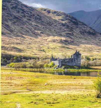
Beloe right: Kilchurn Castle on the Scottish Highlands.
southernmost point. The circular walk around the lighthouse traverses 80m cliffs where the Irish Sea meets the Solway Firth. On clear days, walkers can see four kingdoms: Scotland, England, Ireland, and the Isle of Man.
One of the most rewarding coastal routes is the trek around St Abb’s Head in the Borders. This volcanic headland provides a sheer, exhilarating perspective over the North Sea. Walking the cliff-top loop, visitors are treated to the sight of thousands of nesting seabirds and the jagged “Lumsdaine Dean,” where the rock formations look like frozen waves.
Further west, the Falls of Clyde near Lanark offers a jawdropping journey through a deep, wooded gorge. Following the riverside path from the UNESCO World Heritage site of New Lanark, walk-
ers encounter a series of spectacular waterfalls, including the thundering Corra Linn.
For those seeking historical drama, the walk through Dollar Glen to Castle Campbell is unmatched. The trail ascends through a narrow chasm of bridges and rushing burns before revealing the “Castle Gloom,” perched precariously between two ravines.
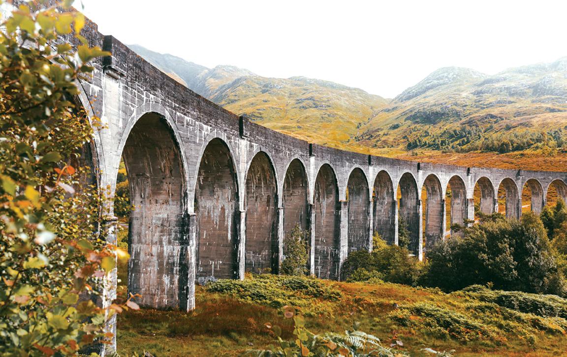
Ultimately, the best short walks in Scotland are those that connect the walker to the country’s layered history. Whether it is the Glenfinnan Viaduct trail, where one can watch a steam train traverse a 21-arch bridge amidst the echoes of the Jacobite Rising, or a stroll around the island ruins of Loch an Eilein in the Cairngorms, these paths are more than just distance covered.
They are invitations to slow down and witness the intersection of earth,
water, and legend.
Scotland’s short walks prove that you do not have to travel far to find the extraordinary. You can sample many of these peerless perambulations by joining the Footsteps excursion to Scotland scheduled for 29 August to 20 September 2026.
It is a complete coverage through coastlands, highlands and lowlands, an absolute belter!
For further details, please go to their website www.footstepswalkingclub.com, or contact them (footstepsanz@gmail.com, 021 172 3244).
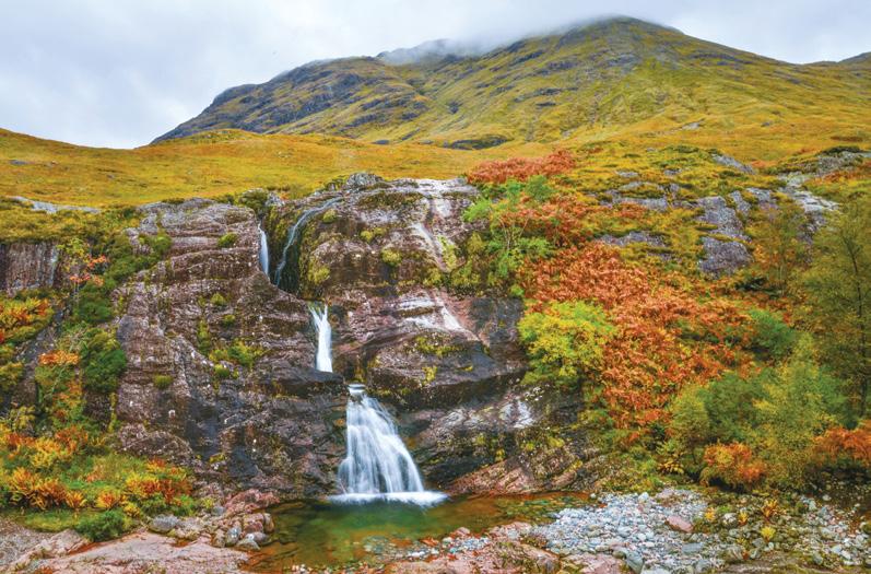
Above left: Meeting of the Three Waters at Glencoe.
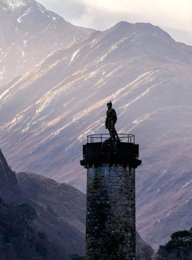
Above right: Glenfinnian Monument.
Below right: On the West Highland Way.
Walking options on Waitahinga Trails
By Dave Scoullar
The Waitahinga Trails near Whanganui have steadily grown in popularity since they were created by the Whanganui Tramping Club more than a decade ago. They are a collection of walks at the no-longer-used Whanganui town water supply.
The trails are mostly under a native forest canopy, a combination of original forest including towering tawa, rimu and nikau, and regeneration dating back to when the land was bought by the municipality in 1903. The ancient-looking mahoe on the flatter areas are examples of regeneration.
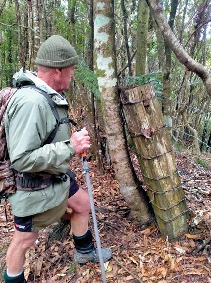
Visitors follow a 100 year old fence line for several kilometres on the longer walks. This was built of local totara and the stumps of the trees for it are still evident.
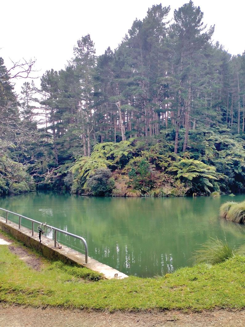
The Waitahinga dam was built in 1904 and decommissioned in the 1990s. Waitahinga is still owned and controlled by the council, including the commercial pine forest.
Above left: The dam is a good place for lunch.
Below left: The fence line is more than 100 years old.
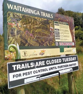
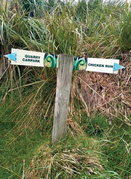
Below right: This sign is at the start of the trails.
There is an informative sign at the start of the trails and the different routes are also well-marked, sign-posted and colour-coded. The terrain is steep in places and requires easy to moderate levels of fitness. The longest walk descends gently 270 vertical metres to the dam about two hours walking time from the car park. The dam is an excellent spot for lunch.
The Chicken Run is an easy walk to viewpoints overlooking the Whanganui/Waitotara back country from the Taranaki maunga in the west to the Ruapehu maunga to the north east. Traps are being introduced and it is hoped this will increase the bird life.
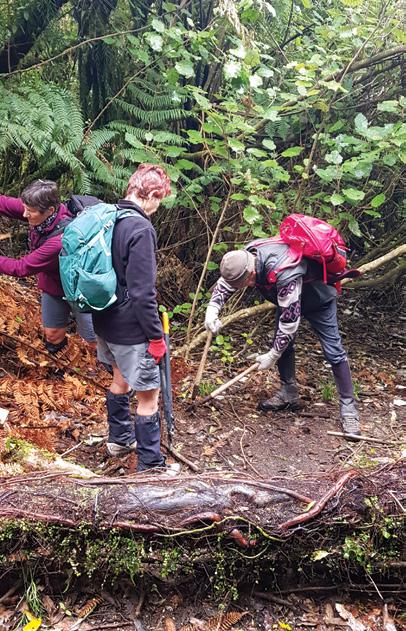
The tramping club, which created the trails for public use as a community project to mark its 60th anniversary, continues to maintain them. A work party in October has ensured they are ready for visitors venturing out in the warmer weather. Twelve club members covered all the trails
using saws, secateurs, loppers and a chain saw to tidy the routes and remove windfalls.
The trails are located 37km from Whanganui. Head along SH3 towards New Plymouth. From Kai Iwi turn onto Rangitatau East Road and continue on to Junction Road. Take drinking water and be aware there are no toilets. Carry warm clothing as the trails are up to 580m above sea level. Dogs are welcome. The trails are closed every Tuesday and during July and August.
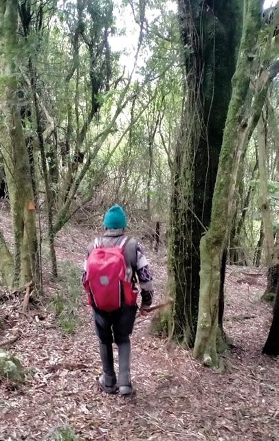
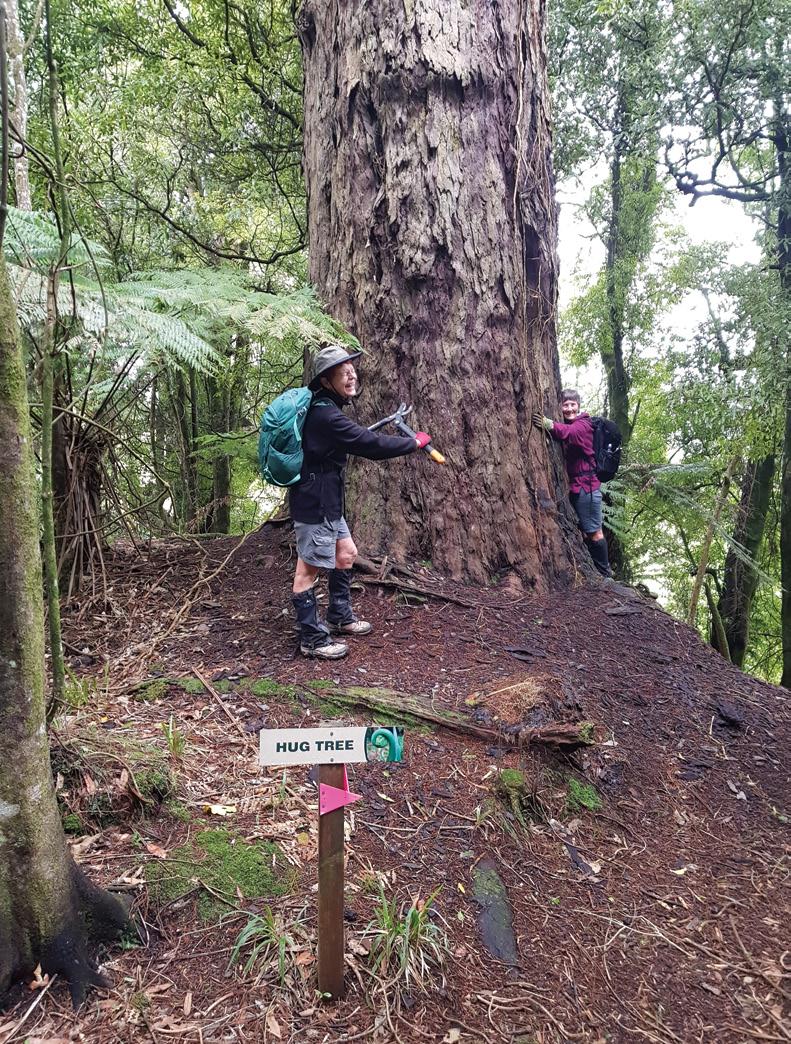
Above left: Native forest canopy dominates.
Above right: The giant rimu hug tree feels the love.
Below left: Maintenance work on the trails.
Below right: The various routes are well sign-posted.
Walking up Mt Tauhana an iconic Taupo landmark .
No matter where you live in Taupō, Mount Tauhara (Tauhara Maunga) is a constant. It greets you when you make your way into town from Turangi, Napier and Rotorua. I’m lucky enough to see the Maunga from my house and often wake to amazing sun rises over the mountain.
I’ve made the trip three times since I moved to Taupō six years ago. I thought it was time to climb it again. So, off my friend and I set one Sunday in midFebruary 2026.
By Gwen Bowler
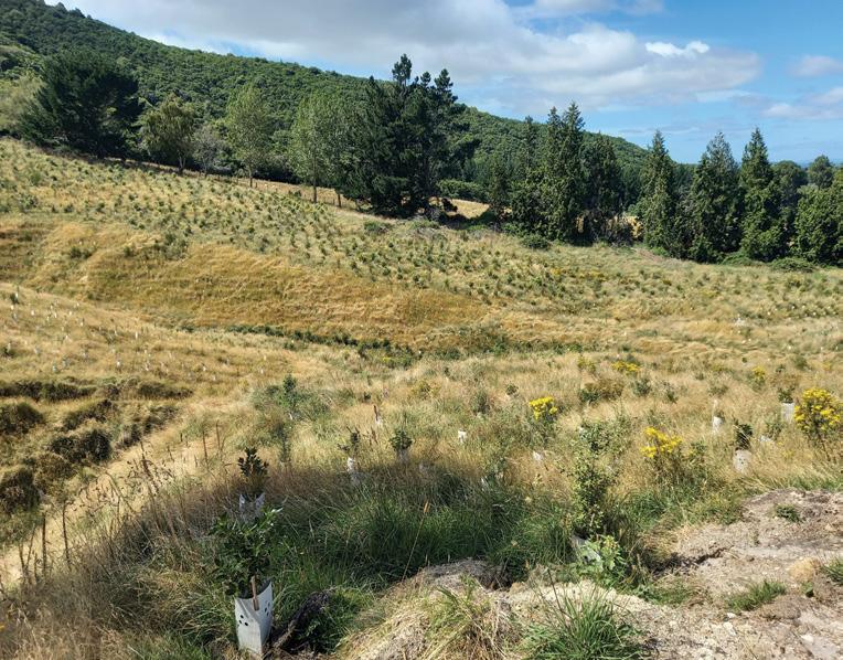
My first surprise was to see a new path zig zagging up the hill to the bush line. This made the first part of the walk so much
easier. There were lots of new plantings as well.
On further investigation a group called the Tauhara Collective, which is made up of neighbouring Ahuwhenua neighbouring land trusts that surround Tauhara Maunga are responsible for the planting.
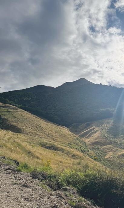
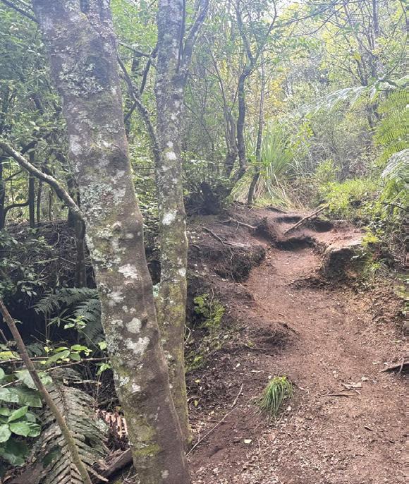
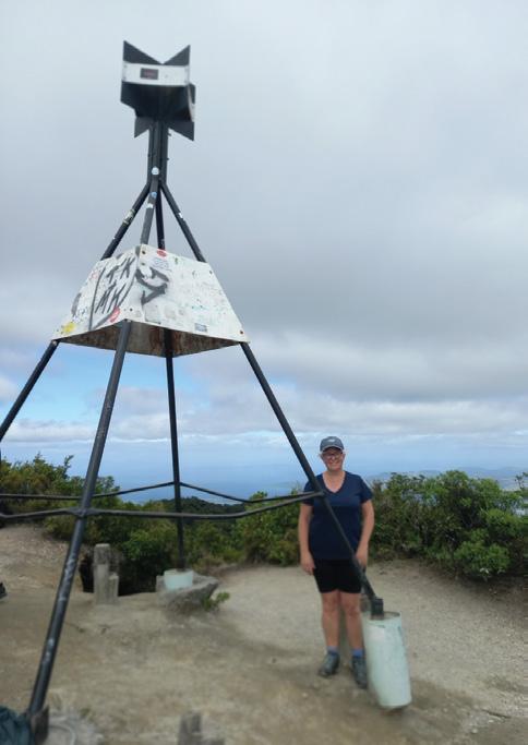
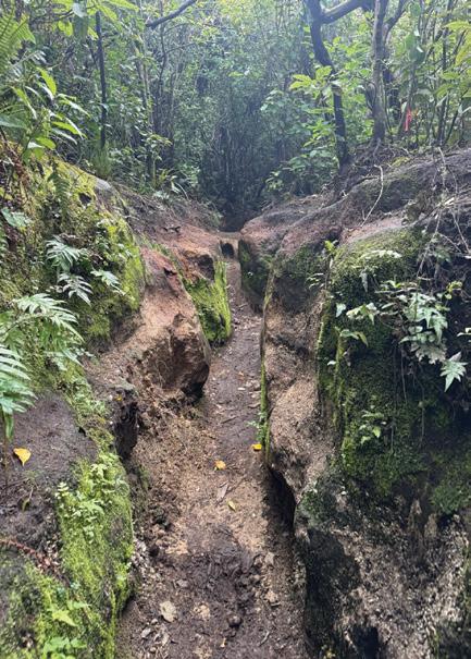
This three to three and a half hour return walk is not for the faint hearted. It is one and a half hours pretty much straight up to the trig station 1000 metres above sea level. Tramping boots or sturdy trail shoes are a must as there are lots of tree roots, and narrow passageways to navigate.
About three quarters of the way up, there is a lovely stream running along the track that restores you. It is a lovely spot to take a break, hydrate and listen to the piwakawaka and the trickle of the stream.
As with many uphill walks, the
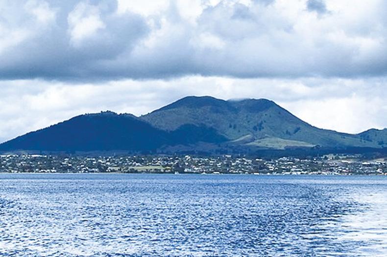
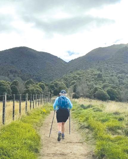
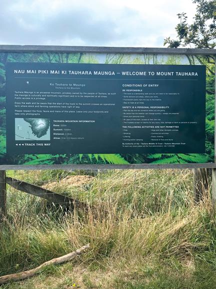
Opposite page top: Mt Tauhara from Lake Taupo. Above right: Mt Tauhara at sunset. Middle left: A walker on the early part ofthe track. Below left: The information board. Below right: Plantings by the Tauhara Collective.
Above left: Pesty tree roots on the track. Above right: At the trig. Below right: The track is very narrow here.
views are amazing. The last section to the Trig Station is up some loose pumice soil that can be slippery.
The uphill sections are soon forgotten when you reach the top and see the 360 views across farmland and out to Lake Taupō and the town below.
The way down is much faster and easier with just some pesky tree roots to trip you up if your mind strays for a moment.
It’s been said many times, don’t leave home until you’ve seen your own country and, in this case, my own backyard. This walk is a must for visitors to Taupō and locals alike. We are so blessed to have such a wonderful Maunga right on our doorstep.
Tauhara holds profound spiritual, cultural, and historical significance for Ngāti Tūwharetoa and other local Māori. It is revered as a sacred mountain (maunga tapu) that serves as a guardian, an ancestor (tūpuna), and a living connection to tribal history.
Ouch! Sore feet while walking?
Hikers Wool is 100% New Zealand wool. Cushion your feet to prevent pain, rubbing and blisters.
Buy online or at selected stockists For more info visit www.hikerswool.co.nz
We are looking for the best digital photos each month depicting walking
Now the time to get your digital camera out or look through your digital images and enter the
Walking New Zealand Digital Photo Contest
The image could be a scenic scene, a walk on the beach with the dog, a bush walk, a street walk or anything walking that takes your fancy. The rules are simply: there must be a person or persons walking in the picture either front, side or back on, and can be in the distance. We require an emailed image in high resolution mode, in jpeg format as an attachment, and NOT embedded in Word or in the email, and NOT a link to a website to be downloaded. The subject line must have the words “Walking New Zealand Photo Contest” and the email must include the NAME, POSTAL ADDRESS and phone number of the person who took the photo and a small caption. In this contest ONLY ONE emailed photo accepted per month. Entry in the contest automatically allows us to print the image. The person who has their photo published will receive a six month subscription or a renewal to Walking New Zealand magazine of six months. If a picture is chosen for the cover page the person will receive a 12 month subscription or renewal Email your entries to: walkingnz@xtra.co.nz with subject line “Walking New Zealand Photo Contest” Only EMAILED entries will be accepted.
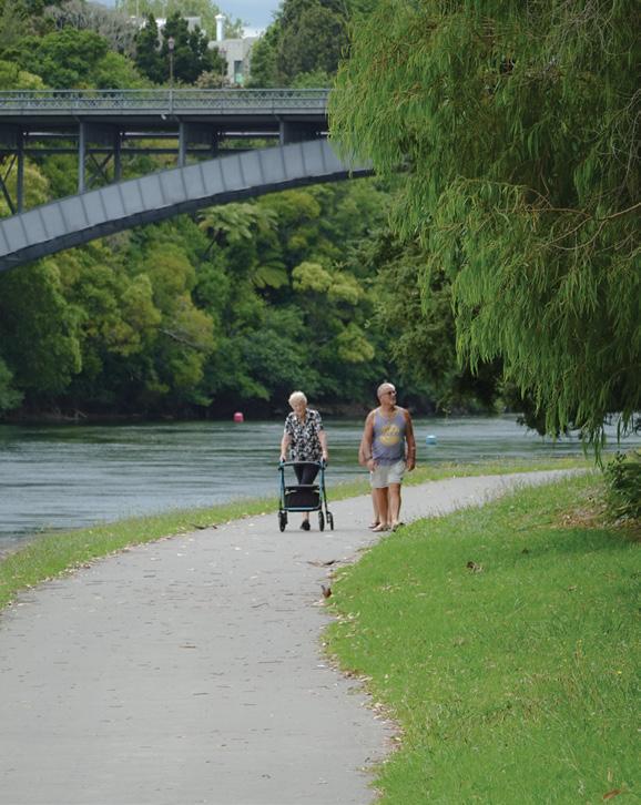
Above right: Walkers enjoying the scenic Hamilton Riverside Walk, which runs alongside the Waikato River. Photo by Claire Woodhall, Pandora, Napier.
PHOTO CONTEST
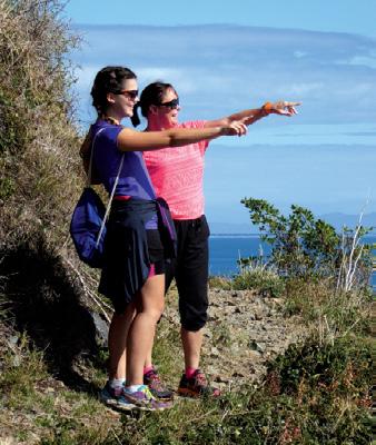
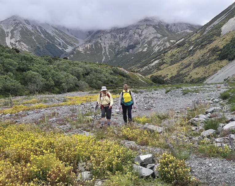
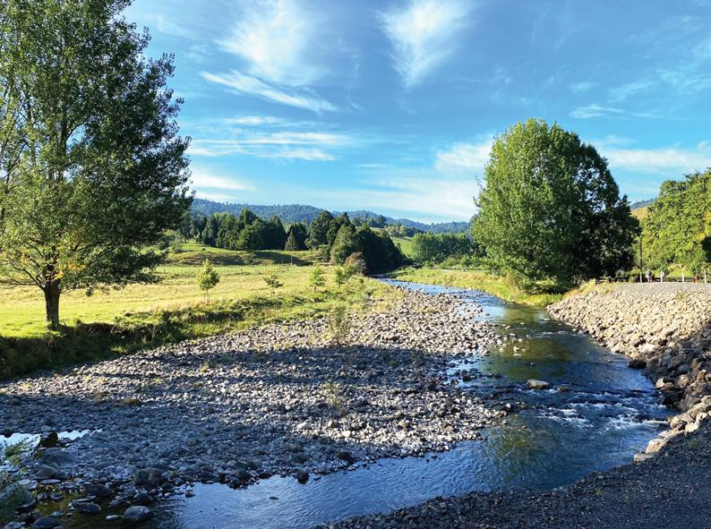
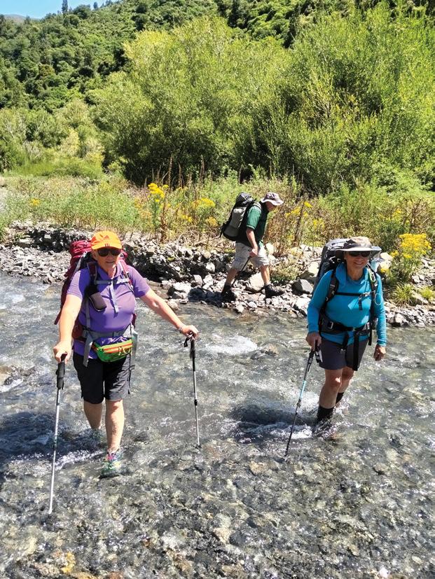
Below left: Members of Bishopdale Tramping Club enjoying a jaunt along the Kowai River following a visit to John Hayward Memorial Hut. located on Brooksdale Station which runs from the foot of the Torlesse Range up to Porters Pass. Photo by Marie-Therese McRae, Papanui, Christchurch.
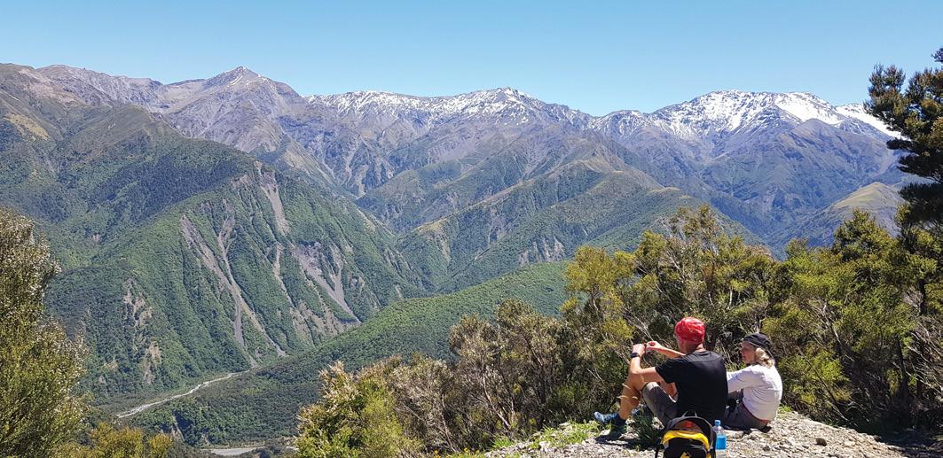
Above: This is just one of the incredible viewing spots on the hike up to Mt Fyffe in Kaikoura. It’s a steady climb up but totally worth it on a nice day, there are mountain views one way and just turn around for the epic coastal vista. 14kms return if you go all the way, or just go as far as the hut on the 4WD road. Photo by Gail Francis, Ohauiti, Tauranga.
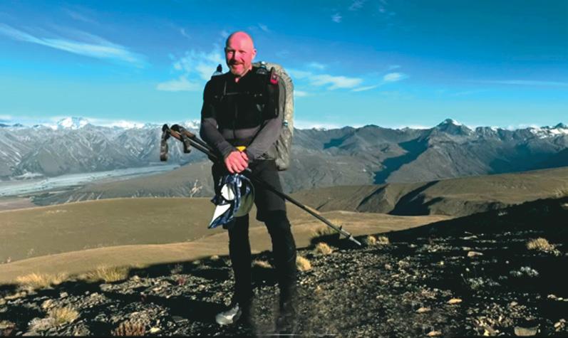
Middle above: Raymond Perry on the Te Araroa Trail, February 2025, in the Southern Alps near Lake Tekapo. Photos taken from Raymond’s You Tube video of his hike, titled “Hiking Revival”. Photo by Edwin Perry, Paraparaumu.
Explore the Murray River with the experts
Ten years ago, river expert Tony Sharley started a 4-day guided walking tour along South Australia’s Murray River to help people discover the magic of Australia’s greatest river, while staying on a luxury houseboat.
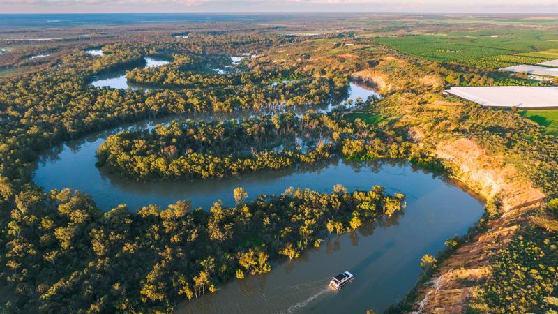
Fast forward to today, and Murray River Walk is one of the Great Walks of Australia, soon to launch its second eco-luxe houseboat boasting 5 king or twin-share bedrooms, each with a private ensuite, top deck spa, quiet solar power, spacious lounges and expansive views that change as you cruise through the Australian outback. Unpack just once for the entire journey.
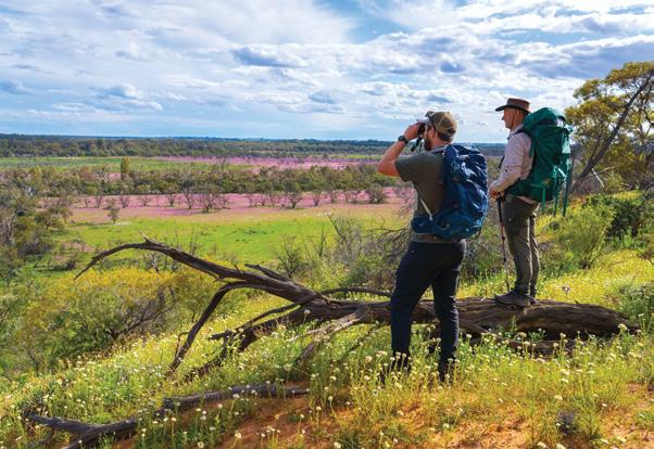
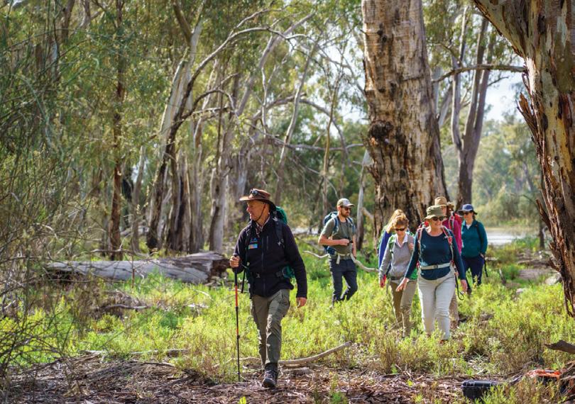
Tony and his team of expert guides lead small groups of up to 10 walkers through the river valley and its red gum forests, woodlands
and wetlands and onto its red ochrecoloured cliffs to marvel at the vast floodplain views and big outback skies, a striking contrast to New Zealand alpine landscapes.
Murray River Walk starts in the historic town of Renmark in South Australia, famous for paddle-steam-
ers, the birthplace of irrigation in Australia, and the art deco Hotel Renmark which was the first community hotel in the British Empire (Est. 1897).
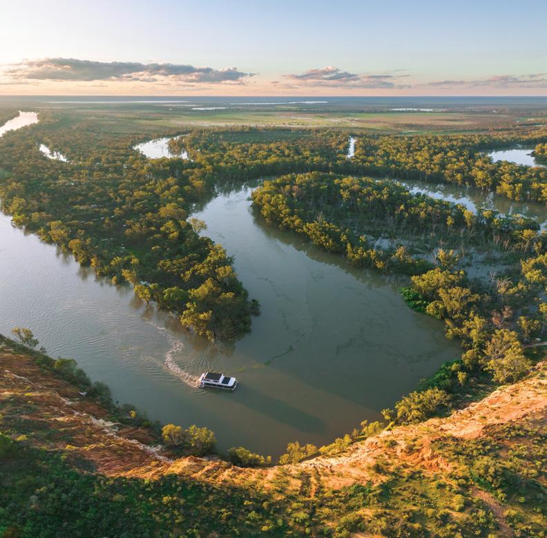
After briefing, guests and guides board a pontoon cruiser and meander 15 kilometres upstream to the
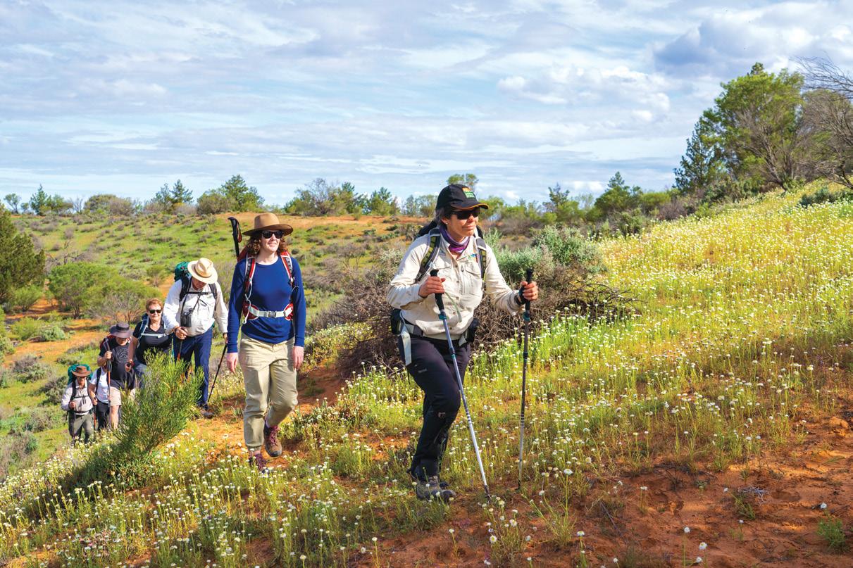
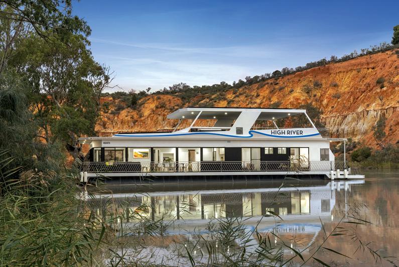
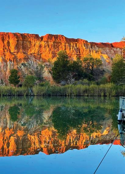
Above: Walking through wild daisies on the edge of the valley. Below left: ‘High River’ moored opposite Headings Cliffs.
Explore the Murray River with the experts
start of the walk. Day 1 is a wonderful way to key in on plants, landscapes, wildlife including kangaroos and koalas and birdlife made up of 180 species of waterbirds and terrestrial birds. The day finishes with a chef-designed three course meal paired with local wines and sets the standard for the next two nights.
Day 2 starts with a spectacular sunrise walk, with first light comes the eruption of birdsong from the
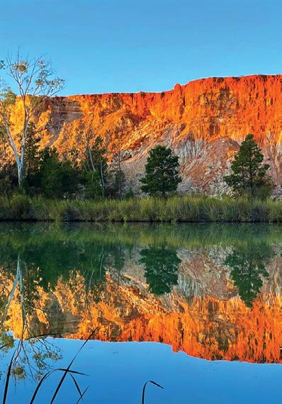
waking river valley, followed by an easy climb to the top of the cliffs which provides stunning views back across the valley with red and orange cliffs that glow as the sun rises. Tea and coffee is served by the guides at the lookout, and then it’s back to the houseboat for a hearty breakfast.
After breakfast, guides lead on through mighty tall red gum forests known as The Generals, following oxbows and creeks that reveal cultural scars and middens that are evidence of the Erawirung people whose time on this river dates back more than 42,000 years.
Day 3 rewards everyone as guests walk through the diverse Chowilla
Above: Reflections at Bunyip Reach Cliffs.
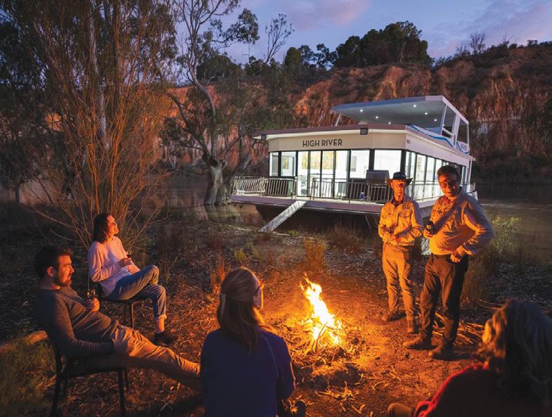
Above left: Walking through wild daisies on the edge of the valley. Below left: Campfire along Crooked Straight.
Day 4 is departure day and after breakfast of smashed avocado and
* Total walking distance is 40 km
* Cruising distance is 70 km
* Tours operate between late April and early October when the weather is mild and perfect for walking - an ideal winter escape for New Zealanders
There are direct flights to Adelaide from Christchurch and Auckland with Air New Zealand, and
Auckland to Adelaide with Qantas. Private transfers or car hire can be arranged to Renmark with Murray River Trails info@murrayrivertrails. com.au
Tours start from Hotel Renmark on a Monday or Tuesday morning
Murray River Walk is offering a special price for Walking NZ readers for their 2026 walking season.
Above right: Aerial photo of ‘High River’ cruising.
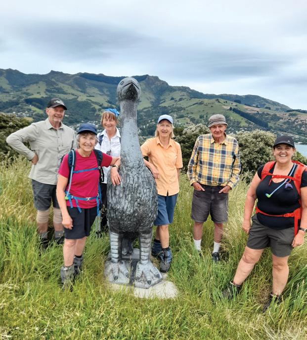
Children’s Bay Rhino Farm Walk
By Yvonne Van Eerden
We visited Akaroa on a beautiful sunny day to walk the Children’s Bay Walkway and beyond. This walk starts at the Children’s Bay Road at the beginning of Akaroa past the boat parking area.
The walk to the top is approximately one to one and a half hours return depending on how long
you stop along the way to view the sculptures which are a lot of fun to see for us all, young or old.
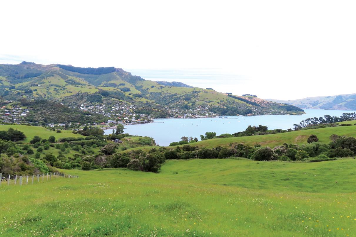
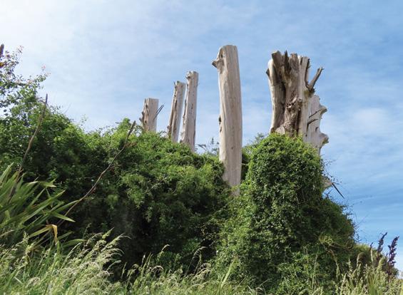
The views of Akaroa and beyond are eye-catching as well. The old trees made a great sculpture by themselves at the beginning of the track with all the different colours and shapes on their trunks and hidden amongst the bush.
We headed further along the track
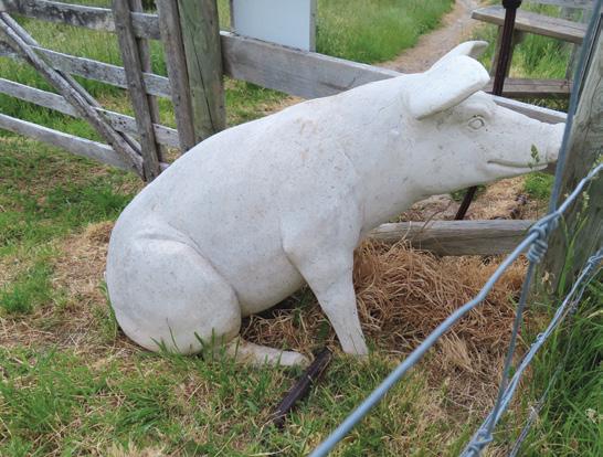
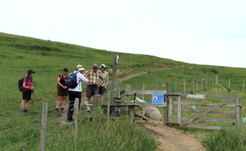
and there were a few more surprises on the way which you can find out for yourselves. You had to remain alert and look around or it was very easy to walk past some of the sculptures. We came to a stile which crossed the fence on the track and to our surprise a lovely sculpture of a pig was waiting for us all.
We continued our walk to the top of the hill and met a magnificent Rhino. What a stunning piece of art.
After many photos we continued towards Takamatua where we had our lunch looking over the bay and then headed back up the hill towards Moa Point.
On the track there were still many views to look at including the view of the gate to nowhere which we all found very interesting. The tracks were very well marked and we eventually wandered back to the beginning of the track. We had been away for a good part of the day.
Akaroa Children’s Bay Walkway (is 1.5 hours from Christchurch)
Opposite page above: Looking back over Akaroa.
Below left: The rhino sculpture at the top of the hill. Below right: A pig greets the group from a pen.
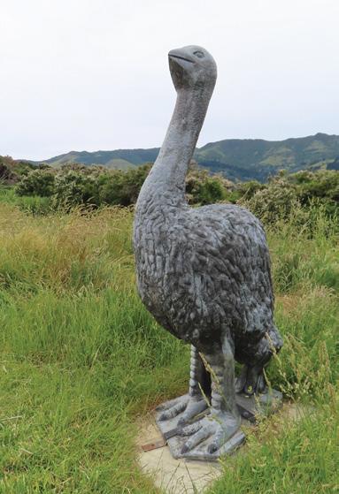
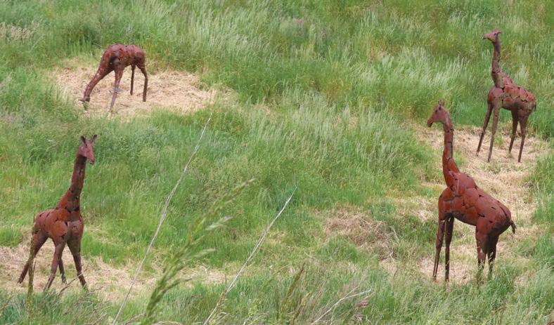
Above left: A moa sculpture. Above right: Viewing the pig. Middle left: Giraffes in the farm.
Below left: Tree sculptures. Below right: The group pose beside a moa.
By Barbz Lowther
The walk to Dickeys Flat in Kaimai Mamaku Forest Park
One of our favourite walks is in the Kaimai Mamaku Forest Park, near Waihi. The trail ends at Dickeys Flat, a local picnic and swimming spot, with toilets and camping available.
From Dickeys Flat, a variety of walks are possible and DOC has a very good brochure describing the
walks available from here, and access roads in.
Leaving a car at Dickeys, we drove back to the end of Franklin Road. From the small car park here, tracks lead into Waitawheta and Dalys huts, and on over the Mangakino Pack Track, to either Te Aroha (west) or Dickeys and beyond.
This is our favourite section. It is a beautiful trail, but has a wide river crossing an hour before Dickeys. Because the Waitawheta River flows fast and rises rapidly after heavy rain, it is not safe to cross until it has settled down. Our last two attempts had to be cancelled so we were happy to have a week of dry weather this time. Although it is a bit shorter to take Deans Track at the end of the car park, we chose to do an extra loop along the Waitawheta Tramline, and up to Dalys hut for morning tea. The trail is really pretty and the history fascinating.
Above left: Waitawheta River at the end of Franklin Road. Above right: Spotting a tui. Below left: Leafy trail with tall natives above Nikau and ferns. Below right: Crossing the river. Opposite page above: spotting a tui. Above right: An up hill section.
After crossing the paddocks with old machinery displayed, we went through the farm gate to Information boards about the tramline. This was built between 1896 -1910 to facilitate the extraction of kauris from the Waitawheta Valley. In 15 minutes, we reached the turn off to Dalys Hut, named after two Dalmations who lived in a little hut in this area digging for Kauri gum. Half an hour up shallow wooden steps, took us to a little stream, and the hut was another five minutes
The hut is set in a lovely open clearing and we sat a while listening
to tuis playing in the trees around, and watching fantails constantly flitting from branch to branch. From here we continued through the clearing, and turned right onto the Mangakino Pack Track. This was constructed in 1880 to transport supplies from Karangahake and Waihi to Tui and Wairongomai mines. A left turn will take you over to Te Aroha.
In about 40 mins we reached the junction with the Dean Track, down over private farmland, back to the car park. This is a nice little loop for a half day walk.
We turned left and continued
The walk to Dickeys Flat
gradually up the Mangakino Pack Track. It was really pretty, passing through nikai groves, with large ferns bordering the trail. Tawa, kohekohe and pukatea, with its buttress roots, towered above, providing leaf cover to cushion the track.
At the highest point, was a stand of young kauri trees. We continued on an undulating trail for a couple of hours climbing over a few tree falls, and stopping for lunch in a cool shady spot.
The trail then led steeply down to the Mangakino Stream, and it was another 15 minutes to the Waitawheta River that is well known for its trout. This was the big crossing, but today it was remarkably shallow and no trouble at all.
Across the river is a very well marked and maintained track, with lots of steps bridges and boardwalk. The last section is over open grassland. We followed the Waitawheta River for an hour, to reach Dickeys flat. All along the way were lovely swimming holes, and there is a good place to swim when you reach the car park.
It was an awesome walk, and if there’s been a dry spell its well worth doing. The car shuffle Franklin to Dickeys flat is only 10 minutes
Above left; Following the trail beside the river. Above right: Tall natives above the nikau palms. Below left: Negotiating steps on the river trail towards Dickeys Flat. Below right: Amongst the nikaus.
Bridal Veil Falls a short walk with big impact
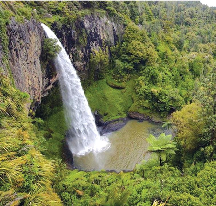
Just a 15-minute drive from Raglan (via Te Mata Road off State Highway 23) lies one of the Waikato’s most rewarding short walks to the breathtaking Wairēinga / Bridal Veil Falls.
Towering 55 metres above a sculpted sandstone amphitheatre, this waterfall is an elegant cascade draped like its namesake bridal veil, set within lush native bush and easily savoured by most ages and abilities. From its unassuming free carpark, the walk begins with an inviting gravel path that gently follows the Pakoka River through a canopy of
native forest. Ferns, nikau palms and birdsong accompany you as you stroll in a kind of setting that makes you slow down, breathe deeply, and feel far from everyday life, even though you’re less than half an hour from town.
For most visitors, the walk to the upper viewing platforms takes around 10 minutes each way that is flat, well formed, and accessible for prams and wheelchairs as far as the top lookout. From here, spectacular views of the falls and the surrounding countryside unfold, giving plenty of material for photos and quiet reflection.
If you’re after a bit more adven-
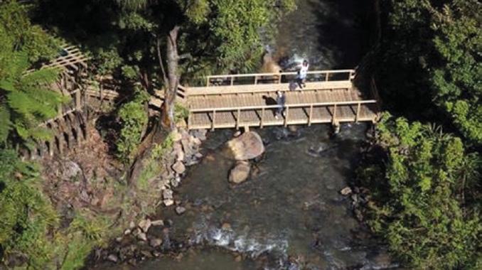
ture, continue down from the top lookout toward the base. This section involves a series of about 260 well-built steps that bring you to a midway viewing point and then to the bridge across the river at the bottom. The plunge pool lies in a wide sandstone bowl that makes a dramatic and beautiful spot to feel the energy of the falls from close up. Allow 30–60 minutes round trip if you choose to see both top and bottom viewpoints at a relaxed pace but longer if you linger with a picnic, take photos from each platform, or simply soak in the sound and spray of cascading water.
The track is well maintained by the Department of Conservation and open year-round. The first section to the top is easy and firm, suitable for all levels. Beyond that, descending the stairs to the base requires a basic level of fitness and sure footing. Going down is easy, but the return climb can get your heart rate up, especially on a warm day.
In wet weather, the stairs and paths can become slippery, and the mist from the falls reaches even the upper platforms, so solid footwear and a light jacket are advisable. There’s no potable water on site, so bring a refillable bottle, and although there are basic toilets at the carpark, there are no food or drink vendors so make a picnic of it before you go. It’s also worth noting that swimming at the pool is not recommended; water quality isn’t consistently healthy for bathing, and the current around the base can be deceptively strong.
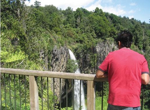
At the top, two viewing platforms
Above left: The Bridal Veil Falls. Below left and right: Two places to view the falls.
Bridal Veil Falls a short walk to big impact
give different perspectives of the falls and the river winding through the landscape below.
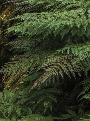
The quiet track through towering tree ferns feels almost meditative in the early morning or late afternoon light, when shadows play on the forest floor and birdlife flits through the branches.
For photographers, the falls are at their most dramatic after rain, thundering over the basalt lip into the sandstone amphitheatre, with fine sprays catching sunlight in a dance of rainbows and mist.
Beyond the waterfall, simply lingering at the picnic tables by the riverbank or exploring the creekside forest makes for a peaceful half-day outing. If your legs are up for more, the Pipiwharauroa Way walking and cycling trail begins just beyond the falls, offering a longer option through farmland and bush.
Whether you’re passing through the Waikato countryside, heading to surf Raglan’s famous breaks, or exploring the region’s walks, Wairēinga / Bridal Veil Falls is a highlight that delivers big scenery with a small investment of time and energy.
It’s a walk that satisfies children and adults alike: accessible yet rewarding, peaceful yet dramatic and a classic New Zealand natural experience.
Boots Packs Rainwear
All your tramping essentials One shop ~ Since 1988
Ride, Sip and Enjoy Hawkes Bay Uncorked
Many New Zealand walkers understand the pleasure of travelling slowly through a landscape. You notice more, meet more people, and feel more connected to the place you are in.
The Uncorked 5-Day Cycle Tour in Hawke’s Bay offers that same slow-travel experience, just on two wheels instead of two feet.
This fully supported, five-day journey combines easy cycling with good food, new friends, local wine, and comfortable accommodation.
Everything is organised in advance, including luggage transfers, meals, tastings, and guiding. Riders can focus on enjoying the scenery and the company rather than worrying about logistics or distance.
Hawke’s Bay is well suited to this relaxed style of travel. The region is known for its sunshine, vineyards, orchards, and wide open landscapes. More than 200 kilometres of flat, well-formed trails connect the coast, rivers, and wine-growing areas, making it one of the easiest places in the country to explore by bike.
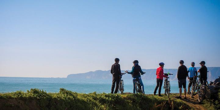
coast beyond. Reaching these viewpoints by bike adds a quiet sense of achievement, similar to arriving at a lookout on a well-chosen walking track. There is time to stop, take photos, and simply enjoy the setting before continuing on.
E-bikes are included, so even people with modest cycling experience can comfortably complete each day.
The tour begins in Napier, famous for its Art Deco architecture and seaside setting. After arriving and settling in, guests share a welcome dinner and meet their guides and fellow travellers. It is an easy introduction that sets the relaxed tone for the days ahead.
The following days combine short rides with regular stops. Trails follow estuaries, quiet stopbanks, and country roads before reaching some of Hawke’s Bay’s best-known wineries. Tastings are unhurried, and there is time to enjoy lunch, learn about the region’s wine styles, and take in the rural surroundings. The distance covered each day matters less than the experience along the way.
One of the highlights of the tour is the visit to Te Mata Peak where there is the opportunity for a short hike and cycling through the surrounding Tukituki Valley. The area offers some of the most recognisable scenery in Hawke’s Bay, with sweeping views across farmland, vineyards, and the
Food plays an important role throughout the five days. Dinners feature local produce, and a visit to the Hawke’s Bay Farmers’ Market introduces travellers to growers, bakers, and food producers from across the region. These shared meals often become the moments people remember most. Conversation flows easily after a day outdoors, and the small group (no more than 10ppl) helps create a friendly, social atmosphere.
A key strength of the uncorked tour is the level of support. Guides manage navigation, timing, and safety. A support vehicle is always nearby, and daily distances are achievable for a wide range of fitness levels. Comfortable accommodation
each night ensures riders are well rested. For people considering their first cycling holiday, this structure removes many common worries. You do not need to be highly fit or experienced. You simply need to be open to trying a different way of travelling.
Although this is a cycle tour, the appeal is very similar to a multi-day walk, with the main difference is range. Cycling allows you to see more of the region while still moving at a relaxed, human pace.
Hawke’s Bay has long been popular with active holidayers, food lovers, and wine travellers. The UNCORKED 5-Day Cycle Tour brings these elements together in a format that is easy, social, and well organised. It is not about speed, it is about enjoying the outdoors, tasting local produce, and discovering a region in a thoughtful way. For many walkers, it may feel like a natural extension of the journeys they already love.
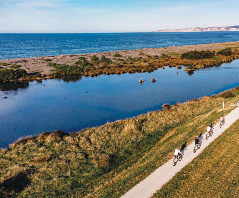
Above left: Bikers on a long stretch with the cliffs at Cape Kidnappers in the background.
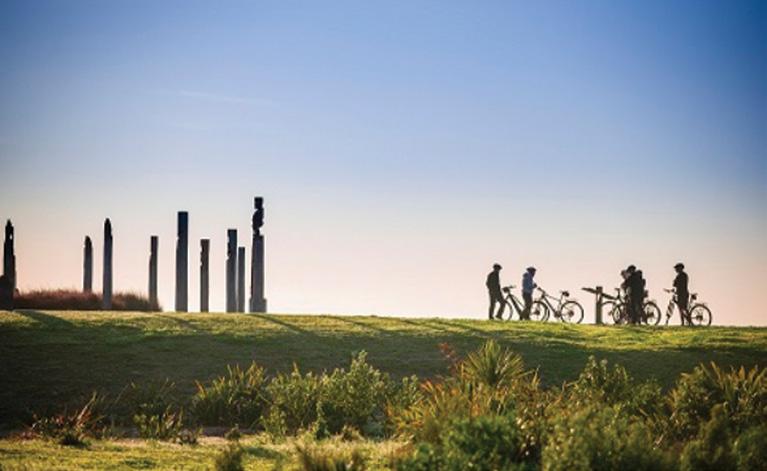
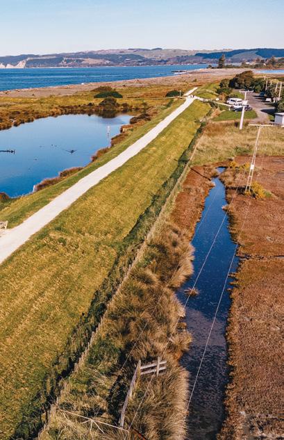
Below left: Maori poles along Marine Parade. Above right: Cyclists on a sealed path with the Bluff Hill behind the riders.
New Plymouth’s Coastal Walkway from the Port to Bell Block .
By Patrick Quinn
The first time I set out to walk from Port Taranaki to Bell Block along the Coastal Walkway, I expected a pleasant seaside stroll.
What I experienced instead was four unforgettable hours immersed in the shifting moods of the Tasman Sea, the quiet rhythm of local life, and the ever present silhouette of Mount Taranaki watching from inland.
The Coastal Walkway stretches approximately 13 kilometres from the port to Bell Block, a well-maintained ribbon of path that curves with the coastline. I allowed myself just over four hours to complete it, including plenty of stops and I am glad I did. This is not a walk to rush.
Beginning at Port Taranaki, the air carried a faint tang of salt and diesel, fishing boats rocking gently against their moorings. The industrial edges of the harbour soon softened as I joined the paved pathway. Within minutes, the steady sound of waves replaced
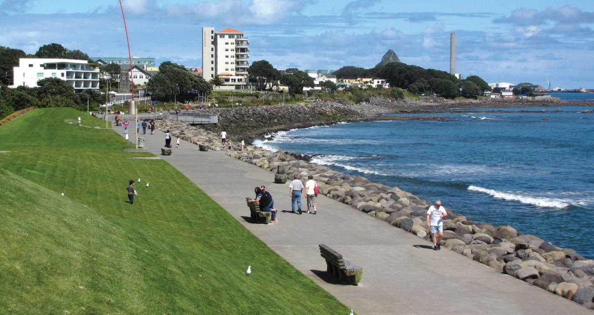
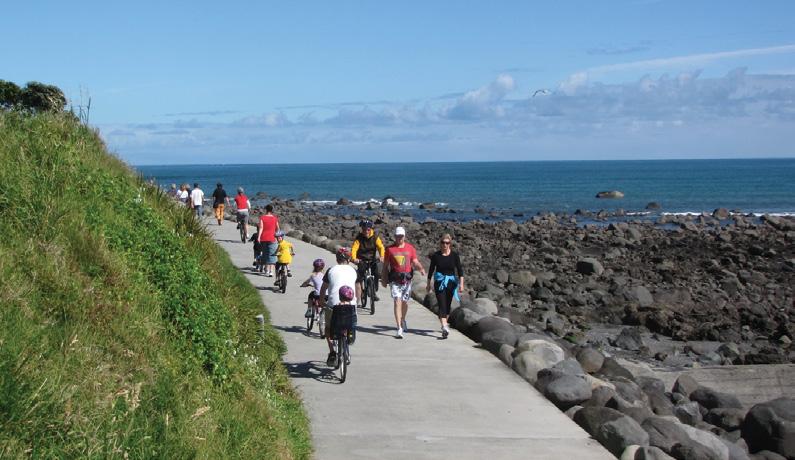
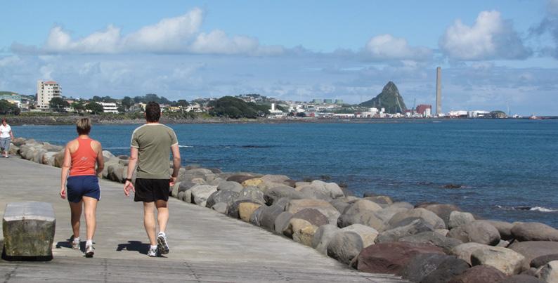
Above top: Looking back along the coastal walkway that passes beside the CBD. Middle left: The walkway is popular with walkers.
Below left: Looking back towards the port of Taranaki.
the hum of machinery. Surfers dotted the water, waiting patiently for clean sets rolling in from the Tasman Sea. I paused more than once to watch them carve across the swells, their silhouettes sharp against the glittering water.
As I moved further along, the walkway revealed its character, part recreational artery, part scenic showcase. Cyclists whirred past with friendly nods. Families ambled with ice creams in hand. Here the inland Te Hunui Track meets the Coastal Track and a place here to relax and enjoy a coffee Joggers maintained determined paces. The path itself was smooth and generous in width, making it easy to share.
One of the highlights was crossing the iconic Te Rewa Rewa Bridge. Its elegant, rib-like arches frame a perfect view inland toward Mount Taranaki on a clear day. I stopped here for a long while, taking photos and simply absorbing the symmetry of mountain, bridge, and sky. It felt like a moment carefully designed by nature and architecture together.
Further north, the landscape opened into stretches of grassy reserves and rugged shoreline. Wind pushed at my back, carrying the scent of sea spray. Seabirds wheeled overhead, their calls sharp and bright. Near Bell Block, the atmosphere grew quieter. The crowds thinned, replaced by long views of dark sand beaches and rocky outcrops.
Reaching Bell Block felt less like an endpoint and more like a gentle exhale. I sat for a while, shoes off, listening to the tide shift against the shore. The 13-kilometre journey had given me more than exercise — it offered perspective, space to think, and a deeper appreciation for Taranaki’s coastal beauty. It is a walk I will return to, again and again.
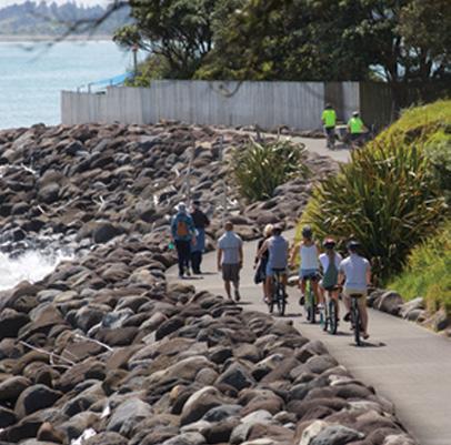
Above top right: The pathway beside the Te Henui Stream.
Above right: This is a popular spot to sit and enjoy the sights with refreshments.
Below right: The Te Rewa Rewa Bridge with Mt Taranaki in the background.
Stanfield Hut an ideal place for lunch
By Dave Scoullar
Stanfield Hut in the eastern Ruahine Ranges is a great lunch destination on a reasonably challenging day out that offers a round trip with both river and ridge walking.
The tracks are located at the end of Tamaki West Road near Dannevirke I the Tararua District..
The riverbed route up the Tamaki River west branch involves many crossings which are easy in low-water conditions. From the picnic area 200m from the carpark follow a DOC marked route for about 20 minutes. This leads into the riverbed. From here the route has only light informal markings but is not hard to follow.
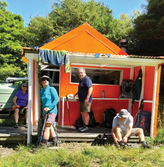
There are many gravel banks which are constantly changing as they are affected by floods. The 5km walk takes about two and a half hours and the hut which is just above the riverbank is marked by a large orange disc.
Eight-bunk Stanfield Hut was built in 1965 by the NZ Forest Service and named after a local bushman and farmer. It is maintained by the Dannevirke-based Ruahine Deerstalkers’ Club. Backcountry Trust volunteers renovated it in December 2021 with the orange paint supplied free of charge by Dulux.
An alternative 5km two and a half hour route to Stanfield starts at the picnic area, crosses the stream and climbs for about 30 minutes to Homes Ridge. This route then follows the open grassy ridge before
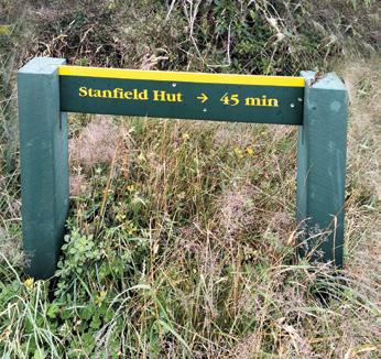
above left: Flooding has created many gravel banks. Below right: A sign on Homes Ridge.
dropping through bush back to the river about 15 minutes from the hut.
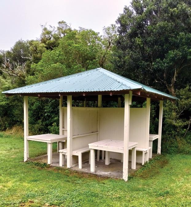
The picnic area has flush toilets and a shelter with picnic tables, a barbecue and a DOC information board. Be aware that it is dangerous to cross or follow the river when the water level is high which can occur during or after heavy rain. The tracks onto Homes Ridge are steep in places and can be slippery in wet weather.
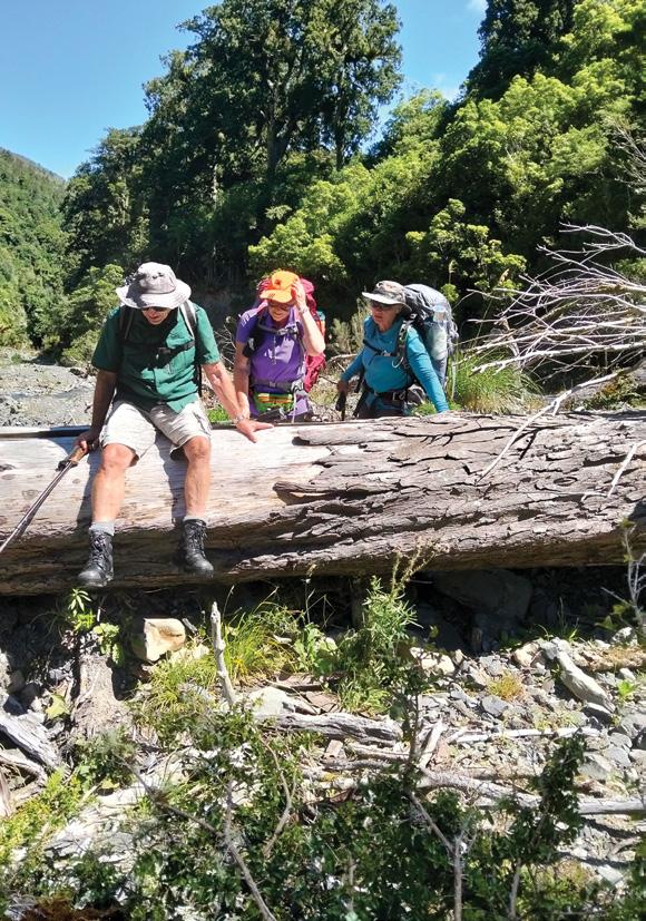
Above left: Tackling an obstacle in the riverbed.
Above right: The shelter with tables at the picnic area. Below left: Trampers making themselves at home at the hut.
Below right: One of many low-water river crossings.
NORTH ISLAND
NORTHLAND
BAY OF ISLANDS
BAY OF ISLANDS WALKERS: Saturday (AM), Jacqui Watson 022-6019741, Roz Whittaker 021-063-1455
DARGAVILLE
DARGAVILLE TRAMPING GROUP: Last Sunday of month (AM), Lynley Thompson 021-102-3974, colvilleestate1@gmail.com
WHANGAREI
CARDIAC CARE WALKING GROUP: Wednesday (AM or PM), Jo or Hugh Knight 09-438-7976
BARRIER TRAMPING& BEER LOVERS CLUB: Sunday, John Brock 09-429-0211
AUCKLAND
AUCKLAND GLOBAL TREKKERS: Sundays (BIA), Auckland walks and one overseas walk, auckland.global.trekkers@gmail.com, https:// heylo.group/aucklandglobaltrekkers
BLUE TOP WALKERS: Henderson, Tuesday, Thursday (AM), Terry Wilson 09-814-9523 or 021-266-1071, terryandsheena@gmail.com, www. bluetopwalkers.weebly.com
FIA OLA WOMEN’S DEVELOPMEMT WALK GROUP: Monday to Saturday, Anne, 09-813-0021
FIT4LIFE: Glenfield, Monday (PM), Friday (AM), Sarah 021 534 649
TE ATAU PENINSULA WALKERS: Monday, Friday (AM), Wednesday (PM), Mary Jones 09-834-6989
TE ATATU SOUTH ACTIVE 35+ WALKING GROUP: Te Atatu South, Wednesday, Edna, 09-834-1401
THE HAPPY WANDERERS WALKING GROUP: Wednesday (AM), Joy Williams 09-817-2464 or 027-353-3434
TITIRANGI TWILIGHT WALKERS: Tuesdays, Thursday, (PM) Titirangi Library, Wednesday (PM) Glovers Real Estate Green Bay, Louise 021437-547, louisenicholson@xtra.co.nz
TITIRANGI WALKERS: Sundays (AM), John Harris 09-627-0099, jeanah@ihug.co.nz
EAST COAST BAYS WALKERS: Browns Bay, Tuesday, Friday (AM), Pam Mattson 09-302-4882 or 021-268-4154, pam_4882@yahoo.co.nz
GREENHITHE WALKING GROUP: Greenhithe, Tuesday (AM), Marjorie Andrew 09-413-9065
HIGHBURY COMMUNITY HOUSE: Highbury, Thursday, Friday (AM), Judy Mayn 09-480-5279
MAIRANGI WALKING NETWORK: Mairangi Bay, Everyday (AM), Paula Cole 09-444-6435
MILFORD MALL WALKERS: Greenhithe, Tuesday, Thursday, (AM), Carol Mosedale 09-443-2054
MILFORD MENS PROBUS: Ian Hall 09-479-4259
NORTH SHORE DIABETES SUPPORT GROUP: Every second Sunday (AM), Dave or Panny 09-476-7447
NORTH SHORE SOCIAL WALKING GROUP: Every second Wednesday, Rosamonde Johnson 022-308-8975, rsmndj@gmail.com
NORTH SHORE TRAMPING CLUB: president@nstc.org.nz, www. nstc.org.nz
NORTHCOTE WALKING GROUP: Northcote, alternative Tuesdays,
LEGEND
Fitness levels: “B” beginner, ”I” intermediate, “A” advanced. (AM) denotes morning walk, (PM) denotes an afternoon or evening walk. Group co-ordinators are asked to please advise us of any updates by fax 06-358-6864 or email walkingnz@xtra.co.nz.
If you notice there that the times, names or contact numbers etc on the list of Walking Grroups in the Directory on these pages needs updating please email us at walkingnz@xtra.co.nz. These are are free listing.
LEGEND
Fitness levels: “B” beginner, ”I” intermediate, “A” advanced. (AM) denotes morning walk, (PM) denotes an afternoon or evening walk. Group co-ordinators are asked to please advise us of any updates by fax 06-358-6864 or email walkingnz@xtra.co.nz.
LAMBDA DAY TRAMPERS: every second Sunday, (BI), social group for gays and lesbians of all ages, https://lambdatrampers.org/ LINWOOD AVENUE WALKING GROUP: Wednesday, Thursday (AM) (B), 03-389-5303
PIONEER TRAMPERS:Thursday (AM) (IA),4-5 hour tramps in Banks Peninsula and the hills and lower mountains from Mt Hutt to Mt Grey, pioneertrampers@gmail.com
Notice to clubs and walking groups If you notice there that the times, names or contact numbers etc on the list of Walking Grroups in the Directory on these pages needs updating please email us at walkingnz@xtra.co.nz. These are are free listing.
19 Auckland Trail Run & Walk: Totara Park, Auckland
25-26 Northland 100, Whangarei
26 Run Auckland: Western Springs, Auckland AUGUST 2026
1 Taupo Marathon, Half Marathon, Taupo
2 South Island Half Marathon, Ashburton
2 Tāmaki River Half Marathon,Point Enghand, Auckland
8 Hanmer Springs Backyard Ultra, Hanmer Springs
AUSTRALIA
MARCH 2026
1 Belair Marathon, Belair National Park, SA
1 Bin to Bin Marathon, Narembeen, WA
1 Cardinia Fun Run & Walk, Packen-
ham, Vic
1 River Run Geelong, Vic
1 Walk for Monash Children’s Hospital, Melbourne, Vic
1 Walk or Run for REACH, Melbourne, Vic
6 Mackay Airport Twilight City Run, Mackay, Qld
Boots Packs Rainwear
All your tramping essentials One shop ~ Since 1988
7 Run Wagga Wagga, NSW
8 Burger Run, Belmount, Vic
8 Coombabah Trail Run, Gold Coast Qld
8 Grange Coastal, Grange, Adelaide, SA
14 Great Illawarra Walk, Shellharbour, NSW
15 Darlington Half Marathon, Darlington, WA
15 Mt Manningham Fun Run Walk, Templstowe, Vic
22 Tamworth Trailblazer, Tamworth, NSW
28-29 Aussie Peace Walk, Canberra, ACT
REST OF WORLD
MARCH 2026
1 Run Tokyo, Tokyo, Japan
APRIL 2026
20 130th Boston Marathon, Half Marathon, 10km & 5km, Boston, USA
MAY 2026
24 Sanlam Cape Town Marathon, Cape Town, South Africa
The H215 Professional 4 Function Pedometer
The H-215, 4-function pedometer is a superb, reasonably priced pedometer that counts steps, calculates distance, calories burned and has a 12/24 hour clock. This is the model that has sold over a quarter of a million worldwide. It has the largest display of any pedometer we tested and is very accurate.
Dimensions: (L) 5.6 * (W) 3.7 * (t) 2.7 cm
Price only $36.95 plus $7.00 P&P
Phone 0800-925-546 for bulk prices
Available now from:
Walking New Zealand Shop
47 Lincoln Tce, Palmerston North - Phone 0800-925-546 Fax 06-358-6864 or email walkingnz@xtra.co.nz. www.walkingnewzealand.co.nz
You can now view and enjoy the latest issue of Walking New Zealand magazine online for $3.95 at http://www.walkingnewzealand.co.nz
www.walkingnewzealand.co.nz
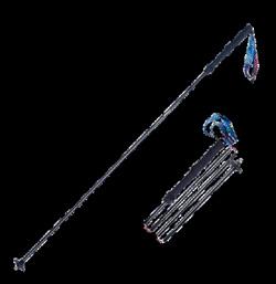
Foldable Hiking Poles
* Made from Aviation Aluminium
* Adjustable from 65cm -135cm
* Folds into 3 sections
* Straight rubber handle
* Comes with handy bag
* Colours Blue or Red
Buy two sticks and save $5.00
$39.95 plus $8.00 Shipping
Available now from:
Walking New Zealand Shop P O Box 1922, Palmerston North Phone 0800-925-546 - email walkingnz@xtra.co.nz. www.walkingnewzealand.co.nz
CAMINO MAGIC MAY 2026 Fully Escorted
Join YOU Travel Whitianga’s experienced escort on a soul-stirring 16-night adventure through Spain and beyond. Walk 115km of the legendary Camino from Sarria to Santiago, uncovering ancient villages, scenic trails, and rich cultural treasures. Space is limited so register your interest today!
Contact us to get more information today! 75 Albert Street, Whitianga 07 866 4397 diana@traveloptions.co.nz
CONTENTS for previous 15 issues
MARCH 336 2026
3 Contents
4 Walk Talk
6 New Zealand Walk: Switch off at Port Jackson 10 Weather: Weather prediction for March
11 New Zealand Walk: Wairoa Loop Track in Hunua Regional Park
12 News: NZ city ranks globally as bicycle-friendly city
12 Walking Group: Auckland Global Trekkers offer walks with sublime views
17 New Zealand Walk: Lake Waikareiti Walk
18 New Zealand Walk: Atene challenges and rewards
19 Overseas Tours: Meet you at Grand Central
23 New Zealand Pathway: Take a day out along the City to Sea Pathway
24 Walking New Zealand Monthly Photo Contest
26 New Zealand Walk: Rapurapu Stream - a perfect walk on a hot day
28 New Zealand Walk: Omahu Bush, Christchurch from tussock to totara
31 New Zealand Walk: Smith’s Bush Path an easy loop walk
32 New Zealand Walk: Greytown to Woodside a popular walk or bike
36 New Zealand Walks: Seven walks on Mt Somers
38 New Zealand Walk: Hobson Bay East Path a short interesting walk:
40 Directory of New Zealand Walking Groups
42 Coming Events: New Zealand
46 Coming Events: Australia
47 Coming Events: Rest of World
48 New Zealand Country Breaks
50 Index of previous 15 issues
51 Walking New Zealand Shop
52 Pak A Roo Walking Jackets FEBRUARY 335 2026
3 Contents
4 Walk Talk
6 New Zealand Walk: Red Rocks Coastal Walk - a wild south coast experience
9 Weather: Weather prediction for February
10 Walking Festival: Walking the landscapes: ECHO Walking Festival
12 New Zealand Walks: Taihape offers a hill and river walk
15 Overseas Walks: Walking the Greek Islands in Spring
16 Overseas Walks: From seething surf to mountain marvels
21 New Zealand Walk: Walking the walk from Palmerston North to Linton
24 Walking New Zealand Monthly Photo Contest
26 New Zealand Walk: Walking on the edge of the world in the Chatham Islands
29 New Zealand Walk: Walking the four Whangarei Falls tracksmy day out at Otuihau
32 New Zealand Walk: Rangitoto Island walk to the summit
36 New Zealand Walk: Wrights Hill Lookout Walk
38 New Zealand Walk: Muriwai Gannets Walk to spectacular bird life
40 Directory of New Zealand Walking Groups
42 Coming Events: New Zealand
46 Coming Events: Australia
47 Coming Events: Rest of World
48 New Zealand Country Breaks
50 Index of previous 15 issues
51 Walking New Zealand Shop
18 Weather: Weather prediction for January
19 New Zealand Walk: Nydia Track from D’Urville Island to Pelorus Sound
24 Walking New Zealand Monthly Photo Contest
26 New Zealand Walk: Walk to Blyth Hutt - popular Tongariro National Park walk
30 New Zealand Walk: Okere Falls Walk for natural beauty and history
34 New Zealand Walks: Three walks to explore in Tunnel Gully Recreational Area
37 New Zealand Walks: Two relazed beachside strolls in the Eastern Bay of Plenty
42 Coming Events: New Zealand
46 Coming Events: Australia
47 Coming Events: Rest of World
48 New Zealand Country Breaks
51 Walking New Zealand Shop
52 Pak A Roo Walking Jackets DECEMBER 333 2025
3 Contents
4 Walk Talk
6 New Zealand Walk; Hamilton Hidden Gems
9 News: Dallington Bridge officially opened over Avon River
10 Walking Tours: Top Walks in the top of the South
15 Manawatu Striders Super Seven Series
16 New Zealand Walk: Native forest giants just off highway:
18 Weather: Weather prediction for December
19 New Zealand Walk: Taking the Green Route from Devonport to Takapuna 22 New Zealand Walk:The Hull’s farm track to Mangatiti Falls
24 Walking New Zealand Monthly Photo Contest
26 New Zealand Walk: A winter walk on the Old Coach Stream Track
32 New Zealand Walk: Dog Stream Waterfall Walk
35 New Zealand Walk: Mercer Bay Loop Track for great sea views
36 New Zealand Walk: Walking the Kereru Track from Days Bay for greats harbour views
39 New Zealand Walks: Walk the Chatham Islandswonderfully remote
40 Directory of New Zealand Walking Groups
42 Coming Events: New Zealand
46 Coming Events: Australia
47 Coming Events: Rest of World
48 New Zealand Country Breaks
51 Walking New Zealand Shop
52 Pak A Roo Walking Jacke NOVEMBER 332 2025
3 Contents
4 Walk Talk
6 New Zealand Walk; Pakihi to Motu - a walking or cycling trail
10 Book: Emilie walks Te Araroa
10 News: Cape Palliser paper road bylaw to allow pedestrian and cycling access
11 Australian Walk: Witton Bluff Base Trail complete!
12 New Zealand Walk: CopperMine Trail - Nelson
14 NZ Walking Tour: Tantalising Taranaki from a volcanoe to coastal walk and in between
18 Weather: Weather prediction for November
19 Subscription page
20 Memories: Walking the Waikaremoana Track - 38 years ago.
24 Walking New Zealand Monthly Photo Contest
26 New Zealand Walk: Walking the Pahi Coastal Track -at the edgae of the Coromandel
30 New Zealand Walks Little River Trail - hike it, bike it, like it!
34 High Achiever: At nearly 80 - the melee of different walks in my life
4 Walk Talk
6 New Zealand Walk; An Autumn walk on the Otago Rail Trail
10 New Zealand Walks: Wonderful walks from Wel-lington to Whanganui
14 Overseas Walk: Morton Bay Fig trees a feature of Norfolk Island walk
15 New Zealand Walk: The Great Dripping Loop walk
18 Weather: Weather prediction for October
19 New Zealand Walk: Seals, camping and short walks on SH1 journey through Kaikoura
20 New Zealand Walk: Rangiwahia Hut murals makes this walk so special
22 New Zealand Walk: Discover Mangati Walkway: New Plymouth’s peaceful shared pathway
24 Walking New Zealand Monthly Photo Contest
26 New Zealand Walk: Katikati Haiku Pathway unique outside Japan
26 Overseas Tours: NZ walking company offers walks in Italy with Pleasure
30 New Zealand Walks: Heaphy Track and Oparara Arches
33 New Zealand Walk: Lou’s Lookout Walk
34 New Zealand Walks: Wandering along the Waika to River Trail from the dam to Jones Landing
38 New Zealand Walk: A’Deanes Bush Walk through an original existing forest
42 Coming Events: New Zealand
46 Coming Events: Australia
47 Coming Events: Rest of World
48 New Zealand Country Breaks
52 Pak A Roo Walking Jackets
SEPTEMBER 330 2025
3 Contents
4 Walk Talk
6 New Zealand Walk; Short walks at Lake Brunner
8 New Zealand Walking Festival: Wairarapa Walking Festival has over 25 walks
10 New Zealand Walk: Makotuku Track has wide appeal
13 Need2know: 7000 steps a day now achievable for most people
14 New Zealand Walk: A wander along the Karangahake Gorge
18 Weather: Weather prediction for September
19 New Zealand Walk: Track repair confirmed for Waimata Gemstone Bay
20 New Zealand Walk: Cape Saddle Walk: A valley to valley walk in Craigieburn Forest Park
24 Walking New Zealand Monthly Photo Contest
26 High Achiever: Raukumara Hikoi to view work done on the ranges
29 Australian Walks: Forest Sky Pier, Orara East State Forest offers great coastal views
30 Te Araroa Trail: How walkers donation have helped the Te Araroa Trail
32 News: 100 years of history with the Auckland Natural History Walking Group
34 New Zealand Walks: Walks in Winsome Wairarapa
36 New Zealand Walk: Walking fron the Woodville end to Ashhurst to first lookout
40 Directory of New Zealand Walking Groups
42 Coming Events: New Zealand
46 Coming Events: Australia
18 Weather: Weather predictiofor August
19 Viewpoint: Reinstate the competitive walking section: Why Auckland Marathon must listen to walkers
20 New Zealand Walking Festival: Bay of Islands Walking Weekend
23 Living Streets Aotearoa: Do you do this?
24 Walking New Zealand Monthly Photo Contest
26 Walking Tours: What’s in the mix for 2026
29 High Achiever: Northland engineer wins Outdoor Access Champions Award
30 New Zealand Walk: Hinehopu Bluffs for lots of native trees and birdlife
33 New Zealand Walk: The Terrace Walk at Franz Josef
34 New Zealand Walk: Karituwhenua Stream Walk a short family walk
36 New Zealand Walk: Omarama’s Clay Cliffs has an unique landscape
39 Auckland Walk: A walk or bike ride through Logan Park Reserve:
40 Directory of New Zealand Walking Groups
42 Coming Events: New Zealand
48 New Zealand Country Breaks
52 Taupo Marathon
JULY 328 2025
3 Contents
4 Walk Talk
6 New Zealand Walk: Tawa Loop Walk - a blend of natural beauty
10 New Zealand Trail: Access easements are the foundation of Kawatiri Coastal Trail
12 New Zealand Walks: Nine DOC huts for the first timer
14 Walking Tours: What is Footsteps
17 High Achiever: Dunedin track builder wins national award
18 New Zealand Walks: Wairakau Stream Walk included a climb up the Duke’s Nose Peak
22 New Zealand Trails: Sign of the Vimes: new Marlborough Vineyard Trail:
24 Walking New Zealand Monthly Photo Contest
26 Overseas Walks: The wild West Coast Trail on Vancouver Island
29 Subscription page
30 New Zealand Walk: Inglewood Walkway a popular community asset
32 New Zealand Walk: McClaren Falls Park has lots of easy walks
36 Australian Walks: Ten best walks and hikes in Tasmania
42 Coming Events: New Zealand
46 Coming Events: Australia
47 Coming Events: Rest of World
48 New Zealand Country Breaksp
52 Pak A Roo Jackets
JUNE 327 2025
3 Contents
4 Walk Talk
6 New Zealand Walk: Walking on Waiheke enjoying bird song
11 New Zealand Walks: Unveiling the beauty and history of the Nydia Track, Marlborough Sounds
14 New Zealand Walks: Wandering through wonder a walk in the Hamilton Gardens
17 Australian Walks: Outstanding odyssey in Oz with some great walks in South Australia
20 New Zealand Walk: Scotts Beach & Nikau Walk, Karamea
23 Te Araroa Trail: A day walk on the Te Araroa Trail
24 Walking New Zealand Monthly Photo Contest
26 Shared Pathway: Cycling the Kapiti Coast: an Autumn adventure
MAY 326 2025
3 Contents
4 Walk Talk
6 New Zealand Walk: Lake Rotorangi Hydro Walkway a little gem
9 New Zealand Walk: Six top Kapiti walks - coastal, scenic and bush worth exploring
12 Waitomo Cycle Trails: Waitomo - a bike walk adventure
14 New Zealand Trail: Ruakuri Scenic Reserve
16 New Zealand Walk: Washpen Falls Walk - Canterbury’s secret canyon walk
19 New Zealand Walk: Walk through a canyon in an ancient volcano
19 New Zealand Walk: Whangarei forestry walkway re-opened
20 Shared Pathway: Hauraki Rail Trail - Thames to Matatoki
23 Book: Hiking the Hexa - a journey on France’s newest through hike
24 Walking New Zealand Monthly Photo Contest
26 Overseas Walks: Trekking to Machu Picchu by the Salkantay Trek
30 Auckland Walks: Great Auckland spots for walking your dog
34 Overseas Walks: Colorado for thousands of hiking trails
39 New Zealand Walk: New footpath bridge opened in Wellsford
40 Directory of New Zealand Walking Groups
42 Coming Events: New Zealand
45 Coming Events: Australia
48 New Zealand Country Breaks
52 Pak A Roo Jackets APRIL 325 2025
3 Contents 4 Walk Talk
6 New Zealand Walk: Lake Rotorangi Hydro Walkway a little gem
9 New Zealand Walk: Six top Kapiti walks - coastal, scenic and bush worth exploring
12 Waitomo Cycle Trails: Waitomo - a bike walk adventure
14 New Zealand Trail: Ruakuri Scenic Reserve
16 New Zealand Walk: Washpen Falls Walk - Canterbury’s secret canyon walk
19 New Zealand Walk: Walk through a canyon in an ancient volcano
19 New Zealand Walk: Whangarei forestry walkway re-opened
20 Shared Pathway: Hauraki Rail Trail - Thames to Matatoki
23 Book: Hiking the Hexa - a journey on France’s newest through hike
24 Walking New Zealand Monthly Photo Contest
26 Overseas Walks: Trekking to Machu Picchu by the Salkantay Trek
30 Auckland Walks: Great Auckland spots for walking your dog
34 Overseas Walks: Colorado for thousands of hiking trails
39 New Zealand Walk: New footpath bridge opened in Wellsford
40 Directory of New Zealand Walking Groups
42 Coming Events: New Zealand
45 Coming Events: Australia
45 Coming Events: Rest of World
48 New Zealand Country Breaks
51 Walking New Zealand Shop
52 Pak A Roo Jackets MARCH 324 2025
3 Contents
4 Walk Talk
6 New Zealand Walk: Taranaki Falls Loop walk a capti]vating experience
8 New Zealand Walk: Cathedral Cove attracts visitors from throughoutthe waorld
10 New Zealand Walk: Sandymount to Sandfly Bay walk a chance to see lions and seals
52 Pak A Roo Walking Jackets JANUARY 334 2026
3 Contents 4 Walk Talk
6 New Zealand Walks; Eight Taupo nature walks
11 Overseas Walk: Handcrafted journey along the Camino de Santiago
12 Overseas Walks: The delights of the Dolomites
17 Need2Know:: Explore safe this Summer
37 Australian Walks: Alice Springs - gorges, water holes and red dessert landscapes
40 Directory of New Zealand Walking Groups
42 Coming Events: New Zealand
46 Coming Events: Australia
47 Coming Events: Rest of World
48 New Zealand Country Breaks
51 Walking New Zealand Shop
52 Pak A Roo Walking Jackets OCTOBER 331 2025
3 Contents
47 Coming Events: Rest of World
48 New Zealand Country Breaks
52 Pak A Roo Walking Jackets
AUGUST 329 2025
3 Contents 4 Walk Talk
6 New Zealand Shared Pathway: Te Ahu a Turanga Manawatu to Tararua a journey from Ashhurst to Woodville
10 New Zealand Shared Pathway: Build the Path
11 New Zealand Walk: St Leonard’s Beach dog friendly
14 New Zealand Walk: Kurow Hill Walk an unique experience
30 New Zealand Walk: Taieri River Scenic Reserve an interesting walk
32 New Zealand Walk: Te Henui Walkway Extension a little known walk
34 New Zealand Event: Run Tekapo walks with breath-taking views
36 New Zealand Walks: From forest to skyline Walking the Wilds of Puhi Peaks
40 Directory of New Zealand Walking Groups
42 Coming Events: New Zealand
45 Coming Events: Rest of World
48 New Zealand Country Breaks
51 Walking New Zealand Shop
52 Pak A Roo Jackets
12 Auckland Cycle Trails: The best family friendly bike rides in
The ULTIMATE is Zerofit’s flagship product and perfect for hiking, golf, sailing or any outdoor activities when it’s cold. But if you are more active it is complemented by the Heatrub MOVE.
Twice as warm as a standard base layer, the material regulates tempertures as you move, so you won’t suffer from cold sweat, if your are running or cycling.
Please visit the Walking New Zealand Shop: https://walkingnewzealand.co.nz/productcategory/apparel/ for more details and to order.