Cover image: Two hikers on the Pahi Coastal Walk. 11 26 38 18
Walk talk
Work started on cycle trail from city to the sea
A proposed “City to Sea Rail Trail” aims to convert the old railway line from Longburn (Palmerston North) to Himatangi and Foxton into a cycleway, traversing historical sites like Karere and Rangiotu.
The route is largely flat and follows the former rail corridor, with development currently in the planning and advocacy stage, often managed via the City to Sea Rail Trail Manawatu Facebook page.
The trail follows the defunct railway line that transported passengers and freight until 1959.
The route goes through rural Manawatu landscapes, including Karere, Tiakitahuna, and Rangiotu (past the old post office and WWI army camp).
The project is a proposed development rather than a fully finished, maintained, or signposted cycle trail. It is designed to be flat, making it suitable for various ages and fitness levels.
For established trails in the region, cyclists often use the Manawatu River shared pathways and the new trail Te Ahu a Turanga: Manawatū Tararua Highway – the ‘gateway’ between Palmerston North, the Tararua District opened in June last year and many are looking forward this new trail when completed will link Woodville in the Tararua District to the sea.
For the most up-to-date information on which sections of the rail line are accessible or to support the development of this trail, checking the City to Sea Rail Trail Manawatu Facebook page.
Above: A working bee is planned for 28th February
Improvements to Mangaokewa Track
Just south of Te Kūiti, the Mangaokewa Track, part of the te Araroa Trail, has always been a tricky section – steep climbs, narrow track, and slips to cross. Thanks to support,from the public, local contractors and volunteers have widened the track, added bridges and retaining walls, and made it safer for walkers.
This season, work continues to improve gradients and clear vegetation. Huge thanks to the Chandler family and Te Kūiti community for their incredible efforts!
Above: Workers on the Mangaokewa Track hard at work.
UNESO Trails popular in Scotland
Scotland’s UNESCO Trail has inspired two in five visitors to visit one of the country’s designated UNESCO sites, according to a report by VisitScotland.
Launched initially as a digital trail in October 2021, it included all 13 of Scotland’s UNESCO designated sites at the time.
The Flow Country, Perth City of Craft and Folk Art, and the Isle of Arran, which have since received UNESCO designation, have been added to the trail over the years as it has been reworked.
An evaluation of Scotland’s UNESCO Trail finds that the trail raised Scotland’s profile as a holiday destination and also as a leader in promoting UNESCO values and responsible tourism practices.
Between 31% and 46% of visitors stated the trail was an important factor in their decision to visit a UNESCO site.
Walk talk
Melling to City link in final stages
Lily Chalmers the founder and chairperson of Free Ride a community cycling initiative, is helping Wellingtonians prepare for the opening of the final stretch of coastal cycle track Te Ara Tupua that is due to open this year.
.The 12-kilometre shared pathway connects Melling in Lower Hutt to Wellington. The Melling to Petone section is open and the Petone to Ngauranga section currently under construction and due to open in the first half of 2026.
Free Ride - which was originally set up as a community bike share initiative in the Lower Hutt suburb of Naenae is running events for people ahead of the opening to help prepare. People may not have ridden a bike for some time, aren’t sure how to maintain a bike or fix a puncture, might need a steer on bike rules and etiquette, or may not have a bike at all.
Above: A group at one of Free Ride events
Walking solo in Tasmania
Tasmanian Walking Company (TWC) has made it more affordable for solo adventurers to take to the trail this year, cutting the single supplement fee on two of its popular long weekend walks. This is in response to a growing demand from travellers who prefer not to share a room.
Single occupancy rooms on the Bay of Fires Long Weekend Walk and the Bruny Island Long Weekend Walk now attract a flat supplementary fee of A$500, down from the previous 75% surcharge on the twinshare rate. This equates to a saving of almost A$1000 for sole occupancy.
The change comes as TWC reports a 43% rise in solo travellers across its eight Australian trails in 2024.
‘Solo hiking isn’t just for young, broke backpackers. Older generations are opting in,’ says Kate Duffy, chief marketing officer of Tasmanian Walking Company. ‘We’ve seen solo travel increase 43%, especially among those in their 40s to 70s.’
TWC offers multi-day small-group guided tours, with overnight stays in premium lodges or exclusive safari tents.
All walks are led by two guides who are storytellers, navigators, and cooks. Duffy notes that solo female travellers are leading the trend with a 47% increase, from 909 walkers in 2023 to 1334 in 2024. ‘It’s not just a female thing,’ she adds, ‘There’s been an increase in male solo travellers as well.’
Above: A cabin on Bruny Island long weekend walk.
Award for Australian Outdoors advocate
Australia’s Outdoors advocate, search and rescue leader, award-winning travel writer and navigation educator Caro Ryan has been awarded a Medal of the Order of Australia (OAM) in the 2026 Australia Day Honours for her significant contribution to bushwalking safety.
Caro leads a 60-person strong specialist Bush Search and Rescue team with the NSW SES in the Blue Mountains, bringing decades of field-tested experience to her role in assisting lost or injured bushwalkers. Her dedication to safety and education is also reflected in her book How to Navigate, which teaches the essential skills of map and compass navigation.
“Navigation is not just a tool – it’s an invitation to feel confident outdoors, connect with nature, and care deeply for wild places,” Caro says.
Later this year, Caro will bring her acclaimed teaching
style and deep bushcraft knowledge to a special departure of Tasmanian Expeditions’ Flinders Island Walking Adventure – In Comfort.
The hosted trip from 12–17 April 2026 integrates her Introduction to Navigation course into the six-day itinerary.
“Flinders Island is the perfect outdoor classroom,” Caro says. “We’ll walk an already incredible itinerary, and along the way I’ll help demystify map and compass navigation so people can step off the well-formed track with confidence and make wise decisions in the bush.”
Switch off at Port Jackson
Story by Gwen Bowler
If coastal views, native bush and rugged farmland are your idea of bliss, then the Pahi Coastal Walk is a must. I recently did this twonight three day walk with a friend.
The coastal road to the small town of Colville in the Coromandel eases you into what is to come. With dodgy cell phone coverage, it is also a chance to switch off and enjoy the magnificent coastal views on the hour-long minibus trip to the start of the walk in Port Jackson.
After a quick briefing by Kath Ward, who opened the family farm for the walk, four years ago, we started our climb. The first part of the walk keeps to the farm tracks and within half an hour, the Hauraki gulf opened up in front of us. We took a few energy stops to catch our breath and admire the views, before carrying on our walk through regenerating bush and then out onto the farm tracks again. The first day is about 12km or there abouts.
This is a walk for those who like home comforts and only want to carry a day pack. With only 12 walkers, there is no need to hurry and
Boots Packs Rainwear
All your tramping essentials
One shop ~ Since 1988
Opposite page: View from the Shearers Quarters looking towards Port Jackson Beach
Above right: Another climb done and dusted.
Below left: Taking in the view before starting the Mountain Home Bush Track.
Switch off at Port Jackson
plenty of time to chat or be at one with nature. The choice is yours.
After a few hours in the hot sun, we arrived at Pahi Retreat. Hot showers, afternoon tea and good company awaited us.
Day 2 starts with a climb. After about 3km and a magnificent view looking out at Great Barrier Island, it was time to decide if we would take Option 1 and do the 19km track, or take Option 2 (12-15km) and make our way across the valley rather than up. Having the options on this walk is great as it is about the overall experience rather than the time spent in hiking boots. We opted for Option 2 and started down the Mountain
Above right: We start the 3km climb from Pahi Retreat on day two.
Above left: We made it to the top. Decision time. Do we do the 19km track or go down the Mountain Home Bush Track?
Above left: View of Port Jackson beach before we descend the steep steps to the beach.
Bush path. The views were breathtaking and with inquisitive cows and the occasional beady eyed bull to keep us company, we made our way over the wellmarked stiles to a path that took us right next to the rugged coastline.
After navigating some steps both up and down, we came to the beach at Port Jackson. It was time to take off those hiking boots and take to the water. It had been a hot climb up and down.
As we reached the Shearers Quarters, a little foot weary, but pleased we had completed the walk, another lovely afternoon tea and dinner awaited us.
Day 3 we had options: swim at the beach, complete an easy 4 km farm walk or hire e-bikes and make our way back to Colville this way.
We opted for a walk along the beach before our 10am minibus pick up.
Farm walks seem to be popping up all over New Zealand. It is a great alternative to longer multi day walks for those who want to catch up with friends or want an easier pace but still want to be active and see parts
of New Zealand that they would not usually have access to.
Above right:Rest stop after an up and down climb over farmland before starting to walk along the coastal cliffs towards the beach at Port Jackson.
WEATHER
MARCH Weather prediction
(Weather is an inexact science, like medicine. Dates given are to be regarded as focus points. Please allow 3-4 days leeway for all forecasts)
1st-3rd High pressure brings dry and warm conditions with very light breezes to mostly calm air throughout.
2nd-9th Chance of fog in the Christchurch area over the coming week.
4th-5th A subtropical low may cross northern parts of the North island with the chance of damaging wind gusts and localised flooding in some parts of Northland, from Whangaparaoa to Cape Reinga.
5th-7th A complex depression deep in the Southern Ocean brings very strong and unstable winds throughout the country, with outbreaks of rain in the South Island at first, later spreading up through the eastern half of the country from Otago to the East Cape.
8th-11th High-pressure ridges onto the country easing rain in the east but bringing showers in the western half of the country before clearing to isolated showers in both islands.
The next four weeks may continue to bring further summer-like conditions, with more anticyclones east of New Zealand extending their ridges back across the country.
As such, light winds may once again frequently prevail over the South Island and easterlies over the North Island. During this period, there should be around five unsettled periods as cold fronts break the otherwise mostly anticyclonic dominance during this period.
Despite the passage of a number of cold fronts during the next four weeks, rainfall amounts may only be around 30-50% of the average throughout much of the country, including throughout Fiordland, Canterbury, Auckland, the Waikato and King Country, and eastern parts of the Wairarapa. Otago and Southland regions may see fairly average conditions.
In contrast, the Far North, Gisborne, northern parts of the South Island and eastern Otago districts may receive above average rainfall. Soil moisture deficits may have become very significant in the west of the North Island from Auckland to the Manawatu, Wairarapa and Marl-
borough by the end of this outlook period with drought conditions possibly having developed, particularly in those areas not accustomed to very dry conditions for this time of year.
Some relief to the unusually dry conditions may arrive towards the end of this outlook period.
15th Chance of thunderstorms in Dunedin.
17th High pressure ridges over the country. A mixed day in Canterbury with the chance of fog patches and thunderstorms.
17th-18th Unsettled throughout the country. Rain activity in the west and south of both islands. Chance of funnel formation winds in Auckland.
Sunshine hours should be around average to about 10% more than normal over most of the country, particularly from Taranaki to Wellington, Marlborough, up to 20% sunnier southern parts of the South Island, but closer to average in the east of the North Island and in the Golden Bay area.
by Ken Ring
Finally, this outlook period ahead may see above average temperatures, particularly in the Waikato, King Country, and central and southwest parts of the North Island. Similarly, heat wave conditions may also appear during this outlook period in inland and eastern parts of the South Island for a time around the end of March into early April when temperatures in the early 30’s may be common.
Overall, this outlook period may be warmer than normal by around one-to-two degrees above the average in the Waikato, Central Plateau, western Bay of Plenty, Taranaki to the Manawatu, western parts of the South Island, south Canterbury and central Otago.
The remainder of the North Island, Marlborough, Westland, and parts of Canterbury and Otago may be around half a degree warmer than average.
11th Chance of fog patches in Christchurch.
12th-16th Intense depression moves onto the country bringing unsettled and strong winds over the South Island, with thunderstorms and heavy rain likely in Southland and Otago, particularly in the Dunedin area, where pockets of localised flooding may occur.
Further north, overnight fog patches in Christchurch may turn to rain later in the day.
19th-21st High pressure ridges over the country clearing rain throughout.
21st Unusually cold overnight in the Otago district with some patches of frost likely, including in the Lauder district. Very light winds to mostly calm air.
22nd Cold fronts sweep over the country. Very strong westerly wind gusts in the lower North Island, including in the Wairarapa to Wellington areas.
23rd-26th A rain embedded trough crosses the country bringing a very wet spell throughout.
22nd-24th Light breezes to mostly calm air in the South Island with chance of patches of fog particularly in Canterbury.
27th Unusually hot around this time in the Waikato, particularly in the Hamilton area, with the maximum temperature likely to reach into the low 30’s.
27th-29th Further rain throughout most parts of the country.
28th-31st A large high slowly drifts over the country. Chance of fog patches over the next few nights in the Christchurch area.
29th Mar-1st April Chance of a heat wave in the east and inland parts of the South Island, including throughout Canterbury, and north and central Otago, with many areas peaking maximum temperatures in excess of 30°C.
Wairoa Loop Track in Hunua Regional Park
Located within Hunua Regional Park in Auckland, the Wairoa Loop Track offers a scenic walk that begins directly opposite the car park at the top of Otau Road. This track is perfect for those who enjoy a mix of forested trails and ridge walks, with the added bonus of a small waterfall and soaking pool along the way.
The track initially follows a stream, often several metres above it, but there are accessible spots, including a short gorge featuring a small waterfall and a soaking pool.
As you continue, the trail ascends along a ridge, eventually connecting with Repeater Road, an access route for a telecommunications repeater. Although the road itself offers limited views, there is one excellent viewpoint over the north end of the Wairoa Reservoir that you should not miss.
Adjacent to the repeater, you’ll find a modest camping area. Keep in mind that you must carry all your supplies in and out.
From here, the trail descends towards the Wairoa Dam. About a fifth of the way down, a short sidetrack leads to another viewpoint overlooking the dam and reservoir.
The track eventually connects with the bottom end of Otau Road. Turning right will take you to the reservoir and dam, while a left turn leads back up the road to the car park. Alternatively, from the dam, you can opt to take the Suspension Bridge Track back to the car park, adding about 40 minutes to your walk.
How to get there
To reach the Wairoa Loop Track from the small town of Hunua, take Hunua Road for about 8 km south, then turn east onto Moumoukai
Road. After 2 km, turn left onto Otau Road, where the car park is located just inside Hunua Regional Park. The track begins directly opposite the car park. Allow approximately 2 to 2.5 hours to complete the loop, with an additional 40 minutes if you choose to include the Suspension Bridge Track.
The Suspension Track to the dam and back is a shorter option. As a hidden surprise, you can discover the twin waterfalls that lie below the car park. On the north side of Hunua, there is access to the much more popular Hunua Falls and Cossey Massey Loop.
Above: The track on an incline in a forested area.
Below left: Just a few steps to climb here.
Below right; A small waterfall on the loop track.
NZ city ranks globally as bicycle-friendly city
Christchurch has been named the most bicycle-friendly city in Asia and Oceania and 38th globally in an international ranking index.
The Copenhagenize Index, published every two years, is the most comprehensive and holistic ranking of bicycle-friendly cities in the world. It provides an evidence-based benchmark that tracks how cities across the globe are progressing in making cycling safe, convenient, and mainstream.
Planning and Delivery Transport Manager Jacob Bradbury says this is a great result and recognises how much work has been put in to make the city a friendly place for cyclists.
“We are pleased to see the investment that has been made in building cycleways and education in recent years is paying off. This is also demonstrated in the statistics we gather through our ongoing resident surveys, with cycle use around the whole of the city increasing by more than 40% in the last eight years.”
“Data shows that growing numbers of residents think that Christchurch is a bicycle friendly city. Ten years ago, 38% of people surveyed thought that it was bicycle friendly while by 2025 this has grown significantly to 67%.
“We’ve also seen a rising trend
in female cyclists numbers city-wide. Indicators show an increase from 33% of all cycling around the inner city eight years ago being by females to 41% in 2025.”
These results echo the national Quality of Life 2024 survey, with Christchurch taking out the highest ranking for perceptions of safety on its local bike network compared to New Zealand’s seven other main cities
Mr Bradbury says the level of cycle education in the city is strong and aims to help young people view the city as bicycle friendly.
“Christchurch's Cycle Safe Programme, which teaches cycle skills in schools, is considered one of the best in the country and is used as a leading delivery model. Students learn the benefits of cycling and how to ride with confidence and be road-wise.”
“We are continuing to invest in our Major Cycleway network, with more work planned to start early in 2026. This investment will help our usage figures continue to grow, cementing our place as a bicycle friendly city locally, nationally and internationally.”
The only other New Zealand city to rank in The Copenhagenize Index was Wellington, which came in third in Asia and Oceania and 47th globally.
Auckland Glo
NZ Cycle Trails
by Miriam Dunningham
Spectacular snow clad mountain peaks, crystalline lakes, lush New Zealand native bush, sweeping golden sand beaches, and bubbling streams.
These are some of the sublime views of nature experienced by hikers who join Auckland Global Trekkers on their hikes.
Founded by Christopher Grant, who can take credit for planning most of the hikes, and who is ably assisted by a group of willing helpers, Auckland Global Trekkers offers something for everyone keen to enjoy the outdoors and increase or maintain their level of fitness. The organisation is superb and the group is open to anyone interested to join.
AGT offers Sunday hikes pretty much every week of the year and generally within three hours of Auckland.
Taking up a full day, including travel to and from locations, these provide members with a wide diversity of landscapes with many hikes uncovering hidden gems unknown to the wider public. They are well attended and very popular.
For myself the opportunity to walk the Blue Springs at Putaruru was something I had long wanted to do. I jumped at the chance to do it with a group of like minded people and it really was a wonderful day. So much more enjoyable than walking it alone which I had planned to do.
If you have never been to the Blue Springs I urge you to go, it is nature at its finest. At the end of every hike there is time allotted for refreshment at a suitable venue for those who want to enjoy some camaraderie before heading home.
During summer and winter you can join a series of short midweek evening walks. Based around Auckland they take hikers to interesting locations around the city.
Taking approximately two hours walking time and including a post walk gathering at a cafe or bar these
bal Trekkers offer walks with sublime views
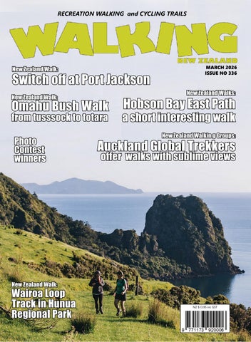
are ideal for a beginner testing the waters of hiking. They are an enjoyable way to share some regular exercise with others.
Occasionally Auckland Global Trekkers will spend a night away at a farm stay or homestead providing an opportunity to walk on two days.
Recently there was a stay at a farm at Waikorea in the Waikato on the rugged West Coast. Friday included a two hour walk through lush bush and past majestic kauri and on Saturday there was the pleasure of relaxing in the geothermal springs at Kawhia. This short weekend break was a refreshing retreat from the working week and a great way to strengthen friendships and get to know fellow hikers.
At least once a year there will be the offer of an overseas trip. The Trekkers have been to many countries over the years including Australia, Chile and Korea and this year are going to Portugal and Taiwan. These are primarily hiking trips but there is always plenty of time included to sample the culture, food and city sights as well.
Organisation of the group is superb. Using the Heylo App makes it easy for interested parties to look up the coming hikes and register.
Health and Safety of walkers is taken seriously and car pooling is used for longer more distant hikes with a contribution towards fuel from the passengers.
There is also a charge of $5 for each hike which goes towards the cost of safety equipment and membership of the Heylo App. This is strictly a non profit group.
Auckland Global Trekkers is a community, social, walking group open to all fitness levels. Members are friendly and helpful and come from all walks of life. Come along and join us, you will be very welcome.
You will find us on Facebook and Instagram and at www.heylo.group/ aucklandglobaltrekkers
Above and below: Member of Auckland Global Trekkers on two of their overseas trips over the years that included Australia, Chile and Korea.
New Zealand Walking Group
Atene challenges and rewards
By Dave Scoullar
The Atene Skyline Track in Whanganui National Park is a circuit ridge tramp with beautiful views.
Covering about 16km of wellmarked track, it is reasonably strenuous and a good level of fitness is desirable. Best done clockwise, begin at the upriver end where the track climbs steeply through lowland forest.
It then follows for about 3 km a gently graded road line which was built by the Ministry of Works during investigation for a possible dam
Above left: A view of old river bed now farmed.
Above right: Sign at the start.
Below left: Trampers relax at the shelter..
Below right: This trig is the highest point.
more than 60 years ago. From here on the track is much rougher and narrow in places as it follows the ridge line to the halfway point at a clearing with a campsite, shelter, drinking water and toilet. This is the only water source. Soon after is Taumata trig, at 572m the
Above left: Tackling a steeper section. Above right: Easy walking on road line. Below left: Map of the track.
track’s highest point. The track winds around the edge of impressive sandstone bluffs and then descends back to the road. Staircases and steps
DIRECTORY of GUIDED WALKS
BANKS TRACK Akaroa
A multi-day walk over the hills at Akaroa 03-304-7612 bankstrack@xtra.co.nz www.bankstrack.co.nz
HUMPRIDGE TRACK Tuatapere 3 Day Loop Walk in Fiordland 03-226-6739 walk@humpridgetrack.co.nz www.humpridgetrack.co.nz
ISLAND HILLS STATION Nth Canterbury Private track, self guided, multi-day walk 022-464-0140 Shaun@islandhillsstation.co.nz www.islandhillsstation.com
NORTHLAND EXPERIENCES Northland E-Bike tours and walking groups 027-203-8416 hello@northland experiences.co.nz www.northlandexperiences.co.nz
PAPAROA GUIDED WALKS Greymouth
All-inclusive guided tours along the Paparoa Track, Marlborough and Tasman regions 027-527-2762 info@paparoaguidedwalks.com www.paparoaguidedwalks.com
TOTALLY TARAWERA Rotorua Your nature connection 07-362-8080 info@totallytarawerea.com www.totallytarawera.com
KAHURANGI GUIDED WALKS Takaka Single and Multi-day hikes in Abel Tasman and Kahurangi National Parks 022-657-8869 kahurangiwalks@gmail.com www.kahurangiwalks.co.nz
SIDETRACKS -WOMEN NZ
Women - only hiking and cycling adventures 021-228-3912 info@sidetracks.co.nz https://www.sidetrackswomen.co.nz
KAIKOURA COAST TRACK Nth Canterbury NZ’ Finest 2 Day Private Walk 021-073-4726 sally@kaikouratrack.co.nz www.kaikouratrack.co.nz
PAHI COAST WALK Coromandel 3 day,2 night fully catered walk 021-816-228 hello@pahicoastwalk.co.nz www.pahicoastwalk.co.nz
This is a free listing service for guided walks/accomodation etc You can add this service to the list by contacting us at walkingnz@xtra.co.nz
Atene challenges and rewards
help with footing but there are some steep sections to negotiate.
The focus throughout the walk is Puketapu, a large hill. Once the hill stood at the end of a long narrownecked peninsula but eventually the river broke through the neck, forcing a more direct route to the sea and cutting off the meander which is now farm land.
The striking topography allows the track to traverse a wide range of bush from a damp gully floor tawa forest through mixed broadleaf forest to open bluff ridges dominated by kamahi and black beech. The
Above left: Staircases and steps help.
Above right: A huge rata on the track. reserve also has an array of native birds including falcon and North Island brown kiwi.
The tramp is listed at eight hours but reasonably fit people should be able to complete it in around six. It is best done in dry weather as the track surface can get slippery. Also from the upriver end there is a two hour return tramp to a lookout with great views of the cut-off meander of the old river bed.
To get there from Whanganui drive north on SH4 for 14km and turn onto the Whanganui River Road. Continue for 22km to just past
Ouch! Sore feet while walking?
Hikers Wool is 100% New Zealand wool. Cushion your feet to prevent pain, rubbing and blisters.
Buy online or at selected stockists
For more info visit www.hikerswool.co.nz
Atene. Parking is on the side of the road by the upriver track entrance. The downriver entrance is 2km back towards Whanganui. Dogs are not permitted on the track.
Lake Waikareiti Walk
Te Urewera, home of the Tūhoe people, is the largest area of native forest in the North Island and offers a wonderful escape in ancient untouched rainforest.
Lake Waikareiti walking track is an easy two hour return trip from the main entrance just off Te Urewera Rainforest Route, past the Lake Waikaremoana Holiday Park. The first half of the walk has a steady incline towards Lake Waikareiti, and you can look forward to a downhill journey on the way back.
See and hear a range of birdlife on the track, including curious keruru soaring above in the treetops and piwakawaka (or, more commonly known as fantails), scratching for bugs at your heels. If you’re lucky, you might even catch a New Zealand native parrot - the kaka or a kakariki peaking through the foliage.
Along with gorgeous birdlife, there is a diverse ecosystem of native bush, all kinds of ferns, hundredyear-old trees, and ancient mosses covering the forest floor. The trees
are predominantly red and silver beech with mighty rimu emerging above the canopy.
Once you reach Lake Waikareiti there is a day shelter and viewing platform with tables and seating - a perfect spot for a picnic lunch. The viewing platform overlooks a shallow bay with crystal clear water and brilliant white sand. There are also restrooms you can use at the day shelter.
After you’ve completed the two hour walk and returned to the entrance, one of New Zealand’s mustsee waterfalls - Papakorito Falls - is located right across the road. It’s only about five minutes walk and definitely worth the extra adventure
before heading home!
Distance: 3.3 km
Duration: two hours return
Please refer to the Ngai Tuhoe website for the latest updates regarding Te Urerewa access
Getting there
If you are driving from Napier, take State Highway 2 North heading towards Wairoa. Once you reach the Wairoa township head inland on State Highway 38 to Lake Waikaremoana. Note that the last 30 minutes of the drive is a steep, windy gravel road. The entrance of the track is located 200 meters from the Visitor Centre and Holiday Park on the Te Urewera Rainforest Route to Rotorua.
Meet you at Grand Central!
A famous New York landmark has analogies to a 3-state walking experience!
“Grand Central” most commonly refers to Grand Central Terminal, a historic and busy train station in Midtown Manhattan, New York City. The name is actually chiselled into the building façade. Built in 1913, it is the largest rail station in the world. covering 19 ha. Its 44 platforms, all below ground, serve 30 tracks on the upper level and 26 on the lower. Its distinctive BeauxArts design has earned it several prestigious designations, including as a National Historic Landmark. Grand Central is one of the world’s ten most-visited tourist attractions. When I first saw it, in the early 1990s, I was completely blown away, and
By Phillip Donnell
Above left: The turrets of the Badlands.
Below left: The four presidents at Mt Rushmore.
30 years later, it never fails to lift my spirits when I’m lucky enough to set foot there.
The terminal’s Main Concourse is often used as a meeting place, and is especially featured in films and television. A radio show in the 1940s opened with a commanding announcer intoning: “Grand Central Station, the crossroads of a million private lives, a gigantic stage on which are played a thousand dramas daily.”
Arising from the famous site in New York, “Central Station” is often part of the proper name for the primary railway hub of a city. We see this in the impressive edifices opened in Dunedin (1906), Auckland (1930), and Wellington (1937).
The name is also used as a metaphor to describe a place that is extremely busy or crowded, as in,
“My hospital room was like Grand Central Station with everyone coming and going.”
In 1950, Jack Finney’s short story “The Third Level” depicted its main character Charley finding his way through a secret time-warp tentacle of Grand Central to the Illinois town of Galesburg as it was in 1894. For him, it is a gateway to an alternate reality, a physical and emotional refuge where he finds solace in a simpler, happier time. Since then, the terminal has become a symbol of escape.
Weave all these permutations
together, and you may well capture the kaleidoscopic experiences of the Footsteps “Grand Central USA” walking tour to South Dakota, Wyoming and Montana scheduled for 5-25 July 2026. You will find yourself in a region that draws many visitors, a tourism hub spread over three states. Your surroundings will be unrelentingly spectacular and a few locations may be crowded, but you will definitely gain respite from the chaotic pressures of modern life.
It’s a comprehensive super-natural excursion, timed for ideal summer conditions. Highlights include:
Above right: The Great Northern Food Hall at Grand Central Station. Below right: Old faithful Geyser at Yellowstone National Park.
Meet you at Grand Central!
Five National Parks: Glacier, Yellowstone, Grand Teton, Wind Cave, Badlands. The scenery is varied and absolutely exceptional!
The modern and attractive towns of Rapid City, Great Falls, and Kalispel.
The sculptured wonders of Mount Rushmore and Crazy Horse.
The thermal and wildlife wonders of Yellowstone NP, such as the Mam-
moth Terraces, Old Faithful Geyser, Grand Prismatic Spring, Mud Volcano, and West Thumb.
The deep valleys of Glacier NP and the soaring peaks of Grand Teton NP.
The largest mineral hot water spring in the world at Thermopolis.
The stamping grounds of Buffalo Bill Cody, Calamity Jane, and Wild Bill Hickok.
The Little Bighorn National Mon-
ument, scene of Custer’s Last Stand. Geological wonders such as Jewel Cave, Devils Tower, the Black Hills, Grand Canyon of the Yellowstone. The South Dakota Badlands amaze all who venture into the Park. The stunning reds, oranges and browns adorn the sharp-edged ridgelines, while prairie intertwines through the rugged landscape. Wind Cave contains 95% of the world’s boxwork formations. Yellowstone contains some 810,000ha of steaming geysers, crystalline lakes, thundering waterfalls and panoramic vistas. It is also one of the world’s foremost wildlife sanctuaries. In 1850 there were 150 glaciers in Glacier National Park, but today there are only 25, all shrinking in size. The landscape they have carved is uniquely striking, as is the Going to the Sun Road.
A vast array of stunning walks are a feature, such as the Highline Trail, Iceberg Lake, String Lake, Red Beds, the Presidential Trail, Cathedral Spires and Castle Trail. These are
Above: Badlands National Park at sunset.
Below left: The Teton Range in Teton National Park.
Above right: Closeup of Prismatic Spring, Yellowstone National Park. Middle left: Central Breaver Creek Bridge at Windcave National Park. Below left: Going to the Sun Road on the Glacier National Park. Below right: Devil’s Tow, South Dakoto.
Meet you at Grand Central!
graded to suit. You choose your activity level – a more strenuous whole day walk, a shorter half-day walk (or maybe two) or just “tiki” tour with the vehicle. Although day walking is a focus of the itinerary, you participate at your own level, according to how you feel on the day. You have a lot of choices.
A glimpse at the walks in just one of these magnificent parks will suffice. The best walk in Yellowstone depends on your interests, but
top contenders include the Grand Prismatic Overlook Trail for iconic views, the Fairy Falls Trail for a beautiful waterfall, the Mount Washburn Trail for panoramic scenery, and the North Rim/South Rim Trails for stunning views of the Grand Canyon of the Yellowstone. For wildlife viewing, consider the Storm Point Trail, and for a classic, challenging hike, the Avalanche Peak Trail is a popular choice.
Escape our winter by joining us
for this awesome 21-day adventure incorporating numerous monumental works of people and nature. For details please contact Footsteps (footstepsanz@gmail.com, 021 172 3244) or go to www.footstepswalk-
Above: Presmatic Spring in Yellowstone National Park.
Below left: Sylvan Lake, Custer State Park.
Make a day of it along the City to Sea pathway .
With plenty of picnic spots, nature play areas and time for real fruit ice cream along the way, the City to Sea pathway makes for the perfect day of exploration on foot or wheels.
The City to Sea pathway begins from Barbadoes Street in the Central City, and travels through the heart of the Ōtākaro Avon River Corridor (OARC).
Once complete, the full pathway will continue to the entrance of New Brighton at Pages Road. Currently, it makes for a smooth winding journey to Avon Park.
Grab the whānau, pack a picnic, and jump on the pathway in the city centre to begin your travels towards the east.
Stop in at the Richmond Community Garden and explore the gardens, fungi farm, or Riverlution Café with coffee, pastries, toasties and real fruit ice cream for a summer’s day treat.
Cruise towards Medway Street, make your way across the foot bridge and find yourself at the midst of a nature play area at Sullivan Park. Climb the play structure and jump along logs spotted within the green area.
When you’re ready to hit the road again after you’ve refuelled, head towards the recently completed Dallington Bridge. Take a moment and listen to the sounds of the river flowing under the OARC’s latest
foot bridge, which opened last September.
After crossing the bridge, continue over the Gayhurst Road Crossing where there is short diversion off the pathway. Set up for lunch here, at Dallington Landing - the perfect place for a picnic.
Take a seat at the picnic tables, relax in the shade and enjoy the native plantings surrounding the area. The public toilets here are a handy addition too.
Meander along the pathway until you reach Avon Park, accessible via Torlesse Street or Avonside Drive (north of 730 Avonside Drive). Swing around on the playground or throw some hoops at the basketball courts – both will be accessible to the public over the summer break.
From there, Te Ara Ōtākaro Avon River rough trail continues to Pages Road in New Brighton, if you’re keen for a dip in the sea, a walk along the Pier, or a quick shop before turning
around and whizzing home.
Now you’ve enjoyed a perfect day out exploring the latest and greatest of the OARC.
We are looking for the best digital photos each month depicting walking
Now the time to get your digital camera out or look through your digital images and enter the
Walking New Zealand Digital Photo Contest
The image could be a scenic scene, a walk on the beach with the dog, a bush walk, a street walk or anything walking that takes your fancy. The rules are simply: there must be a person or persons walking in the picture either front, side or back on, and can be in the distance. We require an emailed image in high resolution mode, in jpeg format as an attachment, and NOT embedded in Word or in the email, and NOT a link to a website to be downloaded. The subject line must have the words “Walking New Zealand Photo Contest” and the email must include the NAME, POSTAL ADDRESS and phone number of the person who took the photo and a small caption. In this contest ONLY ONE emailed photo accepted per month. Entry in the contest automatically allows us to print the image. The person who has their photo published will receive a six month subscription or a renewal to Walking New Zealand magazine of six months. If a picture is chosen for the cover page the person will receive a 12 month subscription or renewal Email your entries to: walkingnz@xtra.co.nz with subject line “Walking New Zealand Photo Contest” Only EMAILED entries will be accepted.
PHOTO CONTEST
Above: It shows myself as a hiker at the Park Run in Rotorua at Sulphur Point. In the morning the low sun gives a nice shadow on the grey thermal ground.
Photo by Martin Kostreaw,, Rotorua.
Below right: Members of the Upper Hutt Walking and Tramping Club walked the Remutaka Rail Trail to the summit and return, here a couple of members walking through one of the many cuttings on the route.”
Photo by Sharon Dunstan, Whitby, Porirua.
Above right: Chelsea has pulled out another wilding pine from near the track on the mineral belt walking to Coppermine Saddle in Nelson. Photo by Rebecca Bowater, Atawhai, Nelson.
Below left: Hiking to the tip of Cape York, the northernmost point of mainland Australia. Although less than 1 km each way, the hike is over rocks. However, it offers spectacular views of the bay on either side. Photo by Claire Woodhall, Pandora, Napier.
Below right: The Okere Falls bushwalk that follows the Okere River is manageable for most, including Nan who is in her early 90’s. The track has lovely scenery and great views of the falls and can be quite exhilarating when you hear and see the white-water rafts and canoes barrelling through.
Photo by Denice Hawker, Mt Maunganui.
PHOTO CONTEST
.Rapurapu Stream - a perfect walk
The return walk up Rapurapu Stream to three tall kauri trees is an absolute delight to do on a hot summers day.
By Barbz Lowther
Located in Kaimai/Mamaku Conservation Park, not far from Tauranga, and accessed off SH29, the track is very well marked.
Although the sign at the start says it’s suitable for fit experienced trampers, this is probably a warning that you are walking on river shingle and very uneven ground. Most families with kiddies 6+ who enjoy the outdoors, would love this track.
I wore walking sandals, which are perfect for this terrain because they cling to wet rock, some wore runners and others had boots and gaiters. Whatever footwear you choose, you will get wet feet. Jandals or bare feet are not a good idea.
The marked track begins along a level trail through grass, scrub and pine forest, soon leading downhill under a canopy of tall tawa and podocarps to reach the stream, which it will cross eight times. The first crossing is within half an hour, and each crossing is marked with a large orange triangle, such fun for kids finding the triangles, and counting off the crossings.
The water is shallow in Summer except after heavy rain and then the walk is best avoided, because the water rises quickly and runs fast. A stick is handy, and large boulders jutting above the water offer good hand holds.
There is a beautiful swimming hole by crossing no. 5, so do take your togs. We stopped there for a break, before continuing on. After number eight crossing it is a short walk to a wooden boardwalk and steps up to view the majestic kauris. We sat a while just admiring nature, before re-tracing our steps. The walk is only 5kms return, taking two to three hours depending on swim and picnic stops. Pop it on your calendar for this Summer.
Opposite page above left: The group beside two kauri trees. Below left: At one of the many stream crossings. Below right: Walking on the boardwalk.
Above left: Climbing over the many rocks at this stream crossing. Below left: The track in a forested section. Above right: Two tall kauri trees. Below right: Coming down a section with steps.
The ULTIMA UT-608 is the pedometer of choice for walkers/ joggers who want more individual and detailed feedback on their daily exercise.
Its MVPA system is fully customizable and its 7-day memory lets you review a week’s worth of data including total steps, calories consumed, distance travelled, time spent active and time spent in your MVPA zone. Its advanced G-sensor technology lets you wear the ULTIMA UT-608 around your neck, in a pocket or in a bag while still providing outstanding accuracy.
Features:
* Two-row easy to read and clear display
* Advanced G-sensor technology
* Easy fits in pocket, bag or around your neck
* Calculates number of steps taken, distance travelled and calories consumed
* Calculates average speed (both steps/minute and km/h)
* Customizable MVPA system
* 7-day memory with automatic reset at midnight memory, mode and reset keys Only $64.95 plus $5.50 P&P Contact us for group discounts Order-on-line: www.walkingnewzealand.co.nz/
Words and photos by Michael Hendriks
Omahu Bush, Christchurch from tussocks to totara
The Christchurch Port Hills are a landscape of dramatic contrasts. From tussocks to totara, they form the rugged volcanic spine between the city’s urban sprawl and the deep blue of Lyttelton Harbour.
While many walkers flock to the popular Bridle Path or Rapaki Track on the weekend, take the time to venture further southeast along the winding Summit Road will find the private reserve of Omahu Bush.
The name Omahu carries a weight of history, translating variously as “running silently,” “escaping,” or “a place of healing.”
It is a reminder of the area’s preEuropean history, where a Maori chief was killed in an ambush close to Coopers Knob (Ōmawete) while some of his followers managed to escape through to what is now known as Omahu Bush.
Omahu Bush was originally part
of Sir Heaton Rhodes’ Otahuna Estate. After his death in 1956 the Crown divided 1,978 hectares into small farms for returned servicemen.
The Prendergast family purchased approximately 450 hectares, which included Omahu Bush.
In the early 1980s, Dr Brian Molloy, a respected botanist and conservation advocate, encouraged the Prendergasts to protect the bush under a Queen Elizabeth II Open Space Covenant. They agreed, and in 1985 they signed the covenant, which ensured the area’s long-term protection.
Then in 1998, the Gama Foundation, a charitable trust established by Grant and Marilyn Nelson, purchased the covenanted land and began restoration.
The start of the walk is in a small car park just past Gilbratar Rock on the right-hand side of the road, about
10km from the Sign of the Kiwi. From the car park, the track heads down and through the native bush before emerging into the open. The track continues down an old farm track, passing underneath Gilbrator
New Zealand Walk
Above: Walking towards Gilbratar Rock. Opposite page: Middle left: A Kereru (Wood Pidgeon). Below left: Gilbraltar Rock Entrance sign. Below right: Author Michael at track information board.
Omahu Bush, Christchurch
from tussocks to totara
Above left: Views south of Southern Port Hills.
Below left: Michael, stopping to enjoy the views of the bush.
Rock.
On one side, the rugged volcanic geology of the hills reveals itself; on the other side is Omahu Bush and, out to the west, is the patchwork of the Canterbury Plains.
The track continues its gentle descent towards the junction where Pendergast’s Track meets Kirk’s Track.
Joining Kirk’s Track for the return loop, the atmosphere shifts. The light dims as the bush canopy closes overhead through this dense section of track through the native bush.
It’s important to take the time to slow down and have a look around to appreciate your surroundings. As we walked back along this section of the track, we saw glimpses of views to the southern port hills as the mist rapidly covered them.
Kirk’s track continued its slow and steady climb back to the car park, winding its way up through the bush, passing mossy boulders blown down the hill from old eruptions millions of years ago.
As we stopped for a break, you could hear the birdsong from the tui and the kererū’s large “whoosh” as it made its short flight from one tree to another.
From our rest stop, the track now continued alongside a small stream, steadily up hill as it winds its way around the gully before crossing a small bridge before existing the bush.
With the track now back in the open, take one last look back, as you will get great view of Omahu Bush Reserve. The final section of the track is a short and steep climb though the native bush back up road. From the exit, it is a short walk back to the car park.
Information: www.summitroadsociety.org.nz
Location: Aprox 10km, south of of the Sign of the Kiwi
Distance Approximately 4.5 km (Loop)
Time 1.5 – 2 hours
Difficulty: easy / moderate
Dog Access No dogs (to protect native bird life)
Smith’s Bush Path an easy loop walk
Smiths Bush Path on Auckland’s North Shore offers an easy loop walk through one of the last remnants of lowland coastal forest in the area, making it a perfect short escape for walkers of all ages.
The flat boardwalk circuit of roughly 1.2km takes about 20 to 30 minutes at a relaxed pace, longer if you stop for birds, photos or kids’ explorations, yet feels a world away from the nearby motorway and sports fields.
Smiths Bush is a compact urban bush walk, ideal as a stand alone stroll or an add on to a longer outing in Onewa Domain. The route forms a loop on mostly elevated boardwalk with a few short gravel sections, keeping feet dry in all but the heaviest rain.
The grade: easy, almost entirely flat, suitable for most fitness levels and for prams while parts are wheelchair friendly, though some side paths can be uneven or muddy after rain.
The surface: elevated timber boardwalk through the bush, with side tracks in compacted gravel. Understorey: nikau, ferns and regenerating shrubs line the boardwalk, making it a good spot to notice succession in a recovering urban forest. Listen and look for kererū, tūī, pīwakawaka (fantail), riroriro (grey warbler) and tauhou (silvereye), that are commonly reported in the reserve.
The boardwalk design protects this sensitive ecosystem, so walkers are asked to stay on the formed path to safeguard roots and young plants.
For the classic loop, enter from beside the Takapuna District Cricket Club at Onewa Domain, turn left at the first junction, then right at the second to complete the circuit back to the car park.
Despite its modest size (around 5.9 hectares), Smiths Bush protects some of the oldest remnant forest on the North Shore and has high ecological value. Once part of a vast lowland kauri forest, it now offers an intimate glimpse of what Auckland’s shore once looked like. Dogs are allowed on lead, which makes this an easy outing for walkers wanting a short, nature rich dog walk close to the city
Smiths Bush Path is more than just a quick leg stretcher. It’s a versatile little pocket of nature for different kinds of walkers seeking a short yet rewarding urban bush experience, Smiths Bush Path offers a gentle reminder of the ancient forests that once cloaked the North Shore, all wrapped into a half hour wander
How to get there
Smiths Bush sits immediately behind Onewa Domain, close to the Northern
Motorway on Auckland’s North Shore. It lies roughly 10km from central Auckland and about 5km from central Takapuna, making it an accessible micro adventure from either side of the harbour.
The main entrance is near10 Akoranga Drive, Northcote, by the Takapuna District Cricket Club rooms in Onewa Domain; the bush gate and boardwalk start just to the left of the clubrooms. There is ample free parking in the Onewa Domain car park adjacent to the sports fields.
By bus: frequent services along Onewa Road and Akoranga Drive put you within a short walk of the reserve, and the nearby Smales Farm and Akoranga bus stations offer easy connections on the Northern Express routes.
Above right: The board walk in the loop walk.
Below left: The entrance gate to the loop walk.
Greytown to Woodside Trail a popular walk or bike
By Patrick Quinn
The Greytown to Woodside Trail in the Wairarapa, is a short walk that feels much bigger than its numbers. On a bright autumn morning I set out from Greytown with nothing more ambitious than a daypack, decent shoes and a curiosity about what lay along the old railway corridor. By the time I turned back around I’d walked about 4.7 kilometres of gentle, well-maintained path, crossed a couple of small streams, threaded a pocket of woodland, watched the Wairarapa plains open out, and enjoyed the simple pleasure of meeting other walkers and cyclists who were clearly as taken with the route as I was.
Finding the start is easy if you know where to look: the Greytown end begins at Cotter Street. There’s a clear entrance and signage marking the old rail line’s conversion into a trail. The sort of friendly notice boards that make a suburban-tocountry transition feel deliberate and welcoming.
If you’re coming from Greytown’s Main Street it’s a short walk or drive: park in town, wander down to Cotter Street and you’ll spot the trailhead
Above left; The track is popular with families.
Above right: The entrance at Greytown.
Below left: A shaded part of the trail.
and the carved wooden signs that announce the track.
The Woodside end finishes close to the Woodside railway station, which makes the trail a tidy out-andback for walkers or a convenient link if you want to combine the walk with a train trip.
The surface and grade are a big part of the trail’s charm. This is the kind of walk that doesn’t demand fancy gear. It is a packed limestone path about two metres wide, largely step-free and suitable for prams, wheelchairs and family bikes. There’s one small rise, but for the most part the route is flat and forgiving: a rail-trail’s gentle gradient that lets you look around instead of watching every footing.
That accessibility makes it popular with a mixed crowd: families with little ones, dog walkers, casual cyclists and older folk enjoying an easy stretch of countryside. If you want a peaceful stroll that still feels like you’ve left town, this is it.
What you see along the way is quintessential Wairarapa with open
paddocks and long horizons, occasional copses of trees, tidy fences and the small, friendly intrusions of farming life. There are a few little bridges over streams, spots of wetland vegetation, and a line of poplars or pines in places that frame views back toward the hills.
For someone who spends long minutes appreciating light and shade, the corridor of the old railway is a great
place to watch the country change a few metres at a time: neat lawns and gardens give way to tussocky grass, then to the wide, breathy space of the plains.
Birdsong and the distant lowing of cattle punctuate the walk: nothing dramatic, just the calm soundtrack of rural New Zealand. Tripadvisor and local trail guides often call the
Above: right: Two cyclists on the trail.
Below right: The trail is flat all the way from Greytown to Woodside.
or bike
Greytown to Woodside Trail a popular walk
.
Above left and right: The Rimutuka Range in the background.
Below left: Walking through treed section.
Below right: The Woodside Train Station.
little stream crossings “cute” and the scenery pleasantly pastoral, and I’d agree. The trail is low drama in the best possible way.
Because the route is short and accessible it’s social without being crowded. I passed cyclists doing the return ride, a family with a toddler and a couple of dog walkers; at one bench a pair of older walkers were comparing notes about other Wairarapa trails they’d done.
Cyclists tended to move steadily and courteously; walkers gave way where necessary, and there’s a general good-humoured etiquette that keeps everyone safe and smiling. If you’re the kind of person who enjoys small exchanges like “beautiful day, isn’t it?” you’ll get them. If you want solitude, head out early or mid-afternoon on a weekday and the trail opens up.
Practical notes: allow around one
and a half to two hours if you’re strolling and taking photos and faster if you’re cycling or hurrying to the Woodside station for a train. The track is well signposted and straightforward. There aren’t tricky intersections or navigation headaches and because the track follows the former railway corridor the changes in direction are gentle and predictable.
If you’re taking children, the relatively even surface makes it easy to keep everyone moving; if you’re on a bike, there’s enough width and sightlines for comfortable overtaking.
Coming back to Greytown I found one of my favourite parts of the day: Greytown’s Main Street and the excellent coffee options. After a walk like that a strong espresso and something flaky are a real treat, and Greytown delivers.
The French Baker is a local favourite for pastries and reliable coffee; other cafés that regularly get a nod from visitors include The Offering, Cahoots and Main St Deli, all clustered along or near the main shopping strip. You can comfortably park, stroll the shops and pick a table al fresco if the weather’s right. In short, the town’s café scene is the perfect bookend to an easy country walk.
There’s also a small but satisfying feeling of continuity to the whole trip. You start in a neat, heritage-minded town that values good coffee and good conversations, you walk through a corridor of landscape that used to
be a workaday rail line, and you end back among shopfronts that encourage lingering.
For anyone who enjoys walks that aren’t about earning a view but about enjoying small, sustained pleasures, the Greytown to Woodside Trail is ideal. It’s short enough to fit into a morning or an afternoon, varied enough to keep you interested, and accessible enough to recommend to almost anyone visiting the Wairarapa
If I were to give one tip to someone heading out is to wear comfortable shoes, bring a light layer (the plains can be breezy) and leave time to stop for coffee back in Greytown. The trail’s friendliness both in surface and in the people you’ll meet means it’s the perfect outing when you want an uncomplicated slice of the Wairarapa countryside without the fuss. I left feeling pleasantly stretched, a little sunnier and already thinking about the next short trail I might try.
Above left: Lookming towards the Rimutaka Ranges.
Above right: The trail looking from the Woodside end.
Middle right: A information board at the Greytown end.
Seven walks on Mt Somers
The Mount Somers Track in Canterbury, provides a number of options, including for kids, for an overnight tramp with impressive rock formations, historic mines and stunning views. It links the popular Pinnacles and Woolshed Creek huts.
Here are the walking options
Mt Somers Track runs from the Staveley carpark to the Woolshed
Creek carpark along the northern side of Mt Somers. There are two huts on the track – Woolshed Creek and Pinnacles. The track is a two day tramp suitable for families.
For an easy overnight tramp suitable for children do the return walk to Woolshed Creek Hut. The track into Pinnacles Hut is more physically demanding but is still suited for family
or school groups.
For a circuit trip to Woolshed Creek Hut, walk in on the Miners Track and out via Rhyolite Ridge Track.
For a more challenging circuit, walk from Sharplin Falls carpark to Woolshed Creek Hut and return via the southern face of Mt Somers.
Sharplin Falls car park to Pinnacles Hut
Time: Three hours
Distance: 5.2 km
The track climbs steeply through mountain beech forest/tawhairauriki to Dukes Knob before following Bowyers Stream to Pinnacles Hut. Allow more time if your group is not use to tramping.
The hut is named after the rock formations on the northern face of Mt Somers, formed by the cooling of very hot sticky lava flows some 90 million years ago.
Pinnacles Hut to Woolshed Creek Hut
Time: Three hours
Distance: 6.2 km
From the hut follow markers through tussock and subalpine scrub
up to the Mt Somers saddle (1170 m). It’s a steady climb to the saddle where views of the Taylor and Old Man ranges dominate the scenery.
On the descent towards Morgan Stream a sign indicates a short sidetrip to view some interesting boulder features referred to as ‘caves’.
Returning to the main track, follow the markers across Morgan Stream and Woolshed Creek to Woolshed Creek Hut.
From Woolshed Creek Hut, Woolshed Creek car park can be reached via Miners Track or Rhyolite Ridge Track. Woolshed Creek Hut to Woolshed Creek car park via Miners Track
Time:Three hours
Distance: 5 km
.hand-built jig that transported coal from the Blackburn Mine to the railway wagons waiting below. At the bottom of the jig the track follows the route of the tramway to Woolshed Creek car park.
Sidewinder Track
Time: 45 minutes
Distance: 1 km
This steep hill track branches off the Miners Track. It begins with a short walk through a small pocket of silver beech that escaped the fires that swept through Ashburton Gorge.
The track then climbs steeply up to and through the tailings of the old Blackburn Mine.
Woolshed Creek Hut to Woolshed Creek car park via Rhyolite Ridge Track junction
Time: Two hours
Distance: 4.6 km
From Woolshed Creek Hut the track rises to a high point (trig R, 934 m) with superb views of the upper Ashburton Gorge, before descending to the old Blackburn Mine.
The track then runs alongside the
The route takes in dynamic scenery with regenerating mountain beech forest/tawhairauriki within a landscape of waterfalls, deep icy pools and rocky tors.
From the hut the route climbs some 500 metres to a local feature known as the Bus Stop Overhang. From here the track crosses the face of Mt Somers to link with Rhyolite Ridge Track (1 hr, 1.8 km), which follows a rocky ridge to Woolshed Creek car park.
Rhyolite Ridge Track junction to Mt Somers
Summit Track junction
Time: Three hours 30 minutes
Distance: 6 km
Passing around the southern face
Above right: Woolshed Creek Hut that has 26 bunk beds, heating, mattresses, toilets - non-flush, water from tap - not treated, boil before use. Bookings are required.
Above left: Pinnacles Hut that has 19 bunk beds, heating, mattresses, toilets - non-flush, water from tapnot treated, boil before use. Bookings are required.
of Mt Somers through a mix of open grassland and forested catchments, this section of track eventually rises to its highest point (1080 m) at the junction of the Mt Somers Summit Track. Acland Shelter provides welcome shelter and rest after about 4 km (1 hour 30 minutes) from the junction.
Mt Somers Summit Track junction to Sharplin Falls car park
Time: Two hours 30 minutes
Distance: 2.7 km
The final steep downhill section is through regenerating forest areas but is open enough to continue to provide interesting views to the east.
Getting to Mt Somers
Sharplin Falls carpark: It can be accessed from Sharplin Falls car park which is at the end of Flynns Road Staveley.
Woolshed Creek carpark: From Mount Somers township, follow Ashburton Gorge Road for approximately 10 km before turning right into Jig Road. Follow Jig Road to the end.
If you intend to walk only one way from Woolshed Creek car park and require vehicle transport, a local service is available - phone Marilyn Gray on 03 303 0809 before you start your trip.
Hobson Bay East Path a short interesting walk
Above top: The boardwalk through the canopy of pohutukawa trees
Above: At the start of the path from Victoria Avenue. Below left The track to the viewing platform.
HBy Catherine Tooher
oson Bay East Path is one of those walks that feels surprisingly wild for being so close to central Auckland, especially if you are looking for something scenic but not too punishing.
The route follows the curve of Hobson Bay between Remuera and Ōrākei, with water, mangroves and city views all woven together in a compact coastal experience.
I began at the Victoria Avenue end in Remuera, where the footpath simply tips you down towards the water and suddenly the city traffic feels further away than it really is. You can also start from the Ōrākei Bay Village side, slipping onto the path from Ōrākei Road or via Martyn Wilson Fields if you prefer to finish with coffee or a meal.
For visitors, buses along Remuera Road or Ōrākei Road make this easy without a car, and if you’re driving,
.
street parking near the end of Victoria Avenue or around Shore Road Reserve is usually manageable outside peak commuting times. I went mid morning on a weekday and had no trouble finding a park, which immediately took the stress out of the outing.
The Hobson Bay East Path itself is quite short, a compact coastal link rather than a big day hike. The main section between the end of Victoria Avenue and the Ōrākei Basin viewing platform is roughly a couple of kilometres, but it connects easily into longer options such as the wider Hobson Bay Walkway and loops via Shore Road and Martyn Wilson Fields that stretch things closer to 3–5 kilometres if you want more time on your feet.
The surface is a mix of sealed path, fine metal track and plenty of solid boardwalk, which makes it very friendly for prams and less confident walkers; I passed parents pushing strollers and older walkers who were clearly at ease on the route. There is one steep pinch at the bottom of Victoria Avenue, but after that it’s mostly gentle, so you can focus on the views rather than watching your footing.
Walking just the Hobson Bay East section at a relaxed pace takes about 30–45 minutes, and combining it with nearby links can comfortably turn it into a one hour outing without feeling rushed.
From Victoria Avenue, the track winds down into a world of mangroves and overhanging pōhutukawa that filter the light and muffle the traffic. The boardwalk threads between gnarled roots and glimpses of still water, and every so often the path opens onto small, tranquil sandy pockets that feel like miniature secret beaches tucked under the suburb.
Art appears in unexpected places: mosaic covered poles, painted panels and iron animal sculptures created by local schoolchildren lend the walk a playful, community feel.
Two elevated lookout points break the journey and offer wide views back across Hobson Bay, where you can trace the curve of the shoreline
and, on a clear day, watch trains slipping across the causeway and rowers cutting lines through the water. For me, those lookouts became natural moments to stop, breathe and note how good it felt to be moving without the pressure of “exercise” in a formal sense.
After you reach Shore Road, the character shifts slightly as the path runs as a boardwalk alongside Ōrākei Road, edging you towards the Ōrākei Basin area. Here, a viewing platform gives a different perspective, letting you look back across both Hobson Bay and the Basin and appreciate how much blue and green sits right on the fringe of the city.
Near the entry to Ōrākei Bay Village, a carved Māori figure stands watch, a reminder of the deeper stories that sit beneath the modern walkways and trainlines.
Ōrākei Bay Village itself is a natural book end to the walk, with cafés and restaurants that make it easy to turn the outing into a small ritual: walk first, coffee or lunch second.
As a 40 year old woman juggling
work, family and the general noise of life, that simple pairing of physical movement and a quiet sit down felt like a small but meaningful act of self care.
What struck me most on the Hobson Bay East Path was how accessible the sense of escape is. You are never far from houses, trains or roads, yet the combination of water, art, birds and boardwalk gives the walk a softness that’s rare in such an urban setting.
The gentle gradients and good surface meant I could walk at my own pace, paying attention to how my body felt rather than worrying about tripping or grinding up steep hills.
It’s the kind of route I’d happily recommend to other women in their forties looking to rebuild fitness, clear their head, or simply carve out an hour where the only real task is to put one foot in front of the other beside the water.
Above right: Artwork by local school children.
Below right: The boardwalk section connecting to Orakei Basin.
NORTH ISLAND
NORTHLAND
BAY OF ISLANDS
BAY OF ISLANDS WALKERS: Saturday (AM), Jacqui Watson 022-6019741, Roz Whittaker 021-063-1455
DARGAVILLE
DARGAVILLE TRAMPING GROUP: Last Sunday of month (AM), Lynley Thompson 021-102-3974, colvilleestate1@gmail.com
WHANGAREI
CARDIAC CARE WALKING GROUP: Wednesday (AM or PM), Jo or Hugh Knight 09-438-7976
BARRIER TRAMPING& BEER LOVERS CLUB: Sunday, John Brock 09-429-0211
AUCKLAND
AUCKLAND GLOBAL TREKKERS: Sundays (BIA), Auckland walks and one overseas walk, auckland.global.trekkers@gmail.com, https:// heylo.group/aucklandglobaltrekkers
BLUE TOP WALKERS: Henderson, Tuesday, Thursday (AM), Terry Wilson 09-814-9523 or 021-266-1071, terryandsheena@gmail.com, www. bluetopwalkers.weebly.com
FIA OLA WOMEN’S DEVELOPMEMT WALK GROUP: Monday to Saturday, Anne, 09-813-0021
FIT4LIFE: Glenfield, Monday (PM), Friday (AM), Sarah 021 534 649
TE ATAU PENINSULA WALKERS: Monday, Friday (AM), Wednesday (PM), Mary Jones 09-834-6989
TE ATATU SOUTH ACTIVE 35+ WALKING GROUP: Te Atatu South, Wednesday, Edna, 09-834-1401
THE HAPPY WANDERERS WALKING GROUP: Wednesday (AM), Joy Williams 09-817-2464 or 027-353-3434
TITIRANGI TWILIGHT WALKERS: Tuesdays, Thursday, (PM) Titirangi Library, Wednesday (PM) Glovers Real Estate Green Bay, Louise 021437-547, louisenicholson@xtra.co.nz
TITIRANGI WALKERS: Sundays (AM), John Harris 09-627-0099, jeanah@ihug.co.nz
EAST COAST BAYS WALKERS: Browns Bay, Tuesday, Friday (AM), Pam Mattson 09-302-4882 or 021-268-4154, pam_4882@yahoo.co.nz
GREENHITHE WALKING GROUP: Greenhithe, Tuesday (AM), Marjorie Andrew 09-413-9065
HIGHBURY COMMUNITY HOUSE: Highbury, Thursday, Friday (AM), Judy Mayn 09-480-5279
MAIRANGI WALKING NETWORK: Mairangi Bay, Everyday (AM), Paula Cole 09-444-6435
MILFORD MALL WALKERS: Greenhithe, Tuesday, Thursday, (AM), Carol Mosedale 09-443-2054
MILFORD MENS PROBUS: Ian Hall 09-479-4259
NORTH SHORE DIABETES SUPPORT GROUP: Every second Sunday (AM), Dave or Panny 09-476-7447
NORTH SHORE SOCIAL WALKING GROUP: Every second Wednesday, Rosamonde Johnson 022-308-8975, rsmndj@gmail.com
NORTH SHORE TRAMPING CLUB: president@nstc.org.nz, www. nstc.org.nz
NORTHCOTE WALKING GROUP: Northcote, alternative Tuesdays,
LEGEND
Fitness levels: “B” beginner, ”I” intermediate, “A” advanced. (AM) denotes morning walk, (PM) denotes an afternoon or evening walk. Group co-ordinators are asked to please advise us of any updates by fax 06-358-6864 or email walkingnz@xtra.co.nz.
If you notice there that the times, names or contact numbers etc on the list of Walking Grroups in the Directory on these pages needs updating please email us at walkingnz@xtra.co.nz. These are are free listing.
LEGEND
Fitness levels: “B” beginner, ”I” intermediate, “A” advanced. (AM) denotes morning walk, (PM) denotes an afternoon or evening walk. Group co-ordinators are asked to please advise us of any updates by fax 06-358-6864 or email walkingnz@xtra.co.nz.
LAMBDA DAY TRAMPERS: every second Sunday, (BI), social group for gays and lesbians of all ages, https://lambdatrampers.org/ LINWOOD AVENUE WALKING GROUP: Wednesday, Thursday (AM) (B), 03-389-5303
PIONEER TRAMPERS:Thursday (AM) (IA),4-5 hour tramps in Banks Peninsula and the hills and lower mountains from Mt Hutt to Mt Grey, pioneertrampers@gmail.com
LEITH WALKERS: Saturday (PM), Kevin Blair 03-476-3289
MORNINGTON MONDAY WALKERS: Monday (AM), (B), Shirley 03-4536398 or 021-294-2218
MULTI-PEAK FITNESS WALKERS: Wednesday (AM), Marelda Gallaher 03-477-6057 or 027-222-3863
OTAGO TRAMPING/MOUNTAINEERING CLUB: Sunday (AM), Joe Bretherton, jsbretherton@gmail.com, http://otmc.co.nz
OVER 30’s TRAMPING CLUB: Sunday (AM), Janice Hodges 03-489-4071
PHOENIX CLUB WALKING GROUP: Wednesday (AM), Nina Davidson 03-471-0114
PINEHILL WALKING GROUP: Thursday (AM), Norman Vare 03-473-8683
Notice to clubs and walking groups
If you notice there that the times, names or contact numbers etc on the list of Walking Grroups in the Directory on these pages needs updating please email us at walkingnz@xtra.co.nz. These are are free listing.
ST KILDA COMMUNITY CLUB WALKING GROUP: Tuesday, (AM), Ngaire McIndoe 03-456-4478
10 Manawatu Striders Super Seven Series, Palmerston North
13 Coast to Coast Mountain Run, Aickens, Canterbury
14 Buller Gorge Marathon, Half Marathon & Team Relay, Lower Buller to Westport
14 Coastal Challenge, Whangaparaoa to Devonport, Auckland
A great little Pedometer that you can carry in your bag or pocket or clip on a belt!
Three function Pedometer with a hi-tech system that you can carry in your bag, pocket, clip on a belt, or as an arm band, and accurately records your activity through its G Sensor technology.
* Step - Counts steps up to 999,999 steps
* Total Steps - It can cumulative number of steps of each activity
* Exercise time - The effective time will be accumulated as the walking is kept going
* Comes with a lanyard if you want it to hang it around your neck, and an additional clip if you want to
14-15 Tarawera Ultra-Trail by UTMB, Rotorua
15 Southern Cross Round the BaysWellington
15 Forest Hill Trail Run, Forest Hill, Central Southland
17 Manawatu Striders Super Seven Series, Palmerston North
20 Ben Lomond Vertical Kilometre, Ben Lomond Station, Moke Lake Road, Queenstown
21 Vineyards Twilight Run, Brown Brothers Winery, Milawa, Vic
22 Castle Hill Trail Run, Castlehill, Qld
22 City2City Run Walk, Albury, Vic
22 Memory Walk & Jog: Canberra, ACT
22 Run Forster, Forster, NSW
22 Trail Run Australia Snowy Mountains, Crackenback, NSW MARCH 2026
1 Belair Marathon, Belair National Park, SA
1 Bin to Bin Marathon, Narembeen, WA
1 Cardinia Fun Run & Walk, Packenham, Vic
1 River Run Geelong, Vic
1 Walk for Monash Children’s Hospital, Melbourne, Vic
1 Walk or Run for REACH, Melbourne, Vic
6 Mackay Airport Twilight City Run, Mackay, Qld
7 Run Wagga Wagga, NSW
8 Burger Run, Belmount, Vic
8 Coombabah Trail Run, Gold Coast Qld
8 Grange Coastal, Grange, Adelaide, SA
14 Great Illawarra Walk, Shellharbour, NSW
15 Darlington Half Marathon, Darlington, WA
15 Mt Manningham Fun Run Walk, Templstowe, Vic
22 Tamworth Trailblazer, Tamworth,
You can now view back issues of Walking New Zealand magazine, two issues back from the latest, FREE at : http://issuu.com/walkingnewzealand.
The H215 Professional 4 Function Pedometer
The H-215, 4-function pedometer is a superb, reasonably priced pedometer that counts steps, calculates distance, calories burned and has a 12/24 hour clock.
This is the model that has sold over a quarter of a million worldwide. It has the largest display of any pedometer we tested and is very accurate.
Dimensions: (L) 5.6 * (W) 3.7 * (t) 2.7 cm
Price only $36.95 plus $7.00 P&P
Phone 0800-925-546 for bulk prices
Available now from: Walking New Zealand Shop
47 Lincoln Tce, Palmerston North - Phone 0800-925-546 Fax 06-358-6864 or email walkingnz@xtra.co.nz. www.walkingnewzealand.co.nz
You can now view and enjoy the latest issue of Walking New Zealand magazine online for $3.95 at http://www.walkingnewzealand.co.nz
www.walkingnewzealand.co.nz
NSW 28-29 Aussie Peace Walk, Canberra, ACT
REST OF WORLD
MARCH 2026
1 Run Tokyo, Tokyo, Japan
APRIL 2026
20 130th Boston Marathon, Half Marathon, 10km & 5km, Boston, USA MAY 2026
24 Sanlam Cape Town Marathon, Cape Town, South Africa
OVERSEAS WALKING TOURS BOOKS
MAGIC MAY 2026
Available from Rangitawa Publishing, rangitawa@xtra.co.nz, Kindle, Amazon books or order from any book store.
Join YOU Travel Whitianga’s experienced escort on a soul-stirring 16-night adventure through Spain and beyond. Walk 115km of the legendary Camino from Sarria to Santiago, uncovering ancient villages, scenic trails, and rich cultural treasures. Space is limited so register your interest today!
Contact us to get more information today! 75 Albert Street, Whitianga 07 866 4397 diana@traveloptions.co.nz
CAMINO
CONTENTS for previous 15 issues
FEBRUARY 335 2026
3 Contents
4 Walk Talk
6 New Zealand Walk: Red Rocks Coastal Walk - a wild south coast experience
9 Weather: Weather prediction for February
10 Walking Festival: Walking the landscapes: ECHO Walking Festival
12 New Zealand Walks: Taihape offers a hill and river walk
15 Overseas Walks: Walking the Greek Islands in Spring
16 Overseas Walks: From seething surf to mountain marvels
21 New Zealand Walk: Walking the walk from Palmerston North to Linton
24 Walking New Zealand Monthly Photo Contest
26 New Zealand Walk: Walking on the edge of the world in the Chatham Islands
29 New Zealand Walk: Walking the four Whangarei Falls tracksmy day out at Otuihau
32 New Zealand Walk: Rangitoto Island walk to the summit
36 New Zealand Walk: Wrights Hill Lookout Walk
38 New Zealand Walk: Muriwai Gannets Walk to spectacular bird life
40 Directory of New Zealand Walking Groups
42 Coming Events: New Zealand
46 Coming Events: Australia
47 Coming Events: Rest of World
48 New Zealand Country Breaks
50 Index of previous 15 issues
51 Walking New Zealand Shop
52 Pak A Roo Walking Jackets JANUARY 334 2026
3 Contents 4 Walk Talk
6 New Zealand Walks; Eight Taupo nature walks
11 Overseas Walk: Handcrafted journey along the Camino de Santiago
12 Overseas Walks: The delights of the Dolomites
17 Need2Know:: Explore safe this Summer
18 Weather: Weather prediction for January
19 New Zealand Walk: Nydia Track from D’Urville Island to Pelorus Sound
24 Walking New Zealand Monthly Photo Contest
26 New Zealand Walk: Walk to Blyth Hutt - popular Tongariro National Park walk
30 New Zealand Walk: Okere Falls Walk for natural beauty and history
34 New Zealand Walks: Three walks to explore in Tunnel Gully Recreational Area
37 New Zealand Walks: Two relazed beachside strolls in the Eastern Bay of Plenty
42 Coming Events: New Zealand
46 Coming Events: Australia
47 Coming Events: Rest of World
48 New Zealand Country Breaks
51 Walking New Zealand Shop
52 Pak A Roo Walking Jackets DECEMBER 333 2025
3 Contents 4 Walk Talk
6 New Zealand Walk; Hamilton Hidden Gems
9 News: Dallington Bridge officially opened over Avon River
10 Walking Tours: Top Walks in the top of the South 15 Manawatu Striders Super Seven Series
16 New Zealand Walk: Native forest giants just off highway:
18 Weather: Weather prediction for December
19 New Zealand Walk: Taking the Green Route from Devonport to Takapuna
22 New Zealand Walk:The Hull’s farm track to Mangatiti Falls
24 Walking New Zealand Monthly Photo Contest
26 New Zealand Walk: A winter walk on the Old Coach Stream Track
32 New Zealand Walk: Dog Stream Waterfall Walk
4 Walk Talk
35 New Zealand Walk: Mercer Bay Loop Track for great sea views
36 New Zealand Walk: Walking the Kereru Track from Days Bay for greats harbour views
39 New Zealand Walks: Walk the Chatham Islandswonderfully remote
40 Directory of New Zealand Walking Groups
42 Coming Events: New Zealand
46 Coming Events: Australia
47 Coming Events: Rest of World
48 New Zealand Country Breaks
51 Walking New Zealand Shop
52 Pak A Roo Walking Jacke NOVEMBER 332 2025
3 Contents 4 Walk Talk
6 New Zealand Walk; Pakihi to Motu - a walking or cycling trail
10 Book: Emilie walks Te Araroa
10 News: Cape Palliser paper road bylaw to allow pedestrian and cycling access
11 Australian Walk: Witton Bluff Base Trail complete!
12 New Zealand Walk: CopperMine Trail - Nelson
14 NZ Walking Tour: Tantalising Taranaki from a volcanoe to coastal walk and in between
18 Weather: Weather prediction for November
19 Subscription page
20 Memories: Walking the Waikaremoana Track - 38 years ago.
24 Walking New Zealand Monthly Photo Contest
26 New Zealand Walk: Walking the Pahi Coastal Track -at the edgae of the Coromandel
30 New Zealand Walks Little River Trail - hike it, bike it, like it!
34 High Achiever: At nearly 80 - the melee of different walks in my life
37 Australian Walks: Alice Springs - gorges, water holes and red dessert landscapes
40 Directory of New Zealand Walking Groups
42 Coming Events: New Zealand
46 Coming Events: Australia
47 Coming Events: Rest of World
48 New Zealand Country Breaks
51 Walking New Zealand Shop
52 Pak A Roo Walking Jackets OCTOBER 331 2025
3 Contents 4 Walk Talk
6 New Zealand Walk; An Autumn walk on the Otago Rail Trail
10 New Zealand Walks: Wonderful walks from Wel-lington to Whanganui
14 Overseas Walk: Morton Bay Fig trees a feature of Norfolk Island walk
15 New Zealand Walk: The Great Dripping Loop walk
18 Weather: Weather prediction for October
19 New Zealand Walk: Seals, camping and short walks on SH1 journey through Kaikoura
20 New Zealand Walk: Rangiwahia Hut murals makes this walk so special
22 New Zealand Walk: Discover Mangati Walkway: New Plymouth’s peaceful shared pathway
24 Walking New Zealand Monthly Photo Contest
26 New Zealand Walk: Katikati Haiku Pathway unique outside Japan
26 Overseas Tours: NZ walking company offers walks in Italy with Pleasure
28 New Zealand Walks: Conquering the summit of Mount Maunganui
34 New Zealand Walks: Four fascinating days in Fiordland
40 Directory of New Zealand Walking Groups
42 Coming Events: New Zealand
48 New Zealand Country Breaks
51 Walking New Zealand Shop
52 Pak A Roo Jackets FEBRUARY 323 2025
3 Contents 4 Walk Talk
6 New Zealand Walk: Discovering Castlepoint: the Deliverence Track 8 New Zealand Walk: Linklater Walkway
9 New Zealand Walks: Historic Whitianga Rock Maori Pa site walk
10 New Zealand Walk: Westmere Lake Loop Walk
12 Overseas Walks: Magnificent midwinter meanders in Europe
14 New Zealand Walk: Swingbridge Loop Track offers an immersive experience
16 Expository Essay: Learning to Walk
18 Manawatu Walking Festival
19 Walking Festival;
SEPTEMBER 330 2025
3 Contents
18 New Zealand Walks: Wairakau Stream Walk included a climb up
12 Waitomo Cycle Trails: Waitomo -
The ULTIMATE is Zerofit’s flagship product and perfect for hiking, golf, sailing or any outdoor activities when it’s cold. But if you are more active it is complemented by the Heatrub MOVE.
Twice as warm as a standard base layer, the material regulates tempertures as you move, so you won’t suffer from cold sweat, if your are running or cycling.
Please visit the Walking New Zealand Shop: https://walkingnewzealand.co.nz/productcategory/apparel/ for more details and to order.