The information and views expressed by contributors are not necessarily agreed to by the editor or publisher, and while every effort will be made to ensure accuracy, no responsibility will be taken by the editor or publisher for inaccurate information.
Your favourite walk or bike ride could win you a free subscription
We are looking for readers’ favourite New Zealand walks or bike rides. Many of us go out regularly walking or biking on a route which we class as our favourite, for a number of reasons. Perhaps because for it’s scenery, it’s safe, it’s challenging, it’s flat, it’s hilly, it’s varied, or for whatever reason.
We would like you to tell us in your own words what is you favourite walk or bike ride and why. Email us a story from say 250 up to 1200 words including a photo or photos.
We will now give you a FREE subscription (six months or more, depending on the article), or extension to Walking New Zealand magazine for walks published.
You can also post an article to Walking New Zealand, Freepost 78863, P O Box 1922, Palmerston North, or fax 06-358-6864.
If sending a photo by email please make sure photos are in high resolution.
Our email address is: walkingnz@xtra.co.nz.
Please put “My Favourite Walk” in the subject line and include your name and postal address.
Walk talk
Hike, picnic and spot the Cagou
By Faye Spooner
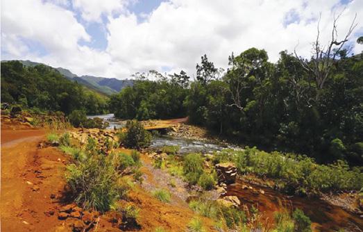
For walkers keen to explore New Caledonia beyond the beach, Toutazimut Eco tours offers guided hikes through Parc Provincial de la Rivière Bleue - an hour from Nouméa.
The seven-hour adventures blend scenic walking trails, freshwater swims, and a traditional French picnic by the river, all led by bilingual guides. Nature lovers may even spot the elusive Cagou, New Caledonia’s flightless bird.
‘This soft-adventure day trip is a great add-on to any itinerary for active travellers looking to connect with the natural heart of the destination,’ says Flight Centre’s Rowena McCarron.
‘With convenient pick-up in Nouméa and small-group options, Toutazimut makes it easy to showcase the wild, authentic side of New Caledonia.’
Ideal for walkers, hikers, golfers, sailors and all those who love or work in the great New Zealand outdoors.
Baselayer MOVE and ULTIMATE available now in New Zealand from WALKING NEW ZEALAND LTD https://walkingnewzealand.co.nz/product/zerofit-heatrub-move-baselayer/ https://walkingnewzealand.co.nz/product/zerofit-heatrub-ultimate-baselayer/
Walking New Zealand digital edition
Walking New Zealand magazine has gone digital on our own website. Viewers can read through the lastest issue for only $3.95 an issue, paid by credit card before viewing.
Go to www. walkingnewzealand.co.nz and mouse over Shop and Subscribe and then click on Latest Issue - Digital. Enjoy!
Ireland’s greenways recognised
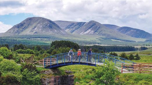
Ireland’s greenways offer a safe and sustainable way to experience the island’s scenery and historical and cultural sites by foot, or on pedal bike or ebike.
At the recent European Greenways Awards which promotes examples of best practice, Ireland’s Great Western Greenway won a special green award for its holistic approach to sustainability, community engagement and environmental stewardship.
The jury praised the route’s environmental innovation such as solar- powered compactor bins, electric bike charging stations and public furniture made from reused wind turbine blades.
The 49km greenway in County Mayo on the Wild Atlantic Way follows the disused Westport to Achill railway line. One of the island’s newest greenways, Limerick Greenway took third prize in the excellence category. It also follows an old railway line, this one running 40km from Rathkeale to Abbeyfeale through picturesque countryside, quaint towns and villages.
Want to know how far you have walked?
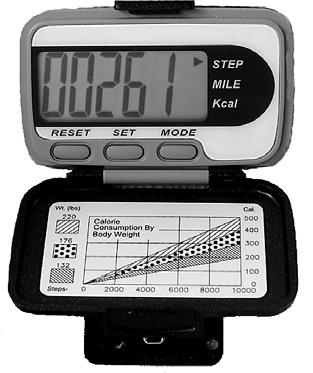
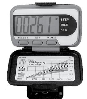
The H-215s is an very easy to use step counter with a very easy to read display and is very accurate.
This is the pedometer that has sold over a quarter of a million worldwide.
* Measures walking/jogging steps up to 99999.
* Compact Clamshell Design.
* Jumbo LCD.
* Solid and Strong spring belt clip.
* Solid and lightweight.
* Great for all-day wear.
* White in colour
* An ideal pedometer for team challenges.
* Complete with battery.
Dimensions: (L) 5.6 * (W) 3.7 * (t) 2.7 cm
Phone 0800-925-546 for bulk prices
47 Lincoln Terrace, Palmerston North - Phone 0800-925-546 www.walkingnewzealand.co.nz - email walkingnz@xtra.co.nz
You can now view and enjoy the latest issue of Walking New Zealand magazine online for only $3.95 at http://www.walkingnewzealand.co.nz
- 2026
Walk talk
Lighting the Sound tour soon to pop up in Albany
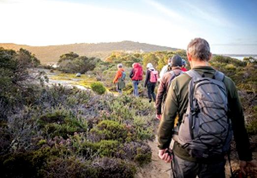
Albany Tours in West Australia has launched a twilight hike experience to coincide with the breathtaking ‘Lighting the Sound’ event by Kari Kola, occurring over three magic weekends in Albany/Kinjarling in March 2026.
Beginning in the late afternoon, the hike will depart from Whalers Cove and conclude at Uredale Point, for the most spectacular vantage point of this world-first, exclusive installation.
Along the way, guests will marvel at the otherworldly surroundings of King George Sound, Princess Royal Harbour and Bramble Beach, before enjoying a gourmet bush food picnic and a warm beverage for the return journey. The expert, fully guided tour shares the stories of Menang elder, Uredale.
Please tell our advertisers you saw it advertised in Walking New Zealand magazine.
Dwellingup Mountain Bike Trail network now complete
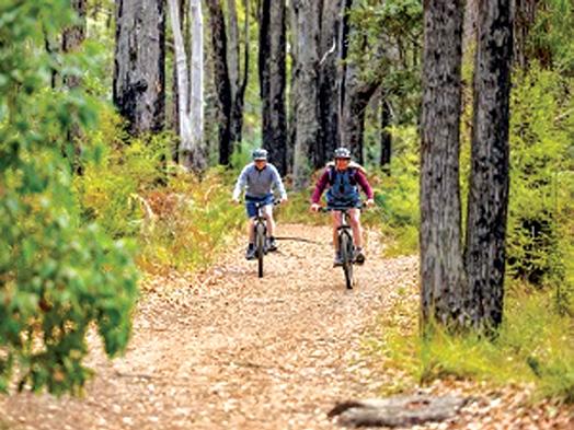
Dwellingup’s growing reputation as a Trail Town has received a significant boost with the opening of Stage 2 of the Dwellingup Mountain Bike Trail network. With Stage 2 now complete, visitors to the region can now explore a world-class 68km trail. Just over an hour from Perth, Dwellingup is known for its towering forests, winding rivers and array of wildlife, providing the perfect surroundings for hiking, mountain biking, camping, and canoeing. Its varied natural attractions include Lane Poole Reserve, a section of the famous Bibbulmun Track and the picturesque Murray River.
Correction
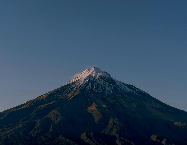
The December issue number 333 cover shows walkers at “Dimrill Dale”, a Lord of the Rings film location on Mount Owen in Kahurangi National Park, not Walkers on their way to Mt Taranaki.
Taupo nature walks
WBy Ceana Priest
hether it’s a weekend visit or a quick pit-stop while passing through the central plateau on State Highway One, Taupō is a worthy detour to stretch the legs and soak up some nature.
Here are eight walks from a few minutes to half a day that are well worth ticking off this summer.
Aratiatia Rapids
SH5 Rotorua-Taupō Highway
Watch a middling stream transform into a thundering river surging through a narrow volcanic gorge when the Aratiatia dam gates open at scheduled times during the day. The turquoise waters of the Aratiatia Rapids rise rapidly, before falling 28 metres over one kilometre—it’s well worth the visit.
Linger for the reverse show as the water drains away. View from the bridge, or walk to the signposted clifftop lookouts.
Need to know: Suitable for walking and biking to the viewpoints. Suitable for buggies and wheelchair users on the bridge. Toilet available. Gate release times: April to September: 10am, 12pm, 2pm. October to March: 10am, 12pm, 2pm and 4pm.
Waipāhīhī Botanical Reserve
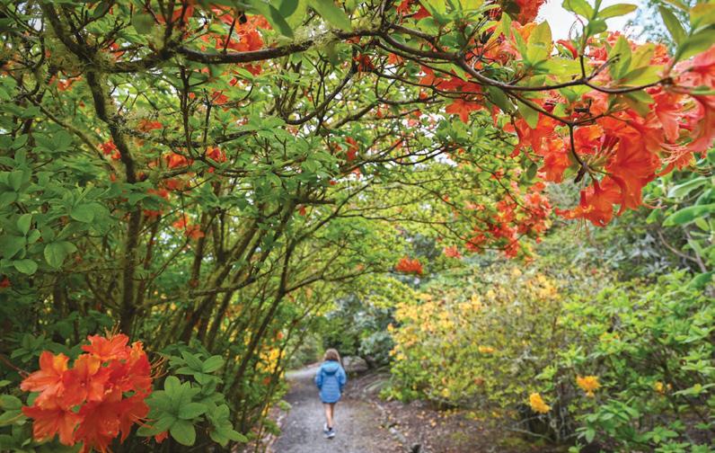
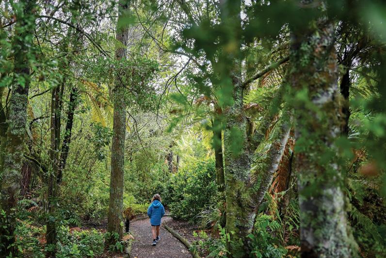
Recharge at the Waipahihi Reserve surrounded by urban sprawl, yet still feeling a million miles away. Drive the easy two kilometre loop through native forest and exotic plant collections, or wander the masses of shaded trails.
In spring, it feels like a colourful 80s disco when the flowers are blooming. Bring painted rocks to add to possibly the country’s longest rock snake.
Need to know: Suitable for driving, walking, buggies and wheelchairs on the road loop (take care with passing cars) or just walking on
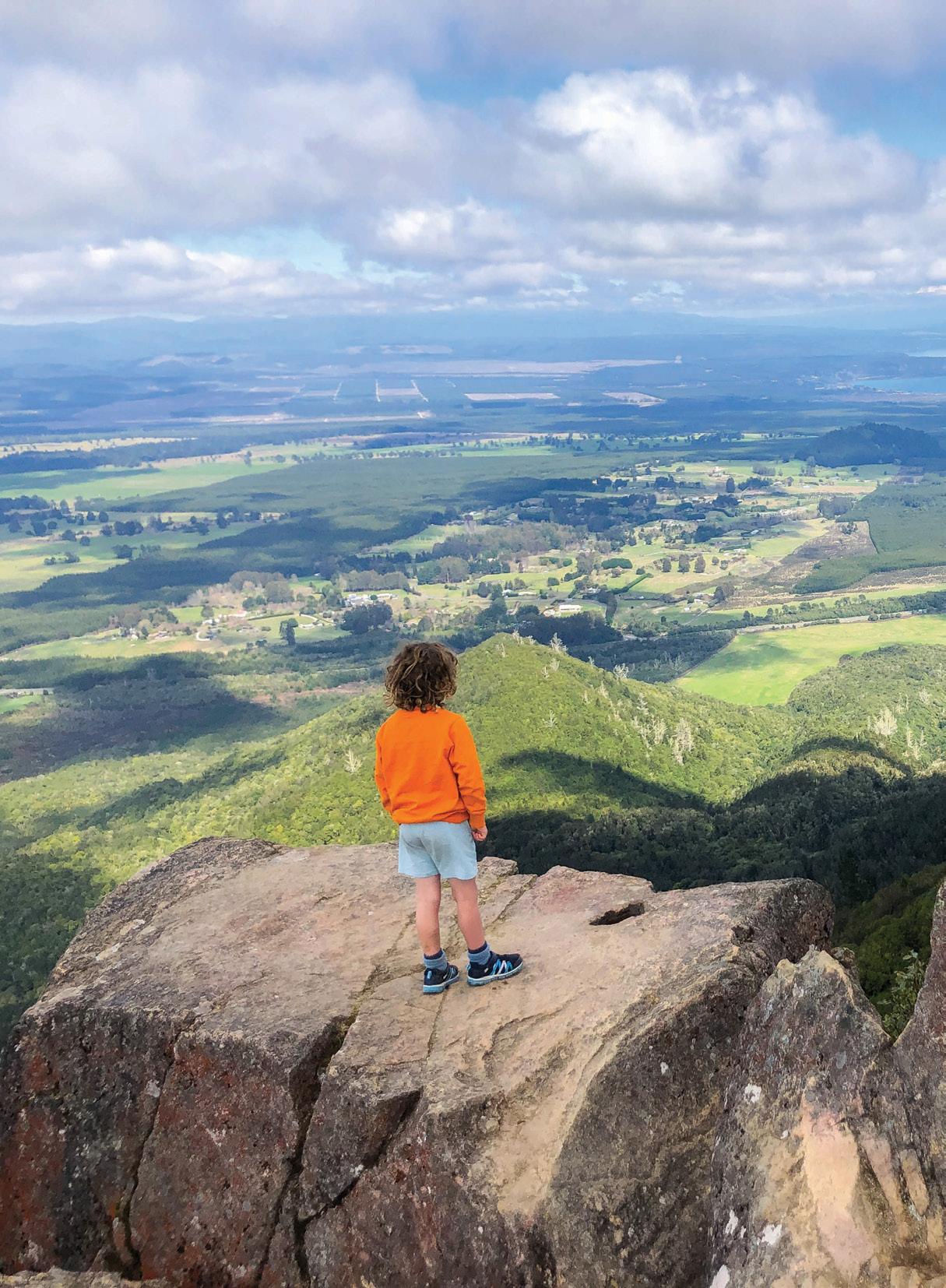
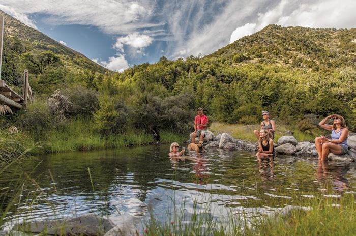
Above: The magnificent view from Mount Tahara. Photo: Outdoorkid
Eight Taupo nature walks
the trails. Dogs on leads. Gates open at dawn and close at dusk.
Rangatira Point Track to Whakamoenga Point
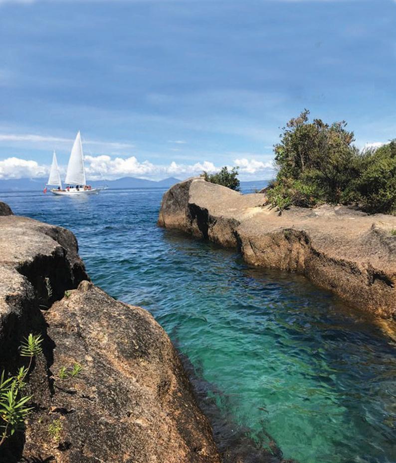
Follow the eroded volcanic shoreline of Lake Taupō to oddly shaped lava ledges—perfect for bombs or laid-back picnics.
The forested trail on the Rangatira Point Track to Whakamaoenga Point walk passes a rock cave once home to moa bones and steep cliffs where spindly trees cling above.
Spend half a day watching sailboats glide toward the 14-metre-high Ngātoroirangi Mine Bay Māori Rock Carvings.
Need to know: Walking only. Dogs on leads. Allow 30 minutes one way. Slip, slop, slap and wrap, as there is no shade on the rocky outcrops.
Mount Tauhara
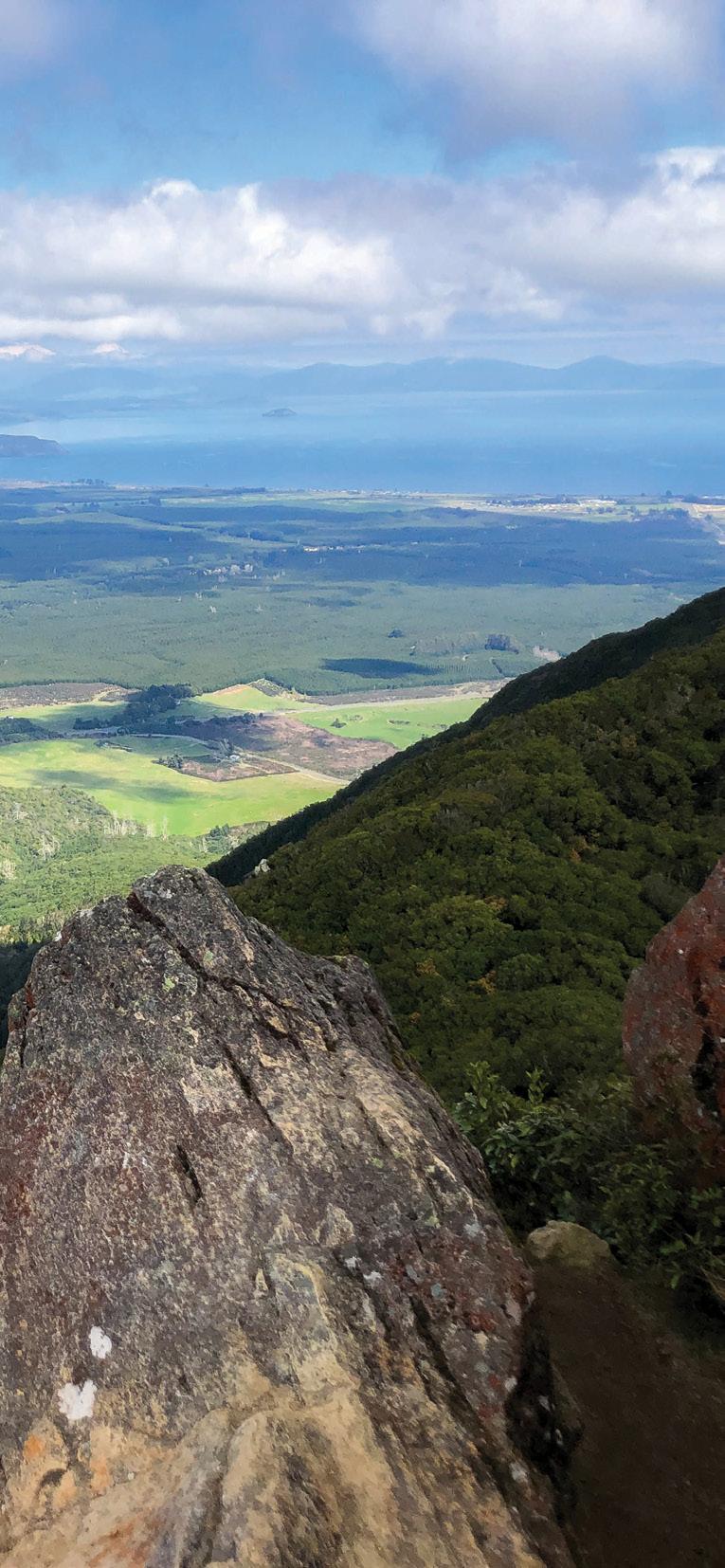
This Mount Tauhara rewards the energetic with sweeping views of the central plateau’s volcanic landscape. But only if you make it past the steep pasture foothills and along a winding trail that climbs steadily through native forest to the summit, where sensational views across the supervolcano of Lake Taupō to Tongariro National Park make the sweat worthwhile.
Need to know: Walking only. No dogs. Allow 2 - 3 hours return. Stiles to cross. No toilets.
Spa Thermal Park to Huka Falls
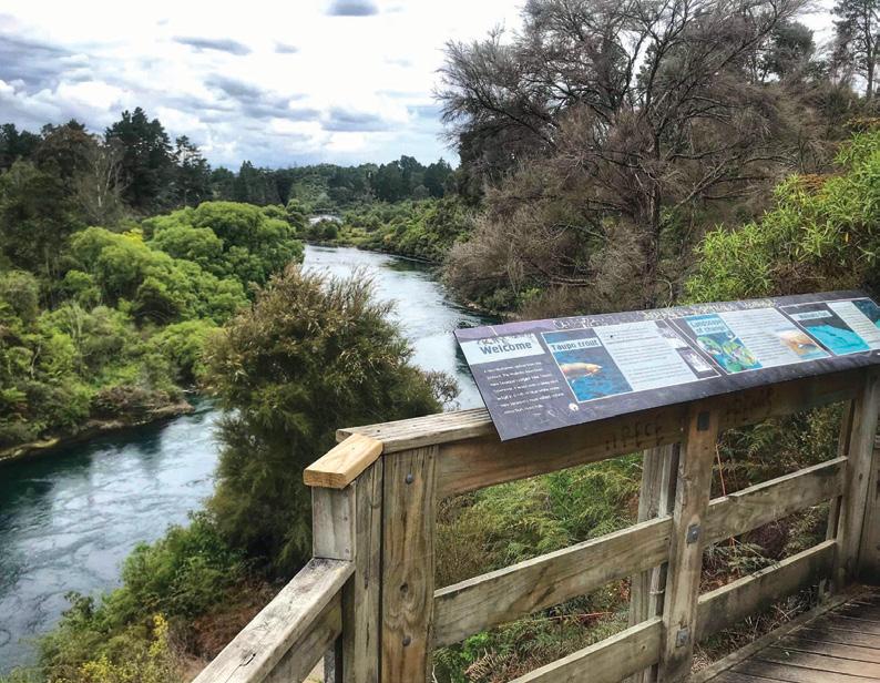
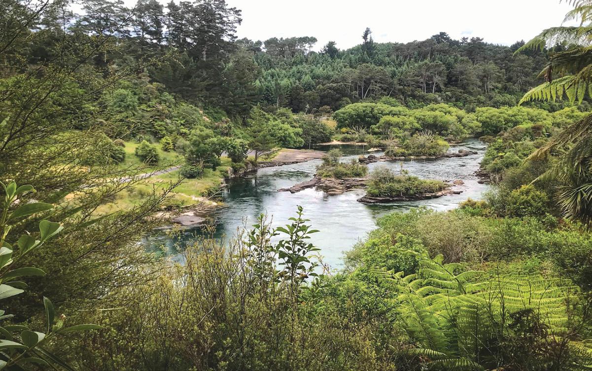
The Spa Thermal Park to Huka Falls is a mid-length riverside walk ticks all the boxes. Cliff-top views over the Waikato River deliver dramatic bluffs and shrubby islands, while the roar of Huka Falls can be heard long before the swiftly-moving river narrows and squeezes through a 15-metre-wide gorge.
Return the same way or arrange pickup from the Huka Falls car park—and if you’re heading back,
Above: left: Whakamoenga Point on Lake Taupo. Photo: Outdoorkid Below left: Looking over the Waikato River on the Spa Thermal Park to Huka Falls walk Photo: Outdoorkid
pack togs for a dip at Otumuheke Stream along the way.
Need to know: Walking only. Outdoorsy buggies for the keen with sturdy biceps. Allow about 45 minutes each way. Toilets at Spa Thermal Park. Parking is available at Spa Thermal Park on Country Avenue. Dogs on leads.
Otumuheke Stream
Spa Thermal Park
The colliding waters of the ther-
mal Otumuheke Stream and the chilly Waikato River create steamy natural pools for wallowing in.
The boulder-strewn stream mouth is now a lively destination for folks to find their perfect ‘natural hot tub’ in the mingling waters. It’s had a big makeover in recent years and now has toilets, a coffee kiosk and changing facilities.
Need to know: The pathway is suitable for walking, buggies and
Above: The view from the track on the Spa Thermal Park to Huka Falls walk. Photo: Outdoorkid
Below right: In the forest of the Opepe Falls Walk. Photo: Outdoorkid
New Zealand Walk
Eight Taupo nature walks
bikes. Allow 10 minutes walking to the stream. Dogs on leads. Parking is available at Spa Thermal Park on Country Avenue.
Opepe Scenic and Historic Reserve
SH5 Taupō-Napier Highway
■
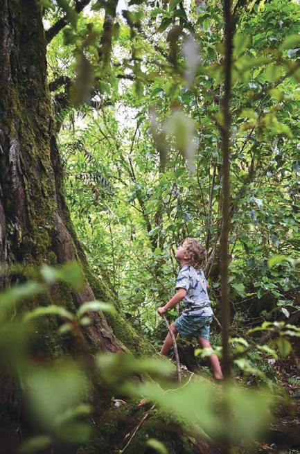
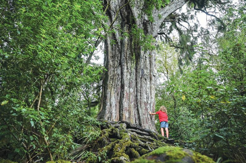
Just a short drive from Taupō, the Opepe Scenic and Historic Reserve is a forest adventure packed with giant podocarps to peer at, clamber over and even crawl through—if you aren’t squermish.
The shady loop trail quickly leaves the highway behind, winding through ancient trees that survived fires and logging—don’t miss the towering 30-metre rimu.
There is a short side track to a small cemetery where members of the Bay of Plenty Cavalry were buried after the 1869 Ōpepe skirmish led by Te Kooti. For a longer wander, cross SH5 for a 3-kilometre trail through regenerating forest and relics of the old township.
Need to know: Walking only. Dogs on leads. Allow 45 minutes for the northern loop and about 60 minutes for the southern walking loop. Parking is 17 kilometres from Taupō on SH5 towards Napier.
Huka Falls
Even if you’ve visited a dozen times before, there’s a reason this is one of New Zealand’s most visited nature attractions. Here, the Waikato River squeezes through a narrow volcanic chasm before bursting into frothy whirlpools.
It’s just a one-minute stroll from the car park to watch the river surge beneath the first bridge, then wander another 100 metres for more viewpoints and watch screaming jet-boat riders bounce across churning waters beside the 11-metre waterfall.
Need to know: Suitable for walking, buggies, wheelchairs and bikes. Dogs on leads. Allow 20 minutes return. Huka Falls Road. Gates open at dawn and close at dusk.
Ceana Priest is the author of familyfriendly walking guidebooks: outdoorkid.co.nz
Above: left: A colourful scene in the Waipahihi Reserve Gardens. Photo: Outdoorkid
Middle left: In a shaded area in the Waipahihi Reserve. Photo: Outdoorkid
Below left: A large tree in the Opepe Reserve. Photo: Outdoorkid
Handcrafted journey along the Camino de Santiago
Join YOU Travel & Cruise Whitianga on an unforgettable, handcrafted journey along the legendary Camino de Santiago. This experience has been thoughtfully designed to showcase the very best of the Camino, blending history, culture, and breath-taking landscapes with authentic Spanish traditions.
Your adventure begins in the medieval town of Sarria, perched high above a winding river. From the moment you arrive, you’ll feel the charm of cobbled streets and centuries-old architecture.
This popular starting point is perfect for easing into the Camino, surrounded by rolling hills and dotted with quaint villages that invite you to pause and explore.
As you walk, the path reveals its stories. You’ll pass peaceful farms, ancient ruins, and beautiful churches dedicated to St James, one of the Twelve Apostles. His legacy is woven into the fabric of this pilgrimage, marked by the iconic scallop shell that guides your steps.
For centuries, pilgrims have followed this route seeking meaning, connection, and discovery. What will the Camino mean to you? That’s yours to uncover.
Travelling with a small, like-minded group and escorted by YOU Travel & Cruise Whitianga, you’ll share laughter, stories, and the joy of the journey. Each night brings warm hospitality in cosy guesthouses, boutique hotels, and traditional homes. Savour the flavours of Galicia – tender octopus, tempting tapas, and local wines that celebrate the day’s achievements. Every meal is a chance to immerse yourself in Spanish life.
Your adventure culminates in Santiago de Compostela, a city steeped in tradition and architectural splendour. But we’ve added something truly special to mark the finale. In ancient times, Cape Fisterra was believed to be the westernmost point of Europe – Finis Terrae, where the land ends and the sea begins.
For centuries, pilgrims have continued beyond Santiago to reach this dramatic edge of the earth. We’ll take you there on a day trip to explore rugged coastlines, cascading waterfalls, and quiet fishing villages. Standing at this windswept point, gazing out over the Atlantic, is the perfect way to close your Camino chapter with wonder and awe.
And that’s not all – enjoy a vibrant Flamenco show in Madrid, alive with rhythm and passion, adding a final flourish to your Spanish adventure.
This is more than a walk. It’s a journey through history, culture, and landscapes that will stay with you forever. It’s your chance to connect – with the land, its people, and perhaps even yourself. Are you ready to take the first step?
Join YOU Travel Whitianga’s experienced escort on a soul-stirring 16-night adventure through Spain and beyond. Walk 115km of the legendary Camino from Sarria to Santiago, uncovering ancient villages, scenic trails, and rich cultural treasures. Space is limited so register your interest today!
CAMINO MAGIC MAY 2026 Fully Escorted
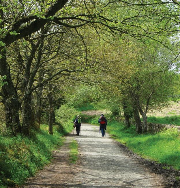
Above right: Pilgrims on the trail to Santiago in the Galicia region Photo by Erin Williams
The delights of the Dolomites
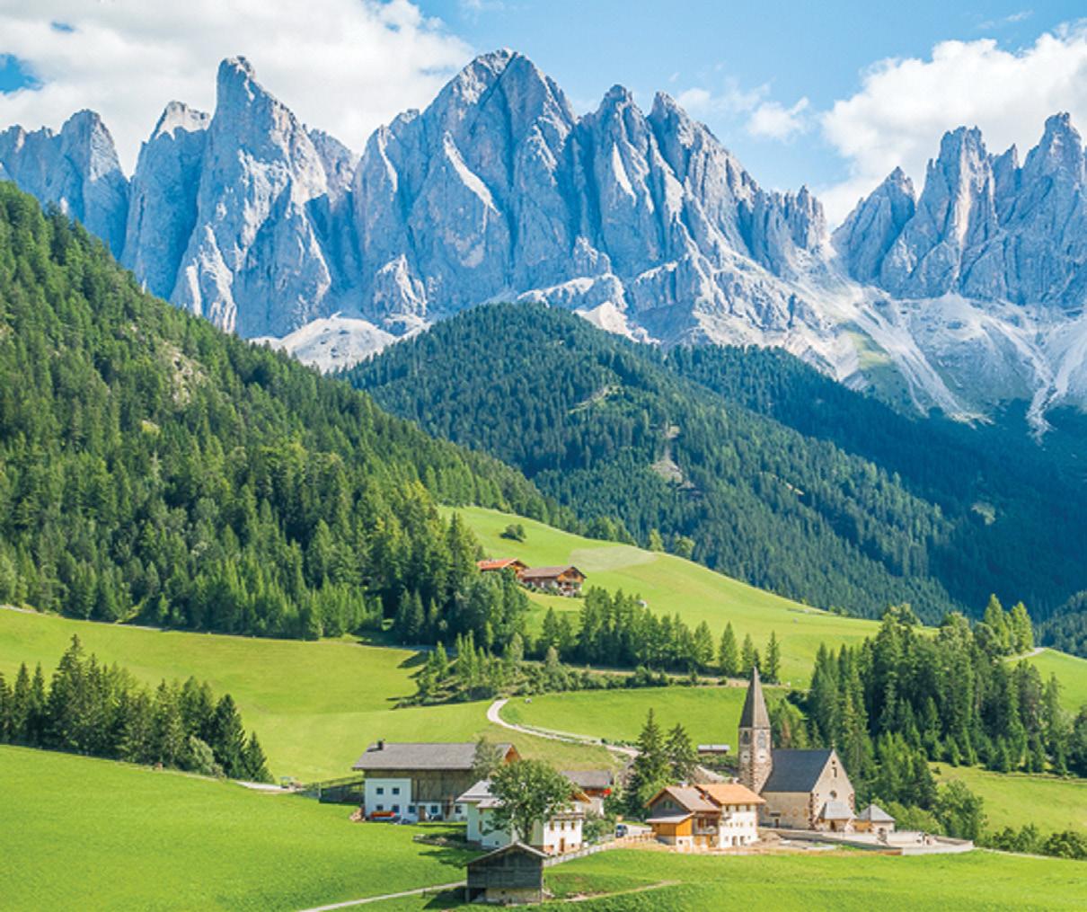
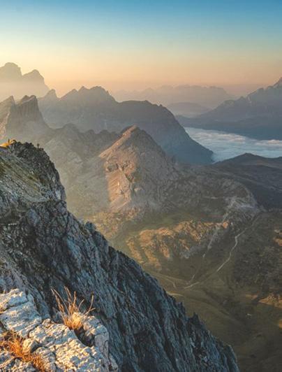
The Dolomites rise from northern Italy like a fantasy landscape — pale limestone towers that glow pink at sunrise and burn crimson at sunset.
These UNESCO World Heritage mountains offer some of Europe’s most dramatic alpine scenery, combined with Italian warmth, excellent cuisine and a huge range of trails
By Astrid Brauksiepe
The massif comprises dolomite rock, named after French geologist Déodat de Dolomieu, who first identified the unique calcium-magnesium carbonate mineral in 1791. The truly astonishing fact is that you’re hiking through ancient coral reefs that thrived in a warm, shallow sea during the Triassic Period, roughly 250 to 200 million years ago.
Around 65 million years ago, Africa began to collide with Europe, pushing these ancient seabeds upward. The Alps and the Dolomites
were thrust skyward. The dolomite rock proved more resistant to erosion than surrounding limestone, creating the dramatic vertical walls and isolated towers. Softer rocks washed away over millions of years, leaving these pale giants standing like sentinels.
Ice then carved the surface. Glaciers created the U-shaped valleys and cirques that define the hiking landscape today. They left behind the alpine lakes, sharpened peaks and hanging valleys that make these mountains so photogenic.
More recent history also shaped these trails. During World War I, the Dolomites became a brutal frontline between Italian and Austro-Hungar-
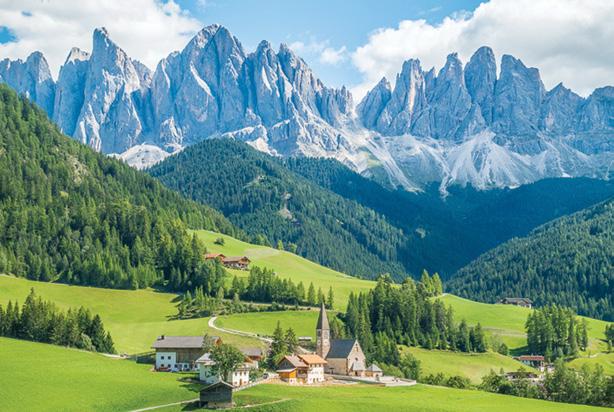
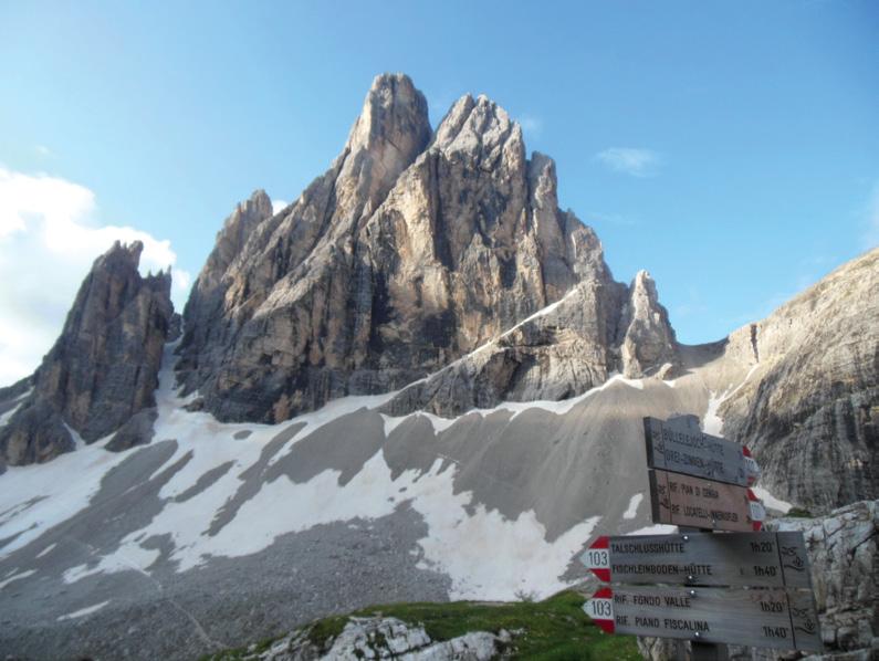
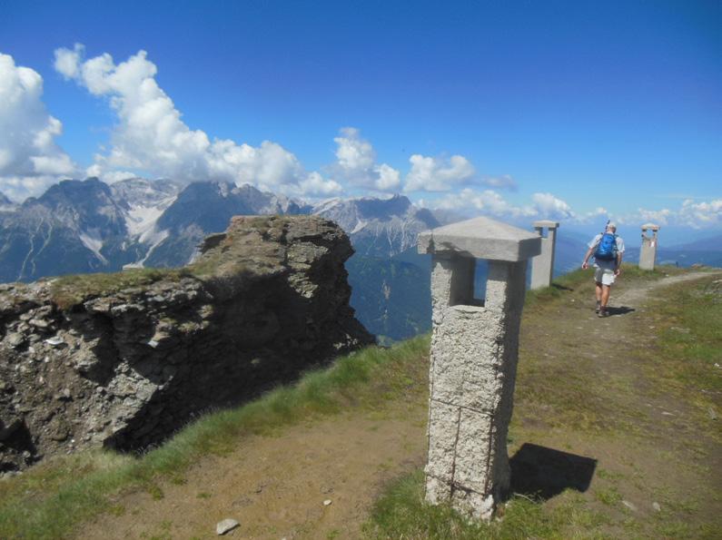
Above left: The magnificent Dolomites in Italy.
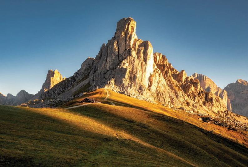
below far left: Giau Pass in bright sunlight through the Dolomites
Bottom left: Rufiego Lazaguoi.
Below right: Rufiego Lazaguoi.
The delights of the Dolomites
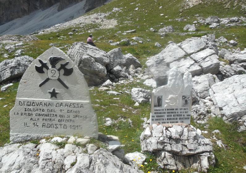
ian forces. Soldiers carved tunnels through glaciers, built precarious supply routes along cliff faces, and fought at altitudes above 3,000 metres. Many of today’s hiking paths follow these wartime routes. You’ll encounter remains of trenches, fortifications, memorials, and via ferrata trails.
The Dolomites sit at the intersection of Latin and Germanic cultures. South Tyrol (Alto Adige) was transferred from Austria to Italy after World War I, creating a cultural complexity that enriches every visit. You’ll find mountain huts where Austrian “knödel” (dumplings) are served alongside polenta.
The tradition of rifugi—mountain huts offering food and shelter—developed from both Italian and Aus-
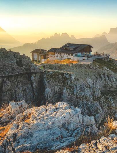
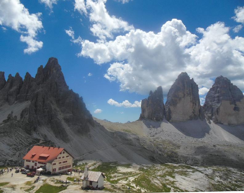
Above: Locatelli Lodge a popular spot.
Below left: Soldier’s graves from World War One.
trian alpine club movements in the late 1800s.
The Footsteps walking tour to the Dolomites (scheduled for 29 June-14 July 2026) explores four iconic areas in these mountains over 17 days, from Venice to Bolzano. We start in Cortina d’Ampezzo, gateway to the eastern Dolomites. It is a Winter Olympics host town (1956 and 2026) with its own unique Ladin language. The town sits in a spectacular basin surrounded by peaks. The Tofane range to the west shows massive layered cliffs representing millions of years of sedimentary deposition, while the Cristallo group to the northeast displays some of the region’s most pristine formations.
We explore the Western ranges, including some WW1 ruins, during our first 3-day tramp. We utilise local buses and cable cars and overnight in refugi in stunning locations. Rifugio Nuvola, at 2575m, is the oldest hut in the region.
Many of these mountain huts have been family-run for generations, preserving a hospitality tradition that goes back to when shepherds and merchants first crossed these passes. Looping back down to Cortina, we meander through forests, mountain pastures, meadows and sleep in an idyllic lake hut before spending a
night in the Alpine resort town.
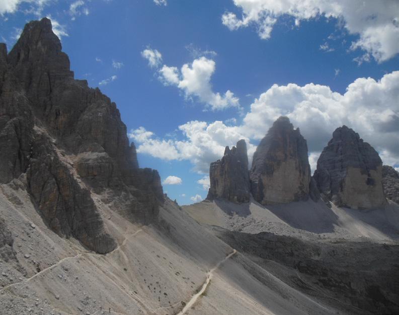
No visit to the Dolomites is complete without the Tre Cime di Lavaredo , our next destination. The near-vertical walls of these iconic three limestone towers rise about 300 metres from base to summit.
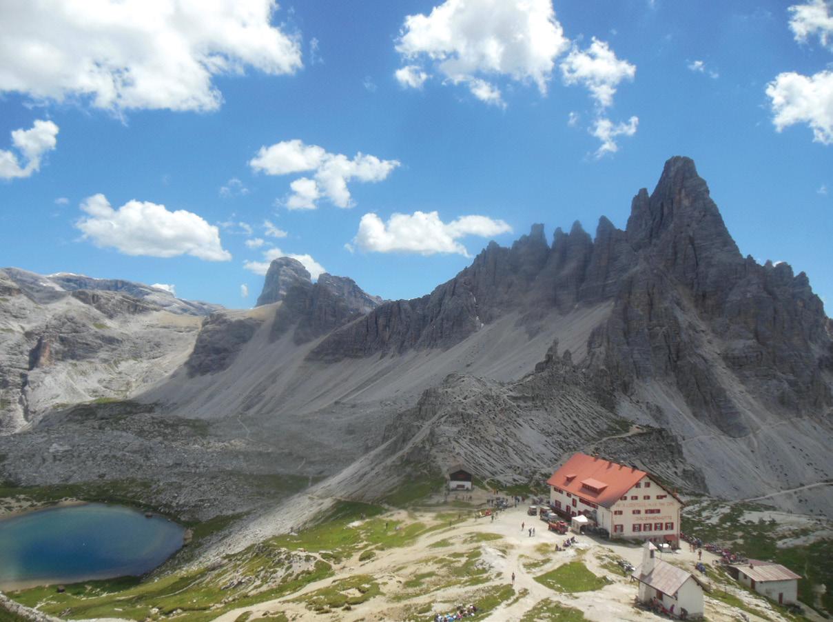
Their walls have always attracted rock climbers. Starting right from our hut for the night, Rifugio Auronzo, a loop trail around these giants delivers jaw-dropping scenery at every turn. The mountain huts along the way serve hearty South Tyrolean food, like speck, dumplings, and apple strudel.
These massive peaks witnessed some of the war’s highest-altitude combat, and bunkers still dot the landscape around them. Today, the Carnic Alps High Trail runs as a “Peace Trail” along the ridge that forms the Italo-Austrian border. We spend two days on this scenic and historically significant trail above Sesto, sleeping in Austria for a night! We then take the train towards
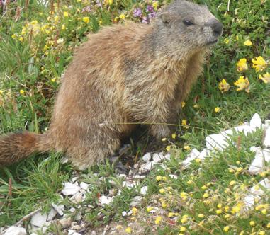
Above: left A marmot in Gardena Valley.
Below right: The loop track can be see in the photo below.
The delights of the Dolomites
Bolzano, the Western side of the Dolomites. Here, Val Gardena offers a different flavour. The local Ladin people are descendants of Romanized Alpine tribes, and their culture represents one of Europe’s smallest linguistic minorities.
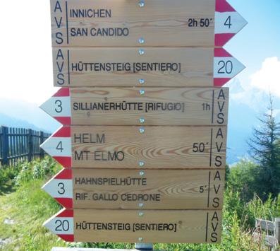
Here, you’ll find trilingual signs (Ladin, Italian, and German) in some villages. The picturesque valley towns of Ortisei, Santa Cristina, and Selva offer authentic mountain hospitality with a distinct cultural identity that sets this area apart.
The Gardena valley itself is a textbook example of glacial carving through layered dolomite. The broad
Boots Packs Rainwear
All your tramping essentials One shop ~ Since 1988
valley floor, flanked by towering walls, was gouged out by massive ice rivers during successive ice ages. The famous Sella massif, a plateaulike mountain, dominates the area. The Seceda ridge, reached by cable car from Ortisei, presents one of the Dolomites’ most photographed viewpoints—a swooping ridgeline with views across an ocean of peaks.
We spend five nights in this area, allowing an optional rest day for those who want to enjoy the hotel and village life. We combine Alpe di Suisi, Sasso Piatto and the Sedeca high plateau during a 3-day hike with the help of some local buses and cablecars.
It’s just a short ride to our final destination, the Rosengarten (Catinaccio in Italian). This massif lives up to its poetic name. That legendary pink glow, the “enrosadira”, isn’t just imagination. It’s pure chemistry: a result of its particular mineral composition (iron and magnesium) and the orientation of its faces toward the setting sun. The ranges glow pink, orange, and deep red, an effect lasting only minutes but transforming the entire area into something that seems almost otherworldly.
Crystal-clear mountain lakes sit in cirques. Assisted by local buses and cable-cars, we embark on our final
3-day hike past towering, pinkish rocks, alpine lakes and meadows. We sleep below the Vajolet Towers that provide a dramatic backdrop. We then descend to Bolzano for our farewell dinner and final night in a central hotel. There might be time to visit the famous “Oezti” the iceman in the local museum. Bolzano is within easy reach of Milan, Switzerland and the beautiful Austrian alpine city of Innsbruck, all accessible by train.
You are warmly invited to join this spectacular excursion. For details visit www.footstepswalkingclub.com, or contact Footsteps (footstepsanz@ gmail.com, 021 172 3244). The deadline is 25 January, so please don’t delay. Register today!
Above left: World War One ruins on the Peace Trail.
Above right: A sign post on the Peace Trail.
Explore safe this Summer
By Eamonn Tee
All of us like to think, that in an emergency, we’ll know how to act. That if we’re lost in the back country, we’ll make the right choices. We’ve seen Man Vs Wild, we did orienteering, we’re survivalists. We tell ourselves we’re good under pressure. We tell ourselves that when things are dire, we can make a difference.
The thing is: When it comes down to it, what we tell ourselves doesn’t matter.
In an emergency, the most important factor isn’t the decisions you’ll make. It’s the decisions you’ve already made.
Decisions like: Did you pack enough to stay warm? Did you tell someone before you left? Were you honest about your own abilities, and did you choose a trip that matches them? Those decisions save more lives than anything that happens in an emergency.
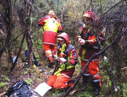
This summer, New Zealand Land Search and Rescue are helping everyone Explore Safe. This campaign is about helping people make more of the right decisions, so they don’t ever need to make the other kind. Empowering everyone to explore, adventure, and experience Aotearoa, knowing they’ve made the right calls.
It all comes down to the Land Safety Code. 5 simple principles that keep you safe while you’re out and about this Summer.
1.Choose the right trip for you. It’s important to choose a trip that suits you and everyone in your group.
When you are looking at the options, make sure you think about everyone’s fitness levels and experience in the outdoors.
2.Understand the weather.
It can change fast. Check the forecast and change your plans if needed. Weather can make or break a trip. It’s one of the most important things to consider when going into the outdoors.
3.Pack warm clothes & extra food.
Prepare for bad weather and an unexpected night out.
Any trip, even if it is short or easy, needs preparation. Packing the right things makes trips safer and more enjoyable.
4.Share your plans, and take ways to get help.
Telling a trusted person your trip details and taking a personal locator beacon (PLB) can save your life.
We all want our trips to go as planned – but sometimes they don’t. If you got hurt or lost on your trip, how would you get help?
One simple step is to leave detailed trip intentions before you go. It helps search and rescue teams respond quickly if something goes wrong.
5. Take care of yourself, and each
other.
Eat, drink and rest, stick with your group and make decisions together
The best way to enjoy your experience in the outdoors and make it home safely is to look out for one another.
While these are simple tips, time and time again, Land Search and Rescue have seen the impact they have. They’re easy ways that you can cover the basics, and make sure you’ve got what you need in the right moment.
Safety isn’t guaranteed, but Land Search and Rescue does what they can. From city streets to mountain peaks, if you’re lost, missing, or injured, they’re there to support you. There’s one simple way you can support them:
Save lives this summer, don’t risk yours.
JANUARY Weather prediction
(Weather is an inexact science, like medicine. Dates given are to be regarded as focus points. Please allow 3-4 days leeway for all forecasts)
1st-2nd High pressure prevails ahead of a wet front.
1st-21st A very hot spell may affect the inland parts of the South Island including in inland Otago and inland Southland, with chance of heat wave temperatures also extending into parts of coastal Canterbury districts and central Marlborough, with daily maximas regularly exceeding 30°C.
2nd-9th Regular outbreaks of heavy rain at times in the Fiordland region.
3rd-4th A cold front crosses the country.
by Ken Ring
5th-6th High pressure ridge moves onto the country in a strong southwest flow, ahead of a cold front.
6th Unusually low minimum temperatures likely overnight in the central North Island, including the chance of isolated pockets of frost, including at Waiouru.
7th-8th A wet front crosses the country with outbreaks of rain in most districts, although remaining mostly dry in the East Cape.
9th Cold front brings widespread outbreaks of rain over the South Island and showers into the lower North Island. Winds likely to be very strong and blustery in a northwest flow around the southwest coastal fringes of the South Island. Very hot day in the Culverden area.
10th Heavy rain contracts to the northern half of the South Island.
Over the next four weeks, the trend of anticyclone systems may be further south than normal and cross the country centered more over the northern half of the South Island. This may result in regular gentle westerly winds prevailing over the southern half of the North Island and throughout the South Island, and an easterly flow over the northern half of the North Island.
There may be up to six to seven wet fronts associated with Southern Ocean depressions affecting the country and the chance of one cyclonic system midway through this outlook period, nearer the
end of January and at the start of February. Overall, the next four weeks may see heat waves and drought conditions develop. Rainfall amounts may be well below normal over most of the North Island and into the Marlborough and northern Canterbury, while wetter than normal in the Horowhenua and closer to the norm elsewhere. Due to the lower rainfall in many parts of the country, severe soil moisture deficits may develop from Auckland to the King Country, in parts of Taranaki, northern Manawatu, Hawkes Bay to the Wairarapa, Wellington, and in the north and eastern coastal parts of the South Island. Sunshine levels may be extremely high in southern parts of Otago, Southland, and inland Canterbury, but unusually cloudy in Northland.
Some parts of Otago and Southland may see up to 150% more sunshine hours than normal. With the drier and sunnier than normal weather for this time of year, temperatures may also reflect this climate with the next four weeks being much warmer than average, particularly in the Waikato, King Country, Nelson, and inland South Island districts. Some parts of the country, including in inland parts of Canterbury and central Marlborough, may experience heat-wave conditions over much of this outlook period, with sustained daily temperatures into the low-to-mid 30’s likely. Overall, temperatures may be up to half a degree above average in the east of the North Island and around 2 degrees higher than normal in the Waikato to the Central Plateau, Nelson and inland districts of the South Island, and around 1 degree above average over the remainder of New Zealand.
11th-13th Rain embedded trough between two high-pressure centers over the country bringing showers to many districts, followed by a Southern Ocean cold front by around the 13th, with heavy rain in
the Nelson-Marlborough region and gusty winds over the South Island. 14th Chance of thunderstorms in the lower North Island, including in Wellington.
14th-16th Anticyclonic and mostly dry throughout.
15th-16th Chance of fog patches in the Christchurch area.
17th Widespread spells of rain over the South Island.
17th-19th Cold front crosses the country.
18th-19th Chance of very heavy rain in the Kapiti District with the chance of flooding in the Horowhenua region over the next couple of days.
19th-26th High-pressure systems prevail.
20th A decaying weak depression over the north of the North Island brings storms and heavy rain throughout most of the country, although mostly dry in Southland.
21st-23rd Widespread shower activity.
22nd Unusually high maximum temperatures across South Canterbury.
24th A cold front behind a decaying high brings widespread heavy rain throughout the northern half of the North Island and in the NelsonMarlborough districts.
25th Chance of thunderstorms in the West Coast.
26th-31st High pressure becomes the dominant climate feature over the country.
27th-28th Cold front crosses the country.
31st Very hot in the lower North Island over the next couple of days. Chance of a tropical depression nearing the north of the North Island around this time, as it tracks down into the Tasman Sea.
Extracted from 372-page 2026 New Zealand Weather Almanac, by Ken Ring. The 2026 book is available in soft cover and hardback, and as e-version from www.predictweather.com
Extracted from 372page 2025 New Zealand Weather Almanac. Availlable in soft cover and hardback, and as e-version from www.predictweather.com
Nydia Track from D’Urville Island to Pelorus Sound
If you have a couple of spare days in the Marlborough area, consider walking in to Nydia Bay on Pelorus Sound. Pelorus (Te Hoiere) is a maze of bays, inlets and coves stretching from Havelock to D’Urville Island. The trail passes through lush coastal bush and re-generating forest, climbs two saddles, and crosses farmland.
By Barbz Lowther
There are lots of stream crossings and an un-bridged river crossing. Not only is the area incredibly beautiful, and tranquil, with the most amazing bird song, but it also has a very interesting history.
The 27km track, initially carved through by loggers in the 1870’s is accessed from either Shag Point at Kaiumu Bay, half an hour from Havelock, or Duncan Bay on Tennyson Inlet, over an hour drive away.
The Nydia is a two day walk which can be walked in either direction, but requires a shuttle for drop off and pick up. ‘Nydia Track
Transport will organise this for you. They’re just a phone call away.
Nydia Bay was well known by early Maori as a place of abundant food, and some settled at Opouri Pa. Cook estimated that about 400 Maori lived in and around the sounds by the late 1700’s.
This all came to an end in 1824, when Te Rauparaha invaded from the north, attacked Opouri Pa and occupied most of the upper South Island. Nydia Bay was abandoned, The first Europeans moved here in 1849, to farm the area, and in 1870 a mill was set up in Nydia Bay to cut rimu and kahikatea trees for the building industry.
Much of the timber was taken to Lyttleton to build Christchurch. A 300m long jetty was built at Nydia Bay, where steamers took the logs to Havelock. An extensive railway system was built around Pelorus and Havelock to service the timber indus-
try and a thriving settlement grew.
By 1920, logging opportunities were easier on the West Coast, because most large trees had already been taken from here, so the mill closed. Barren milling land has slowly been covered by manuka and kanuka, which protect young podocarps and beech seedlings.
The area changed from a logging focus to recreational sport and Tourism - Fishing, Boating walking and biking. Local authorities, aided by DOC.
Conservation groups and volunteers gradually connected and improved old bridle paths, and existing routes cut by loggers, to create the Nydia Track - for walking or biking.
The track, and the 50 bunk Lodge on the South side of the bay are now managed by DOC who carry out ongoing maintenance. After a night in one of the many accommodation places in Havelock, we organised a shuttle to Tennyson Inlet.
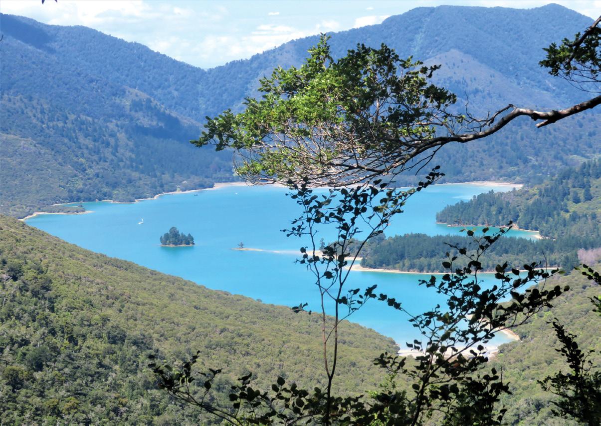
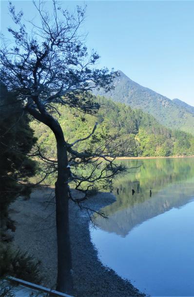
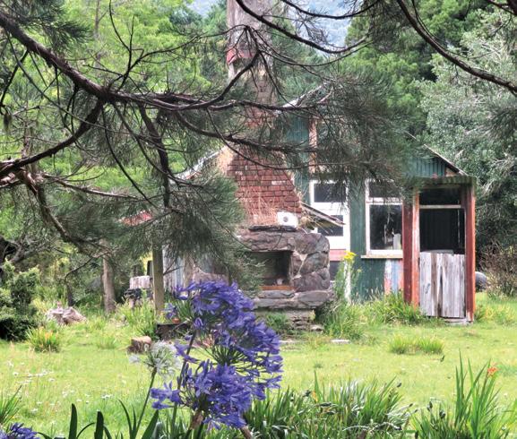
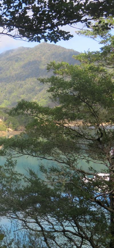
Above: First view of Nydia Bay.
Nydia Track from D’Urville Island to Pelorus Sound
We planned to walk the trail over three days, from Duncan Bay, giving us plenty of time to explore. The scenery on the way was spectacular – Huge rimu, matai, miro, pukatea, totara, beech, and tall manuka and kanuka towering over an under storey of kamahi, mahoe, tawa, lancewood, hinau, kawakawa and punga, with loads of ferns and mosses on the edge of the road.
We passed the turn off to French Pass and D’Urville Island, another exciting place to explore another time.
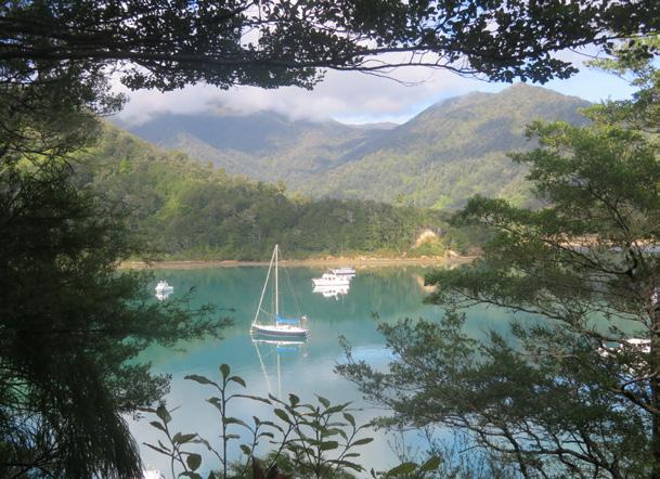
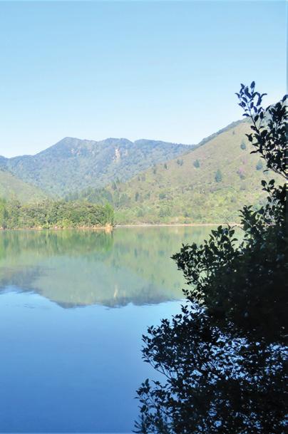
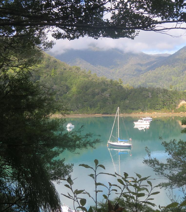
In just over an hour, we reached the beginning of our walk. Duncan Bay is so serene the only sound the lapping of water on the jetty, and bird song – tuis bellbirds and fantails provided a welcome chorus. The water was so calm, that trees and yachts were perfectly reflected in it.
The trail, through pungas and nikau, and bordered by mosses and ferns, followed the shoreline. There were beautiful views of the inlet as far as Ngawhakawhiti Bay. We then gradually climbed to Nydia Saddle on a trail full of roots and rocks. It led through a mix of tall beech and rimu,
nikau and punga, and re-generating bush.
At the top of the saddle there were awesome views back over Tennyson Inlet. The south side of the saddle was damp with lots of deep gullies.
A storm had swept through the area a couple of months earlier, leaving a jumble of huge fallen trees, and slips, both on and around the track.
We climbed over branches, under trunks, and through and around bits of broken bushes. It was interesting and very challenging. With breaks every hour or so to re energise, we finally saw Nydia Bay shimmering way below and it wasn’t long before we reached an eel pond at the western end of the bay. Enormous long- fin eels slowly oozed to the edge of the pond to see if we had food for them.
From there it took us about 40 minutes to wander around the
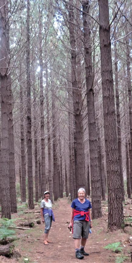
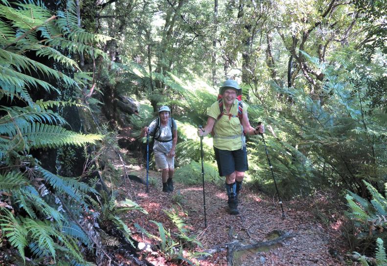
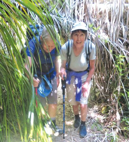
Above left: Heading up to Kaiuma Saddle.. Above middle: Early morning reflections in Nydia Bay. Below left: A trail through the pines leading up to a waterfall. Above right: On the way to Ngawhakawhiti Bay.
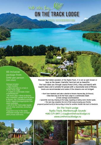
bay to the DOC. Lodge. Shags and gannets were fishing and a lone heron stalked the shores looking for a feed in the shallows. There is also the option of staying at ‘On the Track Lodge’, right on the bay, where guests can have meals provided, and hot spas etc.
We wandered on to the DOC Lodge, staying two nights there, so we had time to explore the bay and its early history. This is a lovely place to stay – well equipped, tranquil and close to the jetty. Both nights we went down at dusk to swim, and watch the phosphorescence glow and sparkle at every move we made in the warm water.
Day two dawned bright and clear with bellbirds and tuis serenading us as we had breakfast on the deck. The cicadas were out in full force too.
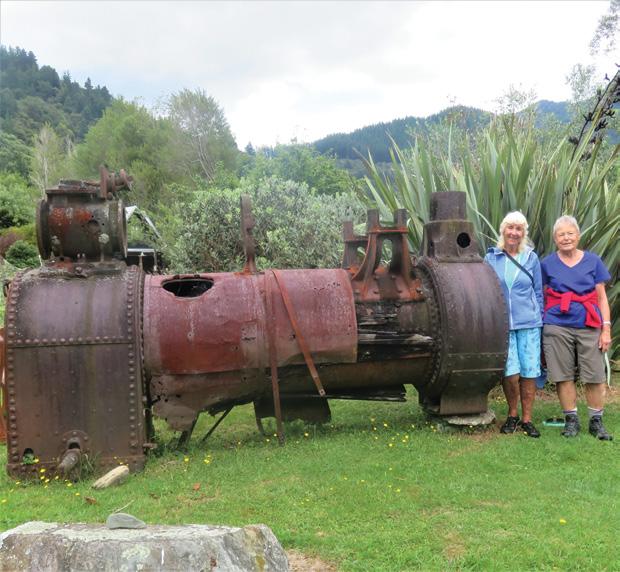
We filled in the day by returning to the bay to check out an old boiler, displayed beside ‘On the Track Lodge’. A historic logging trail led under tall pines, then beside a stream to a waterfall, and the old mill site, where info’ boards show the life of families back in the 1800’s.
A steep incline marked the site of an aerial ropeway to lower logs to a steam powered winch, which hauled the logs to the tramway at the bay.
They were then, transported to the wharf and on to Havelock by boat.
Returning to the wharf we explored a nature trail, so soft to walk on with lots of mosses and ferns under foot
On day three we set off early on a lovely track across open farmland, then climbing under huge beech trees, and re generating bush to Kaiuma Saddle. The track was very narrow in parts, with steep drop offs, I wouldn’t like to be biking!
We reached the top of the saddle in a little over two hours. The views were stunning. We could see as far as Mt Tapuae-O-Uenuku in the inland Kaikouras.
From here the track drops quickly, before climbing again into the forest. We headed down and sat on a mossy bank.
This was not a track to hurry
Nydia Track from D’Urville Island to Pelorus Sound
Below left: The old Boiler from milling days.
Below right: All that remains of an old dwelling.from bygone days.
Above: Reflections at Duncan Bay in Tennyson Inlet.
through. The bird song was just awesome. We sat listening to bellbirds and tuis, while fantails, tomtits and riflemen flitted all around us, a robin sat beside us, and kereru just sat eating. As soon as we sat down wekas appeared out of the undergrowth, grabbing at anything we put down.
The last hour was rougher with quite uneven track, so we had to watch our feet. We continued around a point above Kaiuma Bay, before finishing downhill to the car park.
There was time to explore the beach and watch oyster catchers (torea) making a big display to protect their young, before being picked up by Denise with the Shuttle Van.
In half an hour we were back in Havelock to hot showers and a lovely meal in the local restaurant. It was a spectacular three days. To cap It off, and see a little more of the area, the following day, we went on the mail boat run to the outer properties on Pelorus Sound. We passed through Tawharunui Channel with
its choppy water, and on past Maude Island, a bird sanctuary.
We passed lots of shipwrecks and a narrow strip of land, that early boat builders tried to cut through for easier access.
It was a delightful trip with pet dogs, pigs or goats meeting the boat at the various jetties. We visited twelve properties, and stopped for a swim at Ketu Bay before being delivered back to the wharf in Havelock - Tired and happy.
Although the Nydia can be walked in one day, more often in two, you won’t regret spending three days in this delightful area. It’s well worth taking extra time.
It is with sadness Brabz Lowther’s partner of over 23 years
Derek Kerwood passed away in November just before his 93rd Birthday. He was 70 when he took up tramping. During the next 20 years, he walked 1000’s of kms in New Zealand and in 100 countries overseas . He covered mountain tops in the British Isles, Europe, the Americas, Asia and Africa. His favourites being the Canadian Rockies, around the Matterhorn, Toubkal in Morocco, the G20 in Corsica, the Tatras between Poland and Slovakia, and the mountain ranges in Romania .
He filled his life with so many adventures, but still had time to be a Master Craftsman. One of his biggest achievements, is the huge mural carved by Derek and Megan Godfrey over six years, and gifted to Hamilton Gardens for all to enjoy. It is truly amazing.
During his last two years he regularly biked to Mt Maunganui, and walked to the summit. He was an inspiration to us all and will be missed by many.
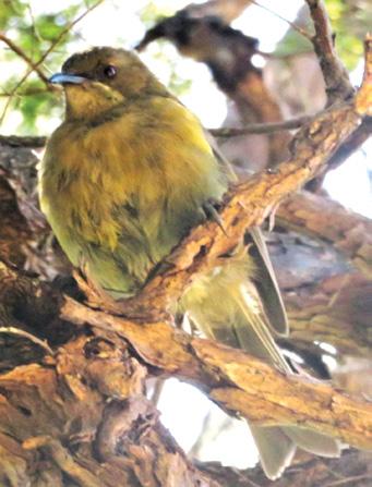
Above right: A bellbird serenading us at our lunch stop. Below right: A rest at the turnoff, before leaving the Bay, and heading over farmland, to Kaiumu Saddle.
We are looking for the best digital photos each month depicting walking
Now the time to get your digital camera out or look through your digital images and enter the
Walking New Zealand
Digital Photo Contest
Above: My husband Bruce looking down the Waitakere River on the Auckland City Walk, Cascades Park; part of the Waitakere Ranges Regional Park, Auckland. Photo by Jo Alexander of Epsom Auckland.
Pedometer
PHOTO CONTEST
* Measures walking/jogging steps up to 99999.
* Compact Clamshell Design.
* Jumbo LCD.
* Solid and Strong spring belt clip.
* Solid and lightweight.
* Great for all-day wear.
* White in colour
* An ideal pedometer for team challenges.
* Complete with battery.
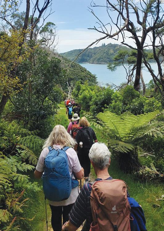
Opposite page Above left: Walkers on part of the Bay of Islands Walking Weekend. They are walking Moturua Island with Motukiekie Island in the background. Photo by Anika Whapshott, Kerikeri
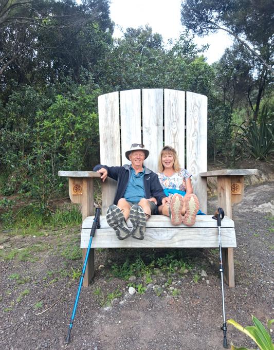
Above right: Mark Wallis and Karen Skellett on the Big Chair at Russell. Photo by Mark Wallis, Matua, Tauranga
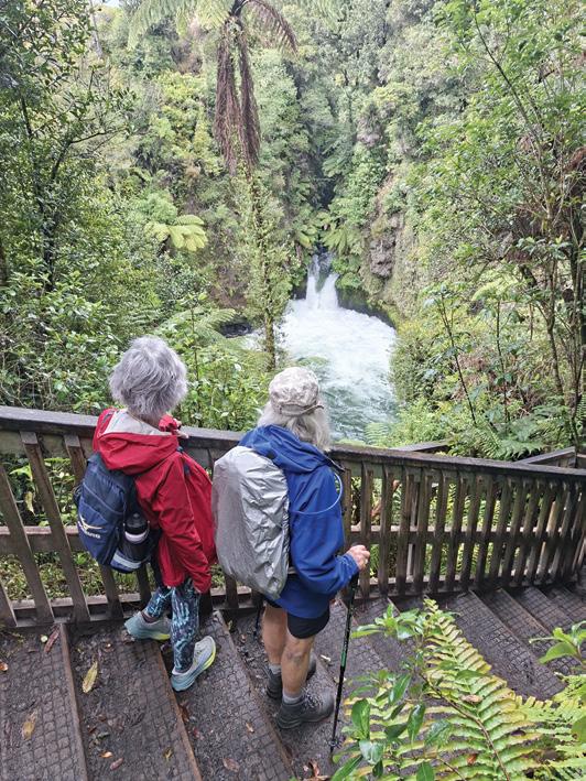
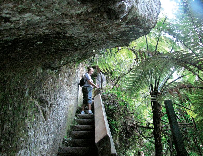
Below left: The Mangatoi Walkers based in Te Puke recently walked the tracks in the Okere Falls Lake Rotorua area. This photo was taken on Hinemoa’s Steps leading down to Tutea’s Cave beside the Kaituna River by John McDonald, Te Puke.
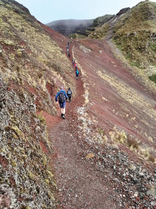
Below right: An amazing walk into the awesome volcanic crater of Mount Tarawera - walk along narrow ridge on volcanic terrain before experiencing the view back around towards Lake Tarawera and then the incredible descent into the crater via scree.... sliding and bracing all at the same time! Some time spent taking it all in at the very bottom of the crater before the climb out - fantastic pathways and a steep trek but the views made it all worth the effort. Photo by Chrissie Courtman, Hamilton.
Walk to Blyth Hut - in Tongariro Park
SBy Dave Scoullar
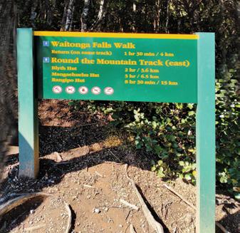
everal tracks lead into Tongariro National Park from the Ohakune Mountain Road and one of the most popular day walks is the 3.6k kilometres to Blyth Hut which is reached in approximately two to two and a half hours at a leisurely pace. With an early start, this is an ideal location for lunch.
The route, which features some gentle climbing, steps, staircases and boardwalks, begins with a wellgraded track.
Within a half hour you reach an ex-
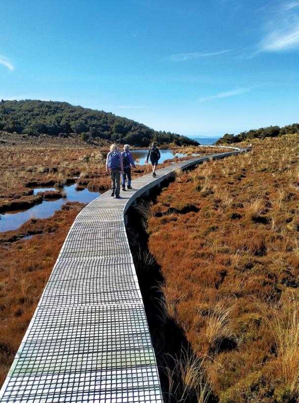
Above left: An extensive boardwalk over a sensitive wetland area.
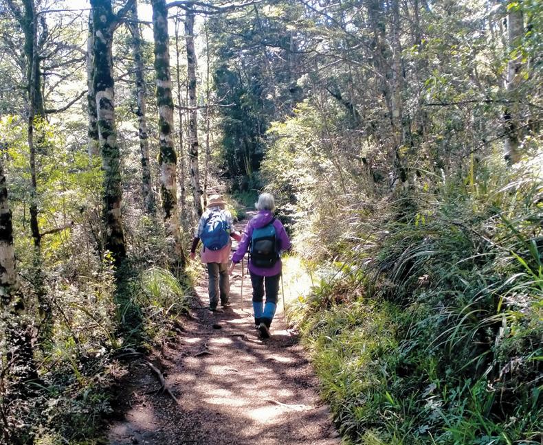
Below left: The track is mainly through mountain beech.
tensive boardwalk which takes you over a sensitive wetland area. A seat on the boardwalk is an opportunity to take in a panoramic view of the maunga, which with luck, will be clear of cloud.
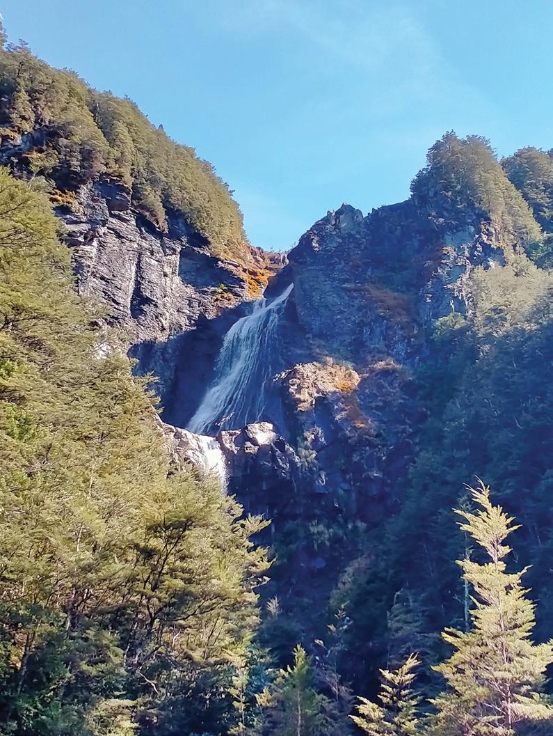
From here the track drops to a stream which has a view of the 39m Waitonga Falls, the highest in the park. This is the turnaround point for many visitors.
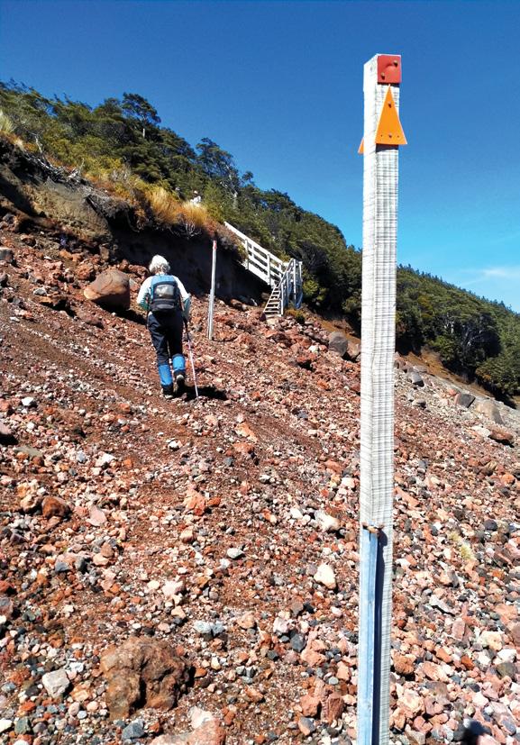
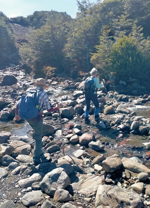
From here the track becomes rougher and you quickly reach the first of five shallow stream crossings. These have to be waded so carrying poles is useful for balance. On our trip a walker without poles slipped and fell.
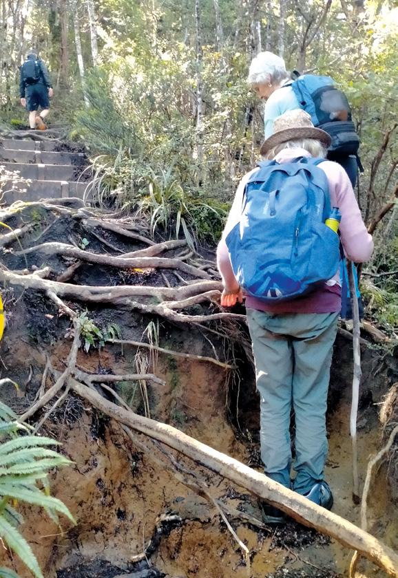
The latter part of the walk is mostly uphill and muddy in places with roots to be navigated and some scrambling is needed.
Ideal for walkers, hikers, golfers, sailors and all those who love or work in the great New Zealand outdoors.
Baselayer MOVE and ULTIMATE available now in New Zealand from WALKING NEW ZEALAND LTD https://walkingnewzealand.co.nz/product/zerofit-heatrub-move-baselayer/ https://walkingnewzealand.co.nz/product/zerofit-heatrub-ultimate-baselayer/
You can now view and enjoy the latest issue of Walking New Zealand magazine online t http://www.pressdisplay.com/pressdisplay/viewer.aspx
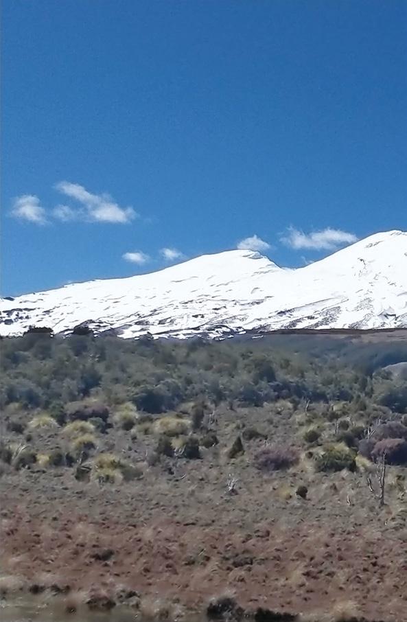
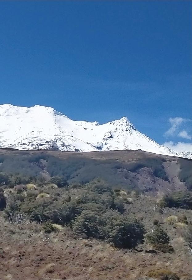
Abovce left: : A panoramic view of Ruapehu, if you are lucky. Above right: Approaching a staircase close to Blyth Hut.
Walk to Blyth Hut ■
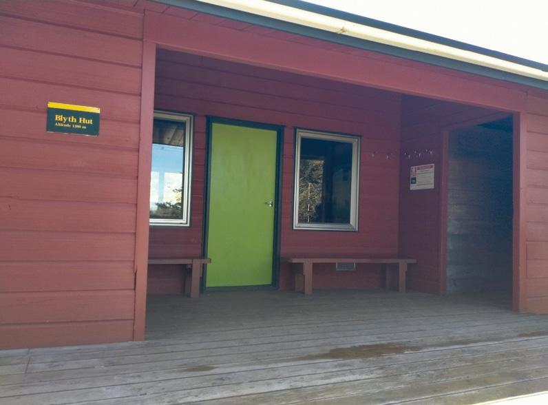
After passing the Whanganui High School’s Lupton Hut, a further 15 minutes on the Conservation Department’s 18-bunk Blyth Hut (1380 metres) comes into view. This is a great spot to bring children on an adventure.
The predominant vegetation on the walk is mountain beech with mountain cedar, celery pine and bog pine also prominent as well as a variety of ferns and alpine scrub species.
Joe Blyth, after whom the hut is named, was a Mt Ruapehu veteran and Ohakune school teacher who it is said taught his pupils the four Rs — reading, writing, arithmetic and Ruapehu. He climbed the mountain 147 times and also has a nearby track named after him.
To reach the start point from Ohakune drive about 12 kilometres up the Ohakune Mountain Road to a parking area. There is good signage there and elsewhere on the track. A toilet is available at the hut.
Above left: The Waitonga Falls are a destination.
Below left: Blyth Hut is an ideal lunch spot.
Opposite page above: Shallow streams have to be waded. Below: Some scrambling is necessary in places.
The H215 Professional 4 Function Pedometer
The H-215, 4-function pedometer is a superb, reasonably priced pedometer that counts steps, calculates distance, calories burned and has a 12/24 hour clock.
This is the model that has sold over a quarter of a million worldwide. It has the largest display of any pedometer we tested and is very accurate.
Dimensions: (L) 5.6 * (W) 3.7 * (t) 2.7 cm
Price only $36.95 plus $7.00 P&P
Phone 0800-925-546 for bulk prices
Available now from:
Walking New Zealand Shop
P O Box 1922, Palmerston North - Phone 0800-925-546 Fax 06-358-6864 or email walkingnz@xtra.co.nz. www.walkingnewzealand.co.nz
The new VeryFitPro ID205L is an intelligent smart looking Sports Watch and activity tracker that ticks all the boxes.
* Strong and durable 3cm clear glass touch screen display
* Skin friendly soft and comfortable wristband strap
* Nine exercise modes walking, running, hiking, cycling, treadmill, fitness, mountain climbing, spinning bike and yoga
* Many functions: step monitoring function, heart rate monitoring, sleep monitoring, calorie monitoring, call reminder, message reminder, sedentary reminder, alarm reminder, stopwatch, timer, music control, looking at mobile phone, breathing training, time and date display, multi-sport mode (step, calories, speed, distance, active time), daily goal
* Raise your hand and the screen will light up.
* Customize the face of your Smart Watch to fit your needs.
* IP68 Deep Waterproof
* Magnetic charging with USB charging cable takes about 2.5 hours for around 10 days usage.
* Uses VeryFitPro app Compatible with smart phones that use IOS 8.0/Android OS 4.4 or later, and Bluetooth 4.0 or later
* Colours available: Black
Only $115.00 plus $8.00 P&P Walking New Zealand Shop
47 Lincoln Terrace, Palmerston North - Phone 027-274-0726
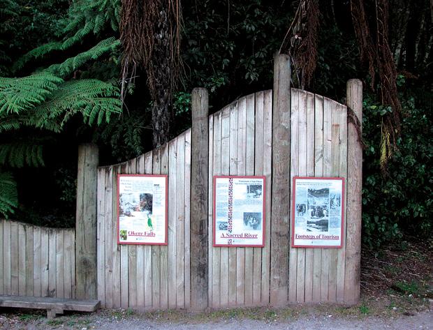
Walking the Okere Falls Track offers an enchanting blend of natural beauty, cultural history, and adventure on the edge of Rotorua.
The journey is just over two kilometers long, taking approximately one hour to complete at a leisurely pace. Along the way, you encounter roaring waterfalls, lush native bush, a rich Māori history, and the lasting echoes of past industry, the perfect setting for an immersive New Zealand bushwalk experience.
Stepping onto the Okere Falls Track, the sounds of the forest envelope visitors: birdsong, rustling leaves, and the ever-present thunder of the falls.
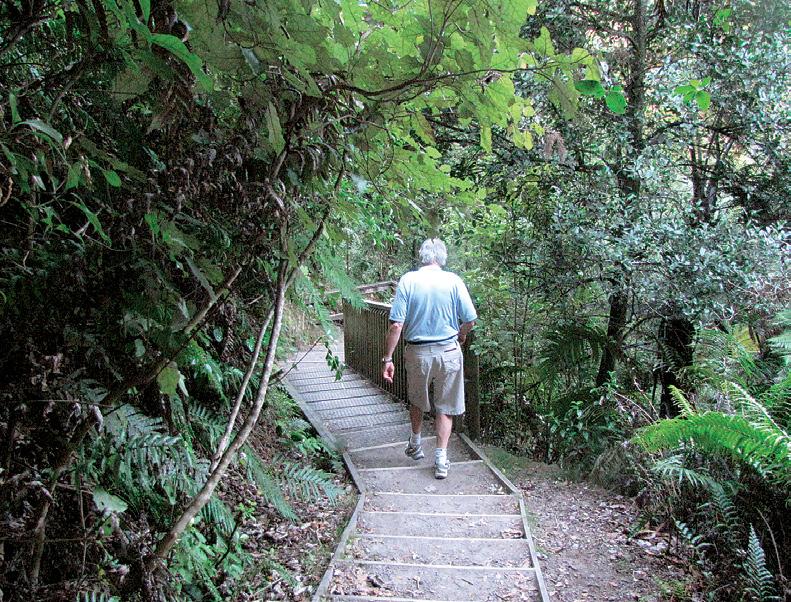
From the Trout Pool Road car park, the track is wide and wellformed, making it ideal for walkers of all abilities.
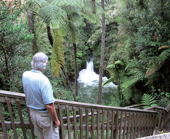
Early in the walk, you descend a short set of steps to your first lookout, where Okere Falls reveals itself, the emerald-green water thundering over ancient rocks.
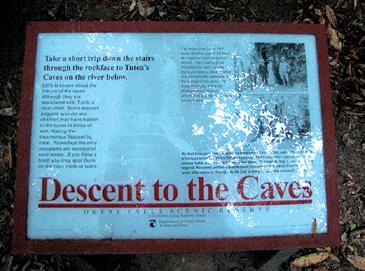
Interpretive signs line the trail, narrating the rich history and unique ecology of the area.
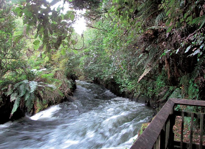
The walking is mostly easy, with a few sections involving steps or short climbs, giving glimpses of the Okere River as it roars through narrow gorges and over multiple waterfalls. The bush is dense and cool, provid-
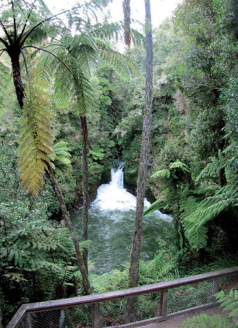
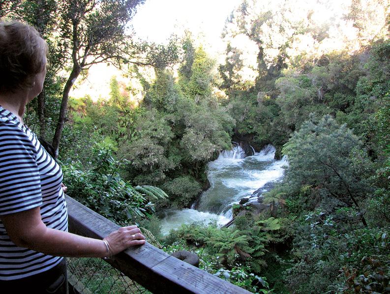
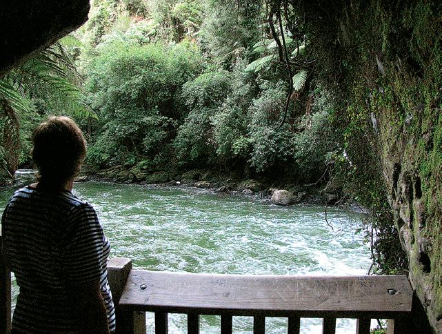
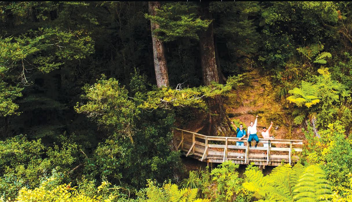
Above left: The rushing waters from a viewing platform. Below left: The entrance to Okere Falls Reserve. Below right: Rushing waters from the steps.
ing ample shade and framing the views with ferns, tall podocarps, and glowing moss.
Along the way, the track splits down to Hinemoa’s Steps, where you can detour to Tutea’s Cave. This natural limestone refuge, named after a local chief, sheltered women and children during times of tribal conflict.
The cave also comes alive at night with glow worms, adding a touch of magic that is uniquely New Zealand.
Further along, another lookout provides a breathtaking view of Tutea Falls. At seven meters tall it is the highest commercially rafted waterfall in the world. Stand above the drop and you may see kayakers and white-water rafters committing themselves to the foaming plunge.
Their shouts of exhilaration often echo up from the water, interrupted only by the sheer roar of the cascade.
At the far end of the track lies the Trout Pool, a calm counterpoint after all the white-water drama. The pools are often glassy and clear, with trout drifting in the current.
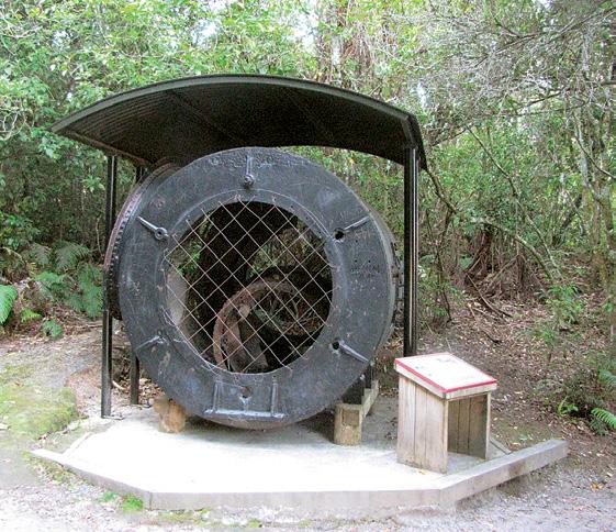
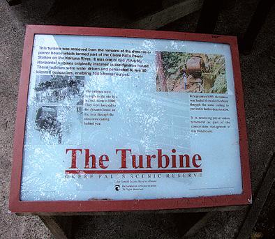
The return leg winds back through the bush, looping past the remains of the historic Okere Falls Power Station that is a relic of the hydroelectric ambitions of the early 20th century.
The Okere Falls Loop Track represents a relatively short but utterly rewarding bushwalk.
Above right: The fast flowing Okere River.
Below right: The steps down the main track.
Okere Falls Walk for natural
beauty and history
Ouch! Sore feet while walking?
Hikers Wool is 100% New Zealand wool. Cushion your feet to prevent pain, rubbing and blisters.
Buy online or at selected stockists For more info visit www.hikerswool.co.nz
The full circuit is 2 to 2.2 kilometers, typically taking between 50 minutes and an hour to complete at a recreational pace. If you pause to read historical markers, watch the rafters, or explore the detours to caves and lookouts that is likely given the sights you can expect to spend the full hour or perhaps a little more.
The track is easily accessible but feels remote, entering a realm where forest and river are in a constant, dramatic conversation.
Walking quietly, you notice the interplay of light and leaf, the changing tempo of the river, and the heady scent of damp earth.
Moments stand out throughout the walk: watching the white spray rising from Okere Falls in the dawn light, ducking into the dimness of Tutea’s Cave, and standing atop the platform above Tutea Falls, marveling at the courage of rafters just before they disappear with a wild whoop into the churning void below.
Even when the track is busy, there’s a sense of solitude that is partly due to the enveloping bush, and partly the awe that the river inspires.
The interpretive panels make the experience educational, sparking curiosity about both the ancient Māori legends and the European settlers who harnessed the river’s energy.
The Okere River area, deeply significant in Te Arawa tribal history, has long been a place for gathering, fishing, and ceremony. The name “Ōkere” translates to “the place of drifting,” a nod to the ever-flowing
Above right: One of the information signs.
Above left: The track to the bottom of the falls is carved out of over hanging rock.
Below left: The Okere River flows over rapids before it meets the falls.
nature of the falls and river.
Tutea’s Cave in particular embodies the Māori heritage of the place, being named for the local rangatira (chief) Tutea. The cave served as a hiding place for women and children during tribal wars, secure among the steep bush-covered cliffs and the rushing river.
European settlers saw the Okere River as a potent force and ripe for harnessing. In 1901, construction began on the Okere Falls Power Station, one of New Zealand’s earliest public hydroelectric power schemes. In operation by 1901, it powered nearby Rotorua, a symbol of the new age dawning in the early 20th century.
The decaying remains of the old turbine and station buildings can still be seen from the track, tangible markers of a time when waterfalls drove not only fish and legends, but also light bulbs and progress.
Remnants of the channel and machinery are visible near the path, a reminder of the region’s pioneering spirit.
Today, Okere Falls continues to be a vital part of community and visitor experience alike. The river is arguably best known now for white-water rafting and kayaking, with many guided trips braving the challenging rapids and vertiginous drops.
The section of the river you walk alongside during the Okere Falls Track includes the highest commercially rafted waterfall in the world that is a claim to fame which draws adventurers from across the globe.
But even for those on foot, the Okere Falls Track remains a gem. It connects people to a vibrant chapter of New Zealand’s natural and cultural story, all in the course of an hour’s stroll.
Walking the Okere Falls Track is more than just a bush stroll, it’s an experience woven from water, forest, history, and adrenaline.
From the reverberating power of the river to the quiet mystery of hidden caves and storied falls, every step deepens a connection with the land and its layered stories.
Whether marveling at ancient Māori refuges, pondering the rusted relics of industry, or simply enjoying the refreshing mist on your skin, Okere Falls delivers a memory-rich hour that lingers long after you’ve left the river behind.
Above left: A turbine a relic from the past.
Above right: A view of the Okere River.
Three walks to explore in Tunnel Gully Area
By Patrick Quinn
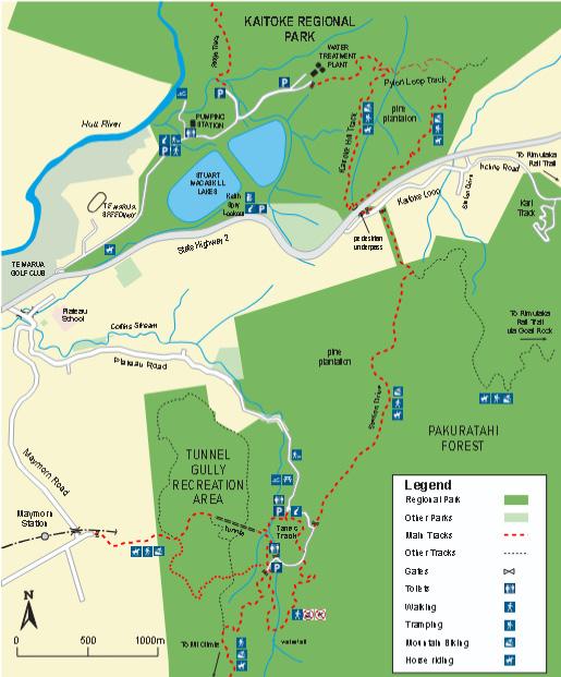
Tucked into the southern foothills of the Tararua Range, Tunnel Gully Recreation Area is one of the Hutt Valley’s most varied walking destinations.
Dense native forest, historic railway engineering, sweeping valley views, and a network of well-graded tracks make it a favourite for both family strollers and seasoned trampers.
Here, we highlight three standout walks with each offering a different flavour of this beautiful corner of the hills.
The Tunnel Gully Track
The signature walk of the recreation area follows the old Cross Creek Railway formation of the 1870s, where the Fell railway once hauled steam trains over the Rimutakas. Today, the rail corridor is an easy, wide path beneath a canopy of regenerating native forest and towering eucalypts.
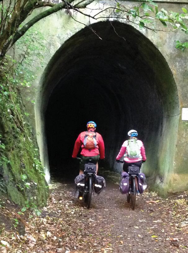
After a gentle ascent, the trail leads to the star attraction: the Mangaroa Tunnel, a 253-metre-long brick-lined railway tunnel. Even on sunny days,
the interior is cool, echoing, and surprisingly atmospheric. Here torches are recommended, especially for children who love the thrill. The tunnel emerges on the far side to a sunny clearing with views towards the Kaitoke ridgeline.
Highlights include: moss-covered cuttings and embankments, tui and riroriro flitting between the manuka and kanuka and a serene, secluded feel despite being close to Upper Hutt.
It’s the perfect short outing for beginners or anyone wanting an evocative, historic wander.
Distance: ~3 km return (to the tunnel) Time: 45–90 minutes Grade: Easy (suitable for families)
Tāne’s Track
Named after Tāne Mahuta, guardian of the forest, this loop track showcases the best of Tunnel Gully’s native bush. It peels off from the picnic area and quickly leaves behind the open spaces, drawing walkers into a cool, shaded world of mamaku ferns, rimu, miro, and kohekohe.
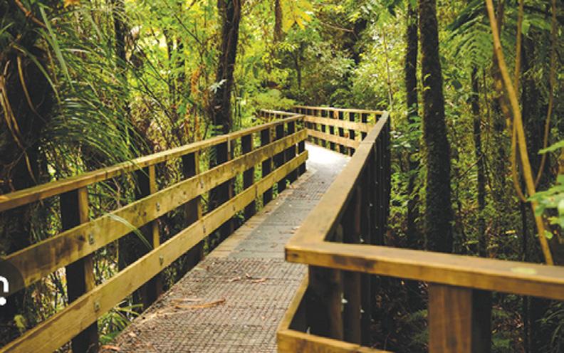
The graded path undulates gently, crossing several small gullies with wooden bridges and boardwalks.
Recreation .
Birdlife is excellent: you’re likely to hear korimako (bellbirds), see piwakawaka darting across the path, and, in the quieter stretches, spot kererū lumbering between the trees.
Interpretation panels appear along the route, explaining the ecology of the area and how the bush has regenerated since early settlement. The combination of variety, shelter, and peacefulness makes it an ideal loop for families or anyone who wants a more immersive forest experience without tackling a major climb.
Distance: ~2.5 km loop
Time: 45–75 minutes
Grade: Easy–moderate
Mount Climie
For those craving a challenge, Mount Climie stands as one of the Hutt Valley’s most rewarding day walks. The route starts on the same track system as the shorter walks, but soon breaks away and begins a steady, sometimes steep climb onto the Climie ridgeline.
The early section winds through
Above left: The view from the track on Tane’s Track. Below left” A large tree in the reserve. Below right: A bridge opn Tane’s Track.
Three walks to explore in Tunnel Gully Recreation Area
dense forest, but after about an hour, the trees open out and the views begin. The final ascent to Climie No. 2 (South Climie) is exposed and often windy. You may need to pack warm layers even on fine days. But the payoff is immense: a broad summit with panoramic vistas over the Upper
$39.95 plus $8
Shipping
Hutt basin, the Tararua Range, Wellington’s distant hills, and, on a clear day, even a glimpse of the Remutaka Ranges stretching south.
This track is popular with trail runners and trampers preparing for longer Tararua trips, but it remains accessible to fit walkers looking for a half-day challenge. Expect chang-
Foldable Hiking Poles
* Compression feel
* Adjustable from 65cm -135cm
* Folds into 3 sections
* Straight rubber handle
* Strong – Made from Aviation Aluminium
* Colours: Blue or Red
* Buy 2 poles and save $5.00
Available now from: Walking New Zealand Shop
P O Box 1922, Palmerston North Phone 0800-925-546 or email walkingnz@xtra. co.nz. www.walkingnewzealand.co.nz
ing weather, bring plenty of water, and enjoy one of the region’s great viewpoints.
Distance: ~10–12 km return (to South Climie summit)
Time: 4–6 hours
Grade: Moderate–hard
Whether you’re wandering to the historic railway tunnel, exploring a tranquil loop of native forest, or climbing high above the valley for spectacular Tararua views, Tunnel Gully Recreation Area offers variety in spades. With picnic areas, good signage, and tracks ranging from gentle strolls to solid hill climbs, it’s a gem of the Hutt Valley and well worth lacing up for.
Tunnel Gully is located just north of Upper Hutt and is accessible by train and bus from Wellington.
To get there: Follow State Highway 2 north to Te Marua.
Turn right onto Plateau Road (at the dairy).Plateau Road leads into the recreation and lower picnic area.
Above left Riders entering the Mangaroa Tunnel.
Above right: On a welll formed path.
Two relaxed beachside strolls in the Eastern Bay of Plenty
By Jim Robinson
Who doesn’t love a relaxed beachside stroll — and Ōpōtiki in the eastern Bay of Plenty has a couple of gems. The Dunes Trail and Waiōtahe Trail are easy on effort, big on ocean views.
Waiōtahe Trail stretches from Ōpōtiki to Te Ahiaua/the Pipi beds near Ōhiwa Harbour. This easy, almost wholly flat trail links with the Waioweka Trail, which links with the Dunes Trail.
The town end of Waiōtahe Trail is by the highway, so it’s more of a convenient link rather than a walk of beauty: but the western 4km of Waiōtahe Trail, from Island View Holiday Park, is nothing less than spectacular.
If you’re just wanting a short walk,
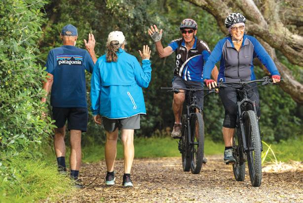
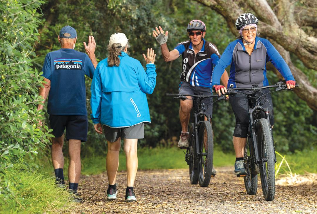
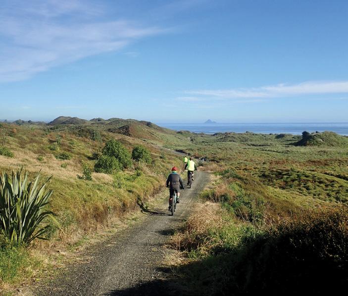
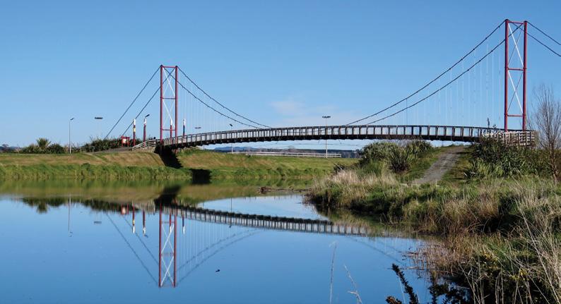
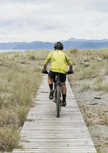
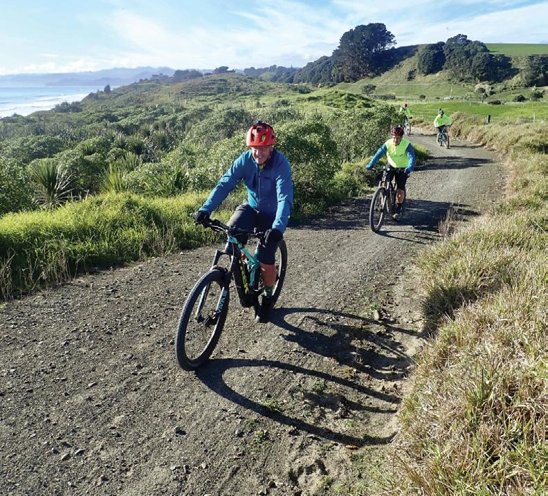
Above: Walkers and cyclists meet on the Waiotahe Trail. Photo Jamie Troughton. Below left: Cyclists on the Dunes Trail section. Photo Jim Richards
Two relaxed
beachside strolls in Eastern Bay of Plenty
start at Te Ahiaua/the Pipi beds, or by the surf club, both spots have toilets and parking. The trail is gravel and clearly marked.
As with much of the Ōpōtiki Coast, Waiōtahe Beach has had a good amount of planting in recent years, which has helped to restore a healthy dunes system. Along Waiōtahe Trail, almost continual sea views, swathes of spinifex and pingao, and towering pōhutukawa make for a unique experience.
The Dunes Trail is one of the highlights of Motu Trails, one of the Great Rides of Ngā Haerenga New Zealand Cycle Trails. The trail starts at Memorial Park at the northern end of Ōpōtiki township, where there
are toilets and car parking. Ōpōtiki Holiday Park is close by. Like the Waiōtahe Trail, the Dunes Trail is shared use, for cycling/walking/ running.
From Memorial Park, cross the 80m Pākowhai ki Otutaopuku bridge over the Otara River. The first 600m of trail is on river stop bank, with the adjoining flood plain planted up with harakeke/flax and tī kōuka/cabbage trees.
All up, alongside the Dunes Trail, more than 35,000 trees and plants have been dug in since 2015, mostly by volunteers. Since 2021, an active predator trapping programme has seen over 100 stoats and weasels, and over 400 rats, removed from the
rolling dune-lands.
After 600m, the trail reaches the sand dunes, blanketed in Muehlenbeckia complexa/pohuehue, and pockets of planted trees. A series of pottery tile displays feature birds of the area, made by local Cheddar Valley Pottery. From the 1km mark of the Dunes Trail, the panoramic view takes in 180-degrees from Ōhope to the Raukumara Ranges in the east, while Whale Island/ Moutohora and White/ Whakaari Island sit on the
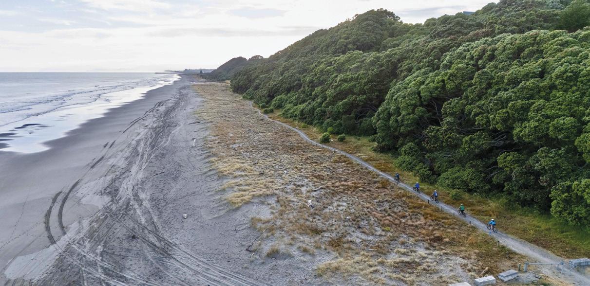
Above: A birds eye view of part of the Waiotahe Trail. Photo Jamie Troughton.
Below left A bridge on the Dunes Trail.
Below right: A boardwalk on the Dunes Trail. Photo Strike Photography
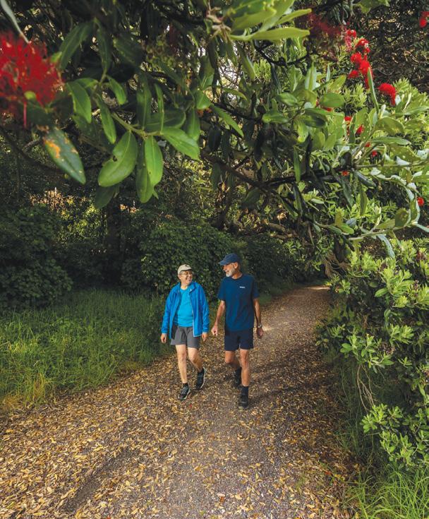
Above right: Cyclist on the Dunes Trail. Below left: Two walkers in a shaded area on the Waiotahe Trail. Photo Jamie Troughton.
Almost 3km from Memorial Park (6km return), you’re at Hukuwai Beach, where there’s parking, plus toilets, picnic tables and a few spaces for motorhome overnighting. Hukuwai is a good rest or turn-around point.
At the Dunes Trail’s 6km mark, you’re at Tirohanga Beach, where the trail crosses the beach itself on wooden decking. Native grass spinifex sericeus (kowhangatara) was planted in the surrounding sand in mid-2014. There has been a remarkable change since then, the bare beach building up into a broad dune area.
There are trail shelters at the 5.5km (Tirohanga) and 9km (Waiwhero) points of the Dunes Trail, plus regular bench seats and tables. If you want to arrange a vehicle pickup, the 9km shelter is 50 metres from SH35, less than 10 minutes’ drive back to Ōpōtiki.
To know more, contact Ōpōtiki isite. To be sent brochures with maps, contact Motu Trails Charitable
Trust on info@motutrails.co.nz or find more information about Motu Trails at www.motutrails.co.nz
Waiotahe Trail
Pakihi Track
Above: right: Cyclists on the Dunes Trail. Photo Jamie Troughton. Below left: Walkers going through a shaded area.. Photo Jamie Troughton.
NORTH ISLAND
NORTHLAND
BAY OF ISLANDS
BAY OF ISLANDS WALKERS: Saturday (AM), Jacqui Watson 022-6019741, Roz Whittaker 021-063-1455
DARGAVILLE
DARGAVILLE TRAMPING GROUP: Last Sunday of month (AM), Lynley Thompson 021-102-3974, colvilleestate1@gmail.com
WHANGAREI
CARDIAC CARE WALKING GROUP: Wednesday (AM or PM), Jo or Hugh Knight 09-438-7976
BLUE TOP WALKERS: Henderson, Tuesday, Thursday (AM), Terry Wilson 09-814-9523 or 021-266-1071, terryandsheena@gmail.com, www. bluetopwalkers.weebly.com
FIA OLA WOMEN’S DEVELOPMEMT WALK GROUP: Monday to Saturday, Anne, 09-813-0021
FIT4LIFE: Glenfield, Monday (PM), Friday (AM), Sarah 021 534 649
GLEN EDEN ATHLETIC CLUB WALKERS: Glen Eden, Wednesday (PM) and Saturday (AM), Neil Turner 09-817-6230 GREEN BAY MUMS BUSH WALKERS: Every second Monday, Anne 09-827-7810 or 09-817-5867
KELSTON MORNING WALKERS: Kelston C.C. Tues (AM), Joy Martin 09-838-6553
KELSTON TWILIGHT WALKERS: Kelston, Tuesday (PM), Joy Martin 09-818-6084
KUMEU WALK GROUP: Kumeu, Friday (AM), Mary Davies 09-412-2262
LYNNMALL SHOPPING CENTRE KIWIFIT CLUB: Monday, Wednesday (AM), (BIA), 09-826-2333
TE ATAU PENINSULA WALKERS: Monday, Friday (AM), Wednesday (PM), Mary Jones 09-834-6989
TE ATATU SOUTH ACTIVE 35+ WALKING GROUP: Te Atatu South, Wednesday, Edna, 09-834-1401
THE HAPPY WANDERERS WALKING GROUP: Wednesday (AM), Joy Williams 09-817-2464 or 027-353-3434
TITIRANGI TWILIGHT WALKERS: Tuesdays, Thursday, (PM) Titirangi Library, Wednesday (PM) Glovers Real Estate Green Bay, Louise 021437-547, louisenicholson@xtra.co.nz
TITIRANGI WALKERS: Sundays (AM), John Harris 09-627-0099, jeanah@ihug.co.nz
Fitness levels: “B” beginner, ”I” intermediate, “A” advanced. (AM) denotes morning walk, (PM) denotes an afternoon or evening walk. Group co-ordinators are asked to please advise us of any updates by fax 06-358-6864 or email walkingnz@xtra.co.nz.
WALKERS & TALKERS: Campbells Bay, Wednesday (AM), Brenda Gray 09-410-4019, Dorothy Ensor 09-478-6702
MANAWATU STRIDERS: Tuesday, Thursday, (PM); Hockey Manawatu Pavillion, Manawaroa Street, (BIA), Bob 027-208-3719 or Kate 027-567-3896
MANAWATU STRIDERS: Sunday (AM); Manawatu Striders Clubrooms, Manawaroa Park, (behind the Esplanade Cafe), (BIA), Bob 027-2083719 or Ross 021-708-733
Notice to clubs and walking groups
If you notice there that the times, names or contact numbers etc on the list of Walking Grroups in the Directory on these pages needs updating please email us at walkingnz@xtra.co.nz. These are are free listing.
LEGEND
Fitness levels: “B” beginner, ”I” intermediate, “A” advanced. (AM) denotes morning walk, (PM) denotes an afternoon or evening walk. Group co-ordinators are asked to please advise us of any updates by fax 06-358-6864 or email walkingnz@xtra.co.nz.
LAMBDA DAY TRAMPERS: every second Sunday, (BI), social group for gays and lesbians of all ages, https://lambdatrampers.org/ LINWOOD AVENUE WALKING GROUP: Wednesday, Thursday (AM) (B), 03-389-5303
PIONEER TRAMPERS:Thursday (AM) (IA),4-5 hour tramps in Banks Peninsula and the hills and lower mountains from Mt Hutt to Mt Grey, pioneertrampers@gmail.com
LEITH WALKERS: Saturday (PM), Kevin Blair 03-476-3289
MORNINGTON MONDAY WALKERS: Monday (AM), (B), Shirley 03-4536398 or 021-294-2218
MULTI-PEAK FITNESS WALKERS: Wednesday (AM), Marelda Gallaher 03-477-6057 or 027-222-3863
OTAGO TRAMPING/MOUNTAINEERING CLUB: Sunday (AM), Joe Bretherton, jsbretherton@gmail.com, http://otmc.co.nz
OVER 30’s TRAMPING CLUB: Sunday (AM), Janice Hodges 03-489-4071
PHOENIX CLUB WALKING GROUP: Wednesday (AM), Nina Davidson 03-471-0114
PINEHILL WALKING GROUP: Thursday (AM), Norman Vare 03-473-8683
Notice to clubs and walking groups
If you notice there that the times, names or contact numbers etc on the list of Walking Grroups in the Directory on these pages needs updating please email us at walkingnz@xtra.co.nz. These are are free listing.
ST KILDA COMMUNITY CLUB WALKING GROUP: Tuesday, (AM), Ngaire McIndoe 03-456-4478
60’S UP WALK GROUP: Monday (AM), Olive Swain 03-214-4802
YMCA WOMEN’S WALKING GROUP: Tuesday (AM), Joan Tuffery, 03-216-7377
ACTIVE WALKERS KIWI SENIORS: Thursday, Sport Southland 03-2112150, e:kiwiseniors@sportsouthland.co.nz, www.sportsouthland. co.nz
GORE
GORE DISTRICT WALKERS: Tuesday (AM), NgaireEvans 03-208-4744 or Maureen Jones 03-208-7322, maway50@gmail.com
HOKONUI TRAMPING CLUB: Margaret Hughes 03-208-7053
NORTHERN SOUTHLAND
NORTHERN SOUTHLAND WALKERS: 2nd and 4th Thursdays, Balfour: Christine MacLean 03-201-6390, Riversdale: Charmaine Will 027358-3531
NEW ZEALAND
DECEMBER 2025
5-7 The Spectacle, Nelson
6 Pirongia Trail Run, Mount Pironga, Waikato
6 Rockys Backyard Ultra, Tauranga
6 Ultra Five-0, Kaiaua to Clevdon, Auckland
6 Ridge Runner Coromandel, White Star Station, Coromandel
6 The Kepler Challenge & Luxmore Grunt, Lake Te Anau
8 The Honest Lawyer 5K Series, Nelson
9 Harcourts Cooper & Co Beach Series
8, Takapuna, Auckland
13 Valley Ultra, Craigiburn, Canterbury
14 Nexans Fun Run/Walk Hawera
14 Canterbury Half Marathon, Pegasus, Canterbury
16 The Cook 5km Summer Series Run/ Walk, Hamilton
JANUARY 2026
10 Aotearoa Ultra Marathon, Little River Canterbury
10 Ian Priest Memorial Hutt River
great little Pedometer that you can carry in your bag or pocket or clip on a
Three function Pedometer with a hi-tech system that you can carry in your bag, pocket, clip on a belt, or as an arm band, and accurately records your activity through its G Sensor technology.
* Step - Counts steps up to 999,999 steps
* Total Steps - It can cumulative number of steps of each activity
* Exercise time - The effective time will be accumulated as the walking is kept going
* Comes
Trail, Wairara to Petone
10 Good Home Taranaki Off Road
Half Marathon, New Plymouth
10 King and Queen of the Withers, Blenheim
10 Sandy Point Backyard Ultra, Invercargill
13 Manawatu Striders Super Seven Series, Palmerston North
17 Glenham Trainwreck Trail, Glenhaam, Southland
17 Mount Festival Half Marathon, Mt Maunganui
17 Hanmer Springs Adventure Run, Hanmer Spings
17 Krayzie Chicks Frontyard Ultra, Kaiapoi Island
17 The Goat Adventure Run, Tongariro National Park
17 Wine Run Rossendale Wines Vineyard, Christchurch
1 Hadlow-to-Harbour Fun Run & Walk, Hadlow, Timaru
6 - 7 Ashburton River Trail Marathon, Ashburton
7 Motatapu, Wanaka to Arrowtown
8 Footprints In The Sand , Foxton Beach
8 Southern Cross Round the BaysAuckland
8 Surf to City Cycle Enemt Invercargill
8 8 Waipa Fun Run and Walk, Cambridge
8 Kaiapoi Fun Run & Walk, Kaiapoi
8 Rotorua Off Road Half Marathon,
The H215 Professional 4 Function Pedometer
The H-215, 4-function pedometer is a superb, reasonably priced pedometer that counts steps, calculates distance, calories burned and has a 12/24 hour clock.
This is the model that has sold over a quarter of a million worldwide.
It has the largest display of any pedometer we tested and is very accurate.
Dimensions: (L) 5.6 * (W) 3.7 * (t) 2.7 cm
Price only $36.95 plus $7.00 P&P
Phone 0800-925-546 for bulk prices
Available now from: Walking New Zealand Shop
47 Lincoln Tce, Palmerston North - Phone 0800-925-546 Fax 06-358-6864 or email walkingnz@xtra.co.nz. www.walkingnewzealand.co.nz
Rotorua
13-15 Taupō Trail Festival, Taupo
14 Pāuanui Trail Epic, Pauanui, Coromandel
14 Run Mt Hutt, Pudding Hill, Canterbury
14 Te Āpiti Traverse, Woodville, Tararua
14 Tararua Mountain Race, Kaotoke to Otaki Forks, Tararua Ranges
15 3 Peaks Mountain Race, Leith Valley, Dunedin
15 City2Surf Fun Run, Latimer Square to New Brighton, Christchurch
15 Hamilton Half Marathon, Hamilton
15 Harcourts Cooper & Co Run Albany, Albany, Auckland
15 Methven Adventure Race, Methven, Canterbury
20 March to 6 April Waiheke Walking Festival
21-22 Northburn 100, Northburn Station, Central Otago
21-22 Rotorua Walking Festival, Rotorua
21 Bombay Farm Run & Walk, Bombay, Auckland
The new VeryFitPro ID205L is an intelligent smart looking Sports Watch and activity tracker that ticks all the boxes.
* Strong and durable 3cm clear glass touch screen display
* Skin friendly soft and comfortable wristband strap
* Nine exercise modes walking, running, hiking, cycling, treadmill, fitness, mountain climbing, spinning bike and yoga
* Many functions: step monitoring function, heart rate monitoring, sleep monitoring, calorie monitoring, call reminder, message reminder, sedentary reminder, alarm reminder, stopwatch, timer, music control, looking at mobile phone, breathing training, time and date display, multi-sport mode (step, calories, speed, distance, active time), daily goal
* Raise your hand and the screen will light up.
* Customize the face of your Smart Watch to fit your needs.
* IP68 Deep Waterproof
* Magnetic charging with USB charging cable takes about 2.5 hours for around 10 days usage.
* Uses VeryFitPro app Compatible with smart phones that use IOS 8.0/Android OS 4.4 or later, and Bluetooth 4.0 or later
* Colours available: Black
walkingnz@xtra.co.nz. www.walkingnewzealand.co.nz
21 Hunua Hillbilly Ultramarathon, Hunua, Auckland
22 Geraldine Multi Challenge, Orari
22 Peak Trail Blazer, Havelock North, Hawkes Bay
27-29 Ring of Fire Alpine Ultra, Tongariro Natioanl Park, Ohakune
28 Foundation Clinic Mauao Half Marathon, Mt Maunganui
28 Middle-earth Halfling Marathon, Hobbiton™ Movie Set, Matamata
30 New Zealand Walks: Heaphy Track and Oparara Arches
19
33 New Zealand Walk: Lou’s Lookout Walk
34 New Zealand Walks: Wandering along the Waika to River Trail from the dam to Jones Landing
38 New Zealand Walk: A’Deanes Bush Walk through an original existing forest
42 Coming Events: New Zealand
46 Coming Events: Australia
47 Coming Events: Rest of World
48 New Zealand Country Breaks
51 Walking New Zealand Shop
52 Pak A Roo Walking Jackets
SEPTEMBER 330 2025
3 Contents
4 Walk Talk
6 New Zealand Walk; Short walks at Lake Brunner
Champions Award
30 New Zealand Walk: Hinehopu Bluffs for lots of native trees and birdlife
33 New Zealand Walk: The Terrace Walk at Franz Josef
34 New Zealand Walk: Karituwhenua Stream Walk a short family walk
36 New Zealand Walk: Omarama’s Clay Cliffs has an unique landscape
39 Auckland Walk: A walk or bike ride through Logan Park Reserve:
40 Directory of New Zealand Walking Groups
42 Coming Events: New Zealand
48 New Zealand Country Breaks
51 Walking New Zealand Shop
52 Taupo Marathon JULY 328 2025
3 Contents
4 Walk Talk
6 New Zealand Walk: Tawa Loop Walk - a blend of natural beauty
10 New Zealand Trail: Access easements are the foundation of Kawatiri Coastal Trail
12 New Zealand Walks: Nine DOC huts for the first timer
14 Walking Tours: What is Footsteps
17 High Achiever: Dunedin track builder wins national award
18 New Zealand Walks: Wairakau Stream Walk included a climb up the Duke’s Nose Peak
Reserve
16 New Zealand Walk: Washpen Falls Walk - Canterbury’s secret canyon walk
19 New Zealand Walk: Walk through a canyon in an ancient volcano
19 New Zealand Walk: Whangarei forestry walkway re-opened
20 Shared Pathway: Hauraki Rail Trail - Thames to Matatoki
23 Book: Hiking the Hexa - a journey on France’s newest through hike
24 Walking New Zealand Monthly Photo Contest
26 Overseas Walks: Trekking to Machu Picchu by the Salkantay Trek
30 Auckland Walks: Great Auckland spots for walking your dog
34 Overseas Walks: Colorado for thousands of hiking trails
39 New Zealand Walk: New footpath bridge opened in Wellsford
40 Directory of New Zealand Walking Groups
42 Coming Events: New Zealand
45 Coming Events: Australia
45 Coming Events: Rest of World
48 New Zealand Country Breaks
50 Index of previous 15 issues
51 Walking New Zealand Shop
52 Pak A Roo Jackets APRIL 325 2025
3 Contents 4 Walk Talk
6 New Zealand Walk: Lake Rotorangi Hydro Walkway a little gem
9 New Zealand Walk: Six top Kapiti walks - coastal, scenic and bush worth exploring
40 Directory of New Zealand Walking Groups
42 Coming Events: New Zealand
48 New Zealand Country Breaks
51 Walking New Zealand Shop
52 Pak A Roo Jackets FEBRUARY 323 2025
3 Contents 4 Walk Talk
6 New Zealand Walk: Discovering Castlepoint: the Deliverence Track
8 New Zealand Walk: Linklater Walkway
9 New Zealand Walks: Historic Whitianga Rock Maori Pa site walk
10 New Zealand Walk: Westmere Lake Loop Walk
12 Overseas Walks: Magnificent midwinter meanders in Europe
14 New Zealand Walk: Swingbridge Loop Track offers an immersive experience
16 Expository Essay: Learning to Walk
18 Manawatu Walking Festival
19 Walking Festival; The 2025 Manawatu Walking Festival beckons adventure seekers
20 New Zealand Walk: Matiatia to the Vineyards Coastal Walk on Waiheke Island
24 Walking New Zealand Monthly Photo Contest
26 New Zealand Walk: Waikanae River Trail Walk popular with locals
28 New Zealand Walks: Two walks to explore on Mt Te Aroha
Zealand’s 11th Great Walk
39
40
42
46
8 New Zealand Walking Festival: Wairarapa Walking Festival has over 25 walks
10 New Zealand Walk: Makotuku Track has wide appeal
13 Need2know: 7000 steps a day now achievable for most people
14 New Zealand Walk: A wander along the Karangahake Gorge
18 Weather: Weather prediction for September
19 New Zealand Walk: Track repair confirmed for Waimata Gemstone Bay
20 New Zealand Walk: Cape Saddle Walk: A valley to valley walk in Craigieburn Forest Park
22 New Zealand Trails: Sign of the Vimes: new Marlborough Vineyard Trail:
24 Walking New Zealand Monthly Photo Contest
26 Overseas Walks: The wild West Coast Trail on Vancouver Island
29 Subscription page
30 New Zealand Walk: Inglewood Walkway a popular community asset
32 New Zealand Walk: McClaren Falls Park has lots of easy walks
36 Australian Walks: Ten best walks and hikes in Tasmania
42 Coming Events: New Zealand
12 Waitomo Cycle Trails: Waitomoa bike walk adventure
14 New Zealand Trail: Ruakuri Scenic Reserve
16 New Zealand Walk: Washpen Falls Walk - Canterbury’s secret canyon walk
19 New Zealand Walk: Walk through a canyon in an ancient volcano
19 New Zealand Walk: Whangarei forestry walkway re-opened
20 Shared Pathway: Hauraki Rail Trail - Thames to Matatoki
23 Book: Hiking the Hexa - a journey on France’s newest through hike
30 New Zealand Walk: Cooks Cove Walkway captivating journey through history
34 New Zealand Walks: Kawau Island for great day trips for walkers
38 Kauri Forest Challenge
39 New Zealand Walk: Moria Gate Loop and Mirror Tarn - a 4km West Coast Walk
40 Directory of New Zealand Walking Groups
42 Coming Events: New Zealand
48 New Zealand Country Breaks
52 Pak A Roo Jackets JANUARY 322 2025
3 Contents 4 Walk Talk
walks Te Araroa
10 News: Cape Palliser paper road bylaw to allow pedestrian and cycling access
11 Australian Walk: Witton Bluff Base Trail complete!
12 New Zealand Walk: CopperMine Trail - Nelson
14 NZ Walking Tour: Tantalising Taranaki from a volcanoe to coastal walk and in between 18 Weather: Weather prediction for November 19 Subscription page 20 Memories: Walking the Waikaremoana Track - 38 years ago.
26 New Zealand Walk: Walking the Pahi Coastal Track -at the edgae of the Coromandel
30 New Zealand Walks Little River Trail - hike it, bike it, like it!
34 High Achiever: At nearly 80 - the melee of different walks in my life
37 Australian Walks: Alice Springs - gorges, water holes and red dessert landscapes
40 Directory of New Zealand Walking Groups
42 Coming Events: New Zealand
46 Coming Events: Australia
47 Coming Events: Rest of World
48 New Zealand Country Breaks
51 Walking New Zealand Shop
52 Pak A Roo Walking Jackets OCTOBER 331 2025
3 Contents
4 Walk Talk
6 New Zealand Walk; An Autumn walk on the Otago Rail Trail
10 New Zealand Walks: Wonderful walks from Wellington to Whanganui
14 Overseas Walk: Morton Bay Fig trees a feature of Norfolk Island walk
15 New Zealand Walk: The Great Dripping Loop walk
18 Weather: Weather prediction for October
19 New Zealand Walk: Seals, camping and short walks on SH1 journey through Kaikoura
20 New Zealand Walk: Rangiwahia Hut murals
24 Walking New Zealand Monthly Photo Contest
26 High Achiever: Raukumara Hikoi to view work done on the ranges
29 Australian Walks: Forest Sky Pier, Orara East State Forest offers great coastal views
30 Te Araroa Trail: How walkers donation have helped the Te Araroa Trail
32 News: 100 years of history with the Auckland Natural History Walking Group
34 New Zealand Walks: Walks in Winsome Wairarapa
36 New Zealand Walk: Walking fron the Woodville end to Ashhurst to first lookout
40 Directory of New Zealand Walking Groups
42 Coming Events: New Zealand
46 Coming Events: Australia
47 Coming Events: Rest of World
48 New Zealand Country Breaks
51 Walking New Zealand Shop
52 Pak A Roo Walking Jackets AUGUST 329 2025
3 Contents 4 Walk Talk
6 New Zealand Shared Pathway: Te Ahu a Turanga Manawatu to Tararua a journey from Ashhurst to Woodville
10 New Zealand Shared Pathway: Build the Path
11 New Zealand Walk: St Leonard’s Beach dog friendly
14 New Zealand Walk: Kurow Hill Walk an unique experience
18 Weather: Weather predictiofor August
19 Viewpoint: Reinstate the competitive walking section: Why Auckland Marathon must listen to walkers
20 New Zealand Walking Festival: Bay of Islands Walking Weekend
23 Living Streets Aotearoa: Do you do this?
24 Walking New Zealand Monthly Photo Contest
26 Walking Tours: What’s in the mix for 2026
29 High Achiever: Northland engineer wins Outdoor Access
46 Coming Events: Australia
47 Coming Events: Rest of World
48 New Zealand Country Breaksp
52 Pak A Roo Jackets JUNE 327 2025
3 Contents 4 Walk Talk
6 New Zealand Walk: Walking on Waiheke enjoying bird song
11 New Zealand Walks: Unveiling the beauty and history of the Nydia Track, Marlborough Sounds
14 New Zealand Walks: Wandering through wonder a walk in the Hamilton Gardens
17 Australian Walks: Outstanding odyssey in Oz with some great walks in South Australia
20 New Zealand Walk: Scotts Beach & Nikau Walk, Karamea
23 Te Araroa Trail: A day walk on the Te Araroa Trail
24 Walking New Zealand Monthly Photo Contest
26 Shared Pathway: Cycling the Kapiti Coast: an Autumn adventure
30 New Zealand Walk: Taieri River Scenic Reserve an interesting walk
32 New Zealand Walk: Te Henui Walkway Extension a little known walk
34 New Zealand Event: Run Tekapo walks with breath-taking views
36 New Zealand Walks: From forest to skyline Walking the Wilds of Puhi Peaks
40 Directory of New Zealand Walking Groups
42 Coming Events: New Zealand
45 Coming Events: Rest of World
48 New Zealand Country Breaks
51 Walking New Zealand Shop
52 Pak A Roo Jackets MAY 326 2025
3 Contents
4 Walk Talk
6 New Zealand Walk: Lake Rotorangi Hydro Walkway a little gem
9 New Zealand Walk: Six top Kapiti walks - coastal, scenic and bush worth exploring
12 Waitomo Cycle Trails: Waitomo - a bike walk adventure
14 New Zealand Trail: Ruakuri Scenic
24 Walking New Zealand Monthly Photo Contest
26 Overseas Walks: Trekking to Machu Picchu by the Salkantay Trek
30 Auckland Walks: Great Auckland spots for walking your dog
34 Overseas Walks: Colorado for thousands of hiking trails
39 New Zealand Walk: New footpath bridge opened in Wellsford
40 Directory of New Zealand Walking Groups
42 Coming Events: New Zealand
45 Coming Events: Australia
45 Coming Events: Rest of World
48 New Zealand Country Breaks
51 Walking New Zealand Shop
52 Pak A Roo Jackets
MARCH 324 2025
3 Contents
4 Walk Talk
6 New Zealand Walk: Taranaki Falls Loop walk a capti]vating experience
8 New Zealand Walk: Cathedral Cove attracts visitors from throughoutthe waorld
10 New Zealand Walk: Sandymount to Sandfly Bay walk a chance to see lions and seals
12 Auckland Cycle Trails: The best family friendly bike rides in Auckland
14 New Zealand Trail: The Greytown to Woodside Trail and beyond
17 New Zealand Trail: Trail accessible to all ages and abilities
18 New Zealand Walks: Many walks to explore in Pirongia Forest Park
20 Walking Festival: 45 guided walks in ECHO Walkng Festival
22 New Zealand Walk: Whangamata Stream Trail through a beautiful forest
28 New Zealand Walks: Conquering the summit of Mount Maunganui
34 New Zealand Walks: Four fascinating days in Fiordland
6 New Zealand Walk: Mt Pukeatua - a forest filled with native flora and fauna
9 New Zealand Walk: Climbing Mt Pukeatua in Maungatautari Scenic Reserve
10 New Zealand Walks: Rotoroa Island -Auckland’s best kept secret
13 New Zealand Great Walk: Sommes Island reopns in time for tourist season
14 Overseas Walks: Get the taste of the Spanish Caminos in just 17 days
16 New Zealand Walk: Two walks in the Hakarimata Scenic Reserve
17 New Zealand Walk: Te Henga Walkway reopens to viewing point
19 New Zealand Walk: Puketi Forest Kauri Challenge classed as one of the best day walks
22 New Zealand Walk: Travis Wetlands Walk - a family friendly frestwater wetlands walk
24 Walking New Zealand Monthly Photo Contest
26 Overseas Walks: Fiji has a huge area to explore
32 New Zealand Walk:Waipu Coastal Walkway - a hidden gem in Northland
34 New Zealand Walks: Five water loving walks to escape to this summer
36 New Zealand Walks: Undertake some walking adventures - make it a new year resolution
38 New Zealand Walks: Two lesser known Auckland parks to explore
42 Coming Events: New Zealand
48 New Zealand Country Breaks
51 Walking New Zealand Shop
52 Pak A Roo Jackets DECEMBER 321 2024
3 Contents 4 Walk Talk
6 New Zealand Walk: Paekakariki Escarpment Track offers an exhilating experience
10 New Zealand Walk: Fensham Reserve - a p;opular local native bush walk
12 New Zealand Great Walk: Tuatapere Humpridge Track now New
The ULTIMATE is Zerofit’s flagship product and perfect for hiking, golf, sailing or any outdoor activities when it’s cold. But if you are more active it is complemented by the Heatrub MOVE.
Twice as warm as a standard base layer, the material regulates tempertures as you move, so you won’t suffer from cold sweat, if your are running or cycling.
Please visit the Walking New Zealand Shop: https://walkingnewzealand.co.nz/productcategory/apparel/ for more details and to order.