Ica Province
Casona del Marqués de Torre Hermosa
Cl. Libertad 141, Plaza de Armas
Known as Casa Bolívar for having hosted the Liberator, it is one of the few colonial buildings that withstands the passage of time.
Iglesia de San Francisco de Asís
Av. Municipalidad 319. Mon, Tue, Thu, Fri, Sat, 8:00-9:00, 18:00-20:30; Sun, 7:00-12:00. Tel. (51-56) 231-402 18th century architectural complex. The façade of San Francisco de Asís church has three bodies and two double-arched towers.
Museo Regional Adolfo Bermúdez Jenkins
Av. Ayabaca, cdra. 8. Tue-Fri, 8:00-19:00; Sat-Sun, and holidays 8:30-18:30. Tel. (51-56) 234-383. Entrance fee charged.
The Adolfo Bermudez Jenkins regional museum exhibits archaeological pieces from cultures developed in the area, such as Paracas, Nasca, Huari, Ica-Chincha, and Inca.
Área de Conservación Regional Laguna de Huacachina
3 miles (5 km) southwest of the city of Ica (10 min by car)
Huacachina lagoon has been declared a Regional Conservation Area because of its location, in the middle of the desert, surrounded by dunes, palm trees, and huarangos. Tourists are encouraged to visit its historic boardwalk and enjoy the regional cuisine. Adventurous visitors can enjoy the traditional pedal boat rides.
Beaches and deserts
37 miles (60 km) southwest of Ocucaje (2 h by car), crossing the desert, you will reach an area ideal for underwater fishing and hunting enthusiasts. To reach beaches such as El Morro, El Negro, La Hierba, Lomitas, Olleros, Antana, Barlovento and La Cueva it is necessary to have appropriate transportation, camping equipment, and a guide.
37 miles (59 km) west of the city of Ica (50 min by car) is Karwas, a beach that is also suitable for fishing and underwater hunting.
Pueblo de Cachiche
2.5 miles (4 km) south of the city of Ica (10 min by car)
Cachiche village is traditionally known for being home to witches, which to this
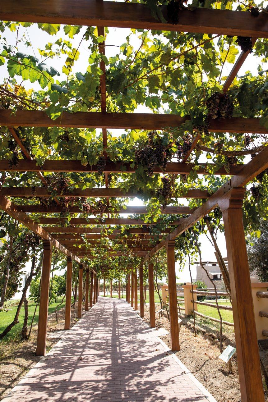
For more than four hundred years, the rich coastal valleys have produced grapes, the main ingredient to prepare pisco — the flag distilled drink of Peru.
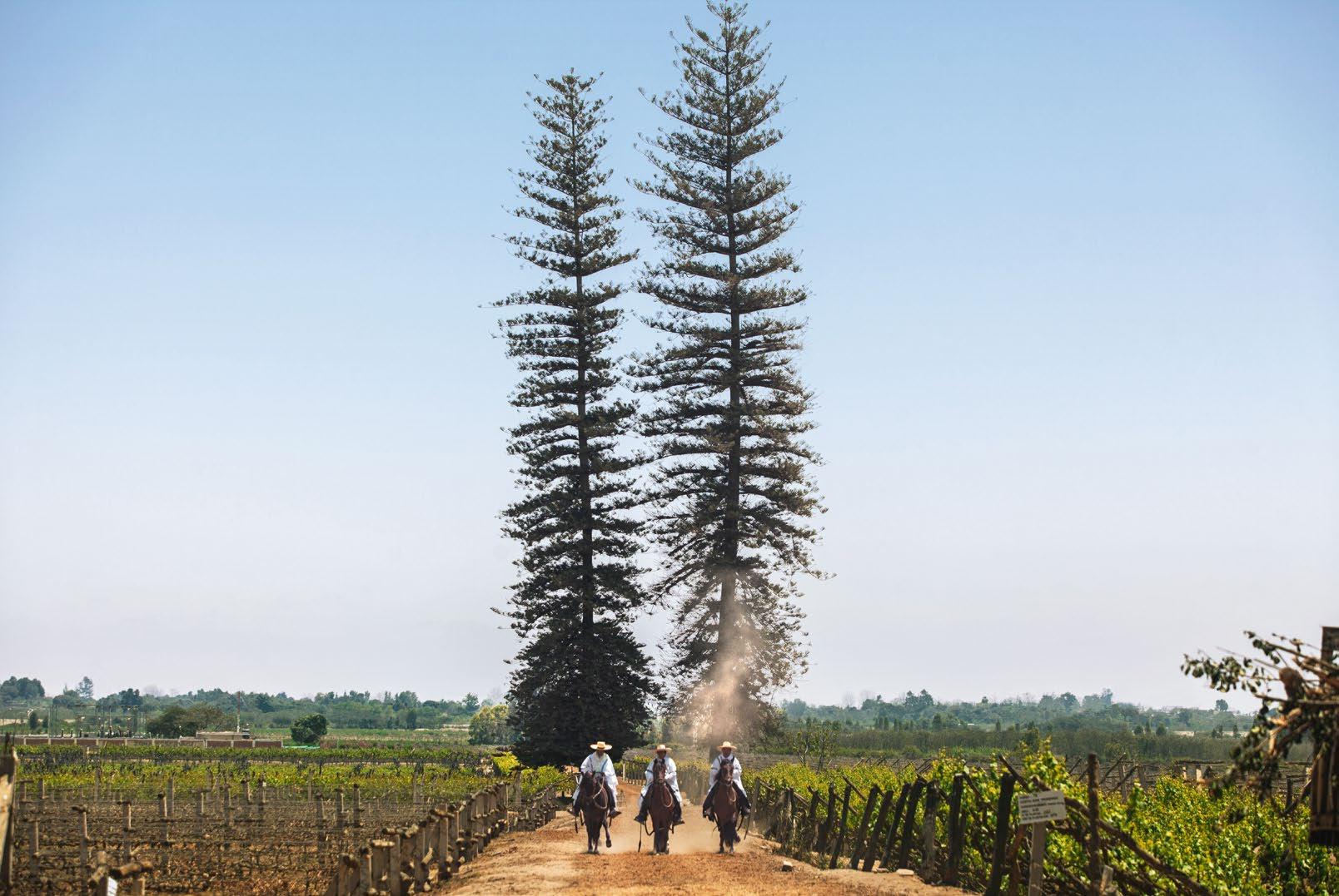
Peruvian Paso horses in the Tacama winery
© Marco Garro
The wineries that make up the Route of Pisco and publicize the production process of our flagship drink are scattered throughout Ica countryside. History and tradition inhabit these wineries, which have been operating since colonial times and preserve their artisanal methods of production. Others use state-of-the-art technology. Travelers are encouraged to enjoy and savor local
Prlg. Andrés Rázuri 310, Chincha Alta (kilometer 198 of Panamericana Sur highway) Mon-Fri, 9:00-18:00; Sat, 10:00-12:00. Tel. (+51-56) 261-602, (+51) 923-846-047
Kilometer 291 of the Panamericana Sur highway, Salas Guadalupe, Ica Mon-Sat, 9:00-17:30. Tel. (+51) 981-249-789. Entrance fee charged.
Av. Camino Real 360, La Tinguiña. Detour at kilometer 294.3 of Panamericana Sur
Tue-Sun, 9:30-16:30. Tel. (056) 581-030, Ext. 2 / 995-124-808. Entrance fee
Fundo Tres Esquinas 102, Subtanjalla, Ica (kilometer 295.5 of Panamericana Sur
Fundo Tres Esquinas 102, Subtanjalla, Ica (kilometer 295.5 of Panamericana Sur highway). Mon-Sun, 10:00-18:00. Tel. (056) 403-565, 955-868-921.
Centro Poblado Garganto, mz. K, lt. 1, Los Aquijes, Ica (kilometer 308 of
Mon-Sat, 8:30-19:30; Sun, 8:30-19:30. Tel. (056) 215-452, 956-679-264.
Mon-Fri, 9:00-12:00, 13:45-15:45; Sat, 9:00-12:00. Tel. (056) 232-919, 238-735.
Mon-Sun, 17:00-19:45 (reservation needed). Tel. (01) 463-1008, 961-789-951.
A 2-hour round trip from the El Chaco wharf or the Paracas tourist marina. Mon-Sun, 8:00-12:00. Entrance fee charged. Ballestas Islands are part of the National Reserve of the System of Islands, Islets and Guaneras Points. A motorboat ride allows you to get quite close to these islands full of birds and sea lions, to see marine flora and fauna and appreciate El Candelabro, an immense geoglyph in the shape of a candlestick, located on the bay.
Reserva Nacional de Paracas
155 miles (250 km) south of the city of Lima (3 h 10 min by car) Mon-Sun, 9:00-16:00. Entrance fee charged.
The Paracas National Reserve covers 335 hectares of deserts, beaches, islands, cliffs, and sea that protect a wide variety of coastal species, such as pelicans, flamingos, penguins, dolphins, and sea lions, as well as fish and crustaceans. It has archaeological attractions and an interpretation center that addresses the biodiversity of the area.
Museo Julio C. Tello
At kilometer 27 of the highway towards Pisco-Puerto San Martín-Paracas National Reserve. Mon-Sun, 9:00-16:00. Entrance fee charged.
The Julio C. Tello Museum has ten exhibition halls where you can learn about the Paracas culture (Cavern and Necropolis), Peruvian archaeology, the first inhabitants, and examine cranial trepanations, funerary bales, textiles, etcetera.
Zona Arqueológica Tambo Colorado
At kilometer 45 of the highway towards Los Libertadores-Wari (40 min by car from the city of Pisco). Mon-Sun, 9:00-17:00. Entrance fee charged.
The Tambo Colorado Archaeological Site was an Inca citadel built in the Humay district during the Pachacútec government as a shelter for soldiers and authorities.
Chincha Province
Ciudad de Chincha Alta
At kilometer 200 of Panamericana Sur highway
It is named after Chinchay, the feline god of the Yauyos, the first settlers. Since colonial times, the valleys of the area have been important centers of agricultural production, so it had a large population of slaves brought to work the cotton plantations.
Santuario de La Melchorita
Grocio Prado District, 3 miles (5 km) northwest of the city of Chincha Alta (15 min by car)
Melchora Saravia Tasayco, “La Melchorita,” was a well-known figure of the last century for welcoming and caring for the poor and sick in her home. After her death on December 4, 1951, miracles have been attributed to her and her shrine has become a pilgrimage center where thousands of faithful come every January 6 and December 4.
Huaca La Centinela
5 miles (8 km) west of the Panamericana Sur highway (10 min by car) Mon-Sun, 9:00-17:00. Entrance fee charged.
La Centinela Huaca was the main settlement of the Chinchas, a prosperous group of farmers, fishermen, artisans, and merchants that developed in the wide and fertile valley of the same name on the coast of Peru, between 900 and 1450 AD. It is made up of two large sets of pyramids (La Centinela and Tambo de Mora) and occupies an area over 75 hectares.
El Carmen District
10 miles (16 km) south of the city of Chincha Alta (20 min by car)
This is where slaves from Senegal, Guinea, Congo, and Angola who worked during the 17th and 18th centuries on the San José and San Regis estates settled. Today, their descendants preserve Afro-Peruvian folklore.
Within
The Candlestick in the Paracas National Reserve
© Alex Bryce / PROMPERÚ
Paracas National Reserve, geoglyph El Candelabro (“The Candlestick”) can be seen northeast of Paracas bay.
Detour to the east at kilometer 203 of Panamericana Sur highway, entrance to the district of El Carmen (20 min by car). Museum opening hours: Mon-Sun,
The San Jose Manor House dates to the end of the 17th century and preserves the characteristic architecture of the coastal “haciendas”. Like other manor houses of its time, it has a church with a remarkable baroque altar. The tour of the catacombs allows you to learn more about the living conditions of the slaves in the area.
Sacramento village, at kilometer 399 of New Panamericana Sur highway,
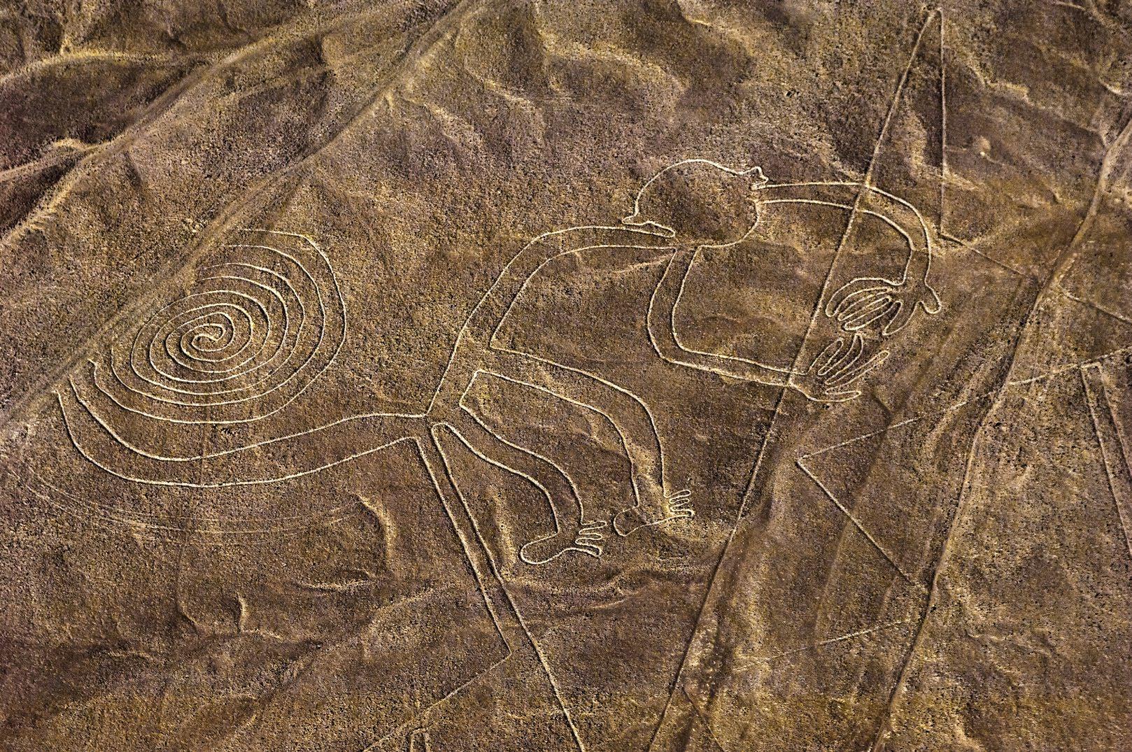
From a viewpoint you can see lines and geoglyphs traced on the slopes of a hill,
Detour to the town of San Francisco at kilometer 384 of Panamericana Sur
Huayurí is called a lost city because of its location, hidden among hills. This archaeological complex built during the Late Intermediate (1200-1400 AD) is
From the natural viewpoints of the towns of Sacramento and Pichango, and the Llipata tower, you can appreciate the immense geometric drawings of Llipata
The tomb in La Muña has an area of 33 × 39 ft (10 × 12 m) and is between 16 and 26 ft (5 and 8 m) deep. La Muña Archaeological Monument is a complex located 2.5 miles (4 km) from Palpa Plaza de Armas. These large tombs belonged to the elite of the Nasca society, whose greatest development was reached in the
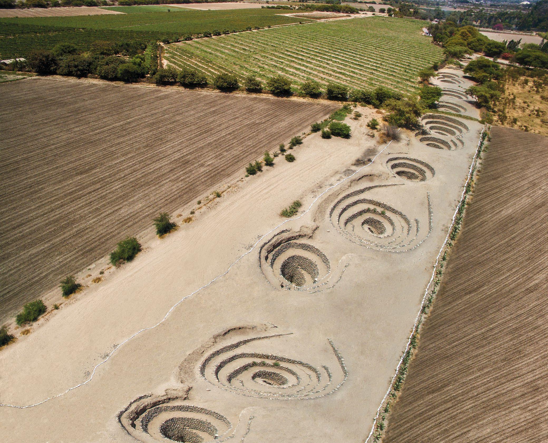
Cantalloc aqueduct © Favio Ovalle / PROMPERÚ
This hydraulic engineering work is located 5 km from the city of Nasca and continues to operate to this day.
Necrópolis de Chauchilla
17 miles (27 km) south of the city of Nasca (30 min by car) Mon-Sun, 7:00-18:00. Entrance fee charged.
In the Chauchilla Necropolis there are 13 pre-Inca tombs, where you can see mummies with textiles and ceramics from their time, in their original burial place.
Reserva Nacional de San Fernando
43 miles (70 km) southwest of Nasca (1 h by pickup or sand buggy). Before visits, please contact the National Service of Natural Areas Protected by the State (SERNANP) at tel. (51-56) 522-770 / (51) 968-218-448.
The San Fernando National Reserve covers 154,716.37 hectares and is home to a wide variety of marine species (sea lions, otters, penguins, and cetaceans), as well as species of fauna from the mountains (guanacos and condors). To the north, the mouths of Ica and Río Grande rivers form forests that give color to the desert. There are seasonal wetlands near Punta Caballas. Any excursion to this area must use vehicles with good traction and tourist guiding.
Fees charged: Non-Peruvian visitors, S/ 30; Peruvian adults, S/ 15; Peruvian minors, S/ 8; local adults, S/ 8; local children, S/ 3.
Cahuachi Ceremonial and Administrative Center © Marco Garro / PROMPERÚ
Urban area
Casona del marqués de Torre Hermosa
Iglesia de San Francisco de Asís
Museo Regional Adolfo Bermúdez Jenkins
Municipal library
Medical center
Police
Town hall
Post office
Av. Juan José Loyola
Cl.
Pje. Los ÁngelesAv.GeneralÁlvarezdeArenales
Pje. Sabroso
Cl. Zarumilla Pje. Hernández
Av. Fernando León de Vivero Pje. Los Ciruelos Pje. Sérvulo Gutiérrez
Cl. San Luis
Cl. San Vicente
Cl. San Vicente de Paúl
Cl. Los Almendros
Cl. Los Pacaes
Prlg.Ayabaca
Jr. Cusco Pje. Unión
Cl.PacasmayoPje.Díaz
Cl. La Viña
Cl.JosédelaTorreUgarte
Cl. Sebastián Barranca
Av. José Matías Manzanilla
Colegio San Luis Gonzaga
Cl. Luis Medina (C)
Cl. General Juan José Salas
Cl. Pedro Ortiz Talla
Cl. 3
Cl. Los Olivos
Cl. Las Palmeras
Pje. Los Robles Av. Túpac Amaru
Parque Victor Raúl
Cl. Las Fresas
Cl. P Av. Ayabaca
Instituto Superior de Bellas Artes
Sérvulo Gutiérrez
Cl. Chota
Cl. Palazuela
Prlg. Tacna
Pr. Callao
Jr. Socorro
Cl. Callao
Cl. Apurímac
Cl. Tacna
Cl. Puno
Cl. Castrovirreyna
Cl. Lambayeque
Cl. Loreto
Cl. Salaverry
Av. Municipalidad
Cl. Libertad
Av. Alfredo Pimentel
Cl. Pachacútec Av. San Carlos
Mercado Modelo
Cl. Moquegua
Cl. Amazonas
Banco de la Nación
DIRCETUR
Parque del Amor Plaza de Armas
Cl.Cajamarca
Universidad Nacional San Luis Gonzaga de Ica
Cl. Francisco Quijandría
Colegio San José
Av. Juan
José Elías
C.C. Plaza Vea Ica
Dirección Regional de Cultura
Cl. Los Jazmines
Cl. Chiclayo
Cl. Los Cerezos Av. San Martín
Cl. Los Cardos
Cl. Grau
Malecón
Cl. Las Américas
Cl. Vista Alegre
C.C. El Quinde
Cl. Turmari
Cl. Cascabel
Av. Los Maestros
Prlg. Cutervo
Caramelo
Cl. 3
Cl. 5
Complejo deportivo
Campo ferial
Compañía de Bomberos
Cl.Camaná
Cl. Independencia
Av. Grau
Cl. 2 Mayo
Cl. Cajamarca
Cl. Perú
La Victoria Cl. San Luis Gonzaga
Pje.LosIncas
Cl. Jonathan
Cl. Hernando de Lavalle
Cl. El Rosedal
Prlg. Grau
Puente Grau
Cl. El Paraíso Cl.RegionalPje.ElOlimpo
Cl. Urubamba
Plazuela Sebastián Barranca
Cl. Lima
Cl. Paita Cl. Víctor Maúrtua
Cl. Huancavelica
Cl. Pisco
Plazuela San Francisco
Cl. Andahuaylas Cl. Caylloma
Cl. Grau
Cl. Áncash
Mercado La Palma
Cl.LasAcacias
Cl. Los Alhelíes
C.C. Plaza del Sol
Cl. Las Brunias
Cl. Piura
Av. Cutervo
C.C. Metro
Cl. Mariscal José de la Mar
Cl. Junín
Cl. Las Cadias Av. Conde de Nieva
Cl. Granda
Cl. Los Azahares
Cl.LasOrquídeas
Cl. Las Begonias
Cl. Las Lilas
Cl. Las Hortencias
Cl.LasMagnolias
Cl. El Edén Cl. Mollendo
Cl. Pisco
Cl. Central Cl. Los Amautas
Av.
Cl. 7
Cl. Orongo
Cl. Alfonso Ugarte
Cl. Los Álamos Cl.Los Eucaliptos
Cl.Acomayo Av. Acomayo
Cl. La Primera
Cl. Olaechea Prlg.Cutervo
INDECOPI
Cl. Juan Pablo Fernandini
Cl. Huacachina
Cl. La Huelga
Cl. Las Gardenias
Av. Luis Gerónimo de Cabrera
Cl. Raúl Boza
Jr. Manuel Medina Paredes
Cl. Catalina Buendía de Pecho
Av.Perú
Puente Cutervo
Cl. Rosa Zárate
Río Ica
Cl. Los Rosales
NASCA Ica
City Center (01) 616-7300, Ext. 1885
María Reiche Newman Aerodrome Panamericana Sur, kilometer 452, Vista Alegre Mon-Sun, 8:00-17:00 iperunasca@promperu.gob.pe
iperu@promperu.gob.pe
The information contained in this brochure has been updated in September 2023. To prepare it, PROMPERÚ has used official information sources, as well as the Regional Directorate of Foreign Trade, Tourism and Crafts of Ica. The opening hours and telephone numbers are subject to vary at each tourist attraction. Please, confirm hours and telephone numbers with IPERÚ.
Published by PROMPERÚ - Peru for Exports and Tourism Promotion Agency
Calle Uno Oeste 50, 14th Floor, Urb. Córpac, San Isidro, Lima, Perú Tel. +511 616-7300 www.promperu.gob.pe © PROMPERÚ. All rights reserved
Legal Deposit at the Biblioteca Nacional del Perú
Printed by WORK UP E. I. R. L. (Calle Albert Einstein 165, Ate, Lima) Lima, October 2023

