Áncash
Guide for Travelers


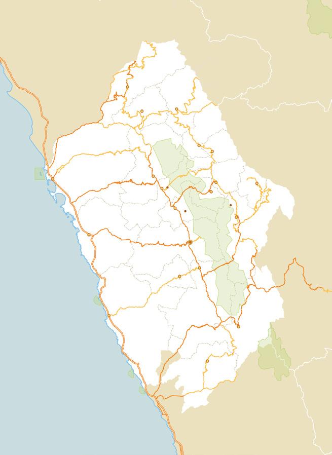
Áncash represents beaches and snow-capped peaks. In Casma, Huarmey, and Santa, travelers will enjoy the warm sea and great scenic beauty.


to Trujillo to Chiclayo to Piura to Tumbes


Áncash represents beaches and snow-capped peaks. In Casma, Huarmey, and Santa, travelers will enjoy the warm sea and great scenic beauty.


to Trujillo to Chiclayo to Piura to Tumbes
Altitude

Sitio arqueológico Pashash
Reserva Nacional Isla Santa
Playa Vesique
13 ft (4 m) (Chimbote) Min.:
Max.:
12,828
Weather
Temperature
Max.:
Vivero forestal de Chimbote
SANTA
PALLASCA
CORONGO
Corongo Sihuas Cabana
HUAYLAS
SIHUAS
Cañón del Pato
Catarata de Hornillos
Nevado Alpamayo
Laguna de Parón
Caraz
POMABAMBA
MARISCAL LUZURIAGA
Pomabamba Piscobamba
Laguna 69
Lagunas de Llanganuco
CARLOS FERMÍN FITZCARRALD
San Luis Chimbote
Punkuri
Sitio arqueológico Pañamarca
Playa Los Chimu Playa Tortugas
Yungay
Quebrada Ulta
Carhuaz
Baños termales de Chancos
CASMA
Casma
Playa La Gramita
Sitio arqueológico de Sechín y Museo Regional de Casma Max Uhle
Restos arqueológicos de Honcopampa
Nevado Huascarán
Chacas
ASUNCIÓN
SAN MARTÍN
ANTONIO RAIMONDI
Santuario de Pomallucay
Huari Vicos Acopalca Humacchuco
Zona artesanal de Taricá
Baños termales de Monterrey
Zona arqueológica monumental de Chanquillo
YUNGAY HUARAZ
Laguna Willcacocha
Sitio arqueológico de Las Aldas
HUARAZ
AIJA
Sitio arqueológico de Willcahuain
Laguna LLaca
Laguna de Churup
Recuay
Aija
Gruta de San Patricio
Laguna Purhuay
HUÁNUCO
Llamellín
HUARI
Catarata María Jiray
Laguna Querocoha
Parque Nacional Huascarán
Nevado
Museo Nacional de Chavín
Monumento arqueológico de Chavín
81 °F (27 °C)
Min.: 45 °F (7 °C)
Reserva Nacional Punta Culebras
Playa Tuquillo
Playa Antivito
How to get here?
By Land
From Lima, via Pativilca-Huaraz: 249 miles (400 km) / 8 h
Castillo de Huarmey
Huarmey
HUARMEY
BOLOGNESI CARHUAZ
RECUAY
Hatunmachay
Pastoruri
Chiquián
Laguna Conococha
Ocros
OCROS
Reserva Nacional Punta Colorado
Reserva Nacional Punta La Litera
Graphic scale (miles / km)
Zona Reservada Cordillera Huayhuash
LIMA

Location
Northwest Coast and Highlands of Peru Capital Huaraz (3,091 m)
13 ft (4 m) (Chimbote) Min.: Max.:
12,828 ft (3,910 m) (Shilla)
Weather
Temperature
Max.:
81 °F (27 °C)
Min.: 45 °F (7 °C)
Nov-Mar Jun-Sept Mar-Jun Sept-Nov
How to get here?
By Land
From Lima, via Pativilca-Huaraz: 249 miles (400 km) / 8 h
By car from the city of Huaraz
DESTINATION / DISTANCE
Aija (Aija Province) / 42 miles (68 km)
Llamellín (Antonio Raimondi Province) / 139 miles (223 km)
Chacas (Asunción Province) / 73 miles (118 km)
Chiquián (Bolognesi Province) / 69 miles (111 km)
Carhuaz (Carhuaz Province) / 22 miles (35 km)
San Luis (Carlos Fermín Fitzcarrald Province) / 139 miles (223 km)
Casma (Casma Province), via Pariacoto / 99 miles (160 km)
Corongo (Corongo Province) / 112 miles (180 km)
Huari (Huari Province) / 93 miles (150 km)
Huarmey (Huarmey Province), via Pariacoto / 142 miles (228 km)
Caraz (Huaylas Province) / 43 miles (69 km)
Piscobamba (Mariscal Luzuriaga Province), via Quebrada Ulta / 113 miles (182 km)
Ocros (Ocros Province) / 80 miles (128 km)
Cabana (Pallasca Province) / 145 miles (234 km)
Pomabamba (Pomabamba Province), via Quebrada Ulta / 129 miles (207 km)
Recuay (Recuay Province) / 16 miles (25 km)
Chimbote (Santa Province), via Casma / 130 miles (210 km)
Sihuas (Sihuas Province) / 142 miles (228 km)
Yungay (Yungay Province) / 36 miles (58 km)

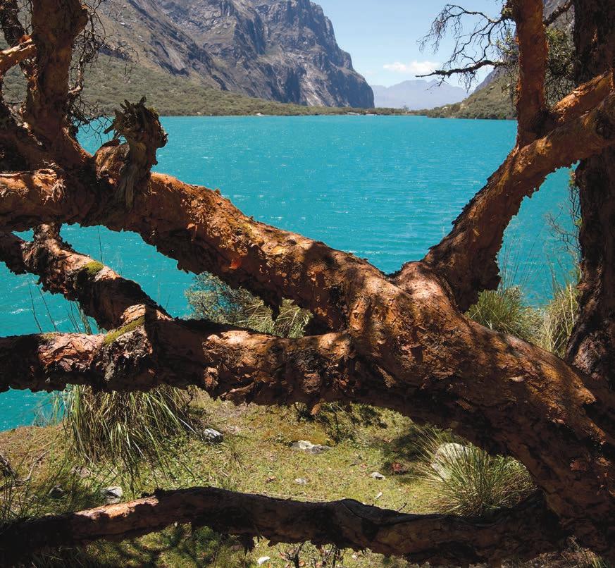
Queñuales in the Llanganuco lagoon © Dickens Rondán / PROMPERÚ
Tours
½ day
1 day
2 days
3 days or more
3 days (minimum recommended stay)
Huaraz City, Monterrey and Chancos (Carhuaz) thermal springs, Willkawaín archaeologic monument, and Willcacocha lagoon
Llanganuco, 69, Parón, and Churup lagoons, Pastoruri snow-capped mountain, Chavín archaeologic monument, Honcopampa archaeologic center, Cañón del Pato, Chacas town, Chiquián town, Sechín archaeologic monument, Tortugas beach, and Tuquillo beach
Community tourism in Humacchuco, Vicos, Acopalca; rock climbing in the Hatunmachay stone forest
Hikes in Parque Nacional Huascarán, Huayhuash mountain range and community tourism at Recuay (llamatrek)
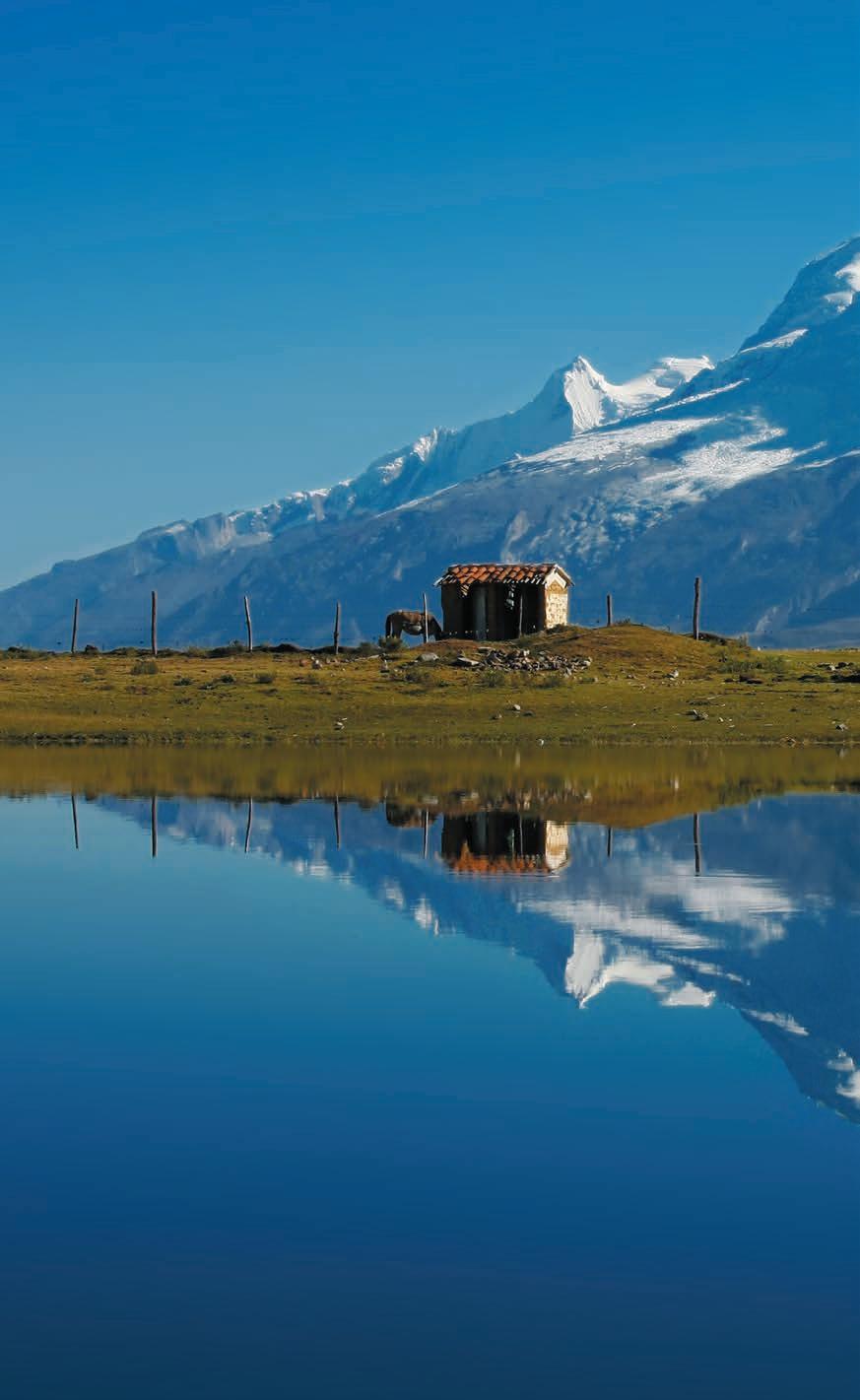
95% of the cordillera Blanca (“White mountain range”) protected by the State and declared
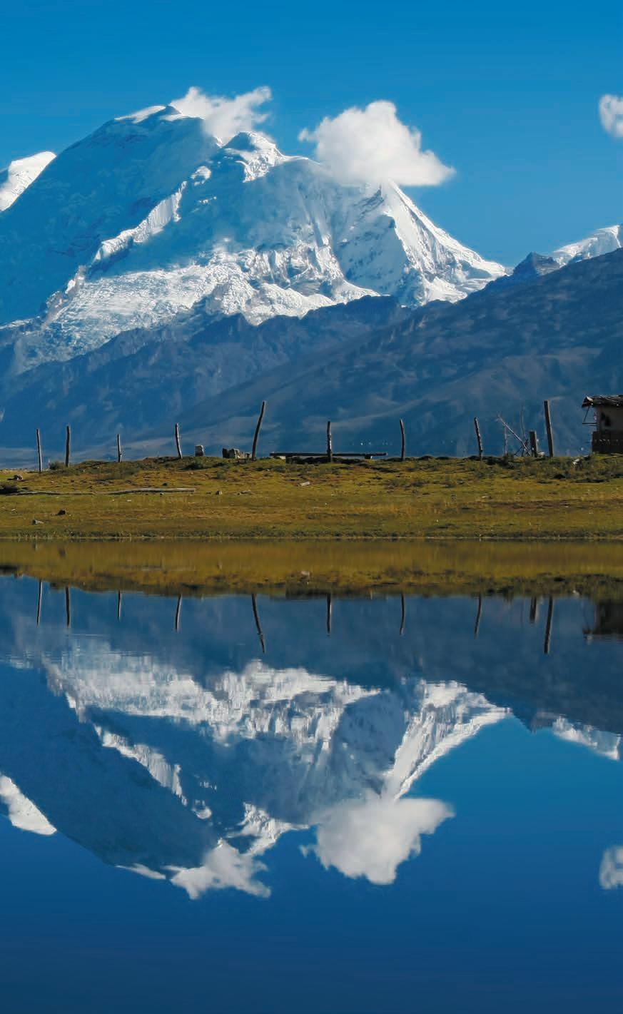
is in the Huascarán National Park, a natural area World Heritage Site by UNESCO in 1985.
Museo Arqueológico de Áncash
Av. Luzuriaga 762. Tue-Sat, 9:00-17:00. Entrance fee charged.
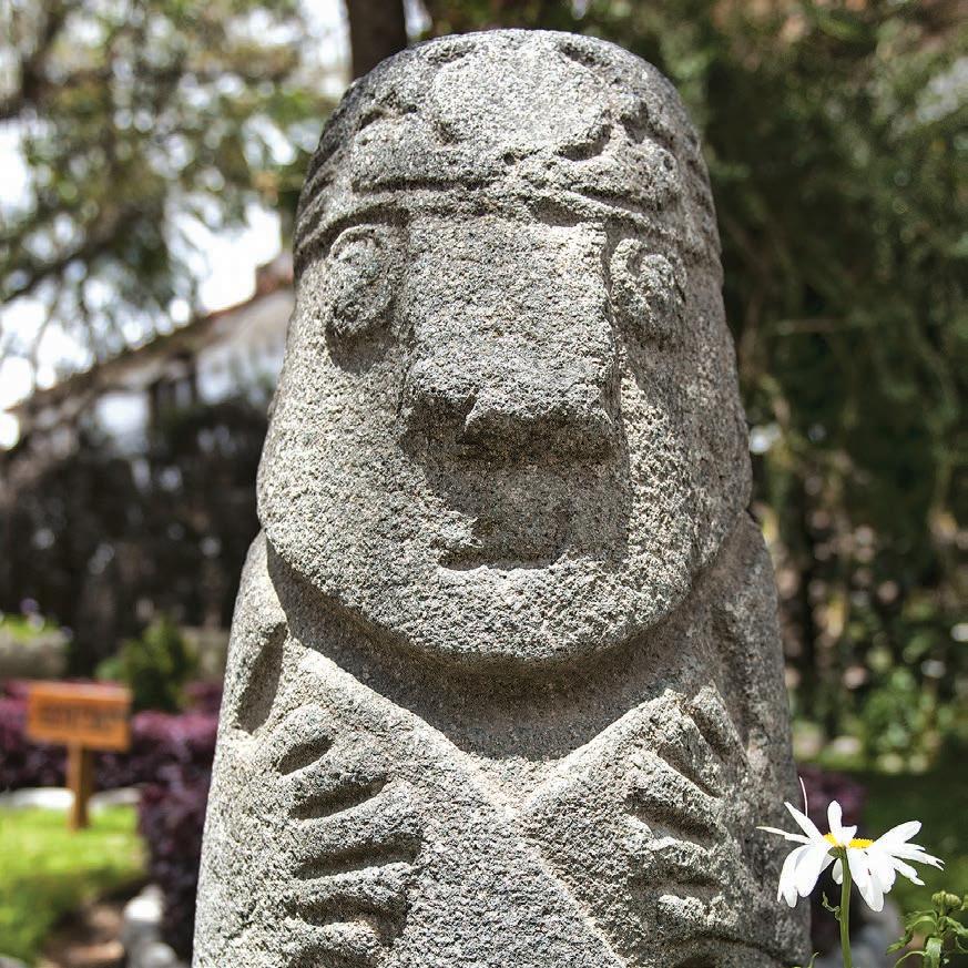
The collection of the Ancash archaeological museum consists of ceramic and textile pieces from the pre-Inca cultures of Chavín, Huarás white over red, Moche, Wari and Chimú, as well as stone sculptures dating back to the Recuay culture.
Santuario del Señor de la Soledad
Soledad Square. Mon-Sun, 8:00-13:00, and 15:00-18:00.
Tel. (043) 425-122
The Sanctuary of Señor de la Soledad was built after the 1970 earthquake. It preserves a 16th-century image of the Lord of Solitude, patron saint of Huaraz.
Calle José Olaya
1,640 ft (500 m) from Plaza de Armas
José Olaya street is a fantastic way of learning about the original distribution and architecture of the city, as it is one of the few areas that was not destroyed by the 1970 earthquake. On Sundays, starting at noon, a gastronomic festival is held.
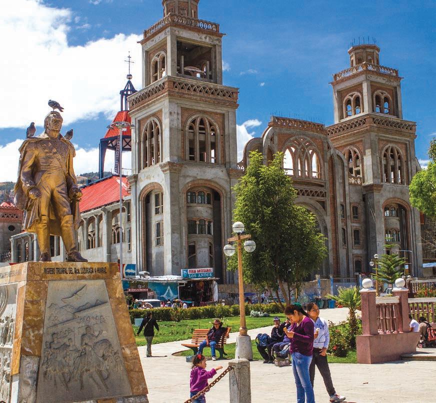
Willkawaín and Ichic Willkawaín archaeological monument © Flor Ruiz / PROMPERÚ

Piscigranja
Av. Confraternidad Internacional Este s/n.
Mon-Sun and holidays, 8:00-17:30. Entrance fee charged. Rainbow trout are grown in hatcheries and ponds of this fish farm. It is one of the most important fishing stations in the region.
Monumento arqueológico de Willkawaín e Ichic Willkawaín
4 miles (7 km) northeast of the city of Huaraz (35 min drive / 3 h walk).
Tue-Sun, 9:00-16:00. Entrance fee charged.
The Wari (700-1100) built the religious centers of Willkawaín and Ichic Willkawaín, where they made offerings to mummies or mallquis
Baños termales de Monterrey
4 miles (7 km) north of the city of Huaraz (15 min by car).
Mon-Sun, 7:00-16:00. Entrance fee charged.
The Monterrey thermal springs is a leisure center with private pools and thermo-medicinal water pools.
Zona artesanal de Taricá
11 miles (17 km) from the city of Huaraz (20 min by car)
District known for the skill their craftsmen have for pouring their traditions in their clay work. Artisans open the doors of their workshops to the public interested in learning about their work process and in purchasing their products.
Parque Nacional Huascarán
The 340,000 hectares of the Huascaran National Park cover ten provinces and much of the White mountain range. Its objective is to conserve flora (such as the Raimondi puya, the plant that gives the largest flower in the world) and fauna (such as the spectacled bear, the taruca, and the Andean condor, all endangered species), as well as to care for archaeological monuments found in the area. Throughout its territory there are 663 glaciers, among which the Huascarán (22,205ft / 6,768 m), the Huandoy (20,981 ft / 6,395 m), and the Alpamayo (19,511 ft / 5,947 m) stand out. Its runoffs feed 434 lagoons, such as Parón and Llanganuco.
Laguna Churup
11 miles (18 km) east of the city of Huaraz to the town of Pitec (40 min) and 3 km walk (3 h). Entrance fee charged. The walk to get to the Churup Lagoon is the perfect reason to discover species of fauna in the area, such as vizcachas and wildcats. Once in the lagoon, surrounded by queñuales, quisuares and ichu, it is possible to see wild ducks.
Laguna Llaca
17 miles (28 km) from the city of Huaraz (2 h by car). Entrance fee charged.
Underground currents and snowmelt in the White mountain range form this lagoon of turquoise-green waters. The landscape is defined by tayas, ancosh and queñuales, among other types of high Andean flora.
Laguna Willcacocha
9 miles (14 km) from the city of Huaraz (1 h by car)
The Willcacocha lagoon can be reached by a 3 km (2 h) walk from the Santa Cruz bridge. The prize for effort is a wonderful view of the Cordillera Blanca and its peaks (Huandoy, Huascarán, Chopicalqui, Hualcán, Copa, Vallunaraju, Ocshapalca, Ranrapalca, Palcaraju, Churup, Chinchey, San Juan, Huamashraju, Huatzan, and Cashan).
Trekking en el Callejón de Huaylas
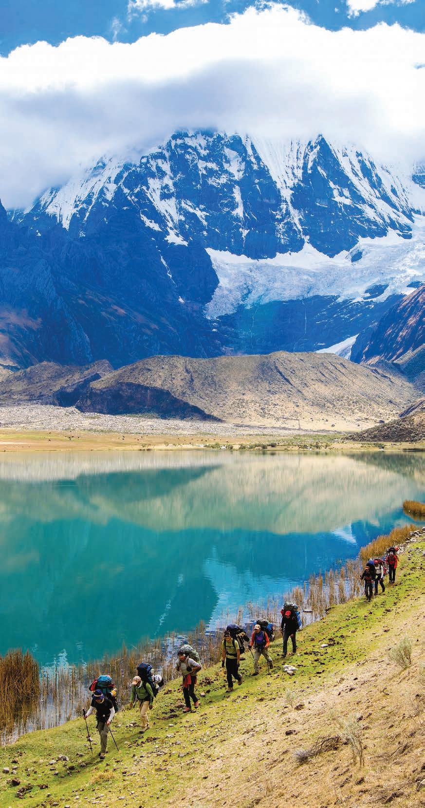
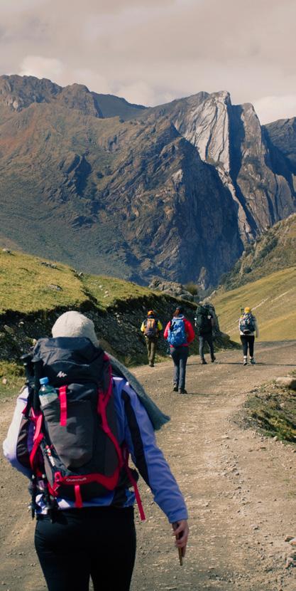
The trekking circuits are available to all types of tourists, from the conventional circuit to those fitting people looking for advanced levels of difficulty. All routes must be followed with authorized guides. The best season is betwen April and September.
• Olleros-Chavín: 23 miles (37 km) (3 days). Difficulty: low/moderate
• Quillcayhuanca-Cójup: 20 miles (32 km) (3 days). Difficulty: low/moderate
• Llanganuco-Santa Cruz: 29 miles (47 km) (4 days). Difficulty: moderate
• Los Cedros-Alpamayo: 57 miles (92 km) (8-9 days). Difficulty: high

Carhuaz
22 miles (35 km) north of the city of Huaraz (40 min by car)
Provincial capital that preserves its traditional architecture and customs. The San Pedro Temple is the main one and sits opposite the main square.
Restos arqueológicos de Honcopampa
22 miles (35 km) from the city of Huaraz. Entrance fee charged. The Honcopampa Archaeological Remains form an architectural complex of three chullpas or stone buildings with multiple chambers. It has two sectors: residential, with urban layout and quadrangular enclosures; and neighborhood, with very high circular walls.
Carhuaz-Chacas Route. Entrance fee charged. Walks along the ravine offer an incomparable visual display. The Auquiscocha lagoon is one of the most beautiful in this ravine; it is located at an elevation of 14,108 ft (4,300 m) and is accessed after a 6-hour walk (round trip). The Señor de Catay and the Ulta viewpoints offer privileged views of the surrounding area. The Punta Olímpica tunnel is located here, which, at an altitude of 15,517 ft (4,730 m), is the highest trans-Andean tunnel in the world.
Vicos
32 km from the city of Huaraz (50 min by car)
Community tourism services are provided in the area. Visitors can participate in domestic activities and hike to Huascarán National Park lagoons such as Lejiacocha and Rocotuyoc. They can also visit the thermal springs of Chancos, known for the therapeutic properties of its waters. In addition to its water pools, it has pools and caves that serve as saunas.
Campo Santo de Yungay
Approx. 35 miles (56 km) from Huaraz (1 h by car)
This graveyard is the location of the former city of Yungay, which was buried by an avalanche in 1970. Some villagers managed to save themselves in the general cemetery, located on a hill on top of which an eleven-meter-high statue of Christ the Redeemer was built. From there you can see the four palm trees that survived the avalanche and adorned the Main Square of the old city, a replica of the facade of the church of Yungay and the spectacular landscape crowned by the Huascarán mountain.
Humacchuco
47 miles (75 km) from the city of Huaraz (2 h by car)
Its inhabitants offer visitors accommodation and food services. From this community you can also go on various hikes to the main attractions of the Huascarán National Park: Laguna 69, and the Chinancocha and Orconcocha lagoons, in the Llanganuco gorge.
Lagunas de Llanganuco
16 miles (25 km) east of Yungay (45 min by car). Entrance fee charged. In the Huascarán National Park, the thaws of the snow-capped Huascarán, Huandoy, Pisco, Yanapaccha and Chopicalqui feed the formation of Llanganuco lagoons. Chinancocha (“female lagoon”) with turquoise green waters is located at the foot of Huascarán and is surrounded by queñual forests. Orconcocha (“male lagoon”), on the other hand, has sky-blue waters.
Laguna 69
60 miles (96 km) northeast of the city of Huaraz to Cebollapampa (2 h 30 min by car), 3 h walk to the lagoon. Entrance fee charged. In the Huascarán National Park lagoon count, this one is number 69. Of light-blue waters, it is located at 15,105 ft (4,604 m). From its banks you can see the Chacraraju, Pisco and Yanapaqcha mountains up close.
Nevado Huandoy
54 miles (87 km) northeast of Huaraz to Cebollapampa (2 h 30 min by car), then 4-5 days hike. Entrance fee charged. It reaches an altitude of 20,980 ft (6,395 m) at its highest point and is the third highest snow-capped mountain in the region. This mountain is considered to be difficult to access.
Nevado Huascarán
13 miles (21 km) southeast of Yungay to the town of Musho (1 h drive), 4 h hike to base camp and 2 h hike to Raimondi Glacier Raimondi Glacier is the base camp from where you start to climb Huascarán. The summit of the highest snow-capped mountain in Peru reaches an altitude of 22,205 ft (6,768 m), and reaching it represents a challenge for lovers of mountaineering. This expedition can take between 6 and 7 days.

Caraz
43 miles (69 km) north of the city of Huaraz (1 h 30 min by car)
This traditional town in the Peruvian highlands is located on the banks of the Santa River, in Callejón de Huaylas, at an elevation of 7,402 ft (2,256 m). Its temple is the only monumental construction made of lime and stone in the Callejón de Huaylas. Just 0.6 miles (1km) from the square is the Tumshucaico Archaeological Site, a stone construction linked with the Chavín civilization.
Museo Municipal Hernán Osorio Herrera de Caraz
0.3 miles (500 m) from the Caraz Square. Mon-Fri, 9:00-13:00, and 14:30-17:00.
The Hernán Osorio Herrera de Caraz municipal museum is housed on the second floor of a mansion built in 1870 and exhibits more than 700 archaeological pieces. Since 2001, the house has been considered a National Cultural Heritage Site.
Granja Interactiva Municipal
1.2 miles (2 km) south of Caraz (5 min by car). Mon-Sun, 10:00-17:00. Entrance fee charged.
The Interactive Municipal Farm is home to ostriches, quails, peacocks, geese, goats, pigs, and vicuñas, among other animals. It is possible to purchase ostrich and free-range hen eggs, dairy products made from goat’s milk, as well as blueberries and aguaymantos (golden berries).
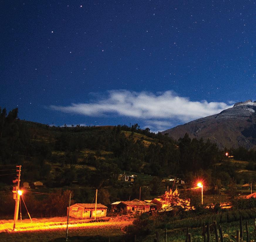
Cañón del Pato
16 miles (25 km) north of Caraz (30 min drive)
The Santa River crosses the Callejón de Huaylas and forms this canyon, almost 3,281 ft (1,000 m) deep. It is the point where the Black and White mountain ranges are closest.
Laguna de Parón
20 miles (32 km) east of Caraz (1 h 30 min by car).
Entrance fee charged.
One of the biggest attractions of the Paron lagoon is its view of the snow-capped Artesonraju mountain (19,767 ft / 6,025 m high), the Garcilaso pyramid (19,308 ft / 5,885 m high), and Chacraraju (20,052ft / 6,112 m high).
Nevado Alpamayo
Route 1: 65 miles (105 km), Huaraz-Caraz-Hualcayán (4 h by car).
Route 2: 99 miles (160 km), Huaraz-Caraz-Cashapampa (3 h by car).
Then walk for 6 to 8 days (round trip). Entrance fee charged.
In the White mountain range, this ice-covered mountain draws attention for its symmetry, which gives it the appearance of a pyramid. At 19,511 ft (5,947 m), it is a very attractive destination for lovers of adventure sports.
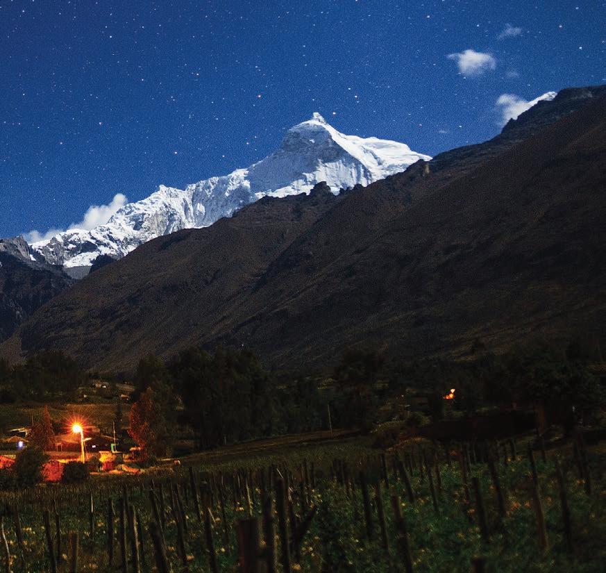

Recuay
16 miles (25 km) south of the city of Huaraz (30 min by car)
A quiet Andean village, starting point to visit the archaeological centers of Pueblo Viejo, Pumacahuara, Jirash, the tombs of Yacucancha and the Grotto of San Patricio, which is a natural formation populated by stalactites and stalagmites.
Laguna Antacocha
6 miles (10 km) from Recuay main square (25 min by car or 2 h 30 min on foot)
Located at 12,881 ft (3926 m) it is a natural water reservoir that originates from underground seeps. The color of its waters that together with the reddish color of the soil, becomes green, blue and orange. To the west of the lagoon is located a rocky wall optimal for rock climbing and rappelling. From the lagoon you have a panoramic view of the Cordillera Blanca, mainly of the snow-capped mountains of Shacsha, Rúrec and Huatsan.
Nevado Pastoruri
43 miles (70 km) south of Huaraz city (2 h 30 min by car)
Entrance fee charged. Although it is only possible to reach the base, this emblematic mountain attracts visitors keen to touch the snow and photograph themselves at its foot. The Patococha lagoon and the Pumapashimi spring can be visited along the way. Cave paintings, gasified waters, and Raimondi puya can also be seen.
Hatunmachay
Detour on the Huaraz-Lima Road 81 miles (131 km), then 3,7 miles (6 km) (40 min by car). Entrance fee charged. It has something to offer everyone. Adventurous lovers of rock climbing are attracted by its stone walls up to 40 m high. History enthusiasts, meanwhile, visit the caves for their cave paintings.
Laguna Querococha
30 miles (48 km) from the city of Huaraz (1 h 30 min by car)
At 13,058 ft (3980 m), this lagoon is surrounded by totorals and hills where the rivers that feed it flow. On the slope of one of them, as a result of erosion, there is a silhouette that resembles the map of Peru.
Pueblo de Chacas
73 miles (118 km) northeast of the city of Huaraz (3 h by car)
Located in a valley in the Conchucos area, this town is renowned for the fervor of its people and the skill of its artisans. To watch how stained glass, paintings, altarpieces, and wooden sculptures are created, you can arrange a visit to the Taller y Cooperativa Don Bosco, a workshop where young people from the area learn to preserve their traditions through art.
Santuario de Mama Ashu
Plaza de Armas of Chacas
The Mama Ashu Sanctuary is a temple built in 1587, with two bell towers on the façade, a finely carved gate, and a stained glass window. Inside, wood predominates, which can be seen on the carved armchairs and the sculptures of angels. Its Baroque-style altarpiece with the image of the Virgin is particularly remarkable.
Museo de Chacas
Plaza de Armas of Chacas. Wed-Sun, 8:00-12:00 and 14:00-18:00. The Chacas Museum exhibits a collection of sculptures and objects of carved stone, ceramics and pieces of metallurgy recovered and found in the area.
Santuario del Señor de la Justicia de Pomallucay
20 miles (32 km) from Chacas (1 h 5 min by car)
The Sanctuary of the Señor de la Justicia de Pomallucay is a beautiful basilica built by the volunteers of Operation Mato Grosso and the artisans of Don Bosco to venerate the Cristo de la Mirada Triste, patron saint of the area. It features beautiful stucco and carved wood decorations.
Monumento arqueológico de Chavín
Jr. 17 de Enero sur s/n, 109 km south of the city of Huaraz (2 h 30 min by car).
Tue-Sun, 9:00-16:00. Tel. (043) 454-232. Entrance fee charged.
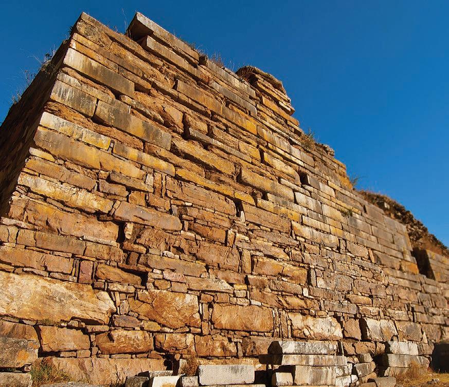
Declared World Cultural Heritage Site by UNESCO in 1985, this ceremonial center was built between 1500 and 500 BC by the Chavín culture. In 1919 the archaeologist Julio C. Tello discovered what is now called the Chavin Archaeological Monument, composed of large stone buildings adorned with stone heads and connected by galleries, as well as important squares, such as the main square and the circular square. One of the most outstanding discoveries is the monolithic lanzón, a 14.86 ft (4.53 m) high sculpture carved with feline and reptile motifs.
Adventurers can depart from Olleros on a guided walk that lasts 3 days and allows them to spend time with members of the communities that are located on the way to the archaeological center.
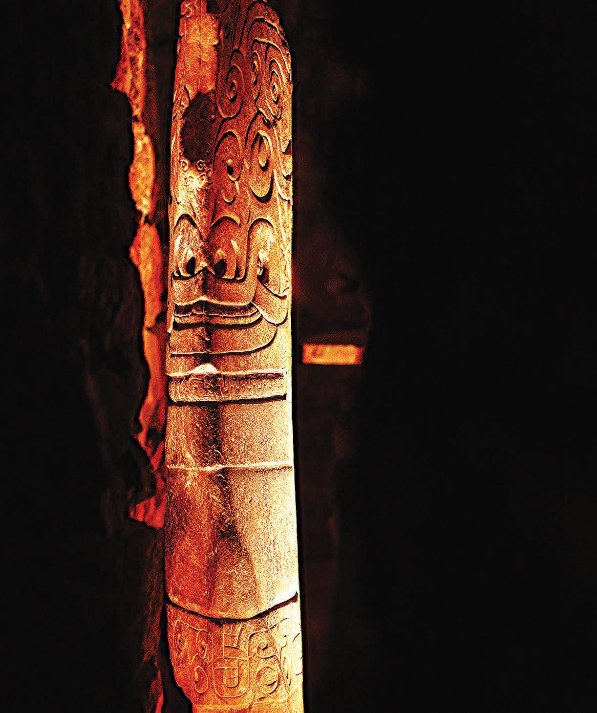
Museo Nacional de Chavín
Jr. 17 de Enero norte s/n. Tue-Sun, 9:00-16:00. Entrance fee charged. Tel. (043) 454-011
The Chavin National Museum exhibits ceramic pieces, stone objects, and stone heads from the Chavín culture. Among the finds obtained from the ceremonial center is a collection of pututos that were used in the rituals held in the circular square.
Acopalca
4 miles (6 km) from Huari (10 min by car)
This is an ideal place to take walks to the extensive Purhuay lagoon and the majestic Maria Jiray waterfall, where you will share with the inhabitants their traditions and customs. Its delicious cuisine, along with the friendliness and warmth of its people, will make this an unforgettable visit.
Catarata María Jiray
4 miles (6 km) from Huari to Acopalca (10 min drive), then 20 min walk
The walk to the artificial Maria Jiray Waterfall, which feeds the hydroelectric power station of the same name, allows you to enjoy beautiful landscapes and the flora of the place, among which the alder, wild shrubs and orchids stand out.
Laguna Purhuay
5 miles (8 km) from Huari (30 min by car)
Purhuay is the closest lagoon to the city of Huari and is surrounded by shrubs, blackberries, queñuales and orchids. Its waters are home to trout. A short hike leads to Llamacorral, where there is an archaeological center.
Chiquián
69 miles (111 km) from the city of Huaraz (2 h)
A quiet traditional village located on the right bank of the Aynín River. It is considered the gateway to the Huayhuash mountain range, as well as being the starting point for discovering various attractions of the province, such as the Conococha lagoon, the snow-capped Tucu Chira, the sanctuary of Señor del Camino, the Usgor waterfall, the archaeological centers of Capillapunta and Puscanhuaru, the colonial churches of Huasta and Aquia, and Pachapaqui and its Puya raimondii.
Cordillera Huayhuash
From Huaraz, passing through Chiquián, towards Llámac, 97 miles (156 km) (3 h 45 min by car), then a hike on foot
The Huayhuash is an Andean mountain range with approximately 30km in length. It is very popular among mountaineering enthusiasts, as six of its multiple peaks exceed an altitude of 19,685 ft (6,000 m). Such is the case of the snow-capped Yerupajá (21,765 ft / 6,634 m), the second highest in the country. The Huayhuash mountain range is located in an area of confluence of the departments of Ancash (Bolognesi Province), Huánuco (Lauricocha Province), and Lima (Cajatambo Province).
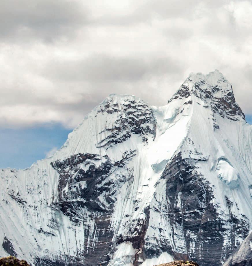
The circuit is considered one of the best in the world. It has an extension of 112 miles (180 km) that surrounds the mountain range, which is covered in an approximate time of 10 to 12 days. During the tour it is possible to see huge ice towers, dozens of rivers, turquoise lagoons, a great diversity of flora and fauna. The human presence, rich in customs and cultures, is another attraction of this famous circuit.
Recommended season: May to September. Rainfall normally starts in October and lasts until March.
• Hike around the mountain range (Llámac-Pocpa-Queropalca Quishuarcancha-Túpac Amaru-Uramaza-Huayllapa-Pacllón): 112 miles (180 km) (10-12 days). Difficulty: moderate/high
• Llámac-Jahuacocha: 17 miles (28 km) (2-3 days). Difficulty: moderate/high

Sitio arqueológico de Sechín and Museo Regional de Casma
Max Uhle
3 miles (5 km) southeast of Casma (10 min by car).
Tue-Sun, 9:00-16:00. Entrance fee charged.
The Sechín culture (1800-800 BC) built this ceremonial center, now called the Sechín Archaeological Site, out of adobe and stone walls, in many cases with wall paintings. At the entrance there is a striking wall covered with carved stones. The Max Uhle Casma Regional Museum, also located here, presents the different pre-Hispanic cultures that occupied the region and exhibits archaeological objects found in the Casma Valley, mainly ceramics.
Playa Tortugas
At kilometer 395 of Panamericana Norte highway, 12 miles (20 km) northwest of Casma (30 min by car)
A stone beach limited, on the north, by Cerro Grande and, on the south, by Cerro Tortuga. Its calm waters are ideal for water sports and fishing.
Zona arqueológica monumental Las Aldas
9 miles (15 km) southwest of Casma (30 min drive)
Nestled on the top of a hill, the Las Aldas Archaeological Zone is a platform surrounded by pyramids built around 1600 BC. Due to their location, it is presumed that they were used to perform religious ceremonies.
Zona arqueológica monumental de Chankillo
10 miles (16 km) southeast of Casma (30 min drive)
The Chankillo Monumental Archaeological Zone was declared World Cultural Heritage Site by UNESCO in 2021. Thirteen 2,300-yearold towers shape America’s oldest solar observatory. An oval stone building stands on a hill.

Playa La Gramita
At kilometer 347 of Panamericana Norte highway, 16 miles (26 km) southwest of Casma
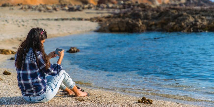
Its waters are ideal for water sports, as well as for fishing, whether from the shore or a boat. Its wide sandy beach invites visitors to camp.
• Punta Bermejo
At kilometer 226 of Panamericana Norte highway
It is exceptional for surfing, due to its point break waves.
• Tuquillo, Maracana, Antivito and La Pocita beaches
The entrance is located at kilometer 303 of Panamericana Norte highway
Tuquillo is a quiet and serene beach, with an islet about fifty meters from the shore, its waters are turquoise and its sand dark. It is a wonderful place to enjoy boating, as well as hunting and spearfishing. To the south is Maracana; its strong waves are recommended for surfing. Antivito is a straight mini sand beach. To the north of Tuquillo is La Pocita, which is ideal for children.
• Perú
11 miles (18 km) north of Huarmey
A wide and windy beach.
• Tamborero
South of Huarmey, at kilometer 261 of Panamericana Norte highway
A natural jetty serves as a pier on this long beach with calm waters where you can swim and fish.
Sitio arqueológico el Castillo de Huarmey
0.6 miles (1 km) east of Huarmey
The Huarmey Castle archaeological site was a Wari administrative center, made up of rooms build of adobe and mud. Its walls feature ochre, red and white paint.
Vivero Forestal
At kilometer 437 of Panamericana Norte highway
Tue-Sun, 9:30-17:30. Entrance fee charged.
The Forest Plant Nursery offers picturesque countryside scenery. It has a lagoon with rowing boats, a train for children, an Olympic swimming pool, mechanical games, and picnic environments. Its facilities include the San Pedrito Pescador museum and Dino Park, a dinosaur theme park.
Complejo arqueológico Punkuri
26 miles (42 km) (50 min by car) southeast of Chimbote, taking the detour at kilometer 405 of Panamericana Norte highway.
Mon-Sun, 8:00-16:00.
With an architecture similar to that of Sechín, the Punkuri Archaeological Complex is a pyramid of two platforms connected by stairs. It was built 3,500 years ago with adobe, stones, and mud. Its walls had motifs drawn in white, red, yellow, blue, and black, and also relief sculptures. The most important image is the 5.25 ft (1.60 m) high sculpture of a feline deity.
Sitio arqueológico de Pañamarca
21 miles (33 km) (40 min by car) southeast of Chimbote, taking the detour at kilometer 405 of Panamericana Norte highway.
Tue-Sun and holidays: 8:00-16:30. Entrance fee charged.
The Pañamarca Archaeological Site was a religious-administrative ceremonial center that secured the southern boundary of the Moche culture. It consists of three stepped pyramids: the most important was built with five overlapping platforms and is the base of the main temple. The second pyramid, opposite the previous one and separated by a courtyard, is of lower height. The third pyramid, north of the previous ones, still remains buried.
Catarata de Hornillos
60 miles (97 km) southeast of Chimbote (2 h and 15 min by car). Entrance fee charged.
The Hornitos waterfall has an approximate height of 39 ft (12 m) and 15.75 ft (4.80 m) wide; its waterfall is best seen in summer. Due to the way it is shaped, it is possible to practice rock climbing and rappelling. This waterfall is surrounded by abundant vegetation, including cacti of varied sizes, and wild birds.
Playa El Dorado
6 miles (10 km) southwest of Chimbote
It is one of the most beautiful beaches in Chimbote due to the tranquility of its waters, and an ideal place for diving or boating. 15 minutes by rowing boat is Caleta Colorada beach.


Isla Blanca
3 miles (5 km) from the port terminal (2 h by boat)
From this island, you can observe the bay of Chimbote and watch guano birds. You can also enjoy Las Conchuelas beach or go kayaking.
Dunas de Huamanchacate
1.2 miles (2 km) from Coishco
Due to its proximity to Panamericana Norte highway (at kilometer 422), the Huamanchacate dunes have become an accessible place for practicing sandboarding in up to three modalities, slalom (descent between pennants), boarder cross (race) and big air (jumps with air maneuvers).
Museo Arqueológico Zonal de Cabana
Cabana Square. Mon-Fri, 8:30-13:00, and 14:00-18:00.
The Cabana Area Archaeological Museum exhibits ceramic and metal pieces created by the Recuay culture, rescued during the excavations in Pashash. There is also a sample of photos and plans of the archaeological site.
Sitio arqueológico Pashash
0.6 miles (1 km) south of the city of Cabana (5 min by car)
The Pashash Archaeological Site was a religious center built in stone by the Recuay culture. In its four buildings, more than 277 offerings linked to the cult of the dead have been found.
Urban area
Museo Arqueológico de Áncash
Restos arqueológicos de Pumacayán
Santuario del Señor de la Soledad
Piscigranja
IPERÚ Medical center
Police
Town hall
Post office
Av. Confraternidad Internacional Oeste
Jr. Los Capulíes
Jr. Los Alisos Av. Centenario
Jr.Recuay
Jr.Huaylas
Jr. Teresa Gonzales de Fanning Jr. Guzmán Barrón
Jr. Candelaria Villar
Jr.Yungay
Jr.Carhuaz
Jr. Sebastián de Aliste Jr.LosLibertadores
Río Quillcay
Puente Huascarán Puente Bolívar
Cl.4
Jr. Caraz
Estadio Rosas Pampa
Av. Antonio Raimondi Francisco Bolognesi
Cl. 16
San Pedro Av. Confraternidad Internacional
Cl. Celeste Jr. Francisco de Zela Jr.DanielVillaizán
Prlg.Recuay
Jr.Pallasca
Jr.Corongo
Jr.Pomabamba
Jr. Mariano Melgar Jr. AugustoB. Leguía
Jr. Víctor Vélez
Puente Quillcay
Jr. 13 de Diciembre
Ciudad universitaria
Av.Universitaria
Jr.LosLirios
Jr.Aviación
Jr. Las Palmeras Cl. La Amistad
Av.ConfraternidadInternacionalEste
Jr.LasGardenias
Parque Nicrupampa
Jr.LasFlores Jr.ElProgreso
Coliseo de Nicrupampa
Av.GranChavínAv.MancoCápac
Boulevard Pastorita Huaracina
Jr. Huascarán Jr. Hualcán Jr. San Cristóbal Av. Fitzcarrald Jr. Comercio Jr. Cajamarca
Mercado Central de Huaraz
Jr. Andrés A. Cáceres
Parque Simón Bolívar
Jr. Juan de la Cruz Romero
Jr. Juan de la Cruz Romero Jr. José de San Martín Av. Mariscal Toribio Luzuriaga Jr. Lucar y Torre Pje. Atusparia
Parque de la Aventura
Parque Lítico
Oeste
Puente Mariscal Agustín Gamarra
Prlg.Caraz Av.LasAméricas
Parque de los Bomberos
Parque del Periodista
Parque Ginebra
Jr. J. Larrea y Laredo Jr. Simón Bolívar Jr. Julio Farfán Jr. 27 de Noviembre
Plaza de Armas
Centro Cultural de Huaraz
Pje. Daniel Coral Vega
Pje. Octavio Hinostroza
Parque Santa Rosa
Jr. Huáscar
Jr. Juan de la Cruz Romero Jr. Teófilo Castillo
Plazuela Belén
Jr. Federico Sal y Rosas
Jr. Alejandro Tafur
Av. Pedro Pablo Villón Cl. 110
Jr. 21 de Diciembre Jr. 27 de Noviembre
Pje.111CCl.114
Cl. 128
Pje. Santos Chocano
Cl. La Unión
Pje.Cooperación
Jr.LasMargaritas
Jr.LasBegonias
Cl.Huaraz
Pje.Asunción Jr.Primavera
Jr.El Progreso
Av. Mariscal Agustín Gamarra
Pje. Enrique Palacios
Alameda Grau
Jr. José Sucre
Parque FAP
Av. Ramón Mejía
Jr. Buenaventura Mendoza
Cl. 70 Jr. Pumacayan Pje. Italia
Jr.LadislaoMeza
Puente Nueva Esperanza
Jr. Italia
Pje.SantaRosa
Jr.AmadeoFigueroa
Jr.Soledad
Plazuela La Soledad
Cl. 67
Cl. 6
Jr.JoséOlaya
Jr.RamónCastilla
Jr.CarlosValenzuelaGuardiaJr.28deJulioJr.EulogiodelRío
Jr. Diego Ferrer
Av. Confraternidad Internacional Este
Jr. Ricardo Palma Pje.108
Prlg. Mariscal Toribio de Luzuriaga
Cl. 117 Jr. Las Trinitarias
Av.PedroPabloVillón
Jr.FidelOlivasEscudero Jr.A.SorianoInfante
Jr.LasMagnolias
Coliseo Cerrado
Jr. Los Claveles Jr.LosJazmines
Jr. Los Girasoles
Parque Perú
Av. Confraternidad Internacional Sur
Jr. Las Azucenas Av. Pedro Pablo Atusparia
Jr. Las Piedritas
Jr. Lliuya Tacaychin
Pje. Los Laureles
Jr. Inca Paulo Jr. Inés Huaylas Jr. Rafael del Castillo
Jr. Ciro Alegría Jr. Pedro Cochachín
Jr. Esteban Castromonte
Jr. Gabino Uribe
Jr. Adela Loli de Raimondi
Jr. Larrea y Laredo
Jr. Rauca Rocadio
Jr. Cabana Pje. Perú
February Carnival (Callejón de Huaylas)
March-April
June 29
June
July 25
August 13-22
September 24
Easter Week
Festivity of San Pedrito (Chimbote)
Cordillera Blanca Mountain Climbing Festival (Callejón de Huaylas and Conchucos)
Anniversary of Huaraz (Huaraz)
Virgen de la Asunción “Mama Ashu” (Asunción and Huaylas)
Virgen de las Mercedes (Carhuaz)
The cuisine of the region reflects the traditions of the mountains and the coast. Picante de cuy, cuchicanca (marinated and baked piglet, accompanied by mote), tamales, charqui (dried and salted beef), llunca kashki (chicken broth with wheat) and pachamanca are representatives of its Andean gastronomy. Traditional dishes from the Ancash coast include ceviche huarmeyano, pepián de pavo, ceviche de pato, and causa de pescado. Among the handmade food products that can be purchased are spread cheese and white cheese, honey and manjar blanco
The region is known for its showy typical costumes and unique handmade garments. It is traditional that the motifs on wool blankets are representative of their place of origin. In addition to textiles made on looms and organic textiles, stone and leather work are well known. Likewise, Chacas is home to the creation of stainedglass windows and wood carvings, and in Taricá, ceramics are very popular.
Department capital
Province capital
District capital
Tourist attraction
Provincial border
Main road
Paved road
Dirt road
Port
Airport
Main river
Protected Natural Area

Plaza de Armas (043) 428-812
Pje. Alonso Martel (Atusparia), of. 1 iperuhuaraz@promperu.gob.pe

iperu@promperu.gob.pe
The information contained in this brochure has been updated in September 2023. To prepare it, PROMPERÚ has used official information sources, as well as the Regional Directorate of Foreign Trade and Tourism (DIRCETUR) of Áncash and the Huascarán National Park.
The opening hours and telephone numbers are subject to vary at each tourist attraction. Please confirm the hours and telephone numbers with IPERÚ.
Published by PROMPERÚ - Peru for Exports and Tourism Promotion Agency
Calle Uno Oeste 50, 14th Floor, Urb. Córpac, San Isidro, Lima, Perú Tel. +511 616-7300 www.promperu.gob.pe © PROMPERÚ. All rights reserved
Legal Deposit in Biblioteca Nacional del Perú No.
Printed by WORK UP E. I. R. L. (Calle Albert Einstein 165, Ate, Lima) Lima, October 2023