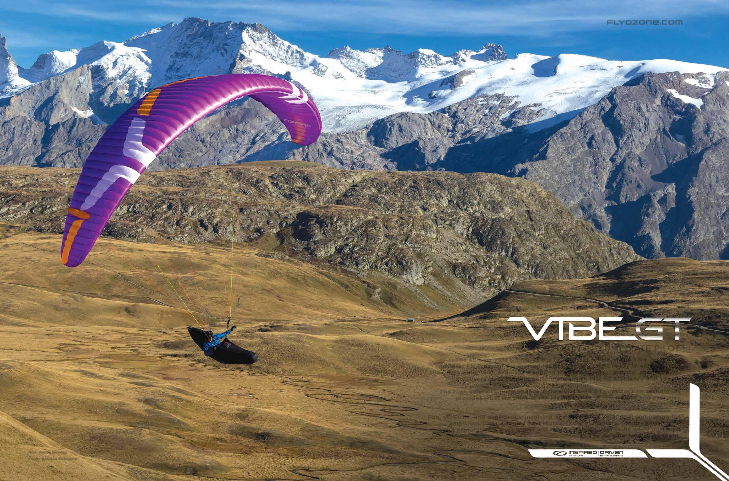
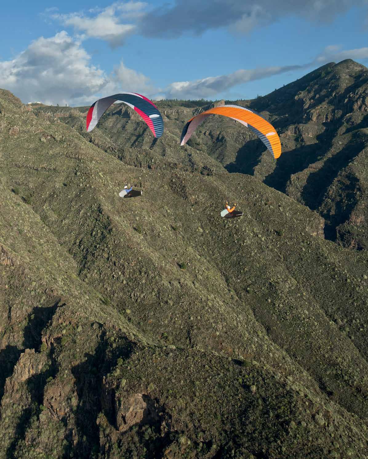
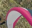
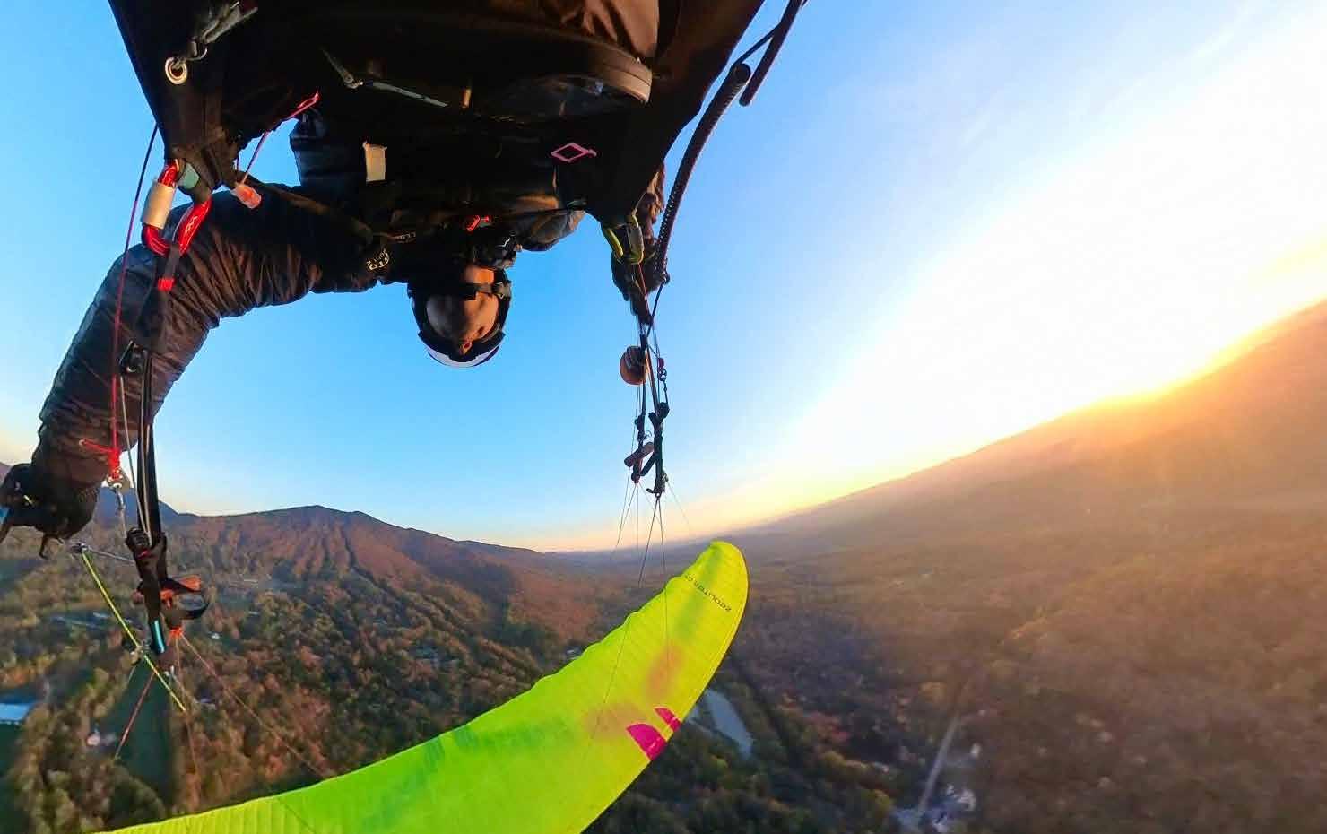
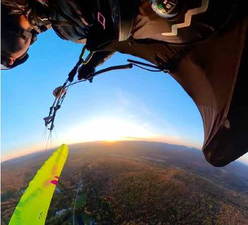
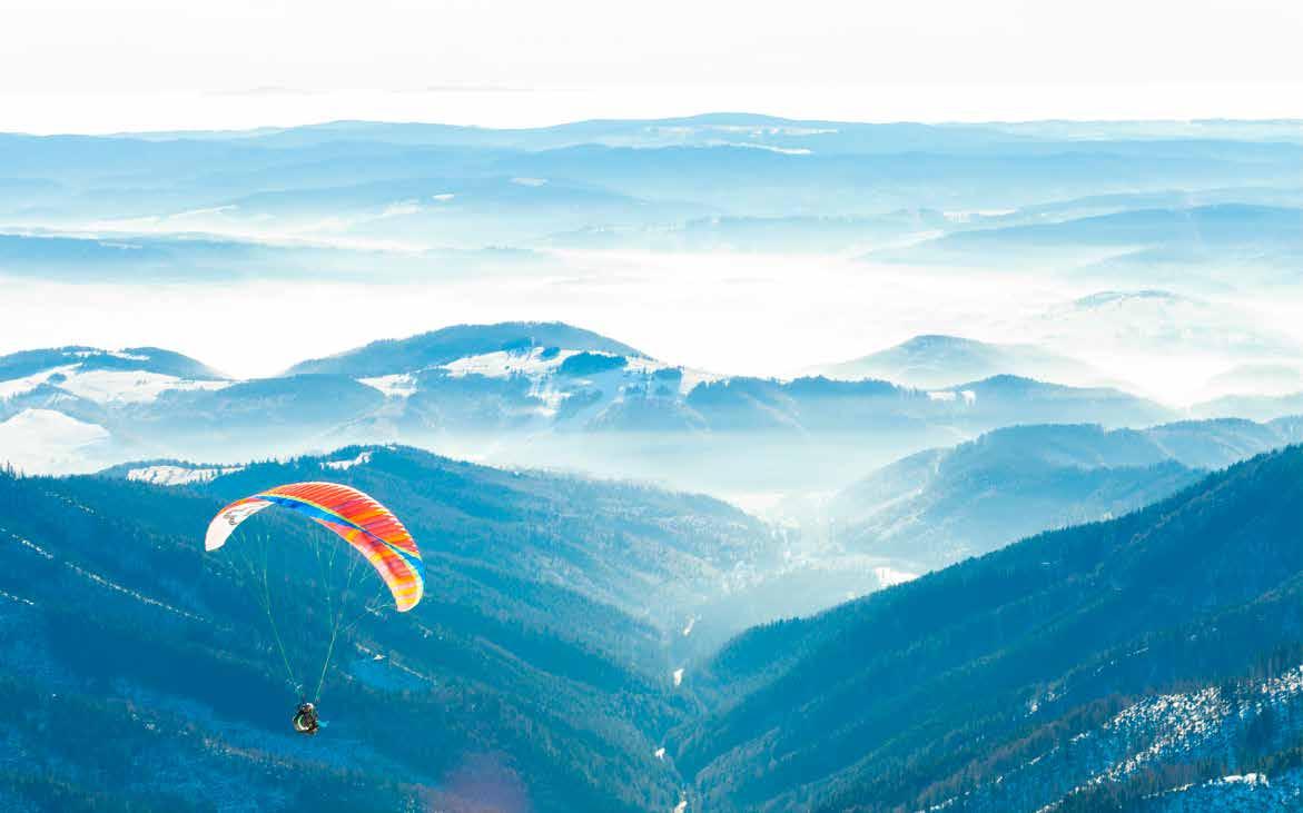
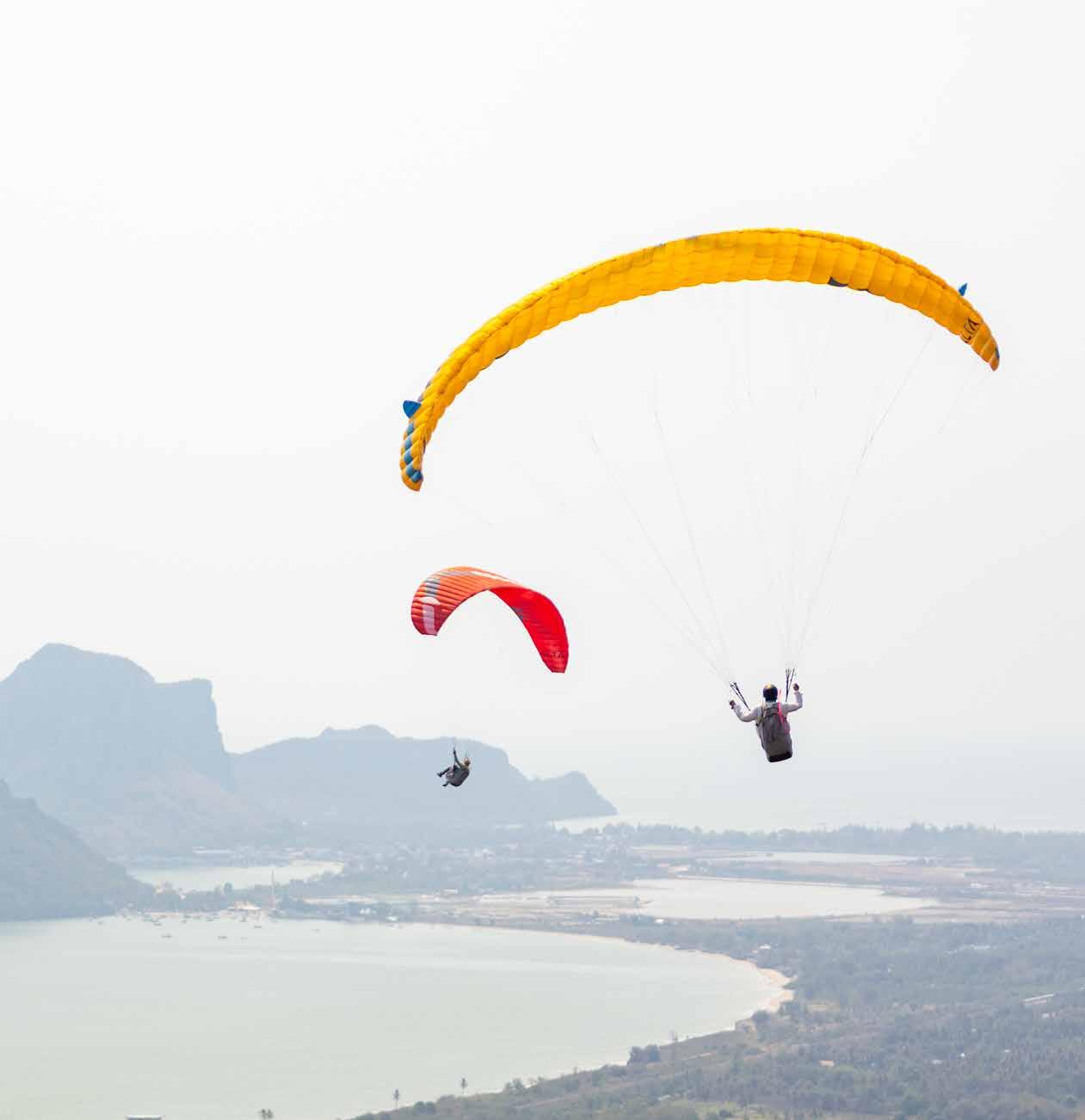
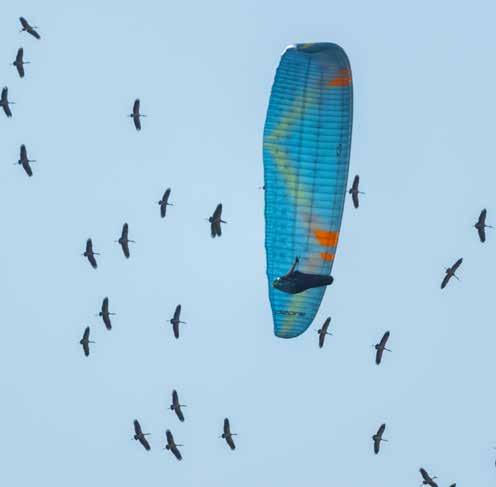
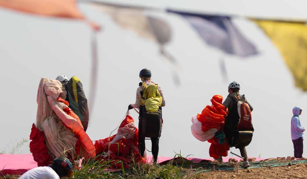
F u n , v e r s a t i l e , a n d c o n fi d e n c e - i n s p i r i n g , t h e V i b e G T i s y o u r i d e a l c o m p a n i o n f o r a m b i t i o u s c r o s s - c o u n t r y a d v e n t u r e s , t h e r m a l m a s t e r y , S I V p r o g r e s s i o n , o r p l a y f u l e x p l o r a t i o n – a w i n g t h a t w i l l r a p i d l y d e e p e n y o u r s k i l l s w h i l e p u t t i n g a s m i l e o n y o u r f a c e e v e r y fl i g h t .
2025 Statistics Report by Jake Schlapfer From the Accident Review Committee
Letter to the Speed Community by Patrick Hennessey
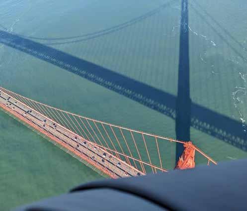
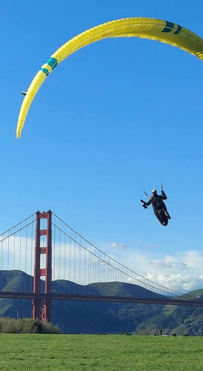
Crossing the Golden Gate by Dan Fourie
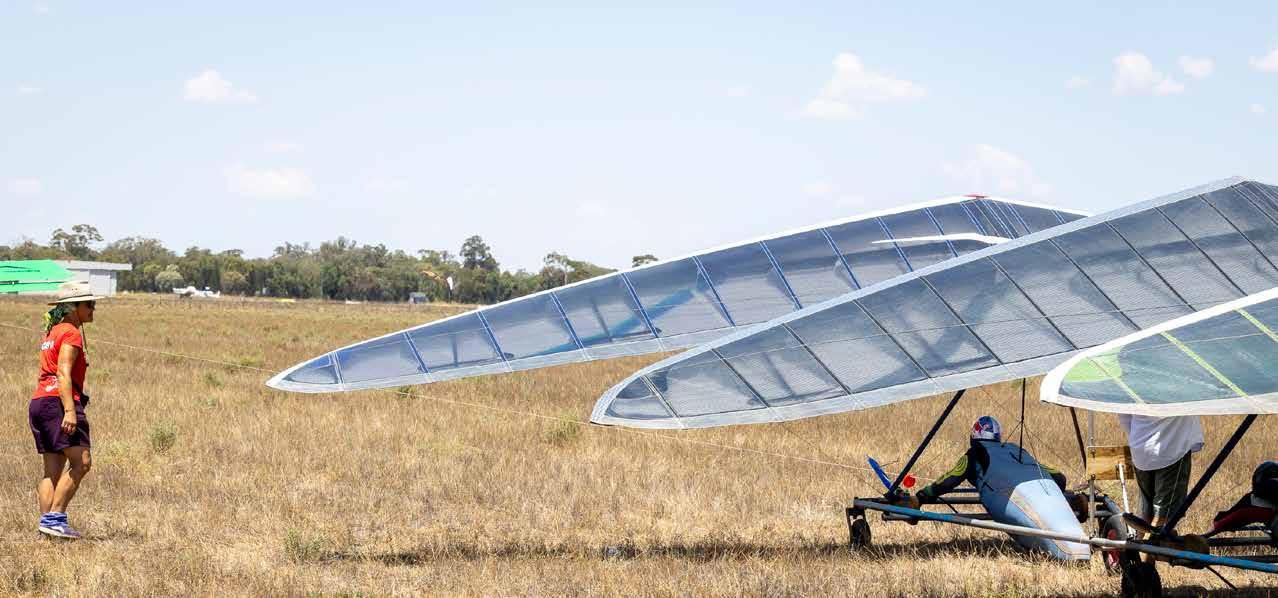
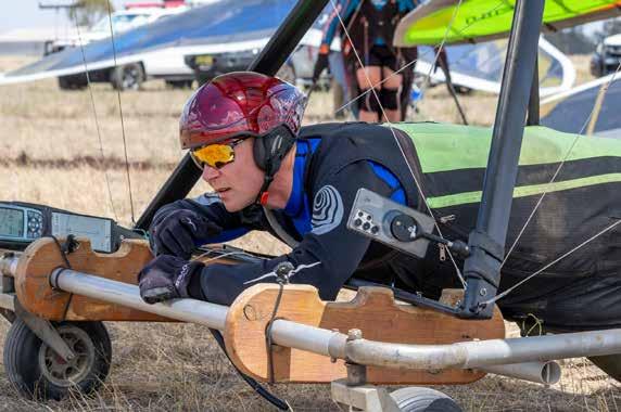
Forbes Flatlands Hang Gliding Competition by Jeff Chipman | Photos by Michael Zupanc from Peak Pictures
Armchair SIV by Calef Letorney Getting Down in 2026
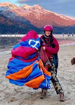
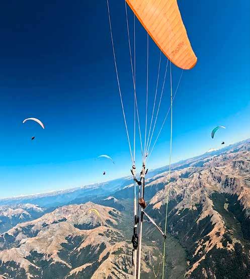
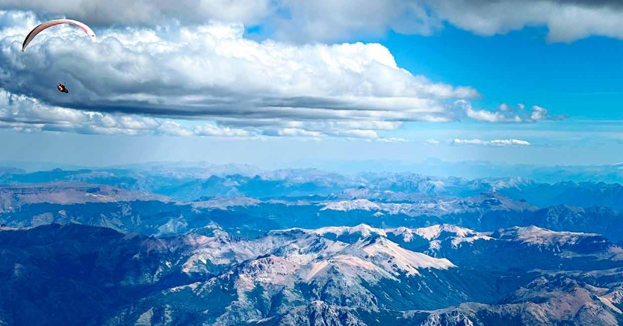
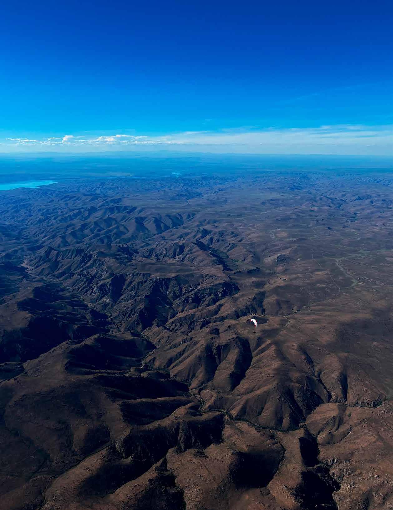
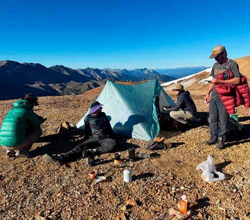
Chasing Endless Summer by Kristopher (Kris) Holub Flying Patagonia
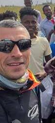
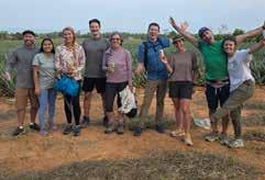
Ethiopia by Mariyan Radev Ivanov Advice for exploring these remote lands
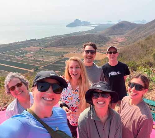
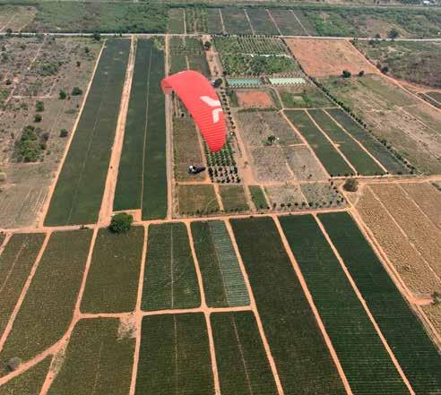
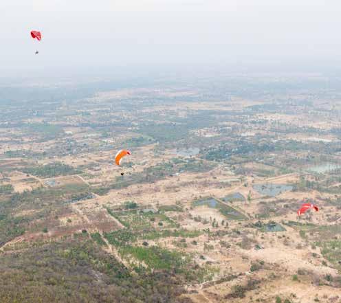
P2 Pilots Take Over Pran Buri, Thailand by Paige Schemenauer
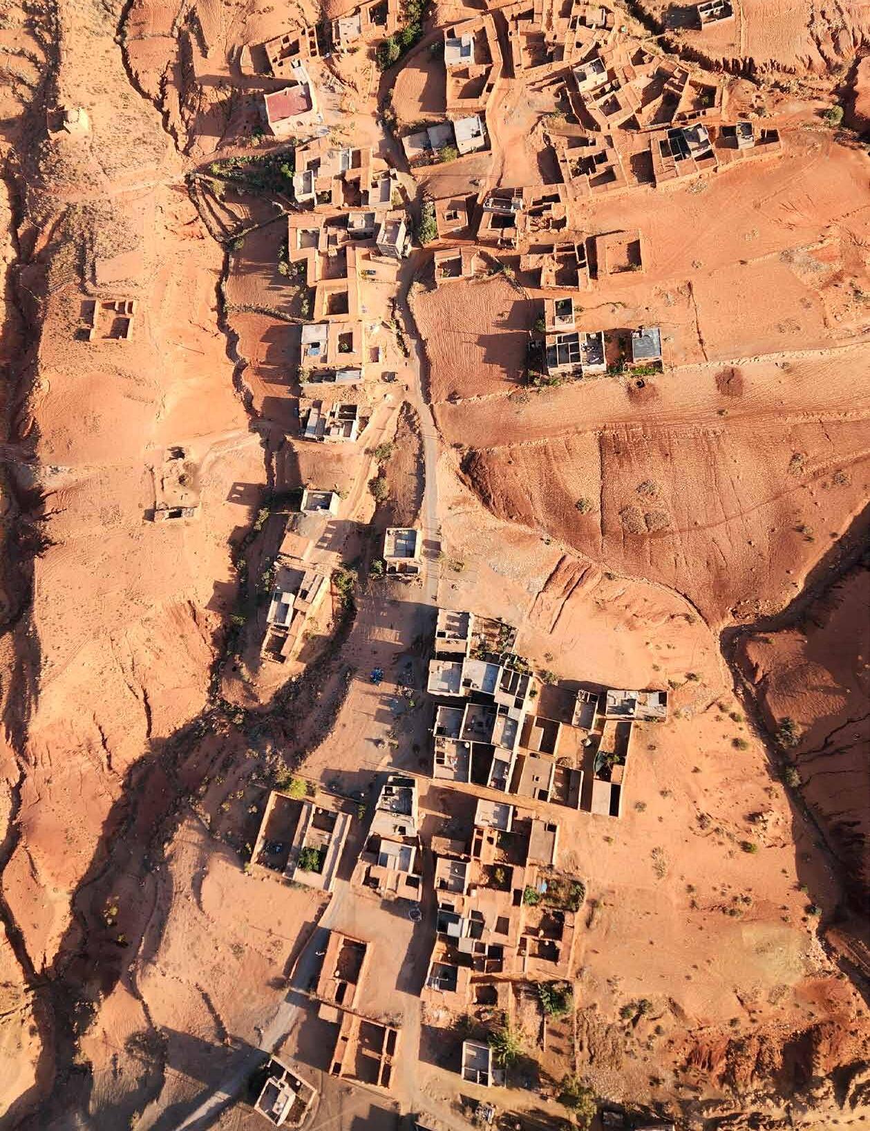
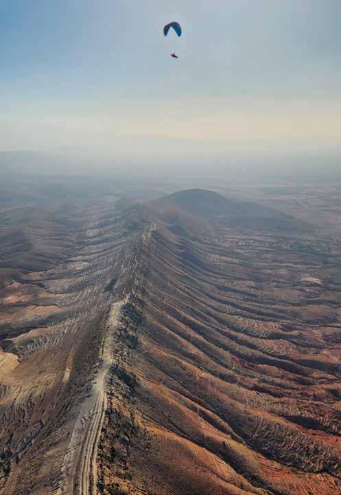
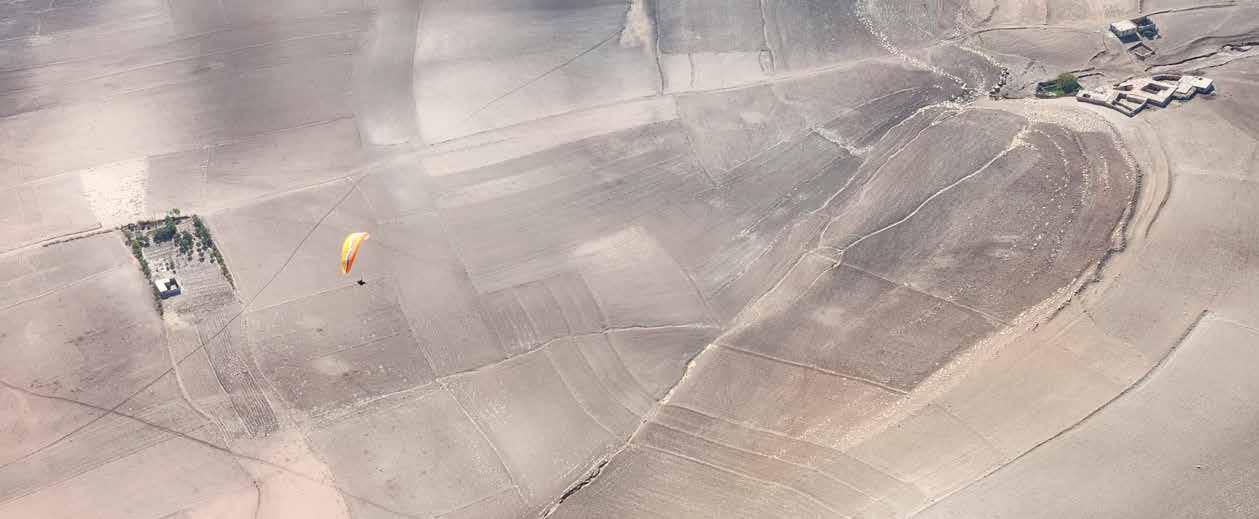
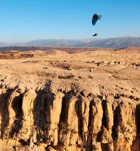
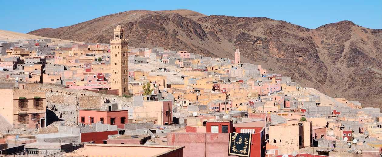
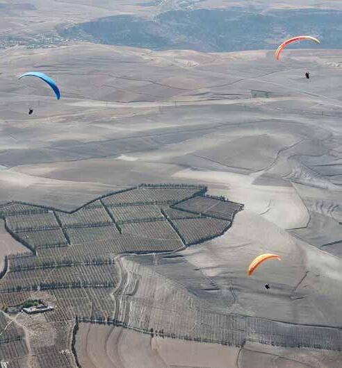
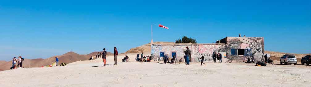
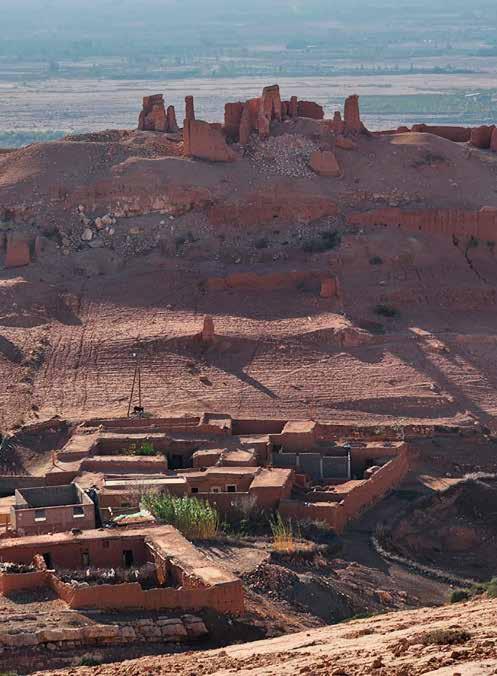
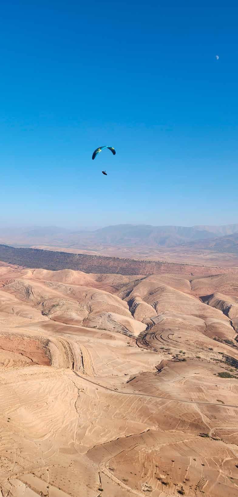
The Lesser Known by Boris Shvidchenko A Morocco trip report
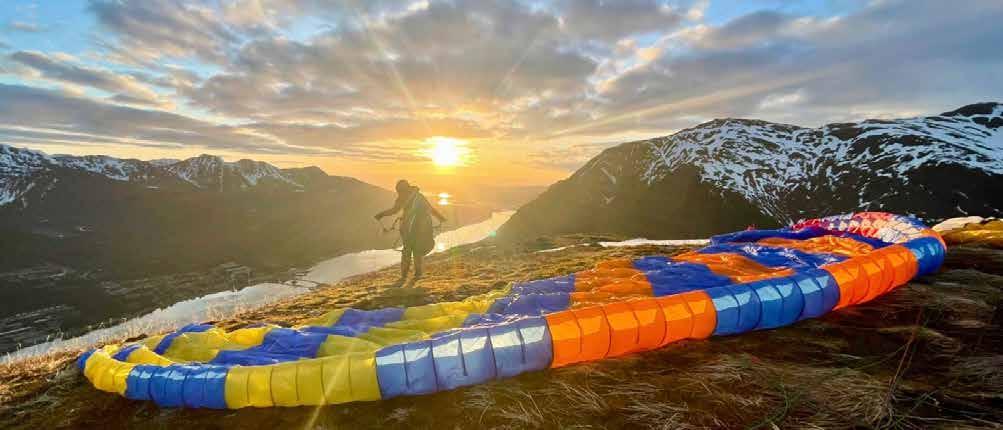
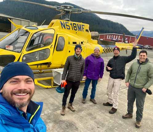
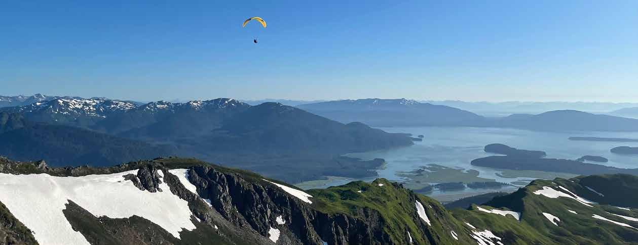
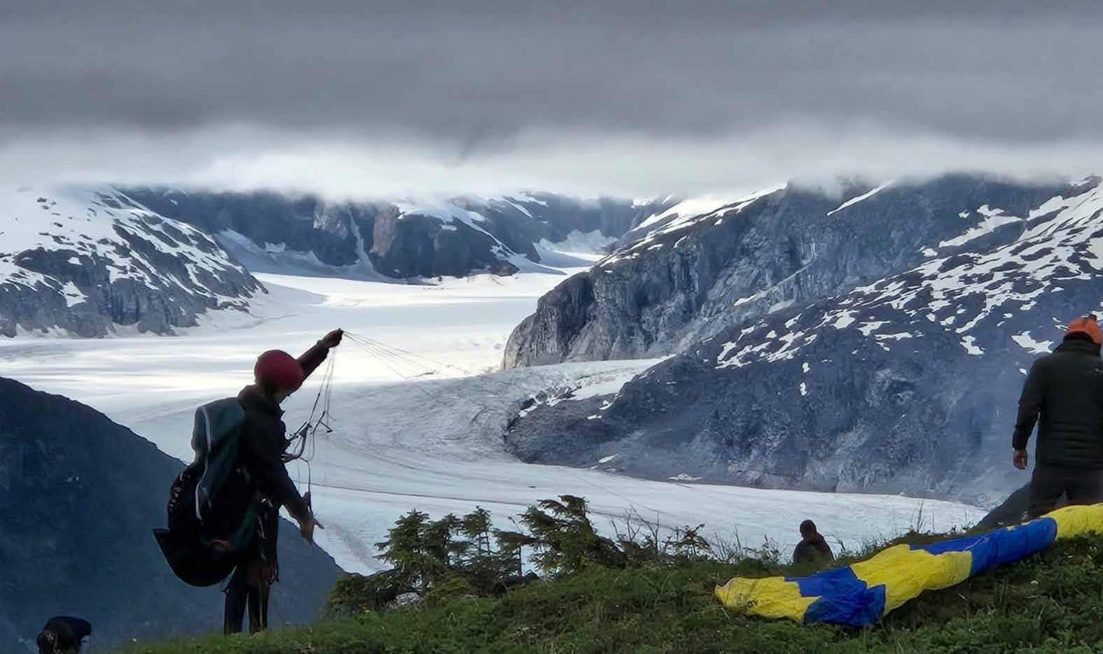
Flying Full-Frontal by Luke Fanning Paragliding in Juneau, Alaska
HANG GLIDING, PARAGLIDING, AND SPEEDFLYING ARE DANGEROUS ACTIVITES
USHPA recommends new or advancing pilots complete a pilot training program under the direct supervision of a USHPA-certified instructor, using equipment suitable for their level of experience. Many of the articles and photographs in the magazine depict advanced maneuvers being performed by expert pilots. No maneuver should be attempted without appropriate and progressive instruction and experience.
Photo: Timo Weibel
Do you have questions about USHPA policies or programs? Are there topics you’d like to hear more about?
EMAIL US AT: info@ushpa.org
Interested in taking a more active role supporting our national organization? USHPA needs your skills and interest.
VOLUNTEER AT: ushpa.org/volunteer
For other USHPA business +1 719-632-8300 info@ushpa.org
ASSOCIATION James
Bradley, Executive Director
Your Risk, and Theirs
: One of my early mentors was a Canadian hang gliding instructor named Michael Robertson. Michael coined a mnemonic: The Wind, the Wing, and the Windividual. It taught me to always consider three things when deciding whether to fly: the conditions, my gear, and myself. If I don’t get green lights on all three, it’s not a good day for me to fly, even if I’d probably get away with it. “Probably” isn’t good enough in flying, like it would be in golf or chess.
The Windividual piece is the hardest. It requires a clear-eyed read of my mental, emotional, and physical state, along with an evaluation of my current skills, discounted for my ego. Since my answers are self-reported, they are always suspect.
As good as W-W-W is, it only answers whether to launch. In the air, the job continues: stay alive on the controls, place high value on terrain clearance, keep ahead of the glider, and so on. You have your own version of this list.
a camera. Threading final approach through a family on the beach who are sitting still. None of it feels reckless in the moment, and most days nothing happens. But I've quietly made each of those people part of my risk calculation, without their consent. And much as I never think I’m going to make a serious mistake, I could.
If my mistake only affects me, that's one thing. But when it involves someone else, or their property, the consequences don't stay with me. Lawyers get involved. Landowners pull access. A community that took years to build can lose something it can't get back. So please, leave margin for a mistake you don’t think you’ll make. Give people and property more space than feels necessary.
Got something I should know? Go to USHPA.org/meetwithjames. I look forward to speaking with you. ushpa.org/meetwithjames
The United States Hang Gliding & Paragliding Association, Inc. (USHPA) is an air sports organization affiliated with the National Aeronautic Association (NAA). The NAA is the official representative of the Fédération Aeronautique Internationale (FAI), which is the world governing body for sport aviation. The NAA represents the United States at FAI meetings.
The NAA has delegated to USHPA the supervision of FAIrelated hang gliding and paragliding activities, such as record attempts and competition sanctions.
All of that is about keeping me alive. There's another piece I think about less, and need to think about more, which is the risk I'm exporting to people who didn't sign up for it.
High-fiving a hiker on a ridge. Swooping a landing turn next to a friend with
Michael Robertson’s risk management manual and DVD can be purchased at flyhigh.com/reliability
EVENT CALENDAR
Scan to see what’s happening near you or to add your own event. USHPA welcomes all free flight community events to our calendar — clinics, flyins, competitions, barbecues, gatherings. No commercial tours and trips, please.
REGION 1 NORTHWEST
REGION 2 CENTRAL WEST Northern
REGION 3 SOUTHWEST
REGION 4 SOUTHEAST
REGION 5 NORTHEAST and INTERNATIONAL
Mission
To deliver programs and services that support all our members, foster a community of skilled and knowledgeable pilots, and promote and protect the freedom to fly.
Vision
A vibrant free flight community across the United States.
Core values & guiding principles
Adventure
Celebrate the spirit of discovery and the joy of being in the outdoors.
Learning
Support ongoing education, development of skills, and acquiring of the judgment that comes from experience and attention.
Preservation
Be stewards of our natural places, our flying sites, and the future of our sport.
Integrity
Act ethically, take 100% ownership, communicate clearly, respond effectively.
Respect
Foster a considerate community free from harassment and abuse.
James Bradley Executive Director james@ushpa.org
Charles Allen President president@ushpa.org
Kirby Ryan Vice President vicepresident@ushpa.org
Van Spurgeon Secretary secretary@ushpa.org
Joshua Wiseman Treasurer treasurer@ushpa.org
Galen Anderson Operations Manager office@ushpa.org
Chris Webster Information Services Manager tech@ushpa.org
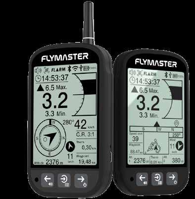
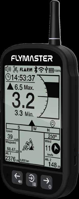
This version of the Flymaster GPS LP is not an update—it’s a true evolution, with more features, capability, and performance at almost the same price. Now with integrated navigation, built-in Bluetooth and Wi-Fi, seamless app connectivity (iOS and Android), a high-resolution display, a powerful speaker, and a refined multi-page interface that keeps advanced tools accessible without clutter. From waypoint navigation to optional FLARM/ADSL visibility, the GPS LS2 delivers significantly more per dollar. Confident from the first flight. Powerful for years to come. More information can be found at FlymasterUSA.com or by email at jugdeep@flymasterusa.com.
BGD TIGRA
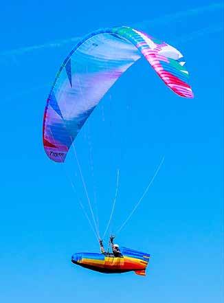
BGD is announcing the upcoming arrival of their new EN-C performance glider, the TIGRA! The Tigra will be available in two color schemes and is scheduled to land in your local flying site in the next two months. Tigra fills the sport pilot and progressing XC pilot category with a high-performance light 2-liner design that has even better handling and performance than the comp-winning Cure 3! To find out more about all the technological advances and schedule a test flight, contact your nearest dealer by visiting flybigskypg.com, the exclusive USA importer.
BGD TUNA
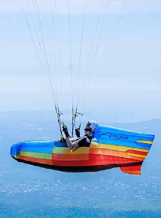
The TUNA is BGD’s new high-performance, lightweight (2.2kg for size M), pressurized harness for XC, competitions, and hike-andfly. Designed with Bogdanfly, it’s streamlined like an ocean predator and built to devour distance. TUNA features an inflatable back protector (mini pump included) that is rated to an impressive 27G. It covers a large body area from the mid-back to under the thighs. An integrated under-seat reserve has an easy-to-locate handle on the right-hand side (left-hand configuration is available on request). The spacious cockpit sits outside the harness envelope, for easy instrument view and access. In flight, TUNA offers a comfortable, reclined position, balancing performance with long-distance comfort. It features a removable seat plate, Edelrid carabiners, and a threestep carbon speedbar. Comes in S, M, and L (other sizes made to order). Find out more, schedule a test flight or meet your nearest dealer by visiting flybigskypg.com, the exclusive USA importer.
OZONE OZIUM 3
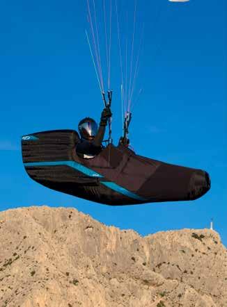
Lightweight, comfortable, and robust, the Ozium 3 is an all-round and XC harness suitable as a first pod, for long XC flights, and an adventure companion. The Ozium 3 is the natural evolution of the Ozium concept, incorporating the latest developments from the F*Race 2 while improving accessibility, durability, and ease of use for everyday pilots. Designed as a true lightweight cross-country and adventure harness, it delivers high aerodynamic efficiency and excellent protection in an all-round package. The possibility to fly it more upright also makes it a great first pod harness for demanding XC apprentices. www.flyozone.com
OZONE ZIG
The ZIG is designed for both professional and casual tandem pilots who demand the highest level of comfort. Our primary goal during development was to design the most ergonomic, comfortable, durable, and user-friendly tandem harness on the market. Through endless hours of professional use over two full seasons, we optimized every comfort detail while maintaining the lowest weight in the category. With its ease of use and low weight, the ZIG is exceptionally convenient, providing a stress-free, and comfortable experience even during intensive professional use. www.flyozone.com
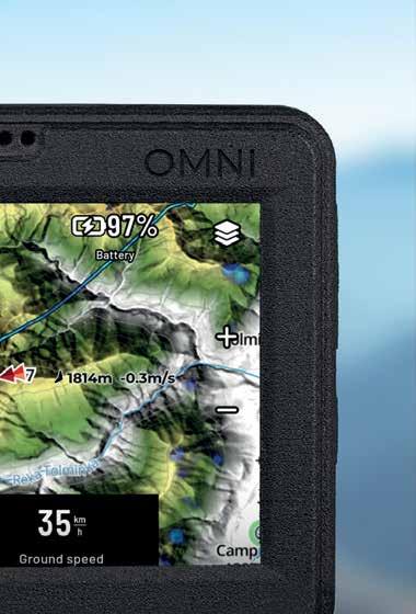
NAVITER SIM CARDS
Flytec USA is pleased to announce an exciting new addition to the Oudie N and Omni lineup — Naviter worldwide SIM cards. New Oudie N/N+ and Omni are now shipping with the new SIM card pre-installed. The Naviter SIM cards provide connectivity in 150+ countries, live tracking, live weather, and seamless software updates (no computer required). The SIM will automatically connect to the best available network, ensuring reliable performance anywhere. While the SIM sign-up is currently hidden in the device software, it will become available directly on each device in the next few weeks. Once available, there will be a free 7-day trial period, and pilots will be able to activate the service and purchase a subscription with a seamless UI already integrated in Navigator. Subscription cost is $4.99 per month. Customers who bought an Oudie N/N+ or Omni prior to having the SIM cards pre-installed will have the option to purchase one for solely the cost of shipping. For more information, please visit www.flytec.com or email info@flytec.com
NEO RACE UP
The Neo Race Up is an ultra-lightweight, performance-oriented harness that is focused on the essentials. Its lightweight nature and compact packability make it barely noticeable in flight while giving the pilot plenty of room to fly. The Neo Race Up’s thin, aerodynamic design weighs 2.22kg. It is available in sizes S–XL for pilots weighing 50–105kg. The Neo Race Up is available for sale through Super Fly, Inc., www.superflyinc.com, +1 (801) 255-9595, or your local dealer.
NOVA XENON 3
The all-new Xenon 3 is an EN-D for XC pilots who like minimal equipment with small pack volume but all of the performance. The XENON 3 is not an entirely new glider, but rather a refined evolution of the XENON 2 — the wing that won the 2025 Red Bull X-Alps. Building on that proven platform, it delivers even more power, especially in full acceleration flight, while also offering noticeably improved filling behavior. It comes in two colors (green and red) and four sizes that include a weight range of 60kg to 110kg. The Nova XENON 3 is available for sale through Super Fly, Inc., www.superflyinc.com, +1 (801) 255-9595, or your local dealer.
GIN
FUSE 4 (New Colors Available)
The Gin Fuse 4 is an EN-B professional tandem paraglider canopy that builds on the successful Gin Fuse 3. Refining the proven Fuse 3 platform, the Fuse 4 features a topspeed increase, lighter handling, and easier take-off. It also includes a comprehensive revision of the riser system, focused on improving mechanical efficiency and longterm durability. The Gin Fuse 4 comes in three new colors (atomic blue, green, and lemon) and is available in sizes 37-44m for all-up weights ranging from 90-240kg. Don’t forget the Fuse Mini that comes in a size range of 32-35m and a weight range of 90-210kg. The Gin Fuse 4 is available for sale through Super Fly, Inc., www.superflyinc.com, +1 (801) 255-9595, or your local dealer.
SYRIDE LIVE TRACKING
Syride announces a major update to its live tracking ecosystem, now accessible to all pilots, even without a Syride instrument. With the new Syride Link mobile app (iOS and Android), users can easily access real-time tracking in both 2D and 3D directly from their smartphones. Getting started is simple: install the app, open the map, and tap “Live.”
Pilots can instantly share their
position or follow others in real time. Designed with pilots in mind, the service remains 100% free, ad-free, subscription-free, and does not sell user data. Beyond convenience, live tracking enhances safety by improving visibility in flight and allowing friends or partners to follow along live. For more information, visit syride.com.
Liz Dengler
Managing Editor editor@ushpa.org
Bethanie Hestermann Copy Editor
Greg Gillam Art Director
WRITERS
Calef Letorney
Do you have a story idea you would like to pitch? We are always looking for stories.
EMAIL LIZ AT: editor@ushpa.org
Are you ready to contribute a complete story? We are always looking for articles, photography and news.
GET STARTED AT: ushpa.org/contributors
All articles, artwork, photographs as well as ideas for articles, artwork and photographs are submitted pursuant to and are subject to the USHPA Contributor's Agreement , which can be reviewed on the USHPA website or obtained by emailing Liz.
Would you like to run an advertisement ? Great!
CONTACT US AT: advertising@ushpa.org
EDITOR Liz Dengler
: Over the last few issues, I have noticed an uptick in AI-generated content being submitted as original work. There are many reasons people might utilize AI tools (such as Claude or ChatGPT) to help them write: time, English isn’t their first language, or they don’t have the confidence to write a quality story on their own, among others.
Though I'd much rather work with you directily, I take no issue with contributors leveraging AI to help craft a story. That said, when an AI writes stories on your behalf, they tend to fall quite flat. In an effort to help your human voice shine through, I’d like to offer some tricks for making it work for you. After all, it’s YOUR voice and experience that readers want to hear.
Using AI to edit: The best use of AI is to help you edit a complete story that you have already written. Once you have a story done, you can ask it to do a copy edit for you. At USHPA Pilot, we have our own in-house style guide, but that's on me to manage. AI tools are good at doing final copy checks.
A GOOD PROMPT: “I have written this story for USHPA Pilot magazine. Without doing any large rewrites, can you check it for AP style? Fix typos, punctuation, etc., but don’t do rewrites of my voice.”
CAUTION: Watch out for hallucinations that AI writing tools are still quite prone to. Typically, this isn’t an issue within the document, but it can certainly be confusing. Also, make sure to read through your story again to make sure it didn't change anything important with out your notice!
Using AI for a first draft: If you feel like you need a bit more help but have solid bones to work with, the next option is to write a loose or rough first draft of your story, then feed it into your favorite tool to get feedback on structure or have it point out confusing sections. This is more developmental editing, and AI tools can be helpful for finding information gaps or missing transitions.
A GOOD PROMPT: “I am submitting this story to USHPA Pilot magazine. Here is a draft of my story. Can you give it a read, ask me any questions, then comment on places that need work or embellishment. Check that the structure and flow make sense? Offer guidance rather than rewrites.”
CAUTION: AI tools LOVE to rewrite human work. Most natural writing doesn’t follow the coded language structures in models (yes, some are better than others). I urge you not to accept all its tone changes outright, as this makes the story quite flat and it loses character.
POSTMASTER USHPA Pilot ISSN 2689-6052 (USPS 17970) is published quarterly by the United States Hang Gliding and Paragliding Association, Inc., USHPA, 201 E Pikes Peak Ave, Suite 1330, Colorado Springs, CO 80903, Phone: 719-632-8300 Fax: 719-6326417 Periodicals Postage Paid in Colorado Springs and additional mailing offices. Send change of address to: USHPA, PO Box 1330, Colorado Springs, CO, 80901-1330. Canadian Return Address: DP Global Mail, 4960-2 Walker Road, Windsor, ON N9A 6J3.
It also makes things up to inject into the story — make sure you proofread!
Asking AI for ideas: If you’ve got a story in mind, but you simply cannot find the words, write a series of bullet points and ask the AI to help you build out and outline your story. Ask it for tips on how you can build out each bullet point. From there, do it again for each paragraph. Once you have a draft, refer to step 2, and then step 1!
A GOOD PROMPT: “I want to write a story for USHPA Pilot magazine. My story is about (INSERT STORY TOPIC HERE), but I am having trouble actually writing. Below are a few bullet points I want to cover; can you offer me guidance for building out the story without doing all the writing for me? Give me tips on how to build out each bullet.”
CAUTION: Again, AI tools love to erase human voices, so use caution when accepting all their writing suggestions. Some AI interfaces have an ‘accept all changes’ option—resist using it. I much prefer to receive a messy version of your human-written story than a clean write-up in an AI-cloned voice.
: My hope is that this short guide will help potential writers feel more confident in submitting stories while keeping their voice intact. Remember, AI is great at a lot of things, but it can’t fulfill the human element in our stories. It can’t know or explain what a thermal felt like, the elation of getting a PB, or the genuine connection of your local flying community. It’s up to you to explore those components — the AI just helps you pull things together.
ACCIDENT REVIEW COMMITTEE
2025 statistics report by
Jake Schlapfer
Though this article is not exclusively about paragliding, the reported incidents heavily lean that way, and therefore, the discussion does as well. There are still great tips for all pilots in this recap.
: We likely all remember the first time we witnessed free flight, and if not, certainly the first time we flew. Whatever your discipline, free flight has hopefully granted you just about every positive feeling imaginable. We each have a unique connection with every flight, but hopefully we all share the same goal in the end: to land with a smile.
Understanding incident trends helps make flying safer and more sustainable for everyone. We must stay focused not only on the physical skills we’ve been trained for, such as local weather patterns and flight techniques, but also on our own experience level relative to the given conditions and the social dynamics around us, like peer pressure and camera culture. This mindfulness builds flight awareness, patience, and the discipline that leads to safe flights and even bigger smiles.
The USHPA Accident Review Committee (ARC) is responsible for reviewing submitted incident reports and identifying trends. USHPA has been collecting annual accident summaries since 1998, and while direct comparisons across three decades are difficult, yearto-year patterns are often similar.
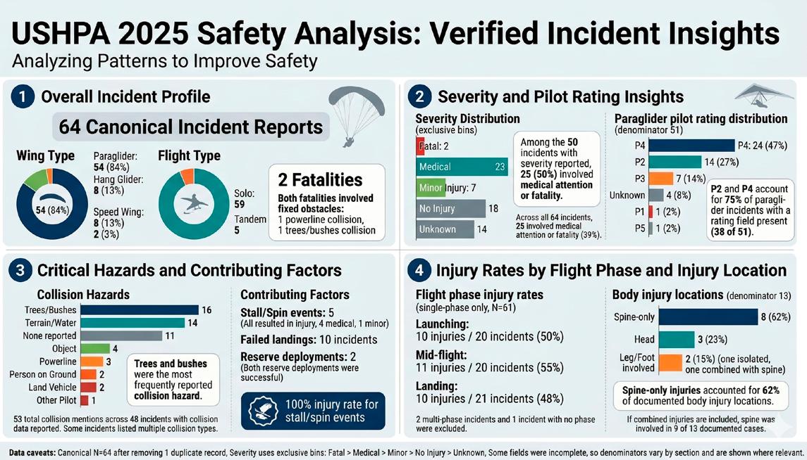
In 2025, a total of 64 incidents were reported through the USHPA Incident Report Form — though it is clear that underreporting remains an issue. Accidents resulting in serious injury are far more likely to be reported than those involving minor injuries or near misses. As a result, the annual summary likely overestimates the severity of injuries received. For example, in 2025, among the 50 incidents reported with injuries, 50% required medical attention.
We are working to improve our definitions of the different stages of flight and the incidents that occur during them. The incident report form now prompts for this information. However, based on the 2025 data, incidents were nearly evenly distributed across the
phases of flight: launching (20), midflight (20), and landing (21). Overall, reported incidents resulted in injury about half the time. Predictably, more than 50% of accidents occurred during the summer months of July, August, and September.
Launching
The vast majority of launch incidents occurred while the pilot was still on the ground or immediately after liftoff. Interviews with involved pilots identified the primary cause as poor inflation — typically resulting from attempting to launch in strong wind, crosswind, or both. Pilots with launching mishaps reported feeling a bit of pressure to launch, either due to being at an event, other pilots waiting, or peers climbing out from launch. Please take your time launching, and only inflate when you are ready. If you need a little more time, step out of the queue.
Midflight
Of the 20 reported midflight incidents, 55% resulted in injury. These reports can be a bit open to interpretation, as midflight could previously have included post-launch and pre-landing incidents. Still, the range of potential midflight scenarios is broad, which is one of many reasons we try to reach out to pilots personally, to hear their stories.
Several pilots reported that their in-flight incident involved a collapse while close to the ground. These pilots stated in retrospect that they knew they were flying too close, and felt the collapse would have been recoverable if they had been at a higher altitude. Don’t push your margins too far. Remember that we can’t see the air we’re flying in, so it’s best practice to avoid scratching or flying too close to terrain, especially during the heat of the day.
Landing
Our newer P2 pilots are the primary contributors to incidents occurring during landing. These tend to unfold in a recognizable pattern: wind shifts, either in direction or velocity, and recognition is slow or missed,
so the pilot fails to compensate early. This often leads to last-second decisions to make big turns low to the ground or other drastic maneuvers. Only a few incidents the result of poor flare, and these injuries are generally minor, if any. Other common factors resulting in failed landings include: collision with obstacles in the LZ, landing outside the intended LZ, and turbulence or thermals on approach.
When landing at a primary LZ, get a briefing from local pilots on obstacles, hazards, dangerous zones, and the character of the wind (laminar, stronger, thermic, etc.). If others are flying, observe other pilots’ successful landings. If flying cross-country, plan your landing early. Give yourself time to assess wind indicators, determine whether conditions are stable or shifting, and identify hazards such as power lines and fences.
Nature and Severity of Injuries
For many years, this report focused on statistical data on which body parts sustained injury. The trend has been remarkably consistent for decades; going back to 1998, spinal injuries have always topped the chart. In 2025, they accounted for 62% of all reported injuries — a figure that has changed very little since records began (approximately 60% in 2001). Some reporting bias likely applies, as minor injuries often go unreported to USHPA. Pilots, equipment manufacturers, and
instructors should make reducing back injuries a top priority. Despite significant advances in equipment technology, the number remains high and should be considered as pilots seek out the lightest hike-and-fly harness available.
Remarkably, head injuries are consistently very few, with only three reported in 2025. This is a testament to the consistent use of helmets and the advancements in impact technology.
Extremity injuries are believed to carry the highest reporting bias. Understandably, it’s easy not to feel the need to report a sprained ankle or wrist. However, the value lies in the events that led up to that near miss or minor injury. This is where we learn to adjust, compensate, and make better decisions. If you experienced a minor extremity injury, please consider sharing it. Also, don’t forget that proper personal protective equipment, from footwear to sunglasses and sunscreen, contributes to better outcomes.
For paragliders, P4-rated pilots accounted for the largest share of accidents at 47%, followed by P2 pilots at 27%. P3 pilots accounted for 14%, with P1 and P5 at just 2% each. It’s a good reminder that just because you have more experience as a P4, it does not make you safer in the sky. This high incident rate among P4 pilots may reflect a tendency to fly more demanding midday conditions or challenging launches, or simply
a return to flight after taking a break (lack of currency). Also, P4 pilots participating in a competition are more likely to submit a report themselves or to have it submitted by event organizers. Incident data broken down by rating is not currently available.
2025 Trending Safety Priorities
• Prioritize landing training and approach judgment for lower-rated pilots. P2 pilots are overrepresented in failed-landing incidents.
• Reinforce obstacle awareness and site-briefing culture, particularly at frequently visited sites where trees, terrain, and other known hazards appear repeatedly in incident reports.
• Treat stall and spin recognition and recovery as a high-value safety topic. Every recorded stall or spin event in 2025 resulted in injury. Consider attending a maneuver clinic!
• Emphasize spine injury prevention through proper harness fit, adequate back protection, and impact-aware training. Spinal injuries remain the largest documented category.
: Please continue to report your incidents and accidents. This data comes from you, our pilots, and from those who have witnessed incidents. The more we report, the better we can understand the trends, thereby, ideally, reduc incidents and accidents.
Pilots often share incidents publicly in various online discussions or forums, such as their club discussion feeds. This is valuable, but that information has greater reach and impact when also shared with all pilots via formally submitting to the ARC. One effective approach is having a designated safety or incident-reporting officer within a club to ensure incidents are documented and shared with the ARC. A club representative can often capture details more accurately and efficiently relay them to the ARC.
Remember, all accident reports are confidential. Names of pilots and reporters are not disclosed unless specifically requested. It takes only a few minutes, and it may help another pilot avoid the same experience. The incident report form is available at: https://www. ushpa.org/incident.
Thank you all, and have a safe and wonderful year of flying in 2026!
Launch into gear savings
Up to
60% o top outdoor brands
for USHPA members
Membership is free—always. Your USHPA membership qualifies you automatically. Scan the code to get started.
+ many more!
Letter to the Speed Community
by Patrick Hennessey, Ozone team speedflying pilot
: Dear speedflying friends, I care deeply about the people in our community and the reputation we carry as speedwing pilots. I try to be a positive influence with my flying, but doing what we do, it all looks sketchy to people who don’t understand this sport. Lately, my attention has been drawn to something more serious. Last year, we noticed a dramatic increase in injuries and fatalities among our speedwing companions, most of which were avoidable. I want to share a few insights in hopes that we can all take a step back, make smarter, safer choices, and keep flying for years to come.
Don’t downsize too soon
A common theme I keep seeing is that pilots are trying to downsize too quickly. My own progression in the sport has been quite slow, over the course of 14 years. I flew a 14m Fazer for four years before I started downsizing. I was also skydiving, packing parachutes for a job, and learning to paraglide. I wanted
to understand canopy flight as deeply as possible to feel comfortable and confident in my abilities before pushing further. I have made mistakes, but I’ve had time to adjust and learn from them.
Today, I see many pilots skipping steps, assuming they can replicate what they see on social media in just a year or two. I’ve always said the better you are at flying a larger wing close to terrain, the easier it will be when you downsize. Before moving to a smaller canopy, your current wing should feel like an extension of yourself—something that you are fully in control of.
Know why you fly
Think honestly about what draws you to this sport and what it means to you. Is it the rush, the adventure, the beautiful views—or is it the likes on social media? Whatever your answer, consider whether it’s pushing you toward good decisions or bad ones.
For me, flying allows me to be connected with
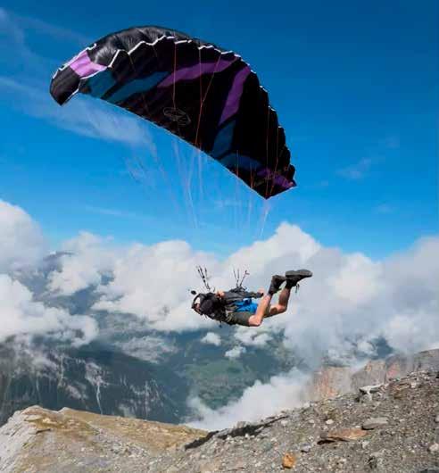
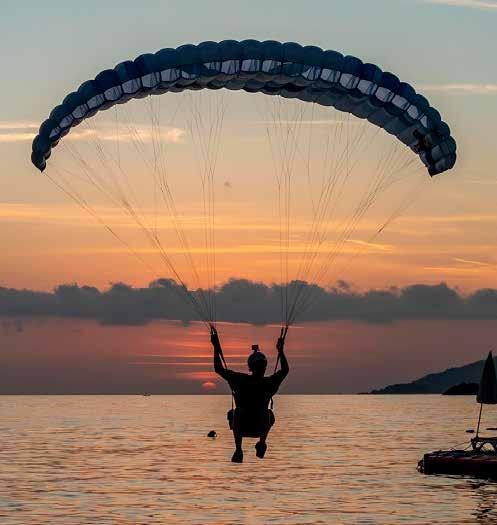
[LEFT] The author launching into the Rottalhutte line in Switzerland. Photo by Jamie Lee [RIGHT] The author landing on the beach at sunset in Oludeniz, Turley. Photo by Rick Neves
nature and is a form of meditation. It demands full presence — both mental and physical awareness of everything around you. Outside distractions do an amazing job of creeping into our thoughts and abilities, and the moment they do, our judgment suffers. Understanding your true motivation in flying is the first step to recognizing where your decision-making might be compromised.
Release the ego
It’s good to be confident in this sport, but overconfidence can be dangerous. If you are letting your ego or social media influence your decision-making in the air, then you’re flying for the wrong reasons. If you’re already thinking about how you’re going to post your flight before you even fly, you’re not doing it for yourself. If that’s the case, I highly suggest leaving the camera at home for a bit. A few years ago, I took an entire year off from using my GoPro, and it was one of the best decisions I’ve made. It allowed me to get back to my roots of just being in the moment and enjoying my time in the mountains. Of course, it’s exciting to see the response to your videos, but it’s important to fly for yourself and not for the likes. Fame is not worth the price, and even the pros don’t make money in this sport.
Fundamentals matter
Be meticulous with everything you do and always double-check your equipment thoroughly before flying. Learn to look up at your wing to check it before committing to launch. You can always stop and fix a problem before launching, but you can’t always fix it in the air.
• Make a plan before flying a line. Consider what could go wrong and what your backup plan would be if it does. Check for obstacles like cables or power lines, and always scout your landing area for hazards. Be very aware of the weather, and consult multiple weather stations if possible. Don’t be afraid to ask an experienced pilot if you’re unsure. Don’t rush to launch — take a moment to feel what the winds are doing. If the conditions make you uncomfortable, it’s never a sign of weakness to walk down.
• Be aware of your headspace. Stress and emotionally challenging situations can affect decision-making
in ways you may not notice. Be honest about where you’re at before pulling out the wing.
• Don’t let group mentality override your judgment. If you’re not comfortable with the conditions, don’t feel the pull to follow just because others are flying. Know your abilities and stay well within them. It’s better to be less confident than you are capable than to be overly confident when you still have lots to learn. Don’t let yourself feel like you’re not cool because you didn’t fly a line as deep as someone else, or you didn’t get that swoop on the landing. You’re flying, and that’s cool enough as is.
• Ask if you have questions or take a course from a qualified instructor.
• Take your time with your progression. Consider upsizing your wing for a bit if your flying is feeling too dynamic. Fly for yourself and think about your loved ones who want you home safe. This sport can be done sustainably, but that choice belongs to you.
: Much love and safe flying!
Crossing the Golden Gate by Dan Fourie
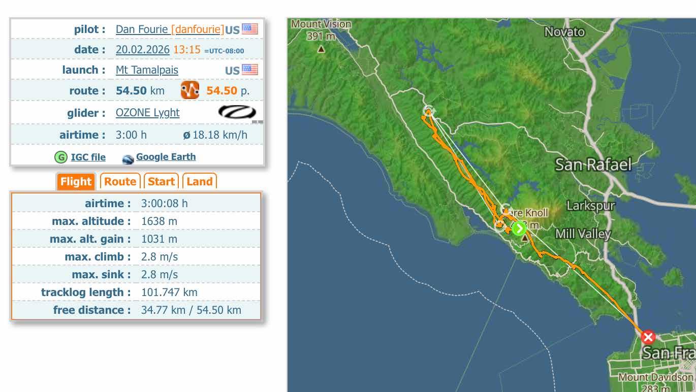
: Carpooling with Ben Wedlock and Anna Behrens to launch on February 20, 2026, it doesn’t look like the day will live up to expectations. Sustained high clouds from the early morning are shading the mountain and suppressing the usual morning cumulus that signal a good day. But hype is high — lots of chatter the night before in the site chat means a dozen plus pilots are headed to launch on a weekday with high expectations. We have just come off a week of rain in the Bay Area, and there is a promise of cold postfrontal magic at Mount Tamalpais (Tam). I have been working too much the days prior and am looking forward to getting outside for some spring flying. The wind is light over the back when we pull up to B launch at noon. Nobody is in a rush. Jeremy Spiegel hands out cookies, Deryk Goerke has some awesome stories from flying in Patagonia, plus Julian
Lemoine is in town.
Dan Zaslavsky and a couple of others have chosen A launch, which is wise with the light south winds. He launches first at about 12:45, and Enes Mentese launches 15 minutes later, both showing the lift is sustainable. Anna points out a trail of short-lived wispies that seem to be indicating the potential for a
On a very cold day, Tam can work even when it’s completely shaded out because the relatively warm ocean acts as a heat reservoir to undergird any bubbles from added solar heating. But because of the microclimate, it’s not common to leave the west ridge of the mountain. The farthest flight, by a few multiples, is an 80 km trip Enes made to Napa County in 2023.
cloud street leading north.
Seeing this, Deryk and I gear up and launch about 1:15 into some local puffs up the slope, even though the ridge sock is still indicating light OTB. We push out and soon find a climb to 1,000 meters (3,300 feet) — launch height is 580 meters (1,900 feet). Dan and Enes are already pushing north along Bolinas Ridge, and we chase after them. The high cirrus is still intact and shading everything, but the lift is good, and the flying is delightful and fast, cumie to cumie.
We catch up with Dan, and we all continue north, enjoying the easy cloud street together. After 15 km, the road ahead to the north is looking darker, so Enes cuts east at Olema, heading for the potential to extend the flight inland. Dan and Deryk follow. I initially do as well, but the way to the east looks darker than I like. The ridge back south to launch is starting to look sunnier, and I like closing triangles, so I head back along the ridge.
I have just returned from a few weeks of delicate flying in a wet Colombia, and I am feeling tuned up to finding lifty lines. Most of the way back south is a delightful no-turn thread through wispy cumulus. By
this point, my hands are starting to get cold despite my mittens and warm layers. I regret not putting hand warmers into my gloves. I shake out my arms below me, and better circulation slowly returns.
I see Anna and Ben heading north, 200 meters below me (they launched at 1:45). Their timing is perfect because the high clouds, which deterred us from continuing straight north, dissipate shortly afterward, and the route clears into a perfect cloud street that they ride 65 km together all the way to Santa Rosa. As I approach Stinson Beach, a blue gap opens between me and launch, and I sink to 200 meters above the ocean, thinking that my flight is likely ending. But down low, there is a relatively stiff SW onshore breeze that I use to soar a windward slope for a while until a slow climb comes through, which I take back to cloudbase.
The wind is lighter aloft, maybe 6 to 10 km/h, and I continue pushing south against it, thinking of making it to a top landing at A launch to complete the triangle, and then relaunching to boat around for the rest of the afternoon. But when I find climbs above launch to 1,600 meters (5,200 feet), I decide to push south to extend the triangle, with the intention of eventually turning around and gliding back to launch. However, it keeps looking good ahead of me. Shortlived cumies form and decay rapidly like will-o’-
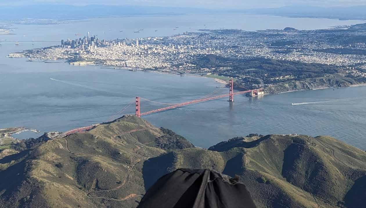
Looking south towards San Francisco and the Golden Gate Bridge from above Rodeo Beach at 900 meters altitude. Photo by Dan Fourie
the-wisps, tempting me along the way. So I press on. Soon, I have Muir Beach on glide and figure that is a cool enough destination to abandon closing the triangle for, and it would be easy to thumb a lift back up to Panoramic Highway for retrieve.
When I reach Muir Beach, I am still quite high, and figure Rodeo Beach would be possible. I haven’t been there since middle school, and I figure it would be cooler than Muir Beach, so I push on. About this time, I start looking at the tip of the south tower of the Golden Gate Bridge moving relative to the green of Crissy Field behind it. It is still far away, but in my field of view it is inching down, exposing slivers of more green above as I get closer — that means I will clear it on my current glide.
But I’d really like more margin for that kind of crossing, and I haven’t had any climbs since one just after I passed Muir Beach. Plus, there’s a slight headwind impacting my glide ratio.
I figure I’ll keep pushing and see what I encounter, knowing I have plenty of landing options all the way up to the north anchorage of the bridge, and an
Crossing the Golden Gate Bridge is a joke we sometimes make on Tam launch. I think Cooper (Brian Cooper) may be the only one who has ever taken it seriously as a possibility. In any case, I have to credit his “Baker Beach, boys?” echoing in the back of my mind as I glide closer.
attempt will be useful for showing what might be possible in the future.
I get an airspace proximity warning alarm from my flight instrument — I haven’t checked the airspace in this direction beforehand. I take a closer look and see that SFO Class-B goes down to 900 meters (3,000 feet) a couple of kilometers north of the gate. I’m on track to cut that corner closely, so I take a 360 to drop under it. I hope to catch another thermal underneath it later, over Hawk Hill. But there are only some spotty zeros when I arrive, so I decide to push on instead of searching and risking losing altitude. My parallax reading on the south tower still says I’m going to clear it with a decent margin on my current glide.
The mile-wide strait of the Golden Gate is not
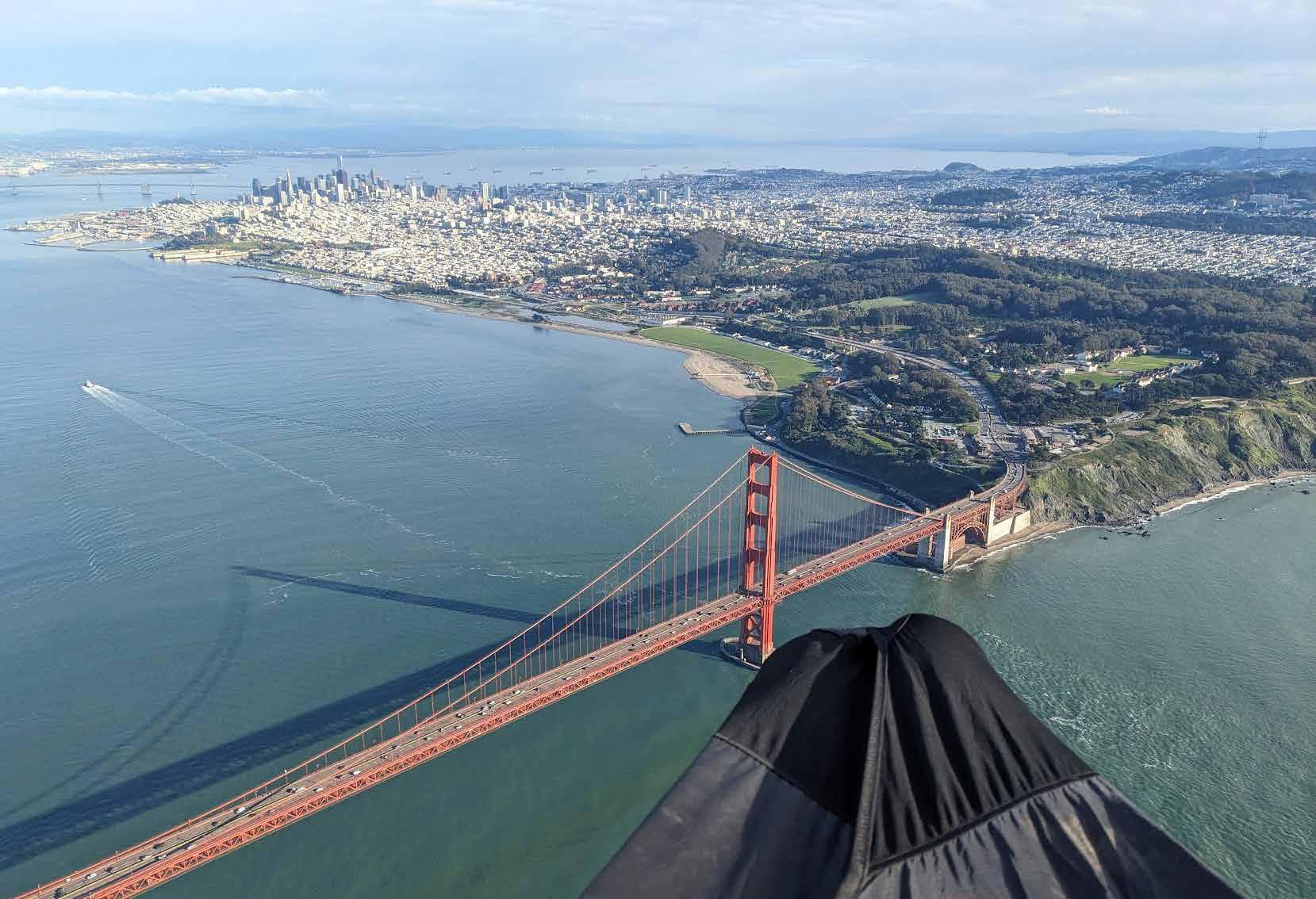
Golden Gate crossing, 500 meters altitude. Photo by Dan Fourie
something to be trifled with, however. It could easily harbor sink or a venturi, despite everything feeling steady at my current altitude. I start to feel a little stressed as I push out over the water. The consequences of messing up here are unbelievably high for both myself and the community. The responsibility of that helps me focus on flying cleanly with presence.
There is a bit of sightseeing air traffic in the vicinity, but it is well below me. Gentle swells roll into the bay, but the ocean surface shows no indication of wind.
I look back at Kirby Beach on the north shore and then forward at the tiny strip of seawall beach west of the bridge’s south anchorage: my two bailouts should something unexpected occur.
The stress transmutes into a giddy relief as I cross the south tower with about 150 meters (500 feet) of clearance. I turn on my phone’s camera and take a shaky video, scored by unintelligible shrieks. I cruise over to Crissy Field, elated, make a couple of turns for photos, and land safely, barely believing what is happening.
I chat a bit with a guy visiting from Maine who captures my landing, then lie on the grass for 15 minutes before packing up, enjoying the high, and re-living the day in memory.
The final glide ends up being 9.5 km (6 miles) at 7.8:1. Later, I calculate that the glide from the point where I decide to leave the north shore to the south anchorage bailout is about 4:1.
It is an incredibly lucky day. Both for free flight conditions in general — to have such instability in the airmass combined with such calm wind (both the day before and the day after have strong, gusty winds) — and for this crossing to have worked out as it does in regard to my glide ratio and altitude, and the airspace. Gate crossing aside, the day is easily the most successful day of free flight at Mount Tamalpais in terms of total distance flown by all pilots combined.
Crossing the south tower of the Golden Gate Bridge. Photo by Dan Fourie Landing at Crissy Field. Photo by Bill Carpenter
Forbes Flatlands Hang Gliding Competition
by Jeff Chipman
: The Forbes Flatlands Hang Gliding Competition in Forbes, Australia, has been on my radar for a long time. For years, I watched from afar, admiring the flying, the camaraderie, and the unique flatland challenge, always hoping that someday I’d be able to take part myself. This year, after retiring, it finally felt like the perfect moment to make it happen. After meeting Peter Burkitt in Italy, and then connecting with Vicki and Greg Cain in Florida, I
was convinced this was the year I needed to attend — and I’m so glad I did.
The entire event was run with friendly enthusiasm and a welcoming spirit, making pilots from all over the world feel immediately at home. The organizers, ground crew, and everyone involved created an atmosphere that was both professional and genuinely warm, making this a competition not to be missed. Even the down days were full of adventure — en-
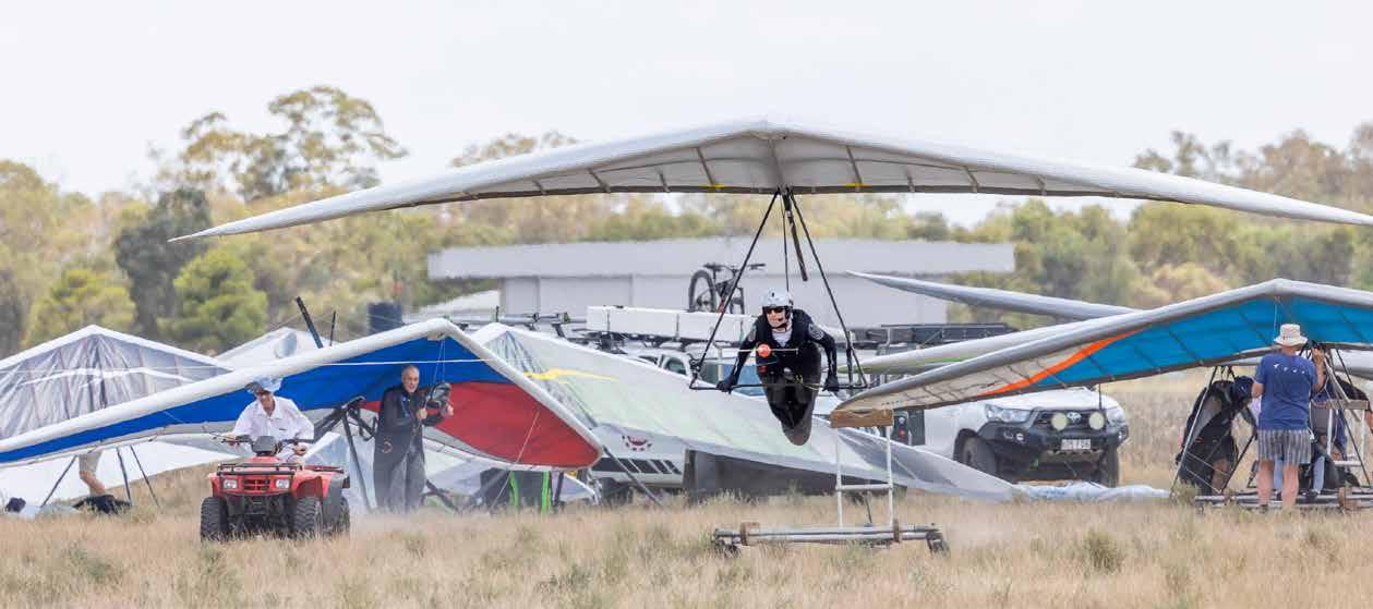
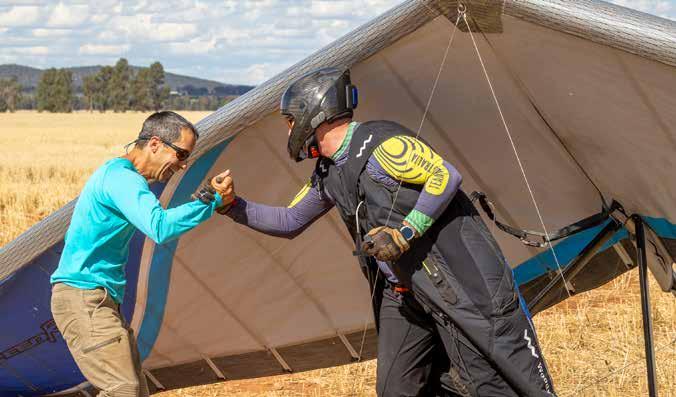
Steve Crosby of Australia ready for the day.
Olav Opsanger from Norway on the cart.
| photos by Michael Zupanc from Peak Pictures (submitted by Vicki Cain)
Pilots queued up to launch.
joying a good round of golf and learning the art of lawn bowling added an unexpected and memorable local flavor.
One of the most unforgettable parts of the experience was the close-up wildlife encounters that made the whole trip feel almost safari-like at times. Seeing wallabies and kangaroos nearby — creatures that somehow seem almost prehistoric in the way they move and watch you from the bush — added
a surreal sense of place. Watching wedge-tailed eagles soaring overhead was equally awe-inspiring, but also a reminder of just how territorial they can be. Pilots would do well to give them a wide berth and respect their space, because several gliders received damaging reminders that we don’t truly “own” the sky. In many ways, it feels far more like their domain than ours. Spotting emus out in the open landscape only added to the distinctly Austra-
Red Dragonfly Pilot, John Blain (Blaino), ready to launch. Curt Warren and Jonny Durand of Australia.
Enda Carrigan of Ireland, taking flight.
lian magic of the week.
The flying itself was exceptional, with personal bests broken almost every day. For many pilots, it meant new records in distance flown, hours spent in the air, or even achieving their first goals in an international competition. The weather, task, and safety committees worked seamlessly together to
create challenges that were ambitious yet appropriate, rewarding pilots at every level with tasks that advanced their skills while keeping the event safe and enjoyable. The result was a week full of big days, big smiles, and unforgettable flights.
Personally, Forbes delivered some truly memorable flying. One standout day included a 100-mile
Vic Hare congratulates Steve Crosby.
Launch Volunteer, Judi De Groot enjoying the day.
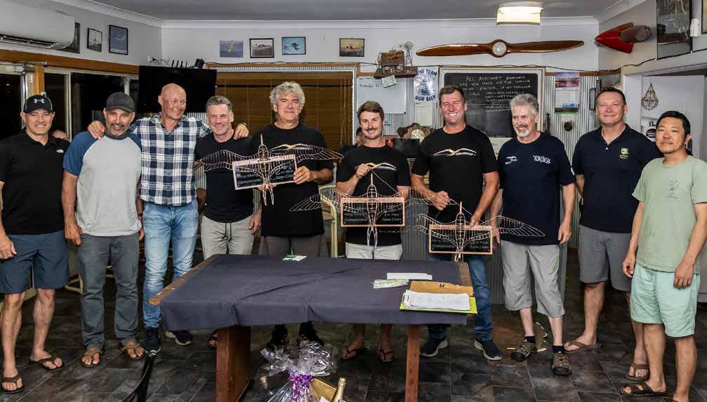
Open Class Top 10 (left to right) Rich Reinauer, USA – 7th, Curt Warren, Australia – 6th, Olav Opsanger, Norway – 4th, Tyler Borradaile, Canada – 5th, Attila Bertok, Hungary – 2nd, Rory Duncan, Australia – 1st, Jonny Durand, Australia – 3rd, Gordon Rigg, UK – 8th, Steve Crosby, Australia – 9th, Yasuhiro Noma , Japan – 10th.
flight with climbs to over 10,000 feet, much of it accomplished on my own, with only occasional glimpses of another pilot in the distance. It’s a big sky out there, and you can lose sight of others quickly. Retrieval in Forbes is made easier since most gates aren’t locked, but landing near a road
if you don’t make goal is highly advisable — those farm padlocks can be enormous, and landing far from access roads will definitely earn you the scorn of your driver and the others riding along in the retrieval vehicle.
I also experienced one of the scarier moments
Emilie Barber of Australia.
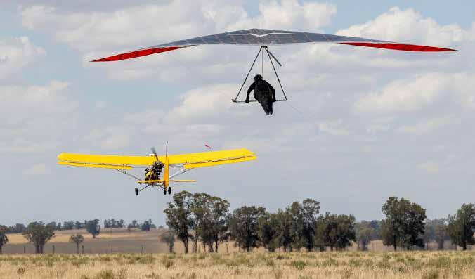
A pilot getting towed up.
of the week: a lockout during a relight that had everyone gasping. I made it safely to the ground, but with rattled nerves and a broken upright. What I remember most afterward were the multiple hugs from those who witnessed it — an immediate outpouring of support that speaks volumes
Armchair SIV Getting Down in 2026 by Calef Letorney
: Staring up at the clouds and wishing you were higher remains the norm for paraglider pilots in 2026, as it always has been. But the opposite is also true. Whether you’re late for work or dealing with a genuine emergency, the potential need for a rapid descent has always been part of our sport.
As paraglider construction changes, so do recommendations for emergency descent techniques. Modern paragliders, especially 2-liners and lightweight constructions, don’t always tolerate the same descent techniques we learned a decade ago. Some methods are fading, others are evolving, and a few may no longer be appropriate. In this edition of Armchair SIV, we discuss how to get out of the sky on a modern paraglider and which techniques ought to be retired with the classic “3-liner” wings.
This article is aimed at “normal” paragliders, not speedwings or parakites, and is a discussion of how changes in equipment impact descent strategies, not a how-to guide. Do not attempt to teach yourself
emergency descent techniques. The safest way to learn these skills is at an SIV clinic.
Avoidance
Let’s start by discussing one of the more consequential reasons for an emergency descent: cloudsuck. Cloudsuck stories almost always start with a pilot intentionally trying to get high. Focused on gaining altitude, pilots recognize the risk of cloudsuck too late. As you climb, thermals widen, and the cloud entrains surrounding air. When you stop trying to gain altitude and attempt to fly away, instead of sink, you can find even stronger lift. And then it happens — you become engulfed in the cloud, and everything gets worse. All sense of direction and horizon becomes lost, and there is only white. Flying straight, hoping to find the edge, doesn’t often work as the cyclonic wind pattern of the cloud turns straight flight into a circle. Navigation gets forgotten while you struggle to keep your glider inflated in strong turbulence.
Condensation forms rapidly on your wing. Water runs down your lines and into your jacket. Wet gliders stall remarkably easily, so the rodeo becomes increasingly violent. Then everything starts freezing. Rime ice rapidly grows on your lines. You shiver uncontrollably and lose dexterity in your fingers. You hope to pop out the top or side of the cloud for a gentle descent through clear air. Don’t count on that. Most cloudsuck stories involve an even more violent and terrifying descent through the cloud. Imagine getting tossed above the glider and doggy paddling through your frozen lines to avoid entanglement as the vario emits a demonic sink tone; it’s that sort of situation.
Yes, the above may describe a worse scenario than some experiences, but remember: when you’re nearing cloudbase, it’s not always easy to see how big or tall a cloud (or surrounding clouds) has become as you climb.
Avoidance is obviously our best defense, but the problem isn’t an unbreakable tractor beam of clouds — it’s pilot complacency. We spend most of our time trying to get higher. Clouds are often quite friendly, especially in moist environments. Pilots get too familiar with flying near clouds and forget (or are unaware) of the horrors discussed above. Then one day, you encounter a cloud with more widespread and stronger lift than anticipated. By the time you recognize the danger, it’s too late.
A good rule of thumb is to always maintain at least a 45° angle (1:1 glide) from the cloud’s edge. In strong conditions, that might not be enough, but the principle is simple: never climb all the way to cloudbase directly under a strong cloud. Move toward the cloud’s edge as you get higher. Complacency is the biggest risk factor, so stay alert and spook early and often.
Emergency descent techniques
Sometimes, avoidance isn’t possible (or you forgot to pay attention to your clearance), and you must fight your way down. The dangers discussed thus far are as old as paragliding, but paragliders have changed dramatically. The pursuit of performance has led to reduced line plans, with fewer line attachment points supported by increasingly complex internal struc-
tures. So what descent techniques are appropriate for today’s gliders, and which prove most useful?
Big ears + speed bar: Despite the modest descent rate, big ears (especially when combined with speed bar) prove useful because you still have forward speed. Escaping lift often requires a combination of actions: run, fight, run, fight, and repeat as needed. Big ears and speed bar play a useful role in minimizing altitude gained while running. Most paragliders can perform big ears, but some do not reinflate spontaneously or may thrash violently. Some glider manuals, especially
BIG EARS
Lowest G-force, lowest sink rate, useful while running.
SPIRALS
Highest sink rate, highest G-forces.
ASYMMETRICAL SPIRALS
High skill requirement, high descent rate, medium-high G-forces, stable in turbulence.
WINGOVERS
Highest skill requirement, high descent rate, moderate G-forces, not ideal in turbulence.
B-STALLS and SPIRALS WITH DEFLATION
No longer recommended on modern equipment.
The author practicing descent techniques.
for 2-liner wings, recommend pulling the outermost rear line to induce a wingtip stall with a similar effect. Consult your paraglider’s manual and practice regularly, because big ears can be difficult and stressful to maintain, especially in the strong and turbulent conditions that necessitate emergency descent.
B-stalls: The B-stall WAS a staple of past SIV clinics because it achieved about -1,600 feet per minute without the uncomfortable G-forces. While this is far from the highest descent rate possible, the B-stall can provide a welcome reprieve from higher G-descents during an extended fight to get down. Whether through age or disability, many pilots are not physically capable of sustaining minutes of high-G emergency descent techniques, making B-stall their fastest way down. Unfortunately, while some manufacturers still recommend B-stalls, this is becoming increasingly rare and limited to normal-weight fabric gliders with three or four galleries of lines. B-stalls are not possible on 2-liner wings and are not recommended for lightweight or hybrid 2/3-line gliders due to the possibility of glider damage with higher loading on the remaining lines and attachments. Refer to your wing’s owner’s manual; it will specifically discuss B-stalls.
Spirals: Turning tighter and tighter until the nose of your glider points at the ground is a tried-and-true way to get out of the sky in a hurry. If you’ve done this before, you know the associated G-forces are hard on your body and the equipment. If you’ve never spiraled before, don’t attempt to teach yourself. Of all the maneuvers taught at an SIV clinic, the simple spiral remains one of the most problematic maneuvers for students to learn. The owner’s manual of nearly all paragliders recommends spirals as an emergency rapid-descent technique. Still, prolonged high-G spirals can stretch lines (putting the glider out of trim) and may damage the glider. This is especially true for gliders with fewer lines and lightweight construction. Each glider spirals a little differently, so practice on what you fly. It’s best to alternate spiral directions to prevent uneven line stretch. Higher-performance gliders achieve higher descent rates with higher G-forces, which makes spirals harder on the equipment and the pilot.
Some pilots find they can’t physically withstand the G-forces of a spiral. To overcome this limitation,
some pilots add a drogue chute — a small parachute deployed from the cockpit and then retracted and stowed. Drogue chutes dramatically reduce the speed and G-forces of a spiral descent, reducing stress on the pilot and equipment while allowing higher descent rates. Consider using a drogue chute if you fly a high-performance or lightweight wing, habitually fly in conditions likely to produce strong lift, or can’t tolerate sustained high G-forces for several minutes.
Spirals with a deflation: Spiraling away from an intentionally deflated wingtip (or both wingtips deflated, like big ears) increased in popularity over the last decade. Much like a drogue chute, this maneuver increases drag and sink rate in a spiral, achieving higher descent rates without the associated increase in G-force. Unfortunately, this descent technique gained popularity just as wing construction began to change. The owner’s manuals for most modern gliders specifically recommend against all forms of spirals with intentional deflations due to an increased risk of structural failure. If your owner’s manual doesn’t discuss this maneuver, I don’t recommend it. Only attempt these maneuvers on a full-weight paraglider with a traditional line plan.
Asymmetrical spirals: Instead of a continuous circle, pilots can rhythmically enter and exit the spiral, creating an oval-shaped turn with lower G-forces than a stable spiral. Asymmetrical spirals resemble a one-sided wingover. Despite being significantly easier to learn than a wingover, it takes most pilots several SIV clinics before they’re ready to practice asymmetrical spirals over the ground. This maneuver demands respect, as mistakes can result in a spin, a large deflation, or an inadvertent hard spiral. Ongoing practice is required to maintain expertise, but it’s a worthwhile pursuit. Asymmetrical spirals are one of the most fun and highest descent rate maneuvers with meaningfully lower G-forces for a given descent rate. Because it’s just a fancy spiral, you won’t likely find this maneuver discussed in your glider’s owner’s manual. But just like a standard spiral, it’s appropriate for all paragliders. Unfortunately, the same cannot be said for potential outcomes of mistakes when learning asymmetrical spirals, so be careful when learning this maneuver on lightweight or reduced-line plan gliders.
Wingovers: Previously, I viewed wingovers as a party
trick rather than a meaningful descent technique, because they’re exceedingly difficult to master and mistakes often lead to terrible outcomes. This opinion was informed by personal trauma; in 2005, my first paragliding buddy died attempting to teach himself wingovers. Wingovers are no less dangerous today, but have become the descent technique of choice for many top pilots because of their high descent rate and low G-forces. This is especially true of high-performance 2-liner wings, which produce great descent rates in a wingover and are less tolerant of the other high-G-force maneuvers. However, the need for discretion cannot be overstated. A blown wingover can spin or result in a massive deflation quickly followed by a violent spiral. Even “small” wingovers can have disastrous consequences because lower energy means a higher risk of a spin. This maneuver should only be learned at an SIV clinic and subsequently practiced with ample altitude to deploy your parachute. Having said all that, unless you’re using a drogue chute, wingovers appear to be one of the most effective descent techniques for modern performance-oriented gliders.
Wingovers are also great fun to practice, and they are currently my preferred descent technique, except in strong turbulence, when I opt for asymmetrical spirals.
: In conclusion, read your glider’s owner’s manual and practice. A friend of mine once referred to vehicle owners’ manuals as “the most expensive and least read book in America.” The paraglider owner’s manuals appear to be a close second. With changes to glider construction, it’s worth revisiting which emergency descent maneuvers are still recommended. On the other hand, paraglider manuals are not laws of nature; they contain manufacturers’ recommendations influenced by assumptions and biases. Just because the manufacturer recommends a specific emergency descent technique doesn’t mean there’s no risk of equipment damage. Conversely, in an emergency situation, you may choose to act outside those recommendations because you’re the pilot in command of the fancy plastic bag. Inform yourself, practice regularly, and use your best judgment.
Happy flights and soft landings.
FLYING PATAGONIA
Chasing Endless Summer
by Kristopher (Kris) Holub
: Before my paragliding obsession managed to ruin my climbing career, I was once an aspiring alpinist with dreams of climbing in one of the most legendary places in the world: Patagonia. Patagonia is perhaps best known for El Chaltén, the “backpacking capital of the world,” and home to the iconic Fitz Roy skyline of towering granite spires. It also has an equally fearsome reputation for high winds, harsh weather, and wild remoteness.
What is somewhat less well known is that Patagonia is a massive region in southern Argentina and Chile. It spans more than 400,000 square miles and contains diverse biomes, ranging from rainforests to glaciated alpine fjords to volcanic remnants and high desert plateaus. It’s essentially equivalent to smashing together Washington, Oregon, Colorado, and Wyoming, with a similar variety of landscapes, but with transitions between areas occurring so abruptly that it’s possible to visit all or most of them in a single flight.
Culturally, it can most aptly be described as a fusion of easygoing, sociable Spaniards, elite Swiss mountain-athlete chic, and rugged American frontiersmen. It’s a distinct contrast from the rest of Latin America, with an overall vibe far more familiar to North Ameri-
can and European lifestyles.
The vast expanse and seclusion of the Patagonian wilderness are impressive even by North American standards. With a population density ranging from two to five people per square mile, it’s comparable to the most remote regions of Wyoming and only slightly more inhabited than Alaska and British Columbia. Settlements are often only a small collection of buildings and are few and far between, with hours of driving between gas stops. Paved roads are sparse, with almost everything connected by dirt and gravel roads, which don’t even show up on Google Maps.
In the mountainous areas, it is easy to land in places where it is a minimum of a two-day hike without a single trail, road, or infrastructure whatsoever. It goes without saying that cell phone coverage outside of towns is nonexistent. On my first flight in Patagonia, I flew a short 70 km out-and-back to a nearby volcano.
A month later, I backpacked the same line, and it took me four days to cover the distance on foot, which I flew in 45 minutes. Only then did I begin to comprehend the epic remoteness.
I had imagined flying over the epic Patagonia land-
Established in the dry-line convergence. Photo by Kris Holub
Established into the convergence directly from takeoff. Photo by Kris Holub
scape, but had mostly written it off due to hearing how limited the opportunities to fly were. I was aware that flights did happen in the region, but they were largely off the radar for most pilots, and the flights tended to be limited in both size and frequency, save for a select few instances. The place had a reputation for being inconsistent, challenging, and difficult to get to, making it a far less attractive winter destination for air-hungry pilots than the classic meccas of Mexico and Colombia. In an admission of American geographic ignorance, I was surprised to discover that, despite being on the same continent and hemisphere, Bariloche, Argentina, is actually 100 miles farther from Roldanillo than my home in Boulder, Colorado, is. For most pilots, it simply doesn’t make sense to gamble a precious few weeks of annual vacation time on traveling to one of the most isolated places in the world to chase committing, inconsistent, unknown, and logistically complicated flying, regardless of how beautiful or epic it could be. However, I’m in a fortunate position in life where these factors were more of a challenge and opportunity than an obstacle. I just passed the four-year mark since leaving my engineering job and have been sustaining a lifestyle of nonstop travel with intensive periods of
teaching SIV and acro, which has blessed me with the freedom to travel essentially year-round.
I had previously spent the last two winter seasons entirely on the classic Valle/Roldanillo circuit chasing it hard, including the all-time epic conditions of early 2024. Despite how good and consistent those places are, I found myself feeling a bit of Groundhog Day and lacking inspiration to repeat it for a third year running — truly first-world pilot problems.
South Africa, Australia, and New Zealand were high on my list of places to visit, but what tipped the scales was my friend Marcos Rosenkjer, who was born and currently lives in Bariloche. Marcos grew up in the United States and lived in Boulder for a few years, which is where we met while flying at the local hill. He moved back to Bariloche during COVID and has been enjoying life so much that we hadn’t seen him in years. He invited me to join him for the winter, and after quizzing him about the lifestyle and conditions, I decided to roll the dice and try something new.
: By chance, the first day of flyable conditions occurred on my third day in Bariloche in early December. It was sunny with light winds, and, with minimal
The Estepa region taken on a separate 285 km open distance flight. Photo by Kris Holub Heading towards Villa la Angostura after reaching the San Martin de los Andes turnpoint . Photo by Franco Latanzio
“For most pilots, it simply doesn’t make sense to gamble a precious few weeks of annual vacation time on traveling to one of the most isolated places in the world to chase committing, inconsistent, unknown, and logistically complicated flying, regardless of how beautiful or epic it could be.”
briefing, we took a 20-minute Uber to the local takeoff. We launched, climbed out, crossed to the local ski area, then flew directly across the middle of the national park, my jaw hanging slack at the expansive vista of alpine terrain leading straight to a 12,000-foot-high glaciated volcano in what was already my deepest, true mountain flight to date. We top-landed right at the base of the glacier on the volcano, to briefly visit the refugio full of backpackers, only to discover that the katabatic flow off the glacier required a downwind takeoff across snow and rocks, which ended above an 800-foot cliff. After a harrowing takeoff, we immediately found a climb to 10,000 feet and cruised back over the national park all the way home. Welcome to Patagonia.
The very next day, we had the opportunity to fly a downwind convergence flight in the Estepa. The Estepa is a high-desert plateau, or “steppe,” that spans all of Argentina from west to east. It’s an arid, remote, nearly uninhabited tract of barren land that begins abruptly at the foothills of the alpine terrain, forming a dramatic transition similar to the rise of the Teton Mountains from the arid plains. There are no lakes, streams, rivers, or trees in the Estepa — just small sagebrush-like bushes, cacti, and intermittent areas of volcanic glass and dried salt beds. It looks and feels shockingly similar to central Wyoming, only even more desolate and empty.
There are stretches where you can’t even see the next road, which is why Marcos generated a waypoint file of various roads and homesteads so we could figure out where to glide to. In order to get home, he carried a mobile Starlink dish in the retrieve truck. Google Maps would be of no use since most of the roads weren’t even marked, so in the event of an outlanding when we weren’t following a road, we could communicate the nearest waypoint and use Starlink-enabled satellite maps to manually find a route. There are sections of the Estepa where the nearest road can be as much as 20 km away, mandating either following a road or truly believing.
Flying the Estepa is Wyoming déjà vu. Thermals of 5 and 6 m/s are common, and 7s and 8s are out there, and can reach altitudes of more than 5,000 meters. The Estepa also commonly forms a dry-line convergence, similar to that found in Texas, generating a cloud street that sometimes stretches more than 500 km and extends all the way to the Atlantic Ocean.
The very next day after flying a volcano out-and-back, we launched ourselves into the desert and flew 200 km over more than eight hours, landing 20 minutes after the sun dropped below the horizon. It was my first time landing after sunset. We never quite connected to the convergence, as it was slightly out of reach from our starting location. Still, we proved that the idea was sound, and I was convinced that, after flying two out
Hernan Pitocco, Tomas Orol, Marcos Rosenkjer, Seba Quiroga, preparing to break camp. Photo by Alex Young
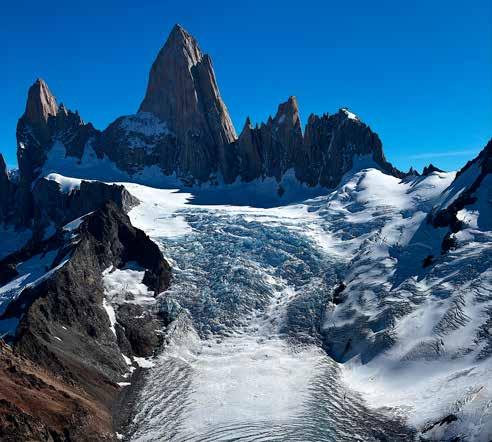
Fitz Skyline—The Fitz Roy massif near El Chaltén, inspiration of the iconic Patagonia logo. Photo by Kris Holub
of my first four days in Patagonia, this was the greatest flying site on Earth. Then, for the next three weeks until the end of the year, we were grounded by relentless wind and rain. Welcome to Patagonia.
During those three weeks of weather, I began to question my decision to spend the sea here. Locals assured me that this was an unusually brutal stretch of December weather, and just before New Year’s, the skies parted and summer turned on. We managed another Estepa flight, which granted us the most incredible climb of our lives: a low save from a dust devil 150 meters off the deck that turned into a sustained 3,800-meter climb, peaking at 8.5 m/s and 7.7 m/s on average. Not only was it one of the longest and strongest sustained climbs of my career, but it was smooth the entire way and topped out at 4,800 meters, complete with a full-bar escape from the white room.
We managed to stay wingtip to wingtip for the entire 8.5 hours, finishing at 285 km and narrowly missing another sunset landing by mere minutes. We were so far from home that we camped that night and spent the entire next day driving home. But fate wasn’t done with us: the very next day after arriving back in Bariloche, excellent mountain conditions presented themselves again. After nine hours, we completed a 180 km triangle on a new line over some of the deepest terrain in the entire area, narrowly avoiding multiple bombouts in tiger country and landing a short distance from the car.
Seeing the epic time we were having, three friends from Colorado who had previously visited Bariloche but were denied exceptional flight conditions came out. For the next three weeks, we went on a tear, flying some of the most incredible terrain and lines I’ve ever had the privilege of seeing, providing a bottomless well of para-babble and spray while our other friends in Colombia were stuck with terribly wet conditions.
By late February, I had been averaging about one fantastic flight per week, with a smattering of smaller flights in between. The longest dry spells lasted about 10 days as windy conditions became increasingly frequent and the days gradually grew shorter and cloudbase lower. But the gaps in flights hardly bothered me, as the exceptional quality of each line satiated me, and during the off days, there was no shortage of things to do. Patagonia offers endless options for ground activities: world-class backpacking, climbing, wing-foiling, and a vibrant social scene. Unlike many other paragliding destinations, you’re having a great time in a beautiful place even if you aren’t flying. The crown jewel of our Patagonia summer arrived in late February. A stretch of five good days appeared on the forecast, good enough for three top Argentinian pilots to fly in just to catch the window. We gathered at Marcos’ house on a Thursday evening to plan our triangle when I noticed that the Saturday forecast now showed a perfect convergence line starting in the mountains near Bariloche and extending all the way to the sea. I proposed that we use the first day to fly into
the mountains and bivy in the highest, deepest mountains where the convergence was forecast to form early the following day. The team loved this plan, and seven of us set up for the mission.
I’ve spent plenty of time camping in the mountains, but had never actually vol-bivied before this, beyond hiking up and camping for an alpine sledder. Packing was similar to backpacking, except you had to be even more selective about the bulk and weight you could bring. I elected to forgo a tent entirely, as there was no rain in the forecast.
On day one, we completed a short 60 km flight and top-landed to spend the night in open air and clear skies. Without a tent, I was treated to a spectacular, light-pollution-free view of the Milky Way and the
Southern Cross. The next morning, we took a leisurely breakfast and a short hike to the high point to check the winds, which were nearly zero. We waited for cycles that felt like a sure bet, out of fear of blowing a fantastic day and the extreme inconvenience of bombing out in the remote valley below. At noon, the cycles started feeling nice, and we launched, only to immediately encounter a 5 m/s thermal that took us directly to over 4,000 meters and into the convergence, as forecast. We kicked ourselves for not having launched an hour earlier.
All seven of our team climbed out, and then it was competition-style gaggle racing for 30 km across the alpine, chasing wispy clouds that marked the convergence as we watched the main cloud street forming far
Marcos Roskenjer and Franco Lattanio lead out towards San Martin de los Andes during a 180 km mountain triangle.
Photo by Kris Holub
in the distance in the Estepa. As we exited the mountains into the desert flats, we lost our first teammate as he top-landed in a valley and radioed that he would hike back up to relaunch and not to wait. From there, we did our best to follow the invisible convergence, since the main part was still blue and the clouds we could see were far apart—the forecast called for this blue convergence line on the edge of the cloud bank. In hindsight, we realized we were too far upwind and wasted the first three to four hours of the flight unnecessarily fighting the crosswind when we should have flown downwind, farther south, into the real line.
As the day progressed, our group got gradually fragmented, and I found myself alone, though in visual contact with my four remaining friends, always just out of reach. By 4 p.m., we finally arrived under a wellformed cloudbase and increased our average speed to 40 km/h, up from a pedestrian start to the day. As the day grew late and the sun fell low, shadows from the well-formed convergence made conditions desperate down low. At 280 km, I found myself low and alone, praying to the lift gods to grant me one last climb to
break the 300 mark, which I had never managed in my career. The gods answered, and granted me one final climb all the way back to cloudbase, where I finally caught up with Marcos. We were still 6,000 feet above the ground as we watched the sun drop below the horizon and illuminate the clouds from below.
We realized that we would run out of visibility before we ran out of altitude, and went full bar to the ground, landing in twilight 345 km from where we took off.
With our retrieve still hours away, we elected for a second bivy in the middle of nowhere with smiles and full hearts.
As March arrived, the days grew shorter and more stable. Though I still managed to visit El Chaltén and fly small thermal flights under the Fitz Roy massif, the same skyline that originally inspired me to come to Patagonia. I think for the right adventurous pilot, there is tremendous untapped and unexplored potential, including the possibility for record-breaking open distance. I can confidently say that this is now my favorite place to fly, and I plan to return, hopefully bringing more friends to share it with.
Ethiopia
by Mariyan Radev Ivanov
Advice for exploring these remote lands
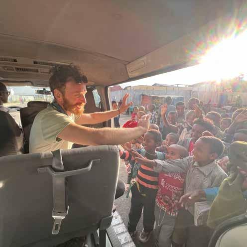
: For a small but ambitious paragliding club from Wisconsin, USA, undertaking a paragliding journey through the Federal Democratic Republic of Ethiopia came with significant unknowns. Winter above the 43rd parallel north can be a bit difficult to swallow at times, but it provides a good staging ground for planning long-distance paragliding trips. I have been to other countries in Africa on multiple occasions, but a backcountry adventure and XC flying in the Horn of Africa was “terra incognita” for us. It took us two years to plan and execute the trip due to multiple uncertainties. The country is home to many ethnic groups, with a handful of traditional faiths and beliefs. Ethiopia has been, and remains, on shaky ground due to ongoing or renewed tribal disputes. Additionally, there are border disputes with Eritrea to the north, South Sudan to the west, and Somalia to the east. Therefore, we thought it best to
Crossing the Bale Mountains National Park. Photo by Mariyan Ivanov
Searching for a take off spot — David Marthe on the way from Humbo. Photo by Mariyan Ivanov
join a crew that knew how to handle the logistics.
The Bulgarian paragliding club SkyNomad has a long tradition of adventure exploration in Ethiopia and Kenya. Originally Bulgarian myself, I had no one better to turn to than Nikolay Yotov. Niki (sometimes called Niko by foreign pilots) has a reputation as an excellent paragliding instructor and holds a wealth of knowledge about backcountry flying, weather, and navigation in the region. He knows Ethiopia like the back of his hand and is a walking — and flying — encyclopedia. He was instrumental in organizing our government-signed letters permitting us to paraglide in Ethiopia.
Ethiopia is a beautiful country, but it is not ideal for large paragliding groups, as the logistics involved are complex. We were just two people from Wisconsin: David from Madison and myself. In Addis Ababa, we teamed up with two Romanian pilots, Lician and Bogdan. Because of tensions in certain regions, choosing flying routes and support along the way was not taken lightly. Heading southwest toward the Kenyan border appeared to be a more predictable and generally safer route for cross-country flying and exploration. That was our goal.
Niki arranged a reliable minibus and an ever-positive Ethiopian driver, Abel. Abel is a member of the
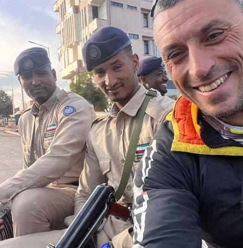
Amhara tribe and hails from the northwest part of the country. Even though he knew and navigated the southwestern routes of Ethiopia very well, we were still extra cautious. We avoided driving at night, deliberately skipped some police and army checkpoints along the way, and showed extra friendliness at every corner.
Ethiopia lacks a paragliding community, and there are no designated paragliding sites. The small number of occasionally visiting adventure pilots must improvise when finding suitable takeoff spots each morning. All we had was a rough route and a ridgeline or cloud street we wanted to follow. Where the exact takeoff would be — and where the landing might end up — was sometimes shrouded in mystery. Certainly, some of the places we landed were firsts for a paraglider.
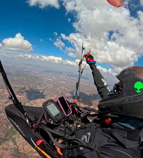
Every morning, Niki would give us A or B routes to choose from based on the weather. These routes would occasionally take us over terrain and features many of which had rarely, if ever, been flown before. There was no playful ridge soaring or local flying— we would take off, thermal up, and continue the XC toward our goal for the day. Many of our improvised takeoff sites were accessible only by foot, so our daily hikes ranged from 30 minutes to three hours with
In pair with David approaching Selam Ber. Photo by Mariyan Ivanov
The Leap of Faith into the Gasera Gorge — take off from Guranda Arsi. Photo by Nikolay Yotov
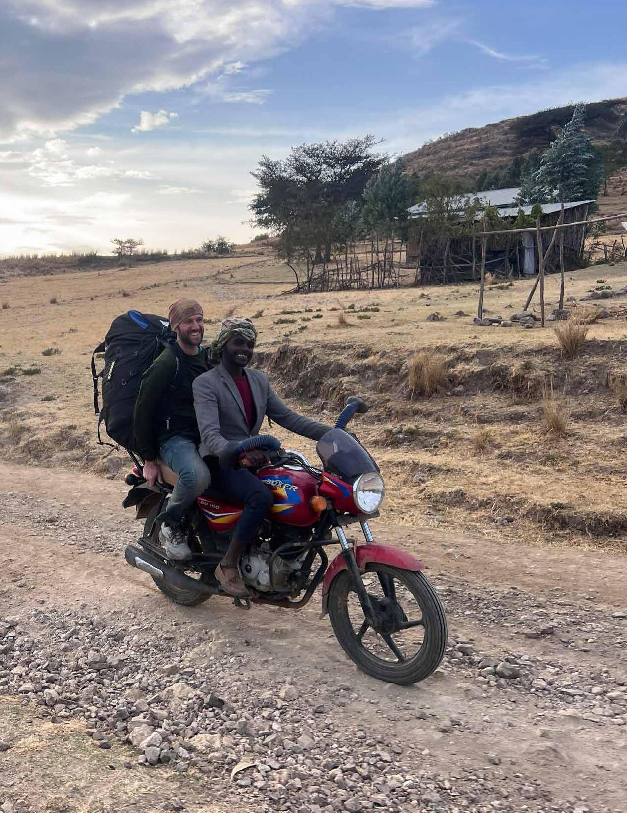
gear. At times, we were able to negotiate transport on mopeds or with porters as far as they could go, and from there we continued on foot.
Ethiopia is best suited for small, agile groups. Hotels in the countryside are few, small, and often full, making accommodations difficult to arrange. Sharing a room is also uncommon in this part of the world, so finding a place with enough open rooms could be a challenge. Having more than one vehicle can be problematic and strain the entire experience. The roads we navigated in the Oromia, Central, and
Southern Nations regions were rough — broken asphalt, dirt, and dust dominated the somewhat drivable roads. Our minibus could only stay on the main roads, as driving off into the bush for retrievals was not ideal. In addition to frequent power outages, Ethiopia faces severe fuel shortages, making it infeasible to rely solely on gas stations. We carried and guarded external fuel tanks on top of our minibus. Given limited hotel availability, rough roads, and fuel shortages, a small group traveling in a single vehicle is definitely the best approach.
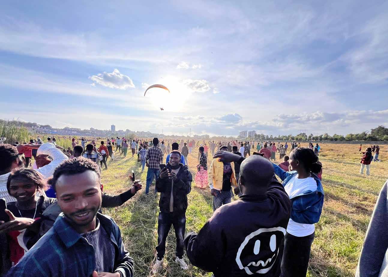
Bogdan saying Goodbye after landing at Robe. Photo by Mariyan Ivanov
After landing in downtown Hosaina. Photo by Mariyan Ivanov
Gasera Gorge to the east. Photo by Nikolay Yotov
A faraway landing often meant a lengthy self-retrieve to a main road, where we could be picked up by our bus — or we could make our own way to the day’s goal. As cautious as we were, after a remote landing near the Awash River on the first flying day, roughly 60 km from Addis Ababa, David and I experienced the uncertainty of Ethiopia firsthand. We were detained in a military compound where we spent several hours reasoning with the friendly yet
strict soldiers. We were released only after the staff received a message from the Ministry of Tourism containing our flying permits. After that incident, we carried copies of our permits at all times.
The ideal paragliding adventure seeker in this part of the world is someone who does not complain, can make a positive experience out of every scenario, can fly and navigate independently, and, last but not least, exhibits strong and empathetic social skills. Your ability to meet and embrace people will be tested.
Nearly every seemingly remote landing or takeoff quickly became a spectacle. Landings were often a game of misdirection, as we would initially fly in one direction to mislead onlookers, then turn and land elsewhere, buying ourselves a few precious moments to pack before groups arrived. Crowds appeared from all directions, driven by pure curiosity to touch, talk, and interact with us. That said, in our experience, village officials, elders, soldiers, or police would often arrive to investigate and physically scatter the crowd. People were friendly yet brimming with energy, having never seen paragliders descend from the sky.
English is barely spoken in the countryside, so patience and a friendly attitude are essential when crowds innocently but energetically approach you.
David landing at Hosaina. Photo by Mariyan Ivanov
Cloud streets over Hamera. Photo by Mariyan Ivanov
Upon landing and packing, our priority was sending our location to our driver, though this was secondary to establishing good relations with locals. Pilot-to-pilot communication was conducted via radios, as cellphones often lost reception above certain altitudes. Local SIM cards provided decent, though inconsistent, internet, but eSIMs were unreliable. It is worth noting that satellite phones, GPS devices, Garmin trackers, and radios are officially not welcome in this “Land of Origins.”
When flying, even though we planned to wait for each other in thermals, it was rarely possible. Ethiopia is high ground, and our launch sites in the southwest were between 6,000 and 8,000 feet ASL. Cloudbase ranged from 13,000 to 16,500 feet on average, with stunning cumulus clouds lighting the sky in all directions. With so many routes and thermal options, keeping visual contact with one another was difficult. Another factor that eased XC flying was the abundance of avian creatures, which would get incredibly close to you in the air. Eagles, vultures, and the Jurassic-looking marabou storks would appear at various altitudes and fly in random directions, often luring us away into better and better terrain.
The landscape of southwestern Ethiopia is diverse — from steep canyons and ridgelines shrouded in clouds to long plateaus and valleys teeming with life. The unique sensation of being among only a handful of pilots in the sky across the entire country created a magical feeling of doing something truly memorable. Flying conditions were excellent, and although we experienced some low saves and unexpected landings, most days we reached our goal or came as close as possible.
Wind direction in December and January in this part of Ethiopia is relatively predictable, making XC feasible yet still challenging. Daily goals ranged from 80 km to 160 km, traversing stunning views and cloudstreets. Southwestern Ethiopia has very low air traffic, allowing pilots to enjoy the airspace largely to themselves.
: Southwestern Ethiopia was breathtaking in every way, and 19 days were not enough. There is much more flying to be done in this country. Northern Ethiopia is home to spectacular scenery, as well
MEMORABLE FLIGHTS AND EXPERIENCES
Upon departure from the ridgeline above Sawla, we were stunned by an immense cloud formation rising from the jungle more than 16,000 feet. It felt as though Mother Nature herself was discouraging us from exploring the more remote and sometimes unsettled land to the west.
Gasera Gorge launch was a true Leap of Faith. The site offered no room for error due to its cliffy nature, lack of bailout options, and absence of an LZ. We waited for birds to indicate the presence of thermals, ensuring we could climb above the ridge and escape on the first attempt. Tricky launch aside, the reward — soaring above picturesque canyons and flying cross country to Robe City — was priceless.
The route from Agarfa along the northern edge of Bale Mountains National Park, all the way to the flats of Dodola, was flown almost entirely at cloudbase, with ballistic thermals keeping us on edge.
Finding blue-sky bubbles from Tebela across the mountain plateau at Zefne, then west toward Selam Ber and beyond, was both mindblowing and thrilling.
From Butajira to Hosaina, we encountered constantly changing wind conditions. Upon arrival in Hosaina, however, eagles and vultures filled the sky, forcing us to physically dodge this avian congestion.
Near the village of Gora, east of Addis Ababa, we were pleasantly surprised by another picture-perfect, seemingly endless canyon — one we could not get enough of.
We skimmed Wonchi Crater Lake, roughly 150 km west of Addis Ababa, peeking into its rim and lush green slopes from above.
as religious and historical sites. Paragliding pilots have flown there in the past, but now, the region is off-limits due to its volatile political situation. Niki mentioned it may take another five to 10 years before northern Ethiopia is safe for paragliding again. Until then, we patiently wait — and fly in the south.
P2 Pilots Take Over Pran Buri, Thailand
by Paige Schemenauer
: It had only been two months since I earned my P2 when Matty Senior, owner of Northwest Paragliding, gave a convincing sales pitch to join his tour in Thailand. Brittney Sutton, a friend I made during the P2 course, was sitting next to me on the bumpy ride up to launch while Matty raved about Thailand — “the best place in the world” — and told us the dates.
“That’s over my birthday,” Brittney said to me.
To which I replied, “That’s over my birthday!”
We shot each other a look that said, “I’d go to Thailand if you’d go to Thailand,” and within the next month, we had signed up and convinced two other P2 pilots to join as well.
Fast forward to February 2026: seven P2 pilots from Seattle arrived in the small coastal town of Pak Nam Pran to explore new terrain and embark on what would probably become the greatest trip ever. The seven pilots were individuals whose paths would likely not have crossed without paragliding.
Our group included Ben and Brianna Landis, a lovely married couple with matching red gliders; Jeff Kilpatrick, a part-time climbing guide whose skills
became very useful after a tree landing; Brittney Sutton, a young nomadic ski bum; Michelle LaMar, a retired mother who had a knack for keeping people on their toes; Sierra Schemenauer, my older sister who had more playlists prepared for this trip than a local DJ; and then the youngest and least experienced of them all, me. The whole group ranged in age from the 60s to the mid-20s.
On this tour, we were led by two of the greatest
guides one could ask for when flying in Thailand. The first was Matty Senior, whose part-time home is in Thailand. A tour with Matty doesn’t only mean you get a great coach, it also means a culinary guide, a cultural educator, and someone who knows where the good bars are. The other guide was Bronson McKinley, who, on countless occasions, rallied the troops and constantly kept spirits high, starting each day with: “Ya know, I think today probably has the opportunity to be the greatest day ever!”
They briefed us on launch and landing zones, talked us through tricky thermic days, and corrected many little bad habits that helped make us all better pilots throughout the trip.
Being based in Pak Nam Pran situated us right between two uniquely different and independently stunning launch sites. To the north was Kao Dan, a site primarily surrounded by dry farmland. During this time of year, the area looked more desert-like than the tropical Thailand we had pictured. The launch was surrounded by small trees that definitely spiked the blood pressure on a few takeoffs. This site had a variety of thermal triggers: if you could climb
high enough, you could reach the ridge behind it and continue from there.
The second site, called Pu Am, was to the south, just off the coast, where you got a combination of smooth
Pilots getting ready for launch at Pu Am. Photo by author Ben and Michelle going to look for thermals over at Pu Am. Photo by author
Chuck with local birds at Pu Am . Photo by the author
coastal air mixed with some thermic activity from the black rocks at the base of the ridge. Here we launched from a small clearing among a forest of bamboo. The ridge was long and allowed us to play around in a relatively safe area with irrigation ponds and tractors moving below. The more favorable landing zone turned out to be a road between two pineapple fields, which appeared soft from the air but, upon closer examination, looked less desirable.
The trip consisted of eight flying days that took all of our abilities to the next level. All of us set personal records in flying time and height, and gained a better understanding of thermals and how they operate. But the learning wasn’t always smooth sailing. Paragliding is a scary sport, and venturing into new elements can bring out that exact emotion.
One particular flight really got to me. I launched in stronger winds than I was used to and got plucked right away. I quickly bombed out and started my landing approach into what, at the time, was the first landing zone I had ever used outside my home mountain. I landed just fine but felt like a mess. I was scared, and my body felt in shock from everything that had just happened during that flight.
Sierra and Brianna landed shortly after, and we packed up together. They could tell I wasn’t processing things well, so they gave me water and worked
to make me feel better, even getting me to dance to shake off the jitters. They made the feelings lighter and eventually convinced me to go for another round. We went back up to launch and had a beautiful sunset flight that was fun and more relaxed.
At the end of the day, it wasn’t our altitude but our attitude that made this trip so amazing. From sled rides to personal best flights, our whole group was giving high-fives across the board. The joy of the group was evident in everything from handing off a cold beer to a pilot at the end of a landing to van ride dance parties and impromptu karaoke on the way to launch.
Our time as a group in hour-long van rides or waiting around on launch turned into some of the most memorable moments of the trip. We had the opportunity and openness to let conversations dive deeply into religion, the shared tragedies of losing loved ones, and the challenge of defining yourself at any stage of life. We never segregated ages into isolation, but instead allowed the multitude of life experiences to shine through in every conversation.
This group brought curiosity, vulnerability, life experience, and enthusiasm into all kinds of discussions, whether it was a heavy conversation, a sing-along, paragliding, or racing scooters down quiet roads. There is a lot more to paragliding than the time spent
Sierra getting some midday napping in between flights.
Photo by the author
The students take a picture together before launching.
Photo by Birttney Sutton
actually piloting.
In a separate world from paragliding, we as a group may have never come together. But here we were able to connect, learn, and grow together in a meaningful way that helped shape our own piloting styles. We all brought different experiences and backgrounds, and learned from each other as well as our coaches. Spaces like this are important because being in the air is only half the adventure. The rest lies in the company you find yourself surrounded by.
Bronson looking to land at the road between pineapple fields. Photo by the author
The crew gaining altitude at Kao Dan.
Photo by the author
The Lesser Known
A Morocco trip report by
Boris Shvidchenko
: When it comes to paragliding destinations, most pilots gravitate toward the more well-known areas where established launch sites, straightforward logistics, and easy travel are the norm. Colombia, Valle de Bravo, Europe, and the Alps all come to mind as common getaways.
However, there are countless raw and lesser-traveled locations out there beckoning to be explored — places where established launches may not exist, XC potential is unlimited, and new lines wait to be discovered. For
pilots with a keen eye and a desire for something new and adventurous, these areas offer unique experiences. That premise drove a trip to Morocco that four of us took at the end of November 2025. By no means an entirely exotic location, Morocco nonetheless offers pilots the opportunity to explore a more obscure destination with beautiful, rugged terrain, a vibrant culture, and seemingly unlimited potential for XC, vol-biv, and local exploration. Big, smooth thermals, friendly skies, and stoked local pilots make Morocco a great winter
Jason over the main spine of Ait-Ourir.
Flying over the small village of Zaouit Sidi Driss at Ait-Ourir. Photo by the author
Old streets of Marrakech. Photos by the author
or early-spring escape from the cold and snow of Europe and the U.S.
After a long day of travel from the States, three of us met up with another traveling pilot in Marrakech before sharing a taxi to our main home base for the week — a small, humble riad near the main launch site of Aguergour, close to the small village of Zakita.
Depending on the time of year you visit Aguergour, the surrounding landscape might be either lush and green or dry and desert-like. Either way, the area is breathtaking. Local villages dot the terrain, and the Atlas Mountains are silhouetted to the south — the area feels wild.
Our first couple of days, we primarily flew in Aguergour, focusing on local flights and small triangles. On weekends, the site is quite busy with local pilots and tandem operations, but simply venturing away from the main launch, the skies became quiet, open, and full of potential. Local XC is possible but requires some consideration given nearby airspace, off-limits zones, and potential retrieval difficulties. Connecting with local pilots beforehand is the best way to get an idea of where you can or cannot fly.
That said, it is fairly easy to do small local triangles and explore the nearby villages from the air. There is something special about flying over isolated towns tucked away into seemingly inaccessible gorges and hearing the call to prayer while you’re hunting for your next climb. Come with an adventurous spirit; this place has a lot of potential.
After a few days adjusting to the new time zone, we ventured to a ridge soaring site east of Marrakech called Ait-Ourir. Perched on a rim overlooking the Jason soaring the rugged ridges of Ait-Ourir. Photo by the author
A pilot over Aguergour. Photo by the author
Oued Zat River to the northeast and the town of Ourika to the southwest, it’s an afternoon site offering amazing soaring with occasional thermals. Access to the main launch requires passing through private property, so going with a local is strongly advised. On our second visit to Ait-Ourir, our driver had to negotiate with and obtain permission from the local farmers for us to pass. Nearby restricted zones limit XC options here; however, the local scenery makes even a local flight worth it. Sprawling villages and towns, old ruined forts, and the looming Atlas Mountains make this place spectacular.
We had ideas about potentially attempting some new XC lines in the area, so a few days later, we ventured to a lesser-known site called Ait Barka, located in the mountains above the town of Touama to the north. With a long 4x4 drive, an approach hike, and a somewhat committing launch, this place encouraged tenacity. Yet the surrounding mountains and ridges offered numerous lines to fly in all directions. Our plan was to fly west back to Aguergour, which lay roughly 60 km away.
Two pilots managed to launch; however, with stable conditions and katabatic flow beginning to shut the site down, the prospects of XC flights deteriorated. With increasingly unlaunchable conditions building,
the rest of the team opted to bail.
On the way down, things got interesting. We were stopped by the local police, who informed us that paragliding was forbidden in the area — something the local pilots hadn’t known or anticipated. The adventure continued late into the evening, ending with our team back in Touama for questioning. After a
A typical village in the mountains of Morocco, My-Brahim, just to the east of Aguergour. Photo by the author
A group of pilots thermalling over Aguergour, looking south toward the small village of Agdour Kik. Photo by the author
few hours of negotiations between our driver (on our behalf) and the police, we were let go, with no gear confiscated and only photocopies of our passports taken. Such is the reality of Morocco; come prepared for bureaucracy and unplanned surprises!
The area around Touama and Ait Barka is stunning, regardless. Being at a higher elevation, the place is more forested and vegetated, and the snow-topped summits of the Atlas range are closer. Aside from potential restrictions, this area definitely has the potential for beautiful XC on the right day.
We spent our remaining days back in Aguergour, flying locally and exploring the nearby areas, including some small XCs. Conditions during our trip were somewhat stable, and as such, longer flights were put on hold for the most part. We agreed that visiting the area in the spring would likely bring more promising conditions for XC. Nevertheless, the flying was smooth and enjoyable — launch, thermal, top-land, repeat.
Aguergour tends to turn on later in the day, which made for long, leisurely mornings. We filled them visiting the local markets and villages while we waited for the day to get good. I highly recommend it for anyone interested in experiencing the vibrant, sometimes bustling culture of village life.
After a full week flying the foothills of the Atlas range, exploring the local areas, and getting a taste of what Morocco has to offer, it was time for us to head home. We spent an additional day in Marrakech, overwhelmed by the chaos, before heading to the airport for the long journey back to the States.
Morocco is an amazing country to visit and explore as a pilot. From mountain flying in the foothills of the Atlas Mountains near Marrakech to coastal soaring opportunities near Agadir, this place has a lot to offer for beginners and advanced pilots alike. It is wild,
vibrant, and exciting, and holds great potential for new lines and routes for adventurous XC pilots — just be prepared for the bureaucracy and other challenges that come with it. Getting in contact with local pilots, guides, and outfitters is a great idea, as it will allow you to gain local know-how of the surrounding areas, including airspace restrictions and off-limits areas. Go prepared, have fun, and remember that there are so many places out there that beckon to be visited and flown.
Main launch at Aguergour. Photo by the author
Ruins located near the main launch of Ait-Ourir. Photo by the author
Thermals dont wait
Neither should your Vario
Fully integrated GPS Variometer with AIRSPEED SENSOR
- Instant Total Energy Vario
- GPS Logger
- Airspeed measurement
- Precise and high resolution wind calculation
- Vario netto
- Fully configurable via BLE
Integrates with : XC Track, FlySkyHy, XCSoar, SeeYou Navigator
Jason in a thermal at Ait-Ourir. Photo by the author
Flying Full-Frontal Paragliding
by Luke Fanning
: Of all the features that make for a great paragliding site — reliable weather, easy retrieves, and good infrastructure — Juneau, Alaska, has none of them. For the 20 pilots of the Juneau Eagles Paragliding Club, persistence is the price of admission. The reward is access to some of the most spectacular flying imaginable — spectacular enough, as it turns out, to wind up featured on a beer label.
Southeast Alaska is rainforest country, and Juneau averages nearly 70 inches of rain a year. As flying sites go, it may win the unofficial contest for the fewest flyable days in the United States. The running joke is that in Juneau, we don’t fly pre-frontal or post-frontal — we fly full-frontal: wedged between the tail end of one weather system and the leading edge of the next. Juneau sits on a narrow strip of land between the Gastineau Channel and a steep mountain range that rises quickly from the ocean. Technically speaking, Juneau is an island and is surrounded by water on all sides. It’s just that most of that water is frozen. The Juneau Icefield, roughly the size of Rhode Island, separates coastal Alaska from Canada and contains more than 1,000 glaciers. With ice, rivers, and ocean hemming it in, there are no roads into Juneau. You can only get here by boat or airplane.
in Juneau, Alaska
Kate readies for a sunset flight. Photo by Nate Geary
When the clouds break, and the sun comes out, Southeast Alaska opens up all at once. On good days, the flying can be unforgettable: towering alpine mountains and glaciers below, and mountain goats and bears on the ridgelines. But flying in Juneau is an exercise in self-reliance — nothing is handed to you. Forecasts are built for 737s, paragliding-specific weather tools are scarce, and the nearest weather balloon is 200 miles away. That means you fly the day you get, and every day is “go ‘til no.” To stay up, pilots read every subtle cue in the wind, birds, and terrain. Though it’s nice to fly with friends, more often than not, you are the wind dummy. As one local sensei likes to say, “An hour flying in Juneau is like two hours anywhere else.”
Access and Flying Conditions
Home to about 32,000 people, Juneau sits between the Pacific Ocean and a steep mountain range that rises abruptly into the icefield. Flat land is scarce, and usable landing zones are even more so. While a few designated LZs exist, new pilots are encouraged to take advantage of the beaches during low tide, when long, forgiving stretches of sand and smaller rocks appear.
The primary launch sits just above treeline at 2,200 feet, about halfway up Mount Roberts, and is accessed via a tram operated by Goldbelt, the local Alaska Native corporation. Spring is the optimal season: winter snow smooths rocky launch areas and buries the salmonberry bushes that have a habit of grabbing lines during setup and aborted launches. When the tram is operating, it’s common to have an audience of tourists visiting from one of the cruise ships in the port below. But the pilots are easygoing, and entertaining tram guests and hikers from all over the world is part of the vibe.
Other “sites” require more creativity, and none are formally designated launches. Pilots often hike, or, if luck is on their side, snag an open seat on a deadhead (an empty helicopter flying up to pick up glacier tourists). It helps that several club members are helicopter pilots who know the daily flight schedules.
Last year, a group of pilots took a 50-mile boat ride up Lynn Canal to Haines, where a four-hour hike took us to a new launch, followed by a ridge soaring session and a golf-course landing. My partner and I play a little game where we try to guess how long it will take to get picked up while hitchhiking. We've had good luck and bad hitchhiking over the years, but generally, Alaska is pretty good. That day, we got a ride back to the Haines boat harbor within minutes when a woman in a minivan full of kids rolled down her window, smiled, and introduced herself as “Sean-Dog’s wife,” another pilot in the Southeast Alaska paragliding and heliskiing scene. Alaska often feels like one big small town. Aircraft awareness is critical in Juneau. Even when flying close to terrain at Mount Roberts, pilots can expect to see helicopters, floatplanes, and commercial jets bound for Juneau airport or the seaplane base below. Established corridors help, but constant vigilance is mandatory. It’s also best to fly well above rotor wash
Pilots Nick, Brett, Luke and Andy loading for the last flight of the year, helicopter assisted. Photo by Nate Geary
Juneau Eagles at the beer launch. Photo by Amanda Breslow
on established flight lines, and to make large wingovers if you see helicopters nearby. Pilots tend to choose wing colors carefully — bright yellows, golds, reds, and oranges stand out best against the dark spruce and hemlock forests below.
Controlled airspace begins just two miles north of launch. The local ATC has been fantastic to work with, provided we do our part and call ahead. It’s not uncommon to report a landing only to learn the controllers had binoculars out and were cheering us on from the tower. Having a cheerleader in ATC never gets old.
Another unique hazard is bald eagles. Mature birds, which are easy to spot by their white heads and tails, know the drill and are regal allies in the air. In mating season, though, the mottled brown immature eagles fly like adolescent teenagers: reckless, curious, and prone to charging into the middle of a thermal with bright yellow talons flared in attack mode, only to peel away at the last second.
The eagle factor is strongest about five kilometers into the classic cross-country route, where bald eagles congregate above the dump. Once the salmon begin to spawn in late June, however, the pattern shifts. Eagles gorge on salmon eggs and carcasses, sometimes to the point they can barely fly, much less show us the way to cloudbase.
Club Pilots and Local Flights
The Juneau Eagles are an eclectic bunch, from fresh P2s squeezing in after-work sledders to accomplished speedwing and XC pilots hunting for never-beenflown lines.
Like many small clubs, the Juneau Eagles flirt constantly with the edge of viability. The club budget barely pays for insurance and a few windsocks. Everything else — site work, land issues, IRS filings — runs on volunteer labor and borrowed tools. Insurance costs sting, given the low number of annual flights, and the club has at times received USHPA assistance just to stay afloat. The risk of losing reasonable insurance remains one of the biggest threats to free flight anywhere. While most flights logged in Juneau are along established corridors and can be done on a weeknight, in recent years, local pilots have steadily pushed the envelope. The current club XC record belongs to Hayden Waddle, an Oregon transplant and seasonal instructor for Eagle Paragliding in Santa Barbara, whose technical 60 km flight past “the end of the road” required crossing four glaciers.
Alaska terrain makes retrieves serious business. While most flying stays within the 25 km corridor between Mount Roberts and the Mendenhall Glacier, anything beyond requires satellite communication. That best practice became mandatory last year after a
Luke launches over Haines, after the 50-mile boat ride.
Photo by Wes Stasyszen
Luke Fanning on a typical Juneau Launch.
Photo by Nate Geary
local pilot bombed out deep in the backcountry and spent two days self-extracting through glacial rivers, hypothermia, and a storm-driven flash flood that destroyed the kit he had staged for pickup. There are some places you just don’t want to go.
Club Tasks and Goals
The club patriarch is Gerry Donohoe, a retired Coast Guard helicopter pilot whose bump tolerance was earned the hard way. In 1985, he received the military’s highest award for extraordinary aerial achievement — the Distinguished Flying Cross — for
rescuing 17 people from boats and oil rigs during Hurricane Juan. Inspired by contests like the Santa Barbara Hoedown, Gerry launched an annual club challenge focused on technical, never-before-flown routes rather than speed. In 2023, the task was to fly the full length of Douglas Island. Officially named the X’áat T’aak Traverse after the Tlingit name for Douglas Island, the 20 km route is short by XC standards, but demanding. Only three pilots have completed it so far, largely due to logistics. A bomb-out on the west side of the island effectively means a boat ride home, assuming you can hail one without cell service.
Kate readies for launch near Mendenhall Glacier.
Photo by Nate Geary
Club sensei Luke Fanning after a helicopter drop.
Photo by Nate Geary
In 2025, Gerry upped the ante with another never-before-flown task: a 35 km route deep over-theback, past two glaciers, across a major river, and ending near a lodge by the Taku Glacier. Completion requires hitching a 30-minute floatplane ride home. If you bomb out, it’s a coin toss whether the greater threat comes from the mosquitoes or the bears that thrive along the salmon-filled Taku River. Bear spray packed in an aviation-safe container, or a pistol if you know how to use it, is recommended.
Never Been Cooler
Longtime supporters of the club include Geoff and Marcy Larson, founders of Alaskan Brewing Company and semi-retired pilots themselves. Their commitment to community stewardship runs deep, from trail work to search-and-rescue dog training to fundraising for local nonprofits. It’s the kind of community infrastructure that makes adventures of all kinds possible in remote areas.
So when the brewery asked the club to help coordinate a photoshoot for a new project, pilots jumped
at the chance — only to be skunked by the weather. When the brewery followed up, asking the club for help crowdsourcing flight footage, the response was immediate: heck yeah!
In January 2026, the club gathered at Alaskan Brewing for the unveiling of the new Juneau Juice — to our knowledge, the world’s first paragliding-themed beer. The label features a paraglider flying from Mount Roberts across Gastineau Channel to Douglas Island — the first leg of the X’áat T’aak Traverse. The juicy IPA is a familiar name with a new recipe and will soon be available in more than 20 states.
: In Juneau, flying means big country, endless scenery, and the kind of adventure that reminds you why you started paragliding in the first place. When it all lines up — glaciers below, mountains stacked to the Canadian border on the horizon, and friends thermalling together beside you — it’s pure magic. We hope to share a thermal with you someday, and maybe over a cold Juneau Juice in a landing zone somewhere, swap stories of great flights and unforgettable days.
The club took a deadhead to Thunder Mountain and gathered in the LZ after flight. Photo by Nate Geary
THE SHARED COMMITMENTS
Welcome to Recreation Risk Retention Group. Recreation isn’t just an insurance company, it’s YOUR insurance company. You and your fellow insuredsownthecompany.WesucceedwhenRecreationanditspolicyholders committodothehardworkofriskmanagement.Thiscommitmentincludes:
T THE COMPANY’S LONG-TERM COMMITMENT TO ALL POLICYHOLDERS
• To work to provide a long- term market with stable pricing
• To provide coverages that support policyholders’ operations and risks
• To insist each policyholder implements required risk management, making every policyholder an even better insurance risk
• To reward those who do the work to be better risks by providing a long-term insurance program not available to those unwilling to so
T THE POLICYHOLDER’S LONG-TERM COMMITMENT
• To do ongoing risk management, actively improving their risk profile
• To embrace a long term relationship as a shareholder, a policyholder, and a trusted risk manager through hard and soft insurance markets
• To demonstrate a commitment to risk management success
P POLICYHOLDERS’ LONG-TERM COMMITMENT TO EACH OTHER
• To do the hard work of risk management to lower the risk faced by our group
• Maintain a long term perspective, knowing that Recreation supports your industry for the long term and will not capitalize on your industry for short term profits
• To demonstrate a commitment to shared success
To find out more about Recreation RRG, contact info@recreationrrg.com
Ratings Issued JAN, FEB, MAR 2026
H1 2 Troy Warner CA Michael Briganti
H1 5 Robert Donahue NJ Daniel C. Guido
H1 5 Terry Timothy NY William G. Vaughn
H2 1 Gavin Phillips MN Scott Schneider
H2 3 Stephen Frerichs AZ Erika J. Klein
H2 3 Jonathan Graham AZ Lj Omara
H2 4 Victor Abraham NC Scott Schneider
H2 4 David Johnson GA Scott Schneider
H2 4 Matthew Lantz AR Scott Schneider
H2 4 Thomas Lockwick FL James E. Tindle
H2 4 Jennifer Swanson NC Scott Schneider
H2 5 Jasmine Almeter NY Scott Schneider
H2 5 Irina Kadantseva MI Scott Schneider
H2 5 Junrui Qu MA Robert J. Hastings
H3 2 Jack Carrozzo CA Takeo Eda
H3 3 Roger Vecchio CA William C. Dydo
H4 4 Michael Boisvert FL Eric Williams
H4 4 Neil Brunett TN Scott Schneider
H4 4 Drake Renner VA William G. Vaughn
H4 4 Charles Trossbach NC Jon C. Thompson
H4 5 Mikah Ackerman OH Jon C. Thompson
H4 5 Jude Denton PA Jon C. Thompson
P0 1 Julian Jamerson MT Weaver Froelicher
P1 1 Victor Garcia WA Joshua Ogborn
P1 1 Jackson Meyers WA Weaver Froelicher
P1 2 Marc Cabrera CA Jeffrey J. Greenbaum
P1 2 Changpeng Lu CA Jay Whiteaker
P1 3 Michael Blackfield CA Jay Whiteaker
P1 3 Cesar Hernandez AZ Charles (Chuck) Woods
P1 3 Christopher Hill CA Jordan Neidinger
P1 3 Matthew Schultz CA Jordan Neidinger
P1 5 Caroline Cating VT William H. Gottling
P2 1 Brent Anderson MT Brian Petersen
P2 1 Kayla Cleven HI Paul Gurrieri
P2 1 Jeremy Grossman ID Jeremy Bishop
P2 1 Akshay Gupta ID Randall Shane
P2 1 Travis Mustian SD Robert Black
P2 1 David Naber AK David Dexter Binder
P2 1 Andrew Rios OR Brad Hill
P2 1 Tyler Selivanow ID Jonathan Jefferies
P2 2 Richard Abihabib CA Jonathan Jefferies
P2 2 Kevin Andrus UT Arias Anderson
P2 2 Geobio Boo CA Robert Black
P2 2 Alexandre Bouyssou CA Robert Black
P2 2 Diego Britos CA Robert Black
P2 2 Austin Davis-Boltz CA Robert Black
P2 2 Daniel Doynow CA Jesse L. Meyer
P2 2 Seth Dunham CA Robert Black
P2 2 Bingrui Foo CA Robert Black
P2 2 Santiago Gonzalez CA Kelly O. Foreman
P2 2 Eshan Gupta CA Robert Black
P2 2 Kai Hjelde UT Brian Petersen
P2 2 Hans Hjelde UT Brian Petersen
P2 2 Andrew Holland CA Andrew Karnowski
P2 2 Tristan Hume CA Robert Black
P2 2 Kendall Humphrey UT Chris W. Santacroce
P2 2 Fangyu Ke CA Jeffrey J. Greenbaum
P2 2 Everett Keating CA Robert Black
P2 2 Hector Kielblock CA Jesse L. Meyer
P2 2 Youngwoo Kim CA Robert Black
P2 2 Solene Lejosne CA Robert Black
P2 2 Lucy Lu UT Nathan Alex Taylor
P2 2 Shad Pallas UT Patrick Kelly
P2 2 Rohan Pandit UT Harry Sandoval
P2 2 Hemil Patel CA Robert Black
P2 2 Jacques Pienaar UT Harry Sandoval
P2 2 Dimiter Radonov CA Robert Black
P2 2 Vivek Rangayan CA Jesse L. Meyer
P2 2 Gregory Rickenbacker UT Chris W. Santacroce
P2 2 Kirk Taylor CA Andrew Karnowski
P2 2 Nicholas Tenaglia CA Robert Black
P2 2 Sim Upadhyayula CA Jesse L. Meyer
P2 2 Thom van Os CA Robert Black
P2 2 Annagrace Walton CA Chris Kennedy
P2 2 William Webster CA Robert Black
P2 2 Yu Zou CA Jeffrey J. Greenbaum
P2 3 Pietro Angeli CO Johannes Rath
P2 3 Nick Beucler CA Max Leonard Marien
P2 3 Kevin Bickers CA Andrew Karnowski
P2 3 Cleveland Brown CA Jordan Neidinger
P2 3 Austin Casey CO Nathan Alex Taylor
P2 3 Danny Giovale AZ Andrew Karnowski
P2 3 Anna Cypris Jaubert NM Chris W. Santacroce
P2 3 John Rychener CO Johannes Rath P2 3 Bijan Safaei CA Hadi Golian
P2 3 Sam Sherif CA Paul Markham
P2 3 Thomas Taylor CA Jeremy Bishop
P2 3 Benjamin Wiebe AZ Chandler Papas
P2 4 Cleverson Daniel Brandão GA Alejandro Albornoz
P2 4 Luke Denney FL Peter Fay
P2 4 Nolan Eads FL Stephen Nowak P2 4 Evan Johnson NC Alejandro Albornoz
P2 4 Jeremy Karnopp TX Andrew Karnowski
P2 4 Matthew Petersen FL Andrew Karnowski
P2 4 Trevor Reis NC Joe D. Hutton
P2 4 Milton Samuels TX Andrew Karnowski
P2 4 Karen Upp TX Christopher Grantham
P2 4 Steven Upp TX Christopher Grantham
P2 4 Lauren Vann GA Austin Kasserman
P2 4 Joel Watrous TN David Hanning
P2 5 Chinshan Chan NY Karim Hamdi
P2 5 Kathryn Lucas MI Patrick Kelly
P2 5 Andrea Reali NY Maren Ludwig
P2 5 Francesco Riccardi MA Salvatore Scaringe
P2 5 Peter Soos CT Andrew Karnowski
P2 5 Michael John Strother CT Andrew Karnowski
P2 5 Elias Turk MA Andrey Kuznetsov
P3 1 Marcos Burigo HI Pete Michelmore
P3 1 David Gordon WY Scott C. Harris
P3 1 Robert Hardwick WA Robert Black
P3 1 Ben Landis WA Austin Cox
P3 1 Brianna Landis WA Austin Cox
P3 1 Dustin Mangus WA Austin Cox
P3 1 Angelo Roman MT Lisa Dickinson
P3 2 Sonny Blevins NV Mitchell B. Neary
P3 2 Sean Brinegar UT Jonathan Jefferies
P3 2 Tess Donaldson UT Jonathan Jefferies
P3 2 Michael Fisher CA Jesse L. Meyer
P3 2 Brittney Griggs NV Mitchell B. Neary
P3 2 Cole Herndon UT Nathan Alex Taylor
P3 2 Justin Hogge UT Jonathan Jefferies
P3 2 Ariel Larsen UT Arias Anderson
P3 2 Huan Li CA Jeffrey J. Greenbaum
P3 2 Kevin Lontz UT Nathan Alex Taylor
P3 2 Marta Nowotka CA Robert Black
P3 2 Phani Pavuluri CA Jeffrey J. Greenbaum
P3 2 Steve Reeser
Marien
Papas
RTG RGN NAME
P3 3 Nathan Foorman
STATE RATING OFFICIAL
CO Brian Doub
P3 3 Dustin Held CA Rob Sporrer
P3 3 Jeff Johnson AZ Chandler Papas
P3 3 Marya Lehman CO Chandler Papas
P3 3 Richard Lesan CO Ryan J. Taylor
P3 3 Patrick Lusk
CO Mauricio Fleitas
P3 3 Chi Meier CO Brian Doub
P3 3 Clara Murray CA Max Leonard Marien
P3 3 Ben O'Brien CO Misha Banks
P3 3 Robert Oxley AZ Chandler Papas
P3 3 William Priest CA Stephen Nowak
P3 3 Alec Thompson CO Brian Doub
P3 3 Daniel Watje CA Stephen Nowak
P3 3 Jian Zeng CA Xing Lin
P3 4 Walo Cardenas FL David Hanning
P3 4 Giceli M. Guimaraes Fleming AR Esau Diaz Guerrero
P3 4 Calum Neff TX Alejandro Albornoz
P3 5 John Buckley MA Max Leonard Marien
P3 5 Hunter Delashmutt CT Max Leonard Marien
P3 5 Luciano Maia MA Davidson Da-Silva
P3 5 David Nickerson MA Max Leonard Marien
P3 5 Robert John Warmbir IL Jaro Krupa
P3 5 Joseph Williams CT Max Leonard Marien
P4 1 Justin Andersen WA Matt Senior
P4 1 Julius Biedermann WA Austin Cox
P4 1 Scout Jordan WA Levi Jordan
P4 1 Tyler Sell WA Austin Cox
P4 1 Benjamin Smith AK Rob Sporrer
P4 2 Mohamad Adnan Eljeiroudi CA Jesse L. Meyer
P4 2 Andrew Gilligan CA Jeffrey J. Greenbaum
P4 2 Richard Hensser UT Chris W. Santacroce
P4 2 Adam Krum UT Blake Pelton
P4 2 Steffen Otto CA Jeffrey J. Greenbaum
P4 2 Carlos Roca CA Jeffrey J. Greenbaum
P4 2 Anthony Tagliaferro CA David Soltz
P4 2 Benjamin Whelan CA Daniel Zaslavsky
P4 3 Hernan Aguila CA Max Leonard Marien
P4 3 David Beckley CO Chandler Papas
P4 3 David W. Biddle CA Jeremy Bishop
P4 3 Xiang Cui CA Xing Lin
P4 3 Jeremy Hebert NM Charles (Chuck) Woods
P4 3 Caleb Hobbs CO Ryan J. Taylor
P4 3 Baptiste Humeau CO Charles Martin
P4 3 Nigel Krumdieck AZ John R. Wolfe
P4 5 Maxwell Brand IL Brian Doub
P4 5 Ricardo Da Silva Lopes MA Davidson Da-Silva
P4 5 Andrew Kerber PA Christopher Garcia
P4 5 Carlos Paulino De Almeida Junior NJ Davidson Da-Silva
P4 5 Tianyi Zhao NJ Max Leonard Marien
S1 3 Denis Bulkin CA Jeremy Bishop
S2 1 Gavin Mulvay AK Scott Alan Amy
S2 2 Jessica King UT Arias Anderson
S2 2 Mick Knutson
S2 3 Robert Anders
S2 3 Nolan Hurd
S2 3 Thomas Taylor
UT Jeremy Bishop
CO Scott Alan Amy
CO Scott Alan Amy
CA Jeremy Bishop
S2 4 Jacob Sanchez FL Todd Higley
S2 5 Russel Kramer
NH Jeremy Bishop
S3 1 William Wehrheim AK Jeff Katz
S3 4 Cynthia Currie FL Jeff Katz
S4 1 Scott Alan Amy AK Arias Anderson
Take your ratings and expiration date everywhere you fly. View from the Members Area section of the USHPA website. Print, trim, and store in your wallet. Great for areas without cell coverage. Save the PDF on your mobile device for easy reference. Available at www.USHPA.org
2026 USHPA Awards
MAKE YOUR NOMINATION AT: ushpa.org/awards NOMINATIONS ARE DUE OCTOBER 1
PRESIDENTIAL CITATION - USHPA's highest award.
ROB KELLS MEMORIAL AWARD - Recognizes a pilot, group, chapter or other entity that has provided continuous service, over a period of 15 years or more.
USHPA EXCEPTIONAL SERVICE AWARD - Outstanding service to the association by any member or non-member.
NAA SAFETY AWARD - The NAA presents this award to an individual, recommended by USHPA, who has promoted safety.
FAI HANG GLIDING DIPLOMA - For outstanding contribution by initiative, work, or leadership in flight achievement.
FAI PEPE LOPES MEDAL - For outstanding contributions to sportsmanship or international understanding.
CHAPTER OF THE YEAR - For conducting successful programs that reflect positively upon the chapter and the sport.
NEWSLETTER/WEBSITE OF THE YEAR (print or webbased).
INSTRUCTOR OF THE YEAR AWARD - Nominations should include letters of support from three students and the local Regional Director. One award per sport per year may be given.
RECOGNITION FOR SPECIAL CONTRIBUTION - For volunteer work by non-members and organizations.
COMMENDATIONS - For USHPA members who have contributed to hang gliding and/or paragliding on a volunteer basis.
BETTINA GRAY AWARD - For the photographer whose work (three examples needed for review) is judged best by the committee in aesthetics, originality, and a positive portrayal.
BEST PROMOTIONAL FILM - For the videographer whose work is judged best by the committee in consideration of aesthetics, originality, and a positive portrayal.
DIRECTOR NOMINATIONS
USHPA’s board is built one person at a time, and the directors who serve it best are usually people someone thought to ask. This summer, we invite you to think of that person.
What matters most is sound judgment and a collaborative temperament: someone who works well with others, holds the whole organization and all USHPA pilots in view. The strongest candidates also bring experience governing or leading organizations, whether through prior board or nonprofit service or executive leadership, and comfort with the fiduciary responsibility of stewarding a national association.
The board’s role is governance. It sets USHPA’s direction on major decisions and provides oversight, while the professional staff runs the association day to day.
Directors meet bi-monthly by teleconference and share the work of stewardship, judgment, and deliberation done in concert with others.
Please nominate someone who fits. You may also nominate yourself. Sitting directors need not be re-nominated. We also encourage women, newer fliers, and younger pilots who bring these strengths to consider serving and to add their perspective.
NAA Encourages pilots of all levels of experience to set records. Dozens of records are established each year. Know the rules before you fly.
Your FAI Sporting license must be valid.
Your Official Observer must not only be a member of USHPA, they must be independent and not be perceived to have a conflict of interest.
Initial notification of a record claim must be filed via the NAA web site within 72 hours of the attempt.
Learn more at naa.aero/records
Certifications Issued JAN, FEB, MAR 2026
BAS
BAS
BAS
BAS
BAS
BAS
BAS
ADV INST
ADV INST
Covington
Scott Alan Amy AK Chris W. Santacroce
Malcolm A. Jones FL Paul Voight
1 Stephen J. Baran WA Mel Glantz
ADV INST HG HG 3 Thomas J. Galvin-Jr CO Paul Voight
ADV INST HG HG 4 Matthew Taber GA Oswaldo Lopez-Armas
ADV INST HG HG 2 Justine Yang CA Kurtis Carter
ADV INST HG HG 2 Theodore Hurley UT Jon C. Thompson
ADV INST HG HG 4 Charles Trossbach NC Jon C. Thompson
ADV INST PG PG 1 Robert Fitzgerald WA Rob Sporrer
ADV INST PG PG 2 Wallace K. Anderson CA Jeffrey J. Greenbaum
ADV INST PG PG 3 Joe Louis Cary CO Gregory Kelley
ADV INST PG PG 4 Cynthia Currie FL Chris W. Santacroce
ADV INST PG PG 1 Jake Schlapfer AK Chris W. Santacroce
ADV INST PG PG 4 Andrew Karnowski KS Rob Sporrer
ADV INST PG PG 2 Nicholas Greece CA Rob Sporrer
ADV INST PG PG 2 Jeffrey J. Greenbaum CA Chris W. Santacroce
ADV INST
2 Nathan Alex Taylor UT Chris W. Santacroce
ADV INST PG PG 3 Johannes Rath CO Gregory Kelley
ADV INST PG PG 2 Brian Clark UT Chris W. Santacroce
ADV INST PG PG 4 Hadley Robinson OK Christopher Grantham