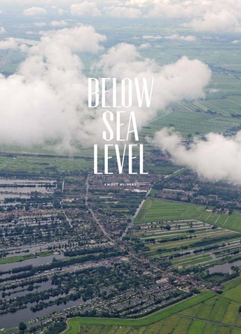
below sea level EWOUT HUIBERS
3
VOORWOORD
N EDERLA N D E E N L A N D DAT N O O IT A F IS. De polder. Het landschap is zo Nederlands dat er niet eens een buitenlands woord voor is. Bijna een kwart van het
landoppervlak bestaat uit deze leeggepompte binnenmeren en drooggelegde zee. Op een landkaart uit de zestiende
eeuw oogt Nederland bijna onherkenbaar – hele provincies zijn grotendeels of geheel blauw. Verder terug, in de ijstijd zo’n tweehonderdduizend jaar geleden, was het land zelfs grotendeels bedekt onder bevroren zeewater. Daarom is het landschap nog altijd zo vlak.
Door Jeroen Junte
Nog steeds ligt ruim de helft van Nederland onder de zeespiegel; het laagste punt – ergens in de weilanden van de Zuidplaspolder boven Rotterdam – zelfs bijna 7 meter. Je zou kunnen zeggen dat Nederland bestaat bij de gratie van een fijnmazig netwerk van dijken, bruggen, gemalen en sluizen. Genoeg om als natie in een permanente staat van paniek te verkeren. Niet de Nederlanders. Die blijven er laconiek onder, permanent ook. Nederlanders weten niet beter. Ze leven al eeuwen met het water. Kijk ze lopen langs de 451 kilometer lange kust terwijl de zeewind op de duinen beukt. Fietsend door de uitgestrekte polders waar het altijd lijkt te regenen. Zie ze onbekommerd schaatsen over binnenmeren die hele dorpen omsluiten. Zeilend en zwemmend in dat water, dat soms letterlijk uitsteekt boven het omliggende landschap. Of ze wonen erop in drijvende villa’s of omgebouwde vrachtschepen. Al blijft het meest romantische woonhuis zo’n ouderwetse windmolen die ooit de polders droogmaalde. Zelfs de regeringsgebouwen aan het Binnenhof worden omringd door water. Trouwens, ook achteloze bezoekers landen op Nederlandse zeebodem. Vliegveld Schiphol was amper vier eeuwen geleden nog een bruisende binnenzee, groter dan de stad Amsterdam. Maar het water laat zich nooit volledig temmen. Duinen worden bij winterstormen weggeslagen en dijken bezwijken onder het wassende rivierwater. Om nog maar te zwijgen van de dreiging van de stijgende zeespiegel. Nederlanders weten dat. Het land verkeert in een voortdurende staat van groot onderhoud. Bouwkranen zwiepen door het landschap en graafmachines ploegen in de klei. Kanalen worden uitgebaggerd en dammen worden verzwaard. De polders worden gevuld met
blinkende gebouwen met futuristische façades. Deze stadsuitbreidingen en aanleg van nieuwe infrastructuur gaan vergezeld van weer nieuwe dijken, bruggen en tunnels. De haven van Rotterdam is met een opgespoten zandvlakte inmiddels verlengd tot in de Noordzee. Niet voor niets genieten Nederlandse architecten en waterbouwkundigen wereldwijde faam. Nederland dankt zijn rijkdom voor een groot deel aan water. Eeuwen geleden verhandelden de Nederlandse zeevaarders specerijen, goud en andere schatten over de wereldzeeën. Nu nog is de haven van Rotterdam de belangrijkste poort tussen Europa en de rest van de wereld. Het water is vijand en bondgenoot tegelijk. Het is er nu eenmaal. Altijd en overal. Zelfs als je het niet ziet in het landschap van hoekige weilanden met onzichtbare slootjes achter een dichte rietkraag. Een eenzame bomenrij staat hoog boven het landschap op een aarden wal. Verscholen achter deze groene dijk ligt een kanaal. Of niet. Want niet alleen het ‘nieuwe’ polderland is door mensenhanden gemaakt. De golvende heidevelden zijn gekapte bossen en de bossen ernaast zijn aangeplant. De weilanden zijn eigenlijk zeebodem maar de kaarsrechte plassen bij Loosdrecht zijn juist uitgegraven om turf te winnen. De enige natuur in Nederland is de Waddenzee, de kuststrook die geen land en geen zee is. In een eeuwig spel van geven en nemen bestaan land en water hier in harmonie. Nederland is één groot park. De verstilde foto’s van Ewout Huibers zijn een ode aan dat vlakke aangeharkte landschap. Het alomtegenwoordige water is de hoofdpersoon in dit boek. Below Sea Level is dan ook de logische titel van deze fotografische reis door de laaglanden. In het landschap dat Huibers schetst met zijn foto’s zie je bijna geen mensen.
6
Maar de mensenhand is op elke foto zichtbaar. Met dijken is tot op de meter bepaald hoe ver een rivier buiten zijn oevers mag treden. Van de klei in deze uiterwaarden worden de bakstenen gebakken voor keurige rijtjeshuizen, die dan weer net zo rechtlijnig zijn als een rivierdijk. De fotografie van Huibers heeft eenzelfde helder lijnenspel. Soms is er niets meer te zien dan een dijk, een hek en een Hollandse lucht met grijze wolken. Een modernistische kantoorkolos reduceert hij tot een geometrische compositie in de geest van de strenge schilder Piet Mondriaan. Maar met een welgekozen detail vertelt hij een rijk verhaal. Een bospad waar de bomen te strak in het gelid staan. Een schelpenpad dat de duinpan keurig volgt. Past de mens zich aan het landschap aan, of andersom? Below Sea Level is daarom vooral een minutieuze studie naar de Nederlanders. In een land dat grotendeels op het water is veroverd wordt elk stukje land gekoesterd. Geen dijk waar het gras niet is gemaaid. Geen rivier zonder een kunstzinnig ontworpen brug. Daarom zijn de Nederlanders zo netjes, nijver en nuchter. Rechtdoorzee, zeg maar. Zeker als ze ook nog eens moeten leven op de dichtstbevolkte stukken land ter wereld. Dan kan er niets aan het toeval worden overgelaten. ‘Polderen’ is tegenwoordig een werkwoord dat zoiets betekent als eindeloos zoeken naar een compromis. Zolang de voortuin maar is aangeharkt kan en mag er veel. Daar wonen, daar werken, daar graffiti en daar mag het rivierwater komen en gaan – alles heeft een eigen door de mens geschapen en afgebakend domein. God schiep de aarde maar de Nederlanders schiepen Nederland. En dat land is nooit af.
INTRODUCTION
THE N ETHERLA N DS TH E WO RK WILL N EVER END. The polder. The polder landscape is something so unique to the Netherlands that other languages have no word for
it. Almost one quarter of the surface of the Netherlands is made up of drained inland lakes and land reclaimed from the sea. Seen on a 17th-century map, the country is almost unrecognisable – with whole provinces mostly or even
completely blue. Further back in the past, in the Ice Age around 200,000 years ago, the land was mostly covered by frozen seawater. This is why the landscape is still so flat today.
Words by Jeroen Junte
More than half of the Netherlands still lies below sea level; at its lowest point – in the meadows of the Zuidplaspolder to the north of Rotterdam – it is almost 7 metres below. You could say that the Netherlands owes its very existence to an intricate network of dikes, bridges, pumping stations and sluices. You might even think that this would leave the nation in a permanent state of panic. But not the Dutch. For them, it is simply a fact of life and always has been. The Dutch people know no different since they have lived alongside the water for centuries. See them walking along the 451 kilometres of coastline as the sea wind batters against the dunes. Or cycling through the expansive polders, where it never seems to stop raining. You can see them skating, carefree, across inland lakes that surround entire villages. Sailing and swimming in that same water, that is sometimes even higher than the surrounding landscape. Sometimes they live on it, in floating houses or converted cargo ships. Of course, the most romantic place to live is an old-fashioned windmill, like those that once drained the polders. The government buildings in The Hague’s Binnenhof are themselves surrounded by water. Even visitors flying into the country actually land on the Dutch seabed. Just four centuries ago, the site of Schiphol airport was a turbulent inland lake bigger than the city of Amsterdam. Despite all of this, the water can never be completely tamed. Winter storms can wipe away dunes and dikes can give way under the pressure of rising rivers. Not to mention the threat of rising sea levels, of course. The people of the Netherlands are only too aware of this. Their country is in a continuous state of large-scale maintenance. Construction cranes sweep across the landscape and excavators plough through the
clay. Canals are dredged and dams reinforced. The polders are slowly being filled with shiny new buildings with futuristic facades. As the towns and cities expand and new infrastructure is built, new dikes, bridges and tunnels are also needed. The port of Rotterdam has been extended into the North Sea through the creation of new land using sand extracted from the sea. Dutch architects and hydraulic engineers are celebrated worldwide for good reason. The Netherlands owes much of its wealth to water. Centuries ago, Dutch seafarers traded in spices, gold and other treasures across the world’s seas. The port of Rotterdam remains the most important port between Europe and the rest of the world to this very day. Water is both an enemy and an ally. It is an inevitability: ever-present and all-encompassing. Even when you cannot see it in the landscape of angular meadows with invisible ditches hidden behind a thicket of reeds, a lonely avenue of trees rises above the landscape on an earth embankment. Behind this green dike lies a canal. Or maybe not. This ‘new’ land of polders is not the only thing created by human hands. The undulating heaths were originally forest and the nearby woods have been planted by man. The meadows were originally seabed, but the angular-shaped lakes at Loosdrecht were in fact excavated to extract peat. The only true nature in the Netherlands is the Wadden Sea, the stretch of coastline that is neither sea nor land. In the eternal game of give-and-take, land and water live in harmony here. The Netherlands is one enormous parkland. Ewout Huibers’ stylised photographs pay homage to this flat and well-tended landscape. The main character in this book is the everpresent water. Below Sea Level is therefore the perfect title for this photographic journey
7 7
through the low countries. In the landscape depicted by Huibers, there is almost no-one to be seen. But the work of human hands can be seen in every shot. Dikes determine down to the individual metre how far a river can exceed its banks. The clay in the water meadows is used to bake bricks for smart terraced houses whose straight lines mirror those of the river dike. Huibers’ photography reflects these same clean straight lines. At times, all there is to see is a dike, a hedge and a Dutch sky with grey clouds. He reduces a modernistic office block to a geometric composition in the strictly-delineated spirit of painter Piet Mondrian. But each carefully-selected detail has a rich tale to tell. A woodland path where the trees stand in serried ranks. A shell path that carefully follows the contours of the dunes. Is humankind adapting to the landscape or vice-versa? So perhaps more than anything, Below Sea Level is a painstaking portrait of the Dutch people. In a country largely reclaimed from the sea, every piece of land is cherished. There is no dike without neatly-mown grass. No river without an artistically-designed bridge. This is why the Dutch people are so orderly, industrious and matter-of-fact. Down-to-earth, so to speak. Hardly surprising, since they have to live on the most densely-populated piece of land in the world. It means that nothing can be left to chance. In the Dutch language, the verb ‘to polder’ has come to mean endlessly searching for a compromise. As long as the front garden is neatly tended, all kinds of things are possible and permissible. Living, working, scrawling graffiti, room for the river to ebb and flow: a place for everything, and everything in its place – and all shaped by human hands. God created the earth, but the Dutch people created the Netherlands. And their work will never end.
8
9
BELOW SEA LEVEL
30
FRIESLAND / NOORD-HOLLAND
AFSLUITDIJK, FRIESLAND NOORD-HOLLAND Met een lengte van 32 kilometer is de Afsluitdijk de langste dijk met water aan beide zijden in Nederland. Het eerste plan voor een dijk die de Zuiderzee zou afsluiten stamt al uit 1891. Het zou vervolgens nog 42 jaar duren voordat het plan was gerealiseerd. De bouw van de waterkering duurde vijf jaar; de Afsluitdijk werd in 1933 geopend voor verkeer. The Afsluitdijk (Closure Dike) is 32 kilometres long, making it the Netherlands’ longest dike with water on both sides. The initial plans for a dike to close off the Zuiderzee date back to 1891. It took a further 42 years for the work to be realised. Five years were spent building this defence against the water; the Aflsuitdijk opened to traffic in 1933.
31
46
Z WO L L E – OV E R I J S S E L Op het dak van De Fundatie, een museum voor moderne en hedendaagse kunst in Zwolle, werd in 2013 een opvallende uitbouw geplaatst. Bijzonder is de mix van hedendaagse architectuur en ambachtelijke tradities. De ovalen blob is bekleed met vijfenvijftigduizend hemelsblauwe tegels, die zijn vervaardigd door aardewerkfabriek Koninklijke Tichelaar Makkum, dat bestaat sinds 1472 en daarmee het oudste familiebedrijf van Nederland is. On the roof of De Fundatie, a museum of modern and contemporary art in Zwolle, an eye-catching extension was completed in 2013. It features an unusual blend of modern architecture and traditional craftsmanship. The elliptically shaped superstructure is covered with 55,000 sky blue tiles manufactured by the ceramics factory Royal Tichelaar Makkum which was founded in 1472, making it the oldest family business in the Netherlands.
47
66
UTRECHT - UTRECHT In een land dat op de zee is veroverd wordt over elk gebouw nagedacht. Deze parkeergarage op industrieterrein Papendorp bij Utrecht heeft een bronskleurige faรงade gekregen met een geometrisch patroon. In a country reclaimed from the sea, careful thought is given to every building. This car park in Papendorp business park near Utrecht has been given a bronze-coloured faรงade with a geometric pattern.
67
188
189
192
193