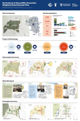
Site Introduction
Key Demographics AIRDRIE 21 MIN DRIVE
HUNTINGTON HILLS
Nose Hill Park
HOUSING STOCK TYPE
13,800
Deerfoot City NOSE HILL PARK
BANFF 1.5 HR DRIVE
UPPER NORTH HAVEN
Nose Creek Valley
THORNCLIFFE
NORTH HAVEN
HIGHWOOD
24 MIN DRIVE
$74,000 MEDIAN HOUSEHOLD INCOME
THORNCLIFFE
MIXED VARIETY
100
60
17%
15-18 MIN DRIVE
GLENMORE TR.
UPPER & NORTH HAVEN
16
50
5 51
DOWNTOWN CORE
0
SingleSingle Detached
SemiSemi Detached
28
47
Row Housing
Apartment
Apt. in Duplex Apt ex e
SINGLE-FAMILY DOMINANT
70%
AVG. INDIVIDUALS 65+ Calgary
Upper North Haven
North Haven
(% of Population) AGE A AG GE DISTRIBUTION Thorncliffe Greenview
McKnight Blvd NW
HOUSING STOCK BUILT BEFORE 1980
HOUSING TENURE STONEY TR.
Centre St N
4 St NW
Jo h Bl n L vd au NW rie
GREENVIEW
TRANS-CANADA HWY
NE ye Wa line Sky
14
CHESTERMERE
APARTMENT DOMINANT
70
150
YYC INT’L AIRPORT PORT
GREENVIEW
200
RESIDENTS (2021)
64 Ave NE
NW St
(% of Dwellings)
0-14
59%
Calgary
OWNER (3,310) MAJOR ROADWAYS
HIGHLAND PARK
OKOTOKS
QUEENS PARK VILLAGE
41%
DOWNTOWN CORE
35 MIN DRIVE
15-64
Greenview
RENTER (2,280)
EMPLOYEE INDUSTRIAL
Thorncliffe
65+
OPEN SPACES AND PARKS
Upper North Haven 0
20
40
60
North Haven
80
Project Methodology
Site Analysis
Project initiation
Concept Development
Site Visit
Final Concepts
Community Workshop
PHASE 1
Open House
PHASE 2
PHASE 3
PHASE 4
Site Analysis Summary BUS 300TO YYCAIRPORT(24 MINS) N
NNW
64 Ave NE
Winter speed (m/s)
NNE
NW
NE
WNW WN W W
ENE
E
W
WSW W WS W
ESE
SW
SE SSE
Period: 1201 - 0228 Calm for 9.07% of the time = 196hrs Each closed polyline shows frequency of 2.5% = 50hrs
INSTITUTIONAL/ TION NAL/ OPEN SPACE EN SP PACE North Hill Park
NW St 14
Northmount Dr NW
SITE BOUNDARY OFFSTREETPATHWAYS
McKnight Blvd NW
Jo h Bl n L vd au NW rie
VALUE SLOPE 0-7% 8-20% 21-40% 41-98% 99-395% SPARSE TRAFFIC INCIDENT DENSE TRAFFIC INCIDENT
/1 ,0 00 M
JAMES FOWLER HIGH SCHOOL (10-12)
21% 21 1%
BUILT FORM
76% 6 6%
RESIDENTIAL RE ESIDENTIAL
Safeway (500m Walkshed)
McKnight Blvd NW
15 M IN SW AL K
64 Ave NE
Centre St N
4 St NW
Northmount Dr NW
3%
COMMERCIAL
Centre St N
NW St 14
BUS 20TO UNIVERSITYOF CALGARY(34 MINS)
S
LAND USE
y NE e Wa Skylin
SSW
Calgary Winter Rose
10.00 9.51 9.01 8.52 8.03 7.54 7.04 6.55 6.06 5.56 5.07 4.58 4.09 3.59 3.10 2.61 2.11 1.62 1.13 0.64
4 St NW
JOHN G. DIEFENBAKER HIGH SCHOOL (10-12)
Jo h Bl n L vd au NW rie
MOBILITY & OPEN SPACE
McKnight Boulevard Station
Safeway (500m Walkshed)
SITE BOUNDARY R-CG S-SPR S-CS S-UN S-FUD C-COR2 C-C1 DC C-N2 M-CG H-GO MIXED USE DEVELOP. OPPORTUNITY
SITE BOUNDARY COMMERCIAL RESIDENTIAL SCHOOL GARAGE COMMUNITY CENTRE/ CHURCH ACTIVITY NODES WALKSHED North(500M) Hill Park FUTURE GREEN LINE LRT PARCEL (SIZE: 10000+ SQUARE METERS) MIXED USE DEV. OPPORTUNITY
SUPERMARKET
BUS MAXGREENTO DOWNTOWN (25 MINS)
What We Heard OPEN SPACE SPA PAC PA ACE Open Space: Improve pedestrian connections between North Haven Community and Nose Creek Extend Trail in Egret Park beyond 4th NW Enhance park furniture Enhance public realm on Central St with green space Activate underutilized small green spaces with functional programming Activate potential Main Streets (64 Ave, 4 St, Northmount Dr NW, Edmonton Trail, Centre St) Creating “third spaces” (informal places for socializing outside of home and work) would strengthen community connections. Improved signage and communication tools could help promote community events and increase resident engagement. Enhancements such as additional greenery, native plantings, and ecological landscaping could improve aesthetics while also supporting urban wildlife.
LAND USE & BUILT FORM
“Impro “Improvingthe rov ro ovingthe brightnessofstreet brightnessof o of st s rreet e lightswould lightswo w would make k it ke feel safer...”
“Walking within neighbourhood isgood but notthe bestthere’sweird fencingto access park”
Land Use and Built Form Density around Green Line station (600m radius high-activity zone) Balance 16-store multi-use building on Central St with adjacent low-density residential areas Consider Senior Housing and Social Housing integration Various Types of Senior Housing Typologies (Multi-Unit, Row Housing) Encourage small businesses and retail improvement Live work units Commercial on ground building type More mixed-use development around existing commercial and activity nodes to support walkability and local services. Staying within the community and aging-in place is a high priority for many residents
MOBILITY NETWORKS “Moresenior living inthe community, butfeeling like itsstill my home...”
“Moresenior living inthe community, butfeeling like itsstill my home...”
“Would love more home businesses (dog groomers, nails and hair, physiotherapistsetc.)” “Activated Spaces tofoster more communityevents”
Mobility Enhance traffic calming in school areas (North Haven) Improve intersection design at McKnight Blvd and John Lavis Blvd Strengthen connections to main trails, Confederation Park, and Nose Creek The neighbourhood needs to offer good and well-maintained biking infrastructure, supporting cycling as a viable transportation option. Residents appreciate the ability to walk and bike easily around the neighbourhood, contributing to a more active and accessible community. Access to commercial areas along 14th Street could be improved to make them more convenient and safer to reach.
a y w rromtheschool... “Lotsofjaywalkingfromtheschool... jay ay yw wa alkingfro ffficcalming measures rres sometrafficcalming aff measure would begood.“
“Driving iseasier!”
“Improving sidewalks and gravel alleyways”
“Busy s st sy s re r et e s and “Busystreets inters r ect rs c ionsfe ct f el fe intersectionsfeel unsafe f towa fe w lk along...” wa unsafetowalk
Strategies Summary OPEN SPACE
LAND USE & BUILT FORM
MOBILITY 64 Ave NE
64th StCrosswalk
CENTRE STREETTRANSITCORRIDOR IMPROVEMENTS 14th @ N Haven Dr NWTraffic Lights
St N W
Northmount Dr NW
14
HILLTOCREEK PATHWAY
N HAVEN DR STREETSCAPE IMPROVEMENTS
Enhance Trail Connectivity & Activate Open Spaces
Strategic Growth through Gentle Densification & Diversification
MCKNIGHT BLVD GREENIFICATION
4th St NW
Centre St N
Bl vd
NW
McKnight Blvd NE
McKnight BlvdCrosswalk
La ur ie
Jo hn
N
Ha ve n
Dr NW
CentreSt NN @ McKnight Blvd N Improvements
Streetscape Improvements to Enhance Pedestrian Comfort & Mobility
Greenveiw Rd NE @ EdmontonTrail NE Traffic Lights
Typologies
Land Use Concept 64 Ave NE Nose Hill Park Centre St
4th St
NW t S 14
R-CG
R-CG
C-C1 M-CG
Northmount Dr NW
Mcknight Blvd NW
Jo h Bl n L vd au NW rie
COMMERCIALCORRIDOR COMMUNITYCORRIDOR GENTLE DENSTIFICATION OPEN SPACES MAJOR ROAD CONNECTIONS SITE BOUNDARY
MISSINGMIDDLE - 4PLEX Vancouver, BC
LANEWAYHOUSING Parkdale, Calgary
ISSUES ACCESS TO AMENTITIES (FOOD, OPEN SPACES)
GROWTH IN NEIGHBOURHOOD& COMMERCIALCORRIDORS
Concept Goal
To support sustainable neighbourhood growth gentle residential densification, mixed-use commercial corridors and transit oriented development while preserving the existing surburban character of the communities.
LIMITED PARCEL SIZES LIMITED TYPOLOGY DIVERSITY
GENTLE DENSITY
CAR-ORIENTED COMMUNITY
BUILTFORM DIVERSIFICATION
No rth Ha ven Dr
Newcombe Pl NW
d NW kam R Nemis
Nes bitt Rd
5
8
AC CE SS TO LA NE WA YH OU SE
Dr
NW
No rth Ha ve n
Norq uay D r
3
NW
48 Av eN W
1 LANEWAYHOUSING
Nanton Rd NW
2 MISSING MIDDLE/ DUPLEX 3 MULTIPLEX CONVERSION North Haven School
ET RE ST
Rd on t n Na
TO SS E C AC
LA NE W AY
E US HO Y A W NE LA
SINGLE-FAMILY S INGLE-F FA AMIL LY Y TOCOMMERCIAL T TO COMMERCIAL
48
Av LANEWAYHOUSE e
No rq ua yD rN W W N
NW
SINGLE-FAMILY TOMULTIPLEX aven Dr North H
4 MISSING MIDDLE HOUSING
SMALLSCALE COMMERCIAL 5 /RESIDENCE
3
6 OUTDOOR SKATING RINK 7 TEMPORARYPROGRAMMING 8 SHAREDSTREET
3
COMMUNITY & COMMERCIAL ACTIVITY NODES THAT SUPPORT WALKABILITY
LOW COMMERCIAL USE (LAND USE) / NO MIXED USE
h rt No
n ve Ha
NW Ave 48
W dN nR o ls Ne
HARD BOUNDARIES (ARTERIAL ROADS)
n ve Ha nity rth u on No mm iati Co soc As
1
IMPROVING LAND USE ZONING MIXED-USE DEVELOPMENT INCREASE DENSITY AROUND FUTURE GREEN LINE STATION
ST RE ET
48 Av eN W
2
CONSTRAINTS
SENIOR HOUSING & SOCIAL INTEGRATION
DUPLEX
6 N 7 ort Comh Hav en m Ass u ocia nity tion
OPPORTUNITIES
DIVERSE HOUSING TYPOLOGIES (LIVE-WORK UNITS, MISSING MIDDLE HOUSING)
Small Scale - Gentle Densification, North Haven This node focuses on gentle,incremental densification of existing single-family parcels while strengthening it as a local mixed-use and community hub.
MULTI-RESIDENTIAL University District, Calgary
North Haven School
Dr
Medium Scale - Mixed-Use Residential, Thorneycroft Dr NW & Northmount Dr NW This node targets the underutilized Safeway commercial site and treat it as a community hub with a ground-oriented commercial site, open space programming, and mid-rise residential above. 5
5
3
FRESH CO. (GROCERY)
RESIDENTIAL COMPLEXES
NW r D nt u o m h rt No
4t hS t
6
6
2 FRESHCO
5
54 Ave NW
3 GREENVIEW PLAZA 4 OPEN SPACE 5
53 Ave NW
COMMERCIALON GROUND
6 APARMENTS 7 OPEN SPACE/ PROGRAMMING 8 PLACEMAKING/TEMP. PROGRAMMING
LAND USE & BUILT FORM
RETAIL FRONTAGE R W eN v A 54
1 LIVE/WORK UNITS
NW Dr ft ro yc ne or Th
Nor thm oun t Dr
6
4
LIVE/WORK UNITS
NW Dr t n ou m h rt No
6
NW
2
Apartment Studio, 1 , 2 Bedroom Live/Work
4th St
2 5
Cafe / Restaurants /Bakery Gym / Workout Studio Pharmacy / Health
Northmount Dr NW
8 7
RESIDENTIALUSES
RESIDENTIAL COMPLEXES
1
6
COMMERCIALUSES
Thorneycroft Dr NW
BEFORE
Building Scale & Density Concept
Typologies
M-U1 M-U2
C-C1 M-CG
DC M-CG
DENSITY & BUILDING SCALE CATEGORIES NO SCALE MODIFIER LIMITED: UP TO 3-STOREYS LOW - MODIFIED (GENTLE DENSITY TO 4-STOREY ) DENSITY UP IMPROVEMENTS) MID: UP TO 6 STOREYS HIGH : UP TO 12-STOREYS PARKS / CIVIC / RECREATION MAJOR ROAD CONNECTIONS
SMALL SCALE COMMERCIAL The General Block, Bridgeland
MULTI-UNIT (MID SCALE) Encore, University District
MULTI-UNIT CO-HOUSING The Priarie Sky, Tuxedo Park
SITE BOUNDRY
Small Scale - Single-Family to Commerical Use LAND USE REZONING (MU-1 )
GROWTH IN NEIGHBOURHOOD & COMMERCIAL CORRIDORS
Concept Goal To support sustainable neighbourhood growth gentle residential densification, mixed-use commercial corridors and transit oriented development while preserving the existing surburban character of the communities.
GENTLE DENSITY
Single-family homes can be incrementally adapted into small-scale commercial spaces through rezoning or discretionary use, supporting local businesses and a more active main street or neighbourhood community.
DISCRETIONARY USE SMALL-SCALE BUSINESS ALLOWED WITHIN EXISTING HOMES DEVELOPMENT PERMIT BUILDING PERMIT
BUILT FORM DIVERSIFICATION
Medium Scale - Senior Co-Housing Village, Northmount Dr & Thorncliffe Dr NW An Age-friendly, low-rise community that supports aging in place through shared spaces, adaptable housing, and strong social connectivity.
The project can be implemented through a phased redevelopment approach that leverages public land and encourages intergenerational living. PLAYGROUND
Northmount Dr
THORNCLIFFE SCHOOL
ADJACENT SCHOOL + GREENSPACE
4-STOREY SENIOR APARTMENT
3
1
Thorncliffe D r
6
4
Thorncliffe School
5
2
54 A ve N W
Large Scale -
1
EXISTING PLAYGROUND
2
OPEN GREEN SPACE
3
4-STOREY APARTMENT
4
3-STOREY CO-HOUSING
5
COMMUITY GARDEN
6
CAFE / WORKSHOP STUDIO
CAFE / WORKSHOP STUDIO
EXISTING PARK / GREEN SPACE
3-STOREY CO-HOUSING CLUSTER
NATURE INTEGRATION
Main Street & Transit Corridor, Centre Street N
The Centre Street Main Street aims to envision a walkable and accessible environment for all ages. A long-term 30 year plan aligning with the North Green Line LRT development.
COMMERCIAL USES
RESIDENTIAL USES
Cafe / Restaurants /Bakery Gym / Workout Studio Pharmacy / Health
Apartment Studio, 1 ,2 & 3 Bedroom Row Housing
MIX OF HOUSING
Centre St N
RESIDENTIAL COMPLEXES
12-STOREY CLOSESTTO LRT STATION
AFTER 2 FLOORS OF COMMERCIAL USE
RETAIL FRONTAGE
Northmount Dr
Underground Parking
TERRACE & UNDERGROUND PARKING
Pedestrian Street
Toboggan Hill Slope
BEFORE
Thorncliffe-Greenview Community Association
55 Av eN W
FUTURE GREEN LINE LRT MCKNIGHT STATION
54 Av eN W
LAND USE & BUILT FORM
PEDESTRIAN STREET
North Haven & Thorncliffe-Greenview Neighbourhood Concept Plan PLAN630: Advanced Professional Planning Studio Bridgette Crabbe | Shiang-Yun Huang | Catherine Mtabaji | Christopher Poon
Strategies Priority
Open Space Concept Transit Corridor • • • • •
64 Ave NE
LRT Route or BRT Route Higher Density and Mixed Use Higher Traffic Flow Active Ground Floors Bike and Pedestrian Pathways
1. Enhance Connectivity Between the Trail Network and Open Spaces • •
Site Boundary Existing Pathways 1st Priority Pathways 2nd Priority Pathways 3rd Priority Pathways
Arterial Road • •
Higher Traffic Flow Pedestrian Crosswalk
Green Blvd • • • •
Northmount Dr NW
Mainly Traffic Flow Medium Density and Mixed Use Active Ground Floors Bike and Pedestrian Pathways
Neighbourhood St
McKnight Blvd NW
• • • • • •
Medium Traffic Flow Medium Density and Mixed Use Active Ground Floors Pedestrian First Bike and Pedestrian Pathways Outdoor Seating
2. Create Pedestrian-Oriented Streetscape Network • •
Low Traffic Flow Medium to Low Density Pedestrian First Bike and Pedestrian Pathways
1st Priority Neighbour St 2nd Priority Neighbour St 1st Priority Shared St 2nd Priority Shared St
3. Activate Open Spaces and Identify Future Growth Areas
• •
Concept Goal
Identify and redefine the roads and streets hierarchy system Create a walkable community through streetscape network providing 1st Priority Transit Corridor 2nd Priority Transit Corridor Arterial Intervention 1st Priority Green Blvd 2nd Priority Green Blvd
Shared St • • • •
Enhance connection between trails and open spaces ( Nose Creek and Nose Hill Park ) Improve the cycling pathway systems
•
To create interconnected green systems and pedestrian-oriented neighbourhoods that sustain the natural resources and cultural identity of existing communities, while promoting active transportation and enhancing community resilience and sense of place.
Provide current destination parks with services, for example street furniture Activate small scale of pocket parks with more engaging design and communities activity opportunities Identify future locations for open spaces Service Improvement Active Pocket Parks Passive Pocket Parks Landscape Integration with the Street
Natural Areas Destination Park Public Park Pocket Park Linear Greenway
Egerts Park - Park Design Concept / North Haven Community After - Egerts Park
A Park for All Ages
# North Haven # Basketball
# Egerts Park # Soccer
# North Haven # Pickleball
# Egerts Park # Outdoor Gym
# North Haven # Bike Pump Tracks
# Egerts Park # Terrace Stairs
Before - Egerts Park
Community Open Spaces - Open Space Design Concept / Thorncliffe-Greenview Community
OPEN SPACE
After
After
# Spring In Thorncliffe-Greenview # MovieNight
# Summer In Thorncliffe-Greenview # SummerMarkets
After
Before
# Winter In Thorncliffe-Greenview # Toboggan Is Fun # Where Is Spring
Current Thorncliffe-Greenview Community and Parking Lots
A Place for All Seasons
N Haven Dr Streetscape Improvements Creates a pedestrian/transit-oriented area to enhance pedestrian safety when accessing transit Raised intersection slows vehicles, increasing safety for children Boulevard separates pedestrians from the road
C
Curb extensions restrict crosswalks to 6m
AA
C
Expanded boulevards narrow the road
FEATURE STREETSCAPING:
Low-impact development
Pick up/drop off
Nipiwan Crescent NW
B
A
NW en Dr N Hav
B
D
No rqu ay Dr NW
Raised Crosswalk with pavers
Crosswalk with pavers (x4) New Trees
Driving Lane (3.0m) Parking Lane (2.2m)
Raised Intersection with tactile pavement
Grass / LID (2.6m)
CURB EXSTENSION
D
BB
Sidewalk (1.8m) NORTH HAVEN SCHOOL
48 th Av eN W
A
Current temporary extensions relocated to other intersections
Pick up/drop off
Nes bitt Rd
NW
Raised Crosswalk with pavers
SCHOOL ZONE SECTION AA - N HAVEN DR NW
SECTION BB N HAVEN DR NW 24 M
24 M
RIGHT OF WAY
RIGHT OF WAY
BEFORE
AFTER
WITHOUTTREES
1.8 M
6.8 M
0.5 M 3 M
WIDENED BOULEVARD
3 M 0.5 M
BRICK PAVERS
6.8 M
1.8 M
1.8 M
WIDENED BOULEVARD
2.3 M 0.5 M 2.5 M
3M
3M
2.5 M 0.5 M 2.3 M
WIDENED BOULEVVARD & SIDEWALK
1.8 M
WIDENED BOULEVVARD & SIDEWALK
P
P
WITH TREES
McKnight Station Area SECTION C C - CENTRE ST N Sidewalk (1.5m)
40 km/h speed limit
BUCKTHORN RD NW
THORNCLIFFE DR NW
A
CENTRE ST N
Creates a pedestrian/transitoriented area to enhance pedestrian safety when accessing transit
Boluevard (4.7m) Parking Lane (2.2m)
Pathway (1.5m lanes) Transit ROW (3.6m lanes)
Sidewalk (1.8m)
Driving Lane (3m) B
C
D
30 M RIGHT OF WAY
40 km/h ‘station zone’ speed limit
Brick road to slow vehicles
Multi-tiered lighting
A
Pedestrian Islands (3m)
Tree-lined boulevards “narrow” the road
56TH AVE NE
NORTHMOUNT DR NW
Space for future station expansion and new crosswalk
Station Area
DD
1.8 M
3M
3.6 M
3M
3.6 M
3M
RED CONCRETE
ROAD PAVERS
SIDEWALK MOVED TO EDGE OF ROW
Sidewalk(1.5 m)
3M
3M
2M
1.5 M
1.5 M
NEW MULTI-USE PATHWAY
ROAD PAVERS
CC
Boulevard (3m) Bike Lanes (1.5m lanes)
FEATURE STREETSCAPING:
Future Station Expansion
C
Curb Separator (0.5m)
TACTILE ROAD SURFACE
SECTION DD - NORTHMOUNT DR NW
Driving Lane (3m) B
THORNCLIFFE-GREENVEIW COMMUNITY ASSOICATION
Brick Paver Road
30 M RIGHT OF WAY
D
Future Crosswalk
P
McKnight Station Area
1.8 M
3.6 M
2.4 M
3M
1.5 M 1.5M
3M
NEW MEDIAN
2.5 M
1.8 M
NEW BIKE LANES
SECTION EE - MCKNIGHT BLVD NE
30 M RIGHT OF WAY
Improves pedestrian safety when crossing Centre St N or McKnight Blvd A
B
New Divided Crosswalk
Curb (0.5m)
Pedestrian Islands restrict crosswalks to 10m in length
Multi-tiered lighting
Driving Lane (3m) Turning Lane (3.3m)
New crosswalk west of Simons Rd NW and Laycock Drive NW
Sidewalk (2.2m)
Soft curb allows for emergency passing
Turning Lane (2.2m)
Boulevard (2.2m) Driving Lane (3.3m) Driving Lane (3.3m)
EE
Pesdestrian Island (5m)
FEATURE STREETSCAPING:
3M
3.6 M
SIDEWALK MOVED TO EDGE OF ROW
2M
1.5 M1.5 M NEW MULTIUSE PATHWAY
A
30 M
C
STREETTREES / LOW-IMPACT DEVELOPMENT
3M
3.6 M
RED CONCRETE
SECTION FF - CENTRE ST N
MCKNIGHT BLVD NW B
1.8 M
1ST ST NW
NW RD
2ND ST NW
S ON SIM
Parking Lane (2.2m)
CENTRE ST N
Tree-line boulevard “narrows” the road
CENTRE ST N
C
FF
Bus Lane (3.6m)
RIGHT OF WAY
MCKNIGHT BLVD NW
NW CK DR LAYCO
Boulevard Trees
1.5 M 3.6 M NEW MEDIAN
MOBILITY
3.3 M
3.3 M
6M NEW MEDIAN RESTRICTS PEDESTRIAN CROSSING TO 10 M
3.3 M
3.3 M
2.5 M 1.5 M