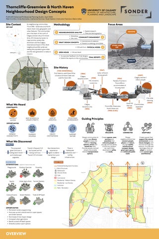
Thorncliffe-Greenview & North Haven Neighbourhood Design Concepts PLAN 630 Advanced Professional Planning Studio | April 2026 Matt Comfort, Emily Eremenko, Catherine Norman, Noah Seeton | Instructor Francisco Alaniz Uribe
Site Context
As neighbouring communities, Thorncliffe - Greenview and North Haven share many geographic and urban features. The communities are in the heart of the north of Calgary and are only a 15-minute drive, 20 minutes by transit, to major activity centers like downtown and the Calgary International Airport (YYC). Both neighbourhood life cycles are seeing the population grow older and the next generation is ready to move in.
KEY MAP
NW
NE
SW
SE
Focus Areas
Methodology 1
Spatial research Data and demographics
NEIGHBOURHOOOD ANALYSIS
Workshop COMMUNITY ENGAGEMENT Site visits
3D built form PHYSICAL MODEL OPEN HOUSE
HOUSING
2
Interventions & ideation Present to steering committee
3 DRAFT DESIGN CONCEPTS
5
BUILT FORM
OTHER LAND USE
4
OPEN SPACE
We are here!
Incorporate feedback into final designs FINAL REPORTS Submit the reports to the communities
6 MOBILITY
E tN 4S
4 St NW
Huntington Hills
Site History
64 Ave NE
Nose Creek
E
NORTH HAVEN
ot Trl N
14 St NW
UPPER NORTH HAVEN
Deerfo
THORNCLIFFE
Nose Hill Park
(1947)
(TIME IMMEMORIAL) First Nations used Nose Hill as a lookout & Nose Creek was used for bison kills
Calgary became a town
Skyline West McKnight Blvd NW
GR
EE
Highwood
IEW
32
Edmonton Trl
Centre St N
Queens Park Village
(2007) Calgary reaches 1 million people
(1954) Parade of homes in Thorncliffe to accommodate oil housing need
YYC moved to current loc.
Av eN
E
What We Heard
Calgary became a city (1894)
CONSTRAINTS
BUSY SCHOOLS & UNSAFE STREETS
DIFFICULT ACCESS
(1938)
Greenview Industrial Park
NV
Highland Park Cambrian Heights
Leduc oil boom & pop growth
(1884)
LACK OF AMENITIES
Thorncliffe, Greenview, North Haven est. (1950s & 60s)
Nose Hill Park est. (1980)
City-wide rezoning (2024)
Communities separated (1991)
Guiding Principles
PEDESTRIAN ENVIRONMENT
OPPORTUNITIES
IMPROVE CONNECTIVITY
DIVERSIFY HOUSING
CREATE DESTINATIONS
SUPPORT NATURE
What We Discovered MOBILITY The proposed green line train is holding back transit and streetscape upgrades.
Transit is frequent N-S but busses are full during rush hour. Transit E-W is limited.
OPEN SPACE
There is inadequate pedestrian and cycling infrastructure.
INCLUSIVE
CONNECTED
ADAPTABLE
Design communities to encourage diverse people to enjoy the different housing options, prices and mixed-use hubs. Provide people-centred streets that enable diverse transportation options.
Create spaces, uses, services and amenities that welcome people of any age and any ability. Ensure any resident can reach their destinations safely and easily.
Design neighbourhoods that connect people, places and nature, through quality infrastructure, compact design, great open spaces, and enhanced public realm.
Create spaces that support the natural environment across future changes, and function through the seasons. Provide built typologies that can adapt to resident needs across ages and lifetimes.
BUILT FORM
INTERVENTIONS *adapted from Friedman & Pollock, 2024 Playgrounds
Key intersections experience higher incidents mainly from poor design.
DIVERSE
Outdoor Exercise
Proximity
Potential Development Corridors
64 t h Ave
Block Structures Restaurants Grocery Stores
Nose Hil l
NW
Cafe
Urban Agriculture
Farmer Markets
Bl ackthorn Rd
th
N
lk
Laycock Park
Residential - Medium Density
14
Sports
St
Commercial
fo or
Dr
Spyhi ll Rd
Residential - Low Density Egert’s Park
Institution Parks + Recreation
Northmount Dr
Cultural Events
Street Markets
Thorncl iffe CA
Trails & Off-leash
OVERVIEW
Jo
hn
La
ur
ie
rB
lv
d
McKnight Blvd
N os e C re ek
OPPORTUNITIES Permanent winter programming Host pop up and cultural events in open spaces and street network Stormwater & low-impact design Increased urban agriculture Rewild unused off-leash spaces Diversify outdoor sport options
NW
Centre St
48
Ave
4 t h St NW
th
4 t h St NE
North Haven CA
Thorncliffe-Greenview & North Haven Neighbourhood Design Concepts PLAN 630 Advanced Professional Planning Studio | April 2026 Matt Comfort, Emily Eremenko, Catherine Norman, Noah Seeton | Instructor Francisco Alaniz Uribe
Key Residential Recommendations FOR THE CITY: Incentivise affordable, diverse housing typologies that accomodate a range of demographics Adopt more pedestrian-friendly, mixed-use districts over auto-orientated zoning Partner with organizations to turn underutilized land into multigenerational living developments
FOR THE COMMUNITY: The community should encourage changes in their neighbourhoods that bring compact growth Support new housing in the form of multi-residential and mixed-use buildings in defined areas Stay involved in how their community evolves overtime with input at engagement events Support projects that create high quality public space and affordable housing
64 t h Ave
NW
14
No
l rfo
kD
r
Deer
th
St
Nose Hil l
Laycock Park
Blackthorn Rd
Spyhi ll Rd
4 t h St NE
e th Av 48
Egert’s Park
NW North Haven CA
Tr
Thorncl iffe CA
foot
N os e C re ek
Northmount Dr
McKnight Blvd
rl nT Ed m
o ont
rB ie ur Jo
hn
La
Centre St
lv
d
4 t h St NW
400 m TOD Radius
200 m TOD Radius
Proposed LRT Stations
Current BRT Stops
Mixed-Use and Live/Work Opportunities
600 m TOD Radius Greenline BRT /Proposed LRT Route
(R-CG)
H-GO)
(MU-1)
(C-N1)
(M-C2)
(M-H1)
(DC)
No Zoning Modifier
Supports Aging-In-Place
Multi-family Residential
Greater Connectivity
Limited (up to 3 storeys)
Low (up to 6 storeys)
Low - Modified (up to 4 storeys)
No Scale Modifier
Supports Families
Supports TOD
Strategy Shared community spaces Rezone to Direct Control (DC) to develop a multi-generational residential on the first 2 levels development that addresses the aging population and families, adapting to the current and future demographic needs. 6 storey apartment with up to
CONTINUUM LIVING: Multi-Generational Complex
Community Ammenities 4 storey apartments with up to 3 bedroom units Greenhouses + community garden
4 bedroom units
th
60
Ave
NE
Tr
T r e lle D r N E
56
6 storey apartments 6 storey Mixed Use Corridor
MAIN STREET LIVING
No rth mo
N
eD
rN
E
E
N o rt h m o u n t D r
Th o rn c li ffe CA
Dr
C en t re S t
unt
Strategy Rezone to Mixed Use - Active Frontage (MU-2) to develop a Transit Oriented Development, main street corridor that functions as both an active pedestrian realm with direct access to the Green Line LRT station and multi-family residential living.
e Av
ell
Centre St
Residential Thorncl iffe CA
Commercial
NEIGHBOURHOOD CONNECTOR 4 storey Mixed-Use commercial at grade with 3 storey 1 & 2 bedroom apartments above 4 - Plexes with the option for live/work units at grade
M c K n ig h t B l v d
3 storey Stacked Townhouses with 2 storey Rowhouses in the back
S k y l i n e We st
ht B
lvd
Ed
nt mo
on
Tr l
nig McK
Sk
yli
ne
W
es
Ed m
FOCUS AREA: HOUSING
t
ont
on T
rl
Strategy Rezone the top 7 parcels to MU-1 to develop a mixed use building with commercial at grade to active the street. Leave the remaining parcels zoned as H-GO to allow for mixed multi-residential typologies, as well as live/work units to align with the NHCLAP ‘Neighbourhood Connector’ Urban Form.
Thorncliffe-Greenview & North Haven Neighbourhood Design Concepts PLAN 630 Advanced Professional Planning Studio | April 2026 Matt Comfort, Emily Eremenko, Catherine Norman, Noah Seeton | Instructor Francisco Alaniz Uribe
Key Other Land Use Recommendations FOR THE CITY: The City should incentivise mixed use development around community hubs to expedite meaningful change Adopt more pedestrian-friendly, mixed-use districts over auto-orientated zoning The City should partner with schools and community organizations to turn underutilized leased land into projects that deliver public benefit
FOR THE COMMUNITY: The community should encourage changes in their neighbourhoods that bring more compact growth Support new housing in the form of mixed-use buildings that are developed in defined areas Stay involved in how their community evolves overtime with input at engagement events Support projects that create high quality public space and affordable housing
Master Plan - Other Land Use NW
Nose Hill
Build Around Existing Assets 64
lk
Ave
1
CHINOOK SCHOOL OF MUSIC
Laycock Park
Dr
Bl ackthorn Rd
14
th
St
N
fo or
th
Spyhi l l Rd
Commercial
Egert’s Park Northmount Dr
4
Thorncl iffe CA
NW
North Haven CA
3
Centre St
1
4 t h St NW
48
Ave
2 4 t h St NE
th
STRATEGY: Intensify around existing hubs by adding additional square footage and enhancing the public realm.
McKnight Blvd
Jo
hn
La
ur
ie
rB
lv
d
N os e C re ek
4
Partnership in Underutilized Space
Commercial Hub
Strip Mall Design Guidlines
Building Around Assets
Partnerships in Underutilized Spaces THORNCLIFFE/GREENVIEW COMMUNITY ASSOCIATION
2
STRATEGY: Take advantage of the surplus land of schools and community associations and partner with the City of Calgary to provide equitable housing in the right places.
Residential Commercial
4
Commercial
3
Residential
Strip Mall Design Guidlines
FORMER SAFEWAY
Residential
NORTH HAVEN SCHOOL
DESCRIPTION: The community associations and schools in our study area have large amounts of underutilized land that could be redeveloped in ways that benefit the community. In these examples, a portion of the parcel will be used to affordable housing. A portion of the lease revenue will be directed to the institutions to upgrade their facilities.
Commercial Hub Development
STRATEGY: Redevelop the former Safeway site (future Fresh Co.) into a mixed-use, urban scaled commercial hub.
DESCRIPTION: This neighbourhood commercial site is a beloved part of North Haven.The current surface parking lot is not the best use of space. Moving the parking to the street opens up space for life. The proposed building helps frame a new plaza. The second story opens into the plaza, while the first story opens to the street.
DESCRIPTION: Grocery stores are getting smaller across Canada to better suite the urban environment and include housing. By developing the first phase on the existing surface parking lot, it will allow the existing grocery store to remain open until the first phase is completed. Once the new grocery store is operational, the next phase can commence.
FOCUS AREA: OTHER LAND USE
PELICAN PEIR MALL
STRATEGY: Provide guidlines for strip mall redevelopment along main streets into mixed use hubs.
5
DESCRIPTION: The strip malls in the study area all reflect their time of development. Their form is not inviting to pedestrians and limits the uses that can exist. New redevelopment guidlines will help to create vibrancy and walkability in the commercial spaces that once featured parking lots. layering uses vertically helps to intensify the community in the areas that can tolerate additional density.
Residential Commercial
Thorncliffe-Greenview & North Haven Neighbourhood Design Concepts PLAN 630 Advanced Professional Planning Studio | April 2026 Matt Comfort, Emily Eremenko, Catherine Norman, Noah Seeton | Instructor Francisco Alaniz Uribe
Key Open Space Recommendations FOR THE COMMUNITY: All properties abutting parks and greenspace should implement bird-friendly design measures The community should implement a community art program (see Mini Galleries in Crescent Heights for inspiration) Individuals should use rain barrels and downspout planters on their property The community should prioritize multi-season/multi-sport courts over one type (baseball diamonds)
FOR THE CITY: The City shall prioritize low-impact design measures when repairing or improving streetscapes and infrastructure The City should daylight Trafford Creek The City should increase seating and seating types in open spaces The City shall plant low maintenance native wildflowers on unused green parcels
Master Plan - Open Space
Parks for All - Inspiration
“We have a lot of green space that does a bit but not enough... Our parks could be doing way more.”
Halifax Boardwalk
64 t h Ave
Trafford Creek Nose Hil l f
Dr
Laycock Park
Blackthorn Rd
th
St
NW
r No
k ol
14
Spyhill Rd Egert’s Park Northmount Dr
Thorncl iffe CA
Crescent Heights - mini galleries
NW
lv Jo
hn
La
ur
N os e C re ek
ie
rB
McKnight Blvd Centre St
4 t h St NW
d
48
Ave
4 t h St NE
th
CREATIVE SEATING Fosters social interaction Builds community identity Supports intergenerational use
ARTWORK Experience at your own pace Can be rotating pieces Can support local artists
North Haven CA
Stormwater Infrastructure (SWI) & low-impact design (LID)
“Parks for All” Existing pathways
Trafford Creek & Nose Creek Brendan Keegan, 2020
C&C Courts Inc
New permeable pavement pathways
Wildflowers & pollinator meadows
New clay/mulch pathways
Other green space
INCLUSIVE EQUIPMENT Provides safe and accessible play for all ages Includes exercise and play equipment for audults and seniors
MULTI-SEASON, MULTI-SPORT Provides different options for sports all in one place Can be converted to a skating rink to allow year-round play
Stormwater Infrastructure & Low Impact Design - Inspiration
Brampton, Ontario, 2014
BIORETENTION/RAIN GARDENS Helps reduce local flooding Improves hill stability Low maintenance long term
BIOSWALES & GREEN GUTTERS Reduces water pollution Increases ground absorption Easily applicable to most roads
TREE TRENCHES & SILVA CELLS Manages runoff and improves tree health Mitigates heat impacts
CONCEPTUAL PROGRAMMING
BEFORE
Trafford Creek & Egert’s Park
SITE PLAN
NW
St
f
Dr
14
Spyhi l l Rd
Y
REFL EN
th
r No
k ol
LA
P
Nose Hil l
The goals of this intervention are to restore the natural habitat and water management and to encourage both engagement and reprise.
GA
E
GE
EXCE
AU
P
Existing deciduous tree
R
SE
Existing coniferous tree
Egert’s Park Northmount Dr
AFTER
CT
PERMEABLE PAVEMENT Better for the environment Safer in ice and snow Costlier than regular pavement
Philadelphia, 2020
gruppe F, 2019
SE
Assemblage Landscape Architecture, 2017
“The snow and ice pools on the streets making it difficult to walk. Then come spring time, our streets turn into waterfalls.”
CI
WHY SWI & LID One of the biggest concerns facing the community is flooding and the poor drainage of water, snow and ice. Implementing these low impact interventions can help address these concerns, especially when designed in areas of high water accumulation. Additionally, these interventions can foster a healthier ecosystem.
WHY PARKS FOR ALL The communities of North Haven, Upper North Haven, Thorncliffe, and Greenview collectively have a lot of access to greenspace. However much of the greenspace is underprogrammed and inaccessible to residents with various mobility needs.
Looking east from just past Norfolk Drive
New Path - permeable pavement New Path - Clay or mulch Existing path Topography Traffford Creek
SECTION A - LOOKING TOWARDS NOSE HIILL
KEY MAP
Culvert Riparian Area* - water friendly plantings
North Haven CA
Play extension - all ages & abilities Dog agility
WATER FLOW
Permeable Pavement Pathway
4 t h St NW
Rain gardens McKnight Blvd
Indigenous art/storytelling RIPARIAN AREA
*general guide
FOCUS AREA: OPEN SPACE
Semi Permeable Rubber Surfacing
Thorncliffe-Greenview & North Haven Neighbourhood Design Concepts PLAN 630 Advanced Professional Planning Studio | April 2026 Matt Comfort, Emily Eremenko, Catherine Norman, Noah Seeton | Instructor Francisco Alaniz Uribe *This poster was aided by the use of Artificial Intelligence*
Key Open Space Recommendations FOR THE COMMUNITY: The community association should provide workshops on active transportation The school should assist in tree and greenery planting along the new median
FOR THE CITY: The city shall require at least one form of traffic calming at all new schools The city shall require that inner community arterial roads have multimodal connections even if adjacent to the road (such as a separated multi-modal path)
Master Plan - Mobility
North Haven School
PRECEDENTS CITY OF WINNIPEG
(Traffic Calming Measures Aim to Curb Safety Risks, 2025)
ST JOHNS, NEWFOUNDLAND
(Chicanes, 2022)
SARNIA, ONTARIO
(Traffic Calming Curbs Installed in Sarnia, 2019)
Facts on Traffic Calming
48th Ave @ North Haven Drive Traffic Calming
New Connections
John Laurie Roundabout and Overpass
Proposed Bus Stops
John Laurie Bus Stop
Multimodal Paths
Thorncliffe School Traffic Calming Measures
Proposed Bus Route
East - West Connections
Raised Crosswalks Reduce car speeds by operating like speed bumps, reducing collision seriousness in crashes Boost pedestrian view by moving them into motorists’ line of vision Inspire drivers to yield more regularly at pedestrian crossings Traffic Medians (Refuge Islands) Help consolidate traffic flow and hinder unsafe passing or turning activities Lower crash levels by stopping head-on crashes (notably with raised medians) Increase safety on open or high-speed streets where full traversing gaps are uncommon Curb Bump-Outs (Curb Extensions) Reduce crossing distance, shrinking the amount of time pedestrians are inside the roadway Strengthen visibility among pedestrians and motorists by eliminating parked-car obstructions Easily slow turning cars by constricting corner radii
Benefits of the Bus Stop Putting a bus stop in this locale would generate briefer, more express walking paths to the bus stop and improve ridership. Right now, John Laurie acts as a manmade barrier that cuts off part of the community and could be prevented by opening this barrier. In doing so, would also get natural surveillance which Jane Jacobs refers to as “eyes on the street”. It also decreases the physical division between the community and public infrastructure such as bus stops. Finally, it provides an opportunity to insert landscaping, benches, or illumination instead of maintaining an obstacle.
MAX ORANGE - CALGARY
(Martin, 2024)
MAX ORANGE - CALGARY
(Martin, 2024)
Thorncliffe School
CONSTRAINTS ADDRESSED
BUSY SCHOOLS & UNSAFE STREETS
Benefits of Medians in School Zones Thinner lanes make motorists feel less secure speeding, guiding more vigilant driving habits Elevated medians can restrict mid-block U-turns or dangerous left turns close to schools A smaller distance for passing, winding, or hostile driving close to schools Extra space can be reorganized to facilitate cycle lanes, broader sidewalks, or buffer areas
John Laurie @ McKnight Roundabout
FOCUS AREA: MOBILITY
Before Conditions
PEDESTRIAN ENVIRONMENT