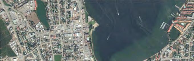
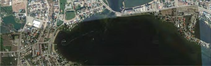
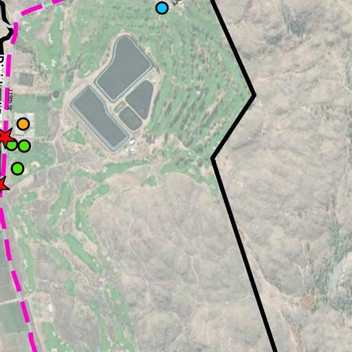
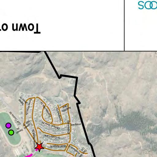
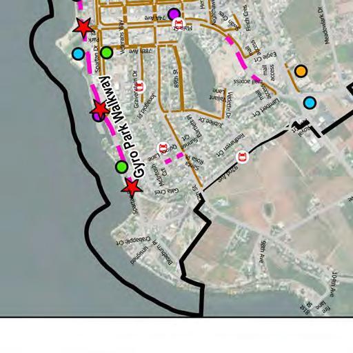
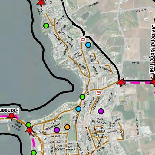
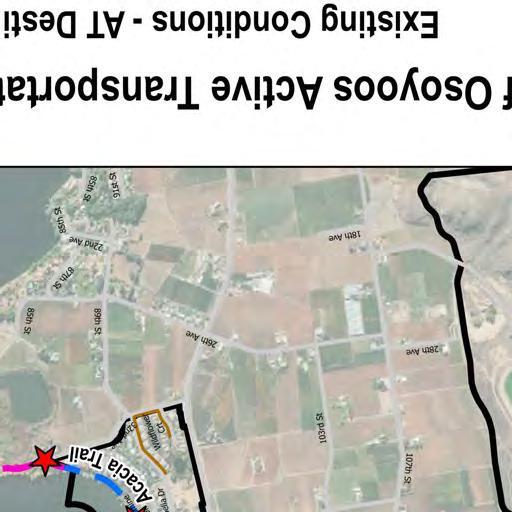
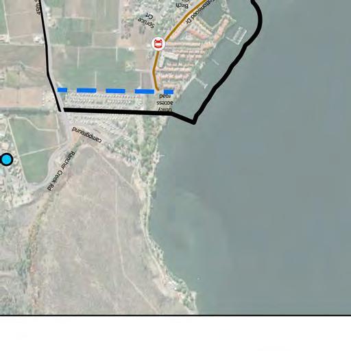
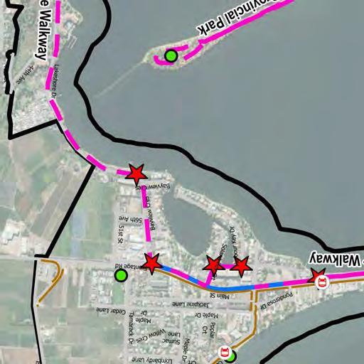
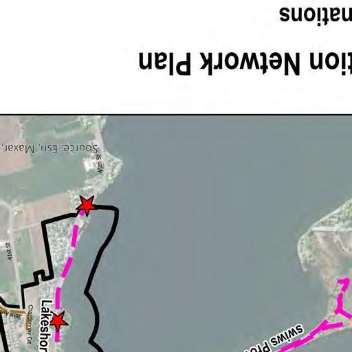
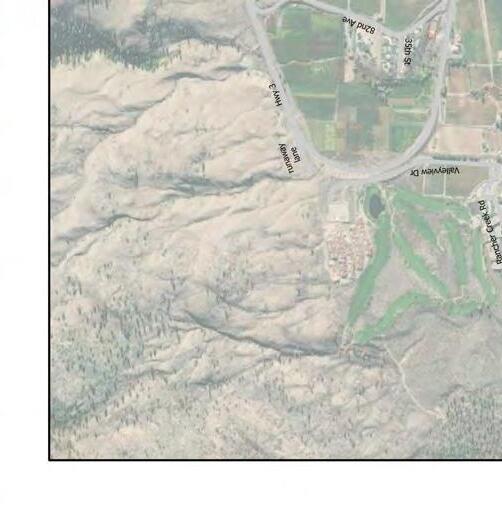
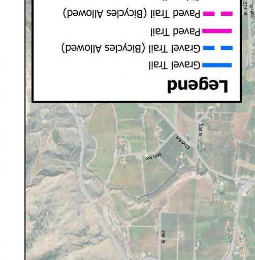
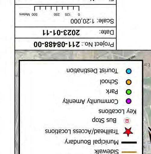
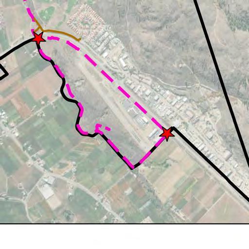
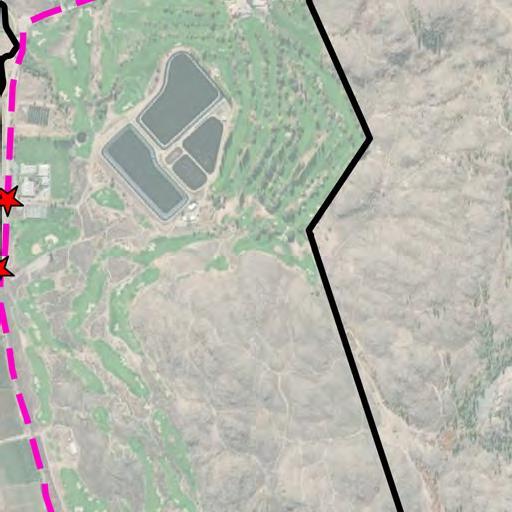
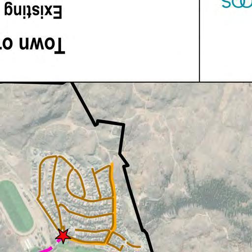
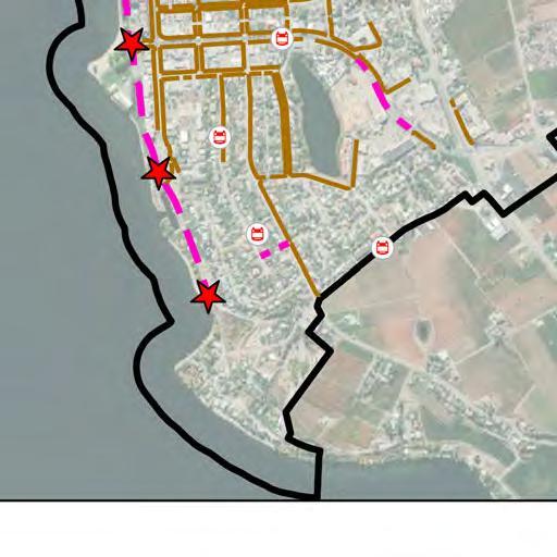
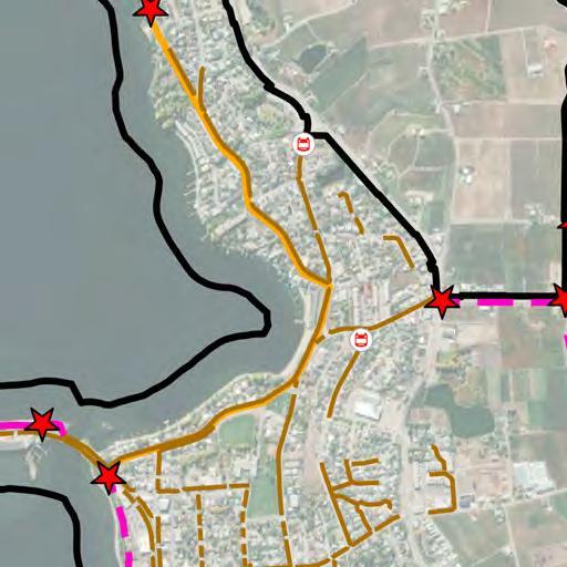
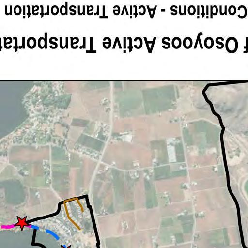
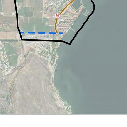
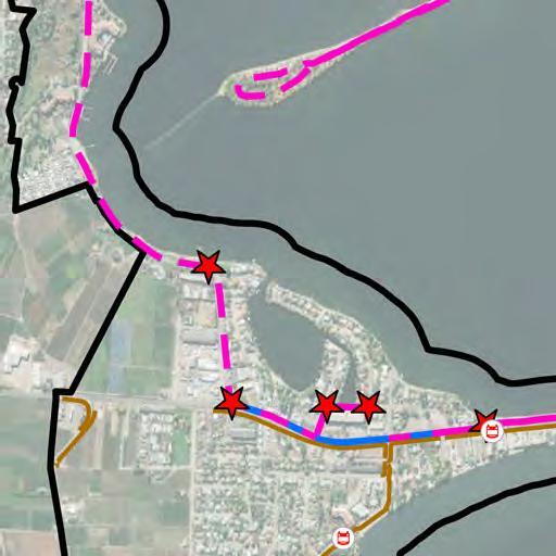
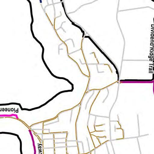
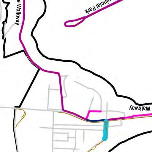
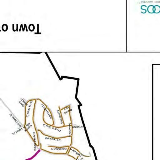
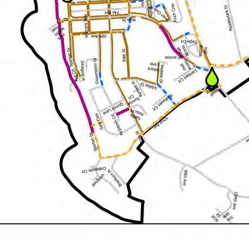
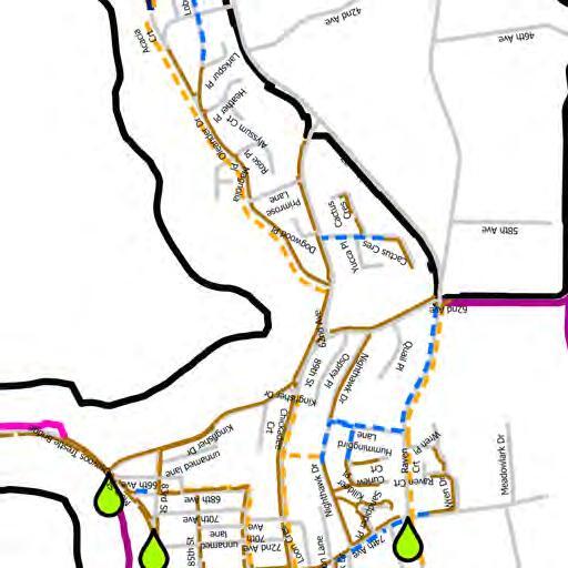
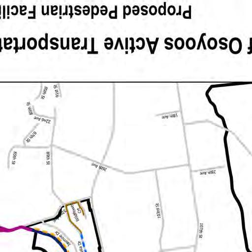
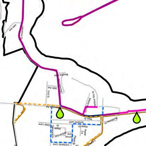
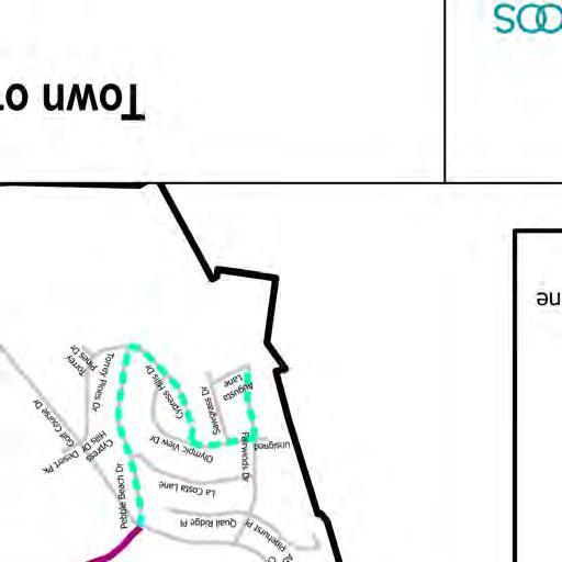
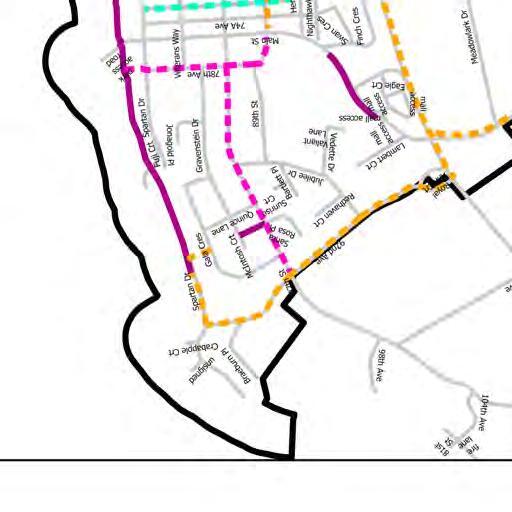
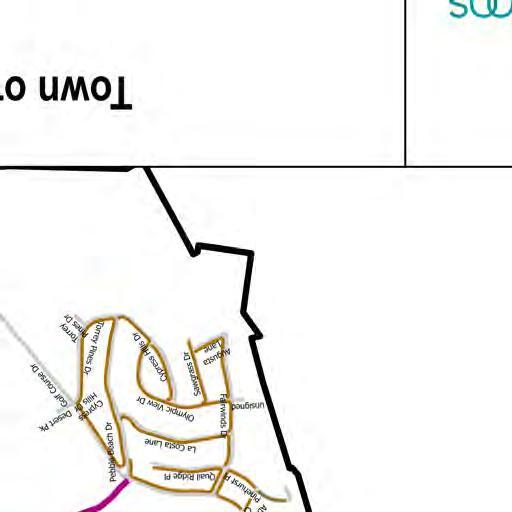
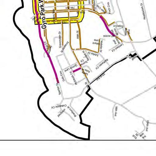
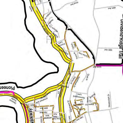
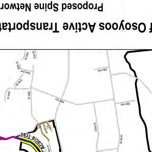
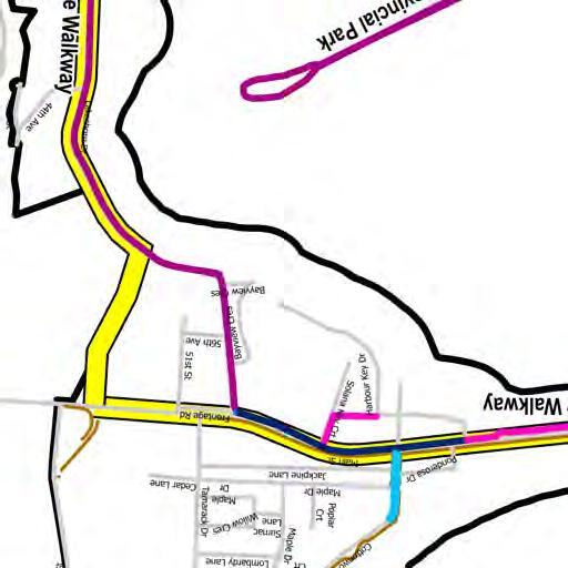
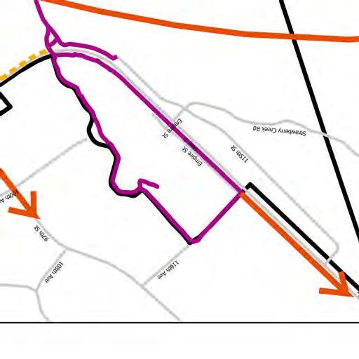
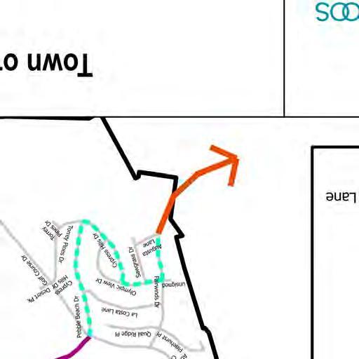
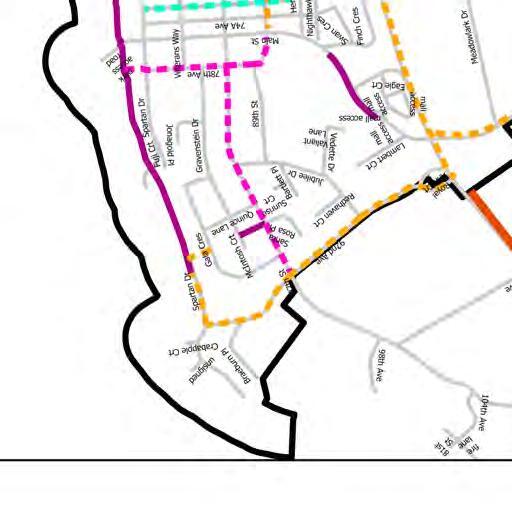
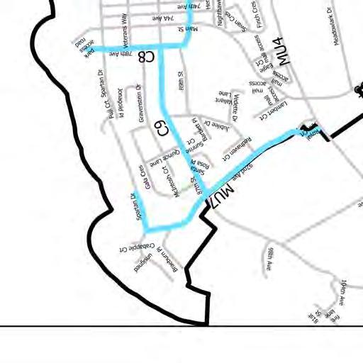
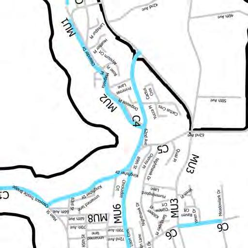
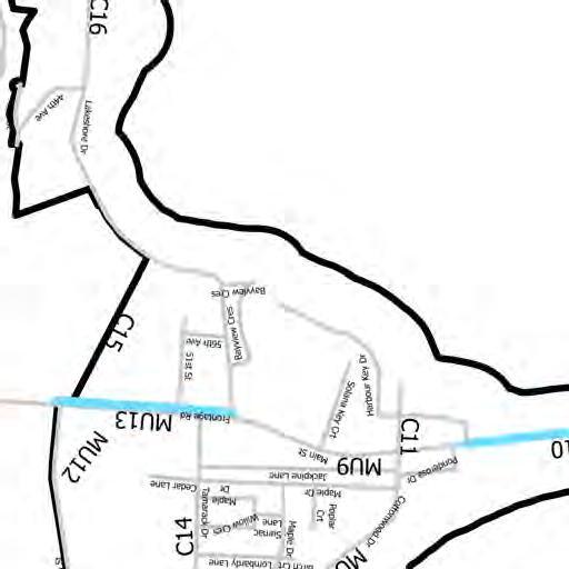
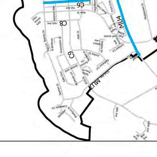
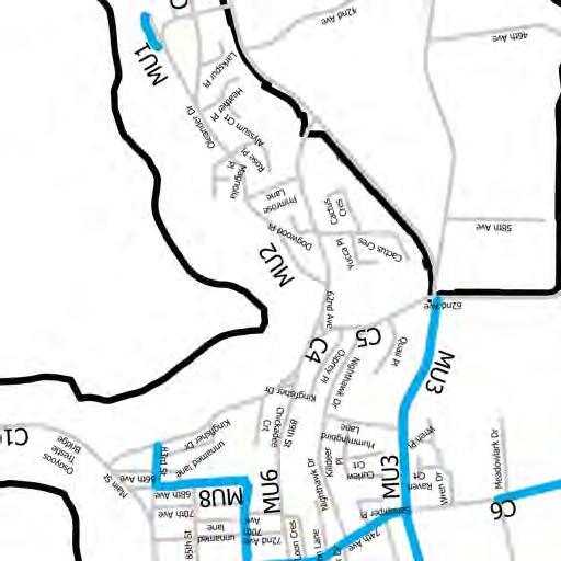
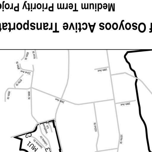
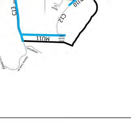
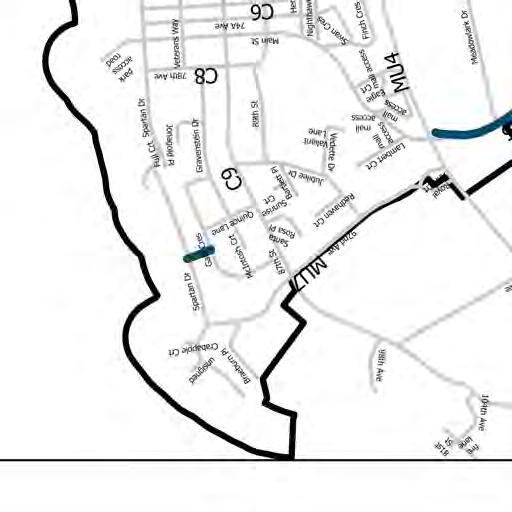
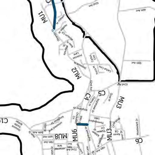
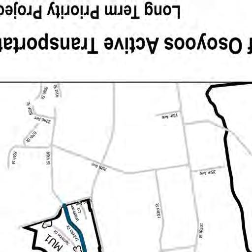
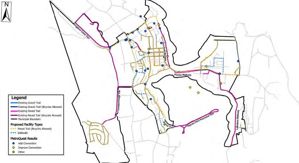
FIGURE 2-4 TOWN OF OSOYOOS AT DESTINATIONS .............................................................9
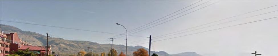
FIGURE 2-5 EXISTING PIONEER TRAIL (BICYCLES ALLOWED) ON MAIN STREET/HIGHWAY 3 EASTBOUND. SOURCE: GOOGLE STREET VIEW IMAGE CAPTURE 2018 (2022) ........12
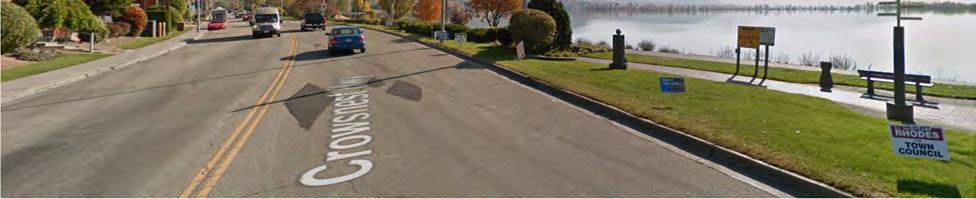
FIGURE 2-6 EXISTING PEDESTRIAN SIDEWALK ON MAIN STREET EASTBOUND AT 85 STREET. SOURCE: GOOGLE STREET VIEW IMAGE CAPTURE 2018 (2022). ......................................13
FIGURE 2-7 EXISTING BIKE LANES ON COTTONWOOD DRIVE NORTHBOUND. SOURCE: GOOGLE STREET VIEW IMAGE CAPTURE 2015 (2022) .......................................13
FIGURE 2-8 EXISTING PAVED TRAIL (BICYCLES ALLOWED) ON LAKESHORE DRIVE SOUTHBOUND. SOURCE: GOOGLE
STREET VIEW IMAGE CAPTURE 2012 (2022) .......................................14
FIGURE 4-2 MEDIUM – TERM PROJECTS (10 – 20 YEARS)..............................................49
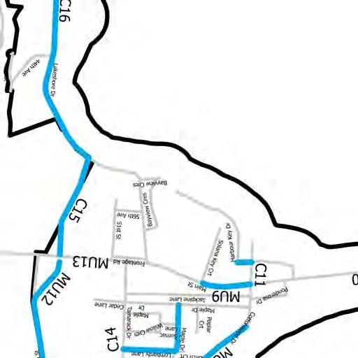
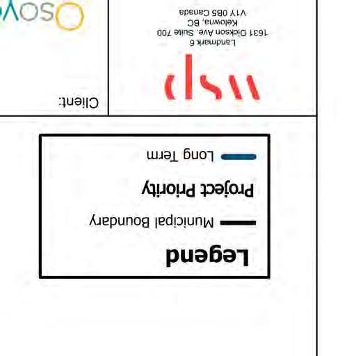
FIGURE 4-3 LONG – TERM PROJECTS (20+ YEARS) ...........................................................50
APPENDICES
A PUBLIC ENGAGEMENT
B PROJECT DETAILS
1 INTRODUCTION
1.1 WHAT IS AN ACTIVE TRANSPORTATION NETWORK PLAN?
The Town of Osoyoos has developed an Active Transportation Network Plan (ATNP), which will help shape how we walk, roll and cycle within Osoyoos. The ATNP identifies a proposed network, priorities, and actions to support human-powered transport modes, while acting as a guide to inform future decision making and investments for active transportation. By following the recommendations within this plan, Osoyoos can address the needs of vulnerable road users, enhance safety and quality of life, and improve community sustainability.
The ATNP supports BC’s active transportation strategy, Move. Commute. Connect. (2019), which aims to double the percentage of trips taken by active transportation by 2030. Osoyoos was a recipient of British Columbia’s Active Transportation Infrastructure Grant Program in 2021, which helps communities develop active transportation network plans to support active transportation for all ages and abilities. This grant helps the development of multiuse protected travel lanes, pedestrian and cycling safety improvements, end-of-trip facilities, and lighting and wayfinding improvements1. This funding has enabled the Town of Osoyoos to create an ATNP that sets the foundation for a strategy to establish meaningful programs, policies, and infrastructure to improve active transportation opportunities within the town.
1.1.1 WHY ACTIVE TRANSPORTATION?
BC’s Move, Commute, Connect Active Transportation Strategy (2019) aims to give BC residents cleaner and better options for getting to where they need to go, by making active transportation easier and safer. To achieve this vision, local governments must work collaboratively to help make active transportation more attractive and accessible. Active transportation improvements within the Town of Osoyoos will directly benefit those residing in town, as this will help lower greenhouse has emissions, build healthier community, provide more affordable transportation options, and reduce traffic congestion.
Health: Active transportation promotes active lifestyles which has potential to reduce physical illnesses such as the risk of heart disease, cancer, diabetes and joint and bone diseases. It also promotes emotional well-being overall through its ability to decrease the incidence of depression and stress, increase happiness via the release of endorphins, and improve sleep and energy levels.
Economic: Active transportation encourages low cost and more affordable mobility options for residents and visitors. It can be more cost-effective for the town as well, as it requires less road construction, repair and maintenance costs over motorized vehicle infrastructure. Active transportation infrastructure has shown to increase property values, especially along greenways, paths and trails. Active transportation infrastructure can also attract cycle tourism which contributes to the local economy as they visit local businesses and interact with the community.
Social and Safety: When using designated active transportation infrastructure, the risk of collisions drops as there are fewer motorists using the road. With more people using active transportation modes, there are more people on the street which increases social interaction among neighbours and increases 'eyes on the street' which has shown to reduce crime levels.
Environment: Human-powered transportation such as walking and cycling leads to a variety of environmental benefits. They do not create any greenhouse gas emissions or air pollutants, unlike motorized transport modes which are one of the major contributors to climate change. Active transportation is also typically more compact, enabling more people to commute in less physical space and removing cars off the road, which can reduce traffic congestion. Active transport modes also have a smaller ecological footprint, and when paired with the transformation green infrastructure, have the potential to reverse many of the development impacts that motorized infrastructure has created.
Equity: Active transportation enhances equity by improving the life of community members by increasing their opportunities to access enriching activities by safe and reliable routes and active transportation options. Active transportation has the potential to contribute to both social and spatial equity when they are considered wholistically within active transportation network planning.
WHO IS THE ATNP FOR?
From a cycling perspective, the ATNP is meant to address the needs of a range of active transportation users that have different interests, abilities and skill levels. The recommendations contained within the Plan reflects the needs and preferences of all user groups to help encourage a broader range of people to use active transportation more often. The Plan provides guidance to the Town of Osoyoos on existing gaps, options for implementation of active transportation infrastructure and supportive programs to build an active transportation culture.
TOWN OF OSOYOOS POLICY ALIGNMENT
Various plans and policies set by the Town of Osoyoos indicate the need to improve active transportation within the town, such as the Official Community Plan (2022) and the Osoyoos Parks and Trails Master Plan (2017). Active Transportation is a key focus area within the Official Community Plan. While several active transportation goals and objectives are identified within the Official Community Plan, the following apply to the ATNP: Encourage walking and cycling by implementing active transportation infrastructure, Improve existing pedestrian and cycling infrastructure, and
Encourage the establishment of key user links between neighbourhoods and community destinations.
The Town’s goal is to provide a safe, balanced and integrated transportation system in Osoyoos, giving consideration to all modes of transportation including pedestrian, bicycle, public transit, goods movement, private vehicle and other travel modes. The Town intends to invest in and encourage active transportation to increase the number of trips taken by humanpowered forms of transportation in Osoyoos, while ensuring that active transportation modes are accessible to all.
-Official Community Plan (2022)
Similarly, the Osoyoos Parks and Trails Master Plan identifies the need to better connect neighbourhoods to offstreet trail facilities, including key actions such as:
Trails and on-road cycle routes need to connect neighbourhoods, parks, as well as regional and provincial parks and key destinations, and
Short, medium and long-term action goals to upgrade and install multi-modal trail corridors.
This ATNP aligns with these plans by addressing these key objectives through a medium and long-term strategy.
1.2 PLAN DEVELOPMENT PROCESS
The ATNP was developed in four phases, using an iterative approach as information was gathered from technical reviews, stakeholders and the public.
PHASE 1 – EXISTING CONDITIONS REVIEW
The first phase involved acquiring a comprehensive understanding of the Town of Osoyoos context including physical conditions, policies and applicable guidance. Goals for the plan as well as opportunities and issues for the active transportation network were also developed through this phase. Section 2 provides a summary of this phase of the project
PHASE 2 – NETWORK DEVELOPMENT AND FACILITY SELECTION
The second phase used the goals and opportunities and issues from phase 1 in combination with best practices to build a proposed network. Route selection criteria was developed and used to identify missing links and facility types. A desktop investigation into candidate routes was also completed to refine the network. The network development process and proposed network is summarized in Section 3.
PHASE 3 – CONSULTATION & PUBLIC ENGAGEMENT
In Phase 3 of the project, the public was asked to provide feedback on the proposed network through online survey by identifying missing links or other safety and accessibility related concerns. Feedback was also collected on the priority of individual projects. Virtual stakeholder meetings were also conducted to gather feedback from key groups including the Ministry of Transportation and Infrastructure (MoTI). The engagement feedback collected through this phase was used to refine the proposed network and inform prioritization. A summary of the engagement activities is provided in Section 1.2.1.
PHASE 4
– PRIORITIZATION, COST ESTIMATES AND REPORTING
The final phase of the plan included prioritization of the proposed network using the public and stakeholder engagement feedback and prioritization criteria. The resulting prioritization informed the capital project implementation plan described in Section 4.
1.2.1 COMMUNICATIONS AND ENGAGEMENT
ENGAGEMENT APPROACH
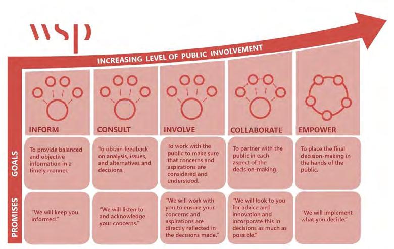
The engagement for the active transportation network plan aimed to provide strategic direction for an active transportation network that is equitable and accessible for people of all ages and abilities. The ATNP has been developed through a deliberate consultation and engagement process to reflect and build upon community needs and previous successes. Meaningfully engaging and collaborating with the community of Osoyoos is essential for ensuring that there is ownership of the final ATNP once it is completed, allowing the plan to more effectively be implemented in the following years.
When developing the scope of engagement for the Town of Osoyoos’ Active Transportation Network Plan the project team identified key audiences that were required to be consulted throughout the project. The identified audiences include:
Town of Osoyoos Project Manager; Town of Osoyoos Staff;
Town Councillors;
Local businesses;
Bicycle Touring and Advocacy Groups;
Community Services Advisory Committee; Traffic Safety Committee;
BC Ministry of Transportation and Infrastructure (MoTI);
Age Friendly and Accessibility Committee; and Members of the public.
Throughout 2022 WSP collaborated with the Town of Osoyoos to facilitate several engagement activities with the identified audiences noted above to inform the development of the ATNP. These activities were completed to gain an understanding of the existing conditions and to identify active transportation strengths, gaps, concerns, and opportunities across the town. The following activities informed WSP’s recommendations for priority areas for Town of Osoyoos to focus the rollout of active transportation infrastructure:
Councillor survey,
MetroQuest community survey (185 respondents),
Stakeholder workshop
Five stakeholders attended the workshop representing the Ministry of Transportation and Infrastructure of British Columbia and the community cycling group, Double O Bikes & Sports. Participants were provided with a link to a Miro Board that featured three maps where participants could markup and highlight areas of concern and opportunity across proposed Pedestrian Facilities, Bike Facilities, and Bike and Pedestrian connections.
MoTI Stakeholder Meeting
A meeting was held with MoTI representative to discuss the public feedback received on MoTI infrastructure and proposed recommendations within the ATNP. The discussion resulted in the refinement of proposed recommendations.
1.3 VISION AND GOALS
Based on the feedback collected from the engagement activities and best practices, the following project goals were established to provide a framework for the development and prioritization of recommendations within the Active Transportation Network Plan, the project goals were to:
Establish a network of active transportation facilities that provide connections to destinations in the Town and Region. Such connections include the Downtown Core; beach accesses; schools; visitor destinations such as hotels, visitor centre, museum, campgrounds, and parks; and sporting destinations such as golf courses and tennis courts; to name a few. Regional destinations include trail accesses at the Town Boundary, Nk’Mip Resort and Casino and wineries in the surrounding area.
Establish a context sensitive network that reflects the diverse user groups in Osoyoos that include an aging population, residents, and tourists. Ensure active transportation infrastructure is equitable and accessible for people of all ages and abilities.
Identify and design for a variety of active transportation infrastructure connections that satisfy the needs of each user group and apply Vision Zero/ Complete Streets principles. Improve safety for pedestrians and cyclists (through the creation of mid-block connections and pedestrian-controlled crossings, proper sidewalks along roads, separated active transportation facilities, and improved lighting).
Develop a prioritization framework that can be applied to active transportation infrastructure implementation and upgrades.
Improve coordination with the Province of British Columbia to develop separated active transportation facilities along the Highway 97 and Highway 3.
2 SETTING THE CONTEXT
2.1 COMMUNITY CONTEXT
2.1.1 GEOGRAPHY AND LAND USE
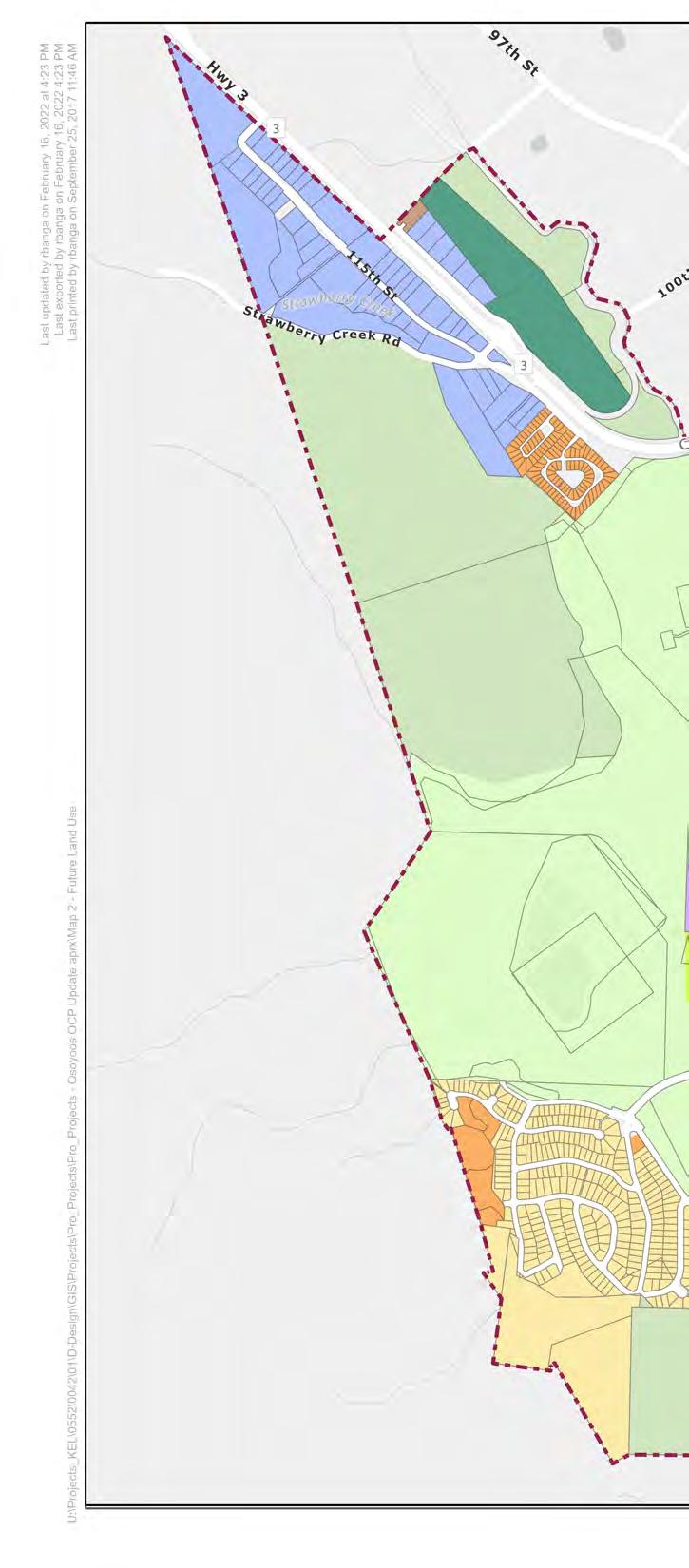
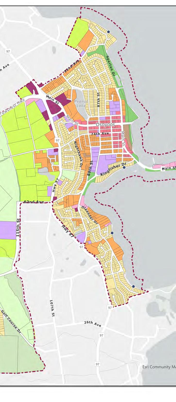
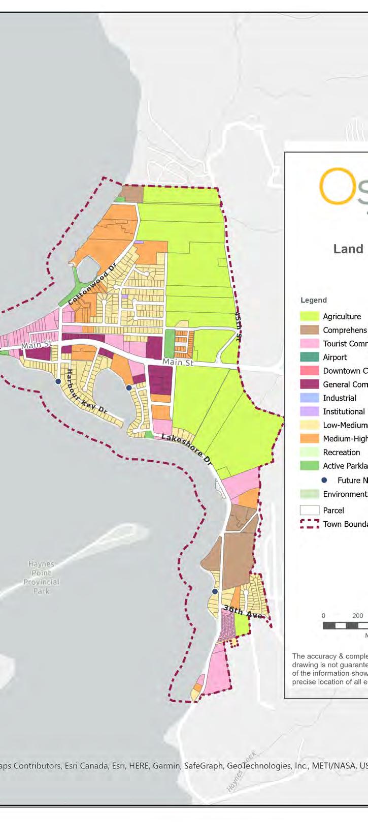
The Town of Osoyoos is the southern most town in the Okanagan Valley, approximately 123 km south of Kelowna, B.C. The Town is surrounded by hill regions to the east and the west, Osoyoos Lake dividing the middle and the U.S. / Canada Border to the south. Figure 2-1 below represents the Town of Osoyoos and current proposed land use plan from The Official Community Plan Final Draft (2022) which demonstrates the physical barriers Osoyoos has as well, the variety of land use designations the Town offers.
The Town of Osoyoos is also part of a greater region known as the Regional District of Okanagan-Similkameen (RDOS), which extends approximately 60 km west of Princeton, 20 km north of Summerland and Monashee Mountain range to the east. The south is defined by the U.S. / Canada border. Key highways such as Highway 3 and 97 through the region and Osoyoos are owned and operated by MoTI. Lastly, the Town of Osoyoos shares a border with the Osoyoos Indian Band which controls about 32,000 acres of land in the vicinity of the town of Oliver and Osoyoos.
Figure 2-1
The east side of the Town has a greater percentage of land designated for tourism, while the west side of town has a greater percentage of park and agricultural land. There is a higher percentage of Low-Medium density residential on the west side of Town. The downtown core (Main Street/Highway 3) is an important corridor to the Town as it provides community amenities such as restaurants, retail, hotels and park and beach accesses throughout the year for locals and visitors to congregate. The distribution of land uses is a factor in determining how to expand the active transportation network and understanding who will be using them.
PHYSICAL BARRIERS
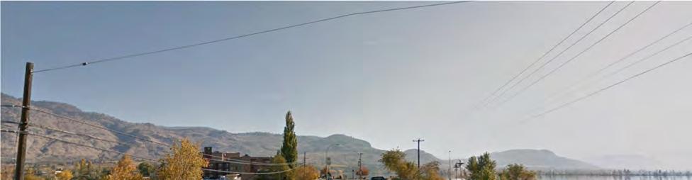
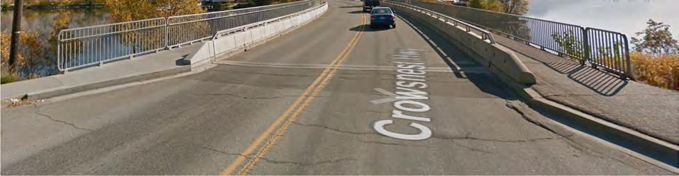
The Town of Osoyoos is divided east and west by Osoyoos Lake, shown in Figure 2-2 and cut through the middle by Highway 3 represented via google street view in Figure 2-3.
Osoyoos Lake is a physical barrier that limits opportunities for additional east-west connections and expansions to the road right-of-way.
The main and only connection between east and west Osoyoos is via the Highway 3 bridge connecting retail and restaurants on Main Street Osoyoos on the west side with hotel row on the east. As a result the highway supports all modes including vehicles, trucks, pedestrians, cyclists and users of other mobility devices.
As it pertains to active transportation, there are limited opportunities to improve this corridor without first engaging with the MoTI who own and operate the right-of-way. Additionally, Highway 97 which extends north and south through the western side of Osoyoos also presents a barrier related to implementing AT infrastructure. This highway is also owned and operated by MoTI.
Figure 2-2: Town of Osoyoos. Source: Google Maps (2022)
The grade is generally flat in central and east Osoyoos, while begins to increase on the west side of town, approaching the hills where there is a higher percentage of parks and agricultural land. This presents a challenge when developing equitable AT infrastructure since a major goal is to ensure that users of all ages and abilities can utilize the facilities. Steep grades can be a challenges for users with limited mobility.
2.1.2 DEMOGRAPHICS
To establish a community profile the Town’s current demographics were reviewed to understand conditions, influences and trends within the community. The 2021 Canadian Census provides the following statistics about Osoyoos and its population:
2.1.3 KEY DESTINATIONS
Key active transportation destinations for the Town of Osoyoos include the various beach accesses for Osoyoos Lake, trail heads both within the town and along its boundary, resorts, and work centers. Additional tourism amenities and key destinations within the Town include, local and provincial parks, such as Haynes Point Park, schools, libraries, and the tourism centre. Figure 2-4 below highlights the teams identified AT destinations.
Osoyoos experiences a four-to five-fold increase in population2 due to tourism in the summer months, with people being drawn to campsites, the lake, and desert like summer heat. Other attractions also include hiking and cycling in the region such as the Irrigation Canal Walkway, International hike and bike trail, and local wineries and vineyards3 This influx in population can impact active transportation users both locally and those who visit as there will be an increase in users on the network. Not only will there be an increase in active transportation users, but it is also expected that vehicular traffic will increase as tourists enter the Town, impacting the safety of active transportation users.
2.1.5 PLANS AND POLICIES
Policies and plans provide guidance on the planning, design, implementation, and operation of facilities such as cycling and pedestrian infrastructure. A summary of relevant polices and guidelines are provided below in Table 1, to better understand the requirements within Provincial and Municipal levels of government. The goal of this review is to develop an understanding of guiding principles for active transportation that may impact the ATNP approach.
Table 2-1 Policy Overview
BC Active Transportation Design Guide (2019)
Move. Commute. Connect. B.C.’s Active Transportation Strategy (2019)
Provincial The British Columbia Ministry of Transportation and Infrastructure (MoTI) Active Transportation Design Guide (2019) is a comprehensive set of planning and engineering guidelines offering recommendations for planning, selection, design, implementation, and maintenance of active transportation facilities across the province.
Provincial The Move. Commute. Connect. B.C’s Active Transportation Strategy is a policy document which outlines goals and strategies related to increasing the percentage of active transportation trips taken; inspire and encourage users of all ages to use active transportation modes; build off the BikeBC program; and work together with communities to create policies and plans that work for them
This guide details information for the design of infrastructure for pedestrians, cyclists, intersections, integration of transit and on highways.
The Regional District of Okanagan-
County The purpose of the RTMP is to define future direction, policies, priorities, standards and actions for the Regional
This strategy outlines goals for MoTI to better assist communities in their goal of providing active transportation for all. Most notably, the strategy highlights actions to further invest in grant funding that communities are able to apply for. The Town of Osoyoos received funding through this grant program which initiated this ATNP
Identifies future planned and existing regional connections that
2 (Helio Group, 2011), Town of Osoyoos Organizational Review: Key Findings and Recommendations
3 https://www.destinationosoyoos.com/
Similkameen (RDOS) Regional Trails Master Plan (2022
Official Community Plan (2022)
Osoyoos Parks & Trails Master Plan (2017)
Age-Friendly Action Plan (2018)
District and its partners with respect to existing and potential future linear parks and trails and support of a regional trail network. The RTMP is a strategic plan that will provide the basic framework to define and guide a Regional Trails Program for the RDOS over the next 10 years (20222031)
Municipal The Town’s Official Community Plan (OCP) includes goals and objectives related to active modes accommodation.
would require a local connection / route within the Town of Osoyoos.
Town of Osoyoos Main Streets Improvements (2022)
Municipal The Osoyoos Parks and Trails Master Plan (2017) is a future-focused, system wide, strategic plan that guides the resourcing, development, management, provision and expansion of the Town’s parks and trails over the next 20 years.
Municipal The Town of Osoyoos completed an Age-Friendly Action Plan (2018) to ensure that the planning process promotes an inclusive, safe and accessible community for everyone.
Municipal The main street improvement report provided the Town with a schematic phase design for Main Street between the Visitor Centre and Lakeshore Drive.
The OCP includes policies around encouragement of active transportation infrastructure, future development and zoning, areas of growth in the Town, and a proposed active transportation network.
The master plan outlines actions related to off-street trails and onstreet multi-modal corridors and categorizes them based on short-, medium-, and long-term actions.
Highlights existing infrastructure that could be improved and recommendations for corridors with missing connections.
The schematic design presented in this report proposes elements that are key for active transportation. Throughout the main street corridor, the design proposes to widen existing sidewalks, construct new sidewalks where links are missing and elongate bump-outs providing safer street crossings for pedestrians. Bicycle infrastructure was not included through this review.
2.2 ACTIVE TRANSPORTATION IN OSOYOOS TODAY
2.2.1
NETWORK USERS
Network users include cyclists and pedestrians of varying experience, age and ability. Different users have different levels of risk tolerance and comfort level. Bicycle riders are typically classified into a spectrum based on their risk tolerance from high to low. The spectrum includes the following:
Strong and Fearless tend to be comfortable riding on major roads, regardless of motor vehicle volumes or speeds, weather conditions, or the presence of existing bicycle facilities.
Enthused and Confident are generally comfortable on most roads with bicycle facilities.
Interested but Concerned do not ride frequently but are interested in cycling more. They usually restrict their riding to roads with physically protected facilities or lower motor vehicle volumes and speeds.
No Way, No How are riders who may never chose to ride a bicycle because they are unable to, uninterested or perceive significant safety issues with cycling in motor vehicle traffic.
Strong and fearless cyclists traverse east and west Osoyoos via the Highway 3 Bridge over Osoyoos Lake and utilize various trails and regional connections north and south, while pedestrians and interested but concerned cyclists use various multi-use paved trail systems the Town has, to connect to popular destinations like downtown, beach accesses and parks along the lake.
2.2.2 EXISTING ACTIVE TRANSPORTATION NETWORK
PEDESTRIAN NETWORK
The existing pedestrian network is comprised of sidewalks on one and two sides of streets and multi-use gravel and paved trails (shared with cyclists), as shown in Figure 2-9. The existing sidewalk network is heavily developed in the downtown core of Osoyoos and some surrounding residential neighbourhoods, primarily on the east side of Osoyoos. The multi-use trails connect beach accesses and recreational areas primarily from the north to south Osoyoos, with connection across the lake. The Osoyoos Main Street and Pioneer Walkway have a strong pedestrian priority with wide sidewalks and enhanced streetscaping. Figure’s 2-5 & 2-6 provide an overview of existing pedestrian infrastructure on the Main Street/Highway 3 corridor.
2-5 Existing Pioneer Trail (Bicycles Allowed) on Main Street/Highway 3 Eastbound. Source: Google Street View Image Capture 2018 (2022)
Figure
CYCLING NETWORK
The existing cycling network comprises of the multi-use gravel and paved trails (shared with pedestrians), and a single stretch of bike lane delineated from vehicular traffic via painted lines along Cottonwood Drive, north of Highway 3 as shown on Figure 2-9. The multi-use trails connect beach accesses primarily from the north to south Osoyoos, with connection across the lake. Figure’s 2-7 & 2-8 provide an overview of existing bike lanes and trails.
Figure 2-6 Existing Pedestrian Sidewalk on Main Street Eastbound at 85 Street. Source: Google Street View Image Capture 2018 (2022).
Figure 2-7 Existing Bike Lanes on Cottonwood Drive Northbound. Source: Google Street View Image Capture 2015 (2022)
Figure 2-8 Existing Paved Trail (Bicycles Allowed) on Lakeshore Drive Southbound. Source: Google Street View Image Capture 2012 (2022)
REGIONAL CONNECTIONS
Existing regional connections include Canary Trail to the east, Trail of the Okanagan’s which extends north and south along Highway 97 through Osoyoos, the Kettle Valley Trail system and Dewdney Trail. Other connections include a link to Nk’MIP Resort which is to the northeast of the Town. Figure 2-10 highlights regional connections in Osoyoos.
2.2.3 TRAVEL PATTERNS AND POPULAR ROUTES
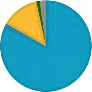
2016 Statistics Canada Census data provide insight into commuter travel patterns and modes of travel in Osoyoos. 2021 data was not available at the time of this report. Of the total commuting population, the census data indicated that 68% of people commute within Osoyoos (i.e. do not leave the Town for work). The Census also gathers information on the mode of travel that commuters use. In Osoyoos, 14% of commuters use active modes, with 13% walking and 1% cycling. While the walk share is significant, the bike share is under the provincial average of 2.5%.
STRAVA DATA
MAIN MODE OF COMMUTING
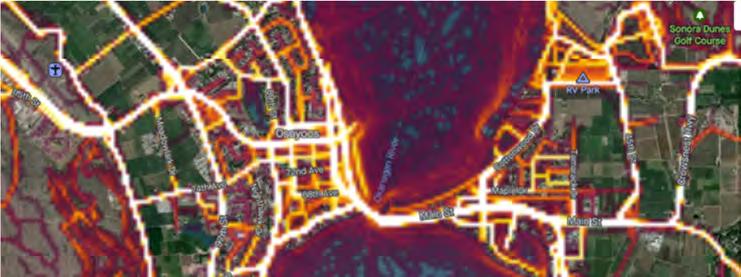
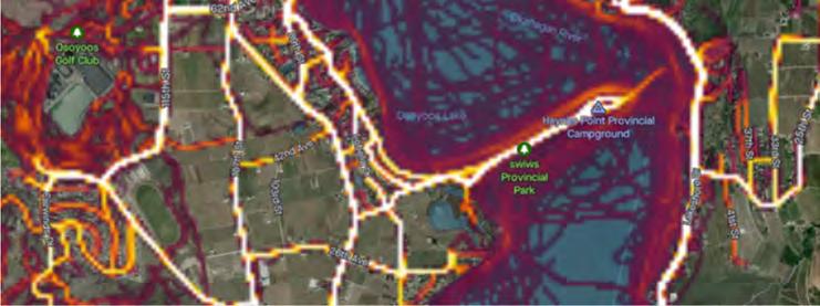
Strava is a fitness app that uses GPS data to track exercise activities such as walking, running and cycling. Through the app, a global heatmap is generated that gives an indication of high-use routes (i.e. routes that are more highly used appear “white hot” while areas with very little activity may not show any “heat”). Strava heatmap data typically reflects the able bodied, strong and fearless category of active transportation users and may not be representation of all ages or incomes of active transportation users. However, in the absence of other available data, the heatmap provides an indication of high use active transportation corridors. The heatmap of Osoyoos is provided in Figure 2-11
Figure 2-11 Strava Heatmap (2022)
Based on the heatmap of Osoyoos, highest use corridors include:
Kingfisher Drive / 62 Avenue; Oleander Drive; 45 Street; Cottonwood Drive; and, Local Downtown Street
Based on data reviewed from the Insurance Corporation of British Columbia (ICBC), there have been very few crashes involving pedestrians between 2016 and 2020. Of the data recorded, two incidents took place at the intersection of Highway 3 and Cottonwood Drive and on 78th Avenue between 87th Street and Gravenstein Drive. The severity is unknown.
Four crashes involving cyclists with unknown severity were observed between 2016 and 2020 at the following locations:
Main Street/Highway 3 between 66th Avenue and Kingfisher Drive
72nd Avenue and 87th Street
89th Street and Main Street/Highway 3
Harbour Key Drive and Main Street/Highway 3
A review of total vehicle crashes (fatal or serious injury and proper damage) was also conducted. Between 2017 and 2021, the top 10 locations within the Town of Osoyoos are summarized in Table 2-2 below.
(from 85 Street to Spartan Dr/Main Street)
(from Kingfisher Dr to North of Osoyoos Bridge)
(from South of Osoyoos Bridge to Harbour Key Dr)
Avenue & 89 Street
Collisions on Main Street/Highway 3 are common based on the review of ICBC collision statistics. MoTI completed a review of crosswalks on the Highway 3 Corridor in 2012 and identified recommendations for short and long-term improvements. Several existing crosswalks were recommended for removal in the short-term including Highway 3 and 89th Street, Highway 3 and Holiday Inn access, and Highway 3 & Richter Pass motel access. The study warrants
Table 2-2 Top Ten Collision locations between 2017 & 2021
an updated review as best practices have evolved. Additional safety improvements to this corridor including a review of crossings and provision of dedicated cycling infrastructure may support a reduction in collisions.
TRAFFIC SAFETY COMMITTEE
The Traffic Safety Committee aims to identify opportunities to improve pedestrian and traffic safety within town boundaries, including highway and neighbourhood corridors4. The committee is made up of representatives from the Ministry of Transportation, RCMP, Town Council and Town Administration. The last meeting held on February 11, 2020 covered topics including regulatory signage along 89 Street, and, pedestrian safety along Lakeshore drive and Golf Course Drive due to speeding vehicles. No resolution was identified on the safety issues discussed at this meeting.
2.3 SUMMARY OF GAPS AND OPPORTUNITIES
A review of existing conditions within the Town of Osoyoos and public engagement feedback has revealed many gaps and opportunities that the town can take to enhance active transportation. The following is a high-level summary of these gaps and opportunities found for active transportation within Osoyoos:
GAPS OR ISSUES:
The existing cycle network consists of gravel and paved trails (shared with pedestrians) and a single stretch of bike lane on Cottonwood Drive beginning at Highway 3. These existing routes do not connect to regional trails east and west of Osoyoos and do not provide adequate links to local neighbourhoods. The existing links that do exist see high user volumes through a single link between east and west Osoyoos, over the Osoyoos Trestle Bridge. This current link is on Highway 3 which is operated and maintained by the B.C. Ministry of Transportation Infrastructure (MOTI). It is recognized that MOTI would prefer cycling accommodation off the highway on a separate corridor but with limited area, this may not be a viable option. Additional links are required to establish a primary spine network that connects to community destinations such as schools, the townhall and, visitor centre.
The existing pedestrian network meets the needs for connectivity in downtown Osoyoos however, there are missing links connecting main spines throughout town. Sidewalk is often missing from both sides of the street which creates accessibility barriers. With a significant infrastructure deficit in sidewalks, the Town may consider prioritizing missing sidewalks links on one-side of the street first before adding it on both sides. It should also be noted that steep grades on the west side of Osoyoos may deter residents from using active modes. As indicated in the Parks and Trails Master Plan, west Osoyoos has a higher aging population with a larger average household income. Coupled with a lower youth population, it is expected that active transportation usage will be lower in this area.
Lastly, additional constraints Osoyoos may face are the higher summer temperatures which could deter some residents to use active transportation facilities during extreme heat events.
OPPORTUNITIES:
The existing cycle network is not consistent throughout the Town and is comprised of mainly shared facilities. There are opportunities to expand this network to introduce facility types that cater to cyclists only and improve access to key destinations within the Town and regionally. An expansion in the cycle network can facilitate additional cycle tourism opportunities throughout the Town. Providing separated cycle facilities also helps to reduce the conflicts between cyclists and pedestrians or vehicles.
The Town of Osoyoos has a high walk mode-share which is a positive indicator that it may increase with pedestrian infrastructure improvements. Based on review of data received from the Town, the existing pedestrian network there are several short sidewalk links that are missing. This introduces an opportunity for the Town to implement and prioritize these connections to provide a continuous pedestrian network. As indicated in the Parks and Trails Master
Plan, east Osoyoos has a mixed age population and the highest number of residents between the ages of 0-19. It is expected that because these individuals mostly do not drive, access to active transportation infrastructure will provide a great opportunity for them to navigate the Town.
3 DEVELOPING THE NETWORK
3.1 NETWORK DEVELOPMENT PROCESS
The proposed active transportation network was developed in 4 steps as outlined in Table 3-1. The network was developed through an iterative process that leveraged the existing foundations set in the Parks and Trails Master Plan, consultation and best practices.
Table 3-1 Network Development Process
Step
1 – Existing Conditions
2 – Route Selection Criteria
Using existing GIS data from the Town and consultation, provincial, regional, and municipal approved planning documents and input from staff, the following was identified:
Existing and planned infrastructure
Geographic areas with limited access to active transportation infrastructure
Key active transportation destinations with the Town and important connections to the region.
A set of criteria was developed to help select, assess, and refine routes to form part of the preferred cycling and pedestrian network. Criteria was developed based on best practices.
Outcome
Identification of gaps and missing links.
Criteria described in Section 3.1.1
3 – Candidate Routes
4 – Confirm Proposed Network and Identify Facility Type
Proposed cycling and pedestrian routes are identified based on their relation to the route selection criteria and building off existing foundations set in the Parks and Trails Master Plan. Routes are identified to complete gaps in the existing and planned network and consider the appropriateness and suitability of the route.
The proposed network defined in Step 3 was refined using the feedback collected through public engagement, stakeholder meetings and discussions with the Town.
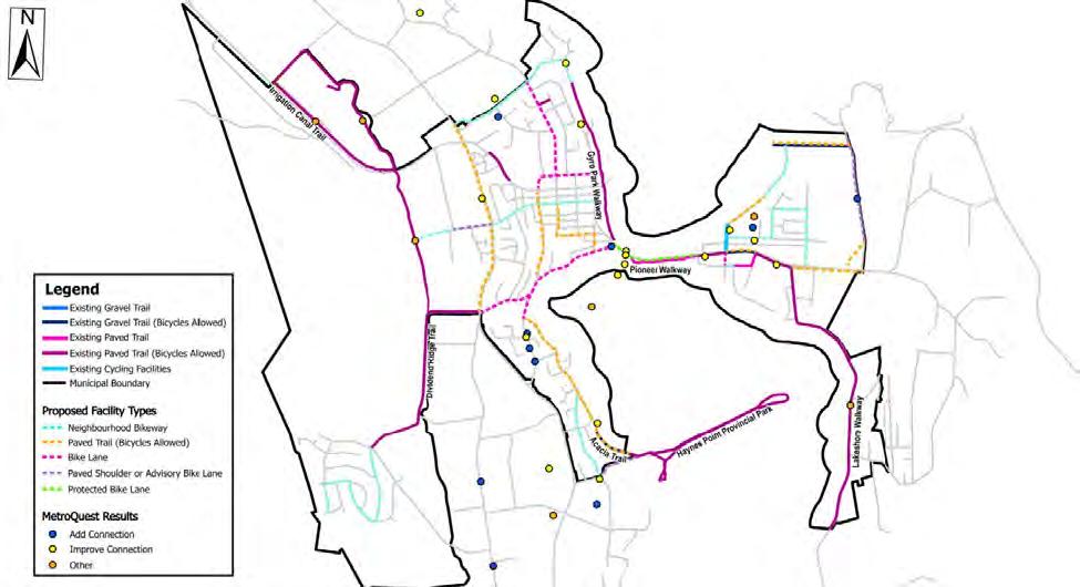
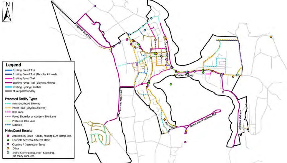
Feedback received from the MetroQuest survey and stakeholder engagement was organized within ArcGIS and separated into Cycling, Pedestrian, and Safety & Accessibility categories. Upon thorough review and engagement with both the City
Proposed Pedestrian and Cycling Network Maps
Public engagement feedback for Pedestrians, Cyclists, Safety & Accessibility (Appendix A)
Refined Proposed Pedestrian and Cycling Network Maps with assigned facility type (Map 3-1 and 3-2)
and MoTI, the team revised the proposed network accordingly.
A key “spine” network was also established through this step. Facility type was assigned for each route using the BC Active Transportation Design Guide, desktop review of available road right-of-way and in consultation with the Town.
3.1.1 ROUTE SELECTION CRITERIA
A set of route selection criteria must be established to ensure that the proposed active transportation network achieves the goals of the ATNP. For a community to unlock the potential demand for walking and cycling, each trip made on foot, by bike or using a mobility device should be direct, seamless, and comfortable. The route selection criteria for proposed cycling and pedestrian network links have been developed through consultation with stakeholders such as the Town of Osoyoos, B.C. Ministry of Transportation Infrastructure and through public engagement to ensure they reflective of the local context. These criteria are meant to be applied in the selection of candidate routes that ultimately form the proposed network.
Table 3-2 Route Selection Criteria
Criteria
Community Connections
Description
- Routes should connect key destinations such as schools, parks, main street and community amenities like the Visitor Centre, Museum, Town Hall / Library, Kinsmen Park, and Haynes Point Park to name a few.
- Sidewalks required on both sides of the road within 400 m of key destinations
Safety and Accessibility - Routes should consider users of all ages and abilities by selecting appropriate alignments and facility types according to road classification, directness of connection and avoiding steep grades.
- Routes should be continuous
Feasibility
Supporting Tourism
- Routes should consider available RROW to accommodate users
- Route should consider future capital plans to incorporate into future Town budgets
- Provides connections for visitors to commercial nodes such as the visitor center, beach accesses and trail heads
Regional Connections - Provides connections to regional trail nodes and Kettle Valley Rail Trail
3.1.2 ENGAGEMENT FINDINGS
The MetroQuest Survey and stakeholder meeting provided the team an understanding of how the proposed network could be refined and how projects were to be prioritized. MetroQuest survey results and the Miro Board were two
major engagement material results which indicated several proposed projects of great interest to public and private stakeholders.
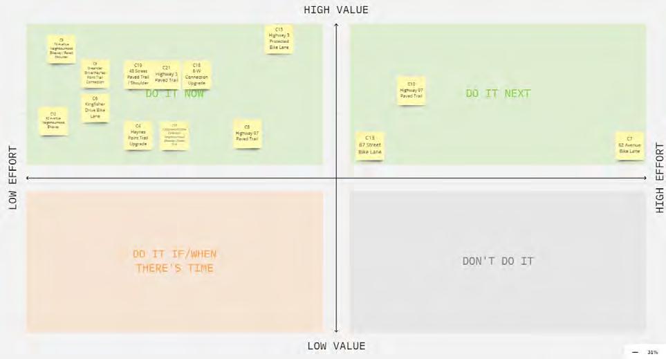
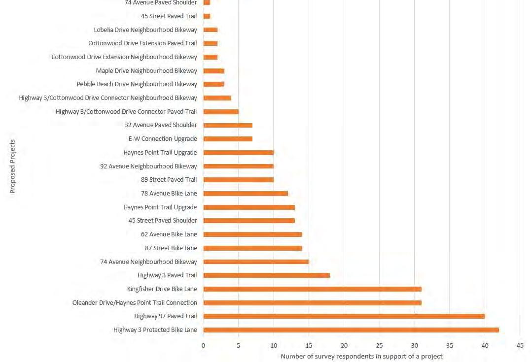
The top priorities for road improvements included building active transportation facilities and trail networks along Highway 3, Kingfisher Drive, Highway 97, 87 Street, and 45 Street. However, Highway 97 and Highway 3 are both under the Ministry of Transportation and Infrastructure’s jurisdiction which means that further coordination to prioritize projects along the route is necessary between the town and the Province of British Columbia. The top priorities for projects entirely within the Town of Osoyoos’ control includes the following:
i. Oleander Drive/Haynes Point Trail Connection (31 responses)
ii. Kingfisher Drive Bike Lane (31 responses)
iii. 74 Avenue Neighborhood Bikeway (15 responses)
iv. 87 Street Bike Lane (14 responses)
v. 62 Avenue Bike Lane (14 responses)
The list of priority projects demonstrates the desire to have more connections made between residential and commercial areas of Osoyoos. This narrative was supported both by the key findings in the MetroQuest and Town Council surveys.
3.1.3 PROPOSED PEDESTRIAN NETWORK
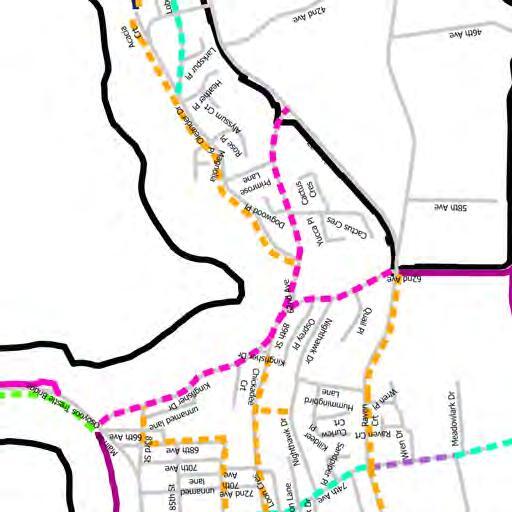
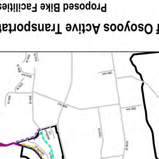
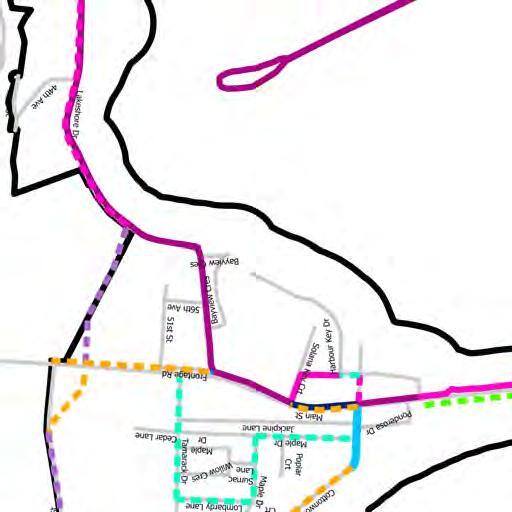
The proposed pedestrian network is composed of a combination of sidewalks and paved trails (pedestrian only and bicycle allowed trails). Sidewalks were identified on one or both sides of a street depending on alignment with route selection criteria. The pedestrian network was refined through consultation. Public engagement feedback collected through the MetroQuest Survey indicated a desire for a connection on Highway 3 from Highway 97 to the Irrigation Canal Trail. A high-level review of the corridor and discussion with MoTI confirmed that a Top of Bank Trail may be feasible at this location and was added to the pedestrian network. Implementation of this infrastructure is anticipated to occur through a combination of Town investment, in collaboration with MoTI and through subdivision and development processes. A series of crosswalk improvements have also been identified that align with the safety review and public engagement feedback. Figure 3-1 shows the proposed pedestrian network.
3.1.4 PROPOSED CYCLING NETWORK
The proposed cycling network consists of a spine network and extended network. The spine network provides the primary connection across town to key destinations and is intended to support all ages and abilities. The spine network consists of a connection around the lake and a loop around downtown.
Public engagement feedback resulted in an additional connection on 89th Street between Oleander Drive and Highway 97. Feedback also highlighted concerns with the existing paved trail (bicycles allowed) on Lakeshore Walkway and the Highway 3 bridge connection. Improvements have been proposed on these corridors. Figure 3-2 shows the proposed cycling network.
3.1.5 REGIONAL CONNECTIONS
Several potential regional connections have been identified based on the RDOS Regional Trails Master Plan (2022) and the Town of Osoyoos Park and Trails Master Plan (2016). The connections are intended to be conceptual only and have not been altered. Alignments of each connection should be determined with further study.
3.1.6 CYCLING FACILITY TYPES
There are several facility types proposed as part of the ATNP. Active transportation facilities can generally be categorized as on-road or off-road facilities, with various subcategories based on users, level of separation, and street context. On-road cycling facility types are often classified by their separation from motorized traffic. Users are generally more comfortable with increasing separation between the cycling facility and motorized traffic, which holds true in Osoyoos based on the survey results. Paved shoulders can be implemented as a means of separating cyclists on rural roads (i.e. without curb and gutter) where budget and/or space do not allow for a fully separated facility.
The facility types and considerations for implementation are:
Paved Trails (Bicycles Allowed)
Neighbourhood Bikeway
Bike lanes
Paved Shoulders
Advisory Bike Lanes
Protected Bike Lanes
3.1.6.1 UNDERSTANDING THE CYCLING FACILITY TYPES
SELECTING BIKE FACILITIES
When determining the facility types for Osoyoos’ active transportation network, it is important to understand the context and constraints of the corridor.
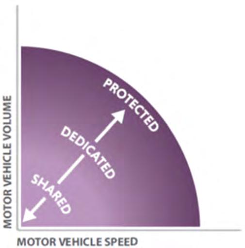
Motor vehicle speeds and volumes are perhaps the most important considerations in selecting the appropriate bicycle facility type. Generally, higher motor vehicle speeds and volumes necessitate a greater degree of separation between motor vehicles and bicycles to support all age and ability design, as illustrated in Figure 3-5.
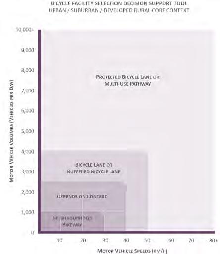
Figure 3-6 shows the Bicycle Facility Selection Decision Support Tool from the BC AT Design Guide, which outlines when each type of bicycle facility may be appropriate. This was used to narrow the range of possible facility types based on motor vehicle speed and average daily motor vehicle volume while also considering the realworld context of Osoyoos.
Figure 3-5: Conceptual Bicycle Facility Selection Diagram. Source: BC Active Transportation Design Guide (2019)
Source: BC Active Transportation Design Guide (2019)
Other factors that inform the facility selection include the following:
Available road right-of-way and road width impact whether a facility can be implemented through a retrofit (i.e. within the road width or curb to curb space) or through reconstruction (within the road right-of-way). Road widening that requires property acquisition to accommodate active transportation facilities may be cost prohibitive and a barrier to implementation.
Users including seniors, children, mobility disadvantaged, and recreational users or tourists are more likely to use a bike facility if it is universally accessible and accommodating of the full spectrum of potential users with all levels of experience. The implications of this are facilities that tend to include greater vehicle separation.
On-street motor vehicle parking can limit the available road width for bike facilities. On-street parking can also negatively impact the safety of cyclists when a bike facility is located with the door opening zone. Onstreet parking may need to be removed or buffers may need to be added between the bike facility and parking lane to address these concerns.
Mixture of vehicles (bus and trucks) can be uncomfortable for cyclists to travel next to. Bicycle facilities should be separated from bus and trucks. Conflicts can occur between loading zones and bus stops that feel unsafe to cyclists.
Conflict points occur at intersections and accesses along a corridor. A high percentage of collisions involving active transportation users occur at these conflict points. Certain types of facilities including bi-directional protected bike lanes and off-road facilities may not be appropriate on roadways with multiple conflict points. Design treatments should be applied to mitigate conflicts at these points.
Available funding may be a constraint in the type of facility that is selected. Generally, facilities that have greater separation (i.e., protected bike lanes and trails) have higher cost implications than those that are limited to ones with pavement markings and signage (i.e. bike lanes or shared lanes). Costs are typically higher for roadways that require reconstruction to complete or where utilities such as streetlights need to be realigned.
Land use context such as urban, suburban, or rural or residential, commercial and industrial can impact the type of facility that is selected. The context has implications on safety, conflicts, type of users, etc that all have impacts on the facility type.
Physical constraints such as retaining walls or steep grades can limit opportunities to expand road right-of-way or require realignment to support bicycle infrastructure.
Primary or secondary networks have implications on the type of facilities that may selected based on the objectives of that network. A primary network should support a higher volume of users and support all ages and abilities. A secondary network acts as an extension of the primary network and may carry a lower volume of users. As a result, a higher investment may be warranted on a primary network versus a secondary network.
DESCRIPTION OF FACILITY TYPES:
Table 3-3 provides a description of each of the different facility types for consideration within this ATNP.
Table 3-3 Cycle Facility Types
Facility
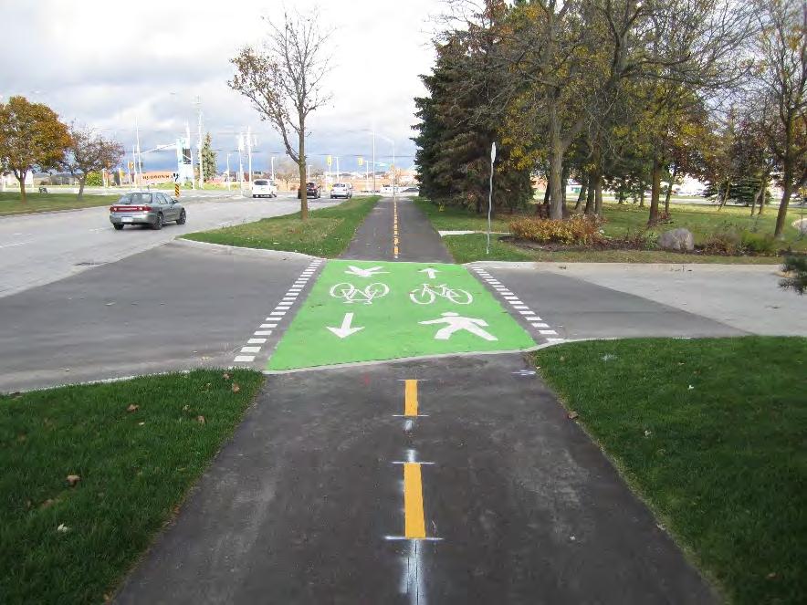
Paved Trails A trail wide enough for people walking, cycling, and using other forms of active transportation.
Neighbourhood Bikeway
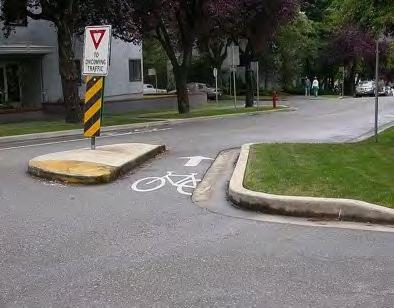
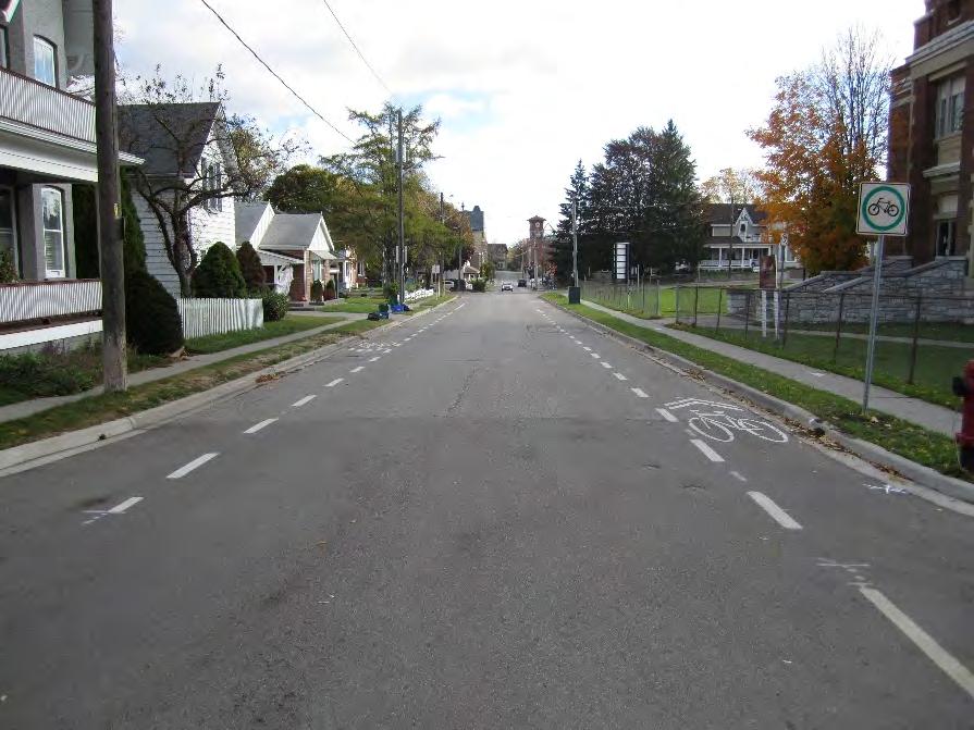
Usually marked by roadway signs and pavement markings, neighbourhood bikeways are intended for streets with low motor vehicle speeds and volumes where vehicles and people cycling can share the road. Some neighbourhood bikeways also include measures to reduce the volume of vehicles and reduce the speed of vehicles.
A paved trail in Newmarket, Ontario
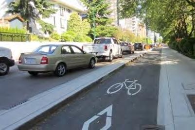
A bike boulevard with a one-way diverter in Vancouver
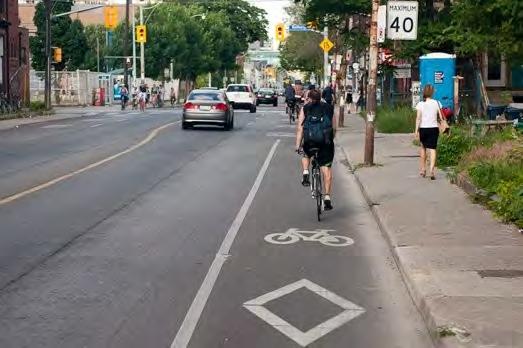
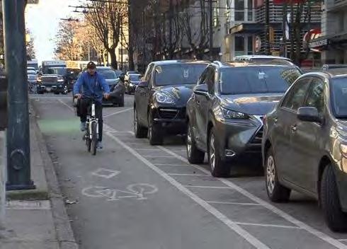
Bike Lanes A bike lane is a portion of a roadway which has been designated for the exclusive use of cyclists through the use of pavement markings such as paint and signage. Typical applications for bike lanes are on low volume arterials or collector roadways and should typically be applied to both sides of the street.
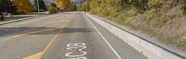
A paved space on the edge of rural roads outside of vehicle travel lanes. Some paved shoulders include physical separation through the application of jersey barriers and fences or a painted buffer with rumble strip.
A conventional bike lane in Toronto, ON and a buffered bike lane with onstreet parking in Vancouver
Paved Shoulders
Example of paved shoulders along Highway 3 in Trail
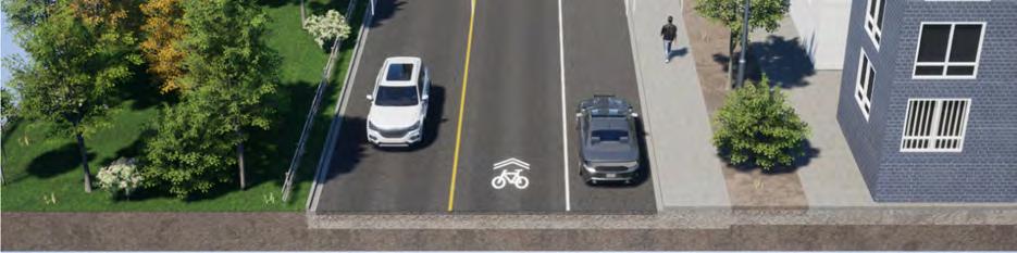
Advisory Bike Lanes A bicycle priority travel lane on a narrow road with a single, narrow centre travel lane for motor vehicles. Motor vehicles may enter the bike priority travel lane to pass an opposing vehicle.
Protected Bike Lanes Separate travel lanes designated exclusively for bicycle use and are usually delineated from vehicular traffic by a physical barrier.
3.1.6.2 SAMPLE CROSS-SECTIONS
Conceptual cross-sections were developed for three different proposed routes to provide an illustration of how active transportation may be accommodated in the future. All cross-section renderings were made with the use of BeyondWare software.
Advisory bike lane in Newmarket, Ontario
Bike lane separated by a concrete curb in Vancouver
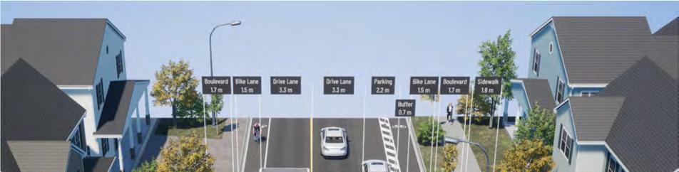
89TH STREET BIKE LANE: OLEANDER DRIVE TO HIGHWAY 97
Features:
This project is classified as a reconstruction where the roadway will be reconfigured from property line to property line
A bike lane is added on the west side and a parking protected bike lane is provided on the east side of the street.
On-street parking is accommodated on the east side of the street as the frequency of driveway accesses is lower than on the west side.
Pedestrians are accommodated through wider sidewalks with greater separation from motor vehicles.
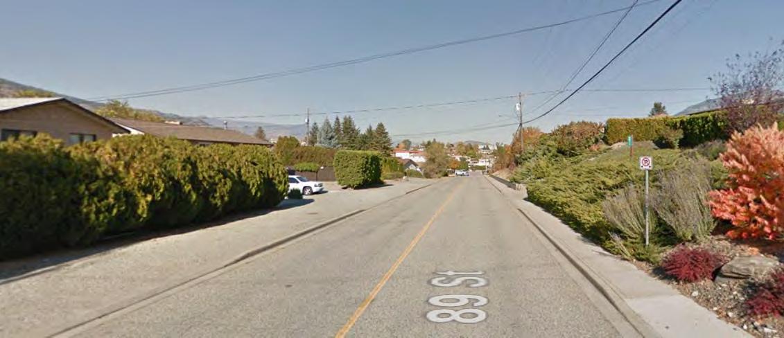
Figure 3-7 Existing Cross-Section 89th Street Northbound. Source: Google Street View Image Capture 2018 (2022)
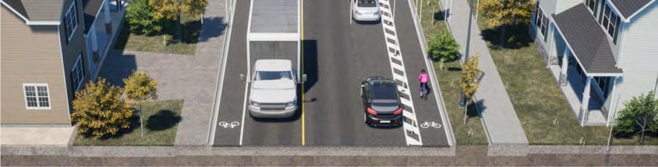
Figure 3-8 Proposed Bike Lane 89th Street
MAIN STREET/HIGHWAY 3 PROTECTED BIKE LANE: KINGFISHER DR TO HARBOUR KEY DR
Features:
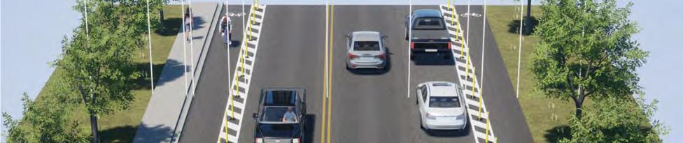
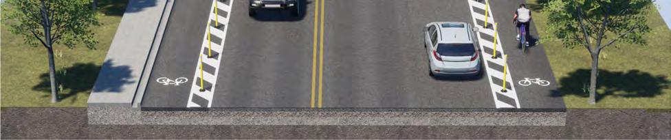
This project is a short-term project that reflects modifications within the road with (curb to curb space). Protected bike lanes are added in both directions to meet the needs of the anticipated users of these facilities and to provide separation from the high volume of trucks and vehicles along this corridor.
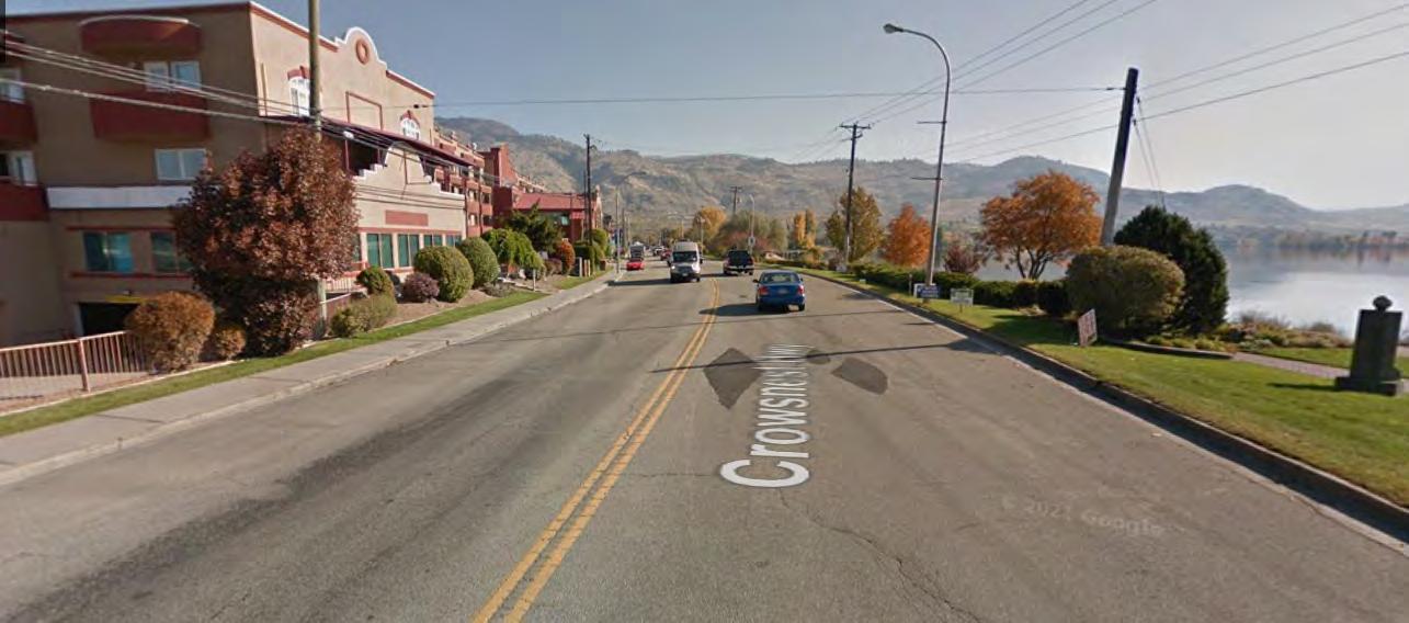
Figure 3-9 Existing Cross-Section Main Street/Highway 3 Eastbound. Source: Google Street View Image Capture 2018 (2022)
Figure 3-10 Proposed Protected Bike Lane Main Street/Highway 3
On-street parking has been removed from the north side of the Highway to accommodate active transportation facilities with the expectation that the Town consider establishing a district parking to facilitate tourist traffic to the area.
Pedestrians are accommodated through existing sidewalks on the north side and through the Pioneer Walkway. Long-term improvements would consider the addition of a sidewalk on the south side and more permanent physical separation between bicycles and vehicles.
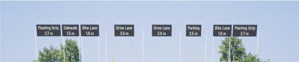
COTTONWOOD DRIVE NEIGHBOURHOOD BIKEWAY: ENTRANCE TO SOLE VITA TO COTTONWOOD CUL-DE-SAC
Features:
This project is classified as a quick-win project that can be implemented in the short-term.
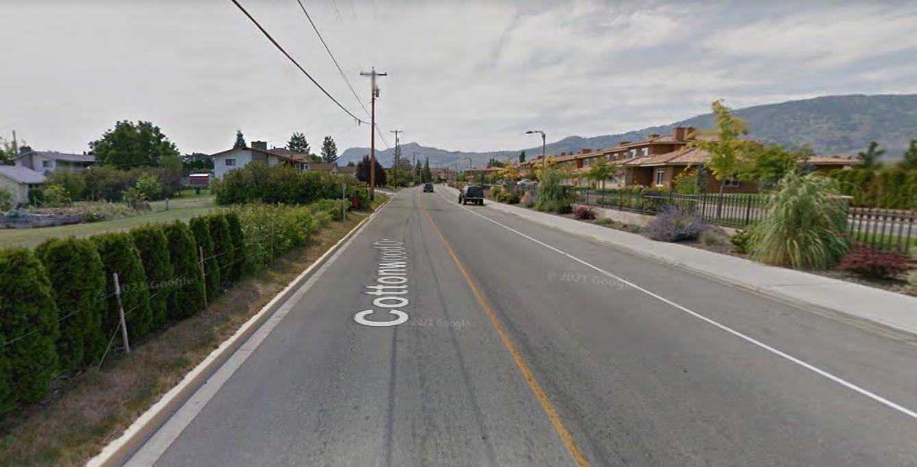
Figure 3-11 Existing Cross-section Cottonwood Drive. Source: Google Street View Image Capture 2012 (2022)
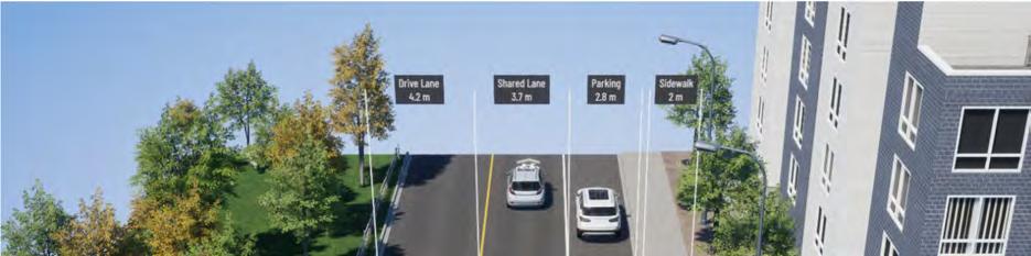
The neighbourhood bikeway consists of pavement markings and signage on this corridor as Cottowood Drive is already a low-volume, and low-speed street.
The width of on-street parking has been reduced to provide ample space for shared operations between cyclists and motor vehicles.
Pedestrians are accommodated through existing sidewalks on the lake side.
3.1.6.3 SUMMARY OF ACTIVE TRANSPORTATION NETWORK FACILITIES
A summary of the proposed infrastructure in number of km is provided below.
Table 3-4 Summary of Proposed Infrastructure
3.2 OTHER CONSIDERATIONS
3.2.1
BC MOTI INFRASTRUCTURE IMPROVEMENTS
Within the plan, there are two proposed active transportation corridor improvement areas along Highway 97 and Highway 3. While the majority of road rights-of-way within the Town of Osoyoos is at the town’s discretion, subject to posted speed, volume and availability, the BC Ministry of Transportation and Infrastructure (MoTI) will always have the ultimate authority over highway right-of-way. Funding of improvements within the highway corridor is another consideration that requires collaboration between the Town and Ministry. As a result, an important consideration is the development of options that can be implemented within the short-term and long-term.
3.2.1.1
LINKS
The ATNP proposes a protected bike lane from Kingfisher Drive to Harbour Key Drive where it turns into an existing paved trail (bicycles allowed) and a proposed paved trail (bicycles allowed) located on the south side of the highway between Cottonwood Drive and Solona Key Ct and between Lakeshore Drive and 45 Street. These facility types were selected based on the speed and volume of vehicles on the highway and the desire to maintain a protected facility to serve all ages and abilities. A paved trail (bicycles allowed) provides the added benefit of supporting pedestrian traffic in addition to cyclists. It is recognized that access closures may be required to support this implementation and that on-street parking will be reduced. However, it should be noted that the proposed facilities does not prohibit the use of the carriage way by strong and fearless cyclists.
Another consideration for Highway 3 includes the Main Street concept developed in 2022 that includes public realm improvements to serve pedestrians. In discussions with the Ministry, further corridor planning studies are required to consider access management, operations and safety before any infrastructure is added.
The second link on Highway 97 includes a proposed trail (bicycles allowed) from 92 Avenue to 62nd Avenue located on the west side of Highway 97. A multi-use trail was selected on this corridor to provide connectivity for pedestrians and cyclists.
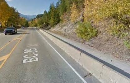
The short-term implementation of these options would include modifications within the existing carriage way (curb to curb or edge of pavement to edge of pavement width). Other communities including Trail ,BC have successfully implemented multi-use facilities within the shoulder in collaboration with the Ministry with the application of physical barriers as shown in Figure 3-13. Further studies and discussions with the Ministry is required before infrastructure is implemented on either of these corridors.
3.2.1.2 CROSSING IMPROVEMENTS
Several engagement responses indicated unsafe crossings of the highways. While this is the jurisdiction of MoTI to improve highway crossings, the Town of Osoyoos and MoTI should work in collaboration to develop concept plans for their improvement. MoTI indicated that they are open to re-studying issues with existing crossings and intersections improvements to facilitate improved active transportation.
Locations identified for improvements based on public engagement feedback are listed below:
- Intersection Improvement at the intersection of Highway 97 and 74 Avenue;
- Improve the highway crossing along Highway 3 just east of Irrigation Canal Trail;
- Crossing improvements along Highway 3 in the area adjacent to the Holiday Inn;
- Crosswalk review along Highway 3 / Main Street in the area adjacent to the corner of 83 Street;
- Crossing Improvements at the intersection of Highway 3 and Lakeshore Drive; and,
- A pedestrian safety review at the intersection of Highway 3 and Kingfisher Drive
3.2.1.3 HIGHWAY 3 BRIDGE
The east-west trestle bridge on Highway 3 requires improvements to better serve active transportation users. For example, when trying to cross the bridge, cyclists must dismount on the north side of the path to cross because the railings are too short to allow for cyclists. The current configuration forces conflicts between either cyclists and pedestrians or cyclists and vehicles. In summer months, the volume of all users increases which increase the number of potential conflicts. The existing bridge is a pinch point with the active transportation network that must be improved to achieve the goals of the overall network. This bridge is under the authority of MoTI. Collaboration between MoTI and the Town of Osoyoos is required to develop a concept plan that addresses the needs of active transportation users of all ages and abilities. Consideration may be placed on creating an exclusive active transportation connection at this location that separates cyclists from pedestrians and vehicles.
Figure 3-13 Highway 3B, Trail BC Source: Google Street View Image Capture 2018 (2022)
3.2.2 BYLAWS AND POLICIES
DEVELOPMENT COST CHARGES (DCC)
Municipalities and regional districts levy development cost charges (DCC) on new development to pay for new or expanded infrastructure such as sewer, water, drainage, parks and roads necessary to adequately service the demands of that new development. Active transportation infrastructure is one such necessary service that municipalities can apply DCC’s for. The cost to build an active transportation facility would then be part of the overall development cost and integrated with the project budget
A review of the town’s current DCCs is recommended to ensure appropriate funding is in place for future infrastructure needed to adequately service growth in the community, especially as it pertains to active transportation use. Development cost charges are established by bylaw with the approval of the Inspector of Municipalities. Updating development cost charge bylaw every five years will generally keep the estimates of new development and infrastructure costs current, therefore the town should ensure that active transportation infrastructure is included within this resource pool within the next update.
REQUIREMENT OF ACTIVE TRANSPORTATION FACILITIES ON NEW ROADS
As development occurs within the town, there is a requirement for developers to construct adequate facilities set out by the Town. There is currently a gap in the Town’s development standards which does not consider cycle infrastructure. It is recommended that the Town of Osoyoos update its development standards to include sidewalk on both sides of high volume local and collector roads, and cycling infrastructure where it connects with the proposed plan. This will ensure that active transportation facilities are planned for and constructed on new roads at the time of development.
COMPLETE STREETS
Complete Streets are streets that are planned, designed, constructed, operated and maintained for all modes of transportation and all street users. The street network functions in such a way that it allows people to arrive at their destination using a wide range of travel modes with a sense of comfort.
A Complete Streets Policy can be considered for all types of projects at any stage. It can be used as a guiding tool for Town staff, agencies, planners and developers to build, design and retrofit existing or new infrastructure. The goal of the policy should be to promote equal consideration to multiple transportation mode users to provide a balanced and inclusive transportation network.
It is recommended that the Town of Osoyoos adopt a Complete Streets policy to provide a standardized guideline in planning, constructing and maintaining infrastructure for all modes of travel and all transportation system users.
TRAFFIC CALMING & SLOW STREETS
Traffic calming is the deliberate slowing of traffic in residential areas for the purpose of improving safety and quality of life for residents. It includes a collection of measures such as engineering, design, educational, and enforcement measures that can be used individually or together as a toolkit to help address traffic challenges such as high speeding and shortcutting traffic. Depending on the traffic concerns, the calming measures can be a combination of passive behaviour changes and permanent physical infrastructure modifications.
Examples of traffic calming measures include speed humps, curb extensions, chicanes, raised pedestrian crossings or intersections, traffic circles, traffic diverters and median islands.
Slow Streets are a specific type of traffic calming that involve the temporary partial closure of neighbourhood streets to limit vehicle traffic, allowing for reduced traffic volumes and speeds. These may be implemented on streets that already have low vehicle volume and speeds. These gained popularity during the COVID-19 pandemic to create more distance between pedestrians and cyclists, but have remained popular since. Slow streets provide the opportunity for people to feel safer while walking, biking, or running throughout their community, encouraging Active Transportation travel in those whose safety concerns prevent them from traveling more frequently.
The creation of a traffic calming policy and/or guideline is a common practice to evaluate and process traffic calming requests received by residents.
ZONING BYLAW CHANGES
Zoning bylaws regulate the type of building and uses allowed on a specific property. It also regulates building size, building siting on the property and parking. To help encourage the use of bicycles, the town may consider bike parking requirements within the development of new buildings. For example, the town may require bicycle parking in certain buildings such as multi-family residential, commercial, and schools, as well as short-term and long-term secure bike parking.
E-BIKES
Micro-mobility and electric-powered vehicles such as e-bikes and kick style e-scooters have emerged as a potential solution for mobility needs for people of various ages and abilities at the provincial, national and international level. E-bikes and other forms of micro-mobility can help municipalities support sustainable and inclusive travel choices such as the first and last kilometre travel and can help to reduce the physical stress of biking by permitting a rider to travel longer and farther than a traditional bike.
Electric bikes (e-bikes) are a class of transportation/recreational bicycle that use and electric motor to assist with propulsion or fully propel the rider. During the public engagement phase, there was public concern about the safety of e-bikes being on paths and trails as well as sidewalks. The concern stems from those who use the paths and believe the higher speeds of e-bikes can be dangerous to other users of the paths and disruptive to the environment. The provincial government has restricted certain classes of e-bikes on recreation sites and established recreation trails to limit the impact to people, wildlife, and trail management.
It is recommended that the Town of Osoyoos establish and / or amend relevant by-laws to pronounce where electric bikes and scooters are prohibited and permitted, and to clarify the use along on and off-road facilities, as well as the classes that are permitted.
SCOOTERS
Similarly to e-bikes, an electric kick scooter is a regulated motorized personal mobility device that has 2-4 wheels and a steering handlebar. According to provincial policies, you can only operate an electric kick scooter on a road in a pilot community, in accordance with provincial regulations. Within the pilot communities that they are allowed to operate, sidewalk use is prohibited. If the province expands the pilot or allows electric scooters elsewhere in the province, the Town of Osoyoos may want to consider developing its own bylaws governing how and where scooters may be used within the town.
The Town of Osoyoos was successful in applying for the pilot program to allow for electric scooters on municipal highways. The Town will be updating related bylaws to allow for this vehicle use on Community Road surfaces, not highways under the jurisdiction of the Ministry of Transportation and Infrastructure.
3.2.3 ACCESSIBILITY IMPROVEMENTS
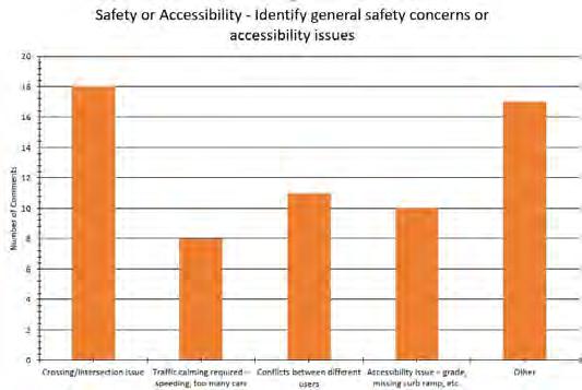
Several engagement responses indicated areas in the Town that were not accessible for all users and should be reviewed by the Town further. While a majority of the locations were identified on Highway 3 or 97 as detailed in
3.2.1.2, feedback provided indicated concerns at the intersection of 89 Street and 62 Avenue which should be further reviewed by the Town, including installation of curb let-downs.
It is recommended that the Town consider the development of an overall safety and accessibility fund that can address concerns related to crossings, curb let-downs, and traffic calming.
3.2.4 TEMPORARY INSTALLATIONS
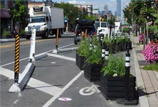
Temporary installation of active transportation infrastructure through low-cost materials is a great way to test the effect on the cycling environment, the effect on curbside demands and parking, the effect on local businesses, and
public perception and level of support from residents and businesses. Pilot projects for active transportation do not have to be costly or time-consuming. For example, simple paint lines, bollards or heavy planters can serve to redirect traffic and give space for active transportation. This can take days or weeks, but are much quicker to implement than brand new long-term infrastructure which can take years between the grant application, planning, engagement, approval, etc. Pilot projects can also be more effective in getting long-term community input before making it more permanent and can easily become a permanent piece of infrastructure if it is well-received by the community.
It is recommended that the Town of Osoyoos pilot active transportation infrastructure through low-cost installments in addition to its long-term planning.
Temporary installations can be implemented with a variety of materials differing in cost, time, effort to install, and frequency of maintenance. Most materials are low cost, readily available, and can be combined to create modular installations. Table 3-5 summarizes possible material options.
Source: Quick-Build Guide: How to Build Safer Streets Quickly and Affordably (2020). Alta Planning + Design.
Table 3-6 provides successful temporary installation examples using various materials from Vancouver, BC and Toronto, ON.
Table 3-6: Temporary Installation Examples
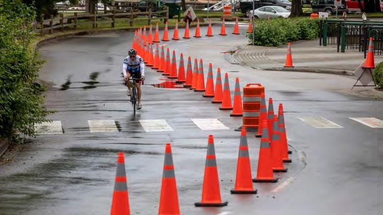
Traffic Cones
Bi-directional bike lane with traffic cone separation from vehicle lane
Stanley Park, Vancouver, BC
Modular Installation
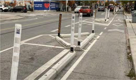
Pre-cast concrete curbs and surface mounted flexible guideposts next to a painted bike lane
Bloor Street, Toronto, ON
Modular Installation
Pre-cast concrete curbs and surface mounted flexible guideposts (left)
Free standing delineators and planters (right)
Avenue, Toronto, ON
3.2.5 PARKING
At present, vehicular parking is permitted along the shoulder of highway 3. On-street parking is currently well utilized from the bridge to cottonwood drive. To accommodate safe active transportation along the highway, one side of vehicular parking should be removed. This will create space for active transportation infrastructure while also removing the safety risk of cars pulling over and opening their doors to those using the active transportation network.
It is recommended that Osoyoos develop a long-term parking strategy that considers a district parking location to support tourists and others looking to park within the town.
Danforth
3.2.6 END OF TRIP FACILITIES
End-of-trip facilities are dedicated facilities for active transportation users. End-of-trip facilities may include secure bike parking, bike lockers, showers, bike repair stations and pumps, and e-bike charging. While some of this infrastructure may be installed by the town, such as bike repair stations and bike parking, Osoyoos can also implement a bylaw requiring the construction of end-of-trip facilities in new buildings. A bylaw or development guide will help to ensure that future commercial and residential buildings can support active modes of transportation.
3.2.7 SUPPORTIVE PROGRAMS
Supportive services and programs can encourage active transportation within Osoyoos. For example, bike to work/school programs, education programs for how to use infrastructure and repair bikes, wayfinding and signage, transportation demand management, and bike theft safety programs can all help encourage active transportation. Short-term sustainability coordinators roles are often established within municipalities over the summer months to coordinate many of these initiatives.
BIKE TO WORK/SCHOOL DAY
Biking to work or school can be daunting for those who have never commuted by bike. Supporting active transportation through town-led bike to workdays can help break down those mental barriers for some, through organized rides throughout major routes in town and marshalling road traffic. Bike to workday can be supported with water and repair stations, as well as prizes for those who log the most kilometers travelled by active transportation modes.
BIKE REPAIR STATION AND COMMUNITY OUTREACH
Bike repair stations have been useful for those who would like to bike, but do not have all of the tools at home or on their ride to make adjustments or pump their tires. A bike repair stand may include a bike pump with gauge, as well as tools such as screwdrivers, tire levers, a pedal wrench, cone wrenches and hex key set securely attached by retractable stainless-steel cable. Strategically placed bike repairs stations can help people feel more prepared while commuting to work or school.
Community outreach programs dedicated to educating and motivating people to use active transportation can help to switch transportation modes. For example, HUB Cycling is a not-for-profit organization that helps remove barriers to cycling in Metro Vancouver through education and programming, and relies heavily on its large volunteer base. A similar urban program like this within Osoyoos could be an effective way of increasing active transportation.
There are existing bike advocacy groups within Osoyoos, with differing goals and objectives. Osoyoos Bike Club is one such bike advocacy group that builds awareness of purpose-built bike trails and promotes inclusiveness within the bike community. The Trail of the Okanagans is another bike advocacy group with a vision for a connected single 370km hiking and cycling trail spanning the entire length of the Okanagan Valley Lake. An inclusive active transportation advocacy group for commuting within Osoyoos could be synergistic with the existing groups and may help build awareness, provide education, and contribute to building the cycling culture.
WAYFINDING
AND SIGNAGE
Wayfinding and signage is important to ensure that active transportation users can easily understand where to go and feel safe doing so. Consideration should be given to reflecting wayfinding standards of the Town and also ensuring
that the signs and pavement markings are used continuously. According to British Columbia’s Active Transportation and Transit-Oriented Development Design Guide5, guidance for wayfinding is provided below:
Pedestrian wayfinding signage and information kiosks should provide directions to transit and other key destinations.
Cycling wayfinding signage and pavement markings should be simple, visible, and provide clear directions to TOD and other key destinations.
Bike counters may be considered at key locations along cycling facilities to monitor cycling trends while also raising awareness of cycling in an attractive and informative way.
BIKE THEFT SAFETY
Bike theft within British Columbia is a growing concern, and it is important to prevent bicycle theft to encourage people to own and use bicycles. There are numerous ways to help prevent bike theft, with secure and well-lit bike short- and long-term bike storage being one of the first lines of defence. Other programs that have helped prevent bike theft and return bikes after being stolen is Vancouver’s Project 529 for example, which allows users to register their bikes for free on an app which becomes part of the worlds largest bike database. While the Project 529 sticker deters bike theft, it also increases the chance to returning the bike to its owner once found or seized by police rather than being put up for auction.
INCLUSIVE BUS STOPS ADJACENT TO ACTIVE TRANSPORTATION INFRASTRUCTURE
A British Columbia Human Rights Tribunal ruling recently upheld a complaint filed by the Canadian Federation of the Blind (CFB) about the design and application of a floating bus stop. There is currently limited design guidance available to address safety issues for blind and vision-impaired people who ride the bus and they often cannot hear the sound of oncoming bicycles. TransLink has launched a study to look at developing an updated design guidance for inclusive bus stops adjacent to cycling infrastructure to ensure they meet the needs of all ages and abilities. The recommendations in this guideline and/or other recommendations to improve accessibility at bus stops near cycling facilities should be monitored within Osoyoos. It is recommended that Osoyoos work closely with BC Transit and the accessibility community on the coordinated design of bus stops near cycling facilities.
A goal of the ATNP was to develop a prioritization process and framework for the implementation of active transportation infrastructure that was clear and defendable. As a result, prioritization is informed by a combination of public and stakeholder feedback, physical characteristics of the proposed infrastructure (road right-of-way, facility type, constructability), alignment with existing capital plans and role within the overall network. A detailed overview of the prioritization process is outlined in the Table below.
The proposed network was prioritized using the following metrics and inputs identified by the steps below.
Step Description
1 – Synthesize Public Engagement Feedback
2 – Understand features for each project
The public and stakeholders were asked to identify priority projects for cycling projects through the MetroQuest Survey and stakeholder meeting. Survey participants were provided the opportunity identify up to 3 priority projects. A map was produced of the results that was stratified into high, medium, and low public priority (Appendix A).
Features were summarized for each project that was used to inform the constructability of each project and ultimate priority. Features that were considered for each project are listed below:
• Constructability: Physical characteristics such as road right-of-way width (property line to property line) and carriage-way width (curb to curb width) were identified to inform the constructability of each project.
• Capital Plan Alignment: 5 year and 5+ year capital plans to determine where funding may be leveraged and to align with asset renewal processes.
• Spine Network: Alignment with the “spine” network to establish a connected, primary network.
• MoTI Alignment: Alignment with MoTI owned infrastructure to account for additional discussions and negotiation of proposed infrastructure.
• Efficiencies: Alignment with proposed sidewalk link to inform where infrastructure upgrades may be optimized.
3 – Categorize projects according to constructability
Using the features identified in Step 2, each project was categorized in terms of constructability as defined below:
Quick Win: Project that can be implemented within the carriage-way where pavement is in good condition and include low-cost improvements such as signage, pavement markings, traffic calming measures and temporary traffic calming curbs. Projects that typically fall within this category include bike lanes, paved shoulders and neighbourhood bikeways.
Repaving: The roadway pavement requires improvements before a bike facility can be added within the road width (curb to curb space). Bike facilities that can be implemented using signage, pavement markings and temporary physical delineators include bike lanes and neighbourhood bikeways.
4 – Define Priority Framework and Prioritize Projects
Reconstruction: Infrastructure requires replacement and reconfiguration of space within the road right-of-way (property line to property line) to provide adequate cycling and pedestrian infrastructure. Cycling infrastructure that falls within this category typically is implemented in the carriage-way. Sidewalks are often added at the same time as cycle projects.
New Construction: Includes the construction of new facilities where no previous facility exists. Most new construction projects are paved trails (bicycles allowed) to be installed between the carriage-way and property-line.
A prioritization framework was created that prioritized projects cycle projects into Short (high priority), Medium (medium priority) and Long-Term (low priority). The framework is defined below:
Short-Term/High Priority (immediate – 10 years) priority projects are a high public engagement priority and have a quick win status, they are part of the main cycling spine and are planned in the existing 5-year capital budget planning identified by the Town.
Medium-Term/Medium Priority (10 – 20 years) priority projects are defined as having a high or medium public engagement priority including either a reconstruct or new construction status, it is planned within the Town’s exiting 5+ to 8-year horizon capital plan and is part of the main cycling spine but has existing facilities. Many projects identified on MoTI infrastructure also fall into this category.
Long-Term/Low Priority (20+ years) priority projects are defined as having a low public engagement priority including either a reconstruct or new construction status. Figure # indicates projects that were assigned a long-term priority. Many projects identified on MoTI infrastructure also fall into this category.
Quick-wins, Safety and Accessibility, and Sidewalk projects fall into a fourth category that assumes an annual budget for improvements. This approach was taken as it provides the Town flexibility in addressing known and emerging issues.
Appendix B includes a details for each project.
4.1.1 PEDESTRIAN PROJECT PRIORITIZATION
Pedestrian projects include paved trails (bicycles allowed) and proposed sidewalks. Paved Trails are equivalent to multi-use pathways and are intended to act as a shared facility type between cyclists and pedestrians. The proposed pedestrian network reflects critical links that are required to improve accessibility to active transportation destinations. As a result, each link has the same relative priority. Sidewalks may be implemented as stand-alone projects or with bicycle infrastructure where they align. An annual budget has been defined for sidewalks over 20 years, to be used for completing missing links defined in the proposed network.
4.2 NETWORK PRIORITIES AND STAGING
Bicycle projects were categorized in short-, medium-, and long-term priority as described in Section 4.1. The figures below show the staging of cycle projects over that duration.
4.3 NETWORK COSTS
Network costs for each project were completed using industry unit costs, and the length of each project facility. The network costs are an Class D estimate only and should be refined at the concept and design phase for each project. The total cost to implement the proposed ATNP is $5,889,700 over the 20+ year capital plan. A summary of the costs by type is provided in the tables below:
Note - *Quick-win projects are intended to be annualized over a 20-year period to address emerging projects
Table 4-2 Pedestrian Project Costs
4-3 Other Project Costs
Note * - Estimated cost includes conceptual, single line drawing. Further detailed design will be required following this initial study. Costs have not been included for subsequent studies as it may vary subject to discussions between the Town and MoTI
Table
4.4 FUNDING STRATEGIES
The development of well-connected active transportation network requires strategic planning and investment over the short, medium and long-run. Osoyoos should leverage funding from senior levels of government to assist with active transportation projects.
This section describes the various funding opportunities that the Town of Osoyoos may leverage to fund capital infrastructure. It is recommended that Osoyoos take full advantage of these programs as they become available to ensure long-term fiscal sustainability. In many cases, stacking of federal and provincial grants are allowed, so applying to multiple streams of funding simultaneously can be beneficial.
Note: The opportunities identified within this section are subject to change based on provincial and federal timelines and remaining funding.
4.4.1 FEDERAL
ACTIVE TRANSPORTATION FUND
The federal Active Transportation Fund is the first ever federal funding dedicated to active transportation. It will provide $400 million over five years to support a modal shift away from cars and toward active transportation, in support of Canada's National Active Transportation Strategy. The fund will invest in projects that build new and expanded networks of pathways, bike lanes, trails and pedestrian bridges, in addition to supporting active transportation planning and stakeholder engagement activities.
The fund has two streams - planning projects and capital projects. The Planning Projects stream includes research, engagement, policy development, feasibility studies, and building awareness, while the Capital Project stream involves the construction of new infrastructure or improvements on existing infrastructure.
Some eligible capital projects may include:
Building or enhancing infrastructure for active transportation such as multi-use paths, sidewalks, footbridges, separated bicycle lanes, and connections to other roadways
Quality improvements to support greater usage of active transportation
Building of enhancing features and facilities to promote active transportation, such as storage facilities, lighting, greenery, shade, and benches
Building or enhancing safety features such as crosswalks, medians, speed bumps, and wayfinding signage.
Under the Active Transportation Fund, the maximum funding amount for a planning project is $50,000 and $50 million for a capital project, and there is no limit to the number of applications that can be submitted.
FCM GREEN MUNICIPAL FUND
The Federation of Canadian Municipalities (FCM) manages the Green Municipal Fund, which finances planning studies, pilot projects and capital projects that improve air, water, land and greenhouse gas emissions through lowinterest loans and grants. Through this program, most recipients receive an additional grant of up to 15% of their loan amount for capital projects. There are various streams of funding depending on the project type, but the transportation stream aligns most closely with active transportation improvements. Within the transportation stream, the following programs are recommended:
Capital Project: Transportation networks and commuting options6
Low interest loan of up to $5 million and a grant worth up to 15% of the loan, covering up to 80% of eligible costs.
Pilot Project: Transportation networks and commuting options
Up to $500,000 to cover up to 50% of eligible costs. Municipalities with a population under 20,000 may qualify for a grant of up to 80% of eligible project costs.
4.4.2 PROVINCIAL
ACTIVE TRANSPORTATION INFRASTRUCTURE GRANT
Under the Active Transportation Infrastructure Grant, governments may apply for funding for new or existing active transportation infrastructure, which has been identified through an active transportation network plan or equivalent. A maximum of two active transportation infrastructure grants for different projects or different phases of the same project may be funded through this program per applicant.
Projects are evaluated according to the following criteria:
Project improves safety for active transportation users in alignment with the B.C. Active Transportation Design Guide and is responding to community safety concerns.
Project improves community connectivity and has community support.
Project is designed for all ages and abilities and incorporates Universal Design and gender-based analysis plus (GBA+).
Project improves economic opportunities for the community.
Project provides environmental benefits
To increase the likelihood of being awarded the grant, having pre-developed concepts for the application and working closely with project partners is often favorable.
Examples of active transportation projects7 that have recently been funded through this program are the following:
Tofino Multi-Use Path, 2019-2020: 2.8km of separated two-way cycling path connecting the Tofino Information Centre to the boundary of the Pacific Rim National Park ($1 million dollars in funding)
Ethel Ave Transportation Corridor in Kelowna, 2019-2020: Street-level protected bike lanes from Sutherland Avenue to Springfield Road/ Cadder Avenue ($237,532 in funding).
The South Shoreline Trail Improvements in Port Moody, 2019-2020: Trail improvements such as widening the path to a 4.2m wide paved multi-use path with improved drainage and sightlines ($205,295 in funding).
The funding cost-share percentage is applied to total eligible project costs after all external third-party contributions have been deducted. For a community with a population of less than 15,000, such as Osoyoos, the percent of eligible funding is 70% up to $500,000.
Additional eligibility requirements can be found on the province's website.
ICBC ROAD IMPROVEMENT PROGRAM
ICBC initiated the Road Improvement Program (the Program) in 1990 to help fund the implementation of road safety engineering measures to reduce the frequency and/or severity of crashes at high-risk locations, reduce claims costs and reduce the potential for crashes. Since 1990, the agency has invested approximately $209 million in over 7,500 road improvement projects across the province. Periodically, ICBC conducts an evaluation of the safety performance of a sample of locations across BC that have been improved under the Program in order to quantify its overall effectiveness.
While it is not a grant system, ICBC will often work with communities to fund road safety enhancements. Osoyoos should work closely with ICBC to identify areas of improvement within its jurisdiction, specifically related to potential enhancements to crossing safety, speed and signage around active transportation corridors.
CARBON TAX REBATE (CARIP)
Municipalities in BC may sign the Climate Action Charter, in which they must commit and report on their sustainability initiatives to reach carbon neutrality in return for an annual rebate from the Province. Many municipalities have set up a climate reserve fund to direct the use of the CARIP grant and other funds for climate action initiatives. This fund helps municipalities fund active transportation improvements, among other sustainability initiatives.
Osoyoos has signed on to the Climate Action Charter and in 2019 was categorized as level 4 in the program, meaning that the municipality has reached carbon neutrality in its operations. In its annual report, it was noted that Osoyoos does not currently have a climate reserve fund set up. Osoyoos may consider setting up a reserve fund in which the CARIP rebate could be reinvested in climate action projects such as active transportation improvements. This dedicated funding source could contribute toward the long-term investment of the recommendations within this plan.
5 CONCLUSION
The Town of Osoyoos Active Transportation Network Plan is the first step towards achieving the vision for Active Transportation set out in the Official Community Plan. The implementation of the proposed active transportation network will support a safe, balanced and integrated transportation system that promotes accessibility for residents and visitors alike. This plan was made possible by a contribution from the BC Active Transportation Infrastructure Grants Program – Network Planning Grant in 2021.
Osoyoos residents and key stakeholders provided crucial feedback that supported the development of the plan and grounded best practices in local context. The feedback provided highlighted network gaps and opportunities, safety and accessibility concerns, and network priorities. Priorities such as improvements to highway infrastructure, pedestrian crossings and the Highway 3 Trestle Bridge emerged and provided an opportunity for the Town to discuss potential improvements further with MoTI.
The financial commitment to implementing the proposed active transportation network will require dedicated investments in capital projects by the Town for the next 20+ years. With this plan, the Town has the opportunity to seek grant funding and partnerships that will support its ongoing implementation. The Town’s investment into Active Transportation is an investment in the quality of life of residents, the economic vitality of the town and the town’s long-term environmental sustainability.
APPENDIX
A PUBLIC ENGAGEMENT
1 BACKGROUND
The Town of Osoyoos Active Transportation Network Plan (ATNP) provides strategic direction for an active transportation network that is equitable and accessible for people of all ages and abilities. The ATNP will help facilitate the expansion of the walking/rolling and cycling network to improve the safety and convenience of residents seeking to use sustainable transportation modes to move around the community. WSP Canada Inc. (WSP) was retained to develop the ATNP through an extensive consultation and engagement process to reflect and build upon community needs and previous successes. Meaningfully engaging and collaborating with the community of Osoyoos is essential for ensuring that there is ownership of the final ATNP once it is completed, allowing the plan to more effectively be implemented in the following years.
1.1 ENGAGEMENT OBJECTIVES
This project was developed using International Association of Public Participation (IAP2) process and practices, as illustrated in Figure 1 below. The IAP2 Process outlines the preparation, management, and evolution of engagement tactics based on a spectrum of involvement tailored to the wants and needs of the anticipated or desired audiences. There are five levels of commitment, which are known as the IAP2 Spectrum of Public Participation.
The amount of information sharing, gathering and integration increases as you “move up” the spectrum. The intent is to recognize that not all stakeholders will have the same level of involvement in the project or need the same amount of information to inform their involvement. The IAP2 approach emphasizes the importance of a consultation plan which is tailored to the understanding, commitment, and contribution of each of the unique groups. By identifying the stakeholders early in the study process the project team will be able to anticipate, identify, plan for and communicate the expectations based on the intended audience. The Osoyoos engagement approach falls into the “Involve” category of the IAP2 spectrum.
When developing the scope of engagement for the Town of Osoyoos’ Active Transportation Network Plan the project team identified key audiences that were required to be consulted throughout the project. The identified audiences include:
Town of Osoyoos Project Manager;
Town of Osoyoos Staff;
Figure 1-1. IAP2 Spectrum of Audience Involvement
Town Councillors; Local businesss;
Bicycle Touring and Advocacy Groups;
Community Services Advisory Committee; Traffic Safety Committee; Age Friend and Accessibility Committee ; and Members of the public.
1.2 ENGAGEMENTAPPROACH
Throughout the project WSP worked with the Town of Osoyoos to facilitate several engagement activities with the identified audiences noted above to inform the development of the ATNP. These activities were completed to gain an understanding of the existing conditions and to identify active transportation strengths, gaps, concerns, and opportunities across the town. The following activities informed WSP’s recommendations for priority areas for Town of Osoyoos to focus the rollout of active transportation infrastructure.
COUNCILLOR SURVEY
In November 2021 a survey a brief 6 question online survey was distributed to the Town of Osoyoos Councillors. The survey was developed and released using the Survey Monkey platform, and results were anonymized. Survey questions were developed with the intent of informing councillors of the ongoing development of the ATNP and provided them with an opportunity to provide input, priorities, and concerns related to the development of active transportation facilities within the town. From the survey results, the project team identified community stakeholders to engage with during future phases of the project.
METROQUEST COMMUNITY SURVEY
Between May 12 and June 10 2022 residents of Osoyoos had the opportunity to provide feedback on the proposed network and facility types, gaps, and accessibility concerns of the proposed active transportation network put forward by the project team. Using MetroQuest allowed the survey to be divided into 3 sections each with a different theme for participants to address. The sections were as follows:
1 A mapping exercise where respondents were able to spatially identify service gaps and safety/accessibility concerns;
2 An overview of facility types and respondents comfort level using each of the proposed facilities;
3 Identifying three cycling network projects the town should focus on.
Throughout the 29-day survey period the MetroQuest survey had 414 visitors to the webpage and 185 respondents to the survey.
STAKEHOLDER WORKSHOP
On April 14, 2022 the Project Team hosted a Stakeholder Engagement workshop with the intent of gathering feedback on gaps, accessibility and safety concerns, and prioritization of individual projects within the existing active transportation network. 5 stakeholders attended the workshop representing either the Ministry of Transportation and Infrastructure of British Columbia or the community cycling group, Double O Bikes & Sports. Participants were provided with a link to a Miro Board that featured 3 maps where participants could markup and highlight areas of concern and opportunity across proposed Pedestrian Facilities, Bike Facilities, and Bike and Pedestrian connections.
2 WHAT WAS SAID
The following sections summarizes the inputs that were received during the engagement process for each respective activity
2.1 COUNCILLOR SURVEY
The Councillor Survey asked Town Council to provide input on the current state of AT in Osoyoos and the opportunities and concerns they had for the ATNP. Key themes derived from the Council Survey included:
STATE OF THE CURRENT OSOYOOS ACTIVE TRANSPORTATION NETWORK
The existing infrastructure is good but there is room for improvement; and Active transportation connectivity is lacking between local and regional destinations.
OPPORTUNITIES TO GROW ACTIVE TRANSPORTATION
USE IN OSOYOOS
Building dedicated active transportation facilities along busy roads and near trails to improve safety and comfort;
Walkability should be prioritized and seeking methods to encourage people to use sidewalks and trails are essential; and
Streets need to be designed to work for everyone, not just vehicles.
DESIRED OUTCOMES OF THE ATNP
To have a clear roadmap/plan that guides the Town of Osoyoos in developing dedicated AT facilities; and
A clear phasing plan to build connected AT facilities that are usable for people of all ages and abilities.
CONCERNS ABOUT THE DEVELOPMENT OF THE ATNP
The cost of developing the plan;
Having the consultant/project team understand the contexts and desires of the Town of Osoyoos; and Having the final ATNP being too focused on tourists as opposed to the needs of residents.
In addition to the key feedback, Town Council also provided input recommendation on key stakeholder and rightsholder groups that would elevate the engagement portion of the project.
2.2 STAKEHOLDER WORKSHOP
Participants were asked to provide feedback on the proposed networks and to identify a priority based on four categories. MoTI was also in attendance and cautioned that implementation would have to be reviewed with more details. Highway speed limits and application of the BC Active Transportation Guide were suggested for further review.
Participants at the workshop were generally satisfied with the pedestrian network. Two comments were provided that included the following:
Maintain or formalize the gravel path currently located between Night Hawk Drive and 89th Street
Improve the crossing of Highway 3 and 45th Street with lighted crossing
Cycling facilities were arranged into priority as shown in Figure X below. Projects that were identified as “Do it Now” include:
Projects that were classified as “Do it Next” included:
C10| Highway 97 Paved Trail
C13| 87 Street Bike Lane
C7| 62 Avenue Bike Lane
2.3 METROQUEST COMMUNITY SURVEY
The following themes were identified from each section of the public MetroQuest Survey.
SECTION 1: MAPPING EXERCISE
Respondents were asked to identify where safety and accessibility concerns were across Osoyoos to help determine where improvements can be made. Most gaps and safety concerns in the pedestrian network involved the need to add new pedestrian connections and to improve existing connections with 20 and 14 geographically marked comments being made on both issues respectively. The spatial results of the public comments related to pedestrian facilities is shown in Figure 2. For the cycling network. 18 comments were made suggesting that there needed to be improved connections within the cycling network, and 14 comments suggested adding new connections to the network as shown in Figure 3. Figure 4 shows the comment categorization and tally of each of the comments made regarding Safety and Accessibility issues. Figure 5 shows the spatial feedback regarding safety and accessibility concerns.
Figure 2-1 Proposed Pedestrian Network Feedback
Figure 2-2 Proposed Bike Network Feedback
Figure 2-4 Safety & Accessibility Feedback 18 comments were made regarding crossing/intersection issues followed by 17 being made on other factors regarding location and experience. Notable comments regarding accessibility concerns included:
“There are no street lights along the south section of sidewalk in front of Safari Beach Hotel. There are power poles with no light. This section is VERY dark and a hazard for pedestrians.”
“For pedestrians walking north along 89 Street, having to walk past the ramp to the cross walk is inconvenient and many just cut the distance and walk upthe short ramp to join 67 Ave. There is no cross walk and there is no sidewalk but many people take this route.”
“For pedestrian/cycling safety and accessibility there needs to be a proper sidewalk or wider paved shoulder installed on 89th Street at south end of Peanut Pond, where 78th Ave intersects. There is no safe access to the crosswalk at Hwy 97 and 89th (in front of Smitty’s Restaurant). Streetlighting should be installed as an added feature in this area.”
“[Dangerous intersection] off of Kingfisher, coupled with the crosswalk often creates a dangerous scenario for both cars & pedestrians. The cars create a backlog on the highway, going around them can sometimes lead to surprising a pedestrian. I'd recommend left turn lanes, further no parking along the east side of the highway, and possibly pedestrian crossing lights.”
Figure 2-3: Active Transportation Safety and Accessibility Concerns in Osoyoos.
SECTION 2: FACILITY TYPES AND COMFORT LEVELS
During the facility type and comfort level exercise respondents were asked to identify pedestrian and cycling gaps and improvements they would like to see added to the pedestrian and cycling networks. Respondents were also asked to rank their comfort level using certain facility types on a scale of 1 – 5 with 1 being least comfortable and 5 being the most comfortable. The results from each section included:
FACILITY TYPES THAT RECEIVED A MAJORITY OF RESPONSES AS SOMEWHAT COMFORTABLE (4) TO VERY COMFORTABLE (5):
Sidewalks
Paved Trail (Bicycles Allowed)
Bike Lane
Protected Bike Lane
Despite the overarching comfort and support for Paved Trails with bicycles being allowed, some residents voiced concerns that included:
“As a senior citizen with mobility and balance issues, it is unnerving to have cyclists, skateboarders, skaters whizzing by at great speed with no consideration for pedestrians.”
“Love the canal path, can’t stand the fact that I am in need to constantly turn my head every 3 min to make sure there is no bikes coming. Almost been ran over twice as bikes and pedestrians both share this path but unlike in Vancouver where they designate one side only for bikes and the other for people walking that would be something that could be easily done at canal path.”
FACILITY TYPES THAT RECEIVED A MAJORITY OF RESPONSES AS NEUTRAL (3) OR HIGHER.
Neighbourhood Bikeway
Comments supporting neighbourhood bikeways were short and simple in their request. This included:
“We could use more”; and “Keep bikes on the road not the pathways.”
FACILITY TYPES THAT RECEIVED A MAJORITY OF RESPONSES AS NEUTRAL (3) OR LOWER
Paved Shoulder or Advisory Bike Lane
Figure 2-5: Active transportation facility preference from the MetroQuest survey.
Residents were divided on the use of advisory bike lanes and paved shoulders. Several comments on the uncomfortable nature of using paved shoulders or advisory bike lanes came from residents who predominantly drive, these included:
“Cyclists should ride single file. If they do it works great. When they are abreast it is dangerous. Cyclists tend to be more of a hazard than cars when they act irresponsibly.”
“Many of the roads in our area are too narrow for a proper bike lane. Again, many cyclists do not make any effort to stay closer to the outside of the road. I do not mind moving over to give them leeway, but not when there is oncoming traffic.”
SECTION 3: PRIORITY CYCLING NETWORK PROJECTS
Respondents were asked to rank their three priority cycling projects; the ranked feedback was then aggregated to show the level of support each proposed cycling facility. Figure 2-6 shows the level of support for proposed cycling projects the Town of Osoyoos should focus on when implementing the ATNP.
Figure 2-6: ATNP project prioritization as determined by the community MetroQuest survey.
Respondents identified that the Highway 3 Protected Bike Lane was their top priority with 42 respondents supporting it. Following this the Highway 97 Paved Trail received support from 40 respondents. Both the Oleander Drive / Haynes Point Trial and the Kingfisher Drive Bike Lane project both receive 31 votes in support of prioritizing these projects. Finally, the Highway 3 Paved Trail had 18 respondents indicate that it is a priority to be implemented. A spatial heat map was developed to visualize the data as shown in Figure 2-7.
Figure 2-7 Heat Map of Priorities
3 WHAT WAS HEARD
3.1 ROUTE PRIORITY
The top priorities for road improvements included building active transportation facilities and trail networks along the Highway 3 – either the Bike Lane or the Paved Trail, Kingfisher Drive, Highway 97, 87 Street, and 45 Street. However, Highway 97 and Highway 3 are both under the Ministry of Transportation and Infrastructure’s jurisdiction which means that further coordination to prioritize projects along the route is necessary between the town and the Province of British Columbia. The top priorities for projects entirely within the Town of Osoyoos’ control includes the following:
1 Oleander Drive/Haynes Point Trail Connection (31 responses)
2 Kingfisher Drive Bike Lane (31 responses)
3 74 Avenue Neighborhood Bikeway (15 responses)
4 87 Street Bike Lane (14 responses)
5 62 Avenue Bike Lane (14 responses)
The list of priority projects demonstrates the desire to have more connections made between residential and commercial areas of Osoyoos. This is narrative is supported both by the key findings in the MetroQuest and Town Council survey. The MetroQuest surveys identification of a list of priority projects for community members helps to inform the list of priority projects for the community also informs the development of a clear phasing plan for the ATNP.
3.2 FACILITY SELECTION
Both the Town Council Survey and the MetroQuest survey identified the types of facilities that are supported and those that are not. The Town Council Survey found highlighted the need to build quality separated facilities along busy routes such as Highway 3 and 97 whether it is in the form of paved trails or protected bicycle lanes. The MetroQuest survey results support the need for protected active transportation facilities within the town with users ranking, sidewalks, paved multi-use trails, bike lanes, and protected bike lanes as comfortable or very comfortable to use.
3.3 SAFETY AND ACCESSIBILITY CONCERNS
Primary concerns identified through the mapping exercise focused on the conflicts that occur between vehicles and pedestrians/cyclists, a lack of mid-block connections and crossings, and a lack of lighting and proper sidewalks along sideroads. Many commenters noted that a lack of pedestrian-controlled intersections and road crossings has resulted in jaywalking and unsafe crossings being conducted. Respondents also focused on the inconsistent state of sidewalks, noting that many trails and streets need being repaired or paved. Respondents highlighted the number of conflicts that occur across intersections due to having multiple vehicles turning lanes going into high-pedestrian use streets. Safety conflicts were also identified along Kingfisher Avenue, with several respondents stating that there are major conflicts between on-street parked vehicles and cyclists using the corridor. Finally, several residents highlighted a lack of curb-cut outs that prohibit crosswalk use for residents using mobility devices.
3.4 HESITANCY AND CONCERNS
Many residents used the MetroQuest survey as an opportunity to voice their concerns over prioritizing the movement of pedestrians and cyclists. Furthermore, concepts such as the Advisory Bike Lane and Paved Shoulder proposal did not receive positive support or provide a level of comfort for respondents. Should the ATNP continue with the development of using Advisory Bike Lanes and Paved shoulders, an education and encouragement program should be developed to educate cyclists, pedestrians, and vehicles drivers on the benefits of using these facility types. Additionally, the benefits of developing active transportation infrastructure for both pedestrians/cyclists and
vehicle drivers needs to be further communicated to build rapport between the two groups, building a culture of cycling as a result