COMMUNITY PLANNING 101 Winter 2026






Decisions are made everyday that impact land use in a municipality. These decisions eventually evolve into a pattern of community growth. Land Use Planning involves looking 5, 20, and even 50 years ahead to anticipate how a place will function and how it will look. Planning provides a unifying framework for decisions, pulling all interests together to find the best path forward. Land use planning refers to the rules and processes which help municipalities achieve their land use goals, which may include increased density, housing options or preserving employment areas. They design plans to determine the best use of land for the community; they also include how land may/not be used, where structures can be located, the types of buildings and uses, as well as lot requirements related to height, density, and parking. All land use decisions are regulated through a planning framework, driven by the Government of Alberta (Municipal Government Act, Alberta Land Stewardship Act, Land Use Framework, Subdivision and Development Regulation) and realized at the municipal level (Municipal Development Plan, Land Use Bylaws, Area Structure Plans, Statutory Plans, etc.). Change of land use is expected, subject to justifying the change to the municipal rules. A planner is often needed to justify the change.
In Alberta, land use planners work for municipal and provincial agencies, developers, not-for-profit groups and the public to support the economy, meet certain social needs and respect the environment. For example, to address the housing crisis, many municipalities are considering ways of including affordable housing as part of their development needs and have set aside funding and other land use controls that favour these kinds of projects.
People also care about how the land is used to build their communities, even if they don’t necessarily have the planning language to talk about it. That’s why planners include consultation with the public and First Nations. As local residents and organizations can provide support for land use planning applications or can choose to challenge them, it’s important that anyone wishing to develop on their land consider building relationships with their community. This can determine whether an application is successful. Together, these guidelines and relationships are used to implement the provincial land use planning policy framework and help to develop healthy, safe, and connected communities.
Land use planning follows a process that starts with big ideas and concepts. As the process progresses, more detailed plans and decisions are made. The planning process can be organized into three key stages:
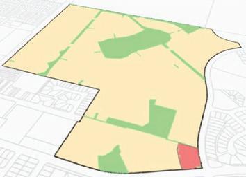
Municipal Development Plan (MPD)
• Long-range planning takes a forward-thinking approach to help guide future community building.
• At this stage, the vision for the future is determined. The resulting policy or plan is high-level but provides the blueprints for concept refinement.
• Tools include statutory plans (Municipal Development Plans), special studies, and policy development.
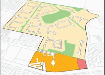
Area Structure Plan (ASP)
• This policy development supports the decisions, made at the big ideas stage, resulting in policy or plans that are more detailed.
• Tools include area structure plans, and area redevelopment plans.
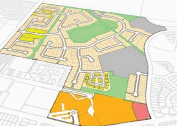
Land Use Bylaw
• The final stage of planning reflects the implementation of decisions made at the refined ideas stage.
• Information is detailed and regulatory documents are precise.
• Tools include redistricting, subdivisions, and development permits.
Community-builders are anyone who influences a decision that impacts the quality of life of a place. They are private individuals, public officials, land use planners, developers, the business community, non-government organizations, school boards, and other levels of government. Everyone’s role is different but essential to the overall process.
In Alberta, land use planning is mandated by provincial legislation through the Municipal Government Act (MGA). The MGA is the primary document that creates Municipalities and delegates powers and obligations to each municipality. Part 17 of the MGA provides direction for statutory planning in the province (Municipal Development Plan, Area Structure Plans, Land Use Bylaws and other tools a municipality may use to direct community building). Additionally, municipal planning must align with other legislation including the Alberta Land Stewardship Act, the Land Use Framework, the Subdivision and Development Regulation, and various other pieces of legislation that range from transportation, water, to environment. The Government of Alberta is also currently working on a set of seven (7) regional plans, which are organized around watershed basins. Morinville is located within the North Saskatchewan Regional Plan, which is currently in development. All of Morinville’s plans must be in alignment with these higher-order plans and legislation.
Municipalities in Alberta use various tools, primarily statutory plans and bylaws, to help guide planning decisions. The Municipal Government Act (MGA) and related provincial legislation outlines specific requirements, statutory plans, and bylaws.
Different tools offer different levels of detail and opportunities for direction from the public and
stakeholders. Statutory plans and bylaws are consistent with one another to help achieve the municipality’s planning goals and objectives.
Municipal councils are elected by the community to represent their interests and make decisions on behalf of the community. These are often difficult decisions when it comes to planning and land-use, as it is nearly impossible to keep all of the people happy all of the time, with numerous opinions and interests to be considered. Through this process it is vital that Council members understand that while decisions, may not always be popular at a moment in time, their obligation is to work for the best interest of the community and greater public good.
Municipalities employ numerous subject matter experts in a range of fields. Morinville’s professionals include a small team of specially trained and experienced planning and economic development professionals. Planners hold advanced degrees in land use planning from accredited universities. They maintain the professional designations of Registered Professional Planner (RPP) and Member of the Canadian Institute of Planners (MCIP) regulated by the Canadian Institute of Planners. They adhere to a strict code of professional ethics and objectively work in the best interest of the communities they serve. Planners are specially trained land use experts who utilize a wide range of information and tools to make recommendations to senior leadership and Council.
The planners and development officers in Morinville guide land use planning for Morinville. Registered Professional Planners (RPP) in Alberta, and other professional planning designations around the world, have a code of conduct and commit to working within high ethical standards in the public interest.
Depending on the situation, the role of the planner is to make recommendations to Council on behalf of the best interests of Morinville. These recommendations are built on direction from various plans, policies and legislation, most importantly are the influence and direction from community formed comments such as the municipal development plan and area structure plans.
Planners need to balance information from research, knowledge of the community, public and stakeholder input, training, and experience to inform decisions or recommendations.
Planners rely on knowledge about the many systems found in a municipality to understand how decisions will impact economic development, transportation, population, education, housing, services, parks and public spaces, and facilities. These elements contribute to the quality of life in Morinville.
Morinville’s planning and economic development professionals also rely on professional input from other departments, such as engineers, public works, utilities, emergency services and finance.
Development planners and officers undertake the work needed to review and apply the Land Use Bylaw regulations to make decisions on development permit applications within Morinville. The development planner and officer work as the development authority to apply professional discretion and input from other municipal departments throughout the development permit process, and provide recommendations to Council regarding amendments to the Land Use Bylaw.
Private companies (developers) and individual landowners conduct most of the physical development within Morinville. Morinville sometimes builds infrastructure like roads, recreation facilities, parks, or renovates existing facilities. Other levels of government may be responsible for certain facilities, such as schools and hospitals.
Planners and decision-makers rely on tools such as statutory plans, special studies, and bylaws created with stakeholder input to tell them how the community should evolve. The policy framework section has detailed information about how different planning tools are used and why.
Documents used by Morinville to make planning decisions are available on Morinville’s website
Morinville Council makes decisions on behalf of the public. Council can delegate certain decision-making authority to Administration, as outlined within the MGA. When decision-making authority is delegated, the authority must consider direction found within relevant statutory plans and bylaws passed by Council. The powers of the decision-making authority are limited to the rules and regulations of the documents approved by Council.
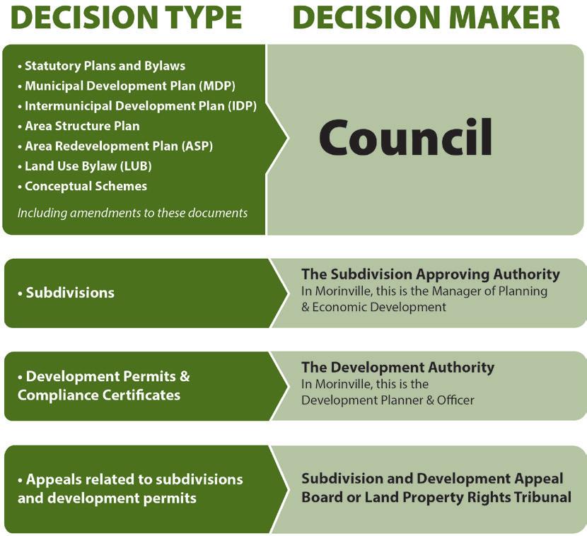


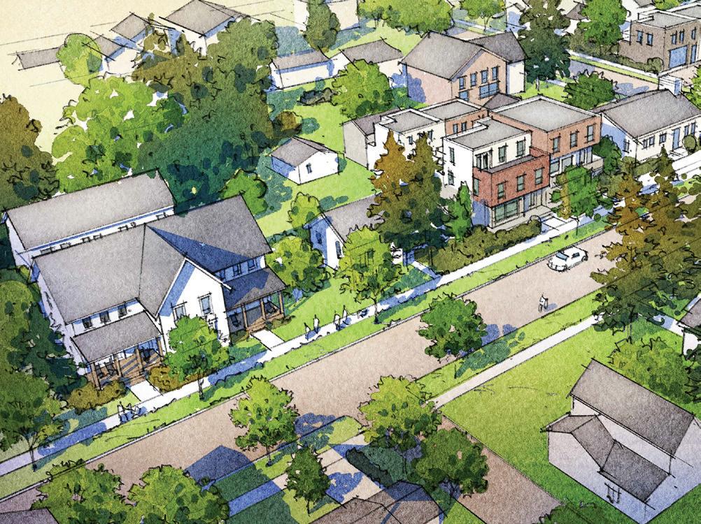
Morinville carefully guides development and land use to ensure functionality, liveability, and sustainability. This process is governed by federal, provincial and municipal statutes, and guided by community input.
In order for a community to be safe, healthy, and productive, certain rules, regulations, and standards must be followed. Morinville’s planning, development, and land use policies ensure that growth and development take place in a way that respects the rule of law and the community’s decisions about how Morinville should grow.
Land use planning in Alberta must follow plans and regulations at both the provincial and municipal levels of government. Planning decisions are informed by a hierarchy of planning documents that guidance and direction.
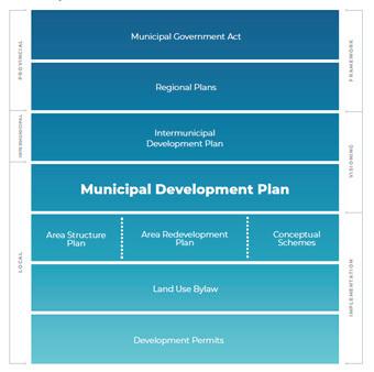
The Municipal Government Act (MGA) is the enabling legislation for all municipalities and their operations in Alberta. Part 17 of the MGA provides legislation for all planning in the province from the intermunicipal level, down to the details of development permitting. This legislation guides the municipality in the must-haves and the may-haves. The legislation requires statutory and non-statutory documents; however, each community has the right to plan and interpret their places and spaces to fit their needs and wants, to ensure safety, community and public health.
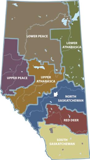
In 2009 the Government enacted the Alberta Land Stewardship Act and the Land Use Framework (2008). This legislation provided additional guidance, particularly around environmental and water resource considerations in Alberta. Alberta was split into seven (7) different planning regions based around the natural watershed systems. These basins include the Lower Athabasca, Lower Peace, Red Deer, South Saskatchewan, Upper Athabasca, Upper Peace and the North Saskatchewan which Morinville is included in – this plan is currently in development by the Government of Alberta.
These are the must have documents for a municipality required by the MGA. Statutory plans are developed by a municipality for the purposes of identifying future plans for development within municipal boundaries and the immediately surrounding area. These statutory plans facilitate local planning and economic growth, and act as a guide for future land-use expectations for both citizens
and businesses. Statutory plans must be consistent with one another and with any regional plans adopted for the area under the Alberta Land Stewardship Act (ALSA)
Statutory Plans include:
Intermunicipal Development Plans (IDPs), Municipal Development Plans (MDPs), Area Structure Plans (ASPs), and Area Redevelopment Plans (ARPs).
Following the dissolution of the Edmonton Metropolitan Region Board (EMRB) in 2025, the Minister of Municipal Affairs provided a formal order to Morinville to develop an IDP with Sturgeon County by November 30, 2027. The plan will provide for future land use within the identified IDP area and is required to identify a procedure to resolve conflicts, to deal with amendments or repeals, and to administer the plan.
The Municipal Government Act (MGA) requires each municipality to have a Municipal Development Plan (MDP). The MDP is an important municipal-wide policy document which outlines long-term policy direction for growth and development. It must conform to the Municipal Government Act. The MDP addresses future land use and development within the municipality and coordinates land use, future growth patterns, transportation systems, municipal services and facilities within the municipality as well as other infrastructure that relates to adjacent municipalities.
In the context of community planning, the MDP takes a holistic approach. All other statutory plans and bylaws must relate back to policy direction contained within the MDP. This includes intermunicipal development plans (IDPs), area structure plans (ASPs), area redevelopment plans (ARPs), and the Land Use Bylaw (LUB).
Morinville is always changing. It is critical that the MDP is able to provide direction for Morinville’s current challenges and future growth. To facilitate this, a full review of the MDP is undertaken typically every five to ten years.
Morinville will have a brand new MDP in Winter 2026! This is an exiting step in the modernization of Morinville’s planning documents and presents a vision of growing to 20,000 residents!
The MDP is a statutory plan that is approved by bylaw. The municipality initiates the review of an existing MDP and may make changes to that document (known as an amendment) or repeal and replace with a new MDP. Extensive public participation and special studies are involved in this process.
Council approves and makes amendments to the MDP through a process outlined within the MGA. The process has specific notification requirements and a public hearing must be held. Amendments can be made to the text, maps, or other elements of the document. Amendments to the MDP are sometimes initiated by Morinville and other times are initiated by private landowners, businesses, or members of the public. There is a fee and sometimes the process is completed in conjunction with other amendments to the ASPs or the LUB to ensure all documents align.
Area Structure Plans (ASPs) plan new neighbourhoods in undeveloped (green field) areas. They contain policy direction for land use, density, transportation, servicing, parks, commercial and industrial activities, sequence of development, and more.

A municipal council has the option to adopt an ASP to provide a framework for developing a specific area within the municipality. Unlike other statutory plans, an ASP is generally prepared by a developer and not necessarily initiated by the municipality. An ASP must describe the proposed development sequence, proposed land uses for the area, proposed population density of the area, and the general location of major transportation routes and public utilities. Morinville’s are:
• The Champagne District ASP
• Coal Creek ASP
• Coeur de Morinville ASP
• Juniper Heights ASP
• South Business Commercial ASP
• South Glens ASP
• Westmore Development Park ASP
• Westwinds ASP
Area redevelopment plans are applied to specific areas to guide redevelopment.
They contain policy direction for: land use, density, transportation, servicing, parks, recreational activities, commercial activities, sequence of development, design standards, and more. A municipal Council has the option to develop an ARP for a designated area
of the municipality to preserve land and buildings, to rehabilitate, remove or construct buildings, to improve roads, to generally facilitate development in the area. ARPs also provide opportunities for municipalities to implement alternative funding models including redevelopment levies. An ARP includes the objectives of the plan, the proposed land uses, the reasons for any redevelopment levies to be proposed as part of the plan, and any proposals for acquiring land for municipal uses, schools, parks and recreation. While Morinville does not currently have an ARP, the Coeur de Morinville ASP would qualify for an amendment to an ARP.
Amendments to ASPs and ARPs follow the same process. Often, additional focus is placed on public participation during the ARP process when the proposal impacts existing residents and the subject area serves a dynamic set of stakeholders.
New ASPs are usually initiated by private landowners or developers and occur on lands that previously did not have an ASP (greenfield development). Area redevelopment plans are initiated by both municipalities and private landowners or developers. There is a fee to apply for an amendment to any ASP or ARP, and sometimes the process can involve changes to the MDP or LUB to ensure all documents align.
Total Time from Application to Public Hearing: Approximately 5-8 Months
Applicant may schedule a pre-application meeting with Morinville.
A public engagement plan may be submitted to Morinville and a Morinville representative shall attend the engagement event.
Statutory Plan, or LUB application and supporting documents, will not be reviewed prior to application acceptance.
Once submitted, the application will be reviewed for completeness. If the document is deemed incomplete, the application will be returned to the applicant with a deficiency list.
Once deemed complete the application will be referred to internal departments and external agencies.
Revision may be required from the referral process.
Any submissions with substantial remaining deficiencies may be subject to a review fee.
Administration will prepare a recommendation for council.
Council will make a decision to accept modify, or review the statutory plan or LUB application.
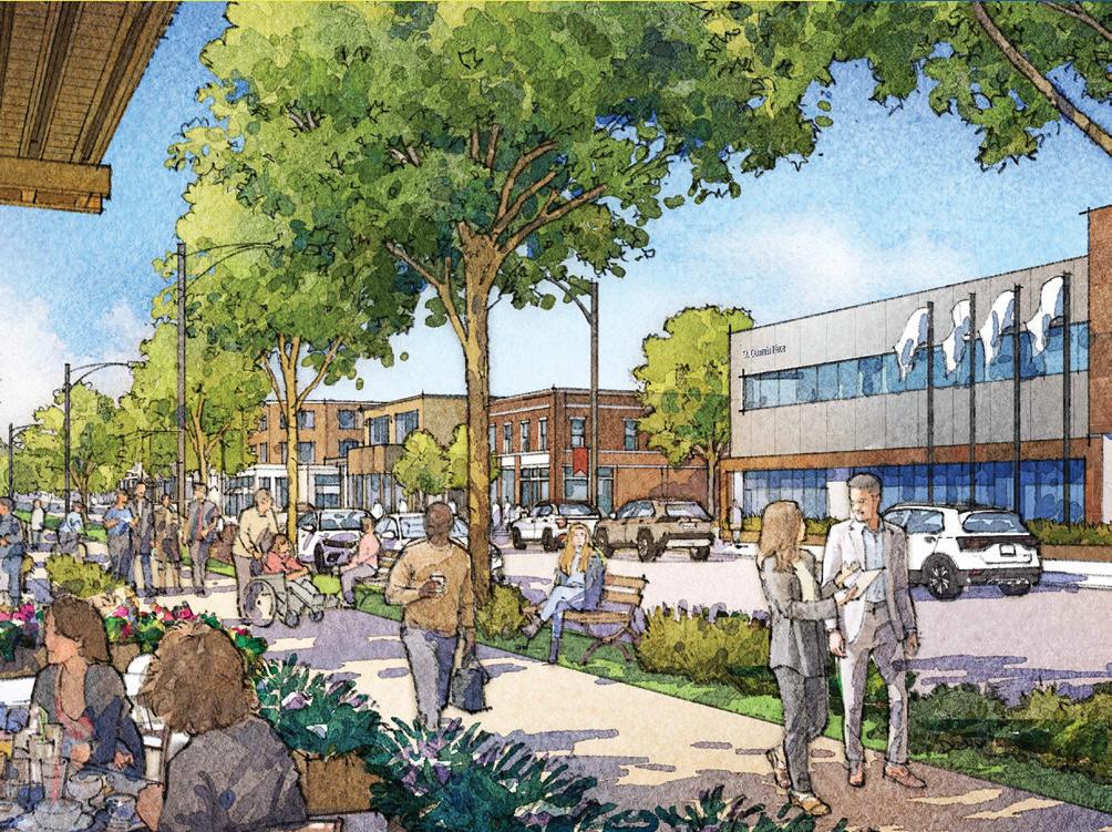
The MGA requires Morinville to have a Land Use Bylaw. The LUB outlines land use districts (zones) that allow different types of land uses and have different rules.
This document of rules and regulations is used to implement policies within statutory plans. The LUB outlines different categories of land uses throughout the municipality, called districts.
Each district identifies compatible land uses and activities and has standards for lot size, building type and height, building setbacks, site coverage, densities, parking, landscaping, signage, and other elements of the built form. These standards provide for the amenity and safety of the area, and keep the location and form of physical development compatible.
Amendments to the LUB may occur to the text or change land from one land use to another. Changing the land use of a parcel is called redistricting. Sometimes called rezoning, redistricting occurs when the applicant would like to change what is currently allowed to happen on the land.
The process for redistricting is important because it allows Council to consider how well the proposed change fits with the neighbourhood. In planning practice, if an ASP applies to the area being considered for redistricting, the proposal should align with the future land use contained within the ASP. The same is true for the future land use map within the MDP. Otherwise, an amendment to the ASP and possibly the MDP may also be required before redistricting can be approved.
Amendments to the Land Use Bylaw require a public hearing. In some cases, a public meeting or public open house may also be held. Input from stakeholders before and during the public hearing is encouraged.
A Land Use Bylaw controls how land is used by humans. It implements the objectives and policies of the MDP by regulating and controlling specific land uses. The Land Use Bylaw also protects people from nuisance uses
which could impact the use and enjoyment of their land balancing the personal and community benefits of land uses. A Land Use Bylaw achieves this by stating exactly:
• What land uses may be permitted (for example, residential, small-scale retail, personal services, or government services)
• Where buildings and other structures can be located
• Which types of buildings are permitted (for example, houses, apartment buildings, commercial buildings, industrial buildings, etc.) and how they may be used
• Lot sizes and dimensions, parking requirements, building heights and densities, and setbacks a street or lot boundary
Having an up-to-date Land Use Bylaw ensures that the locally developed policies in the MDP are capable of being fully carried out in a timely way. It also ensures regulations reflect current market demands and development practice. It is an important element of being an investment-ready community.
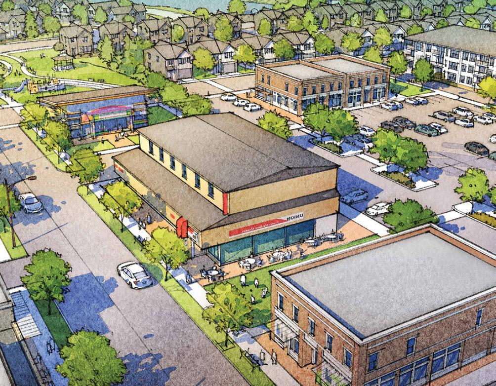
Municipalities also develop a number of technical and subject-specific plans. These plans are identified and developed in alignment with the MDP and they provide technical details and specifications. Some are engineering-related such as the Transportation Master Plan and the Utility Master Plan, while others address social and recreation services such as the Parks and Open Spaces Plan, and the Heritage and Culture Plan. Master plans are not approved bylaws and are accepted for information by Council by resolution or motion. Depending on the nature of the plan and/or the scope of the amendment, Morinville may or may not conduct public engagement on these documents.
Morinville, Plans, Reports and Studies.
Special studies are undertaken to gather information on a variety of best practices in land use planning or engineering and are often project-based. The information is used to help shape policy and bylaw recommendations. Planners and other subject matter experts can learn a lot from researching other communities and from gathering data about our own community. Special studies can also be technical and be prepared by experts in various fields like engineering or geology. Special studies provide critical input to ensure recommendations and decisions are informed.
Guidelines supplement statutory plans and bylaws through additional direction at various stages of development. Planning is a balance between requirements and flexibility. Guidelines are used to provide clearer direction and ideas for anyone undertaking development. They are typically non-binding, so they are a good place to put suggestions without making the process too prescriptive.
Morinville also uses a type of land use plan called conceptual schemes. These documents are recognized by the MGA as a land use plan that sets out the development for an area smaller than what would be considered in an area structure plan but are not approved through a formal public hearing or by bylaw. Morinville has two (2) conceptual schemes:
Meadows of Morinville Conceptual Scheme
Morinville 10 Acre Site Conceptual Scheme

A subdivision is the process of dividing a parcel of land into two or more parcels so each will have its own legal title. This means that each parcel can be owned by different people. Subdivisions are regulated by Morinville’s Land Use Bylaw, Municipal Government Act and the Alberta Subdivision and Development Regulation. An application for subdivision, must, at a minimum, include the following:
• Plan of Subdivision prepared by a registered Alberta Land Surveyor;
• Copy of recent land title and any relevant instruments (mortgage information is not required) dated within 30 days of the application date;
• Completed subdivision application form;
• Subdivision application fees; and
• Any other information as discussed with Morinville’s professionals in advance of an application being made.
Subdivision is directed under the provincial Subdivision and Development Regulation. This legislation lays out the requirements, considerations and processes for applying, reviewing and decisions related to subdivision. The subdivision authority is required to consider the following when making decisions:
a) its topography,
b) its soil characteristics,
c) storm water collection and disposal,
d) any potential for the flooding, subsidence, or erosion of the land,
e) its accessibility to a road as defined in section 616 (aa) of the Act,
f) the availability and adequacy of a water supply, a sewage disposal system and solid waste disposal,
g) in the case of land not serviced by a licensed water distribution and wastewater collection system, sites shall comply with the requirements of the Private Sewage Disposal Systems Regulation (AR 229/97) in respect of lot size and distances between property lines, buildings, water sources and private sewage disposal systems as identified in section 6(4) (b) and (c), h) the use of land,
h) the use of land in the vicinity of the land that is the subject of the application, and
i) any other matters that it considers necessary to determine whether the land that is the subject of the application is suitable for the purpose for which the subdivision is intended.
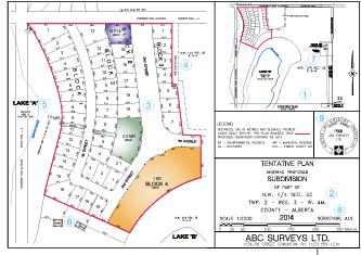
The Subdivision Authority is the body or person(s) determined by Council through bylaw that will have the authority to make decisions about subdivisions on behalf of the municipality. In Morinville, the Subdivision Approving Authority is the Manager of the Planning and Economic Development Department. Subdivision decisions can be appealed to the Subdvision and Development Appeal Board or Land and Property Rights Tribunal. Only the applicant, the municipality, government agency, or a school board can file an appeal.

Subdivision approval is a two-step process: decision and endorsement. The process begins when a property owner (or an authorized agent) submits a proposed plan of subdivision to the approval authority for review. The approval authority consults with municipal officials and other agencies that are considered to have an interest in the proposed subdivision (such as utility companies, internal departments and adjacent landowners). Comments received from the consulted parties are also reviewed. The approval authority makes a decision on the application which either conditionally approves or refuses an application.
A conditional approval will generally be subject to one or more conditions that must be fulfilled before the subdivision plan is eligible for endorsement (final approval) and registration. A conditional approval is valid for one (1) year. These conditions might include:
• Municipal property taxes are paid to date on the subject lands
• A final plan of subdivision is prepared by an accredited alberta land surveyor
• Municipal reserve dedication
• A road widening
• Signing of a development agreement between the municipality and the developer to secure various obligations that continue beyond final approval
The property owner may be required, as a condition of granting endorsement (final approval), to enter into a development agreement with Morinville to guarantee that services within the subdivision (such as roads, pipes, and sidewalks) will be constructed to Morinville’s Municipal Design Standards (engineering requirements).
When all approval conditions have been met, and verified by Morinville, the subdivision plan can then be submitted for endorsement (final approval) and can be registered by an alberta land surveyor at Alberta Land Titles. The registered plan is a legal document that sets out the precise boundaries of the property, the dimensions of the blocks, lots and the widths of all streets and right-of-ways within the property.
A final plan of subdivision can only be prepared and registered by a registered alberta land surveyor.
If the subdivision approval authority does not make a decision within the legislated timeframe of 60 days (or an agreed-upon time extension), the application is deemed refused, and the applicant may appeal this refusal.
There are two subdivision appeal bodies in Alberta, the majority of appeals will be heard by Morinville’s Subdivision and Development Appeal Board (SDAB). The SDAB is a quasi-judicial board appointed by Morinville Council. The other is provincial, the Land and Property Rights Tribunal (LPRT), the LRPT hears appeals in matters that have Provincial interest, such as applications adjacent to Highways or waterbodies. Only certain persons or public bodies, as identified in the Municipal Government Act and Subdivision and Development Regulation, have the right of appeal. The grounds for a subdivision appeal are if an applicant or stakeholder, identified by the MGA, feels that the subdivision authority misinterpreted the Land Use Bylaw in making their decision. A subdivision refusal or a condition placed on an approval may be appealed. A notice of decision will be sent to relevant stakeholders who have a 21 day window in which to make an appeal. An adjacent landowner may not appeal a subdivision decision.
Pre-Application
Requirement
Letter sent within 14 days of pre-application meeting
Completeness
Review: 20 days per submission
Referral Period: 21 days
Subdivision decision will be made 60 days from the acceptance date
Appeal will be heard within 30 days of request for SDAB and 60 for land property rights tribunal (LPRT)
Subdivision application requirements will be established through consultation with Morinville.
If the document is deemed incomplete, the application will be returned to the applicant with a deficiency list.
Once deemed complete, the application will be referred to internal departments and external agencies.
Revision may be required from the referral process.
The subdivision authority will decide whether to conditionally approved or refuse the subdivision.
The applicant or affected external agencies are able to appeal the subdivision decision and conditions.
If an appeal is submitted, it will be heard by the SDAB or the LPRT.
The appeal board may choose to uphold, modify, or overturn the decision of the subdivision authority.

A condominium is another legal tool to divide ownership of property and create land titles. A conventional condominium – those used for apartment buildings - create the ability to own a portion of space within a larger building with a legal land title. Conventional condominiums can also be used for commercial and industrial properties. There are other types of condominiums (bareland and phased) that may be an appropriate tool for the division of property rights based on individual scenarios. These would be discussed with a land surveyor and the municipality to find the best fit for the situation. In all condominiums the term common property will be used, this is land or
areas of a building that are owned by a condominium corporation. Each owner within the condominium plan owns a share of this common property, similar to owning shares in a company. The Condominium Property Act governs this ownership tool, and regulates the rights and responsibilities of condominium owners and the condominium corporation.
The application and approval processes are similar for conventional condominiums as for subdivisions. Condominium plans and other required documents are prepared by an Alberta land surveyor and submitted to Morinville for review. The subdivision authority is the approving body for condominiums.