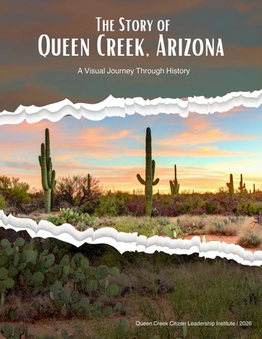
The Story of
Queen Creek, Arizona A Visual Visual Journey Through History
Queen Creek Citizen Leadership Institute | 2026
Table of Contents Indigenous Origins
Pre-1200 – 1800s
U.S Settlement 1860s – 1890s
Agriculture Takes root 1900s – 1930s
Rural Stability
1940 – 1960s
Incorporation 1970 – 1989
The Pivot Years
1990 – 1999
Hyper-Growth
2000 – 2009
Identity Tension
2010 – 2019
Fast-Growth Suburb
2020 – 2026
01 02 03 04 05 06 07 08 09
01
INDIGENOUS ORIGINS Pre-1200 P re-1200 – 1800s
The Hohokam and their O'odham descendants shaped this landscape for thousands of years, farming, weaving, and leaving their mark in stone long before European settlers arrived. The images in this chapter document these first peoples of Queen Creek and the surrounding area.
Before cities, before roads, people built communities here. They used wood, brush and mud to build homes.. Wood, brush, mud. These pit houses stayed cool in brutal heat and warm on cold desert nights. Small villages spread across the land, tied together by farming, especially corn, and whatever they could hunt or gather. This is how the Hohokam made the desert livable, starting around AD 150. (San Tan Historical Society Museum)
Someone stood right here and carved this into stone. These petroglyphs weren’t random. They marked movement, meaning, maybe memory. Travelers passed through these same mountains and left proof they existed. You’re looking at a message that outlived them. (Around San Tan Mountain by David Salge/Bernadette Heath)
Indigenous Origins
Pre-1200 P re-1200 – 1800s
The building of the Great House near Coolidge, Arizona was a major event of the Classic Period (1100 – 1450 C.E.). The best dating methods available indicate that this large, puddled adobe structure was built during the 1300's. The construction was well planned and organized, requiring tons of material and a huge cooperative effort on the part of many people. (Queen Creek CLI/Dennis Miller/03-12-26)
During the late 1300’s and early 1400’s, the ancestral Sonoran Desert people suffered a period of widespread depopulation and change. Speculations as to the cause have included drought, floods, disease, invasion, earthquakes, internal strife, and salinization of farmland. Today, several indigenous groups have links to the ancestral people. Their cultural traditions, together with on-going archeology and the continued interest of visitors at Casa Grande Ruins, all combine to keep the legacy of the ancestral Sonoran Desert people alive to this day. Perhaps tribes in the Queen Creek area were descendents of the ancestral Sonoran Desert people as they migrated away from the Gila River area. The O’odham (including Pima and Papago) are considered the direct descendants of these builders. (Queen Creek CLI/Dennis Miller/03-12-26)
Indigenous Origins
Pre-1200 P re-1200 – 1800s
There were no riverfront farms. No rainfall you can trust. The Hohokam built it anyway. They carved hundreds of miles of canals by hand, pulling water from the Salt and Gila Rivers across dry desert. This was engineering. It turned Arizona into farmland centuries before modern infrastructure showed up. (San Tan Historical Society Museum)
Corn, beans, and squash worked as a system, not separate crops. Corn gave the beans something to climb. Beans fed the soil. Squash covered the ground to hold moisture and block weeds. It looks simple. It’s not. It’s a selfsustaining food strategy that kept communities alive here for generations. (San Tan Historical Society Museum)
This wasn’t decoration. It was storage, transport, survival. Hohokam redware jars held water, food, and trade goods. Built to last, shaped by hand. What survives now is what people depended on daily. (San Tan Historical Society Museum)
Indigenous Origins
Pre-1200 P re-1200 – 1800s
Hohokam Redware Jar: This jar carried the basics. Water. Grain. Anything that had to last. Hohokam redware was shaped by hand and fired in open pits, built for daily use, not display. What you’re looking at survived because people depended on it. (San Tan Historical Society Museum)
Hohokam Plainware Vessel: Plainware vessels were everyday tools used for cooking, storage, and serving. Durable, practical, and made in volume, they show what daily life required (San Tan Historical Society Museum).
Hohokam Pit House and Community: Life wasn’t isolated. Pit houses were built in clusters. They formed small communities, each structure partly below ground to manage desert heat. Shared space, shared work, and systems that made survival possible together. (San Tan Historical Society Museum)
Pozos du Sonoqui Architectural Site: Pozos de Sonoqui shows how Hohokam communities were organized across the region, tied to water systems, trade routes, and each other. Arizona wasn’t empty. It was structured. (San Tan Historical Society Museum)
Indigenous Origins
Pre-1200 P re-1200 – 1800s
The Southwest was home to distinct groups like the Ancestral Puebloans and Mogollon, each with their own timelines, systems, and ways of living. These weren’t isolated communities. They overlapped, traded, and influenced each other across centuries. (San Tan Historical Society Museum)
Metate stones were used to grind seeds, nuts, and mesquite beans into meal or flour, one push at a time. No shortcuts. No machines. Just repetition, skill, and time. This was daily work, often done by hand for hours, turning raw desert resources into something people could live on. (San Tan Historical Society Museum)
Pima territory, 1700: Before borders, this was Akimel O’odham land. Territory followed water, movement, and community, not lines on a map. This is what control of land looked like before outside claims reshaped it. (https://en.wikipedia.org/wiki/Akimel_O%CA %BCodham)
Indigenous Origins
Pre-1200 P re-1200 – 1800s
On the following pages are photographs of individuals in surrounding communities, as indigenous people left the Queen Creek area circa 1450 AD. (San Tan Historical Society Museum) Sa-Vaughn, Akimel O’odham (Pima), photographed around 1900. He is lounging in a semi-recline against a low dirt embankment resting from working on an irrigation dam (not visible). (https://commons.wikimedia.org/wiki/File:Pima_Indian_m an,_Sa-Vaughn,_Pima,_Arizona,_ca.1900_(CHS3628).jpg/Charles C Pierce/1900)
Miguel, Akimel O’odham farmer, circa 1900. Farming here depended on deep knowledge of the land and river systems. By this time, upstream diversion of the Gila River had already begun to disrupt that way of life, making survival harder year by year. (https://picryl.com/media/pima-indian-manmiguel-a-farmer-pima-arizona-ca1900chs-3625-92b2c2//Public Domain Media)
A group of Akimel O’odham (Pima) individuals, photographed in 1870. Early photographs like this captured people during a time of rapid change and increasing outside pressure on their land and way of life. (lhttps://www.legendsofamerica.com/pimatribe//Carlo Gentile/1870)
Indigenous Origins
Pre-1200 P re-1200 – 1800s
By 1900, traditional life and imposed change sit side by side. You see both Indigenous structures and Westernstyle buildings in the same space.
(https://en.wikipedia.org/wiki/Akimel_O%CA%BCo dham)
A Pima woman outside a traditional dwelling. Homes like this were built from local materials, designed for desert life. What looks simple is deeply adapted to heat, resources, and community living.
(https://picryl.com/media/pima-indian-womanseated-in-front-of-hut-weaving-basket-probablyarizona-ca-eb1d29//Public Domain Media)
Basket weaving wasn’t a hobby. It was skill, identity, and survival. Each basket carried function and meaning, with patterns passed down through generations. (https://en.wikipedia.org/wiki/ Tohono_O%CA%BCodham//H. T. Cory/1916)
Indigenous Origins
Pre-1200 P re-1200 – 1800s
These patterns carry identity. Pima basketry is known for precision, symmetry, and meaning, passed down through generations. Each piece reflects both function and culture, built to last and meant to be used. (https://en.wikipedia.org/wiki/Akimel_O%CA%BCodham//Edward S. Curtis)
Children grew up between two worlds. Around 1900, indigenous children were increasingly pushed into Western education systems that often stripped language and culture. (https://en.wikipedia.org/wiki/Aki mel_O%CA%BCodham)
Indigenous Origins
Pre-1200 P re-1200 – 1800s
Women shaped, fired, and finished vessels by hand, creating what their households and communities relied on every day. (San Tan Historical Society Museum)
“Toka” was more than a game. Played by Pima women, it required coordination, strength, and teamwork. It built community and carried tradition forward. (https://www.britannica.com/topic/Pima-people)
Indigenous Origins
Pre-1200 P re-1200 – 1800s
A Pima woman and her children stand on what used to sustain them. By the 1930s, upstream diversion had dried the Gila River, collapsing a farming system that had worked for centuries. (https://www.facebook.com/groups/73 5785833645251/posts/201344394587 9427/Arizona Barrio Stories)
Tools and artifacts show how many people lived, worked, and moved through this area long before modern development. (San Tan Historical Society Museum)
Indigenous Origins
Pre-1200 P re-1200 – 1800s
02
U.S SETTLEMENT 1860s – 1890s
More people were drawn to the Queen Creek area in the 1860s, drawn by open land and water, building homesteads and running cattle across the Sonoran desert. Their persistence laid the foundation for everything that followed.
Robert Bowen Ranch, Queen Creek, circa 1885. One of the earliest ranchers in the area, Bowen built his home here as American settlement pushed into the region. What you’re looking at is early ranch life taking hold on land that had already been lived on and worked for generations. (San Tan Historical Society Museum)
Desert Wells Stage Stop, Queen Creek. This well was a critical stop along early travel routes, giving stagecoaches and travelers a reliable place to rest and refill in an unforgiving desert. Routes didn’t form randomly. They followed water, just like the people who lived here long before them.(Queen Creek CLI/John McGowan/03/08/26) There were six cattle ranches in the Queen Creek area from the late 1860s until the early 1900s. Sylvestre Andrade was the first non-indigenous settler in Queen Creek, circa late 1860s. He owned Rancho Pozo de Sonoki, east of Ellsworth and Riggs roads and the Desert Wells Stage Stop. (San Tan Historical Society)
Entrance to the San Tan Historical Society Museum, a place to explore and understand early settlement in the region through preserved stories, artifacts, and local history. (Queen Creek CLI/John McGowan/03/03/26)
U.S Settlement
1860s – 1890s
Historic early 20th-century community building, now home to the San Tan Historical Society and Museum, preserving the stories of the region’s first settlers and ranching families. (Queen Creek CLI/John McGowan/03/03/26)
Exhibit space inside the San Tan Historical Society and Museum, where stories of early homesteaders, ranchers, and desert life are told through photographs, maps, and artifacts. (San Tan Historical Society Museum)
U.S Settlement
1860s – 1890s
Archival maps and early aerial imagery of Queen Creek Wash, showing how water shaped the land, guided settlement patterns, and made farming possible in the Sonoran Desert. (San Tan Historical Society Museum)
U.S Settlement
1860s – 1890s
Archival photographs of early Queen Creek homesteaders and farmworker families, capturing daily life, agriculture, and the diverse people who built and sustained the community in the early 20th century. (San Tan Historical Society Museum)
U.S Settlement
1860s – 1890s
Archival photographs of the Sossaman family, tracing multiple generations from their early 1900s migration from Texas to Arizona through their role in farming, community building, and the long-standing agricultural roots of the Queen Creek area. (San Tan Historical Society Museum)
U.S Settlement
1860s – 1890s
Archival photographs of Charles Rittenhouse and his family, alongside early images of irrigation systems and homestead life, documenting the shift from small desert homesteads to large-scale farming made possible through irrigation in the early 1900s. (San Tan Historical Society Museum)
U.S Settlement
1860s – 1890s
Archival photographs from Rittenhouse Ranch showing early largescale farming efforts, land clearing with mule teams, and the families and workers who built the ranch and surrounding community in the early 1900s. (San Tan Historical Society Museum)
U.S Settlement
1860s – 1890s
Archival photographs and records of early Queen Creek ranching families, tracing the rise of cattle operations, land ownership, and the networks of ranches that shaped settlement and growth in the region. (San Tan Historical Society Museum)
U.S Settlement
1860s – 1890s
Archival maps, documents, and photographs from Harrington Well Ranch, illustrating one of the earliest ranching efforts in the Queen Creek area and the harsh realities of desert life faced by pioneering families in the late 1800s. (San Tan Historical Society Museum)
U.S Settlement
1860s – 1890s
Archival maps, photographs, and records from Bowen Ranch and Desert Wells, documenting early ranching, mining ties, and the critical role of wells, water access, and stage stops in sustaining settlement and travel across the desert. (San Tan Historical Society Museum)
U.S Settlement
1860s – 1890s
03
AGRICULTURE TAKES ROOT 1900s – 1930s
By the early 1900s, Queen Creek had transformed from scattered ranches into a thriving agricultural community, with fields, dairy farms, and family farming operations that would define the town for decades to come.
Early 1900s portraits of Earl and Hazel Rittenhouse, members of a pioneering family whose irrigation work and land development helped transform the Queen Creek area from desert into productive farmland. (San Tan Historical Society Museum/1914-1920)
Early 1920 image of the first Rittenhouse schoolhouse and teacher Mrs. Mahoney, capturing the beginnings of formal education for children of homesteading families in the Queen Creek area. (San Tan Historical Society Museum/1920)
Early 1900s image of Earl and Hazel Rittenhouse’s modest homestead, reflecting the simple structures and rugged living conditions of families building new lives in the Queen Creek desert. (San Tan Historical Society Museum/1914-1919)
Agriculture Takes Root
1900s – 1930s
1920s water tower at the Queen Creek siding, a critical piece of early infrastructure that supported railroad operations, agriculture, and the growing settlement in the desert. (San Tan Historical Society Museum)
Circa 1920s Ellsworth Brothers Store, a central supply point for early settlers and ranchers, where residents gathered for goods, services, and connection in the growing Queen Creek community. (San Tan Historical Society Museum/1924)
Early 1930s photograph of students at the Rittenhouse school, capturing a small, tight-knit group of children from homesteading families who formed the foundation of education in the growing Queen Creek community. (San Tan Historical Society Museum/1932-1933)
Agriculture Takes Root
1900s – 1930s
1935 photograph of teacher Faith Sossaman with her Spanish students at Rittenhouse School, reflecting the diverse families who shaped the community and the role of education in early Queen Creek. (San Tan Historical Society Museum/1935)
1928 Brandon family home, representing the transition from rough homesteads to more established residences as families put down roots and the Queen Creek community began to take shape. (San Tan Historical Society Museum/1928)
Early 20th-century plat map of the Chandler Heights Citrus Tract, showing how land was divided and sold for agriculture, reflecting the shift from open desert to planned citrus farming communities in the Queen Creek area. (San Tan Historical Society Museum/02-21-29)
Agriculture Takes Root
1900s – 1930s
Early photograph of citrus harvesting in Chandler Heights, showing workers loading crates for transport, a snapshot of the agricultural industry that drove growth and settlement. (Around San Tan Mountain by David Salge/ Virginia Mitchell Minor)
Early citrus farming scene showing irrigation in a grapefruit orchard, illustrating how water management turned desert land into productive agriculture and sustained early settlement in the Queen Creek area. (Around San Tan Mountain by David Salge/Virginia Mitchell Minor)
1918 portraits of Lalier Cawthon Brandon and Charles Brandon, early settlers whose lives reflect the families that established roots and helped build the Queen Creek community. (San Tan Historical Society Museum/1918)
Agriculture Takes Root
1900s – 1930s
Early 20th-century image of Charles Brandon hauling hay by horse-drawn wagon, illustrating the daily labor and agricultural work that sustained early farming families in the Queen Creek area.
(Around San Tan Mountain by David Salge/Francis Brandon Pickett/04/12-24)
Early cotton field inspection, showing farmers checking crop conditions, a key part of sustaining one of the region’s primary agricultural industries in the early development of Queen Creek. (Around San Mountain by David Salge/San Tan Historical Society Museum)
1936 class photo of Rittenhouse School, showing local children of farming and ranching families, reflecting the tight-knit, hardworking community that defined early Queen Creek. (Around San Tan Mountain by David Salge/San Tan Historical Society Museum/1936)
Agriculture Takes Root
1900s – 1930s
1930 program from the dedication of Coolidge Dam on the Gila River, marking a major milestone in water control and irrigation that supported agriculture and growth across central Arizona, including the Queen Creek region. (San Tan Historical Society Museum/03-04-1930)
Agriculture Takes Root
1900s – 1930s
Ellsworth Implement & Supply Co., circa 1940s—farm supply and equipment store offering J.I. Case machinery, drugs, and service, with an early automobile parked out front, reflecting the shift toward mechanized agriculture in the Queen Creek area. (Around San Tan Mountain by David Salge/Ruth Wales and Myrna Skousen)
Depression-era canvas and wood shelter, reflecting the harsh living conditions faced by families who came to the Queen Creek area seeking farm work and survived through resilience, shared labor, and limited resources. (Around San Tan Mountain by David Salge/ Roger Nash/1930s)
Interior of an early 1930s rural general store in the Chandler Heights area, packed floor to ceiling with dry goods, canned food, tools, and household supplies —serving as both a supply hub and social center for the surrounding farming community. (Around San Tan Mountain by David Salge/Roger Nash/1930s)
Agriculture Takes Root
1900s – 1930s
Ellsworth Bros. Store (c. 1928–1929) Early roadside gas pump and general store serving local farmers—fuel, supplies, and a quick stop in a still-rural Queen Creek corridor.
First Community Church, Rittenhouse. Small wooden church that doubled as a gathering place—religion, meetings, and community life all under one roof.
(San Tan Historical Society Museum)
(Around San Tan Mountain by David Salge/San Tan Historical Society Museum/1921)
First School Building (1920–1922) Simple one-room schoolhouse; Mrs. Mahoney noted as the first teacher, educating children of early farming families in a remote desert settlement.
Foothills of the San Tan Mountains, 1935—Betty Binner and a group of children packed into an early pickup truck, capturing everyday life, mobility, and community in a still-remote desert .
(Around San Mountain by David Salge/San Tan Historical Society Museum/1920-1922)
(San Tan Historical Society Museum/1935)
Agriculture Takes Root
1900s – 1930s
Salt River Project, early 1900s— construction and early use of Roosevelt Dam capturing the scale and stakes: raw rock, manual labor, and the water system that made farming in this region possible. Close-up shots show the dam rising block by block under brutal conditions. Another flips the tone—men in a small boat killing a rattlesnake on Roosevelt Reservoir, a reminder this wasn’t just engineering, it was survival. (https://azmemory.azlibrary.gov/Salt River Project)
Agriculture Takes Root
1900s – 1930s
March 18, 1911— Roosevelt Dam releasing water in force, a raw reminder that controlling the Salt River wasn’t theory, it was survival and risk in real time. (https://azmemory.azlibrary.gov/ Salt River Project/03-18-11)
Outcome: Alfalfa cut just 25 days after the first harvest. Fast growth like that doesn’t happen in the desert without irrigation. That’s the payoff. (https://azmemory.azlibrary.gov/ Salt River Project)
Ostriches in a fenced field with two men watching. Early Arizona tried everything to make the land produce, even ventures that didn’t last. (https://azmemory.azlibrary.gov/Salt River Project)
A flock of sheep clogs a dirt road while a car waits. Old world meets new. Livestock still runs the road, but the future is already idling behind. (https://azmemory.azlibrary.gov/Salt River Project)
Agriculture Takes Root
1900s – 1930s
Early Salt River Project canal headworks showing control gates used to regulate irrigation water flow into distribution canals. (https://azmemory.azlibrary.gov/Salt River Project)
Construction phase of Roosevelt Dam, showing concrete work, temporary supports, and on-site building conditions during the early 1900s. (https://azmemory.azlibrary.gov/Salt River Project)
Salt River Project construction camp building, used by workers during dam construction, with horses for transport and hauling. (https://azmemory.azlibrary.gov/Salt River Project)
Dedication ceremony for Roosevelt Dam, 1911, marking a major milestone in the Salt River Project and water development in Arizona. (https://azmemory.azlibrary.gov/Salt River Project)
Agriculture Takes Root
1900s – 1930s
Chandler Heights U.S. Post Office and general store, showing a rural mail stop combined with fuel and basic goods service for the surrounding community. (Around San Tan Mountain by David Salge)
Rittenhouse railroad station, established about 1924, serving Queen Creek Farms Co.; later operated seasonally to ship agricultural products, including large volumes of potatoes. (San Tan Historical Society Museum/1924)
Irrigation canal alongside orchard rows, with reinforced banks used to control erosion and maintain steady water flow to crops, late 1930s. (Around San Tan Mountain by David Salge/Virginia and Mitchel Mince)
Agriculture Takes Root
1900s – 1930s
Sossaman family home, 1930s, representing early farm housing built near cultivated fields in the Queen Creek area. (Around San Tan Mountain by David Salge/Jamie and Sue Sossaman/1930s)
Horse-drawn equipment used to harvest sorghum, with farm workers cutting and gathering crops by hand alongside mechanized tools. (Around San Tan Mountain by David Salge/Virginia and Mitchel Mince)
Families in early rural Arizona often slept outdoors during summer heat; smoke from burning materials was sometimes used as a crude insect repellent, and damp sheets provided limited cooling. (Around San Tan Mountain by David Salge/Barbara Lindsay Smith/1933)
Agriculture Takes Root
1900s – 1930s
Migrant farm workers sorting and packing produce in the field, part of seasonal agricultural labor in Arizona, 1930s. (Around San Tan Mountain by David Salge/1930s)
Mather family posed with horse, tack, and equipment, showing the central role of livestock and shared labor in early agricultural life. Faith Mather is on the far left. (Around San Tan Mountain by David Salge/Jamie and Sue Sossaman/1919)
Agriculture Takes Root
1900s – 1930s
04
RURAL STABILITY 1940 – 1960s
Through the mid-century decades, Queen Creek remained a small farming town where everyone knew each other and agricultural rhythms governed daily life.
Students gathered outside a rural schoolhouse with playground equipment, reflecting postwar growth and community-centered education in Chandler-area farming communities. (Around San Tan Mountain by David Salge/San Tan Historical Society Museum/1953)
Chandler Heights Trading Post and Chevron gas station, a key stop for fuel, supplies, and local commerce serving rural residents and travelers. (Around San Tan Mountain by David Salge/Roger Nash/1946)
Ellsworth Brothers cleaning mill, where cotton was processed after harvest, highlighting the scale and importance of cotton production in the region’s economy. (Around San Tan Mountain by David Salge/Delos and Alba Ellsworth/1960s)
Rural Stability
1940 – 1960s
Early mechanized farming equipment in use, showing the transition from animalpowered agriculture to motorized machinery in Arizona fields. (Around San Tan Mountain by David Salge/Mark Schnepf)
Walter Clifford McLean on horseback 1962, near a rural service station and farm equipment. (Around San Tan Mountain by David Salge/San Tan Historical Society Museum)
Mansel Carter at Goldmine Mountain, 1960s, a longtime local miner and desert resident known for his work and life in the area’s mining community. (Around San Tan Mountain by David Salge/Barbare Peacock/1957)
Our Lady of Guadalupe Catholic Church, serving as a central place of worship and community gathering for local residents. (Around San Tan Mountain by David Salge/Bernadette Heath)
Rural Stability
1940 – 1960s
Queen Creek Elementary flooding, 1966: Flooding at Queen Creek Elementary School, September 14, 1966, forced school closures as water surrounded buildings; students and staff navigated knee-deep water during cleanup. (Chandler Arizona Tribune/09-14-66)
1964 flood damage: Severe flooding on August 12, 1964, washed out roads, irrigation ditches, and farmland across the area, including damage near Higley Road and Chandler Heights Road, where water flowed through homes and fields. (Chandler Arizona Tribune/09-14-66)
Rural Stability
1940 – 1960s
First meeting of the Queen Creek Ward, March 13, 1949, held in the barracks building at Queen Creek School, reflecting the growing community’s organization and shared institutions. (San Tan Historical Society Museum/Max and Carolyn Ellsworth Schnepf/3-13-49)
Maude and Jack Schnepf, early Queen Creek residents and agricultural pioneers, photographed on their desert farmland. (San Tan Historical Society Museum)
Workers pour and shape a concrete irrigation ditch, part of the expanding canal and water infrastructure that made largescale farming possible in Queen Creek and surrounding areas. (San Tan Historical Society Museum/1951)
Wright’s Queen Creek Store, 1947, served as a central hub for groceries, supplies, and community life during the area’s early development. (Around San Tan Mountain by David Salge/Francis Brandon Pickett/1947)
Rural Stability
1940 – 1960s
Community swimming pool at Schnepf Farms, mid-20th century, offering a rare recreational space for local families in a largely agricultural region. (Around San Tan Mountain by David Salge/Mark Schnepf/1950)
Ray and Thora Schnepf’s home, circa 1943, later preserved as part of Schnepf Farms and now recognized as a historic site and museum. (Mark Schnepf at The Villages/1943)
Rittenhouse Elementary School, reflecting the transition from rural homesteads to more established residential and civic buildings in the mid-20th century. (Around San Tan Mountain by David Salge/San Tan Historical Society Museum/1955)
Ray Schnepf holding Mark Schnepf while inspecting a newly constructed cotton gin, circa 1963, highlighting the growth of cotton production and modernization of local agriculture. (Mark Schnepf at the Villages/1963)
Rural Stability
1940 – 1960s
Ellsworth Avenue in Queen Creek, circa 1950, showing the small but growing commercial center that served local farms and residents. (San Tan Historical Society Museum/1950)
Workers sorting and packing citrus at an Arizona Citrus Growers Association packing house, reflecting the scale and organization of the region’s citrus industry in the mid-20th century. (San Tan Historical Society Museum)
Mansel Carter (1902–1987), known as the “Old Man of the Mountain,” a longtime miner on Goldmine Mountain who later created intricate “cactus curios” after years of mining in the San Tan Mountains. (San Tan Historical Society Museum)
Rural Stability
1940 – 1960s
Flooding at Queen Creek Elementary School during heavy rains, September 14, 1966, as election workers moved ballots to higher ground and residents waded through water to vote. (Chandler Arizonan Tribune/09-14-66)
Rural Stability
1940 – 1960s
The Schnepf family, men and women alike, all licensed pilots by the mid-1950s, reflecting the unique blend of agriculture and aviation in Queen Creek’s farming community. (Queen Creek by Sylvia Acuña/San Tan Historical Society Museum/1956)
Queen Creek rail stop and depot during the era of the “Dinky” or “Doodlebug” train, which connected local farming communities before being phased out by diesel trains around 1940. (San Tan Historical Society Museum)
Maricopa County farmers standing beside Arizona Farm Bureau signage, representing the growing organization of agricultural producers advocating for farming, livestock, and water management issues in the mid20th century. (Images of Queen Creek by Sylvia Acuña/San Tan Historical Society Museum/1955)
Rural Stability
1940 – 1960s
Four-year-old grapefruit tree in the Salt River Valley, illustrating the rise of citrus farming alongside cotton in central Arizona. (San Tan Historical Society Museum)
Irrigated cotton fields in Chandler Heights with the San Tan Mountains in the background, showing the scale and water dependency of desert farming. (San Tan Historical Society Museum)
New irrigation well on the Combs & Clegg ranch, circa 1950, part of a system that pulled water from 600–700 feet underground to support largescale farming and livestock operations. (San Tan Historical Society Museum/1950)
Rural Stability
1940 – 1960s
Early mechanized cotton picker in use, marking the shift from manual labor to machine harvesting in Arizona agriculture. (San Tan Historical Society Museum)
Farmers inspecting mature cotton crops in Queen Creek, reflecting the area’s dependence on cotton as a primary cash crop in the mid1900s. (Around San Tan Mountain by David Salge/San Tan Historical Society Museum/1940s)
Rural Stability
1940 – 1960s
05
INCORPORATION 1970 – 1989
By the 1980s, Queen Creek was quietly growing, with new dairy farms, a community center, and local organizations strengthening its sense of shared identity. In 1989, residents voted to incorporate, informing their future while preserving the small town charm they love.
Queen Creek kindergarten class visits Greer Dairy, 1981–1982. Field trips like this connected children to the agricultural roots of their community, showing where food came from and how local farms operated. (Queen Creek by Sylvia Acuña/San Tan Historical Society Museum)
Queen Creek Community Center, 1983. Spaces like this became the center of town life, hosting meetings, events, and services as the community continued to grow. Queen Creek Elementary kindergarten class, 1974–1975, with teacher Joyce Power (left). Power taught in Queen Creek for 17 years before retiring in 1978, leaving a lasting impact on generations of students. (Queen Creek by Sylvia Acuña/San Tan Historical Society Museum)
(Queen Creek by Sylvia Acuña/San Tan Historical Society Museum)
Queen Creek Elementary fifth-grade class, 1970. They would go on to become the eighth-grade graduating class of 1973. (Queen Creek by Sylvia Acuña/San Tan Historical Society Museum)
Incorporation
1970 – 1989
John Deere tractor pulling a feed wagon along a rural roadway. Scenes like this were common as farms and ranches relied on equipment to move feed, supplies, and crops across growing operations.
(Queen Creek by Sylvia Acuña/San Tan Historical Society Museum)
At Schnepf Farms during the early 1980s. By this point, farming in Queen Creek had scaled up, blending machinery with labor to keep pace. (Around San Tan Mountain by David Salge/Mark Schnepf)
Ray Schnepf with grape harvest, circa 1970. Taken on land that is now The Villages, this captures a time when vineyards and agriculture defined the landscape. (Mark Schnepf at The Villages)
Onion harvest, Queen Creek, 1982. Rows of onions pulled, sorted, and bagged show the labor behind one of the area’s key crops during peak agricultural years. (Around San Tan Mountain by David Salge/Mark Schnepf)
Incorporation
1970 – 1989
Queen Creek’s first Town Council sworn in, 1989. Incorporation turned a farming community into a town with its own voice, leadership, and control over its future. (Queen Creek High School Bulldog Edition/09-20-89)
Rudy’s Restaurant, a Queen Creek landmark since 1975. Owned by Antonia “Toni” and Rudy Valenzuela, it became a local staple.
Queen Creek High School Bulldogs celebrate their first state baseball championship. A small-town program breaks through, marking a moment that put Queen Creek on the map beyond its farmland roots.
(Queen Creek by Sylvia Acuña/San Tan Historical Society Museum)
(Queen Creek High School Bulldog Edition/05-31-89)
Magma Engineering, established in 1970. A family-run business providing machine work and welding. (Queen Creek by Sylvia Acuña/San Tan Historical Society Museum)
Proposed landfill site near Queen Creek High School. Debate over growth and land use was already here, with residents weighing development against the impact on their community. (Queen Creek High School Bulldog Edition/1988)
Incorporation
1970 – 1989
Student from Carolyn Tanner’s class at Pioneer Arizona, 1980s. Field trips like this connected classroom learning to hands-on history, bringing early Arizona life into focus. (Queen Creek by Sylvia Acuña/San Tan Historical Society Museum)
Students at Pioneer Arizona, 1980s. Set against a reconstructed pioneer setting, these images reflect how local history was taught and experienced by a new generation. (Queen Creek by Sylvia Acuña/San Tan Historical Society Museum)
Carolyn Tanner’s third-grade class at Pioneer Arizona, 1980s. Students explore a recreated pioneer village, stepping into how early settlers lived, worked, and built in the region. (Queen Creek by Sylvia Acuña/San Tan Historical Society Museum)
Third-grade students during Pioneer Arizona field trip, 1980s. Moments like this capture the social side of learning, where history, place, and friendship all intersect.
(Queen Creek by Sylvia Acuña/San Tan Historical Society Museum)
Incorporation
1970 – 1989
Chandler Heights Monthly announcement for the Queen Creek Hometown Celebration, June 20, 1987. A Fourth of July tradition built around food, music, and fireworks, showing how a small farming community came together and funded local schools, sports, and events. (Queen Creek by Sylvia Acuña/San Tan Historical Society Museum)
Construction of a Queen Creek elementary school. As the population grew, new schools followed, marking the shift from a small rural town to a community building for the next generation. (Queen Creek by Sylvia Acuña/San Tan Historical Society Museum)
Incorporation
1970 – 1989
Dos Arbolitos Imports, opened in 1989 on Ellsworth Road. Owned by Francisco and Griselda Gutierrez, the shop offered Mexican goods. (Queen Creek by Sylvia Acuña/Town of Queen Creek)
Ernest Hawes, Queen Creek farmer and innovator. Known for growing Red Pontiac potatoes and inventing a mechanical harvester in the 1950s, Hawes helped shape the area’s agricultural economy. (Queen Creek by Sylvia Acuña/San Tan Historical Society Museum)
Griselda Gutierrez at Dos Arbolitos Imports with customers. More than a store, it was a place to meet, talk, and stay connected to culture through food, music, and everyday goods.
(Queen Creek by Sylvia Acuña/Town of Queen Creek)
Rancho Jardines development, 1970s. Land once farmed by Ernest Hawes was subdivided into residential lots, marking the shift from agriculture to housing. (Queen Creek by Sylvia Acuña/San Tan Historical Society Museum)
Kent Power at the family fruit stand, Queen Creek, 1988. Part of a farming family that helped shape the area, the Powers grew cotton, potatoes, and produce across thousands of acres. By the 1980s, roadside stands like this connected that work directly to the community. The sticker on his truck said it best: “As a matter of fact, I do own the road.” (Queen Creek by Sylvia Acuña/San Tan Historical Society Museum)
Incorporation
1970 – 1989
Gloria and Phillip Greer at a Christmas program at the Queen Creek Ward of the Church of Jesus Christ of Latter-day Saints (Queen Creek by Sylvia Acuña/Gloria Greer)
Women of the Queen Creek Ward gather for the annual quilting bee to complete quilts in a single day for donation to hospitals. (Queen Creek by Sylvia Acuña/Gloria Greer)
Greg Combs inside the Pork Shop he founded at Combs and Schnepf Roads, a business built from his roots in farming, 4-H, and a lifetime in agriculture that earned regional recognition.
(Queen Creek by Sylvia Acuña/Greg Combs)
Jason Corman works at the Pork Shop, continuing a family operation started by Greg Combs in 1979, known locally for skilled butchering and recognized statewide for quality. (Queen Creek by Sylvia Acuña/Greg Combs)
Our Lady of Guadalupe Catholic Church on Ocotillo Road in the late 1970s, where overcrowding often forced parishioners to stand outside and watch Mass through the windows. Queen Creek by Sylvia Acuña/San Tan Historical Society Museum)
Incorporation
1970 – 1989
John Morris of San Tan Adobe lays adobe block for a home in Rancho Jardines, part of his decades-long work supplying adobe brick across the Phoenix area. (Queen Creek by Sylvia Acuña/Sylvia Acuña)
Machine stamping a mud mixture into Adobe blocks which cure in seven to eight hours. A crew of four can produce up to 3500 blocks in a day.
The Power family’s produce stand south of Rittenhouse and Power Roads, where the “Power Boys” sold farm goods and directed visitors to orchards for picking fresh fruit. (Queen Creek by Sylvia Acuña/San Tan Historical Society Museum)
(Queen Creek by Sylvia Acuña/Sylvia Acuña)
Queen Creek pioneer farmer Jasper Sossaman rides in the 1987 Christmas parade. He is recognized for bringing irrigation to the area and helping found the Queen Creek Potato Growers Association.
An individual boxes premium table grapes in the orchard, part of the Power family’s diversified farming operations that once covered thousands of acres in Queen Creek. (Queen Creek by Sylvia Acuña/San Tan Historical Society Museum)
(Queen Creek by Sylvia Acuña/San Tan Historical Society Museum)
Paul Dunn leads the colt Desert Falcon down Ellsworth Road in 1988, part of Desert Thunder Arabians, a local breeding operation founded in 1982. (Queen Creek by Sylvia Acuña/Jeri and Carol Jones)
Incorporation
1970 – 1989
The Girl Scout Color Guard opens the 1987 Christmas parade, carrying historic flags.
(Queen Creek by Sylvia Acuña/San Tan Historical Museum)
Children from Grace Fellowship Assembly of God reenact the Nativity during the 1987 Queen Creek Christmas parade. (Queen Creek by Sylvia Acuña/San Tan Historical Society Museum)
Brownie Troop 1425 marches in the 1988 parade. (Queen Creek by Sylvia Acuña/San Tan Historical Society Museum).
Judges for the 1987 Queen Creek Christmas parade. (Queen Creek by Sylvia Acuña/San Tan Historical Society Museum)
Volunteers clean up after parade animals during the 1987 Christmas parade, a necessary and famously appreciated part of the event. (Queen Creek by Sylvia Acuña/San Tan Historical Society Museum)
Maricopa County Supervisor Tom Freestone administers the oath of office to Queen Creek’s first town council on September 20, 1989, marking the town’s official incorporation. (Queen Creek by Sylvia Acuña/San Tan Historical Society Museum)
Incorporation
1970 – 1989
06
THE PIVOT YEARS 1990 – 1999
In the 1990s, Queen Creek began its transformation from farming community to growing suburb. New housing developments appeared alongside agricultural fields.
Community members share a handmade quilt at a local event, highlighting the town’s strong tradition of craftsmanship and connection. Gloria Greer (left) assists the unidentified winner of a quilt raffle at the Schnepf Farms Potato Fest. Greer donated many handmade quilts for fundraising. (Queen Creek by Sylvia Acuña/San Tan Historical Society Museum)
Irrigation water flows through a headgate system, reflecting the infrastructure that made large-scale farming possible in early Queen Creek. (Queen Creek by Sylvia Acuña/San Tan Historical Society Museum/1995)
Students line up with shovels for a ceremonial burying of a tenth anniversary time capsule for the town of Queen Creek. (Town of Queen Creek/1999)
The Pivot Years
1990 – 1999
Town staff gather in front of Historic Town Hall for a photo, capturing the tenth anniversary for a growing, tight-knit town. (Queen Creek by Sylvia Acuña/Town of Queen Creek/1999)
An aerial view show the Arizona Boys Ranch campus nestled among the cotton and alfalfa fields that defined Queen Creek with the San Tan Mountains rising in the distance. (San Tan Historical Society Museum)
San Tan Historical Society Museum, housed in a historic brick building, preserves Queen Creek’s agricultural roots and community story for future generations. (San Tan Historical Society Museum)
The Pivot Years
1990 – 1999
Frances Pickett, a longtime community member, remembered for her contributions to Queen Creek served as the museum president from 1997 to 1998.
Mark Schnepf, first Queen Creek mayor, swearing in and handshake, reflecting Queen Creek’s growing civic leadership. (Queen Creek by Sylvia Acuña/Town of Queen Creek/1992)
Queen Creek by Sylvia Acuña/San Tan Historical Society Museum)
Citizen Leadership Institute 1997 graduates are recognized at a 1998 own meeting, representing the volunteers and leaders shaping Queen Creek’s civic life. (Town of Queen Creek/1998)
The Pivot Years
1990 – 1999
Mary Bendyna, founding president of the San Tan Historical Society, led early preservation efforts and secured funding to restore the Rittenhouse School. (Queen Creek by Sylvia Acuña/San Tan Historical Society Museum/1994)
San Tan Historical Society leaders mark the Rittenhouse School’s addition to the National Register in 1998. (Queen Creek by Sylvia Acuña/San Tan Historical Society Museum)
Following the unveiling of the National Register of Historic Places plaque by Frances Pickett on October 23, 1998, attendees enjoyed a tamale luncheon catered by Mary Camacho and her family.
(Queen Creek by Sylvia Acuña/San Tan Historical Society Museum)
The Pivot Years
1990 – 1999
Historic Town Hall. (Town of QueenCreek/1993)
Arizona Boys Ranch, 1996. Before present-day surrounding areas grew to include houses, retail, and additional roadways. (San Tan Historical Society Museum/1996)
An Eagle Scout project raises a new flagpole at Rittenhouse School in 1999. (Queen Creek by Sylvia Acuña/San Tan Historical Society Museum/1999)
The Pivot Years
1990 – 1999
San Tan Historical Society float at the 1994 Queen Creek Christmas parade. First place in the float division with the theme “A Proud Past, A Promised Future,” honoring founding families including Walker, Clegg, Murdock, Chavez, Van Allen, Valenzuela, Shearwood, and Sullivan. (Queen Creek by Sylvia Acuña/San Tan Historical Society Museum/1994)
Map of early Queen Creek-area settlers and roads, with dates tied to families like Germann (1914), Ellsworth (1928), Mather (1921), Hawes (1930), and others across Rittenhouse, Chandler Heights, Higley, and Combs. (San Tan Historical Society Museum)
Illustrated 1994 Queen Creek community map. The five-year old town celebrated two large events; the first Country Jam USA Music festival, and the third annual Potato fest. (Queen Creek by Sylvia Acuña/San Tan Historical Society Museum)
The Pivot Years
1990 – 1999
The founding fathers are Robert Eberle, Paul Gardner, Ralph Pomeroy, Mark Schnepf and Steve Sossaman. They wanted growth without losing the town. This dedication plaque was installed much later, but can be viewed present day at the corner of Ocotillo and Ellsworth roads. (Town of Queen Creek)
Timeline from incorporation in 1989 until 1985 with major milestones to celebrate. (Town of Queen Creek)
The Pivot Years
1990 – 1999
Old friends reconnect at a local gathering, sharing stories and memories that span decades in the Queen Creek community. Seen here from left to right are Zone Bryant, Bill Brandon, and Slim Ahlquist. (Queen Creek by Sylvia Acuña/San Tan Historical Society Museum)
Gail Barney, a longtime community leader, brought a farmer’s voice and served as Mayor of Queen Creek from 2010-2022. (Town of Queen Creek)
The Desert Wells Stage Stop site, one of the area’s earliest rest stops, preserved as the San Tan Historical Society's first official project. (Queen Creek by Sylvia Acuña/San Tan Historical Society Museum)
David Farnsworth installs signage for the San Tan Historical Society’s temporary office, built on a tight budget and a lot of volunteer effort. (Queen Creek by Sylvia Acuña/San Tan Historical Society Museum)
The Pivot Years
1990 – 1999
07
HYPER GROWTH 2000 – 2009
The 2000s brought growth, with masterplanned communities, shopping centers, and schools transforming former farmland almost overnight. The challenge was immense: how do you build a community with real character and identity when thousands of new residents are arriving each year?
May 14, 2005. Community Emergency Response Team (CERT) training for Queen Creek residents. (Town of Queen Creek/05-14-05)
April 2007 Arbor Day event. Community volunteers planting trees as part of town beautification and growth efforts. (Town of Queen Creek/04-10-07)
Cortina master-planned community. Residential development during Queen Creek’s 2000s population growth. (Queen Creek CLI/Renee Abelseth/03-21-26)
Cactus Plaza retail/office space in early Queen Creek commercial development along Ellsworth Road. (Town of Queen Creek/04-14-18)
Hyper Growth
2000 – 2009
January 2004. Governor and local leaders at the Unity Walk event in Queen Creek. (Town of Queen Creek/01-2004)
Northwest corner of Ellsworth and Ocotillo, 2003. Two-lane roads, light traffic, and open edges. (Town of Queen Creek/2003)
October 4, 2006. Groundbreaking for Ellsworth Loop Road. Infrastructure planning for growth. (Town of Queen Creek/10-04-2006)
December 28, 2005. Along Ellsworth Road, featuring seasonal banners and maintained streetscape. (Town of Queen Creek/12/28-05)
Hyper Growth
2000 – 2009
Holiday Parade & Festival, 2005. Riders in holiday attire participating in parade. (Town of Queen Creek/2005)
Holiday Parade & Festival, 2004. Santa riding with Rural/Metro Fire. (Town of Queen Creek/2004)
Holiday Parade & Festival, 2004. John Deere tractor pulling parade entry. (Town of Queen Creek/2004)
Hyper Growth
2000 – 2009
New Queen Creek Library groundbreaking, May 2007. (Town of Queen Creek/05-2007)
New Queen Creek Public Library and Recreation Annex construction site. (Town of Queen Creek/2007)
Langley Gateway Estates II subdivision, built in 2005, entrance. (Queen Creek CLI/Renee Abelseth/2005)
Jack Barnes Elementary School, Queen Creek, opened in 2009. (Queen Creek CLI/Renee Abelseth/03-21-26)
Hyper Growth
2000 – 2009
Queen Creek growth and development, 2000–2010. Population increased from 4,316 to 26,361, with expanded town boundaries, annexations, and new residential and commercial development. (San Tan Historical Society Musuem)
Hyper Growth
2000 – 2009
Queen Creek Post Office, 2008. Expanded services to meet a rising population. (Town of Queen Creek/05-01-08)
Queen Creek Marketplace opened in 2008. Retail expansion followed residential growth, bringing new businesses and services to town. (Queen Creek CLI/Renee Abelseth/03-23-26)
Montelena subdivision, built in the 2005, entrance sign. (Queen Creek CLI/Renee Abelseth/03-21-26)
Queen Creek High School site opened in 2002. Opened to serve growing enrollment as new families moved into the area. (Queen Creek CLI/Renee Abelseth/03-21-26)
Hyper Growth
2000 – 2009
Target at Queen Creek Marketplace. National retail arrives as rooftops multiply. (Queen Creek CLI/Renee Abelseth/03-26-26)
Queen Creek Olive Mill opened in 2005. Agritourism scaled into a destination. Farm, market, and eatery in one stop. (Queen Creek CLI/Renee Abelseth/03-21-26)
“Ride Your Horse to Work,” 2005. (Town of Queen Creek/2005)
Sossaman Estates starting building in 2002. Subdivisions followed annexation. Names tied back to founding families. (Queen Creek CLI/Renee Abelseth/03-12-26)
Hyper Growth
2000 – 2009
Installation of a traffic signal at Ellsworth and Ocotillo Roads, January 11, 2005. One of the early signals added to the infrastructure as the population increased.
Queen Creek Town Council, June 2000. Leadership during the town’s first decade after incorporation in 1989. (Town of Queen Creek/06-2000)
(Town of Queen Creek/01-11-05)
Queen Creek Town Council in the 2004 Holiday Parade. Elected officials rode alongside residents, reflecting the town’s close civic culture. (Town of Queen Creek/2004)
Hyper Growth
2000 – 2009
08
IDENTITY TENSION 2010 – 2019
The 2010s brought a reckoning as Queen Creek grappled with who it wanted to be. Long-time residents mourned the loss of farmland and open space while new arrivals brought energy and growth. The tension between preservation and progress would define the decade.
School rally, 2017. Local quarterback Brock Purdy is from Queen Creek, AZ, reflecting the town residents’ growing presence in Arizona athletics.
Town of Queen Creek campaign highlighting agritourism and agribusiness in 2018. Farming, family events, and local food have became a defining part of the town’s identity. (https://www.queencreekaz.gov/
(Independent Newsmedia/2017)
Town of Queen Creek entrance sign marking the incorporated municipality established in 1989. (Town of Queen Creek)
Identity Tension
2010 – 2019
Agriculture evolves into experience. Schnepf Farms expands from working farm to destination, blending heritage with tourism through stays, events, and family activities. (East Valley Tribune/2011)
Town Council leadership during Queen Creek’s modern growth era. Part of the team shaping policy as the town transitioned from rural to suburban. (Town of Queen Creek/2010)
Identity Tension
2010 – 2019
Grand opening of Mansel Carter Oasis Park. (Independent Newsmedia/09-01-18)
Queen Creek Unified School District enrollment trends. K–2 growth spikes first. The signal that young families are driving the town’s expansion.
(Arizona Dept. of Education Queen Creek Unified School District Applied Economics/2015-2016)
Regional reporting on Arizona growth. Queen Creek adds thousands of residents in a single year, fueled by annexation and new development pushing outward. (KJZZ News Phoenix/Claire Caulfield/12-14-18)
Identity Tension
2010 – 2019
Queen Creek Population growth, 1990–2023. From just a few thousand residents to more than 70,000 as annexation and development accelerated. (https://www.biggestuscities.com/)
Town Council approves Transportation Master Plan, 2016. Planning road expansion and infrastructure to keep pace with rapid growth. (Independent Newsmedia/12-20-2016)
Queen Creek 25th Anniversary, 2014. Celebrating incorporation in 1989 and the town’s transition from rural community to fast-growing suburb. (https:// www.queencreekaz.gov/2014)
Identity Tension
2010 – 2019
Ocotillo Road ribbon cutting and traffic route map. Road improvements expanding east-west connectivity as residential neighborhoods filled in. (https://www.queencreekaz.gov/06-18-26)
Queen Creek Town Center Core plan, 2017. Designating mixed-use development, retail, and higher-density housing to create a central hub for a rapidly growing community. (https://www.queencreekaz.gov/10-2017)
Identity Tension
2010 – 2019
Sonoqui Wash flood control and trail corridor, reflecting ongoing efforts to manage desert waterways while expanding recreation and connectivity.
Expansion of Queen Creek’s multi-use and equestrian trail system, preserving the town’s rural character even as population and development accelerated.
(Town of Queen Creek)
(Town of Queen Creek)
Sherry Munroe; Queen Creek rodeo figure, inducted into the Rodeo Hall of Fame.
New desert housing pushing outward toward the San Tan Mountains, marking the shift from farmland and open desert to master-planned communities in the 2010s. (Town of Queen Creek)
(https://wpra.com//2019)
Riggs Road expansion and improvements, part of broader transportation investments responding to rapid population growth and increased commuter traffic. (https://www.queencreekaz.gov//2019 )
Identity Tension
2010 – 2019
Transportation Master Planning: subdivisions, roads and commercial corridors followed population growth. (https://www.queencreekaz.gov// 2018)
One of the town’s defining agritourism anchors. The town's heritage helped it become a destination and stayed central to Queen Creek's story. (https://www.queencreekolivemill.com)
As the town expanded, events like the Block Party kept its identity intact. Growth didn’t erase community. It forced it to show up, louder. (Town of Queen Creek/2013)
Identity Tension
2010 – 2019
08
FAST GROWTH SUBURB 2020 – 2026
Queen Creek is now one of Arizona's fastest-growing communities, a suburb of over 90,000 residents today and still evolving at remarkable speed. Even as new developments reshape the landscape, our agritainment venues and the San Tan Historical Society keep the town's roots alive. In 2026, Queen Creek marks its own remarkable journey as a dynamic community in the American Southwest.
Community members celebrate the ribbon cutting ceremony of the Desert Wells Stage Stop updated signage, preserving a key piece of the area’s early travel history. (Town of Queen Creek/1993)
Large-scale masterplanned development pushing deeper into former farmland and desert. The shift from rural plots to dense residential was no longer coming. It had arrived. (Queen Creek CLI/Dennis Miller/05-12-22)
San Tan Memorial Gardens today. As a former Mayor of Queen Creek, Mark Schnepf knew the community always needed a cemetery, but since the value of land was only going up decided to donate a portion of the family farm for the creation of the first cemetery in the Southeast Valley - San Tan Memorial Gardens at Schnepf Farms. (https://www.santanmemorial.com/gallery//San Tan Memorial Gardens)
Fast Growth Suburb 2020 –2026
Town of Queen Creek: Growth didn’t happen quietly. Leadership and planning turned Queen Creek into one of Arizona’s fastest-growing communities. (Town of Queen Creek/05-10-24)
Infrastructure racing to catch up. New corridors like SR24 weren’t optional. They were survival, built to move a town growing faster than its roads. (Arizona Department of Transportation /10-17-25)
Spring Into QC: Smalltown tradition meets big-town turnout. Family events scaled fast as population surged. (Town of Queen Creek/0221-26)
Costco opening in Queen Creek: Retail follows rooftops. National chains arrived once the population hit critical mass, marking the shift from rural outpost to full-service suburb. (Independent Newsmedia/Arianna Grainey/12/24/23)
Fast Growth Suburb 2020 –2026
Queen Creek Founding Fathers monument: Before the boom, it was families and fields. The town’s roots sit with the early leaders who incorporated it in 1989 and set the path for everything that followed. (Town of Queen Creek/09-01-23)
Ellsworth Ranch Phase 2 site plan: Farmland to master plan. (Town of Queen Creek/08-1823)
From quiet storefront to destination draw. Adaptive reuse like the Rusty Buckle Saloon marks the shift from pass-through town to a place people will stop. (Town of Queen Creek/11-12-25)
Ellsworth Road widening: roads built for a farming town now carry a commuter town. (Independent Newsmedia/Arianna Grainey/01-29-26)
Fast Growth Suburb 2020 –2026
Hometown Christmas Parade: As new residents arrived, community traditions grew louder, blending longtime roots with new families. (Town of Queen Creek/Anna Butler/12/05-24)
Hometown Christmas Tree, Town Center: Public spaces became gathering points, not just pass-throughs. (Town of Queen Creek/12-5-24)
Frontier Family Park: Recreation scaled with growth. Multi-field complexes replaced open desert, providing this growing community with more ways to stay active. (Town of Queen Creek/06-07-24)
Recognition of Economic Development Staff: Growth took coordination. Public-private partnerships and planning leadership earned statewide recognition as the town managed rapid expansion. (Town of Queen Creek/01-12-26)
Fast Growth Suburb 2020 –2026
Mansel Carter Oasis Park expansion opening: Quality of life became a selling point. Parks evolved to full recreation hubs built to retain families, not just attract them. (Town of Queen Creek/04-30-24/07-10-24)
Residential construction surge: Not a trickle. A flood. Entire neighborhoods framed at once as demand outpaced supply and builders raced to keep up. (Independent Newsmedia/ Arianna Grainey/06-07-25)
LG Energy Solution site development: Jobs changed the story. Industrial investment brought scale, signaling Queen Creek wasn’t just bedrooms. It was becoming an employment hub. (Town of Queen Creek/12-09-25)
Fast Growth Suburb 2020 –2026
Town of Queen Creek Mayor Julia Wheatley with newly-appointed Vice Mayor Bryan McClure in 2026. (Town of Queen Creek/01-23-26)
The Matheson medical campus: A two-story, 20,000-square-foot medical building is currently under construction. (Town of Queen Creek/08-19-25)
Pegasus Airpark condo project site: Not your typical suburb play. Aviation community meets residential density. (Town of Queen Creek/08-03-23)
Fast Growth Suburb 2020 –2026
Community entrance sign for Ovation at Meridian, with palm-lined walkways, desert plantings, and stone monument signage in Queen Creek, Arizona (Queen Creek CLI/Dennis Miller/02-23-26)
Main entrance to the Ovation at Meridian clubhouse, a contemporary residential community featuring desert landscaping and modern Southwestern architectural elements. (Queen Creek CLI/Dennis Miller/02-23-26)
Fast Growth Suburb 2020 –2026
Map showing planned and completed improvements along State Route 24 and Loop 202 near Mesa Gateway Airport, including lane expansions, new bridges, and interchange reconstruction extending toward Ironwood Drive in the East Valley of Arizona. (Arizona Department of Transportation/10-25-25)
Planning map outlining the Queen Creek Town Center development, including designated parcels for commercial, residential, civic, and mixed-use districts organized around a central core. (Town of Queen Creek/09-27-23)
Fast Growth Suburb 2020 –2026
Aerial view of State Route 24 under construction, showing newly graded lanes and overpass structures as part of a highway extension east of Mesa Gateway Airport in Arizona. (Arizona Department of Transportation /1007-25)
A rodeo rider is thrown forward as a bucking horse kicks during the Roots N’ Boots rodeo in Queen Creek, Arizona, an annual event reflecting the town’s Western heritage. (Independent Newsmedia/Arianna Grainey/01-26-26)
Official portrait of Queen Creek Mayor Julia Wheatley Queen Creek, Arizona, photographed in 2023. (Town of Queen Creek/08-18-22)
Fast Growth Suburb 2020 –2026
Queen Creek Town Center clock tower illuminated with holiday lights, wreaths, and seasonal displays during a community Christmas event in Arizona. (Town of Queen Creek/12-04-23)
Queen Creek Town Council members stand at the Harquahala Valley Water Transport site beside a commemorative marker, recognizing progress on a longterm water supply project in Arizona. (Town of Queen Creek/02-17-26)
Residential neighborhood street in Queen Creek, Arizona, with singlefamily homes and desert landscaping. (Town of Queen Creek/07-03-25)
Fast Growth Suburb 2020 –2026
dedication Queen Creek Citizen Leadership Class of 2026 Queen Creek grew from an agricultural community into one of the fastest-growing towns in Arizona, shaped by land, water, and the people willing to build something here. That growth came with choices, tradeoffs, and a clear belief that this place was worth investing in. We created this project as part of the America 250 initiative to document that story as it’s been lived and built. Every image in this book was sourced, reviewed, and selected by members of the Queen Creek Citizen Leadership Class of 2026. Together, they form a visual timeline of the town’s evolution. It’s not exhaustive, but it’s honest. What you’ll see here tracks that change over time. Early landscapes and agricultural roots. Roads, infrastructure, and expansion. Neighborhoods, public spaces, and the rhythms of daily life. It’s a look at what can be documented and seen, and how those pieces come together to show a town still in motion. This work is dedicated to the people who shaped Queen Creek before us, and to those who will shape what comes next.
Amanda Godfrey
Debbie Cohen
Dennis Miller
Julie Mason
Kelly Vickrey
Nikki Stratton
Nistha Shah
Renee Abelseth
Sonia Kakkar
Anati Zubia
Not Pictured: John McGowan, Lee Youngs
Special Thanks This project would not exist without the people who helped us find, verify, and understand the history behind these images.
San Tan Historical Society & Museum Keith Johanson, President Sylvia Acuña, Vice President
Town of Queen Creek Amber Gough, Community Outreach Specialist Sam Womer, Public Information Specialist
Photography Sources ADOT “Around San Tan Mountain” by David Salge Arizona Department of Transportation AZMAG BiggestUSCities.com Bulldog Newspaper City of Queen Creek Dennis Miller East Valley Tribune Eastmark Independent Newsmedia KJZZ Mark Schnepf at The Villages “ Queen Creek” By Sylvia G. Acuña Queen Creek Unified School District QueenCreekAZ.gov QueenCreekOliveMill.com Salt River Project San Tan Historical Museum San Tan Historical Society San Tan Memorial Garden Town of Queen Creek WPRA YourValley.net
University of Arizona Dr. Ofelia Zepeda Regents’ Professor of Tohono O’odham Language and Linguistics Director, American Indian Language Development Institute (AILDI)