Architecture and Urbanism
Vladimir Michel-Portfolio 2024

Vladimir Michel-Portfolio 2024
Personal Information
Vladimir Michel
26 December 1998
Nationality: Swiss and French citizenship
Address: 3 Chemin des Vergys, 1225 Chêne-Bourg, Geneva
Telephone: +41799266675
E-mail: vladimir.michel@usi.ch
Education
2014 - 2018:
Bilingual Baccalaureate, Collège Claparède, Geneva Specific Option: Spanish Complementary option: digital graphics tools
2019-2020:
Bsc. Biology and Anthropology, University of Neuchâtel, (not completed) Training in anthropological terrain and reading traces in the environment Credits Earned for the first year
2020-2023:
Academy of Architecture, Mendrisio, Bsc. of Science in Architecture(current) Work Experience.
2017:
Official Photographer of the Festival "Les Jeunes parmi le Jazz," Geneva
2017-2018:
Young Director, International Human Rights Film Festival, Geneva, Film work/video editing
2017-2018:
Young Director, Visions Du Réels, Nyon Film work/video editing Managing the festival's Instagram page
2017-2018-2019:
Volunteering, Geneva International Film Festival (GIFF), Geneva Welcoming visitors and filmmakers
2019-2020:
Volunteering, Black Movie Festival, Geneva Welcoming visitors and filmmakers
2021:
Ruggero Tropeano Architekten, Zurich Survey/Constructive Details/Collective Work with Archicad
2023:
Constructlab Berlin
3d design/Constructive Details + physical building with wood and metal
Additional Training.
2017
360˚ Cinema Training Workshop, Bureau Culturel, Geneva
2018
Workshop “Visual Arts and Cybersecurity “, Mapping Festival, Geneva
2019
Training in permaculture techniques, Mano a Mano, Cochabamba, Bolivia
2021
Swiss Architecture Summer School, Landscape Architecture section, Lake Geneva
2022
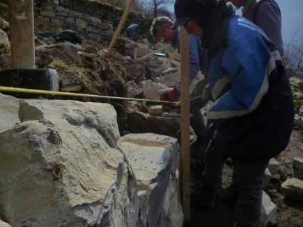
Drywall Construction Training, Muggio Valley Ethnographic Museum, Cabbio
2022
Workshop “Palazzo Re-use: Bauteile Wiederwenden” ZHAW, Winterthur
2022
Workshop “Transversal Territory,” work on memory in the Ticino landscape, Mendrisio
2022
Workshop “New Thule,” self-construction of a floating structure with a group of students, Mendrisio
Softwares Office Suite, Photoshop, Lightroom, Illustrator, InDesign, Acrobat Autocad, Archicad, VectorWorks, Rhinoceros, Twinmotion, V-Ray
Model Making Skills Mock-Up Building skills
Languages
English: Fluent (C1-Diploma Bilingual in High School)
French: Mother Tongue
Spanish: Fluent (C1, 4 years of study at the high school level + 6 months of immersion)
Portuguese: B1
German: B2
Italian: Fluent (C1-Current language of study, academic level)


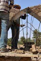
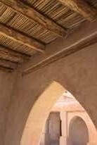
We were tasked with producing our own analysis of rammed earth constructions during our stay in Morocco. We visited three different realizations by the moroccan Architect Salima Naji and had to break them down constructively. I chose to classify them on the basis of how they responded to different constraints, be it water protection, providing foundations or combining with lighter construction elements. The first intervention(P1) is a renovated Souk near Taghjijt, which mostly relies on monolithical rammed earth construction. The second one(P2) is a grain storage building sitting atop a mountain in Amtoudi, mostly reliying on dry-stone techniques consolidated with clay plaster. The last structure is the outer wall of Casablanca’s old Medina is a collective realization by inhabitants. All pictures, including the ones I realized in addition to constructive details are property of Salima Naiji under the label creative commons. The entirety of this constructive knowledge stems from century of research and experience from local Amazigh and rural Arabic communities





Our task during the semester was to design a single-family house who would respond to different climatic contexts. We also investigated the potential of mixing vernacular/modern thermal strategies to design a living experience. I personally chose Martin Rauch’s own house,in the village of Schlins, in south-western Austria, a cold humid climate with a warm summer.
I chose to keep the same construction technique, rammed earth, whilst increasing the idea of having south-facing facade. Another decision was not to excavate the terrain, and follow the topography. Spaces are therefore always as close to the ground as possible, in order to increase their termal efficency. I simplified Rauch’s programme, having only one bedroom, one kitchen-living room, a working space and different terraces
The house is built only with bio-sourced material, except for the metal roof. I use stone capital inside of the rammed earth walls to support pine beams themselves holding pavement and roof.






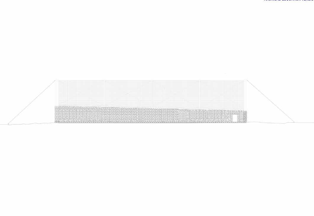




Our site is located in the center of Zürich, 5 minutes from the station. It is an old insurance building that is to be converted into social housing. Our task was to create a new facade for the building only from re-used material. With the help of Zirkular AG, a deconstruction company, we disassembled parts from a building under demolition that we used in the design process and for building a mock up. We chose to work with laminated translucent metal sheets we found in the building. The main idea behind our proposal is to create a stage on the street and give inhabitants the possibility to relate to their surrounding urban environment. As some sanitization work had to be done on the facade, we propose to keep some parts of the scaffolding in order to create balconies. The metal sheets are mounted on slidable frames and inhabitants are free to move them around to either hide away or expose themseleves from the street. As the structure lets some sun rays and water through, it is an excellent space for growing plants, we therefore chose to build the pavement out of metal grids mounted onto laminated sheets, as to provide easy water disposal.


Plan-Destruction


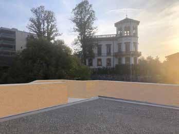

This project is taking place in the city of Krefeld, in Nord-Rhein-Westphalia.
The goal of this residency, hosted by the TransUrban collective was to give back their public character to 20th century urban interventions now occupied by parking spaces.
The Wälle from Krefeld are promenades that were built during the city’s industrializing period to provide green space to the inhabitants.
They consist of spacious walkways with trees, urban furniture and flowery patches.
The site of intervention, the Westwall was covered with concrete in the 1980s in order to create parking lots needed as a consequence of the city’s deindustrialization.
Deindustrialization is also responsible for the degradation of the city’s quality of life and disappearance of public life.

Usi e Destinazioni

Versatility of functions
Construction Workshop Mendrisio, Ticino, 2023 Un luogo d’incontro che nasce dal desiderio di compiere un viaggio. Concepito a Mendrisio e assemblato a Capolago, viene trasportato sul lago per raggiungere le sponde della città di Lugano. A bordo riconosciamo tre elementi archetipici. La cornice palesa davanti ai nostri occhi quella soglia tra noi e il paesaggio, esplicita un confine invisibile. Il tavolo è forse il luogo che vede riunito il maggior numero di persone alla minima distanza, e allo stesso tempo custodisce nei cassetti le loro tracce. L’albero maestro si erge come la colonna che regge i nostri tetti, quell’elemento naturale che rende unico il nostro pianeta e perciò una delle cose più preziose che conosciamo.
Infine si può dire che su quest’isola non si è mai soli. La tovaglia lasciata sul tavolo, il quaderno di bordo nei suoi cassetti, il piatto di grani per le rondini o i suoni del rame appesi al ramo più alto, sono tutti in qualche modo parte di questo viaggio. Non è che un modo di incorniciare un momento delle nostre vite.
During this workshop, organized with friends from the Master degree, a DIY raft was realized with leftover material from the school. The idea was to offer woodwokring and soldering training to students whilst realizing a collectively built structure. Its emerged platform would create a public space on the lake of Lugano, whose coastline is highly privatized. It would also support three playful elements, a tree with a sonic sculpture, a shelf with a notebook for anonymous messages , a bench and frame structure meant to watch movies. The design process extended over the summer holidays whereas the raft was realized in 6 days, upon going back to school. Although it has been displayed and used in different parks across Ticino, the canton still hasn’t given their authorization to make it float.


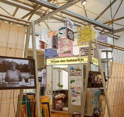
During my internship at the Berlin based collective Constructlab, our team was tasked with designing the exhibition Spaces of Solidarity, highlighting work done by different self-organized grassroots collective in Berlin. We collaborated with the chair Transforming Solidarities and the graphical designers of Studio EST who produced the exhibition content. Constructlab had built a kiosk used by the different collectives to do street initiatives, we had to decorate this latter with the different slogans used by the during the public events. In order to display mapping and relevant informations about the grassroot organisation, we thought it would be interesting to use construction site fence to hang the various exhibition material. We built connectors for fences which were mounted on wheels, in order to be flexible with the exhibition layout.




This structure was developped during the course “Space, Body, Event” of Riccardo Blumer, a designer from the Academy. The whole research during the semester was concerned with equilibrium, or how to put things in balance.
We first started with finding the equilibrium points of plane and vertical structure to then move to three dimensional designs.
This is my proposal for the final showcase, in which 80 students wore their structure, which had been previously painted in uv light reacting paint to appear as floating.
I thought of combining two different shapes, a structural circle and long pieces of wood.
As only the long pieces were painted, they created a circular lit space all around me. It was then really interesting to see how this structure interacted and conflicted with the surrounding one during the performance.

The final task of our Urban Sociology course was to study a street or a block of our own city with Jane Jacobs’ analytical tools. I chose one street of the neighboorhood of “Pâquis” in Geneva because it is often at the center of different debates by the city’s politicians, who criticize for possessing a high number of undocumented migrants. I started by categorizing the different functions present on the street, then studied the building’s age to then proceed to a chronological map of the street’s use.I also conducted a serie of interview with inhabitants.I discovered that people labeled as dangerous by politicians, on the contrary provided “eyes on the street” like in Jacobs works. It was also interesting to see that the diversity of functions present on the street ensured activitiy all around the clock, something that also increased its safety. Last important elements are a serie of urban struggles, that made sure the neighboorhood remained affordable for different populations whilst increasing creating institutions such as leisure center for children, fulcrum of the neighboorhood social fabric.


I was tasked with comparing urban reform in cities that all made their fortune as centers of colonial empires. Analysing policies in New York, Amsterdam and London I showed how the accumulation of capital was based on the exploitiation and agressive management of its underprivileged population in the three cities. It was essential to show that process of enclosure of areas deemed “unproductive” was essential into the extraction of profit, be it in the original enclosure wall of Manhattan Island by the Dutch or the later fencing off of immigrant neighboorhoods in order to create “white only” zones. It was also essential to see how agressive destruction of households was a pre-condition to process of gentrification and exclusion of undesirable, such as in London or Amsterdam slum clearance. To conclude, I was able to show how these reforms contributed to current urban inequality to the latest cartographical and statistical surveys.
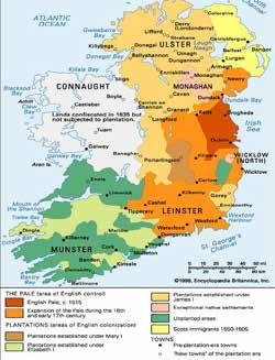
This Urban History essay analyses the different mechanism of enclosure constituted by european colonial powers and their continuation in two cities urban fabric: New York and London.
I first show how land grab into colonized territories was always underpinned by a rhetoric of development/underdevelopment from colonizing power
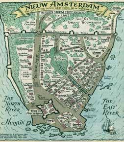
of

Similar mechanicms also took place inside colonial metropolises. The underdevelopment rhetoric allowed the pacification and policing of the innercity working class population as well as the agressive refashioning of their living environment and communities.

In London, slum clearance campaign were used to drive out undesirable population who did not fit into white, capitalist-abiding and heternormative forms of life.
Devices such as private compartimentalization of common land, physical enclosure and plantation economies enabled the inclusion of territories into capitalist modernity
The categorization of certain zones as «underdevelopped» or «worthy of developlment» justified dispossession, displacement and brutal reshaping of social structure.
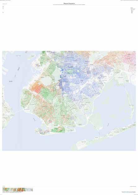
In New York, practices such as redlining, knowingly the classification of neighboorhood as worthy of investment based on their ethnic make-up reinforced segregation and divided multicultural worker’s alliance.
It reproduced whiteness by selectively allowing white workers to access private property into areas deemed «financially secure», who got more investment and better infrastructure.


clearance in Whitechapel, smaller settlements are built for selected families.

This research and terrain had at its center a philosophical question in the wake of Marc Augé research about Non-Places: can a natural landscape be a non-place ? Augé defines them as places that have no historical, contextual or anthropological continuity with their surrounding, thus rendering them interchangeable geographically. This golf course in Geneva is a good example of a place that is completely disconnected from its surrounding setting. It nevertheless markets itself as an authentic piece of “swiss nature” on the basis that it was built on the estate park of a influential family. Mapping enabled us to trace the privatization of this territory, a former collective agricultural landscape transformed into a private bourgeois domain itself turned into a golf course. We analyzed how contemporary discourses on Nature were used to justify enclosure and exert further disdain on rural realities


My research focused on the development patterns of agricultural infrastructure. By using the geographical data software QGis, I realized that these infrastructures, whether greenhouses or fenced fields, often developed concentrically around water points, especially around mega-basins storing water pumped from the subsoil. They privatize water by preventing water infiltration into subterrean aquifers. This increases the risk of drought and further precarize small exploitants.
Agricultural laws dating from French colonial times also further disenfranchise small farmers by guaranteing economical support for large scale exploitation and western backed gigantic infrastructural projects.
Qgis allowed me to visualize the correlation between mega-bassin water storage, access to one of the mega-project and agricultural growth. This enabled us to highlight inequalities in water access and infrastructural violence.


The city of Agadir is located on the edge of the Atlantic Ocean and in the watershed of the Anti-Atlas.
Water from this mountainous massif then accumulates in the aquifers of the plain. Two important rivers originate from the melting glaciers of the Massif, the Oued Souss and the Oued Massa


To face this challenge, the regional government implemented an underwater pipeline to carry desalinated water to farmers as to ease the hydraulic burden on the region’s aquifers. It unfortunately only provides water to farmers who already have a significant exploitation and the financial means to pay for it


My research then focused on the development patterns of agricultural infrastructure. By using QGis, I realized that these infrastructures, whether greenhouses or fenced fields, often developed concentrically around water points, especially around mega-basins storing water pumped from the subsoil


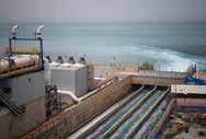

I observed how agricultural facilities densified along the underground network transporting desalinated seawater through the valley, a backbone fostering infrastructural growth.

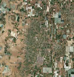


The bassin of the river Souss create an extremely fertile area. Traditional farming inserts itself directly on the swamps of the river’ delta


Human start settling around this rich agricultural area, cities grow outwardly on both banks of the Delta.


Traditional settlements stand in strong contrast with intensive agriculture greenhouses. The underground pipeline enabled this infrastructure to thrive. Greenhouses sprawl outwardly from an historical human settlement. It serves as a core for social life and circulation node. The lighter structure of greenhouses can easily span huge areas.


Intensive agriculture greenhouses grow outwardly around an illegal above ground water storage basin. They feed off water that should normally be able to sink back into aquifers.


Academy of Architecture of Mendrisio Vladimir Michel +41799266675
vladimir.michel@usi.ch