Foundation Highlights
Coastal Insights
Partnerships & Outreach
THINK COASTAL Summer/Fall 2026
A Letter From Our Board Chair and President Welcome to the inaugural issue of Think Coastal magazine. For all of us at the North Carolina Marine & Estuary Foundation, this publication represents more than a collection of stories and updates. It reflects a shared belief that North Carolina's coastal waters, fisheries, and estuaries are among our state's greatest treasures—and that their future deserves both our attention and our investment. The pages that follow highlight many of the partnerships, research initiatives, and stewardship efforts helping shape that future. You'll read about groundbreaking advances in red drum satellite tracking, our commitment to rebuilding and sustaining striped bass populations from the Roanoke River to the Cape Fear, innovative tools like our FINDEX® stock status indicator, and the people and organizations working every day to strengthen the fisheries and habitats that define eastern North Carolina. You'll also explore stories about blue crabs, oysters, shrimp, estuaries, and the remarkable ecosystems that support both thriving marine life and coastal communities. As we considered what to call this magazine, we kept returning to a simple phrase that has become central to our identity: Think Coastal. To us, thinking coastal is more than a slogan. It is a way of viewing the world around us. It means recognizing that healthy fisheries, productive estuaries, clean waters, working waterfronts, and strong coastal economies are all connected. It means understanding that the decisions we make today will influence the future of our coast for generations to come. Most importantly, it means embracing our responsibility as stewards of North Carolina's marine and estuarine resources and working together to ensure they remain vibrant, productive, and accessible for those who follow us. Since our incorporation in 2018, we have been privileged to watch a bold vision become a growing movement. What began as an idea shared by a handful of committed coastal leaders has evolved into a trusted statewide organization advancing research, education, restoration, and fisheries stewardship across North Carolina. We are proud of how far we have come, but even more energized by the opportunities that lie ahead. The encouraging news is that meaningful progress is happening. Together with our partners and supporters, we are generating new science, expanding educational opportunities, advancing practical solutions, and helping create a stronger foundation for North Carolina's marine and estuarine resources. Yet our work is far from complete. Significant challenges remain, and achieving our mission—building world-class fisheries and thriving coastal economies—will require continued dedication from all who care about the future of our coast. Thank you for being part of this effort. Whether you are a donor, partner, angler, educator, business leader, or simply someone who loves our coast, your support makes this work possible. We hope the stories in these pages inform, inspire, and remind us all of the importance of always thinking coastal. Sincerely,
Allen Gant, Jr. Chair
Chuck Fuller President
About Us Founded in 2018, the North Carolina Marine & Estuary Foundation was formed by business leaders dedicated to supporting eastern North Carolina. Since its
Executive Director Chad Thomas
inception, our Foundation has earned recognition as an innovative nonprofit, developing forward-thinking initiatives to revitalize the marine and estuarine resources that have sustained North Carolina’s coastal
Contributors
communities for generations.
Ellen Simons Ethan Britton
Our Mission
Mason Phipps
Build world-class fisheries and thriving coastal
Steve Poland
economies
Contact Information
Our Vision
Website: ncmefoundation.org
See North Carolina become the country’s premier
Email: info@ncmefoundation.org
fishing destination
Phone: 984-304-7860 ext. 902 Office Address: 1213 Culbreth Dr, Suite 140, Wilmington, NC 28405 Donation Mailing Address: 2054 Kildaire Farm Rd, MB #236,
Our Values Collaboration & Innovation Science & Research Education & Outreach
Cary, NC 27518
Cover
The North Carolina Marine and Estuary Foundation, Inc. is a
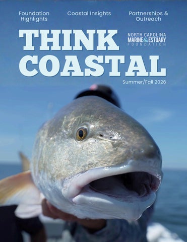
Adult red drum from Pamlico Sound.
501(c)(3) nonprofit organization. Contributions are tax-
Photo: Chris Douglas
deductible to the fullest extent allowed by law. EIN 83-0893015
Foundation Projects & Resources 05
From Sound to Satellite: Unlocking the Secrets of NC’s Most Iconic Fish
23
Tidal Creek Restoration: Hewletts Creek & Bradley Creek
11
From Satellite to Screen: Bringing Data to Life
27
FINDEX: Making Fisheries Science Make Sense
15
Drawing the Lines: Mapping Who Manages NC’s Fisheries
39
The Rockfish Revival: How a Broad Partnership is Bringing Striped Bass Back
21
Keeping the Coast Open: Boating & Fishing Access
52
Coastal Community
About Us
Coastal Insights
Quick Catches
01
What is an Estuary?
04
What’s That Sound?
17
Under the Shell
14
Sheepshead on the Rise
25
Spot the Difference
22
How Fish Find Home
31
Into the Molt
35
250 Years
44
The Larval Lottery
37
Caught Red Handed
51
Robust Gains for Bluefish
45
Do you Know Your Shrimp?
47
Inside Shrimp Harvest
49
The Forgotten Fishery
About Us 36
Understanding Cold Stuns
COASTAL INSIGHTS
WHAT IS AN ESTUARY? Supporting Ecosystems & Economies
With the smell of salt on the breeze and views of shimmering mudflats blending into blue as they fade into the distant waters, there’s no question that North Carolina’s estuaries are beautiful. Whether you come here to find the solace of nature or have built your life around these waterways, there’s a reason they feel like a refuge for many of us. North Carolina’s estuaries form a diverse network between the rivers and the ocean that supports ecosystems, fuels local economies, and enhances our coastal communities. But what exactly makes these estuaries so special, and why should we care?
An Ecosystem in Flux An estuary is a body of water that forms when freshwater from a river or stream mixes with saltwater from the ocean. The resulting water is brackish, meaning it’s salty but not as salty as the ocean. These conditions create a range of diverse habitats, including salt marshes, mudflats, and seagrass beds. As we see across the world’s biomes, diverse habitats support greater diversity in life! This brackish water opens up ecological niches for an impressive range of plants and animals.
01 Think Coastal Magazine Summer/Fall 2026
We’ll dig more into the incredible ecology of estuaries in the next section, but first, we’ll overview the different types of estuaries and explain some of the factors that create these ecosystems.
Types of Estuaries Interestingly, an estuary doesn’t form at every river mouth. In most cases, the freshwater disperses into the ocean. Estuaries are like a container; the landscape creates a partially enclosed area that allows the saltwater and freshwater to mix. There are a few different types of estuaries named for the geologic events that created them. Coastal Plain Estuary: Sea level rise can cause the ocean to fill in coastal lowlands or river valleys, creating a coastal plain estuary. Example: Chesapeake Bay Tectonic Estuary: When an oceanic and continental plate collide, this can create a downwarping effect that causes a depression in the landscape. Both the ocean and nearby rivers mix together to fill the opening and create a tectonic estuary. Example: San Francisco Bay
Fjord Estuary: At the end of the last ice age, glaciers retreated to leave deep valleys behind. These valleys funnel rivers to the sea, while saltwater funnels in from the ocean, creating a fjord estuary. Example: Puget Sound Bar-built Estuary: Barrier islands and sand bars can create the container of an estuary. When waves and currents build up sediment near the shore, they create narrow barrier islands that protect inner lagoons and bays. Example: Pamlico Sound
Cycles of Change One thing that’s consistent about estuaries is that they are always changing. The cyclical nature of tides, rainfall, and climate means that the ratio of saltwater to freshwater is constantly in flux. Take the tides, for example. As high tide comes in, it raises both the water level and the salinity of the estuary, creating what we call an estuarine current. Because saltwater is heavier than freshwater, this current moves near the bottom, while the less dense freshwater from the river flows near the surface—a process called the anti-estuarine current. These currents are always cycling, but their strength shifts depending on the tide and river flow.
seven empty into the estuaries along our coast (the other five meet the ocean in other states). This massive estuarine system is a mosaic of interconnected sounds, bays, rivers, and inlets, shaping the region’s unique ecological and geographical characteristics. Among the most notable are the Pamlico Sound, Albemarle Sound, and Cape Fear River Estuary. These estuaries formed primarily due to the barrier islands that protect the coast. However, rising sea levels at the end of the last ice age filled in some of the nearby river valleys, making North Carolina’s estuaries a combination of bar-built and coastal plain estuaries. This expansive system is broken down into smaller sounds and lagoons to account for nuanced geologic and cultural differences. Bogue Sound, behind Bogue Banks, and Core Sound, between the mainland and Core Banks, are just two examples of the many smaller estuaries found on the North Carolina coast.
Why We Care North Carolina’s estuaries are remarkable! The interplay of climate, geology, and topography has formed an array of ecosystems that have both ecological and economic value.
Seasonal changes, like heavy rains or droughts, add another layer of variability. During the rainy season, rivers swell and pour more freshwater into the estuary, pushing back the salty intrusion. In dry periods, river flow slows, allowing saltwater to push farther inland. On both a daily and seasonal basis, these natural cycles shape the surrounding ecosystems and economies that have long depended on estuaries for fishing, farming, and trade.
Estuaries in North Carolina In North Carolina, estuaries define the coastline. Our entire coastal region is dominated by the Albemarle-Pamlico Estuarine System. Covering over two million acres, it’s the second largest estuary system in the United States, stretching from the barrier islands of the Outer Banks in the east all the way inland towards the Raleigh-Durham region in the west. Of North Carolina’s twelve major rivers,
Ecological Value Fueled by cycling currents that deliver nutrients from both land and sea, estuaries are among the most productive ecosystems on Earth. The lush plant life found in marshes and seagrass beds offers critical shelter for countless marine species. Like a pyramid, the estuarine ecosystem is built from the
02
the bottom up—its strong foundation supports a wide variety of life higher up the food chain. These sheltered habitats serve as nurseries for key forage species like Atlantic menhaden and striped mullet, as well as vital invertebrates such as shrimp, blue crabs, and oysters. Together, they form the foundation of the estuarine food web, supporting prized recreational and commercial species including flounder, speckled trout, red drum, and striped bass. In addition to supporting wildlife, estuaries provide natural coastal defense by mitigating the damaging effects of storm surge and flooding. Plant life helps stabilize shorelines, reducing erosion and protecting coastal communities. At the same time, oysters naturally filter pollutants from the water, improving water clarity and enhancing overall ecosystem health.
Economic Value Speaking of how estuaries benefit human economies, let’s take a closer look at the on-land value they drive. These rich, sheltered waters help support a seafood industry that reaches far beyond
03 Think Coastal Magazine Summer/Fall 2026
our shores. Nationally, estuaries provide nursery grounds for 75% of the fish and shellfish we eat, producing more food per acre than even the most fertile farmland in the country. Here at home, they help sustain more than 40,000 jobs from seafood harvesters and fishing guides to boat builders and marina crews. Healthy estuaries don’t just feed us, they keep our coastal communities thriving.
The Future of Our Estuaries North Carolina’s estuaries are beautiful coastal ecosystems that sustain diverse wildlife, enrich local economies, and make life brighter for residents and visitors alike. By understanding how estuaries form, recognizing their ecological significance, and appreciating their economic contributions, we come to see their true value. As coastal populations expand, our estuaries face growing environmental stress. That’s why the future of these delicate ecosystems depends on a shared commitment to data-driven research and innovation. With the help of cutting-edge science and technology, we can determine how human activity and environmental change impact North Carolina’s fisheries and coastal resources.
QUICK CATCH
What’s That Sound? Anchor up in Pamlico Sound on a quiet fall evening, cut the engine, and listen. You might hear a low, rhythmic thrum radiating through the hull. What you’re hearing is red drum, doing what they’ve done for tens of millions of years: talking. Red drum, spotted seatrout, croakers, weakfish, and the rest of the Sciaenidae family are among the most acoustically active fish. Specialized sonic muscles attach directly to the swim bladder and contract at high speed, making it vibrate. The result is a low-frequency pulse that carries hundreds of meters through shallow water. Each species in the family has its own acoustic fingerprint. Red drum produce deep, repeated pulses that resonate across the estuary. Spotted seatrout have a more complex, staccato-style call. Black drum are unusual in that both sexes call, not just the males. Experienced researchers and a few longtime anglers can tell them apart by ear alone. Sound isn’t just a novelty for these fish; it’s central to reproduction. Males are the primary callers, and their drumming intensifies during spawning season, peaking at dusk as water temperatures and lunar cycles align. It’s a way of announcing fitness and location to potential
mates in waters where visibility extends only inches. That chorus has become a management tool. Research out of East Carolina University used sonobuoys and hydrophones to identify where and when each sciaenid species was spawning: weakfish and silver perch called predominantly near inlets in May and June; spotted seatrout peaked in July at river mouth sites in western Pamlico Sound; red drum choruses built near coastal inlets in September and October. NC State University’s Center for Marine Sciences and Technology has expanded on this work, linking soundscapes to habitat quality, particularly on oyster reefs and surrounding waters. Where the drums go quiet, something may be wrong. What makes passive acoustics such a powerful tool is its reach and patience. A hydrophone simply listens, and what it hears can directly inform where fishing regulations and habitat protections are most needed. Protect spawning habitat at the right time and place, and you protect the fishery itself. So, the next time you cut the engine and drift, take a moment to listen. Somewhere beneath you, a red drum might be making its case to a nearby female. That’s not just remarkable biology, it’s a tool for smarter fisheries management.
04
I
t’s copper-red and bull-shouldered, with a distinctive black spot near its tail that looks like nature painted a bullseye. It can live to be 60 years old, tip the scales past 90 pounds, and drive anglers across the Atlantic Seaboard to plan entire seasons around a single encounter. North Carolina’s state saltwater fish, the red drum, is something of a coastal legend. And if you’ve never hooked one, never tasted one fresh off the grill, or never watched one roll in the shallows on a calm fall morning, take a moment to recognize what it represents: the economic engine of coastal North Carolina. Anglers average three million fishing trips per year in North Carolina in pursuit of red drum, trips that fuel restaurants, bait shops, charter guides, marinas, and motels. The red drum is not just a fish. It is a culture. It is an economy. And for the NC Marine & Estuary Foundation, it is a priority.
Identifying the Gap Every serious conservation effort begins with a question. For red drum, the most pressing question
05 Think Coastal Magazine Summer/Fall 2026
wasn’t about abundance; it was about movement. Where do these fish go? When do they spawn, and where? Do they stay within the sounds and estuaries of North Carolina all year, or do they range far beyond our borders? These weren’t idle curiosities. They were formally identified by the NC Division of Marine Fisheries as the highest-priority research need for the species, and answering them would require the kind of innovative, privately funded partnership our Foundation was built to provide. The Atlantic States Marine Fisheries Commission, which coordinates management across the entire range of red drum on the East Coast, had also flagged movement data as critical to comprehensive, cross-jurisdictional management. Without knowing how and where adult red drum travel, every management decision, no matter how well-intentioned, is built on incomplete information. Our Foundation recognized that this was not a problem waiting for someone else to solve. It was an opportunity to lead.
FROM SOUND TO SATELLITE
Unlocking the Secrets of North Carolina’s Most Iconic Fish
Learning to Tag a Legend In 2024, the Foundation partnered with the NC Division of Marine Fisheries to develop and execute a pilot tagging project focused on adult red drum along the North Carolina coast. That fall, Division biologists deployed 10 SeaTag-GEO pop-up satellite tags on mature red drum (over 32 inches) captured during their annual longline survey in western Pamlico Sound. These tags, at $2,500 apiece including monthly satellite subscription fees, measure geomagnetic field values, ambient light, and water temperature, with data transmitted via the Argos satellite network to positioning software back on shore. Tags were programmed to “pop off” after intervals of up to 30 days, releasing from the fish, floating to the surface, and transmitting a burst of archived location and environmental data via satellite. Though brief, the pilot produced fascinating early movement patterns and gave our team and Division staff firsthand experience with both attachment methods and the realities and limitations of satellite
detection. It also revealed important lessons about tag performance that would shape project decisions going forward. The attachment method itself is worth understanding, both for what it reveals about the science and as a testament to the care taken to minimize impact on the fish. The technique is experimental but grounded in methods proven effective with Pacific cod, a species with a body shape similar to red drum. A loop of strong monofilament line is carefully inserted about two inches below the dorsal fin, then secured on each side with small plastic discs crimped snugly against the fish to hold the line in place without causing irritation. The satellite tag is tethered to this line so that it rides smoothly over the fish’s back as it swims. Though the tag weighs 42 grams in air, a built-in float reduces its effective weight in seawater to eight grams, ensuring minimal drag. When the programmed pop-off date arrives, the tag detaches cleanly, leaving only a small cap on the fish with negligible lasting impact.
06
Lilley, Richard Andrews, and Mitchell Blake were among those who contributed their time, expertise, and local knowledge to make the 2025 season a success. Their partnership reflects the strong, shared commitment between our Foundation and the recreational fishing community that drives this work forward.
Feeding the monofilament right below the dorsal fin.
Second, under the supervision of Cara Kowalchyk, the Division’s red drum species lead, biologists tagged fish during their annual longline surveys in August and September. Tagging was concentrated near the mouths of the Tar-Pamlico and Neuse rivers, historic red drum corridors. By the time the 2025 season closed, 33 fish had been tagged, each carrying a satellite tag into the depths with pop-off intervals ranging from 4 to 12 months, designed to capture a far broader arc of behavior and movement than the pilot allowed.
Putting It on the Map Crimping both sides to hold the discs in place.
Tethering the tag to the monofilament.
2025: Going All In What we learned in 2024 was enough to confirm one thing: this approach works, and it’s worth scaling. In 2025, the Foundation launched the project with the goal of tagging 40 red drum. The initiative unfolded in two parallel tracks. First, our Foundation staff took the wheel on the inshore effort, working alongside a network of recreational fishing guides from Dare County to Brunswick County to capture and tag fish in various coastal sounds and inshore waters beginning in June. These guides, who know these fish and these waters as well as anyone, were indispensable partners in the field. Captains Bryan DeHart, Scooter
07 Think Coastal Magazine Summer/Fall 2026
Science is only as powerful as its ability to communicate. That’s why our Foundation partnered with Mapotic, the same developers behind the world-renowned OCEARCH shark tracking platform, to build a custom, publicly accessible Red Drum Tracking Platform. The platform displays near-real-time locations whenever a tag connects with the Argos satellite network, allowing anyone to follow these fish. The data is currently being mined and analyzed, and the early results are intriguing. Many of the tagged fish are showing movement patterns consistent with what past conventional tagging studies have suggested: sustained activity within Pamlico Sound and the connecting rivers, periodic movement into nearshore ocean waters, and return trips back into the sounds. But not every fish is following the script. A handful of tags have shown unexpected offshore movement patterns, with tracks pushing well beyond the inshore sounds and into open Atlantic waters. What does that mean? Is is evidence of genuine migration behavior? Or are there other explanations? Could a shark have taken the bait, ingesting a tag and carrying it on an entirely different journey? Could a popped-off tag, designed to float on the surface, have been picked up by the Gulf Stream currents and carried miles offshore before its final transmission?
The honest answer: we don’t know yet. And that’s exactly what makes this science so compelling.
An example of an unexpected track as shown on our red drum tracking platform.
These are precisely the kinds of puzzles that drive researchers to tag more fish, refine their methods, and keep pushing for answers. As results become available, we are sharing them on the tracking platform and inviting the public to learn as we learn. Pull up the tracker, follow a fish, and be part of the discovery. The full picture, spanning months of movement by dozens of individual fish, will deliver the most detailed portrait of adult red drum behavior ever assembled for this region, informing NC Division of Marine Fisheries management decisions and Atlantic States Marine Fisheries Commission stock assessments for years to come.
temperatures it encountered, and how its behavior shifted across seasons. This opens an entirely new dimension of insight. Are red drum staging near inlets in shallow water before moving offshore? Are they diving deeper as they migrate south along the coast? The microPAT is built to answer these questions. Wildlife Computers’ technology is proven and trusted across hundreds of fish tracking studies globally. Their tags incorporate advanced location processing that integrates light data, sea-surface temperature, and bathymetric information to produce highly accurate position tracks. With onboard memory capable of storing up to a year of archived data, this platform represents a significant leap in both reliability and data resolution. For the fish. For the science. For the story.
“Our Foundation will always be looking for the best technology available. The microPAT represents a meaningful leap forward—in reliability and in the quality of science we can deliver.”
This Summer: On the Water
As the 2025 data revealed important lessons about tag performance, our Foundation began evaluating the next generation of technology. For 2026, we are transitioning to Wildlife Computers, a global leader in marine animal tracking technology, and their state-of-the-art microPAT pop-up satellite tag.
Beginning this summer, our Foundation will deploy the microPAT satellite tags in collaboration with our network of local recreational fishing guides, the same trusted captains who have been with us since the beginning, along with a few new faces joining the effort for the first time. Tags will be deployed across coastal inshore areas throughout the summer season, with a continued focus on expanding geographic coverage up and down the North Carolina coastline and potentially into adjacent waters in Virginia and South Carolina.
The microPAT is a small, geolocating pop-up satellite tag, weighing just 46 grams and smaller than a deck of cards. Yet it’s capable of far more than its size suggests. In addition to the light, temperature, and positional data collected by previous tags, the microPAT continuously tracks depth throughout the entire deployment period. That means we won’t just know where a red drum traveled; we’ll know how deep it dove, what water
In addition, the Foundation will be field-testing two other tagging technologies this summer. The first is a type of satellite tag (SPOT 426) that has been used extensively on marine mammals and adapted for application on red drum to evaluate its performance and data quality on a fish of this size and behavior. The second is acoustic receiver technology, which uses submerged hydrophone arrays to detect tagged fish as they pass within range, building a picture of
2026: Leveling Up
08
movement through fixed geographic corridors. Both technologies offer potential advantages worth understanding, and evaluating them in parallel with the microPAT deployments reflects our ongoing commitment to ensuring that the science behind this program is always grounded in the best available tools and methods.
The Bigger Picture The world record red drum—a 94-pound, 2-ounce behemoth caught off Avon, NC in 1984—still stands, a testament to what our waters are capable of producing. Red drum is the official state saltwater fish of North Carolina, and they have sustained our coastal communities for generations. And yet, fundamental questions about their movement and behavior have long gone unanswered. This project represents a sustained commitment to changing that, one tagged fish at a time. None of this—a single tag, a single transmission, a single data point—happens without the financial
support of our donors. Each $2,500 tag is a direct investment in scientific knowledge that will shape how this species is managed for decades to come. Each dollar contributed to the Foundation is a dollar spent on building the data infrastructure that protects red drum, the recreational fishery they support, and the coastal economy it drives. Red drum are being tracked from the sounds of North Carolina to wherever they roam in the Atlantic. A public platform brings those results to life, inviting anyone to follow along. And with the transition to Wildlife Computers’ microPAT technology this season, the data collected will be more detailed and more dependable than ever. None of that happens without the vision, partnership, and financial investment that have carried this program from a 10-fish pilot to a multi-year, multitechnology initiative. World-class fisheries demand world-class science, and that conviction drives every tag we deploy, every dollar we invest, and every question we refuse to stop asking. A 44.5-inch red drum tagged while filming an episode of Carolina All Out with Chris Douglas and Captain Scooter Lilley.
F
lashback to March 2025. With the pilot portion of our red drum satellite tagging project under our belt, excitement began to build as we realized the breadth of the data we were set to collect. Our minds raced with ideas of how best to share this newfound data with the public, and what started as a far-fetched idea quickly became possible with a chance discovery. If you’ve ever tracked a marine animal on an online platform or mobile app, chances are the same company built it. For us, that realization came as our Foundation brainstormed ways to bring the public in as we learned where adult red drum were moving. How could we show people what we were learning as we learned it? OCEARCH does it with sharks, so what was stopping us from doing the same with red
11
Think Coastal Magazine Summer/Fall 2026
drum? The answer turned out to be hiding in plain sight. Our team visited the popular shark-tracking platform to get a feel for how it was built and found our answer in a simple hyperlink in the bottom-left corner. That link led to a website for Mapotic, a developer group specializing in map-based projects. After exploring their website, we immediately scheduled a demo. From the first call, it was clear this was no longer a question of what if, but how soon.
Behind the Build In the months that followed, our team worked with Mapotic to bring our vision to life. After countless video calls, emails, and test runs, we created a first-
FROM SATELLITE TO SCREEN Bringing Data to Life
of-its-kind red drum tracking platform that brings science from the field to the public. The platform connects directly to the Argos software, pulling location data each time a tag connects with a passing satellite. That data is stored in the backend of our platform and published in near-real time. Each point represents a piece of a red drum’s journey, allowing anyone to see where these fish travel and to understand why protecting their habitat matters.
Two Streams, One Story Satellite tags don’t just tell us where a fish has been; they tell a story in two distinct ways. Together, these data streams reveal how individual fish move through coastal waters.
The first stream is real-time opportunistic data. When a red drum swims near the surface and sunlight reaches the tag’s solar panel, it may transmit data to the Argos satellite network. These transmissions are irregular and unpredictable, but they offer rough location updates along the way. The second stream arrives at the end of a tag’s scheduled deployment. Once a tag releases from its fish, it floats to the surface and transmits its full archived dataset. This includes daily position estimates, temperature records, and a timeline of movement, allowing our team to reconstruct each fish’s path in greater detail. Both data streams are reflected on our platform through a simple color-coding system.
12
Active: Tag is deployed and communicating occasionally with the Argos satellite network prior to pop off Standby: Tag is deployed and awaiting communication with the Argos satellite network prior to pop off Inactive: Tag has popped off the fish, and tracking is complete
Connecting the Dots Data is being analyzed as tags from year one of the project continue to pop off. From localized movement through our sounds and rivers to offshore migration, each fish’s journey offers a glimpse into the expected and unexpected behavior patterns of adult red drum. When a tag pings in the open Atlantic, our team pours over the surrounding data points, transmission timing, and water temperatures to look for clues about what really happened out there.
striped bass as they pass by underwater receivers, with data periodically collected and recorded by Division staff. The Division agreed to provide us with spreadsheets containing the coordinates and time of each ping. Our team is now working with Mapotic to build out each striped bass profile before publishing them on our platform. The second question has been on our minds since the beginning. When we first met with Mapotic, we discussed the possibility of a red drum tracking mobile app to accompany the web platform, and they didn’t hesitate. We decided to build the web platform first, then revisit the mobile app a few months after launch. Since then, Mapotic has developed an app that offers all the same features as our web platform, plus the ability to log in and save your favorite fish for easy access. Testing has begun, and our team is working with Mapotic to implement final edits prior to deployment in app stores.
That uncertainty is part of what makes our platform worth checking regularly. A track that looks unremarkable one week can take a dramatic turn the next, or a tag designated as standby can turn to an active tag with just one ping. The data variety is exactly what drives our research team to learn more. This means tagging more fish, asking new questions, and piecing together existing data to see the bigger picture.
Looking Ahead As we work to improve tag performance with the transition to microPAT satellite tags for year two of the project, we are also looking for ways to elevate our tracking platform. Two questions come to mind: If we can share movement patterns of red drum, why not expand to include other fish species? And if we can build a web tracking platform, why not bring the same technology to mobile phones? The answer to the first question starts with our existing relationship with the NC Division of Marine Fisheries. At our annual meeting to discuss red drum tagging plans for the upcoming year, our team proposed adding striped bass to the platform. The Division uses acoustic telemetry tags to track
13 Think Coastal Magazine Summer/Fall 2026
A sneak peek at our mobile app. Users will be able to follow their favorite fish just as they have on the web.
In the coming months, our web platform will include tagged fish from year two and a striped bass data layer, and our mobile app will be available for download. Until then, visit our red drum tracking web platform, follow a fish, and let us know what we should add next.
QUICK CATCH
Sheepshead on the Rise Few fish inspire as much curiosity and frustration as the sheepshead. With bold blackand-white stripes, human-like teeth, and a knack for stealing bait, they’ve earned the nickname “Convict Fish.” Ranging along the Atlantic coast from Canada to Brazil, sheepshead can be found year-round in North Carolina, moving between estuaries and nearshore waters as they grow. Sheepshead have quietly become one of North Carolina’s most popular inshore targets. They are strong fighters, excellent table fare, and smart enough to keep anglers coming back. But that popularity has a downside, and new regulations are meant to bolster the population. Recent reviews of commercial and recreational data show a fishery growing rapidly in effort and harvest. More anglers are targeting sheepshead, landings are up, and younger fish now make up a larger share of the catch, while older fish are becoming less common. Taken together, these trends raised concerns about the fishery’s direction. A 2024 snapshot shows the shift: Recreational anglers took more than 400,000 directed trips and landed nearly 1.43 million pounds, the second-highest recreational harvest on record.
More than 1.1 million sheepshead were released by recreational anglers, the highest number of releases observed (1996–2024). Commercial fishermen landed 129,702 pounds, the highest total since 2015. In response, the Division of Marine Fisheries implemented new regulations on March 1, 2026. For recreational anglers, the daily bag limit dropped to five fish per person, and the minimum size limit increased to 14 inches. These adjustments were designed to reduce harvest pressure on younger fish and ensure more sheepshead survive long enough to reproduce. The commercial fishery saw similar changes. All sheepshead must meet the 14-inch minimum size, with trip limits set at 1,500 pounds per operation per day for pound nets, 10 fish per person per day (or trip) for gigs and spears, and 300 pounds per trip for other gears. One final detail worth noting under the new rules: sheepshead are measured by total length, not fork length. This change mirrors black drum regulations and helps reduce confusion when the two are caught together. For anglers, the takeaway is simple: sheepshead are more popular than ever, and the rules are changing to match that reality. Knowing the new regulations will help avoid surprises at the dock.
14
DRAWING THE LINES
Mapping Who Manages North Carolina’s Fisheries
WRC
DMF
WRC & DMF
Fisheries management in North Carolina is anything but simple. Decisions involve two state agencies, a federal commission, two federal councils, and several advisory committees. To help make sense of who manages which species and where, our Foundation created an interactive map that clearly illustrates the management structure. Not only does the map identify the agencies responsible for governing specific waters, but with just one click, users can discover how they operate and which species are under their jurisdiction.
North Carolina Wildlife Resources Commission Inland Fishing Waters
ASMFC
NMFS
districts and serve six-year terms, and one at-large member who serves a four-year term. The General Assembly has ten appointments, all serving twoyear terms. The Commissioner of Agriculture appoints one member who serves a four-year term. The Executive Director of the WRC is hired by and serves the 21-member Commission. Staff report to the Executive Director, and recommendations are brought forward to the Commission for consideration and approval. The WRC has jurisdiction over the regulation, licensing, and enforcement of fishing in Inland Fishing Waters.
North Carolina Division of Marine Fisheries Coastal Fishing Waters
The North Carolina Wildlife Resources Commission (WRC) plays a key role in managing Inland and Joint Fishing Waters across the state. As one of two state rulemaking bodies, it oversees licensing, regulation, and enforcement for numerous freshwater and migratory species found in North Carolina’s rivers, estuaries, and shared coastal zones.
The North Carolina Marine Fisheries Commission (MFC) and Division of Marine Fisheries (DMF) share responsibility for managing the state’s coastal fishing waters. Together, they oversee rulemaking, management plans, and enforcement for many of our most important marine and estuarine species.
The WRC consists of 21 members. The Governor appoints nine members who represent geographic
The MFC consists of nine members appointed by the Governor as follows: three persons representing
15 Think Coastal Magazine Summer/Fall 2026
commercial fishing or the industry, three persons engaged in recreational fishing or the industry, two at-large appointments, and one scientist. The DMF is established as a “subunit” of the North Carolina Department of Environmental Quality (DEQ). The Secretary of the DEQ selects a Director for the DMF and may delegate powers and duties. Fishery management plans are developed by the DMF and presented for approval to the MFC. While rulemaking authority lies within the MFC, the Director of the DMF has proclamation authority to regulate seasons, areas, size limits, and creel limits for fisheries within jurisdictional waters.
Wildlife Resources Commission & Division of Marine Fisheries Joint Fishing Waters Joint Fishing Waters are co-managed by the MFC and WRC, with oversight responsibilities and boundaries determined by mutual agreement. These shared waters are the subject of ongoing jurisdictional debate, particularly around recreational fishing access and authority. The Governor has the statutory authority to resolve conflicts between the two agencies. Commercial fishing activities are managed and regulated by the MFC in Joint Fishing Waters.
Atlantic States Marine Fisheries Commission 0-3 Miles Offshore The Atlantic States Marine Fisheries Commission (ASMFC) coordinates the conservation and management of coastal fish species shared by states along the Atlantic coast. Representing 15 member states, the ASMFC plays a key role in developing interstate fishery management plans and ensuring sustainable use of shared marine resources 0 to 3 miles offshore. The ASMFC is a federal oversight commission comprised of voting representatives from the 15 member states. Each member state is represented as
follows: the director of the state marine fisheries agency, a state legislator appointed by the Governor, and a citizen of the state appointed by the Governor. The three “commissioners” from each state vote in a caucus to cast one vote for formal motions. The ASMFC administers a program to promote the development and implementation of conservation programs for Atlantic coastal fisheries known as the Interstate Fishery Management Program. This program outlines the preparation and adoption of fishery management plans, which are developed under the supervision of species-specific management boards. When preparing plans for species found in both state waters (0 to 3 miles offshore) and the Exclusive Economic Zone (3 to 200 miles offshore), the ASMFC consults with the appropriate US Regional Fishery Management Council.
National Marine Fisheries Service 3-200 Miles Offshore
The National Marine Fisheries Service (NMFS) is a federal agency that works with the US Regional Fishery Management Council system to manage fisheries 3 to 200 miles offshore for eight regions. This area is referred to as the Exclusive Economic Zone (EEZ), as defined by the Magnuson-Stevens Fisheries Conservation and Management Act. North Carolina is a member state of two regional councils: the Mid-Atlantic and South Atlantic Fishery Management Councils. The Mid-Atlantic Fishery Management Council has 21 voting members and four non-voting members. The South Atlantic Fishery Management Council has 17 voting members and four non-voting members. North Carolina has three voting members on each council. Plans and specific management measures (such as seasons, quotas, and closed areas) are developed based on scientific advice and are initiated, evaluated, and adopted through a public process. Each regional council maintains a scientific and statistical committee to assist with the peer review of any fishery management plans.
16
COASTAL INSIGHTS
UNDER THE SHELL All About Oysters
Oysters have shaped our estuaries for centuries. They’ve supported working waterfronts, filtered our waters, and built reefs that shelter fish and crabs. Today, they sit at the center of important conversations about coastal economies, water quality, public trust waters, and the future of our fisheries. Whether you harvest them, grow them, eat them, or simply value clean water and thriving estuaries, oysters connect us all.
Nature’s Estuary Engineer Few species tell the story of our coast like the oyster. Once so abundant that reefs were navigational hazards, oysters helped shape North Carolina’s estuaries and the communities built around them. They fed families, sustained working waterfronts, and formed the backbone of coastal economies. Historic oyster reefs once spanned tens of thousands of acres throughout North Carolina’s estuaries. Modern mapping has identified roughly 22,000 acres of shell bottom in coastal waters, a tangible reminder of what was and what restoration hopes to rebuild.
17 Think Coastal Magazine Summer/Fall 2026
Over time, habitat loss, water quality challenges, and intense harvest pressure dramatically reduced wild oyster populations. Yet today, oysters are at the center of one of the most hopeful stories in coastal restoration and sustainable seafood. Oysters do more than live in estuaries; they build them. A single adult oyster can filter up to 50 gallons of water per day under ideal conditions, removing excess nutrients and suspended particles. Over time, clusters of oysters form reefs that create hard structure in otherwise soft-bottom waters. These reefs shelter juvenile fish and crabs, support shrimp populations, and buffer shorelines. At the same time, consumer demand for oysters continues to grow nationwide. Oyster mariculture— the cultivation of oysters in coastal waters—is expanding in nearly every U.S. region. Cultured production now represents the most valuable sector of marine aquaculture in the country. Here in North Carolina, both public reef harvest and private lease production play important roles. Wild oysters connect us to heritage and tradition.
Cultured oysters help meet rising demand and provide economic stability for coastal communities. Together, they generated $8.15 million in dockside sales in 2024, the highest value on record. Oysters are more than seafood on ice. They are living infrastructure, and one of the clearest examples of how conservation and coastal livelihoods can move forward together.
Wild vs. Cultured When you order oysters on the half shell, you’re tasting one of two distinct pathways from water to plate. Both begin in North Carolina’s estuaries. Both depend on clean water. But they operate differently, and together, they’re shaping a broader conversation about how our coastal waters are used.
Wild Harvest Wild oysters grow naturally on reefs throughout our sounds and rivers. Harvesters collect them using traditional methods, such as hand tongs or dredges, depending on the location.
Cultured oysters begin as hatchery-produced seed and are raised within defined lease boundaries. Growers manage density, tend gear, and monitor conditions as the oysters mature. Because oysters feed naturally by filtering plankton from surrounding waters, no feed inputs are required. There are currently 525 active shellfish leases in North Carolina, covering approximately 2,528 acres of estuarine waters. These include: 305 bottom leases totaling about 1,465 acres 179 water column (floating or suspended) leases totaling about 605 acres 38 franchise areas covering roughly 452 acres 3 research leases totaling just over 6 acres For context, North Carolina contains roughly 2.2 million acres of estuarine waters. Even so, mariculture can feel highly visible in certain creeks and sounds, particularly where floating gear is present.
Wild harvest follows the rhythms of the estuary. Production rises and falls with spawning success, storms, salinity, and reef condition. Healthy public reefs provide harvest opportunities, but they also create habitat, protect the shoreline, and serve as the ecological foundation of the estuary. For generations, this was North Carolina’s oyster model.
Cultured Oysters (Mariculture) Over the past decade, oyster mariculture—the cultivation of oysters within leased coastal waters— has become a more visible part of the oyster model.
Lease activity is also concentrated geographically. The five counties with the highest number of active lease footprints are: 1. Carteret – 136 2. Onslow – 85 3. Pender – 52 4. Hyde – 25 5. Pamlico – 21 Other counties have far fewer leases, and local governments play an active role in shaping how and where new leases are considered. In recent years, some counties have adopted additional review processes or temporary pauses as communities
18
evaluate growth, navigation concerns, and compatibility with other water uses. As a result, while cultured production has grown significantly over the past decade, its future pace will likely reflect both market demand and local decision-making. What remains clear is this: wild harvest and private lease production now operate side by side within a shared public trust estuary system used by commercial fishermen, recreational boaters, anglers, waterfront residents, and conservation groups alike.
The Secret Life of an Oyster On a warm summer evening, as water temperatures rise into the 70s, something extraordinary happens beneath the surface: oysters spawn. Triggered primarily by warming water, adult oysters release eggs and sperm directly into the surrounding estuary. Fertilization occurs in open water, carried by tides and currents. There are no nests and no parental care, just timing, proximity, and the movement of water.
support fish and crabs, stabilize sediments, and buffer shorelines. Out of millions of eggs released, only a few survive, but those survivors become the architects of entire estuarine communities.
The Oyster Economy Oysters may carry the name of a local creek or bay, but economically they are part of a national trend. Across the United States, oyster mariculture has become the most valuable sector of marine aquaculture, generating more than $200 million in dockside value from cultured production in 2023. Demand for high-quality oysters continues to expand, with a strong interest in premium halfshell products. In North Carolina, the transformation has been striking. Two decades ago, the state’s commercial oyster industry relied almost entirely on wild harvest, with only minimal cultured production. Wild landings peaked around 2010 before settling into a more variable range shaped by environmental conditions.
Many oysters begin life as males. As they grow—and depending on food availability and environmental conditions—many transition to females, sometimes shifting more than once during their lifetime. This reproductive flexibility helps stabilize spawning success in a changing environment. A large female oyster can release millions of eggs in a single spawning event, yet only a fraction survives. Once fertilized, larvae drift for two to three weeks, suspended in the plankton. During this period, they develop a tiny shell and a small “foot” that will help them attach to a hard surface. Wind, tides, salinity, and freshwater flow all influence where these larvae end up. Some remain in productive nursery habitats, while others are swept away. When ready, larvae search for something solid. They are chemically attracted to oyster shells. If they find a suitable substrate, they cement themselves permanently in place and become “spat.” From that moment on, they never move again. As oysters grow, they layer shell upon shell, forming reefs that
19 Think Coastal Magazine Summer/Fall 2026
The change in North Carolina’s commercial oyster harvest from 2000 to 2024.
At the same time, private lease production began to rise. Growth was gradual at first, but then by 2024, cultured oyster production surpassed 200,000 bushels, exceeding wild harvest volume. The difference is even clearer when measured in dollars. While wild oysters remain important, the value of cultured production has climbed steadily, now exceeding $5.5 million annually and outpacing the value of wild harvest.
something is wrong with the shellfish themselves. More often, the closure reflects conditions in the surrounding watershed.
The change in North Carolina’s commercial oyster value from 2000 to 2024.
This shift is not a story of replacement, but of diversification, adding stability to a sector long shaped by environmental variability. Wild harvest will always fluctuate, but mariculture offers more predictable production and access to premium markets through off-bottom culture methods that produce consistent, high-quality oysters.
When Waters Close If you’ve ever seen a shellfish harvesting area marked “Closed Area,” you might assume
Because oysters filter large volumes of water, they can accumulate bacteria when quality declines. After heavy rainfall, stormwater runoff can carry contaminants into nearby creeks and estuaries. As a precaution, harvesting areas are temporarily closed until testing confirms they are safe. These closures remind us that oyster health and watershed health are inseparable. What happens upstream— development patterns, stormwater management, and wastewater infrastructure—influences whether shellfish waters remain open. Oysters are also part of the solution. By filtering water and removing excess nutrients, they improve clarity and support ecological balance. Restoration efforts that rebuild oyster reefs strengthen this natural function. Balancing sustainable wild harvest, responsible mariculture, and investments in water quality offers a path forward that supports both conservation and coastal livelihoods. Oysters are not just indicators of water health; they are active partners in restoring it.
KEEPING THE COAST OPEN
Boating & Fishing Access
N
orth Carolina is home to more than 300,000 registered vessels. With all those boats comes the need for clean, convenient access to our sounds and waterways. That is why there are 250 free public boating access areas connecting boaters to more than 100 bodies of water across the state. The majority of these sites are owned and operated by the NC Wildlife Resources Commission. Four years ago, in 2022, our Foundation partnered with the Commission to enhance boating and fishing access at some of the largest access areas on the coast. What started as financial support for five access sites has since expanded to eight. Weldon – Roanoke River, Halifax County Manns Harbor – Croatan Sound, Dare County Swan Quarter – Pamlico Sound, Hyde County Straits Landing – North River near Harkers Island, Carteret County
21 Think Coastal Magazine Summer/Fall 2026
Beaufort – Taylor’s Creek, Carteret County Wrightsville Beach – Intracoastal Waterway, New Hanover County Snow’s Cut – Intracoastal Waterway near Carolina Beach, New Hanover County Oak Island – Intracoastal Waterway near Southport, Brunswick County While the Commission works hard to keep these sites in top shape, our financial support helps ensure safe, reliable access through routine maintenance and infrastructure repairs. This includes renovations made to the Straits Landing and Wrightsville Beach access areas by way of improved amenities. Each of the access sites is ADAcompliant and engineered to provide smooth launching and retrieving of vessels. If you’re ever at any of the eight access sites we support, keep an eye out for specialized signage highlighting the joint venture.
QUICK CATCH
How Fish Find Home Every spring, red drum return to North Carolina. Not just to the state, but to specific sounds, creek mouths, and even the same stretches of marsh. Data from our Foundation’s satellite tagging project is confirming what many suspected: individual fish revisit the same estuarine areas year after year with a consistency that feels less like wandering and more like going home. This pattern is known as site fidelity, and it raises the question: how does a fish that may spend the winter hundreds of miles offshore find its way back to the same patch of estuarine water months later? The answer lies in a mix of biological tools refined over hundreds of millions of years. One is the Earth’s magnetic field. Some fish detect magnetic gradients and use them to orient across open water, giving them a built-in sense of direction that works much like a compass. Scientists are still determining how widespread this ability is, but the evidence continues to grow among highly migratory species. As fish get closer to home, smell takes over. Fish detect chemical signatures at incredibly low concentrations, and young fish appear to learn their home estuary’s unique fingerprint early in life, then follow those cues back as adults. This olfactory imprinting is well documented in
salmon and increasingly observed in red drum and speckled trout. Experience matters too. Fish that have made the journey before seem to build a mental map from currents, temperature changes, and coastline shape, refining their routes with each migration. What makes this compelling isn’t just how it works, but what it means for the waters these fish return to. If a significant portion of a population repeatedly uses a specific area, that area becomes a meaningful management unit. Heavy fishing pressure or habitat degradation in one location can weaken a subgroup even while the coastwide population appears stable. Management boundaries that ignore this spatial structure may protect the whole while eroding its parts. Our Foundation’s red drum tracking project is generating the movement data needed to answer these questions: how consistently fish return, how long they remain, and what environmental conditions shape those patterns. This data directly informs management boundaries and habitat protection. Fish do not navigate home by instinct alone. They rely on a layered set of biological tools. The more we understand how fish find home, the better equipped we are to protect the habitats they depend on.
22
TIDAL CREEK RESTORATION
Hewletts Creek & Bradley Creek
W
ilmington’s tidal creeks have been impaired for decades—closed to shellfishing, burdened by chronic bacterial contamination, and increasingly disconnected from their natural function. Despite years of incremental effort, conditions have not meaningfully improved.
Focused on Hewletts Creek and Bradley Creek, this initiative targets the underlying drivers of chronic impairment: restricted tidal exchange, altered hydrology, and reduced flushing capacity. By addressing these constraints directly, the project moves beyond temporary fixes toward durable ecological recovery.
We are now at an inflection point. The science, tools, and local precedent finally exist to solve this problem, but without decisive action, these systems will continue to degrade, and restoration will become more complex, more expensive, and less certain.
More than three decades ago, nearby Futch Creek demonstrated that targeted, permitted in-stream interventions could dramatically improve water quality and reopen shellfishing waters. That success was real, but it remained largely isolated. The science was not advanced, scaled, or applied to adjacent creeks, and the opportunity to build a broader restoration framework was left unrealized.
That is where our Foundation comes in, poised to push this restoration initiative forward with partners at the ready and science at the center. This initiative transforms an isolated proof of concept into a data-driven restoration strategy. The project will be led through close collaboration with researchers from the University of North Carolina System and supported by experienced engineers and coastal restoration professionals.
23 Think Coastal Magazine Summer/Fall 2026
What it Will Take
Wilmington’s tidal creeks have crossed a threshold from which recovery without immediate and significant intervention may be impossible. The following roadmap reflects a shift toward decisive, system-level intervention focused on restoring function, not managing decline.
Phase 1 – Preliminary Planning & Scoping
Phase 3 – Targeted Project Design & Optimization
This phase is actively underway and continues to refine the foundation for restoration. Efforts focus on compiling and synthesizing scientific data, evaluating long-term water quality trends, and clarifying the hydrological and ecological constraints limiting recovery. This ongoing work aligns stakeholders, sharpens objectives, and continuously informs the science-driven path forward.
Building on the spatial model, this phase identifies and evaluates targeted opportunities to improve water quality and hydrologic function. Researchers will assess the effectiveness of past and ongoing projects, evaluate flood risk, and develop a spatially explicit framework to guide future restoration and enhancement efforts—integrating ecological benefits with engineered solutions.
Phase 2 – Advanced Watershed Modeling This phase applies advanced spatial analysis to understand how pollution sources, natural systems, and engineered infrastructure interact across the watershed. Pubicly available environmental data will be synthesized to evaluate spatial and temporal relationships between pollutant sources and sinks, resulting in a high-resolution model of the landscape’s capacity to regulate water quality.
Phase 4 – Transformational Implementation & Lasting Impact The final phase moves from analysis to action. Guided by the results of Phases 1–3, this phase will implement a series of permitted, in-stream demonstration projects designed to improve tidal flushing, increase salinity, and restore natural system function. Outcomes will be monitored and refined through adaptive management, positioning this initiative as a scalable, science-based model for coastal restoration.
24
COASTAL INSIGHTS
SPOT THE DIFFERENCE North Carolina’s Flounder Species
Flounder are a prized catch along North Carolina’s coast and a vital part of the state’s fisheries. Our coast is home to three distinct species, each with unique traits, ranges, and spawning habits. Understanding the differences among these species is key to shaping smarter, more effective conservation and management strategies—so let’s break them down.
Summer Flounder
Southern Flounder
They are more common along North Carolina’s northern coast and are especially popular among offshore and surf anglers. Males typically reach 15 to 18 inches and weigh 1 to 2 pounds, while females can grow significantly larger—up to 26 inches and over 6 pounds.
The most common type found in North Carolina, southern flounder are typically found in shallow estuaries, bays, and even some freshwater areas. Unlike other flounder, they don’t have eye-like spots, just faint, irregular blotches that help them blend into sandy or muddy bottoms. They’re a favorite catch for both commercial and recreational fishers, valued for their mild flavor and firm, white meat. On average, adult males reach about 15 inches in length and weigh around 1.5 pounds, while females grow larger, often exceeding 20 inches and weighing 3 to 5 pounds.
25 Think Coastal Magazine Summer/Fall 2026
Often called fluke, summer flounder are typically found in ocean waters near inlets, sandy bottoms, and along the nearshore coastline. They’re easy to identify thanks to the 5 to 14 eye-like black spots scattered across their body, which help distinguish them from other flounder species.
Gulf Flounder Less common in North Carolina waters, Gulf Flounder are easy to recognize by the three distinct ocellated spots on their back, arranged in a triangle pattern. These spots set them apart from the blotchier Southern Flounder and the many-spotted Summer Flounder.
They prefer warmer waters and are most often found around offshore reefs, rocky bottoms, and shipwrecks, making them a more likely catch for anglers fishing near structure farther from shore. They are also the smallest of the three flounder species found in North Carolina. Males and females alike typically range from 12 to 16 inches in length and weigh less than 2 pounds.
Southern Flounder. Photo: NC Division of Marine Fisheries
tend to remain in shallow estuarine areas with hard sand bottoms and lower salinity.
Extent of Range Each of North Carolina’s three flounder species has a distinct range along the Atlantic and beyond. Fully-grown southern flounder may migrate from North Carolina waters as far north as Virginia and as far south as southeast Florida. Summer flounder have a broader range, stretching from Massachusetts to Florida, though they are most concentrated between Delaware and Cape Lookout, North Carolina. Gulf flounder tend to head in the opposite direction, favoring warmer waters as they move south toward the Caribbean Sea and Gulf of Mexico. Understanding where each species travels helps researchers track spawning, migration, and habitat use across seasons.
Economic Importance
Summer Flounder. Photo: NC Division of Marine Fisheries
Flounder are a highly valued species that support both recreational and commercial fisheries. Despite strict regulations, eastern North Carolina continues to benefit economically from the fishery. In 2023, the state’s commercial fleet harvested 374,079 pounds of southern flounder valued at $832,334, and 2,096,508 pounds of summer flounder worth $3,462,012.
Gulf Flounder. Photo: NC Division of Marine Fisheries
While recreational harvests aren’t assigned a dollar value, anglers kept an estimated 192,168 pounds of southern flounder and 34,192 pounds of summer flounder in 2023. During the same year, anglers targeted flounder on 100,000 trips—just 0.6% of the state’s 16 million total recreational fishing trips. In 2024, there was no recreational harvest season for flounder in coastal fishing waters. The 2025 and 2026 recreational flounder seasons were limited to two weeks in September.
Spawning Cycle
The Future of Flounder in NC
All three flounder species spawn offshore in the fall and winter. Their larvae and juveniles drift into protected, resource-rich estuaries, like the Albemarle and Pamlico Sound where they grow for up to two years before returning to the ocean to continue the reproductive cycle. While summer flounder range between estuaries, inlets, and nearshore ocean waters, southern and gulf flounder
Stronger flounder populations could lead to longer seasons and greater economic benefits for eastern North Carolina. Rebuilding North Carolina’s flounder fishery starts with meeting management targets for fishing mortality and spawning stock biomass, while constantly looking for ways to improve the data collection programs used in the assessment model.
26
Making Fisheries Science Make Sense
A
sk a room full of anglers, seafood dealers, charter captains, biologists, and fisheries managers a simple question: How are our coastal fish stocks doing? The answers will be all over the map. Some will tell you a stock is thriving. Others will insist it is collapsing. Many will admit they have no idea. Surprisingly, even people who work in fisheries sometimes struggle to clearly explain the status of a fish population to the public. That communication gap is precisely why the North Carolina Marine & Estuary Foundation created FINDEX®. At its core, FINDEX is an attempt to answer a simple question: How healthy is a fish stock? Not in scientific jargon. Not through a maze of statistical terms and management benchmarks. Not by asking someone to digest a 200-page technical report. Just a clear, understandable answer.
The Problem with Fisheries Language Modern fisheries science is remarkably sophisticated. Stock assessments incorporate
27 Think Coastal Magazine Summer/Fall 2026
decades of data, biological sampling, harvest records, age structures, recruitment estimates, mortality rates, and advanced population models. The science is impressive. The messaging, however, often leaves much to be desired. When a stock assessment is completed, the findings are usually distilled into one of four categories: overfished, not overfished, overfishing is occurring, or overfishing is not occurring. Sometimes those categories are even combined, creating statements such as, "The stock is overfished, but overfishing is not occurring," or "The stock is not overfished, but overfishing is occurring." To fisheries scientists, these statements have precise technical meanings. To everyone else, they sound like word puzzles. The problem is that "overfished" and "overfishing" describe two entirely different measurements. Overfished refers to population size, usually measured as spawning stock biomass (SSB). In simple terms, it tells us whether enough mature fish exist to sustain the population. Overfishing refers to mortality, often measured through fishing mortality rates (F). It tells us whether fish are being removed faster than managers consider sustainable. One
metric is best when it is high. The other is best when it is low. The public is expected to understand both concepts, interpret how they interact, and somehow determine whether a fishery is healthy. That is a tall order.
The result is a simple index that allows anyone to quickly understand how a population is performing. No jargon. No confusing combinations of regulatory terminology. No advanced fisheries degree required. Just a score that tells a story.
A Simpler Way to Measure Success
Defining “World-Class”
FINDEX was built around a straightforward idea. Every stock assessment already contains management targets. Scientists know how much spawning biomass they would like to see, and they know how much fishing mortality they are willing to tolerate. So why not measure how far a stock is from those targets? FINDEX does exactly that. The index calculates the distance between a stock's current condition and its management goals. When stock assessments include both spawning stock biomass and fishing mortality estimates, FINDEX combines those measurements into a single score. Because the two metrics move in opposite directions, the mortality calculation is standardized so both measures operate on the same scale.
When our Foundation adopted the mission of building world-class fisheries and thriving coastal economies, we encountered an interesting question. What exactly is a world-class fishery? The phrase sounds inspiring, but how do you define it? How do you measure it? How do you know when you've achieved it? FINDEX allowed us to answer those questions. For perhaps the first time, "worldclass" became something measurable rather than merely aspirational. Using FINDEX, we established a barometer that ranks fisheries according to their performance relative to management targets. A FINDEX score between 0 and 49 is considered Depleted. Scores from 50 to 99 are Deficient. Fisheries scoring between 100 and 149 are considered Stable, meaning they are meeting or exceeding established management goals. Scores
28
from 150 to 199 are classified as Robust, and anything above 200 earns the designation WorldClass.
For managers, stakeholders, and the public, understanding where a fishery stands is important. Understanding where it has been, and where it appears to be heading, can be even more valuable.
A score of 100 means a population is achieving its management targets. A score above 100 indicates a stock is outperforming those targets. A score exceeding 200 represents a fishery operating at a level that most resource managers would envy.
The Messenger, Not the Message
North Carolina red drum have a Stable FINDEX value of 126%
Instead of merely saying a stock is "not overfished," FINDEX allows us to recognize when a fishery is truly exceptional. Likewise, instead of simply labeling a stock "overfished," FINDEX reveals how far recovery still has to go. The difference is important. Good management deserves recognition when it produces extraordinary results, while struggling fisheries deserve honest assessments that clearly communicate the scale of the challenge. Fisheries management excels at identifying problems. FINDEX helps identify success as well.
Tracking Progress Over Time One of the most powerful aspects of FINDEX is that it does not stop with a single snapshot. Using data already contained within stock assessments, FINDEX can calculate annual scores throughout the entire assessment period. The result is a historical performance record that shows how a stock has changed through time. These long-term trajectories often reveal stories that traditional assessment summaries miss. A fishery may still be classified as overfished while showing years of steady improvement. Another may technically not be overfished while quietly declining toward a management threshold. FINDEX helps make those trends visible.
29 Think Coastal Magazine Summer/Fall 2026
One of the most important aspects of FINDEX is what it is not. FINDEX does not create new biological data. It does not replace stock assessments. It does not alter scientific conclusions. Instead, it takes peer-reviewed assessment results produced by state and federal scientists and translates them into a format that is easier to understand. The underlying science remains exactly the same. Only the way the science is communicated changes. That distinction matters because fisheries debates are often fueled by differing perceptions of reality. Ask ten people how a particular stock is performing and you may receive ten different answers. Anglers, commercial fishermen, managers, scientists, and conservation advocates often view the same fishery through very different lenses. FINDEX provides a common reference point grounded in the best available science. The goal is not to end debate. The goal is to ensure that everyone begins the conversation from the same set of facts.
More Than a Score
One of the most unexpected benefits of FINDEX has been its ability to highlight another challenge facing fisheries management: the need for more timely stock assessments. Many assessments are updated only every five to ten years. When fisheries support coastal communities, recreational opportunities, seafood industries, and billions of dollars in economic activity, that is a long time between report cards. An index is only as current as the data behind it. By making assessment age more visible, FINDEX also encourages investment in faster, more responsive stock assessment programs. Better science depends not only on quality data, but also on timely data. Ultimately, FINDEX was created for a simple reason – the public deserves to understand the status of our coastal resources. Fish populations belong to all of us, so the science used to manage them should be
understandable to all of us as well. When science becomes easier to understand, conversations improve. Decisions improve. Accountability improves. And perhaps most importantly, we can finally answer a straightforward question with a straightforward answer: How are our fisheries doing?
FINDEX helps us find out, providing a clearer picture of where our fisheries stand and what it will take to build the world-class fisheries of tomorrow. View FINDEX scores, stock status histories, commercial and recreational trends, and species profiles for North Carolina’s coastal fisheries.
Power Rankings Bluefish
191% = Robust
Red Drum
126% = Stable
Spanish Mackerel
83% = Deficient
Striped Bass (Atlantic)
76% = Deficient
Speckled Trout
67% = Deficient
Blue Crab
56% = Deficient
Weakfish
22% = Depleted
Striped Mullet
16% = Depleted
Southern Flounder
7% = Depleted
Striped Bass (A-R)
2% = Depleted 30
COASTAL INSIGHTS
INTO THE MOLT All About Blue Crabs
Few creatures in North Carolina’s coastal waters are as instantly recognizable as the blue crab. Its scientific name, Callinectes sapidus, translates to “beautiful savory swimmer,” a fitting tribute for anyone who has watched one dart sideways across a shallow flat or cracked open a freshly steamed bushel. Behind that familiar presence, however, lies one of the most complex life cycles in our estuaries: a passage that stretches from quiet upper rivers to the open ocean and ultimately determines how many crabs make it back. That journey begins with a single, irreversible moment. Mating takes place in the lower-salinity waters of the upper estuary, typically from spring through fall. Female blue crabs mate only once in their lifetime, during a final molt when their shell is still soft. Males locate receptive females by following chemical cues, then cradle and protect them for days before and after molting. Once mating is complete, the female begins a one-way migration toward the coast. In North Carolina’s Albemarle-Pamlico system, post-mating females have been tracked traveling more than 30 miles in a single season, riding
31 Think Coastal Magazine Summer/Fall 2026
outgoing tides with remarkable efficiency. They rise into the water column as currents ebb and settle back down as tides turn. Their destination is the high-salinity waters near coastal inlets, where females fertilize their eggs using stored sperm and extrude them into a spongy mass beneath their abdomen, becoming what watermen call “sponge crabs.” A single sponge can hold anywhere from 750,000 to 8 million eggs, with about 2 million being typical, and many females produce multiple sponges in a season. When those eggs hatch, the story shifts offshore. Larvae are released during outgoing tides and carried into nearshore ocean waters, drifting through a series of microscopic life stages over 30 to 50 days. During this time, they are entirely at the mercy of currents, temperature, and salinity, and only a fraction will survive. For those that do, the journey is far from over.
Drift, Transform, Return What begins as a cloud of microscopic larvae adrift in the Atlantic must eventually find its way back, undergo a complete transformation, and survive in the very estuaries where the cycle began. After
weeks offshore, surviving larvae develop into megalopae—tiny, crab-like juveniles roughly the size of a pencil eraser. Unlike the stages before them, megalopae can swim and crawl. Riding incoming nighttime tides, they make their way back toward North Carolina’s estuaries, where conditions must align for the next phase to take hold.
Stages of Development Eggs (Sponge Stage): Females carry millions of fertilized eggs beneath their abdomen. Zoea I (Larval Stage): Larvae hatch and are released into coastal waters. Zoea II–V: Over 30–45 days, larvae molt through multiple planktonic stages while drifting offshore. Megalopa (Post-Larva): Larvae transform into a small, mobile, crab-like form. Settlement: Megalopae return to the estuary and seek out nursery habitat. Juvenile Stage: Young crabs settle into grass beds and marsh edges, growing through repeated molts. Adult Stage: Mature crabs spread across the estuary, and the cycle begins again.
Once settled, juvenile crabs depend on high-quality nursery habitat for food and protection, including submerged grasses, marsh edges, and shallow flats.
Growth occurs through molting, a vulnerable process in which a crab sheds its shell, absorbs water to expand a new soft one, and then hardens it over the following days. As blue crabs mature, males and females sort themselves across the estuary. Males linger in fresher upstream waters, while females migrate toward higher salinity to prepare for spawning, spreading the population across the full range of the system. This natural division of space keeps the species resilient under variable conditions. Each stage forms a tightly linked chain, from offshore drift to estuarine settlement. When conditions align, that chain produces the abundance that coastal communities have relied on for generations. When they don’t, the effects ripple across the entire fishery.
The Backbone of the Coast The blue crab is more than a biological marvel; it is the backbone of the state’s commercial fishing economy. In 2024, commercial fishers landed roughly 19 million pounds of hard, peeler, and soft crabs, with a dockside value exceeding $28 million. By that measure, blue crab remains North Carolina’s most valuable commercial species. Yet the numbers only begin to describe their true impact. Behind those landings is a network of commercial watermen, crab picking houses, gear manufacturers, and seafood dealers that stretches along the coast. The fishery supports more than 1,200 jobs and hundreds of small, family-owned operations. North Carolina consistently ranks among the top blue crab producing states in the nation and supplies the live crab trade that moves north to Baltimore and D.C. At the center of the industry is a simple but highly effective piece of gear: the crab pot. These baited wire traps account for almost 95 percent of all landings, with as many as 800,000 pots fished each year. Commercial crabbers often work hundreds of pots at a time, spread across miles of water and marked by small buoys. Their routine is relentless, shaped by a daily cycle of pulling pots, sorting the catch, rebaiting, and resetting through the peak season from May to October. Most harvest comes from Albemarle Sound, followed by Pamlico Sound and surrounding river systems.
32
Fewer fishermen are landing a larger share of the catch, while the workforce continues to age. Younger entrants face steep costs for gear, fuel, and licenses in a fishery with uncertain returns. These trends mirror broader patterns across North Carolina’s commercial fishing sector, but they carry particular weight for blue crab because of how closely the fishery is tied to place.
Blue crab caught inside a crab pot.
Alongside the hard crab fishery, North Carolina supports a soft and peeler crab fishery. Crabbers harvest crabs just before they molt and hold them in shedding systems until they emerge as soft crabs, a product that commands premium prices in restaurant markets. The blue crab fishery is not static. It is an industry in transition, and those changes are reshaping both the fishery and the communities that depend on it.
A Shrinking Footprint The blue crab fishery remains a cornerstone of North Carolina’s coastal economy, but it now operates on a different scale than it once did. In 1996, North Carolina crabbers landed a record 65.7 million pounds. By 2022, that number had fallen to nearly 9.5 million pounds, a decline of more than 85 percent. Landings have rebounded somewhat in recent years, but they remain well below the historical levels that once defined the fishery. That contraction is visible not only on the water, but across the infrastructure that supports it. The number of certified crab picking houses dropped from 45 in 1982 to just 11 today. With fewer processing facilities, fishermen often have fewer local buyers, and a growing share of North Carolina crabs are shipped out of state for processing before returning to market. Participation in the fishery has also declined steadily over the past three decades, even as the value per remaining participant has increased.
33 Think Coastal Magazine Summer/Fall 2026
In many coastal communities, blue crab is more than a commodity—it is a cultural anchor. Families have worked the same waters for generations, and picking houses have long served as economic hubs in small towns. The cadence of crab season shapes daily life in ways that are difficult to quantify but easy to recognize. When the fishery struggles, the effects ripple outward through local businesses, working waterfronts, and communities with few alternative sources of income. That broader context is essential for understanding the decisions that shape the future of the fishery.
Where Things Stand North Carolina’s blue crab are managed by the NC Division of Marine Fisheries. A 2018 benchmark stock assessment found the stock compromised on two fronts. Too many crabs were being removed relative to the population’s ability to replace them— a condition called “overfishing.” Meanwhile, the number of mature spawning females, the engine of future population growth, had fallen below target— a condition called “overfished.” In response, the Marine Fisheries Commission amended the management plan in February 2020, introducing seasonal closures, size limits for mature females, a ban on harvesting immature females, and expanded spawning sanctuaries. Those measures, intended to reduce harvest by 2.4%, have been in place since January 2021. You can follow the stock’s historical trends in spawner abundance and fishing mortality through our FINDEX, which currently describes the blue crab stock status as “Deficient.”
FINDEX = (0.824 x 0.685) x 100 = 56.4% 56.4% = Deficient
Our FINDEX formula and resulting barometer for North Carolina blue crab.
More than halfway through the ten-year rebuilding timeline, monitoring programs continue to show low abundance across all life stages. Landings hit a record low of roughly 9.5 million pounds in 2022 before climbing back toward 19 million pounds by 2024. The long-term trend still points to a population working its way back, but tracking that recovery requires reliable data. That is where the challenges run deeper than the numbers alone. Blue crab monitoring has historically relied on multi-species surveys not designed specifically for crab. A dedicated, fishery-independent survey has been the top-ranked data need for this species since 1998. In 2025, that gap widened further when the Pamlico Sound Survey—a 38-year dataset that recorded the sex, maturity, and reproductive condition of individual crabs—was suspended after the research vessel could no longer be safely operated. That is a meaningful loss of the kind of biological detail stock assessments depend on. Investing in a dedicated blue crab monitoring program remains one of the most practical steps the state could take to support sound, long-term management of this fishery. Those data investments will also matter as managers work through the stakeholder process and a new stock assessment.
The Road Ahead The data gaps described above aren’t just a scientific inconvenience. They shaped a very public management episode in 2025, and a new stock assessment due in 2026 may be what finally moves things forward. In 2025, managers attempted to update the stock assessment with data through 2022. External peer reviewers identified significant issues with the modeling approach and did not accept it—a standard quality-control step in fisheries science, though the timing was difficult. Without a validated assessment, the state lacked the scientific foundation needed to evaluate whether additional conservation measures were warranted.
Drawing on available monitoring data and biological indicators, the Division moved forward with a proposal for new restrictions. All three advisory committees voted against changes, roughly 15 coastal counties passed resolutions in opposition, and the scheduled vote was removed from the November 2025 Commission meeting agenda without action. This illustrates a practical reality: even when managers have genuine reason for concern, building consensus around further action is significantly harder without a current, shared stock assessment as the common reference point. North Carolina is not navigating this decline alone. South Carolina has documented nearly two decades of blue crab population decline, and the Chesapeake Bay stock has drawn its own precautionary attention. Coast-wide patterns suggest that environmental forces, including water quality trends, temperature shifts, and habitat loss, are influencing blue crab abundance alongside fishing pressure. A 2025 study by researcher Erin Voigt adds an unexpected point: juvenile blue crab numbers in Albemarle-Pamlico Estuarine System nursery habitats were comparable before and after the fishery’s decline, suggesting recruitment is not the primary driver. As Voigt puts it, “There is most likely a bottleneck we aren’t aware of that’s happening somewhere between their arrival in the habitats and reaching adulthood. If we can find that bottleneck, it may help the numbers improve.” Identifying that bottleneck may be the most valuable contribution science can make to this fishery—and the benefits would reach well beyond North Carolina’s waters. The most significant near-term development is a new benchmark stock assessment now underway, with results expected in 2026. A successful, peerreviewed assessment would give managers, harvesters, and the public a current picture of the stock and a foundation for subsequent decisions. Whether the findings are encouraging or call for further action, solid science is the first step. Blue crab represents one of North Carolina’s most economically and culturally significant fisheries. The 2026 assessment is an opportunity to move from uncertainty toward clarity. From there, it can guide decisions that support a healthy population and a viable coastal economy for years to come.
34
COASTAL INSIGHTS
250 YEARS One Constant Connection to the Water
This Independence Day, Americans celebrated 250 years as a nation. Across North Carolina, families gathered for cookouts, parades, and fireworks. Along our coast, however, another tradition quietly continued, one that has connected generations for centuries. People headed to the water. Some launched a skiff before sunrise, hoping to catch speckled trout or red drum. Others checked crab pots, cast a line from a pier, or spent the day on the sound with children and grandchildren. By evening, fresh seafood found its way onto dinner tables, and fireworks reflected across rivers, estuaries, and the ocean. The boats look different today than they did 250 years ago. So do the engines, the electronics, and the science that helps us understand our fisheries. But the reasons we go remain remarkably familiar. We fish for food. We fish for fun. We fish for tradition. We fish for the quiet moments that only seem to happen on the water. We fish because some of our best memories are made there, whether it’s watching a cork disappear beneath the surface, hearing a child yell “I’ve got one!”, or sharing the day’s catch with family and friends. Those connections have always shaped North Carolina’s coast. Long before modern fisheries management, coastal waters sustained indigenous communities and later helped colonial settlements take root. Fishing became part of the identity of towns that still define our coast today. Over time, recreational fishing joined commercial fishing as another way people experienced these waters, creating traditions that continue with every new generation that learns to cast a line.
35 Think Coastal Magazine Summer/Fall 2026
That’s why the future of our fisheries matters. It’s about far more than fish populations or harvest numbers. Healthy fisheries support local businesses, strengthen coastal economies, and create opportunities for families to spend time together doing something they love. They remind us that the coast is not simply a place we visit; it is part of our shared heritage. At the North Carolina Marine & Estuary Foundation, that belief guides everything we do. Whether supporting fisheries research, improving habitats, investing in education, or helping resource managers make informed decisions, our work is rooted in a simple idea: those who come after us should have the same opportunity to experience our coastal waters as those who came before us. As our nation celebrated 250 years of independence this year, it’s worth remembering that every generation inherits the same waters. Our responsibility is not simply to enjoy them, but to pass them forward. If we’re successful, our children and grandchildren will launch their own boats, teach the next generation how to bait a hook, and create memories on these same rivers, sounds, and estuaries. They may fish with different technology, informed by new science, but they’ll be connected by the same waters that have sustained North Carolina for centuries. This Independence Day wasn't just about remembering the past. It’s about leaving North Carolina’s fisheries in better shape for those who will celebrate America’s 300th birthday.
QUICK CATCH
Understanding Cold Stuns Each winter, North Carolina’s coastal fisheries are on the front lines of potential cold stun events. Cold stuns occur when water temperatures drop to levels that fish cannot tolerate, causing them to become lethargic, lose equilibrium, and stop feeding. If frigid conditions persist or arrive suddenly, these events are often fatal. Speckled trout are especially vulnerable, since they overwinter in shallow coastal bays, estuaries, creeks, and sounds. Fish typically begin showing signs of cold stress when water temperatures fall below 45°F. As temperatures decline into the low 40s, the risk of mortality increases substantially. During rapid cold snaps or prolonged cold periods, speckled trout can become trapped in deeper holes and sloughs and are unable to move to warmer refuge areas. The Division of Marine Fisheries recognizes cold stun mortality as a major factor influencing year-toyear speckled trout abundance. An established set of protocols is used to evaluate the severity and duration of cold water events and determine when temporary harvest closures may be warranted.
How Other Species Compare Other important coastal species respond differently to winter cold. Adult red drum avoid
the coldest estuarine waters by migrating offshore, where temperatures are more stable. Juveniles that remain in estuaries may be affected, but red drum tend to tolerate colder water better than speckled trout. They often become lethargic and stop feeding below 50°F, yet some individuals can survive brief exposure to near-freezing conditions. Southern flounder juveniles perform best in moderate temperatures, from the upper 50s to the lower 70s. Cold-related stress increases when temperatures fall below 50°F in low salinity waters and below 45°F in saltwater, with smaller and younger flounder being most vulnerable.
Speckled Trout by the Numbers Few fish mean more to anglers and communities in eastern North Carolina than speckled trout. In 2024, anglers harvested 1.5 million and released more than 5 million. Nearly one in five of the 18,570,731 recreational trips taken in North Carolina in 2024 targeted the species, fueling spending at tackle shops, marinas, guides, restaurants, and lodging along the coast. Commercial harvest added nearly 590,000 pounds and $1.5 million in dockside value, with the fish’s mild, slightly sweet meat making it a popular dinner choice. By the numbers, speckled trout are more than popular; they are essential.
36
COASTAL INSIGHTS
CAUGHT RED HANDED The Case of the Traveling Satellite Tag
Our first red drum satellite-tagging trip of 2025 was hosted by Captain Bryan DeHart out of Manteo on a beautiful mid-June morning. Captain Bryan enlisted two accomplished anglers to do the fishing: his daughter, Joy, and her close friend and 10th-grade classmate, Bella Huntingford. The four of us set sail early with high expectations. The seas were choppy and the wind was tight, but the red drum didn’t seem to mind. It didn’t take long for Joy to hook a perfect candidate for our first satellite tag of the season. Like a seasoned pro, Joy brought the 37-inch fish to the boat, and the team sprang into action. Captain Bryan placed the drum in a padded trough, where it was quickly measured. A hose was then inserted into the fish’s mouth and positioned to deliver a continuous stream of water over the gills. To begin the tagging process, a $100 red reward tag was anchored on the left side of the fish just below the dorsal (top) fin. Next, a thin hollow tube was inserted about two inches below the dorsal fin, and a monofilament line was fed through the tube. Plastic discs were threaded onto the line on both sides of
37 Think Coastal Magazine Summer/Fall 2026
the fish and crimped in place to prevent the line from pulling against the skin Once the monofilament was formed into a loop, the satellite tag was crimped onto it through a hole at the base of the tag. The tether was adjusted so the tag would “ride” just above and slightly behind the dorsal fin. When the procedure was completed, the fish was returned to the water and released. After Joy’s fish was successfully tagged and released, there was plenty of celebration and excitement on the boat. Nothing like putting the first fish on the board!
The first red drum tagged by Foundation staff.
Bella soon joined the action, landing a magnificent 47-inch drum of her own, and the satellite-tagging procedure was repeated. On our tracking platform, Bella’s fish goes by “Dwight,” named after country singer Dwight Yoakam, whose music was playing through the boat’s speaker just before the hookup. The captain and crew landed several more drum in the lower 30-inch range that day, none quite large enough for a satellite tag, but each receiving a yellow reward tag before release. Our trip ended beneath a purple- and orange-hued sunset as we headed back to the access area, a perfect ending to a perfect day. But as it turned out, that first red drum wouldn’t hold onto its satellite tag for long. Less than two weeks later, Shawn Ganslein, an angler visiting from Ohio, caught a satellite-tagged red drum while fishing with Captain Chris McDonald of First Light Charters.
Captain Chris remarked that at first glance, they thought the fish was tangled in a popping cork. Upon closer inspection, the number on the satellite tag matched Joy’s fish. Apparently, this thieving drum had swum through the monofilament loop on the first fish, pulled the tag free, and made it its own. After a few phone calls, the satellite tag and loop were removed from red drum #2, and the tag eventually made its way back to our team. Quite an improbable sequence of events. Fast forward two months to a late-August fishing spot on Pamlico Sound. Carolina All Out host and producer Chris Douglas lands a 45-inch red drum under the watchful eye of Captain Scooter Lilley. Armed and blinking green, satellite tag #281098 began a new journey on its third fish, affectionately named “Wilbur” on our tracking platform.
However, something was odd, to say the least. There was no red reward tag on the fish, and the satellite tag wasn’t attached in the usual way. Instead, the fish was “wearing” the satellite tag like a choker around its head.
Our Executive Director attaching the returned tag to a new red drum named “Wilbur”.
Once this well-traveled tag releases from Wilbur and floats to the surface, it will share insights into his movements and habits. Our team will work alongside the NC Division of Marine Fisheries to mine the data before uploading Wilbur’s full journey onto our tracking platform. For now, Wilbur is listed as being on standby on our platform, meaning the tag is deployed and awaiting communication with the Argos satellite network before pop-off. The takeaway for us? Make smaller loops… An angler holding a red drum that stole our satellite tag from the red drum that was originally tagged.
38
THE ROCKFISH REVIVAL How a Broad Partnership is Bringing Striped Bass Back
E
very spring, something remarkable happens in northeastern North Carolina. Striped bass, or rockfish to those who grew up fishing for them, pour through Oregon Inlet and push deep into Albemarle Sound, following the same instinct that has drawn them up the Roanoke River for centuries. Guides and their clients are waiting. Tackle shops have stocked their shelves. Hotels and restaurants from Roanoke Rapids to the coast brace for an annual surge of anglers from across the Southeast. The spring run of rockfish is more than a seasonal fishing event. Along the Albemarle Sound and the rivers that feed it, the migration has shaped communities, careers, and a culture built around the water. Weldon, North Carolina, did not earn the title “Rockfish Capital of the World” by accident.
Sound system had fallen to levels not seen since the mid-1980s, when the stock was considered collapsed. The closure was not a regulatory overreaction. It was a reckoning. Today, the NC Marine & Estuary Foundation is part of a broad partnership working to change that trajectory—bringing together state agencies, a federal fish hatchery, researchers, and private supporters around a shared goal: rebuild the population, strengthen the science, and give this iconic fishery its best chance at long-term recovery.
A Decade of Warning Signs
In 2024, for the first time in recorded history, there was no harvest season for striped bass. No recreational season. No commercial harvest. And fewer anglers at the ramps.
The collapse did not happen overnight. Beginning in 2017, fisheries biologists began documenting a troubling pattern in the Roanoke River spawning run: year after year, fewer young fish were surviving. Weak year classes stacked on top of weak year classes. As those fish moved through the population, fewer adults returned to spawn the following spring. The decline fed on itself.
State biologists had made the call no one wanted to make: the striped bass population in the Albemarle
By 2024, the most recent stock assessment told the story plainly: adult abundance had fallen to levels
39 Think Coastal Magazine Summer/Fall 2026
not seen in four decades. The fish that had sustained guides, marinas, hotels, bait shops, and restaurants throughout northeastern North Carolina were not there in the numbers needed to support a season.
Estuary Foundation partnered with the NC Wildlife Resources Commission and the NC Division of Marine Fisheries to launch a focused restoration initiative.
What made the situation especially urgent is something unique about this population. The Albemarle Sound and Roanoke River system supports the only naturally reproducing coastal striped bass population remaining in North Carolina. Every other coastal river system depends heavily on hatchery production to maintain a fishery. The Roanoke stock has sustained itself through wild reproduction, and when that natural cycle faltered, there was no safety net.
Pulling in the Same Direction
The Foundation’s role in this collaboration goes well beyond writing checks. As a nonprofit partner, it helps align agencies, researchers, hatcheries, and private supporters around a shared vision, and provides the kind of flexible funding that can move quickly when and where it is needed most. Donor support has helped expand hatchery production capacity, fund field monitoring, and support college interns working alongside hatchery staff during the critical summer rearing season. Those interns represent an investment of a different kind: the next generation of conservation professionals who will carry this work forward.
Recovering a depleted fish population requires more than good intentions. It demands hatchery capacity, field biology, genetic science, sustained monitoring, and the kind of long-term financial commitment that public agency budgets alone rarely provide. In 2023, recognizing both the urgency of the situation and the scale of resources required, the NC Marine &
What followed became one of the most comprehensive striped bass restoration efforts ever undertaken in North Carolina. Over three years, partners stocked striped bass at multiple life stages —from newly hatched fry to larger, 5-9 inch fish, grown out to advanced sizes throughout the
40
summer and fall. Each release was not simply an attempt to add fish to the system. It was also a carefully designed scientific experiment intended to answer a practical question: which stocking approach delivers the greatest return?
broodfish. Genetic information from those tissue samples is cataloged and linked to the offspring produced from specific spawning events. These genetic fingerprints travel with the fish—invisibly, permanently—for the rest of their lives.
A key partner throughout the effort was the Edenton National Fish Hatchery in Chowan County, where Foundation support helped expand production capacity and keep pace with the demands of the program. By the conclusion of the initial three-year effort, more than six million striped bass had entered the Albemarle Sound and Roanoke River system through this collaborative partnership.
6.15M+ Striped bass stocked across the Roanoke River and Albemarle Sound since 2023
4.1M Fry
1.85M
Juveniles
202K
Sub-adults
Six million fish. The number is striking, but what it represents matters more: the sustained commitment of public agencies, private supporters, and conservation partners willing to invest in a fishery that hasn’t fully recovered yet, because they believe it will.
The Genetic Recipe for Accountability Stocking millions of fish is one thing. Knowing whether those fish survive, grow, and ultimately contribute to rebuilding the population is another, and that is where the science behind this effort becomes genuinely remarkable. Before striped bass are spawned at the hatchery, biologists collect small fin clips from each
41 Think Coastal Magazine Summer/Fall 2026
Biologist collecting a fin clip from a hatchery broodfish.
When biologists later encounter striped bass during field surveys, they collect their own fin clips and run the genetic material against the archived hatchery database. The results can tell researchers conclusively whether a fish came from a hatchery or was born wild in the river. If it came from a hatchery, they can identify where it was raised, when it entered the water, and even which specific fish served as its parents. That level of precision changes the nature of the questions scientists can ask. Instead of simply tracking whether stocked fish show up in the population, researchers can evaluate which life stage—fry, fingerling, or sub-adult—produces the best survival and contribution rates over time. That distinction carries real financial implications: fish raised for months before release require considerably more resources than those stocked shortly after hatching. If long-term monitoring reveals similar outcomes across life stages, managers can do more conservation work with the same investment. The ultimate test is still ahead. Striped bass take several years to reach reproductive maturity, and the most meaningful measure of success will come when the fish produced through this effort return to the spawning grounds near Weldon and contribute to a new generation of wild-born rockfish. That is the benchmark that matters most, and the one this program was designed to reach.
Lessons Beyond the Roanoke
Rockfish at the Ramp Again
The work underway in the Albemarle Sound is generating knowledge that extends well beyond a single river system.
Recovering a fishery that took years to decline is not a quick process. No single stocking effort, however large, can guarantee the outcome. The biology is complicated, the timeline is long, and the forces that contributed to the decline—poor spawning success, weak year classes, reduced adult abundance —do not reverse themselves on demand.
In the Tar, Neuse, and Cape Fear rivers, managers have spent years combining hatchery stockings with harvest moratoriums in hopes of rebuilding selfsustaining populations. The results have been difficult. Genetic analyses indicate that the vast majority of striped bass in these rivers originate from hatchery releases, not wild spawning events. Physical barriers to spawning habitat and inconsistent river flows create conditions that rarely allow for successful natural reproduction—and those findings are prompting important conversations about what a realistic recovery path looks like for each system. In some river systems, the most honest answer may be that maintaining a quality recreational fishery through sustained stocking is more achievable than expecting a fully self-sustaining population in the near term. That is not a concession of failure. Communities like Washington, New Bern, and Wilmington still benefit from the economic activity and outdoor recreation that striped bass provide, regardless of their origin. The Foundation continues to support hatchery production and genetic monitoring efforts in those river systems. Every stocking event adds to a growing body of information that will help fisheries managers make better, more targeted decisions for years to come.
What has changed is the quality and scale of the response. More than six million striped bass have entered the Albemarle Sound and Roanoke River system since 2023. A multi-year genetic evaluation is generating data that will inform management decisions. State and federal hatcheries are operating in close coordination with field biologists, geneticists, and conservation partners. And private donors are providing the flexible, sustained support that public budgets often cannot. Somewhere in those waters right now, striped bass produced through this effort are growing. Anglers are already catching some of them. And over time, the plan is for some of those fish to join the existing spawning population and produce a series of strong year classes. When that happens, guides will fill their calendars again. Tackle shops will restock their shelves. The communities that built a culture around the spring run of rockfish will have it back. That is what your support is working toward. And thanks to the partnership among state agencies, a federal hatchery, and the NC Marine & Estuary Foundation, it is closer today than it has been in years.
QUICK CATCH
The Larval Lottery A red drum can release more than a million eggs in a season. Southern flounder produce hundreds of thousands. Menhaden shed nearly half a million at once, and an adult striped bass can exceed two million. Yet only a small fraction of those eggs ever reach adulthood. The difference between a strong year and a weak one often has less to do with how many eggs were released and more with what happens next. The larval stage is the most dangerous stretch of a fish’s life. Newly hatched larvae are microscopic, nearly transparent, and unable to swim against currents; they go wherever the water takes them. If currents carry them toward productive nursery habitat, survival improves. If they are pushed offshore or swept past narrow inlets, mortality can be nearly total. Wind drives much of this. Onshore winds push surface water into inlets; offshore winds carry it away from the estuaries larvae depend on. Timing is everything. A well-timed stretch of favorable winds can deliver an entire generation safely inland, while a poorly timed shift can erase it. Blue crab recruitment shows this clearly: when winds favor transport toward estuaries, juvenile populations surge; when they don’t, recruitment can collapse even with unchanged spawning levels.
Temperature and salinity add another layer of complexity. Larvae often occupy depths where currents behave differently than at the surface. Some species move up and down in the water column, positioning themselves in currents that improve their odds. Even so, the margin for success is razor-thin, which helps explain why even healthy populations can produce wildly different results from one year to the next, even when spawning populations are nearly identical. A large adult population is essential, but it doesn’t guarantee success. Strong recruitment depends on environmental conditions largely beyond human control. What can be controlled is the size of the spawning stock. The larger it is, the more larvae enter a high-stakes lottery each year, and the better the odds some encounter the right conditions at the right time. That’s why managing fish populations above minimum thresholds matters. It’s not just about sustaining numbers, but improving the odds when nature cooperates. North Carolina’s sounds and inlets sit at the receiving end of this process for dozens of species, and their health helps determine the strength of entire fisheries. The future of our fisheries is shaped before a fish is ever seen, caught, or counted. It depends on enough fish spawning and on the systems that carry their offspring functioning properly. Sustaining fisheries means protecting both.
44
COASTAL INSIGHTS
DO YOU KNOW YOUR SHRIMP? North Carolina’s Shrimp Species
The North Carolina shrimp fishery harvests three species: white, brown, and pink shrimp. White and brown shrimp are the dominant species, while pink shrimp make up the smallest portion of the annual harvest. From the public’s perspective, all three species are simply sold as “shrimp.” Once cooked, they are indistinguishable by taste and appearance and thus sold without species-specific labels. Instead, labeling focuses on size and whether the shrimp are heads-on or heads-off.
habitats within the various inland sounds. Their growth is fairly fast and depends on factors such as water temperature and salinity. Once they reach about 5.5 inches, they can reproduce.
Although shrimp are primarily harvested for food, all three species are also commercially harvested for use as recreational bait. Shrimp sold for the bait market are smaller and often sold live.
Shrimp have a short lifespan of 16 to 24 months and can quickly recover from low population levels, making them very resilient. As a result, they can sustain high levels of harvest without the same overfishing concerns that occur in other fisheries. The primary factors affecting annual shrimp abundance are environmental conditions, such as water temperature, rainfall, and tropical cyclones, while fishing mortality has only a minor impact on annual variation.
Life History
Breaking Down NC’s Shrimp
The life history of all three shrimp species is similar. Mature adults leave North Carolina’s estuarine waters to spawn offshore between May and September. A single female can produce one million eggs and may spawn several times. Fertilized eggs hatch into tiny larvae within 12 to 24 hours and rise in the water column. These newly hatched shrimp are carried by shoreward currents to nursery
White Shrimp
45 Think Coastal Magazine Summer/Fall 2026
Litopenaeus setiferus, commonly called white shrimp or green tails, are primarily harvested in the estuarine and nearshore ocean waters. They are light gray with green-tinted tails, and their antennae are 2.5 to 3 times their body length. Evidence suggests that warming water temperatures
are contributing to an increased abundance of white shrimp in North Carolina and states to the north.
North Carolina has historically had the northernmost commercially viable population of white shrimp. However, in 2022, Virginia began permitting a limited offshore shrimp trawl fishery due to the consistent presence of white shrimp in its nearshore ocean waters. Similarly, North Carolina’s harvest of white shrimp has increased over time, with the species surpassing brown shrimp as the majority species of harvest for the first time in 2005 and regularly doing so ever since. In 2023, 3.8 million pounds of white shrimp were harvested from North Carolina waters, with annual landings surpassing 9 million pounds as recently as 2017.
Brown Shrimp Farfantepenaeus aztecus, commonly called brown shrimp or summer shrimp, are primarily harvested in the estuarine waters of North Carolina. They typically remain low in the water column and depend on certain water temperatures to trigger biological changes. Specifically, decreasing water temperatures prompt overwintering behavior, during which they bury themselves in sediment for protection from the cold. Evidence suggests that warming water temperatures may disrupt this behavior, leading to a higher natural mortality and greater variability in landings. Reported brown shrimp landings in North Carolina exceeded 2.7 million pounds in 2023, and were as high as 6.3 million pounds as recently as 2015.
Pink Shrimp Farfantepenaeus duorarum, commonly called pink shrimp or spotted shrimp, are often found in sand or sand-shell bottom habitats. They are easily identified by their pink color and a dark-colored spot between their third and fourth abdominal segments. Similar to brown shrimp, smaller pink shrimp remain in estuarine waters during the winter and bury themselves in the sediment to protect against cold temperatures.
In the past, pink shrimp made up a sizable percentage of the total shrimp harvest in North Carolina. However, landings have been low in recent years, with just over 29,000 pounds landed in 2023. Pink shrimp have accounted for less than 20% of the North Carolina harvest since 1993, and less than 10% in most years.
Not Like the Others There is another species of shrimp that is occasionally captured in North Carolina, the invasive tiger shrimp (Penaeus monodon). Native to Southeast Asia, tiger shrimp were first caught off the Carolinas in 1988, following an accidental release from an aquaculture facility. They can grow up to 13 inches and have a rusty brown to black coloration with distinct banding along their backs. North Carolina’s first documented inshore capture of tiger shrimp occurred in 2006 when five specimens were collected from Pamlico Sound. Tiger shrimp are now considered an established species along the southeast and Gulf coasts.
46
COASTAL INSIGHTS
INSIDE SHRIMP HARVEST Trawl Types & Landings Data
In North Carolina, shrimp are harvested for both food and bait, primarily using skimmer trawls and otter trawls. In 2024, a total of 270 licensed commercial fishermen reported landing shrimp with trawl gear, making more than 3,800 trips. Trawls of varying sizes and types are used in most South Atlantic states and are regulated to address user conflicts, reduce bycatch, and mitigate impacts on essential habitats.
How a Skimmer Trawl Works Skimmer trawls derive their name from the way they skim along the surface of the water. They are primarily used to harvest white shrimp in both estuarine and ocean waters. Each skimmer trawl consists of two rigid frames mounted on either side of a vessel, with nets attached along the sides of the frames. Metal skids keep the frames elevated as the nets are pushed through the water column. One advantage of skimmer trawls is that the tailbag can be checked periodically while the nets continue fishing. This allows for higher bycatch survival rates compared with otter trawls and reduces the time needed to haul in the nets, thereby increasing operational efficiency. Although the use of skimmer
47 Think Coastal Magazine Summer/Fall 2026
trawls has grown in certain parts of North Carolina, they still account for less than 10% of the state’s total commercial harvest.
How an Otter Trawl Works Otter trawls are named after the two otter doors, or boards, that hold the net open as it is towed behind a vessel. These trawls account for nearly 90% of North Carolina’s shrimp harvest. They are used to catch all three shrimp species, with gear specifications adjusted to target specific species and to operate effectively in different environments. Because otter trawls make contact with the seafloor while being towed, they are known to have a more direct impact on habitats, particularly structured habitats such as oyster reefs, shell bottoms, and submerged aquatic vegetation. Of the approximately 2.1 million acres of estuarine habitat in North Carolina, it is estimated that 1.2 million acres are currently closed to trawling. Many of these areas are designated as primary nursery areas or permanent secondary nursery areas, which remain closed yearround. However, seasonal trawling is permitted in habitats classified as special secondary nursery areas from September 1 through November 30.
Bycatch (the incidental take of non-target species) is also a concern in otter trawl fisheries, particularly for sea turtles and juvenile finfish. Each otter trawl tailbag must be fitted with two bycatch reduction devices and a turtle excluder device. The Marine Fisheries Commission recognizes the importance of collaborating with the shrimp industry to identify and evaluate gear modifications that further reduce bycatch in this fishery. The development of a comprehensive shrimp observer program has been identified as a key priority to better quantify bycatch by season, gear design, and area.
Diagram of a skimmer trawl
NC Shrimp Landings Data Brown Shrimp, 2000-2024 Brown shrimp landings in 2024 were nearly 1.9 million pounds with a value of $2.7 million. Brown shrimp are harvested primarily from Pamlico Sound and other internal waterways, with approximately 88% of the landings occurring inshore over the last 25 years. Average contributions from ocean waters show a steady decline across the time series: 2000–2007: <20% 2008–2021: < 10% 2022–2024: <5%
Commercial landings and value of brown shrimp
White Shrimp, 2000-2024 White shrimp landings in 2024 totaled 5.8 million pounds with a dockside value of $11.9 million. Over the full time series, white shrimp harvest was evenly split between estuarine waters and the Atlantic Ocean, with 49% landed from the ocean. However, over the past six years (2019–2024), the majority of the harvest has come from ocean waters.
Diagram of an otter trawl
Other Gears Gears other than skimmer and otter trawls include float nets, channel nets, butterfly nets, shrimp pounds, and shrimp pots. These gears are much less common when compared with skimmer and otter trawl gears. However, their use has increased in recent years, primarily in the area along the coast from Jacksonville to Wilmington.
Commercial landings and value of white shrimp
48
COASTAL INSIGHTS
THE FORGOTTEN FISHERY The Rise and Fall of Weakfish
There was a time when a summer evening on a North Carolina sound meant one thing: gray trout on the line. Weakfish, whose proper name was earned not from any lack of fight but from the fragile tissue around their mouths that lets hooks tear free, were once the pulse of the inshore fishery here. In 1987, recreational anglers landed over 2.4 million of them, totaling 3.4 million pounds. Commercial boats were hauling in even more, with over 15 million pounds in 1988 alone. By 2024, the combined commercial and recreational total had fallen to roughly 222,000 pounds. That’s a decline of more than 98 percent in three decades. The fish are still out there, but just barely, at least by historical measures. If weakfish feel like a ghost of the North Carolina coast, that’s because they are in population terms. Weakfish are members of the drum family, close cousins of spotted seatrout but with a taste for the higher-salinity waters near coastal inlets. They spawn in our sounds and estuaries each spring and mature quickly, making them a species capable of rapid growth under favorable conditions.
49 Think Coastal Magazine Summer/Fall 2026
The stock collapse of weakfish was not sudden. Landings slid through the 1990s and continued falling through the 2000s. By 2009, a coastwide stock assessment declared weakfish severely depleted. In response, fishery managers implemented emergency harvest restrictions that remain in effect today: one fish per person per day for recreational anglers and a 100-pound daily trip limit for commercial fishermen. Against the backdrop of what the fishery once produced, those limits tell a sobering story.
Not the Usual Suspects What makes weakfish unusual is that overfishing is not the primary cause of the decline. The 2016 benchmark assessment, along with its 2019 update, found that natural mortality had increased dramatically, climbing fivefold between the early part of the study period and the 2007–2017 window. Shifting predator communities, changing forage availability, and other ecological pressures were taking weakfish at rates far exceeding what the population had historically experienced, even as fishing pressure dropped to low levels.
The leading explanation is a cascade of ecosystem change. The rebound of striped bass along the Atlantic coast in the 1990s and 2000s may have placed weakfish under sustained predation pressure that a diminished population simply could not absorb. But the picture refuses to simplify neatly. Striped bass are now declining coastwide, yet weakfish natural mortality remains elevated. Multiple predators, a shifting forage base, and broader ecosystem dynamics all appear to be at work. As it turns out, marine ecosystems do not sort themselves out one species at a time. The highest research need for weakfish identified by our state management agency is determining the magnitude of discards across all commercial gear types, including both directed and non-directed fisheries. How annual discard mortality from trawl fisheries affects weakfish populations is largely unknown. Investigating methods to increase the survival of released fish—both from commercial bycatch and recreational angling—is needed to help maintain a sustainable weakfish population.
Echoes in the Data The toll from decades of elevated natural mortality is evident in the age structure of the population. Historically, weakfish in North Carolina waters were sampled as old as 15 years. Since 2007, the oldest fish state biologists have recorded has rarely exceeded age six. The population has lost many of its oldest and most reproductively powerful fish. While female weakfish mature early, older fish spawn more frequently and produce far more eggs. A population skewed entirely toward young fish is a population that cannot easily rebuild itself. And yet, the data carries a few notes worth hearing. In 2023, the Pamlico Sound Survey recorded its strongest juvenile weakfish abundance in a decade, a genuine pulse of young-of-the-year fish that biologists watch closely as a leading indicator of future stock condition. Then, the 2024 numbers pulled back, a reminder that one strong year is not a trend. But recreational harvest reached 115,496 pounds in 2024, the highest level since 2015. The NC Saltwater Fishing Tournament issued 30 weakfish citations in 2024, down from a high of 59 in 2022 but well above the near-zero totals that defined most of the 2010s. At a minimum, that data suggests change is occurring.
None of this means recovery is underway. The breeding population remains far below the thresholds that would indicate a sustainable fishery, and the ecosystem pressures driving elevated natural mortality have not been resolved. A 2025 coastwide assessment update, the first since 2019, was not accepted for management use, highlighting how difficult it is to model a species whose fate is driven largely by forces beyond the reach of traditional fishery regulations. A new benchmark assessment is being prepared this year. Our FINDEX platform currently scores weakfish at 22%, earning a “depleted” designation that reflects low spawning stock biomass and elevated total mortality relative to management targets. For context, weakfish reached “world-class” status on that same scale in the mid-to-late 1990s, with a peak score above 400% in 1997. The distance between then and now is the story of this fishery.
FINDEX = (0.710 x 0.312) x 100 = 22.13% 22.13% = Depleted
Our FINDEX formula and resulting barometer for North Carolina weakfish.
Few species better illustrate the complexity of modern fisheries management than weakfish. Once abundant across North Carolina’s estuaries and sounds, the population remains a fraction of what it once was, and the reasons are more complex than harvest alone. Understanding those drivers will require continued investment in science through better quantification of natural mortality, more sophisticated ecosystem modeling, and long-term monitoring that can separate temporary fluctuations from meaningful recovery. Our Foundation is committed to supporting that work to help ensure that the science needed to understand weakfish recovery remains a priority.
50
QUICK CATCH
Robust Gains for Bluefish The management track stock assessment for bluefish was released during the summer of 2025 with data through 2024. Results from the report concluded that bluefish are not overfished and overfishing is not occurring.
What has changed since the last bluefish stock assessment? For starters, the fishing mortality estimates in the new model showed a continual decline from 2020 to 2024, with the values remaining well below target. In response to these lower removals of bluefish, the model then calculated an increasing trend in the number of spawning females.
But a deeper dive using FINDEX reveals that the population is performing exceptionally well relative to the established target values for fishing mortality and spawning stock biomass. So well, in fact, that the FINDEX value of 191.1% falls into the “Robust” category.
FINDEX = (2.148 x 0.890) x 100 = 191.1% 191.1% = Robust
Our FINDEX formula and resulting barometer for North Carolina bluefish.
For perspective, a FINDEX value of 100% would describe a “Stable” population, where the target values and the values for the most recent data year in the assessment are the same, meaning there is no gap and the ratio is one.
51 Think Coastal Magazine Summer/Fall 2026
Since 2020, a 3-fish bag limit for bluefish has been in place, with a 5-fish limit for for-hire anglers. But based on the updated stock assessment results, higher recreational and commercial quotas were set for 2026. Starting January 1, 2026, the daily bag limit increased to five fish for private anglers and seven fish for for-hire anglers. The commercial quota increased to 1,493,521 pounds, with an 800pound possession limit per day established on April 13, 2026. These updated limits reflect encouraging trends in the bluefish population. Now it’s time for other species to follow suit.
COASTAL COMMUNITY
THE NEXT WAVE
How Hands-on Learning is Inspiring the Next Generation of Coastal Stewards
Our Foundation doesn't think of education and scientific research as separate efforts. They are part of the same continuum. When a student raises a tank of striped bass or traces a tagged red drum's path across the coast, they aren't just learning about coastal stewardship. They are practicing it, advancing the same mission our Foundation works to support every day. This year, two new partnerships make that progression visible in classrooms across North Carolina. That same continuum extends to the four student interns we’ve supported this year and last.
Striped Bass Restoration School of Rockfish Over the last few years, and continuing in 2026, our Foundation has financially supported the stocking and genetic evaluation of striped bass in the Roanoke, Cape Fear, Neuse, and Tar rivers. This spring, that restoration story extended into 25
classrooms across 13 North Carolina counties, through the NC Museum of Natural Sciences' School of Rockfish program. Teachers completed training workshops and outfitted their classrooms with aquaria and water quality equipment. Students started by hatching brine shrimp to provide a live food source. Then came the main event: two- to four-day-old striped bass fry, delivered fresh from the Watha State Fish Hatchery, took up residence in the tanks. For one to three weeks, students cared for their fry, watching tiny, fragile fish grow stronger each day, before releasing them into the Tar River basin in May. The students weren't simply completing a science project. School of Rockfish blends the biology of coastal striped bass from river systems across the state to teach migratory behavior and habitat requirements, the same questions driving the restoration work our Foundation has championed for years. This hands-on program builds on the
52
legacy of the Museum's Shad in the Classroom program, which has introduced thousands of students to the world of anadromous fish.
where it might swim next, showed us something: this platform wasn't just a research tool; it was a doorway into the classroom. We approached UNC-Wilmington's MarineQuest education program with an idea and an ask, and now they’re helping us bring "Red Drum in the Classroom" to life. Emma, a MarineQuest student intern, supported by a $2,500 scholarship from our Foundation, is building enrichment materials around the tracking data. The tracking platform is the centerpiece, but the lessons reach well beyond fish biology and into the math and technology behind it: how satellites work, how latitude and longitude pinpoint a fish's location, how we make sense of the Earth's positioning at all.
Museum staff pick up rockfish fry for delivery to classrooms across the state.
We are honored to be part of a strong coalition of partners bringing this work to classrooms statewide. By supporting both fisheries restoration and the educational experiences that grow from it, our donors are helping create benefits that extend far beyond the riverbank. Every fish stocked and every student engaged is an investment in the future of North Carolina’s coastal resources.
Red Drum Satellite Tracking Red Drum in the Classroom The idea for Red Drum in the Classroom didn't start in a planning meeting. It started with first graders in Currituck County and a fish named Finley. Our Foundation's red drum satellite tagging project tracks adult red drum across coastal North Carolina, and the public can follow their movements in near real time. Earlier this year, Currituck County first graders were invited to name one of the tagged red drum on the platform. Of 17 submissions, "Finley" won. Having a classroom of six- and seven-yearolds light up over naming a real fish, then asking
53 Think Coastal Magazine Summer/Fall 2026
The enrichment materials debuted this spring in New Hanover County, where students in first through third grade watched a red drum’s path unfold on screen, tracing a journey along parts of our coast most of them had never seen. Once the materials are tested and refined, our Foundation will look to bring Red Drum in the Classroom to schools across the state.
Carrying the Work Forward Over the past two summers, the Edenton National Fish Hatchery has hosted three student interns— Zeke, a recent NC State graduate; Kaitlyn, a senior at Chowan University; and Cy, a junior at East Carolina University—each spending their summer feeding, sampling, and preparing striped bass for stocking. Our Foundation has awarded each intern a $1,500 stipend to help offset the cost of their internship, an investment not just in striped bass restoration, but in the next generation of fisheries professionals learning the craft firsthand. A first grader naming a red drum and a classroom raising fry to release into a river are doing the same thing, in different ways. They're learning that our coast belongs to them, and that they have a role in caring for it. Whether through a tank of striped bass fry in a Piedmont school, a tagged red drum tracked along our coast, or an intern spending a summer at the hatchery, these programs carry science from our estuaries into the classroom and the field, turning curiosity into stewardship one student at a time. We're proud to support that work today, and we're already looking ahead to where it leads us next.
Emma, UNCW student and MarineQuest intern.
Kaitlyn and Cy, Edenton National Fish Hatchery’s 2026 summer interns.
Zeke, Edenton National Fish Hatchery’s 2025 summer intern.
Striped bass fry being placed in a cooler for transport.
COASTAL COMMUNITY
ROCKFISH FESTIVAL
Wet Boots, Loud Music, and Six Million Rockfish
Photo: Timmy Turner
Rain didn’t stop the 2026 Albemarle Rockfish Festival from drawing hundreds to Edenton for ten hours of live music, local pride, and a shared investment in the future of one of the Albemarle Sound’s most storied fish. Eight bands kept the energy high through a cold, gray afternoon. The music hit hard, and so did the cause behind it. “Rockfish” is what generations of northeastern North Carolinians have called striped bass. Out here, the fish and the music are woven into the people, and right now, both deserve a little extra amplification. Striped bass populations in the Albemarle Sound have been under serious pressure for years, with no recreational or commercial harvest season for the past three due to declining numbers. Recruitment challenges and environmental stress have forced difficult management decisions for a fishery that once defined this region. The NC Marine & Estuary Foundation has been working to change that trajectory, helping fund the stocking of more than
55 Think Coastal Magazine Summer/Fall 2026
six million striped bass into the Albemarle system over the past three years, alongside genetic evaluations designed to track stocking success. Between sets, Foundation Executive Director Chad Thomas took the stage to update the crowd on where that work stands and what the science shows. The crowd listened. As Timmy Turner, Events and Community Outreach Coordinator for Main Street Edenton, put it: “The 2026 Albemarle Rockfish Festival was a rainy and chilly one, but that didn’t stop Edenton from showing up for a good time.” Main Street Edenton also presented the Foundation with $1,473 from festival proceeds, a direct investment from the community closest to the water. Some traditions run too deep for bad weather to wash away. With music carrying across the water and rain falling through the afternoon, the festival felt less like a gathering and more like a promise to keep rockfish part of the Albemarle Sound’s future.
COASTAL COMMUNITY
WEAR THE GEAR THAT GIVES Turning Our Mission into Merch
What started as a way of thinking quickly became an all-encompassing mindset of what it means to understand and enhance our coastal resources. Think Coastal is part of the NC Marine & Estuary Foundation’s identity, and we wanted to turn that mindset into something everyone could embody. In 2022, Think Coastal transformed into a mission that could be worn. This idea started small with a simple redfish design on a couple of shirts and hats. Since then, it has expanded to include more species, more products, and a larger purpose. With the launch of our red drum satellite tagging project, our team kept coming back to the phrase “Sound to Satellite.” So, we turned it into a design worth wearing for a cause worth supporting. Every
57 Think Coastal Magazine Summer/Fall 2026
item in our Sound to Satellite Collection directly supports our red drum tagging project, putting 100% of proceeds toward advancing this research and deepening our understanding of North Carolina’s official state saltwater fish. Sound to Satellite is the newest chapter. As our Foundation grows, so will our collections, giving you more ways to wear the mission on the beach, on the boat, and everywhere in between.
Building the Future If there is one message we hope you take away from this inaugural issue of Think Coastal, it’s that the future of North Carolina's coast is not something that simply happens to us. It’s something we shape together. Every fish population restored, every acre of habitat improved, every student inspired, every scientific discovery advanced, and every practical solution implemented begins with people who care enough to get involved. The stories in these pages demonstrate what is possible when researchers, anglers, business leaders, educators, and coastal communities unite around a shared vision for the future. At the North Carolina Marine & Estuary Foundation, we believe North Carolina can lead the nation in fisheries stewardship, coastal science, and marine resource management. We believe our estuaries can be healthier, our fisheries more productive, and our coastal economies stronger than ever before. The work highlighted throughout this issue is proof that meaningful progress is possible when sound science, strong partnerships, and committed supporters come together. But the most important stories are not the ones we’ve told here. They are the next breakthrough in fisheries science, the next habitat restored, and the next generation inspired to care for our marine and estuarine resources. Together, we have the opportunity to help write those stories. Whether you have supported our work for years or are discovering our Foundation for the first time, thank you for taking this journey with us. Your support helps turn ideas into action and action into measurable results. The future of North Carolina's coast will not be determined by chance. It will be determined by the people willing to invest in it—through their leadership, their engagement, and their commitment to something larger than themselves. We hope you'll be one of them. Because the future of our coast isn't something we inherit. It's something we build. Keep Thinking Coastal.
Chad Thomas Executive Director
JOIN OUR MISSION
ncmefoundation.org