The Hills Shire Council's Climate Risk Action Plan
Executive Summary3
Introduction4
Climate Risk and Adaptation5
Purpose of the Climate Risk Assessment and Action Plan6
Understanding Climate Risk6
The Hills Shire Council Climate Risk Assessment7
Climate Risk Scenarios7
Climate Risk Assessment Results6
Scope of Actions9
Using the Action Plan9 Governance, Monitoring and Review9
Climate Risk Action Plan Table10
Climate Risk Hazard - Temperature11
Climate Risk Hazard - Hot Days14
Climate Risk Hazard - Rainfall15
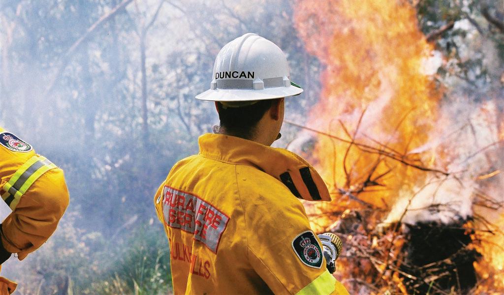
Climate Risk Hazard - Fire Weather20
Climate Risk Hazard - Sea Level Rise22
Appendices
Glossary 23
The Hills Shire Council
3 Columbia Court, Norwest NSW 2153 PO Box 7064, Norwest 2153
P +61 2 9843 0555 | E council@thehills.nsw.gov.au www.thehills.nsw.gov.au
Acknowledgment of Country
We acknowledge the Dharug people as the original custodians of the land on which The Hills Shire is located and where we conduct our business. We pay our respects to ancestors and Elders, past and present.
We also acknowledge the service and sacrifice of all veterans, past and present who have defended this Country.
Executive Summary
The Hills Shire Council is responsible for safeguarding community assets valued at approximately $5.5 billion. This portfolio includes buildings, roads, parks, land, stormwater management systems and associated infrastructure. Ensuring these assets remain resilient to current and future climate-related risks is critical to maintaining service delivery, protecting community wellbeing and supporting long-term financial sustainability.
The Hills Shire is one of the fastest growing local government areas in New South Wales. With an expected population increase of 54% by 2046, approximately 10,000 hectares of greenfield development and around 70,000 new homes will be delivered across the Shire. As the community grows, so too does Council’s exposure to climate-related risks that may impact assets, infrastructure, operations and service delivery.
In 2023, Council partnered with Statewide Mutual to undertake a Climate Risk Assessment using locally relevant climate projections and the ISO 31000 Risk Management framework. The assessment identified 27 climate-related risks across Council’s assets, operations and services. Of these, 18 were assessed as High or Medium priority and require targeted adaptation and risk treatment measures.
This Climate Risk Action Plan provides Council’s first coordinated framework for identifying, prioritising and managing climaterelated risks across the organisation. The Plan establishes a structured program of actions and objectives to strengthen governance, improve decision-making, enhance asset resilience and support the ongoing delivery of essential services to the community.
Research undertaken by CSIRO demonstrates that investment in adaptation and disaster risk reduction can deliver significant long-term benefits by reducing the impacts and costs associated with future hazard events. This Plan provides a practical pathway to build organisational resilience, reduce risk exposure and support informed investment in Council’s assets, services and operations.
Guiding Principles
The following guiding principles underpin the implementation of the Climate Risk Action Plan and will guide Council’s approach to managing climate-related risks across its assets, services and operations:
Risk Identification and Assessment
• Apply best-practice climate science and risk management methodologies to identify, assess and prioritise climate-related risks.
Governance and Decision Making
• Embed climate risk considerations into strategic, operational and financial decision-making.
Infrastructure and Asset Management
• Integrate climate risk considerations into asset planning, maintenance, renewal and investment decisions.
Land Use Planning and Development
• Promote resilient land use and development outcomes that reduce exposure to climate-related hazards.
Natural Environment and Ecosystem Resilience
• Protect and enhance natural systems that support resilience and adaptation.
Emergency Preparedness and Business Continuity
• Strengthen preparedness, response and recovery arrangements for climate-related hazards.
Climate-related hazards are creating increasing challenges for local government.
Changes in temperature, rainfall patterns, severe storm events, bushfire conditions and other climate-related hazards have the potential to affect Council assets, operations, service delivery and long-term financial sustainability.
In 2023, Council partnered with Statewide Mutual to undertake a Climate Risk Assessment using locally relevant climate projections and the ISO 31000 Risk Management framework. The assessment identified a range of climate-related risks to Council’s assets, services and operations and provided the foundation for the development of this Climate Risk Action Plan.
The purpose of this Plan is to establish a coordinated, risk-based approach to identifying, prioritising and managing climate-related risks across Council. It outlines practical actions that will strengthen organisational resilience, improve decision-making and support the ongoing delivery of services to the community.
For The Hills Shire Council this means:
• Community assets such as roads, stormwater infrastructure, buildings and recreational facilities may experience greater exposure to climate-related hazards;
• Land use planning and development decisions may need to consider changing risk profiles across the Shire;
• Operational costs associated with asset maintenance, renewal, emergency management and service delivery may increase over time; and
• Demand for some Council services may change as climate-related risks and community expectations evolve.
Understanding and planning for climate-related risks is critical to ensuring Council can continue to deliver reliable services, protect community assets and make informed long-term investment decisions.
Climate Risk and Adaptation
Climate-related risks arise from the interaction between hazards, exposure and vulnerability. For local government, these risks can affect assets, infrastructure, service delivery, operations and long-term financial sustainability.
Managing climate risk generally involves two complementary approaches:
• Mitigation focuses on reducing greenhouse gas emissions and addressing the factors that contribute to long-term changes in weather patterns and environmental conditions.
• Adaptation focuses on understanding, preparing for and responding to climate-related risks and hazards to reduce impacts and strengthen resilience.
The actions contained within the Plan are intended to reduce Council’s exposure and vulnerability to climate-related risks, improve resilience and support the continued delivery of services to the community.
MitigationAdaptation
Action to reduce emissions that cause climate change
Action to manage the risks of climate change impacts
Figure 1. Climate Risk Management Approaches: Mitigation and Adaptation
Purpose of the Climate Risk Assessment and Action Plan
The Climate Risk Assessment and Action Plan provide a structured framework for identifying, assessing and managing climate-related risks that may affect Council’s assets, operations, services and long-term financial sustainability.
The Climate Risk Assessment was undertaken to:
• Identify climate-related hazards relevant to The Hills Shire
• Assess Council’s exposure and vulnerability to those hazards
• Evaluate risks to Council assets, operations and service delivery
• Prioritise risks requiring further action and investment.
The Climate Risk Action Plan translates the findings of the assessment into practical and achievable actions.
It provides a coordinated and risk-based approach to managing climate-related risks, supporting informed decision-making and strengthening organisational resilience.
Together, the Assessment and Action Plan establish a proactive framework for reducing risk, improving preparedness and ensuring Council can continue to deliver reliable services and maintain critical infrastructure into the future.
Understanding Climate Risk
Climate risk is influenced by the interaction between hazards, exposure and vulnerability.
Hazards are climate-related events or conditions that may cause harm, such as heatwaves, flooding, bushfire and severe storms.
Exposure refers to the people, assets, infrastructure and services that may be affected by a hazard.
Vulnerability reflects how susceptible those assets, services or systems are to damage or disruption.
Climate risk can be reduced by understanding these factors and implementing actions that reduce exposure, minimise vulnerability and strengthen resilience.
Figure 2. Components of Climate Risk: Hazards, Exposure and Vulnerability Illustration of how climate risk results from the interaction of climate-related hazards with the exposure and vulnerability of assets, services, infrastructure and communities.
The Hills Shire Council Climate Risk Assessment
In 2023, The Hills Shire Council partnered with Statewide Mutual to undertake a Climate Risk Assessment to better understand how climate-related hazards may affect Council assets, operations, services and long-term planning.
The assessment was informed by locally relevant climate projections and undertaken using the ISO 31000 Risk Management framework. Climate risk scenarios were developed to assess Council’s exposure and vulnerability to a range of climate-related hazards that may impact service delivery, asset performance and organisational resilience.
The assessment considered potential impacts across a broad range of Council functions and identified risks relating to:
• Asset condition and maintenance
• Infrastructure performance and reliability
• Service delivery
• Financial sustainability
• Governance and regulatory obligations
• Workplace health and safety
• Community resilience.
The assessment identified 27 climate-related risks across five climate hazard scenarios. The results provide the evidence base for this Climate Risk Action Plan and support Council’s ongoing approach to identifying, prioritising and managing climate-related risks.
Climate Risk Scenarios
The Climate Risk Assessment identified five climate hazard scenarios relevant to The Hills Shire that were used to assess potential impacts across Council operations, assets and services. These scenarios were developed using regional climate projections and provide a basis for understanding potential future risk exposure.
Temperature
Increase in average temperature, with spring and overnight temperatures experiencing the greatest increases.
Hot days
Increase in the number of hot days, primarily during spring and summer, with hot conditions extending further into autumn.
Rainfall
Changes in seasonal rainfall patterns, including increased autumn rainfall, reduced spring rainfall and increased rainfall intensity.
Fire weather
Increase in average and severe fire weather conditions, particularly during spring and summer.
Sea level rise
Rising sea levels resulting in more frequent and permanent inundation of low-lying areas.
Climate Risk Assessment Results
The Climate Risk Assessment identified 27 climate-related risks across the five climate hazard scenarios assessed by Council. The risks were evaluated using Council’s Risk Matrix and assigned a rating based on their likelihood and consequence.
Council’s priority is to implement actions that address High and Medium risks. Of the 27 risks identified, 18 were assessed as High or Medium priority and require targeted adaptation and risk treatment measures. These priority risks form the basis of the actions and objectives outlined in this Climate Risk Action Plan.
Low risks identified through the assessment will continue to be monitored and managed through Council’s existing risk management processes and do not currently require additional adaptation actions.
The following Action Plan outlines the actions, responsibilities and implementation pathways required to strengthen organisational resilience and reduce Council’s exposure to climate-related risks over the period 2026–2030.
Scope of Actions
This Climate Risk Action Plan outlines the actions Council will undertake to address the 18 High and Medium priority risks identified through the Climate Risk Assessment.
The actions have been developed to reduce Council’s exposure and vulnerability to climaterelated risks and strengthen organisational resilience across assets, services and operations. Successful implementation will depend on ongoing collaboration across Council and the availability of resources, funding opportunities and partnerships.
The actions contained within this Plan aim to:
• Improve understanding of climate-related risks and vulnerabilities
• Strengthen governance and decision-making
• Support resilient asset planning, design and maintenance
• Enhance preparedness for climate-related hazards
• Support the continued delivery of services to the community.
The Climate Risk Action Plan adopts an adaptive management approach. Climate-related risks will continue to evolve over time, requiring ongoing assessment, planning, implementation, monitoring and review. This process supports continuous improvement and ensures Council’s response remains aligned with changing risk profiles, emerging information and organisational priorities.
Using the Action Plan
This Climate Risk Action Plan provides a practical framework for implementing climate risk treatment measures across Council. The Plan translates the findings of the Climate Risk Assessment into clear actions that support informed decision-making, strengthen organisational resilience and improve Council’s capacity to manage climate-related risks.
Actions are organised by climate hazard and linked directly to the risks identified through the Climate Risk Assessment. Each action contains specific objectives, responsible business units and indicative implementation timeframes to support accountability and coordinated delivery across the organisation.
Tier 1 – Foundational Actions
Tier 1 actions are enabling activities that establish the information, processes, governance arrangements and evidence base required to support future implementation. These actions are typically focused on assessment, planning, policy development and strategic decisionmaking.
Tier 2 – Implementation Actions
Tier 2 actions involve the application of risk treatment
measures informed by Tier 1 activities. These actions focus on improving resilience through operational improvements, infrastructure upgrades, planning controls and ongoing management practices.
Governance Monitoring and Review
Implementation of the Climate Risk Action Plan is a shared responsibility across Council, with delivery of actions assigned to relevant business units. The Sustainability Team will coordinate implementation, monitor progress and support periodic reviews.
Progress against actions and objectives will be reported through Council’s existing governance and reporting processes. The Plan will be reviewed periodically to ensure actions remain effective and responsive to emerging climate-related risks, updated information and organisational priorities.
Implementation of the Plan will be supported through integration with Council’s Risk Management Framework, Risk Appetite Statement, Integrated Planning and Reporting Framework and Asset Management planning processes.
Figure 3. Climate Risk Management Cycle
Climate Risk Action Plan Table
Climate Risk Hazard Temperature
Objectives and desired
Risk scenario 1. An increase in average temperature could lead to greater/ faster degradation of Council assets and infrastructure resulting in the need to increase maintenance levels and increased costs of operation.
Action1.1 Embed climate resilience and adaptation within long-term financial forecasts of whole lifecycle condition assessments within the Asset Management Plan, Capital Works Briefs, Maintenance Management Plan and Building Operations Maintenance Management Plan.
Objective 1.1.1 Conduct an LGA-wide climate vulnerability assessment to investigate the impacts of increasing temperatures on Council asset classes. Engage a suitably qualified consultant to undertake desktop analysis and heat mapping. Produce a list of at-risk asset classes and individual assets for discussion with asset managers and asset owners/managers for implementation into risk management planning. The results of mapping will contribute to implementation of Actions 1.2, 4.2, 5.1, 5.2.
1.1.2 Review Council’s processes to integrate increasing temperature and UV exposure risk on at-risk assets and develop risk-based approaches and resilience building designs into capital works and asset management processes, plans and briefs.
1.1.3 Develop sustainable design guidelines for council buildings, focusing on environmental performance, resilient building design, energy efficiency and compliance with relevant standards. Apply the guidelines to design, construction and refurbishment of all habitable council buildings. Should be implemented alongside universal design principles and current disability standards. Emphasise sustainability, operations, maintenance and whole-of-life cycle costs.
Action1.2 Embed climate resilience and adaptation into asset maintenance by preparing for increased temperature i.e. selecting heat-resistant materials, reflective coatings, protective sealants for joints and surfaces and structural design adjustments.
Objective 1.2.1 Develop recommendations to ensure Council’s asset maintenance and capital works processes consider the importance of using high quality, robust and durable materials that will withstand UV over a longer term.
Objectives and desired
Risk scenario 2. An increase in average temperature may cause greater energy usage at Council’s facilities resulting in increased costs to Council e.g. AC usage in libraries, cost of chlorination in pools.
Action2.1 Undertake energy audits of Council assets to find ways to reduce consumption and improve efficiency.
Objective 2.1.1 Engage a suitably qualified consultant to undertake Type 2 energy audits of highenergy-use Council assets and prepare recommendations, costs and return-oninvestment assessments.
Action2.2 Conduct upgrades as reported in audit.
Objective 2.2.1 Develop a program of works based on the Type 2 Energy Audit Report. Prioritise projects based on best ROI deliver projects through capital works program over 5-year period.
Risk scenario 3. An increase in average temperature may lead to adverse impact on vegetation in public areas/ reserves/parks resulting in increased water consumption and maintenance of impacted vegetation.
Action3.1 Embed resilience and adaptation by preparing for increased hazard and risks such as urban heat - through better management of water usage through collaboration, water reduction projects and increased usage of smart management technology.
Objective 3.1.1 Develop a water roadmap and water reduction program outlining opportunities to improve water efficiency through smart technology, partnerships and irrigation improvements.
Risk scenario 4. An increase in average temperature may have an increased impact on new released areas with small lots and narrow roads limiting ability to provide vegetation to mitigate the heat resulting in impact on Council’s reputation.
Action4.1 Embed resilience and adaptation by preparing for increased hazard and risks such as urban heat - through increasing urban tree canopy cover (includes bushland, street trees and trees on private property).
Objective 4.1.1 Implement the key actions within the Local Strategic Planning Statement’s
• 17.3 – Identify opportunities to collaborate with adjoining councils to link Green Grid corridor initiatives
• 18.1 – Identify areas vulnerable to the urban heat island effect and direct planting and education efforts to these areas
• 20.1 – Prepare a suite of information material to raise awareness of and prepare existing and future residents for environmental and urban risks and hazards.
4.1.2 Conduct a tree audit to understand current tree numbers and identify gaps where new trees can be planted. Create Masterplan that identifies areas with low canopy cover in new release areas that are at high risk of increased temperature (identified in Action 1.1).
Objective 4.1.3 Increase urban cooling outcomes in areas with limited capacity for additional tree canopy by enhancing canopy cover and vegetation within the public domain. Implement Public Domain Strategy Action 4.3.7 by increasing the use of groundcovers and understorey planting on street verges and in town centres, and incorporate shade structures and other cooling measures within strategic centre public spaces.
4.1.4
Action4.2 Embed sound governance and operational frameworks to manage new and existing developments with robust policies, plans and processes that meet community needs and expectations.
Objective 4.2.1 Conduct a review of the Development Control Plans (DCP) to include amendments within the Environment and Sustainability sections that meet the needs and expectations of the community and incorporate best practice in relation to energy and water ratings and incorporating natural elements into designs.
5. An increase in average temperature may shift the demand of recreational areas e.g. increased demand for swimming and water play facilities and shade structures resulting in potential increased cost for building/maintaining extra indoor facilities.
Action5.1 Plan for recreation and open space to meet the needs of a growing community.
Objective 5.1.1 Integrate outcomes from Action 1.1 heat mapping into the planning, design and renewal of open spaces and recreation facilities to improve resilience to increasing temperatures. Where practicable incorporate passive solar design, heat-resistant materials, and blue-green infrastructure into capital works briefs, recreation strategies and, Plans of Management.
Action5.2 Where practical and within capital works spend thresholds increase built and natural shade around recreational areas to ensure more facilities can be used. Conduct a feasibility study on delivering new indoor recreational facilities including additional aquatic centres.
Objective 5.2.1 Assess the future demand for indoor recreation and aquatic facilities to inform longterm planning and investment decisions. As part of future reviews of the Recreation Strategy and Public Domain Strategy, undertake a feasibility study to determine community need, identify suitable locations, and evaluate options for additional indoor recreation facilities and an aquatic centre in line with projected population growth.
Climate Risk Hazard
Hot Days
Objectives and desired outcomesLead
Risk scenario
6. An increase in the number of hot days may cause increased potential of heat stress incidents in staff impacting their personal health and safety and productivity.
Action6.1 Review WHS controls to include alternative tasks and in-house training ready for hot days and controls for comfort not just temperature.
Objective 6.1.1 Determine if thermal comfort assessment should be added to the Outdoor Work Environment Procedure during the next review.
Risk scenario
7. An increase in hot days may impact attendance and enjoyment by the community at Council events or at Council venues, leading to reduced community benefit.
Action7.1 Improve community resilience to shocks and stresses such as urban heat at Council events and facilities through improved access to shade and better education around heat related illness.
Objective 7.1.1 Ensure heat is considered at every event and shade is either accessible or added to protect vulnerable community groups.
7.1.2 Compile and assess climate risk and vulnerability research relevant to The Hills Shire Council, with a focus on the health and community impacts of extreme heat and heatwaves. Collaborate with the Greater Sydney Heat Taskforce to support and implement education and awareness initiatives identified within the Greater Sydney Heat Smart City Plan.
Climate Risk Hazard Rainfall
Objectives and desired outcomesLead
Risk scenario 10. There is a risk that an increase in rainfall could lead to more frequent/ severe flood events that result in damage to Council’s infrastructure.
Action10.1 Embed resilience and adaptation by preparing for increased hazard risks such as flooding through policy and planning i.e. Develop a Flood Risk Management Plan (FRMP).
Objective 10.1.1 Update the 2017 Urban Overland Flow Study (UOLFS) incorporating Climate Change in the hydrologic and hydraulic modelling.
10.1.2 Based on the results of the UOLFS, develop a Flood Risk Management Plan (FRMP) for priority urban catchments to guide long-term flood resilience strategies.
10.1.3 Update catchment-wide flood modelling for rural catchments to incorporate projected increases in rainfall intensity and frequency.
10.1.4 Prioritise flood mitigation projects in highrisk areas (e.g. downstream of declared dams).
10.1.5 Implement land use planning controls to restrict development in areas classified as high hazard areas (e.g. foreshore properties along the Hawkesbury River System).
Action10.2 Update Council’s Design Guidelines for Subdivision and Developments to factor in Climate Change in the design of minor drainage systems. Update the Council’s Flood Modelling and Stormwater Design Guidelines to factor in Climate Change in flood modelling and the design of minor drainage systems.
Objective 10.2.1 Review and Update Flood Modelling Guidelines Regularly: Establish a scheduled review cycle (e.g., every 5 years) for the Flood Modelling and Stormwater Design Guidelines to reflect the latest regional climate projections from the NSW Department of Climate Change, Energy, the Environment and Water (DCCEEW).
10.2.2 Incorporate increased rainfall intensity into the design of stormwater drainage systems for new developments and subdivisions to improve resilience. Design drainage assets with enhanced conveyance capacity to reduce the risk of overland flooding and protect road and drainage infrastructure from future climate-related impacts.
Objective 10.2.3 Capacity Building for Staff and Developers: Conduct technical workshops for Council engineers, planners, and consulting engineers on integrating climate projections into design rainfall, hydrologic modelling, and drainage sizing.
10.2.4 Implement Climate-Resilient Asset Management: Incorporate drainage climate allowances into Council’s Asset Management Plans to prioritise renewal and upsizing of undercapacity drainage assets vulnerable to future rainfall extremes.
Action10.3 Following the FRMP conduct a review of infrastructure design around water capture and determine if changes to parameters are required.
Objective 10.3.1 Consider aspects to reduce runoff impacting assets such as increasing permeable areas into the development and renewal of open space in key areas identified in action 13.1.
10.3.2 Revise Design Parameters for Stormwater Detention and Retention Systems: Future detention basins and on-site detention (OSD) systems will be designed using rainfall projections that incorporate climate change allowances (e.g., +10% to +30% rainfall intensity increases).
10.3.3 Review and Update Water Capture Design Criteria: Update Council’s Water Sensitive Urban Design (WSUD) and stormwater reuse guidelines to ensure capture systems (rainwater tanks, infiltration basins, swales) account for changing rainfall patterns and runoff variability.
10.3.4 Promote Dual-Purpose Water Capture Infrastructure: Encourage multi-benefit systems (e.g., detention basins integrated with open space or biodiversity corridors) that provide both flood mitigation and ecological value under future climate conditions.
10.3.5 Establish a Periodic Review Cycle: Review stormwater capture and detention design parameters every five years, or when new regional rainfall projection data becomes available from DCCEEW or BOM.
Risk scenario 11. An increase in rainfall intensity could cause greater impact on Council infrastructure resulting in impact to operational capacity of the asset.
Action11.1 Review all catchments within the LGA to determine if overland flow processors will impact on the operational capacity of assets.
Objective 11.1.1 Conduct detailed overland flow study of all catchments within the LGA, provide detailed maps outlining the overland flow processors and their impacts on assets and their operational capacity.
Objective 11.1.2 Use this data to update the FRMP and inform any drainage infrastructure upgrades.
and Waterways
Action11.2 Embed resilience and adaptation into asset maintenance by preparing for increased hazard risks through retrofitting and upgrading assets for future rainfall and flooding events.
Objective 11.2.1 Incorporate findings from the Flood Risk Management Plan (FRMP) and Action 13.1 into the design, upgrade and renewal of Council assets to improve resilience to increased rainfall and flooding. Implement appropriate adaptation measures, such as raising electrical infrastructure above predicted flood levels, to maintain asset functionality and operational capacity during future rainfall events.
Risk scenario 12. An increase in rainfall intensity may cause more frequent closure of infrastructure and facilities leading to impact on the community.
Action12.1 Upgrade stormwater systems and raise road profiles at low level waterway crossings below the 1% AEP (formerly 1:100 year) flood threshold to reduce the frequency of road closures due to flash flooding.
Objective 12.1.1 Conduct feasibility study on costs associated with upgrading stormwater systems and raising of roads at low level crossings.
12.1.2 Develop a Program of Incremental Road Raising Works: Stage the raising of road profiles over multiple budget cycles, beginning with crossings where recurrent closures significantly affect accessibility for residents, schools, or emergency services.
12.1.3 Review and Upsize Stormwater Capacity at Critical Crossings: Re-assess culvert and pipe capacities under climate-adjusted rainfall intensities (ARR2019 + climate allowance). Design upgrades to maintain serviceability for frequent storm events and minimise closure duration.
12.1.4 Integrate Works into Capital and Asset Management Plans: Align proposed upgrades with Council’s Long-Term Financial Plan and Asset Management Program to ensure progressive delivery and funding continuity.
12.1.5 Determine possible avenues for funding and timeframes for projects.
and
Action12.2 Conduct resilient assessments of assets to determine the feasibility of upgrades to reduce individual risks from climate hazards.
Objective 12.2.1 Conduct a desktop review of asset closure frequency related to rainfall and assess if any changes to the asset are required.
Risk scenario 13. An increase in rainfall intensity may cause asset damage that result in increase in public safety risks.
Action13.1 Embed Climate resilience and adaptation by preparing for increased hazard risks - by providing better consideration for increased rainfall events through long-term financial forecasts of whole of lifecycle condition assessments within Asset Management Plans, Maintenance Management Plan and Building Operations Maintenance Management Plan.
Objective 13.1.1 Conduct an asset vulnerability analysis that investigates the impact of rainfall intensity on specific areas within the LGA. Conduct a desktop analysis using best-practice climate science (NARCLiM) to identify high risk asset classes and create maps that are relevant to climate-risk including their metadata that will support ongoing monitoring and assessment of vulnerability across asset classes. Produce a list of at-risk areas for discussion with asset managers. (the results of mapping will contribute to implementation of Actions 1.1, 1.2, 4.2, 5.1, 5.2 and 20.1)
13.1.2 Review Council's processes to integrate the risk of rainfall intensity on assets and develop risk-based approaches and resilience building designs into capital works and asset management processes, plans and briefs. Develop recommendations to ensure Council's asset maintenance and capital works processes consider and manage impacts of increasing rainfall
13.1.3 Integrate Water Sensitive Urban Design (WSUD) measures
Action14.1 Nurture and improve the quality of waterways, working with stakeholders to conduct erosion modelling and implement water quality testing along key waterways.
Objective 14.1.1 Develop a water quality monitoring program that includes assessment of erosion and its impact on water quality. Regularly report on findings and assess if any erosion control works are needed.
Objective 14.2.1 Continue to review regulatory strategies and laws and update systems and processors as required. Ensure compliance for new developments.
and
Risk scenario 15. Changes in rainfall distribution could cause changes to the biodiversity leading to introduction of invasive species.
Action15.1 Continue to work with Stakeholders including Hawkesbury River County Council and Local Land Services to ensure better management of invasive species.
Objective 15.1.1 Continue to fund and work with Hawkesbury River County Council to manage weeds. Ensure they contain and remove high-risk plant species and conduct regular weed control within THSC LGA.
15.1.2 Improve community awareness and reporting of invasive species by providing residents with information and referral pathways to Hawkesbury River County Council and Local Land Services for the identification, reporting and management of invasive species on private land.
15.1.3 Continue community rabbit baiting program alongside Local Land Services and participate in eradication programs with LLS (dear, rabbits, foxes) on public land when required.
15.1.4 Monitor for newly emerging invasive species (fire ants, cane toads) and when required develop eradication programs in conjunction with LLS and other key collaborators.
Action15.2 Identify acceptable thresholds for potential increases in invasive plant species into natural areas and the management frameworks associated with these areas.
Objective 15.2.1 Assess the potential impacts of changing rainfall patterns on the distribution and abundance of invasive species within natural areas. Establish acceptable thresholds for invasive species based on environmental, financial and liability risks, and incorporate these thresholds and associated management approaches into the Generic Plan of Management and other relevant strategic documents during future reviews.
15.2.2 Continue to work with stakeholders to reduce and limit invasive species in our natural areas (as actioned in 15.1).
Climate Risk Hazard Fire
Weather
Objectives and desired
Risk scenario 19. There is a risk that increased fire weather days will lead to impacting public safety and private property.
Action19.1 Ensure the Bush Fire Management Zones are maintained as per the Bush Fire Risk Management Plan (BFMP) and when required conduct a review to the Asset Protection Zones to ensure these areas reduce the risk of fire weather on public safety and private property.
Objective 19.1.1 Maintain Bush Fire Management Zones in accordance with the Bush Fire Risk Management Plan (BFRMP) and relevant legislative requirements to reduce bushfire risk to public safety and property. Support the periodic review of the BFRMP by the Hills Bush Fire Management Committee in accordance with the Rural Fires Act 1997.
Risk scenario 20. There is a risk that an increase in fire weather days could increase the potential of bushfires impacting on infrastructure and assets.
Action20.1 Embed climate resilience and adaptation by preparing for increased hazards such as bushfires through long-term financial forecasts of whole of lifecycle condition assessments within Asset Management Plans, Maintenance Management Plan and Building Operations Maintenance Management Plan.
Objective 20.1.1 Conduct an LGA-wide climate vulnerability assessment to investigate the impact of bushfire threats on bushfire prone areas on Council asset classes. Engage a suitably qualified consultant to undertake desktop analysis and heat mapping. Produce a list of at-risk asset classes and individual assets for discussion with asset managers and asset owners/managers for implementation into risk management planning. The results of mapping will contribute to implementation of Actions 1.2, 4.2, 5.1, 5. 2 and 13.1).
20.1.2 Review Council's processes to integrate the risk of bushfire damage on assets and develop risk-based approaches and resilient building designs into capital works and asset management processes, plans and briefs.
20.1.3 Ensure Council’s asset maintenance and capital works processes consider new and emerging technology and design standards to reduce the impacts of bushfire risk.
21. There is a risk that an increase in fire weather days could increase the potential of bushfires impacting upon the community and local economy.
Action21.1 Improve community resilience to shocks and stresses such as bushfires through better education of the risk to public safety by working with the Rural Fire Services (RFS) on the Bush Fire Risk Mitigation and Resilience Support Program.
Partner with the NSW Rural Fire Service to deliver community education and awareness initiatives that improve bushfire preparedness and resilience. Promote the Fire Ready Challenge, Get Ready Campaign and other relevant programs to support local businesses and the community in preparing for bushfire risk.
Ensure the Bush Fire Management Zones are maintained as per the Bush Fire Risk Management Plan (BFMP) and when required conduct a review to the Asset Protection Zones to ensure these areas reduce the risk of fire weather on public safety and private property
Objective 22.1.1 Maintain Bush Fire Management Zones in accordance with the Bush Fire Risk Management Plan (BFRMP) and relevant legislative requirements to reduce bushfire risk to environmental and heritage assets. Support the periodic review of the BFRMP by the Hills Bush Fire Management Committee in accordance with the Rural Fires Act 1997 to ensure ongoing protection of environmental and heritage values.
Climate Risk Hazard
Sea Level
Objectives and desired
20262027202820292030
Risk scenario 25. An increase in sea level combined with increasing rainfall, may cause increased tidal flooding events and lead to the degradation or destruction of critical infrastructure (i.e. road) resulting in reduced access to certain parts of the rural community.
Action25.1 Continue partnership with stakeholders to complete all stages of the Hawkesbury-Nepean Coastal Management Program - under the Coastal Management Act 2016.
Objective 25.1.1 Support the progression and delivery of the Hawkesbury–Nepean Coastal Management Program in collaboration with key stakeholders. Utilise the outcomes of Stage 3 to inform the development of the draft Coastal Management Program during Stage 4, ensuring identified management actions are prioritised and implemented in accordance with the NSW Coastal Management Framework.
Stormwater Management Team 1
Glossary
Adaptation
Climate
Climate change scenario
Climate resilience
Adjustment to the actual or expected effects of climate change. Adaptation plays a key role in reducing exposure and vulnerability to climate change, and can be proactive, reactive, incremental or transformational (IPCC 2023).
The average weather that a location experiences over many years, even thousands of years. Key variables include temperature, rainfall and wind. In a wider sense is the state of the climate system (IPCC 2023).
A coherent, plausible but often simplified description of a possible future state of the climate as influenced by climate change. It is not a prediction about the future, but rather it provides a means of understanding the potential impacts of climate change (CSIRO 2016).
The capacity of systems (including social, economic, engineered, natural and ecosystems) to cope with a hazardous event, trend or disturbance. Coping means responding in ways that maintain the essential function, identity and structure of a system, as well as biodiversity in the case of ecosystems (IPCC 2022).
Exposure
Hazards
Mitigation
Natural hazards
Vulnerability
People, species and ecosystems, assets and resources in places and settings that could be adversely affected by hazards. These could include infrastructure within a flood zone, people working outside on extreme heat days (IPCC 2023).
The potential occurrence of an event (natural or human-induced) that may cause loss of life, injury or other health impacts and also damage or loss to property, environment or service provisions (IPCC 2023). Hazards include heatwaves, flooding, storms, landslides and bushfire (Resilience NSW).
Human intervention to reduce emissions or increase the amounts of greenhouse gases removed from the atmosphere through greenhouse sinks (AdaptNSW; IPCC 2023).
A natural or human-induced situation or condition that could harm people or damage property or the environment. Natural hazards include heatwaves, flooding and tidal inundation, storms such as east coast lows, landslides and bushfire (Resilience NSW).
The propensity or predisposition to be adversely affected. It encompasses a variety of concepts and elements including sensitivity or susceptibility to harm and lack of capacity to cope and adapt. Examples include floor height of buildings in flood zones and the socio-economic status of a community or person (IPCC 2023).
@thehillsshirecouncil
www.thehills.nsw.gov.au
3 Columbia Court Norwest NSW 2153 PO Box 7064, Norwest 2153
P +61 2 9843 0555
E council@thehills.nsw.gov.au
If you do not speak English and need an interpreter, contact the Translating and Interpreting Service on 131 450 and ask them to call council on 9843 0555.