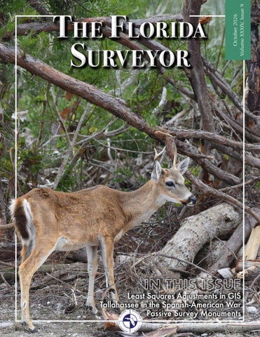
Surveyor
October 2026 Volume XXXIV, Issue 9
The Florida
IN THIS ISSUE
Least Squares Adjustments in GIS Tallahassee in the Spanish-American War Passive Survey Monuments
TABLE OF CONTENTS PRESIDENT’S Message SURVEYING CAREERS in Florida 2026-27 FSMS Officers AROUND The State “PASSIVE” Survey Monuments SUSTAINING Firms
1 2 13 19 31 35
THE U.S. NAVY COMES To Pensacola LEAST SQUARES Adjustments in GIS NGS NEWS TALLAHASSEE IN THE Spanish-American War FROM THE Archives
41 53 63 67 81
The Florida Surveyor is the official publication of the Florida Surveying and Mapping Society, also known as FSMS. It is published monthly for the purpose of communicating with the professional surveying community and related professions who are members of FSMS. Our award winning publication informs members eleven months out of the year about national, state, and district events and accomplishments, as well as articles relevant to the surveying profession. In addition, continuing educational courses are also available.
PRESIDENT’S Message October 2026 Good Morning Friends, This month's message will be a bit different than normal. I am a big fan of learning from others so heed my error. A few weeks ago I found myself in the hospital thinking I was having a heart attack. Fortunately, no heart attack and I’m doing great. After arriving at the ER and a plethora of tests, the ER doctor said my sodium chloride was dangerously low, and they need to admit me until it’s at acceptable levels. For those who know me, you know I eat a ton of quality sea salt, so how did this happen? To compound the low sodium issue I was also severely dehydrated. Below you will find symptoms and preventative measures for low sodium chloride and dehydration. These findings are AI generated and it did reference WebMD and other medical websites.
President
Brion Yancy (772) 475-7475 byancy@bowman.com
Low sodium in the blood is called hyponatremia. It means the sodium concentration is below the normal range—typically below about 135 mmol/L (mine was 128). Sodium is important for nerve function, muscle function, and maintaining the body’s fluid balance. Why low sodium can be dangerous The biggest concern is the brain. When blood sodium becomes too low, water can move into cells and cause them to swell. Brain swelling can lead to neurological symptoms and, when severe or rapid, can become life-threatening. Symptoms can include: • Headache • Nausea or vomiting The Florida Surveyor
Page 1
PRESIDENT’S Message • Fatigue or unusual drowsiness • Weakness or muscle cramps • Confusion, irritability, or restlessness • Muscle twitching • Seizures • Loss of consciousness or coma in severe cases A rapid drop is particularly dangerous. Acute hyponatremia can cause significant brain swelling, while sodium that falls gradually may produce fewer or milder symptoms. What causes it? Interestingly, low blood sodium isn’t usually simply from “not eating enough salt.” Causes can include drinking excessive amounts of water, vomiting/diarrhea, heavy sweating, certain medications, kidney/heart/liver problems, hormonal problems, and SIADH, among others. Treatment depends heavily on why the sodium is low. In some cases doctors restrict fluids; in others, IV fluids or medications may be needed. Sodium generally needs to be corrected carefully because raising it too quickly can also cause serious neurological injury. If someone with known or suspected low sodium develops confusion, repeated vomiting, a seizure, severe drowsiness, or loses consciousness, that’s an emergency and they should receive immediate medical attention. Dehydration happens when your body loses more fluid than it takes in. It can range from mild to life-threatening, especially if it becomes severe or happens quickly. What dehydration can cause • Thirst, dry mouth, and dark urine • Headache, dizziness, and weakness • Fatigue and difficulty concentrating • Muscle cramps • Fast heartbeat or breathing • Low blood pressure, which can cause fainting October 2026
Page 2
PRESIDENT’S Message • Kidney problems, including kidney injury if severe • Electrolyte abnormalities, including changes in sodium and potassium that can affect muscles, nerves, and the heart • In severe cases, confusion, extreme weakness, shock, loss of consciousness, or organ damage When it’s an emergency Seek urgent medical help if someone who may be dehydrated has confusion, fainting, inability to keep fluids down, very little/no urination, severe weakness, rapid breathing/heartbeat, or significant worsening symptoms. Dehydration and low sodium can sometimes occur together, but they don’t always. Drinking excessive amounts of plain water while dehydrated can actually make blood sodium dangerously low in some circumstances. My input on dehydration; if you tongue is sticky/dry you are dehydrated to the point you need an IV. Pinch the back of your hand, if it snaps back you are good. If it is slow to get to normal you are dehydrated. Low sodium (hyponatremia) and dehydration occurring together can be particularly concerning because they affect the body’s fluid balance, blood pressure, brain function, kidneys, and electrolytes. Why the combination is dangerous With dehydration, you lose water and often sodium and other electrolytes. If sodium falls significantly at the same time, the body can struggle to maintain adequate circulation while the brain is affected by the abnormal sodium concentration. Possible complications include: • Severe dizziness or fainting from low blood volume and blood pressure • Confusion, unusual sleepiness, or difficulty thinking • Severe headache, nausea, or vomiting • Muscle weakness, cramps, or twitching • Rapid heartbeat The Florida Surveyor
Page 3
PRESIDENT’S Message • Kidney injury from inadequate blood flow to the kidneys • Seizures or loss of consciousness when sodium becomes severely low, particularly if it falls rapidly • In extreme cases, brain swelling, shock, organ damage, or death An important complication It can be tempting to treat dehydration by drinking large amounts of plain water. If the person’s sodium is already low, excessive plain water can dilute the sodium further and make hyponatremia worse. On the other hand, simply consuming a lot of salt isn’t necessarily the right treatment either. The appropriate treatment depends on the cause and severity. Also, sodium must be corrected carefully. Raising it too quickly after significant hyponatremia can cause a serious neurological condition called osmotic demyelination syndrome. When to get emergency help If someone has known or suspected low sodium plus dehydration and develops confusion, severe drowsiness, fainting, seizure, severe weakness, repeated vomiting, inability to drink/keep fluids down, or very little/no urine, they should receive emergency medical evaluation. When dehydration and low blood sodium (hyponatremia) occur together, symptoms can overlap, and the combination can become serious. Common signs • Strong thirst or dry mouth • Dark yellow urine or urinating less often • Dizziness, especially when standing • Headache • Weakness or unusual tiredness • Nausea or vomiting • Muscle cramps or weakness • Fast heartbeat October 2026
Page 4
PRESIDENT’S Message • Feeling lightheaded or faint • Difficulty concentrating or feeling mentally “foggy” Warning signs of worsening hyponatremia These are more concerning: • Increasing confusion or disorientation • Unusual sleepiness or difficulty staying awake • Severe headache • Significant muscle weakness • Repeated vomiting • Problems walking or coordinating movements • Seizure • Loss of consciousness Confusion, seizure, loss of consciousness, or severe difficulty staying awake is an emergency—call 911. Because dehydration can also cause low blood pressure and electrolyte abnormalities, symptoms alone can’t reliably tell you how low the sodium is. A blood electrolyte panel is usually needed. Please feel free to forward this to you crews or anyone else you think may need this information. Your humble President, BRION YANCY, PSM Survey Director | BOWMAN O: (772) 283-1413 | D: (772) 678-4340 | M: (772) 475-7475 byancy@bowman.com
The Florida Surveyor
Page 5
Surveying Careers in Florida (Click Here to Learn More!) Professional Land Surveyor (PLS) Location: West Palm Beach, FL Organization: FRS & Associates Experience: 3-5 years
The Licensed Professional Land Surveyor will provide professional oversight and technical expertise for a variety of land surveying projects throughout Florida. The position requires a strong understanding of boundary surveying, surveying principles, research of public and private records, legal descriptions, survey computations, field data, and preparation and review of final survey documents. The ideal candidate will be a detail-oriented professional who can effectively manage multiple projects, communicate with clients and staff, review the work of survey crews and CAD technicians, and take professional responsibility for completed surveying work. Examples of Duties & Responsibilities: • Manage and oversee land surveying projects from initial assignment through completion. • Perform and/or review boundary, topographic, ALTA/NSPS, construction, right-of-way, and other professional surveys. • Analyze deeds, plats, easements, right-of-way documents, previous surveys, title information, and other public records to establish property boundaries. • Review and analyze field survey data, survey control, measurements, and survey computations. • Provide professional guidance and direction to survey field crews and CAD technicians. • Review field notes, sketches, survey data, calculations, drawings, and other project documentation for accuracy and completeness. • Prepare, review, and certify survey plats, maps, legal descriptions, and survey exhibits as appropriate. • Prepare and review legal descriptions for easements, rights-of-way, acquisition parcels, boundary adjustments, and other property interests. • Perform quality assurance and quality control (QA/QC) reviews of surveying and mapping projects. • Ensure projects are completed in accordance with applicable Florida laws, regulations, surveying standards, and client requirements. • Coordinate with clients, engineers, architects, contractors, attorneys, title companies, government agencies, and other professionals as required. • Assist with project scheduling, estimating, scope development, and technical proposals. • Provide technical support and guidance to field and office personnel. • Identify potential survey issues and communicate solutions to project managers and clients. • Maintain accurate and organized project records and documentation. October 2026
Page 6
Surveying Careers in Florida (Click Here to Learn More!) • Participate in fieldwork when necessary to resolve technical issues or verify survey information. Qualifications and Experience: • Current Florida Professional Land Surveyor (PLS) License. • Demonstrated professional experience in land surveying. • Strong knowledge of boundary surveying principles and practices. • Experience interpreting deeds, plats, easements, rights-of-way, title information, and other property records. • Experience preparing and reviewing legal descriptions and survey exhibits. • Ability to review field data, survey computations, drawings, and final surveys. • Strong written and verbal communication skills. • Strong organizational skills and attention to detail. • Ability to manage multiple projects and meet established deadlines. • Ability to work independently and effectively with field and office personnel.
Land Surveyor — Party Chief Location: West Palm Beach, FL Organization: FRS & Associates Education: High School / GED Salary: $30 per hour
The Land Surveyor – Party Chief will perform a variety of technical and skilled surveying duties in the field, including: • Lead and supervise field survey crews in the completion of land surveying projects. • Operate and maintain modern surveying equipment, including Trimble GPS, robotic total stations, and digital levels. • Perform field measurements and collect accurate survey data. • Prepare thorough and accurate field notes, sketches, and reports in accordance with company procedures and industry standards. • Review field data for completeness and accuracy. • Communicate effectively with project managers, office personnel, clients, contractors, and other field personnel. • Complete and submit accurate daily timesheets for the crew. • Promote and maintain a safe, professional, and productive work environment. The position may involve a variety of surveying assignments, including: • Construction Staking. • Topographic Surveys. • Boundary Surveys. • ALTA/NSPS Land Title Surveys. The Florida Surveyor
Page 7
• Hydrographic Surveys. • Construction and development projects. • Other general land surveying assignments. This position requires working outdoors and the ability to perform physically demanding fieldwork in a variety of environments and weather conditions. Candidates must be physically capable of: • Working for extended periods in hot and humid conditions. • Working around heavy construction equipment. • Walking and working on steep or uneven terrain. • Working in and around open trenches and canals. • Performing fieldwork from boats when required. • Operating or riding ATVs as necessary to access project sites. • Performing other physical activities associated with land surveying and field operations. Minimum Qualifications: • Experience with Trimble surveying equipment. • Experience with AutoCAD. • Proficiency with Microsoft Office and related computer applications. • Previous experience as a Party Chief or Crew Chief. • Experience leading or working as part of a professional survey crew. • Ability to operate surveying equipment safely and accurately. • Strong communication and organizational skills. • Ability to work independently and as part of a team. • Dependable work ethic and professional attitude. • Valid driver's license. • Ability to successfully complete a pre-employment drug screening.
AutoCAD Technician
Location: West Palm Beach, FL Organization: FRS & Associates Experience: 3-5 years Education: High School / GED Salary: $30 per hour Description and Nature of Work: • Prepare detailed survey and construction drawings using AutoCAD Civil 3D for land development and surveying projects. • Prepare subdivision maps, ALTA/NSPS Land Title Surveys, topographic surveys, asbuilt surveys, DTM models, and other survey-related maps and exhibits. • Create and maintain 3D CAD models and digital terrain models (DTMs). • Utilize advanced AutoCAD Civil 3D tools and techniques to develop working models and construction documents. October 2026
Page 8
Surveying Careers in Florida (Click Here to Learn More!) • Interpret field crew data files, survey points, field sketches, photographs, reference maps, deeds, plats, and other source information to create accurate survey base drawings. • Perform research through county, municipal, and other public records for deeds, easements, right-of-way information, plats, and other property records. • Prepare legal descriptions and exhibits for rights-of-way, easements, acquisitions, and related surveying projects. • Prepare topographic surveys, survey exhibits, corner records, and records of surveys. • Perform quality assurance and quality control (QA/QC) reviews of work prepared by you and others. • Provide technical feedback regarding field data to supervisors and survey field crews. • Assist with deed mosaics, right-of-way mapping, road alignments, and right-of-way geometry. • Communicate effectively with clients, project managers, supervisors, field crews, and other staff. • Maintain organized digital and hard-copy project files and documentation. Examples of Duties: • Apply current FRS & Associates CAD standards to all assigned projects. • Utilize AutoCAD Civil 3D and other applicable CAD software to upload and download survey data. • Work with survey control and field data, including raw data reduction, traverse adjustments/reductions, level-run reductions, and related survey computations. • Create existing-conditions survey plans, including development of DTM surfaces and appropriate labeling. • Review and interpret survey field data and communicate discrepancies or questions to the appropriate supervisor or field crew. • Perform property and public-record research. • Research and plot deeds, plats, surveys, easements, right-of-way documents, & property records. • Assist with preparation of deed mosaics and right-of-way mapping. • Plot and label road alignments, right-of-way lines, and associated geometry. • Maintain accurate and organized electronic and hard-copy project files. • Correspond professionally with clients and FRS & Associates staff. Knowledge, Skills and Abilities: • Previous experience working in the land surveying industry. • Experience with AutoCAD Civil 3D. • Experience preparing ALTA/NSPS Land Title Surveys. • Experience preparing boundary and topographic surveys. • Experience creating DTM surfaces and 3D survey models. • Experience preparing legal descriptions and survey exhibits. The Florida Surveyor
Page 9
• • • • •
Experience with corner records and records of surveys. Experience with MicroStation V8i. Experience with survey data collection, reductions, and processing. Familiarity with Trimble survey equipment and field data. Experience with Florida surveying standards, procedures, and public.
Minimum Qualifications: • Previous experience working in the land surveying industry. • Strong working knowledge of AutoCAD. • Ability to interpret survey field data and prepare accurate survey drawings. • Working knowledge of surveying principles related to boundary and topographic surveys. • Strong attention to detail and accuracy. • Ability to work independently while also working effectively as part of a team. • Good written and verbal communication skills. • Strong organizational and time-management skills. How to Apply / Contact: FRS & Associates (561) 662-8023 send resume to: bonny@frssurvey.com
Surveying Careers in Florida (Click Here to Learn More!) Assistant Professor of Geomatics – Cadastral Principles – Land Title, Boundaries, & Surveys Location: Gainesville, FL Organization: University of Florida Education Requirement: PhD
This is a 9 month tenure-accruing position that will be 60% teaching (College of Agricultural and Life Sciences) and 40% extension (Florida Cooperative Extension Service), available in the School of Forest Fisheries and Geomatics Sciences, Institute of Food and Agricultural Sciences, at the University of Florida. This assignment may change in accordance with the needs of the unit. Tenure will accrue in the School of Forest, Fisheries, and Geomatics Sciences (SFFGS). The faculty member will seek contract and grant funding actively to support their program. Teaching duties will include designing and delivering undergraduate and graduate courses such as Cadastral Principles, Surveying and Mapping Practice, and Geodetic Surveying for Land Management. Instruction will combine classroom teaching with field components that use boundary‑surveying techniques, parcel datasets, and the legal aspects of land administration. In addition, the professor will mentor students, supervise capstone projects and graduate theses, and support career development for those pursuing surveying or land‑administration pathways. Ongoing contributions will include curriculum innovation, development of distance‑education modules, and interdisciplinary teaching across the School of Forest, Fisheries, and Geomatics Sciences. Extension duties will include creating and leading a statewide Extension program focused on cadastral systems, land tenure, and surveying geospatial infrastructure. This effort will involve delivering workshops, short courses, and hands‑on training to local government agencies and private‑sector stakeholders. The faculty will collaborate and support ongoing surveying workforce development efforts. The faculty will produce Extension publications, technical guides, and policy briefs, and provide technical expertise to initiatives such as map archiving and workforce‑development projects. Securing extramural funding to sustain and expand Extension activities will also be a core responsibility. The faculty will actively participate in departmental governance, contribute to curriculum review and accreditation efforts, and engage with professional organizations such as the Florida Surveying and Mapping Society (FSMS) and the International Federation of Surveyors (FIG). Collaboration will extend across UF/IFAS units and with external partners to promote interdisciplinary initiatives and support statewide Extension programs. Individuals wishing to apply should go online to Careers at UF (Link to Job No. 540843)
The Florida Surveyor
Page 11
2026-27 FSMS Officers The Florida Surveyor
President-Elect
Earl Soeder (954) 818-2610 earl.soeder@ duncan-parnell.com
Vice President
Eddie Suarez (786) 865-3172 esuarez@longitudefl.com
Secretary
Nicholas DiGruttolo (352) 328-4025 ndigrutt@gmail.com
Treasurer
Bon Dewitt (352) 682-6007 bon@ufl.edu
Immediate Past President
Robert N. Johnson (772) 562-4191 rjohnson@ljasurvey.com Page 13
2026-27 Districts and Directors District 1 - Northwest Bay, Calhoun, Escambia, Franklin, Gadsden, Gulf, Holmes, Jackson, Jefferson, Leon, Liberty, Madison, Okaloosa, Santa Rosa, Taylor, Wakulla, Walton, Washington
Chad Thurner (850) 200-2441 chad.thurner@sam.biz
Angela Bailey (850) 559-5039 bailey.angelakay@gmail. com
District 2 - Northeast Alachua, Baker, Bradford, Clay, Columbia, Dixie, Duval, Gilchrist, Hamilton, Lafayette, Levy, Marion, Nassau, Putnam, Suwannee, St. Johns, Union
Pablo Ferrari (904) 219-4054 pferrari@drmp.com
Hal Peters (352) 304-9534 halpeters@yahoo. com
District 3 - East Central Brevard, Flagler, Indian River, Lake, Okeechobee, Orange, Osceola, Seminole, Martin, St. Lucie, Volusia
Howard Ehmke (772) 206-4650 howard.ehmke @bowman.com
Al Quickel (352) 552-3756 alq.fsms@gmail.com
District 4 - West Central Citrus, Hernando, Hillsborough, Pasco, Pinellas, Polk, Sumter
Scott Vannetta (352) 796-9423 ext. 1031 svannetta@coastalengineering.com
Tim Morris (813) 506-4015 tmorris@civilsurv.com
1
2 4 3 5
6 7
District 5 - Southwest Charlotte, Collier, DeSoto, Glades, Hardee, Hendry, Highlands, Lee, Manatee, Sarasota
Stephen Shawles (239) 481-1331 sshawles@ haleyward.com
Shane Christy (941) 840-2809 schristy@georgefyoung.com
District 6 - Southeast Broward, Palm Beach
Kevin Beck (561) 229-0239 kbeckpsm@comcast.net
John Liptak (786) 547-6340 johnliptak@icloud. com
District 7 - South Miami-Dade, Monroe
Manny Vera, Jr. (305) 221-6210 mverajr@mgvera.com
Jose Sanfiel (305) 375-2657 psm5636@gmail.com
NSPS Director Russell Hyatt (941) 812-6460 russell@hyattsurvey.com
YSN Director Justin Thomas (352) 222-9561 jthomas88@ufl.edu
2026-27 Chapter Presidents District 1
District 2
District 3
Panhandle
FL Crown
Central FL
David Lee dlee@baskervilledonovan. com
Brandon Robbins brndrbbns@netscape.net
Gulf Coast
Chris McLaughlin cmclaughlin@cfb-inc.com
Jonathan Gibson jgibson0102@gmail.com
Chipola
Jesse Snelgrove jsnelgrove@ snelgrovesurveying.com
Northwest FL
Pam Nobles pam@dddsinc.com
District 4 Ridge
Jeff Ammerman jammermann@ chastainskillman.com
Tampa Bay
John Beland jbeland@mckimcreed.com
North Central FL
UF Geomatics
Reese Veerkamp r.veerkamp@ufl.edu
Tim Jaskiewicz tjaskiewicz@ southeasternsurveying.com
Indian River
Jet Martel jmartel@martin.fl.us
Volusia
Anthony Sanzone tsanzone1@gmail.com
District 5
District 6
Charlotte Harbor
Broward
Derek Miller millersurveying@comcast.net
Collier-Lee
Jeff Stouten jeff@planrightsurvey.com
Manasota
Collin Naaman cnaaman@ brittsurveying.com
Benjamin Hoyle benjamin.hoyle@kci.com
Palm Beach
Tom Whidden tom@whiddensurveying.com
FAU Geomatics
Rene Garza rgarza2023@fau.edu
District 7 Miami-Dade
Eddie Suarez esuarez@longitudefl.com The Florida Surveyor
Page 15
2026-27 Committees Standing Committees
Nominating Committee
Earl Soder
Membership Committee
Shane Christy
Finance Committee
Bon Dewitt
Ethics Committee
Nick DiGruttolo
Education Committee Constitution & Resolution Advisory Committee
Angela Bailey Pablo Ferrari
Annual Meeting Committee
Eddie Suarez
Legal & Legislative Committee
Jack Breed
Surveying & Mapping Council
Randy Tompkins
Strategic Planning Committee
Earl Soder
Executive Committee
Brion Yancy
Special Committees Equipment Theft
Rick Pryce
Awards Committee
Bob Johnson
UF Alumni Recruiting Committee
Russell Hyatt
Professional Practice Committee Workforce Development Committee
Lou Campanile, Jr. Lou Campanile, Jr.
CST Program FDACS BPSM
Alex Jenkins Don Elder
Liaisons
Surveyors in Government
Richard Allen
Academic Advisory
Justin Thomas UF / Earl Soeder FAU
FES
Lou Campanile, Jr.
Practice Sections Geospatial Users Group
Richard Allen
Young Surveyors Network
Mary Voor
Women Surveyors of FL (WSFL)
Angela Bailey
The Florida Surveyor
Page 17
H.O. Peters Surveyor of the Year Award Robert (Bob) Johnson Jim Bennett Board Member of the Year Award Angela Bailey Life Member Recipient Howard Ehmke Fellow Member Recipients Pablo Ferrari & Harold (Hal) Peters Committee Chair of the Year Award Brion Yancy Young Surveyor of the Year Award Marla Moore Associate of the Year Award Cheryll Mock Professional Excellence Award Dr. Youssef Kaddoura Perry C. McGriff Outstanding Civic Contribution Award Katie Britt Steven Woods Exceptional Service Award Nicholas Campanile Chapter President of the Year Award Johnny Beland - Tampa Bay Small Chapter of the Year Award Indian River Large Chapter of the Year Award Manasota
A
round the State
Manasota Chapter Surveyors from Pam Hyatt October meeting at the Stantec office included a 1 hour CEU course on GPS from Duncan-Parnell. Very informative! We had 16 in attendance. Next meeting Nov. 4th.
The Florida Surveyor
Page 19
Florida Young Surveyors Network We had such a blast kicking off the football season with the University of Florida Geomatics Student Association at our joint tailgate for the UF vs. FAU game! We’d like to send a huge thank you to KEITH for sponsoring our event and helping to make it such a success. It was great to see everyone who stopped by for some food, games, and lots of fun!
October 2026
Page 20
Jonathan Nobles, PSM – Vice President of FL YSN The Florida Young Surveyors Network keeps making meaningful strides. This week I had the honor of taking part in our first inter-chapter event with the Alabama YSN. Alongside Matthew Herrell and Rick Armond, we presented the benefits of joining YSN to Troy University Geospatial Informatics Department students. Thanks to Matt for organizing and including FL YSN in this event, Dr. Ramroop for hosting us, and McKim & Creed, Inc. for supporting my time to take part in efforts like this that keep young surveyors engaged!
The Florida Surveyor
Page 21
GPI Geospatial, Inc. Congratulations to Hal Peters on being honored as a Fellow Member of Florida Surveying and Mapping Society! We are incredibly proud of this well-deserved recognition and grateful to have such a respected leader on our team. This achievement is especially meaningful as it continues a remarkable family legacy. In 1955, Hal's grandfather, H.O. Peters, helped establish FSMS and served as the organization's founding president, helping shape its role and influence within the surveying and mapping profession. Twenty years later, he was recognized as a Fellow Member of FSMS in 1975. Congratulations, Hal, on carrying forward a tradition of leadership, service, and excellence in the surveying and mapping industry!
October 2026
Page 22
Dr. Youssef Kaddoura Yesterday - 9/24/2026, I had the pleasure of welcoming Nick Campanile from WGI Geospatial and his wife Cathy Campanile from Florida Surveying and Mapping Society, and Alex Jenkins, PSM from Southeastern Surveying and Mapping Corp. to the UF Geomatics program - University of Florida School of Forest, Fisheries, and Geomatics Sciences at UF IFAS Mid-Florida Research and Education Center for a productive discussion on future collaboration. Our conversation revealed a powerful alignment around a service‑oriented mindset, a commitment to empowering the next generation through education, hands‑on experience, and streamlined licensure pathways. I am energized by this momentum and look forward to translating these promising ideas into concrete initiatives.
The Florida Surveyor
Page 23
Katie Britt, UF Assistant Director for Geomatics Extension and Earl Soeder, PSM and FSMS President-Elect at the Central Florida GIS Expo in Orlando, Florida.
October 2026
Page 24
Florida Young Surveyors Network Last week for our September meeting we hosted guest speaker, Daniel Whittaker, to discuss working along the Township line. During the meeting Daniel discussed the importance of having a proper base before you start a project. This involves considering all of the evidence when deciding what information to hold and how this can greatly impact surveying work years down the line. We truly appreciate Daniel's dedication to educating young surveyors and wanting to share his experiences with us. Thank you to everyone who attended the meeting, we look forward to seeing you at the next one!
Central Florida Chapter What an incredible September (9/22/2026) meeting with the Central Florida Chapter! The energy was truly inspiring — from the lively networking conversations to the thoughtful discussions and insightful reports shared by our members. Moments like these remind us why this community is so special. Thank you to everyone who attended and contributed to making this such a memorable and productive gathering. Already looking forward to our next chapter meeting! We truly appreciate your time and your continued impact across our profession. A sincere thank you as well to everyone who participated and contributed. Special recognition to the Florida Surveying and Mapping Society FSMS Central Florida Chapter FSMS Officers and Associate Directors for their dedication and leadership in organizing this event: Tim Jaskiewicz President, Ralph A. Nieto - Vice President, Alex Jenkins, PSM President Elect, Marco Krieger - Secretary, Betty Morris, GISP - Treasurer, Allen Quickel, PSM - District 3 Director, Bill Rowe - Director, Chris LaBerge, PSM - Director, Christy Graves Director, John Gray - Associate Director, Dr. Youssef Omar Kaddoura - Associate Director, Colton Locklin - Associate Director, Kenneth Dell SIT Associate Director, Richard Allen, PSM, CFM - Scholarship/ Recruiting/Valencia, Dolly Carwile, PSM - Webmaster.
Congratulations to Mihajlo Grkovic from University of Florida School of Forest, Fisheries, and Geomatics Sciences on receiving the Central Florida Chapter FSMS Scholarship Award! It was a proud moment at our September 2026 chapter meeting as our Chapter President Tim Jaskiewicz presented Mick with this well-deserved recognition. This scholarship reflects our chapter's commitment to investing in the next generation of surveying and geomatics professionals. To all students out there — we encourage you to submit your applications for our upcoming scholarship opportunities. This could be you! A heartfelt thank you to our members and leadership for making initiatives like this possible and for continuing to strengthen our profession from the ground up.
Andrew Beckwith, SIT, CST I Thank you to everyone who joined us at Florida Atlantic University FAU College of Engineering & Computer Science Engineering East building for another successful Florida Surveying and Mapping Society Palm Beach Chapter gathering! A big thank-you to Clyde Mason, PSM of Ritzel-Mason, for his presentation, Starting and Running a Small Survey Business. His insights and real-world experience gave attendees plenty to think about, and everyone earned 1 CEC for attending. Guests also enjoyed a beef and chicken taco bar, while networking with fellow surveyors and mappers. Thanks to our speaker, our attendees, and FAU for hosting. We look forward to seeing you at the next meeting! Pictured: Avirom & Associates, Inc, Ray Alexandrich, Deris Bardales P.E., P.S.M., Kevin Beck, PSM, Frank Carvalho, John Doogan, Luis Gaztambide, Reggie Harris, Scott Langford, Joshua Lee PSM, Bryan Merritt, LS PSM, Earl Soeder, Kelly Stout, Hongbo Su, Yovani Valdes, Hudson Wharton, Arbi Shehu PhD, PSM, PMP, GISP, Erin LeGros, Maria Barboza, David Myers, Reyad Mammadov, Thomas Pancoast, Stefan Hagens, Saul Brand, PSM, Presler Jean, Caulfield & Wheeler, Inc. (CWI), DRMP, Duncan-Parnell Inc.
The Florida Surveyor
Page 29
Yovani Valdes Honored to share that I was awarded the Carl Miller Scholarship at the Florida Surveying and Mapping Society (FSMS) event this past Tuesday! A huge thank you to Kelly Stout , Andrew L. Beckwith, SIT, CST I , Hongbo Su , and the entire community at Florida Surveying and Mapping Society for your incredible support, mentorship, and continuous investment in students entering the surveying and mapping industry. Scholarships like this make a significant impact on our education and inspire us to keep pushing the industry forward. Special thanks as well to Clyde Mason from Ritzel-Mason for his incredibly informative presentation on how to own and operate a surveying company. The practical insights and advice you shared were invaluable as we look toward our future careers! Excited for what lies ahead and proud to be part of such a supportive professional community!
October 2026
Page 30
“Passive” Survey Monuments Richard D. Pryce, RLS/PSM Survey monuments, in today’s Global Navigation Satellite System (GNSS) world, both horizontal and vertical have taken on the role of being either “Active” as in a COR station, or “Passive” as in all other monuments that are not continuously being recorded. The term “passive” by definition means, inactive, idle, inert, not continuously useful, and by that view alone, this is a true statement. However, if we look at it from Surveyors perspective, I will argue, that they are anything but passive. The work that went into their special place on the ground was significant and included a variety of the following: research, calculations, field work, astronomic observations, creating the monument itself, stamping the disk, setting the monument and references, documenting for future reference, and then finally using the monument for its intended purpose. All of the work that went into that monument before it was even in the ground, in my opinion makes it anything but passive. Sure, you might argue that if it’s not continuously being used, then what else would you call it? My thoughts are “Monument in waiting” Waiting to be found for its intended purpose: for a PLSS corner, a boundary corner of a plat/lot/parcel for sale, a control point for geodetic work, a right-of-way corner, a geodetic/tidal benchmark, or even a semi-permanent monument for aerial control work on an annual basis. The point is that it represents something of significance that took time and effort to place it specifically where it is and that those who set it took the time to document it for the future. The effort taken to set it specifically at a defined point on earth and make it semi-permanent makes it more than passive. In the past 7-8 years, the interest in “passive marks” across the US really came to the forefront from NGS putting out a call for “GPS on Benchmarks” program with the idea of using it to establish a more accurate Geoid model for the new Datum. This was a call for help on the local and state levels to find as many of the older NGS horizontal and vertical control monuments as possible, occupy them with GPS for a minimum of four to eight hours each, document it, and publish them in OPUS share. Individual Surveyors and Survey Societies across the country took this call seriously and went to work on the what I would call as one of the most important and impressive survey collaboration projects that has ever been done since the original township surveys in America. In Florida alone, the individual surveyors, companies, county and state agencies did an unbelievable job finding thousands of marks and accomplishing something truly remarkable. Even though we didn’t get all of the 52 thousand marks that NGS requested we did a fantastic job. This project alone shows the importance of so-called “Passive” survey monuments and why I think they are anything but “Passive”.
The Florida Surveyor
Page 31
Florida Department of Environmental Protection
National Geodetic Survey OPUS Share Map
October 2026
Page 32
Opus shared monument. “Waldrup”
The Florida Surveyor
Page 33
2026 Sustaining 3D Surveying 850-480-0317
Allen Engineering 321-783-7443
30 South Surveying 863-800-3539
American Government Services Corporation 813-933-3322
4M Surveying & Mapping Services, American Inc. Surveying, Inc. 321-210-0446 813-234-0103
A AA Surface Pro, Inc. 239-471-2668 Accuright Surveys of Orlando 407-894-6314 AIM Engineering & Surveying 239-332-4569 Allen & Company, LLC 407-654-5355
The Florida Surveyor
Amerritt, Inc. 813-221-5200 AOI (Area of Interest) Solutions, Inc. 321-877-0056 Arcengine Technologies LLC 1-702-602-5093 Arc Surveying & Mapping, Inc. 904-384-8377 Ardurra 239-292-7773
Associated Land Surveying & Mapping, Inc. 407-869-5002 Atlantic Drafting & Surveying, Inc. 386-264-8490 ATWELL, LLC 866-850-4200 Avirom & Associates, Inc. 561-392-2594
B
BBLS Surveyors, Inc. 239-597-1315 Bello & Bello Land Surveying Corporation 305-251-9606 Bennett-Panfil, Inc. 941-497-1290 BGE, Inc. 561-485-0824 Boatwright Land Surveyors, Inc. 904-241-8550 Bock & Clark Corporation(NV5) 330-665-4821
Barnes, Ferland and Associates, Inc. Bowman 407-896-8608 Consulting Group 703-454-1000 Barraco & Associates, Inc. 239-461-3170 Bartram Trail Surveying, Inc. 904-284-2224
Braden Land Surveying 727-224-8758
Page 35
Firms Directory Bradshaw-Niles & Associates, Inc. 904-829-2591
Caulfield & Wheeler 561-392-1991
Control Point Associates, Inc. 954-763-7611
Brown & Phillips, Inc. 561-615-3988
CivilSurv Design Group, Inc. 863-646-4771
Cousins Surveyors & Associates, Inc. 954-689-7766
BSE Consultants, Inc. 321-725-3674
Clary & Associates, Inc. 904-260-2703
CPH Consulting, LLC 407-322-6841
Buchanan & Harper, Inc. 850-763-7427
Clements Surveying, Inc. 941-729-6690
Craven-Thompson & Associates, Inc. 954-739-6400
Clymer Farner Barley Surveying, LLC 352-748-3126
D
C Calvin, Giordano & Associates, Inc. 954-921-7781 Carnahan, Proctor & Cross, Inc. 407-960-5980 Carter Associates, Inc. 772-562-4191
October 2026
Coastal Engineering Associates, Inc. 352-796-9423 Colliers Engineering & Design 732-383-1950
Dewberry 407-843-5120 Digital E. Consulting 786-465-7434 Donald W. McIntosh Associates, Inc. 407-644-4068 Donoghue Construction Layout, LLC. 321-248-7979 Douglass, Leavy & Associates, Inc. 954-344-7994
DCCM (Design, Consulting, DRMP, Inc. Construction 833-811-3767 Management. 713-874-9162 DSW Surveying & Mapping, PLC. DeGrove 352-735-3796 Surveyors, Inc. 904-722-0400 Duncan-Parnell, Inc. Dennis J. Leavy 800-849-7708 & Associates 561-753-0650 Durden Surveying and Mapping, Inc. 904-853-6822
Page 36
2026 Sustaining E ECHO UES, Inc. 888-778-3246 Eda Consultants, Inc. 352-373-3541 Eiland & Associates, Inc. 904-272-1000 Element Engineering Group, LLC. 813-386-2101 Engenuity Group, Inc. 561-655-1151 ER Brownell & Associates, Inc. 305-860-3866
ETM Suryeying & Mapping 904-642-8550 Exacta Land Surveyors, Inc. 866-735-1916
F
Florida Engineering & Surveying, LLC. 941-485-3100 FLT Geosystems 954-763-5300 Ford, Armenteros & Fernandez, Inc. 305-477-6472
Ferguson Land Surveyors 727-230-9606
Formtech Land Surveying Inc. 786-429-3034
First Choice Surveying, Inc. 407-951-3425
Fortin, Leavey, Skiles, Inc. 305-653-4493
Florabama Geospatial Solutions LLC 850-480-7467
Frontier Precision Unmanned 701-222-2030
Florida Design Consultants, Inc. 727-849-7588
F.R.S. & Associates, Inc. 561-478-7178
G GCY, Inc. 772-286-8083 GeoData Consultants, Inc 407-732-6965 Geoline Surveying 386-418-0500 Geo Networking, Inc. 407-549-5075 GeoPoint Surveying, Inc. 813-248-8888 George F. Young 727-822-4317 Germaine Surveying, Inc. 863-385-6856 GISurv, LLC 954-651-5942
The Florida Surveyor
Page 37
Firms Directory GPI Geospatial, Inc. 407-851-7880 Gustin, Cothern & Tucker, Inc. 850-678-5141
H Haley Ward 207-989-4824 Hanson Professional Services, Inc. 217-788-2450 Hanson, Walter & Associates, Inc. 407-847-9433 H.L. Bennett & Associates, Inc. 863-675-8882 HUB International 850-386-1111 Hyatt Survey Services 941-748-4693
October 2026
I Ibarra Land Surveyors 305-262-0400 I.F. Rooks & Associates, LLC. 813-752-2113
Kendrick Land Surveying, LLC 863-533-4874
Leading Edge Land Services, Inc. 407-351-6730
KPM Franklin (407) 410-8624
Leiter Perez & Associates, Inc. 305-652-5133
Kugelmann Land Surveying Inc. 321-459-0930
L
J JAVAD 408-770-1770 Johnston's Surveying, Inc. 407-847-2179
K KCI Technologies 954-776-1616 Keith and Associates, Inc. 954-788-3400
Landmark Engineering & Surveying Corporation 813-621-7841 Land Precision Corporation 727-796-2737 Langan Engineering and Environmental Services, Inc. 973-560-4900
Lengemann Corp. 800-342-9238 LJA Surveying 713-953-5200 Longitude Surveyors, LLC 305-463-0912 Long Surveying, Inc. 407-330-9717 Lynx Surveyors & Engineering 833-721-2907
Page 38
2026 Sustaining M
N
Manuel G. Vera & Associates, Inc. 305-221-6210
Navigation Electronics, Inc. 337-237-1413
Maptech, Inc. 601-664-1666
Northwest Surveying, Inc. 813-889-9236
Massey-Richards Surveying & Mapping, LLC. 305-853-0066
O
Masteller, Moler & Taylor, Inc. 772-564-8050
On The Mark Surveying, LLC. 321-626-6376
McKim & Creed, Inc. 919-233-8091
OTZ Consulting Group 305-781-4034
Moore Bass Consulting, Inc. 850-222-5678 Morris-Depew Associates, Inc. 239-337-3993 Murphy’s Land Surveying 727-347-8740
The Florida Surveyor
P PAPE-DAWSON 210-375-9000 PEC Surveying & Mapping, LLC 407-542-4967
Pennoni Associates, Inc. 863-594-2007
Pulice Land Surveyors, Inc. 954-572-1777
Perret and Associates, Inc 904-805-0030
Q
Pickett & Associates, Inc. 863-533-9095
Qfactor LLC 805-459-4047
Plan Right Surveying, Inc. 239-276-2861 Platinum Surveying & Mapping, LLC. 863-904-4699 Point Break Surveying 941-378-4797 Polaris Associates, Inc. 727-461-6113 Porter Geographical Positioning & Surveying, Inc. 863-853-1496
Q Grady Minor & Associates, PA 239-947-1144
R Reece & Associates, Inc. 305-872-1348 Rhodes & Rhodes Land Surveying, Inc. 239-405-8166 Richard P. Clarson & Associates, Inc. 904-396-2623 River City Surveying & Mapping, LLC 904-675-9300
Page 39
Firms Directory R.M. Barrineau & Associates, Inc. 352-622-3133 Robayna and Associates, Inc. 305-823-9316
Stoner Inc. 954-585-0997 Suarez Surveying & Mapping, Inc. 305-596-1799
Survey Data Solutions, LLC Rutherford Engineering Group 352-816-4084 850-387-4994 SurvTech Solutions, Inc. 813-621-4929
S
SAM Surveying & Mapping, LLC. 850-385-1179 Settimio Consulting Services, Inc. 850-341-0507
T
UF/IFAS School of Forest, Fisheries, and Geomatics Sciences 352-846-0850
T2 UES Inc. 407-587-0603
Wilco Electrical LLC 877-945-2655
Upham, Inc. 386-672-9515
Winnigham & Fradley 954-771-7440
V
Woolpert, Inc. 800-414-1045
Voler Group 407-681-3836
Tectonic Engineering and Surveying Sexton Engineering Consultants Associates, Inc. 845-534-5959 561-792-3122 Thurman Southeastern Roddenberry Surveying & & Associates Mapping Corp. 850-962-2538 407-292-8580 TopoDOT 407-248-0160
October 2026
U
Whidden Surveying & Mapping, Inc. 561-790-5515
W
Z ZNS Engineering, LLC. 941-748-8080
Wade Surveying, Inc. 352-753-6511 Wantman Group, Inc.(WGI) 561-687-2220 WBQ Design & Engineering, Inc. 407-839-4300
Page 40
THE UNITED STATES NAVY COMES TO PENSACOLA by George F. Pearce*
T
HE PRESENCE of the navy has been a factor in the history of Pensacola almost since the moment that Florida became an American possession in 1821. The action by Congress in 1825 of selecting Pensacola as the location for a navy yard put Secretary of the Navy Samuel L. Southard, and ultimately the commissioners whom he appointed to determine the site for that establishment, in an unenviable position. Acting under pressure from Congress, the secretary ordered the commissioners to Pensacola before a study by the government to ascertain the most suitable location for a navy yard on the Gulf of Mexico had been completed. Thus, they, like Congress earlier when it chose the location, had little professional advice to guide them in their selection of the site. For that matter, it was subsequently learned, there was no suitable place in Pensacola Bay for a navy yard; the primary function of which was to build and repair ships. Indeed, its lack of natural advantages even precluded the fulfillment of the limited criteria Secretary Southard established to guide the commissioners in making their selection.1 Even so, in the long run, the site selected under conditions laying stress on
*
Mr. Pearce is associate professor of history, University of West Florida, Pensacola.
1. Two subsequent reports accurately described the natural obstacles which would preclude the establishment of a successful navy yard in Pensacola. In a report to Secretary of the Navy John Branch in July 1829, Navy Commissioner John Rodgers suggested that before additional improvments be made at the Pensacola yard both he and President Andrew Jackson should further investigate the yard's capacity to protect American commerce and suppress piracy in the Gulf of Mexico and the West Indies. Among other things, Rodgers pointed out "the difficulty of ingress and egress at all times; the sterility of the soil in the vicinity of the yard and for forty miles in every direction [it could never suppor a large population]; the impossibility of preserving salted provisions and bread for any great length of time; and more particularly the high prices of labor and provisions, and the uncertainty and difficulty of obtaining mechanics and laborers from time to time, as the exigencies and nature of the service to be performed may render expedient." If the President and secretary considered these circumstances, Rodgers concluded, they would "perceive that Pensacola, as a naval station, neither possesses by nature nor can be The Florida Surveyor
Page 41
haste, proved to be propitious for the navy’s future needs, and consequently established a long, friendly, and profitable relationship between the Pensacola community and the navy. On February 3, 1823, the Florida Legislative Council petitioned President James Monroe and the United States Senate for improvements in the territory, among which were improved fortifications at Pensacola and the establishment of a naval station at that place. Its commodious harbor, the petition contended, was superior to all others on the Gulf of Mexico. The depth of the channel into Pensacola Bay was sufficient to let all but the largest vessels enter, and its location was easily defended by forts San Carlos de Barrancas and Santa Rosa. Furthermore, “a single fortification, strongly and judiciously built” on the highlands in the rear of the town, would protect it in every direction “from the inroads of the enemy by land.” These advantages, the petition continued, combined with the “salubrity of its atmosphere and mildness of climate,” and its proximity to the trade routes in the Gulf of Mexico, would make it an invaluable asset in war and peace. “Although made by artificial means to supply, in an essential degree any of the requisites called for in … the operations of a naval force. …" Rodgers to Branch, July 3, 1829, American State Papers: Naval Affairs, 4 vols. (Washington, 1834-1861), III, 358. In 1889 the Navy Department ordered that the present site of the Pensacola Navy Yard "would have to be abandoned or closed for construction purposes (building and repairing ships) as it is no longer safe from the high powered guns of a fleet in the Gulf. …" Therefore, a navy commission was appointed to select a new site either farther up the bay above Pensacola or elsewhere along the Gulf coast. Two sites in the bay, Gaberonne and Bohemia, attracted the commission's attention. An examination of them proved disappointing, however. Tests showed that "the character of the ground is unsuitable for … heavy buildings and excavated docks and basins, and that the cost of a dry dock and dredged channel to the sites would be excessive." The commissioners also agreed that there was a general "lack of labor, both skilled and unskilled," and that Pensacola's geographical isolation made it extremely difficult to procure "supplies of materials of all kinds." As a result of these findings, the commission concluded, it could "not recommend a site for a naval dock-yard at Pensacola Bay." House Executive Documents, 51st Cong., Ist sess., no. 2721, pp. 185-88. Many of these same defects, in addition to its exposed position, applied to the present navy yard and largely explained why from the beginning it had been a navy yard in name only. With the exception of two sloops-of-war built—but not outfitted—in 1859, the yard's inadequacies restricted its function largely to minor repair work and supply activities. Nonetheless, as if destined, indecision in Washington over its fate permitted it to survive, though somewhat precariously at times, under the misnomer of navy yard until 1914. On January 20, 1914, the name was changed to Pensacola Naval Aeronautic Station. This change ushered in a new, exciting, and perhaps more meaningful age for the facility.
Originally published in The Florida Historical Quarterly, Vol. 55, No. 1 (July 1976) October 2026
Page 42
engineers have been appointed to make a survey of the harbor,” the petition stated in concluding, “it is to be hoped that the suggestions of your memorialists may not be considered obtrusive, but … as the offspring of a lively interest in the welfare of this Territory and of the United States.”2 This appeal found the President and Congress in a receptive mood. Addressing Congress on March 30, 1824, Monroe emphasized the importance of a strong navy to defend the country and to preserve peace.3 The Secretary of the Navy concurred with this view and called for more naval establishments along the East Coast and the Gulf.4 With such recommendations coming from high officials, rumors soon circulated that Pensacola would become the major naval depot of the South. These rumors were strengthened when, on April 15, 1824, the Navy Commissioners’ Office informed Secretary Southard that the commissioners “are decidedly of [the] opinion that it would be advisable to establish a naval depot on some part of the coast of Florida, as near the mouth of the Mississippi as a suitable site for such an establishment can be found.”5 Two weeks later, on April 28, Southard informed Senator James Lloyd, chairman of the Committee on Naval Affairs, that the commissioners believed it inexpedient to establish a navy yard at Charleston, South Carolina, until further information had been procured. The secretary also told the senator that “The station at New Orleans has ceased to be useful …; it is impossible to use it at all as a place for building or repairing vessels; and its distance from the Gulf, and the difficulty of the navigation of the river, render it useless for supplies.” Southard then reiterated the commissioners’ belief that a naval depot on the coast of Florida was “indespensable for the economical and efficient management of that portion of our navy which is employed in the West Indies and Gulf of Mexico.”6
2. Memorial of Legislative Council of the Territory of Florida to President James Monroe, submitted to the Senate, February 3, 1823, American State Papers: Miscellaneous, 2 vols. (Washington, 1834-1861), II, 1025-27. East and West Florida became a territory of the United States upon the ratification of the Adams-Onis Treaty in 1821. 3.
U. S. Congress, Register of Debates in Congress, 14 vols. (Washington, 1825-1837), I, 11-16.
4.
Ibid., 738.
5.
Rodgers to Southard, April 15, 1824, American State Papers: Naval Affairs, I, 951-52.
6.
Southard to Lloyd, April 28, 1824, Ibid., 951.
7.
Pensacola Gazette and West Florida Advertiser, February 26, 1825.
The Florida Surveyor
Page 43
On February 2, 1825, in the waning days of Monroe’s administration, a bill authorizing a navy yard and depot at Pensacola was introduced in Congress.7 Later that month, on the twenty-fifth, the naval bill passed the Senate.8 The House gave its approval on March 3, 1825.9 This action was taken by the government despite the fact that it had not yet received the results of a study begun in 1822 by the navy commissioners and Army Board of Engineers to determine the most suitable site for a navy yard on the Gulf Coast. Furthermore, recommendations from the Navy Commissioners’ Office in April 1824, were largely ignored. The commissioners agreed that Pensacola possessed “more of the advantages necessary” for a naval establishment “than any other place … on the whole coast of Florida,” even if she did not afford, “at all times, a sufficient depth of water for larger vessels than frigates of the first class.” The commissioners recommended “that the harbor of Pensacola be regularly surveyed, by competent officers of the navy, and of the engineer corps of the army, to determine its advantages, before any permanent establishment shall be commenced.”10 Apparently, Tampa Bay was the only other site in contention with Pensacola for the navy yard. Army topographical engineers had been directed to make surveys of the bays, of the surrounding ground, and a chart of the soundings at both sites. The death of the officer assigned this duty for Tampa Bay, however, suspended their execution there, evidently permanently. A member of the Army Board of Engineers wrote on September 19, 1825, that this work was about to be completed at Pensacola. In closing, however, he remarked that “Pensacola does not seem to be possessed of the same local advantages which led the naval commissioners and the [army] board of engineers to recommend … naval depots of the first class upon our Atlantic
8.
Register of Debates, I, 686.
9.
Ibid., 738.
10. Rodgers to Southard, April 15, 1824, American State Papers: Naval Affairs, I, 951-52. The Board of Navy Commissioners was created by an act of Congress in 1815. Three captains (then the highest rank in the navy) comprised the board. They were appointed by the President with the consent of the Senate. Under the "superintendence" of the Secretary of the Navy, the commissioners were to "discharge all ministerial duties" of the secretary's office. In addition, they were to provide "other information and statements" as the secretary "may deem necessary." Quoted in Harold and Margaret Sprout, The Rise of American Naval Power, 1776-1918 (Princeton, 1939), 92.
October 2026
Page 44
maritime frontiers.” Those yards needed no artificial defenses in their vicinity, he explained. “But the state of things is different at Pensacola. There a navy yard will find itself in the same predicament as most European navy yards; that is to say, near to the sea shore and easy of acces by land.” Therefore, it would require an expensive system of fortifications for its protection.”11 Five months earlier, on March 3, and obviously without professional advice, Congress had given its approval to locating the yard at Pensacola. Prior to Pensacola’s selection as the location for a yard, the recentlyestablished West India Squadron operated from Thompson’s Island in the Florida Keys. The squadron cruised the Gulf of Mexico and the Caribbean in search of pirates who preyed on the lucrative traffic radiating from New Orleans, the commercial outlet of the Mississippi Valley. On May 24, 1825, Secretary Southard informed Commodore Lewis Warrington, commander, that for reasons of health and efficiency all stores and forces “now at Thompson’s Island” were to be removed to Pensacola. The site selection for the naval facility at Pensacola had not yet been made when Warrington received the secretary’s order. Nevertheless, until such time as the new establishment was ready, Warrington was directed to use nearby Fort Barrancas and the adjoining barracks and houses which the army, at the request of the War Department, had agreed to relinquish to the navy. The transfer of the squadron to Pensacola did not, cautioned the secretary alter its duties “protecting our commerce,” and “watching at tentively the movements of the pirates” in the West Indies and Gulf of Mexico.12 In September, Secretary Southard informed Commodore Warrington and Captains William Bainbridge and James Biddle that they were commissioned to proceed to Pensacola and "select a site for a naval establishment." Southard stated that he would rely on their "judgement and discretion," but reminded the commissioners to keep in mind "the disadvantages which have resulted from the injudicious location of other yards." He listed expense, accessibility, 11. Brigadier General Bernard to Major General A. Macomb, September 19, 1825, American State Papers: Military Affairs, 7 vols. (Washington, 1834-1861), III, 158-59. 12.
Southard to Warrington, May 24, 1825, American State Papers: Naval Affairs, II, 109-10.
13. Southard to Bainbridge, Warrington, and Biddle, September 15, 1825, American State Papers: Naval Affairs, II, 110-11. The three officers had brilliant naval records, and had served effectively in the War of 1812. See numerous references in Leonard F. Guttridge and Jay D. Smith, The Commodores (New York, 1969). The Florida Surveyor
Page 45
and practicability of defense as the most important criteria governing site selection. So that their report could be completed by the Navy Department prior to the meeting of Congress in December, the commissioners were ordered to carry out their duties with dispatch.13 On Wednesday, October 5, 1825, Captain Bainbridge departed Washington on the steamboat Potomac for Norfolk, Virginia, to board the sloop of war Hornet, which would carry him, Warrington, and Biddle to Pensacola. Bainbridge arrived in Norfolk after what he described as an “unpleasant passage from excessive hot weather and unsociable company.”14 When the officers visited the Hornet the following morning, they “were much disappointed in finding the Hornet not ready.”15 After a week’s delay, the ship departed Norfolk on October 14. The weather over the next two days was pleasant, but on October 17 squally weather was encountered, and, at times, winds of gale force. “The Hornet is a great sea boat,” Bainbridge remarked, “but does not sail fast.”16 On the sixth day out of Norfolk, the Hornet reached the Florida Straits, the northern passage into the Gulf of Mexico. For three days she plowed her way through high seas on a south-westerly course. In his journal Bainbridge wrote: “Having cruised in the Havana (Florida) Straits during the inclement winter of 1799 and 1800, I can say the sea experienced … was uncommonly high for this latitude.”16 At 1:00 p.m. on October 23, the island of Cuba was sighted, and Bainbridge noted “But the weather … is so very hasey [sic], [we] can not distinguish the land sufficiently to identify with certainity [sic] the particular part of the island. But presume it is about … Havana.”18 On that
14. "Manuscript Notes of a Journal of Commodore Bainbridge, U.S.N., of voyage enroute to Pensacola, Fla., as Commissioner appointed to select a site for a Navy Yard at that place (1825) together with brief minutes while there and during return voyage from Pensacola to Washington," p. 1, in Box 533 (PS-Navy Yard and Naval Hospital, Pensacola, Fla., 1825-1877), Naval Records Collection of the Office of Naval Records and Library, Record Group 45, National Archives, Washington, D.C. Hereinafter cited as "Journal of Commodore Bainbridge." 15.
Ibid., 2. Bainbridge had commanded the Hornet during the War of 1812.
16.
Ibid., 5.
17.
Ibid., 10.
18.
Ibid., 11.
October 2026
Page 46
assumption the Hornet’s course for Pensacola was set. At 9:00 a.m., Tuesday, October 25, Santa Rosa Island came in view, “a high broken sand hill.” Soon “high land with trees was seen over Santa Rosa Island,” and the “Light House of Pensacola” was visible.19 As the Hornet sailed in toward land, “a gun was fired, the colours hoisted, and a signal was made for a pilot.”20 The Hornet successively maneuvered the shallow channel over the sand bar to the entrance into Pensacola Bay. Captain Woodhouse had intended to anchor just inside the bay, Bainbridge noted, but being confronted by a head wind, “we had to beat up the Bay and about 2:06 p.m. came to anchor … abreast of the town of Pensacola.”21 The weather being stormy the following day, the commissioners were unable to commence the examination of the bay. The time was spent “receiving the visits and congratulations of many of the most respectable citizens, and of Colonel Duncan L. Clinch and the officers of the U. S. Army stationed at Cantonment Clinch.”22 When it cleared the next morning, Bainbridge was able to examine the bay above Pensacola, and he found shallow water “at a long distance from the shore.” The sailboat which the officers were making the survey in very nearly capsized. “As I cannot swim,” Bainbridge stated, “I consider it a fortunate escape as we certainly were for a moment in most eminent [sic] danger.”23 When next they went out, the commissioners “hired a schooner.” They examined the west shore of Pensacola Bay to Fort San Carlos de Barrancas, and on the opposite side, Deer Point, Fair Point, Town Point, and English and Spanish Coves. “The deepest water was found on that side of the Bay, close to, and to the North of Deer Point.” But this site, the commissioners agreed,
19.
Ibid., 14.
20.
Ibid.
21. Ibid., 15. The records do not reveal Woodhouse's first name. For years, the shallow channel seriously restricted the size of the ships that could enter the bay, and constituted a navigation hazard. 22. Ibid., 16. Military camps were called cantonments and were often named after their commanding officer; thus, Cantonment Clinch. 23.
Ibid., 16-17.
The Florida Surveyor
Page 47
was “not comparable to a site on the west side of the Bay at Tartar Point.”24 They gave the necessary orders for determining the actual depth of the water at specified distances from the shoreline around the Point. Lieutenant Adams of the Hornet was assigned this duty.25 Inspecting the terrain surrounding Tartar Point and nearby Fort San Carlos de Barrancas, the commissioners found that Tartar Point and the area lying to the nort and east of it was the most suitable for a naval establishment. They called for sounding to determine the depth of the water on the bar at the bay entrance. Lieutenant Pinkham received this duty, while Lieutenant Adams continued with offshore soundings at Tartar Point and adjacent areas.26 Pensacola’s leading citizens decided to hold a public dinner honoring the commissioners, and a committee on arrangements was appointed.27 The affair was held November 2, at the Commercial Hotel. According to a newspaper account, The room was handsomely decorated with several flags of the different Republics [states] and with a number of splendid copies of the Declaration of our Independence, a good band, furnished by the politeness of Capt. Woodhouse, entertained the company with appropriate music; the company were [sic] enlivened & amused by a number of National, Patriotic and convivial songs kindly volunteered by several of the company, and the evening passed with the utmost harmony and regularity, and with great satisfaction to all who partook.28 Bainbridge described it as “an excellent dinner and conducted with the utmost propriety.”29 After the opening toast, Bainbridge thanked the 24. Ibid., 17. The sites mentioned on the opposite side of the bay were located around the peninsula which juts into Pensacola Bay, or what is the present-day community of Gulf Breeze, Florida. Tartar Point is located on the west side of the bay between Pensacola and the entrance into the bay. 25.
Ibid., 18.
26.
Ibid. The evidence does not reveal the first names of Lieutenants Adams and Pinkham.
27. The committee was composed of Mayor John Jerrison, F. H. Nisbet, Major Thomas Wright, David C. Pinkham, Colonel John de la Rua, Major Samuel R. Overton, and Peter Alba. Pensacola Gazette and West Florida Advertiser, November 5, 1825. 28.
Ibid.
29.
"Journal of Commodore Bainbridge," 19.
October 2026
Page 48
assemblage on behalf of himself and his fellow officers.30 This was followed by thirty-six other toasts.31 The commissioners began preparing their report for the secretary of the navy. Lieutenant Pinkham had found that twenty-one feet was the minimum depth of water on the bar at low tide, and that the tide rose about three feet. Adams had also submitted his findings which were incorporated.32 According to the commissioners report, The Bay of Pensacola is extensive and capacious, easy of access from the sea, and affording secure anchorage for any number of vessels of the largest class. The depth of water on the bar … is twenty-one feet. From the report to us … at least this depth of water, we believe, will always be found on the bar. … The ordinary tides do not rise more than three feet; but these tides run with considerable rapidity; thus affording facilities to vessels working in or out of the harbor against an unfavorable wind. The position we have selected as in our judgment combining the greatest advantages for a navy yard, is in the vicinity of the Barancas [sic], and to the northward and eastward of Tartar’s Point. Here we found the necessary depth of water nearest the shore; an important consideration in respect to the expense to be incurred in carrying out the wharves required for naval purposes. Here too the works erected for the defense of the navy yard, would give additional security to the harbor, while its vicinity to the Barancas [sic] would admit of assistance to it in case of need, from the troops stationed there. Here, we are … susceptible of complete defence, at a less expense than elsewhere within the bay. The position is wholly protected, by Tartar’s Point, against the swell of the sea, which strong southerly winds set over the bar. … Its healthiness is not surpassed by any other part of the bay, and fresh water is there abundant, and of a wholesome quality.
30.
Ibid.
31.
Pensacola Gazette and West Florida Advertiser, November 5, 1825.
32.
"Journal of Commodore Bainbridge," 19.
The Florida Surveyor
Page 49
Other positions, in other parts of the bay, have engaged our attention; but, upon mature consideration, we are unanimously of the opinion that the position which we have designated, is the most eligible under all circumstances, and combines the greatest advantages. … That part of your instructions which directs us to purchase the land, we are not necessitated to act upon, as the site we have selected already belongs to the government.33 On Sunday, November 6, Bainbridge wrote: “We, the Commissioners, are ready for a departure and only waiting for the John Adams to carry us to the Chesapeake. Expect to sail tomorrow.”34 Two days earlier Commodore Warrington had appointed Navy Lieutenant Archibald S. Campbell naval storekeeper and directed that he “take charge of the store[s] belonging to the Navy at Pensacola.”35 He also had seven marines from the frigate John Adams transferred ashore as a guard for the navy yard.36 On the day before their departure, however, Bainbridge described his impressions of Pensacola: The Town … has a population of about 1400 souls. It has evidently been [much the same] since the [yellow] fever [epidemic] of 1822 which caused many to remove from it and prevented others from coming to it from apprehension of the return of the fever. But ... [the] panic has in great measure subsided, and the place is now reviving. It has a mix[ed] population of Americans and Spanish who altho[ugh] not … [opulent] are hospitab[le] to strangers and harmonial [sic] among themselves. From natural causes, it can not be otherwise than healthy. [Being] ... situated in sandy soil that retains no moisture, [it] has no marsh or stagnant water to generate a miasma or noxious affluvia. Very
33. Bainbridge, Warrington, and Biddle to Southard, November 4, 1825, American State Papers: Naval Affairs, II, 111. 34.
"Journal of Commodore Bainbridge," 20.
35. "On the claim of Lieutenant Archibald S. Campbell, of the Navy, for extra pay while acting as naval storekeeper at Pensacola, in 1825-'26," American State Papers: Naval Affairs, IV, 276. Warrington returned to Pensacola in April 1826 as the first commandant of the navy yard. 36.
Pensacola Naval Air Station The Gosport, November 10, 1939.
October 2026
Page 50
pure and wholesome water [is] in abundance, and the prevalent winds blowing from the sea … [produce] a fine atmosphere. The land for 60 miles to the north and east of Pensacola, I understand, is similar to that near the town which is sandy and barren-producing nothing but pine and live-oak. … As Alabama becomes more populous, and that population … extends itself to the head of the fine waters of Pensacola Bay, this place will be abundantly supplied from that quarter. It has at present, a most excellent fish and beef market, and the inhabitants cultivate in their small gardens a tolerable supply of vegetables. Fruits are scarce, owing to the want of cultivating them. [The] … grapes, I understand, flourish well here. And so should the fruit orange, [if] raised in well selected situations.37 At 10:00 a.m. on Monday, November 7, the John Adams weighed anchor and sailed in company with the Hornet. At first there was a favorable wind for crossing the bar, but as the vessels neared the western end of Santa Rosa Island, the wind changed directions and became light. The ships anchored until noon the next day. When they were able to get underway again, the Hornet sailed over the bar without incident, but the John Adams in the same manuever “knocked off her rudder, and [did] some injury to her keel and stern.”38 Bainbridge remarked: There were several most violent thumps. Three of which were extremely hard and one amidship appeared to have broken her in two. I have never known a ship to strike as violently as the John Adams did this
37.
"Journal of Commodore Bainbridge," 20-22.
38.
Ibid., 23.
39.
Ibid., 25-26.
40.
"Journal of Commodore Bainbridge," 28-29.
41.
Southard to Adams, December 2, 1825, American State Papers: Naval Affairs, II, 111.
The Florida Surveyor
Page 51
day and escape from destruction and the loss of all the lives on board-it appears almost a miracle.39 The John Adams continued the voyage in the tow of the Hornet until the damage was repaired.40 Secretary of the Navy Samuel L. Southard submitted the commissioners’ report to the President on December 2, 1825, stating that “Should it meet your approbation, immediate measures will be taken to erect the necessary buildings, and make the improvements.” President John Quincy Adams approved the measure on the following day.41 •
2027 MEMBERSHIP IS COMING! Please login-in to your FSMS account and update any contact information so you don't miss out on all things related to Annual Conference, Continuing Education, and Chapter Events.
CLICK HERE TO LOG-IN TO YOUR FSMS ACCOUNT
Least Squares Adjustments in GIS: Powerful Mathematics, Conditional Truth Frank Conkling Panda Consulting https://www.pandaconsulting.com/logb/2026/2/1/least-squares-adjustmentsin-gis-powerful-mathematics-conditional-truth Least squares adjustment is one of the most important mathematical tools in surveying, geodesy, and spatial data science. It is elegant, statistically rigorous, and foundational to the construction of modern coordinate systems, GPS observations, and control networks. Yet within GIS workflows, least squares adjustment is often misunderstood, misapplied, or assumed to be a universal solution for “making data better.” This misunderstanding is not a failure of the mathematics—it is a failure to respect the assumptions under which least squares produces meaningful results. GIS data lives at the intersection of measurement, interpretation, and representation. Least squares can be transformative when applied to the right kind of data, and actively misleading when applied to the wrong kind. Understanding when least squares adjustment is appropriate in GIS—and when it is not—is essential for anyone responsible for spatial accuracy, legal defensibility, or analytical integrity.
What Is a Least Squares Adjustment? At its core, a least squares adjustment is a statistical method for estimating unknown values by minimizing the sum of the squared residuals between observed and computed values. In plain terms, it finds the “best-fit” solution when observations contain unavoidable error. In surveying, this typically means:
The Florida Surveyor
Page 53
• Multiple measurements of distances, angles, or vectors. • Redundant observations of the same unknown. • Known statistical properties of measurement error. Rather than forcing observations to agree perfectly (which they never do), least squares distributes the error across the network in a mathematically optimal way, producing: • Adjusted coordinates. • Residuals for each observation. • Measures of uncertainty (variance, standard deviation). • Statistical indicators of reliability. This approach is not about perfection—it is about probability.
The Assumptions About Least Squares Least squares adjustment only produces meaningful results when its core assumptions are met: October 2026
Page 54
• Observations are measurements, not interpretations. • The input data must be derived from physical measurements, not inferred or digitized. • Errors are random, not systematic. Least squares assumes that errors are normally distributed and unbiased. It cannot correct consistent directional errors. • Observations have known or estimable precision. • Measurements must be weighted appropriately. A GPS baseline and a digitized line from a scanned map are not equivalent observations. • Redundancy exists. There must be more observations than unknowns. Without redundancy, there is nothing to adjust. • The model reflects physical reality. • The geometry being adjusted must correspond to how the data was actually collected. When these assumptions hold, least squares is extraordinarily powerful. When they do not, the math still produces an answer—but that answer may be meaningless.
When Least Squares Adjustment is Applicable in GIS Control Networks and Survey-Grade Data Least squares is entirely appropriate—and often essential—when GIS data is derived from: • GNSS observations. • Total station measurements. • Control point networks. • Geodetic surveys. In these cases, GIS is acting as a container for survey-grade data, not a replacement for survey methodology. Parcel fabric control points, monument coordinates, and reference stations benefit directly from least squares adjustment because they originate from measurement processes with known precision. The Florida Surveyor
Page 55
Here, GIS becomes a spatial database for statistically defensible coordinates.
Parcel Fabric Adjustments Based on Measurements Within parcel fabric systems, least squares adjustment can be appropriate when: • Parcels are built from bearings and distances. • Measurements are redundant and connected. • Control points constrain the solution. The adjustment respects the hierarchy of evidence (monuments over dimensions). Used correctly, least squares helps reconcile small discrepancies while honoring original survey intent. It does not “fix” bad data; it distributes uncertainty while preserving relationships. This is especially valuable when integrating multiple surveys of differing quality over time.
Network Conflation with Known Error Models In limited cases, least squares can be applied to GIS conflation workflows when: • Source datasets have known accuracy characteristics. • Positional uncertainty is explicitly modeled. • The adjustment is constrained by reliable control. For example, aligning utility networks or transportation features derived from survey data may benefit from constrained least squares methods. The key is that the adjustment is informed by measurement theory—not just geometry.
When Least Squares Adjustment is Not Applicable in GIS Digitized or Interpreted Features October 2026
Page 56
Least squares should not be applied to: • Digitized parcels from scanned maps. • Heads-up digitizing of historical plats. • Features derived from aerial imagery without ground control. These are interpretations, not measurements. Any apparent precision is artificial. Applying least squares in this context gives the illusion of statistical rigor without any factual basis for error modeling. The math is correct; the premise is false.
Legal Boundaries Defined by Monuments Property boundaries are not statistical constructs. They are legal facts defined by: • Original monuments. • Surveyor intent. • Case law and doctrine. Least squares minimizes error; boundary law prioritizes evidence. These are fundamentally different objectives. Using least squares to “smooth” or “improve” boundary geometry risks violating the legal hierarchy of evidence, particularly when: • Monuments disagree with the record dimensions. • (This is a BIG one because parcel boundaries are defined by monuments, not measurements). • Occupation conflicts with measured geometry. In these cases, judgment—not mathematics—controls the outcome.
Systemic Errors and Biases Least squares cannot fix: • Incorrect coordinate system definitions. • Projection distortions are applied inconsistently. The Florida Surveyor
Page 57
• Datum mismatches. • Bad control points. If errors are systematic, least squares will simply distribute the bias across the dataset, making the results look better while embedding the problem more deeply. This is especially dangerous in enterprise GIS environments, where adjusted data propagates downstream into analysis, taxation, and public consumption.
“Making Data Look Better” Perhaps the most common misuse of least squares in GIS is aesthetic correction: • Making lines meet. • Removing gaps or overlaps. • Aligning datasets visually. These are cartographic problems, not statistical ones. Least squares is not a tool for visual cleanup. When used this way, it replaces data integrity with mathematical cosmetics.
While Based on Measurement, GIS Is Not a Measurement System A critical distinction must be made: GIS is primarily a representation and analysis system, not a measurement system. • Surveying produces observations. • GIS stores, visualizes, and analyzes the results. • Least squares belongs to the observation phase. When it is pulled downstream into GIS without regard for its origin, it becomes disconnected from reality. This is why least squares feels both powerful and dangerous in GIS environments—it operates with authority, even when its assumptions have been violated.
The Role of Professional Judgment October 2026
Page 58
No algorithm can determine whether least squares is appropriate for a dataset. That decision requires: • Understanding how the data was created. • Knowing what the data is legally or analytically used for. • Recognizing the difference between accuracy, precision, and truth. In cadastral GIS, especially, least squares must serve as evidence—not replace it.
Conclusion: Respect the Tool, Respect the Context Least squares adjustment is one of the great achievements of applied mathematics. In the right context, it enables modern surveying, global positioning, and high-precision spatial infrastructure. In GIS, however, it must be applied with restraint and humility. Used appropriately, least squares clarifies uncertainty and strengthens spatial integrity. Used indiscriminately, it creates false confidence and obscures the very realities GIS is meant to represent. The question is not whether least squares works—it always does. The question is whether it works for the truth you are trying to model.
The Florida Surveyor
Page 59
The Story of America: To Provide a Navy
October 2026
Page 60
NGS News
NGS Reaches Major Milestone with NSRS Modernization: Core Beta Products and Tools Made Available for Public Testing Test the Tools to Access and Use the Modernized NSRS NOAA’s National Geodetic Survey (NGS) has reached an important milestone in the modernization of the National Spatial Reference System (NSRS) with the public beta release of its core supporting products and The Florida Surveyor
Page 63
tools. These beta products are now available through the NGS Beta website for stakeholder evaluation and feedback. We encourage surveyors, engineers, GIS professionals, mapping agencies, software developers, researchers, and other members of the geospatial community to explore these tools, test them using real-world workflows, and provide feedback. Your input will help refine these products and improve their usability prior to their official release. Please note: The products available on the NGS Beta website are preliminary releases for testing and evaluation only. They should not be used for operational or authoritative purposes.The descriptions below supersede previous updates or information shared in NSRS Modernization blueprint documents, plans, or presentations. These products and their status will be described on the Track Our Progress webpage. 1. The Data Delivery System (DDS) serves as the primary gateway for discovering, visualizing, and accessing geodetic data and products in the modernized NSRS. It integrates a modernized NGS Map, with two new products—Geodetic Station Pages, and Geodetic Mark Pages— into a consistent, API-driven experience for accessing geodetic control information and products. Geodetic Station Pages replace the current NOAA CORS Network (NCN) station pages and provide access to station metadata, reference epoch coordinates, updated CORS coordinate functions (CCFs), and related geodetic products. Geodetic Mark Pages replace the current ASCII datasheets with interactive pages that provide access to mark metadata, reference epoch coordinates, and related geodetic products. 2. The NGS Coordinate Conversion and Transformation Tool (NCAT) has been updated to support coordinate conversions and transformations involving both the current and modernized NSRS. NCAT supports horizontal coordinate transformations using NADCON, vertical datum transformations using VERTCON, coordinate conversions, and expanded geopotential calculations, including conversions between ellipsoid and orthometric heights. Additionally, support for international reference frames is available through 14-parameter Helmert transformations. Finally, support for estimating the changes of coordinates between two epochs has also been added. 3. OPUS-Static has been updated to process static Global Navigation Satellite System (GNSS) observations directly in the modernized NSRS October 2026
Page 64
using multi-constellation data. Solutions are provided in any of the four 2022 terrestrial reference frames, as well as in the International Terrestrial Reference Frame of 2020 (ITRF2020), and includes State Plane Coordinate System of 2022 (SPCS2022) coordinates, where available, and orthometric heights referenced to the North American-Pacific Geopotential Datum of 2022 (NAPGD2022), where available. OPUS-Share functionality remains available during the beta testing period, allowing users to share solutions. Solutions shared through the beta system are temporary and will not be retained nor migrated to the operational system when beta testing concludes. Over the coming weeks, NGS will hold a series of public webinars providing detailed information about each product and the impacts of NSRS modernization on geospatial workflows. We encourage you to evaluate these beta products, compare them with your existing workflows, and submit comments, questions, or bug reports to ngs.feedback@noaa.gov. Community feedback is essential to ensuring the modernized NSRS and its supporting tools meet the needs of the geospatial community before their official release. Products found on the NGS beta website are preliminary releases that are for testing and evaluation only; they are not final products nor do they contain any authoritative NGS data or tools. To provide feedback on any of the content on this site, please email ngs.feedback@noaa.gov.
Learn More
The Florida Surveyor
Page 65
SUPPORT FSMPAC TODAY!
Your contribution can make a monumental difference in ensuring that our profession thrives and our voices are heard where it matters most. Join FSMPAC and become a driving force for the future of Surveying & Mapping in Florida.
FSMPAC, the Florida Surveying & Mapping Political Action Committee, is your ticket to shaping the future of our profession. Our mission thrives on the generosity of dedicated Surveyors and Mappers who want to champion and safeguard our profession. Your contributions go toward researching, identifying,and supporting candidates who champion our concerns.
Lea Le arn More & Donate Here
Forts, Ports, Canals, and Wars An Uncommon History of Tallahassee & Surrounding Areas by Dr. Joe Knetsch
“Camp Henderson,” where the local battalion and Governor’s Guards trained, was named for Colonel John A. Henderson (State Library and Archives of Florida) The Florida Surveyor
Page 67
CHAPTER 15
The War Spirit is Abroad in the Land: Tallahassee in the Spanish-American War of 1898
T
he Spanish-American War has an interesting history in the state of Florida; no one has written much about it. Looking back over the issues of every major historical publication in Florida and one will find little discussion of the Spanish-American War. There is a fine dissertation done in 1958 by William Schellings and an earlier Masters Thesis on Filibustering from Florida, but not one major work has been completed on the role of Florida in this war. More specifically, there is nothing in our histories of Tallahassee to indicate that much went on here during the build up to the war and during the short duration of it. This near total lack of historical interpretation of this important era is surprising since Florida was the center of all domestic action during this expansionist war. The local press did cover the usual stories of the period and gave glowing accounts of the actions and battles. Prior to the war it covered the annual encampments of the State Troops and noted their vast improvements year by year. Little critical was ever reported about these annual events and when new equipment arrived, it was lauded as manna from heaven for the local boys. The Governor’s Guards was the name of the local battalion and its neighbor from Quincy, the Third Battalion under the command of Major W. F. Williams, was commonly noted as the Gadsden Guards. These units and the others throughout the state took part in these exercises and in 1895, 1897, and 1898, they took place in Tallahassee just about a half mile southeast of the Capitol building, variously called “Leon Heights,” “Houstoun Heights,” or “Bloxham Heights.” Whichever name it was, it became known to everyone as “Camp Henderson” named for Colonel John A. Henderson, the VicePresident of the Florida Central and Peninsular Rail Road and noted for being, “a warm supporter of and real benefactor to the State Troops.” The same source, the “Report of the Adjutant General of the State of Florida for 1897,” also gives a very good written description of the encampment site for
October 2026
Page 68
Forts, Ports, Canals, and Wars the 1895 encampment. “The camp is laid out on a spur running from nearly southeast to northwest, in a sparse grove of live oaks, interspersed with pines and other trees, as for a brigade of infantry of five battalions.” The site had been loaned to the State Troops by Adjutant General Patrick Houstoun. The space occupied was approximately five hundred yards in length by two hundred in width. The “streets” between the companies were thirty feet wide and the officers were separated by a street of fifty feet in width from the rest of the troops. Southwest of the encampment were the parade and drill grounds which proved inadequate at first and the area was extended further southwest to accommodate the extended order drills. The men were regularly drilled by the manual of the day and most became proficient at the manual of arms and simple troop movements in company formation. Sanitation was maintained by digging “sinks” into the ground, yet they were not properly done at first and had to be filled in and moved yet they remained poorly attended to during the encampment. This lack of attention to sanitation was to be a costly error for all the volunteer troops who served in this war and it took a high toll of lives in all the camps throughout the South. The Florida troops were not any different in this respect and it was duly noted by their Adjutant General. The drills were often viewed by the local population who were accommodated by grand stands and concession booths. One such concession booth violated the rules a bit and had to be closed for selling liquor and beer to the spectators and troops alike. The camp commander, Major Williams, closed this stand and had it dismantled. Again, this was a common problem near any military encampment or establishment. The 1897 encampment details, found in the Adjutant Generals Report for 1899, notes that Major Williams was again assigned as the camp commander and Surgeon General, Colonel Henry Bacon, was given the duty as Post Surgeon. Held in mid-May, the encampment came at the beginning of the warmer season and with a total force of eighty-two officers and 934 men, this gave rise to the need for a hospital corps and first aid instruction. “Upon several occasions,” it was noted, “the hospital corps detachment was called out to take care of the men who had been overcome by the heat at drill or parade.” Water was piped in by the city to supply the large need for this beverage and horses were hired to haul the artillery and Gatling gun. Three hospital tents The Florida Surveyor
Page 69
Dr. Joe Knetsch had been purchased in the preceding year along with an additional eighty wall tents for the men. The Young Men’s Business Association provided the grandstands this year and they even erected a “ladies lavatory” for the fair sex’s convenience. There was only one minor disturbance associated with this encampment, and that on the very first day when some of the young men ventured downtown and imbibed in some local spirits and the provost guard had to be called out to bring them back to camp. This exciting encampment featured a full dress mock battle, complete with an assault on occupied rise about a mile southeast of Camp Henderson. The occupying force had the advantage of a rise about 600 yards in length, partially screened on the right flank by a grove of timber. About 900 yards to the north of this crest was another parallel to it and nearly the same elevation. Between these two ridges ran a small stream bordered with underbrush and small trees. There was a natural slope to the ridge that formed a near perfect glacis and made attack difficult. The assaulting troops had to march over this difficult terrain and attempt to take the hill. The skirmishers were properly deployed and advanced to the creek before the first volley was fired. After this action the troops advanced forward and fired in volley about every forty yards. The two artillery batteries assigned to the assault fired constantly, and the Gatling gun was used to spray the hills and keep the defenders pinned down. Troops from both sides in this battle were supplied with blank ammunition and used the modified Springfield rifles with black powder. The same was true for those volunteer troops who were sent to Cuba, and the smoke from the powder gave their positions away and caused much higher casualty rates than necessary. Regular troops in this war, and certain volunteer units, used the newly developed Krag-Jorgenson rifles with smokeless powder. After fighting all day in the heat of May, the troops were sent back to camp for dinner. The citizens of Tallahassee provided the mess halls and kitchens for each company. Each company was furnished with its own stove, utensils for cooking, and dishes. “Colored cooks were employed and the tables were supplied with an abundance of wholesome food at a cost not exceeding the amount allowed by the State as Commutation for Rations.” Camp Commander Williams failed to mention that this would not likely be the state of affairs were the troops to be sent to the front lines in Cuba. And here was the final rub for the boys from Tallahassee: none were to serve in their units October 2026
Page 70
Forts, Ports, Canals, and Wars during the Spanish-American War. The State Troops were not organized in regimental units but by companies and battalions. Only twelve of the twenty companies from Florida were mustered into service as the Florida Regiment and Tallahassee’s Governor’s Guard was not among them. This was a great disappointment to those who had volunteered to go when called up by the Governor in April of 1898. Many Florida boys resigned their commissions and joined the regular forces as volunteers to fill up the Federal regiments. One of the most notable of these was future governor Albert W. Gilchrist, who resigned his captaincy and went to occupy Guantanamo Bay as a private. The fate of the first Florida Regiment was not pleasant. They were sent immediately to Tampa Heights and there watched as other units were loaded and sent overseas to fight. According to Florida National Guard historian Robert Hawk, this may have been a good thing. Hawk has recorded: “On the eve of the war with Spain, Florida’s soldiers were not ready to assume an active military role with the Regular Army. They had proven their ability to perform peacekeeping state active duty functions, and, as a military formation, they were better than they had been in several decades and were improving every year. But they were still lacking in proper uniforms, equipment, and field training.”1 Yet these men who did go into camp in Tampa experienced some truly awful conditions, especially in the realm of poor sanitation. Typhoid fever took many lives of those who remained behind because of the poor sanitation and the poor selection of camp grounds in and around Tampa. Conditions were better in Jacksonville, but it too became overcrowded with troops getting ready for the Puerto Rican campaign, and soon it lost its strict guiding hand when General Fitzhugh Lee was named to the staff of Commanding General Nelson Miles and left Camp Cuba Libra to others less concerned with strict sanitation enforcement. Lakeland had the healthiest location for the troops, but some numbskull decided to place the “sinks” above the area where the drinking water was procured and polluted this fine site.2 Fernandina offered the best remaining alternative, but by the time this island based camp was constructed, many of the troops had already been infected with the typhoid fever and the First Florida Regiment experienced an outbreak of measles. By August, over eighty cases of this disease were under the Camp Surgeon’s care. There was initially a shortage of cots, blankets, and tents to house the sick, but this was taken care of as quickly as possible during those days of slow trains and even slower The Florida Surveyor
Page 71
SURVEYOR ULTRA Versatile and lightweight. Penetrates dense canopy and captures accurate ground models for forestry, mining, and infrastructure.
VOYAGER Precision redefined: ultra-dense, long-range LiDAR delivering unmatched accuracy from UAV or helicopter.
NAVIGATOR Shallow-water bathymetric LiDAR for rivers, wetlands, and coastal mapping.
PRECISION MAPPING. ANY INDUSTRY. ANY MISSION. Frontier Precision Unmanned + YellowScan LiDAR From shallow-water bathymetry to large-area forestry, mining, and infrastructure, Frontier Precision Unmanned delivers the unmatched accuracy of YellowScan LiDAR — integrated on drones or helicopters for any application. As America’s largest and most trusted YellowScan dealer, Frontier combines the industry’s top LiDAR sensors with decades of geospatial expertise and full-service support. Whether you’re surveying corridors, monitoring coastlines, modeling terrain, or inspecting utilities, Frontier Precision Unmanned provides the tools, training, and experience to ensure your LiDAR investment delivers real results. With Frontier’s broad lineup of drones, sensors, and software, you’ll find the right system — at the right scale — for your industry.
Partner with Frontier Precision Unmanned — your trusted U.S. YellowScan dealer. www.frontierprecision.com
Forts, Ports, Canals, and Wars distribution in the Army hierarchy. Most of the needed supplies had to be shipped in from St. Louis, New York, and Philadelphia; with the local women helping to fill the void in the food supply as well.3 The president had called up over two hundred thousand reserves for the war and this was far too many. All of the camps had problems with sanitation, equipment, food, etc. Typhoid fever, measles, various other fevers and boredom plagued the camps and some violence among the troops did take place. The First Florida Regiment suffered along with everyone else. With the spread of measles in Fernandina, a new location was thought to be desirable. So, with Bannel uniforms and all they left Fernandina in August and headed to Huntsville, Alabama, where they resumed the camp regimen. Many were still hoping to get into the action when the end of the war was announced, and like most of the other reserves they were soon longing for home and some good food. The first eight companies were discharged in October of 1898, but the remaining four companies had to wait until January of 1899 before being released. None of the units ever saw anything more of the war than the embarking of the main body for Cuba. It was a disappointing service by all accounts.4 The most “exciting” event of this forgotten war was the arrival of Theodore Roosevelt and his “Rough Riders” in Tallahassee for a quick stop in early June of 1898. According to the Weekly Tallahassean for June 2, 1898: “At an early hour this morning Governor Bloxham learned that Col. Roosevelt was at the depot. The Governor immediately ordered a carriage, drove to the depot, and invited the Colonel to a seat in the carriage. They drove up town, the Colonel was introduced to many of our citizens, and chatted pleasantly for a while.” The report went on to predict that great things would come of this unit in the coming months. According to a Tallahassee Daily Democrat article dated June 26, 1938, one H. N. Sweeting, who ran a small jewelry store downtown in Tallahassee when Roosevelt arrived. Sweeting recalled that the gallant Colonel (actually his rank was Lieutenant Colonel at the time) inquired where he might get a good cup of coffee. Sweeting took him to the local coffee shop and while there the two men discussed Sweeting’s service with the British Army in India. Twelve years later, the jeweler remembered, he was visiting New York City and Roosevelt’s “Jovial voice” call out, “Hi Sweeting, how is India?” The ever popular The Florida Surveyor
Page 73
Dr. Joe Knetsch Roosevelt seems to have had a good reception in town. The Rough Riders have become national heroes through the writings of Roosevelt and others, but the people of Tallahassee have reason to remember them as something else — thieves! While Rough Rider J. O. Wells remembered only that they watered the stock in Tallahassee, Theodore Miller recalled something a bit more adventurous. According to his autobiography: “Our next long stop was at Tallahassee, where we watered the horses; and we stopped from noon until about five o’clock. Our Troop cooked dinner under a tree, and two of the men caught a chicken, and later a man named Stewart caught a rooster. They picked them, and all I saw of the result was some chicken broth for the hospital patients in our car. Troop A caught a small pig, and another Troop had a goose.” The intrepid soldier also noted that the brook next to the train track provided a convenient place to get a good wash. The mayor of the town visited the troops too and hoped that they would look over the grounds of Camp Henderson and persuade the brass that it would be a good place for other units to train in preference to the already overcrowded conditions at Tampa. The Florida troops already in training there cheered the Rough Riders as the train departed and headed to their next stop in Dade City.5 The most telling incidents were given by Roy Cashion in some letters published posthumously as “Letters from Roy” published in the Hennessey Clippery, his hometown paper. His letter for June 4, 1898, gives a more interesting picture of the stop-over in Tallahassee. “The fourth day began at Tallahassee, so while the horses were taken out of the cars and fed which took five hours, us boys made up a foraging party. Well the guard had strict orders not to let any of us off the train, but he was hungry as the rest of us, so we got him to stand with his back to us while we crawled out the windows. We went up town and visited the stores.” In a scene reminding us of the “Great Filling Station Hold-up” Roy continued: “Some of us would crowd around the storekeeper and tell him all about cowboy life while the rest of them did their duty in filling their blouses with everything good to eat. … As we were going back to the car with our spoils we ran into Major Brodie. He gave us a sly wink and pretended to be awful mad. He said we hadn’t ought to come where he could see us with stuff like that, as it was his duty to keep us from it. He said just so he didn’t see us it was all right.” The piratical crew was not done just yet either: “Then we visited a lot of chicken houses and got ten chickens and two geese. Then we left Tallahassee.”6 October 2026
Page 74
Forts, Ports, Canals, and Wars Unfortunately for Roy Cashion, he was to meet his end in Cuba. We can only hope that he enjoyed his fine meal in Tallahassee. The Florida Times-Union for the following day, June 3, 1898, gave a more sanitized version of the Rough Riders’ visit. “Roosevelt and his Rough Riders held the Capital City captive from noon yesterday until 9 o’clock this morning, arriving and departing by battalions. Colonel Weed was with the advance and ‘Teddy’ brought up the rear. Officers and men were shown many attentions by State officials and citizens and Tallahassee made many friends of the entire command.” The same story also added that if they wanted to do duty in Florida they should asked to be assigned to Camp Henderson near the State house. The most memorable incident involving the Rough Riders however, was the loss of five horses from the command by someone cutting the animals’ hamstrings and ruining them for any use. This cruel act was suspicious and some, including Wells, thought it the work of Spanish sympathizers. The newspapers reported some suspects being on board the train, but no one ever elaborated on this possibility. Yes, indeed, the Rough Riders made quite a stir when they came to Tallahassee. Other units also stopped in Tallahassee on their way to Tampa, like the Second Louisiana Regiment under Colonel M. E. Wood, but none received the reception of Roosevelt’s famed unit.7 Governor William D. Bloxham was serving in his second term in office when the war broke out. A very well known man and resident of Tallahassee, he was known for his efficient running office and his interest in developing the State’s resources. During his first term, he had been involved in the famous Disston Sale which brought about the era of large railroads and opened the state for its most rapid growth then seen. With the war clouds looming in 1897, Bloxham had to make a number of key decisions and handle some very difficult situations. One of his first decisions was the sale of the sites of the Martello Towers on the island of Key West. These were wanted by the War Department for defense purposes to supplement the guns mounted at Fort Taylor. Fort Taylor was already undergoing tremendous changes at this time with its famed third level casemates being removed and the new “disappearing guns” being mounted. Bloxham dealt directly with Secretary of War R. A. Alger in getting the transfer of the property done quickly.8 He also worked with Congressman Stephen Sparkman (of Tampa) to get rapid The Florida Surveyor
Page 75
Dr. Joe Knetsch firing guns mounted near Apalachicola and Carrabelle for their protection. Sparkman had visited with Alger and the Secretary informed him that he could not get large guns for the ports but that the rapid firing guns would do for the time being. He also told Sparkman that when war was declared it was: “The plan of the President to have our Navy attack the Spanish Navy as soon as war is declared.” Once this action had taken place, Sparkman was assured that a gun-boat would be detailed to patrol the coast and the rapid firing guns would be sufficient.9 Governor Bloxham also had some delicate duties relating to our Hispanic population. Florida throughout its long history has been intimately tied to Cuba and Spain. In more recent times many Hispanics had migrated to Key West and Tampa to begin the famed cigar making industry. Both Cubans and Spaniards lived in large numbers in the Tampa area when the war broke out and attorney Peter O. Knight, one of the city’s leading citizens, wrote to Bloxham expressing a desire to have the governor reassure these citizens that their lives and property would be defended by the militia if any trouble was threatened. Knight informed the Governor that: “The Spaniards are a very desirable class of people, many of them having property interests here and they are almost panic stricken over the situation.” After assuring the Governor that he had done all in his considerable power to persuade the Spanish population that they had nothing to fear, the manufacturers asked him to have Bloxham write to the local inspector general, J. P. Anderson, to have the militia on the ready in case any trouble was in the offing. If the Governor did this they would feel assured that all would besafe and remain in their homes and factories. Bloxham accommodated his friends in Tampa and no panic ensued even though stories of Spanish spies abounded.10 As the official head of the State Troops, Bloxham had to work with his Adjutant General and other officers to ensure that the troops had all that they needed. As we have seen this was not an easy task and it was now accomplished by the time the war ended. As early as January, Florida’s Naval Militia had been requesting equipment needed to bring them into readiness, but the Assistant Secretary of the Navy had to decline because they were not available at that time. Assistant Secretary of the Navy Theodore Roosevelt would be later responsible for calling out the Florida Naval units and assisted in having them attached to the signal corps, a job they handled October 2026
Page 76
Forts, Ports, Canals, and Wars with great enthusiasm and aplomb.11 His biggest worry was the lack of proper equipment. Even prior to his taking office, his predecessor, H. L. Mitchell had requested from the legislature a lot more funding for the State Troops, but these requests fell on deaf ears. Bloxham had no better luck and not until the war had ended and the session gathered for its 1899 meeting did Adjutant General Houstoun persuade the legislature to change the militia laws and give more funding to supply its needs.12 The Governor also had to deal with the requests for more cots and blankets to supply the medical needs of Fernandina and elsewhere. With little funding from the legislative side, he could do little to alleviate the situation except give it publicity which he did effectively. Bloxham further tried to get the troops sent back to Tallahassee for training and better conditions than those being reported out of Tampa. In this regard, General William Rufus Shafter, commander of Fifth Corps at Tampa, replied that it was better for the Army to be trained together and get the regiments used to working with each other. And, Shafter added: “here they are somewhat removed from their friends, which, with the young soldier, is a thing greatly to be desired. I was out to see them tonight and find them apparently very happy and looking very well.”13 Shafter’s experience in the Civil War and in West Texas had taught him the necessity of keeping recruits away from the coddling influences of home. Finally, the Governor had to handle the political appointments in the State Troops and get certain ones discharged for a variety of reasons. This took a tremendous amount of the Governor’s time and energy. Through it all Governor Bloxham performed admirably and with a level headedness that is a marvel when considering the confusions of war time. Tallahassee was not a hot-bed of activity during the Spanish-American War. It did have its encampments, political intrigue, and rallies in support of the troops. It saw many units on the way to the front or to their camps. In every instance reported we see that they welcomed the troops and showed tremendous hospitality. That they were taken advantage of is something to bemoan, but it is inevitable given the nature of the beast. Also, Tallahassee was typical in many ways of inland cities not directly affected by the war. There was no fear of the Spanish fleet in Tallahassee, Lake City, or other inland towns and villages. Yet to think that they were not attuned to what was happening and left out, listless, and unhappy is to mistaken the enthusiasm of the city and its denizens. The Florida Surveyor
Page 77
Dr. Joe Knetsch What must be remembered is that there was a war spirit in the air and all were responding. ENDNOTES:
1. Robert Hawk. Florida’s Army: Militia/State Troops/National Guard 1565-1985. Englewood, Florida: Pineapple Press, 1986. 112-115. 2. House of Representatives Document No. 757, 58th Congress, 2nd Session. Volume I. Washington: Government Printing Office, 1904. This is known as the “Reed Report” after Major Walter Reed who headed the commission to study the spread of Typhoid Fever in the military camps. 3. State Archives Record Group 101, Series 578, Box 15, Folder 7. Letter of August 16, 1898. State Archives of Florida. 4. Hawk. 116. 5. Theodore Miller. Rough Rider, His Diary as a Soldier and the Story of His Life. Akron: Edited by George Vincent, Privately Published, 1899. 82-83. 6. Roy Cashion. “Letters fom Roy.” Hennessey Clippery. Hennessey, Okalahoma. Letters of June 2 and 4, 1898. His obituary was published in the same paper on July 21, 1898. The author would like to thank Claude Kenneson for all of his hard work in compiling materials related to the Spanish-American War and Tallahassee in the State Library and putting them into convenient binders. 7. Florida Times-Union. Jacksonville, Florida, June 26, 1898. 8. State Archives Record Group 101, Series 578, Box 15, Folder 7. Letters of September 9 and 17, 1897. 9. Ibid. Letter of April 8, 1898. Sparkman to Judge J. F. C. Griggs. (Copy to Bloxham) 10. Ibid. Letter of April 16, 1898. 11. Florida Times-Union. Jacksonville, Florida, January 24, 1898. 12. Hawk. 118. 13. State Archives Record Group No. 101, Series 578, Box 15, Folder 7. Letter of May 26, 1898. ж Dr. Joe Knetsch is the author of over two hundred articles and sixteen books, most of them concerning the state of Florida’s historty. Three of these books involve the Seminole Wars and their impact on Florida’s development. He is also a frequent reviewer of books on military history for the Journal of America's Military Past and authored regular articles for Professional Surveyor Magazine for over a decade. For twenty-eight years he served as the historian for the Division of State Lands in the Florida Department of Environmental Protection. Dr. Knetsch lives in Tallahassee with his wife Linda and is now retired.
October 2026
Page 78
FROM THE ARCHIVES
The Florida Surveyor
Page 81
BOUNDARIES AND LANDMARKS A PRACTICAL MANUAL
BY
A. C. MULFORD
NEW YORK D. VAN NOSTRAND COMPANY 25 Park Place 1912
October 2026
Page 82
Boundaries and Landmarks Chapter XIV. LAYING OUT NEW ROADS. It would not be right to leave the general subject of roads without a few words of suggestion in the matter of laying out and recording new highways. If the surveyor comes in touch at all with the local government of his town his first work will very probably be to lay out a new road, or, more probably, to make a survey of a private road already existing in order that it may be placed upon the records of the town and made a public highway. The common methods of procedure in such cases is for a number of property owners along a road to petition the town to put the road on the highway list. If the petition is accepted all persons owning land affected are called upon to “sign a release,” by which they agree to release the town from all liability for any injury which may come to their property through the opening of this road. The next thing is to survey and mark the road in order that a description of it may be put upon record and a description incorporated in the release. The surveyor is expected to make this survey and to prepare the map and description. From my own experience I am of the belief that the determination of the exact boundary of such a private road is a rather delicate affair. Among the petitioners there are pretty sure to be one or more who are not very enthusiastic in the matter and who are very jealous of their rights. Of course all principles of engineering require that a road should consist of straight lines and satisfactory curves, all laid with reference to ease of construction and economy of maintenance. The prejudices and jealousies of adjoiners, however, frequently make such a plan hopeless of execution, and it is possible to place the road only in that location where they are willing to have it go. The first and most important thing is to determine accurately where each owner’s private boundary along the road is located. Some owners will be willing to The Florida Surveyor
Page 83
make concessions to the common good, while some will not yield an inch. All that the surveyor can do is to keep on hand an inexhaustible supply of patience and good nature and to do the best he can with the conditions as he finds them. The survey of the road having been made, the boundaries should be marked after the method commonly employed by the town, though stone monuments should be used if possible. Since stakes and even monuments are sometimes buried and at times actually dug up, it is very desirable that there should be some additional means of locating the lines of the road easily and accurately. Accordingly all important points on the survey should have their location clearly defined with reference to plain and permanent landmarks wherever this is possible, and these “ties” should be shown on the map, though for the sake of clearness they may sometimes be wisely omitted from the written record. The description prepared for entry should be constructed with great care. It should convey the intended meaning without a shadow of ambiguity, and it should, in no part icular, mean either more or less than it was intended to mean. It is perhaps well to go over the first draft of such a description with the town’s legal adviser before offering it for record, in order that no loophole may be left for future litigation.
Chapter XV. RESPONSIBILITIES OF THE SURVEYOR This completes the suggestions which I wished to offer, but I would like in conclusion to say a few words in a general manner. This very brief treatise is not intended as a handbook for surveyors in any way; it is not didactic — it is suggestive only. It is intended to give a little light to men thrown, for perhaps the first time, on their own October 2026
Page 84
responsibility or brought face to face with problems which they have not met in their previous experience. For the solution of these problems no general rules can be laid down; each man must work out his own salvation. All that I hope to do is to give a few suggestions from hard won personal knowledge which may make the road a little easier. The problems of boundary lie at the foundation of all surveying, for one must know where a line is before he can measure it, and the solution of these problems calls for the same powers of accurate observation and of consecutive and logical thought that are demanded for successful work in any branch of modern science. It is needless to say that the successful surveyor must be accurate in his instrument work and in his computation; yet, if he would really succ eed, he must go beyond this. He must add to this the patience to collect all the evidence which can be found bearing upon the case in hand, together with the ability to weigh this evidence to a nicety and to determine clearly the course pointed out by the balance of probability. If, in addition, he possesses enough imagination to cast pleasant lights across the desert of dry details, he should be successf ul indeed. The watchwords of the surveyor are Patience and Common Sense. The vocation of the Civil Engineer has always been invested with a dignity of its own. But it seems to me that of late years, in paying him the honor which is his just due, we are apt to fix a little too wide a gap between him and his humbler brother, the Surveyor. We give engineering the chief attention in our technical schools, but surveying we are wont to relegate to the Freshman class. Yet the profession of the Surveyor deals with one of the oldest and most fundamental facts of human society — the possession and inheritance of land. Fire, f lood and earthquake wipe out the greatest works of the engineer, but the land cont inueth forever. Curiously enough the Surveyor is isolated in his calling, and therein lie his responsibility and his temptations. The lawyer comes nearest to understanding the work, yet of the actual details of a survey The Florida Surveyor
Page 85
FROM THE ARCHIVES
most lawyers are woefully ignorant. The business man who can judge to a hair the fulfillment of a contract has no eye for the shortened line or the shifted landmark. To the skilled accountant of the bank the traverse sheet is a closed book. Dishonesty in ordinary business life cannot long be hid and errors in accounts quickly come to light, but the false or faulty survey may pass unchallenged through the years, for few but the Surveyor himself are qualified to judge it. I maintain that in the hands of the Surveyor, to an except ional degree, lie the honor of the generations past and the welfare of the generations to come; in his keeping is the Doomsday Book of his community, and who shall know if he is false to his trust? Therefore I believe that to every Surveyor who values his honor and has a full sense of his duty the fear of error is a perpetual shadow that darkens the sunlight. Yet it seems to me that to a man of active mind and high ideals the profession is singularly suited; for to the reasonable certainty of a modest income must be added the intellectual satisfaction of problems solved, a sense of knowledge and power increasing with the years, the respect of the community, the consciousness of responsibility met and work well done. It is a profession for men who believe that a man is measured by his work, not by his purse, and to such I commend it.•
Past
Presidents
1956 - 1957 H.O. Peters
1957 - 1958 Harry C. Schwebke
1958 - 1959 John P. Goggin
1959 - 1960 R.H. Jones
1960 - 1961 Hugh A. Binyon
1961 - 1962 Russell H. DeGrove
1962 - 1963 Perry C. McGriff
1963 - 1964 Carl E. Johnson
1964 - 1965 James A. Thigpenn, III
1965 - 1966 Harold A. Schuler, Jr.
1966 - 1967 Shields E. Clark
1967 - 1968 Maurice E. Berry
Past
Presidents
1968 - 1969 William C. Hart
1969 - 1970 Frank R. Shilling, Jr.
1970 - 1971 William V. Keith
1971 - 1972 James M. King
1972 - 1973 Broward P. Davis
1973 - 1974 E.R. (Ed) Brownell
1974 - 1975 E.W. (Gene) Stoner
1975 -1976 Lewis H. Kent
1976 - 1977 Robert S. Harris
1977 - 1978 Paul T. O’Hargan
1978 - 1979 William G. Wallace, Jr.
1979 -1980 Robert W. Wigglesworth
Past
Presidents
1980 - 1981 Ben P. Blackburn
1981 - 1982 William B. Thompson, III
1982 - 1983 John R. Gargis
1983 - 1984 Robert A. Bannerman
1984 - 1985 Buell H. Harper
1985 - 1986 H. Bruce Durden
1986 - 1987 Jan L. Skipper
1987 - 1988 Stephen M. Woods
1988 - 1989 Stephen G. Vrabel
1989 - 1990 W. Lamar Evers
1990 - 1991 Joseph S. Boggs
1991 - 1992 Robert L. Graham
Past
Presidents
1992 - 1993 Nicholas D. Miller
1993 - 1994 Loren E. Mercer
1994 - 1995 Kent Green
1994 - 1995 Robert D. Cross
1995 - 1996 Thomas L. Conner
1996 - 1997 Gordon R. Niles, Jr.
1997 - 1998 Dennis E. Blankenship
1998 - 1999 W. Lanier Mathews, II
1999 - 2000 Jack Breed
2000 - 2001 Arthur A. Mastronicola
2001 - 2002 Michael H. Maxwell
2002 - 2003 John M. Clyatt
Past
Presidents
2003 - 2004 David W. Schryver
2004 - 2005 Stephen M. Gordon
2005 - 2006 Richard G. Powell
2006 - 2007 Michael J. Whitling
2007 - 2008 Robert W. Jackson, Jr.
2008 - 2009 Pablo Ferrari
2009 - 2010 Steve Stinson
2010 - 2011 Dan Ferrans
2011 - 2012 Jeremiah Slaymaker
2012 - 2013 Ken Glass
2013 - 2014 Russell Hyatt
2014 - 2015 William Rowe
Past
Presidents
2015 - 2016 Dale Bradshaw
2016 - 2017 Lou Campanile, Jr.
2017 - 2018 Robert Strayer, Jr.
2018 - 2019 Dianne Collins
2019 - 2020 Don Elder
2020 - 2021 Hal Peters
2021 - 2022 Lou Campanile, Jr.
2022 - 2024 Howard Ehmke
2024 - 2025 Richard Pryce
2025 - 2026 Robert N. Johnson
Staff
ADMINISTRATIVE
The Florida Surveyor
Executive Director Rebecca Porter director@fsms.org
Communications Director
Justin Ortiz communications@fsms.org
Regional Coordinator
Cathy Campanile seminolecc84@gmail.com
Page 93
The Florida Surveying and Mapping Society has an eLearning Platform that is linked to your FSMS membership account. When accessing the eLearning platform, use your FSMS membership username and password to log in. (Not Available for Sustaining Firm Memberships) As always, Correspondence Courses are available by mail or email. Updated Correspondence & eLearning Courses: • Riparian Rights (Video Course) • Basics of Real Property • Map Projections and Coordinate Datums • Elevation Certificates and the Community Rating System • Datums (eLearning Video Course) • FL Surveying and Mapping Laws CHECK YOUR CREDITS HERE
Provider No. CE11
Please email communications@fsms.org to notify us of upcoming events.
Advertise With Us!
All advertisements contained within the publication are published as a service to readers. Publication of the advertisements does not imply or express any endorsement or recommendation by FSMS. Benefits: Full color; hyperlinks added to your webpages as well as email addresses. Requirements: Contracts for one year (11 issues) receive 10% discount if paid in advance; 15% for Sustaining Firms. (Ads should be in jpeg, pdf, or png format) New ads and/or changes are due by the 25th of each month.
Size
1 Issue
2-11 Issues
Inside Front Cover
N/A
$525
Full Page
$720
$395/issue
1/2 Page
$575
$320/issue
1/4 Page
$290
$175/issue
Questions? Call our office at (850) 942-1900 or email at communications@fsms.org