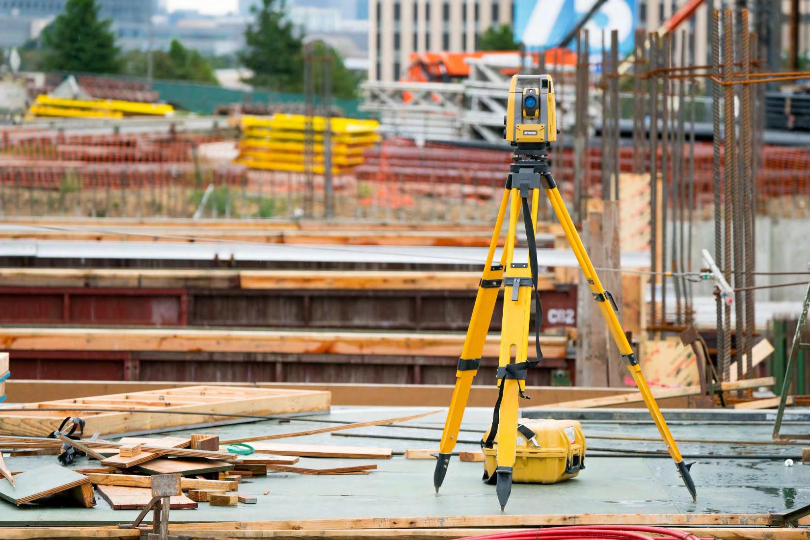
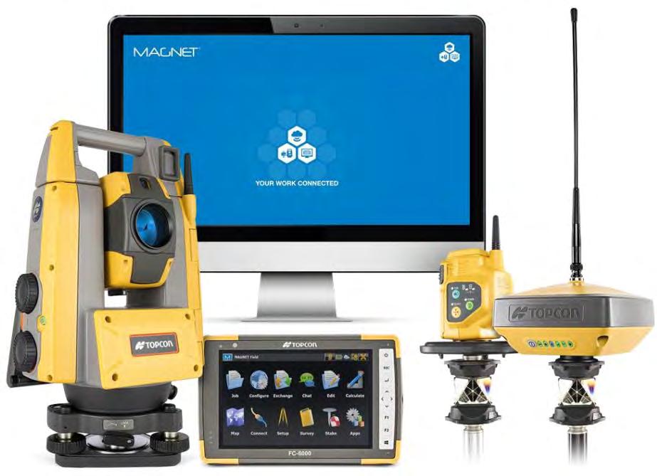
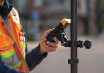
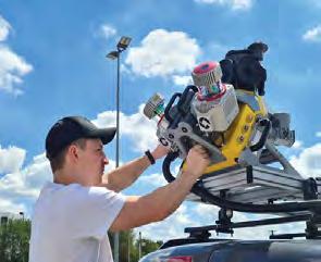
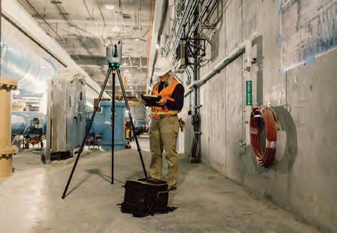
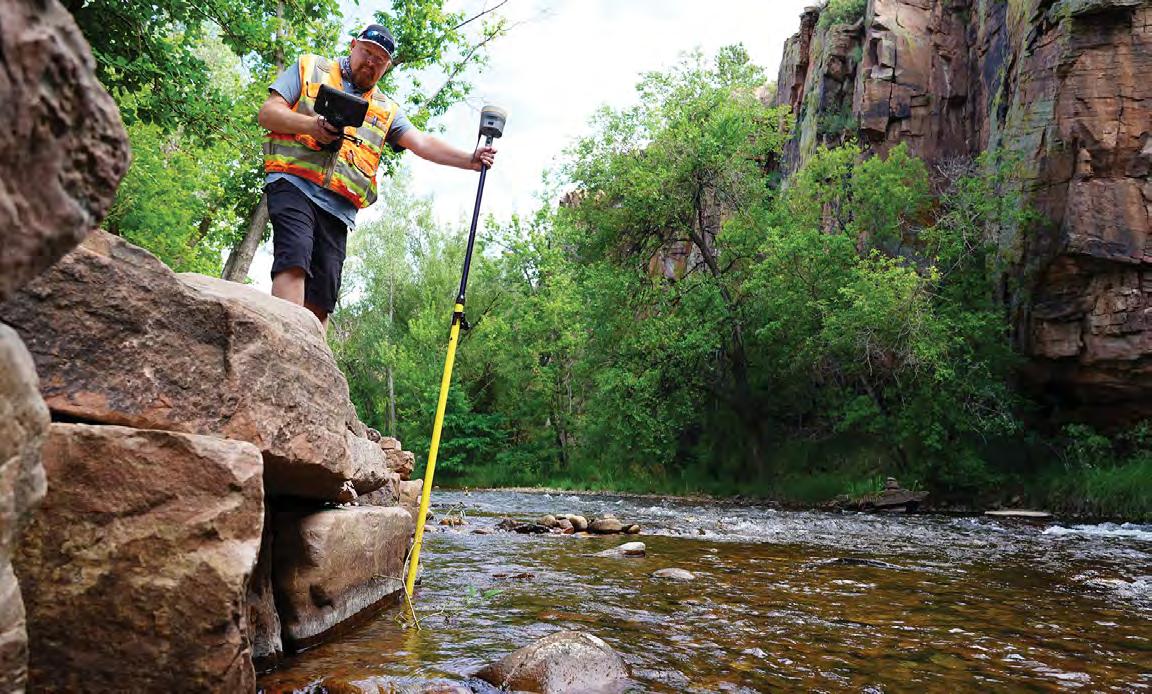
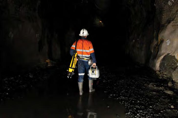
Call us t o g et your complete work flow s olution today ! Efficiency and versatility that will accelerate productivity comes part of a workflow solution that includes the FC-6000 field controller, Magnet software, a HiPer VR receiver and the GT-1200/GT-600 single-operator robotic system. The power of longrange reflectorless measurements comes in your choice of 1”, 2” or 3” GT-1200 models or 2”, 3” or 5” GT -600 models.
The F lorida Surveyor is the official publication of the Florida Surveying and Mapping Society, also known as FSMS. It is published monthly for the purpose of communicating with the professional surveying community and related professions who are members of FSMS. Our award winning publication informs members eleven months out of the year about national, state, and district events and accomplishments, as well as articles relevant to the surveying profession. In addition, continuing educational courses are also available.
PRESIDENT’S Message
May 2026
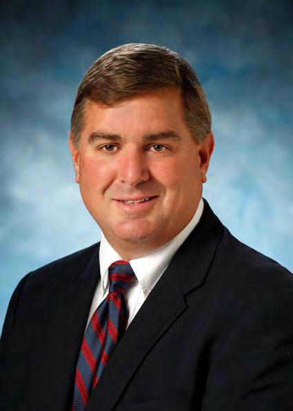
Members,
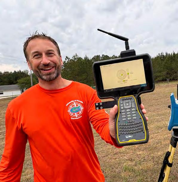
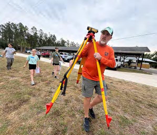
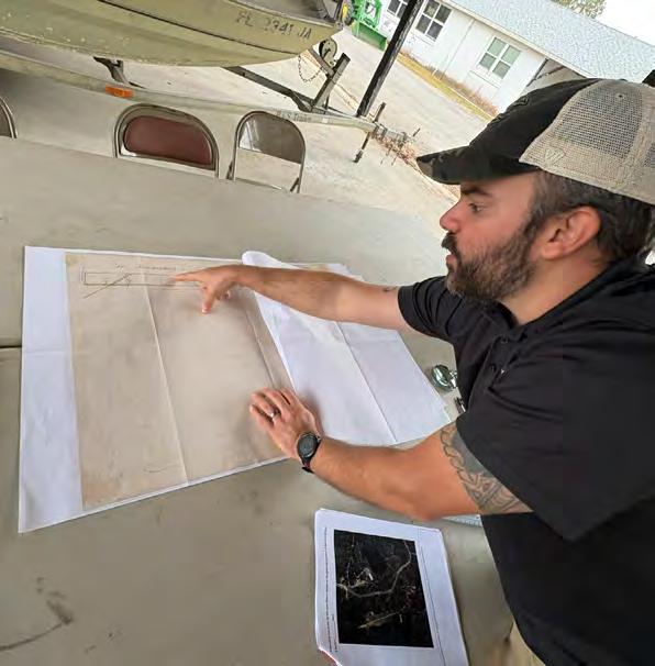
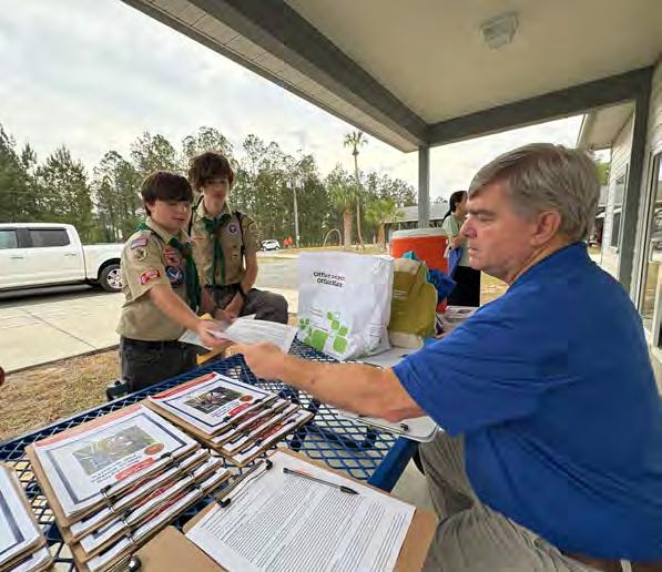
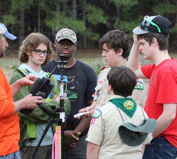
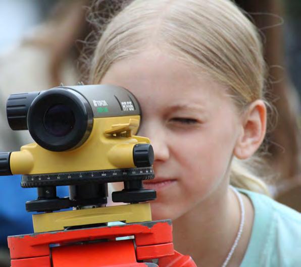
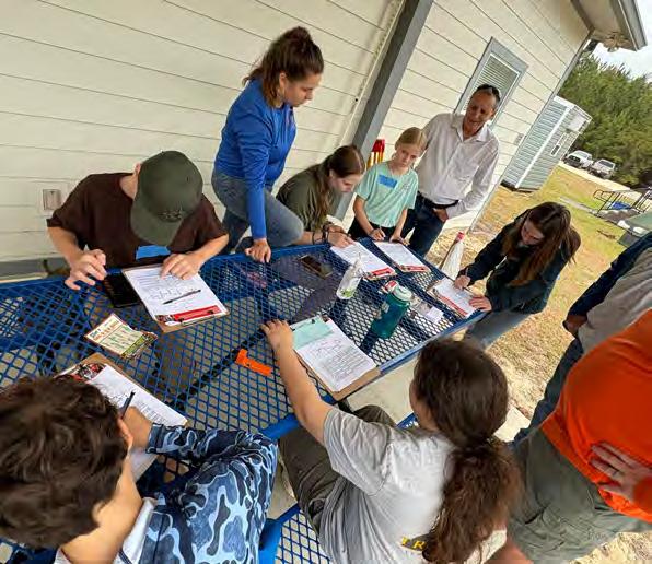
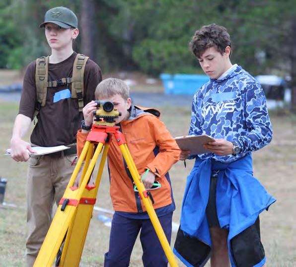
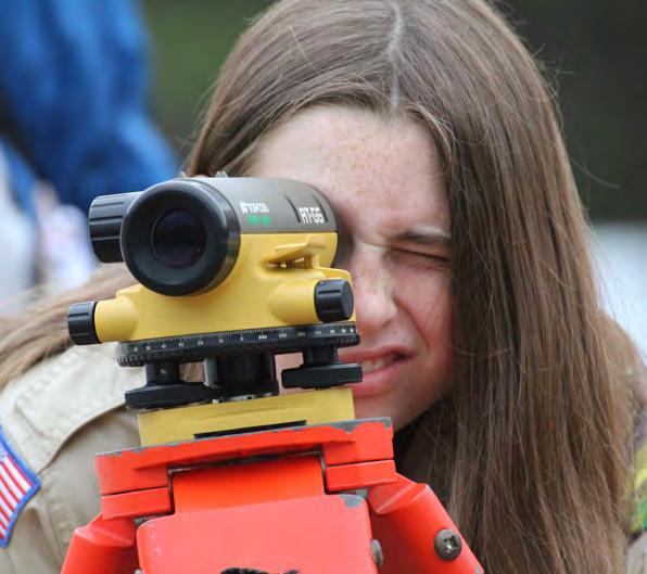
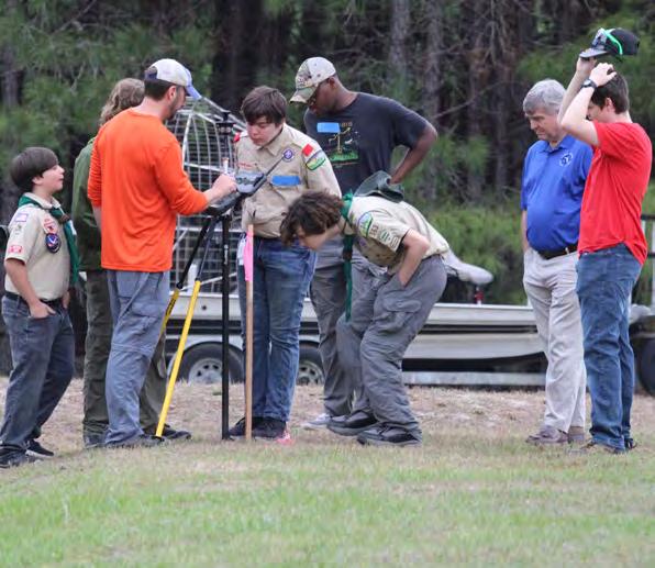
I had the opportunity to go to a Scouting Surveying merit badge event In Gainesville earlier this month. The event, hosted by the University of Florida’s School of Forest Fisheries, and Geomatics Sciences (SFFGS), despite the weather, was truly an amazing event. The badge requirements included setting up an instrument and measuring angles and distances, measuring with GPS, preparation of field notes, finding the elevation of a remote point with a level, and a discussion of emerging technologies. We had fourteen scouts complete the badge requirements, and I had the opportunity to meet some really great, inquisitive kids, who asked a lot of fantastic questions. I genuinely believe that this is a worthwhile event, bringing education of the surveying profession to the younger generation, and to the parents as well. In speaking with one of the parents, he remarked “I had no idea how much effort went into putting together a survey.”
I personally want to congratulate Brian Murphy (3002 Geospatial), Katie Britt (SFFGS), Eric Orndorff (WGI), Nicholas DiGruttolo (Duke Energy), Noble Haile (Noble Precision Technologies), Tim Jaskiewicz (Southeastern Su rveying), Kenneth Dell (CFB), Marco Krieger, Alejandro Perez, and the re st of the volunteers on an event well planned and well executed!
Miscellanea
It is nominations time again, time to recognize your fellow surveying and mapping professionals that have stood out and set themselves apart through their accomplishments and service to the community. You should have received an email regarding the Awards Criteria and Nomination Form . President
(772) 370-0558 president.fsms@gmail.com
PRESIDENT’S Message
Nominations are open until May 31, 2026.
As a reminder, Conference is July 29th – August 1st at the JW Marriott Miami Turnberry. Rooms are going fast, so if you plan on attending, I encourage you to register for classes and reserve your room.
Brevard chapter members, I am looking for you. It has come to my attention that the Space Coast Chapter has quietly gone dormant. I am act ively looking for FSMS members in the Brevard area to reach out to me to see if we can resurrect this once proud chapter.
As always, your thoughts are important, and I would like to hea r from you regarding any comments or suggestions you may have. Please email me at president.fsms@gmail.com .
Respectfully submitted,
Robert N. Johnson, PSM, CFM
2025-26 Districts and
Directors
District 1 - Northwest
Bay, Calhoun, Escambia, Franklin, Gadsden, Gulf, Holmes, Jackson, Jefferson, Leon, Liberty, Madison, Okaloosa, Santa Rosa, Taylor, Wakulla, Walton, Washington
Chad Thurner (850) 200-2441 chad.thurner@sam.biz
Angela Bailey (850) 559-5039 bailey.angelakay@gmail. com
District 2 - Northeast
Alachua, Baker, Bradford, Clay, Columbia, Dixie, Duval, Gilchrist, Hamilton, Lafayette, Levy, Marion, Nassau, Putnam, Suwannee, St. Johns, Union
Pablo Ferrari (904) 219-4054 pferrari@drmp.com
Nick Digruttolo (352) 374-2249 ndigrutt@gmail. com
District 3 - East Central
Brevard, Flagler, Indian River, Lake, Okeechobee, Orange, Osceola, Seminole, Martin, St. Lucie, Volusia
Howard Ehmke (772) 206-4650 howard.ehmke @bowman.com
Constitution & Resolution Advisory Committee Pablo Ferrari
Annual Meeting Committee Allen Nobles
Legal & Legislative Committee Jack Breed
Surveying & Mapping Council Randy Tompkins
Strategic Planning Committee Brion Yancy
Executive Committee Bob Johnson
Special Committees
Equipment Theft Rick Pryce
Awards Committee Rick Pryce
UF Alumni Recruiting Committee Russell Hyatt
Professional Practice Committee Lou Campanile, Jr.
Workforce Development Committee Lou Campanile, Jr.
Liaisons
CST Program Alex Jenkins
FDACS BPSM Don Elder
Surveyors in Government Richard Allen
Academic Advisory Justin Thomas UF / Earl Soeder FAU
FES Lou Campanile, Jr.
Practice Sections
Geospatial Users Group
Richard Allen
Young Surveyors Network Mary Voor
Sherry Kirkland, psm of 30 South Surveying
A Huge Congratulations to our 2026 Recruitment Champion, Sherry Kirkland of 30 South Surveying.
Sherry Recruited Four New Members ( 1 Sustaining Firm, 1 Full, and 2 Associates ) as part of our 2026 Membership Recruitment Contest. As the winner, she will enjoy a 2 night stay at the JW Marriot Miami Turnberry Resort & Spa during annual conference along with a Packet One Registration.
Thank You to all of this year's participants in the membership recruitment contest. Together, we continue to grow and reach new heights!
round the State A
University of Florida Geomatics Student Association
Congratulations to the new GSA officers!
President- Reese Veerkamp
Vice President- Billy Payne
Treasurer- Zane Chaires
Secretary- William Fouts
ROAR- Ashley Hays
Social Coordinator- Oakley Sever
Geospatial Rep- William Bramley
Thank you to Pickett for sponsoring the meeting! We all learned a lot from your presentation.
Hongbo Su (Associate Professor at FAU, PSM)
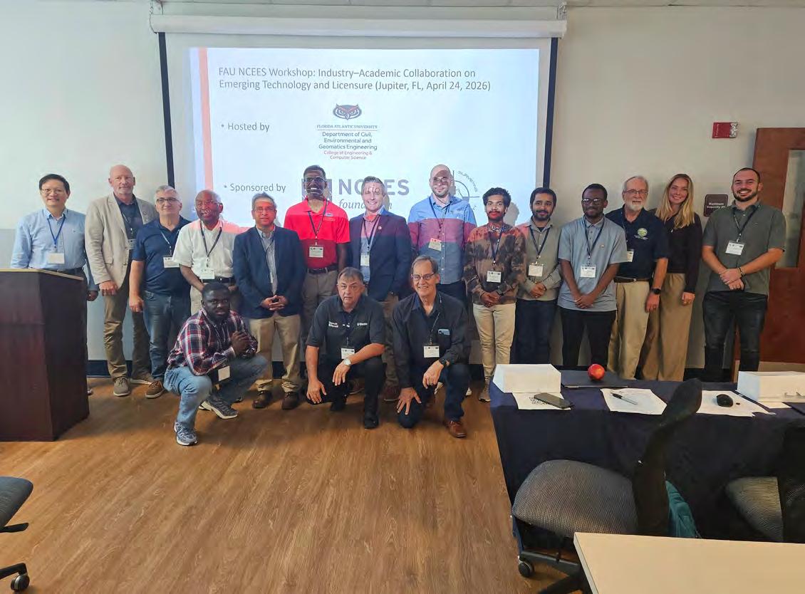
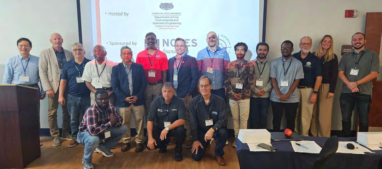
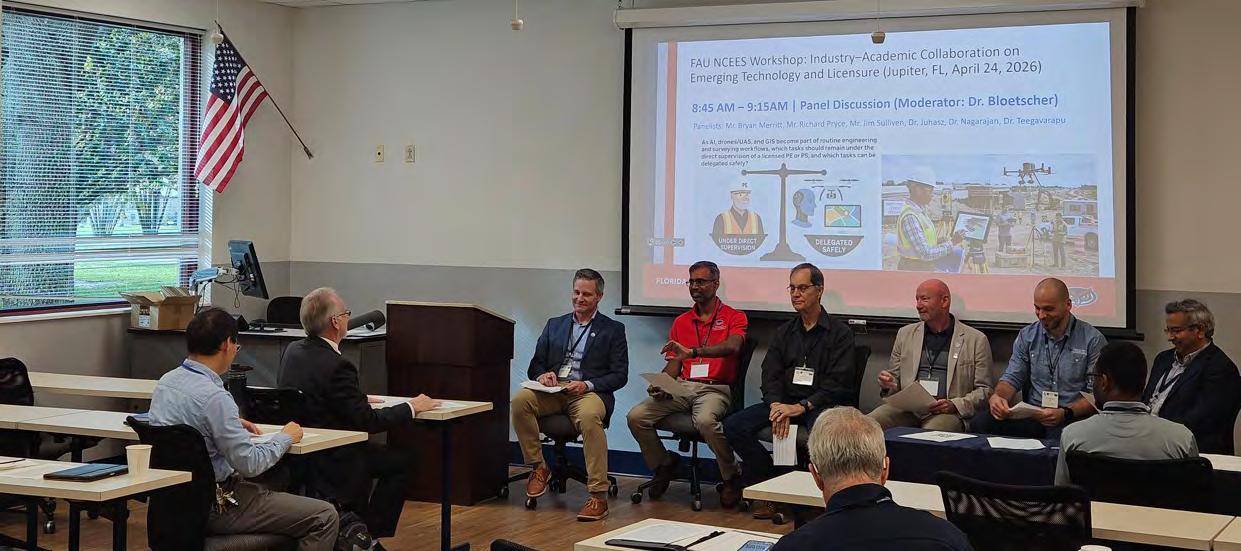
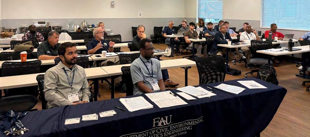
Thanks to everyone who participated in today’s workshop on Industry–Academic Collaboration on Emerging Tech & Policy and the Path to Professional Licensure in Jupiter! It was hosted by FAU Civil, Environmental and Geomatics Engineering Department, and sponsored by NCEES Foundation and Florida Surveying & Mapping Society (FSMS Jim Sullivan, Richard Pryce, Earl Soeder, Bryan Merritt, LS PSM Sudhagar Nagarajan, Ramesh Teegavarapu, Levente Juhász, Fred Bloetscher, Evangelos I. Kaisar, Joseph Gyegyiri, E.I., GISP)
I truly appreciated your time, engagement, and the thoughtful discussions throughout the session. It was a pleasure connecting with such a wonderful group and sharing ideas together.
I’m also grateful for the energy and collaboration that made the workshop so meaningful and productive.
I’ll be sharing photos from the workshop, and the recorded session is also available on YouTube for those who would like to revisit it.
Thank you again for being part of it!
Central Florida Chapter
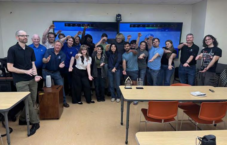
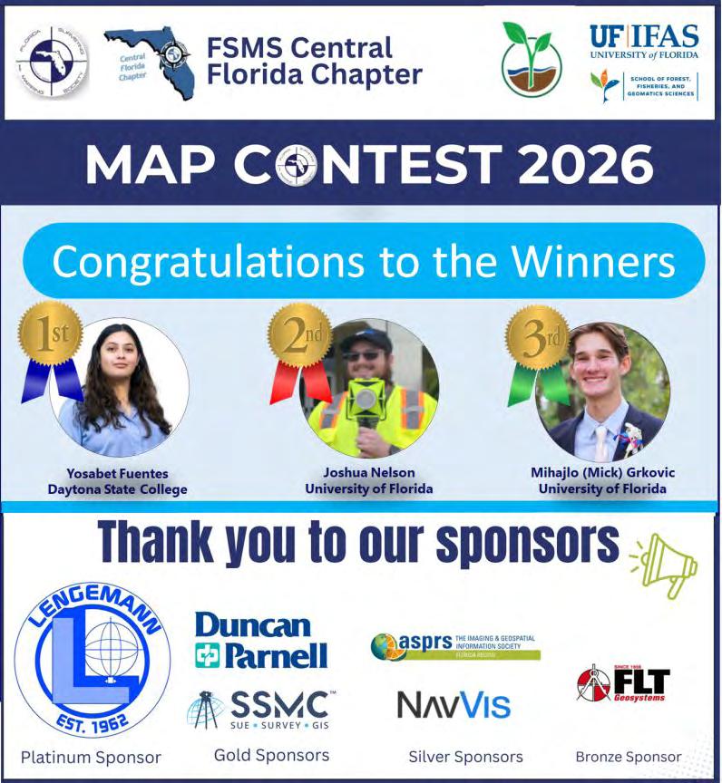
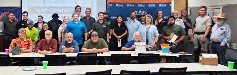
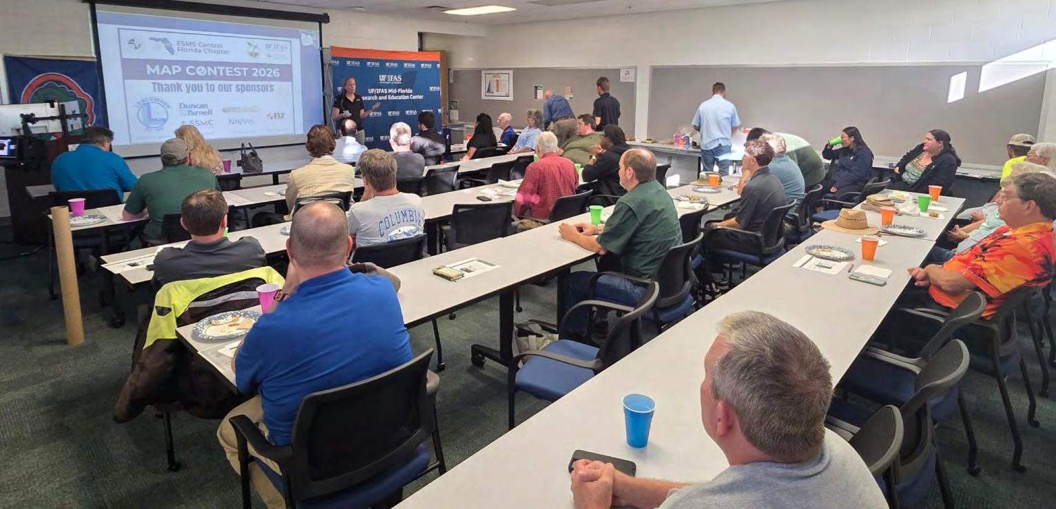
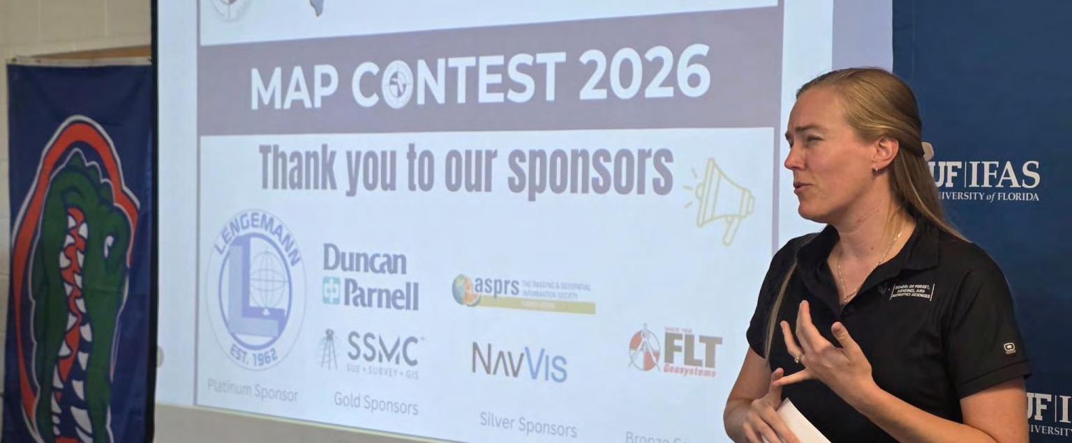
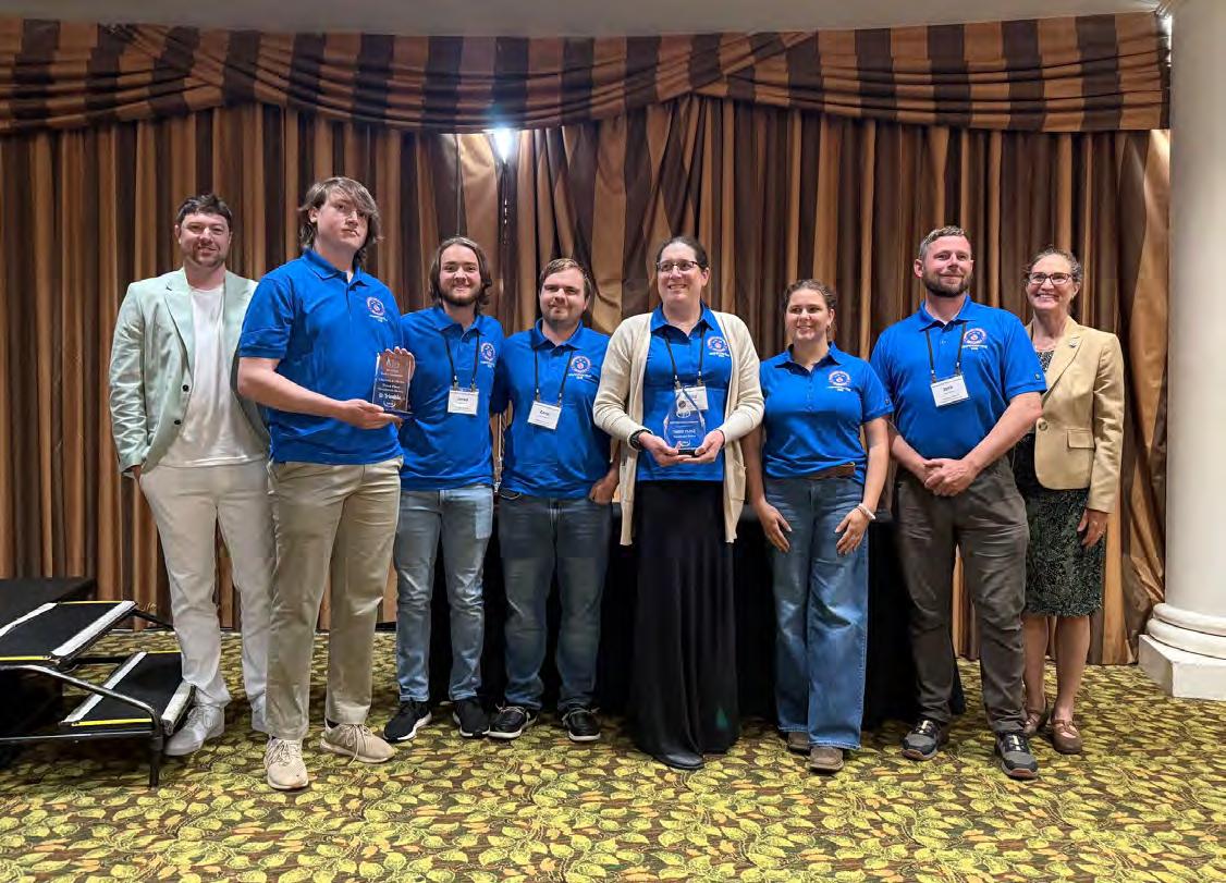
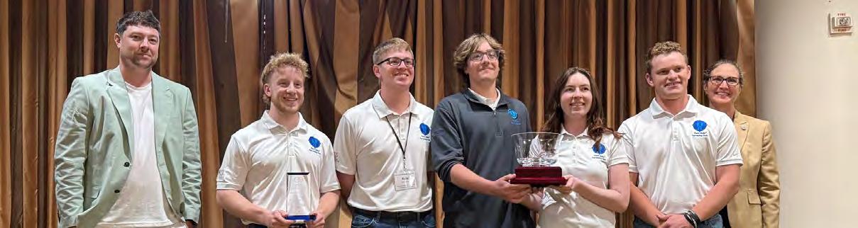
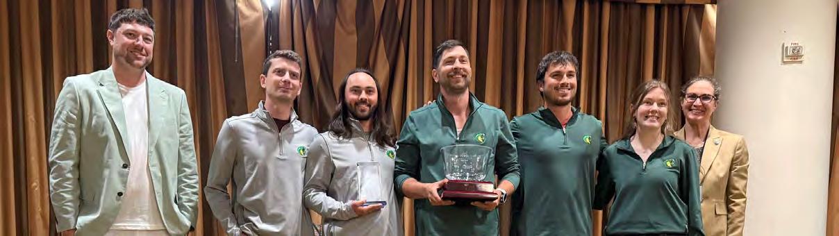
Florida Surveying and Mapping Society - Central Florida Chapter – Map Contest Winners Announced!
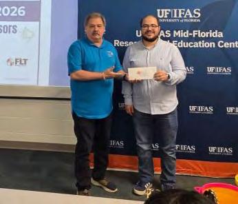
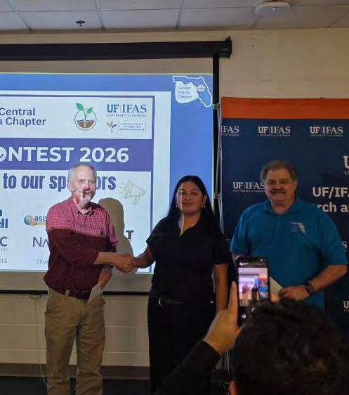
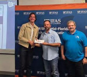
We are excited to announce the winners of the FSMS Central Florida Chapter Map Contest that took place at the UF IFAS Mid-Florida Research and Education Center! This event was a tremendous success thanks to the creativity and technical excellence of our participants and the generous support of our sponsors.
Contest Winners
1. First Place: Yosabet Fuentes, Daytona State College.
2. Second Place: Joshua Nelson, University of Florida School of Forest, Fisheries, and Geomatics Sciences.
3. Third Place: Mihajlo Grkovic, University of Florida School of Forest, Fisheries, and Geomatics Sciences.
Congratulations to all the winners! Your maps impressed the judges and showcased the talent and innovation within our geospatial community.
Thank You to Our Sponsors
Platinum Sponsor: Lengemann Corporation
Gold Sponsors: Duncan-Parnell Inc.; Southeastern Surveying and Mapping Corp.
Silver Sponsors: NavVis; ASPRS - University of Florida Student Chapter / American Society for Photogrammetry and Remote Sensing (ASPRS)
Bronze Sponsor: FLT Geosystems: A Division of Florida Level & Transit Co.
Your support made this event possible and helped ensure its success. A sincere thank you as well to everyone who participated and contributed. Special recognition to the FSMS Central Florida Chapter Officers and Associate Directors for their dedication and leadership in organizing this event: Edwin Munoz, PSM - President, Ralph A. NietoVice President, Tim Jaskiewicz - President Elect, Marco Krieger - Secretary, Betty Morris, GISP - Treasurer, Allen Quickel, PSM - District 3 Director, Bill Rowe - Director, Chris LaBerge, PSM - Director, Christy Graves - Director, John Gray - Associate Director, Dr. Youssef Omar Kaddoura - Associate Director, Colton Locklin - Associate Director, Kenneth Dell SIT - Associate Director,Richard Allen, PSM, CFM - Scholarship/Recruiting/Valencia, Dolly Carwile, PSM - Webmaster.
Thank you all for supporting student engagement and excellence in mapping and geospatial sciences!
Andrew L. Beckwith, CST I
The Palm Beach & FSMS FAU chapters of the Florida Surveying and Mapping Society met at Florida Atlantic University's Engineering East building to hear a presentation from Engenuity Group, Inc.'s Maxwell Wharton, SIT.
Florida Young Surveyors Network
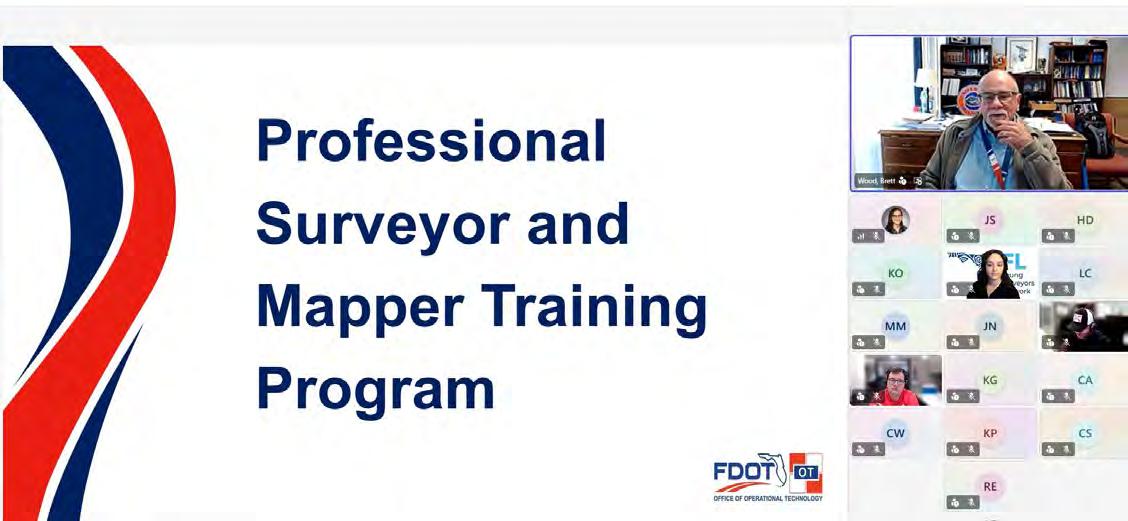
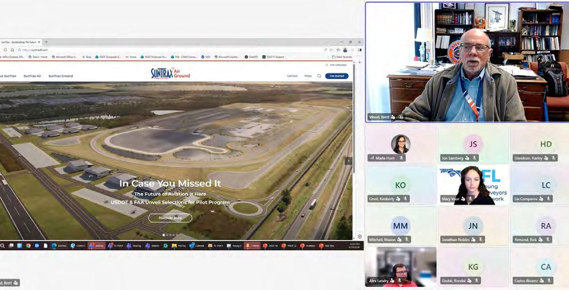
We had great turnout at out last meeting with Florida Department of Transportation State Surveyor, Brett Wood, PSM Wood, peaking at 21 attendees!
At the meeting, Brett discussed all of the upcoming opportunities within the state public sector of surveying including Advanced Air Mobility via the SunTrax testing grounds, the development of a Professional Survey Training Program, and challenges related to technological innovations in industry.
Throughout the meeting, Brett's enthusiasm and encouragement for staying up to date with geospatial advancement was supported by efforts to provide professional development, forward education, and maintain competency as the industry progresses.
We'd like to extend our utmost thanks to Brett for taking the time to speak with young surveyors across the state about surveying in the public sector, and appreciate your dedication to the future of the profession.
UF School of Forest, Fisheries, and Geomatics Sciences
Shout out to the Surveyors who showed up on a Saturday (5/2/26) to share their knowledge with Scouts and 4-Hers during a merit badge and project day held in Gainesville by SFFGS Geomatics extension.
Youth traveled from all over the Florida to take part in surveying plus forestry and fishing lessons.
The event was sponsored by Florida Surveying and Mapping Society, 3002 Geospatial Surveying and Geospatial WGI.
Central Florida Chapter
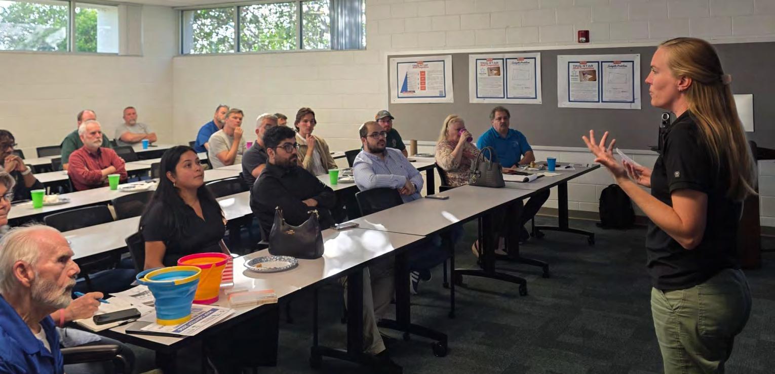
We were honored to host Katie Britt as the guest speaker at the Florida Surveying and Mapping Society - FSMS Central Florida Chapter meeting on April 21, 2026 that took place at the UF IFAS Mid-Florida Research and Education Center! Her presentation on [University of Florida School of Forest, Fisheries, and Geomatics Sciences] Extension as a core part of the Land - Grant mission was insightful, timely, and highly impactful.
Katie clearly demonstrated how Extension serves as an active bridge between academia, industry, and the public, responding directly to workforce and societal needs. Key highlights from her presentation included:
1. Recruiting and training the next generation of technicians, including CST support, entry‑level field technician training, alignment wi th state standards, and integration with high school CTE, CareerSource, and FFA programs.
2. Building a stronger workforce pipeline, with innovative efforts such as shared equipment databases, online training delivery, and industry - supported outreach.
3. Increasing visibility of the surveying profession, emphasizing public awareness, youth engagement, and education through Extension articles, media outreach, and real - world examples.
4. Youth education and outreach initiatives, including NCEES Foundation curriculum kits, marine geomatics workshops through 4 - H, Trig - Star competitions, scouting merit badge events, and adoption of surveying curriculum by 4 - H agents statewide.
Katie’s work powerfully illustrated how Extension connects needs assessment to action, supports industry, and inspires future professionals. Thank you, Katie, for your leadership, dedication, and for sharing such a compelling vision for the future of geomatics education and outreach. We truly appreciate your time and your continued impact across our profession.
A sincere thank you as well to everyone who participated and contributed. Special recognition to the FSMS Central Florida Chapter Officers and Associate Directors for their dedication and leadership in organizing this event: Edwin Munoz, PSM - President, Ralph A. Nieto - Vice President, Tim JaskiewiczPresident Elect, Marco Krieger - Secretary, Betty Morris, GISP - Treasurer, Allen Quickel, PSM - District 3 Director, Bill Rowe - Director, Chris LaBerge, PSM - Director, @Christy Graves - Director, John Gray - Associate Director, Dr. Youssef Omar Kaddoura - Associate Director, @Colton Locklin - Associate Director, Kenneth Dell SIT SIT - Associate Director, Richard Allen, PSM, CFMScholarship/Recruiting/Valencia, Dolly Carwile, PSM - Webmaster.
Karol Hernandez, SIT
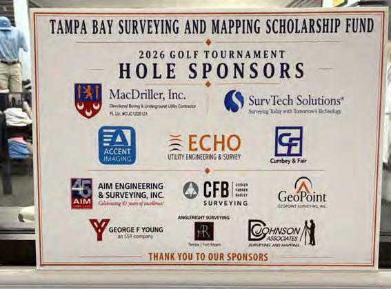
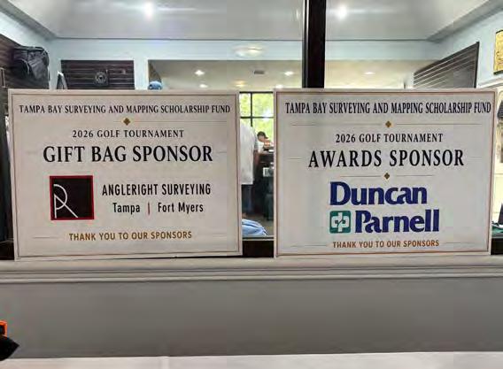
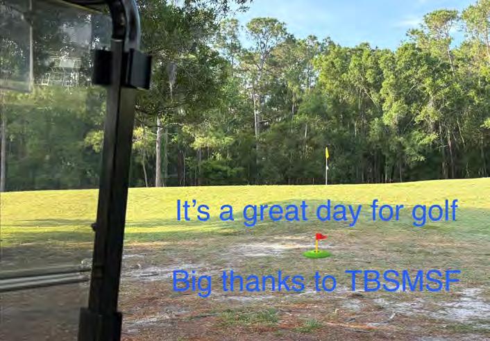
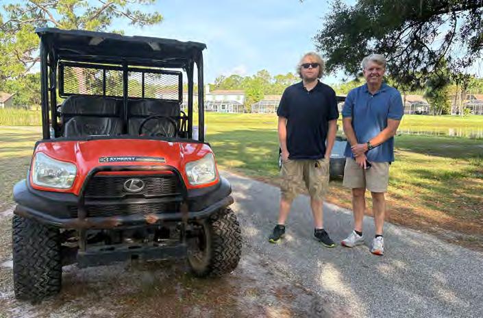
I am honored to be part of TAMPA BAY SURVEYING AND MAPPING SCHOLARSHIP FUND INC. This past Saturday was our annual Golf Tournament Fundraiser. Thank you to all the survey community that show up to support the future of the profession.
England-Thims & Miller, Inc.
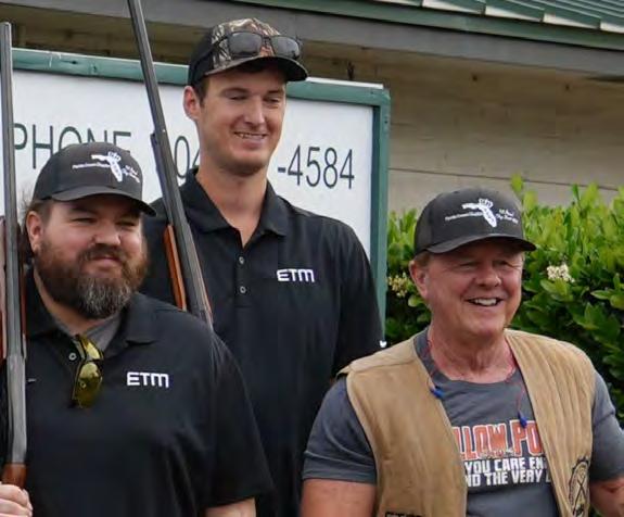
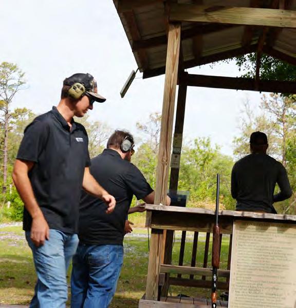
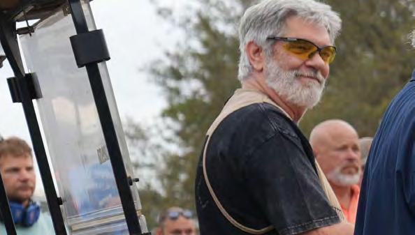
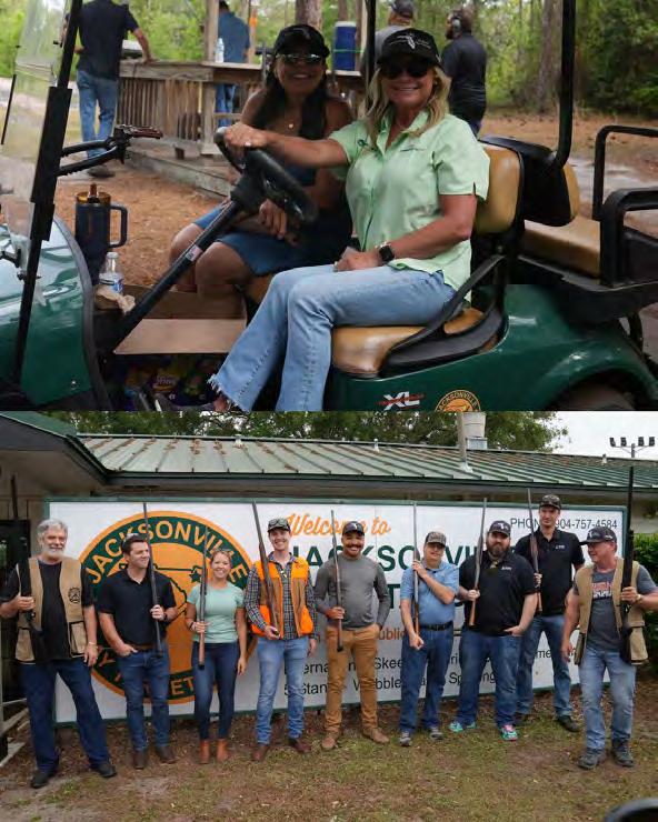
ETM was proud to sponsor and participate in the Florida Surveying and Mapping Society's First Annual Clay Shoot on April 30th at Jack sonville Clay Target Sports.
Beyond the friendly competition, the event raised funds for the FSMS Scholarship Fund, which supports students enrolled in land surveying and geomatics programs at Florida colleges and universities.
That mission is one we're glad to support.
Surveying is the foundation of everything that gets built. Every site, every road, every project starts with the work surveyors do, and the next generation of this profession deserves every bit of investment we can give them.
Thank you to FSMS for putting on a great inaugural event, and congratulations on what we hope will become a longstanding tradition.
NSPS Young Surveyors Network (YSN)
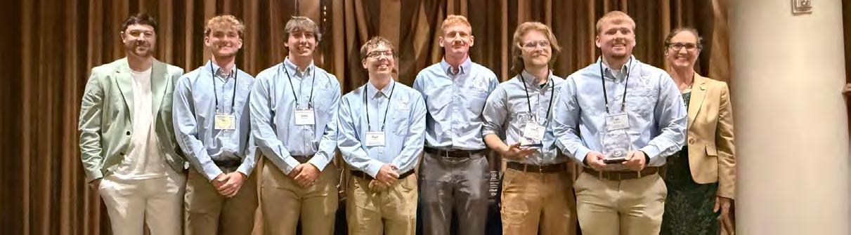
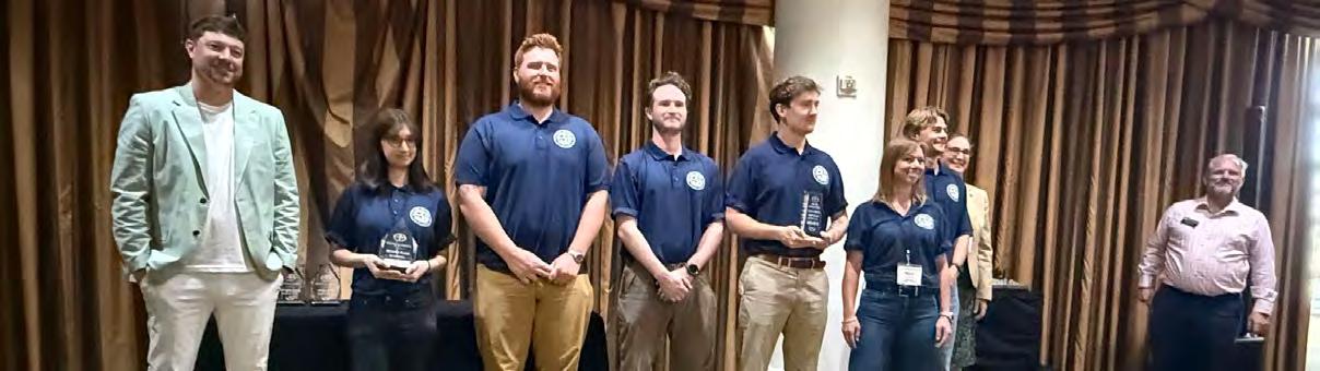
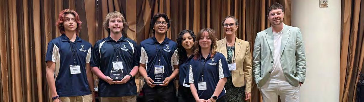
Congratulations to the winners of the NSPS Student Competition!
Bachelor’s Division
1. Penn State
2. University of Akron
3. University of Florida
Associate’s Division
1. Parkland College
2. Clark College
3. Klein Collins
A huge congratulations to all of the students who competed this week. The level of talent, teamwork, problem solving, and field skill on display was incredibly fun to watch. The future of the surveying profession is in very good hands. This was a meaningful event for the students, if you are interested in getting involved and volunteering, check out the link below! https://youngsurveyors.org/become-a-volunteer/
Pam Hyatt — Manasota Surveyors
Love the camaraderie of the Mighty Manasota Chapter! 19 in attendance tonight and we had a great time together. Please consider coming out to the next one just to hang out with some cool people!
Florida Young Surveyors Network
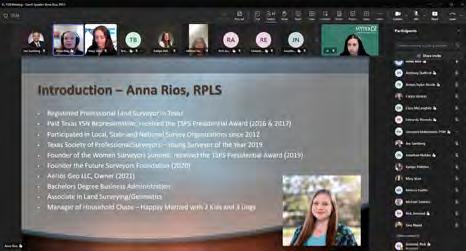
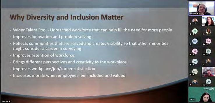
We had an a-MAY-zing meeting last week with our guest speaker, Anna Rios, RPLS!
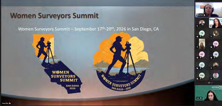
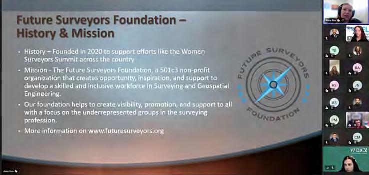
During the meeting Anna discussed how her founding of "Women Surveyors Summit" and "Future Surveyors Foundation" came to be, as well as the tremendous progress both have made since established.
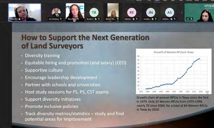
Additionally, Anna touched on some of the challenges we all feel in the surveying profession, especially when first starting out. She emphasized how diversity and inclusion can lead to a stronger industry through visibility, which can create opportunity and long-term workforce stability.
As we move thoughout our careers, Anna reminds us how crucial it is to support the next generation of young surveyors and grow our professional network.
We'd like to extend a HUGE thank you to Anna for offering her time and experience to our group of young surveyors. We hope to see y'all at the next one!
Florida Young Surveyors Network
Florida YSN has that WOW factor!
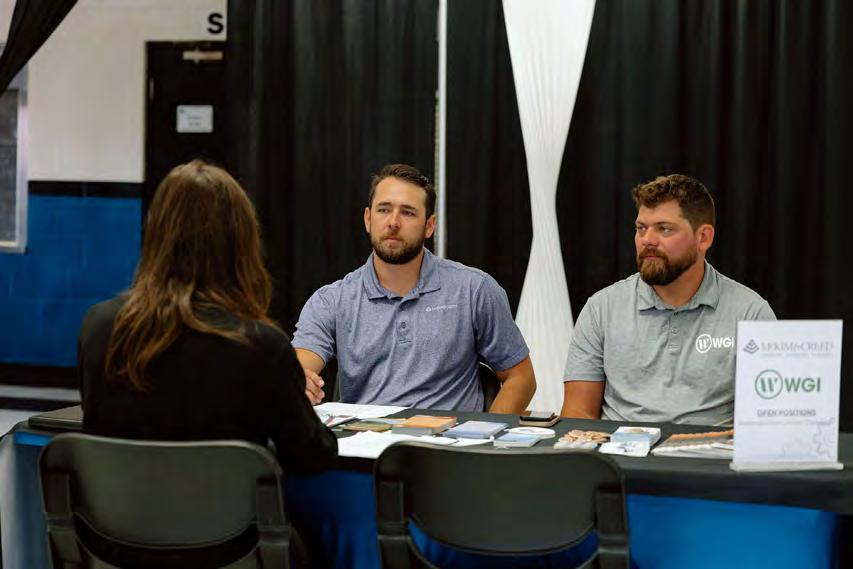
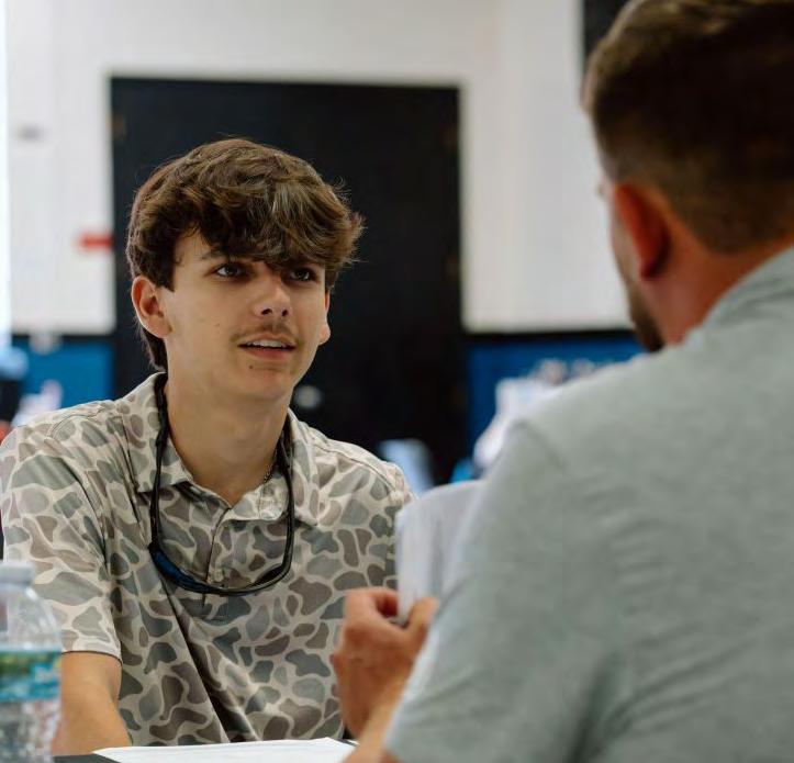
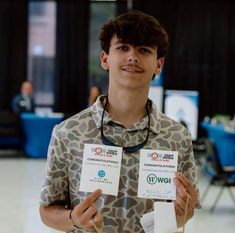
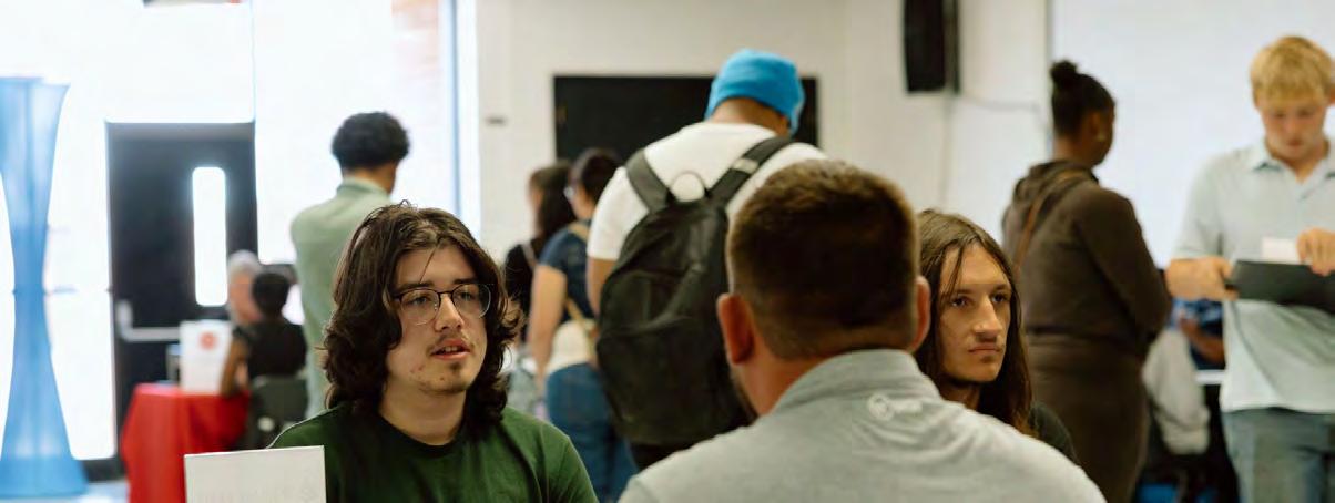
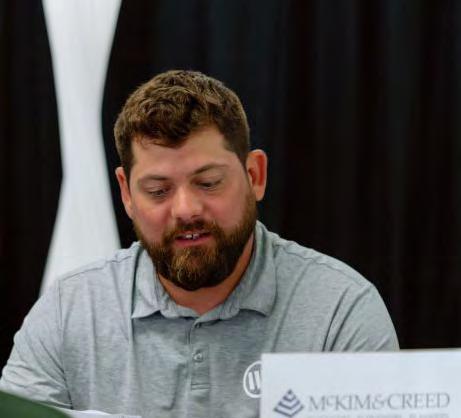
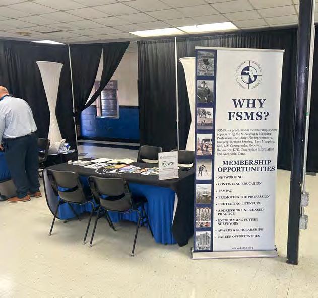
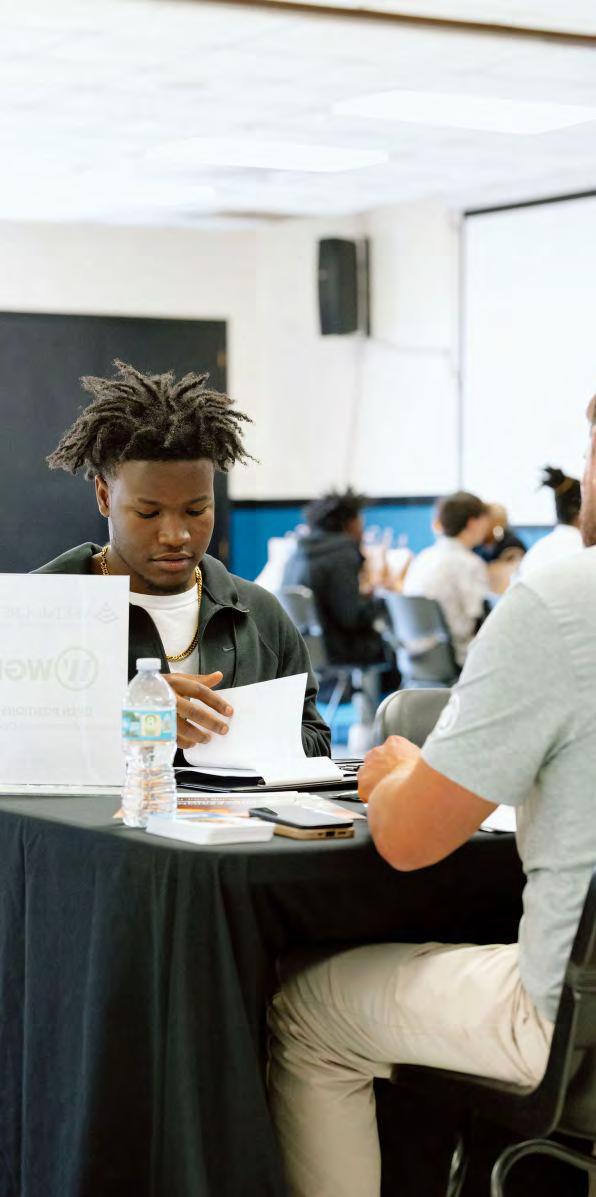
Check out Vice President, Jonathan Nobles, who participated in the WOW (World of Work) Career Expo. This event connected graduating senior students with prospective employers for entry level career opportunities.
Jonathan's company McKim & Creed, Inc., WGI, and the Florida Surveying and Mapping Society all partnered to conduct on-site interviews for students interested in Surveying. Additionally, be on the lookout for a follow-up event called "Be a Surveyor" that will aim to familiarize students with career paths and opportunities in the surveying industry!
FAU HOLDS WORKSHOP ON EMERGING TECHNOLOGY, POLICY,
AND
PROFESSIONAL LICENSURE IN JUPITER
Department of Civil, Environmental and Geomatics Engineering
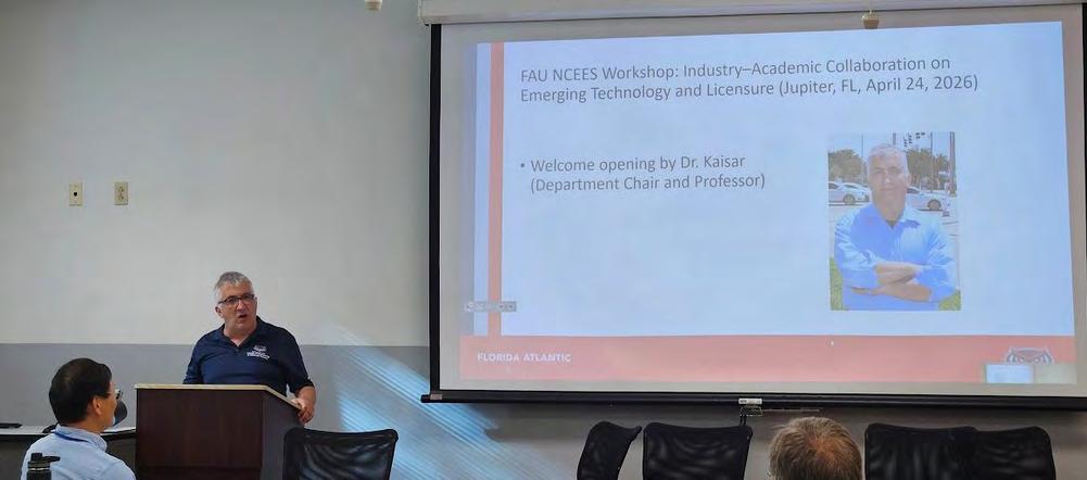
JUPITER, Fla., April 24, 2026 — Florida Atlantic University’s Department of Civil, Environmental and Geomatics Engineering (CEGE) hosted a high-impact workshop on April 24 at the FAU Jupiter campus focused on industry–academic collaboration on emerging technology and policy, with an emphasis on the path to professional engineering and surveying licensure. The event was titled “Industry–Academic Collaboration on Emerging Tech & Policy and the Path to Professional Licensure,” and highlighted the goal of promoting Professional Engineer (P.E.) and Professional Surveyor (P.S.) licensure readiness. The workshop was sponsored by NCEES Foundation and FSMS.
The program was organized as a half-day forum bringing together academic researchers, industry professionals, and students for panel discussions, oral presentations, and live demonstrations.
The morning opened with registration and welcome. Dr. Kaisar delivered opening remarks, while Dr. Su presented an overview of the workshop’s goals and schedule.
The first major session was a panel discussion, moderated by Dr. Bloetscher. Panelists included Mr. Bryan Merritt, Mr. Richard Pryce, Mr. Jim Sullivan, Dr. Levente Juhasz, Dr. Sudhagar Nagarajan, and Dr. Ramesh Teegavarapu, followed by a moderated discussion on key themes and a brief audience question-and-answer segment.
A broad lineup of oral presentations was scheduled after the panel discussion, with Dr. Su serving as moderator. Topics throughout the morning included AI, UAS, GIS, GeoAI, big data analytics, engineering education, Survey/GIS integration, and the ethical impact of AI and new
technologies on professional engineering practice. The program also offered 3 continuing education credits for Florida PSM participants.
The event concluded with a live demonstration session moderated by Dr. nagarajan and led by professionals from Keith & Associates, Hazen and Sawyer, and Duncan Parnell, followed by closing remarks and lunch. The workshop’s theme emphasized connecting drones, AI, GIS, and regulatory insight to help prepare the next generation of licensed professionals.
By combining university faculty, industry speakers, panel discussion, and live demonstrations, the event positioned FAU Jupiter as a venue for discussions on how emerging technologies are reshaping engineering and surveying education, professional practice, and regulatory preparation.
The Boundary on the Ground vs. the Words on the Page: Why Original Surveys Still Define the Parcel
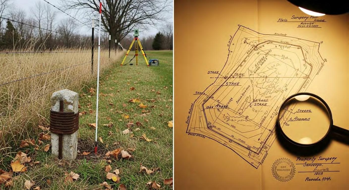
I n an era dominated by digital mapping, high-precision GNSS, and automated parcel fabrics, it is tempting to believe that land ownership is defined primarily by legal descriptions, coordinate geometry, or the latest dataset in a GIS. But this view misses a foundational principle of boundary law and surveying: once a parcel is established on the ground by the original surveyor—and relied upon by landowners—that physical boundary becomes the controlling definition of the property. The written description and measured values are secondary. They describe the boundary; they do not create it.
This distinction is subtle, but it is critical. It is also one that continues to challenge modern practitioners who must reconcile historical evidence with contemporary expectations of precision.
The Original Survey as an Act of Creation
When a surveyor first lays out a parcel, they are not merely recording measurements—they are performing an act of creation. Corners are set, lines are marked, and boundaries are physically defined in a real-world context. These actions, taken together, establish the parcel in a way that is intended to persist over time.
Importantly, the surveyor’s intent is expressed not only through numbers written in a field book or plat, but through the placement of monuments and the relationship of the parcel to surrounding features. These physical markers— whether iron rods, stones, trees, or other objects—anchor the parcel in reality.
Once landowners take possession based on those boundaries—building fences, making improvements, or simply occupying the land—the boundary becomes more than a technical construct. It becomes a legal and practical reality, reinforced by use and recognition.
The Role—and Limits—of Legal Descriptions
Legal descriptions are often treated as definitive, but they are better understood as representations of the boundary rather than the boundary itself. They are attempts to describe, in words and measurements, what was originally established on the ground.
However, descriptions are inherently imperfect. They can contain:
• Measurement errors due to limitations of equipment or methods at the time.
• Transcription mistakes from one document to another.
• A mbiguities in language or interpretation.
• Chang es introduced through successive conveyances.
Over time, these small discrepancies can accumulate, leading to descriptions that diverge—sometimes significantly—from the physical reality of the parcel.
This is why courts and surveying standards consistently prioritize original monuments and lines over written descriptions. When conflicts arise, the question is not “What does the description say?” but rather “What did the original surveyor establish, and how has that boundary been recognized since?”
Monuments Over Measurements
A cornerstone principle in boundary resolution is the priority of evidence. In general terms, the hierarchy looks something like this:
1. Natural monuments (rivers, trees, etc.).
2. A rtificial monuments (iron rods, stakes, markers).
3. Lines o f occupation (fences, walls, longstanding use).
4. B earings and distances.
5. A rea or quantity.
This hierarchy reflects a simple truth: physical evidence on the ground is
more reliable than abstract measurements. A monument set by the original surveyor—even if slightly “off” by modern standards—carries more weight than a mathematically perfect coordinate derived later.
Why? Because that monument represents the surveyor’s intent at the moment the parcel was created. It is the closest thing we have to the original act of defining the boundary.
The Problem with “Correcting” History
Modern tools allow us to measure with extraordinary precision. With GNSS and least-squares adjustments, we can compute positions to within centimeters or better. But this precision can create a false sense of authority.
A common mistake is to assume that improved measurement accuracy justifies “correcting” older surveys. For example:
• Adjusting a parcel boundary to match a mathematically closed traverse.
• Repositioning corners to fit coordinate geometry.
• Redrawing boundaries to eliminate apparent overlaps or gaps.
While these actions may produce cleaner data, they risk overriding the original boundary and the legal reality it represents. In effect, they substitute a new interpretation for the established one—potentially altering property rights in the process.
Surveying, in this context, is not about achieving mathematical perfection. It is about recovering and respecting the original intent, even when that intent is imperfectly expressed.
Boundary as Evidence, Not Geometry
One of the most useful ways to think about parcels is to separate the concept of boundary from geometry .
• G eometry is how we model the parcel: coordinates, lines, polygons, and areas in a GIS.
• B oundary is the legally recognized extent of ownership, grounded in physical evidence and historical intent.
Geometry can be updated, refined, and corrected. Boundary, once established and relied upon, is far more stable. It persists even as our representations of it evolve.
This distinction is especially important in modern systems like parcel fabrics, where the temptation is to treat the dataset as authoritative. In reality, the dataset is an interpretation—one that must remain subordinate to the underlying evidence.
Implications for GIS and Parcel Management
For GIS professionals and cadastral managers, this principle has practical consequences:
• Data should reflect evidence, not override it. When discrepancies arise, the goal is to document and reconcile them, not to force alignment.
• H istorical surveys matter. Even incomplete or inconsistent records may
contain critical clues about original intent.
• Accuracy is not the same as correctness. A highly precise dataset can still be wrong if it misrepresents the established boundary.
• Uncertainty should be acknowledged. Not all discrepancies can—or should—be resolved through computation alone.
Modern systems are powerful tools, but they must be used with an understanding of the legal and historical context in which parcels exist.
The Enduring Authority of the Original Boundary
At its core, this concept reinforces a fundamental idea: land ownership is not defined by the latest description, the cleanest dataset, or the most precise measurement. It is defined by the boundary that was originally established on the ground and accepted over time.
That boundary may not be perfect. It may not close mathematically. It may even conflict with the written description. But if it reflects the original surveyor’s intent and has been relied upon by landowners, it carries enduring authority.
For surveyors and GIS professionals alike, the challenge is not to impose modern precision on historical work, but to understand and honor the boundary as it was created. In doing so, we preserve not just spatial accuracy, but the continuity of property rights that depend on it.
In a world increasingly driven by data, this perspective serves as a reminder: the most important lines are not the ones we draw today, but the ones that were set in the ground—often generations ago—and still define ownership in the present.
YOUR FLORIDA GEOSPATIAL PARTNER
Duncan-Parnell, along with our valued partners, including Trimble and other top brands, are proud supporters of the Florida Surveying & Mapping Society. From solutions including GNSS, scanning, GPR, drones, and more to services including support, rentals, training, and repair, we are pleased to be your one-stop shop for geospatial professionals throughout the Sunshine State.
Jacksonville, FL (904) 620 - 0500
Orlando, FL (407) 601 - 5816
www.duncan-parnell.com
202 6 S u S taining
3D Surveying
850-480-0317
30 South Surveying
863-800-3539
AA Surface Pro, Inc.
239-471-2668 Accuracy Datum
863-599-8688
Accuright Surveys of Orlando
407-894-6314
A. D. Platt & Associates, Inc.
(Area of Interest)
Arc Surveying & Mapping, Inc. 904-384-8377 Ardurra 239-292-7773
Associated Land Surveying & Mapping, Inc. 407-869-5002 ATWELL, LLC 866-850-4200
Avirom & Associates, Inc. 561-392-2594
BBLS Surveyors, Inc. 239-597-1315
Bello & Bello Land Surveying Corporation 305-251-9606
Bennett-Panfil, Inc. 941-497-1290
BGE, Inc. 561-485-0824
Boatwright Land Surveyors, Inc. 904-241-8550
Bock & Clark Corporation(NV5) 330-665-4821
Barnes, Ferland and Associates, Inc. 407-896-8608 Barraco & Associates, Inc. 239-461-3170 Bartram Trail Surveying, Inc. 904-284-2224
Bowman Consulting Group 703-454-1000
Braden Land Surveying 727-224-8758
Bradshaw-Niles & Associates, Inc. 904-829-2591
F irm S Directory
Brown & Phillips, Inc.
561-615-3988
BSE Consultants, Inc.
321-725-3674
Buchanan & Harper, Inc.
850-763-7427 C
Calvin, Giordano & Associates, Inc.
954-921-7781
Carnahan, Proctor & Cross, Inc.
407-960-5980
Carter Associates, Inc.
772-562-4191
Caulfield & Wheeler
561-392-1991
CivilSurv Design Group, Inc.
863-646-4771
Clary & Associates, Inc.
904-260-2703
Clements Surveying, Inc.
941-729-6690
Clymer Farner Barley Surveying, LLC
352-748-3126
Coastal Engineering Associates, Inc.
352-796-9423
Colliers Engineering & Design
732-383-1950
Control Point Associates, Inc. 954-763-7611
Cousins Surveyors & Associates, Inc. 954-689-7766
CPH Consulting, LLC 407-322-6841
Craven-Thompson & Associates, Inc. 954-739-6400 D
DCCM (Design, Consulting, Construction Management. 713-874-9162
Porter Geographical Positioning & Surveying, Inc. 863-853-1496
Pulice Land Surveyors, Inc. 954-572-1777
Q Grady Minor & Associates, PA 239-947-1144
Richard P. Clarson & Associates, Inc.
904-396-2623
River City Surveying & Mapping, LLC
904-675-9300
R.M. Barrineau & Associates, Inc.
352-622-3133
Robayna and Associates, Inc.
305-823-9316
Rutherford Engineering Group 850-387-4994
Reece & Associates, Inc. 305-872-1348
Rhodes & Rhodes Land Surveying, Inc. 239-405-8166
S SAM Surveying & Mapping, LLC. 850-385-1179
F irm S Directory
Settimio Consulting Services, Inc.
850-341-0507
Sexton Engineering Associates, Inc.
561-792-3122
Southeastern Surveying & Mapping Corp.
407-292-8580
Stoner Inc.
954-585-0997
Suarez Surveying & Mapping, Inc.
305-596-1799
Survey Data Solutions, LLC
352-816-4084
SurvTech Solutions, Inc.
813-621-4929
T2 UES Inc.
407-587-0603
UF/IFAS School of Forest, Fisheries, and Geomatics Sciences
Wantman Group, Inc.(WGI) 561-687-2220
WBQ Design & Engineering, Inc. 407-839-4300
Whidden Surveying & Mapping, Inc. 561-790-5515
Wilco Electrical LLC 877-945-2655
Winnigham & Fradley 954-771-7440
Woolpert, Inc.
800-414-1045 Z ZNS Engineering, LLC. 941-748-8080
Why German Generals Said American Maps Were “Unfair.”
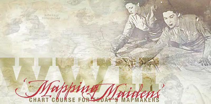
History of the “Military Mapping Maidens” of World War II”
"Why German Generals Said American Maps Were "Unfair"
https://youtu.be/2hTYwLHrBdY?si=6BbehdE0j1loKYxb
Until a friend sent me this video I had no idea of this program and the important role these women had on the success of the USA in World War II. As a professional surveyor and mapper, I was amazed at the amount of accurate topographic maps produced by this program for our troops
History of the “Military Mapping Maidens” of World War II”
which by in large gave them a greater advantage than even the Germans who lived in the country. The maps produced by this agency in record time and almost on demand and the women who worked in it should have been celebrated and commended more then they were. For without them, our troops would have surely been denied victory and we could have been living in a quite different world today. … Richard D. Pryce, RLS/PSM
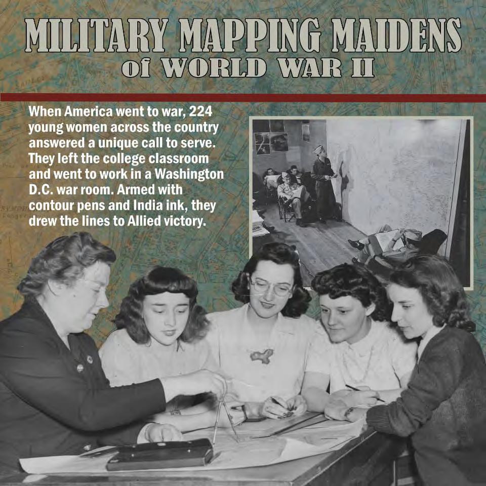
During World War II, the U.S. Army Map Service (AMS) faced a crisis: it was losing skilled mapmakers while demand for accurate, up -to - date maps surged. To meet wartime needs, the federal government created the “Military Mapping Maidens” — also called “3Ms” — a program that trained thousands of women in military cartography.
Who were the Mapping Maidens?
Distinguished Alumna Helps Open Exhibit Showcasing Women’s Role in Cartography During World War II | College of Arts & Sciences, Department of Geography
The exhibit, sponsored by the Department of Geography, highlights the unique military service of Kent State alumna Bea (Shaheen) McPherson and 223 other women. These “Military Mapping Maidens” or “3M Girls” contributed to the war effort by researching, drafting and compiling over 40,000 maps in the Army Map Service (AMS), now known as the National Geospatial-Intelligence Agency.
On The Map: Bea McPherson Charted Course of Women Mapmakers | Department of Geography, Kent State Magazine
Origins and Training
In 1941, the 77th U.S. Congress passed a bill allocating funds to map “strategic” areas worldwide. Many existing maps, especially in the Pacific, were outdated (some from the 19th century), so the government launched training programs under the Engineering , Science, and Management Wartime Training (ESMWT) initiative.
By 1942, select coeducational and women’s colleges began offering Military Map Making (3M) courses. These were 60-hour college-level programs, often supplemented by a four-week Army Map Service in-service training.
Edith Putnam Parker, a geography professor at the University of Chicago, oversaw the program. In its first year, 200 women completed the training.
History of the “Military Mapping Maidens” of World War II”
Colleges and Participants
The program was offered at institutions such as Barnard, Hunter, Rochester, Brown, Illinois, Simmons, Bryn Mawr, Kent State, Syracuse, University of Chicago, Michigan, University of Maine, Columbia, Mt. Holyoke, Wellesley, Cornell, Northwestern, Wisconsin–Madison, Florida State College for Women, Penn State, Houghton, and Radcliffe. Many schools had no cartography courses before the war.
Work and Impact
Participants worked up to 70 hours per week over three years, producing over 40,000 maps. Each new map required about 600 hours of cartographic labor and was hand- drawn using foreign maps, aerial photos, and other intelligence.
They mapped strategic locations, roads, water bodies, land contours, churches, and schools, often interpreting aerial imagery where ground intelligence was limited. Maps produced included those for D-Day, the Battle of the Bulge, and operations near Fiume, Italy.
Legacy
By war’s end, women made up 58% of the Army Map Service. Many continued in government or military mapping careers, and some, like Vivian Johnston Goddin, became certified Army Signal Corps draftsman Library of Congress Blogs. The program not only met urgent wartime needs but also expanded opportunities for women in technical and scientific fields.
FSMS Awards Criteria
“Chapter President of the Year Award”
Basic Criteria
1. C andidate must be, or must have been within the last 12 months, a Chapter President of the Florida Surveying and Mapping Society, actively supporting the interest of the Society at the local chapter level.
2. C andidate’s record must show participation in professional and technical societies and chapter activities in the past twelve (12) months.
3. C andidate shall have consistently worked for the professional, civic and technical interest of the surveying and mapping profession.
Nomination Requirements:
An Officer of a Chapter and each Board Member may nominate one (1) Chapter President.
“Associate
Member of the Year Award”
Basic Criteria
1. C andidate shall be an associate member of the Florida Surveying and Mapping Society in good standing.
2. C andidate’s record must show participation in professional and technical society activities in the past twelve (12) months.
3. C andidate shall have consistently worked for the professional, civic and technical interest of the surveying and mapping profession.
Nomination Requirements:
Each Chapter President and each Board Member may nominate one (1) associate member.
FSMS Awards Criteria
“Perry C. McGriff Outstanding Professional for Civic Contribution Award”
Basic Criteria
1. C andidate must have achieved distinction resulting in substantial beneficial publicity and/or recognition of the profession through public office and/or civic leadership in the past twenty four (24) months.
2. C andidate shall be a member of the Florida Surveying and Mapping Society in good standing.
Nomination Requirements:
A current FSMS Member may nominate one (1) professional surveyor and mapper.
“Professional Excellence Award”
Basic Criteria (any one of the following)
1. C andidate shall be an individual, sustaining firm or public agency that has encouraged participation by surveyors and mappers in professional and technical societies, civic activities, and in continuing education.
2. C andidate shall be an individual, sustaining firm or public agency who consistently worked for the professional, civic and technical interest of the surveying and mapping profession.
3. C andidate shall be an individual, sustaining firm or public agency that has performed outstanding work in the field of research or work in academia, governmental or private sector in the past twelve months that benefits all surveyors and mappers.
4. C andidate shall be an individual, sustaining firm or public agency that has been a “ prime mover ” for development or passage of significant legislation pertaining to surveying and mapping in the State of Florida.
FSMS Awards Criteria
5. C andidate shall be an individual, sustaining firm or public agency that has shown outstanding public relations and/or improvement of the public image of surveying and mapping in the State of Florida.
6. C andidate shall be an individual, sustaining firm or public agency that has performed exemplary teaching activities and improvements in surveying and mapping education.
Nomination Requirements:
A current FSMS Member may nominate one (1) individual, sustaining firm or public agency.
“Large
Chapter of the Year Award”
Basic Criteria
1. Any Chapt er of the Florida Surveying and Mapping Society with fifty or more members qualifies for this award.
2. Chapt er must follow all guidelines as set forth by the Society in Guidelines and Procedures for Local Chapters.
Nomination Requirements:
The selection shall be based on the following:
a. Each chapter nominating itself for consideration of this award may present a bound notebook, scrapbook, and/or PowerPoint presentation, which would best show the activities of their chapter. This material may consist of newsletters, pictures, newspaper articles, etc.
b. Criteria:
1. Civic A ctivities.
2. S cholarship Participation.
3. M embership Participation.
4. Programs Provided.
5. Chapt er Reports Submittal.
FSMS Awards Criteria
6. Presentation of Materials.
“Small
Chapter of the Year Award”
Basic Criteria
1. Any Chapt er of the Florida Surveying and Mapping Society with less than fifty or more members qualifies for this award.
2. Chapt er must follow all guidelines as set forth by the Society in Guidelines and Procedures for Local Chapters.
Nomination Requirements:
The selection shall be based on the following:
a. Each chapter nominating itself for consideration of this award may present a bound notebook, scrapbook, and/or PowerPoint presentation, which would best show the activities of their chapter. This material may consist of newsletters, pictures, newspaper articles, etc.
b. Criteria:
1. Civic A ctivities.
2. S cholarship Participation.
3. M embership Participation.
4. Programs Provided.
5. Chapt er Reports Submittal.
6. Presentation of Materials.
“Young
Professional Surveyor & Mapper of the Year Award”
Basic Criteria
1. C andidate must be a Full Member of the Society and under the age of 39.
2. C andidate must have accomplished continual outstanding volunteer service to the Society over the previous year.
FSMS Awards Criteria
3. N ominator must supply a detailed list of accomplishments that proves a candidate’s outstanding service to the Society which qualifies a candidate for this award.
Nomination Requirements:
A current FSMS Member may nominate one (1) member for this award.
“Committee
Chair of the Year Award”
Basic Criteria
1. C andidate must be a Chair of a committee or President of a Practice Section created by the Board of Directors of the Florida Surveying and Mapping Society.
2. C andidate’s record must show leadership and accomplishments in the Committee or Practice Section which he or she presides
3. C andidate shall have consistently worked for the professional, civic and technical interests of the surveying and mapping profession.
Nomination Requirements:
Each Board Member may nominate one (1) Committee Chairman or Practice Section President.
“Jim
Bennett Board Member of the Year
Award”
Basic Criteria
1. C andidate must be a Director or Officer of the Florida Surveying and Mapping Society actively supporting the interest of the society at the state level.
2. C andidate’s record must show participation in professional and technical society activities in the past twelve months.
3. C andidate shall have a proven voting record as a board member in
FSMS Awards Criteria
accordance with the majority wishes of his/her constituency.
4. C andidate shall have consistently worked for the professional, civic and technical interests of the surveying and mapping profession.
Nomination Requirements:
Each Board Member may nominate one (1) Board Member.
“Steven
Woods Exceptional Service Award”
Basic Criteria
1. C andidate must be a Member of FSMS in good standing.
2. C andidate must have accomplished continual, outstanding, volunteer service to the Society over an extended period. This award is not for a one-time accomplishment, but for multiple years of service and must include multiple areas of service.
3. N ominator must supply a detailed list of volunteer accomplishments that qualify the candidate for this award.
Nomination Requirements:
A current FSMS Member may nominate one (1) individual.
“H.O.
Peters Surveyor & Mapper of
the Year Award”
Basic Criteria
1. C andidate must have performed outstanding service for the profession for the previous twelve (12) months.
2. C andidate must have achieved distinction in his/her own technical field and mode of practice.
3. C andidate shall be a member in good standing of the Florida Surveying and Mapping Society.
4. C andidate’s record must show participation in professional and technical activities of the Florida Surveying and Mapping Society.
FSMS Awards Criteria
5. C andidate shall have consistently worked for the professional, civic and technical interests of the surveying and mapping profession.
Nomination Requirements:
Each Chapter President and each Board Member may nominate one (1) Full, Fellow, or Life member.
“Honorary Member”
Basic Criteria
1. Any per son is eligible for this classification who has given acknowledged eminent service to the Society and/or the surveying and mapping profession, and who has made valuable and outstanding contributions to the surveying and mapping profession.
Nomination Requirements:
Each Chapter President and each Board Member may nominate one (1) person, typically this award is not given to Florida licensed surveyors and mappers.
“Fellow
Member”
Basic Criteria
1. Any per son is eligible for this classification who is of recognized excellent character and distinguished surveying and mapping achievements, who has been a Professional Surveyor and Mapper and actively engaged in the practice of surveying and mapping as a Professional Surveyor and Mapper for not less than fifteen years, who has been a Member (as defined by membership categories per Article II, Sections 1 or 6 of the FSMS Constitution) for not less than ten (10) years, and who has given outstanding service to the surveying and mapping profession and to the Society.
FSMS Awards Criteria
Nomination Requirements:
Each chapter President and each Board Member may nominate one professional surveyor and mapper.
“Life
Member”
Basic Criteria
1. Any per son is eligible for this classification who has acknowledged distinction in surveying and mapping, who has given outstanding service to the surveying and mapping profession and to the Society, and who has held a membership classification as defined by Article II, Sections 1, 4 or 6, of the FSMS Constitution) for no less than twenty (20) years and have been a Fellow Member for a minimum of five (5) years.
Nomination Requirements:
Each Chapter President and each Board Member may nominate one Fellow Member.
SOCIAL MEDIA LINKS
LinkedIn = 2,621 Followers
Facebook = 1.1K Followers
X = 384 Followers
Instagram = 814 Followers
YouTube = 79 Subscribers • 28 Videos
Date: Award Nominated For:
Nominator: (Person or Chapter)
Nominator's Contact Information
Nominee’s Name:
Nominee’s Home Address:
Nominee’s Telephone:
Nominee’s Employer:
Address:
FSMS Member: Yes No
Chapter Name:
FSMS Chapter Member: Yes No
Offices/Positions heldin FSMS or NSPS (Include approximate dates, if known)
Describe in detail why this individual or firm is uniquely qualified to receive this award, attach additional paperwork if needed.
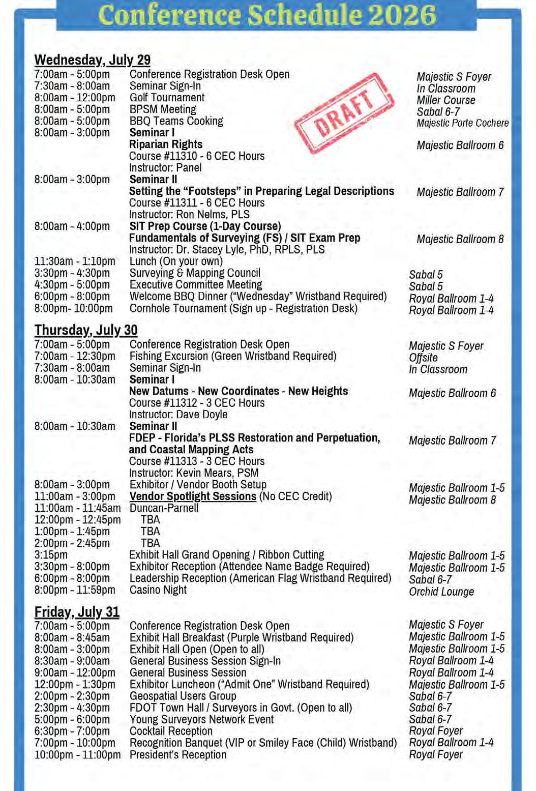
8:00 am - 3:00 pm
Riparian Rights
Choose one 6-hour seminar for Wednesday
Prep 8:00 am4:00 pm
Wednesday - July 29
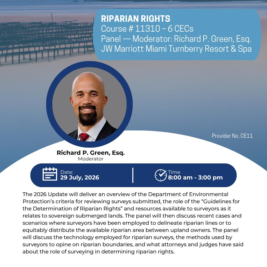
(6 CEC – #11310) Instructor: Richard P. Green, Esq.
The 2026 Update will deliver an overview of the Department of Environmental Protection’s criteria for reviewing surveys submitted, the role of the “Guidelines for the Determination of Riparian Rights” and resources available to surveyors as it relates to sovereign submerged lands. The panel will then discuss recent cases and scenarios where surveyors have been employed to delineate riparian lines or to equitably distribute the available riparian area between upland owners. The panel will discuss the technology employed for riparian surveys, the methods used by surveyors to opine on riparian boundaries, and what attorneys and judges have said about the role of surveying in determining riparian rights.
Richard P. Green, Esq. is Senior Attorney at the St. Petersburg office of Lewis, Longman & Walker, P.A. He has extensive litigation experience in a variety of areas such as real property, commercial, riparian rights, and environmental matters. He represents various public and private entities in litigation in both federal, state, and administrative forums. Green was included in Tampa Magazine’s 2024 Top Lawyers List in the areas of Administrative/Regulatory Law and Environmental Litigation, the 2024 Best Lawyers in America “Ones to Watch List” for Environmental Litigation and Real Estate Law, and Rising Star by Florida Super Lawyers, a peer designation awarded to only 2.5% of Florida lawyers, since 2020.
Panelists: James C. Weed, PLS , David O’Brien PSM, Richard Malloy, PSM, Eric Sellers, PSM, Kevin Mears, PSM
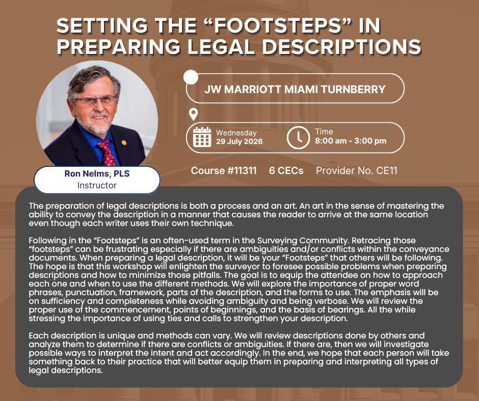
Setting the "Footsteps" in Preparing Legal Descriptions (6 CEC – #11311) Instructor: Ron Nelms, PLS
The preparation of legal descriptions is both a process and an art. An art in the sense of mastering the ability to convey the description in a manner that causes the reader to arrive at the same location even though each writer uses their own technique. Following in the “Footsteps” is an often-used term in the Surveying Community. Retracing those “footsteps” can be frustrating especially if there are ambiguities and/or conflicts within the conveyance documents. When preparing a legal description, it will be your “Footsteps” that others will be following. The hope is that this workshop will enlighten the surveyor to foresee possible problems when preparing descriptions and how to minimize those pitfalls. The goal is to equip the attendee on how to approach each one and when to use the different methods. We will explore the importance of proper word phrases, punctuation, framework, parts of the description, and the forms to use. The emphasis will be on sufficiency and completeness while avoiding ambiguity and being verbose. We will review the proper use of the commencement, points of beginnings, and the basis of bearings. All the while stressing the importance of using ties and calls to strengthen your description. Each description is unique and methods can vary. We will review descriptions done by others and analyze them to determine if there are conflicts or ambiguities. If there are, then we will investigate possible ways to interpret the intent and act accordingly. In the end, we hope that each person will take something back to their practice that will better equip them in preparing and interpreting all types of legal descriptions.
Ron Nelms, PLS founded Nelms Surveying; Inc. in 1992 and serves as the principal. He is licensed in California, Arizona, and Nevada. He is a past President (2018) of the California Land Surveyors Association (CLSA). CLSA Member of the Year in 2015. During his time at Nelms Surveying he has performed numerous surveys that included Boundary retracements, Legal Descriptions, Topographic surveys, As-Builts, and ALTA standard surveys. In addition, he is noted for his expert testimony. He is the author of “Putting Big Sticks by Little Sticks.” He has two sons and has been gifted with four grandchildren. A proud Rotarian and for recreation he plays tennis and pickle ball. He enjoys reading and writing in his spare time.
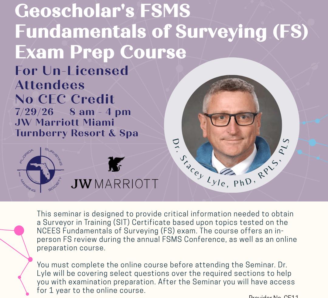
Geoscholar's Florida Surveying and Mapping Society Fundamentals of Surveying (FS) Exam Prep Course UnLicensed Attendees - No CEC Credit - Dr. Stacey Lyle, PhD, RPLS, PLS
Geoscholar's Florida Surveying and Mapping Society Fundamentals of Surveying (FS) Exam Prep Course is designed to provide critical information needed to obtain a Surveyor in Training (SIT) Certificate based upon topics tested on the NCEES Fundamentals of Surveying (FS) exam. The course offers an in-person FS review during the annual Florida Surveying and Mapping Society Conference, as well as an online preparation course. You must complete the online course before attending the Seminar. Dr. Lyle will be covering select questions over the required sections to help you with examination preparation. After the Seminar you will have access for 1 year to the online course.
Dr. Stacey Lyle, PhD, RPLS, PLS is an Associate Professor of Practice at Texas A&M University’s Zachry Department of Civil and Environmental Engineering and Department of Geography. He has served as an expert witness on lanwitness on land boundary court cases. He is active in the industry with over 35 years of surveying experience 1 including civil engineering, land surveying, cadastral land recor tabases, GIS/CAD/BIM Fusion, geodesy, hydrography,photogrammetry, and cartography.
Thursday - July 30 8:00 am - 10:30 am
Choose one 3-hour seminar for Thursday
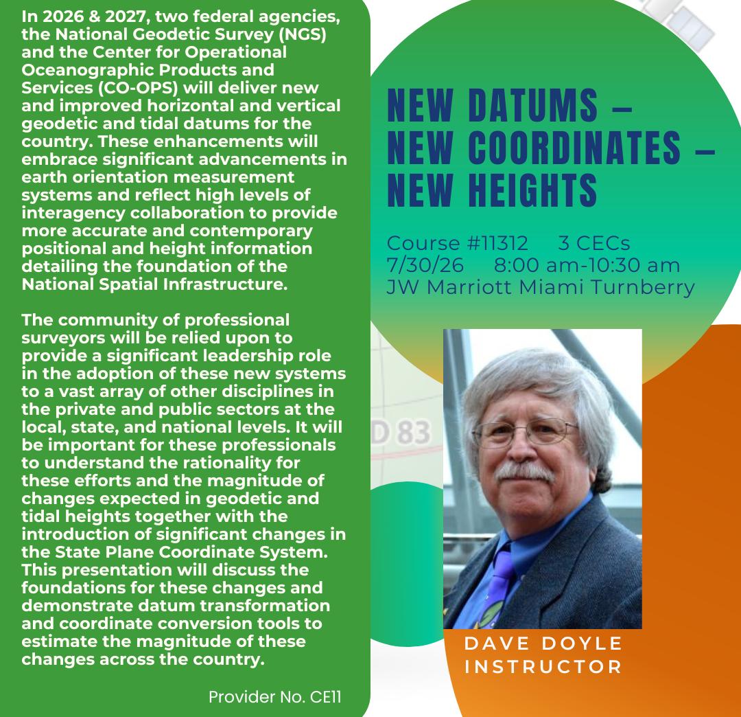
New Datums - New Coordinates - New Heights (3CEC – #11312)Instructor: Dave Doyle
In 2026 & 2027, two federal agencies, the National Geodetic Survey (NGS) and the Center for Operational Oceanographic Products and Services (CO-OPS) will deliver new and improved horizontal and vertical geodetic and tidal datums for the country. These enhancements will embrace significant advancements in earth orientation measurement systems and reflect high levels of interagency collaboration to provide more accurate and contemporary positional and height information detailing the foundation of the National Spatial Infrastructure. The community of professional surveyors will be relied upon to provide a significant leadership role in the adoption of these new systems to a vast array of other disciplines in the private and public sectors at the local, state, and national levels. It will be important for these professionals to understand the rationality for these efforts and the magnitude of changes expected in geodetic and tidal heights together with the introduction of significant changes in the State Plane Coordinate System. This presentation will discuss the foundations for these changes and demonstrate datum transformation and coordinate conversion tools to estimate the magnitude of these changes across the country.
Dave Doyle joined the National Geodetic Survey in 1972 and held the position of chief geodetic surveyor at his retirement in January 2013. He was responsible for the development, technical design and management of plans and programs that enhance the United States National Spatial Reference System. Mr. Doyle began his career as a geodetic surveyor in the U.S. Army in 1967 and served on numerous survey campaigns until completion of his military service in 1970. From 1970 until 1972, he worked for a private surveying company near Washington D.C. where he was responsible for completing boundary, topographic and engineering surveys while pursuing undergraduate studies in geodesy, cartography and mathematics at George Washington University. During his time at NGS his experiences included all phases of geodetic triangulation, astronomic positioning, leveling, GPS data collection, data analysis, datum transformations, network adjustments, and data publication. Mr. Doyle’s activities have included extensive efforts on the development and implementation of the national horizontal and vertical geodetic datums. He is currently the owner of Base 9 Geodetic Consulting Services. Mr. Doyle is a past president and Fellow Member of the American Association for Geodetic Surveying and is an active member of the District of Columbia, Maryland, New Jersey and Virginia professional surveyors’ associations.
FDEP - Florida's PLSS Restoration and Perpetuation, and Coastal Mapping Acts (3 CEC – #11313)Instructor: Kevin Mears, PSM
This course will meet the following objectives – The Coastal Mapping Act of 1974 - provide history leading to legislation; aspects of tides and MHW methodology; LABINS; historical and new tide stations; sample tidal station and benchmark items, vertical control and relationship to Erosion Control Lines. The PLSS Restoration and Perpetuation Act – provide history on the initial point, including reconstruction, efforts leading to legislation and the first CCR.
Kevin Mears, PSM manages the statutory programs and repositories for the “Florida Coastal Mapping Act of 1974” (Ch. 177, Part II, F.S.) and the “Florida Public Land Survey restoration and Perpetuation Act” (Ch. 177, Part III, F.S.) for DEP. He also manages the LABINS (www.labins.org) program via FSU FREAC (Florida State University’s Florida Resources and Environmental Analysis Center). Kevin has been involved in survey and mapping for over 45 years and has spent most of his career in the private sector and joined DEP’s Division of State Lands, Bureau of Survey and Mapping in 2021.
8:00 am9:40am
8:00 am9:40 am
8:00 am9:40am
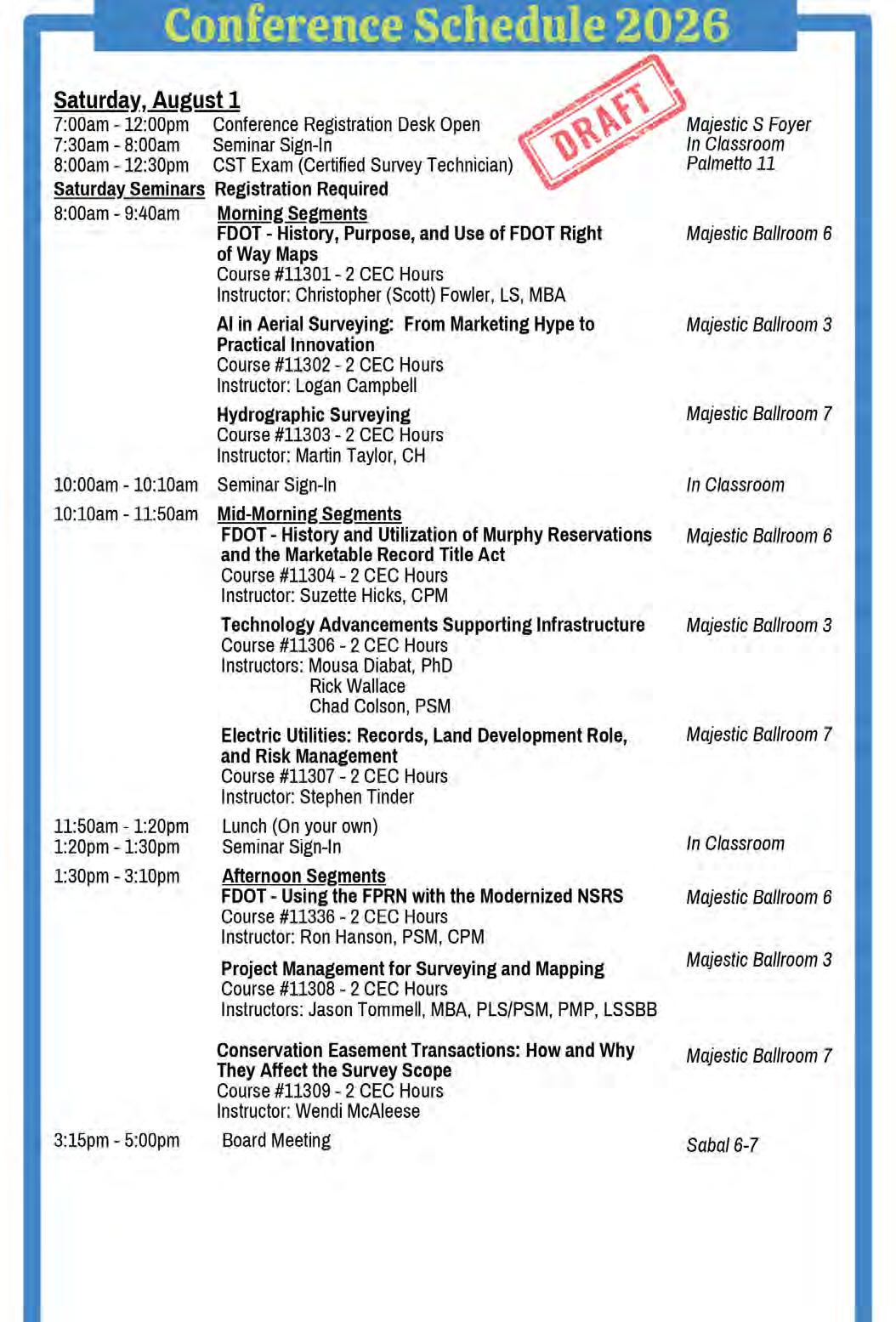
Saturday - August 1
FDOT - History, Purpose, and Use of FDOT Right of Way Maps
(2 CEC – Course #11301) Instructor: Christopher (Scott) Fowler, LS, MBA
This course presents the history of State Road Department’s and Florida Department of Transportation’s Right of Way Maps (RWM) as mapping evolved from the early days of automobile adoption to today’s extensive transportation infrastructure inventory. This course examines different era Right of Way Map examples to assist surveyors’ interpretation and application of Right of Way Map information for their practical use.
Christopher (Scott) Fowler, LS, MBA began land surveying in South Florida in 1989. His range of work experience includes land development, engineering support, construction layout, and roadway construction. He joined FDOT District Five in 2017 as Surveyor II in their Right of Way Mapping Section and is currently a Survey and Mapping Supervisor I in that same Section. He is a graduate of Miami Dade College, University of Minnesota, and Chancellor University. Mr. Fowler is a Licensed Surveyor in the State of Florida.
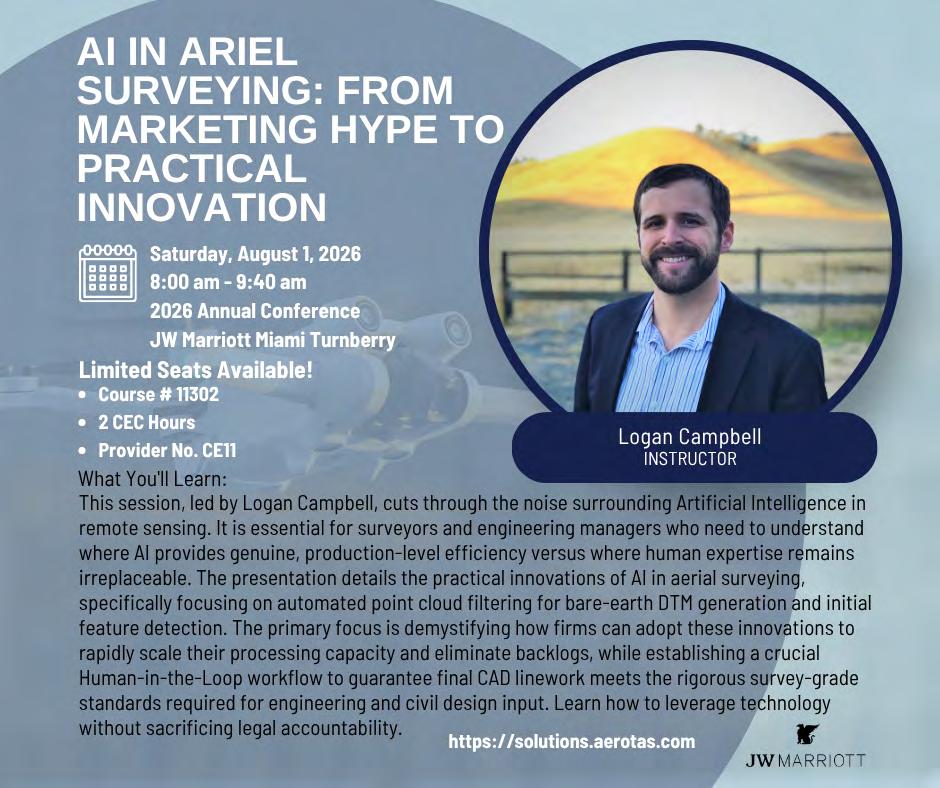
AI in Ariel Surveying: From Marketing Hype to Practical Innovation
(2 CEC- #11302) Instructor: Logan Campbell
This session, led by Logan Campbell, cuts through the noise surrounding Artificial Intelligence in remote sensing. It is essential for surveyors and engineering managers who need to understand where AI provides genuine, production-level efficiency versus where human expertise remains irreplaceable. The presentation details the practical innovations of AI in aerial surveying, specifically focusing on automated point cloud filtering for bare-earth DTM generation and initial feature detection. The primary focus is demystifying how firms can adopt these innovations to rapidly scale their processing capacity and eliminate backlogs, while establishing a crucial Human-in-the-Loop workflow to guarantee final CAD linework meets the rigorous survey-grade standards required for engineering and civil design input. Learn how to leverage technology without sacrificing legal accountability.
Logan Campbell is the Founder and CEO of Aerotas, which provides drone data processing for land surveyors and Civil Engineers. He founded Aerotas in 2014 and has since helped thousands of surveyors get the highest quality data out of their drone programs. Prior to founding Aerotas, Logan worked as a statistician in the financial services industry. Logan has an MBA from Harvard Business School and received his undergraduate degree from USC. Logan is a Certified Mapping Scientist with the ASPRS and a CFA Charter holder. As a recognized industry expert, he regularly speaks at survey and drone conferences and writes in numerous land surveying publications.
Hydrographic Surveying
(2 CEC - #11303) Instructor: Martin Taylor, CH
This session provides a practical, high-level overview of hydrographic surveying and its application within professional land surveying practice. Hydrographic surveying involves the measurement and mapping of underwater terrain and features using technologies such as single-beam and multibeam echosounders, side-scan sonar, magnetometer, subbottom profilers, inertial motion units (IMUs), and autonomous platforms. Participants will gain insight into how hydrographic surveys are conducted in rivers, lakes, and coastal environments, and how the resulting data supports navigation safety, dredging, marine construction, floodplain management, and environmental restoration. A central focus of the course is the integration of hydrographic and conventional land survey data. Practical workflows for combining bathymetric and topographic datasets will be discussed, enabling seamless shoreline modeling, infrastructure planning, and boundary delineation. Emerging technologies—including autonomous surface vehicles (ASVs), bathymetric LiDAR, real-time GNSS correction services such as Real-Time Extended (RTX), and cloud-based data processing—will also be introduced, equipping land surveyors with the knowledge needed to collaborate across disciplines and adapt to an evolving geospatial landscape.
Martin Taylor is a THSOA-NSPS Certified Hydrographer with over 20 years of professional experience in the geospatial and surveying industry. He serves as a Senior Geospatial Project Manager at McKim & Creed, managing complex, multidisciplinary surveying projects that integrate hydrographic surveying with mobile, aerial, and static lidar and conventional land surveying techniques. His project experience includes federal navigation channel surveys, beach renourishment initiatives, and extensive surveying support for transportation infrastructure projects, including mobile lidar corridor mapping for state Department of Transportation (DOT) roadway programs.Martin’s professional focus spans hydrographic surveying, terrestrial lidar, and transportation-related surveying, with an emphasis on sensor integration, survey design, data processing, standards development, and the integration of bathymetric and topographic datasets. His work supports shoreline modeling, infrastructure planning, corridor mapping, and the management of coastal and transportation systems. He holds a bachelor’s degree in Physics from the University of Waikato in Hamilton, New Zealand, and has lived in Wilmington, North Carolina for the past 20 years, where his work encompasses riverine, coastal, nearshore, and transportation environments. This presentation marks his first appearance at the Florida Surveying & Mapping Society (FSMS) conference.
10:10 am -
11:50 am
10:10 am -
11:50 am
10:10 am -
11:50 am
Saturday - August 1
FDOT - History and Utilization of Murphy Reservations and the Marketable Record Title Act
(2 CEC - #11304) Instructor: Suzette Hicks, CPM
This course presents the history of the Murphy Act and its impact on present-day property. Students will learn how to identify a valid State Road and how to obtain a release. We will also cover the Marketable Record Title Act (MRTA) and its impact on the title search and its exceptions.
Suzette Hicks, CPM started her career in banking, after graduating from the University of Central Florida, with a Bachelor of Science in Business Administration with a major in Finance. She worked many different positions in banking, including a Loan Secretary, Assistant Branch Manager and an Administrative Assistant, where her duties included training Loan Secretaries and Branch Managers the proper way to execute the loan documents. Following her 8 years in banking, she went to work for a Title Insurance Underwriter and learned title examination. After learning how to do complete title searching and even supervising the research department for 7 years, she left the private industry for FDOT. At the FDOT, Suzette has worked on many important projects, such as Ultimate I-4, SunRail, Wekiva Parkway, and High Speed Rail. She is the supervisor of the Title and Documents Section for District 5, with 9 counties and 6 employees. She has been at the FDOT for 27 years, 13 as a supervisor.
Technology Advancements Supporting Infrastructure
(2 CEC – #11306) Instructors: Mousa Diabat, PhD, Rick Wallace, Chad Colson, PSM
This session features a series of presentations highlighting current practices and emerging technologies for bridge deck inspection, bridge clearance, infrastructure expansion along with right-away safety and compliance. Contributors will discuss a broad spectrum of methods, including traditional visual assessments, physical assessments, and modern data-collection platforms that support more efficient condition monitoring. Among the techniques covered is the use of airborne thermal infrared imaging to help identify potential delamination, presented as part of a wider toolkit of remotely sensed approaches. By examining the strengths, limitations, and practical considerations of each method, the session offers a well-rounded perspective on how diverse inspection and planning strategies can be integrated to support safer, more resilient infrastructure.
Dr. Mousa Diabat, PhD (pronounced Moo-sa, De-ya-bat) is a Technical Domain Expert at NV5 Geospatial, specializing in remote sensing thermography and hydrology. He has led the development of several innovative airborne thermal infrared imaging solutions for infrastructure inspection, pipeline monitoring, and the mapping of geothermal resources and natural assets. Dr. Diabat’s work brings cutting-edge technology with practical applications, advancing the role of thermal infrared remote sensing in environmental and engineering domains.
Rick Wallace has a strong management background with more than 35 years of combined experience in both the information technology and geospatial industries. Rick currently serves as the Southeast Regional Manager for NV5 Geospatial. His responsibilities include Quality Assurance and Quality Control for photogrammetric and GIS projects, project design and estimation, contract administration and scheduling, along with client liaison responsibilities. He coordinates Southeast project activities with assigned project managers and technical staff. A native of North Carolina, Rick has worked with project teams throughout the United States to provide leading edge technical solutions for clients and their constituents.
Chad Colson, PSM serves as a Director of Surveying, SUE, Transportation + Geospatial services, and has over 13 years’ experience with boundary surveys, hydrographic surveys, terrestrial LiDAR, topographic surveys, aerial mapping with drones (using photogrammetry and LiDAR), subsurface utility surveys, right of way mapping and construction staking. He holds a Graduate Certificate from the University of Florida in Mapping with Unmanned Aerial Systems. In addition to working on a variety of projects throughout Florida, he has also supported technical aspects of the field efforts on projects throughout the southeast region of the United States for engineers.
Electric Utilities: Records, Land Development Role, and Risk Management
(2 CEC - #11307) Instructor: Stephen Tinder
This course provides an overview of electric utilities’ role in land development, surveying, and risk management. Participants will learn how to research and request land rights records, including easements, corridor maps, as-built drawings, and encroachment agreements, and understand the step-by-step process for coordinating with various Land Rights and Right-of-Way teams. The course explains when and why development activities trigger electric utilities review, outlines the possible outcomes of that review process, and emphasizes the importance of proper encroachment documentation as a risk mitigation tool. It also examines electric utilities’ influence on easement and encroachment case law and discusses the practical implications for surveyors, developers, and other professionals involved in land development.
Stephen Tinder is an accomplished multidisciplinary land professional with over 20 years of experience in the oil and gas, electric transmission and distribution, and renewable energy sectors. He has vast experience conducting title research and negotiating agreements from private landowners, utility companies, and the Department of Transportation for various states. Mr. Tinder also has experience in creating and implementing training materials to ensure consistency in deliverables to the client.
Saturday - August 1
FDOT - Using the FPRN with the Modernized NSRS (2 CEC - #11336) - Instructor: Ron Hanson, PSM, CPM
1:30 pm3:00 pm 1:30 pm3:00 pm
This course outlines the best practices for using the Florida Permanent Reference Network (FPRN) for accurate GNSS positioning. Review the suggested methods for using each of the four reference frames offered by the FPRN. NAD 83 – The current horizontal and geometric control datum for the United States. NATRF 22 – The modernized National Spatial Reference System (NSRS) replacing NAD 83. WGS 84 – Reference Frame developed by the United States Department of Defense, commonly used with autonomous vehicles and drones. ITRF 2020 – The latest version of the International Terrestrial Reference Frame. Used as the basis for the modernized NSRS. Review services offered on the FPRN web page. Rinex download. Computation service.
Ronald “Ron” Hanson, PSM CPM is a Florida Professional Surveyor and Mapper. He is employed by the Florida Department of Transportation, Office of Transportation Technology, Surveying and Mapping Office as the Geodetic Services Supervisor, ultimately responsible for the operation of the Florida Permanent Reference Network (FPRN) and State-Wide Geodetic Control. Ron has a survey career that spans 40 years, with 25 years as a PSM. Ron was one of the first users of the FPRN in private practice to receive Real-Time corrections. He has been managing the FPRN since January 1, 2013.
Project Management for Surveying and Mapping (2 CEC – Course #11308) - Instructor:Jason Tommell, MBA, PLS/PSM, PMP, LSSBB
Explore practical project management frameworks tailored for Surveying & Mapping. We'll discuss baselines, tracking performance, managing changes systematically, and selecting appropriate approaches (waterfall, agile, or hybrid) for different project types. A conversational session examining tools and techniques worth considering for your surveying practice.
Jason Tommell, MBA, PLS/PSM, PMP, LSSB grew up in Saratoga Springs, NY and worked on survey field crews from a young age during summers in his father's regional survey company. His work as a survey rodman and later as an instrument operator continued through high school and college. Jason attended Washington College in Chestertown, MD as a Humanities major, earning a Bachelor of Arts degree. After college, he worked in and later ran the family survey business, which grew to include engineering, landscape architecture, GIS, and forestry services. Since closing the business in 2015, Jason has held multiple survey leadership roles at engineering and surveying firms, currently serving as Director of Survey and Operational Excellence and a Program Manager at SGC Survey. Jason completed Norwich University's MBA program in 2009 with a concentration in organizational leadership. He holds a certified floodplain manager (CFM®) certification, project management professional (PMP®) certification, and is a Lean Six Sigma black belt (Council for Six Sigma Certification). He obtained an online graduate certificate in surveying engineering technology from the University of Maine and is currently pursuing an MS in Surveying Engineering Technology at the University of Maine. Jason's initial land surveying license is in New York (2006). He is also licensed in Florida and Kentucky.
Conservation Easement Transactions: How and Why They Affect the Survey Scope (2 CEC – Course #11309) - Instructor: Wendi McAleese
1:30 pm3:00 pm
Join Wendi McAleese, current Vice-Chair of the Board of Professional Surveyors and Mappers, to discuss the due diligence differences between fee transactions and conservation easements. Conservation Easements require on-going cooperation between the buyer and seller, resulting in complex issues not generally seen in fee transactions. Wendi will outline the unique scope of survey services required for CEs, including internal access easements, complicated cut-outs and internal encroachments and discuss how each affects the overall transaction.
Wendi McAleese is a Florida Licensed Title Insurance Agent and Licensed Real Estate Salesperson with over 28 years of experience in the insurance industry. As President of American Government Services, Wendi is actively involved in the day-to-day operations of the company including management of our Closing Department. She is responsible for title examination on all work performed under contracts with the Florida Department of Transportation, Florida’s Turnpike Enterprise, Florida Department of Environmental Protection, and the U.S. Army Corps of Engineers. Wendi also serves as Project Manager for the FL Department of Environmental Protection multi-year statewide contract to provide title and closing services. Wendi’s professional accomplishments include the purchase of an $18.5 million parcel for the Florida Department of Transportation, which at the time was the largest single payout in the history of the Florida Turnpike Enterprise. She also served as senior closing agent for the acquisition of a $36 million conservation easement by the Florida Department of Environmental Protection in Glades County. She was appointed as a Consumer Member of the Florida Board of Professional Surveyors and Mappers in 2023.
Registrants Name:
71st Annual FSMS Conference
CONFERENCE REGISTRATION
July 29 – August 1 at JW Marriott Miami Turnberry Resort & Spa
Packet 1 – Full Registration/Best Value
Member
Licensed Non-Member
Non-licensed
$500
$650
$450
Includes: (1) Wednesday Welcome BBQ ticket, (1) Friday Exhibit Hall Breakfast ticket , (1) Friday Exhibit Hall Lunch ticket, (1) Friday Recognition Banquet ticket, and (6) Saturday Seminar CEC’s.
Member
Packet 2 – Partial Registration
Member
Licensed Non-Member
Non-Licensed
$485
$635
$435
Includes: (1) Friday Exhibit Hall Breakfast ticket, (1) Friday Exhibit Hall Lunch ticket, (1) Friday Recognition Banquet ticket, and (6) Saturday Seminar CEC’s.
Packet 3 – Saturday Only
Licensed Non-Member
Non-licensed
$260
$360
$210
Includes: (6) Saturday Seminar CEC’s
SATURDAY SEMINARS
August 1
Course options are listed below, please mark the circle next to the course. Choose only ONE course per time segment.
2 Hour Course Options
Course name:
8:00 am–9:40 am (choose one from this row)
FDOT – History, Purpose, and Use of FDOT Right of Way Maps
(2 CEC’s – Course #11301)
Instructor: Christopher (Scott) Fowler, LS, MBA
Course name:
10:10 am – 11:50 am
(choose one from this row)
1:30 pm – 3:10 pm
(choose one from this row)
FDOT – History and Utilization of Murphy Reservations and the Marketable Record Title Act
(2 CEC’s - Course #11304)
Instructor: Suzette Hicks, CPM
Course name:
FDOT - Using the FPRN with the Modernized NSRS
(2 CEC’s – Course #11304)
Instructor: Ron Hanson, PSM, CPM
Course name:
AI in Ariel Surveying: From Marketing Hype to Practical Innovation
(2 CEC’s – Course #11302)
Instructor: Logan Campbell
Course name:
Technology Advancements Supporting Infrastructure
(2 CEC’s - Course # 11306)
Instructor: Mousa Diabat PhD, Rick Wallace, Chad Colson, PSM
Course name:
Project Management for Surveying and Mapping
(2 CEC’s – Course #11308)
Instructor: Jason Tommell, MBA, PLS/PSM, PMP, LSSBB
Course name:
Hydrographic Surveying
(2 CEC’s – Course #11303 )
Instructor: Martin Taylor, CH
Course name:
Electric Utilities: Records, Land Development Role, and Risk Management
(2 CEC’s – Course #11307)
Instructor: Stephen Tinder
Course name:
Conservation Easement Transactions:
How and Why They Affect the Survey Scope
(2 CEC’s - Course #11309)
Instructor: Wendi McAleese
71st Annual FSMS Conference
SIT ($300) / Wed. Seminars ($260) / Thurs. Seminars ($130)
Instructor: Panel – Moderator: Richard P. Green, Esq.
Seminar II:
Setting the “Footsteps” in Preparing Legal Descriptions
(6 CEC’s - Course #11311 )
Instructor: Ron Nelms, PLS
SIT Prep Course (Un-Licensed Attendees, No CEC Credit)
July 29
8:00 am – 4:00 pm
Geoscholar's Florida Surveying and Mapping Society Fundamentals of Surveying (FS) Exam/Surveyor in Training (SIT) Certificate Prep Course
You must complete the online course before attending the Seminar. Dr. Lyle will be covering select questions over the required sections to help you with examination preparation. After the Seminar you will have access for 1 year to the online course.
FDEP - Florida’s PLSS Restoration and Perpetuation, and Coastal Mapping Acts
(3 CEC’s - Course #11313)
Instructor: Kevin Mears, PSM
EXHIBITORS
PLATINUM
Duncan-Parnell
Duncan-Parnell is an Authorized Trimble Dealer for land survey, mapping/GIS, and construction instruments — and has been the leading provider of survey & mapping solutions in Florida for over 25 years. Our product offerings include GNSS receivers, drones/UAVs solutions, robotic and manual total stations, software for workflow integration, digital and automatic levels, 3D laser scanners, mobile mapping and monitoring solutions, construction lasers, as well as a full range of field supplies and accessories. Duncan-Parnell is your full field-to-finish provider. Our Geospatial team has decades of industry experience, certified service centers, and experienced trainers on staff. We’re ready to be a trusted partner and assist with your sales, rental, or maintenance needs. Contact us today!
EXHIBITORS
GOLD
Frontier Precision Unmanned
Frontier Precision Unmanned delivers comprehensive uncrewed solutions for surveying and mapping professionals, helping teams move seamlessly from data capture to accurate, usable deliverables. Through expert guidance, data services, and training, we support efficient workflows, reliable results, and scalable program development.
EXHIBITORS
SILVER
Aerotas
Aerotas is a national drone data collection and processing company helping surveyors and engineering firms deliver projects faster and more efficiently. We provide aerial data acquisition, photogrammetry processing, LiDAR classification, orthomosaics, topographic mapping, CAD drafting, and utility corridor support for projects across the United States. Trusted by surveying professionals nationwide, Aerotas combines responsive service, reliable turnaround times, and survey-focused expertise to help firms scale capacity without adding internal overhead.
GROUNDHAWK
SILVER EXHIBITORS
KUCERA INTERNATIONAL, INC.
Kucera International, Inc. is a leading provider of aerial remote sensing, lidar processing/classification, photogrammetric mapping, orthoimaging, CAD and GIS conversion and support, and related services for surveying/engineering, government, industrial/ commercial, and educational/research applications. Kucera’s in-house staff of over 60 experienced geomatic professionals working at offices in Florida, Ohio, and Pennsylvania includes licensed/certified photogrammetrists, surveyors, engineers, GIS/CAD specialists, project managers, pilots, and aircraft mechanics. For aerial data acquisition, Kucera maintains a fleet of high-performance, multi-port manned aircraft outfitted with latest generation aerial lidar, digital aerial imaging, and multispectral sensing systems integrated with advanced airborne GPS/IMU georeferencing technologies. For data processing, mapping, conversion, and support, Kucera uses a variety of robust, proven remote sensing, photogrammetric, imaging, and GIS and CAD technologies/software. Kucera regularly works throughout Florida, the Caribbean region, and other areas of the U.S. Kucera is a long-standing Florida professional surveying and mapping firm and a sustaining member of ASPRS.
EXHIBITORS
SILVER
NavVis
BUILD
BETTER REALITY
— Bridge the gap between the physical and digital worlds through reality capture technology that provides the digital foundation for the world you want to live in. We supply fast, reliable spatial data to service providers and enterprises seeking to capture photorealistic digital twins of the built environment. And our digital factory solutions enable greater organizational operability, productivity, agility, and profitability. Headquartered in Munich, Germany, and with offices in the United States, the United Kingdom, and China, NavVis serves global customers across the surveying, AEC, and manufacturing industries. Learn more at www.navvis.com.
SAFE SITE UTILITY SERVICES LLC
Safe Site LLC is a full-service utility locating and subsurface utility engineering company dedicated to improving safety and reducing risk on excavation and construction projects. Using advanced technologies such as ground penetrating radar (GPR), electromagnetic (EM) locating, vacuum excavation, and utility mapping, Safe Site accurately identifies and documents underground utilities, including gas, water, sewer, electric, and telecom lines. Serving contractors, engineers, and municipalities across the U.S., Safe Site delivers reliable, non-destructive data to help prevent utility strikes and project delays. Learn more at safesitellc.com or call 844-224-4774 for more information or service inquiries.
EXHIBITORS
SILVER
YellowScan
At YellowScan, we design, develop, and build LiDAR solutions for professionals that require performance, robustness, and accuracy. Our hardware and software solutions are easy-to-use data collection tools that come with training and support from our experts. Our products come with embedded laser scanners, INS, GNSS receivers, and onboard computing. Each system is designed to meet the highest precision and accuracy needs for 3D mapping. Founded in 2012 in France, we now have sales, customer training, and support representatives around the globe. Our customers use our products in surveying, forestry, environmental research, archaeology, industrial inspection, civil engineering, and mining sectors.
Sponsors
Lanyards E TM Surveying & Mapping
Name Badges SAM
Conference Tote Bags L ANGAN
Swag C AULFIELD & WHEELER
Sponsors
Registration Desk & Signs S SMS
Program Book (Front Cover) D RMP
Casino Night L ANDPOINT
Cornhole
Sponsors
Young Surveyors Event D uncan-Parnell
Young Surveyors Event L ANGAN
Young Surveyors Event L ANDPOINT
Young Surveyors Event S SMC
Sponsors
Exhibit Hall Luncheon Bar
Surveyors Instrument Services
and
Forts, Ports, Canals, Wars
An Uncommon History of Tallahassee & Surrounding Areas
by Dr. Joe Knetsch
(State Library and Archives of Florida)
Renactment of the Battle of Natural Bridge
Observations on the Battle of Natural Bridge
Few battles in the history of the State of Florida have had so many disparate elements as the Battle of Natural Bridge. In this significant battle, troops of the 99th and 2nd Colored Infantry bore the brunt of the Federal side of the engagement while facing the troops in the center of the line from the West Florida Seminary, mere boys from the local school in Tallahassee. Many elements on the Confederate side were reserve units from Gadsden and Jefferson Counties, most of whom were either too old or too young to be enlisted or conscripted into service. Few Confederate units had any previous battle experience, though some individuals in the reserve units had already served the cause bravely. The Union side also included elements of the 2nd Florida Cavalry, headquartered in Fort Myers and led by a former Union naval officer with no connection to Florida. Most of the Union artillery in the battle were manned by Union naval personnel and consisted of naval howitzers. Thus, the battle represents one of the more unique combinations of units to be found in any battle during the war.
P
rior to the battle commencing, the forces of Florida were scattered and untrained in normal army discipline. According to General William Miller, he found many of the troops in tattered clothes and nearly barefoot. Upon a quick requisition trip to Charleston, he partially remedied the situation. He also found the troops sadly lacking in training and the cavalry units short of horses, some 60 or more had to be destroyed because of the glanders. Skilled officers were also lacking, and one of Miller’s reforms was to hold new e lections of officers, which proved so chaotic that he had to select the officers himse lf. Of the officers he selected and got elected was Colonel J. J. Daniel of Jacksonville, a former U.S. Deputy Surveyor and future leader in the legal profession of Florida in partnership with future governor Francis Fleming. In the Battle of Natural Bridge, Daniel was to lead the First Florida Reserves. Consolidating his forces under the command of Colonel Carroway Smith, he put in a rigerous program of training for the few forces at his immediate command. Miller also repaired certain vital railroad links within Florida to
Forts, Ports, Canals, and Wars
move troops and supplies more rapidly.
T he Union commander’s motives to attempt the attack on Tallahassee are, to this day, unclear. The lack of clear plans and the uncertain execution of those that were executed show an indecisiveness that normally leads to failure in military adventures. Attempts to burn railroad bridges crossing the Aucilla and Little Aucilla Rivers to the east and the Ochlockonee River to the west failed to accomplish anything materially affecting the battle and cost the lives of two unionist Taylor County men. The Union Commander BrigadierGe neral John Newton relied heavily on the advice of Major Edmuod C. Weeks, who had been given command of the 2nd Florida Cavalry. Neither man was familiar with the area to be attacked and relied on local informants and deserters for information. Somewhat surprising in the planning for this battle was the seemingly poor knowledge of Apalachee Bay and the St. Marks River, which greatly hampered landing operations by the Union Blockading S quadron. This is surprising when one considers that the Federal government spent considerable sums of money over the years improving the St. Marks and surely had plenty of good maps of the bay and river. That so many of the Union Blockading Squadron should have run aground approaching old Port Leon and in the bay is remarkable and fortuitous for rhe Confederate cause. The delays caused by the poor landings and the gallant delaying action at the East River bridge added valuable time for reinforcements to arrive on t he scene.
T he battle for Tallahassee, as the Battle of Natural Bridge is often labelled, began with the arrival of the fleet of thirteen steam and three sailing vessels off the coast on March 3rd, according to historian Mark Boyd, t his may have been the largest fleet ever assembled in Apalachee Bay. On t he morning of the 4th, a naval contingent of 30 men and 60 men under Weeks headed up the East River, by the lighthouse, to capture the bridge. T hey encountered little resistance at first and held the ground against an attack by local cavalry units. However, the grounding of the vessel with the reinforcements forced Weeks to temporarily withdraw. This gave opportunity to the Confederate forces to remove some of the planking and attempt to burn this bridge. General Newton, on the morning of the 5th, advanced toward the bridge and found it defended by elements of the 5th Florida Cavalry under the intrepid Lieutenant Colonel, George Washington Scott.
Scott’s action in delaying the crossing of the East River, though costing one art illery piece, added more time to the gathering of forces to oppose the plans of Newton and Weeks. The scene of action shifted to the old port city of Newport, home of the Daniel Ladd, a pioneer in the economic development of north central Florida.
T he town of Newport suffered considerable damage in the attempt to de lay the Federal advance. Ladd’s grist mill and warehouse were ordered burned to make for a clearer line of fire. The bridge at Newport was also burned to slow the advance and make the crossing of the St. Marks more difficult. The Confederate forces, Scott’s and other local units, had const ructed some earthworks and entrenchments across the river, which kept up an almost constant fire upon the Union forces as they approached the river bank. The result of this foresight was the fateful decision to advance further up the St. Marks to the Natural Bridge. Accordingly, Newton’s forces proceeded up a little use d trail pointed out by local guides to the east side of t he Natural Bridge. This set the stage for the battle that was to follow.
According to General Miller’s account, on the night of the 5th, it be came evident that the enemy was rapidly approaching the Natural Bridge. He therefore ordered Scott’s unit to head in that direction which met, at about 10:00 p.m., the seven companies of reserves under Daniel, about 275 me n from various militia companies (The Gadsden Grays, Col. Sam Love’s milit ia, and Lt. Whitehead’s artillery section) and 80 muskets under Col. Girardeau. He also had the benefit of Capt. Patrick Houston’s artillery pieces and that of Denham’s artillery battery, formerly of the Kilcrease Company of Gadsden County. At 4:00 a.m. on the 6th, Daniel and the other forces marched to the Natural Bridge and began entrenching the area under the direction of Scott. Houston’s battery, consisting of two pieces, was placed in t he center of the line to enfilade the approach over the bridge. By the first part of the day, or shortly after Daniel and Scott arrived, skirmishes were t aking place with the advance units of the Federal forces. The units on the scene, under Scott’s direction, placed themselves in an arc around the center of the line and left themselves an open field of fire of about 150 yards toward t he river. Miller arrived at the scene about 8:30 a.m. and brought with him t he cadets of the West Florida Seminary and 80 men under Col. Samuel Love. The cadets were immediately placed left of center and Love’s force
Forts, Ports, Canals, and Wars
placed in reserve for the support of Houston’s battery. About an hour later, De nham’s battery arrived and was placed on the left, with one piece placed on the right alongside of Whitehead’s. By this time, the Federal advance was pressing the troops and the battle was on in earnest.
According to Boyd, the Federals made three major attempts to cross the Natural Bridge, each with great spirit and verve, but each was repulsed by the continuous fire from the muskets and the cannister shot of the artillery. Early in the p.m., Carroway Smith’s experienced forces arrived on the scene and were placed to the right of the Confederate line down the St. Marks. This extention of the line made any hope of flanking by the Federals a pipedream and forced them to realize that the approach via the Natural Bridge was hopeless. This realized, the Federals began their withdrawal from the area and back toward the coast. This movement was well covered by the construction of some breastworks in the hammock across the bridge. With the slackening of the fire, the Confederate forces, under the command of Capt. W K. Simmons, advanced to penetrate the hammock. The advance was to be cautious and to determine only the extent of the withdrawal. However, Simmons, upon observing the breastworks and felled trees, decided upon an immediate charge. This maneuver cost the brave Captain his life and wounded more of his troops. This ended, technically, Battle of Natural Bridge as the Confederate forces only followed the Federals with small cavalry units.
T he actual number of troops engaged in the Battle of Natural Bridge, it is still subject to debate. The Federal force, according to General Newton, was originally 893 men, however, the actions at the East River bridge and at Newport forced him to advance a force of about 500 men to the Natural Bridge. Almost all of the troops engaged on the Federal side in the battle were from the two units of U.S. Colored troops, the 99th and 2nd Infantry. The record of the Confederate forces are very unclear as to the numbers in each unit. Boyd estimates the total number at anywhere from 600 to 700 de pending upon the sources used. For the greater part of the battle, however, he notes that Carroway’s forces were not engaged, so that the active number for the major portion of the battle would be approximately 476 men. Of this force, 25, at least, were the “boys” of the West Florida Seminary. For its part in the action, this unit, sometimes called the “Baby Corps,” was to receive the distinction of being only one of three such units in the entire country to be
Seminars at Sea 2026 Seminars at Sea 2026
The Cruise
• Princess Cruise Line - Majestic Princess
• 7 Nights
• Leaving out of New York Harbor 10/3/26
• Newport, Rhode Island
• Boston, Massachusetts
• A morning of “Learning” at Sea
• Saint John (for the Bay of Fundy), Canada
• Halifax (Nova Scotia), Canada
• A morning of “Learning” at Sea
• Return to New York Harbor 10/10/26
The Learning
• Two - 6 hour live morning classes while onboard during two days at sea from 7 am to Noon.
• History of Swamp and Overflowed Lands and Island Surveys in Florida (6 CECs) Course# 11097
• The Great Halifax Explosion of 1917: The Roles of the Surveyors & Planners (6 CECs) Course# 11096
• 12 hours CE Credit via your choice of Correspondence Courses.
• Registering for the Learning will be at an additional cost of $500 per seminar attendee above the cost of the Cruise. Click Here to Register for The Learning Provider No. CE11.
The Instructor
Dr. Joe Knetsch will be our live onboard instructor for the 2026 Seminars at Sea. Dr. Knetsch received his Ph. D. in history from Florida State University (1990), an MA in history from Florida Atlantic University (1974) and a B.S. from Western Michigan University with a major in History and Economics. He was the historian for the Florida Department of Environmental Protection (formerly Department of Natural Resources), Division of State Lands from 1987 to August of 2014.
The Details
• Book early to secure your cabin - FSMS currently has Deluxe Mini-Suites and Deluxe Balconies on hold until May 2026 at the below rates. Click Here to Check out the Cabins and their Availability
• Category MB - Mini-Suite $2066 per person based on double occupancy.
• Category DB - Balcony $1846 per person based on double occupancy.
• Please note at the time of booking with Princess any promotions which could include reduced fares or deposits will be applied to your booking. If there is another category of cabin you would like to book, our Travel Advisor Gail Oliver will work with you on finding the best cabin for the best rate to suit your needs. It is important to book with Gail to be considered a part of the FSMS group to receive the group benefits. Contact Gail Oliver at Tesoro Travel via email at gail@tesorotravel.com or phone at 904-687-5655.
The Sponsorship
$3000
• Verbal Recognition during Event
• T-shirts with your company logo
• “Thank You” on FSMS website and social media posts
• Listed in all Seminars at Sea Communication
• Featured Full-page ad in The Florida Surveyor Magazine
Forts, Ports, Canals, and Wars
allowed a battle streamer for their flag, “In grateful recognition of the valiant se rvice performed by the cadets of the West Florida Seminary.” The number of casualties is also a disputed figure, as the Confederate figure of three dead and 23 wounded would appear to reflect only the losses sustained in the act ual battle at the Natural Bridge and no other engagements. The Federal figure includes all casualties in the engagements from the East River Bridge t hrough the retreat. The Union losses, as listed by Boyd, were two officers and 19 men killed, 89 wounded and 38 listed as missing, for a total listing of 148 me n lost.
All battles of the War Between the States are important in the fact that they are bloodlettings between brothers and friends. All who served and came under fire did so bravely, though, like all men who know war, not wit hout trepidation. In reporting the engagement to his superiors, General Miller noted: “I cannot too highly commend the spirit with which the militia, from boys of 14 to men of 70, from the humble woodsman to the highe st civil dignitaries, came to the defense of their country and bore with patient endurance a long night’s march. Their bravery needs not comment …” We can add that same sentiment to all who served and fought in our country’s greatest war, and especially to those we today commemorate in this reenactment of the Battle of Natural Bridge. Let us all remember them well and long.
Destruction of a salt factory
(State Library and Archives of Florida)
CHAPTER
12
Salt and the Civil War in Florida
In addressing the legislature in 1862, Florida’s Governor John Milton st ated:
In November last I was informed that there was a large quantity of
Forts, Ports, Canals, and Wars
salt at Apalachicola, held for the purposes of spec ulation. Citizens of this and adjacent States desired to purchase, and a refusal to sell at reasonable prices, produced excitement which threatened to terminate in violence by the seizure of the salt by a mob. At the time, Apalachicola was threatened by the enemy, and the salt was liable to fall into their hands. The salt was much needed for the use of the State Forces and their families and other citizens. General Floyd, the officer in command, was ordered to take possession of the Salt and send it (except such as might be necessary at Apalachicola) to Ochesee, 90 miles above Apalachicola, and store it with Mr. Jason Gregory. This order was executed.1
S o valuable was this salt that an entire town would, in the face of the enemy, risk confrontation to obtain it. Few articles today would or could claim such attention from the populace of any town. However, in the midnine teenth century, salt was one of the most important items on the frontier. It was the only sure preservative of almost any meat or fish.
As t he War Between the States dragged on and beef supplies from west of the Mississippi dried up, the role of Florida as a supplier of this major commodity became paramount to the success of the southern states’ effort t o obtain independence. As Joe Akerman, Canter Brown Jr., and Robert A. Taylor have recently demonstrated beyond any doubt, the greatest role of Florida in the war, aside from its brave troops, was the supply of beef to the Confederate armies. For the armies to enjoy this limited supply while on the march, the beef had to be preserved. The only natural way to preserve meat was to either smoke it or cure it in salt. With the importance of beef came the attendant importance of salt to preserve it.
Alt hough less well known or documented, the transport of salted fish t o the southern armies and citizens was also important to the limited diet of the South. Pork too, was also sent from Florida and other adjacent southern states, and this item required preservation by salt. As Northern armies began to control the traditional Southern sources of natural salt, primarily in the Kanawha Valley of Virginia (today’s West Virginia), Saltville, South Carolina and Goose Creek, Kentucky, the production of sea water salt became of ever increasingly importantance to the Southern cause. To provide the armies of the South and its more dependent citizens with salt became a major goal
of the saltworks of Florida. Without increased production of this valuable commodity; the beef, fish, and pork with which to feed these hungry people would not be available and the Southern cause, itself, would be in danger.
Very early on, Governor Milton and the Legislature recognized the need to protect the populace and the army from speculators. In one of the more sweeping, bur necessary, enactments of the war, the Governor signed into law Chapter l,360 [No. 44.], Laws of Florida, which basically outlawed the attempt to monopolize the production of any needed commodity that would be utilized by the army or civilians. Any attempt to fraudulently represent that they were purchasing on behalf of the state or any of the Confederate states for the purpose of speculation could or would result in a conviction on felony charges, which carried a no less than one or more than three years. Anyone attempting to monopolize or create scarcity for the purpose of raising the prices for speculative gain could be guilty of a misde me anor which carried the stiff fine of no less than five hundred or more than five thousand dollar s. Even if this was done through the legal gambit of a corporation, the president and directors were liable to be punished too. 2 The only problem faced by Milton and the legislature was how and when to enforce this draconian law.
S alt make rs were also exempted from the dreaded conscription law of 1862. So important was their production that even the long arm of the conscript ing officer could not reach them. This, of course, led to widespread applications for such exemptions and the misuse of this enactment by desiring to avoid service on the fronts. Those on the frontlines did not appreciate the high prices of sale and the relatively high profits made by the salt make rs, e specially because they were exempt from this law. Michael Raysor, writing home in early 1863 expressed this sentiment when he noted the costs to his family and the army. He even suggested: “The conscript officer ought to go down there [the coast] and take all of them between eighteen and forty five. If they were up here [in Tennessee], I’ll insure they would be conscripted and soon.” 3 Not only were the salt make rs exempt from military service, they were given military protection.
Whe n possible, State troops or regular Confederate forces tried to give protection to the makers of sea salt . This, of course, was very difficult
Forts, Ports, Canals, and Wars
because of the lack of importance placed upon Florida in Southern military planning. Also, the very large number of salt works were scattered from Choct awhatchee Bay to near Tampa, an area much too large to expect much protection. With the lack of railroads and its relatively poor local road network, Florida was at a distinct disadvantage when expecting mili t ary assistance for its salt works. However, it did provide some protection through local militia units and some self cont ained units made up of salt workers. Inde ed, the State actually encouraged such units to be formed in 1862, when t he General Assembly passed a Joint Resolution, “For organizing the saltmake rs upon the coasts of Florida for their own and the public defense.” The resolution stated that the Governor would be empow e red to appoint officers, make suitable regulations and provide arms to these units. However, in recognition of the poor state of the public treasury, and the unpopularity of the salt make rs, this resolution further stated, “That the salt make rs so organized shall have no claim against the State of Florida for the services they may render agreeably to this resolution.” 4
Governor John Milton wanted to go further in controlling the saltworks and the profits made there from. In his message for 1862, he proposed t hat those engaged in salt making should be charged a tax of “one tenth part of the salt manufactured” for the State’s use, primarily for the benefit of the indigent families, many of whom were the families of soldiers at the front or who had been killed in action. He also asked for “suitable agents” to distribute this salt to the said families. The reasons, Milton argued:
T he makers of salt have the protection of the state, and have made, and are making immense profits in its manufacture. The laborers and t eams necessary to its manufacture and transporta t ion have consumed, and are consuming large quantities of grain which has been made in the state, and in proportion to the quan t ity consumed, and being consumed prices upon bread stuffs have been advanced, and they rendered more difficult to procure. 5
T he Governor did not get his way with the General Assembly in this attempt at regulation, however, he did not stop there. In September, he wrote to President Jefferson Davis asking for the exemption from service t o be regulated by the states. As he noted: “It would be a wise exemption
SURVEYOR ULTRA
Versatile and lightweight. Penetrates dense canopy and captures accurate ground models for forestry, mining, and infrastructure.
VOYAGER
Precision redefined: ultra-dense, long-range LiDAR delivering unmatched accuracy from UAV or helicopter.
NAVIGATOR
Shallow-water bathymetric LiDAR for rivers, wetlands, and coastal mapping.
PRECISION MAPPING. ANY INDUSTRY. ANY MISSION.
Frontier Precision Unmanned + YellowScan LiDAR
From shallow-water bathymetry to large-area forestry, mining, and infrastructure, Frontier Precision Unmanned delivers the unmatched accuracy of YellowScan LiDAR — integrated on drones or helicopters for any application.
As America’s largest and most trusted YellowScan dealer, Frontier combines the industry’s top LiDAR sensors with decades of geospatial expertise and full-service support. Whether you’re surveying corridors, monitoring coastlines, modeling terrain, or inspecting utilities, Frontier Precision Unmanned provides the tools, training, and experience to ensure your LiDAR investment delivers real results.
With Frontier’s broad lineup of drones, sensors, and software, you’ll find the right system — at the right scale — for your industry.
Partner with Frontier Precision Unmanned — your trusted U.S. YellowScan dealer.
Forts, Ports, Canals, and Wars
if confined to such as should be authorized by State authority, and that aut hority should be prudently, impartially and wisely exercised; otherwise privileges may and will be abused to the detriment of the public service.” He clearly stated his reasons to Davis for such unusual authority:
T here are honorable exceptions, patriotic men, who have labored in good faith to make salt, and perhaps regret the neces sity of having to charge their fellowcitizens $10 per bushel or 20 cents per pound for it. If millers, tanners, and saltmakers shall be exempted from military service, it should be upon condition that grain, cloth, leather, shoes, and salt manufactured by them should be sold at reasonable prices; maximum rates should be established, otherwise many anxious to avoid military service will not only be authorized to do so, but to make and dispose of the prime necessities of life at exorbitant prices to less fortunate fellowcitizens, to the wives and children of those fighting for their rights, and to the widows and orphans of soldiers who should be respected and protected, not only from the abuses of the enemy, but from extortions of heartless villains who would barter the liberties of the country for a 'mess of pottage'. …Since I have commenced to write, I have been informed of ten ablebodied men associated under the pretense of making salt, who for the last six weeks have been upon our coast without having made a bushel of salt, dodging from place to place to avoid being made conscripts, and they say they would rather die than to be disgraced by being made conscripts, and doubtless would as willingly be hung as traitors as die in battle vindicating the rights of free men. No man should be exempt from military service for his private benefit. 6
Ag ain, Milton did not get his way with President Davis any more than wit h his own State’s General Assembly, however, as quoted above, he did make the case for closer regulation and, in a thoroughly modern tone, put forth a case for government price cont rols.
T hroughout the war, Governor Milton tried to do what he could to either regulate the salt trade or alleviate some of its more onerous features. One of the most noticeable attempts at monopoly came with the attempt by various interests to purchase from the State all lands suitable for the setting up of saltworks. In his message for 1863, the governor put the case as follows:
While Florida has extended the privilege to citizens of other states to make salt within her jurisdiction and upon her lands, and has invited them to avail themselves of a privilege which has been largely accepted, and has proved of inestimable benefit, I regret to say that t he vile spirit of speculation and extortion has gone hand in hand and thrown obstacles in the way of cheap manufacture of this article, so indispensable to the citizens generally. In no way has this vile spirit been exhibited in a more oppressive and contemptible light than in the purchase of large tracts of land by our own and by citizens of other States, and the letting out for sale of mere fractions of it at exorbitant rates, thus depriving citi zens of our own and other states, of limited means, of the right or opportunity to manufacture cheaply, or even to use their own industry in the exercise and enjoyment of a privilege extended alike to the poor and rich. To check in a measure this growing evil, the lands in such localities were withdrawn from market. 7
Milt on’s condemnation of this attempt to monopolize the salt making areas of the State followed quickly on the heels of the action taken by the Board of Trustees of the Internal Improvement Trust Fund. This body, which had and has trusteeship over all State owned lands, met on June 30, 1863, and de cided to withdraw from sale all such lands lying within two miles of the coast of Florida which were suitable for making salt. Their target, specifically, was those individuals involved in the schemes attempting to control the price of salt through the purchase of said lands. 8 It was this very action to which Governor Milton was referring to in his annual message.
S peculators, in any form, were frowned upon in frontier Florida, especially if they were perceived to be maintaining a monopoly. Milton’s t irades against this alleged group, however, may not have had a basis in fact. Research into the sales receipts of the swamp and overflowed lands and of the internal improvement fund lands does not bare out Milton’s picture of a small group of monopolists attempting to corner the market of saltmaking lands along t he coast of Florida, or at least northern Florida. These lands were cheap, the state accepting seventy five cents per acre. Yet, there was no great rush to buy these lands. In northern Florida, from today’s Taylor County to Wakulla County, only two areas show any concentration of purchase, and none of ownership. The most land buying activity was
Forts, Ports, Canals, and Wars
confined to Township 8 South, Range 8 East, near Sweetwater, Oyster, and Fish Creeks in southern Taylor County, and in Township 4 South, Range 2 East, today’s St. Marks Reserve. Indeed, most of the activity of land purchase from the state came in this latter named area. The names of Gamble, Chaires, Bradford, Bailey, Lester, Muttan, and Ladd all appear, however, none had enough land to constitute any form of monopoly or oligopoly. Forty seven sales of internal improvement fund lands and only two of the swamp and overflowed lands fund are evidenced by the receipts held in today’s Land Records and Title Section of the Florida Department of Environmental Protection. As each of these sales was for less than a quarter of a quarter section of land, and there is no concentration of ownership in terms of location within the area, the only conclusion that can be drawn is that Milton was attacking a perceived enemy, not one that was in fact established. Yet, one must caution that this is only one area of study and does not constitute evidence for the entire state. Some of the lands most used for salt production in North Florida were in Wakulla County and enclosed within the old Forbes Purchase, of which little public record survives.
In a final executive action on the subject of salt, John Milton noted in his message for 1864, that he had found a workable solution to the problem of getting salt to those most in need of it. He noted:
Having ascertained the great convenience and advantage of contracting for the purchase of salt to be bought in quantity by the State for the use of soldiers families, I devoted a portion of the amount appropriated for the relief of soldiers’ families to the purchase of salt, which has been distributed in lieu of money which would have been expended for its purchase by families at a much greater price than that for which it was obtained. This method has operated well, and I would recommend that a specific appropriation be made for the purchase of salt for distribution to those counties where it is most difficult to be obt ained and most costly. 9
T hat the governor would go against the entire concept of state’s right s and individual freedom to obtain the necessities of life for his fellowcit izens indicates the extreme nature of the problem. The extreme greed and speculation of some individuals had to be reigned in to preserve the lives of
those most in need: the wives, children, and families of those who had gone to war.
T he makers of the salt that so worried the governor, also had their share of worries and woes. All was not simply a matter of greed and speculation. It was a matter of economics, profit, and the rationing of valuable resources. For the operation of a saltworks was a complicated business, especially in a time when resources, cash, transportation and labor are very scarce. It was not just pumping the water up to a boiling vat and allowing nature to take its course. The making and distribution of salt made from sea water was a complex business in which the added problem of continuous Union raids added to the overall costs to both producer and consumer.
At the beginning of the war, locally made salt was a minor, almost home base d industry. The only commercial establishment for the production of sea salt was that built in Key West, and the technology used in this facility was totally different from that adopted by nearly every maker along the coasts of Florida. The concern in Key West used the Cape Cod/New Bedford me thod of salt making, which involved vats with movable covers, a pickling vat, a drying room, and a considerable investment in building materials, labor, and maintenance to produce salt via evaporation. 10 Earlier attempts using the Bahamian method of evaporation were too costly in time, labor and included the possibility of a sudden rain shower washing away all profits. T he salt produced in northern Florida along the coasts at St. Andrews Bay, Alligator Point, Goose Creek, St. Marks, the Aucilla River, and other points, was by the more traditional and less expensive, boilng method. To quote from EA. Rhodes’s notable article:
T he average small salt plant consisted merely of a large kettle holding from sixty to one hundred gallons of water set in a brick or clay furnace. They were not build [sic] directly on the shore because of the high tides and wind, but were usually located a few hundred feet inland. Very near this furnace and kettle was dug a shallow well which always produced a plentiful supply of salty water. Sometimes shallow holes were dug along the shore, and falling tides would leave them full of water, which was dipped up and carried in buckets to the furnace. This method seemed to have been used by Dr. Bradford, however, it must be remembered
Forts, Ports, Canals, and Wars
that he used a large number of slaves at his plant [near St. Marks] and t herefore the question of labor involved was not a serious one. The salt water after being poured into the kettle, was boiled in the same way as the brine secured from the smokehouse. When there was only a thick brine left in the kettle it was dipped up, for further cooking would only burn that salt near the bottom of the kettle and render it unfit for use. The brine was usually placed on clean boards for the drying and bleaching process. Sometimes the brine was poured in a barrel, and after it settled the water was dipped off the top. This was done part icularly if the salt was not for table consumption, but merely for the use of packing meat, etc. 11
T his method did have some drawbacks, in particular, the brine was often boiled but not well dried. This meant that the glauber produced what is called “Epsom salts” and contained a high amount of lime and magnesium, which made the salt too bitter for use and turned the meat green in a very short time. The most recommended solution to the problem was to let the brine boil, then cool under a steady, but low fire, where the crystals would fall to the bottom after forming, then pour off the remaining briny water to prevent the impurities from forming and spoiling the product. 12 The method also had a more significant drawback; it produced a great deal of smoke at night , and provided lights by which the Union blockaders could pin point the manufacturer’s location.
Aside from these problems, the other major problem was hauling the salt to market or back to the plantations for domestic consumption. The rainy season often left the works untended or unworked because of the poor condition of the local road network. In January of 1864, for instance, W. E. Davis wrote to D. C. Barrow concerning his salt works near St. Marks:
De ar Sir: I drop you a few lines this morning though I have no news t o write you of interest, this leaves me unwell though able to be up, the rest are all well except one of Johny negroes that is having chills. It has been raining here every day this week the roads are So bad that we can Scarcely pull an empty wagon over them there is no body trying to make Salt at all. We are cutting and Splitting wood out at the Faircloth Place we have moved all the hands and mules out there to remain until
SUPPORT FSMPAC TODAY!
Your contribution can make a monumental difference in ensuring that our profession thrives and our voices are heard where it matters most.
Join FSMPAC and become a driving force for the future of Surveying & Mapping in Florida.
FSMPAC, the Florida Surveying & Mapping Political Action Committee, is your ticket to shaping the future of our profession. Our mission thrives on the generosity of dedicated Surveyors and Mappers who want to champion and safeguard our profession.
Your contributions go toward researching, identifying,and supporting candidates who champion our concerns.
Le arn More & Donate Here
Forts, Ports, Canals, and Wars
the weather is better. Salt is selling at from 12 to 15 Dollars per Bush we will go t o making again as soon as the roads get so we can have wood. 13
Mr. Barrow’s overseer, William B. Braswell, continued along this same t enor a few days later noting that he had nothing to do at the salt works “but st and in the mud & rain.” 14 Given that these salt making facilities were in the mar shy lands along the coast and the roads to the area followed, as best they could, the higher and dry routes, little wonder that the salt make rs could not ge t their product out in wet weather.
T he road network of early Leon County (and what is now Wakulla County) was fairly comprehensive. As early as 1825, a road had been marked and laid out from the Georgia line to St. Marks which covered the “nearest and best ground to St. Marks.” 15 Another road to St. Marks, from the center of Tallahassee, following the Meridian Line as closely as possible, was laid out in 1826. 16 Roads were also constructed from Tallahassee to Rock Haven, Magnolia, and Ne wport over the course of the next few years. However, the problem of maintenance was forever cropping up and the only way to get these roads repaired was through the annual levy of four to eight work days for each male (no matter of color) assigned by the local Justice of the Peace under direct orders from the County Court. A road was also constructed from St. Marks to Ashton’s Mill on the Ockolockney River and one connecting t his same point to Magnolia was also surveyed, though we do not know if it was ever constructed. 17 When one considers the extent of the road network, the lack of labor to maintain the roads properly, and the interposition of the Second Seminole War and periodic outbreaks of Yellow Fever, it is little wonder that the road construction and maintenance was somewhat behind the expectations of the salt make rs and others.
T he problem of suitable labor for the operation of the saltworks is also apparent from the letters of the day. Slave labor may have provided some of the saltworks with men, however, because of the frequent raids on the saltworks, the defection of “contraband” workers, especially after 1863, rapidly de pleted this supply and put into question those remaining. Historian George Buker, in his recent book Blockaders, Refugees,& Contrabands: Civil War on Florida’s Gulf Coast, 1861-1865 , has noted that the change in Union policy toward contraband, especially after the Emancipation Proc lamation,
Dr. Joe Knetsch
allowed Union commanders to recruit and promote contraband into the navy from ranks ranging from landsman to fireman. The increased activity of t he raiders caused the Confederates great consternation not only in the lost salt making capacity, but in the lost labor from defecting laborers, notably t he former slaves. The letters of the day also note the problem of getting competent overseers and the Barrow correspondence shows that keeping the incompetent ones could be costly to the operation too. 18
T he biggest and most worrisome problem of all, however, was the continued raids conducted by the East Gulf Coast Blockading Squadron. The well known raid on Goose Creek, west of St. Marks, in early 1864, produced some unique comments from Barrow’s overseer:
I left the salt works this morning and fel in company with one of the men that was taken at Goos Creek and he tels me that all the men that war not clear by age or inability they are going to keep for exchange. I am in danger whare I am and if I am not armd & protected I shal leave the works. It don’t pay to risk what you have thare…Capt Fisher is trying to organising all the salt makers but what good will that do and les we could be backt I dont dred the Blockade force but the deserters may come in behind us and then there will be no chance but to fight out I shal keep a shar p look out and if I find thing[s] not safe I shal leave … 19
T hese raids were often devastating, if even for a short time. The famed raid on St. Andrews Bay in late 1863, destroyed over a ten day period, five hundred salt works, thirty t hree wagons, twelve flat boats, two sloops, six oxcart s, four thousand bushels of salt, seven hundred buildings, and probably a thousand or more kettles and iron boilers. This represented a loss of nearly six million dollars, when added to the works destroyed by the Confederates themselves to prevent their capture. 20 Closer to home, the raid on Alligator Point, in June of 1863, destroyed sixty five kettles, over 200 bushels of salt, four saltwork, and thirty “huts and houses.” 21 The recitation of the extent and numbers of these raids could go on indefinitely, however, the point to be made is that these raids did put a severe limitation on the production of salt, and therefore prevented the preservation of meats and other foods destined for the front line armies of the Confederacy.
Forts, Ports, Canals, and Wars
De spite the best efforts of Governor Milton and the legislature, the salt works on the coast could not be adequately protected, nor could they prevent the price gouging by certain manufacturers/suppliers. The effort t o supply the army and civilian population with usable salt fell short of the demand for this valuable commodity. What is remarkable about the effort is t he amount of success these people had in providing, as best they could, the vital supplies to the army and civilians. In the face of constant raids, the salemake rs of Florida did accomplish a major feat of daring and perseverance. In the face of poor transportation facilities, they delivered a surprising amount of salt to the front lines. In the face of government criticism and control, they did make a legitimate effort to keep prices reasonable, in spite of the few extremely greedy individuals among them. Taken altogether, the combined efforts of Florida’s government, troops, and civilian salt make rs provided the Confederate armies with a vital supply, one without which the effort to establish an independent nation would have been much shorter.
ENDNOTES:
1. Journal of the Proceedings of the Senate of the General Assembly of the State of Florida. Tallahassee: Office of the Florida Sentinel, 1862. 44.
2. Act s and Resolutions of the General Assembly of Florida. Tallahassee: Office of the F loridian & Journal, 1862. 36.
3. Quot ed in John F. Reiter. “Deprivation, Disaffection, and Desertion in Confederate F lorida.” Florida Historical Quarterly . 48(January 1970): 287.
4. Act s and Resolutions of the General Assembly of Florida. Tallahassee: Office of the F loridian & Journal, 1862. 77.
5. Journal of the Proceedings of the Senate of the General Assembly of the State of Florida. Tallahassee: Office of the Florida Sentinel, 1862. 45.
6. T he War of the Rebellion: A Compilation of the Official Records of the Union and Confederate Armies. Series IV Volume II Washington: Government Printing Office, 1900 93 95. Le tter of September 11, 1862. John Milton to Jefferson Davis.
7. Journal of Proceedings of the House of Representatives of the General Assembly of t he State of Florida. Tallahassee: Office of the Floridian & Journal. 1863. 20 21.
8. Minutes of the Proceedings of the Board of Trustees of the Internal Improvement Fund of the State of Florida. Volume 1. Tallahassee: I. B. Hilson, 1902. 251 52.
9. Journal of the Proceedings of the Senate of the General Assembly of the State of Florida. Tallahassee: Office of the Florida Sentinel, 1864. 29.
10. De Bo ws Review . 14 (April 1853): 332 33. For a good discussion of the technology of salt making by evaporation, see William P. Quinn, The Saltworks of Historic Cape Cod Orleans, Mass.: Parnassus Imprints, 1993. This volume has very valuable illust rations and photographs of the vast saltworks of Cape Cod, which add greatly to the understanding of what the Lafayette Salt Company and Charles Howe were doing in Key West.
11. F. A. Rhodes. “Salt Making on the Apalachee Bay.” Tallahassee Historical Society Annual, 1935 Volume II. Tallahassee: Tallahassee Historical Society, 1935. 18.
12. Macon Telegraph . (no date) Quoted in Allen R. Gerrell. “The Civil War in and around St. Marks, Florida.” Self published. (no date). The letter Gerrell quotes is dated August 25, 1862 by one T. J. Boynton writing from Newport, Florida. 46 48.
13. W. E. Davis to D. C. Barrow, 8 January 1864. Barrow Papers, Special Collections, University of Georgia, Athens, Georgia, Folder 29. The author would like to thank David Coles for his guidance in the use of this collection.
14. William B. Braswell to D. C. Barrow, 15 January 1864. Barrow Papers. Box 3, Folder 69.
15. “Count y Court Minutes, Leon County, Florida: March 14, 1825 September 19, 1833.” The date for this entry is unreadable from the microfilm, however, it appears t o be from the April session of the County Court. There were two routes laid out from the Georgia line to St. Marks, one from where Thomas County, Georgia, had completed its road to the Florida line and the other from where Bevin County, Georgia, had laid out its road to the Florida line. For the transcribed copy of these minutes, see Joe Knetsch, “Road Builders of Early Leon County: A Study in Early Court Records.” Tallahassee Genealogist . 14(November 1994): 19 22.
16. Ibid. 21.
17. S ee Joe Knetsch. “Early Road Builders of Leon county”, Part II and III Tallahassee Genealogist . 14 (February and May, 1995): 13 16, 6 9.
18. Pope Barrow to Major General Henry C. Wayne. 10 October 1864. Barrow Papers. Box 3, Folder 2. The letter referred to asks for a service exemption for one Ge orge H. Davis, the overseer of the Barrow plantation in Decator County, Georgia. Part of his duties, it later appears, is the supervision of the final days of the saltworks at S t. Marks.
19. William B. Braswell to Captain Cobb. 25 February 1864. Barrow Papers. Box 3, Folder 29.
20. Ella Lonn. “The Extent and Importance of Federal Naval Raids on Salt Making in Florida, 1862 1865.” Florida Historical Quarterly . 10 (April 1932): 176.
21. Officia l Records of the Union and Confederate Navies in the War of the Rebellion , Series I, Volume 17. Washington: Government Printing Office, 1903. 469 71.
Forts, Ports, Canals, and Wars
Dr. Joe Knetsch is the author of over two hundred articles and sixteen books, most of them concerning the state of F lorida’s historty. T hree of these books involve the Seminole Wars and their impact on F lorida’s development. He is also a frequent reviewer of books on military history for the Journal of America's Military Past and authored regular articles for Professional Surveyor Magazine for over a decade. For twentyeight years he served as the historian for the Division of State Lands in the F lorida De partment of Environmental Protection. Dr. Knetsch lives in Tallahassee with his wife Linda and is now retired.
2026 MEMBERSHIP
Membership for 2026 is open and available for those needing to renew or for those wanting to join The Florida Surveying and Mapping Society. You can Renew your current membership by Clicking Here and logging-in to your FSMS account.
For those New Members wishing to join or rejoin if they were not a member in 2025, Click Here to read about our Membership types and click on the “Join FSMS Today” button at the top of the page to begin your membership with The Florida Surveying and Mapping Society.
ARCHIVES FROM THE
BOUNDARIES AND LANDMARKS
A PRACTICAL MANUAL
BY A. C. MULFORD
Boundaries and Landmarks
Chapter XI.
HOUSE LOTS (concluded).
Another complication which sometimes arises is in the matter of extending the streets from one property to an o ther. An illustration may be in point. There once came into my hands a map of lots laid out as follows: A main street ran through the middle of the property with a cross street at right angles to it. At the extreme edge of the property lay a street, which we will call “Edge Street,” distant 400 feet from the cross street and parallel with it. Edge Street had been formed from a residual strip 30 feet wide given by the property in question and a strip 20 feet wide given by the adjoining property. Four hundred feet from the cross street I found the old surveyor’s stake marking the intersection of Edge Street with the main street before mentioned, and I set the street monument accordingly. At this stage a lot owner on the main street made a protest and produced deeds showing that instead of 400 feet the distance between the cross street and Edge Street was really 405 feet.
A s earch in the County Clerk’s office showed that there was on file there a map of the property in which, previous to filing, certain dimensions had been erased and altered. One of the lots had been broadened from 50 feet to 55 feet and the strip thrown into Edge Street had been narrowed from 30 feet to 25 feet. In accordance with the recorded map I moved the monument 5 feet, thus increasing the distance between streets from 400 to 405 feet. It will be seen that there still existed a discrepancy of 5 feet between the corner as the original surveyor left it staked in the field and the corner as shown on the map filed with the County Clerk. In other words, the stakes in the field had never been moved to fit the revised map placed on file. Under ordinary circ umstances the final establishment of the corner should have settled all trouble, but it had happened that already the owner of the adjoining property had cut it up into lots and had extended Edge Street through
the entire length of it. Unfortunately the surveyor had extended this street from the stakes existing in the field, having no possible way of knowing that they did not agree with the map filed at the County Seat.
T his extension of Edge Street was opened, lots were sold along it, trees were planted and houses built. The result of the discovery of the error of location of the first part of Edge Street and its correction by moving the whole alignment 5 feet can readily be seen. In the first property this shifting was easily effected since this part of Edge Street had never been improved, but the permanent improvements of Edge Street in the adjoining property made such a “moving over” impossible. As a result, at the boundary line between the two properties the street “broke joints” to the amount of 5 feet, and when this private street later became a public highway the matter had to be adjusted by inserting a small oblique course to join these two unmatched por t ions.
It quite frequently happens that where the ground is uneven, careful measurements will show that there is not sufficient land between clearly established streets to meet the demands of the map or of the deeds which have already been filed. Sometimes, rarely in auction sales of lots, glaring errors will exist in dimensions. I remember one property where such errors occurred as the following,
Sa les dimension, 420 feet, actual dimension, 412.1 feet;
Sa les dimension, 335 feet, actual dimension, 355.5 feet; Sa les dimension, 150 feet, actual dimension, 130.75 feet; with others of the same nature. Unfortunately in the haste of the sale these lots were all sold by specified dimen s ions without a single qualifying word. It can readily be seen that the final adjustment was more profitable to the surveyor than to the parties of the first and second parts.
H ow can a surveyor bring order out of such chaos as this? How can he adjust all the discrepancies in the work of those who have gone before him? The answer is simple—he cannot. But he can do a great deal toward miti g ating conditions. He must be able to gather all informa t ion bearing on the problems and weigh it accurately, he must
be able to interpret a deed to a nicety and to deter m ine unerringly the priority of conflicting claims, he must be willing to bring about friendly relations and mutual concessions between adjoiners and he can advise his clients against accepting unsatisfactory deeds. Beyond all else he must be ready to go over with endless patience innu m erable repetitions of detail with interested parties who are frequently of willing mind but of slow comprehension. In short he must do all his work in such a thorough and painstaking manner that any one coming after him may find nothing to add to it.
O f one thing, however, I am firmly convinced, that it is useless for a surveyor to go into a strange subdivided prop e rty and locate any one lot with quickness, ease and accu r acy. I have seen the attempt fail too many times. If one could be certain that the first layout was absolutely accu r ate and that the stakes had never been displaced it would be a different matter; but such is not the case. Errors of inches and sometimes of feet often occur; right angles seldom measure exactly 90 degrees and stakes are fre q uently moved out of line by people stumbling over them. If the surveyor would rest with an easy mind he must check up a sufficient number of streets, blocks and lots, to be sure that he has located his special lot in strict accord a nce with the boundaries of the streets and the claims of other landholders. To do this he will frequently have to put in many hours of work from which he must expect no immediate returns. But the fact that he has taken pains to locate the lots accurately, that he has worked out the details of the property and that he (and very likely he only) knows where the lines truly run, practically insures that all or nearly all of the future work in that property will eventually come to him for execution. It is simply another illustration of the fact that honesty is the best policy.
T here is one other form of the lot problem which should be mentioned. In earlier times it was a frequent occur r ence for a land owner to sell a succession of house lots from his property. These small holdings adjoined each other and were of all shapes and sizes, with very uncertain relations to the highway which they bordered. Happily
they were usually fenced at an early date, and the evi d ences of early possession are of vastly greater value than the deed dimensions. Front and rear dimensions are usu a lly fairly accurate, but a common line between two neigh b ors will often have quite dissimilar lengths in the two deeds. This is due largely to the uncertain condition of the highway line. As stated, the lines of old possession are very important, but in deciding a boundary controversy it is never safe to assume that any one line of possession is sufficiently correct to be taken as a starting point for measurements. A sufficient number of deeds must be examined and a sufficient number of lots checked up to make certain of the accuracy of the possession line in question. It may then be used as a point of departure.
To illustrate, a certain street corner which was in dispute was recorded as being located “25 links west of lot belong i ng to William Smith.” The width of the Smith lot was measured and found to be exactly 50 feet — a standard size. Then the street corner was made 25 links beyond. To leave no chance of error the deed of the Smith lot was procured, and it was found that the front dimension was not 50 feet but “74 links of chain” or 48.84 feet. This led to a checking up of all other properties necessary, with the result that all lines of possession were found to be essentially correct except a part of the west fence of the Smith lot which was comparatively new. After this had been established it was easy to locate the street corner accurately and satisfactorily.
It will readily be seen that there are no fixed rules which can be laid down for the accurate handling of old lot layouts. Satisfactory results can be obtained only through care, patience and common sense and, above all, honesty.
S o much for the interpretation of old lot layouts; now a word with reference to the construction of new ones. With reference to general plan there is little to say, for the reason that the owner of the land has usually some pretty clear idea of just exactly what he desires — he simply wants the surveyor to carry out his design. In cases
where there is no such preconceived plan one or two sug g estions may not be out of place.
1. R oads and streets should be located, as far as possible, with a view to economy in construction and maintenance, while every effort should be made to so place the streets that after grading they shall be reasonably accessible from the lots bordering them.
2. I f the land is to be cut up into standard lots there is very little room for independence of action, but if it is to be divided into somewhat variable plots much can be done in the way of locating them with reference to picturesque n ess and accessibility. One further point might be made. Nearly every property has some undesirable land scattered about in one or more places. It is a mistake to make any one plot consist of undesirable land only, since it must be sold at a greatly reduced price if at all. If, how e ver, you so divide the property that this undesirable land shall be shared in small quantities by a number of plots otherwise wholly desirable, the difficulty has been over c ome. A purchaser naturally expects that he will get a little inferior land with the good and, if he gets a good house site and lawn, he is perfectly willing to take a little less satisfactory land on some other part of his plot. In other words, the idea is not to cut the land into extra fine plots and poor plots, but to so divide it that each and every plot shall have sufficient points of excellence to thor o ughly compensate for the less desirable features which must be distributed in general to all purchasers. Briefly put, the plots must all be salable.
3 . It is not good practice to subdivide land in the office. If the original traverse of the property has been exception a lly accurate this may be done with a fair degree of safety; but it so frequently happens that one error offsets another, that a fine balance of an entire traverse is no guarantee that the work is as perfect in all its details as this balance would seem to show. It is my belief that all streets should be actually laid on the ground and their intersections with the boundaries of the property actually determined in the field. All complete blocks and all residual blocks should also be measured
before any attempt is made to give even the approximate dimensions of residual lots. This method, while more laborious than others, is sure to give good re s ults, and will avoid the annoying discrepancies which are so frequently found in properties divided by methods of computation only.•
Past Presidents
19561957
H.O. Peters
19601961
Hugh A. Binyon
James A. Thigpenn, III
19571958
Har ry C. Schwebke
19611962
Russell H. DeGrove
Harold A. Schuler, Jr.
19581959
John P. Goggin
19621963
Perry C. McGriff
Shields E. Clark
19591960
R.H. Jones
19631964
Carl E. Johnson
Maurice E. Berry
Past Presidents
Past Presidents
Past Presidents
Past Presidents
Past Presidents
20152016
Dale Bradshaw
20192020
Don Elder
20242025
Richard Pryce
20162017
Lou Campanile, Jr.
20202021
Hal Peters
20172018
Robert Strayer, Jr.
20212022
Lou Campanile,
Jr.
20182019
Dianne Collins
20222024
Howard Ehmke
The Florida Surveying and Mapping Society has an eLearning Platform that is linked to your FSMS membership account .
When accessing the eLearning platform, use your FSMS membership username and password to log in. (Not Available for Sustaining Firm Memberships)
As always, Correspondence Courses are available by mail or email.
Updated Correspondence & eLearning Courses:
• Riparian Rights (Video Course)
• Basics of Real Property
• Map Projections and Coordinate Datums
• Elevation Certificates and the Community Rating System
• Datums (eLearning Video Course)
• FL Surveying and Mapping Laws
CHECK YOUR CREDITS HERE
Please email communications@fsms.org to notify us
Advertise With Us!
All advertisements contained within the publication are published as a service to readers. Publication of the advertisements does not imply or express any endorsement or recommendation by FSMS.
Benefits: Full color; hyperlinks added to your webpages as well as email addresses.
Requirements: Contracts for one year (11 issues) receive 10% discount if paid in advance; 15% for Sustaining Firms. (Ads should be in jpeg, pdf, or png format)
New ads and/or changes are due by the 25th of each month.
Questions? Call our office at (850) 942-1900 or email at communications@fsms.org