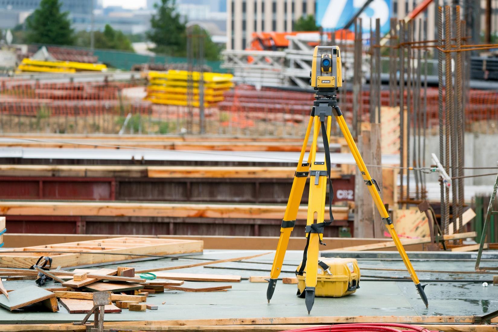
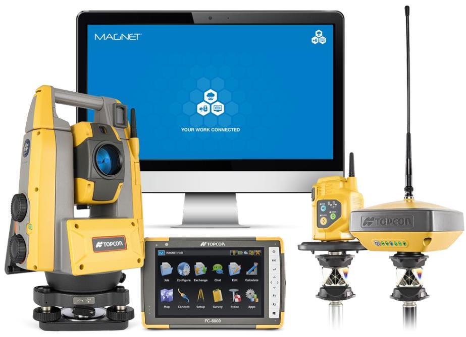
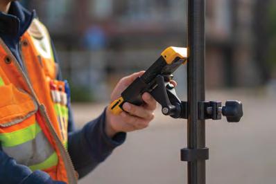
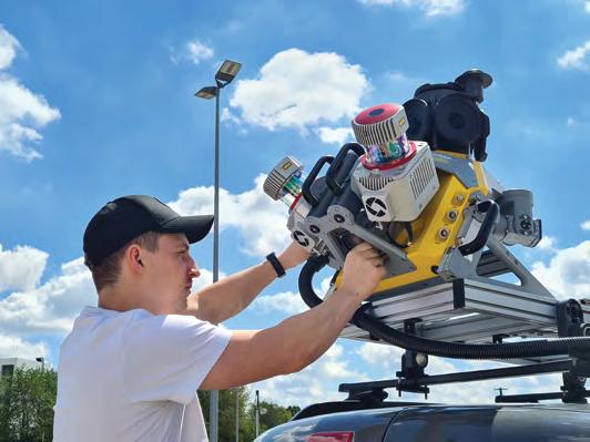
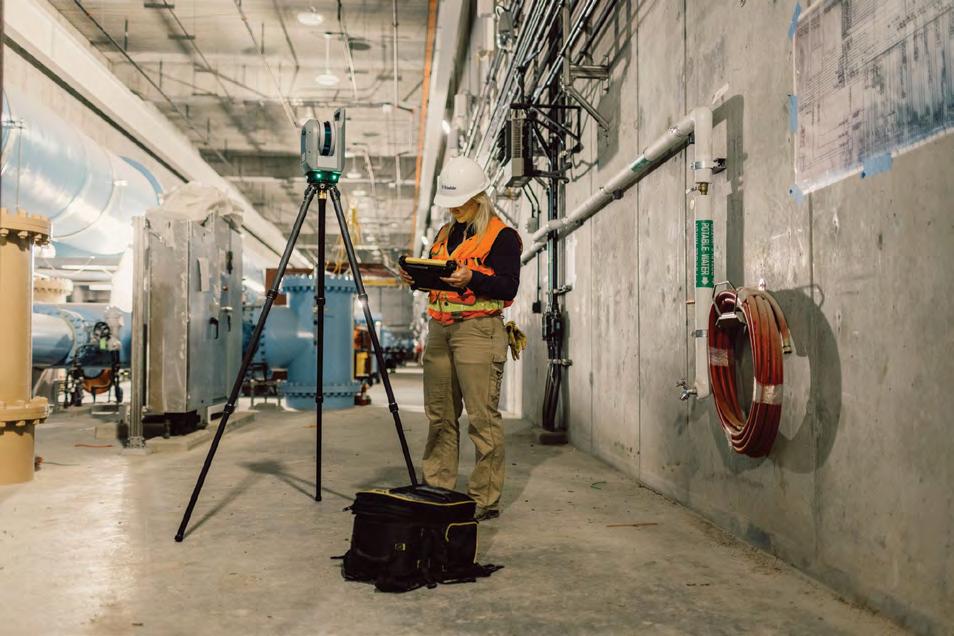
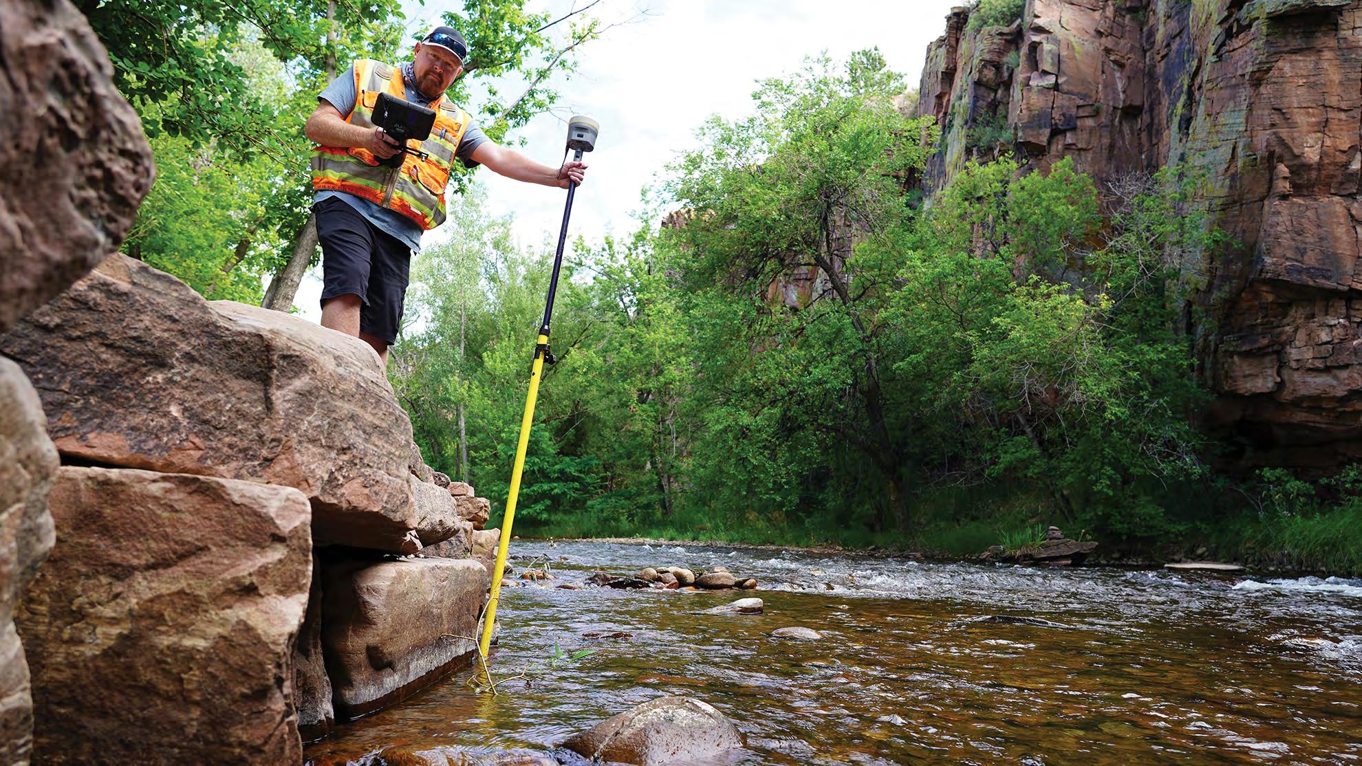
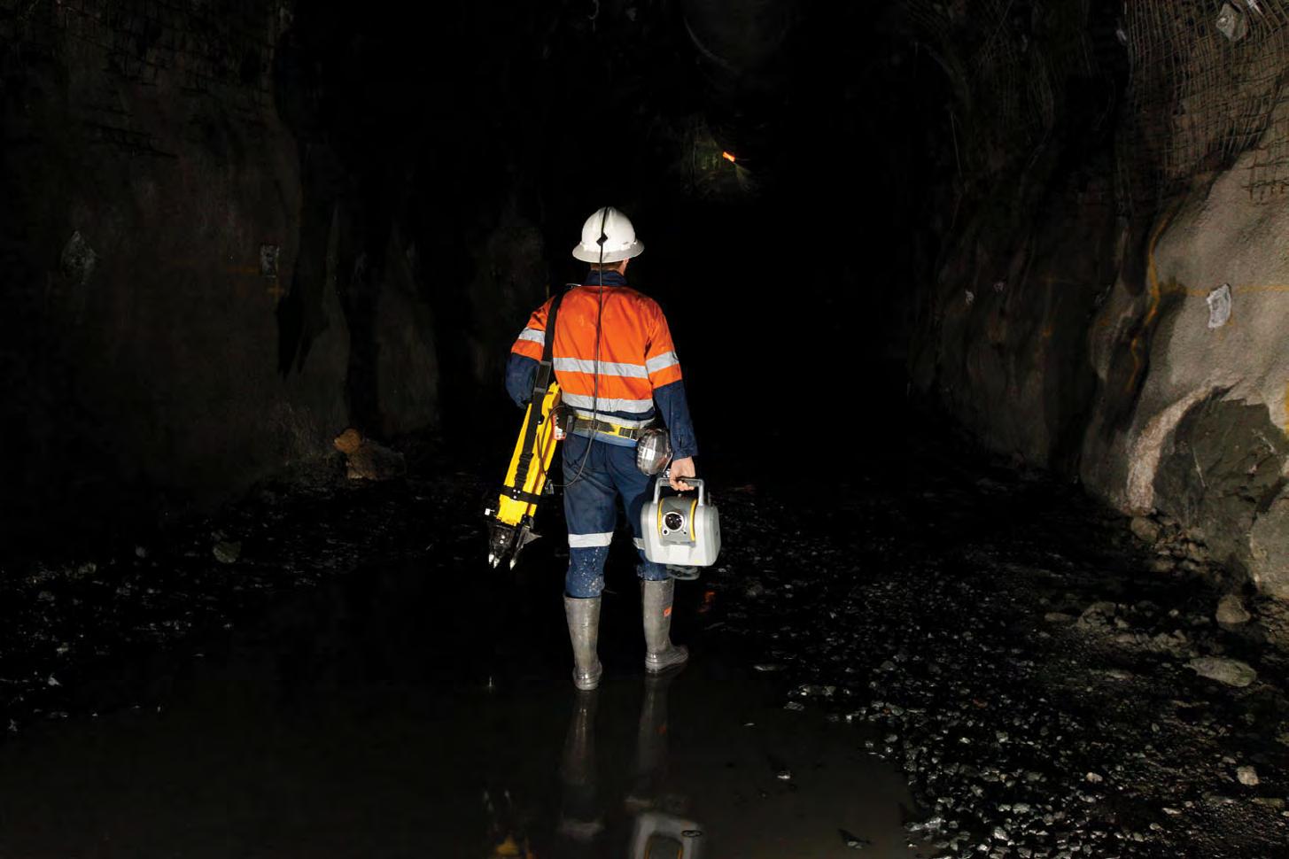
Call us t o g et your complete work flow s olution today ! Efficiency and versatility that will accelerate productivity comes part of a workflow solution that includes the FC-6000 field controller, Magnet software, a HiPer VR receiver and the GT-1200/GT-600 single-operator robotic system. The power of longrange reflectorless measurements comes in your choice of 1”, 2” or 3” GT-1200 models or 2”, 3” or 5” GT -600 models.
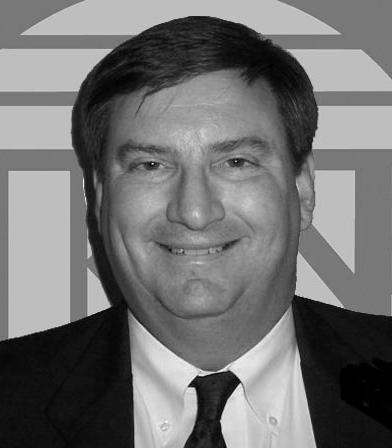
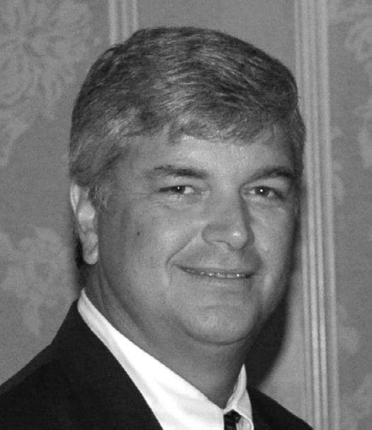
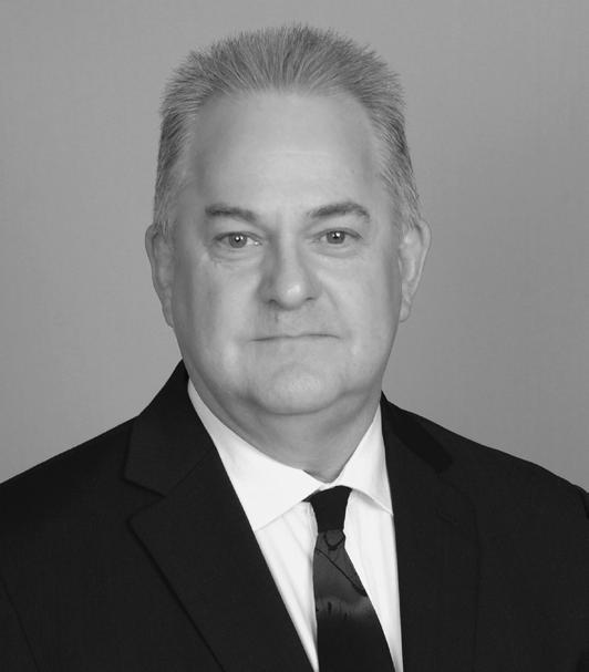
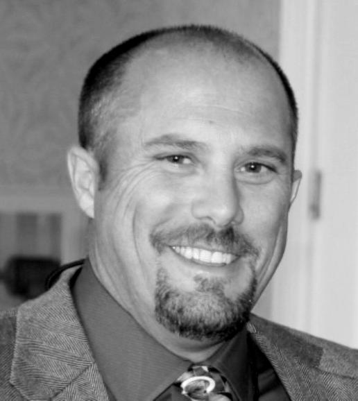
AND Chappy Young
The F lorida Surveyor is the official publication of the Florida Surveying and Mapping Society, also known as FSMS. It is published monthly for the purpose of communicating with the professional surveying community and related professions who are members of FSMS. Our award winning publication informs members eleven months out of the year about national, state, and district events and accomplishments, as well as articles relevant to the surveying profession. In addition, continuing educational courses are also available.
PRESIDENT’S Message
March 2026
Members,
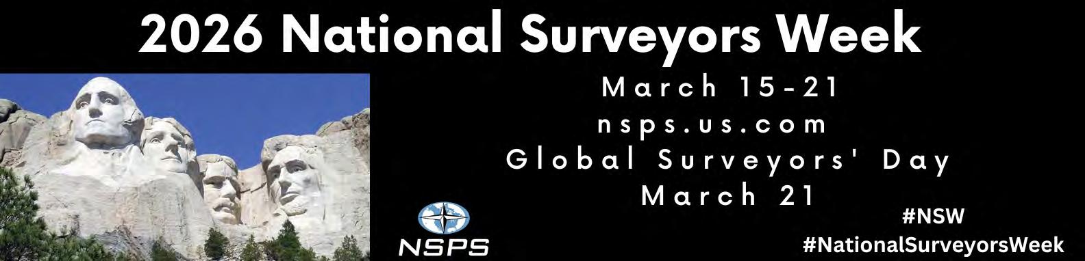
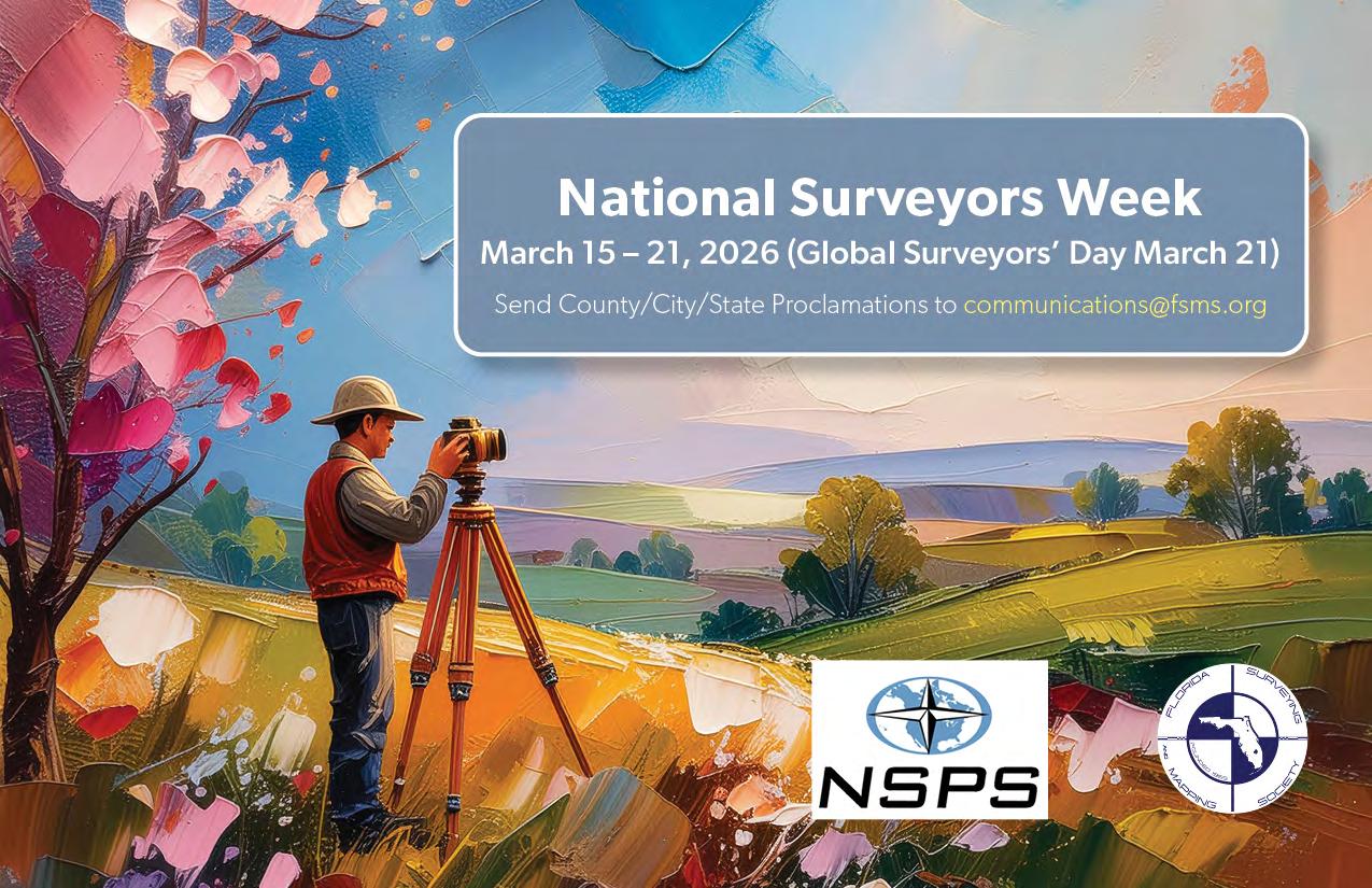
National surveyors’ week is upon us. Surveyors’ week runs from March 15th to March 21st, culminating with Global Surveyors Day on March 21st.
As you may know, the goal of National Surveyors Week is to explain the importance of surveying and to make the public aware of the role that surveyors play in today’s society.
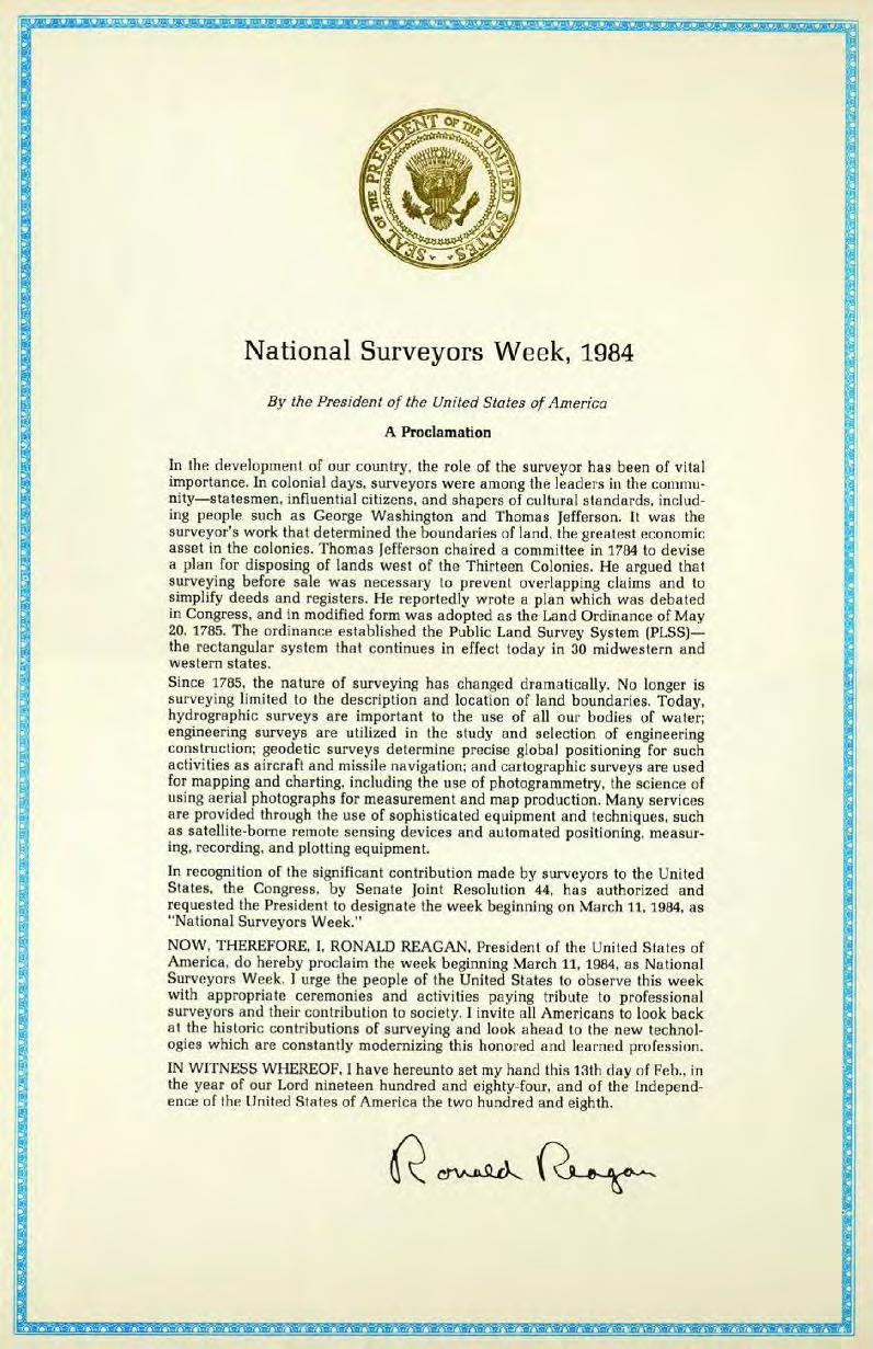
The first Surveyors Week was signed into law on November 30, 1983, as Ronald Reagan signed public law 98-182 designating the week beginning March 11, 1984, as “National Surveyors Week”.
Surveying is one of the world’s oldest professions. Beginning in Egypt in 3000 B.C. surveyors were utilized for construction projects and reestablishing boundary lines after the annual Nile River flooding. Fast forward to 1785, within the United States, Thomas Jefferson helped craft a method for orderly transfer of property through the Public Land Survey System (PLSS) in the Land Ordinance of M ay 20, 1785. Today We are still determining boundary lines and so much more. Surveyors utilize technology like laser scanners, GNSS, drones, and LiDAR to aid the AEC industry with whatever projects they can dream up.
Our job now is to educate the public about what we do, and to introduce middle schoolers and high schoolers to the surveying profession. This can be done in a number of ways.
The National Society of Professional Surveyors has created the NSPS Trig-Star program. Trig-Star is a competition that recognizes and awards high school students who excel in mathematics, with the goal being to demonstrate
PRESIDENT’S Message
practical uses for mathematics and bring greater awareness to the surveying profession. For more information, see the trig-Star Information al flyer. https://blogs.ifas.ufl.edu/ffgs/files/2025/07/Trig-Star-general.pd f
If you know of a teacher that may be interested in having their students compete, they can reach out to geo-extension@ifas.ufl.edu for more information.
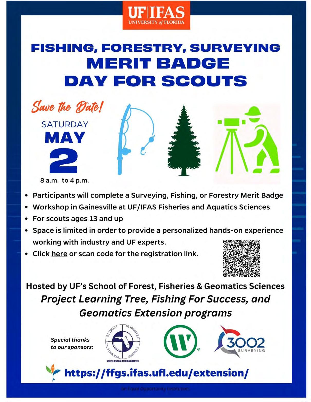
As surveyors we have the tools and ability to do outreach to the Boy Scout and Girl Scout groups. Scouting has a surveying Merit badge. Contact your Local scouting troop, the field work requirements take about an afternoon to complete.
Lastly, I would like each of our members to show up at your loc al municipal Surveyors’ Week proclamations, projecting visibility of the surveying profession in the communities we serve.
Your thoughts are important, and I would like to hear from you regarding any comments or suggestions you may have. Please email me at president.fsms@ gmail.com .
Respectfully submitted,
Robert N. Johnson, PSM, CFM
Surveying Careers in Florida (Click
County Surveyor
Location: Gainesville, FL
Organization: Alachua County Board of County Commissioners
Experience: 5 - 10 years
Education: Bachelor's Degree
Salary: $93,392 - $112,320 Annually
This is responsible, professional, and supervisory work in all phases of surveying and real property acquisition and disposal for the County. An employee in this class organizes the methodology and develops operational procedures, as well as directing and coordinating the functions and activities associated with the Survey, Real Property and GIS Division within the Transportation and Development Department of Public Works.
Professional Surveyor & Mapper - Section Manager
Location: Clearwater, FL
Organization: Pinellas County Public Works
Experience: 10 years or more
Education: Bachelor's
Salary: $92,622.40 - $148,179.20 Annually
Pinellas County Public Works is seeking a motivated and collaborative Professional Surveyor and Mapper to manage the Survey Mapping and Research Section. Work includes overseeing professional and technical staff and building cross-departmental teams for the purpose of maintaining and developing the County’s infrastructure while keeping Survey and Mapping goals and initiatives in alignment with Public Works goals and initiatives and the County’s strategic plan.
Senior Survey Drafter, Senior Survey Crew Chief, Land Surveyor in Training
Location: Anywhere in Florida
Organization: New Survey Business
Experience: 5 - 10 years
Education: High School / GED
Semi-retired Florida PSM seeking to assist in establishing a new surveying business anywhere in Florida in partnership with qualified individuals to serve the residential construction market. The qualified candidate will be 2-3 years from becoming a Florida registered surveyor, and has a desire to start their surveying business experience as soon as possible.
Professional Surveyor
Location: Royal Palm Beach, FL
Organization: Wilco Electrical LLC
Experience: 3 - 5 years
Education: Bachelor's Degree
Wilco Electrical is looking for a professional surveyor to start and run a new survey division within the company. We have a high volume of work all coming from one client. This position is excellent for someone looking to grow and run an organization that they are fully in command of. Payment will be a negotiated salary plus bonus tied to profitability.
2025-26 Districts and
Directors
District 1 - Northwest
Bay, Calhoun, Escambia, Franklin, Gadsden, Gulf, Holmes, Jackson, Jefferson, Leon, Liberty, Madison, Okaloosa, Santa Rosa, Taylor, Wakulla, Walton, Washington
Chad Thurner (850) 200-2441 chad.thurner@sam.biz
Angela Bailey (850) 559-5039 bailey.angelakay@gmail. com
District 2 - Northeast
Alachua, Baker, Bradford, Clay, Columbia, Dixie, Duval, Gilchrist, Hamilton, Lafayette, Levy, Marion, Nassau, Putnam, Suwannee, St. Johns, Union
Pablo Ferrari (904) 219-4054 pferrari@drmp.com
Nick Digruttolo (352) 374-2249 ndigrutt@gmail. com
District 3 - East Central
Brevard, Flagler, Indian River, Lake, Okeechobee, Orange, Osceola, Seminole, Martin, St. Lucie, Volusia
Howard Ehmke (772) 206-4650 howard.ehmke @bowman.com
Constitution & Resolution Advisory Committee Pablo Ferrari
Annual Meeting Committee Allen Nobles
Legal & Legislative Committee Jack Breed
Surveying & Mapping Council Randy Tompkins
Strategic Planning Committee Brion Yancy
Executive Committee Bob Johnson
Special Committees
Equipment Theft Rick Pryce
Awards Committee Rick Pryce
UF Alumni Recruiting Committee Russell Hyatt
Professional Practice Committee Lou Campanile, Jr.
Workforce Development Committee Lou Campanile, Jr.
Liaisons
CST Program Alex Jenkins
FDACS BPSM Don Elder
Surveyors in Government Richard Allen
Academic Advisory Justin Thomas UF / Earl Soeder FAU
FES Lou Campanile, Jr.
Practice Sections
Geospatial Users Group
Richard Allen
Young Surveyors Network Mary Voor
The Origins of National Surveyors Week
By John Palatiello
Following about five years of retaining an outside independent lobbyist and then a national law and lobbying firm, the American Congress on Surveying (ACSM), the predecessor to NSPS, decided to create an in-house government affairs program and hire staff to manage the activity in 1981. This decision coincided with a proposed “consolidation” or merger between ACSM and the American Society of Photogrammetry (ASP), later renamed the American Society for Photogrammetry and Remote Sensing (ASPRS). A joint board known as the Council of Mapping, Photogrammetry, and Surveying Societies (COMPASS) was formed to develop a consolidation plan. In the transition to a combined organization, joint programs in education and government affairs were formed. I was hired as the first Joint Government Affairs Director in January of 1982.
The surveying and mapping profession had experienced several adverse legislative and government affairs decisions and actions that needed correction. The “Brooks Act”, providing for qualification-based selection of firms as contractors for architecture, engineering and related services by Federal agencies, enacted in 1972, had been considered to apply to surveying and mapping contracts, but these services were removed from the law by bid protest decisions rendered by the Comptroller General of the United States in 1977. The controversial Surface Mining Control and Reclamation Act was signed into law by President Jimmy Carter in 1977, after previously being vetoed by President Gerald Ford in 1975. It specified that engineers or geologists shall be lead professionals authorized to prepare cross-section maps or plans of the land to be affected in a surface mining permit application, usurping and preempting most state laws that define such activities as the practice of land surveying. Numerous other Federal activities defined or classified surveying and mapping as less than a professional activity, regarded surveyors as members of an occupation that was not recognized as a profession, and did not recognize licensed surveyors as professionals.
My task as Joint Government Affairs Director was to lobby Congress and Federal agencies to restore, elevate, and define surveying as a profession.
While the groundwork to remedy the aforementioned disadvantageous laws and policies was being laid, it became apparent that the surveying profession lacked the experience or ability to engage in grass roots lobbying by individual surveyors. My memory, and NSPS’s records, fail to document who originated the idea for National Surveyors Week, but Don Bender of California, 1982 NSPS President and Paul Lapham of Michigan, a NSPS past president and chair of the ACSM-ASPRS Joint Government Affairs Committee, were instrumental. My experience as a
Congressional staff professional prior to coming to ACSM included leading the effort to pass a Congressional resolution to authorize the President to proclaim the week that includes Thanksgiving as National Family Week was an important part of the decision to pursue a similar effort to establish Surveyors Week.
In those days, hundreds of commemorative resolutions were introduced in Congress each year. Some members of Congress, staff, and citizens believed Congress was spending too much time on things like building naming, postage stamps, commemorative coins, Congressional Gold Medals, memorials, and designating special days, weeks, months, and anniversaries at the expense of more substantive legislation to address national priorities. At the time, the House had a protocol that a commemorative resolution, once introduced, needed 218 cosponsors, one-half of the members of the House, and the Senate required 25 cosponsors, divided among senators from both political parties, in order for a committee of jurisdiction to act on a resolution to triage in favor of those with significant support. (In 1995, the House adopted a rule still in effect today that prohibits commemorative resolutions.)
Many congressmen and senators would only cosponsor a commemorative resolution if they received a request from a constituent. In order to secure the necessary cosponsors, and to engage in a drill to introduce surveyors to grass roots lobbying and communication with their federal representatives in preparation for more substantive forthcoming legislative efforts, the National Surveyors Week project was launched. That was not to say there were no surveyors who were politically active and astute, nor without strong personal relationships with their congressmen or senators. NSPS member P. Porcher “ Shay ” Gregg of Virginia Beach, Virginia and Ferrell Prosser of Florence, South Carolina volunteered to secure sponsors for the Surveyors Week resolution. They were immediately successful as Representative G. William Whitehurst (R-VA) and Senator Strom Thurmond (R-SC) committed to introducing House and Senate resolutions, respectively.
Concurrent with this effort was the establishment of the ACSM-NSPS Political Action Committee (PAC) on April 1, 1982.
On October 1, 1982, Senator Thurmond introduced Senate Joint Resolution (S. J. Res.) 263, to authorize the President to issue a proclamation designating the week beginning on March 13, 1983, as “ National Surveyors Week ”. NSPS members, Senator Thurmond, and I immediately went to work. Having garnered 35 cosponsors (20 Republicans, 15 Democrats), the resolution was discharged from the Committee on Judiciary and passed by the full Senate on a voice vote on December 10, 1982. On September 9, 1982, Representative Whitehurst introduced House Joint Resolution (H.J. Res.) 591, to authorize the President to issue a proclamation designating the week beginning on March 13, 1983, as “ National Surveyors Week ” . However, having only secured 167 cosponsors, the Whitehurst resolution, as well as
Thurmond’s Senate-passed resolution, died in a House committee when Congress adjourned at the end of 1982.
While the NSPS membership was deeply disappointed, but neither deflated nor discouraged. Instructed by the adage popularized by then-Speaker of the House Thomas J. “ Tip” O’Neill, Jr. (D-MA) that “all politics is local ”, NSPS redoubled its efforts and committed to securing the requisite cosponsors on new resolutions in both the House and Senate. The failure of the first effort to pass a Congressional resolution did not deter the surveying community. During the 1983 ACSM-ASP convention in March, Surveyors Week was nonetheless launched. Rep. Nick Rahall (D-WV), sponsor of legislation to reinstate the surveyor as a lead professional in the Surface Mining Act was a speaker. The first PAC reception was held at the Capitol Hill Club, attracting scores of the association’s members and numerous lawmakers. This was a precursor for today’s annual “ Day on the Hill ”. A special National Surveyors Week campaign button was worn by members throughout the convention. Even without a Congressional resolution or Presidential proclamation, state proclamations designating Surveyors Week were issued by the governors of Pennsylvania and Wyoming and a feature was published in the newsletter of the Defense Mapping Agency, among other observances.
On March 2, 1983, Senator Thurmond introduced S.J. Res. 44, to authorize the President to issue a proclamation designating the week beginning on March 11, 1984, as “ National Surveyors Week ”. Building on the groundwork of the previous year, it was introduced with 31 cosponsors. And when the magic 35th cosponsor (18 Republicans 16 Democrats joined Thurmond) signed onto the resolution on March 17, it was immediately discharged from the Judiciary Committee, of which Thurmond was chairman, and passed by the Senate on that same day. It was sent to the House and referred to the Committee on Post of fice and Civil Service.
Meanwhile, determined to work with NSPS and not fall short again, Representative Whitehurst started earlier by introducing H.J. Res. 103 on January 26, 1983. While it took a sustained effort, this time the NSPS effort was successful. The Whitehurst resolution secured its 218th cosponsor on November 9, 1983 (and then added six more, getting to a total of 224), the House Committee on Post Of fice and Civil Service was discharged from further consideration of Thurmond’s S.J. Res. 44 and the full House unanimously passed the resolution on November 17. A resolution to authorize the President to issue a proclamation designating the week beginning on March 11, 1984, as “ National Surveyors Week ” was on its way to President Ronald Reagan who signed it into law, Public Law 98-182, on November 30, 1983.
While the lobbying effort ended, the public relations effort needed to begin. I developed a guidebook that outlined suggested activities to observe Surveyors Week with tips on everything from working with the local news media to
planning an event. The program won a national association award and earned publicity for ACSM. The effort stimulated activity by numerous state surveying societies, government agencies, and individual surveyors and firms.
Among the most notable public relations success was a special project carried out by the National Geodetic Survey (NGS) to measure the extent to which the Washington Monument was subsiding. It was featured on the CBS Evening News that ended with a dramatic simulation showing the monument sinking at a much more rapid rate than the NGS crew found while Walter Cronkite signed off with his signature “and that’s the way it is” one evening during Surveyors Week in March of 1984. A subsequent feature in the Mini Page, a nationally syndicated supplement carried in hundreds of newspapers, educated youngsters on how maps are made.
The PAC reception grew exponentially from its inaugural foray the previous year, attracting over 130 ACSM-NSPS members and more than 40 legislators.
It is interesting to reflect on the House and Senate members who helped pass National Surveyors Week. No Senate cosponsor remains in the Senate today. Rep. Ron Wyder (D-OR), a cosponsor as a House member, is now a senior U.S. Senator, while Sen. Charles Grassley (R-IA) is the only member of the Senate in 1983 still serving today, but he was not a cosponsor. Among House members in 1983, only 4 are still in the House today, Reps. Hal Rogers (R-KY), Chris Smith (R-NJ), Steny Hoyer (D-MD), and Marcy Kaptur (D-OH.) Hoyer and Kaptur were cosponsors. The House cosponsors also included two future Vice Presidents of the United States – Al Gore, Jr. and Richard Cheney. Cheney’s brother was a surveyor with the National Park Service and an ACSM/NSPS member. Several House cosponsors went on to serve as Governors, U.S. Senators, Speaker of the House, and Cabinet members, but are no longer in those positions.
The effort to secure a Congressional resolution authorizing President Reagan to issue a National Surveyors Week proclamation also served as a catalyst for effective ACSM-NSPS government affairs activity and success. The Surface Mining Act was amended to reinstate the surveyor as a lead professional by an amendment to an Interior Appropriations bill offered by Senator Robert Byrd (D-WV), other bills were used as vehicles for amendments to reinstate surveying and mapping in the Brooks Act for military construction projects, the Corps of Engineers, highway, Superfund, and airports projects, and then the original Brooks Act itself was amended to add surveying and mapping in 1987. During Ronald Reagan’s presidency the Department of Labor reaf firmed a longstanding policy that surveying personnel were not deemed “laborers and mechanics” subject to the Davis-Bacon Act and the occupations of Land Surveyor and Photogrammetrist were removed from the department’s list of “apprenticeable” occupations. And the Of fice of Personnel Management updated its position classification for surveyors employed in the
federal government, providing recognition as professionals, among other legislative and policy victories.
Ironically, the proposed consolidation of ACSM and ASP was narrowly rejected by a vote of members of both societies in the fall of 1983 and the joint government affairs program subsequently became solely an ACSM-NSPS activity. But National Surveyors Week was a springboard for giving surveyors an effective voice in Washington, DC that continues to this day.
John Palatiello was ACSM-ASP Joint Government Affairs beginning in 1982 after nearly a decade as a Congressional staff assistant. He was later promoted to Assistant Executive Director for Public Affairs. He formed Jon M. Palatiello & Associates in 1987 and provided consulting services to the surveying and mapping profession for the next 40 years. In 2013, his firm was retained to manage NSPS government affairs in Washington, D.C., and to advocate for the surveying profession at the federal level, a position his current firm, Miller-Wenhold Capitol Strategies, continues to hold.
National Surveyors Week1
What's It All About
National Surveyors Week — the annual week-long celebration of the surveying profession that takes place in March. What is the best way to use this event to the advantage of the surveying profession?
Consider having three goals of public awareness through:
1. Education of the public
2. Public media
3. Public service
Education of the public is the number one goal of National Surveyors Week. The work surveyors perform for the benefit of the public often goes unrecognized and surveyors need to share our knowledge with them. The work being done by NSPS TrigStar volunteers is incredible and should be highlighted during National Surveyors Week. There are volunteers doing outreach to Boy Scout and Girl Scout groups and resources are available for these programs. We can expand on this and offer to speak to the local Rotary or Lions Club. They are always willing to have a speaker at their meetings. How better to promote your profession and your business than to make a public appearance?
Reaching out to the public through the media and making them aware of the surveying profession and our role in today’s society is a goal whose value we all recognize. Over the last few years we have achieved this in a variety of ways including Presidential, gubernatorial, and municipal proclamations, newspaper articles, and radio spots highlighting National Surveyors Week. There is also a GPS Day, Facebook and X. Each of these channels represents another way for the land surveying community to stay connected with a different segment of the public.
Although the annual effort of contacting the President, members of Congress, your governor and your municipal leaders may seem trivial, remember that it serves to remind them that surveyors are important . It is an essential part of the NSPS awareness campaign and serves as an introduction to our senators and representatives when we visit them on the hill. Whenever a bill, law or ordinance is being contemplated which affects the public and affects the surveying profession, these elected officials should know who to turn to for answers to their
questions — surveyors, YOU!
Newspaper articles, radio advertisements, and on-line media can serve the same function for the surveying profession, keeping us in the public eye. Too often our image is hidden behind the impressions of an attorney, title agent or real estate agent. Surveyors can use the media to highlight the value of the surveying profession with our most important constituency, our clients. The best way to get an article about surveying published in a newspaper is to contact a local reporter and let them know that you have a good lead on a community interest story. If that fails to attract their attention offer to write one yourself and submit it to the paper. State societies, society chapters and even private firms have written or sponsored articles or public service announcements which serve as advertising for the surveying profession and their businesses.
In his inaugural address on January 20, 1961, President John F. Kennedy poignantly challenged us when he said “Ask not what your country can do for you—ask what you can do for your country ”. It is with this attitude in mind that we surveyors should attempt to give back to our nation and our profession and lay the groundwork for the future. Surveyors may lament the passing of the geodetic field parties of the past and the disappearance of the NGS monuments, but surveyors need to embrace the future, share expertise and volunteer for a common cause. In doing this we can prepare the foundation with which the public will turn to future surveyors and for their professional services. It will help us hone our skills and keep us abreast of changes in our own practice.
1Modified from an article by Frank Lenik, PLS (2016)
How to request a proclamation.
An easy way to bring public recognition to the profession is by obtaining proclamations from local, state, and national governments to recognize the contributions of surveyors.
Contact the state and local government offices from which you would like to request a proclamation to determine the process for each. Most state and local governments need at least 3–4 weeks to complete the request. Sample proclamations are available on the National Surveyors Week website, www.nsps.us.com/page/NSW. Make sure you follow up to confirm receipt of your request and to find out how long it will take to complete it, how you will be notified, and if you can schedule a signing ceremony.
If you are able to schedule a signing ceremony,
Arrange to have several surveyors present
Promote the day and time of the ceremony on community calendars and in local news publications
Be sure to take pictures during the event so that you can include a photo with any news releases, and post them on your website and other social media that you use.
Provide information and photos about signing ceremonies to NSPS (info@nsps.us.com)
H ow do I t a l k to kids ab o ut surveying ?
HOW do I start?
Identify potential groups within your local community. Your list should include local elementary and middle schools, after-school care programs, Boy Scout and Girl Scout troops, Boys and Girls Clubs, and other area youth groups.
HOW do I set up a visit?
Contact NSPS (240-439-4615 or info@nsps.us.com) for give-away items. Look at your list and see if you have a personal connection to any of the groups. Do you have a daughter who is a Girl Scout? Is your neighbor an elementary school teacher?
Once you’ve identified a group to work with,
Reach out to them and explain that you are interested in visiting the group and to lead a hands-on activity related to surveying
Answer any questions they may have
Ask if they have a volunteer policy
Schedule and confirm a date and time for the visit
HOW do I explain surveying to kids?
Hands-on activities are the best way to engage the group and illustrate basic surveying principles. You can bring some of your equipment and demonstrate how and why you use it. Additionally, you can use programs like Get Kids Into Survey (GKIS). Since 2017, GKIS has been working internationally to educate young students about the world of surveying. Through the development of online resources, school, and career-day events and through the production of engaging and exciting learning materials, children all over the world have already learned a great deal about geospatial work. GKIS has a variety of resources that you can use when speaking to young students, including coloring sheets, lesson plans, posters, quizzes, and a comic book. In addition to using these free resources online, you can also become a brand ambassador or sponsor of GKIS. Visit getkidsintosurvey.com for more information.
HOW do I get kids excited about the profession?
Use phrases like making a difference and problem solving. Avoid phrases and terms that make it sound difficult to become a surveyor. Ask them about their interests, and see if any of them relate to the profession. Do they like to work with computers? If so, tell them how you use computers and other advanced technology in surveying. Are they interested in history? Tell them about the historical significance of the profession and boundaries. Demonstrate the technology you use every day especially today’s high-tech data gathering/processing equipment.
HOW do I prepare for my visit?
7–10 days before the visit
Decide which of your favorite activities you’d like to share with the group, and gather the necessary materials. If you don’t have a favorite activity or would like some new ideas, visit the National Surveyors Week website via www.nsps.us.com/page/NSW and download a free copy of GPS Adventures. This easy-to-follow guide provides sample GPSrelated hands-on activities that are easily adapted to include basic surveying principles.
Day of visit
Make sure you wear something that you would typically wear to work. If you often work in the field, consider wearing your outdoor attire and gear. Students are usually quick to recognize a surveyor when he or she has on a hard hat and other outdoor gear. And remember, relax, smile, and have fun!
Day after visit
Follow up with the teacher or leaders of the group to thank them for the opportunity and to make sure they know where to find more information. Ask for feedback on the session and activity.
Global Surveyors Day - March 21 annually
Global Surveyors Day (www.globalsurveyorsday.com) was created in 2018 through a collaboration among worldwide surveying organizations to recognize the role of Surveyors.
March 21 was chosen as the date for GSD so that the event will always fall within the dates for National Surveyors Week in the US which is celebrated each year during the week in March following the 3rd Sunday.
Surveying Merit Badge
HOW can I help a Boy Scout earn the Surveying Merit Badge?
Helping a Boy Scout earn the surveying merit badge has never been easier. Start by visiting the Boy Scouts of America website (www.scouting.org ) to download the current badge requirements. Then visit the NSPS website (www.nsps.us.com/page/BSmeritbadge) for step-by-step instructions on how to complete the requirements and tutorials.
After reviewing the requirements, identify local Boy Scout troop leaders in your community. Reach out to them and offer to help their scouts complete the badge requirements. Completing all of the requirements for the badge can take approximately 6–7 hours.
Find out if there is a “Scouts Day” or similar event in your area and contact the hosting organization regarding participation.
Trig-Star
HOW can I get involved in the Trig-Star Competition?
Trig-Star is an annual competition for high school trigonometry students. It connects what students are learning in the classroom with a profession that requires those skills.
Volunteers are needed to assist in administering the exams and presenting information to the students about the surveying profession. Contact your state coordinator and let them know that you are interested in volunteering. Visit www.trig-star.com for more information and for a list of state coordinators.
Winners from the state competitions (typically 35-40) participate in the annual National Trig-Star Competition.
All students who participate in Trig-Star are eligible to apply for the Trig-Star Scholarship upon proof of enrollment in a college surveying curriculum.
NSPS Guide to Requesting National Surveyors Week Proclamations
What is a proclamation?
A Proclamation is a public or official announcement of an important matter.
Why should I request a proclamation for National Surveyors Week?
A proclamation is a great way to announce the dates and purpose of National Surveyors Week. It’s effective in bringing public recognition to the surveying profession and the vital services surveyors provide regarding the advancement and betterment of human welfare.
How do I request a proclamation?
Contact the state and local government offices from which you would like to request a proclamation to determine the process for each. Use the samples provided in this guide to complete and submit the request.
How long will it take to process my request and receive a proclamation?
Most state and local governments need at least 3-4 weeks to complete the request.
What do I do once I’ve submitted the request?
Make sure you follow-up to confirm receipt of your request and find out how long it will take to complete it, how you will be notified, and if you can schedule a signing ceremony.
What do I do with the proclamation?
If you are able to schedule a signing ceremony, you’ll want to arrange to have several surveyors present. Promote the day and time of the ceremony on community calendars and in local news publications. You’ll also want to make sure a photographer is present to commemorate the event so you can include a photo with any news releases and post them on your website.
Sample Request
January 1, 2026
City Council
City of [insert name of city]
Address
City, State, Zip
RE: [insert name of state/local chapter]
National Surveyors Week Proclamation
Dear City Council:
Please accept this letter as a request to issue a “National Surveyors Week” proclamation declaring March 15-21, 2020, National Surveyors Week in [insert city or state].
National Surveyors Week was established by the National Society of Professional Surveyors as an annual event to bring public recognition to the surveying profession and the vital services surveyors provide to the advancement and betterment of human welfare. During this week, thousands of professional surveyors throughout the country will take part in local activities designed to introduce a new generation to the profession and highlight the use of technology in their day-to-day work.
A copy of the proclamation is enclosed. Thank you in advance for your support of NSPS and the surveying profession. Please contact me at [insert contact information] if you have any questions.
Sincerely, [insert your name] [insert name of state/local NSPS chapter] [insert your position with the state/local NSPS chapter] enclosure
Strategic Planning and Board Meeting
The Florida Surveying and Mapping Society invites you to join us for our upcoming Strategic Planning Retreat and Board Meeting. This will be held Tuesday, March 31st from 8:30 a.m. – 4 p.m. and Wednesday, April 1st from 8:30 a.m. – 11 a.m. in Gainesville, Florida. Board Meeting will follow the Strategic Planning Retreat on Wednesday, April 1st.
This retreat offers a venue for professional surveyors to bring forth major issues they are facing within the profession and is open for anyone to attend. We will announce the exact location(s) for these events next week in a follow-up email.
Hotel suggestions include: Drury Inn, DoubleTree by Hilton Gainesville, Courtyard by Marriott Gainesville FL.
If you have any questions, email Executive Director, Rebecca Porter at director@fsms.org or call us at (850) 942-1900. We look forward to seeing you in Gainesville.
round the State A
Central Florida Chapter
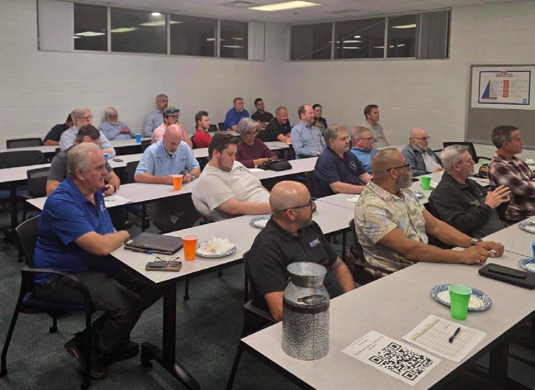
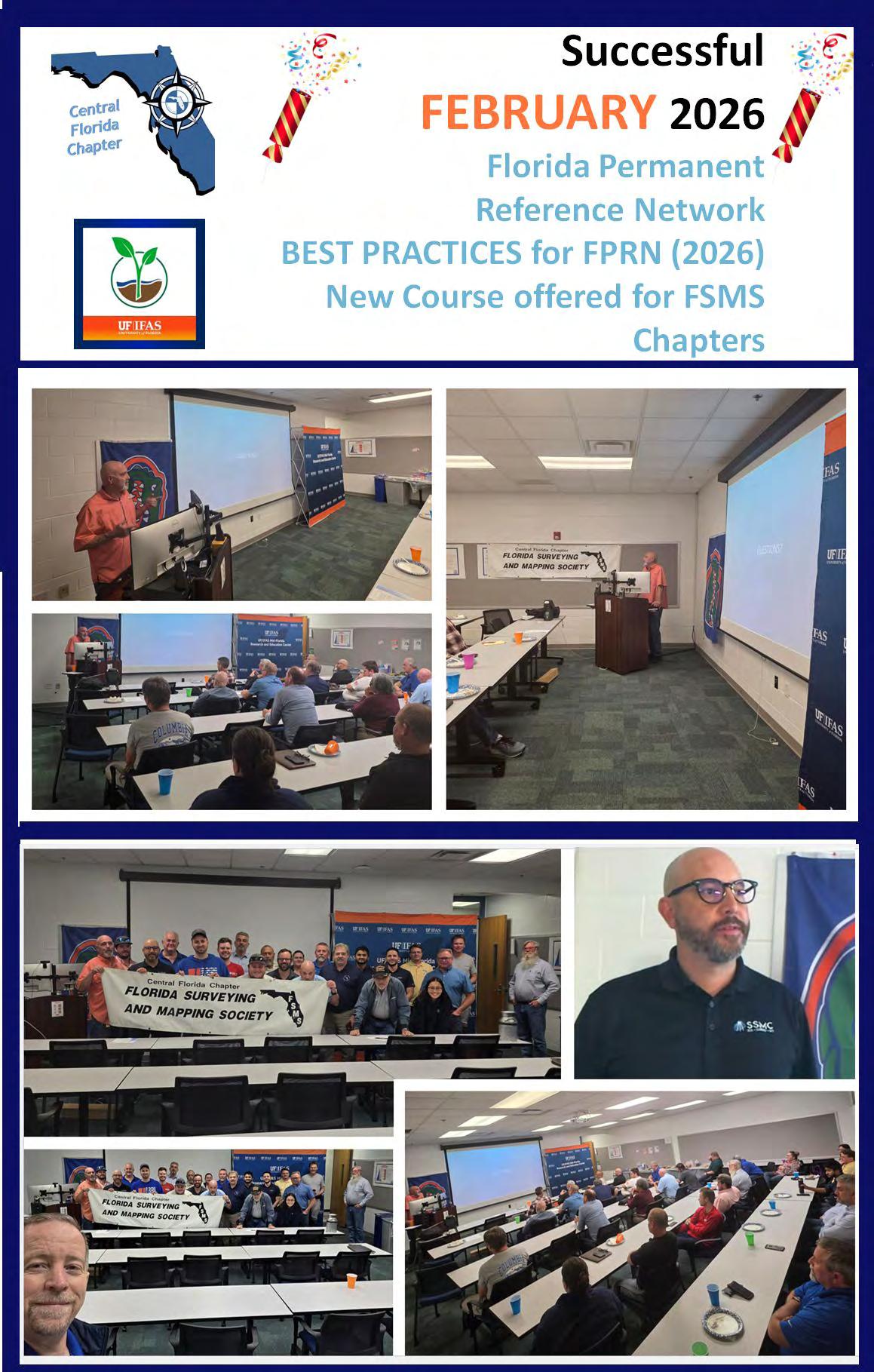
Thank you all for an incredible Central Florida Chapter FSMS Chapter meeting! We’re still energized from the inspiring session delivered by our special guest, Ronald - Ron Hanson, PSM, CPM. Ron is a Florida Professional Surveyor and Mapper with the Florida Department of Transportation, Office of Transportation Technology, Operational Technology — Surveying and Mapping. As the Geodetic Services Supervisor, he oversees the @Florida Permanent Reference Network (FPRN) and statewide geodetic control. With a 39-year surveying career — including 25 years as a PSM — Ron was among the earliest private-sector users of the FPRN to receive real-time corrections. He has been leading and advancing the FPRN since January 1, 2013. His experience and insights made this session especially valuable.
A huge thank-you also goes to:
1-Southeastern Surveying and Mapping Corp. for generously contributing to the Chapter meeting refreshments.
2-UF IFAS Mid-Florida Research and Education Center for hosting our hybrid gathering in Apopka and supporting our chapter’s mission.
Your enthusiasm and participation made this event productive, engaging, and memorable. We look forward to seeing everyone at our next chapter meeting!
Organized by the Central Florida Chapter FSMS Officers:
Edwin Munoz, PSM, PSM — President
Ralph A. Nieto — Vice President
Tim Jaskiewicz — President Elect
Marco Krieger — Secretary
Betty Morris, GISP — Treasurer
Allen (Al) Quickel, PSM — District 3 Director
Bill Rowe — Director
Chris LaBerge, PSM — Director
@Christy Graves — Director
John Gray— Associate Director
Dr. Youssef Omar Kaddoura — Associate Director
Colton Nordby, LSIT Locklin — Associate Director
Kenneth Dell SIT, SIT — Associate Director
Richard Allen, PSM, CFM — Scholarship/Recruiting/Valencia
Dolly Carwile, PSM — Webmaster
Northwest Florida Chapter President – Jeremiah Slaymaker
Great folks doing great things!
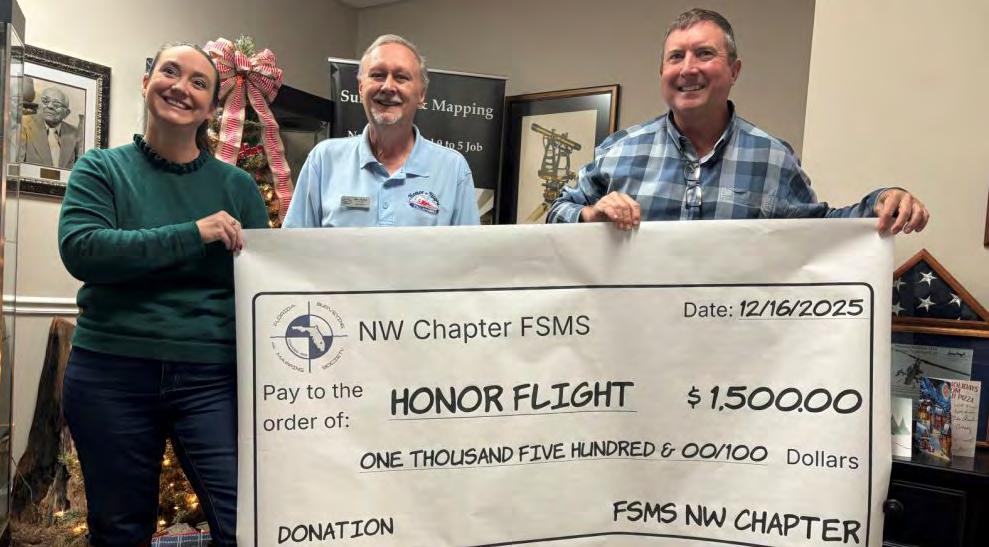
I am very grateful to be part of an outstanding group in the Florida Surveying and Mapping Society (Northwest Florida Chapter) that continually finds ways to give back to our local community. Earlier this year, we had the privilege of presenting a $1,500 donation to the Honor Flight Network, a remarkable organization that recognizes our WWII, Korean War, and Vietnam War veterans by providing them with a once-in-alifetime opportunity to travel to Washington, DC and visit the monuments dedicated to their service and sacrifice.
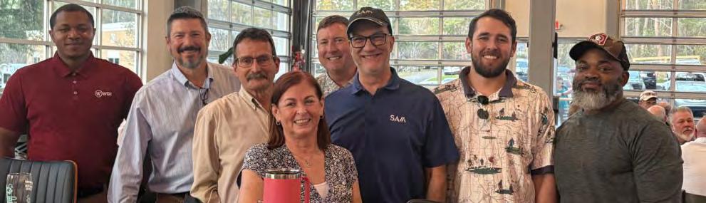
At last week’s local chapter meeting, we continued that spirit of collaboration alongside Jonathan Nobles and Rick Armond. Both are proud members of the society and strong advocates for the Florida Young Surveyors Network (YSN). They quickly stepped up and volunteered to work with Katie Britt, Assistant Director for Geomatics at the University of Florida, to ensure the surveying profession is well represented at the upcoming Worlds of Work event. This career fair will bring together hundreds of high school students from Leon County and surrounding areas, providing an incredible opportunity to introduce the next generation to the surveying profession.
FSMS News March “Florida Surveyor”
A New Award category has been approved by the FSMS Awards Committee for 2026
Richard D. Pryce, RLS/PSM
“Historical Monument Award”
The background of th is Award came from the FSMS Annual Conference in 2025 when I gave out a Presidential Award to several Surveyors that had located historical monuments from 1855 that were part of the original U. S. Coastal Surveys of Florida by then Superintendent A. D. Bache, the greatgrandson of Benjamin Franklin.
In order to improve the accuracy of the U. S. Coastal Surveys, t here were two precise baselines established in South Florida, one on Key Biscayne and one on Cape Sable in 1855 within two months of each other. Both were 4 miles in length and special monuments were set on both ends and every mile in between with extreme accuracy and precision. The North Base monument of the Key Biscayne baseline was found in 1972, it was researched and documented and then in the 1980’s, Surveyors of the then FSPLS collaborated with the National Park Service, FDOT and the Airforce Recovery team to locate, find, and recover the South Base monument which was about 300 feet offshore under 12 -15 feet of water due to erosion. There were multiple articles about this discovery and the recovery of the two end bases which were massive solid granite obelisks and stamped 1855 and A.D. Bache on its sides. However, the discovery of the individual Mile posts , which were also granite but much smaller by other surveyors in the 1990’s was never documented properly or reported. Those Surveyors, Ted Riggs and John Liptak were recognized in 2025 with a FSMS Presidential Award
In connection with the Coastal Surveys in 2024 & 2025 two other Surveyors went looking for the monuments for the Cape Sable Baseline. Mike Ba rtholomew and his son found the East Base monument which was a nine -inch diameter cast iron screw pile with a brass disk on top stamped A. D. Bache. His search continued west two miles looking for the Mid -Base monument. With much effort and digging , he was unable to locate it at the time, but felt he was close. A few months later Brion Yancy, his father, and a couple of other Surveyors did another search for the Mid Base and finally found it within a couple of feet from where Mike Ba rtholomew had been looking. That Monument turned out to be a solid granite monument with a brass plug on top. These Surveyors were also recognized in 2025 with a FSMS Presidential Award.
The extraordinary effort, research and significance of the monuments were what set these discoveries apart from our daily surveying activities and why I felt it important enough to recognize those involved with a special Presidential Award to commemorate the occasions. I did my own research and put together a presentation showing what was done to find these monuments and the
research behind the scenes. This included notes from A.D Bache’s report to Congress in 1855, the instruments and procedures they used to measure the baselines accurately, and the background on the Screw piles for the Cape Sable Baseline. I also included n otes and pictures of the recovery of the South base on Key Biscayne from the 1980’s articles, pictures of the mile post monuments from the 1990’s and newer pictures from Mike and Brion’s discovery of the Cape Sable East and Mid Base monuments.
After the Annual Conference was over I kept thinking about these monuments and how many other Historical Monuments are still out there and thought that we should do something about it. So, I brought it to the attention of the FSMS Awards Committee and proposed that we make this an annual Award for the Oldest Historical Monument found each year.
I believe that there are many significant monuments out there with their own stories to tell, that have already been found by many of our members and peers but are only documented in their field books, on a survey they performed, or just found and referenced. We would like to bring them back to life and share their importance before they are lost to development or time. Our history as Surveyors and the footsteps of those who came before us, their records, the monuments they placed in the ground, as well as the evidence they left behind are part of our heritage. The field notes, plats, surveys and maps produced with careful consideration and effort to ensure the boundaries would stand the test of time.
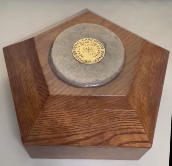
I believe strongly that this Award is significant and important to all of us as a celebration to our heritage and our profession. I had the Award specially designed and built to show its importance and the significance to our history and of the monuments it represents. Its outer frame is made of oak and glazed with six coats of clear polyurethane to protect its surface. I felt that the centerpiece of the Award should be its focal point.
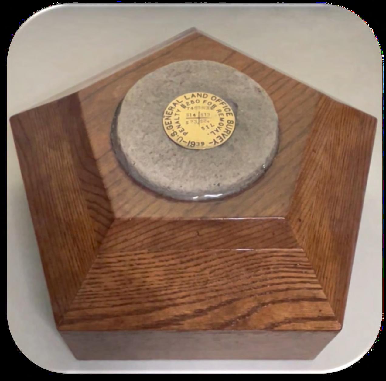
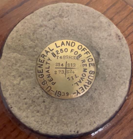
One of the crews I was working with before I retired from Craven Thompson & Associates was retracing a Section out in Township 48 South, Range 33 East , part of a Dependent Resurvey of that Township by the Government Land Office (GLO) in 1939 for the boundary of the Seminole Indian Reservation. As they were searching for this particular section corner they discovered the GLO monument set in 1939 had been pu lled out of the ground and was just laying there several feet from its calculated position with no visible evidence of where it had been or why someone would do this. It was in an area that was relatively undisturbed with no fences or other boundary evidence. It was covered in dirt and algae and looked as if it had been there several years. I had the crew r etrieve it and I brought it home. It weighed 75 pounds, and was a 6-inch diameter concrete monument, 37inches long with a 3-inch brass disk on top with the GLO stamping, section, township, range and 1939 date. I pressure washed the outside of the entire m onument and then cleaned and polished the brass disk on top to show off its important information.
After holding on to this important monument for several weeks, I realized that this would make the perfect centerpiece for the Award, so I removed the top four inches of this GLO monument, and it now rests in the Award for everyone to see. Whoever wins the Award each year will be able to take it with them to display in their office for the next year, but will need to make arrangements for its return to the FSMS Tallahassee Office at least one month before the next Annual Conference. Upon return to FSMS each year, the winner’s name will be stamped into a brass plate and added to the monument showing the year they won.
See the Award below which is still in progress, waiting for brass plates, and the attached Criteria for applying for it.
Award Criteria: “Historical Monument Award”
Purpose:
Encourage participation from Members across the State to search for and document historical monuments that may still exist before they are lost or destroyed by development or other environmental factors. The monument(s) must have been found within the past two years, so that some recent findings can be included.
Definition:
Historical monument: Must be a minimum of 50 years old. It can be a PLSS/GLO/BLM, NGS/USGS, RECORD PLAT, and/or other HISTORICAL monument that can be identified by Map, field notes, or other such records to properly identify and prove the importance of the monument.
Basic Criteria:
1. The Monument must be documented and verified in the public or historical records (field notes, maps, and dates)
2. You must take a minimum of two pictures.
• one of location standing a minimum of 3 feet away from the monument and facing a cardinal direction.
• one of monument face that is readable.
3. Collect State Plane Coordinates, identify Zone, and Latitude and Longitude with GPS if possible.
4. Must include a brief story of the monument/corner with the description of your search, methods and why this monument was needed or searched for.
5. If it is a PLSS/GLO/BLM monument then a CCR should be referenced with the found monument or created and sent to FDEP.
6. If it is an NGS monument then NGS documentation and pictures should be updated on the NGS website.
7. Notify FSMS to add to the “Florida Surveyor” magazine.
Potential Categories:
1. Oldest Historical Monument/Corner: Other than PLSS/GLO/BLM, NGS/USGS, or RECORD PLAT and verified by historical record documentation or stamped on monument.
2. Oldest PLSS/GLO/BLM Monument/Corner: Found original and verified by historical record documentation and/or stamped on monument.
3. Oldest NGS/USGS Monument: Found and verified by historical record documentation or stamped on monument.
4. Oldest Recorded Plat Monument/Corner: Found and verified by historical record documentation and/or stamped on monument.
The Winner:
The winner of this award each year will be able to take home the Official Award Monument Plaque for one year +/- for display in their office(s). They will need to make arrangements for the return of the Award Plaque to the FSMS Office in Tallahassee at least one month before the next annual Conference. Upon return to the FSMS Office the name of that individual(s) or company will be added to the side of the Plaque in recognition of their accomplishment.
Submittal Requirements:
For recognition and eligibility for one of the awards categories at the Annual Conference, all submittals need to include an award documentation package and be sent to FSMS no less than 90 days prior to the FSMS Annual Conference.
The Award
The special case is made of Oak, and the centerpiece is the top of an original GLO monument set in 1939 and found pulled and laid over on top of the ground in 2025 near the Section, Township, and Range stamped on top. Out of respect for the importance and history of the GLO surveys, the monument was cleaned and polished and made part of this important award in recognition of history of Surveyors of Florida and created for Florida Surveying and Mapping Society.
Reece & White Land Surveying, Inc. 305-872-1348 Rhodes & Rhodes Land Surveying, Inc. 239-405-8166
Richard P. Clarson & Associates, Inc. 904-396-2623
SAM Surveying & Mapping, LLC. 850-385-1179
SCR & Associates NWFL Inc. 850-527-1910
Sexton Engineering Associates, Inc. 561-792-3122
Shah Drotos & Associates, PA 954-943-9433
Survey Data Solutions, LLC 352-816-4084 Survey Pros, Inc. 305-767-6802
SurvTech Solutions, Inc. 813-621-4929
F irm S Directory
T2 UES Inc.
407-587-0603
845-534-5959
Thurman Roddenberry & Associates
850-962-2538
TopoDOT
407-248-0160
TranSystems Corporation Consultants
727-822-4151
UF/IFAS
352-846-0850
MEDIA LINKS LinkedIn = 2,558 Followers Facebook = 1.1K Followers X = 384 Followers
Instagram = 668 Followers
YouTube = 79 Subscribers • 28 Videos
YOUR FLORIDA GEOSPATIAL PARTNER
Duncan-Parnell, along with our valued partners, including Trimble and other top brands, are proud supporters of the Florida Surveying & Mapping Society. From solutions including GNSS, scanning, GPR, drones, and more to services including support, rentals, training, and repair, we are pleased to be your one-stop shop for geospatial professionals throughout the Sunshine State.
Jacksonville, FL (904) 620 - 0500
Orlando, FL (407) 601 - 5816
www.duncan-parnell.com
CST E xam Status
For future CST exams like this one, always keep updated by visiting the NSPS calendar found at https://cstnsps.com/calendar/
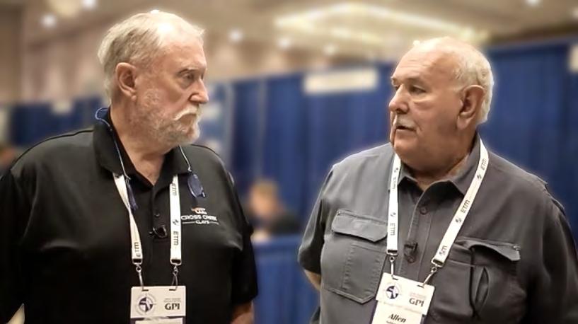
Allen Nobles & Chappy Young
Forts, Ports, Canals, Wars
An Uncommon History of Tallahassee & Surrounding Areas
by Dr. Joe Knetsch
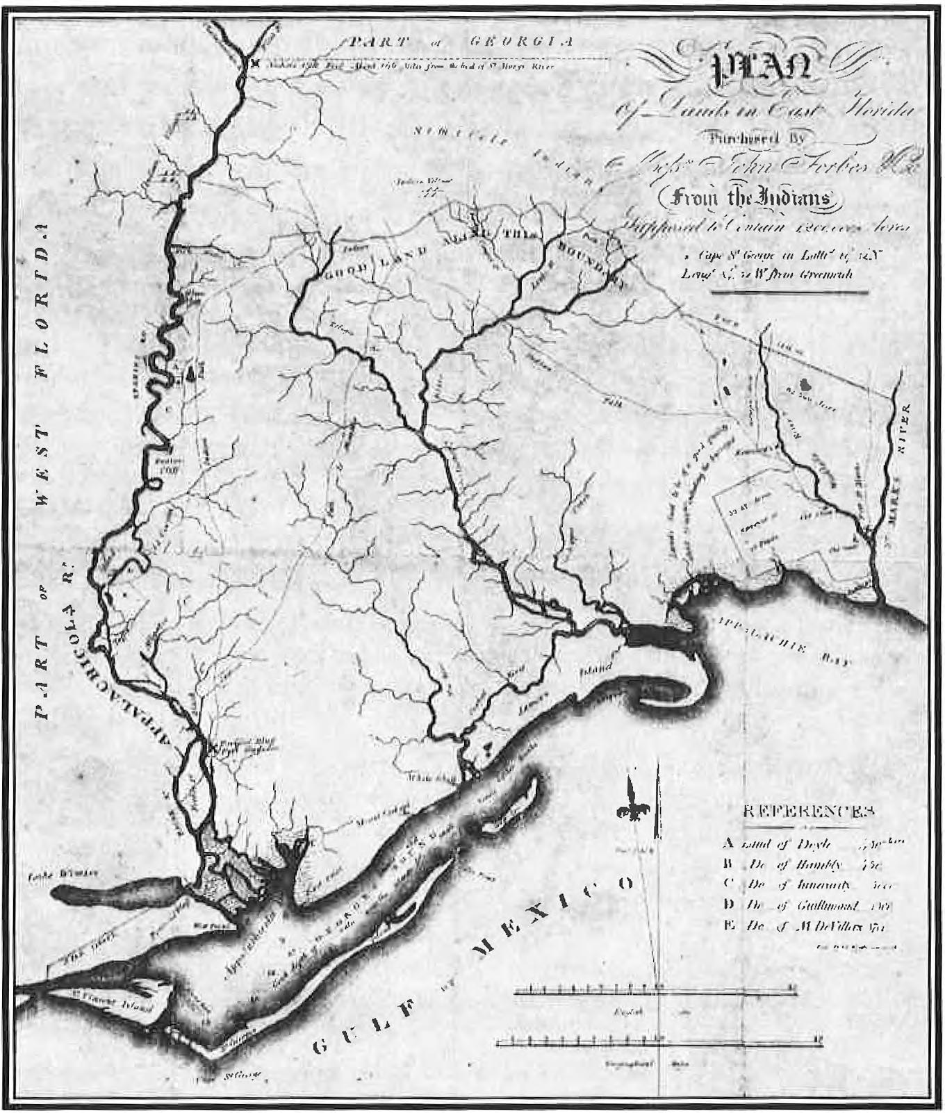
Map of land in east Florida purchased by the John Forbes Company from the Indians … supposed to contain 1,200,000 acres
(State Library and Archives of Florida) and
CHAPTER 9
Frontier Speculation and the Forbes Purchase
The names of the Western Reserve, the Yazoo Land Company, the Holland Land Company, and many other frontier ventures usually bring to mind land speculation and sometimes corruption. Spanish claims in the Territory of Florida evoke similar images of speculation and conjure up the names of Arredondo, Levy, Clark, and many others. Many of these ventures began life as simple land claims made upon the colonial powers by settlers under their jurisdiction. One of the major themes in frontier history is the struggle between the settlers and the speculators over land, often represented by these very land companies and grant holders. Such is the case with Florida’s Forbes Purchase situated in Wakulla, Gadsden, Liberty, and Franklin Counties. But one of the real questions, often unasked, is just who were the speculators?
Recent materials found in the Florida State Archives, Florida State University, the Florida Department of Environmental Protection (old Surveyor General’s office records), and other institutions have given rise to some new questions and answers relative to the question of speculation and settlement. It is a well-established fact that the Forbes Purchase was the result of the payment of debts by the resident Creek/Seminole Indians to the firm of Panton and Leslie. The Spanish governments of Florida recognized the legality of this grant under Spanish Law and approved this method of payment. The boundaries of the grant were agreed to by the Native Americans and the Spanish government and run via the metes and bounds system of the day. This type of survey relied heavily upon natural boundaries and marks on the land. It is very different from the rectangular system employed over the rest of Florida, excepting all other land grants.
The basic grant ran over the land between the Apalachicola River and the St. Marks River, with the northern boundary running along Sweetwater Creek eastward toward the Little River thence down the Ocklockony River to a point were it crossed over to the St. Marks. The southern boundary was the
Forts, Ports, Canals, and Wars
Gulf of Mexico with most of the islands included within the grant.
When the United States acquired Florida from Spain, officially in 1821, there were people already upon the land. According to a letter written by the early land agent of the company, John Carnochan, he settled upon the land in October of 1820 on the banks of the Apalachicola River to secure the lands for the Forbes Company, the predecessor in title to the Apalachicola Land Company. There he met one John Collins, his overseer, with some slaves and equipment to establish a homestead and make improvements. He did all of this at the request of Octavius and Colin Mitchel, the brothers of his business partner, Peter Mitchel of Savannah, Georgia, and a large speculator in the lands of Florida and a sometimes merchant trader. At that time, the area was a wilderness and occupied by Indians, sometimes friendly and other times not so inclined. Carnochan states that he lost houses and other improvements at both places where he settled within the Purchase and that he suffered greatly by the privations of frontier life, theft by the Natives, and illness. There were very few settlers on the land in 1821 and this agent of the company soon found himself traveling to the Carolinas, Virginia, and other northern destinations to recruit homesteaders to take up the land. Over the years he went into debt to his brother, Richard, in an amount of over $10,000.1
As he was frequently on the road doing the company’s bidding, he was granted the assistance of J. B. Brown of Apalachicola. From the start these two agents had to struggle with squatters on the land of the company many of them situated in today’s Wakulla County. The major problem for the agents of the company was not just with the squatters/settlers, but also with the question of title. Was the grant to the Forbes Company a legal grant under the laws recognized by the United States? This was decided in the affirmative in the case of Colin Mitchel v. United States heard in 1835 by the United States Supreme Court. Arguing against the grant on behalf of the United States was Richard Keith Call, soon to be governor of the Territory. Against him were aligned some of the best legal talent of the day, Joseph White (Florida’s Territorial Delegate to Congress and translator of Spanish Land Law), John McPherson Berrien (U.S. Senator, later Georgia governor and Attorney General under Andrew Jackson) and Daniel Webster (U.S. Senator from Massachusetts). Title to the grant was confirmed by the decision of the court. However, this did not clear things up for the agents. What was
to be done about the people who settled upon the land before the court heard the case and what basis did they believe they had good title to the land?
On May 15, 1824, the Pensacola Gazette ran the advertisement calling on those interests in the Forbes Purchase to meet at the house of Major Jonathon Robinson to discuss the division of the grant. Other than the immediate investors in the new company, few actually attended this meeting. There is a very good reason for the lack of attendance: what could the company give them that they did not already possess? The question of title loomed large in this venture, and not everyone was convinced that this company actually held legitimate title. If they did not hold title to the vast acreage (over 1.2 million acres) how would it benefit any settler to attend this meeting? On the frontier, possession is 9/10s of the law when no clear title can be given and warranted. Almost all of the early settlers knew of the claim, but few believed it to be valid.
The Forbes Company, as it was known as until 1835 when it became the Apalachicola Land Company, had its hands full. Michael Harvey was one of the first, if not the very first, to settle in what is now Wakulla County under the new regime. He arrived in 1822 and settled upon lands near modern Crawfordville. He came to the area at the “indirect invitation” of John Carnochan, who allegedly claimed that he could give good title to the land. When pressed for such a wanted title, Carnochan could not produce one, and the agent simply let the matter lie with Harvey occupying the land. In a deposition filed in front of Commissioner John Galbraith in 1856, Mark Harvey, Michael’s son, noted that his father never did receive a title from the company agent or anyone else. Occupancy was tbe basis for his title and when he sold it to George Fisher, he gave only a quitclaim deed.
Mark Harvey eventually repurchased this land along with that which he inherited from his late father. In one of the more revealing statements, Mark Harvey noted that many of those who settled on the lands of the Forbes Purchase did so in anticipation of the Mitchel claim being defeated. Rumors spread by some of the attorneys involved in the case supposedly indicated that Mitchel’s claim would be nullified and that the lands would revert back to the United States whereupon these very same settlers could apply for preemption claims or, in some cases, a 640 acre Donation Act claim. Many, in
Forts, Ports, Canals, and Wars
true frontier fashion, would not recognize the claim’s validity even after the Court’s decision and refused to give up their own possession claims to the land. Mark Harvey further indicated that as some of the early settlers passed to their great reward, their heirs took over their claims and either lived on the lands or sold their interests in the improvements. There were a few who did make payments to the company (many of whom had made arrangements with Carnochan), but it appears that the majority did not. 2
ln the same suit, former sheriff Alfred Fisher deposed that as ex-officio tax assessor he had occasion to discuss the tide question with numerous settlers in the area. They too admitted that they were not expecting the outcome of the Supreme Court decision and had felt they had a “possessory title” to the lands they had improved. Again and again the question of “good title” came to the fore. None of the settlers, according to Fisher, were willing to claim lands adversely to the United States, which they believed owned the lands. They may or may not have been willing to pay for the land if the Company could give them warrantable title. Fisher’s father was the same that purchased the “Harvey’s Mill” property and sold it back to his son. Fisher also noted that some of the other early settlers, Mr. Fort, the Harveys, Ashton Vivian, Judge [Ambrose] Crane, Mr. Wikoff, and Squire Ash, were all in possession of lands in today’s Wakulla County at the time of the Mitchel decision and had similar feelings about the validity of the grant. Two settlers, to his knowledge, a Mr. Miller and James Kilcrease did purchase directly from the company. The former sheriff also recalled that some of the early settlers including men by the name of Alston, Green, and Brinson, left when the decision came down against the United States claim. These men, too, appear to have been more interested in establishing a claim against the United States either through pre-emption or donation than paying the higher price that was assumed to be charged by the Forbes Company. 3
Judge David L. White of Gadsden County also remembered the problem Carnochan had with the settlers on the Purchase lands. At the age of 76, the old settler recalled that only Harvey (he believed), Jonathan Robinson, and a man named Kennedy actually paid money to the company agent for their land prior to the Supreme Court’s decision. White also noted that the company claimed land in and around the military fort at St. Marks, which was later disputed too by the United States. The land suits, the lack
SURVEYOR ULTRA
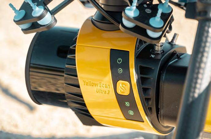
Versatile and lightweight. Penetrates dense canopy and captures accurate ground models for forestry, mining, and infrastructure.
VOYAGER
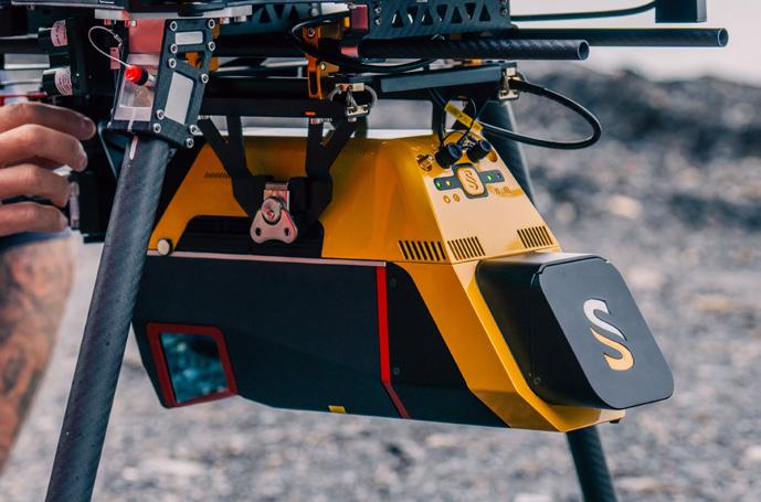
Precision redefined: ultra-dense, long-range LiDAR delivering unmatched accuracy from UAV or helicopter.
NAVIGATOR
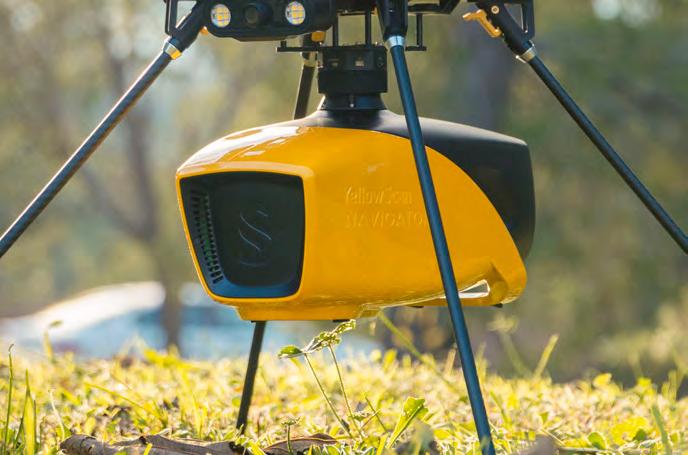
Shallow-water bathymetric LiDAR for rivers, wetlands, and coastal mapping.
PRECISION MAPPING. ANY INDUSTRY. ANY MISSION.
Frontier Precision Unmanned + YellowScan LiDAR
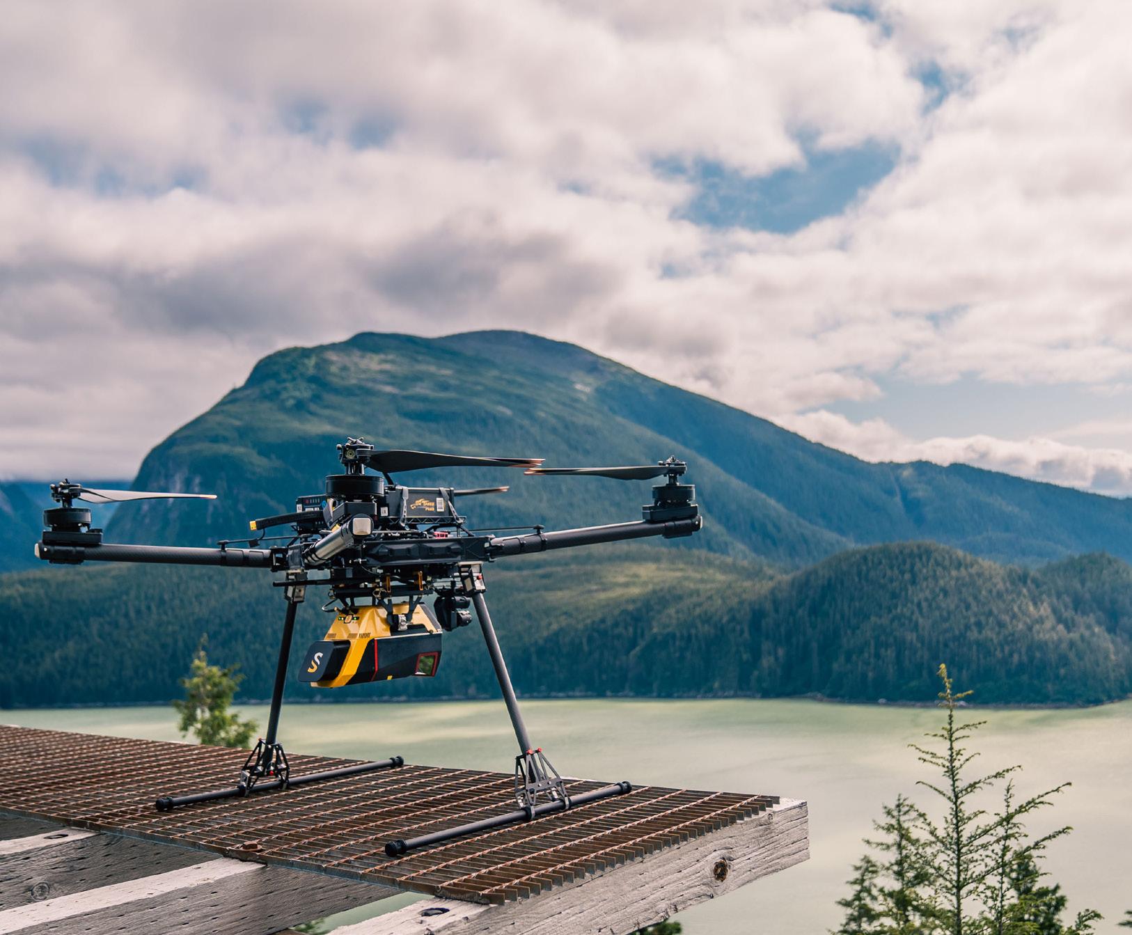
From shallow-water bathymetry to large-area forestry, mining, and infrastructure, Frontier Precision Unmanned delivers the unmatched accuracy of YellowScan LiDAR — integrated on drones or helicopters for any application.
As America’s largest and most trusted YellowScan dealer, Frontier combines the industry’s top LiDAR sensors with decades of geospatial expertise and full-service support. Whether you’re surveying corridors, monitoring coastlines, modeling terrain, or inspecting utilities, Frontier Precision Unmanned provides the tools, training, and experience to ensure your LiDAR investment delivers real results.
With Frontier’s broad lineup of drones, sensors, and software, you’ll find the right system — at the right scale — for your industry.
Partner with Frontier Precision Unmanned — your trusted U.S. YellowScan dealer.
Forts, Ports, Canals, and Wars
of warrantable title, and the speculation of the frontiersmen made it almost impossible to attract and keep paying settlers on the land inside the Forbes Purchase. Judge White further stated, that although many did recognize that the title was probably in the land company, they were repelled by the “exorbitant prices” charged by the company for its better lands. 4
Attorney Thomas Baltzell, who served as counsel for the company during the case over the military reserve and also served on the Legislative Council for the Territory, among many other positions he held in the Territory, was also deposed in the case and remembered the service rendered by Carnochan to the company’s efforts at settlement. When he was elected to the board of the company and then appointed president, Baltzell did not recall anyone claiming title superior to that of the company. As president or counsel to the company, he did not recall ever instituting a suit for ejectment against any of the settlers within the Purchase lands. He also admitted that he did not interview many of the early settlers, and based on what little intercourse he had with them, he claimed that they were willing to purchase the lands they occupied at the company price. 5
One W. G. Burgess lived in early Magnolia in 1829 and resided there for a number of years. He noted in his deposition that no one in that settlement even knew they were within the Forbes Purchase and that the United States government had actually surveyed the area and sold the site of Magnolia to “Messrs Hamlins.” Like many others on the land, he assumed that his title by possession was good. Among those he noted as living in the Wakulla area were Jason Brinson, Thomas J. Green, Virgil Vivian, William Owens, and Mr. Ash. When cross-examined, Burgess did agree that the case in front of the courts was notorious at the time (1829-31), but that he supposed, “that these parties claimed, like Adam by right of occupancy as I always under stood.” He further stated: “I was told by Thos. J. Green of Wakulla County that if I would come and settle in his neighborhood in the Purchase that my title to the lands which I so settled upon would be as good as a fee simple title as the question of title between the United States and the Forbes Claim ants would probably never be decided, and if it was decided in favor of the claimants, there were so many heirs scattered about that they could never be united in a suit, and others said that if it was in favor of the United States, I and they would be entitled to Preemption Rights.” Mr. Burgess summed up the feelings
of many of the earliest settlers in one neat package. 6
When a young officer of the Army showed up in 1825, he observed very few settlers on the lands of the Forbes Purchase. He noted Canorchan, Robinson, and Henry Young, all of whom held lands under title or agreement with the Forbes Company of which Carnochan was the agent and who had an interest in said company. When the land office was established in Tallahassee, a young Richard Keith Call noted that the U.S. surveys did not extend, except by mistake, over the lines of the Purchase, nor did the pre-emption laws apply within these limits. Call also recognized that many settlers were anxious to move onto the lands of the company and it was generally assumed that the United States had a superior claim to the lands and would eventually win the suit. People rushed onto these lands to establish their claims in what was viewed as the eventual triumph of the United States. According to Call’s deposition, no one questioned the title or claim to the lands since the company regularly paid its assessed taxes. Although he had heard of people upon the land without title, he noted that the company was endeavoring to have these squatters evicted, but had not succeeded as of 1856. 7 This piece of testimony, if believable, indicates the tenacity with which people held onto lands and improvements they possessed regardless of proper title. This is a typical frontier trait, as is the frequent moving of many pioneer families when title is demonstrated to be in other’s hands. Davy Crockett is one of the most famous of this type of frontiersman.
Perhaps one of the more interesting forms of speculation came with the survey of some of the lands within the Purchase by Arthur M. Randolph, one of Florida’s greatest surveyors. Randolph contracted to survey some of the lands within the Purchase on behalf of the company. His contract clearly stated (as did that of Marcellus Williams west of Apalachicola) that he would follow the form used by the United States surveyors in laying out the public lands. This made title easier to track and more understandable than the riverorientated surveys of McNeil and Hartfield. Interestingly however, he went into the survey with an agreement with the settlers and the company in hand. According to his deposition, Randolph agreed to the following:
Several of the settlers on these lands in Wakulla County came to me in the year 1854 and 1855 to procure their claims from me. I had made a
Forts, Ports, Canals, and Wars
bargain with the Agent Mr. Beard to survey part of these lands and take land in pay for my services, and it was by arrangement with several of the settlers that I was to select lands occupied by them and they would purchase from me. It was under these circumstances that the offers were made to me, Nims, Lavender, Lucian Duval, Maxwell, Humphreys, Fisher and Skipper made applications to me to purchase the same way. I do not know the reasons why Brinson, Green and Alston moved off these lands as above stated, nor what they did with their possessions. Arthur Macon remained on the land occupied by him until his death.
Randolph also noted for the court that he never saw a deed conveying full title except that issued by the Apalachicola Land Company. Not surprisingly, he met with no resistance to his surveys while working on the land. 8 This was opposite of his earlier experiences in Columbia County while surveying the “Little Arredondo” grant.9
The question of speculation therefore had a very different twist in the area of the Forbes Purchase. Although the company was mostly made up of New York backers and their money, the true speculators inside the grant were the early settlers, or squatters as the company termed them. This is not to say that some of the more affluent men of the day did not speculate in the lands of the Forbes Purchase. Three of the primary attorneys retained by the company chose to accept land instead of pay for their services. One of the more openly eager men was Senator John M. Berrien, who chose some of the very best lands for his work. He actually received title to 5,000 acres of land which he traded to the company for four lots in the Little River survey and one choice lot in the Hartfield survey. (The 1845 map of the Arredondo Grant in Alachua County shows Berrien doing something similar there. He owned four sections of land in lieu of cash payment within that grant where he also served as an attorney of record.) The lands most desired were those in and around Apalachicola, and the company did very well selling wharf lots, waterfront property, and land along the river. In these cases the land owned by the company paid top dollar for the time. And then the Panic struck!
The Panic of 1837, coming as it did during the middle of the Second Seminole War (1835-1842) made land speculation in Florida a highly risky business. In the period preceding the Panic, land prices were at all
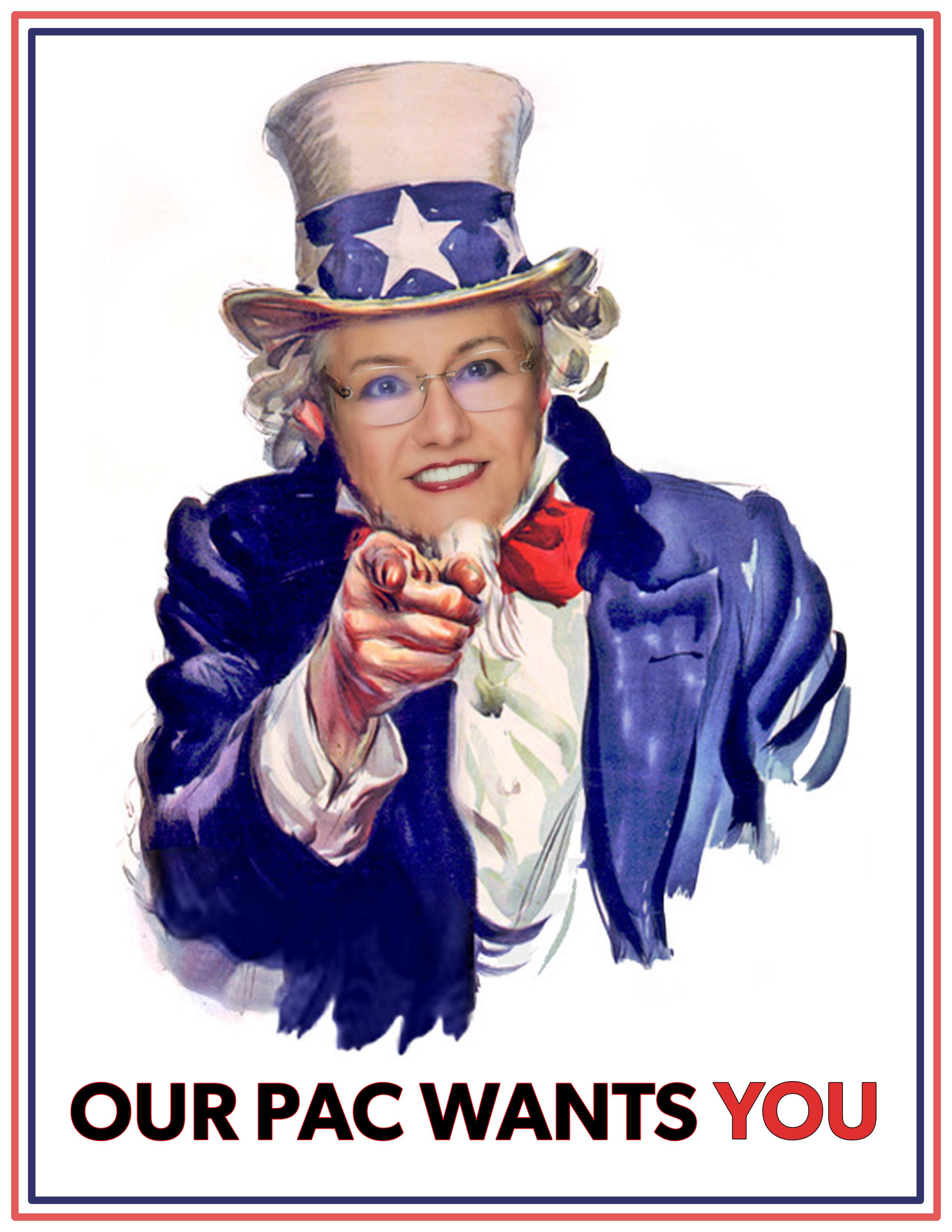
SUPPORT FSMPAC TODAY!
Your contribution can make a monumental difference in ensuring that our profession thrives and our voices are heard where it matters most.
Join FSMPAC and become a driving force for the future of Surveying & Mapping in Florida.
FSMPAC, the Florida Surveying & Mapping Political Action Committee, is your ticket to shaping the future of our profession. Our mission thrives on the generosity of dedicated Surveyors and Mappers who want to champion and safeguard our profession.
Your contributions go toward researching, identifying,and supporting candidates who champion our concerns.
Le arn More & Donate Here
2026 MEMBERSHIP
Membership for 2026 is open and available for those needing to renew or for those wanting to join The Florida Surveying and Mapping Society. You can Renew your current membership by Clicking Here and logging-in to your FSMS account.
For those New Members wishing to join or rejoin if they were not a member in 2025, Click Here to read about our Membership types and click on the “Join FSMS Today” button at the top of the page to begin your membership with The Florida Surveying and Mapping Society.
time highs and speculation was rampant everywhere in the nation. Daniel Webster, the famed Senator from Massachusetts, speculated heavily in western lands in Michigan, Ohio, Indiana, Illinois, and Wisconsin. By the onset of the Panic, he was indebted to bankers, his lawyers, and other backers to the tune of over $100,000. He never recovered from this financial setback and died owing money in spite of the yearly subscriptions paid to support the “Great Man,” as Philip Hone called him. Unlike Webster, most of those who speculated in western and southern lands during this boom time lost their collective shirts. Few had subscribers to support them in the life style which only the very few enjoy. 10
For the Apalachicola Land Company, the Panic brought numerous failures to meet its obligations primarily because their rents failed to be paid on time, if at all; their lands were purchased via contract on an installment basis and many simply defaulted in their payments. Contrary to high school history texts, the Panic of 1837 was not caused solely by the issuance of Jackson’s infamous “Species Circular” and Pet Banks. As early as 1835 many foreign investors began to question the wild speculation taking place in the United States. Barings and the Bank of England, in particular, began calling in some of their more risky loans and things began to snowball from there. Regional banks, like the Union Bank in Tallahassee, had been basing their business on very shaky grounds. Loans were given to planters to purchase slaves and a little while later, before the loan was paid in full, these same planters took out more loans using these same slaves as collateral. It is similar in principle to the current problems with the Secondary Loan market. When the larger banks, centered on the Second Bank of the United States and its branches, started calling in their loans and requiring convertible bank notes or species as payment, the smaller regional or local banks collapsed because the local or regional bank notes were so highly discounted in the larger market.
On an already cash-starved frontier, the impact of all this was devastating. The Apalachicola Land Company, which held its local funds with the Southern Life Insurance and Trust Company, which suspended payments in June of 1840, had a difficult time getting negotiable bonds or species in payment for its lands. The Southern Life Insurance and Trust Company, which had ties with the Union Bank in Tallahassee, operated on a very
Forts, Ports, Canals, and Wars
questionable basis. Some Leaders, like James D. Westcott, Jr. (later one of Florida’s first two U.S. Senators) called it “that corrupt & corrupting rag-hop” and were pleased to see it fail. 11 Westcott and other Democrats had a distinct distrust of banks in general and it should not be forgotten that the 18381839 Constitutional Convention held in St. Joseph produced a very antibank document. Having been “pinched” by the Southern Life lnsurance and Trust Company and the Union Bank, many of the writers of that document were not about to let bankers control the wealth of the Terri tory again unless strictly supervised. With financial problems and a growing indebtedness due to uncollectible accounts it is little wonder that the Apala chicola Land Company had difficulties.
The final problem for the company in getting its total grant came with the suit against the United States for the lands around St. Marks. Here the company hired Thomas Baltzell to argue the case in the Superior Court of Florida. His basic argument was that it had been part of the original grant from the Indians and could not be detached from the rest of the property. The main counter argument, which the company knew could be the winner, was that the land occupied by the old fortification was similar to the military reserves of the United States. Additionally, the lands around and appurtenant to the fort were also reserved under Spanish law, similar to that at St. Augustine and Fernandina. The company again called in Joseph White, John Berrien, and retained David Ogden in Washington and also contacted Webster for further legal advice. Without belaboring the point, the United States had the better claim and the original survey of the reserve by David Thomas, done in 1830, was held to be the approximate boundary. A more refined survey was ordered and performed by John Irwin in 1841.
The constant litigation (suits were also on-going among the heirs of Carnochan and Mitchel, the Innerarity family and more distant relatives of Forbes) was a continual drain on the resources of the company. The agreements with the Tallahassee to St. Marks Railroad took time and energy without great compensation because of the poor soil along the route. Spending time lobbying in Washington for funding the improvements of the St. Marks River, Apalachicola harbor and approaches thereto, getting their own people in as collector at the port, and working on getting Congress to fund the St. George Island lighthouse, all took time, money, and energy the
Dr. Joe Knetsch
struggling company could not afford. It would take years to straighten out all of the affairs of the company, which continued along in various forms until the early 20th Century. It is not surprising given the usual tenor of historical writing in the modem era to see firms like the Apalachicola Land Company castigated by historians, when they remember it at all. However this firm and the lives of those who struggled for many years to make it a profitable entity deserve better than being written off as mere speculators equivalent to some of the more notorious land companies. They brought numerous changes to the Florida frontier, made Apalachicola one of the most important ports of the day, and opened up for settlement some of northern Florida’s richest lands. In the case of this firm and the squatters upon its lands we can see who the real speculators were.
ENDNOTES:
1. Bill of Complaint: “In Chancery before the Vice Chancellor, the Separate Answer of John Carnochan, one of the Defendants to the Bill of Complaint of John McPherson Berrien, Complaintant.” New York: J.M. Elliott, Printer, 1836. 33-34.
2. Leon County Court in Chancery: A. S. Garr etal. vs. Lewis Curtis. Deposition of Mark Harvey. Florida Stact Archives.
3. Ibid. Deposition of Alfred Fisher.
4. Ibid. Deposition of David L. White.
5. Ibid. Deposition of Thomas Baltzell.
6. Ibid. Deposition ofW G. Burgess.
7. Ibid. Deposition of Richard K. Call.
8. Ibid. Deposition of Arthur M. Randolph.
9. Edward Keuchel and Joe Knetsch. “Settlers, Bureaucrats and Private Land Claims: The ‘Little Arredondo Grant’.” Florida Historical Quarterly. Volume 68, October 1989.
10. Charles M. Wiltse, Editor. The Papers of Daniel Webster: Correspondence, Volumes 3-7, 1830-1852 . Hanover, New Hampshire: Dartmouth College, 1977. These five volumes detail some of Webster’s financial difficulties.
11. Clarence E. Carter. The Territorial Papers of the United States: Volume XXVI The Territory of Florida, 1839-1845. Washington: The National Archives, 1962. 166.
Forts, Ports, Canals, and Wars
Dr. Joe Knetsch is the author of over two hundred articles and sixteen books, most of them concerning the state of Florida’s historty. Three of these books involve the Seminole Wars and their impact on Florida’s development. He is also a frequent reviewer of books on military history for the Journal of America's Military Past and authored regular articles for Professional Surveyor Magazine for over a decade. For twenty-eight years he served as the historian for the Division of State Lands in the Florida Department of Environmental Protection. Dr. Knetsch lives in Tallahassee with his wife Linda and is now retired.
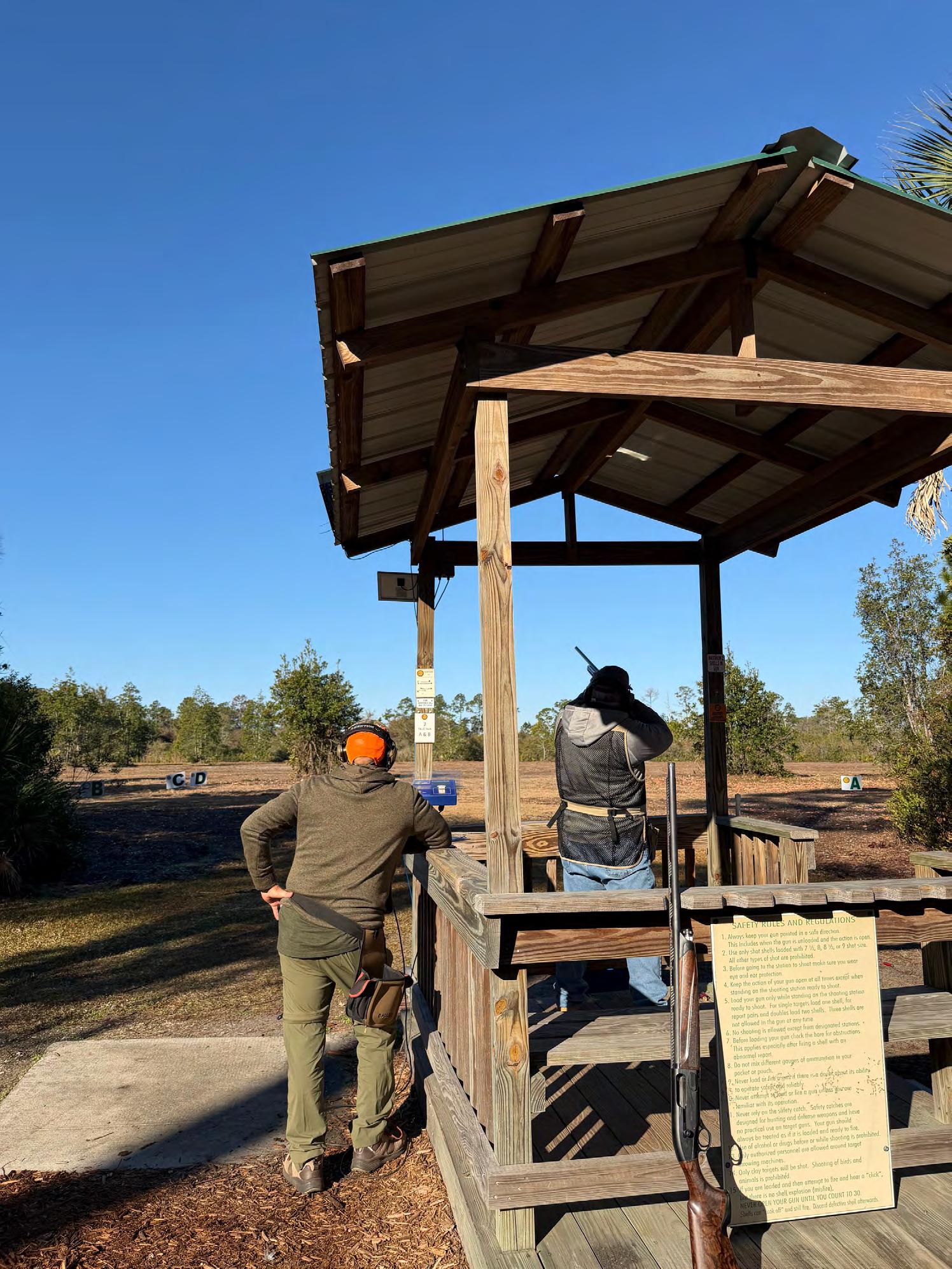
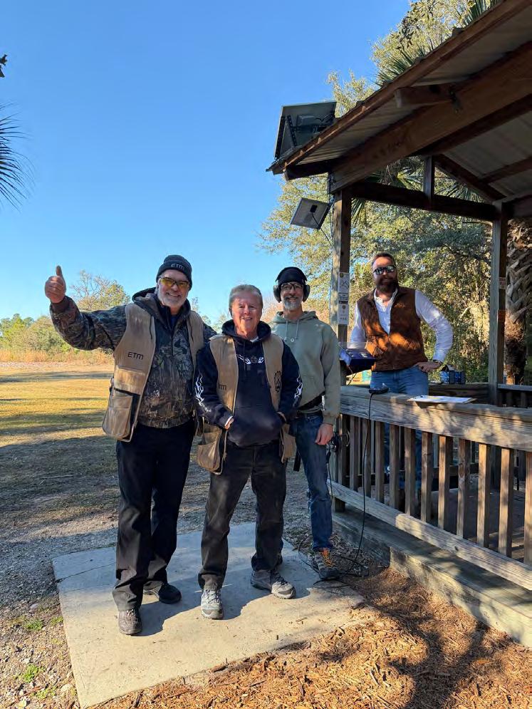
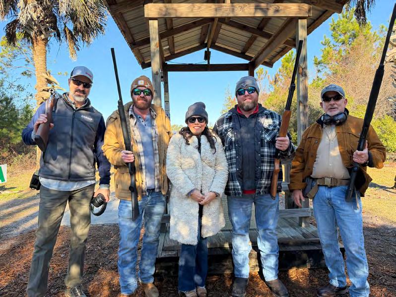
CLAY SHOOT CLAY SHOOT
ARCHIVES FROM THE
BOUNDARIES AND LANDMARKS
A PRACTICAL MANUAL
BY A. C. MULFORD
Boundaries and Landmarks
Chapter VIII.
SOURCES OF ERROR IN DESCRIPTIONS.
In the description in the previous chapter it has been taken for granted that there have been no clerical errors in recording the field notes or in transcribing them into the deed. In addition to this the actual date of the survey and the name of the surveyor are given. The former gives some definite basis on which to make compass corrections, while it is possible that something is known of the special idiosyncrasies of this particular surveyor. But it can per haps be fairly said that in these respects this particular deed is an exception to the established order.
The descriptions to be found in many deeds are but dreary inheritances from the past. It frequently happens that circumstances require a surveyor to follow back the title of a piece of land of which he has been furnished only the description from the last transfer. He then frequently finds that the description does not apply to the time of this particular transfer at all, but has been handed down slavishly from transfer to transfer — from decade to dec ade. This is not necessarily the result of ignorance or penuriousness, but is frequently based on the desire to make sure that the piece of land conveyed is exactly the same piece that was conveyed by the next previous deed. In fact most deeds contain a clause stating that this is “the same piece of land formerly conveyed by X— to Z—, dated so-and-so and recorded so-and-so.” Of course this all means that the date of the original survey is so very uncertain that there is no basis upon which to correct the compass, unless the search should chance to establish the time of the original survey in a fairly definite manner. It may at least be said that a few experiences of this sort remove all confidence in one’s ability to make ac curate compass corrections from the data contained in the ordinary deed. Indeed it is often much easier to fix the approximate date of the
original survey from the actually measured compass correction of a known line in the field.
Besides this uncertainty of date there are often distinct clerical errors in transcription or even in the original field notes. When there is reason to doubt the description a careful search for what mistake would probably have been made under these particular circumstances will often lead to a discovery of what the proper record should have been.
It is not an uncommon matter to find that the bearing has been recorded in the wrong quadrant, especially if the bearing approaches closely due east or due west. Some what rarer is the error of reading the compass backward. Suppose that the bearing is N 33° W and that the surveyor is reading the end of the needle nearest him, under which circumstances the figures on the compass ring would be inverted, causing a certain possibility of confusion. His eye, instead of catching the 30 and reading on to the left, catches the 40 and reads on to the right. The result is that he records the bearing as N 47° W instead of N 33° W as it should be. It would seem that these errors ought to come out in balancing the survey at the time of the original computation, but this is not always the case, for I have seen a very bad quadrant error carried straight on and plotted in the map; while in unclosed surveys, such as those of highways, where there is no computation, there is no way of discovering the error after it has once been made.
It is always well at the start to plot out on the paper the description from the deed in order to find errors of this kind, if any are present. There was a certain descrip tion where two courses were given as northeast. When plotted thus, a most remarkable outline with great error of closure was the result. Knowing something of the local ity, I felt confident that these courses should be made southeast instead. As soon as this change was made the survey closed in a very satisfactory manner, and subse quent fieldwork proved my theory correct.
Far less easy to locate are errors in copying figures, yet a logical
course of procedure will frequently enable one to make the right correction. I remember one case where the description was supposed to follow the remains of an old worm fence and the actual survey agreed with this description in a most satisfactory manner. Suddenly, on a course given as S 7° E, the line deflected several feet from the fence and on the following courses continued parallel to it. It seemed that the surveyor might have read the compass backward and recorded 7° when he meant 3°. This correction improved the trouble but did not entirely do away with it. I then took the actual bear ing of the fence, corrected it and found that the original bearing must have been 4° instead of 7°. The explana tion was simple. Someone in writing the 4 had made the first downstroke very short, had made the cross-stroke very high and had carried it only until it met the long downstroke. Someone making a later copy of this de scription had mistaken the distorted 4 for an elaborate 7 and had copied it as such.
When such clerical errors occur on maps they can fre quently be discovered by going over the map with scale and protractor, the actual lines of the map being correct while the accompanying legend is not. Other errors again can only be corrected from the actual conditions as found in the field. For some errors no logical explanation can be found. They must be corrected according to the best dictates of common sense.
Before leaving the subject of deeds attention should be called to one further point of interest, that for purposes of getting back to an original boundary or settling a dispute, several deeds, though equally explicit, are not necessarily of equal value. This is especially true with reference to the determination of boundaries along highways. Most highways are described in the public records by a survey, the courses, distances and width of the road being clearly given. Theoretically the descriptions of properties adjoin ing such a road should come to the recorded boundaries of the road and no farther. It is a fact, however, that these boundaries along roads are the most unstable of all boundaries for the simple reason that, while each man watches his neighbor to see that there is no transgression of the line between
them, all parties concerned are apt to combine to borrow as much land from the public highway as possible. As a rule a highway record is rather difficult to reestablish, and in cases of small places and house lots the ordinary deed, outside of city limits, makes no pre tense of defining the road in accordance with its official boundaries. The survey has usually been made at small charges by some local surveyor, the object being simply to “get something we can put in the deed.”
As a result some deeds bordering along such a road, notably those of a date nearest to that at which the road itself was put on record, may be very valuable not only with reference to the piece of property which they de scribe but also in connection with determining the actual location of the road itself. They more probably repre sent the conditions before there was any encroachment on the highway, while the deeds of other pieces of land on the same street, though they may agree exactly with the present lines of possession, may be based upon surveys made after the fences had been pushed out on to land properly belonging to the public. There is a case where two small streets together formed a T-shaped court, one street forming the upright of the T and the other the crossbar at the top. Both had been recorded something like fifty years ago, but the official boundaries had been very much neglected. It became necessary to define the boundaries of these streets, since it was generally believed that there had been wholesale encroachment on the high way. A careful examination of the road record, and of the deeds which were made at about the same time and which also referred specifically to these streets as new streets, gave sufficient data for locating the limits of the road successfully. There were other deeds, however, where the case was very different. There was one in particular of a property located at the corner where the two streets met. In this deed the description agreed almost exactly with the land as found in possession, but these lines of possession at one corner encroached several feet on the highway. Investigation showed that for nearly ten years after the recording of the street this corner land had lain unfenced and had practically been regarded as common land. When finally a fence was erected it was placed without reference to the street lines which had
Seminars at Sea 2026 Seminars at Sea 2026
The Cruise
• Princess Cruise Line - Majestic Princess
• 7 Nights
• Leaving out of New York Harbor 10/3/26
• Newport, Rhode Island
• Boston, Massachusetts
• A morning of “Learning” at Sea
• Saint John (for the Bay of Fundy), Canada
• Halifax (Nova Scotia), Canada
• A morning of “Learning” at Sea
• Return to New York Harbor 10/10/26
The Learning
• Two - 6 hour live morning classes while onboard during two days at sea from 7 am to Noon.
• History of Swamp and Overflowed Lands and Island Surveys in Florida (6 CECs) Course# 11097
• The Great Halifax Explosion of 1917: The Roles of the Surveyors & Planners (6 CECs) Course# 11096
• 12 hours CE Credit via your choice of Correspondence Courses.
• Registering for the Learning will be at an additional cost of $500 per seminar attendee above the cost of the Cruise. Click Here to Register for The Learning Provider No. CE11.
The Instructor
Dr. Joe Knetsch will be our live onboard instructor for the 2026 Seminars at Sea. Dr. Knetsch received his Ph. D. in history from Florida State University (1990), an MA in history from Florida Atlantic University (1974) and a B.S. from Western Michigan University with a major in History and Economics. He was the historian for the Florida Department of Environmental Protection (formerly Department of Natural Resources), Division of State Lands from 1987 to August of 2014.
The Details
• Book early to secure your cabin - FSMS currently has Deluxe Mini-Suites and Deluxe Balconies on hold until May 2026 at the below rates. Click Here to Check out the Cabins and their Availability
• Category MB - Mini-Suite $2066 per person based on double occupancy.
• Category DB - Balcony $1846 per person based on double occupancy.
• Please note at the time of booking with Princess any promotions which could include reduced fares or deposits will be applied to your booking. If there is another category of cabin you would like to book, our Travel Advisor Gail Oliver will work with you on finding the best cabin for the best rate to suit your needs. It is important to book with Gail to be considered a part of the FSMS group to receive the group benefits. Contact Gail Oliver at Tesoro Travel via email at gail@tesorotravel.com or phone at 904-687-5655.
The Sponsorship
$3000
• Verbal Recognition during Event
• T-shirts with your company logo
• “Thank You” on FSMS website and social media posts
• Listed in all Seminars at Sea Communication
• Featured Full-page ad in The Florida Surveyor Magazine
been lost sight of meanwhile. The survey for the deed was prob ably made as the fence stood, and thus it came to pass that a description which agreed with long-established lines of possession was finally found to be utterly at variance with the road record.
From the above it will readily be seen that it is a deli cate matter, in the case of determining a boundary contro versy, to sort out the valuable deeds from those which are worthless from the surveyor’s standpoint. It requires not only good judgment but a considerable amount of tact as well, for it is a trying matter to convince one party in the altercation that his deed is worthless as evidence while his opponent’s is of value. The surveyor is pretty sure to incur criticism in any case.
Of course a large part of the foregoing does not apply to sections where property lines and especially street lines are marked by accurately set stone monuments. In such cases the boundaries are already settled. The suggestions are intended to apply to old acreage and long-settled country communities where the loosely established bound aries of long ago have seldom been verified, and where, during the lapse of easy-going years, the landmarks have been lost or forgotten. It is such lines and such landmarks that it is difficult to reestablish when the requirements of the present day demand them.•
Past Presidents
1956 - 1957
H.O. Peters
1960 - 1961
Hugh A. Binyon
1964 - 1965
James A. Thigpenn, III
1957 - 1958
C.
1961 - 1962
Russell H. DeGrove
1965 - 1966
Harold A. Schuler, Jr.
1958 - 1959
P. Goggin
1962 - 1963
Perry C. McGriff
1966 - 1967
Shields E. Clark
1959 - 1960
1963 - 1964
Carl E. Johnson
1967 - 1968
Maurice E. Berry
Harry
Schwebke
John
R.H. Jones
Past Presidents
1968 - 1969
C. Hart
1972 - 1973
Broward P. Davis
1976 - 1977
Robert S. Harris
1969 - 1970
1973 - 1974
E.R. (Ed) Brownell
1970 - 1971
1974 - 1975
E.W. (Gene) Stoner
1971 - 1972
1975 -1976
Lewis H. Kent
William G. Wallace, Jr. 1979 -1980
Robert W. Wigglesworth
William
Frank R. Shilling, Jr.
William V. Keith
James M. King
Past Presidents
1980 - 1981
Ben P. Blackburn
1984 - 1985
Buell H. Harper
1988 - 1989
Stephen G. Vrabel
1981 - 1982
William B. Thompson, III
1985 - 1986
H. Bruce Durden
1989 - 1990
W. Lamar Evers
1982 - 1983
John R. Gargis
1986 - 1987
Jan L. Skipper
1990 - 1991
Joseph S. Boggs
1983 - 1984
Robert A. Bannerman
1987 - 1988
Stephen M. Woods
1991 - 1992
Robert L. Graham
Past Presidents
1992 - 1993
1995 - 1996
Thomas L. Conner
1999 - 2000 Jack Breed
1993 - 1994
1996 - 1997
R. Niles, Jr.
- 1995
1997 - 1998
E.
1998 - 1999
Nicholas D. Miller
Loren E. Mercer 1994 -
Robert D. Cross
Kent Green
Gordon
Dennis
Blankenship
W. Lanier Mathews, II
Past Presidents
Stephen M. Gordon
Richard G. Powell
Michael J. Whitling 2007
Robert W. Jackson, Jr. 2008 -
Pablo Ferrari
Steve Stinson
Dan Ferrans 2011
Jeremiah Slaymaker
Ken Glass
Russell Hyatt
William Rowe 2003 -
David W. Schryver
Past Presidents
2015 - 2016
2019 - 2020
2024 - 2025
2016 - 2017
2020 - 2021
2017 - 2018
2021 - 2022
2018 - 2019
2022 - 2024
Lou Campanile, Jr.
Robert Strayer, Jr.
Dianne Collins
Don Elder
Richard Pryce
Hal Peters
Lou Campanile, Jr.
Howard Ehmke
Dale Bradshaw
The Florida Surveying and Mapping Society has an eLearning Platform that is linked to your FSMS membership account .
When accessing the eLearning platform, use your FSMS membership username and password to log in. (Not Available for Sustaining Firm Memberships)
As always, Correspondence Courses are available by mail or email.
Updated Correspondence & eLearning Courses:
• Writing Boundary Descriptions
• Basics of Real Property
• Map Projections and Coordinate Datums
• Elevation Certificates and the Community Rating System
• Datums (eLearning Video Course)
• FL Surveying and Mapping Laws
Please email communications@fsms.org to notify us of
Advertise With Us!
All advertisements contained within the publication are published as a service to readers. Publication of the advertisements does not imply or express any endorsement or recommendation by FSMS.
Benefits: Full color; hyperlinks added to your webpages as well as email addresses.
Requirements: Contracts for one year (11 issues) receive 10% discount if paid in advance; 15% for Sustaining Firms. (Ads should be in jpeg, pdf, or png format)
New ads and/or changes are due by the 25th of each month.
Questions? Call our office at (850) 942-1900 or email at communications@fsms.org