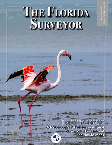
Surveyor
December 2025 Volume XXXIII, Issue 11
The Florida
IN THIS ISSUE
Goldsborough’s Failed Survey Attempt Surveyors in Government Olde Florida Maps
Call us to get your complete workflow solution today! Efficiency and versatility that will accelerate productivity comes part of a workflow solution that includes the FC-6000 field controller, Magnet software, a HiPer VR receiver and the GT-1200/GT-600 single-operator robotic system. The power of longrange reflectorless measurements comes in your choice of 1”, 2” or 3” GT-1200 models or 2”, 3” or 5” GT-600 models.
43316 State Road 19 Altoona, FL 32702
www.lengemann.us
TABLE OF CONTENTS PRESIDENT’S Message 2025-26 FSMS Officers AROUND The State SUSTAINING Firms SURVEYORS IN Government OLDE FLORIDA Survey Maps
1 3 7
SEMINAR ALTA/NSPS Land Title Surveys FORTS, PORTS, CANALS & WARS Dr. Joe Knetsch FROM THE Archives
40 53 71
13 20 27
The Florida Surveyor is the official publication of the Florida Surveying and Mapping Society, also known as FSMS. It is published monthly for the purpose of communicating with the professional surveying community and related professions who are members of FSMS. Our award winning publication informs members eleven months out of the year about national, state, and district events and accomplishments, as well as articles relevant to the surveying profession. In addition, continuing educational courses are also available.
PRESIDENT’S Message December 2025
Members, Last month I was able to attend the South Florida Global GIS Day Celebration at the UF Research and Education Center in Davie. A Story Map student competition with undergraduate and graduate student categories was held, and I must say, I was blown away with the ways that data can be conveyed and made easily understandable. I want to wish all competitors a job well done. This month I was privileged to be invited to speak at the Indian River Chapter Christmas Party. It was a great event led by Chapter President Marla Moore. Cobb’s Landing is a great location, and we were fortunate enough to have our President-Elect, Brion Yancy and Board Members Howard Ehmke, Earl Soeder and John Liptak in attendance.
President
Robert Johnson (772) 370-0558 president.fsms@gmail.com
On a personal note, I would like to share a recent story from within my family. I grew up in the sun. When the weekends rolled around my family and I were boating, camping or working in the yard, rarely with sun protection. My wife, to a lesser extent, did the same. But as we had our family, to my wife’s credit, she always made sure that our two boys wore sun block, sometimes to the point of my annoyance. Fast forward, my boys are now 20 and 22; they too love the outdoors.
My youngest decided a few years ago to start detailing cars for college money. He was moderately good about wearing sun block, but not always. Recently, he had an appointment with his dermatologist and found out that he had Melanoma. Thankfully, it was caught fairly early and two surgeries later, we were done; or so we thought. His latest appointment found an abnormal mole that will now need to be removed. Again, we are so thankful that it was The Florida Surveyor
Page 1
PRESIDENT’S Message
caught early, but I want to make a point to all the membership that due to the profession we are in, cancer – skin cancer especially, can’t be ignored. The three main types of skin cancer are: Basil Cell Carcinoma, Squamous Cell Carcinoma, and the most serious of the three, Melanoma. All are curable if caught early.
Several risk factors that make us more susceptible to skin cancer, including light colored eyes, blond or red hair, fair or freckled skin, if you spend a lot of time in the sun, or have family history of skin cancer, have numerous or irregularshaped moles, if you're easily sunburned or have a history of sunburns. Things to watch for: New growths, changing moles, scaly patches, or sores that don’t heal, and the ABCDE’s of existing moles or new growths. A: Asymmetry (irregular shape) B: Border (blurry or irregularly shaped edges) C: Color (mole with more than one color) D: Diameter (larger than a pencil eraser) E: Evolving (changing in shape, size, or color) Other signs to look for: A sore that bleeds, crusts, or won’t heal; itchy or tender spots, scaly, and rough patches. (Cleveland Clinic) I highly recommend scheduled dermatology screenings twice a year. It’s so Important. Respectfully submitted, Robert N. Johnson December 2025
Page 2
2025-26 FSMS Officers The Florida Surveyor
President-Elect
Brion Yancy (772) 475-7475 brionyancy@gmail.com
Vice President
Allen Nobles (850) 385-1179 allen@burritobrothers.biz
Secretary
Eddie Suarez (786) 865-3172 esuarez@longitudefl.com
Treasurer
Bon Dewitt (352) 682-6007 bon@ufl.edu
Immediate Past President
Richard Pryce (954) 651-5942 rdpryce@gmail.com Page 3
2025-26 Districts and Directors
1
2 4
District 1 - Northwest
5
Bay, Calhoun, Escambia, Franklin, Gadsden, Gulf, Holmes, Jackson, Jefferson, Leon, Liberty, Madison, Okaloosa, Santa Rosa, Taylor, Wakulla, Walton, Washington
Chad Thurner (850) 200-2441 chad.thurner@sam.biz
Angela Bailey (850) 559-5039 bailey.angelakay@gmail. com
District 2 - Northeast Alachua, Baker, Bradford, Clay, Columbia, Dixie, Duval, Gilchrist, Hamilton, Lafayette, Levy, Marion, Nassau, Putnam, Suwannee, St. Johns, Union
Pablo Ferrari (904) 219-4054 pferrari@drmp.com
Nick Digruttolo (352) 374-2249 ndigrutt@gmail. com
District 3 - East Central Brevard, Flagler, Indian River, Lake, Okeechobee, Orange, Osceola, Seminole, Martin, St. Lucie, Volusia
Howard Ehmke (772) 206-4650 hehmke@carterassoc.com
Al Quickel (352) 552-3756 alq.fsms@gmail.com
District 4 - West Central Citrus, Hernando, Hillsborough, Pasco, Pinellas, Polk, Sumter
Scott Vannetta (352) 796-9423 ext. 1031 svannetta@coastalengineering.com
Tim Morris (813) 506-4015 tmorris@civilsurv.com
3 6 7
District 5 - Southwest Charlotte, Collier, DeSoto, Glades, Hardee, Hendry, Highlands, Lee, Manatee, Sarasota
Stephen Shawles (239) 481-1331 sshawles@ haleyward.com
Shane Christy (941) 840-2809 schristy@georgefyoung.com
District 6 - Southeast Broward, Palm Beach
John Liptak Earl Soeder (786) 547-6340 (954) 818-2610 johnliptak@icloud. earl.soeder@duncan-parnell.com com
District 7 - South Miami-Dade, Monroe
Manny Vera, Jr. (305) 221-6210 mverajr@mgvera.com
Jose Sanfiel (305) 375-2657 psm5636@gmail.com
NSPS Director Russell Hyatt (941) 812-6460 russell@hyattsurvey.com
2025-26 Chapter Presidents District 1
District 3
District 5
Panhandle
Central FL
Charlotte Harbor
David Lee Eddie Munoz, Jr. dlee@baskervilledonovan.com emunoz@ southeastersurveying.com
Gulf Coast
Jonathan Gibson jgibson0102@gmail.com
Chipola
Jesse Snelgrove jsnelgrove@ snelgrovesurveying.com
Indian River
Marla Moore mamoore@sfwmd.gov
Volusia
Jeff Barnes jbarnes5576@gmail.com
Jeremiah Slaymaker jslay@wginc.com
District 4
FL Crown
Ridge
Brandon Robbins brndrbbns@netscape.net
Kenneth Glass kglass@civilsurv.com
North Central FL
Tampa Bay
Austin Rupert austinrupert@ufl.edu The Florida Surveyor
Cameron Harmon charmon.rma@gmail.com
Manasota
Collin Naaman cnaaman@brittsurveying.com
Broward
District 2
UF Geomatics
Collier-Lee
District 6
Northwest FL
David Smith dsmith@CFB-inc.com
Derek Miller millersurveying@comcast.net
John Beland jbeland@mckimcreed.com
Benjamin Hoyle benjamin.hoyle@kci.com
Palm Beach
Earl Soeder earl.soeder@duncanparnell.com
FAU Geomatics
Rene Garza rgarza2023@fau.edu
District 7 Miami-Dade
Eddie Suarez marketing@longitudefl.com Page 5
2025-26 Committees Standing Committees
Nominating Committee
Brion Yancy
Membership Committee
Shane Christy
Finance Committee
Bon Dewitt
Ethics Committee
Nick DiGruttolo
Education Committee Constitution & Resolution Advisory Committee
Angela Bailey Pablo Ferrari
Annual Meeting Committee
Allen Nobles
Legal & Legislative Committee
Jack Breed
Surveying & Mapping Council
Randy Tompkins
Strategic Planning Committee
Brion Yancy
Executive Committee
Bob Johnson
Special Committees Equipment Theft
Rick Pryce
Awards Committee
Rick Pryce
UF Alumni Recruiting Committee
Russell Hyatt
Professional Practice Committee Workforce Development Committee CST Program FDACS BPSM
Surveyors in Government
Lou Campanile, Jr. Lou Campanile, Jr.
Liaisons
Alex Jenkins Don Elder
Richard Allen
Academic Advisory
Justin Thomas UF / Earl Soeder FAU
FES
Lou Campanile, Jr.
Practice Sections Geospatial Users Group
Richard Allen
Young Surveyors Network
Joseph Samberg
A
round the State
Tim Morris, PSM – District 4 Director I recently had the honor of swearing in our Florida Surveying and Mapping Society Ridge Chapter 2026 slate of officers. I am extremely thankful to have these individuals donate their time & energy to keep this great chapter moving forward in a positive direction. Jeff Ammermann – President Harley-Davidson Motor Company (HFD) – Vice President Sherry Kirkland – Treasurer Karol Hernandez, – Secretary Fun fact: 50% of our officers are women & 100% are University of Florida Geomatics Alumni!
The Florida Surveyor
Page 7
Central Florida Chapter Thank you all for an incredible FSMS Central FL Chapter meeting!
We’re still buzzing from the inspiring session with our special guest, Dave Doyle (Retired NGS Chief Geodetic Surveyor), who opened our minds on “Are You Ready for 2025?” and the evolving world of datum transformations. A huge thank‑you also goes to: Southeastern Surveying and Mapping Corp. for generously sponsoring the food and keeping us energized throughout the day, as well as UF IFAS Mid-Florida Research and Education Center for hosting our hybrid gathering in Apopka. Your enthusiasm and support made this event both productive and memorable. Looking forward to the next chapter meeting! Organized by Central Florida Chapter FSMS Officers: Edwin Munoz, PSM - President, Ralph A. Nieto - Vice President, Tim Jaskiewicz - President Elect, Marco Krieger - Secretary, Betty Morris, GISP - Treasurer, Allen (Al) Quickel, PSM - District 3 Director, Bill Rowe - Director, Chris LaBerge, PSM - Director, Christy Graves - Director, John Gray Associate Director, Dr. Youssef Omar Kaddoura - Associate Director, Colton Locklin Associate Director, Kenneth Dell SIT - Associate Director, Richard Allen, PSM, CFM - Scholarship/ Recruiting/Valencia, Dolly Carwile, PSM - Webmaster.
December 2025
Page 8
From Todd Bates, PSM, UF Geomatics 2025 GIS DAY SOUTH FLORIDA STUDENT MAP CONTEST! Hosted by UF Geomatics – Fort Lauderdale REC • 24 talented students, 9 MAP entries, from 17 students. • 20+ industry pros. • $3,400 in cash prizes. • FREE dinner for students. • $1000 in Donations to the UF_Geomatics FLREC program to support Geomatics students! All this happened on Thursday, 11/20/2025, and it was an incredible celebration of geospatial innovation! A huge THANK YOU to Rick Householder, Geospatial Program Director at Woolpert, and to our amazing sponsors for making this event possible. Your support fuels the next generation of geospatial leaders! For full details, student profiles, and their amazing maps, explore our ArcGIS StoryMap here: https://arcg.is/1e4Ki01
The Florida Surveyor
Page 9
December 2025
Page 10
Florida Young Surveyors Network We had an amazing time hosting the UF v Tennessee tailgate in partnership with the University of Florida Geomatics Student Association! It was so great getting to meet everyone and build connections within the young professional community. We’d like to thank all who made it out and of course, our sponsors JBPro, for making the event a success! Go Gator Surveyors!
The Florida Surveyor
Page 11
Manasota Chapter — Pam Hyatt Great holiday meeting! 21 in attendance and everyone enjoyed socializing and exchanging gifts.
December 2025
Page 12
2025 Sustaining A AA Surface Pro, Inc. 239-471-2668 Accuracy Datum 863-599-8688 Accuright Surveys of Orlando 407-894-6314 A. D. Platt & Associates, Inc. 850-329-5551
American Government Services Corporation 813-933-3322 American Surveying, Inc. 813-234-0103 Amerritt, Inc. 813-221-5200 AOI (Area of Interest) Solutions, Inc. 321-877-0056
Adventure Coast Orthomosaic & Mapping Solutions, LLC (ACOMS) 352-777-4077
Arc Surveying & Mapping, Inc. 904-384-8377
AIM Engineering & Surveying 239-332-4569
Associated Land Surveying & Mapping, Inc. 407-869-5002
Allen & Company, LLC 407-654-5355
ATWELL, LLC 866-850-4200
Allen Engineering 321-783-7443
Avirom & Associates, Inc. 561-392-2594
The Florida Surveyor
Ardurra 239-292-7773
B
Bock & Clark Corporation(NV5) 330-665-4821
Barnes, Ferland Bowman and Associates, Inc. Consulting Group 407-896-8608 703-454-1000 Barraco & Associates, Inc. 239-461-3170 Bartram Trail Surveying, Inc. 904-284-2224
Braden Land Surveying 727-224-8758 Bradshaw-Niles & Associates, Inc. 904-829-2591
BBLS Surveyors, Inc. Brown & 239-597-1315 Phillips, Inc. 561-615-3988 Bello & Bello Land Surveying BSE Corporation Consultants, Inc. 305-251-9606 321-725-3674 Bennett-Panfil, Inc. Buchanan 941-497-1290 & Harper, Inc. 850-763-7427 Berntsen International 608-443-2772 BGE, Inc. 561-485-0824 Boatwright Land Surveyors, Inc. 904-241-8550
Page 13
Firms Directory C
Clements Surveying, Inc. 941-729-6690
Calvin, Giordano & Clymer Farner Associates, Inc. Barley Surveying, 954-921-7781 LLC 352-748-3126 Campanile & Associates, Inc. Coastal 954-980-8888 Engineering Associates, Inc. Carnahan, Proctor 352-796-9423 & Cross, Inc. 407-960-5980 Colliers Engineering Carter & Design Associates, Inc. 732-383-1950 772-562-4191 Caulfield & Wheeler 561-392-1991
Control Point Associates, Inc. 954-763-7611
Cousins Surveyors Chastain-Skillman, & Associates, Inc. Inc. 954-689-7766 863-646-1402 CivilSurv Design Group, Inc. 863-646-4771 Clary & Associates, Inc. 904-260-2703
CPH Consulting, LLC 407-322-6841 Craven-Thompson & Associates, Inc. 954-739-6400
D DeGrove Surveyors, Inc. 904-722-0400 Dennis J. Leavy & Associates 561-753-0650
Duncan-Parnell, Inc. 800-849-7708 Durden Surveying and Mapping, Inc. 904-853-6822
E
Dewberry 407-843-5120
ECHO UES, Inc. 888-778-3246
Donald W. McIntosh Associates, Inc. 407-644-4068
Eda Consultants, Inc. 352-373-3541
Donoghue Construction Layout, LLC. 321-248-7979 Douglass, Leavy & Associates, Inc. 954-344-7994 DRMP, Inc. 833-811-3767
Eiland & Associates, Inc. 904-272-1000 Element Engineering Group, LLC. 813-386-2101 Engenuity Group, Inc. 561-655-1151
DSW Surveying & Mapping, PLC. 352-735-3796
Culpepper & Terpening, Inc. 772-464-3537 December 2025
Page 14
2025 Sustaining ER Brownell & Associates, Inc. 305-860-3866 ETM Suryeying & Mapping 904-642-8550 Exacta Land Surveyors, Inc. 866-735-1916
F Ferguson Land Surveyors 727-230-9606 First Choice Surveying, Inc. 407-951-3425 Florabama Geospatial Solutions LLC 850-480-7467 Florida Design Consultants, Inc. 727-849-7588 Florida Engineering & Surveying, LLC. 941-485-3100 The Florida Surveyor
FLT Geosystems 954-763-5300
GeoPoint Surveying, Inc. 813-248-8888
H.L. Bennett & Associates, Inc. 863-675-8882
George F. Young 727-822-4317
HUB International 850-386-1111
Fortin, Leavey, Skiles, Inc. 305-653-4493
Germaine Surveying, Inc. 863-385-6856
Hyatt Survey Services 941-748-4693
Frontier Precision Unmanned 701-222-2030
GISurv, LLC 954-651-5942
Ford, Armenteros & Fernandez, Inc. 305-477-6472
F.R.S. & Associates, Inc. 561-478-7178
G GCY, Inc. 772-286-8083 GeoData Consultants, Inc 407-732-6965 Geoline Surveying 386-418-0500 Geo Networking, Inc. 407-549-5075
GPI Geospatial, Inc. 407-851-7880 Gustin, Cothern & Tucker, Inc. 850-678-5141
H Haley Ward 207-989-4824 Hanson Professional Services, Inc. 217-788-2450
I Ibarra Land Surveyors 305-262-0400 I.F. Rooks & Associates, LLC. 813-752-2113
J JAVAD 408-770-1770 Johnston's Surveying, Inc. 407-847-2179
Hanson, Walter & Associates, Inc. 407-847-9433 Page 15
Firms Directory K KCI Technologies 954-776-1616 Keith and Associates, Inc. 954-788-3400 Kendrick Land Surveying, LLC 863-533-4874 KPMFranklin (407) 410-8624
L Landmark Engineering & Surveying Corporation 813-621-7841 Land Precision Corporation 727-796-2737 L&S Diversified, LLC. 407-681-3836
December 2025
Langan Engineering and Environmental Services, Inc. 973-560-4900 Leading Edge Land Services, Inc. 407-351-6730 Leiter Perez & Associates, Inc. 305-652-5133 Lengemann Corp. 800-342-9238 Locklin Surveying & Mapping LLC 407-402-8897 Longitude Surveyors, LLC 305-463-0912 Long Surveying, Inc. 407-330-9717 Lynx Surveyors & Engineering 833-721-2907
M Manuel G. Vera & Associates, Inc. 305-221-6210 Maptech, Inc. 601-664-1666
Morris-Depew Associates, Inc. 239-337-3993 Murphy’s Land Surveying 727-347-8740
N
Massey-Richards Surveying & Mapping, LLC. 305-853-0066
Navigation Electronics, Inc. 337-237-1413
Masteller, Moler & Taylor, Inc. 772-564-8050
Northwest Surveying, Inc. 813-889-9236
McKim & Creed, Inc. 919-233-8091 Metron Surveying and Mapping, LLC. 239-275-8575
O On The Mark Surveying, LLC. 321-626-6376
Mock Roos & Associates, Inc. 561-683-3113 Moore Bass Consulting, Inc. 850-222-5678
Page 16
2025 Sustaining P PEC Surveying & Mapping 407-542-4967 Pennoni Associates, Inc. 863-594-2007 Perret and Associates, Inc 904-805-0030 Pickett & Associates, Inc. 863-533-9095 Plan Right Surveying, Inc. 239-276-2861 Platinum Surveying & Mapping, LLC. 863-904-4699 Polaris Associates, Inc. 727-461-6113 Porter Geographical Positioning & Surveying, Inc. 863-853-1496 The Florida Surveyor
Pulice Land Surveyors, Inc. 954-572-1777
Q Q Grady Minor & Associates, PA 239-947-1144
R
R.M. Barrineau & Associates, Inc. 352-622-3133
Southeast Geospatial 877-653-6544
Robayna and Associates, Inc. 305-823-9316
Stoner Inc. 954-585-0997
S SAM Surveying & Mapping, LLC. 850-385-1179
Suarez Surveying & Mapping, Inc. 305-596-1799 Survey Data Solutions, LLC 352-816-4084
SCR & Associates Survey Pros, Inc. Reece & White Land NWFL Inc. 305-767-6802 Surveying, Inc. 850-527-1910 305-872-1348 SurvTech Sexton Engineering Solutions, Inc. Rhodes & Rhodes Associates, Inc. 813-621-4929 Land Surveying, Inc. 561-792-3122 239-405-8166 Shah Drotos & Richard P. Clarson Associates, PA & Associates, Inc. 954-943-9433 904-396-2623 T2 UES Inc. Sliger & 407-587-0603 Ritzel-Mason, Inc. Associates, Inc. 786-472-0358 386-761-5385 Tectonic Engineering River City Southeastern and Surveying Surveying & Surveying & Consultants Mapping, LLC Mapping Corp. 845-534-5959 904-675-9300 407-292-8580
T
Page 17
Firms Directory Thurman Roddenberry & Associates 850-962-2538 TopoDOT 407-248-0160 TranSystems Corporation Consultants 727-822-4151
U UF/IFAS School of Forest, Fisheries, and Geomatics Sciences 352-846-0850 Upham, Inc. 386-672-9515
W Wade Surveying, Inc. 352-753-6511 Wantman Group, Inc.(WGI) 561-687-2220 December 2025
WBQ Design & Engineering, Inc. 407-839-4300 Whidden Surveying & Mapping, Inc. 561-790-5515 Winnigham & Fradley 954-771-7440 Woolpert, Inc. 800-414-1045
Z ZNS Engineering, LLC. 941-748-8080
SOCIAL MEDIA LINKS LinkedIn = 2,381 Followers Facebook = 1.1K Followers X = 384 Followers Instagram = 569 Followers YouTube = 66 Subscribers • 28 Videos
Page 18
YOUR FLORIDA GEOSPATIAL PARTNER Duncan-Parnell, along with our valued partners, including Trimble and other top brands, are proud supporters of the Florida Surveying & Mapping Society. From solutions including GNSS, scanning, GPR, drones, and more to services including support, rentals, training, and repair, we are pleased to be your one-stop shop for geospatial professionals throughout the Sunshine State. Jacksonville, FL
Orlando, FL
(904) 620 - 0500
(407) 601 - 5816
www.duncan-parnell.com
December 2025 Greetings All, This month as we are all getting ready for the holiday season we are working on closing out the year and planning for what is on our agenda for the next year. As I write this, we have been continually working on an expansion of services. What can we provide beyond traditional services, how do we keep current? I love to keep up with technology, but on the government side of surveying, it can be challenging for several reasons. First, it takes a good amount of time to budget for it. You can plan all year and get buy-in from your leaders, for that funding to only be cut at the completion of the budgeting process. This happened to us a few fiscal years. With this you must persevere and keep pushing forward. The issue with this is that technology can change rather quickly, and you find yourself adjusting what your plan is in the preparation for the next fiscal year. The second issue is that you need multiple years of compiled budgeting to put together enough equipment to focus on some of the areas of the profession that have very expensive equipment. You must do all of this while keeping your conventional equipment current, calibrated, and operational. I am not saying that the private side does not have these issues, they do. Many can meddle in the technology playground with their R&D funding and not have second thoughts, this is a challenge for smaller operations and planning for it is not only a trial, but it can also be a defined process that you can use repeatedly. For the City, we have introduced new technology and found support with leadership that supports future initiatives when they interact with the data from the new technology. One example is when we introduced the use of drone imagery in 2020, it was not until Hurricane Ian in 2022 where we sent videos and stills of the various flooding impacts from the hurricane. Until that time I had flown 10-12 missions. During the hurricane alone, I flew 22 missions in the matter of 10 days. Most were the days right after the storm. I was recalled by the Public Works Director during the storm and asked to capture an area in our downtown for use by the Emergency Operations Center. So, for the next 10 days I continued to collect and report damage around the city. December 2025
Page 20
Drones are only one instance, for our LiDAR operations we have been slowly acquiring sensors and putting them to use. Currently we have three different sensors that are all terrestrial based. The first sensor we purchased was in 2017 and that was a process that started six years earlier. We had a project that Southeastern Surveying and JMR Surveying had teamed up for the city in 2011. They mapped and scanned manholes for use in sewer slip lining projects and the manholes were hand-built as well as irregular in size. Having the perspective to see and measure the structure was extremely beneficial for the engineer working this project, because he preempted the slip lining company with the joints and how the lines would have to intersect into the various seven manholes down the centerline of an extremely busy roadway. Now to perform this kind of work we all now know that you must have a specialized tripod, which Jerry Rinnert with JMR Surveying had to create his own welded tripod. This was because he was doing scans that not many in the world had been doing, I believe at the time of this project, it was the first time in the United States that we could find. He used a Faro Focus scanner inverted, which at the time very few scanners could do because of the compensator. Now I believe most can achieve this process with the right equipment. I will tell you about the tripod, because those are over $1,300 and then the scanner was another $65,000 for GSA pricing. But then you must buy software ($7,000 initial cost, with on-going maintenance of $1,400 a year, not including the scanner warranty of $4,500), and that is where your long-term investment lies. Keeping up with technology is not cheap as you will find out, but it takes careful and progressive planning. In our current configuration of staffing and equipment, it has been a process of ten years that I have been continually requesting, adjusting and resubmitting. Many times, it was received with a response of, “we’ll see” that never comes to fruition, to the “that’s a great idea” moment. As of late we have been receiving more responses “what do you need?” that are extremely helpful, but that is because you must always provide a return on investment as we all know. Small wins lead to big victories. That is not to say we have not had setbacks. When I originally requested the scanner, I had requested a staffer to run the equipment as well. The equipment was approved but the staffer was not. That took an additional December 2025
Page 22
six years to complete. A current issue is that we have a drone that has issues with the on-board RTK integrating with the imagery, which we have had to send back to the vendor two times. The drone is still having issues that we are working through. This is a drone that was over $22,000 that we need to get 100% operational, and that has been a slow process. Today we are in the process of acquiring a mobile LiDAR system for use in our urban corridor for use in planning and in future construction projects. This is a process that we have been working on for over two years now, and it helps to have patience internally, and with your vendors. I have to say the current team I have been working with on this purchase has been great, and I do appreciate their understanding of how the municipal process runs and how time-consuming it can be. I wanted to share our experience helping the other agencies in this process, or to new government surveyors who have not experienced this. As part of Surveyors in Government, as liaison, I am here to help you all and to share collaboration between agencies. To share experiences and to learn from one another. Until next time my friends, I bid you adieux. Thank you for taking the time to read this article! Sincerely, Richard Allen, City Surveyor for Orlando FSMS Surveyors in Government Liaison President of the Geospatial Users Group ASPRS Florida Region Director 407.246.2788 (O) Richard.Allen@orlando.gov
The Florida Surveyor
Page 23
REGISTRATION FORM
Florida Surveying and Mapping Society - Manasota Chapter 7th Annual Orange Crush Classic - Sporting Clays Fundraiser Company Name: Mailing Address: Contact Name:
Saturday, December 20, 2025 - Sarasota Trap, Skeet, and Clays 9:00am-1:00pm
(if different from company name)
Please indicate your level of participation by placing an X next to your choice(s): Sponsorship 1. T-SHIRT SPONSOR (incl. one foursome, logo on tee)
Yes (X)
Amount $2,500.00
Total $0.00
2. AMMUNITION SPONSOR (incl. one foursome, logo on tee)
$2,250.00
3. DIAMOND SPONSOR (incl. two foursomes, logo on tee)
$2,000.00
$0.00
4. AWARDS SPONSOR (incl. one foursome, logo on tee)
$1,500.00
$0.00
5. BEVERAGE SPONSOR (incl. one foursome, logo on tee)
$1,500.00
$0.00
6. GOLF CART SPONSOR (incl. one foursome, logo on tee)
$1,500.00
$0.00
7. GUN RAFFLE SPONSOR
$750.00
$0.00
8. FOURSOME SPONSOR
$500.00
9. STATION SIGN SPONSOR
$250.00
10. INDIVIDUAL PARTICIPANT
$125.00 Total Amount
**Sponsorships are not exclusive.
If you have more than one team, please use a separate form for each team. Please fill in the names of your four players and one mailing and e-mail address: NAME
CONTACT PERSON
SHIRT SIZE
1.
Name:
2.
Address:
3.
City, State ZIP:
4. TEAM NAME:
Telephone #: E-Mail Address:
Please make checks payable to: FSMS Manasota Chapter Please return with payment to: Tim Kluver E-Mail Address schristy@georgefyoung.com Hyatt Survey 1767 Lakewood Ranch Blvd., #378 Bradenton, FL 34211 Thank you for your support of the FSMS Manasota Chapter!
$0.00
2026 MEMBERSHIP IS OPEN! Membership for 2026 is open and available for those needing to renew or for those wanting to join The Florida Surveying and Mapping Society. You can Renew your current membership by Clicking Here and logging-in to your FSMS account. For those New Members wishing to join or rejoin if they were not a member in 2025, Click Here to read about our Membership types and click on the “Join FSMS Today” button at the top of the page to begin your membership with The Florida Surveying and Mapping Society.
The Florida Surveyor
Page 25
Dodie KeithLazowick, PSM of KEITH
December 2025
Page 26
Olde Florida Survey Maps From the muses of a Professional Surveyor
Chapter 1
by Richard D. Pryce RLS/PSM
Surveying Maps……. Especially old Survey/Military Maps hold a special place for me as a surveyor, as an artist, and as a history buff. I have done a lot of personal research on different areas of the USA related to surveying and mapping, always looking for uniqueness in maps, and stories to pass on and Florida has many. Surveying never disappoints on these matters. The surveyors, cartographers, astronomers, geographers, and visionaries of old were true artists and story tellers, and their works and the master engravers that created these masterpieces are worth the effort when you find them. I have searched many places, to bring them to light and think I found this first beauty by Surveyor General John Wescott 1855 and figured I’d share with all. It shows the state of surveys and re-surveys in Florida just 10 years after statehood and based on the notes on the map, it includes survey details obtained by the US Coastal Surveys by superintendent A.D. Bache, Ben Franklin’s grandson.
The Florida Surveyor
Page 27
Olde Florida Survey Maps From the muses of a Professional Surveyor
December 2025
Page 28
Olde Florida Survey Maps From the muses of a Professional Surveyor
Chapter 2 - Cross Florida Canal This next map I found by chance years ago. It’s an 1829 Topographic Map North Florida Territory with exquisite detail. This map was cut into three pieces, so I took the time to splice them together with minimal distortion so you can get the full effect and majesty of the original drawing. Now even at that time they were contemplating a canal route between the Atlantic Ocean and the Gulf of Mexico. So, the Surveyors performed a topographic survey with profiles of two separate routes that are shown on the top of the map. I have highlighted them on the map to make them easier to see, and color coded the Profiles on the topography of the map.
The Florida Surveyor
Page 29
Olde Florida Survey Maps From the muses of a Professional Surveyor
1829 Territory Map of Florida showing topographic details of two potential canal locations
Closeup of two proposed Canal Routes
December 2025
Page 30
Olde Florida Survey Maps From the muses of a Professional Surveyor
I drew out the southern route on Google Earth trying to use the landmarks to match as close as I could visually and following what the map details show. The Google Earth image below shows the redlined approximation of the southern canal route, with the topographic profile from Google earth along the bottom of the picture.
Below I condensed the 2023 Google Earth topographic route from above to match the width of the southerly 1829 canal route in the map
The results above are surprisingly similar, comparing the 1829 terrain to 2023 DEM inside of Google Earth. Which goes to show the level of detail the surveyors/engineers went through to map out and design a new canal to shorten trade routes. Unfortunately, the Civil War interrupted many potential projects in the Florida Territory, and these two routes were never attempted.
The Florida Surveyor
Page 31
Olde Florida Survey Maps From the muses of a Professional Surveyor
Chapter 3 - Something besides Olde Maps
I’ve seen these on a lot of the Olde Maps in Florida, and they used the bottles with messages in them to map out the currents. The messages would have location information written on them where they were dropped overboard and then when they were found they recorded that location.
However, just because it’s on this map got me curious about what they actually drank back onboard ships. A little research and …. It turns out they really did drink a lot of beer/rum, for they had a daily ration and a reward, times haven’t changed that much. Would be Pirates……I think. “It cannot be denied that sailors drank large quantities of alcohol. The average alcoholic beverage consumption across the drinking-age population in the early Republic stood at about 6.8 to 7.1 gallons per person per year, whereas a sailor receiving his full spirit ration every day consumed slightly over 27 gallons per year.” USS Constitution Museum Here’s a couple of links to more details on the drinks while you’re waiting on the next map.
Drink in the “Grog” Tub: Beer, Rum, and Whiskey Beer on Board in the Age of Sail – Smithsonian Libraries and Archives / Unbound (si.edu)
Olde Florida Survey Maps From the muses of a Professional Surveyor
Chapter 4 - Cross-Florida Shipping Canal saga As we continue this map series with the Cross-Florida Ship Canal saga that never got built. I just love a Great map with a back story …………………. Well, this one is 1879
Remember this image below from Chapter 2, and I compared the blue line profile with Google Earth profile today? Well, they came back to it after Florida became a State and the Civil War ended.
The Florida Surveyor
Page 33
Olde Florida Survey Maps From the muses of a Professional Surveyor
In 1879 they revisited the Cross-Florida Shipping Canal with a more extensive and detailed survey along the northern (Green) route and created an exquisitely fine map of the project showing the original proposed barge canal route from 1829, the new route based on the survey, and a proposed alternate route. What started as the profile from February 1829 below
Grew into a serious topographic survey and engineering project design with a series of proposed locks starting at Camp Pinckney of the St Mary’s River and running to St Marks River south of Tallahassee. (Below) The Ship Map is titled below:
The Full Map below:
SURVEYOR ULTRA Versatile and lightweight. Penetrates dense canopy and captures accurate ground models for forestry, mining, and infrastructure.
VOYAGER Precision redefined: ultra-dense, long-range LiDAR delivering unmatched accuracy from UAV or helicopter.
NAVIGATOR Shallow-water bathymetric LiDAR for rivers, wetlands, and coastal mapping.
PRECISION MAPPING. ANY INDUSTRY. ANY MISSION. Frontier Precision Unmanned + YellowScan LiDAR From shallow-water bathymetry to large-area forestry, mining, and infrastructure, Frontier Precision Unmanned delivers the unmatched accuracy of YellowScan LiDAR — integrated on drones or helicopters for any application. As America’s largest and most trusted YellowScan dealer, Frontier combines the industry’s top LiDAR sensors with decades of geospatial expertise and full-service support. Whether you’re surveying corridors, monitoring coastlines, modeling terrain, or inspecting utilities, Frontier Precision Unmanned provides the tools, training, and experience to ensure your LiDAR investment delivers real results. With Frontier’s broad lineup of drones, sensors, and software, you’ll find the right system — at the right scale — for your industry.
Partner with Frontier Precision Unmanned — your trusted U.S. YellowScan dealer. www.frontierprecision.com
Olde Florida Survey Maps From the muses of a Professional Surveyor
Map and W ½ Canal details below:
Map and E ½ Canal details below:
Olde Florida Survey Maps From the muses of a Professional Surveyor
Details of the proposed locks starting at St. Mary’s River and running westerly to St. Marks River East 1/3 of the Locks - St. Mary’s River to the right
Middle 1/3 of the Locks
West 1/3 of the Locks - St. Marks River to the left
The Florida Surveyor
Page 37
Olde Florida Survey Maps From the muses of a Professional Surveyor
Chapter 5 Florida Map Series 1827, 1838, 1839, 1851, 1853, 1879 For this Chapter, let’s take a step back in time to see the progression of Maps & Surveys of Florida in sequence and the years leading up to Civil War and after Statehood. I have handpicked seven of the best quality for you in this series, some have color some not, but each one is a large high quality example. As a surveyor, artist, and history buff, these reflect the wild Florida in its early stages of development, from some of the best map makers in the country at the time. The last two are in full color and highest of quality for the time and I’m glad I was able to find images of them. John Williams Map of Western part of Florida 1827,
1827
R.D. Pryce 2025
Olde Florida Survey Maps From the muses of a Professional Surveyor
1838 Plat of Surveys Territory of Florida by Survey General Robert Butler
1838
The Florida Surveyor
Page 39
Olde Florida Survey Maps From the muses of a Professional Surveyor
Map of the Seat of War of southern half of Florida compiled under the direction of Brigadier General Zachary Taylor 1839
1839
The Florida Surveyor
Page 41
Olde Florida Survey Maps From the muses of a Professional Surveyor
1851 Plat of Surveys State of Florida by B.A. Putnam, Survey General
1 8 51
December 2025
Page 42
Olde Florida Survey Maps From the muses of a Professional Surveyor
1853 Plat of Surveys State of Florida by John Wescott, Survey General
1853
The Florida Surveyor
Page 43
Olde Florida Survey Maps From the muses of a Professional Surveyor
And finally, the equixially detailed and colored 1873 Colton’s New Township Map of State of Florida
1873
December 2025
Page 44
SUPPORT FSMPAC TODAY!
Your contribution can make a monumental difference in ensuring that our profession thrives and our voices are heard where it matters most. Join FSMPAC and become a driving force for the future of Surveying & Mapping in Florida.
FSMPAC, the Florida Surveying & Mapping Political Action Committee, is your ticket to shaping the future of our profession. Our mission thrives on the generosity of dedicated Surveyors and Mappers who want to champion and safeguard our profession. Your contributions go toward researching, identifying,and supporting candidates who champion our concerns.
Lea Le arn More & Donate Here
The Florida Surveyor
Page 45
Olde Florida Survey Maps From the muses of a Professional Surveyor
Chapter 6 - St. Augustine Continuing our series with the St Augustine’s history and stories within maps…… St. Augustine after Florida was relinquished by Spain into the new United States, took on a new role and the Spanish Fort “Castille de San Marcos” became “Fort Marion” and was used as a prison from 1837- 1886 for indigenous Tribes across the country from Kiowa, Cheyenne, Arapaho, Comanche, Caddo, and Seminole during the Indian wars. "Inspection of Indian Prisoners, Fort Marion, Fla." 1875 ledger drawing by Cheyenne POW Making Medicine
During that time Fort Marion was used for additional purposes and as a Base of operations for the Coast Surveys. The US Coast Surveys were being conducted by the then Superintendent A.D. Bache, (great grandson of Benjamin Franklin) and attached is an 1862 map in full color and details of the Land, the Coast and the Hydrography around St. Augustine and within the surrounding rivers. You could buy these maps for mere 60 cents in 1862, or roughly $18.13 in todays money. Based on the pay scale back then probably only Officer’s pay could handle that.
December 2025
Page 46
Olde Florida Survey Maps From the muses of a Professional Surveyor
A.D. Bache’s 1862 Map of Saint Augustine Harbor
The Florida Surveyor
Page 47
Olde Florida Survey Maps From the muses of a Professional Surveyor
As we see from our maps, Florida went through some drastic changes in its history. But the place that’s seen the most and survived is none other than its oldest City, St. Augustine. The attached maps show two different attacks against the Spanish Settlement, and each tell a different story. The first Map on 29 May 1586 1586 – Sir Francis Drake and over 1,000 men left St. Augustine after burning the settlement to the ground on this date. The raid was part of a much larger Anglo-Spanish War between England and Spain which spilled over into the new world. Although the city was destroyed and much of their supplies had been plundered by Drake’s forces, the people of St. Augustine were able to slowly rebuild with the help of the Spanish government and eventually began construction on a permanent stone fort after subsequent attacks from others, now known as the Castillo de San Marcos. The attached 1589 Map by Baptista Boazio shows the English version of the story in 1586 with a description below of everything about the battle and the fish (dolphin) they found within the waters. It also shows the original Spanish Fort that was burned to the ground.
December 2025
Page 48
Olde Florida Survey Maps From the muses of a Professional Surveyor
Even though the British won out in the first round, between this battle and the next several battles the Spanish built the Castille de San Marcos. Construction began on the Castillo de San Marcos in 1672 and lasted 23 years until 1695. The fort came under fire for the first time in 1702. British forces, led by General Moore, burned the city but could not penetrate the Castillo's walls. Subsequent attacks in 1728 and 1740 yielded similar results, and the British were never able to take St. Augustine by force. Enlargement details from the overall 1589 Map by Baptista Boazio
Olde Florida Survey Maps From the muses of a Professional Surveyor
The Second Map The Battle in 1740 where the British tried once again by General Oglethorpe. On the 17th of June 1740, the general sent a summond to the Governor to surrender. And the Governor sent back word that he would be glad to shake hands with him in the Castille. Bad weather caused the English war ships to set back out to sea, and thus the Spanish held on. A full account of the battle is listed on the map
December 2025
Page 50
Olde Florida Survey Maps From the muses of a Professional Surveyor
1740 Map of the last Battle by the British for control of St. Augustine
Season’s Greetings from the FSMS staff! Thank you for a fantastic 2025. May your holidays be merry and your New Year be filled with endless possibilities. See you in 2026!
Forts, Ports, Canals, and Wars An Uncommon History of Tallahassee & Surrounding Areas by Dr. Joe Knetsch
The shear impenetrable nature of some of the lands made Goldsborough’s attempt to survey difficult at best (J. Perry)
The Florida Surveyor
Page 53
CHAPTER 6
No Closure: Charles Goldsborough’s Failed Attempt to Survey the Forbes Purchase
T
he process of surveying on an unknown frontier is difficult at best. The obscacles to be overcome are only to be guessed, the real or imagined “enemies” are sheer speculation, and the securing of competent assistance is a variable to which there are no sure answers. In the frontier situation, these things can either mean disaster or fortune. To find your way into the great wilderness without some advanced knowledge of what lies ahead takes courage, skill, and some luck (dumb or otherwise). This is what faced almost every surveyor of the Florida frontier in the Territorial Period and later. Not every surveyor or survey was successful. Some went broke and left the territory for greener pastures. Others tried their luck in the courts, and frequently lost! A few simply disappeared from the written pages of history without much of a trace. These frontier tragedies were often played out, to the extent of a written record, in the correspondence of the Office of the Surveyor General of Florida. The reading of these old letters gives valuable insight into the life of the frontier surveyors and the problems which faced them in attempting to bring order out of chaos. One such failed attempt was that of Charles H. Goldsborough whose three year struggle to survey the outer boundary of the Forbes Purchase ended in debt and humiliation. The story of the Forbes Purchase is relatively well known to many in North Florida; however, a brief recapitulation is in order to help in understanding the nature of Goldsborough’s problems. In essence, the “Purchase” was little more than a collection of debts from various Indian groups that owed money to the firm of Panton and Leslie, the greatest of the trading companies operating in the South during the British and Second Spanish Periods of Florida's history (1776-1821). The trading partners had worked with the Indians (Creeks and Seminoles) for many years and accumulated large amounts of credit from these tribes in exchange for goods December 2025
Page 54
Forts, Ports, Canals, and Wars sold at their various stores, especially those on the Apalachicola River. With the consent of the Spanish governor, the firm was allowed to receive tentative title to the lands recognized as belonging to these Indians in return for the cancellation of the debts. The company did not have full right to sell any of these lands without the consent of the Spanish authorities. The bulk of the transaction regarding the land took place in 1804.1 Panton, Leslie & Company changed its name to John Forbes and Company shortly after the cession of lands was made in 1804. To it went all of the rights and privileges which had formerly been granted to the Panton, Leslie and Company. As Indian debts continued to mount in those tenuous years, the company had to petition the Spanish governor for additional lands in return for the further cancellation of debts. By 1811, most of the lands to be included in the final grant were ceded to the firm, including the famous grant of Forbes Island, seven miles in length and one in width. Title was confirmed to the company by the Spanish government toward the end of 1811. This grant, or “purchase,” encompassed nearly one and one-half million acres of land stretching from the Apalachicola River to the St. Marks River and as far north as Little River in modern Gadsden County.2 The grant actually implied that the Forbes Island was included and Richard Keith Call argued against this inclusion of the island when the case was heard before the Supreme Court in 1835. Call’s arguments against the grant being confirmed to the Forbes interests included the concept that the Indians did not own the land they gave in return for the dismissal of their debts (they belonged to the Crown), that the Spanish Governor of West Florida did not have the power to grant such lands, and that the lands were technically in East Florida and out of the jurisdiction of the Governor of West Florida. An additional argument could have been made, as it was in the case of the second Forbes Grant (called by Coker and Watson “Forbes II”), that the documents concerning the grant were fraudulent and therefore illegal. This was not forcibly argued in front of the Supreme Court, and the documents produced by two visits to Havana were not admitted as evidence against the grant. When the ruling came down from Chief Justice Marshall, the island was included in the grant.3 The second Forbes Grant was to extend to the west beyond the St. The Florida Surveyor
Page 55
Dr. Joe Knetsch Andrews Bay and included nearly as much land as the first grant. The lnnerarity brothers,James and John, fought in local court to have it confirmed on behalf of the investors in the Forbes Company, of which they were two of the largest. When Call made two trips to Havana, he found his suspicions confirmed of the fraudulent nature of the second grant and brought the evidence in front of the court, which ruled against the validity of the grant, especially since it was made after the deadline called for in the Adams-Onis Treaty (January 24, 1818). The second grant was, therefore, annulled by the court’s action.4 The litigation over the grant was finally decided in 1835, in the case of Mitchel v. United States. The original suit was brought in 1828 by Colin Mitchel and others in the Superior Court of Middle Florida on behalf of Mitchel’s firm, a Savannah based land investment house which included John Carnochan, James Innerarity, William Calder, Benjamin W. Rogers, and others. The firm lost the suit in the lower court and appealed to the Supreme Court of the United States, which has jurisdiction in cases involving treaties, etc. The boundary of the grant was defined by the Court’s final order and included the Forbes Island portion and stipulated that if the attorneys for the claimants could show evidence that the Fort of St Marks was included in the terms of the grant, it might include this property too. However, if the fort was used for military purposes and not part of the Indian cession to the firm of Panton, Leslie & Company, the fortress area would be the public lands of the United States and not part of the grant. This was ruled (in favor of the United States) in The Superior Court of Middle Florida in 1838 and affirmed by the Supreme Court of Florida in 1841.5 The U.S. Supreme Court’s ruling in 1835 necessitated a survey of the boundary of the grant. Although the language of the Court’s order made specific designation concerning the boundary line, it did not have an adequate map of the area, nor did it have an official survey upon which to base any definite opinion. Therefore, the Surveyor General of Florida, Robert Butler, was ordered by the General Land Office to hire a surveyor to make the required survey to delineate the final boundary of the grant. Butler turned to Charles H. Goldsborough, a relative of Lieutenant Louis M. Goldsborough, the son-in-law to William Wirt, a former Cabinet officer under Andrew Jackson. December 2025
Page 56
Forts, Ports, Canals, and Wars Goldsborough signed his contract to survey the grant on September 28, 1835, and was joined by Louis Goldsborough and Judge Richard C. Allen. The contract specifically read, “Connecting the Public lands with Surveying the several Deeds of Cession enumerated and recognized in the decree of the Supreme Court of the United States at the January Term 1835 to Colin Mitchel and others, as per copy thereof, and instructions furnished herewith.” In layman’s terms, this meant that all boundary lines surveyed under the grant’s language must be tied into chose already completed for the Public lands in the area and corners established where these lines met.6 The major direction given to Goldsborough was to follow strictly the dictate of the court, and certified copies of the decision were given to him as part of his instructions. Butler also gave special attention to the surveying of Forbes Island, noting that, “The Island granted to John Forbes in the Apalachicola River must be also surveyed, and the necessary observation taken to show its connexion with same (the nearest stations) of the adjoining survey, with a view to perpetuate on paper in your return thereof its relative position in said River …” He then continued: “ … you will designate in like manner St. Vincent or Deer Island, with the tract to which it is appended at the Mouth of Apalachicola River.” Each grant – and there were numerous concessions mentioned in the Court’s decision – was to be surveyed separately. This clause made the final tying together of all the surveys difficult, especially in consideration of the large number of islands, coves, rivers, streams, etc. that dotted the landscape to be included in the grant’s survey. These special instructions also added one further complication – the boundary of the Fort of St. Marks could not be laid off until the Superior Court ruled on its extent, but its exterior lines were to be run, “leaving the reservation to be bounded, where its limits shall be settled by the Court aforesaid …” This unclear language made the eastern section of the survey even more confusing.7 The land greeting the surveyor was not the Elysian Field of classical mythology. Instead, it more closely resembled the name for a large section within the grant, later called Tate’s Hell. The number of islands, the twisting, turning shoreline and the shear impenetrable nature of some of the lands made the attempt to run any meaningful lines difficult at best. On November 22, 1835, at the beginning of his work, Goldsborough wrote to Butler asking The Florida Surveyor
Page 57
Dr. Joe Knetsch for some specific instructions in surveying some of the questionable marsh near St. Marks: I do myself the honor to enquire of your Department whether you will require the Islands lying West of, and near the St Marks river meandered or not. These a half dozen very inferior group of Islands near that river, very boggy and covered entirely with marsh grass, indeed I question whether they ought to be considered islands or as an appendage to the adjoining mail land. I find on examining the map, which I presume the claimants had drawn, that the Islands which I have reference to, are not noticed, but considered simply as marsh land and attached to the main. There are many little creeks or bayous which run in different directions, and when during high water separate these Islands, but when the tide is full ebb leaves but a mass of soft mud.8 This description of the land at the beginning of the survey was to presage the rest of this nearly impossible adventure. Butler’s immediate answer to Goldsborough’s request for further directions was brusque and pointed. “Your letter of enquiry bearing the date of 22 Ulto. can only be answered by reference to the documents in your possession… From the description of the mud banks alluded to by you it would appear to my mind that they can not be esteemed other than marsh.”9 The tenor of the reply gives an indication that Butler was not going to be sympathetic to any delays caused by the surveyor not knowing a marsh from an island or any other reason. By the following May, Charles Goldsborough’s troubles were only just beginning. Not only did he incur the displeasure of the Surveyor General, but he aroused the ire of the holders of the grant, who, in turn, put more pressure on the over-wrought Butler. On May 7, 1836, Goldsborough penned the following letter in hopes of gaining more time and, we suspect, sympathy from Butler: Sir: I have the honor to inform you of the very great difficulty I am at present laboring under, viz. that of employing men to assist me in the performance of the duties which you have been pleased to honor me December 2025
Page 58
Dr. Joe Knetsch with. I have had occasion recently to discharge three of my men, who, in consequence of disabilities I was forced to part with. I have to request you to permit me to suspend the survey, on which I am engaged, until the ensuing fall, at which time I shall, as a matter of course, proceed to duty. I can at present, employ men at $40 per month which price I am not disposed to give, indeed I might say, unable to afford, and which I am satisfied you are well aware this contract will not authorize, taking into consideration the circumstances of my having been forced heretofore to give extra wages. However Sir; permit me to remark, that should you insist on the immediate execution of the duties on which I am engaged, I shall go with, notwithstanding the great difficulties I am laboring. With sentiments of great respect,10 Three days later, on May 10th, Butler fired off his reply: Sir: Your letter of the 7 inst. is before me and I hasten to communicate that I would not feel myself authorized to suspend the execution of your contract until the fall ensuing upon any plea of pecuniary consideration, and I feel it necessary to state that I had reported some time since to the Commdrs. of Genl. Land Office that I expected that contract completed in a short time. The claimants urge its completion, the contract requires its completion, the Government expects its completion, and my duties require me to say that I expected its completion before this time. Under all the circumstances I must beg your unremitted attention to this duty under apprehensions that you and securities will be ordered to be sued on your bond if much further delay shall be experienced.11 Butler’s impatience with the constant delays in completing the contract are justified when it is considered that this survey was only expected to last one surveying season and not two years. Also, from the above letter, it can be seen that the Surveyor General was under considerable political pressure to get the lands surveyed so the firm could commence sales of the land recently confirmed to it by the United States Supreme Court. Despite the pressure asserted by Butler, the survey did not go on as scheduled. The next letter in the correspondence between Butler and December 2025
Page 60
Forts, Ports, Canals, and Wars Goldsborough comes on January 21, 1837. Again we find Butler imploring the surveyor to report progress of any sort. “Sir: From the repeated solicitations and inquiries of the Attorney for the Company of the large grant Forbes & Co. and for the survey of which you long since entered into contract, I feel it my imperious duty to require that you will without delay, report in writing the cause or causes which have led to the unusual delay in filling said contract in all its provisions, that I may be enabled to report immediately a copy to the Commdr. of the Gen’l Land Office for the information and desicison of government.”12 Goldsborough replied on the 6th of February: Your letter to me bearing the date 21st ulto. has just reached me, and in answer have to remark that the very great difficulty attending the survey of “Forbes Purchase” particularly that part which is required by your Dept. of making out exact returns showing the very many indentations on all the lines, also the exact area of all the purchases (say four) can be the only excuse I have in my power to offer you for the long delay of hand in the returns. I have been at work night and day for some time past at my brother’s, making the drawings of the survey, is the cause why your letter did not sooner reach me, and receive that attention which was incumbent on me on [Sic] (to) bestow on it. You have been pleased, Sir; to remark that, “the unusual delay in filling said contract in all its provisions” etc. etc. In answer to which I have only to say that the difficulty in procurring the necessary assistants and also the long spell of sickness which I was afflicted with last summer will possibly be a sufficient apology for the delay. It is only the person who performs the d_ery [drudgery] who knows, and who can in all possibly appreciate the difficulty which I have had to encounter in the late survey. I was not aware myself, Sir, that more and serious difficulties awaited me at my table, by more difficulties have been, in a great measure, overcome, and I think I may safely say that you will be in possession of all the papers incident to the survey in the course of the present month.l3 Two pieces of information stand out as reasons for the long delay in the The Florida Surveyor
Page 61
Dr. Joe Knetsch completion of the survey – Goldsborough’s personal illness over the summer and the lack of an adequate labor force on the frontier. He also notes other difficulties, but, at this stage, does not inform the Surveyor General exactly what they are. He also makes an unfortunate remark on Butler’s knowledge of surveying on the frontier in stating that only the person who “performs the d_ery [drudgery]” can appreciate the difficulties. Butler, who knew the area as an aide to Jackson in his Florida campaign and crossed some of the Forbes Purchase territory, was not one to take such an attempted slight lightly. Butler, a good bureaucrat and administrator, did not want this delayed fulfillment of a contract to reflect poorly on him. On February 9, 1837, he wrote the Commissioner of the General Land Office, James Whitcomb, noting Goldsborough’s letter, which he enclosed, and all of the back correspondence, plus instructions, to show that he was not the cause of the delay in fulfilling the Supreme Court’s mandate.14 On March 31, 1837, Butler again wrote to the Commissioner to note that he has had, “to order Mr. Goldsborough again to the woods for the important purpose of connecting the public lands with the Survey of Forbe’s etal. as required in his instructions … which he failed to comply with and which fact but recently came to my knowledge. …”15 Thus, it appears from this letter that Goldsborough sent in his field notes for the survey along with the drawings. However, as Butler bluntly remarked, he did not fulfill the contract as instructed, therefore, Goldsborough was again sent to the field. The costs of the survey were originally set at about four thousand dollars, according to Goldsborough’s contract, however, Butler did not think that sum would be expended. On April 20, 1837, Butler noted to the Commissioner, “It has been estimated that the Survey of Forbes Claim (now under execution) will cost near four thousand dollars, if this be true, a further sum than that on hand in deposit will be required.”16 Butler appears to have expected the survey to be done for less than the contracted amount, but, because of the delays, the added labor costs, return to the field, etc., Goldsborough succeeded in running the costs close to this amount. The Commissioner wrote to Butler on June 7th acknowledging the receipt of his letter informing the General Land Office of Goldsborough’s successful completion of the Forbes Survey and remitting $4,000 to Butler’s account for payment on the contract.17 On June 12, 1837, the Surveyor General December 2025
Page 62
Forts, Ports, Canals, and Wars again wrote to the Commissioner exclaiming that he now had enough money on hand to meet, “the expected demand of Mr. Goldsborough on his contract.”18 All appeared to be finished with the long awaited survey of the Forbes Purchase, but it was not to be. From the correspondence of the Surveyor General, dated June 29, 1837, Goldsborough apparently did not turn in the final product of his survey. Butler expected the results almost daily, and was anxious to be done with this problem.19 On July 3rd, Butler again wrote to the Commissioner informing him that he had met with Goldsborough and was informed by the surveyor of, “being ready to return his work into the office in a week at farthest.”20 Seven days later Butler received the following from the tardy surveyor: I have the honor to acknowledge the receipt of your letter of this morning calling on me for a circumstantial statement showing the condition of my contract. It is a subject Sir of regret to me that I should have been so long beyond the period for the completion of my contract. In the protraction of the extensive grant to Panton Leslie & Co. including all the lands between the Apalachicola River on the West and extending to the River St. Marks on the East, I find on examination that there has been a great error, so much so, that I could not, with propriety had in your office. The plot has been protracted and as I thought a day or two ago, would be ready for examination by this time, yet it requires a more thorough one than I have enabled to bestow on it and also make out a new plot entirely. The one I have finished being drawn in ink it will require at least a fortnight to protract another so as to ascertain where the error was committed – there being upwards to three thousand courses. All the field notes are finished and ready for inspection. The plots of the other grants are also finished and ready for inspection. … I will proceed immediately to the examination and protraction of the above named grant and when finished will report to your office the result of it.21 The delay produced by this “great error” was to be costly. Two days later Goldsborough again wrote Buder, this time with a new request. The letter of July 12th shows the extent of expenses incurred by the The Florida Surveyor
Page 63
Dr. Joe Knetsch Deputy Surveyor in attempting to finish this enormous survey. The letter and Butler’s response also indicate the closeness usually found between Butler and his deputies. Owing to the great length of time I have been engaged in my contract with your office and the very heavy expense I have of necessity, been at, which are upwards of $2500, induce me again to ask you for such an advance of which you are to be the judge. I feel rather diffident in pressing the matter on you, but Sir; I must resort to the old adage that there is not excuse necessary for an application of this character when necessity demands it of which, I assure you is fully the case. I pledge myself that the returns of my contract will be forthcoming.22 Butler replied on the same day: Sir: Your letter of present date is just received requesting an advance of public funds on your contract for the survey of the claim decreed by the Supreme Court to certain individuals therein named / Will you have the goodness to revert to the conversation had with you on this subject a few weeks since wherein I informed you most distinctly that my instructions forbid me in positive terms to making such advances. If I had private funds to spare I would take pleasure to relieve your wants (as I have before to others without the advantage of one cent emolument) but I am denied the pleasure of obliging you.23 At the same time, Butler wrote to the Commissioner of the General Land Office that Goldsborough had found the “great error” in his own work and that it would, “require some time to correct.”24 By mid-October the returns of Goldsborough’s survey had not been sent to Butler, and he had to inform the Commissioner that such was the case. He also noted that if the returns were sent in soon, they would still have to await the decision of the Superior Court of Middle Florida concerning the boundaries of the St. Marks reserve, which would then have to be surveyed and included in the Goldsborough contract.25 This an even longer time before the money-starved Apalachicola Land Company, the successor to John Forbes & Co., could get their lands to market with a possibility of clear December 2025
Page 64
FSMS is Awarding a Recruitment Bonus for Current Members Bringing in New Memberships The Bonus will be a Conference Packet One Registration (includes One Wed. BBQ Ticket, One Fri. Exhibitor's Luncheon Ticket, One Fri. Recognition Banquet Ticket, and Six Sat. Seminar CECs) along with a 2 Night Stay at JW Marriot Miami.
• The Recruitment Bonus will be Awarded based on a Point System. • 6 Points for each New Full Member, Gov. Surveyor, & Sustaining Firm. • 1 Point for each New Associate, Affiliate, & Student Member. • Whenever a New Member fills out their membership form they must provide referred current member's name when asked, “Were you referred by a Current Member of FSMS?” Points will be awarded during Open Enrollment between now and March 31, 2026. The Member with the most points will be deemed the Winner and be announced in April's edition of The Florida Surveyor!
WIN A PACKET ONE REGISTRATION FOR ANNUAL CONFERENCE!
Dr. Joe Knetsch title. With time and patience running out, Butler received the following from Goldsborough on November 28th: In case you may suppose me too negligent (in which, tis true, I have been) in the performance of the duties prescribed to me by your office in the year 1835, I have the honor to make you acquainted in detail with the circumstances which produced the failure of making out the returns which are usual with your deputies. In surveying the Apalachicola River I was forced as a matter of necessity, to observe the triangular mode of survey, and in doing so, I must have made a considerable error & am therefore unable to form the plots or rather close the maps in accordance with the usage of your Department. I have, in vain, tried every means to close the maps so as to make a correct survey, but find it utterly impossible. A re-survey will be absolutely necessary & I should have undertaken it myself long since had my health have permitted it, which has been bad, and is at this time in rather a precarious situation, and I have my doubts whether I could survive the swamps of Apalachicola were I now to go in them. The other surveys, the one West of the River is completed, also the Island the Apalachicola and the Islands appertaining to the large survey, together with notes of those surveys.26 This letter led Butler to ask the Commissioner to decide whether he could hire another surveyor to finish the job at Government expense or take it from the contracted amount due to Goldsborough through a suit for noncompliance.27 One final complication arose from the reports of murders of settlers on the Gadsden and Wakulla frontiers. This meant that no surveyors would be able to take the field and complete any survey at that time.28 Not until February 1, 1839, did Robert Butler get the opportunity to hire a deputy to finish and correct the work attempted, but never completed, by Charles Goldsborough. On that day, he hired Robert Ker, a fellow member of the First Presbyterian Church of Tallahassee and experienced surveyor. The contract reads almost exactly as that of Goldsborough’s, as does the special instructions enclosed with the contract.29 As Rod Maddox, Public Land Surveyor, noted a few years ago in his, “The Forbes Purchase: A Surveyor’s Dilemma”: “First, the entire boundary was run as a tremendous closed traverse, and the three other contiguous grants given in 1811 are run December 2025
Page 66
Forts, Ports, Canals, and Wars also along with the islands off the coast which were given in the first cession. This survey [Ker’s] is the first complete boundary survey whose notes are presently on record. He [Ker] then retraced the original section, township and range lines which the government did complete on the exterior of the Purchase boundary, and tied them together with the boundary.”30 These tasks, not performed well by Goldsborough, were satisfactorily completed by Ker during the 1839 surveying season. With the survey complete and acceptable, Robert Butler could rest more easily and turn his attentions to the many other important surveys to be completed under his direction. ENDNOTES:
1. John C. Upchurch. “Some Aspects of Early Exploration, Settlement, and Economic Development Within the Forbes Purchase.” Masters Thesis, Florida State University, August 1965.10-11. 2. Ibid. 10-14. 3. See William S. Coker and Thomas D. Watson, Indian Traders of the Southeastern Spanish Borderlands: Panton, Leslie & Company and John Forbes & Company, 1783-1847. Gainesville: University Presses of Florida, 1986. 350-360. 4. Ibid. 5. Apalachicola Land & Development Co. eta!. v. McCrea, Commissioner of Agriculture, etal. 98 Southern Reporter. Cited in “A Report on the Application of the Marketable Record Title Act to the Sovereign Lands of Florida.” Florida Department of Natural Resources, Office of the General Councel, Tallahassee, Florida, August 1985. 6. Copy of Contract between Robert Butler and Charles H. Goldsborough, Dated September 28, 1835. Drawer: “U.S. Deputy Survyeors A-H”, File: “U.S. Deputy Surveyor, Charles H. Goldsborough.” Land Records and Title Section, Division of State Lands, Florida Department of Environmental Protection, Tallahassee, Florida. Hereafter “Goldsborough file.” 7. Ibid. Letter of September 28, 1835, Butler to Goldsborough. 8. Goldsborough file. Letter of November 22, 1835. Goldsborough to Butler. 9. Goldsborough file. Letter of November 30, 1835. Butler to Goldsborough. 10. Goldsborough file. Letter of May 7, 1836. Goldsborough to Butler. 11. Goldsborough file. Letter of May 10, 1836. Butler to Goldsborough. 12. Letters of Surveyor General, Volume 2: 1836-41. 23. Bound volume of original letters. Letter of January 21, 1837. Butler to Goldsborough. Land Records and Title Section, Division of State Lands, Florida Department of Environmental Protection. Tallahassee, Florida. Hereafter, Letters of Surveyor General. 13. Goldsborough file. Letter of February 6, 1837. Butler to Goldsborough. 14. Letters of Surveyor General, Volume 2. Letter of February 9, 1837. Butler to Whitcomb. 23.
The Florida Surveyor
Page 67
Dr. Joe Knetsch 15. Letters of Surveyor General, Volume 2. Letter of March 31, 1837. Butler to Whitcomb. 26. 16. Letters of Surveyor General, Volume 2. Letter of April 20, 1837. Butler to Whitcomb. 29. Also see the contract in Goldsborough file. 17. Letters from Commissioner, Volume 2: 1832-39. 23. Letter of June 7, 1837. Whitcomb to Butler. 419. Land Records and Title Section, Division of State Lands, Florida Department of Environmental Protection. Tallahassee, Florida. 18. Letters of the Surveyor General, Volume 2. Letter of June 12, 1837. Butler to Whitcomb. 36. 19. Letters of Surveyor General, Volume 2. Letter of June 29, 1837. Butler to Whitcomb. 40-41. 20. Ibid. 41. 21. Goldsborough file. Letter of July 10, 1837. Goldsborough to Butler. 22. Goldsborough file. Letter of July 12, 1837. Goldsborough to Butler. 23. Letters of Surveyor General, Volume 2. Letter of July 12, 1837. Butler to Goldsborough. 45. 24. Letters of Surveyor General, Volume 2. Letter of July 12, 1837. Butler to Whitcomb. 46. 25. Letters of Surveyor General, Volume 2. Letter of October 16, 1837. Butler to Whitcomb. 47. 26. Goldsborough file. Letter of November 28, 1837. Goldsborough to Butler. 27. Letters of Surveyor General, Volume 2. Letter of November 28, 1837. Butler to Whitcomb. 53. 28. Letters of Surveyor General, Volume 2. Letter of October 1, 1838. Butler to Whitcomb. 121. 29. Contract of February 1, 1839. Robert Ker. “Drawer: U. S. Deputy Surveyors: I-N,” “File: U. S. Deputy Surveyor, Robt. Ker.” Land Records and Title Section, Division of State Lands, Florida Department of Environmental Protection. Tallahassee, Florida.
30. Rod Maddox. “The Forbes Purchase: A Surveyor’s Dilemma.” Paper on file in the Land Records and Title Section, Division of State Lands, Florida Department of Environmental Protection. Tallahassee, Florida. This paper was originally composed as a requirment for seniors in the surveying seminars in University of Florida’s surveying program and was done under the supervision of Professor David Gibson.
ж Dr. Joe Knetsch is the author of over two hundred articles and sixteen books, most of them concerning the state of Florida’s historty. Three of these books involve the Seminole Wars and their impact on Florida’s development. He is also a frequent reviewer of books on military history for the Journal of America's Military Past and authored regular articles for Professional Surveyor Magazine for over a decade. For twenty-eight years he served as the historian for the Division of State Lands in the Florida Department of Environmental Protection. Dr. Knetsch lives in Tallahassee with his wife Linda and is now retired.
December 2025
Page 68
FSMS Member
Step 2: Choose Member Type
EMAILED 6 CEC 3 CEC
Fee $115 Per Course $58 Per Course
x x
Quantity ______ ______
= =
Amount $ ______________ $ ______________
MAILED 6 CEC 3 CEC
$125 Per Course $68 Per Course
x x
______ ______
= =
$ ______________ $ ______________
TOTAL
$ ______________
______
Non-Member EMAILED 6 CEC 3 CEC
Fee $135 Per Course $78 Per Course
x x
Quantity ______ ______
= =
Amount $ ______________ $ ______________
MAILED 6 CEC 3 CEC
$145 Per Course $88 Per Course
x x
______ ______
= =
$ ______________ $ ______________
TOTAL
$ ______________
______
Non-Licensed in ANY State EMAILED 6 CEC 3 CEC
Fee $100 Per Course $60 Per Course
x x
Quantity ______ ______
= =
Amount $ ______________ $ ______________
MAILED 6 CEC 3 CEC
$110 Per Course $70 Per Course
x x
______ ______
= =
$ ______________ $ ______________
TOTAL
______
$ ______________
Step 3: Payment Information Name: ___________________________________ PSM#: _______ State: ____ FSMS Member: ___ YES ___ NO Firm: _____________________________________________________________ Sustaining Firm: ___ YES ___ NO Address: ______________________________________________________________________________________ City/State: _______________________________________________________________ Zip Code: _____________ Email Address: ______________________________________________ Work Phone: _______________________ Payment Information: ________ Check Enclosed (Payable to FSMS) ________ VISA/MasterCard/American Express Card #: _______________________________________ Exp. Date: ________ CVV Code:___________ Billing Address of Credit Card: _____________________________________________________________________ Signature: _____________________________________________________________________________________ IF PAYING BY CHECK, MAIL FORM TO: 1689 Mahan Center Boulevard. Tallahassee, Florida 32308 IF PAYING BY CREDIT CARD, CALL 850.942.1900 OR EMAIL FORM TO: education@fsms.org Provider No. CE11
fsms.org
FROM THE ARCHIVES
The Florida Surveyor
Page 71
BOUNDARIES AND LANDMARKS A PRACTICAL MANUAL
BY
A. C. MULFORD
NEW YORK D. VAN NOSTRAND COMPANY 25 Park Place 1912
December 2025
Page 72
Boundaries and Landmarks Chapter V. LANDMARKS. (continued). MARKED TIMBER. DITCHES AND BALKS. Trees are frequently used as monuments in the descript ion of property. In these cases the kind of tree is usua lly named or the tree is specified as a “marked” tree. As far as the author’s personal experience goes, he has found that in the sections where stone for landmarks was scarce, extra attention was given to marking or “blazing” the trees. In the southern portion of Long Island, for instance, there are few fence stones but there is a good deal of marked timber. The methods of marking timber to indicate a line must of necessity vary greatly with locality and usage, but there are certain “blaze marks” which are so well established that they must be regarded as extremely important, espec ially as they usually come under the head of “marks on the ground of an old survey.” A property owner often sets up the artificial landmarks, but it is more frequently the surveyor who marks the timber. Corner trees. — A “corner tree” is usually marked in some distinctive way (Fig. II shows one). Sometimes a series of three notches, one over the other, is cut on each of the four sides, or it may be that these notches are confined to the sides where the intersecting lines enter the tree. Sometimes a stone is jammed into the earth at the foot of the tree to emphasize the corner, like in Fig. 12. There is an instance where the stump of a corner tree which had been small and inconspicuous had been cut down but the stone jammed in by the stump, especially as it was common local usage, identified it with certainty (see Fig. 12.)
The Florida Surveyor
Page 73
December 2025
Page 74
Line trees. — A “line tree,” i.e., a tree through which the line passes, is usually designated in the field by one of several ways. Ordinarily a liberal chip is cut out of the tree several feet above the ground at the point where the line enters it and another on the opposite side at the point where the line leaves it (Fig. 13 shows such a case). Sometimes a second pair of chips is cut out in such a way that the line connecting them is at right angles to the line of the survey, the tree thus being blazed on four sides. This arrangement has been found less frequent than the other. There are cases where you will find a line tree with only the second pair of chips removed. For lack of a better name any mark intended to indicate a line tree might be termed a “line blaze.” Lopped trees. — A friend of the author’s who was an antiquarian as well as a surveyor, once called his attention to another very old form of line mark which he called a “lopped tree” (see Fig. 14). It seems that many old surveyors had a practice of “lopping” a sapling which came on the line, i.e., at a point several feet above the ground they cut the sapling half through in such a way that it could be bent over parallel to the ground and in the direction of the line. The Florida Surveyor
Page 75
FROM THE ARCHIVES
Such a sapling did not die nor did it ever become erect again. Though it might grow to great size, the main trunk was always horizontal or at least showed a double crook. The position of this trunk may indicate half a century later the location and general direction of the line of the early survey. Another form of blaze is used on a tree that stands very close to the line though not actually on it. This mark consists in a chip taken out of the side of the tree which is next to the line. For lack of a better name this may be called a “side-line blaze” (see Fig. 15).
Of all these marks the “line-tree” blaze is the most valuable. It is usually strong and unmistakable. But all blaze marks must be treated with a certain amount of skepticism. A man clearing up a piece of woodland frequently places a side-line blaze on the trees which stand just over the line on his neighbor’s land. Such marks are usually very nearly accurate for the reason that, unless the line was very clear, the man who was cutting the wood would not dare to define it. Scars looking very much like blaze marks may be formed on trees from natural causes, while it must be remembered that a small boy with a hatchet can mark up more trees in one Saturday afternoon than a dozen surveyors can in a year. In general, blaze marks are to be regarded as suggestive and corroborative rather than determinative. They may suggest that the line runs in a place where you did not expect it and a subsequent study of the records may entirely confirm this. Or in a case where it has been necessary to render a decision on meager evidence, the finding of blaze marks may confirm the decision. But, in general practice, to render a definite opinion on the evidence of a few rather obscure blaze marks is, to say the least, rash. It must, however, be clearly understood that these remarks do not refer to the government blaze marks on public lands, these being clearly and carefully made. These remarks apply only to the cases met within ordinary country surveying. Ditches. — Ditches are frequently used to mark bounda ry lines, but usually in meadow lands only. In such cases the line, which usually runs down the center of the ditch, is frequently marked additionally by a stake at either end of the ditch or by a line of stakes extending from one end to the other. Such ditches are usually specifically mentioned in descriptions and their meaning is thereby made clear. Balks. — The using of this term, which is of perhaps too local a nature, is meant in a wholly tentative manner. It is intended to signify all ridges of earth which mark a boundary line, whether they be natural or artificial. The Florida Surveyor
Page 77
Another Old Survey Friend Passes On It’s truly a sad day when you discover that another old reliable and trusted Surveyor friend has passed on due to the negligence of others. When so many of us have come to rely on so many of these friends over the years, we just take them for granted that they’ll always be there to help guide us through to the next step in our own journey of life. This particular friend has been there standing proud and true since he came into being in 1965 as a monument to all that have come before him and since and as a testament to the best of what Surveyors have to offer in elevating us to heights of first order perfection. He wasn’t the first or will be the last in performing this task for all that have seen him, used him, and trusted his wisdom in elevating our great profession. He and many other of his compadre’s are in the same perilous position he was in and deserves better treatment and respect for what he stood for, for what he represents to Surveyors across this country and for the efforts it took to position him to where he stood proud and strong for so many years and has served as a benchmark to all that have grown to rely on him. May he rest forever in peace and harmony with the spirit of our forefathers, and those un-named hero’s that helped to establish his legacy. They have following in the footsteps of those that have come before him and those that are left as a testament to the greatness of our Country and of Surveyors that have made their mark upon it. May we all take a moment to say our goodbyes and pay our respects for he has paid the ultimate price to advancing our profession and our knowledge, and will forever be elevated to the heights of perfection that we all strive for! My only hope is that we do a better job to protect, nurture, and keep better track of those friends that are left for that still have a place in our world and what we do every day.
Kind Regards, Richard D. Pryce, PLS/PSM #4038 Here’s to the memory of:
National Geodetic Survey, First Order - Class 1 – Benchmark
Q-235 (PID AD2570)
Elev. = 6.36’ NAVD 88
“Rest in Peace Old Friend”
A balk is sometimes simply a low wall of earth built along a boundary line. In such cases the line runs along the center and, if there has been a previous survey, the stakes will be found on top of the mound. It is my impression that this form is most frequently employed where the boundary line follows the junction of marsh and upland. There is a second form much more difficult of interpretat ion, where a ditch has been excavated and the earth thrown up in a low mound along one side. This form is not confined to marsh lands, but is sometimes seen in unfenced woodland and hill country and also on the plains here on Long Island. It is an ancient, cheap and permanent method of marking poor land. The great trouble with it is that there seems to be no rule to determine whether the ditch or the balk marks the line. There are cases of it being both ways. If the deed throws no light on the subject, the surveyor must look for other marks on the ground or must consult persons who are familiar with the land and its history. It is a case where additional evidence must always be sought. A third form of balk is largely the work of nature. The plow is a great destroyer, and where the soil has been loosened by it year after year, nature removes the excess of earth in ways of her own. On the other hand, where man has left the soil alone, nature builds up its surface from plant waste and makes its texture firm by interlacing roots. For this reason the level of cultivated fields is gradually lowered, while, if there is a hedgerow between them, the surface of this undisturbed portion may actually become slightly raised. If, after this, the fields be allowed to lie fallow and the hedgerow be entirely cleared away, the position' of the latter will nevertheless be marked in all probability by a low broad balk, an ineradicable mark of ancient boundary. After all has been said it must be fairly admitted that these three classes of landmarks, — blazed trees, ditches and balks, — though capable of very varied interpretat ion, form a most useful and valuable portion of the gene ral body of evidence.•
The Florida Surveyor
Page 79
Seminars at Sea 2026 The Cruise • • • • • • • • • •
Princess Cruise Line - Majestic Princess 7 Nights Leaving out of New York Harbor 10/3/26 Newport, Rhode Island Boston, Massachusetts A morning of “Learning” at Sea Saint John (for the Bay of Fundy), Canada Halifax (Nova Scotia), Canada A morning of “Learning” at Sea Return to New York Harbor 10/10/26
The Learning • • • • •
Two - 6 hour live morning classes while onboard during two days at sea from 7 am to Noon. History of Swamp and Overflowed Lands and Island Surveys in Florida (6 CECs) Course# 11097 The Great Halifax Explosion of 1917: The Roles of the Surveyors & Planners (6 CECs) Course# 11096 12 hours CE Credit via your choice of Correspondence Courses. Registering for the Learning will be at an additional cost of $500 per seminar attendee above the cost of the Cruise. Click Here to Register for The Learning Provider No. CE11.
The Instructor Dr. Joe Knetsch will be our live onboard instructor for the 2026 Seminars at Sea. Dr. Knetsch received his Ph. D. in history from Florida State University (1990), an MA in history from Florida Atlantic University (1974) and a B.S. from Western Michigan University with a major in History and Economics. He was the historian for the Florida Department of Environmental Protection (formerly Department of Natural Resources), Division of State Lands from 1987 to August of 2014.
The Details •
Book early to secure your cabin - FSMS currently has Deluxe Mini-Suites and Deluxe Balconies on hold until May 2026 at the below rates. Click Here to Check out the Cabins and their Availability
•
Category MB - Mini-Suite $2066 per person based on double occupancy.
•
Category DB - Balcony $1846 per person based on double occupancy.
•
Please note at the time of booking with Princess any promotions which could include reduced fares or deposits will be applied to your booking. If there is another category of cabin you would like to book, our Travel Advisor Gail Oliver will work with you on finding the best cabin for the best rate to suit your needs. It is important to book with Gail to be considered a part of the FSMS group to receive the group benefits. Contact Gail Oliver at Tesoro Travel via email at gail@tesorotravel.com or phone at 904-687-5655.
The Sponsorship $3000 • • • • •
Verbal Recognition during Event T-shirts with your company logo “Thank You” on FSMS website and social media posts Listed in all Seminars at Sea Communication Featured Full-page ad in The Florida Surveyor Magazine
Past
Presidents
1956 - 1957 H.O. Peters
1957 - 1958 Harry C. Schwebke
1958 - 1959 John P. Goggin
1959 - 1960 R.H. Jones
1960 - 1961 Hugh A. Binyon
1961 - 1962 Russell H. DeGrove
1962 - 1963 Perry C. McGriff
1963 - 1964 Carl E. Johnson
1964 - 1965 James A. Thigpenn, III
1965 - 1966 Harold A. Schuler, Jr.
1966 - 1967 Shields E. Clark
1967 - 1968 Maurice E. Berry
Past
Presidents
1968 - 1969 William C. Hart
1969 - 1970 Frank R. Shilling, Jr.
1970 - 1971 William V. Keith
1971 - 1972 James M. King
1972 - 1973 Broward P. Davis
1973 - 1974 E.R. (Ed) Brownell
1974 - 1975 E.W. (Gene) Stoner
1975 -1976 Lewis H. Kent
1976 - 1977 Robert S. Harris
1977 - 1978 Paul T. O’Hargan
1978 - 1979 William G. Wallace, Jr.
1979 -1980 Robert W. Wigglesworth
Past
Presidents
1980 - 1981 Ben P. Blackburn
1981 - 1982 William B. Thompson, III
1982 - 1983 John R. Gargis
1983 - 1984 Robert A. Bannerman
1984 - 1985 Buell H. Harper
1985 - 1986 H. Bruce Durden
1986 - 1987 Jan L. Skipper
1987 - 1988 Stephen M. Woods
1988 - 1989 Stephen G. Vrabel
1989 - 1990 W. Lamar Evers
1990 - 1991 Joseph S. Boggs
1991 - 1992 Robert L. Graham
Past
Presidents
1992 - 1993 Nicholas D. Miller
1993 - 1994 Loren E. Mercer
1994 - 1995 Kent Green
1994 - 1995 Robert D. Cross
1995 - 1996 Thomas L. Conner
1996 - 1997 Gordon R. Niles, Jr.
1997 - 1998 Dennis E. Blankenship
1998 - 1999 W. Lanier Mathews, II
1999 - 2000 Jack Breed
2000 - 2001 Arthur A. Mastronicola
2001 - 2002 Michael H. Maxwell
2002 - 2003 John M. Clyatt
Past
Presidents
2003 - 2004 David W. Schryver
2004 - 2005 Stephen M. Gordon
2005 - 2006 Richard G. Powell
2006 - 2007 Michael J. Whitling
2007 - 2008 Robert W. Jackson, Jr.
2008 - 2009 Pablo Ferrari
2009 - 2010 Steve Stinson
2010 - 2011 Dan Ferrans
2011 - 2012 Jeremiah Slaymaker
2012 - 2013 Ken Glass
2013 - 2014 Russell Hyatt
2014 - 2015 William Rowe
Past
Presidents
2015 - 2016 Dale Bradshaw
2016 - 2017 Lou Campanile, Jr.
2017 - 2018 Robert Strayer, Jr.
2018 - 2019 Dianne Collins
2019 - 2020 Don Elder
2020 - 2021 Hal Peters
2021 - 2022 Lou Campanile, Jr.
2022 - 2024 Howard Ehmke
2024 - 2025 Richard Pryce
Staff
ADMINISTRATIVE
The Florida Surveyor
Executive Director Rebecca Porter director@fsms.org
Education Director Samantha Hobbs education@fsms.org
Communications Director
Justin Ortiz communications@fsms.org
Regional Coordinator
Cathy Campanile seminolecc84@gmail.com
Page 87
The Florida Surveying and Mapping Society has an eLearning Platform that is linked to your FSMS membership account. When accessing the eLearning platform, use your FSMS membership username and password to log in. (Not Available for Sustaining Firm Memberships) As always, Correspondence Courses are available by mail or email. Updated Correspondence & eLearning Courses: • Writing Boundary Descriptions • Basics of Real Property • Map Projections and Coordinate Datums • Elevation Certificates and the Community Rating System • Datums (eLearning Video Course) • FL Surveying and Mapping Laws CHECK YOUR CREDITS HERE
Provider No. CE11
Please email communications@fsms.org to notify us of upcoming events.
Advertise With Us!
All advertisements contained within the publication are published as a service to readers. Publication of the advertisements does not imply or express any endorsement or recommendation by FSMS. Benefits: Full color; hyperlinks added to your webpages as well as email addresses. Requirements: Contracts for one year (11 issues) receive 10% discount if paid in advance; 15% for Sustaining Firms. (Ads should be in jpeg, pdf, or png format) New ads and/or changes are due by the 25th of each month.
Size
1 Issue
2-11 Issues
Inside Front Cover
N/A
$525
Full Page
$720
$395/issue
1/2 Page
$575
$320/issue
1/4 Page
$290
$175/issue
Questions? Call our office at (850) 942-1900 or email at communications@fsms.org