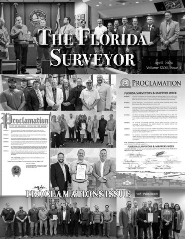
The Florida
Surveyor
PROCLAMATIONS ISSUE
April 2024 Volume XXXII, Issue 4
Call us to get your complete workflow solution today! Efficiency and versatility that will accelerate productivity comes part of a workflow solution that includes the FC-6000 field controller, Magnet software, a HiPer VR receiver and the GT-1200/GT-600 single-operator robotic system. The power of longrange reflectorless measurements comes in your choice of 1”, 2” or 3” GT-1200 models or 2”, 3” or 5” GT-600 models.
43316 State Road 19 Altoona, FL 32702
www.lengemann.us
TABLE OF CONTENTS PRESIDENT’ S Message 2023-24 FSMS Officers AROUND The State UF GEOMATICS Students Association PROCLAMATIONS OF National Surveyors Week SURVEYORS IN Government
1 3 7 15 19 32
2024 CONFERENCE Seminars & Registration SAVE OUR Everglades SUSTAINING Firms FACES ON The Frontier FROM THE Archives
35 43 71 89 99
The Florida Surveyor is the official publication of the Florida Surveying and Mapping Society, also known as FSMS. It is published monthly for the purpose of communicating with the professional surveying community and related professions who are members of FSMS. Our award winning publication informs members eleven months out of the year about national, state, and district events and accomplishments, as well as articles relevant to the surveying profession. In addition, continuing educational courses are also available.
PRESIDENT’S Message April 16th, 2024
Dear FSMS Members, On April 11, 2024, the Board of Directors met in Gainesville to prepare the upcoming FSMS Strategic Plan for 2025. Mr. Rick Pryce, President elect, conducted the meeting. The meeting set the goals for the next two years. He is putting together his report for us to share to the membership, and to also include in a future issue of The Florida Surveyor. Following that meeting on Friday April 12, 2024 the Board held its quarterly meeting. Mr. David Daniels gave the Board an overview of the recent legislative issue and his insight for the upcoming year.
President
Everything is set for the Annual Conference in July. Howard Ehmke Please make sure you have registered and made (561) 360-8883 your hotel accommodations. Check out our Annual Howard@GCYinc.com Conference webpage where you can register for conference, read about this year's education seminars, look over the proposed schedule, and reserve your hotel room. I look forward to another fruitful gathering and seeing you all there. https://www.fsms.org/69th-annual-conference Respectfully submitted. Howard J. Ehmke II
The Florida Surveyor
Page 1
CONGRATULATIONS TO GREG PRATHER, FSMS RECRUITMENT CHAMPION! Mr. Prather Successfully Recruited Two NEW Full Members and Two NEW Associate Members as part of Our Membership Recruitment Contest. Mr. Greg will Receive a Conference Packet 1 Registration along with a 2 Night Stay at the DoubleTree by Hilton Hotel Orlando at SeaWorld. FSMS would like to thank all of the participants in this year's membership recruitment contest. Through your combined efforts, FSMS gained 37 New Members: 9 Full, 12 Associate, 3 Affiliate, 3 Sustaining Firms, and 10 Students.
April 2024
Page 2
2023-24 FSMS Officers The Florida Surveyor
President-Elect
Richard Pryce (954) 651-5942 rdpryce@gmail.com
Vice President
Allen Nobles (850) 385-1179 allen@burritobrothers.biz
Secretary
Sam Hall (352) 408-6033 surveysam17@outlook.com
Treasurer
Bon Dewitt (352) 682-6007 bon@ufl.edu
Immediate Past President
Lou Campanile, Jr. (954) 980-8888 lou@campanile.net Page 3
2023-24 Districts and Directors
1
2 4
District 1 - Northwest
5
Bay, Calhoun, Escambia, Franklin, Gadsden, Gulf, Holmes, Jackson, Jefferson, Leon, Liberty, Madison, Okaloosa, Santa Rosa, Taylor, Wakulla, Walton, Washington
Angela Bailey (850) 559-5039 bailey.angelak@yahoo.com
Chad Thurner (850) 200-2441 chad.thurner@ sam.biz
District 2 - Northeast Alachua, Baker, Bradford, Clay, Columbia, Dixie, Duval, Gilchrist, Hamilton, Lafayette, Levy, Marion, Nassau, Putnam, Suwannee, St. Johns, Union
Nick Digruttolo (863) 344-2330 ndigruttolo@pickettusa.com
Pablo Ferrari (904) 219-4054 pferrari@drmp.com
District 3 - East Central Brevard, Flagler, Indian River, Lake, Okeechobee, Orange, Osceola, Seminole, Martin, St. Lucie, Volusia
Al Quickel (352) 552-3756 alq.fsms@gmail.com
Robert Johnson (772) 370-0558 bobj@carterassoc.com
District 4 - West Central Citrus, Hernando, Hillsborough, Pasco, Pinellas, Polk, Sumter
Greg Prather (863) 670-9612 gprather@pickettusa.com
Alex Parnes (813) 493-3952 alexwolfeparnes @gmail.com
3 6 7
District 5 - Southwest Charlotte, Collier, DeSoto, Glades, Hardee, Hendry, Highlands, Lee, Manatee, Sarasota
Shane Christy (941) 840-2809 schristy@georgefyoung.com
Donald Stouten (239) 281-0410 dstouten@ ardurra.com
District 6 - Southeast Broward, Palm Beach
John Liptak (786) 547-6340 JohnLiptak@ICLoud.Com
Earl Soeder (954) 818-2610 earl.soeder@ duncan-parnell.com
District 7 - South Miami-Dade, Monroe
Jose Sanfiel (305) 375-2657 psm5636@gmail.com
Manny Vera, Jr. (305) 221-6210 mverajr@mgvera.com
NSPS Director Russell Hyatt (941) 812-6460 russell@hyattsurvey.com
2023-24 Chapter Presidents District 1
District 3
District 5
Panhandle
Central FL
Charlotte Harbor
Angela Bailey bailey.angelak@yahoo.com
Gulf Coast
Jonathan Gibson jgibson0102@gmail.com
Chipola
Jesse Snelgrove jsnelgrove@ snelgrovesurveying.com
William (Bill) Rowe browe@southeasternsurveying.com
Derek Miller millersurveying@comcast.net
Indian River
Steve Shawles II sshawles@haleyward.com
Brion Yancy brionyancy@gmail.com
Volusia
Jeff Cory jeff@corysurveyor.com
Northwest FL
District 2
District 4
FL Crown
Ridge
Brandon Robbins brndrbbns@netscape.net
Kenneth Glass kglass@civilsurv.com
North Central FL
Tampa Bay
UF Geomatics
Kenneth Dell kennethdell@ufl.edu
Manasota
Brian Sleight psm6162@comcast.net
District 6 Broward
Jeremiah Slaymaker jslay@wginc.com
Jeremy D. Hallick jdhallick@hotmail.com
Collier-Lee
John Beland jbeland1979@gmail.com
Benjamin Hoyle benjamin.hoyle@kci.com
Palm Beach
Todd Bates tbates@craventhompson.com
FAU Geomatics
Lemuel Roberts lroberts2022@fau.edu
District 7 Miami-Dade
Eddie Suarez marketing@longitudefl.com
2023-24 Committees Standing Committees
Nominating Committee
Rick Pryce
Membership Committee
Nick DiGruttolo
Finance Committee
Bon Dewitt
Ethics Committee
Shane Christy
Education Committee Constitution & Resolution Advisory Committee
Greg Prather
Angela Bailey
Annual Meeting Committee
Allen Nobles
Legal & Legislative Committee
Jack Breed
Surveying & Mapping Council
Randy Tompkins
Strategic Planning Committee
Rick Pryce
Executive Committee
Howard Ehmke
Special Committees Equipment Theft
Manny Vera, Jr.
Awards Committee
Lou Campanile, Jr.
UF Alumni Recruiting Committee
Russell Hyatt
Professional Practice Committee Workforce Development Committee CST Program FDACS BPSM
Lou Campanile, Jr. Allen Nobles
Liaisons
Alex Jenkins Don Elder
Surveyors in Government
Richard Allen
Academic Advisory UF
Justin Thomas
FES
Lou Campanile, Jr.
Practice Sections Geospatial Users Group
Earl Soeder
Young Surveyors Network
Melissa A. Padilla Cintron, SIT
A
round the State
The Florida Surveyor
Special Thanks to Kelly Stout of DRMP for her wonderful pictures.
Page 7
Tri-County Surveyors Meeting(Broward, Miami-Dade, Palm Beach,) From President-Elect Rick Pryce: I would like to personally thank all of the Members and FSMS Chapters that organized and attended the event in Broward. It was billed as Tri-County, but members from Indian River Chapter attended also, so I think this was the first Quad-County event ever held in Florida for National Surveyors Week and now also Global Surveyors Day! We had a whopping 162 people there and it was one big party for all, so many thanks to hard and sometimes frustrating work behind the scenes of our Chapter Presidents Ben Hoyle (Broward), Todd Bates (Palm Beach), Eddie Suarez (Miami-Dade), and Brion Yancy (Indian River) for there promoting and attending the event. Also thank you goes out the others Maria Barbosa (Bowman) for the event games, and others that also worked on the event. They did such an excellent job with the event and the presentation, games, and commentary there. Now with the Miami-Dade and Palm Beach Chapters back up and running successfully with more support, and the enthusiasm and dedication of their new Presidents, I think we can expect great things in coming events for those chapters and in our annual event here. And Thank you to our speaker last night Denis Riordan (NGS) for bringing us up to speed on the New Datums and the ongoing work of NGS preparing us on the journey into another challenge for the experts in measurement (Surveyors). They could not possibly do all of this without the support of our members, Chapter staff, and the funds from our loyal and most important sponsors. The companies that support us every year and the money they invest for the local Society events is crucial to this particular celebration. I would like to personally thank all of them, and the individuals within each company that are the champions of this cause because they are able to convince their Company, which Surveying may not be the biggest part of to support them and our society. They also took advantage of and celebrated the important and growing role of Women in Surveying with our own Dodie Keith-Lazowick for hosting three other women Surveyors, Lis Tolstoy (CTS), Jennifer Malin (Engenuity), and Adadewa Okutu (Seminole Tribe), which a panel discussion of their backgrounds and experiences. No matter how much the Legislators and some others, may not think of us as a Profession, last night I saw 162 Professional people come together as a group and celebrate their jobs, their history, their friendships and it sets the stage that we will continue the work we love, promote people from within and come together as a group, and family of true professional in every meaning of the word. Thanks to ALL and especially our sponsors below.
April 2024
Page 8
The Florida Surveyor
Page 9
April 2024
Page 10
Central Florida, Ridge, & Tampa Bay Tri-Chapter Meeting
The FSMS Chapters of Central Florida, Tampa Bay, and Ridge started Spring with our annual Tri-Chapter meeting. It was an excellent opportunity to learn about the coming 2022 Datum and to see old and make new friends. Thanks to the Gulf Coast Regional Geodetic Advisor Mr. Denis Riordan, PSM, for the insightful presentation and all the chapter members who assisted. — Karol Hernandez
The Florida Surveyor
Page 11
April 2024
Page 12
Spring 2024 Geospatial Users Group Meeting in Viera, March 26, 2024.
Presenters: Dr. Nick DiGruttolo, Ron Hanson, Richard Allen, and Allen Nobles. Photos courtesy of Richard Allen
The Florida Surveyor
Page 13
Happy New Year, Dear fellow Surveyors, the University of Florida Geomatics Students Association (GSA) would like to inform you on some of the steps we as an organization have taken to better prepare the Geomatics Students for the workforce and broaden their horizons to the opportunities within the field of Geomatics. Here is a list of the many events which we have partaken in over the last year.
Weekly Meetings Weekly meetings have been integral to the GSA, as they have fostered a community and social bond between fellow students, essential in the survey community's small world. Many individuals have continuously echoed the fact that “It's not about what you know, but who you know”. These weekly meetings have allowed us to get to know classmates as well as many of the companies who have graciously come to present their work and share advice essential for students soon to enter the workforce. Our diverse group of presenters has allowed us to gain insight into a multitude of aspects of life as a surveyor, from running a small company with less than 30 employees, all the way up to working in a major firm with more than 1,500 employees. We have also learned from hydrographic firms to firms with the latest in aerial lidar technologies and everything in between. The meetings have been valuable in developing an understanding of the new technology and the important traits all successful PSMs must develop. April 2024
Page 14
2023 National Society of Professional Surveyors Competition For the first time, the University of Florida was able to assemble a team to represent our University at the National Society of Professional Surveyors (NSPS) Young Surveyors Network(YSN) Competition in Washington DC. The competition involved applying new skills and allowed students to get hands on with equipment utilized by previous generations. From a T2 Theodolite to a chain and compass traverse, it gave us the opportunity to learn about the technology that set the survey groundwork for this nation. We were also able to meet many other future surveyors from around From the NOAA website the country and learn about their respective geomatics programs. Representatives of each state's Professional Society were also present, and we were given opportunities to gain insight into their responsibilities in these positions.
2023 Federation Internationale de Geomatics Conference This year's Federation Internationale de Geomatics (FIG) conference was the first time in 20 years that the International Convention of Geomatics occurred in the United States. With it being in our home state, we were able to have multiple students attend the event as well as contribute to the Young Surveyors Section of the conference. While in the Young Surveyors section, we were able to chat with students from around the globe, about how they are addressing the lack of new surveyors in the nation and how to motivate the younger generations to join the field. There were also multiple technical sessions that students were able to attend, where they learned about everything from new datums to future data collection methods.
The Florida Surveyor
Page 15
2023 Florida Society for Surveyors and Mappers Conference The GSA was able to sponsor multiple students to attend this year's FSMS conference where they had opportunities to meet many of you. We were able to spend this time making connections and got to commemorate the years of service Dr. Bon Dewitt gave to the program and the impact he has made on thousands of surveyors across the globe. We would like to thank everyone who answered our countless questions and the wonderful conversations we were able to have with you all and we look forward to meeting you again next year. This is a shortened and simplified list of activities that the GSA has done this year and none of these activities would have been done without the support of the many companies and individuals who dedicated their time and resources to the program, and we appreciate them. We plan on continuing our efforts and have planned for the coming year to repeat most of these activities to continue to develop our students, prepare them more for the workforce, and show them the countless possible careers that they can pursue in the geomatics field. Unfortunately, all these activities require finances. The Geomatics Student Association is a nonprofit and we need funding and support in order to attend these events. We would appreciate it if you would help fund the future of the Geomatics Field with a donation. Here are some of our Goals for this School year and how your funding could help us accomplish them.
2024 American Society for Photogrammetry and Remote Sensing GeoWeek
The GSA was able to sponsor 3 students to attend the 2024 GeoWeek Conference and learned about a variety of new technology and applications of the current technology in various fields and aspects of Survey. We also got to meet the many people in the industry and gain a better understanding of the many various survey related jobs there are and the possibilities that exist.
Our Goals for 2024 This year we plan on continuing what we have done and more. We have continued to have regular meetings with various Guest Speakers and plan to continue. We have worked hard to rejuvenate involvement in the Geomatics Student’s Association, and we have seen an average of a 100% increase in attendance so far this year. We plan on keeping students involved and teaching them about the field through a few events this year. April 2024
Page 16
We plan on returning to the National Society of Professional Surveyors Competition and are hoping to possibly be sponsoring a team of 6 students You could Sponsor the students with a donation of $1000. This will help cover the flight ($500), conference registration, hotel rooms ($400), and other miscellaneous costs. In sponsoring a Student, we plan to make custom shirts for the team, which can include the sponsor's Logo to be worn at the event, as well as a highly appreciative student group.
We hope to send students to network at the Conference and learn about the new technology as well as the data collection and processing procedure associated with the conference. There will also be countless opportunities to network and meet many new individuals and we would highly appreciate financial support to provide students with the opportunity to attend the conference. Another goal is to ensure that we provide students with the opportunity to attend the 2024 Florida Surveying and Mapping Society Conference in Orlando. Students have always enjoyed the opportunity to go to the conference and meet future colleagues, employers, and friends. With a small and tight-knit profession like ours, it is essential we stay together and get to know each other, and the conference is the perfect place for us students to get to meet you. We appreciate your support in any capacity, and we plan to steward the support to the best of our ability and use it to prepare the next generation of Surveyors and Mappers. You can give through mailing us a Check written out to the “Geomatics Student Association” and mail it to 310 Reed Lab, PO Box 110565 Gainesville, FL 32611-0565 Sincerely, the University of Florida Geomatics Student Association
The Florida Surveyor
Page 17
NOMINATE
VOLUNTEER
FSMS Needs Someone Like You! The Florida Surveying and Mapping Society encourages membership to nominate their fellow outstanding surveyors for awards and leadership. Link to Awards Criteria Link to Nomination Form
SERVE
April 2024
LEAD
Page 18
Proclamations from — National Surveyors Week — th rd March 17 - 23 , 2024. Thank you to all the Surveyors who sent in their Proclamations.
The Florida Surveyor
Page 19
City of Hialeah
April 2024
Page 20
Indian River County
The Florida Surveyor
Page 21
Lake County
April 2024
Page 22
Manatee County
The Florida Surveyor
Page 23
Martin County
April 2024
Page 24
City of Ocala
The Florida Surveyor
Page 25
City of Orlando
WHEREAS,
surveyors and mappers were among the founding leaders of our country and were instrumental in the formation of the layout of property boundaries in the United States; and
WHEREAS,
George Washington, Thomas Jefferson and other former Presidents of the United States served their fellow colonists as surveyors; and
WHEREAS,
the surveying and mapping profession requires special education, training, knowledge of mathematics and physical and applied sciences and requirements of law for evidence; and
WHEREAS,
surveyors and mappers are uniquely qualified and licensed to determine and describe land and water boundaries for the management of natural resources and protection of private and public property rights; and
WHEREAS,
the continual advancements in instrumentation have required the surveyor and mapper not only to be able to understand and implement the methods of the past, but also to learn and employ modern technology in finding solutions to meet the challenges of the future; and
WHEREAS,
the City of Orlando celebrates the valuable contributions of surveyors and mappers to our community and appreciates their professionalism and commitment, recognizing that important decisions are made based on the knowledge and expertise of licensed surveyors and mappers; NOW, THEREFORE, I, Buddy Dyer, Mayor of the City of Orlando; do hereby proclaim March 17-23, 2024, as
“National Surveyors and Mappers Week and Florida Surveyors and Mappers Week” in the City of Orlando. IN WITNESS WHEREOF, I hereunto have set my hand and caused the Seal of the City of Orlando to be affixed this 17th day of March, 2024.
April 2024
Page 26
Pinellas County
The Florida Surveyor
Page 27
St. Lucie County
April 2024
Page 28
City of Venice
The Florida Surveyor
Page 29
City of Wildwood
April 2024
Page 30
April 2024 This month, I would like to take time yet again to write about the work that many dedicated FSMS staffers and surveyors diligently work on this time of year, preparing for the Florida Surveying and Mapping Society’s Annual Conference. You often will find many of the same faces year in and year out volunteering time to help put together the conference and build the education agenda for the conference. I have been fortunate to have worked with many of those who dedicate time and effort in putting this all together. This year there are many good courses being development and material put together for some of the typical areas of focus, but what I am excited to cover this month is the GIS/Survey Panel Presentations and Discussion. This is going to be a great opportunity for the those who extensively use GIS and Survey and the integration of both thereof in how the work in their daily operations. It will be an even bigger benefit for those who do not, as this should be an opportunity to see how others are integrating technologies and incorporating them into their organizations. As we all know government is a major driver and user of Geospatial Data in all forms, but the private side filling that government need, or even their private clients are becoming digesters of geospatial data. We are no longer only in a world of paper surveys for real estate transactions. We are in a digital world and we are now dealing with digital data life cycles and how that digital or geospatial data relates to other objects. We are dealing with IoT (Internet of Things), digital twin (Digital replication of a physical object), and a whole multitude of other digital or physical variations of items that interact physical space or geospatial location. The importance of data and location are becoming vital in how we make decisions in government and in our personal lives. Now, we should cover most if not all of this in the presentations and panel discussion, but there is only so much you can cover in six fun-filled hours. There looks to be a good mix of surveyors and GIS users comprised of the panel and presenters. So if you have not had much experience, or are a novice user like myself (I am not as experienced as I would like to be and I hope to change that) who is minimally using the applications or creating simple apps like our benchmarks app, or an app that was created to mine Stormwater drainage, FEMA Flood Zone Mapping, The Florida Surveyor
Page 31
Flooding Complaint Calls, and Highwater Mark Surveys to disseminate to decision makers. I have a bunch of room to grow in that respect, and to learn from others in our industry and those who we do not routinely interact with. That is the best part of learning, especially from those who we may not get the experience to learn and grow with as this is the future. Wait until we get into 3DGIS, and the digital environments like META and individual digital twin models, and who knows, one day a state-wide model for interactive geospatial data. Hope to see you all there. I know there is consternation by many in how GIS will adapt with boundary information as these maps become more accurate and people will have accurate measuring devices (Smart Phones) at their finger tips. The parcel fabric map (Frank Conkling will be touching on this subject) that has been preached about is a beneficial thing to know where assets are in relation to property ownership and maintenance responsibility. We will have to grow and adapt with this. The boundary of a property is not a line on map, it is based on the established and recovered control and evidence. That effort for the foreseeable future will still need to occur, but having more accurate data at the finger tips of decision makers is important in protecting the public, which is our first duty as surveyors. People should have more knowledge and understanding of their boundary, this is their biggest asset in most case, well except for some of these ridiculous expensive cars, there are many creeping up beyond the price I paid for my house, scares the crap out of me what it will cost in ten years. When we read about the history of boundaries, we often see that people used to walk the bounds of their property and they knew where every corner or marker was located. They could reference trees next to corners and other natural monuments. Today, most that I interact with have little or no idea, especially new homeowners. I see GIS Mapping as a bridge to expand their knowledge. It would be beneficial for surveyors to create story maps to explain how boundary surveys work as they have little clue in many cases, it is just a hassle to purchase their property. Just an idea. Until next time my friends, I bid you adieux. Thank you for taking the time to read this article! April 2024
Page 32
Sincerely, Richard Allen, City Surveyor for Orlando FSMS Surveyors in Government Liaison President of the Geospatial Users Group ASPRS Florida Region Director Region V Director of the Florida Floodplain Managers Association 407.246.2788 (O) Richard.Allen@orlando.gov
The Florida Surveyor
Page 33
Wednesday - July 24 8:00 am - 3:00 pm
Riparian Rights Surveying (6 CECs - Course #10807) Panel Discussion (6 speakers) - Moderator: Richard P. Green, Esq. Florida Bar CLE's: Course Reference Number: 2403461N This course will provide a history of riparian rights in Florida and the role of the Florida Department of Environmental Protection. From this foundation the course will detail a “nuts and bolts” of riparian rights surveying including techniques, standards, methodology, and emerging technologies. Surveyors will be equipped with the basics for performing a riparian rights survey along any waterbody where riparian rights are applicable. Richard P. Green, Esq. is Senior Attorney at the St. Petersburg office of Lewis, Longman & Walker, P.A. He has extensive litigation experience in a variety of areas such as real property, commercial, riparian rights, and environmental matters. He represents various public and private entities in litigation in both federal, state, and administrative forums. Green was included in Tampa Magazine’s 2024 Top Lawyers List in the areas of Administrative/Regulatory Law and Environmental Litigation, the 2024 Best Lawyers in America “Ones to Watch List” for Environmental Litigation and Real Estate Law, and Rising Star by Florida Super Lawyers, a peer designation awarded to only 2.5% of Florida lawyers, since 2020. Panelists:
Choose one 6-hour seminar for Wednesday
Andrew J. Baumann, Esq. James C. Weed, PLS George “Chappy” Young, Jr, PSM Richard Malloy, PSM Scott Woolam, PSM
A Mock Trial - A Boundary Dispute Case - Based in part on the case of Dowdell v. Cotham (6 CECs - Course #10808) Instructor: Jeffery N. Lucas, JD, PLS, Esq. This mock trial is loosely based on the case of Dowdell v. Cotham, a case involving neighbors who for over 20 years lived in happy-peaceful-coexistence, until one of the neighbors hired a surveyor to survey his property. After that—well —let’s just say that things were never the same. This seminar will explore the world of civil litigation through a mock trial based on a real-life boundary dispute case. Through audience participation, volunteers will play the roles of attorneys, landowners, lay witnesses and expert land surveyor witnesses; the seminar leader plays the role of judge. The remainder of the audience will be divided into jury pools, each with a foreman spokesperson. The size and number of juries will be determined by the size of the remaining audience. The trial will be held, and the juries will deliberate. Following deliberation, each jury will then render their verdict, and discuss their reasoning. This seminar is designed to demystify the litigation process and explain the rules of engagement that will be used in court. Jeffery N. Lucas, JD, PLS, Esq. is a licensed land surveyor in Alabama, Florida, Georgia, Mississippi and Tennessee. He is also a licensed attorney in the State of Alabama. Jeff is a recognized expert in land boundary law, riparian rights, and land surveying liability issues. He has practiced land surveying throughout the five southeastern states in which he is licensed. Jeff is also an author, columnist, lecturer and seminar presenter. He has authored three books on surveying, has over 100 nationally published articles and over 30 titles in his seminar library. Jeff has presented continuing education seminars at conferences from Alaska to Florida, from California to Nova Scotia, and most places in between.
SIT Prep 8:00 am 4:00 pm
Geoscholar's Florida Surveying and Mapping Society Fundamentals of Surveying (FS) Exam Prep Course Un-Licensed Attendees - No CEC Credit - Dr. Stacey Lyle, PhD, RPLS, PLS Geoscholar's Florida Surveying and Mapping Society Fundamentals of Surveying (FS) Exam Prep Course is designed to provide critical information needed to obtain a Surveyor in Training (SIT) Certificate based upon topics tested on the NCEES Fundamentals of Surveying (FS) exam. The course offers an in-person FS review during the annual Florida Surveying and Mapping Society Conference, as well as an online preparation course. You must complete the online course before attending the Seminar. Dr. Lyle will be covering select questions over the required sections to help you with examination preparation. After the Seminar you will have access for 1 year to the online course. Dr. Stacey Lyle, PhD, RPLS, PLS is an Associate Professor of Practice at Texas A&M University’s Zachry Department of Civil and Environmental Engineering and Department of Geography. He has served as an expert witness on land boundary court cases. He is active in the industry with over 35 years of surveying experience including civil engineering, land surveying, cadastral land records databases, GIS/CAD/BIM Fusion, geodesy, hydrography, photogrammetry, and cartography.
April 2024
CE 11
Page 34
Thursday - July 25
8:00 am - 10:45 am
The Historical Cartography of Florida Course #10809 - 3 CECs Dr. Joe Knetsch, PhD The course is designed to facilitate the understanding of the early and current mapping of the State of Florida. Each age has had its differing purposes and various nations have contributed to the mapping of the land of Florida. From the earliest explorers to the current GIS systems, the maps of Florida have shown the changes in the land, the formations exposed or covered and the property lines of all individuals who claim to own the land. Each type of map, coast charts, property plats, etc. have their individual purposes and all need to understand that each map will show or highlight something different depending upon the use for which it is intended. This course will demonstrate that each map has its use and interpretation and it is important to understand these before committing a proper survey of the lands to be depicted. Dr. Joe Knetsch, PhD received his PhD in history from Florida State University (1990), an MA in history from Florida Atlantic University (1974) and a BS from Western Michigan University with a major in History and Economics. He was the historian for the Florida Department of Environmental Protection (formerly Department of Natural Resources), Division of State Lands, from 1987 to August, 2014. He is the author of fourteen books (mostly on Florida History), over two hundred journal articles, forty book reviews, and over two hundred and twenty papers and presentations on Florida history. Dr. Knetsch is a member of numerous historical societies and associations. He currently resides in Tallahassee, Florida, with his wife of forty-five years, Linda. He also currently works as a consultant for the Town of Redington Beach, the State of Alabama, and other private interests.
Choose one 3-hour seminar for Thursday
Impact of NGS 2022 DATUM & Low Distortion Projections (LDPs) to Mapping & Engineering Projects Course #10810 - 3 CECs Vasileios "Vas" Kalogirou, RPLS, PLS, PS, PSM, LS The National Geodetic Survey (NGS) is updating both the HORIZONTAL and VERTICAL DATUMS. The presentation will depict the impact of Surveying/Mapping, GIS and Engineering projects based on the design and configuration of the NEW State Plane Coordinate Systems (SPCSs) and the Low Distortion Projections (LDPs). The learning objectives of this presentation will be to have a better understanding of: The principles of the new NGS 2022 Datum & LDPs, The impact of the new DATUMs to various geographic regions after 2022, managing legacy, small-scale & large-scale projects before and after 2022. Vasileios "Vas" Kalogirou, RPLS, PLS, PS, PSM, LS started his surveying career in Greece 30+ years ago through his surveying family business and is a third generation Surveyor. While working in the surveying industry he received a 5-year bachelor’s degree in Land Surveying Engineering from the Aristotle University of Thessalonica, Greece in 2001. At the end of the same year he received his license as a Professional Land Surveyor in Greece and then moved to the United Kingdom where he received his master’s degree in GIS in 2003. At the end of 2003 he served in the Greek Artillery where he continued working as a surveyor for various expeditions. Vas moved to Dallas, Texas in 2005 and started working for Halff, which is where he is still employed today as the VP, Survey Practice Leader. Throughout his career, Vas managed several TxDOT & ALTA Surveys, FEMA, USACE, Oil & Gas and Geospatial projects in various parts of Texas and other States. Vas is a Licensed Surveyor in seven (7) States, including the State of Florida. Since 2007 he has been coordinating the RPLS & SIT study groups while serving as the President of the Dallas TSPS Chapter 5 in 2021. Vas is also an adjunct professor teaching the courses of GIS and Geodetic Surveying & Mapping at Dallas County College since 2015 and currently serves as a Surveying Advisory Committee member on behalf of the Texas Board of Professional Engineers and Land Surveyors, but most importantly, he is a devoted family man who really enjoys surveying.
CE 11
The Florida Surveyor
Page 35
Saturday - July 27 8:30 am 10:10 am
Boundary Litigation and the Surveyor Course #10816 – 2 CECs Knud Hermansen PLS, PE, PhD, Esq. Many surveyors will be involved in boundary litigation as an expert witness. For those surveyors without experience as an expert witness, boundary litigation can be a stressful experience. Even surveyors with experience may wish to improve their testimony and be more credible and persuasive. This workshop will explain boundary litigation and the surveyor’s role in litigating boundaries. Knud Hermansen PLS, PE, PhD, Esq. is an attorney, professional engineer, and professional land surveyor. His education includes a Ph.D. in Civil Engineering from the Pennsylvania State University and a J.D. (Doctorate in Law) from West Virginia University. Knud has served as an expert witness, litigator, appellate counsel, arbitrator, mediator, boundary commissioner, member of a board of licensure, and surveying faculty member. Knud is a professor emeritus at the University of Maine. He operates a consulting firm offering surveying, engineering, and legal services. He is an author or coauthor of numerous books and articles.
8:30 am 10:10 am
Advances in UAV-Mounted Topo-Bathymetric LiDAR Course #10817 – 2 CECs Joe Priestner, PLS, PE Airborne Topo-Bathymetric LiDAR systems have been commercially available for mounting in manned aircraft for many years. These sensors solve the problem of tying the upland topography and the near shore bathymetry together using a single sensor. Only recently have advances in manufacturing enabled these sensors to be produced small enough to be mounted on a UAV. This presentation will start with a brief history of airborne topo-bathymetric LiDAR, followed by a discussion of how it works, the components that make up the sensor system, and the challenges faced when using an airborne topo-bathymetric LiDAR system. From there, we will discuss the capabilities of current UAV-mounted topobathymetric LiDAR systems and the environments to which they are suited. Mission planning parameters and logistics will be addressed, with an emphasis on special safety considerations for Class 3B lasers. The last section of the presentation will focus on the data processing workflow and deliverable extraction. The datasets used for these examples will be captured in Florida at locations with varying water quality to demonstrate how the local conditions affect the depth and point density of the data captured. Joe Priestner, PLS, PE is a Geospatial Solutions Engineer at Duncan-Parnell, focusing on the sales and support of automated monitoring, UAS, and mobile mapping solutions. Joe has over 35 years of experience working as a consulting surveyor and engineer with the last 15 years focused on heavy civil and vertical construction. Joe is naturally inquisitive and a tenacious problem solver. Joe holds a BS degree in Survey Engineering Technology from the NJ Institute of Technology and a BS degree in Civil Engineering from The Citadel. He is licensed as both an Engineer and Land Surveyor in multiple states.
8:30 am 10:10 am
Retracement of the Initial Baseline Survey for Florida (Before GPS) Course #10818 – 2 CECs Allen Nobles, PSM This class will cover the retracement survey of 75 miles of the initial Florida baseline ran in 1824 with a compass and survey chain. This project was done before GPS (1979) so we will cover the use of a Litton inertial guidance system for control; the search for witness trees; proving section corners; doing the solar observations for control traversing; and the data results found. Allen Nobles, PSM is a licensed surveyor in Florida and Georgia and has previously managed his own company in North Florida for 40 years delivering multidisciplinary professional services in the surveying industry and has an extensive background in hands on surveying, project management and business practices. Mr. Nobles is a Life Member of the Florida Surveying and Mapping Society and has been a speaker at the industry’s leading professional groups and has provided classes on LiDAR, photogrammetry, GPS, and boundary surveying for many professional groups (including the University of Puerto Rico, FAU, the University of Florida and Troy University). He has also provided several articles for the major surveying magazines on a wide range of subjects.
April 2024
CE 11
Page 36
Saturday - July 27 10:30 am 12:10 pm
Surveying Railroad Corridors with Respect to Property Course #10819 – 2 CECs Leslie Odom, PSM This course discusses the historical, best practices and practical problems in determining railroad corridor locations with respect to the land and property rights beneath the tracks. Railroads have played a major role in the settlement and development of these United States of America. The importance of ‘bands of steel’ uniting the country was underscored by the powers granted the railroad companies to acquire land and property rights in whatever way necessary, whether by grant, fee simple absolute, fee with reversionary right, fee determinable, easement or simply by occupation. Surveyors involved with the original location and placement of the railroad faced hostile environments, extreme weather conditions, low pay, no beds, no showers and few hot meals. Today, our goal is to follow in their footsteps and define, as best we can, the original configuration of the rails and the land parcels associated with the rails. Leslie Odom, PSM is a Registered Land Surveyor in Texas and Florida and has 28 years of land surveying experience with 12+ years dedicated to surveying the railroad at CSX (retiring 2017) and various other railroad projects since retiring. As the lead in-house surveyor for CSX, his responsibilities included managing surveys in 23 eastern states and 2 Canadian provinces and being an expert witness in several railroad land disputes. Les has surveyed and designed tracks within active rail yards, mainlines, passing sidings and industry tracks. Les is a graduate of the University of West Florida with a B.A. in Mathematics, has taught surveying mathematics at Northlake Community College in Lewisville, Texas and authored mathematic courses specific for survey technicians.
10:30 am 12:10 pm
A.I. Unleashed - Surveyor's Dream or Nightmare Course # 10820 – 2 CECs Dr. Youseff Kaddoura, PhD This presentation explores the possible advantages and hurdles associated with incorporating A.I. technologies into geospatial analysis and surveying. Attendees will be guided through the changing terrain where surveying and artificial intelligence converge, examining the intricate dynamics of A.I. as both an ally and a potential obstacle in the realm of surveying technologies. Dr. Youssef O. Kaddoura, PhD currently holds the position of Academic Program Specialist II at the Fort Lauderdale research and Education Center within the University of Florida (UF). His Ph.D. in Geomatics Science from UF forms the basis for his specialized focus on developing a replicable technique for georeferencing oblique tower mounted (PhenoCam) images. In addition to his responsibilities as Chapter Coordinator at FSMS Broward Chapter, Dr. Kaddoura has served as a voting Board Member for ASPRS in the years 2020 and 2023, and he presently serves as ASPRS Florida Region President. Beyond his doctoral degree, he also earned a Master of Science in Computer Engineering, also from the University of Florida. Prior to his tenure at the University of Florida, Dr. Kaddoura gained valuable expertise through employment at Geospatial Consultancy Company, an ESRI affiliate.
10:30 am 12:10 pm
An Introduction to Leveraging Remote Sensing and Surveying Practices for Design-Grade Survey Projects Course #10821 — 2 CECs Michael Zoltek, LS,CP,CFedS, GISP,PMP/Jeffery Young, PSM, CP, PPS, SP As remote sensing, surveying, and geospatial technology continue to improve, so do the requirements and workflows for applying these services to engineering design and survey projects. This presentation will provide a background in remote sensing technology and will give insight into how to apply remote sensing technology and methods to projects that have a tight accuracy tolerance. Topics will include the creation of customized flight and drive acquisition plans for aerial and mobile mapping projects, the design of ground control layouts, the feature extraction and compilation process, and the QA/QC of final deliverables. Attendees will leave this class with an understanding of remote sensing workflows and, how they are applied to design projects, and how to assess the accuracy of remotely sensed data. Mike Zoltek is a land surveyor, photogrammetrist, and GIS professional with over 30 years of geospatial experience. As the National Geospatial Program Director at GPI Geospatial, Inc. (GPI), Mike is responsible for the coordination, execution, and supervision of projects for local, state, federal, DOT, and private clients. A licensed surveyor who holds active registrations in 26 states Mike brings to clients a comprehensive background in surveying and mapping, which includes data collection and processing, project management, and QA/QC coordination. Mike is a current member of Florida’s State Board of Professional Surveyors & Mappers and is a long-standing member of the American Society for Photogrammetry and Remote Sensing (ASPRS). Mike has presented numerous technical seminars at universities and community colleges, as well as at industry conferences, and has served as an expert witness in boundary litigation cases in the state of Florida. T. Jeffrey “Jeff” Young has more than 40 years of involvement in the photogrammetry field. Currently a Senior Geospatial Manager with GPI Geospatial Inc., Jeff manages photogrammetry projects for the company out of their Tampa office. Formerly with Pickett and Associates, Inc., Jeff managed the Lakeland based photogrammetry department for 25 years. Jeff was also with BKS Surveys, Ltd. in Northern Ireland and Washington, D.C. He has receivedCE extensive photogrammetric training and has vast experience utilizing 11 4 analog, analytical, and softcopy photogrammetric instruments. Jeff earned his Photogrammetric Training from Coleraine Technical College in Northern Ireland. He is a Florida licensed Surveyor & Mapper, a licensed Photogrammetric Surveyor with the State of South Carolina, a licensed Surveyor Photogrammetrist with the Commonwealth of Virginia.
The Florida Surveyor
Page 37
Saturday - July 27 1:30 pm 3:00 pm
Tidal Datums and Property Boundaries Course #10822 — 2 CECs Dr. Nick DiGruttolo, PSM, PhD/Martin Scott Britt, PSM This seminar covers the things a surveyor needs to know to establish a boundary line on a tidal water body. We will discuss the forces that influence the tides and the causes of local variations. Tidal datums and how to determine their elevation at a project site will be described. The effects of erosion, accretion, avulsion and sea level rise on tidal boundaries will be shown with case studies and the resources and methods surveyors use to perform tide studies will be compared in detail. Nick DiGruttolo, PSM, PhD has been surveying since 1988 and spent 15 years working as a field crew chief for Sarasota County before moving to Gainesville to pursue his bachelors in Geomatics. After obtaining the bachelor’s degree, Nick obtained surveying licenses in Florida, Georgia and Mississippi and completed a MSc and PhD, with a concentration in geomatics, while working for Northrop Grumman Advanced Geospatial Intelligence Operating Unit. Nick’s PhD research focused on variations in mean high water in bays and tidal creeks. Nick currently works for Pickett and Associates as a Survey Manager supporting electrical utility projects. Martin "Scott" Britt, PSM founded MSB Surveying, Inc. in 2000 and is currently the acting President and Surveyor & Mapper. Scott is a second-generation Surveyor & Mapper in the Sarasota, Manatee and Charlotte County areas and he has surveyed for over forty years. His expertise and project experience includes historical research and local knowledge, boundary, topographic, hydrographic, mean high water, tidal studies, littoral rights, route surveys, construction stake out, subdivision and condominium platting, ALTA/ACSM Land Title Surveys, FEMA Elevation Certificates, and expert witness on boundary, tidal water boundaries and littoral lines.
1:30 pm 3:00 pm
Emerging Technology for Data Collection Course #10823 — 2 CECs Adam Long, PE, PS This course will provide examples of the use of emerging technologies for surveying and mapping. This will include current programs using AI technologies for extracting survey data from photos and LiDAR, working with 3D data in visible formats, working with a Calibration Test Facility to test equipment specifications from a surveyor’s point of view, and examples of other emerging technology trends. Adam Long, PE, PS joined SAM in 2011 as Chief Technology Officer. He has over 30 years of diverse experience in engineering, surveying, and information technology, which he used to create the Applied Technology department at SAM. Adam partners with SAM leaders to provide strategic technology innovation focusing on quality and efficiency for client solutions. His curiosity in technology and physical sciences fosters original ideas and designs that deliver precise results. Adam holds a Bachelor of Science in Civil Engineering from Ohio State University and is registered as an engineer in Ohio and Texas, as well as a Registered Professional Land Surveyor in Ohio, Indiana, Texas, and West Virginia. He has served as an adjunct professor in the Geospatial Engineering Department at the Austin Community College since 2014, teaching Engineering Design Surveying, Land Surveying, and Intro to Surveying.
1:30 pm 3:00 pm
The Role of Title in the Government Acquisition Due Diligence Process Course #10824 — 2 CECs Wendi McAleese During this presentation, Wendi will discuss the various title products available, how each one supports the due diligence products required by government agencies, including surveys, and how to determine which one best meets the needs of project stakeholders. Wendi will review title issues relevant to the survey and outline changing agency concerns with these issues. She will present recent case studies for these issues and discuss solutions used to move projects forward. Wendi McAleese is a Florida licensed Title Agent and a Florida licensed Real Estate Agent with 25-plus years of experience with public acquisition projects. Wendi is the President and a principal at American Government Services Corporation, a fullservice title agency which specializes in acquisitions by government agencies at all levels – local, state and federal. She has recently been appointed to the Florida Board of Professional Surveyors and Mappers as one of two Consumer Members.
April 2024
CE 11
Page 38
Saturday - July 27 - All Day Course 8:30 am 3:30 pm Surveying the Infrastructure of GIS Course #10815 — 6 CECs Moderator: Richard Allen, PSM, CFM (9 speakers) CAD vs GIS, & Intro to the “Parcel Fabric” Frank Conkling PSM, GISP Successful Project Integration of Survey & GIS Richard Pryce, RLS, PSM Panel Discussion - Experts and Users on Survey and GIS A presentation on the differences between CAD and GIS and an introduction to the Parcel Fabric by Frank Conkling, PSM, GISP, and then a presentation of Successful Project Integration of Survey & GIS by Rick Pryce, PSM. Following the presentations will be a panel discussion of the topics presented and what opportunities, misconceptions, and problems that exist for those in both industries with a diverse group of individuals from academia, government, and the private sector. Richard Allen, PSM, CFM is a Florida Licensed Surveyor & Mapper and Certified Floodplain Manager. He is the City Surveyor at the City of Orlando. He has been in surveying for over 27 years and has been with the City for 18 years. He is the Surveyors in Government Liaison for FSMS, Region V Director for the Florida Floodplain Manager's Association, and a Director for the ASPRS Florida Region. He is the scholarship chair and Valencia College Liaison for the Central Florida Chapter of FSMS. He is an Adjunct Professor at Valencia College's Built Environment Program, teaching Surveying and Drafting. He is married to his lovely wife Amanda and has a son named Richie. Frank J. Conkling, PSM, GISP owns Panda Consulting, an LB-licensed Professional Surveying and Mapping business offering GIS Professional Services since 1998. Frank is a recognized authority on GIS and Surveying and Mapping technology, including mapping various types of ownership interest in land. Frank has been involved in GIS and Parcel Mapping since 1974 and has enjoyed studying and guiding the creation, implementation, and maintenance of some of the country's most effective GIS systems and most accurate land ownership databases. Frank is a licensed Professional Surveyor and Mapper in Florida and a licensed GIS Surveyor in South Carolina. He is a Past President of the Florida Association of Cadastral Mappers, an organization focused on cadastral mapping throughout the state of Florida, and a Member Emeritus of the Florida Board of Professional Surveyors and Mappers, the regulatory Board for all Surveyors and Mappers in the State. Panda Consulting is the first organization in the nation to receive the Esri Parcel Management Specialty Designation. Richard Pryce, RLS/PSM Vice President Survey & G.I.S. at Craven Thompson & Associates, Inc.; current President-Elect for State FSMS; former Director and President of Broward Chapter FSMS. Rick has been surveying since 1972 and was licensed in 1983. He has performed surveys in 42 counties within Florida and was an early adopter of Geographic Information Systems using ESRI software since 1990. He has successfully integrated and completed multiple Survey, Engineering, and GIS multi-million-dollar projects over the past three decades and has provided numerous presentations and general talks on them to a diverse group of Engineers, Surveyors, and GIS Professionals. His interest, knowledge, and expertise in remote sensing started in 1996 when he worked directly with a remote sensing firm while surveying, to assist in developing a precision agriculture applications. He has expanded his knowledge and expertise to include all forms of LiDAR, (terrestrial, mobile and aerial) since then, and has also included forensic work on disaster sites. He developed multiple ways to QA/QC LiDAR work and check both horizontal and vertical accuracies to improve upon the final product. Most recently he has been using his background with LiDAR and remote sensing to assess properties for Monroe County Land Authorities in determining how much of the property is below the Mean High water line. Panelists: Richard Allen, PSM, City of Orlando Surveyor Frank Conkling, PSM, GISP, Owner Panda Consulting Richard Pryce, RLS/PSM, VP Survey & GIS at Craven & Thompson Matthew Kalus, PSM, PE, Chief Engineer, Development Review Services, Orange County Dr. Bon Dewitt, PSM, PhD, Retired Professor Geomatics at UF Allen Nobles, PSM, VP. SAM,LLC & Former Owner: Nobles Consulting Greg Caffee, CCF, Mapper Sr./Cadastral, Orange County Property Appraiser Howard Ehmke, PSM, GCY, INC Mike Garcia, PSM, Program Manager II, Seminole County CE 11
The Florida Surveyor
Page 39
69th Annual FSMS Conference Conference Registration - July 24 – July 27, 2024 Doubletree by Hilton Hotel Orlando at SeaWorld 10100 International Drive Orlando, FL 32821
Name_______________________________ Company
_______ PSM#__________
Packet 1 – Full Registration/Best Value Member Licensed Non-Member Non-licensed
$370 $470 $320
(Includes one (1) Welcome Barbecue ticket (Wed.), one (1) Exhibit Hall Breakfast & Lunch ticket (Fri.), one (1) Recognition Banquet ticket (Fri.), six (6) Saturday Seminar CECs)
Packet 2 – Partial Registration Member Licensed Non-Member Non-Licensed
$355 $455 $305
(Includes one (1) Exhibit Hall Lunch ticket (Fri.), one (1) Recognition Banquet ticket (Fri.), six (6) Saturday Seminar CECs)
Packet 3 – Saturday Only
Member $230 Licensed Non-Member $330 Non-licensed $180 (Includes six (6) Saturday Seminar CECs)
Saturday Seminars July 27
Course options are listed below, please mark the circle next to the course. Choose only ONE course per time segment. 6 Hour Course Option
8:30 am – 3:30pm (All day course)
Course name: Surveying the Infrastructure of GIS CAD vs GIS, & Intro to the “Parcel Fabric” Frank Conkling PSM, GISP Successful Project Integration of Survey & GIS Richard Pryce, RLS, PSM Panel Discussion - Experts and Users on Survey and GIS - Moderator: Richard Allen, PSM, CFM (9 speakers) (6 CEC – Course #10815) 2 Hour Course Options
8:30 am–10:10 am
(choose one from this row)
10:30 am – 12:10 pm
(choose one from this row)
1:30 pm – 3:10 pm
(choose one from this row)
April 2024
Course name:
Course name:
Course name:
Boundary Litigation and the Surveyor
Advances in UAV-Mounted Topo-Bathymetric LiDAR
(2 CEC – Course #10816) Instructor: Knud Hermansen PLS, PE, Ph.D., Esq.
(2 CEC - Course #10817) Instructor: Joe Priestner, PLS, PE
Retracement of the Initial Baseline Survey for Florida (Before GPS) (2 CEC - Course #10818) Instructor: Allen Nobles, PSM
Course name:
Course name:
Course name:
Surveying Railroad Corridors with Respect to Property
A.I. Unleashed – Surveyor’s Dream or Nightmare
(2 CEC - Course #10819) Instructor: Leslie Odom, PSM
(2 CEC - Course #10820) Instructor: Dr. Youseff Kaddoura, PhD
An Introduction to Leveraging Remote Sensing and Surveying Practices for Design-Grade Survey Projects
Course name:
Course name:
Tidal Datums and Property Boundaries
Emerging Technology for Data Collection
(2 CEC – Course #10822) Instructors: Dr. Nick Digruttolo, PSM, PhD/Martin Scott Britt, PSM
(2 CEC – Course #10823) Instructor: Adam Long, PE, PS
(2 CEC – Course #10821) Instructors: Michael Zoltek, LS, CP, CFedS, GISP, PMP/ Jeffrey Young, PSM, CP, PPS, SP Course name: The Role of Title in the Government Land Acquisition Due Diligence Process (2 CEC - Course #10824) Instructor: Wendi McAleese
Page 40
69th Annual FSMS Conference
Additional Seminar Offerings Wednesday Seminars (Separate Registration Required) July 24 8:00 am – 3:00 pm ONLY CHOOSE ONE Seminar I:
Riparian Rights Surveying (6 CEC’s - Course #10807) Panel Discussion (6 speakers) Moderator: Richard P. Green, Esq. Seminar II: A Mock Trial - A Boundary Dispute Case Based in part on the case of Dowdell v. Cotham (6 CEC’s - Course #10808) Instructor: Jeffery N. Lucas, JD, PLS, Esq.
SIT Prep Course (Un-Licensed Attendees, No CEC Credit)
July 24 8:00 am – 4:00 pm
Geoscholar's Florida Surveying and Mapping Society Fundamentals of Surveying (FS) Exam/Surveyor in Training (SIT) Certificate Prep Course You must complete the online course before attending the Seminar. Dr. Lyle will be covering select questions over the required sections to help you with examination preparation. After the Seminar you will have access for 1 year to the online course. Instructor: Dr. Stacey Lyle, PhD, RPLS, PLS
Thursday Seminars (Separate Registration Required) July 25 8:00 am – 10:45 am ONLY CHOOSE ONE Seminar I:
The Historical Cartography of Florida (3 CEC’s - Course #10809) Instructor: Dr. Joe Knetsch, PhD Seminar II: Impact of NGS 2022 DATUM & Low Distortion Projections (LDPs) to Mapping & Engineering Projects (3 CEC’s - Course #10810) Instructor: Vasileios "Vas" Kalogirou, RPLS, PLS, PS, PSM, LS
Complete payment information on the following page Cancellation Policy: 30 days prior to conference: 50% refund Less than 30 days to conference: No refund
The Florida Surveyor
Page 41
69th Annual FSMS Conference Registration Form Name:
PSM#:
FSMS Member: YES
Address:
NO
City/State:
Phone: Zip Code:
Email Address:
PACKET SELECTION
(Will contact for Sat. Seminars. A Complete Conference Registration will be available soon on fsms.org) Packet 1 ($370 member, $470 licensed non-member, Includes: 1 Welcome BBQ ticket (Wed.), 1 Exhibit Hall Breakfast ticket $320 non-licensed) (Fri.), 1 Exhibit Hall Lunch ticket (Fri.), 1 Recognition Banquet ticket Licensed government employees receive a $100 (Fri.), and 6 Saturday Seminar CECs (Continuing Education Credits) discount on Packet 1
$ Amount:
$
Includes: 1 Exhibit Hall Lunch ticket (Fri.), 1 Recognition Banquet ticket (Fri.), and 6 Saturday Seminar CECs (Continuing Education Credits) Includes: 6 Saturday Seminar CECs (Continuing Education Credits)
$
SIT Prep Course - Wed. (8 hrs.)
$300
July 24, 8:00 am – 4:00 pm Instructor: Dr. Stacey Lyle, PhD, RPLS, PLS
$
Wednesday Seminar I (6 hrs.)
$220
Riparian Rights Surveying (Panel Discussion) Course #10807 — 6 CECs July 24, 8:00 am – 3:00 pm Moderator: Richard P. Green, Esq.
$
Wednesday Seminar II (6 hrs.)
$220
$
Thursday Seminar l (3 hrs.)
$120
A Mock Trial – A Boundary Dispute Case Course #10808 — 6 CECs July 24, 8:00 am – 3:00 pm Instructor: Jeffery N. Lucas, JD, PLS, Esq. The Historical Cartography of Florida Course #10809 — 3 CECs July 25, 8:00 am – 10:45 am Instructor: Dr. Joe Knetsch, PhD
Thursday Seminar II (3 hrs.)
$120
Impact of NGS 2022 DATUM & Low Distortion Projections (LDPs) to Mapping & Engineering Projects Course #10810 — 3 CECs July 25, 8:00 am – 10:45 am Instructor: Vasileios "Vas" Kalogirou, RPLS, PLS, PS, PSM, LS
$
Packet 2 ($355 member, $455 licensed non-member,
$305 non-licensed) Packet 3 ($230 member, $330 licensed non-member, $180 non-licensed)
ADDITIONAL SEMINARS Only Select One Per Day
For Un-Licensed Attendees, 0 CECs
EVENT TICKETS
*Only Pay if Participating
Golf Match (Wed):
$100 per person $200 per team (2 players) $120 per person $50
Top Golf (Thur.): *Casino Night (Thur.):
FOOD TICKETS (Additional or Individual Tickets) * No cancellations unless replacement found Welcome BBQ (Wed.): *Legislative Reception (Thur.): Exhibit Hall Breakfast (Fri.) Exhibit Hall Lunch (Fri.): Recognition Banquet (Fri.):
$ Amount:
$
Number of Tickets:
$ Amount:
Number of Tickets:
$ Amount:
$ $ $ $
Players:
$55 or $65 (at conference) $100 $20 or $30 (at conference) $50 or $60 (at conference) $100 or $110 (at conference) $25 (kid’s meal 12 or under) Requested Vegetarian Meal
$
$ $ $ $ $ $
TOTAL ENCLOSED $ Payment Information:
Check Enclosed (Make Payable to FSMS)
Card #:
Exp. Date:
VISA/MasterCard/AE/Discover CVV Number:
Billing Address of Credit Card: IF PAYING BY CHECK, MAIL FORM TO: FSMS, P.O. Box 850001-243, Orlando, Florida 32885 IF PAYING BY CREDIT CARD, FAX OR EMAIL FORM TO: 850.877.4852 or director@fsms.org Questions? Call us at 850-942-1900 Cancellation Policy:
Provider No. CE11
April 2024
30 days prior to conference: 50% refund Less than 30 days to conference: No refund
fsms.org
Page 42
CHAPTER SEVEN
“Save Our Everglades”: Reagan’s New Federalism and Governor Bob Graham in the 1980s
In the early 1980s, two political leaders brought strikingly different agendas to bear on Florida’s water management problems. Daniel Robert “Bob” Graham, a Florida Democrat with a strong record on the environment in the state senate, was elected governor of the state in 1978. Ronald Reagan, the former governor of California who blamed many of the nation’s economic woes on “environmental extremists,” was elected president of the United States two years later. The two politicians moved forward with their respective agendas at different speeds but with telling synchrony. Upon taking office in 1981, President Reagan began an immediate overhaul of environmental regulations that had developed over the past decade, and he reduced federal funding across a broad range of environmental agencies and programs. Reagan’s environmental policy provoked strong reaction in Congress and among the general public, forcing the president (along with some other factors) to dismiss the two cabinet members who were the most identified with his environmental agenda, EPA Administrator Ann Gorsuch and Secretary of the Interior James G. Watt. Governor Graham treaded cautiously in the environmental arena in his first two years in the state house, but began wading into environmental issues shortly after Reagan became president. In 1983 – the high water mark of public consternation with Reagan’s environmental policy – Graham made “Save Our Everglades” a major element in his political program for Florida, continuing and strengthening the environmental concern first demonstrated by Reubin Askew’s administration. The thrust of Reagan’s environmental agenda was to shift responsibility from the federal government to the states. Graham’s environmental program revolved around central planning and public land acquisition. In the face of Reagan’s electoral triumph and the contraction of federal leadership in environmental affairs, Graham marshaled the state’s resources to undertake the mammoth task of restoring the Everglades ecosystem. Together, the policies of these two contrasting leaders – building on the foundation constructed by Askew’s administration – rearranged the political landscape of South Florida water management. In February 1981, Sports Illustrated published a hard-hitting article about environmental degradation in Florida. Authors Robert H. Boyle and Rose Mary Mechem described the state’s rampant population growth and frenetic new construction and noted that Governor Bob Graham had declared his administration in full support of bringing in more industry. “The sad fact is that Florida is going down the tube,” the authors wrote. “Indeed, in no state is the environment being wrecked faster and on a larger scale.” The authors went on to cite dire warnings of ecological collapse by such prominent Florida environmentalists as Marjory Stoneman Douglas, Charles Lee, John “Johnny” Jones, Arthur R. Marshall, and Nathaniel P. Reed.1 What set this article apart from a dozen other contemporary essays about Florida’s ailing environment was its prominent placement in a magazine with a broad readership. This was Sports Illustrated’s hotselling annual swimsuit issue, and the 10-page article on Florida’s environment dovetailed with a 14-page spread of bathing beauties on Florida beaches. The Florida Surveyor
Page 43
The instigator of the Sports Illustrated article was none other than the brash and effective political lobbyist Johnny Jones, executive director of the Florida Wildlife Federation and an instrumental player in Kissimmee and Okeechobee issues in the 1970s. Negative publicity was just what Jones was seeking. In 1980, he began calling newspaper editors and outdoors writers around the state, feeding them information for stories on the environment. After some success at the state level, he approached Sports Illustrated. Jones’ idea at that point was to challenge the governor by making caustic remarks about Bob Graham’s commitment to the environment in the national magazine.2 “There never was a better environmental senator than Bob Graham,” Jones was quoted as saying in the article, referring to Graham’s legislative achievements in the state senate. “But as governor he has wandered away from us. I can’t even get in to talk with him, and I run the biggest conservation organization in Florida. As a governor, he ain’t got it.” Jones went on to charge Graham with forsaking environmentalists, reaching out to sugarcane growers and agribusiness, and generally moving to the political center because he had presidential ambitions.3 Jones’ words were harsh but measured; privately he held the governor in high esteem. Yet he knew from experience, he told an interviewer many years later, “that if you want somebody to move in government . . . you have to pick up a two-by-four and hit him upside the head.”4 Graham’s commitment to the environment was both personal and complex. Born in the Miami suburb of Coral Gables in 1936, he was no stranger to South Florida’s growth issues. His father, Ernest Graham, had moved to Florida from Chicago and, in the words of Marjory Stoneman Douglas, “turned a Miami dairy farm into a real estate fortune.”5 As a young man, Bob Graham took a turn with cattle raising and home construction, before venturing into politics. He served in the Florida House of Representatives from 1967 to 1970, and in the Florida Senate from 1971 to 1978, where he got several important environmental laws enacted. In 1978, he was elected governor. One of his first acts was to create the Office of Planning and Budgeting, which was aimed at giving state planners more influence in shaping the state budget.6 In this regard, Graham’s approach to governance contrasted with that of President Ronald Reagan, who made masterly use of the federal budget as a tool for shaping federal policy. While both Graham and Reagan appreciated the nexus of budget and Governor Bob Graham. (Source: The Florida Memory Project, State Library and policy, Reagan approached it from the opposite Archives of Florida.) direction, using the Office of Management and Budget (OMB) to degrade federal programs he did not like – including many environmental programs affecting South Florida. When Graham took office, one of the key planners in Florida state government was Estus Whitfield. Whitfield was the principal author of the state’s first land development plan. In 1979, April 2024
Page 44
Governor Graham asked Whitfield to join his staff, requesting that Whitfield attend some cabinet briefings. According to Whitfield, “the environmental stuff was always the most significant part of the Cabinet meetings. It did not necessarily take the most time, but it was always difficult, controversial, because you had the issues of the use of state-sovereign lands.”7 Consistent with the acts he had sponsored in the state legislature in the early 1970s, Governor Graham wanted to facilitate dialogue between advocates of growth and environmental protection. Not surprisingly, the criticism of the governor in the Sports Illustrated piece found its mark. Whitfield remembers bringing the governor a copy of the magazine. “There is some good news and some bad news here,” Whitfield said, “and the good news is on the front, Christie Brinkley in her swimsuit.” The bad news was inside. To see such a popular national magazine lambasting Florida’s mismanagement of the Everglades, and to read the criticism by Jones – a political friend and supporter who had a big following in the state – made a powerful impression on Graham. “I do not ever remember a time thereafter,” Whitfield remarked, “that the environment was not on the top of the agenda.”8 The environmental problems that the governor faced were tied inextricably to Florida’s continuing rampant growth. By the 1980 census, the state had nearly 10 million people and had risen to the rank of seventh largest state in the union. Two cities, Miami and Orlando, were growing apace. Miami, long established as the nation’s gateway to Latin America, had become, like New York and Los Angeles, one of the nation’s great immigrant cities. Its population contained not only Cuban exiles, but also large numbers of non-Cuban Hispanics, Caribbeans, and Asians. In the early 1980s, Miami captured national headlines as it coped with a floodtide of refugee “boat people” and rising ethnic violence. Orlando, meanwhile, continued to grow as a destination resort and service center for Disneyworld’s Magic Kingdom. Sprawling across four counties, this metropolitan area was attracting some 150 new residents daily by the 1980s.9 The phenomenal growth of Miami and Orlando, together with the development of other cities and innumerable retirement communities, placed increasing demands on the water supply of South Florida. Agriculture, too, continued to grow, imposing its own set of water demands. Sugar cane, in particular, consumed a huge quantity of water. While dairy farms and citrus groves north of Lake Kissimmee disappeared into subdivisions on the expanding fringes of Orlando, sugar cane interests further south increased their stake in the lands served by the C&SF Project. In the EAA, the farm crop amounted to $700 million in 1981, of which $600 million was in sugar cane. That year, Florida surpassed Hawaii as the nation’s top producer of sugar. Ornamental tree farms were another significant agricultural interest. In Dade County’s agricultural areas, intensive fruit and vegetable farming yielded 75 percent of the winter vegetables and 95 percent of the limes consumed in the entire country.10 One concern for many people was the water supply for Dade County. Three million people in South Florida depended on the Biscayne aquifer for their sole source of drinking water. As demands on the aquifer mounted, so did longstanding concerns about seawater infiltrating into the groundwater. Another concern was contamination of the water supply by chemicals and sewage. There were known hazardous waste sites all over South Florida where no barrier existed to stop potentially hazardous wastes from leeching into the groundwater. People, too, worried The Florida Surveyor
Page 45
South Florida History provided by US Army Corps of Engineers
Miami, 1985. (Source: The Florida Memory Project, State Library and Archives of Florida.)
about contamination of shore waters. Pollution in Tampa Bay was so bad that parts of the bay were off-limits to swimmers.11 But the most pressing issue was the decline of the Everglades. By the early 1980s, experts were agreeing that the health of the Everglades ecosystem was deteriorating at an accelerating rate. The signs of ecological imbalance were many: soil subsidence; water scarcity and pollution; alteration and elimination of vegetation, wildlife, and fisheries; and intrusion of exotic species. If there was one ray of hope, it was in the growing recognition that water management was the key to saving the Everglades. It was not just a matter of protecting the quantity and quality of water in the natural system; it was imperative that resource managers discover how to distribute the water so that it closely paralleled the historic sheet flow and the region’s annual rainfall cycle.12 These ideas crystallized in 1982 when another deer crisis occurred in Water Conservation Area No. 3. From 1980 to 1981, South Florida had experienced a drought, and the low water, coupled with fewer hunting opportunities, had caused the deer population to expand. Then, in the spring of 1982, heavy rains began falling, raising water levels in Conservation Area No. 3 to 11 feet, significantly above the regulation schedule of 9.5 to 10.5 feet. The heavy rains also April 2024
Page 46
forced the Corps to pump water from the EAA to the water conservation areas, exacerbating the condition. With deer unable to find forage due to the high water, the Florida Game and Fresh Water Fish Commission called for an out-of-season hunt to reduce the deer population and enable more of the animals to survive. On 18 and 19 July 1982, hunters killed 722 deer. But animal-rights activists protested strongly against the hunt, vilifying both the Corps and the Game and Fresh Water Fish Commission, and the plight of the deer became nightly fodder on the national evening news. This negative publicity prompted Graham to create the Everglades Wildlife Management Committee, composed of representatives from state and federal agencies and headed by Estus Whitfield. Graham asked the committee to develop a wildlife management plan in harmony with water management goals.13 The Everglades Wildlife Management Committee held public hearings to gauge what could be done about the deer. Numerous animal-rights activists came, as did many environmentalists. According to Whitfield, “the common theme, which was repeated over and over and over again,” was that “poor water management” was the problem. Therefore, when the committee issued its report, it stated, in Whitfield’s words, that the deer should not only be managed at lower levels, but that “the water-management system is flawed and . . . needs to be altered.”14 One of the ways to change water management was by implementing steps that Arthur Marshall had been promoting for years – something that Johnny Jones referred to as the “Marshall Plan.” Jones gave the program this designation both to honor his friend and for rhetorical effect, as it echoed the economic rebuilding program developed by Secretary of State George C. Marshall after the Second World War and the plan promulgated by U.S. Geological Survey employee Robert Marshall to solve the water woes of the San Joaquin Valley in the 1920s (which eventually became the Central Valley Reclamation Project). The Arthur Marshall Plan was essentially what Marshall had advocated since the early 1970s – a restoration of natural sheet flow to the entire ecosystem, from the headwaters of the Kissimmee River to Florida Bay. It was then a prototype for the comprehensive plan for ecosystem restoration that would emerge in the 1990s. Marshall’s ideas, however, focused on the problems of the upper basin, particularly along the Kissimmee River, and referred to the plan as a way to “repair” the Everglades, not “restore” it.15 Regardless, the program provided a blueprint for ecological restoration – albeit encompassing a limited area of the Kissimmee-Okeechobee-Everglades ecosystem – and it assumed a large commitment of funding by the state government. Ironically, Florida’s latter-day Marshall Plan did not have any federal funding behind it even though the enormity of the proposal and the fact that it would affect Everglades National Park seemed to warrant it. Some even believed that the U.S. Army Corps of Engineers would oppose the plan, given the extensive modifications of the C&SF Project it would require. Nor was it clear whether Florida would get much support for its environmental initiatives from agencies such as the EPA, the FWS, and the NPS, even though all of these entities had supported environmental initiatives in the 1960s and 1970s. The reason was simple: about the same time that environmentalists succeeded in reawakening Graham to environmental issues in Florida, they lost whatever influence they had had in the executive branch of the federal government under Ronald Reagan. The newly elected president was avowedly pro-business, strenuously opposed to “big government,” and hostile to most of the environmentalists’ agenda. His election in 1980 created a new political context for environmental restoration initiatives in South Florida. The Florida Surveyor
Page 47
South Florida History provided by US Army Corps of Engineers Reagan campaigned for the presidency on a theme of cutting taxes and government “red tape” in order to revitalize the economy. His vision of economic growth contrasted with President Jimmy Carter’s message of sacrifice. Reagan’s conviction that the United States could achieve energy independence by unlocking its own domestic resources contradicted Carter’s emphasis on conservation and limits to growth. Reagan also presented “simple” alternatives to Carter’s complicated analyses. Although environmental issues were not at the center of debate in the presidential campaign, the two candidates presented a stark difference on environmental policy.16 When Reagan won the election, environmentalists feared that the new president would undo many of the movement’s accomplishments of the previous decade. Reagan, for his part, claimed that his landslide victory at the polls (he had defeated Carter by 489 to 49 electoral votes and garnered a plurality of popular votes in a three-way race with Independent John Anderson) gave him a popular mandate to reform the nation’s economic and regulatory policies, including those shaping the environment. Reagan’s environmental agenda was deregulation, reduction of programs, and the opening of public lands for energy Ronald Reagan at a press conference in Florida. (Source: development and other uses. But in spite The Florida Memory Project, State Library and Archives of Florida.) of Reagan’s decisive victory, it was questionable whether his environmental policy was in sync with majority opinion. Because most people based their votes on multiple issues, no one could be sure that voters had given Reagan a mandate to reform environmental policy. Indeed, one strong indication that the public remained committed to environmental reforms of the 1970s was the fact that environmental organizations dramatically increased in membership during the Reagan administration. Analysts came to believe that the public consensus that had formed behind the environmental movement in the 1970s held together in the 1980s. As the Reagan administration moved ahead on its agenda, environmentalists sought to protect the status quo through Congress and the courts.17 Reagan pursued his environmental policies through three principal strategies. First, he appointed administrators who shared his conservative ideology and who were willing to undertake an extensive rewrite of federal regulations. Whereas Carter had appointed many administrators from the environmental community, Reagan recruited largely from the business arena and his appointees to environmental agencies typically had cut their teeth opposing government regulators. While some of Reagan’s top appointments provoked congressional opposition, his lower level designees were too numerous for Congress, environmental groups, or the media to monitor. The Reagan administration’s political appointments reached farther down in the ranks of the executive branch than in any previous modern presidency, and the President April 2024
Page 48
accomplished his goals in part through a systematic weakening of federal environmental regulations and policies at the hands of these administrators.18 Reagan’s second principal strategy was to use the budget process to implement policy. He began his first term by pushing a package of massive tax and budget cuts through Congress. “No previous administration ever came into power more determined or better prepared to achieve substantial domestic policy change through the budgetary process,” political scientist Robert V. Bartlett argued. In each ensuing budgetary cycle following the 1981 tax cut, Reagan directed the inevitable reductions in federal appropriations toward those environmental programs he favored least. “Few environmental programs,” Bartlett wrote, “escaped the Reagan budgetary scalpel.”19 While Congress began to restore some environmental program budgets to former levels in Reagan’s second term, many programs – such as funding for research and development – bore lasting scars from this budget slashing approach to policymaking. Reagan’s third principal strategy was to avoid battles with Congress. He sought to weaken environmental laws not through legislative amendment but through selective non-enforcement of the laws based on regulatory revision and budget cuts. The Reagan administration made few legislative proposals in the environmental arena. Although Congress opposed the Reagan environmental policy agenda in many particulars, it went along with the president’s tax and budget cuts in 1981. As a result, Congress’s opposition to the president on environmental issues during the 1980s was largely confined to budget battles.20 The poster child for Reagan’s environmental agenda was Secretary of the Interior James G. Watt, the most flamboyant and controversial of Reagan’s appointees. A Wyoming lawyer who had spent years lobbying for and battling against Interior Department policies, most recently as a member of the conservative Mountain States Legal Foundation, Watt was a self-proclaimed leader in the “Sagebrush Rebellion.” Centered in the West, the Sagebrush Rebellion was fueled by frustration over declining energy prices and protective land policies that were allegedly harming western rural communities. Its principal goal was to privatize certain public lands administered by federal agencies. Although the Sagebrush Rebellion focused most intently on federal wilderness areas and minerals administered by the U.S. Forest Service and the Bureau of Land Management – western issues that were seemingly remote from Florida – its attack on public land ownership was significant. One Secretary of the Interior James G. Watt. of Secretary Watt’s first initiatives was to freeze (Source: U.S. Department of the Interior.) expenditures by the Land and Water Conservation Fund.21 This fund was used primarily for purchasing land in authorized additions to the national park system, and from 1965 to 1981, it had enabled the NPS to acquire 1.4 million acres – including land in Florida’s Big Cypress National Preserve and Biscayne National Monument. As proposals for ecosystem restoration in South Florida increasingly pointed to the need for more The Florida Surveyor
Page 49
Frontier Precision has the latest LiDAR photogrammetry innovations to fit your job or application. Our staff has the knowledge and real-world experience to help you select the solution that’s best for you and the training to make you more proficient and profitable. Just as important, our professional services group can help you implement LiDAR and photogrammetry solutions on your next project – from field data capture to data processing – we have the expertise to make sure your project is done right.
YOUR LIDAR & PHOTOGRAMMETRY SOLUTIONS EXPERTS.
The YellowScan LiDAR UAV delivers the highest level of accuracy and density for real-time georeferenced point cloud data. Lightness and accuracy combine for a LiDAR solution that works hard for you.
FRONTIER PRECISION 8301 Cyprus Plaza Drive, #107 Jacksonville, FL 32256
Emesent automates the collection and analysis of data in challenging GPS-denied environments, delivering revolutionary efficiency, safety, and operational insights to underground mining and other industries. It’s core areas of expertise are drone autonomy, SLAM-based LiDAR mapping, and data analytics.
R
Joey Civello | 904.477.6662 [Cell] or jcivello@frontierprecision.com PRODUCTS | TRAINING | REPAIR | RENTALS | TECHNICAL SERVICES
FIND OUT MORE AT www.frontierprecision.com/lidar
publicly owned conservation lands, the Reagan administration did nothing to encourage a vigorous federal or state land acquisition program. The operating budget of Everglades National Park took some direct hits in Secretary Watt’s drive to reduce expenditures by the NPS. In 1982, the park was denied funding for restoration of natural drainage to the Turner River watershed in Big Cypress National Preserve and the western edge of Everglades National Park, a project that the Izaak Walton League claimed “would be truly a precedent setting action.”22 In 1983, the park lost funding of its exotic plant control program. Watt also had a penchant for making flip remarks (Reagan once gave Watt a sculpture of a cowboy boot with a bullet hole through the toe to symbolize this characteristic) and this tendency was evident in his response to the ecological endangerment of Everglades National Park. In June 1983, at a time when the national news media were carrying stories about manmade flood disaster in the park, Watt said in a prepared address to the American Petroleum Institute, “I’m told that Everglades National Park is being improved and is in better shape than it has ever been.”23 Park officials told the press the next day that the secretary of the interior was vastly uninformed. Watt’s critics pounced on this flap as evidence that the secretary did not talk to his park superintendents and did not comprehend or care about the ecological integrity of national parks. Indeed, it seemed to be further proof that Watt was narrowly focused on infrastructure improvements in the national parks. Florida Audubon Society president Peter Mott saw it as evidence that the interior secretary was ignorant that the park had lost 90 percent of its wading bird population. “Or maybe he thinks visitor centers are more important so people can go there and see trees with no birds in them,” Mott sarcastically commented.24 Another controversial Reagan appointee, Ann Gorsuch, presided over drastic reductions of budget, staffing, and regulatory enforcement at the EPA. Under her leadership, according to historian Edmund P. Russell, “EPA cut enforcement actions in half and morale plunged.” Administration critics asserted that Gorsuch was unqualified and incompetent to lead EPA. Pressured by Congress, and with critics within the White House as well, she resigned in 1983, and Reagan brought back EPA’s first administrator, William Ruckelshaus, to restore the agency’s sense of mission. In one important respect EPA had been adrift since the Carter administration. Originally, the EPA had concerned itself with the total environment, but it had since moved toward a narrower focus on cancer-causing toxins.25 In part because of this focus, EPA paid little attention to Everglades protection during the Reagan years. Reagan’s choice to oversee water resource development programs of the U.S. Army Corps of Engineers was William R. Gianelli, who became Assistant Secretary of the Army (Civil Works) in April 1981. Gianelli had served as head of California’s Department of Water Resources when Reagan was governor of that state. Gianelli had two principal goals as the assistant secretary. First, as part of Reagan’s effort to deregulate, he wanted to curtail the Corps’ Section 404 regulatory program. This program was named for Section 404 of the Clean Water Act of 1972, which assigned the Corps responsibility for issuing permits to dredge and fill wetlands. During the Carter years, the Section 404 program evolved so that the permitting process served to protect, or at least mitigate, wetlands loss. Gianelli believed this was wrong. In his view, the intent of Section 404 was to protect water quality, not wetlands. If Congress really wanted to prevent the destruction of wetlands, Gianelli maintained, then it needed to pass another law and The Florida Surveyor
Page 51
South Florida History provided by US Army Corps of Engineers assign responsibility to EPA or the FWS. So Gianelli embarked on a revision of the Section 404 regulations with the assistance of his deputy, Robert Dawson. The principal result of these efforts was to streamline the permitting process and allow more development in wetlands. Gianelli was particularly proud that the revised regulations reduced the influence of “singlepurpose agencies” such as the FWS and the NPS.26 Gianelli’s other main goal was to reform the system of funding for water development projects. Curiously, this was one environmental policy initiative the Reagan administration shared with the Carter administration. But Reagan would not repeat the mistake that Carter had made. In 1977, Carter had gone to Congress with a “hit list” of Corps of Engineers civil works projects that he considered unnecessary and worthy of deauthorization. Carter took aim at these projects because the Corps had a longstanding reputation as an agency that lent itself to “pork barrel” politics. Members of Congress had made an industry out of obtaining civil works projects for their local districts – projects that were often paid for by taxpayers at no additional cost to the local communities that were supposed to benefit from them. Moreover, the Corps’ civil works program carried a backlog of projects that, in the context of the environmental movement, appeared misguided Assistant Secretary of the Army (Civil Works) and detrimental to the environment. Carter, William R. Gianelli. (Source: U.S. Army Corps of however, underestimated how jealously Congress Engineers.) guarded its prerogative to authorize these civil works projects, and he encountered a firestorm of congressional opposition. The resulting standoff killed any new water resource development acts – the semi-annual appropriation bills of the Corps’ civil works program. Carter retreated from his hardline stance in the last two years of his administration, but the damage had been done.27 When President Reagan came into office in 1981, he was every bit as opposed to pork barrel politics as his predecessor. Yet Reagan strongly supported water resources development. Indeed, Carter’s assault on water development projects was one of the wellsprings of the Sagebrush Rebellion that had helped elect Reagan president. Therefore, Reagan’s prescription for the Corps’ civil works program was to get it moving again by shifting a greater proportion of project costs to the states. Carter, too, had proposed new cost sharing arrangements, but Reagan took it further. Gianelli, again with support from his deputy, Robert Dawson, proposed substantially increased “cost-sharing” between the federal government and non-federal sponsors for construction of new projects. Historically, a study by the Water Resources Council had shown, local interests had paid an average of 19 percent for federal flood control projects, but Gianelli, April 2024
Page 52
using figures developed by Robert Eiland, his special assistant, proposed that this figure be increased to 35 percent. Congress resisted this reform, and the stalemate over new project authorizations that had begun in the Carter administration continued through the first term of the Reagan administration. Finally, the Reagan administration succeeded in passing the Water Resources Development Act of 1986 (WRDA-86), which required local interests to enter into cost sharing agreements with the Corps for almost all new flood control projects. Local interests would bear at least 25 percent of the burden, instead of the federal government paying the full amount, and they would also supply 50 percent of the cost for feasibility studies. According to the Corps’ chief counsel at the time, Les Edelman, it was Dawson who skillfully sold the costsharing idea to Congress, but congressional leaders, especially Senate Republicans such as Robert Dole, James Abdnor, and Mark Hatfield, were the ones who secured the legislation’s passage.28 WRDA-86 was a significant achievement for an administration that put forth few legislative proposals in the environmental policy arena. The Reagan administration advanced its environmental agenda most effectively through the budget process, slashing appropriations for the Department of the Interior, EPA, and even the Corps, which lost nearly 3,000 positions in the civil works division from 1981 to 1983.29 Therefore, as Florida positioned itself to undertake much more extensive ecosystem restoration in the early 1980s, it had little support from Washington. Reagan’s new federalism would shape the direction of ecosystem restoration in South Florida for the next dozen years. Reagan’s new federalism was evident in the return of the jetport controversy. Although the first jetport proposal in the Big Cypress Swamp had been defeated, controversy swirled again over Site 14, a 26-square-mile area in northwest Dade County selected under the Everglades Jetport Pact in the 1970s. Construction had been delayed on the jetport, and by the late 1970s, environmentalists were bitterly divided over Site 14. Some environmental groups, notably the Florida Audubon Society, opposed Site 14, believing that the sacrifice of wetlands, the encroachment on critical habitat of several endangered species including the Everglades kite, and the disruption of sheet flow across Conservation Area No. 3B were unacceptable costs to accommodate further aviation needs.30 But most of the Everglades Coalition supported the alternative site in the belief that, if it were not approved, Dade County would eventually build somewhere else in a location that would probably do more harm to Everglades National Park. Nathaniel Reed took this point of view, arguing that Conservation Area No. 3B, in which Site 14 was located, must be treated as multiple-use land in order to protect the national park and preserve land to the south and west. The dispute drove a wedge in the coalition.31 In October 1979, EPA raised the bar for Site 14 when it designated the Biscayne aquifer as a sole source aquifer under Section 1424(e) of the Safe Drinking Water Act. Now pollution discharged into the groundwater had to be considered in addition to the other environmental impacts of the proposed facility. EPA notified the FAA of its intent to review the project in light of its Section 1424(e) authority. By the spring of 1980, EPA officials in the Regional Administrator’s office in Atlanta were warning the FAA that EPA had “several major concerns” – particularly since the Dade County Water and Sewer Authority had recently proposed to develop a major new well field for tapping the Biscayne aquifer near Site 14.32 The Florida Surveyor
Page 53
South Florida History provided by US Army Corps of Engineers EPA completed its review of the final EIS for Site 14 in February 1982, nearly a year into Reagan’s first term. The agency reiterated its concern that the development of a commercial airport “within the cone-of-influence” of the newly developed well field represented a “potential threat to future drinking water quality in south Florida.” Yet EPA would not use its Section 1424(e) authority to prevent the project, stating that it could not “conclusively demonstrate that an airport at Site 14 will lead to contamination of the Biscayne [aquifer].”33 Commenting on the final EIS in January 1982, the Jacksonville District of the Corps of Engineers expressed its own reservations about Site 14. The jetport facility would render Conservation Area No. 3B “virtually useless” for its intended purpose as a floodwater storage area. Moreover, the Corps objected to a statement in the final EIS that the Corps, together with other federal agencies, had determined that the jetport development was compatible with plans for the building of a conveyance canal from Conservation Area No. 3 to Everglades National Park. “The Corps of Engineers was not a party to this determination, and in fact disagrees with this determination,” the Jacksonville District stated.34 To the contrary, there was high potential for the jetport facility to contaminate water that was to be conveyed directly to Everglades National Park through the new canal. Therefore, the District requested that the FAA address these issues in its final EIS, noting that the FAA needed to follow the procedures outlined in Section 404(r) of the Clean Water Act as well.35 Faced with mounting criticisms of the project, Governor Graham formed a committee to study the issue and to recommend a final decision. He selected seven individuals: five from state government, one from private industry, and one from the University of Florida. The governor charged the group with making a thorough analysis of South Florida’s future aviation needs. The group considered a range of other measures to improve commercial aviation service and
Urban encroachment of Dade County. (Source: South Florida Water Management District.)
April 2024
Page 54
determined that existing facilities at Miami International Airport could meet the region’s demands through 2000. From a state perspective, further consideration of a proposed airport at Site 14 was unwarranted, the group decided. The governor accepted the group’s findings.36 On 11 May 1983, Graham announced that he opposed the jetport plan and would not renew the state’s participation in the Everglades Jetport Pact. “Our decision to withdraw the state’s support for a Jetport in Dade County will mean enhanced protection of the Everglades, the ‘river of grass’ unique to the world,” Graham stated. “This decision to withdraw state support of the study of a major new jetport in Dade County means that such a Jetport should not be built in this century.”37 Reminding people that the jetport proposal had been under consideration for a long time, the governor explained that public attitudes about land use had changed dramatically in the intervening years. Graham might have added, although he was too politically savvy to say it, that the federal perspective on land use had changed dramatically as well. If growth pressures in Dade County threatened Everglades National Park, it was now up to the state, not the federal government, to press for action. At the same time that debate raged over the jetport proposal, the Corps struggled with another task that, in a different political climate, might have provided valuable help for addressing South Florida’s water management problems. In 1980, the Jacksonville District initiated a study of South Florida’s water supply mandated by Congress to resolve the questions of water supply to Everglades National Park. As explained previously, P.L. 91-282, passed in 1970, required that the Corps conduct a study in 1980 to “determine whether further modifications of the project [were] warranted, and [to] give further assurances of maintaining the essential water supply to insure the protection of the Park’s ecosystem.” 38 The study was funded as a component of the C&SF Project – another in a series of restudies of the huge project to gauge its progress and prospects. But instead of focusing on whether or not Everglades National Park was receiving enough water, the Jacksonville District decided to use the restudy to assess how the C&SF Project could increase water availability for the region’s agricultural, municipal, and industrial needs. The restudy of the early 1980s foreshadowed the extensive reexamination that would be undertaken in the following decade. Like the latter effort, its purpose was to identify means for expanding the water pie in South Florida so that all stakeholders in the project could get a larger piece. However, the water supply study of the early 1980s withered. It served to highlight needs and options, but did not result in any comprehensive plans or recommendations. A drought beset South Florida at the same time that the study was commenced, heightening public interest in the water supply problem. Hardest hit by the drought was Lake Okeechobee. As the level of the lake dropped to its lowest point in history, the Corps was urged to reconsider old proposals to raise the lake level and increase its storage capacity. The problem was that the level of the lake directly affected its water quality and wildlife habitat. To resolve these conflicts, the Corps changed the lake-stage regulation schedule in 1978 in order to increase water storage, and the SFWMD curtailed backpumping of water from the EAA into Lake Okeechobee in order to improve water quality. However, due to the drought, the lake level dropped despite the new regulation schedule. In order to prevent levels from decreasing even more, the SFWMD allowed a resumption of backpumping through August 1982.39 The Florida Surveyor
Page 55
South Florida History provided by US Army Corps of Engineers As part of the water supply study, the Corps investigated options for raising the level of Lake Okeechobee. It also considered backpumping water from east coast canals into the lake. Other alternatives included the establishment of additional water conservation areas, storage of freshwater in deep aquifers so that it could be pumped to the surface in times of shortage, desalinization of seawater, and water conservation. One concerned citizen wanted to import water to Lake Okeechobee from the St. Johns River basin to the north, a proposal that U.S. Senator Lawton Chiles (D-Florida) relayed to Colonel Alfred B. Devereaux, Jr., District Engineer of the Jacksonville District. Devereaux’s deputy responded to Senator Chiles that interbasin diversion was not among the alternatives under consideration.40
Lake Okeechobee. (Source: South Florida Water Management District.)
Governor Graham agreed with the Corps on this matter, stating that interbasin transfers of water should be considered only as a last resort, and that the state and the Corps were investigating other means of improving South Florida’s water supply. Graham noted that the array of water supply concerns included the protection of water quality, coordination of water use activities in each region, and “maintaining minimum flows for natural systems.”41 This last item was of crucial importance with respect to Everglades National Park. Governor Graham was not the only one requesting that the Corps address the needs of Everglades National Park. John M. Morehead, superintendent of the park, was interested in the ultimate effects of the Corps’ study. In a letter to Colonel Devereaux, he expressed hope that the study would “examine ways to rejoin the historical hydrological equilibrium between the east Everglades, the Water Conservation areas, and Everglades National Park.”42 Environmental groups, too, wanted assurance that the water supply study would adequately address park needs. April 2024
Page 56
It was not an unreasonable demand, since Congress originally authorized the study in 1970 as part of its efforts to protect water supply to the park.43 But in the view of the Corps, the multiple demands on South Florida’s water supply by municipalities, industry, and agriculture required a broader approach. As the water supply study entered its third year, the Corps determined that the best way to complete it was to throw its effort behind an initiative of the SFWMD involving computer modeling. Thomas MacVicar, a state hydrologist in the Resource Planning Department of the SFWMD, had begun developing a computer model capable of simulating the hydrology of South Florida on a regional scale. As the model progressed, the Corps provided funding through contractual arrangements with the SFWMD. Gradually, the water supply study melded into the SFWMD’s computer modeling strategy.44 In its original published form (1984), the model was called the South Florida Water Management Model (version 1.1). It would be continually modified, upgraded, and populated with additional data over the next two decades, and in the early 1990s, it would form the basis for a Natural System Model that was crucial in developing a comprehensive plan for ecosystem restoration.45 MacVicar’s original concept was to develop something that would simulate how water was distributed and flowed through the entire ecosystem so that managers could test how operational decisions in one locality would affect hydrologic conditions elsewhere. The hydrologic model simulated groundwater flow, surface water flow, and how hydrology would respond to hypothetical channel routings from changes in canals, levees, and other structures. Spatially, the model consisted of a grid-pattern overlay of South Florida composed of squares two miles on each side, with each point of intersection in the grid being a node in the computer model. For each node, the model was populated with data on topography, land use, and aquifer thickness and permeability. In terms of timing, the model used one-day intervals, and data were supplied for rainfall, well field withdrawal, and structure discharge for each day of simulation.46 Because it explored the relationship of disparate regions within the entire ecosystem – showing how changes in one part of the area affected water distribution or other characteristics in another section – MacVicar’s model foreshadowed the Corps’ restudy of the C&SF Project in the 1990s. In many ways, it was one of the key factors allowing the concept of Everglades restoration to bloom. In its beginning stages, MacVicar’s program was used for developing “optimization” of the C&SF Project. MacVicar encoded the model so that it would compare actual water stages throughout the system with “optimum” stages. Actual amounts were computed by entering the previous day’s hydrologic data into the program. Optimums for each canal were variable depending on time of year, hydrologic conditions, and other operational considerations. The model helped managers to minimize the “absolute deviation” between the actual and optimum stages in each canal or reservoir, thereby allowing agencies “to drive the system to operate as close as feasible to the optimum.”47 Park Superintendent Morehead saw the possibility of adapting MacVicar’s hydrologic program to predict the results of different C&SF Project modifications for water deliveries to Everglades National Park. Through the Corps, he supplied MacVicar with data on mean monthly delivery volumes for the years 1969-1975.48 MacVicar then entered operational data – the spatial arrangement of levees, canals, and other structures – for the same period. As he The Florida Surveyor
Page 57
South Florida History provided by US Army Corps of Engineers explained in a meeting of Corps, SFWMD, and NPS hydrologists and engineers in May 1983, he could now run the computer model for “base” (current) or “historical” conditions. By operating the model on historical conditions, it was possible to rewind the clock on C&SF Project developments and simulate how the hydrology would respond. In this case, “historical conditions” referred only to the operational system in the years 1969-1975 – not far in the past – but the idea was to model different scenarios for filling in or degrading existing canals and levees in order to achieve a measure of ecosystem restoration. Toney Lanier, the Corps’ project manager for the water supply study, assisted the development of MacVicar’s program by committing project monies for it.49 Yet the Corps never produced a final report with an analysis of alternatives, as was conceived at the outset of the study and in the examination’s congressional authorization. Yet the agency never officially abandoned it either. Strapped for funds and personnel, and distracted by project cost-sharing issues, it merely utilized the SFWMD’s hydrologic model of South Florida for information.50 After Congress passed an emergency measure for Everglades National Park in November 1983, requiring the Corps and the NPS to implement a two-year experimental program of modified water delivery for the park, the Corps became firmly wedded to the SFWMD’s computer program as a means of re-evaluating water supply options not only for the park but throughout the Kissimmee River-Lake Okeechobee-Everglades ecosystem. It had used the water supply study to assess how agricultural, industrial, and municipal needs could co-exist with the park’s ecological needs, much to the chagrin of the park, and it subordinated the study to the state’s own water management objectives. In 1987, seven years after the water supply study was initiated, the Corps sought comment from the FWS on another iteration of the examination, offering, for unclear reasons, only a meager $5,000 transfer of project funds for the FWS review. Field Supervisor Joseph D. Carroll of the FWS’s Vero Beach office responded indignantly to Jacksonville District Engineer Colonel Charles T. Myers, III. “What is impending is a request at the 11th hour by your staff to respond in two weeks or 30 days to a ream of computer data,” Carroll wrote. “As indicated in the Scope of Work, your staff will want to know detailed biological effects on Lake Okeechobee, the water conservation areas, the Holeyland and Rotenberger tracts, and Everglades National Park (millions of acres). This just cannot be done!” Carroll accepted the $5,000 transfer but warned that such a trifling sum would merely pay for “the most superficial treatment of this huge project, largely based on past studies and experience.”51 Meanwhile, Governor Graham advanced his environmental agenda through state legislation. Graham’s first significant environmental law was his “Save Our Rivers” initiative, enacted in June 1981, which provided $320 million to the state’s five water management districts over the next ten years for river cleanup. In 1983, the state legislature passed the Water Quality Assurance Act, creating a $100 million trust fund to help local governments upgrade sewage treatment plants. The law also established guidelines for protection of groundwater from industrial pollution and gave the Florida Department of Environmental Regulation $3 million for enforcement. In 1984, the legislature enacted the Wetlands Protection Act, which enlarged the department’s jurisdiction over swamps, marshes, and floodplains by extending the list of plants that identified an area as wetland from 67 to 266 species. The law also gave the department permitting authority for development in wetlands – a responsibility that overlapped the Corps’ April 2024
Page 58
Everglades National Park, 1980. (Source: The Florida Memory Project, State Library and Archives of Florida.)
regulatory program under Section 404 of the Clean Water Act. By 1985, officials in Tallahassee claimed that Florida was doing more than any other state to protect water supplies, with the possible exception of California. Despite these state efforts, Department of Environmental Regulation Secretary Victoria J. Tschinkel emphasized, Florida’s water supply remained vulnerable to threats of pollution. More than nine out of ten Floridians depended on groundwater for their drinking water. “In south Florida,” one environmentalist commented, “we live right on top of our water supply. It’s like drinking out of the toilet.” A noted expert on the state’s water resources, John DeGrove, testified in hearings held by the department that “what we’ve seen here scares the daylights out of me.”52 While President Reagan promised the nation regulatory relief, Governor Graham assured Floridians that they deserved more environmental safeguards – and as the governor’s popularity rose, it increasingly appeared that that was what most Floridians wanted. Under the strong leadership of Secretary Tschinkel, the Department of Environmental Regulation moved ahead of both the Corps and EPA to address state water problems. Tschinkel announced a protective state water policy in 1981, followed by a coastal management plan soon after that. Impatient for EPA to mandate allowable limits for toxic chemicals in drinking water under the federal Clean Water Act, Tschinkel’s agency established state standards, becoming the first state in the nation to do so.53 Governor Graham’s enthusiasm for land-use planning to protect environmental quality culminated in Florida’s Growth Management Act of 1985. Although the state had passed similar The Florida Surveyor
Page 59
legislation a decade earlier, it was not effective in dealing with the pressures of Florida’s rapid population expansion. One of the most pressing issues for many Floridians was how to preserve the small-town character of communities that were becoming smothered by strip malls and homogenous residential subdivisions. The Growth Management Act of 1985 aimed to address numerous problems in conjunction with this development, including inadequate infrastructure to support growth, affordable housing, and urban renewal, as well as environmental degradation. In essence, the law required local governments to develop local comprehensive plans for land use.54 In the long run, this law failed in its objectives. The principal reason was that the legislation was not enforceable: it allowed for substantial local control, and when developers wanted to develop a particular parcel of land that was out of bounds, they lobbied the local government to have the comprehensive plan modified. The law made Florida’s Department of Community Affairs responsible for enforcing the comprehensive plans, but it allowed the plans to be modified as often as twice a year. Another limitation of the Growth Management Act was that it did not attempt to coordinate land-use planning with conservation needs. Land use plans too often ran afoul of the Section 404 permitting process, for example, or of requirements under the Endangered Species Act.55 Growth management was fundamentally a problem for local and state governments, but clean water, protection of wetlands, and cleanup of hazardous waste sites were environmental issues that involved state and federal cooperation. While Graham was willing to put the resources of the state behind various initiatives, he was frustrated by the lack of federal support. “To date, we have sort of dragged the federal agencies with us,” Graham remarked in 1986. “I’d like to see Washington move from a passive and reluctant partner to a full and enthusiastic one.”56 Nowhere was the state in more need of federal assistance than in South Florida, where the Everglades continued to show signs of inexorable decline. Environmentalists had long insisted that the federal government was neglecting its stewardship responsibilities in South Florida. The national parks and other federal interests in South Florida ought to compel greater federal involvement in that region’s ecological problems, environmentalists argued. Graham did not disagree, but he decided that the underlying problems were so broad and complex that environmental leadership had to come from the state. In particular, he was impatient with the Corps over its slow pace in studying how to repair environmental damage caused by the C-38 canal it had built down the Kissimmee River Valley. As Jones and Marshall reminded him following the exposé of Florida’s environmental problems in Sports Illustrated, the Corps had resisted modifying the Kissimmee River project since it was first asked to reexamine it in 1976. “The governor is not going to wait forever for the Corps of Engineers to act,” Graham’s chief environmental aide, Estus Whitfield, informed the media.57 Rather, the state would propose its own version of Kissimmee River restoration. In late March 1983, Graham called a summit of his top environmental administrators. State agencies represented at the conference included the SFWMD, the DER, the DNR, the Florida Game and Fresh Water Fish Commission, and the Department of Community Affairs. He demanded interagency cooperation and gave meeting participants a 1 July deadline to develop a blueprint for saving the Everglades. Over the next three months, the governor held a series of other meetings on the Everglades with business leaders, environmentalists, and state officials. Although the governor conducted these conferences behind closed doors, word began to leak to The Florida Surveyor
Page 61
South Florida History provided by US Army Corps of Engineers the press that the plan would involve restoration of sheet flow through the entire ecosystem. It would likely mean changes of land use in two bitterly contested areas: the EAA (south of Lake Okeechobee) and the section of Dade County bordering Everglades National Park known as the East Everglades Area.58 On 9 August, Governor Graham unveiled his program of environmental initiatives for South Florida. Aimed at “rejuvenation” of the entire Kissimmee River-Lake Okeechobee-Everglades ecological system, the program took the name “Save Our Everglades” to highlight the significance of the effort for Everglades National Park. The program embraced six “Phase I” actions, presented roughly in northsouth or downstream order. First, the state would seek federal cooperation in reestablishing the values of the Kissimmee River. Second, the Holey Land and Rotenberger tracts – lands within the EAA that were now mostly in state ownership – would be restored as wetlands for the benefit of water sheet flow and wildlife habitat. Third, the deer population in Conservation Area No. 3 would be managed so that high water levels would not cause massive die-offs. Fourth, the two highways traversing the Everglades The cover to Governor Graham's Save Our Everglades plan. east to west, Alligator Alley and the Tamiami Trail, would undergo extensive modification to reduce impoundment of sheet flow from north to south. Fifth, the state would acquire land, as well as encourage the federal government to acquire land, in the controversial East Everglades Area for the protection of Everglades National Park. In addition, the state would support the park’s demands for a modified water delivery plan. Sixth and finally, state and federal land acquisition would be pushed ahead in Big Cypress National Preserve and Fakahatchee Strand for the protection of the Florida panther.59 Of the six actions, only the second and third were primarily achievable without federal participation. Therefore, Governor Graham informed President Reagan about the “Save Our Everglades” program in a personal letter delivered to the White House on 8 August, one day prior to the program’s official disclosure. “Florida is undertaking an ambitious program to restore and preserve the Everglades, a national treasure and a key factor in the future prosperity of our State,” the governor began. “We will need the assistance of federal agencies. I urge your April 2024
Page 62
South Florida History provided by US Army Corps of Engineers cooperation in revitalizing the Everglades and the environment of South Florida.” Graham then cited the actions that would depend heavily on federal support: restoration of fish and wildlife values in the Kissimmee River Valley, requiring the “expedited cooperation” of the Corps of Engineers; reconstruction of Alligator Alley as an interstate freeway, which would need the assistance of the U.S. Department of Transportation; mitigation of water management impacts on Everglades National Park, necessitating Corps help; and acquisition of lands adjacent to the park and within Big Cypress National Preserve, in cooperation with the Interior Department. The governor requested that President Reagan designate a federal coordinator “who would be charged with expediting the actions of federal agencies in concert with state and local governments.”60 Although this last request did not garner any response from the Reagan administration, it foreshadowed the establishment of a federal task force on South Florida ecosystem restoration a decade later. “Save Our Everglades” was a program more than a plan: it put forth a public goal and six distinct “actions” that would be pursued more or less independently of each other. Nevertheless, it was a huge step forward in forging public support for an ambitious program of environmental action in South Florida. And unquestionably, the program hung together around the central concept of ecosystem restoration. When Governor Graham announced “Save Our Everglades” in a press conference in Tallahassee on 9 August 1983, he defined three public purposes for the project that were “fundamental priorities” of his administration: first, to avoid any further degradation of the Everglades and related natural systems from the headwaters of the Kissimmee River to Florida Bay; second, to reestablish the “natural ecological functions” of the ecosystem; and third, to improve the overall management of recreation, water, fish and wildlife for the Everglades and surrounding areas.61 All three purposes emphasized the connectedness of the Everglades with all of South Florida. They could be summed up in three words: preservation, restoration, and use. The concept of ecosystem restoration presented in “Save Our Everglades,” then, enlarged upon the core national park mandate of preservation and use; it related Everglades National Park to the rest of South Florida, and it posited that ecological functionality was vital to both. An 11-page issue paper that accompanied the press release on “Save Our Everglades” made repeated references to “the Everglades and the environment of South Florida.”62 To save the Everglades was to save South Florida, home to six million people. In the “Save Our Everglades” program, Graham offered a vision, or definition, for ecosystem restoration. The program was designed to provide “that the Everglades of the year 2000 looks and functions more like it did in 1900 than it does today.”63 The issue paper carried a “background statement” that sketched some history of human-induced changes to the environment from Hamilton Disston’s drainage works in the 1880s to the initiation of the C&SF Project in the late 1940s. It then declared, “Although the system can never be the same as it was before Disston began his work, many of its natural functions and values can be restored while providing water supplies and flood protection to south Florida.”64 Graham reiterated these themes on a barnstorming tour of South Florida on 10 August 1983, accompanied by state officials, members of the press, and Colonel Alfred Devereaux, District Engineer of the Jacksonville District. The governor emphasized the interdependence between the natural environment and the nearly six million people who lived in South Florida.65 In pledging Florida’s efforts to restore the Everglades to its turn of the century condition, Graham April 2024
Page 64
had in mind an idealized baseline when the environment of South Florida supported agriculture, small cities, and the natural wonders of the Everglades in more or less equilibrium. In implementing this plan, Graham was continuing a process begun by Governor Reubin Askew in the 1970s: that of state initiative in repairing and restoring the South Florida ecosystem. The irony of the situation did not escape Audubon magazine, however, which observed that it was the state of Florida that had requested the C&SF Project in the first place, and now that same state was providing the program to save South Florida from the environmental destruction of the “enormous surface plumbing system.”66 Yet even though the state faced a presidential administration hostile to environmental policies, officials knew that federal involvement in Save Our Everglades was crucial. Whether or not that help would be forthcoming remained to be seen.
The Florida Surveyor
Page 65
South Florida History provided by US Army Corps of Engineers Chapter Seven Endnotes 1
Robert H. Boyle and Rose Mary Mechem, "There’s Trouble in Paradise," Sports Illustrated 54 (9 February 1981): 82-93 (quotation on p. 84). 2
Jones interview, 12.
3
Quotations in Boyle and Mechem, "There’s Trouble in Paradise," 93; see also Grunwald, The Swamp, 273.
4
Jones interview, 12.
5
Douglas, Voice of the River, 245.
6
Estus Whitfield interview by Brian Gridley, 15 May 2001, 4, Everglades Interview No. 8, Samuel Proctor Oral History Program, University of Florida, Gainesville, Florida [hereafter referred to as Whitfield interview]; Grunwald, The Swamp, 272. 7
Whitfield interview, 12.
8
Quotations in Whitfield interview, 14; see also Grunwald, The Swamp, 271-272.
9
Gary R. Mormino, "Sunbelt Dreams and Altered States: A Social and Cultural History of Florida, 1950-2000," The Florida Historical Quarterly 81 (Summer 2002): 15-17. 10
Kevin Hanson, "South Florida’s Water Dilemma: A Trickle of Hope for the Everglades," Environment 26 (June 1984): 17. 11
Boyle and Mechem, "There’s Trouble in Paradise," 86.
12
Hanson, "South Florida’s Water Dilemma," 15; William J. Schneider and James H. Hartwell, "Troubled Waters of the Everglades," Natural History 93 (November 1984): 47. 13
Untitled draft document, File 10-1-7a C&SF Wtr (1983), Central and Southern Florida Water Supply (January-September 1983), Box 3285, JDAR; "Everglades Deer Crisis," File Everglades Conservation Area: Correspondence & Studies, 1978-1982, Box 1, S1719, Game & Fresh Water Fish Commission Everglades Conservation Files, 1958-1982, FSA; "Everglades Hunt: The Deer Can’t Win," Newsweek 100 (17 October 1982): 27; John Weiss, "Everglades Deer in Trouble," Outdoor Life 165 (April 1980): 32, 36. 14
Whitfield interview, 14.
15
Boyle and Mechem, "There’s Trouble in Paradise," 94; George Reiger, "The River of Grass is Drying Up!" National Wildlife 12 (December/January 1974): 62. 16
C. Brant Short, Ronald Reagan and the Public Lands: America’s Conservation Debate, 1979-1984 (College Station: Texas A&M University Press, 1989), passim. 17
Robert Cameron Mitchell, "Public Opinion and Environmental Politics in the 1970s and 1980s," in Environmental Policy in the 1980s: Reagan’s New Agenda, Norman J. Vig and Michael E. Kraft, eds. (Washington, D.C.: Congressional Quarterly, 1984), 51-74. 18
J. Clarence Davies, "Environmental Institutions and the Reagan Administration," in Environmental Policy in the 1980s: Reagan’s New Agenda, 145-148. 19
Robert V. Bartlett, "The Budgetary Process and Environmental Policy," in Environmental Policy in the 1980s: Reagan’s New Agenda, 121-122. 20
Henry C. Kenski and Margaret Corgan Kenski, "Congress Against the President: The Struggle Over the Environment," in Environmental Policy in the 1980s: Reagan’s New Agenda, 98-105. 21
Paul J. Culhane, "Sagebrush Rebels in Office: Jim Watt’s Land and Water Politics," in Environmental Policy in the 1980s: Reagan’s New Agenda, 293, 308.
April 2024
Page 66
Chapter Seven Endnotes (continued) 22
Quotation in Franklin B. Adams, President, Florida Division of the Izaak Walton League of America to Robert Baker, Regional Director, 5 March 1982, and Baker to Adams, 8 April 1982, Folder 24, Box 3, Marshall Papers; Hansen, "South Florida’s Water Dilemma: A Trickle of Hope," 20. 23
As quoted in Naples Daily News, June 16, 1983.
24
As quoted in Naples Daily News, June 16, 1983.
25
Edmund P. Russell III, "Lost Among the Parts per Billion: Ecological Protection at the United States Environmental Protection Agency, 1970-1993," Environmental History 2 (January 1997): 36. 26
U.S. Army Corps of Engineers, Office of the Chief of Engineers, Water Resources, People and Issues: An Interview with William Gianelli, EP 870-1-24 (Washington, D.C.: U.S. Army Corps of Engineers, 1985), 32-33, 36 [hereafter referred to as Gianelli interview]. 27
Martin Reuss, Reshaping National Water Politics: The Emergence of the Water Resources Development Act of 1986, IWR Policy Study 91-PS-1 (Fort Belvoir, Va.: U.S. Army Corps of Engineers, Institute for Water Resources, 1991), 48-64; Stine, "Environmental Politics and Water Resources Development," 179-182. 28
Reuss, Reshaping National Water Politics, 82-83, 145-199; Gianelli interview, 16-17; Les Edelman interview by Theodore Catton, 17 November 2004, 3-4. 29
J. Clarence Davies, "Environmental Institutions and the Reagan Administration," in Environmental Policy in the 1980s: Reagan’s New Agenda, 147. 30
Joseph Browder interview by Theodore Catton, 17 November 2004, 4 [hereafter cited as Browder interview].
31
Browder interview, 3-4.
32
Briefing Document, Site 14 – Training Airport, 5 May 1980, File Jetport Important Correspondence 1979, Box 1, Accession 412-91-0041, RG 412, NARA-SE. 33
Howard D. Zeller, Acting Assistant Regional Administrator for Policy and Management, to James E. Sheppard, Chief, Miami Airport District Office, 5 February 1982, Folder 18, Box 2, Marshall Papers. 34
A. J. Salem, Acting Chief, Planning Division to James E. Sheppard, Chief, Miami Airport District Office, 22 January 1982, Folder 18, Box 2, Marshall Papers. 35
Salem to Sheppard, 22 January 1982.
36
Untitled memorandum, no date, File Jetport, Box 6, S172, Executive Office of the Governor Press Secretary Subject Files 1979-86, FSA. 37
Graham Announces Opposition to Southeast Florida Jetport, 11 May 1983, File Jetport, Box 6, S172, FSA.
38
Senate, River Basin Monetary Authorizations and Miscellaneous Civil Works Amendments, 91st Cong., 2d sess., S. Rept. 91-895, 1970, Serial 12881-3, 20. 39
R. Thomas James, Val H. Smith, and Bradley L. Jones, "Historical Trends in the Lake Okeechobee Ecosystem, III. Water Quality," Arch. Hydrobiology 107 (January 1995): 52-53. 40
Robert J. Waterston III, Deputy DE to Lawton M. Chiles, Jr., 19 August 1981, File 10-1-7a C&SF Wtr (8081) Central and Southern Florida Water Supply (January 1980 – September 1981), Box 3285, JDAR. 41
Bob Graham to C. J. O’Brien, 7 July 1981, File 10-1-7a C&SF Wtr (80-81) Central and Southern Florida Water Supply (January 1980 – September 1981), Box 3285, JDAR. 42
John M. Morehead, Superintendent, to Colonel Alfred B. Devereaux, District Engineer, 17 September 1982, File Everglades National Park 1958-88, General/Resolutions and Agreements, Box 02161, SFWMDAR.
The Florida Surveyor
Page 67
South Florida History provided by US Army Corps of Engineers Chapter Seven Endnotes (continued) 43
Alice Wainwright, National Audubon Society, to John Seiberling, Chairman, House Subcommittee on Public Lands and National Parks, 25 February 1983, File 31, Box 2, Marshall Papers. 44
Toney Lanier, Project Manager, Memorandum for the Record, 11 May 1983, File 10-1-7a C&SF Wtr (1983) Central & Southern Florida Water Supply Study (January – September 1983), Box 3285, JDAR. 45
Robert J. Fennema et al., "A Computer Model to Simulate Natural Everglades Hydrology," in Everglades: The Ecosystem and its Restoration, Steven M. Davis and John C. Ogden, eds. (Delray Beach, Fla.: St. Lucie Press, 1994), 250-251. 46
"Central and South Florida Water Supply Modeling," no date, File 10-1-7a C&SF Wtr (1983) Central & Southern Florida Water Supply Study (January – September 1983), Box 3285, JDAR. 47
"Water Management Decision Model," no date, File 10-1-7a C&SF Wtr (1983) Central & Southern Florida Water Supply Study (January – September 1983), Box 3285, JDAR. 48
John M. Morehead, Superintendent, to Colonel Alfred B. Devereaux, District Engineer, 17 September 1982, File Everglades National Park 1958-88, General/Resolutions and Agreements, Box 02161, SFWMDAR. 49
Toney Lanier, Project Manager, Memorandum for the Record, 11 May 1983, File 10-1-7a C&SF Wtr (1983) Central & Southern Florida Water Supply Study (January – September 1983), Box 3285, JDAR. 50
On cost-sharing see A. J. Salem, Acting Chief Planning Division, to Commander, South Atlantic Division, 3 February 1982, enclosing "Benefit Evaluation Central and South Florida Project," File 10-1-7a C&SF Wtr (1988) Central & Southern Florida Water Supply (1988), Box 3285, JDAR. On the use of computer modeling see Joseph D. Carroll, Jr., Field Supervisor, to Charles T. Myers III, District Engineer, 14 February 1985, File CE-SE Central and Southern Florida FCP Everglades National Park Water Requirements Study, FWSVBAR. 51
Joseph D. Carroll, Jr., Field Supervisor, to Charles T. Myers III, District Engineer, 3 March 1987, File 10-17a C&SF Wtr (83-85) Central & Southern Florida Water Supply (October 1983 – 1985), Box 3285, JDAR. 52
Both quotations in "Florida’s Growth Straining Fragile Groundwater," Engineering News-Record 189 (3 January 1985): 26. 53
Victoria J. Tschinkel to David H. Pingree, 17 July 1981, File Department of Environmental Regulation, Box 4, S172, FSA; "Suggested Comments for Governor Graham, National Wetlands News Conference," 12 January 1983, File Environment, ibid. 54
Randall G. Holcombe, "Why Has Florida’s Growth Management Act Been Ineffective?" Journal of the James Madison Institute, No. 28 (Spring/Summer 2004): 13-16. 55
Holcombe, "Why Has Florida’s Growth Management Act Been Ineffective?"; Jones interview, 31; Colonel Terry Rice interview by Theodore Catton, 6 December 2004, 9. 56
As quoted in Ron Moreau, "Everglades Forever?" Newsweek 98 (7 April 1986): 72.
57
As quoted in The Post (West Palm Beach), 8 April 1983.
58
Fort Lauderdale News, 5 June 1983.
59
"Save Our Everglades," 9 August 1983, SFWMDAR.
60
Bob Graham, Governor, to Ronald Reagan, President, undated, Folder 16, Box 2, Marshall Papers.
61
"Graham Announces Save Our Everglades Program," 9 August 1983, Folder 16, Box 2, Marshall Papers.
62
"Save Our Everglades," 9 August 1983, 4, 11.
63
"Graham Announces Save Our Everglades Program," 9 August 1983, Folder 16, Box 2, Marshall Papers.
64
"Save Our Everglades," 9 August 1983, 4.
April 2024
Page 68
Chapter Seven Endnotes (continued) 65
Colonel Alfred B. Devereaux, Jr., District Engineer, Memorandum for the Record, 12 August 1983, File 1110-2-1150a (C&SF) Kissimmee River Valley Basin Jan 1983, Box 9, Accession 077-01-0023, RG 77, FRC. 66
Steve Yates, "Saga of the Glades Continues," Audubon 87 (January 1985): 34.
Hello, I am Noah Sirmans, Florida PSM #7538. I am the new Forest Land Surveyor for the National Forests in Florida. I work with all three National Forests in the state out of the Supervisor’s Office in Tallahassee. If there is ever any need for information regarding boundaries, plats, deeds, etc. of the forests in Florida, please do not hesitate to reach out to me by phone (850) 523-8548 or by email at noah.sirmans@usda.gov. Thank you, Noah Sirmans, PSM Land Surveyor Forest Service National Forests in Florida Supervisor's Office
The Florida Surveyor
Page 69
SUPPORT FSMPAC TODAY!
Your contribution can make a monumental difference in ensuring that our profession thrives and our voices are heard where it matters most. Join FSMPAC and become a driving force for the future of Surveying & Mapping in Florida.
FSMPAC, the Florida Surveying & Mapping Political Action Committee, is your ticket to shaping the future of our profession. Our mission thrives on the generosity of dedicated Surveyors and Mappers who want to champion and safeguard our profession. Your contributions go toward researching, identifying,and supporting candidates who champion our concerns.
Lea Le arn More & Donate Here
2024 Sustaining A
Amerritt, Inc. 813-221-5200
B
Boatwright Land Surveyors, Inc. 904-241-8550
AA Surface Pro, Inc. 239-471-2668
Arc Surveying & Mapping, Inc. 904-384-8377
Barnes, Ferland Bock & Clark and Associates, Inc. Corporation(NV5) 407-896-8608 330-665-4821
A. D. Platt & Associates, Inc. 850-329-5551
ARCVERTEX LLC 631-480-2201
Barraco & Associates, Inc. 239-461-3170
AIM Engineering & Surveying 239-332-4569 Allen & Company, Inc. 407-654-5355 Allen Engineering 321-783-7443
Ardurra, Inc. 239-292-7773 Associated Land Surveying & Mapping, Inc. 407-869-5002 ATWELL, LLC 866-850-4200
Avirom & Altapro Surveyors Associates, Inc. 561-392-2594 386-837-0244 American Government Services Corporation 813-933-3322 American Surveying, Inc. 813-234-0103
The Florida Surveyor
AXIS GeoSpatial, LLC 410-822-1441
Bartram Trail Surveying, Inc. 904-284-2224 Bello & Bello Land Surveying Corporation 305-251-9606
Bowman Consulting Group 703-454-1000 Bradshaw-Niles & Associates, Inc. 904-829-2591 Brown & Phillips, Inc. 561-615-3988
BSE Bennett-Panfil, Inc. Consultants, Inc. 941-497-1290 321-725-3674 Berntsen International 608-443-2772
Buchanan & Harper, Inc. 850-763-7427
Betsy Lindsay, Inc. 772-286-5753 BGE, Inc. 561-485-0824 Biscayne Engineering Company, Inc. 305-324-7671 Page 71
Firms Directory C
Colliers Engineering & Design 732-383-1950
Calvin, Giordano & Associates, Inc. Cousins Surveyors 954-921-7781 & Associates, Inc. 954-689-7766 Carnahan, Proctor & Cross, Inc. CPH 407-960-5980 Consulting, LLC 407-322-6841 Carter Associates, Inc. Craven-Thompson 772-562-4191 & Associates, Inc. 954-739-6400 Caulfield & Wheeler Culpepper & 561-392-1991 Terpening, Inc. 772-464-3537 Chastain-Skillman, Inc. 863-646-1402
Donald W. McIntosh Associates, Inc. 407-644-4068 Donoghue Construction Layout, LLC. 321-248-7979 Douglass, Leavy & Associates, Inc. 954-344-7994 DRMP, Inc. 833-811-3767 DroneView Technologies 248-321-9417
CivilSurv Design Group, Inc. 863-646-4771
D
DSW Surveying & Mapping, PLC. 352-735-3796
DARIUS 561-427-9514
Clements Surveying, Inc. 941-729-6690
DeGrove Surveyors, Inc. 904-722-0400
Duncan-Parnell, Inc. 800-849-7708
Coastal Engineering Associates, Inc. 352-796-9423
Dennis J. Leavy & Associates 561-753-0650
Durden Surveying and Mapping, Inc. 904-853-6822
E ECHO UES, Inc. 888-778-3246 Eda Consultants, Inc. 352-373-3541 Eiland & Associates, Inc. 904-272-1000 Element Engineering Group, LLC. 813-386-2101 Engenuity Group, Inc. 561-655-1151 Engineering Design & Construction, Inc. 772-462-2455 ER Brownell & Associates, Inc. 305-860-3866 ETM Suryeying & Mapping 904-642-8550
Dewberry 407-843-5120 April 2024
Page 72
2024 Sustaining Exacta Land Surveyors, Inc. 866-735-1916
F Ferguson Land Surveyors 727-230-9606 First Choice Surveying, Inc. 407-951-3425 Florida Design Consultants, Inc. 727-849-7588 Florida Engineering & Surveying, LLC. 941-485-3100 FLT Geosystems 954-763-5300 Ford, Armenteros & Fernandez, Inc. 305-477-6472 Fortin, Leavey, Skiles, Inc. 305-653-4493
The Florida Surveyor
Frontier Precision Unmanned 701-222-2030
GPI Geospatial, Inc. 407-851-7880
F.R.S. & Associates, Inc. 561-478-7178
Gustin, Cothern & Tucker, Inc. 850-678-5141
G
H
GCY, Inc. 772-286-8083
Haley Ward, Inc. 207-989-4824
GeoData Consultants, Inc 407-732-6965
Hanson Professional Services, Inc. 217-788-2450
Geoline Surveying 386-418-0500 Geo Networking, Inc. 407-549-5075 GeoPoint Surveying, Inc. 813-248-8888 George F. Young 727-822-4317 Germaine Surveying, Inc. 863-385-6856
Hanson, Walter & Associates, Inc. 407-847-9433 H.L. Bennett & Associates, Inc. 863-675-8882
I Ibarra Land Surveyors 305-262-0400 I.F. Rooks & Associates, LLC. 813-752-2113
K KCI Technologies 954-776-1616 Keith and Associates, Inc. 954-788-3400 Kendrick Land Surveying, LLC 863-533-4874
Hole Montes, Inc. 239-254-2000 HUB International 850-386-1111 Hyatt Survey Services 941-748-4693 Page 73
Firms Directory L Landmark Engineering & Surveying Corporation 813-621-7841 Land Precision Corporation 727-796-2737 L&S Diversified, LLC. 407-681-3836 Langan Engineering and Environmental Services, Inc. 973-560-4900 Leading Edge Land Services, Inc. 407-351-6730 Leiter Perez & Associates, Inc. 305-652-5133 Lengemann Corp. 800-342-9238 Leo Mills & Associates 941-722-2460 April 2024
Longitude Surveyors, LLC 305-463-0912
Metron Surveying and Mapping, LLC. 239-275-8575
Long Surveying, Inc. 407-330-9717
Mock Roos & Associates, Inc. 561-683-3113
Lynx Surveyors & Engineering 833-721-2907
Moore Bass Consulting, Inc. 850-222-5678
M
Morris-Depew Associates, Inc. 239-337-3993
Manuel G. Vera & Associates, Inc. 305-221-6210
Murphy’s Land Surveying 727-347-8740
Massey-Richards Surveying & Mapping, LLC. 305-853-0066 Masteller, Moler & Taylor, Inc. 772-564-8050 McKim & Creed, Inc. 919-233-8091 McLaughlin Engineering, Co. 954-763-7611
N Navigation Electronics, Inc. 337-237-1413 NEXGEN ENTERPRISES 561-207-7446 Northwest Surveying, Inc. 813-889-9236
O On The Mark Surveying, LLC. 321-626-6376
P PEC Surveying & Mapping 407-542-4967 Pennoni Associates, Inc. 863-594-2007 Perret and Associates, Inc 904-805-0030 Pickett & Associates, Inc. 863-533-9095 Platinum Surveying & Mapping, LLC. 863-904-4699 Polaris Associates, Inc. 727-461-6113
NV5, Inc 954-495-2112 Page 74
2024 Sustaining Porter Geographical Positioning & Surveying, Inc. 863-853-1496 Pulice Land Surveyors, Inc. 954-572-1777
Q Q Grady Minor & Associates, PA 239-947-1144
R
River City Surveying & Mapping, LLC 904-675-9300 R.M. Barrineau & Associates, Inc. 352-622-3133 Robayna and Associates, Inc. 305-823-9316
S SAM Surveying & Mapping, LLC. 850-385-1179
Shah Drotos & Associates, PA 954-943-9433 Sliger & Associates, Inc. 386-761-5385 Southeastern Surveying & Mapping Corp. 407-292-8580
T2 UES Inc. 407-587-0603 Tectonic Engineering and Surveying Consultants 845-534-5959
Thurman Stephen H. Gibbs Roddenberry Land Surveyors, Inc. & Associates 954-923-7666 850-962-2538 Stoner Inc. 954-585-0997 Suarez Surveying & Mapping, Inc. 305-596-1799
SCR & Associates Reece & White Land NWFL Inc. Surveying, Inc. 850-527-1910 305-872-1348 Survey Data Sergio Redondo Solutions, LLC Rhodes & Rhodes & Associates, Inc. 352-816-4084 Land Surveying, Inc. 305-378-4443 239-405-8166 SurvTech Sexton Engineering Solutions, Inc. Richard P. Clarson Associates, Inc. 813-621-4929 & Associates, Inc. 561-792-3122 904-396-2623 SGC Ritzel-Mason, Inc. Engineering, LLC. 786-472-0358 407-637-2588
The Florida Surveyor
T
TopoDOT 407-248-0160 TranSystems Corporation Consultants 727-822-4151
Page 75
Firms Directory U UF/IFAS School of Forest, Fisheries, and Geomatics Sciences 352-846-0850 Upham, Inc. 386-672-9515
Woolpert, Inc. 800-414-1045
Z ZNS Engineering, LLC. 941-748-8080
W Wade Surveying, Inc. 352-753-6511 Wantman Group, Inc.(WGI) 561-687-2220 WBQ Design & Engineering, Inc. 407-839-4300 Whidden Surveying & Mapping, Inc. 561-790-5515
SOCIAL MEDIA LINKS LinkedIn = 1,134 Followers Facebook = 990 Followers X = 387 Followers Instagram = 308 Followers YouTube
Winnigham & Fradley 954-771-7440
April 2024
Page 76
The Florida Surveyor
Page 77
April 2024
Page 78
SponSorShip opportunitieS
*Conference App Sponsor $3,500
Recognition Banquet $2,700
- Sponsorship of phone app available for all registrants to download
- Sponsorship of Conference Banquet - Full-Page Ad in The Florida Surveyor
D L O S *Room Keys $2,500
- Sponsorship of Room Key Cards given to each Attendee staying at hotel
- Company Name & Logo on Signage
- Company Name & Logo on Room Key Cards
Swag Sponsor 1 $2,300 Sponsor
*Conference Tote Bags $2,300
Exclusive Geo Sponsor $2,000
- Sponsorship of multiple Key Events throughout Conference
- Sponsorship of Tote Bags given to Attendees
- Conference/Sponsor Swag for All Attendees - Name and Logo on Swag
- Company Name & Logo on Tote Bags
- Company Name and Logo on Signage at the General Business Session & Friday Night Banquet
*Lanyards $2,000
*Name Badges $2,000
Top Golf $2,000
- Company Name & Logo on Lanyards given to All Conference Attendees
- Company Name & Logo on Name Badges given to All Conference Attendees
- Sponsorship Assists with Top Golf Expenses - Full-Page Ad in The Florida Surveyor - Signage at the Registration Desk - Assists with Food & Beverage Costs
Welcome BBQ $2,000
Refreshment Breaks $1,700
*Program Book
- Sponsorship of our Conference Welcome BBQ (popular networking event)
- Sponsorship of Refreshments available during Seminar Breaks
- Company Name & Logo on App
D L SO
D D L L SO SO - 4 Complimentary Tickets
- Company Name & Logo on Signage
*Program Book (Back Cover)
$1,500
- Company Name & Logo on back cover
The Florida Surveyor
- Full-Page Ad in The Florida Surveyor - Company Name & Logo on Signage
Banquet Door Prizes $1,500 - Sponsorship of Prizes given at Recognition Banquet
- Full-Page Ad in The Florida Surveyor - Assists in Conference Expenses
D L SO (Front Cover)
$1,700
- Company Name & Logo displayed on front cover
Casino Night 1 $1,500 Sponsor
- Company Name & Logo on Signage - Recognition in Conf. Program Book
*Only 1 Sponsorship Available — Call for Availability (850) 942-1900
*Only 1 Sponsorship Available — Call for Availability (850) 942-1900
ALL SPONSORSHIPS INCLUDE: • Recognition in Conference Program Book • Recognition in the Conference Edition of The Florida Surveyor • Company Logo with Hyperlink to website displayed on FSMS.org
-Company Name & Logo on Signage
Page 79
Legislative Reception $1,500
Registration Desk & Signs $1,500
Exhibit Hall Breakfast $1,200
- Sponsorship for Reception and Guest Speaker
- Sponsorship of Signs at Conference - Company Name & Logo on Conference Welcome Banner at Registration Desk
- Company Name & Logo on Signage
- Company Name & Logo on Signage
- Sponsorship Assists with Breakfast Expenses
Exhibit Hall Door Prizes $1,200
Exhibit Hall Luncheon $1,200
- Name & Logo on Signage
- Company Name & Logo on Signage
- Company Recognized during Raffle as Sponsor of Door Prizes
- Sponsorship Assists with Lunch Expenses
Cornhole Tournament $1,000 2
Golf Tournament 1 $1,000
Marquee Speakers $1,000
- Company Name & Logo on Signage during Welcome BBQ & Cornhole Tournament
- Company Name & Logo on Signage
- Sponsorship of Headlining Education Speakers
*Program Book
Exhibitor Welcome Bags $950
Sponsors
(Inside Front Cover)
$1,000
- Full-Page Ad on inside Front Cover of the Conference Program Book
D L SO *Program Book
Sponsor
- Assists with Food, Beverage & Prize Costs
- Company Name & Logo on Exhibitor Welcome Bags
SIT Test Prep 1 $1,200 Sponsor - Company Name & Logo on Signage outside of classroom
- Company Name & Logo on Signage
Cash Bar During Exhibit Hall Luncheon $800 - Beer & Soda at 1 Bar in the Exhibit Hall on Friday (Includes 4 Drink Tickets) - Company Name & Logo on Signage
1 Sponsor
General Business Session $700
- Company Name & Logo on Signage before & during Exam
- Company Name & Logo on Signage at & during GBS
Exhibitors Coffee Break $500
Registration Packets 1 $500
Sat. Refreshments Break $500
- Company Name & Logo on Signage at Afternoon Coffee/Water Break in the Exhibit Hall
- Company Name & Logo on Registration Packets given to All Attendees
- Company Name & Logo on Signage at All Saturday Seminar Refreshment Breaks
Sat. Seminar Sponsor $500
Young Surveyors Event 2 $500
General Sponsor $300
- Company Name & Logo on Signage at Seminar of Your Choice
- Sponsorship of Special Activity
- Half-Page Ad in The Florida Surveyor
(Inside Back Cover)
$800
- Full-Page Ad on inside Back Cover of the Conference Program Book
CST Exams $750
Sponsor
Sponsors
FSMS 69th Annual Conference Exhibitor Packet April 2024
*Only 1 Sponsorship Available — Call for Availability (850) 942-1900
*Only 1 Sponsorship Available — Call for Availability (850) 942-1900
sponsorship opportunitiEs
14
Page 80
69th Annual Conference
Program Book Advertising 1 full page 5.5” (width) x 8.5” (height) 7.5% sales tax TOTAL
$200.00 $15.00 $215.00
68th
Annual
FSMS Conference
OR 1/2 page 5.5” (width) x 4.25” (height) 7.5% sales tax TOTAL
$125.00 $9.38 $134.38
Sponsor/Advertiser
Program Book Sponsor:
Contact Name Address City
State
Phone
Zip
Ads must be in .pdf, .jpg, or .png format We agree to the terms & conditions in the rate schedule.
Print Name
Signature
MAIL CHECK AND FORM TO: Florida Surveying & Mapping Society P.O. Box 850001-243, Orlando, FL 32885-0243 Email: director@fsms.org Payment Information: Check Enclosed
AE/Discover/Mastercard/Visa
Card Number CCV/Card Identification #
Card Expiration Date Billing Zip Code
Signature The Florida Surveyor
Page 81
69th Annual Conference Flyer Insert Advertising Create a Unique Advertising Touchpoint with Your Brand's Flyer! An additional way to showcase your company at our Annual Conference is through our Attendee Registration Packets. Prepare your company’s flyer and ship (200 inserts) to the Administrative Office for arrival by June 15th.
Cost - $100 (choose one) Or, FSMS can print your flyers on letter size copy paper (8.5” x 11”) with B & W print
Cost - $200 (choose one) MAIL CHECK AND FORM TO:
Florida Surveying & Mapping Society P.O. Box 850001-243, Orlando, FL 32885-0243 Email: director@fsms.org We agree to the terms & conditions in the rate schedule. Company
Contact Name
Signature Address City Method of Payment: Check
State
Zip
Credit Card(AE/Discover/MasterCard/Visa)
Card #
Exp. Date
CCV/Card Identification #
Billing Zip Code
April 2024
Page 82
Calendars and Scheduling
The Florida Surveyor
Page 83
WHY FSMS? FSMS is a professional membership society representing the Surveying & Mapping Profession, including: Photogrammetry, Imagery, Remote Sensing, Base Mapping, GIS/LIS, Cartography, Geodesy, Geomatics, GPS, Geographic Information and Geospatial Data.
MEMBERSHIP OPPORTUNITIES •
NETWORKING
•
CONTINUING EDUCATION
• LEGISLATIVE FSMPAC • PROMOTING THE PROFESSION • PROTECTING LICENSURE • ADDRESSING UNLICENSED PRACTICE • ENCOURAGING FUTURE SURVEYORS • AWARDS & SCHOLARSHIPS
April 2024
• CAREER OPPORTUNITIES
Page 84
NGS Multi-Year CORS Solution 3 Coming Later This Year In order to maintain consistency with the International Earth Rotation and Reference System Service (IERS) and the International GNSS Service (IGS) reference frames, NGS has been working to implement the new International Terrestrial Reference Frame 2020 (ITRF2020) and IGS20 realizations in the U.S. National Spatial Reference System (NSRS). This will result in updated North American Datum 1983 (NAD 83) coordinates for stations in the NOAA CORS Network (NCN) that are consistent with the existing NAD 83 epoch 2010.0 realization. This update will be called the Multi-Year CORS Solution 3 (MYCS3), and the last time NGS did a similar update was 5 years ago for MYCS2, where you can read more information on the MYCS2 website.
What’s new?
This update to the NSRS is expected to be released later this year. What’s new? • New coordinate functions for NOAA CORS Network (NCN) stations consistent with ITRF2020 • Datasheets will display new NAD 83 coordinates transformed from ITRF2020 coordinate functions. The new NAD 83 coordinates will remain at reference epoch 2010.0. • Position and Velocity (P&V) files will display coordinates/velocities in both NAD83 and ITRF2020 • The NGS Online Positioning Users Service (OPUS) will begin processing data with NCN control that is consistent with ITRF2020 at the time of measurement; results will still be transformed to NAD83 at epoch 2010.0. NGS will share more information, including an upcoming webinar, as the transition date approaches.
The Florida Surveyor
Page 85
Background: On 2 October 2022, the International Earth Rotation and Reference System Service (IERS) released a new realization of the International Terrestrial Reference Frame called ITRF2020. The new frame supersedes the previous version called ITRF2014. The ITRF2020 release was followed shortly by the release of a new frame realization by the International GNSS Service (IGS) called IGS20 which is closely related to ITRF2020.
April 2024
Page 86
DID YOU KNOW?
Radio Frequency Technology was utilized by the Soviets for Covert Listening Devices In 1945 the Soviet Union presented a hand-carved ceremonial seal of the USA to the US ambassador, Averell Harriman. Unfortunately, this wasn’t just a gift, it was a new kind of listening device. Hidden within the artwork was an antenna activated by radio waves that were directed at the US embassy by the Soviets. This served as a microphone and broadcast private conversations back to the Soviets. It wasn’t initially found by embassy staff because the device had no batteries or wires to detect. For seven years, private conversations in Harriman’s study were unknowingly broadcast to the Soviets. The Great Seal Bug, also known as The Thing, was a passive covert listening device, invented during WWII by Léon Theremin in the Soviet Union (USSR) and planted in the residence of the US Ambassador in Moscow, hidden inside a wooden carving of the Great Seal of the United States. It is called a passive device as it does not have its own power source. Instead it is activated from the outside by a strong electromagnetic signal. The operating principle is based on the resonant cavity microphone, also known as an endovibrator. The bug was finally discovered by the US State Department in 1952, three ambassadors later, during the tenure of Amb. George F. Kennan. The discovery of the bug was kept secret for many years, until the 1960 U-2 incident. On May 1, 1960, the Soviets had shot down an American U-2 spy plane over Soviet airspace, as a result of which the Soviet Union convened a meeting of the United Nations Security Council, accusing the Americans of spying. On the 4th day of the meeting (May 26, 1960), in an attempt to illustrate to the council that spying between the two nations was mutual, American Ambassador to the UN, Henry Cabot Lodge, revealed the Russian bugging device.
Source
FACES ON THE FRONTIER FLORIDA SURVEYORS AND DEVELOPERS IN THE 19TH CENTURY by Dr. Joe Knetsch
CHAPTER 7 D. A. SPAULDING IN FLORIDA: A SPECIAL MAN WITH EXCEPTIONAL TALENT with Don Sonneson
T
he name, Don Alonzo Spaulding, must have had a magical ring to the inhabitants of St. Augustine when he arrived to work for the Surveyor General's Office in late 1854. A man of meticulous habits and strong principles, Spaulding had been asked by Surveyor General John Westcott to come to Florida and make some sense out of the mish-mash of Spanish Land Claims and Grants that existed in his office. At the time of his recruitment Spaulding was working in the General Land Office in Washington preparing General Instructions fur Surveyors General, creating forms for the proper descriptions of corners for Registers and Receivers and other administrative details necessary to the Commissioner. In 1853 he had completed a short term as the Surveyor General for the District of Illinois and Missouri. Prior to that appointment, he had served as the Chief Clerk in the same office for four years. Thus, to Westcott, Don Alonzo Spaulding appeared to be the perfect man for the job. D. A. Spaulding's bearing seemed to exude authority. From a very young age be had exhibited an interest in mathematics and surveying and studied both at the local academy near Castleton, Vermont, where he had
The Florida Surveyor
Page 89
been born in 1797. He obviously had some experience in surveying while in Vermont for when he migrated down the Ohio River and landed at Massac, Illinois, he had his instruments with him. He immediately went to work laying out the new county seat for Johnson County, Illinois, for which he received twenty-five dollars. With this grubstake in his hands he arrived in Kaskaskia, Illinois, in July of 1818 and soon joined a survey team headed north to work on a tract of land thirty miles north of Alton. Like many frontier surveyors he survived by surveying, teaching school and holding other jobs when these two did not pan out. He was twice elected constable for Goshen Township in 1819 and 1821, respectively. In 1825 the people of Madison County elected him county surveyor, a post he held for a decade. By 1834 his skills were widely recognized and he was appointed U. S. Deputy Surveyor in charge of surveying the 3rd Principal Meridian and running, in all, eighteen hundred miles of lines in eighteen months. Over the course of his career he ran an estimated seven thousand miles of lines for the U. S. government. Because Illinois was settled under both the French and English systems, Spaulding had a familiarity with land grants. In addition, he had executed a contract that segregated twenty-four Indian reservations out from the public lands on both sides of the Kankakee River. These demanding surveys and the amount of knowledge and experience he had running the lines of public surveys connecting all of these grants and reservations gave him an excellent background to handle the organizing of the grants in Westcott's office when he assumed that position. A man of meticulous habits Spaulding was perfect for the job. Upon his arrival in St. Augustine Spaulding probably took up residence in one of the many inns. In the days before Henry Flagler's magnificent hotels this was the common practice of visitors and part time residents. Westcott had obtained permission from the Quartermaster General of the Army, Thomas Jesup, to use some of the vacant rooms in the St. Francis Barracks for the official offices of the Surveyor General. It was here that D. A. Spaulding came to work for the inventive Westcott. According to the “Register of Officers and Agents ... 1855,” Spaulding was hired as a clerk in the office of the Surveyor General at a salary of $1,600 per year, the same amount as the Chief Clerk A. J. Miller. Also serving in the capacity of clerk were George Bunker, J. J. Daniel and J. Mickler, all of whom became April 2024
Page 90
Faces on the Frontier Deputy Surveyors in Florida. The draughtsman in the office was the equally meticulous John Dick. Although the justification for paying Spaulding so much must have been his responsibilities concerning the organization of the grants and his other duties to Westcott, he was worth every penny. Conditions in the old barracks were a little bit crowded at times as Westcott's staff numbered an even dozen men. This was twice the number of men employed by his predecessor Benjamin Putnam, who had rented rooms elsewhere in the city. Westcott justified his hiring so many staff members by noting that the workload was much greater relative to Swamp and Overflowed lands, private land claims, the advent of railroad grants and the growth of the demand for surveys after the Second Seminole War and the Indian Scare of 1849-50. The influx of new settlers might have required this increase in staff size, but some of it was undoubtedly caused by Westcott's penchant for going into the field to examine the work of his deputies personally. He needed to have a competent staff ready to handle the workload when he was away on these inspections. In the persons of Spaulding, Miller and Dick, he seems to have had just what he needed. Spaulding was soon given the task of locating one of the most controversial claims on the ground. The survey would be of the Joseph Hernandez Grant on both sides of the St. Johns River in Township 11 South, Range 26 East. This grant had been surveyed before in two separate surveys, on the East side by A. M. Randolph and on the West by Alexander McKay both during the 1849-50 surveying season. Each side of the river was to contain five thousand acres and had been originally surveyed by Andres Burgevin in 1821. General Hernandez, Florida's first delegate to Congress and a leader in Territorial Florida, was with Burgevin when he made the survey and verified the original work. Each corner was distinctly marked so that there was supposed to be no mistakes. McKay's work was thrown out by the United States District Court because it followed the true meridian “when it should have been run by the Magnetic Meridian.” The same court threw out the Randolph survey because it did not conform to the acreage or location called for in the Supreme Court decision. Randolph assumed the improper location for ending the survey and there was some confusion as to which creek on the St. Johns was to be used as the ending point. Randolph noted in his reply to Westcott that he did not feel authorized to go beyond the The Florida Surveyor
Page 91
Dr. Joe Knetsch creek at the northeastern corner and therefore gave him the best alternative. The deputy surveyor also noted that General Hernandez had been given an opportunity to review the survey by Surveyor General Putnam and could not, at that time, find reasonable fault with it. Because both of these surveys were dismissed as improper, Westcott investigated the causes and reported to the Commissioner of the General Land Office that a resurvey was called for by the courts. Reluctantly Commissioner John Wilson gave the permission to hire a new deputy surveyor to complete the task as mandated by the courts. Westcott did not have to look far to find the best man for the job, Don Alonzo Spaulding. Because the survey would interfere with two other grants holders in the area, legally represented by George Fairbanks and David Levy Yulee, Westcott made doubly sure that these gentlemen were informed about the possible change in their grant's boundaries and sought their consent to the proceedings. He then drew up special instructions that included all of the ties that would relate to the new boundaries and the public land surveys of the area. This was done for both sides of the river and also demonstrated for Spaulding where the earlier surveys had erred according to the courts. The instructions called for Spaulding to follow as truly as possible the Burgevin lines and included a copy of that surveyor's work as his guide. If the original marks could not be found Spaulding was ordered to make a diligent search and should he not find any of the marks on the ground he must take the best evidence that could be obtained “on the spot, or elsewhere.” Natural calls and “well established calls of the claim” were to be used assuming they were part of the original evidence of title. All of the nearest section corners outside of the grant were to be used in laying out the claim along with all intersections noted in the field notes so that all will know the location of these lines. Spaulding was to include detailed information in his notes not often found in other Florida instructions. In addition to the soil types, roads, trails, streams, ponds, creeks, etc. he was also to include, “all works of art, Houses Mounds, Fortifications, Embankments, Ditches, &c. So that the plat when constructed from them will present as far as possible a complete topographical description of the land embraced within the lines of the survey, as well as where the lines intersect these objects.” Westcott also asked that he make special notation of which lands were subject to inundation and without artificial means of drainage were unfit for cultivation and the depth of said inundation, “as April 2024
Page 92
Faces on the Frontier determined from indications on the trees, and its frequency of inundation from the best information to be obtained.” This, the instructions noted, “is required that the swamp lands granted to the state September 28, 1850 may be accounted & more easily separated from the lands of the United States.” Don Alonzo signed the contract on 4 June 1855 and took the field on 18 June. For his work he was to be paid ten dollars per mile for the private claim and five dollars per mile for every mile of connections actually resurveyed, traced and measured. The relatively high pay for the claim indicates the importance of the grant survey and the General Land Office's anxiety concerning the ongoing problem of surveying correctly the Spanish claims in Florida. Spaulding's work was very good and yet not without some minor controversy. In making out the northern line of the grant, Spaulding had crossed the traverse of Dunn's Creek made by Randolph that gave Hernandez a portion of Murphy's Island in Section 34 of Township 10 South, Range 26 East. This created a fractional section that had to be “harmonized” by an additional survey, presumably scrap work of a later date. Westcott also noted in his letter to the GLO of July 28, 1855, that Spaulding's work would have to be submitted to the U. S. District Court so that the claimant and the court would be satisfied with the final product. His work passed muster during the very next session of the court. Don Alonzo Spaulding also did some private surveying for Westcott and his co-investors in the St. Johns Railway. This internal improvement was laid out in 1856-57 by Spaulding, not Westcott, and the route, with minor adjustments, was that used by this pioneering railroad. Prior to the Civil War, this railway was drawn not be an engine but by mules and/or horses. It was the butt of numerous jokes until purchased after the war by William Astor, who improved the line, brought in a small steam locomotive and ran the line somewhat successfully for a number of years. In a later manifestation the line became the property of Henry Flagler's system. The original route was laid out by D. A. Spaulding, a surveyor with exceptional talent. Spaulding made many friends while serving in Florida including John Westcott and A. J. Miller. Miller informed Spaulding of the deaths of some of their mutual friends, including the wife of Colonel Rogers of the Florida Volunteers and Rafe Fontane, a member of one of St. Augustine's oldest The Florida Surveyor
Page 93
Dr. Joe Knetsch families. His aid was solicited in attempting to get a seminary of higher learning placed in St. Augustine and located in the old government buildings, especially St. Francis Barracks. One of his closest friends and associates was Richard F. Floyd, who had served as the draughtsman under Putnam's reign in the Surveyor's General Office. Both had worked on the St. Johns Railway and Floyd had actually created the map of the route from Spaulding's notes and draft. A number of letters passed between these two gentlemen prior to the Civil War and most concerned the railway, Westcott and social happenings in St. Augustine. It appears from the little evidence remaining that these two friends remained in contact once the war began. By mid-1857 Don Alonzo Spaulding was back in the arms of his family near Alton, Illinois. There he joined his second wife Sarah and his two sons, Henry and Don Alonzo, Jr., and one daughter Helen who had married the talented and well-to-do Andrew Hawley. The 1860 Census showed Don Alonzo Spaulding was sixty-three years of age and listed himself as a farmer with real estate worth $10,000 and personal wealth of $1,000, a comfortable level in frontier Illinois. He appears to have lived out the rest of his life surrounded by his family earning a pleasant living from his farm, real estate investments and occasional surveying. In fact, the 1880 Census showed the 83-year-old Spaulding listing himself as a surveyor. He died in mid-January 1891 at the age of ninety-four. His obituary noted the following attribute, “He was a civil engineer and his surveys are the standard at the present time.”
Next Month … CHAPTER 8 SU RV EYS A N D SU RV EYOR S OF SOU T H W E ST E R N F L OR I DA Joe Knetsch has published over 170 articles and given over 130 papers on the history of Florida. He is the author of Florida's Seminole Wars: 1817-1858 and he has edited two additional books. Faces on the Frontier: Florida Surveyors
April 2024
Page 94
Faces on the Frontier and Developers in 19th Century Florida is a history of the evolution of surveying public lands in Florida and traces the problems associated with any new frontier through the personalities of the majort historical figures of the period. As the historian for the Division of State Lands, Florida Department of Environmental Protection, he is often called to give expert witness testimony involving land titles and navigable waterways issues.
The Florida Surveyor
Page 95
YOUR FIELD-TO-FINISH SURVEY PARTNER As surveying technologies continue to advance, a trusted and knowledgeable partner can help you stay ahead of the game. For over 75 years Duncan-Parnell has provided leading-edge products and services to help surveyors succeed. • • • • • • • •
Robotic Total Stations Trimble GNSS Instruments UAS/Drone Solutions Technical Training Software for Survey & Mapping Survey Supplies Instrument Repair & Maintenance Monitoring Solutions
www.duncan-parnell.com Jacksonville, FL (904) 620 - 0500
Orlando, FL (407) 601 - 5816
Washington, D.C., 1880
FROM THE ARCHIVES
The Florida Surveyor
Page 99
SCENES IN A
SURVEYOR’S LIFE; LIFE ; OR A
RECORD OF HARDSHIPS AND DANGERS ENCOUNTERED. AND AMUSING SCENES WHICH OCCURRED, IN THE
Operations of a Party of Surveyors IN
SOUTH FLORIDA .
April 2024
Page 100
By W. L. PERRY.
JACKSONVILLE: C. DREW'S BOOK AND JOB PRINTING OFFICE 1859.
CHAPTER VIII ALTHOUGH feeling safe after escaping so dreadful a fate as that of being devoured by a panther, the terrors of this eventful night were not yet at an end. I had brought down from the wagon, which, the reader will remember, was some distance from the spot which I had selected for a camping-place, my cooking utensils, and after cooking and eating supper, I spread my blanket upon the grass and was soon wrapped in the most profound obliviousness. About midnight, however, my slumbers were disturbed in a manner calculated to terrify one of stronger nerves than I could boast. The horses were jumping from side to side, snorting, and jerking back against the blackjacks to which they were tied, as if determined to break their necks; and Bull, with his hair all turned wrong end foremost, and uttering occasionally a low growl terminating in a wine, (indications of extreme fright) was doing his best to get under me. The fire had smouldered down to a few embers only, and as I slowly and cautiously raised myself into a sitting posture, I could distinctly hear sticks cracking in several directions, as if breaking under the cautious tread of some heavy animal. Just waking out of a deep sleep, I sat for some time in a half stupefied state, endeavoring to realize the true state of affairs. I was at a loss to account for the strange conduct of the horses and dog; for I knew that neither of them had ever exhibited the least fear for any of the wild animals inhabiting those parts—particularly the dog. What, then, could it be? There were certainly more than one of them; for, as already observed, the sticks were cracking in several directions The Florida Surveyor
Page 101
FROM THE ARCHIVES
around me. Being one of the fortunate sort, however, who seldom lose presence of mind even amidst the most trying difficulties, I very deliberately reasoned with myself as follows: Shall I build up the fire, or lay still where I am and risk the consequences? If they are wild animals prowling around with a disposition to make a supper of me, each moment I suffer the fire to remain unkindled serves but to increase the danger; but, on the other hand, if they are Indians, and they are seeking to take my life, the light will enable them to take a more certain and deadly aim. Considering, however, that if they were Indians and they felt disposed to kill me, they would do so anyhow—for they had only to wait till daylight to accomplish their purpose—and considering, too, that if they were animals the fire would protect me, I determined to kindle it. Having thrown on the now blazing fire a large number of lightwood knots, I then lit a few small chips and proceeded to the wagon to bring out the gun, which, strange to say, I had not thought of before. Putting on fresh caps, I returned to the fire and sat with it across my lap, both barrels cocked, and the axe and a couple of pine knots, to be used as clubs, within my reach, to await any new turn matters might take, determined to fight to the last, come what might. How long I remained in this position I know not, for the next thing I knew, I awoke about sunrise in the morning, and found the horses all quiet, and the gun lying across me. Not a vestige of the cause, whatever it might be, that gave me such an outrageous fright the night previous, was left. I never ascertained what it was, and can only attribute the singular conduct of the horses and dog to the near approach of Indians, whose design was to steal something from my wagon, but on witnessing my proceedings with the gun thought proper to withdraw. I left this camping-place without much regret, as soon as I could hitch up my team, and on the evening of the following day arrived safely at Fort Capron, without meeting with any further adventure worthy of note. As soon as I arrived I began loading up the wagon, and got as much of the provisions on as the ponies could conveniently pull, and set out an early hour in the morning on my return for the camp. I progressed finely on that day, but about 9 o'clock on the morning of the second day met with an accident which left me in a woeful plight. I had traveled but a mile or two from my encampment, driving leisurely along, April 2024
Page 102
when one of the wagon wheels came in contact with the end of a small log, and the axletree snapped in twain, immediately letting that part of the wagon down to the ground. Here was an awful “kettle of fish!” forty miles to the camp—thirty miles back to Fort Capron—not a soul from whom assistance could be obtained nearer than those two places, and the wagon in a condition that it could not be moved. It was out of the question for me to make a new axle without the tools to do it with, and if I had it I could not alone raise the wagon to put it in. I knew that any delay with the provisions would cause the Captain and hands at the camp to suffer; for they were then on short rations, and looking forward to my return with anxiety. The first thing that struck me, when I sat down to turn the matter over in my mind and come to some conclusion as to what was best to be done, was to take as much of the provisions as I could carry on the ponies' back and push on to the camp, and get some tools and one of the boys, and return in a day or two for the wagon. But when I set about putting this plan into execution, I found that the pork, beans, and, in fact, everything I had, was in barrels, and I hadn't a single thing out of which a bag could be constructed. After a long debate with myself as to what was the best mode to pursue under the circumstances, I finally hit upon and carried out the following plan, the result of which will soon appear: I stove in the head of the pork barrel, and took therefrom four of the largest sized pieces I could get hold of, cut holes in them, strung two to each end of a short rope and placed them across the back of one of the ponies, as one would a pair of saddle-bags. So far, so good—one of the difficulties was overcome. But what of the beans? It was highly necessary to take some of them. Shut your eyes, ye timid! whose modesty is easily shocked, and I will tell you how I managed the beans. I drew off my unmentionables, tied a string tightly around the bottom of each leg, filled them with beans, and straddled them across the other pony, “just like a man.” The thing looked so much like a man astride the pony, who had been sawed off considerably above the knees, that I could scarcely look upon it without experienceing some slight sensation of horror. After piling a vast number of lightwood knots on the provisions in the wagon, to prevent the wolves and other animals from destroying what was left, I mounted the pony in front of the breeches of beans, (for I couldn't make up my mind to ride behind such a looking object,) and went The Florida Surveyor
Page 103
FROM THE ARCHIVES
on my way rejoicing, at least for a time. But presently, as the sun mounted higher and higher in the heavens, and his rays became hotter and hotter, I began to experience a sensation from my exposed legs anything but the most agreeable. I hoped they would soon get accustomed to the exposure, and when the sun turned the meridian would begin to feel better; but it was a vain hope. Every moment served but to increase the pain, and by twelve o'clock the torture was almost insufferable. I now thought, for the first time, that if I would get some small bushes, tie the stems about my waist and let the tops hang down over my legs, it would be a protection from the sun's rays and afford relief at once. I did so, but it was too late. When I had tied them around me, the slightest touch of the leaves as they swung against my bare, baked legs, produced the most intense and excruciating pain. Of course I abandoned the bushes, preferring the hot sun to the agonizing touch of the leaves. I rode slowly all day, suffering more pain, ten times told, than in any similar period of time in all my life. At about sunset as I was crossing a narrow but very thick strip of swamp, the mud and water knee deep, and fairly groaning with the intensity of my pain, I chanced to raise my eyes and was startled by a glimpse of the muzzle of a gun being thrust through the thick bushes toward me, and not more than four yards from my head. Before I had time to think how the shot might be obviated—for I was certain it was an Indian bent on taking my life—the gun fired, the pony wheeled to the left, and I rolled in the mud. I imagined I felt the ball pass right through me; and while I lay half buried in the mud, wondering whether I should ever be able to rise, and whether my scalp would be taken while yet alive, Sile, whom the Captain had sent to meet and camp with me, pushed his way through the thicket and presented himself in the open space before me. When he saw my pitiable condition, instead of expressing feelings of regret, and making every apology for what he had done, as any Christian would, he just put his hands to his sides and set up a roar of laughter that I thought lasted one hour, without the least bit of intermission. I was greatly relieved when I found I was not beset by the Indians, but could freely have “mounted” Sile for the fright he had given me. We camped near the scene of this last fright, but I slept very little. I rolled and tumbled nearly the whole night in great agony, and when I arose April 2024
Page 104
in the morning a scorching fever was upon me. I made out to ride the fifteen miles to the camp, when I took to bed and did not leave it for two long weeks, at the end of which time my legs shed skin like a black snake in the spring season.•
The Florida Surveyor
Page 105
The Florida Surveying and Mapping Society has a new eLearning Platform that is now linked to your FSMS membership account. When accessing the new eLearning platform, use your FSMS membership username (Not Available for Sustaining Firm Memberships) and password to log in. As always, Correspondence Courses are always available my mail or email. Updated Correspondence & eLearning Courses: • Writing Boundary Descriptions • Basics of Real Property • Map Projections and Coordinate Datums • Elevation Certificates and the Community Rating System • Datums (eLearning Video Course) • FL Surveying and Mapping Laws CHECK YOUR CREDITS HERE
Provider No. CE11
The Florida Surveyor
Page 107
FSMS Member
Step 2: Choose Member Type
EMAILED 6 CEC 3 CEC
Fee $115 Per Course $58 Per Course
x x
Quantity ______ ______
= =
Amount $ ______________ $ ______________
MAILED 6 CEC 3 CEC
$125 Per Course $68 Per Course
x x
______ ______
= =
$ ______________ $ ______________
TOTAL
$ ______________
______
Non-Member EMAILED 6 CEC 3 CEC
Fee $135 Per Course $78 Per Course
x x
Quantity ______ ______
= =
Amount $ ______________ $ ______________
MAILED 6 CEC 3 CEC
$145 Per Course $88 Per Course
x x
______ ______
= =
$ ______________ $ ______________
TOTAL
$ ______________
______
Non-Licensed in ANY State EMAILED 6 CEC 3 CEC
Fee $100 Per Course $60 Per Course
x x
Quantity ______ ______
= =
Amount $ ______________ $ ______________
MAILED 6 CEC 3 CEC
$110 Per Course $70 Per Course
x x
______ ______
= =
$ ______________ $ ______________
TOTAL
______
$ ______________
Step 3: Payment Information Name: ___________________________________ PSM#: _______ State: ____ FSMS Member: ___ YES ___ NO Firm: _____________________________________________________________ Sustaining Firm: ___ YES ___ NO Address: ______________________________________________________________________________________ City/State: _______________________________________________________________ Zip Code: _____________ Email Address: ______________________________________________ Work Phone: _______________________ Payment Information: ________ Check Enclosed (Payable to FSMS) ________ VISA/MasterCard/American Express Card #: _______________________________________ Exp. Date: ________ CVV Code:___________ Billing Address of Credit Card: _____________________________________________________________________ Signature: _____________________________________________________________________________________ IF PAYING BY CHECK, MAIL FORM TO: FSMS, P.O. Box 850001-243, Orlando, Florida 32885-0243 IF PAYING BY CREDIT CARD, FAX OR EMAIL FORM TO: 850.877.4852 education@fsms.org QUESTIONS? CALL 800.237.4384 Provider No. CE11
April 2024
fsms.org
Page 108
Past
Presidents
1956 - 1957 H.O. Peters
1957 - 1958 Harry C. Schwebke
1958 - 1959 John P. Goggin
1959 - 1960 R.H. Jones
1960 - 1961 Hugh A. Binyon
1961 - 1962 Russell H. DeGrove
1962 - 1963 Perry C. McGriff
1963 - 1964 Carl E. Johnson
1964 - 1965 James A. Thigpenn, III
1965 - 1966 Harold A. Schuler, Jr.
1966 - 1967 Shields E. Clark
1967 - 1968 Maurice E. Berry
Past
Presidents
1968 - 1969 William C. Hart
1969 - 1970 Frank R. Shilling, Jr.
1970 - 1971 William V. Keith
1971 - 1972 James M. King
1972 - 1973 Broward P. Davis
1973 - 1974 E.R. (Ed) Brownell
1974 - 1975 E.W. (Gene) Stoner
1975 -1976 Lewis H. Kent
1976 - 1977 Robert S. Harris
1977 - 1978 Paul T. O’Hargan
1978 - 1979 William G. Wallace, Jr.
1979 -1980 Robert W. Wigglesworth
Past
Presidents
1980 - 1981 Ben P. Blackburn
1981 - 1982 William B. Thompson, III
1982 - 1983 John R. Gargis
1983 - 1984 Robert A. Bannerman
1984 - 1985 Buell H. Harper
1985 - 1986 H. Bruce Durden
1986 - 1987 Jan L. Skipper
1987 - 1988 Stephen M. Woods
1988 - 1989 Stephen G. Vrabel
1989 - 1990 W. Lamar Evers
1990 - 1991 Joseph S. Boggs
1991 - 1992 Robert L. Graham
Past
Presidents
1992 - 1993 Nicholas D. Miller
1993 - 1994 Loren E. Mercer
1994 - 1995 Kent Green
1994 - 1995 Robert D. Cross
1995 - 1996 Thomas L. Conner
1996 - 1997 Gordon R. Niles, Jr.
1997 - 1998 Dennis E. Blankenship
1998 - 1999 W. Lanier Mathews, II
1999 - 2000 Jack Breed
2000 - 2001 Arthur A. Mastronicola
2001 - 2002 Michael H. Maxwell
2002 - 2003 John M. Clyatt
Past
Presidents
2003 - 2004 David W. Schryver
2004 - 2005 Stephen M. Gordon
2005 - 2006 Richard G. Powell
2006 - 2007 Michael J. Whitling
2007 - 2008 Robert W. Jackson, Jr.
2008 - 2009 Pablo Ferrari
2009 - 2010 Steve Stinson
2010 - 2011 Dan Ferrans
2011 - 2012 Jeremiah Slaymaker
2012 - 2013 Ken Glass
2013 - 2014 Russell Hyatt
2014 - 2015 William Rowe
Past
Presidents
2015 - 2016 Dale Bradshaw
2016 - 2017 Lou Campanile, Jr.
2017 - 2018 Robert Strayer, Jr.
2019 - 2020 Don Elder
2020 - 2021 Hal Peters
2021 - 2022 Lou Campanile, Jr.
April 2024
2018 - 2019 Dianne Collins
Page 114
Staff
ADMINISTRATIVE
The Florida Surveyor
Executive Director Rebecca Porter director@fsms.org
Education Director Samantha Hobbs education@fsms.org
Communications Director
Justin Ortiz communications@fsms.org
Regional Coordinator
Cathy Campanile seminolecc84@gmail.com
Page 115
COMING IN JANUARY 2025 — Seminars at Sea Relax, Rejuvenate & Learn!
Join your fellow surveyors & bring along the family & friends in January of 2025 on a 4 night cruise to the Bahamas on Royal Caribbean’s Voyager of the Seas. We will leave from Orlando (Port Canaveral), Florida on Thursday, January 30th 2025 at 4 pm, and return Monday, February 3rd at 7 am. GROUP SPACE IS BEING HELD!
Live Seminar at Sea:
• Book early to get the best rates. • Cabins starting as low as $456. • Rate is per person based on double occupancy! • Be sure to book with our Travel Advisor, Gail Oliver to get the Group benefits. Click Here for more information and booking availability.
Course # 10757 (5 CECs) FL Surveying and Mapping Laws, Rules, and Other Statutes. — Saturday, 2/1/25 from 7:30 am to 12:00 pm. Description: This course will review various laws and rules which regulate the practice of surveying and mapping within the jurisdiction of the State of Florida. It will also include "other" random laws the surveying profession has listed and that you may not have heard or thought of. Get ready for an interactive fun discussion on laws and rules, including Standards of Practice! Included with Registration: One voucher for a 6 hour correspondence course of your choice. Contact education@fsms.org after registering with course selection to redeem your voucher. Link to Seminars at Sea Webpage
SPONSORSHIPS: For Sponsorship Opportunities & Info contact Education Director Sam Hobbs at education@fsms.org.
Thank You to our T-Shirts Sponsor — E.R. Brownell & Associates Education Sponsor $1000 (Provides Coffee & Pastries during the Education Class, Printed & digital signage displayed in the classroom, Dedicated “Sponsor Thank you” on FSMS website & social media posts, Listed in all Seminars at Sea Communication, Recognition in The Florida Surveyor Magazine)
Private Cocktail Party Sponsor $3000 (Pirate Themed Welcome Party with cocktails
& appetizers (1 Hour), Verbal Recognition during Event, Dedicated “Sponsor Thank you” on FSMS website and social media posts, Listed in all Seminars at Sea Communication, Featured Full-page ad in The Florida Surveyor Magazine) April 2024 Page Provider No. 116 CE11
Please email communications@fsms.org to notify us of upcoming events.
Advertise With Us!
All advertisements contained within the publication are published as a service to readers. Publication of the advertisements does not imply or express any endorsement or recommendation by FSMS. Benefits: Full color; hyperlinks added to your webpages as well as email addresses. Requirements: Contracts for one year (11 issues) receive 10% discount if paid in advance; 15% for Sustaining Firms. (Ads should be in jpeg, pdf, or png format)
Size
1 Issue
2-11 Issues
Full Page
$720
$395/issue
1/2 Page
$575
$320/issue
1/4 Page
$290
$175/issue
New ads and/or changes are due by the 25th of each month. The Florida Surveyor
Page 117