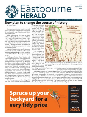
Changes to a section that may have formed part of a pā site have highlighted an urgent need for protections for areas of significance to Māori in the District Plan.
Mana Whenua (Te Āti Awa-Taranaki Whānui and Ngāti Toa) are working with Hutt City Council on the revised District Plan, which will be out for consultation later this year. This comes too late to investigate what was potentially a fortified pā site before bulldozers levelled it. Historical Society of Eastbourne researcher Ali Carew may uncover some archaeological finds.
A group of houses in Days Bay/ Ōruāmotoro were sold recently, with the subsequent demolition and earthworks at 43 Ferry Road on what is believed to have been a pre-European pā site.
Wellington Tenths Trust Trustee and Hīkoikoi Management Ltd relationship liaison officer Richard Te One says Mana Whenua are working with HCC to include an extensive list of historic sites in the revised Plan, which will include protocols relating to work on historic sites. This could include precincts or buffer zones, which would mean any planned earthworks over a certain size would trigger engagement with local iwi, and possibly accidental discovery protocols. Work would stop if any items of historical significance were unearthed and archaeologists called in. Heritage New Zealand Pouhere Taonga, may become involved.
“But it’s not going to stop them doing what they want to do, which is one thing we have
to be careful about because people get this idea that we’re there to stop them doing stuff and in fact we’re not, we just want to make sure that if you do find something there is a process in place to protect it,” says Mr Te One, who believes the proliferance of historic sites around the Harbour has meant there has not been a drive to include them in District Plans.
“We tended to settle along the coast and up the rivers and streams…historically a lot of these sites weren’t important to settlers – they were only important to Mana Whenua. It’s only relatively recently that we started putting these things into District Plans to give them some level of protection.”
Historical accounts of the Eastbourne area document a Ngāti Ira pā site in what is now Ferry Road. This pre-dated the pivotal arrival of a war party in 1819/20, comprised of various northern iwi including some from Taranaki and Ngāti Toa who journeyed southward, gathering support as they progressed. They clashed with Ngāti Ira near the mouth of Te
Awakairangi and subsequently pursued Ngāti Ira up the river to their inland pā in Upper Hutt. The conflict significantly reduced Ngāti Ira’s numbers, and when the Taranaki hapū returned to Wellington, they found the inner harbour largely abandoned. Despite this, scattered groups of Ngāti Ira persisted along the harbour’s edges, engaging intermittently with the newcomers. By the time the New Zealand (Continues on Page 2)
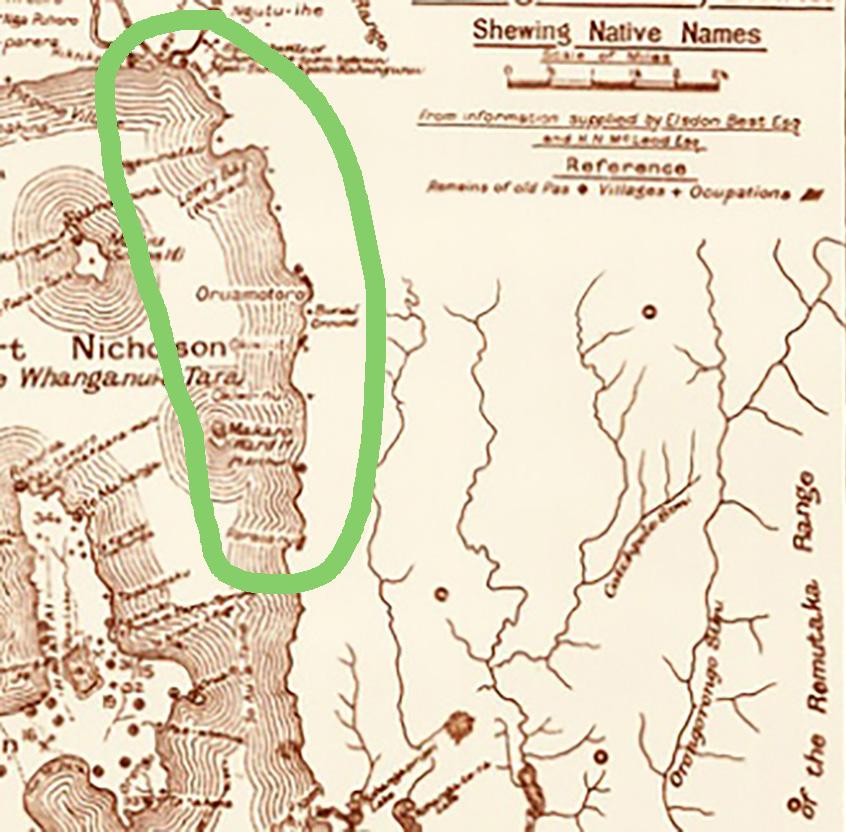
An early map of Wellington, showing sites of significance to Māori along the eastern bays. Map courtesy of Te Rua Mahara o te Kāwanatanga Archives New Zealand
DP to consider historic sites
(From Page 1)
Company arrived in 1840, Ngāti Ira had been effectively displaced from the area, and the Taranaki hapū had settled along the Petone foreshore.
For the Taranaki hapū, Eastbourne served primarily as a seasonal retreat, where they would establish temporary settlements during the summer months to fish, gather food, and preserve resources.
Hutt City Policy Planning Manager Nathan Geard says the presence of a pā would only be considered in a resource consent application if the site of the pā was identified in that location in the District Plan.
“The current District Plan identifies a range of Sites of Significance to Māori through its Significant Cultural Resources overlay. This includes two sites in Oruamotoro – the remains of old village sites and an urupā. However, those sites are not identified in the District Plan as being at 43 Ferry Road.
“Council is working with Mana Whenua to identify Sites and Areas of Significance to Māori that will be included in the Proposed District Plan early next year. That work is ongoing.”
Developers undertaking activity that modifies a site associated with human activity which occurred before 1900 need to obtain an archaeological authority from Heritage New Zealand Pouhere Taonga, Mr Geard says.
“The Council’s consenting team would only be made aware of this report if it was part of a resource consent application, but resource consent is not required for the demolition/ removal of a building from [43 Ferry Road].
“It is understood that there was a pā in Days Bay somewhere, but the actual location is unknown. It should also be noted that
Open
Monday-Friday 7am-4pm
Saturday & Sunday 8am-4pm Enquiries: 04 562 0071
the site is not recorded by the New Zealand Archaeological Association.”
Mrs Carew believes that a report submitted to the council in 1996 by local historian Frank Fitzgerald identified the pā site, but the council has no record of this.
Mr Te One says that there are several pā sites around Eastbourne, all related to Ngāti Ira or even earlier.
“The issue that council officers are faced with is that if it’s not in the District Plan now and it’s not a registered archaeological site through Heritage NZ, there is actually nothing they can do.”
Proposal to disestablish community boards
A Hutt City representation review has recommended that community boards, including the Eastbourne Community Board (ECB), be disestablished.
The ECB believes that community boards provide an invaluable service to residents.
The report argues that representation is inequitable with only three community boards in Hutt City, in Eastbourne, Petone and Wainuiomata. We believe that introducing a community board to each ward would be a better way to address this inequality. The report also argues that community boards, established in 1989, are no longer relevant in the twenty-first century. The ECB believes that in this digital age, face-to-face access to elected representatives who are neighbours in our communities has never been more important. Council is consulting on the proposal until 1 August and we encourage locals to share their views on HCC’s website, or via printed feedback forms at Eastbourne Library.
See www.eastbourne.nz for more.
August
ECB meeting at the Library
Note that the next public ECB meeting will be held at the Eastbourne Library.
Next ECB meeting: 7.15pm Tuesday 13 August, Eastbourne Library and Community Hub - ALL WELCOME
OPINION
Keep local democracy alivehave your say
Have your say to retain a community board for Eastbourne
Hutt City Council has received a report from an independent panel that has reviewed representation in Hutt City. The report makes several recommendations that are under public consultation until 1 August.
One recommendation is to disestablish the three community boards in Hutt City, which are in Eastbourne, Petone, and Wainuiomata. The representation review report argues that representation is inequitable, with only three community boards. The Eastbourne Community Board (ECB) believes that introducing a community board to each ward would be a better way to address this inequality. (This would combine the Eastbourne and Petone Community Boards for Harbour Ward).
The report argues that community boards, established in 1989, are no longer relevant in the twenty-first century. However, we believe that in this digital age, the need for ready, face-to-face access to elected representatives who are neighbours in our communities has never been more important. In an increasingly digital world, community boards provide a vital human connection.
What are community boards, and what do they do?
There are approximately 110 community boards in Aotearoa. They typically represent an area within their council to ensure smaller communities’ voices aren’t lost in the big-picture conversations. They ensure better representation and promote stronger community wellbeing.
We know that community boards like the ECB are crucial in providing fair and effective representation for their residents and communities. Your voice matters, and community boards help ensure it is heard. Community board members act as community representatives, advocates, and connectors.
The ECB engages with the Eastbourne and Eastern Bays community and advocates for it in council discussions and decisions. We have
responsibilities and decision-making powers delegated by Council.
We believe community boards are a lowcost, efficient way to add a layer of localised representation. Community board members are accountable and accessible, helping residents navigate Council processes.
Helping to make Eastbourne a wonderful place to live
The ECB harnesses residents’ knowledge and enthusiasm to make Eastbourne a better place to live. Regular meetings in Eastbourne let residents directly address the Council, leading to local improvements.
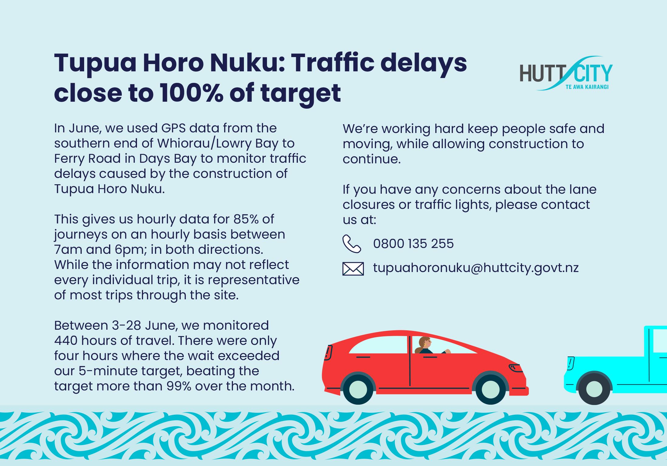
It is doubtful the Tupua Horo Nuku resilience and shared path project would have gone ahead without the ECB’s efforts over the last 10 years. The project started when an ECB survey in 2016 identified a shared path as a priority for Eastbourne residents. Now that the project is underway, the ECB has an important role in liaising with residents, the Council, and the project team about many of the design and implementation aspects of the project and consent conditions.
The ECB led the project to install the mosaics in Eastbourne Village, the Greenwood Park redevelopment, the Heritage Trail, and the current move to install the historic jail near Rona Wharf. It supported the skateboard ramp and is developing a junior cycle skills park at Burdan’s Gate.
The Board supports recycling efforts by operating the battery and tetra pak collections at the Eastbourne Community Hub (Library).
The ECB engages with and supports Eastbourne businesses, recognising their services are important to the community.
The ECB is working with Council and volunteers to find ways to extend the summer pool season.
This year, the ECB led a resilience expo that brought many emergency and resilience services to Eastbourne so residents could learn about and discuss emergency plans and preparedness.
Each year the ECB presents Eastbourne Awards to residents who have significantly impacted our community. Nearly 50 residents have received awards since 2007.
The ECB distributes around $2,500 yearly for community initiatives through the Community Engagement Fund.
Council is consulting on the proposal and other changes until 1 August. We encourage Eastbourne residents to share their views. (https://haveyoursay.huttcity.govt.nz/ representation-review). Use the comment field in the survey to ask Council to retain the Eastbourne Community Board.
- Eastbourne Community Board
Second family member achieves top award
by Ann Packer
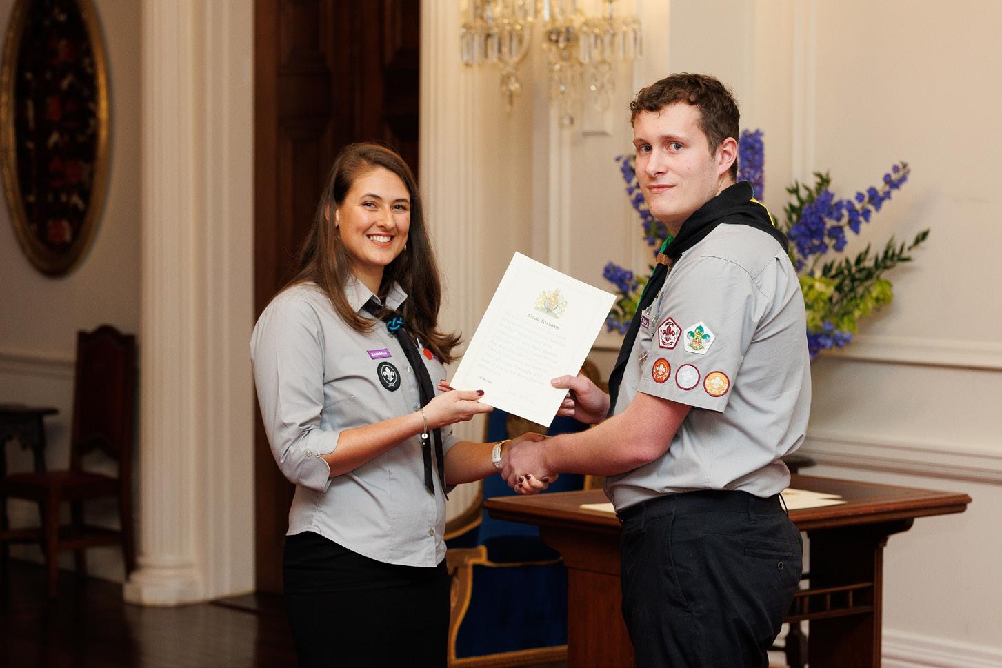
Eastbourne teen Noah Kirkham will shortly have not one but two certificates to mark his attaining the Commonwealth’s top youth scouting award recently.
The certificate he received at Government House on 15 June was signed by the late Queen Elizabeth II – even though the former Scots College student was actually among the first group to be honoured with a King’s Scout Award by the new monarch, King Charles III. A certificate (facsimile-) signed by the new king will arrive in due course.
The honour, first awarded under King Edward VII in 1909, applies to all Scouts under 18 within the Commonwealth realms. (American and other scouting jurisdictions have similar awards with different names.) Due to Elizabeth’s long reign, there had been no King’s Scouts since her father King George died in 1952.
With mother Susan Kirkham leading the local Venturer troop – a small group of around ten boys and girls aged between 14 and 18, who plan their own programmes – and with older sister Brianna having qualified as a Queen’s Scout in 2020, it was perhaps inevitable that Noah, now studying at Canterbury University, would also complete the prestigious award, which builds on years of scouting experiences. The family moved here when he was five and his memories include hikes to Powell Hut in the Tararuas, where they spent the night on the deck in sleeping bags, and jamborees at Mystery Creek and Renwick, near Blenheim, where the overflow were accommodated in tents pitched on prickly paddocks cleared of
sheep for the occasion. The highlight of that gathering was helicopter flights over the Wairau Valley – “everyone got a helicopter trip”.
With modules on road safety, environmental awareness, personal development and community service, the King’s Scout Award overlaps some Duke of Edinburgh Award components, and Noah has already achieved his Gold DofE.
He has also attended the Walsh Memorial Scout Flying School at Matamata and flown solo.
Currently flatting in Christchurch, while studying for a degree in computer science with minors in astronomy and cinematic art, Noah hopes to eventually work somewhere like Rocket Lab – though he concedes the cinematic art is purely for fun.
Raani Kelderman, Scouts Aotearoa National Commissioner, presents Noah Kirkham with his first King’s Scout Award, signed by Queen Elizabeth II.
LETTERS Stupidity beggars belief
Let's play dodge the potholes
In my travels in and around Wellington, and especially Eastbourne, I have noticed a new sport being played by the motoring community. Pot hole dodging. It is a simple sport, only reliant on leaving a reasonable space between you and the car in front, which in itself is upholding the requirements of the road code, in order to spot the next pit to avoid.
While travelling throughout the UK last year I admired the skills displayed in the same sport, with the locals ducking and weaving with aplomb. So we are not alone.
The time is now right to organize regional and national events to find our champions. This may well become an international event, one which I believe NZ would excel due to the state of our highways.
I can see it now, our team “Black Dodgers” world champs and drawing overseas visitors to view our humble roads.
Hugh Mackenzie Eastbourne
Despite writing and trying to find someone who didn’t pretend to know nothing, this is the truth as witnessed and observed over the years.
There have been many rain storms that have caused the Rona Street creek to block and flood Muritai Road & Marine Parade.
In the days of Eastbourne Borough Council, flooding did not occur because our tractor was driven up to kerb level and with blade down, backed down to high tide level so that any overflow would drain out to sea immediately. Despite pleading, the Hutt City Council never would and awful floods occurred.
One experience no one will ever forget was due to no maintenance and cost the HCC a truck load. My neighbour broke two toes evacuating his wife and family. He was an expert in law and was not amused when HCC sold him half a dozen sand bags (find your own sand).
He gathered meticulously all the evidence and facts that resulted in HCC getting a specialist to design a scheme to prevent flooding in future. I don’t recall his name but he was from Southampton UK.
The design began by clearing and flattening a 13.5 meter wide area of sand hills that was to be planted with marram grass to hold the sand, extending the concrete pipe and building
special groins at the top of Rona Street.
At the handing over the completed project by CCL, our specialist said nothing will work without adequate maintenance.
My heart sank when I heard the man from HCC say - “Yeah!, Yeah ,Yeah! Oh my gosh.
The first ops were the HCC-stacked concrete lamp posts across the area to impede any excess water escaping , but now we a going to have a fence. That should fix it. It may stop dogs getting to the beach but my dog would have found a solution and she cleaned up the rats too. The fence may keep the penguins seaward but all I can say is such stupidity beggars belief.
I wonder what Cliff and Vi Bishop would have thought.
Alan Collins Eastbourne
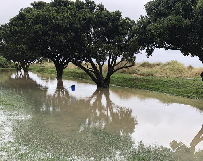
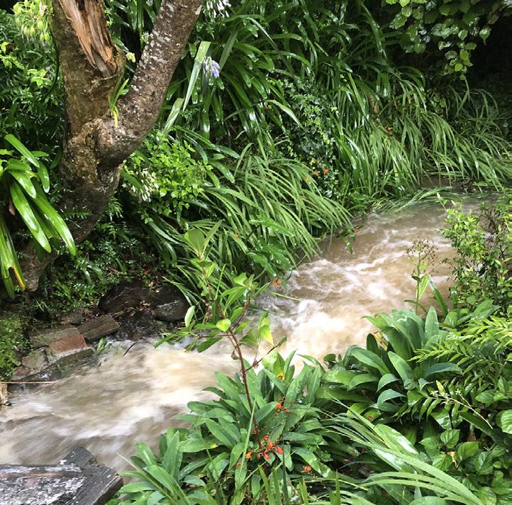
Flooding at Bishop Park.
Changes to Hutt City Council’s Long Term Plan have resulted in rental charges for council spaces being at least doubled.
HCC Acting Neighbourhoods and Communities Director Karl Chitham says past under-investment in many community facilities and parks and reserves means significant work will be required over the next ten years.
The council has to balance the affordability of community facilities while not increasing the burden on ratepayers, he says. The council this year voted for a 16.9 percent rates increase, in its long-term plan.
Rather than all paying the same rate, the council has split users into three categories: Community, individual benefit and commercial.
Community is described as for community benefit and does not charge attendees per session beyond cost recovery. Individual benefit is for private groups such as weddings or parties and includes churches. Commercial is classed business and groups that are generating revenue
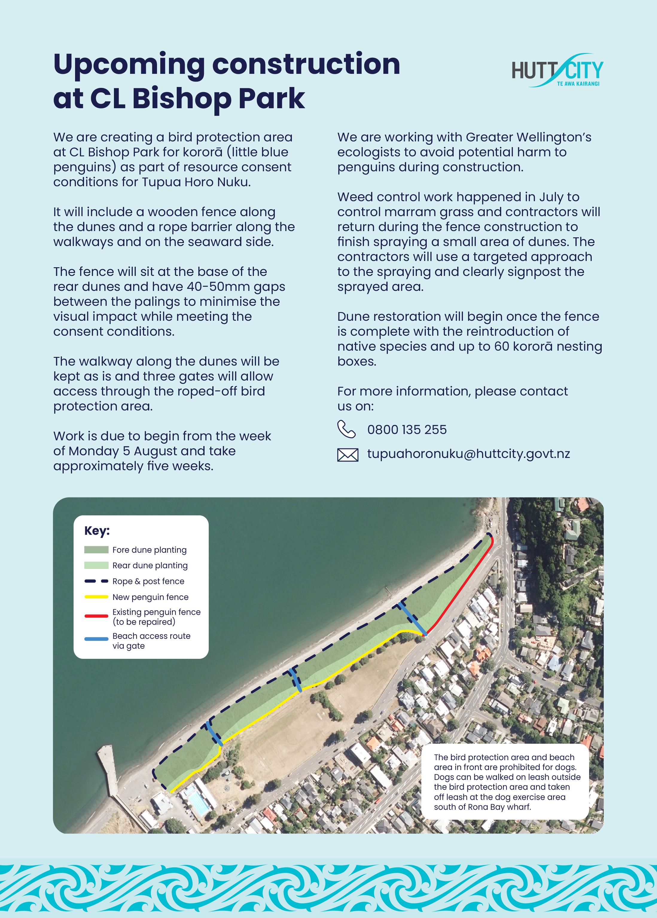
Weed spraying in Bishop Park has been under the spotlight, with local residents complaining to the council about being affected by the smell of glyphosate being used to kill marram grass and other weed species in preparation for the new bird protection area (BPA).
The Eastbourne Herald was contacted by Kim Hansen, who questioned why poison was being used to kill weeds, while potentially endangering skinks, birds, fish and shellfish –not to mention humans. In 2015 The World Health Organisation classified glyphosate as “probably carcinogenic to humans”.
“How can we profess to care so deeply about native lizards, little blue penguins, fish, water quality etc and submit to regular, wholesale poisoning of our environment,” she asked.
“How can we care so little about the health of our community, especially our children, that we would regularly spray glyphosate at a children’s playground and soccer field, with significant overspray affecting everyone?“
Hutt City Council Economy and Development Director Jon Kingsbury said residents were notified by letter on June 27 that the spraying would be taking place in preparation for the bird protection area to be established as part of resource consent conditions for Tupua Horo Nuku.
The contractors follow best practice
Spencer Logan Valuations Limited
Registered Valuers and Property Consultants
For professional property advice
Tel: 562-7555
or Campbell Logan - 022 093 8090
Spencer Logan - 021 627 773
Email: admin@spencerlogan.co.nz
www.spencerlogan.co.nz
from their activity beyond cost recovery of the event.
Previously, all three were paying $15 per day, but now the community charge has risen to $16.50 per day; individual benefit to $26 per day and commercial to $32.50 per day.
The boardroom charge has increased from $9 to $19 for community usage, $30 for individual benefit and $38 for commercial use.
Mr Chitham says the increased fees and charges reflect the true cost of assets.
“Our review as part of the Long-term plan process included changing our approach to rentals and bookings, ensuring the spaces are optimised and assessable for everyone; and increasing the fees and charges for using our spaces to reflect the true cost of assets, striking a fair balance for users and non-users.”
A full copy of the 10 Year Plan/LTP will be on the HCC website at the end of July. Printed copies will be available at Eastbourne Library after this date.
guidelines and checked the weather forecast before spraying, he said. The area that was sprayed was clearly signposted and monitored by staff on site.
Spraying was halted when the council received a call from a resident concerned the wind was blowing spray towards people’s homes.
Mr Kingsbury says the spray Glyphosate is an industry-standard herbicide authorised by the NZ Environment Protection Agency and used widely in New Zealand, including in road maintenance and at parks and reserves in Hutt City.
“The use of applications other than glyphosate for weed removal are generally four times more expensive,” he says. “Manually weeding the area included in the bird protection area (10,000m2) was unfeasible due to its size.”
The council is to plant 3,700 native grasses in the dunes once the fence is constructed as part of the BPA. That construction is due to begin in August and will be followed by placement of 150 kororā nesting boxes.
Garden Stuff with Sandy Lang FRUIT QUALITY
July/Aug: Mid/late-winter. When it’s dry, get on with the pruning. Buy new trees /shrubs now. First in gets the best, last in gets the rejects. Talking of rejects... Export rejects: Most NZ fruit producers grow for export because that’s where the money is. But an export fruit must be top quality, or its price at some distant market doesn’t cover the cost of packing and shipping. So, we Kiwis get the export rejects. These usually oversupply our home market and keep our prices down. But it’s worth understanding why a fruit’s been rejected for export. Sometimes it looks second rate but tastes good, other times it looks good but tastes awful. What to look for...
Cosmetic: There’re a whole bunch of visual criteria for export rejection: misshapen, russeted, over / under-size, no stalk, skin growth blemishes. None of these affects nutritional quality or taste, so all are still a good buy.
Worrying: But there’re a few blemishes to avoidbruising, skin punctures, small areas of rot. These worsen fast once home, and may already have spread deep inside, giving fruit an off taste. There are also a number of taste /texture criteria that clever packhouse machines detect but you may miss. The key one is...
Under /overripe: A fruit picked too early is sour and hard, one picked too late is bland and soft, and may have an off taste /smell. For economic reasons, the trees /vines of most fruit species are strip-picked at some optimal stage when the average fruit is just right. But there’s often 2 or 3 weeks between when the first fruit ripens and when the last one ripens. Meaning, at harvest, maybe 15% are underripe and 15% overripe. The 70% that’re about right go offshore. How can you tell if a fruit’s under /over ripe? Depends on species...
Apples: Don’t be misled by a rosy-red cheek. Look on the other side. Green, underripe. Yellow, overripe. Oranges: Colour not a good guide. A smooth, shiny skin is likely sweeter than a dimply ‘orange-peel’ skin.
Kiwifruit: Hard to tell. Colour not indicative. Soft in patches, not good. Rock-hard may ripen in the fruit bowl.
Melons: No smell, underripe. Strong smell, overripe. If you can, buy a half melon so you see the insides. Cherries: Some cultivars darker than others. For a particular cultivar the darker, the sweeter. Bananas: Colour. Easy.
slang@xtra.co.nz www.mulchpile.org
Beam me up, Scotty - local gin makes waves
by Ann Packer
It sounds too weird to be true – the use of sound waves to create flavour, in a locallyproduced gin. But Whistlebird Gin’s Niko Scott manages to explain the process so it makes sense.
He says not only do sound waves speed up the maceration time in the handcrafted spirit he creates in a Maungaraki garage with his business partner Johnny Dempsey, the vibration actually enhances flavour selection in the botanicals.
Like many in the community, the Days Bay dad – an industrial design grad who works full time as a tattoo artist – is time-poor. So anything that speeds up the distillation period needed to prepare his product, without impacting on the flavour, frees up more time for family – wife Pippa, who grew up in the bay’s waterfront Katherine Mansfield house, and five-month-old son Albie.
Throughout the experimentation stage, he routinely worked all day in Upper Hutt then from 6pm-11pm (sometimes until 2am) in Maungaraki.
With 18 botanicals (fruits, herbs and spices) required to create the unique taste of Whistlebird gin, accelerating the process of maceration – when hydrosols (soluble oils) are extracted from the plant material – allows Niko and Johnny to get their product out more efficiently to retail stores and hospitality venues.
The plant matter is in effect bathed in low frequency sound, which sends vibrations through the botanicals, permeating the cellular tissue and producing a high-pitched whistle –hence the name.
New Zealand is one of the few places in the world which allows ordinary citizens to distill their own alcohol, though not for sale. In fact, Niko and Johhny joked that if their gin
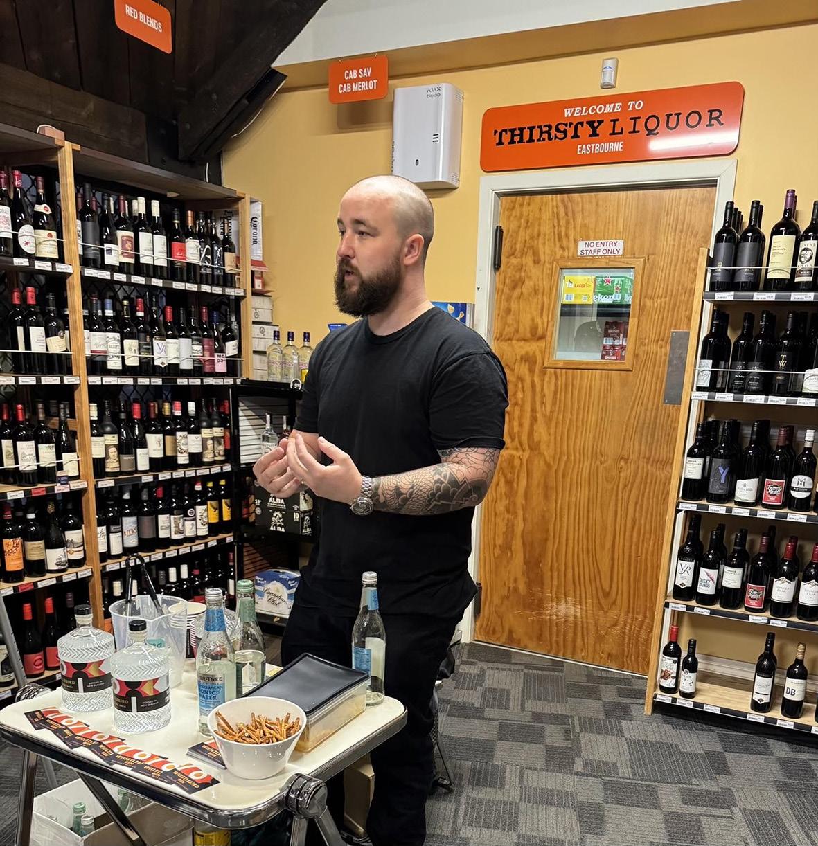
Gin-maker Niko Scott recently held a gin tasting event
experiment didn’t work, they’d have “alcohol forever”.
They begin with pure, fresh water from Petone’s Te Puna Wai Ora spring on Jackson Street, and juniper berries, the staple of every gin. But the process of adding more exotic ingredients – Persian black lime, elderflower, lemon myrtle, sumac berries and orris root, among others – took more than 50 iterations before the pair got the taste of wildflower.
“Everything we do is very untraditional,” says Niko, whose industrial design background allowed him to build his still not from the traditional copper but from glass.
He also designed the Whistlebird bottle, which features corrugated ribs symbolic of the sound waves used in their process.
Their company motto: “Good vibes only” is
locally.
a subtle touch on the base. The only thing not designed by him was the label; family member Mariona Wesselo-Comas, previously an art director at Saatchi & Saatchi, came up with the Bauhaus-style label.
Although he has worked at many jobs since graduating from Victoria University, including plumber, dog trainer, photographer and videographer, Niko has no wish to give up his day job as a tattoo artist at Lucky’s Tattoo Museum as it is very close to his heart. But he continues to experiment – a non-alcoholic gin is coming.
“The story is all well and good but in the end it has to taste good,” says Niko. “At the end of the day it’s still gin.”
http://whistlebird.co.nz
Learning more about our history through travel
by Ross Jamieson
It's funny when overseas one can stumble upon stuff you never knew about your own hometown. This happened to me, exploring the historical prison in Hobart. I was thumbing through Kristyn Harman’s book Aboriginal Convicts whilst waiting to be shown around, only to find the last three chapters were dedicated to Māori in the 1846 Boulcott farm attack in Lower Hutt. Five Māori involved in the attack had been deported to Tasmania. Here they were to serve out their unjust prison sentences in one of the cruellest convict setups in the then world.
The gist of the story goes like this. After the Wairau massacre/affray in 1843 the newly arrived Pākeha settlers around Cook Strait were really put on edge. Eight fleeing settlers surrendered after their group attacked Te Rauparaha over contested Marlborough land ownership. That went horribly wrong.
The eight who surrendered were slaughtered on utu revenge grounds, for the Pākeha surveyors and their settler accomplices had killed Te Rauparaha’s daughter Te Rongo, beloved wife of Te Rangihaeata. Governor FitzRoy held off charging Māori with murder as the Europeans started the” affray”.
In the Hutt Valley newly arrived settlers set about establishing their 100-acre lots, Edward Gibbon Wakefield had sold them back in the UK. His musket and blanket deal had seemingly purchased 9/10ths of Wellington Province for a song. This deal was not understood nor accepted by many Māori. The magnificent native forested Hutt riverbanks were being cleared for farming. Long established Māori homes, a Māori church, gardens and kūmara beds were being burnt and destroyed by the new, assertive British arrivals. One such farmer settler, a te reo Māori-speaking Quaker, Thomas Mason, was so uncomfortable about this encroachment he uplifted his family and fled to Tasmania. In an awful incident, new farmer Andrew Gillespie and his son were tomahawked to death by dispossessed Māori. The NZ land wars were truly underway.
Lobbyists to replace Governor Fitzroy succeeded. Tough-minded George Grey took over. British troops arrived. A soldiers’ stockade and a fort were built alongside the Hutt River and military martial law imposed.
Te Ati Awa, the dominant Wellington iwi sided with new settlers (for purportedly security reasons) against aggrieved Te Rangihaeata’s fellow tribesmen; mainly Ngāti Rangitahi and Ngāti Tama.
In May 1846 Te Rangihaeata decided on an early morning attack on the stockade at Boulcott farm. Two hundred or more Māori crept along a track from Porirua. Sixteenyear-old William Allen blew his bugle alarm when they were spotted, only to have his hand tomahawked off. He tried again, so the heroic story goes, with his other hand and was instantly killed.
An hour-and-a-half hour of close combat
followed. Six soldiers, and at least two Māori invaders died in addition to the wounded on both sides. The retreating Māori did a haka.
The incensed Governor Grey set about making an example of these attackers. In a later skirmish at Pari Pari, he rounded up seven involved in the Boulcott farm incident and subjected them to martial law trials. There was no proof any of the seven had killed soldiers, which they denied; nor, indeed were they legally represented.
One, Te Wareeitu was sentenced to be hanged, being found guilty of open rebellion; his brother deemed insane; and the remaining five deported to Tasmania. The press stirred up unease over this questionable justice - it was, after all, war. No one was willing to tie the hangman’s knot until “a purse of gold” enticed a soldier to do the dreadful deed. A year later he drowned in shallow water.
Remarkably, the five deportees were greeted by many when they arrived in Hobart, as unjustly deported” noble natives”. Lobbying, mainly by Quaker, Thomas Mason, had them sent to Maria Island instead of brutal Port Arthur. Here they were treated better than many other prisoners, and not kept in leg cuffs and chains. Handsome Hohepa Te Umuroa was the chief among them, but he caught TB, died, and was buried on the island - but unusually for a convict given a headstone. The remaining four were later pardoned and repatriated back to NZ.
Hohepa’s headstone read” Here lie the remains of Hohepa Te Umuroa, Native of Wanganui, N.Z., who died July 19,1847”. In the 1980s Australia’s bicentenary interest in convict history intensified and the overgrown cemetery was spruced up. Maria Island became a National Park. Surprisingly, talk from observant visiting school kids in 1985 triggered real interest in the repatriation of Te Umuroa back to NZ. Prime ministers even debated who should pick up the tab, David Lange relented and elders from the Wanganui iwi went and recovered their treasured ancestor’s remains. Strangely, at the time he was being reinterred at the Patiarero
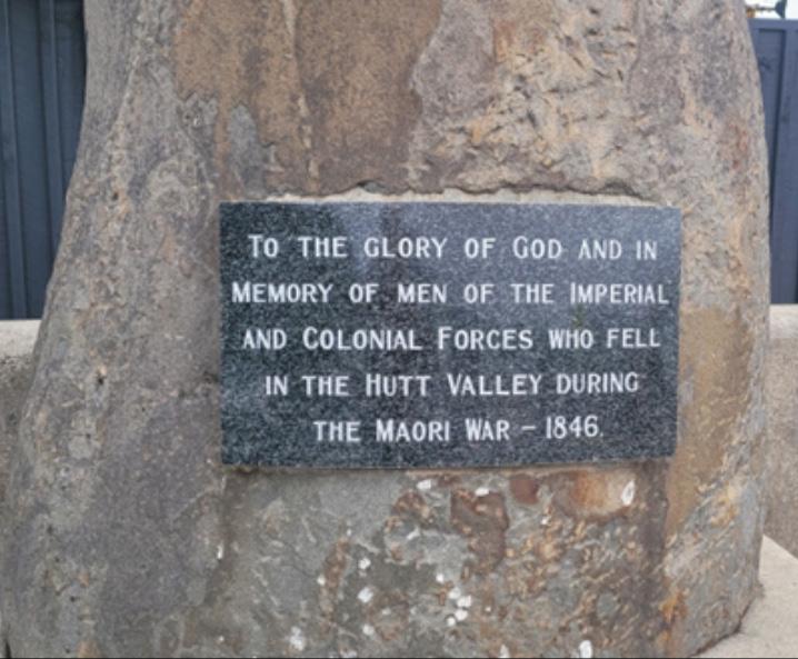
A memorial inscribed in memory “of men of the imperial and colonial forces who fell in the Māori War makes no mention of Māori.
marae, rare Nankeen night heron migratory birds (Nycticorax caledonicus) settled nearby - carriers perhaps, of Te Umuroa’s spirit home?
Witi Ihimaera wrote “The Trowenna Sea” a 528 page historical novel about Te Umuroa. It was published in 2009 so sullying his standout reputation. He had plagiarized some of the book's content and did not acknowledge sources properly. Magnanimously, he offered to buy back all the unsold copies then in print.
Jenny Mcleod composed “Hohepa” a chamber opera on the story which has only had one production in 2012. A pity, given the effort that went into its making and potential with say the involvement of top contemporary song writers and lyricists.
Once again school children, this time from Boulcott Primary School, are bringing the saga to life again. They encouraged Hutt City Council to relook at the existing nearby memorial to those killed. At present it only recognizes the British dead. Balance is called for, and the various descendants, both Māori and Pākeha, are currently ruminating how best this can be done.
*The author sourced Kristyn Harman's "Aboriginal Convicts" for this story.
Have your property appraised before 20 September 2024 and go in the draw to win a luxury escape to beautiful Tahiti, including flights and acommodation.*
* Terms and conditions apply. Scan this QR code or view at nzsir.com/escapeinluxury
28 NGAUMATAU ROAD, POINT HOWARD
Mondays
• Retired Persons’ Assn meet 4th Mon, 10am St Ronan's Church hall for morning tea followed by a speaker - $2 entry.Transport can be arranged for these meetings on request, ph 562 7365 or 562 8387.
• “Baby Bounce & Rhyme” at the library 10.00am.
• Toy Library - Two Monday Sessions at 1.302.30pm and 7.30-8.30pm.
EastbourneToyLibrary on Facebook. Kathy 0273551950
• DB Playcentre Monday, Tuesday, Wednesday and Friday mornings, from 9:15 to 12 noon, Drop in anytime to visit a session or call James on 022 043 7841 to arrange a visit.
• Pt Howard Playcentre. Mon 9.15 -11.45am. pcpointhoward@gmail.com
• The Historical Society’s Eastbourne History Room above the library is open 2-4 pm every Monday.
• Eastbourne Volunteer Fire Brigade training every Monday 7-9pm. Ph 562 7001 for more info.
• Keas - 5:15pm - 6:15pm. Ed 021 738 699
• Cubs - 5:30pm - 7:00pm - Ed 021 738 699
• Venturers - 7:15pm - 9pm - Ed 021 738 699.
Tuesdays
• Mindful Mummas group for Mums and preschool children. Childminder onsite. 1011.30. Text Emily 027 552 6119 to join or go to bemoreyou.co.nz for more info.
• DB Playcentre Monday, Tuesday, Wednesday and Friday mornings, from 9:15 to 12 noon, Drop in anytime to visit a session or call James on 022 043 7841 to arrange a visit.
• Muritai Tennis Club 9.30–noon. Merryn 562 0236.
• Eastbourne Homebirth Group 1st Tuesday of the month. Phone Kate 562-7096.
• East Harbour Women’s Club Morning Tea & Chat Group 10am. Contact Glendyr 0210303480.
• Indoor Bowls Club 1.30pm, at the croquet club, Oroua Street. Rosemary 562 7365
• Menzshed 9 till 12 , Williams Park, Barrie barrielittlefair@gmail.com 0204 1234511. Women welcome.
• 9.30am Nia Dance Fitness Class (low impactteens to 70+) Music Movement Magic - Muritai Yacht Club - call Amanda 021 316692 www. niainwellington.com
Wednesdays
• Cubs: 5.30pm - 7.00pm, Ed 021 738 699.
• Library preschool story time 10.00 am.
• Pt Howard Playcentre Wed 9.15 -11.45am. pcpointhoward@gmail.com
• Scottish Country Dance. Merryn 562 0236.
• Bridge Club 7-10pm. Shona 562 7073.
• DB Playcentre Monday, Tuesday, Wednesday
WHAT'S ON
and Friday mornings, from 9:15 to 12 noon, Drop in anytime to visit a session or call James on 022 043 7841 to arrange a visit.
• “Steady as You Go” Age Concern sponsored Falls Prevention and Exercise Programme. Held 12 noon each Wednesday at Eastbourne Community Hall. Classes are held for 1 hour and costs only $2. Improve your strength and balance to reduce falls and injuries. Falls are preventable. Please join us!
• EHock - Fun Stick and Ball game Girls and Boys 7- 13.Eastbourne Community Hall. Wednesdays 6.00 p.m. - 7.30 p.m. Derek Wilshere 0274303596.
Thursdays
• Menzshed 9 till 12 , Williams Park, Barrie barrielittlefair@gmail.com 0204 1234511. Women welcome.
• St Ronan’s Mainly Music, 9.15am-11.15am, during school terms. Contact Cathy 027 213 9342.
• SPACE at Days Bay Playcentre. Michelle 971 8598.
•Lions meet 2nd Thursday of the month at the Eastbourne Sports and Services Club, Tuatoru St 6.30 pm. New members and visitors are welcome. Graham 562 8819.
• Scouts 6pm-8pm - Ed 021 738 699
• Eastbourne Bowling Club casual summer bowls 5.30pm for an hour or so. Make up a mixed team of three. Contact Keith Turner ph 04 934 4142.
• Sing Eastbourne: 8pm, St Alban's Hall.
Fridays
• Pop in and Play playgroup at St Ronan's Church Hall, 9am-11.30am during school terms. All preschoolers (0-4 years) welcome. Cath 027 213 9342.
• Pt Howard Playcentre Fri 9.15 -11.45am pcpointhoward@gmail.com
• AA Plunket Rooms 7.30pm. Mark 566 6444/ Pauline 562 7833
• DB Playcentre 9.15-12 noon Puddle Jumpers casual ‘drop-in’ session.$5 per child per session. Call James on 022 043 7841
Saturdays
• Justice of the Peace at the Eastbourne Community Library, first Saturday of each month 12pm-1pm.
• Croquet from 10am Muritai Croquet Club. Lyn 562 8722 or Val 562 8181.
• Lions' Bin - cost effective rubbish and e-waste
disposal. Last Saturday of the month (except December) by Bus Barns. Gavin 027 488 5602.
Sundays
• AA Plunket Rooms 10am. Karen 021 440 705.
Police chase brings arrests
Reports of a suspicious car in Point Howard lead to the arrest of three people on firearm, methamphetamine and cannabis charges. The car fled from Police, who spiked the vehicle in Gracefield, which reversed into a Police vehicle. The occupants abandoned their vehicle nearby and attempted to steal a member of the public’s vehicle on Gracefield Road. Police, with the assistance of the Police dog unit, tracked the occupants to Gracefield Road where all three were taken into custody.
Provides transport to appointments in the Hutt Valley and Wellington, for older residents living in Eastbourne and the Bays.
Volunteers’ are also available for small jobs around the home.
Please
my Lower Hutt office, my staff and
are
Authorised by Chris Bishop, Parliament Buildings, Wgtn.
Faith in the Community
Be kind...
COVID is still with us. Back in the day when its threat began to impact our lives, Jacinda urged us to “be kind”. It became her catchphrase. It caught the imagination then, and it still has currency today. The phrase echoes something of the teaching of Jesus when he remarked to his followers that there was little merit if they were kind only to those who were kind to them. He said they should love their enemies and do good to those who mistreated them. A similar idea is expressed in a Celtic poem of hospitality to strangers. It reads:
I met a stranger yest’re’een; I put food in the eating place, Drink in the drinking place, Music in the listening place; And, in the sacred name of the Triune, He blessed myself and my house, My cattle and my dear ones, And the lark said in her song, Often, often, often, Goes the Christ in the stranger’s guise; Often, often, often, Goes the Christ in the stranger’s guise.
Jesus said: “In as much as you did it to the least of these, you did it to me.” Good words to keep in mind when in times of political upheaval, you feel like strongly expressing your feelings in response to a stranger’s tweet or post that raises your ire...
St Alban’s + St Ronan’s: 1st Sundays 9:30am monthly shared communion services (alternating venues, leaders and preachers) 4 August at San Antonio church, 1 September at St Ronan’s church. St Ronan’s: 1st Sundays shared with St Albans (see above). 2nd and 4th Sundays 9:30am informal, 3rd Sundays 9:30am traditional, 5th Sundays 12:00pm fellowship meal. E:office@ stronans.org.nz W:www.stronans.org.nz
St Alban’s: 1st Sundays shared with St Ronan’s (see above). Other Sunday services now at San Antonio church at 9:30am. 1st Thursdays, communion at 10:30am at St Ronan’s church. Details www.facebook.com/StAlbansNZ E:office@ stalbanschurch.nz W:www.stalbanschurch.nz San Antonio: Vigil Mass, Sat 5.30pm. Sacred Heart, Petone: Mass, Sun 9.30am and 5.30pm. E:holyspiritparish41@gmail.com W:www.holyspirit.nz
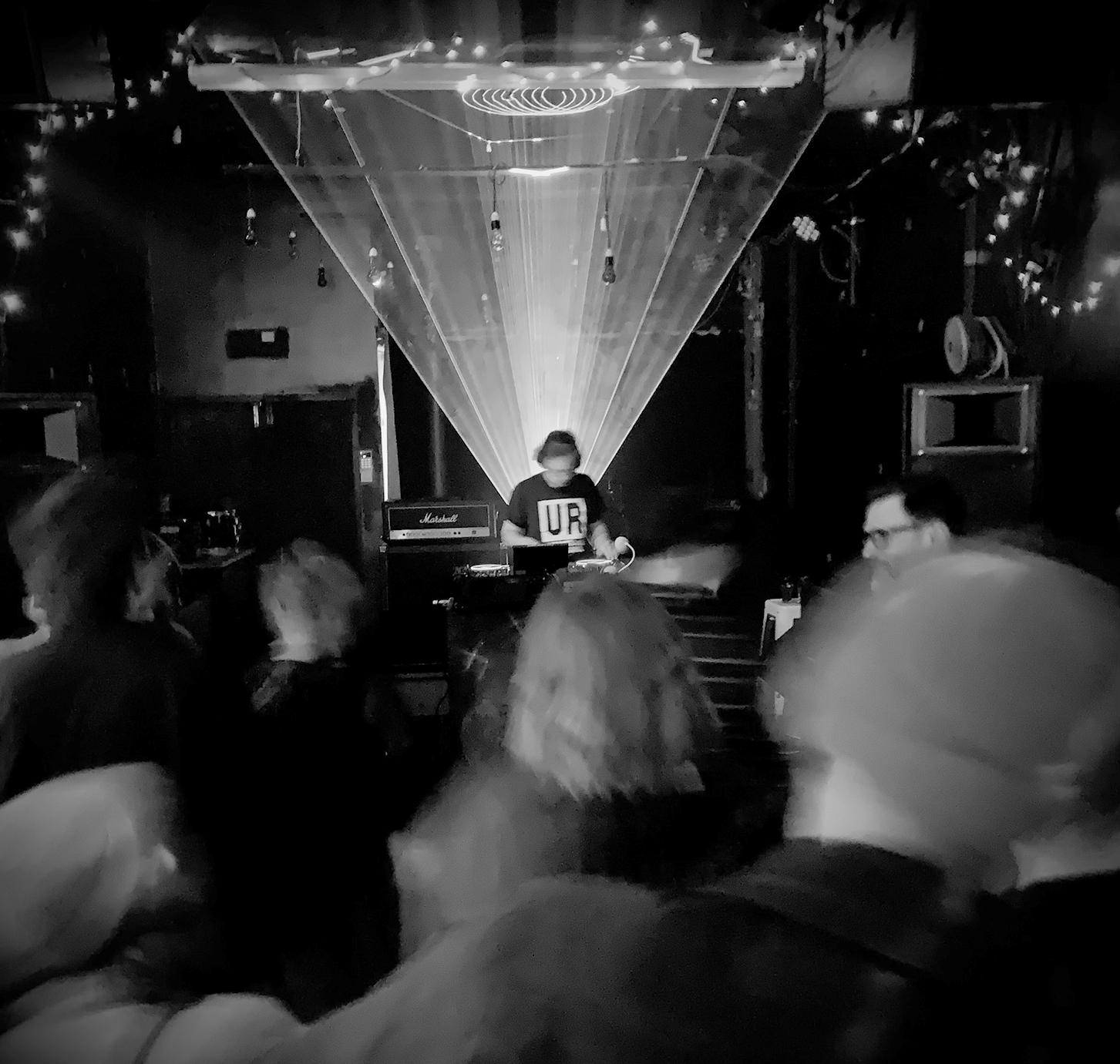
Local art director and music producer Peter Freer (pictured in action, above) launched his first EP on vinyl last week. A point B, under his moniker Cyxqrd (pronounced six-chord) is described as “atmospheric, transportive techno” and is less intense than his usual output. It’s available on vinyl and to download through Bandcamp.com, or stream on all streaming platforms. If you like what you hear, follow him on Soundcloud.com (search for Cyxqrd).
Get rid of your electronics safely - and for free
by Hugh Walcott
Eastbourne Bays will be able to dispose of old phones, laptops, printers, tvs… any anything with a plug, or FREE, this August thanks to a donation from the Eastbourne Games Charitable Trust.
E-Waste is the fastest growing municipal waste-stream, and directly responsible for over 70 percent of the toxic material in landfill. Electronics today are also more toxic than ever before, containing more types of heavy and rare metals and minerals.
When put in the bin, e-waste will acidify water, killing fish and other water life down the Hutt River and out to Te Whanganui a Tara. Yet the ethical and secure disposal of electronics is not easy or cheap.
I recently found myself clearing out our family home on Mahoe St, and stockpiling the old stereos, computers, power boards, and other household electronics in my garage instead of putting them in the skip. While throwing the devices out with the trash would have been easier, I was concerned about the
data security risks and environmental impacts, so I figured I’d do my research”.
This led me to Echo Technologies, NZ’s largest e-waste recycling and disposal service provider. After visiting their new factory in Seaview, I saw firsthand how electronic devices are sorted, sanitised, shredded, recycled, and repurposed, and how important this process was for our whenua.
As founder of the Eastbourne Games, I realised I could scale my action to help everyone in Eastbourne do the right thing with their electronics. With financial support from Eastbourne Games Charitable Trust, and help from Eastbourne Lions, Scouts and now the Muritai school, I now has a foot army ready to roll for a mass collection this August.
Collection details and booking form are available at the website: eastbourne.nz/event/e-waste-collection/] (https://eastbourne.nz/event/e-wastecollection/
Scan the ad on Pg 13 to book your drop-off and for more information
Eastbourne's biggest untold story comes to life
by Ann Packer
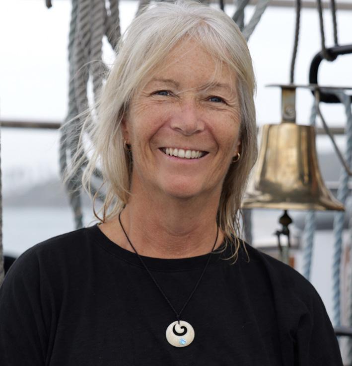
Cristina Sanders (pictured) never intended to write a crime story, especially one as grisly as this. The author of Ōkiwi Brown, who will talk about her just-released novel at the Eastbourne Historical Society’s AGM on 25 August, is “not really a murder person” and doesn’t like the idea of murder for entertainment – but says there are actually twenty murders in her new book.
Very little is known about the east harbour settler, William “Ōkiwi” Brown, who took his name from Ōkiwi-iti, the Māori name for Rona Bay. With his wife Nan, he ran an accommodation house for travellers en route to the Wairarapa, around the coast road, before the 1855 earthquake. According to local historian A G Bagnall’s history, Okiwi published in 1972 by his Māhina Press and now a collector’s item, Rona Bay was known to early settlers as Brown’s (after the man himself) or Rait’s Bay. In an 1844 chart the author found in the National Library, it’s called Rail’s Bay.
The idea for a fuller, fictionalized account of Ōkiwi’s life first came from local historians Ali Carew and Julia Stuart, who calls it “the biggest untold Eastbourne story”.
The author of Jerningham and the Ockhamshortlisted Mrs Jewell and the Wreck of the General Grant, both also published by Cuba Press, met Julia at a Yarns in Barns event in the Wairarapa several years ago. When the Eastbourne woman later wrote to her saying, “I’ve got a story for you”, the author responded politely – but on further reading, she became hooked on the idea of Ōkiwi Brown. After visiting the actual territory near Windy Point where our earliest pākeha settler lived,
Kidztalk
she started thinking “what if?".
As in, what if the missing William Hare –whose infamous partner-incrime in the terrifying Edinburgh “anatomy murders”, William Burke, was hanged – had got on a ship and fetched up on the other side of the world? There were plenty of whaling ships coming into the Scottish river port where Hare was last seen…
As one who has written about some of the less savoury aspects of early pioneers, of whom we often have “wistful, nostalgic” notions, the Wellington-born, Hawkes Bay- resident novelist notes many of those who came here were in fact “bankrupt and morally corrupt”.
She says her Ōkiwi Brown character himself doesn’t actually get a word in – when a body is washed up on the beach, his story is told by witnesses – all based on real characters at Brown’s trial for murder: soldiers, a child and a ship’s bosun, among others.
Ōkiwi’s wife Nan, one of the key witnesses, was a woman he claimed to have found abandoned on his beach. She may have been Moriori, perhaps a runaway slave. “We don’t know who she was, but she lived with him for about 40 years,” the author says. “I still wanted to give her a voice.”
Cristina says in Ōkiwi Brown, she’s taken a few liberties with historical detail and hopes
locals will accept that. “Nobody knew the truth, or anything about him. This is my version.”
The challenge, she says, was keeping all the witness voices clear. And she promises all the stories come together in the end – though she can say it’s a dreadful one.
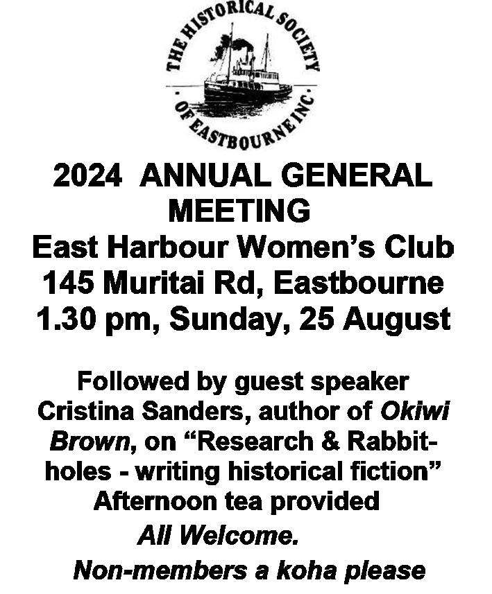
Copies of Ōkiwi Brown will be available for purchase after the HSE AGM at East Harbour Women’s Club, 145 Muritai Rd, Eastbourne, 1.30 pm, Sunday, 25 August.
https://schrodingersbooks.co.nz/p/okiwibrown...
NEWS FROM EAST HARBOUR KINDERGARTEN
News from our local early childhood centres PROUDLY SPONSORED BY
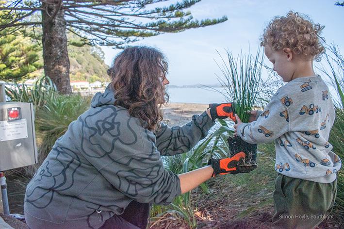
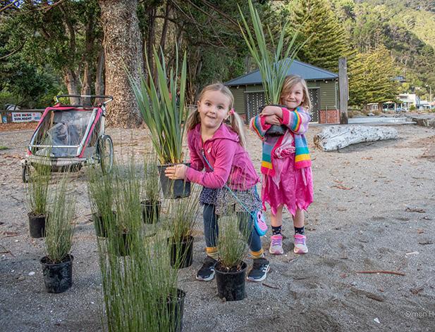
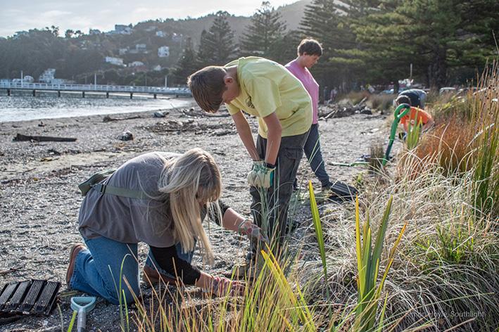
Here at East Harbour Kindergarten we love getting out into the local environment to help take care of it. Recently Kindergarten families helped plant many natives in Days Bay. It was a beautiful day and felt great to be working together to help care of the beach. A big thank you to Janet and Simon for working hard to keep this initiative going over many years. Photographs by Simon at Southlight Photography.
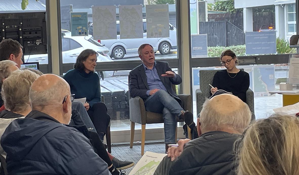
Residents turn out to hear from review panel chair
by Ann Packer
About thirty Eastbourne residents turned up on a wet winter afternoon to hear Independent Panel chair and former MP Paul Swain, along with council employees Rachel Houlbrooke and Olivia Miller, talk about proposed changes to Hutt City Council’s representation – including the panel’s recommendation that the three community boards set up in 1989 in Eastbourne, Petone and Wainuiomata be disestablished.
Eastbourne Community Board chair Belinda Moss and at least three other ECB members and one past chair attended, as well as Cr Andy Mitchell, who lives in Naenae.
Asked for a show of hands, about half those present indicated they had read the report.
After a brief rundown on the panel’s community engagement process, questions were taken from the floor and most concerned the ability of councillors-at-large to represent ordinary people on the ground. Several commented they had no idea what most of
the current council looked like.
The meeting seemed agreed that community boards have an important advocacy role, deliver value for money, function as a sounding board for community issues and take pressure off ward councillors.
Community boards also act as a valuable training ground for aspiring local politicians – it was claimed that as many as eight councillors have done time on community boards.
It was all very civilised – but when asked whether any of his panel of four had any personal experience of community boards, Mr Swain had no answer.
Meanwhile, when it comes to redrawing boundaries, it seems the powers that be have still not taken on the recommendation of years of lobbying by ECB for the Coast Road to be included in the Harbour Ward rather than Wainuiomata.
All councils are required to review their representation every six years.
Paul Swain and council employees Rachel Houlbrooke and Olivia Miller at Saturday's meeting.
Lizard numbers double
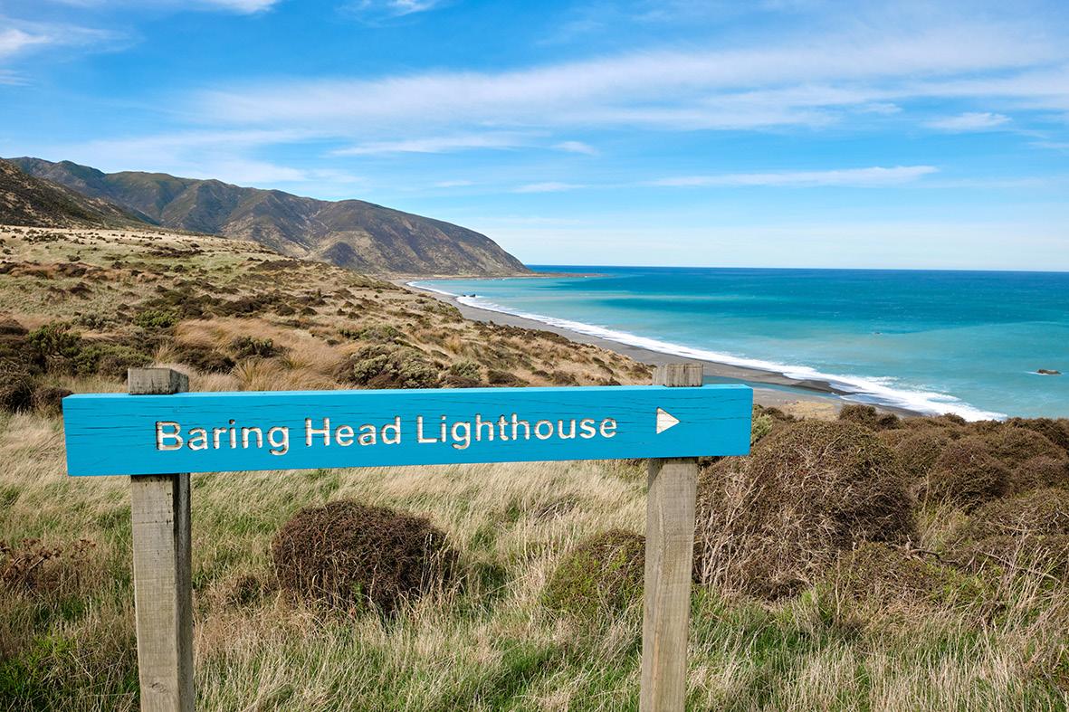
The populations of an endemic lizard species found at Ōrua-Pouanui/Baring Head has doubled, according to the latest Greater Wellington lizard monitoring report.
Released in June 2024, the report shows the number of northern grass skinks (Oligosoma polychrome) has doubled while the raukawa gecko (Woodworthia maculata), and northern spotted skink (Oligosoma kokowai) populations have also increased since the last monitoring cycle in 2017-2019.
Conservation takes a village, with Hem of Remutaka, Mainland Island Restoration Operation (MIRO), Friends of Baring Head and Greater Wellington all working to protect the lizards by maintaining a network of predator traps across the headland.
Friends of Baring Head chair Paula Warren celebrates the increasing lizard populations as a “biodiversity success”.
“Lizards play an important role in our ecosystems, pollinating native plants, dispersing seeds, eating invertebrates and being eaten by native birds – the circle of life,” Warren says.
“Habitat destruction and introduced predators pose the greatest threat to our endemic lizards. The protection of Baring Head, reduction of destructive activities like driving on the beach, and years of intensive trapping by our volunteers has allowed these and many other species begin to recover.”
The report shows mustelids, rats, and mice are in decline, with hedgehog numbers dropping 35 percent since 2019.
Greater Wellington environment restoration advisor Simone Marchiolli says reptiles are one of the many reasons Aotearoa is unique.
“New Zealand is home to more than 120 gecko and skink species found nowhere else in the world,” Marchiolli says.
Okiwi Trust
Thursday, August 29
PARKSIDE
“The northern spotted skink has an ‘At Risk’ conservation status, so it’s very rewarding to see the population trending upwards.
“Now that the numbers of predators at Baring Head and Parangarahu Lakes have decreased, our focus is on restoring the lizards' habitat through programmes like Recloaking Papatūānuku. We hope to see the populations of lizard species continue to grow in the next monitoring cycle.”
Greater Wellington has been monitoring lizard populations at Ōrua-Pouanui/Baring Head since 2012, as one of 57 areas with ‘high biodiversity values’ in the Wellington Region being protected and restored through the Key Native Ecosystem programme.
Contact: Anne Manchester 027 684 5664
A northern grass skink (Oligosoma polychrome).
There's lots of life in our streams
by Ann Packer
You’d be surprised just what’s in our streams. Every bay has at least one, and they are full of aquatic life, says Mountains to Sea Wellington’s Liz Gibson, who spoke to last week’s East Harbour Environmental Association AGM.
She’s one of a team of freshwater educators who has worked with local schools on field trips discovering what lives in our fresh water ecosystems. But it’s not just the obvious fish and invertebrates, from eels and koura to caddis flies, that frequent our waterways.
Every organism sheds genetic material, and what captivated last week’s audience – and no doubt the school kids – were the results obtained using an eDNA sampling kit, an environmental monitoring tool from Miramar company Wilderlab that is basically a simple syringe with a sophisticated filter that can produce unexpected results from a cup or two of water.
The further south the streams tested, the more traces of other species found, that at first glance sound highly unlikely – cows, birds, dogs, deer... And down at the lakes: swans, sheep, geese, marine fish species and an Australasian tree frog.
East Harbour streams are characterized by steep short catchments – in other words we have all habitats on tap, from ridge to sea.
On the whole, the water quality is excellent, offering a good habitat for aquatic life, and we have a large range of underwater invertebrate species. But we also have streams closer to built-up areas that are impacted by rubbish and stormwater pipes, which impede fish passage for those species that need to return to higher ground to breed.
EHEA promises to host a return visit following up some of the concerns expressed in a thicket of Post-It notes left for the engaging speaker, covering everything from fish passages to streams awaiting exploration.
MountainsToSeaWellington.org
Search continues
It’s been more than a month since George Dominic was last seen and Police and his family continue to search for answers.
That last sighting of Mr Dominic, known as Niko, was in Eastbourne on 29 May, sometime around 5:30pm. Witnesses placed him at the end of Muritai Road, near Burdan’s Gate, shortly after a single-vehicle crash in which Mr Dominic was believed to be the driver.
Police have made extensive enquiries to locate the 44-year-old Lower Hutt man. This has included assistance from FENZ, LANDSAR, Police National Dive Squad, search dogs, Mr Dominic’s family and the
local community. Sonar has also been utilised. Sadly, he remains missing.
Mr Dominic was last seen wearing a black Raider’s cap, a grey Nike hoodie with a logo on the upper left chest, black trackpants, as well as red, white and grey Nike Air Max shoes.
His missing person’s file remains open, and Police continue to review any new information that may help locate him. Anyone who has information that may assist that effort is asked to contact Police via the 105 service, referencing the event number 240529/4406.
Meanwhile the Coroner is to make a ruling on the drowning of an East by West passenger on May 24. Police say the death is not believed to be suspicious.
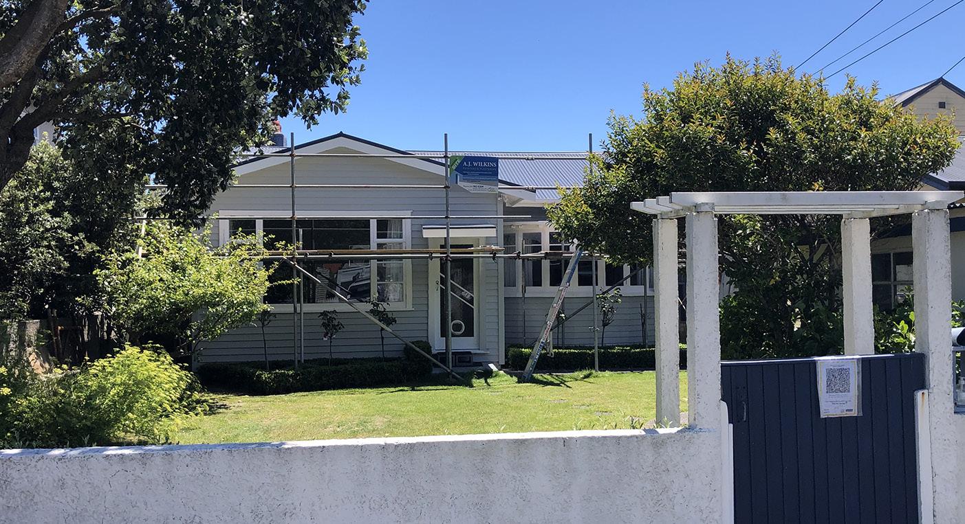
A J WILKINS LTD
Servicing the Wellington region for 30 years
• Exterior painting: all aspects including scaffolding
• Interior painting: Complete service including plastering, wallpaper & paint
• Maintenance: Washdowns, carpentry repairs, epoxy repairs. We draw on a combined 80 years’ painting experience & use the latest technology to deliver a quality finish that’s environmentally friendly.
TRADES AND SERVICES
Stu Fargher
Abundant potential in popular location
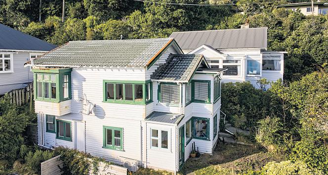
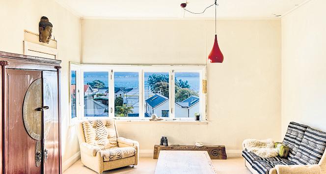
Set back from the street with an idyllic front yard, this character cottage faces the harbour with great views from most rooms in the house. Yes there is work to do but for those with some tools and some skills, there is also fantastic potential to add value in this premium location, a handy and easy walk to the Ferry and Days Bay, the village, the beach and parks and local schools. The layout currently offers bedrooms and a bathroom on each level, with a spacious lounge and open fire, as well as heat pump for winter warmth. There is a modern single garage from the street, with a covered area to the back of it. Seriously for sale by motivated vendors, come and see the views and start putting some plans in place.
bayleys.co.nz/3327328
Truly spectacular
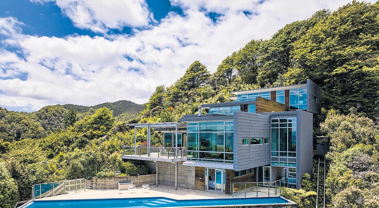
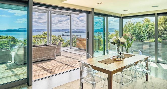
This simply stunning home is beyond compare, with jaw dropping views from every room to the Harbour and beyond across the water to the City. Superb connection from indoor living spaces to sheltered outdoor entertainment make this a house to be enjoyed year round. Clad in Zinc and Cedar for minimal maintenance and nestled amongst the Beech trees giving peace and privacy and a luxury lifestyle, this very special property must be seen to be appreciated.
bayleys.co.nz/3326525
3 1 2 1
For Sale offers invited over $649,000
View by appointment
Duncan Povey 027 597 1080
duncan.povey@bayleys.co.nz
Jasper Povey 027 552 7737
jasper.povey@bayleys.co.nz
CAPITAL
5 2 3 4
For Sale offers invited over $3,500,000 View by appointment