BSP EXPO 2026
RIGHT TO THE GOOD CITY

This catalogue presents student projects from the BSP Expo 2026, exploring the Right to the Good City through themes of public life, ecological urbanism, inclusion, identity, and urban justice.
FOREWORD
The 2025–26 Expo of the Bartlett School of Planning centres on an important theme: The Right to the Good City. Organised by the Bartlett Urban Planning Society (BUPS), in collaboration with staff at UCL, the Expo brings together a rich collection of work from students across undergraduate and postgraduate taught programmes at the Bartlett School of Planning (BSP). Together, these projects showcase the vibrant ideas, creativity, and critical thinking of BSP students, while exploring a theme that is central to contemporary planning debates.
The proposition of a Right to the Good City was developed by the Expo team around two interconnected ideas. First, the well-established demand for justice articulated through the Right to the City: the idea that all residents should have the power not only to access the city, but also to shape it through active participation in urban life and city-making processes, including participatory planning and urban design. Second, the notion of a Good City asks what makes urban environments successful, who benefits from them, and how these outcomes are defined and negotiated in practice.
As cities face escalating climate challenges, rapid technological change, and shifting social dynamics, there is increasing urgency to these questions. The theme encompasses a wide range of ideas that are fundamental to contemporary planning, and the contributions presented here demonstrate the broad relevance and adaptability of the Right to the Good City across different contexts, scales, and perspectives.
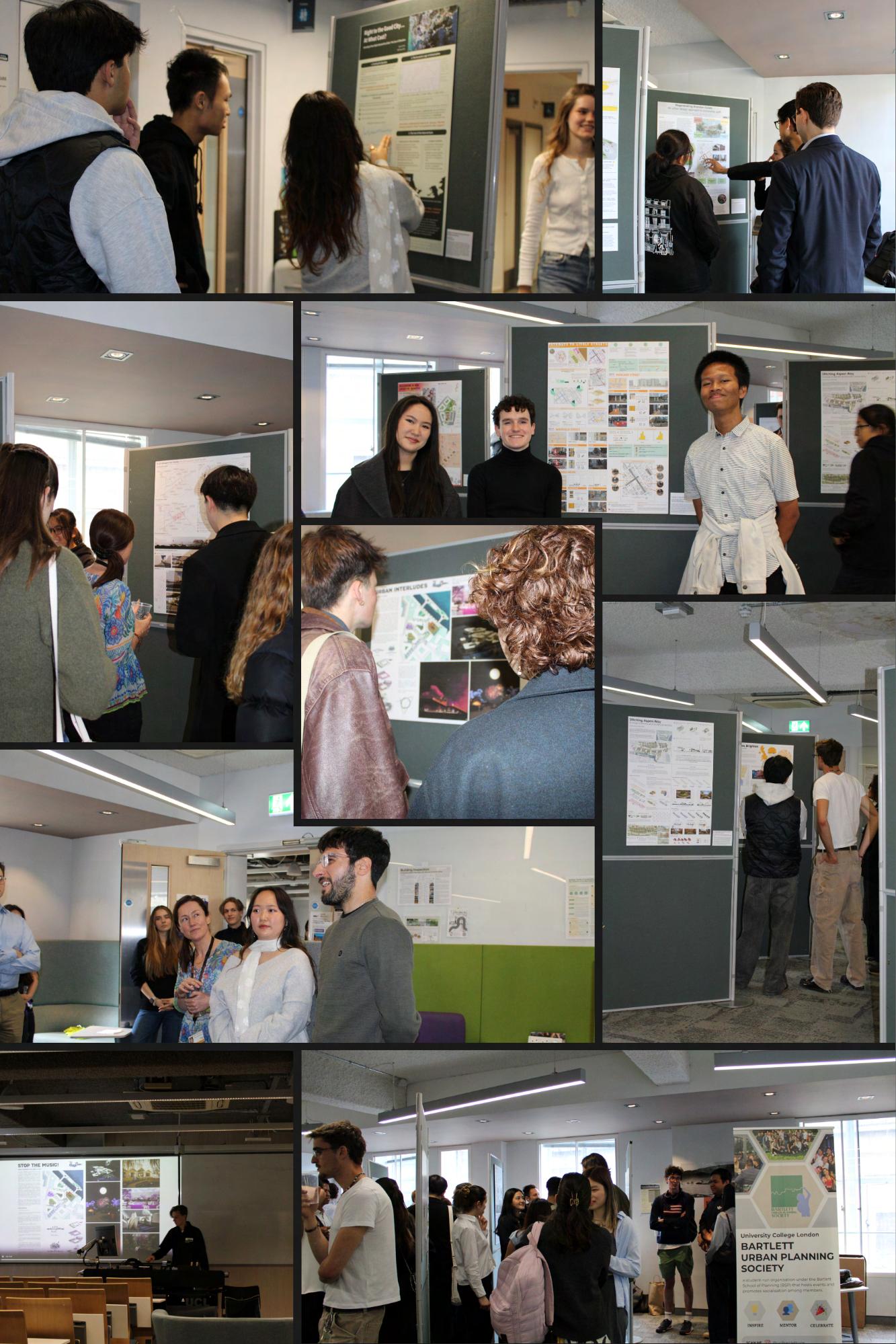
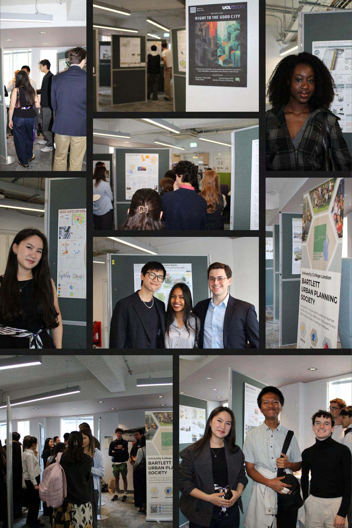
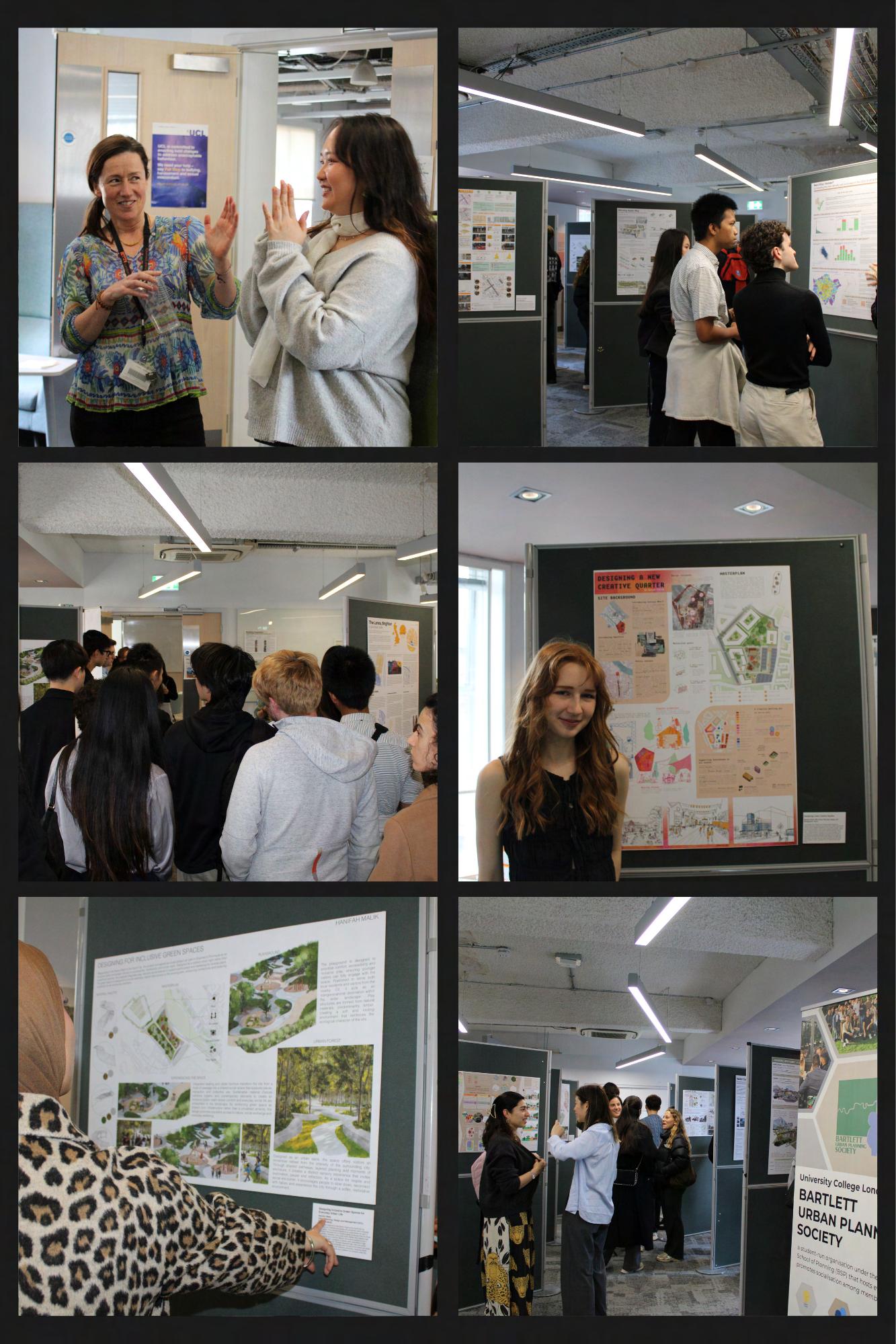
The works included in this catalogue represent BSP students’ creative and critical explorations during the 2025–26 academic year, examining what constitutes a Good City and how rights to urban spaces and processes can be secured. These projects were exhibited as part of the BSP Expo launch event held on the 7th of May 2026 at Central House, UCL.
2026 also marks UCL’s bicentenary, celebrating 200 years since the university’s establishment as the first university in London. This Expo formed part of the UCL200 programme of activities, reflecting UCL’s founding values while celebrating the excellence, ambition, and impact of its students and staff.
This catalogue serves as a lasting record of the projects, discussions, and ideas that shaped this year’s Expo. Whether encountered during the exhibition itself or through these pages, we hope the work presented here inspires further reflection on what it means to create more just, inclusive, and genuinely good cities.
The BSP Expo Organising Team, Bartlett Urban Planning Society and Lucy Natarajan
1. Reclaiming Everyday Public Life
Public space as pause, encounter, play, and everyday social infrastructure
Lewis Cubitt Square: When the Event Ends
Darina Park
BSc Urban Planning, Design, and Management, Year 1
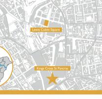
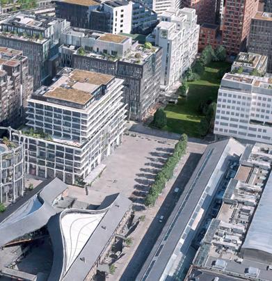
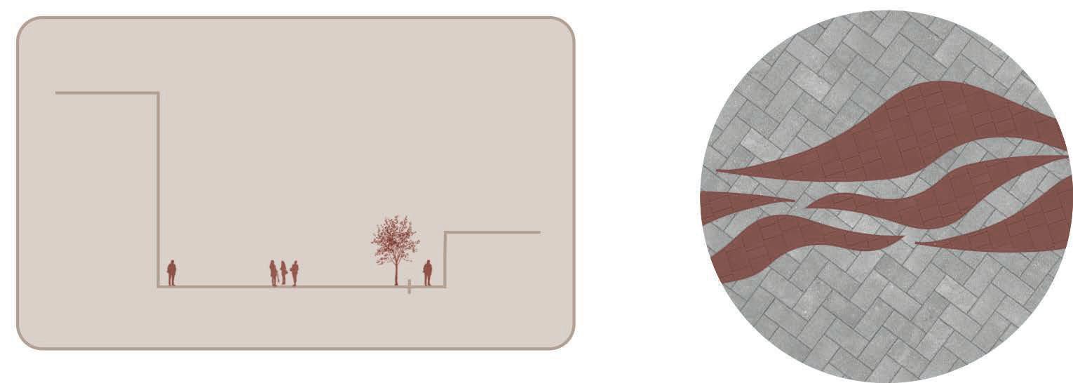
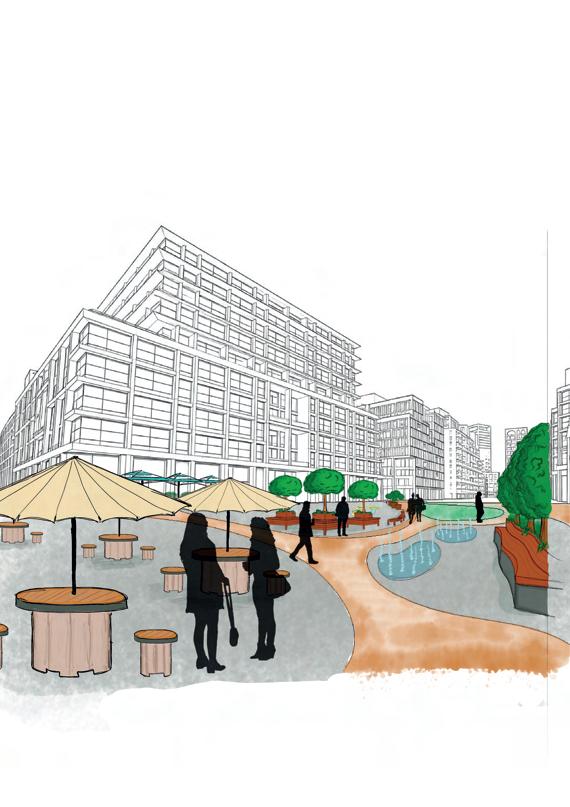
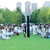
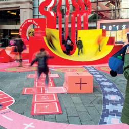
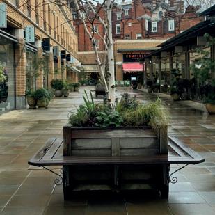
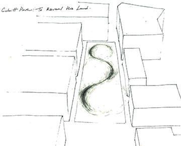
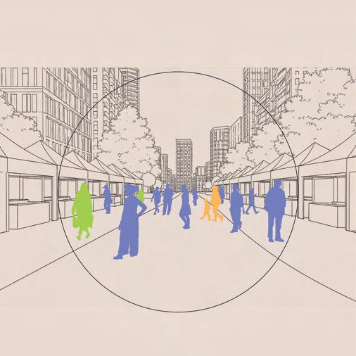
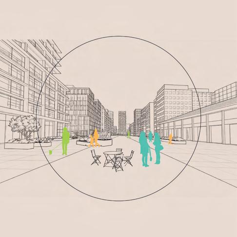
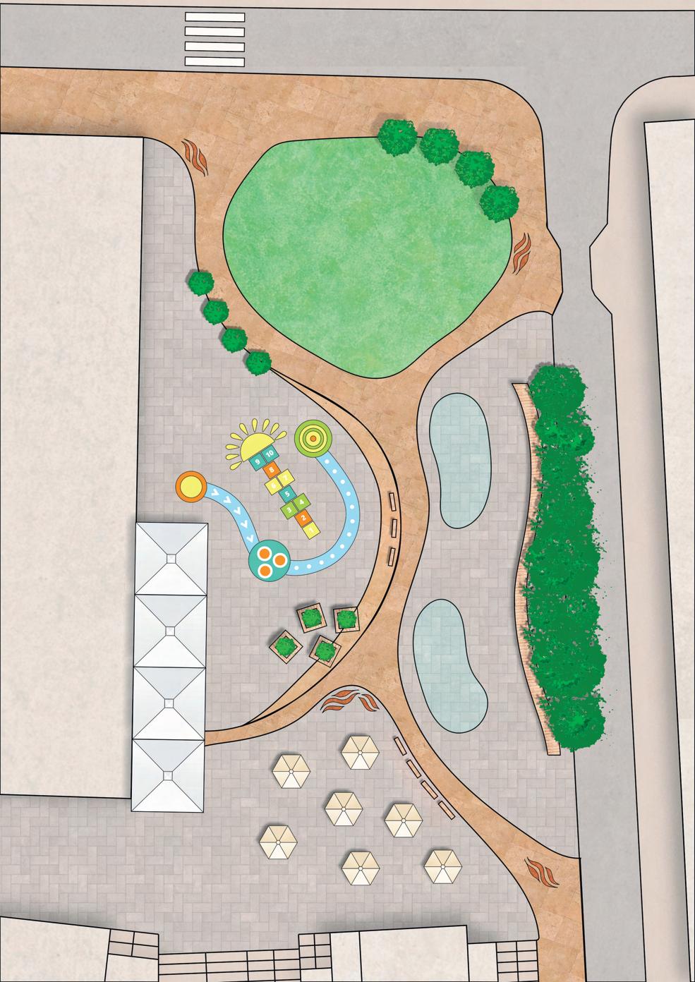
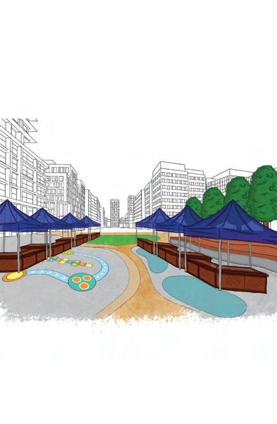
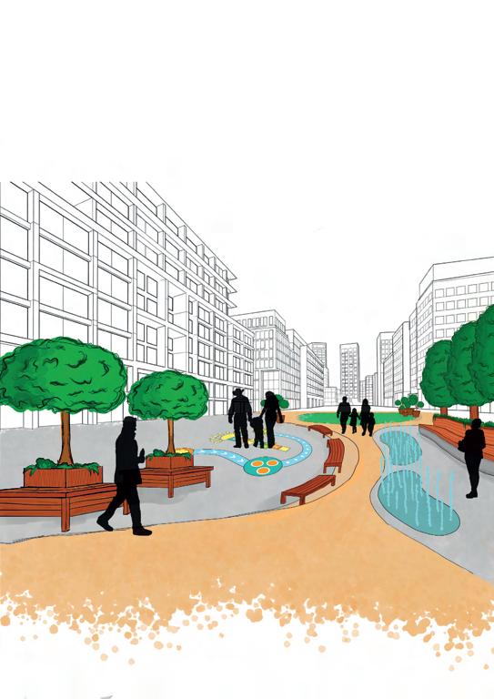
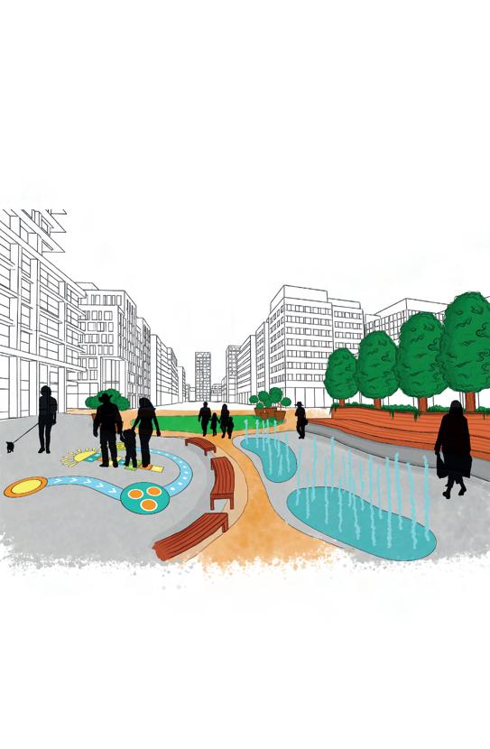
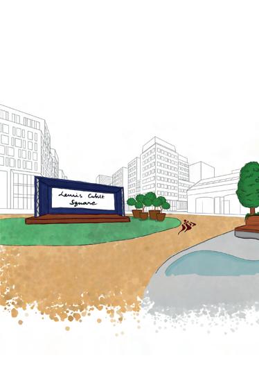
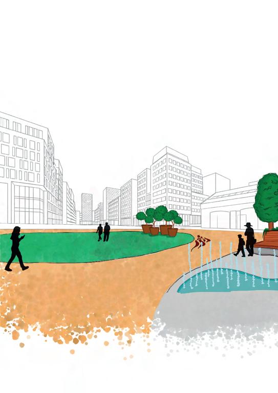
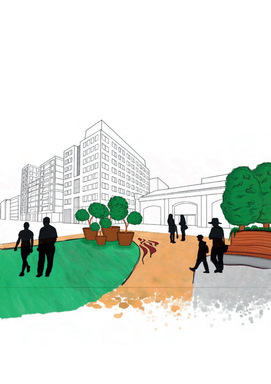
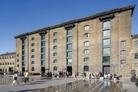
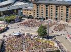
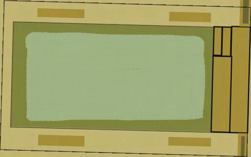
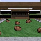
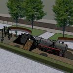
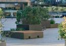
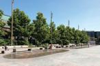
A right to a good city should be universally accessible. ‘Lewis Cubitt Square: When the Event Ends’ explores the redesign of existing public space into a more adaptable (responding to both event and no-event conditions) and inclusive environment within the diverse context of King’s Cross.
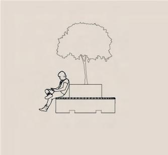
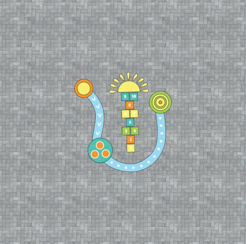
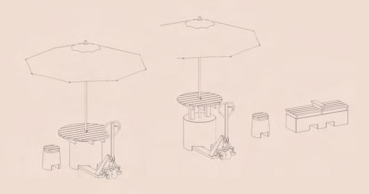
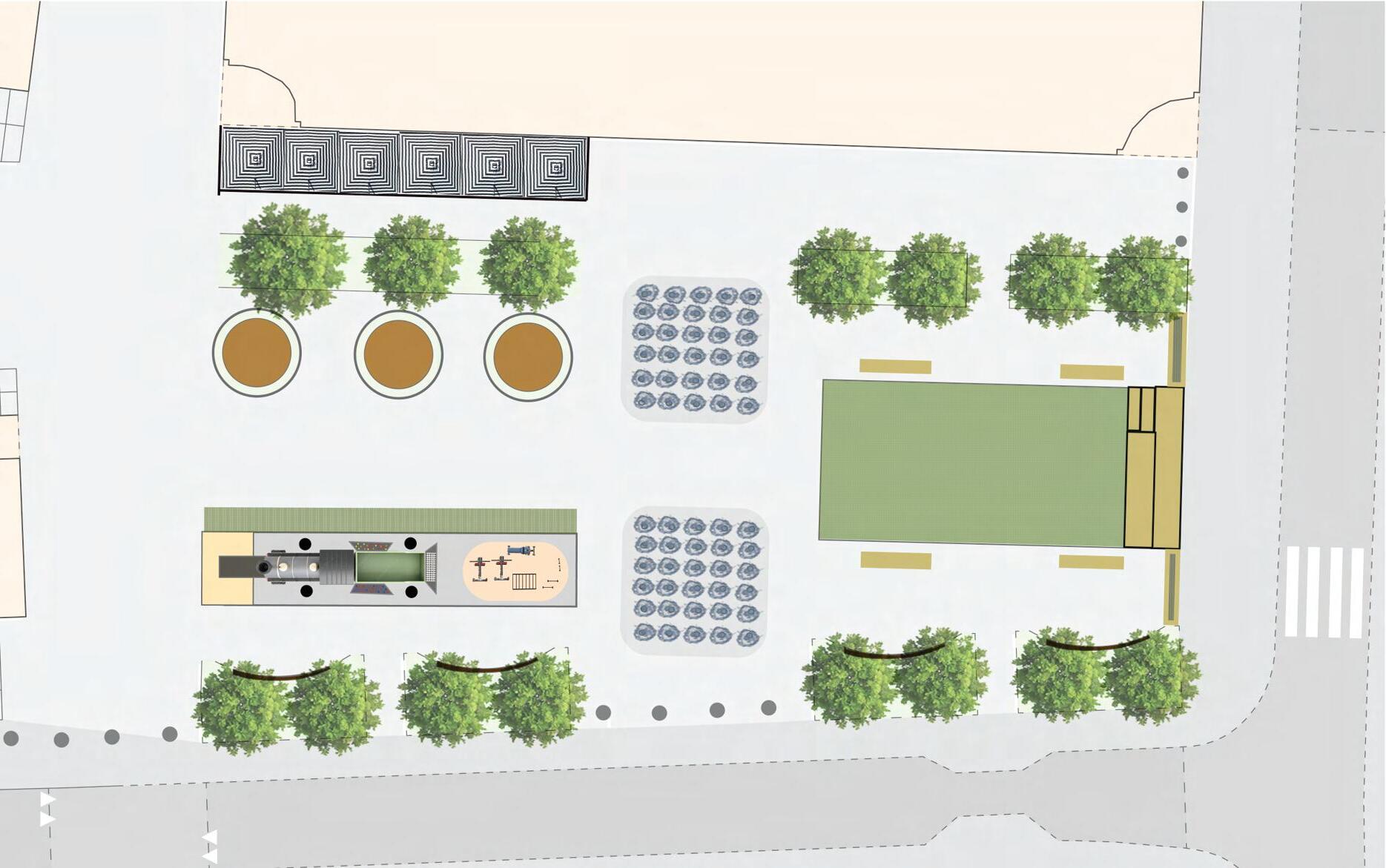
As different user groups have distinct behaviours and temporal patterns of use, this work aims to address their needs by integrating various spatial experiences within the same square. Design interventions such as dedicated activity zones for children, a climate-responsive resting area for shoppers, a flexible green lawn for residents, and movable furniture establish a flexible spatial programming and activate the square during non-event scenarios.























Lewis Cubitt Square: The Transitional Square
Adelio Hafindika
BSc Urban Planning, Design, and Management, Year 1
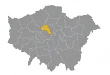
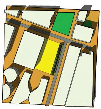
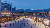
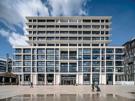
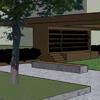
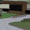
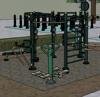
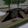
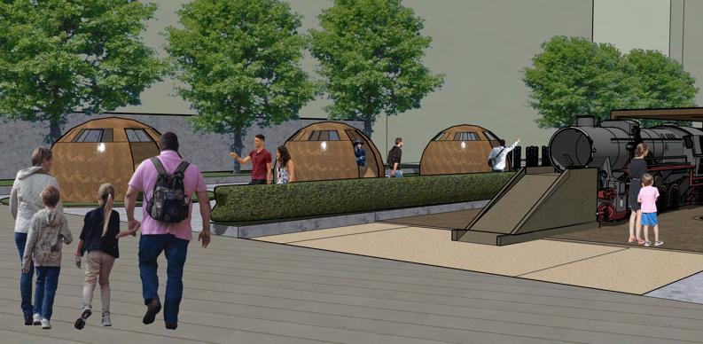
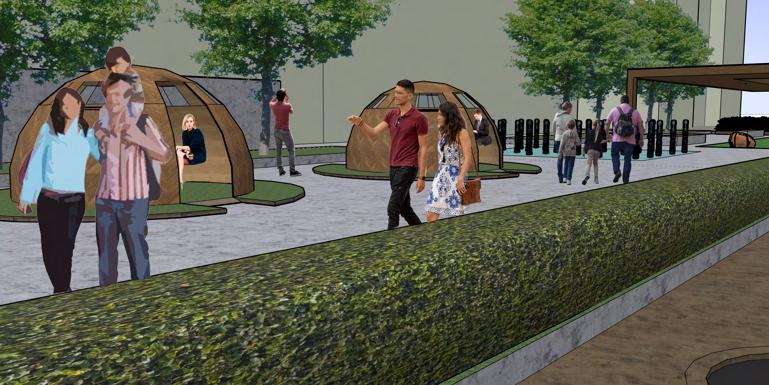
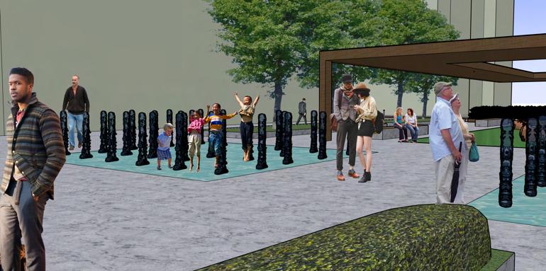
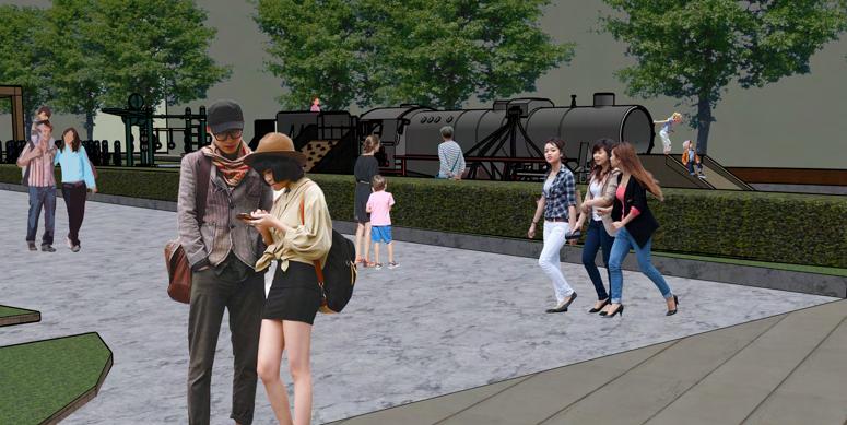
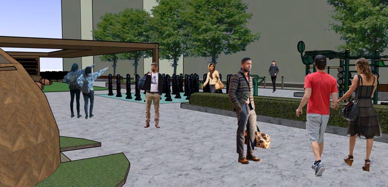
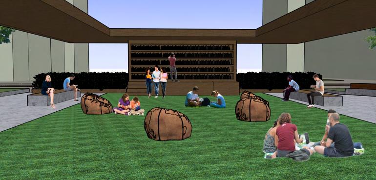
One of the rights to a good city is the right to access quality public space that attracts and accommodates many kinds of users. My project, part of BPLN0073: Design Skills, examines Lewis Cubitt Square in King’s Cross, an underutilized public space where poor enclosure and lack of amenities that reduce its attractiveness and usefulness limit its potential.
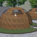
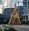
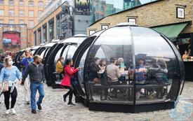
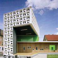
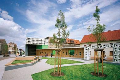
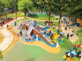
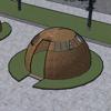
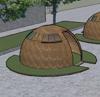
By introducing a sheltered dome, an open-air library, a multigenerational playground, and additional greenery, I demonstrate that thoughtful urban design can transform an overlooked square into a livable, community-driven space that secures everyone’s right to a good city, while limiting economic expense by maintaining the existing infrastructure.
Lewis Cubitt - The Transitional Square!


















Lewis Cubitt Square: Introducing the Right to Choose
Rochelle Ababio
BSc Urban Planning, Design and Management, Year
1
A good city provides its inhabitants ample opportunities to choose how they want to spend their time. My proposal aims to turn a transient and commercialised square into a memorable place that cultivates a lively community.
The Crossroads establishes four micro-zones for pause, play and rest and gives its users the right to choose how they spend their time, with no barriers to entry or entertainment. The Wild Garden, active and passive play areas and resting spots creates accessible and inclusive amenities and uses existing and recycled materials to create a sustainable and independently functioning public space for all.
The Crossroads: From Transient to Memorable

Rochelle Ababio

Design Proposal
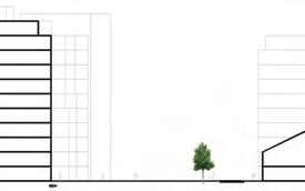
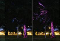
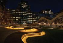
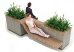
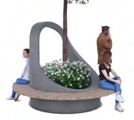
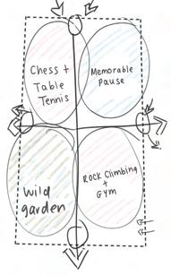
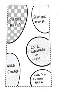
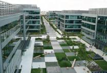
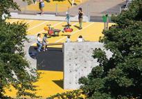



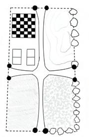
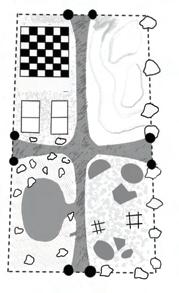
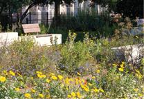
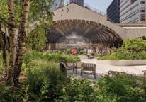

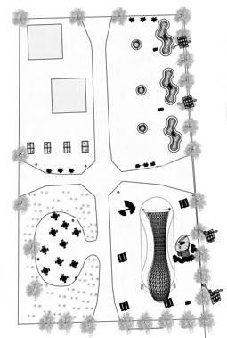







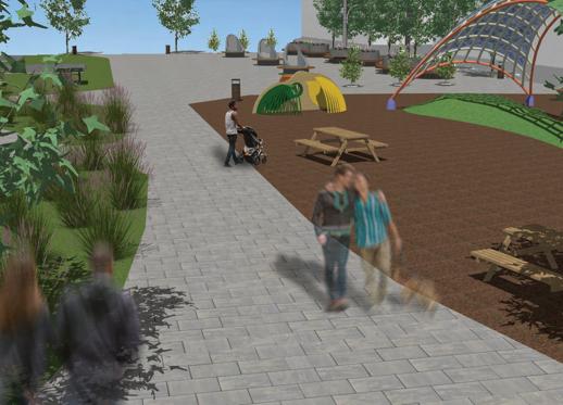
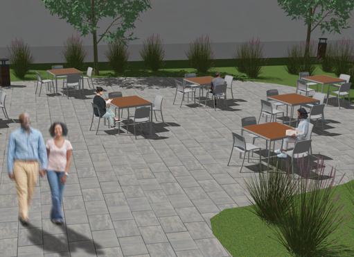
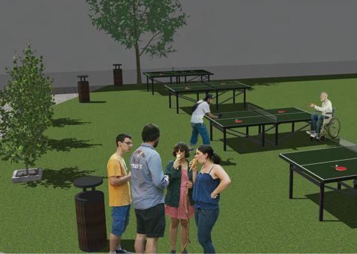
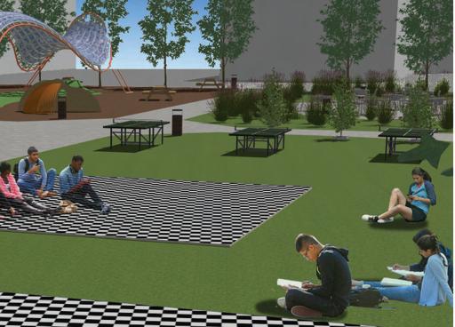
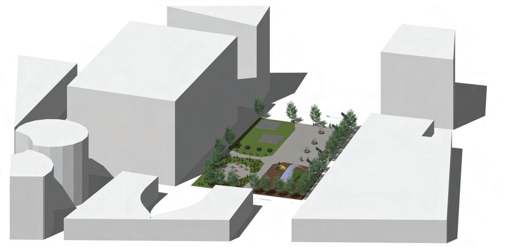


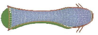


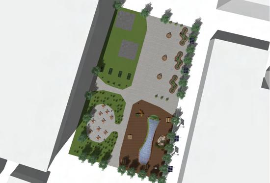
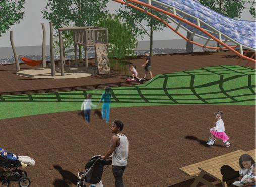
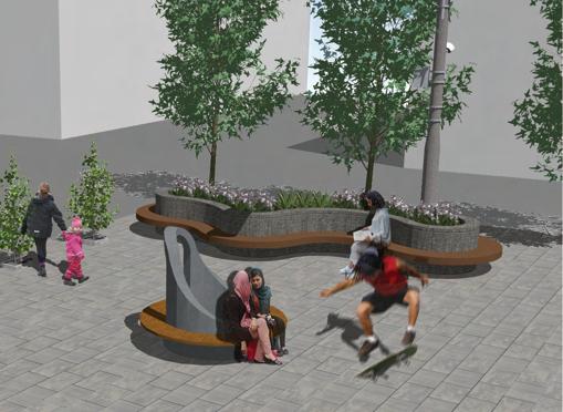
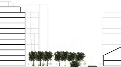
Entering The Crossroads presents visitors with the option to pause, play or rest. Vistors can pause under the shade and serenity of the wild garden. Vistors
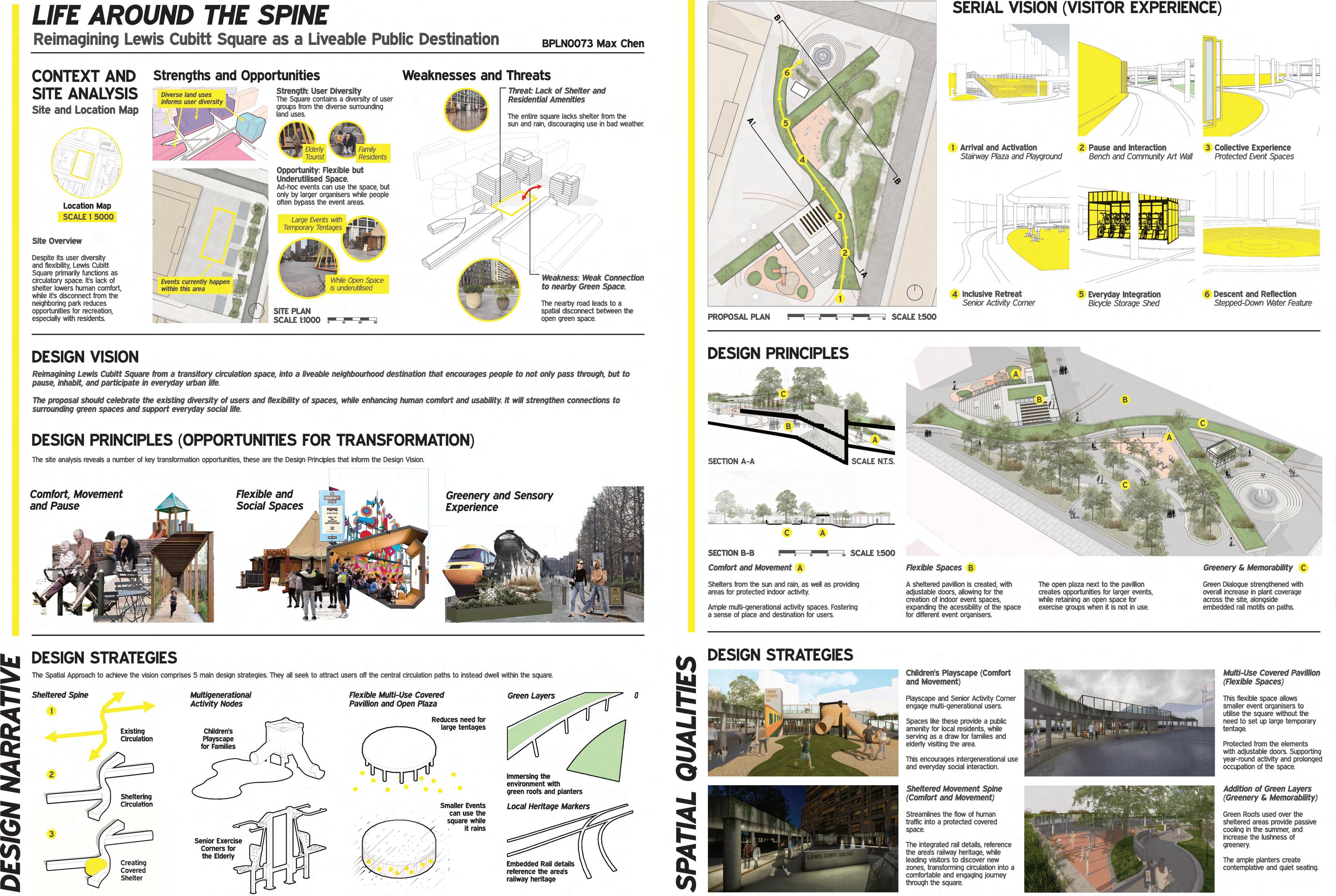
The Social Spine, Reimagining Lewis Cubitt Square
Max Chen
BSc Urban Planning, Design and Management, Year 1
There is a growing need for our cities to be inclusive and adaptable in the face of evolving social dynamics. This proposal reimagines Lewis Cubitt Square, a transitory space despite its central location and diverse user base, into a liveable and inclusive public square that supports everyday urban life.
By introducing a network of sheltered walkways, flexible activity nodes and integrated green infrastructure, this establishes a Social Spine that reorganises movement and activity across the site. By enhancing environmental comfort and creating spaces for pause, play and interaction, the proposal enables a wider range of users (residents, families and elderly) to actively inhabit the square.
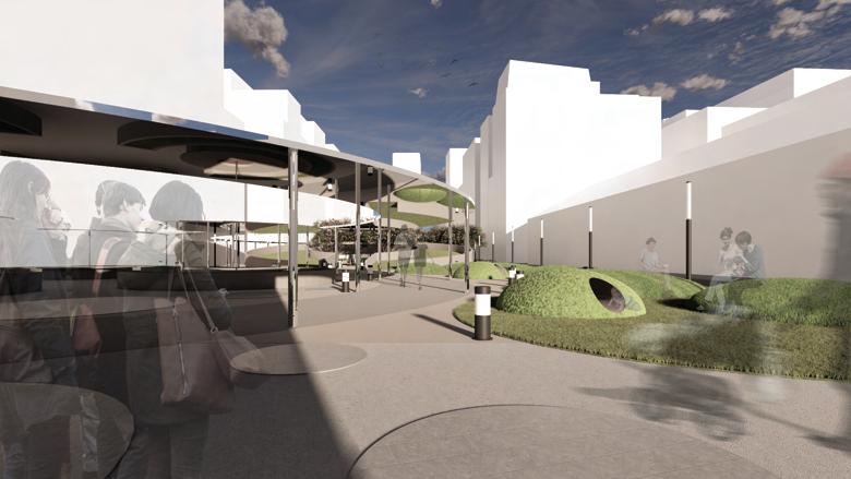
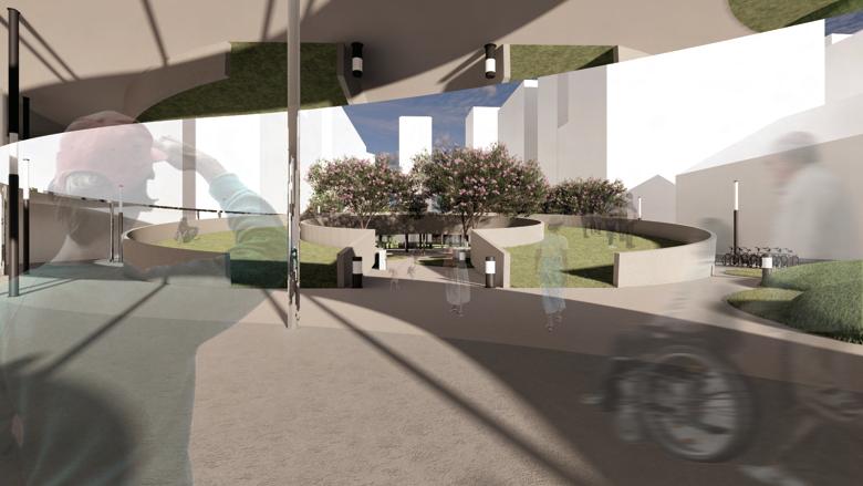
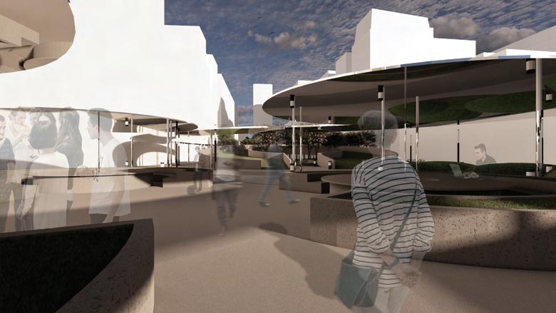
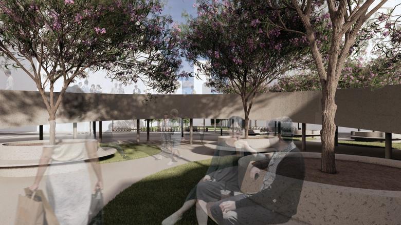
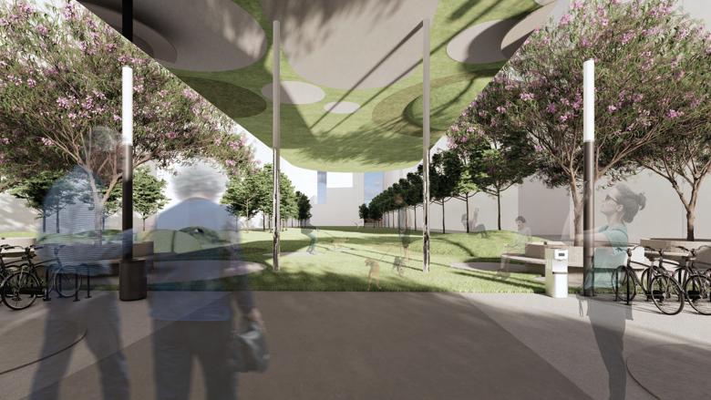
A Landscape that Invites: Reclaiming Lewis Cubitt Square
Xavier Jude Ong
BSc Urban Planning, Design and Management, Year 1
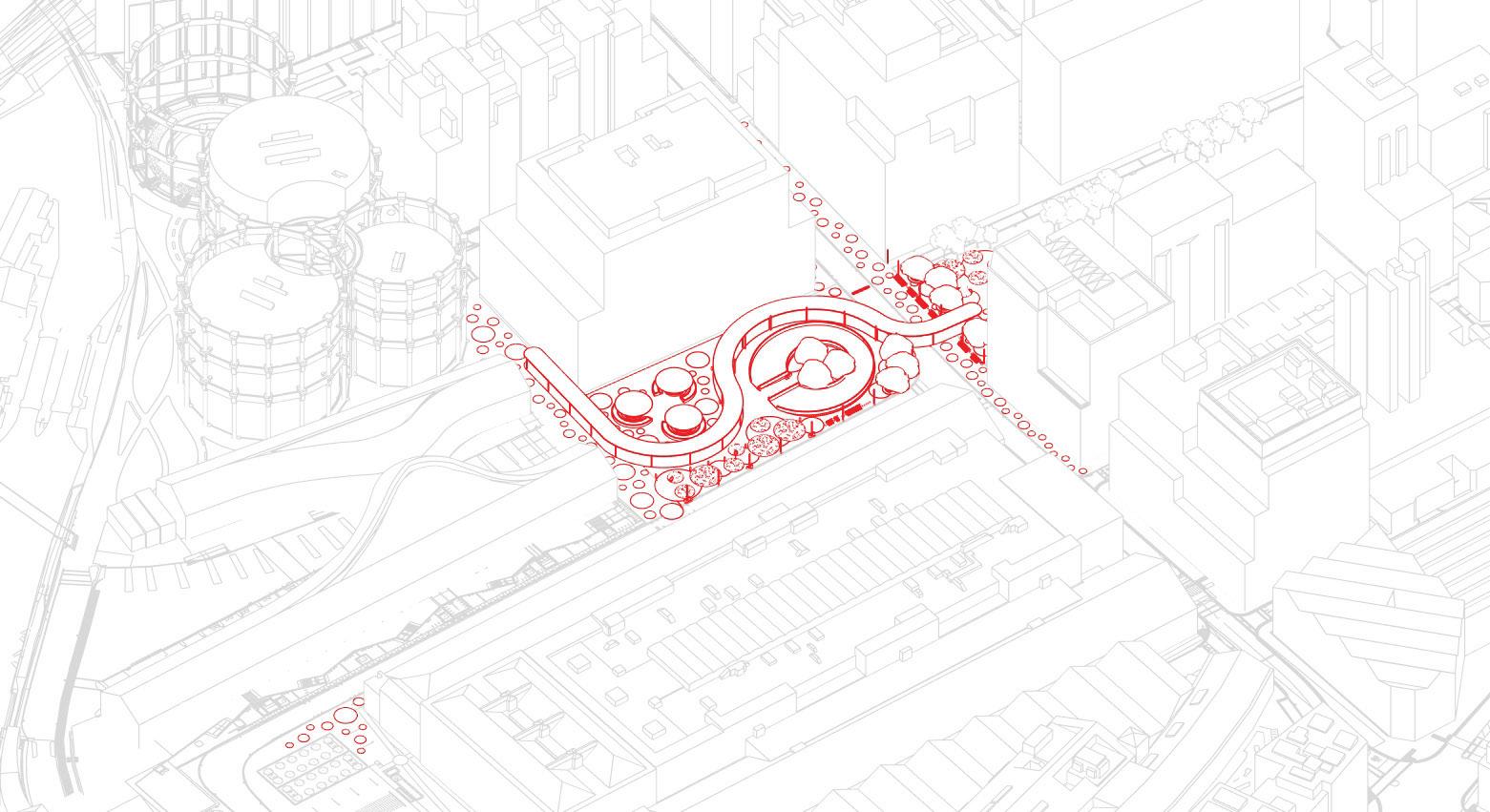
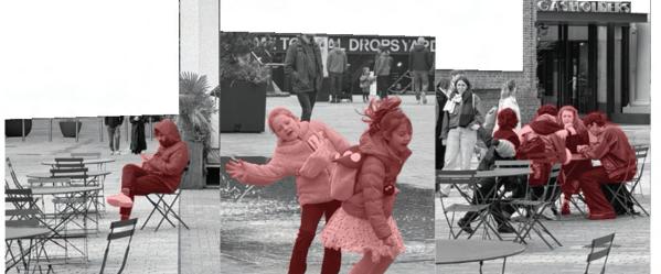
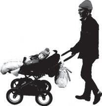
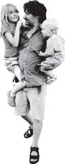
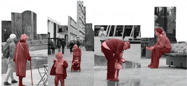
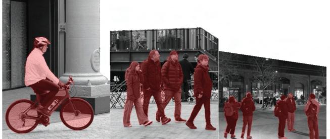
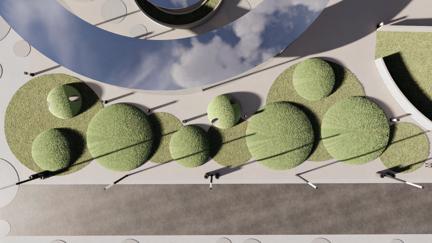
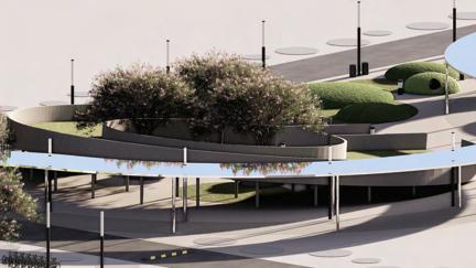
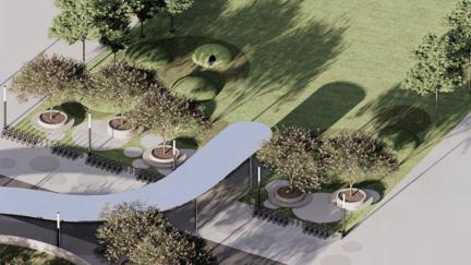
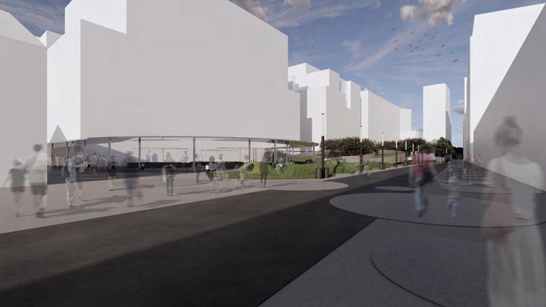
Lewis Cubitt Square sits at the heart of King’s Cross, surrounded by destinations but offering no reason to stay. Workers eat lunch with nowhere to sit, parents watch children play on hard ground, people cross the square twice a day and never once stop. Through interviews and site analysis, this project asks a simple question: Who does this square actually belong to?
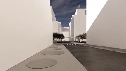
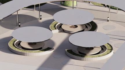
The proposalrespondswith a continuous landscape of shelter, topography and gathering spaces that give people spatial permission to pause, rest and occupy the square on their own terms. It is grounded in the belief that a good city is not just one that moves people efficiently but one that lets them stay. As a Singaporeanstudent now living in London, I have seen how vastly different approaches to public space shape everyday life, and this project reflects my growing conviction that the right to the city begins with the right to simply be in it.
A Landscape that Invites: Reclaiming Lewis Cubitt Square


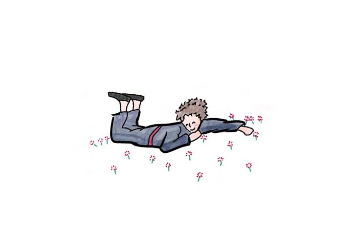
Stop the Music!
Urban Interludes: The Right to Relax
Lucas van den Oever BSc Urban Planning, Design and Management, Year 3
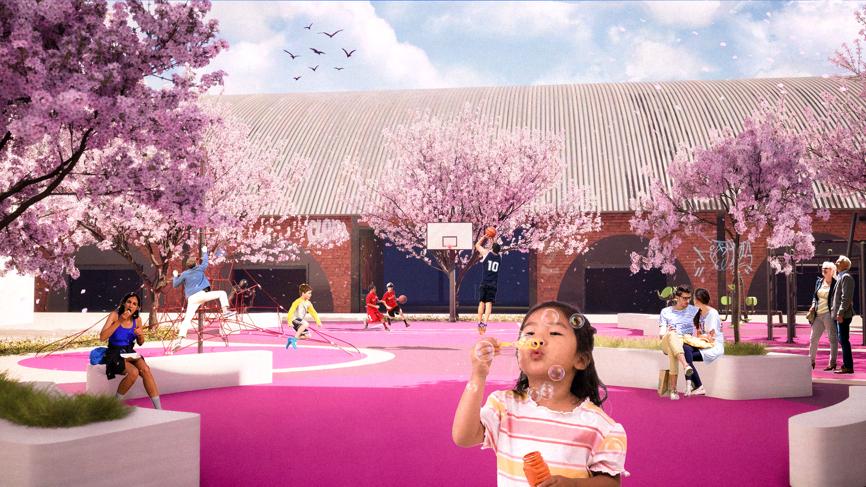
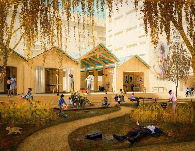
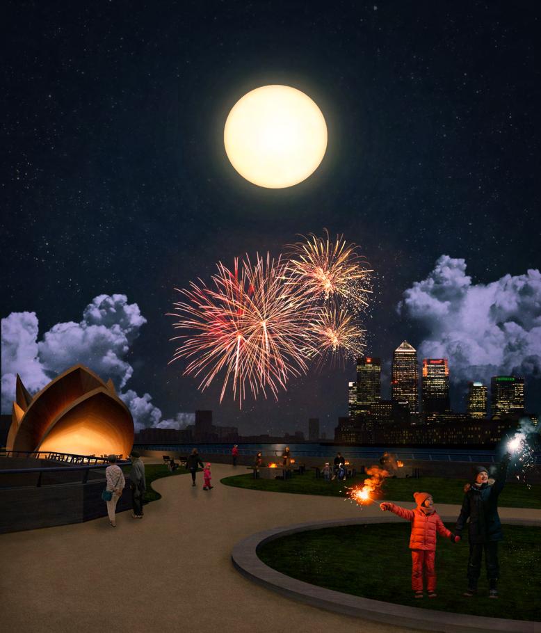
In a world where we are constantly told that we should be doing something — whether that is consuming, being productive, or even just moving from A to B — it is crucial for spaces to be available for us to do the opposite. Spaces where we can leave the stresses of our lives behind and momentarily indulge in a self-contained bubble where we can do nothing useful at all.
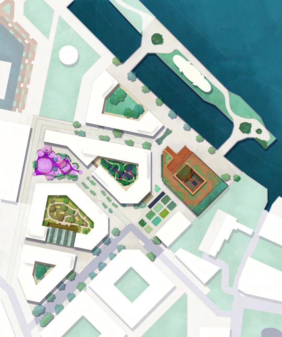
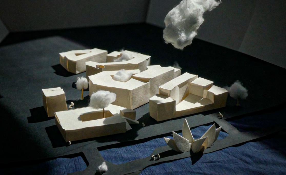
This detailed masterplan for a section of a wider masterplan of Convoys Wharf in Deptford was submitted as an individual project for Urban Design: Space and Place. It centres around five self- contained ‘urban interludes’ — public spaces where people can exercise their right to peace and quiet in the built environment.
URBAN INTERLUDES
The right to relax
Our group masterplan of the Convoys Wharf site in Deptford centred signifcantly around concepts of commerce, vitality, attraction, employment and production. Whilst these seem like separate ideas in line with our masterplan’s philosophy of a diverse urban tapestry, they ultimately all follow one core idea: maximalism. We wanted a neighbourhood which was active, bustling and naturally extroverted, drawing people in and encouraging them to interact and engage.
Whilst these kinds of spaces are immensely valuable, when I inherited a specifc section of our masterplan to individually design in more detail took it as an opportunity to explore a diferent, more introverted kind of space. Taking advantage of the more enclosed and disconnected urban fabric, my detailed masterplan focused on the concept of urban interludes — secluded, self-contained spaces acting as a pause from the outside world, each with a unique atmosphere inspired by an aspect of Deptford’s culture. was inspired by themes of impressionism and magical realism, and the idea that a well-designed space can have a distinct mood which afects our perception and experience within it.
Instead of accommodating fow, these spaces are intentionally circular and convoluted. Instead of being clearly legible, they are hidden and secretive. The detailed masterplan aims to provide residents with a fundamental right which is often neglected in our daily lives: the right to stop and relax!

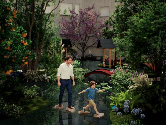
Below: an integenerational playground, allowing adults to discover the joy of play again. Scan the QR code for a video walkthrough.
Right: the DIY garden, where residents can collaborate on repairs and create art out of recycled materials sourced from around the neighbourhood.
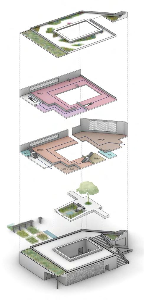

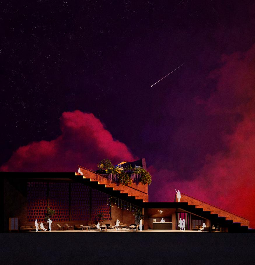
Left: an axonometric diagram of the Museum of Enslavement and Freedom, which takes inspiration from traditional Yoruba, Igbo and Hausa design motifs to both educate residents about Deptford’s role in the slave trade and provide a public indoor space for the community.
Right: a cross-section of the Museum, showing its cavernous main room, intended to provide a counterpoint to the neighbouring riverfront area.
Below: a conceptual sketch of the


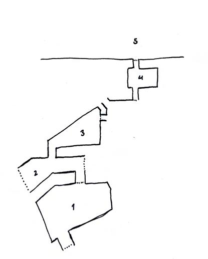

The detailed masterplan.
Above: a sunken garden, designed to food when it rains. The garden uses principles of spatial choreography to create an episodic experience along a single path.
Left: a 1:600 scale model of the site.
Below: a sketch illustrating the sequence of spaces moving towards the river and the resulting expansion and compression of the movement experience.
Left: the jetty.
Below: a scale model of the jetty’s cafe building, designed to resemble the sails of a ship.
Source: BUPS photography, all rights reserved
2.Inclusive Communities and Social Infrastructure
Designing urban environments around care, participation, accessibility, and collective wellbeing
Pathway to Lively Streets
Adelio Hafindika, Darina Park, Grayson Weekly, and Wilson Lo
BSc Urban Planning, Design, and Management, Year 1
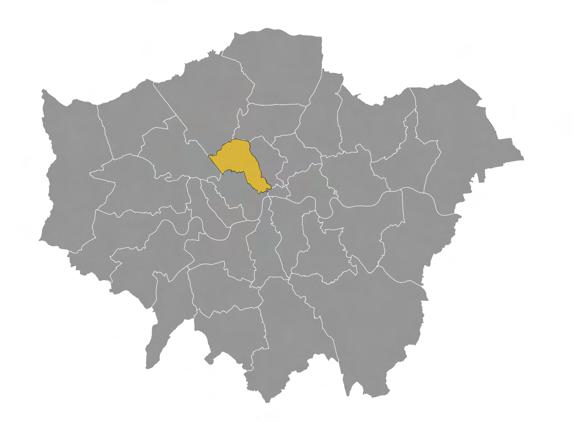
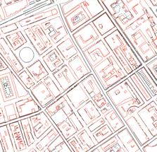
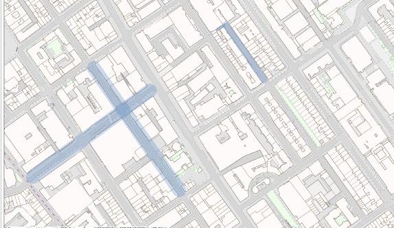
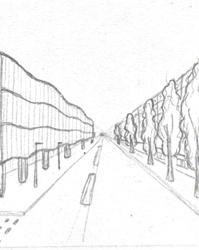
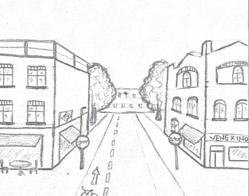
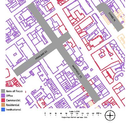
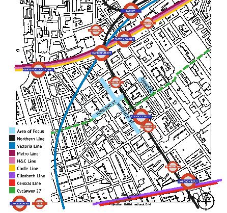
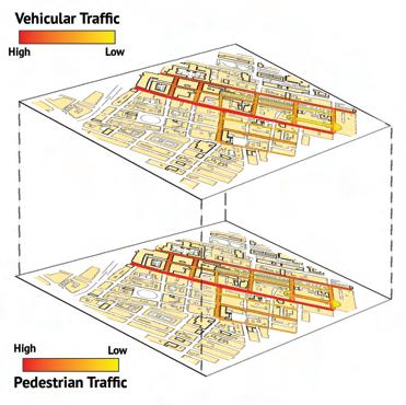
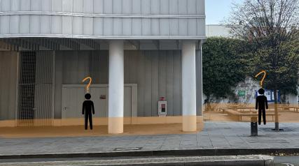
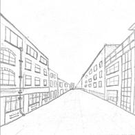
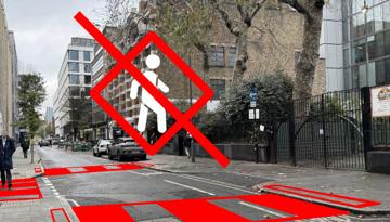
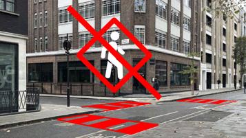
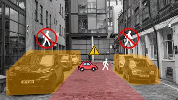
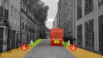
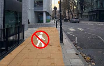
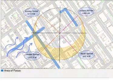
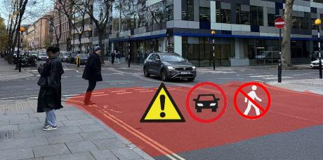
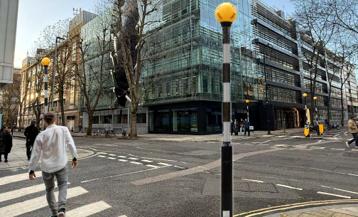
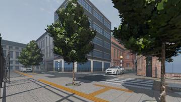
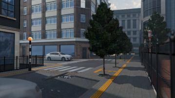
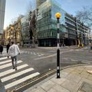
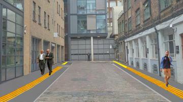
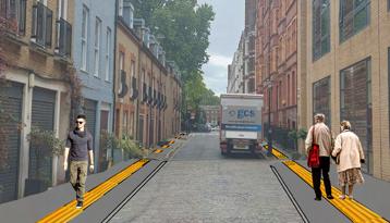
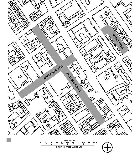
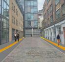
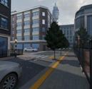
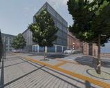
The right to a good city is the right to move through it freely and safely, inclusive to all users, no matter the background. Our project, which is part of BPLN0072: Graphic Communication, examines and proposes solutions to three streets in Bloomsbury and Fitzrovia: Howland Street, Whitfield Street, and Chenies Mews, where pedestrians, particularly children, the elderly, and people with visual impairments, are poorly served by existing infrastructure.
We propose targeted interventions, including tactile paving, new crossings, and a designated play street. The project demonstrates how small-scale spatial changes can challenge embedded design hierarchies and expand access to everyday urban life.
PATHWAYS TO LIVELY STREETS


























Designing Inclusive Green Spaces for Everyday Urban Life
Hanifah Malik
BSc Urban Planning, Design and Management,
Year 3
This project responds to the theme ‘Right to the Good City’ by rethinking how creativity and access are embedded within everyday public space. The proposal transforms an underutilised car park in Greenwich Peninsula into an inclusive green landscape that prioritises accessibility, interaction, and social value.
Rather than treating high- quality design as a premium feature, the scheme positions it as a shared urban right - available to diverse users regardless of age, income, or background. Through integrated play, rest, and social spaces, the project demonstrates how the built environment can foster participation, wellbeing, and collective ownership, reframing public space as both infrastructure and a platform for inclusive urban life.
DESIGNING FOR INCLUSIVE GREEN SPACES
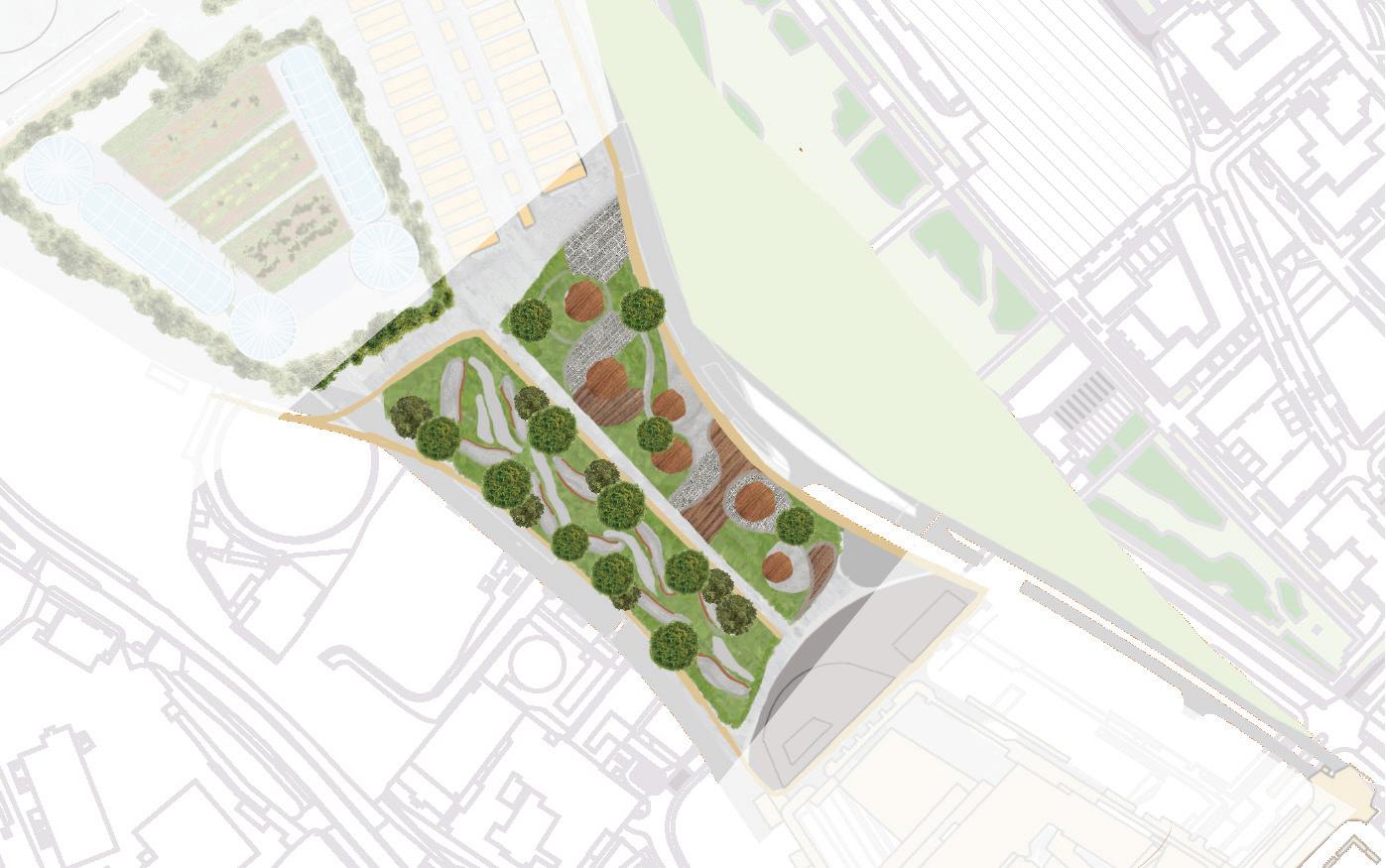
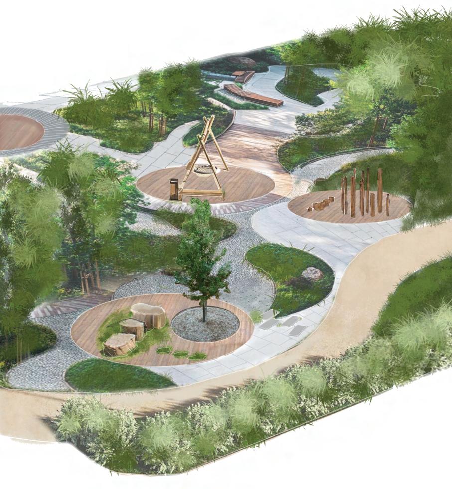
Responding to the theme Right to the Good City, this project reimagines an underutilised car park in Greenwich Peninsula as an inclusive green landscape centred on accessibility, biodiversity and social value. Designed as a shared urban right rather than a premium amenity, the proposal integrates play, rest and social spaces to support participation and wellbeing for diverse users. The green space is designed to provide seamless, barrier-free access to the existing park, enhancing connectivity and fostering inclusivity for all community members.
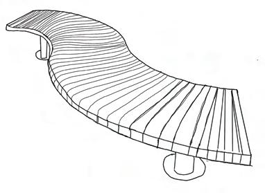
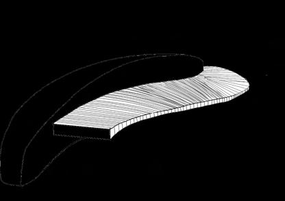
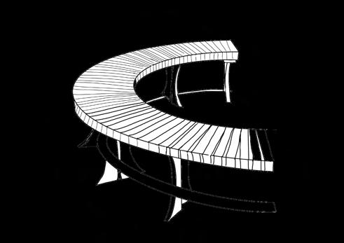
MATERIAL PALETTE





PLAYGROUND
MASTERPLAN
EXPERIENCING THE SPACE
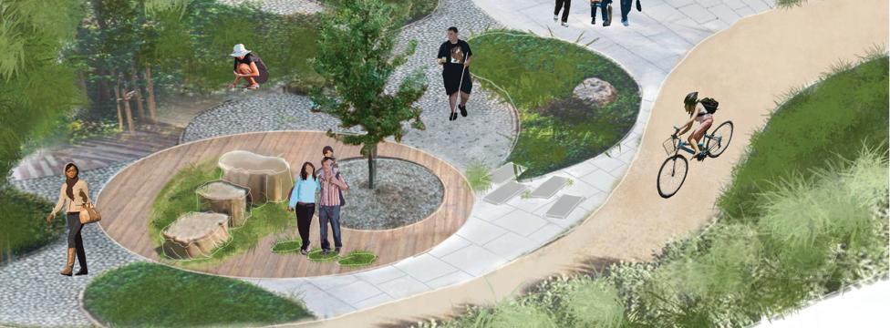
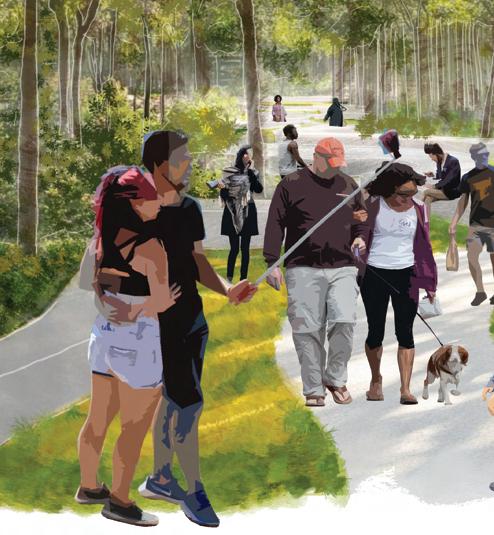


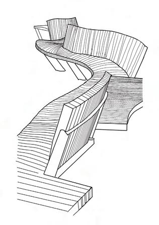
Integrated seating and urban furniture transform the site from a route of passage into a shared social space that supports pause, interaction and collective use. Sustainable material choices combine organic and contemporary elements to create an inclusive public realm where comfort and everyday social life are embedded in the landscape. By reinforcing green space as shared civic infrastructure rather than a privatised amenity, the design promotes equitable access to nature, social exchange and everyday wellbeing.
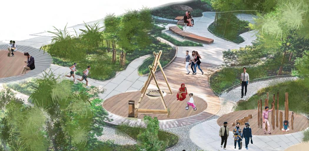
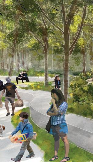
The playground is designed to prioritise comfort, accessibility and inclusive play, ensuring younger visitors can fully engage with the space. Positioned to serve both local residents and visitors from the nearby O2, it acts as an intergenerational destination within the wider landscape. Play structures are formed from natural materials, predominantly timber, creating a soft and inviting environment that reinforces the ecological character of the site.
URBAN FOREST
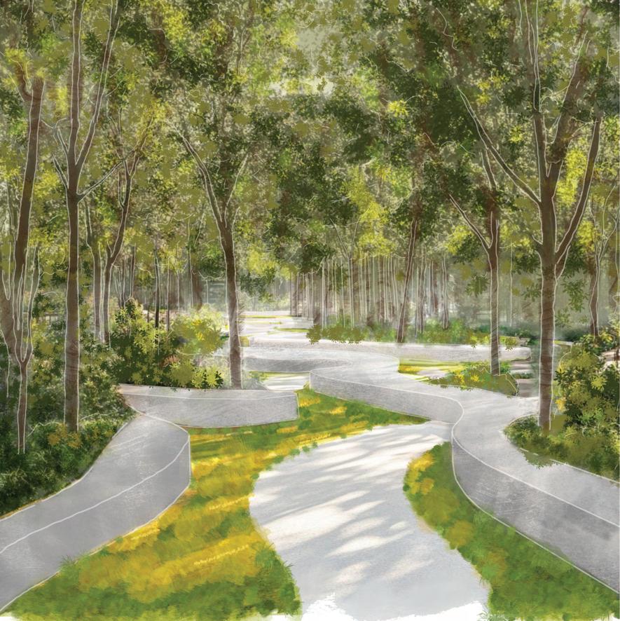
Designed as an urban oasis, the space offers visitors an immersive retreat from the intensity of the surrounding city. Through shaded pathways, layered planting and moments of enclosure, it creates a distinct sensory experience that invites exploration, pause and reflection. As a space for respite and social encounter, it encourages people to slow down, reconnect with nature and experience the city through a softer, restorative environment.
Designing the In-Between for Everyone
Shirley Sik Kei Ho, MSc Urban Design and City Planning
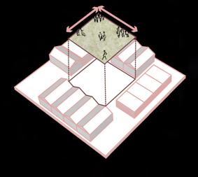
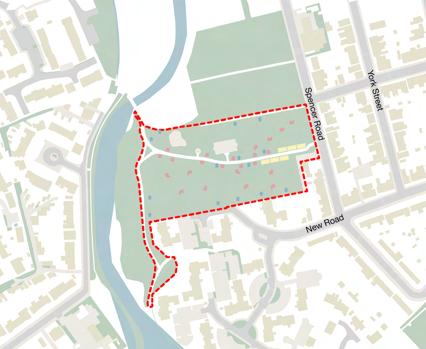
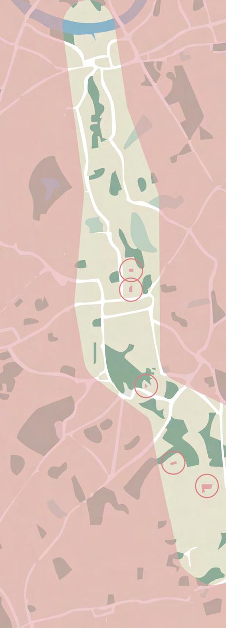
People have often focused on creating new spaces for socio-economic uses. However, rather than continually developing new areas, why not utilise existing “left-over” spaces, those that are often overlooked yet function as everyday transitional spaces, to generate community value?
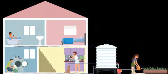
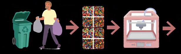
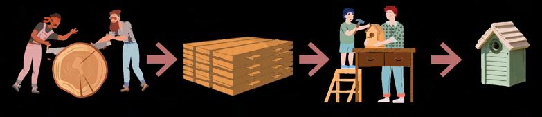
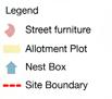
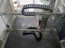
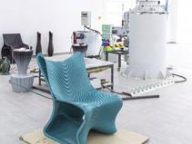
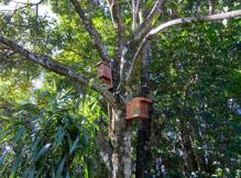
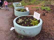
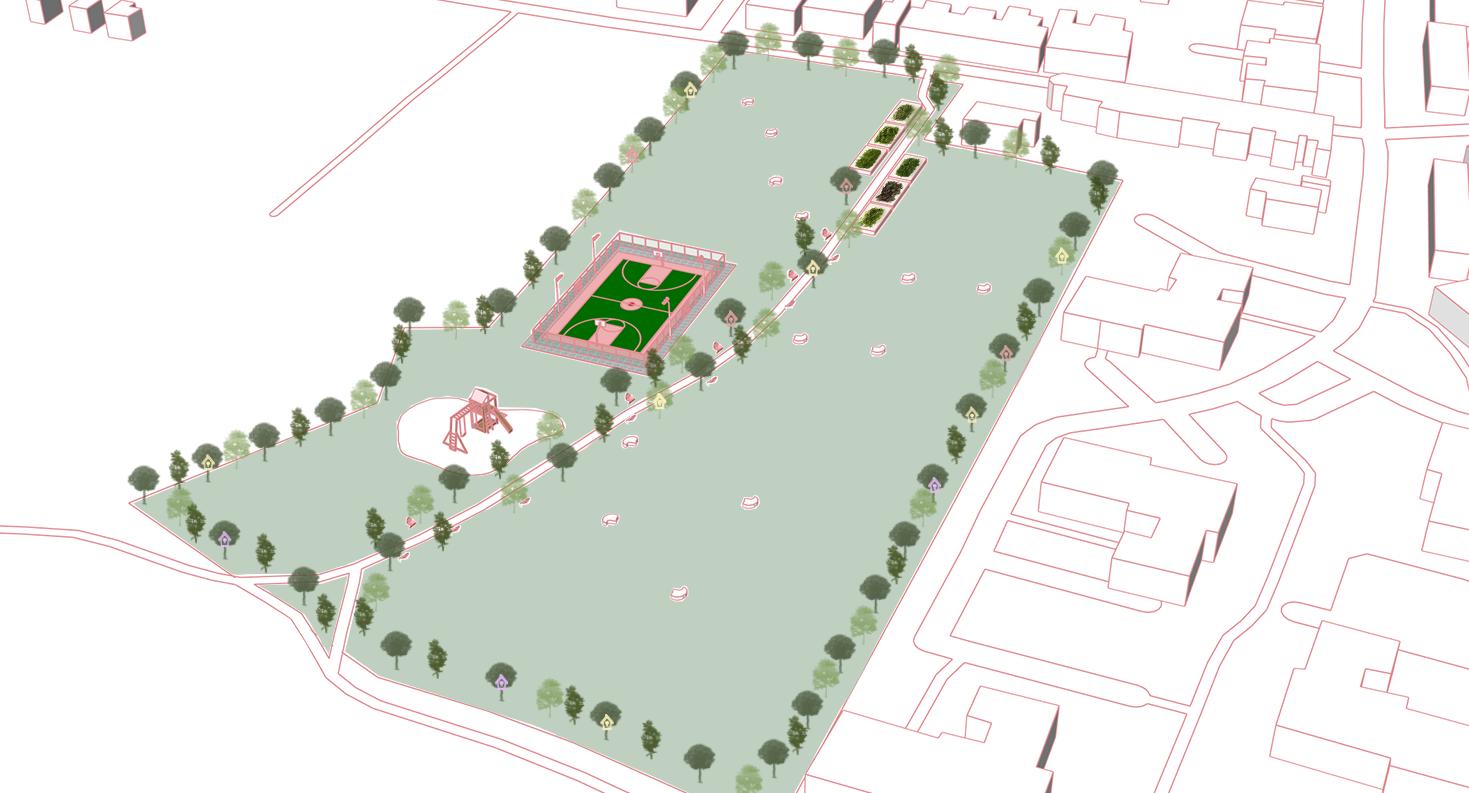
This project activates such spaces within the Wandle Valley region in London. It proposes a 10-year phasing strategy from 2025 to 2035, encouraging sustainable water use, the creation of street furniture and nest boxes using recycled materials, and the establishment of community gardens. Through these interventions, the project aims to nurture the next generation of community leaders to promote environmental sustainability.
Reclaiming Public Space
Transforming
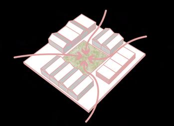
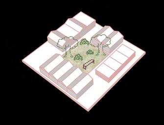
Phase 1: Community Garden (Recycle and Reuse)
Phase 2a: Street Furniture (Recycle)

Phase 2b: Nest Box (Recycle)



Watercress Park
An Urban Design Approach to Community Uplift
Claudia Alvazzi Delfrate, Spencer Chan, Alex Lafleur, Sebastian Leahy, and Ziyu Mao
MPlan Year 1
Xinyi Li
MSc Spatial Planning
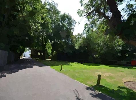
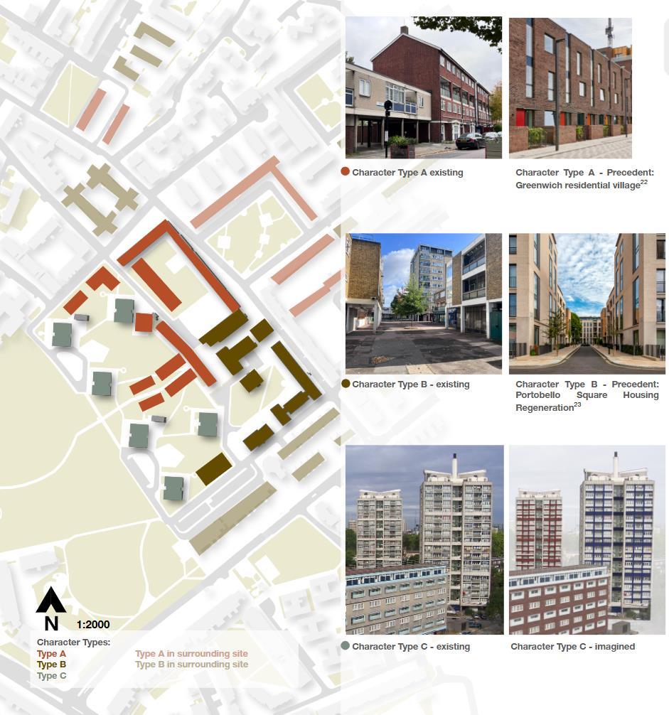
Built in 1958, Brandon Estate exemplifies post-war council estates designed with a top-down, modernist approach. The verticality and compact nature of the estate led to poor enclosure of open spaces, disjointed communities, and created safety and crime issues.
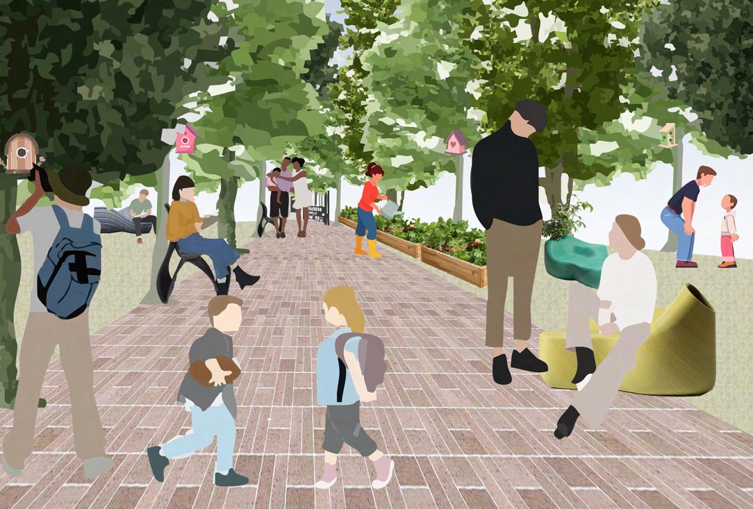
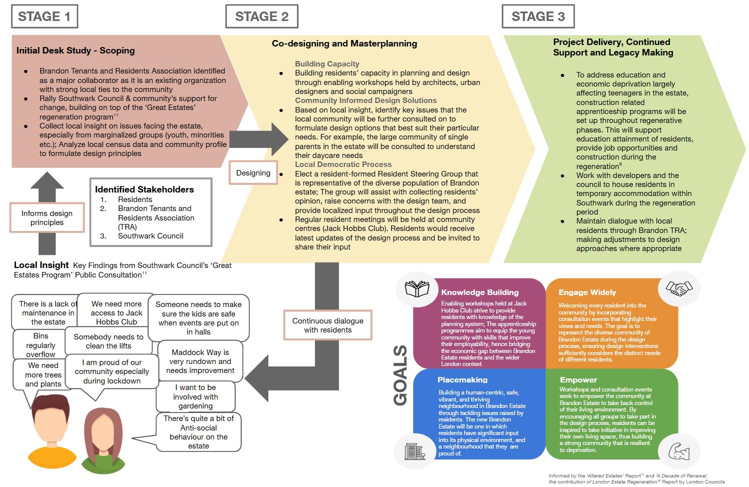
By employing a community- led approach to urban design, this project seeks to address the issues of dead frontages and low quality green and social spaces caused by a dated design that ignored the human- scale, therefore gifting the community decision-making power to dictate what their living space should look like, thus building community resilience to deprivation and allowing residents to regain control over the future of the estate.
Regenerating Brandon Estate –
An urban design approach to community uplift

Abstract
Brandon Estate was once considered the ‘most dangerous estate in Britain’ While the high crime rate has significantly improved over the years, due to disrepair, safety concerns, legibility issues, dated top-down modernist design approaches, poor diurnal rhythm, and additional issues related to privacy and activity, the estate suffers from a sense of desolation and neglect, impacting community formation and residents’ mental health
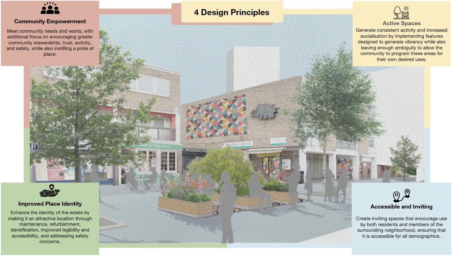
Through an analysis of Brandon Estate using Matthew Carmona’s Placemaking Dimensions, it was determined that ample open space and existing community ties gave the neighborhood potential to be a vibrant location for both residents and visitors Specific community-based design interventions have been developed under four guiding principles to regenerate the estate, with the goal of instilling pride of place and encourage greater activity and stewardship from residents, therefore reclaiming Brandon Estate’s identity as a vibrant, lively and engaging neighbourhood Community Engagement Strategy
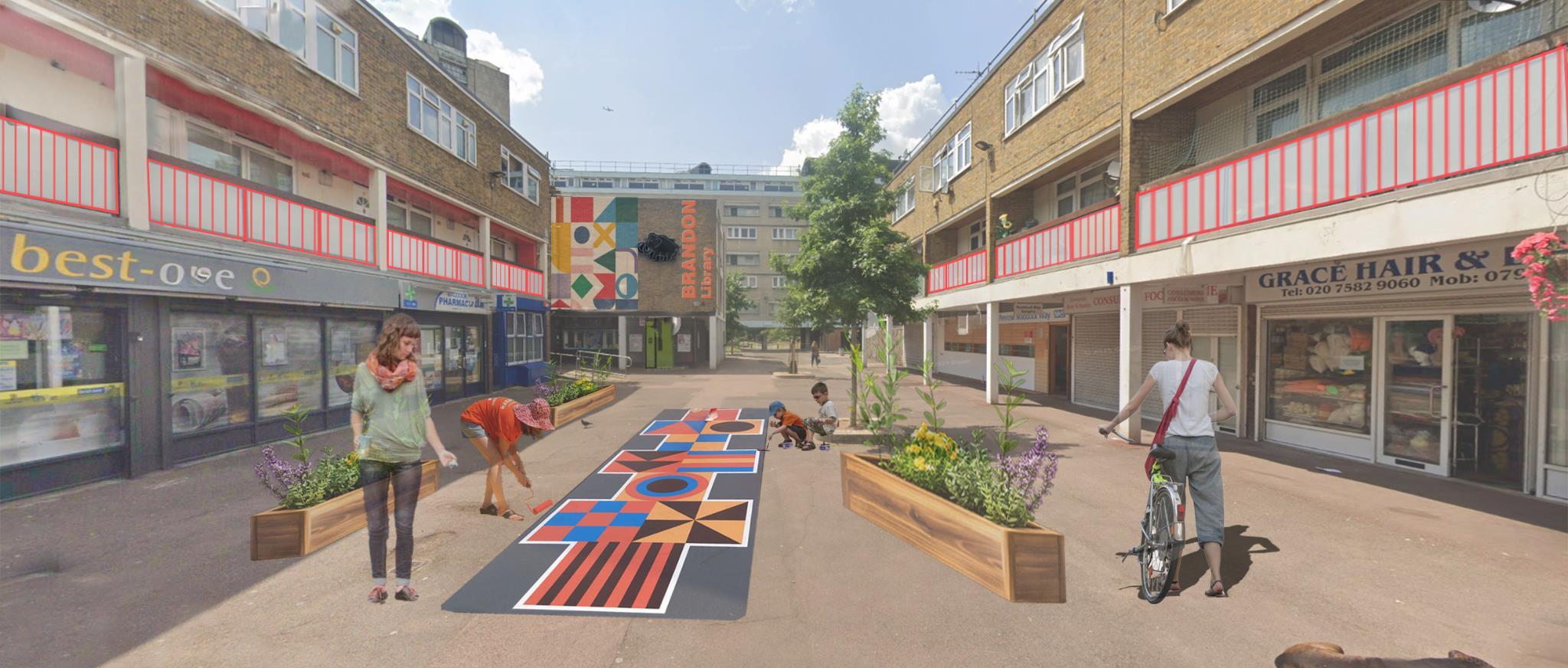
The aim of this intervention is to build the identity of the Brandon Estate incrementally through community-led design and represent the values of the community physically within the public realm This will foster a sense of ownership and pride amongst residents and visitors will perceive the estate as a home to a diverse and closely-knit community
• Co-creating artworks with local artists and residents through workshops and art activities; Developing a unique design language for the estate
• Ensuring existing artworks continue to be well maintained, remain visible from ground level and are visually framed by new interventions
• Temporary Planters to shape space
• Co-created design language informs permanent adjustments such as new pavings, street furniture, signage or new buildings' character
•Permanent planting and artworks cement the enhanced physical identity of the estate
• Storefronts design should be cohesive with its surroundings in terms of material and scale contributing to newly created identity
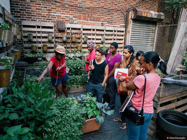
Green Social Prescribing
Aim:
The aim of this intervention is to build the identity of the Brandon Estate incrementally through community-led design and represent the values of the community physically within the public realm This will foster a sense of ownership and pride amongst residents and visitors will perceive the estate as a home to a diverse and closely-knit community
Community Gardens: Introducing new plants within the estate, echoing residents’ comments during the ‘Great Estates’ consultation. Gardens act as a vibrant social hub, strengthening community bonds and instills senses of belonging through shared activity exclusive to residents of Brandon Estate

Cultural Activities: The open space on Maddock Way provides an opportunity to hold temporary events celebrating the holidays of the range of nationalities represented within the estate. This promotes interfaith and intercultural exchange, empowering previously less visible communities to celebrate their
with the wider community.
Claudia Alvazzi Delfrate Spencer Chan Alex LaFleur Sebastian Leahy Xinyi Li Ziyu Mao
Empowerment
Source: BUPS photography, all rights reserved
3.Ecological Urbanism and Living Systems
Cities shaped through water, biodiversity, climate resilience, and ecological infrastructure
A Living Campus for Tomorrow
Sara Ridzuan MSc Urban Design and City Planning, Final Year
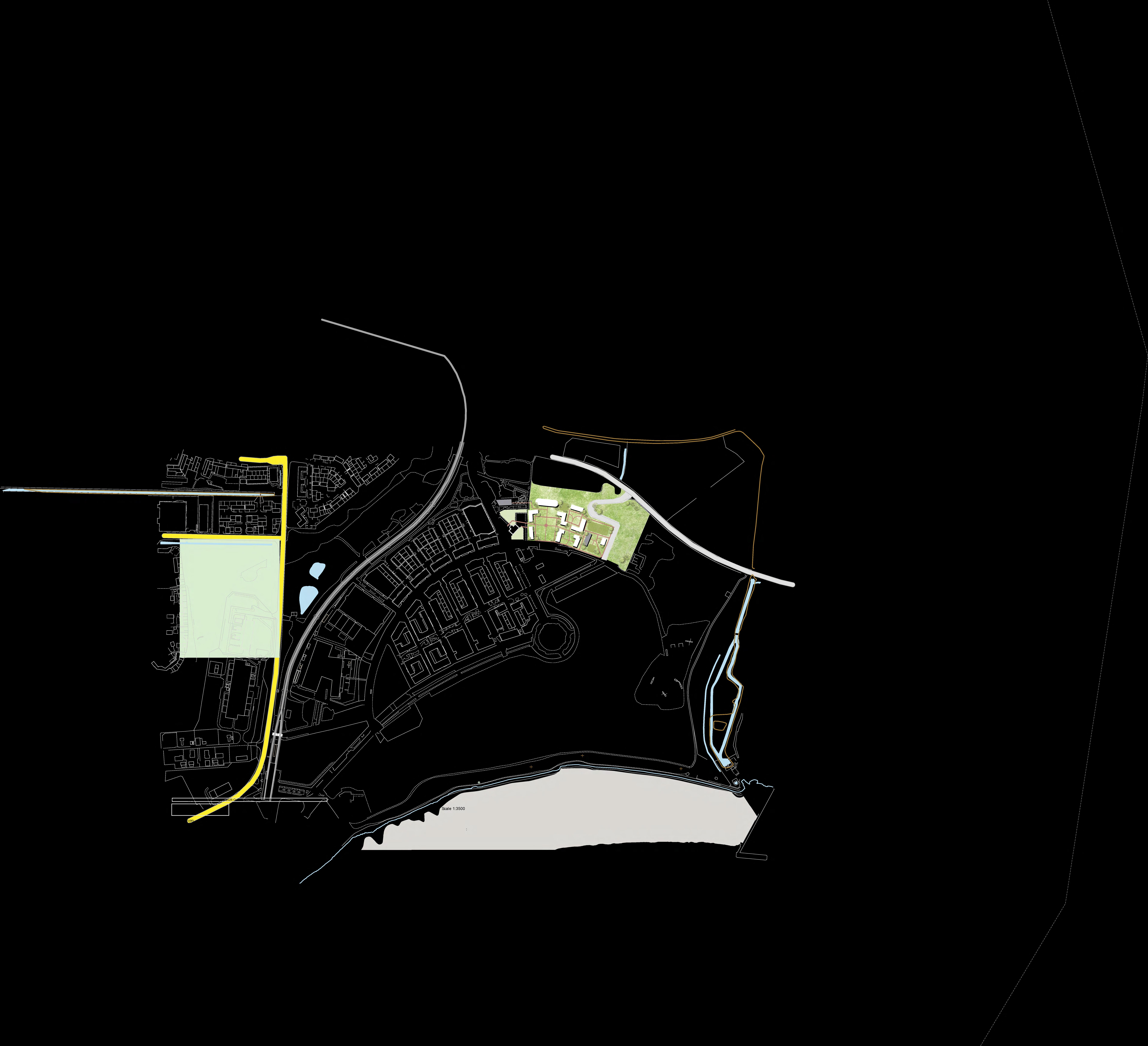
The “Right to the Good City” encompasses inclusivity, equal access to amenities, opportunities for self-actualization, and deep community interconnectedness. In response to escalating climate challenges and biodiversity loss, this project proposes a Living Campus at Barking Riverside to advocate for multi-species urbanism. It functions simultaneously as an engine for ecological regeneration, restoring local food chains and creating vital habitats, and a functional space for daily human activity.
A campus was chosen to represent the right to accessible knowledge, research and shared value as tools for self-actualization, bringing positive externalities to benefit society on a wider scale. By operating as an open, public research hub, it secures the community’s right to climate-resilient green spaces, and allows the public to benefit from increased biodiversity initiatives, demonstrating that a “Good City” advocates for both humans and natural living.
VISION: Living With Nature
If rapid urbanisation continues without sustainable, ecology-led design the loss of native pollinators to manage local greenery can lead to the future collapse of entire local food webs, barren lands, and rising heat Thus, we must begin to build and live with nature, rather than over it








LIBRARY CONSERVATORY
Eco-mimicry Workshop Yard




Invertebrates & Pollinator Pathway
Bat & Bird Foraging Pathways
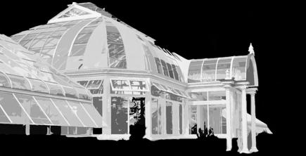
Living Lab Conservatory:



REWILDED GRASSLAND RESERVE (Reclaimed Car Park)
Seed-bank propagating Thames Estuary native plants to directly supply the campus’s Open Mosaic Habitat (OMH) roofs and ecological stepping stones Controlled earlystage plant growth extends active foraging season for the site's pollinator network









An open-access college focuses on rebuilding the foundation of the food web (invertebrates) to attract local predators (birds and bats) through ecological pathways, while simultaneously hosting daily human activity By 2040 Barking Riverside is envisioned as a national testbed for ecological regeneration and pioneer for multi-species urbanism
Species-specific classrooms: Built low carbon rammed-earth structure Features South-facing bat bricks (thermal gain) and North-East bird crevices (protection from sun + wind), positioned near the pollinator stepping stones to provide immediate foraging access for fledglings
The Wilds Community Centre
CLASSROOMS
Adult College BRIC Riverside Campus
Permeable Active Network: Car-free porous paths that manage stormwater to feed surrounding pollinator soils, eliminating emissions and connecting to The Wilds Community Centre
Sports Field Community Garden
Eco-mimicry Rooftop:
Bike Station

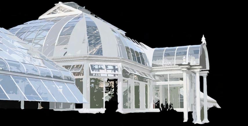


Undulating OMH rooftop with nectarrich scrub Varied topography creates micro-climates (differing sun/moisture) to breed invertebrates, forming food web base for local bats and redstarts Features skylights for natural lighting

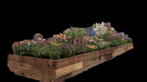






Eco-mimicry Workshop Yard:
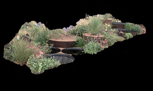
Open workshops teach the public to create OMH landscapes using recycled site rubble, exposed substrates and scrub, to recreate postindustrial conditions for nesting and foraging

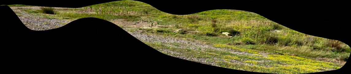











Recycling Glass Glass collected campus-wide Crushed into stressed substrate, suitable for calcicolous plants, and ground-nesting invertebrates
PHASE 1: FOUNDATION (2026-2031)
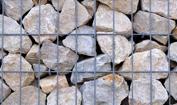
Recycle car park rubble to build gabions steps and create Workshop Yard Construct rammed-earth classrooms Begin propagating Thames seeds in the Living Lab Conservatory
• Partner with BRIC college and The Wilds to run free public weekend workshops, dedicated to accessible climate literacy: locals learn about urban heat, flood risks and practical habitat creation
• Section 106 developer contributions; National Lottery Heritage Fund (for community education & seedbank)







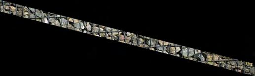

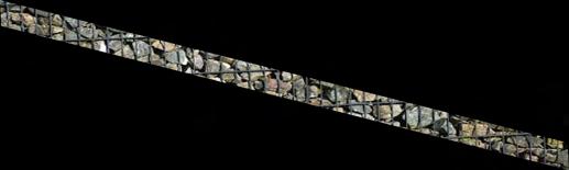
Standing and fallen deadwood scattered as habitat stepping stones Some is upcycled for furniture, while rest is critical nesting for saproxylic (deadwood-specialist) beetles
PHASE 2: GROWTH & INTEGRATION (2029-2032)
• Install permeable street network Plant OMH rooftops and deadwood stepping stones. Living Lab Conservatory fully operational,
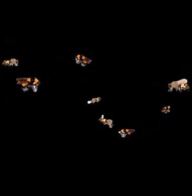


Pollinator Stepping Stones: Gabion caged steps + Pollino Wayfinders create micro-habitats and nesting habitats for native bees and beetles
Deadwood Stepping Stones:
BARKING RIVERSIDE LIBRARY
Pipistrelle)
Stitching Aspen Way: Ecological Density and Social Connectivity
Riham El Arab, and Claudia Calenzani Bravo MSc Urban Design and City Planning
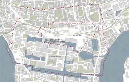
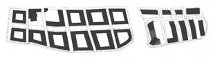
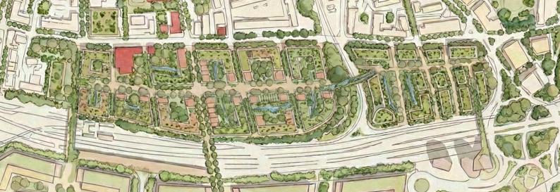
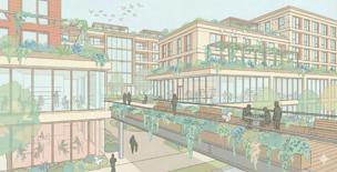
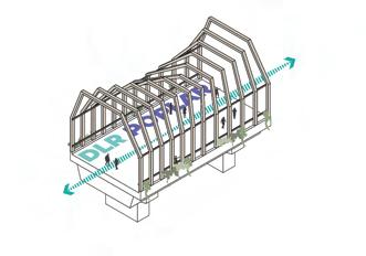
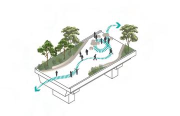
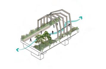
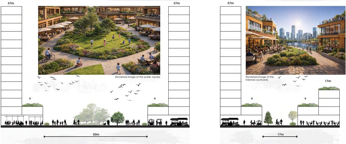
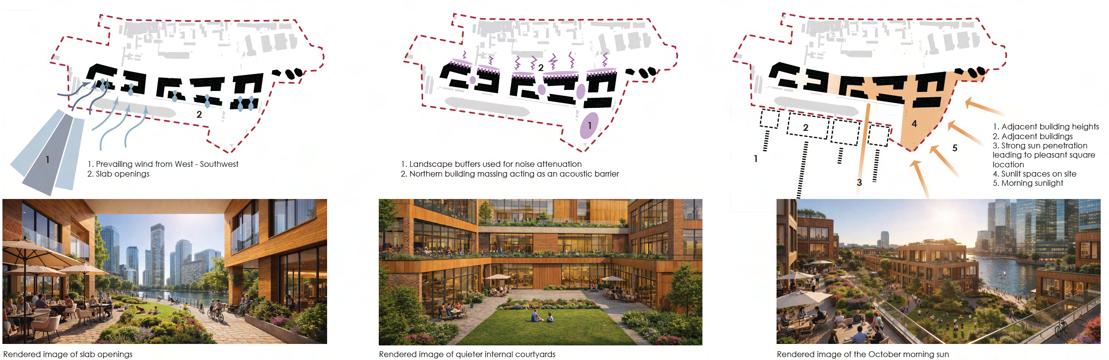
Developed within the Density and Form course, our joint proposal addresses the “Right to the City” by critically investigating the spatial qualities of South Poplar. Challenging the historical severance of Aspen Way, we explore how considered spatial composition, urban form, and density can democratise access to climate-resilient public spaces.
By integrating continuous ecological corridors with mixed- use social infrastructure, our design proposal ensures that high- density urban living actively enhances, rather than compromises, environmental and social well-being. Ultimately, we seek to reclaim the city for its residents, fostering biodiversity and social cohesion to cultivate a truly sustainable and inclusive community.
Stitching Aspen Way
Ecological Density and Social Connectivity
North Side Density through the lens of nature elements by Claudia
Calenzani
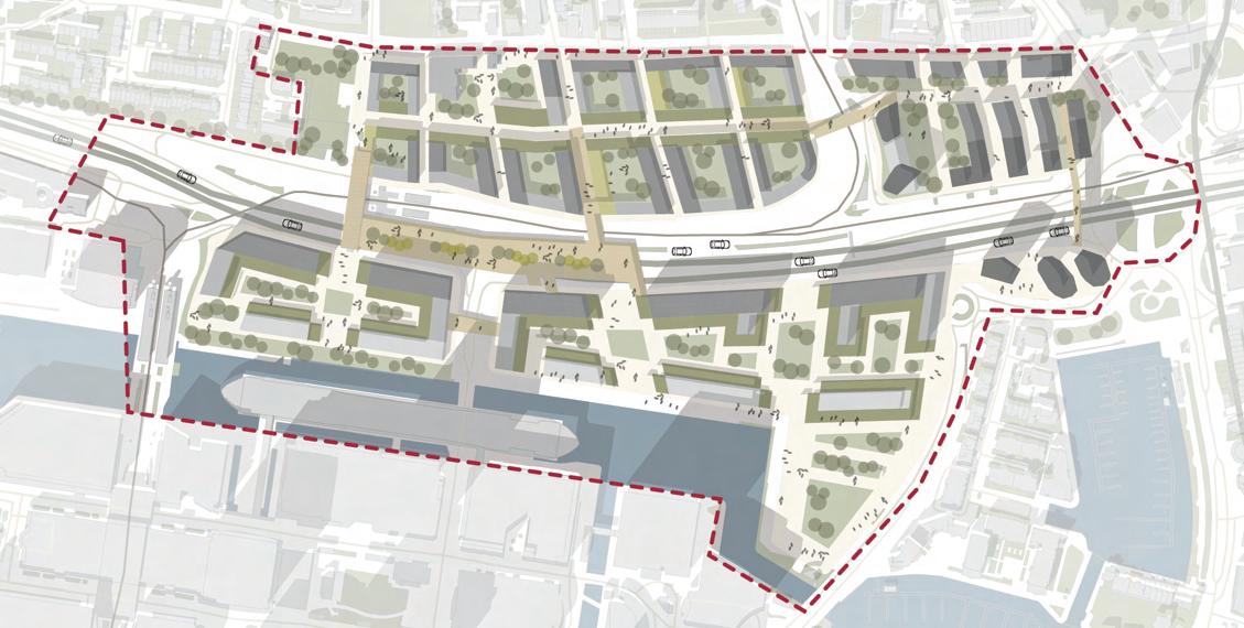
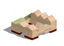
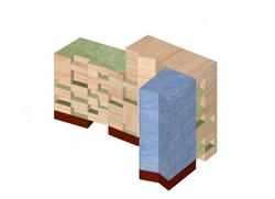
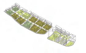
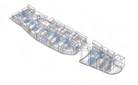
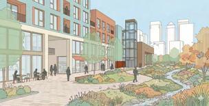
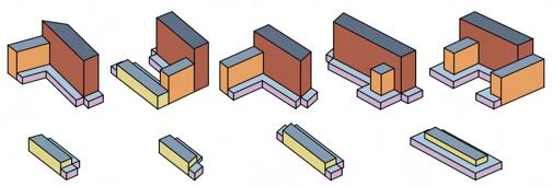
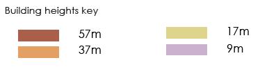
Prioritizing “Ecological Density,” the Northern intervention mitigates Aspen Way’s impact through permeable blocks, hybrid slabs, and advanced Blue-Green Infrastructure. This framework restores habitats and establishes a “second ground” for sustainable stormwater
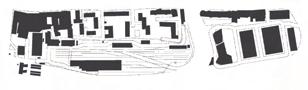
Design parameter layers





















South Side

Connectivity, Open and Green Spaces


Connecting People to People and People to Places by Riham El Arab






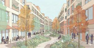
Our proposal reimagines Aspen Way as a unifying seam, merging two complementary density approaches. The Northern scheme prioritizes climate resilience via permeable blocks, hybrid slabs, and blue-green infrastructure to restore ecological corridors. The Southern scheme fosters social sustainability through active courtyards, mixed-use frontages, and human-scaled squares. Stitched together by active green bridges, our proposal cultivates a cohesive neighborhood that balances high residential capacity with thriving ecosystems and vibrant community life.
Emphasizing “Social Connectivity,” the proposal utilizes design-led regeneration to address local severance. A fne-grained network of active courtyards, human-scaled squares, and mixed-use frontages replaces mono-functional environments to foster frequent interaction. By harmonizing moderate-to-high residential density with vibrant pedestrian networks, the strategy transforms the area into a socially sustainable neighborhood.




Claudia Calenzani & Riham El Arab
Pedestrian park covering the Aspen Way
Canary Wharf
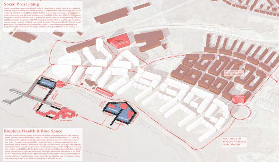
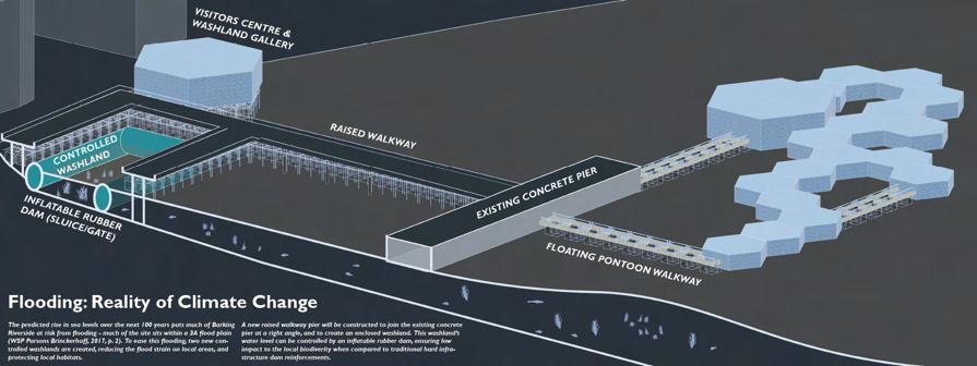
Water Commons: Reclaiming Waterways for a Resilient Barking Riverside
Eugene Dowling, Gianna Conrado, Claudia Calenzani Bravo, and Marcelo Murillo Smith
MSc Urban Design and City Planning
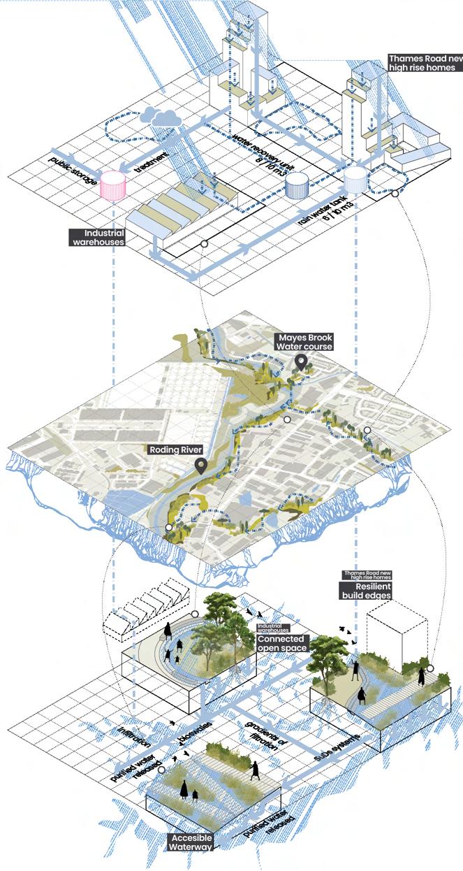
The “Right to the Good City” demands that urban environments not only withstand escalating climate pressures but actively heal the social and ecological fractures they inherit. This joint submission reimagines Barking Riverside’s waterways as dynamic catalysts for urban justice and resilience.
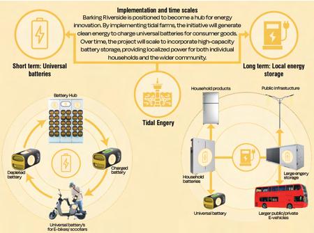
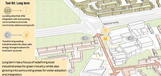
By dissolving rigid infrastructural boundaries, we assert that a ‘good city’ must democratise access to its essential systems— whether through shared water stewardship, accessible biophilic healthcare, community-driven rewilding, or decentralised energy networks. Our combined vision positions the riverine edge not as a barrier, but as a living, integrated commons that empowers residents to actively navigate and shape their changing environment.
Water Commons
Reclaiming Waterways for a Resilient Barking Riverside
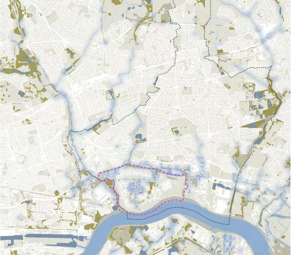
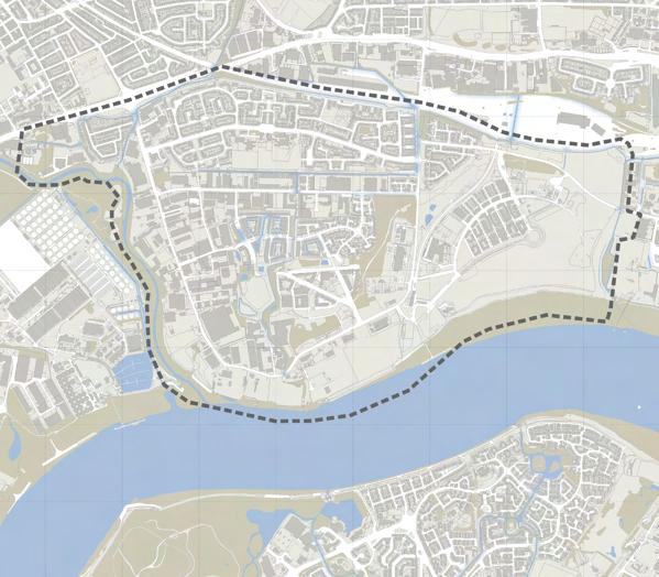
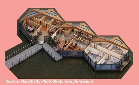
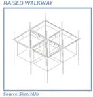
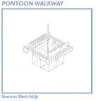
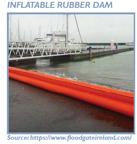
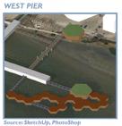
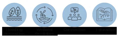
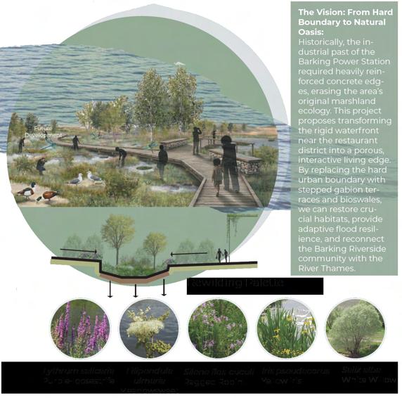
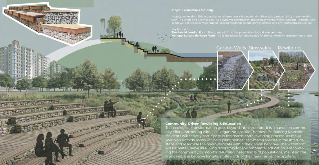
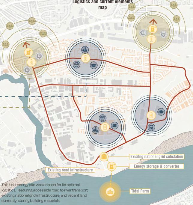
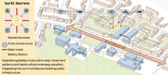
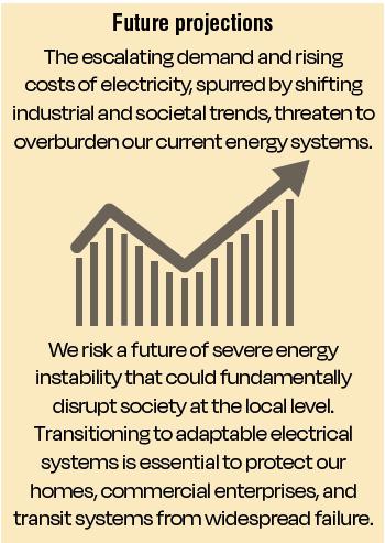
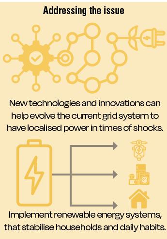
Envisioning Barking Riverside a decade from now, this collaborative manifesto positions waterways as the central arteries of a sustainable, resilient urban future. While historical planning has often treated water as a hazard or an industrial boundary, these four intersecting proposals reclaim the river edge as a vital civic space: spanning ecological rewilding, health infrastructure, energy systems, and subsurface metabolism. We propose a synthesized spatial interventions that merge technological innovation with ecological sensitivity, showcasing how overlapping waterway systems can collaboratively address fooding, energy instability, and public health, ultimately securing the community’s right to a thriving, adaptive city

3

Gianna Conrado
Marcelo Murillo
Claudia Calenzani
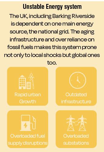
Barking Riverside: A rapidly expanding London Opportunity Area where massive housing growth intersects with vulnerable river edges, intensifying the pressure on local food risks and aging infrastructure
Reimagining the City as an Urban Food Forest
Tia Richards
BSc Urban Planning, Design and Management, Year 3
This project responds to the theme The Right to the Good City by reframing housing, nature, and food as shared urban commons essential to collective wellbeing. Set within Convoys Wharf in Deptford, the proposal reimagines a vacant site as a circular, productive neighbourhood structured around an accessible urban food forest.
In many urban areas, residents experience nature deficit and detachment from food systems, limiting access to green space and nutritious food. A good city can address these inequalities by embedding biodiversity, affordable housing, and local food production into everyday urban life. By making ecological systems visible and participatory, the proposal seeks to promote food, spatial, and environmental justice.
SPATIAL STRATEGY FOR AN URBAN FOOD FOREST
The spatial strategy organises housing, movement, and landscape into a connected, circular neighbourhood structure.
The Interaction of production, waste and consumption is reinforced into the circular, edible neighbourhood concept, such as through space for community composting, productive landscapes within the masterplan and mindful consumption through encouraging sustainable practices (water collection, community composting, fruit-picking etc.).


These clusters are embedded throughout the housing layout, creating a network of productive spaces that increase ecological richness between buildings rather than separating nature from development.
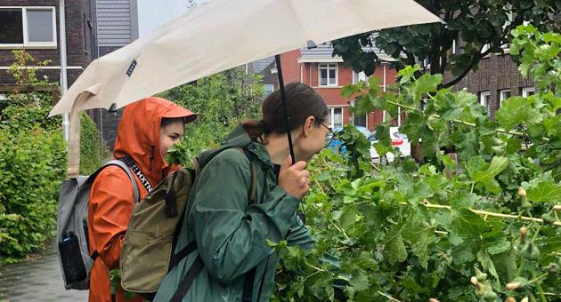
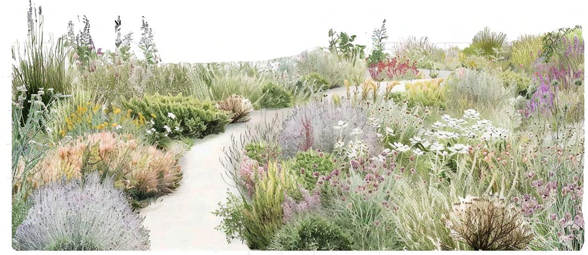
Food growing is integrated informally across the estate, moving beyond the traditional allotment model. The landscape adopts principles of a layered food forest, incorporating ground cover, shrubs, and small fruiting trees to create diverse, productive ecosystems within everyday residential space. These clusters are designed as wilder, species-rich pockets, encouraging biodiversity and creating habitats that support pollinators and local wildlife. The landscape framework connects to a wider strategy to bring a food forest to people and link areas of
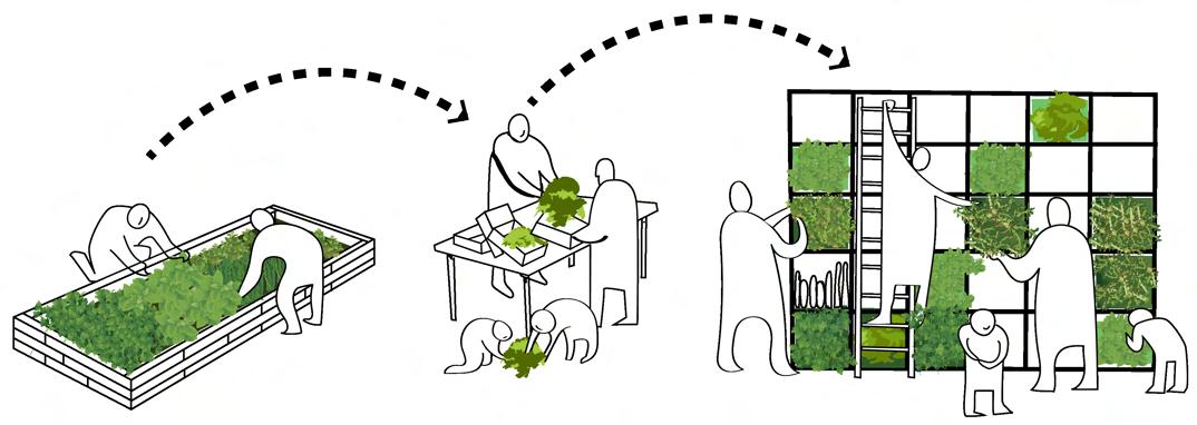


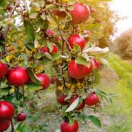
The edible growing spaces reinforces the circularity principles. Within these areas, a wide variety of small-scale habitats are introduced, including locally appropriate species such as apples, pears, plums, berries, and flowering plants, supporting both food production, sustainable water management and biodiversity.
Biodiverse Planting Orchards Private gardens Paved
planting, with species-rich wildflower meadows anchoring each end of the site. At a more local scale, edible clusters are positioned to form shared, semi-enclosed spaces for residents. These courtyard gardens adopt a soft, informal character, providing a contrast to the more formal and hard landscaped areas associated with housing.

The use of embedded growing spaces reinforces the organic design language while maximising usability and accessibility. Within these areas, a wide variety of small-scale habitats are introduced, to
help bring residents closer to nature, create more calming biodiverse pockets in an urban area and promote healthy food, by bringing awareness of edible plants.
7 Layers of the food forest
1. The canopy, consisting of original and planted large trees.
2. Low trees, consisting of smaller trees or half-standards.
3. Shrub layer of fruit and berry bushes.
4. Herb layer of multi-annual vegetables and herbs.
EVERYDAY RESIDENTIAL & BLUE-GREEN LANDSCAPES
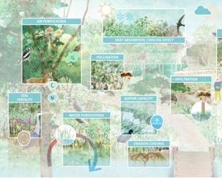
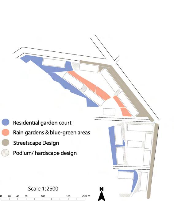
Blue-green infrastructure and public realm are integrated into the masterplan section.
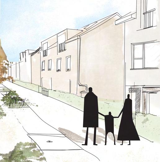
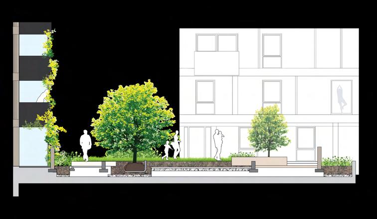
Residential landscapes integrate blue-green infrastructure with shared garden courts, podiums, and roof terraces to support water management, biodiversity, and everyday amenity. Landscape-led urban design is used to shape daily routines and social interaction, rather than functioning as a residual space.
5. Soil covers, a layer of plants that spread horizontally.
as brining enhancement of ecosystem services, climate adaptation measures and promotion of social cohesion.
6. Underground layer of plants that produce roots or tubers.
7. Climbers, a vertical layer of climbing plants.
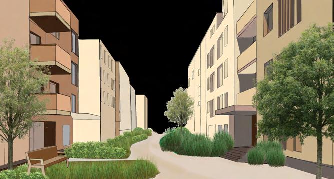
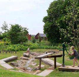
Subtly designed rain gardens and bioswales are incorporated next to the housing to manage surface water while creating engaging and playful landscape elements. These strategies draw inspiration from Hanham Hall, where habitat diversity and resident stewardship are integrated within close proximity to housing through the use of productive planting and collective maintenance structures (HTA Design).
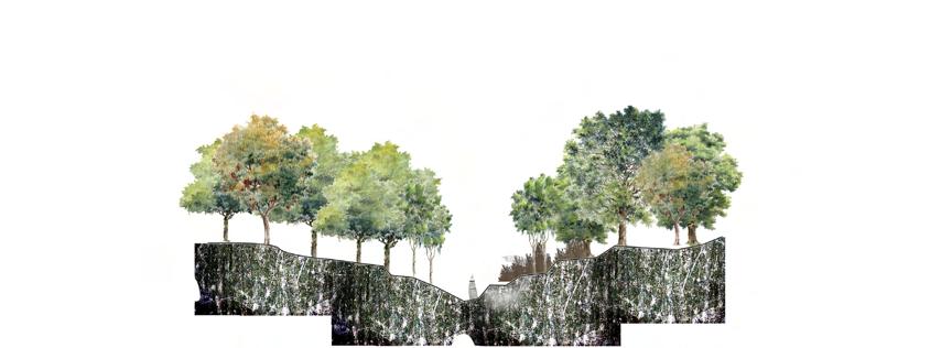
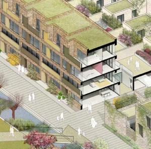
Podium landscapes and roof gardens provide inclusive, accessible spaces while enhancing biodiversity. Design inspiration is taken from Chobham Manor, where mews-inspired landscapes and biodiverse roof systems contribute to measurable environmental performance (Make Architects, n.d.; EcoGreen Group, 2024). Roof planting strategies include flowering species, sedum, and wildflowers to support pollinators and urban biodiversity.
Stacked maisonettes and apartments are arranged around residential garden courts, reinforcing a strong relationship between housing and shared green space.





































The Urban Food Forest Concept
Utrecht
Rijnvliet
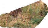
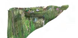
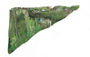
The Rijnvliet edible neighbourhood is a source of inspiration due the concept of bringing ecosystem services, particularly edible flora, directly to residents.
The design studio, Felixx, describes the place
CASE STUDY: Rijnvliet, Utretch
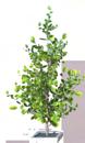
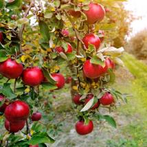
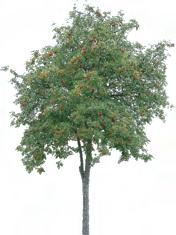
Apple Tree
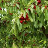
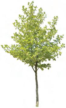
Cherry Tree
Image by Woodroffe Papa of Chobham Manor, showing two-storey mews houses which have a range of gardens and roof terraces.
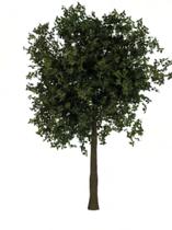
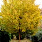
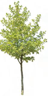
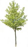
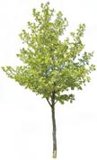
Acer campestre (field maple)
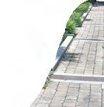
Rain gardens adjacent to the walkway.
Blue-green areas, similar to the residential courts.
Podium design of the residential garden court (above and top left).
Community-scale edible landscapes embed circularity principles into the neighbourhood by linking food growing, composting, soil regeneration, and water management into a visible and shared system.
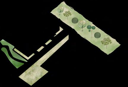
A larger shared landscape is incorporated within the sectional design, combining:
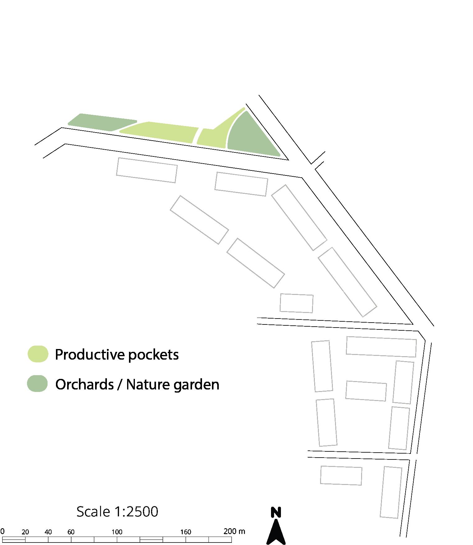
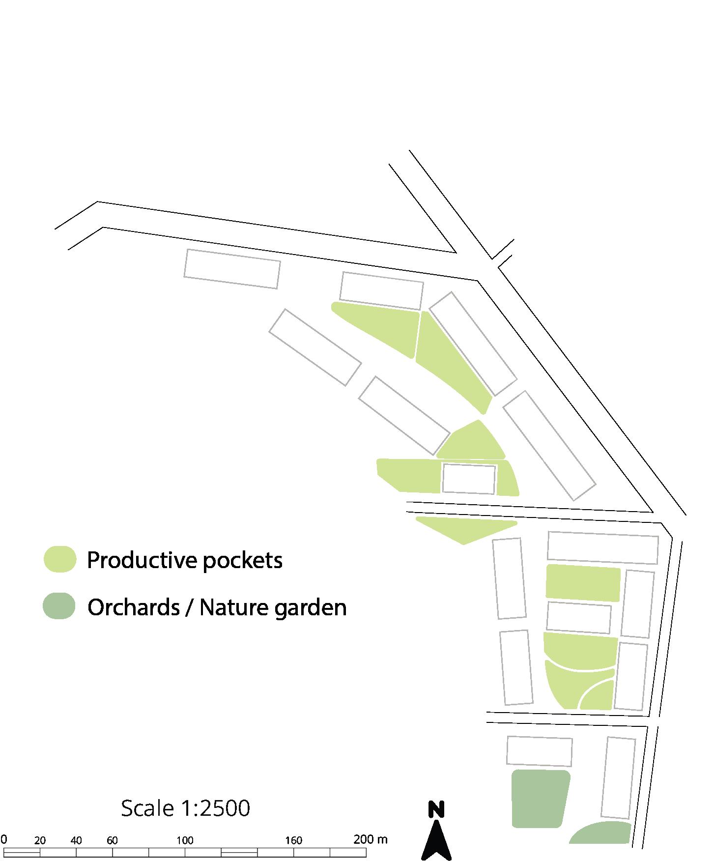
•ecologically diverse orchards, •community nature gardens, informal seating spaces, and •stormwater management features such as shallow wetlands and vegetated swales.
These spaces support collective food production, seasonal change, and long-term stewardship, drawing on principles of agro-ecological urbanism, particularly the integration of food systems within housing zones (Bohn and Tomkins, 2024). Community compost hubs form part of this system, closing nutrient loops by transforming food waste into soil enrichment for surrounding productive landscapes.
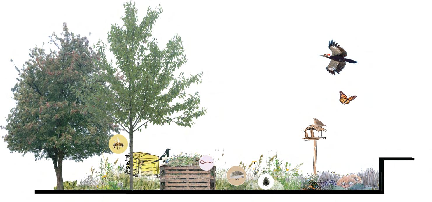
One part of the sectional design incorporates a larger shared landscape comprising orchards and community nature gardens, introducing food growing at a collective scale. Drawing on principles of layered planting and ecological diversity, these spaces are intended to support seasonal change, shared activity, and long-term stewardship.
Circular Community Landscape
The shared landscape includes ecologically diverse orchards, community compost bins with associated planters, and stormwater management features such as vegetated swales and small wetland habitats. These elements integrate food production, soil regeneration, and water management into a coherent landscape system.
PRODUCTIVE EDIBLE POCKETS AND LINKS
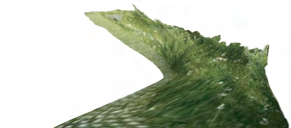
The productive pockets draws inspiration from Hanham Hall, where landscape is closely integrated with housing to create a nature-connected community. At Hanham Hall, biodiversity and wildlife are promoted through a green spine linking species-rich wildflower meadows and productive landscapes close to homes. This approach informs the proposed neighbourhood sections, where species-rich productive clusters are integrated alongside housing, incorporating hedges of fruiting edible plants, calming spaces, and functional landscapes that support everyday use and wellbeing.

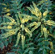
Stormwater management is addressed through a vegetated wet swale with gently sloping sides and a neutral wetland grassland raingarden. At least one shallow edge is incorporated to allow access for amphibians and other wildlife, while features such as deadwood, stones, shrubs, and tall vegetation enhance habitat diversity. Swales, buffer strips, and planting bands are also used to create natural transitions between seating areas, nature zones, composting areas, and beehives, in line with guidance on urban greening and biodiversity net gain (GLA, 2021).
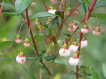
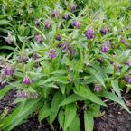
Further inspiration is taken from the landscape design of Hanham Hall, where allotments and orchards are integrated close to housing to provide food, shade, and biodiversity. This approach is reflected in the proposed northern green space through indicative planting, subject to ecological approval. Planting includes fruiting species and mineral-accumulating plants such as Lavandula angustifolia, Ugni molinae, Taraxacum officinale, and Symphytum officinale, supporting soil health and productive landscapes.
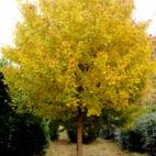




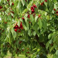
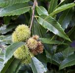
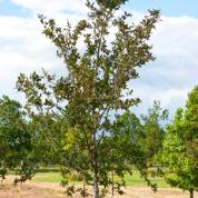
Indicative planting includes a mix of native and edible species such as blackthorn, wild and sour cherry, hawthorn (Crataegus monogyna), field maple (Acer campestre), marsh marigold, and larger canopy trees including oak, birch, ash, sycamore, chestnut, and hornbeam. This planting strategy supports ecological diversity, seasonal change, and long-term resilience, remaining compatible with residential settings.
fertility plants
trees

Shrub layer of fruit and berry bushes


layer
Productive pockets are conceived as small, manageable shared gardens that allow residents to participate in food growing. This is similar to Eddington, Cambridge, where shared gardens and natural zones are embedded between residential areas, encouraging doorstep growing, informal play, and social interaction within safe and accessible environments. These spaces contribute to interconnected natural systems that link housing, landscape, and community life.

The design further draws on the seven-layer urban food forest concept, implemented at a smaller and appropriate scale. This includes layered planting beneath connected tree pits, using structural soil and cell systems to support shrubs and understorey planting beneath tree canopies,






Larger canopy trees
as recommended by London’s Urban Greening and Biodiversity Net Gain guidance (GLA, 2021). This approach aligns with principles demonstrated by the Miyawaki method, which has proven effective in establishing dense, biodiverse planting in constrained and polluted urban sites (Horniman Museum, 2023).

Inspiration has been taken from speculative edible landscapes along the Lower River Lea, where food production, ecology, and public access are integrated within post-industrial settings (Bohn and Tomkins, 2024). These projects combine urban orchards, nature reserves, hedgerows, and ecological trails to create productive and accessible landscapes.
Ugni Molinae
Lavandula Augustifolia
Mahonia x Media ‘Winter Sun’
Acer Campestre (field maple)
Hyppophae Rhamnoides Symphytum Officinale
Chestnut Tree
Mespilus Germanica
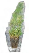
Blackthorn
Soil
Low
Canopy
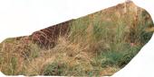
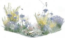
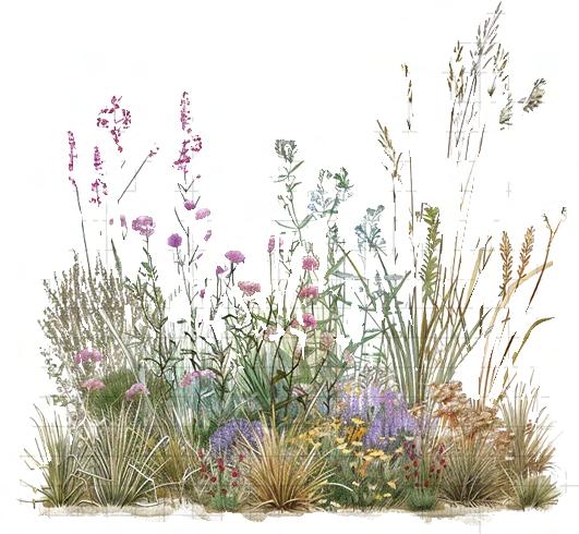
Wildflower & shrubs
Edible species
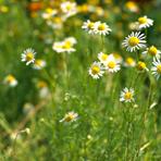
Camomile
Cornflower (Centaurea cyanus)
Blackberry Plum Tree Cherry Tree Apple Tree
Taraxacum Officinale
4. Urban Identity, Heritage, and Culture
Urban identity shaped through memory, creativity, local culture, and spatial atmosphere
The Lanes: a Good Place Profile
Will Gillett
BSc Urban Planning, Design and Management, Year 2
So many new developments today are marked by a feeling of sterility and social alienation. In present-day planning we are seeing the rise of design codes - and this place profile looks at what codes could be used to avoid those feelings.
Through The Lanes in Brighton, a personal favourite urban area, this profile explores what it is that makes the lived experience in The Lanes such an enjoyable one. From this, three design codes are abstracted, informed by academic literature, to encourage the implementation of similar characteristics in the formation of those new developments - promoting a ‘good place’ and sense of place.
The Lanes, Brighton
a ‘good place’ profle
The Lanes, found within the city of Brighton and Hove, are located on the South Coast of England, about 50 miles south of London (Gilbert, 1949).
The Lanes occupy the site of Brighton’s Old Town. Originally a small, unplanned fishing village, by 1779 a map of Brighton (then known as ‘Brighthelmston’) shows a small town, with many of the streets that now comprise The Lanes already built (Gilbert, 1949). A historic character is still evident throughout The Lanes, with its labyrinth of twittens, flintstone buildings, and nearly 500 year-old pubs.
Although the street layout of The Lanes dates back to the city’s origins, not all of today’s streets have been publicly accessible. Hanningtons Lane, for example, was originally the site of a former service yard for a large department store, which was reopened in 2019 to join the network of streets (Hanningtons Brighton, 2021).
Today, Brighton’s lanes are generally identified as two separate networks, divided by North Street, known as ‘The Lanes’ and the ‘North Laine’.
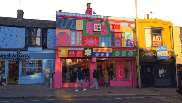
Both have a “very distinctive character” (Brighton & Hove City Council, 2011, p.23), marked by brightly coloured facades, distinctive architectural features, and pedestrianised streets. These make the user experience of Brighton’s lanes unique from the rest of the city, creating a distinct sense of place. The rest of this profile looks specifically at just the area south of North Street - ‘The Lanes’.
Design Codes
1. Gateways
The first aspect of The Lanes’ urban form that many users will experience, is the way in which they enter into the streets themselves. At multiple points pedestrians walk under covered passageways, creating a visual distinction between The Lanes and the rest of the city - allowing observers to physically, as well as mentally, enter through a ‘gateway’ (see Alexander, 1977, p.158). This distinction helps to form a perceptual and workable image, an identity, for users to isolate this district, and its character, from another (Lynch, 1960).
This links to the idea of ‘framing’, and the ‘relationship between the viewer and the viewed’ (Meha y et al., 2020). In this sense, the covered passageways create a border focussed on the network of twittens behind it - bringing a sense of intrigue and arousal through design, “making the space more memorable and meaningful” (Mfon, 2023, p.929).
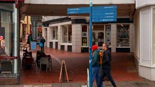
Gateways reinforce the concept of human-scale, as such a design is created in proportion to pedestrians not automobiles.
Overhead ceilings provide a sense of enclosure without the need for the ‘imaginary sphere of the sky’ (Zucker, 1959). Both enclosure and humanscale design are also noted as key qualities for walkability (Ewing et al., 2006).
Design code 1: Gateways
2. Twisting street network
The Lanes, unlike the orthogonal nature of the rest of the city of Brighton, follow a Medieval street typology - a “labyrinthine maze” (Carmona, 2021, p.276). An irregular layout “divides the route into a series of recognizable visual statements ... which are human in scale” (Cullen, 1961, p.106)amplifying the sense of identity.
An inter-woven street layout allows The Lanes to resemble a more ‘semi-lattice’ design (Alexander, 1965), o ering a freedom of movement choice throughout the streets. They also concentrate flows into one area - attracting ‘large numbers of pedestrians’ (Bentley et al., 1985, p.33). The twisting nature of these streets means that users’ attention is always held: at no point is their gaze “lost in infinity” (Sitte, 1889, p.167) - making them feel ‘at ease’. If a sense of progression is maintained, a winding street typology can evoke a sense of privacy from the rest of the city (Cullen, 1961, p.106).
The impact of twisting street networks, however, arises through their distinction from the rest of the urban morphology. Whilst a gridded urban form does have the advantages of “simplicity, replicability..., legibility and ease of access” (Grant, 2001, p.219), the inclusion of a separate district with a deformed grid can avoid the “supposed monotony” (Carmona, 2021, p.209) of rectilinear layouts.
It is the uniqueness of an area with a labyrinthine morphology that can not only enhance the character of that area, but can create a landmark for a city - as is the case with Brighton.
Design code 2: Twisting street network
The Lanes comprise a mix of uses, independent restaurants, pubs, bars, crafts, shops and cafes, alongside residential and o ce spaces. In a 2021 report, The Lanes were noted as one of Sussex’s ‘star products’ (Blue Sail, 2021, p.69) and ranked second in Trip Advisor’sTop Attractions in East Sussex, having an average rating of 4.4/5 (Trip Advisor, 2026).
Referred to as ‘Brighton’s Kasbah’ (Musgrave, 2011), The Lanes are often noted for their labyrinthine network of narrow alleyways that contribute
to its distinct urban morphology. With them, these alleyways bring a sense of value ‘mystification’ and ‘surprise’. The following section examines three elements of The Lanes’ urban form. From there design codes are proposed for future mixed-use, retail districts. Their aim is to provide the core urban form features that could then be transfered to future places, without the need for such a rich historical context.
legend:
3. Narrow streets
In 1977, Christopher Alexander notes: “The simple social intercourse created when people rub shoulders in public is one of the most essential kinds of social “glue” in society” (p.489). In The Lanes, narrow streets and a tall height-to-width ratio achieve this. Medieval streets, as seen in The Lanes, are typically narrow and have inconsistent street widths (Yaseen, Jawad, Kehl, 2022). Elevations for the reopening of Hanningtons Lane state the range of building heights to be around 9-11 metres (two/three stories) (Brighton and Hove City Council, 2016), and measurements from maps indicate that street widths range from around 3-5 metres (Ordinance Survey, 2026). This produces height-to-width ratios between around 2:1 to 3:1.
Such proportions provide a sense of comfortability (Alexander, 1977) and enclosure - and hence a sense of safety. Regardless, safety is also strongly related to the volume of light penetration (Stamps, 2005).
However, considering this is a retail district, shop window fronts provide a level of ‘natural surveillance’ (Jacobs, 1961) and light.
Carmona (2021) emphasises the importance of eye-level details within narrow streets. Buildings should be around two or three stories high, to keep them at a human scale, and to avoid a canyoning e ect. An additional minimum width of 2 metres should be maintained in accordance with national Inclusive Mobility standards (Department for Transport, 2021).
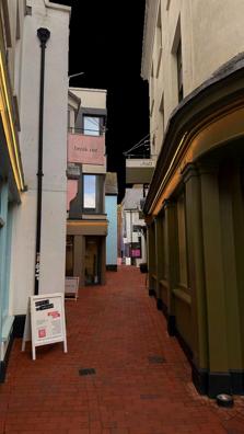
Narrow streets also encourage greater pedestrian density, and hence a greater feeling of liveliness on the street (Alexander, 1977).
Design code 3: Narrow streets
Designing a New Creative Quarter
Hannah Clarke BSc Urban Planning, Design and Management, Year
3
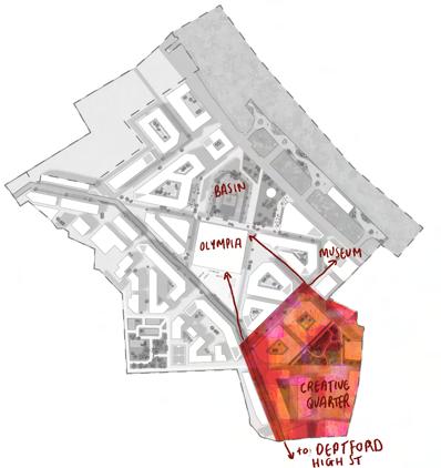
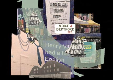
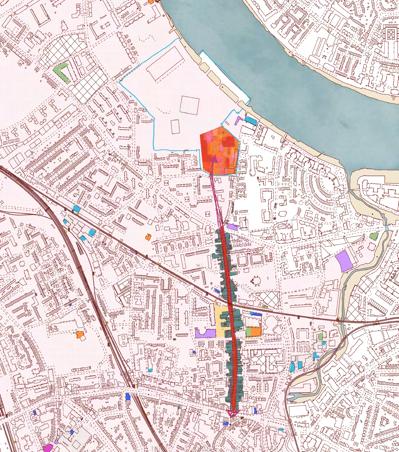
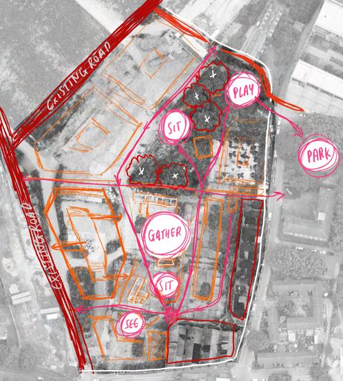
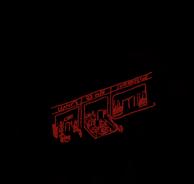
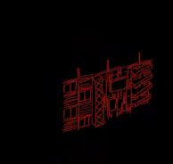
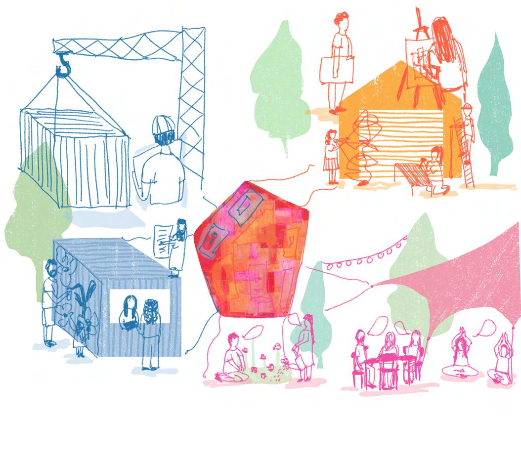
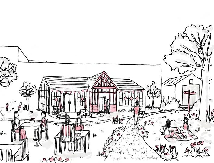
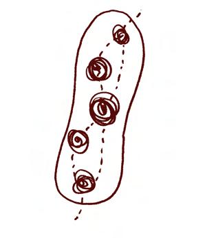
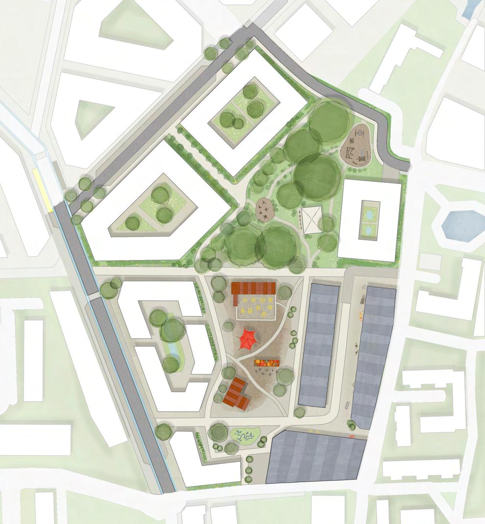
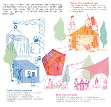
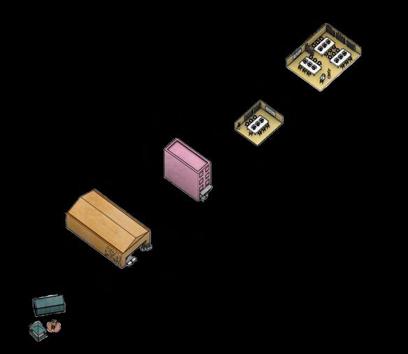
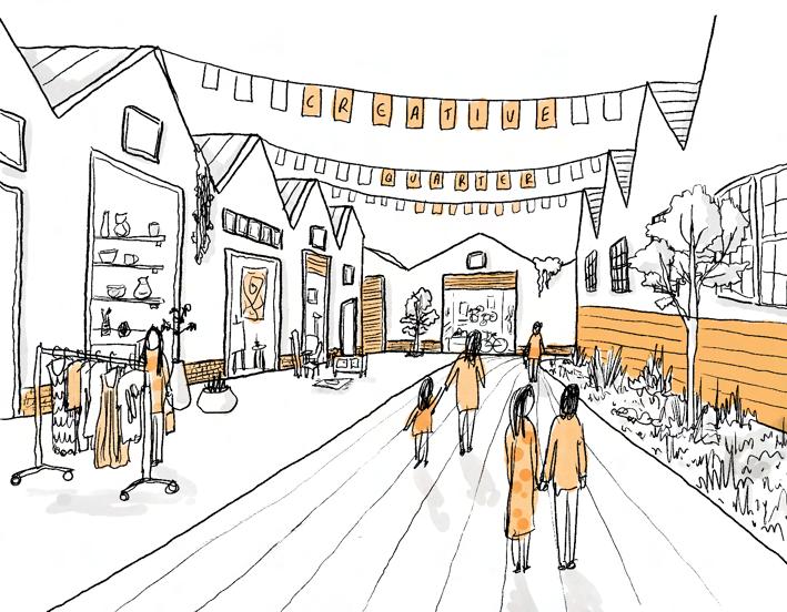
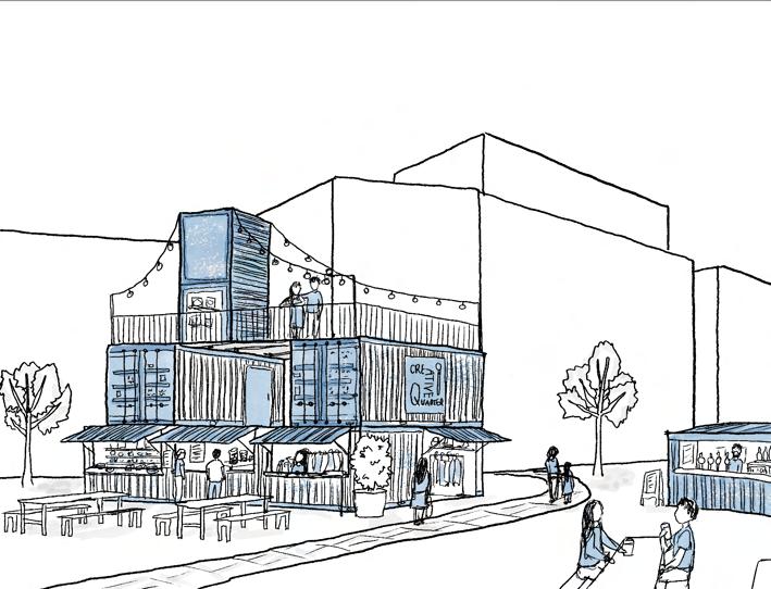
The concept of the ‘creative city’ has been widely explored in academic literature, but what does this look like in reality? When faced with producing a detailed masterplan for the ‘Creative Quarter’ area of our site, Convoys Wharf, I tried to take a different perspective.
Rather than focusing on trying to attract what Florida termed the ‘creative class’, I instead wanted to consider how the local population could be empowered to pursue creativity and innovate from the bottom up, through principles like affordable workspace and co-production. I believe that the ‘Good City’ is one which everyone can enjoy and contribute to, and hope that my Creative Quarter would be a place which residents, visitors, creatives and non-creatives alike would enjoy.
DESIGNING A NEW CREATIVE QUARTER
by Hannah Clarke

SITE BACKGROUND
MASTERPLAN



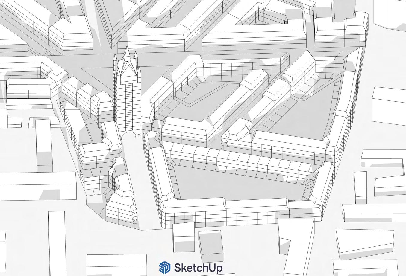
Convoys Wharf: Achieving Livability Through Heritage Design
Neel Le Meur
BSc Urban Planning, Design and Management, Year 3
The right to the good city can be interpreted as many things, but the most fundamental criterium determining the quality of a city ought to be the quality of life it enables. After all, settlements are for living in. This project delves deep into how livability could be achieved, but from a unique starting point. So many modern masterplans claiming to prioritise livability believe that it requires throwing out millennia of lessons learnt, and starting afresh with untested and experimental ideas.
My project instead examines heritage and history as a precedent of how things could be done differently; we have far more to learn from history than one person could ever achieve through brainstorming. Many of the design interventions I propose in the masterplan, thus, have their basis in grounded, if occasionally radical, best practice.
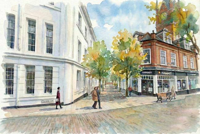
In order to cement pedestrian priority, shared streets will be implemented sitewide. All non-essential vehicles will be barred from entry, so streets would naturally belong to people, with cyclists as guests and vehicles as rarities. A one-way system was also designed to route trafc onto wider roads instead of local streets.
As part of the pro-sunlight massing policy, to improve sunlight penetration, some corners of awkwardly-shaped blocks were cut, and some buildings’ roofs were slanted. Slanted roofs ensured a minimum building height of 2.5 storeys, so that each building could have units above the maisonettes, increasing door count.
To improve integration with surrounding communities, where possible, there will be a border mews-like street so that buildings on the edge front onto surroundings. This allows direct connections with the site’s surroundings, and opens the possibility for any nearby redevelopments to front onto the site by sharing this mews street.
Maisonette Strategy
Street interactions are minimised where ground-foor units have insufcient privacy (Kim et al., 2025). By making all groundfoor units double-storey maisonettes, with bedrooms on the frst foor, a healthy and lively street frontage is thus ensured. This furthermore secures against the fact that the entire site is in a food risk zone.
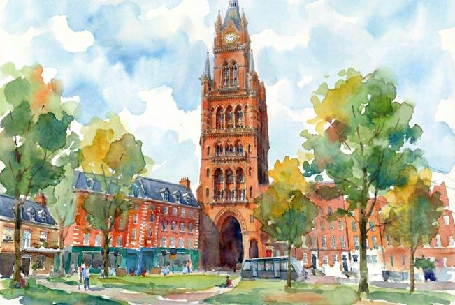
To maximise livability, character was a key concern in the design of the plan. The character of the plan is predominantly heritage-based, being the local community’s most valued element of the area. This will be refected in heritage architectural styles, materials, ornament, and street furniture, wherever possible.
Permeable, heritage street materials will also contribute to pedestrian priority ‘Movement areas’ in the centre of streets will have rougher cobblestone paving which will slow cycle and vehicle speeds (Nogueira and Mennis, 2019). To ensure accessibility, the sides (pavements) of streets will remain smooth
Nelson Square in part did not have any clear provision for the tram stop meant to be there, and a road cut through the park simply to allow for a sightline from the clocktower to Olympia Square. The garden will be redesigned to consolidate and create one larger green space, right next to the tram stop.
Massing
The part I plan had narrow streets but mid-rise buildings. Whilst this created strong enclosure, the situation limited direct sunlight. Building heights were thus entirely revised to satisfy an explicit policy of every dwelling receiving direct sunlight every day of the year, including the winter solstice.
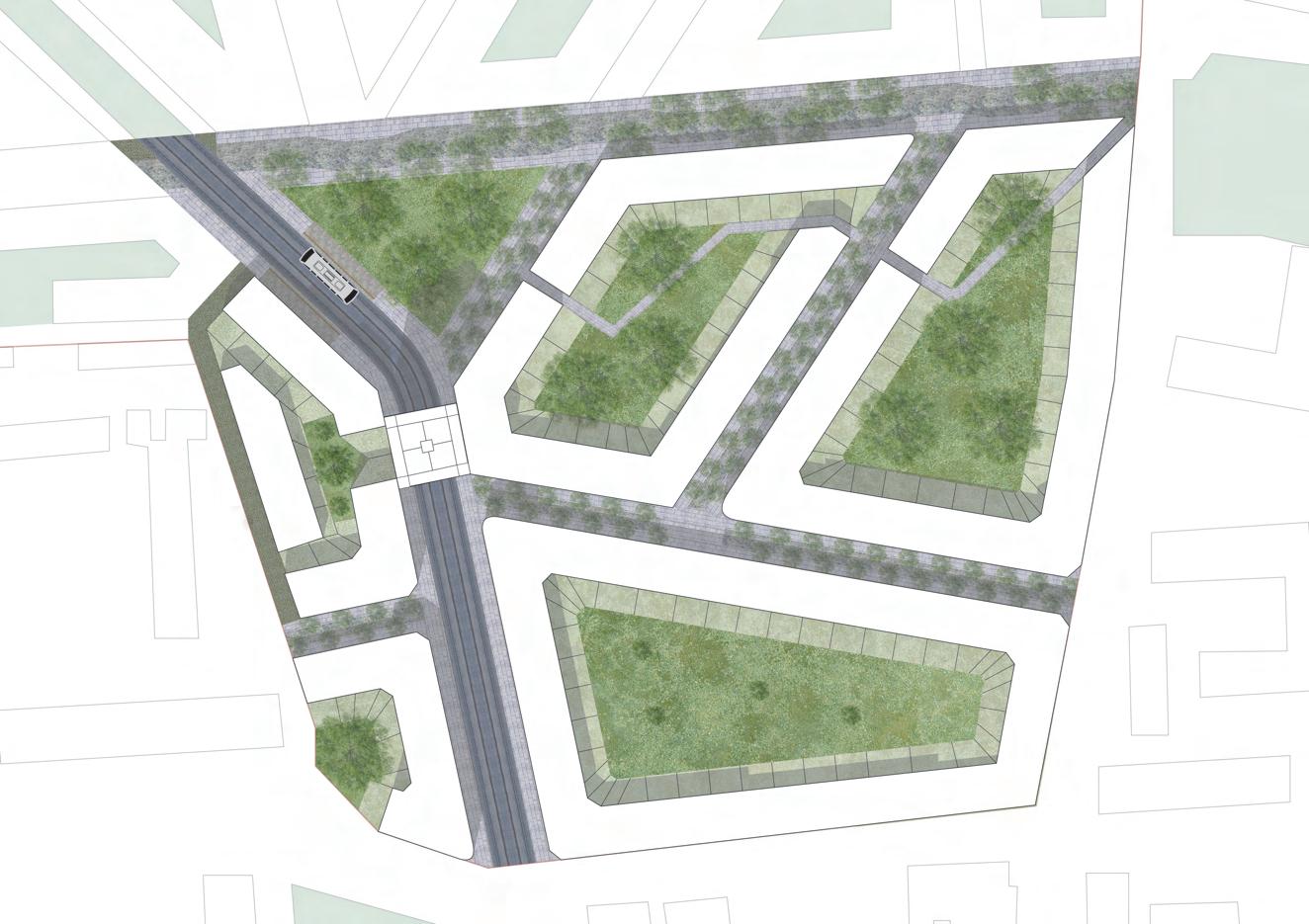
With the reduction in estimated dwellings from the part I masterplan, due to reduced building depths, came a reduction in the parking provision mandated by the London Plan (2021). Therefore, the podium parking lot in the southwest block was removed to allow for SUDS and more sunlight penetration.
Ground-foor commerce will be increased from part I, whilst live-work units will allow for entrepreneurs to live above their shops. Where commerce would not be viable, frequent doors from the plethora of maisonettes and upper unit accessways, alongside facade gardens, would keep street frontages engaging
For better light penetration and crossventilation, and to meet London guidelines (GLA, 2023), all dwellings will be dual aspect. For this, building depths were reduced to 9m, and chamfering improved corner building foorplans. Sharper-angled corner units would also be dual aspect, though would not overlook courtyards.
Courtyards
The communal courtyards will ensure access to green space for all residents, including those in fats. These will serve as anchors to form mini-communities within the larger site in each block. Besides recreation, these courtyards will improve food resilience through SUDS and hold other functions such as storage
Some courtyards will be semi-private accessable via passages (made openair, in contrast with part I). These will form part of a larger green network across the site. In this section, the passages and semi-private courtyards create a green detour between Twinkle Park to the east and Nelson Square
Where streets will be large enough to permit trees, the trees will alternate sides of the street to maximise their fnal potential size, and introduce visual chicaning Facade gardens for defensible space will also add to greenery wherever there is sufcient leftover space on the footway, or in streets too narrow to host trees.
Wider Street Widths
As part of the efort to maximise sunlight penetration, streets were widened slightly from part I. The new street widths were chosen to match those of streets in the nearby context, especially where they had notable heritage characteristics, were relevant to the site, or retained high levels of enclosure
To maximise livability, and comply with London guidelines (GLA, 2023), each dwelling was designed to have access to private outdoor space. For maisonettes, this would be private back gardens fronting the courtyards, whilst fats would have access to balconies which overlook the courtyard.
The policy of all dwellings receiving direct sunlight every day governed massing design. Even on the winter solstice, every dwelling will receive direct sunlight
Source: BUPS photography, all rights reserved
5. Urban Justice, and the Politics of Development
Questioning who benefits from urban transformation and who bears its costs
Next Stop: Homes?
Scrutinising the New NPPF Density Rule
Bosco Choi MSc Sustainable Urbanism
A good city can be one that provides adequate housing with transit- oriented development. How can we achieve this? In the Dec 2025 Draft NPPF, the government pro-posed to give “Default yes” to residential planning applications within a reasonable walking distance of well-connected train stations.
My study employs Python to scrutinise this proposal by inspecting past planning application database in London to see if this proposal is a good idea, and how can we make it better. Not only is the study itself a discussion of how to shape a better city through policy, but by making my Python analysis code open-source and by using entirely publicly available data, I am demonstrating how citizens can use freely-available resources to participate in shaping the policy rhetoric of a “good city”.
Next Stop: Homes?
Author: Bosco (Yung Kin) Choi, MSc Sustainable Urbanism @ UCL Bartlett School of Planning (BSP)
One of the new rules



• “Default yes” to residential planning applications within a reasonable walking distance of wellconnected train stations. (MHCLG, 2025)
• What is a “reasonable walking distance” has not been explicitly defined, but the Minister for Housing and Planning suggested that 800m could be a possibility. (Pennycook, 2025)
• These interventions are framed as ways to encourage building right homes in the right places, and to “get Britain building” by lowering time and financial costs for developers in the planning application processes.
Question 1: Has planning really been constraining housing supply?
planning applications in London take to be determined?
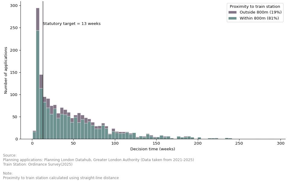
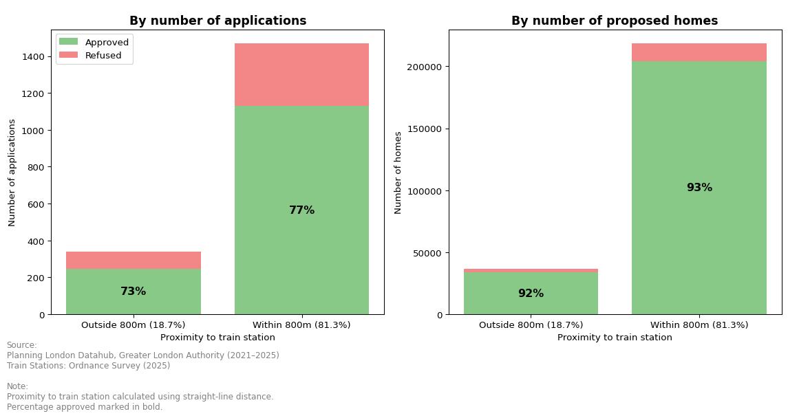
that a significant proportion of major housing schemes can be going through the default approval route in the future.
• Only 7% of the proposed homes were given red light eventually. Planning did not seem to have massively blocked housing supply through rejection.
• Hence, an additional tilt towards green-lighting housebuilding near stations itself might not increase housing supply, unless the “default yes” route provide significant time and cost savings for developers.
Another caveat is the 800m buffer. Despite strong planning policy support for building in sustainable locations before the “default yes” came out, approval rate did not show significant differences across the 800m boundary. Is 800m a good buffer or is it too blunt?
Question 2: Is distance to train stations a good measure of the “right place”?
How strongly does
transport accessiblity?
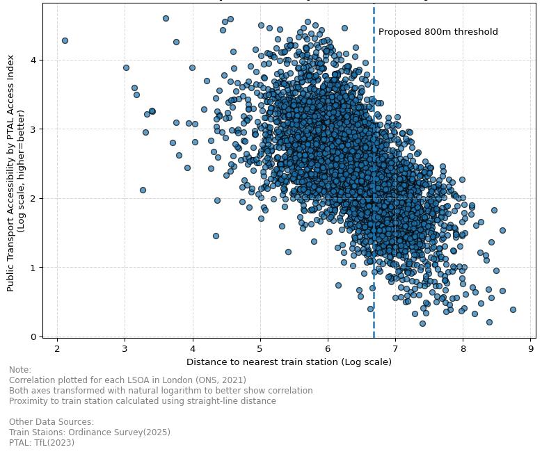
How were approval patterns of major
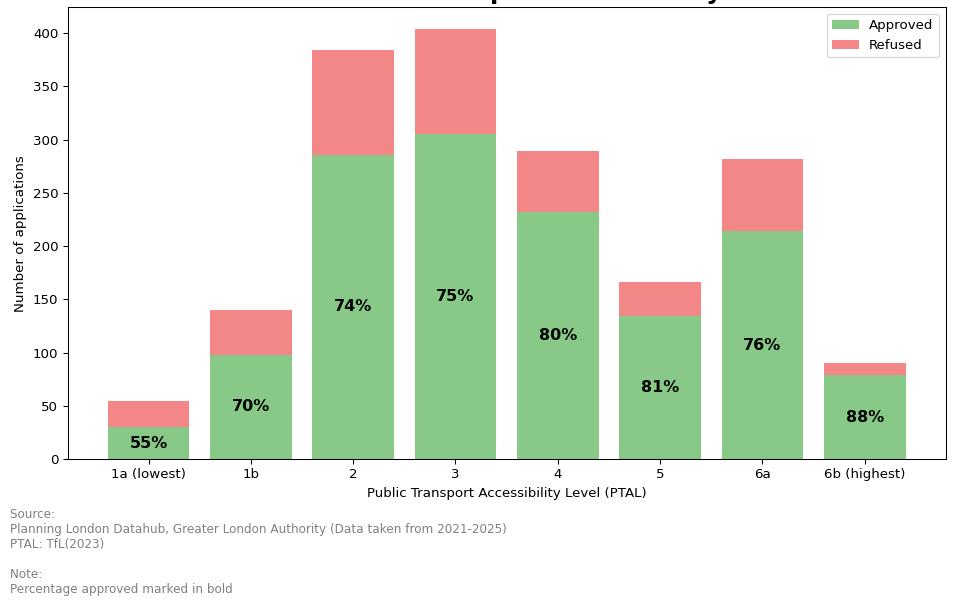
To answer the question, we can look at the dataset of Public Transport Accessibility Level (PTAL) from TfL, which considers not only distance to public transport but also service frequency, and includes a range of transport options.
• Based on this dataset, we can see that between all neighbourhoods in London, public transport accessibility can still vary significantly even with the same distance to a nearest train station, not to mention that within the 800m buffer, there can be variations in accessibility between locations of different distances to stations.
• When we break approval rates down by PTAL, a clearer pattern emerges: areas with better public transport accessibility tend to see much higher approval rates, except for PTAL 6a.
• Hence, with a handy PTAL dataset available in London, using it to set more graduated levels of support for housebuilding based on better measurement of transport accessibility would better ensure building right homes in the right places, potentially through the next London Plan.
Question 3: Where are the opportunity areas for further densification in London?
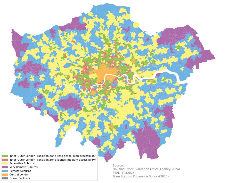
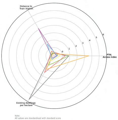

• To help strengthen the emphasis of developing in sustainable locations, I have classified London neighbourhoods into several clusters to close off this analysis with something to move forward with.
Clusters are grouped based on existing neighbourhood density, PTAL levels, and distance to train stations. K-Means Clustering, an unsupervised machine learning algorithm, is employed.
The green areas on the map below highlights opportunity areas for further densification and development, since they have lower existing density, and good public transport accessibility with train stations very nearby.
On the list of green areas, we have New Cross, Peckham, Kennington, Clapham, Mile End, Hampstead, Barking, etc.


• Full article


Interactive map • Technical appendix • Limitations • Source code for full reproducibility
Charts made by author Data: Data:
Charts
More Than a Place: Defending the Right to Community
Tam Chun Hei Wood MSc Spatial Planning
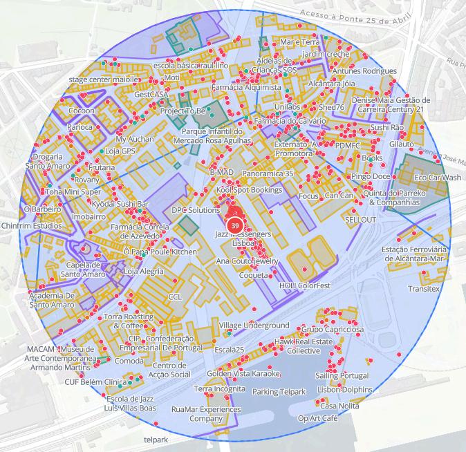
This poster will discuss how the Right to the Good City relates to the spatial justice of infrastructure-led regeneration through the example of Lisbon, the LX Factory. Spatial data shows that, although it is hailed as an urban regeneration success, there is a sharp disparity between 234 tourist- commercial hotspots and only 83 local amenities, and skyrocketing median asking prices (€6,454/m ) that fuel extreme community displacement.
Based on the fundamental ideas of BSP spatial planning about the urban morphology and spatial equity, the present work is a critique of the top- down gentrification. It presents arguments, both graphical and analytical, that a truly Good City should not be an erased community at the hands of development but should focus on resident-oriented programming instead of commercial enclaves.
vs 83 €6,454 / m²
(Tourist Hotspots vs Local Amenities)
(Median asking sale price)


W h i l e c e l e b r a t e d a s a
s u c c e s s f u l r e g e n e r a t i o n h u b , L X F a c t o r y i n L i s b o n , P o r t
C a p i t a l i n f l o w i n t o
A l c â n t a r a h a s t r i g g e r e d s e v e r e t e n u r e d i s p l a c e m e n t r i s k s
D e s p i t e a s t a b l e , s l i g h t l y d e c l i n i n g l o c a l p o p u l a t i o n , m a r k e t i n d i c a t o r s s h o w a g g r e s s i v e g e n t r i f i c a t i o n w i t h m e d i a n a s k i n g s a l e s
r e a c h i n g € 6 , 4 5 4 / m ² T h e r e g e n e r a t i o n c h a n g e s w h o t h e a r e a
s e r v e s , r a t h e r t h a n r e s p o n d i n g t o c o m m u n i t y g r o w t h
G o o d C i t
' ,
a n n i n
t
s h i f t f r o m c o m m e r c i a l e n c l a v e s t o g e n u i n e , r e s i d e n t - o r i e n t e d p l a c e m a k i n g
Rights to the Good City Beyond the City: Examining Shenzhen
Lauryn Chan
BSc Urban Studies, Year 3
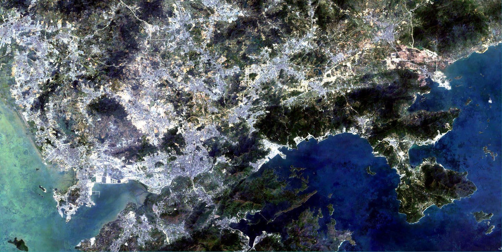
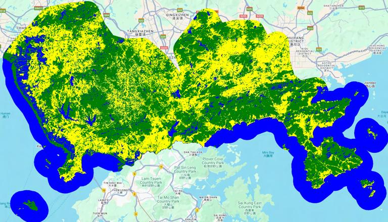
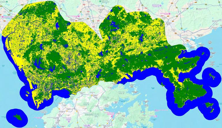
This project, developed as part of the GEOG0027 Environmental Remote Sensing elective, classifies and quantifies land use change in Shenzhen (1986-2023) using ENVI and Google Earth Engine (GEE).
A multi-linear model in RStudio integrates socio-economic variables to predict urban expansion. Building on this, the research critically examines land reclamation not only as a material process of creating urban land, but as a political process of redistributing rights. It asks: whose rights are being reclaimed, and where? The findings suggest that Shenzhen’s urban growth depends on the displacement of rural and environmental rights beyond the city.
Right to the Good City… At What
Cost?
Extending Urban Rights Beyond the Urban: The Case of Shenzhen
Lauryn Chan BSP Expo 2026
1.Framing the Question
The concept of the Right to the City has long been rooted in traditions of social justice, foregrounding equitable access to urban space, participation, and resources.
Yet, the emerging notion of the Right to the Good City expands this concern. It engages with contemporary pressures including climate change, technological transformation, and evolving socio-spatial inequalities. This project asks a neglected question:
What are the implications of securing urban “rights” when their material basis lies beyond the city itself?
Shenzhen as a Frontier for Land Reclamation and Urbanisation
Shenzhen, as a flagship Special Economic Zone, exemplifies accelerated urban transformation driven by state-led land production and market reforms.
Rapid conversion of agricultural and rural land into urban uses since the 1980s
Extensive reliance on land reclamation and spatial expansion
Integration into global circuits of capital and production
Urbanisation of Shenzhen over time (%)
2.The Economic Logic of Urbanisation
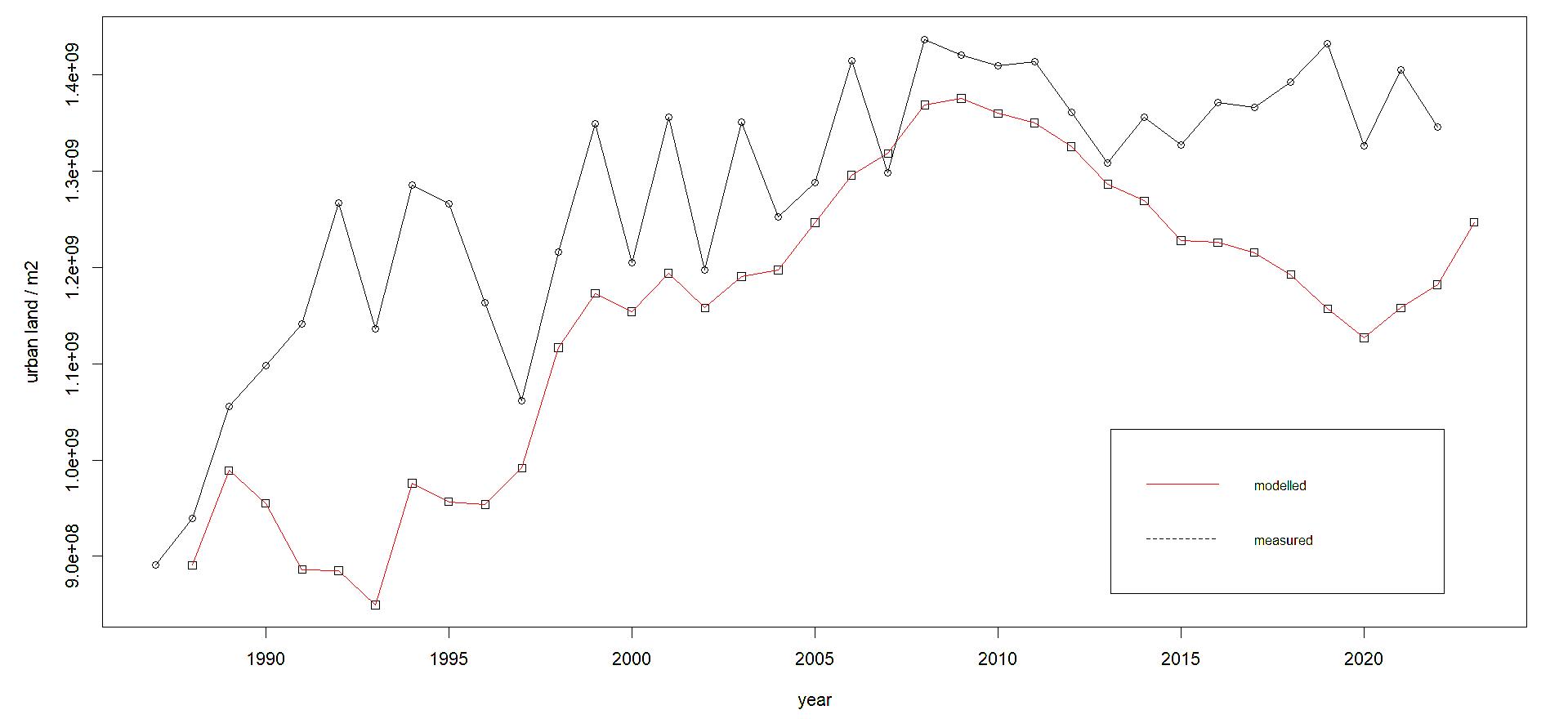
y: Column vector of lengthN(years – 1) with urban land use change per year
x2: value of gross agricultural output / agriculture population
x4: log(average total wage)
x5: (value of gross agricultural output/Agricultural land) / (value of gross industrial output /
The regression analysis reveals that factor �� , productivity ratio, is the most influential. A decrease in the ratio of agricultural/industrial productivity leads to the largest increase in urban expansion. This attributes majority of urban expansion to the economic gap between what the land is worth as a farm versus what it's worth as a factory or city centre
Urbanisation is mathematically fueled by this ‘value gap’, effectively treating rural land as a "bank" to be liquidated for urban "progress".
3.The Cost of this Material Basis
1.Dispossession as Urban Foundation
65 million rural residents were not just displaced, but also excluded from the very “Good City” their land created.
• With developers paying 40x more than the compensation residents received, the “Good City” is built on a massive transfer of wealth from the periphery to the core.
• “Public interest’ sidelined, public infrastructure only built when projects are financially viable.
Rethinking the ‘Good City’
2.Ecological Liquidation Land reclamation is often framed as creating land, but it is actually the destruction of ecological rights.
• Damages to marine ecosystems; severe accumulation of heavy metals (Zn, Cu, Cr) (Zhang et al., 2021).
• The environment was declared as one of four ‘unsustainable’ situations facing the city by 2005.
Shenzhen’s “Good City” is produced by shifting social and environmental costs outside the city. Is this really ‘Good’?
The debate shouldn't be about how to make cities "better," but how to stop urbanisation from acting as a ‘quiet colonisation’ of rural and ecological spaces.
Territorial Justice
We must reject the idea that the "urban" ends at the city limits. Using Brenner and Schmid’s lens of Planetary Urbanism, we see that urbanisation has dissolved the traditional distinction between city and countryside. To truly define a "Good City," we must account for the hinterlands and oceans reorganised to sustain it, ensuring urban progress no longer relies on territorial sacrifice.
ACKNOWLEDGEMENTS
This year’s Expo would not have been possible without the collective efforts of students, staff, practitioners, and organisers who contributed their time, expertise, and enthusiasm throughout the process.
Special thanks go to the Bartlett Urban Planning Society (BUPS) and staff at UCL for organising the 2025–26 BSP Expo and supporting the exhibition and catalogue production. In particular, we would like to thank Dr Dimitrios Panayotopoulos-Tsiros for his support in helping make this year’s event a great success.
We are also grateful to the panel of BSP staff and planning practitioners who reviewed the exhibited works, with particular thanks to Samer Bagaeen, vice-president of the Royal Town Planning Institute, and Charles Campion, Partner at JTP, Trustee Plunkett UK, for generously contributing their expertise, insight, and encouragement to the student projects.
The Expo formed part of the wider UCL200 celebrations, recognising 200 years of UCL’s commitment to education, innovation, and public engagement.
Catalogue compiled and edited by Ksenia Gudim.
Contact Bartlett Urban Planning Society
Website: https://www.bups.london/
Email: infobartlettups@gmail.com
Instagram: @uclbartlettups
LinkedIn: Bartlett Urban Planning Society (BUPS)
Facebook: @bartlettups