
3,200/page

Circulation & Readership Profile
The publisher reserves the right to edit, revise or reject any advertisement deemed unsuitable or inappropriate. •
This one-time-only special rate o er is for new advertisers.
Space availability is subject to booking on a first-come-first-served basis.
Clients will provide ready-to-print artwork in PDF format with 300dpi.
Full page: 210mm x 297mm, 3mm extra bleed sizes for 4-sided.
Advertising space must be utilised before 30 June 2026.
*Please note that the above rate will be subjected to 8% SST. For overseas advertisers, an additional 25% will be charged.
Rate shown above excludes 15% advertising agency commission.
Payment term: Full advance payment.
Artwork submission deadline is on (or before) the 1st week of the prior month of publication.
After the material deadline, no cancellation or alteration to the advertisement will be entertained.
Any cancellation after signing the advertising order will result in a 50% penalty charge.
JURUTERA has an estimated readership of 200,000 professionals. Our esteemed readership consists of certified engineers, decision making corporate leaders, CEOs, government officials, project directors, entrepreneurs, project consultants, engineering consulting firms and companies involved with engineering products and services.
Publica�on month/s:
Company’s Stamp & Authorised Signature
Date



















Geotechnical engineering remains a fundamental pillar of engineering, quietly shaping the safety, resilience, and sustainability of our built environment. From the stability of deep foundations and offshore structures to the performance of slopes, tunnels, and reclamation works, geotechnical practice underpins nearly every major infrastructure development.
Today, geotechnical engineers face increasingly complex challenges. Urban densification, climate change, rising sea levels, and the need for more sustainable construction methods demand innovative thinking and stronger integration between geotechnical, structural, and environmental disciplines. Advances in ground investigation technologies, digital modelling, and data-driven design are transforming how we understand subsurface conditions and manage risk throughout the project life-cycle. This issue highlights the critical role of geotechnical engineering in ensuring safety and serviceability as well as in enabling smarter and more sustainable development. By embracing new tools, strengthening interdisciplinary collaboration, and reinforcing sound engineering judgement, the profession continues to elevate its contribution to national infrastructure and long-term resilience. Good geotechnical practice is ultimately about stewardship, of land, resources, and public trust.
We also extend our warmest wishes to all readers observing the holy month of Ramadan.
















President: Ir. Prof. Dr. Jeffrey Chiang Choong Luin
Deputy President: Ir. Yau Chau Fong
Vice Presidents:
Ir. Prof. Dr. David Chuah Joon Huang, Dato’ Ir. Wan Nazari Wan Jusoh,
Ir. Dr. Bernard Lim Kee Weng, Ir. Prof. Dr. Tan Chee Fai, Ir. Prof. Dr. Lau Hieng Ho, Ir. Yeong Chin Chow, Simon, Ir. Abdul Razak Yakob
Honorary Secretary: Ir. Chen Harn Shean
Honorary Treasurer: Ir. Prof. Dr. Wong Yew Hoong
Immediate Past President: Ir. Prof. Dr. Norlida Buniyamin
Past Presidents:
Datuk Ir. Prof. Ow Chee Sheng, Academician Tan Sri Dato’ Ir. Prof. Em. Dr. Chuah
Hean Teik, Dato’ Ir. Dr. Lim Chow Hock, Ir. Dr. Tan Yean Chin, Ir. Ong Ching Loon
Civil Representative: Ir. Tu Yong Eng
Mechanical Representative: Ir. Ng Yong Kong
Electrical Representative: Ir. Mohd. Aman Hj. Idris
Structural Representative: Ir. Dr. Tan Kuang Leong
Chemical Representative: Ir. Kim Kek Seong
Other Disciplines Representative: Ir. Dr. Dhakshyani Ratnadurai
Multimedia Representative: Ir. Assoc. Prof. Dr. Lai Khin Wee
Women Engineers Representative: Ir. Dr. Syuhaida Ismail
Young Engineers Section Representatives: Mr. Lim Yiren, Mr. Darshan a/l Balasubramaniam, Ms. Ong Ye Shian, Mr. Chuah Pei Lim, Mr. Teoh Chi Yang
Council Members:
Ir. Sharifah Azlina Raja Kamal Pasmah, Ir. Ts. Dr. Wan Syakirah Wan Abdullah, Ir. Dr. Mui Kai Yin, Ir. Shamil Abu Hassan, Ir. Ts. Wan Rizaluddin Abdullah Wan Ali, Ir. Dr. Aidil Chee Tahir, Ir. Dr. Angelia Liew San Chuin, Ir. Prof. Dr. Zuhaina Zakaria, Ir. Begum Irdawati Dowlad Rahuman, Ir. Chong Chee Yen, Ir. Khoo Chee Min, Ir. Ahmad Rafidi Mohayiddin (casual vacancy for Ir. Abdul Razak Yakob), Ir. Dr. Chan Swee Huat, Ir. Alex Looi Tink Huey, Ir. Sukhairul Nizam Abdul Razak, Dato’ Ir. Ting Chek Choon, Ir. Dr. Norashikin M Thamrin, Ir. Lee Cheng Pay, Datuk Ir. Chin Tet Fu @Willy, Ir. Ts. Gs. Br. Dr. Zarabizan Zakaria, Ir. Choo Lay Guat, Ir. Dr. Siow Chun Lim, Ir. Assoc. Prof. Dr. Leong Kah Hon, Ir. Ts. Dr. Sara Lee Kit Yee, Ir. Chan Wah Cheong, Ir. Dr. Marianah Masrie
Council Members by Invitation:
Datuk Ir. Ho Hon Sang, Dato’ Ir. Ahmad Sabirin Arshad, Ir. Dr. Sanjayan K.V. Velautham
Branch Chairman
1. Penang : Ir. Dr. Lee Choo Yong
2. Southern : Ir. David Puen Ming Shen
3. Perak : Ir. Dr. Tiah Oon Han
4. Pahang : Ir. Harzah Mazni Ramli
5. Kedah-Perlis : Ir. Jamaluddin Abdullah
6. Negeri Sembilan : Ir. Richard Khoo Nee Keong
7. Kelantan : Ir. Hj. Nik Burhanuddin Nik Yusoff
8. Terengganu : Ir. Zakaria Abdullah
9. Melaka : Ir. Lim Su Hian
10. Sarawak : Ir. Dr. Angelia Liew San Chuin
11. Miri : Ir. Meheron Selowara Joo
12. Sabah : Datuk Ir. Ts. Mohd Yaakob Hj. Jaafar
Chairman, InfoPub & Chief Editor: Ir. Prof. Dr. Lau Hieng Ho
Vice Chairman & Principal Bulletin Editor: Ir. Ts. Wan Rizaluddin Abdullah Wan Ali
Secretary: Ir. Ts. Assoc. Prof. Dr. Hum Yan Chai
Chairman, Sub Committee on Resource Centre: Ir. Tay Siang Hui
Journal Editor-in-Chief: Ir. Ts. Prof. Dr. Teo Fang Yenn
Chairman, Sub Committee on Web Portal: Ir. Dr. Hasril Hasini
Project Leader for Jurutera-i: Ir. Alex Looi Tink Huey
Committee
Members:
Ir. Ts. Dr. Tan Kim Seah, Ir. Lau Tai Onn, Ir. Yee Thien Seng, Ms. Michelle Lau Chui Chui, Ir. Begum Irdawati Dowlad Rahuman, Ir. Dr. Nor Ilia Anisa Aris, Ir. Ts. Wong Chee Fui, Ir. Dr. Marianah Masrie, Ir. Dr. Lau Chee Yong, Ir. Dr. Bhuvendhraa Rudrusamy, Ir. Razmahwata Razalli, Ir. Lee Chang Quan, Ir. Assoc. Prof. Dr. Moey Lip Kean, Ir. Tan Kok Jyh, Ms. Chai Jing Xuan, Mr. Chin Zehong, Ir. Ts. Dr. Lau Chee Yong
Chief Editor: Ir. Prof. Dr. Lau Hieng Ho
Principal Bulletin Editor: Ir. Wan Rizaluddin Abdullah Wan Ali Committee Members:
Ir. Alex Looi Tink Huey, Ir. Dr. Tan Kim Seah, Ir. Razmahwata Mohd Razalli, Ir. Prof. Dr. Teo Fang Yenn, Ir. Lau Tai Onn, Ir. Yee Thien Seng, Ms. Michelle Lau Chui Chui, Ir. Ahmad Rafidi Mohayiddin, Ir. Lee Chang Quan, Dr. Sudharshan N. Raman, Ir. Begum Irdawati Dowlad Rahuman, Ir. Ts. Dr. Lau Chee Yong
THE INSTITUTION OF ENGINEERS, MALAYSIA
Bangunan Ingenieur, Lots 60 & 62, Jalan 52/4, P.O. Box 223, (Jalan Sultan), 46720 Petaling Jaya, Selangor Darul Ehsan. Tel: 603-7890 0130 Fax: 603-7957 7678
E-mail: sec@iem.org.my Homepage: http://www.myiem.org.my

Ir. Dr. Gue Chang Shin Chairman, GETD
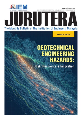
Geotechnical engineering has long been at the forefront of managing natural and man-made hazards, from landslides and sinkholes to ground settlement and foundation instability. As urban development extends into more challenging terrain and climatic events intensify, the need to rethink how we assess, mitigate, and adapt to geotechnical risks has never been greater.
This month, we explore Geotechnical Engineering Hazards: Risk, Resilience & Innovation. Experts speak on how the profession is shifting toward proactive, resilience-based designs. The National Slope Master Plan exemplifies this vision, combining systematic risk assessment with sustainable mitigation to protect communities.
Emerging technologies and real-time monitoring are driving predictive geotechnical intelligence as well as merging data and design to enhance safety and strengthen resilience. So, let us push boundaries, collaborate across disciplines, and build a stronger, safer, and more resilient nation.
DIMENSION PUBLISHING SDN. BHD. [ 199701034233 (449732-T) ]
Level 18-01, PJX-HM Shah Tower, No. 16A, Persiaran Barat, 46050 Petaling Jaya, Selangor Darul Ehsan, Malaysia. Tel: +(603) 7493 1049
E-mail: info@dimensionpublishing.com Fax: +(603) 7493 1047 Website: www.dimensionpublishing.com
Chairman Robert Mebruer
CEO/Publisher Shirley Tham shirley@dimensionpublishing.com
Head of Marketing & Business Development
Joseph How joseph@dimensionpublishing.com
Production Editor Tan Bee Hong bee@dimensionpublishing.com
Contributing Writers Putri Zanina putri@dimensionpublishing.com
Hanna Sheikh Mokhtar hanna@dimensionpublishing.com
Senior Graphic Designer Sofia Hanis Mohd Uzir sofia@dimensionpublishing.com
Graphic Designer Nicole Theng nicole@dimensionpublishing.com
Advertising Consultants Tham Choon Kit ckit@dimensionpublishing.com
Accounts Cum Admin Executive Yong Yen Yin yenyin@dimensionpublishing.com
PUBLICATION DISCLAIMER
For advertisement placements and subscriptions, please contact:
DIMENSION PUBLISHING SDN. BHD. [ 199701034233 (449732-T) ]
Tel: +(603) 7493 1049
Fax: +(603) 7493 1047
E-mail: info@dimensionpublishing.com Website: www.dimensionpublishing.com
Subscription Department E-mail: info@dimensionpublishing.com
JURUTERA MONTHLY CIRCULATION: OVER 50,000 MEMBERS
Submission or placement of articles in JURUTERA could be made to the:
Chief Editor THE INSTITUTION OF ENGINEERS, MALAYSIA (IEM)
Bangunan Ingenieur, Lots 60 & 62, Jalan 52/4, P.O. Box 223 (Jalan Sultan), 46720 Petaling Jaya, Selangor. Tel: +(603) 7890 0130
Fax: +(603) 7957 7678
E-mail: pub@iem.org.my Website: http://www.myiem.org.my
Published by: The Institution of Engineers, Malaysia (IEM) Publishing Consultant: Dimension Publishing Sdn. Bhd. Printed by: Thunder Print Sdn. Bhd.
The publication has been compiled by both IEM and Dimension with great care and they disclaim any duty to investigate any products, process, services, designs and the like which may be described in this publication. The appearance of any information in this publication does not necessarily constitute endorsement by IEM and Dimension. There is no guarantee that the information in this publication is free from errors. IEM and Dimension do not necessarily agree with the statement or the opinion expresssed in this publication.
COPYRIGHT JURUTERA Bulletin of IEM is the official magazine of The Institution of Engineers, Malaysia (IEM) and is published by Dimension Publishing Sdn. Bhd. The Institution and the Publisher retain the copyright over all materials published in the magazine. No part of this magazine may be reproduced and transmitted in any form or stored in any retrieval system of any nature without the prior written permission of IEM and the Publisher.
Interview session with Ir. Liew Shaw Shong
Ir. Som Pong Pichan
Ir. Prof Dr. Mohd Ashraf Mohamad Ismail
As geotechnical hazards such as landslides, ground subsidence, and settlement continue to challenge infrastructure safety, understanding the risks and how to build resilience has never been more critical. To drive safer and more resilient geotechnical engineering, JURUTERA interviewed three leading experts in the field, including a past Chairman of the Geotechnical Engineering Technical Division (GETD), Ir. Liew Shaw Shong from G&P Geotechnics Sdn. Bhd., Ir. Som Pong Pichan from JKR Geotechnical Engineering Branch, and Ir. Prof. Dr. Mohd Ashraf Mohamad Ismail from the School of Civil Engineering, USM. Their insights highlight evolving strategies to anticipate, manage, and mitigate geotechnical hazards.
Can you share a significant case or project where you had to deal with a geotechnical hazard? What were the main challenges?
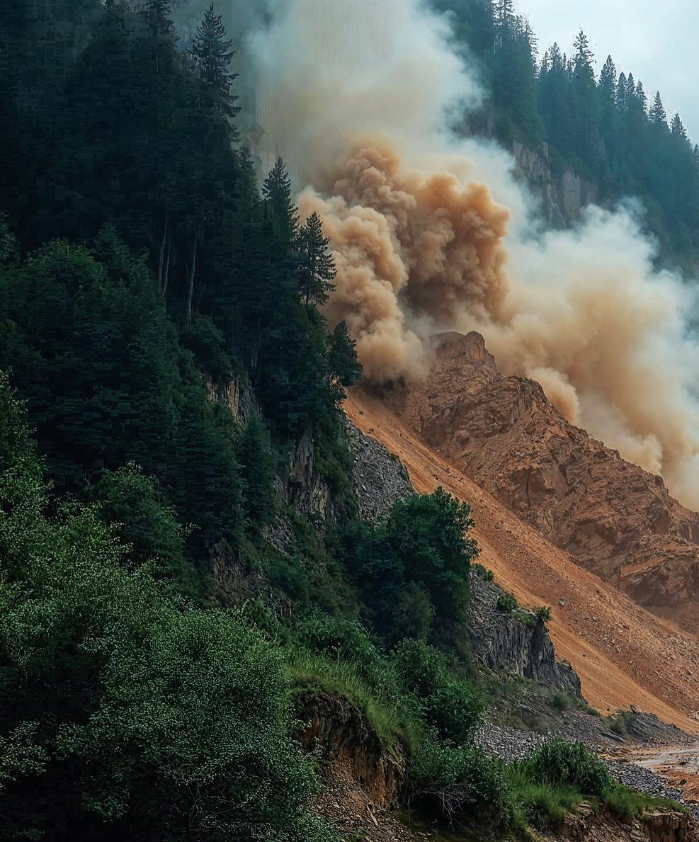
Ir. Liew Shaw Shong: One significant case I handled involved a bioconversion plant constructed on ex-mining land. It was surrounded by large ponds and reclaimed areas. The site was inherently hazardous, with sandy soils, mine tailings, and high groundwater. Adjacent to the plant was an active open-cast sand mining pit that was being deepened to 24m and kept dry through continuous dewatering. This altered the hydrogeological regime, creating steep gradients which triggered static liquefaction at the pit edge. The result was a sudden debris-flow collapse of part of the plant platform, with a runout of nearly 300m, causing severe structural and equipment damage. Fortunately, the failure did not extend to the adjacent mining pond as this could have caused a catastrophic breach similar to the 1993 Pantai Remis landslide in Perak. The rehabilitation was an in-situ retaining system with gapped contiguous spun pile wall supported by raked piles to retain the remaining intact platform for replanned operational layout for continuous operation. The main challenges were poor hydrogeological management, regulatory gaps, and limited monitoring requirements. The incident highlighted the urgent need for stricter oversight, real-time monitoring, risk communication, and stronger ethical accountability in high-risk developments.
Ir. Som Pong: In my many years of service with JKR Malaysia, I have been personally involved in several cases of geotechnical hazard, either small- or large-scale incidents. I joined JKR in 2002. The first significant case that I can recall is a less well-known slope failure case on the eastern side of Pulau Banding in 2007. A two-storey building owned by the Perak State Park Corporation (PTNP), built in 2004, collapsed on a
hillside at the edge of Tasik Banding in Gerik. Investigations revealed the important roles of geotechnical engineering in hillside development and environmentally sensitive areas. The incident has had a great impact on my personal affection for the field, even till today.
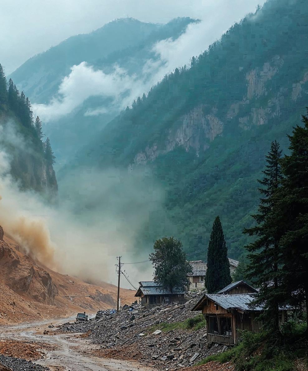
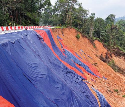
There were other major cases, such as the Bukit Antarabangsa landslide and, more recently, the Batang Kali landslide, where I would say the main challenges in dealing with geotechnical hazards were poor hillside development practices, the lack of maintenance and preventive measures, and the evolving climate impact, which complicated hazard prediction, mitigation, and infrastructure resilience.
Prof. Ir. Dr. Mohd Ashraf: One significant case I remember involved addressing excessive ground settlement in an industrial site where proper subsurface investigation had not been conducted before construction. The post-construction settlement led to structural distress and serviceability issues. The main challenge was rectifying foundation performance without adequate baseline data, which required extensive back-analysis and ground improvement under operational constraints.
Another example was a weathered slope along a major transportation route, where poor slope drainage and lack of maintenance progressively weakened the slope. Despite it being a critical route, preventive works were delayed, and failures occurred after prolonged rainfall. A further challenge was in the ageing subsurface infrastructure, including old sewer/drainage networks, where limited as-built records and the lack of maintenance data made it difficult to identify hidden voids or potential sinkholes. These cases highlight the urgent need for integrated asset management, routine monitoring, and data-driven maintenance planning to mitigate future geotechnical risks effectively.
Please share your views on the risk mitigation for geotechnical engineering hazards in Malaysia. Is there anything lacking or which requires improvement?
Ir. Liew: Risk mitigation for geotechnical hazards in Malaysia requires a systematic and proactive approach, as issues such as
landslides, debris flows, sinkholes, liquefaction, and erosion often develop through identifiable precursors.
Effective strategies should begin with risk avoidance in planning, followed by risk reduction through design and construction and, where unavoidable, risk acceptance should be supported by early warning, monitoring, and evacuation systems. Key measures include multi-disciplinary hazard mapping using geotechnical, geomorphological, hydrogeological, and remote sensing data, advanced surveying technologies such as resistivity scanning, MASW, and photogrammetry, as well as adherence to regulatory frameworks from JKR, CIDB, and local councils. However, several gaps remain: Fragmented data sharing, inadequate post-construction monitoring, limited climate adaptation models, and insufficient community engagement. Commercial pressures sometimes override safety, while poor infrastructure records hinder risk management. Improvements should focus on a centralised geohazard database, long-term monitoring, ethical oversight, digital asset inventories, capacity building, and adoption of smart technologies to build resilience.



Ir. Som Pong: Due to our tropical climate, geological conditions, hilly terrain, and intense rainfall, Malaysia is prone to geotechnical engineering hazards, especially landslides, slope failures, and sinkholes. Despite the implementation of numerous geotechnical risk mitigations in recent decades, there are some critical aspects which need improvement to ensure their effectiveness. Most importantly, a comprehensive geotechnical hazard map is essential for identifying and mitigating risks, especially in areas with complex terrain or rapid development. Despite the significant progress, numerous areas are still in the process of development.
Additionally, limited data sharing and integration across agencies, insufficient monitoring and early warning systems, and weak enforcement of planning guidelines have resulted in ineffective risk mitigation for geotechnical hazards. Addressing these shortcomings will be essential to enhance our preparedness and resilience in the face of geotechnical threats, ultimately fostering safer environments for future generations.
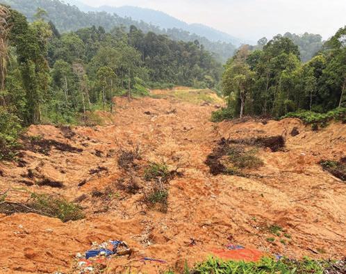
Prof. Mohd Ashraf: Malaysia has developed an extensive and highquality infrastructure network, with many projects meeting international standards. However, effective risk mitigation for geotechnical hazards remains challenged by inadequate maintenance and ageing infrastructure. Failures often occur from hidden or neglected components such as underground utilities and slopes along federal and state roads. The increasing occurrence of anthropogenic or manmade sinkholes and slope failures, intensified by extreme rainfall and climate change, further underscores these vulnerabilities.
To enhance resilience, Malaysia needs a more proactive, risk-based maintenance framework which integrates geotechnical monitoring, real-time data, and predictive modelling. Strengthening interagency collaboration, ensuring sustained funding for preventive
programmes, and embedding geotechnical risk assessment into all infrastructure planning and asset management processes are critical steps toward long-term infrastructure safety and sustainability.
Do you think current engineering codes and guidelines in Malaysia sufficiently support resilient design? What improvements would you recommend?
Ir. Liew: While engineering codes and guidelines in Malaysia provide important references, checklists, and SOPs which help prevent major mistakes, over-reliance on these risks producing compliance-driven engineers who lack innovation. Codes often promote reactive compliance rather than proactive, anticipatory design, and may not fully address rare or complex scenarios.
In practice, engineers should be encouraged to apply knowledge critically, calibrating their designs to local ground behaviours and environmental responses rather than simply following prescriptive rules. Although technical documents are generally adequate, current codes tend to treat geotechnical,
hydrological, and climate risks in isolation. A more resilient framework would integrate these elements into a unified Resilient Design Code, especially given the high variability in ground and environmental conditions. For critical projects, independent peer reviews should be mandated. Beyond design, resilience must also extend to construction, operation, and end-of-life stages through ongoing monitoring, inspection, maintenance, and timely rehabilitation to meet evolving standards.
Ir. Som Pong: In general, geotechnical practices in Malaysia have adopted most of the key Eurocodes, such as EN 1997 (Geotechnical Design), and EN 1998 (Earthquake Resistance), aligning with international best practices to ensure resilient infrastructure. In this regard, JKR Malaysia, the main technical agency for the Government, has published various manuals and guidelines related to the planning, design, and construction of geotechnical works which have been used internally. Some have also been widely adopted across the nation by other technical agencies and the private sector.
However, as the current codes are developed based on international standards which may not have fully taken into account the extreme rainfall or intense weathering processes in tropical regions, regular updates of these documents by considering critical tropical-specific factors are required. Furthermore, the nationally standardised manuals and guidelines should be strictly adopted by all local authorities which approve development projects, especially in geotechnically and geologically sensitive areas.
Prof. Mohd Ashraf: Current engineering codes and guidelines in Malaysia provide a solid foundation for design, construction and infrastructure assessment but are still evolving toward resiliencebased standards. Most existing codes emphasise structural safety under conventional conditions, yet they do not fully address long-term climate impacts, extreme rainfall, or multi-hazard interactions such as simultaneous slope failure and flooding. To enhance resilience, codes should integrate risk-based
geotechnical design principles, incorporate probabilistic and performance-based approaches, and encourage the use of realtime monitoring data for adaptive management.
Greater alignment with climateresilient infrastructure frameworks and international standards will also strengthen local practice. Additionally, improved coordination between design codes, slope management guidelines, and asset maintenance protocols is essential. Developing a national database of geotechnical failures and performance feedback will further support evidencebased updates to future Malaysian standards.
Are there recent advancements in research or technology that have significantly improved geohazard prediction or management?
Ir. Liew: Recent years have seen remarkable advances in geohazard prediction and management, many of which are transforming resilience planning in Malaysia. Artificial
intelligence (AI) and deep learning models now process massive datasets — rainfall, soil type, topography, and seismic records — to forecast landslides, debris flows, subsidence, and sinkhole risks with far greater accuracy than traditional methods. Remote sensing, particularly Synthetic Aperture Radar (SAR) interferometry of typically 12-days scanning duration, enables detection of subtle ground deformation through vegetation and cloud cover, with archived satellite data providing affordable insights into long-term surface changes.
UAVs equipped with LiDAR and photogrammetry deliver highresolution terrain models, supporting both design and emergency response in inaccessible zones. Real-time monitoring using IoT sensors streams continuous geotechnical and weather data, triggering alerts when thresholds are exceeded, allowing proactive interventions. Climateintegrated runout modelling further enhances design by incorporating future rainfall extremes, while Digital Disaster Reduction Systems (DDRS) use simulations and VR tools to support stakeholder engagement and risk communication.
Ir. Som Pong: Geotechnical engineers are typically used to being conservative in their design practice to mitigate potential risks and to ensure that structures can withstand unforeseen challenges posed by the uncertainties in subsurface materials and quality of workmanship during the construction stage. However, recent breakthroughs in AI, remote sensing, and integrated monitoring systems have proven to be effective for geohazard prediction and management, especially for landslides, debris flows, and ground settlement. So, adoption of these advanced technologies, such as AI-driven modelling, real-time monitoring, geotechnical BIM and digital twins, is crucial and should be explored by all parties in Malaysia. Currently, JKR has implemented a nationwide real-time slope monitoring system using sensors, robotic stations, and rainfall thresholds to
detect early signs of slope instability and prevent landslides. The department is also in the beginning stages of exploring the potential application of machine learning models to predict slope failures, settlements, and pile behaviours using historical site investigation data. The successful application of the advanced technologies in geotechnical engineering works will benefit the nation in the long term.
Prof. Mohd Ashraf: Recent advancements in research and technology have transformed geotechnical prediction and management. AI-driven analysis combined with UAV-based remote sensing enables rapid on-site and near-site assessment of slopes, ground movement, and erosion through high-resolution imaging and 3D reconstruction. These technologies allow early detection of instability patterns which may not be visible from ground inspection. IoT-based monitoring systems further enhance data collection by continuously recording rainfall, pore pressure, and displacement in real time. The integration of machine learning and GIS-based predictive models improves the accuracy of hazard mapping and risk forecasting. Meanwhile, satellite radar interferometry (InSAR) provides precise deformation tracking over large areas, complementing fieldbased monitoring. The emerging digital twin framework linking artificial intelligence, remote sensing, and real-time ground data marks a major leap toward predictive and preventive geotechnical engineering hazards management, significantly improving Malaysia’s capability to ensure infrastructure safety and resilience.
What do you see as the greatest geotechnical risks facing Malaysia in the next two decades?
Ir. Liew: In the next two decades, Malaysia’s geotechnical risks will be caused by climate extremes, rapid urbanisation, and subsurface uncertainties. Intensified rainfall is expected to trigger more frequent
landslides, slope failures, debris flow, erosion (especially in highlands), sinkhole collapse in soluble limestone formation and leaked water carrying utilities, and compromised pipelines in unstable ground carrying hazardous products.
Urban growth pressures will push development onto marginal land such as steep hillsides and reclaimed coastal zones, where inadequate ground improvement may result in settlement, liquefaction, and longterm distress. Seismic risk remains underestimated, yet fault reactivation and the absence of micro-zonation maps expose urban centres and critical infrastructure to potential ground motion amplification, particularly in soft alluvial areas. Ageing infrastructure further compounds the risk, with poor documentation of foundations, underground utilities, and subsurface conditions complicating rehabilitation and new construction. Weak monitoring and ethical lapses — where commercial pressures overshadow safety — remain systemic challenges. Future resilience will depend on integrated climate adaptation, seismic preparedness, transparent data sharing, independent reviews, and smart monitoring systems.
Ir. Som Pong: In the past few decades, rapid development of infrastructure projects in Malaysia had encroached into geotechnically and environmentally sensitive areas such as the unstable hillslopes and along the coastlines, which were underlain by problematic soft soil deposits. While we are still focused on building new infrastructure today, older assets such as slopes, drains, and retaining structures which were built decades ago are deteriorating without systematic maintenance and rehabilitation.
In addition to that, we are also facing more intense and frequent rainfall, rising temperatures, and sealevel rise because of climate change phenomena. Therefore, Malaysia’s greatest geotechnical risks over the next two decades are expected to result from climate-driven slope instability, uncontrolled anthropogenic
activities in geotechnically sensitive areas in the past, and ageing infrastructure, especially in urban, tropical highland zones and coastal reclamation areas.
Prof. Mohd Ashraf: In the next two decades, Malaysia’s greatest geotechnical risks will arise from rapid urban development, climate variability, and ageing infrastructure. The most critical concerns include slope failures triggered by prolonged and high-intensity rainfall, ground settlement in reclaimed and soft ground areas due to increased loading and inadequate ground improvement, and anthropogenic sinkholes associated with ageing underground utilities and poor drainage management.
In addition, coastal and lowlying regions face increasing risks of erosion and instability from sea-level rise and land reclamation. These emerging challenges require a shift toward climate-resilient geotechnical design, real-time ground monitoring, and integrated land-use planning. Strengthening institutional coordination, investing in early warning systems, and promoting data-driven predictive modelling will be vital to mitigate geotechnical hazards and ensure the long-term sustainability and safety of Malaysia’s infrastructure and communities.

Sdn. Bhd.

Geotechnical Engineering Branch, Public Works Department Malaysia

Ismail
School of Civil Engineering, Universiti Sains Malaysia




































by:


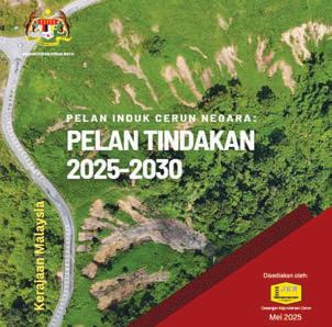
The landscape of slope engineering in Malaysia is undergoing a profound transformation. The Simposium Cerun Negara 2025, held in Putrajaya last May, was not merely a ceremonial closure to the National Slope Master Plan (NSMP) 20092023 but was also the launchpad for a more data-driven, technologically integrated era defined by the Pelan Induk Cerun Negara: Pelan Tindakan 2025-2030.
For decades, we have grappled with the dual challenges of rapid urbanisation and a tropical monsoon climate, a potent combination that often results in geo-hazards. The previous decade focused on foundational policy formulation following the wake-up calls of the Bukit Lanjan rockslide (2003) and the Highland Towers tragedy (1993). However, the mandate for
2025-2030 represents a shift from “establishing baselines” to “precision management”.
With the Cabinet approval on 15 May 2024 to extend the NSMP mandate, the focus has moved to Achievable Action Plans (Pelan Tindakan Boleh Capai). These are not broad, aspirational statements but granular, operationally viable targets tailored to the financial and technical capacities of implementing agencies.
This article dissects the technical components of the new Action Plan, highlighting the legislative updates, system architectures, and engineering strategies driving our national resilience against the backdrop of climate change and systemic risks.
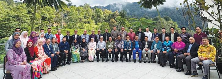
No technical plan can succeed without a robust governance structure. The institutionalisation of slope management has been a critical success of the original NSMP. Today, the Inter-Governmental Agency Committee for Slope Management (ICSM), established in 2011, has matured into a robust coordinating body comprising 39 agencies, including NADMA, JMG, PLANMalaysia, METMalaysia, and various local authorities. Operating under the framework of the ICSM, the NSMP is designed to bolster the nation's resilience against slope-related risks. This initiative serves as a definitive benchmark for implementing best practices and systematically decreasing the occurrence of slope disasters.
To ensure the 2025-2030 roadmap moves from policy to practice, the efficacy of ICSM is now driven by five dedicated Working Groups (WG). These groups streamline technical execution, ensuring that data flows seamlessly from hazard identification to policy enforcement and emergency response. This structure dismantles the silo mentality that often plagues multi-agency initiatives, ensuring that a landslide risk identified by a geologist in JMG is communicated effectively to the civil engineer in JKR and the town planner in the Local Authority.
The five (WG) that streamline technical execution are:
1. Hazard Mapping & Assessment (HMA). Led by JMG.
2. Public Awareness & Education (PAE). Led by CKC, JKR.
3. Policy & Institutional Framework. Led by KPKT.
4. Emergency Preparedness, Response & Recovery. Led by NADMA.
5. Research & Development. Led by CREATE, JKR.
1. Hazard Mapping & Assessment: The Foundation of Data. Led by Jabatan Mineral & Geosains (JMG).
The logical starting point for any risk management strategy is accurate data. The HMA Working Group is tasked with the critical role of identifying and quantifying slope hazards before they manifest as disasters.
Dual Mapping Strategy: Linear vs. Area-Based. A distinct feature of the Malaysian slope management strategy is the dual approach to hazard mapping, catering to different administrative needs.
• Linear-Based Mapping (PBRC – Linear): Led by JKR, this approach focuses on slopes along federal and state roads. Given that road networks are the lifelines of the nation’s economy, maintaining their connectivity is paramount. The Slope Hazard & Risk Map is used to prioritise preventive maintenance funding, ensuring that high-risk slopes along critical arteries such as the East-West Highway are treated before failure occurs.

• Area-Based Mapping (PBRC – Area): Led by JMG, this approach focuses on broader territories, particularly those under development pressure. Significant progress has been made in mapping critical areas such as Cameron Highlands (475 km²), Kota Kinabalu (155 km²), and Kundasang (370 km²). These maps are vital for land use planning and are integrated into District Local Plans to guide safe development. Integrated Slope Management System (ISMAS) and Integrated Data
Ecosystems: Data collection is only half the battle; integration is key. While the NSMP 2009-2023 saw the birth of slope information systems, 2025-2030 is about intelligence. JKR has successfully deployed ISMAS, a web-based GIS platform acting as the central repository for slope assets. What ISMAS can do:
• Inventory & Maintenance: The system logs slope registration, hazard ratings, and preventive maintenance schedules.
• Spatial Data Integration: Utilises Airborne LiDAR data to generate Digital Terrain Models (DTM) and Digital Surface Models (DSM). This allows engineers to visualise slope features such as drainage patterns and contour changes with high precision, essential for identifying potential failure zones.







Annual Reports • Booklets • Brochures • Buntings • Business Cards
CD / DVD Replications • Calendars • Cards & Invitations • Certificates
Custom Printings • Envelopes • Folders • NCR Bill Books • Notepads
Leaflets • Letterheads • Paper Bags • Posters • Stickers • Others
• GIS Layers: Integrates multiple GIS layers including Slope Polygons, Orthophotos, Contours, Hillshade, and Slope Hydrology, enabling comprehensive spatial analysis. This is complemented by other agency systems, creating a national data ecosystem. For instance, JMG operates the National Terrain & Slope Geospatial Information System (NATSIS), while PLUS Expressways utilises the Total Expressway Maintenance Management System (TEMAN) for highway slopes.
Moving forward, the Action Plan 2025-2030 aims to expand PBRC initiatives beyond federal roads to include debris flow areas, dams, and areas under the jurisdiction of local authorities.
2. Public Awareness & Education (PAE): Bridging the Last Mile. Led by CKC, JKR - Cawangan Kejuruteraan Cerun. However, technical data stored in servers is insufficient if the community remains unaware of the risks. Transitioning from the technical mapping of WG1, the PAE Working Group focuses on shifting the paradigm from general awareness to active Community-Based Disaster Risk Reduction (CBDRR).
The Local Champion Initiative is to bridge the last mile of communication. The plan emphasises the training of Local Champions – community leaders who act as first responders. These individuals are trained to identify early signs of landslides, such as tension cracks or muddy water flows, effectively translating engineering signs into community action.
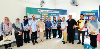












Programmes such as the one conducted with the Orang Asli community in Kampung Pawong, Perak, demonstrate the efficacy of this grassroots approach. By empowering local populations to be the eyes and ears of slope safety, the engineering community gains a valuable layer of real-time intelligence which technical sensors might miss.
Educating the Next Generation Beyond community leaders, the PAE initiative targets schools in high-risk areas. Programmes at schools such as SK Seri Layang, Genting Highlands, serve to inoculate the next generation with a culture of safety. The curriculum moves beyond simple warnings to explaining the mechanics of landslides and how rainfall saturation affects soil stability as well as demystifying the hazard and reducing panic during events.
3. Policy & Institutional Framework. Led by KPKTKementerian Perumahan & Kerajaan Tempatan. While education is vital, robust engineering requires a strong legal backbone to enforce standards. Building on the awareness created by WG2, the Policy & Institutional Framework Working Group ensures that technical standards are backed by enforceable regulations.















Legislative Teeth: Strengthening Act 133. One of the most significant takeaways for professional engineers in the new Action Plan is the re-emphasis on the Street, Drainage & Building Act 1974 (Act 133). Specific amendments now directly impact geotechnical practice.
• Section 70 (Amendment): This mandates that geotechnical reports for hillside developments must be verified by an Accredited Checker. This introduces a mandatory layer of independent technical audit, ensuring designs comply with the highest safety standards before approval. For the consulting engineer, this signifies a move towards greater accountability and peer review.
• Section 85A: This introduces provisions for Periodic Slope Inspection, placing a legal onus on owners to maintain slope stability. This creates a new avenue for engineers to provide life-cycle maintenance inspection services, shifting the industry from a build-and-forget mindset to one of continuous care.
monitor surface movements automatically with submillimetre precision.
• Surface and Sub-surface Sensors: A network comprising over 20 Tilt Sensors, 4 Inclinometers, 12 Soil MoistureTensiometer and 6 Piezometers provides real-time data on ground movement and pore water pressure changes.
• GNSS: Global Navigation Satellite Systems are utilised for large-area ground movement monitoring, providing stability data over wider geographical zones.
Comprehensive Technical Guidelines: These legislative moves are complemented by a suite of technical guidelines which standardise practice. Key documents include Guidelines for Slope Design (2010) and Guidelines on Slope Maintenance in Malaysia (2006). These documents form the technical backbone for engineers involved in hillside development, ensuring that “best practice” is not just a recommendation, but a standard operating procedure.
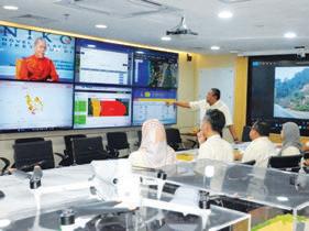
4. Emergency Preparedness, Response & Recovery: The Safety Net. Led by NADMAAgensi Pengurusan Bencana Negara. Despite the best prevention efforts through mapping, education, and policy, nature remains unpredictable. This brings us to the 4th pillar: Readiness. The Emergency Preparedness Working Group focuses on the infrastructure of response, powered by real-time data.
Real-Time Early Warning Systems (EWS) and Sistem Amaran Awal Tanah Runtuh (SAATR) are the technical infrastructure that underpins national preparedness. It has evolved from simple standalone rain gauges to a complex telemetry network capable of real-time monitoring and alerting.
• Rain Gauges (RG): Over 73 stations managed by JKR are integrated with data from JPS and METMalaysia to monitor rainfall intensity and duration, the primary triggers for landslides in our tropical climate.
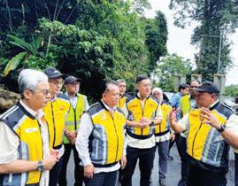
• Robotic Total Stations (RTS): These advanced optical instruments are deployed in critical sections, such as FT185 Jalan Simpang Pulai-Cameron Highlands, to
Dynamic Risk Assessment: For practising engineers, this means slope stability analysis is no longer static. The integration of this telemetry data allows for dynamic risk assessment. System development by respective agencies will be integrated under the National Disaster Control Centre (NDCC), NADMA, to provide timely alerts and information to stakeholders and affected communities.
The JKKTR Mechanism & Forensic Engineering. When prevention fails, the Landslide Working Group Committee (JKKTR) activates. Led by the Slope Engineering Branch (CKC) of JKR, this technical task force mobilises experts from JMG, METMalaysia, JPS, and MYSA to conduct forensic investigations for high-impact incidents.
Under Arahan NADMA No. 1, JKR is mandated to provide technical expertise in forensic engineering. This feedback loop is essential; forensic data is not just used for post-mortem analysis but is fed back into national hazard models to refine design standards and prevent recurrence.
Research & Development (R&D): FutureProofing the Nation: Led by CREATE, JKR – Centre of Excellence for Engineering and Technology.
Finally, to sustain these efforts in the long term, we must innovate. The R&D Working Group is tasked with advancing the science of slope engineering to meet the challenges of tomorrow, particularly the phenomenon of Double Disasters where extreme weather triggers simultaneous floods and landslides.
Sustainable Engineering via Bio-Engineering, a major focus of the R&D agenda, is sustainability through Naturebased Solutions (NbS). JKR’s Bio-Engineering research sites are testing the efficacy of local plant species for slope erosion control.
• Seksyen 42.8 Jalan Simpang Pulai-Blue Valley: Research here focuses on the root strength and soil retention properties of species such as periuk kera (pitcher plants), resam (ferns), and lalang
• KM 12 Jalan Seremban-Kuala Klawang: This site investigates the performance of Akasia, petai belalang, and senduduk bulu
These studies provide the empirical data needed to standardise bio-engineering as a viable, eco-friendly alternative to conventional concrete structures such as gunite or shotcrete. This aligns Malaysian engineering with global Sustainable Development Goals (SDGs), reducing the carbon footprint of slope stabilisation works.
AI and Predictive Modelling. The Ministry of Works (KKR) and JKR have also committed to intensifying technology adoption. This includes leveraging Artificial Intelligence (AI) for predictive slope stability modelling. By feeding the vast datasets from ISMAS and SAATR into AI algorithms, researchers aim to move from Early Warning to Predictive Forecasting, identifying potential failure sites weeks or months before a monsoon season begins.
The Pelan Induk Cerun Negara: Pelan Tindakan 20252030 is a comprehensive technical roadmap that matures the Malaysian approach to slope engineering. It empowers engineers with legislative backing through Act 133, equips them with advanced tools such as ISMAS and RTS, and creates a clear governance structure through the ICSM.
As aptly put by the Director General of Public Works, Dato’ Sri Ir. Roslan Ismail, the success of this plan relies on the dynamic collaboration between government agencies and the private sector. As we move forward, the engineering community must embrace these tools and strategies. Whether it’s complying with updated guidelines, participating in community DRR initiatives, or advancing research in sustainable engineering, our collective goal remains clear: Cerun Yang Selamat, Menyelamatkan Nyawa (Safe Slopes Save Lives).
Let us carry the momentum from the 2025 Symposium to ensure the next five years of implementation will set a global benchmark for slope resilience.



by:

Ir. Assoc. Prof.
Dr. Choo Chung
Siung Director
(Centre for Innovative Society), Associate Professor (Faculty of Engineering, Computing and Science) Swinburne University of Technology, Sarawak Campus and Honorary Treasurer of Malaysian Geotechnical Society.
Geotechnical hazards in Malaysia, such as sinkholes in urban limestone areas, rainfall-induced landslides, and excessive settlement in soft ground are becoming more frequent, more visible, and more disruptive. While such hazards are not new, their frequency, spatial extent, and socio-economic impact have heightened in recent years. Rapid urbanisation, especially in marginalised areas, extreme and unpredictable climate-induced effects, ageing underground infrastructure, and increasing reliance on underground space, have collectively raised the risks of geotechnical failure.
Crucially, these hazards are rarely caused by a single triggering mechanism. Sinkholes typically arise from the interaction between geology, fluctuating groundwater, utility conditions, and surface loading. Landslides are often the result
of cumulative rainfall, pore pressure build-up, material degradation, and historical activities (anthropogenic or natural) at the slope site.
Excessive settlement in soft ground reflects timedependent consolidation or creep, construction staging, and changes in groundwater regime. In all, these cases of georisk hazards are not the result of isolated design factors but typically emerge from interacting systems of geology, groundwater, infrastructure, climate, and human intervention.
Conventional geotechnical practice, however, remains largely static. Designs are finalised based on limited snapshots of subsurface conditions obtained during site investigation. Numerical analyses typically assume fixed material parameters, simplified boundary conditions, and prescribed loading scenarios. Monitoring systems, when installed, are often implemented during or after construction and primarily for compliance, rather than as integral components of decision-making. In an era characterised by climate extremes, ageing underground utilities, and dense urban development, this approach increasingly exposes engineers, asset owners, and authorities to residual and poorly quantified risk.
Digital twins and artificial intelligence (AI) offer a fundamentally different approach. Together, they enable a shift from reactive hazard management (responding after a georisk instance) to predictive geotechnical intelligence (pre-emptive mitigative
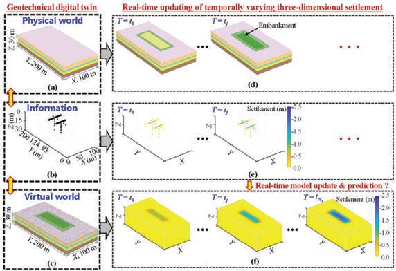
underground space for embankment construction: (a) 3D ground space, (b) locations of monitoring sensors and devices, (c) 3D FEM model, (d) construction of an embankment on a 3D ground space, (e) 3D ground settlement data monitored at various construction stages and (f) prediction of time-varying consolidation settlement in a 3D space (Tian et al., 2025)
response to likely georisk instances). Predictive geotechnical intelligence involves the continuous assessment of ground behaviour, where the risks can be learnt from, and acted upon before failure occurs. This shift is not merely technological; it also represents a change in how geotechnical engineers conceptualise risk, uncertainty, and responsibility in the built environment.
A geotechnical digital twin is not a static three-dimensional model nor an extension of building information modelling (BIM). It is a living digital representation of the groundstructure system, continuously updated using real-world data and capable of simulating future behaviour under changing environmental and operational conditions.
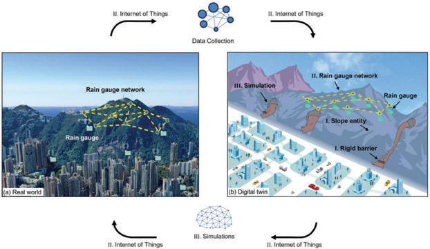
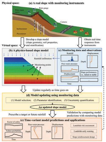
In essence, a digital twin links the physical system (soil, rock, groundwater, structures, and monitoring instruments) to a virtual system comprising numerical models, databases, and analytical engines. An essential feature of digital twins is that information flows bi-directionally, where monitoring data are used to update models, while simulations generate predictions that inform engineering decisions. This concept is illustrated schematically in Figure 1 for a slope digital twin, where real-world slope conditions, monitoring systems, and numerical models are coupled through continuous data exchange and simulation updating.
Unlike traditional analyses, digital twins explicitly acknowledge uncertainty, variability and time-dependency. Material properties are not necessarily treated as fixed constants but as parameters which may evolve as new data become available.
Boundary conditions, such as groundwater levels or loading sequences, are updated as conditions change. This makes digital twins particularly wellsuited to geotechnical engineering, where behaviour is strongly influenced by groundwater, rainfall, construction sequence, and progressive degradation.
Recent research demonstrates that digital twins are no longer purely conceptual. They have been applied to slope stability forecasting, where failure probability can be updated in near real time, and to ground settlement prediction, where consolidation behaviour is refined as construction progresses.
Figure 2 illustrates the concept of real-time updating of three-dimensional consolidation settlement during embankment construction. This shows how digital twins can bridge the long-standing gap between design assumptions and observed performance, enabling engineers to learn continuously from the ground itself.
Malaysia’s geological and climatic conditions amplify geotechnical risk in distinctive ways. Urban centres such as Kuala Lumpur, Ipoh, and parts of Penang and Kuching are underlain by limestone formations. These karstic environments are inherently susceptible to subsurface voiding and sinkhole formation, especially when groundwater regimes are disturbed by excavation, tunnelling, or leaking utilities.
At the same time, our tropical climate delivers highintensity rainfall events that frequently exceed the assumptions embedded in older design standards.
Cut slopes along highways, hill-site developments, and infrastructure corridors are repeatedly subjected to prolonged rainfall, leading to pore pressure build-up and progressive strength reduction. In coastal and low-lying areas, extensive deposits of soft clay and peat introduce long-term settlement risks that can persist for decades after construction.
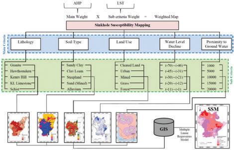
The spatial nature of these hazards is evident in national and city-scale hazard mapping. Figure 3 shows a GIS-based framework for sinkhole susceptibility mapping in Malaysia, integrating geological, hydrological, and land-use factors.
This highlights that geotechnical hazards are predictable geospatially and are condition-dependent. However, current responses to the incidence of such hazards remain largely event-driven rather than anticipatory, even with the aid of such hazard maps. Investigations are often commissioned after failure, and mitigation measures are implemented reactively. A digital twin framework offers the opportunity to transform such hazard maps from static planning tools into dynamic risk platforms which evolve with time, monitoring data, and operational changes. Planning controls administered by asset owners as well as environmental oversight by agencies, can be significantly strengthened by integrating digital twin outputs into approval, monitoring, and enforcement processes.
Digital twins become genuinely powerful when enhanced with AI. Physics-based models alone struggle to capture the full complexity of geotechnical systems, particularly when parameters are uncertain, behaviour is nonlinear, and multiple interacting processes are involved. Moreover, detailed numerical simulations are often computationally expensive, limiting their use in real-time decision-making.
AI complements physicsbased models by learning patterns from monitoring data, operational records, and historical performance, including datasets already collected under existing inspection programmes and local authority monitoring requirements. Machine learning algorithms can identify relationships between rainfall, pore pressure, displacement, and failure that are difficult to express analytically. Surrogate models can approximate complex numerical analyses, enabling rapid forecasting. When integrated carefully, AI does not replace engineering judgement. Rather, it augments it. The transformation from raw data to engineering decisions is illustrated in Figure 4, which shows a data-to-decision workflow for a slope digital twin. Monitoring data are assimilated into the digital model, uncertainties are updated, and risk indicators are generated to support intervention strategies.















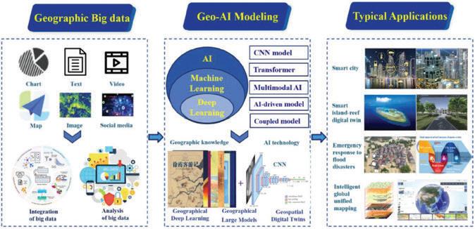
AI-enabled digital twins can support several key Malaysian geohazard applications.
• Sinkholes: By integrating subsurface susceptibility, groundwater behaviour, and utility condition data, digital twins can identify zones where void formation and collapse risk are increasing, enabling targeted inspection and preventive maintenance before surface failure occurs.
• Landslides: AI models can move beyond simple rainfall thresholds by learning site-specific rainfallpore pressure-movement relationships, reducing false alarms while improving early warning capability.
• Settlement: In soft ground environments, digital twins can enable adaptive construction control by continuously updating settlement predictions as new monitoring data become available, supporting informed decisions on staging, surcharge removal, or ground improvement.
International benchmarks demonstrate the feasibility of this approach. Instrumented slopes, probabilistic model updating frameworks, and data-driven prediction systems provide valuable lessons which are directly transferable to Malaysian. AI-enabled digital twins can convert monitoring data from passive records into active inputs for risk management.
Digital twins and AI represent a strategic evolution in geotechnical engineering. They do not replace engineering judgement; instead, they enhance it by providing foresight rather than hindsight. By continuously learning from the ground, these tools enable earlier intervention, more efficient mitigation, and improved public safety.
As illustrated in the roadmap in Figure 5, the profession is moving from isolated monitoring towards an integrated predictive intelligence. For Malaysia, embracing this
transition offers a pathway to safer infrastructure, more resilient cities, and more informed decision-making. Despite its promise, predictive geotechnical intelligence is not without challenges. High-quality data are essential, and monitoring systems must be designed with model integration in mind. Models must be transparent and interpretable if they are to gain professional and regulatory acceptance. Engineers must be trained to not only use these tools, but also to understand their limitations.
Equally important are governance structures and data-sharing arrangements. Digital twins cut across traditional project boundaries, requiring collaboration between designers, contractors, asset owners, and authorities. Without clear responsibility and accountability frameworks, even technically robust systems may fail to influence decision-making. The transition from monitoringbased practice to predictive geotechnical intelligence will not occur through technology adoption alone. It requires deliberate policy alignment, capability building, professional leadership, and institutional coordination. Malaysia already possesses much of the required monitoring capability, numerical expertise, and research capacity. In fact, Malaysia has embarked on increasing the adoption of satellite-based InSAR ground deformation monitoring, smart city analytics platforms, and digitalisation of underground utility assets. Initiatives such as the Putrajaya Urban Observatory, the Virtual Island of Penang and the Augmented Reality for Underground Utility Mapping System can be serve as proto-digital twins for a practical foundation in developing comprehensive geotechnical risk management systems.
What is needed is integration across projects, agencies, and disciplines, supported by professional leadership and standards development. For Malaysia, the following suggestions are proposed for consideration by the engineering profession, regulators, and asset-owning agencies.
1. Embed Digital Twins within Existing Standards
Digital twins and AI should be positioned as extensions of existing Malaysian standards and manuals. Current frameworks for site investigation and slope maintenance guidelines already mandate inspection, instrumentation, and monitoring. Policy guidance should explicitly recognise digital twins as an acceptable mechanism for integrating these requirements into a continuous, life-cycle-based risk management system.
2. Formalise Data Governance and Data Sharing
Predictive geointelligence depends on data continuity. Policy frameworks should encourage secure and accountable data sharing between the various stakeholders, namely between consultants, contractors, asset owners, and authorities. Geotechnical engineering institutions (such as the Institution of Engineers, Malaysia and the Malaysian Geotechnical Society) can play a coordinating role by proposing data governance principles tailored to geotechnical applications, rather than leave this to ad hoc project arrangements.
3. Treat AI as Decision Support
In order to maintain professional accountability, policy guidance should clearly state that AI-enabled digital twins function strictly as decision-support tools, while final engineering judgement remains the responsibility of registered Professional Engineers. This ensures that outputs generated by AI-enabled digital twins are subject to professional interpretation, validation, and contextual understanding, rather than being treated as autonomous or deterministic decisions. Professional Engineers therefore remain fully accountable for how predictions are assessed, applied, or overridden in practice.
4. Invest in Capability Building, Not Just Technology
The success of digital twins ultimately depends not on software or sensors, but on engineers who are capable of bridging geotechnical behaviour and data-driven modelling. Digital twins are only as reliable as the assumptions, data quality, and interpretive judgement applied to them.
Continuous Professional Development (CPD) programmes must begin to incorporate structured training in digital twin concepts, including data integration, model calibration, validation, and life-cycle management. Equally important is competency in AI model interpretation and explainability, so that engineers can understand why a model produces a particular prediction, recognise its limitations, and identify when outputs fall outside credible engineering bounds.
5. Pilot Before Mandate
Rather than pursuing immediate nationwide mandates, the adoption of digital twins and AI-enabled tools should proceed through targeted pilot projects, focusing on contexts where geotechnical risk is high and monitoring data already exists. Suitable starting points include selected high-risk slopes, known urban sinkhole-prone zones, or stretches of major infrastructure corridors.
Digital twins which perform well in isolated projects must demonstrate consistency, robustness, and transparency
when deployed across multiple sites, geological conditions, and operational teams. This allows for gradual scaling for the identification of weaknesses in before wider adoption.
Lessons from these pilots should then inform the gradual integration of digital twins into technical guidelines, codes of practice, and asset management frameworks. This evidence-led approach builds confidence among engineers, regulators, and asset owners, ensuring that digital tools enhance established engineering processes rather than disrupt them.
While predictive geotechnical intelligence is still emerging, the rapid evolution of digital twin architectures and AIenabled analytics points to a future where ground behaviour can be understood, anticipated, and managed in ways that are both more responsive and more resilient. Real-world research and early deployments show that these systems are technically feasible and can meaningfully enhance traditional engineering practice when implemented with careful governance, rigorous professional interpretation, and ongoing engagement with monitoring data.
The goal for Malaysia is not only to adopt new tools, but to cultivate an ecosystem in which engineers remain the stewards of risk. This can be achieved by shaping how data, models, and decisions converge to safeguard infrastructure and communities.
The challenge ahead lies not in questioning whether digital twins and AI should be adopted, but in determining how responsibly they can be embedded into mainstream geotechnical practice. With careful implementation, ongoing professional development, and strong governance, these technologies offer a pathway towards resilient infrastructure, better risk management, and a strengthened role for geotechnical engineers in safeguarding the built environment.
[1] Ju, L.Y., Xiao, T., He, J., Xu, W.F., Xiao, S.H., Zhang, L.M., 2025. A simulation-enabled slope digital twin for real-time assessment of rain-induced landslides. Eng Geol 353. https://doi.org/10.1016/j. enggeo.2025.108116
[2] Liu, X., Wang, Y., Koo, R.C.H., Kwan, J.S.H., 2022. Development of a slope digital twin for predicting temporal variation of rainfall-induced slope instability using past slope performance records and monitoring data. Eng Geol 308. https://doi.org/10.1016/j.enggeo.2022.106825
[3] Rosdi, M.A.H.M., Othman, A.N., Zubir, M.A.M., Latif, Z.A., Yusoff, Z.M., 2013. Sinkhole susceptibility hazard zones using gis and analytical hierarchical process (AHP): A case study of Kuala Lumpur and Ampang Jaya, in: International Archives of the Photogrammetry, Remote Sensing and Spatial Information Sciences - ISPRS Archives. International Society for Photogrammetry and Remote Sensing, pp. 145–151. https://doi.org/10.5194/isprs-archives-XLII-4-W5-145-2017
[4] Su, F., Yan, F., Wu, W., Fu, D., Cao, Y., Lyne, V., Meadows, M., Yao, L., Wang, J., Huang, Y., Huang, C., Qin, J., Fang, S., Zhang, A., 2025. Advancing intelligent geography: Current status, innovations, and future prospects. Geography and Sustainability. https://doi. org/10.1016/j.geosus.2025.100375
[5] Tian, H., Wang, Y., Zhang, D., 2025. Real-time model updating and prediction of three-dimensional time-varying consolidation settlement using machine learning. Journal of Rock Mechanics and Geotechnical Engineering 17, 5954–5969. https://doi.org/10.1016/j. jrmge.2024.10.030


Annual Reports • Booklets • Brochures • Buntings • Business Cards
CD / DVD Replications • Calendars • Cards & Invitations • Certificates
Custom Printings • Envelopes • Folders • NCR Bill Books • Notepads Leaflets • Letterheads • Paper Bags • Posters • Stickers • Others










































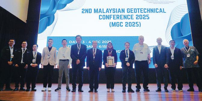
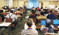
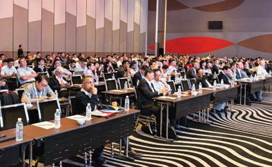
The 2nd Malaysian Geotechnical Conference 2025 (MGC 2025) was organised by The Institution of Engineers, Malaysia’s Geotechnical Engineering Technical Division (GETD), in collaboration with the Malaysian Geotechnical Society (MGS). Held at the Wyndham Grand Bangsar, Kuala Lumpur, on 3-4 December 2025, it was attended by 320 participants and marked its second edition; the inaugural event was held in 2004.
The MGC 2025, themed Innovative & Practical Geotechnical Solutions, aimed to highlight various geotechnical engineering challenges faced by professionals, to keep abreast of the latest technological advancements, and to provide a platform for professional networking.
There were memorial lecture sessions dedicated to the late Ir. Dr. Ooi Tek Aun and the late Ir. Dr. Ting Wen Hui, in recognition of their significant contributions to the engineering community. Both were involved in the 1st MGC 2004, serving respectively as members of the organising committee and as a keynote speaker. The lectures provided a platform for reflection and learning, with Mr. Mike Dobie presenting Lessons from Laboratory & Field Testing and Ir. Dr. Toh Cheng Teik sharing insights on Slope Stability – Design Problems, Predictability, Consequences of Failure & Liabilities. Both lectures offered valuable knowledge and practical reflections shaped by decades of professional experience, providing enduring insights for all participants.

by:
Ir. Dr. Ng Soon Min
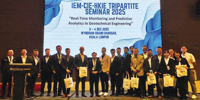
In addition, the conference was held in conjunction with the IEM-CIE-HKIE Tripartite Seminar, as 2025 was the year in which hosting responsibilities came under IEM. The Tripartite Seminar is an annual event that provides a platform for interactive discussions and the exchange of multidisciplinary engineering experiences between IEM, the Chinese Institute of Engineers (CIE, Taiwan), and the Hong Kong Institution of Engineers (HKIE). The seminar is hosted in rotation by these three professional institutions. The theme for 2025 was Real-Time Monitoring & Predictive Analytics in Geotechnical Engineering, highlighting advancements in real-time monitoring and predictive analytics, complemented by insights from project experiences and emerging technologies.
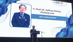
The conference commenced with a welcoming address by Ir. Sin Peng Tean, the Organising Chairman of MGC 2025, followed by the official opening address delivered by the IEM President, Ir. Prof. Dr. Jeffrey Chiang Choong Luin. The technical programme featured four keynote lectures and 18 technical paper presentations, covering a broad spectrum of geotechnical engineering topics such as slope stability, ground improvement, geosynthetics applications, deep excavation and foundation engineering.
The keynote lectures were delivered by distinguished experts. Dr. Vivi Anggraini presented a data-driven approach to analysing rainfall-soil moisture interaction for urban slopes, linking environmental geotechnics with sustainable development. Mr. Chris Lawson shared insights
on the use of geosynthetic-reinforced fills in marine engineering applications, while Prof. Chu Jian introduced a new foundation system developed for container yards in Singapore. Ir. Dr. Ooi Lean Hock concluded the keynote sessions by sharing practical case histories on underground excavation in sedimentary formations.
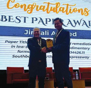
The Best Paper Award was conferred in recognition of exceptional research quality, innovative approach, and significant contribution to the advancement of geotechnical engineering. The prestigious award was bestowed on the paper titled Cut Slope Design & Remediation in LowStrength Weathered Sedimentary Formation: A Case Study of KM426.11 Southbound, North-South Expressway, authored and presented by Ir. Dr. Jimjali Ahmed. The paper was distinguished for its rigorous analyses, practical engineering insights, and valuable contribution to slope stability design and remediation practices in challenging geological conditions.
The MGC 2025 has emerged as a platform for advancing knowledge, fostering collaboration, and driving innovation. The active participation of industry practitioners, researchers, and policy-makers underscored the strategic role of geotechnical engineering in supporting the development of a safe, resilient, and sustainable built environment. The Organising Committee also extended its sincere appreciation to the event sponsors for their invaluable support and contributions, which were instrumental in the success of the conference.
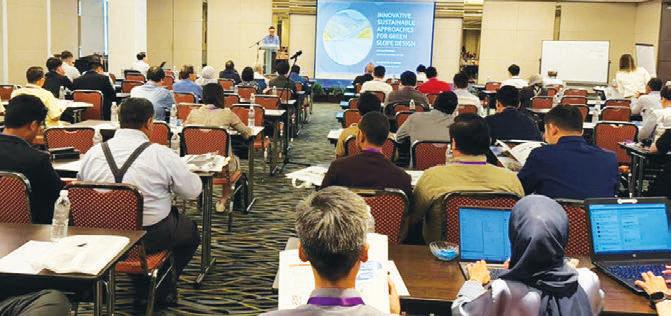
The Geotechnical Engineering Technical Division (GETD) of The Institution of Engineers, Malaysia (IEM) successfully organised a one-day seminar titled Resilient Slopes: Sustainable Design, Monitoring, and Maintenance Practices, on 23 July 2025. The event featured a distinguished panel of industry and public-sector experts: Ir. Dr. Low Tian Huat, Ir. Dr. Toh Cheng Teik, and Ir. Nursalbiah Hamidun.
The seminar was held at the Armada Hotel, Petaling Jaya, from 8:30 a.m. to 5:30 p.m. with a full day of intensive technical sessions and vibrant discussions. It was exceptionally well-received, drawing a diverse and engaged audience of 115 participants. This cohort included professional engineers, project managers, planners, academics, and key representatives from various public authorities, all united by a common concern for enhancing slope stability and safety in Malaysia.
The core objective was to move beyond conventional reactive measures and to foster a comprehensive dialogue on proactive, sustainable, and integrated slope management. In an era defined by increasing climatic volatility and rapid infrastructure development, the insights shared were both critical and timely.
The main focus was on dissecting the issue of slope resilience from four key angles: Sustainable green design, advanced monitoring technology, forensic analysis of past failures, and the overarching national regulatory framework.
The day was structured to equip participants with practical, actionable knowledge to develop robust, sustainable, and forward-thinking strategies for slope engineering. The key topics covered were:

by:
Ir. Dr. Low Tian Huat, a Director at Mohd. Asbi Associates Sdn. Bhd., has extensive involvement in tropical soil research, slope hazard and landslide studies, infrastructure risk mapping, and the development of sustainable “green” geotechnical design solutions. He delivered two comprehensive sessions that formed the technical core of the morning.
His first presentation, Innovative Sustainable Approaches for Green Slope Design, confronted a major challenge in the industry: The frequent unsustainability of green solutions on problematic ground. He addressed the common failure of conventional greening on sterile, acidic sub-soil stripped of its topsoil.
He argued against the use of chemical fertilisers, presenting instead Microbe Cultivation Technology as a superior bioengineering solution. This approach focused on rebuilding a living Soil Food Web by feeding microbes with specific organisms such as Mycorrhizal fungi, Trichoderma, and bacteria. He then linked this botanical science directly to geotechnical performance, demonstrating how these microbial ecosystems and root networks increase soil strength by significantly enhancing apparent cohesion (by as much as 15kPa) as well as increase soil matric suction, thereby strengthening slopes against shallow failures.
In his second session, Advancement in Slope Monitoring & Early Warning Systems, Ir. Dr. Low pivoted from design to proactive risk mitigation. He contrasted traditional, reactive strategies with modern, proactive approaches enabled by real-time monitoring. He elaborated on the integration of state-of-the-art geotechnical instrumentation, including inclinometers and piezometers, with wireless data transmission, robust data analytics, and automated notification protocols. He showed how these systems provided a continuous, intelligent assessment of critical parameters such as ground movement, pore water pressure, and rainfall, allowing stakeholders to make informed and timely decisions.
3. Kampung Pasir Revisited: Case History on a Liquefaction Slide
The afternoon began with a compelling forensic analysis by Ir. Dr. Toh Cheng Teik of Dr. Toh Associates Sdn. Bhd., The geotechnical engineering practitioner has 46 years’ experience spanning foundations, soil treatment, slope stabilisation, and basement construction across alluvial and marine deposits, peat, residual soils, and rock formations.
His presentation, Kampung Pasir Revisited, examined the catastrophic tragedy of 31 May 2006. Ir. Dr. Toh meticulously guided the audience through the 19-year official proceedings which ultimately led to the consultant’s exoneration in 2025. He provided precise definitions of liquefaction failures, distinguishing them from debris flows and mudflows. The session was a masterclass in forensic investigation, exploring the specific subsurface conditions, the mechanics of liquefaction, and the high-velocity travel distances which posed such a significant risk to life, underscored by actual video footage of the slide.
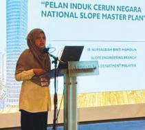
As Head of the Slope Technology Transformation Division at JKR, Ir. Nursalbiah provided a comprehensive overview of the nation’s strategic approach to slope management, which was first established in the wake of the 2003 Bukit Lanjan rockslide. She highlighted the plan’s primary goals: To establish a comprehensive national policy and, most importantly, to reduce risk and losses due to landslides.
Ir. Nursalbiah detailed the significant achievements of the National Slope Master Plan, including crucial amendments to the Street, Drainage & Building Act 1974 (Act 133), which now mandates geotechnical report verification by accredited checkers (Sec 70), slope safety reviews (Sec 70B), and periodic slope inspections (Sec 85A). Key achievements presented included the development of Slope Hazard & Risk Maps (PBRC) in both Area-Based (by JMG) and Linear-Based (by JKR) formats, which are now used for land-use planning.
She also detailed the Landslide Early Warning System (LEWS), supported by a network of 73 rain gauges and advanced monitoring like Robotic Total Stations (RTS) in critical areas. She concluded by introducing the new Action Plan for 2025-2030, which will focus on expanding PBRC to debris flow areas, strengthening data integration (via systems like ISMAS), and empowering local communities through Community-Led Disaster Risk Reduction (CLDRR).
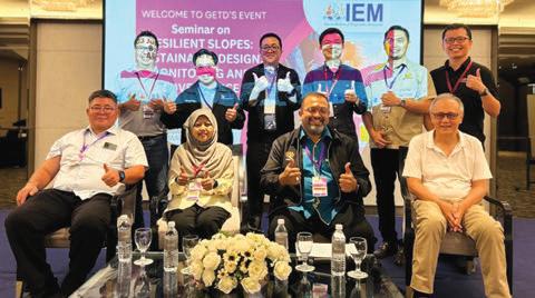
The seminar concluded with a dynamic forum and panel discussion moderated by Dr. Mohamad Niizar Abdurahman, a Senior Civil Engineer at the Slope Engineering Branch, Public Works Department Malaysia (JKR). The panel, comprising the speakers, addressed a wide range of questions from the floor.
A critical takeaway for all practicing engineers was his warning on the “irrelevance of limit equilibrium analysis” in such cases, demonstrating how conventional backcalculations could lead to false conclusions with severe consequences.
The discussion successfully bridged the gap between innovative design, forensic lessons, and regulatory governance, providing a holistic perspective on the future of slope engineering. The seminar concluded with a token of appreciation for the speakers, marking the end of a highly successful and informative day.


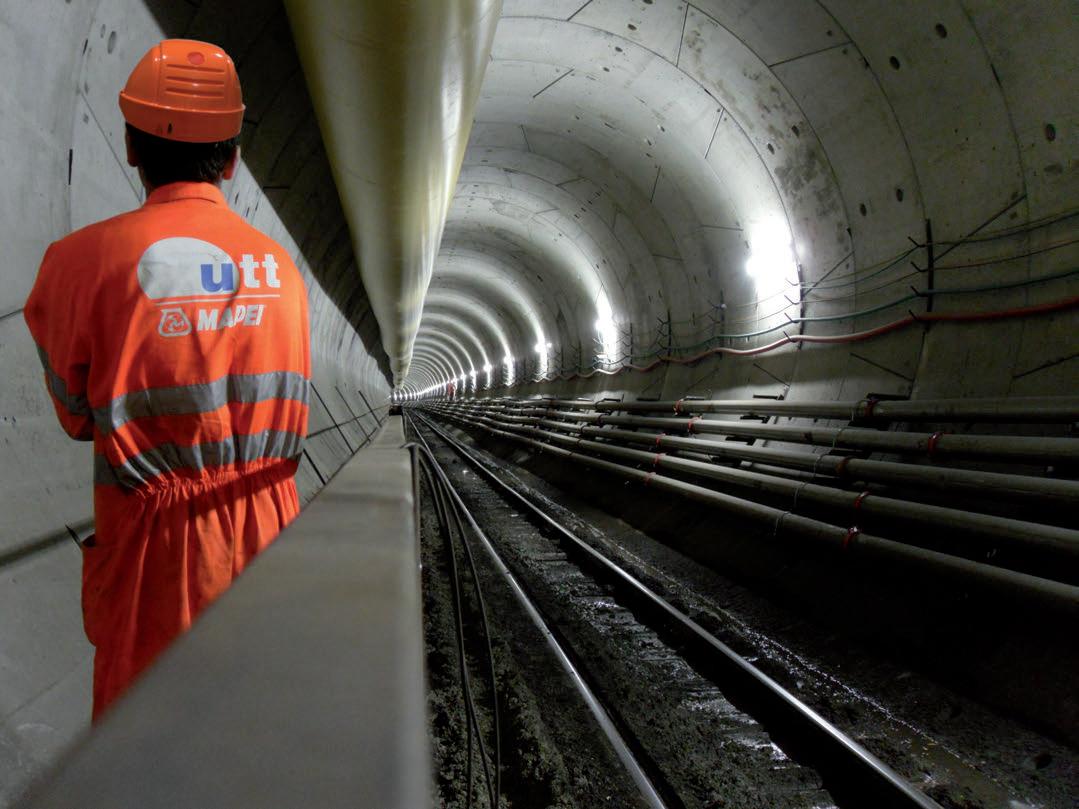
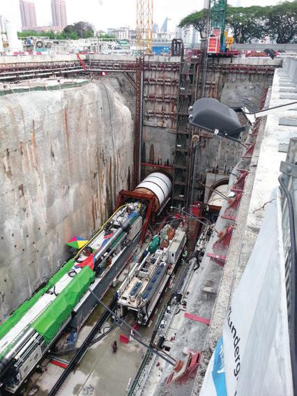
The Geotechnical Engineering Technical Division (GETD) of The Institution of Engineers, Malaysia (IEM) organised a technical visit to the Naue Asia Sdn. Bhd. factory in Selangor on Wednesday, 2 July 2025.
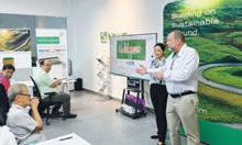
The visit offered a deeper look into the manufacturing of geosynthetics and all 15 participants expressed satisfaction, noting that they had gained valuable insights from the experience. The group departed from IEM at 8:30 a.m. and arrived at Lot 8598/8599, Batu 11, Jalan Segenting, Telok Panglima Garang, at 9:15 a.m. There was a briefing and presentation on Naue Asia’s projects, case studies, and a demonstration of the Naue online portal.
For the factory tour, which included manufacturing and lab testing demonstrations, the participants were split into two groups. The event concluded with a Q&A session before participants departed for IEM.

by:
Ir. Allan Chwee Yew Lun
What Participants Took Away from the Visit
Naue Asia Sdn. Bhd. is the South-East Asian hub of German geosynthetics manufacturer Naue GmbH & Co. KG. Participants gained the following insights:
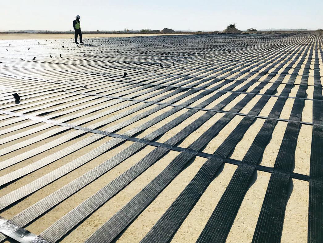
• Behind-the-Scenes Factory Tour: Participants witnessed first-hand the production of Bentofix® Geosynthetic Clay Liners (GCLs) and Secutex® Nonwoven Geotextiles.
• Digital Engineering Tools: Hands-on insights were provided into online geotechnical design software developed to facilitate design tasks, covering areas such as pavement base course calculations, coastal protection, and stormwater retention management.
• Innovative and Sustainable Solutions: Attendees learnt how Naue’s technologies contribute to smarter, safer, and more sustainable infrastructure across civil, geotechnical, and environmental projects.
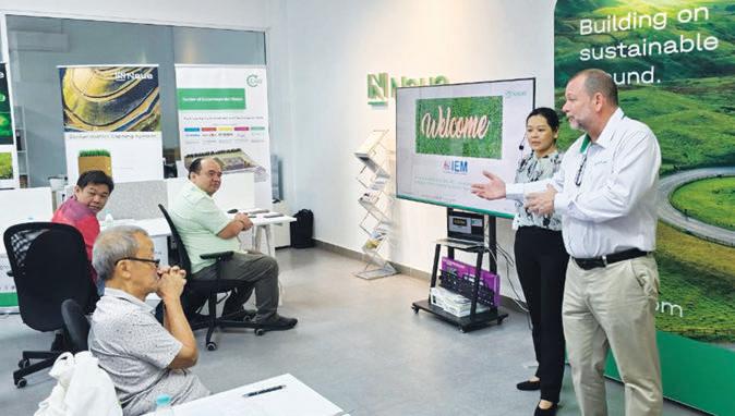
Presentation on Naue Asia projects
For the visit, which offered valuable exposure to the applications of geosynthetics, engineering innovation, and digital transformation in civil engineering, participants were entitled to 3 BEM Approved CPD Hours.



by:
The PMTD Pickleball Showdown, held on 15 November 2025 from 8:30 a.m. to 11:00 a.m. at Stadium Pickleball KWC, Kuala Lumpur, brought together a dynamic mix of engineers, young professionals, and inter-committee representatives for a morning filled with high energy, friendly competition, and strong camaraderie. Organised by the Project Management Technical Division (PMTD) of The Institution of Engineers, Malaysia (IEM), the event was designed to not only promote sportsmanship and well-being but also to strengthen inter-division engagement among the Technical Divisions, Special Interest Groups, Sections, and Young Engineers’ bodies.
From the moment the participants entered the stadium, the atmosphere was abuzz with excitement. There were six teams registered for the event. Each team showcased its unique identity through creative themes. PMTD dressed as Malay warriors. WE embraced a pink, fun theme. Triple A came with a sporty concept. MIMA impressed with a cowboy look. TUSTD appeared in an all-black ensemble and YES added cultural flair with a traditional theme. These themes added colour and personality to the competition to help strengthen a sense of unity among participants.


The event began at 8:45 a.m. with a short briefing by Ir. Ts. Nur Islam Nur Iskandar, Vice Chair of the PMTD, followed by a warm-up session led by the Triple A team before the matches started at 9:00 a.m. All the teams demonstrated strong teamwork, agility, and sportsmanship. Although the tone of the event was friendly, the teams played with focus and motivation, keeping the competition exciting and engaging.
Supporters came along to add to the spirit by firing up their team’s tagline cheers vibrantly. As the matches progressed, clever drop shots, last-minute saves, and unexpected “oops” moments kept everyone engaged, amused, and laughing, especially since several participants, although first-time players, were clearly enjoying the experience.
The awards presentation ceremony was officiated by Ir. Assoc. Prof. Dr. Syuhaida Ismail, Chair of PMTD, who commended not only the excellence, but also the style, humour, and unwavering enthusiasm shown by the participating teams. Triple A was named Champion, followed by the MIMA, the Runner-Up and TUSTD in third place.
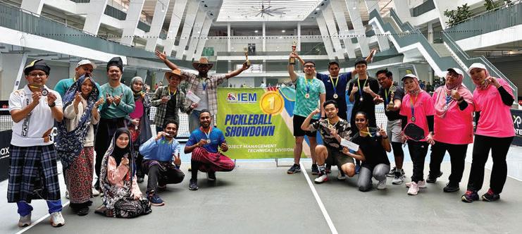
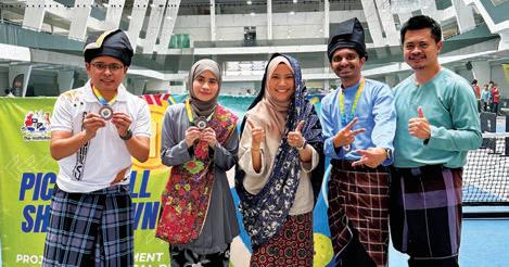

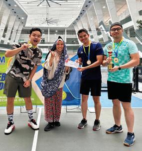
In addition to the podium achievements, there were also special awards which added vibrancy and fun to the tournament. The Vogue Award was presented to PMTD, for its standout warrior-themed attire which was the visual highlight of the event. The stadium echoed with non-stop cheers, thanks to the fiery and energetic support from YES, which earned the Loudest Cheerer Award.
Meanwhile, the Oops, I Did It Again Award was humorously won by WE in acknowledgement of its memorable funny moments, repeated playful mishaps, and unwavering spirit which entertained the spectators. WE definitely reminded everyone that sports was also about joy and laughter. Collectively, these awards reflected
the event’s holistic focus on not just victory, but also unity, creativity, joy, and togetherness.
The success of the PMTD Pickleball Showdown could be attributed to the dedicated volunteers, organising committee members, technical officials, and supportive interdivision committees which ensured that every detail – from team registration and match coordination to venue logistics and safety – ran seamlessly. Their hard work aligned IEM’s broader mission of promoting holistic development through a balanced mix of professional, social, and recreational programmes for members.
Beyond the tournament outcomes, the event fostered meaningful inter-committee engagement, strengthened friendships, and provided a refreshing platform for recreational activities. It encouraged healthier lifestyles, enhanced networking opportunities, and reminded the engineering community of the importance of staying active and connected.
As the event concluded with group photos, post-match laughter, and congratulatory exchanges among the participants, it was evident that the PMTD Pickleball Showdown was more than just a sports activity. With such strong participation and overwhelmingly positive feedback, IEM is looking forward to organising more engaging, inclusive, and exciting activities in the future with the aim to cultivate a strong sense of belonging within the engineering fraternity.



Discover unlimited access to essential engineering eBooks for IEM members, supporting your professional development and knowledge enhancement.

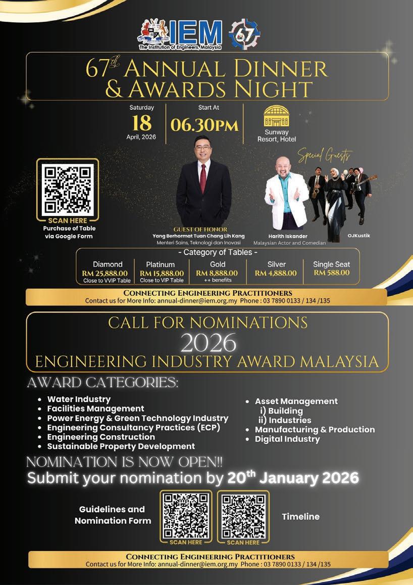









Stretching 2.7km across the strait separating San Francisco and Marin County, the Golden Gate Bridge in California, USA, was once thought to be impossible to build. Before it existed, ferries were the only connection across the channel. They were slow, weather dependent, and couldn’t keep up with growing demand. A permanent link was needed to bring communities together and to support regional development.
The idea first appeared in 1916 in a newspaper article by journalist James Wilkins. But it was engineer Joseph Strauss who took the idea forward, refining the vision and assembling a team that included Charles Ellis and Leon Moisseiff. When the bridge opened in 1937, its 1,280m main span was the longest suspension span in the world at the time.
Built under difficult conditions, including strong tides, deep waters, and dense fog, the project also introduced new safety measures. A safety net installed beneath the bridge deck saved the lives of 19 workers. Its International Orange colour was chosen, not just for its bold appearance, but also for visibility in foggy conditions.
The Golden Gate wasn’t just about crossing water. It was a bold act of engineering that connected people, enabled progress, and changed the future. It’s a lasting reminder of what great engineering can achieve.
To all Members,
Date: 22 February 2026
LIST OF CANDIDATES ELIGIBLE TO SIT FOR THE PROFESSIONAL INTERVIEW FOR THE YEAR 2026
The following is a list of candidates who are eligible to sit for the Professional Interview for the year 2026.
According to the IEM Bylaws, Section 3.8, the names listed below are published as eligible candidates to become Insitution Members, provided that they pass the Professional Interview in 2026.
If there are any Corporate Members who have objections against any candidate deemed unsuitable to sit for the Professional Interview, a letter of objection can be submitted to the Honorary Secretary, IEM. A letter of objection must be submitted within one month from the date of publication.
Ir. Chen Harn Shean IEM Honorary Secretary
NEW APPLICATION NAME QUALIFICATION
CIVIL ENGINEERING
AHMAD MUZAMMIR BIN MUHAMMAD BE (SUNDERLAND POLYTECHNIC) (CIVIL, 1991) MBA (UiTM) (BUSINESS ADMINISTRATION, 2009)
SHAHRUL AMIRUL BIN SIVAGNANAM BE HONS (UPM) (CIVIL, 1999)
APPLICATION FOR CORPORATE MEMBER NAME QUALIFICATION
CIVIL ENGINEERING
AIMANORLIN BINTI RAMLI BE HONS (UTM) (CIVIL, 2008)
MD KHUSAIRI BIN BAHARUN BE HONS (UMP) (CIVIL - ENVIRONMENTAL, 2012)
SUHAIMI BIN MAT SAAD BE HONS (UiTM) (CIVIL, 2016) MSc (UiTM) (HIGHWAY, 2022)
ELECTRICAL ENGINEERING
SHEIKH MUHAMAD FIKRI BIN
SH. JA'AFAR BE HONS (MMU) (ELECTRONICSTELECOMMUNICATIONS, 2012)
MEMBER TRANSFER
M'SHIP NO. NAME QUALIFICATION
CIVIL ENGINEERING
132530 MUHAMMAD IRFAN SHARAFI BIN ZAKARIA BE HONS (UTM) (CIVIL, 2020)
105249 CHEW ZHAO YIN ME HONS (THE UNI. OF NOTTINGHAM) (CIVIL, 2019)
112783 MOHD SYAUFIK HELMI BIN YUSOFF BE HONS (UTM) (CIVIL, 2017) MSc (UiTM) (CONSTRUCTION, 2021)
23261 CHAO MEANG SIONG BE HONS (THE UNI. OF SOUTHERN QUEENSLAND) (CIVIL, 2002)
ELECTRICAL ENGINEERING
132617 CHONG MAN YUEN BE HONS (UTeM) (ELECTRICAL - INDUSTRIAL POWER, 2010)
MECHANICAL ENGINEERING
96032 KUMARAN A/L RAMACHANDRAN BE HONS (UTM) (MECHANICAL - AERONAUTICS, 1995) MBA (INTI) (BUSINESS ADMINISTRATION, 2009)
35583 CHEONG YUN KIM BE HONS (UNITEN) (MECHANICAL, 2010) ME (UNI. OF SOUTHERN CALIFORNIA) (BUILDING SCIENCE, 2016)
128998 GOH HUI JACK BE HONS (MONASH) (MECHANICAL, 2021)
TRANSFER TO CORPORATE MEMBER
M'SHIP NO. NAME QUALIFICATION
CIVIL ENGINEERING
115250 CHUNG KA YIE, GABRIEL BE HOS (MONASH) (CIVIL, 2021) MSc (THE UNI OF SHEFFIELD) (STRUCTURAL, 2023)
99204 LEE WEE KIANG, MICHAEL BE HONS (UNIMAS) (CIVIL, 2011)
ELECTRICAL ENGINEERING
124099 INDIRAN A/L KAMALAN BE HONS (MMU) (ELECTRONICS, 2011) MBA (UTM) (BUSINESS ADMINISTRATION, 2017)
93767 ROLAND LAGATA BE HONS (UTM) (ELECTRICAL, 2021)
62109 THONG SOON KIAT BE HONS (APU) (ELECTRICAL & ELECTRONIC, 2015)
ELECTRONIC ENGINEERING
43491 NASRIN BINTI SULAIMAN BE HONS (UKM) (ELECTRICAL, ELECTRONIC & SYSTEMS, 2002) ME (UTM) (ELECTRCAL POWER, 2010)
MECHANICAL ENGINEERING
54097 OON CHEEN SEAN BE HONS (UNIMAP) (MECHANICAL, 2010) MSc (UM) (ENGINEERING, 2013) PhD (UM) ( 2018)
119694 LOTER
(USM) (MECHANICAL, 2006)
The institution expresses its gratitude to all who have contributed to the Wisma IEM Building Fund. IEM members and readers who wish to make a donation may do so by downloading the form from the IEM website at http://myiem.org.my or by contacting the secretariat at +603-7890 0130 / 136 for further information. The list of contributors for January 2026 is as shown in the table