
LAND USE AND BIOTA OF THE HEATHLANDS OF THE SUFFOLK SANDLINGS, 1020-2020
PATRICK ARMSTRONG
Introduction
Between about 1966 and 1984 I conducted systematic field and archival research on the ecology and land use history of the East Suffolk Sandlings (Armstrong, 1970, 1971, 1972, 1973, 1975, 1984). Most of my time since mid-1974 has been spent outside the UK, and only very occasional brief field visits to Suffolk have been possible. This paper seeks to provide something of an update to my earlier work, some of which is briefly summarised here. It thus brings to an end a programme of field and archival research I commenced on my first visit to the region in April 1946.
A landscape mosaic
The Sandlings (sometimes Sandlands) region is defined as the strip of land, approximately 15 km wide, from the River Orwell, northward to just north of Lowestoft, and underlain by Plio-Pleistocene Crag deposits. Soils are predominantly sandy, podzolic and acid, and relief seldom exceeds 25m. For centuries it has comprised a mosaic of open heathland, arable and with drained marshland in the valleys. Undrained marshes, including saltmarsh, locally provide a coastal fringe.
The heathland-sheep system in the eighteenth and early nineteenth centuries
John Kirby (1735) emphasised the landscape’s mosaic-like nature: The Sandland ... may be divided into the marsh, arable and heathland. The marshland is naturally fruitful, fatting great numbers of oxen and sheep The part which is arable is in some places good for tillage and produces excellent crops of all sorts of corn, and where it is in a manner barren it is found fit for improvement by chalk rubbish, and a late discovered cragg or shell ... the heathy part may contain about one third of the Sandlands and is used for sheep walks.
A few decades later, in 1810 poet George Crabbe (in The Borough) emphasised the intermixture of drained and undrained marshland, and heath, and the possibilities of enrichment of the soil through the use of crag: Fen,marshes,bogandheathallintervene Herepitsofcrag,withspongy,plashybase, Toenrichth‘uncultivatedplace.
An estimate of the different land use types in two typical Sandlings parishes is found in the Tithe Apportionment documents – files in the Public Record Office compiled during the Tithe Apportionment Surveys of the 1830s.
Even more important, each individual agricultural estate or holding would comprise a similar suite of different land-types: heathland (and sometimes dunes), undrained marsh (reedswamp or saltings), drained marsh (usually good quality pasture) and arable. (Evidence of piecemeal drainage of marshes along the Suffolk coast exists from about 1500.) At the estate at Westwood, for example, in 1767, of approximately 2550 acres (1032ha), 402 acres were marsh, 622 arable and 1550 heath or ‘sheepwalk’.
Quantity of Tithable Land in acres
The arable included land ploughed for rye, wheat, barley, oats, clover, and after about 1700, turnips. Usually, a crop rotation was practiced. Arthur Young made a tour of East Suffolk farms in 1795 and reported: The dry heaths are to be profitably managed only by sheep being made the principal,objectandallthetillageofthefarmabsolutelysubservienttothem.
At about the same time (1797) he noted:
It is extremely difficult to calculate with accuracy the produce of land which is nevermanagedorkeptdistinctfromtherestofthefarm.
The system was highly integrated. Cereals would of course be sold off the farm, but much of the arable land would be used for folding sheep after harvest, the land thus receiving manure in the form of dung from the sheep. Turnips and clover also might be grazed by sheepflocks directly from the fields, again providing a nutrient input particularly of nitrogen. (Nitrogen also being fixed by the clover). Great care was taken to ensure that the maximum benefit was obtained from folding the sheep on the land most able to benefit. Arthur Young wrote that ‘folding is universally and anxiously practiced, as the manure upon which the corn principally depends’. Leases might specify exactly how this was to be done. Sir John Blois indicated in a lease for Westwood (near Blythburgh):
Tenant to keep at least 800 sheep and to fold them at all reasonable times in the yearwiththeusualnumberofhurdlesuponsomepartofthefarmmostlikelytobe benefited thereby, under penalty of £5 a night for every night that the flock or at least 600 therof shall not be folded on the said part of the premises. (Suffolk
Archives:HA30/50/22/3.40)
In fact, when Arthur Young visited the farm at this time there were about double the number of sheep specified in the lease.
The sheep would be put to graze on the heathlands (sheepwalks) throughout the summer, while the other crops were growing on the land suitable for arable. Moreover crag or marl pits on the heathland or sheepwalks might provide lime for the cultivated land. The drained marshland, and sometimes the actual coastal saltings might be grazed at certain times of the year. Moreover ‘scummings’ or ‘marsh earth’organic material from creeks and drainage channels might be used as a further supply of compost for the farmland.

Another nineteenth century observer confirms both the vegetation type and the pattern of husbandry:
Whins[gorse],fern[bracken]andling[heather]grow…alongmostoftheseheaths
Large flocks of sheep are fed on these heaths and folded on the adjoining land. (Raynbird,1849)
One estimate had it that each acre of heathland could yield about 15lb of wool (say, very approx. 17kg per hectare), although it was acknowledged that there would have been important contributions from the other elements of the estate. Many young sheep would be sold, which would constitute a further output from the system. Vegetation was sometimes cut from the heaths for use in barns and for bedding stock, providing another link within the system. Even the saltings were sometimes used for sheep-grazing: the salt was thought to be beneficial.
The long-term persistence of the heaths
It is possible that the essentially open character of the Sandlings landscape had its origin in late pre-historic (Iron Age or earlier) or ‘Dark Age’ or Anglo-Saxon times. Certainly, the Domesday Survey (1086) shows that there was both less woodland cover and fewer plough-teams per unit area (and thus less arable land) than elsewhere in Suffolk, suggesting thar there must have been substantial areas of uncultivated ground. The meagre evidence indicates that there were already, however, appreciable numbers of sheep (and also goats) in the Sandlings area (Darby 1957). Slight support for the existence of heathland at this early time comes from references to bee-keeping. There are references in Domesday from Westleton, Blythburgh and Leiston to hives, or to renderings of honey, implying that bee-hives were set out so that nectar could be collected from expanses of heather. As far as can be ascertained, the sheep and heath relationship seems to have persisted through the Middle Ages, and into the ‘Early Modern’ period. A 1576 source reveals there were 500 sheep on the lord’s heathland at Benacre (Suckling, 1848), and a set of accounts for 1646-7 showed that there were about 1000 sheep in the summer of 1646, grazing on the heaths of the manor of Westwood, near Blythburgh (Suffolk Records HA 30: 30/5022/27.3). Other sources show that sheepflocks of comparable size grazed heathland on an estate including parts of Aldeburgh, Friston, Snape and Hazelwood (see also below).
In the late eighteenth century, heaths formed a near-continuous belt in the southern Sandlings, although probably less well managed than elsewhere. A Mr J Boys described Sutton Heath in 1793:
A desert sandy tract for many miles, covered with furze and brakes [bracken]suckinglambs,subjectto ricketsdiein greatnumbers … hereand there[stands]a solitaryshepherdattendingahalf-starvedflockofNorfolksheep.
There were indeed substantial areas of blown sand in the southern Sandlings at this time. Should further evidence be required, all along the coastal belt not only do the remaining area of heathland sometimes retain the name ‘walk’ or ‘walks’ –sheepwalks – but often field-names of areas now cultivated and even plantations also bear the appellation ‘walk’.
As late as the 1930s, at the time of the First Land Utilisation Survey, the general aspect of the sheep-heath-arable land use pattern seems to have been much the same. As in previous centuries…
Sheeparethemainstayofthearablefarmers …Thesheeprunforthemostparton theheathsandpoorgrasslandinthesummer,andarefoldedinthegreencropsin theautumnandstallfedontheroots[turnips?]inthewinter.(Butcher,1941)

Rabbits and warrens
Grazing by sheep, to some extent probably supplemented by cattle and goats, would do much to maintain the open character of the heaths in these early centuries: occasional fires would also assist in preventing invasion by scrub.
There are no mentions of coney-warrens in Domesday, but probably from the thirteenth century onward, rabbits added to the grazing pressure. The Normans introduced the species, first to islands off the south and west of England (the Isles of Scilly, Lundy), but by about 1235 they were established on the mainland. One Richard le Scot of Dunwich was granted the right of Free Warren in land at Minsmere, Dunwich and Westleton in 1265, and similar rights were granted in many nearby parishes in the decades that followed.
A statute passed in 1389 (13 Richard II, stat I, c.XIII, intended to control hunting with ‘greyhounds and other dogs’) makes mention of coneys and ‘warrens and conningries’: they were clearly widespread. And by 1400 many coney-warrens were established very widely in and near the Sandlings region, the court rolls of manors recording the sanctions imposed on poachers.
A coney-warren existed on the heath at Benacre in 1576 (Suckling, 1846), probably on the same land as that to warren rights had been granted to a Robert de Pierpoint in around 1267. Land use types can be extremely persistent.
Another example of a persistent warren is one mentioned in the Hundred Rolls (1267), and also in an
Indenturemadethe27th dayofDecemberinthexiiiyereoftheReynofkingHenry viii [1522] between Sir Robard Clear, knight … [and others] of one party and John Woreyn[asignificantname,perhaps …andothers]…ofthatotherpartyforallthat woreyn of coneys in Blyburgh [sic] belonging to the manor of Westwood as well withintheparkaswithout.(SuffolkArchivesHA30:50/22/1/11)
The lease was for 15 years and the annual rent was to be 14s. John might graze one horse on the warren, but nothing more. And he was not to hunt deer: these were presumably reserved to the landlord(s). And John was, at the end of the 15-year term, to
Levetheforesaidwarrenwellreplenishedwithatleast2000conyesormoretobe determinedbythediscretionoffourpersonsindifferentlytobechosenbythesaid partyes.
Clearly an accurate estimate of the population would be impossible, but the intention was to prevent complete extermination just before the end of the lease. Both the short-term and long-term productivity of the resource were thus protected. The area of the Westwood warren is not mentioned, but others in the Sandlings area for which more-or-less contemporary leases exist were of around 1000 acres (c. 400ha).
Nearly 200 years later, by a lease of Westwood for five years, commencing in November 1701, Sir Charles Blois permitted his tenant to havetheuseofthewarrenaswelluponthe[sheep]walksasintheinclosuresuntil St James’ day [25 July] right before the completion of the lease. And [the tenant] dothcovenantandgrantthathe duringthesaidtermshalldeliverweeklyfromSt James’daytoCandlemas[2February]threescorerabbitstoCookfieldHall.(Suffolk Archives30.50/22/1.37[i])
If this is accepted at face value, some 11,000 rabbits per year were to be given in part payment of rent. The lease was renewed on the same terms in 1706. In a lease dated 1764 the warren is not specifically mentioned, the landlord reserving the ‘liberty to take coneys, game and wildfowl upon the premises’.
Names of areas of heathland (and field names) including the element ‘warren’ or ‘coney’ abound in the Sandlings. There must have been dozens of warrens in the belt from Ipswich to Lowestoft. A visitor to southern Sandlings in the 1760s described the heathland there as ‘teeming with rabbits’ (Duc de la Rochefoucauld, 1933). Thousands of rabbit carcases were exported from the region to nearby towns, and even to London, particularly after the development of the railways. The typical yield seems to have been between 7 and 10 rabbits per annum, per acre (say 15 to 20 per hectare).
The Benacre warren in 1576 was described as ‘containing by estimation cc [200] acres of heath and pasture now replenished with v hundred [500] shepe [sic] or thereabouts, and some conyes’. It is clear however that both sheep and rabbits fed for much of the time on nearby arable land, marsh and ‘sea banks’. Coming closer to the present, the Assistant Tithe Commissioner for Snape, wrote of Snape Warren: ‘mere sand encumbered by furze’, used for both rabbit warrening and sheepwalk –‘a great many sheep are kept in the parish.’ There seems to be evidence that the sheep and rabbits would take different food-plants from the heathland vegetation: lichens, for example were completely avoided by rabbits but readily eaten by sheep – the relationship was almost symbiotic.
Thus, although some warrens were enclosed, many were partially enclosed or open. Both sheep and rabbits could come and go and thus obtain food from nearby
arable land, pasture, saltmarsh and pasture. Sometimes, particularly in the winter, additional food (such as hay or turnips) from nearby farmland was provided.
An intimate ecological balance thus seems to have existed between the heaths (sheepwalks, warrens), the sheep, the rabbits, and nearby farmland (hay, turnips, cereals), drained marsh and pasture. Even the local crag pits, saltmarshes and seabanks, and drainage channels had their part to play. The persistence of the Sandlings heaths for many centuries depended not only on the sheep and rabbits that prevented invasion by scrub, but on the network of relationships within the quite complex land use pattern.
The reasons for heathland decline
Arthur Young foresaw the decline in the area of heathland in east Suffolk. As early as 1795 he wrote:
Alltheseheathswilldisappearintime. He appreciated that agricultural methods were improving rapidly and new approaches to crop rotation, scientific methods, and mechanisation would allow an increasing area of sandy, infertile sheepwalk to the brought under the plough.
The total area of heath in Sandlings parishes recorded at the time of the Tithe Apportionment surveys of the late 1830s and 1840s was about 9000 ha. However, no complete records exist for a substantial number of parishes that probably had quite extensive areas of heath. Moreover, there was no consistency in the manner in which land was recorded. Heathland in one parish might be very similar to pasture in another. A figure of 12,000 might not be too high for the 1830s. Earlier figures are even more difficult to calculate. A survey of Suffolk made by J. Hodkinson in 1783, taken together with other evidence suggests extensive and continuous areas in the southern Sandlings, so the figure around the turn of the eighteen and nineteen centuries was even higher. Closer to the present, figures can be more accurately given. 7700ha in 1889 was reduced to 2422 in 1964. Between 1949 and 1964 1200ha were reclaimed in the southern Sandlinsg alone. However, locally, on occasions when the prices for crops from arable land were low, areas under cultivation might be abandoned and revert to heath.
The following table (from Sanford, 2005, and other sources) gives some idea of the overall decline in the area of Sandlings heath:
As well as the total area of heath declining, the size of individual fragments of heathland habitat became smaller: a given area of heathland habitat might be broken into a large number of fragments: this has significant ecological implications.
Shepherd, warrener, farm-hand and landlord alike were called into the services in the two world wars, and some countryside tasks were put on hold or covered by a skeleton staff. Warrening particularly seems to have been neglected: the rabbit crop at Benacre was carefully recorded in game books up to 1912, not after. After the
Great War came the depression: land values and crop prices fell, although in some places some sheep remained. However, the decline continued and Whiting (1967) noted for a group of 24 parishes in the southern Sandlings that sheep numbers had declined from 13,113 in 1938 to 4,081 in 1962. No longer were arable land, drained marshland and nearby saltings ecologically linked to the heaths by the sheep.
Other reasons for the expansion of agriculture at the expense of the heaths included the development of summer irrigation after 1947, and the solution of certain trace element problems (Bo, Cu, Mg) of the leached sandy soils in the 1950s. This type of reclamation and ‘improvement’ in post-Second World War decades also attracted subsidies.
Urban expansion of Ipswich occurred in the direction of the heaths. Possibly 500ha of heath have been used for airfield construction: Martlesham Airfield before the Second War, and RAF Woodbridge during it and Bentwaters subsequently. From 1884 onwards another 400 ha or so have been utilised as golf-courses.
But greater than all of these have been the demands of the Forestry Commission (now branded as Forestry England). Shortages of timber during and following World War I resulted is the aspiration that the UK should become self-sufficient in timber (or certain types of timber) and the Commission was formed under the Forestry Act (1919). From 1920 onward the Commission undertook a (sometimes unpopular) quite aggressive land purchase campaign – at a time when land values were low. Extensive holdings were acquired in the Sandlings. These are now grouped into:
Scots pine (Pinus sylvestris) and Corsican pine (Pinus nigra) were originally the plantation species most used. 3075ha were under plantation by late 1982. Rotations of between 50 and 75 years were envisaged. Further statistics on the changing land area under forestry are given in some of my publications listed above.
Myxomatosis
As sheep disappeared from the Sandlings scene, to some extent grazing pressure on the open heathland remnants was maintained by rabbits (Oryctolagus cuniculus). However, on 2 December 1953 myxomatosis was reported in a rabbit population in Easton Bavents, following its emergence in Kent the previous October. Game book records (in private possession) reveal that warreners’ killings at Benacre in the 1953-4 season totalled 5025, but in 1954-5 the equivalent figure was 35. ‘Warreners’ killings’ as a category disappeared from game records from that year onwards.
The destruction was almost total. Tens of thousands of rabbits died throughout the Sandlings region during the summer of 1954, and the stink of decomposing flesh
was a constant in the region’s countryside at that time. Numbers have occasionally built up subsequently, in the years 1957 and 1963 for example, but the disease usually prevents any major irruption. Rabbit population densities have remained well below pre-1953 levels.
The collapse of the system
In earlier centuries sheepfolding, rabbit-warrening, arable agriculture, the management of drained marshland pasture, and even the surveillance of undrained marsh and saltings were tightly integrated with one another. All depended, to a greater or lesser degree, on the existence of heathland nearby. The decline in the number of sheep in the region loosened the links between the heaths and other land uses at the same time that plantation forestry, intensification of arable farming and airfield construction were increasing, and recreational pressures on the heathland were expanding.
Changes in the heathland biota
The evidence for the changes in status for a number of ‘heathland indicator organisms’ and their associated communities will now be reviewed.
Plants and Vegetation
Tithe Apportionment records, and accounts by eighteenth and nineteenth century topographic writers provide thin, but fairly clear evidence of the nature of the plants and vegetation of the Sandlings heaths at that time. For example:
‘agoodgrowthoffurzeandling’;‘Blacklingheaths’(Young,1795);
‘heath,furzeandling’(Lease,SuffolkArchives,1764);
‘poorgrassandgorse’(DucdelaRochefoucauld,1784[1933]);
‘furzeandbrakes’(Boys,1793);
‘barrensandproducingrushesandsand-grass’(LeistonTitheFile,1840s)
Field (and other) names recorded in the Tithe files such as ‘Whinny Piece, Broom Field, Whin Pightle, the Brakes, Ling Close’ confirm that the dominant species were therefore (using modern names): Broom (Cytisus scoparius), Gorse (Ulex europeaus and the rarer Ulex gallii), Bracken (Pteridium aquilinum), Ling (Calluna vulgaris), Bell heather (Erica cinerea) and several species of grasses. Subtle differences in soil and the nature of grazing pressure (sheep, rabbits, other species) and burning history being amongst the factors that influenced the species composition of any particular patch. Cross-leaved heath (Erica tetralix) occurred is slightly damper heathland soils, e.g. on Westleton Heath, but by the 1980s was described as ‘extinct in some former habitats’ (Simpson, 1982). There is every reason to suppose that the plant community had been basically similar in the preceding centuries.
The decrease in sheep numbers did not seem to occasion any immediate change: possibly the reduction in sheep grazing was compensated for by an expansion in rabbit numbers, and so the situation in the 1940s and early 1950s might not have been very different from a century before. However, rapid change followed the virtual extermination of rabbits in 1954.
A series of photos I took in 1953 showed expansive areas dominated by Calluna and Erica on Tinkers Walk, Walberswick, with only the occasional Ulex shrub. Photos taken from identical positions in 1969 show completely transformed plant communities. In some locations the heather community had been invaded by swathes of bracken, in others a tangle of gorse had almost complete overwhelmed the Calluna and Erica: the lichen flora had also been reduced. A decade later substantial Betula and Pinus and occasional Elder (Sambucus nigra) sapling growth was to be seen on many heaths in the coastal belt.
The initial stages of afforestation, may have not occasioned major changes in heathland biota: in the 1920s and early 1930s, regularly spaced small saplings probably did not affect the ground vegetation cover nor the vertebrate or invertebrate biota substantially. By the late 1930s, 1940s and 1950s, ground cover was shaded out, soils affected by needle-drop and thus the nesting habitats for several bird species reduced. Clear-felling of some plantations occasionally opened the habitat sufficiently for some temporary recovery. The ‘great storm’ of October 1987 and the resulting clearance resulted in development of important areas of open habitat. (There had been an earlier somewhat less destructive storm in January 1976.)
Vertebrates
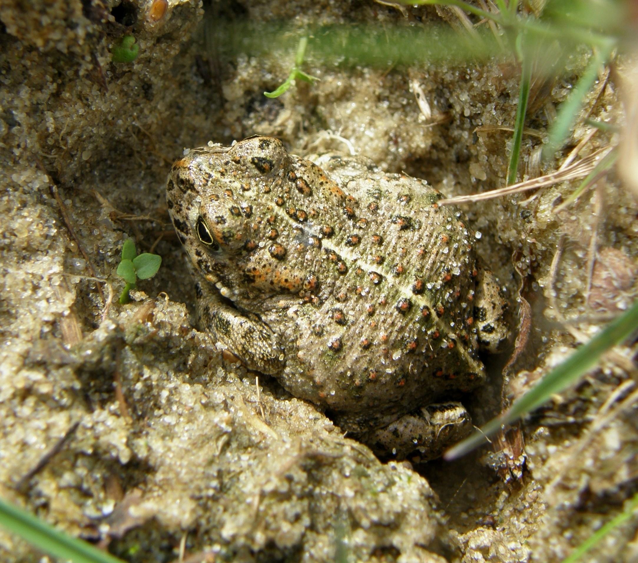
The natterjack toad (Bufo calamita). This species requires both sandy areas and ponds or marshes in which to breed and is thus doubly at risk. Early records (e.g. those quoted by Rope, 1934) note natterjacks present in at least 12 of the Suffolk coastal parishes (e.g. Southwold, Easton Warren, Walberswick), as late as the 1920s and
The common lizard (Zootoca vivipara) and adder (Vipera berus). These have long been the reptiles associated with Sandlings heathland habitats, and they remain not infrequent of Suffolk heathland fragments. Reports in the local press of humans or more commonly pets (cats, dogs) being bitten by adders occur most summers. A board on which several dead adders were displayed was erected on Dunwich Heath in the 1960s to discourage trespassers. The approach has changed: a notice erected around 2017 on Walberswick Common bore the words ‘Adders: you may find them basking in grass and amongst the heather. They are a legally protected species, please do not disturb them. Keep dogs under close supervision’. The isolated populations of both species on small heathland fragments remain at risk.
Amongst mammals, the game-book records for the Benacre estate provided evidence of an interesting change. The average kill of rabbits 1949-1954 was about 330: the mean for the next two decades – post-myxomatosis – was 25 – 30. The corresponding figures for hares (Lepus europaeus) were about 213 and 692: the year following the outbreak it was well over 1000. Although the ecological niches occupied by the two species are different, the massive reduction in food consumed by rabbit allowed considerable expansion by the other species.
It is amongst bird species that the effects of habitat change and reduction have been most noticed, partly because of the greater number of observers. Perhaps the species that typifies the change is the Red-backed Shrike (Lanius cellurio). Babington (1884-1886) described the species as ‘common or tolerably common’ at the end of the nineteenth century. By 1932, Ticehurst noted it had a ‘tendency to become less common’, habitat change being implicated. In 1943 it was reported as ‘unusually scarce’, but the First Suffolk Bird Report (SBR, 1950) described the species as ‘thinly but widely distributed’ noting the remarkable increase at Minsmere compared to 1949. In 1953, it was breeding ‘in good numbers in East Suffolk’. But Payn (1962) suggested there were no positive records of breeding north of Southwold since 1956, but a figure for 30 pairs was given for Walberswick alone in 1955-1956 (Pearson, 1973) (and I saw at least one pair apparently breeding at Benacre in the summer of 1967.) In 1962 there were said to be 35 breeding pairs in the Sandlings region, in 1964 there were 24, and in 1965, 17 (at 5 localities). At Minsmere, numbers of pairs declined from 16 in 1962, to 4 in 1964: pesticide residues were found in some unhatched eggs in nests at this site (RSPB documents). By 1989 it had been virtually lost as a Sandlings breeding species (Piotrowski, 2003), with only occasional singles seen since (with a couple of reported attempted breedings, Suffolk Bird Report [hereafter SBR, whether separately published as Suffolk Birds or included in the Transactions] 2020). There is evidence that the decline is Europe wide, and that climate may be implicated.
Wheatear (Oenanthe oenanthe). Long associated with rabbit warrens and sheepwalks, because of its preference for relatively open plant communities, and its use of rabbit burrows as nesting sites, this species suffered from the last century and a half of land use change. The reduction of sheep numbers with the agricultural depression, followed by myxomatosis robbed the area of the open habitat wheatears
needed for feeding and of nesting sites. Increased predation, e.g. by stoats, also followed myxomatosis. Afforestation destroyed habitats. Common in the nineteenth century, Ticehurst perceived a decline by 1932. About 68 pairs nested on the Sandlings heaths in 1955 (SBR) but by 1958 there were few reports of breeding: in 1955 there were 37 pairs on Sutton Heath, but by 1957 they had gone, In 1967 only four pairs nested in the coastal belt, three of them at Minsmere. By 1968 even these had gone (SBRs and RSPB documents). About ten pairs had returned by the end of the 1970s. The SBR, 2020, mentioned a very small number of breeding pairs in the coastal heathland region.
Woodlark (Lullula arborea). This species has rather specialised habitat requirements –open heathland areas with scattered trees. Not overcommon in the latter nineteenth century, numbers seem to have increased in the Sandlings region in the first decades of the twentieth century (Babington, 1884-6, Ticehurst, 1932, Payn 1978). A peak was reached in the 1950s, when woodlarks were spread through a considerable area of the Sandlings, perhaps explained by the changes effected by the first decades of afforestation, initially providing plenty of heathland with scattered trees. The early 1960s saw ‘numbers falling everywhere’ (Piotrowski, 2003) and ‘there were few records for 1961’ (SBR, 1962) as the plantations matured providing less suitable habitats, and possibly increased predation following myxomatosis. The tide turned in the late 1970s, as clear-cutting of the plantations accelerated. Moreover the ‘Great Storm’ of 16th October 1987 opened up a great deal of suitable habitat. The number of pairs in the coastal belt for selected years is as follows:
(Data from Piotrowski and SBRs)
The species provides a good example of the manner in which changing land use patterns, ecological factors such as myxomatosis, and climate interact.
Stone Curlew (Burhinus oedicnemus). The decline of this species has been dramatic. I recall substantial flocks as a familiar sight, and its call, eerie and evocative, on many Sandlings heaths until well into the 1950s. There is evidence of decline in the second half of the nineteenth century. Dresser (1876) suggested it was ‘becoming scarer every year’ in Suffolk. In the inter-war period however, some cultivated land was returning to heath, and Ticehurst (1932) was able to write:
The stone curlew breeds on every heath between Southwold and the R. Orwell …
Furthermoretheincreaseofuncultivated‘poorland’isallinitsfavour.
In 1950, flocks of up to 40 were noted on Westleton Heath. In 1955 and 1956 the species bred in ‘appreciable numbers’ in almost every parish from the Orwell estuary to Covehithe, and in 1958 it was recorded as ‘breeding much as usual’. In 1961 three pairs bred at Minsmere, and a further pair may have bred near Ipswich. The following year Minsmere was reduced to a single, unsuccessful, breeding pair. In 1964, 1977 and 1980 only 3 pairs bred in East Suffolk, reduced to one by 2003. It was asserted
that the growing of vegetation following myxomatosis was the principal cause of the decline. In 2005 Sanford reported: ‘Much management work has focussed on increasing the east Suffolk population by providing wide open areas of close-cropped

Nightjar (
). Babington (1884
indicated that it was common in all districts of Suffolk, particularly in the coastal parishes. He wrote:
‘Found not uncommonly in most parts of the county where there are heaths and warrens; it also occurs in and near woods and plantations’. The association with warrens is of note, but the species seems, in the nineteenth century (and probably earlier) to have been more catholic in its habitat requirements than subsequently.
Ticehurst (1932) agreed: ‘Common and well-distributed throughout the heathlands, commons, brecks and woodlands’. Payne (1962) thought that a decline began in 1945: in 1962 it was ‘still found in variable and generally declining numbers all down the coastal belt’. I recall the nightjar as being plentiful in the central Sandlings (Blythburgh, Dunwich, Walberswick, Southwold) area as late as 1957, but by 1964 it had deserted the area. By 1962 it seems to have been confined to the heaths of Westleton and Minsmere. The species nests on the ground in open heathland settings, so afforestation, and predator pressure following myxomatosis may be partial explanations. By the late 1960s the species was ‘lost from all parishes north of
Blythburgh’ (Piotrowski, 2003). By 1981 the tide had turned: clearance of some of the older plantations has begun, providing patches of open habitat in clearings, a trend accelerated following the 1987 storm. By 1992 there were said to be 167 occupied territories on coastal heaths: this had fallen to 69 in 2019, and to 50 in 2020, however the last figure may be incomplete, because of Covid restrictions (Piotrowski, 2003; SBR, 2020). There may be a cycle here, the optimum environment for nesting nightjars being in plantation 0-10 years old: open areas being soon occupied after clearance, but numbers declining as the forests mature (Ravenscroft, 1989; Bowden & Hoblyn, 1990).
Dartford Warbler (Sylvia undata). The species does not seem to have been noticed before 1828, but both Babington (1884-6) and Ticehurst (1932) record it occurring, presumably breeding, on heaths between Aldeburgh and Southwold in the 1860s, 70s and 80s. By the 1890s populations were more scattered. A severe winter 1916-17 reduced numbers, and there were fewer records thereafter – none at all between 1939 and 1987. Numbers recovered, however after a single occurrence in 1987. Piotrowski (2003) noted three pairs breeding in 1997, 12 in 1998, 20 in 1999 and 33 in 2000. The Suffolk Bird Report for 2020 noted 52 territorial pairs at 7 heathland sites. The conserved areas of Minsmere, Westleton and Walberswick account for many records. The expansion of gorse thickets may have helped the species.
Stonechat (Saxicola torquata). Piotrowski (2003) wrote: The scolding chack of the Stonechat perched high on a gorse bush was once a familiarsoundonheathsandcommonsfromIpswichthroughtoLowestoftdunes.
The species has a preference for heaths with scattered gorse (Ulex europaeus) thickets: in this it resembles the Dartford warbler, a species with which it has an

affinity, and which its history in Suffolk resembles. The harsh winter of 1916-17, and the sequence of cold winters between 1939 and 1947 extinguished the population on the Sandlings heaths. Three breeding pairs returned in 1948, expanding to 12 in 1950 and with fluctuations, to 22 in 1990. Another harsh winter caused a fall from 39 pairs on the Sandlings heaths in 2012 to six in 2013. Numbers improved to about 52 in 2016, 53 in 2019 and 73 in 2020 (SBRs). This species, like the Dartford warbler, and unlike the wheatear, seems to have benefited from the invasion of scrub on certain heaths following myxomatosis: however, there is some evidence from Minsmere and elsewhere in the Sandlings that there was a spectacular decline immediately after myxomatosis, perhaps because predators such as stoats sought nestlings when alternative food supplies disappeared. As with the Dartford warbler, the conserved and managed heaths near Dunwich, Walberswick, Westleton and Minsmere have provided the locales of the recovery. It seems sensitive to climate.
Invertebrates
Silver-studded Blue (Plebejus argus). Jermyn (1827) recorded the species on heaths near Ipswich in the 1820s. Bloomfield (1904), and Vinter (1937) noted the species as common at Dunwich, and it was evidently fairly widely distributed on Sandlings heaths, and the status does not seem to have been very different in the 1950s: in July 1952 it was on Purdis Heath, near Ipswich and was described as ‘common on the heaths of East Suffolk’. Two years later an observer at Southwold said the blue was ‘on most of the local heaths’. The colony at Mill Heath has long been known to butterfly collectors: in 1955 it was noted: ‘The Wenhaston (Mill Heath) colony continues to thrive but in a very restricted area’ although the species was recorded from Dunwich and Martlesham. The late-1950s may have been a low point, for the following note appeared in 1959:
Ahuntforthesilver-studdedblueproducedverymeagreanddisappointingresults. Only in one restricted areas did we find a handful, whereas ten years ago this delightful little insect was found on all the heaths round Blythburgh and Walberswick.
Similar results were noted in 1964, and a very few were seen at the Wenhaston locality in 1967 and 1968. Mendel & Piotrowski (1986) refer to the ‘alarming’ reduction in the species in Suffolk and that at that time there were ‘less than a dozen colonies left in Suffolk … all in the Sandlings area.’ However, Sanford (2005) reported that two new sites were established by introductions in 1986, and others had recently been colonised naturally. Stone (2021) records the species as present in 13 tetrads (4 sq km grid squares) in the Sandlings.
The very local nature of the Suffolk Silver-studded Blue’s distribution and the long persistence of small (in area) colonies can perhaps be explained by the species’ highly distinctive ecology and behaviour. It is no surprise that the caterpillars’ food plants include the typical heathland species heather, ling and gorse but they it is also closely dependant on two species of ants during part of its life history (Lasius niger and L. alienus). The eggs are laid on the undersides of bracken fronds. The species is thus dependant on the close juxtaposition of several factors. Moreover, adult butterflies
seldom move far from their colony: it is unusual to find an individual more than 1km from its ‘tight, close-knit colony’ (Thomas & Lewington, 2010). There is probably a link between these facts.
Grayling butterfly (Hipparchia semele). Master of camouflage, in the colouration of its hind-wings, and its resting behaviour, the grayling is supremely well adapted to the heath environment. When at rest it blends perfectly with the lichen and heather fragments of the heathland floor. The species was noted by Jermyn in the southern Sandlings in 1827, and by Vinter on many Sandlings heaths in the 1930s. Many observers commented on the fluctuations in the numbers of this species, possibly reflecting climate. For example, in the Walberswick area, good numbers were recorded in 1973, despite a fire in 1972, ‘low numbers’ in 1976-1978, ‘increasing’ in 1979 and 1982. Nationally there has been a substantial reduction in its distribution (about 40% in 10 years and 71% in 45 years). And its distribution in the whole county of Suffolk has contracted to the Sandlings region. It now occurs in about 40 Sandlings tetrads, a reduction from about 70 shown on the maps in Mendel & Piotrowski (1986).
Emperor moth (Saturnia pavonia). This impressive species – the larval food-plant of which is Calluna - is sometimes described as widespread but seldom abundant. Waller (1937) describes it as ‘Not uncommon here [i.e., in Suffolk] up to 1890 now a good deal scarer.’ An early record was at Westleton in 1917, and it was noted at Blythburgh in 1922, and it occurs or has occurred on many Sandlings heaths. Numbers apparently fluctuate, allegedly in response to climatic factors: years of particular abundance being 1929, 1943, 1948 and 1952 (H. E. Chipperfield, Personal communication, 1968). There is some evidence of a recent increase.

Deflection of food-chains
The striking apparent increase in hare numbers following the destruction of the rabbit population by myxomatosis in the years following 1954 has been mentioned above. There were other consequences. It was argued for example that traditionally the main food-source of the Stoat (Mustela erminea) had been the rabbits: and with their elimination, this predator sought other food sources, such as young birds and that this was responsible for the reduction in the numbers of heathland birds, as well as habitat loss.
On the other hand, Beaufoy speculated, concerning the butterfly fauna in 1955:
SmallandEssexskippers[Adopea sylvestris and A lineola]…arealwayscommonin Suffolk, particularly the former, but … this last summer there were considerably morenumbersthanusual,itispossiblethattheabsenceofrabbitsmayhave been the indirect cause, as the favourite food plant of the larvae, the cat’s tail grass (Phleum nodosum)waslefttogrowwithoutdisturbance.
Both species subsequently declined in Suffolk, although Stone (2021) describes their status as ‘stable’.
The Raven (Corvus corax) seems to have been a familiar species in the Sandlings in the early nineteenth century. However, by the 1840s it was in decline, and the last nest in the region was at Stutton in 1869 (Babington 1884-1886). A straggler was seen at Walberswick in 1954, the first recorded for 65 years, and occasional singles noted since (Piotrowski, 2003). Egg-collecting and habitat loss were probably partial explanations for the decline, but it has been suggested that there was an ecological link with sheep. Sickly lambs and sheep’s afterbirth were sources of food for this species. Moreover, this association rendered it exposed to shooting by landed interests in the area. The species returned as a breeding species in 2018 – in very small numbers.
Some food chains are associated with specific events or management methods. The fungus Daldinia concentrica (King Alfred’s cakes, coal fungus) appears to grow on charred birch and gorse twigs after heath fires: burning is sometimes used as a management tool, or occurs accidentally. It is apparently the only food-source for the larvae of the moth Euzophera neophares of which there are a very few Suffolk Sandlings records. One was for Aldeburgh in July 1960, adjacent to North Warren which had experienced a heath-fire in 1959. The fungus’, and the moth’s occurrences are therefore tightly dependent not only on a particular species and habitat, but the occurrence of a particular event.
Recent changes in the patterns of land use and conservation
Until the 1920s the tightly-integrated system in which the heaths were linked to other land use elements nearby through sheep grazing, supplemented by the grazing pressure of rabbits, both within warrens and without, maintained the open character of the heaths. Warrens and game coverts were frequently carefully managed, but other active conservation measures were not considered important. The retreat of the sheep, accompanied by an agricultural recession and a collapse in farmland values
permitted other interests to come in: forestry, gravel and sand working, recreation (e.g. golf), aviation, urban development. Heaths, instead of being ‘sheepwalks’ were often regarded as ‘waste ground’. The disappearance of the rabbit further reduced the grazing pressure, accelerating scrub invasion. In the 1950s and 1960s these pressures combined with the expansion of visitor pressure in the countryside (fires, trampling, wildlife disturbance), expansion of arable agriculture together with the use of pesticides, the deflection of predation from rabbits to ground- and near-groundnesting birds had a substantial effect on a number of members of the heathland biota. The fragmentation of heathland meant that, particularly for some vertebrates, an area might not be large enough to support a viable population.
Furthermore, there appeared to be, until about the 1970s a ‘piecemeal’ approach to land management. The Forestry Commission, individual landowners, and sometimes conservation organisations approaching their tasks substantially in isolation from one another. Some heathland is designated National Nature Reserve (designated originally under the National Parks and Access to the Countryside Act, 1949 or Wildlife and Countryside Act, 1981 e.g. Walberswick and Westleton Heaths), some is owned by the National Trust (Dunwich), some is owned (or leased) by conservation organisations such as the RSPB (Minsmere), some is held by private landowners.
The Heritage Coast Plan for the Sandlings region was produced in May 1978 with the co-operation of local authorities, to facilitate co-operation, safeguard footpaths, remove eyesores and rationalise car parking. Two years later, the Sandlings Group was, as an ad hoc committee was formed with representatives of local government

and the conservation organisations, both statutory and non-government. An early task was mapping and documenting the remaining heathland in the region.
In parallel with these developments, The Suffolk Coast & Heaths Area of Outstanding Natural Beauty (AONB), was established in 1970 (under the National Parks and Access to the Countryside Act: the governing Act is now the Countryside and Rights of Way Act 2000), the area being extended in 2020 to include the southern shore of the River Stour, the Stour Estuary itself, Samford Valley and Freston Brook. The importance of this AONB development is that it brings the wide variety of rural land uses, in an area of 403 sq km (recently increased by about a third), including woodland, heath, salting and wetland ecosystems within a single planning and conservation framework. Under this umbrella have been included the management of footpaths and rights of way, the encouragement of the appreciation of the countryside through appropriate publications and the fixing of interpretive signs. Successive management plans, the most recent for the period 2018-2023 have provided guidelines for the conservation and planning for rural (including natural and seminatural) environments. Moreover, within the Suffolk Coast ANOB, there exist some 32 Sites of Special Scientific Interest (SSSI). Some of these are tiny, e.g. a small disused quarry or pit of geological importance, such as Sudbourne Park Pit, (1.1ha) some are much larger, e.g. Minsmere-Walberswick Heaths and Marshes (1265.52ha). This last includes wetland, heath and coastal environments, and embraces National Nature Reserves and properties owned by the RSPB, National Trust and the Suffolk Wildlife Trust. These developments encourage co-operation in the management of different components, owned by different entities. Since 1993 supervision has been by the Suffolk Coasts and Heaths Partnership, which brings together representatives of local authorities, conservation organisations and landowners (including Forestry England)
Also, Forestry England now has a wider remit. The absolute priority of timberproduction of the first few decades of the Commission’s existence has given way to a policy integrating recreation (e.g. promoting way-marked walking trails), amenity and conservation alongside timber production. For example, in 2006 the body began work on a ‘rewilding’ programme in the at Dunwich Forest area. Co-operating with the Suffolk Wildlife Trust and the RSPB, it plans to gradually replace conifers in the northern part of the forest with broad-leaved, deciduous tree species and to convert areas in the south of the forest to heathland.
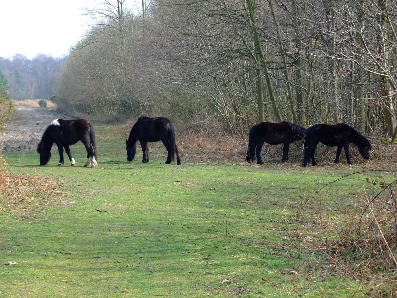
This more integrated and co-operative approach has given a ‘second chance’ to the fragments of heath that remain. And a wide variety of strategies and management practices have been adopted to maintain the traditional open character of the communities, and a balance between Calluna, Erica, Pteridium and other taxa. The tradition of sheep grazing was re-established for a while at Westwood, and fenced enclosures allowed a comparison between sheep and rabbit grazing. Similar experiments were conducted by the RSPB at North Warren. Dartmoor ponies have been used on areas of Forestry England’s property at Dunwich. A forage harvester was used at Walberswick to remove bracken litter: this in places allowed heather seeds to germinate. Volunteer schemes and government subsidised ‘manpower’
programmes have locally been utilised to remove birch and pine saplings manually. Chemical herbicides have locally been used, sometimes controversially (e.g. by the RSPB at North Warren) to control scrub, and also to discourage bracken invasion. An attempt was made to establish a 20-year burning rotation for burning at Westleton Heath. Conventional ecological wisdom is that management should aim to promote a mosaic of plant communities and age-stands. Thus, it has been argued that older stands of heather are ideal in terms of insect biodiversity. On the other hand, Stone (2017) noting that the Silver-studded Blue was ‘struggling’ and that the ‘maintenance and re-creation of heathland will prove vital in the species’ success’. Sanford (2005) documented a number of attempts, and proposed attempts, at re-creating heath on suitable land.
In 2003 Piotrowski, noting that only a single pair of stone curlews had nested in the coastal heathland belt, expressed the aspiration that ‘the habitat restoration schemes currently underway will soon encourage birds back to their former haunts.’ There is evidence (see above) that this was an accurate prognosis. Similarly, at Minsmere the removal of invading birch and pine scrub, to create glades with bare, open patches allowed an increase in nightjar pairs from five in 1982 to 40 in 1989 (Burgess, et al., 1990).
Summary and conclusion
Heathlands were integral to the land management system of the Suffolk Sandlings region for many centuries. The disappearance of the sheep flocks, agricultural depression reducing the price of land allowing other land uses to come in (from the 1920s) and then, the disappearance of an important species, following myxomatosis (1954), shattered many ecological links. It would not be too strong a statement to say that the old system collapsed. The rise of the conservation movement, particularly since the 1970s, and the development of enlightened, integrated land use policies, and of co-operation, has gone some way to re-establish economic and ecological links. This has had some modestly beneficial effects on the biota; however, the status of individual taxa depends on a variety of factors, apart from land use pattern and the state of habitat, of which climate (both longer-term climatic change, and individual weather events) and pesticide use are implicated.
References
Armstrong, P. H. (1970). The heathlands of the East Suffolk Sandlings in their setting: a systems approach to landscape study. PhD thesis, CNAA, College of Arts and Technology, Cambridge.
Armstrong, P. H. (1971). The heathlands of the East Suffolk Sandlings. Trans. Suffolk Nat. Soc., 15: 417-430.
Armstrong, P. H. (1972). The rabbit in East Anglia. East Anglian Magazine, 31: 161165.
Armstrong, P. H. (1973). Changes in the land use of the Suffolk Sandlings: a study of the disintegration of an ecosystem. Geography, 58 (1), 1-8.
Armstrong, P. H. (1975). The Changing Landscape. Terence Dalton. Lavenham.
Armstrong, P. H. (1984). Recent changes in the land use and ecology of the East Suffolk Sandlings. Trans. Suffolk Nat. Soc., 20: 52-69.
Babington, C. (1884-86). Catalogue of the Birds of Suffolk London, J. Van Voorst.
Beaufoy, S. (1955). Observations: small and Essex Skippers. Trans. Suffolk Nat. Soc., 5 (4): 246.
Bloomfield, E. N. (1904). Suffolk Lepidoptera in 1903. Entomologists Monthly Magazine, 40: 79.
Bowden, C. & Hoblyn, R. (1990). The increasing importance of restocked conifer plantations for woodlarks in Britain. RSPB Conserv. Rev., 4: 26-31.
Boys, J. (1793). Agricultural minutes taken during a ride through the counties of Kent, Essex, Suffolk, Cambridge … in 1792. Annals of Agriculture, 19: 72-145.
Burgess, N., Evans, C. & Sorensen, J. (1990). Heathland management for nightjars. RSPB Conserv. Rev., 4: 32-35.
Burrell, E. D. R. (1960). An Historical Geography of the Sandlings of Suffolk 1600-1850. MSc thesis, London University.
Butcher, R. W. (1941). The Land of Britain - Suffolk East and West. London, Geographical Publications.
Chipperfield, H. E. (1961). Suffolk Lepidoptera 1960. Trans Suffolk Nat. Soc., 11(5): 419-420.
Darby, H. C. (1957). The Domesday Geography of Eastern England. Cambridge University Press.
Dresser, H. E. (1876). A History of the Birds of Europe. London, Taylor & Francis.
Jermyn, L. (1827). The Butterfly Collector’s Vade Mecum. Ipswich, J. Raw.
Kirby, J. (1735). The Suffolk Traveller: or a Journey through Suffolk. Ipswich.
Mendel, H. & Piotrowski, S. H. (1986). The Butterflies of Suffolk: an Atlas & History. Ipswich, Suffolk Naturalists’ Society.
Payn, W. (1962). The Birds of Suffolk. Ipswich, Ancient House Publishing: (Second edition, 1978).
Pearson, D. J. (1973). Changes in the status of heath and marshland birds in the Walberswick area. Trans. Suffolk Nat. Soc., 16: 152-157.
Piotrowski, S. H. (2003). The Birds of Suffolk. London, Christopher Helm.
Raynbird, W. & H. (1849). The Agriculture of Suffolk. London.
Ravenscoft, N. O. M. (1989). The distribution and status of the nightjar on the Suffolk Sandlings. Suffolk Birds, 38: 26-32.
Rope, E. J. (1934). The reptiles of Suffolk. Trans. Suffolk Nat. Soc., 2: 209-224.
Sanford, M. (2005). Suffolk: State of Nature – Heathland. Ipswich, Suffolk Biological Records Centre.
Simpson, F. W. (1982). Simpson’s Flora of Suffolk. Ipswich, Suffolk Naturalists’ Society.
Stone, W. (2017). 2016 Suffolk butterfly report. Trans Suffolk Nat Soc 53, 72-95.
Stone, W. (2021). 2020 Suffolk butterfly report. Trans. Suffolk Nat. Soc. 57: 47-81.
Suckling, H. I. (1846). History and Antiquities of Suffolk. London, John Weale.
Ticehurst, C. B. (1932). A History of the Birds of Suffolk London, Gurney & Jackson.
Thomas J. & Lewington, R. (2012). Butterflies of Britain & Ireland. Gillingham, British Wildlife Publishing.
Rochefoucauld, Duc de la (1933). A Frenchman in England. Cambridge University Press, from a manuscript dated 1784.
Vinter, H. S. (1937). Catalogue of the Lepidoptera of Suffolk – Butterflies. Ipswich, Suffolk Naturalists’ Society.
Waller, A. P. (1937). Catalogue of the Lepidoptera of Suffolk – Macro-moths. Ipswich, Suffolk Naturalists’ Society.
Whiting, N. E. (1967). Changes in the Agicultural Geography of the Suffolk Sandlings since 1930. MA thesis, University of London.
Young, A. (1795). A fortnight’s tour in East Suffolk. Annals of Agriculture 23: 18-52.
Young, A. (1797). A General View of the Agriculture of the County of Suffolk. London, Macmillan.
Biographical Note
Patrick spent his working life teaching geography and ecology in universities and colleges in England and Australia. He has been interested in the natural history of the Suffolk Sandlings for over 75 years and has been a member of the Suffolk Naturalists’ Society for a little under 60 years. He holds the position of Adjunct Professor at the University of Western Australia, and now lives, and occasionally birdwatches, in a retirement village in Jolimont, Western Australia.