Pinnacorp Investments Inc.
Pinnacle Village What We Heard Report June 11, 2025
Contents 1
Public Engagement Summary and Results .................................................................................................. 1 1.1
2
Project Overview...................................................................................................................................... 1
Process – What we did .................................................................................................................................... 1 2.1.1
Advertisement ...................................................................................................................................... 1
2.1.2
Open House .......................................................................................................................................... 1
2.2
What We Heard ........................................................................................................................................ 2
2.3
What Happens Next ................................................................................................................................. 3
www.arcadis.com Pinnacle Village OP WWH Report 2025-06-06.docx
ii
1 1.1
Public Engagement Summary and Results Project Overview
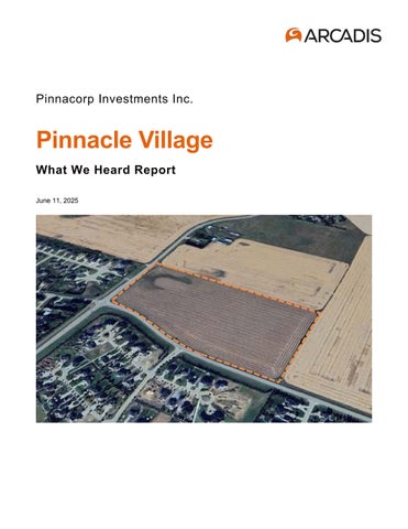
The purpose of the Pinnacle Village Redistricting and Outline Plan (OP) is to describe the land use framework, infrastructure servicing concept and development objectives for the future development of Pinnacle Village. The OP will allow for transitional valley style of residential lots, which will increase the housing diversity and affordability for residents of Sturgeon County. The plan area is 13.88 ha located in the Valley Core Reserve area of the Sturgeon Valley Core ASP. The Pinnacle Village OP is located within the Sturgeon Valley Core ASP and has been prepared within the context of the following: • Natural features of the site and surrounding area; • Type, size and location of various land uses; • Transportation network as it relates to the plan area; • Open space concept and pedestrian connectivity framework; • Conceptual servicing schemes and provision of utility services and infrastructure; • Implementation and phasing of development.
2
Process – What we did
2.1.1
Advertisement
Advertisement of the public open house included a mailout to property owners in the valley core area, sent on May 22, 2025 as well as an advertisement posted in the St. Albert Gazette on May 22 and 29, 2025. The mailout and newspaper ads included a summary of the proposed amendment, the proposed development concept, information about the public open house, and a contact at Arcadis and Pinnacorp for any questions. No inquiries were received seeking additional clarification on the amendment areas. Copies of the mailout and newspaper ad are included in Appendix A.
2.1.2
Open House
The public open house was held at the Cattail Crossing Golf Club June 2, 2025, from 5:00 PM to 8:00 PM. Boards presented at the open house included an overview of the amendment purpose, existing development concept, proposed development concept, servicing concept, transportation and open space plan. Representatives from Pinnacorp Investments Inc. and Arcadis were present at the open house to provide information and anything www.arcadis.com Pinnacle Village OP WWH Report 2025-06-06.docx
1
questions. Approximately, 81 people attended the open house. Participants invite to review the information boards that have been updated since the previous open house. A presentation was held during a portion of the event, followed by a question-and-answer period. Copies of the open house boards and information booklet in Appendix B.
2.2
What We Heard
Open Space & Recreation • •
Pickleball vs. Tennis Courts: Pickleball is in higher demand than tennis. Alternative Uses for SWMF (Stormwater Management Facility): o Potential for organized sports. o Soccer field activities could be accommodated.
Transportation & Traffic Concerns •
•
Access & Road Capacity: o Only two access points into the neighbourhood. o Concerns about increased vehicle volume and traffic congestion. o Question about future roadway upgrades. Traffic & Safety Issues: o Starky Road is under study by the County; development planning considers timing of improvements. o Intersection of Starky & 544 has a history of accidents; a traffic circle is planned. o Highway 544 is perceived as a “speedway.” o Riverside residents concerned about increased traffic from Pinnacle using their only access point.
Levies, Taxes & HOA • •
Homeowners Association (HOA): o HOA fees will apply, but the rate is not yet determined. Tax Revenue Use: o Additional taxes expected to help fund future infrastructure upgrades and maintenance.
Infrastructure & Services •
•
Utilities & Capacity: o No lift station currently in Starky Hills. o Concerns for water capacities for residential use and fire protection. It was stated that stated that studies confirm adequate water capacity for fire protection. Correction: Representative meant to state that studies have proven that water capacity and pressure will not negatively impact the county as a result of Pinnacle Village. Fire protection will be administered through the county current water protection capabilities. Public Safety: o Request for increased police presence due to anticipated population growth and potential for increased crime.
www.arcadis.com Pinnacle Village OP WWH Report 2025-06-06.docx
2
Housing Density & Design • •
•
•
2.3
Density Transitions: o Emphasis on sensitive transitions between housing densities. Housing Types: o Support for bungalows to accommodate aging in place. o Building pockets start at 40 ft, suitable for bungalows. Lot Size o A lot size attractive to existing county residents that want to downsize and remain in the county o A lot size for people to move to the County from other municipalities o Some existing residents prefer the reduced maintenance responsibility offered in Pinnacle Village and still remain in the county Design Guidelines: o Restrictive covenants in place; minimum bungalow size is 1,500 sq ft. o Lot depths range from approximately 130 ft to 250 ft. o Concerns expressed about house sizes in Rivers Gate. o Maximum lot coverage is 55%.
What Happens Next
Pinnacle Village redistricting application with the outline plan appended will be presented to Council and will be discussed as part of a statutory public hearing. During the public hearing Administration and the applicant will be present the application and all interesting parties are welcome to speak on their support or non-support of the application. Following presentations, Council can ask questions to Administration, the applicant and interested parties before voting on the redistricting application.
www.arcadis.com Pinnacle Village OP WWH Report 2025-06-06.docx
3
Appendix A Mailout Notification Newspaper ad
www.arcadis.com Pinnacle Village OP WWH Report 2025-06-06.docx
A
REYESM8894
PUBLIC MEETING
DRAFT
Date: June 2, 2025 Time: 5:00 PM – 8:00 PM Location: Cattail Crossing Golf Course Event Venue 24427 Township Rd 542 Sturgeon County, AB Sturgeon County
March 25, 2025 1:54:07 PM
Outline Plan Location
20.00
20.00
20.00
20.00
20.00
20.00
C:\Users\reyesm8894\DC\ACCDocs\Arcadis ACC US\ACA-00133341-Pinnacle_Village_PL\Project Files\10_WIP\19-PLAN\Outline Plan\SUB3_OP Pinnacle_2025-02-12.dwg
28.00
* N
Existing Pinnacle Ridge
An Information Session is being held to discuss the proposed Pinnacle Village development project. The purpose of the Information Session is to provide the public with an update of the development and how the development aligns with the Valley Core Area Structure Plan. Legend R7 – Transition Valley Local Road Contact: Michael Reyes Residential District Stormwater Management Public Utility Lot (PU) Phone: Facility (PU)780 428 4000 * Outline Plan Area Park & Greenway (MR) Email: michael.reyes2@arcadis.com Boundary
PINNACLE VILLAGE ARCADIS PROFESSIONAL SERVICES (CANADA) INC arcadis.com
300 – 10120 103 Avenue Edmonton AB T5J 3R6 Canada tel 780 428 4000 fax 780 426 3256
OUTLINE PLAN FIGURE 3
|
Contact: Ed Basaraba Phone: 780 498 6585 Website: pinnaclevillage.ca
Abandoned Resource Well Location of Mailbox Pullout
DEVELOPMENT CONCEPT
ALL AREAS AND DIMENSIONS HAVE BEEN ROUNDED; LOT INFORMATION IS PRELIMINARY AND SUBJECT TO CHANGE, AND SHOULD BE CONFIRMED WITH A REGISTERED PLAN.
DATE:
March 25, 2025
DESIGNED BY: GS DRAWN BY:
GS
CHECKED BY:
JH, MR
SCALE:
NTS
JOB NUMBER:
133341
Appendix B Open House Boards Information Booklets
www.arcadis.com Pinnacle Village OP WWH Report 2025-06-06.docx
B
Pinnacle Village Outline Plan and Sturgeon County Area Structure Plan
Pinnacle Village Development and Outline Plan Gross area: 11.91 ha Lots: 144 Lot areas: 0.12 -0.20 acres Edmonton Metropolitan Regional Growth Plan: Area C Sturgeon Core Valley Area Structure Plan: Valley Core Reserve Recreational Facilities: • • • •
Gazebo Half basketball court Two pickleball courts Walking trails
• • • •
Seasonal Amenities: • •
Summer: Dry pond repurposed as a soccer field Winter: Community-developed skating rink
1 | Pinnacle Village Outline Plan and Sturgeon County Area Structure Plan
Playground Berry garden Community storage garage Sitting areas with benches and tables
Table 1: Pinnacle Outline Plan - Land Use Statistics Land Use
Area (Ha)
Area (ac)
% Gross Area
Gross Area
13.91
34.37
100%
Gross Developable Area
13.91
34.37161
% GDA 100%
Parks (MR) Stormwater Management Facility Circulation Total Local Roads Public Utility Lot
0.33 1.07 3.06 3.06 0.21
0.82 2.64 7.56 7.56 0.52
2.4% 8% 22%
Total Non-Residential Area Net Residential Area (NRA)
4.67 9.24
11.54 22.83
66%
Residential Land Use Residential Low Density 9.24 22.83 66% *Exact area of Municipal Reserve will be determined at the subdivision stage of development in consultation with Sturgeon County Projected Units and Population Approximate number of units (assuming a lot size of approximately 0.12 - 0.2 acres) Persons per household (assuming 3.16 people/du per the Sturgeon County municipal census) Projected population at build-out Units Per Gross Residential Hectare (u/GDA) Units Per Net Residential Hectare (u/NRha)
144 3.16 455 10.4 15.6
Pinnacle Village Outline Plan and Sturgeon County Area Structure Plan | 2
Sturgeon Valley Core Area Structure Plan (ASP) Plan Purpose To guide the development of the remainder of the Plan area in an orderly and phased manner while enabling complementary intensification of the established residential communities. The Plan is intended to drive contiguous, compact development in the Sturgeon valley that is sensitive to existing landowners and surrounding agricultural areas. The Plan area is primarily comprised of existing residential communities, with some pockets of undeveloped land that have the potential to support additional residential development. These developments are to be supported by technical studies through the development of Outline Plans. Intent of the ASP: • • • • •
Preserves Agricultural lands Preserves existing neighbourhoods Reflects vision residents articulated to date, as best possible Support new lifestyle amenities and services Facilitate new transportation connections
Planning Context – Edmonton Metropolitan Region Growth Plan (EMRGP) The EMRGP identifies areas throughout the Region and assigns policies to assist with growth and development. This Plan identifies the ASP as part of Area C. Area C – Are the lands to be retained as part of this Plan, enabling the completion of the Plan area in a manner consistent with the existing community, with a density of up to 20 du/nrha. This means: • •
Consistent with the existing community: proposed development should align with the characteristics or nature of the existing neighborhood, such as building styles, land use, or overall feel of the area. Density of up to 20 du/nrha (Dwelling units per net residential hectare): This sets up the maximum number of dwelling units that can be built per net residential hectare of land.
3 | Pinnacle Village Outline Plan and Sturgeon County Area Structure Plan
EMRGP - Policy 3.2.2 The Sturgeon Valley Area Structure Plan (Bylaw 882/99) shall be amended in the following areas to enable the completion of the existing community (Area C) and the development of new Area Structure Plan(s) (in Areas A and B): a. The Area Structure Plan planning boundary will be reduced to encompass only Area C; and b. Remaining greenfield lands in Area C will be designated for development in a complementary manner to the existing rural residential community. Notwithstanding the above amendments, it is agreed that all remaining elements and policies of the existing Area Structure Plan for Area C will remain grandfathered. This means: In the context of residential development, the term “complementary” refers to how different elements within a development—or even different developments near each other—work well together in terms of function, design, scale, and purpose. The following are examples how Pinnacle Village can complement adjacent developments: • • •
Architectural and Aesthetic Harmony: Complementary design means new housing should match or enhance the existing neighborhood character—this could include materiality, buildings style, colors, rooflines, landscaping, etc. Functional Compatibility: Complementary development should serve a purpose that fits well with the area’s existing uses. Infrastructure and Services: Complementary development accounts for the capacity of local infrastructure—roads, water, sewer, schools—and ensures service levels are maintained and enhanced.
EMRGP - Policy 3.2.3 Future residential development in Area C will be consistent with existing development densities, up to a maximum density of the lowest Rural Tier minimum greenfield residential density target as identified in the Edmonton Metropolitan Region Growth Plan. This means: The term consistent means that new residential development will align with the character, form, and general pattern of what is already in place in the area. By maintaining consistency, future development will complement rather than disrupt the existing community fabric. Density Target Compliance: The maximum density will align with Schedule 6 EMRGP – Minimum Greenfield Residential Density, which stipulates a target of 20 dwelling units per net residential hectare (20 du/nrha).
Policy Interpretation Shall vs Should vs May Policy
Meaning
All policy statements containing “shall” are mandatory and must be implemented. Where a “shall” policy proves impractical, an applicant may apply to amend the Plan.
“Shall” means something is required. If it can’t be done, the plan (ASP) must be changed to reflect that.
All policy statements containing “should” are an advisory statement and indicate the preferred objective, policy and/or implementation strategy of the County. If the “should” statement is not followed because it is impractical or impossible, the intent of the policy may be met through other agreed-upon means.
“Should” means it’s strongly recommended. If it’s not practical to follow, other solutions can be considered and agreed upon.
Where “may” is used in a policy, it denotes a choice in applying the policy, creating discretionary compliance or the ability to vary the requirements to achieve the intent of the vision and objectives of the Plan.
“May” means it’s optional. These policies support the overall vision of the plan but don’t have to be followed.
Pinnacle Village Outline Plan and Sturgeon County Area Structure Plan | 4
ASP – Section 5.2 Development Concept Valley Core Reserve The Valley Core Reserve (VCR) is related to the greenfield areas within the Plan area. Development on lands designated as VCR requires outline plans to be developed and approved by the County prior to redistricting and subsequent development occurring. In addition, anticipated development for these areas would be in alignment with the Sturgeon County Municipal Development Plan and the Edmonton Metropolitan Region Growth Plan Appendix G Policies. • •
Priority shall be given to contiguous extensions of residential subdivisions with full municipal servicing in order to minimize incremental infrastructure costs. The intention is not to pre-district lands designated as Valley Core Reserve through the Land Use Bylaw. The intention is to allow individual landowners and/or developers to apply for redistricting after the approval of Outline Plans described in Section 5.12.
This means: • • • • •
The Valley Core Reserve refers to undeveloped (“greenfield”) land within the plan area C. Before any development can happen on VCR lands, an Outline Plan must be created and approved by the County. These developments must align with both the Sturgeon County Municipal Development Plan and the Edmonton Metropolitan Region Growth Plan policies. Priority will be given to developments that extend existing residential areas and use full municipal services, to keep infrastructure costs efficient. The land won’t be pre-zoned (or “pre-districted”) by the County. Instead, landowners or developers must apply to change the zoning (redistricting) after their Outline Plan is approved (as outlined in Section 5.12).
5 | Pinnacle Village Outline Plan and Sturgeon County Area Structure Plan
Pinnacle Village Outline Plan and Sturgeon County Area Structure Plan | 6
Goal To enable fully serviced multi-lot residential development while being cognizant of impacts on existing infrastructure and residential communities.
Overview The intent of this Plan is to allow for additional residential development, up to a density of 20 du/nrha as per the policies within the EMRGP. What this means: This statement means that the goal of the plan is to enable more residential development in area C, allowing for higher-density housing, but within a limit of 20 residential units per hectare, as per policy.
Objective • • • •
Ensure that new multi-lot residential developments are attractive, conveniently located, and safe physical environments. Ensure that new multi-lot residential developments are provided with municipal water and wastewater systems, and paved roads. Provide for orderly multi-lot residential development. Provide for transitional densities between existing residential communities and future development.
This means: Designing a gradual change in housing density between established neighborhoods and new developments. This helps maintain compatibility, reduce abrupt shifts in building scale, and create a more cohesive community. Provide for transitional densities between existing residential communities and future development by implementing gradual changes in housing density, ensuring compatibility through buffering, preserving neighborhood character, and considering traffic and infrastructure impacts.
Policies Interpretation and Implementation VALLEY CORE RESERVE POLICIES 5.4.4 The County shall permit development density up to a maximum of 20 du/nrha on lands designated as Valley Core Reserve in Figure 5: Development Concept Map. This means: The County allows residential development within the Valley Core Reserve areas—up to a maximum density of 20 dwelling units per net residential hectare (du/nrha), as shown in the Development Concept Map. • • • •
Density is capped at 20 units per hectare of land used for housing. This applies only to Valley Core Reserve lands. Encourages compact, diverse housing. Supports affordability, character, and green space preservation. 5.4.5 The County shall require that lands designated as Valley Core Reserve are developed in a manner complementary to regional policies and cognizant of existing communities.
This means: Development must comply with regional policies such as those in the EMRGP, respect the character and context of existing communities, and align with approved Area Structure Plans (ASP) while undergoing the required County approval process.
7 | Pinnacle Village Outline Plan and Sturgeon County Area Structure Plan
5.4.6 Proposed residential lots within the Valley Core Reserve that abut existing multi-lot residential lots prior to the adoption of this Area Structure Plan shall be developed in a manner consistent with the land use district of the existing multi-lot residential lots. Exception: Pinnacle Village doesn’t have to match the housing style of the neighborhoods next to it (as 5.4.6 would require), because Trestle Ridge Road and Starkey Road provide a buffer. This satisfies clause 5.4.7, which allows different densities as long as there is separation (like roads or parks) in between. 5.4.7 Where possible, the development of roads, parks, and/or green corridors should be used as buffers to offset the built form of varying densities. This means: When designing a community, roads, parks, and green spaces should help separate areas with different housing densities. This keeps neighborhoods balanced and visually appealing.
COMMUNITY SERVICES POLICIES 5.8.1 The County shall continue to improve fire protection within the Plan area. This means: The county is committed to ongoing efforts to understand any requirement regarding fire safety and emergency response in the area covered by the development. The development has demonstrated how current fire protection services levels can be maintained and managed in emergency situations.
TRANSPORTATION POLICIES 5.9.4 The County shall determine future roadway upgrades through the outcomes from the TMP. 5.9.5 The County shall require that any future roadway upgrades or expansions meet the County’s General Municipal Servicing Standards. This means: In collaboration with County, A Transportation Impact Assessment has been developed for the project to assess traffic volumes because of project and County growth. The assessment also outlines immediate and future recommendations for adjacent roadway upgrades.
SERVICING AND IMPLEMENTATION POLICIES 5.12.6 The County shall require that all on-site servicing for a new development is borne by the developer and payment of the required off-site levies in accordance with the County’s off-site development levy bylaw. In some cases, the developer may be required to also bear the costs related to off-site infrastructure work that is not covered by the County’s off-site levy bylaw. This means: As part of bringing forward a new development, the County won’t pay for the services and infrastructure needed. Instead: 1. The developer has to pay for and build everything inside the development area. This includes things like roads, water pipes, sewer systems, street lights, sidewalks, and anything else needed to make the site ready to use. 2. The developer also has to pay a fee (called an “off-site levy”) to help cover the cost of big infrastructure projects that are outside of the development area but still needed—like major roads, water treatment plants, or sewer systems that serve the wider community. 3. Sometimes, there are extra infrastructure needs that aren’t covered by the regular fee system. If that happens, the County may also require the developer to pay for those extra things directly. Pinnacle Village Outline Plan and Sturgeon County Area Structure Plan | 8
Frequently Asked Questions Understanding the Planning Process We understand that the planning and approval process can sometimes be complex. To provide clarity, we have compiled answers to common questions and outlined key details about the development process. To date, we have engaged with the community through an open house, our website, Facebook, and personal interactions, accumulating over 3,000 discussions about Pinnacle Village. A dedicated Q&A session was also shared in a Facebook group to address concerns.
Development Timeline and Status We are here: COMPLETED
Initial Proposal & Community Engagement
All Reports Complete and Accepted by County Administration
PENDING
Final Approval from the County
FUTURE STAGES
Subdivision and Infrastructure Development
Lot Sales and Home Construction
Note: No subdivision approvals have been granted yet, and we continue to work with the County to ensure compliance with all requirements.
Questions
MUNICIPAL STANDARDS
DENSITY COMPARISONS
Q: Do Pinnacle Village and Rivers Gate follow the same General Municipal Service Standards (GMSS)?
Q: What is the overall density of Pinnacle Village and Pinnacle Ridge Estates compared to Rivers Gate? A: • Pinnacle Village & Pinnacle Ridge Estates: 6.83 lots/ha • Rivers Gate: 7.32 lots/ha Q: What is the density of the 12 lots in Stage 5 of Rivers Gate under R7 zoning? A: 16.58 lots/ha Q: What is the proposed density in Pinnacle Village ? A: The proposed density in Pinnacle Village is 15.6 lots per hectare (lots/ha).
A: No. Differences include: • Sidewalks: Rivers Gate does not have sidewalks in front of lots or on the outer perimeter. • Offsite Levy: Considerably lower in Rivers Gate ($92,000/ha vs. $350,000/ha). • Construction Costs: Lower in Rivers Gate due to different standards and timeline.
DEVELOPMENT CONSIDERATIONS Q: If zoning allows between 2 to 20 lots/ha, why not develop fewer lots? A: Several factors influence the density decision: • County-imposed GMSS requirements increase development costs. • Higher offsite levies add to overall expenses. • Rising construction costs for sewer, water, power, gas, landscaping, and engineering. • Financial viability: A minimum of 10 lots/ha is required to cover costs excluding land, while 15.9 lots/ha achieves a balance between affordability, community needs, and sustainability.
9 | Pinnacle Village Outline Plan and Sturgeon County Area Structure Plan
Q: How will the proposed development handle increased traffic?
PLANNED AMENITIES Q: What amenities are planned for Pinnacle Village?
A: A transportation study confirms that the existing road infrastructure can accommodate the new development. Additionally, off-site levies include funds for necessary road upgrades.
A: The development will include: Recreational Facilities: • Gazebo • Berry garden • Half basketball court • Community • Two pickleball courts storage garage • Walking trails • Sitting areas with • Playground benches and tables
Q: What is the maximum height allowed for structures in the new development? A: Under the Land Use Bylaw R7 zoning regulations, the maximum building height is restricted to 39.4 feet, consistent with R2 zoning.
Seasonal Amenities: • Summer: Dry pond repurposed as a soccer field • Winter: Community-developed skating rink
Q: Will there be sufficient water supply for the new development?
LOT AVAILABILITY AND PURCHASE PROCESS
A: Off-site levies will contribute to necessary water system improvements, ensuring adequate service capacity.
Q: Why are some lots marked as “on hold” on the website? Have they already been sold?
Q: How will light pollution be managed?
A: No, they have not been sold. The owners of Pinnacle Ridge Estates have been given the first right to purchase lots if and when the County approves the subdivision. No contracts have been signed—this is a courtesy extended to existing owners. Q: How can I purchase a lot if the County approves the subdivision?
A: The development must adhere to GMSS lighting standards, which regulate outdoor lighting to minimize light pollution and ensure compliance with community guidelines. Q: How does your proposal align with BYLAW 1557/21 – Sturgeon Valley Core Area Structure Plan? A: This proposal demonstrates full alignment with the policies and objectives set out in Section 5.12.2 of BYLAW 1557/21 – Sturgeon Valley Core Area Structure Plan. In support of this, we have provided the County with a comprehensive submission exceeding 1,000 pages of technical reports and supporting documentation. These materials address the specific requirements outlined in the ASP and reflect a thorough commitment to meeting the County’s planning standards, policy direction, and long-term vision for sustainable growth within the Sturgeon Valley Core area. The County Administration has reviewed and accepted these reports as complete, confirming that they meet all required criteria.
A: Once approval is granted, further details on the purchasing process will be provided.
HOME BUILDING OPTIONS Q: Can I buy a lot and build my own house, or must I go through a builder? A: You are free to purchase a lot and build your own home. However, builders will also be available if you prefer their services.
COMMON CONCERNS ADDRESSED Q: Will property values in the existing residential area decrease due to the new development? A: The cost of new lots, combined with construction expenses, will result in new homes that exceed the value of older developments. Additionally, demand for halfacre serviced lots remains high, and since no new halfacre lots are being developed, this demand is expected to drive property values up.
Pinnacle Village Outline Plan and Sturgeon County Area Structure Plan | 10
WHY HIGHER DENSITY IS NECESSARY 1. Increased Development Costs Require Higher Density - Rising costs for land, materials, and regulatory compliance necessitate efficient use of space. - Offsite levies, infrastructure requirements, and stricter GMSS standards increase expenses. 2. Efficient Land Use & Sustainability - Higher-density developments optimize infrastructure and public services, reducing municipal costs. - Compact development patterns help preserve green spaces. 3. Changing Housing Demand & Affordability - The need for diverse housing types is growing, especially among young families and retirees. - Higher density allows for more attainable housing options. 4. Comparison to Previous Developments - Rivers Gate’s last stage had a density of 16.58 lots/ha, but was built under different economic conditions. - If similar estate-style developments were proposed today, their pricing would be significantly higher.
CURRENT HOUSING SHORTAGE & MARKET REALITY • • •
Zero available lots in Sturgeon Valley: Nearly all developments are built out, with few remaining lots held by owners for imminent construction. Three-year delay for new developments: Even if approved today, new homeowners wouldn’t be able to move in for years. Limited supply is driving up prices: The housing shortage is making homeownership increasingly difficult.
Final Thoughts We recognize that planning and development can be complex, and we are committed to transparency and open communication. If you have further questions, feel free to reach out through our website, Facebook group, or direct contact. The Sturgeon Valley housing shortage is a present-day issue. A well-planned, slightly higher-density development is essential for meeting demand, ensuring affordability, and sustaining the community’s growth.
www.pinnaclevillage.ca Ed Basaraba
Pinnacorp Investments Inc. P: +1 780 498 6585 E: ebasaraba@telus.net 11 | Pinnacle Village Outline Plan and Sturgeon County Area Structure Plan
Michael Reyes
Arcadis P: +1 780 428 4000 E: michael.reyes2@arcadis.com
Welcome! Pinnacle Village | Outline Plan
June 2, 2025
INFORMATION SESSION Pinnacle Village Outline Plan Information Session
1
Frequently Asked Questions Understanding the Planning Process We understand that the planning and approval process can sometimes be complex. To provide clarity, we have compiled answers to common questions and outlined key details about the development process. To date, we have engaged with the community through an open house, our website, Facebook, and personal interactions, accumulating over 3,000 discussions about Pinnacle Village. A dedicated Q&A session was also shared in a Facebook group to address concerns.
Development Timeline & Status We Are Here: COMPLETED
Initial Proposal & Community Engagement
All Reports Complete and Accepted by County Administration
PENDING
FUTURE STAGES
Final Approval from the County
Subdivision and Infrastructure Development
Lot Sales and Home Construction
Note: No subdivision approvals have been granted yet, and we continue to work with the County to ensure compliance with all requirements.
Questions Density Comparisons
Municipal Standards
Q: What is the overall density of Pinnacle Village and Pinnacle Ridge Estates compared to Rivers Gate?
Q: Do Pinnacle Village and Rivers Gate follow the same General Municipal Service Standards (GMSS)?
A: • Pinnacle Village & Pinnacle Ridge Estates: 6.83 lots/ha • Rivers Gate: 7.32 lots/ha
A: 16.58 lots/ha
A: No. Differences include: • Sidewalks: Rivers Gate does not have sidewalks in front of lots or on the outer perimeter. • Offsite Levy: Considerably lower in Rivers Gate ($92,000/ha vs. $350,000/ha). • Construction Costs: Lower in Rivers Gate due to different standards and timeline.
Q: What is the proposed density in Pinnacle Village?
Planned Amenities
Q: What is the density of the 12 lots in Stage 5 of Rivers Gate under R7 zoning?
A: The proposed density in Pinnacle Village is 15.6 lots per hectare (lots/ha).
Development Considerations Q: If zoning allows between 2 to 20 lots/ha, why not develop fewer lots? A: Several factors influence the density decision: • County-imposed GMSS requirements increase development costs. • Higher offsite levies add to overall expenses. • Rising construction costs for sewer, water, power, gas, landscaping, and engineering. • Financial viability: A minimum of 10 lots/ha is required to cover costs excluding land, while 15.9 lots/ha achieves a balance between affordability, community needs, and sustainability.
Q: What amenities are planned for Pinnacle Village? A: The development will include: Recreational Facilities: • Gazebo • Berry garden • Half basketball court • Community storage garage • Two pickleball courts • Sitting areas with benches • Walking trails and tables • Playground Seasonal Amenities: • Summer: Dry pond repurposed as a soccer field • Winter: Community-developed skating rink
Pinnacle Village Outline Plan Information Session
2
Frequently Asked Questions Lot Availability and Purchase Process Q: Why are some lots marked as “on hold” on the website? Have they already been sold? A: No, they have not been sold. The owners of Pinnacle Ridge Estates have been given the first right to purchase lots if and when the County approves the subdivision. No contracts have been signed—this is a courtesy extended to existing owners. Q: How can I purchase a lot if the County approves the subdivision? A: Once approval is granted, further details on the purchasing process will be provided.
Home Building Options Q: Can I buy a lot and build my own house, or must I go through a builder? A: You are free to purchase a lot and build your own home. However, builders will also be available if you prefer their services.
Common Concerns Addressed Q: Will property values in the existing residential area decrease due to the new development? A: The cost of new lots, combined with construction expenses, will result in new homes that exceed the value of older developments. Additionally, demand for half-acre serviced lots remains high, and since no new half-acre lots are being developed, this demand is expected to drive property values up. Q: How will the proposed development handle increased traffic? A: A transportation study confirms that the existing road infrastructure can accommodate the new development. Additionally, off-site levies include funds for necessary road upgrades. Q: What is the maximum height allowed for structures in the new development? A: Under the Land Use Bylaw R7 zoning regulations, the maximum building height is restricted to 39.4 feet, consistent with R2 zoning. Q: How will light pollution be managed? A: The development must adhere to GMSS lighting standards, which regulate outdoor lighting to minimize light pollution and ensure compliance with community guidelines. Q: Will there be sufficient water supply for the new development? A: Off-site levies will contribute to necessary water system improvements, ensuring adequate service capacity.
Q: How does your proposal align with BYLAW 1557/21 – Sturgeon Valley Core Area Structure Plan? A: This proposal demonstrates full alignment with the policies and objectives set out in Section 5.12.2 of BYLAW 1557/21 – Sturgeon Valley Core Area Structure Plan. In support of this, we have provided the County with a comprehensive submission exceeding 1,000 pages of technical reports and supporting documentation. These materials address the specific requirements outlined in the ASP and reflect a thorough commitment to meeting the County’s planning standards, policy direction, and long-term vision for sustainable growth within the Sturgeon Valley Core area. The County Administration has reviewed and accepted these reports as complete, confirming that they meet all required criteria.
Why Higher Density is Necessary 1. Increased Development Costs Require Higher Density • Rising costs for land, materials, and regulatory compliance necessitate efficient use of space. • Offsite levies, infrastructure requirements, and stricter GMSS standards increase expenses. 2. Efficient Land Use & Sustainability • Higher-density developments optimize infrastructure and public services, reducing municipal costs. • Compact development patterns help preserve green spaces. 3. Changing Housing Demand & Affordability • The need for diverse housing types is growing, especially among young families and retirees. • Higher density allows for more attainable housing options. 4. Comparison to Previous Developments • Rivers Gate’s last stage had a density of 16.58 lots/ha, but was built under different economic conditions. • If similar estate-style developments were proposed today, their pricing would be significantly higher.
Current Housing Shortage & Market Reality • Zero available lots in Sturgeon Valley: Nearly all developments are built out, with few remaining lots held by owners for imminent construction. • Three-year delay for new developments: Even if approved today, new homeowners wouldn’t be able to move in for years. • Limited supply is driving up prices: The housing shortage is making homeownership increasingly difficult.
Final Thoughts We recognize that planning and development can be complex, and we are committed to transparency and open communication. If you have further questions, feel free to reach out through our website, Facebook group, or direct contact. The Sturgeon Valley housing shortage is a present-day issue. A well-planned, slightly higher-density development is essential for meeting demand, ensuring affordability, and sustaining the community’s growth.
Pinnacle Village Outline Plan Information Session
3
20.00
20.00
March 25, 2025 1:54:07 PM
Development Concept
20.00
20.00
20.00
20.00
20.0
0
20.00
20.00
*
20.00
0
20.00
20.0
C:\Users\reyesm8894\DC\ACCDocs\Arcadis ACC US\ACA-00133341-Pinnacle_Village_PL\Project Files\10_WIP\19-PLAN\Outline Plan\SUB3_OP Pinnacle_2025-02-12.dwg
_WIP\19-PLAN\Outline Plan\SUB3_OP Pinnacle_2025-02-12.dwg
28.00
28.00
* Legend R7 – Transition Valley Residential District Stormwater Management Facility (PU) Park & Greenway (MR)
Local Road Public Utility Lot (PU) Outline Plan Area Boundary
*
Abandoned Resource Well Location of Mailbox Pullout ALL AREAS AND DIMENSIONS HAVE BEEN ROUNDED; LOT INFORMATION IS PRELIMINARY AND SUBJECT TO CHANGE, AND SHOULD BE CONFIRMED WITH A REGISTERED PLAN.
Pinnacle Village Outline Plan Information Session
4
Development Amenities Recreational Facilities • Gazebo • Half basketball court • Two pickleball courts • Walking trails • Playground • Berry garden • Community storage garage • Sitting areas with benches and tables
Seasonal Amenities • Summer: Dry pond repurposed as a soccer field • Winter: Community-developed skating rink
Pinnacle Village Outline Plan Information Session
5
Development Amenities
Pinnacle Village Outline Plan Information Session
6
Development Amenities
Pinnacle Village Outline Plan Information Session
7
Development Amenities
Pinnacle Village Outline Plan Information Session
8
Development Amenities
Pinnacle Village Outline Plan Information Session
9
Servicing Boards
Stormwater connecting to existing network Sanitary connection to Pinnacle Ridge
Water Servicing originating from existing connection to Pinnacle Ridge
Pinnacle Village Outline Plan Information Session
10
Open Space and Pedestrian Network
Pinnacle Village Outline Plan Information Session
11
Sturgeon Valley Core Area Structure Plan (ASP) Plan Purpose To guide the development of the remainder of the Plan area in an orderly and phased manner while enabling complementary intensification of the established residential communities. The Plan is intended to drive contiguous, compact development in the Sturgeon valley that is sensitive to existing landowners and surrounding agricultural areas. The Plan area is primarily comprised of existing residential communities, with some pockets of undeveloped land that have the potential to support additional residential development. These developments are to be supported by technical studies through the development of Outline Plans.
Intent of the ASP • Preserve agricultural lands. • Preserves existing neighbourhoods. • Support new lifestyle amenities, services, and housing types. • Facilitate new transportation connections.
Pinnacle Village Outline Plan Information Session
12
Edmonton Metropolitan Region Growth Plan (EMRGP) The EMRGP identifies areas throughout the Region and assigns policies to assist with growth and development. This Plan identifies the ASP as part of Area C. Area C – the lands to be retained as part of this Plan, enabling the completion of the Plan area in a manner consistent with the existing community, with a density of up to 20 du/nrha.
This means: • Consistent with the existing community: proposed development should align with the characteristics or nature of the existing neighborhood, such as building styles, land use, or overall feel of the area. • Density of up to 20 du/nrha (Dwelling units per net residential hectare): This sets up the maximum number of dwelling units that can be built per net residential hectare of land.
Pinnacle Village Development
Pinnacle Village Outline Plan Information Session
13
Edmonton Metropolitan Region Growth Plan – Policy 3.2.2 The following are policies in the EMRGP that related to the planning and development of land in Area C.
Policy 3.2.2 The Sturgeon Valley Area Structure Plan (Bylaw 882/99) shall be amended in the following areas to enable the completion of the existing community (Area C) and the development of new Area Structure Plan(s) (in Areas A and B): a. The Area Structure Plan planning boundary will be reduced to encompass only Area C; and b. Remaining greenfield lands in Area C will be designated for development in a complementary manner to the existing rural residential community. Notwithstanding the above amendments, it is agreed that all remaining elements and policies of the existing Area Structure Plan for Area C will remain grandfathered.
This means: How Pinnacle Village aims to be complementary: • Architectural and Aesthetic Harmony: Complementary design means new housing should match or enhance the existing neighborhood character—this could include materiality, buildings style, colors, rooflines, landscaping, etc. • Functional Compatibility: Complementary development should serve a purpose that fits well with the area’s existing uses. • Infrastructure and Services: Complementary development accounts for the capacity of local infrastructure—roads, water, sewer, schools—and ensures service levels are maintained and enhanced.
Pinnacle Village Development
Pinnacle Village Outline Plan Information Session
14
Edmonton Metropolitan Region Growth Plan – Policy 3.2.3 The following are policies are in the EMRGP that related to the planning and development of land in Area C.
Policy 3.2.3 Future residential development in Area C will be consistent with existing development densities, up to a maximum density of the lowest Rural Tier minimum greenfield residential density target as identified in the EMRGP.
This means: The term consistent means that new residential development will align with the character, form, and general pattern of what is already in place in the area. By maintaining consistency, future development will complement rather than disrupt the existing community fabric.
Pinnacle Village Development
Density Target Compliance: The maximum density will align with Schedule 6 EMRGP – Minimum Greenfield Residential Density, which stipulates a target of 20 dwelling units per net residential hectare (20 du/nrha).
Pinnacle Village Outline Plan Information Session
15
Sturgeon Valley Core Area Structure Plan – 5.2 Development Concept This Plan identifies the Pinnacle Village land as part of the Valley Core Reserve lands and defines the designation. The Valley Core Reserve (VCR) is related to the greenfield areas within the Plan area. Development on lands designated as VCR require outline plans to be developed and approved by the County prior to redistricting and subsequent development occurring. In addition, anticipated development for these areas would be in alignment with the Sturgeon County Municipal Development Plan and the Edmonton Metropolitan Region Growth Plan Appendix G Policies. • Priority shall be given to contiguous extensions of residential subdivisions with full municipal servicing in order to minimize incremental infrastructure costs. • The intention is not to pre-district lands designated as Valley Core Reserve through the Land Use Bylaw. The intention is to allow individual landowners and/or developers to apply for redistricting after the approval of Outline Plans described in Section 5.12.
This means: Before anything can be built on VCR identified land, landowners must create a detailed plan showing how the land will be used. This plan needs County approval before the land can be officially zoned and developed. Any new development must follow the rules set out in the County’s main planning documents, including the Sturgeon County Municipal Development Plan and the Edmonton Metropolitan Region Growth Plan. These new neighborhoods must be next to existing ones and use full municipal services. This helps keep infrastructure costs lower.
Pinnacle Village Outline Plan Information Session
16
Sturgeon Valley Core Area Structure Plan – 5.4 Valley Core Reserve Section 5.4 of the Plan and outline the Valley Core Reserve land goals and objectives. The Valley Core Reserve (VCR) is related to the greenfield areas within the Plan area. Development on lands designated as VCR require outline plans to be developed and approved by the County prior to redistricting and subsequent development occurring.
Goal To enable fully serviced multi-lot residential development while being cognizant of impacts on existing infrastructure and residential communities.
Overview The intent of this Plan is to allow for additional residential development, up to a density of 20 du/nrha as per the policies within the EMRGP.
This means: The VCR sets aside for future residential neighborhoods in new growth areas. Before any building can happen, an outline plan must be created and approved by the County. This ensures that new development is well thought out and fits with nearby communities. The goal is to allow fully serviced housing with access to water, sewer, and roads without putting too much pressure on existing infrastructure. According to regional policies, these areas can include up to 20 homes per hectare.
Objective • Ensure that new multi-lot residential developments are attractive, conveniently located, and safe physical environments. • Ensure that new multi-lot residential developments are provided with municipal water and wastewater systems, and paved roads. • Provide for orderly multi-lot residential development. • Provide for transitional densities between existing residential communities and future development.
This means: Designing a gradual change in housing density between established neighborhoods and new developments. This helps maintain compatibility, reduce abrupt shifts in building scale, and create a more cohesive community. Provide for transitional densities between existing residential communities and future development by implementing gradual changes in housing density, ensuring compatibility through buffering, preserving neighborhood character, and considering traffic and infrastructure impacts.
Pinnacle Village Outline Plan Information Session
17
Valley Core Area Structure Plan – Valley Core Reserve Policies Policies
Meaning
5.4.4 The County shall permit development density up to a maximum of 20 du/nrha on lands designated as Valley Core Reserve in Figure 5: Development Concept Map.
The County allows residential development within the Valley Core Reserve areas—up to a maximum density of 20 dwelling units per net residential hectare (du/nrha), as shown in the Development Concept Map.
5.4.5 The County shall require that lands designated as Valley Core Reserve are developed in a manner complementary to regional policies and cognizant of existing communities.
Development must comply with regional policies such as those in the EMRGP, respect the character and context of existing communities, and align with approved Area Structure Plans while undergoing the required County approval process.
5.4.6 Proposed residential lots within the Valley Core Reserve that abut existing multi-lot residential lots prior to the adoption of this Area Structure Plan shall be developed in a manner consistent with the land use district of the existing multi-lot residential lots.
Exemption: Pinnacle Village is exempt from matching housing style of the neighboring areas, because Trestle Ridge Road and Starkey Road act as buffers.
5.4.7 Where possible, the development of roads, parks, and/or green corridors should be used as buffers to offset the built form of varying densities.
Policies 5.4.7 permits variations in housing density when separated by features like roads or parks. In community design, such elements—roads, parks, and green spaces—play a crucial role in creating visual separation and maintaining a balanced, aesthetically pleasing neighborhood layout.
• Density is capped at 20 units per hectare of land used for housing. • This applies only to Valley Core Reserve lands. • Encourages compact, diverse housing. • Supports affordability, character, and green space preservation.
Pinnacle Village Outline Plan Information Session
18
Valley Core Area Structure Plan – Valley Core Reserve Policies Policies
Meaning
5.8.1 The County shall continue to improve fire protection within the Plan area.
The county is committed to ongoing efforts to understand any requirement regarding fire safety and emergency response in the area covered by the development. The development has demonstrated how current fire protection services levels can be maintained and managed in emergency situations.
5.9.4 The County shall determine future roadway upgrades through the outcomes from the TMP. 5.9.5 The County shall require that any future roadway upgrades or expansions meet the County’s General Municipal Servicing Standards. 5.12.6 The County shall require that all on-site servicing for a new development is borne by the developer and payment of the required offsite levies in accordance with the County’s offsite development levy bylaw. In some cases, the developer may be required to also bear the costs related to off-site infrastructure work that is not covered by the County’s off-site levy bylaw.
In collaboration with County, the development is supported by a TIA complete with immediate and long-term recommendations for adjacent roadway updated.
As part of bringing forward a new development, the County won’t pay for the services and infrastructure needed. Instead: The developer has to pay for and build everything inside the development area. This includes things like roads, water pipes, sewer systems, street lights, sidewalks, and anything else needed to make the site ready to use. The developer also has to pay a fee (called an “off-site levy”) to help cover the cost of big infrastructure projects that are outside of the development area but still needed—like major roads, water treatment plants, or sewer systems that serve the wider community. Sometimes, there are extra infrastructure needs that aren’t covered by the regular fee system. If that happens, the County may also require the developer to pay for those extra things directly.
Pinnacle Village Outline Plan Information Session
19
DRAFT
40
G G
20.00
8115
27
50.38
93.08
112.67
112.86
46
43
43
43
43
7087
5907
5907
5907
5899
2 51.44
3 51.44
43
9
5900
114.99
4 51.44
5 51.41
43
8
5900
114.99
43
7
5900
114.99
43
G G
G
6
49.21 49.21
49.21 49.21
116.97
G
49.21
G 20.00
G
6407 117.03
G G
18
G
117.09
9
10
11
127.69
8
127.72
7
127.74
6
6263
6260
6260
6194
6193
6192
6191
6191
6184
6754
40
40
40
40
40
40
40
40
40
41
Lot has very little extra site setback space
53.54
6373
7035
5.8
2
53 8
13
Notes: 1.
14 48.9
Lot Area (sq ft)
7823
15 45
.2 8
12
*
Lot width shown at custom 40 ft depth
45
1
5
49.44
Garage Location
6397
46
16
12
7.1
4
G
G
48.43
48.46
48.46
48.46
48.46
48.46
G
5
4
40
3
48.46
46
17
114.04
4
45
2 6284
48.46
G 6396
G
G
Pocket Size
46
117.07
5.2
7974
48.46
41
6395 117.05
G
13
1
48.81
46
19
G
8 124.
45
64.04
46
20
G
20.00
7938
28.00
Well Site
117.03
G
6.3
G
41
21
95.11
G G
Utility Lots
116.99 5758
R1
G G
G G
41
22
5757 116.99
14
42
119
GG
127.76
42
118
6488
GG
127.82
6494
63.89
127.63
117
Municipal Reserve
5756
G
G
6927
41
23
54.76
114.99
49.21
62.11 50.85
50.85
G
54.66
22 57.
46
52
1
5901
116.96
G
10951
7910
114.83
94.62
26
10
Premium Lots
5755
54.66
120.73
109.35
56.53
8386
7
43
41
24
54.66
56.53 56.54
55
G G
127.81
42
G
48
60.40
7772
64.70
127.66
6612
28
106.07
127.56
116
114.99
9.6
49.94
88.39
43
4
88.42
6615
112.47
14
.14
G G
49.9
2
42
9
115
128.0
6548
50.7
128.3 3
42
114
25
6554
50
114.99
G
G
61.54
G
48
112.11
25
G
114.99
11
Lots on Hold
116.94
G G
9
128.
42
51.0
G 20.00
42
125.45
5
113
29
6561
50.8
49
12
41
25
54.59
56.56
49.57
112
128.
42
G G
5
.70
6567
50.8
128
42
111
.82
6573
5
128
42
50.8
55.2
6
GG
5
51
G G
.94
6591
50.8
110
5
G G
56.53
7
5
109
6.3
67.38
55.2
48
42
R1
7088
6621 10
52
114.99
5848
125.31
47
6623 89
7
119.
86
53 55.2
48
120.
82
7
119.
92 119.
55.2
47
6622
G G
128
42
54
119.
95
7
48
47
6618
5848
Show Home Lots
116.92
G
114.99
13
5848
24 9846
14
42
42 49
G
127.80
2 30.2
55.2
.07
6494
50.8
.43
108
47
55
G G
129
42
5
.00
42
6701
50.8
129
6628
107
5 .00
106
50.8
.11
.37
5
47 125.18
G G
129
50.8
3
105
43
81.9
G G
50.0
5
8023
7
G G
51.1
9990
119.
20.00
G
131
8
104
55.2
7
G
G
47
6
132
.1
46
G
6 .3
16
.38
125.02
48
6621
55
G
7073
56
23
5
G
57
46
130 Lots 6620
54.58
G
48
47
7499
22
111.75
106.40
52.49 52.49
1.2 15
6.
*
114.70 5858
9631
0.4
C:\Users\sparksg9920\DC\ACCDocs\Arcadis ACC US\ACA-00133341-Pinnacle_Village_PL\Project Files\10_WIP\19-PLAN\Lotting\CON1_Lotting PinnacleOverall_2025-05-22.dwg
88.98
R1 51
G G
43
63.22
5848
46
13
9145
43
43 96
58
21
G
7031
Stage 1
119.47 5925
G
6472
2
46
55
35
54.8
103
97
42
59
G
G
113.42
71.75
G G
124.48
95
89.9 5
35 6. R1
52.00
102
8185
44
7255
G
50.35
11
74.18
44
6003
50.91
G G
45
123.29
65.10
.00 50
.43
48
119.75 5933
114.75
1 4.1
G G
G
41
60
42
41
26
5754
50.85
46 6238
109.91
6636
16 5694
Legend
5754
G
114.99
11
.11
101
44
94
98
62
50 137
11830
56.73
.20
12005
G
6026
130
6
5.6
100
99
119.75
17 5694
G
15
6949
* 41 * 41 * 41 * 41
41
G
114.81
18 5694
43
G
50.85
19 5694
G 48.89
48.88
59.
135.33
18
42
54
G
95.31
51.31
20 6778
136.38
G 48.88
48.88
41
27 116.91
51.31
42
20.00
52.49
9977
93
116.89
G
5753
35.50
G
G
116.47
G 59.85
7594
62.69
10479
44 8
48
112.83
5
41
28
5752
20.00
6.3
G
44 42
G G
G G
R1
114.83
6029
112.80
G G
42
29 116.86
51.31
49
49
30 60.75
51.31
57
58
31 49.21
116.86
5897
61.96
7197
32 49.21
35.00
7726
52
33 49.21
6666
G
G
8681
34 49.21
114.84
6904
66
35 49.21
114.84
65
36 49.21
127.78
64
6933
49
119.75
63
6874
44
119.75
119.75
119.75
100.07
98.43
.89 104
62
7301
49
49
49
61
7912
6813
6813
49
48
*
92
37 49.28
96.78
*
6494
91
52.17
0
5740
90
6.5
54
89
8
88
66.31
*38
G G
139.34
11
56.43
87
2
G 65.81
41
7548
2.2
107.2
57.35
13
57.68
57.68
57.68
62.53
66.04
56.89
56.89
G
4
119.75
G
.0
119.75
62
G
5555
5
48
9106
5554
6
43
53
5552
1 0.
.77
67
5550
G
*
49.21
40
8084
61.75
20.00
5
5549
42
49.21
8.
9531
5547
112.76
15
120
G
R16.3
G G
G G
G G 100.07
R1
0
3.8
11204
14 Lots
G G
8740
14
68
5711
116.47
G
6.
35
G
20.00
Stage 2
G 3 58.2
50
39
47
7048
116.47
.64
116.47
116.08
86
32
7.
16
41
.30
69 53
G
G
G G
7.2
51.31 5538
10
71
51.84
41
112
51.35
G G
G G
G
51.35
72
41
114.84
51.35
73
41
7
51.35
74
41
60.07
51.35
75
41
51.7
49.90
76
110.83
49.90
*
78
9533
41
112.73
8698
44
116.47
70
42
112.20
5950
8
5783 112.60
5784
112.63
5785 112.65
5786 112.67
5787 112.70
45
56.00
70
*
79
5626
G G
G
43
60.
9219
G
43
45
85
G
43
55.
G
52
43
112.72
49.90
43
4
50.11
*
80
112.77
81
43
2.6
114.17
63
8
49.97
.44
.45
82
5627
112.73
5629
43
42
42 112.75
5950 112.79
6040
120
7
3.4
4 51.7 6087
4.1
84
15
83
11
11539
May 22, 2025 2:53:39 PM
42
111.55
42
13
42
43
55
119.75
SPARKSG9920
Lotting Plan
11474
6720
41
ALL AREAS AND DIMENSIONS HAVE BEEN ROUNDED; LOT INFORMATION IS PRELIMINARY AND SUBJECT TO CHANGE, AND SHOULD BE CONFIRMED WITH A REGISTERED PLAN.
PINNACLE VILLAGE ARCADIS PROFESSIONAL SERVICES (CANADA) INC arcadis.com
300 – 10120 103 Avenue Edmonton AB T5J 3R6 Canada tel 780 428 4000 fax 780 426 3256
LOTTING PLAN
DATE:
May 22, 2025
DESIGNED BY: GS
DRAWN BY: GS/MR Pinnacle Village Outline Plan Information Session CHECKED BY:
MR/CCB
SCALE:
NTS
JOB NUMBER: 133341
20
Arcadis Professional Services (Canada) Inc. 10120 103 Avenue, Suite 300 Edmonton, Alberta T5J 3R6 Canada Phone: 780 428 4000 www.arcadis.com
Arcadis. Improving quality of life.
Figures
Appendix A [Report Subtitle] (Insert page break to increment Appendix Title)
Appendix B
Arcadis Professional Services (Canada) Inc. 10120 103 Avenue, Suite 300 Edmonton, Alberta T5J 3R6 Canada Phone: 780 428 4000 www.arcadis.com
Arcadis. Improving quality of life.