shreya satheesh +44 7767979749
shreya.satheesh.08@gmail.com
THE ATLANTICS
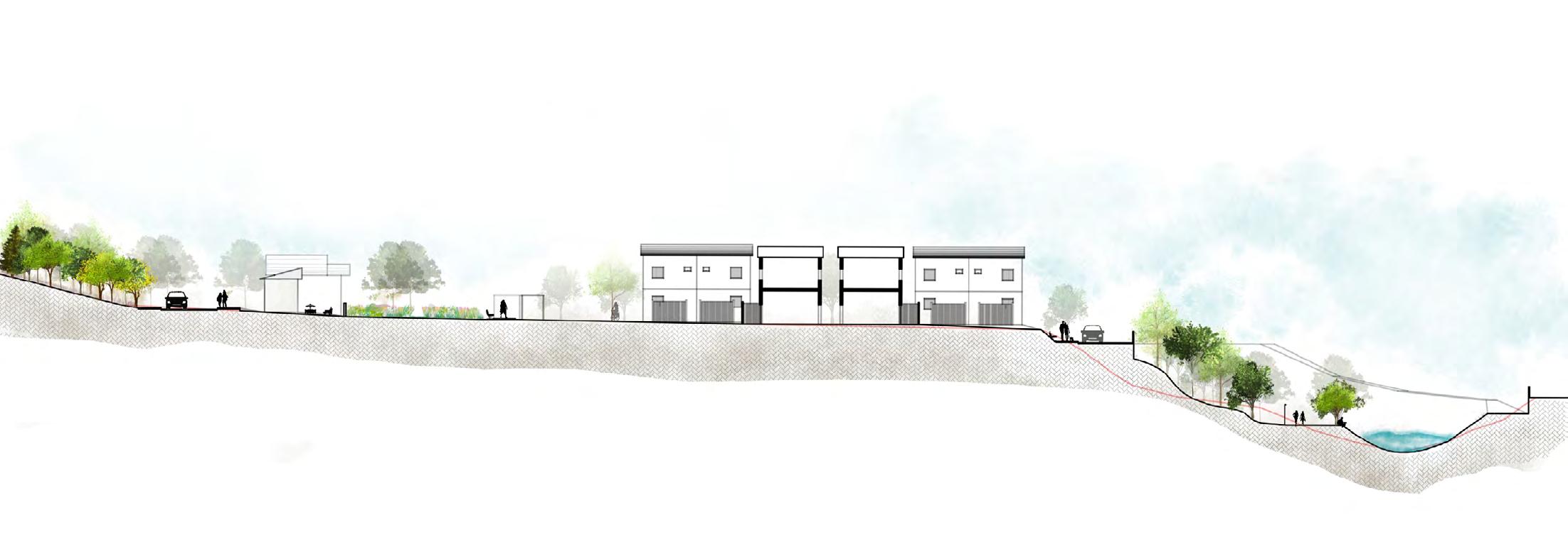
LAND AT SEATON


SOCIETREE
CROSSWAYS ASSISTED LIVING
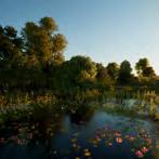
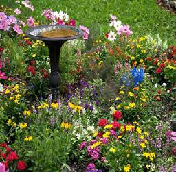
HEALING GARDENS
SUSTAINABLE STOCKPORT
MARE AND FOAL SANCTUARY


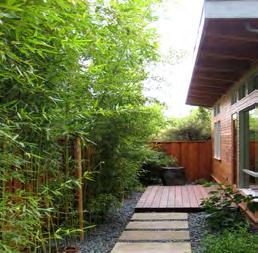
REIMAGINING SPACES
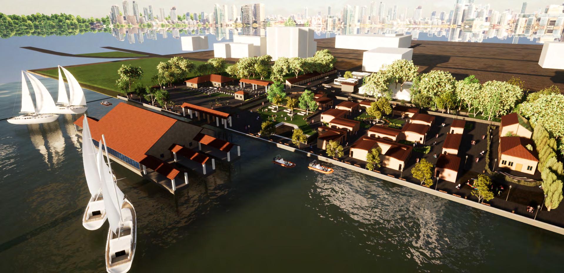
KOCHI URBAN HAAT
RAMANILAYAM
TREE MAPPING

shreya satheesh +44 7767979749
shreya.satheesh.08@gmail.com
LAND AT SEATON
SOCIETREE
CROSSWAYS ASSISTED LIVING
HEALING GARDENS
SUSTAINABLE STOCKPORT
MARE AND FOAL SANCTUARY
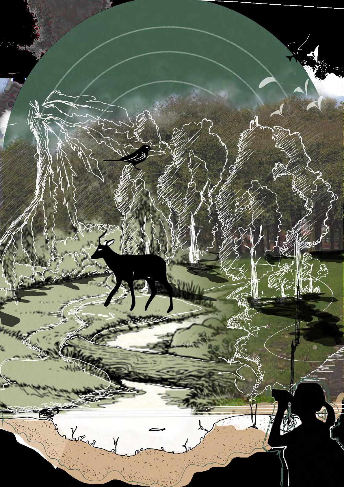
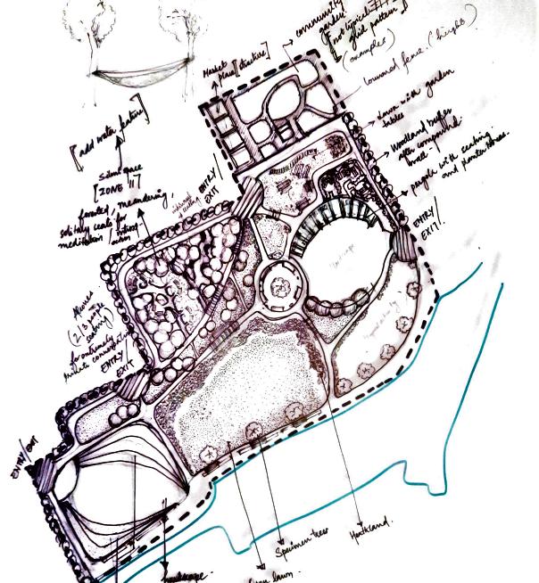
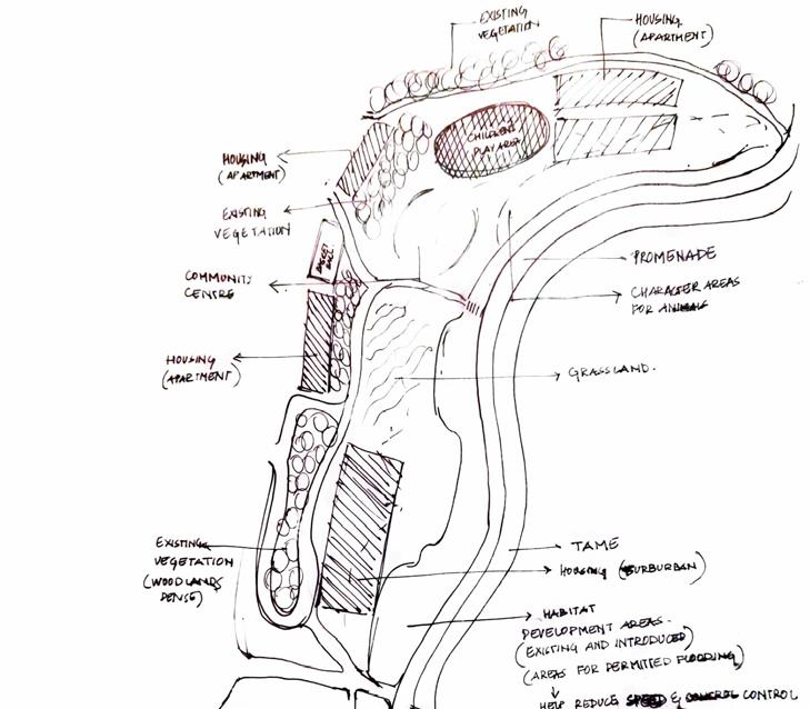
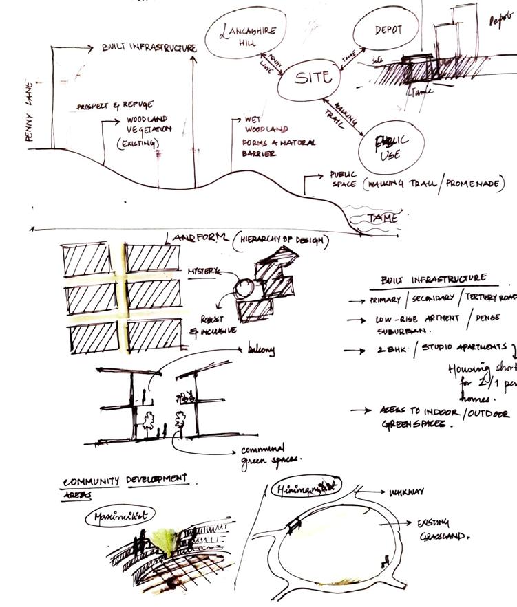
IN WHAT WAYS CAN WE BRING BACK THE BALANCE BETWEEN BIODIVERSITY AND ENDANGERED HABITATS, AND THE PRESENT URBAN BUYOUT OF GREEN SPACES, THROUGH AN INTERVENTION IN A DEGRADED URBAN PARK?
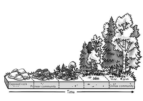
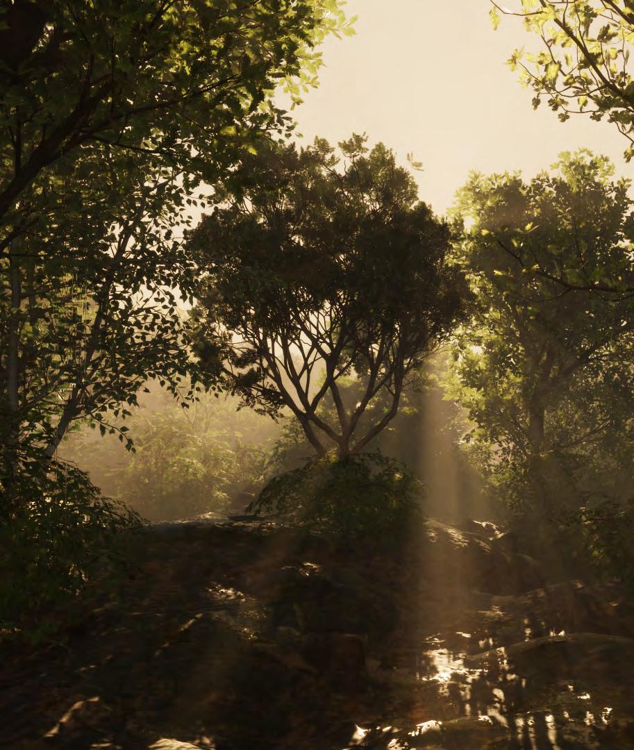
Manchester’s urban landscape hides a surprising secret: a history steeped in temperate rainforests.
Inspired by the Bialowieza Forest and “The Lost Rainforests of Britain,” we discovered the UK’s hidden rainforest fragments and their ecological significance.
Our research revealed a critical gap in the ecological corridor between Wales and South Manchester. This gap presents a unique opportunity for landscape architects. By studying Dr. Christopher Ellis’ map, we can strategically reintroduce native species, bridging the gap and restoring a vital ecosystem.
Britain’s current woodlands, dominated by non-native conifers, highlight the urgency of rainforest restoration. This project aims to raise awareness and inspire action, promoting biodiversity and fostering a more vibrant Manchester.
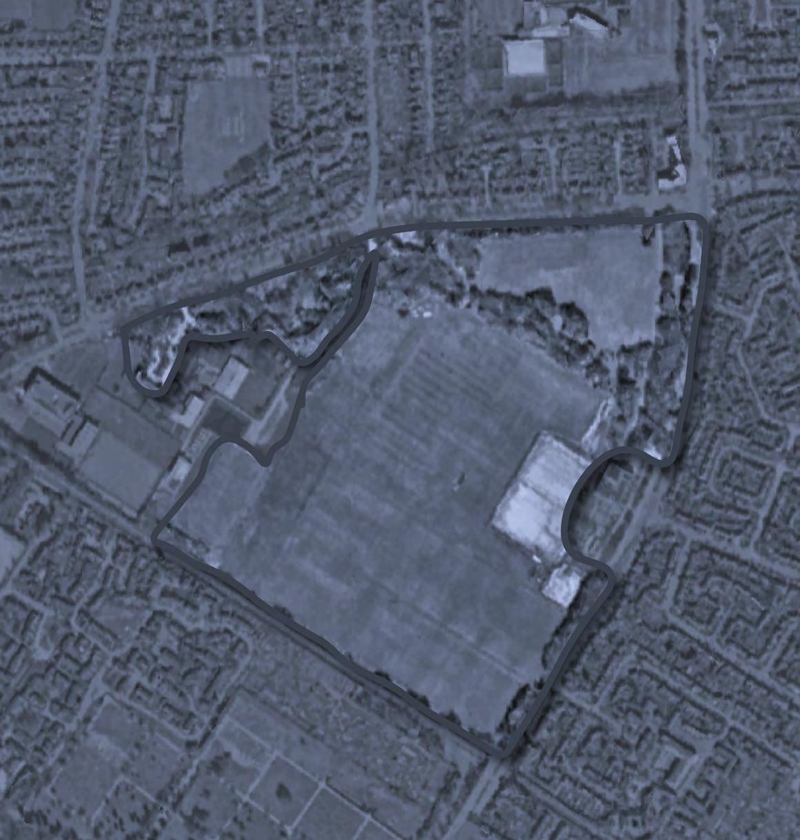
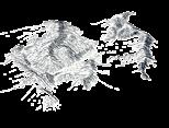
Existing habitat fragment:
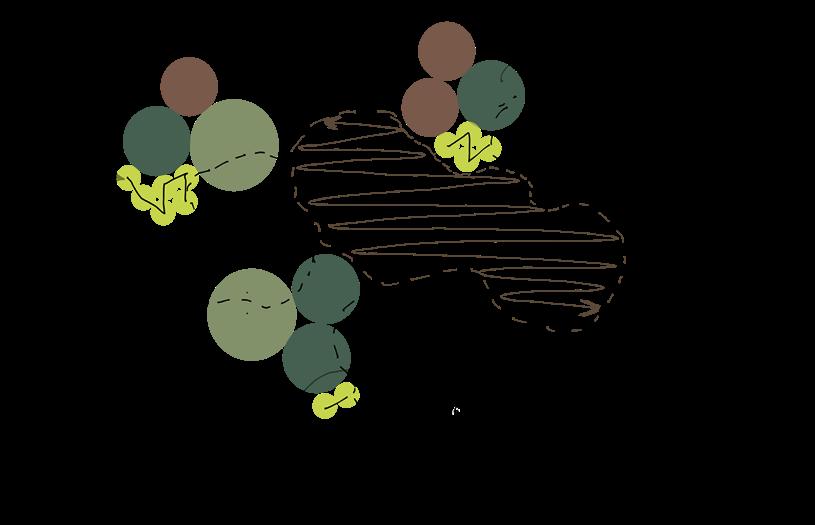
Precedent to species selection for the planting plan.
Terrain adjustments To help temperate rainforest microclimate as well as access to shade and light
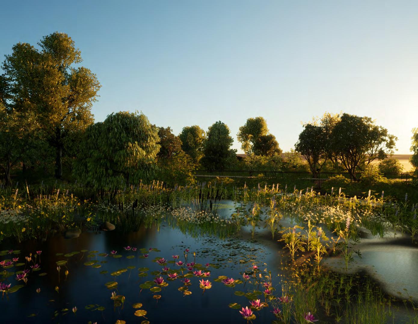
Brook enhancement and pond formation
The water is expected to find in from the surrounding mounds oevr time, the initial soil maintenance is provided. Also helps enhancing humidity.
Tools: Indisign, concepts, hand drawings
13 pioneer species forming canopy, understory and ground cover along with existing edge tree line and on site vegetation
Surrounding urban- housing dwelling:
Community engagement to ensure support and active participation in forest maintenance and conservation
Existing edge tree line
Woodland habitat forming translucent edges around the site. This is retained in the design.


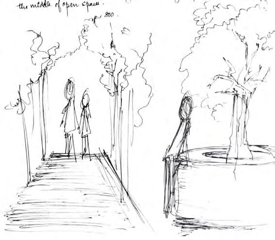
The project is an envisioning of a space where the human and non-human roles have reversed. Its a space where we “humans” would feel the same dread, exhaustion, loss that the distruction of what we understand as our home, space, right would be taken away from us. A space that, just like the very first tall concrete structure, human need and technology, could become a catalyst for the temperate rainforest to take back its land towards the ancient vernacular landscape of the UK.
drawing: CADD others: indesign, photoshop, concepts
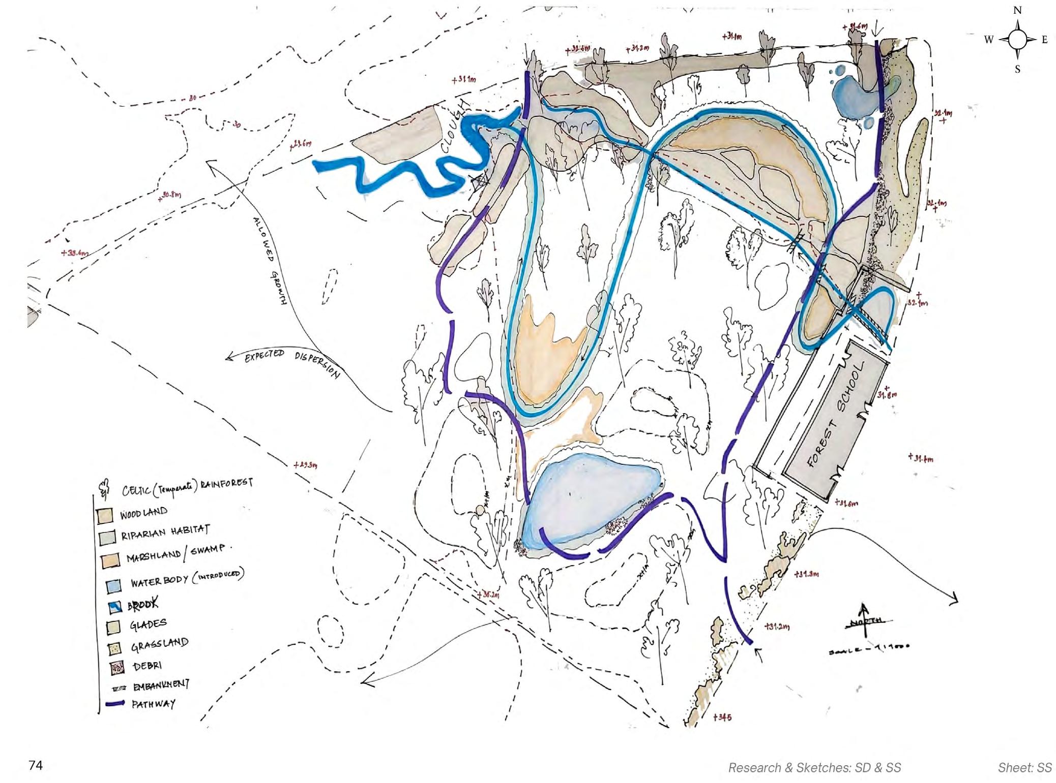
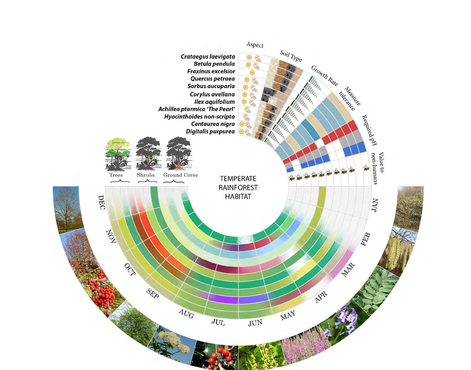
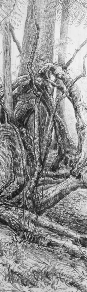
TEMPERATE RAINFOREST HABITAT
Societree, NGO, Plymouth

Microforest design and community engagement
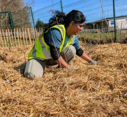
Working with SocieTree, a Plymouth-based non-profit creating Miyawaki-inspired microforests in schools, has influenced me deeply as both a designer and a learner. These projects are more than planting exercises, they’re about helping children experience nature up close, understand ecosystems, and take ownership of the green spaces around them.
Through site visits, soil assessments, planting layouts and after-care planning, I’ve learned how to translate ecological principles into accessible, child-friendly spaces. But the most meaningful part has been working directly with student volunteers, teachers, environmentalists and specialist advisors, seeing how a small ecological intervention can also become a classroom, a play space, and a place of belonging.
This work continues to shape my approach as a landscape architect: design with empathy, listen to lived experiences, and I stay curious about how children interact with the spaces we create. It has made me more aware of how small interventions, when rooted in community and ecology, can have lasting educational and emotional value.

EuEu Euonymus europaeus Spindle Sub dominant
BR/cell 27
MaSy Malus sylvestris Crab apple Sub dominant 45-60cm BR/cell 38
CrMo Crataegus monogyna Hawthorn Sub dominant 45-60cm BR/cell 27
CoAv Corylus avellana Hazlenut Sub dominant 45-60cm BR/cell 38
IlAq Ilex aquifolium Holly Sub dominant 45-60cm BR/cell 23
LiVu Ligustrum vulgare Wild Privet Sub dominant 45-60cm BR/cell 23
PrSp Prunus Spinosa Sloe Shrubs 45-60cm
Code of Practice for General Landscape Operations.
BS 3882:2015 Specifications for Topsoil. (Multipurpose Grade).
BS 8601:2013 Specification for Subsoil. (Multipurpose Grade). BS 3998:2010 Tree work Recommendations.


Mulch
Mulch:
100-150 mm of straw mulch on micro forest floor for moisture retention, weed suppression, and organic matter enrichment.
Reading Circle and Path
Reduce reading area and access paths by 150mm and disperse arisings throughout forest area.
Grade to levels and remove any sharp objects dead roots
Sink logs 1/3 of height into ground and compact the soil around the logs ensure the stability and longevity of the seating.
Lay cardboard whole area and path ensure all tape or plastic is removed)
Supply and spread 150mm of woodchip to whole area.
Seating: Logs placed around the perimeter as stated above, minimum 32 number.
Edges path and reading circle to be defined by horizontally laying down logs of approximately 100mm diameter all along.
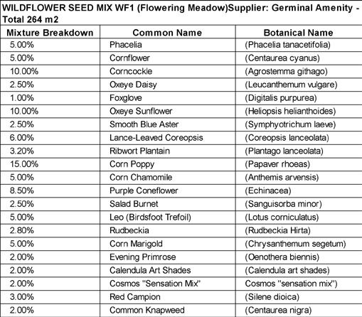
Wildflower Edges
Preparation: Rotavate area to 10-15 cm for receptive seed bed.
Seed Mix: The wildflower mix should consist of UK-native species, selected to support


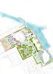
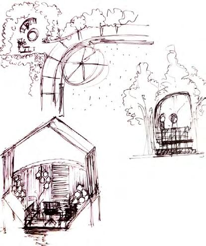
This project involved designing the external landscape for an assisted living facility, where the needs of residents shaped every design decision. Sensory experience was central to the brief: planting selections prioritised texture, fragrance and seasonal colour to support wellbeing and orientation, while the layout of pathways and rest points was guided by the cognitive and mobility needs of the people who would use them daily. Key features include a sensory trail designed to encourage gentle movement and engagement with the natural environment, and an insect hotel wall that brings ecology into direct contact with residents, connecting them to the rhythms of the living world beyond their immediate care setting. This project deepened my understanding of how landscape can be an active tool for healing rather than simply a backdrop to it.


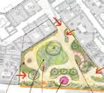
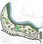
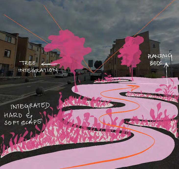
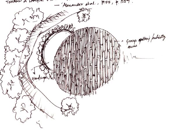
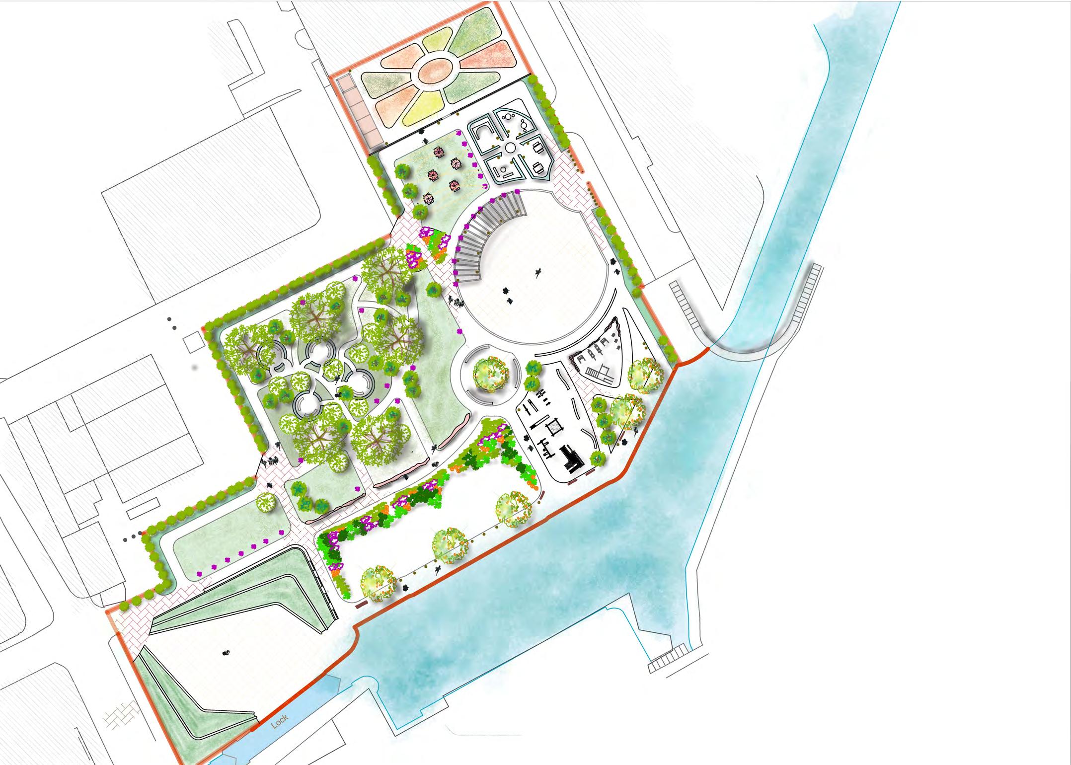
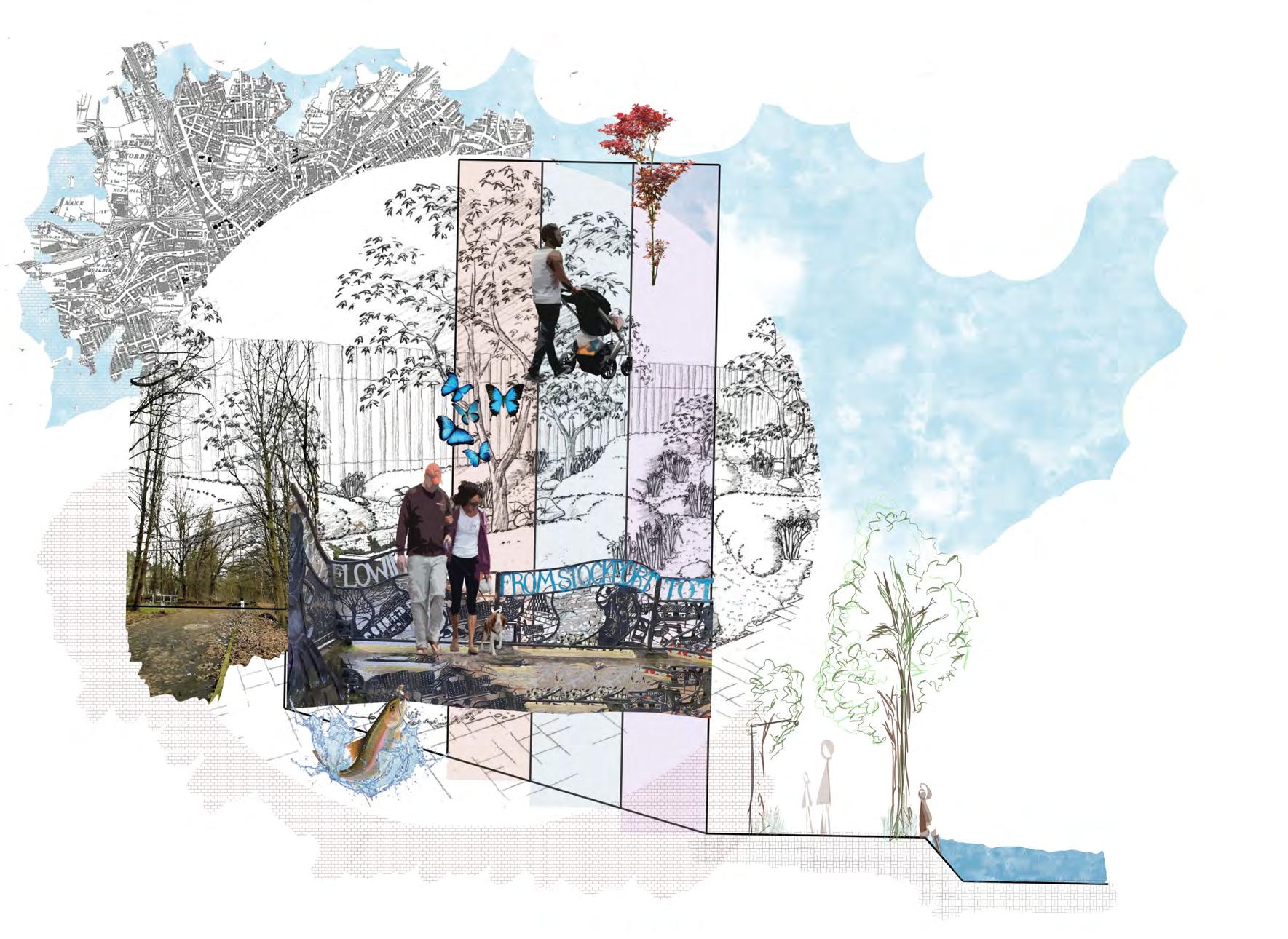
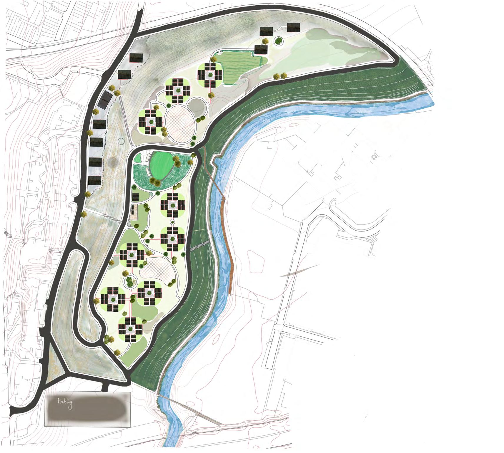
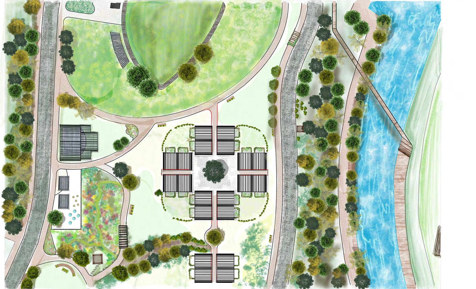
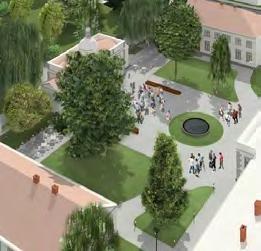
The brief is about understanding communities, both human and plant as an advocate for design. The park is located at Picadilly Basin, which is currently used as a car park. Historically the site had canals running through is ending in a warehouse, the building still stands and is being used at as a multi use building with offices and store houses.the context consists of various historic and mordern buildings and behind the very busy Picadilly gardens. The roads adjacent to the site have a heavy traffic flow as well as footfall. The canal has a promenade along the site with seating and vegetation further connecting to a bridge to cross the canal. Most of the the building in cintext to the site are refurbished buildings that have now become multi use with commercial spaces like pubs, supermarkets, etc., in the ground floor and residential or office spaces up stairs.
Tools: Photoshop, Illustrator, concepts, hand sketches

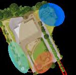
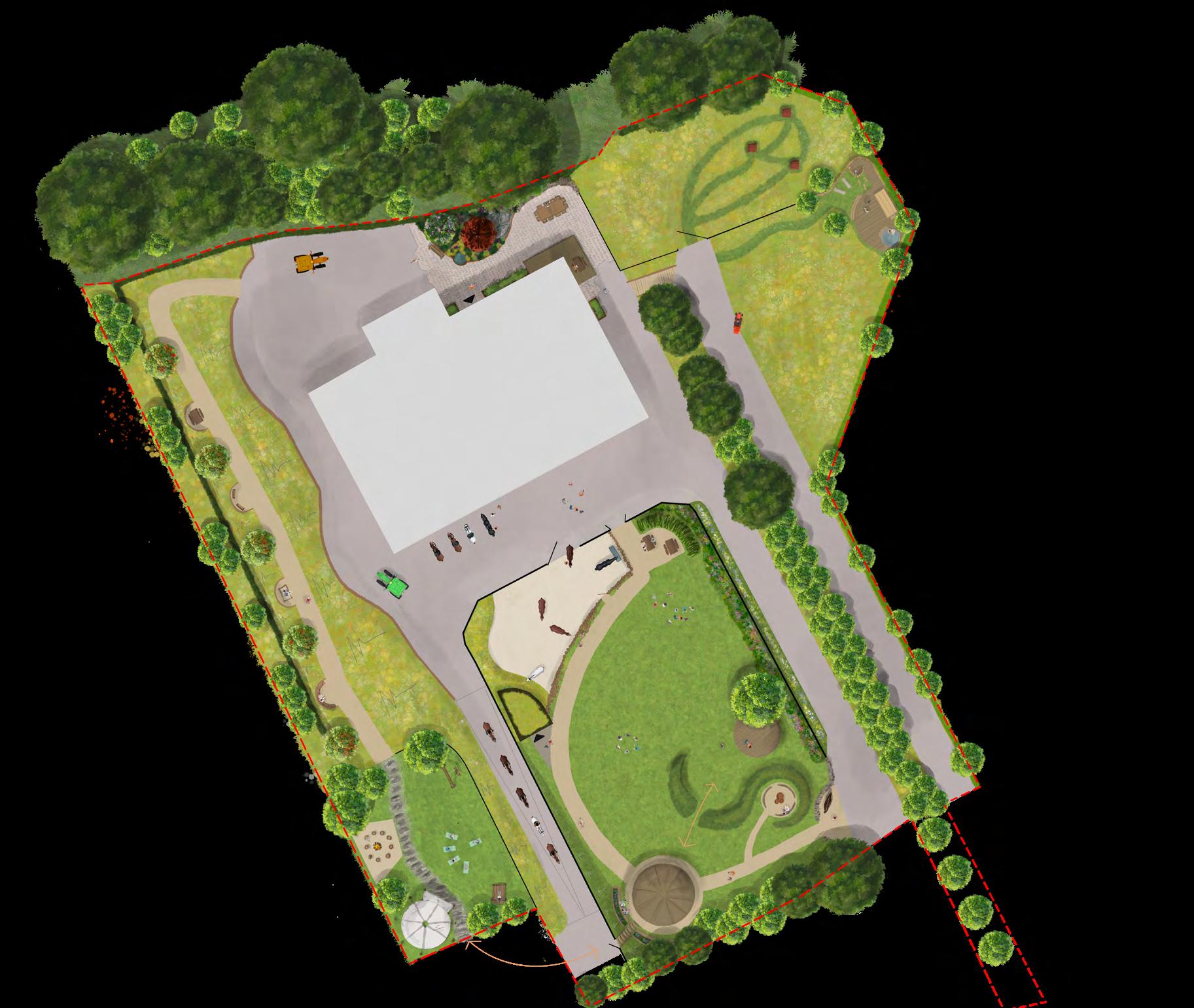
The concept is structured around the four natural elements: Fire, Earth, Water, and Air.
Each shaping a distinct zone of activity and experience within the space. This elemental framework provides an intuitive, poetic way to navigate the sanctuary, where every area carries its own character, and opportunity of events. Rooted in nature and designed for connection, the concept reflects the sanctuary's own relationship with the land and the animals it cares for.

A grounding zone of sensory engagement inspired by Zen gardens and offering connection with the learning and horses.

A zone of calm and reflection; offering quieter, restorative experiences like cold plunge and sauna with beautiful view. Inspired by flow, stillness, and renewal.

An open, expansive zone for movement, freedom, and active play; drawing on the open skies and open paddock character of the site.

A gathering and celebration zone with fire temple; a place for warmth, connection, and shared experiences around light and energy.
drawing: CADD, others: indesign, Illustrator,


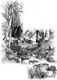
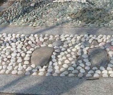
The Ramanilayam building is surrounded by a vast span of land with potential for beautiful landscapes. However, it is currently in the condition shown in the pictures to the right. A proposal plan was made by the team at dd Architects, of which was fortunate to be a part of, and is shown on the extreme right. There is a vast variety of flora existing on site, and a lot of which is said to belong to the endagered category of species.
This task gave me the window of opportunity to learn about different species, their origins, how they can be accomodated into a landscape design without having to uproot them, etc. The whole process was intriguing, wholesome and the time spent outdoors was exhilerating.
Tools:
site visit, client discus -
sion, Desktop research
Drawing: AutoCad
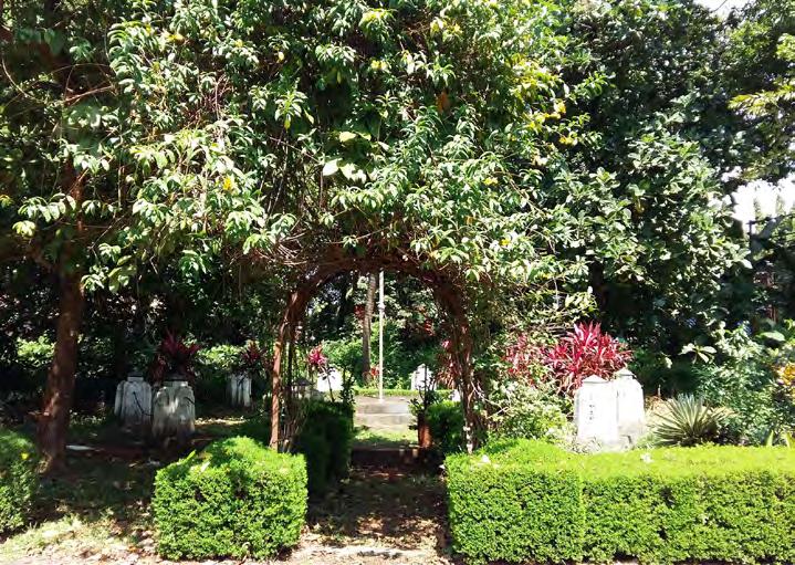
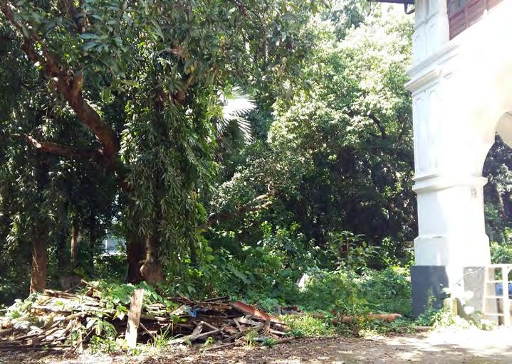
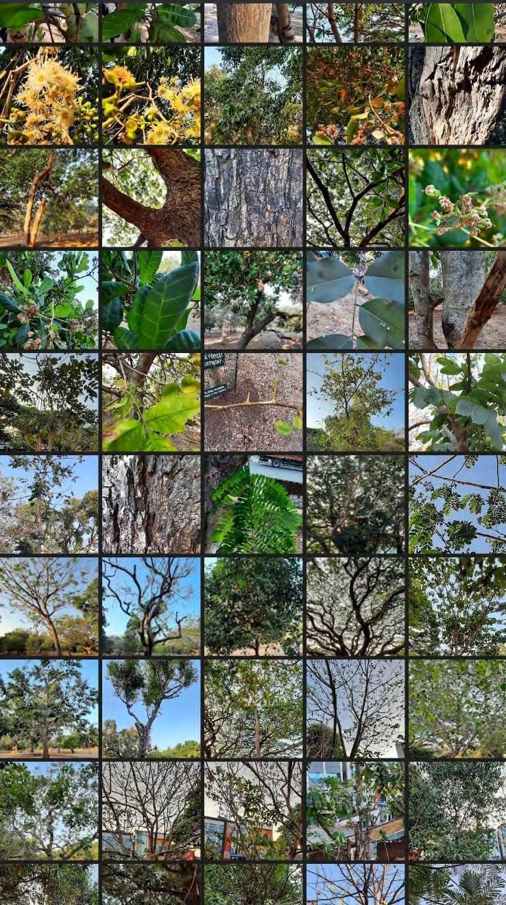
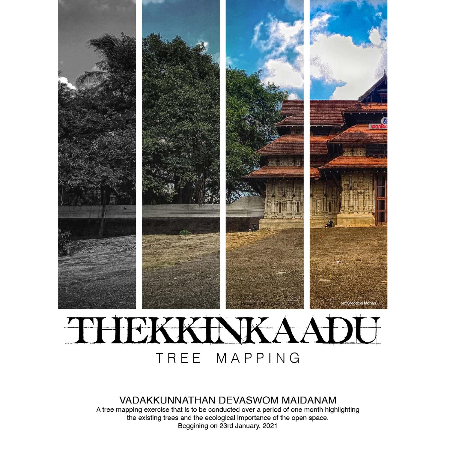
INTACH is a heritage conservation organisation in India with individual chapters for numerous cities. The Thrissur chapter, in Kerala, identified the vegetation in the Thekinkaadu maidan to have an interesting mix of indegenous and imported species of flora. In the event of replaning the entire ground, the possibility of uprooting unidentified trees, which may or maynot belong to endangered species, could not be overlooked. This led to proposing a tree mapping exercise that involved nature enthusiasts from different walks of life. This exercise in itself was a four part event led by a taxonomist, and involved identifying and numbering the trees. This was followed by geomapping the numbers on the tree with their latitudes and longitudes, eventually placing them on a map.
Writing the report on the mapping exercise required us to further study the premises and conduct a survey and analysis on the user groups in and around the differet spaces. This also gave way to an urban study of the spaces which was again very diverse and exciting with respect to the surrounding spaces.
Tools:
site visit, geo-mapping, Desktop research
Poster - illustrator

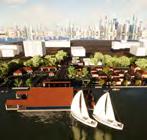
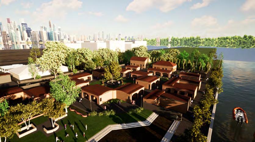
The access to the ferry terminal is also a singular pathway designed parallel to the central entrance aisle to the site, along the same axis in order to provide for the travellers to enter and exit the terminal without the hindrance of the activities of the visitors to the haat. The 6m road that goes around the site helps in case of any emergency that would require the assistance of a fire engine, ambulance or any such vehicle or service. This road is accessed through the main door with an additional entry in the south east of the site.
The circulation space, in the otherwise completely pedestrian area is also 6m for safety purposes. The built concrete stage in project also has a green room facility with washrooms and two rooms. This site sits in-between the Children’s, park and the Subhash Bose Park, with a walkway that runs along the length of the water for approximately 3m. There is an entrance to each of the parks provided from the site
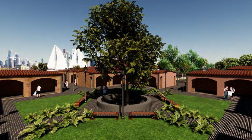
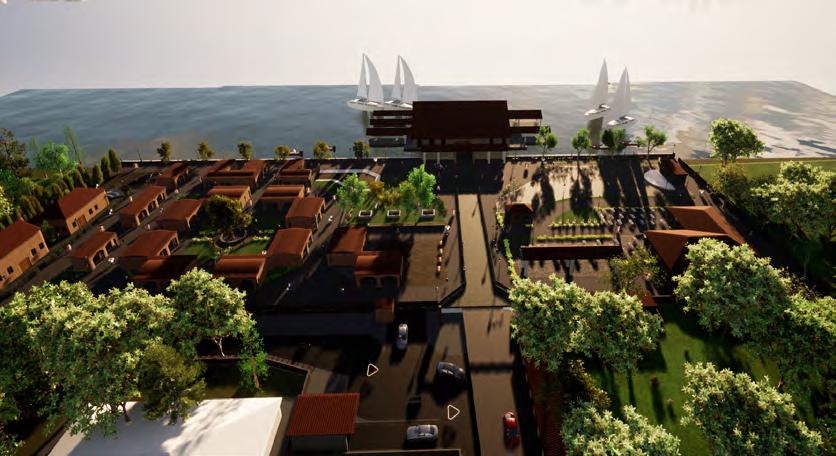
Model: Revit
Render: Twinmotion, illustrator
Plan: AutoCad, Illustrator

A haat bazaar, most often called simply haat or hat, is an openair market that serves as a trading venue for local people in rural areas and some towns of Nepal, India, and Bangladesh Haat bazaars are conducted on a regular basis, i.e or that is once, twice, or three times a week and in some places every two weeks. At times, haat bazaars are organized in a different manner, to support or promote trading by and with rural people. In addition to providing trading opportunities, haat bazaars gradually concentrate rural settlements and convert villages into small towns.
Model: Revit
Render: Twinmotion, illustrator