Urban Design & Planning Portfolio (2019–2026) I Kunth Shah
design portfolio
KUNTH SHAH
MS Urban Design
The University of Texas at Austin
selected professional and academic work 2019 - 2026
References_
Liang Wang
Assistant
Professor
Graduate
Advisor for Urban Design
The University of Texas at Austin
liang.wang@utexas.edu
01_
GreenLink Denver
Weaving disconnected neighborhoods
Competition
First Place - APA Student Planning and Design Competition, NPC Denver 2025
03_
Keep Austin Lit
Housing and public programming
Academic Design Excellence Award Nomination at UT SOA
05_
Tea at No Man’s Land
Border porosity on the Radcliffe Line
Academic - Undergraduate Thesis Dissertation
07_
Revitalizing Turner Road
Street design
Professional Practice
Ongoing project
09_
Dwell - Tube House
Low-rise, high density housing
Urban research
02_
Richmond Zoning Pattern
Zoning and form-based coding
Professional Practice
Ongoing Project
04_
Downtown Tapestry
Downtown revitalization - Seattle
Competition
ULI Hines Student Competition, 2024
06_
Into The Meadows
Township design
Professional Practice
Ongoing project
08_
Social Resilience
Community based research + advocacy
Urban mapping and community engagement
Built Project - Grant Funded
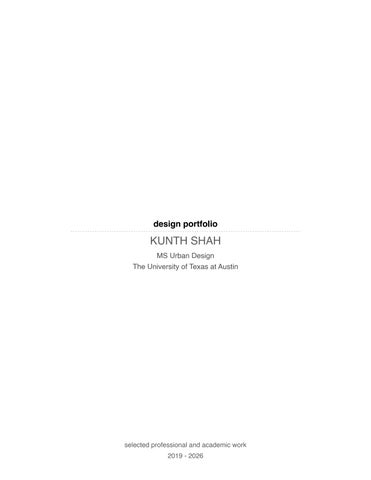
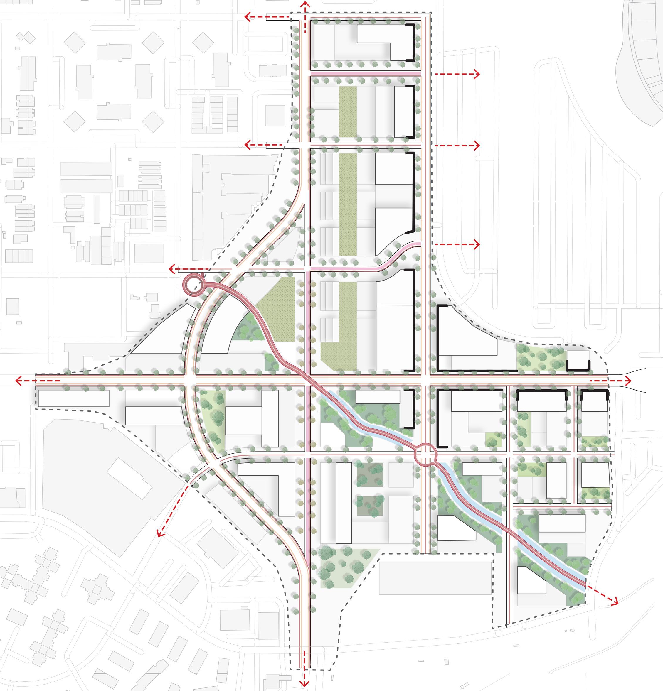
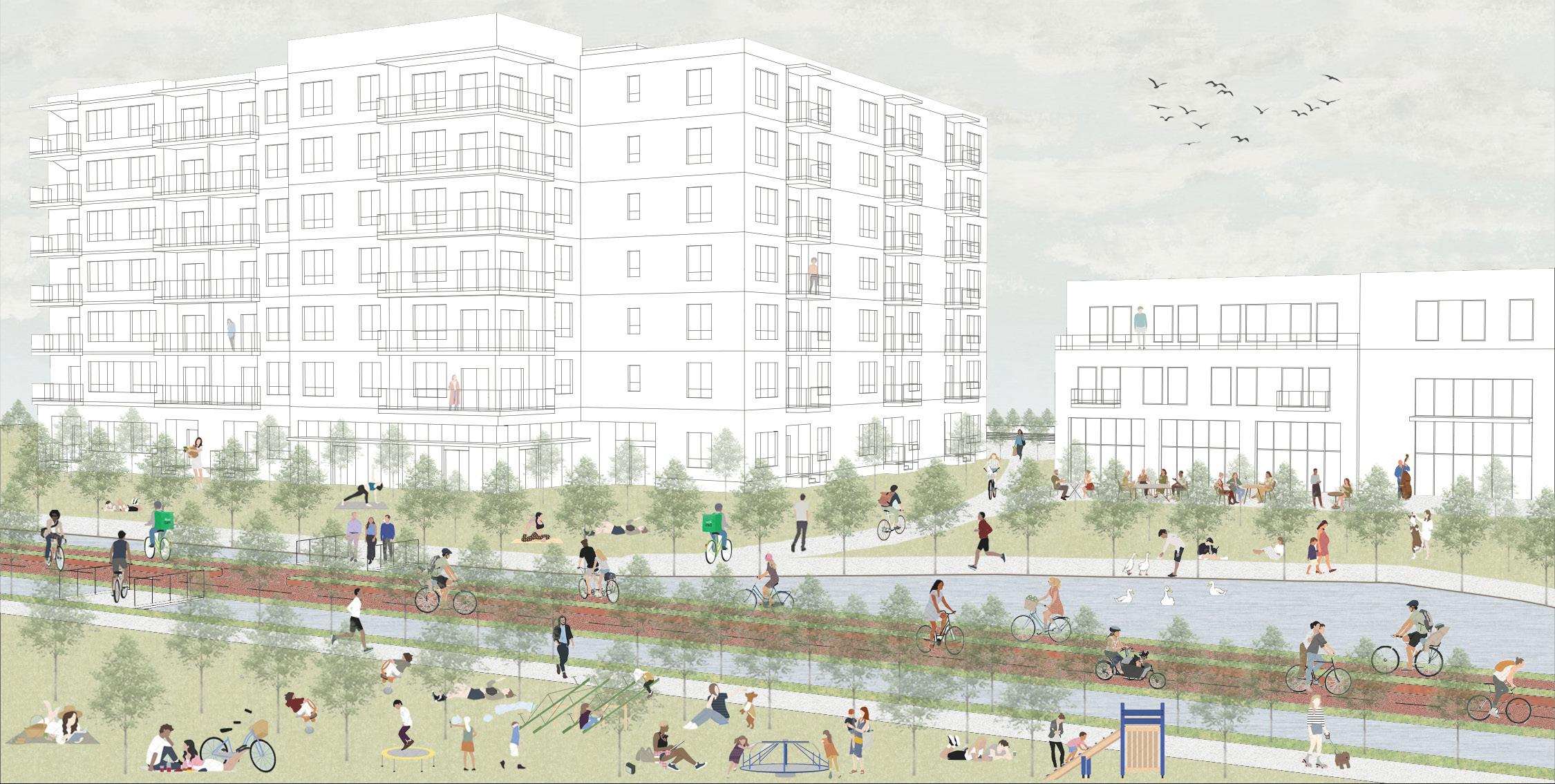
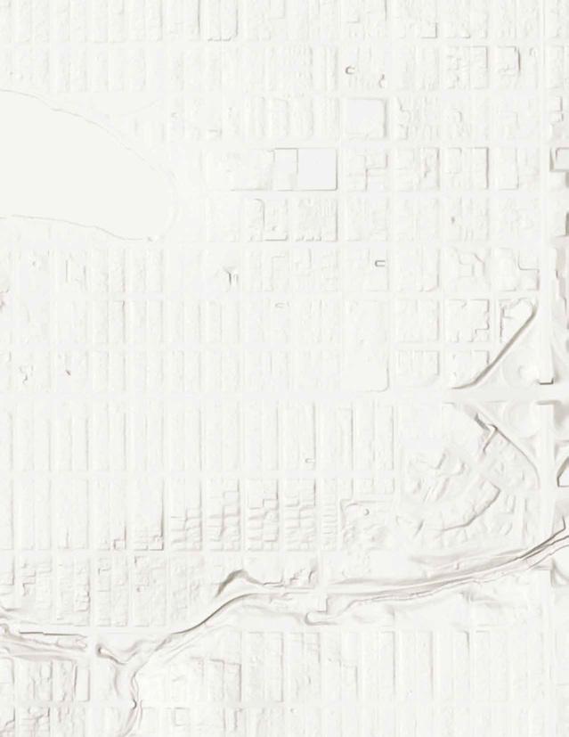
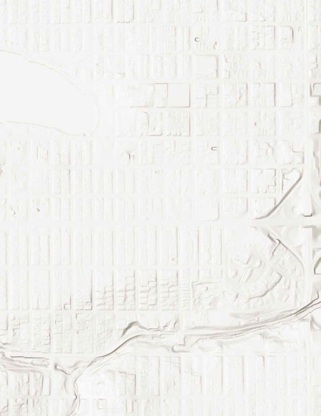
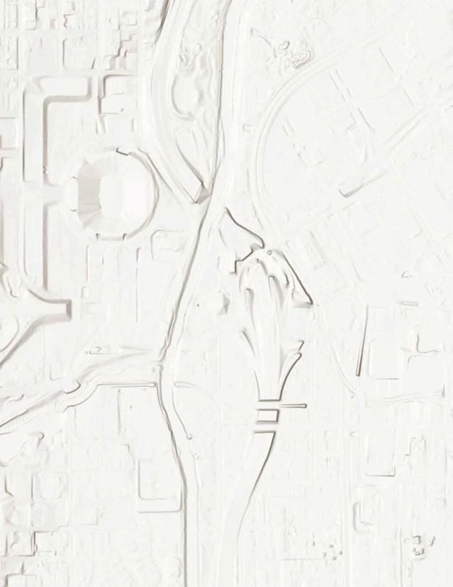
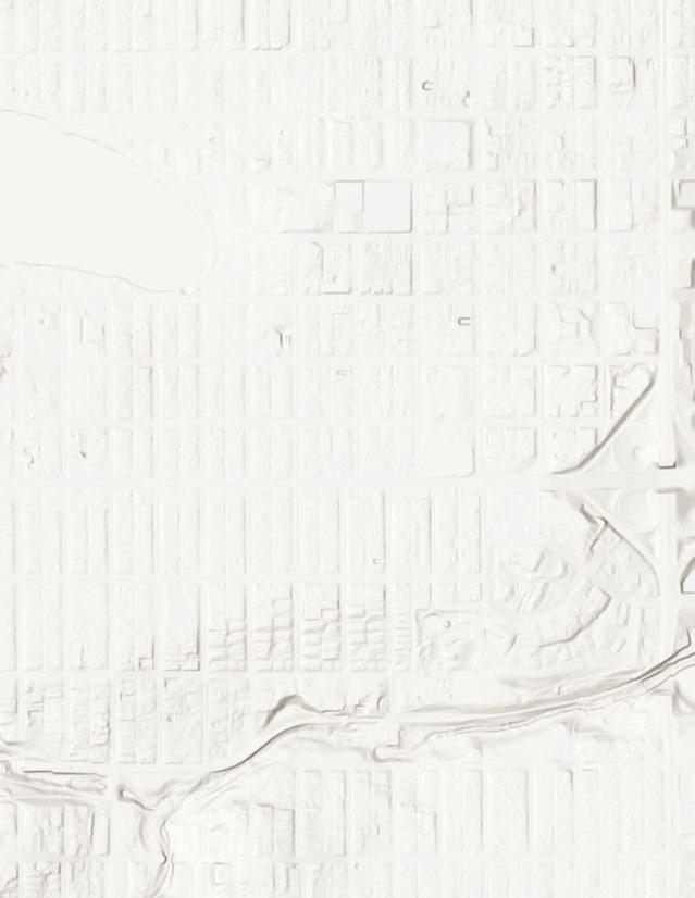
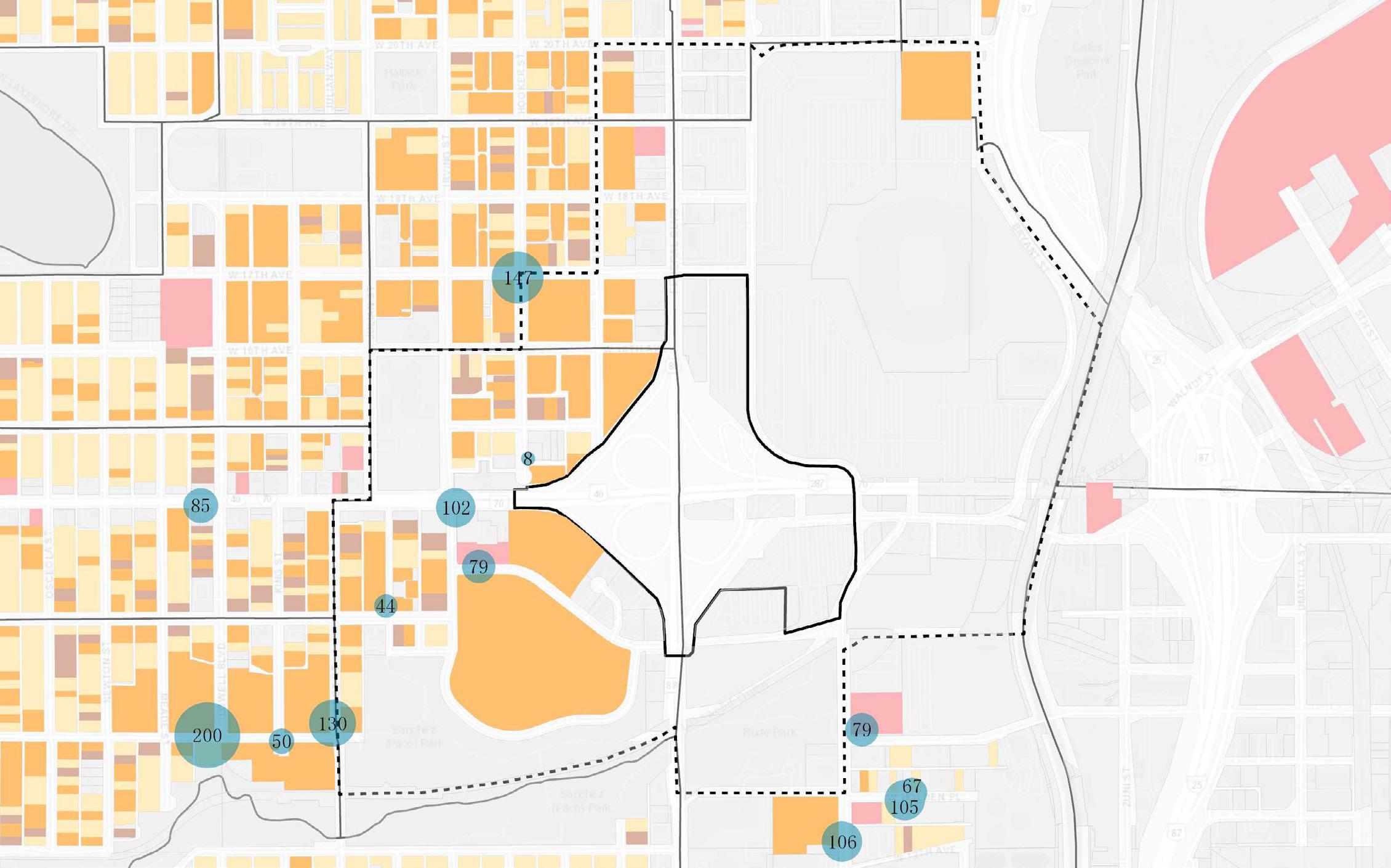
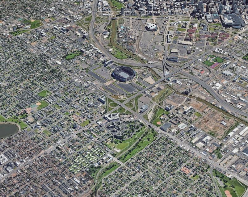
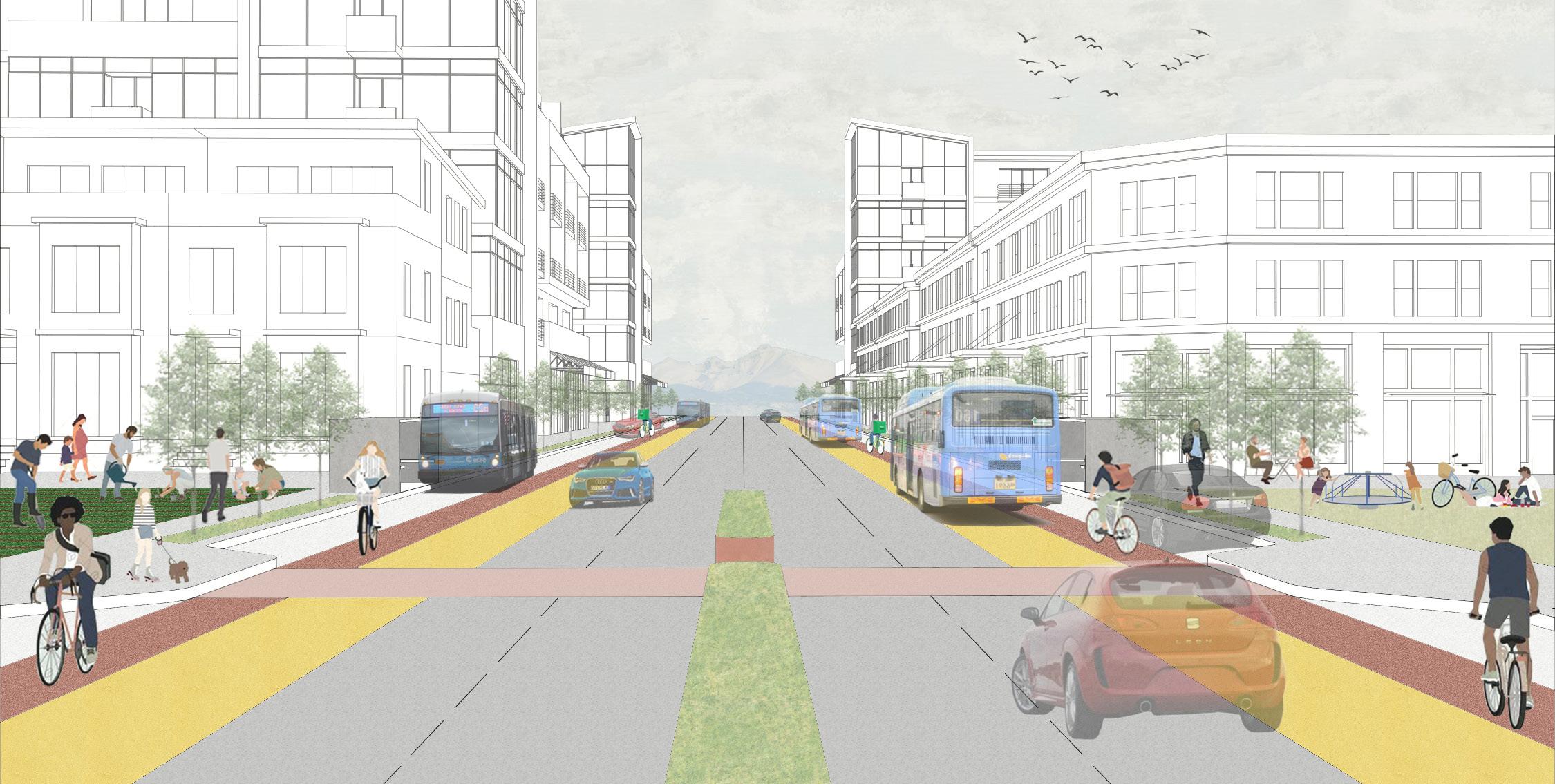
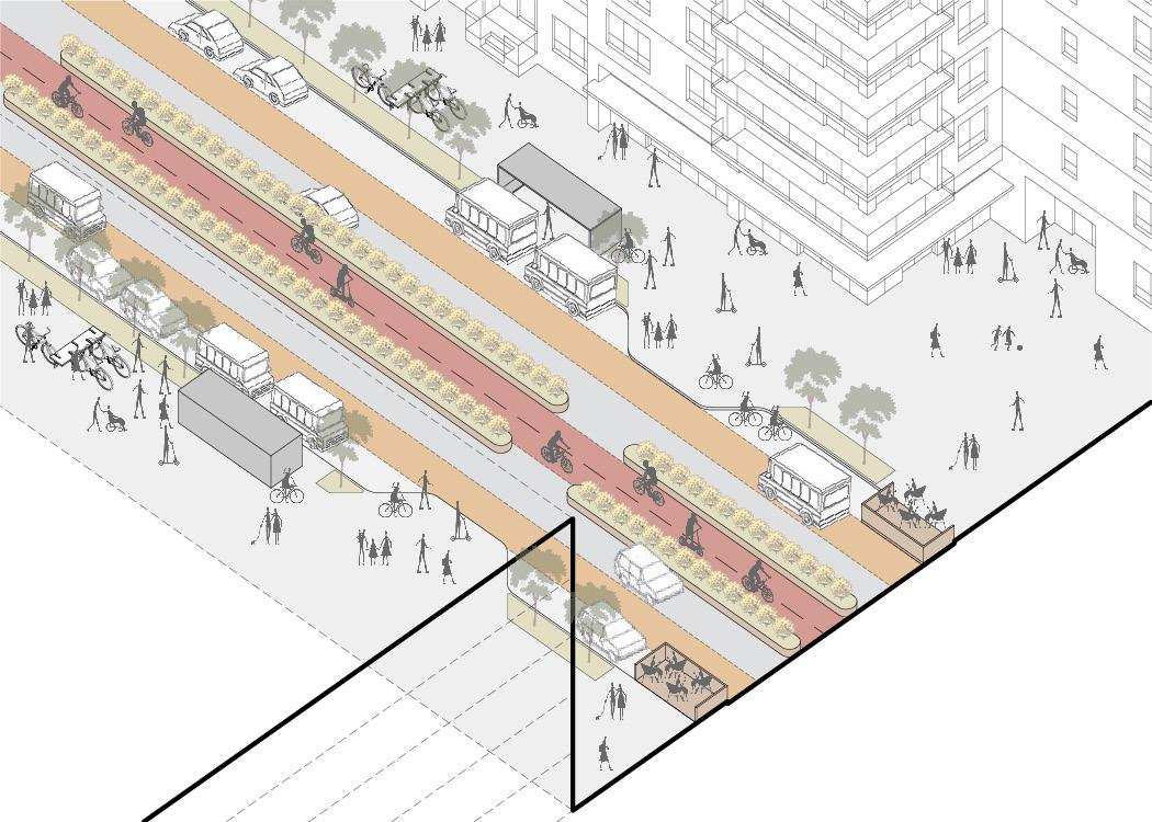
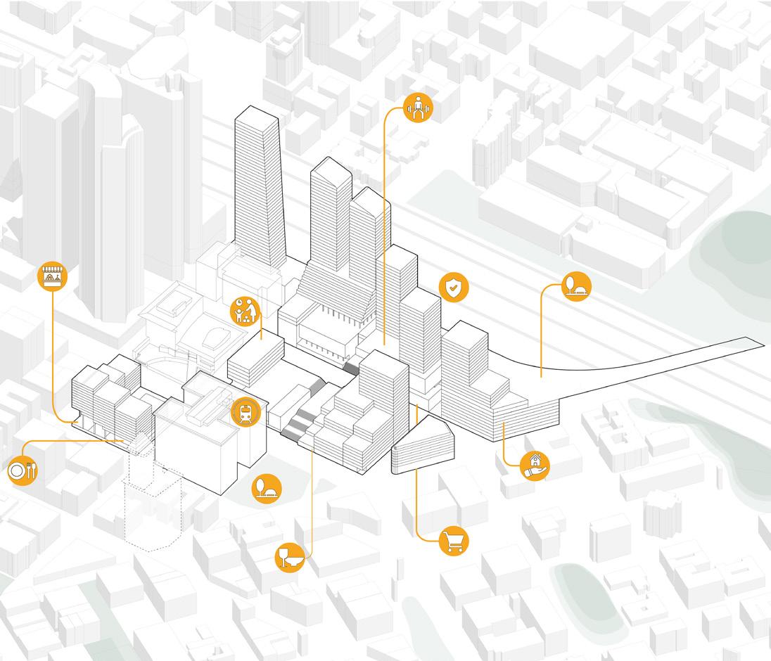
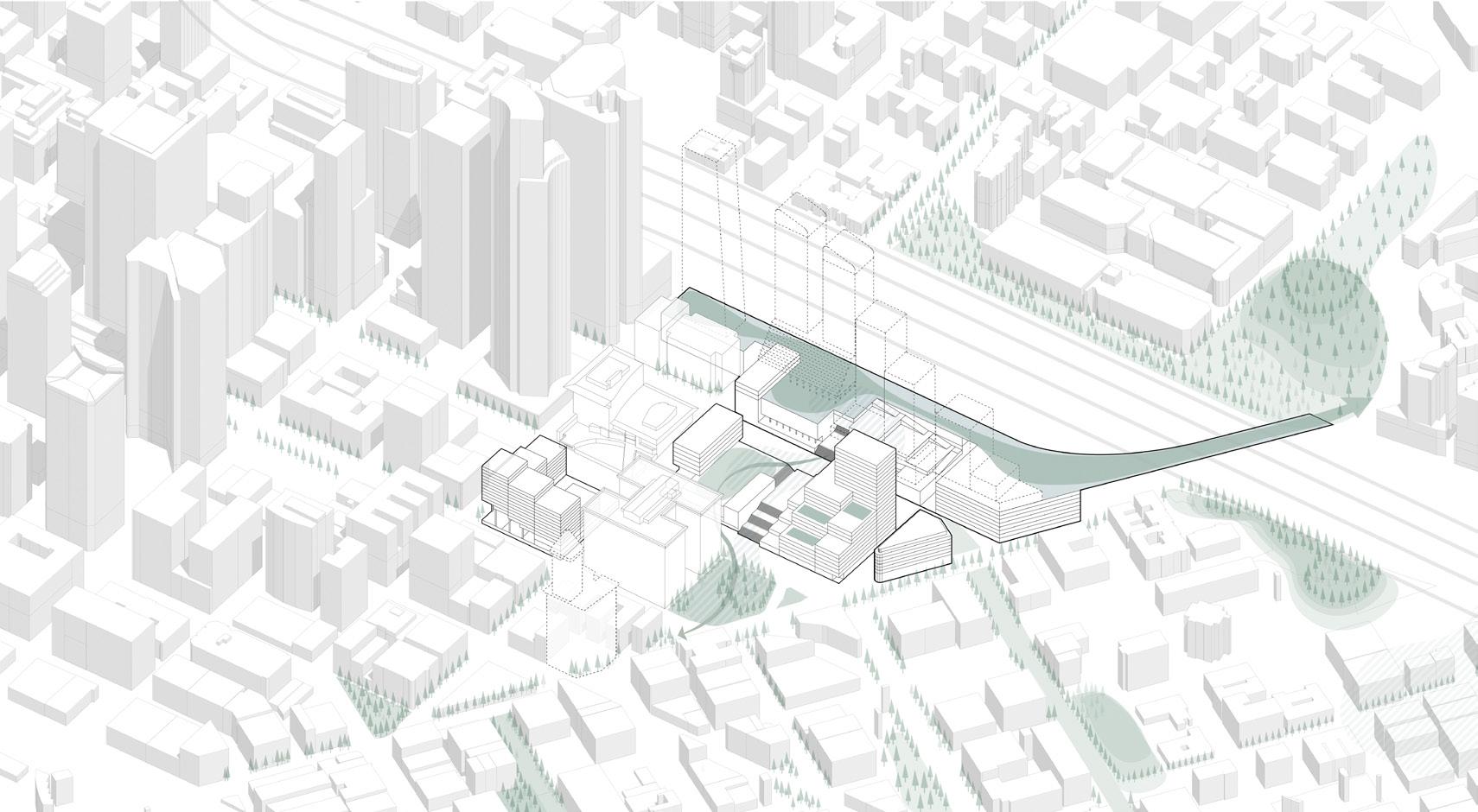
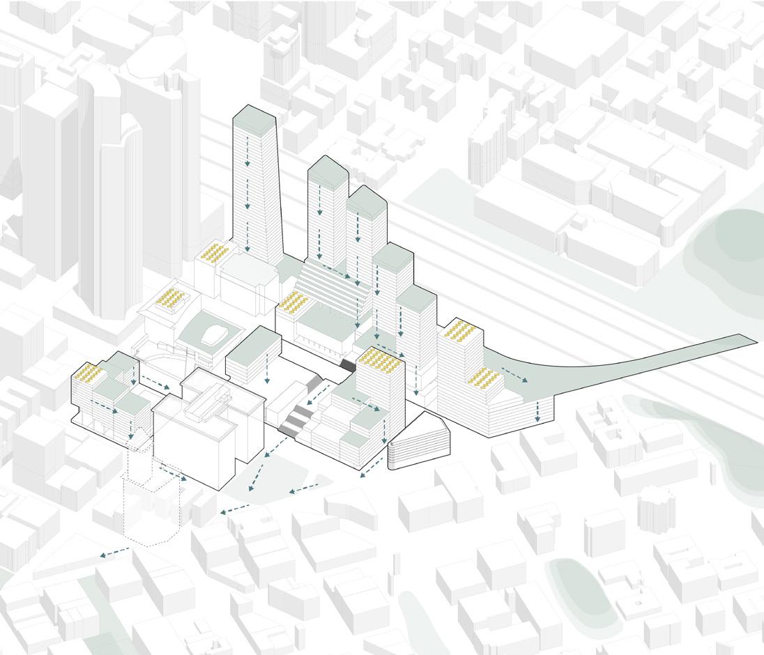
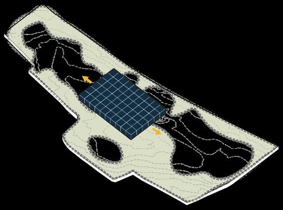
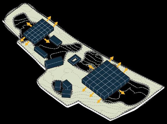
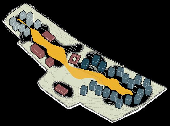
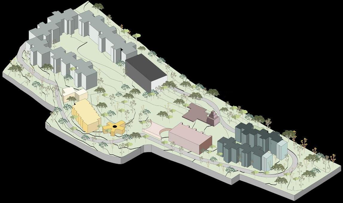
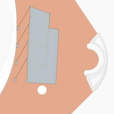
01 GreenLink Denver
Weaving disconnected neighborhoods
Competition x Neighborhood Scale
First Place - APA Student Planning and Design Competition, NPC Denver 2025
Site Plan
1- GreenLink 2- Multi Modal Transit Hub
3- Urban Farming
4- Community Garden
5- Community Programming 6- Pocket Parks 7- Education
Location: Federal and Colfax Ave., West Denver Team: Edwin, Tess, Chaochen, Maria
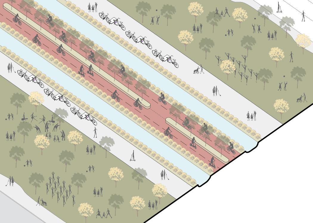
Personal Contribution: Site research and mapping, design development, perspective view renderings, transportation drawings.
Green-Link
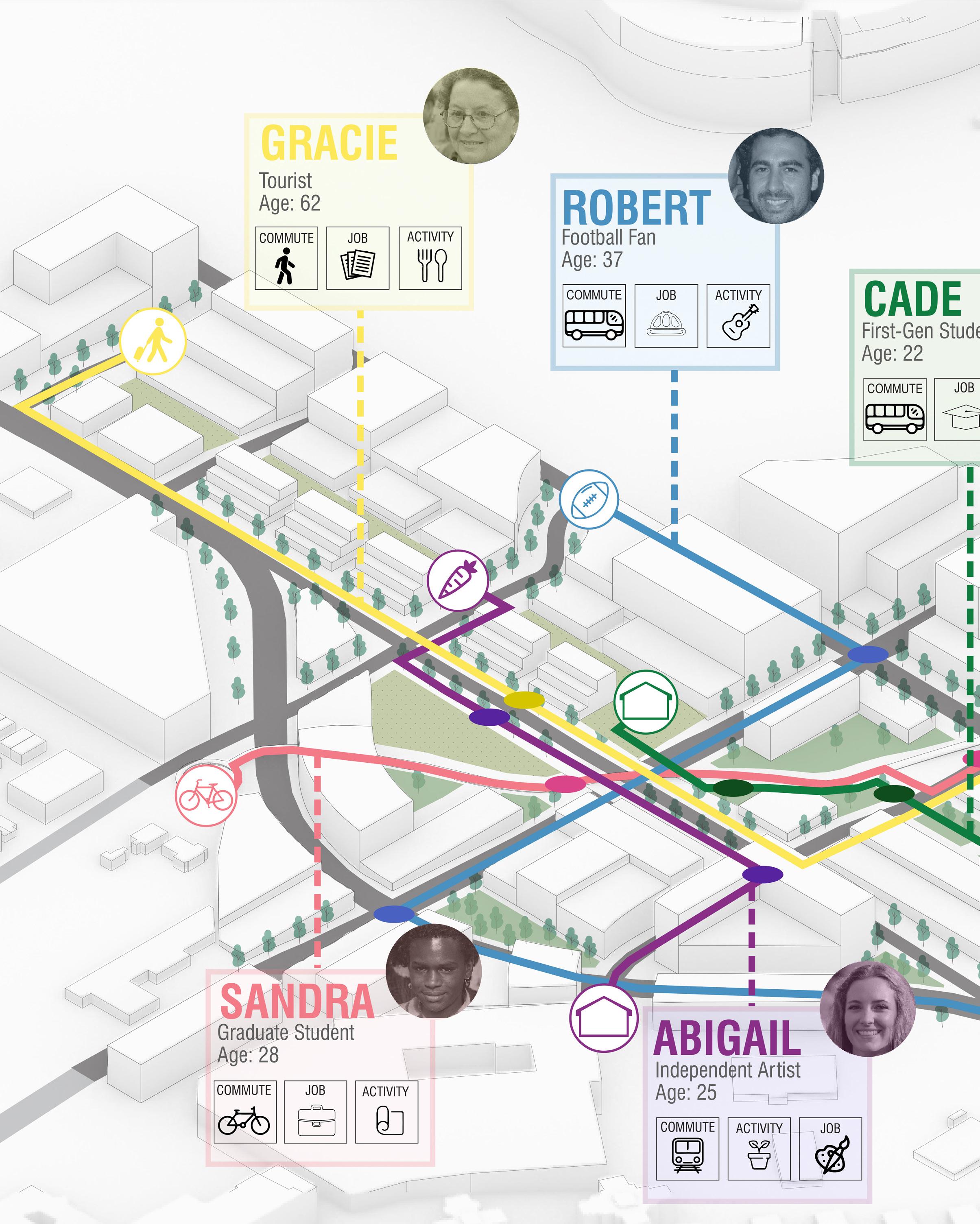
Summary: The project envisions a comprehensive mixed-use development, serving as a reparative link for an auto-dominant and disconnected site. Guiding principles such as mobility, social resilience, economy, and sustainability drive the planning and design.
Special Use Street
Space Network Map
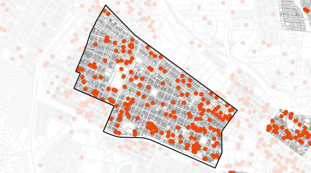
Heat Island Map
Accident Vulnerability Map
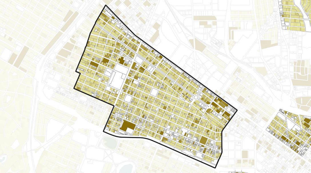
Demographic Study
- Single Unit
- Two-Unit
- Multi-Unit
- Mixed-Use
- Affordable Units
Green
Floodplain Map
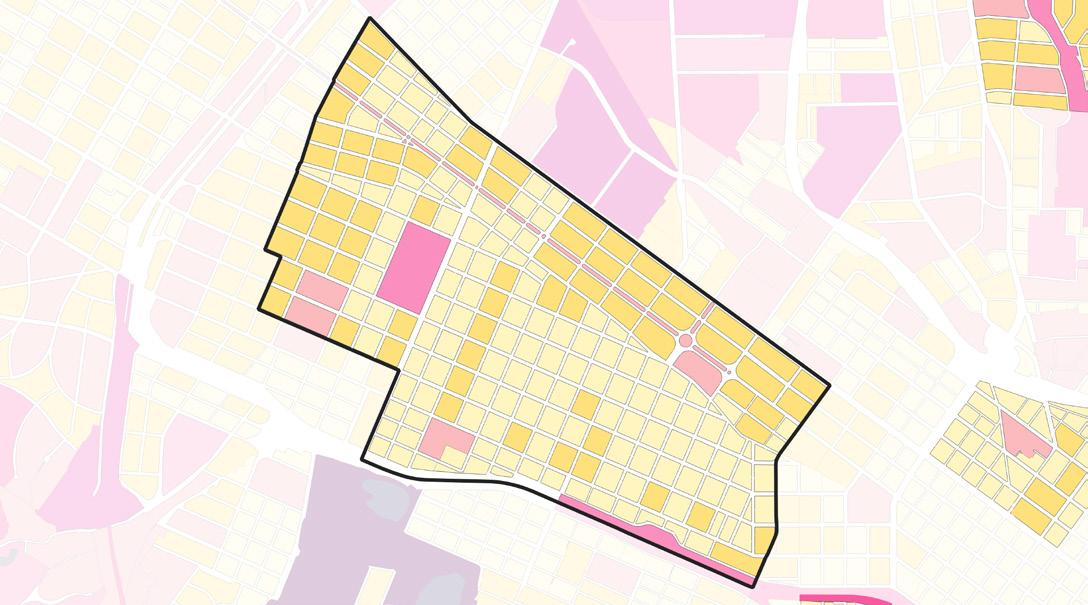
- Residential
- Retail
- Community
- Education
- Urban Farm
- Pocket Parks
- Hospitality
Land Use
- Sun-facing
- Solar Energy
- Bioswale
- Windbreak
- Permeability
Mixed-Use Street
Bicycle Highway
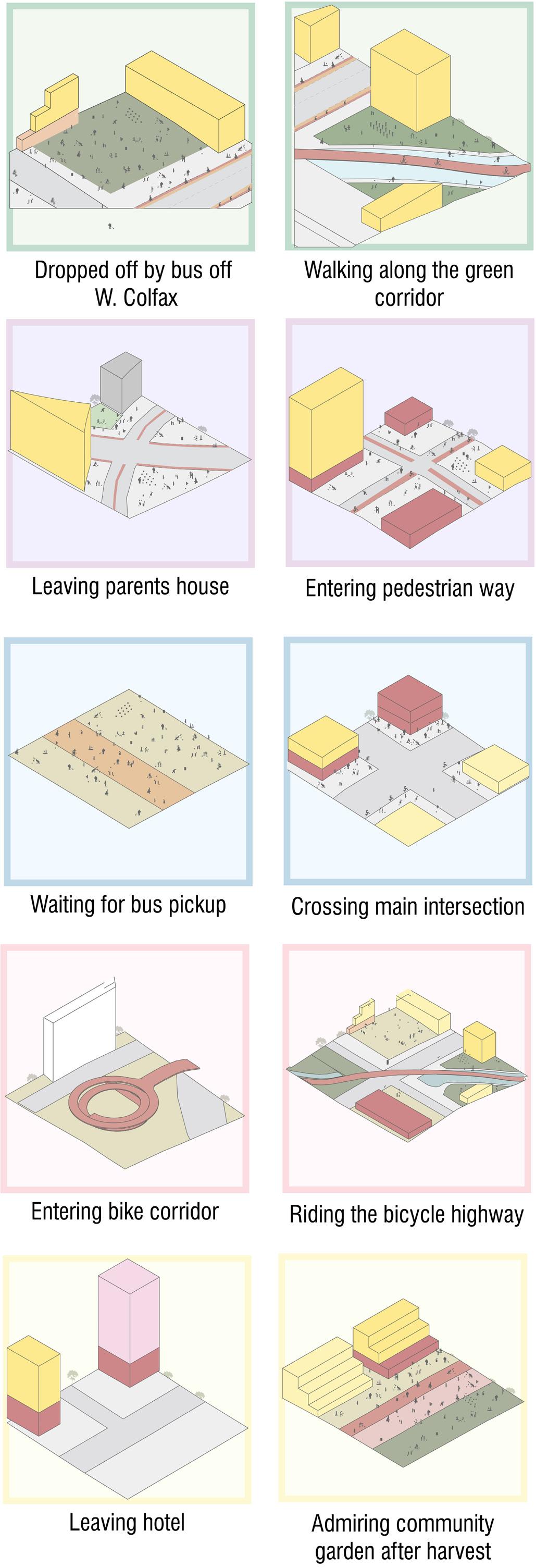
A DAY IN THE LINK
LINK
CADE’S
LINK
LINK
LINK
LINK
ABIGAIL’S
ROBERT’S
SANDRA’S
GRACIE’S
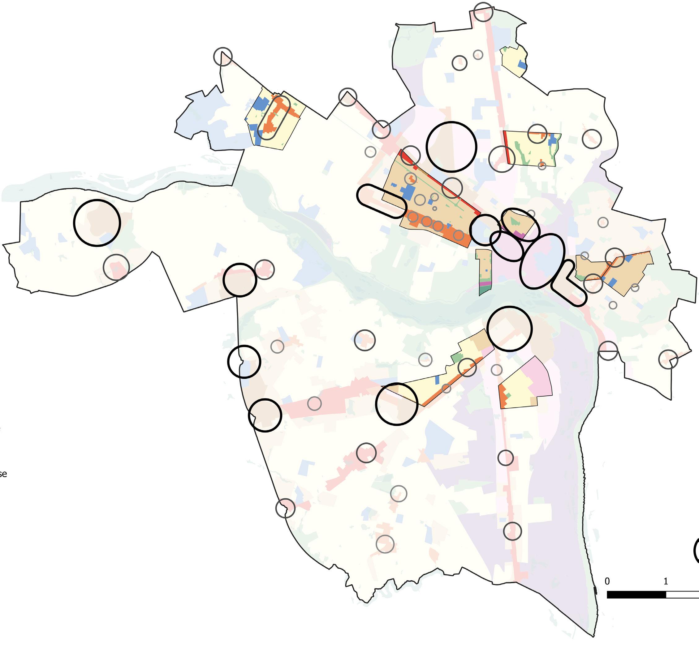
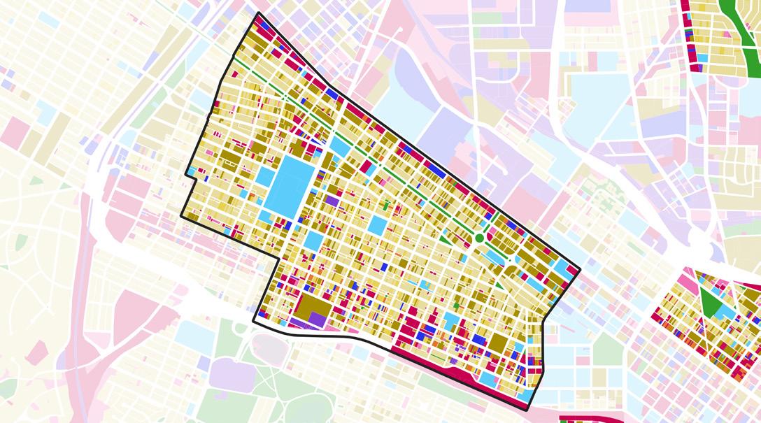
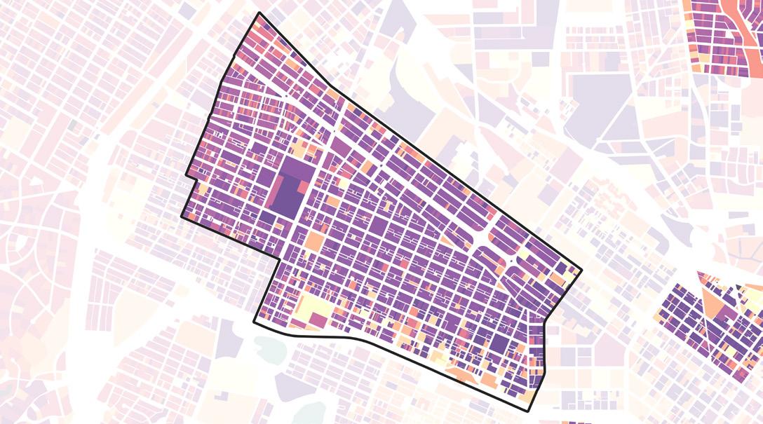
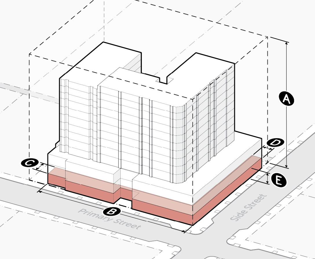
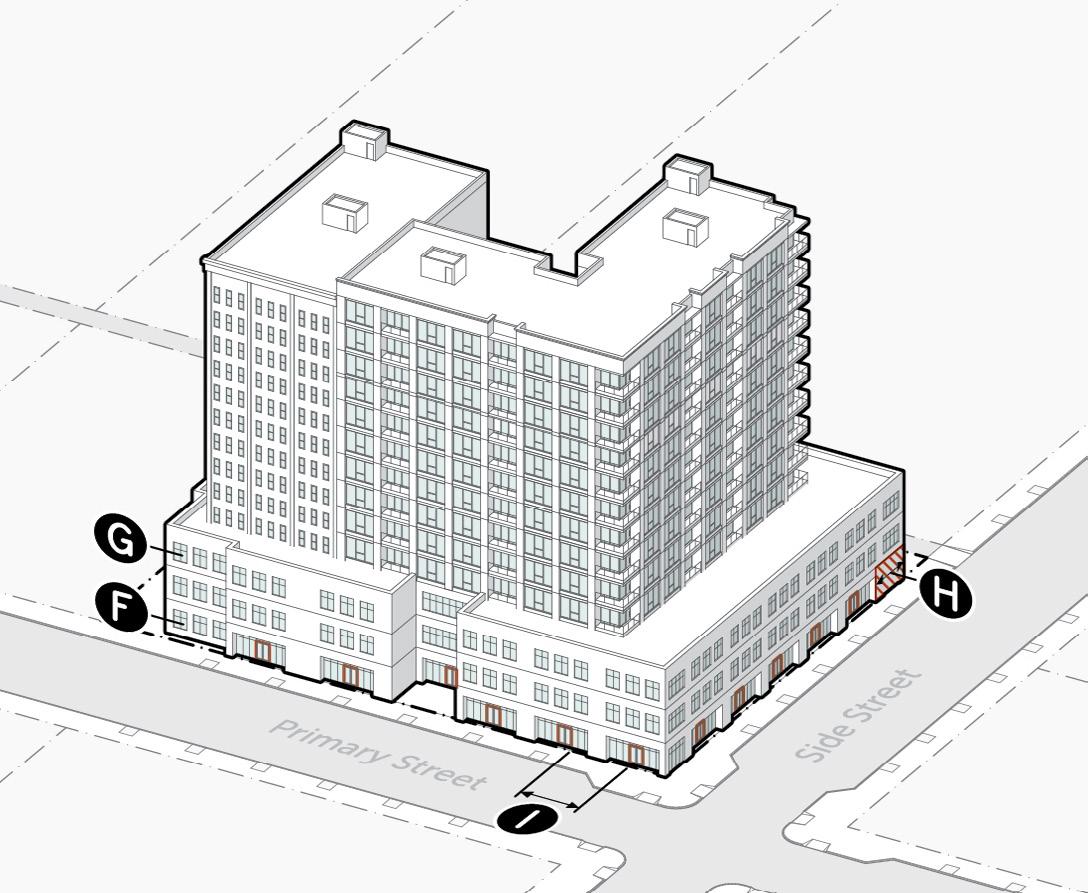
02 Richmond Zoning Pattern
Zoning and form-based coding
Professional Practice x City Scale
Ongoing Project - Public Review
Representational Neighborhoods
Location: Richmond, Virginia
Team: Code Studio
Personal Contribution: 3D modeling and illustrator styling of district graphics.
Noncomformities
The pattern book identifies patterns and metrics to regulate, guiding zoning reform and explaining to the public why changes are needed to align regulations with desirable existing built forms, flag nonconformities, and propose form-based codes blending historic character with contemporary standards.
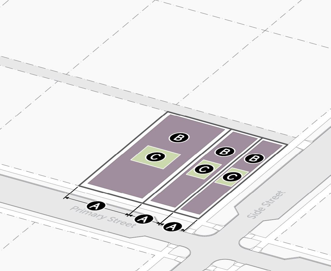
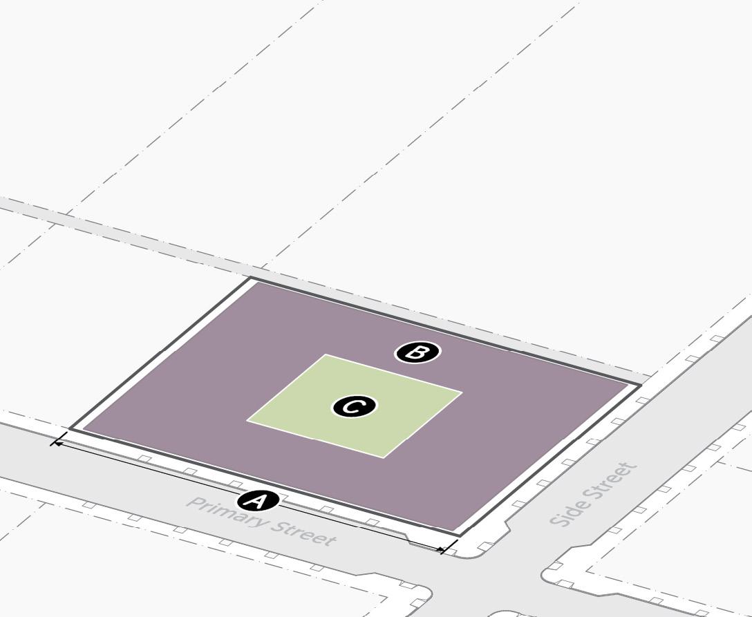
Residential Districts, RA-A (attached, low)
A
- Site
Lot Width (min)
Building Coverage (max)
Outdoor Amenity Space (min)
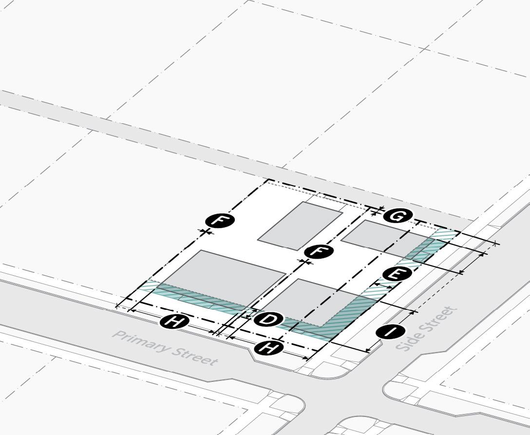
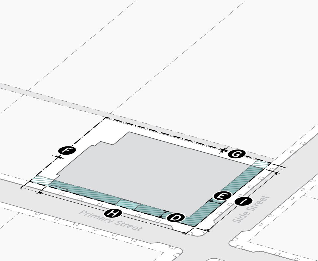
Mixed-use Districts, MX-13
A - Site
Lot Width (min)
Building Coverage (max)
Outdoor Amenity Space (min)
B - Setbacks
Primary Street (min/max)
Side Street (min/max)
Side and Read (min)
Alley (min/max)
Build-to Primary Street
Build-to Side Street
B - Setbacks
Primary Street (min/max)
Side Street (min/max)
Side and Read (min)
Alley (min/max)
Build-to Primary Street
Build-to Side Street
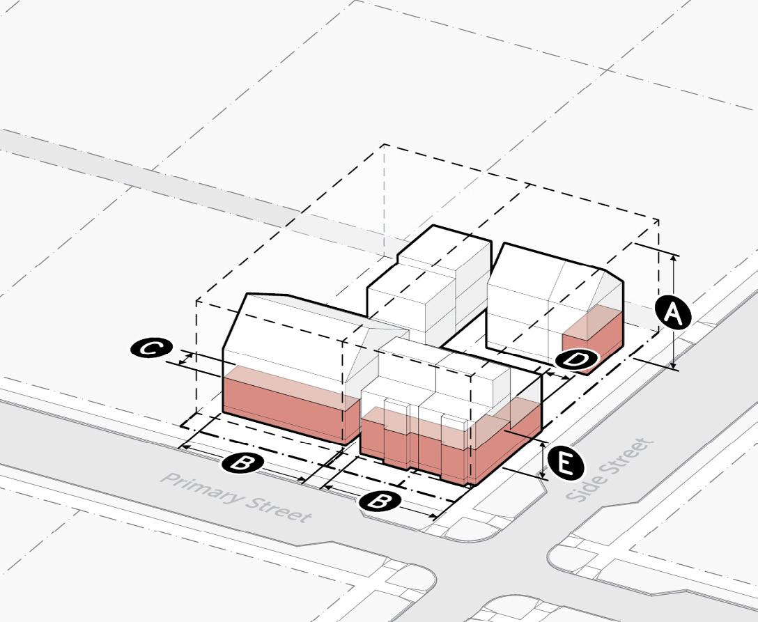
C - Massing
Building Height (max)
Building Width (max)
Active-depth Primary Street (min)
Active-depth Side Street (min)
Ground Story Height (min)
- Massing
Building Height (max)
Building Width (max)
Active-depth Primary Street (min)
Active-depth Side Street (min)
Ground Story Height (min)
- Activation
Windows - Ground Story (min)
Windows - Upper Story (min)
Blank Wall Width (max)
Door Spacing - street facing (max)
- Activation
Windows - Ground Story (min)
Windows - Upper Story (min)
Blank Wall Width (max)
Door Spacing - street facing (max)
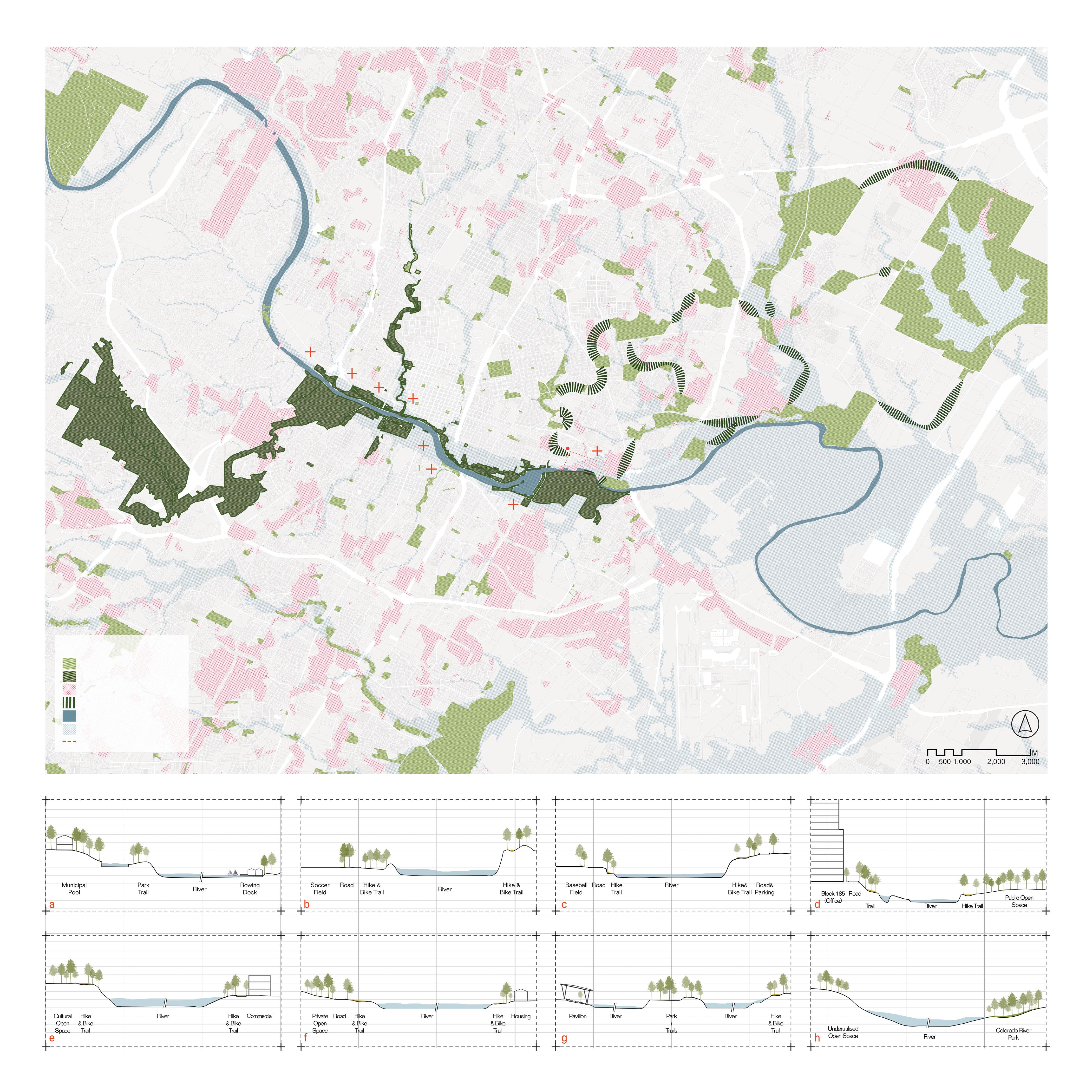
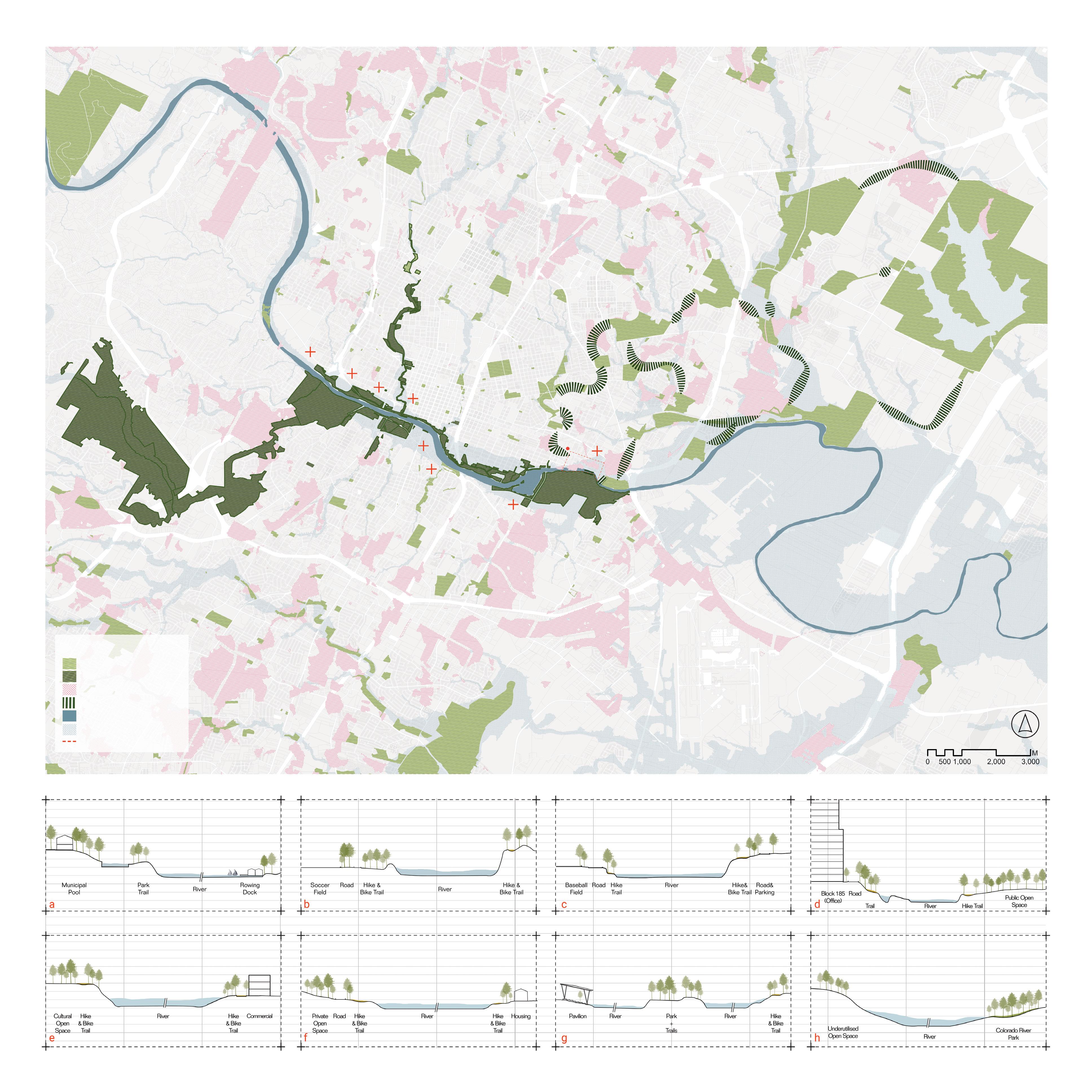
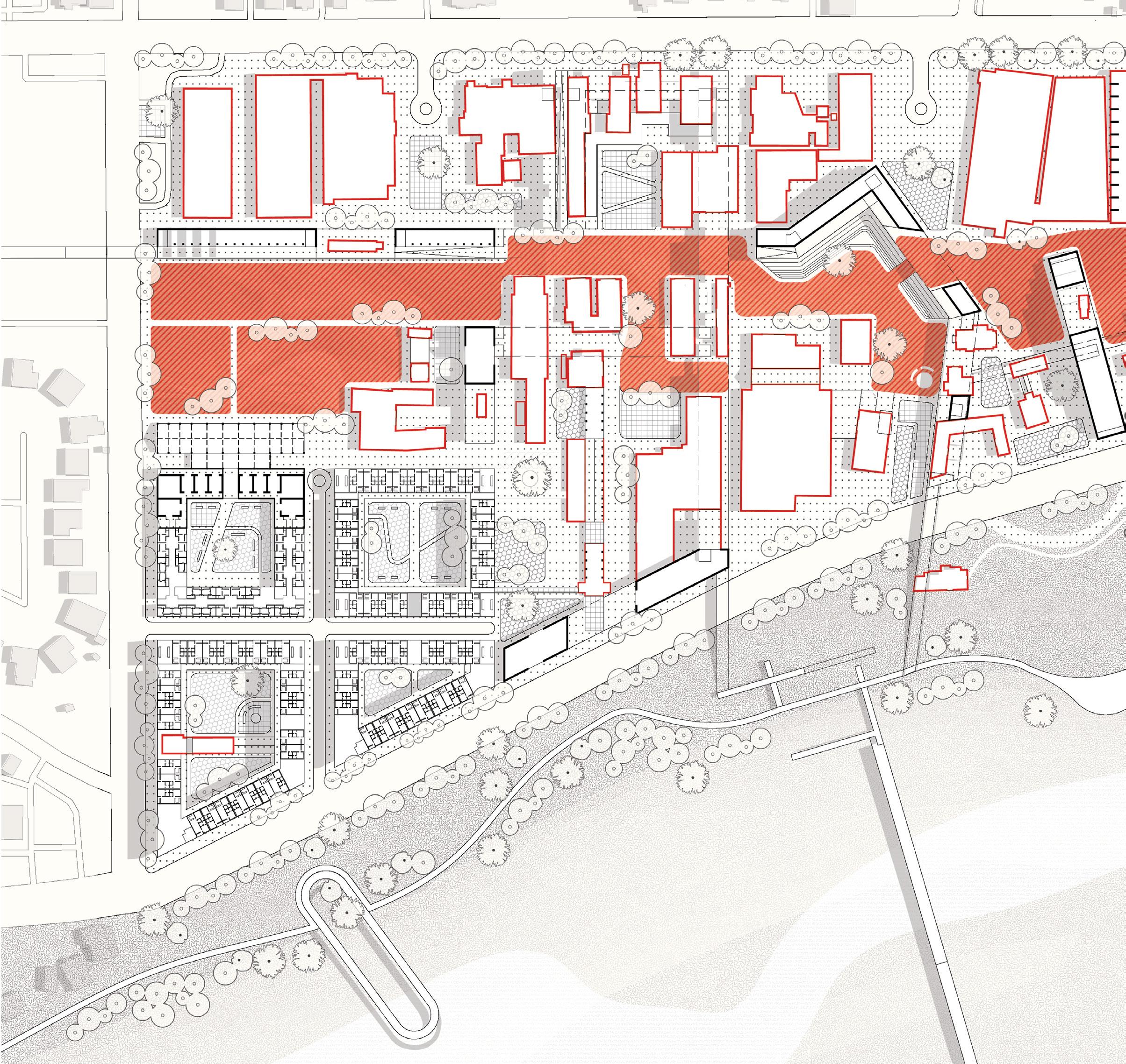
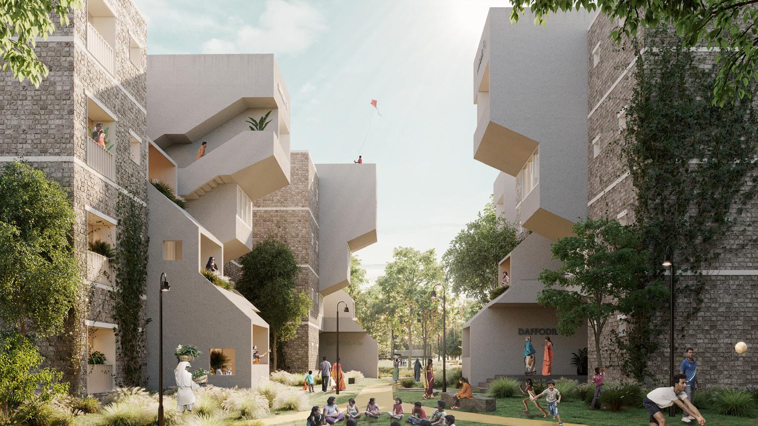
Keep Austin Lit
Housing and public programming
Academic x Neighborhood Scale
Nominated for the Design Excellence Award at UT SOA
Location: East Cesar Chavez St., Austin Team: Ambreen Massey
Personal Contribution: Metropolitan and site scale mapping and analysis, 3D modeling on Rhino, drawing renderings, design diagrams.
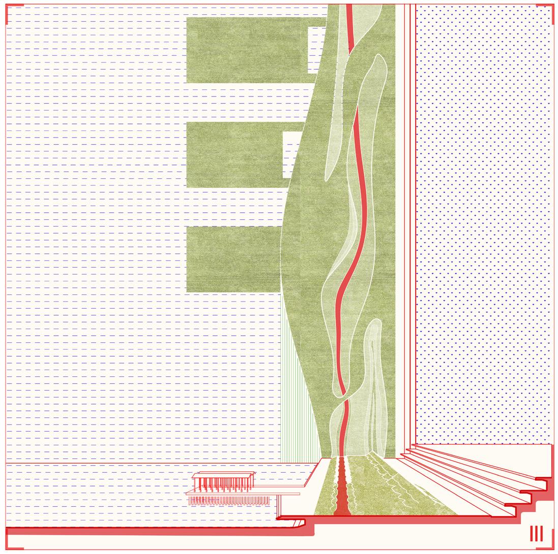
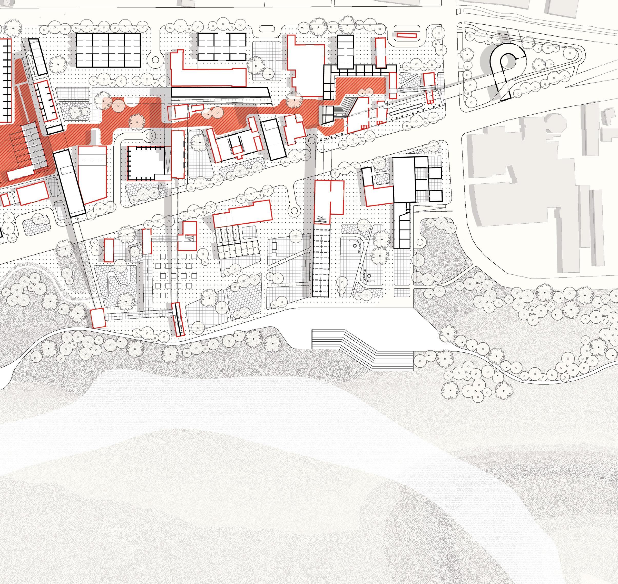
Situated at the edge of the East Austin area along the Colorado River, the 63 acre site is bound by 5th St. to the south and Shady lane to the East. The project focuses on examining new building typologies, in combination with re imagined urban block configurations. Affiliated mobility and mix use programs, can constitute a renewed model for a denser and more diverse mixed -use urban development.
Precedent 1: Green Archipelago | Berlin, Germany
Precedent 2: Praça das Artes | Sao Paulo
Precedent 3: Brooklyn Bridge Park | New York
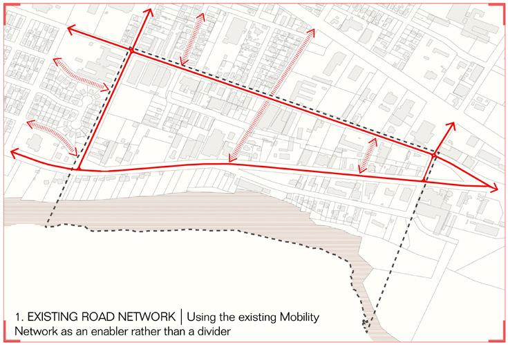
1_Existing Road Network
Using the existing mobility network as an enabler for connection than a divider.
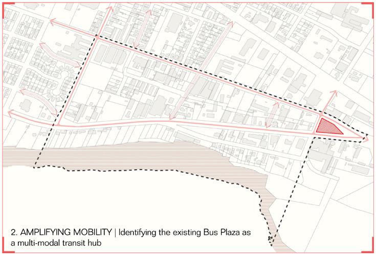
2_Amplifying Mobility
Identifying existing bus plaza as a multi modal transit hub.
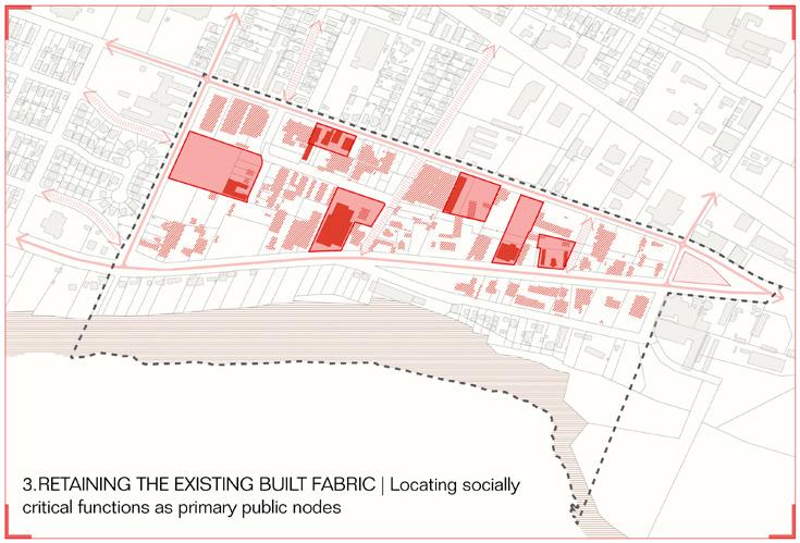
3_Retaining The Existing Built Fabric
Locating socially critical functions as primary public nodes.
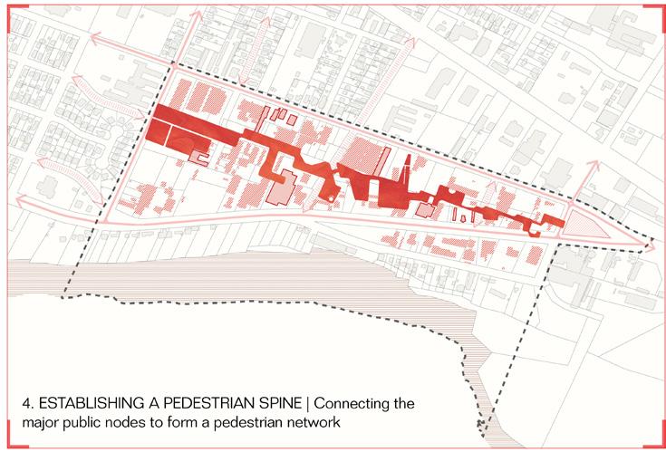
4_Establishing a Pedestrian Spine
Connecting major public nodes to form a pedestrian first backbone.
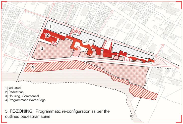
5_Re-zoning
Programmatic re-zoning of spaces based on the outlined spine.
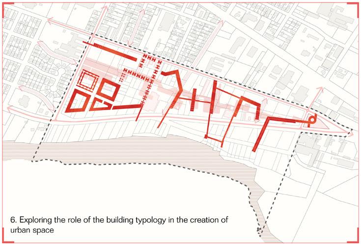
6_Adapive Re-use And Building Typology
Exploring building typologies to create urban spaces.
Typology 1
Multi modal transit system & market
Typology 3
Artist housing
Typology 2
Market-rate housing + F & B programs
Typology 4
Elder + Affordable Housing
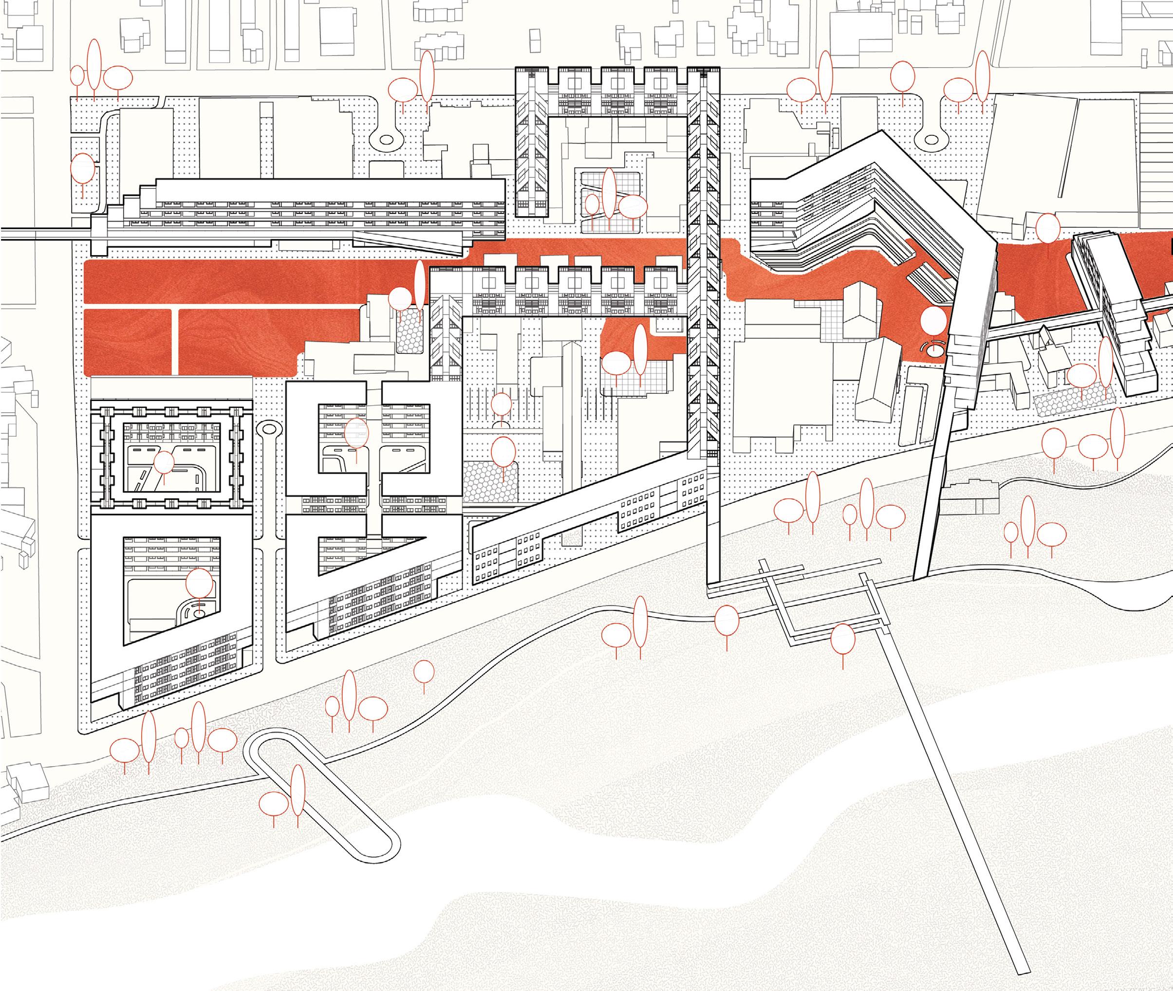
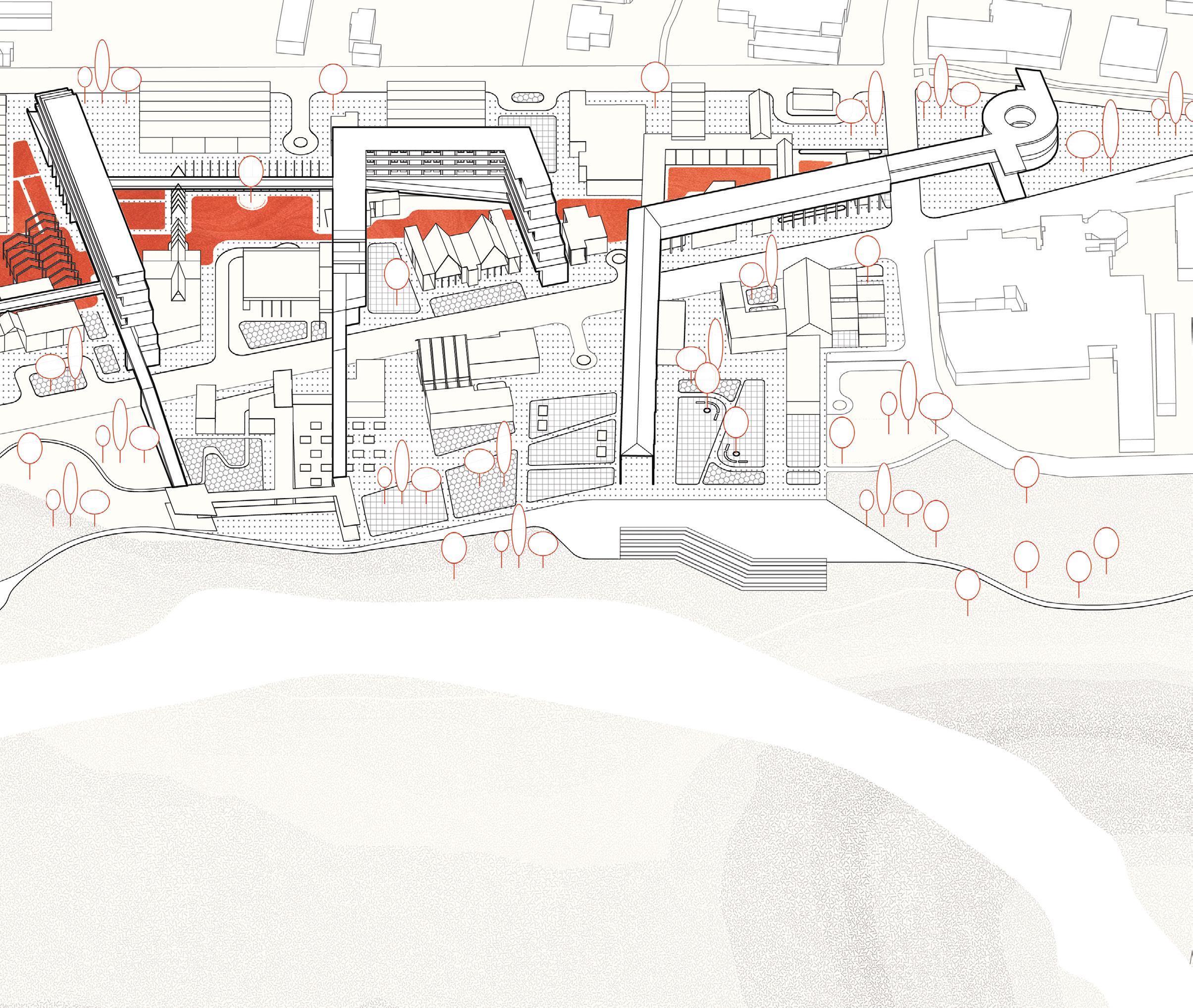
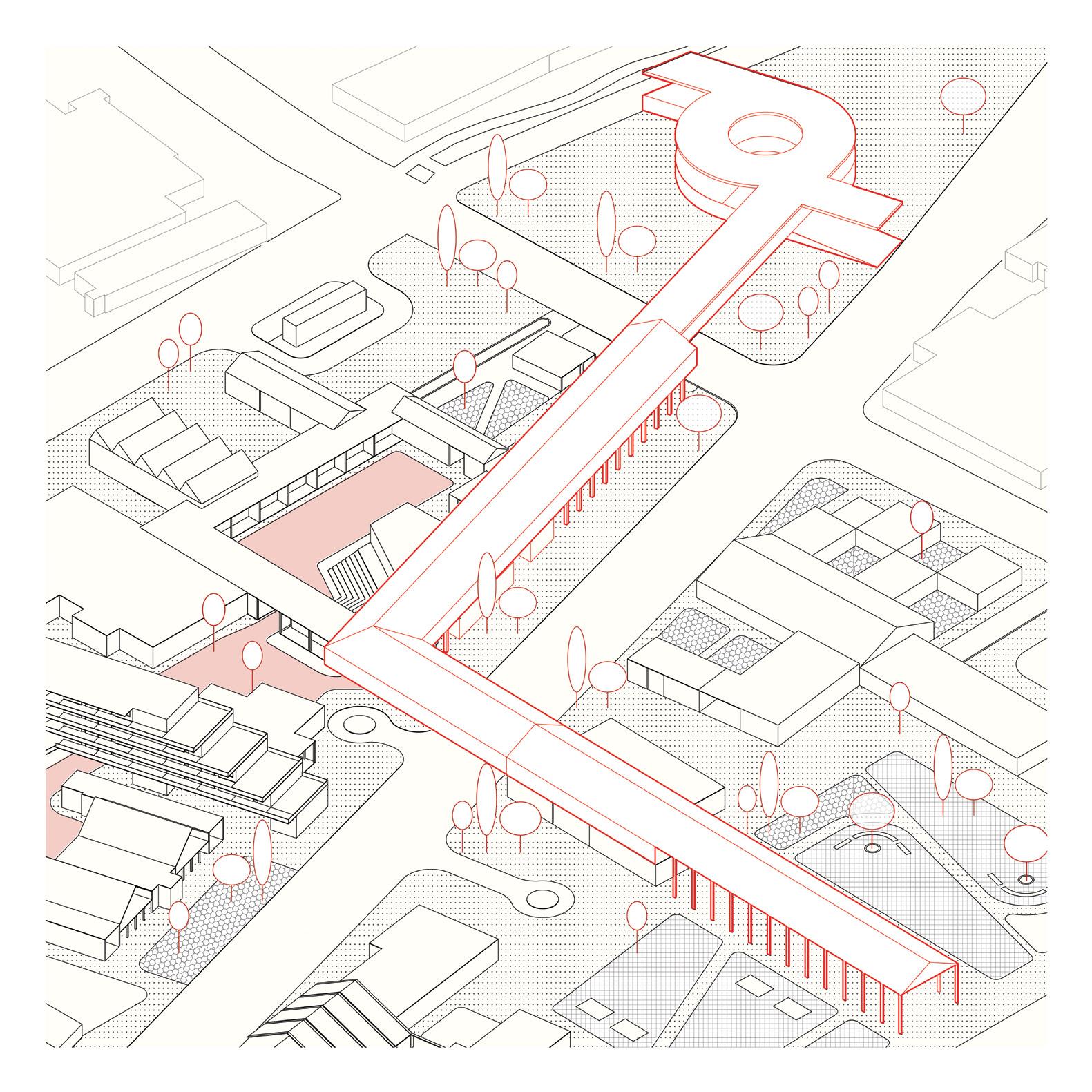
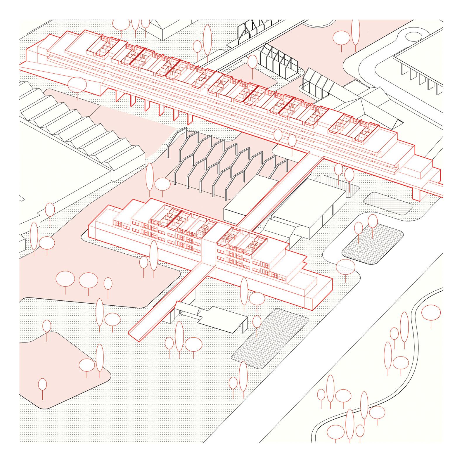
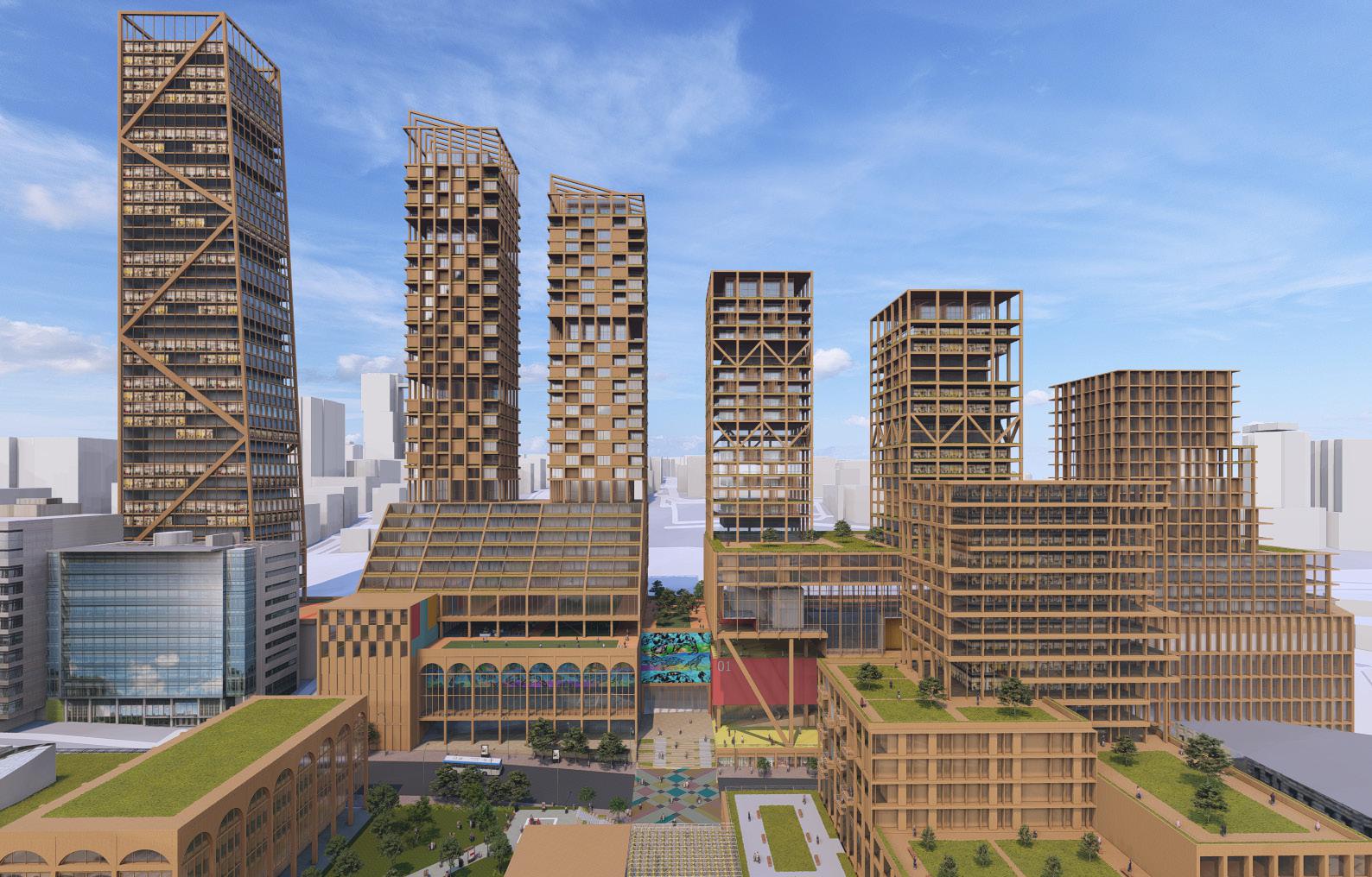
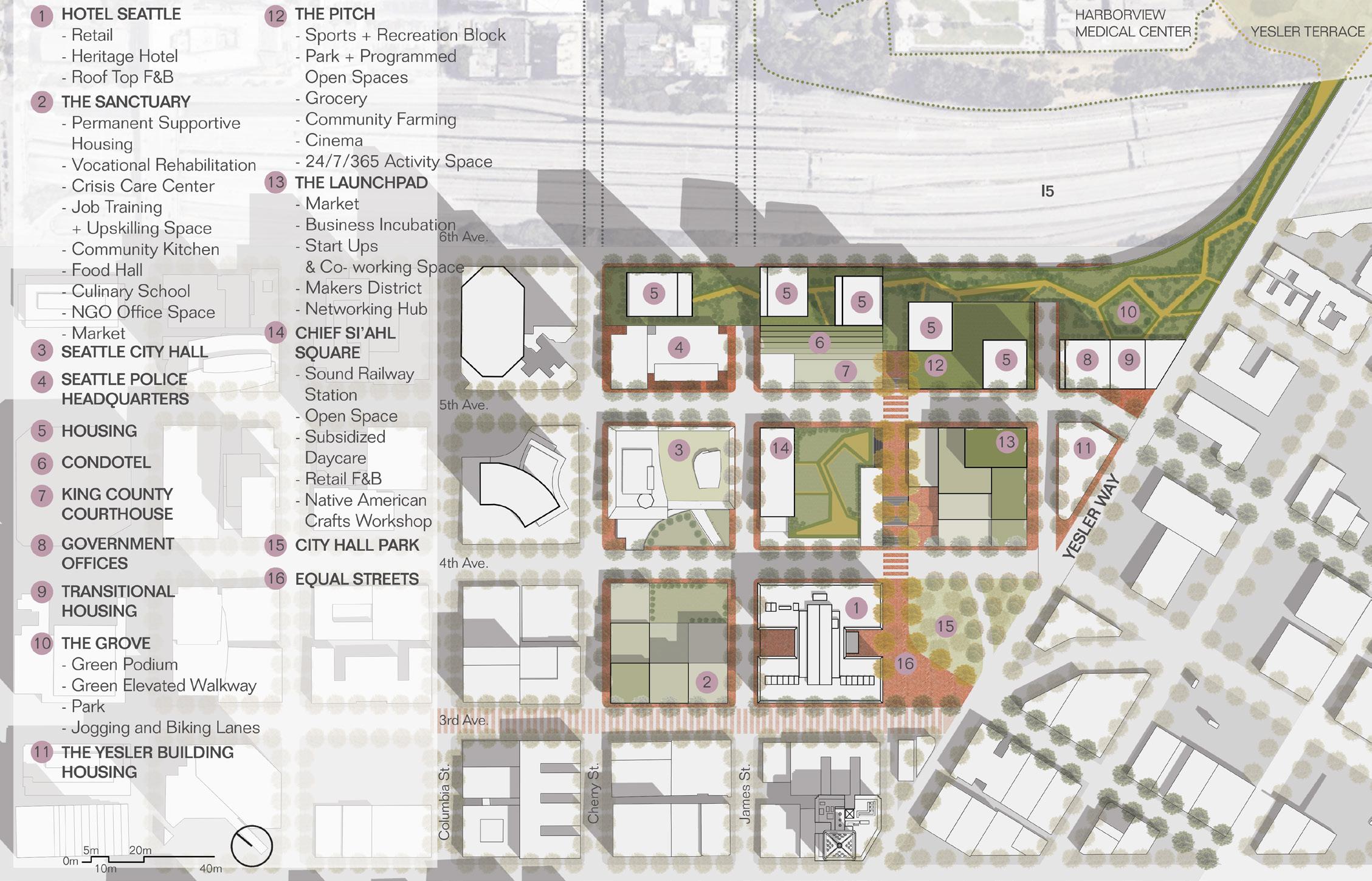
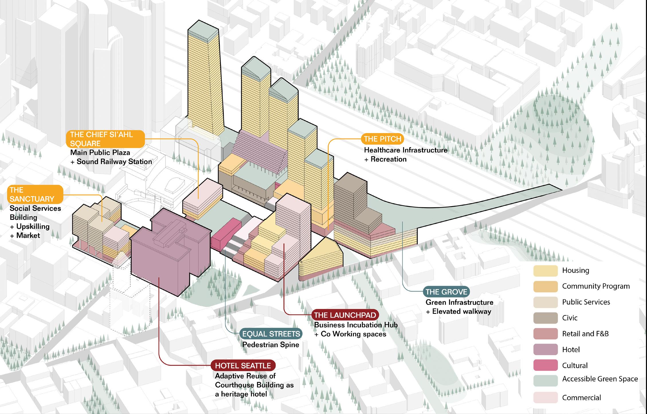
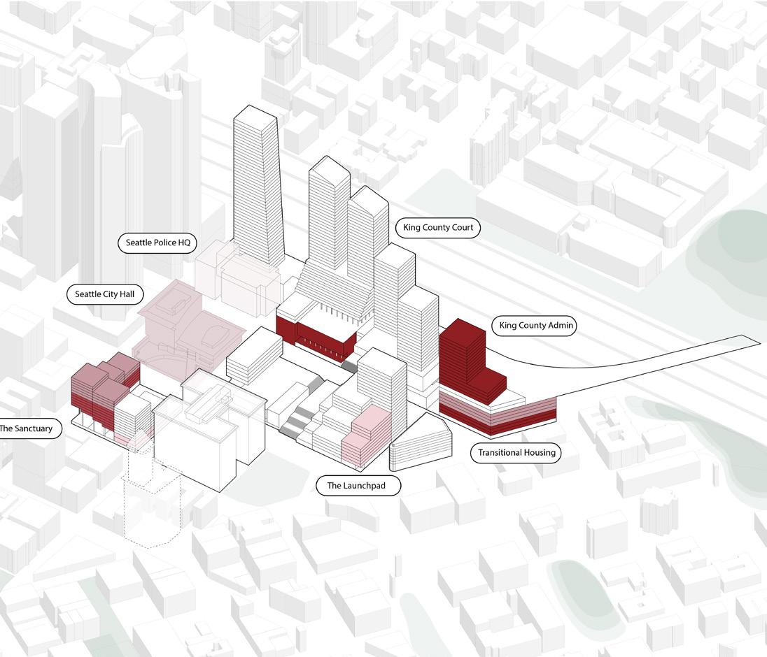
04 Downtown Tapestry
Downtown revitalization - ULI Competition 2024
Competition x Neighborhood Scale
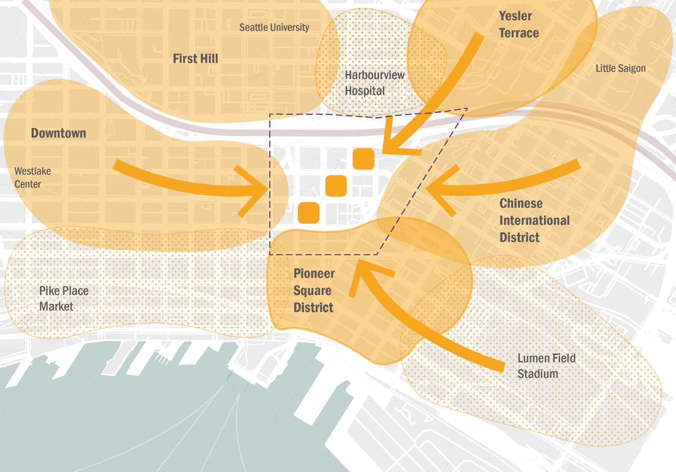
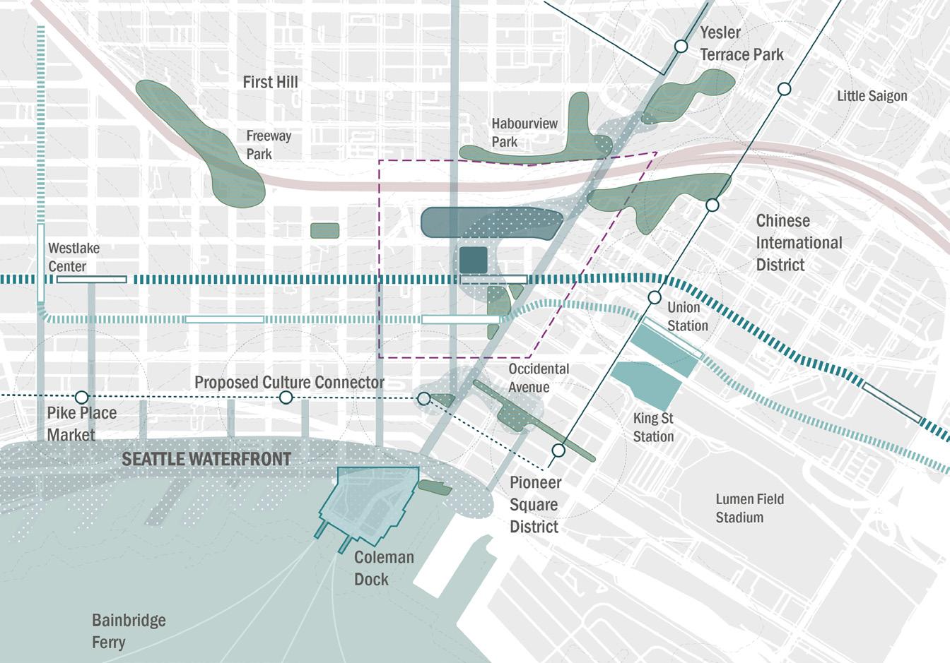
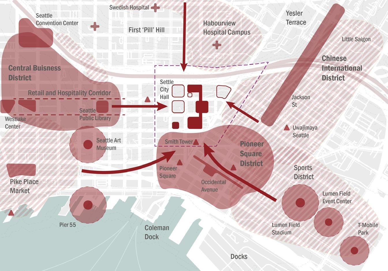
Location: Pioneer Square, Seattle
Team: Nilay, Vatsal, Tony, Jamie
Personal Contribution: Research and analysis, design development, diagrams, story board, site plan render, sections, programmatic axon.
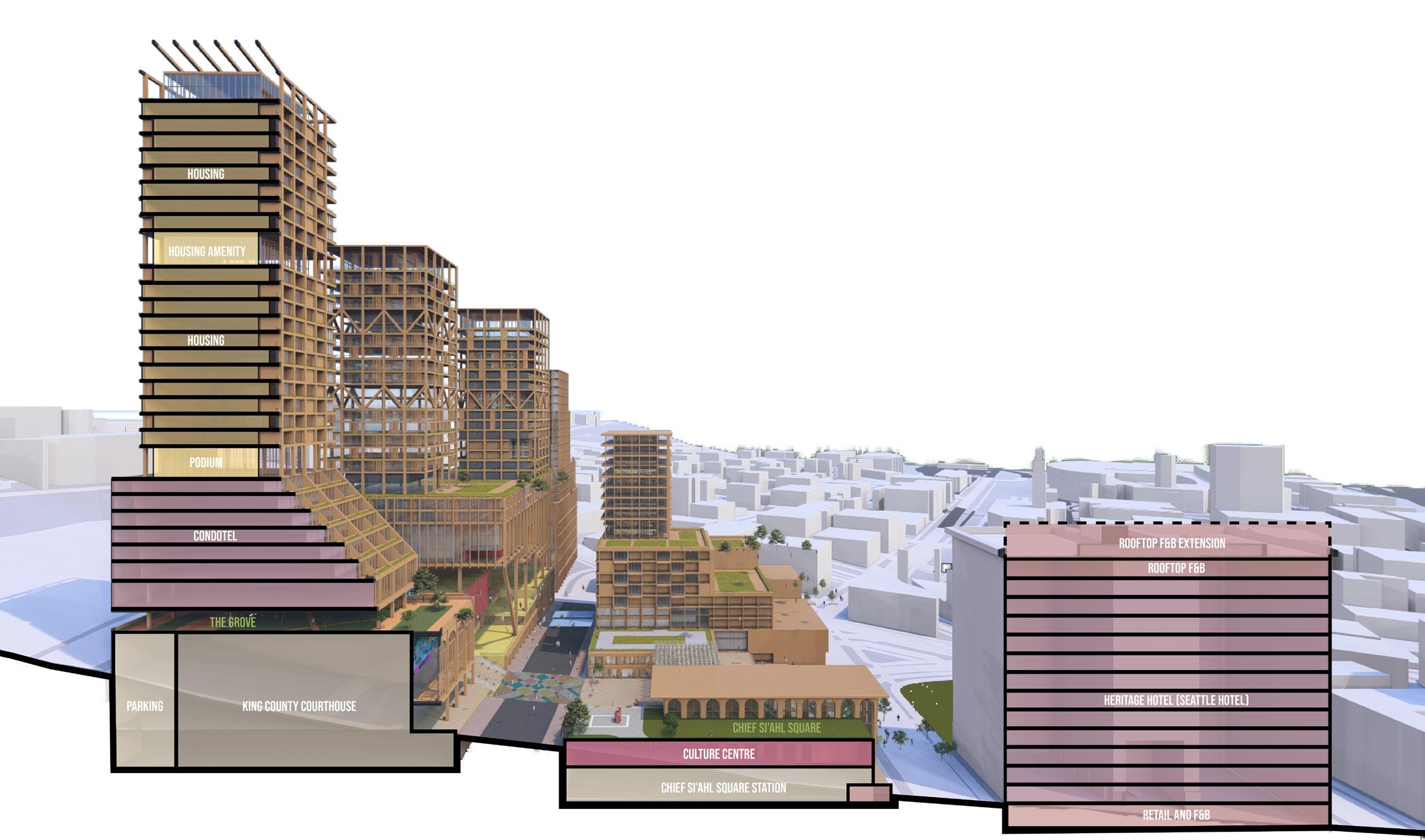
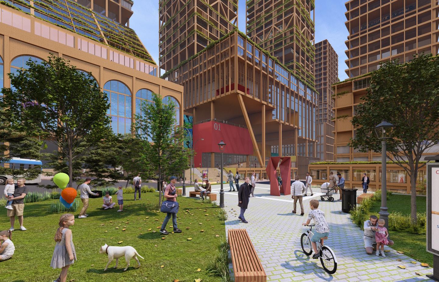
Downtown Tapestry stitches disconnected adjacent districts and splintered communities to form a robust urban linkage. The project transforms a former civic district into a thriving mixed-use development for complete living. The project unlocks the potential of re-zoning existing civic programs to stitch mixed-use buildings via a series of green infrastructures. The mixed-use development is anchored by programmed open spaces, efficient mobility networks, and a pedestrian spine that stitches affordable housing and welfare with cultural expression and business, thus forming three key threads in the Tapestry – Connectivity, Community, and Economy
Site Plan
Community
Pioneer Square continues to be richly historic, and culturally vibrant. The project celebrates the legacy of Pioneer Square by re-establishing cultural links to Seattle, and integrating communities from adjacent neighbourhoods to create a rich tapestry of programs.
Weaving disconnected districts
Connectivity
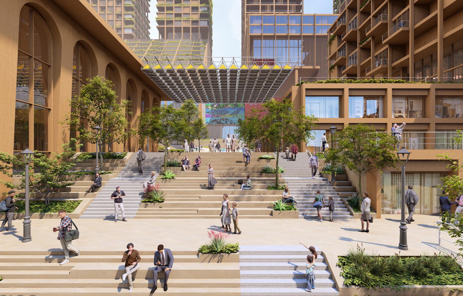
The development intends to converge diverse groups of people and cultures through dense urban programming. Green infrastructure such as shared bike and walking lanes, connected green spaces on ground and podium levels, pedestrian-only streets, and a green elevated pathway across I5 feed into pre-existing modes of public transportation to amplify and encourage the use of public mobility networks.
Economy
Equal Street – a pedestrian first complete street (former Jefferson St.) forms the backbone of the economic district. The street draws tourists from Occidental Avenue, into the Tapestry to experience bipoc art studios, retail + F&B programs, and festivals hosted at Chief Si’ahl Square. This leverages already existing businesses, thus improving livelihoods of communities beyond our boundaries. The Launchpad - business incubation centre, co-working spaces, and mentorship programs, makers hub, plugs into Equal Street.
Amplifying public mobility network
Extention of the business district
Connected open spaces
Sustainibility systems
HOUSING
Timber construction
CONDOTEL
Designed for tourist footfall
Equal Streets - pedestrian spine
THE CHIEF SI’AHL SQUARE
A public plaza a major public transport hub
THE YESLER BUILDING
Adaptive Reuse of heritage building for housing
HOTEL SEATTLE
Adaptive Reuse of heritage building as a hotel
Cross Section
Chief Si-Ahl Square
The Grove - green podium
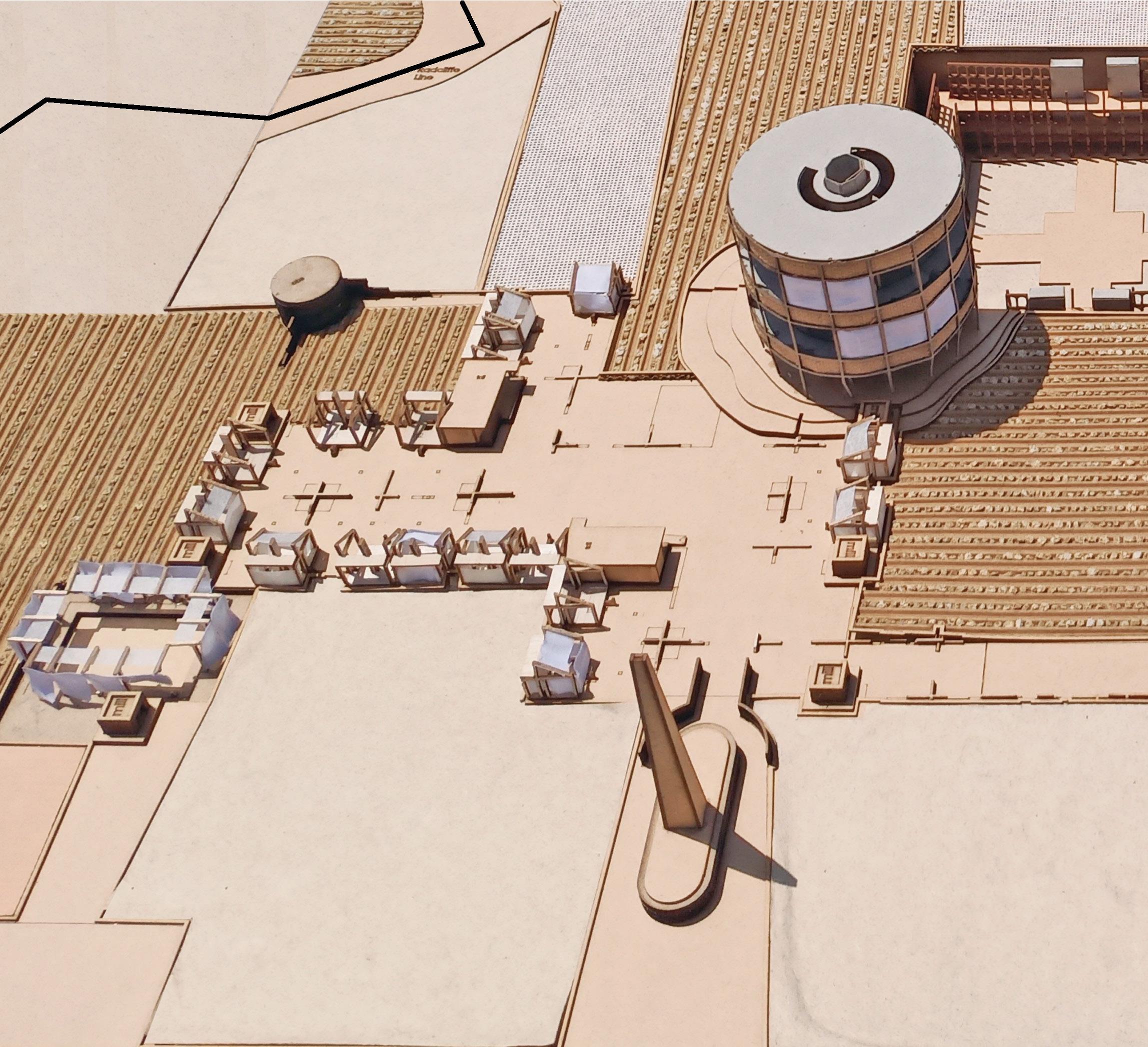
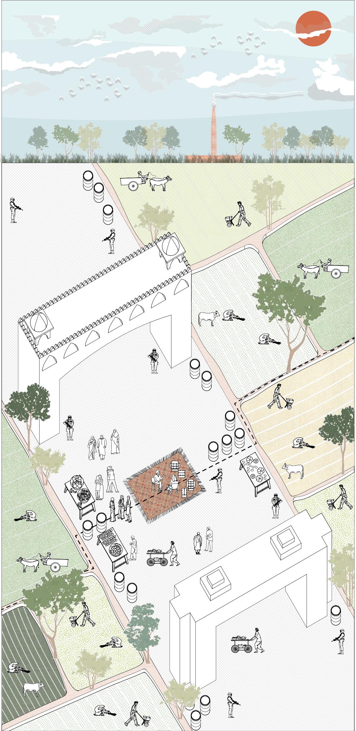
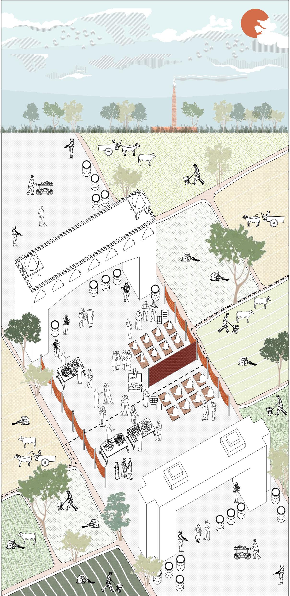
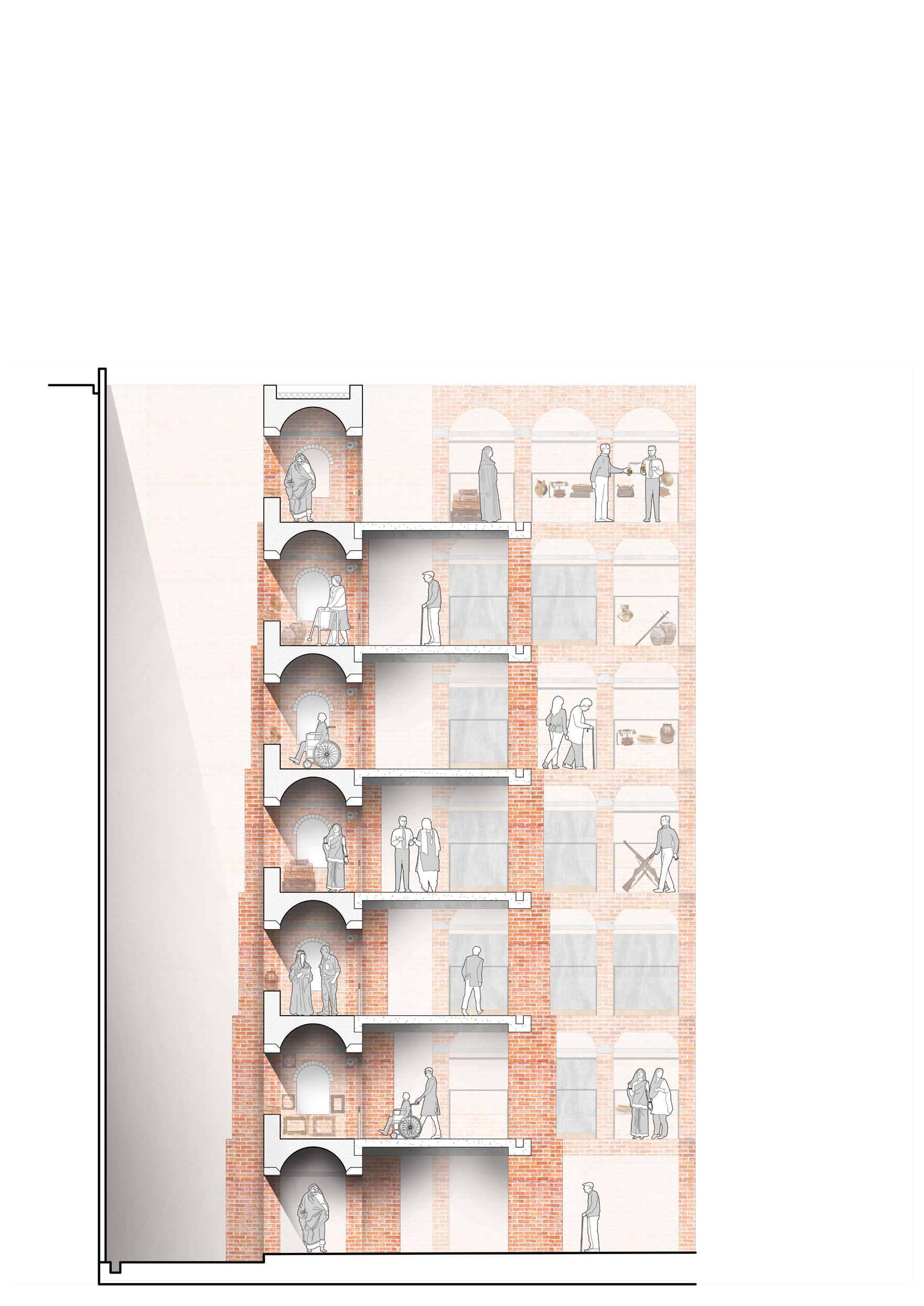
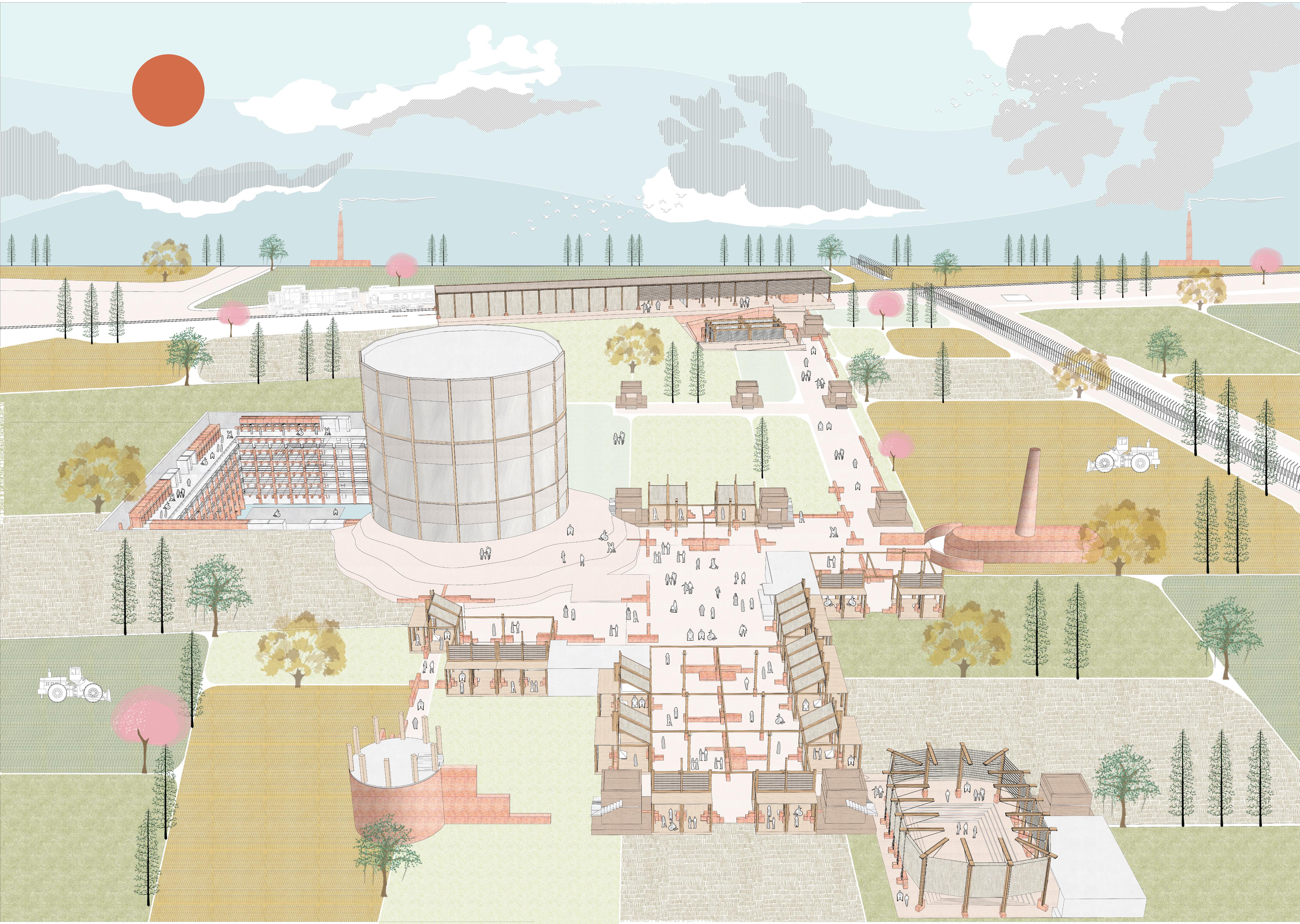
Tea at No Man’s Land
Border porosity on the Radcliffe Line
Academic x Neighborhood Scale
Undergraduate Thesis Dissertation
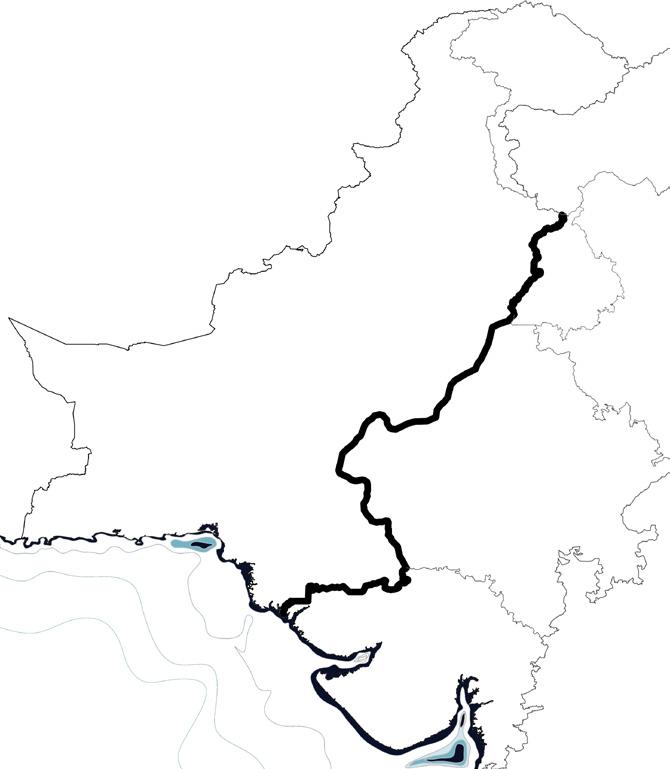
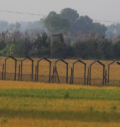
Location: India-Pakistan International Border
Having co-existed in relative peace and harmony, villages, families, homes, lands, cultures were torn apart by drawing the line of partition. The newly carved border by an alien identity acts like a physical manifestation of the great divide across ‘sameness’, giving people new national identities.
The “No Man’s Land” is a byproduct of the boundary between India and Pakistan. A space that does not exist. The characteristic non-existence of space strips the person of their identity, and also their preconceived notions of nationalism. What is the national identity of a person inhabiting this space? How does an invisible line, redefine national identities of people?
Pakistan
International Border
India Punjab
No Man’s Land
Arabian Sea
1 - Two friends - Lata Mangeshkar and Noor Jahan - 1952
Two famous singers and close friends were separated during the partition. Rugs were laid for them to meet, they brought gifts and Biryani for each other.
2 - Two families solemnizing
A bride’s family was denied visas and so wedding. The border was decorated as
Congregation on No Man’s Land
solemnizing a wedding - 1948
No Man’s Land became the space for a two families congregated for a wedding.
3 - Religious Mela (fair) - Annual Fair
The Radcliffe line ran through a Dargah. An annual fair is celebrated which is used by separated friends and families to reunite temporarily.
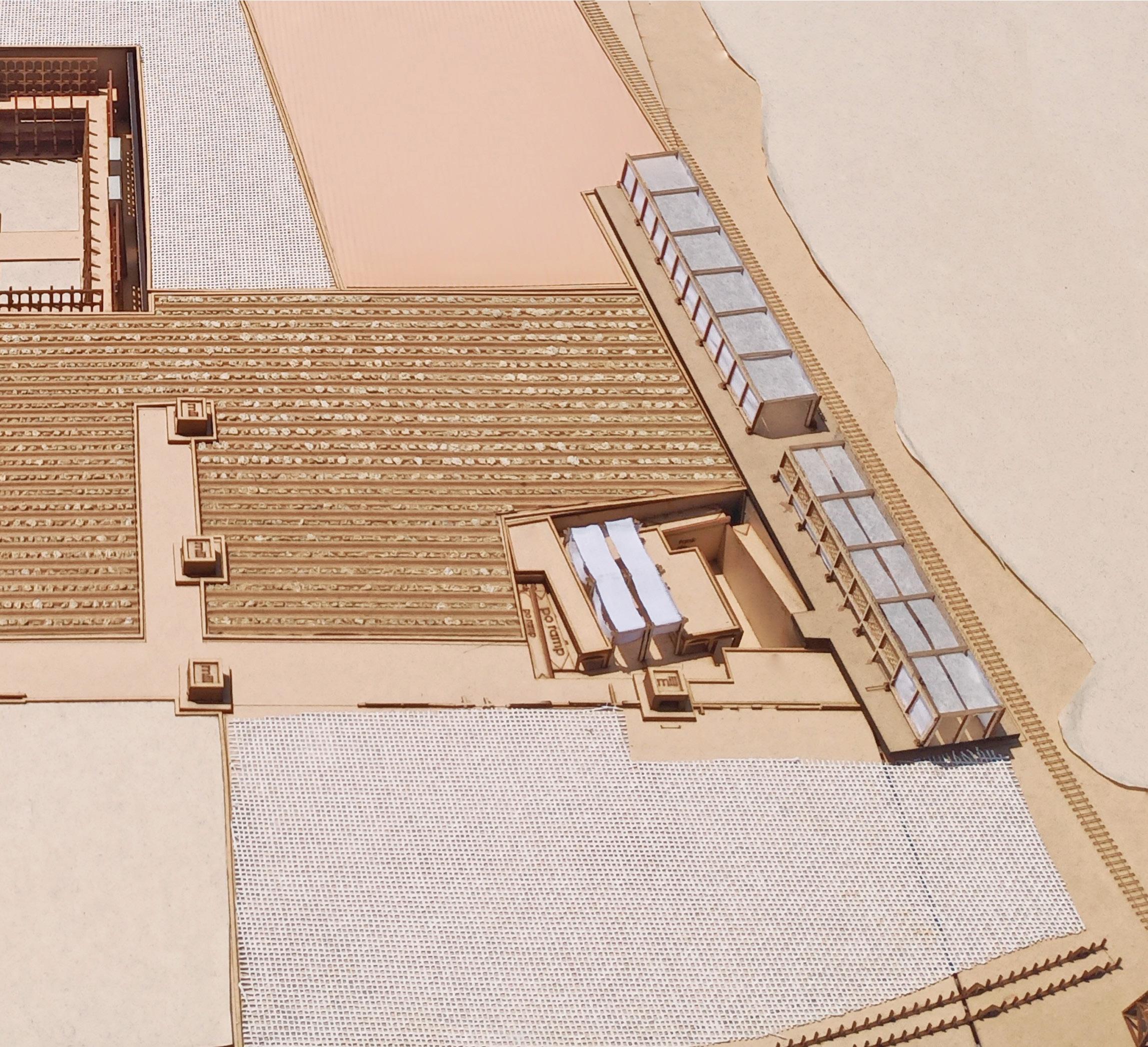
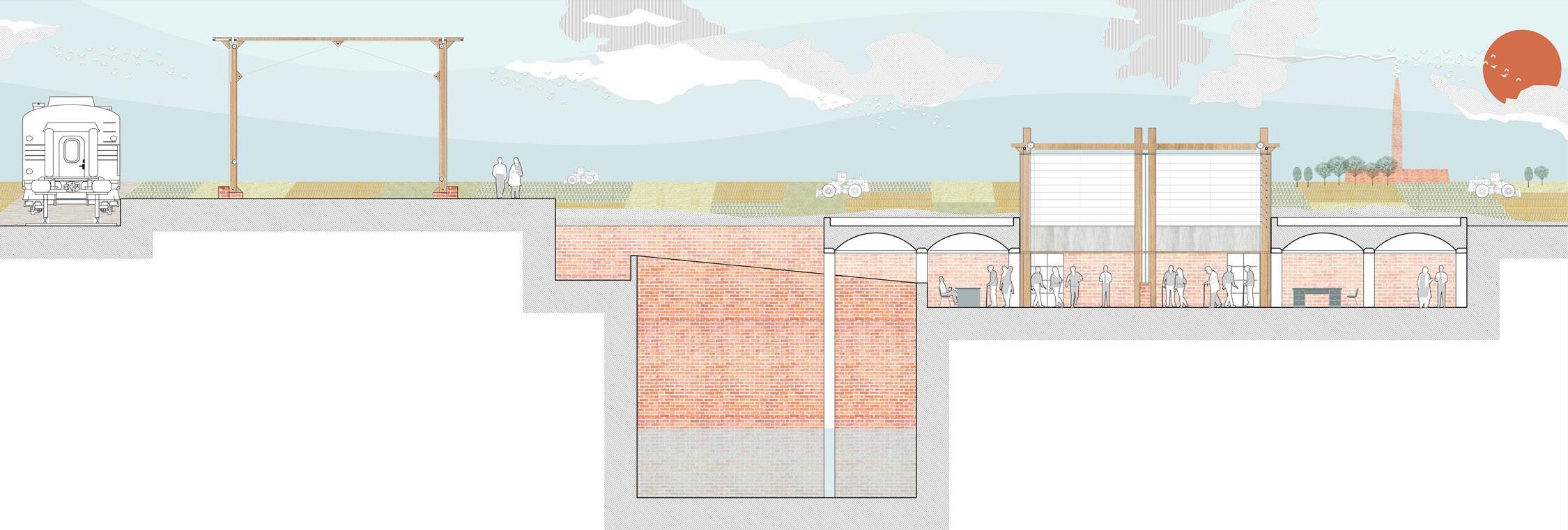
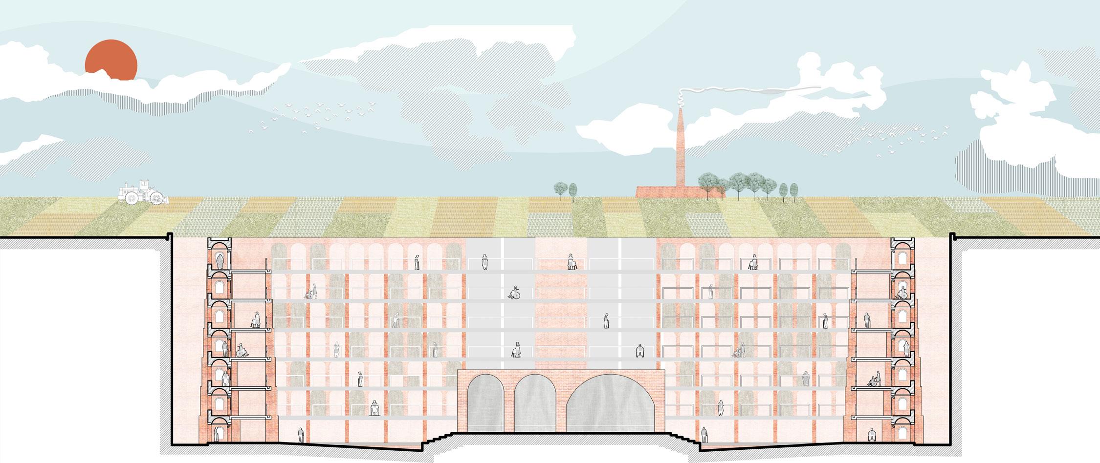
Railway Station:
Much like the experience of Toba Tek Singh, the Railway station tries to bring a sense of madness into the viewer by giving one sweeping view of the entire site from a certain point just outside the mill.
Post Office:
House of Toba Tek Singh Post Office for Memories as Address
35mmx35mm
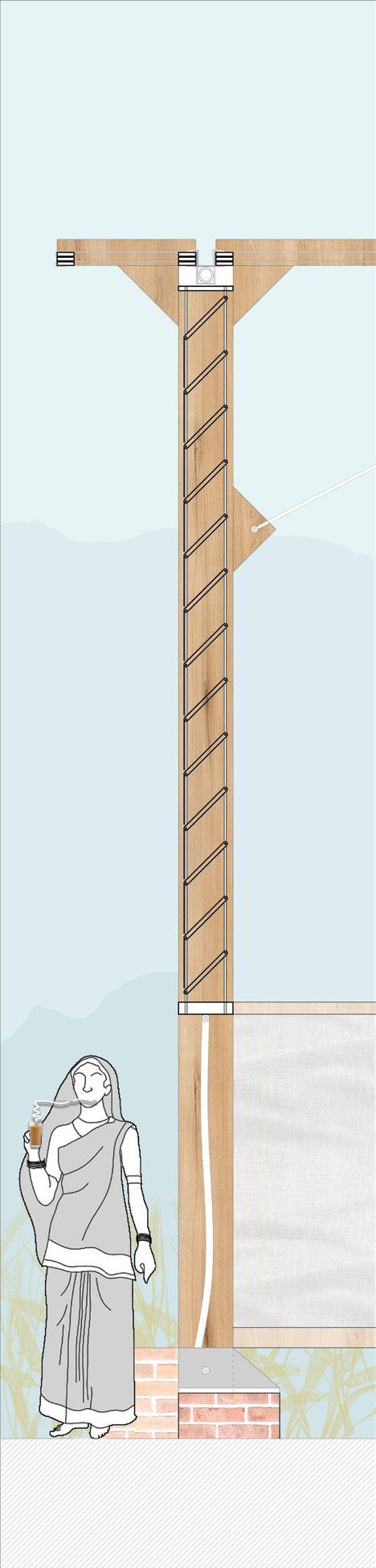
Timber Beam
MS Gutter + Aluminum Flashing
Timber Pulley
Timber Bracket
Jute Rope
Jute Rope Vertical
10mm Dia. MS
Steel Brace
Timber Bracket
1.5m Khus Fabric
Louver system
270mm x 35mm
Timber Post
25mm Stone Sill
20mm China
Mosaic Tiles
20mmm BBC
Brick Cupola
35mm Thick
Timber Frame
180mm RCC
Anchor Beam
1.5mm Fabric
Opening
5mm MS Base Plate
400mm Brick Pedestal
Tucked within the ground with only the fabric visible. Sorting cases for letters and parcels that may have arrived for the cemetery are designed to be in the transition zone of the viewer. The attempt here is to create curiosity and questions which get answered subsequently.
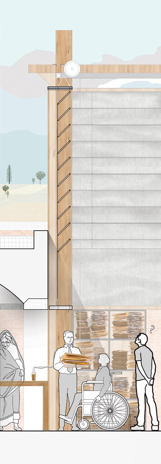
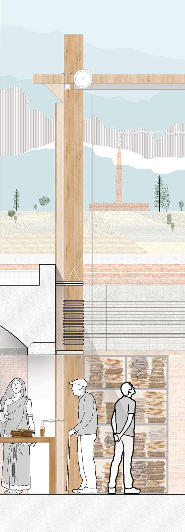
Wall Section
Cross Section
Wall Section - Winter
Wall Section - Summer
150mm RCC Retaining Wall
150mm BBC
Load Bearing Brick Pier
Crypt for Objects
150mm RCC Slab
Cemetery of Material Memory: Experiences embedded within most common place objects can trigger memories. One can deposit their object and make peace with their trauma, with a sense of privacy. After having placed the object it becomes part of the larger archive of thousands of other objects.
of the Railway Station and approach into no man’s land
300mm x 160mm RCC Ring Beam
Fabric Screen for Privacy
Cross Section
Wall Section
View of the Cemetery
View of the Post office as seen from the Railway Station
View
RCC Gutter
Existing Farmlands
International Border
Samjhauta Express
Cemetery of Material Memory
Observatory of Sameness
Flour Mills
House of Toba Tek Singh (Railway Station)
Existing Farmlands
Fence
Brick Kiln
Room of Requirement (meeting spaces)
Theater of Common Culture (Performance space)
Post Office for Memories as address
Existing Railway Line
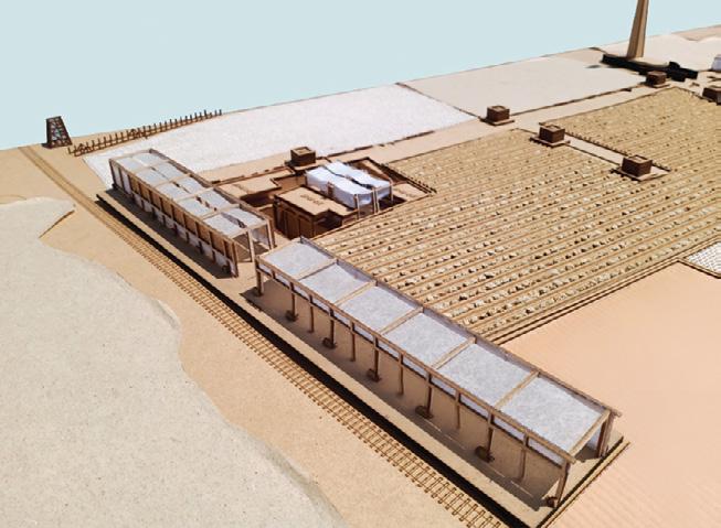
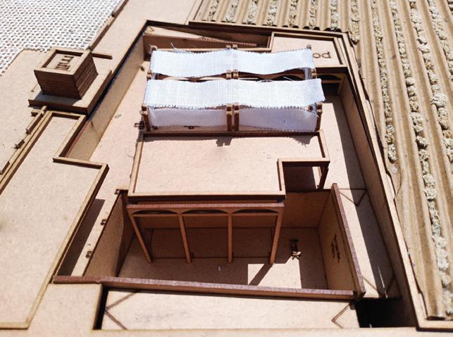
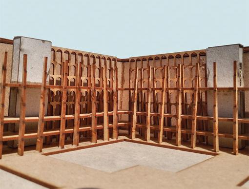
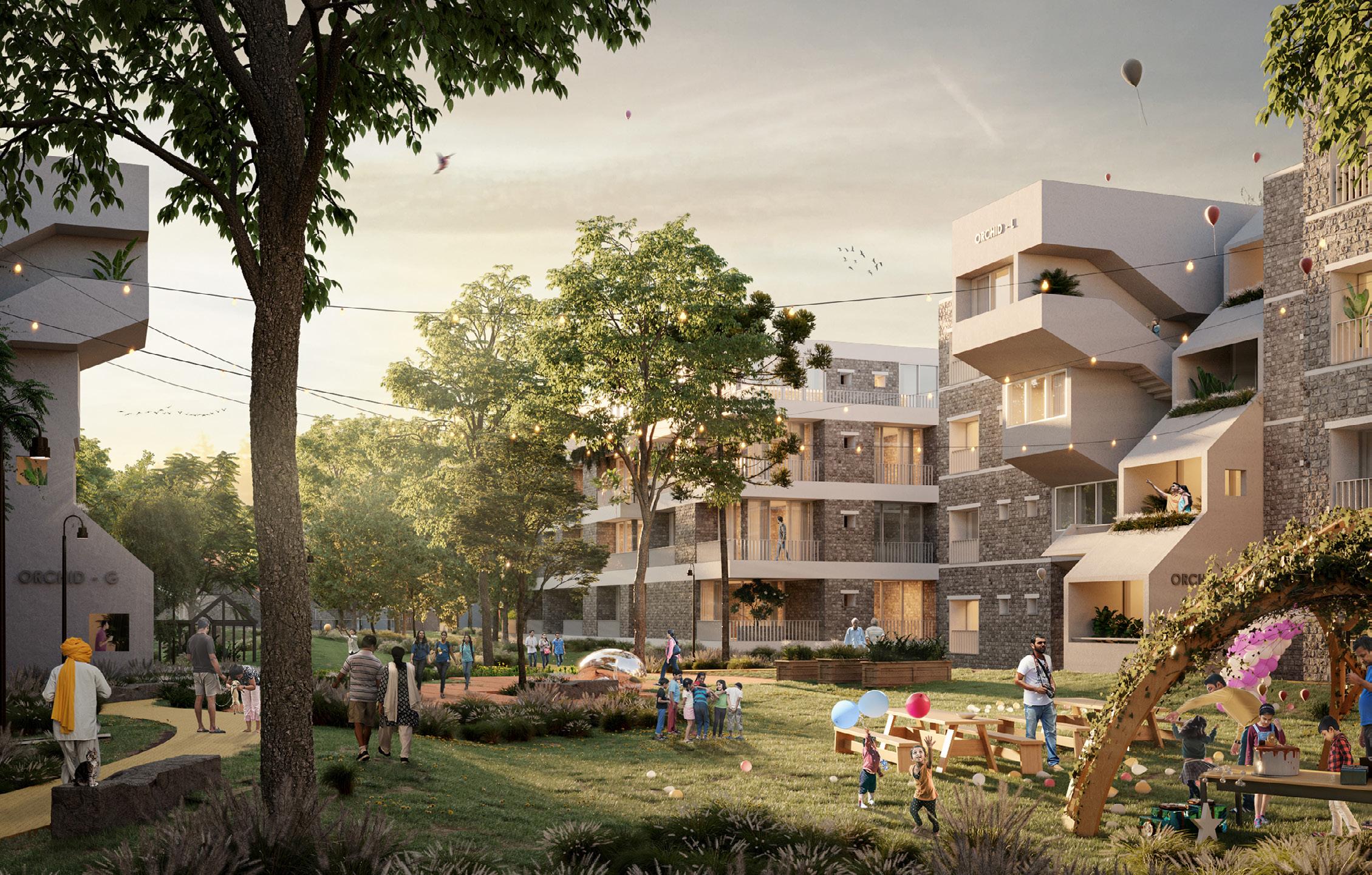
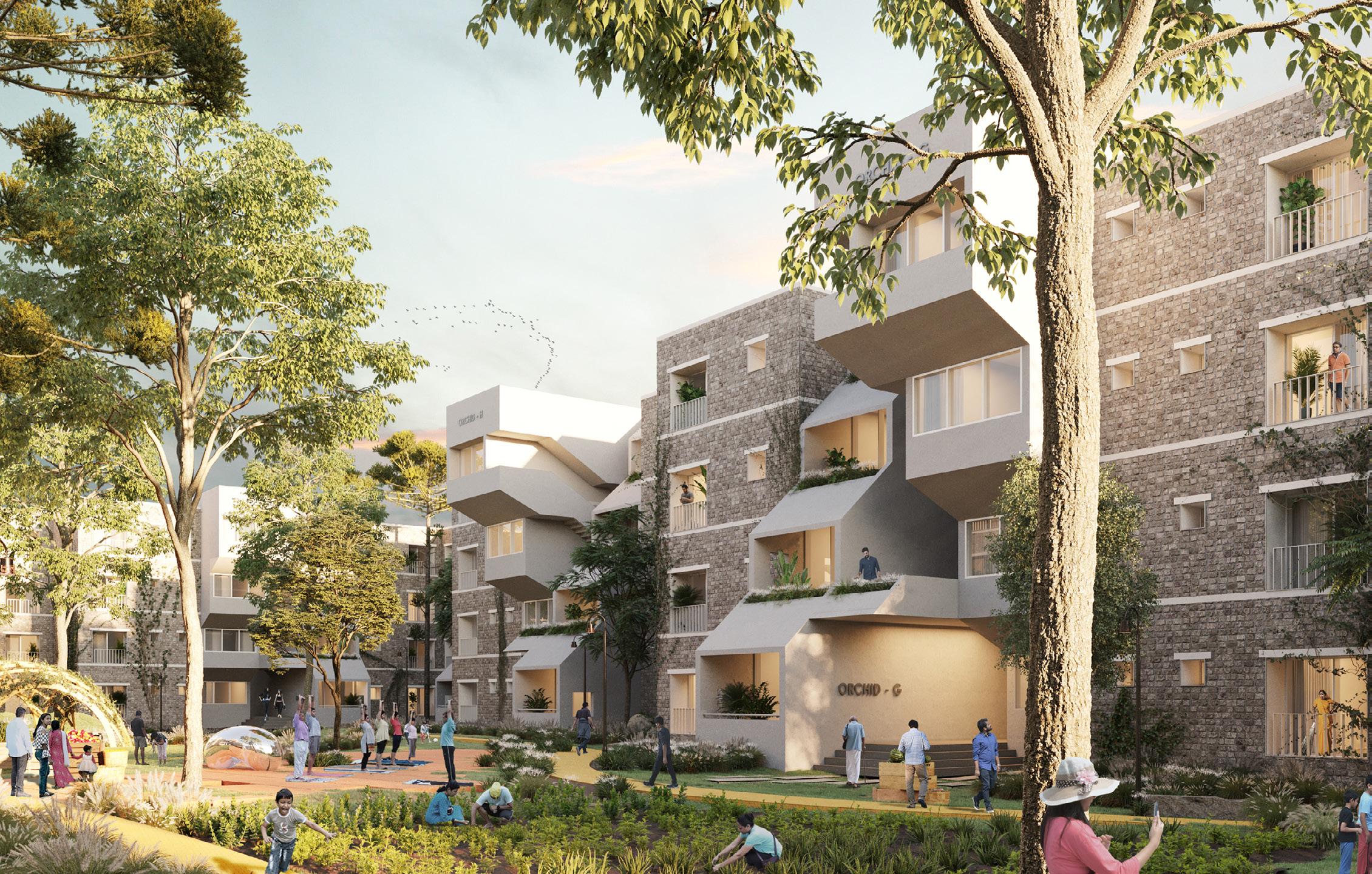
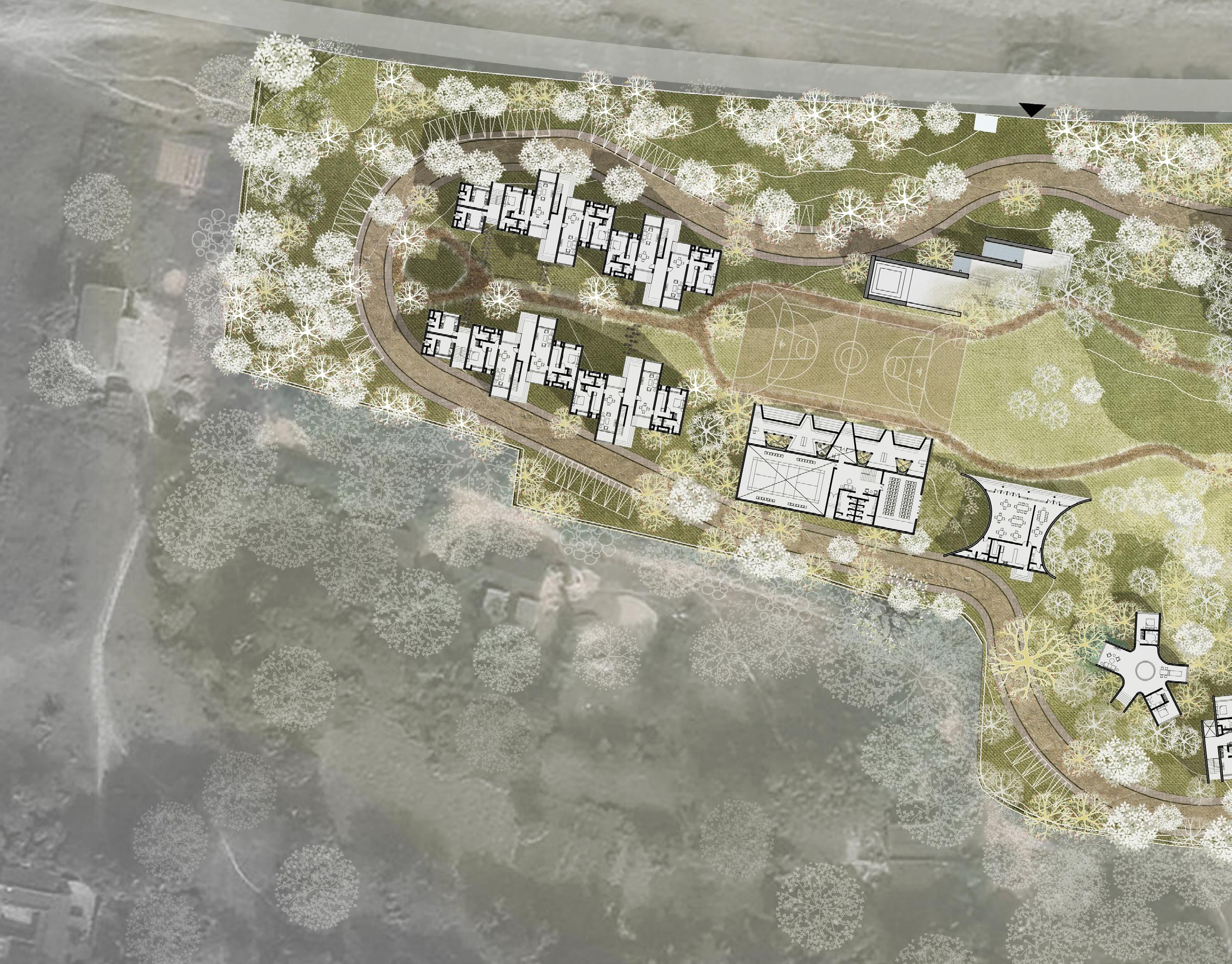
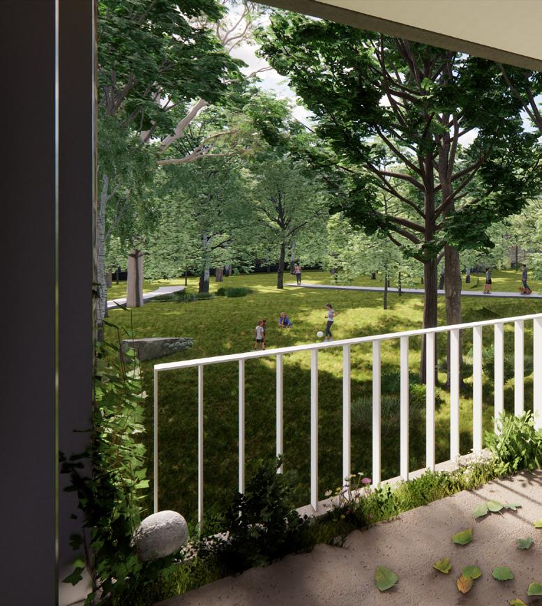
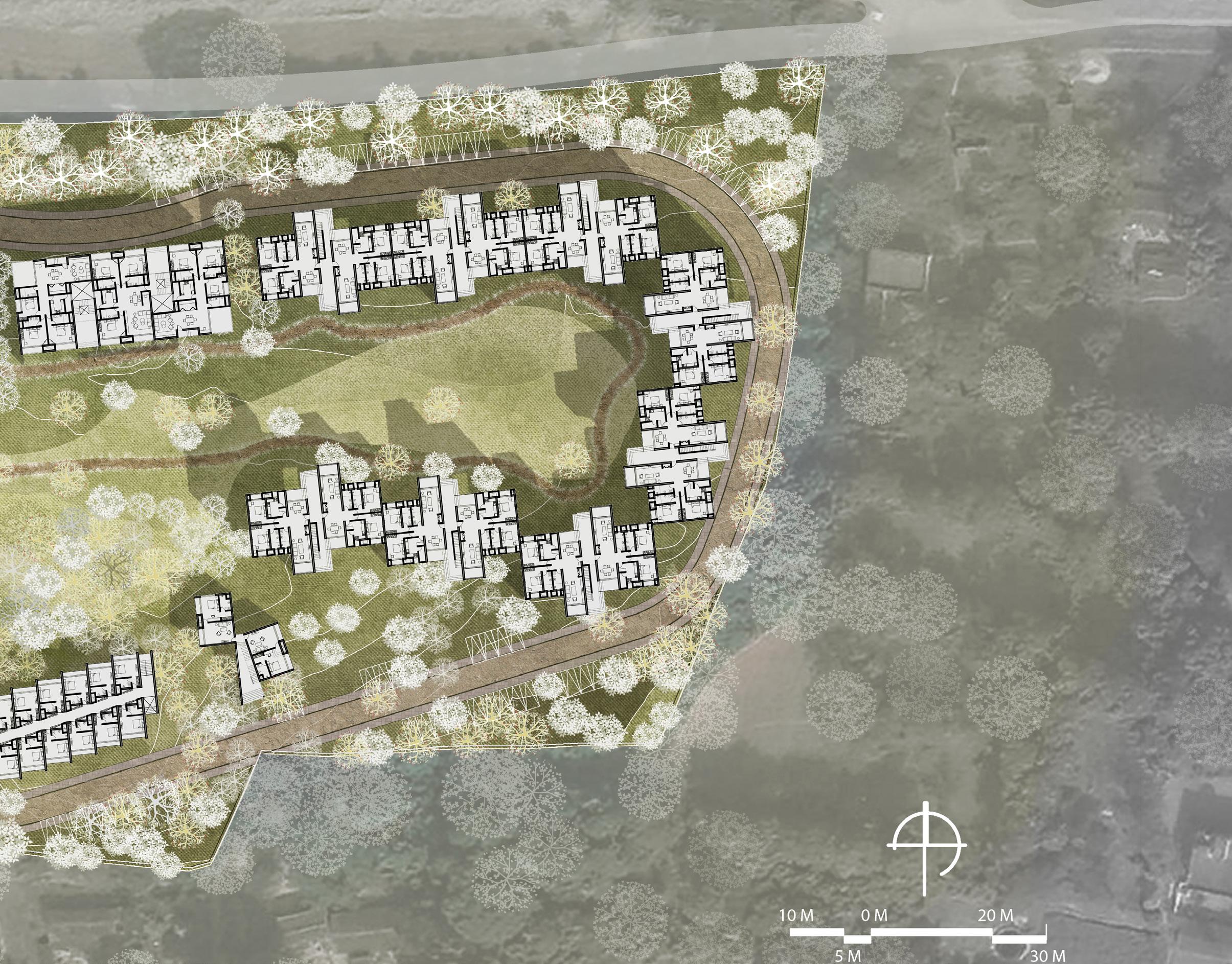
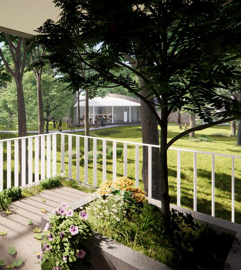
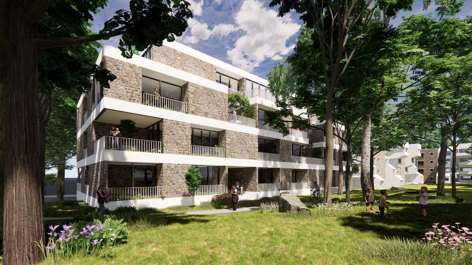
Into the Meadows
Township design
Professional Practice x Neighborhood Scale
Ongoing Project
Location: Odisa, India
Team: Sameep Padora and Associates
Personal Contribution: Design development, 3D modeling and visualization, design diagrams, plan rendering.
The township provides a unique opportunity to stitch multiple programs together in such a way that is contextual and sensitive to the ecology. The masterplan contains housing units of various sizes with amenity blocks, temple and parking spaces. The challenge was to preserve every tree on site and build in the negative spaces. This was done by a detailed survey to mark every tree. GIS mapping of the site soon followed to map site hydrology, which became the basis to place built programs.
Detailed site survey to mark every tree and site hydrology lines 2
Block made out of the sum total of the built up area required in the township 3
Redistributing the block into individual programs and placing them in the negative spaces between clusters of trees
Strategy
Final position of the blocks, leaving the middle portion as open space and farming area. A cycling track loops around the site
House 1 Guest House 2
Temple Club House Dining Hall
1- Site entry I 2- Temple
3- Club house
View
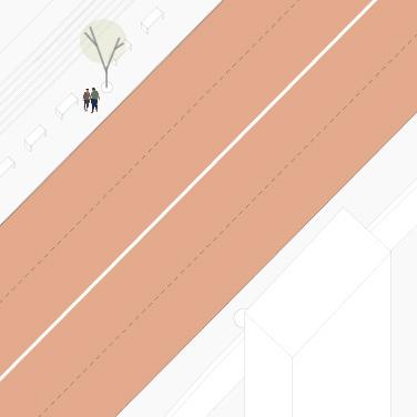
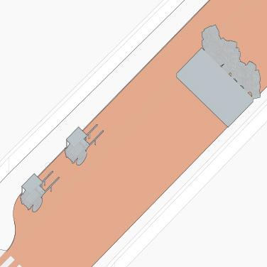
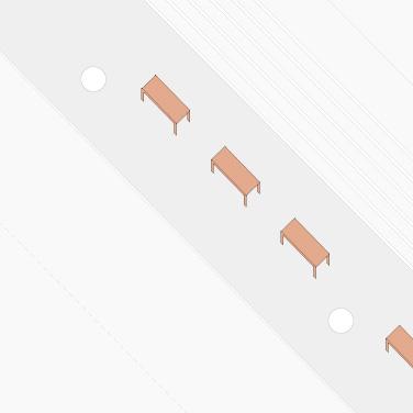
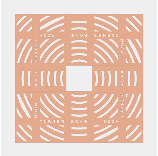
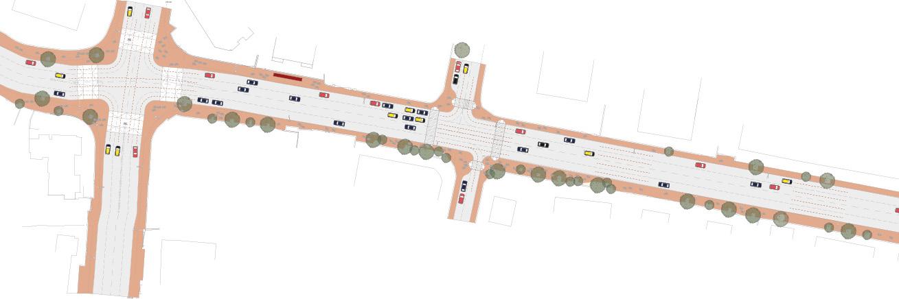
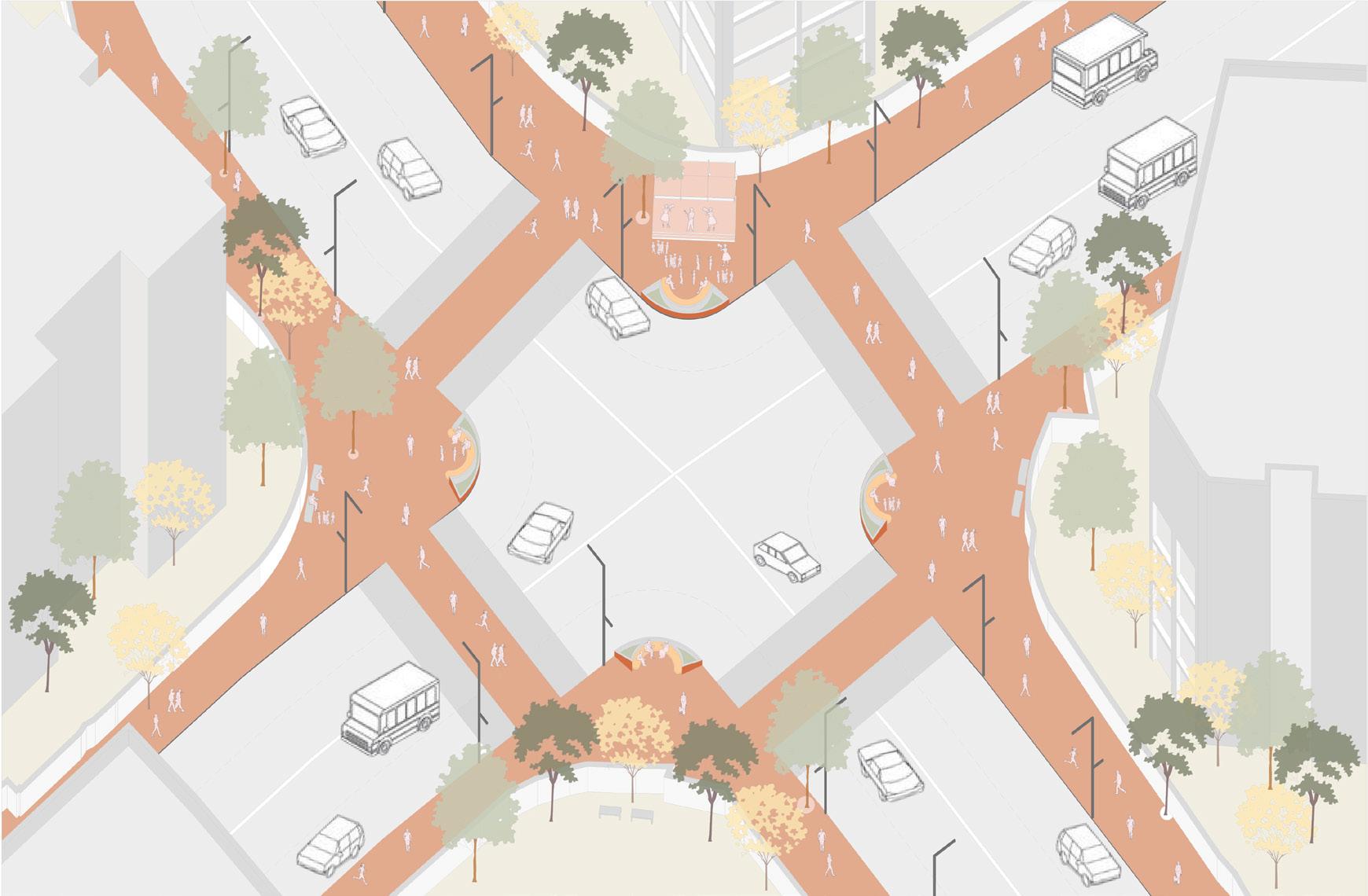
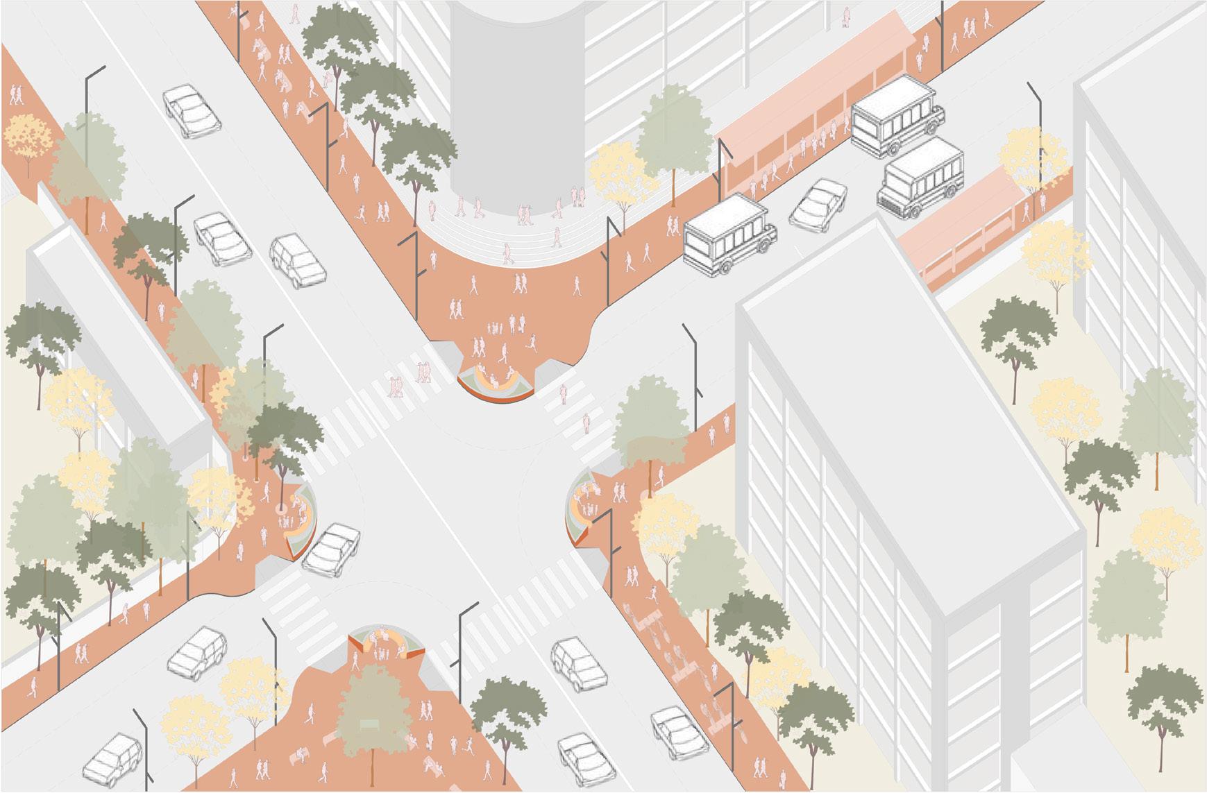
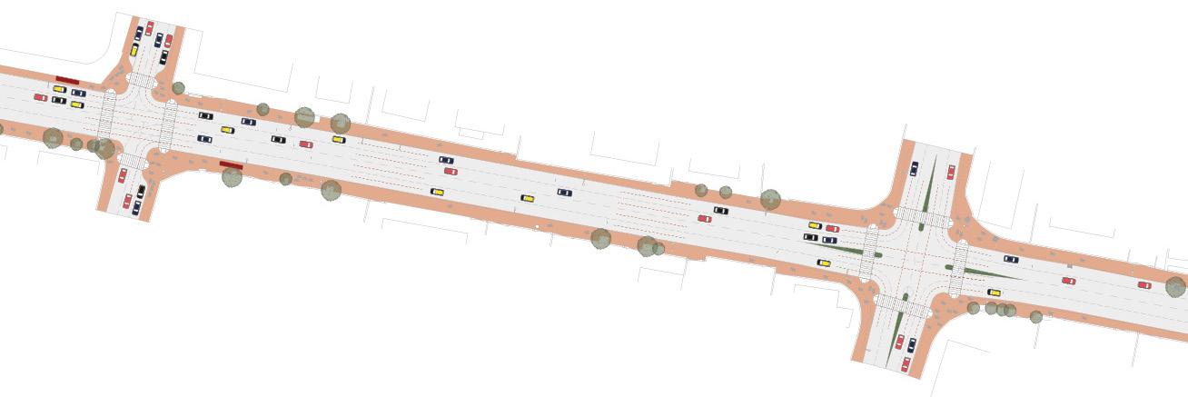
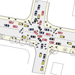
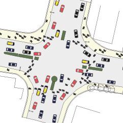
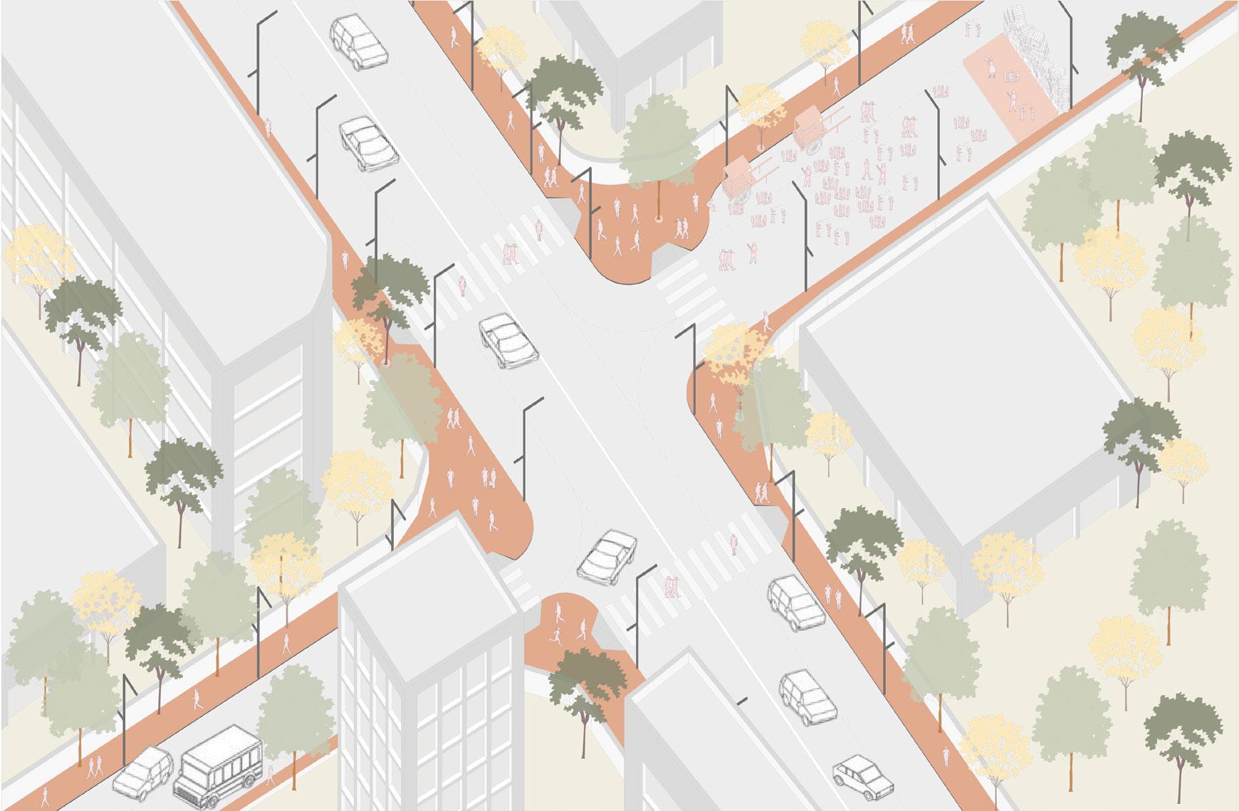
07 Revitalizing Turner Road
Street design
Professional Practice x Street Scale
Ongoing Project
Location: Bandra, Mumbai
Team: Studio Pomegranate
Personal Contribution: Site survey and documentation, design development, plan and intersection renderings.
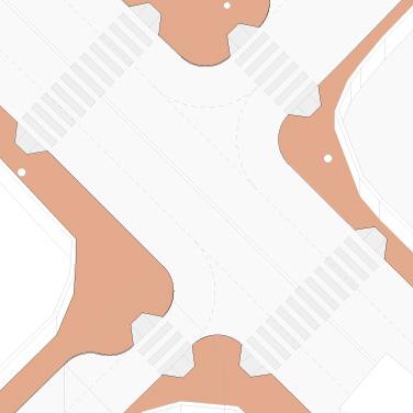
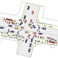
Turner Road in Bandra is one of the most prominent streets of Mumbai. The 800-metre long east-west corridor, joins two important nodes of the city. This prominence has lead to a vibrant jewelery and clothes market along with F&B programs. The road is currently in a state of decay and disrepair making it inefficient in ensuring smooth transition of customers and unsafe pedestrian and vehicular movement.
Turner Road
- Bombay Municipal Corporation
Project Share: 40% as part of the Smart city development program, funding received from the central government.
- People’s Association of Bandra
Project Share: 50% as part Corporate Social Responsibility (CSR)
- Traffic Management Depart-
Project Share: 5%
- Electricity Department
Project Share: 5%
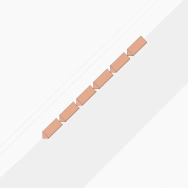
Road alignment
Pedestrianize street
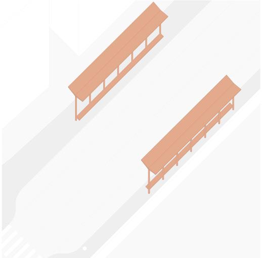
Seating - Bulb-out
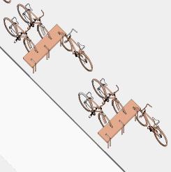
Bike stand
Speed tables
Bulb-outs
Public plaza
Benches
Food carts
Traffic islands
Parking bays
Art wall
macro
meso
micro
Wall hung benches
Multimodal transport Tree grate
Junction 2
Junction 1
Key Plan
Junction 1
Existing condition
Junction 3
Existing condition
Existing condition
Existing condition
Junction 2
Junction 4
Junction 3
Junction 4
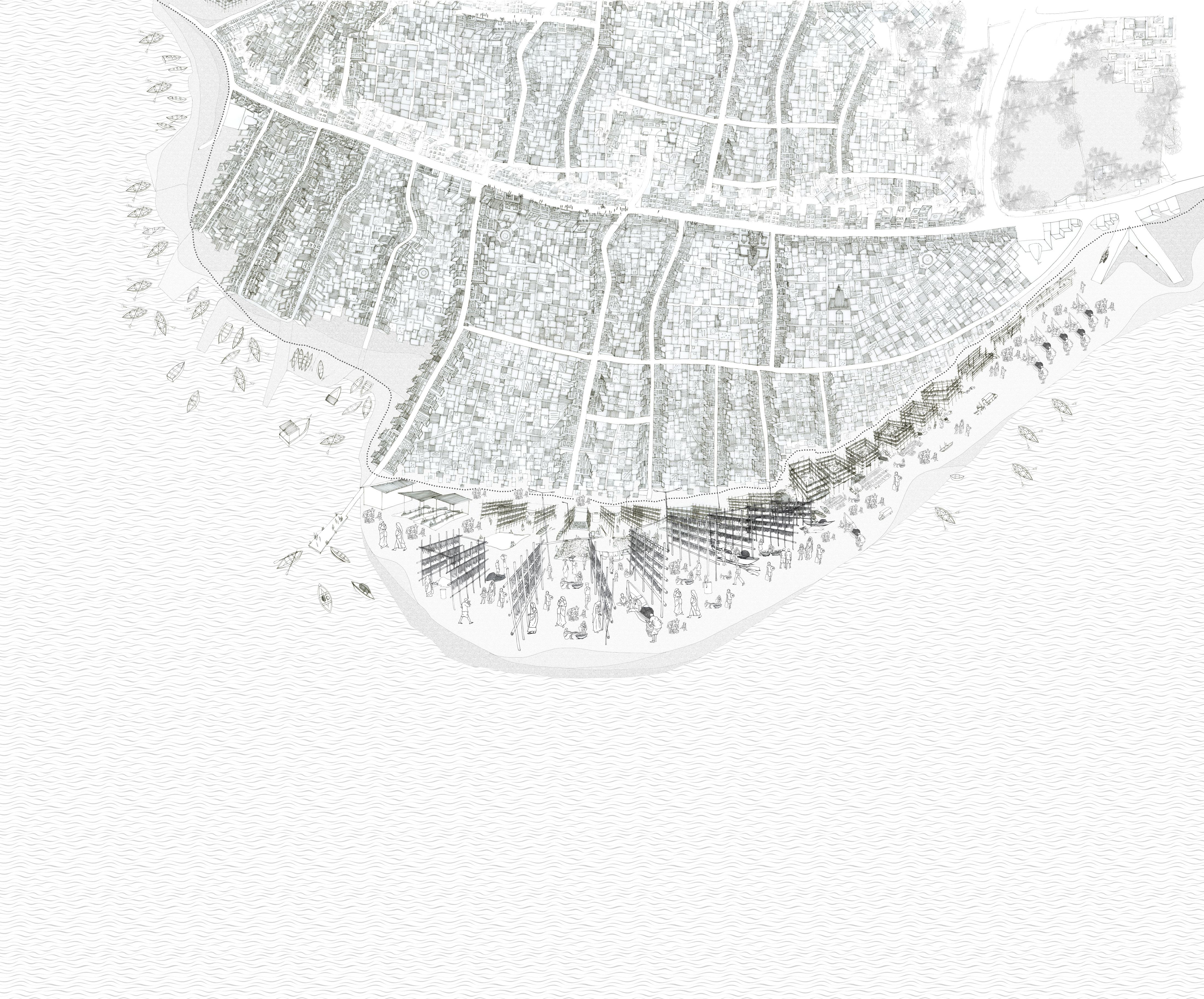
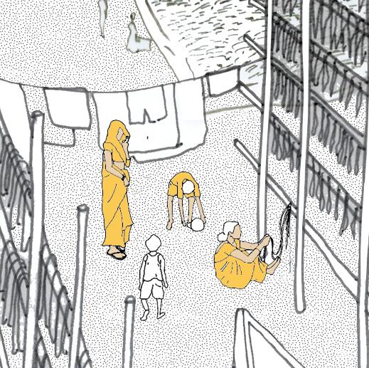
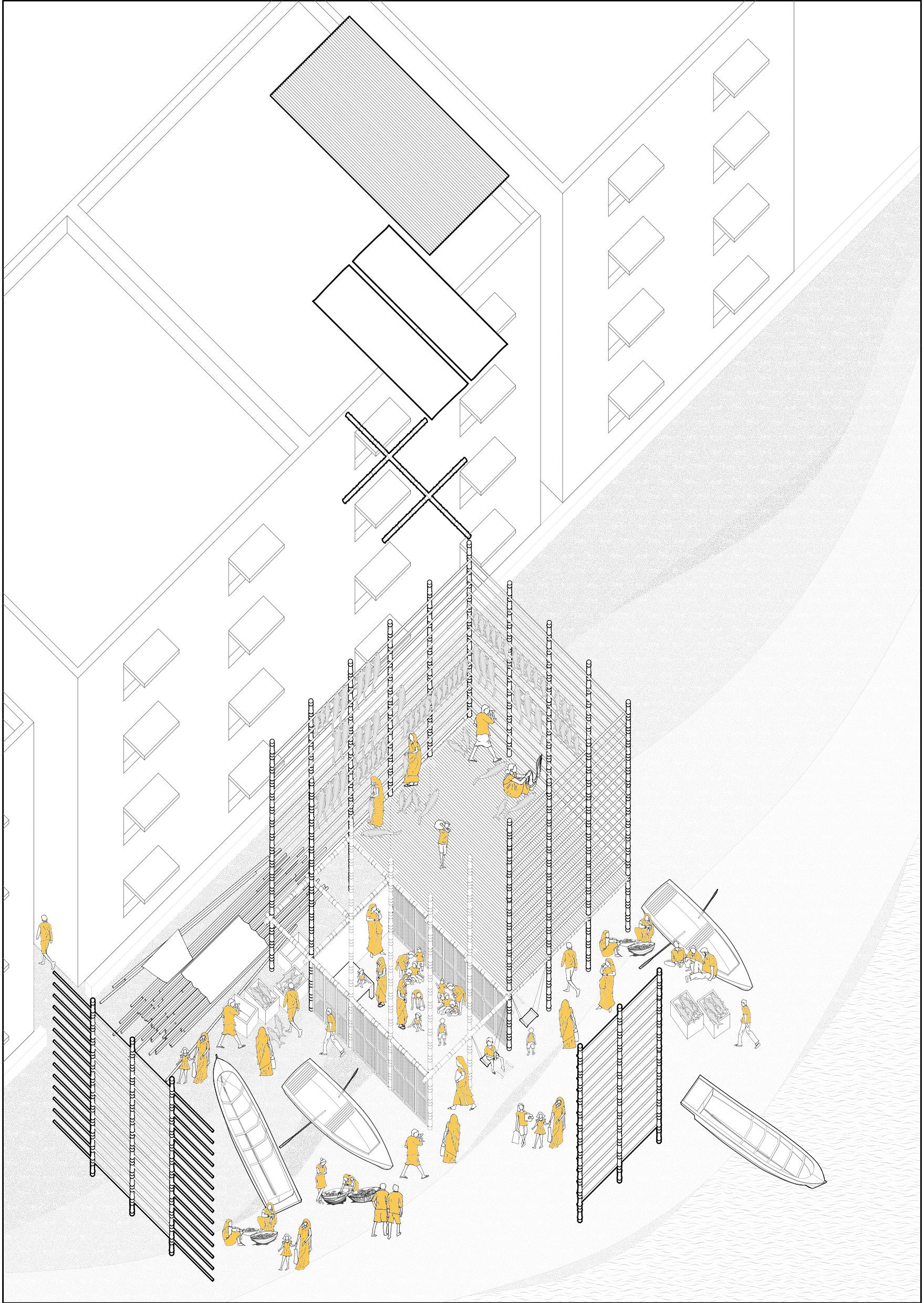
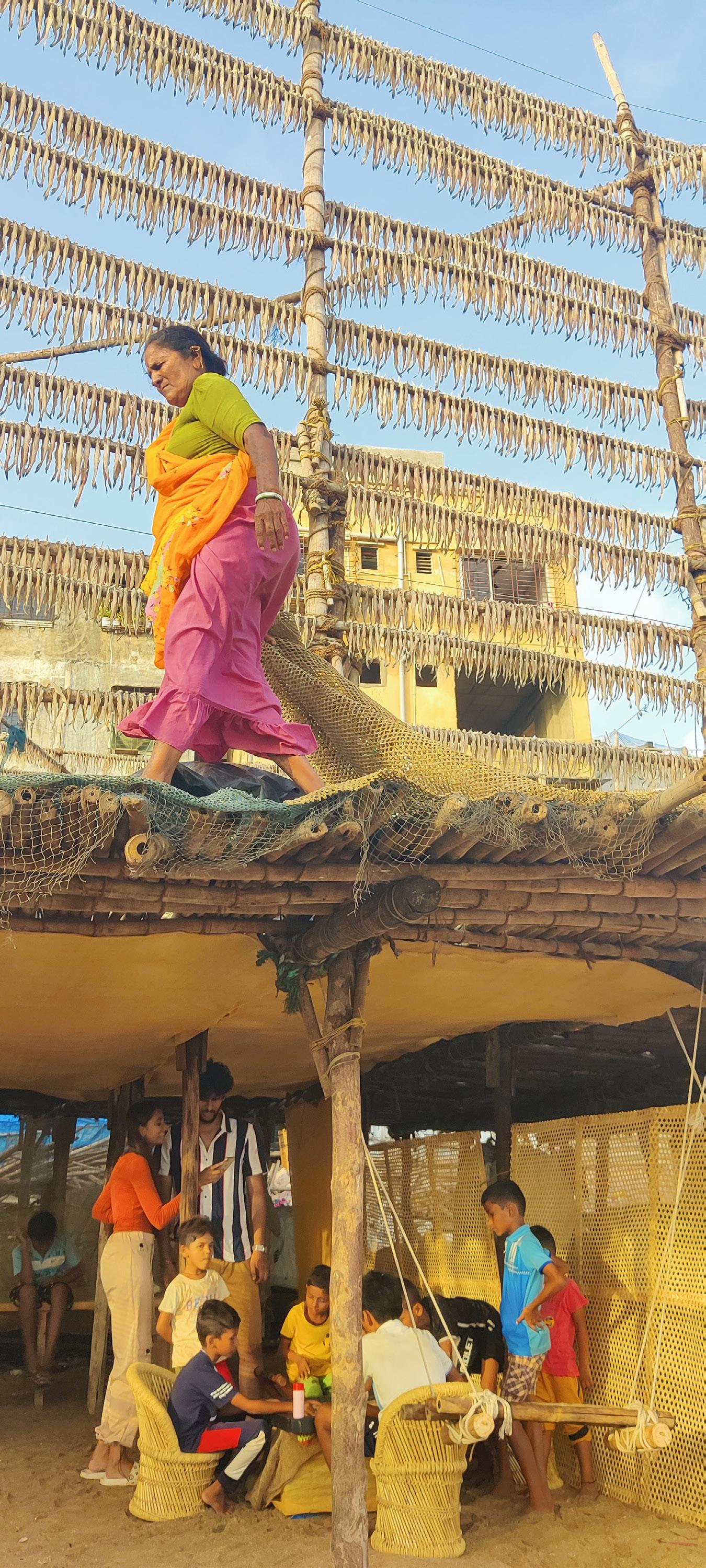
08
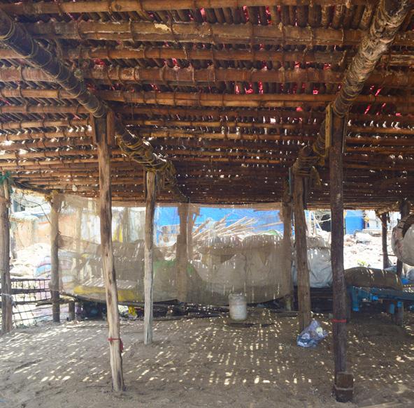
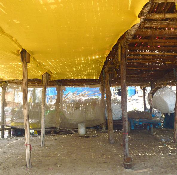
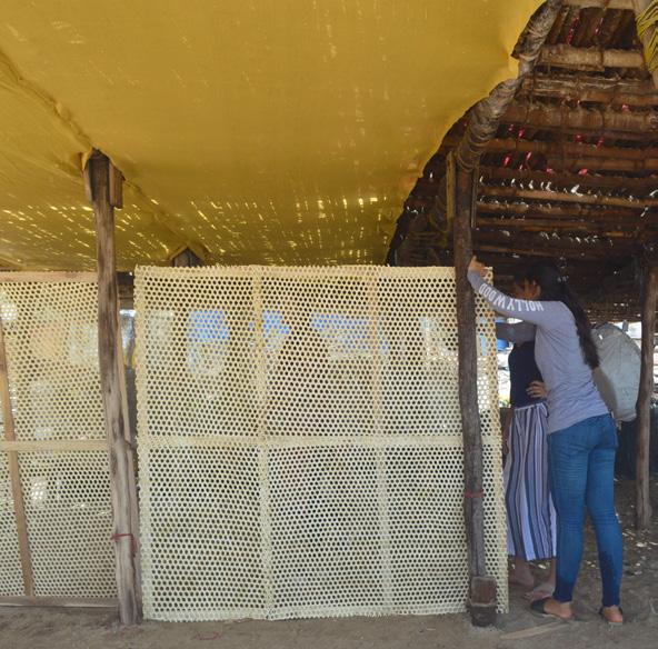
Social Resilience
Community based participatory research and advocacy + placemaking
Personal Contribution: Map of Mumbai, hand drawings post production, data analysis, detailed drawing of the mandav structure, interviews and surveys on site, project photographs.
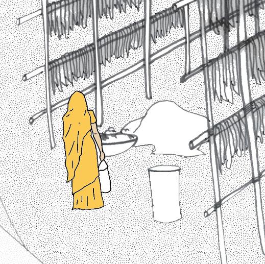
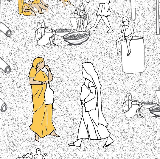
The Kathiawadi Community are a migrant fish drying people who have been subject to exclusionary social practices by their landlords (Koli’s). Access to amenities have been denied and threat of climate change is real and experienced daily with rising sea levels. Our aim was to actively engage with the community, map their social spaces and everyday lives, to be able to design and build a place-making project using community participation to make the community resilient.
I don’t have access to parks and there is no provision for lights here at night, so I can’t leave my house for a walk after sunset.
There is no privacy for women to breast feed their babies or change their clothes. I wish we had more privacy around our workplace.
High tide line
Houses of Kathiawadi Community
We don’t have a garden or a park nearby to play nor do we have access to quality formal education. We have to play in the dirt.
Houses of Kathiawadi Community
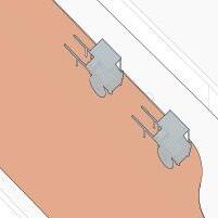
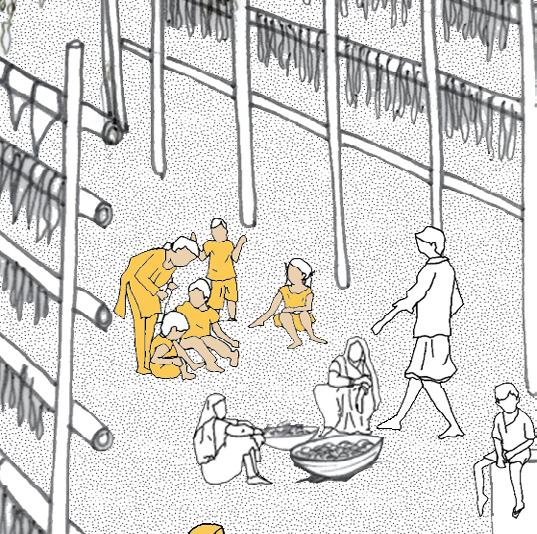
MandavTemporary bamboo structure for fish drying
- Community Space
- Open Space
- Education
- Healthcare Facility
- Religious Site
We don’t have any representation, or a body of voice neither do we have access to a community space for meetings.
We don’t have any space of respite, not even to have lunch or take a break around our workplace. No place to take a nap.
The land that we rent for our livelihood is being sold to private developers to build Illegal Housing at the edge.
Waste Bamboo from the site up-cycled for the project
Waste Agro-net from the site repurposed for the project
School for children and privacy for women
Organization of community and storage spaces
Safe play area for children
Agro-net to stop water drippage
Constructing and installing light weight - movable screens to create transformable spaces to host community gatherings. Making a bed and providing swings as elements for women to breastfeed and children to play and learn.
Place-making project under the mandav structure for social resilience
Cleaning Mandav Underside
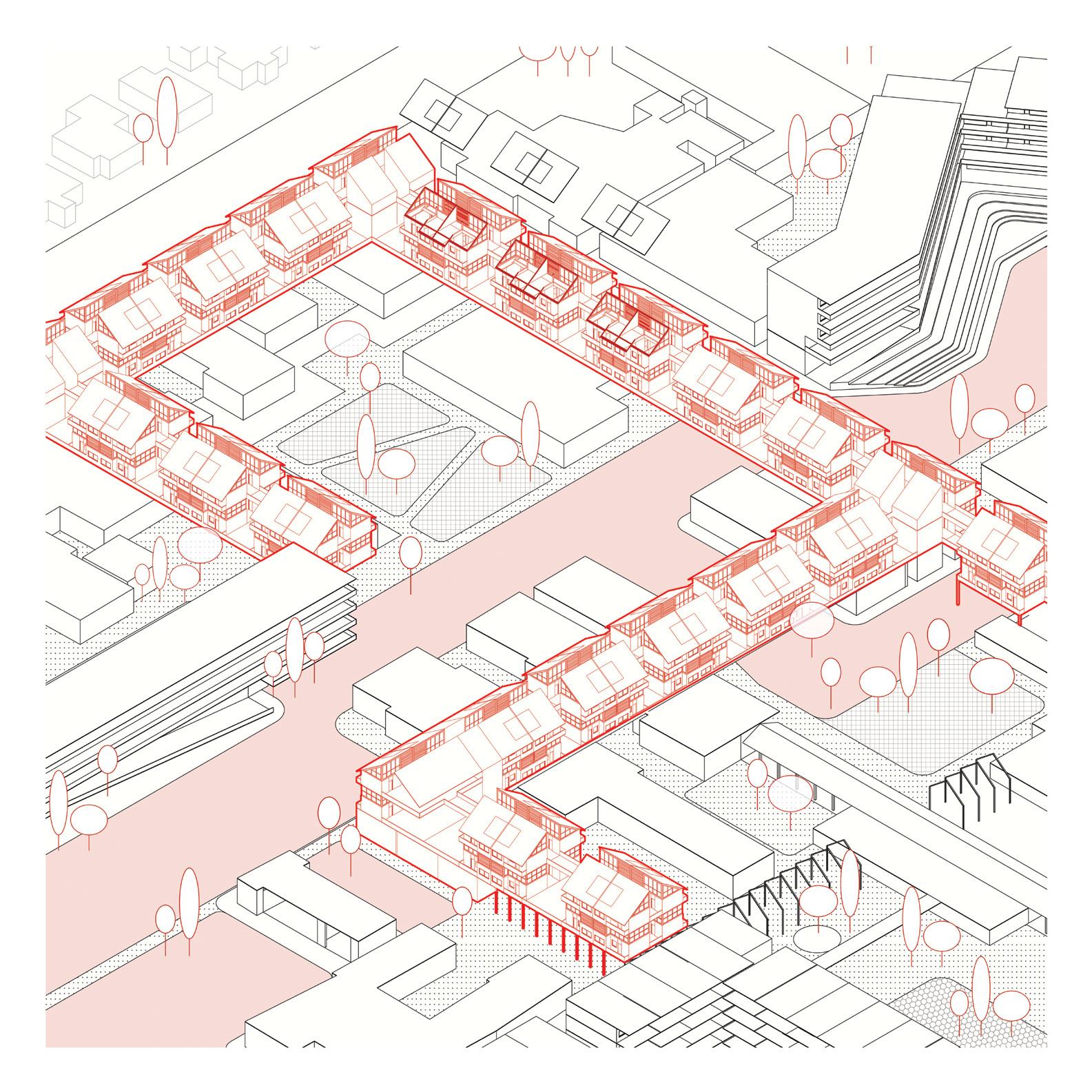
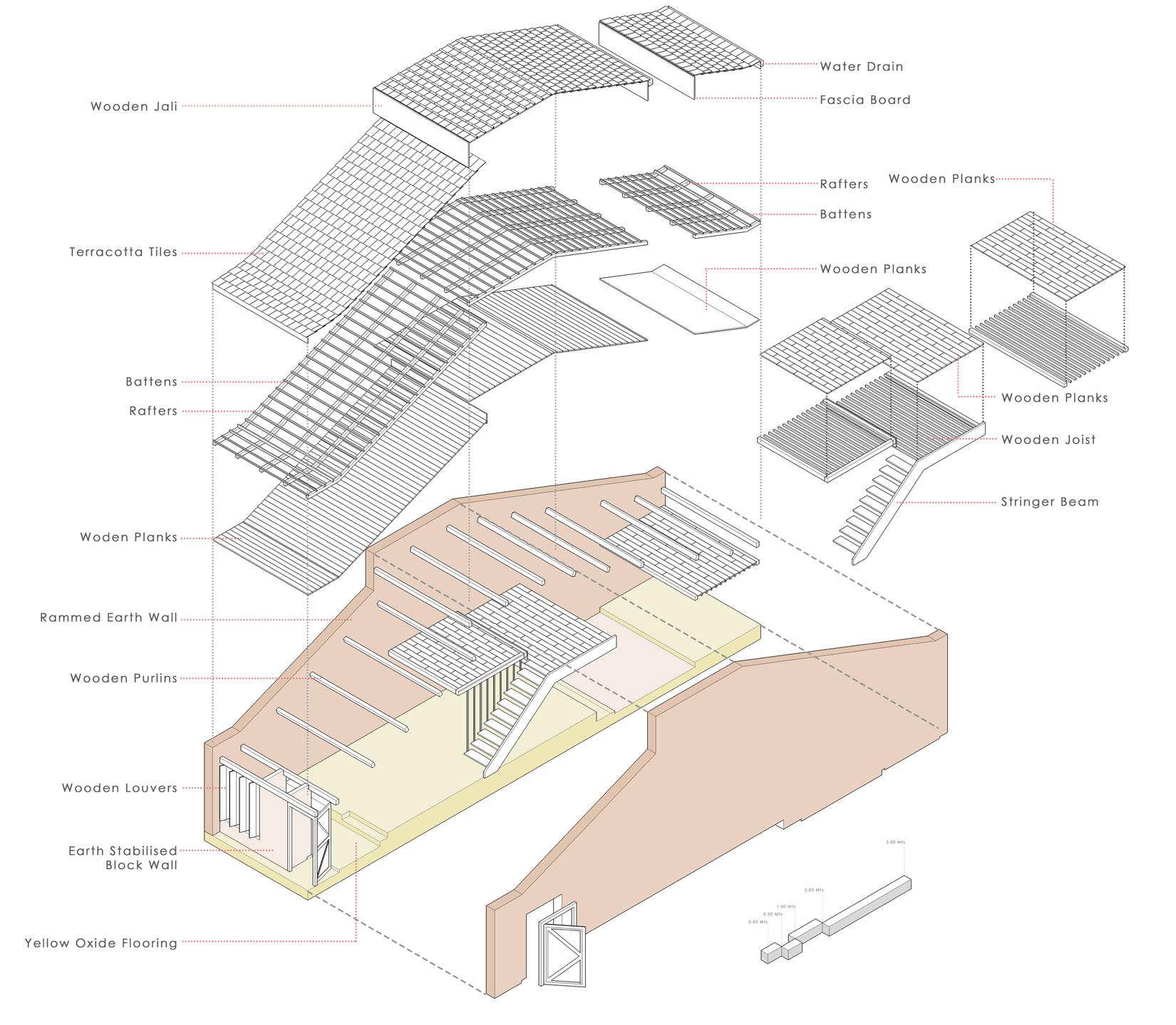
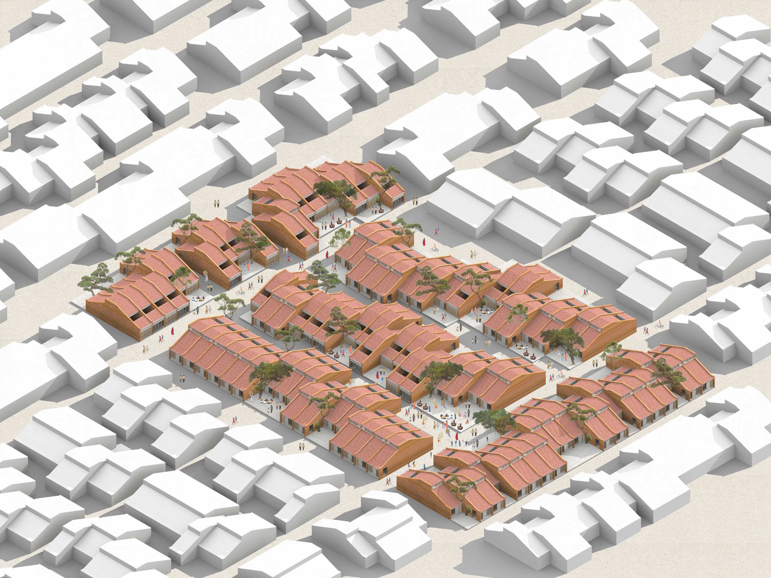
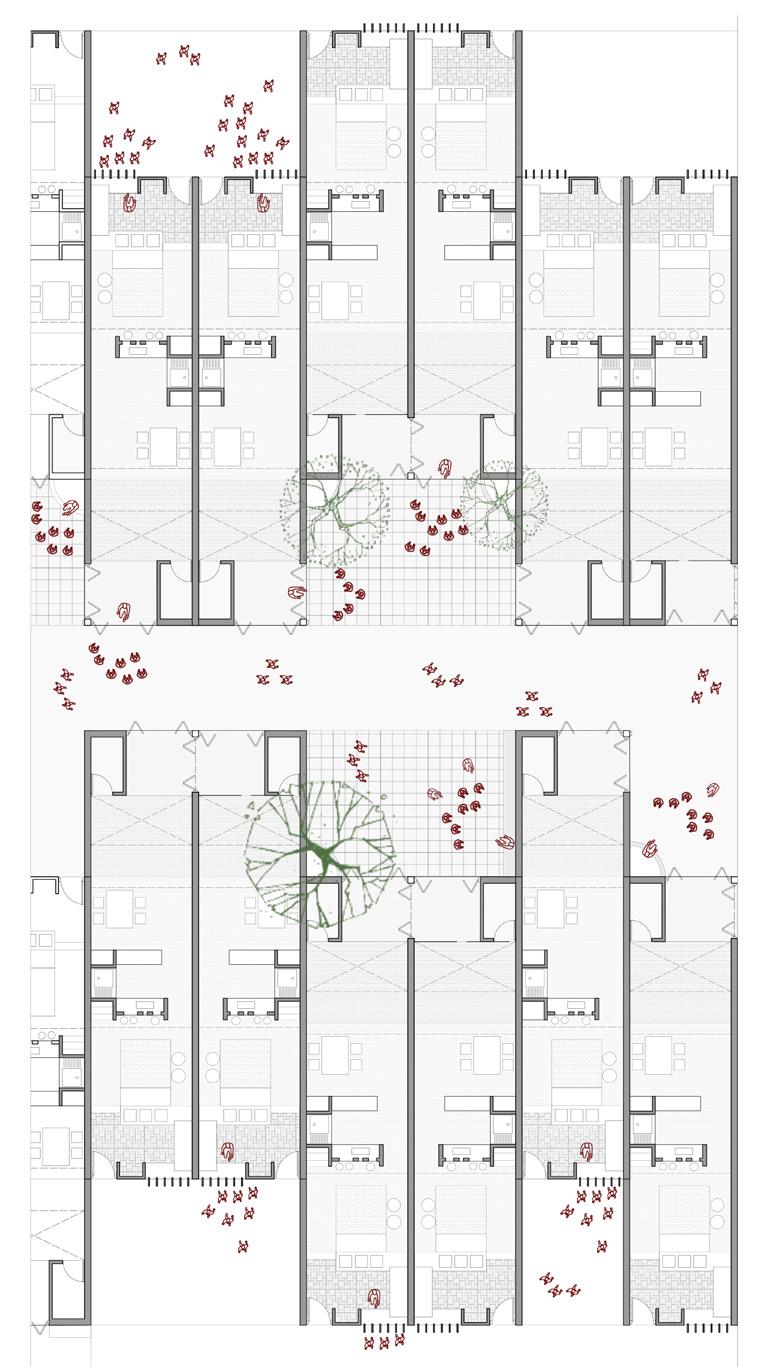
Dwell - Tube House
Low-rise high-density housing
Urban research x Building Scale
Location: Lucknow, India
Team: Adhish, Mahek, Bansi, Shamanth, Samad
Personal Contribution: Site isometric drawing and render, structural axon., design development
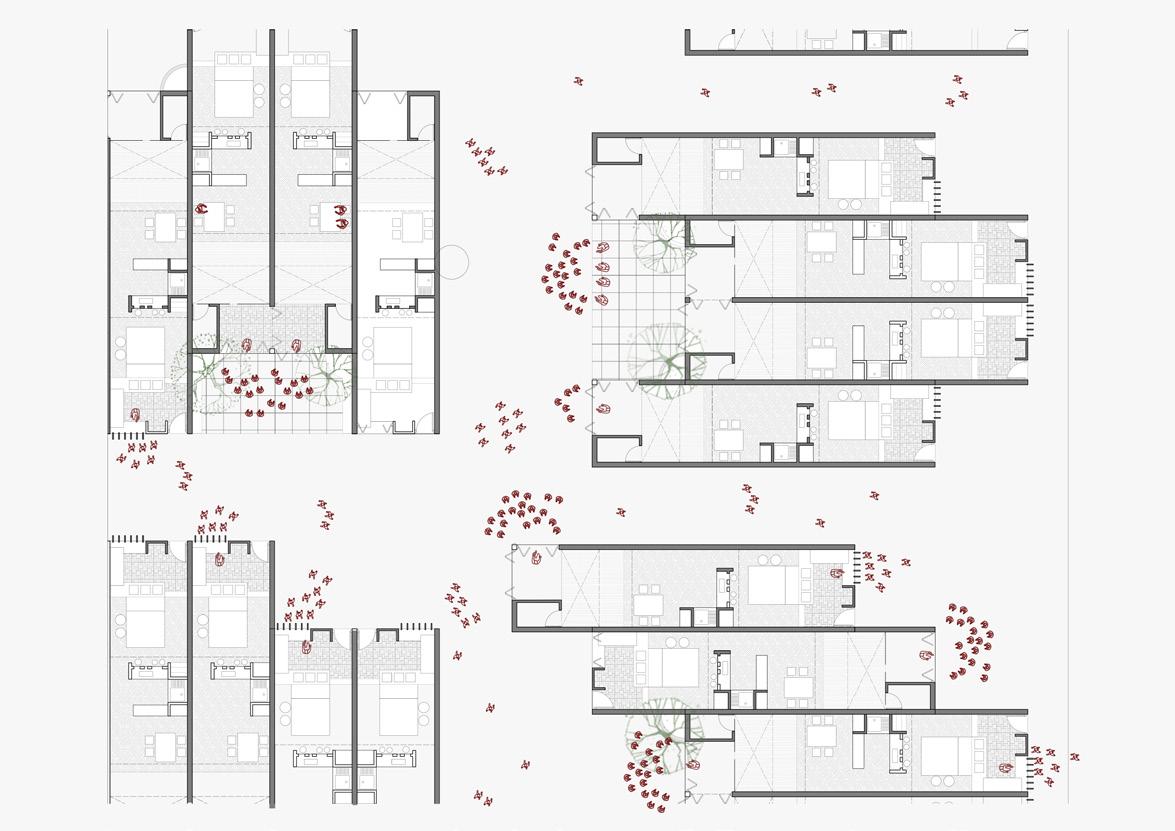
Tube house was a scheme which gave every household an individual plot on the ground, while still achieving the density required. The aim at Dwell was to provoke a discussion on the role of architecture and urban design to mitigate urban mathematics of densities and land values. We re-designed the layout to create unique new possibilities of spaces. We saw that the toilet block at one end of the house was acting as a dead node, which we re-positioned in the plan.
Wooden Jali
Terracotta Tiles
Battens Rafters
Planks
Rammed Earth Wall
Timber Purlins
Timber Louvers
Earth Stabilized Block Wall
Yellow Oxide Flooring
Water Drain Fascia Board
Rafters
Battens
Timber Planks
Timber Planks
Timber Joist
Stringer Beam
Timber
Timber Planks
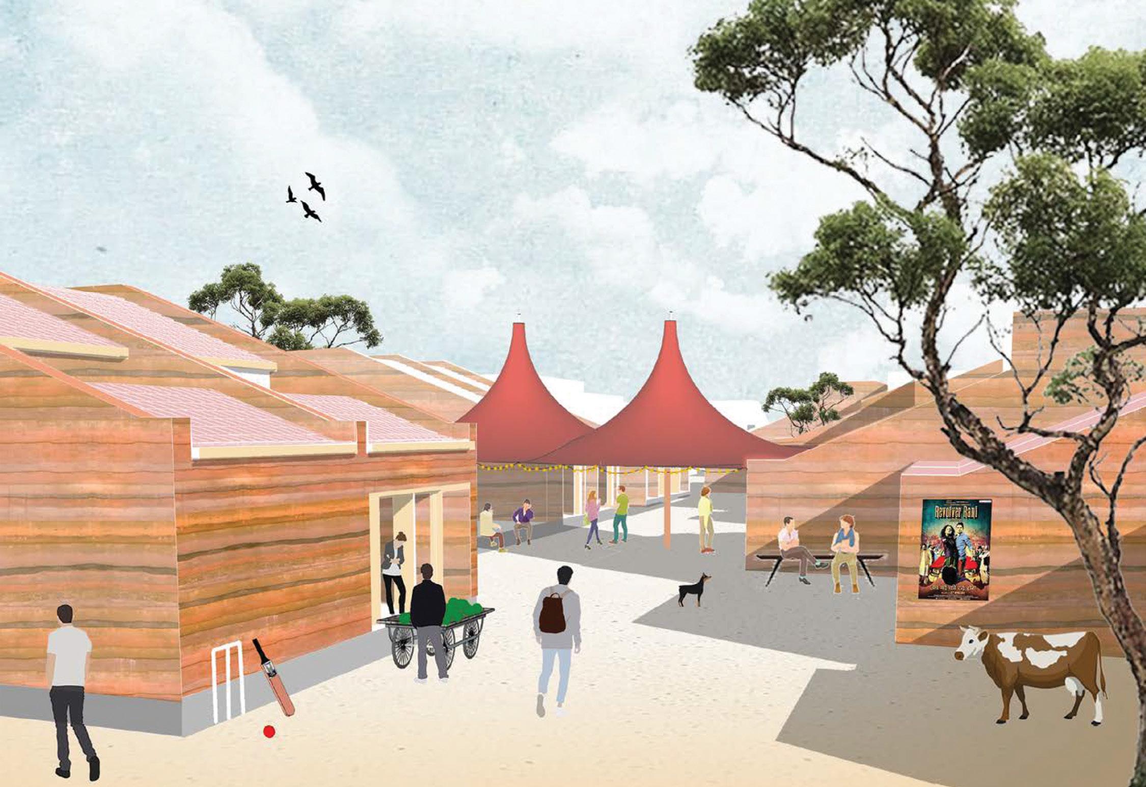
Smaller Nodes:
Intermittent open spaces for small groups of people. Each of the nodes are flanked by small shops (tea stalls). These nodes are placed strategically at the intersections of streets hence one is always made to pass through these spaces which allows for chance interaction between inhabitants.
Largest Node:
Placed farthest within the site to allow people to meander through the streets before reaching the largest space. To be used by the inhabitants for large personal gatherings such festival celebrations weddings etc.
Street:
The streets cut through the site from four places and do the job of stitching the nodes and the network of tube houses together. They are flanked by a series of staggered tube houses with open ends and welcoming plinths. The street can be public or private, as per the inhabitants need for the day.